 COUNTY COUNTY
|
|
||||||||
| EXISTING STATIONS | ||||||||
|---|---|---|---|---|---|---|---|---|
| Station Name |
Original Railroad |
Current Location |
Type | Current Use |
Date Built |
Track Status |
Building Material |
More Info |
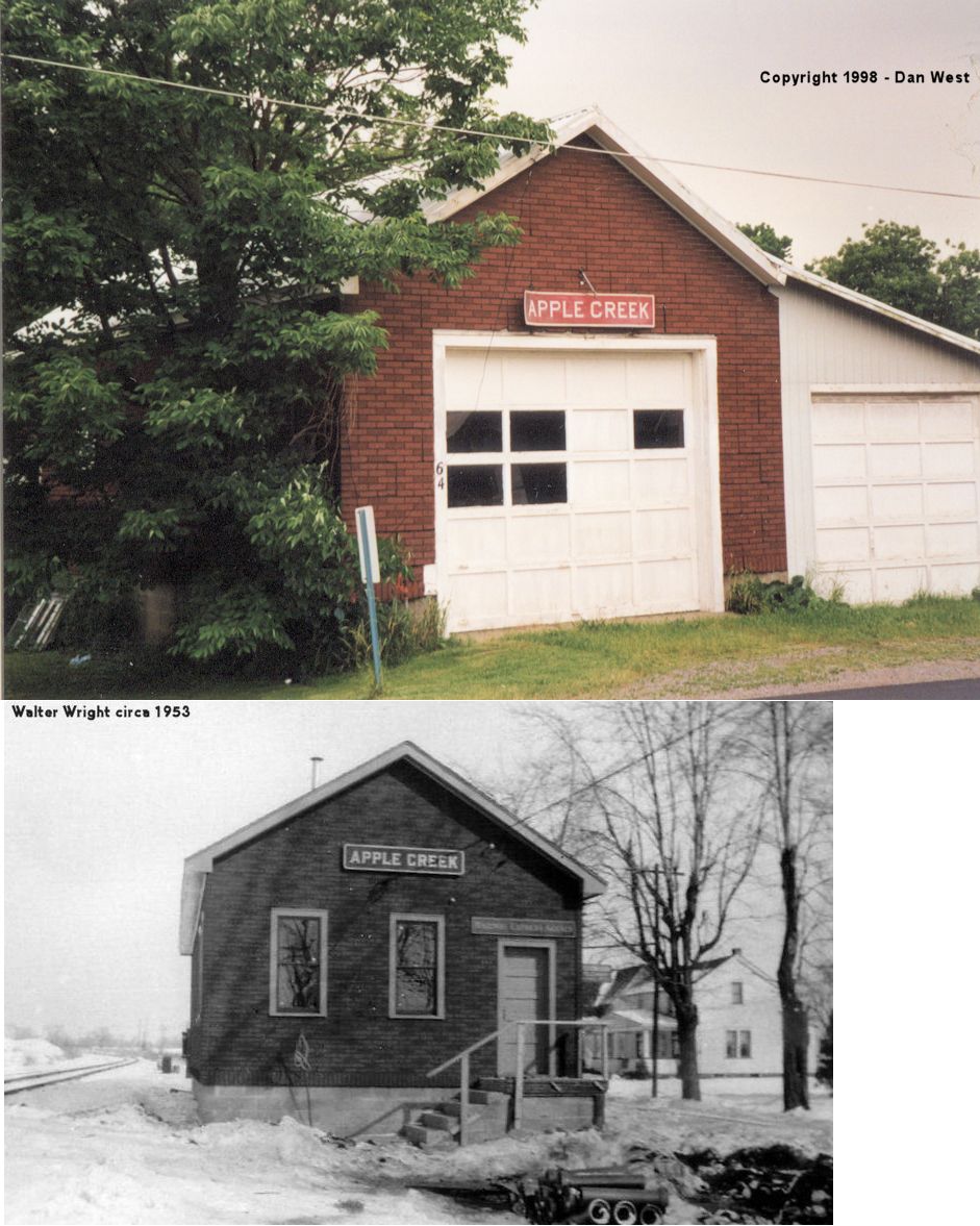
| Apple Creek |  |
Mill Street at Lance Street (GPS: 40.748503,-81.834168) |
P | Private | ???? | None | Block |
|
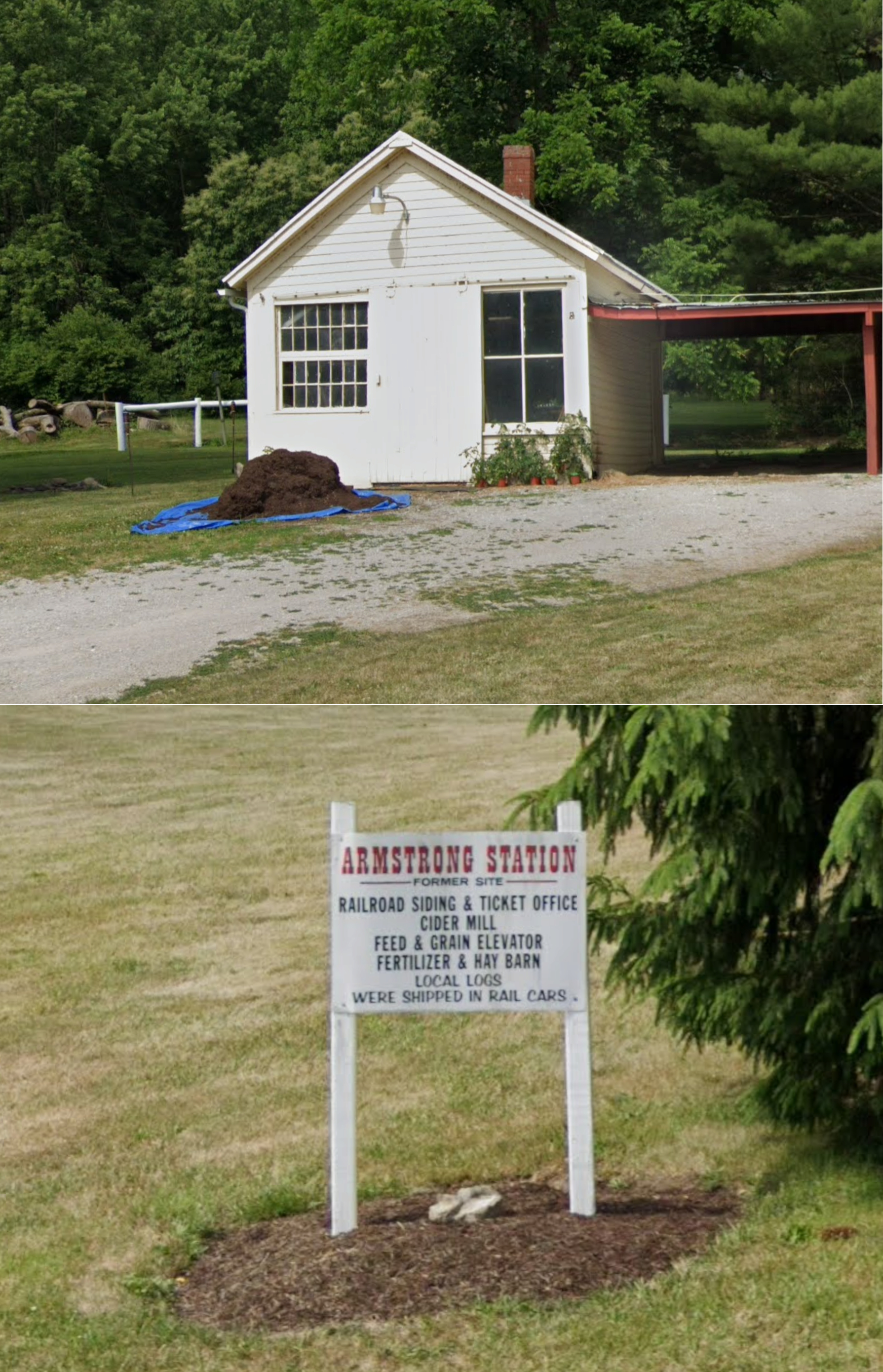
| Armstrong |  |
3940 Pleasant Home Road (GPS: 40.911368, -82.009900) |
P | Storage | ???? | None | Wood |
|
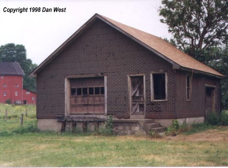
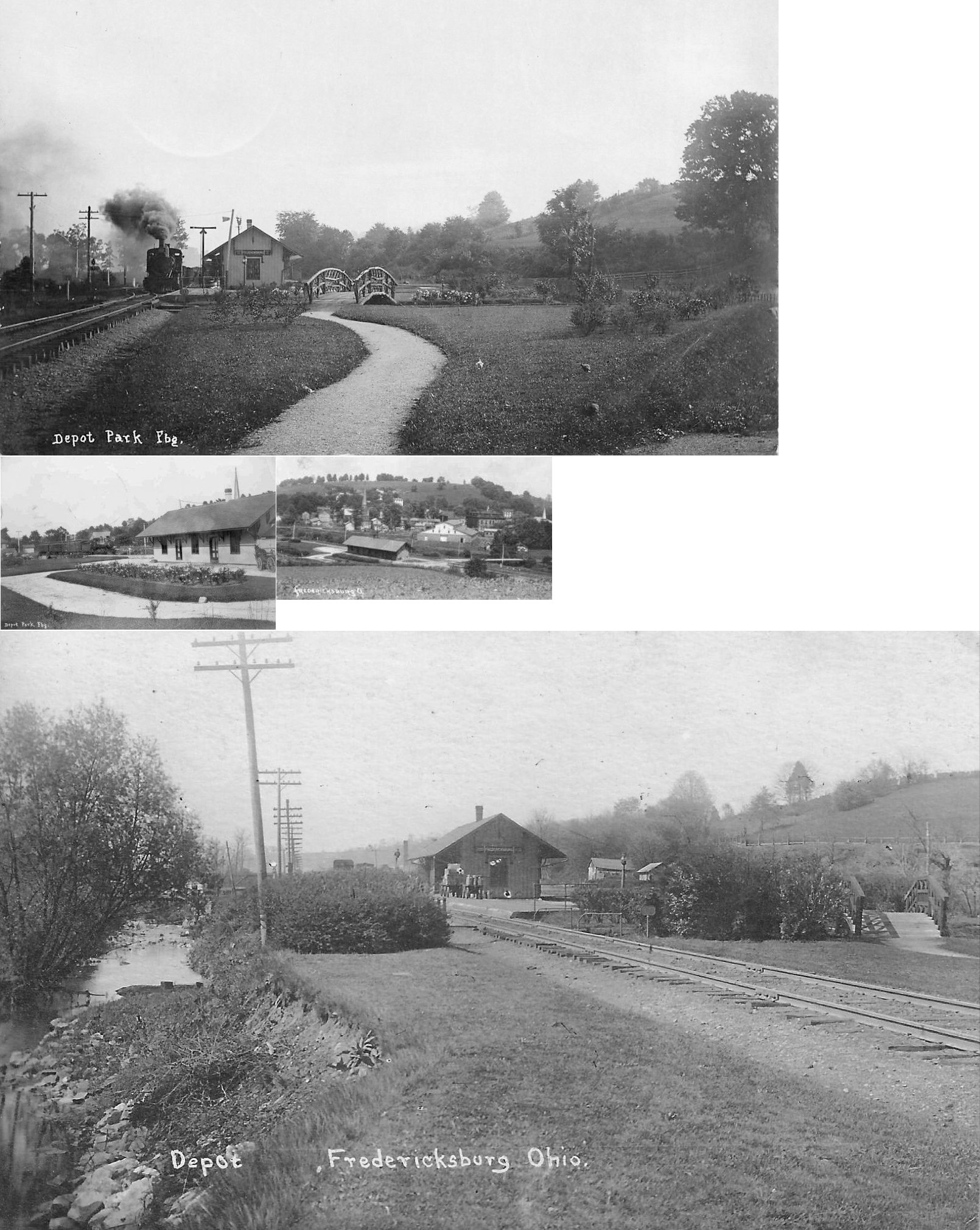
| Fredericksburg | |
80 yards north of the intersection of West Clay Street and Water Street (GPS: 40.676934, -81.872693) |
C | Storage | ???? | Gone | Block |
|
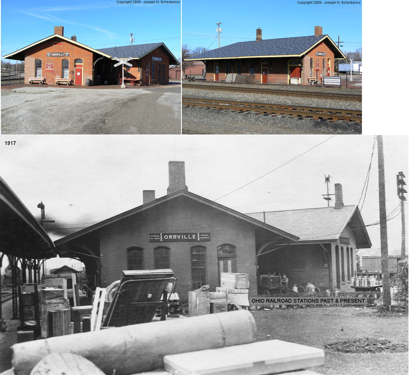
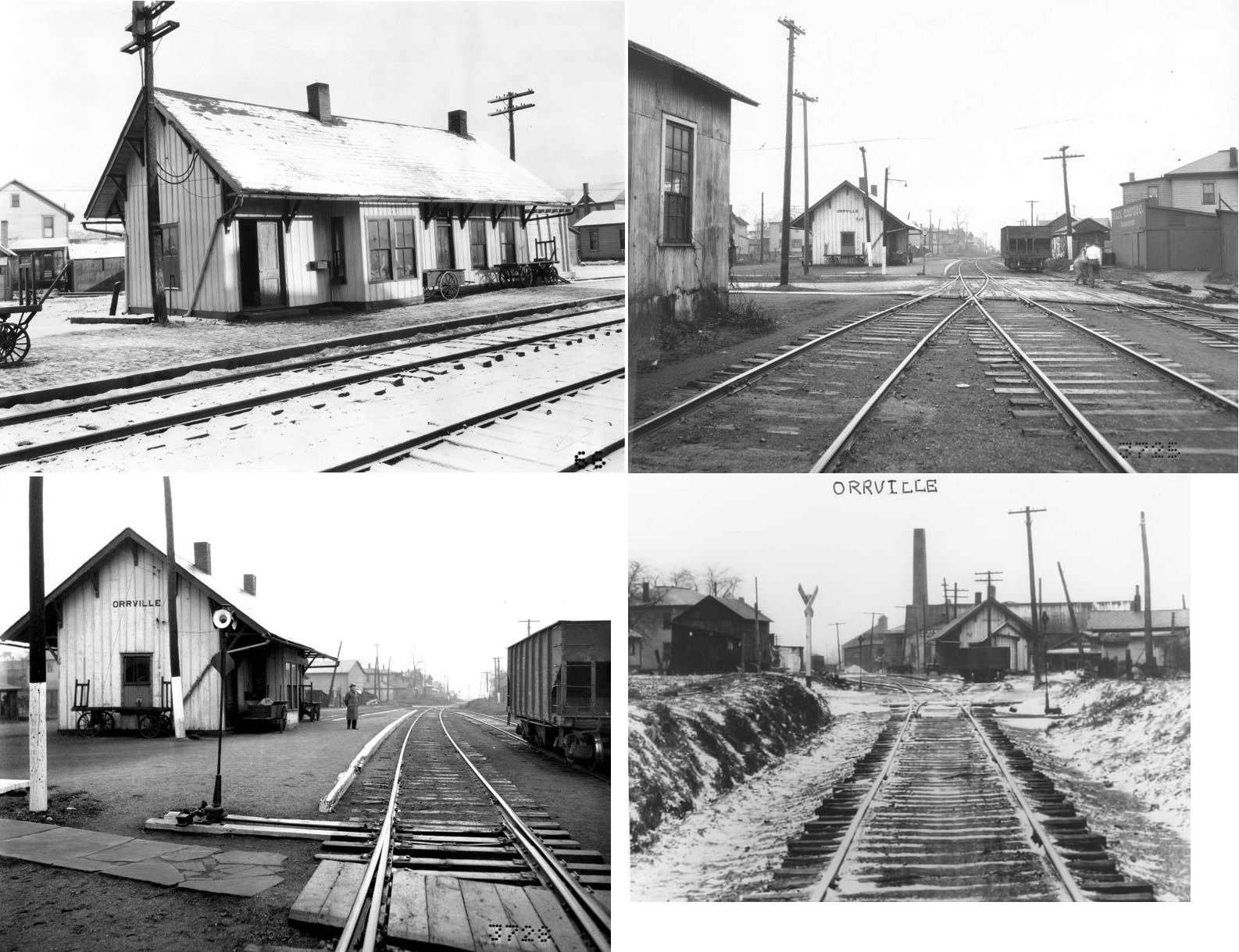
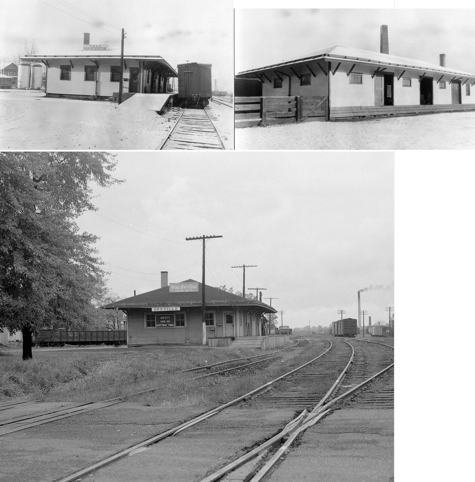
| Orrville |  AND  |
145 Depot Street (GPS: 40.839806, -81.767663) |
P | Museum | 1868 | In Use | Brick |
|
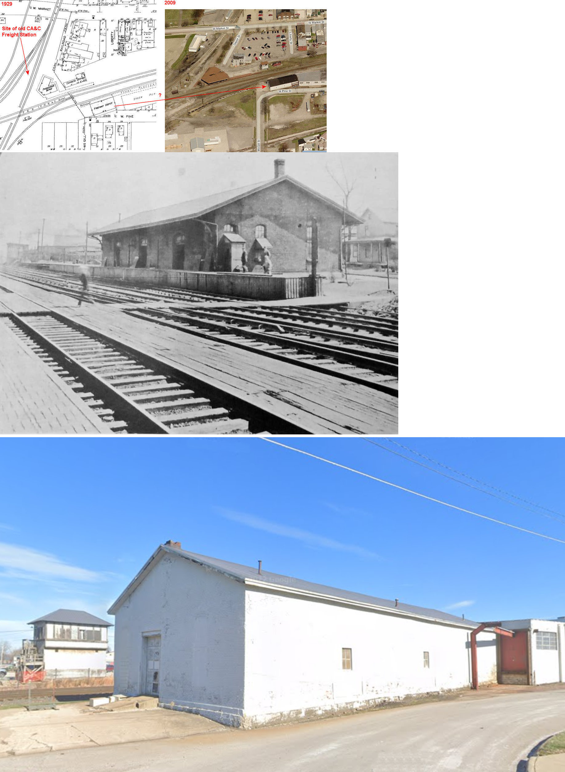
| Orrville | |
Corner of McGill & Pine Streets (GPS: 40.839652, -81.766799) |
F | Business | 1870 | In Use | Brick |
|
| Overton |  |
5678 Mechanicsburg Road (GPS: 40.865201, -82.008940) |
C | Storage | ???? | Gone | Wood | |
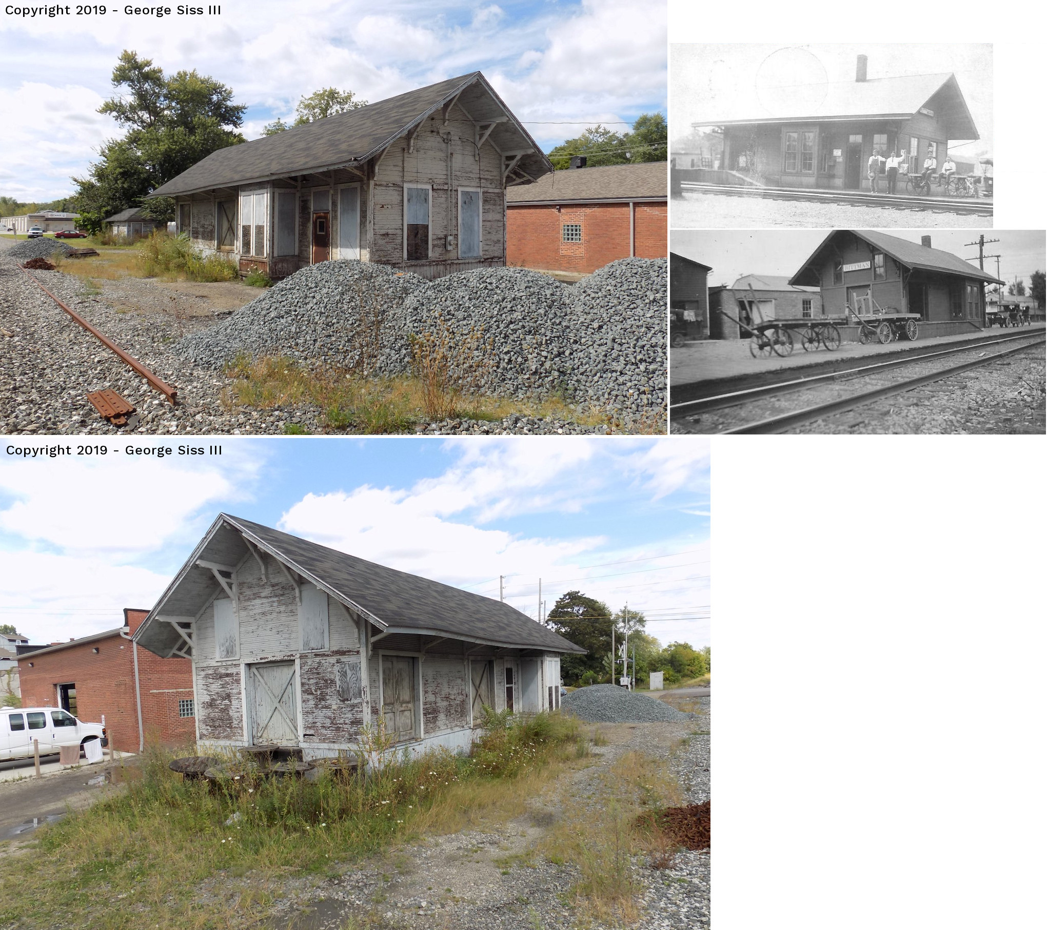
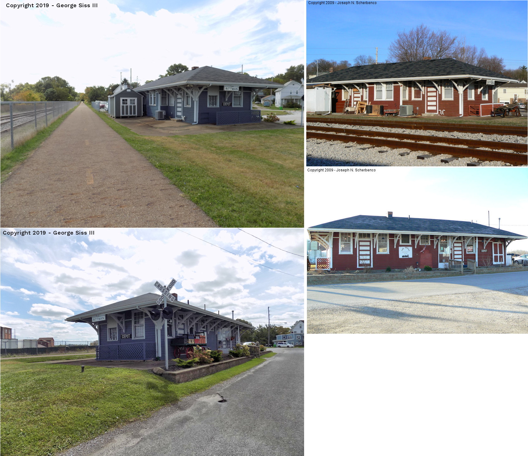
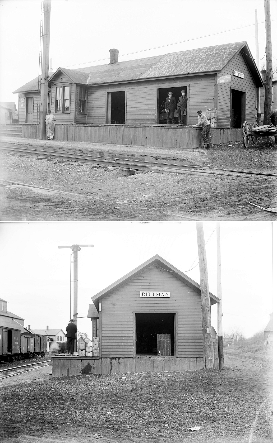
| Rittman | |
West side of South Main Street between Sterling and Front (GPS: 40.966986, -81.782233) |
C | Railroad | 1891 | In Use | Wood |
|
| Rittman |  |
Intersection of Seneca, Grant, and Ohio Streets. (GPS: 40.970838,-81.778434) |
P | Business | 1913 | In Use | Wood | |
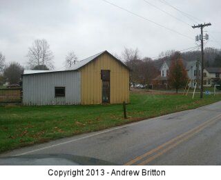
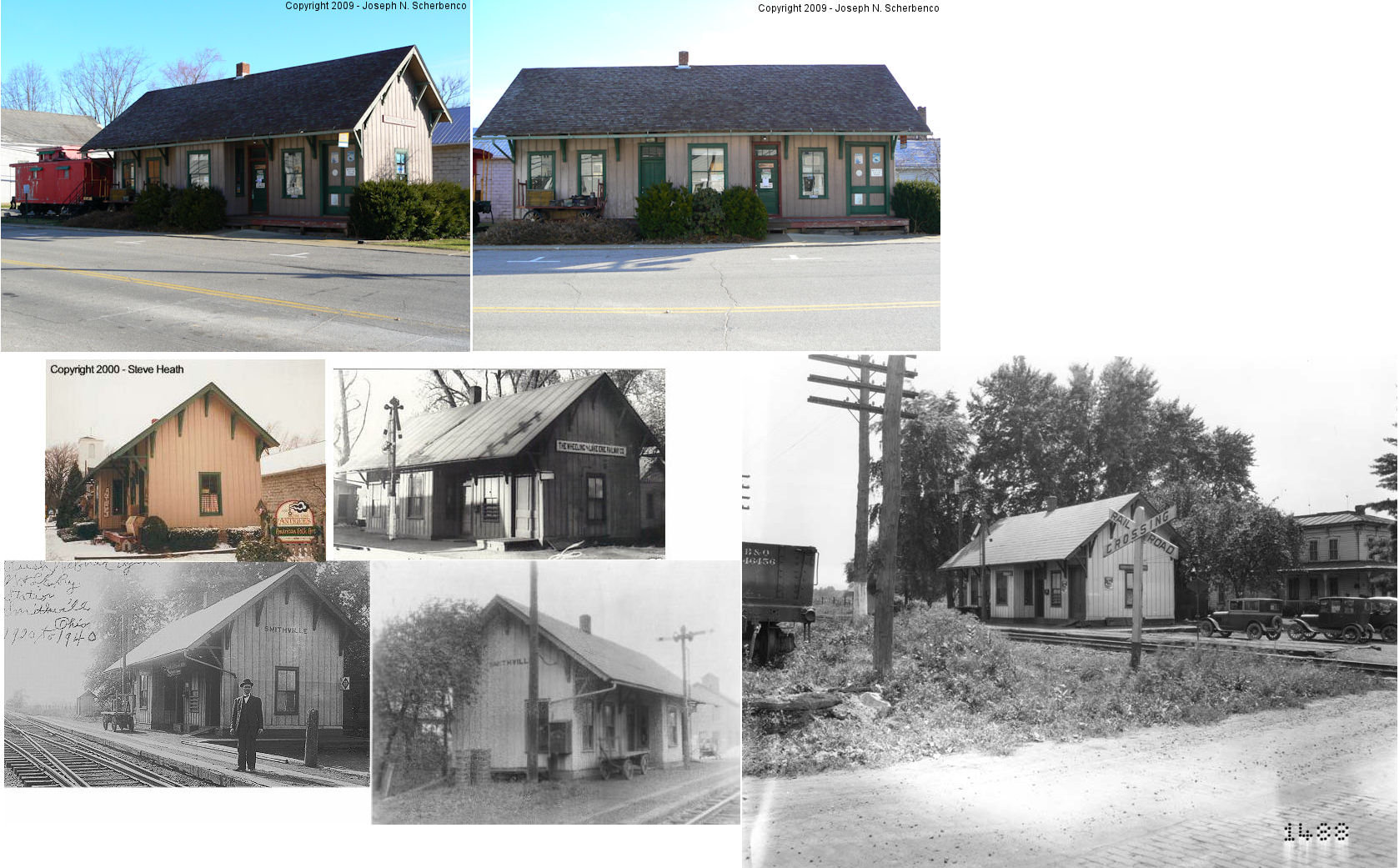
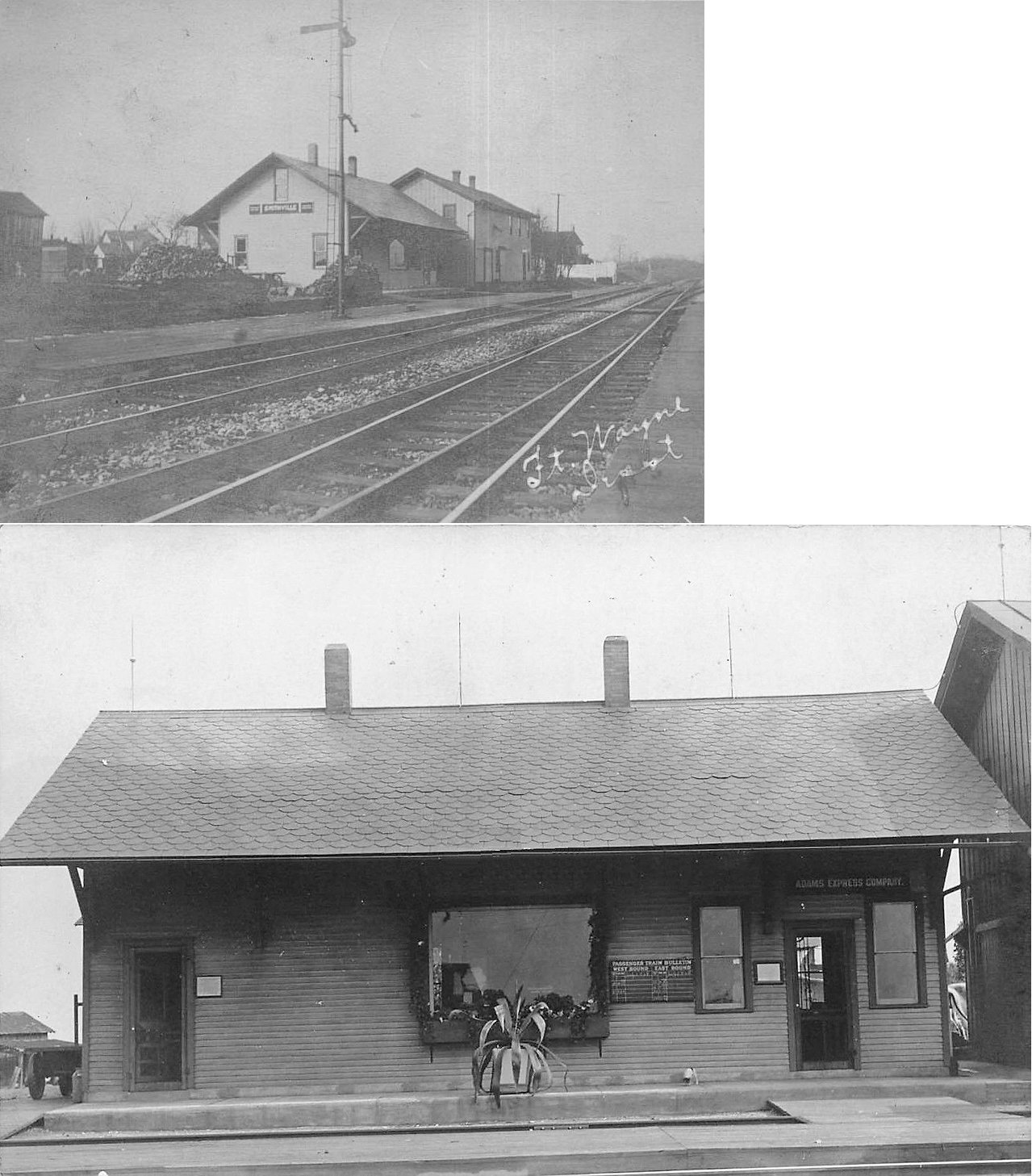
| Smithville |  |
Main & North Milton Streets (GPS: 40.863643,-81.859734) |
P | Business | ???? | None | Wood |
|
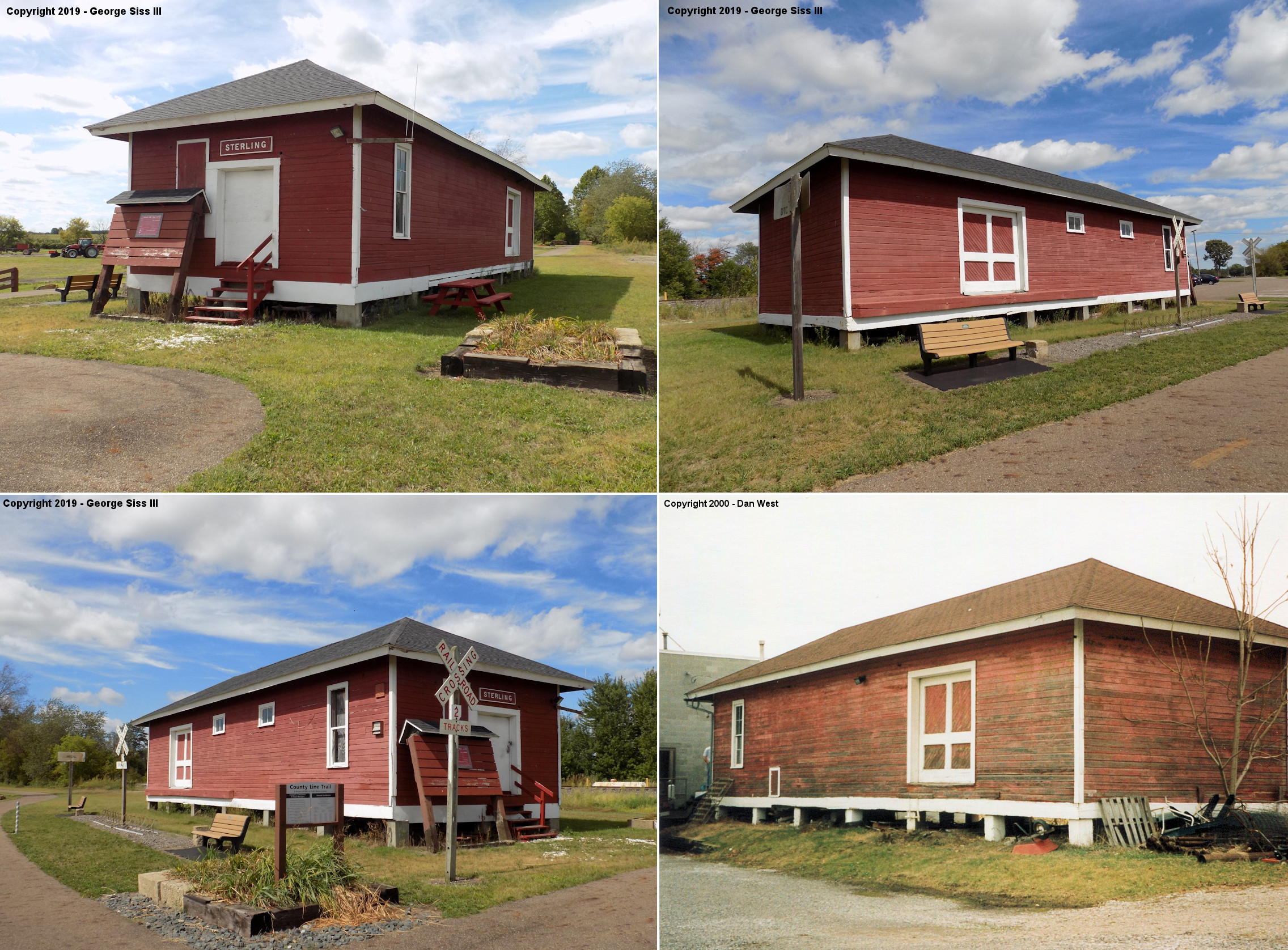
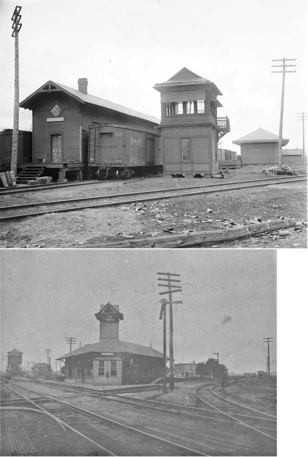
| Sterling |
|
14004 Kauffman Avenue (GPS: 40.970955, -81.851544) |
F | Storage | ???? | Gone | Wood |
|
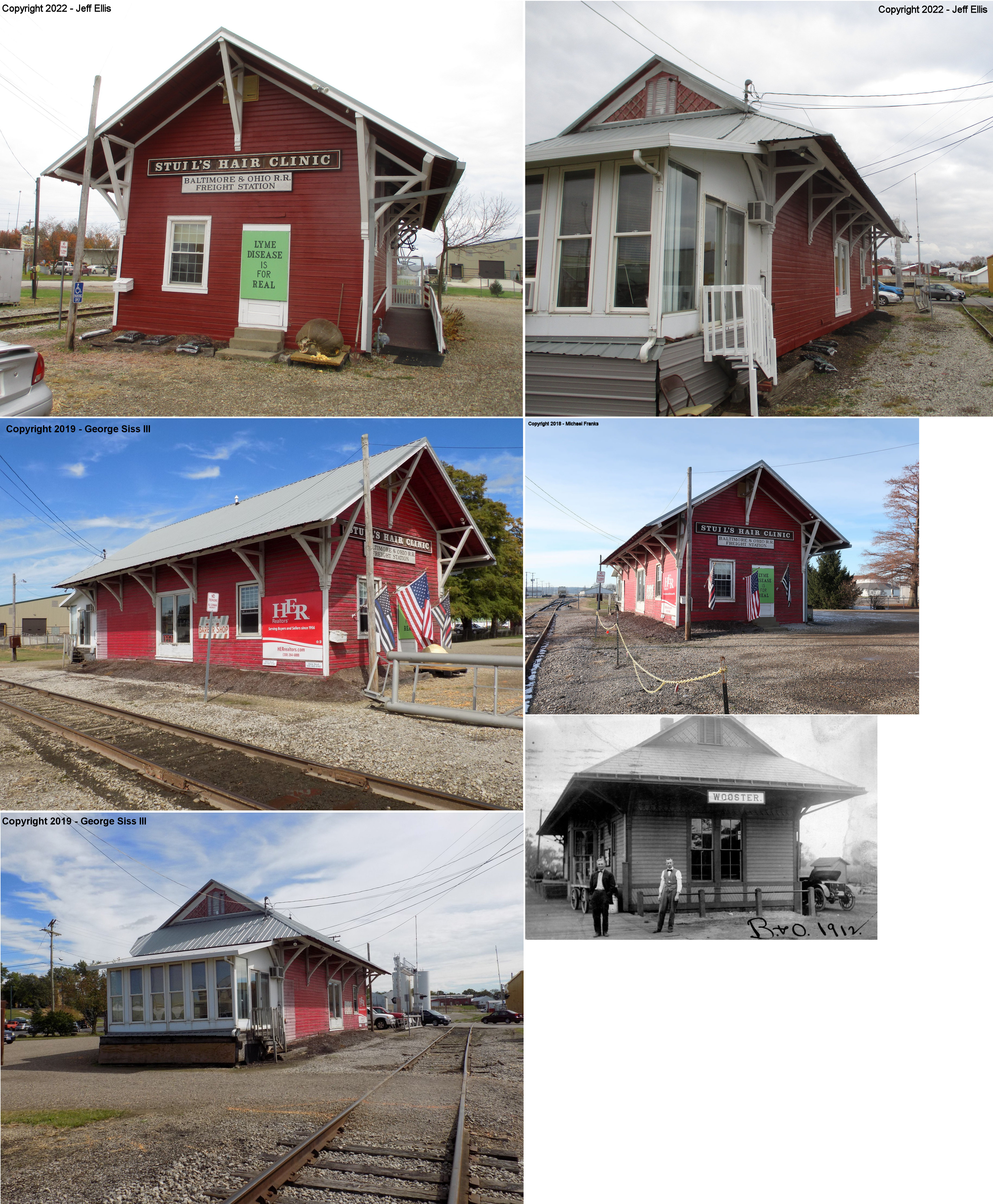
| Wooster | |
256 Columbus Avenue at Vanover Street (GPS: 40.795602,-81.948422) |
C | Business | ???? | In Use | Wood | |
| STATIONS OF THE PAST | ||||||||
| Station Name |
Original Railroad |
Notes | ||||||
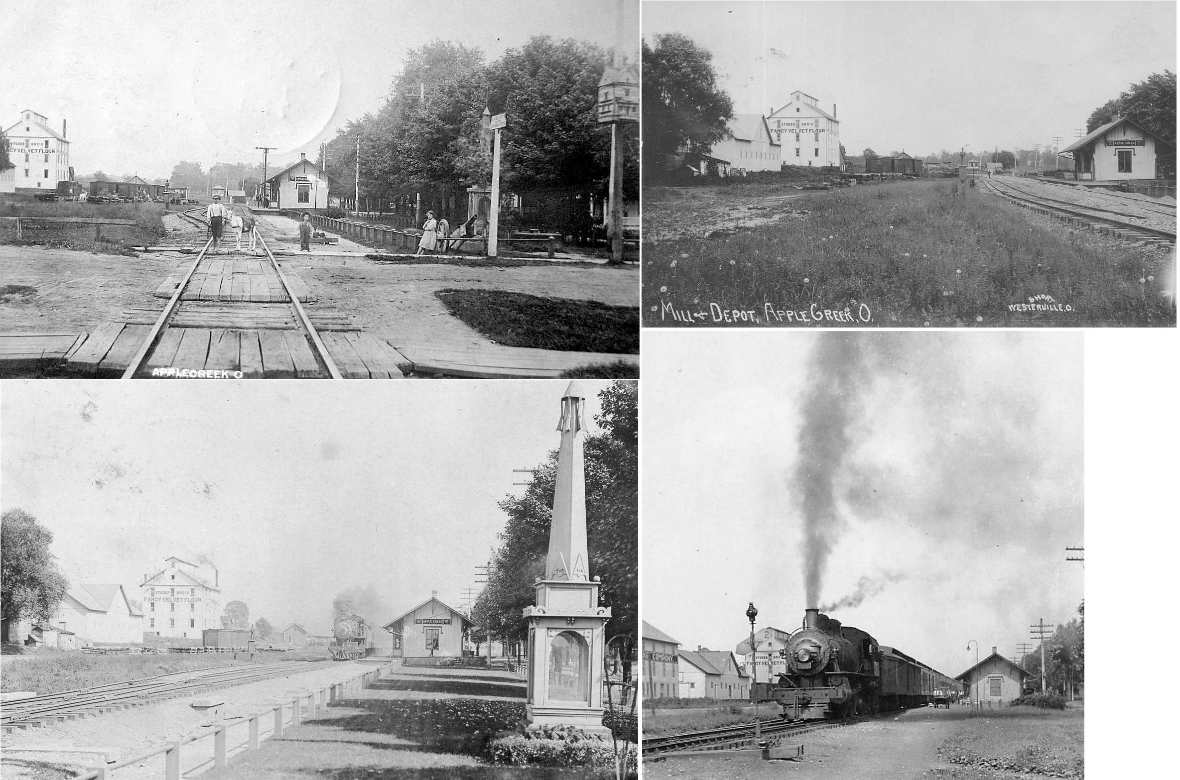
| Apple Creek | |
The station that still stands in Apple Creek may be this
same building, but heavily modified. The PRR ordered heavy modifications
of the stations on this line in the 1950s. There were originally both
passenger and freight stations next to each other on Depot Street (now
Maple Street) at Cross Street (GPS: 40.749122,-81.834755). According to the Evening Independent of July 27, 1965, the first depot here was built in 1852 by the Cleveland, Mt. Vernon & Columbus Railroad near where the tracks crossed Apple Creek. Some field work is need on the ground in Apple Creek to detangle the depot situation there. Are the stations pictured the same or different buildings? Do one or both (if there were two) still stand? The other building that is reportedly the station is in an alley behind the house at 190 Main Street. That building is at GPS: 40.746757, -81.834502. Can someone get a photo of that building and find out more info? |
||||||
| Armstrong | |
This station was built in 1888 (according to the B&O Annual Report of that year). It was near the intersection of Overton and Pleasant Home Roads. | ||||||
| Aukerman | |
This station was near the intersection of Sterling and Overton Roads in the vicinity of GPS: 40.959618, -82.026333. A new freight station was built here in 1905. | ||||||
| Branstetter | |
|||||||
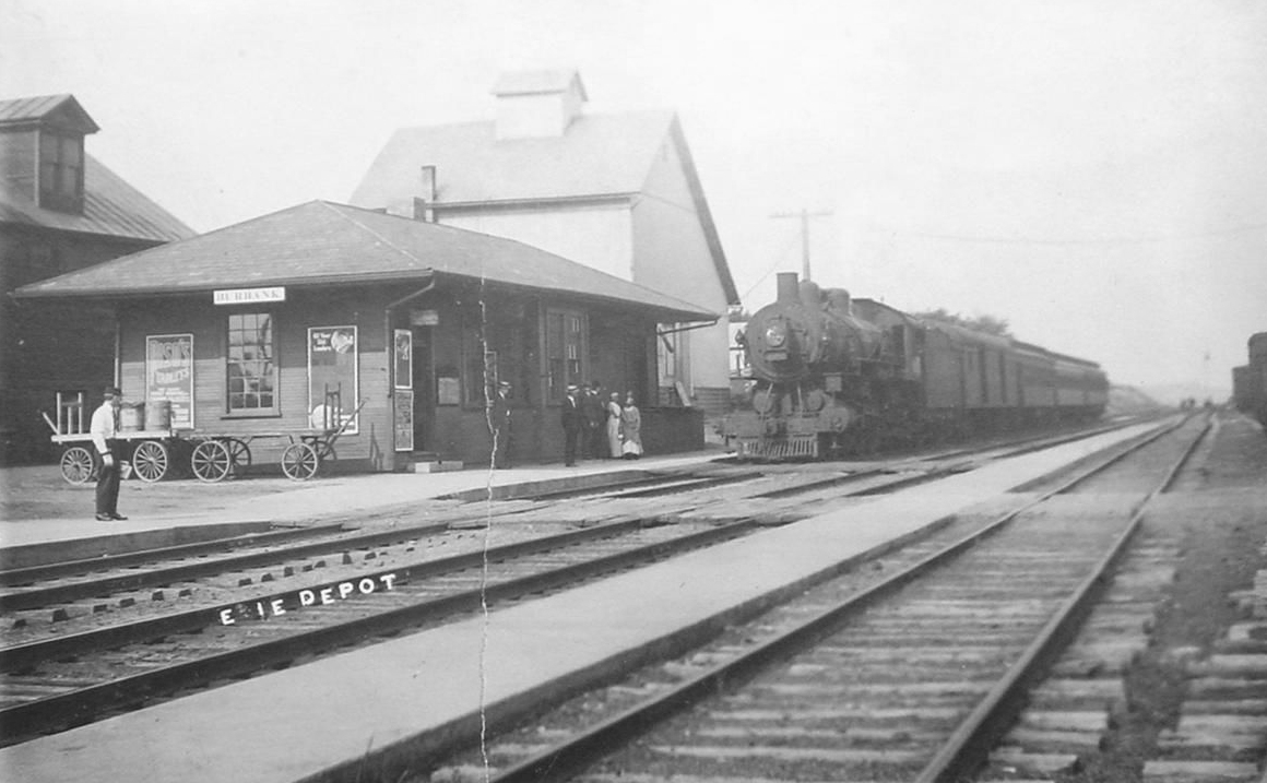
| Burbank |
 |
This station was on Depot Road. Technically it was probably over the line in Medina County although most of the town is in Wayne County. | ||||||
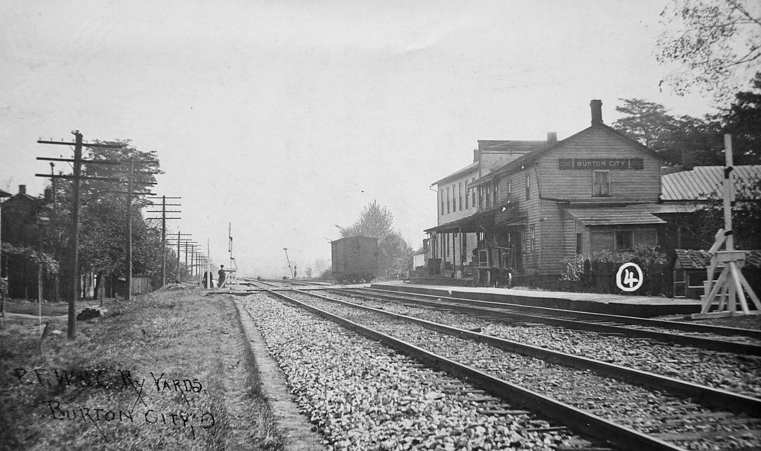
| Burton
City (Fairview) |
|
This station sat on the west side of Mt. Eaton Road north of Market Street. It was on the south side of the tracks (GPS: 40.844979,-81.703531). | ||||||
| Burton City (Fairview) |
|
This station was on the SE corner of Mt. Eaton Road and Burton City Road (GPS: 40.843696,-81.703117). | ||||||
| Cedar Valley | |
|||||||
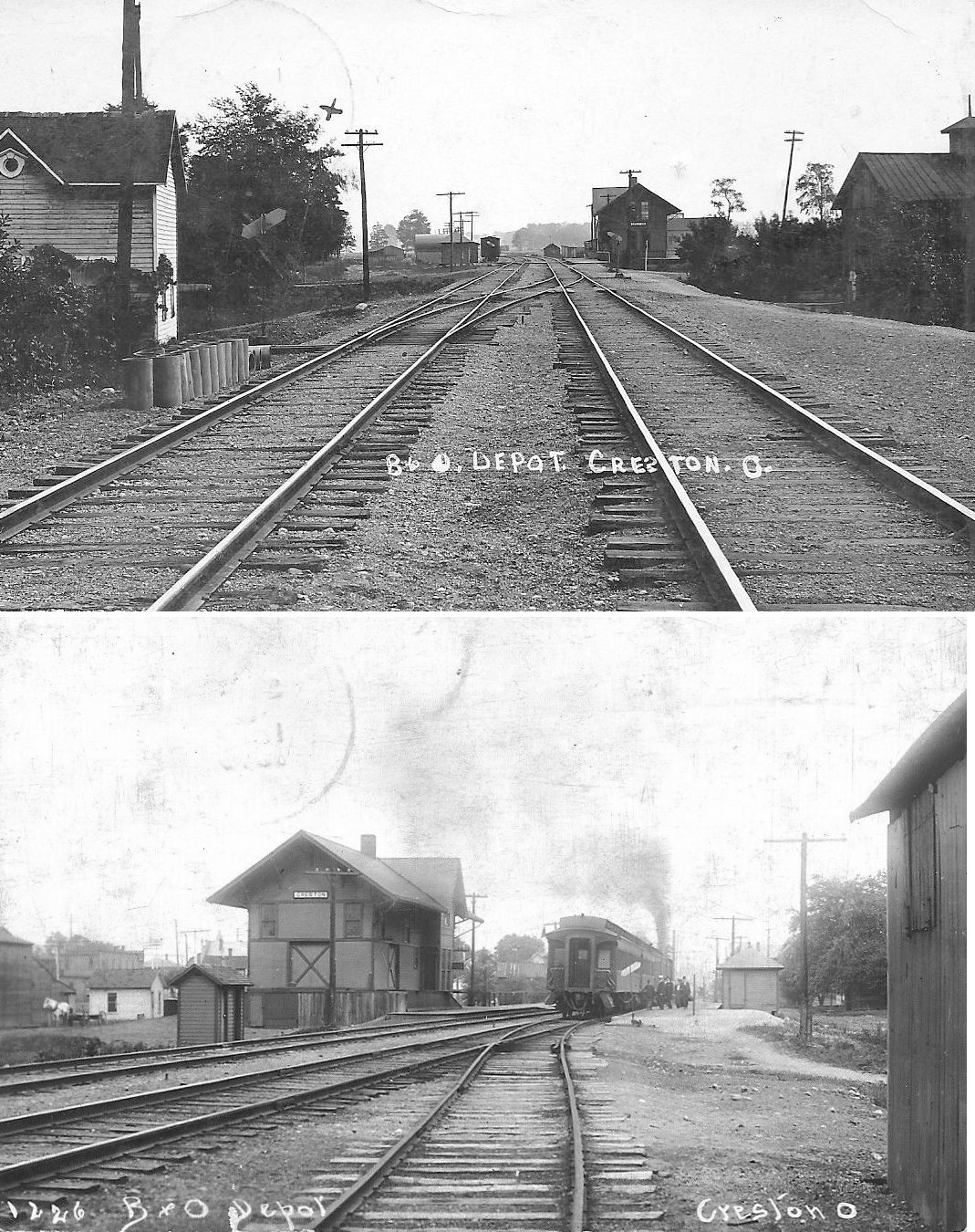
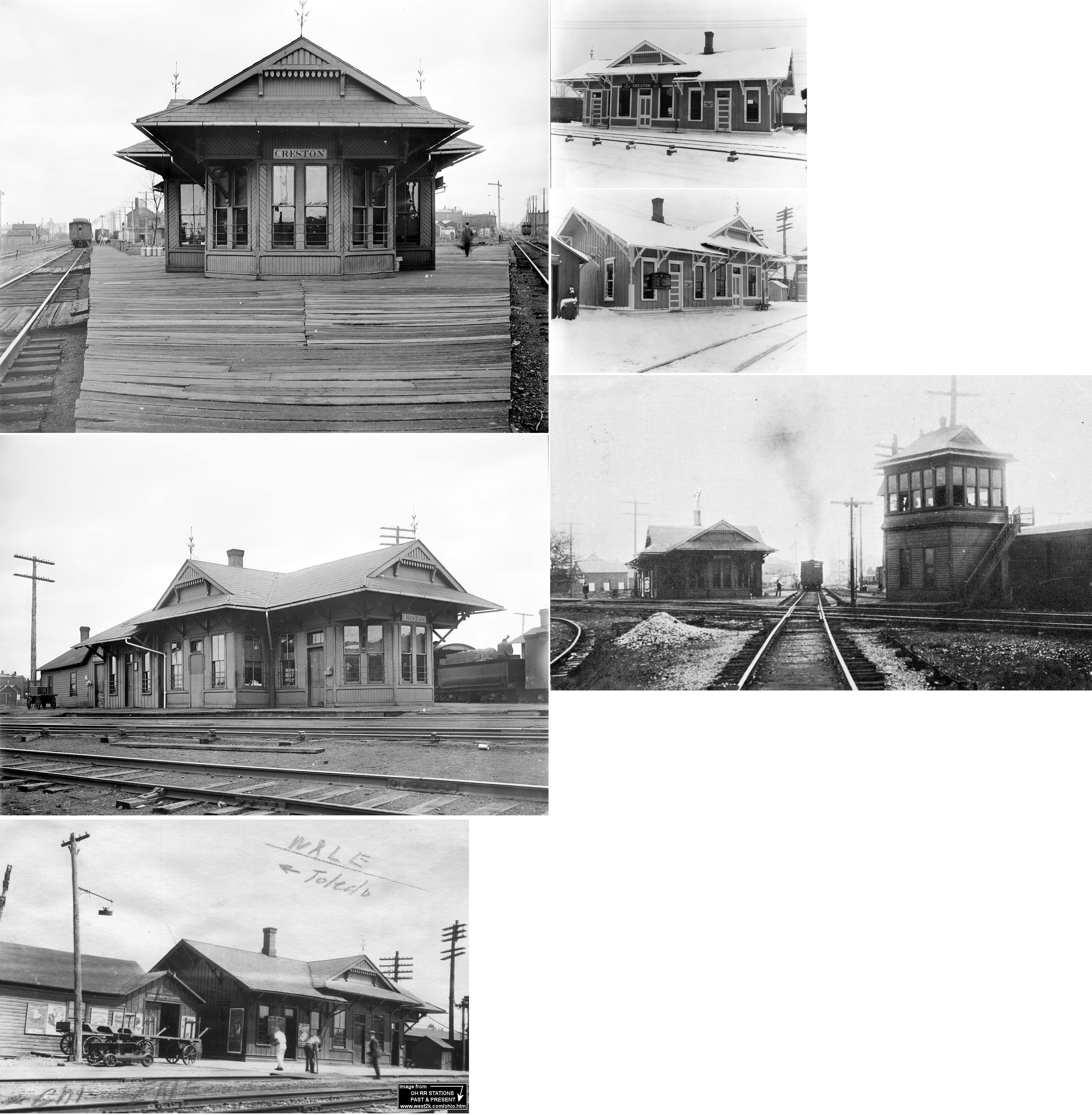
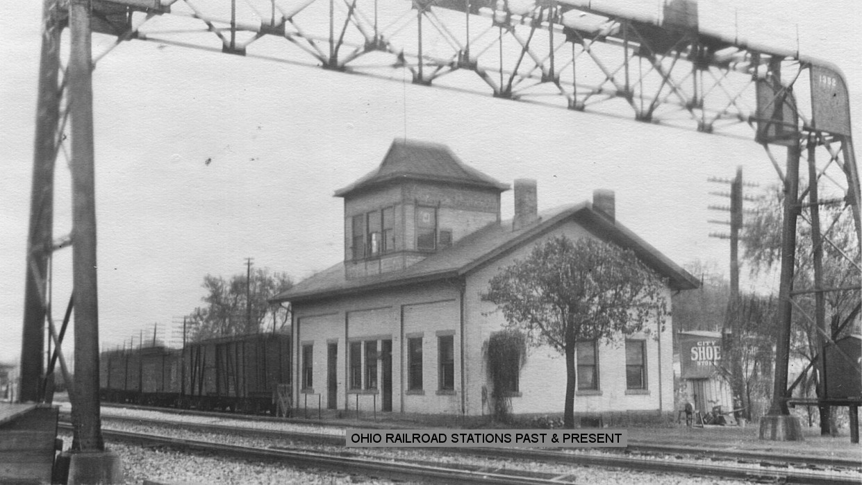
| Creston | |
This station was on Hay Street east of Brooklyn Street on the south side of the tracks (GPS: 40.98449,-81.892465). According to Sanborn Fire maps, this station was gone by 1930. | ||||||
| Creston | AND |
The Erie and W&LE shared this station southeast of the intersection of Brooklyn Avenue and Erie Street near Onion Street (GPS: 40.982555,-81.892304). There was a shared freight house to the east and the old Morehead Hotel sat to the west with the interlocking tower between the two. According to Erie RR valuation records, the station was built in 1886. | ||||||
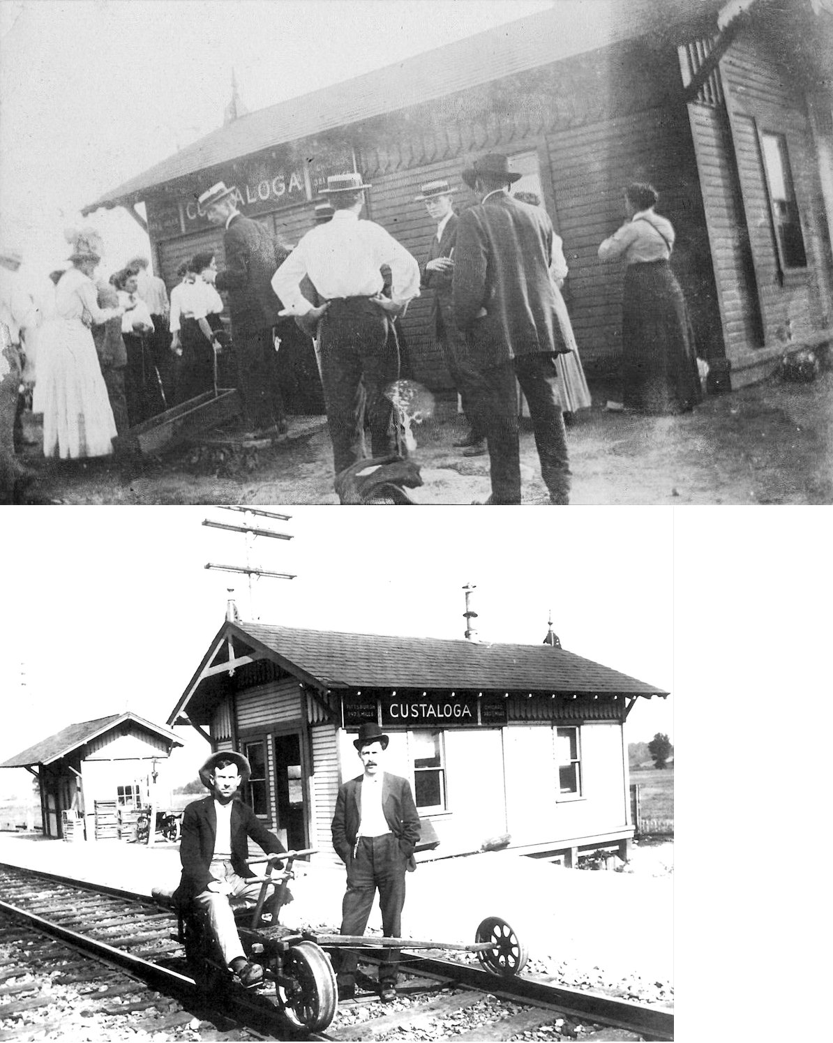
| Custaloga |
|
This station, which was at A&W (Ashland & Wooster) Junction was built in 1900 by the PRR (Akron Daily Democrat, 5-04-1900). This junction was between Shreve and Big Prairie north of SR-226. The station was located at approximately GPS: 40.670491, -82.073588. The station burned after being struck by lightning in 1914 after which an old passenger car was used as a station. | ||||||
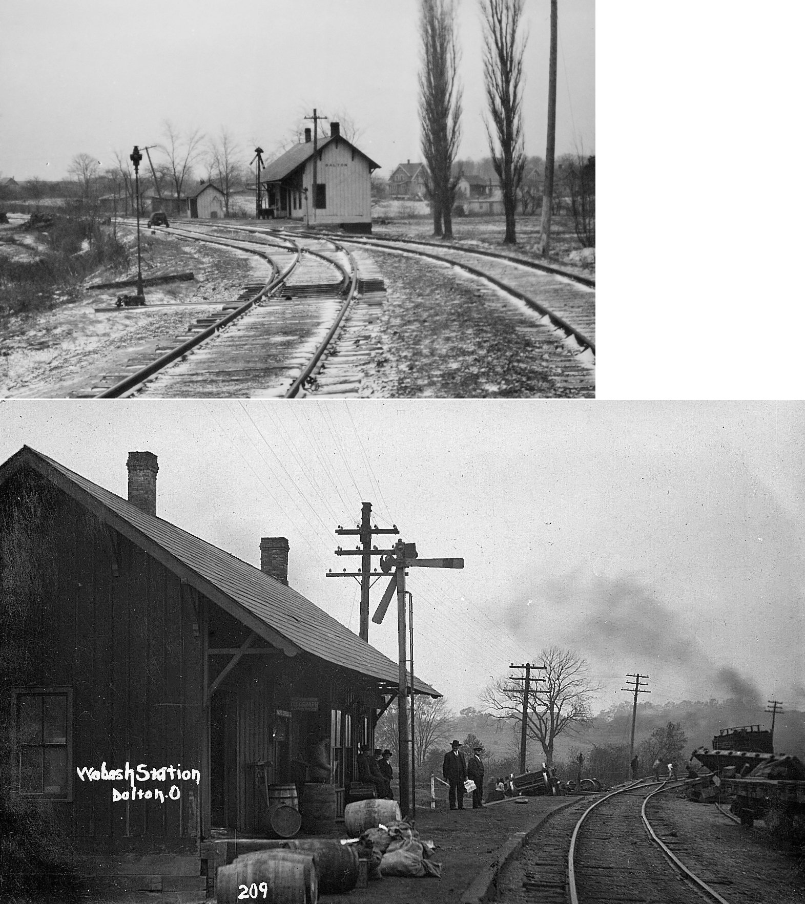
| Dalton |
|
This station was NE of the intersection of East Schultz Avenue and North Cochran Street (GPS: 40.800528,-81.687346). | ||||||
| East Union | |
This station is shown on the 1923 PRR List of Stations & Sidings. | ||||||
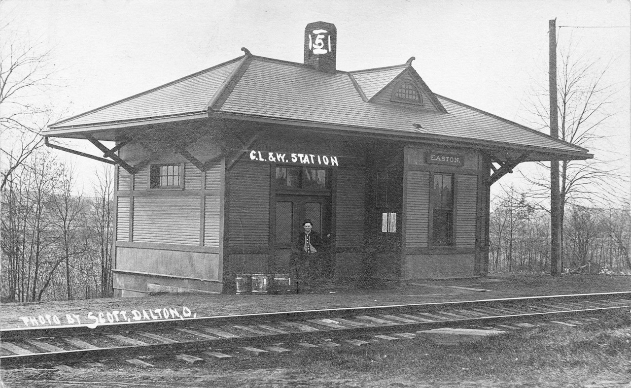
| Easton | |
This was the first Easton station, built in the early 1880s. It was on the old main line located on the south bend of what is now called Harvey Circle (GPS: 40.948043,-81.739896). | ||||||
| Easton | |
This was built later (compared to the above) by the B&O. It was probably built when the line was moved to the other side of town (although both stations are shown on the 1897 map). It was on the NE side of Cleveland Street just east of SR-94 on the south side of the tracks (GPS: 40.955046,-81.736463). | ||||||
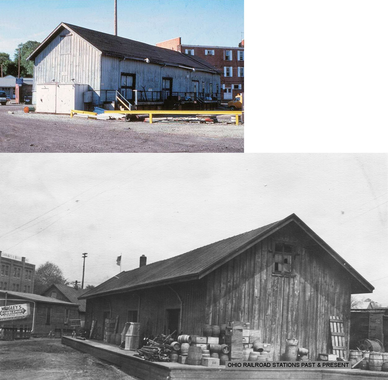
| Fredericksburg | |
This station was about 80 yards north of the intersection of Clay Street and Water Street on the west side of the tracks. | ||||||
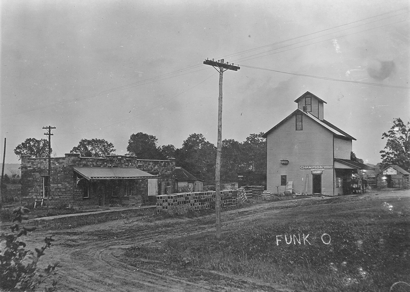
| Funk |
 |
This station was of the same design as the station at Jeromesville (Ashland County). | ||||||
| Kauke | |
This station was between Wooster and Hard (Holmes Co.). | ||||||
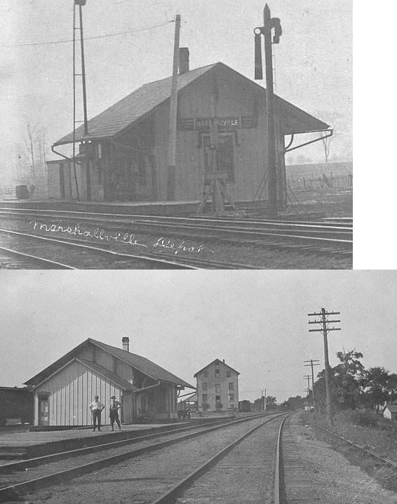
| Marshallville | |
Both the passenger and freight stations sat on the bend in Euclid Street south of Market Street. | ||||||
| Orrville |
|
The passenger station was located near the intersection of Chestnut and McGill Streets. It was on the north side of the tracks on the east side of McGill. This location is an empty lot as of 2009. | ||||||
| Orrville |
|
The freight station was at the end of West Chestnut Street (the part that is unpaved). This location is an empty lot as of 2009. | ||||||
| orrville | |
The CA&C had a freight house NW across the tracks from the passenger station. | ||||||
| Orrville | |
A frame station predated the 1868 station. It was on Main Street and was destroyed by fire in 1867. | ||||||
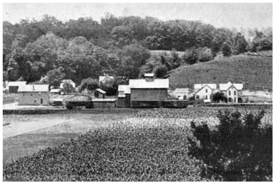
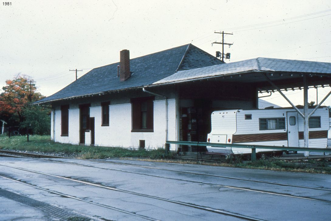
| Overton | |
The feed mill here also served as a freight station (see photo link to the left). There is currently (2021) a building standing near the corner of Mechanicsburg and Winkler Roads that some have claimed is the old station, but others have said that it is a more contemporary building erected as a workshop for the residence there. | ||||||
| Rittman | |
The first station on this line was located at the corner of Main and Elliot Streets. After the new passenger station was built in 1913, this station served as the freight-only depot for a few years, but was gone by 1924. This station sat on what is now part of Erie Street. | ||||||
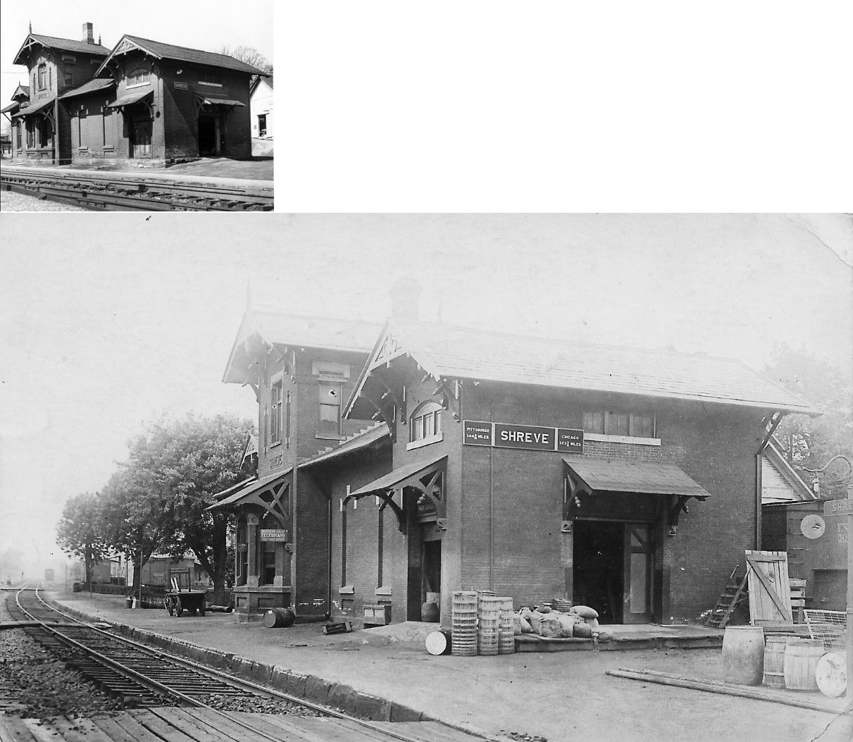
| Shreve | |
This station was located on the west side of Market Street between Jones and Robinson Streets (GPS: 40.682705,-82.022493). It was built in 1878 (confirmed in PRR valuation records), and was torn down around 1963 with the bricks used as fill for a southern extension of Market Street. | ||||||
| Smithville Station | |
Also known as Smithfield Station. | ||||||
|
Sonnenburg (Kidron) |
|
It appears there was a small passenger waiting shelter here. | ||||||
| Sterling (Russell) |
|
The original name for the station here was "Russell," but it was changed to Sterling in 1883. | ||||||
| Sterling |
AND |
A NYP&O-designed, v-shaped union station sat on the south side of Atlantic Street east of Lake Street (GPS: 40.970198,-81.847943). This station was still visible on maps from 1908. | ||||||
| Sterling |
|
According to the 1897 map the B&O had a station on the west side of Kauffman Avenue on the north side of the tracks (GPS: 40.971178,-81.851074). | ||||||
| Sterling | AND |
This station was a standard B&O design. It was built in the early 1900s and sat at the same location as the NYP&O/CL&W station listed above (GPS: 40.970198,-81.847943). | ||||||
| West Lebanon | |
According to valuation records, an old passenger coach was placed here as a station in 1877. It was still there as of 1929. | ||||||
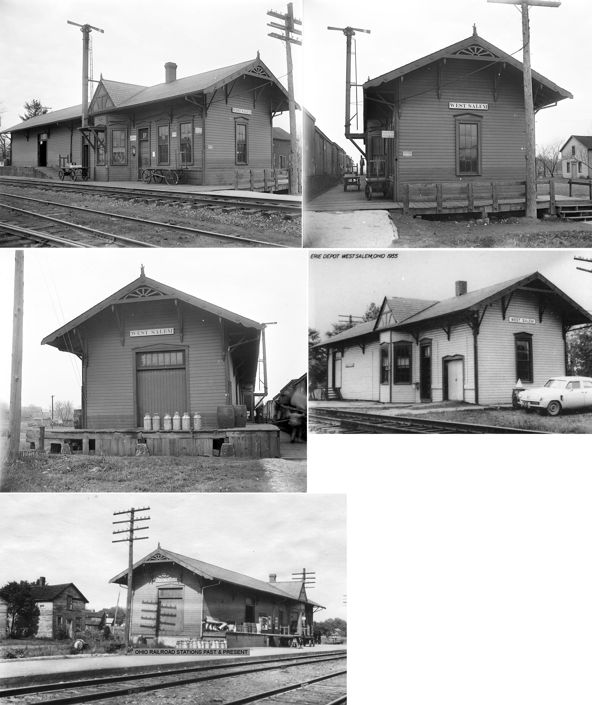
| West Salem |
|
The original station here burned down on November 17, 1883 (The Wellington Enterprise, 9-21-1883). | ||||||
| West Salem |
|
This station was on what was formerly known as Depot Street. This location is now known as Centennial Street. The station was at the south of the end of 2nd Street toward 3rd Street (which is now gone). According to Erie RR valuation records, it was built in 1885. | ||||||
| West Salem |
|
This is either a newer station or the original station heavily modified. | ||||||
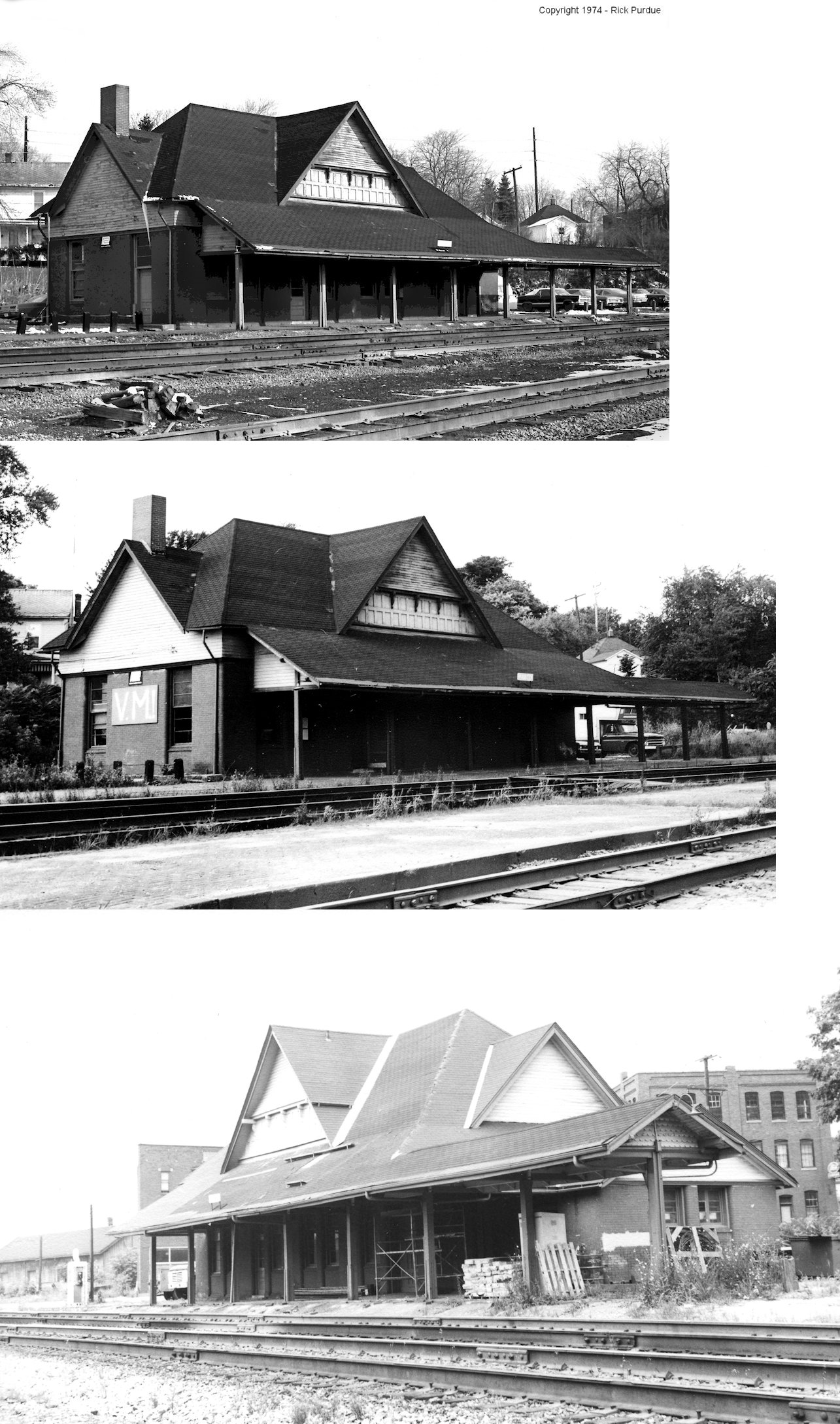
| Wooster |
|
The building pictured may have been the second generation, pre-1890 station at Wooster. At the time of the photo, 1917, the building was being used as a supervisor's office and telegraph station. It was on the north side of South Street on the east side of the tracks at GPS: 40.798250, -81.932752. According to PRR valuation records, this buiding was built in 1872. The railroad arrived inn Wooster in 1852. | ||||||
| Wooster |
|
Photo is from the late 1970s. This station, opened in 1890, was on the east side of the intersection of Spink Street, East Liberty Street and Pitsburgh Avenue (GPS: 40.799372,-81.931778). The station was demolished following a derailment that damaged the building on August 6, 1977. | ||||||
| Wooster |
|
The freight station was to the SW of the passenger station across Pittsburgh Avenue on the south side of East Liberty Street (GPS: 40.798875,-81.932881). | ||||||
| Wooster |
|
A freight house was built here in 1888 (according to the B&O Annual Report of that year). Does anyone know where this was located? | ||||||
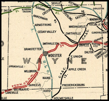
| 1898 WAYNE COUNTY RAILROAD MAP | ||||||||
 |
||||||||
| Notes About Existing
Stations... Apple Creek (PRR) - This may be the original CA&C station after undergoing the heavy modification program that the PRR performed on old CA&C structures in later years. The sign is on this building and it has what looks to be the same Insulbrick siding. Or, this may have been a later PRR station or the freight station. Or, it may just be an unrelated building that the sign and siding was placed on. See Killbuck (Holmes Co.) and Sunbury (Delaware Co.) as other examples of modified PRR stations. Other reports say that this building is not the station, but that it was moved to another location and now looks like a barn. More research is needed to verify the fate of this/these station(s). Also see the listing below in the "Stations Of The Past" section. Armstrong (B&O) - This station was built in 1888 according to the B&O annual report from that year. The station appears to have been moved slightly from its original location. Fredericksburg (PRR) - Building is block but covered with shingling. Sits about 200 yards off Clay St. behind old feed mill. Old CA&C milepost nearby. This may be a part of the original station as maps from 1897 show the original station at this same location. It looks like it underwent the extreme PRR makeover of removing most of its distinguishing features and was then chopped into a smaller piece. Either that or this was a later PRR station. Orrville (PFt.W&C and CA&C) - Home of the Orrville Railroad Heritage Society. The new W&LE bought these tracks from Norfolk Southern back in the early 90's, when the new W&LE was established. See OrrvilleRailroad.com for more information. Oddly, PRR valuation records of 1917 give the build date as 1889. Orrville (PFt.W&C Freight) - According to PRR valuation records, this freight station was built in 1870. When the railroad abandoned the freight station, most likely in the 1950's, it was connected to the Orrville Body Company building. The original windows were the same shape as the union depot. Rittman (B&O) - This station was built by the Akron & Chicago Junction Railroad in July of 1891 right before the B&O takeover at the end of the month. Passenger service was cut in 1970 and the building was used as a clerk's office. CSX used the station as storage until 2022. As of 2025, the Rittman Historical Society is in the process of getting funds together to move the station away from CSX New Castle Sub to become a small museum and public gathering place on the Rails to Trails (former Erie Right of Way) between Erie Street and Sterling Avenue. The society hopes the station can be moved and restored by 2027. Smithville (W&LE) - Moved here from the tracks in the late 1970s. The original location was ont he south side of Main Street on the west side of the tracks (GPS: 40.868292,-81.851181). Sterling (CL&W) - The station was moved in 2010 to its current location. The station sat for many years behind a warehouse at Kauffman and Chestnut Streets (GPS: 40.967458,-81.846393). Maps from 1897 and 1908 show a B&O passenger or freight station located on the west side of Kauffman Street just south of Atlantic Avenue (to the NW of where the old passenger station sat). |
||||||||