 COUNTY COUNTY
|
|
||||||||
| EXISTING STATIONS | ||||||||
|---|---|---|---|---|---|---|---|---|
| Station Name |
Original Railroad | Current Location |
Type | Current Use |
Date Built |
Track Status |
Building Material |
More Info |
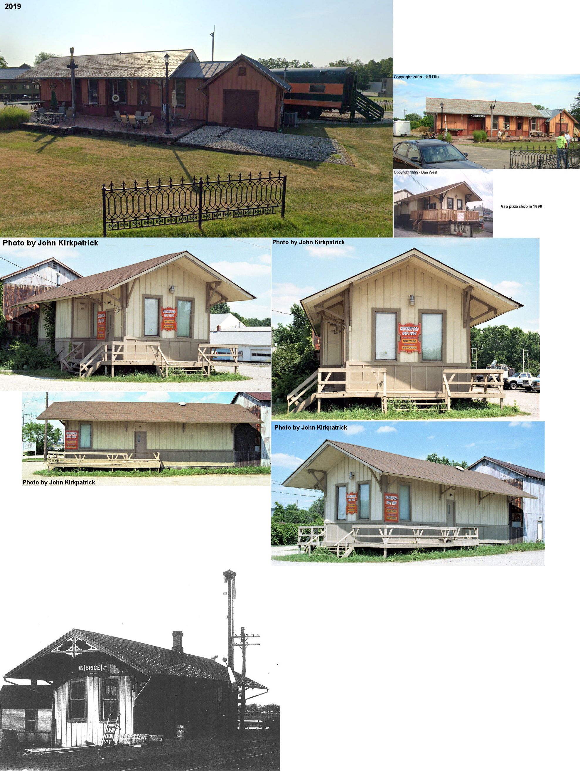
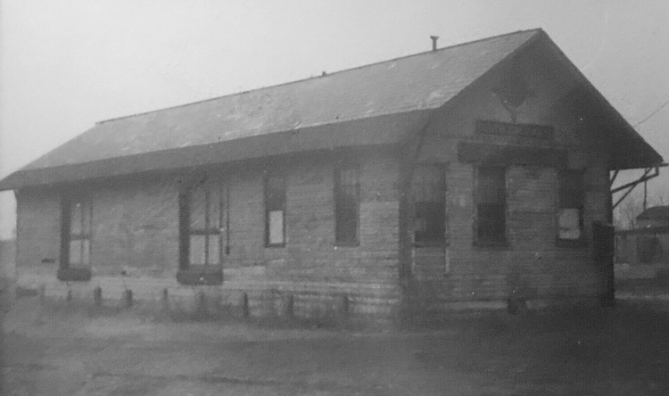
| Brice |
 |
134 Church Street Plain City, Madison County (GPS: 40.107077, -83.264798) |
C | Business | 1880 | In Use | Wood |
|
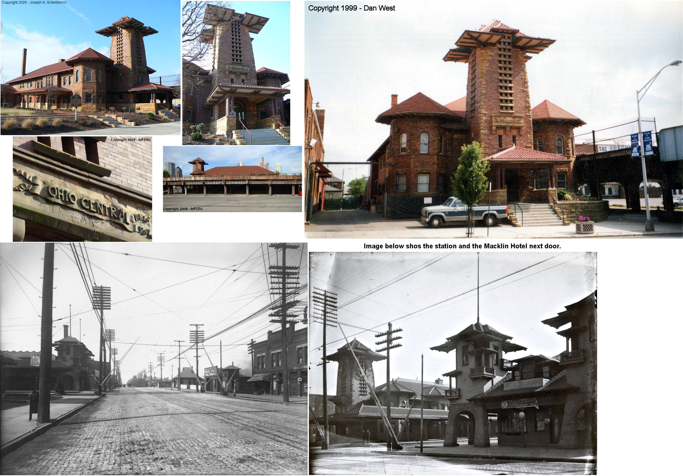
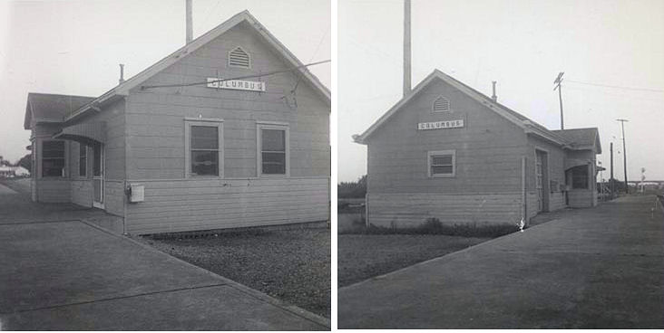
| Columbus |
|
379 West Broad Street (GPS: 39.960631, -83.010744) |
P | Civic | 1895 | In Use | Brick |
|
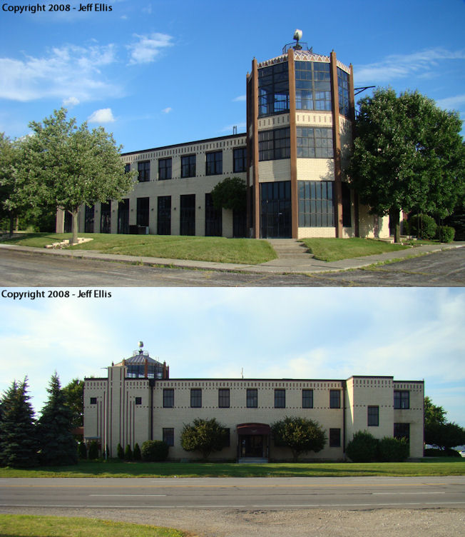
| Columbus |
 |
5th Avenue and Hamilton Avenue SE (GPS: 39.986857, -82.871800) |
P | Office | 1929 | In Use | Brick |
|
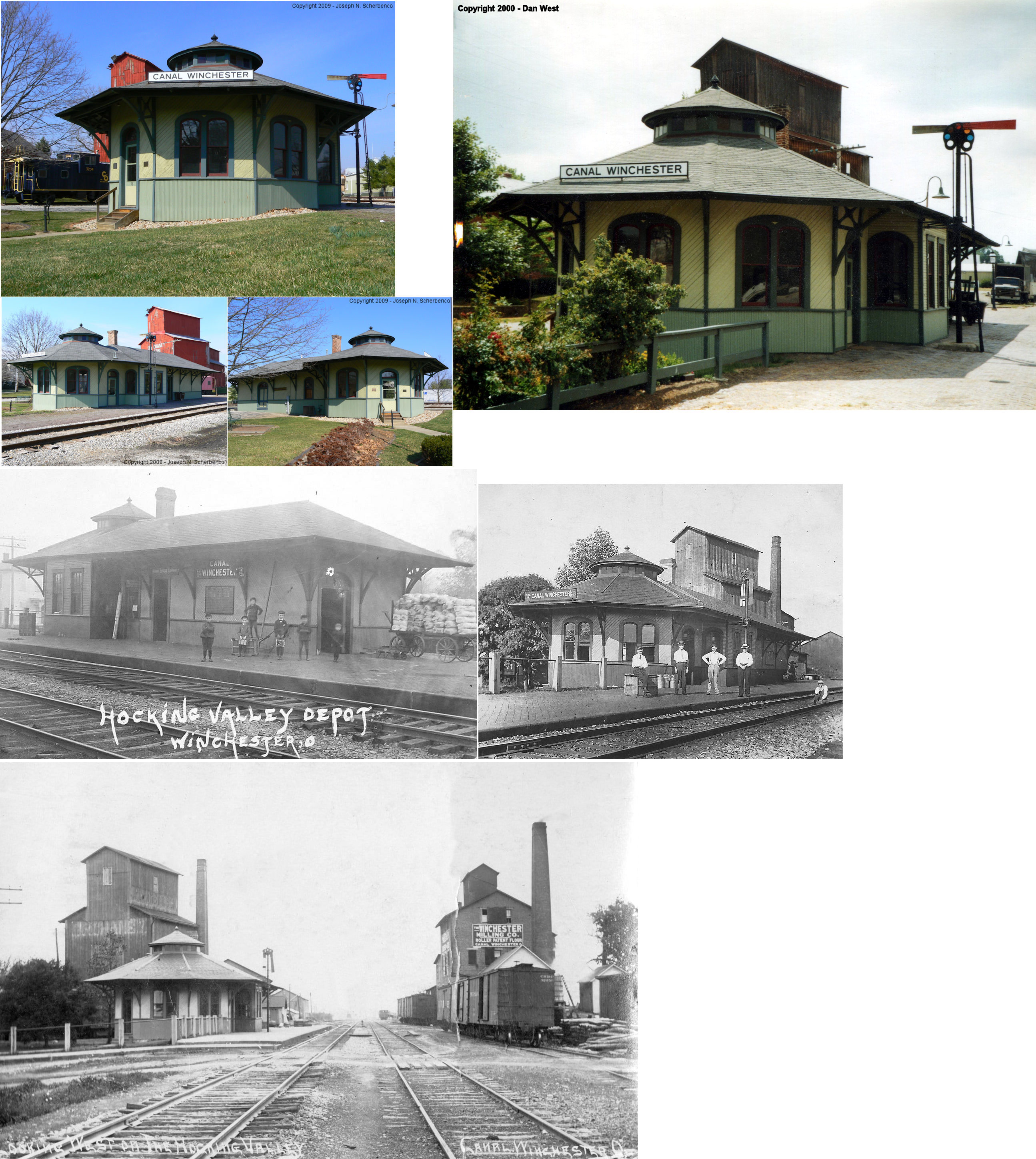
| Canal Winchester |
 |
96 North High Street (GPS: 39.845608, -82.805798) |
P | Civic | 1895 | In Use | Wood |
|
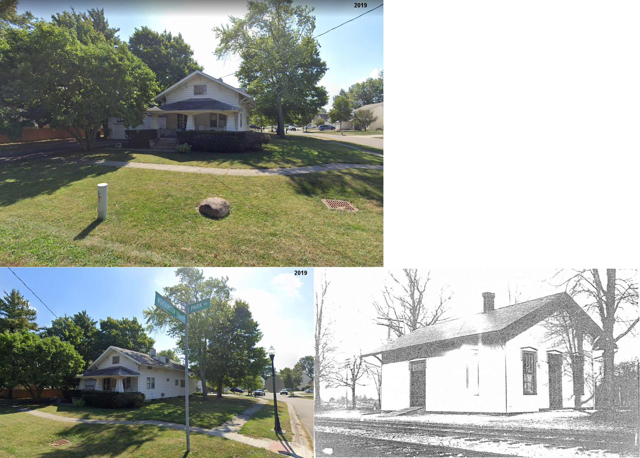
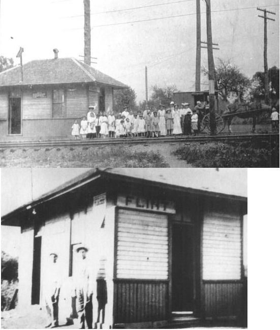
| Flint |
 |
553 Park Road (GPS: 40.126442, -82.989432) |
P | Residence | 1875 | None | Wood |
|
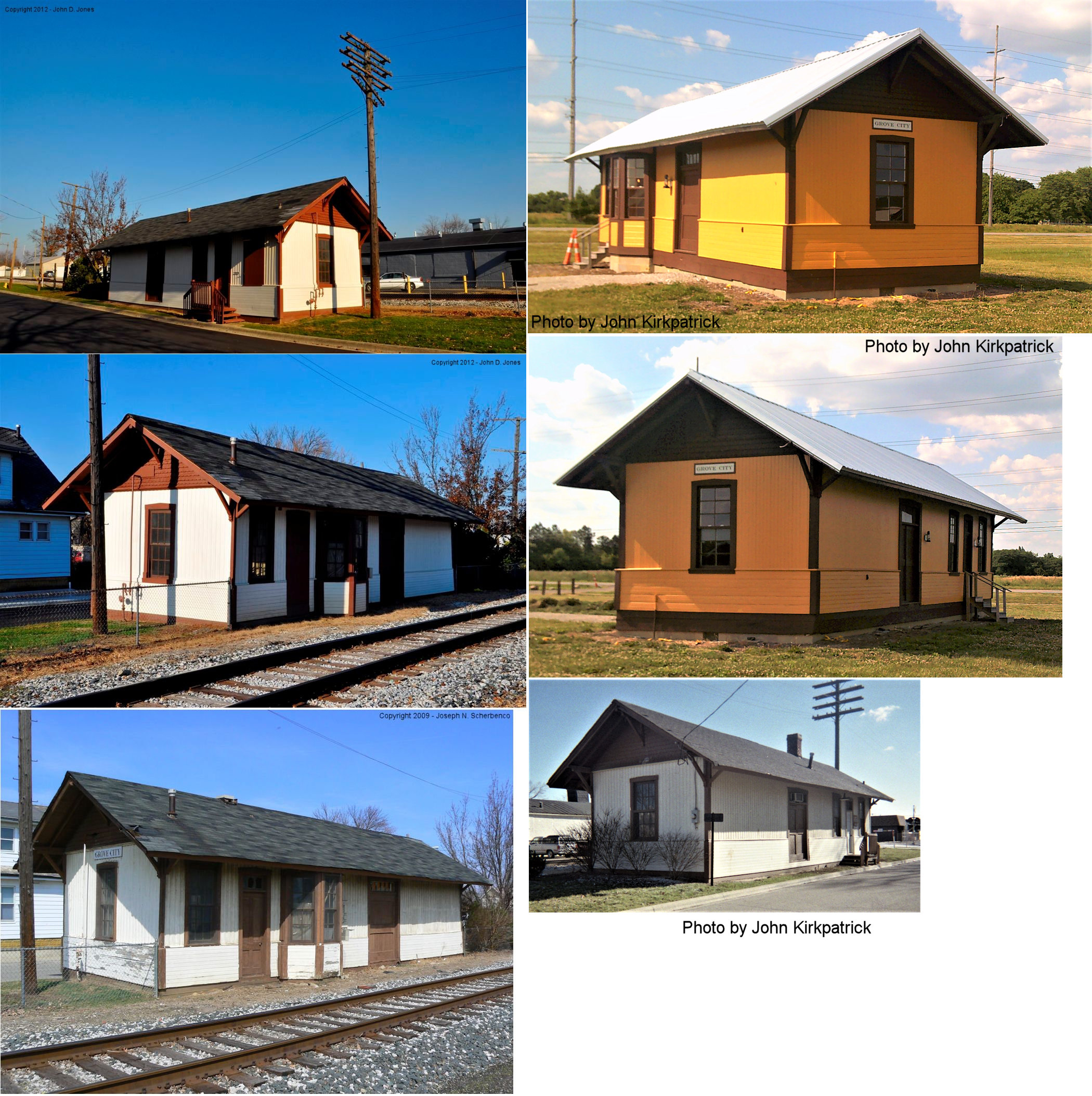
| Grove City |
 |
South side of Orders Road at Century Village (GPS: 39.859929, -83.102074) |
C | Civic | 1884 | In Use | Wood |
|
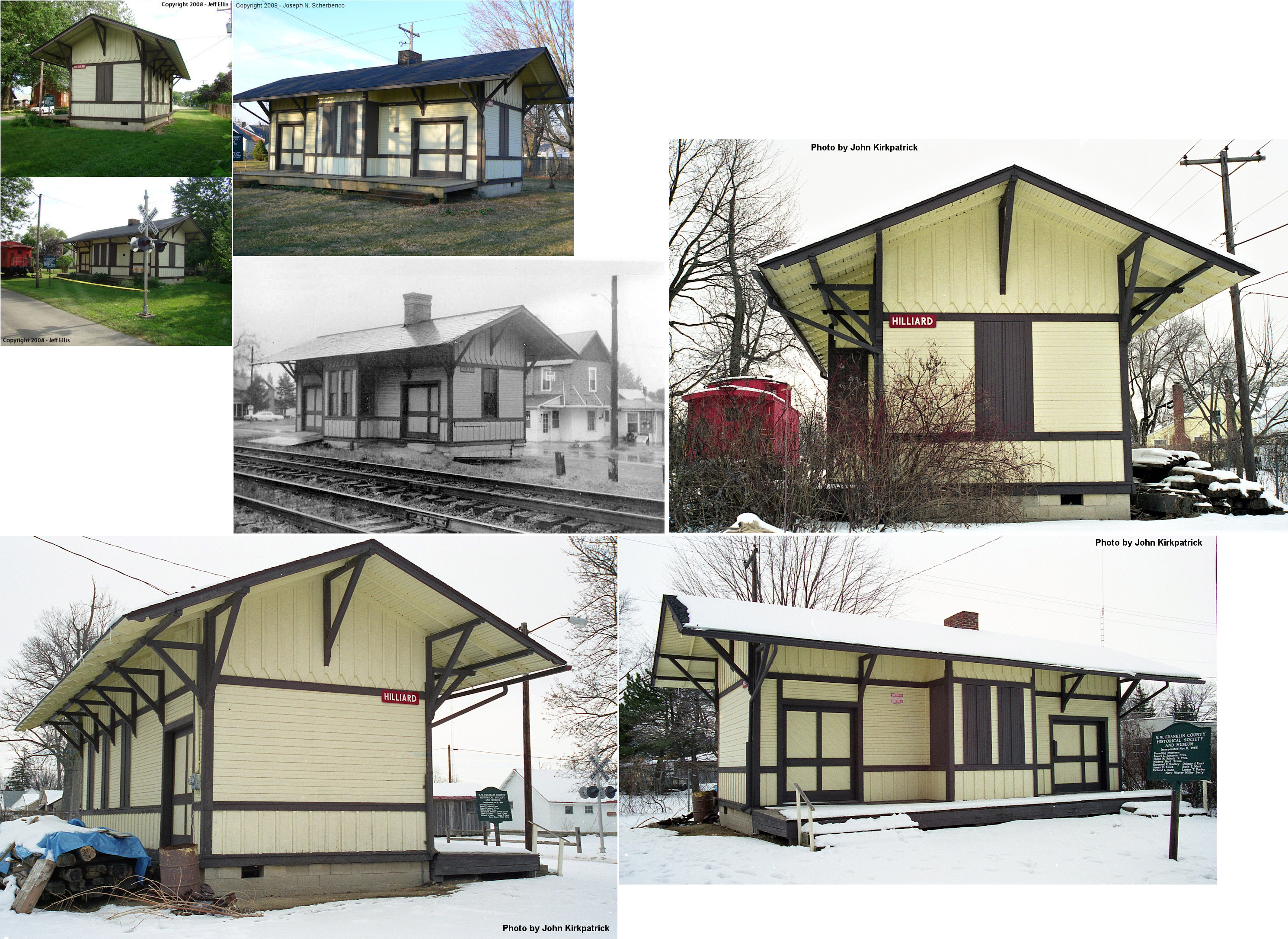
| Hilliard |
 |
Hilliard's Station Lane between Main Street/Avery Road and Columbia Street (GPS: 40.035956, -83.156068) |
P | Civic | 1899 | None | Wood |
|
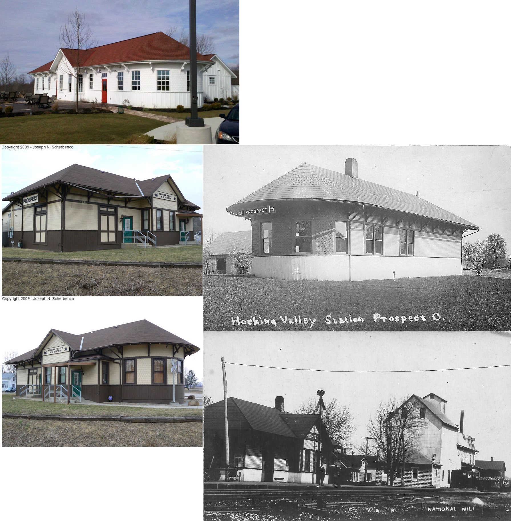
| Prospect | |
789 Science Boulevard in Gahanna (GPS: 39.996693,-82.844735) |
C | Business | 1902 | None | Wood |
|
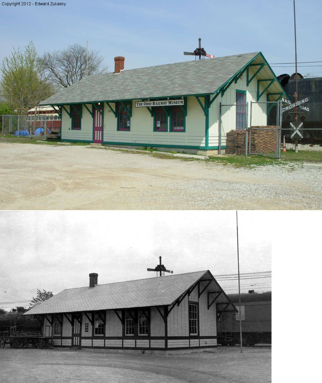
| Worthington |
 |
Ohio RR Museum, 990 Proprietors Road (GPS: 40.093183, -83.003410) |
P | Museum | 1969 | In Use | Wood | |
| Worthington |
 |
North of Dublin-Granville Road (GPS: 40.088871, -83.002700) |
P | ???? | ???? | In Use | Wood |
|
| Worthington |
|
North of Dublin-Granville Road (GPS: 40.089841, -83.002835) |
F | ???? | ???? | In Use | Wood | |
| STATIONS OF THE PAST | ||||||||
| Station Name |
Original Railroad |
Notes | ||||||
| Alton Station |
|
A station is shown here on the 1856 Franklin County Map. | ||||||
| Alum Creek Junction |
|
|||||||
| Amlin |
|
|||||||
| Arlington Place |
|
This station was on the west side of the Scioto River. It was closed sometime before 1930. | ||||||
| Avenue |
|
This station was between Columbus and Galloway. It was 6.7 miles from Columbus Union Station and 3.4 miles from Galloway. | ||||||
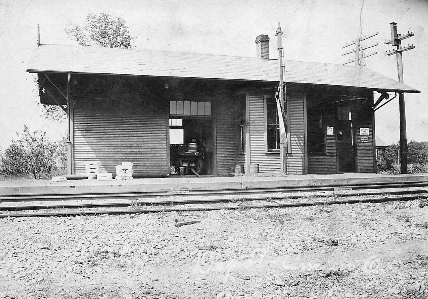
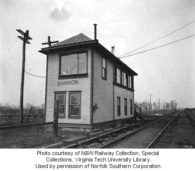
| Bannon |
 |
Tower and station that served the T&OC and N&W. Torn down in the early 1930s. | ||||||
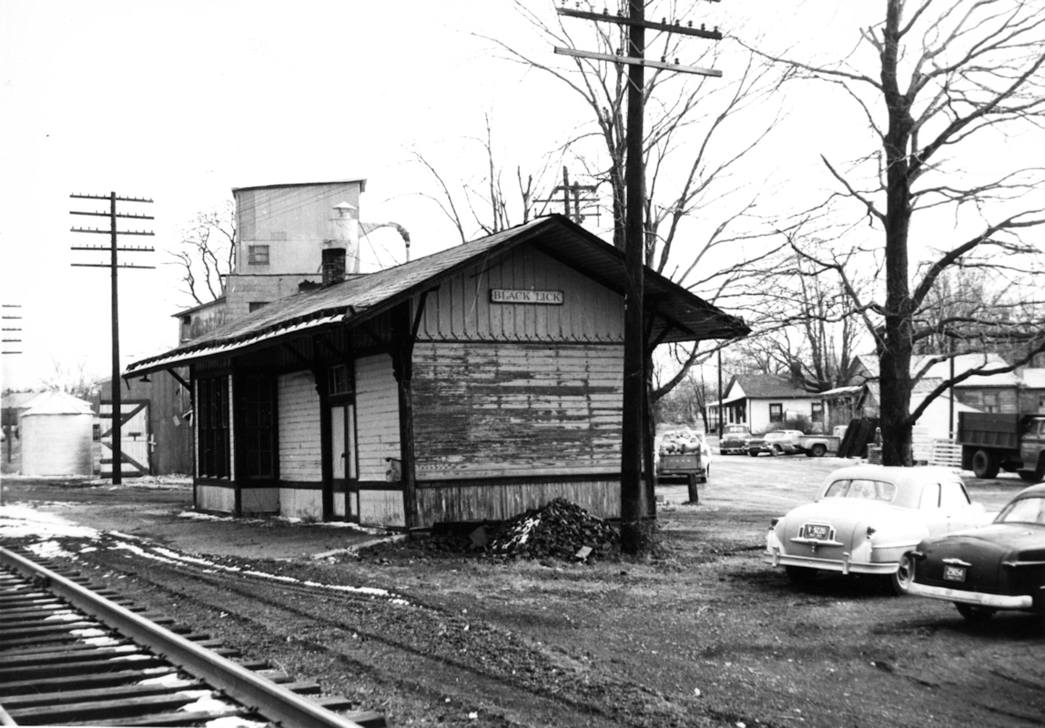
| BlackLick |
|
|||||||
| Blacklick |
|
A station is listed here on the 1923 PRR List of Stations & Sidings. | ||||||
| Camp Chase |
|
This was an early station on the Cincinnati, Sanduky & Cleveland RR (Columbus Division). It was just south west of West Broad Street in the vicinity of GPS: 39.953693, -83.091678. The station is listed in Bullinger's Postal & Shipping Guide for 1881 and shown on some maps of that era. It may have been torn down when the tracks were elevated over Broad Street. | ||||||
| Canal Winchester |
|
The original (circa 1869) station here burned down on October 13, 1894 (Cincinnati Enquirer, 10-14-1894). | ||||||
| Clintonville |
|
|||||||
| Columbus |
 |
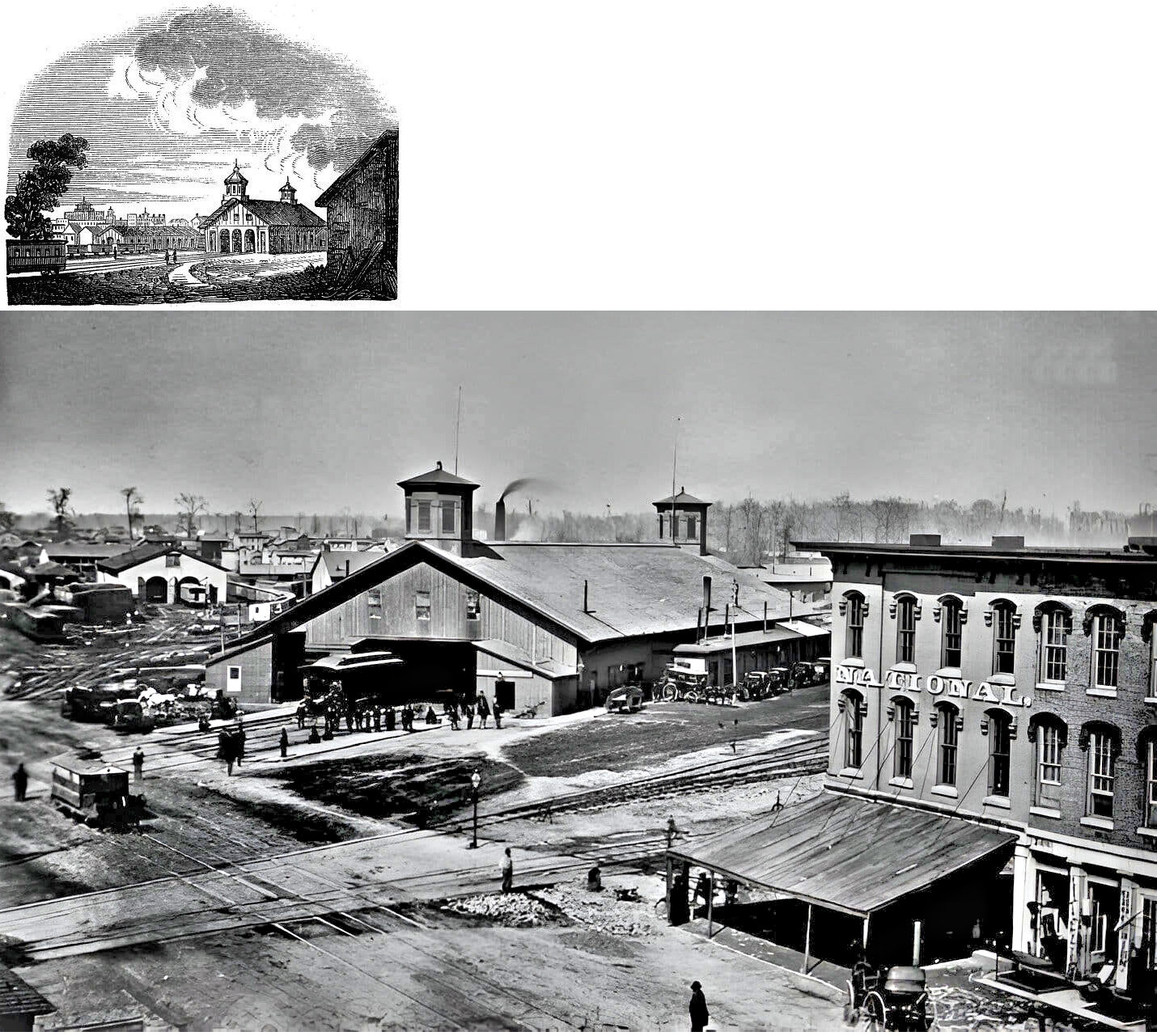
The first station here was opened by The Columbus & Xenia RR (which later merged with the Little Miami RR). The station opened in 1850 and was a temporary shed-type station on the west bank of the Scioto River in the Franklinton neighborhood. Passengers were brought to (and from) this station from central Columbus via a stagecoach. The station was short-lived as service to the first union station (see below) began in December of 1850 with the completion of the RR bridge over the Scioto River. | ||||||
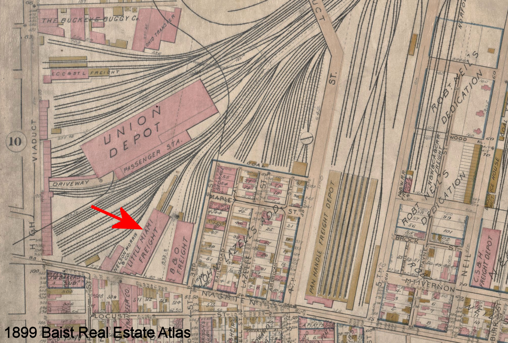
| Columbus |
|
There was a LMRR freight station just south of Union Depot with frontage on Naghten Street. | ||||||
| Columbus |
 |
This was the first permanent station in Columbus. It was built in 1850 and demolished in 1875 and sat on North High Street at Naghten Street. The station was built by the Columbus & Xenia RR (later part of the PRR) and the Cleveland, Columbus & Cincinnati RR (later part of the Big 4). In 1854 the Central Ohio RR (later part of the B&O) was added as a tennant. In 1856 the Piqua RR was added. | ||||||
| Columbus |
|
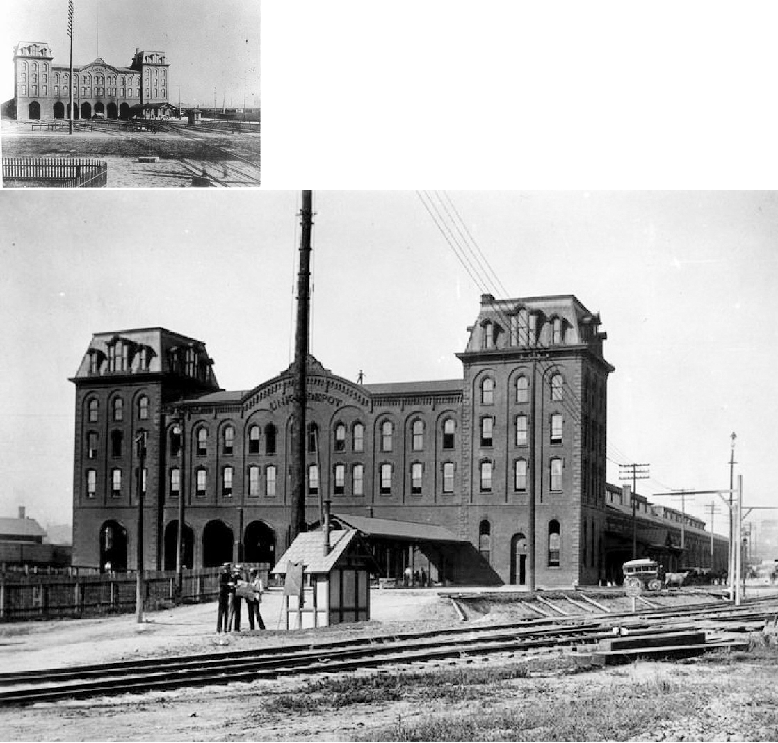
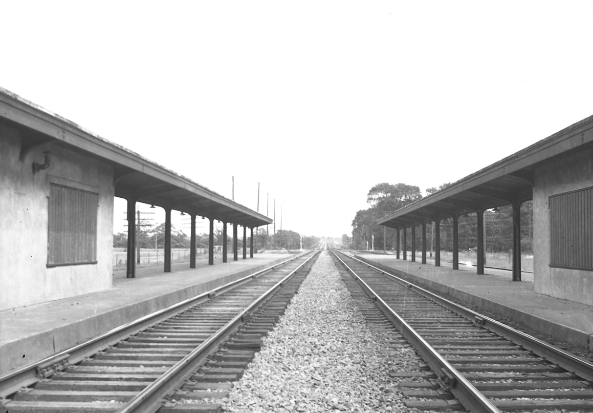
The second permanent union station was built by the Big 4 and Panhandle on the east side of High Street just north of the previous union station. It was active between 1874-1897. | ||||||
| Columbus |
|
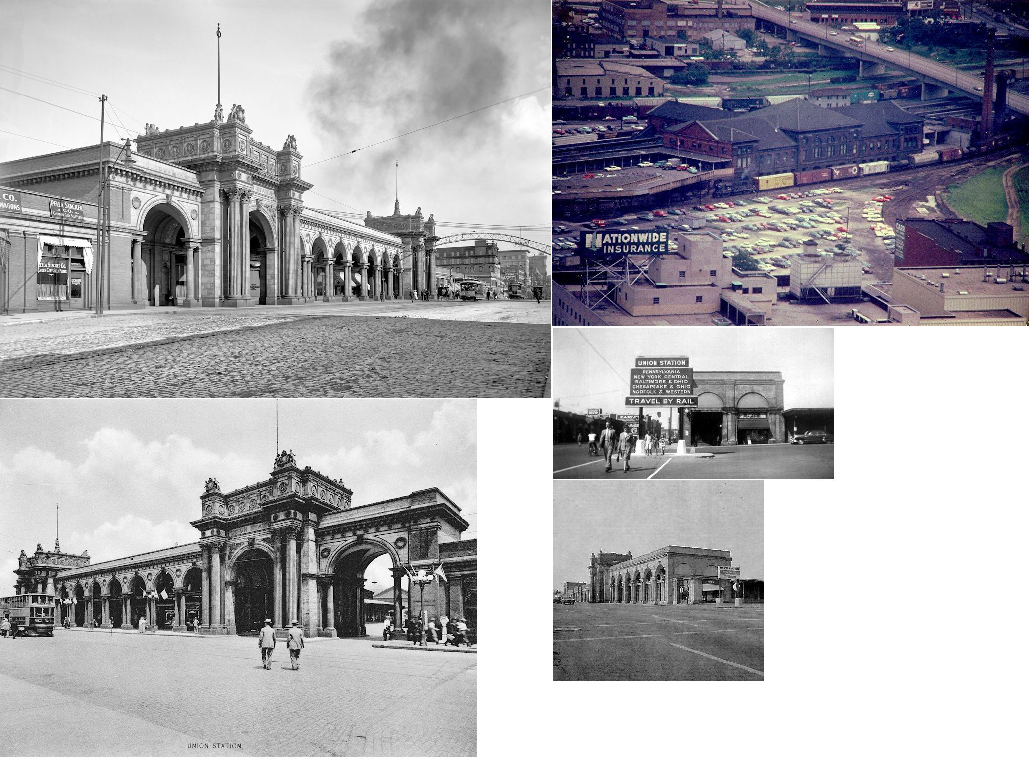
Station served B&O, CCC&StL (NYC), CHV&T (C&O), N&W, CS&H (NYC), CA&C (PRR) and PCC&ST.L (PRR). It opened on August 29, 1897 and was demolished in 1976. | ||||||
| Columbus |
|
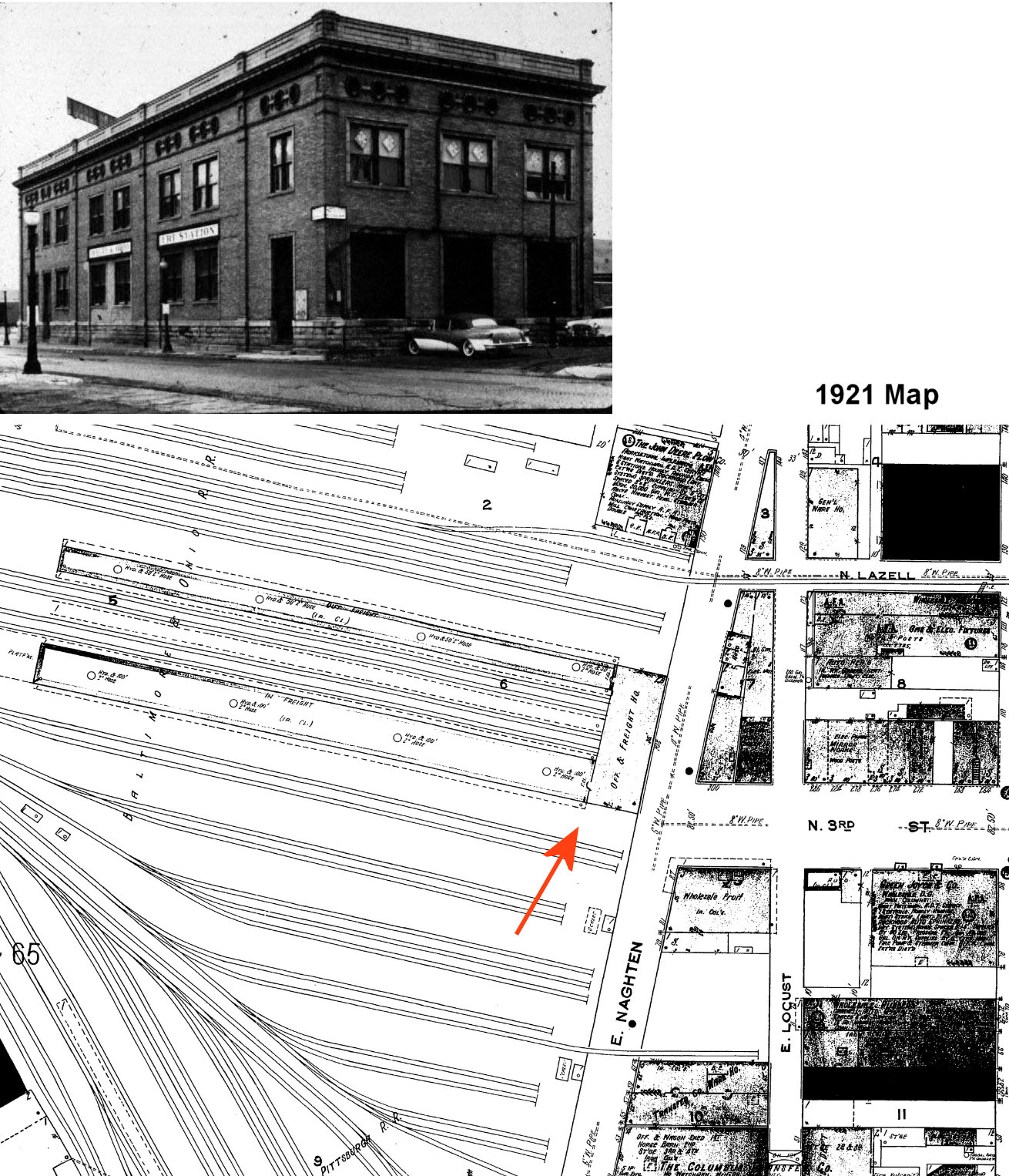
A 300-foot brick freight station was built here in 1888 (according to the B&O Annual Report of that year). This station was at Naghten and 3rd Streets at GPS: 39.969412, -82.999251. It was demolished in the 1950s to make way for the 3rd Street viaduct. | ||||||
| Columbus |
|
A freight house was constructed here in 1905 with inbound and outbound houses that were 533' long. | ||||||
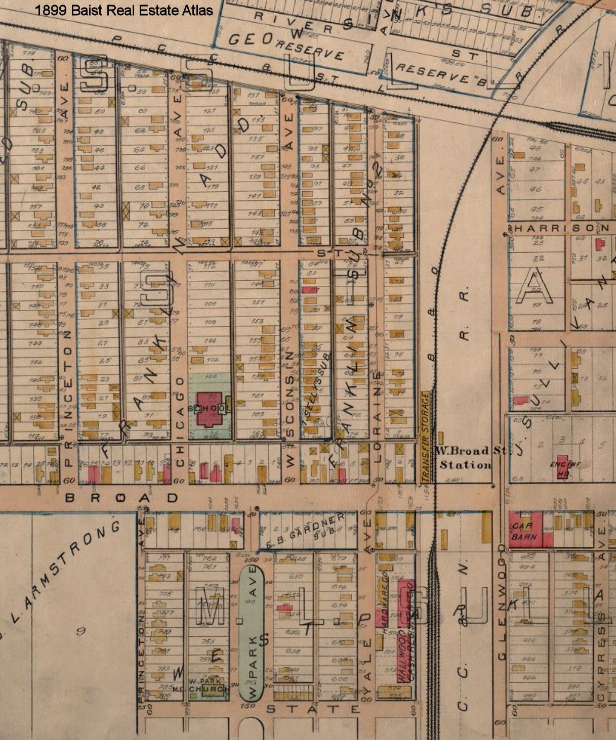
| Columbus |
|
This was the West Broad Street station. It was north of Broad Street at GPS: 39.959357, -83.031144. It appears there was also a freight transfer house here across the tracks from the passenger station. | ||||||
| Columbus |
 |
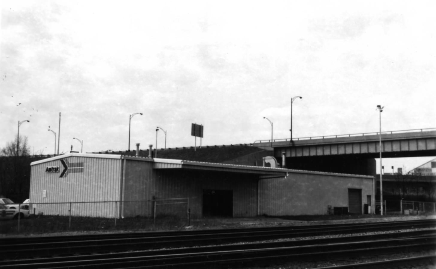
Following the demolition of Union Station in 1976, Amtrak used a pole barn-type metal building. This "Amshack" was about 1/2 mile from the old Union Station site. | ||||||
| Columbus |
AND |
This frame freight house sat on Mt. Vernon Avenue and 5th Street at GPS: 39.969662, -82.995768. It was called the Mt. Vernon Freight House. In later years it was shared with the PRR for its Lines West of Akron Division. | ||||||
| Columbus |
AND |
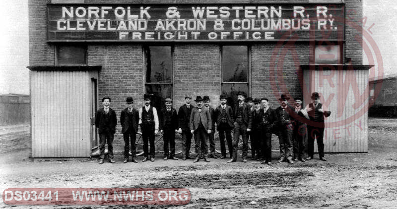
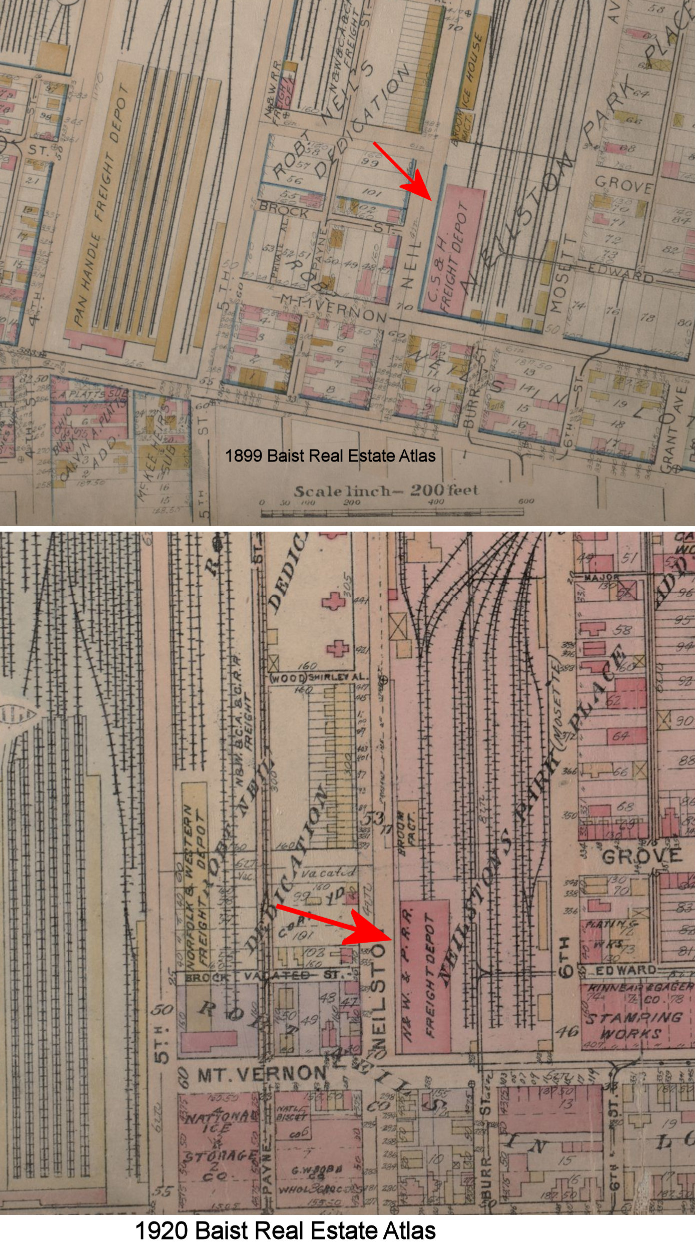
This freight house was on Neilston Street at Mt. Vernon Avenue at GPS: 39.969580, -82.994285. Originally it was the CS&H Freight House, built by the Columbus and Eastern in 1864; in later years the same building became the N&W outgoing Freight House and was also used by the PRR. It was 22,000 square feet, made of brick and was out of service by 1934. It was known as the Neilston Street Freight House. | ||||||
| Columbus (Broad Street) |
 |
|||||||
| Columbus |
|
This station was south of Mound Street. The location today is just south of, or under, the I-70/71 overpass near the SW end of Mound Street. The station is shown here on the 1872 county map. | ||||||
| Columbus |
|
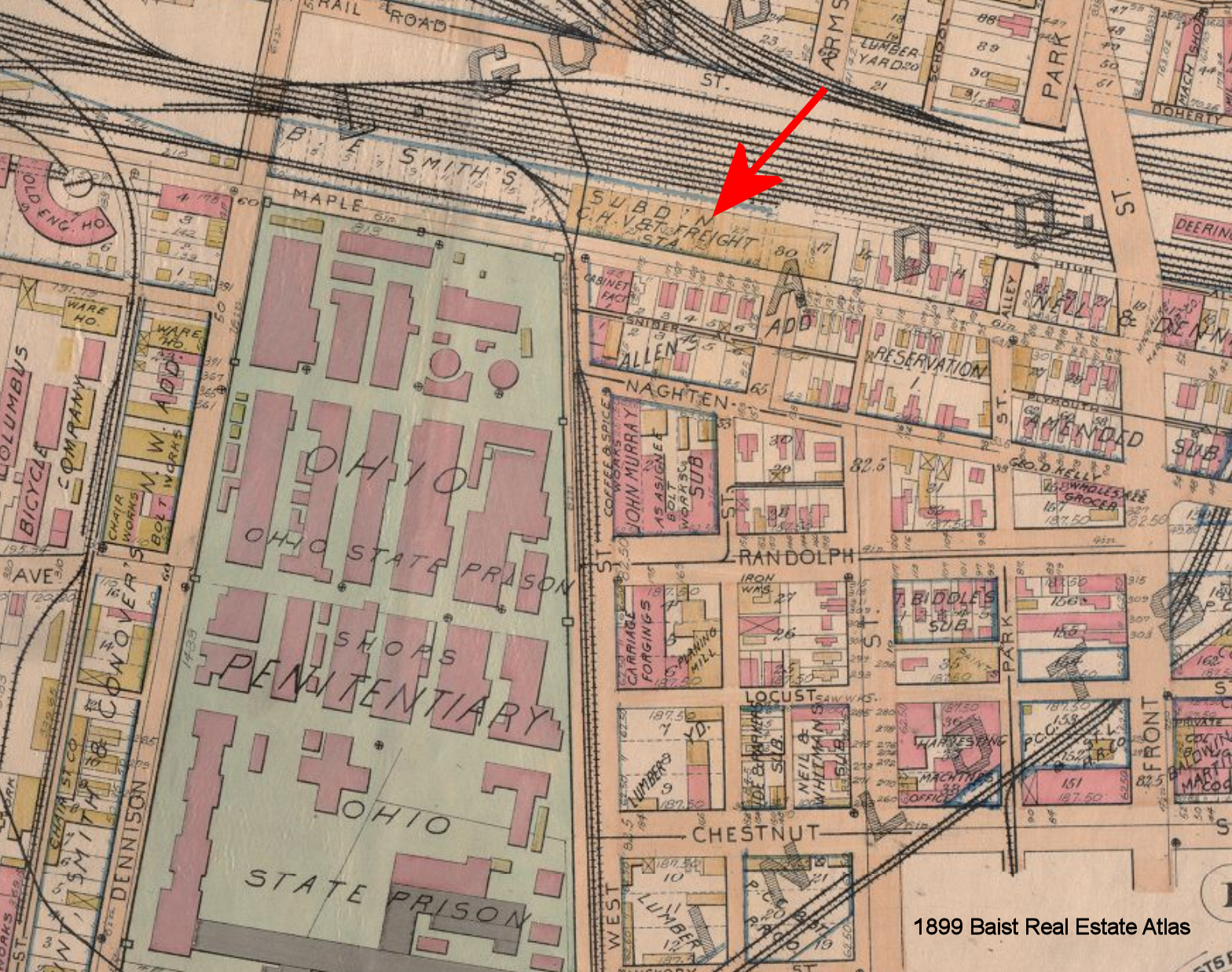
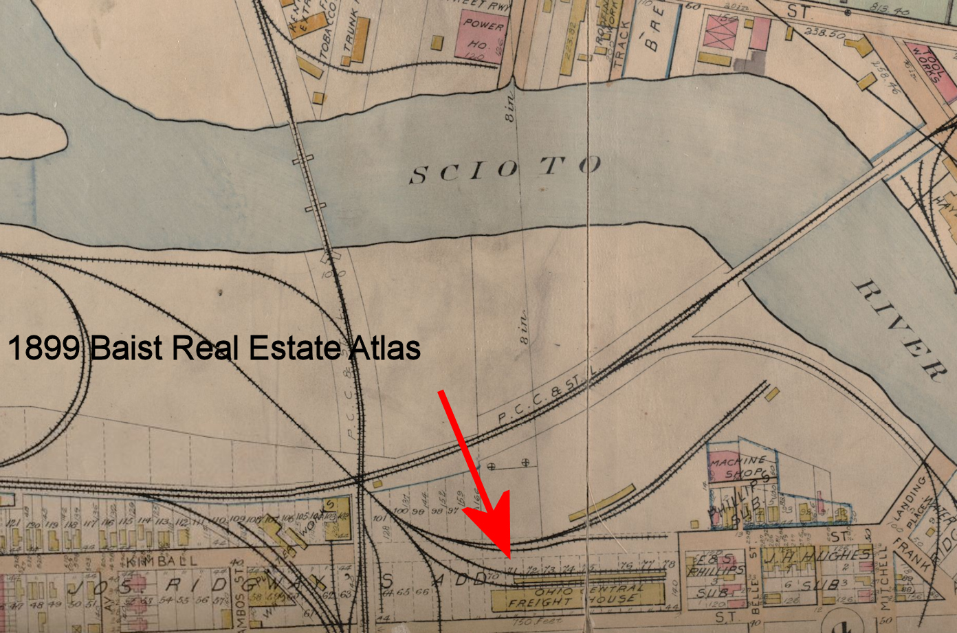
There was a large freight house on Maple Street between Dennison Avenue (now Neil Avenue) and Front Street at GPS: 39.970198, -83.007160. The book The Hocking Valley Railway by Edward Miller (2007) claims this freight house was built in 1903, however it is shown on the 1899 Baist Real Esate map, so it was built sometime prior to that. | ||||||
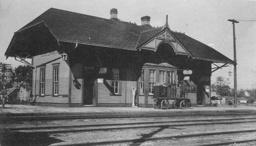
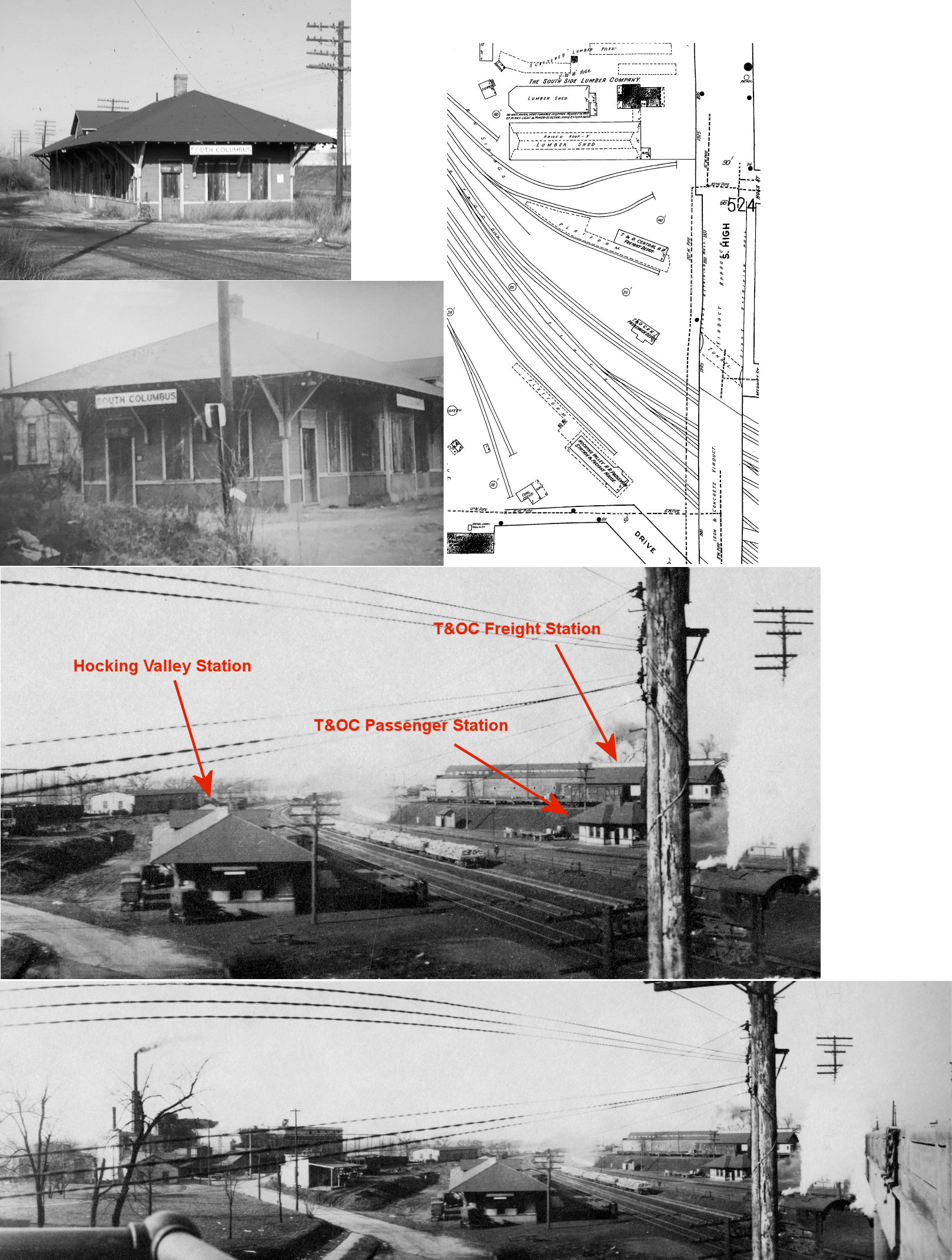
| Columbus (S. Columbus) |
|
This combination station was on the west side of South High Street on the SW side of the tracks at GPS: 39.921649, -82.995923. It was torn down in the late 1960s. | ||||||
| Columbus |
 |
There was a freight house on South High Street known as the South Columus Freight House. | ||||||
| Columbus |
|
This freight house was on Naghten and 3rd Streets at GPS: 39.969486, -82.999599, next to (west of) the B&O freight station. The PCCC&St.L and CA&C shared a freight station until 1894 when the CA&C discontinued using it. This station may have also been used by the N&W. | ||||||
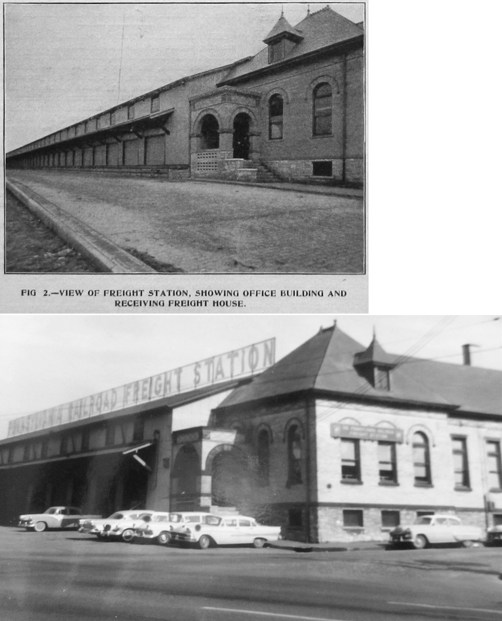
| Columbus |
|
New inbound and outbound freight houses opened here in 1896 on the north side of Naughten Street between 4th and 5th at GPS: 39.969041, -82.996687 (the freight house and tracks spanned the entire block. The inbound and outbound freight houses were 148' apart with six tracks and seven platforms between them. Both freight houses were 632' long with the inbound side being 60' wide and the outbound side being 29' wide. They were connected on the south end by a headhouse/office. | ||||||
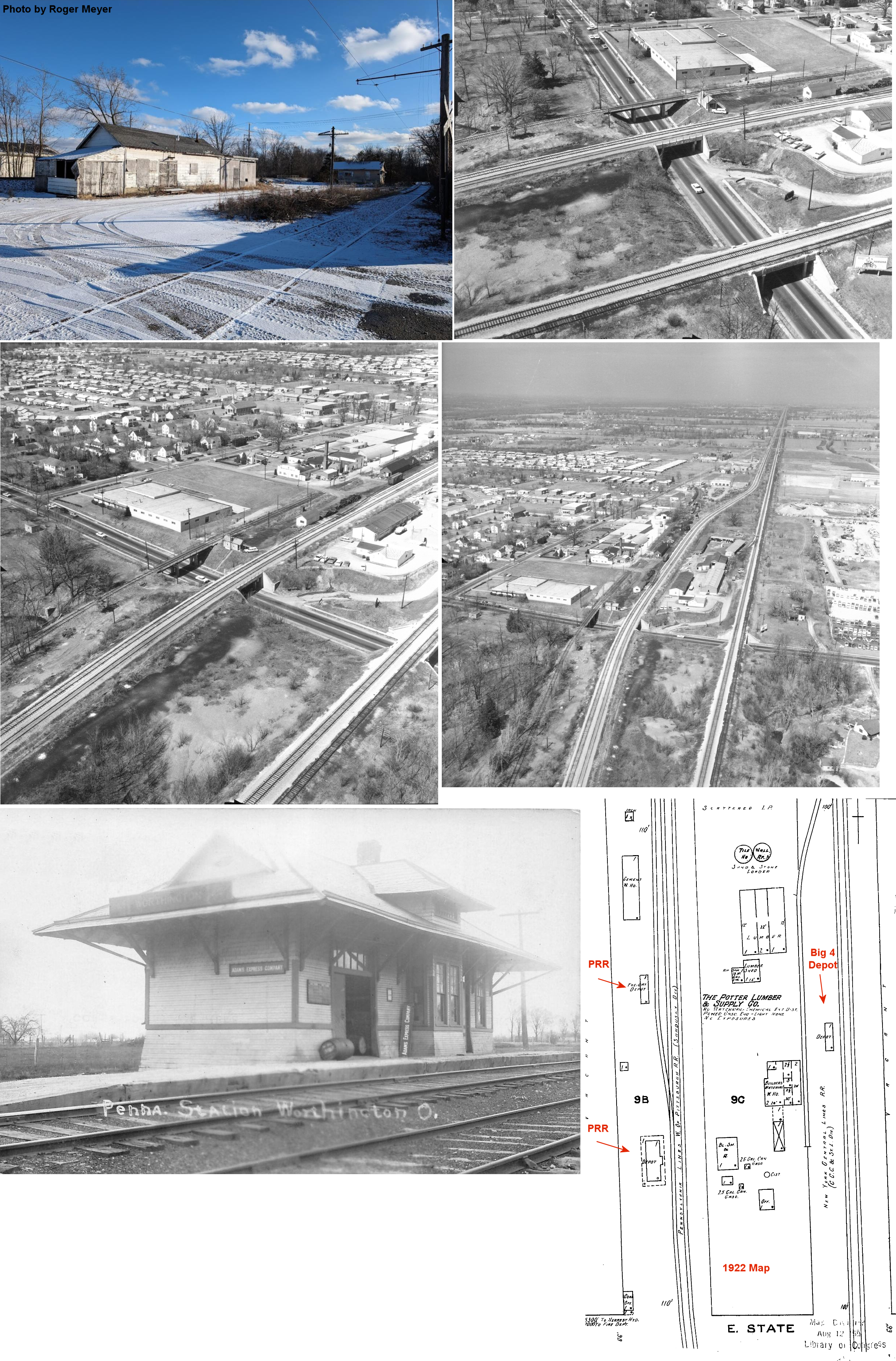
| Columbus (Port Columbus) |
|
This station was built in 1929 to serve the Port Columbus Airport. | ||||||
| Columbus (North Broadway) |
|
This station was on East North Broadway Street east of Indianola Avenue at approximately GPS: 40.031645, -82.997823. There is a mural of the station painted on the wall of the subway under the tracks as of 2023. | ||||||
| Columbus |
|
There was a 48,000 square foot brick freight house on North High Street just to the NW of Union Station. There was a smaller freight house here prior to that one being built. | ||||||
| Columbus |
|
This smaller frame freight house was known as the NYC South Columbus freight house. | ||||||
| Columbus (Fairgrounds) |
|
This station was on the west side of the fairgrounds off Big 4 Street at GPS: 39.995843, -82.995131. The station is shown on the 1937 Plat Book of Columbus & Vicinity. The station may have been used by the PRR as well as the station was between the two lines. | ||||||
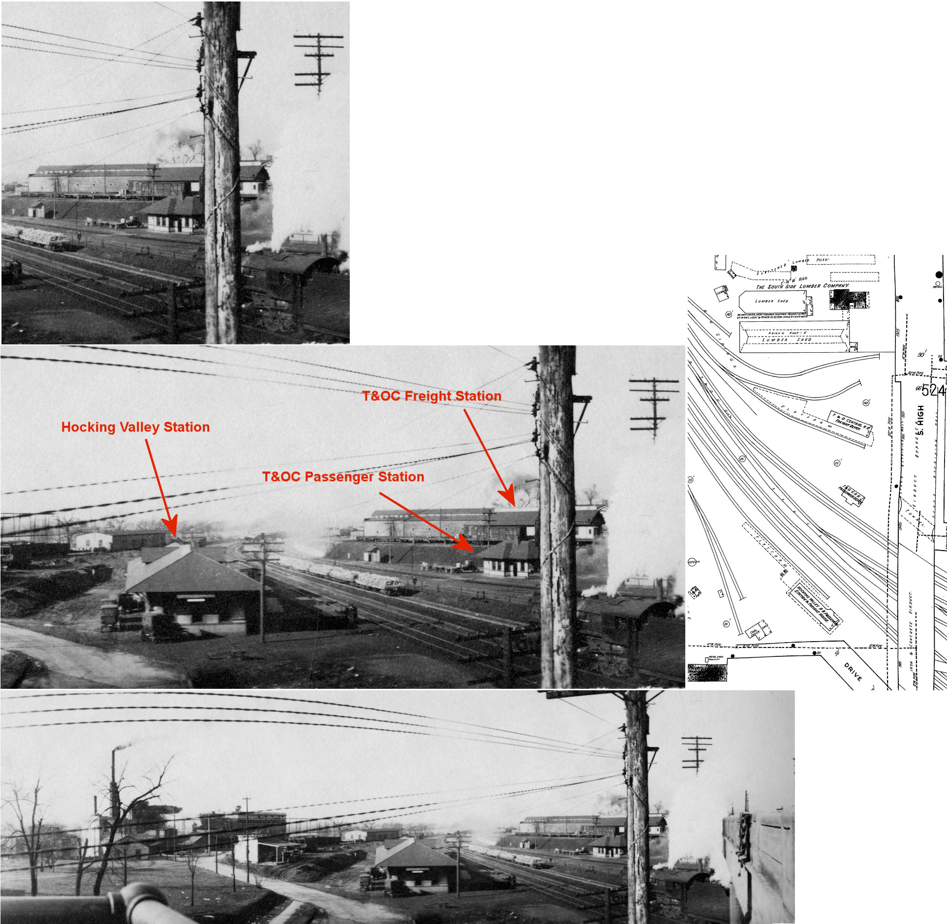
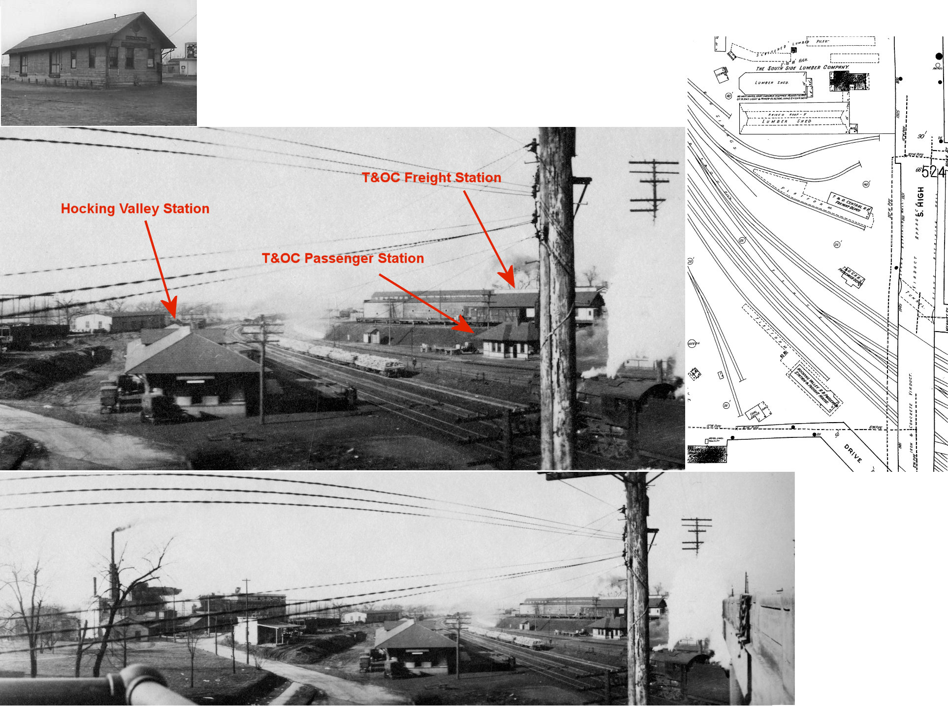
| Columbus (S. Columbus) |
|
This station was across the tracks from the Hocking Valley station listed above on the west side of High Street. It was at GPS: 39.922088, -82.995726. There was a tunnel leading from Merritt Street under the overpass to access the T&OC stations. This tunnel can still be seen from the SW curve in Merritt Street, but the entrance is now bricked up. | ||||||
| COLUMBUS (S. Columbus) |
|
This freight station was also on the west side of High Street north of the passenger station at GPS: 39.922456, -82.995835. | ||||||
| Columbus |
|
There was a T&OC freight house on the north side of West Broad Street at GPS: 39.961495, -83.010637. | ||||||
| Columbus (S. Columbus) |
|
There was a freight station on the west side of South High Street on some spur tracks between the passenger station and the South Side Lumber Company to the north. It was at GPS: 39.922385, -82.995728. | ||||||
| Columbus (5TH Avenue) |
|
There was a passenger station on 5th Avenue. | ||||||
| Columbus |
|
There was a freight station on the NE corner of Mt. Vernon Avenue and Neilston Street at GPS: 39.969633, -82.994340. This station was later used by the N&W as an outgoing freight house (see listing above). | ||||||
| Columbus (Fair Grounds) |
|
There was a station at the state fairgrounds. | ||||||
| Columbus (CA&C CrossinG) |
|
Can anyone tell me where this station was? | ||||||
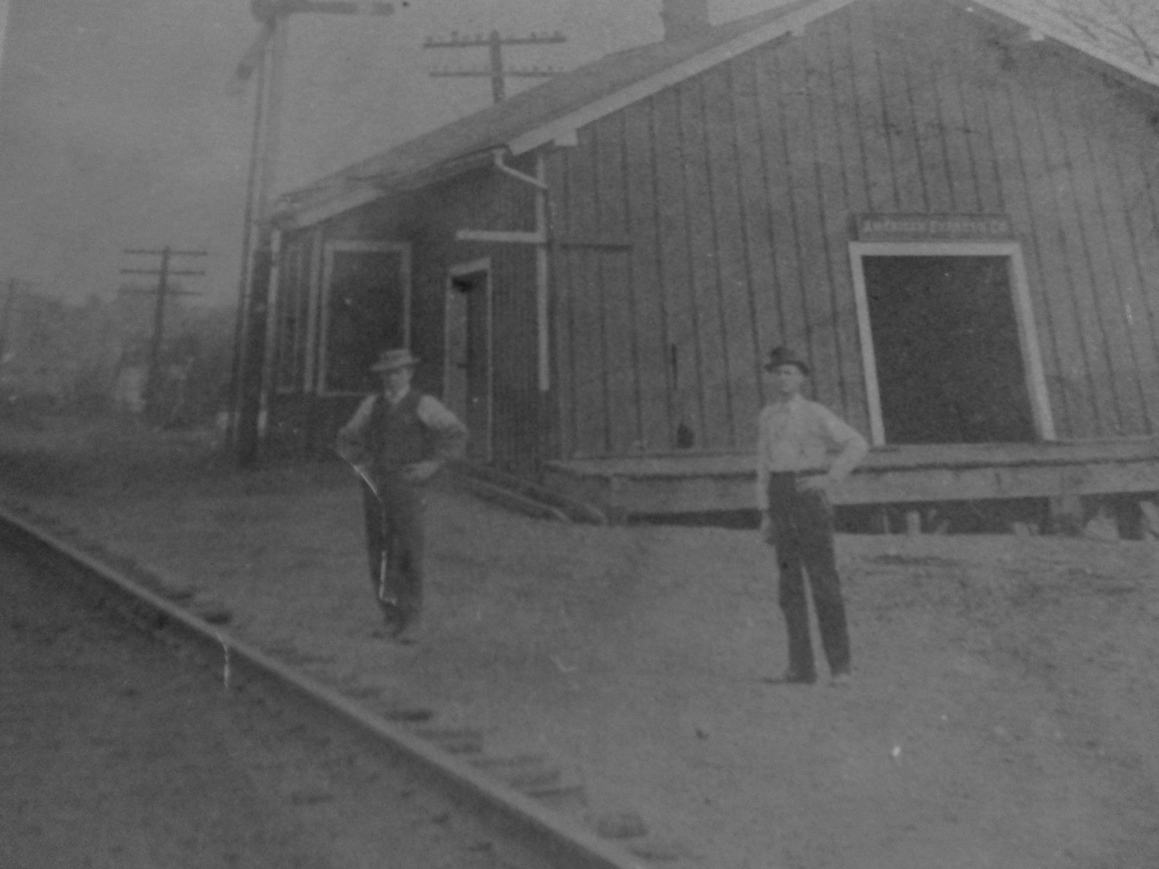
| Columbus |
 |
Can anyone tell me which RR this belonged to and where it was? The photos are from 1966. | ||||||
| Doney's Station |
|
|||||||
| East Linden |
AND |
|||||||
| Edwards |
|
This station is shown on the 1872 Franklin County Atlas. It was on the border between Madison and Hamilton Townships. | ||||||
| Elmwood |
|
See listing for Linworth below. | ||||||
| Flint |
|
|||||||
| Galloway |
|
This station was located on the west side of South Main Street just past South High Street. | ||||||
| Georgesville (New Georgesville) |
|
This town was relocated closer to the RR. The 1872 county atlas shows Georgesville and New Georgesville with the old town on the east side of Darby Creek and the new town on the west side. | ||||||
| Grahamsville |
|
See listing for Taylor Station below. | ||||||
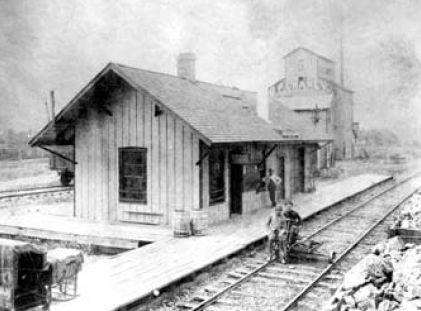
| Groveport |
|
This was the original station in Groveport. It was built in 1868. | ||||||
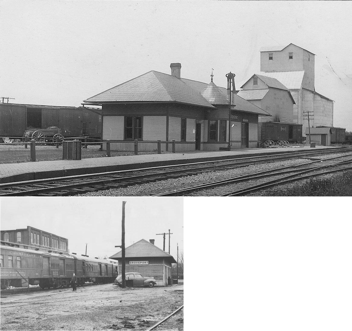
| Groveport |
|
This station was off Front Street on the south side of the tracks. It was built in 1898 and torn down in the mid-1960s. | ||||||
| Hayden |
|
|||||||
| Linworth (Elmwood) |
|
The original station (was built in 1876 and replaced with a new station in 1895. The station sat on Dublin-Granville Rd. (SR 161) on the west side of the tracks. It was renamed Linworth in 1905. The station was retired in 1962. | ||||||
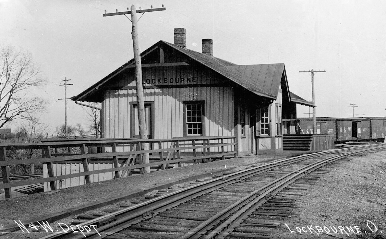
| Lockbourne |
|
|||||||
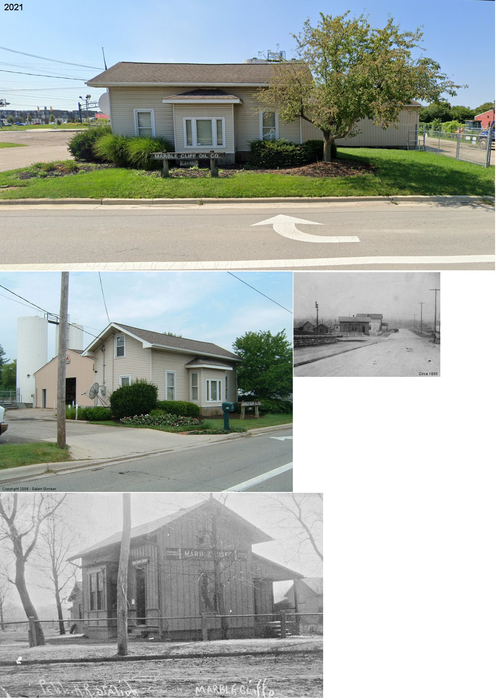
| Marble Cliff (Scioto) |
|
After service in 1930, this station was moved about 3/4 mile from its original location at the SW corner of railroad crossing with West Fifth Avenue. It sat at 2057 Dublin Road (GPS: 39.995536, -83.085858) until it was torn down in 2022 to make way for a storage facility. It was used by the Marble Cliff Oil Company for many years. | ||||||
| Miami Crossing |
|
|||||||
| Olentangy |
|
|||||||
| Pleasant Corners |
|
|||||||
| Quarry Switch |
|
A station is shown here on the timetable for the Columbus & Indianapolis Railroad in the 1859 Dinsmore Railroad Guide. The station was 5 miles from Columbus and 5 miles from Hilliard station. | ||||||
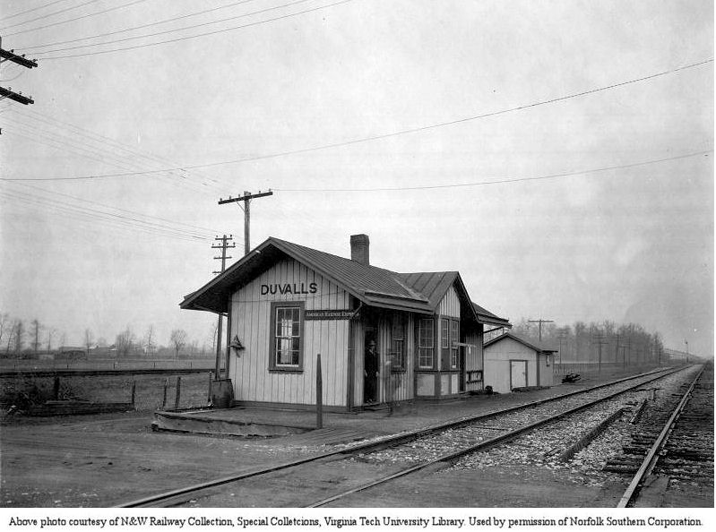
| Reese |
|
This station was four miles from Lockbourne and two mailes from Valley Crossing. There was a connection here to the Scioto Valley Traction Company. The station was moved to Duvalls (Pickaway Co.) in 1906. Here is a photo of the station as it looked at Duvalls. | ||||||
| Shepard |
|
|||||||
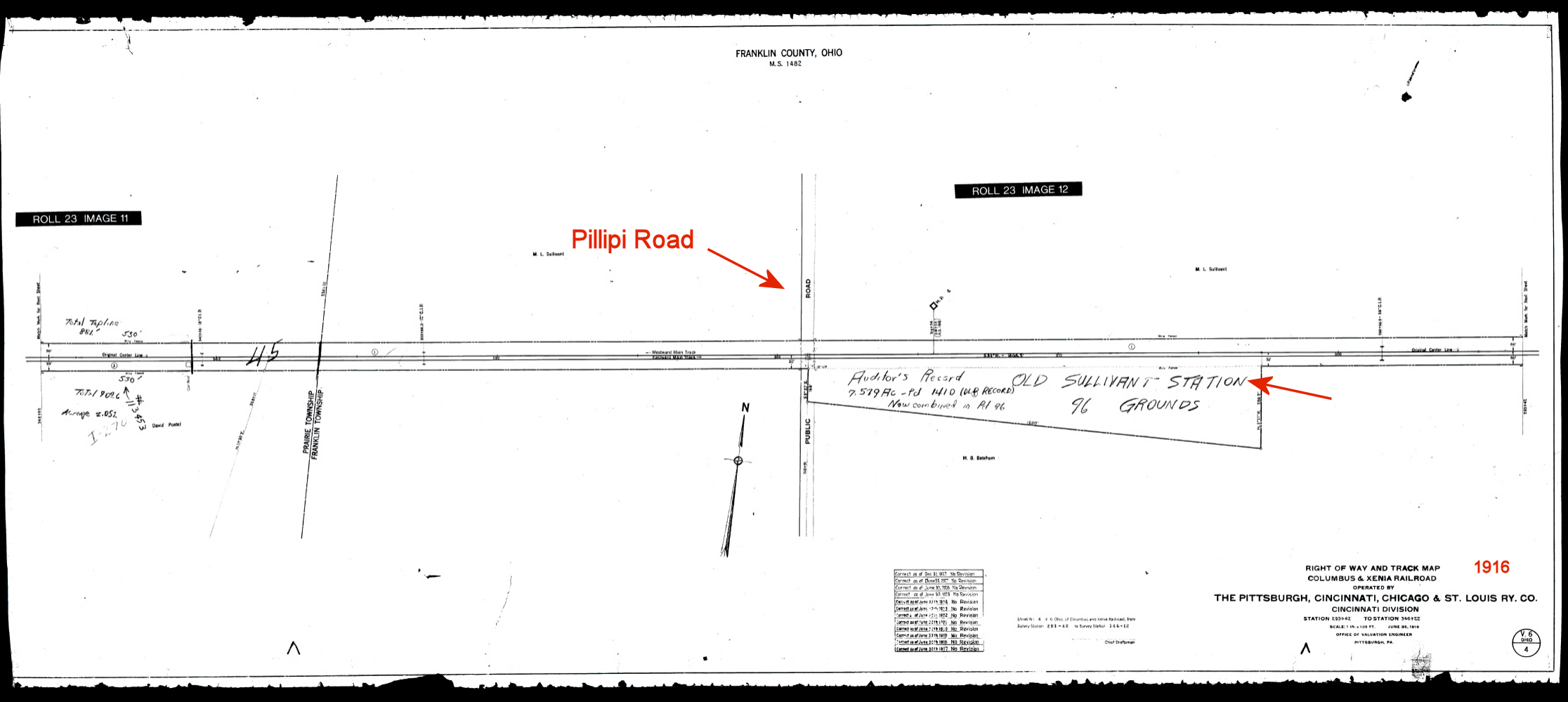
| Sullivants Station |
|
An early station on the line, this station is listed in Bullinger's Postal & Shipping Guide for 1881. It was on the east side of Phillipi Road on the south of the tracks (GPS: 39.964205, -83.110766). Later this area would be the location of the sidings for the Westinghouse plant. The station and any structures were gone by at least 1916, and it is unknown at this time what structures exactly were located there, and when they were removed. | ||||||
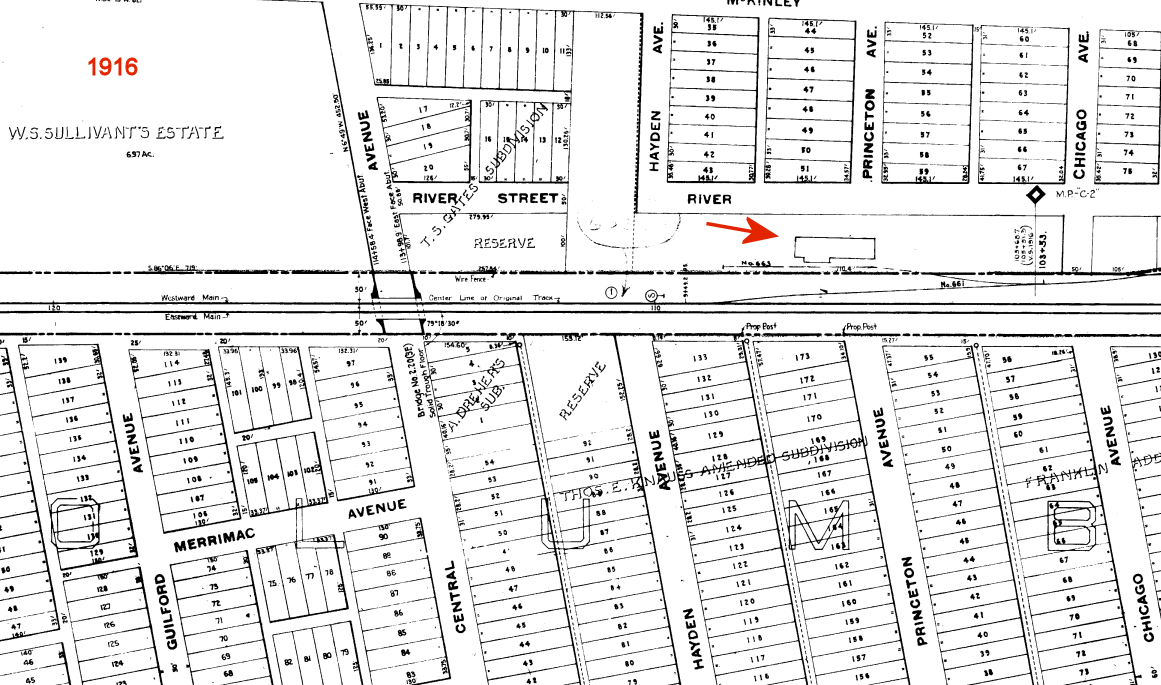
| Sullivants Station |
|
Based on the building profile and track arrangement on the 1916 valuation map, it appears that there may have been a freight station south of McKinley Avenue at GPS: 39.962412, -83.036262. However, the building on this map is not identified. | ||||||
| Taylor Station (Grahamsville) |
|
Also known as Taylorstown. | ||||||
| Taylor |
|
A station is listed here on the 1923 PRR List of Stations & Sidings. | ||||||
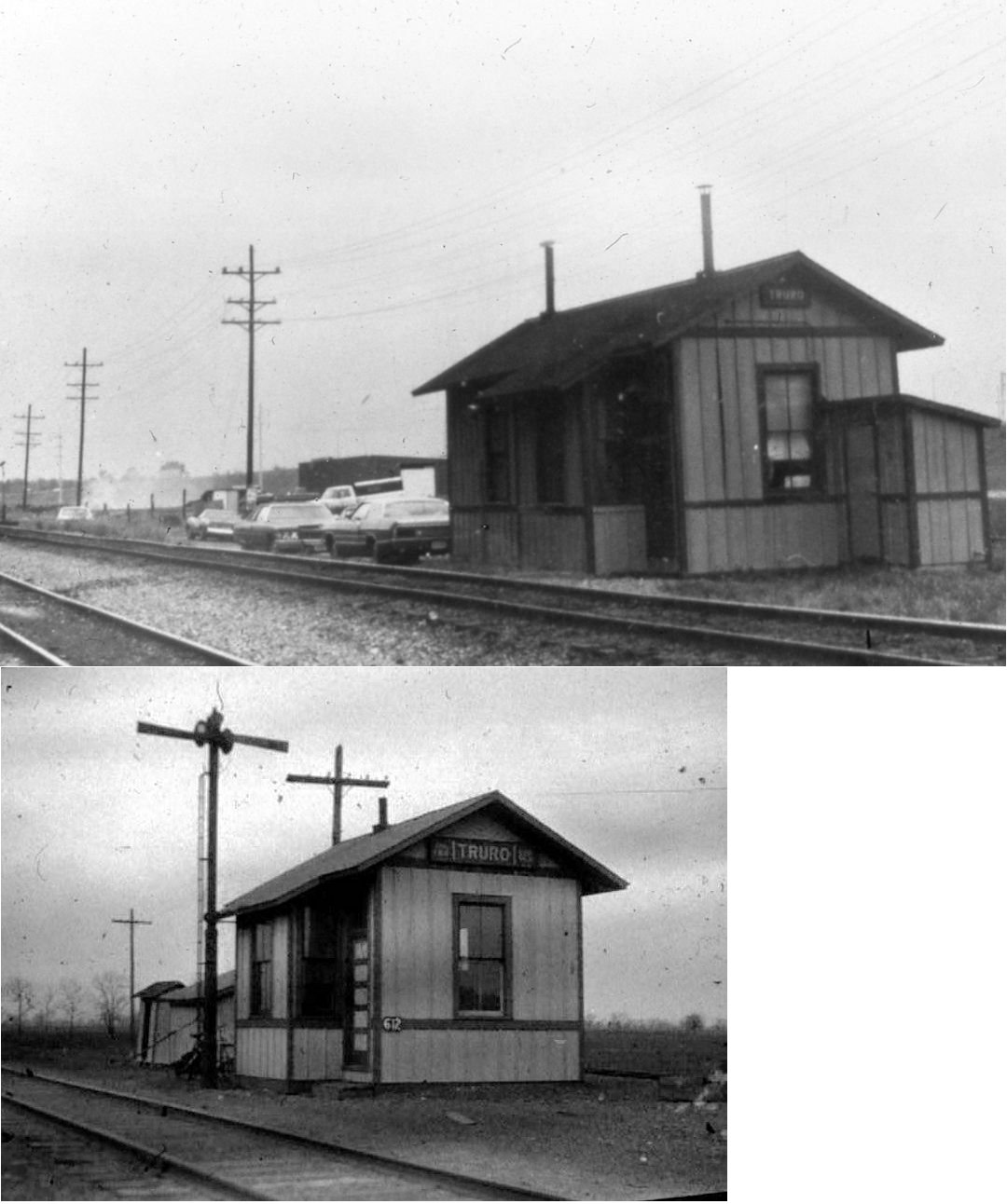
| Truro |
|
|||||||
| Valley Crossing |
AND |
This station served both the N&W and CHV&T. It closed in 1932 and the nearby tower closed in the early 1960s. | ||||||
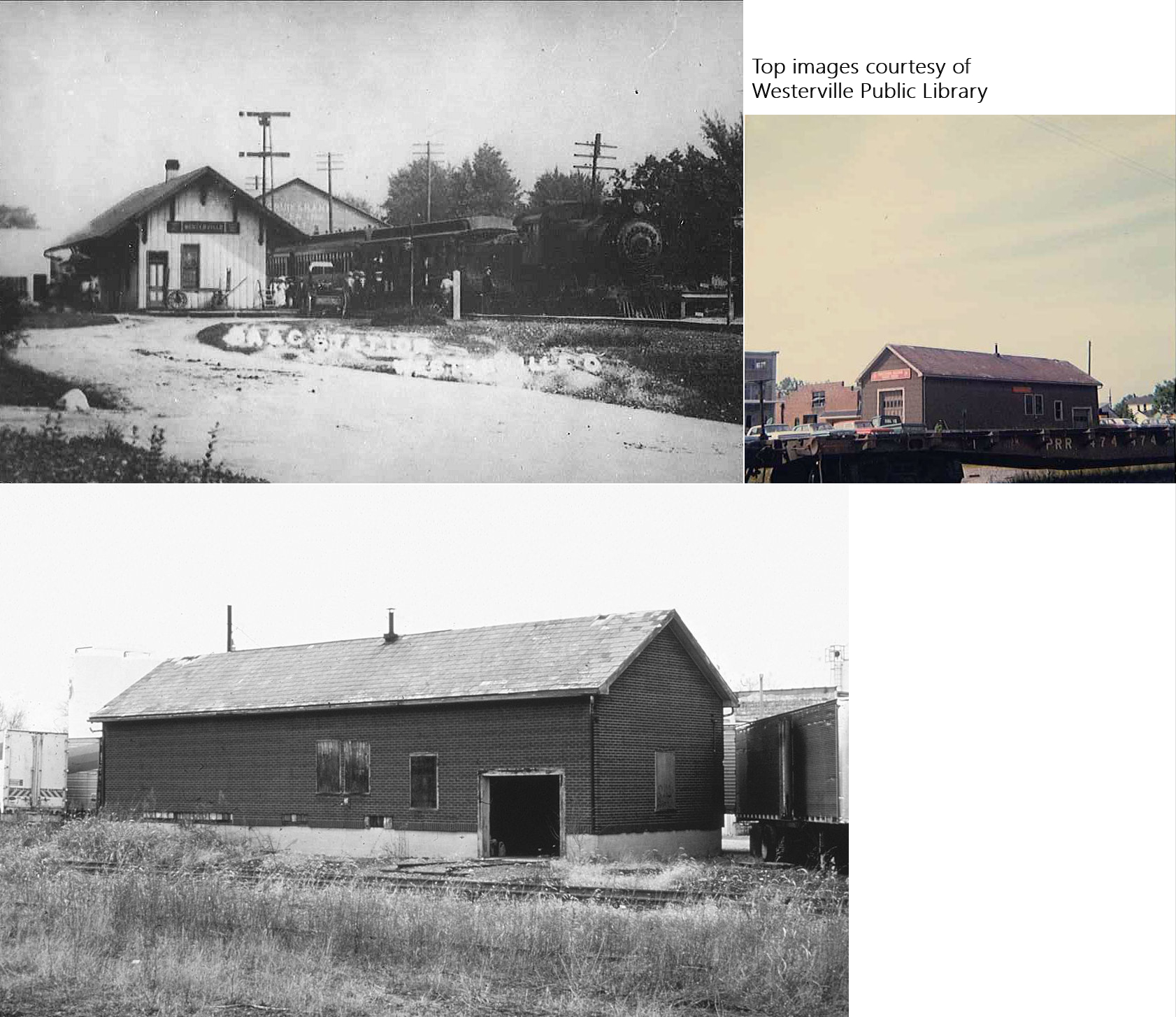
| Westerville |
 |
This station was on the west side of the tracks at the end of East Home Street (two blocks east of Vine Street) (GPS: 40.127474,-82.927031). It was heavily modified by the PRR in the 1950s and then torn down in the 1970s. | ||||||
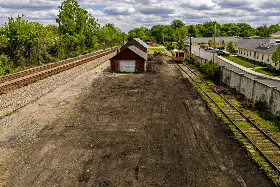
| Worthington |
|
This station was on the north side of East Dublin-Granville Road (SR-161) on the west side of the tracks (GPS: 40.088848,-83.001867). | ||||||
| 1898 FRANKLIN COUNTY RAILROAD MAP | ||||||||
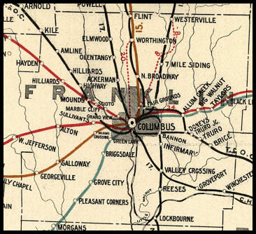 |
||||||||
|
Notes About Existing Stations... Brice (T&OC) - The station was originally moved across the tracks from its original location and was a pizza shop for a few years. In 2001 it was moved again to 919 Old Henderson Road (GPS: 40.051428, -83.044925) where it served as a conference center. In 2024 the station was disassembled and relocated again to Plain City (Madison County) as part of the Public Square Project. Columbus (T&OC) - This station was built in 1895 and opened on April 1, 1896 when the T&OC pulled out of Union Station in favor of its own facilties. The building is on National Register of Historic Places. A track elevation project took place in 1911. The station was used for passenger service until 1930 when the NYC transferred operations to Columbus Union Station. From 1930 to 2003, the station was occupied by the Central Ohio Volunteers of America. The station has been through a flood (1913) and two fires (1910, 1975), being renovated each time. It was placed on the NRHP in 1973. Columbus (PRR) - Although not a railroad building, the PRR stopped at the original Columbus Airport Terminal building. A covered walkway connected the platforms to the terminal. This was the first transfer point for transcontinental service using a combination of railroads and airplanes. Passengers were brought from New York City to the Columbus terminal via the PRR, then flown on a plane to Waynoka, Oklahoma where they boarded the Santa Fe railroad for a trip to Clovis, New Mexico for a final airplane leg to Los Angeles. The entire trip took just 48 hours. The first of such trips took place on July 7-8, 1929. Canal Winchester (CHV&T) - Chamber of Commerce On National Register of Historic Places. Flint (CCC&St.L) - Moved from original site in 1930s. Grove City (B&O) - Owned by the SW Franklin County Historical Society. The station was formerly at 3950 Front Street at Park Street. It was moved around 2018 to Century Village. Hilliard (PRR) - Moved. Caboose on site. The original location of this station was on N. Center St. between Wayne and Main. Prior to this station being built, from 1895-1899, three boxcars were joined to form a makeshift station.
|
||||||||