 COUNTY COUNTY
|
|
||||||||
| EXISTING STATIONS | ||||||||
|---|---|---|---|---|---|---|---|---|
| Station Name |
Original Railroad | Current Location |
Type | Current Use |
Date Built |
Track Status |
Building Material |
More Info |
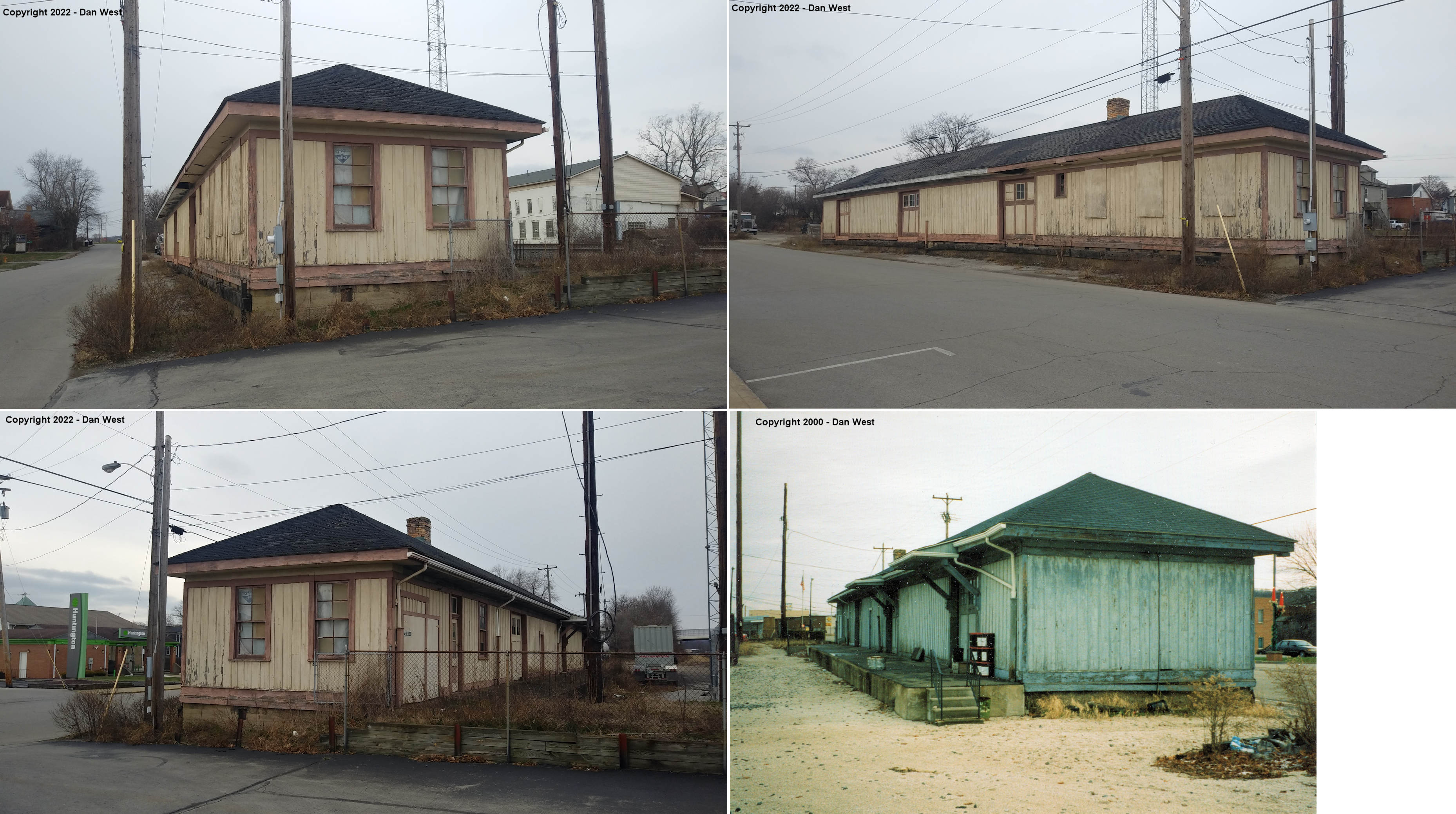
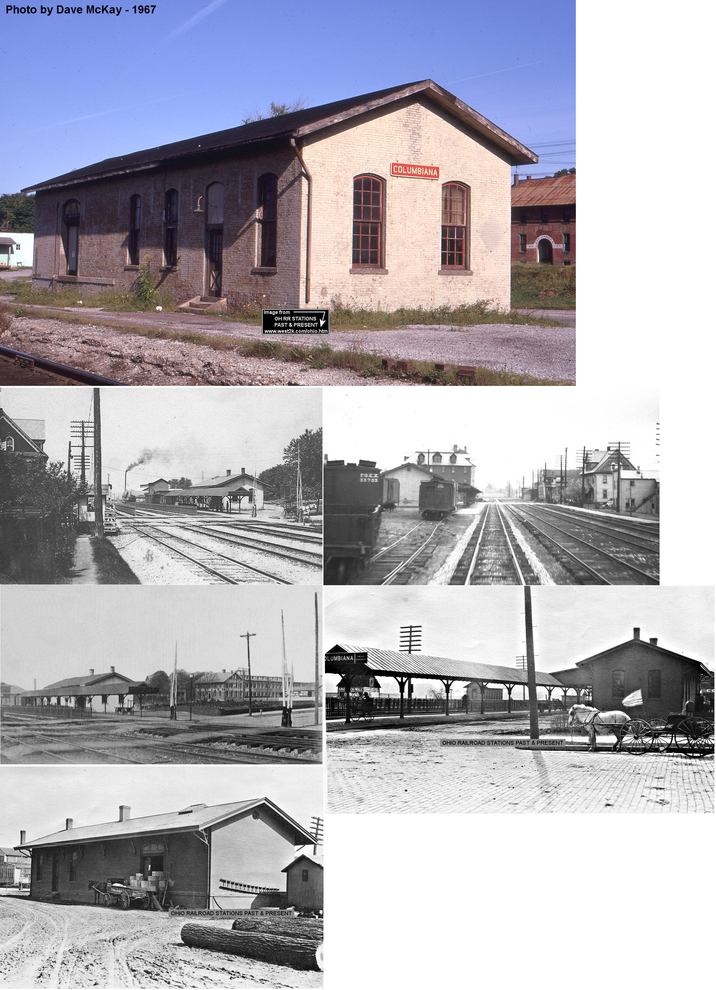
| Columbiana |  |
148 East Park Avenue (GPS: 40.888724, -80.689984) |
P | Railroad | ???? | In Use | Brick | |
| East Palestine |  |
West Taggart Street
between Market and Walnut (GPS: 40.835370, -80.540599) |
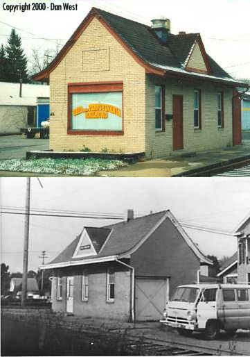
F | Railroad | 1905 | In Use | Wood | |
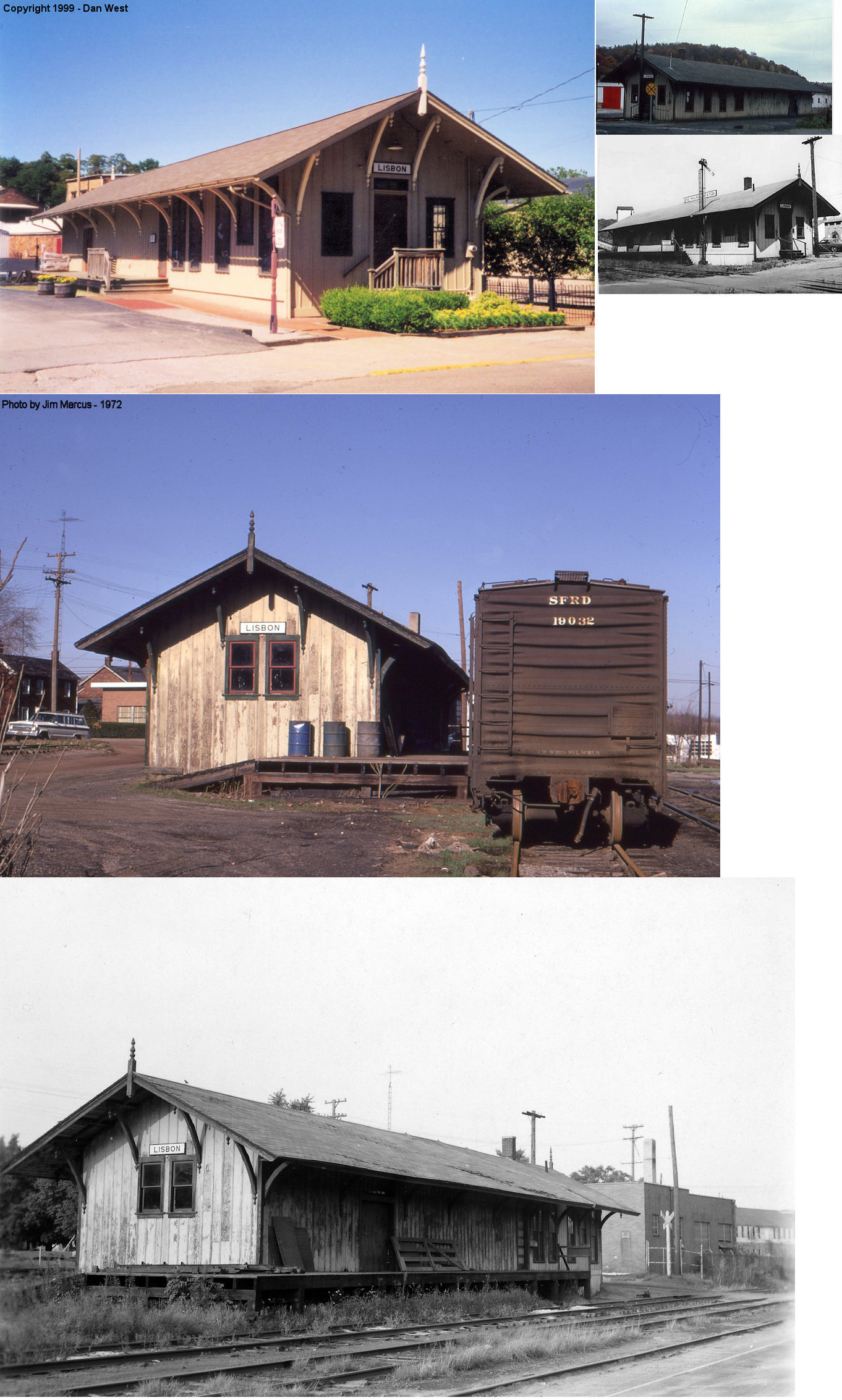
| Lisbon |  |
119 East Washington Street (GPS: 40.771257, -80.766883) |
C | Museum | 1905 | None | Wood |
|
| Lisbon |  |
South Market Street at Maple Street (GPS: 40.770079, -80.767870) |
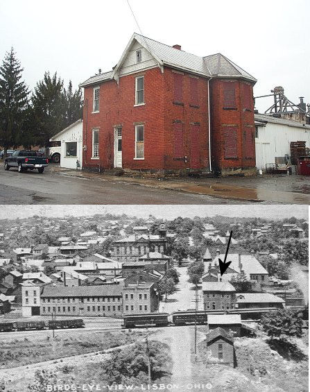
P | Vacant | 1886 | None | Brick | |
| STATIONS OF THE PAST | ||||||||
| Station Name |
Original Railroad |
Notes | ||||||
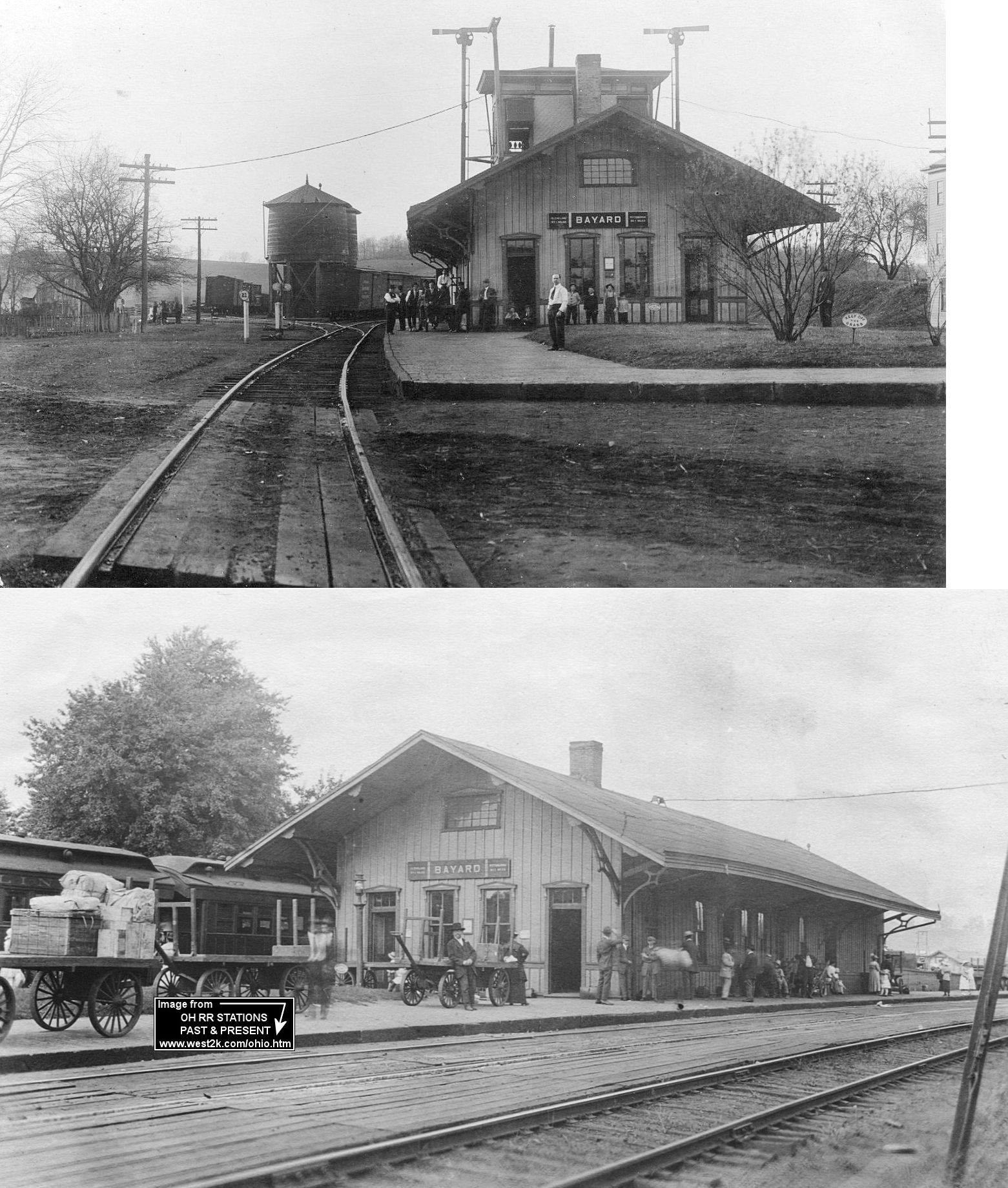
| Bayard |  |
According to the 1917 PRR valuation records, this station was built in 1852. This was the beginning of the Tuscarawas Branch. The station was on the north side of Bayard Road (formerly Depot Street) on the SW side of the tracks. | ||||||
| Bayard | |
There was also a freight station here. It was destroyed in an October 21, 1901 derailment that saw two trains collide and with a coal car collapsing the two-story station (East Liverpool Evening Review, 10-21-1901). The freight station was just SE of the passenger station on the north side of Bayard Road. | ||||||
| Colemans | |
|||||||
| Columbiana | |
This station was on the west side of Main Street on the north side of the tracksat GPS: 40.883294, -80.694231. According to PRR valuation records, the station was built in 1872 with the eastbound shed added in 1912. | ||||||
| Damascus Station | |
Formerly known as Stanley Station until 1852 when it was renamed by the Ohio & Pennsylvania Railroad (later PFt.W&C). | ||||||
| East Liverpool | |
The first station here was likely built in the 1860s. | ||||||
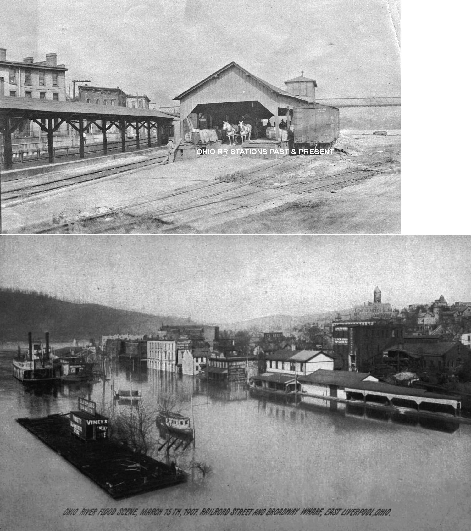
| East Liverpool | |
The second C&P passenger station, built in 1874 (according to PRR valuation records), was at the end of Walnut Street on Water Street at the river (this area of Walnut Street no longer exists) at GPS: 40.615581, -80.575096 . The passenger station was on the north side of the tracks and a freight station on the south side (see below). In later years both buildings were used as freight stations after the new brick station was built. The old passenger station continued to be used as an inbound freight station at least into the 1940s and perhaps longer. The second story was not part of the original structure; it was added some time between 1897-1903. | ||||||
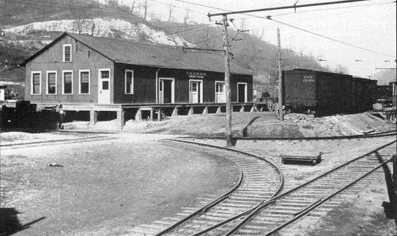
| East Liverpool | |
This freight station was built in 1888 according to PRR valuation records. It sat across from the old frame passenger station at GPS: 40.615459, -80.574956. The old freight station was eventually moved west (as of 1908) across from the new brick passenger station at GPS: 40.615062, -80.577712 and used as the outbound freight house. After it was moved, a small second-story tower was added to it. The photo is of the station after it was moved and the tower was added. | ||||||
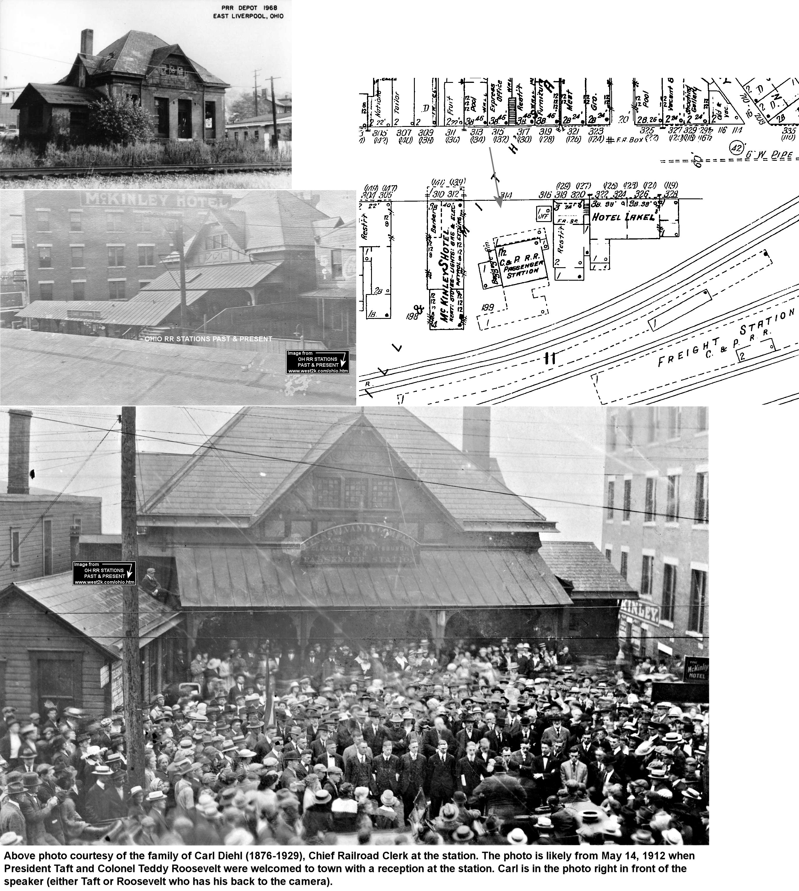
| East Liverpool | |
This passenger station was built in 1888 according to PRR valuation records. It sat on Second Street east of Union Street at GPS: 40.615365, -80.578252. The station had frontage on second street but sat at the back of the lot against the tracks. A freight station was added across the tracks at this location around 1905. In the old days there were large hotels on both sides of the passenger station (the Hotel Lake to the east and McKinley's Hotel to the west). Despite local citizens and businesses lobbying the railroad for a new station in the early 1900s, it never came to pass. The railroad did however start to build a new depot, but it was never finished. Newspaper articles refer to the incomplete station building, but never specify its exact location. | ||||||
| East Liverpool (Laughlin) |
|
A passenger depot was opened in the east end of East Liverpool on November 20, 1905. PRR valuation records say the station was of brick construction, however Sanborn maps show the station as a wood frame building. The station was located across from the Homer Laughlin China Company. It was on the south side of the tracks just to the east of where Central Avenue used to cross at GPS: 40.631715, -80.548863. PRR records also indicate that there was a freight station here built in 1912. | ||||||
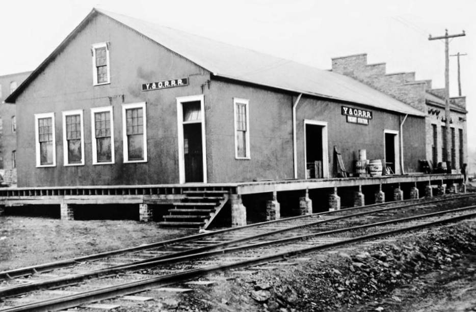
| East Liverpool |  |
The Youngstown & Ohio steam and electric freight/passenger railroad/interurban had a freight station near the corner of Claiborne Avenue and Moore Street near Dresden Ave. | ||||||
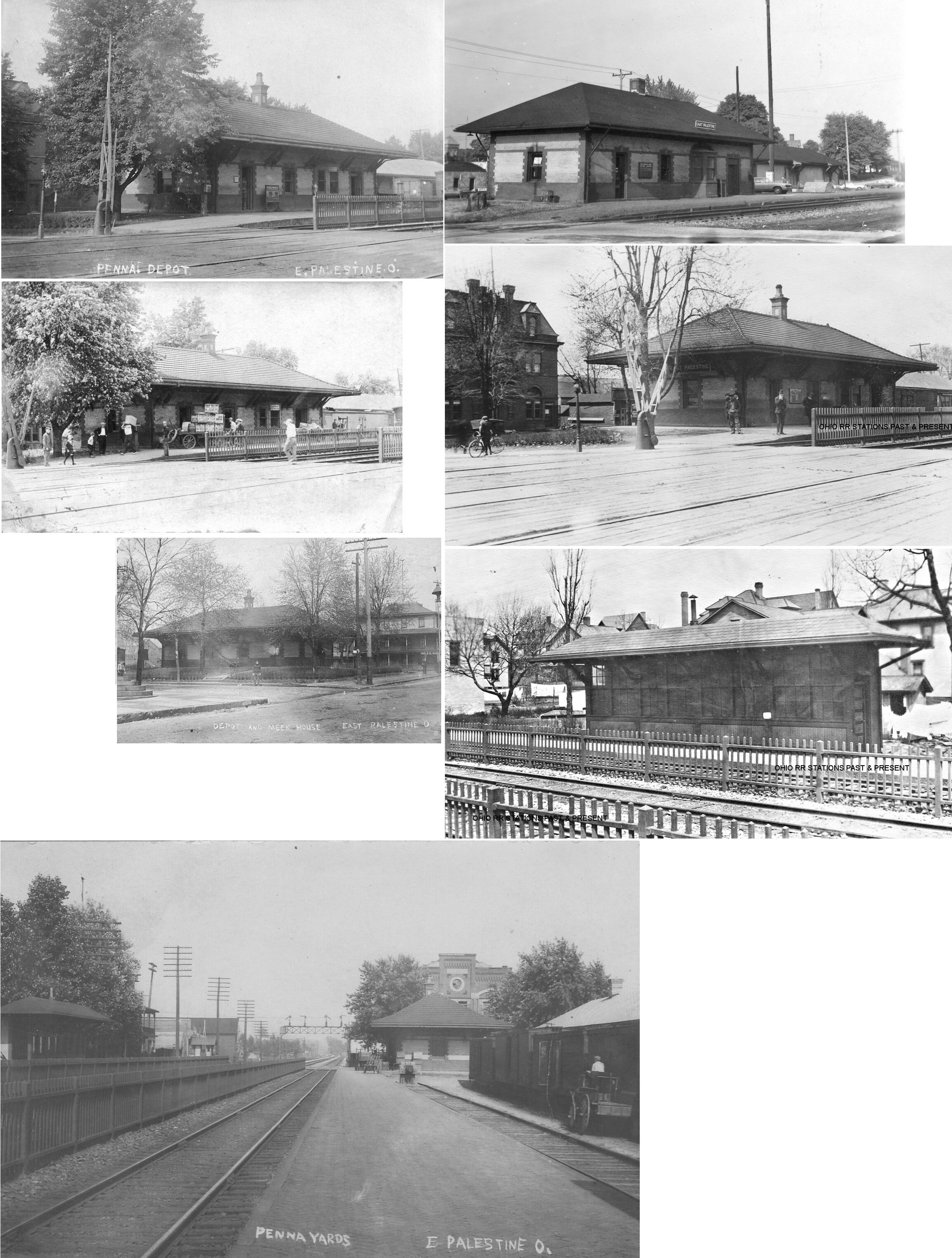
| East Palestine | |
There was an older combination station (built in 1883) at the corner of Taggart and Market Streets at GPS: 40.835447, -80.540299. It burned down in January 1904. | ||||||
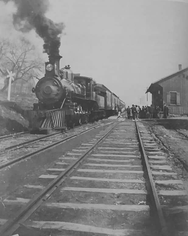
| East Palestine | |
This passenger station sat at the corner of Taggart and Market Streets at GPS: 40.835433, -80.540194, next to the existing freight station. It was built in 1905. There was a small westbound waiting shelter with eaves across the tracks behind the Meek House Hotel (which is shown in the photo). According to PRR valuation records the shelter was added in 1906. | ||||||
| East Rochester | |
According to PRR valuation records, a new station was built here in 1906. | ||||||
| Elkton | |
|||||||
| Franklin Station | |
|||||||
| Franklin Square | |
According to Erie RR valuation records, the station standing here in 1919 was built in 1912. | ||||||
| Holly | |
|||||||
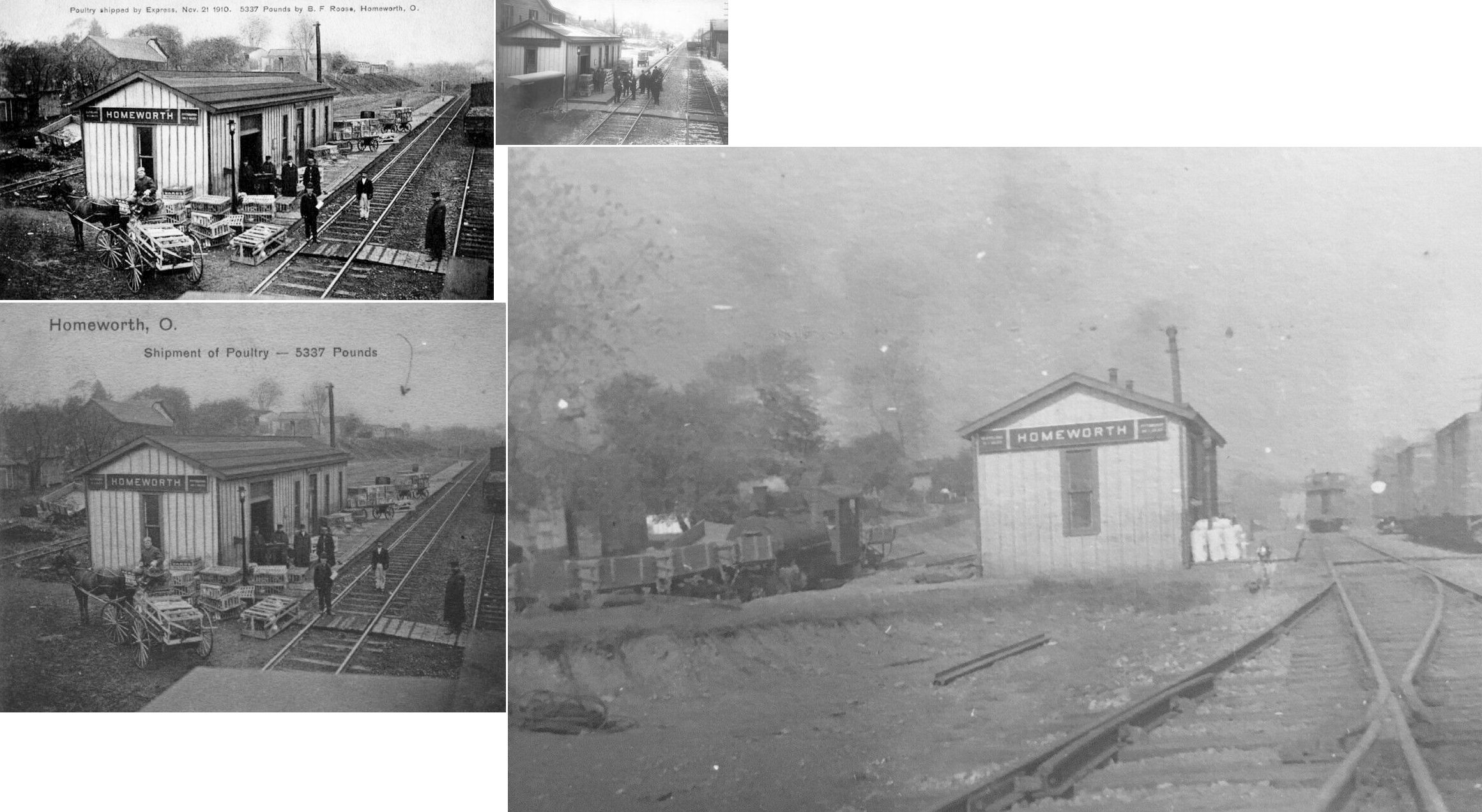
| Homeworth | |
This was the original combination station here. | ||||||
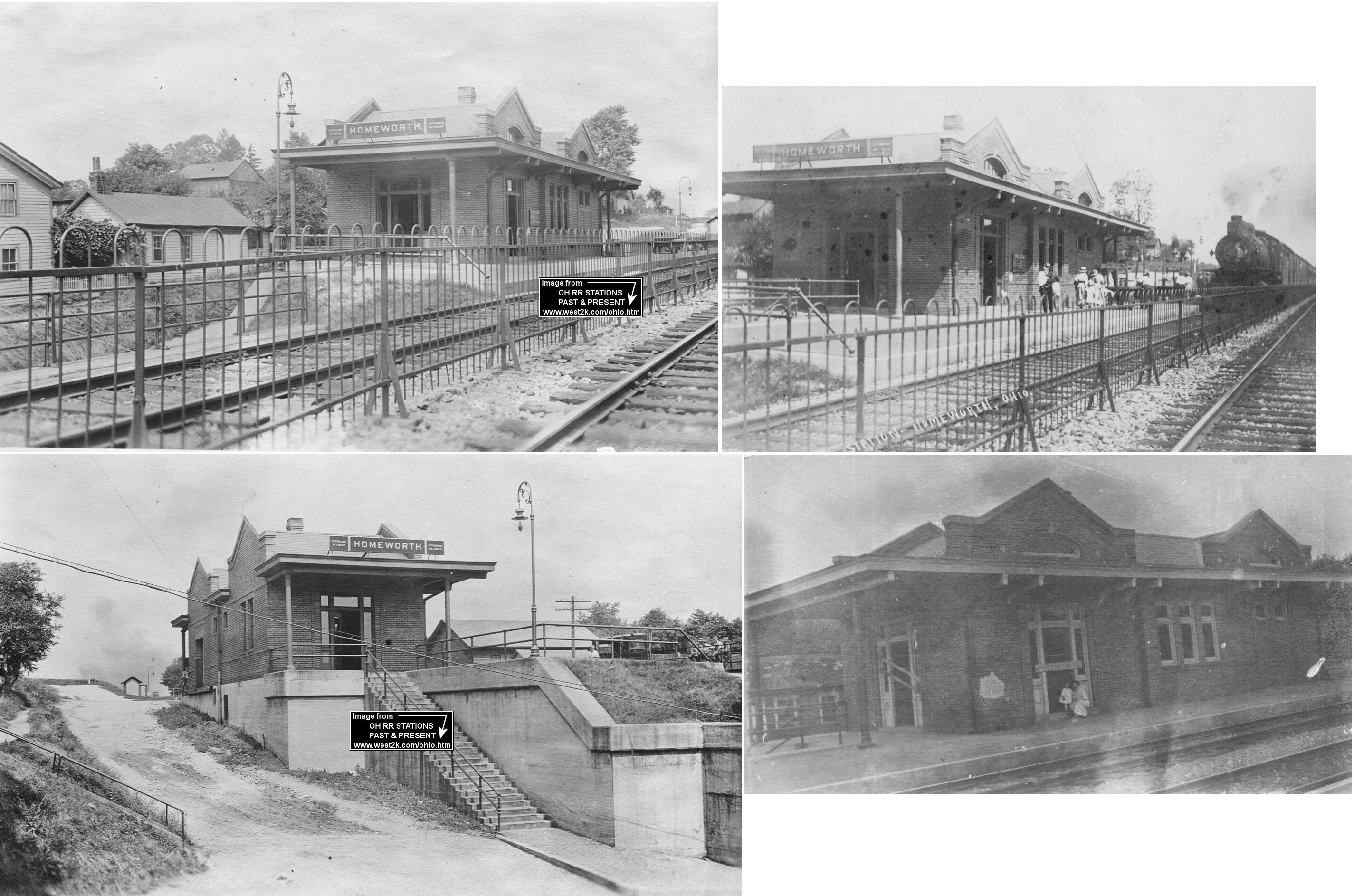
| Homeworth | |
According to the 1917 PRR valuation records, this brick passenger station was built in 1913. It was on the north side of Main Street on the west side of the tracks at GPS: 40.836583, -81.067557. According to a newspaper article from 1912, a new freight station was expected to be built as well, but the 1917 valuation records don't list one nor does the 1923 PRR List of Stations & Sidings show one for that year. | ||||||
| Jethro | |
Was just west of East Liverpool. | ||||||
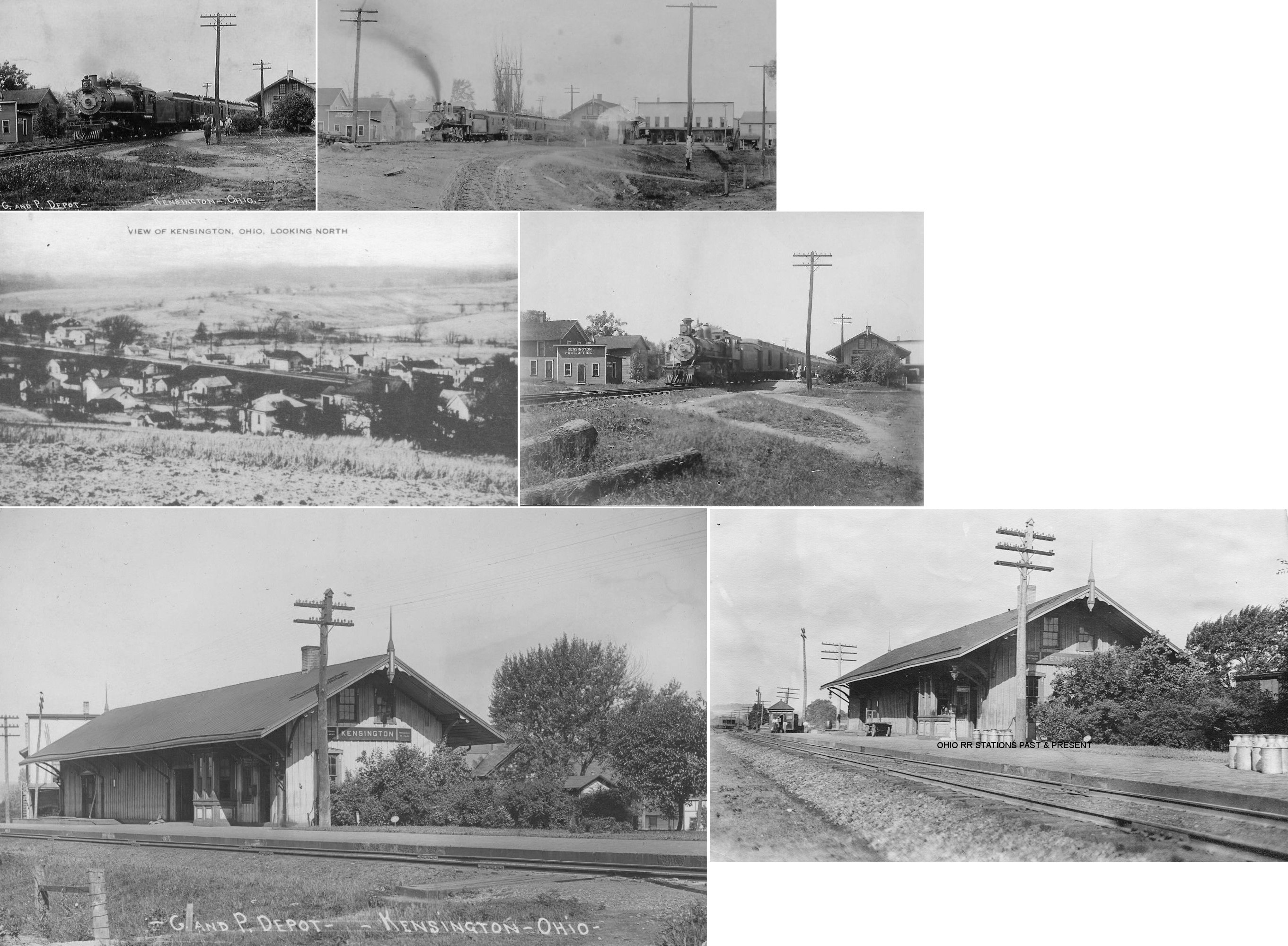
| Kensington (Maysville) |
|
The town was formerly known as Maysville (as shown on 1870 map). According to PRR valuation records from 1917, the station was built in 1852. | ||||||
| Kountz Station | |
This station was where SR 7 is today, just east of the intersection of Campground Road (there is still a Kountz Road north of 7). | ||||||
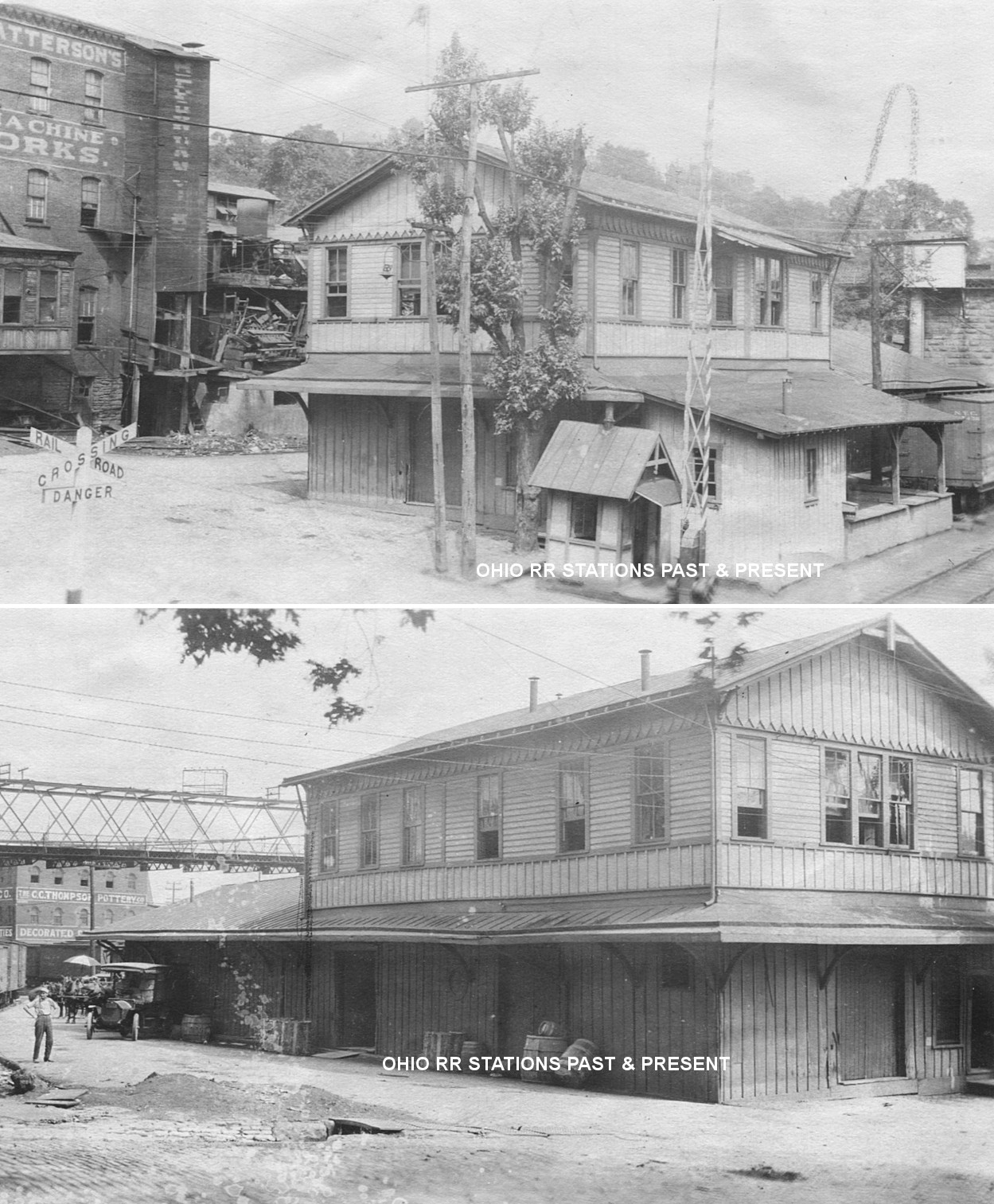
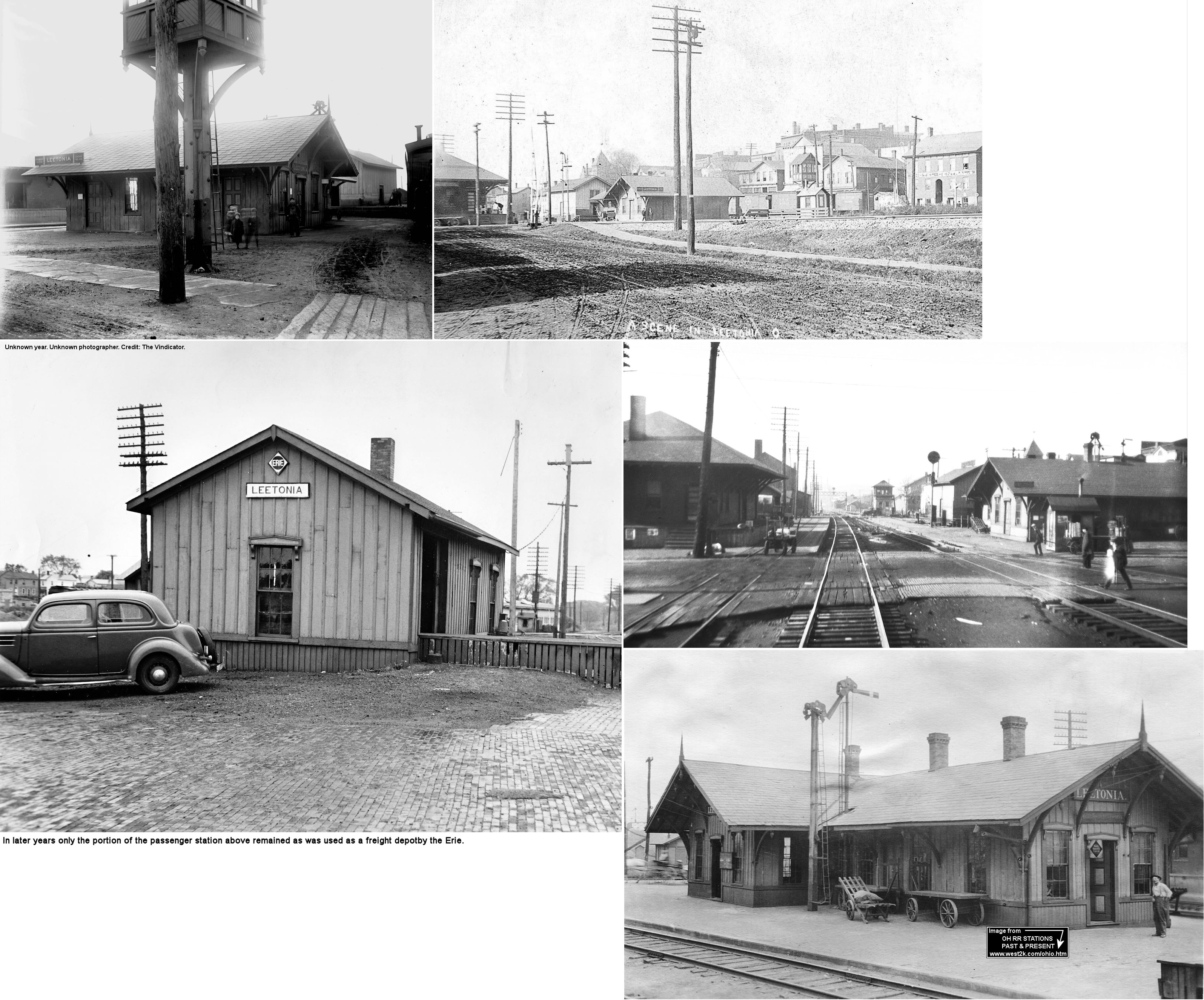
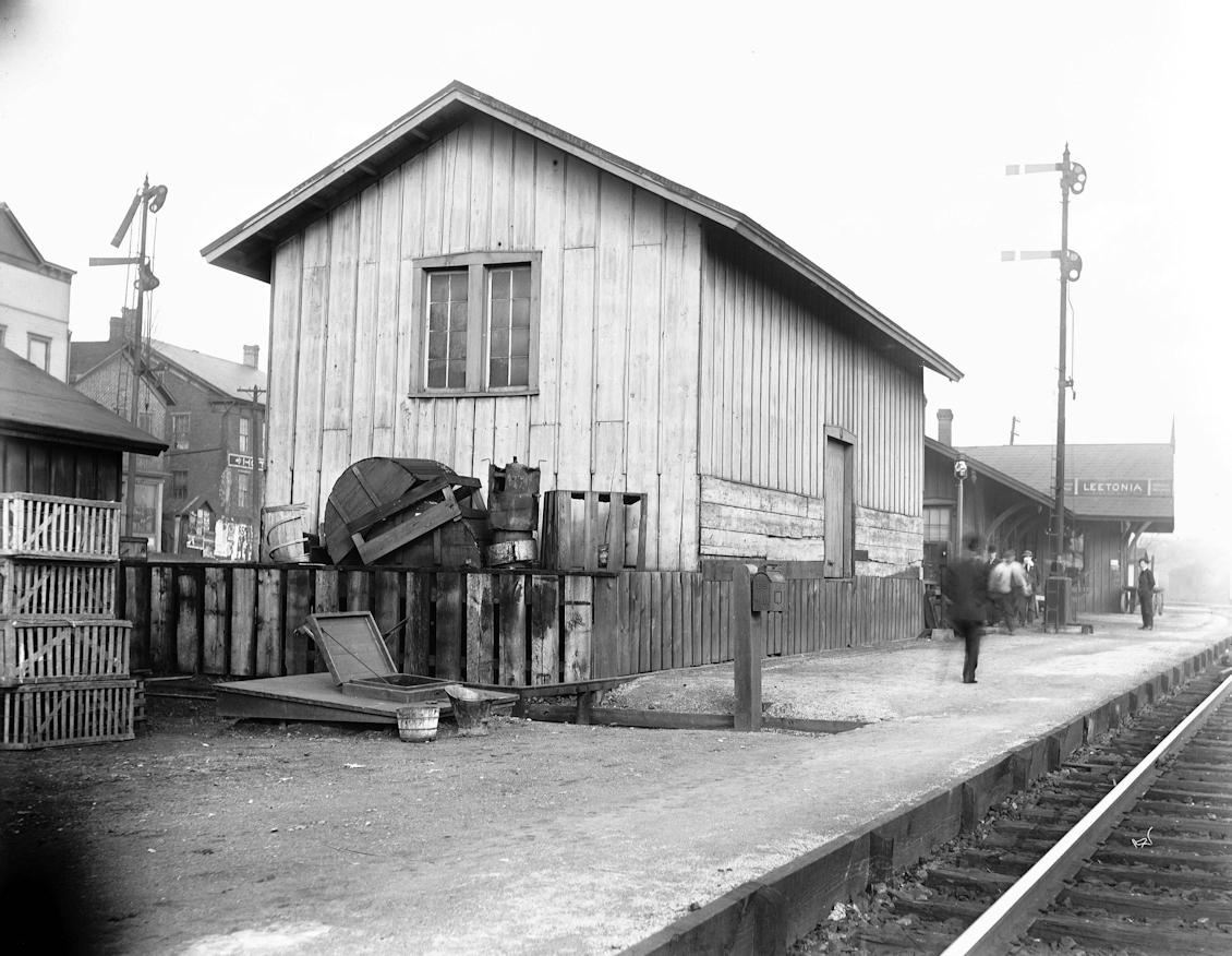
| Leetonia |
 |
This union passenger station served the PFt.W&C (PRR) and the NYP&O (Erie) and sat between the two lines at the corner of Front and Chestnut Streets at GPS: 40.877416, -80.755869. It was built in 1865 by the Niles & New Lisbon RR. The Erie RR valuation records give a build date of 1884. Sometime between 1923 and 1950 part of the station was torn down. Passenger service on the PRR ended here in 1954 and the Erie ended service in the early 1960s and the remainder of the station was torn down in 1966. Erie RR valuation records from 1919 contrdict the build date above and list it as 1885. | ||||||
| Leetonia | AND |
This freight station sat directly to the SW of the passenger station at GPS: 40.877171, -80.756298. PRR valuation records say this shared freight house was built in 1870. It was gone by 1950. | ||||||
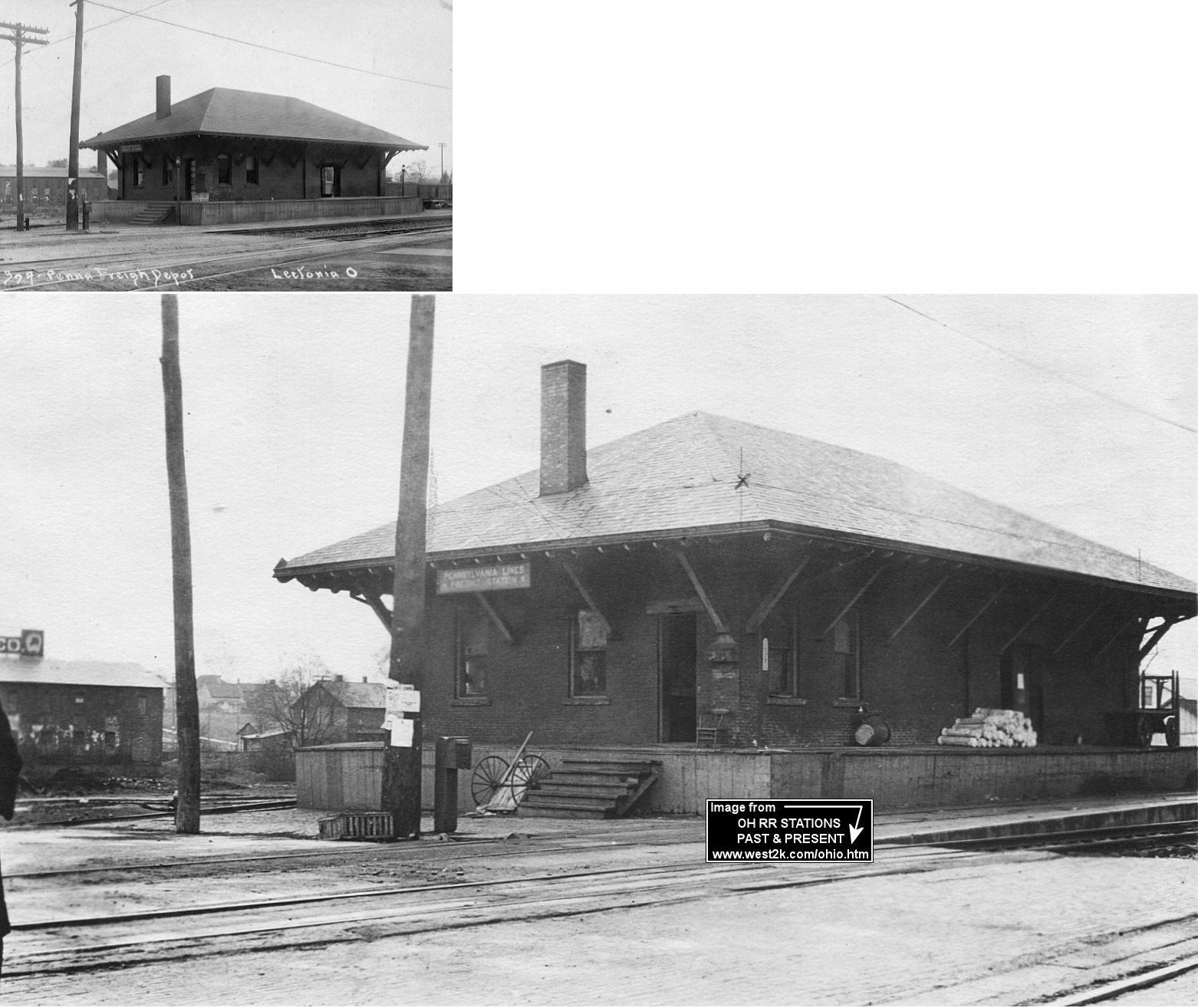
| Leetonia | |
The PRR freight house (which was either formerly an engine house or built on the same site as the former engine house) was located on the corner of Chestnut and Columbia (across the tracks to the SE of the passenger depot) at GPS: 40.877059, -80.755886. According to PRR valuation records the freight station was built in 1898. In later years (circa 1920s) the PRR had a small passenger waiting shed behind this freight station. | ||||||
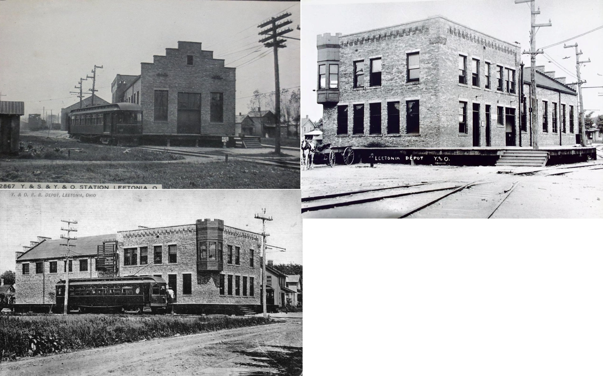
| Leetonia | |
Built in 1907 by the Youngstown & Ohio Railroad, this combination station was demolished in 2010 and a new house was built using its foundation. It was on the north side of Pearl Street between Mill Street and Spruce Street at GPS: 40.8756098, -80.7498919. The Youngstown and Ohio Railroad used it from 1907 to 1931 and the the Youngstown and Southern used it from 1909 to 1951. Then it was later used by the Leetonia Street department. | ||||||
| Lisbon | |
This station was built by the Y&OR in 1907. Then the Pittsburgh Lisbon and Western RR bought the spur, and station, but didn't use the station. They then sold the station in 1944, when it was turned into an office for a scrapyard, before being torn down in the 1960's. | ||||||
| Lisbon (New Lisbon) |
 |
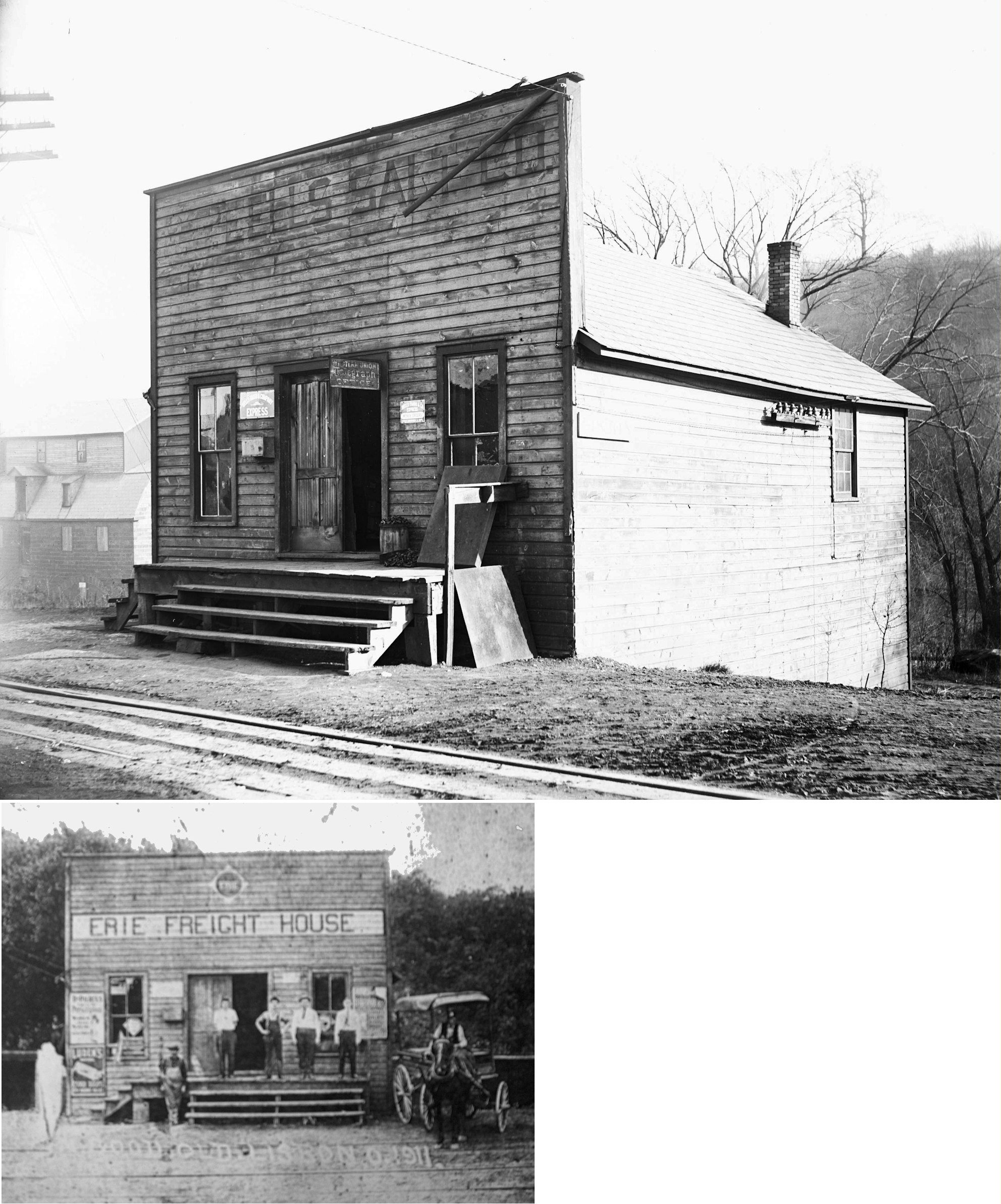
This mixed-use building was the original station. It was used by both the R.G. Eells Salt Company and the New Lisbon Railway (1865-1869) then the Niles & New Lisbon beginning July 14, 1869. --Note by Bob Gentzel. | ||||||
| Lisbon |  |
The NYP&O (later part of the Erie RR) had a freight house on the east side of South Beaver Street just south of the PL&W engine house and turntable. This freight house was across the street from the passenger station (later a combination station after the old freight station was torn down). | ||||||
| Longs | |
|||||||
| Lynchburg | |
|||||||
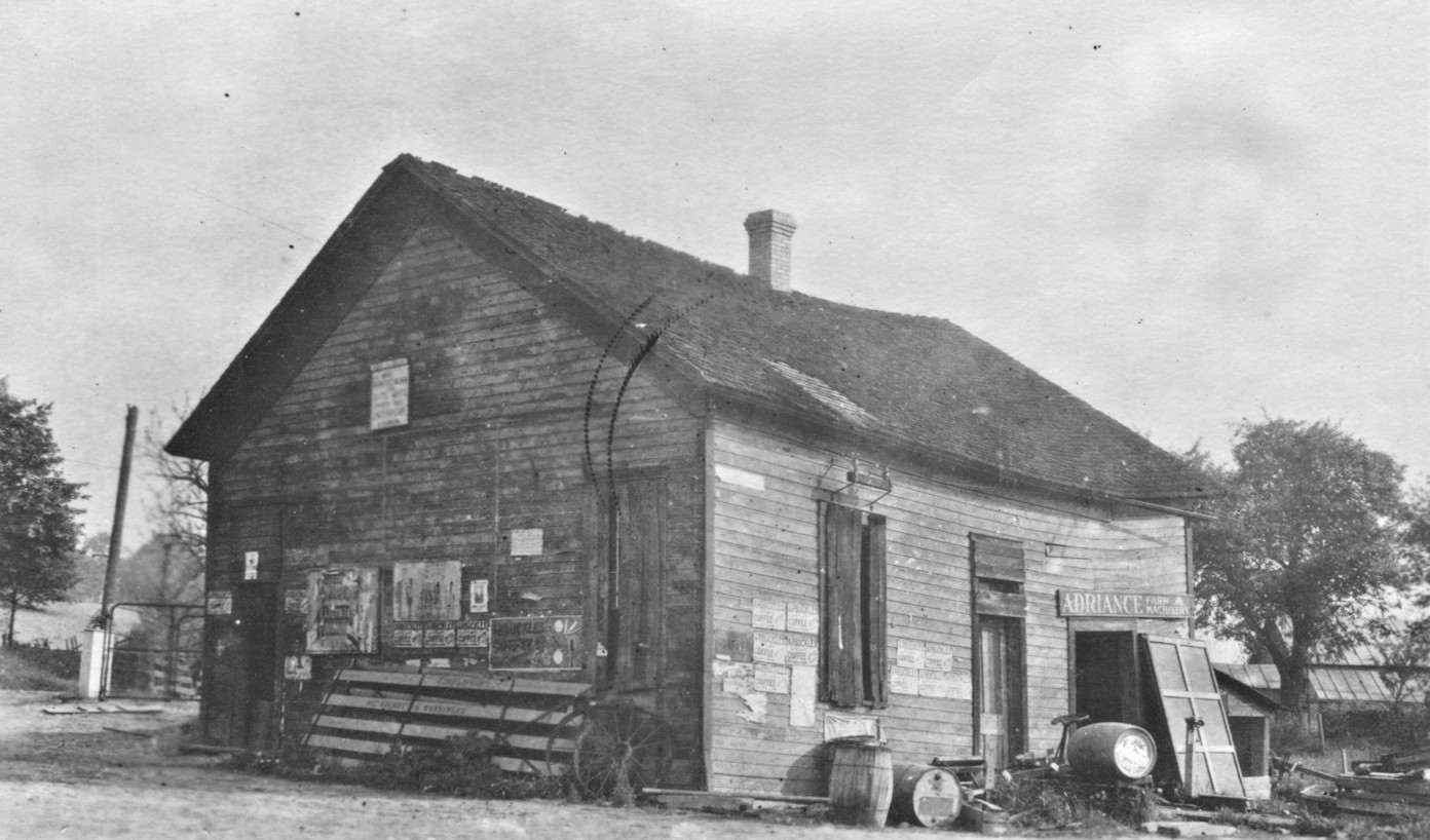
| McGarry | |
The station here was a depot, post office and store owned by John McGarry. | ||||||
| Mill rock | |
|||||||
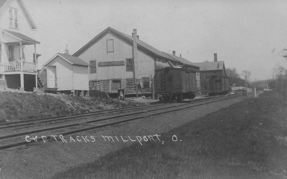
| Millport (FrankLin) |
|
Formerly called Franklin (1870). Presumably changed the name to avoid confusion with Franklin Square and Franklin Station in Salem Twp. The station was the east side of Main Street between Washington and Walnut Streets at GPS: 40.699150, -80.885448. | ||||||
| Moultrie | |
According to the 1917 PRR valuation records, this station was built in 1887. | ||||||
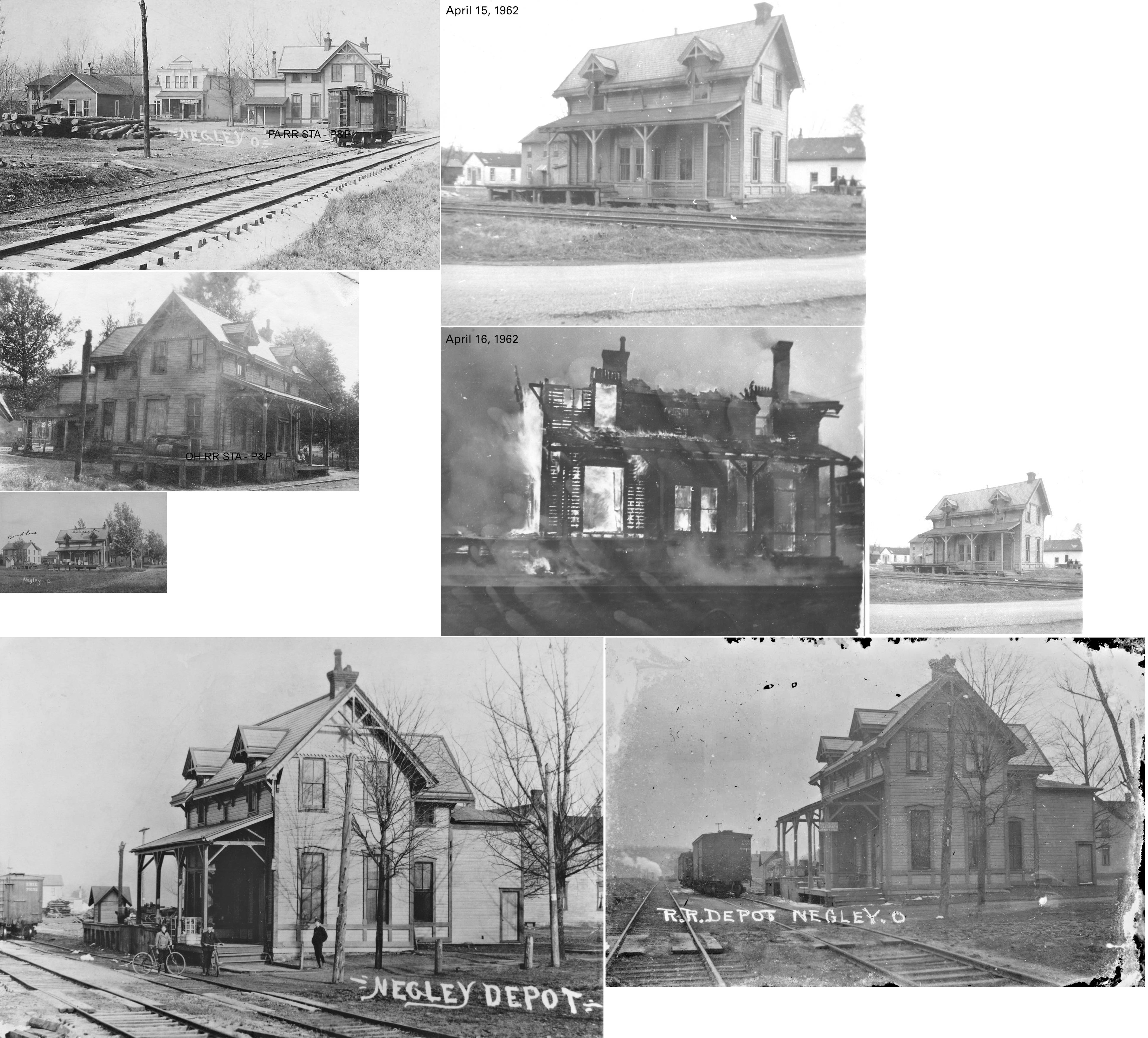
| Negley | |
In 1902, the station was on Front Street west of Commerce Street. Not sure if the station pictured was that station or a predecessor. The station was burned down (controlled burn) on April 16, 1962. | ||||||
| Negley |
|
This station was burned down by the fire department as an exercise on April 15, 1962 according to the Salem News (4-16-1962). The article claimed that the station was 90 yeas old at the time, which predates the railroad so either the age estimate was an error or the building was repurposed for the railroad at some point in its history. | ||||||
| New Salisbury | |
Town was formerly known as Salisburry Station. According to PRR valuation records, the station here may have been two old box cars in 1917. The 1923 PRR List of Stations & Sidings lists only a platform here for that year at MP 8.8 (miles are from Wellsville passenger station). | ||||||
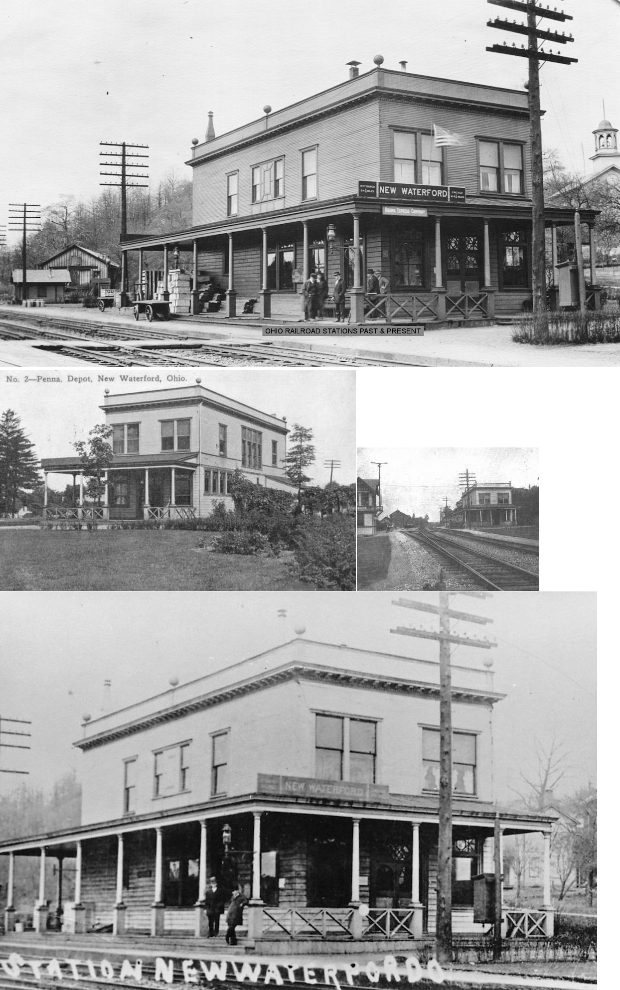
| New Waterford | |
The first station here was along the west side of the tracks north of Main Street at GPS: 40.846301, -80.612879. | ||||||
| New Waterford | |
This station, built in 1883 (although PRR valuation records say 1894), was located on the north side of East Main Street, on the west side of the tracks (shown on a 1902 map at GPS: 40.845796, -80.612495). This was the second station here as an earlier station sat farther up the tracks to the northwest (shown on an 1870 map). | ||||||
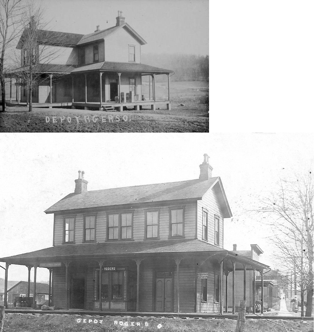
| Rogers | |
This station was on the east side of Depot Street on the south side of the tracks at GPS: 40.793221, -80.627167. | ||||||
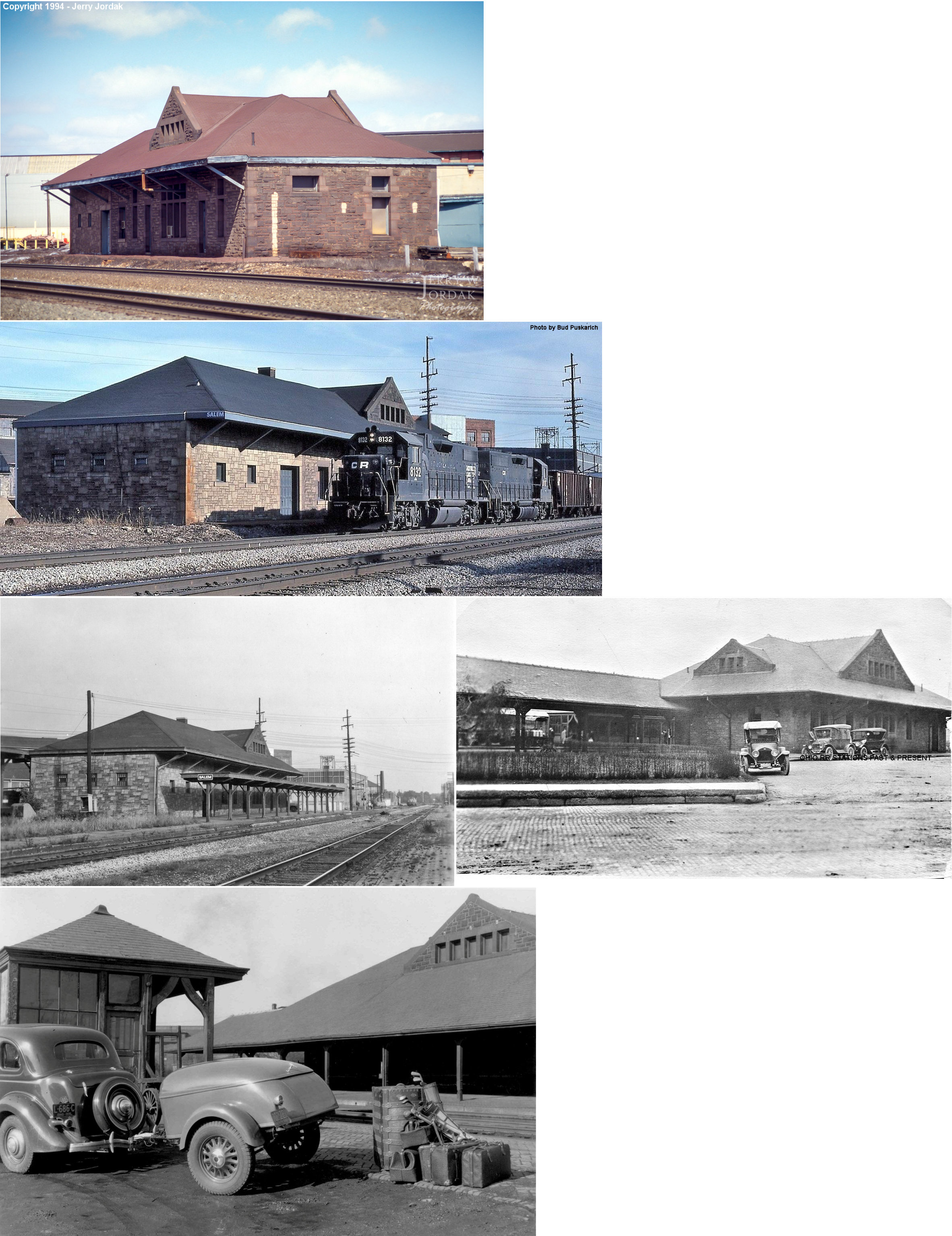
| Salem | |
The original passenger and freight stations were between Aetna and Mullins Streets. These stations were built in 1865-1867 (PRR valuation records say the freight station was built in 1865). The passenger station was torn down shortly after 1892, but the freight station remained (see below). | ||||||
| Salem | |
This is the original freight station that the PRR valuation records say was built in 1865. The photo is from around 1917. | ||||||
| Salem | |
Built in 1892 to replace the smaller frame depot here, this station sat on the west side of South Ellsworth Street (formerly Depot St.) at Aetna Street. It was demolished in an accident on July 31, 1997. The Salem News of June 5, 1956 claimed that the station was the same one used at the Chicago World's Fair in 1893 and was disassembled there and rebuilt in Salem. However, this claim seems to be false as news articles from 1892 in the same newspaper detail the building of the station in Salem starting in 1892 and opening in February of 1893. The fair in Chicago didn't open until May, 1893. | ||||||
| Salem |
 |
The Salem RR combination station was on the east side of
Ellsworth Street (across the street from the PFt.W&C station). The Salem
RR was built by the city under a special act authorizing certain cities,
counties, townships and towns to build and lease or operate railroads. In
the early 1880s, 40 such railroads were authorized by the state, but only
four railroads were actually built under this law: The Cincinnati Southern
Railroad, the Muskingum County Railroad, the Mt. Gilead Short Line
Railroad and the Salem Railroad. After the Salem RR had been built and
operated for a couple of years the law authorizing the building of these
lines was declared unconstitutional and the city ceased levying taxes for
it. In 1897 the property was placed in the hands of a receiver and in 1902
the Salem Railroad was acquired by the Pittsburg, Lisbon and Western RR
and eventually the W&LE.
The line of road ran from Salem to Washingtonville, a distance of seven
miles. By 1909 this station was being used by the Y&O Traction Company and
later it became part of the Deming Company and was used as a warehouse for
pipes. The station was built in 1892, but moved a short distance to the east in 1893 due to wagons backing against the depot which result in it being partially knocked off its original foundation (Salem Daily News, 8-5-1893). In 1966 the station was slated to be moved, but during the operation it collapsed and the heap was subsequently burned by the fire department for training (Salem News, 8-26-1966). There is a more modern building on the site now (2009). |
||||||
| Salem |
|
|||||||
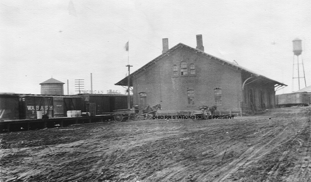
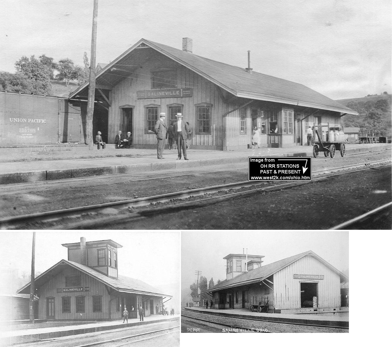
| Salineville | |
This combination station was at the corner of Main and Elm Streets on the east side of the tracks. In 1870 the station agent was J. Hoey. According to PRR valuation records from 1917, the station was built in 1852. The 3-mile Salineville Railroad, which served local potteries and collieries, junctioned near the station. | ||||||
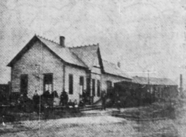
| Signal | |
This building was constructed for another purpose in 1879 and purchased by the RR in 1882 and subsequently used as the Signal station. Not sure when it closed. PL&W valuation notes from 1919 say that although the building is in poor condition it "can be put in good condition with proper repairs which are contemplated." The photo is from 1919. | ||||||
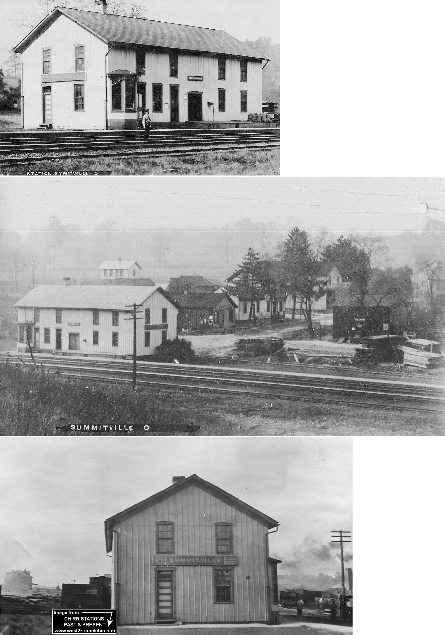
| Summitville | |
This station was on Front Street (where it used to intersect with Depot Street) on the west side of the tracks. According to PRR valuation records from 1917, the station was built in 1864. | ||||||
| Teegarden | |
|||||||
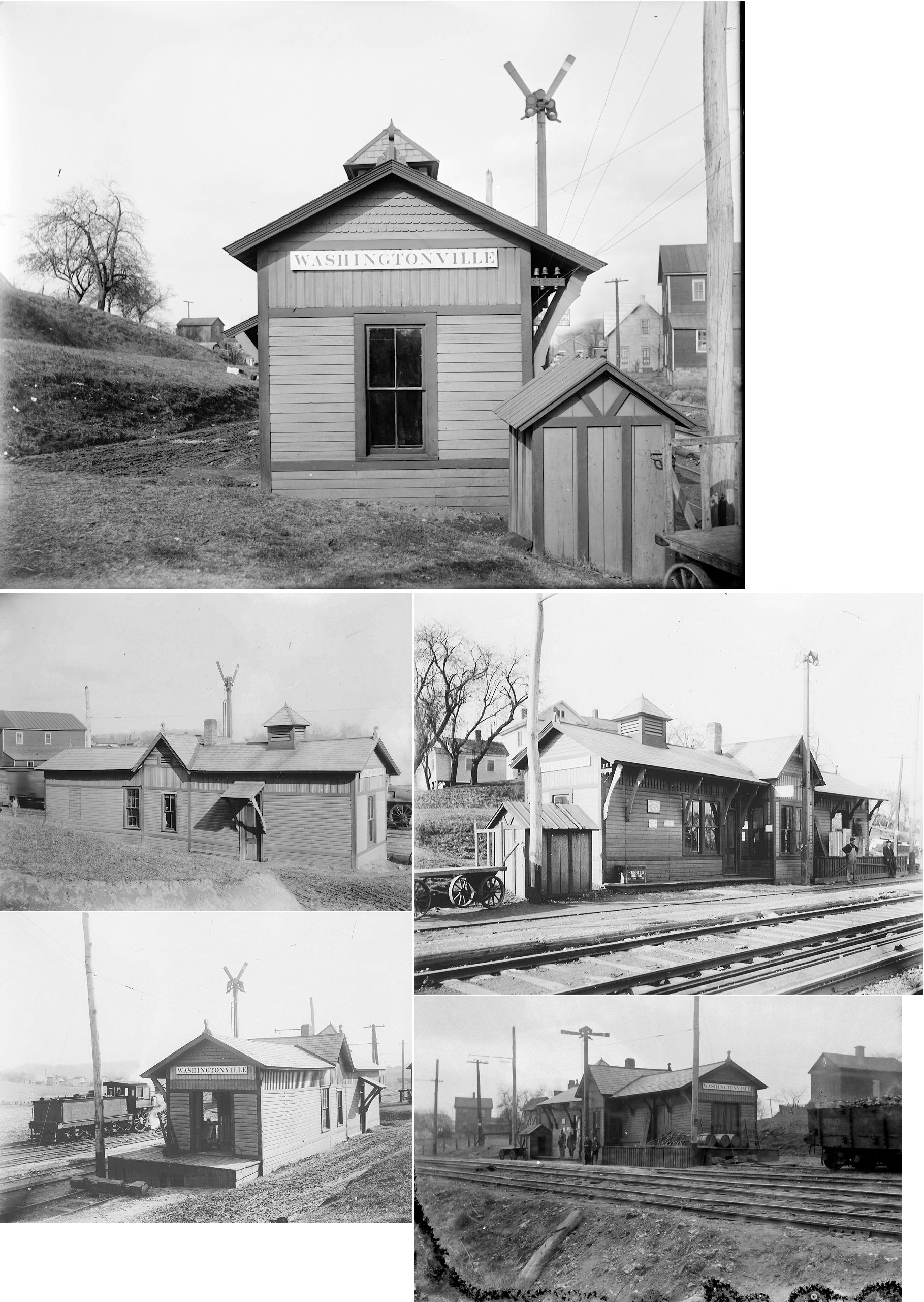
| Washingtonville | |
According an article in The Salem News on Nov. 28, 1936, the depot was built in 1885 and was originally located on the north side of Main Street. It was later moved to south of Union Street and an addition was built. It was located at GPS: 40.899108, -80.763814. It served the Erie RR, Salem-Washingtonville RR and the Y&O. It was closed in 1931, then "torn down and hauled away" in 1936. Erie RR valuation records from 1919 confirm that the station was built in 1885. | ||||||
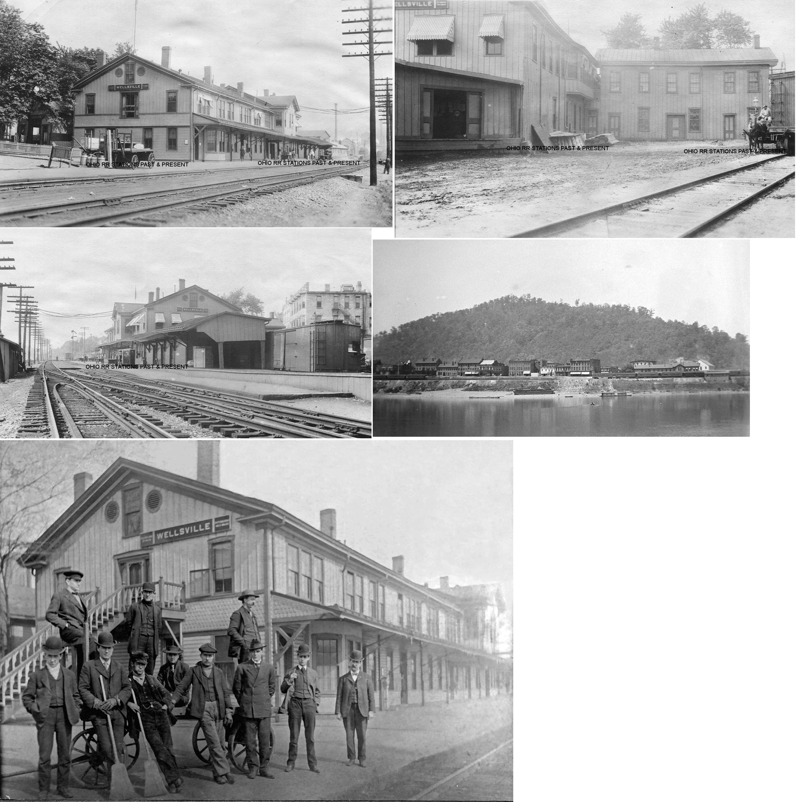
| Wellsville | |
This large combination station was on the NE corner of 3rd Street and Riverside Avenue (GPS: 40.610564,-80.640794). According to PRR valuation records, this building was originally a hotel that was repurposed as a station with the canopy being added in 1862. The station was torn down in September 1933. | ||||||
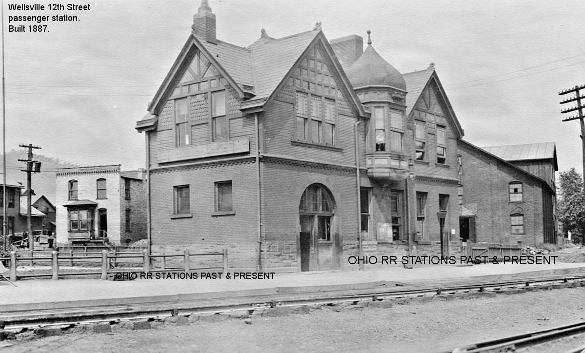
| Wellsville | |
This passenger station was built in 1887 according to PRR valuation records. It was at the bottom of 12th Street on the north side of the tracks at GPS: 40.600347, -80.651027. | ||||||
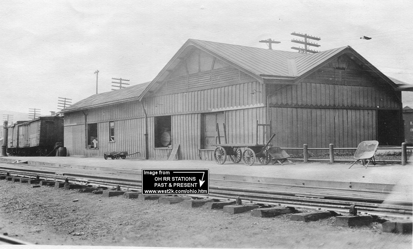
| Wellsville | |
There was a freight transfer station just southwest of the 12th Street passenger station at GPS: 40.600101, -80.651523. According to PRR valuation records, it was built in 1884. | ||||||
| 1898 COLUMBIANA COUNTY RAILROAD MAP | ||||||||
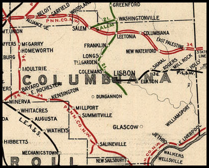 |
||||||||
|
Notes About Existing Stations... Lisbon (Erie) - This station was moved. It was originally on South Beaver Street. Lisbon (PL&W) - Building was also PL&W office. After the RR went out of business in the 1940s, the building was used for various businesses including a feed mill which closed aroun 2000. The building is currently (2010) undergoing restoration into office space. Here is a story about the restoration. |
||||||||