|
|
||||||||
| EXISTING STATIONS | ||||||||
|---|---|---|---|---|---|---|---|---|
| Station Name |
Original Railroad |
Current Location |
Type | Current Use |
Date Built |
Track Status |
Building Material |
More Info |
| Allegheny |  |
3235 North 22nd Street (GPS: 40.003799, -75.165443) |
P | Railroad | 1938 | In Use | Brick | |
| Allen Lane |  |
Allen Lane & Cresheim Street (GPS: 40.057516, -75.194737) |
P | Railroad | 1885 | In Use | Brick |
|
| Bridesburg |
 |
2200 Bridge Street near Aramingo Avenue (GPS: 40.010588, -75.069836) |
P | Railroad | ???? | In Use | Wood | |
| Carpenter | |
310 Carpenter Lane (GPS: 40.050935, -75.191736) |
P | Railroad | 1885 | In Use | Brick/ Wood |
|
| Chelten Avenue (Cheltenham) |
|
359 Chelten Avenue (GPS: 40.029922, -75.181228) |
P | Railroad | 1916 | In Use | ???? | |
| Cheltenham | |
589 Hasbrook Avenue (GPS: 40.057933, -75.092946) |
P | Railroad | 2008 | In Use | ???? | |
| Chestnut Hill West | |
9 West Evergreen Avenue (GPS: 40.076141, -75.208299) |
P | Railroad | 1884 | In Use | Stone |
|
| Chestnut Hill East | |
100 East Chestnut Hill Avenue (GPS: 40.080923, -75.207835) |
P | Railroad | 1931 | In Use | Stone | |
| East Falls |
|
On Cresson Street near Midvale Avenue (GPS: 40.011467, -75.192011) |
P | Railroad | ???? | In Use | Combo | |
| Eastwick |
|
8511 Bartram Ave near Mario Lanza Boulevard (GPS: 39.891576, -75.244982) |
P | Railroad | ???? | In Use | Metal | |
| Fern Rock |
|
North 11th Street and West Nedro Avenue (GPS: 40.041513, -75.135131) |
P | Railroad | 1956/ 1992 |
In Use | Cement |
|
| Forest Hills |
|
Byberry Road near Philmont Avenue (GPS: 40.127761, -75.020912) |
P | Railroad | ???? | In Use | Metal | |
| Fox Chase |
|
440 Rhawn Street (GPS: 40.075953, -75.083579) |
P | Railroad | 2010 | In Use | Brick | |
| Germantown | |
162 East Chelten Avenue (GPS: 40.037900, -75.172045) |
P | Railroad | ???? | In Use | Combo | |
| Germantown Road | |
7627 Germantown Avenue (GPS: 40.066393, -75.196066) |
P | Railroad | ???? | Gone | Stone | |
| GraverS LANE | |
300 East Gravers Lane (GPS: 40.077363, -75.201932) |
P | Railroad | 1883 | In Use | Brick | |
|
Highland (Chestnut Hill) |
|
St. Martins Lane near Seminole Street (GPS: 40.070414, -75.211257) |
P | Railroad | ???? | In Use | Metal | |
|
Holmesburg Junction |
|
4783 Rhawn Street (GPS: 40.032886, -75.023858) |
P | Railroad | 1888 | In Use | Brick | |
| Ivy Ridge |
|
On Umbria Street near Parker Avenue (GPS: 40.034174, -75.235458) |
P | Railroad | ???? | In Use | Metal | |
| Manayunk | |
4401 Cresson Street (GPS: 40.027010, -75.225158) |
P | Business | 1930 | In Use | Brick | |
| Mt. Airy | |
Gowen Avenue & Devon Street (GPS: 40.065216, -75.191193) |
P | Railroad | 1883 | In Use | Brick | |
| North Philadelphia | |
2900 North Broad Street (GPS: 39.996970, -75.155019) |
P | Railroad | 1901 | In Use | Brick |
|
| North Philadelpia |
 |
Off West Indiana Avenue (GPS: 39.997607, -75.155432) |
P | Vacant | 1991 | In Use | Concrete | |
| Olney |
|
5401 North Mascher Street between West Tabor Road and West Olney Avenue (GPS: 40.033457, -75.122583) |
P | Railroad | ???? | In Use | Concrete | |
|
Overbrook (City Avenue) |
|
2195 North 63rd Street (GPS: 39.989853, -75.250021) |
P | Railroad/ Residence |
1858 | In Use | Wood |
|
| Philadelphia |
 |
1001 South 15th Street - SE corner of 15th and Carpenter Streets (GPS: 39.939002, -75.167818) |
F | Business | 1876 | Gone | Brick | |
| Philadelphia (30th Street) |
|
2955 Market Street (GPS: 39.955663, -75.181936) |
P | Offices | 1933 | In Use | Brick |
|
|
Philadelphia (Suburban Station) |
|
1617 JFK Boulevard (GPS: 39.954182, -75.167383) |
P | Offices | 1929 | In Use | Brick |
|
|
Philadelphia (Fairhill) |
|
East Venango Street east of B Street (GPS: 40.003812, -75.122592) |
F | Railroad | 1928 | In Use | Brick |
|
Philadelphia (Ontario St.) |
|
Ontario Street between Collins and Tulip Streets (GPS: 39.992775, -75.104778) |
F | Railroad | ???? | In Use | Brick |
|
|
Philadelphia (Reading Terminal) |
|
North 12th Street & Market Street (GPS: 39.952164, -75.159226) |
C | Business | 1893 | Gone | Stone |
|
|
Philadelphia (N. Broad Street) |
|
2600 North Broad Street (GPS: 39.992806, -75.155699) |
P | Civic | 1929 | In Use | Brick |
|
|
Philadelphia (49th Street) |
|
Chester Avenue near 49th Street (GPS: 39.943531, -75.216369) |
P | Railroad | ???? | In Use | Metal | |
|
Philadelphia (Airport Terminal) |
|
Between Commercial Vehicles Road and Departures Road (Terminal A & B Station GPS: 39.876155, -75.245583), (Terminal C & D Station GPS: 39.877262, -75.241605), (Terminal E & F Station GPS: 39.879133, -75.239963) |
P | Railroad | 1985 | In Use | Cement | |
|
Philadelphia (Jefferson) |
|
Near Filbert Street Between North 12th Street and North 10th Street (Station is below street level) |
P | Railroad | 1984 | In Use | Brick |
|
|
Philadelphia (Penn Medicine) |
|
Convention Avenue below South Street (GPS: 39.947841, -75.190391) |
P | Railroad | 1995 | In Use | Cement |
|
| Queen Lane | |
5319 Wissahickon Avenue (GPS: 40.023256, -75.177793) |
P | Railroad | ???? | In Use | Brick |
|
| Ryers |
|
On Cottman Avenue near Rockwell Avenue (GPS: 40.063682, -75.086747) |
P | Railroad | ???? | In Use | Cement | |
| Sedgwick (Mt. Airy) |
|
On Devon Street near East Mt. Pleasant Street (GPS: 40.062775, -75.185201) |
P | Railroad | ???? | In Use | Metal | |
|
Shawmont Station |
 |
7700 Nixon Street (GPS: 40.044066, -75.250029) |
P | Business | 1826 | In Use | Concrete |
|
| Somerton |
|
Philmont Avenue near Bustleton Avenue and Station Road (GPS: 40.130708, -75.012101) |
P | Railroad | 1888 | In Use | Brick | |
| Stenton | |
Blakemore Street between Vernon Road and Gorgas Lane (GPS: 40.060459, -75.178869) |
P | Railroad | 1907 | In Use | Stone | |
| St. Martins (Wissahickon Heights) |
|
Pocono Street between West Willow Grove Avenue and West Springfield Avenue (GPS: 40.065745, -75.204615) |
P | Railroad | 1883 | In Use | Brick |
|
| Tacony |
|
4939 Disston Street near State Road (GPS: 40.023352, -75.039170) |
P | Railroad | ???? | In Use | Cement | |
| Temple University |
|
927 W Berks Street between North 10th Street and North 9th Street (GPS: 39.980842, -75.149752) |
P | Railroad | 1992 | In Use | Metal | |
| Torresdale | |
Grant
Avenue & James Streets (GPS: 40.054479, -74.984689) |
P | Railroad | ???? | In Use | Stucco | |
| Tulpehocken | |
Walnut Lane & Tulpehocken Street (GPS: 40.035183, -75.186863) |
P | Vacant | ???? | In Use | Brick |
|
| Upsal | |
6460 Greene Street (GPS: 40.042382, -75.190075) |
P | Restaurant | ???? | In Use | Brick |
|
| Washington Lane (E. Germantown) |
|
On Washington Lane near Chew Avenue (GPS: 40.051061, -75.171635) |
P | Railroad | ???? | In Use | Metal | |
| Wayne Junction | |
Wayne & Windrim Avenues (GPS: 40.022353, -75.160151) |
P | Railroad | 1901 | In Use | Stone | |
| Wissahickon |
|
On Rochelle Avenue near Ridge Avenue (GPS: 40.016407, -75.209959) |
P | Railroad | ???? | In Use | Combo | |
| Wister |
|
East Ashmead Street (GPS: 40.036142, -75.161611) |
P | Railroad | ???? | In Use | Combo | |
| Wyndmoor | |
Wyndmoor Street at Benezet Street (GPS: 40.073395, -75.196908) |
P | Railroad | 1930 | In Use | Stone | |
| Wynnefield Avenue |
|
Wynnefield Avenue near Bryn Mawr Avenue (GPS: 39.990862, -75.225596) |
P | Railroad | ???? | In Use | Metal | |
| STATIONS OF THE PAST | ||||||||
| Station Name |
Original Railroad |
Notes | ||||||
| Angora | |
This station was on the NE side of 58th Street (Cobbs Creek Parkway) at Fernwood Street at GPS: 39.944729, -75.238455. Passenger service was ended at Angora in 1905, but freight service continued. | ||||||
| Ashton |
|
This early Phildealphia & Trenton station was on Bustleton Branch. It was on the NW side of Ashton Road on the east side of the tracks at GPS: 40.060570, -75.024752. It is shown on the 1885 "Atlas of Properties near the Philadelphia and Trenton Rail Road." | ||||||
| Bellevue | |
This station was on the SE side of Hunting Park Avenue on the north side of the tracks at GPS: 40.006651, -75.174925. | ||||||
| Belmont | |
This station was just to the NE of West Fairmount Park at GPS: 39.990076,-75.20457. This is near where the Fairmount Park offices used to be during the 1876 Exhibition. | ||||||
| Blue Grass |
|
This early Phildealphia & Trenton station was on Bustleton Branch. It was on the SE side of Blue Grass Road on the SW side of the tracks at GPS: 40.073173, -75.028251. It is shown on the 1885 "Atlas of Properties near the Philadelphia and Trenton Rail Road." | ||||||
| Bridesburg | |
There was an early freight station here built in 1845 by the Philadelphia & Trenton RR. That freight station become redundant with the opening of the Trenton Cutoff in 1892 (which took away most of the freight traffic from this line). | ||||||
| Bridesburg | |
This station was relocated in 1883. A new station was built in 1892 and a shelter was added in 1896. The station was on the west side of Bridge Street on the north side of the tracks at GPS: 40.010900, -75.069848. The shelter was on the south side of the tracks. The station is shown on the 1920 Sanborn map. By the 1951 revision map, the station is gone and small concrete/brick building is in its place. | ||||||
| Bonnaffon |
|
A new station was constructed here when the Darby Improvement line was built in 1872. This moved the location of the mainline. This station was between Mt. Moriah and Paschallville on the SW side of South 67th Street at GPS: 39.921915, -75.235045. The station is shown on the 1889 map, but not on the 1901 map. | ||||||
| Bustleton | |
This building was used as a barn, an arsenal and a powder storage magazine during the Revolutionary War before the property was taken over by the railroad in 1870. It was on the SE side of Bustleton Avenue at approximately GPS: 40.085744, -75.036890. The Bustleton Branch (formerly the Holmesburg & Bustleton Railroad) ended at the station. | ||||||
| Bustleton | |
Perhaps this was an earlier station? | ||||||
| Bustleton | |
|||||||
| Byberry | |
There was a very small 5'x7' passenger shed on the east side of Byberry Road on the north side of the tracks at GPS: 40.115168, -75.005133. This was on the Reading's New York Short Line. The passenger shed was built in 1914. This served the old Philadelphia County Byberry Fairgrounds. The station is shown on the 1929 Sanborn map and the 1951 revision (although it was likely gone by then), The Philadelphia County Fair started at Byberry around 1912 and continued until the late 1920s. Records show there was also a freight station at Byberry, although it is not pictured on the Sanborn maps. | ||||||
| Carpenter |
 |
|||||||
| Cedar Grove | |
This shelter-type station was on the Frankford Branch. It was on the SE side of Tabor Avenue on the SW side of the tracks at GPS: 40.036559, -75.103091. | ||||||
| Centennial Station (Fairmount Park) |
|
This station was on the corner of Belmont and Parkside Avenues (GPS: 39.977605,-75.213979). It was built for the 1876 World's Fair. It burned down in 1896. | ||||||
| Chelten Avenue | |
The old station here was closed in 1916 for grade crossing elimination. It was built in 1887. It stood for sometime after it closed (it still appears on the 1951 revised Sanborn map. There was a freight station on the west corner of Chelten Avenue and Pulaski Street (GPS: 40.030452, -75.180591) as shown in the photo from 1929. | ||||||
| Cheltenham | |
This station was on Hasbrook Avenue NE of Old Soldiers Road at GPS: 40.057892, -75.092974. It burned down in 1993 as the result of arson. Until a new station was built in 2008, a trailer served as the station here. | ||||||
| Chestnut Hill (EAST) |
|
This is the original frame station building of the Chestnut Hill Railroad that was at Chestnut Hill and Spring House Turnpike and New Street (now Bethlehem Pike at Newton Street). The Chestnut Hill RR completed a line from Germantown to Chestnut Hill in 1857, with this station as its terminus. In 1870, the Philadelphia and Reading Railroad leased the Chestnut Hill Railroad and in 1872 the depot was replaced with the stone structure listed below. | ||||||
|
Chestnut Hill (EAST) |
|
This station was built in 1872 and sat at Bethlehem Pike & Chestnut Hill Avenue to replace the station listed above. It was demolished in 1933 and replaced with the current (still standing) Chestnut Hill East station at the same location. There was also a stone freight station just to the NE of the passenger station on the other side of the roundhouse that was next to the passenger station. | ||||||
| Chestnut Hill (St. Martins) |
|
Originally called Wissahickon Heights Station. | ||||||
| Chestnut Hill (Highland) |
|
This station was mere .4-mile from the main Chestnut Hill station. | ||||||
| Cinnaminson (Roxborough) |
|
The name of this station was changed to "Cinnaminson" from "Roxborough" in 1892. On the 1923 Sanborn map the station is shown on the SW side of Umbria Street on the NE side of the tracks at GPS: 40.034280, -75.234742. This is where the parking lot is for the Ivy Ridge Station today (as of 2023). | ||||||
| Crescentville | |
A shelter-type station was built here in 1894 followed by a new station in 1907. It was on the SE side of Risingsun Avenue on the NE side of the tracks at GPS: 40.040835, -75.106954. | ||||||
| East Falls (Falls of Schuylkill) |
|
The original station here, when the stop was known as "Falls Of Schuylkill" (later shortened to just "Falls" and eventually to "East Falls") opened in 1856. It was replaced in 1912 by the station listed below. It was on the east side of Midvale Avenue at GPS: 40.011423, -75.192339. | ||||||
| East Falls | |
This station, opened on November 18, 1912, was on the east side of Midvale Avenue on the south side of the tracks at GPS: 40.011395, -75.192334. There was also a brick waiting shed across the tracks. The station burned down circa 1982 and was replaced with a small waiting shelter. | ||||||
| Eastwick | |
The old Eastwick RDG station was on 53rd Street (now Harley Avenue) at GPS: 39.932954, -75.212662. Two maps from 1910 show the station in slightly different locations. One shows it on 53rd Street, whereas the other shows it in the east quadrant of the B&O/RDG diamond. | ||||||
| Elm Station | |
This station, located near 44th Street & Belmont Avenue, was one of several depots built to transport passengers to and from the Centennial Exposition in Fairmount Park, 1876. | ||||||
| Engelside | |
This passenger station, which was only two blocks SW or the Ridge Avenue station, closed in 1903 when the PRR ended its short haul service due to competition from interurban lines. It was on the north side of West Oxford Street at GPS: 39.981208, -75.186756. The 1900 PRR List of Stations & Sidings lists it on the half-mile Engelside Railroad branch which also included service to the American Brewery and the Berger & Engel Brewery plants. The line diverged from the Connecting Railway and junctioned with the P&R. On some maps it is spelled "Engleside," and on others it is "Engelside." | ||||||
| Engelside | |
The Engelside freight station was along Glenwood Avenue between West Jefferson Street and West Oxford Street at GPS: 39.980567, -75.186478. | ||||||
| Fair Hill |
|
The 1900 PRR List of Stations & Sidings lists a freight station at the end of the .78-mile Fair Hill RR which was incorporated on June 13, 1892 and finished a couple years later. It ran from the Connecting Railway mainline along the east side of Rosehill Street to Cambria Street. | ||||||
| Fern Rock |
 |
The first station here was a freight station that was built around 1897. A wood frame passenger station was added in 1902 and may have been relocated here from elsewhere. | ||||||
| Fern RocK |
|
This brick station, built in 1924 to replace the station above, was south of West Godfrey Avenue on the west side of the tracks at GPS: 40.045754, -75.134908. | ||||||
| Fishers |
|
This station was located on the north side of Logan Street (formerly Lindley Street) between Stenton Avenue and North 20th Street (GPS: 40.031122,-75.157261). The station was torn down in 1983, but one of the wood shelters is still standing. The concrete underpass and stairs still exist, but are fenced off. | ||||||
| Fitlers |
|
This station is shown on the 1885 "Atlas of Properties near the Philadelphia and Trenton Rail Road" and the 1900 "PRR List of Stations & Sidings."" It was about a half mile from the Bridesburg station and was the junction of the Fitler Branch. | ||||||
| Forest Hills (Cemetery Sta.) |
|
Also known as Somerton Hills and Cemetery Station, this station was on the NE side of Byberry Road on the north side of the tracks at GPS: 40.127882, -75.021092. There was a greenhouse next to the station. | ||||||
| Fox Chase | |
This station was built in 1891. It was the second station here. It was on the south side of Rhawn Street on the west side of the tracks at GPS: 40.076356, -75.083519. There was also a small freight house on the east side of the tracks at GPS: 40.076604, -75.083251. The first station here was built around 1876 by the Philadelphia, Newtown, and New York Railroad. That RR would soon come under the control of the PRR. The line was subsquently sold to the Reading in 1879. | ||||||
| Fox Chase | |
In the 1960s, the 1891 station was replaced by this small waiting shelter. | ||||||
| Frankford | |
This terminal-type station was on the NW side of Frankford Avenue NE of Unity Street at GPS: 40.012992, -75.087513. It was gone by 1951. | ||||||
| Frankford (Arrott Street) |
|
This station was on the NE side of Arrott Street north of Large Street at GPS: 40.021531, -75.091987. The station, built in 1895, is shown on the 1920 Sanborn map, but was gone by the 1951 revision. Note that the map accompanying the photo incorrectly labels the tracks as PRR. | ||||||
| Frankford | |
This freight station was on the NW side of Griscom Street NE of Unity Street at GPS: 40.013662, -75.088157. It was gone by 1951. | ||||||
| Frankford | |
This freight station was on the SW side of Orthodox Street between Horrocks and Oakland Streets at GPS: 40.017543, -75.090948. It is not on the 1920 Sanborn map, but is on the 1951 revision, so it likely replaced the freight station listed above. | ||||||
| Frankford | |
This station, built in 1883, was on the west side of Church Street north of Tacony Street at GPS: 40.007274, -75.083387. The station is shown on the 1920 Sanborn map, but was gone by the 1951 revision. The shelter on the north side of the tracks remained though and a newer brick shelter was built where the station once stood. There was also a small freight station next to the passenger station on the west side. | ||||||
| Frankford | |
The Frankford freight station was north of the passenger station on Church Street at GPS: 40.007621, -75.083461. See map/photo on listing above. The freight station was still standing as of 1951. | ||||||
| Frankford Junction | |
The original station, a wood frame station built in 1871, was at Frankford Avenue, East Glenwood Avenue and Butler Street at GPS: 40.001306, -75.097781. A new station was built here in 1883, another in 1887, and another in 1896. A new shelter was added here in 1897. On the 1901 map, a wood frame station is shown here on the north side of the tracks, which is likely the one built in 1896. Yet another later-generation brick station was built sometime after 1901 (see listing and photo below). | ||||||
| Frankford Junction | |
This brick station was built sometime after 1901. | ||||||
| Germantown |
|
Built in 1855 by the Phildelphia Germantown & Norristown Railroad (later Reading RR), this station was at the southeast corner of Germantown Avenue and Price Street, across from Vernon Park (GPS: 40.036756, -75.175463). It went out of service in 1900, but housed businesses over the years until it was destroyed by fire in 1981. When it was built in 1855, it replaced Shingle's Tavern, which was previously used as the waiting room and ticket office for the railway. | ||||||
| Germantown |
|
The 1863 map shows another PG&N at Church Lane and what is now Baynton Street (GPS: 40.037094,-75.168452). | ||||||
| Germantown |
|
This was the thrid generation station at this location. | ||||||
| Germantown | |
This freight station was on the SE side of East Chelten Avenue at GPS: 40.037518, -75.172487. | ||||||
|
Germantown (Wingohocking Station) |
|
This station was on Belfield Avenue near Church Lane at approximately GPS: 40.036874, -75.166805. Some sources say the building served as a schoolhouse exhibit at the 1876 Phildelphia Centennial and was moved to trackside in 1877. It was torn down during the 1929-30 grade crossing elimination project on the line. | ||||||
|
Germantown Jct. (N. Philadelphia) |
|
See listing below for North Philadelphia. | ||||||
| Germantown Road |
|
This station was on the Cresheim Branch and was opened in 1893. According to the 1900 PRR List of Stations & Sidings the station was .2 mile from the "Pennsylvania Deaf & Dumb Institute." | ||||||
| Girard Avenue |
|
There was a station here on the mainline that closed in 1895 due to competition from trolley lines. | ||||||
| Glen Willow (Springfield) |
|
This station was on the NE side of the tracks near where Parker Avenue (formerly Glen Willow Avenue) now crosses at the Station at Manayunk apartment complex at GPS: 40.034763, -75.236058. The station used to serve the Glen Willow Ice Manufacturing Company that was where the apartments are today (as of 2023) and other nearby industries. | ||||||
| Gorgas Lane |
|
This station was built in 1884 and was designed by Frank Furness. It was on the NE side of Gorgas Lane on the north side of the tracks at GPS: 40.061412, -75.181012. The station was closed in 1907 and replaced by the newly-built Stenton station about a block away. | ||||||
| Hestonville | |
This station is shown on the 1863 map of the city. It was at the corner of Lancaster Avenue, North 52nd, and Merion Avenue (GPS: 39.97754,-75.226414). | ||||||
| Highland | |
This station was on St. Martins Lane at Seminole Street on the NE side of the tracks at GPS: 40.070529, -75.211092. The station was demolished in 1916 when the line was electrified and the grade crossing was eliminated (The Philadelphia Inquirer, 1-14-1916). On the 1929 Sanborn map only a small wooden station is shown here on the opposite side (SW) of the tracks. | ||||||
| Holmesburg | |
This early station was Philadelphia & Trenton Bustleton Branch. It was near the intersection of what is now Welsh Road and Walker Street in the vicinity of GPS: 40.039480, -75.023614. The station is shown on the 1885 "Atlas of Properties near the Philadelphia and Trenton Rail Road." | ||||||
| Holmesburg Junction | |
This was the original PRR station that was located at the same location as the existing station on the west side of Rhawn Street near Tulip Street at GPS: 40.032886, -75.023858. It was built in 1886. | ||||||
| Holmesburg Junction | |
The freight station was on the east side of Rhawn Street near Tulip Street at GPS: 40.033693, -75.023196. | ||||||
| Lawndale |
|
This station was at the NW end of Robbins Street on the SE side of the tracks (GPS: 40.051597, -75.102672). It was just in Philadelphia County as the tracks followed the Philadelphia/Montgomery county line here. Sanborn maps from 1927 indicate that the station also served as a dwelling. The station was closed in 1906 when the nearby New York shortline opened, but Lawndale reopened in 1916 as local demand grew again. | ||||||
| Lawnton |
|
This station was south of 66th Avenue on the west side of the tracks at GPS: 40.051624, -75.134108. | ||||||
|
Liddonfield (Pennypack) |
|
Formerly known as Pennypack Station, the PRR renamed in Liddonfield when it built a new station there in 1890. It was on the NE side of Pennypack Street on the north side of the tracks at GPS: 40.041412, -75.006164. The station was torn down around 1935. | ||||||
| Lindley |
|
This station was onthe south side of Lindley Avenue on the west side of the tracks at GPS: 40.029088, -75.135359. | ||||||
| Logan |
|
The first station here was near the intersection of Lindley Avenue and Old York Road (GPS: 40.030580, -75.145728). It was built in 1882. | ||||||
| Logan |
|
When the tracks were elevated in 1911 this new station was built. It was on the west side of North Broad Street south of Fishers Lane at GPS: 40.029975, -75.147430. The photo is oriented looking from north to south. | ||||||
| Manayunk |
|
The first Manayunk Station, built by the Phildelphia
Germantown & Norristown Railroad in 1834, was located on Jackson
Street. It was made of concrete and was demolished upon construction of the PRR
in that town in 1884. The 1863 map shows three stations in central Manayunk. Click here to see that section of map. |
||||||
| Manayunk |
|
There was also a station on the SW side of the tracks near the intersection of Cresson and Kingsley Streets (GPS: 40.022209,-75.217128). The station likely served the four mills and a rope factory that were nearby. This is shown on the 1863 map. | ||||||
| Manayunk | |
This station replaced the one listed above. It was located at Cresson Street & Roxborough Streets.
This second, street-level Manayunk Station was built 1884 by the Phila. &
Reading, when the Pennsylvania Railroad laid their Schuylkill Branch. It was torn down during the 1930 elevation project which saw the new elevated station (still standing) built to the NW. The 1863 map shows three stations in central Manayunk. Click here to see that section of map. |
||||||
|
Manayunk (N. Manayunk) |
|
The small North Manayunk wooden passenger station was on the NE side of Main Street just south of Leverington Avenue at GPS: 40.028892, -75.229890. The North Manayunk freight station was across the tracks to the NE at GPS: 40.029030, -75.229458. Both stations were removed during the elevation of the line sometime between 1928-1931. The freight station was replaced by the one listed below. | ||||||
| Manayunk | |
Sometime between 1923 and 1930 a new freight station was built on the north side of Main Street northeast of Green Lane at GPS: 40.027303, -75.227540. | ||||||
| Manayunk | |
The 1863 map shows the PRR station on Green Lane on the south side of the tracks next to Girard Manayunk College. | ||||||
| Manayunk | |
This brick station was at Dupont & High Streets at GPS: 40.028124, -75.227756. | ||||||
| Mantua Station | |
This station was on the north side of the tracks at 41st Street (GPS: 39.971554,-75.205654). | ||||||
| Mantua Station | |
A new freight transfer station opened at 49th and Columbia Avenue in 1904. | ||||||
| Mermaid | |
This station was built in 1877 and closed in 1931 as part of the Chestnut Hill elevation project. It was on the NW side of East Mermaid Lane near Ardleigh Street on the NE side of the tracks at GPS: 40.070906, -75.194418. | ||||||
|
Midvale (Nicetown) |
|
The 1900 PRR List of Stations & Sidings list a freight station on the half-mile Midvale Branch than went from the Chestnut Hill Branch to the Midvale Steel Works. The 1923 Sanborn map shows the brick freight station on the SE side of West Abbotsford Avenue between Stokely Street and Wissahickon Avenue at GPS: 40.016278, -75.174416. | ||||||
| Nicetown |
|
This was the original station at Nicetown. | ||||||
| Nicetown | |
This was the second station here. It was built in 1902 and served until 1911 when a new elevated station was built as part the grade elimination project. It was at North 21st Street and Hunting Park Avenue. | ||||||
| Nicetown | |
This station was built in 1911 as part the grade elimination project. | ||||||
| Oak Lane |
|
The original Oak Lane station was on the SE side of West Cheltenham Avenue at GPS: 40.057640, -75.130443. A new Oak Lane station (late renamed "Melrose Park") was built to the east in Montgomery County around 1901 (although the 1901 map pictured here still shows the old station's location). | ||||||
| Ogontz |
|
Originally known as "Old York Road Station," this station was built around 1874. | ||||||
| Olney | |
Built in 1906, this station sat at Tabor Road and Mascher Street. It was torn down in 2008 and replaced by new high level platforms with shelters slightly north of the original structure's location. | ||||||
| Olney |
|
This was the original NPRR station here prior to the 1906 P&R station. After the tracks were elevated above street level and the new station was built, the old station remained. The 1924 Sanborn map indicates that at that time it was used as a dwelling. Not sure when it was eventually torn down. | ||||||
| Olney |
|
The Olney freight station was on the east side of the north end (at the tracks) of 2nd Street at GPS: 40.031887, -75.125695. It does not appear on the 1924 Sanborn map, but does appear on the 1951 revision. | ||||||
| Overbrook |
|
A new freight station was built here in 1882. On the 1925 Sanborn map the station is shown to the SE of the passenger station on the east side fo the tracks at GPS: 39.988732, -75.248774. | ||||||
| Paschallville (PaschalL) |
|
A new station was constructed here when the Darby Improvement line was built in 1872. This moved the location of the mainline. | ||||||
| PaschalL |
|
This station closed in 1903 when the PRR ended its short haul service due to competition from interurban lines. After that, it was used as a freight station. It was just south of 72nd Street on the west side of the tracks at GPS: 39.916694, -75.243202. | ||||||
| Paschall (70th Street) |
|
This station was where the tracks cross 70th Street today at approximately GPS: 39.923166, -75.244540. On the 1889 map this station is shown as "70th Street Station," but on the 1901 map it is shown as "Paschall." | ||||||
| Pearson Sta. (Pierson Sta.) |
|
This early station was on the NE side of Linden Lane (formerly Eleven Mile Lane) on the SE side of the tracks at GPS: 40.047276, -74.996015. This small station sevred the area around the estate of Isaac Pearson. On the 1885 "Atlas of Properties near the Philadelphia and Trenton Rail Road" the station is shown with both spellings: "Pierson" and "Pearson" on different pages. | ||||||
| Philadelphia (South Street) |
|
This station closed in 1903 when the PRR ended its short haul service due to competition from interurban lines. It was on the north side of South Street at approximately GPS: 39.948884, -75.189182. | ||||||
| Philadelphia | |
The first freight station in Phildelphia was at the NW corner of Broad and Cherry Streets and opened in 1849. This was a warehouse owned by a pair called Craig and Bellas. | ||||||
| Philadelphia |
|
Bingham & Dock's "Commonwealth Passenger Station" was located on the NE corner of 18th and Market Streets at GPS: 39.953447, -75.169729. The station was opened in August 1852. At the time, this station served all railroads that used the Columbia line with the exception of the West Chester & Philadelphia RR. The PRR left this station in 1854 when it opened its own station in the old PW&B station at 11th and Market Streets and the building was sold to the West Chester & Philadelphia Railroad. | ||||||
| Philadelphia (Broad St. Station) |
|
"Broad Street Station" was at North Broad Street and what is now JFK Boulevard. The site is just to the west of City Hall now occupied by the NW section of Dilworth Plaza and the Penn Center offices (GPS: 39.953187, -75.164732), It was built in 1881 and dramatically expanded by architect Frank Furness in 1892. The station shed burned down in 1923. The station closed in 1952 and was demolished in 1953. | ||||||
| Philadelphia | |
There was a passenger station on the SE corner of Market Street and 11th Street (GPS: 39.951439,-75.158114). It was built in 1854 and is shown on the 1863 city map. In 1881 the firm of Powers & Weightman purchased the station, including the Mansion House, from the Adams Express Company. The old depot section was converted to shops, and the hotel was remodeled. | ||||||
| Philadelphia | |
There was a freight station on the SE corner of Juniper Street and Market Street at GPS: 39.951954, -75.162256. In the photos from 1871, "land in the foreground has been cleared for the construction of City Hall. The coaches at the lower edge are parked on Broad Street." | ||||||
| Philadelphia | |
There was an elevated freight house that opened in 1881 at
16th and Market Streets. It was known as the Filbert Street Elevated
Freight Station for outbound freight service from West Philadelphia. There was also a new 2-story, four-track freight station in the block between 15th & 16th & Market Streets, which replaced an old street-level facility. |
||||||
| Philadelphia | |
This freight station, built in 1853 and opened in 1854, sat at the SE corner of Market and 13th Streets. It was enlarged in 1860. The building was purchased by businessman John Wanamaker in 1876 and converted into the "Depot Store." It is shown on the 1863 map of the city. In 1865 this station was designated to handle through freight for Pittsburgh and all points west of there. | ||||||
| Philadelphia | |
There was a local-only freight station on the north side of Market street between 15th and 16th Streets. It opened in 1864. Thereafter through freight was handled at the 13th and Market Street station (listed above). Two workers were killed here during the construction of the station when two iron roof trusses collapsed. In 1865 this station was designated to handle freight locally and for all points east of Pittsburgh. | ||||||
| Philadelphia | |
A new two-story freight station opened in 1889 at 17th and Market Streets. | ||||||
| Philadelphia | |
New larger freight stations were built at 17th and Market Streets in 1892. They were closed by the PRR in 1903 and remodeled to house the Adams Express Agency. | ||||||
|
Philadelphia (Delaware Avenue) |
|
This freight station sat at Delaware Avenue and Christian Street near Swanson Street. It was built in 1889. | ||||||
|
Philadelphia (Shackamaxon St.) |
|
There was a freight station at the corner of Laurel Street and Beach Street (now Canal Street) north of Delaware Avenue at 39.964989, -75.134801. This was known as the Shackamaxon Street Freight Station as shown on the 1916 Sanborn map (Vol. 3). By the 1950 edition of this map the building was owned by the Acme Fast Freight Company. | ||||||
|
Philadelphia (Federal Street) |
|
This freight station sat at Federal and Front Streets. It was built in 1886. | ||||||
|
Philadelphia (Hamilton Street) |
|
There was a freight station on the south side of Hamilton Street between 20th and 21st Streets at GPS: 39.962239, -75.171811. | ||||||
|
Philadelphia (Walnut Street) |
|
There was a freight depot on the SW corner of Walnut Street and Delaware Avenue at GPS: 39.946152, -75.142098. | ||||||
|
Philadelphia (Fairhill) |
|
This freight station was on the NE corner of Cambria and B Streets at GPS: 39.993660, -75.126159. It is shown on the 1919 Sanborn map, but is gone by the 1950 revision having been replaced in 1928 by a new Fairhill freight station at Venango and B Streets (which is still standing). There were several freight tracks here from the north that all ended at Cambria Street. | ||||||
| Philadelphia (North Penn Junction) |
|
This station was on the east side of North 5th Street at Tioga Street at GPS: 40.004118, -75.137382. A new station was built here in 1889. The 1900 PRR List of Stations & Sidings puts this station at milepost 82.9 on the Connecting Railway where it junctioned with the P&R. The station is shown on 1921 Sanborn map, but is gone by the 1951 revision. | ||||||
| Philadelphia (North Penn) |
|
The North Penn freight station was on the north side of the tracks west of 2nd Street at GPS: 40.005360, -75.133384. It is shown on the 1921 map. By the 1951 revision the station was closed and being used for "junk storage." | ||||||
| Philadelphia (North Philadelphia) (Germantown Junction) |
|
The first station here opened in the 1870s, and the one in the photo was built in 1884. It was known originally as New York Junction and later as Germantown Junction. It was replaced by the still-standing North Philadelphia station in 1901 and the name was changed from Germantown Junction to North Philadelphia in 1912 when that station was remodeled. | ||||||
| Philadelphia (North Philadelphia) |
|
The North Phildelphia Freight Station was along West Sedgley Avenue on the east side of Broad Street at GPS: 39.998760, -75.153115. After it went out of service as a freight station for the railroad, it served as a wholesale beer warehouse (as shown on the 1951 Sanborn map revision). | ||||||
| Philadelphia (Emigrant Station) |
|
"Emigrant Station - Pier 53 South" was next to the Federal Street freight station as shown on the 1900 PRR List of Stations & Sidings. | ||||||
| Philadelphia (Dock Street) |
|
There was a freight station on Dock Street that was built in 1874. This station handled through freight and replaced the station that was at 13th and Market Streets. It was rebuilt in 1881 with inbound freight downstairs and outbound freight upstairs. The River Front Railroad junctioned here. | ||||||
| Philadelphia (Vine Street) |
|
The Vine Street freight station served Piers 13, 15, and 19 North. | ||||||
| Philadelphia (Christian Street) |
|
The 1900 PRR List of Stations & Sidings list a freight station at Christian Street on the Southwark Branch Extension. | ||||||
| Philadelphia (Ontario St.) |
|
This freight station opened in 1890. It was on East Ontario Street between Tulip and Collins Streets at GPS: 39.993182, -75.103988. | ||||||
|
Philadelphia (Centennial Grounds) |
|
A temporary station was constructed for Centennial Grounds at Elm Street (now Parkside) and Belmont Avenue in 1876. It was at approximately GPS: 39.978097, -75.215080. The original plan was to disassemble parts of the station to be rebuilt at Pittsburgh, but it was determined that such a move would be too costly and the station was torn down in 1877 (The Jeffersonian, 8-4-1877). | ||||||
|
Philadelphia (Fairmount Park) |
|
After the temporary station and loop track was removed from the Centennial Exposition (station listed above), a spur was left in and a small station was built at almost the same site as the larger Centennial Grounds station at Elm and Belmont. The PRR began running special local park trains to the station from the Broad Street station in 1882. The service failed to attract much ridership and was discontinued after a little more than a year. | ||||||
| Philadelphia (Centennial) |
|
This station was at 32nd Avenue and Market Street. It was built in 1876 and closed in December, 1881 (on same day the new Broad Street station opened). It was replaced by local stations at Powelton Avenue and 35th Street in West Philadelphia. After closing as a station it served as railroad offices and as storage for passenger cars. It was destroyed by fire on April 18, 1896. | ||||||
| Philadelphia (Belmont Ave.) (Girard Ave.) |
|
This station was near the intersection of Belmont and Girard Avenues at approximately GPS: 39.973313, -75.213747. It was originally called Belmont Avenue Station, but was renamed Girard Avenue Station in 1876. | ||||||
| Philadelphia (21st Street) |
|
A station opened here on the Filbert Street elevated line in 1882. This station served local trains to Bryn Mawr, Downington and Paoli. | ||||||
| Phiadelphia (West Philadelphia) |
|
A small station opened here in 1858, specific location not known. | ||||||
| Philadelphia (West Philadelphia) |
|
A new passenger station opened here on October 16, 1864 which was located on Market Street between 30th and 31st Streets. This station was an old stone building that was remodeled into a station. | ||||||
| Philadelphia (West Philadelphia) |
|
A new station was built on the north side of Market Street between 32nd and 33rd Streets at GPS: 39.955734, -75.189036. It was built in 1876 to provide service to the Centennial Exposition. It burned down in 1896. | ||||||
| Philadelphia (West Philadelphia) |
|
A new freight station was built on the north side of Market Street at 30th Street in 1889. It was at GPS: 39.954933, -75.182249. | ||||||
| Philadelphia (PaSSyunk Avenue) |
|
The 1900 PRR List of Stations & Sidings list a freight station here on the Delaware Extension. | ||||||
| Philadelphia (40th Street Sta.) |
|
|||||||
| Philadelphia (40th Street Sta.) |
|
The 40th Street freight station, known as the Mantua Freight Transfer Station, opened in 1883. It was in service until 1887 when a new transfer station opened in the 46th Street Yard. | ||||||
| Philadelphia (Elm Avenue) |
|
The 1900 PRR List of Stations & Sidings shows this station as .4-mile from the 40th Street station. | ||||||
| Philadelphia (46th Street) |
|
In 1887 a new freight transfer station opened in the PRR's 46 Street Yard. | ||||||
| Philadelphia (47th Street) (Woodland Ave.) (49th Street) |
|
There was a freight station at 47th and Woodland Avenue. It opened in 1890. The name of the station was changed to Woodland Avenue Freight Station in 1901. There was a smaller freight station along the tracks on the west side of Woodland at GPS: 39.942706, -75.211557. There were also long freight sheds here on spur tracks at the SW corner of Woodland and 47th Street at GPS: 39.943280, -75.211302. On the 1923 map it is denoted as the "PB&W 49th Street Freight Sheds." | ||||||
| Philadelphia (49th Street) |
|
This station was at the site of the old PB&W 49th Street Station. In later years it was only the passenger shelter as pictured. As of 2025 there was a Septa platform at this site. The old shelter was at GPS: 39.943569, -75.216516. | ||||||
| Philadelphia (West Philadelphia) |
|
A freight station opened in 1882 at 31st and Chestnut Streets. | ||||||
|
Philadelphia (West Philadelphia) |
|
This appearts to be a more modern freight house at 31st and Chestnut Streets than those listed above. | ||||||
| Philadelphia (West Philadelphia) (Powelton Ave.) |
|
There was a brick passenger station on Powelton Avenue. It opened in 1881. It was heavily damaged by a fire on July 14, 1885 and was rebuilt later that year. It closed on March 29, 1903 with passenger traffic shifted to the newer (1901) West Philadelphia station. | ||||||
| Philadelphia (West Philadelphia) |
|
There was a passenger station on 35th Street. It opened in 1881. | ||||||
| Philadelphia (West Philadelphia) |
|
A new freight station opened at 31st and Market Streets in 1878. | ||||||
| Philadelphia (West Philadelphia) |
|
Built in 1901, this station was located at 32nd (31st) Avenue and West Market Street at GPS: 39.955574, -75.187355. It officially opened on March 29, 1903 with the closing of the Powelton Avenue Station. | ||||||
| Philadelphia (Kensington) |
|
There was a Phildelphia & Trenton RR station at the site of what is now the Kensington High School for the Creative and Performing Arts on the east side of North Front Street at West Montgomery Avenue (GPS: 39.977248,-75.133634). This was the original terminus of the P&T RR and is shown on the 1862 city map. The first station at this location was built in 1835 and a new station opened in 1882. | ||||||
| Philadelphia (Kensington) |
|
This second generation Kensington passenger station opened in 1882 on the east side of Front Street between Berks and Norris Streets at GPS: 39.979381, -75.133175. This was a terminal-type station with the tracks coming in from the NE. It is shown on 1917 Sanborn map, but is gone by the 1951 revision. | ||||||
| Philadelphia (Kensington) (Somerset Street) |
|
A dwelling at Trenton Avenue and Somerset Street was remodeled into a station in 1886. The 1900 PRR List of Stations & Sidings calls this the Somerset Street Station and puts it at milepost 82.2, with the main Kensington station at 83.2. The 1901 map shows both a passenger and freight station here at GPS: 39.985860, -75.117872. The PRR's Philadelphia & Trenton Branch crossed the Reading just to the SW of the station. | ||||||
| Philadelphia (Harrowgate) |
|
This Connecting Railway station appears on the 1893 timetable and the 1901 map (although it is not labeled on the map). It was on the NW side of Kensington Street north of Glenwood Avenue/VEnango Street on the south side of the tracks at GPS: 40.002118, -75.103846. L Street used to cross the tracks at the station. | ||||||
| Philadelphia (Kensington) (Frankford Creek) |
|
The 1900 PRR List of Stations & Sidings list a freight station called "Frankford Creek Freight" near the junction with the Frankford Creek Branch - K&T RR. It was at the same milepost (81.0) as the F.W. Tunnell & Company plant No. 2. | ||||||
| Philadelphia (Kensington) |
|
The Kensington Freight Station was on the east side of Front Street north of West Palmer Street at GPS: 39.976653, -75.133809. There was a two-story brick headhouse on the north end of the building. It is shown on the 1917 Sanborn map. It is also shown on the 1951 revised map, but with an additional smaller freight station across fove sets of tracks to the east. According to the map, this smaller freight station was built in 1946. | ||||||
| Philadelphia (Hestonville) (52nd Street) |
|
This station was on the NW side of 52nd Street noth of Lancaster Avenue at 39.977940, -75.226684. Some remnants of the upper part of this station exist. Abandoned in 1980 after it was burned by vandals and the remains were subsequently demolished in 1995. The station here was originally named Hestonville, but the name was changed to 52nd Street Station in 1876. There was a freight station here as well. | ||||||
| Philadelphia (62nd Street) |
|
There was a station at 62nd Street on the Maryland Division line. It was on the NE side of 62nd Street near Glenmore Avenue at GPS: 39.926633, -75.228464. It was closed in 1902 due to competition from trolly lines. | ||||||
| Philadelphia (63rd & Market) |
|
There was a freight house at 63rd and Market Streets. The name of the station was changed to Milbourne Mills in 1901. | ||||||
| Philadelphia Zoological Garden |
|
This station was at 34th Street and Girard Avenue near the entrance to the Philadelphia Zoo. The first station here opened in 1874. A new station was built in 1886 and closed in 1901 due to competition from interurban lines. | ||||||
| Phiadelphia (Park Sta.) (Parkside) |
|
This station was on the north side of Montgomery Avenue when it used to go through and cross the tracks to Parkside Avenue at GPS: 39.984950, -75.227144. On the 1925 map the 1.5-story station is shown as closed. It was only about a third of a mile from the Wynnefield Avenue station. It served the SW side of Fairmount Park and George's Hill. | ||||||
| Phiadelphia (Wynnefield) |
|
A new station was built here on the Schuylkill Division in 1896. It was on the east side of Bryn Mawr Avenue south of Wynnefield Avenue at 39.989916, -75.225872. | ||||||
| Philadelphia (Jackson's Wharf) |
|
There was a freight shed at Jackson's Wharf on Pier 82 at GPS: 39.918128, -75.136568. | ||||||
| Philadelphia |
|
The 1838-39 PW&B timetable lists a station at 280 Market Street. This may not have been a railroad-built station though as other sources have the first PW&B station opening in 1843 at 11th and Market Streets. | ||||||
| Philadelphia |
AND |
This early station was at 11th and Market Streets and opened in 1843. The railroad vacated it in 1852 and it was then bought by the PRR and used as a temporary freight station and then as a passenger station beginning in 1854. In the next few years, the railroads would battle over the sale of the station with the PRR only leasing rather than buying the station outright. | ||||||
| Philadelphia |
|
In 1852 the PW&B rented rooms at "Goldsmith's Hall" on Library Street to serve as a passenger station. | ||||||
| Philadelphia |
|
This station sat on the NW corner of Broad and Washington (formerly Prime) Streets. It later served as a freight station for the PRR. It opened in 1852 and is shown on the 1862 city map. The opening of this station coincided with the railroad vacating its station at 11th and Market Streets. | ||||||
| Philadelphia |
|
There was a large, 2-building passenger/freight station complex (later only freight) that occupied the block bordered by Broad Street on the east, Carpenter Street on the north, 15th Street on the west, and Washington Avenue on the south. It was called the PW&B's "Southern & Western Station." A portion of the north building remains standing (see photo), but the rest of the complex was demolished in 1938. | ||||||
| Philadelphia (49th Street) |
|
The station is shown on an 1886 map, at the intersection of 49th Street and Chester Avenue. It was closed sometime between 1923-1938 as it is not shown on maps from 1938. In early years it was called Gray's Ferry Station (which would then become the name of the station listed below in later years at a different location). On the 1923 map it is on the north side of the tracks in the southern corner of the 49th Street/Chester Avenue intersection at GPS: 39.943767, -75.216487. Still later, after the station here was gone, a shelter was erected (see PRR listing above for 49th Street). | ||||||
| Philadelphia (Gray's Ferry) |
|
The station is shown on the 1923 Sanborn map on the NE side of South 49th Street SE of Paschall Avenue at GPS: 39.939640, -75.210605. | ||||||
| Philadelphia (Gray's Ferry) |
|
There was a freight station on the north side of Oakford Street at 29th Street at GPS: 39.938639, -75.192080. | ||||||
| Philadelphia |
|
There was a PW&B depot at the end of Washington Avenue at what is now South Chirstopher Columbus Boulevard (formerly Swanson Street) at GPS: 39.932997,-75.142933. This station is shown on the 1863 city map. A new freight station was opened on the SE corner of this intersection in 1868. | ||||||
| Philadelphia (South Street) |
|
The old station here was called "South Street Station." In 1895 Pennsylvania University petitioned the RR to rename the station "University Station," but the RR declined. | ||||||
| Philadelphia |
 AND |
There was a West Chester & Phildelphia RR/Philadelphia & Baltimore Central RR station on the NE corner of Market Street and 18th Street (GPS: 39.953339,-75.169787). This station is shown on the 1863 city map and was built around 1850. In 1881, the West Chester & Philadelphia Railroad was consolidated into the P&BC, and the merged lines were controlled by the Philadelphia, Wilmington & Baltimore Railroad, which was itself controlled by the PRR. | ||||||
| Philadelphia (58th Street) |
|
A new station was constructed here when the Darby Improvement line was built in 1872. This moved the location of the mainline. | ||||||
| Philadelphia (Mount Moriah) (62nd Street) |
|
A new station was constructed here when the Darby Improvement line was built in 1872. This moved the location of the mainline. In 1900 the PW&B changed the name of the station from Mt. Moriah to 62nd Street, Philadelphia. The station was on the NE side of 62nd Street at GPS: 39.926635, -75.228423. | ||||||
| Philadelphia (N. Philadelphia) |
 |
The Fair Hill Railway opened a short industrial branch and a freight station at Cambria and B Streets in 1896. The Fair Hill junctioned with the Connecting Railway less than a mile from this station. The Fair Hill Railway would late become the Fair Hill Branch of the Connecting Railway. | ||||||
| Philadelphia |
|
The first station here opened in 1835 and was on the east side of Broad Street near Race Street. The station included an inn called the West Chester House. It was retired as a station and sold by the railroad in 1852 and subsequently became the Broad Street Market. After that the city bought the building and used it as an armory. | ||||||
| Philadelphia |
|
The second station here opened in 1852 and was on the south side of Market Street west of 18th Street. This station replaced the one listed above as the main Philadelphia passenger station for the WCRR. | ||||||
| Philadelphia |
|
There was a West Chester & Philadelphia station on the SE corner of Market Street and was used to be called Lehman Street (GPS:39.954844,-75.185087). This station is shown on the 1862 city map. | ||||||
| Philadelphia |
|
The WC&P bought the old PRR station that was formerly known as Bingham & Dock's "Commonwealth Passenger Station." It was located on the NE corner of 18th and Market Streets at GPS: 39.953447, -75.169729. The station was opened by the PRR in August 1852. At that time, this station served all railroads that used the Columbia line with the exception of the WC&P RR. The PRR left this station in 1854 when it opened its own station in the old PW&B station at 11th and Market Streets and the building was then sold to the West Chester & Philadelphia Railroad as it is labeled on the 1862 map. | ||||||
| Philadelphia (West Philadelphia) |
|
A West Chester & Philadelphia RR station opened at 31st and Chestnut Streets on June 1, 1867. | ||||||
| Philadelphia (West Philadelphia) |
|
A new West Chester & Philadelphia RR station opened at 31st and Chestnut Streets at GPS: 39.952448, -75.185730 in July 1874. This station is shown on the 1877, 1888 and 1901 maps. | ||||||
| Philadelphia |
|
An early station here was at the SE corner of Broad and Cherry Streets (GPS: 39.955528, -75.163248). In order to get to this station, the trains ran over the Philadelphia & Columbia Railroad and City Railroad tracks. The station opened in 1839 and was closed in December 1859 and its services replaced with the station listed below. The building was repurposed by the government as a hospital in 1861. | ||||||
| Philadelphia |
|
This station was opened in December 1859 (other sources say August 31, 1860) to replace the depot at Broad and Cherry Streets. The 1862 city map shows the station taking up the block bordered by Noble, North Broad, Callowhill, and North 13th Streets (GPS: 39.959861,-75.160904). It was replaced as the RDGs main station in 1893 with the opening of the Reading Terminal. The building was torn down in 1898 and a freight station was built on the site (next listing below). | ||||||
| Philadelphia |
|
A new freight station was built in 1898 on the block bordered by Noble, North Broad, Callowhill, and North 13th Streets (GPS: 39.959861,-75.160904).It was comprised of two, block-long brick buildings. | ||||||
| Philadelphia (Dock 38) |
|
There was a freight station at Dock 38 at the end of Catherine Street at Delaware Avenue at GPS: 39.937253, -75.141411. | ||||||
| Philadelphia (16th Street) (New York Jct.) |
|
The 16th Street station was also known as New York Junction and Intersection at various times during its history. | ||||||
| Philadelphia (23rd & Arch) |
|
There was a freight house along Cherry Street on the west side of 23 Street with the head end/offie right on the corner at GPS: 39.957060, -75.177417. It was known as the 23rd and Arch Street Freight Station and Yard. | ||||||
| Philadelphia (Centennial Grounds) |
|
The Reading built a temporary station for the 1876 Centennial Exhibition south of River Road (now MLK Jr. Drive) at approximately GPS: 39.980881, -75.205705. The Reading leased a mile of the Junction RR to get trains to this station. Service to the station ended on June 4, 1877. | ||||||
| Philadelphia (Belmont) |
|
|||||||
| Philadelphia (Girard Ave.) |
|
This station was on the south side of Girard Avenue near North 31st Street on the NE side of the tracks at GPS: 39.974888, -75.186924. | ||||||
| Philadelphia (Grand Avenue) |
|
The Grand Avenue freight station was at the NW corner of West Master Street and North 32nd Street at GPS: 39.978513, -75.187956. The station is labeled "Grand Av. Freight Station" on the 1918 Sanborn map, but it is unclear why it was called that as there is no Grand Avenue anywhere nearby. Perhaps this was a misprint and it should have been Girard Avenue as that street is two blocks south of where the station was located. | ||||||
| Philadelphia (Master St.) |
|
The Master Street freight station was on the west side of 8th Street between Master Street and West Thompson Street at GPS: 39.972772, -75.149940. It is not shown on the 1917 Sanborn Map (although there was a freight yard here), but is on the 1951 revision. | ||||||
| Philadelphia (Germantown Ave.) |
|
There was a freight station between Germantown Avenue and Cadwaller Street at 3rd Street at GPS: 39.971659, -75.141003. | ||||||
| Philadelphia (32nd St.) |
|
There was a freight station on the NW corner of Master and 32nd Streets at GPS: 39.978444, -75.187928. | ||||||
|
Philadelphia (Girard Ave.) |
|
This station was atop the elevated tracks at Girard Avenue and 9th Street at GPS: 39.970577, -75.150945. This station opened on 8/19/1912, PaPUC approved its abandonment 6/26/1946, demolished under 10/1947 Reading RR contract with Mayer Pollack for $25,000. | ||||||
|
Philadelphia (22nd Street) |
|
Before the tracks were elevated here, there were two shelters on each side of the tracks with long platforms on the west side of 22nd Street at GPS: 40.003878, -75.166106. This station was replaced by the new Allegheny station in 1939-1940. | ||||||
|
Philadelphia (22nd Street) (Allegheny) |
|
There was a brick freight station along Allegheny Avenue at the NE corner of 22nd Street at GPS: 40.003435, -75.165681. The two-story head end had frontage on 22nd Street. | ||||||
|
Philadelphia |
|
There was an early freight station on Oak Street south of Noble Street at approximately GPS: 39.958135, -75.138493. This station is shown on the 1862 map just east of the NPRR station. | ||||||
|
Philadelphia (Freight Ho. 1 & 2) (Willow & Noble) |
|
There were two brick freight houses on the South Side of Willow Street between New Market Street (now gone) and Front Street at GPS: 39.958201, -75.140092. These are shown on the 1916 Sanborn map. By the time of the 1950 map the buildings had been sold to the Hugh F. Cannon Trucking Corporation. It is likely that the RR replaced these freight houses sometime between 1916-1950 with those labeled 6 and 7 listed below. | ||||||
|
Philadelphia (Freight Ho. 3) |
|
There was a brick freight house along the west side of Front Street between Willow and Spring Garden Streets at GPS: 39.959064, -75.139657. On the 1950 Sanborn map it is labeled "Freight House 3." | ||||||
|
Philadelphia (Freight Ho. 6) (Willow & Noble) |
|
There was a freight house along the east side of Front Street between Willow and Noble Streets at GPS: 39.958654, -75.139268. On the 1950 Sanborn map it is labeled "Freight House 6, Willow & Noble Streets Station." | ||||||
|
Philadelphia (Freight Ho. 7) (Willow & Noble) |
|
There was a curved freight house along the east side of Front Street/North Water Street between Willow and Callowhill Streets at GPS: 39.957746, -75.139423. On the 1950 Sanborn map it is labeled "Freight House 7." There were several other freight stations in the area down by the docks as seen on the 1901 map. | ||||||
|
Philadelphia (William St.) |
|
The William Street Freight Station was at the SE end of Cambria Street (this section of Cambria street was formerly called William Street) at GPS: 39.976530, -75.106414. This station is shown on the 1901 map. | ||||||
| Philadelphia (Columbia Avenue Station) |
|
The original Columbia Avenue station was on the SW corner of Columbia Avenue (now called Cecil B. Moore Avenue) and 9th Street at GPS: 39.977480, -75.149640. The building was formerly a residence owned by Amos Ellis. Ellis transferred the building to the PG&N on September 26, 1867. It was torn down in 1909 so a new station could be built on the same site (Perkasie Central News, 8-19-1909). Between 1909 and 1911 (when the new station opened, see below) the RR built a temporary wooden structure just down the tracks to handle passenger traffic. | ||||||
| Philadelphia (Columbia Avenue Station) |
|
The station was built in 1911 and is shown on the 1917 Sanborn map. On the 1951 revised map the building is still standing, but labeled as a "Boys' Club." | ||||||
| Philadelphia (Cumberland St.) |
|
The Cumberland Street freight station was on the east corner of East Cumberland Street and Richmond Street at GPS: 39.973985, -75.117178. | ||||||
| Philadelphia (Coral St.) |
|
The Coral Street freight station was on the east side of Lehigh Avenue just south of Amber Street at GPS: 39.986074, -75.120979. | ||||||
| Philadelphia (12th & York) |
|
The 12th & York Street freight station was on the south side of West Cumberland Street between North 12th and North 13th Streets at GPS: 39.990297, -75.152266. It is shown on both the 1921 and 1951 Sanborn maps. | ||||||
| Philadelphia (Huntingdon St.) |
|
This passenger station was on the east side of North Broad Street between Huntingdon Street and West Lehigh Avenue at GPS: 39.992786, -75.154471. New stations were built here in 1887 and 1910. It was replaced by the new North Broad Street Station in 1929. | ||||||
| Philadelphia (Lehigh Ave.) |
|
There was a small wooden station on the SE corner of Lehigh Avenue and North American Street at GPS: 39.991363, -75.135951. This station is shown on the 1901 map. This was likely the freight office for the freight yard there. Later, a brick freight station was built just to the south (see next lisiting below). | ||||||
| Philadelphia (2nd & Lehigh) |
|
There was a brick freight station with frontage on 2nd Street between Huntingdon Street and Lehigh Avenue at GPS: 39.990620, -75.135495. This is shown on the 1921/1951 Sanborn maps. | ||||||
| Philadelphia (Erie Avenue) |
|
The Erie Avenue passenger station was on the south side of Erie Avenue on the east side of the tracks at GPS: 40.006872, -75.135044. | ||||||
| Philadelphia (Erie Avenue) |
|
The freight station was on the NE corner of West Erie Avenue and North Lawrence Street at GPS: 40.007564, -75.135671. | ||||||
| Philadelphia (Drove Yard) |
|
This station was north of East Luzerne Street and east of North 5th Street at GPS: 40.012868, -75.133897. This station served the North Philadelphia Butchers & Drovers Association Stock Yard. | ||||||
| Philadelphia (Greenmount) (Stock Yard) |
|
This station was near the intersection of West Bristol Street and North 2nd Street (and Rising Sun Avenue) at GPS: 40.012868, -75.133897. This station served Greenmount Cemetery to the east and the North Philadelphia Stock Yard to the SW. | ||||||
| Philadelphia (Wyoming Avenue) |
|
This small station was on the south side of West Wyoming Avenue on the west side of the tracks at GPS: 40.021870, -75.128141. There were stairs leading from the street level down to the station. The station appears on the 1895 Baist Map and 1924 Sanborn map, but not on the 1951 Sanborn revision. | ||||||
| Philadelphia |
|
The first station at 9th and Green Streets was built in 1832 by the PG&N. After almost 20 years, it was too small to handle the increase in traffic so the station listed below was built. | ||||||
| Philadelphia |
|
This station, built in 1851, was located on 9th and Green Streets and replaced the station listed above. Originally a combination station, passenger operations closed in 1893 with the opening of the Spring Garden station next door and the Reading Terminal. It continued to serve as a freight station until 1909 when it was demolished for a coaling station and track imporvements to Spring Garden. | ||||||
| Philadelphia |
|
"The original viaduct had mostly iron bridges over the roads that were of lower height than what exists today. During the construction of the viaduct Reading built a temporary station at 9th and Spring Garden streets that straddled both sides of the viaduct and transformed the station at 9th and Green into a freight only terminal. Around 1909 Reading had maxed out their office space and decided to build an annex office building at the site of the temporary station. The western portion of the temporary station was integrated into the new building which is still standing at 915 Spring Garden Street. Until the late 1980s the eastern side of the building contained the functional remnants of that temporary station. In 1912 the Reading replaced the iron bridges over Spring Garden Street with current masonry structure. At the same time they demolished they remaining half of the temporary train station and built the structure which is currently threatened with demolition." --Timothy Reimer (2021) | ||||||
| Philadelphia |
|
The 1863 map shows a freight station between Callowhill and Noble Streets near North Front Street (GPS: 39.957846,-75.138652). | ||||||
| Philadelphia (Spring Garden) |
|
This station was on Spring Garden Street between 8th and 9th Streets at GPS:39.962305, -75.152516. It was built in 1909 and torn down in 2021 after sitting vacant and run down for years. | ||||||
| Philadelphia (Gibsons Point Station) |
|
This station was on 58th Street at approximately GPS: 39.927137, -75.216816. | ||||||
| Philadelphia (72nd Street) |
|
The 1910 map shows a station name here in the vicinity of GPS: 39.904963, -75.233260 where 72nd Street used to cross the tracks, but the map does not depict an actual building there. | ||||||
| Philadelphia (Bell Road) |
|
Bell Road Station was at Island Avenue (GPS: 39.899127,-75.238398). It was shown on the 1863 map as well as the 1910 map. | ||||||
| Phildelphia (84th Street) |
|
This station was in the vicinity of GPS: 39.893056, -75.243585 as shown on the 1910 map. | ||||||
| Philadelphia (Elmwood) |
|
This station was on 87th Street between Eastwick and Bartram Avenues at GPS: 39.888982, -75.247266. | ||||||
| Philadelphia |
|
The 1862 map shows an NPRR station on the SE corner of Noble Street and Front Street (GPS: 39.958997,-75.138985). There was an early P&R freight station just to the east. | ||||||
| Philadelphia |
|
The 1863 map shows an NPRR station on the NW corner of North American Street and West Montgomery Avenue (GPS: 39.978094,-75.139342). | ||||||
| Philadelphia (Berks Street) (Third Street) |
|
The next generation of the station listed above was one block north on the NW corner of West Berks Street and North American Street at GPS: 39.979590, -75.139068. The Berks Street freight station ran along the west side of 2nd Street from Berks Street to Montgomery Street at GPS: 39.978575, -75.137793. The passenger station is shown on 1917 map as a station, but on the 1951 revision the station building stills stands, but is used as a warehouse. | ||||||
| Philadelphia |
|
This station was at 24th and Chestnut Street at GPS: 39.952748, -75.179865. The station opened in 1888. The front porch, as seen in this old photo, was demolished in 1943 during renovations to the station. The station was demolished in 1963. | ||||||
| Philadelphia (Locust Street) |
|
A station is shown here on the 1888 and 1893 versions of the "New Map of The City of Philadelphia" publsihed by J.L. Smith. However, the station does not appear on any other maps or timetables. This station may not have existed, may have only been planned, or may have been a minor local flag stop. As the map shows, this is true of the three stations listed below as well. | ||||||
| Philadelphia (Pine Street) |
|
A station is shown here on the 1888 and 1893 versions of the "New Map of The City of Philadelphia" publsihed by J.L. Smith. However, the station does not appear on any other maps or timetables. This station may not have existed, may have only been planned, or may have been a minor local flag stop. | ||||||
| Philadelphia (Bainbridge St.) (Naval Asylum) |
|
A station is shown here on the 1888 and 1893 versions of the "New Map of The City of Philadelphia" publsihed by J.L. Smith. However, the station does not appear on any other maps or timetables. This station may not have existed, may have only been planned, or may have been a minor local flag stop. | ||||||
| Philadelphia (Christian St.) (Arsenal) |
|
A station is shown here on the 1888 and 1893 versions of the "New Map of The City of Philadelphia" publsihed by J.L. Smith. However, the station does not appear on any other maps or timetables. This station may not have existed, may have only been planned, or may have been a minor local flag stop. | ||||||
| Philadelphia |
|
There was a freight station between Poplar and Laurel Streets in South Philadelphia. | ||||||
| Philadelphia |
|
There was a freight yard and several freight stations/freight houses on the west side of North Bonsall Street between Vine Street and Race Street in the area of GPS: 39.958731, -75.178012. | ||||||
| Philadelphia |
|
There was a freight house on the east corner of North Penn Street (formerly North Delaware at the time) and Ellen Street at GPS: 39.963089, -75.134268. | ||||||
| Philadelphia |
|
I'm not sure what freight station is shown in the photo. It says "11 1/2" under the freight station sign. Perhaps this was a wharf number? I could not identify it from any of the Philadelphia maps I looked at. Please advise if you know. | ||||||
| Philadelphia (Bartram Sta.) |
|
This small station was near the intersection of 56th Street and Grays Avenue at GPS: 39.932360, -75.218638. | ||||||
| Philadelphia (58th Street) |
|
There was a freight station on the south corner of Woodland and South 58th Street at GPS: 39.932160, -75.224610. | ||||||
| Philadelphia (60th Street) |
|
This station was on the SW side of South 60th Street on the north side of the tracks at GPS: 39.930385, -75.228379. It was gone by 1951. | ||||||
| Philadelphia (Mt. Moriah) |
|
This station was on the north side of Cemetery Avenue at GPS: 39.928741, -75.233744. | ||||||
| Reservoir Station |
|
The 1883 railroad map shows a Phildelhia & Newtown station SW of what is today the Lawndale SEPTA stop. Reservoir Station was at GPS: 40.050175,-75.105624) | ||||||
| Ridge Avenue |
|
This station was on the Connecting Railway. A new station was built here in 1889. It was on the SW side of Ridge Avenue at Sedgley Street on the NW side of the tracks at GPS: 39.985829, -75.179797. This station closed in 1903 when the PRR ended its short haul service due to competition from interurban lines. | ||||||
| Rowland Sta. |
|
This early Phildealphia & Trenton station was on Bustleton Branch. It was near what is now the SE end of Pearch Lane at GPS: 40.053054, -75.018821. This small station sevred the Maxwell Rowland shovel and spade manufacting works along Pennypack Creek. It is shown on the 1885 "Atlas of Properties near the Philadelphia and Trenton Rail Road." | ||||||
| Ryers |
|
A new station was built here in 1914. It was on the NE side of Cottman Avenue on the east side of the tracks at GPS: 40.063518, -75.086774. By 1951, all that remained was a small passenger shelter. | ||||||
| School Lane |
|
Also known as School House Lane, this station was on the west side of School Lane on the south side of the tracks at GPS: 40.013754, -75.200579. It was closed in favor of the nearby East Falls Station. | ||||||
| Schurs |
|
This station was built in 1892 with a passenger shed added in 1907. It was on the SE side of Shurs Lane (formerly Walnut Lane) on the SW side of the tracks at GPS: 40.022520, -75.217584. | ||||||
| Sedgwick (Mt. Pleasant) |
|
This station was built in 1880 and burned down in 1980. It was at the same site of the current SEPTA station on the west side of East Mt. Pleasant Avenue at GPS: 40.062775, -75.185201. | ||||||
| Shawmont | |
This station was on the NE side of Nixon Street on the south side of the tracks at approximately GPS: 40.045060, -75.250236. | ||||||
| Somerton | |
There was also a freight station here on a siding on the south side of the tracks on the north side of Station Road at GPS: 40.130618, -75.011559. This freight station is shown on the 1929 and 1951 Sanborn maps. | ||||||
| Summerdale | |
This station, built in 1907, was on the Frankford Branch. It was on the SE side of Summerdale Avenue on the NE side of the tracks at GPS: 40.028452, -75.094957. | ||||||
| Tabor |
|
This station was on the north side of West Tabor Road on the west side of the tracks at GPS: 40.036759, -75.136467. The station is shown on the 1951 Sanbron map. On the 1924 map, there are only two small passenger shelters at this location. The one pictured here is the one built in 1924. Over the years there were various combinations of station buildings and shelters at this location, including one designed by Frank Furness. A station is shown here on the 1895 Baist Map. | ||||||
| Tacony | |
The station here was overturned and demolished by high winds on March 27, 1911 (The Waynesboro Record-Herald, 3-28-1911). It was rebuilt. On the 1928 Sanborn Map, the station is shown on the east side of Disston Street on the south side of the tracks at GPS: 40.023091, -75.038881. By the 1940 aerial photo, the station building was gone and just a shelter on each side of the tracks remained (see below). | ||||||
| Tacony | |
The 1940 aerial photo shows only a shelter on each side of the tracks. The freight station was on the north side of State Road between Disston Street and Princeton Avenue at GPS: 40.023450, -75.037248. This freight station is shown on both the 1928 and 1951 maps. | ||||||
| Tioga | |
There were four different station buildings here at West Tioga Street and North 20th Street over the course of the line's history. The first station was built in 1854 on the NE side of the tracks at approximately GPS: 40.007073, -75.160923. | ||||||
| Tioga | |
The second station here was built in 1882 to replace the original. It was also on the NE side of the tracks at approximately GPS: 40.007073, -75.160923. | ||||||
| Tioga | |
The third station here was subsequently built in 1903 on the SE side of the tracks at approximately GPS: 40.006977, -75.161341. | ||||||
| Tioga | |
The fourth station here was built in 1910 when the tracks were elevated It was also on the SE side of the tracks at approximately GPS: 40.006977, -75.161341. It was torn down in 1987. | ||||||
| Tioga | |
This station, built in 1886, was on the NE side of North Tioga Street at GPS: 39.995328, -75.101851 across the street from Tioga Mills (that building is still standing as of 2015). Special thanks to Donald Chew for his research on all the Tioga stations. | ||||||
| Tioga | |
A freight station opened at Richmond and Tioga Streets in 1890. | ||||||
| Torresdale | |
This older generation station was at the same location as the existing station at the intersection of James Street and Grant Avenue. The station was on the south side of the tracks and the shelter was on the north. | ||||||
| Walnut Lane | |
This station, built in 1878, was on the east corner of East Tulpehocken Street and Chew Avenue at GPS: 40.049864, -75.171083. It was closed in 1907 and replaced by the nearby Washington Lane station (see listing below). | ||||||
| Washington Lane | |
This station, built in 1907, was at Washington Lane & Clearview Avenue on the SE side of the tracks at GPS: 40.051156, -75.171828. This station replaced the nearby Walnut Lane station listed above. | ||||||
| Wayne |
|
An original PG&N station is shown here on the 1863 map on Wayne Avenue. | ||||||
| Wayne |
|
The 1863 map also shows a station on the south side of Logan Street (GPS: 40.030942,-75.156999). | ||||||
| Wayne Junction |
|
The original Wayne Junction passenger station was built in 1881. It was a wood frame building at the same location as the existing station. The map from 1901 shows the old station (even though the new stone station was being built at the time). | ||||||
| Wayne Junction |
|
The original freight station here was a large wooden freight station to the SE of the passenger station at GPS: 40.018446, -75.162873. This location is in what is now the Roberts Yard SEPTA facility just south of the expressway overpass. | ||||||
| Wayne Junction |
|
There was a large brick freight station to the NE of the intersection of Germantown Avenue and Stenton Avenue at GPS: 40.024612, -75.158217. The freight station is shown on the 1925 and 1950 Sanborn maps. It was still standing at least until the 1970s. | ||||||
| West Falls |
|
This station was on West River Drive, south of Falls Bridge. It was closed in 1912. | ||||||
| Westmoreland |
|
This station was originally one story brick station. A second story was added in 1890. It was on the NW corner of West Westmoreland Street and 22nd Street near Bellvue Street at GPS: 40.005475, -75.165948. | ||||||
| Westmoreland |
|
The brick station listed above was gone by the late 1930s and all that remained was two wooden passenger shelters. | ||||||
| Wingohocking |
|
See listing for Germantown (Wingohocking) above. | ||||||
| Wissahickon |
|
This was the original station which was built in 1834. Not sure if the illustration is from 1855 or if that's just the time period captured in a later illustration. It sat 300 yards southeast of the current Wissahickon Station. It was demolished. | ||||||
| Wissahickon |
|
This station was on Ridge Avenue on the south side of the tracks at GPS: 40.016391, -75.209836. It was designed by Frank Furness and built in 1882. There was a small freight house to the east of the passenger station. | ||||||
| Wissahickon |
|
This freight station was on Ridge Avenue to the east of the passenger station. | ||||||
|
Wissahickon Heights |
|
See listing for existing station at St. Martins. | ||||||
| Wister (Duys Station) |
|
The 1863 map shows a station in what is now Wister Woods Park on the north side of the tracks at approximately (GPS: 40.035337,-75.157294). On the 1883 map it is known as Duys Station. On the 1901 map, a station is shown on the south side of the tracks at Wister Street (at GPS: 40.035776, -75.158812). These were either two generations of stations, or the original station was moved. | ||||||
| Wister |
|
On the 1925 map, a stone station is shown on the south side of the tracks at GPS: 40.035244, -75.157908. The station was demolished during the grade crossing elimination project of 1929-30 and replaced with the station listed below. | ||||||
| Wister | |
This station, built in 1932, was on Ashmead Street north of Rubicam Street. | ||||||
| Wissinoming | |
This station opened in 1889. It was on the NE side of Comly Street between Keystone Street and State Road at GPS: 40.014781, -75.056045. It appears as though the station's foundation is still there (as of 2023). | ||||||
| Wissinoming | |
The station above was replaced by a pair of brick and concrete passenger shelters. | ||||||
| Wyndmoor | |
On the 1863 map, the Wyndmoor station is shown on the NW side of East Willow Grove Avenue on the north side of the tracks. Another station was built in 1877. That was likely the brick station that was in service until 1930. On the 1929 Sanborn map, that station is shown on the north side of the tracks on the east side of Willow Grove Avenue at GPS: 40.073790, -75.196965. | ||||||
| 1895 PHILADELPHIA COUNTY RAILROAD MAP | ||||||||
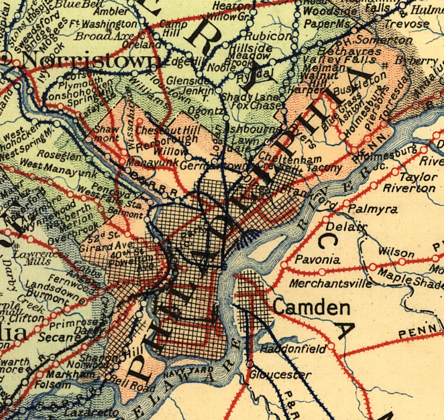 Map Of Original Railroad Stations In Downtown Philadelphia 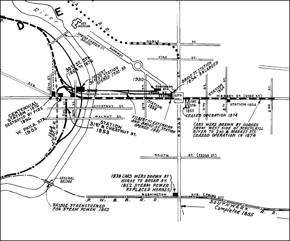 |
||||||||
| Notes About Existing
Stations... Allen Lane (PRR) - The shelter was added in 1890. Chestnut Hill (PRR) - Station was heavily modified when line was electrified in 1918. There was a brick freight station (now gone) along Evergreen at Shawnee Street at GPS: 40.075475, -75.208744. There is a frame waiting shed on Germantown Avenue (with steps down to the station) that used to house a newsstand and telephone booth. It allows passengers to connect with bus service. Fern Rock (SEPTA) - This station was built in 1956 to serve the Broad Street Subway Line. It was rebuilt in 1992 and now serves the SEPTA Warminster, Trenton, and Lansdale/Doylestown lines. North Philadelphia (PRR - 2900 North Broad) - Formerly known as Germantown Junction Station. On National Register Of Historic Places. The first station here opened in the 1870s. It was known as Germantown Junction and New York Junction. It was replaced by this station in 1896 and the name was changed from Germantown Junction to North Philadelphia in 1912 when the station was remodeled. The station was closed for railroad use in 1991 when it was replaced by an Amtrak station across the tracks. That Amtrak station subsequently closed Overbrook (PRR) - This is purported to be the oldest station on the Main Line from Overbrook to Paoli, dating from 1858. It is built entirely of wood and has seen much use and wear. It was formerly known as City Avenue Station. There is a splendid brick interlocking tower about 50 yards east of the station, and an artfully-built concrete bridge which carries City Line Ave. over the tracks. Here is an old photo. The westbound passenger shelter is on the Drexel Rd. side of the tracks. The descriptive information is for the inbound (Eastbound) station/ticket office/newsstand/residence near the signal tower on the 63rd St. side of the tracks. -- James Boylan Philadelphia (PRR - 30th & Market) - Consturction of this station started in 1927. On the aerial photo from September 7, 1930, the sign on the building reads "Opens Spetember 28, 1930." The station wouldn't actually open until 1933. Philadelphia (PRR - Suburban Station) - The 21-story office building atop the station served as the PRR's headquarters from 1930-1957. Philadelphia (PRR Fairhill Freight) - Original PRR LCL container transloading facility in Fairhill Yard. Addition to building built in 1945. +50,000sq ft clear span in original building with two overhead cranes and three indoor tracks and one outdoor track. Active rail-related facility. Philadelphia (PRR Ontario St. Freight) - Only the western end of this station still stands. Philadelphia (RDG - North Broad Street) - A previous station sat just north of this site and it was referred to as Reading's Huntingdon Street station. Queen Lane (PRR) - This station was originally one story. A second story was added in 1890. Philadelphia (RDG - 8th & Spring Garden) - The station still sits intact on the north corner of 8th and Spring Garden. It is a two-story building. The second story is an elevated passenger station. Philadelphia (RDG - 12th & Arch) - Also site of the Reading Terminal Market. The market predates the station (in fact it is the descendant of the original market at the the eastern end of Market Street that gave the street its current name). When the P&R bought the site, the elevated station permitted the market to continue below. This station was eventually replaced by SETPA's Market East station when the PRR and Reading commuter lines were connected in the early 80's. The station's old buildings are in use for several purposes. The old train shed is now part of the Pennsylvania Convention Center. Another part of the station is now part of a large food market with fresh and prepared foods served in stalls. The rest of the terminal is now a Hard Rock Cafe and office building. The Market East station is a block south of Reading Terminal and is located beneath The Gallery which is a large indoor mall. This is the second station to be built at this location. This station cost the railroad $90,000 to build. Philadelphia (RDG - Spring Garden Street) - The station still sits intact on the north corner of 8th and Spring Garden. It is a two-story building. The second story is an elevated passenger station. Philadelphia (Jefferson) (SEPTA) - This station was built to replace the old Reading Terminal, and is three stories under the original Reading Terminal. The entire station is underground, and trains enter the station through the Center City Commuter Connection Tunnel in Philadelphia. Between 1984 and 2014, this station was called "Market East Station." Philadelphia (Penn Medicine) (SEPTA) - This station was originally named "University City" station. In 2020, the station was renamed to "Penn Medicine" station when the University of Pennsylvania Health System signed a $3.3 million deal with SEPTA to change the name of the station. Shawmont (PG&N) - Originally built as a country summer house in 1826, the building passed through a couple of owners before it began serving in 1835 as a passenger/freight station for a private lumber business situated next to the Philadelphia, Germantown & Norristown RR and the Schuylkill Navigation System Canal. Ownership of the station passed to the PG&N (sold for $1 by the owner at the time) in 1857 and a small freight house was soon constructed across the tracks. The station was called "Green Tree" from 1835-1873 and was at one time referred to as Nixon Street Station. The Shawmont Station is the oldest, original railroad station in the United States as the the 1831 station at Ellicot City, MD has been through restoration and been altered. It was built in the "Greek Revival" style and had the roof mouldings re-modeled and an addition put on the back in the 1870's. It also resembled a typical stagecoach stop, as many early PG&N stations did in the 1830's. It will likely become a national landmark in the years to come. The station was closed by SEPTA in 1991. See John Johnstone's page for more info: Historic Shawmont Station. St. Martins (PRR) - This was originally a one-story station and formerly known as Wissahickon Heights until 1906. The second story was added in 1889 when the PRR did this to three Phildelphia-area stations on the Chestnut Hill Branch: Tulpehocken, Upsal and Wissahickon Heights (St. Martins). Tulpehocken (PRR) - This was originally a one-story station. The second story was added in 1889 when the PRR did this to three Phildelphia-area stations on the Chestnut Hill Branch: Tulpehocken, Upsal and Wissahickon Heights (St. Martins). Upsal (PRR) - This was originally a one-story station. The second story was added in 1889 when the PRR did this to three Phildelphia-area stations on the Chestnut Hill Branch: Tulpehocken, Upsal and Wissahickon Heights. |
||||||||
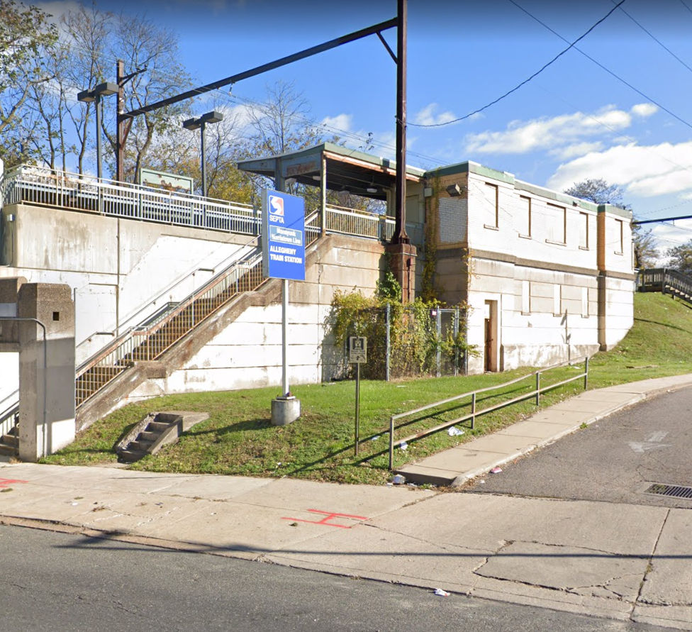
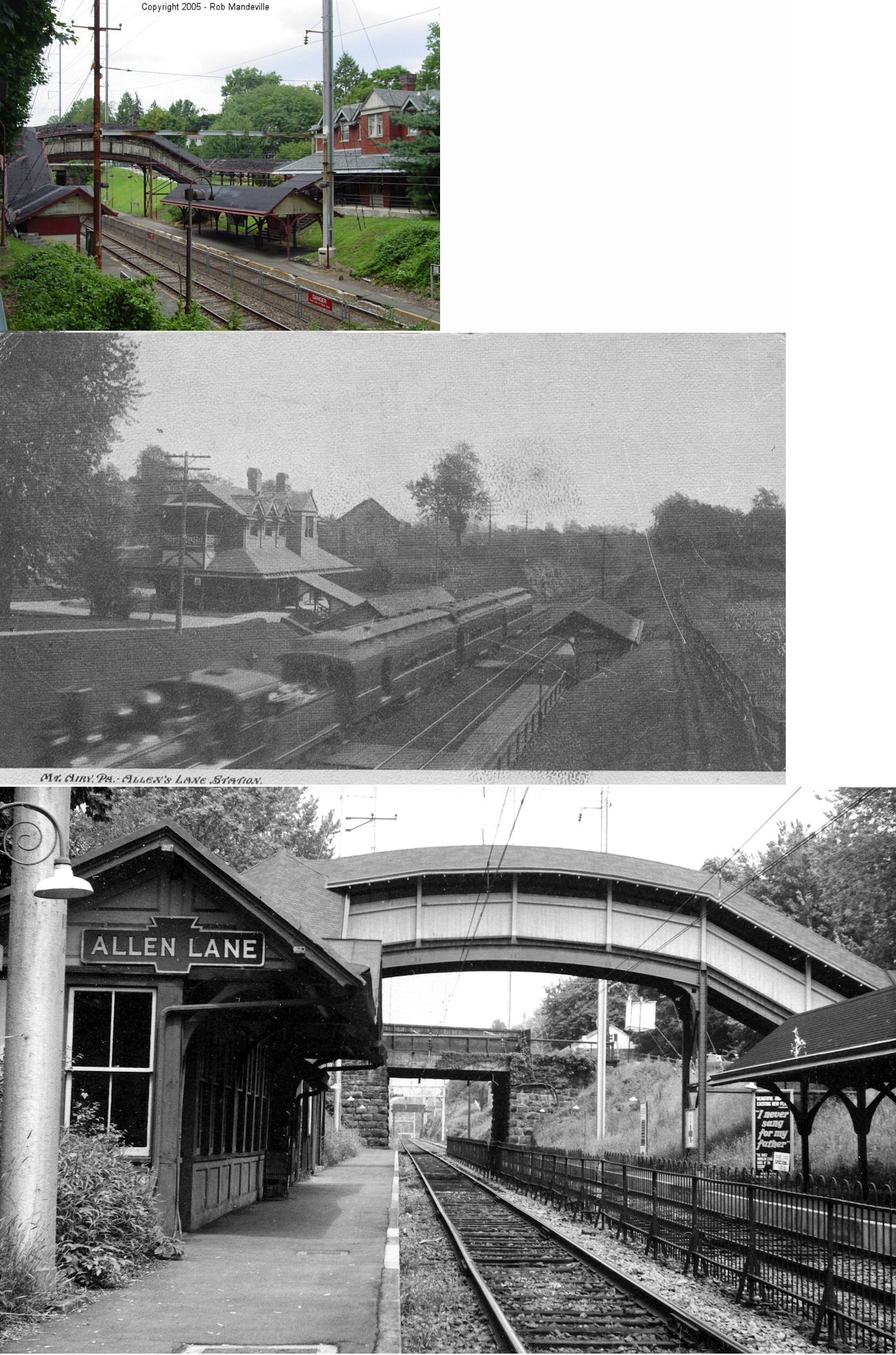
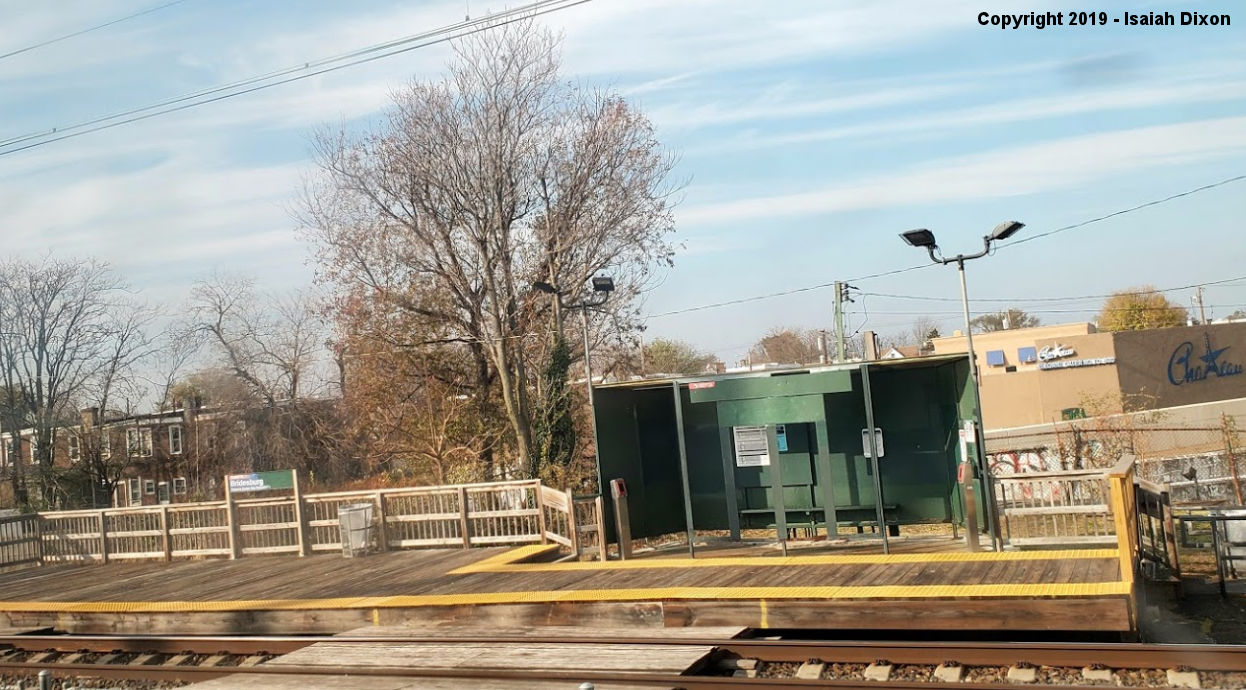
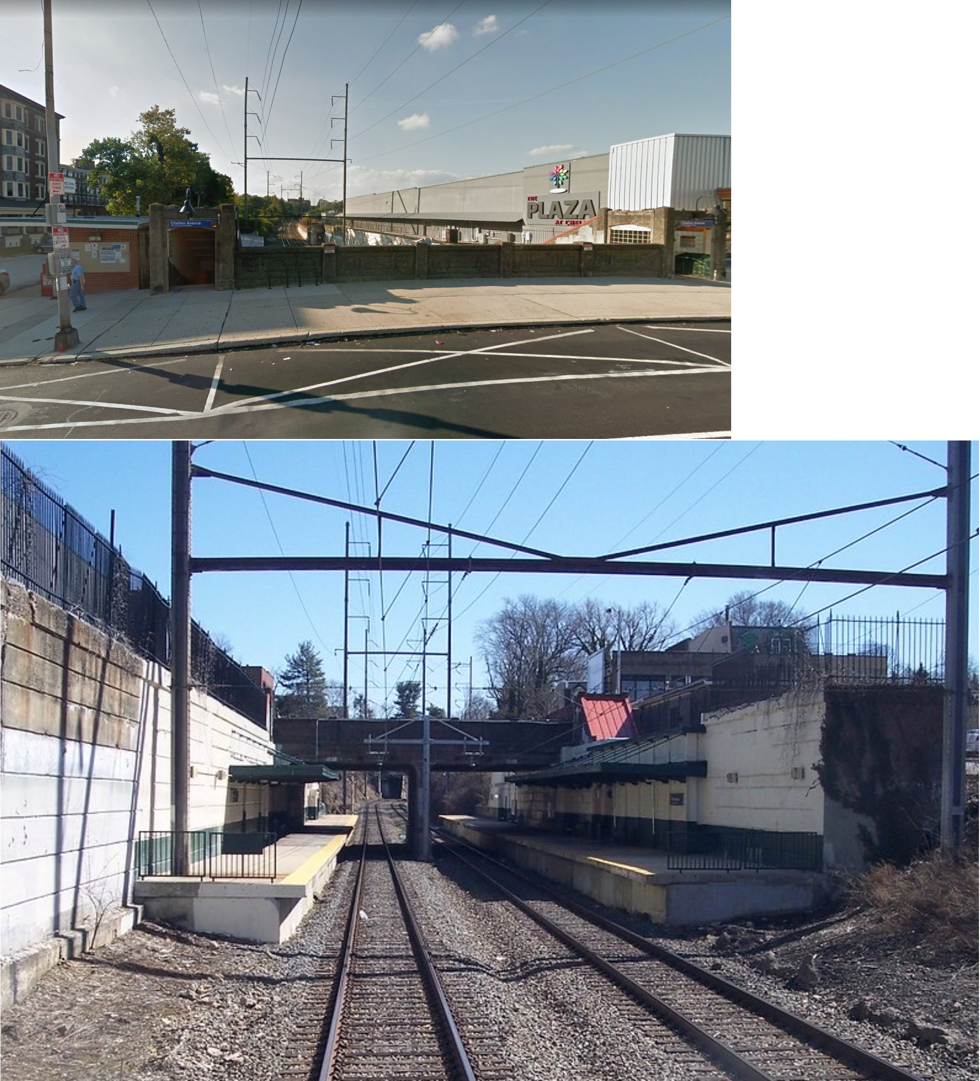
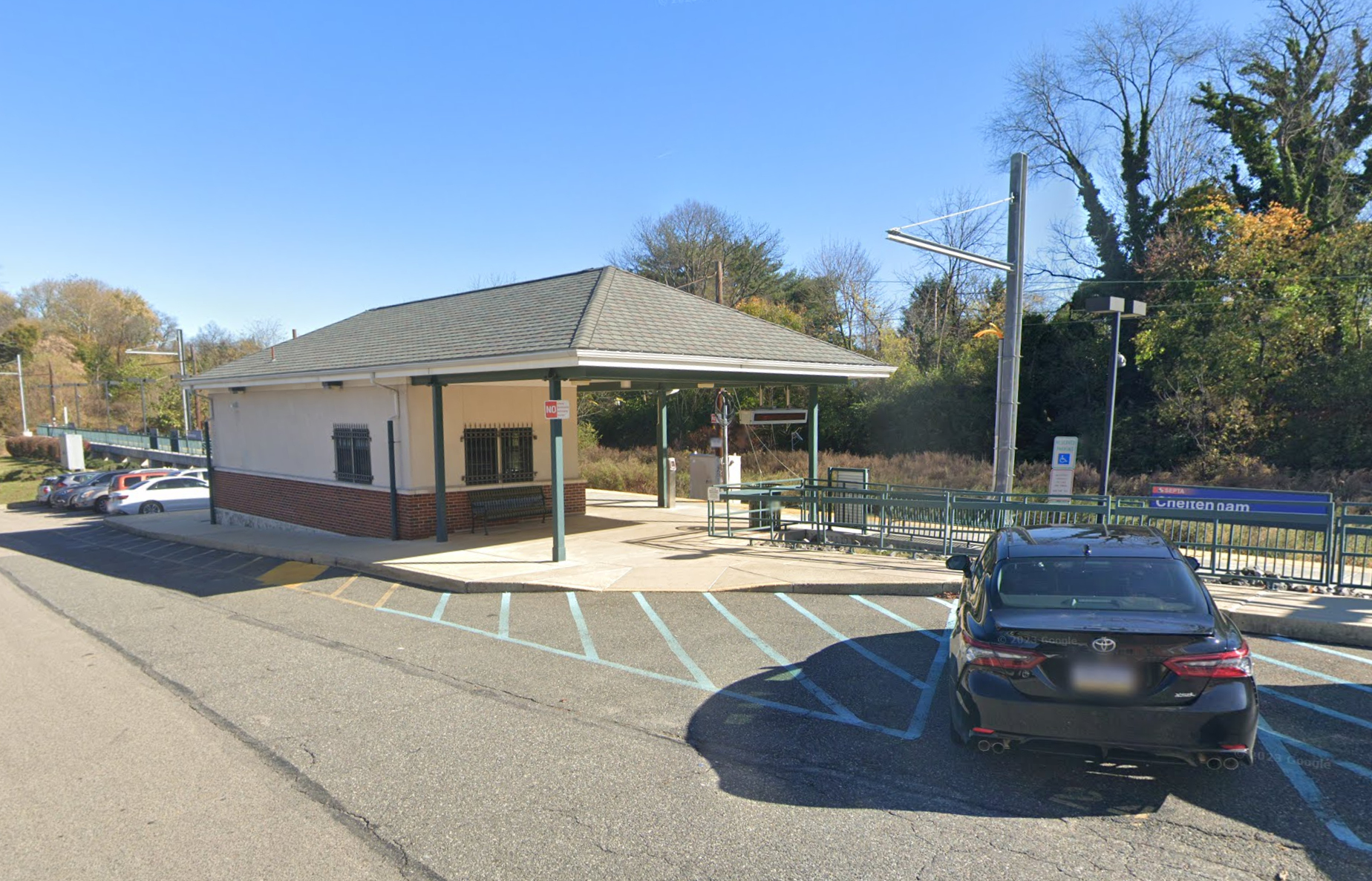
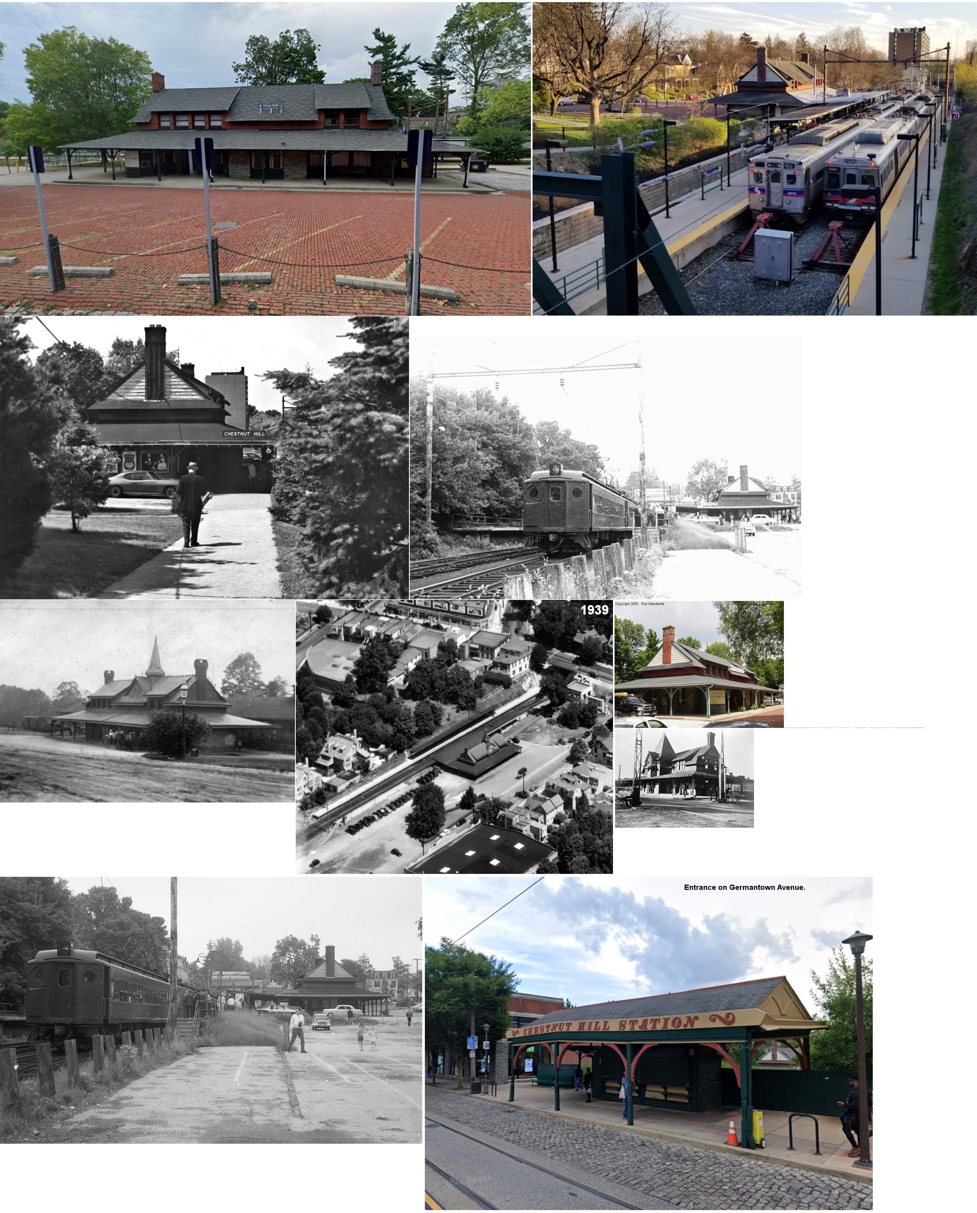
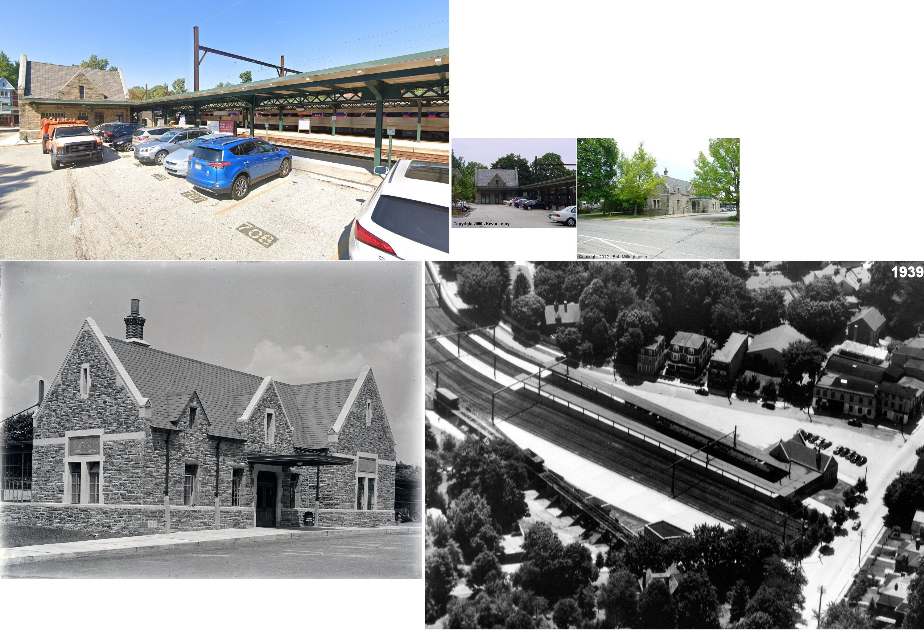
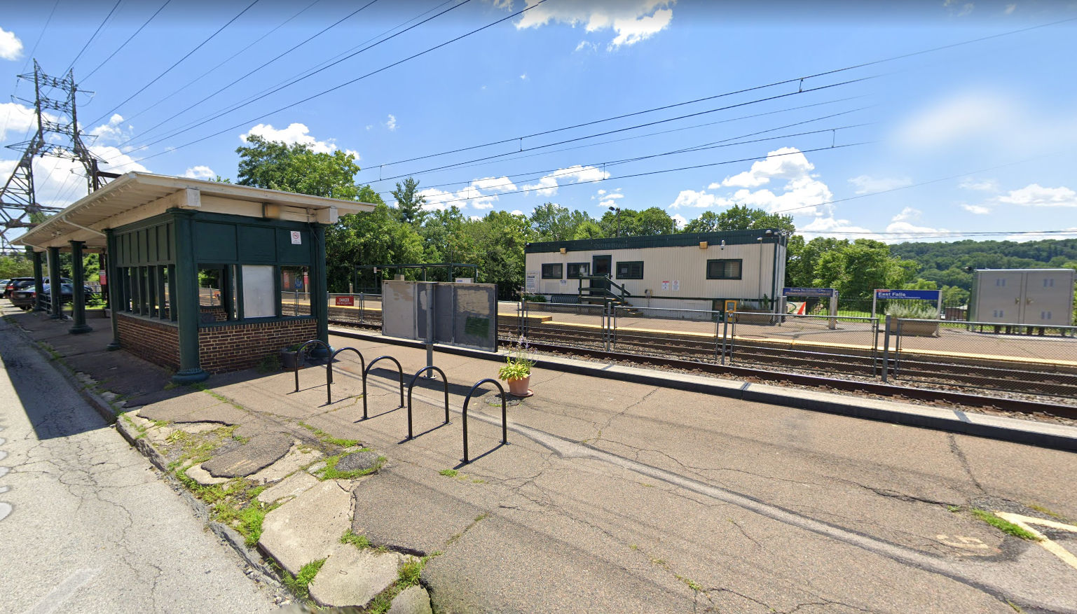
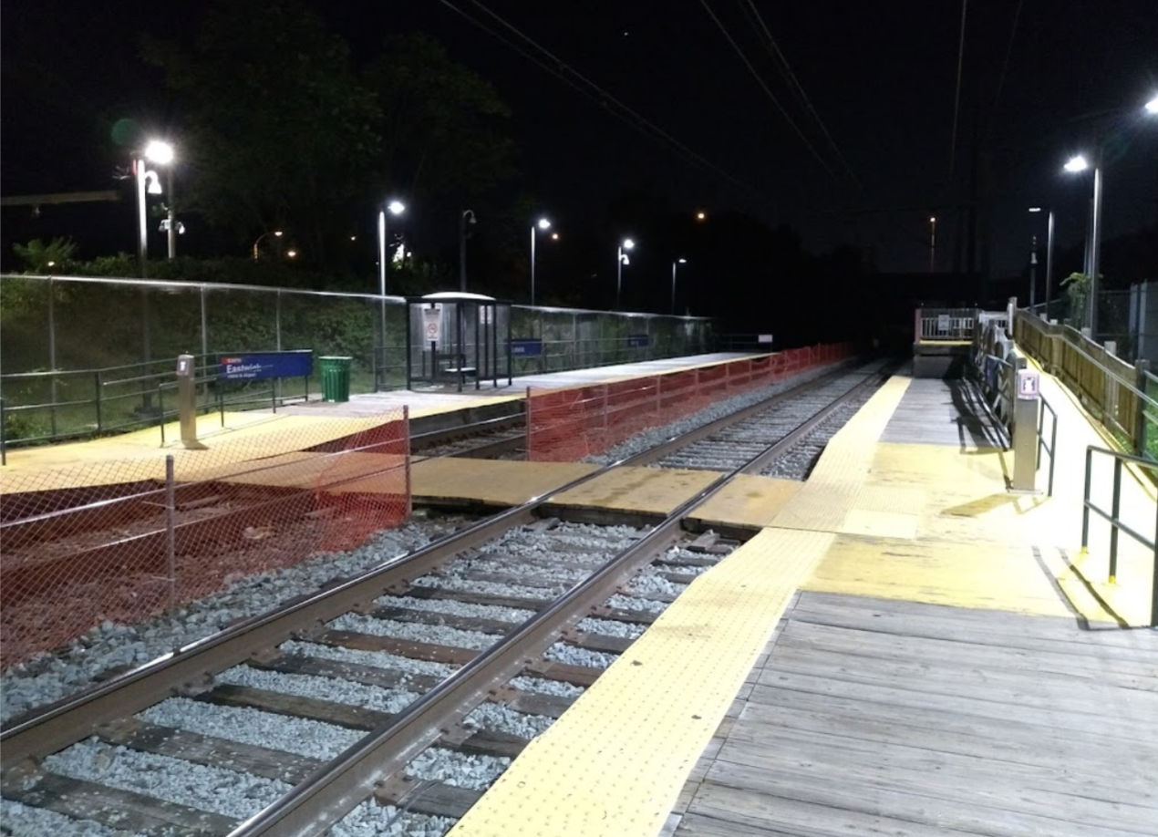
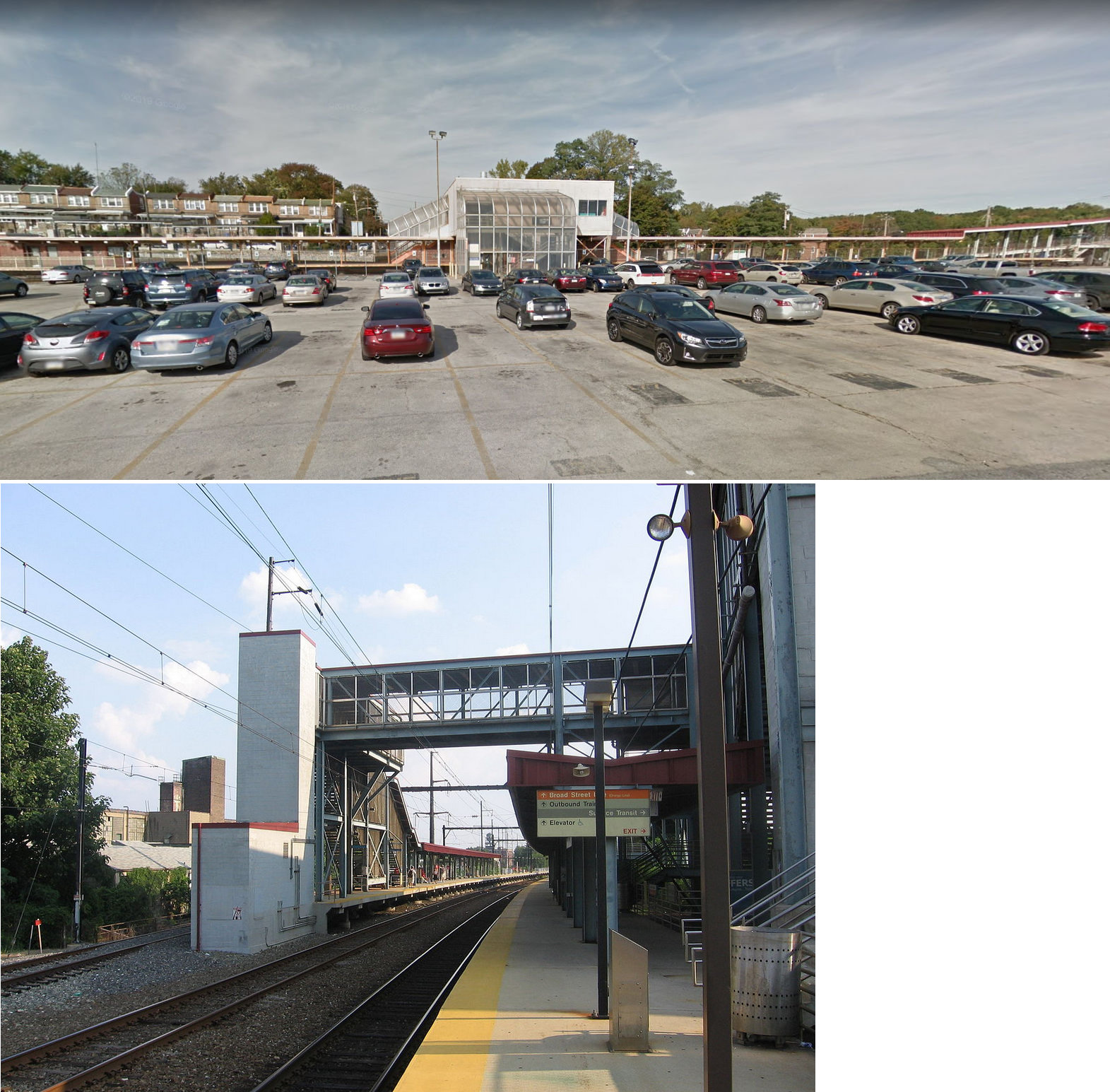
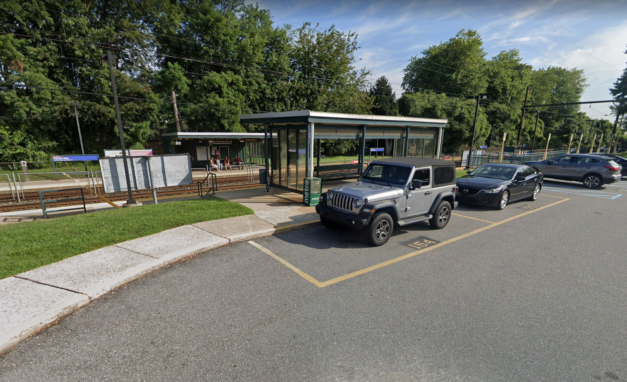
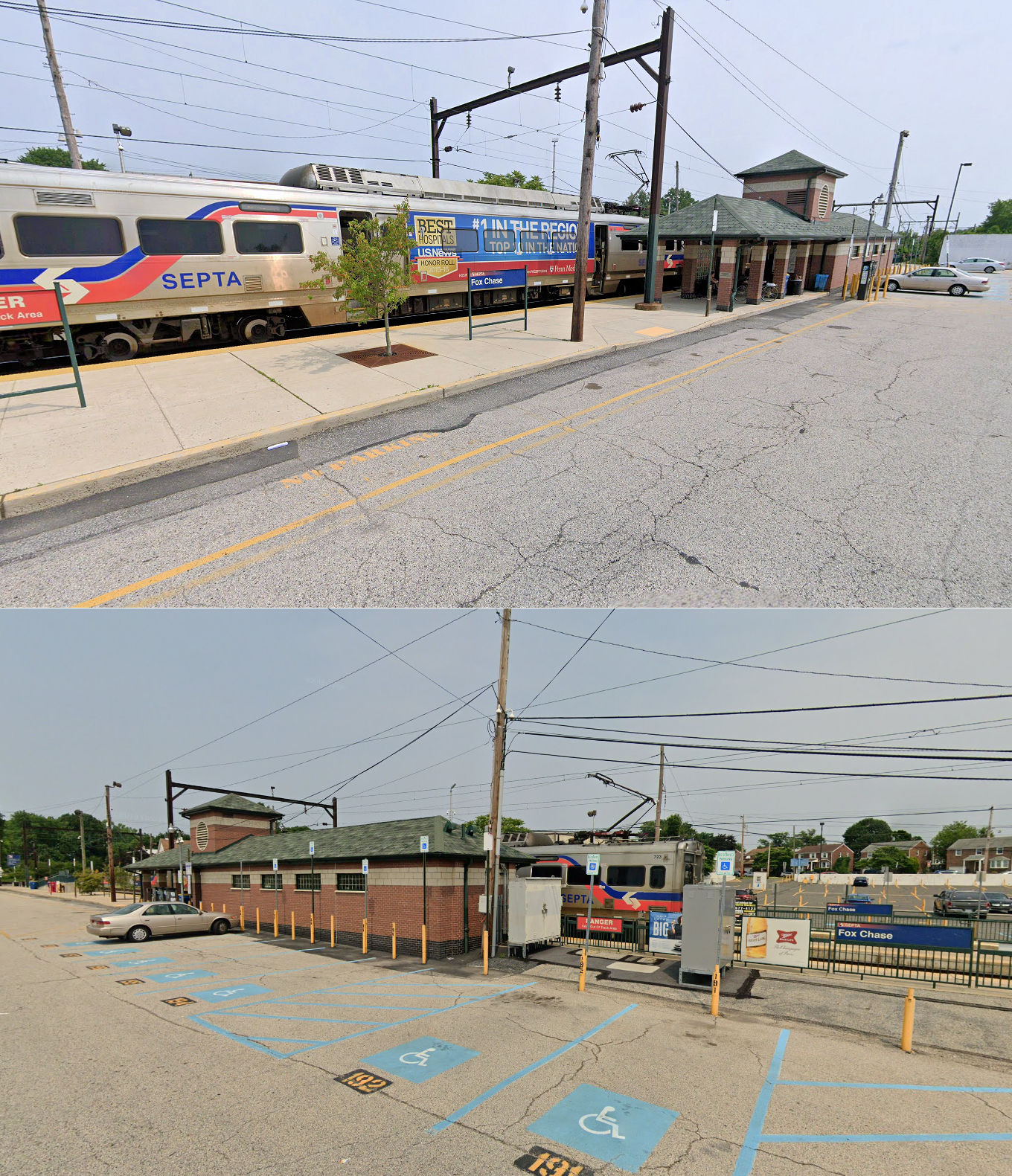
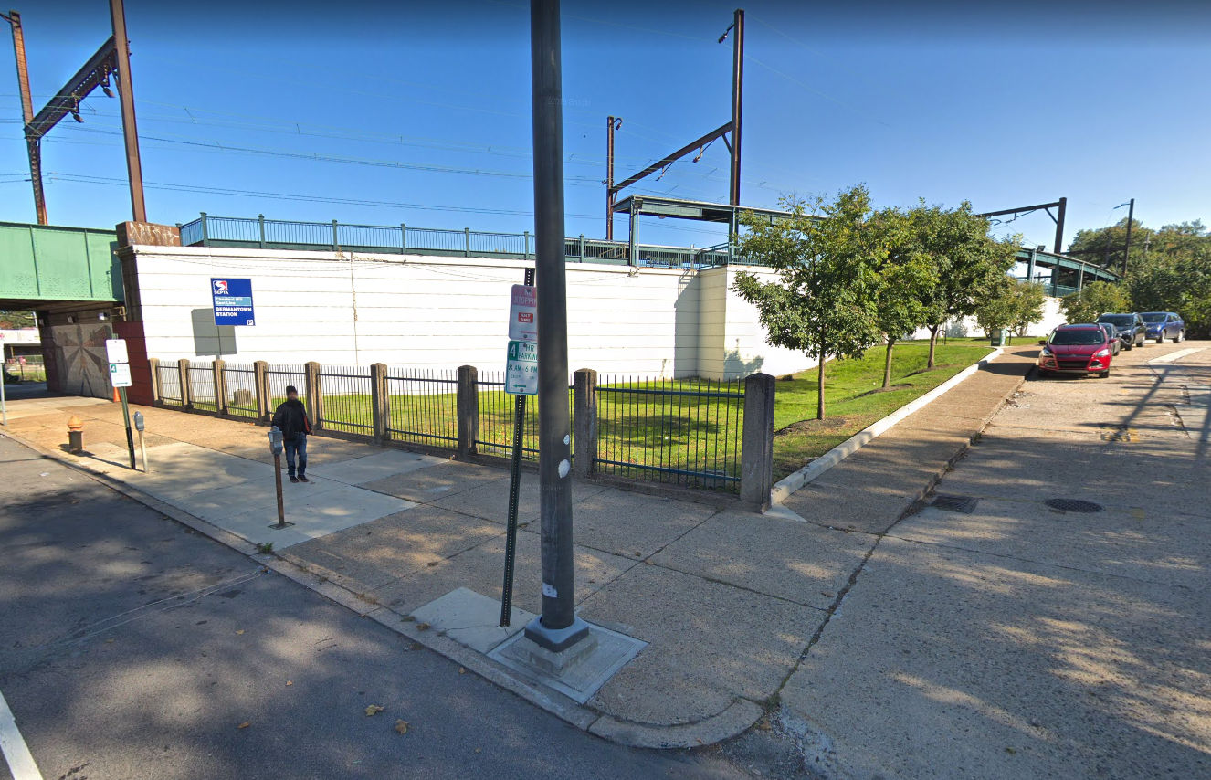
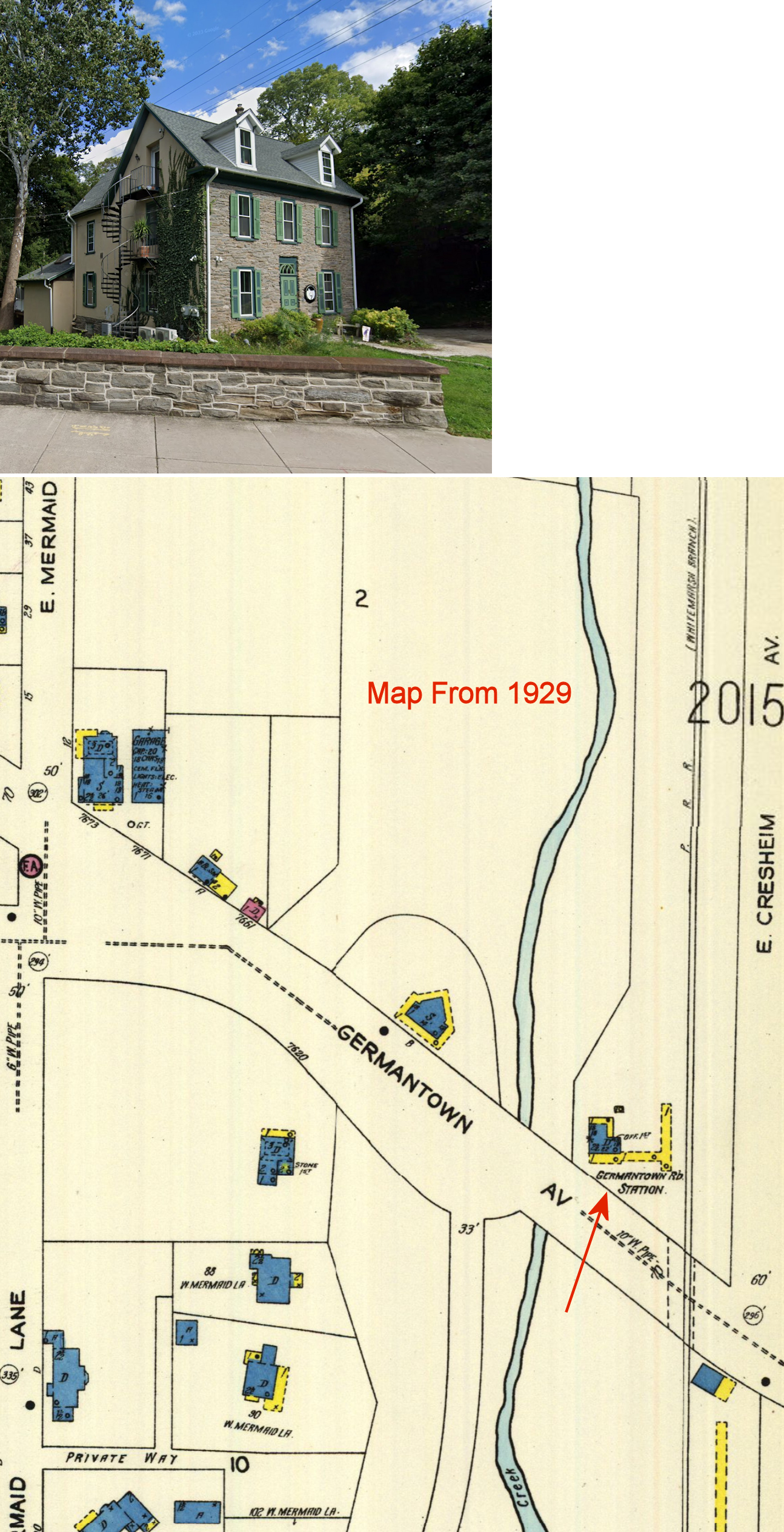
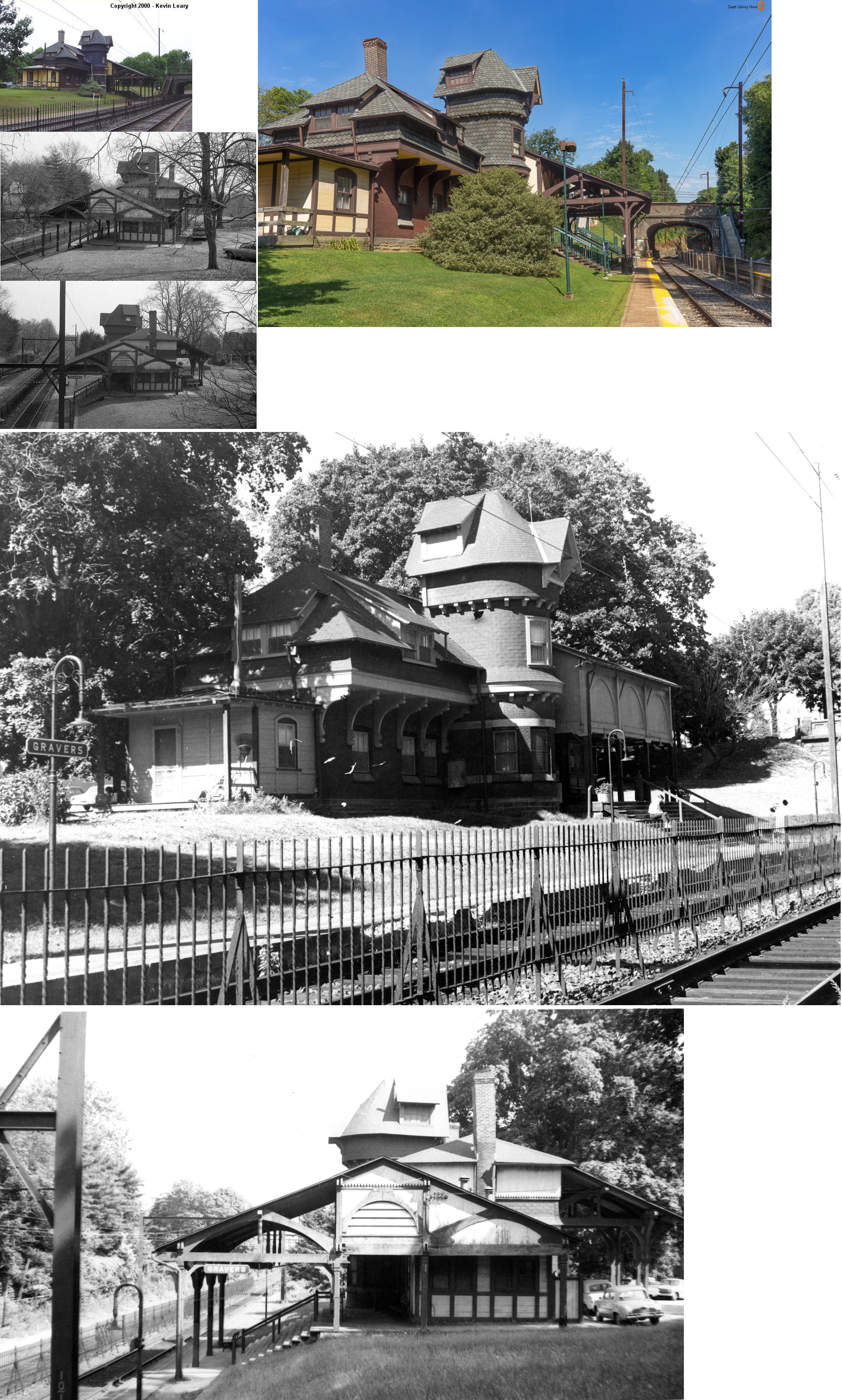
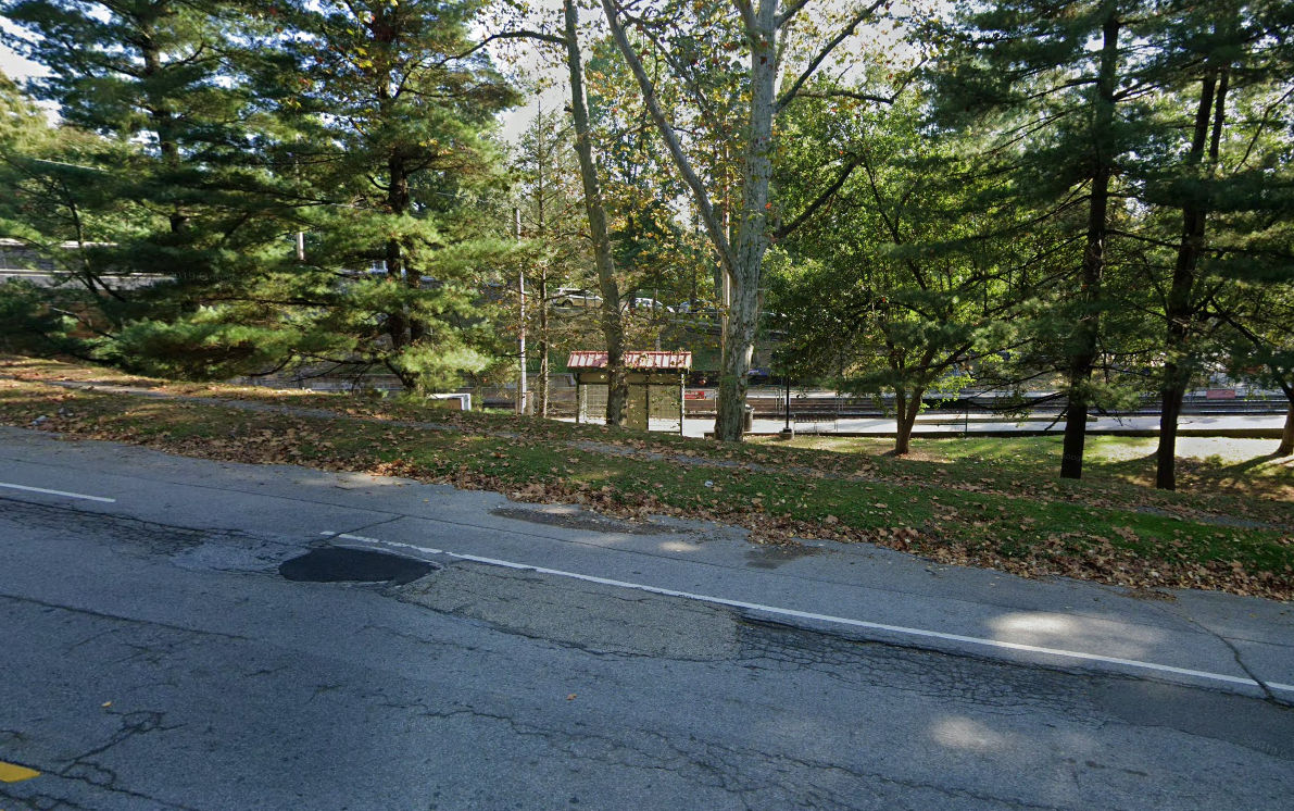
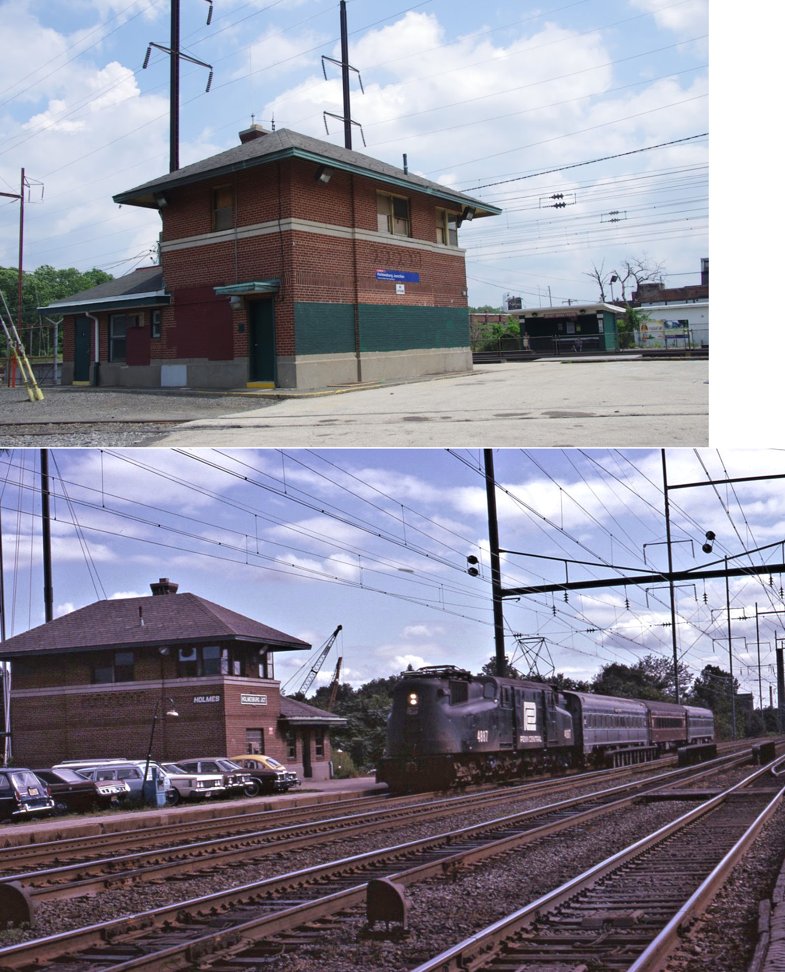
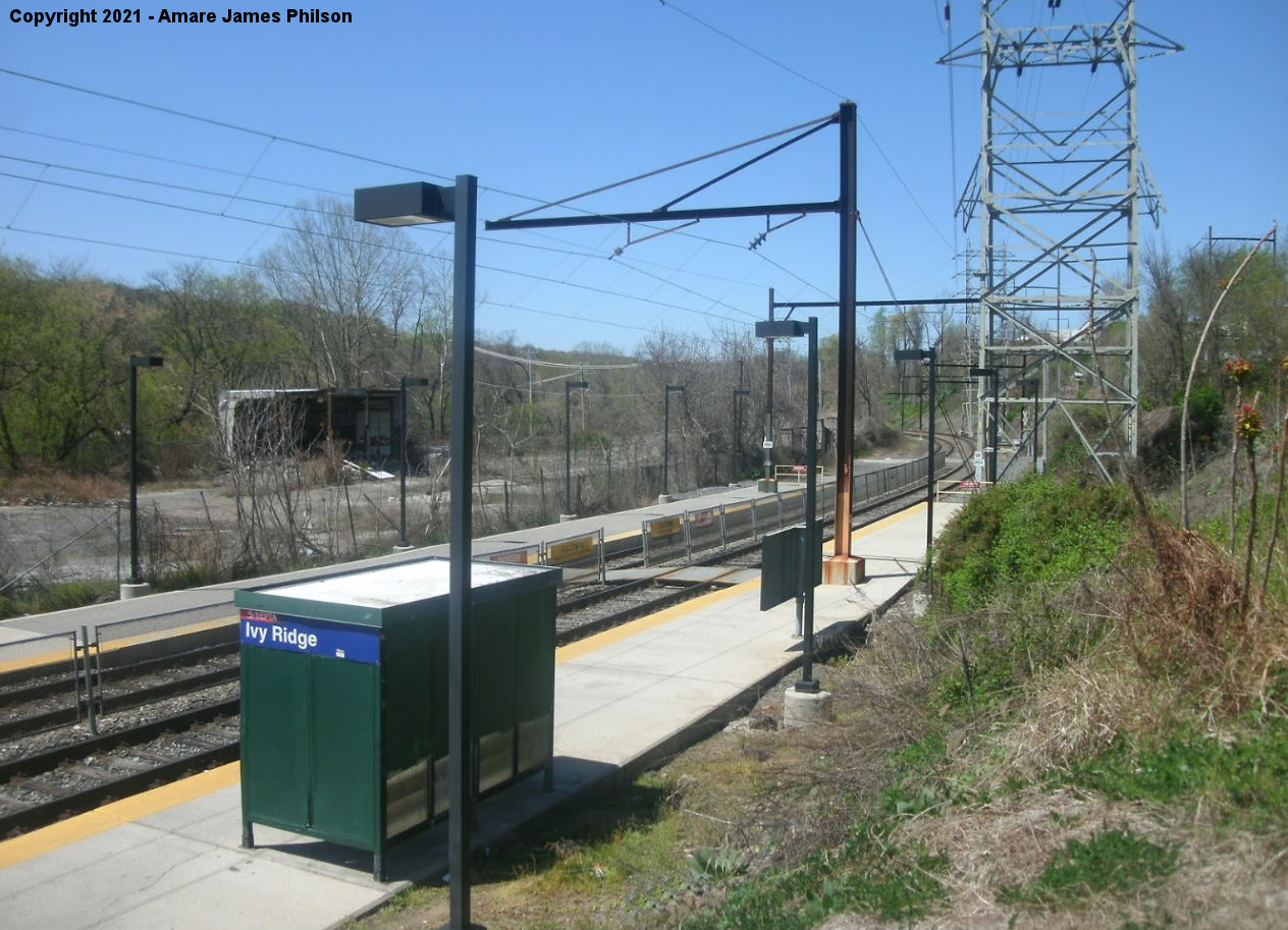
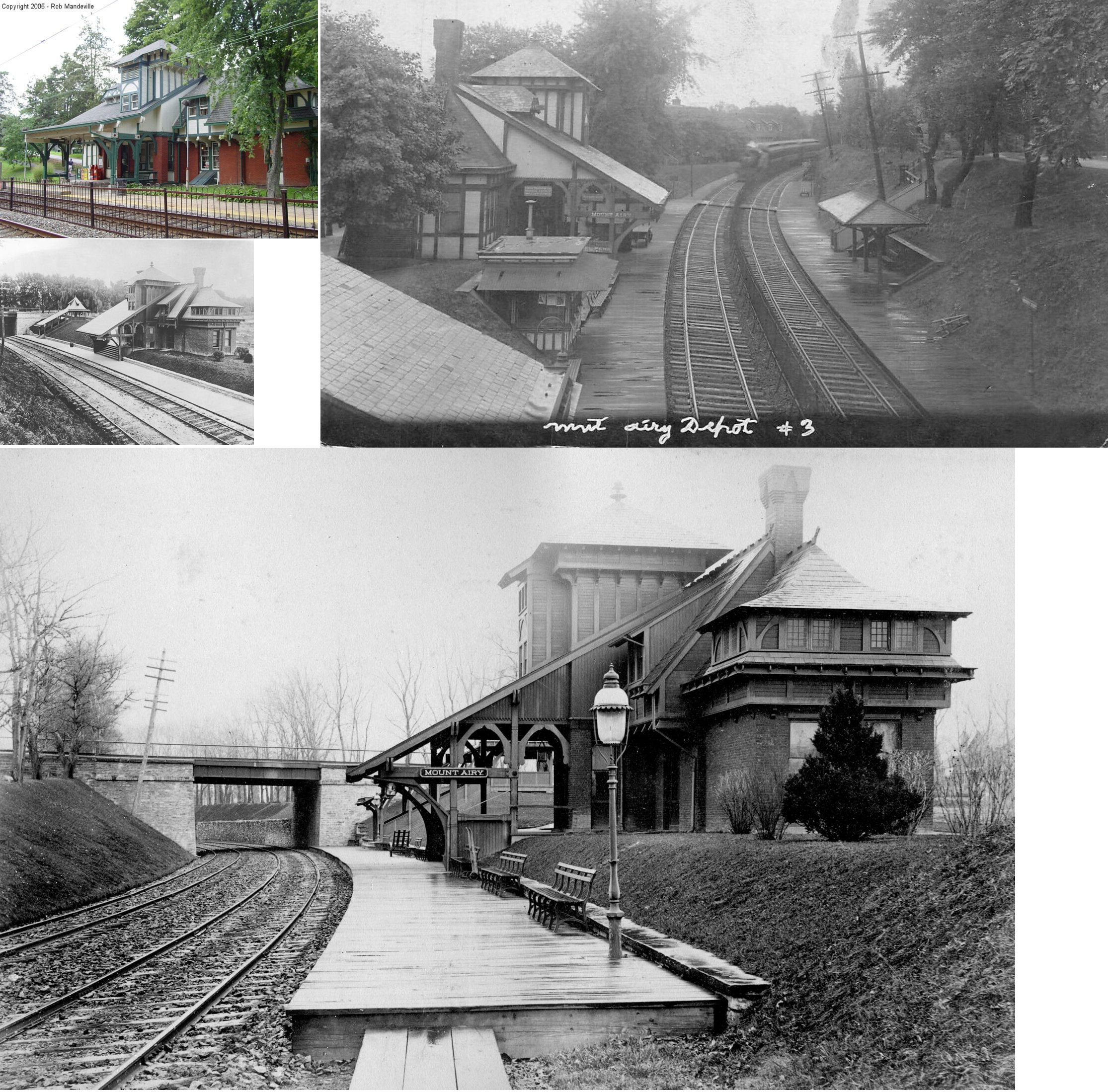
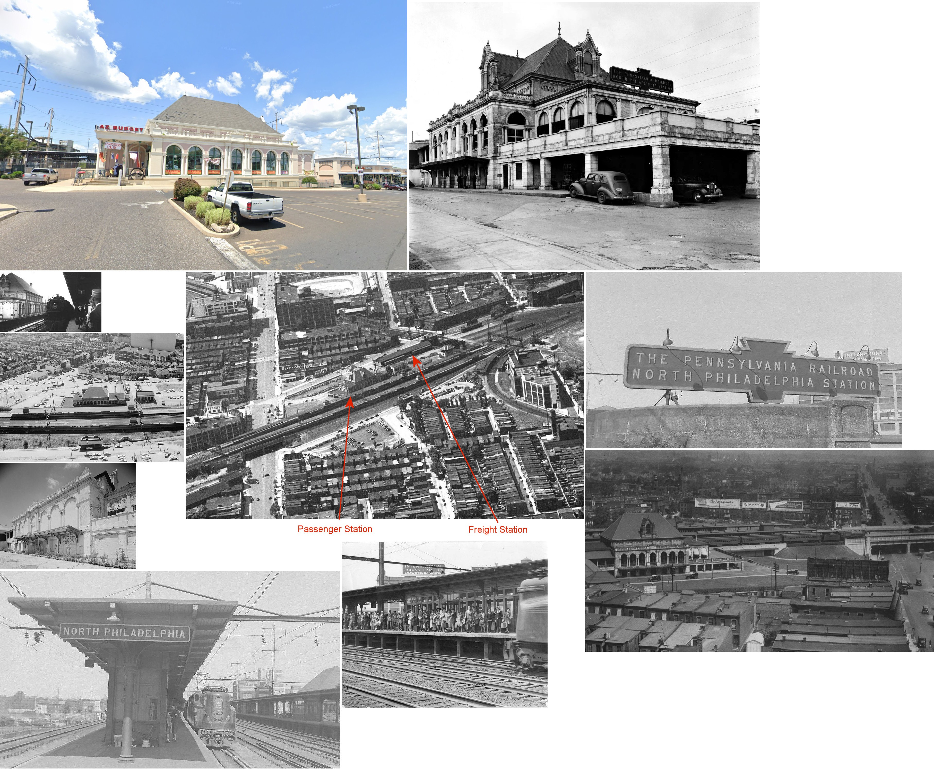
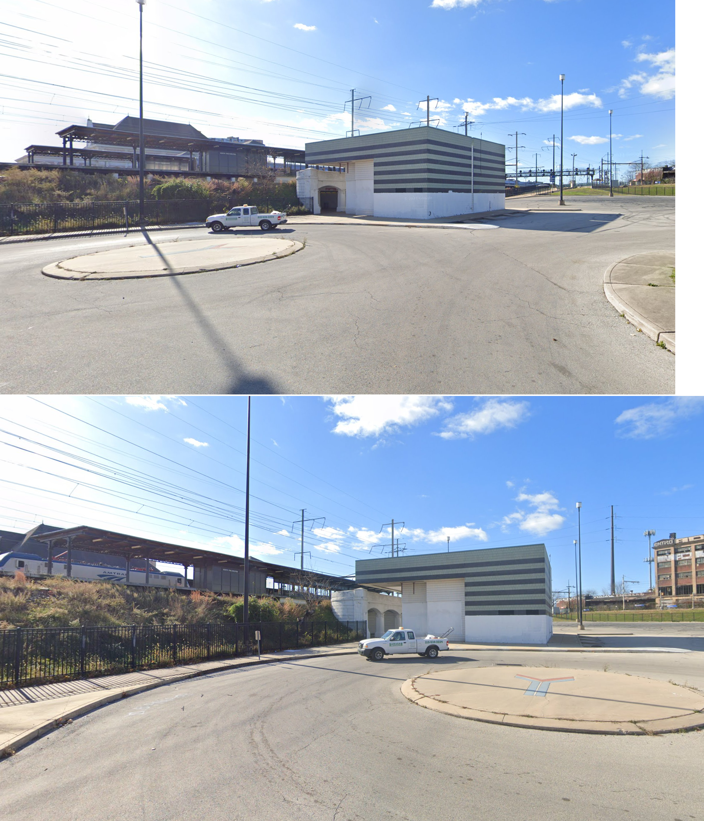
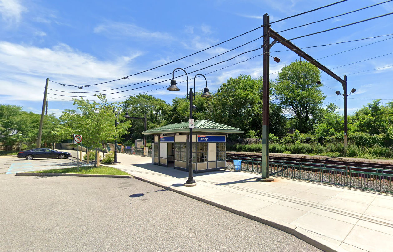
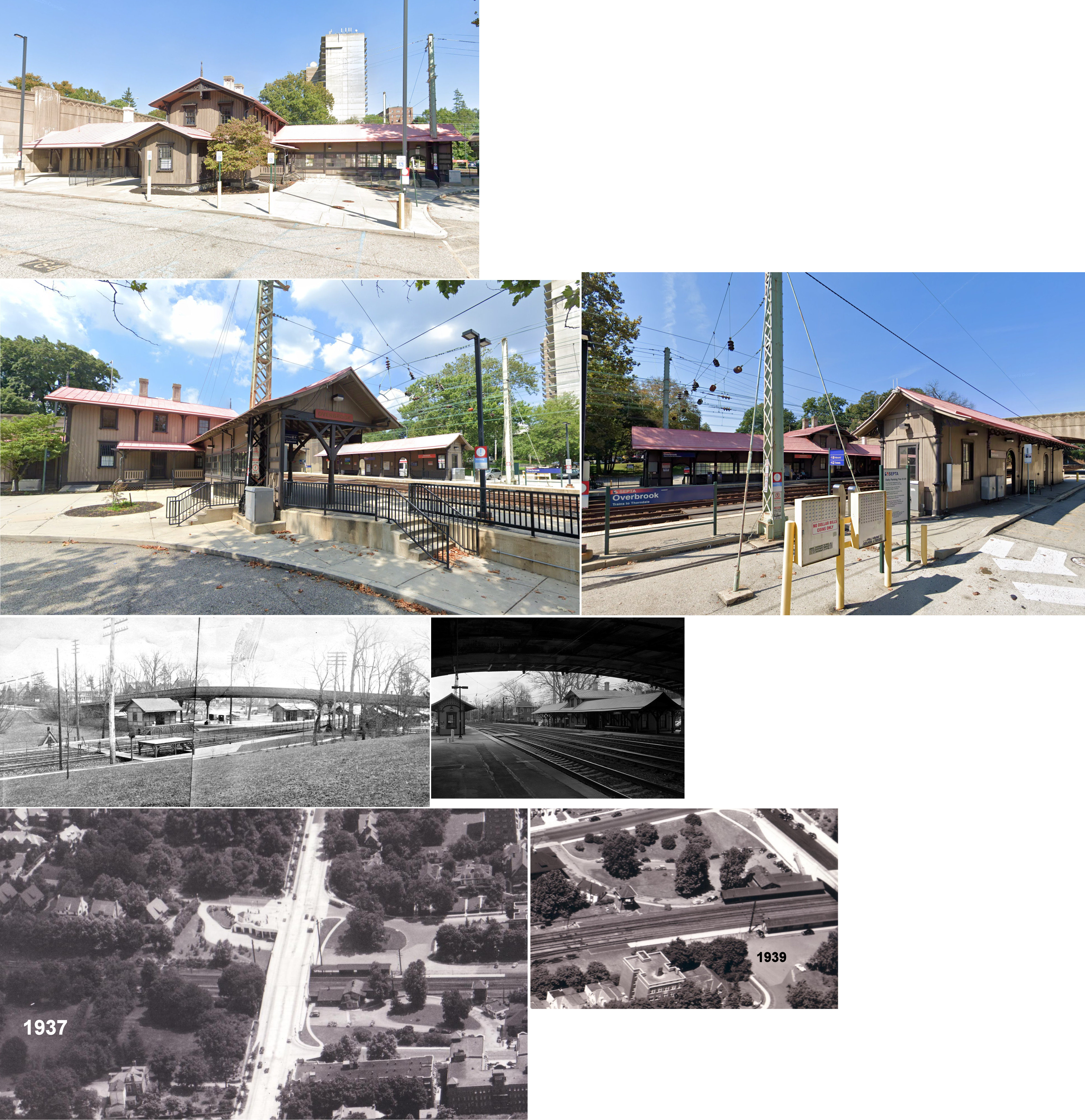
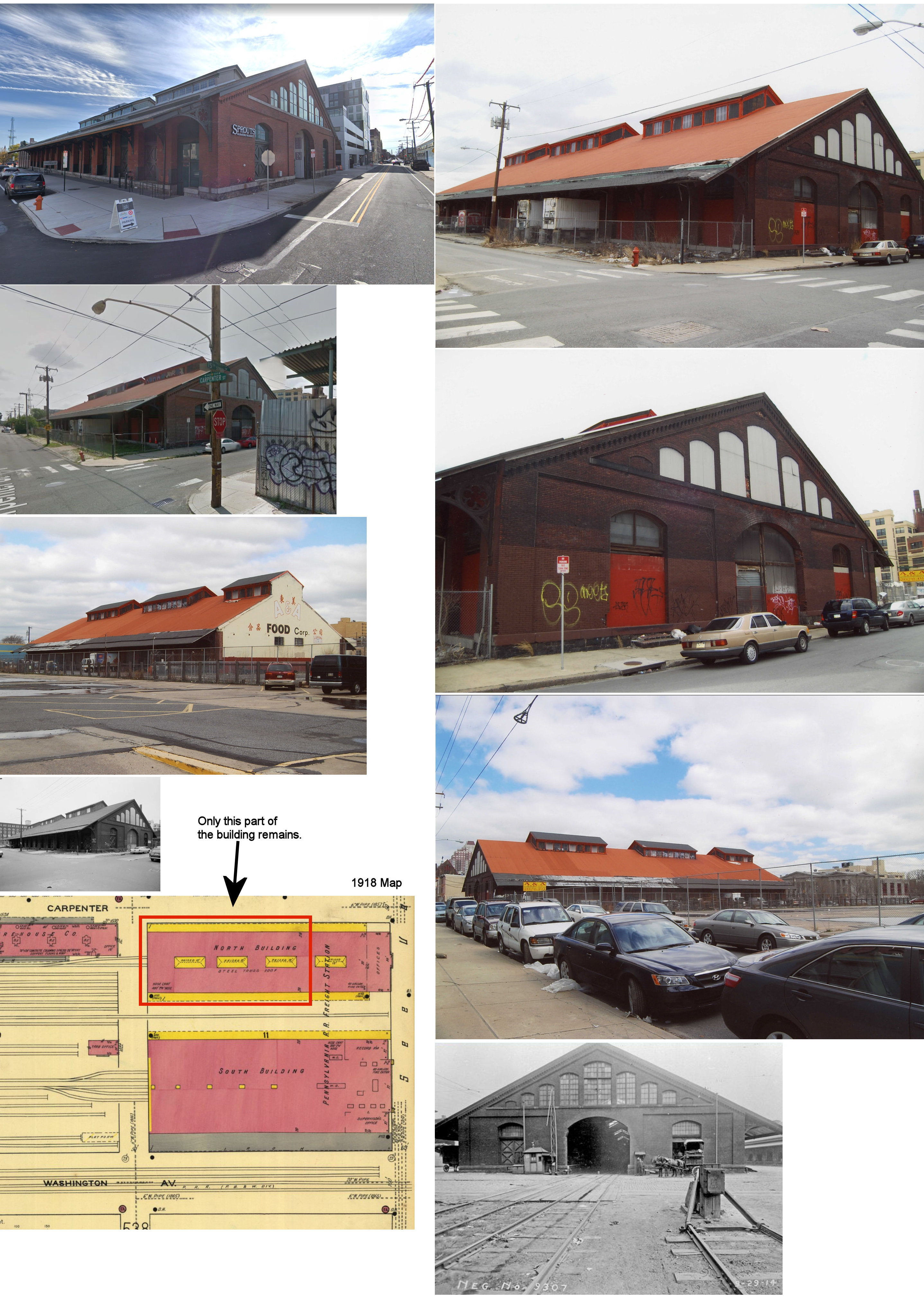
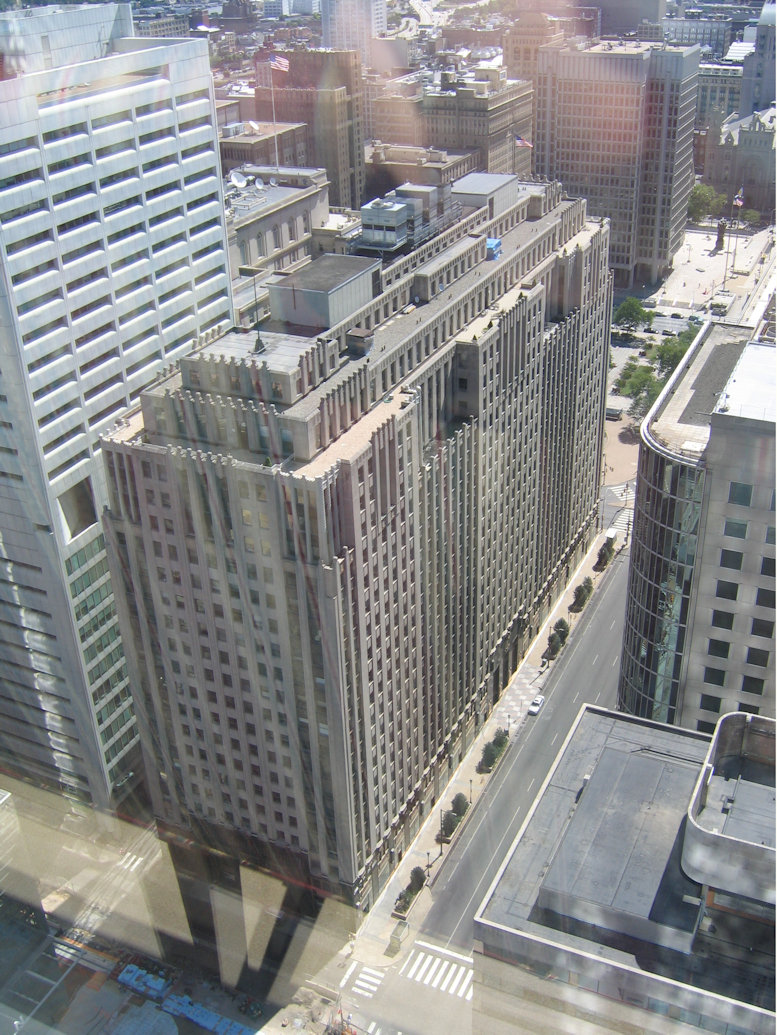
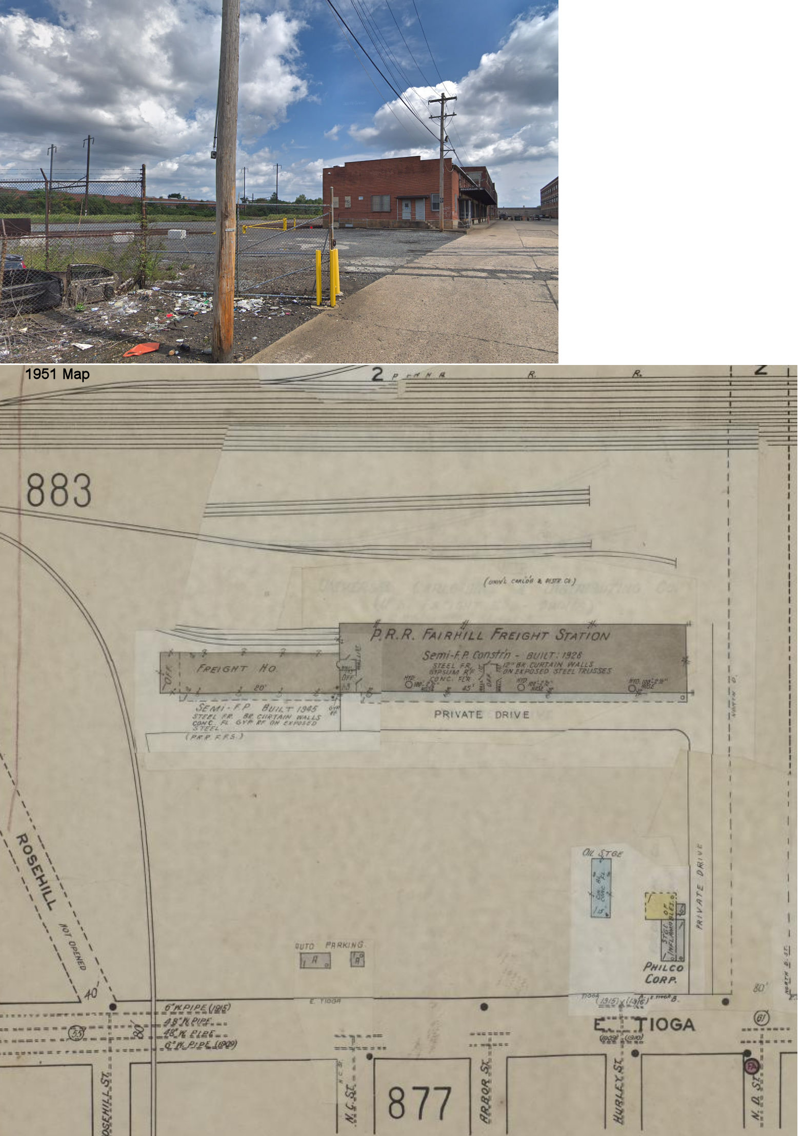
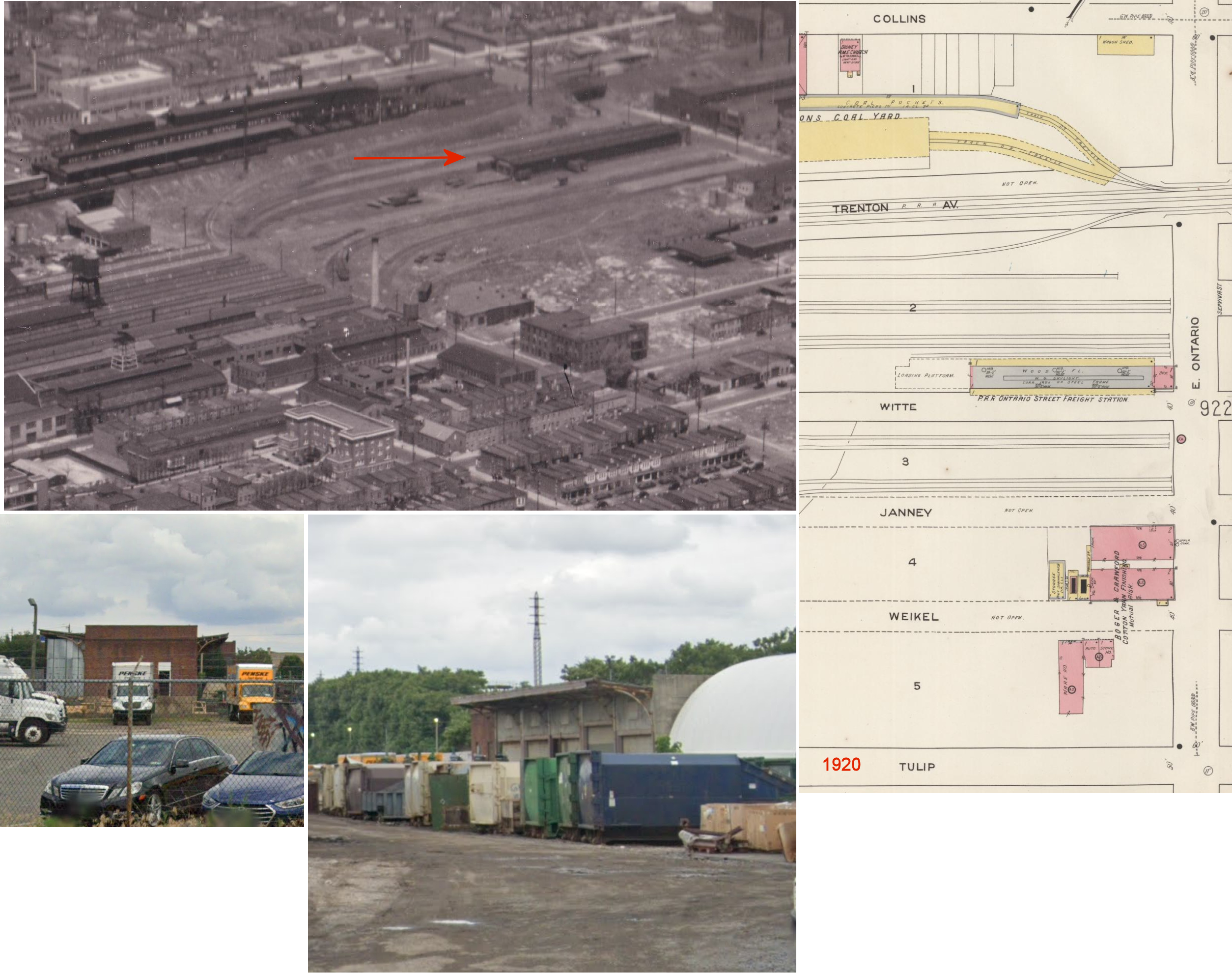
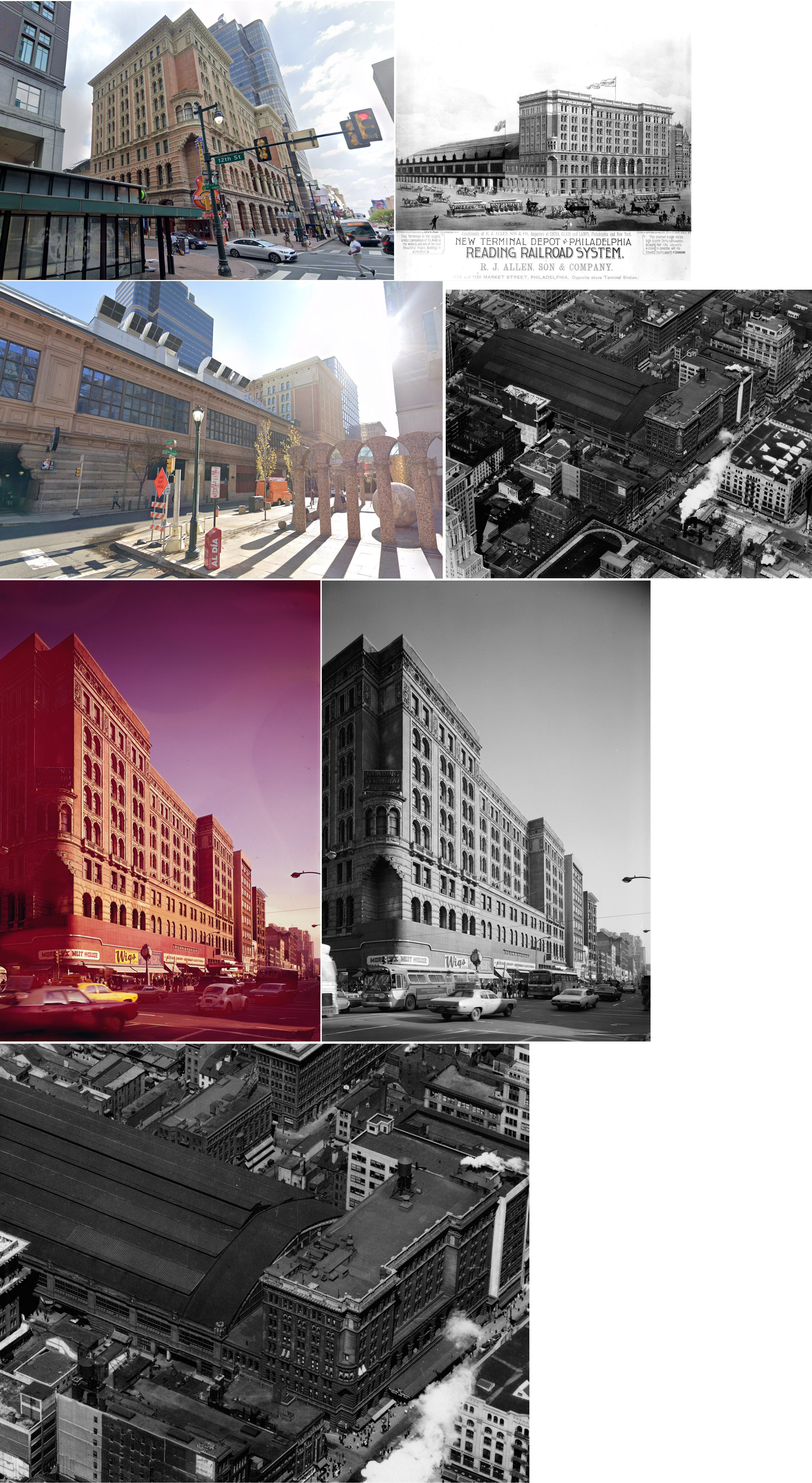
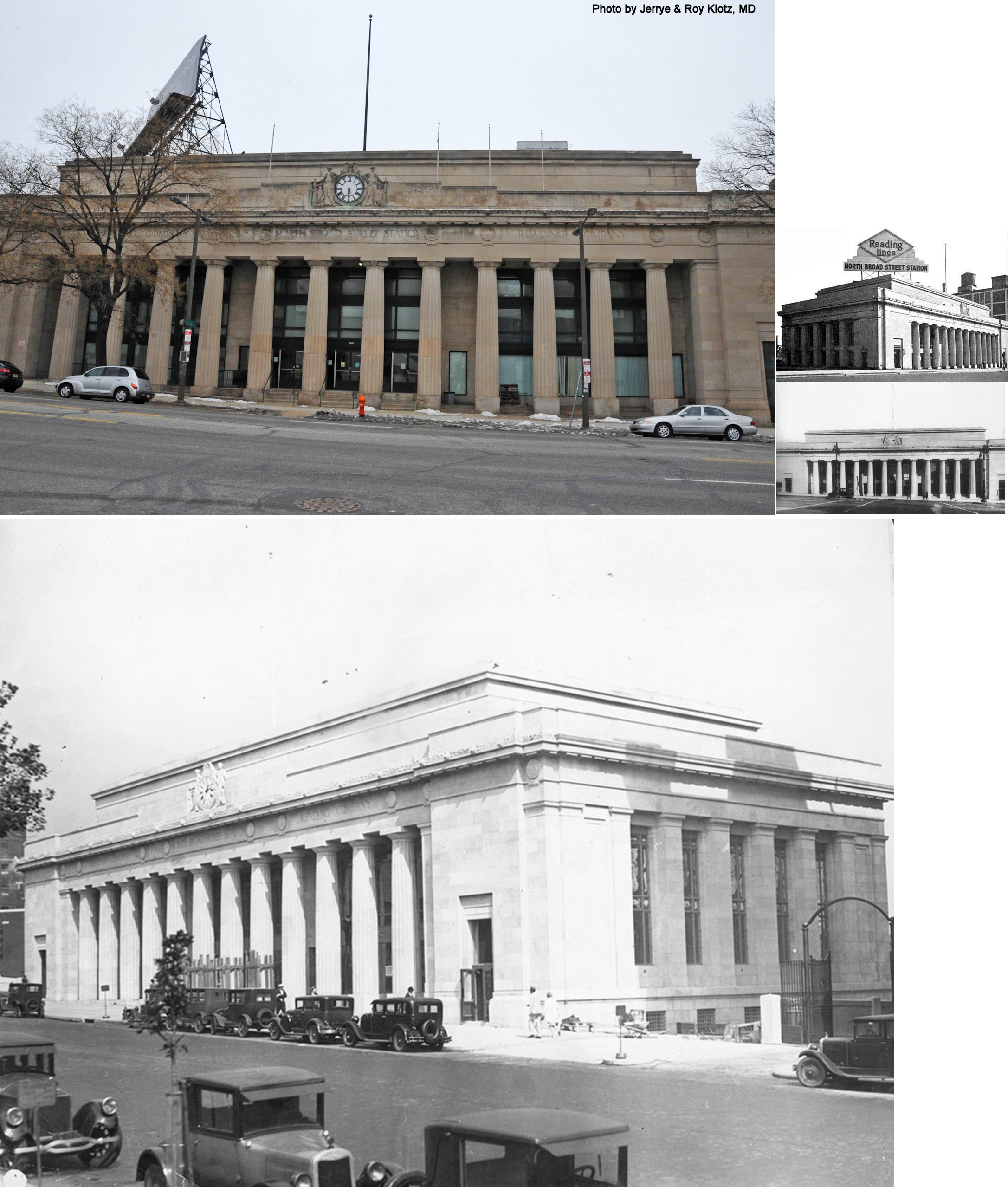
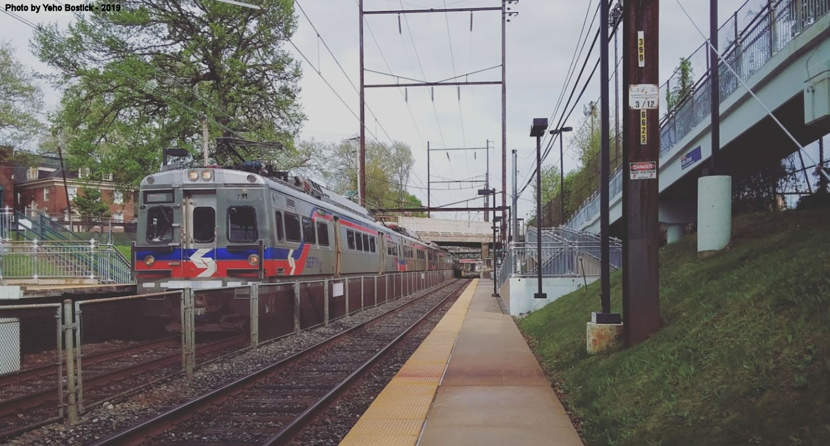
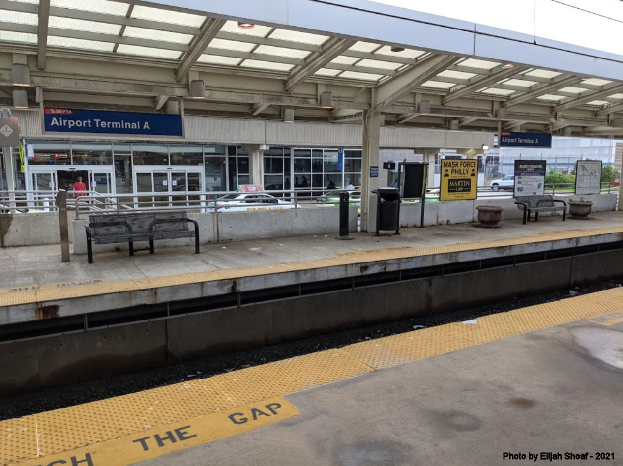
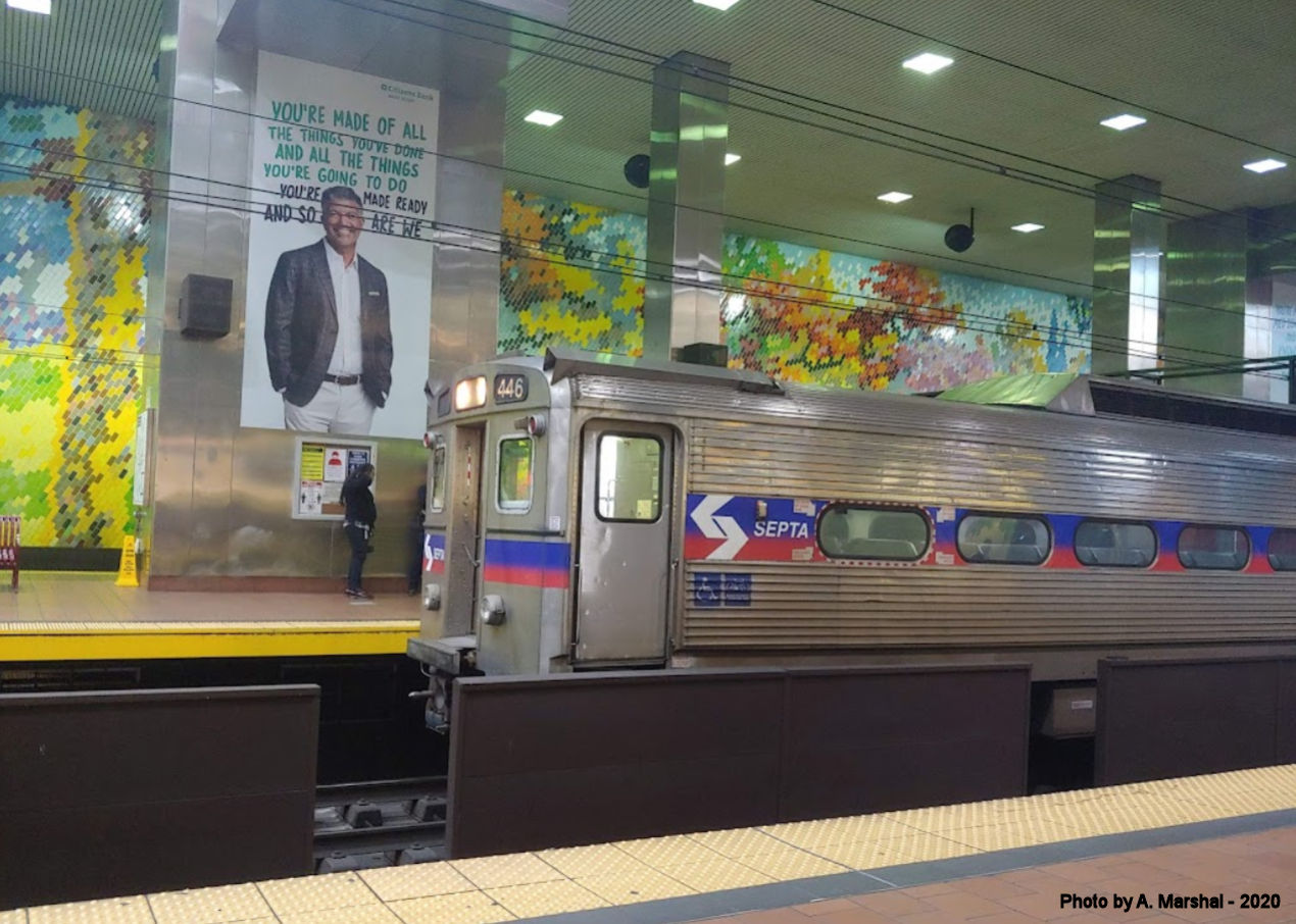
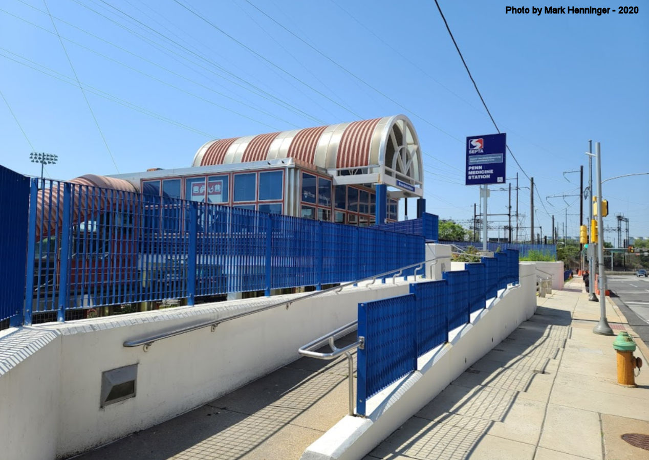
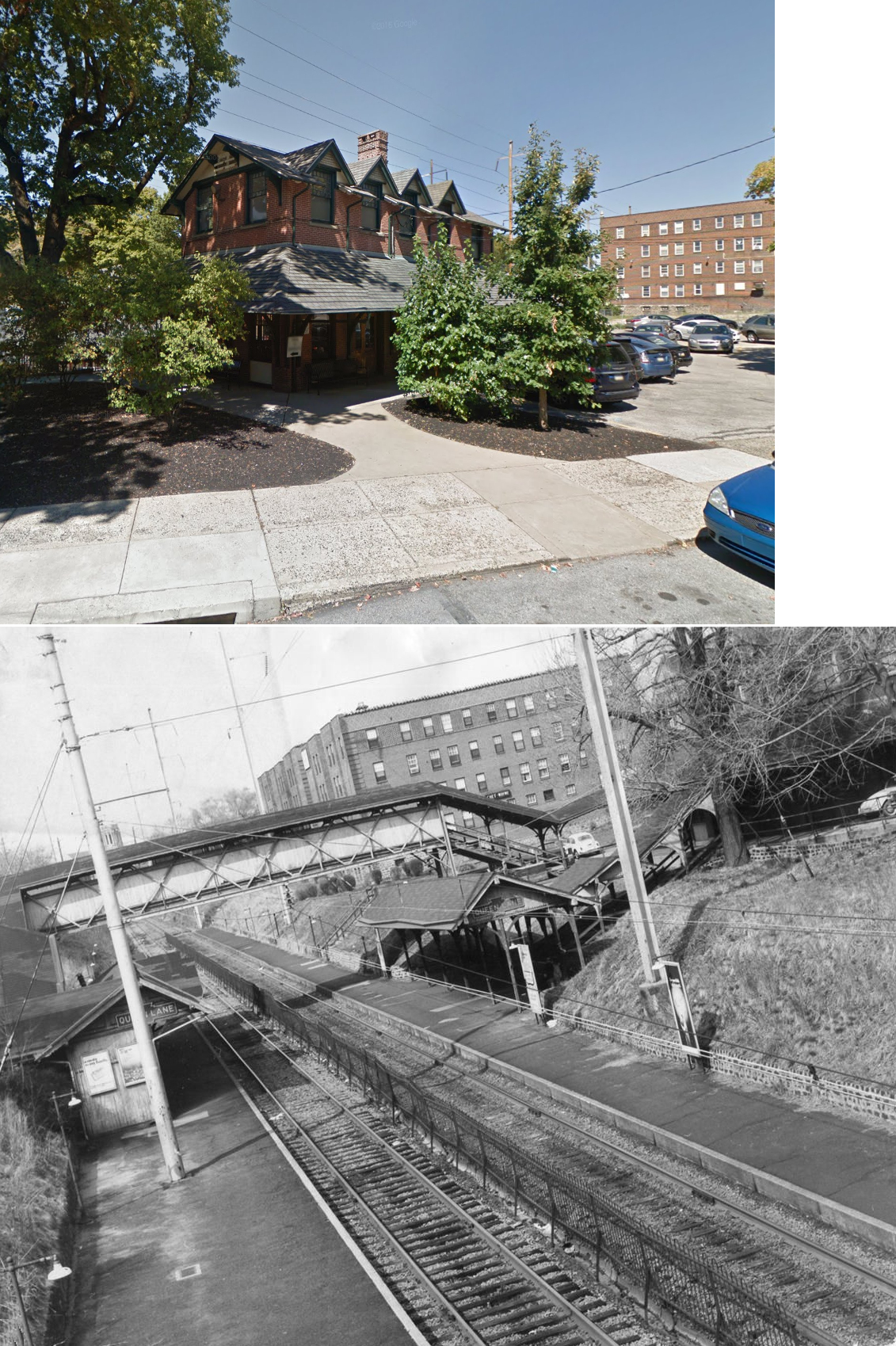
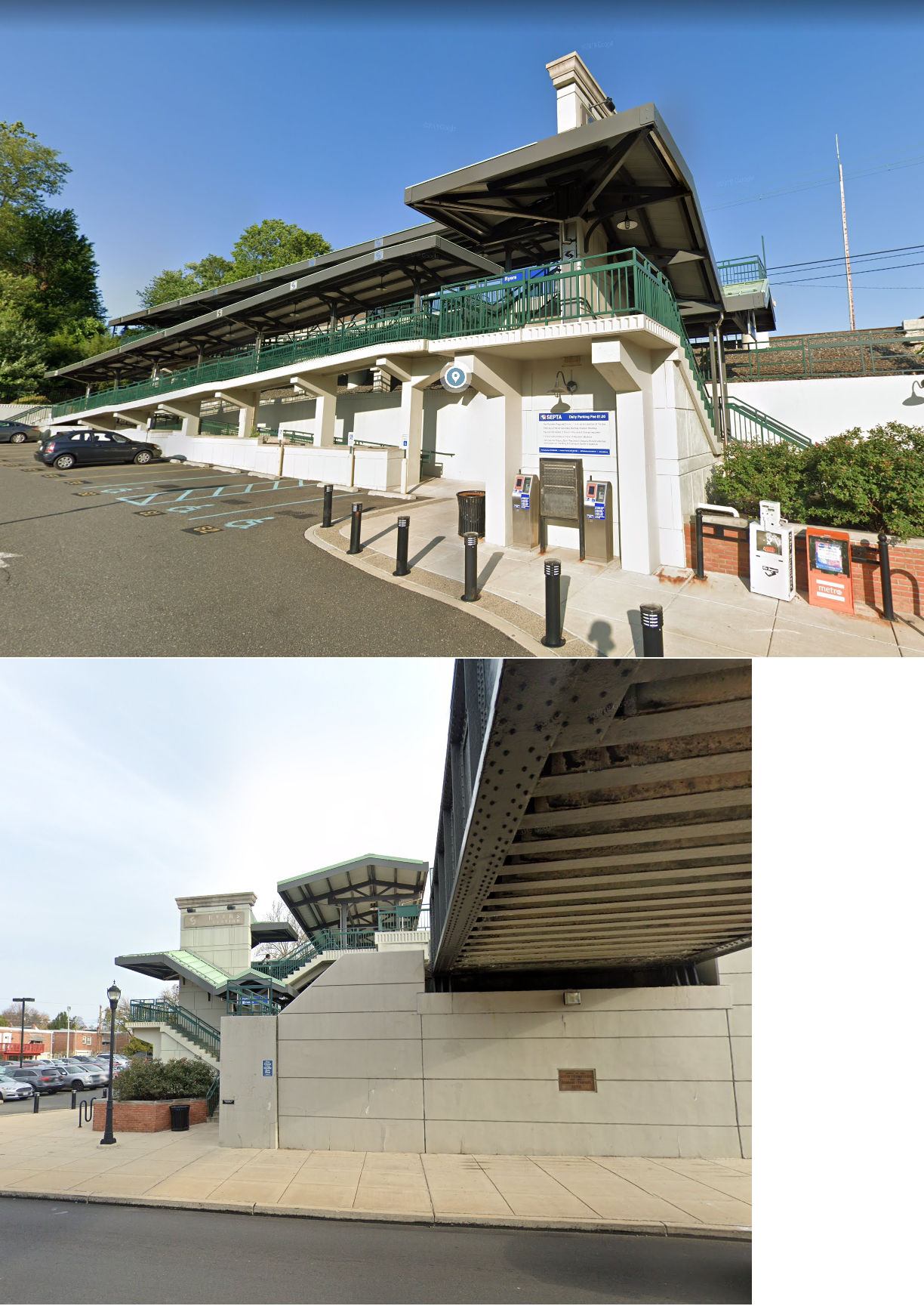
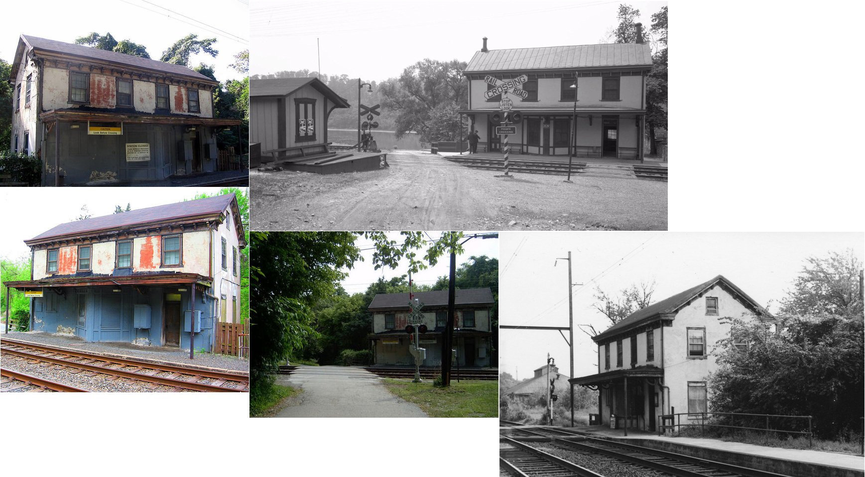
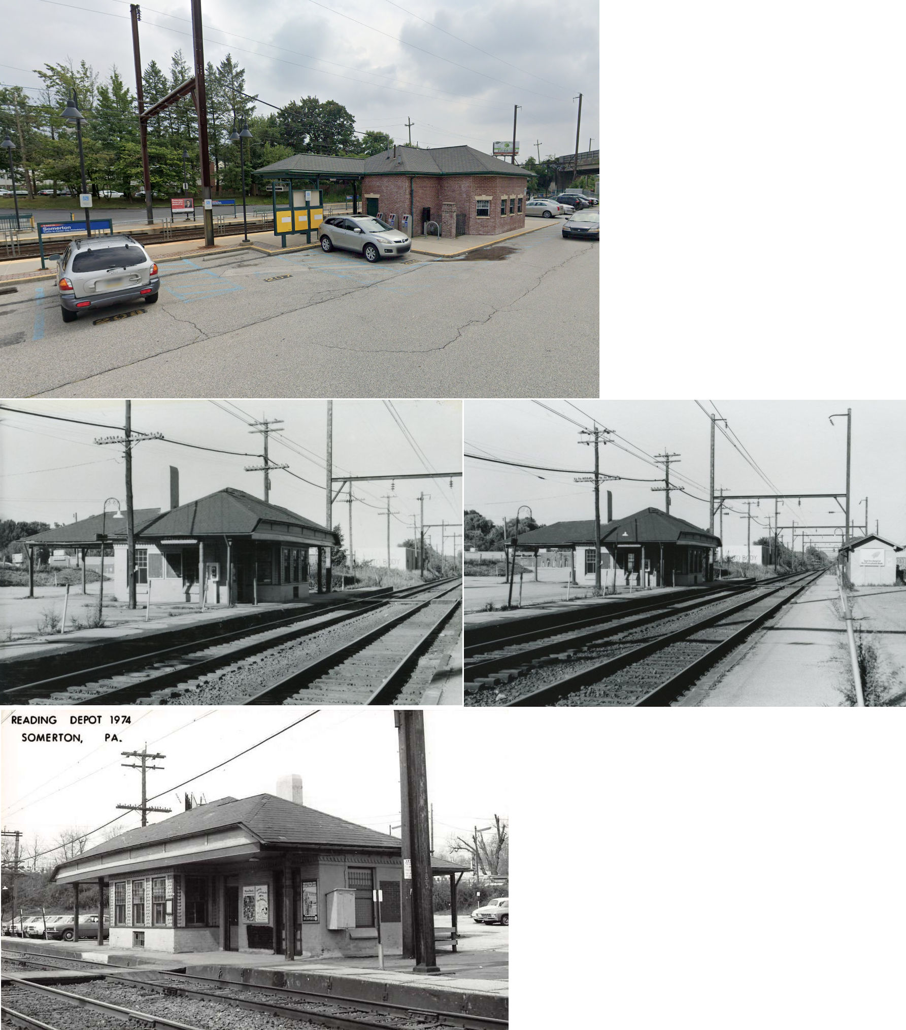
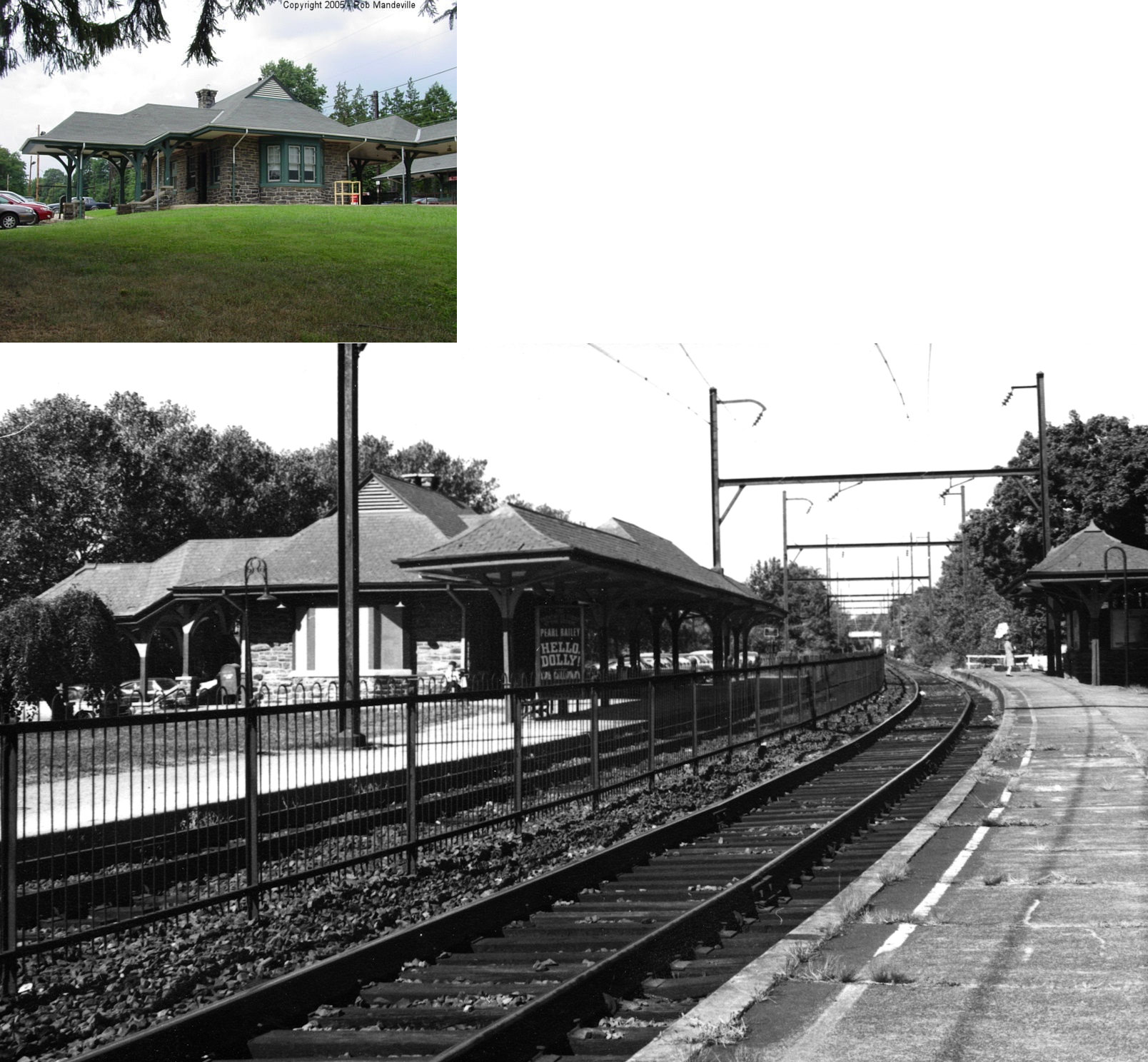
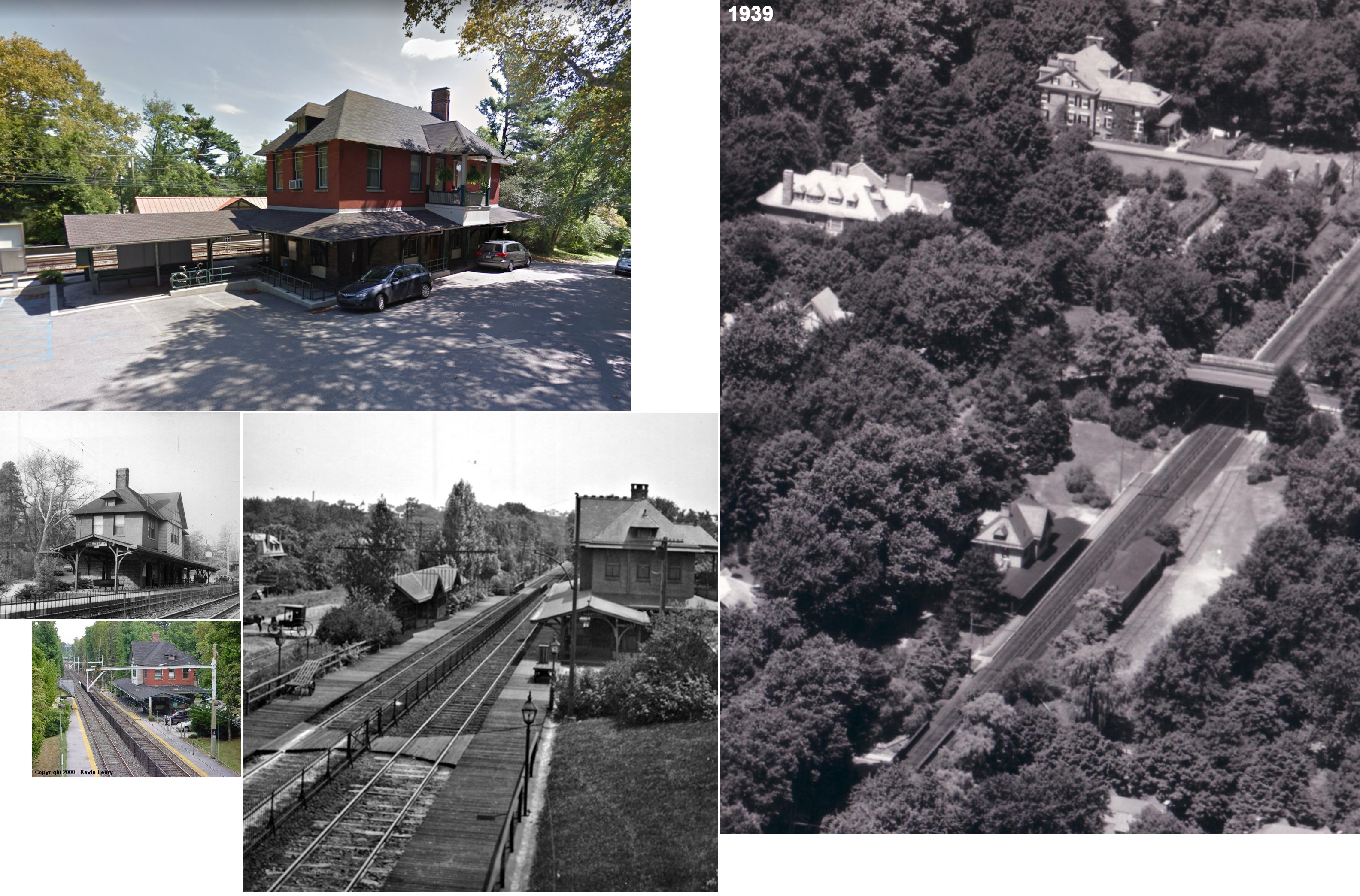
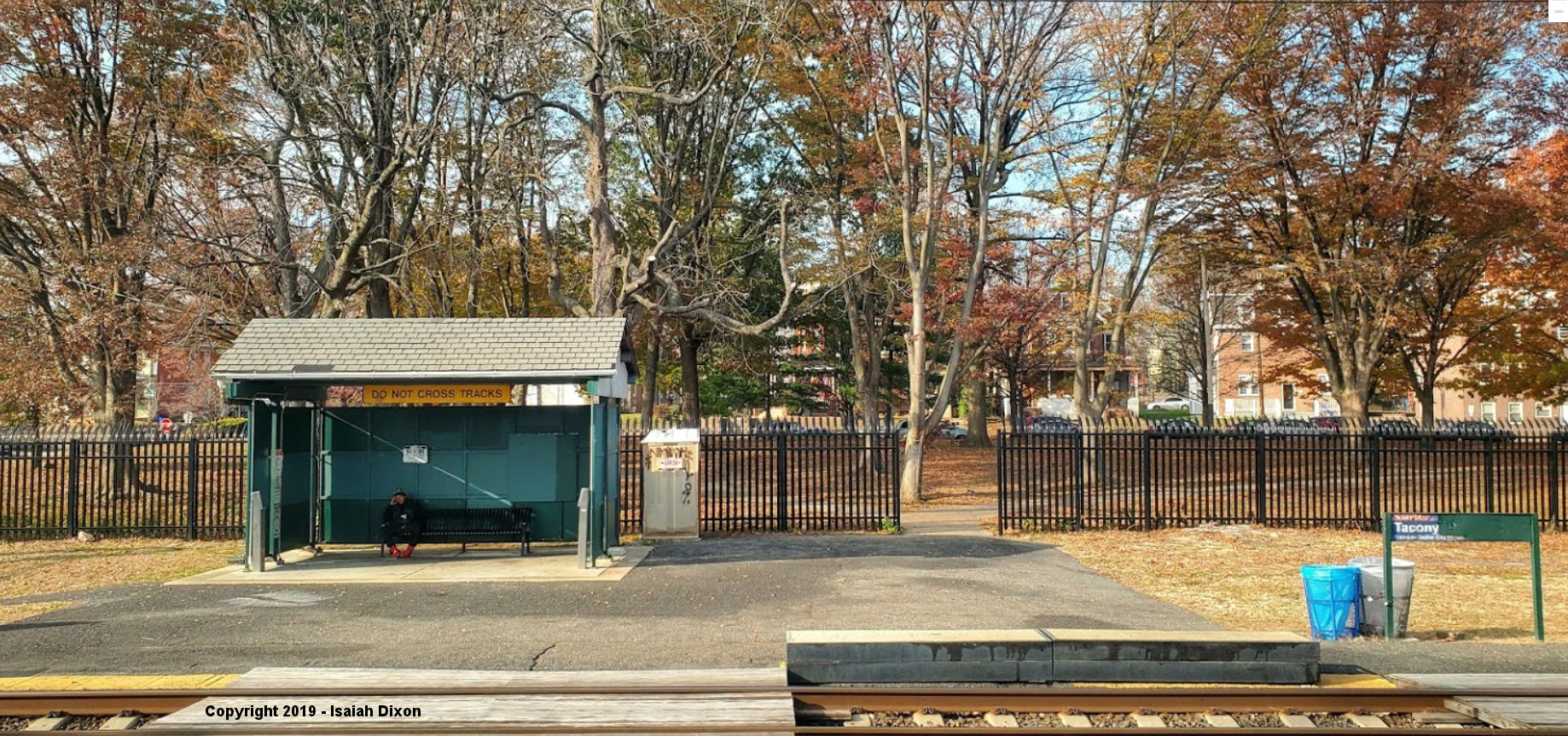
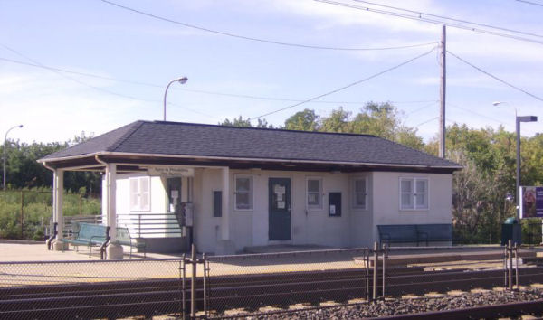
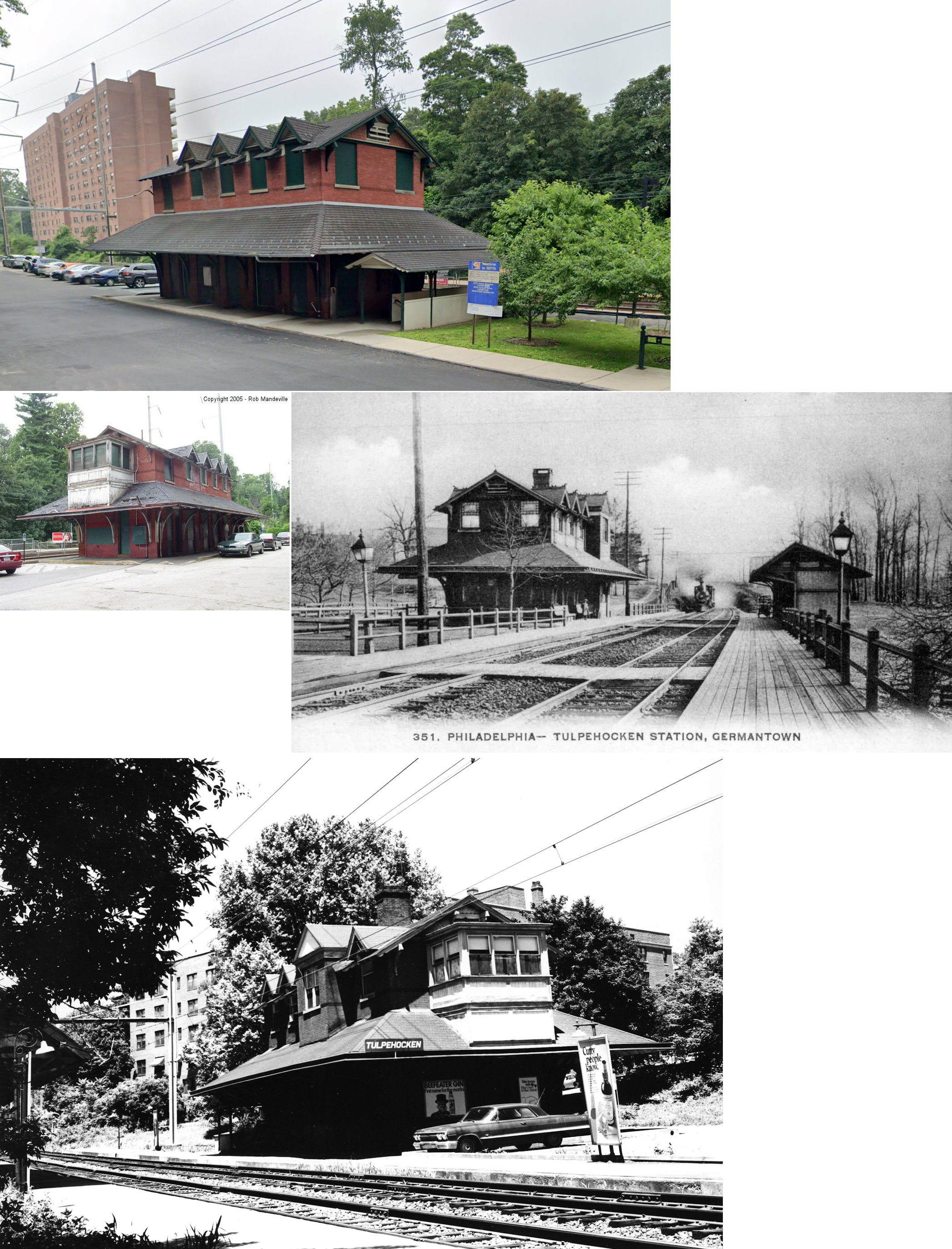
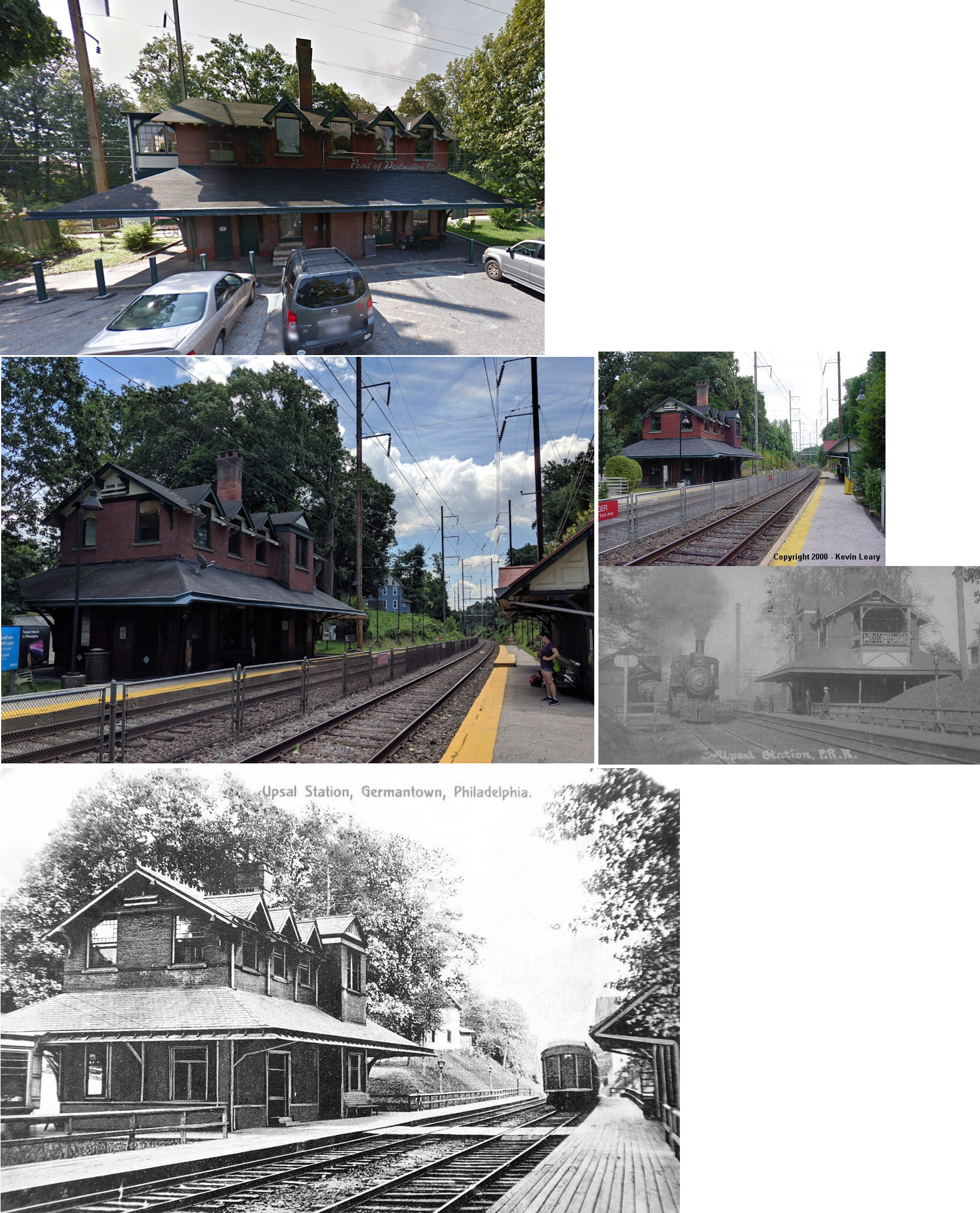
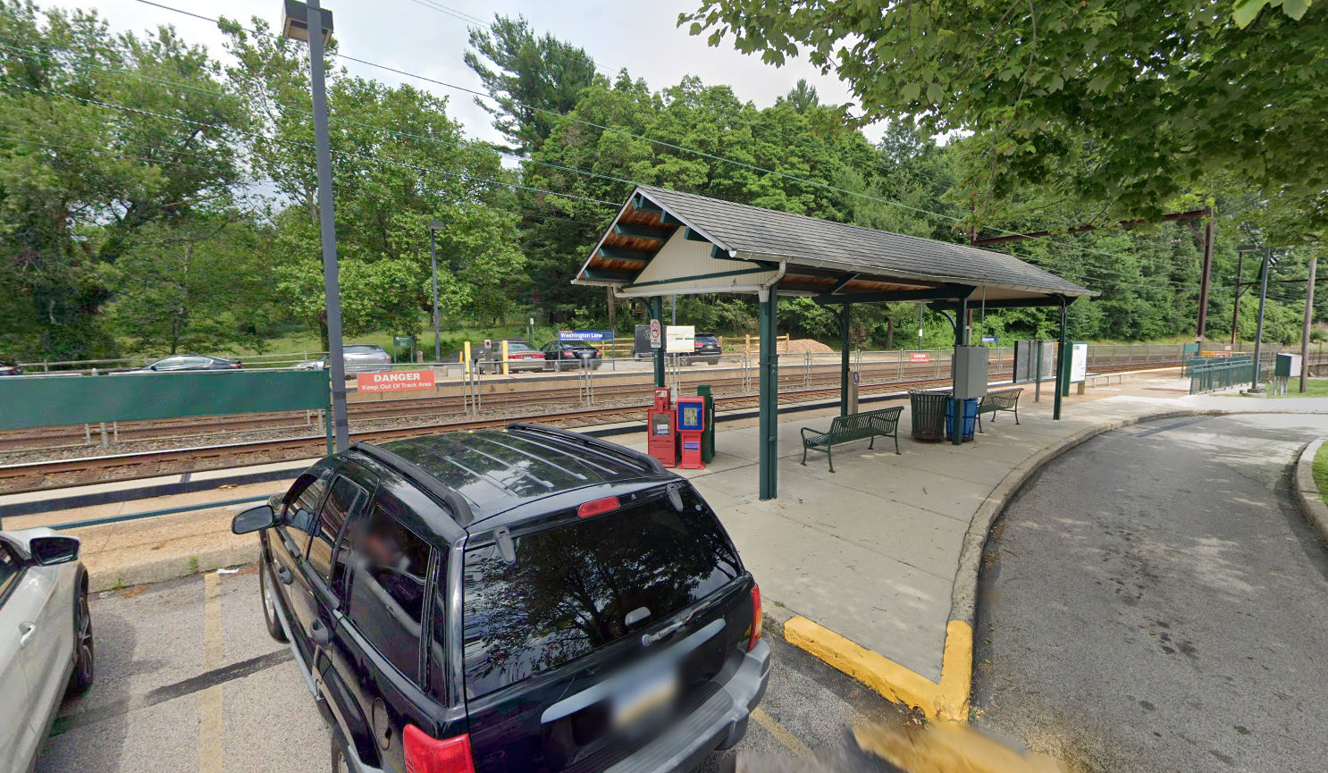
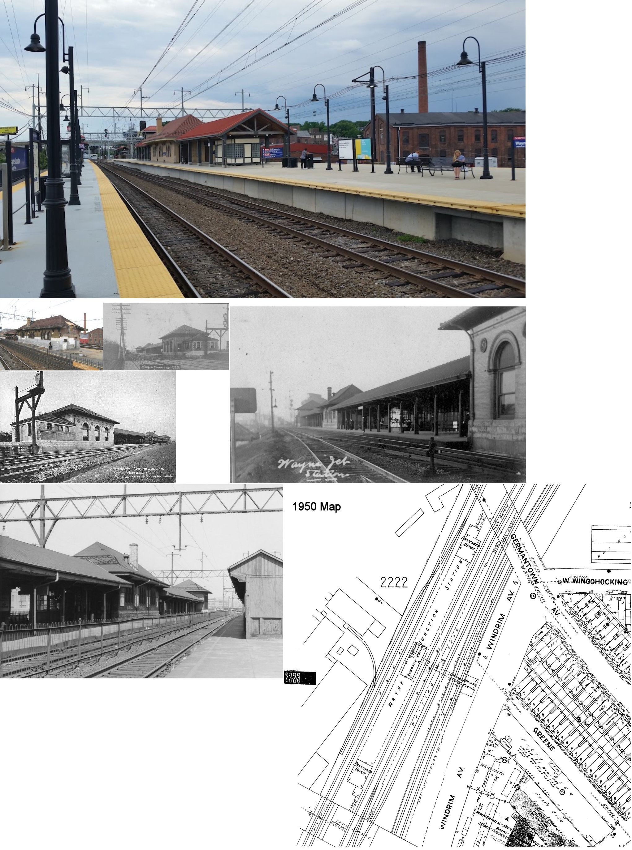
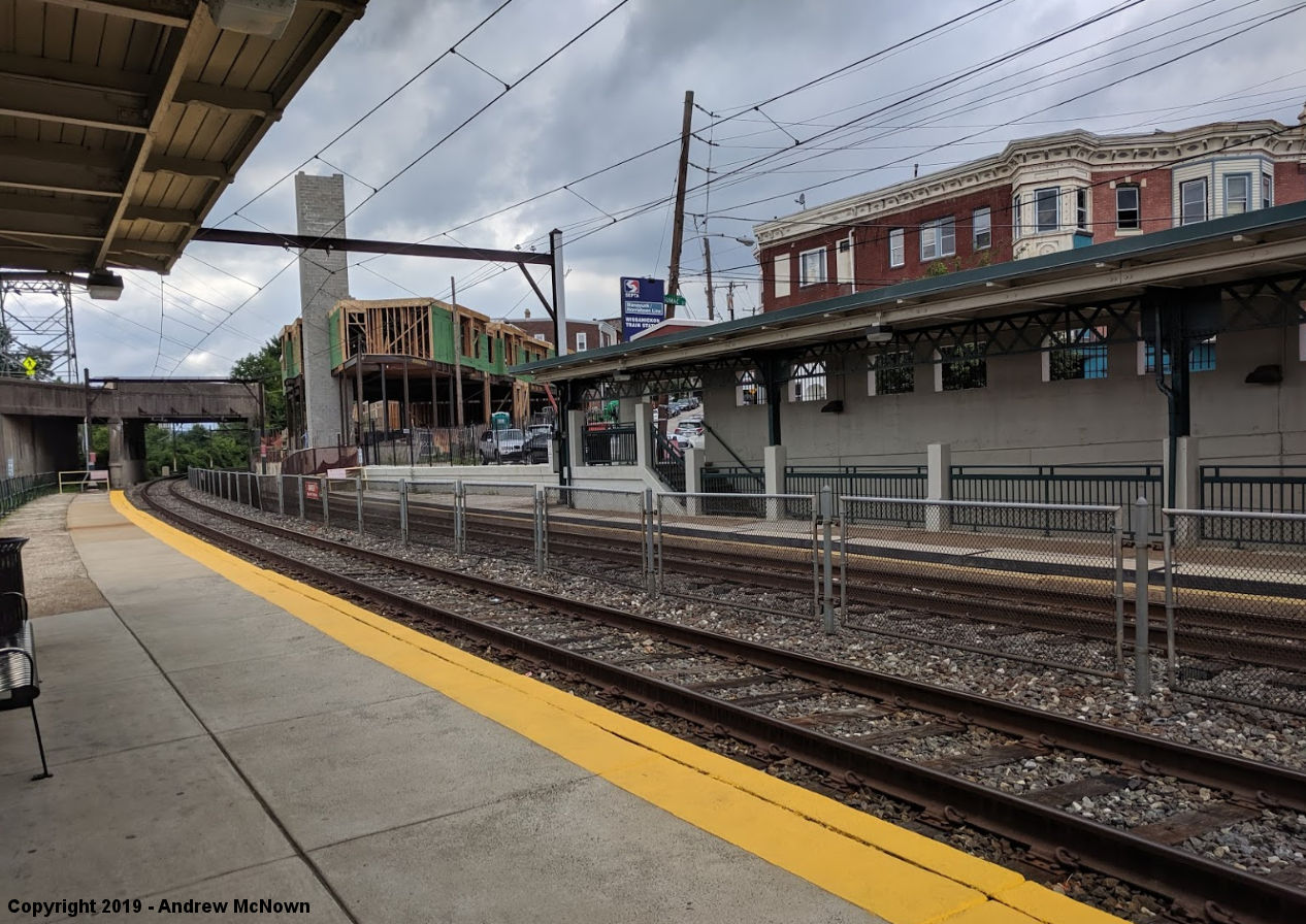
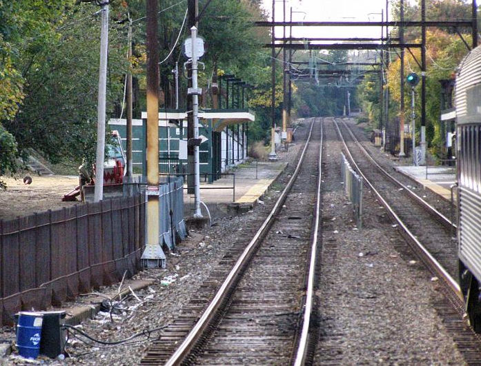
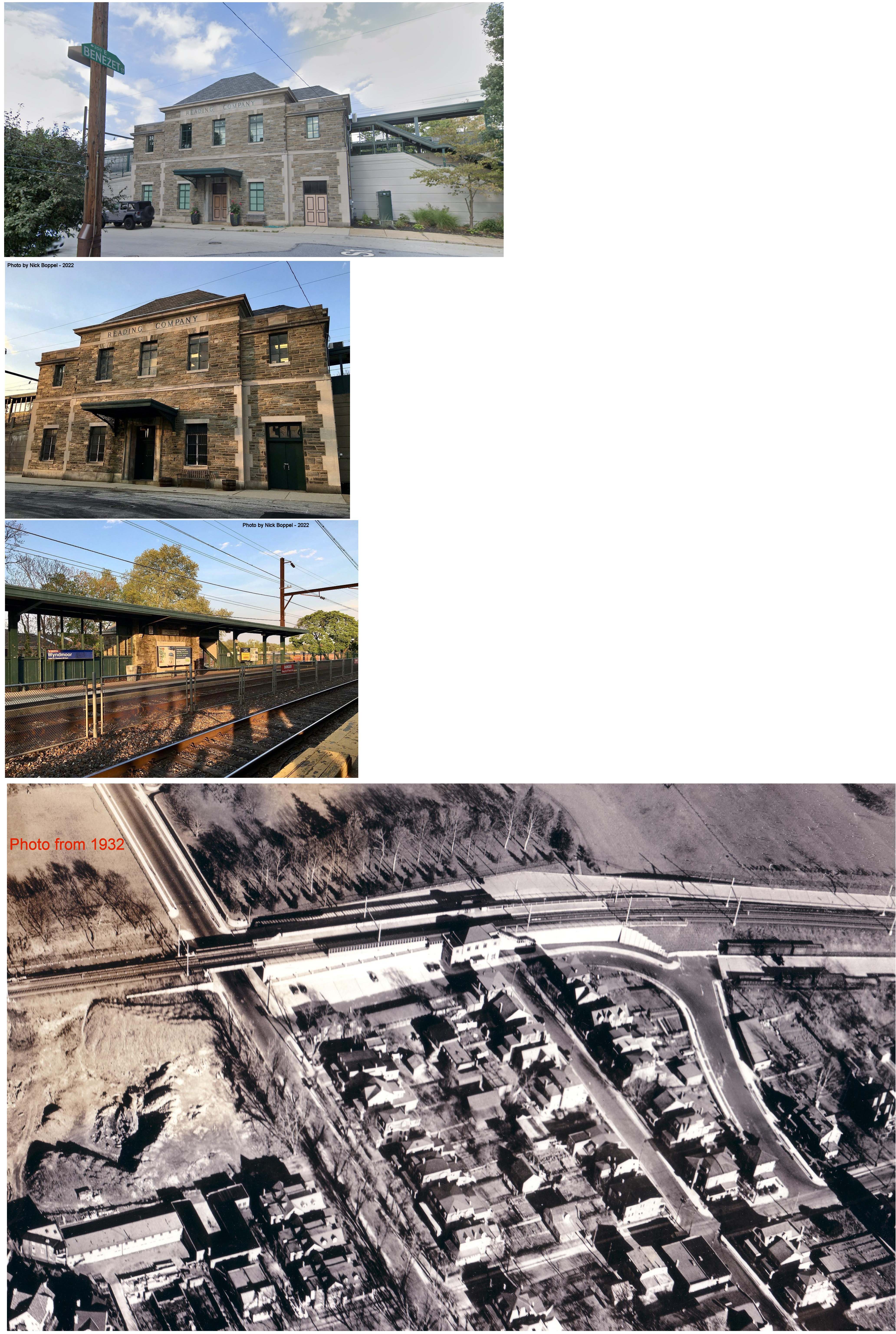
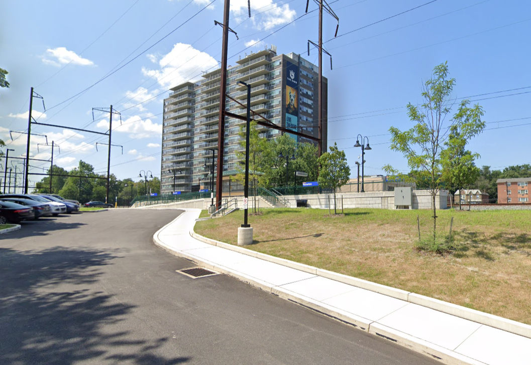
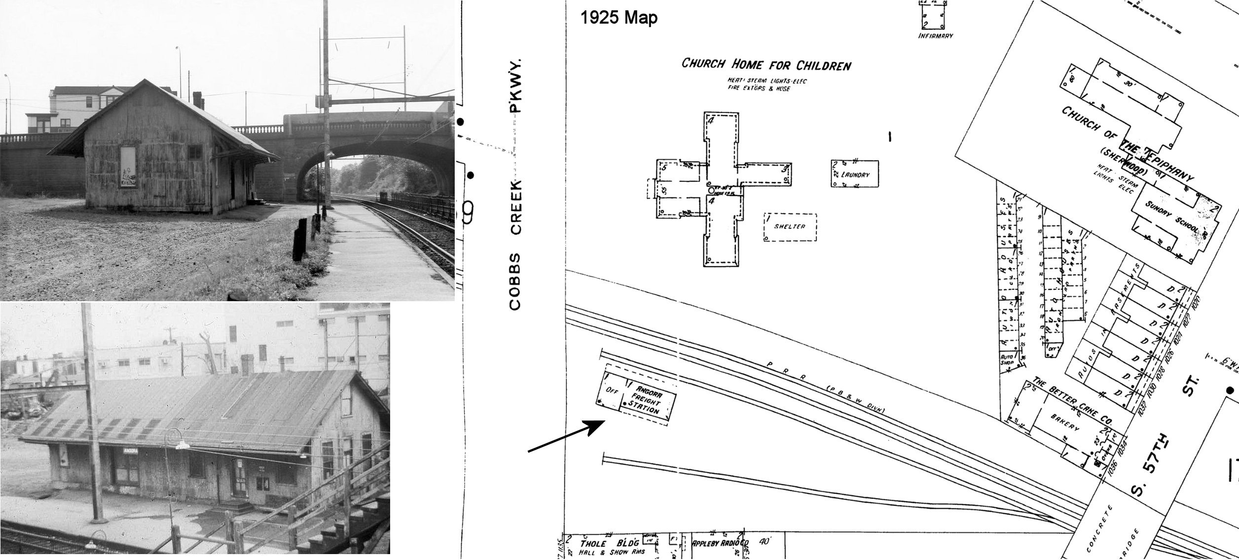
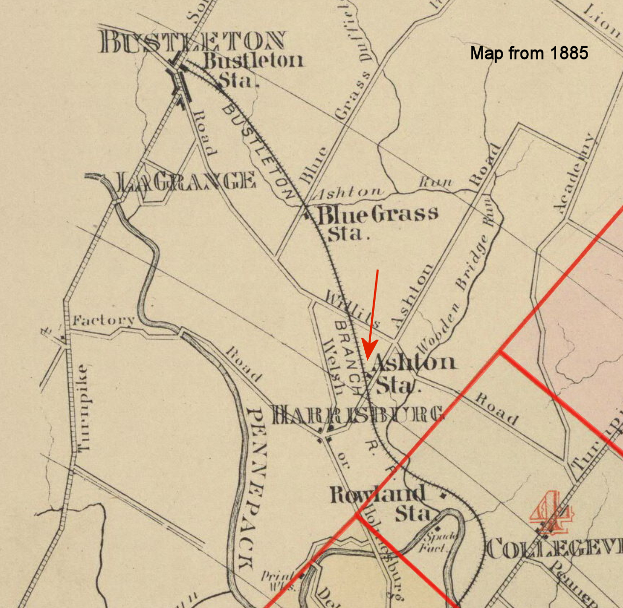
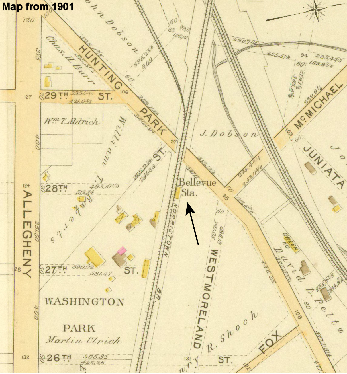
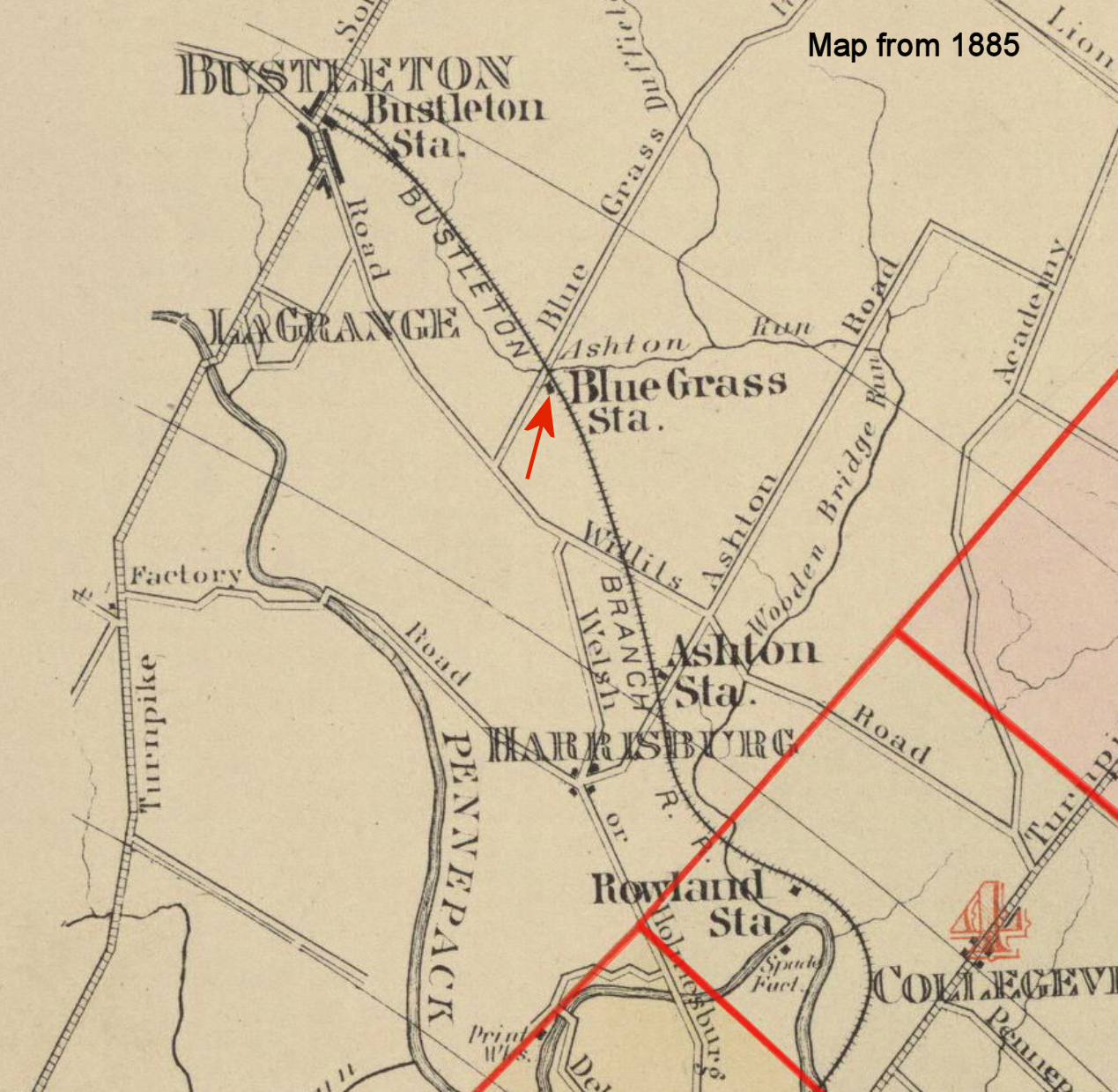
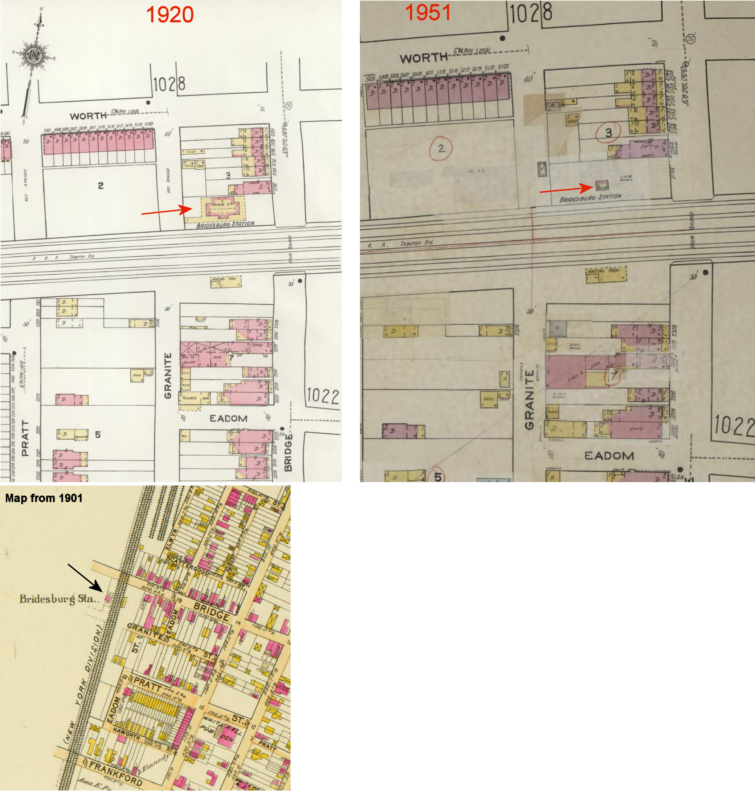
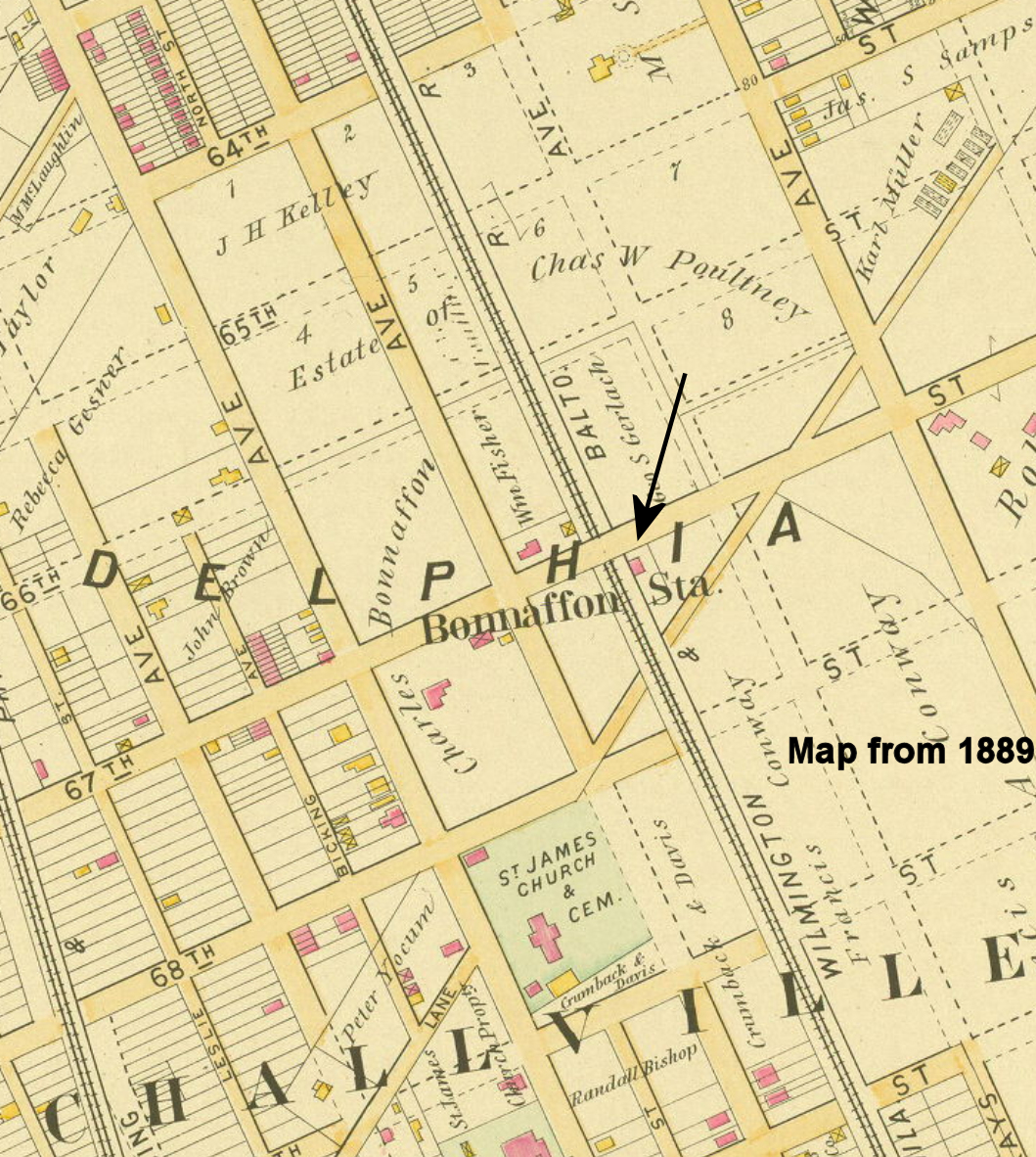
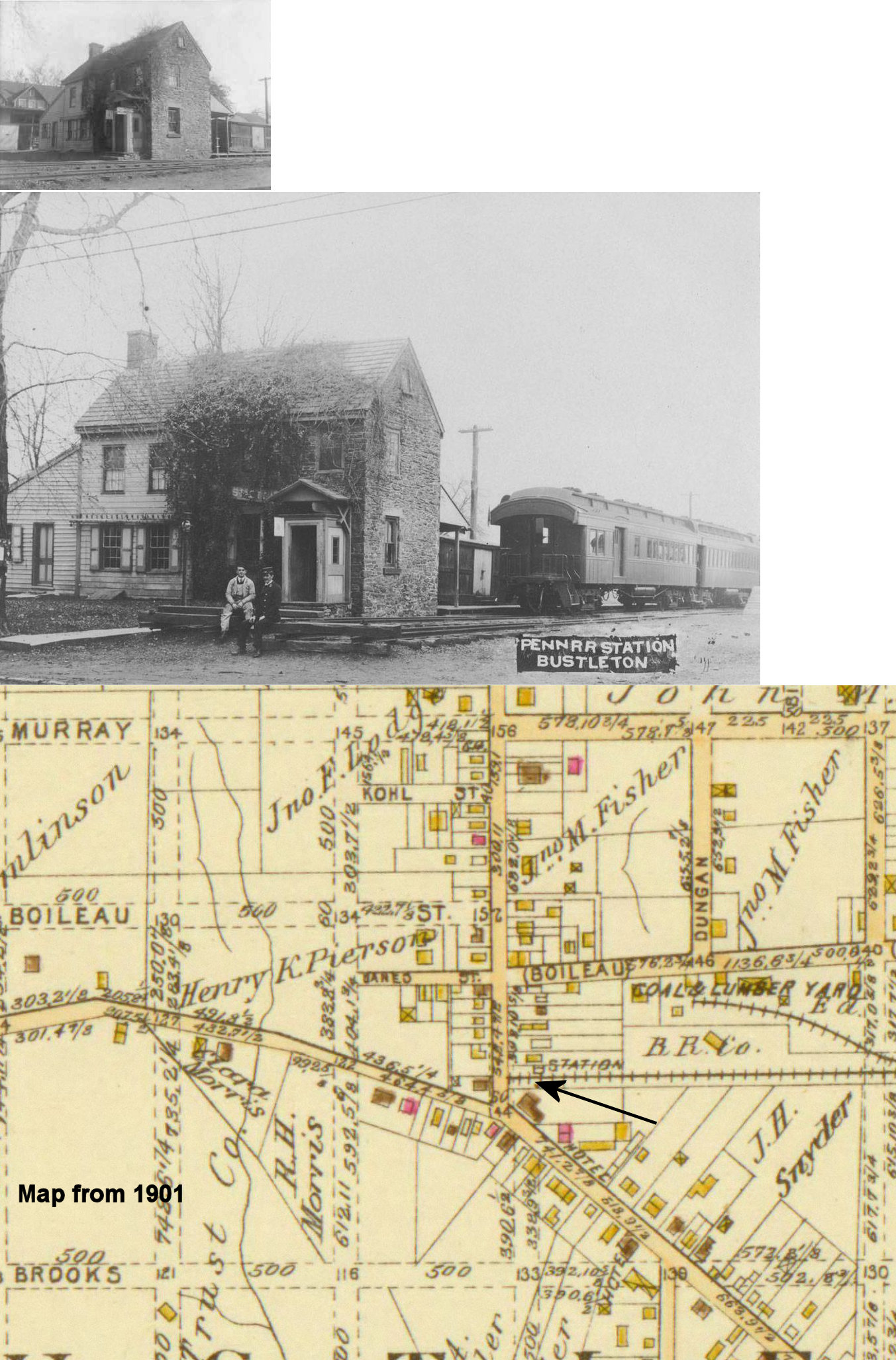
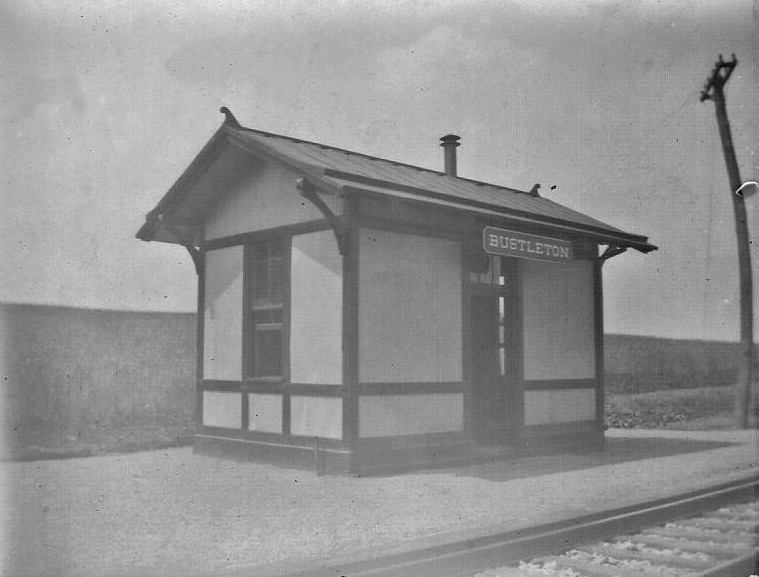
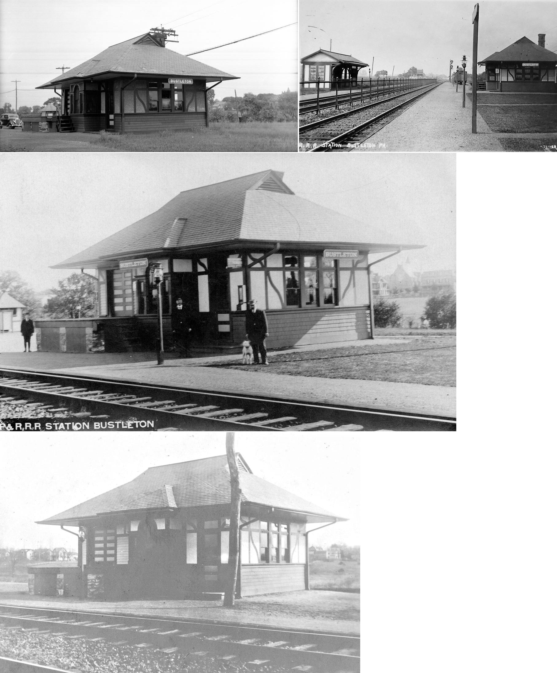
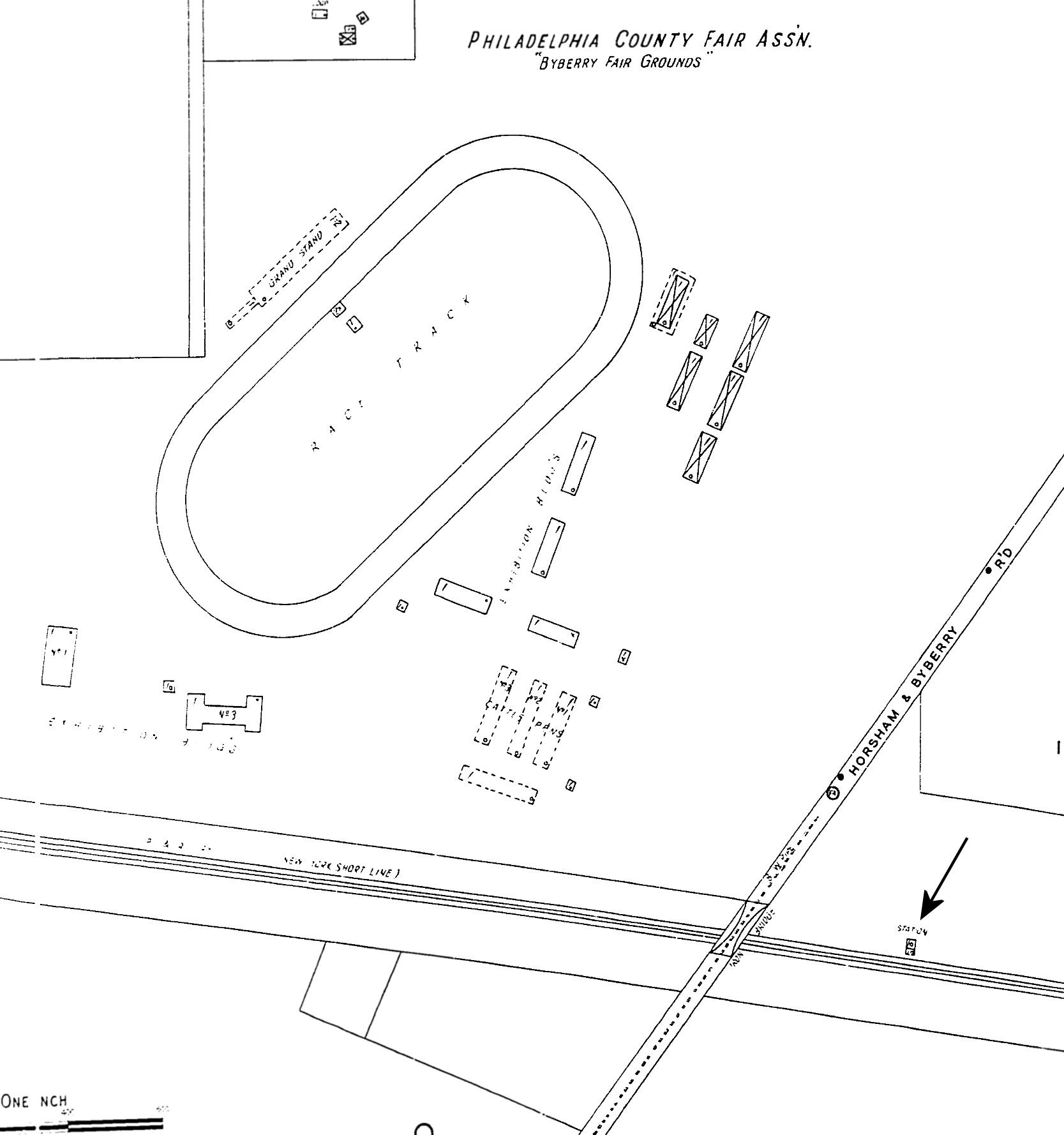
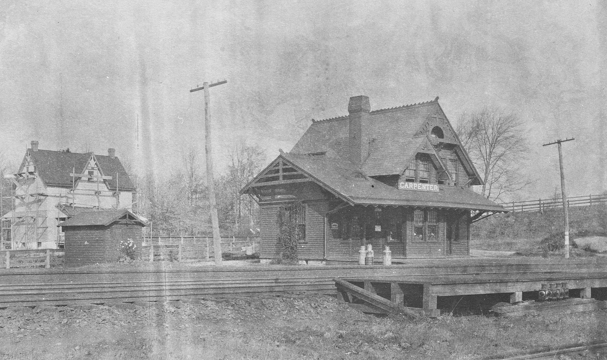
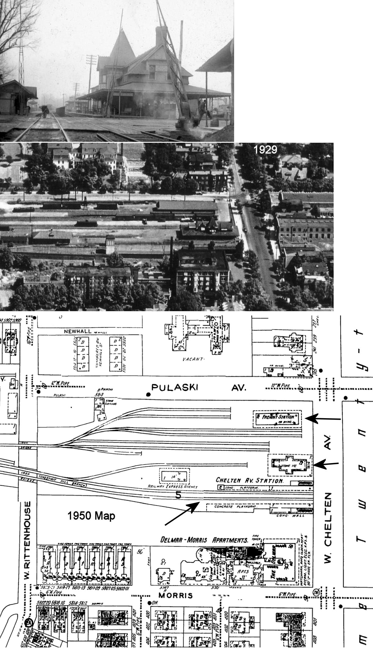
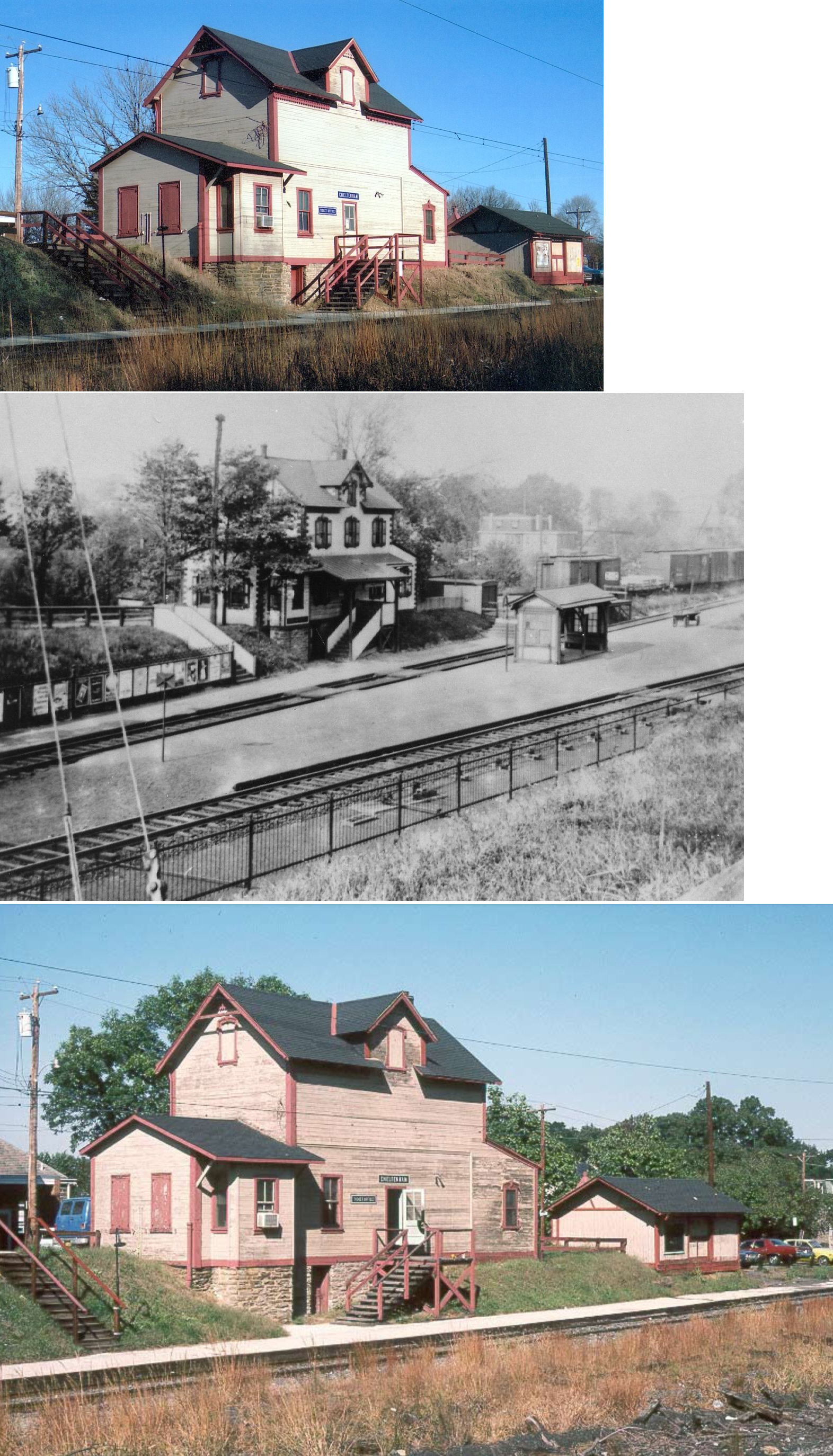
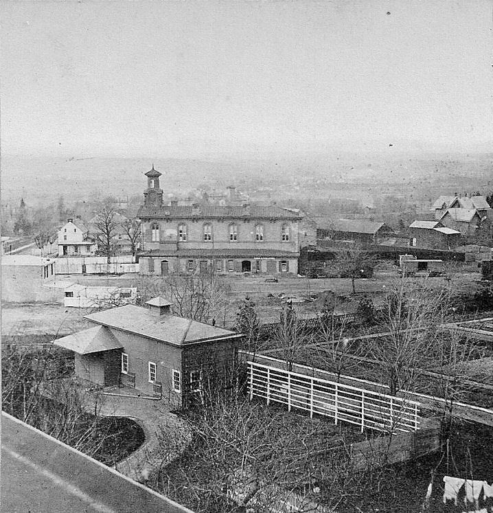
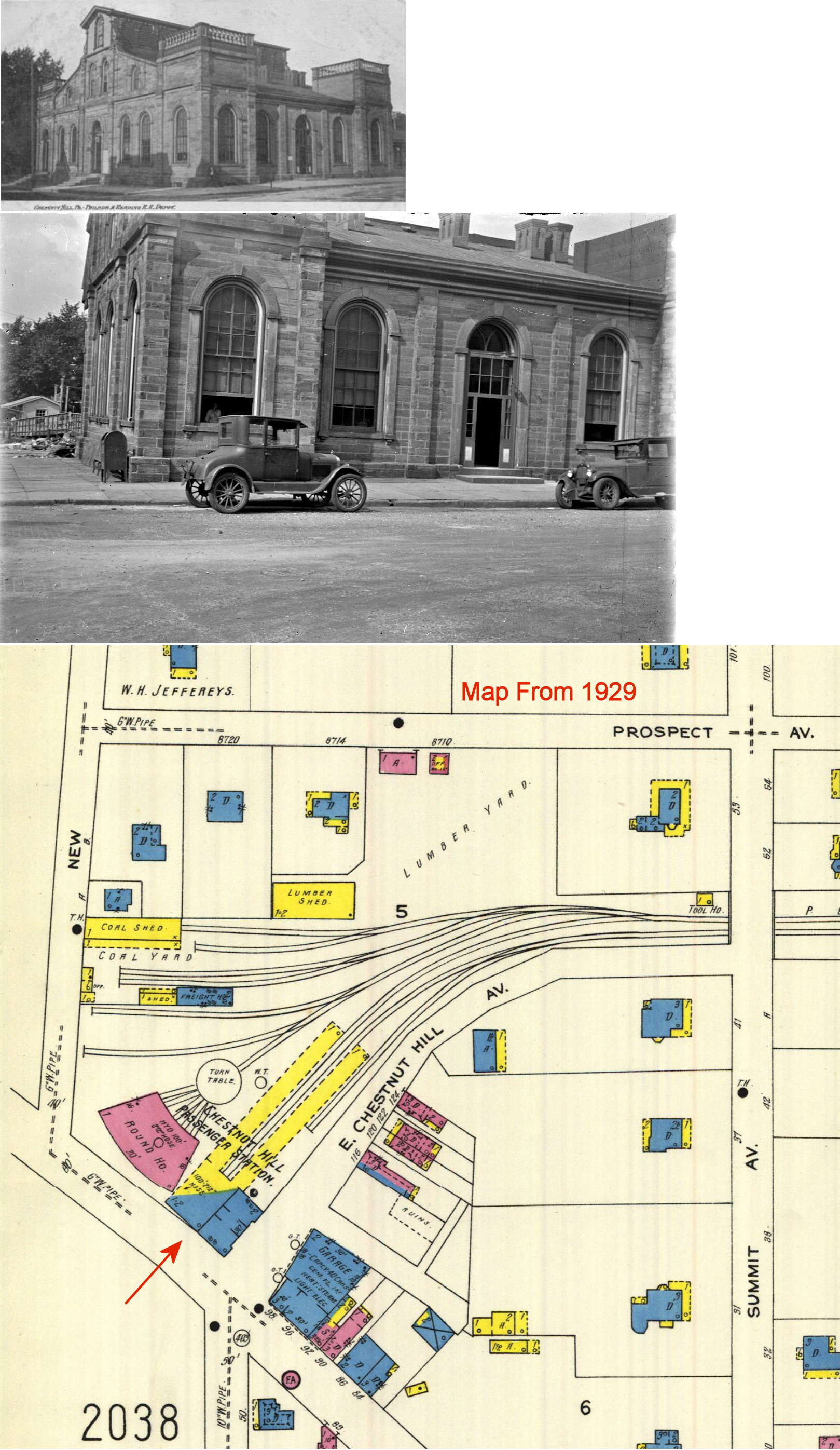
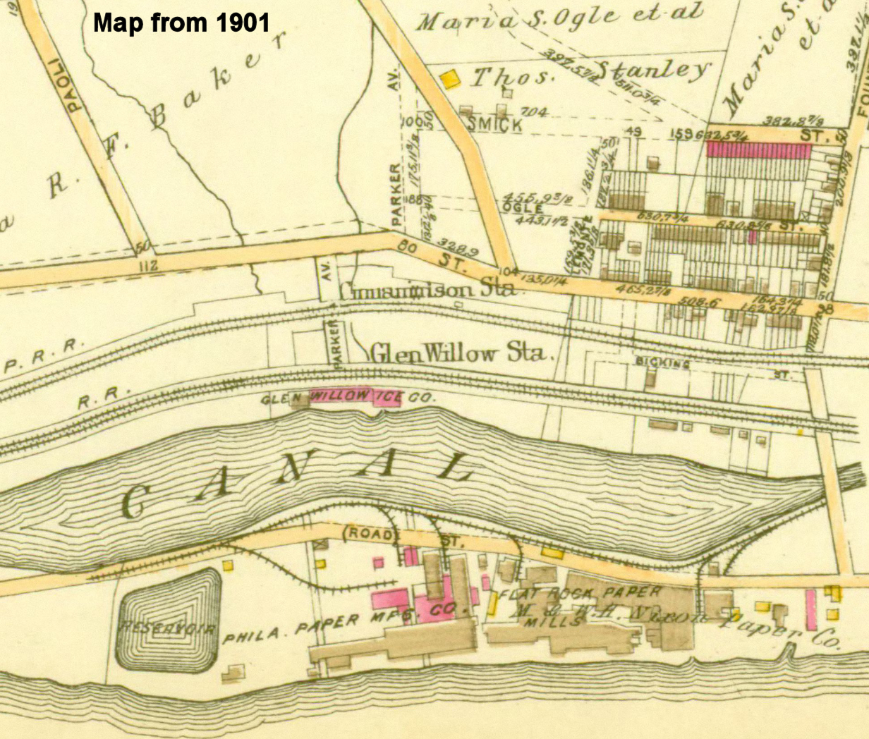
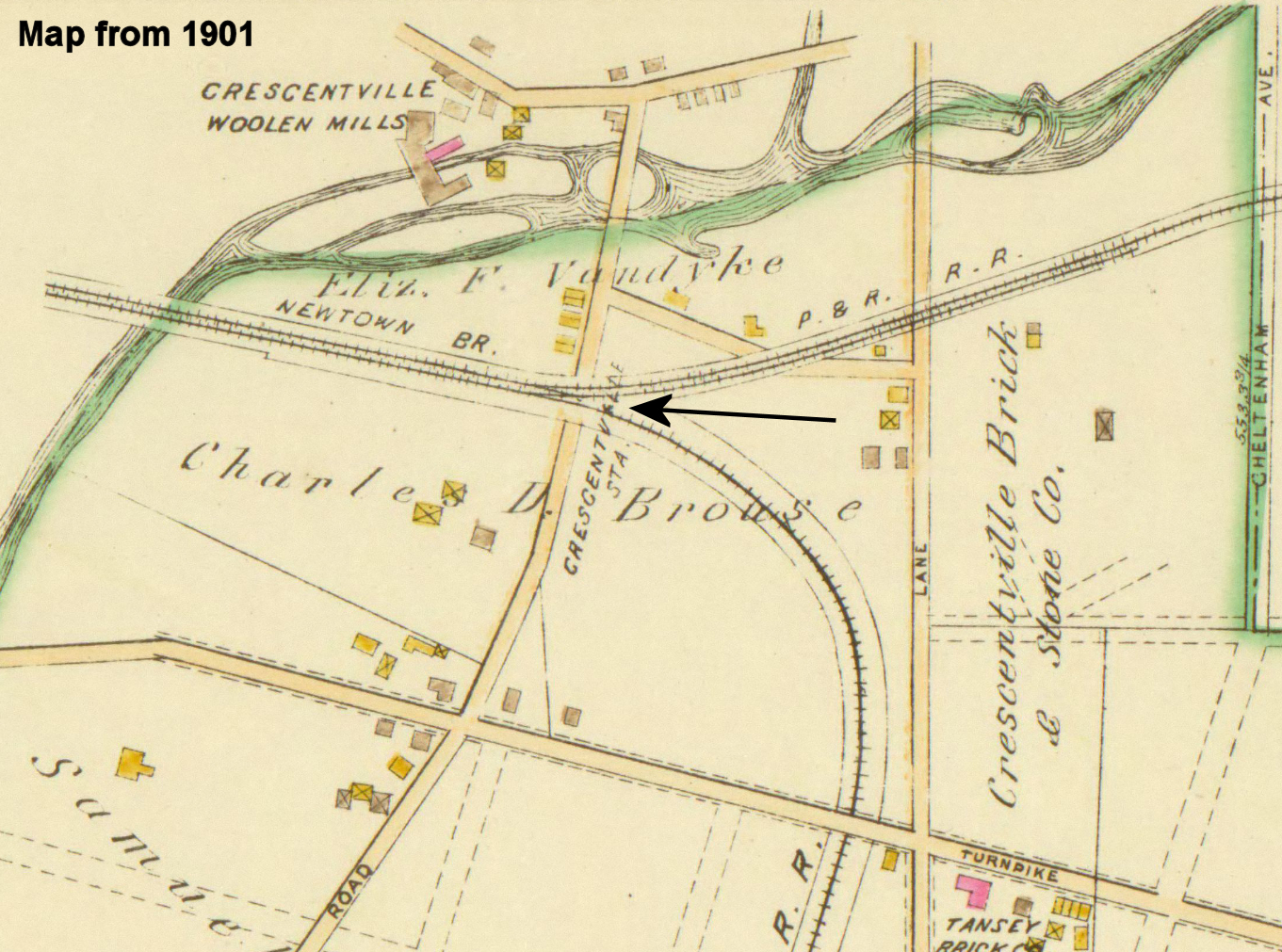
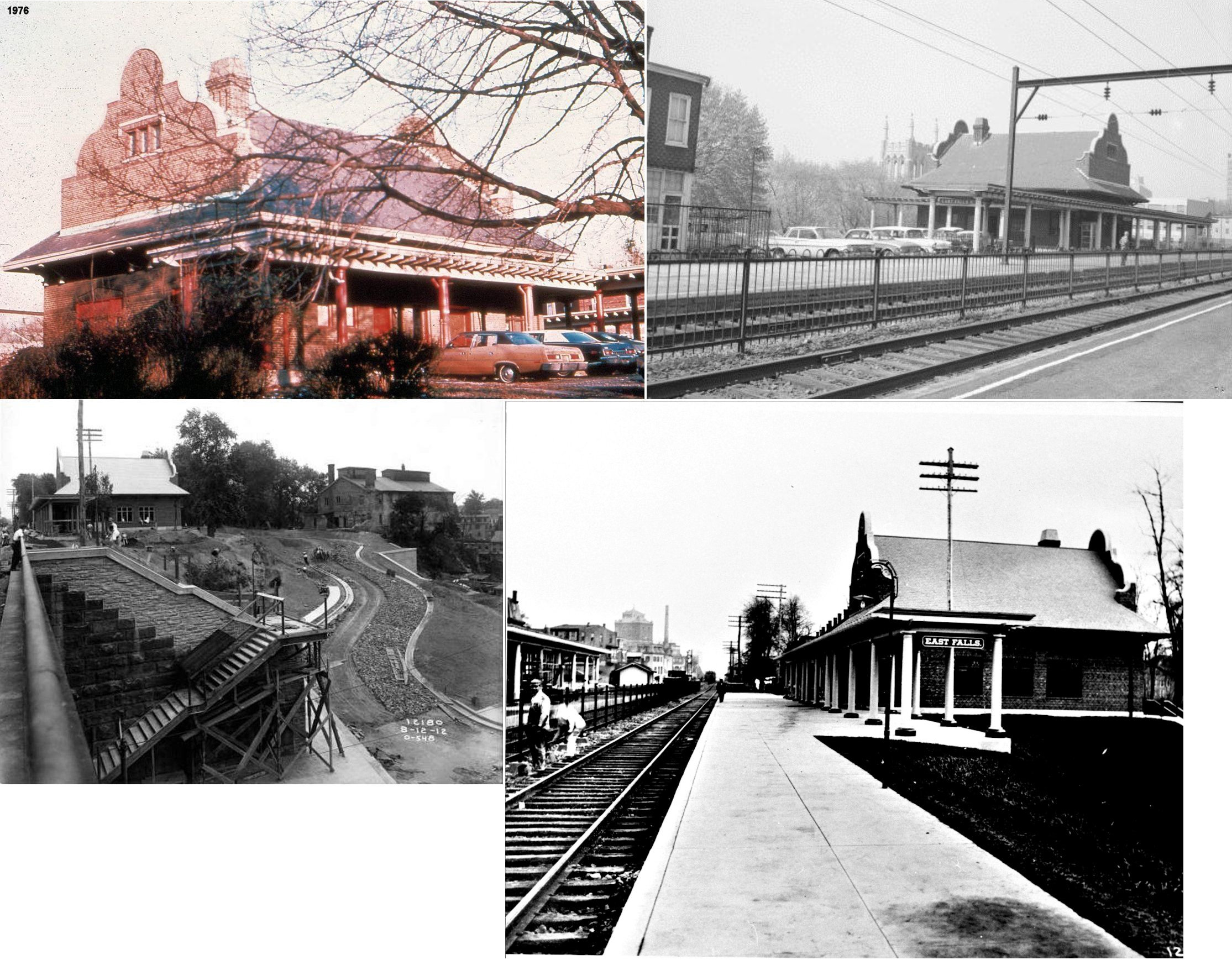
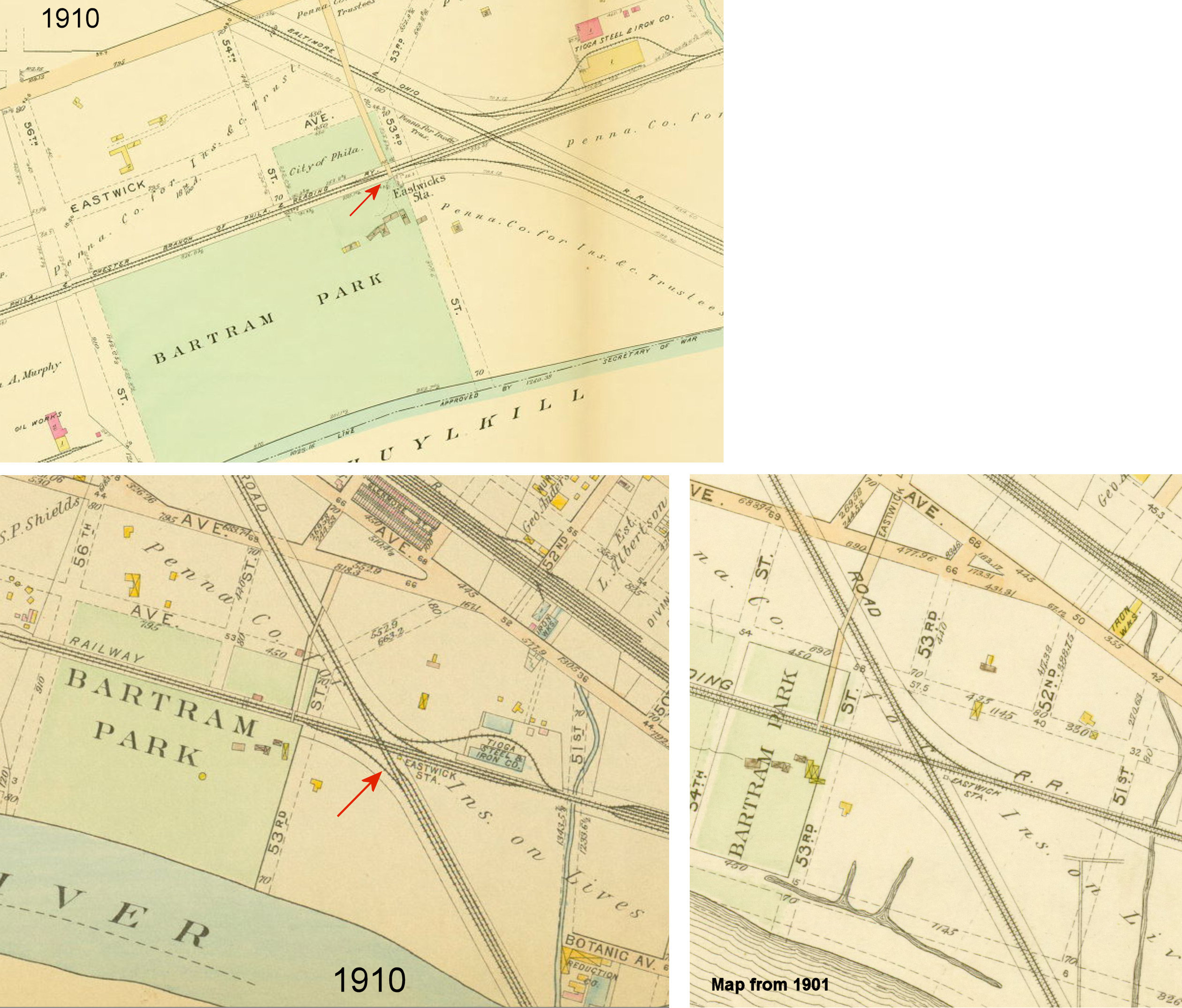
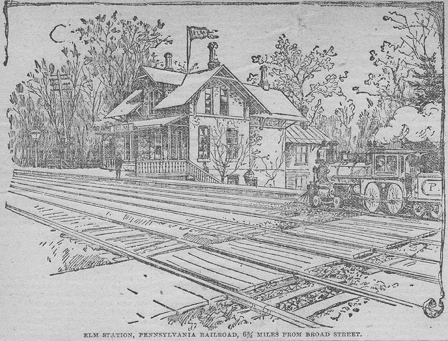
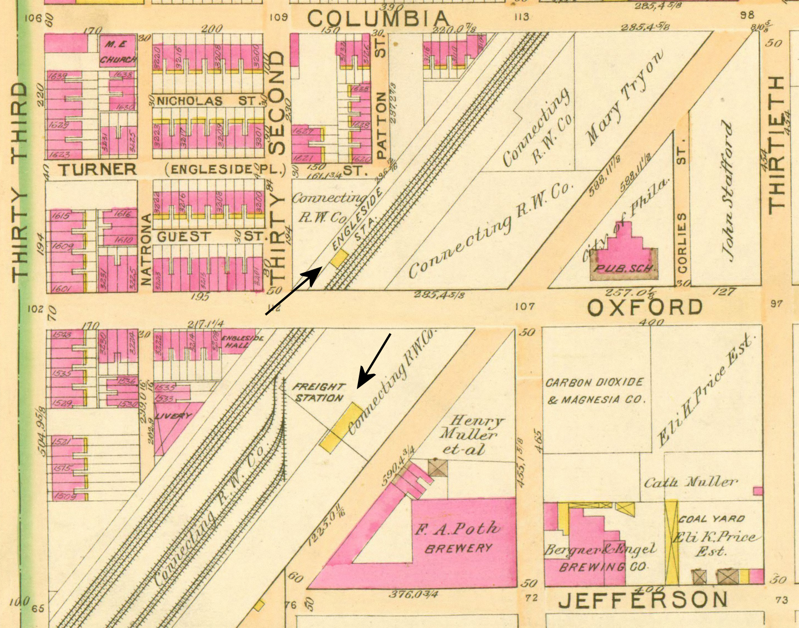
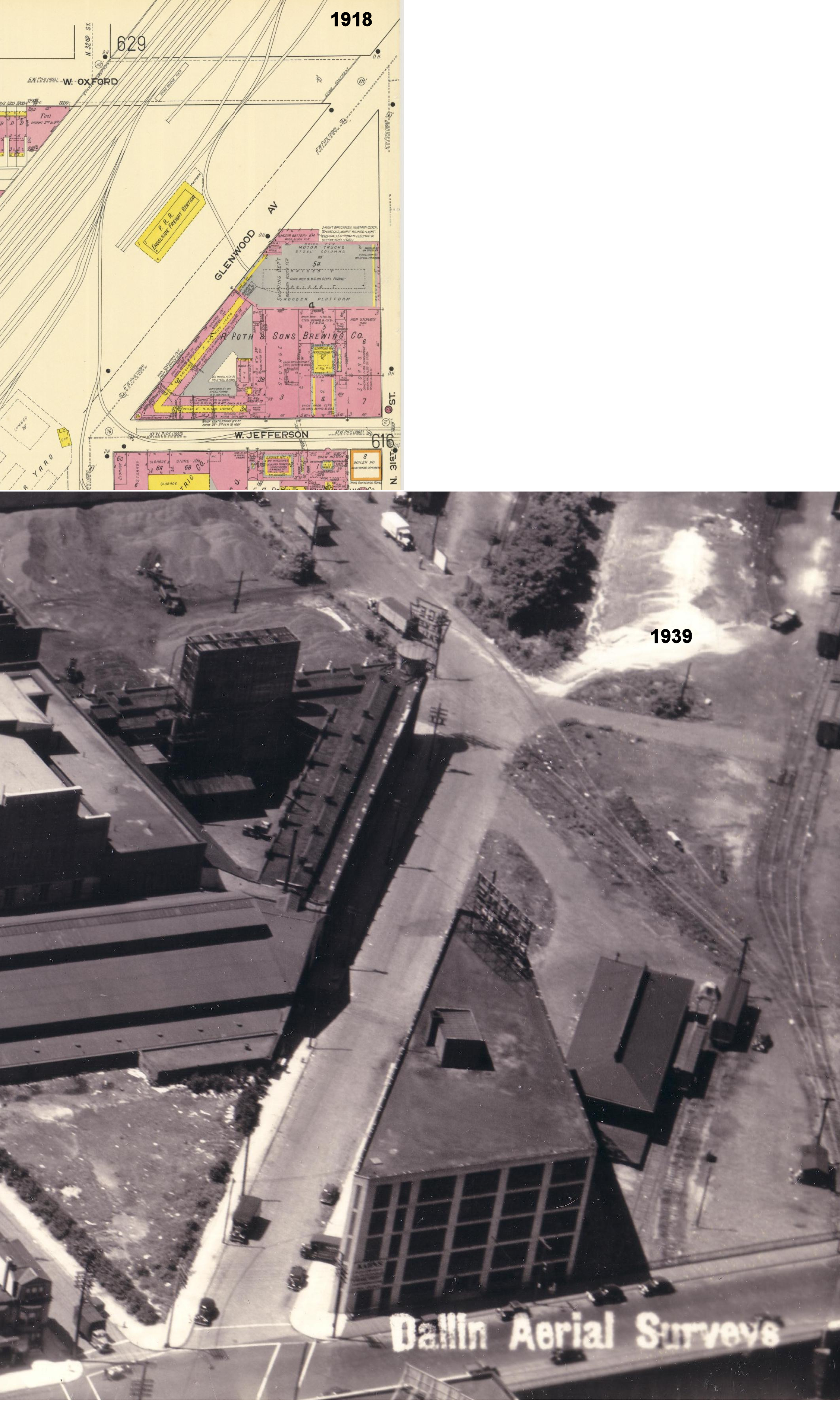
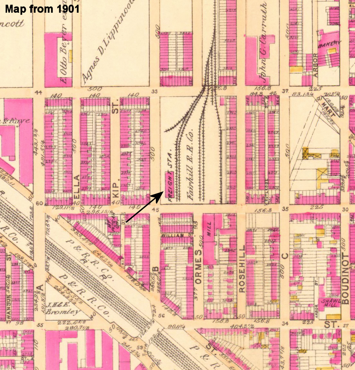
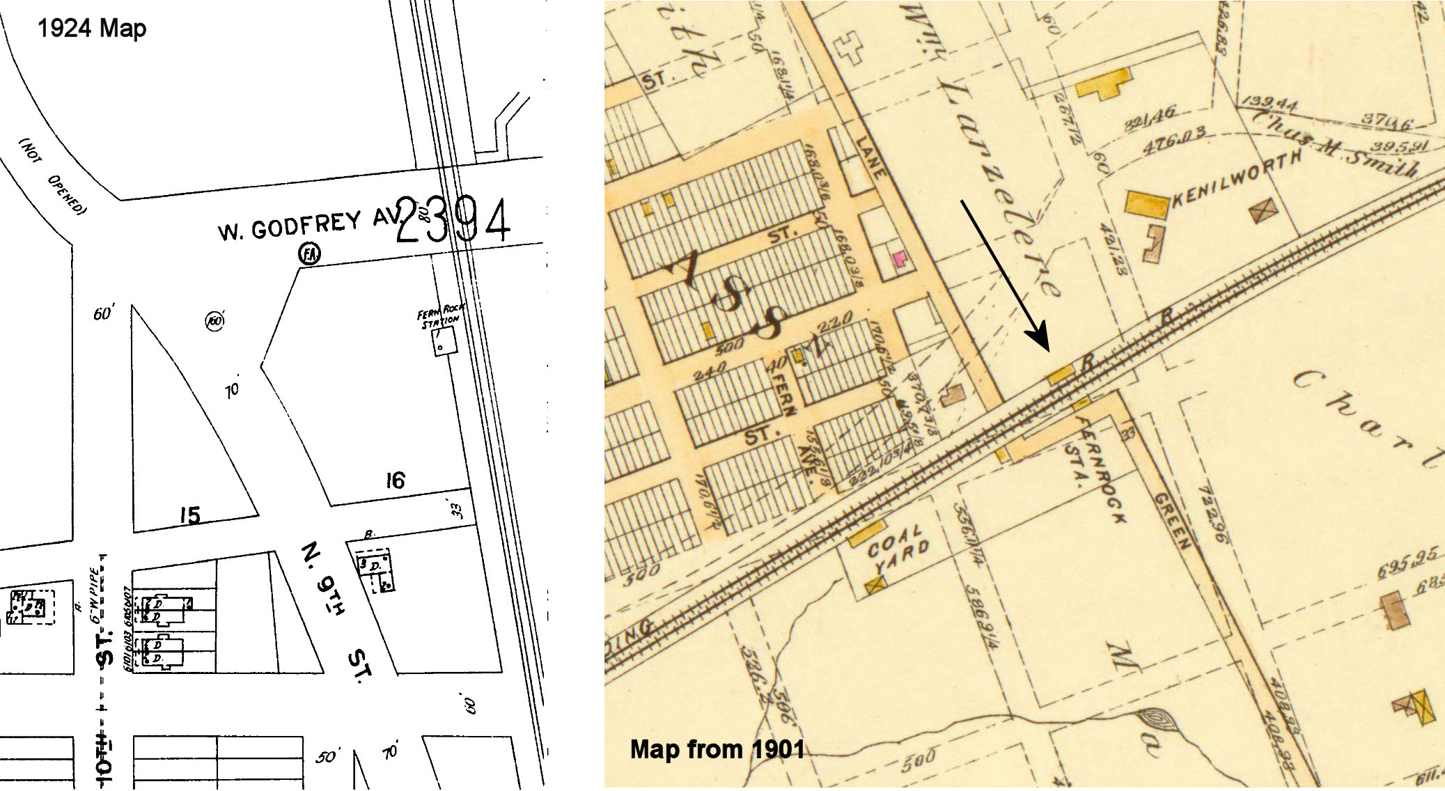
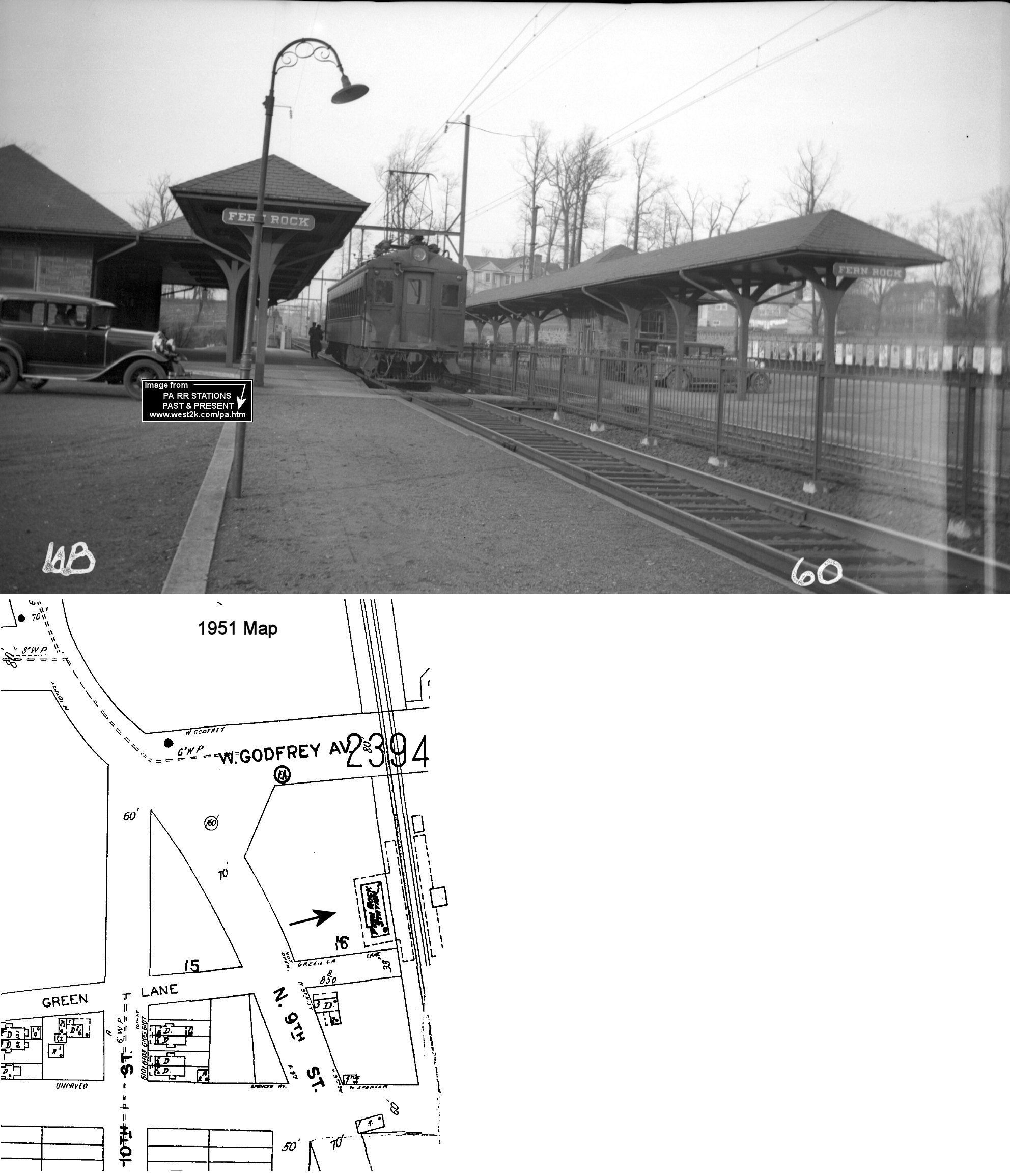
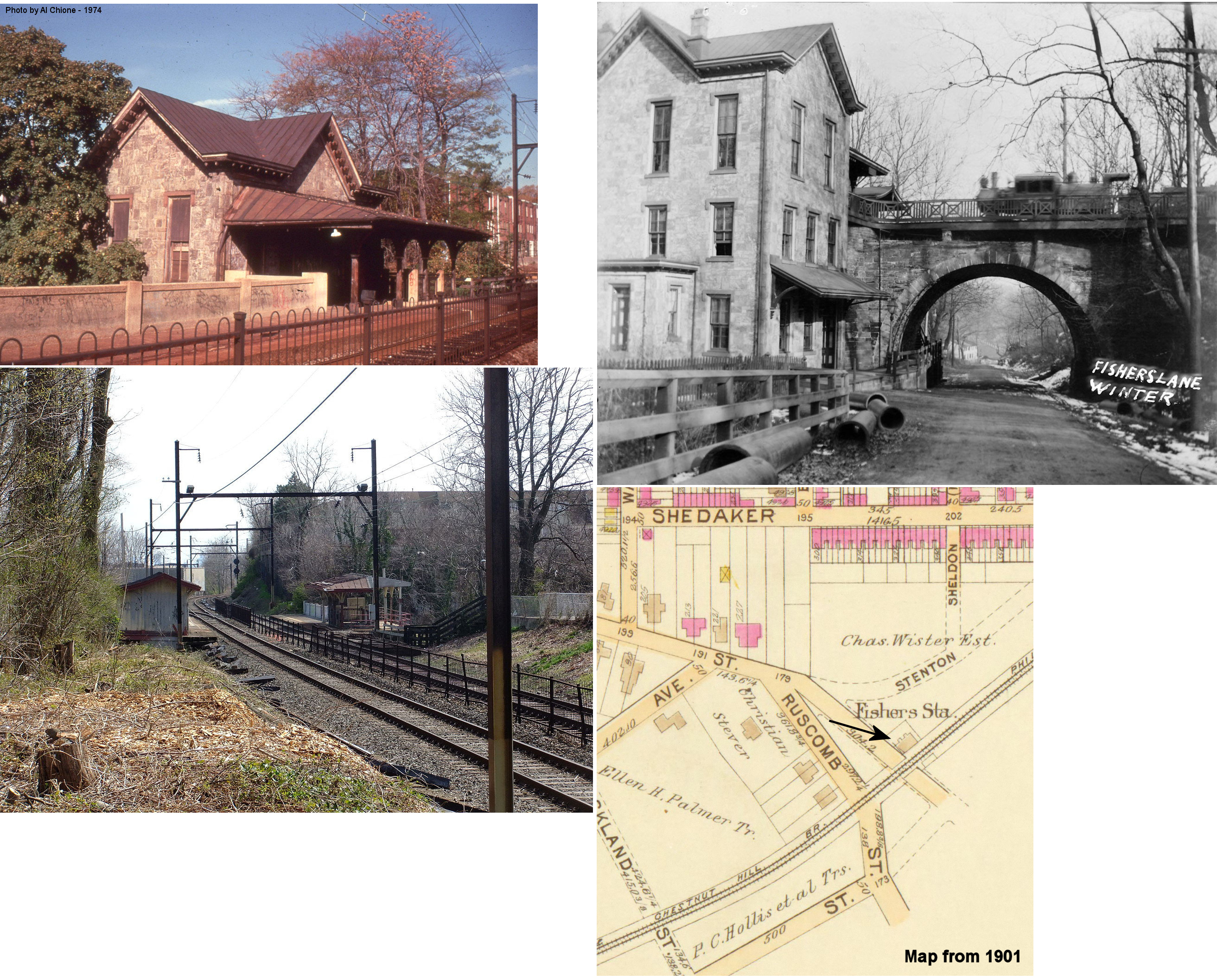
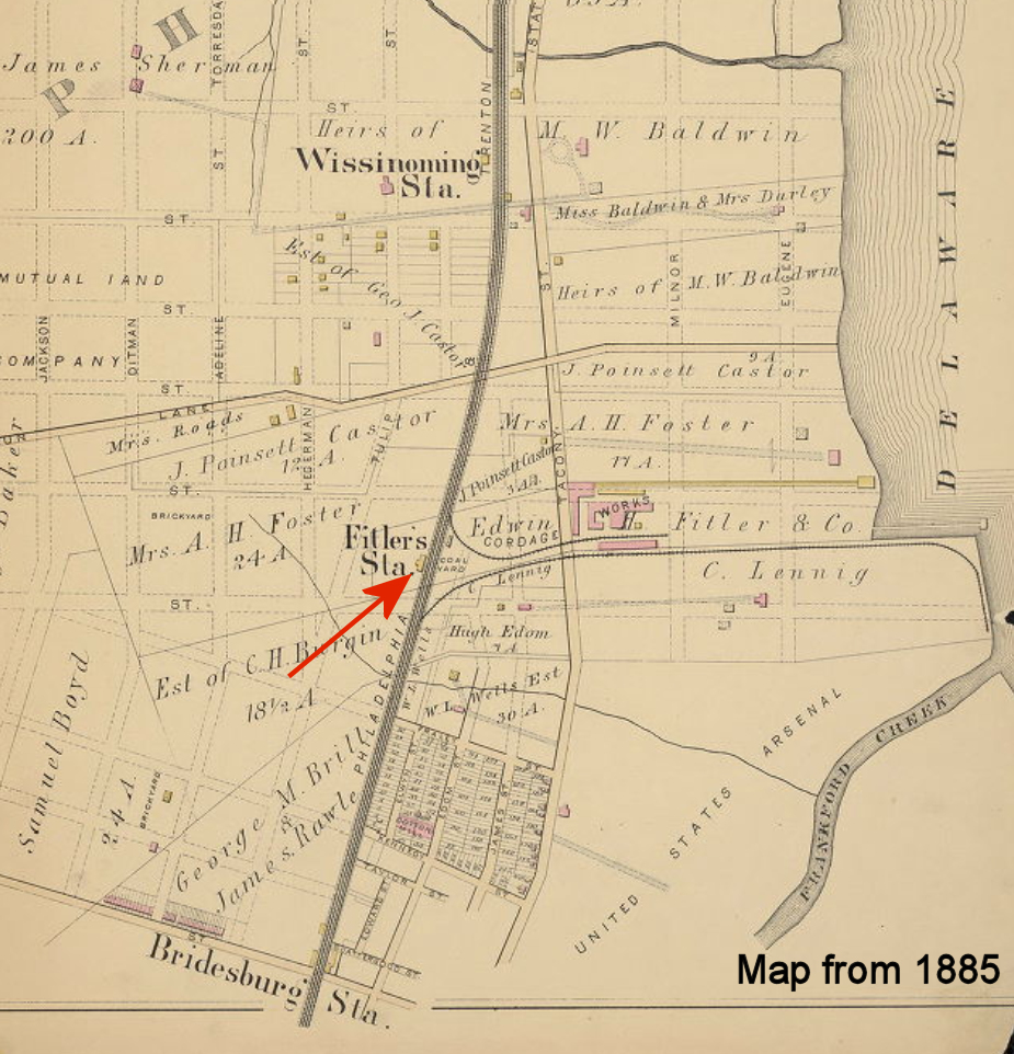
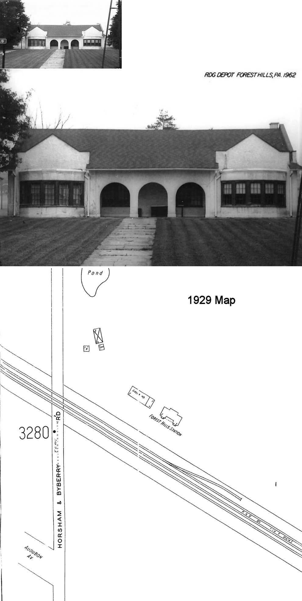
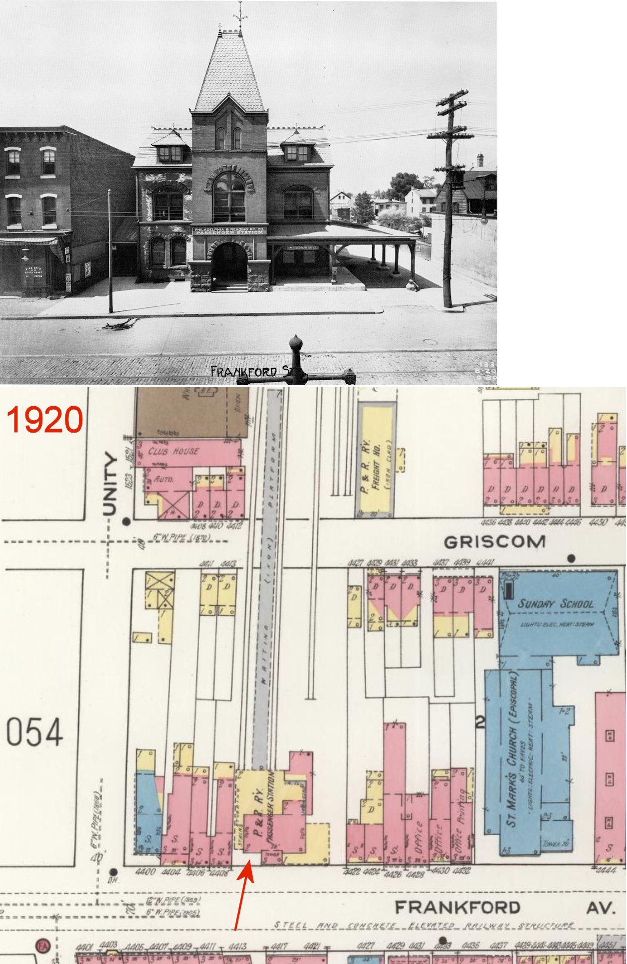
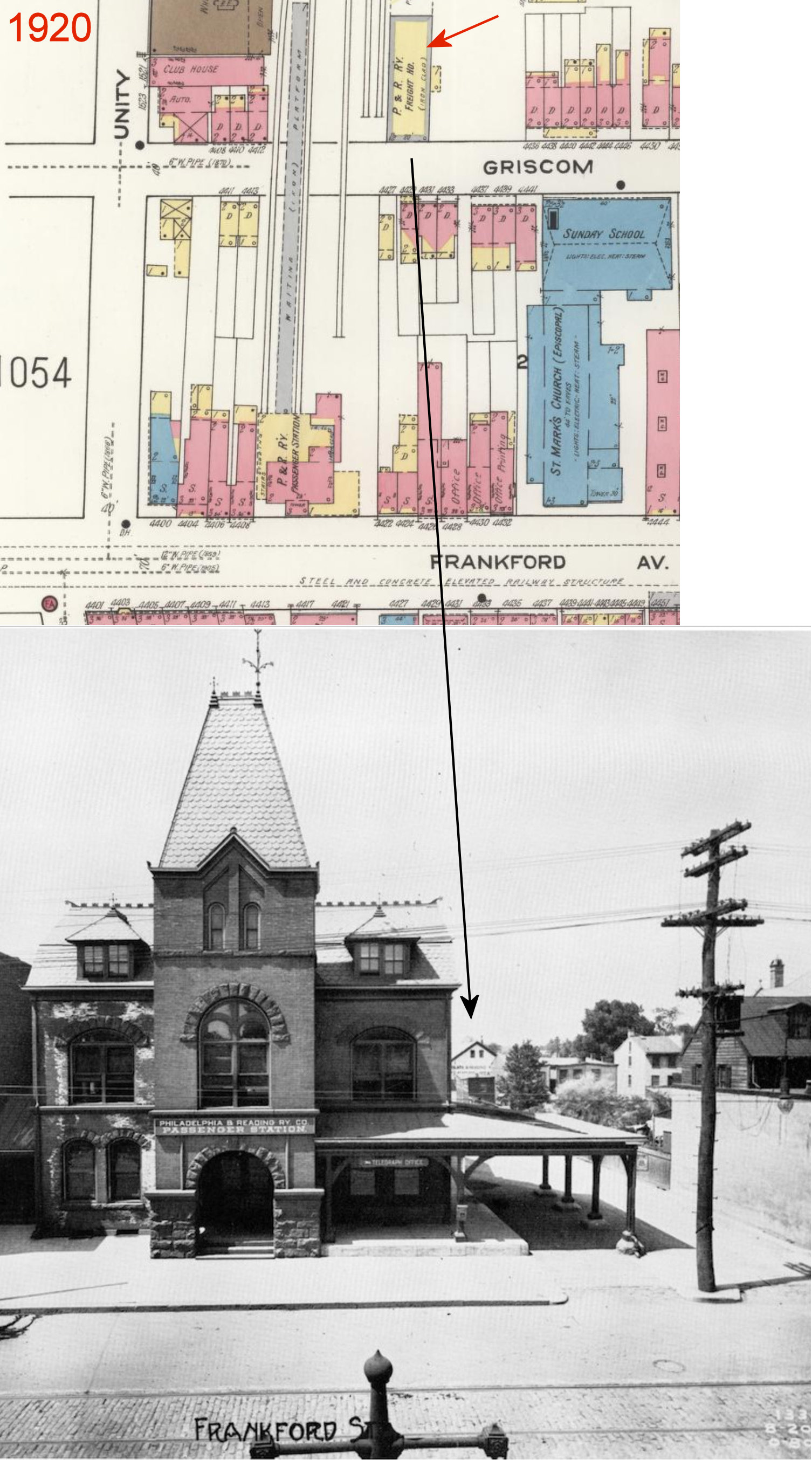
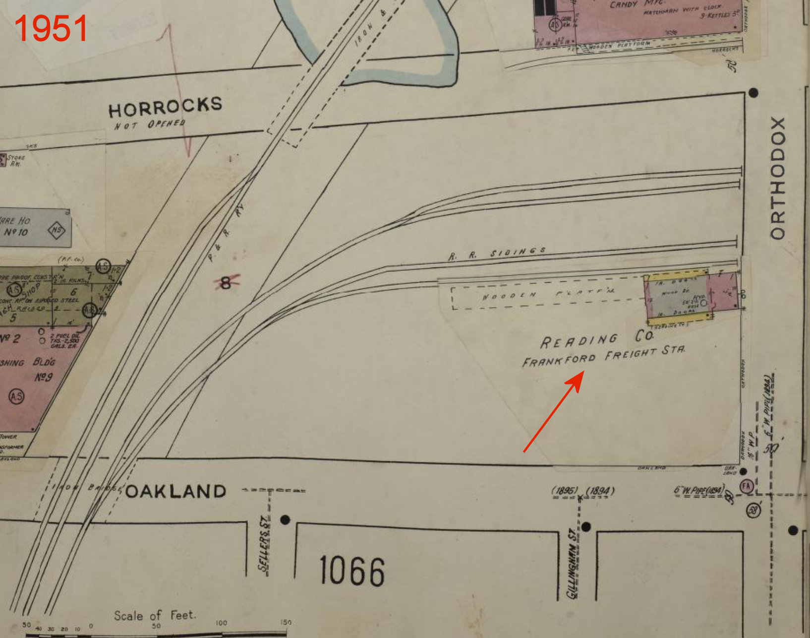
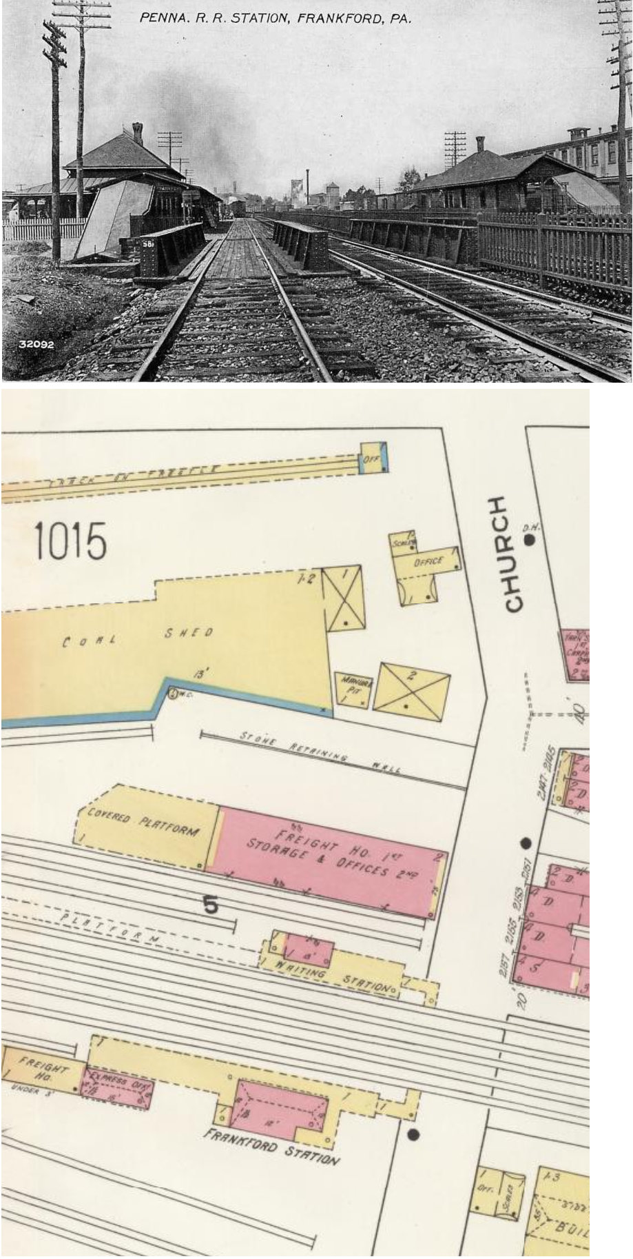
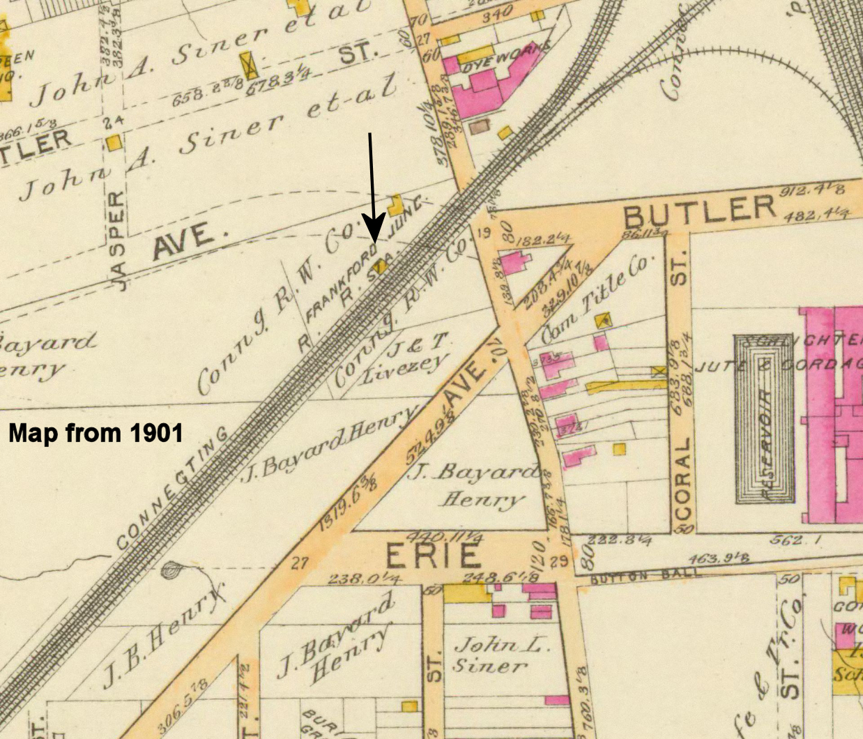
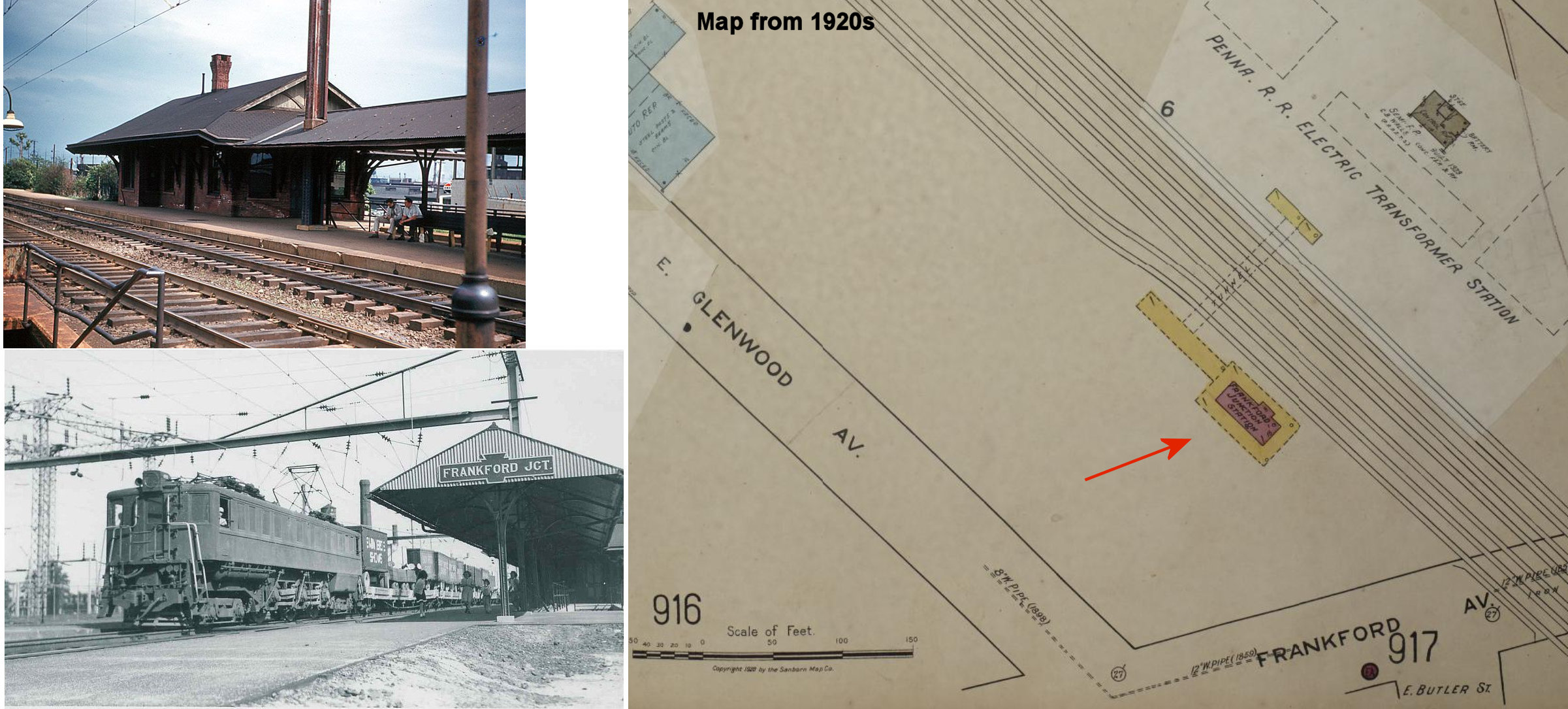
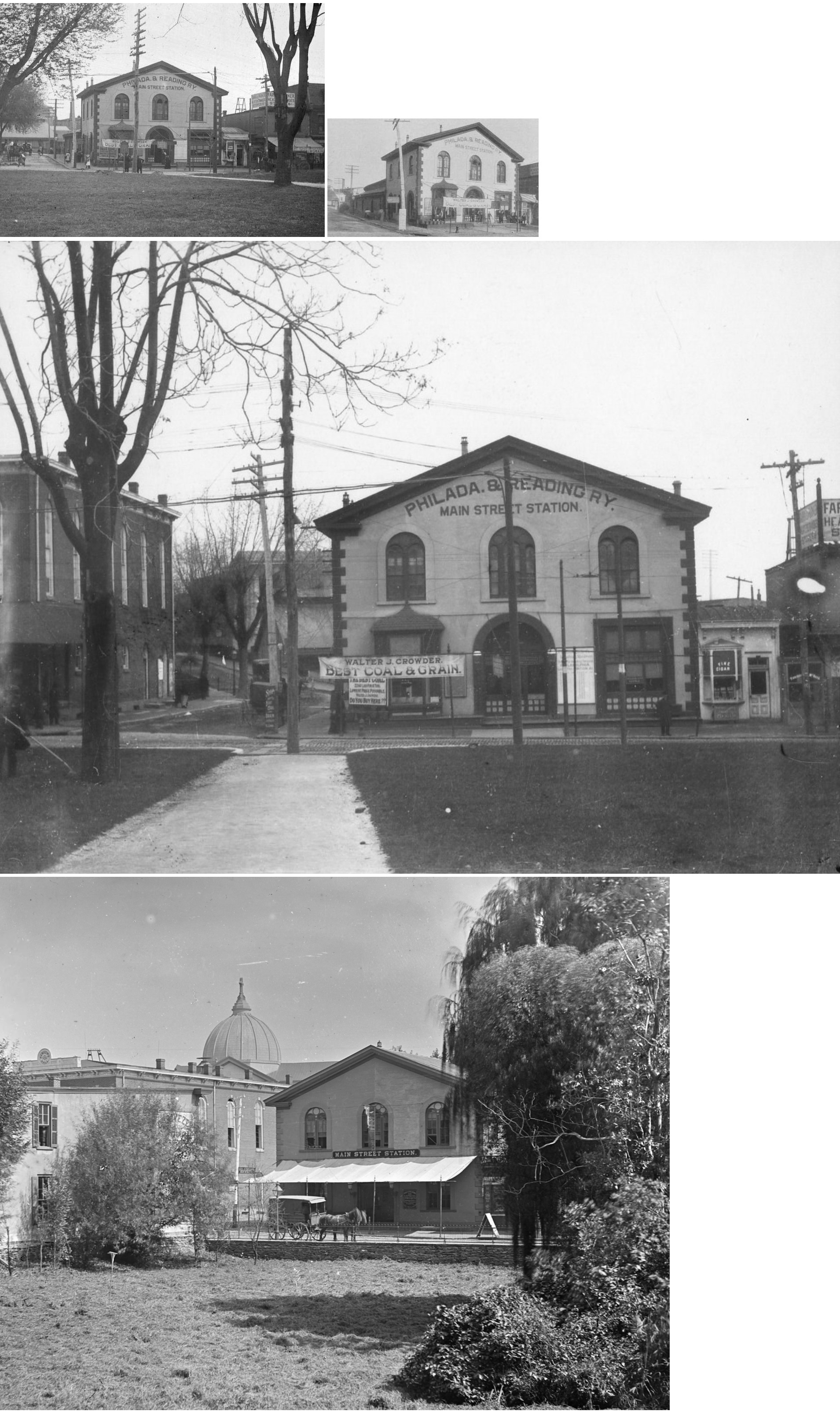
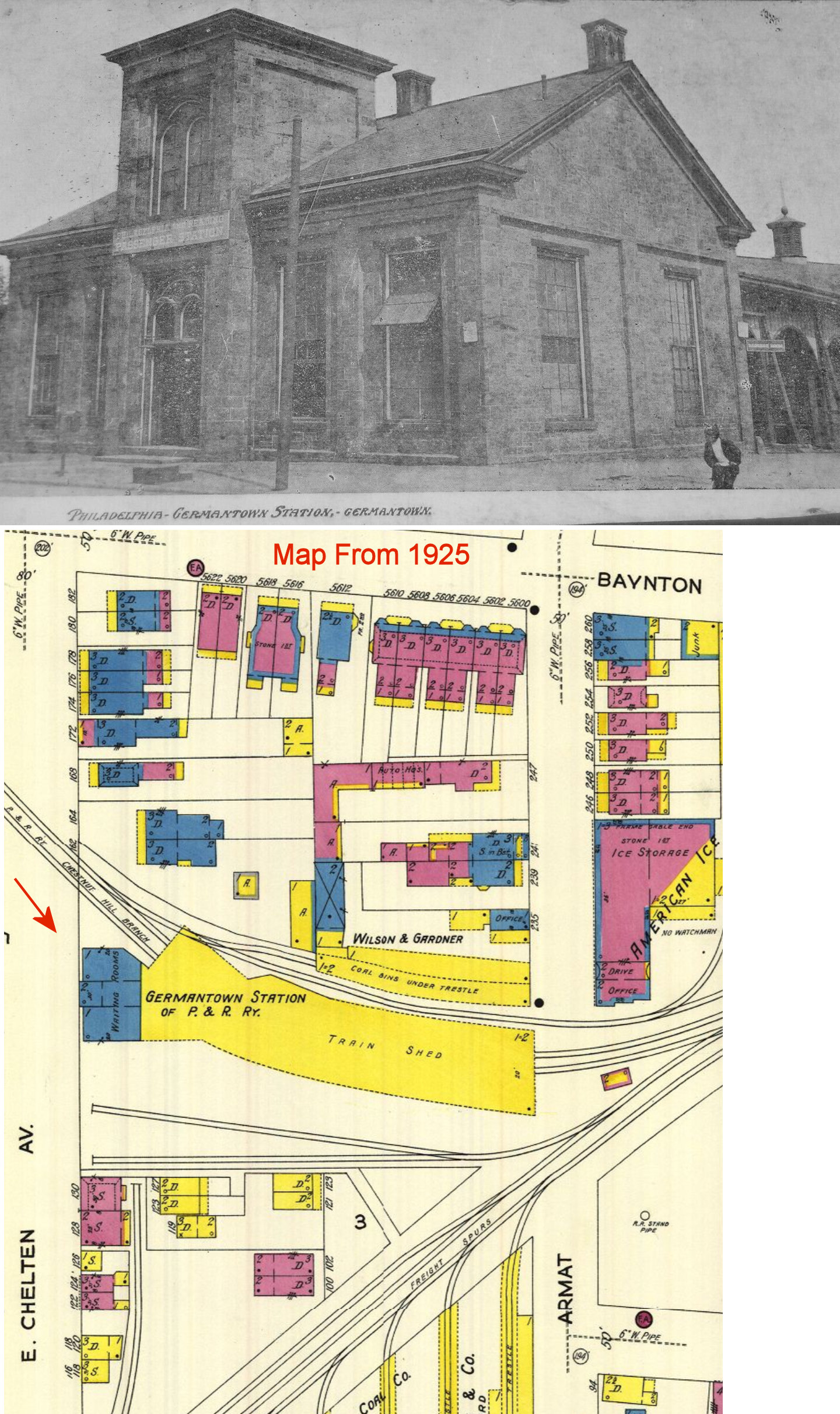
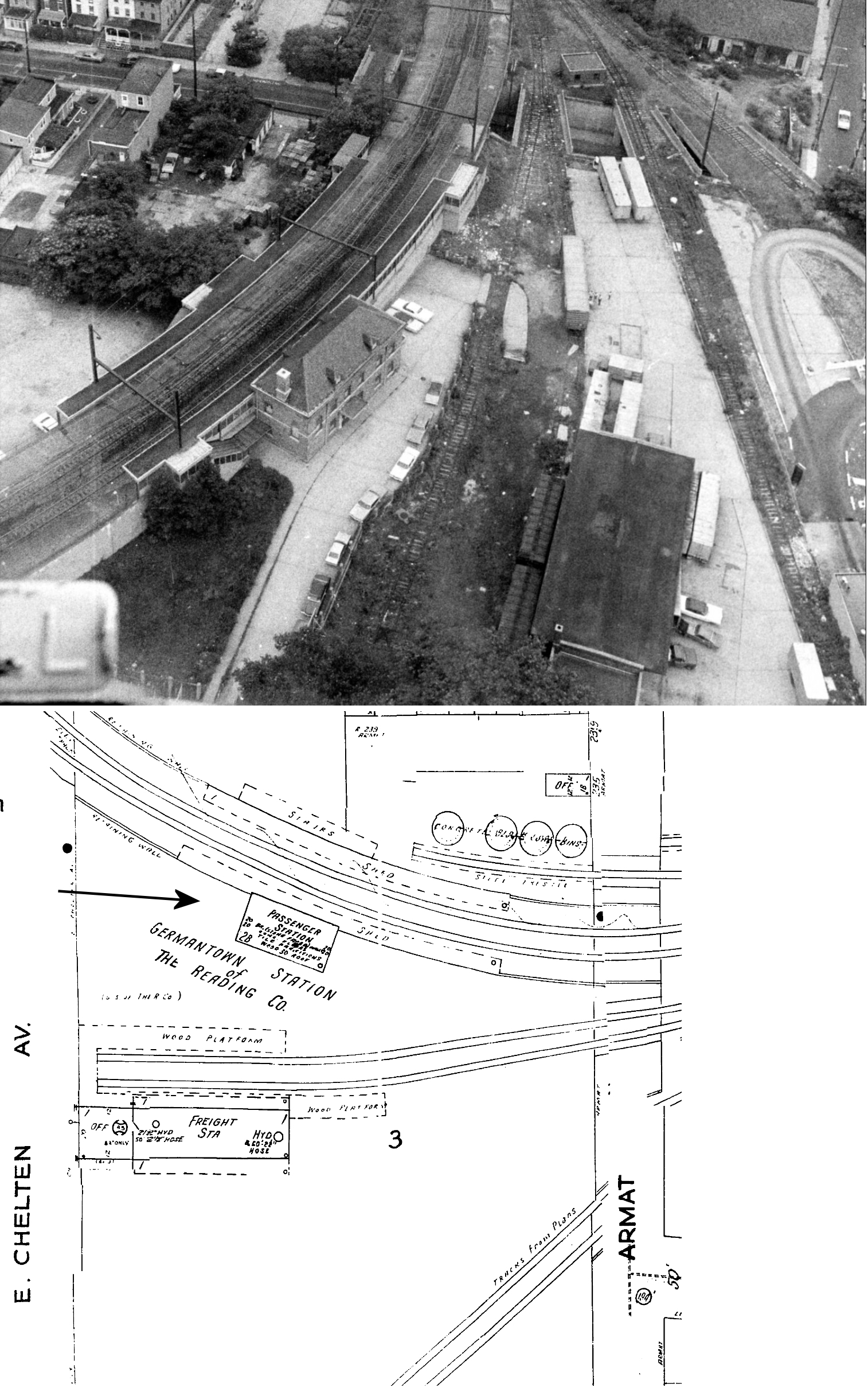
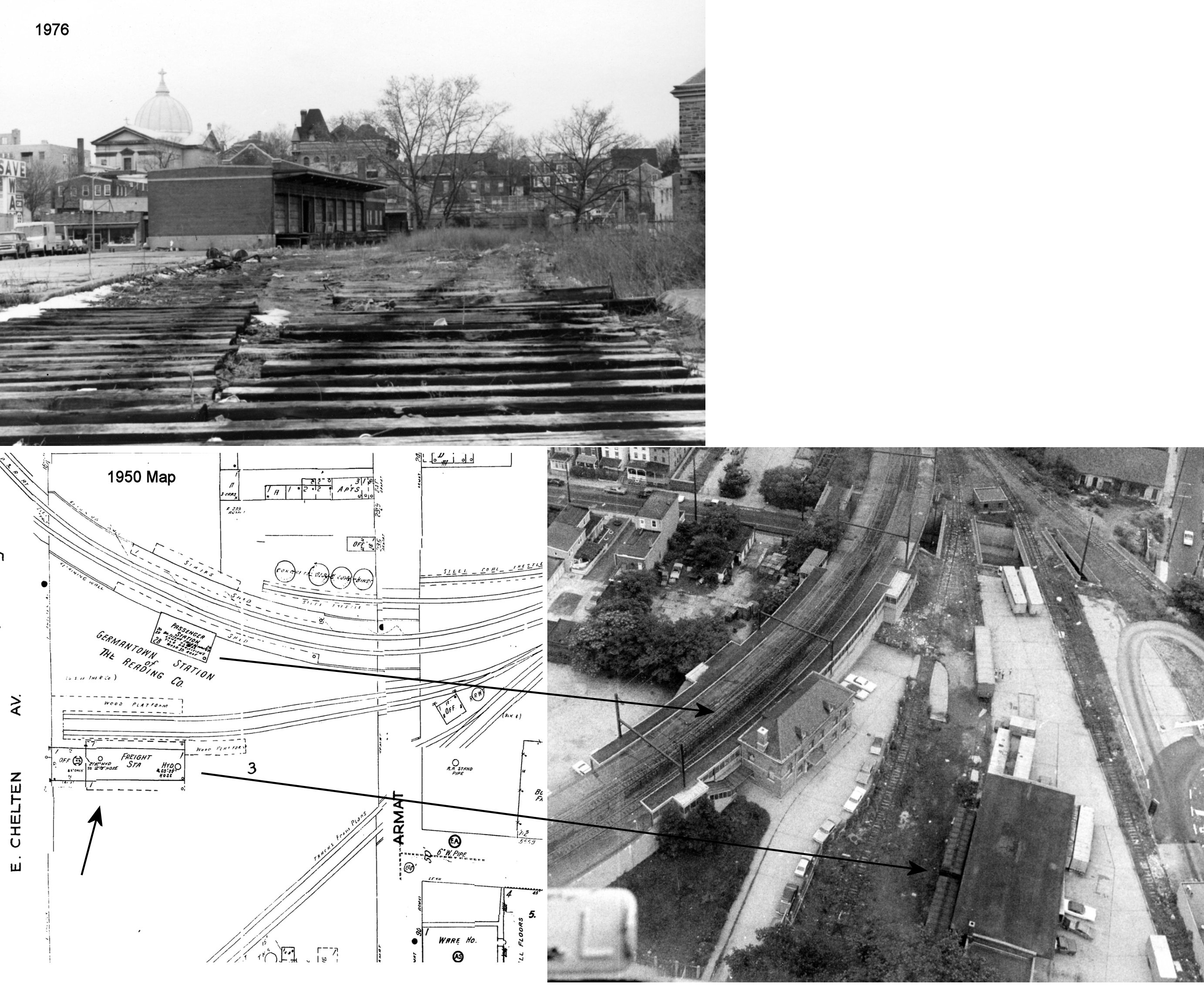
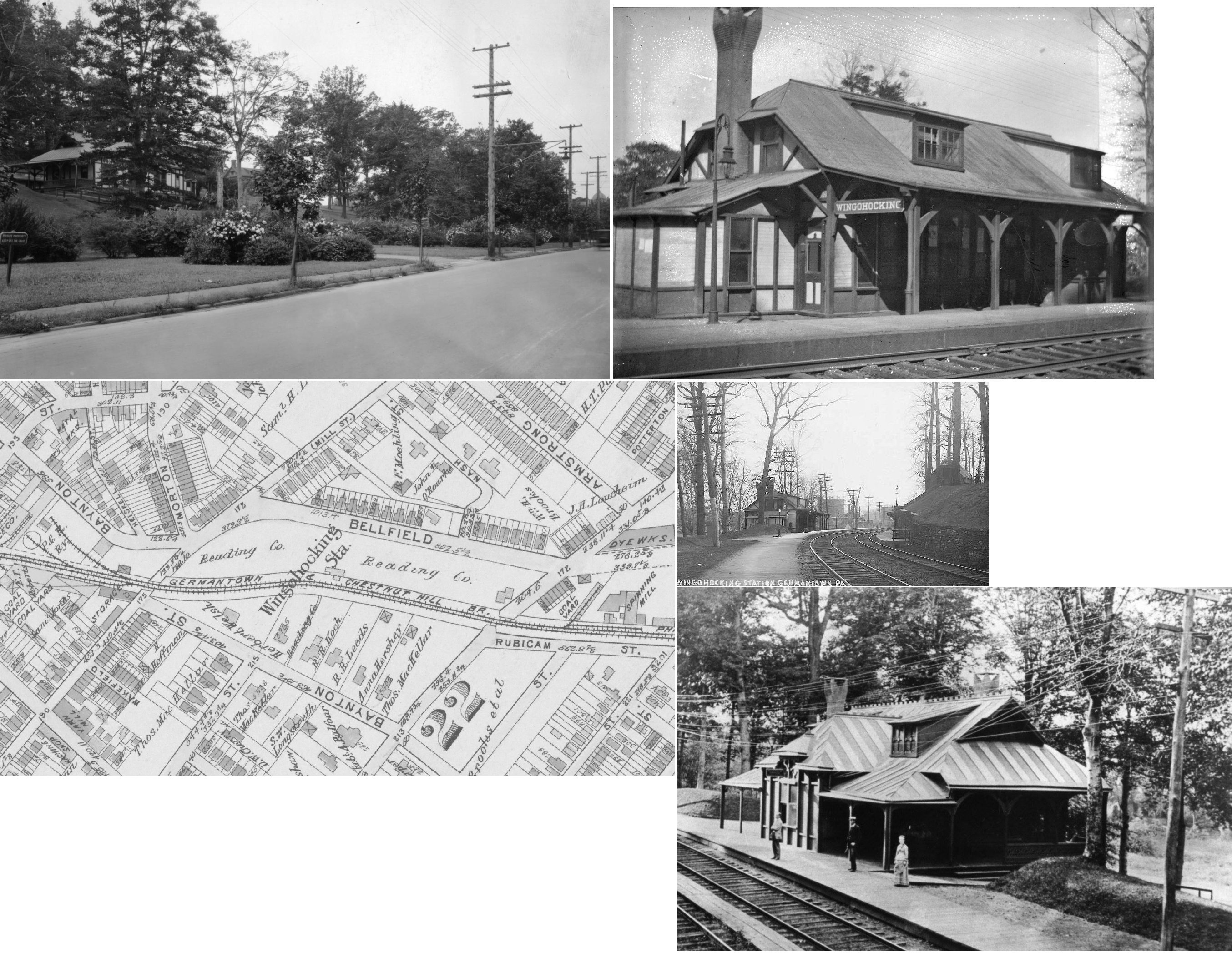
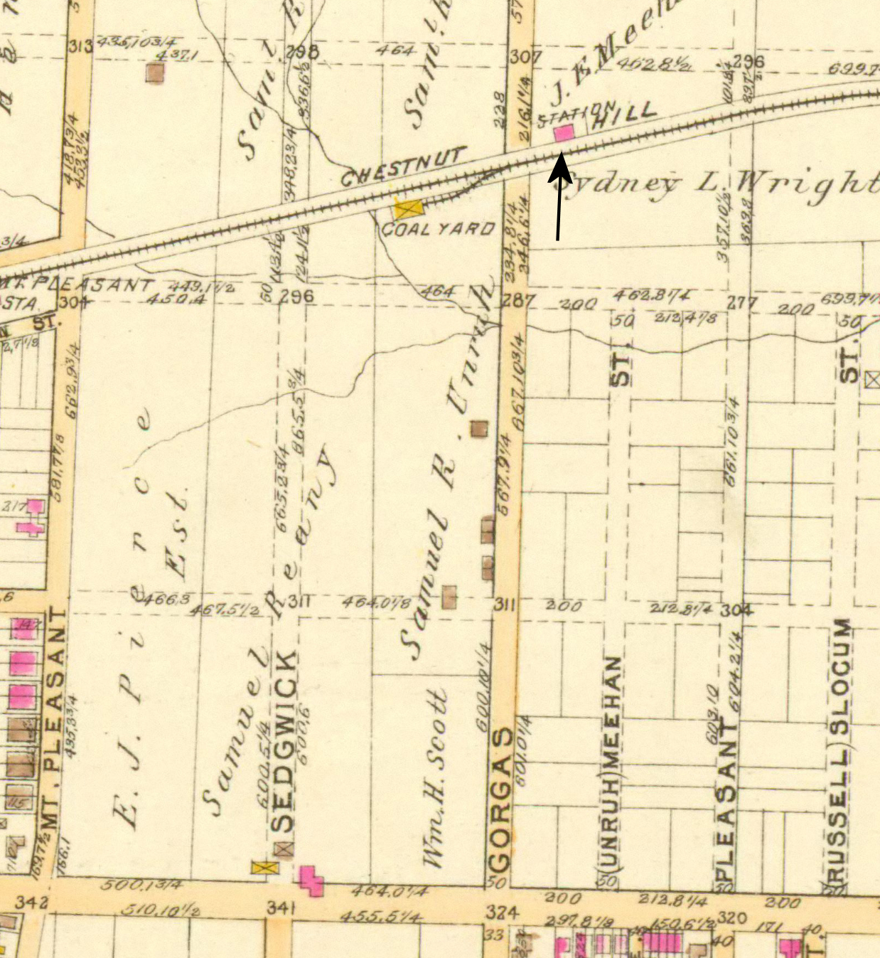
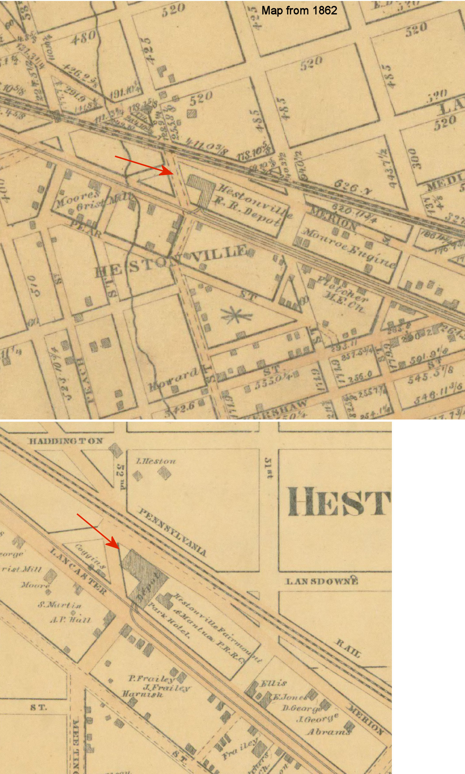
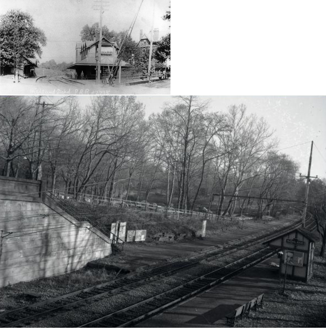
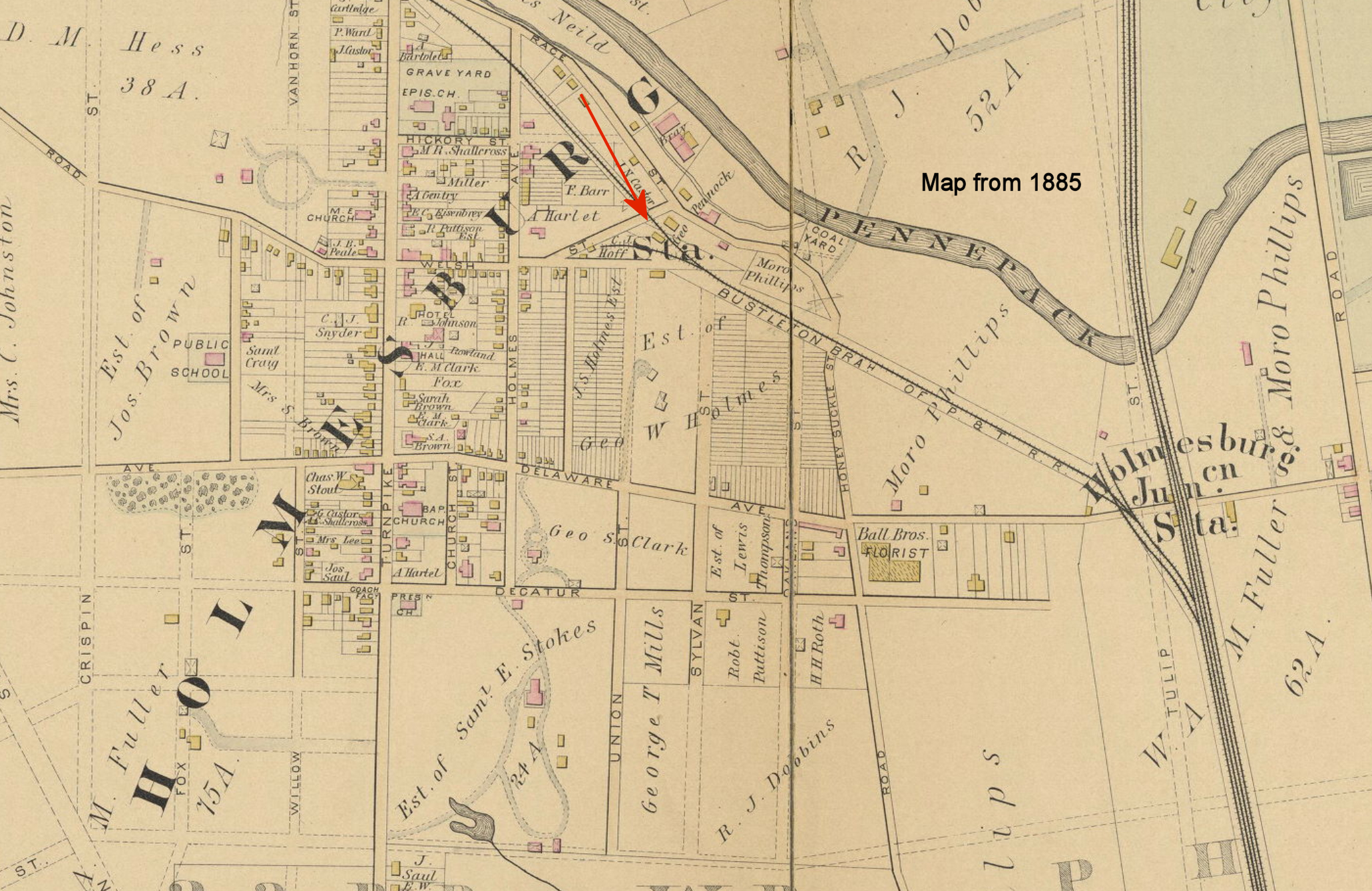
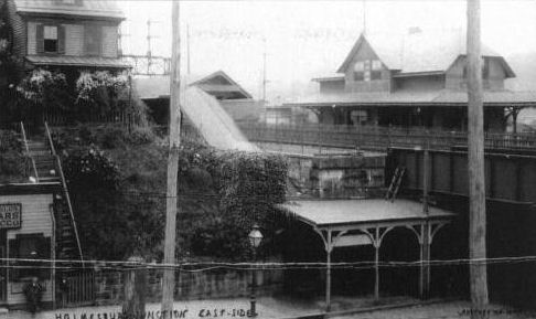
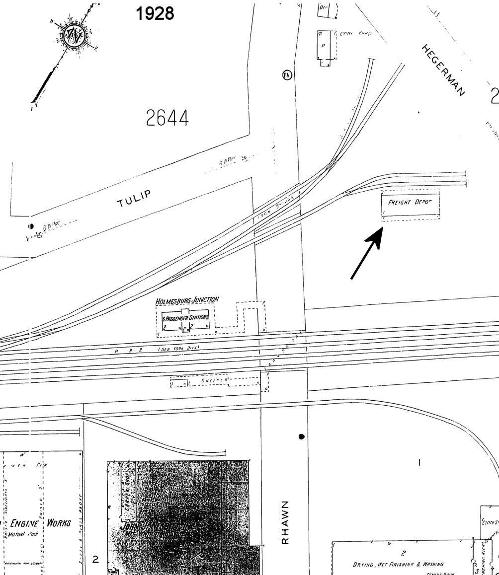
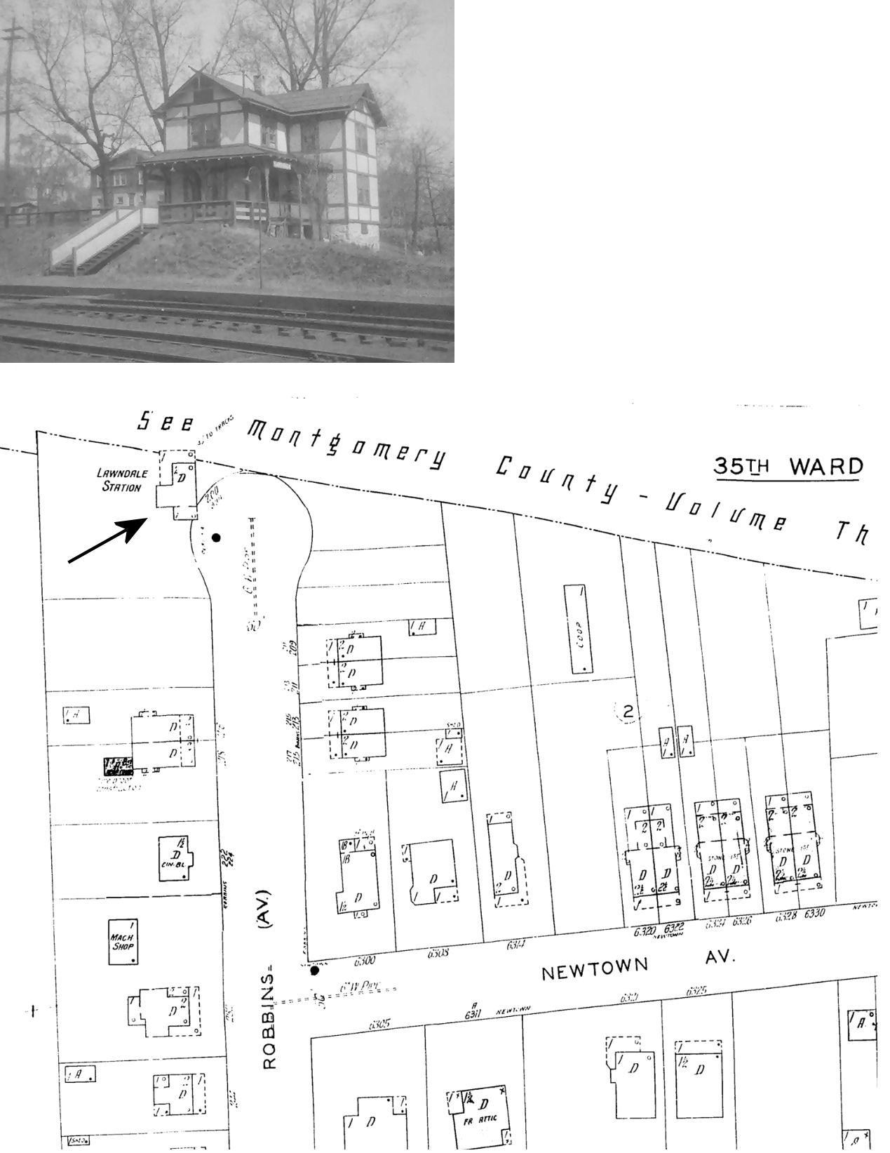
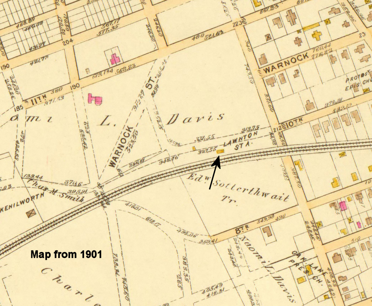
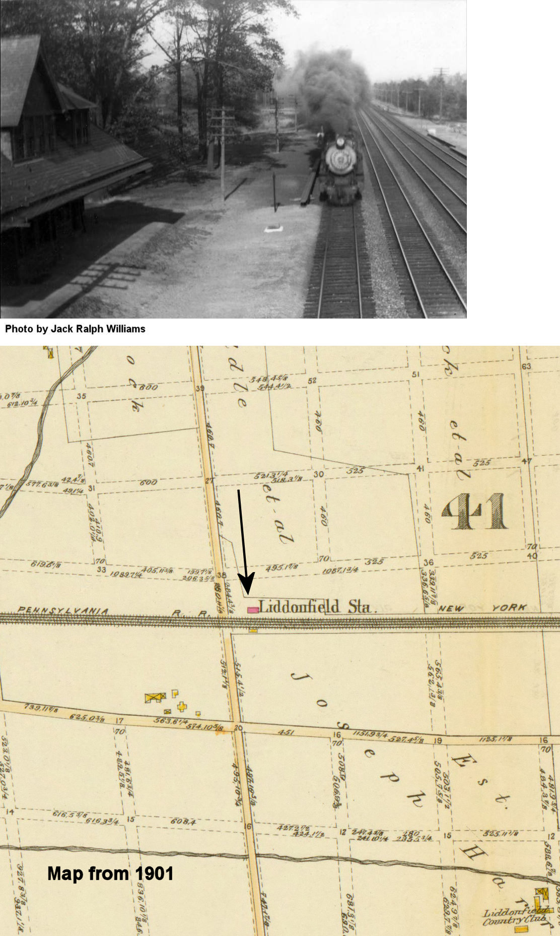
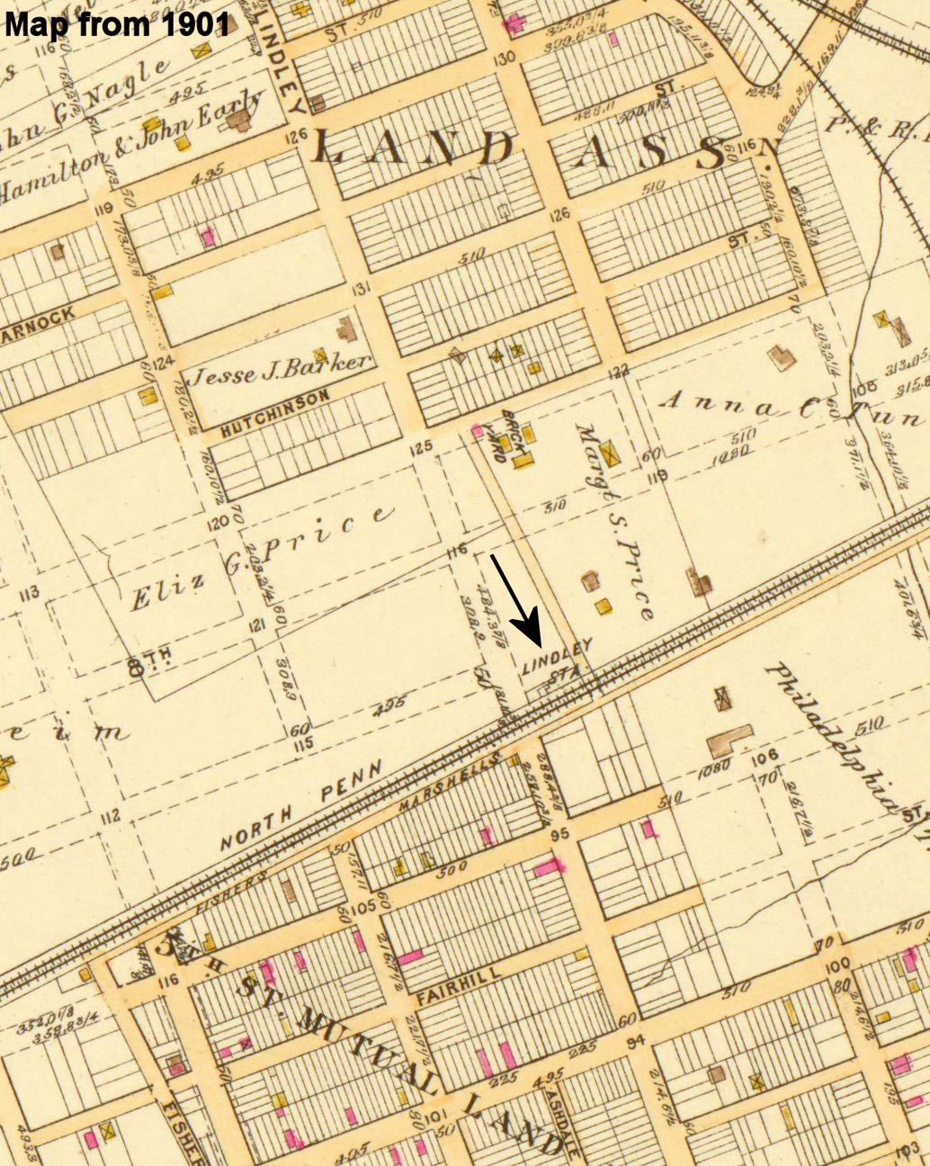
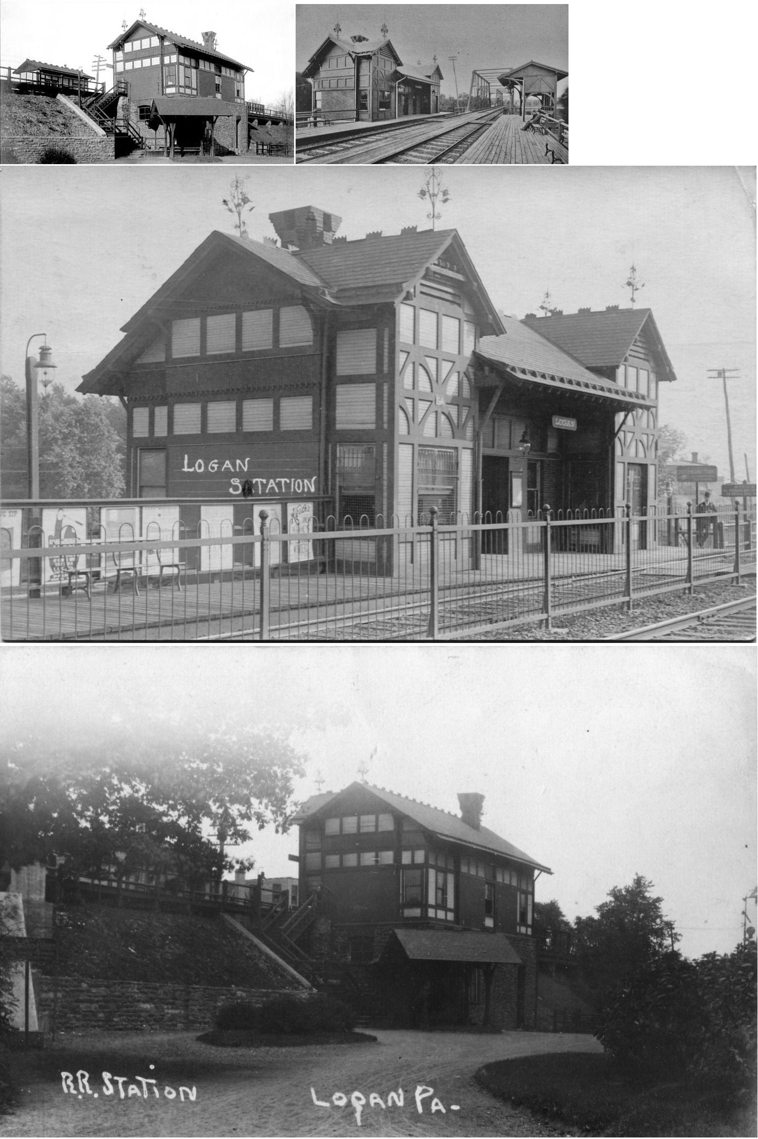
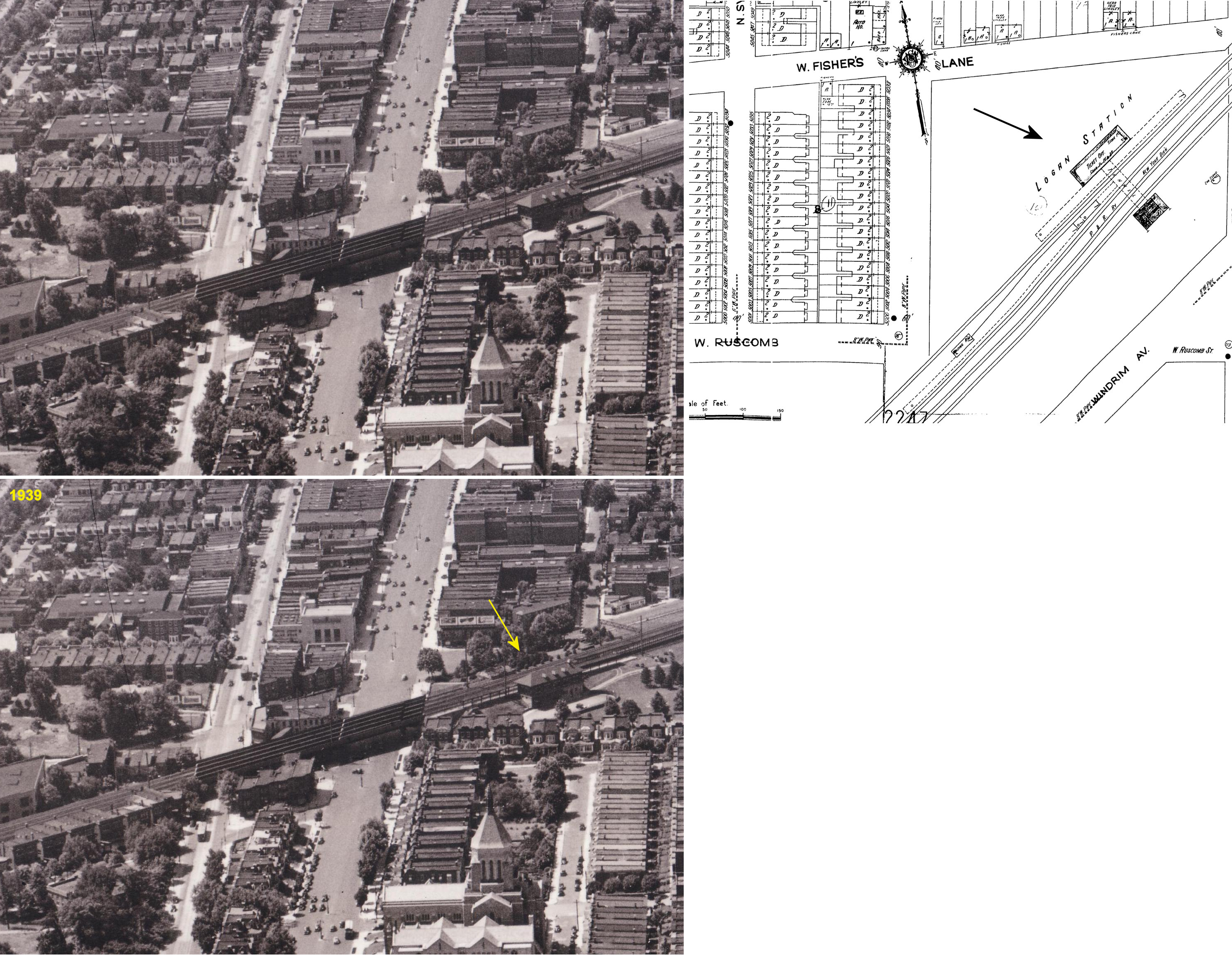
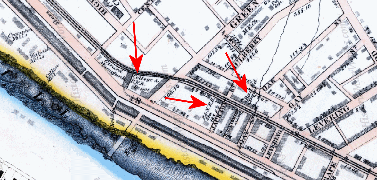
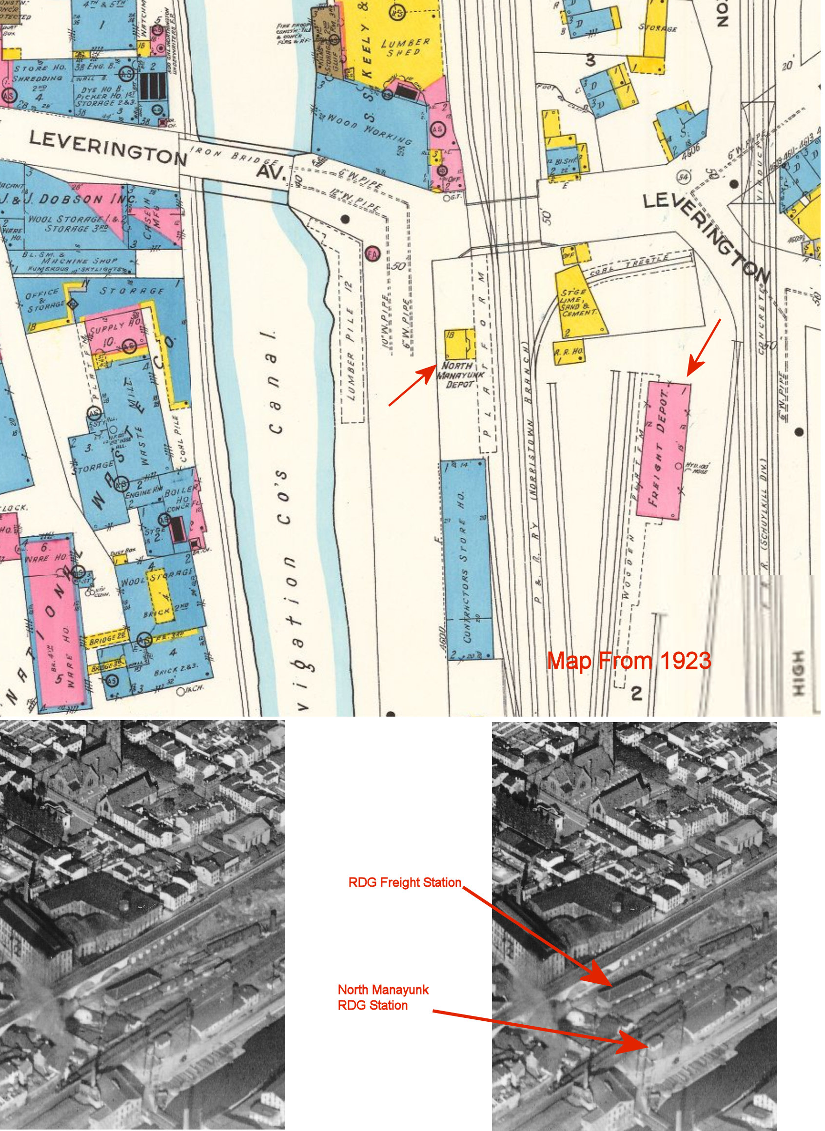
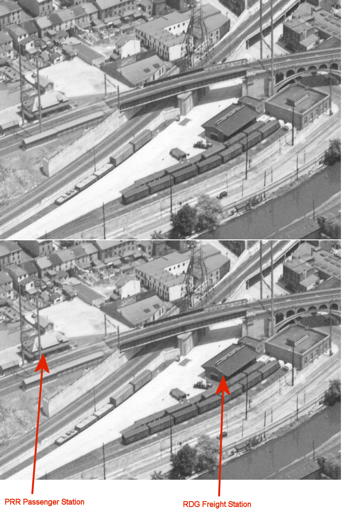
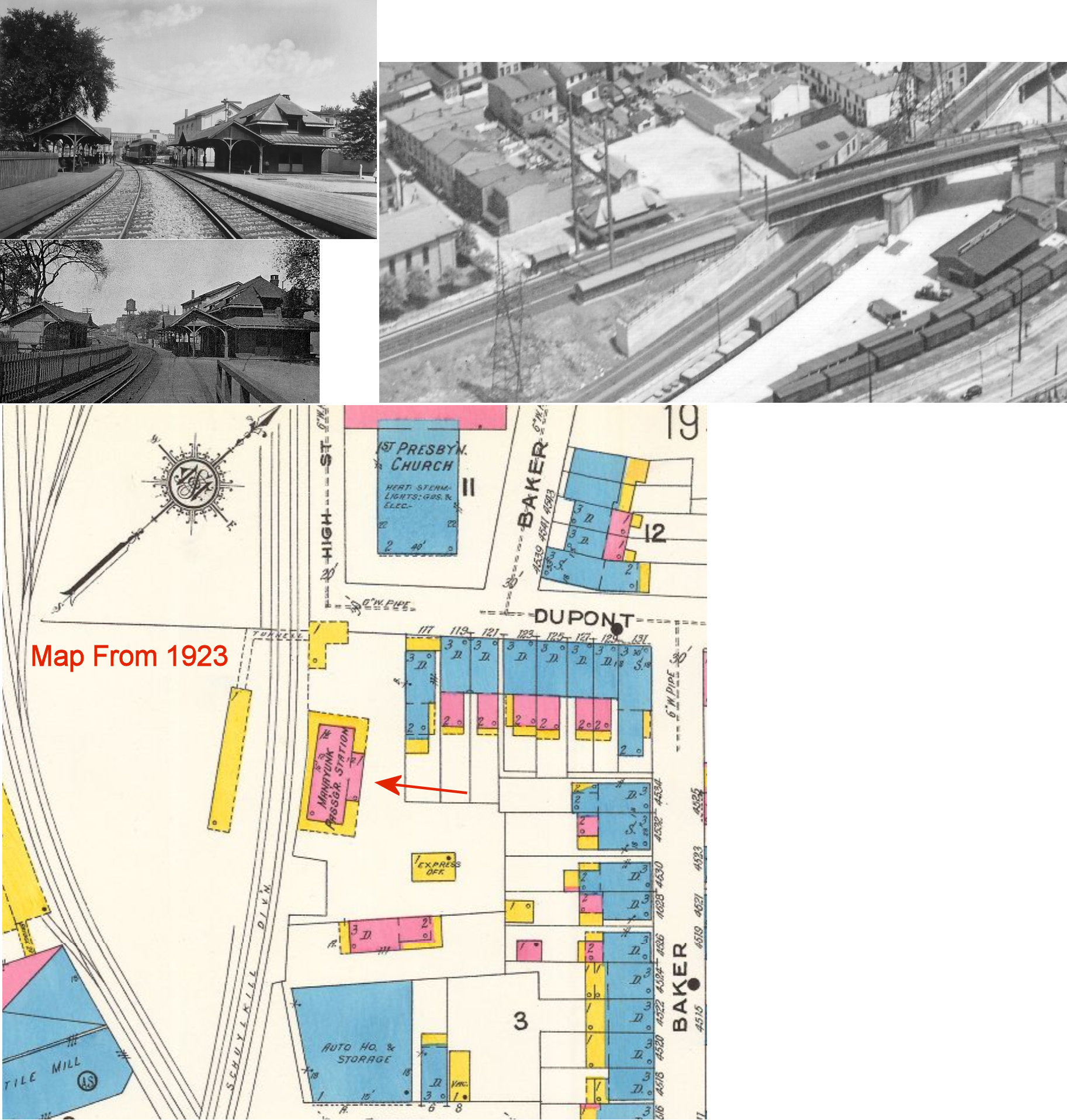
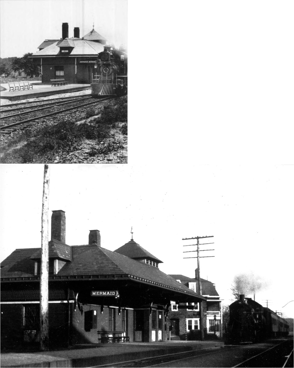
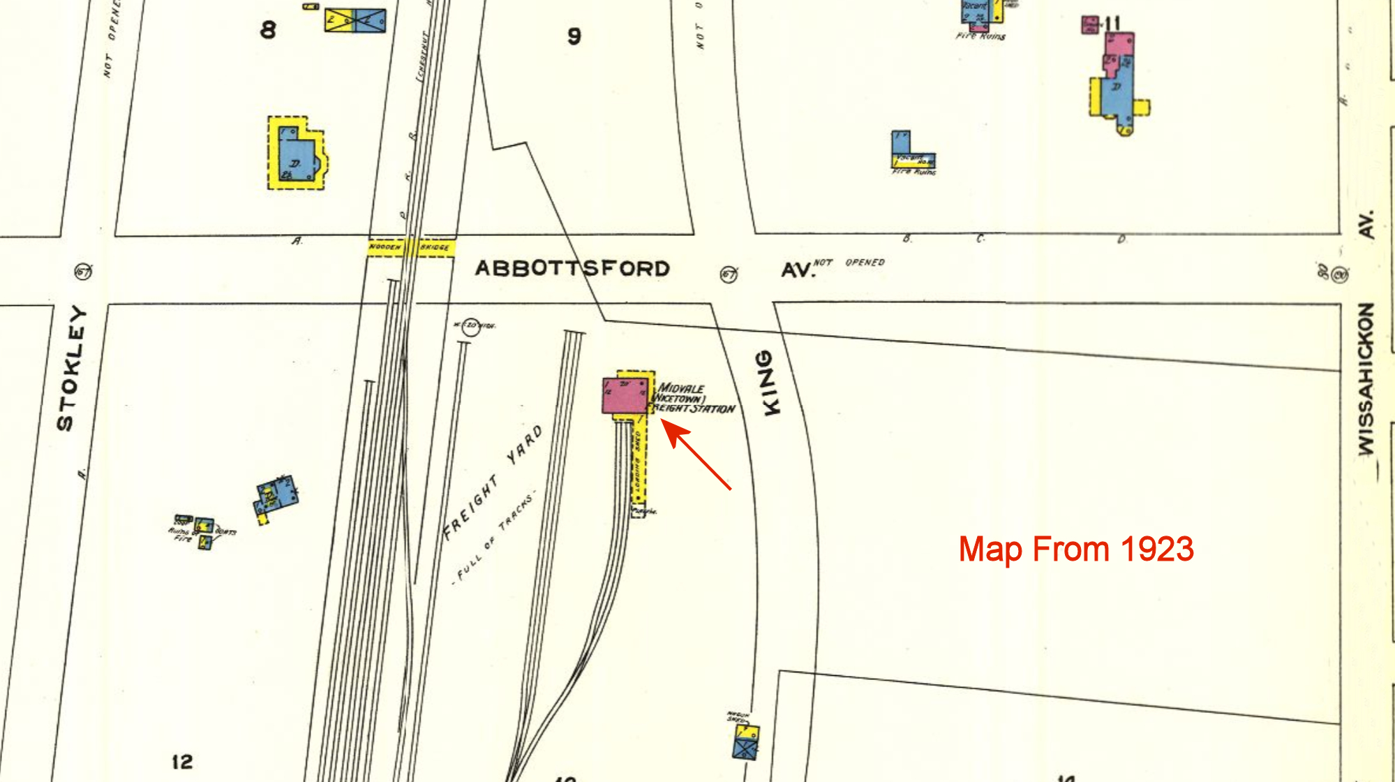
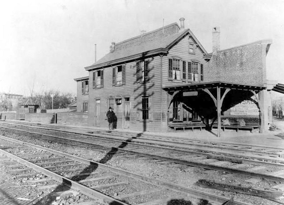
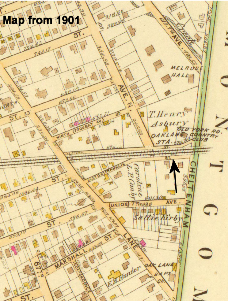
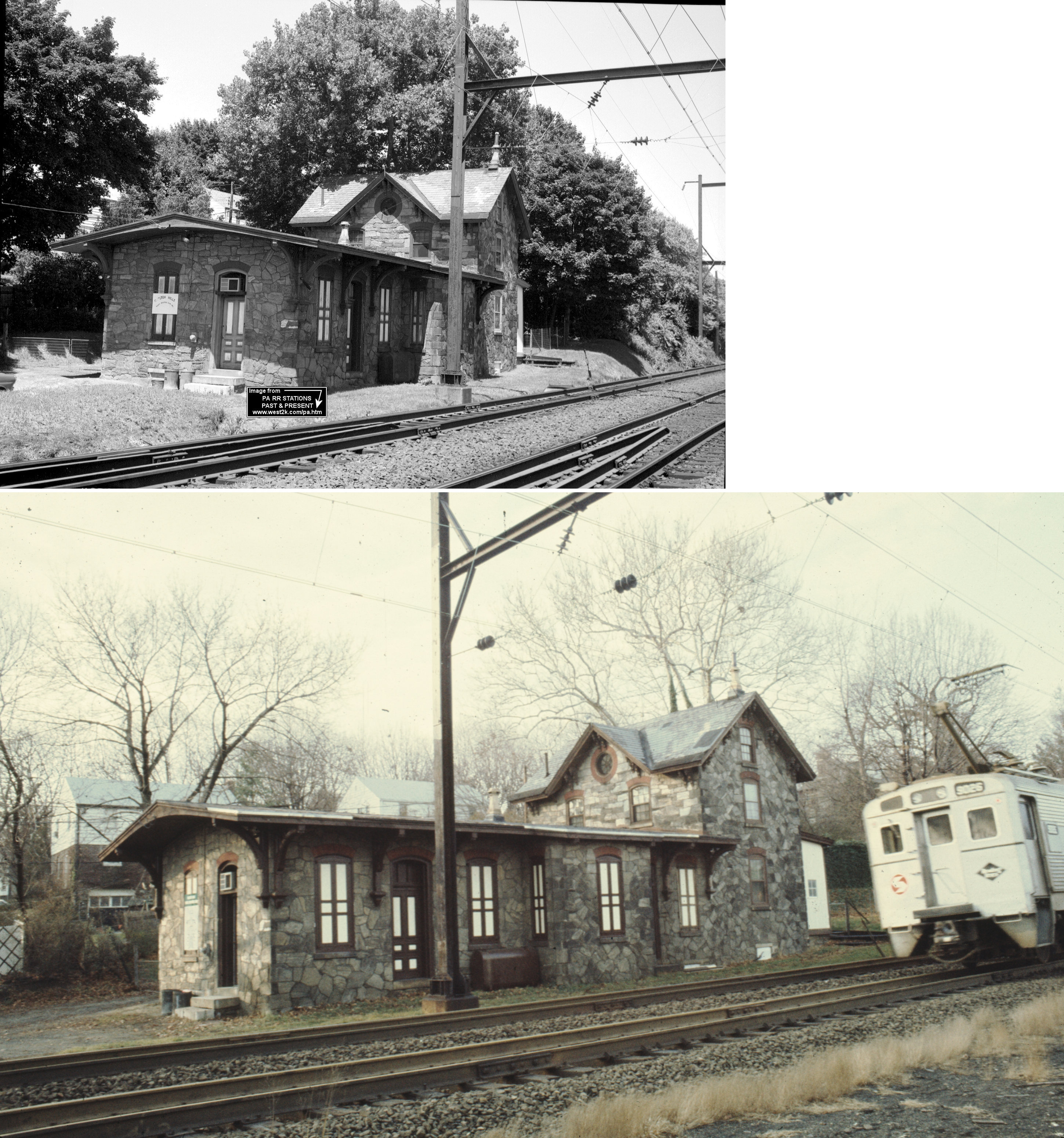
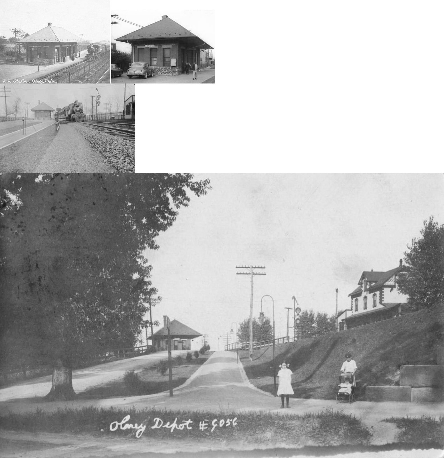
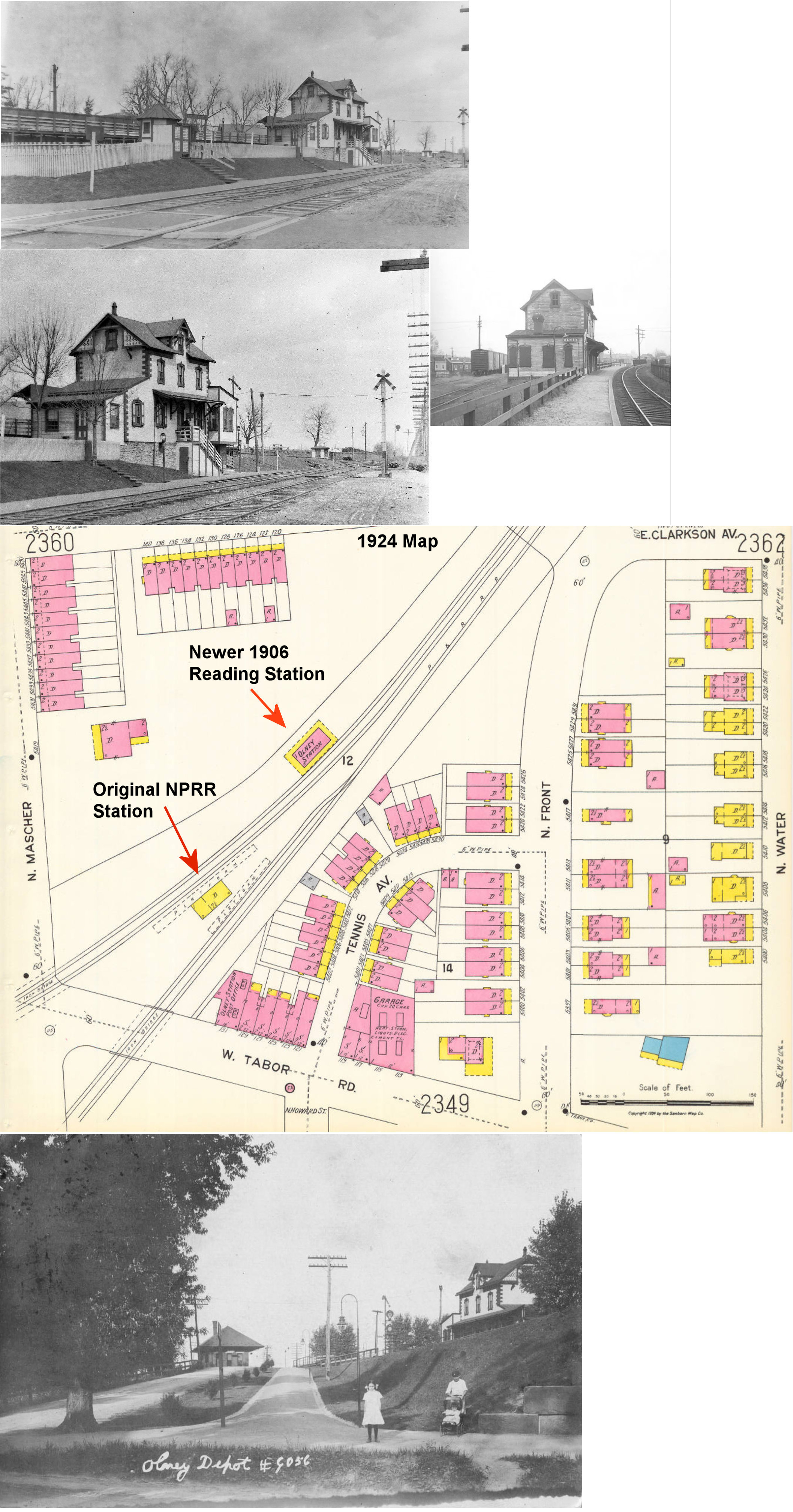
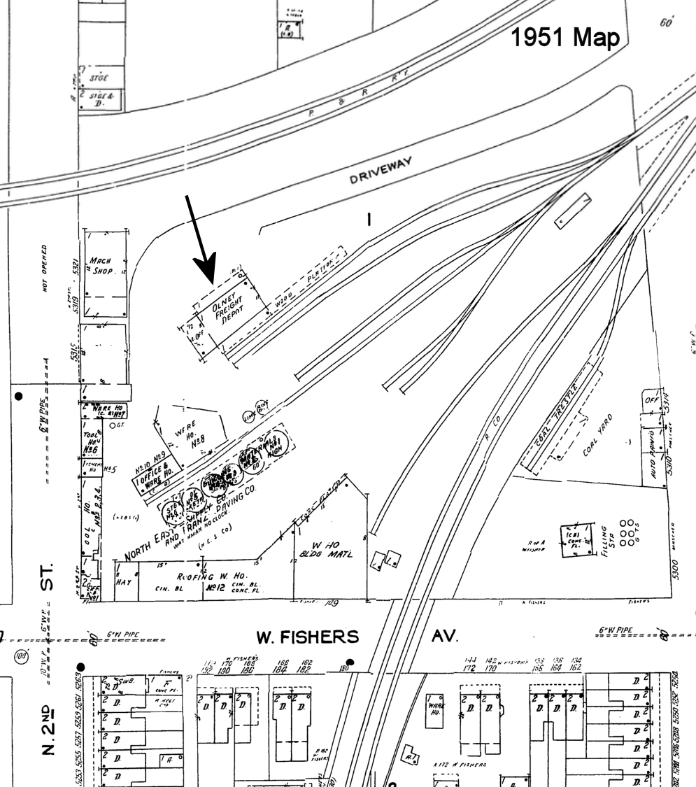
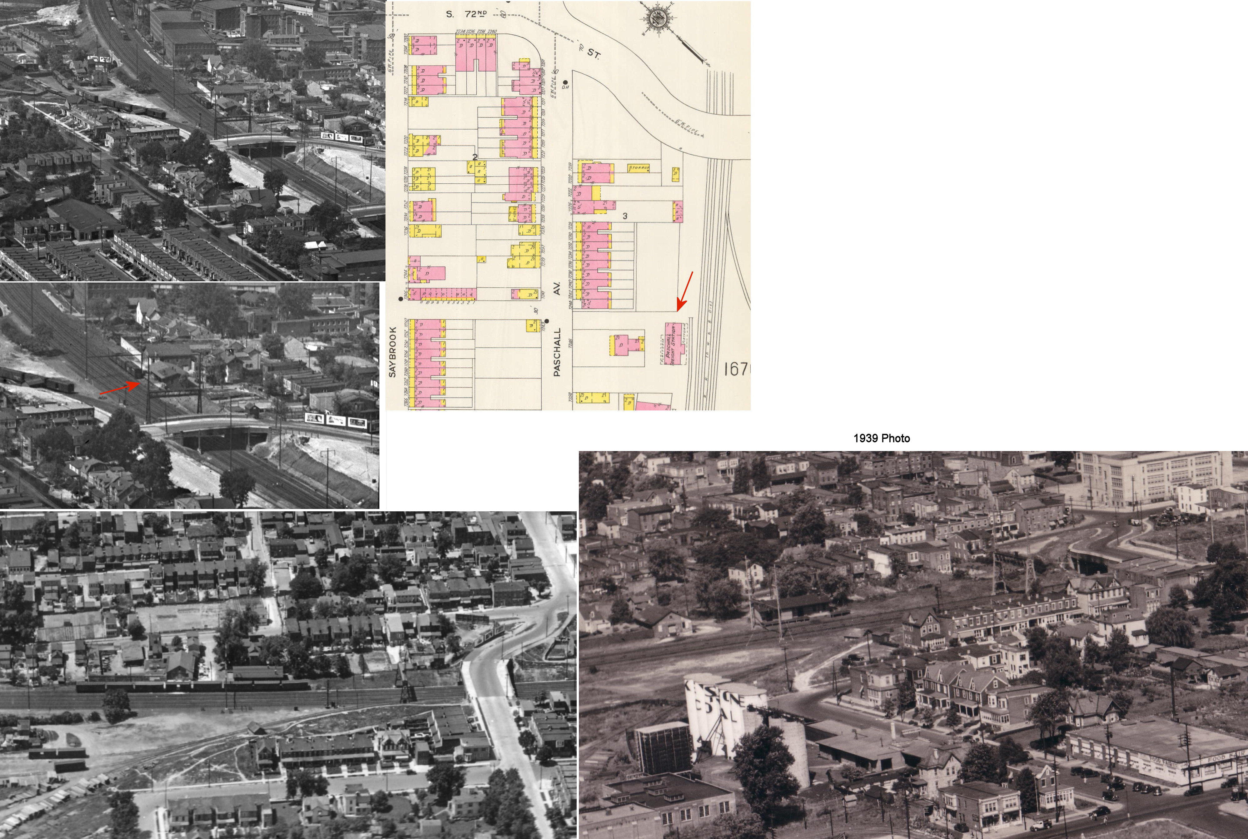
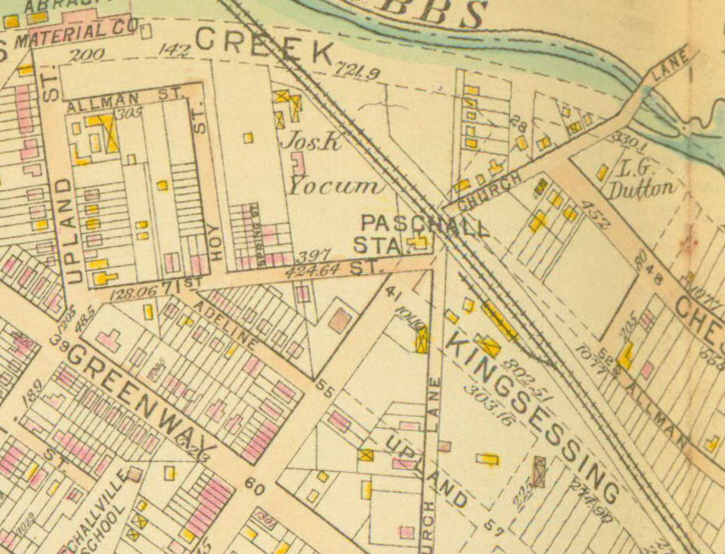
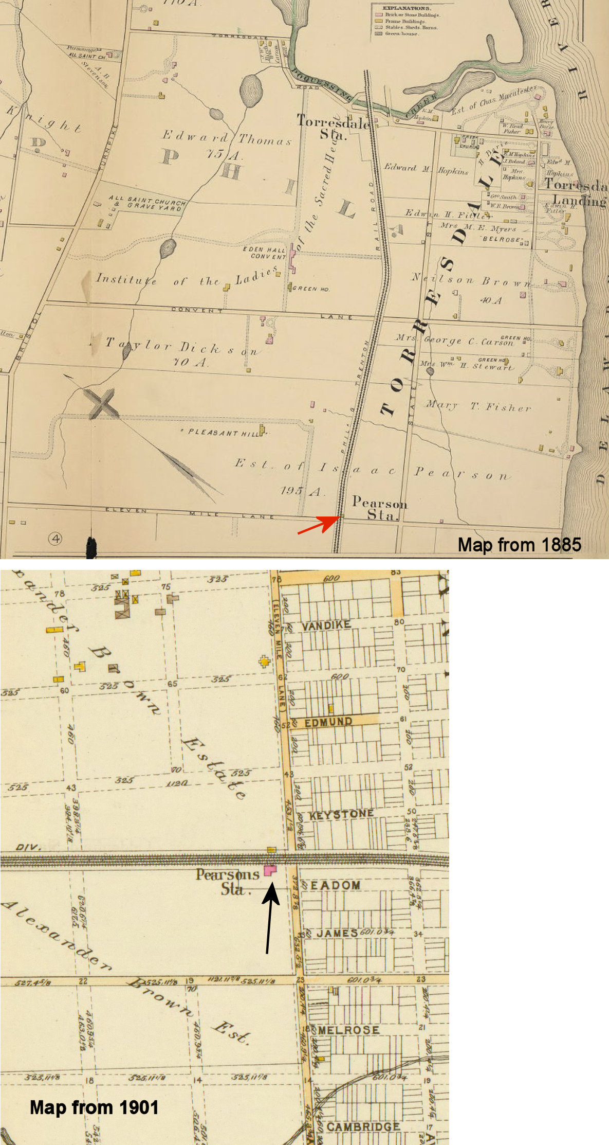
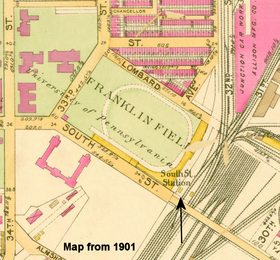
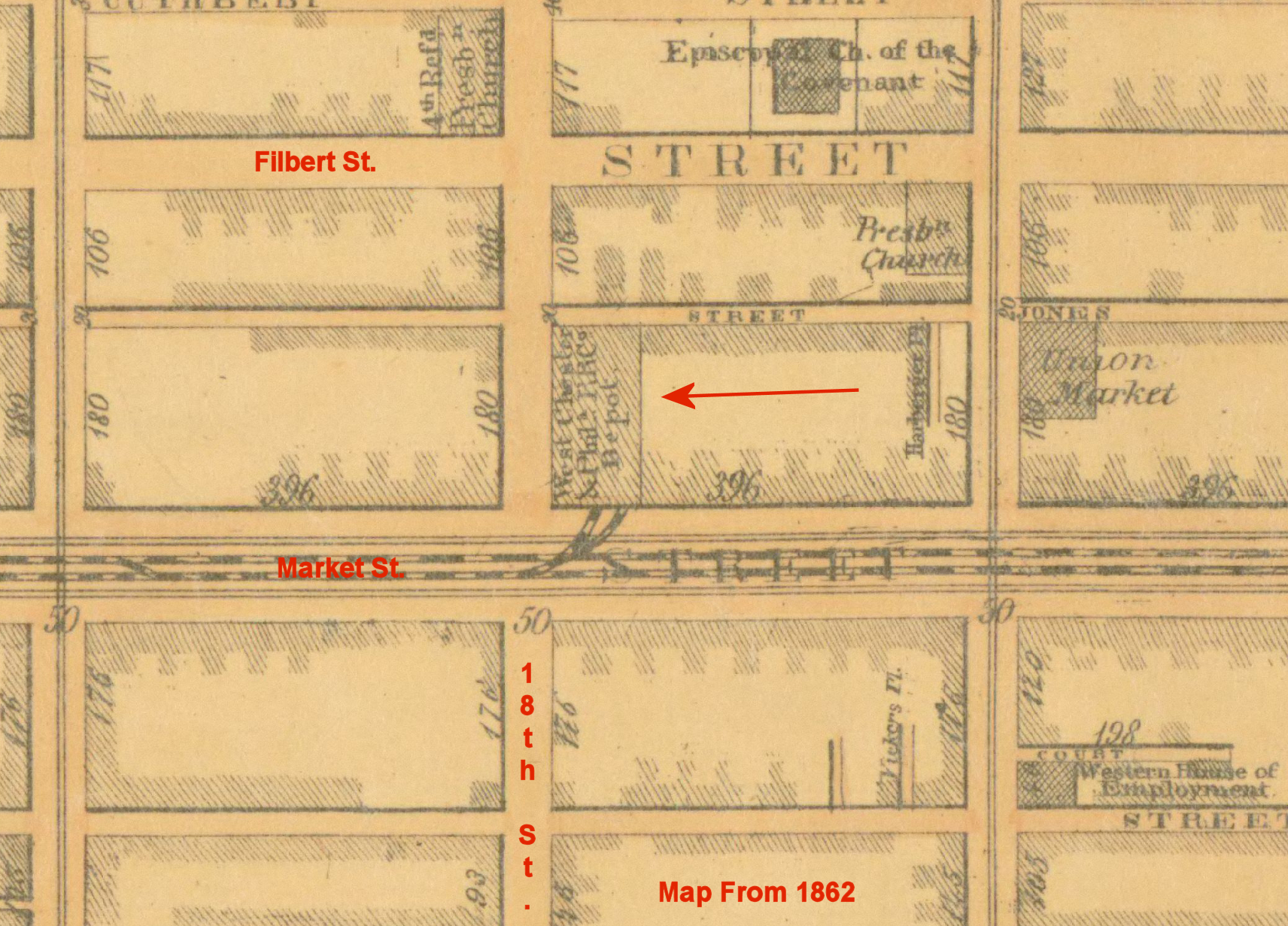
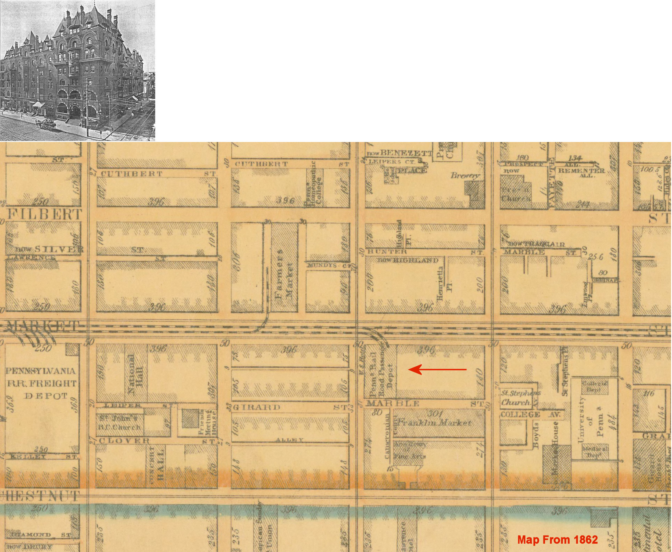
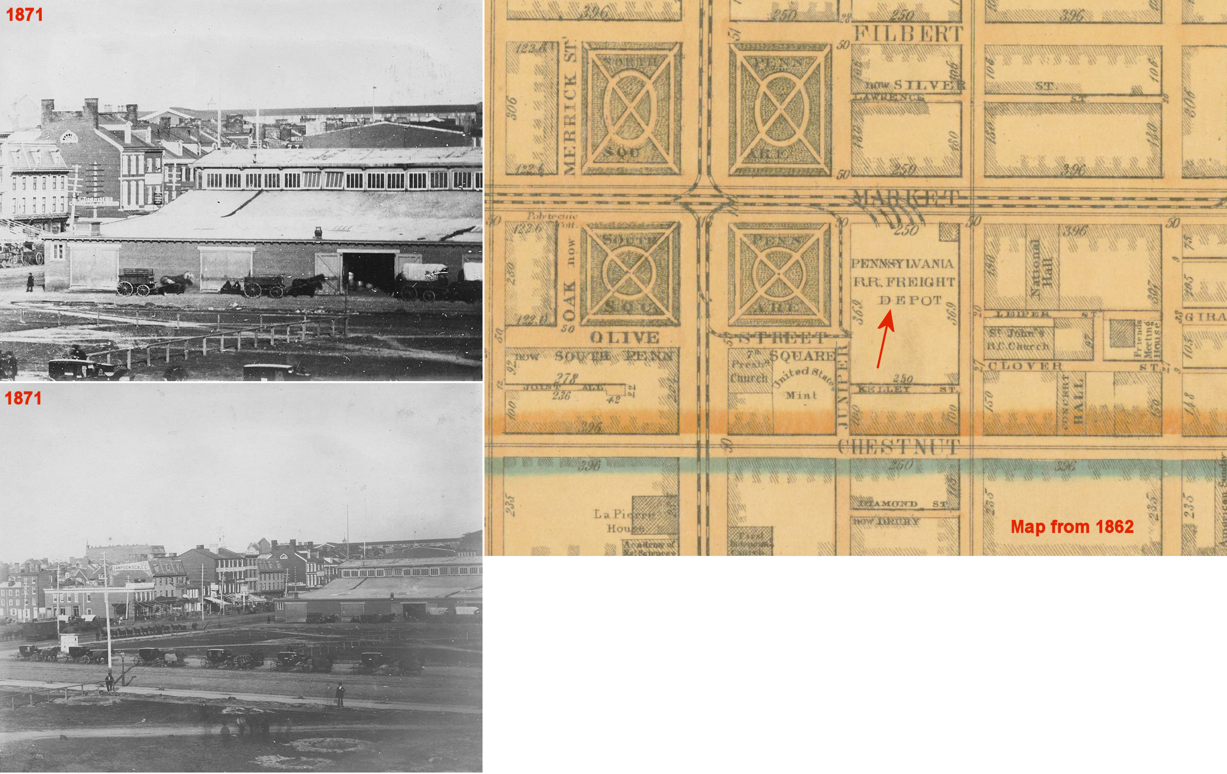
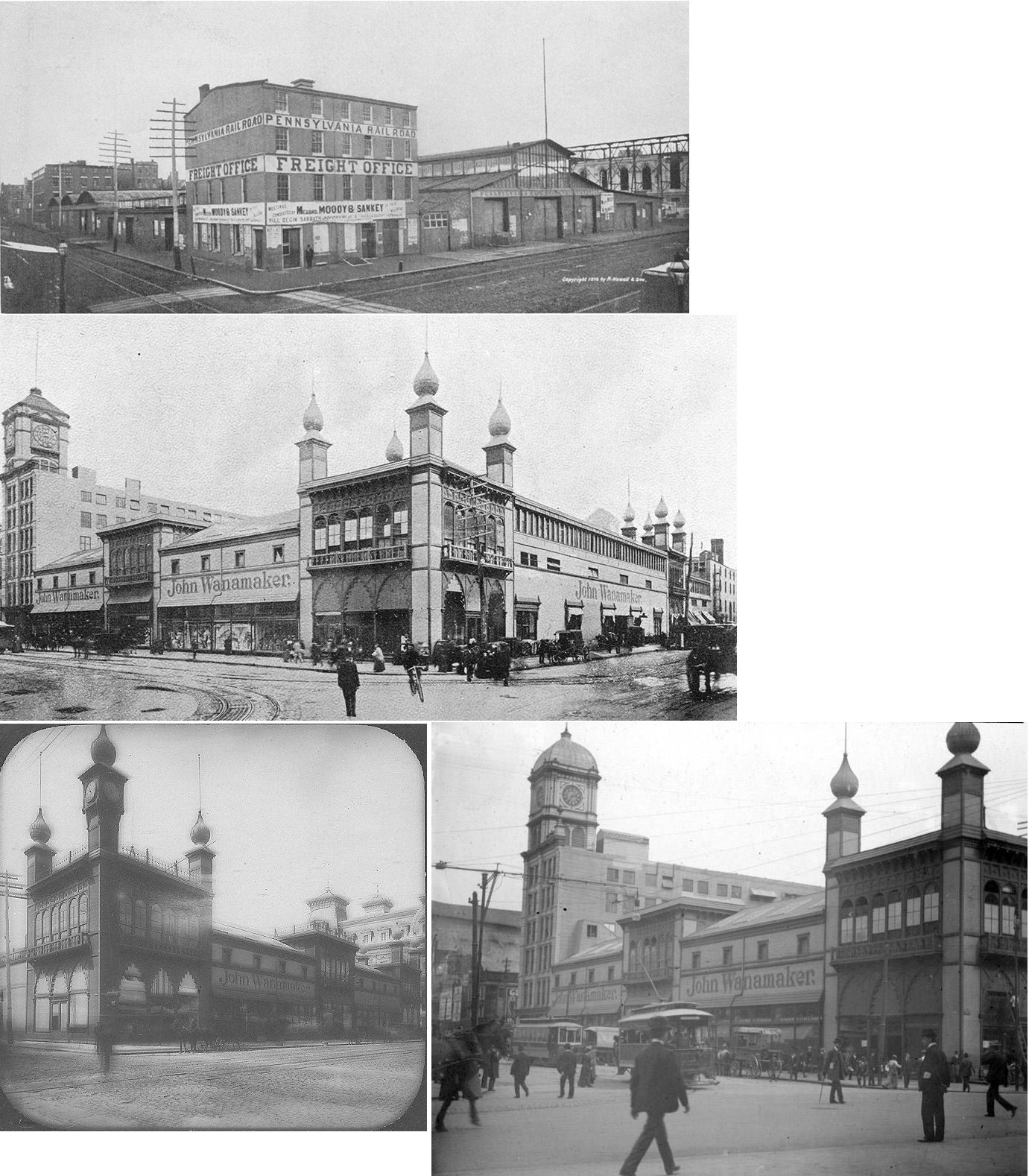
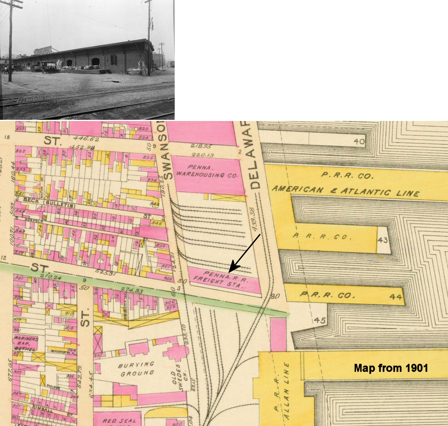
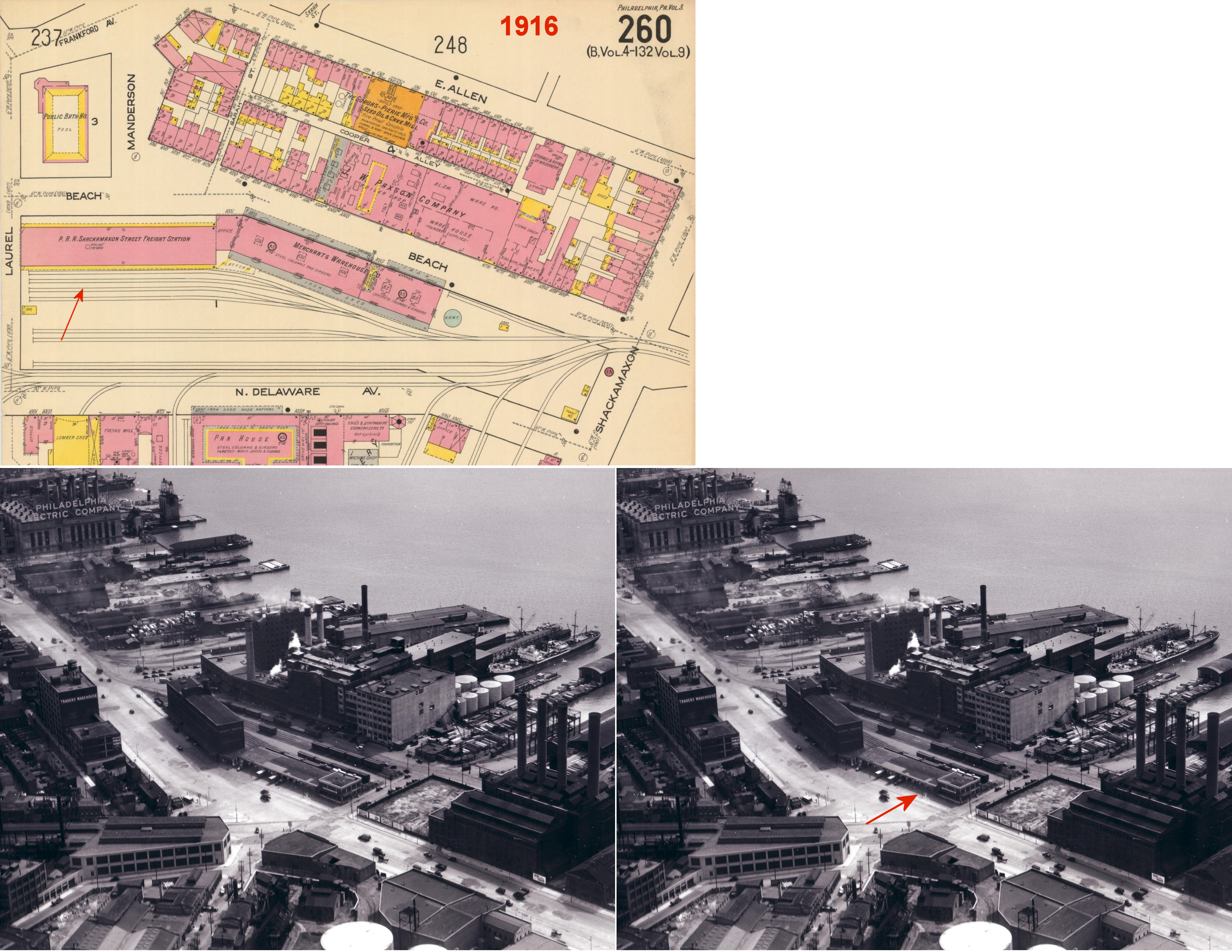
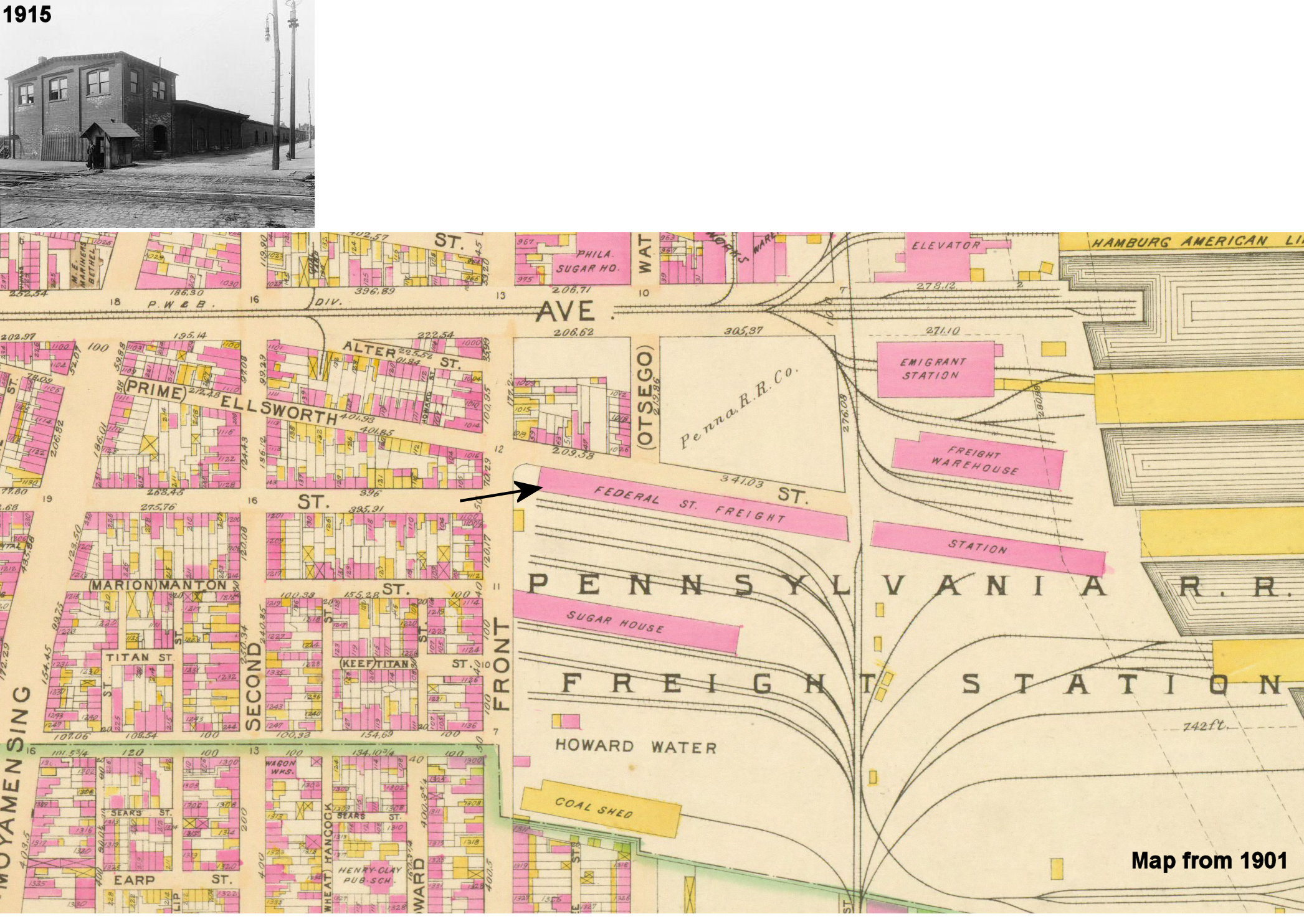
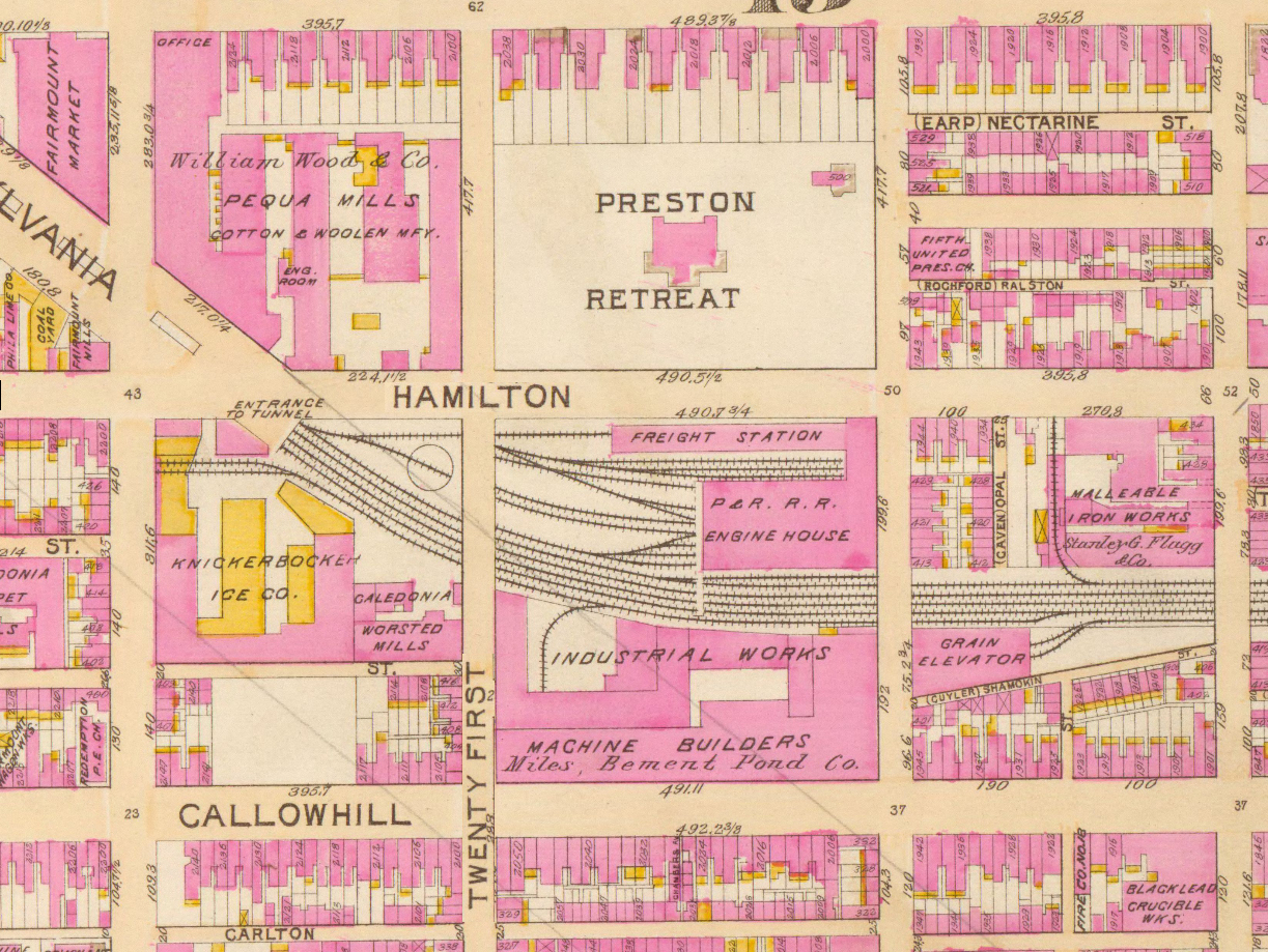
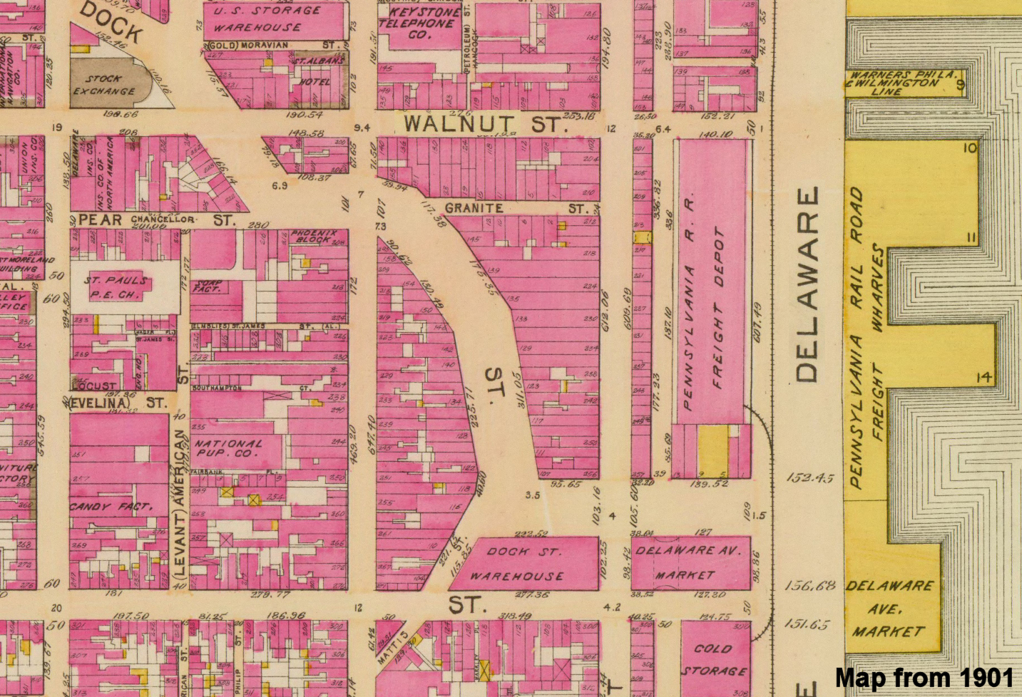
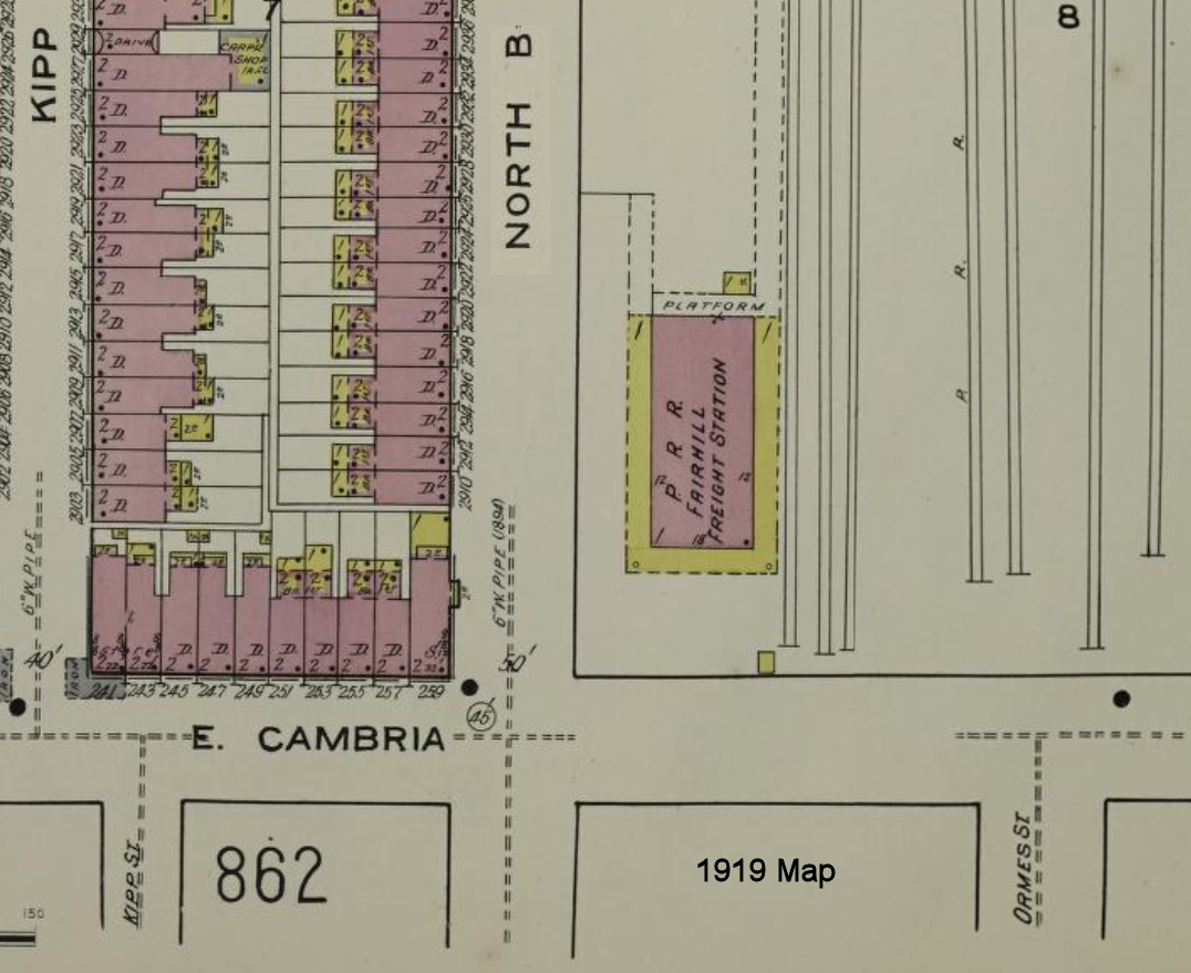
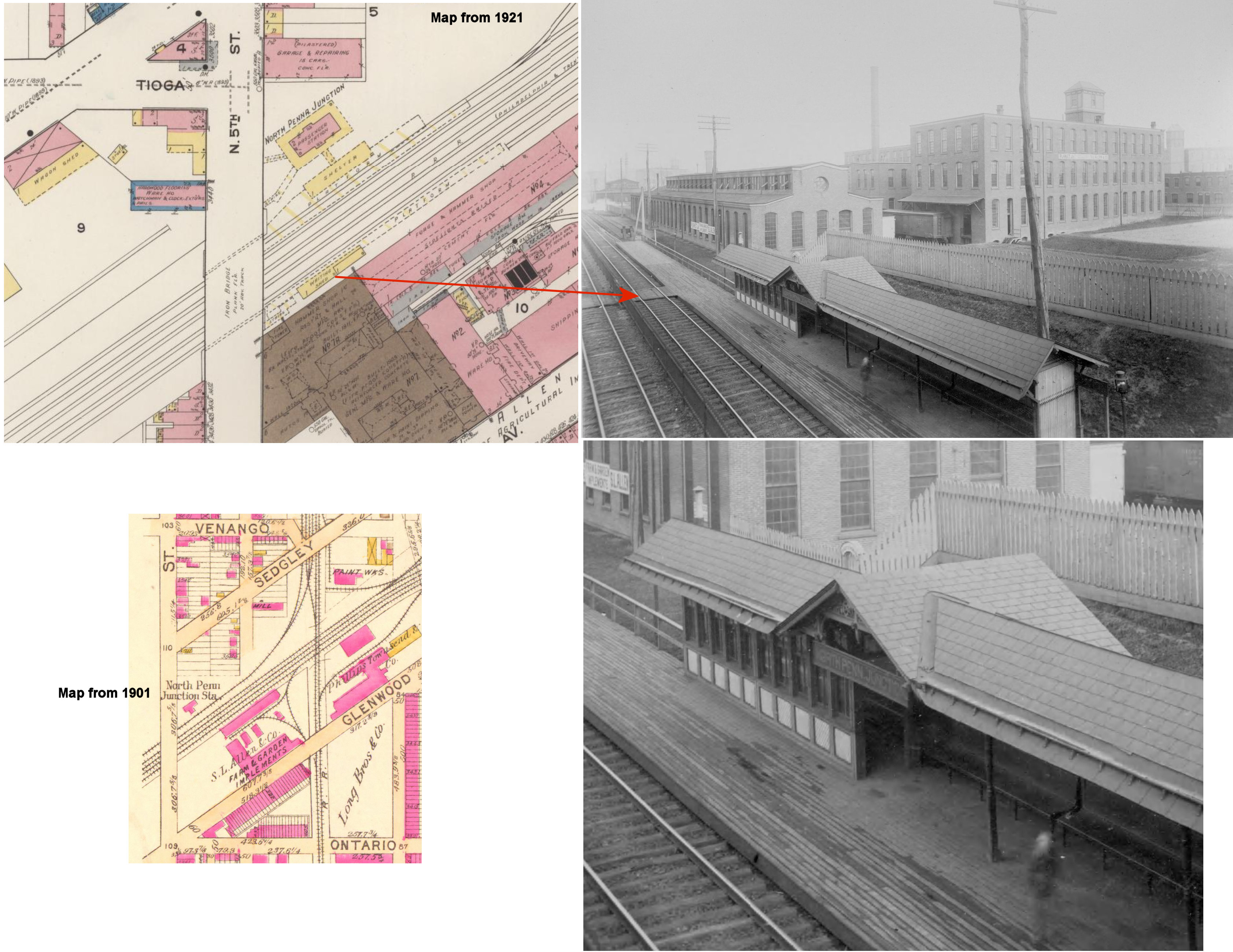
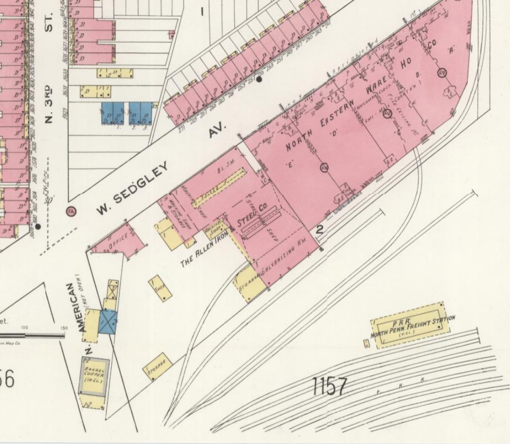
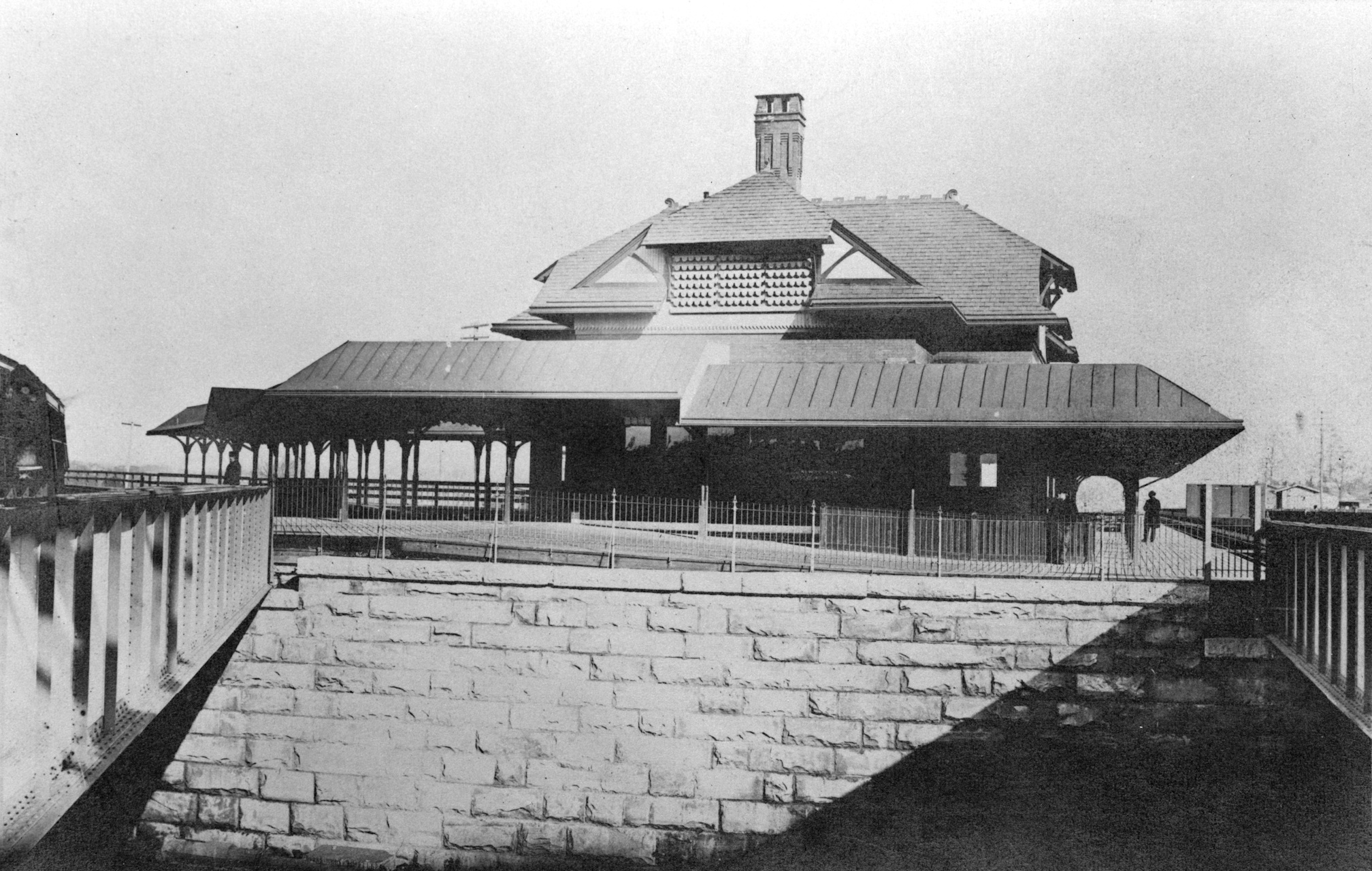
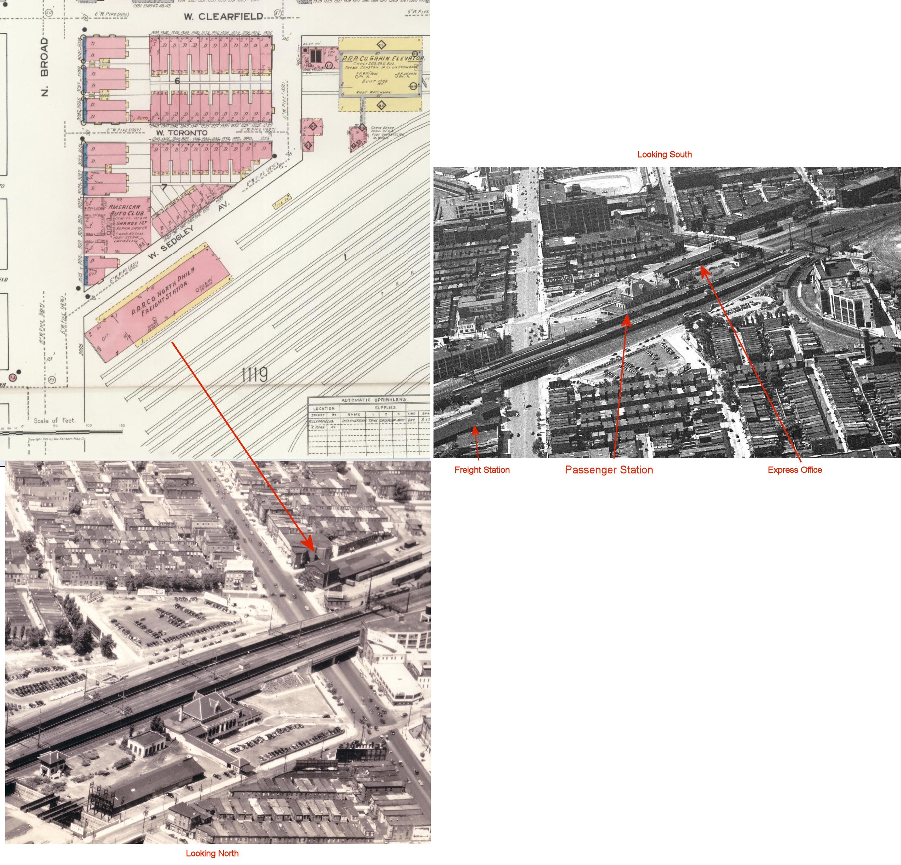
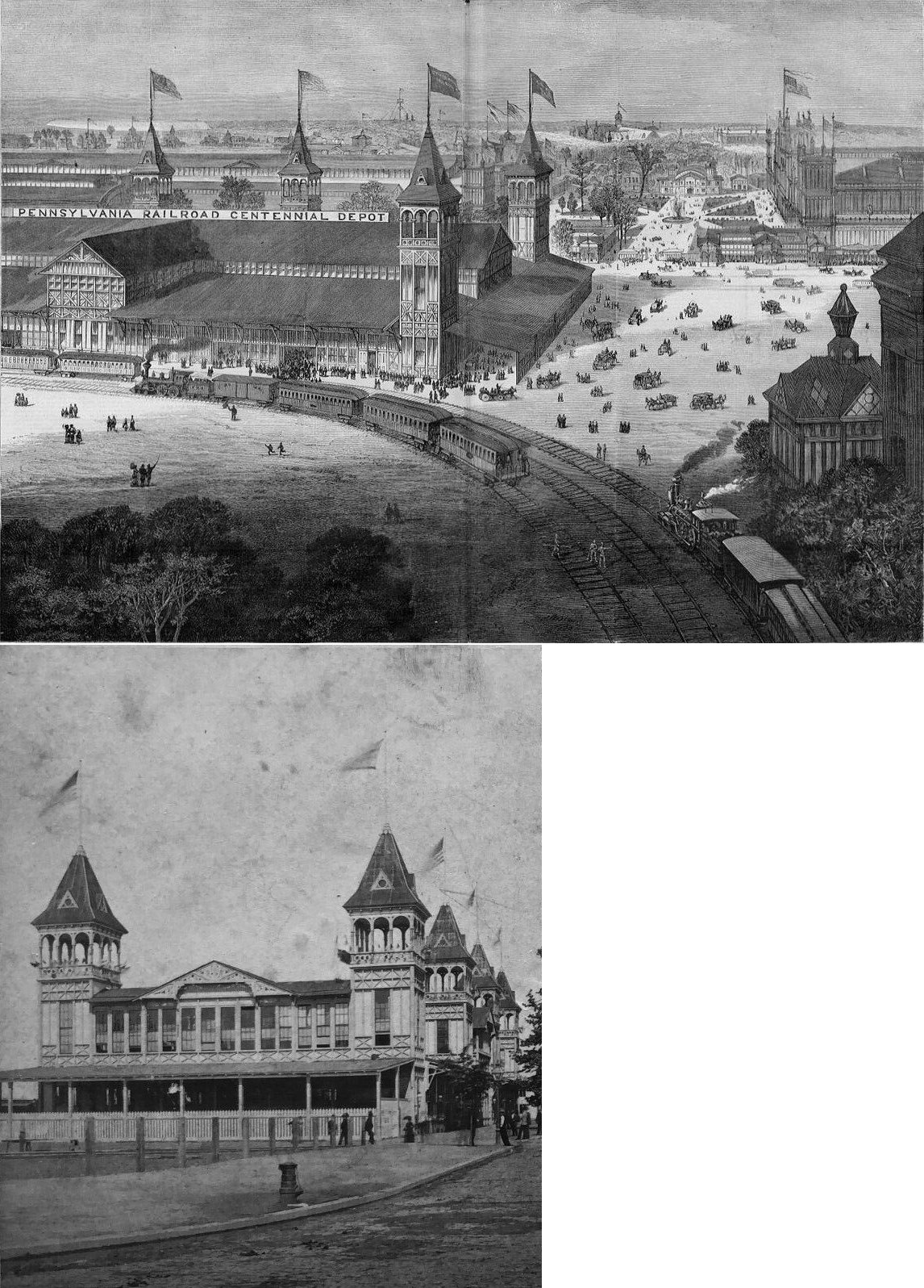
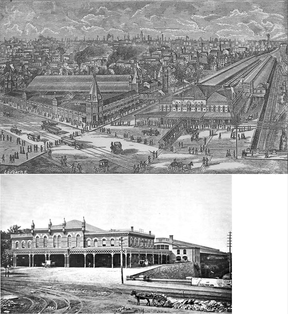
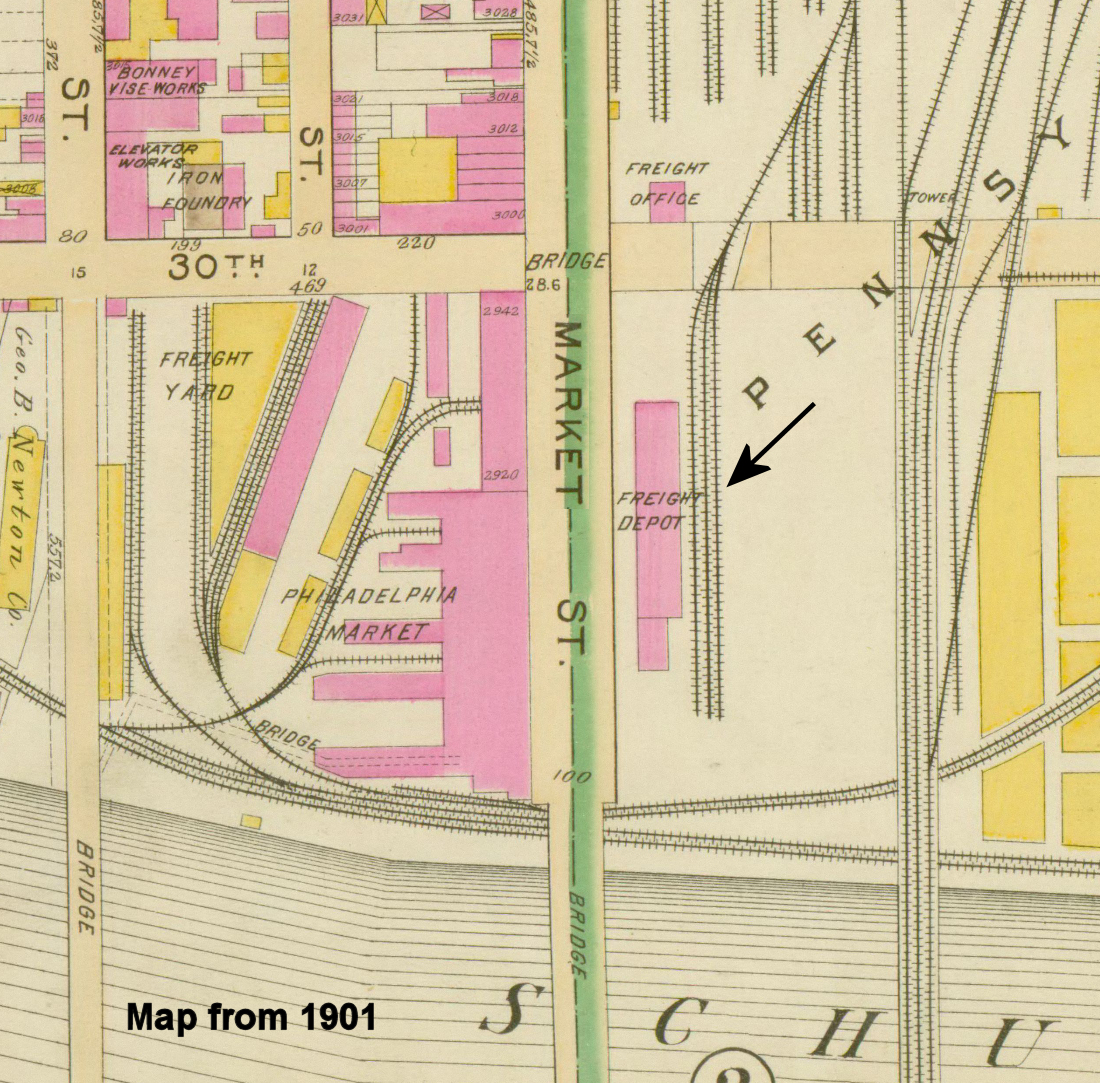
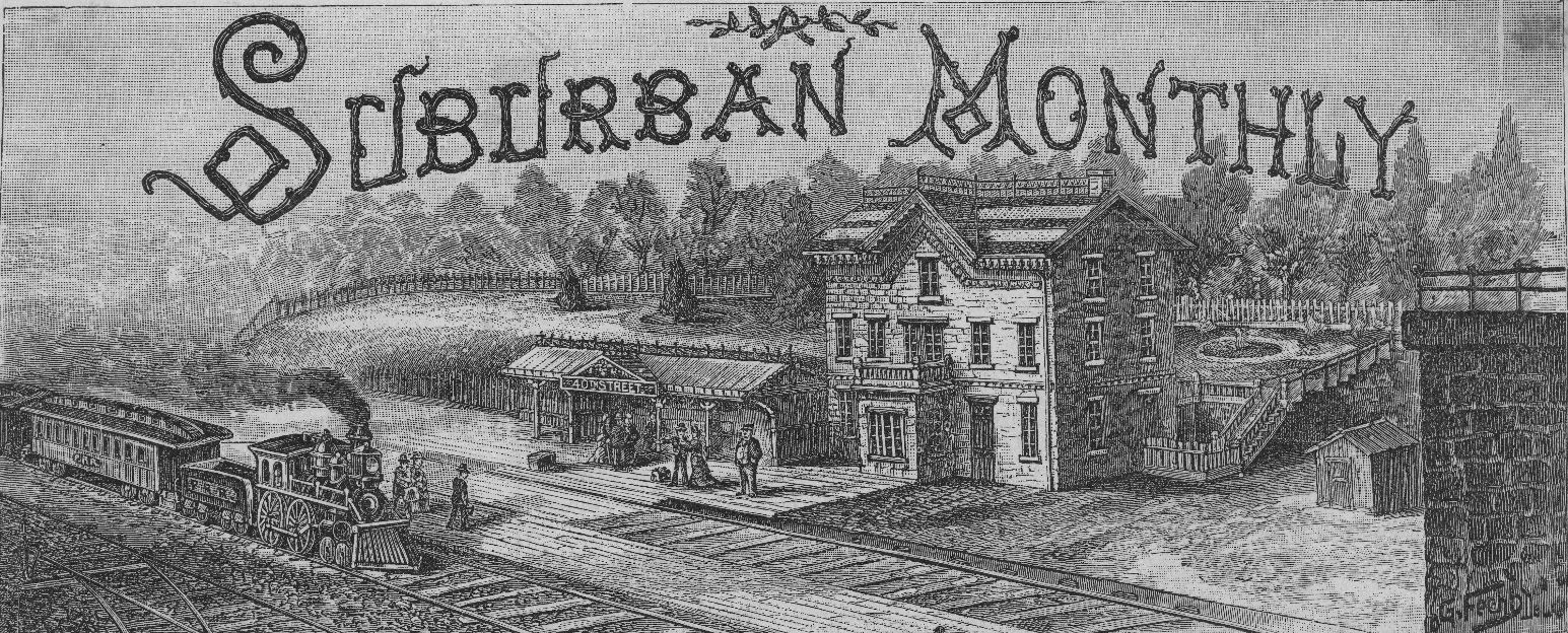
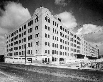
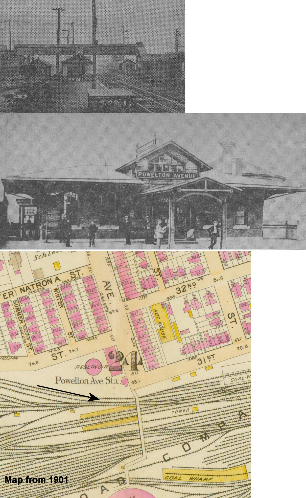
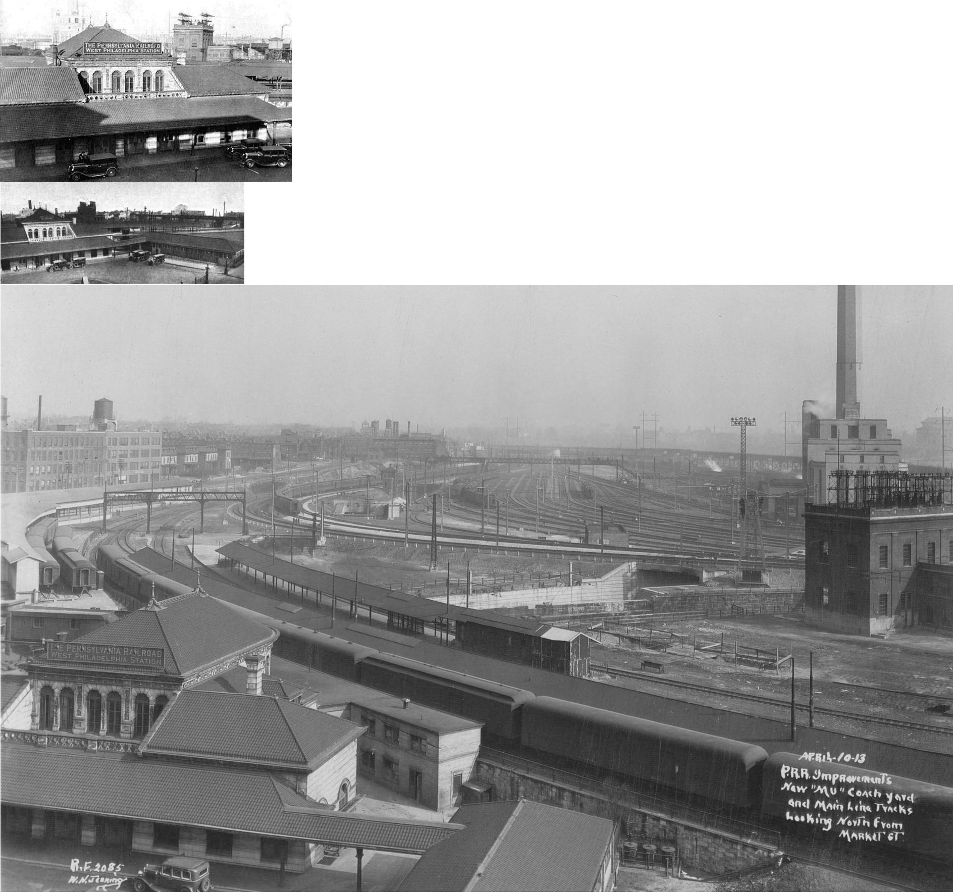
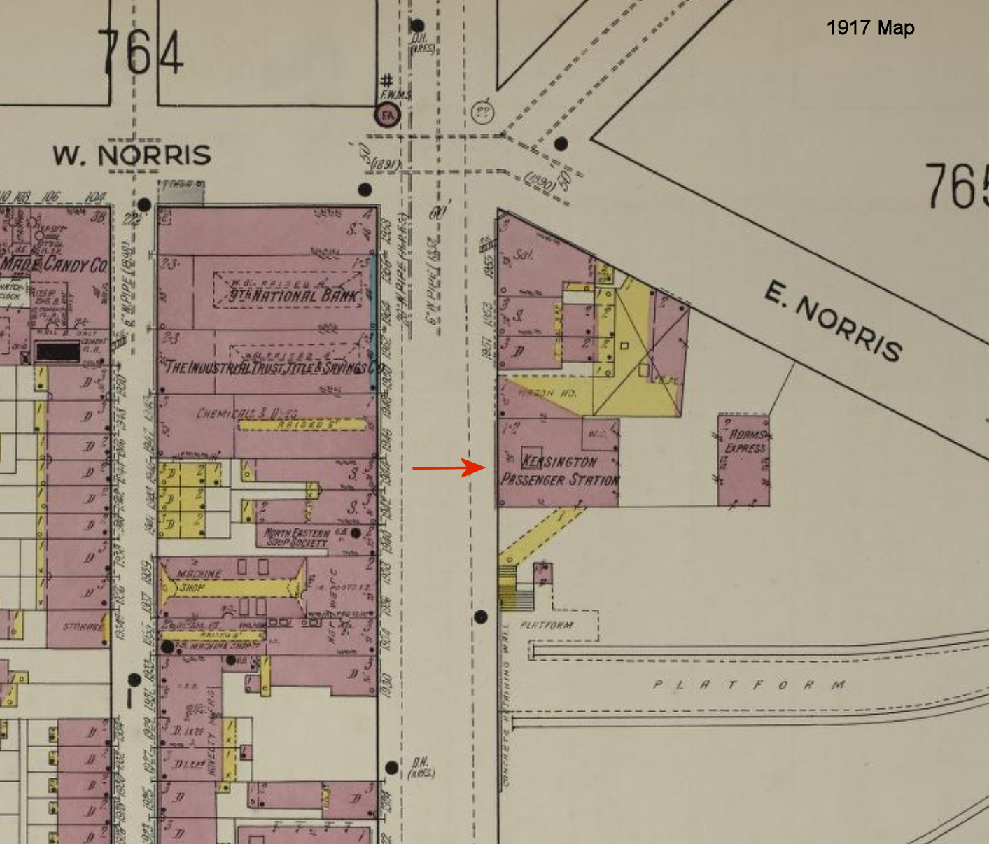
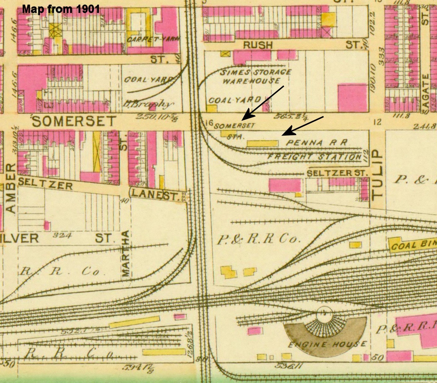
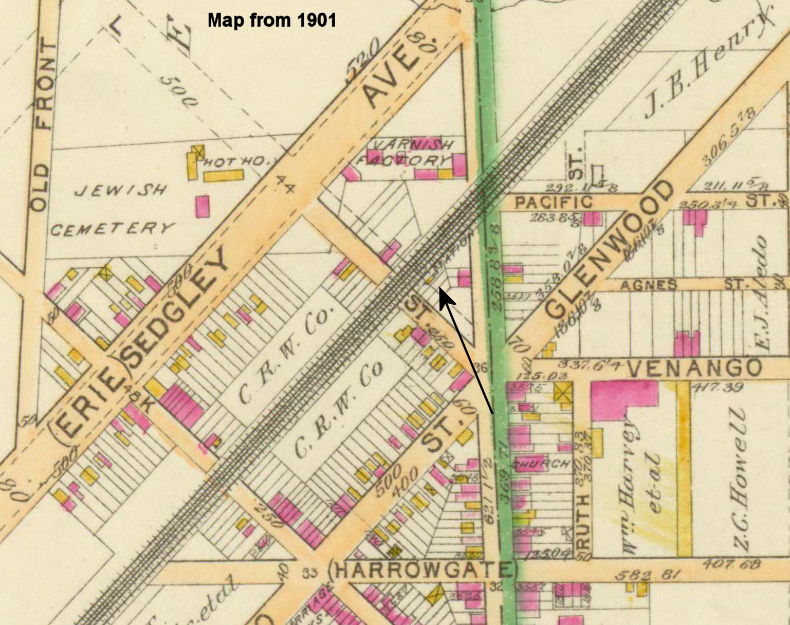
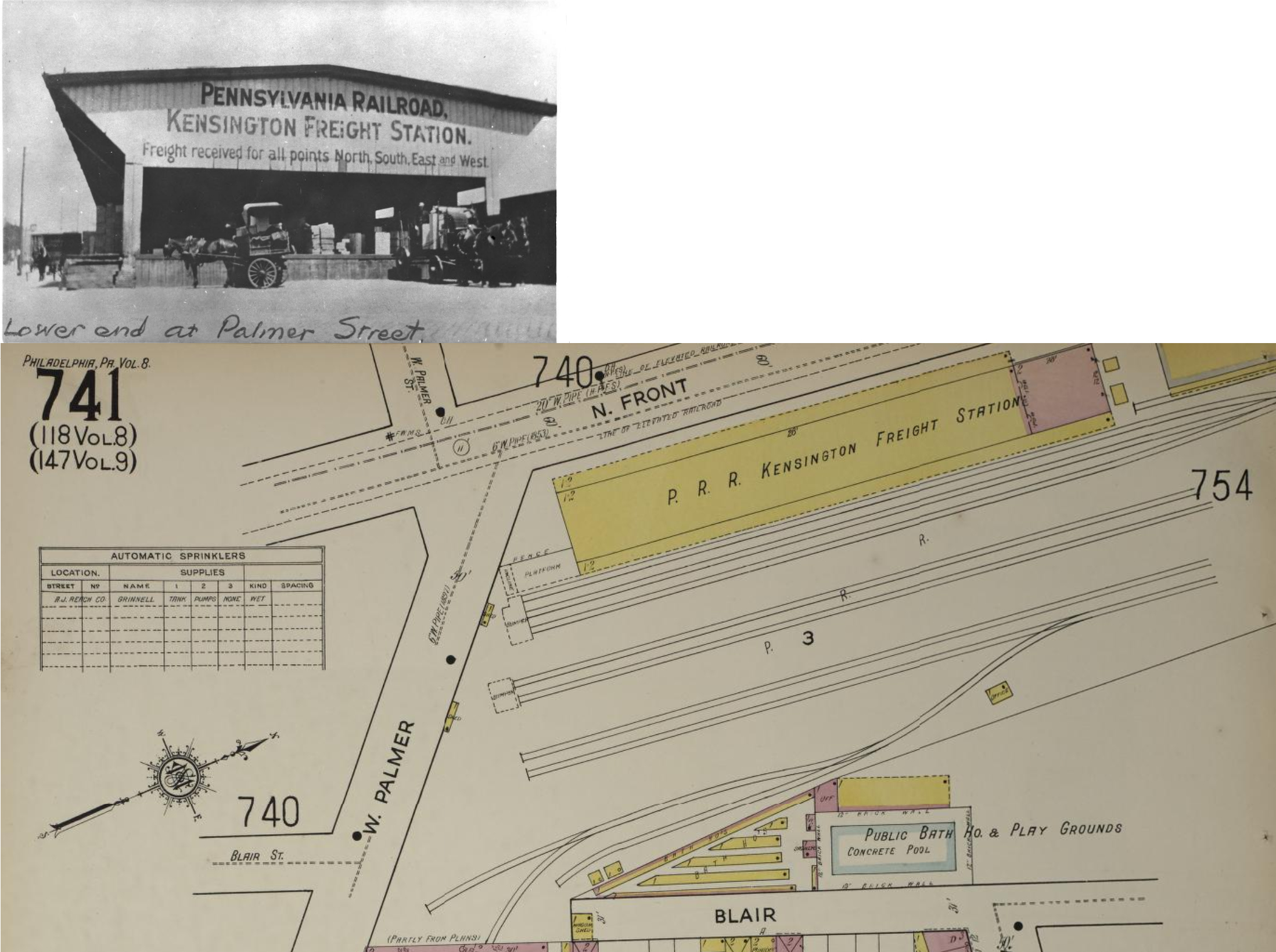
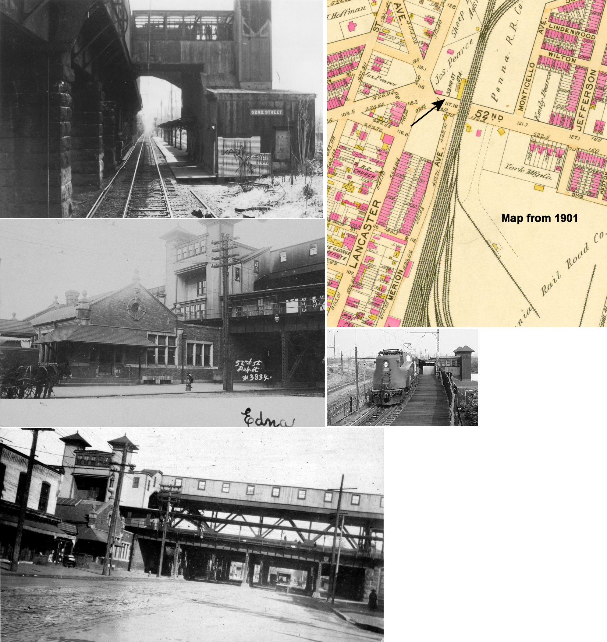
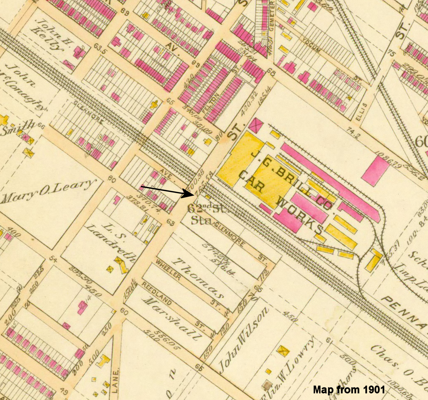
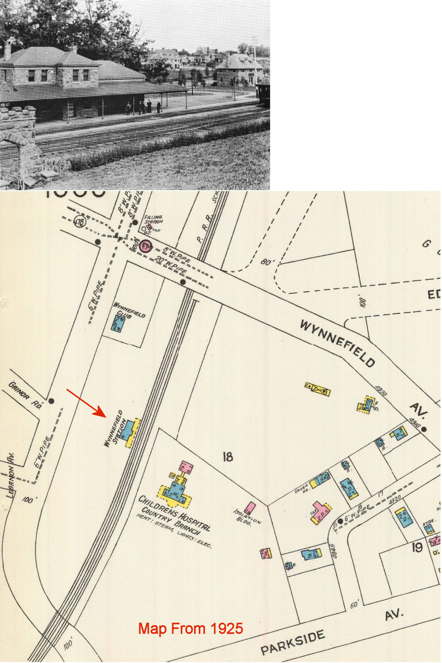
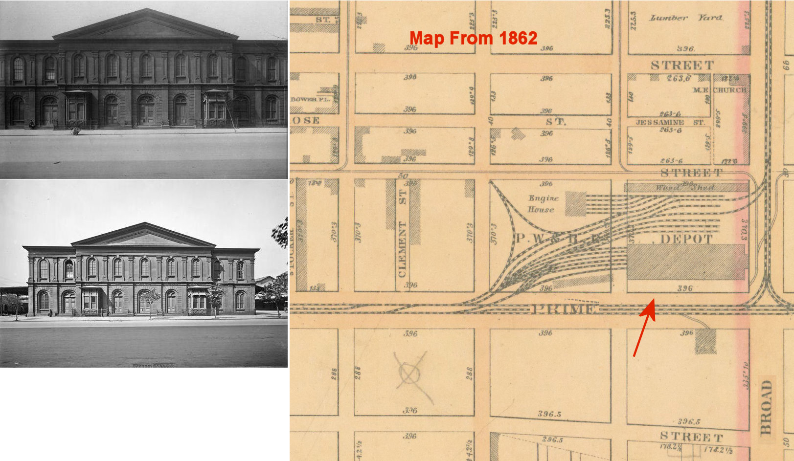
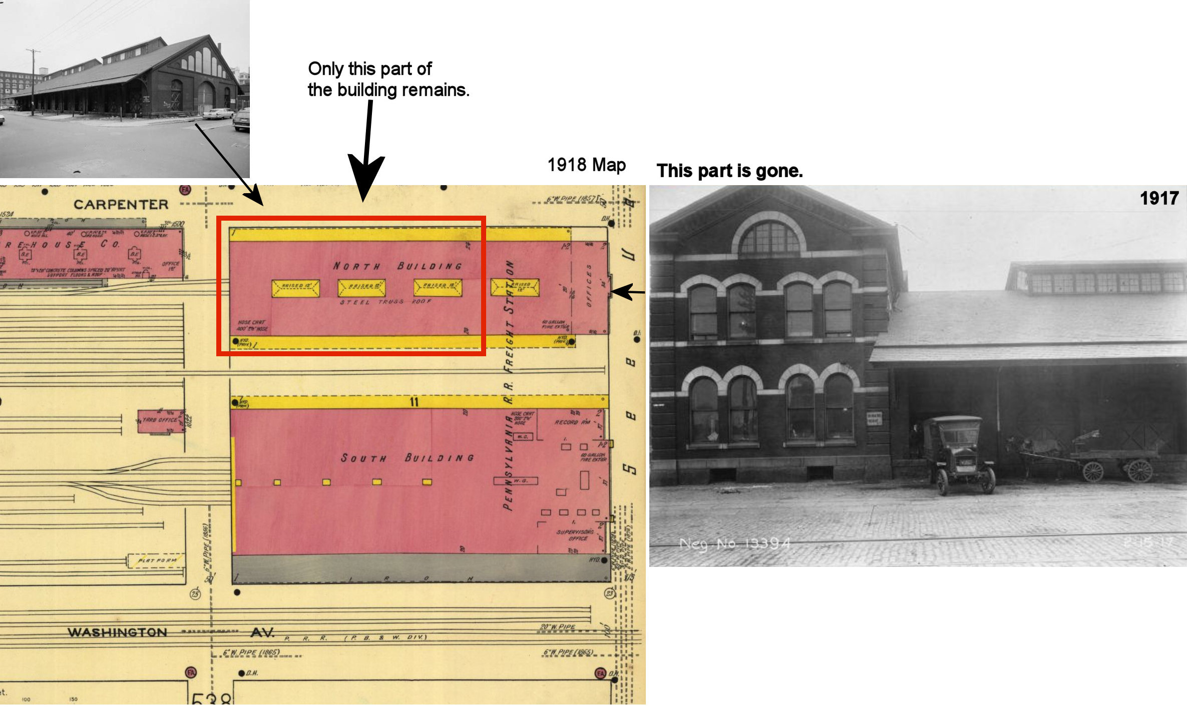
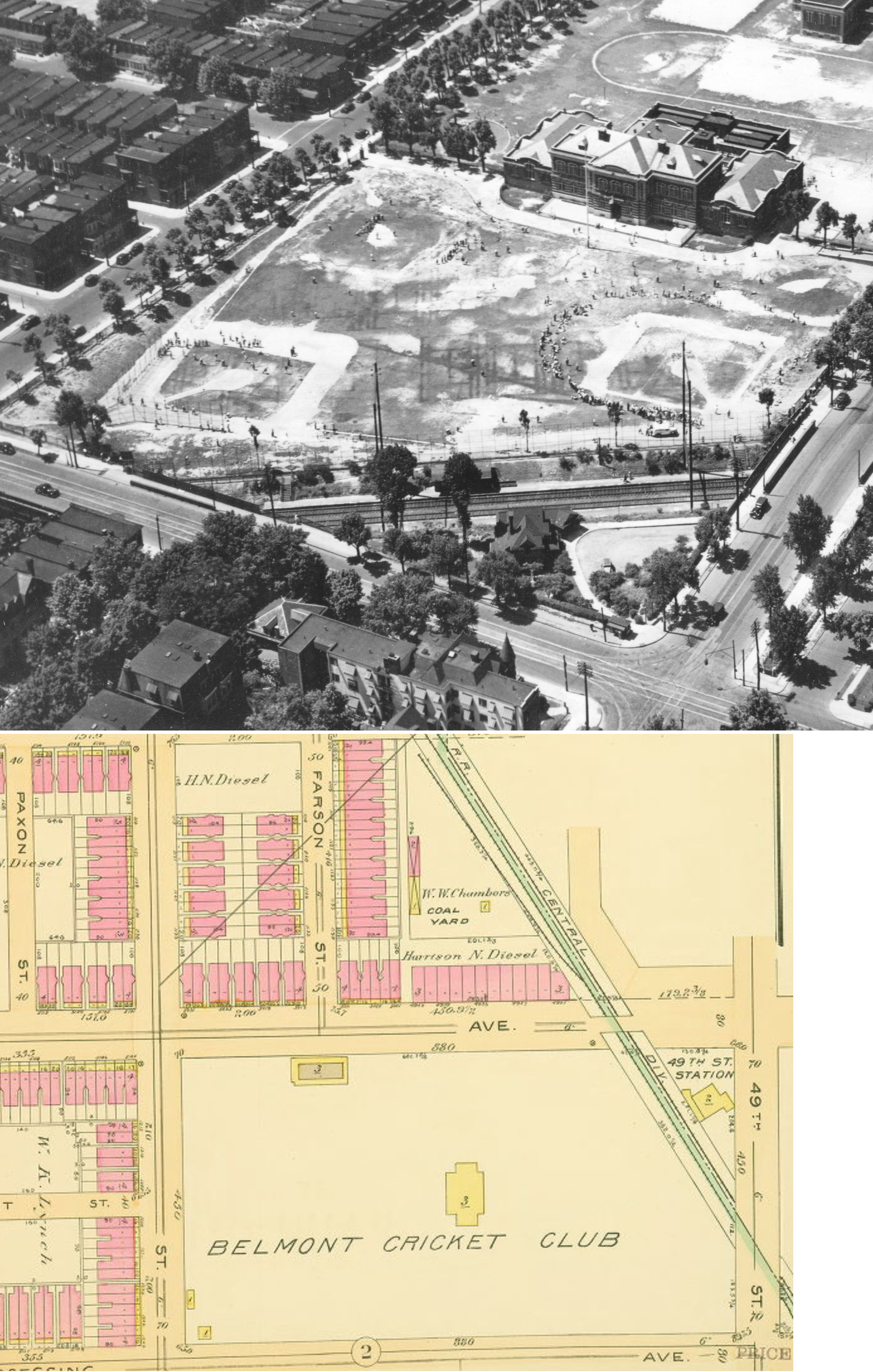
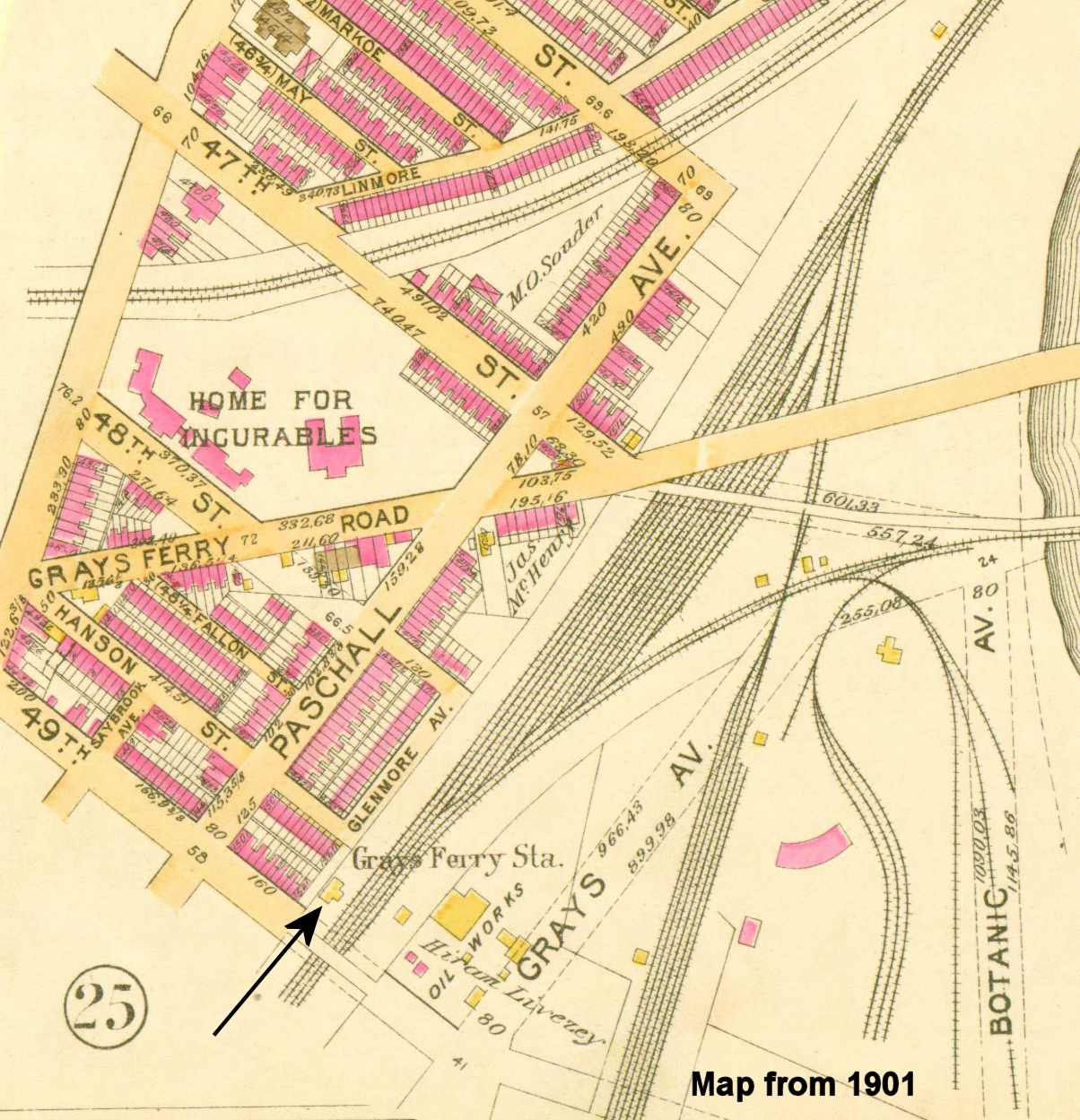
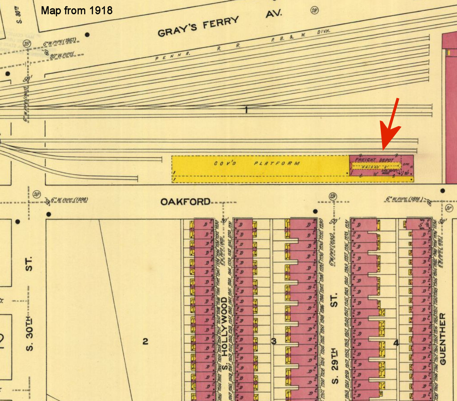
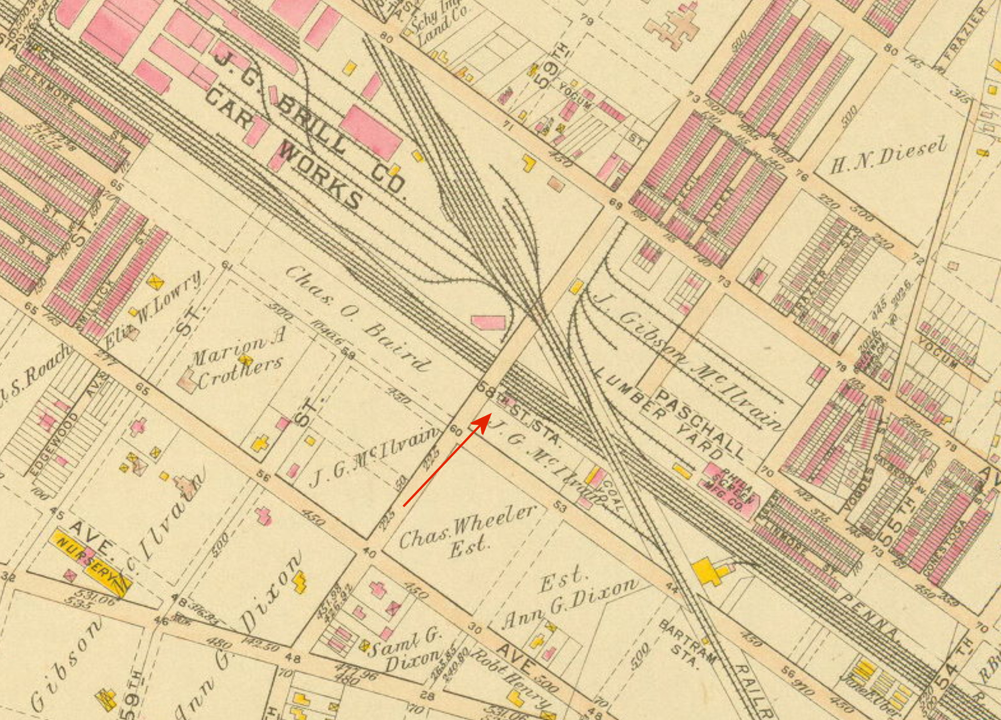
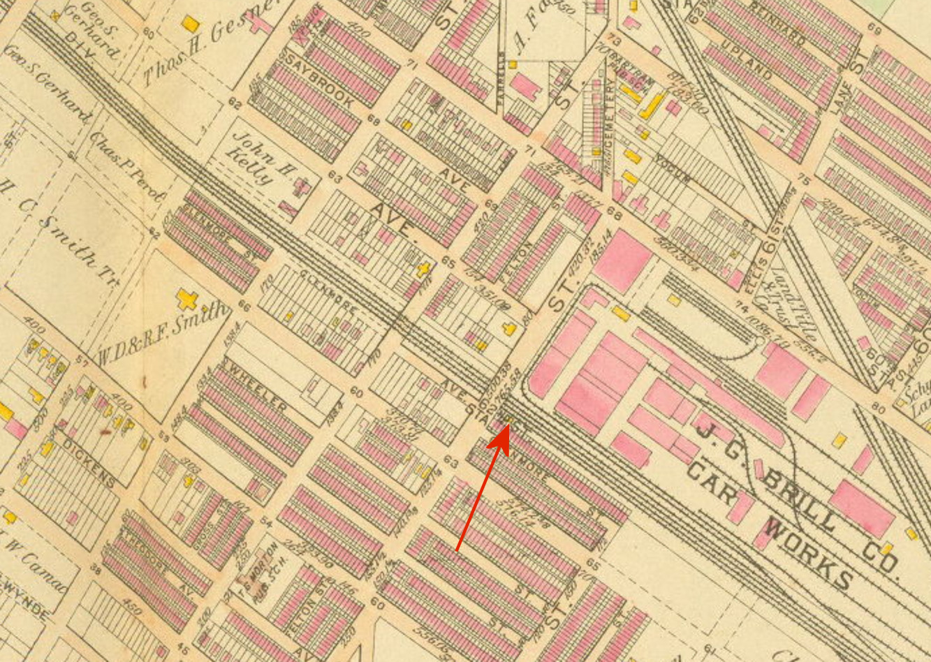
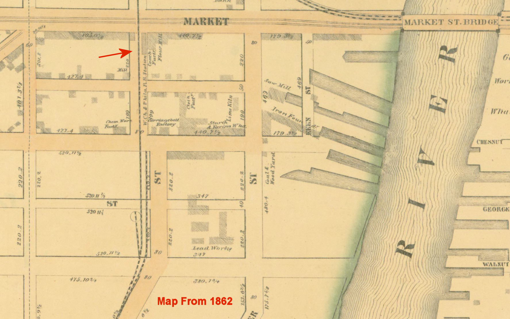
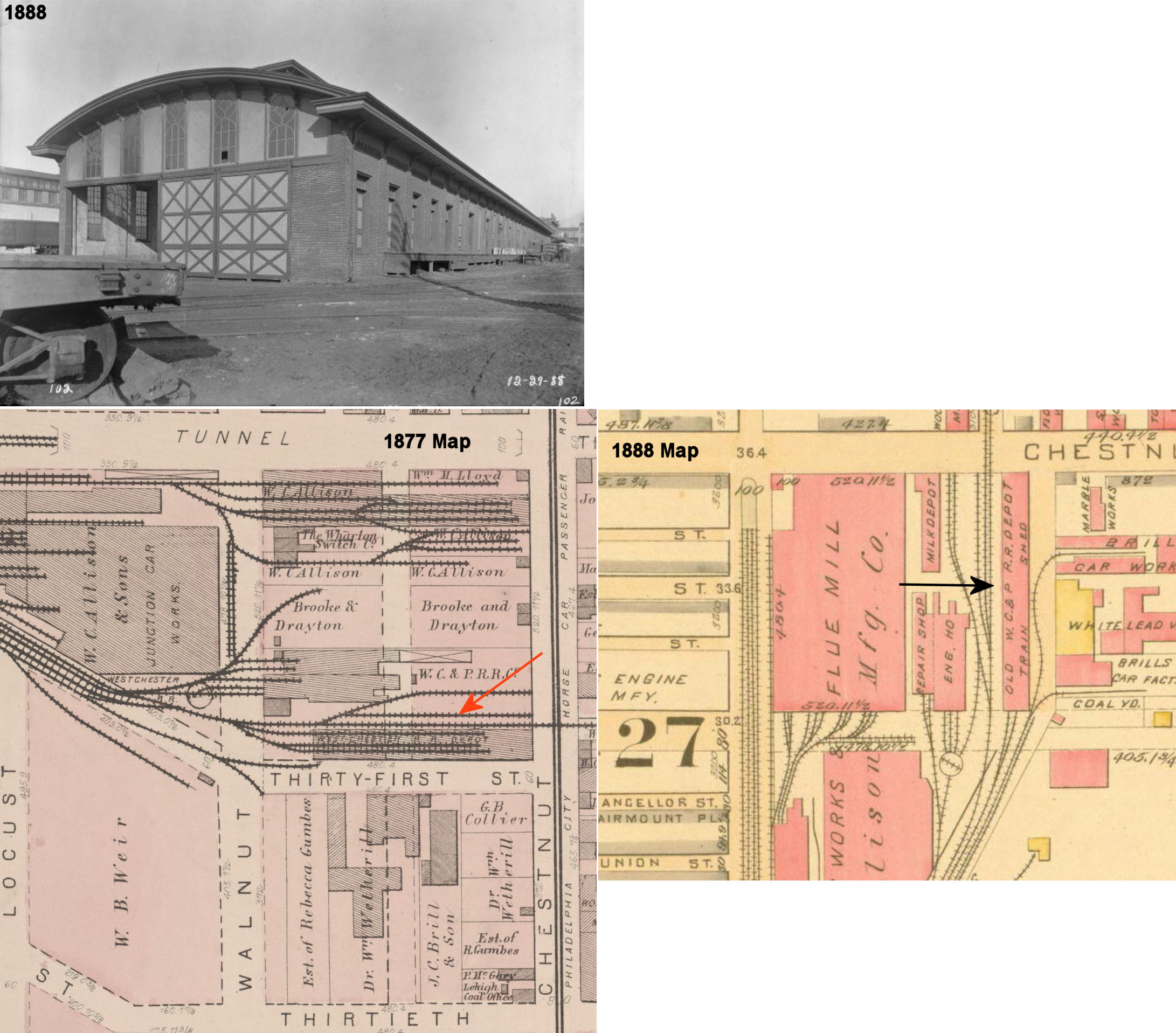
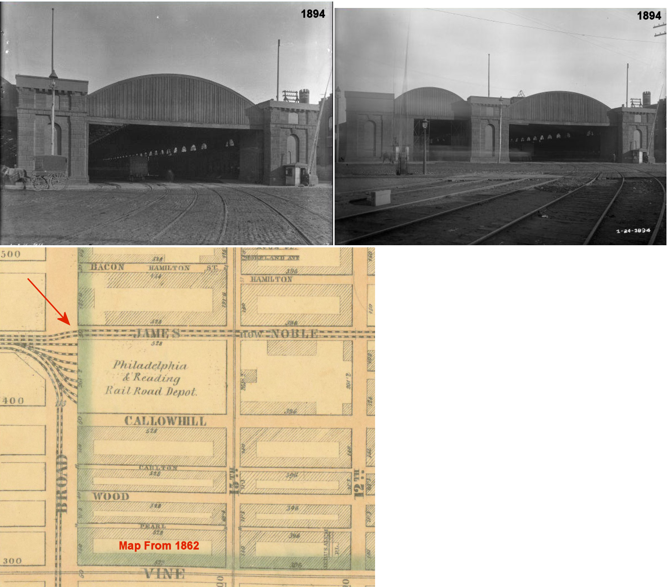
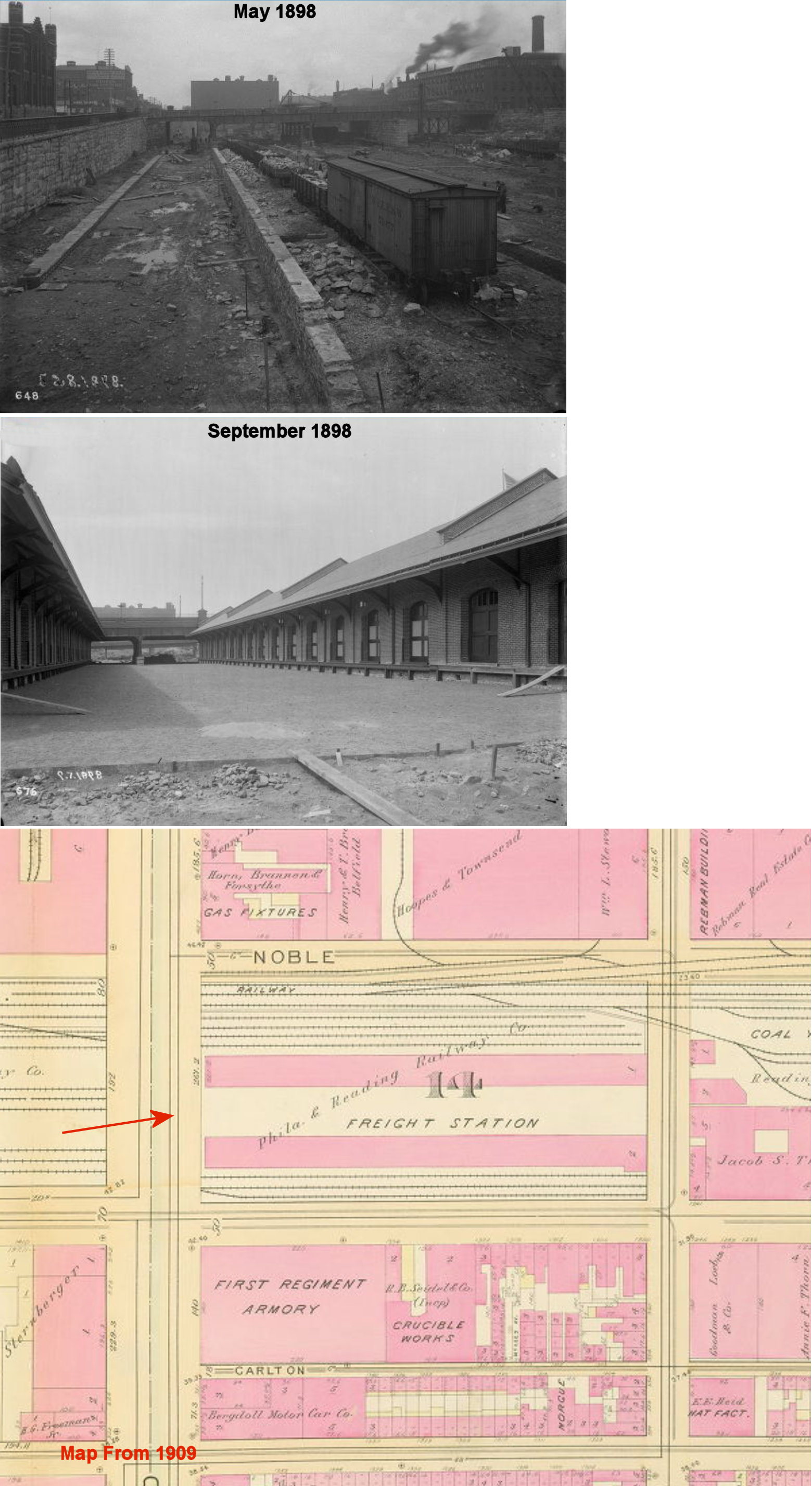
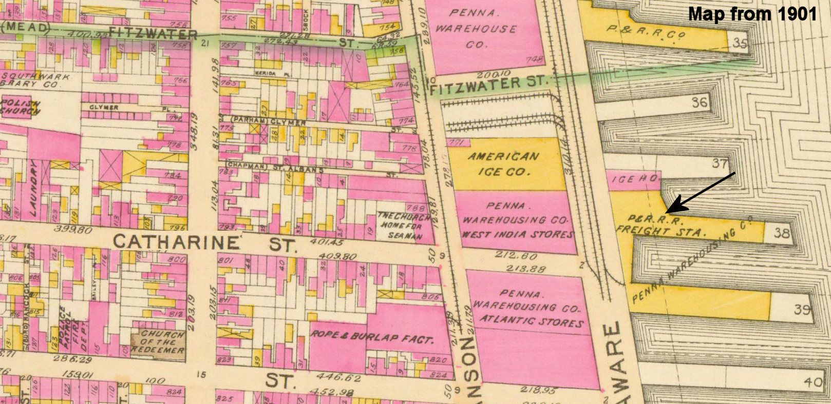
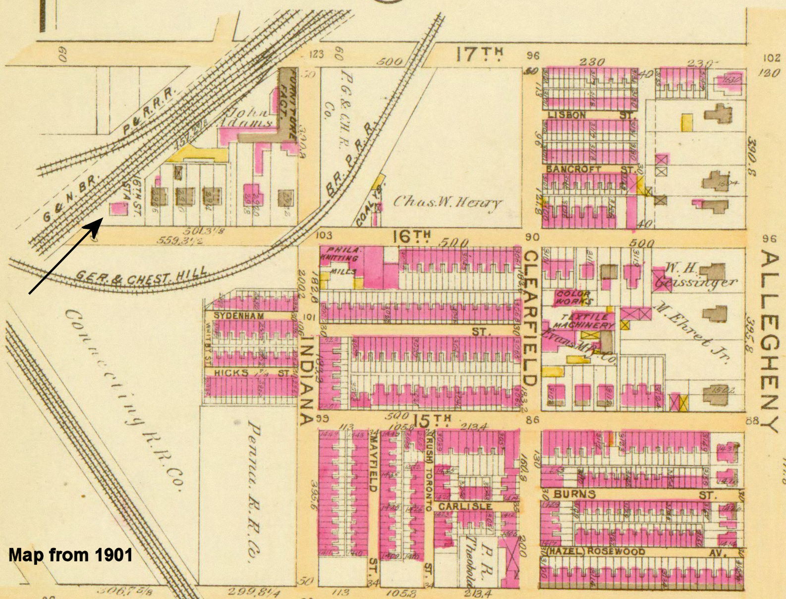
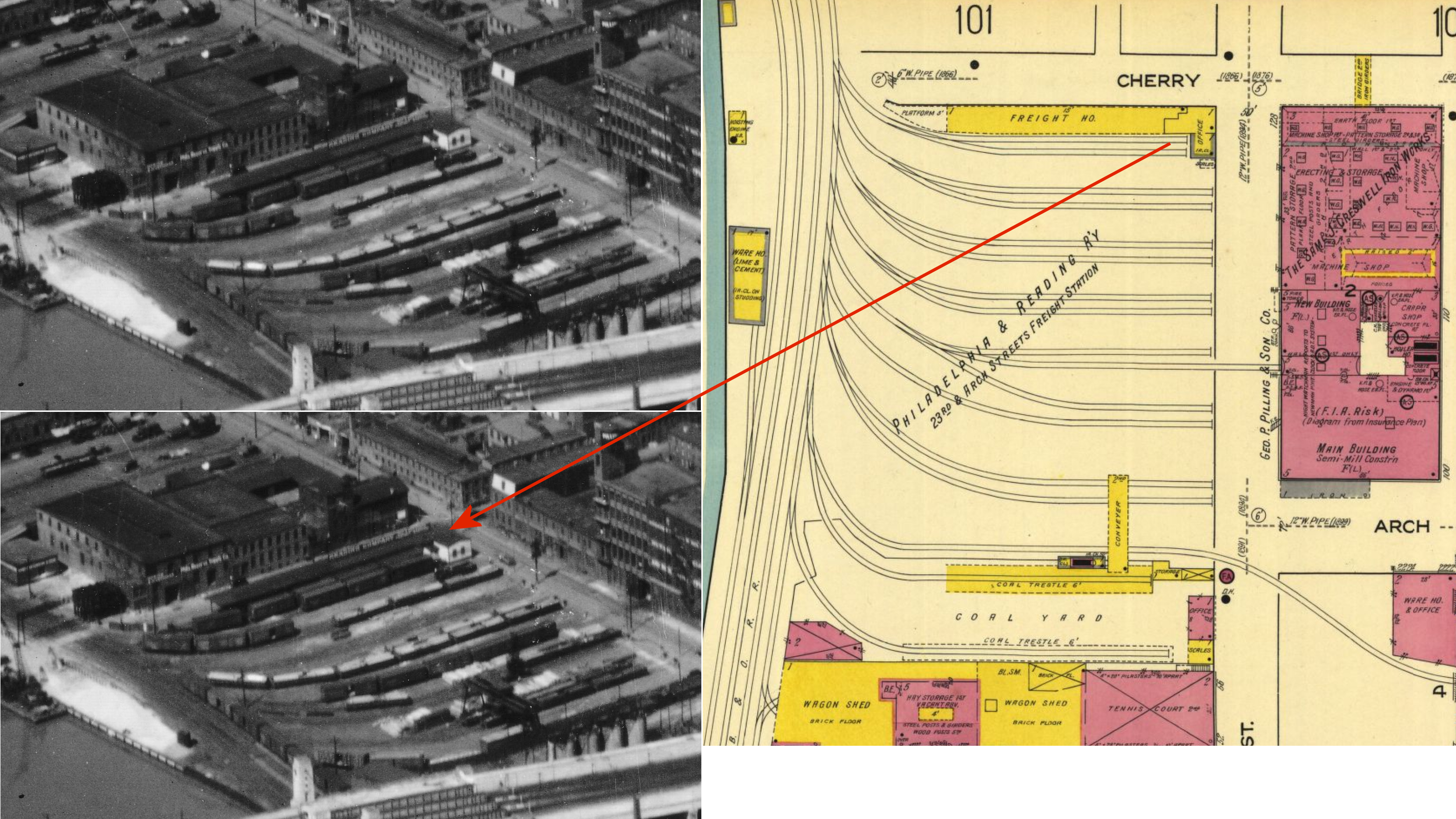
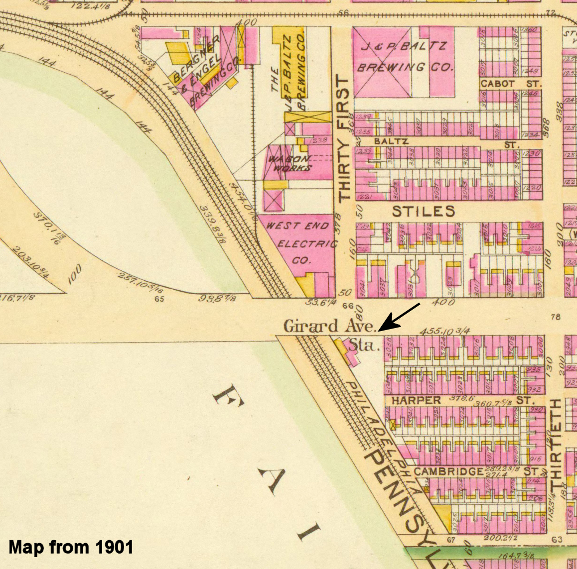
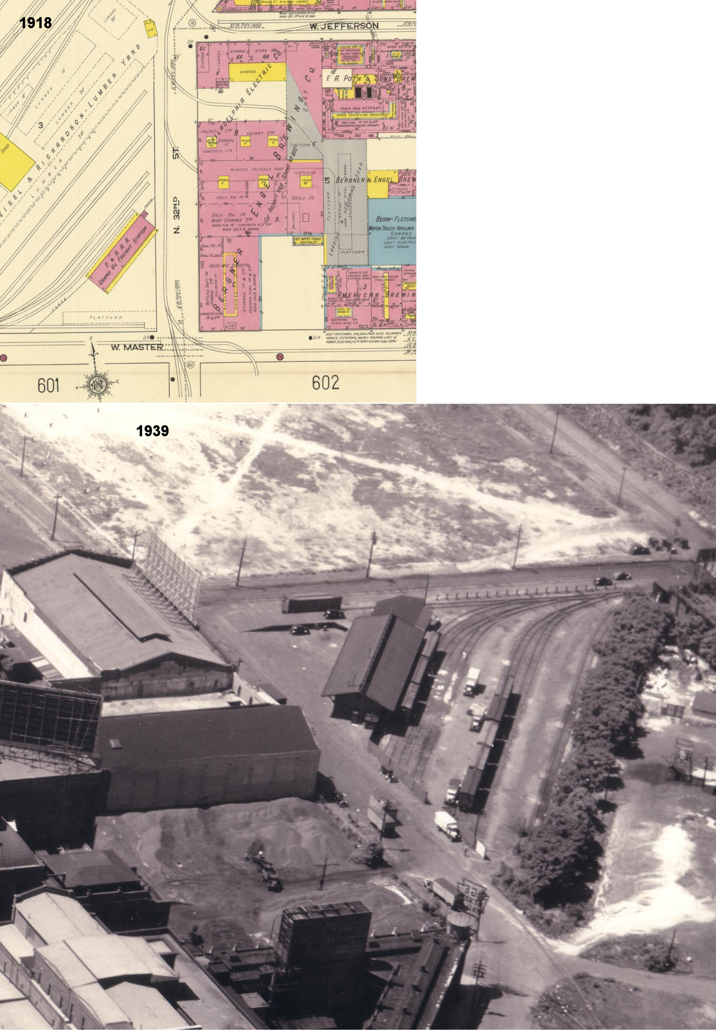
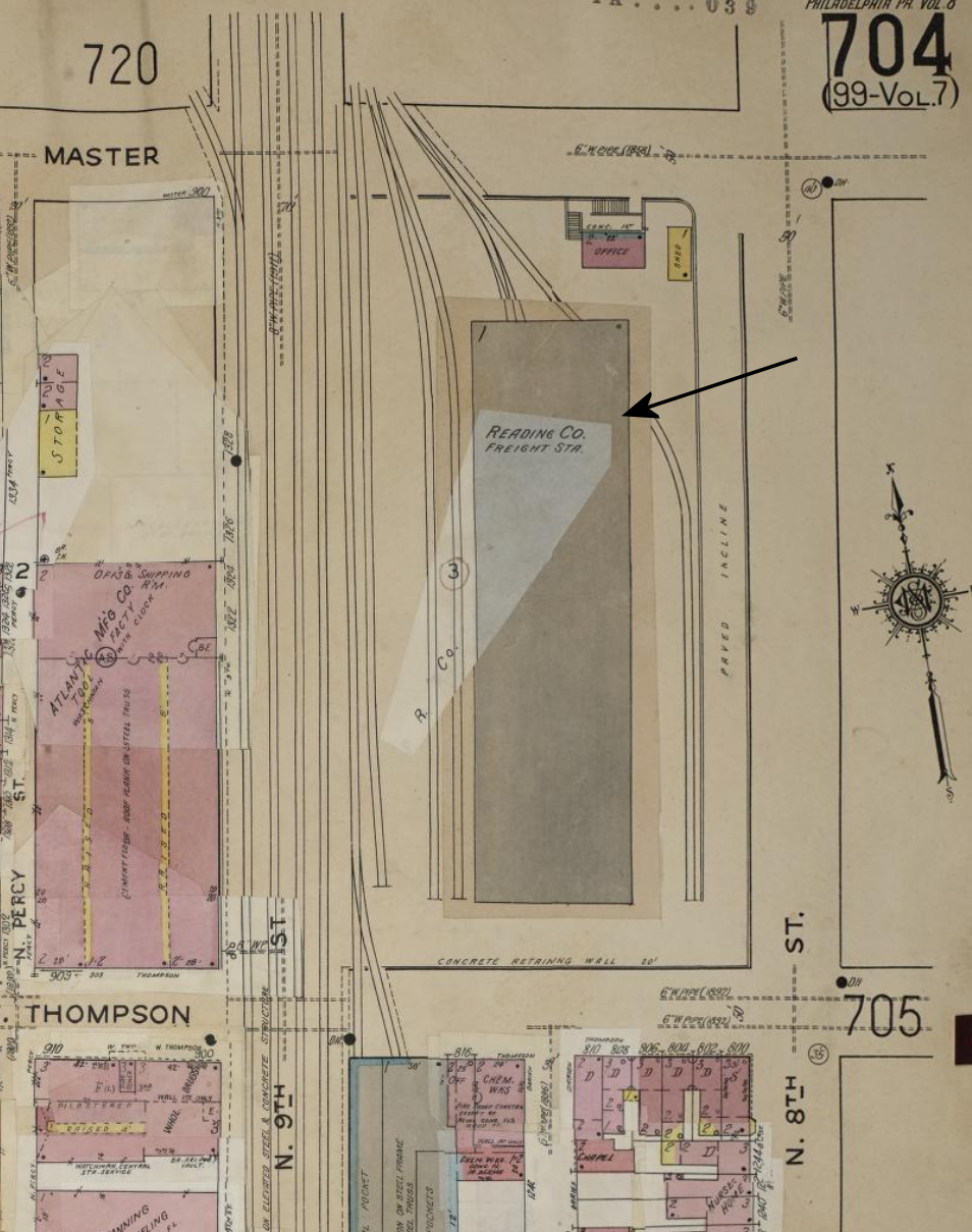
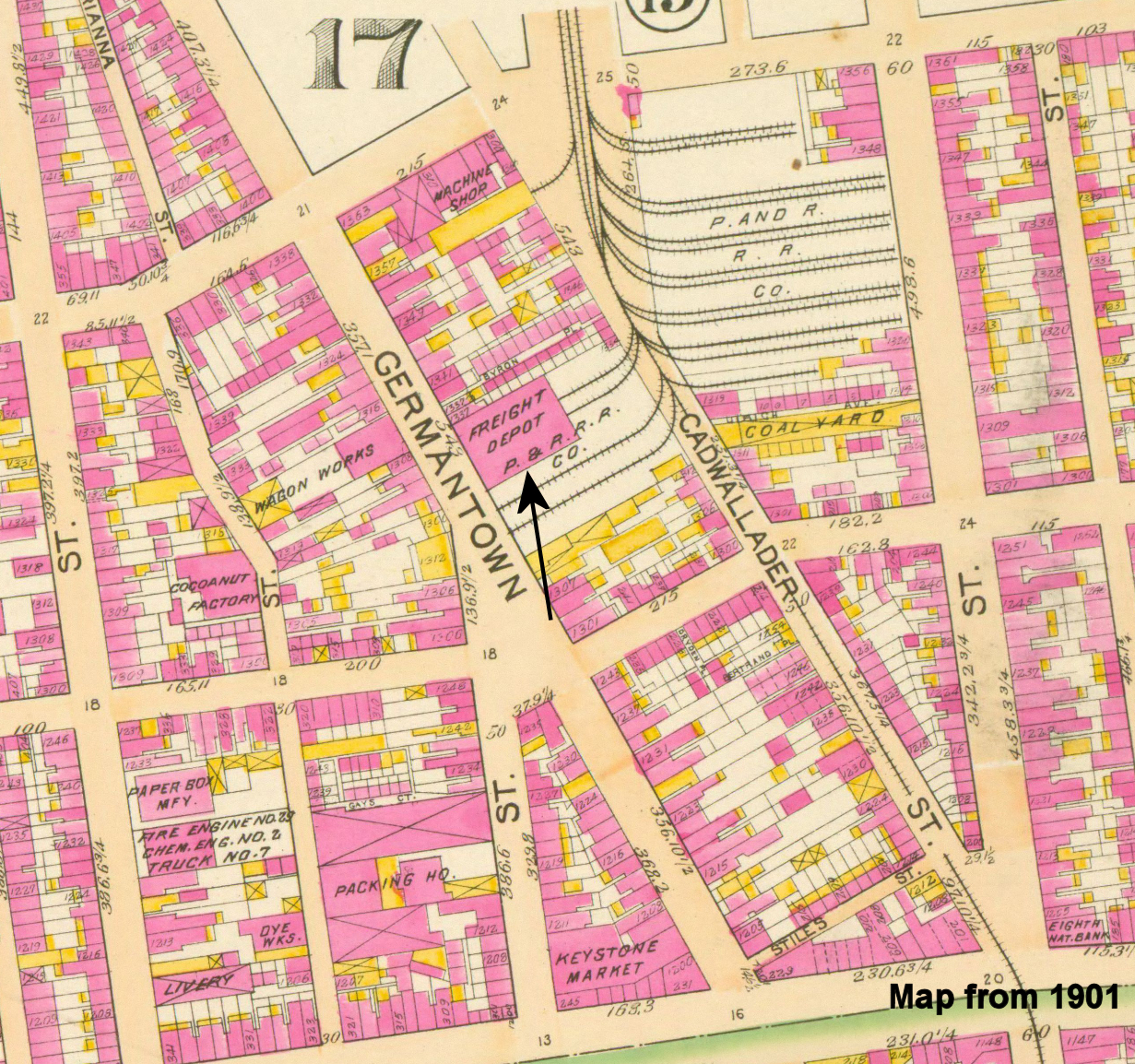
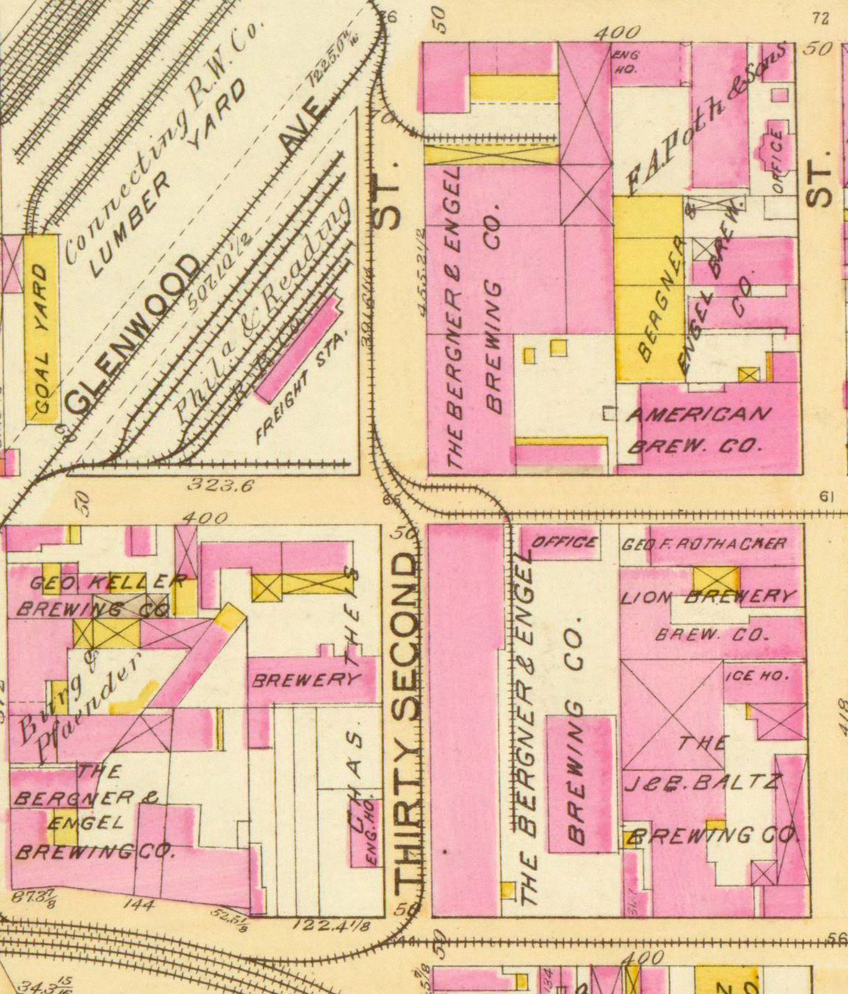
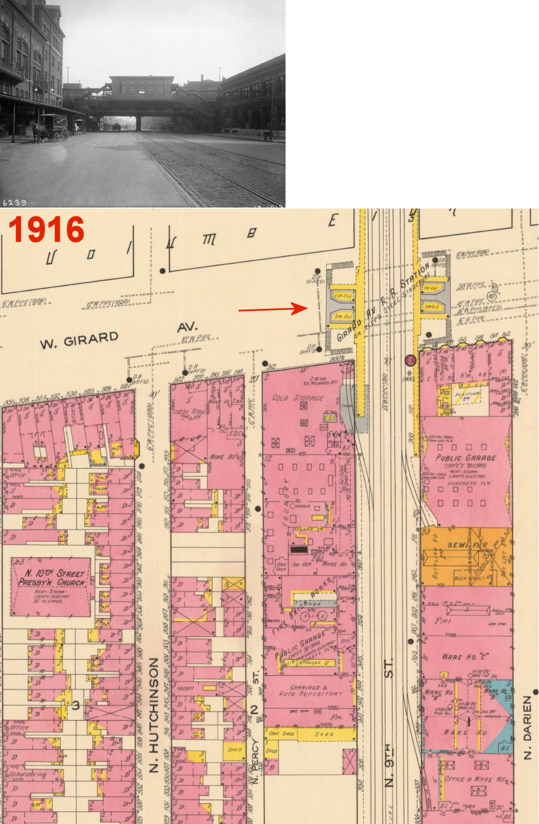
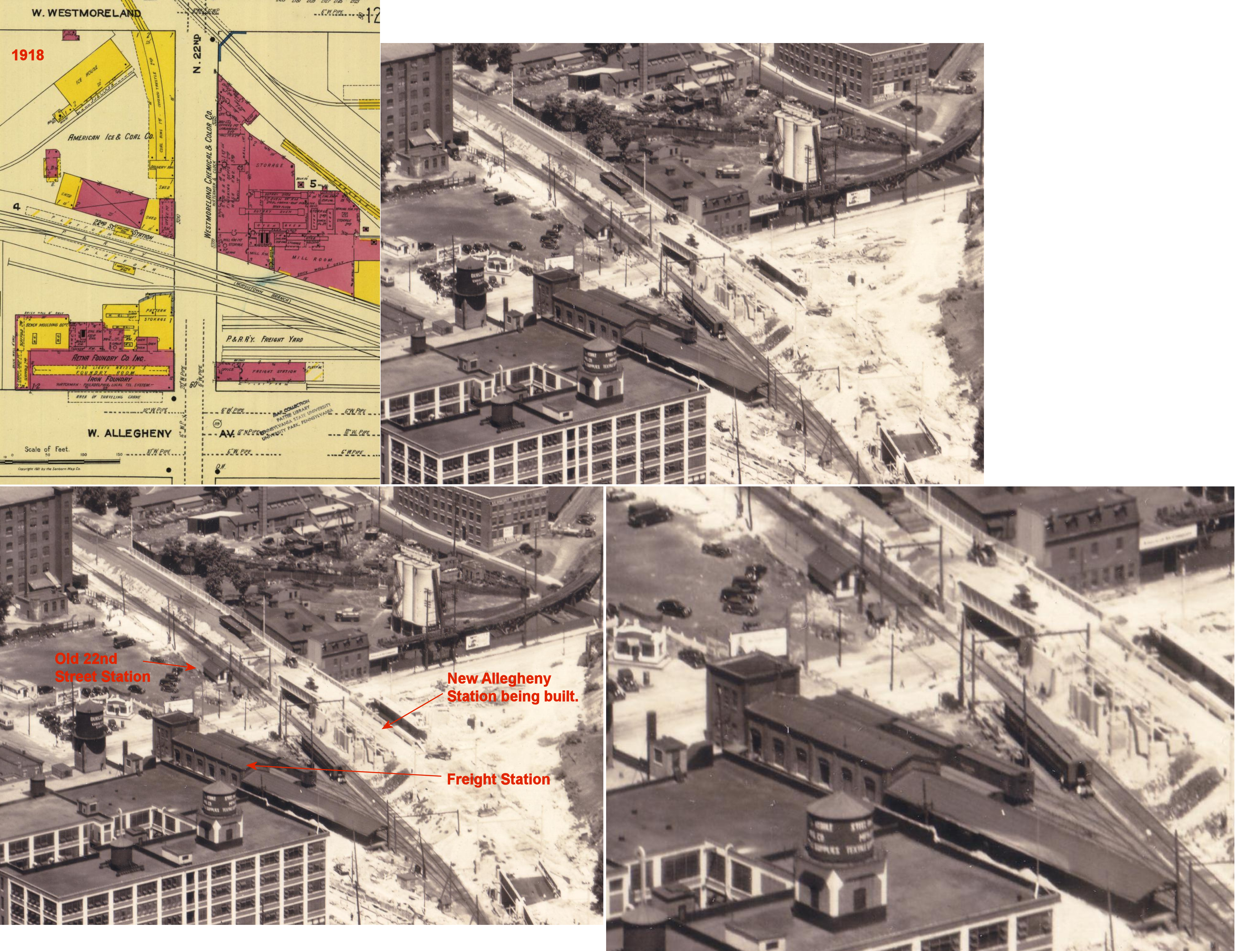
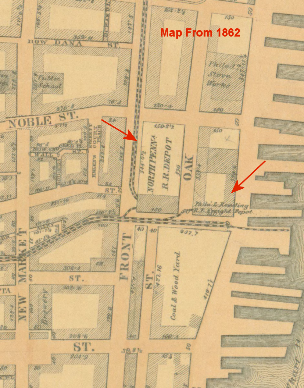
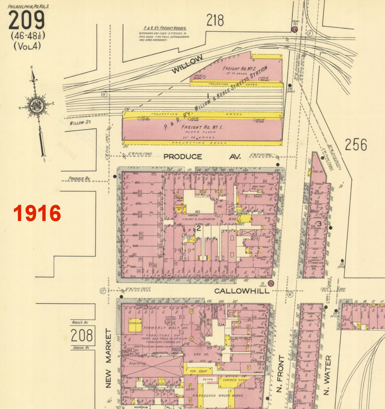
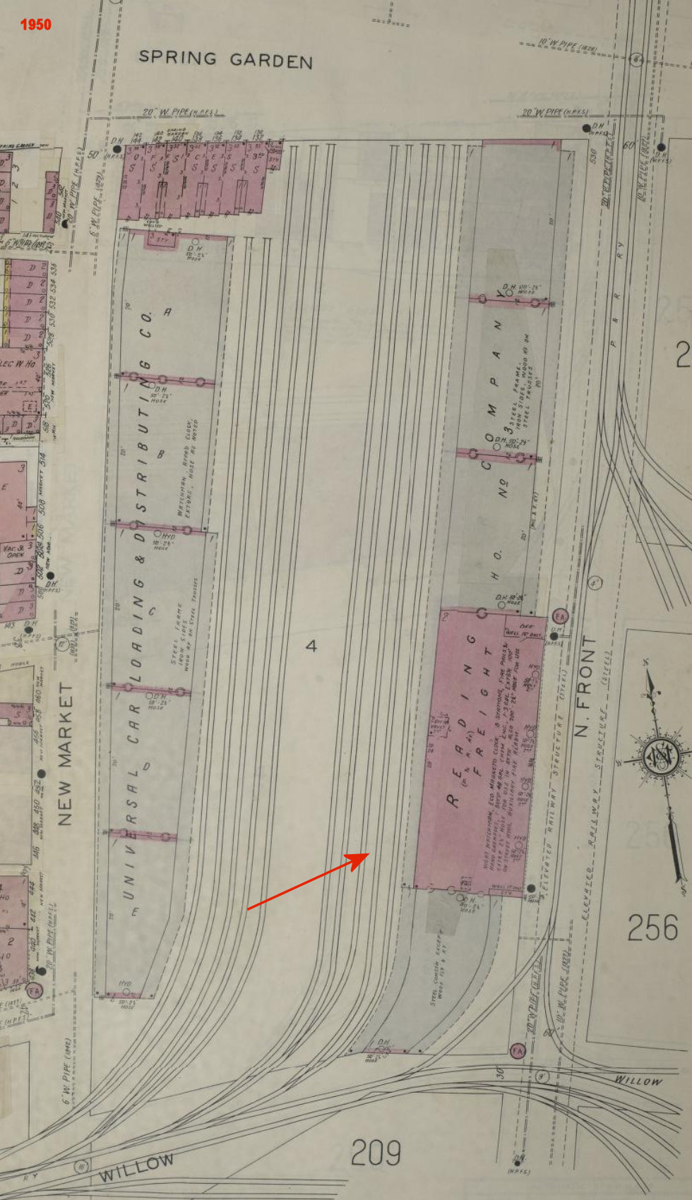
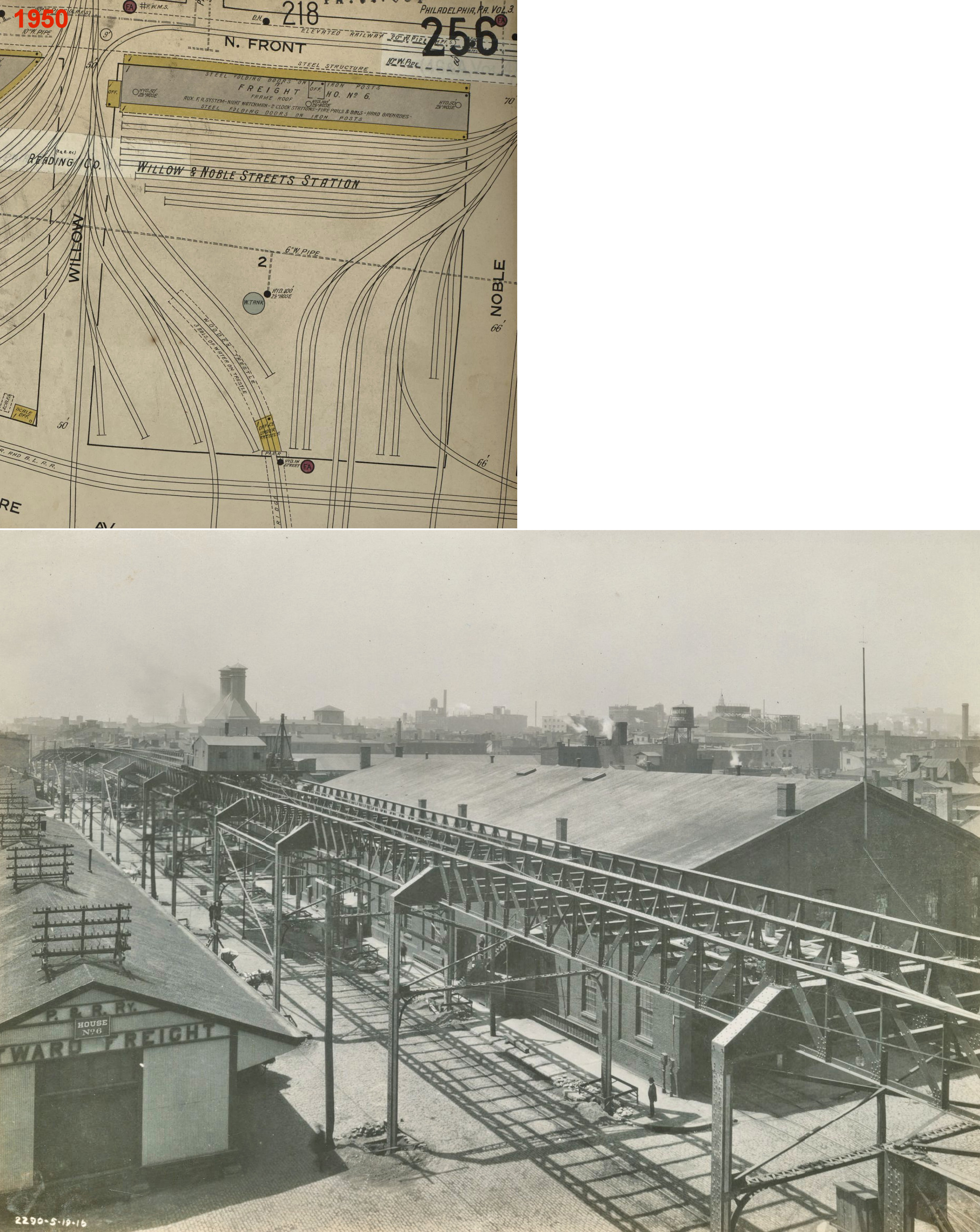
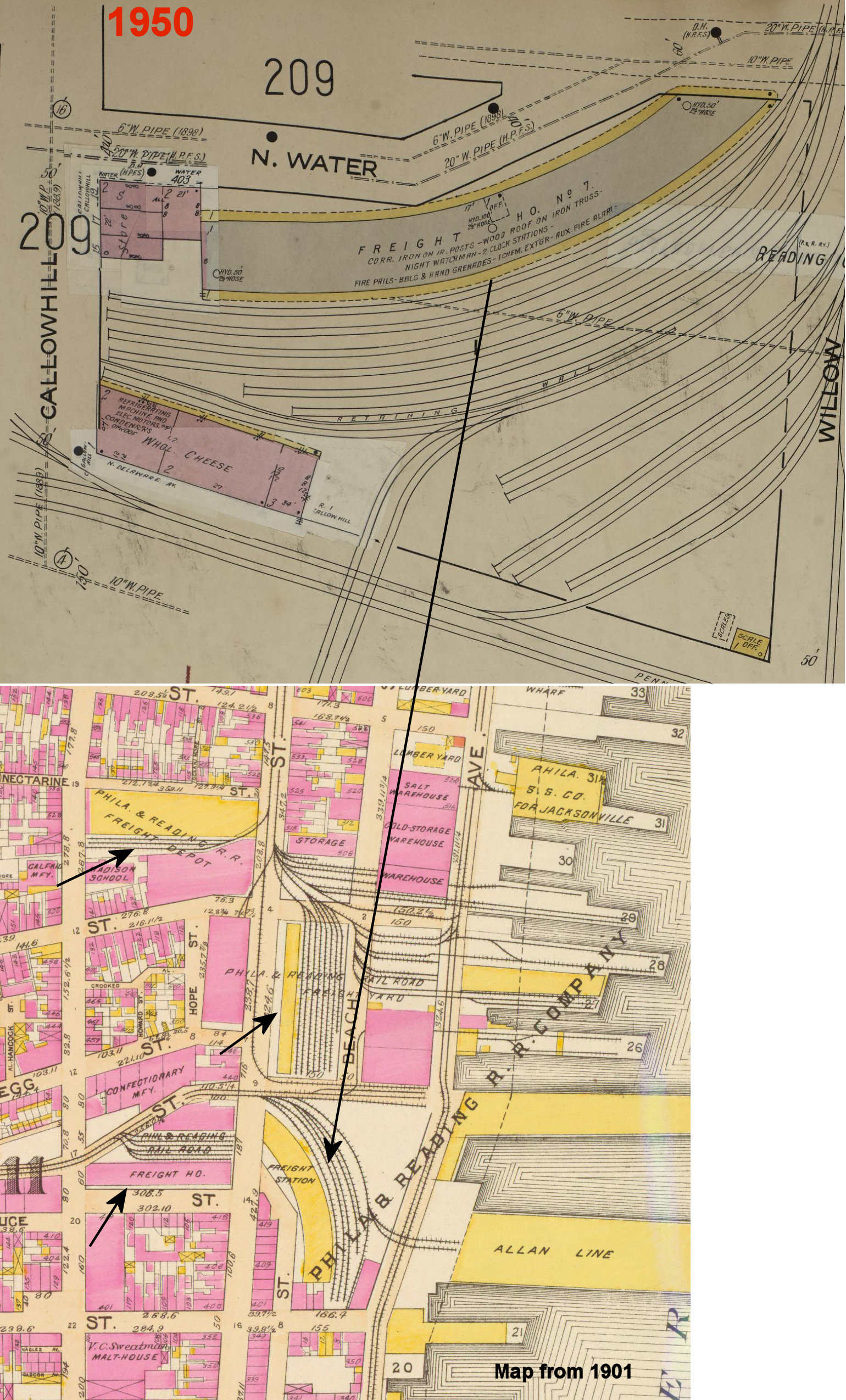
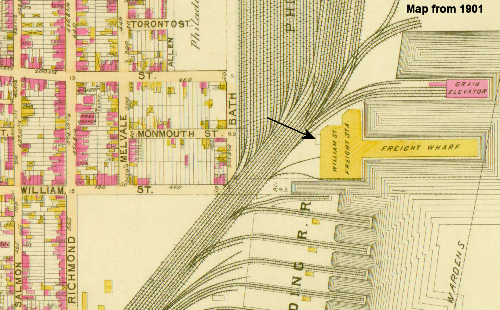
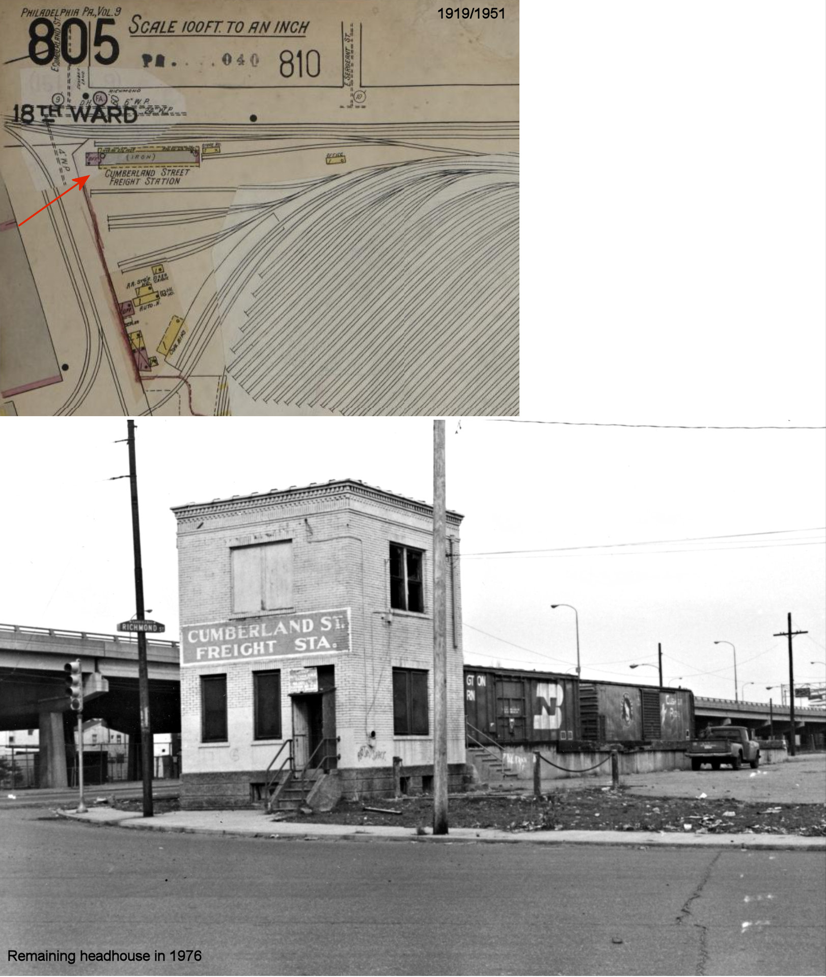
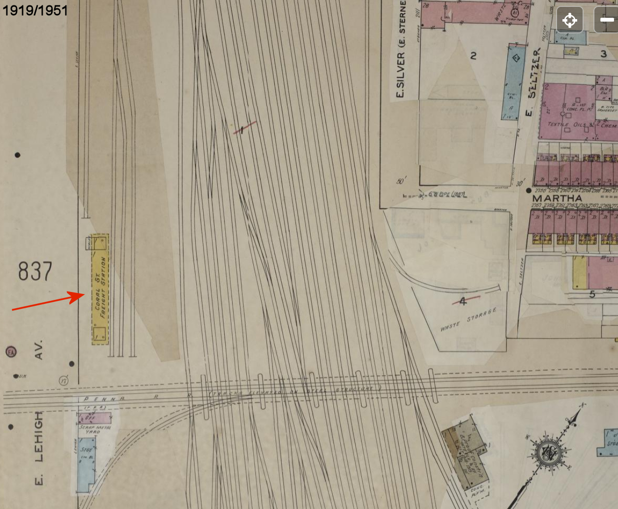
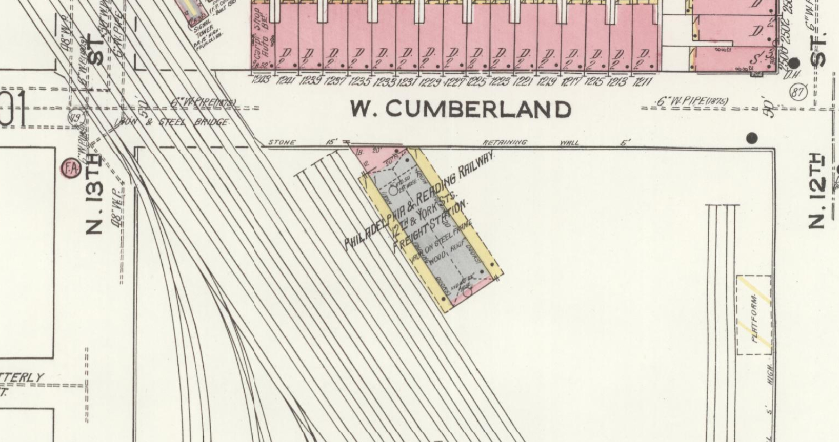
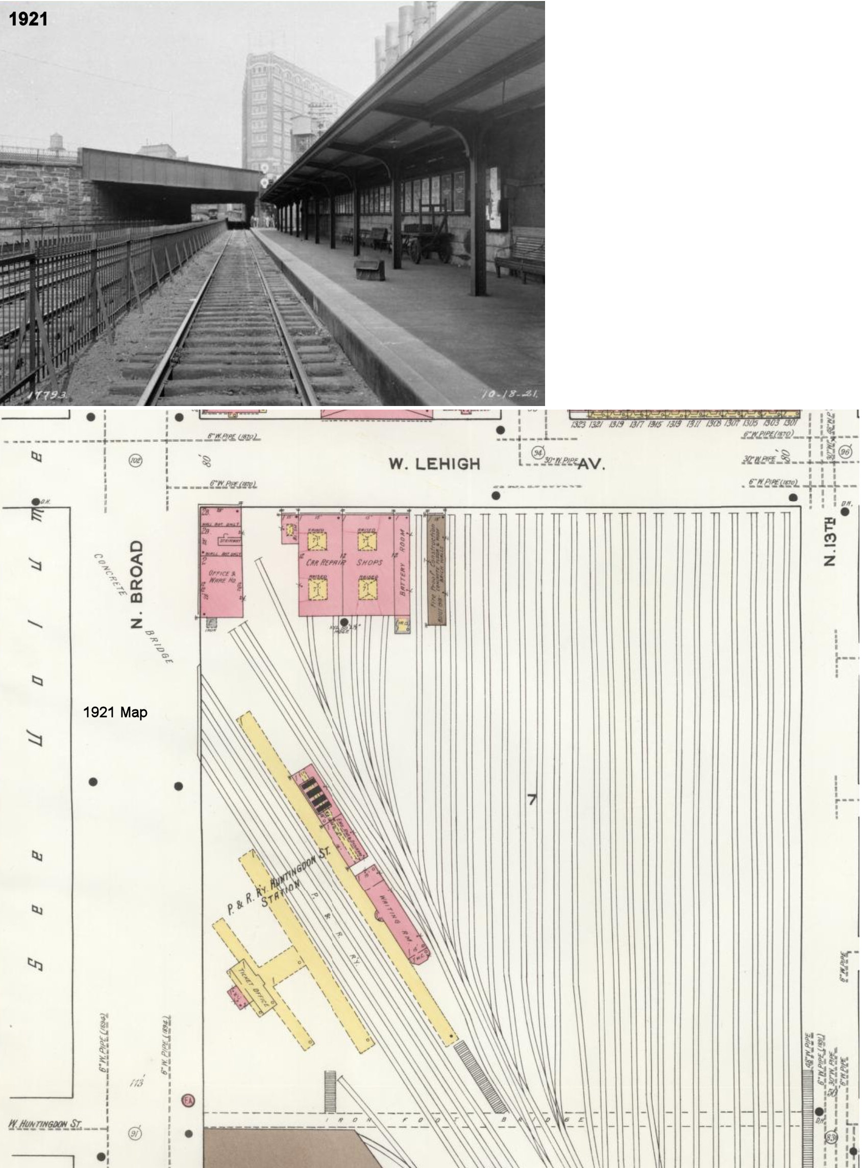
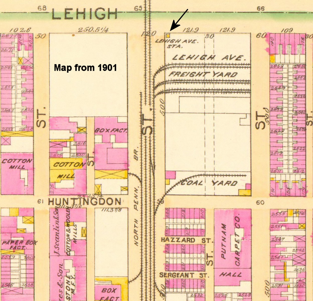
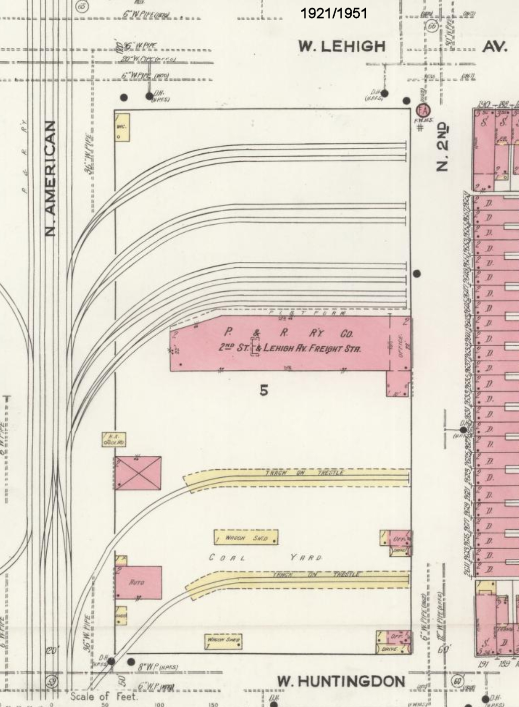
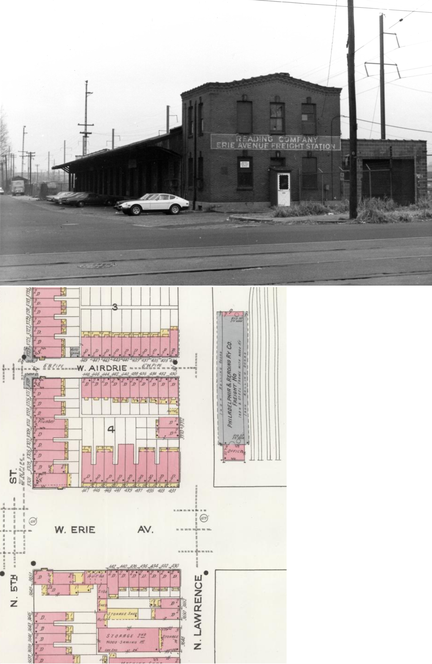
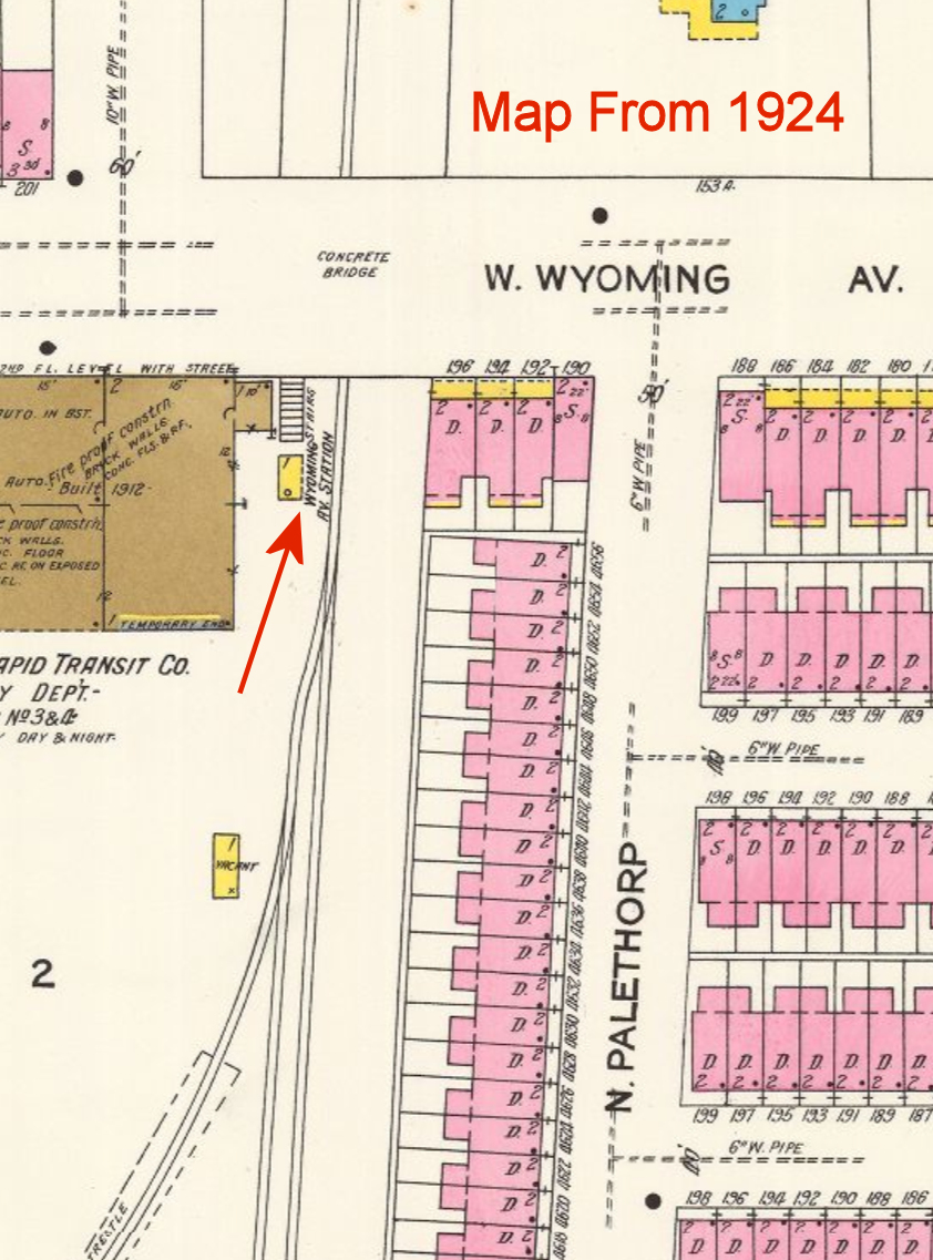
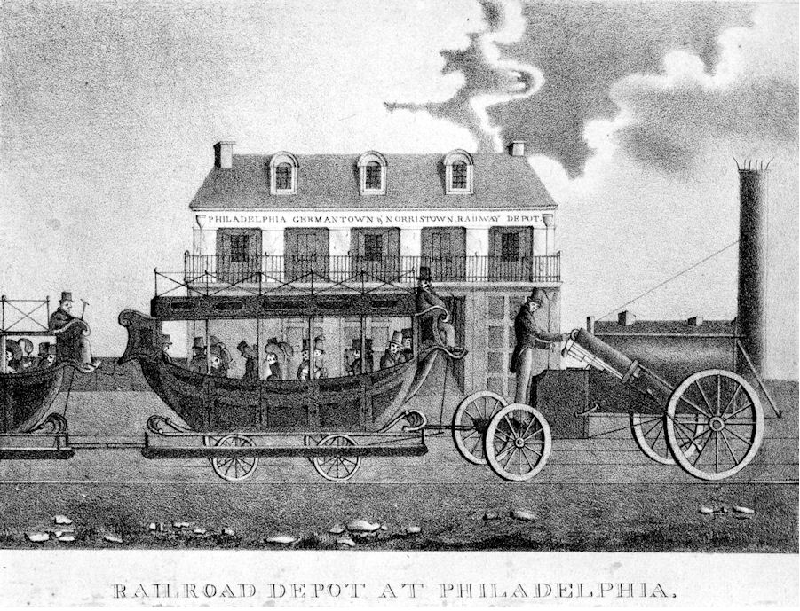
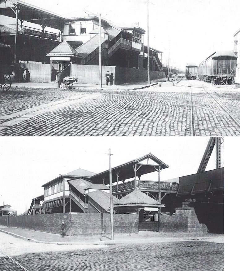
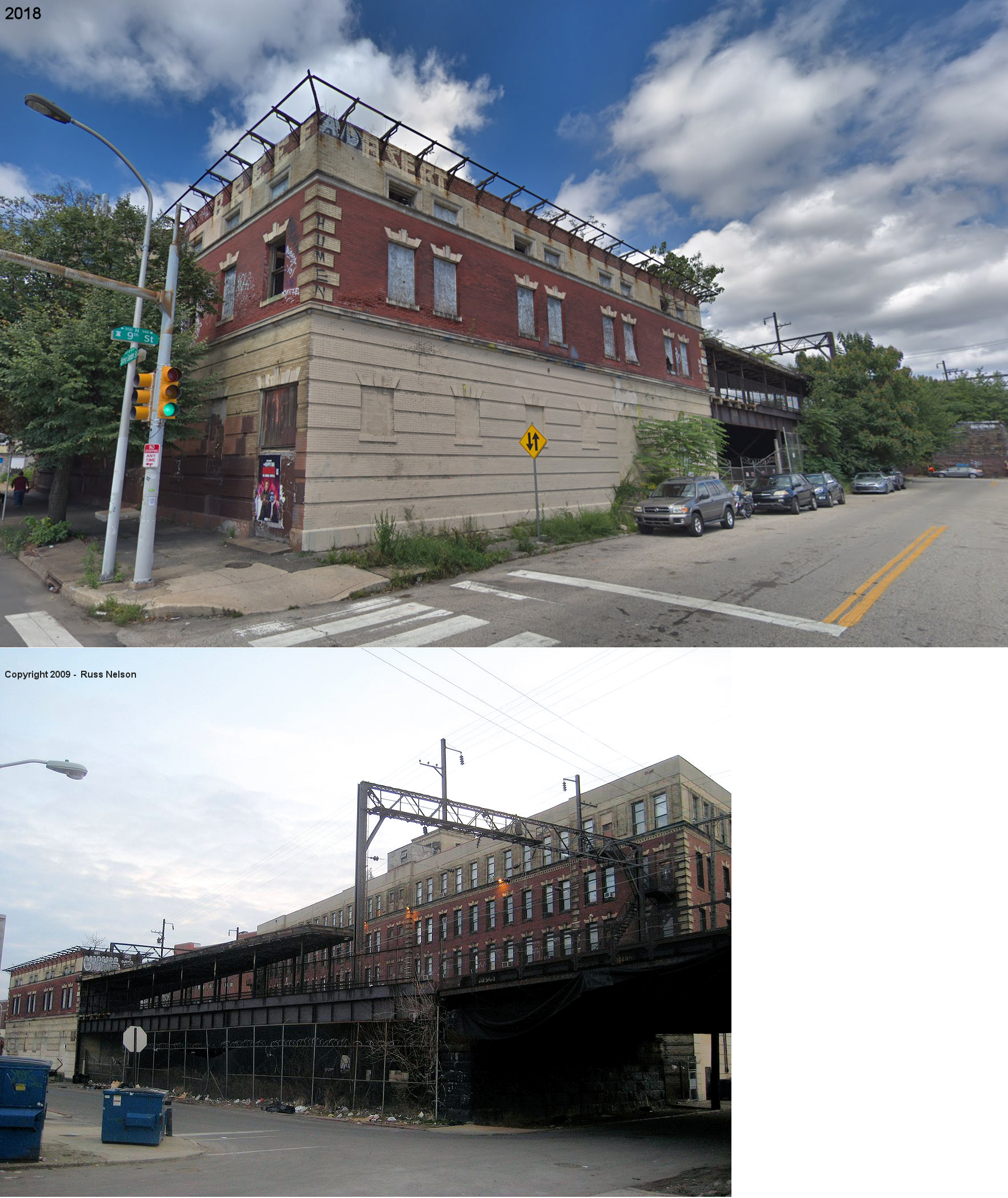
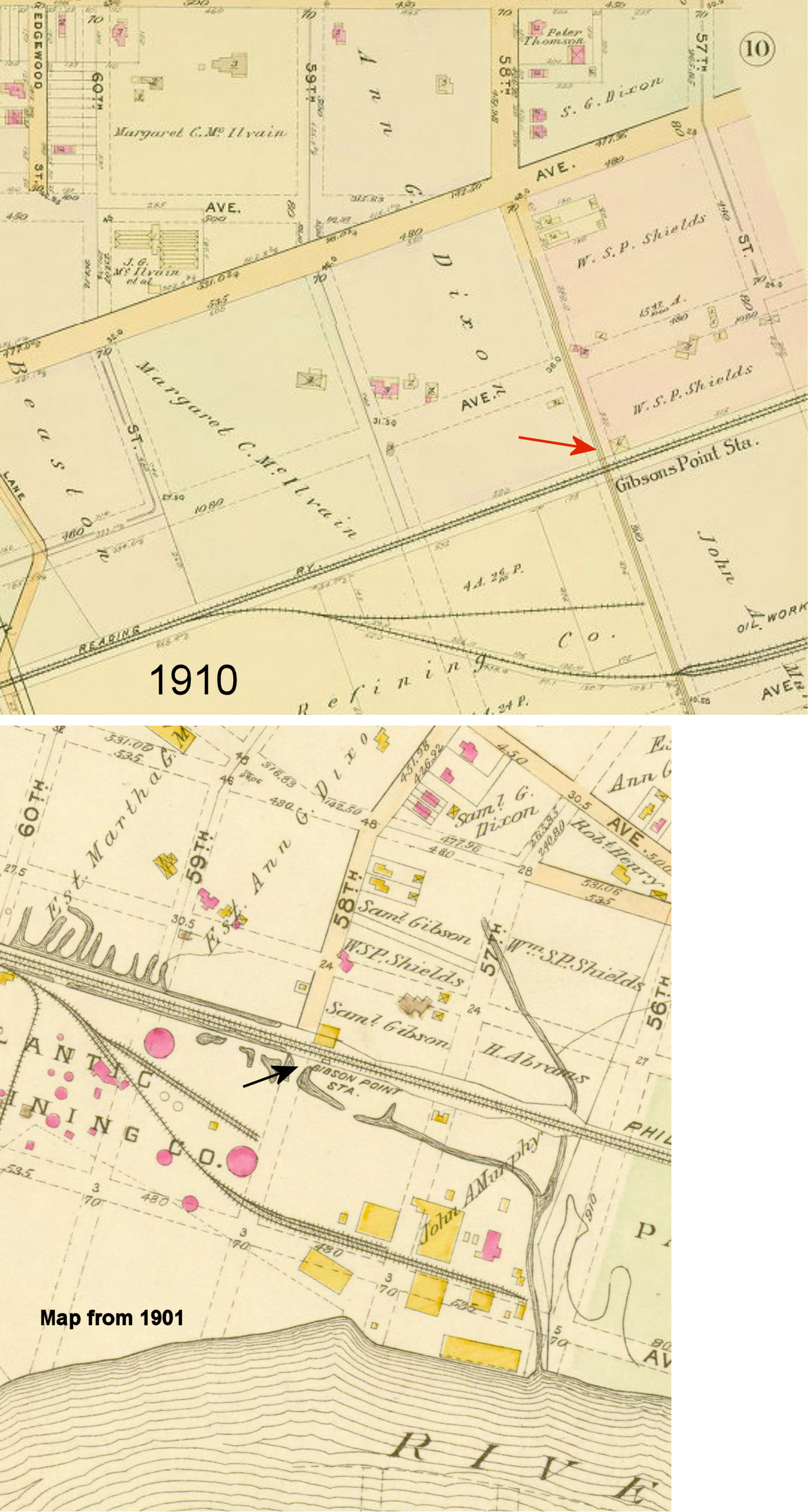
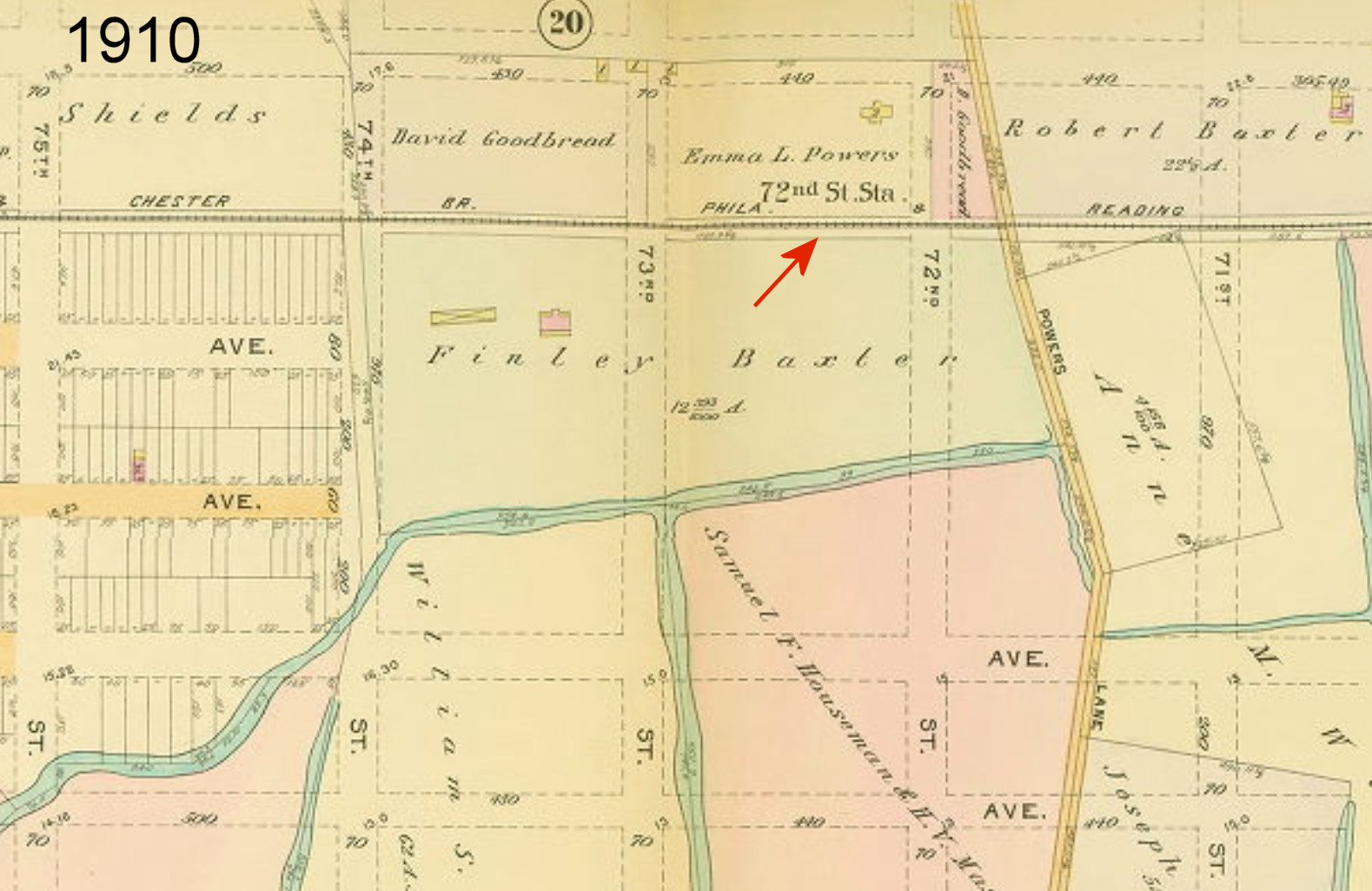
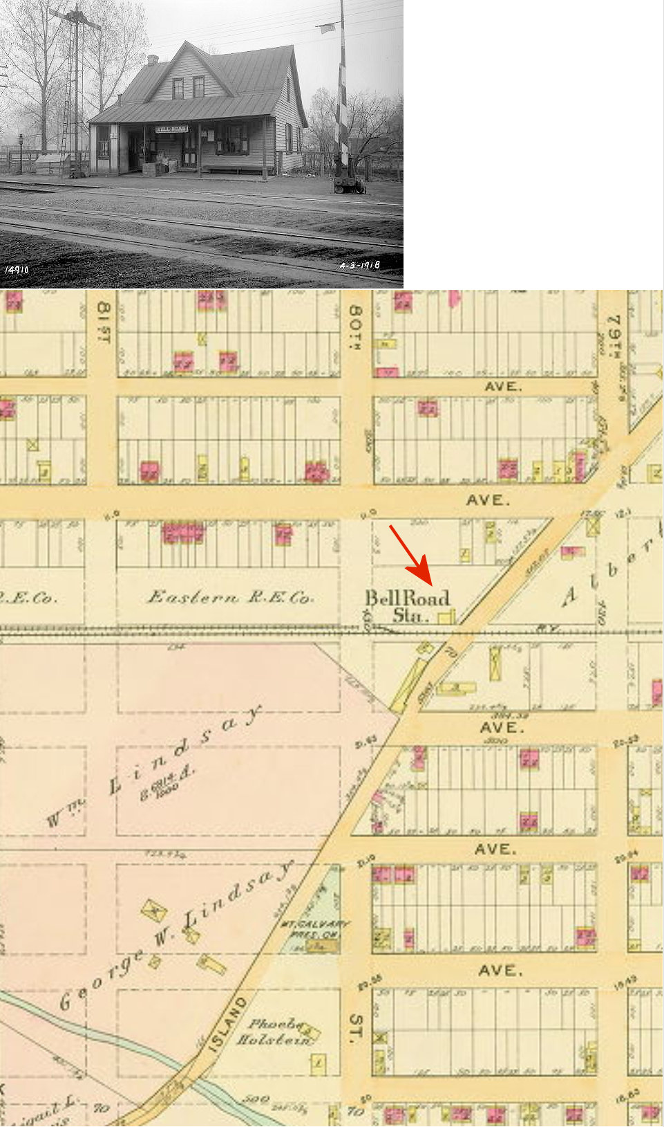
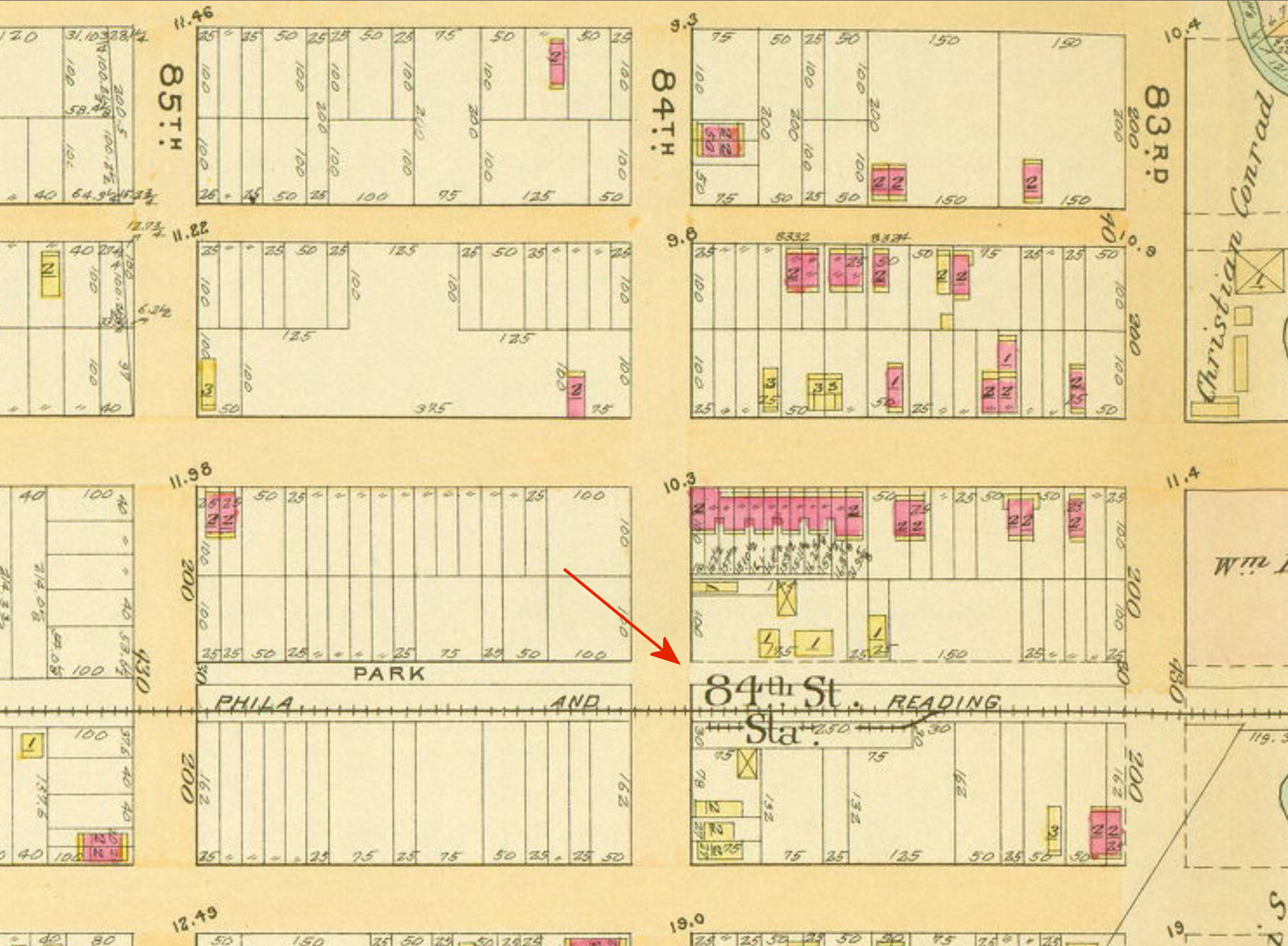
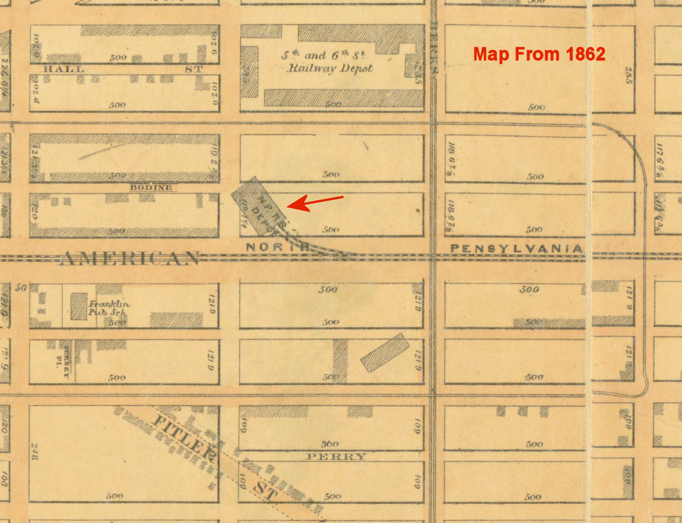
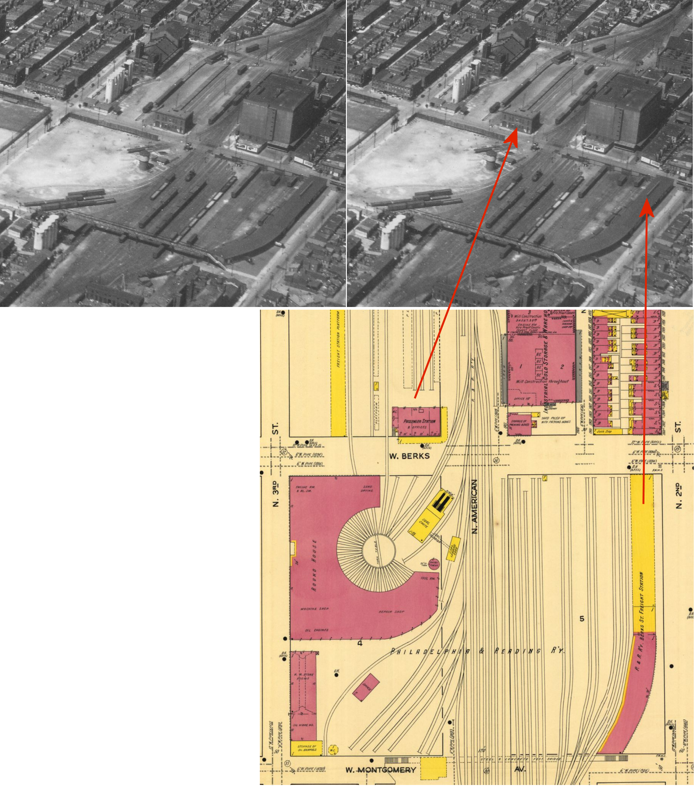
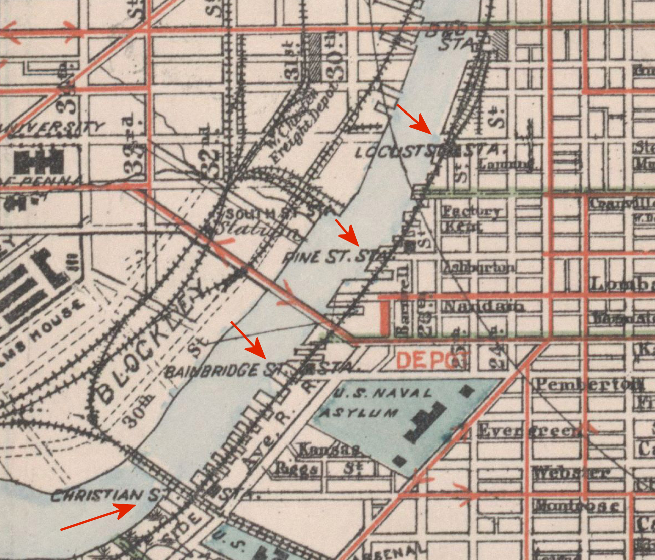
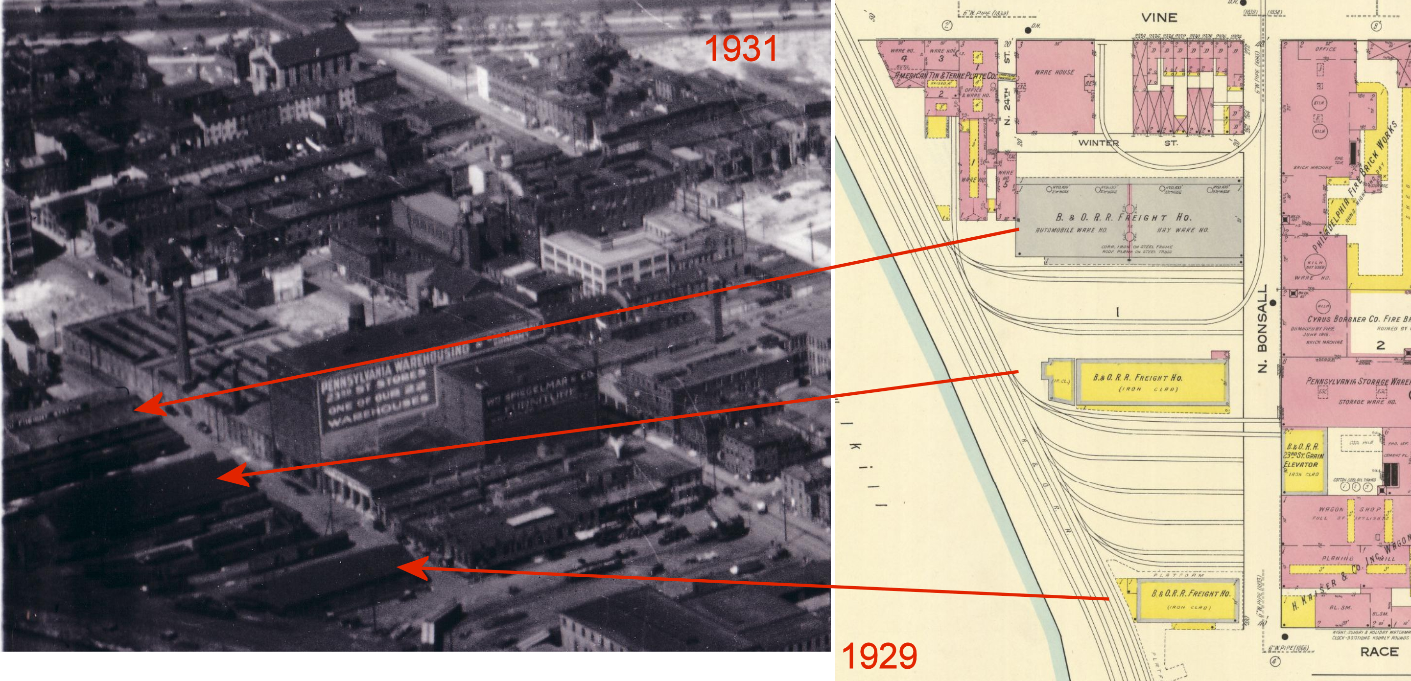
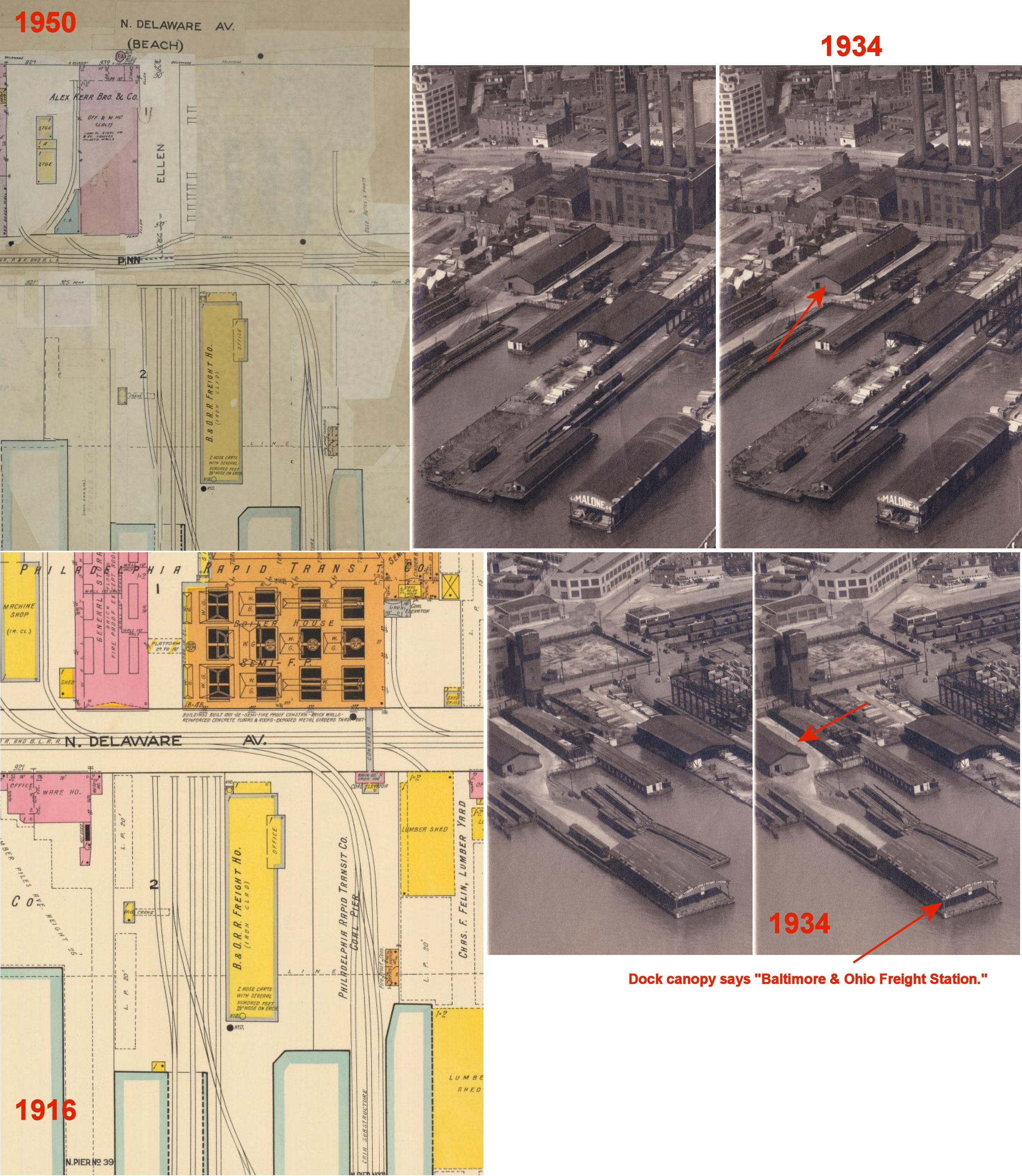
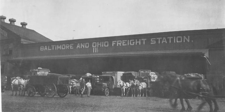
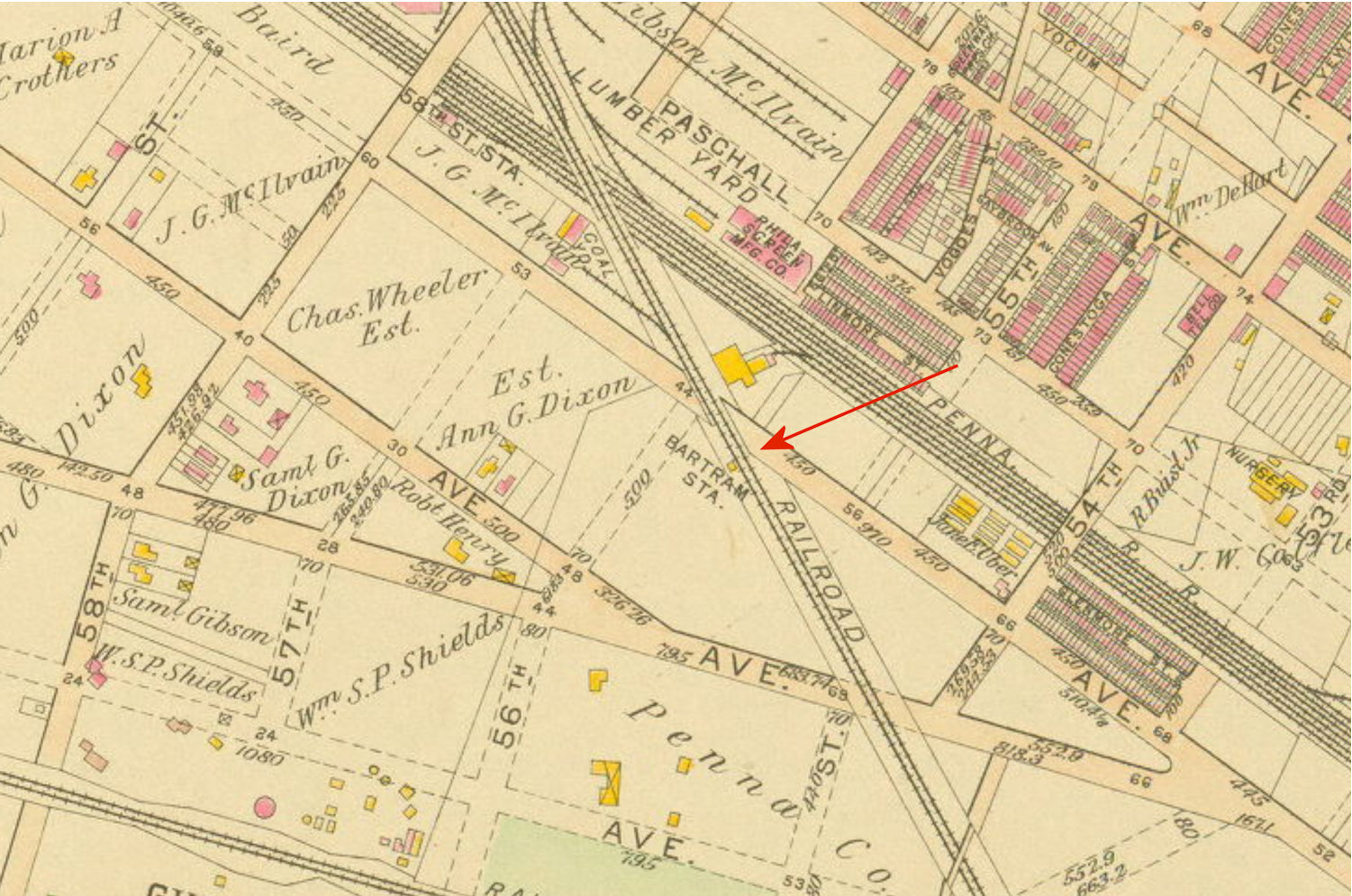
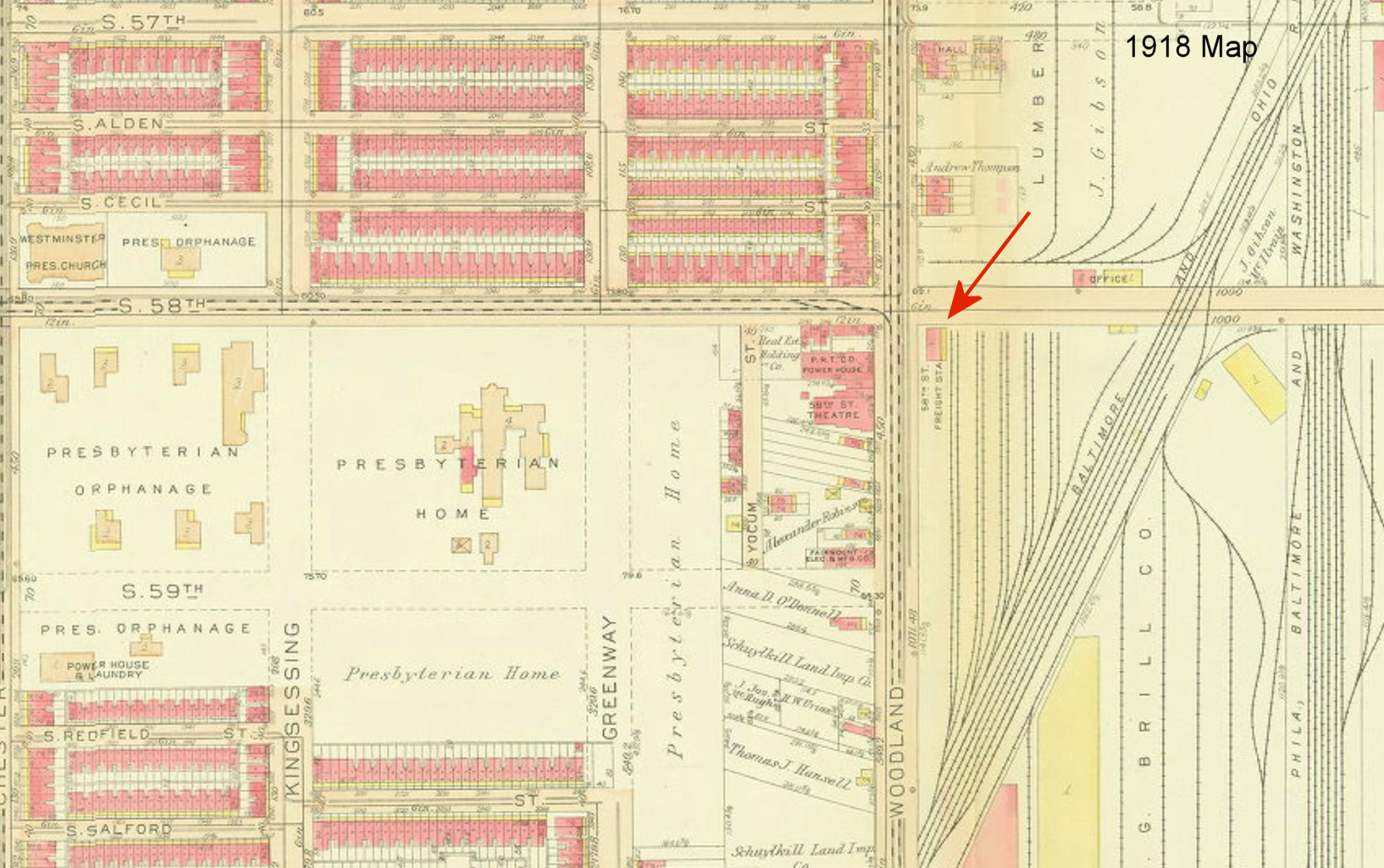
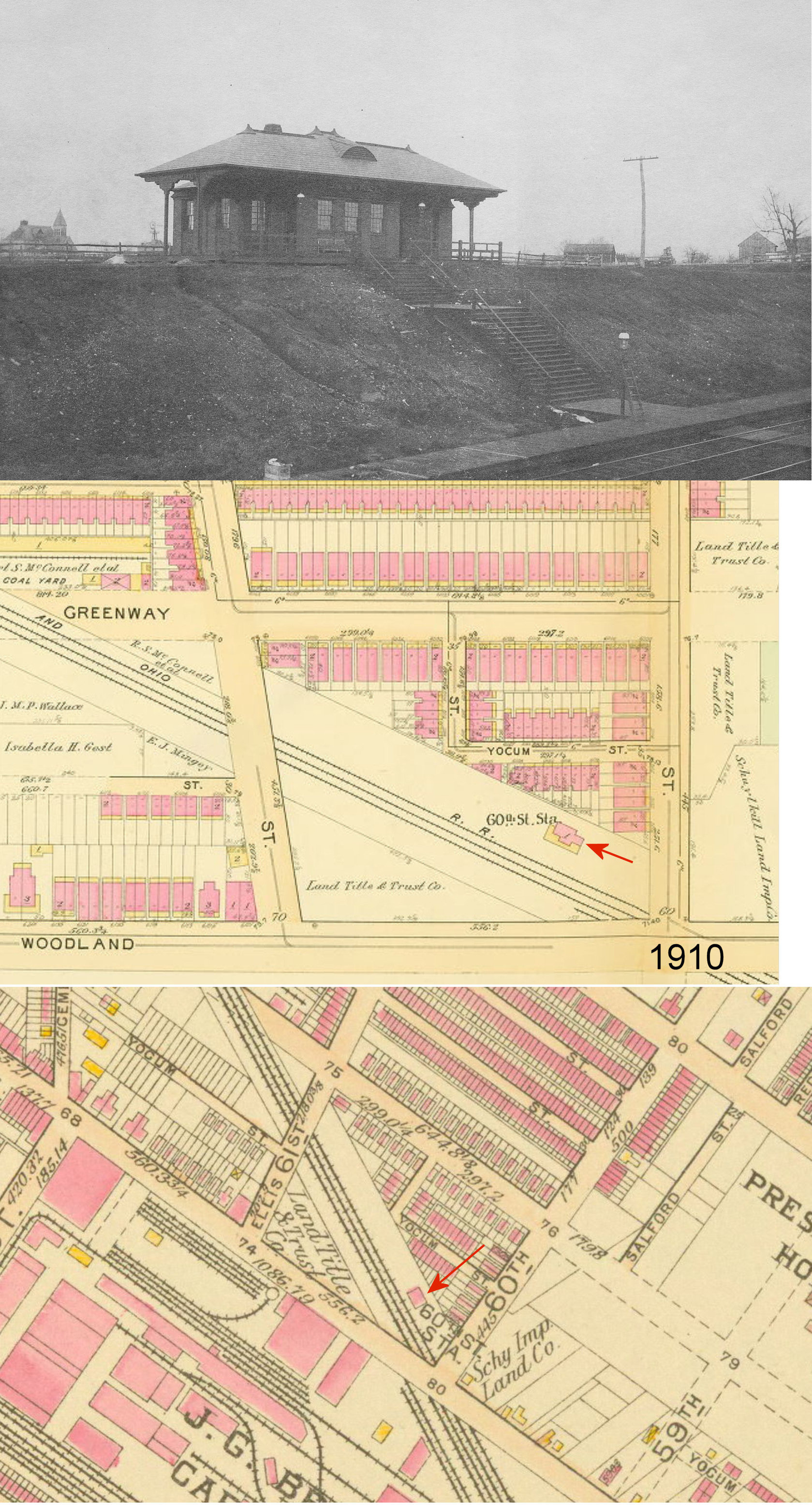
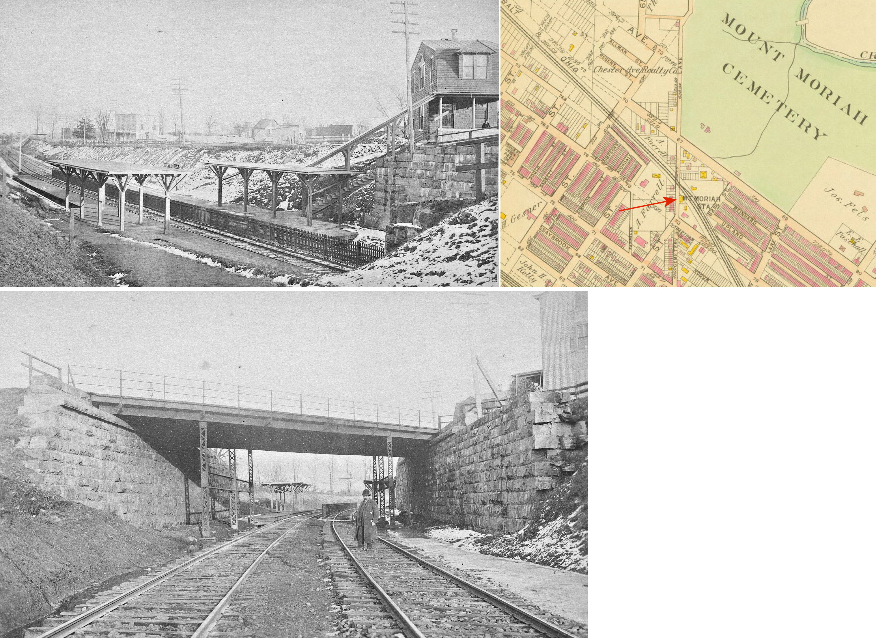
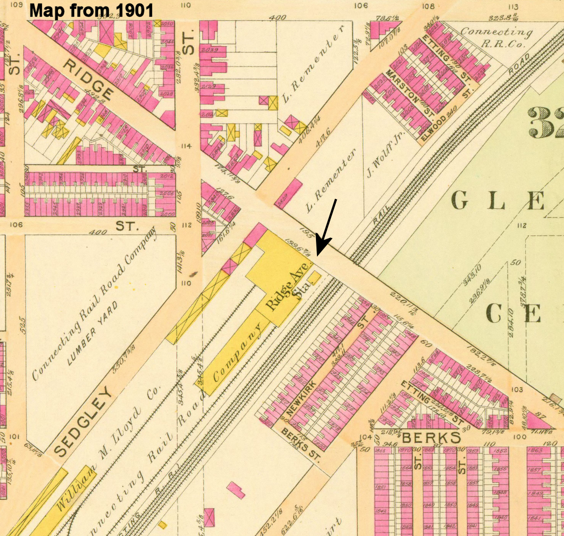
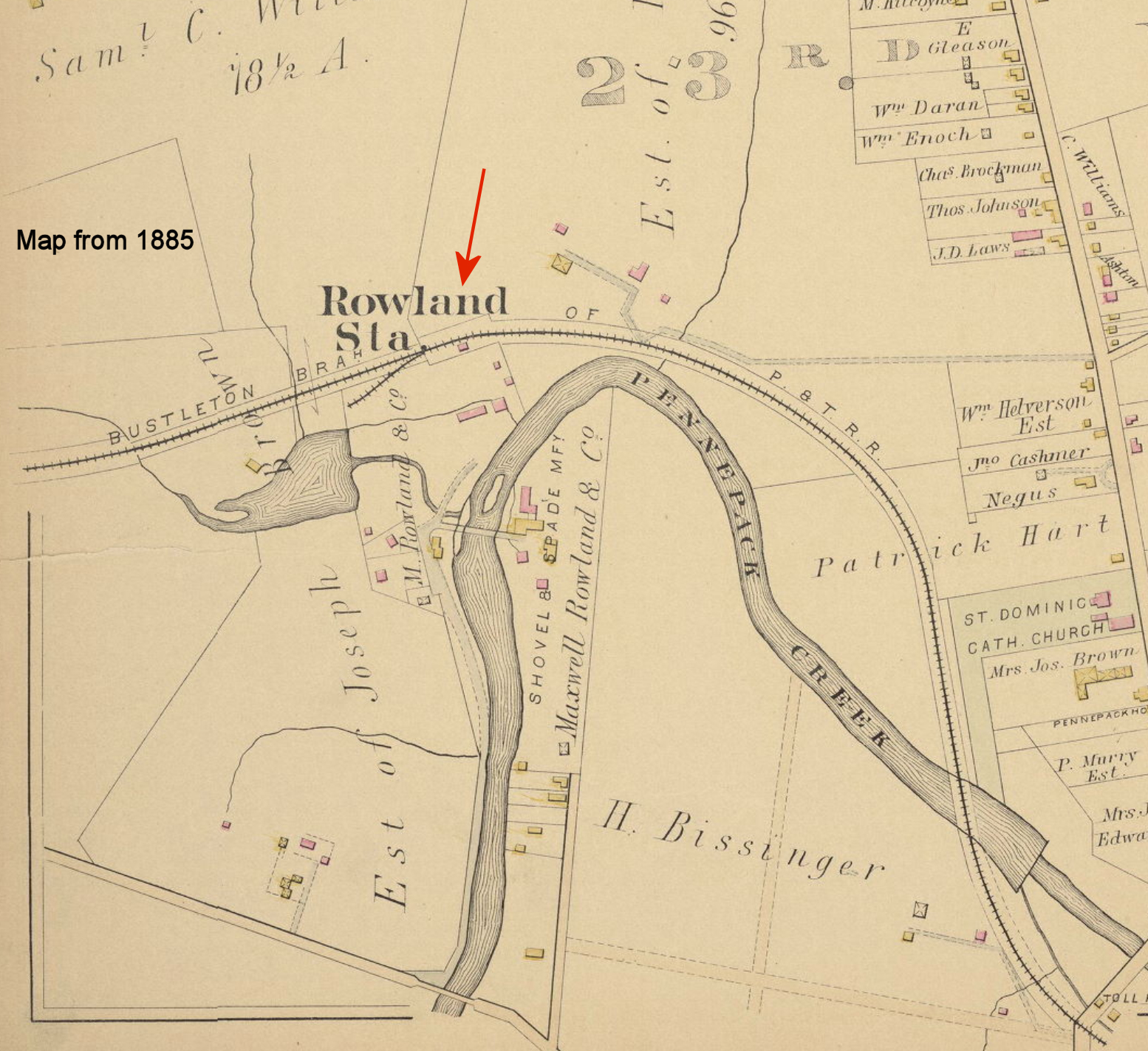
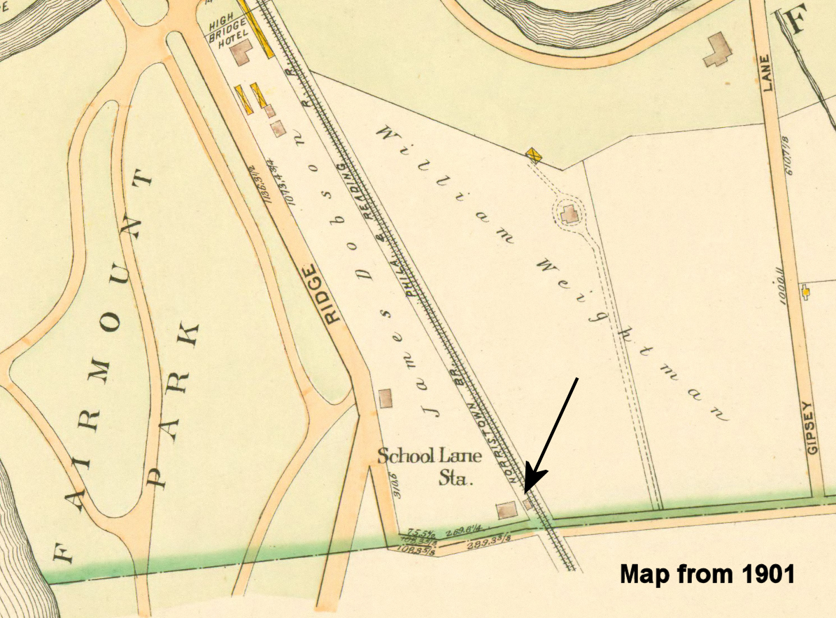
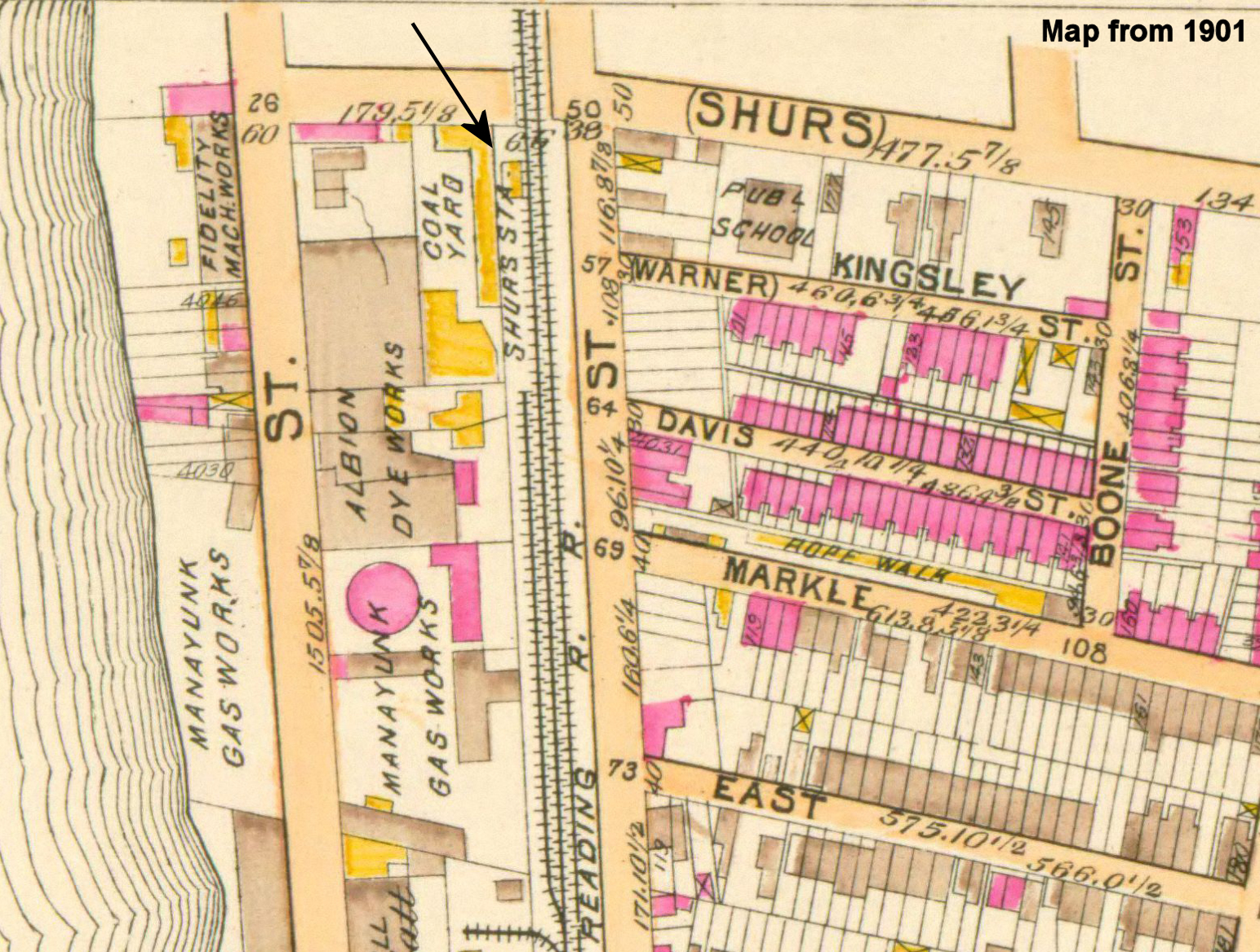
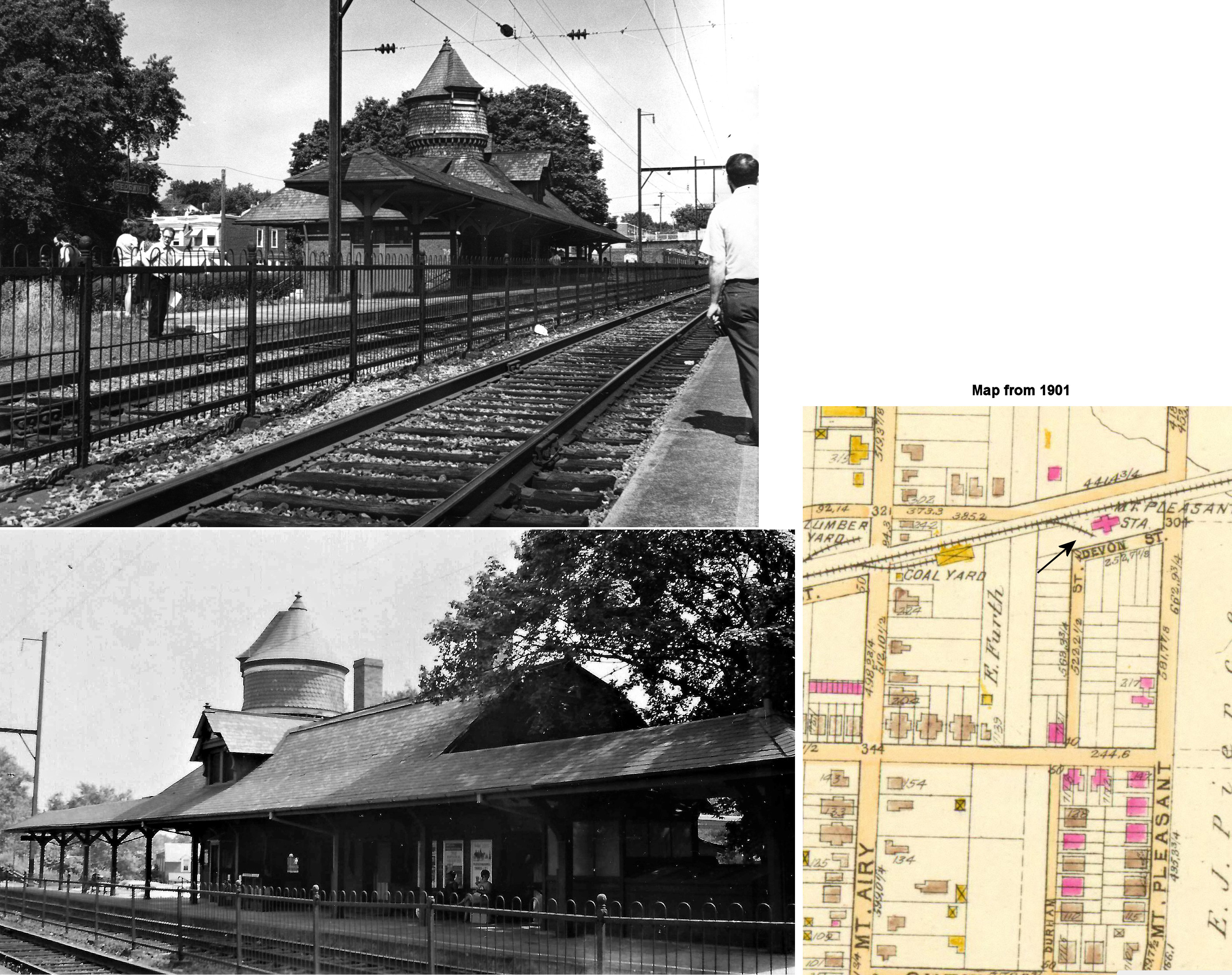
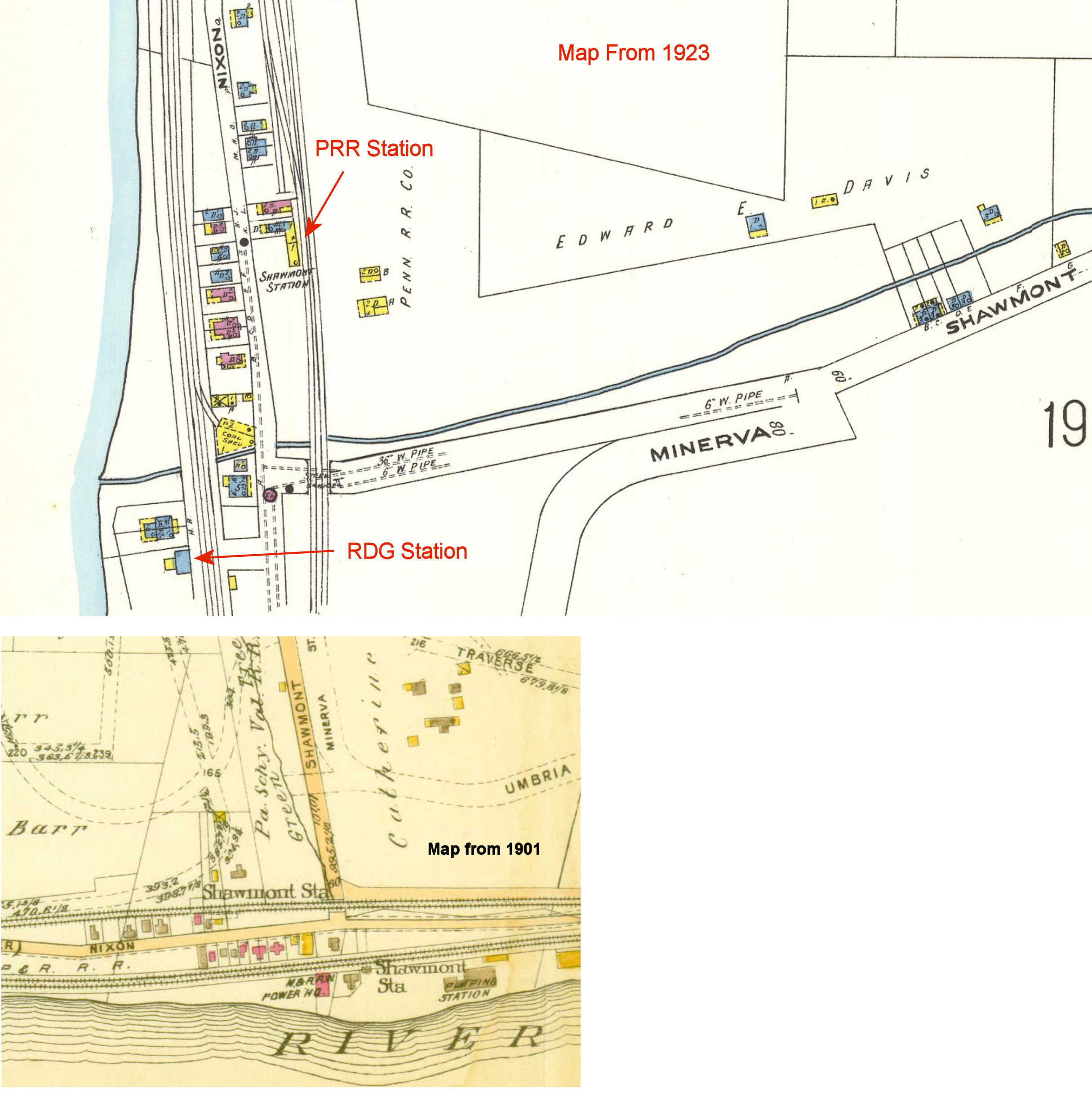
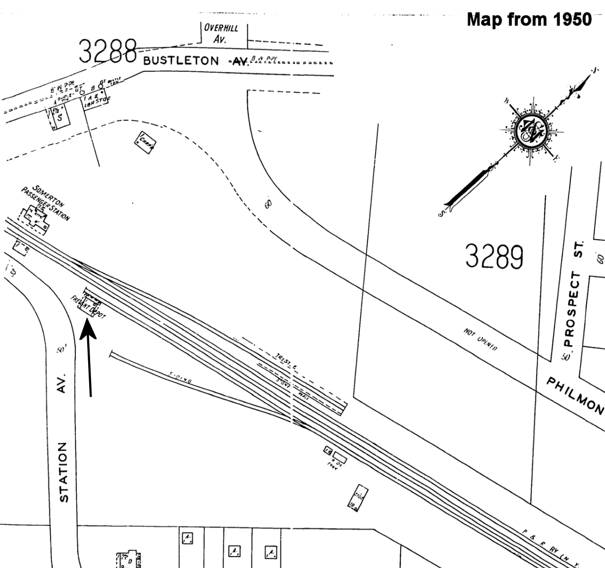
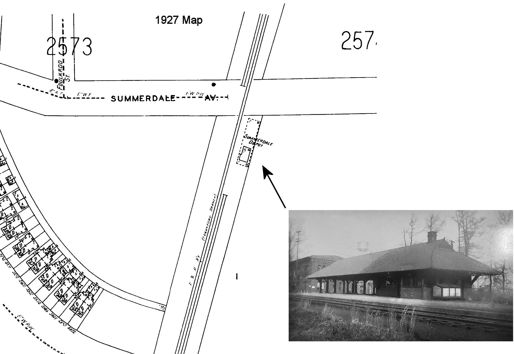
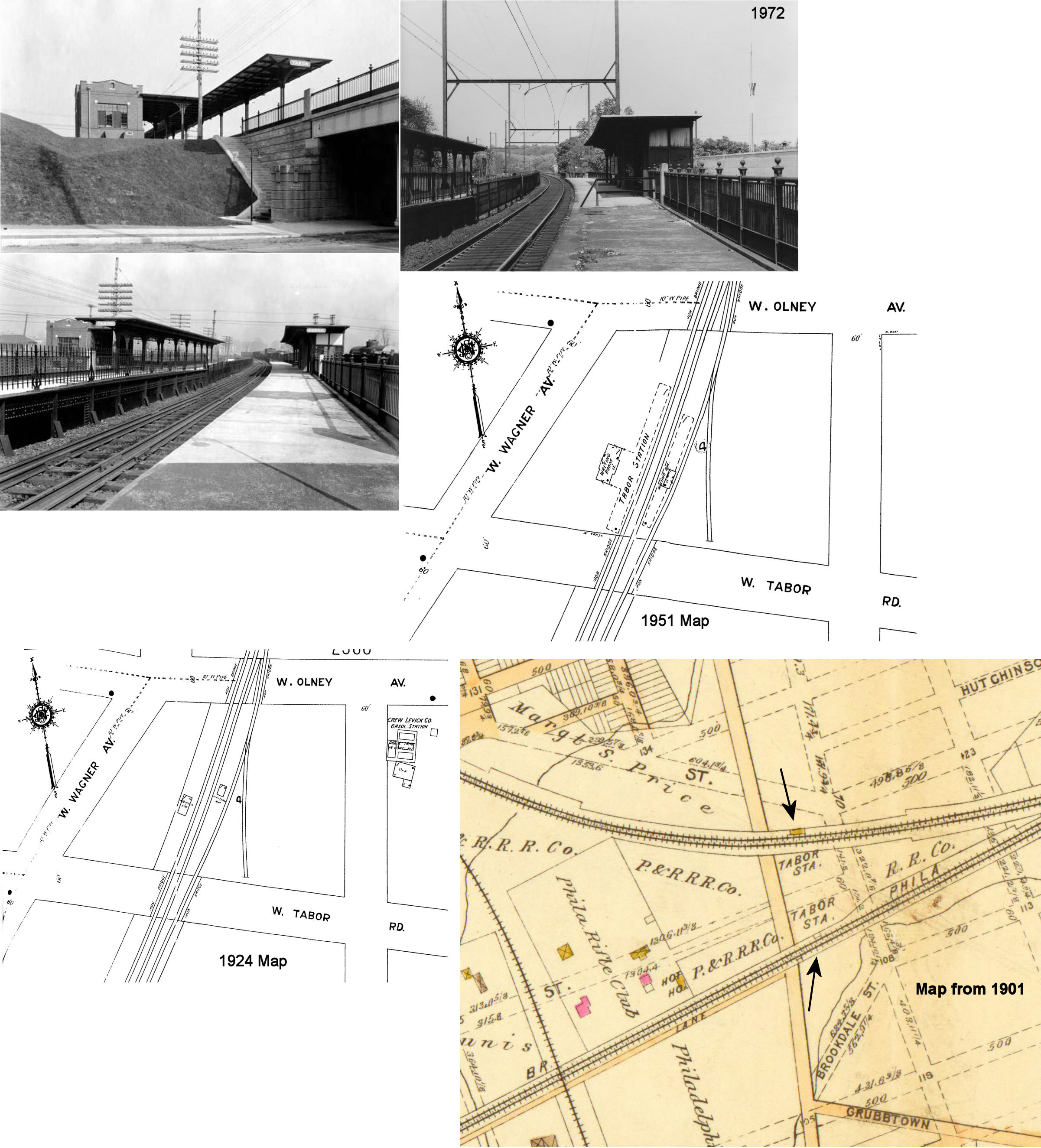
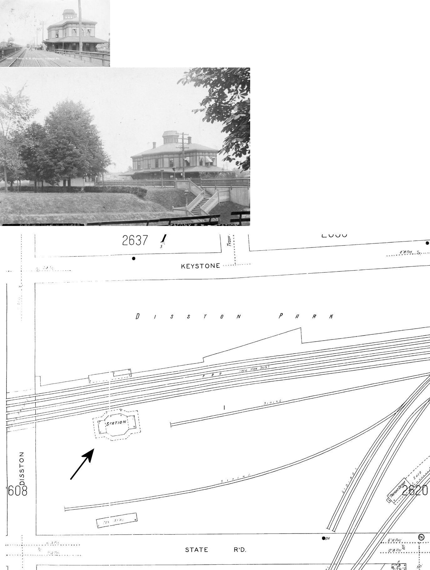
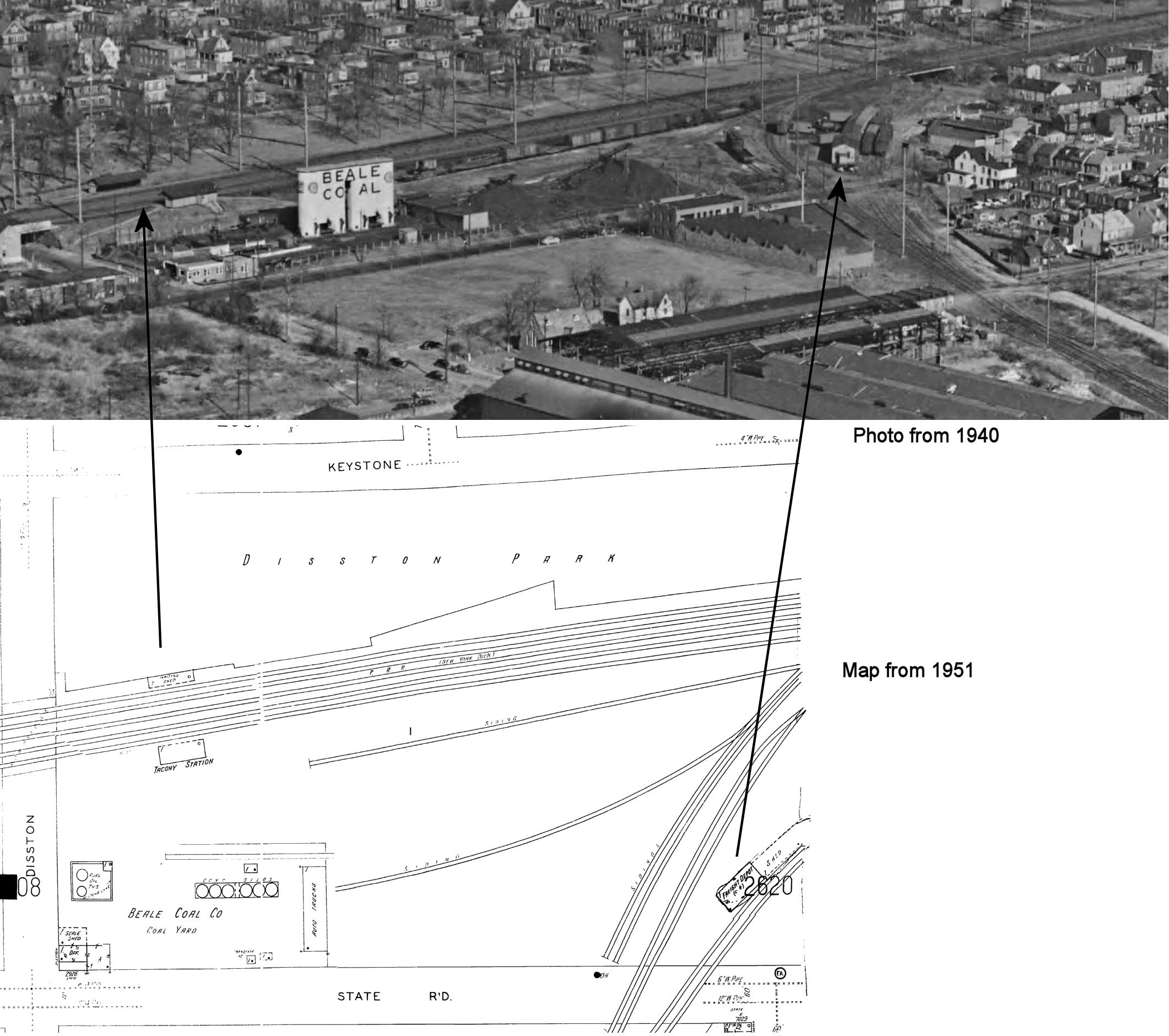
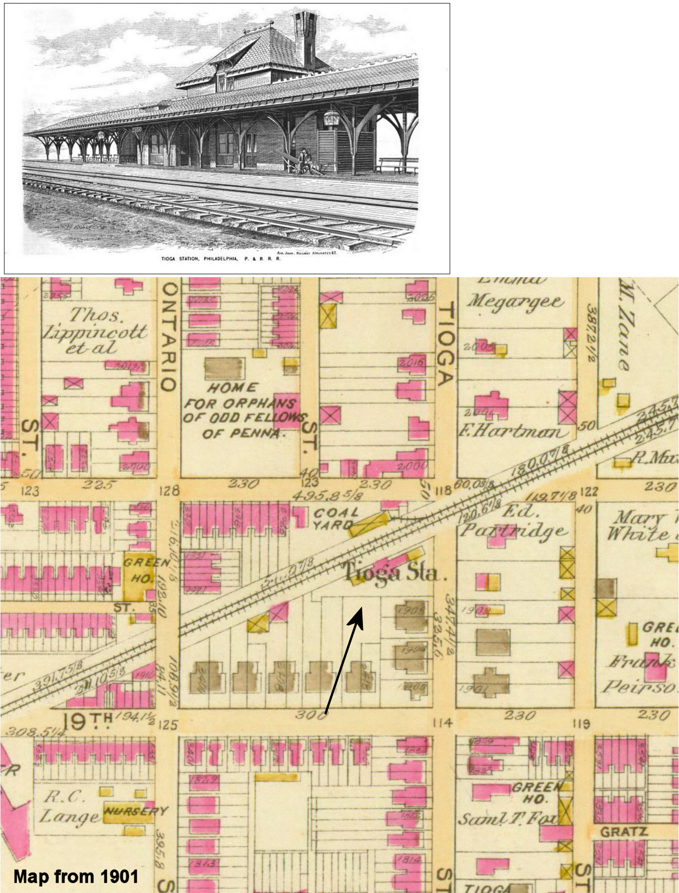
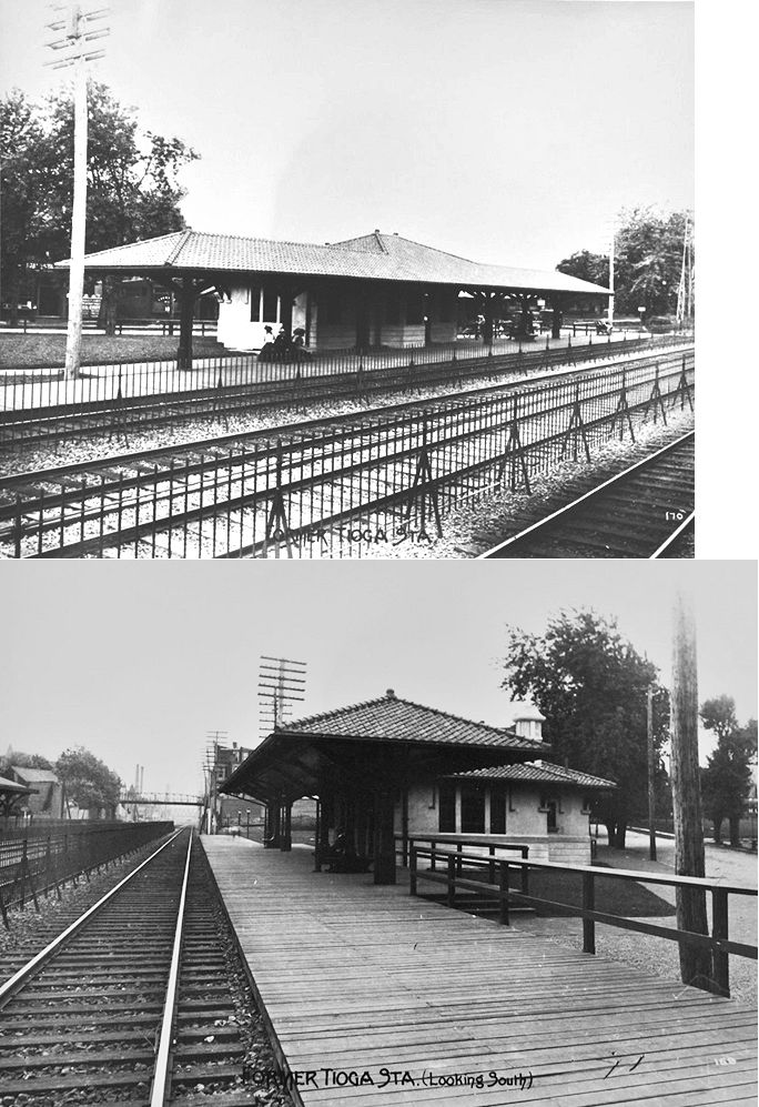
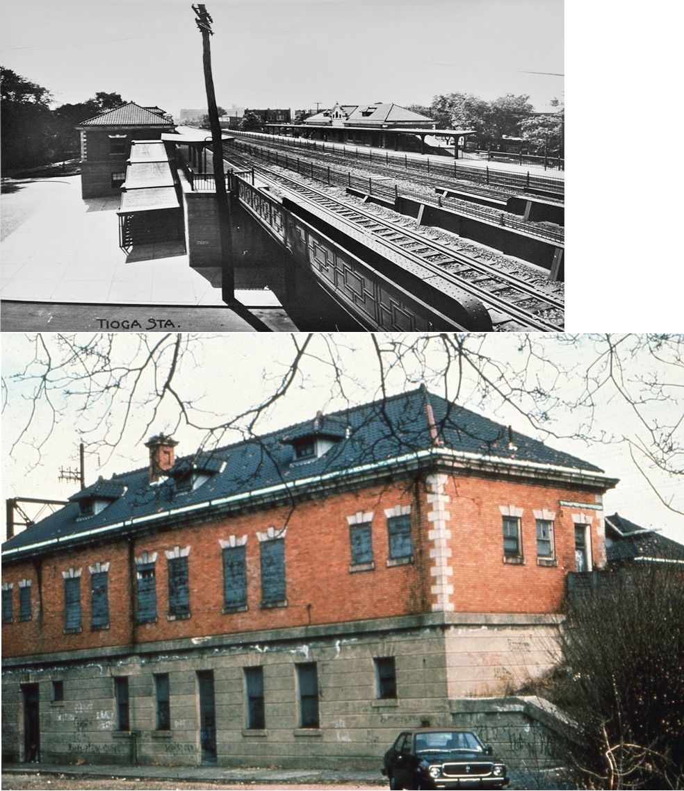
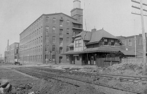
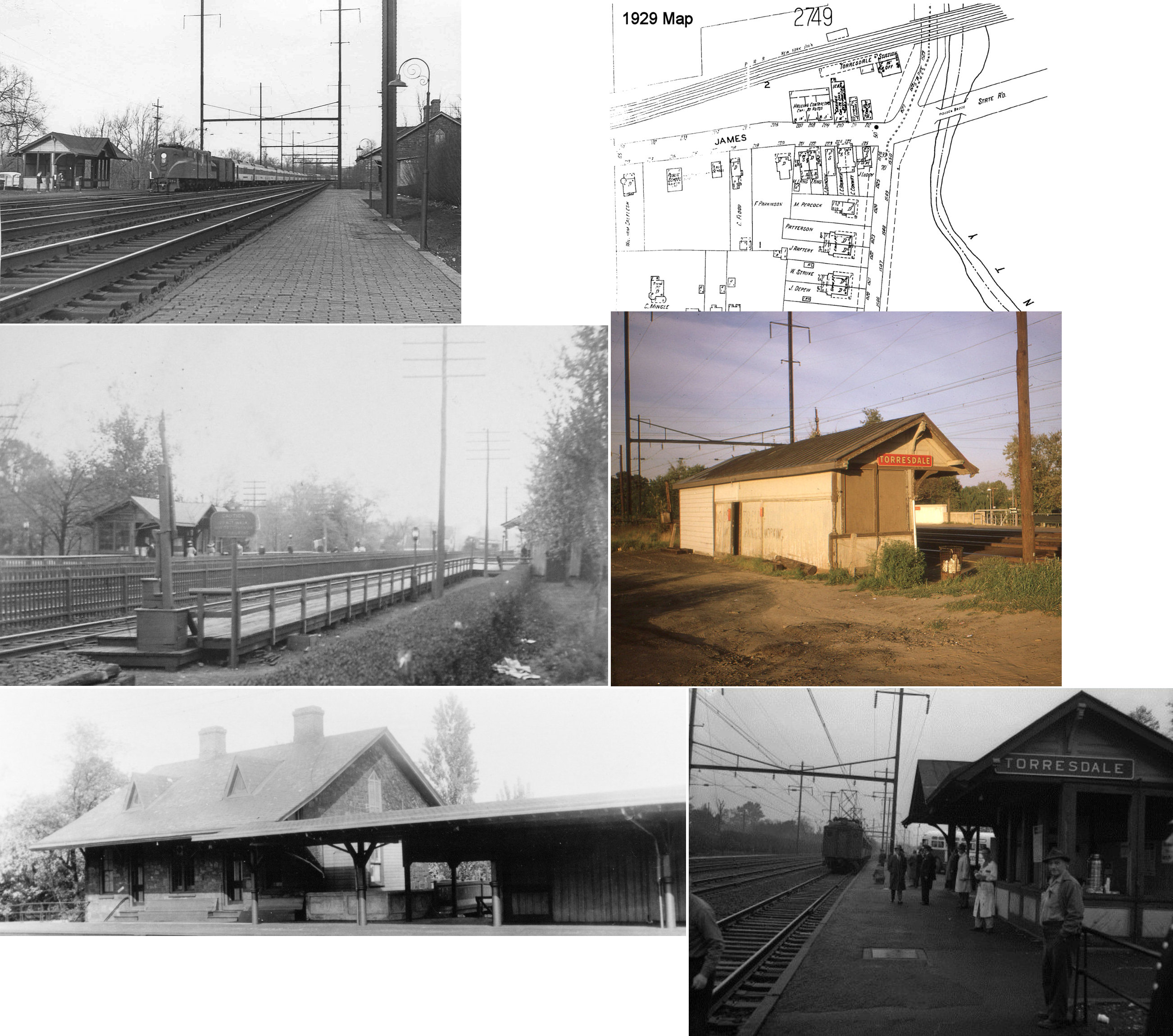
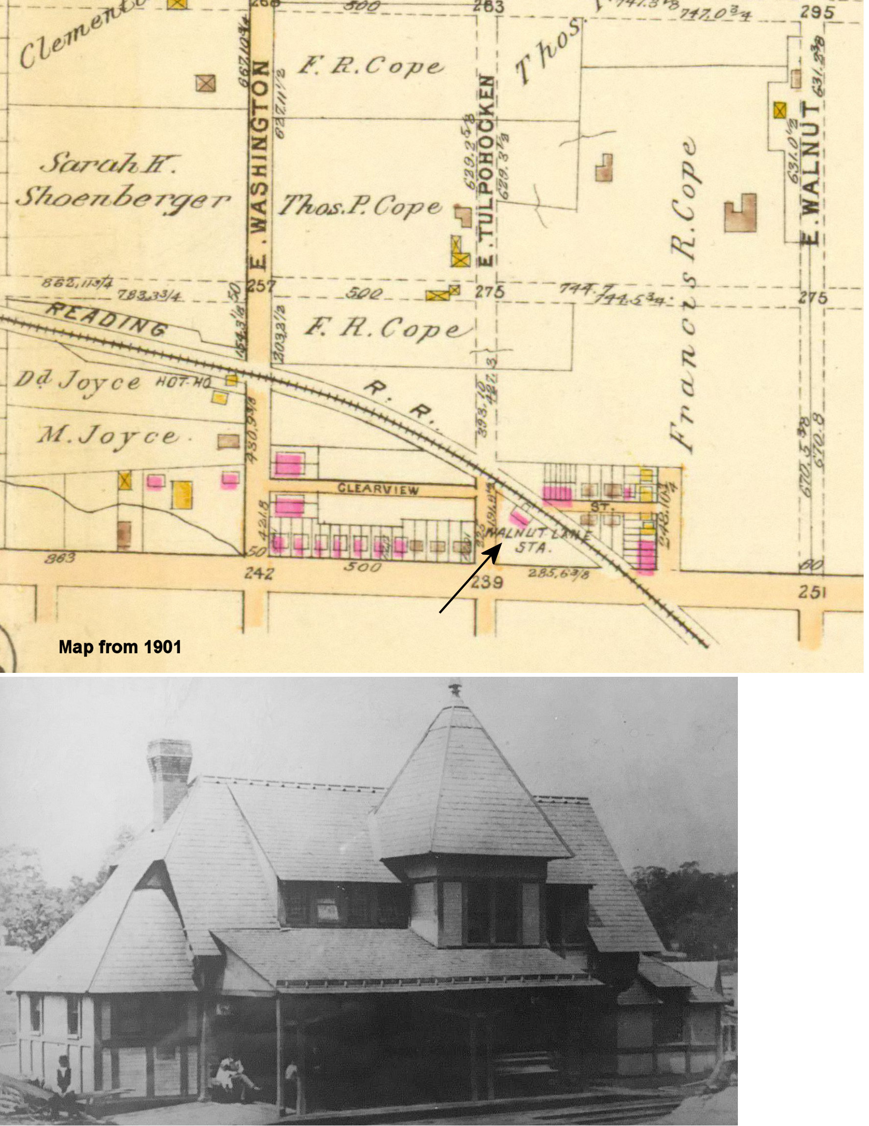
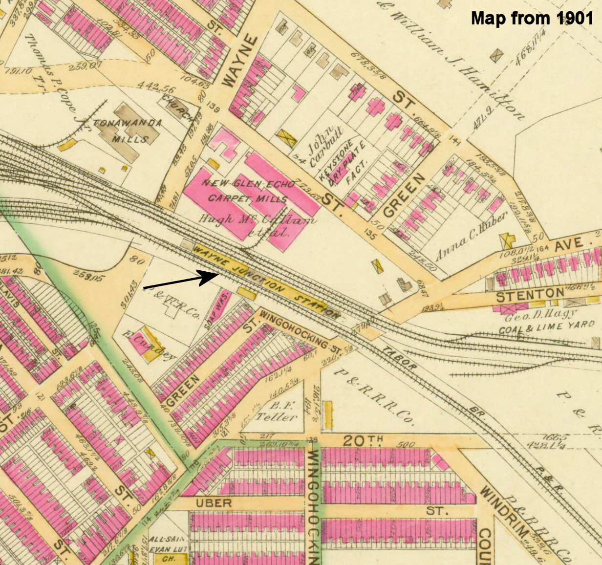
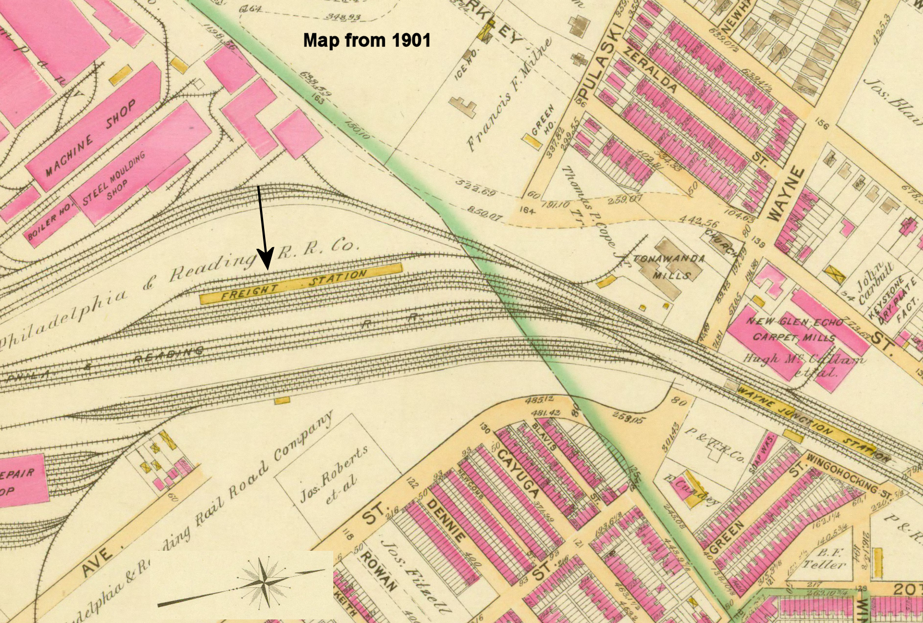
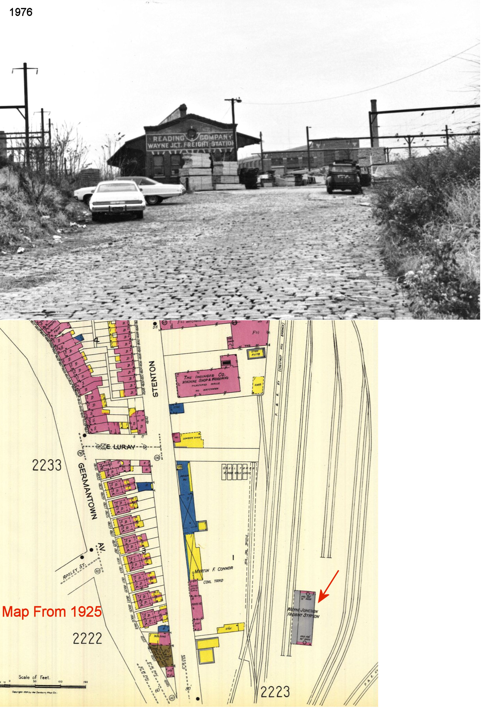
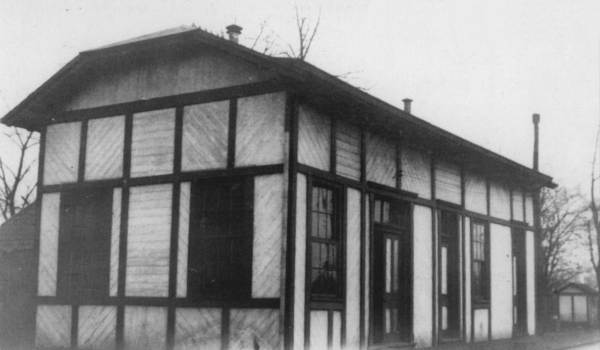
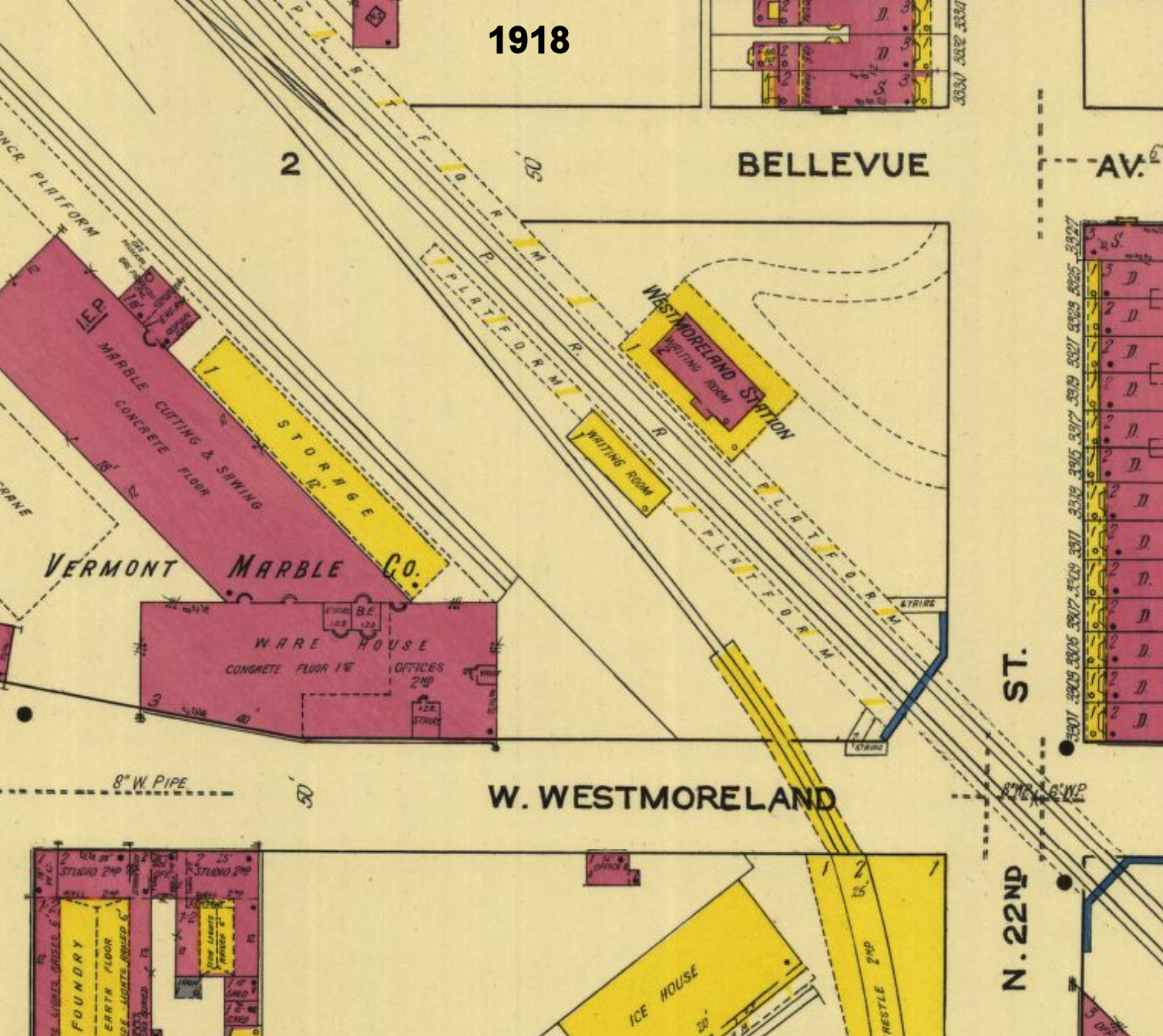
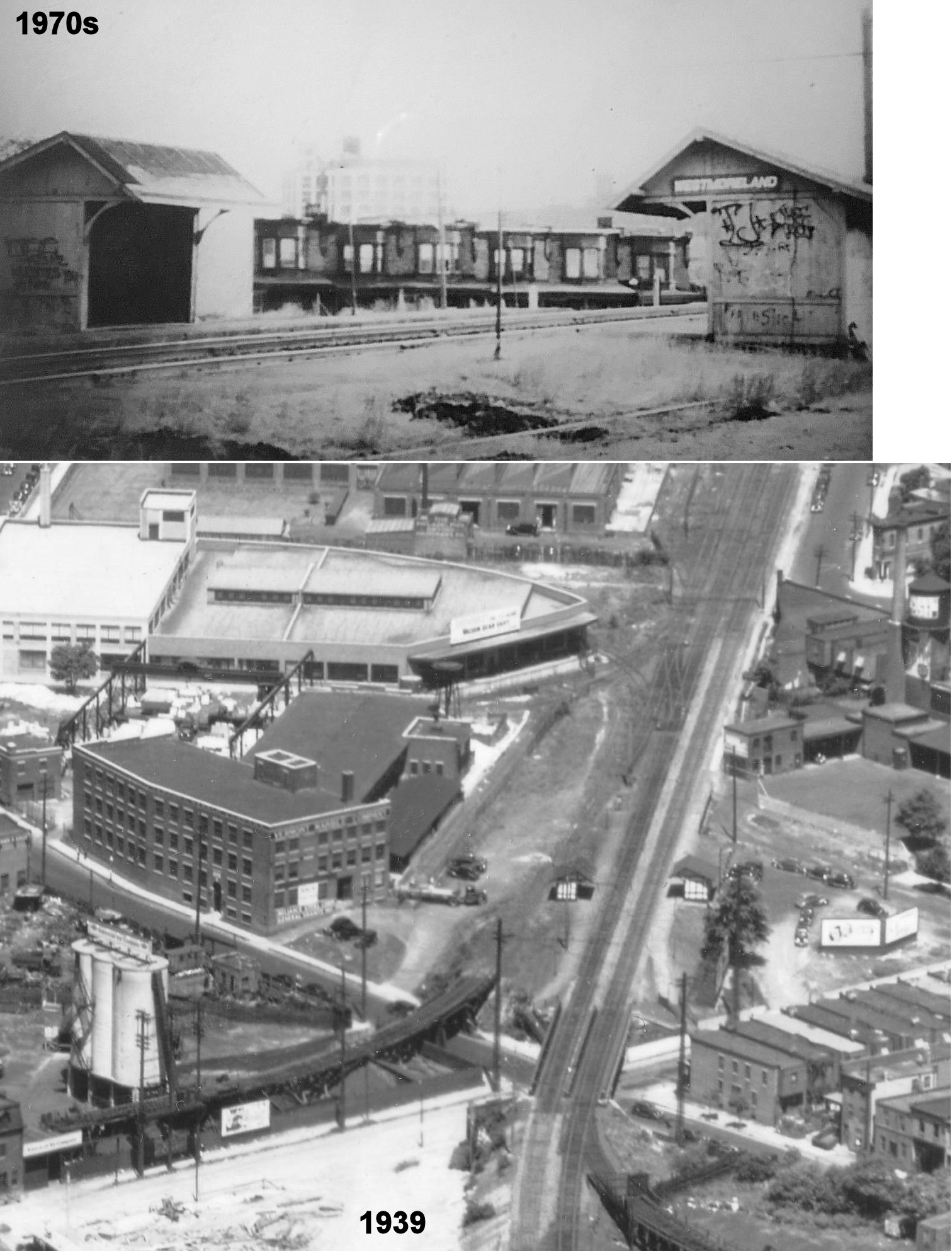
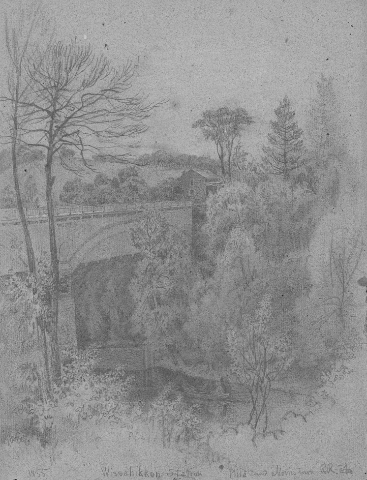
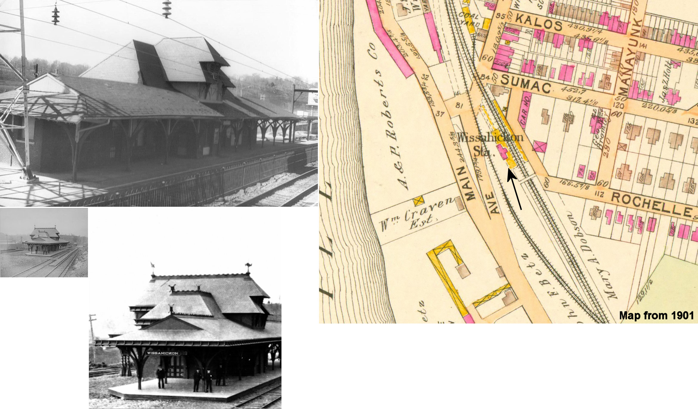
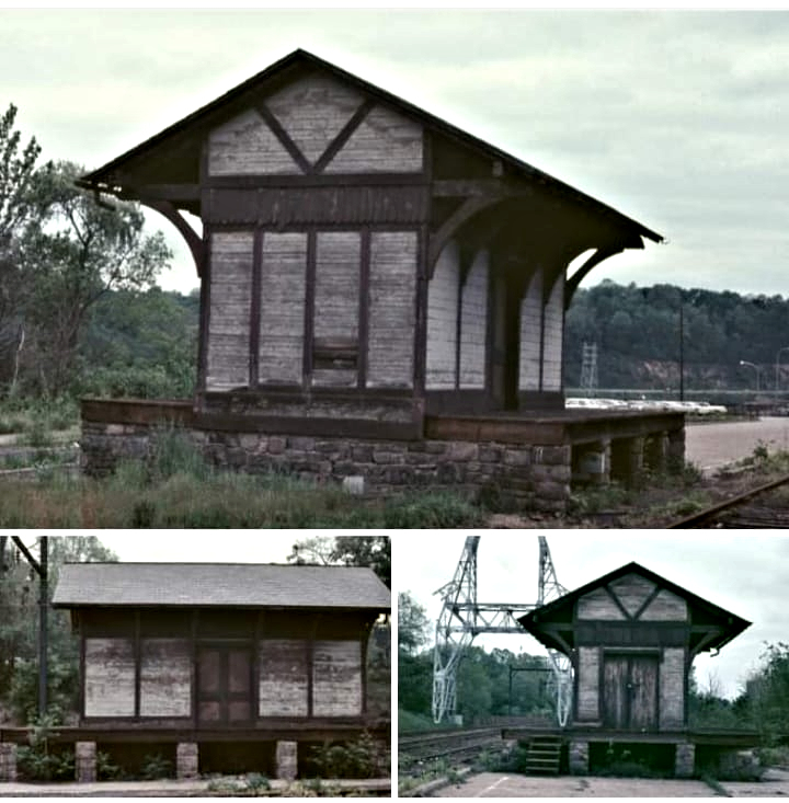
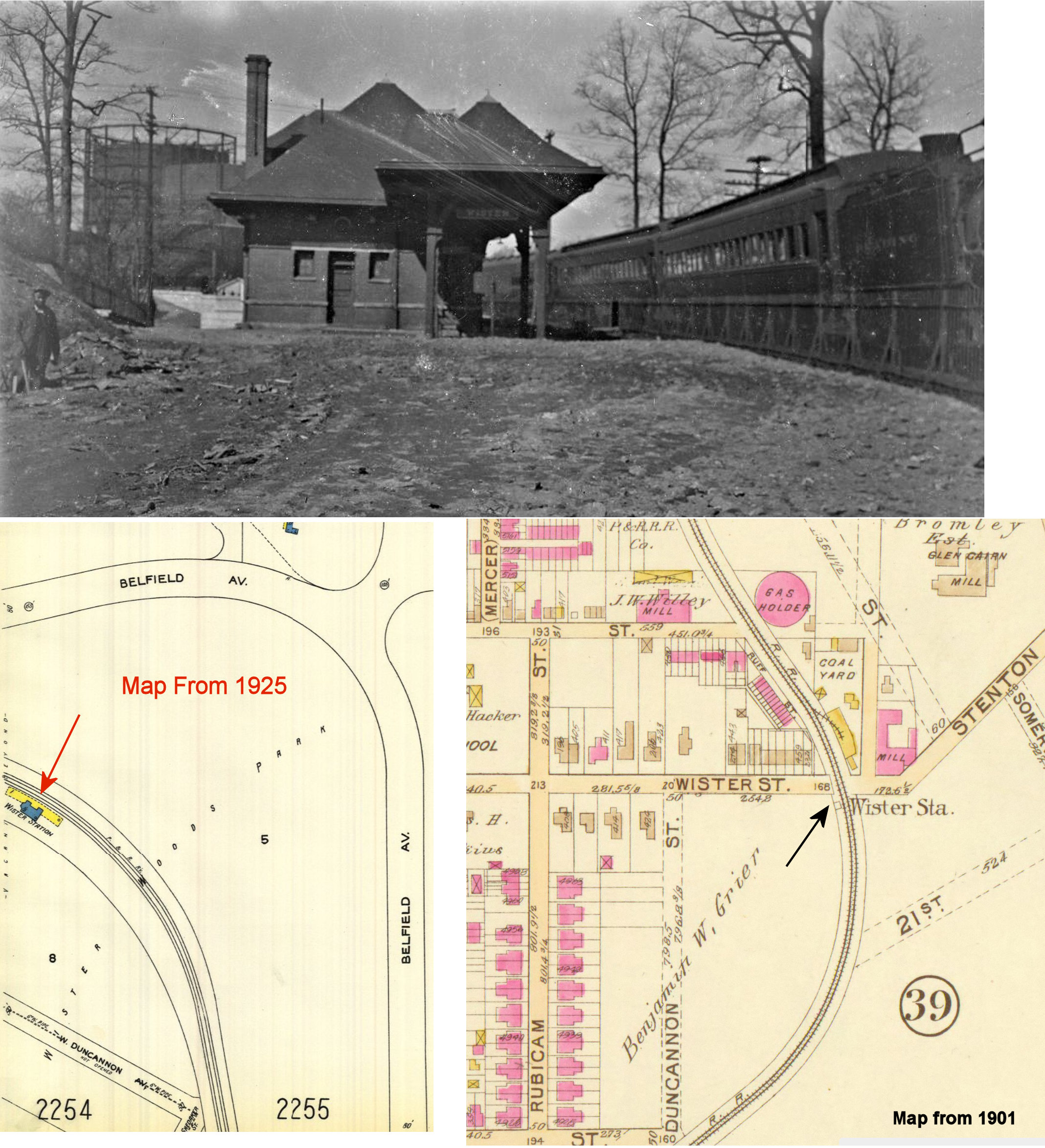
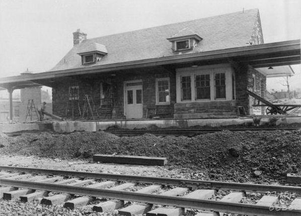
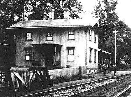