|
|
||||||||
| EXISTING STATIONS | ||||||||
|---|---|---|---|---|---|---|---|---|
| Station Name |
Original Railroad |
Current Location |
Type | Current Use |
Date Built |
Track Status |
Building Material |
More Info |
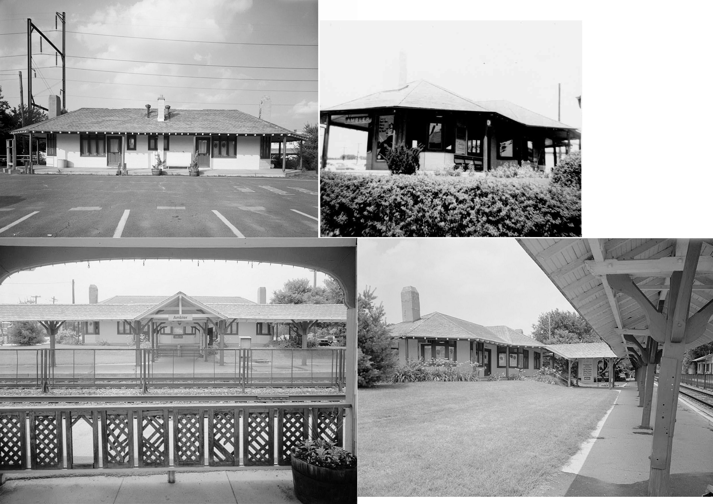
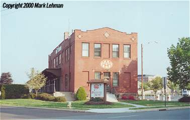
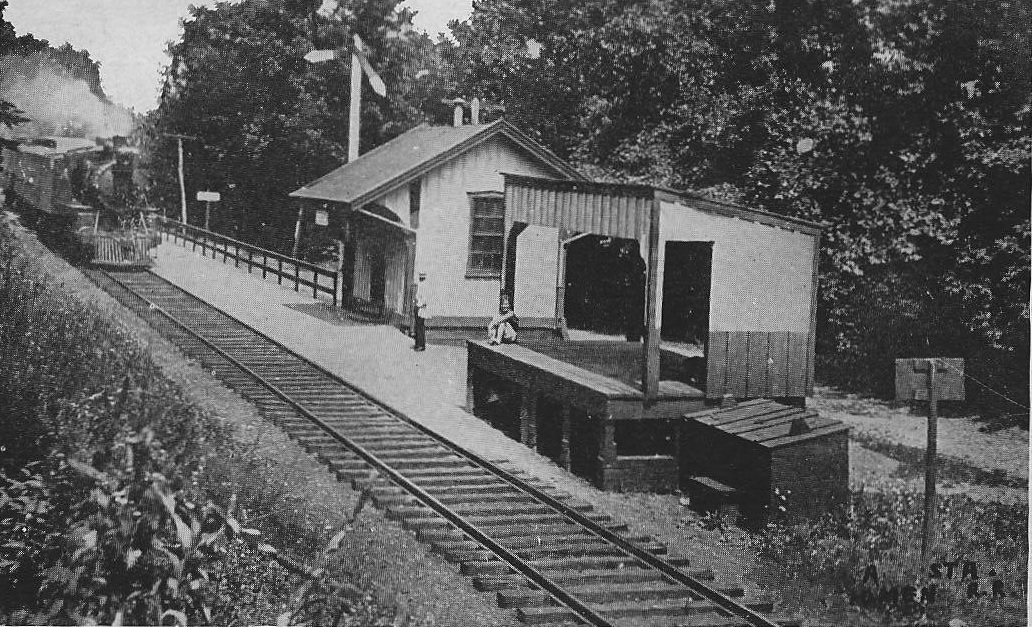
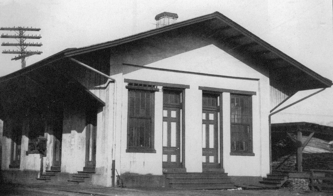
| Ambler |
 |
27 West Butler Pike (GPS: 40.153644,-75.225137) |
P | Business | ???? | In Use | Wood | |
| Ambler |
 |
South side of West Butler Pike on the SW side of the tracks on South Maple Street (GPS: 40.152814, -75.224468) |
P | Railroad | 2011 | In Use | Brick | |
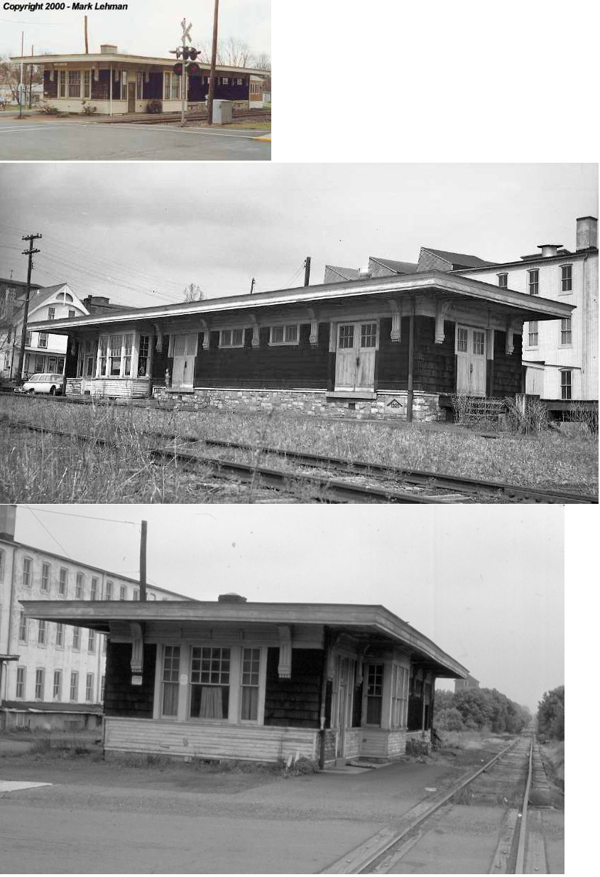
| Ambler |
 |
West Race Street (GPS: 40.15411,-75.22505) |
F | ???? | ???? | In Use | Wood | |
| Ardsley | |
2617 Jenkintown Road (40.113940, -75.153387) |
P | Business | ???? | In Use | Wood | |
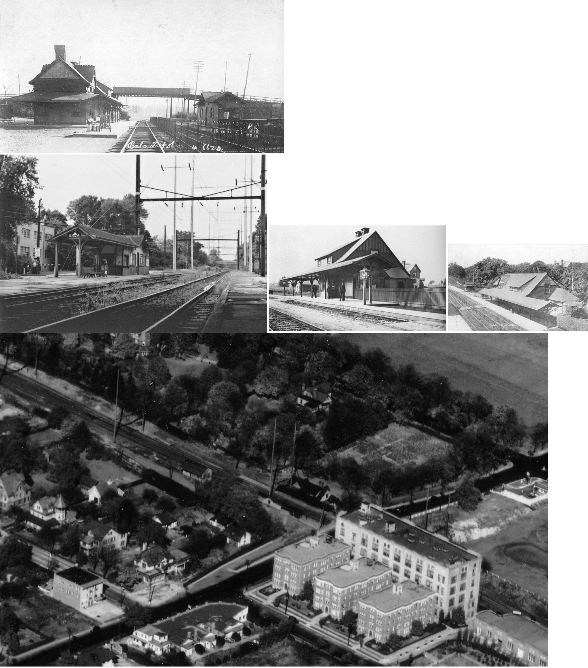
| Bala |
|
Route 1 near Conshohocken State Road (GPS: 40.001248, -75.227866) |
P | Railroad | ???? | In Use | Metal | |
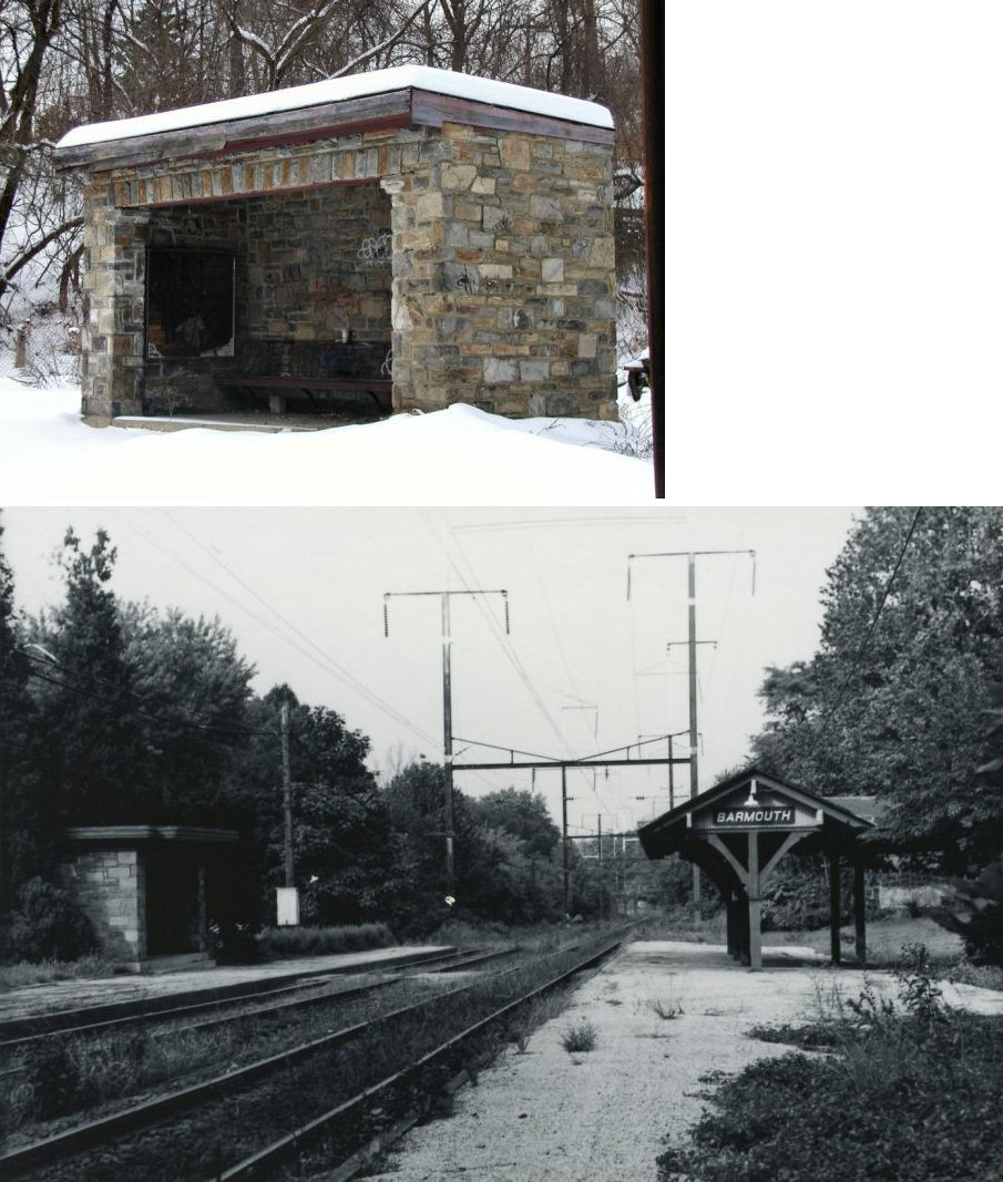
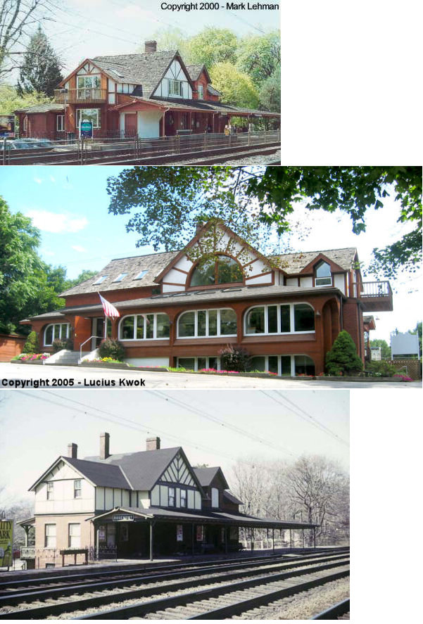
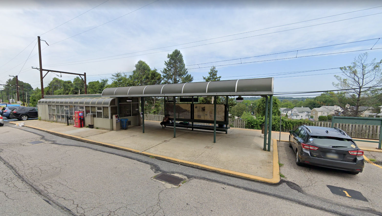
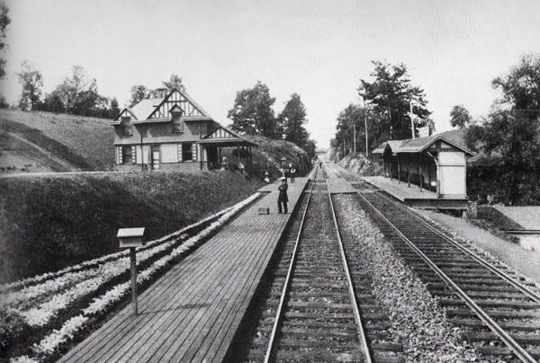
| Barmouth (West Laurel Hill Station) |
 |
Belmont Avenue at Levering
Mill Road, 1/8 mile north of Belmont Avenue (GPS: 40.016084, -75.227458) |
P | Vacant | ???? | Aband. | Stone | |
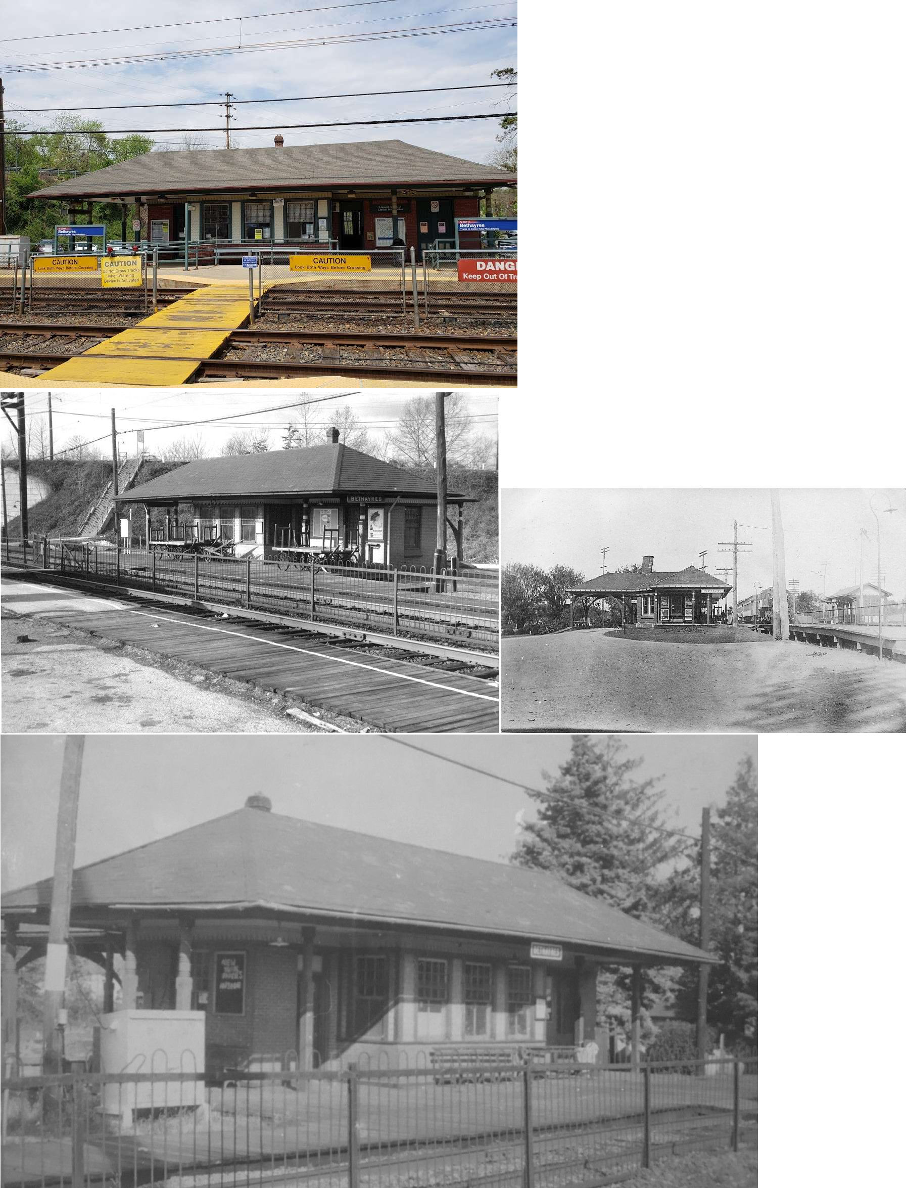
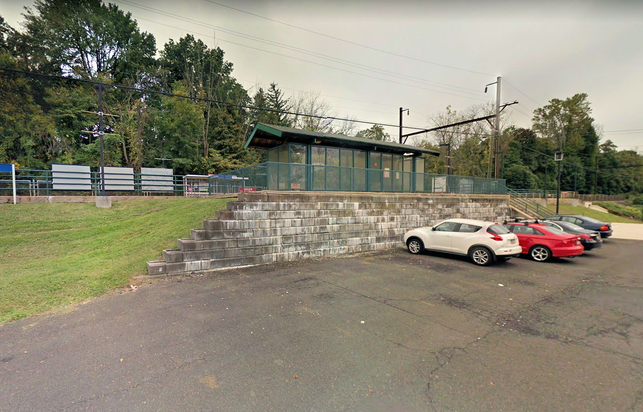
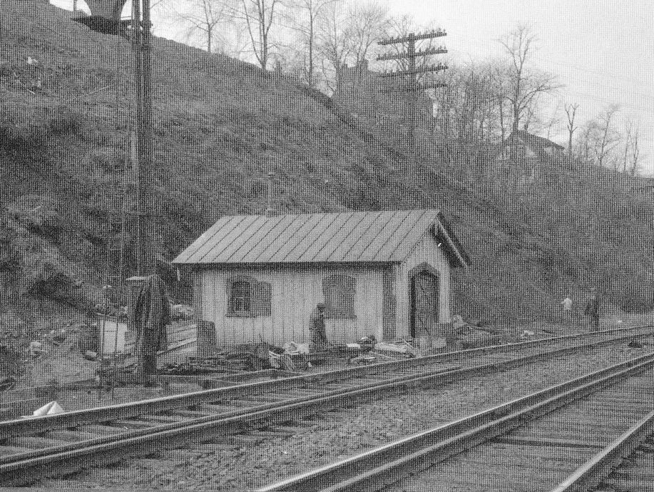
| Bethayres |
|
Huntington Pike & Station Road (GPS: 40.116582, -75.068770) |
P | Railroad | 1883 | In Use | Brick | |
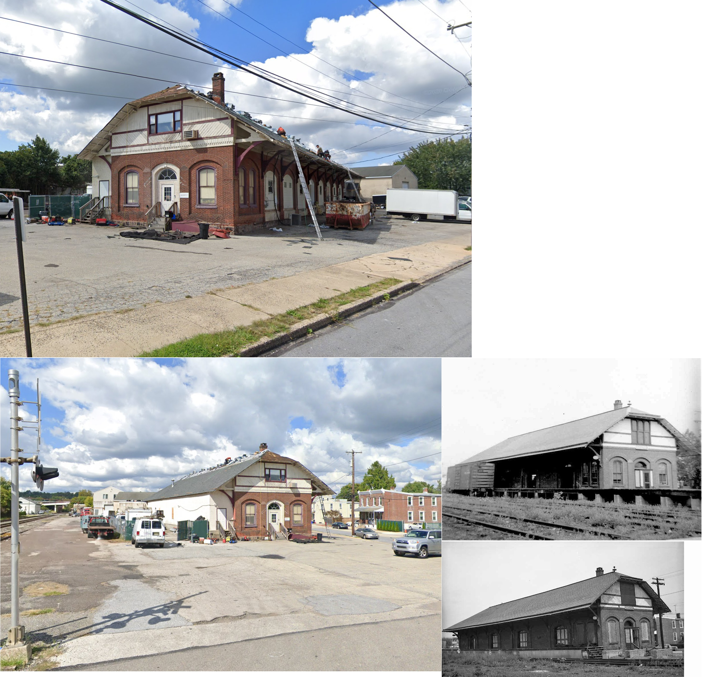
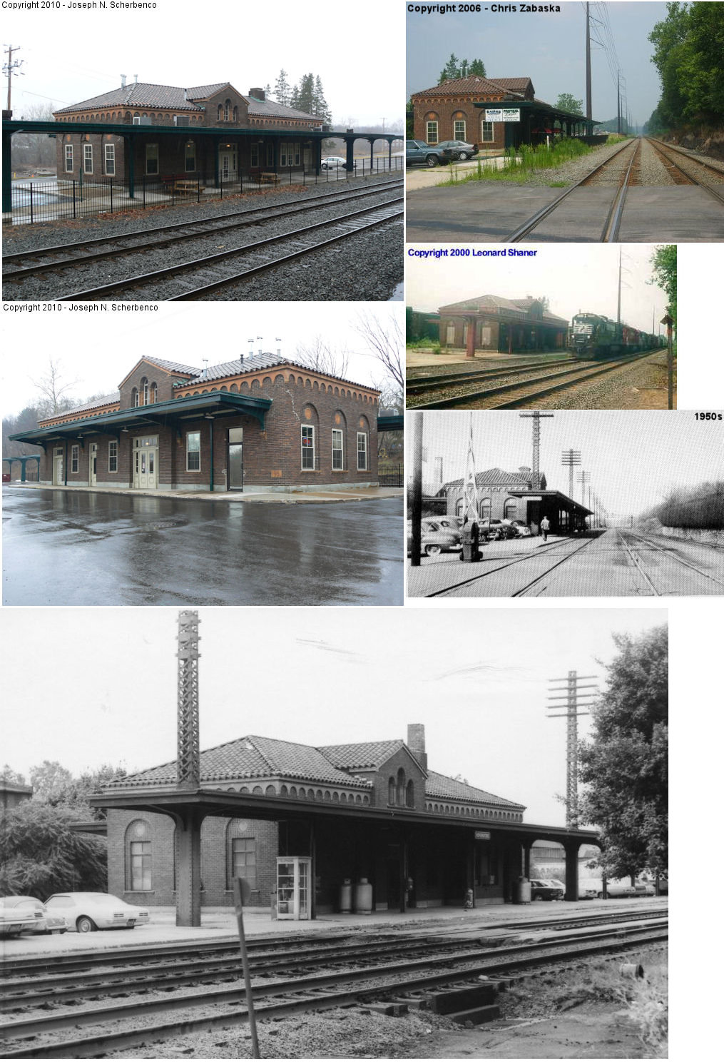
| Bridgeport | |
Corner of 2nd and Depot Streets (GPS: 40.106480, -75.342140) |
F | Vacant | ???? | In Use | W/B | |
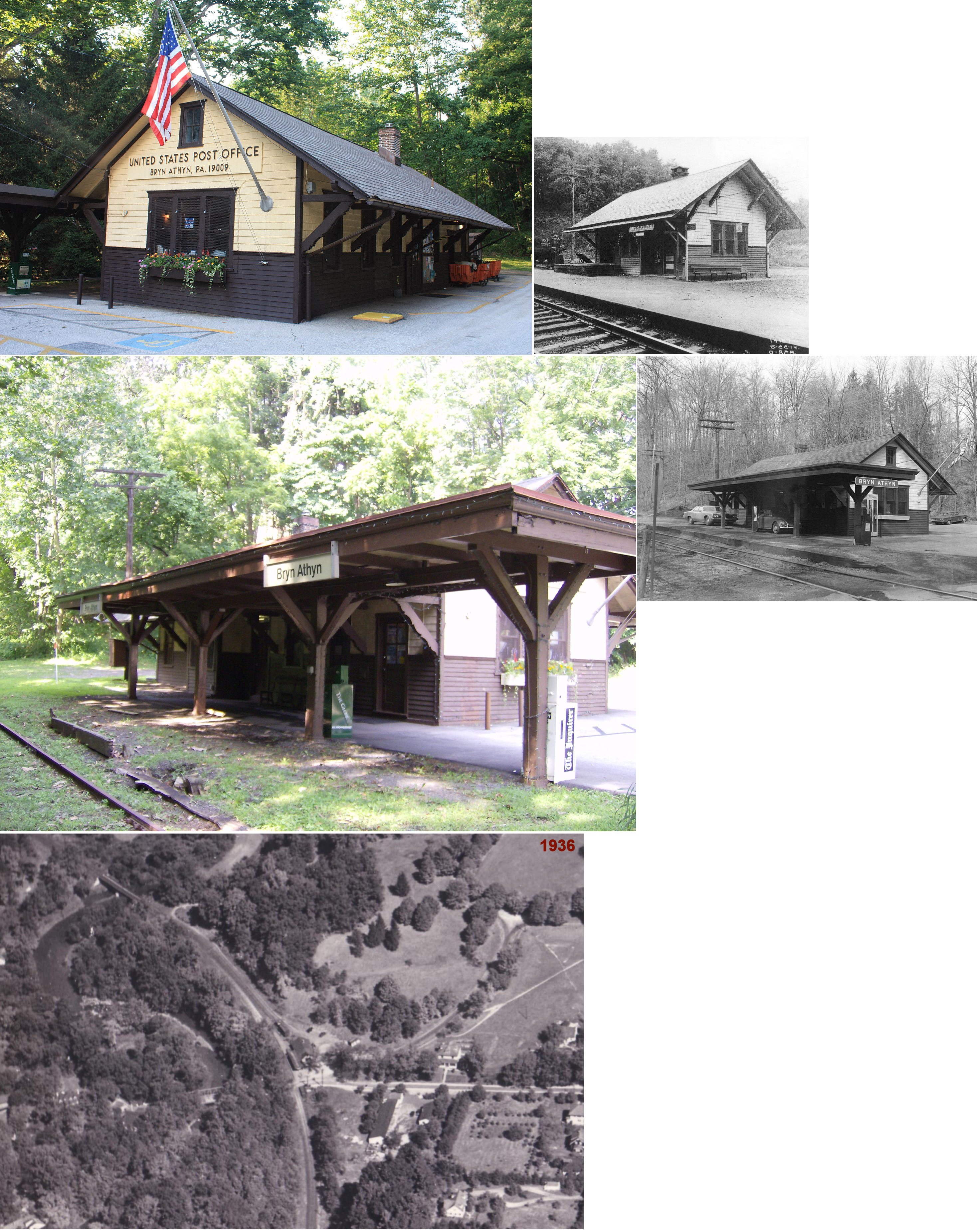
| Bryn Athyn | |
999 Fetters Mill Road (GPS: 40.130226, -75.070805) |
C | Post office | 1902 | Aband. | Wood |
|
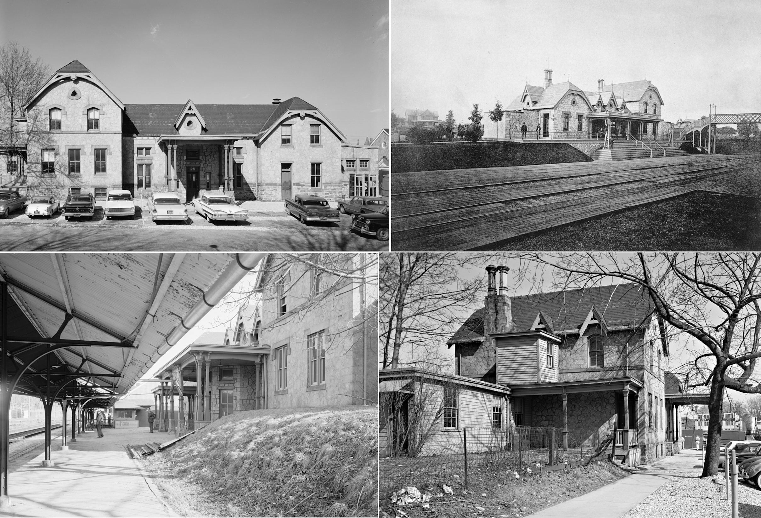
| Bryn Mawr | |
54 North Bryn Mawr Avenue (GPS: 40.021707, -75.315770) |
C | Railroad | 1963 | In Use | Brick |
|
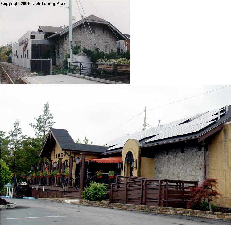
| Bryn Mawr | |
39 Morris Avenue (GPS: 40.021533, -75.315369) |
F | Restaurant | 1870 | In Use | Stone |
|
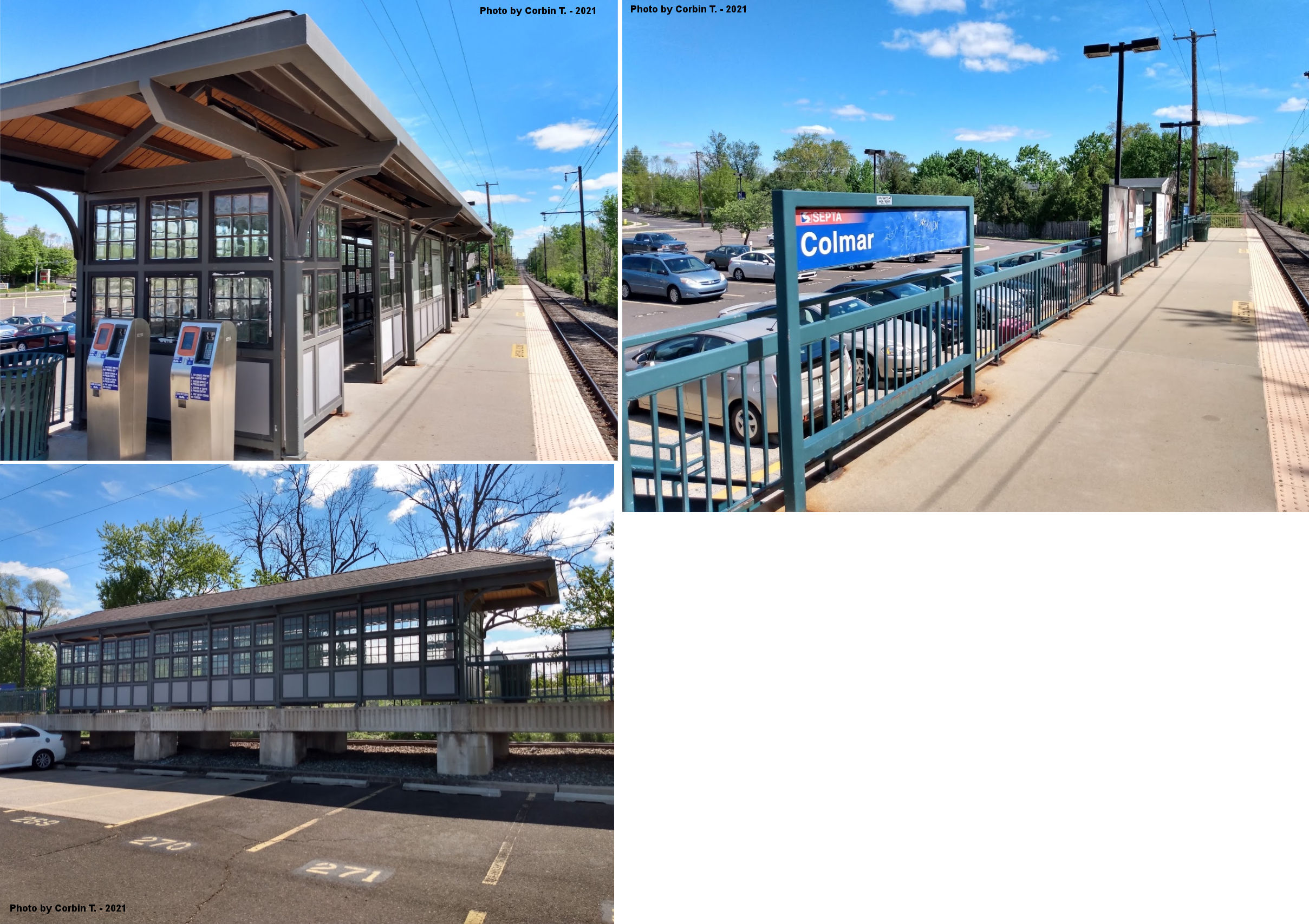
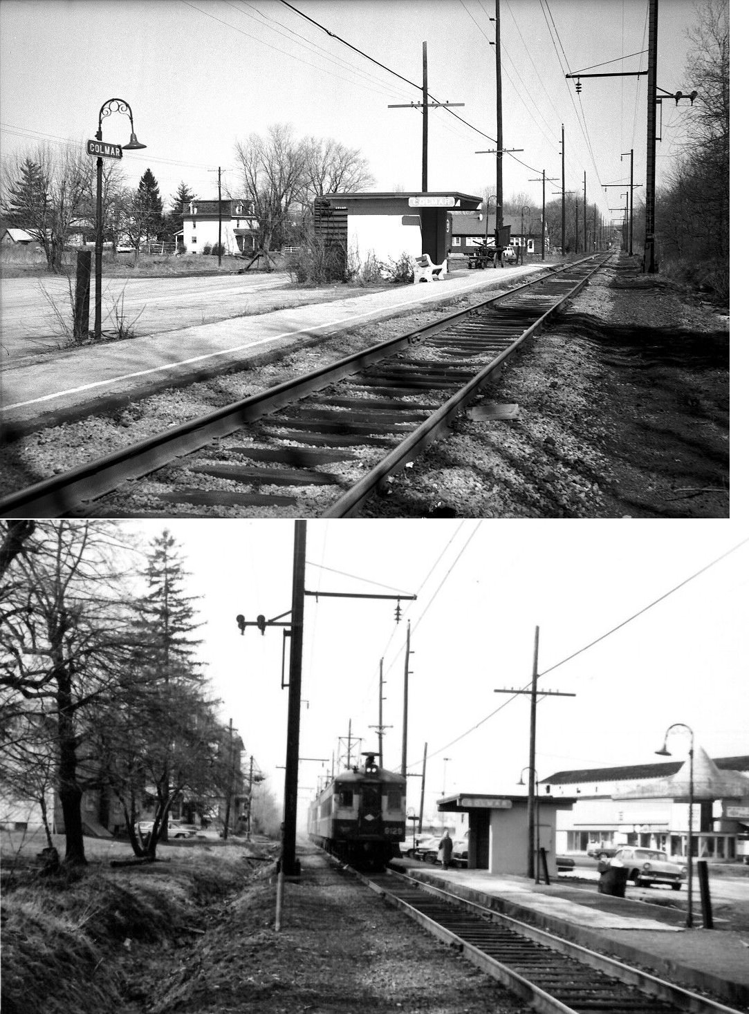
| Colmar |
|
East Walnut Street at Bethlehem Pike (GPS: 40.268525, -75.254156) |
P | Railroad | ???? | In Use | Wood | |
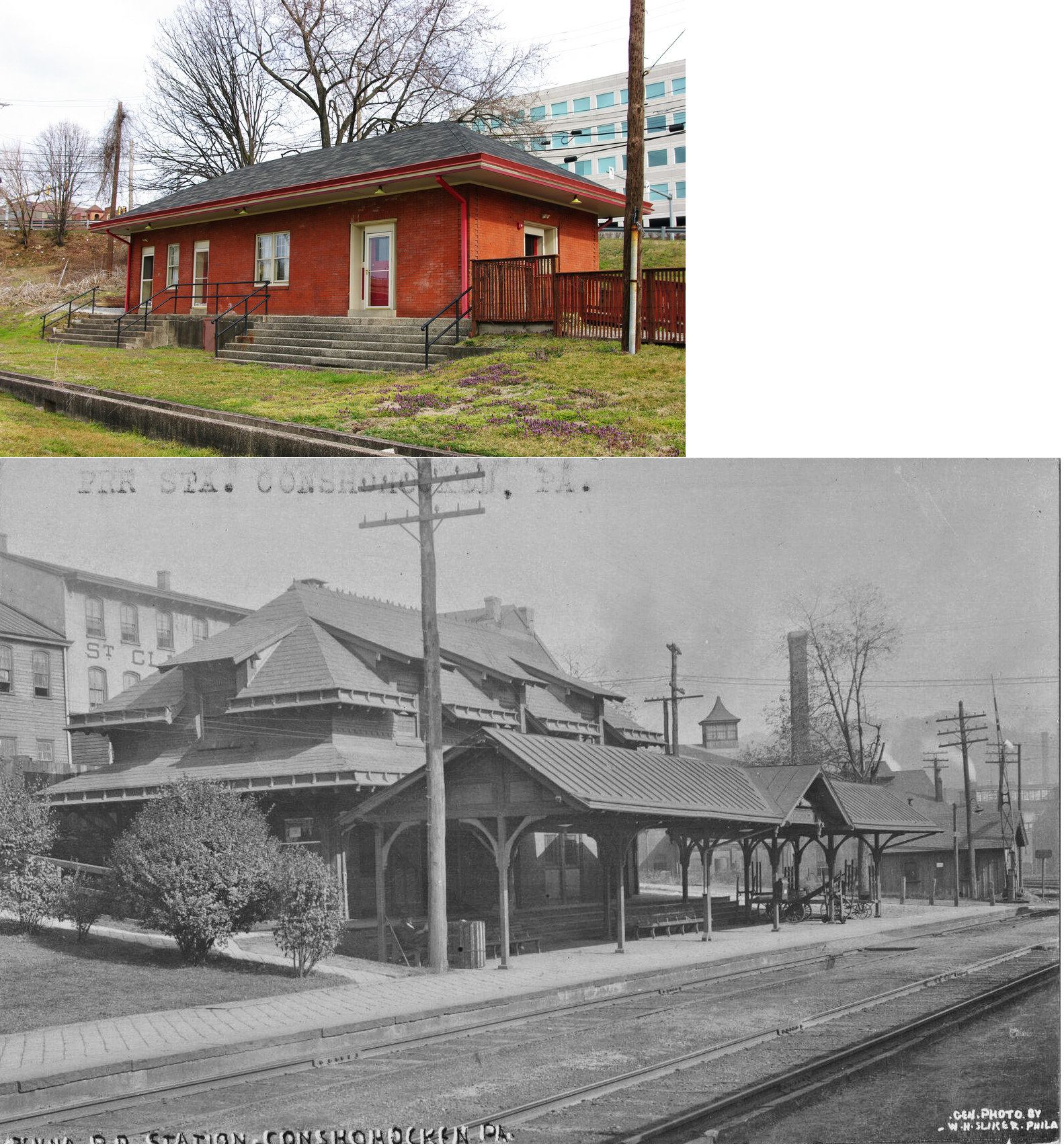
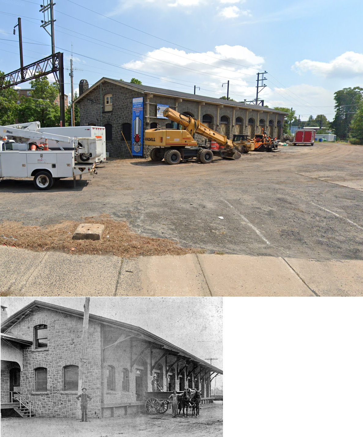
| Conshohocken | |
2 Harry Street (GPS: 40.072208, -75.306956) |
P | Business | 1884 | Gone | Brick |
|
| Conshohocken |
|
10 Washington Street near Stoddard Avenue (GPS: 40.072080, -75.308776) |
P | Railroad | ???? | In Use | Stucco |
|
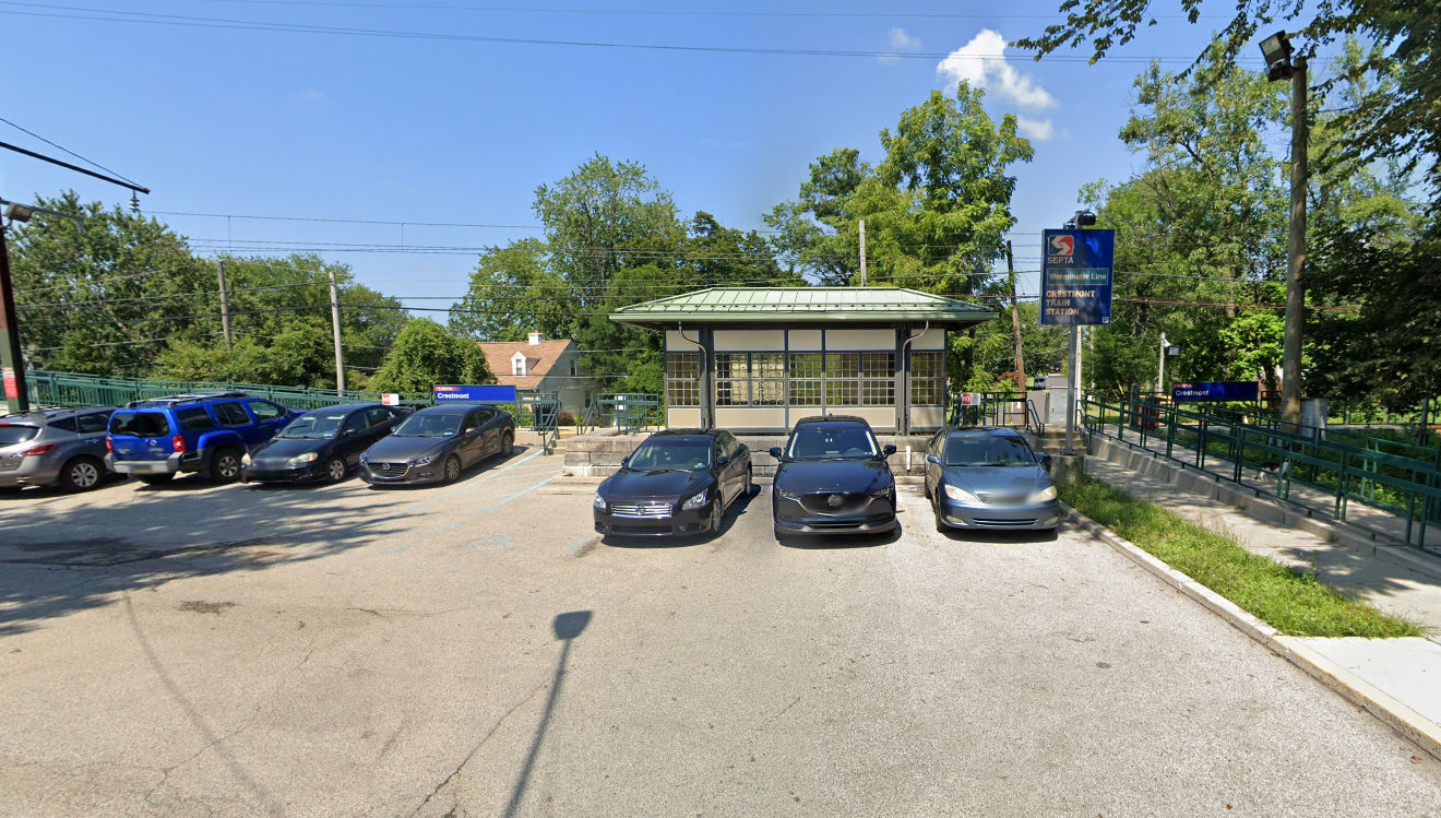
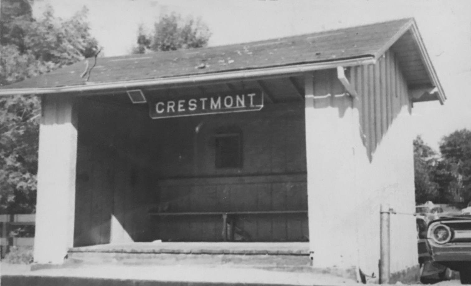
| Crestmont |
|
2198 Rubicam Avenue between Washington Avenue and Rockwell Road (GPS: 40.133263, -75.118595) |
P | Railroad | ???? | In Use | Cement | |
| Cynwyd | |
U.S. 23 & Montgomery Avenue (GPS: 40.006727, -75.232063) |
P | Railroad | 1890 | In Use | B/W | |
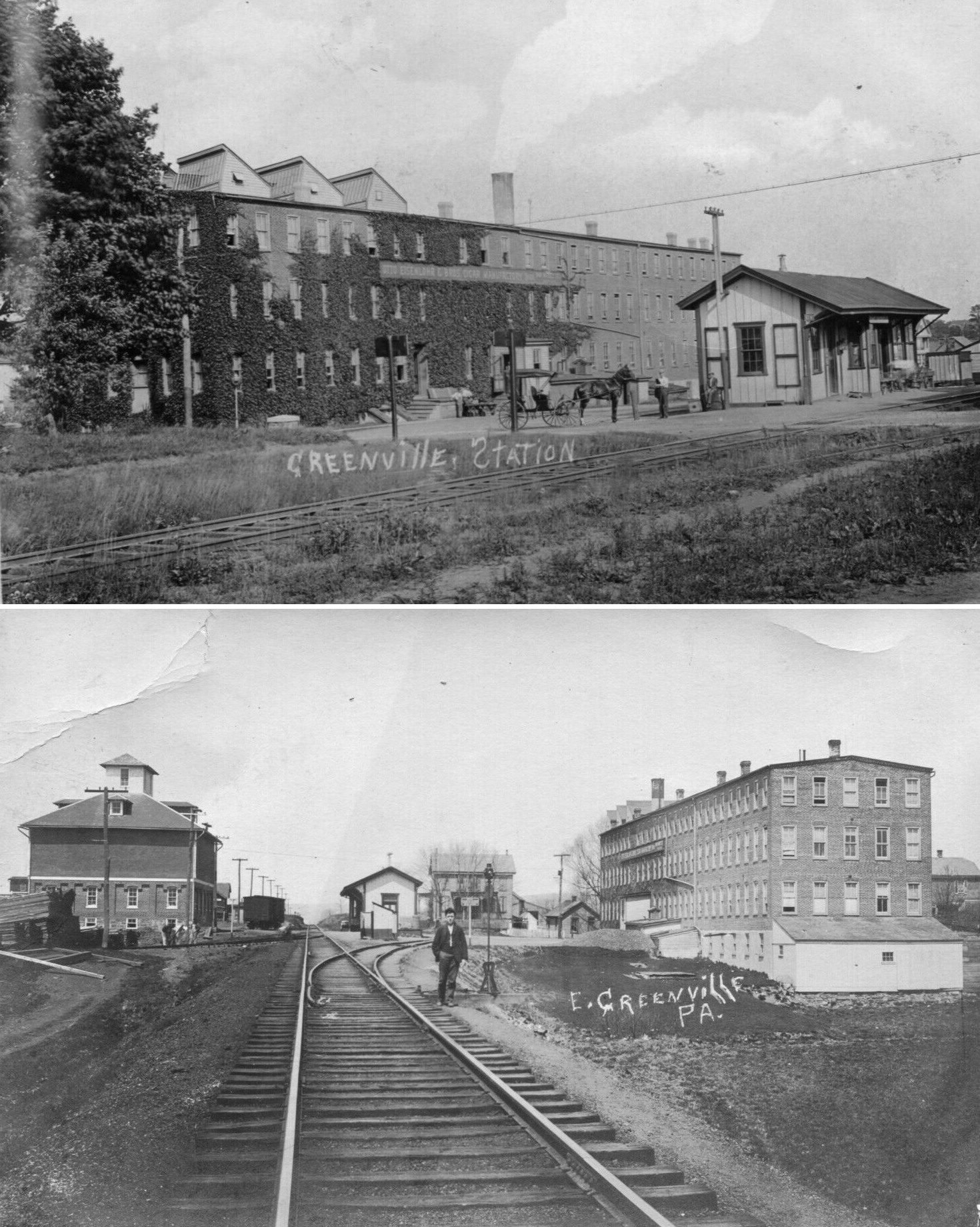
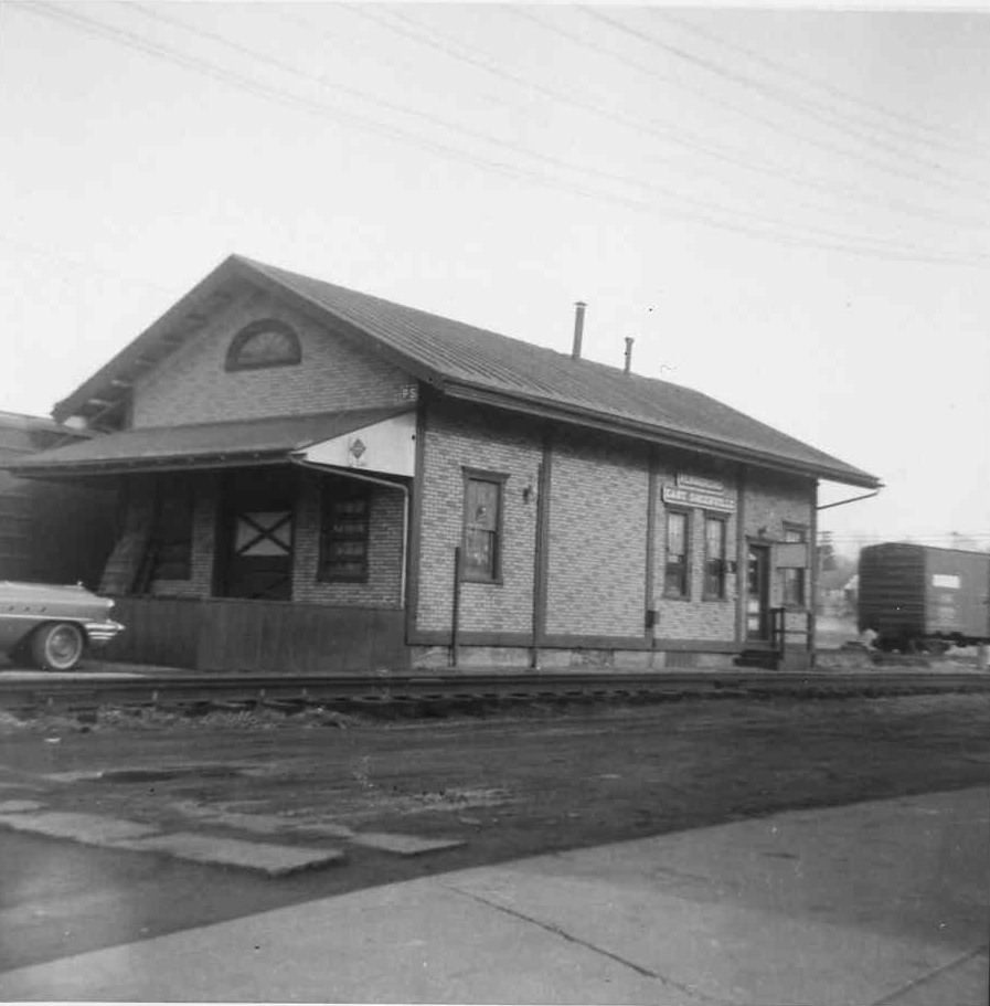
| East Greenville | |
406 4th Street (GPS: 40.404989, -75.507107) |
P | Private | 1920 | In Use | Wood | |
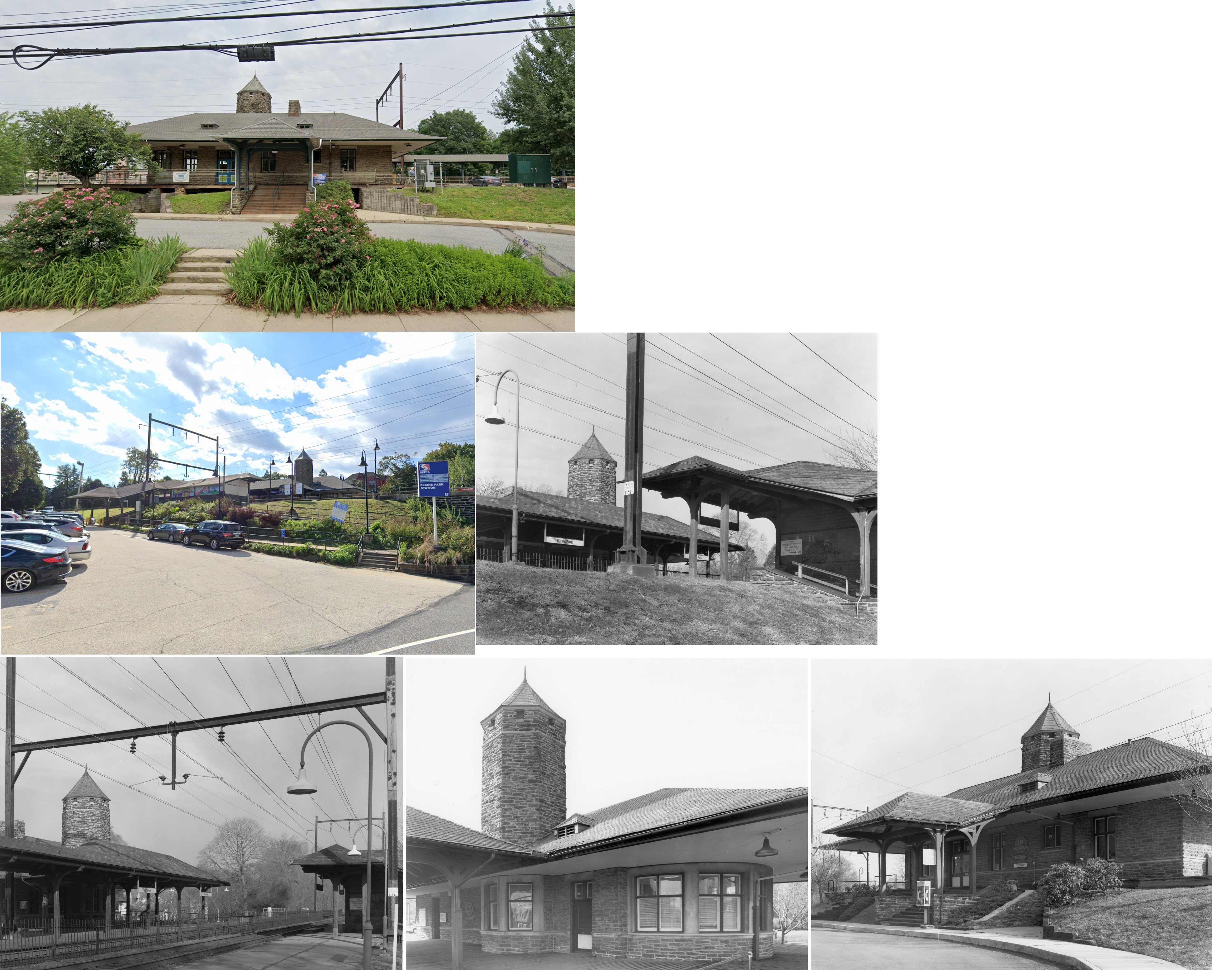
| Elkins
Park (Ashbourne) |
|
7876 Spring Avenue (GPS: 40.071217, -75.127878) |
P | Railroad | 1898 | In Use | Stone | |
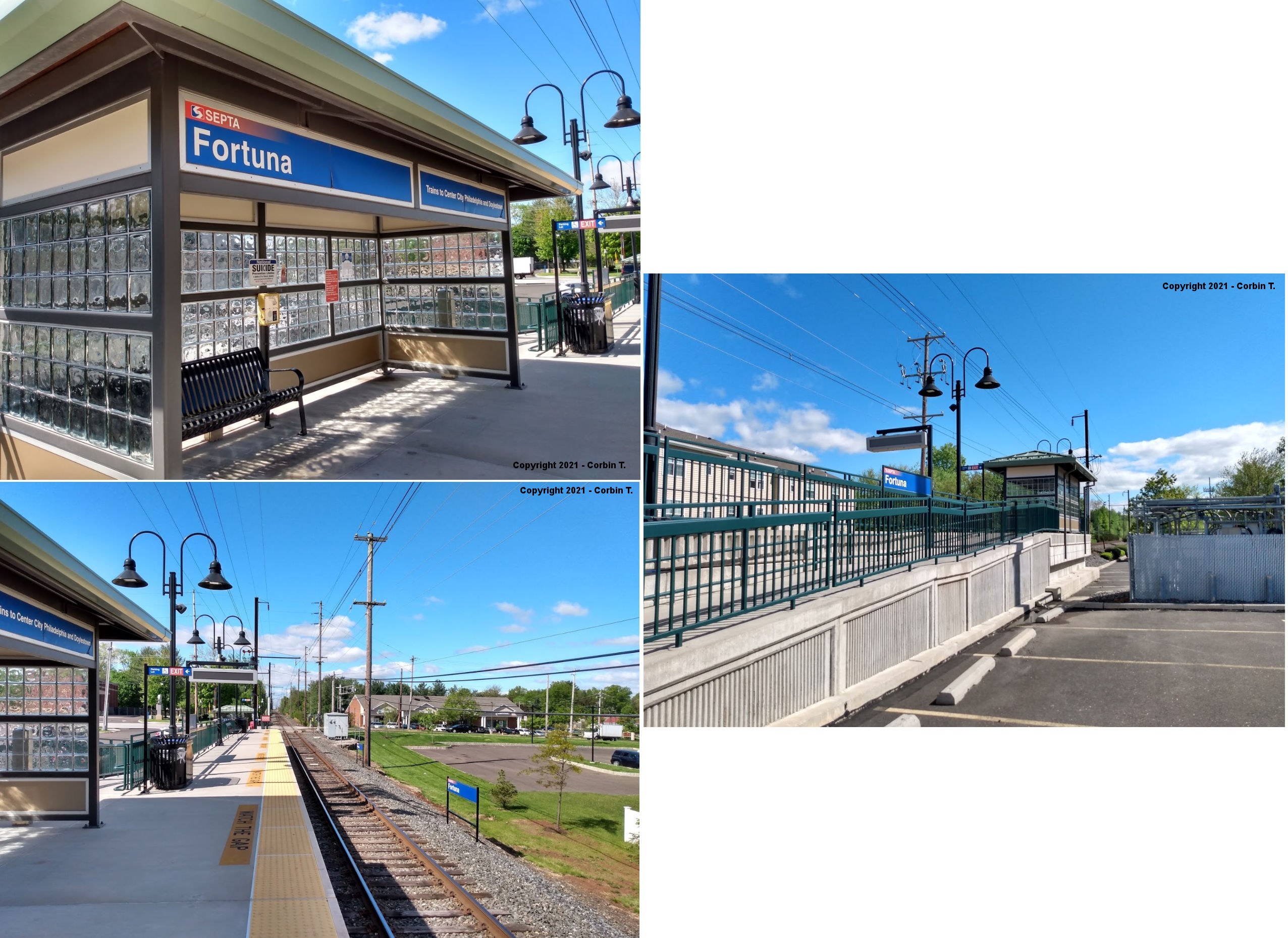
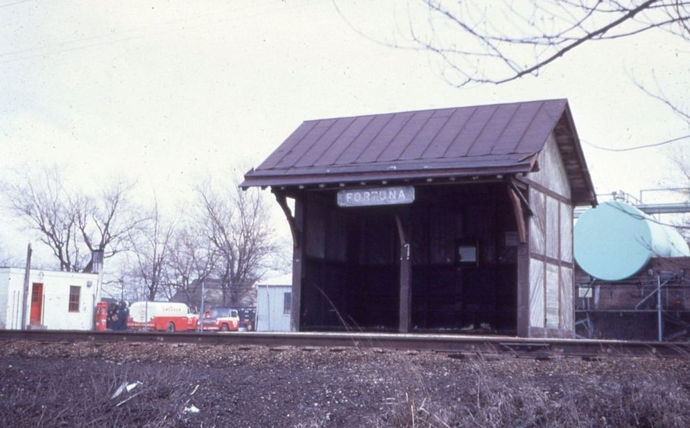
| Fortuna |
|
NE side of Cowpath Road (GPS: 40.259798, -75.265810) |
P | Railroad | ???? | In Use | Metal | |
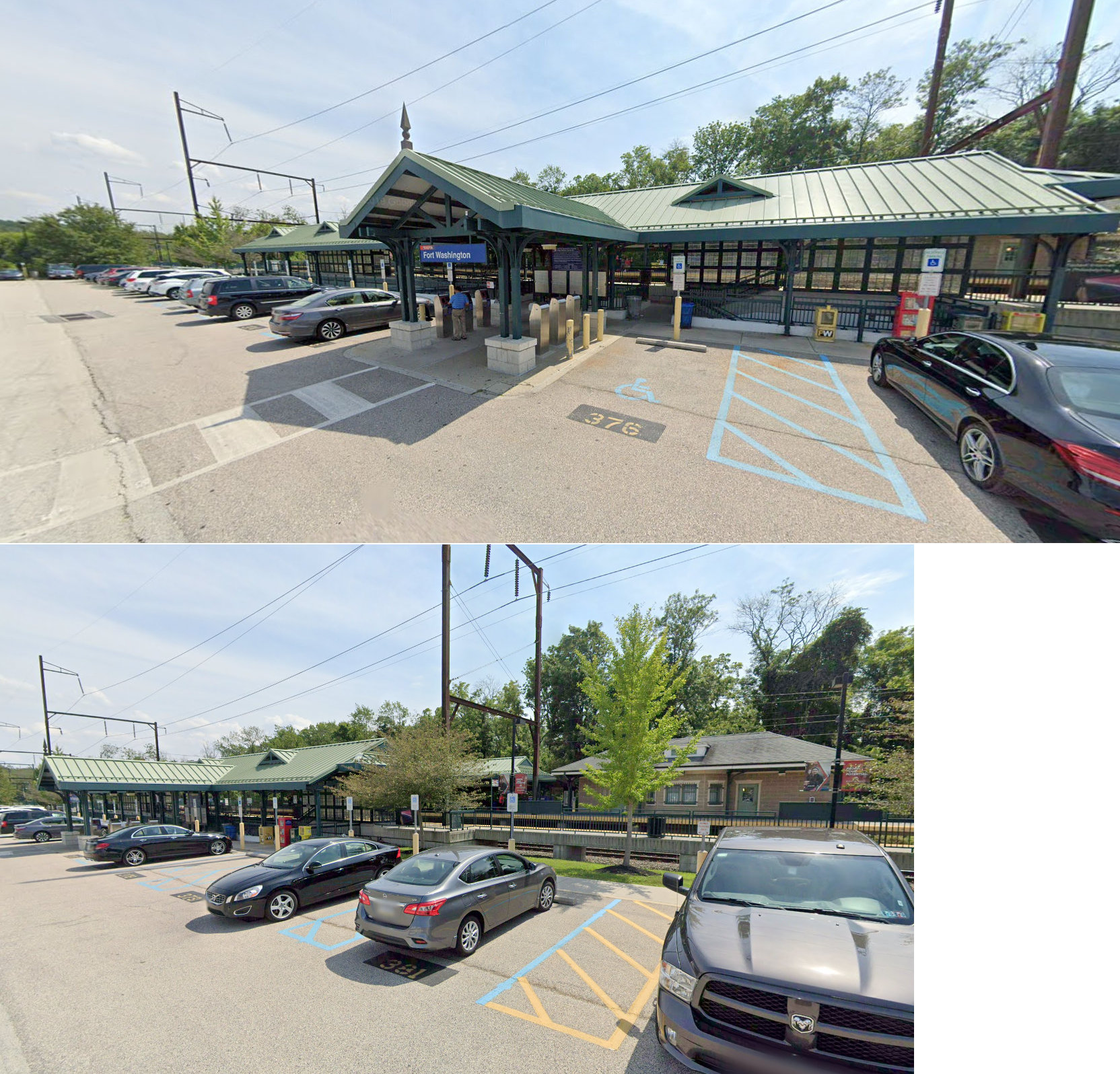
| Fort Washington | |
Bethlehem Pike & Station Avenue (GPS: 40.135774, -75.212530) |
P | Railroad | 1903 | In Use | Stone | |
| Fort Washington |
|
Station Avenue (GPS: 40.135338, -75.211406) |
P | Railroad | ???? | In Use | Concrete/ Metal |
|
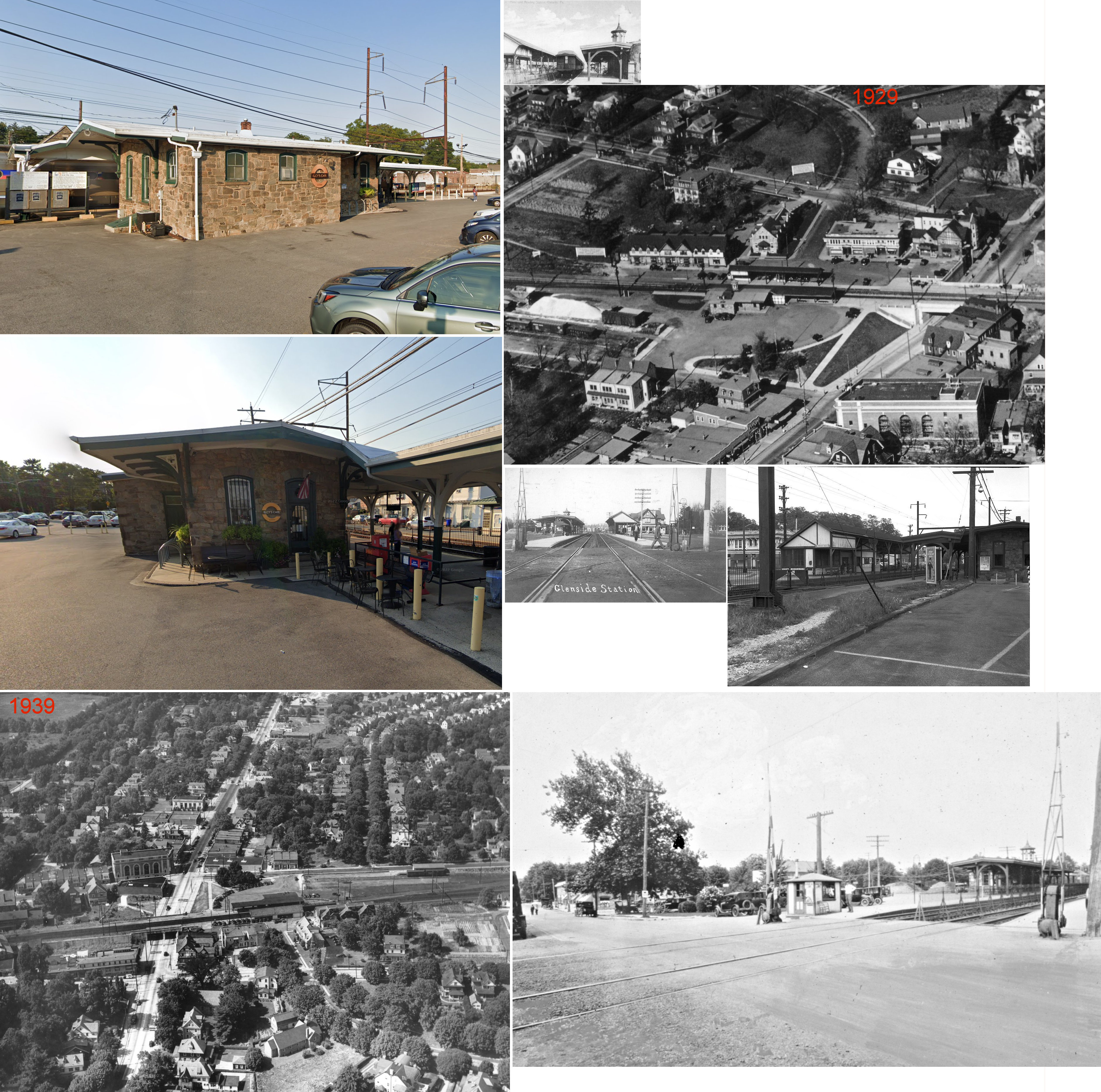
| Glenside (Abington) |
|
Easton Road & Glenside Avenue (GPS: 40.101282, -75.153781) |
P | Railroad | 1873 | In Use | Stone |
|
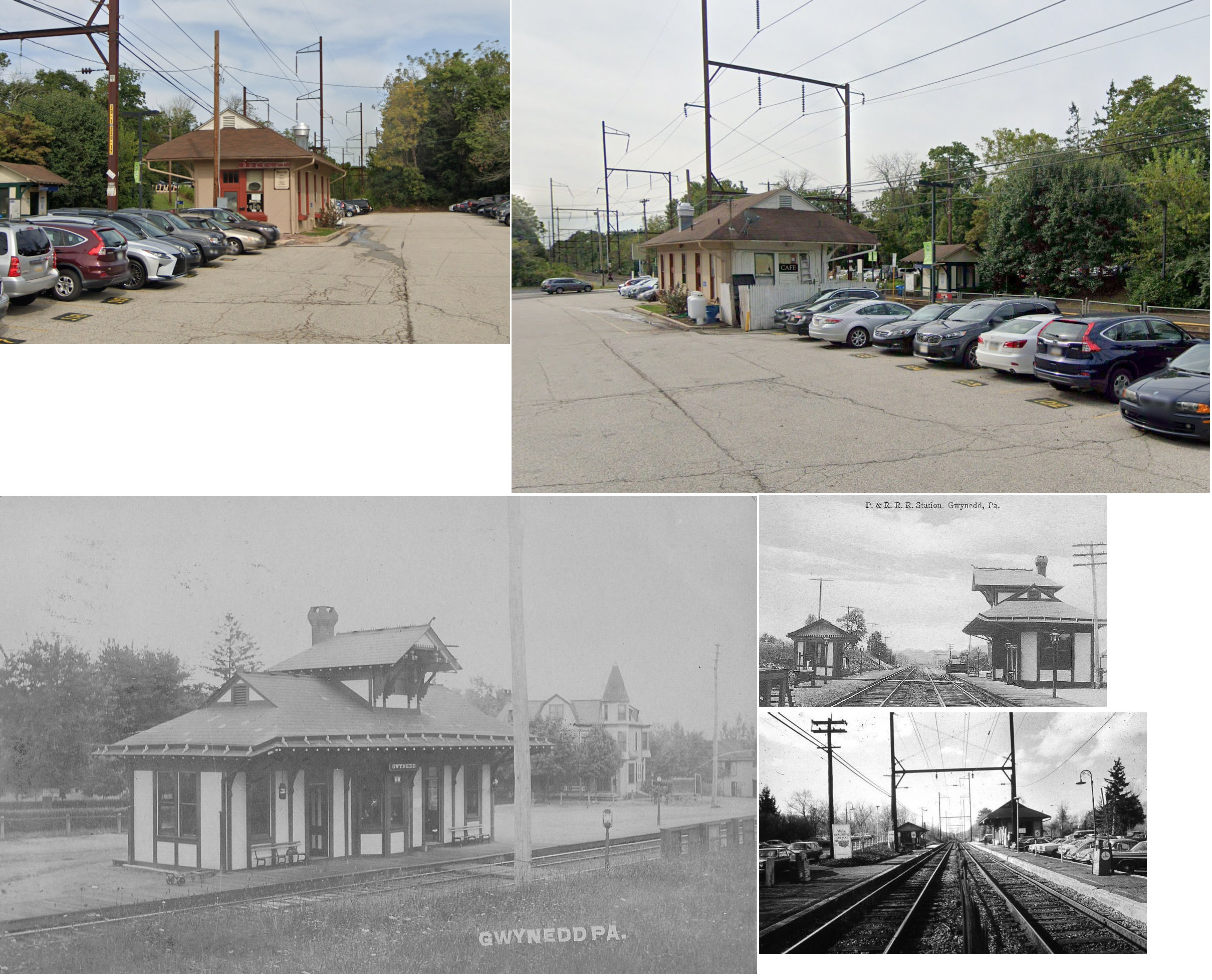
| Gwynedd
Valley (Hoyt) |
|
521 Plymouth Road (GPS: 40.184874, -75.256843) |
P | RR/Business | 1888 | In Use | Wood | |
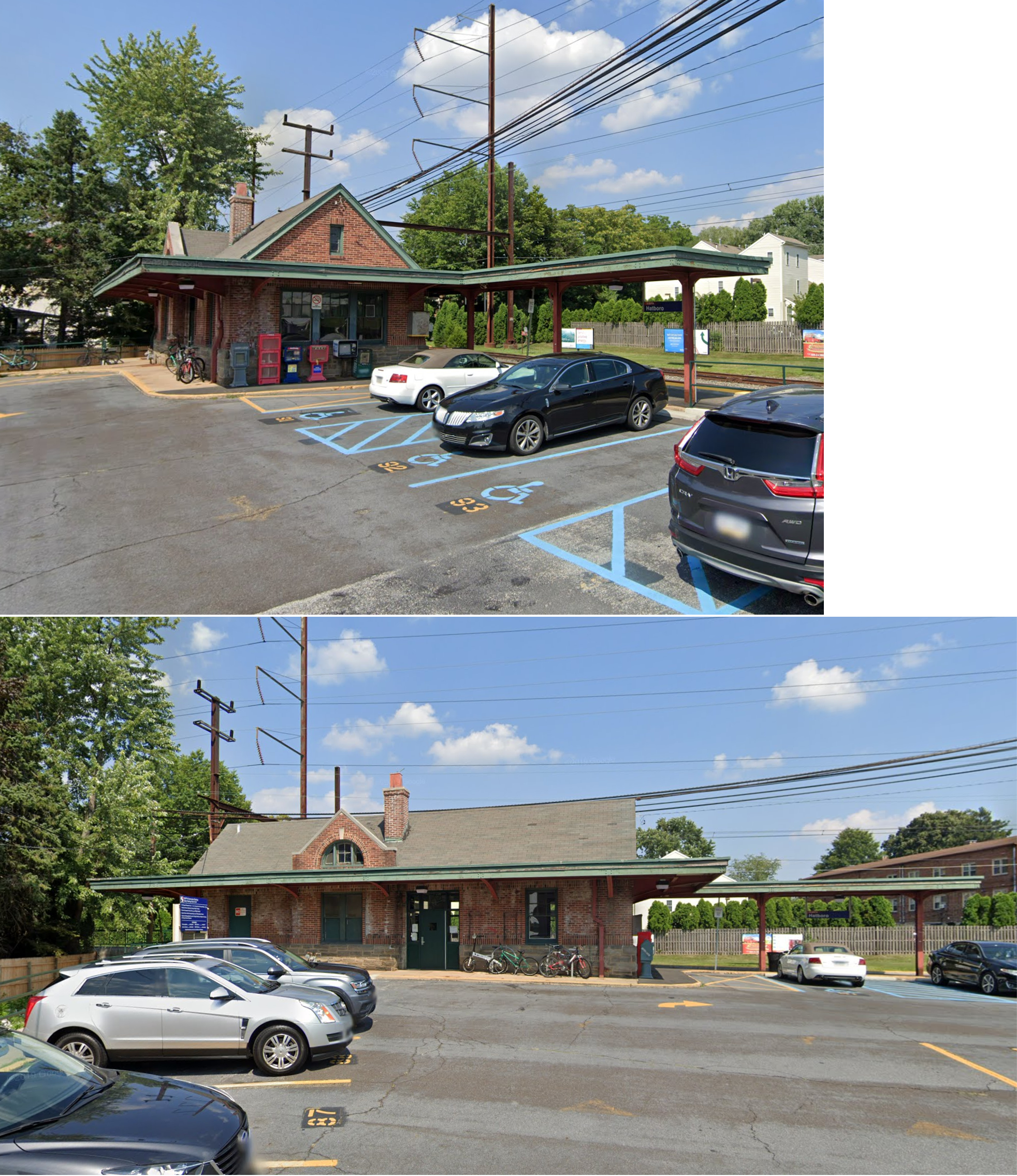
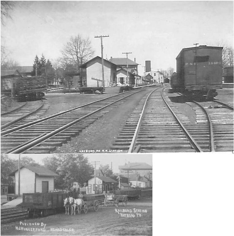
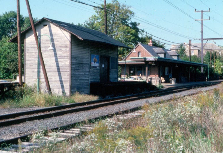
| Hatboro | |
South Penn Street (GPS: 40.175642, -75.102960) |
P | Railroad | 1935 | In Use | Brick | |
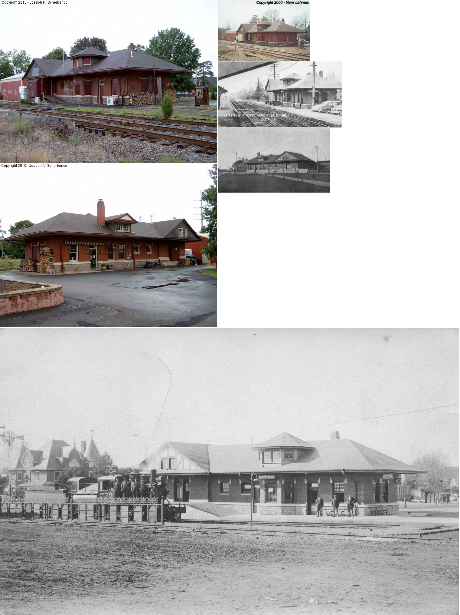
| Hatfield | |
56 East Broad Street (GPS: 40.281920, -75.296484) |
C | Business | 1913 | In Use | Brick | |
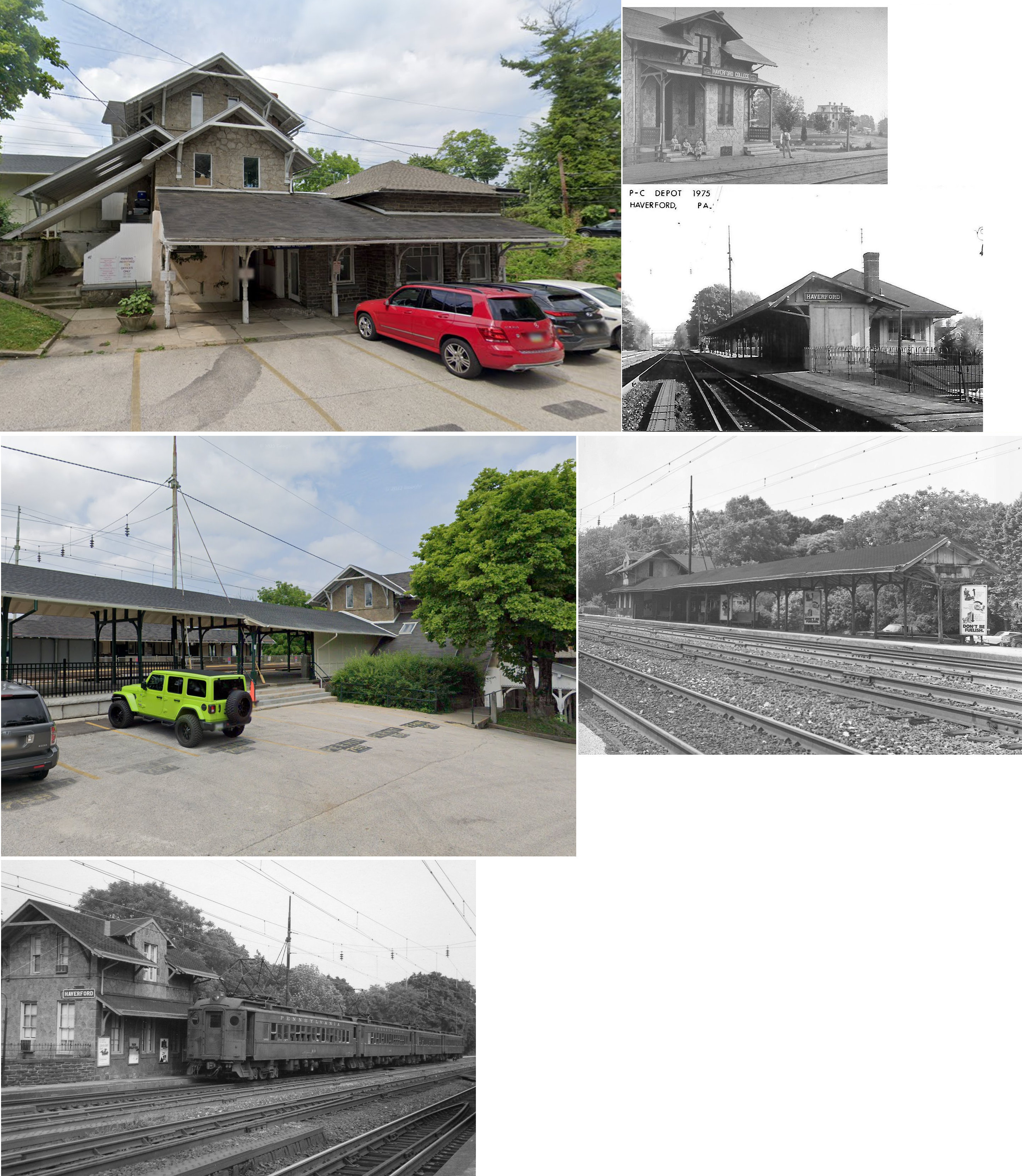
| Haverford | |
50 Haverford Station Road (GPS: 40.014284, -75.300133) |
P | Railroad/ Business |
1870 | In Use | Stone | |
| Haverford | |
43 Haverford Station Road (GPS: 40.013994, -75.300304) |
P | Railroad | 1916 | In Use | Brick |
|
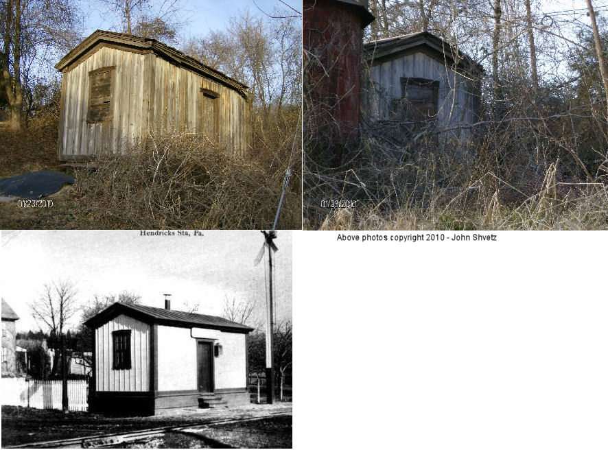
| Hendricks |
 |
1/4 mile north of its former location on the corner of Hendricks Station Road and Hendricks Road (GPS: 40.306691, -75.461855). |
P | Private | ???? | None | Wood | |
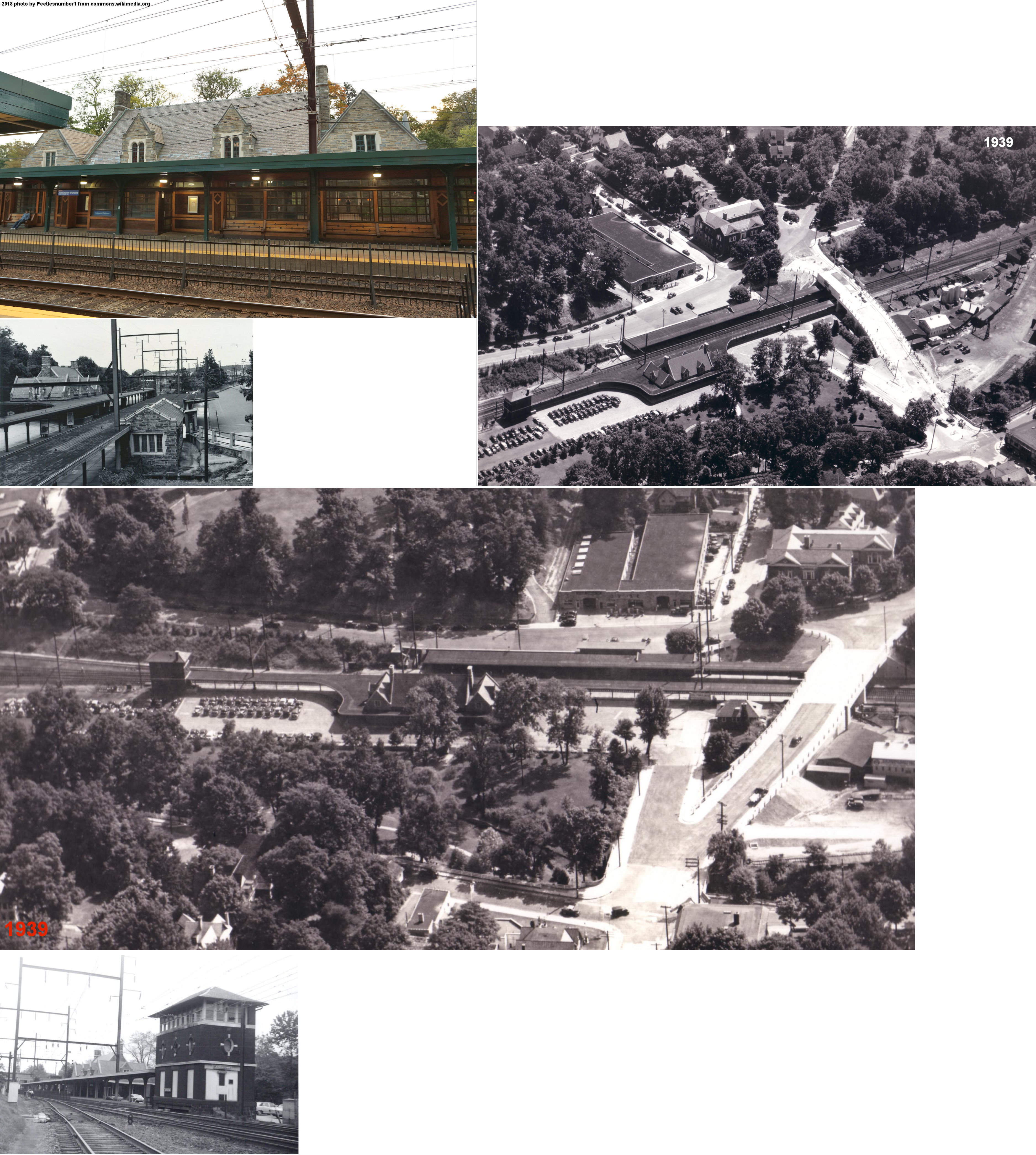
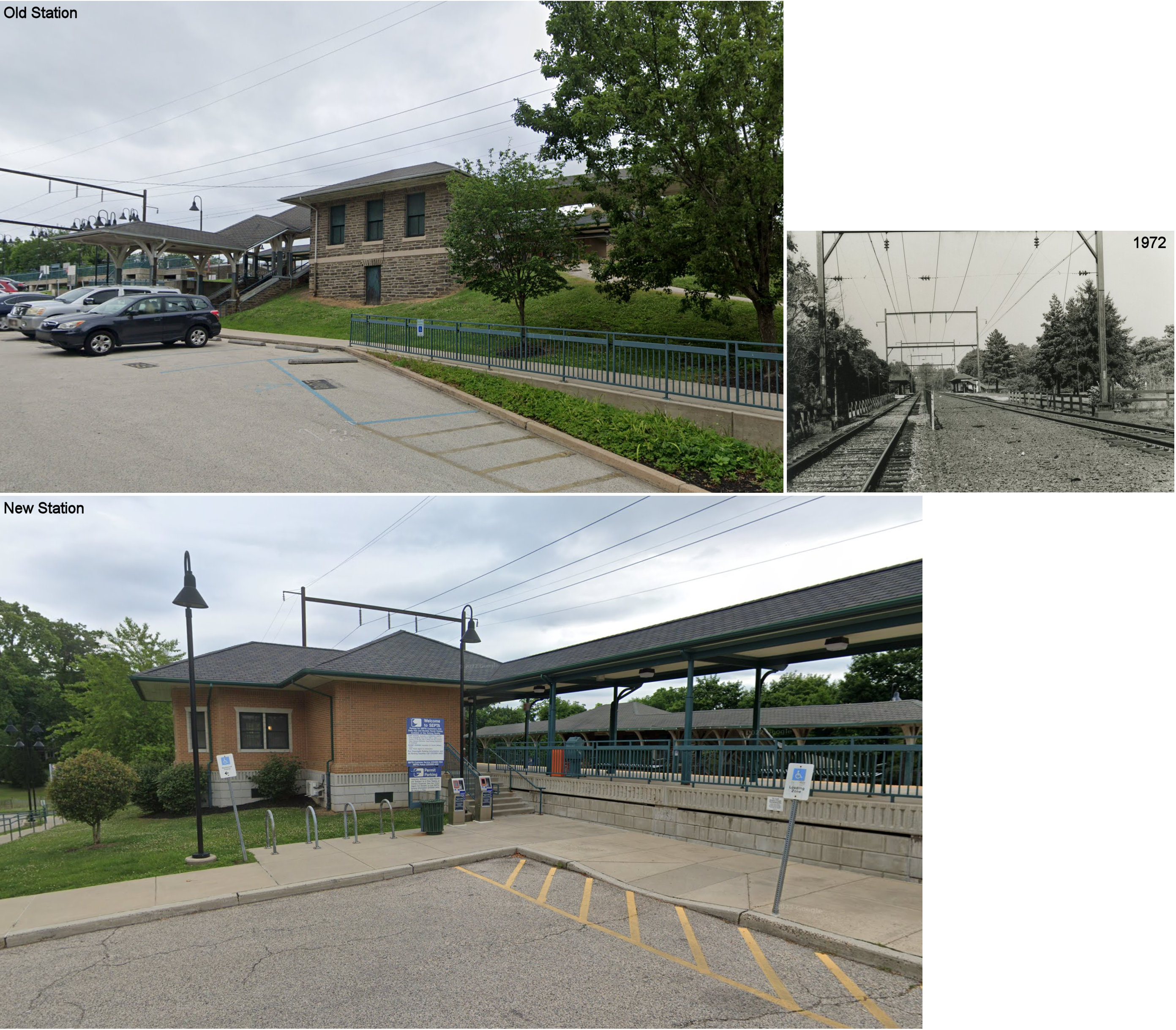
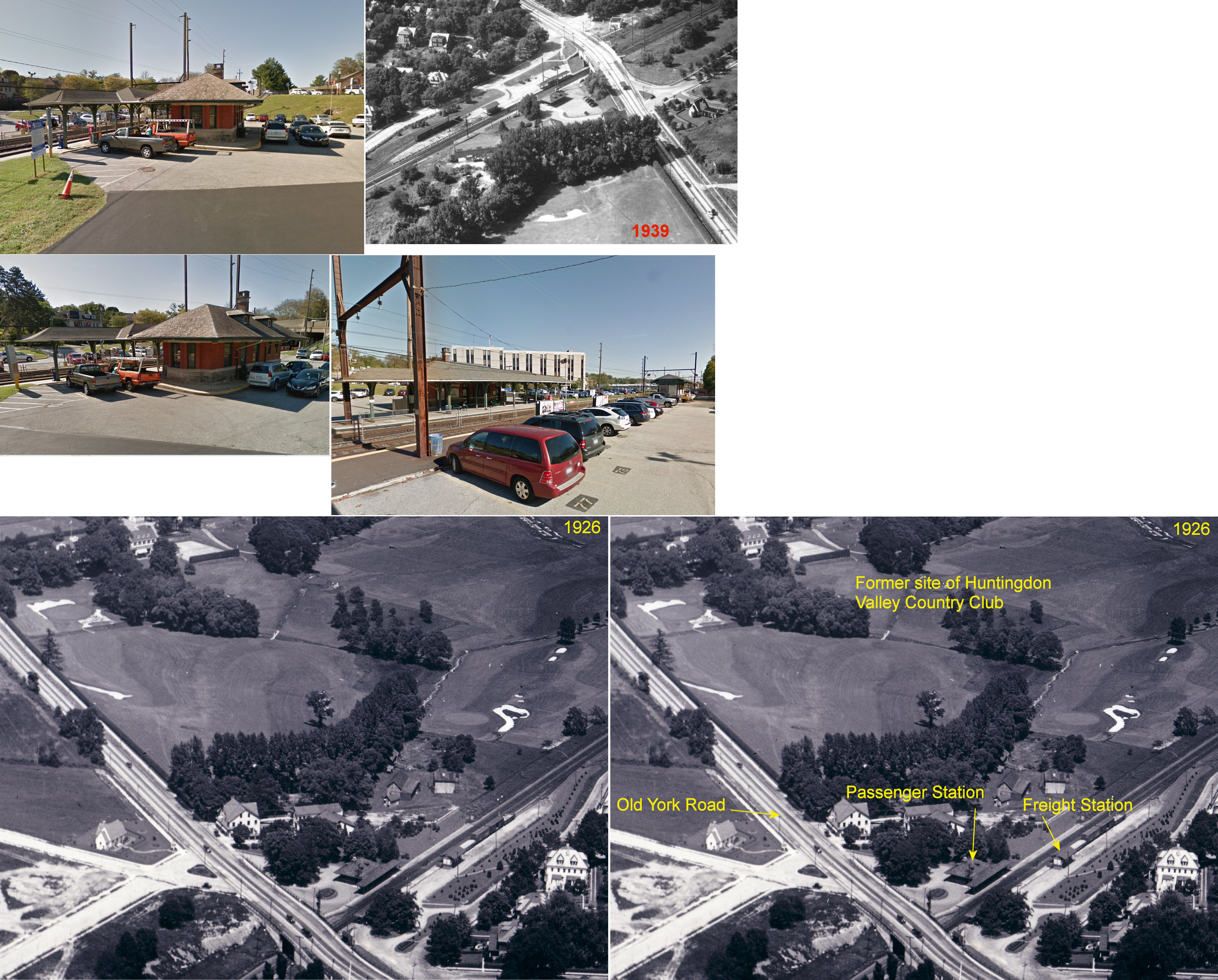
| Jenkintown | |
2 Greenwood Avenue (GPS: 40.093156, -75.137971) |
P | Railroad/ Business |
1932 | In Use | Stone |
|
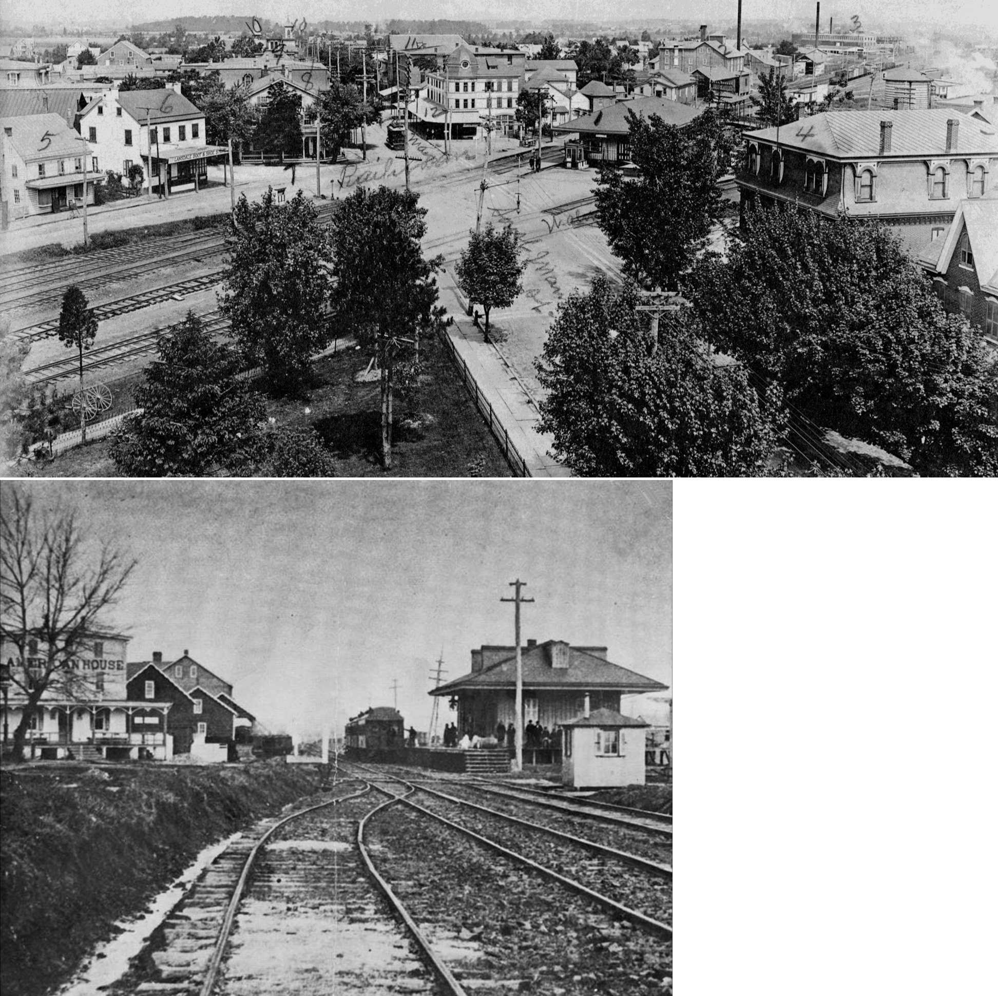
| Lansdale | |
South Main Street at Walnut Street (GPS: 40.243078, -75.285184) |
P | Railroad | 1902 | In Use | Brick | |
| Lansdale | |
At the intersection of South Broad Street, Vine Street, and Railroad
Avenue (GPS: 40.239925, -75.284733) |
F | Vacant | 1902 | In Use | Stone | |
| Lansdale | |
141 West 9th Street (GPS: 40.250149, -75.279198) |
P | Railroad | 2015 | In Use | Brick | |
| Lawndale | |
105 Devereaux Avenue (GPS: 40.051373, -75.103405) |
P | Railroad | ???? | In Use | Cement | |
| Link Belt (Colmar) |
|
East Walnut Street SE of County Line Road (GPS: 40.273906, -75.246808) |
P | Railroad | ???? | In Use | Concrete | |
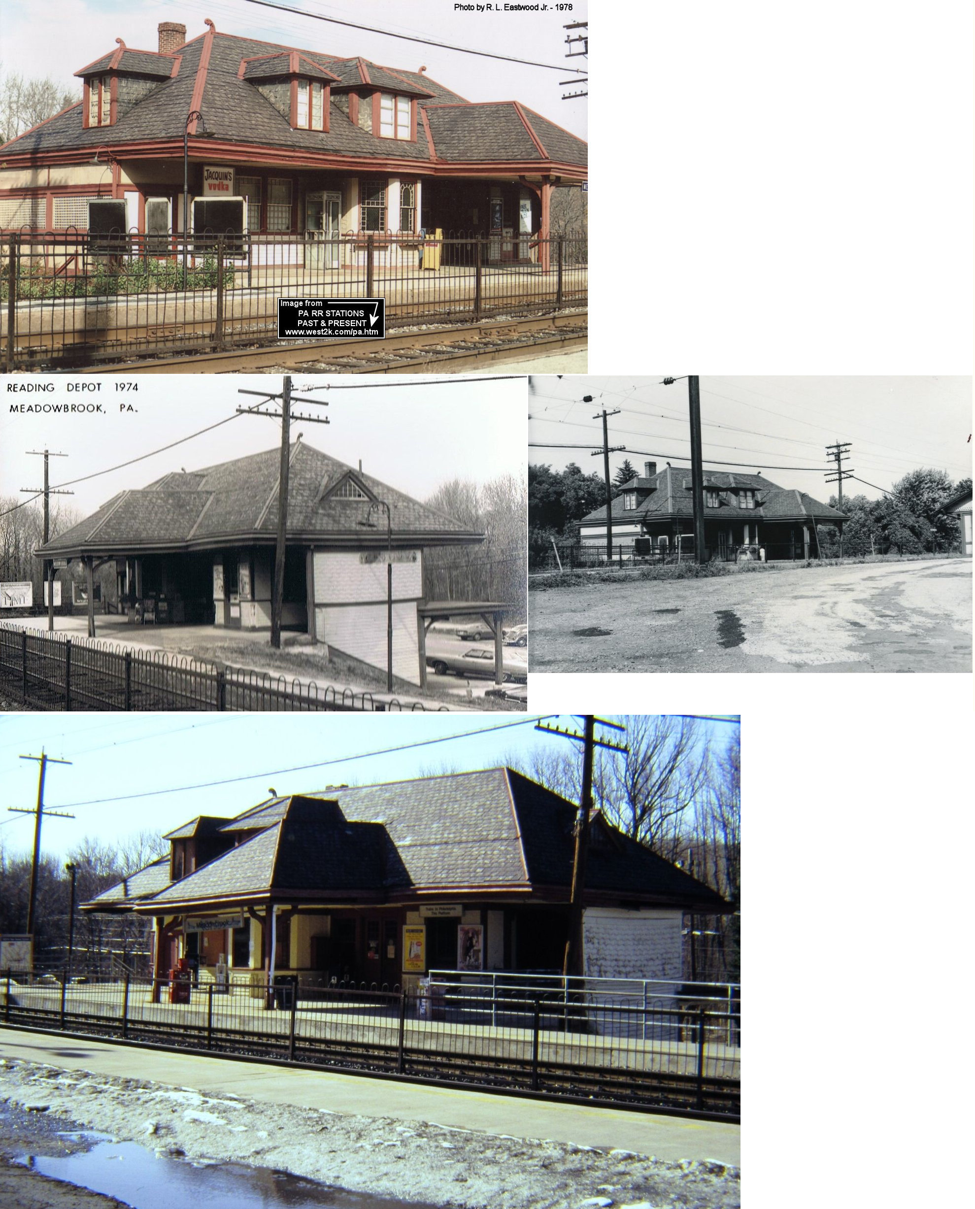
| Meadowbrook | |
Between Valley Road and Lindsay Lane (GPS: 40.111376, -75.092502) |
P | Railroad | ???? | In Use | Metal | |
| Melrose Park | |
900 Valley Road (GPS: 40.059478, -75.129018) |
P | Railroad | ???? | In Use | Stone |
|
| Merion Station | |
17 Civic Circle/Idris Road Inbound (GPS: 39.997544, -75.251631) Outbound (GPS: 39.997614, -75.251352) |
C | Railroad/ Post Office |
???? | In Use | Brick |
|
| Merion Station | |
Civic Cricle (GPS: 39.997976, -75.251317) |
F | Railroad | ???? | In Use | Brick | |
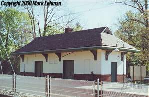
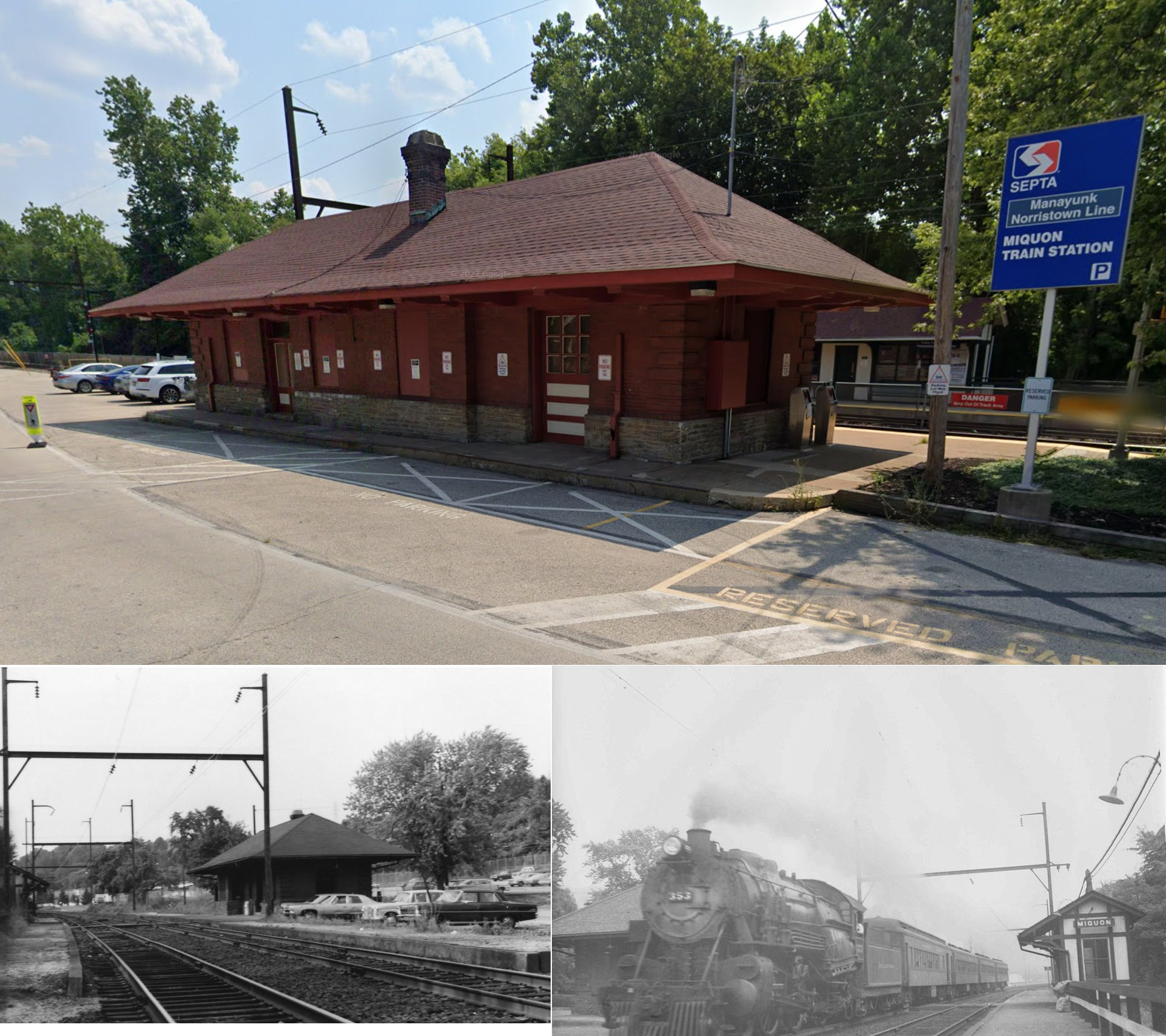
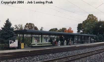
| Miquon | |
1096 River Road (GPS: 40.058597, -75.266292) |
P | Business | 1910 | In Use | Brick |
|
| Narberth | |
211 Elmwood Ave, between Elmwood Avenue and Haverford Avenue (GPS: 40.004755, -75.261503) |
P | Railroad | ???? | In Use | Cement | |
| Noble | |
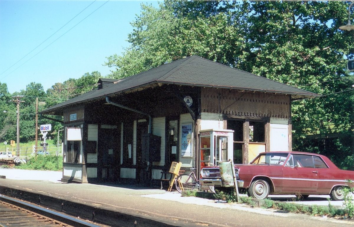
East side of Old York Road between Rodman Avenue and Baeder Road (GPS: 40.104486, -75.124670) |
P | Railroad | 1901 | In Use | Brick | |
| Noble | |
North side of Rodman Avenue (GPS: 40.104373, -75.124217) |
F | Unknown | ???? | In Use | Wood | |
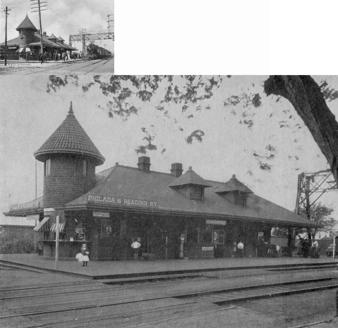
| Norristown | |
West side of DeKalb Sreet at East Washington Street (GPS: 40.112586, -75.344206) |
P | Railroad | 1932 | In Use | Brick | |
| Norristown | |
East side of Dekalb Street near Lafayette Street (GPS: 40.112631, -75.342833) |
F | Business | 1934 | In Use | Concrete | |
|
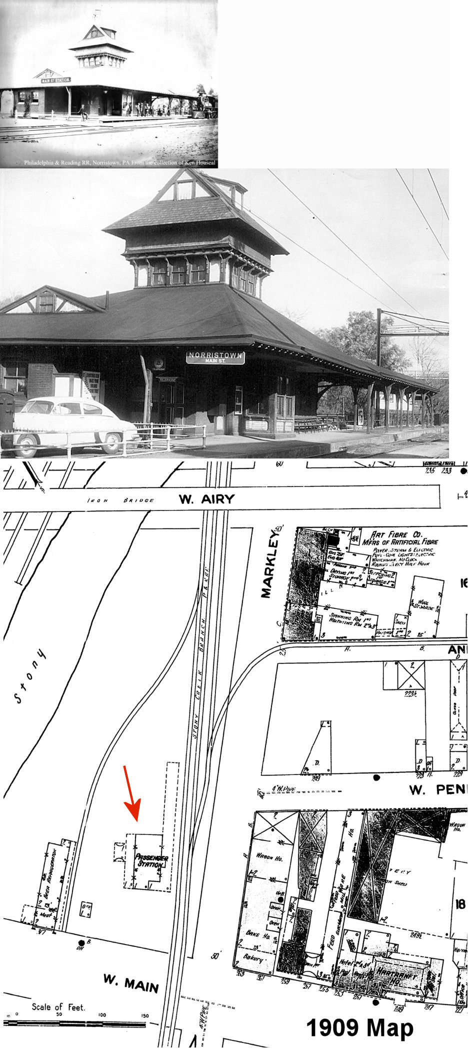
Norristown (Main Street) |
|
305 West Main Street near Markley Street (GPS: 40.117093, -75.348753) |
P | Railroad | ???? | In Use | Brick | |
|
Norristown (Elm Street) |
|
793 Markley Street (GPS: 40.120803, -75.344994) |
P | Railroad | ???? | In Use | Metal | |
|
North
Hills (Edge Hill) |
|
North Hills Road & Station Road (GPS: 40.112133, -75.169868) |
P | Railroad | 1931 | In Use | Brick | |
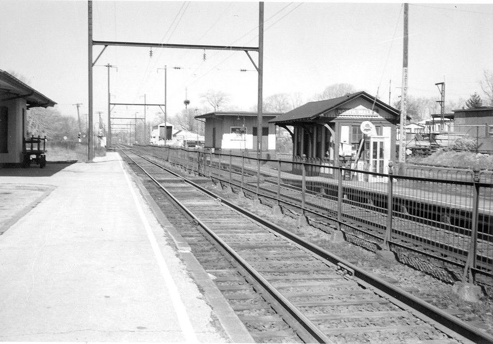
| North Wales |
|
605 Beaver Street (GPS: 40.214346, -75.277447) |
P | Business | 1873 | In Use | Brick |
|
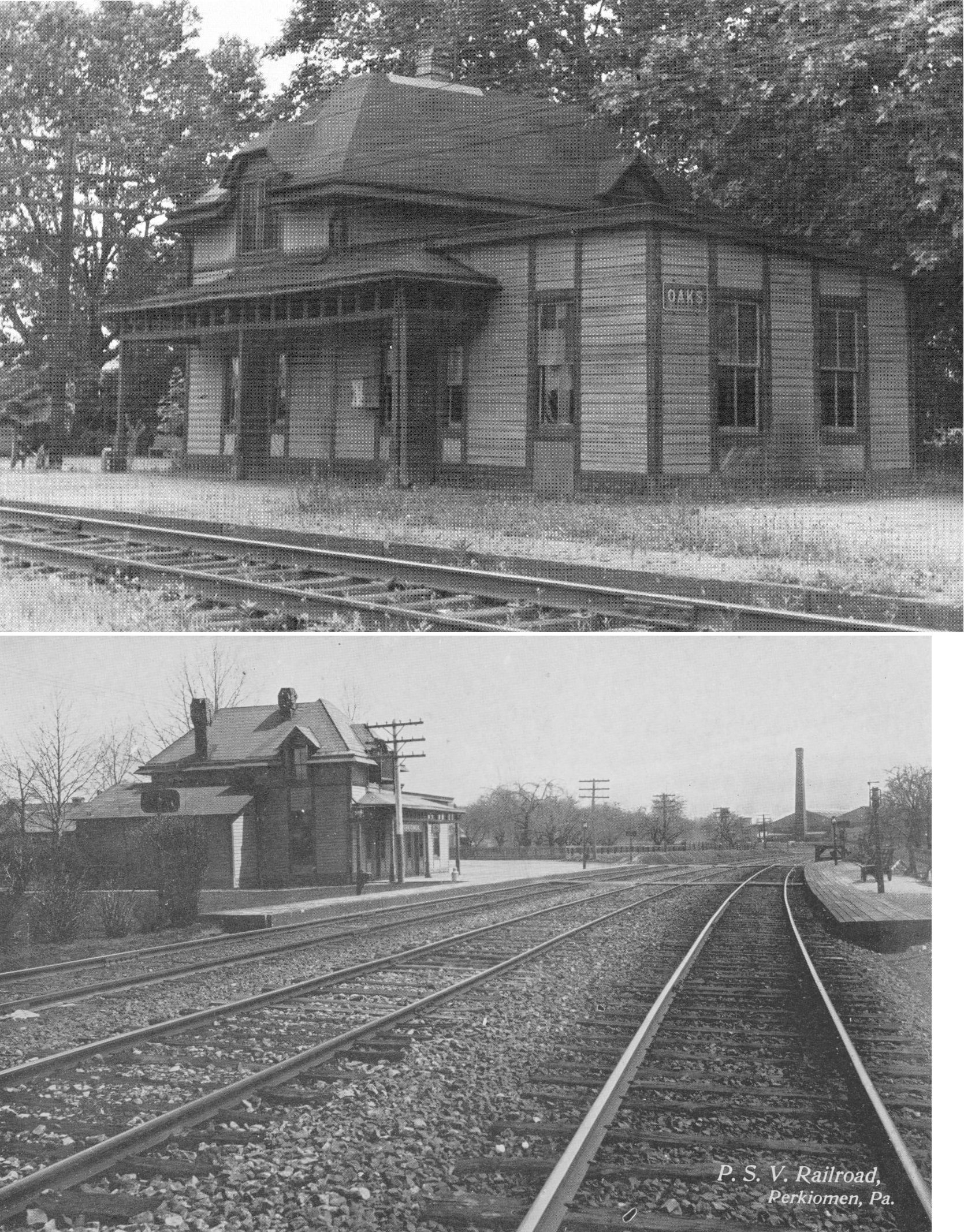
| Oaks | |
Egypt Road & Station Avenue (GPS: 40.132726, -75.454058) |
P | Business | 1918 | Aband. | Wood | |
|
Old
York Road Station (Ogontz Sta.) |
|
Old York Road & Chelten
Hills Road in Elkins Park (GPS: 40.075965, -75.129254) |
P | Private | 1874 | In Use | Stone | |
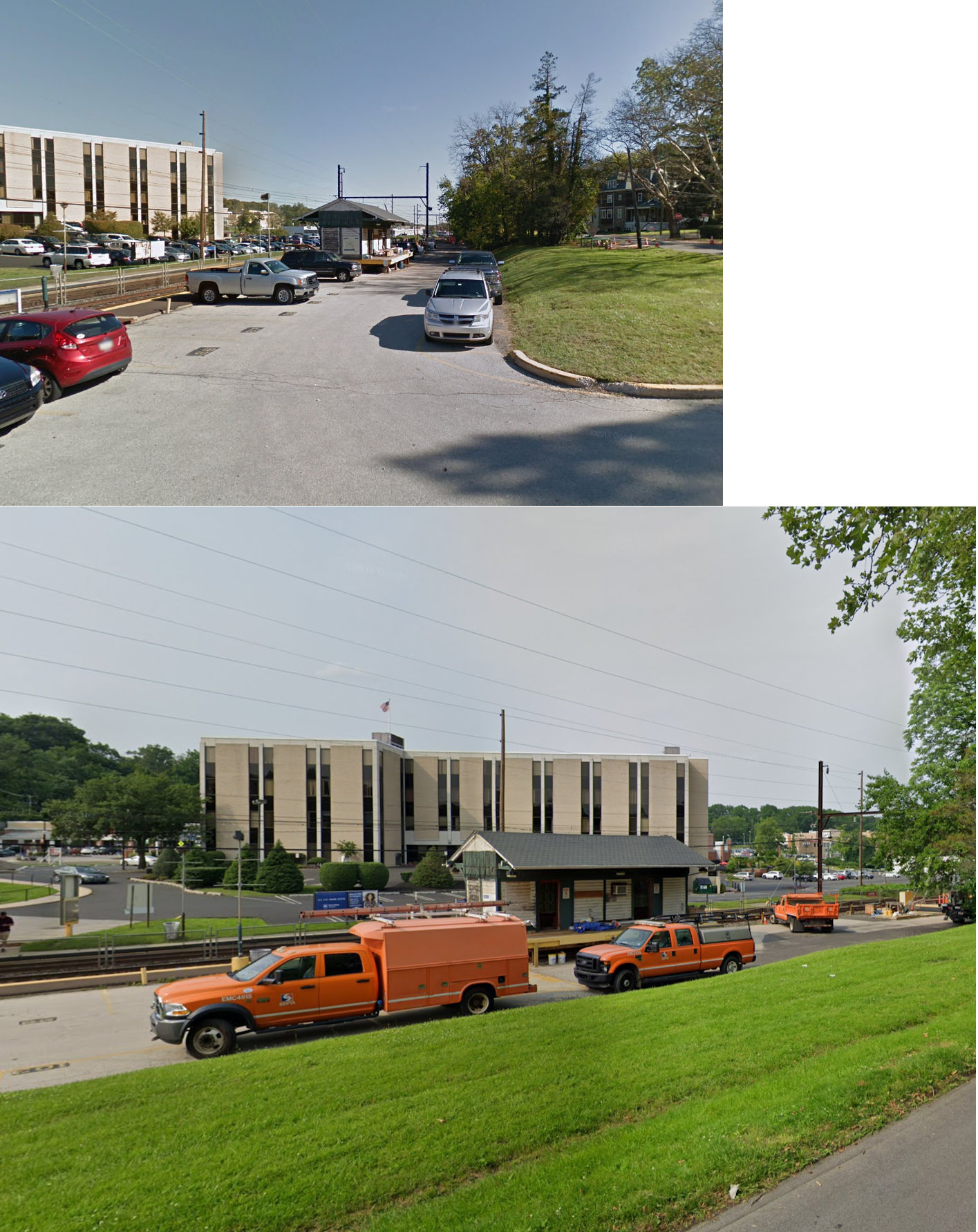
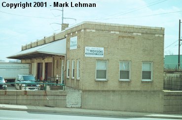
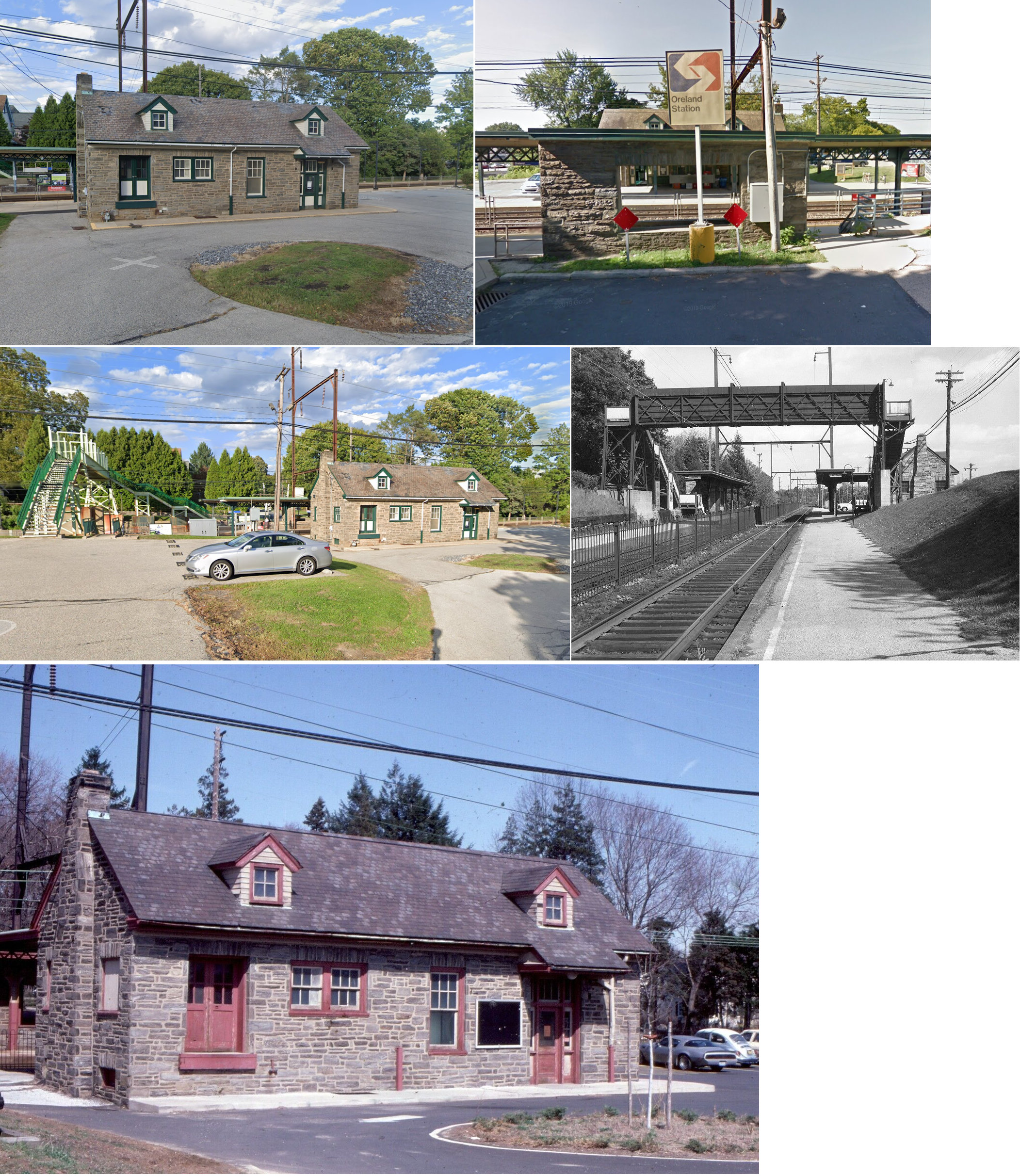
| Oreland | |
1502 Bruce Road (GPS: 40.118114, -75.183910) |
P | Railroad | 1931 | In Use | Stone | |
| Palm |
|
1111 Station Road (GPS: 40.429466, -75.533546) |
F | Storage | 1879 | In Use | Wood | |
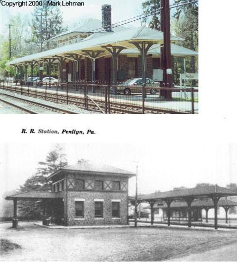
| Penllyn | |
Penllyn Pike and Pershing Road (GPS: 40.169631, -75.244118) |
P | Railroad | 1903 | In Use | Stone | |
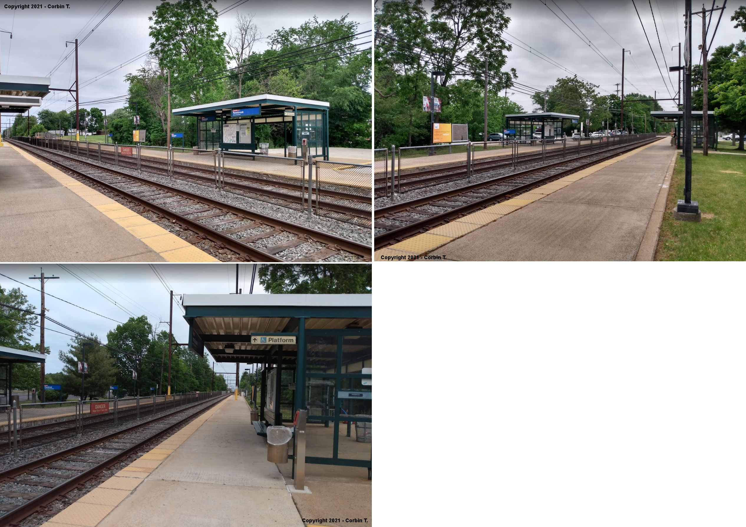
|
Pennbrook (Lansdale) |
|
1114 Chruch Road (GPS: 40.230276, -75.281841) |
P | Railroad | ???? | In Use | Metal | |
| Pennsburg | |
220 West 4th Street (GPS: 40.396980, -75.499857) |
P | Residence | 1914 | In Use | Wood | |
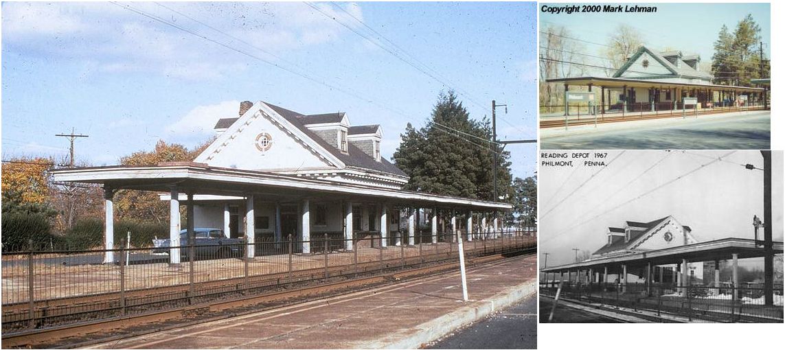
| Philmont | |
106 Tomlinson Road (GPS: 40.121982, -75.043811) |
P | Railroad | 1913 | In Use | Stucco | |
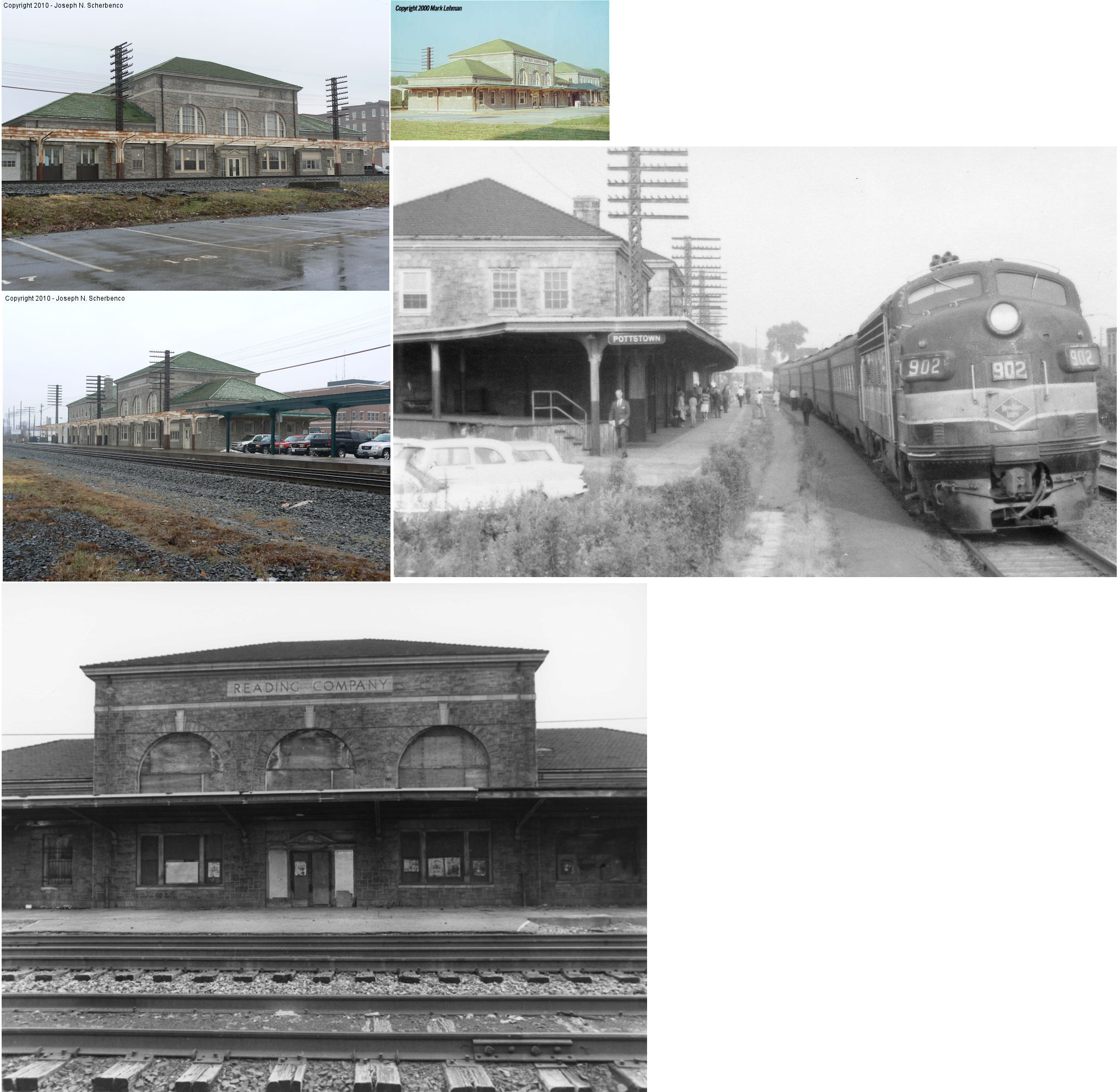
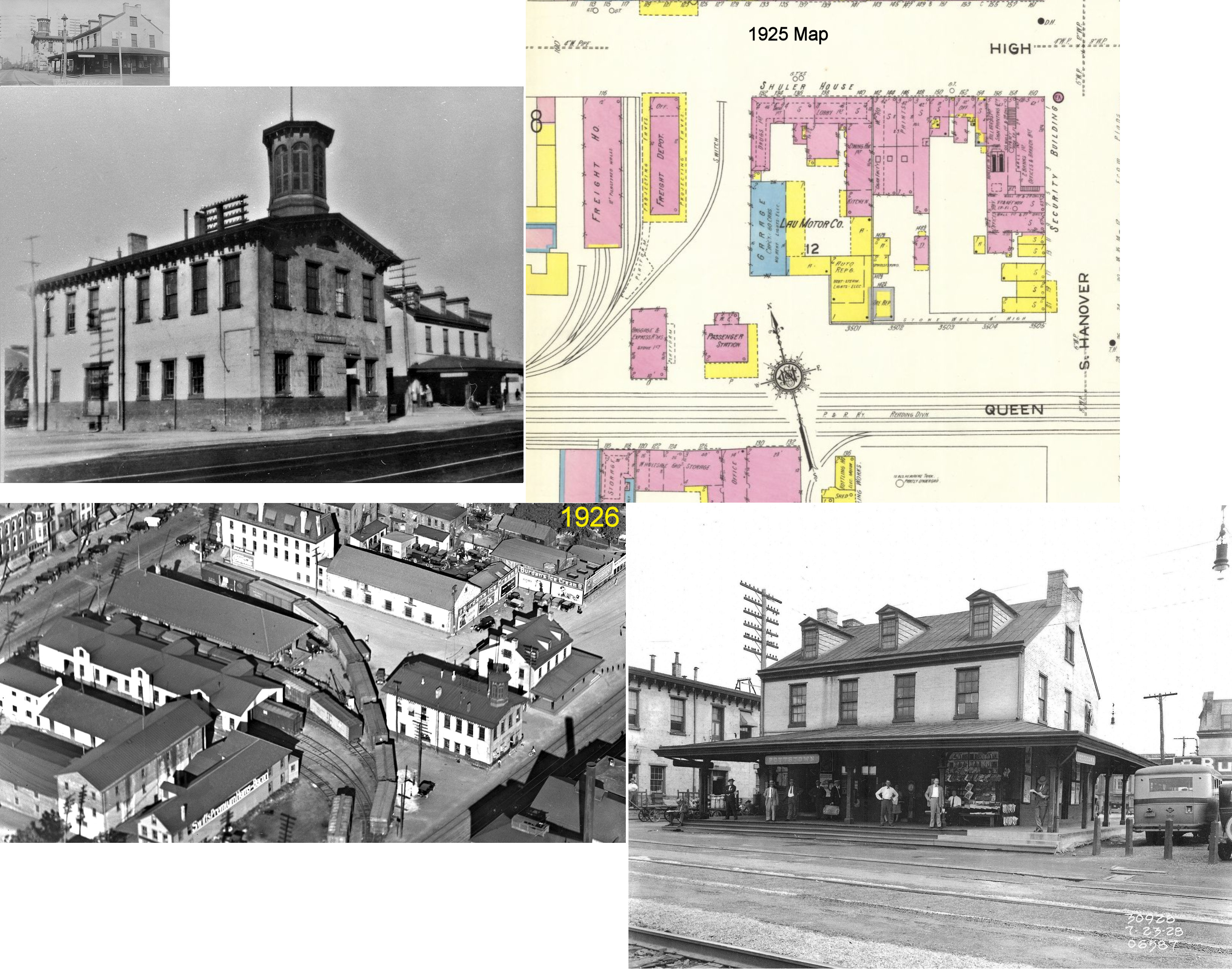
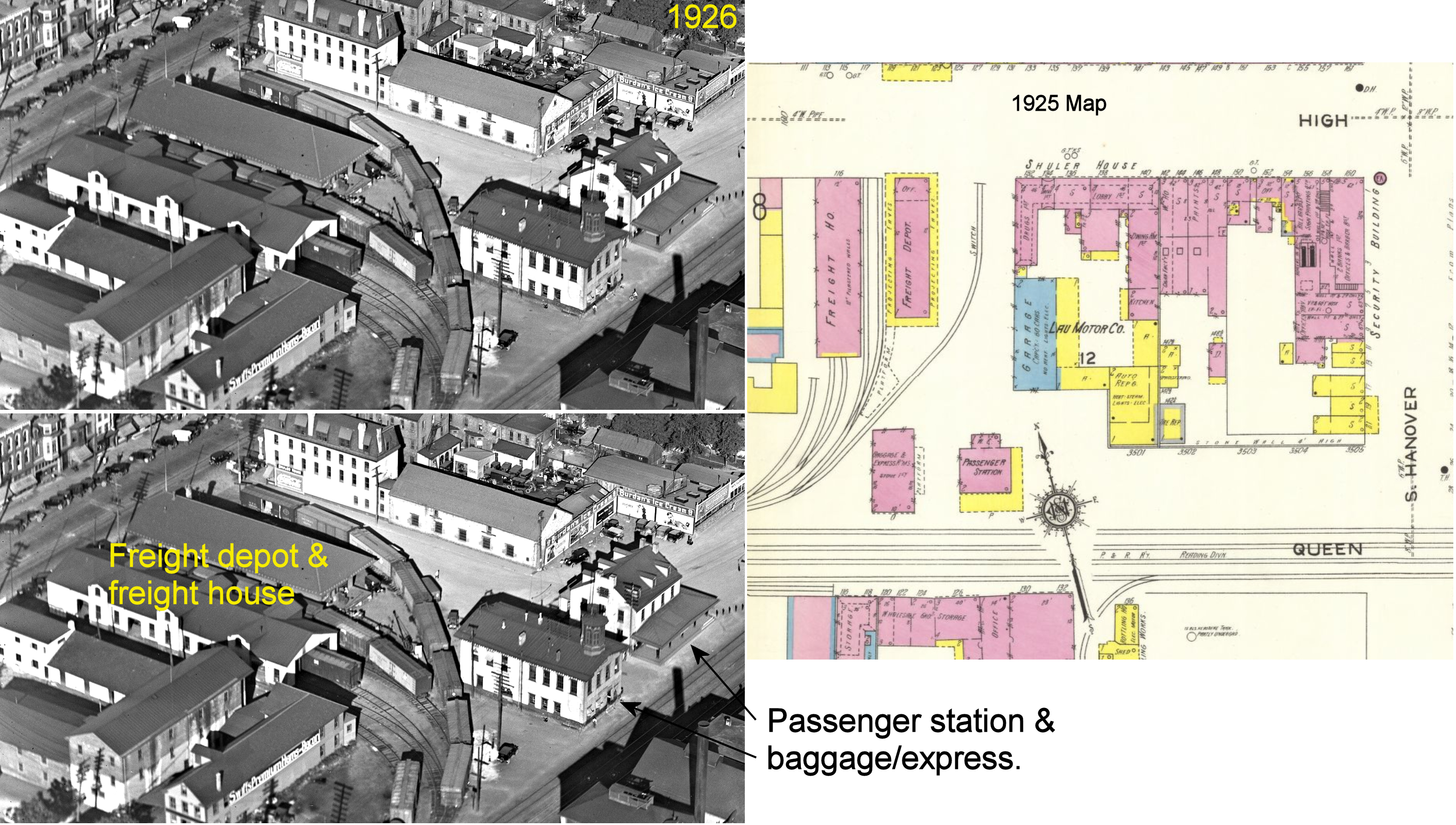
| Pottstown | |
West side of South Hanover Street (GPS: 40.245014, -75.652115) |
P | Bank | 1928 | In Use | Brick | |
| Pottstown | |
NW corner of South Hanover Street and South Street (GPS: 40.243969, -75.651278) |
F | Storage | 1928 | Gone | Brick | |
| Port Kennedy | |
3113 Valley Forge Circle (Station Lane) (GPS: 40.106402, -75.421084) |
P | Storage | 1904 | In Use | Wood |
|
| Rosemont | |
Airdale Road & Montrose Avenue 1 block east of US 30 (GPS: 40.028126, -75.327392) |
P | Railroad | 1892 | In Use | Brick | |
| Roslyn | |
1095 Easton Road between Susquehanna Road and Tyson Avenue (GPS: 40.120838, -75.134139) |
P | Railroad | ???? | In Use | Metal | |
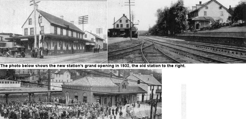
| Royersford | |
Main Street at Railroad Plaza (GPS: 40.183514, -75.543544) |
P | Business | 1931 | In Use | Brick | |
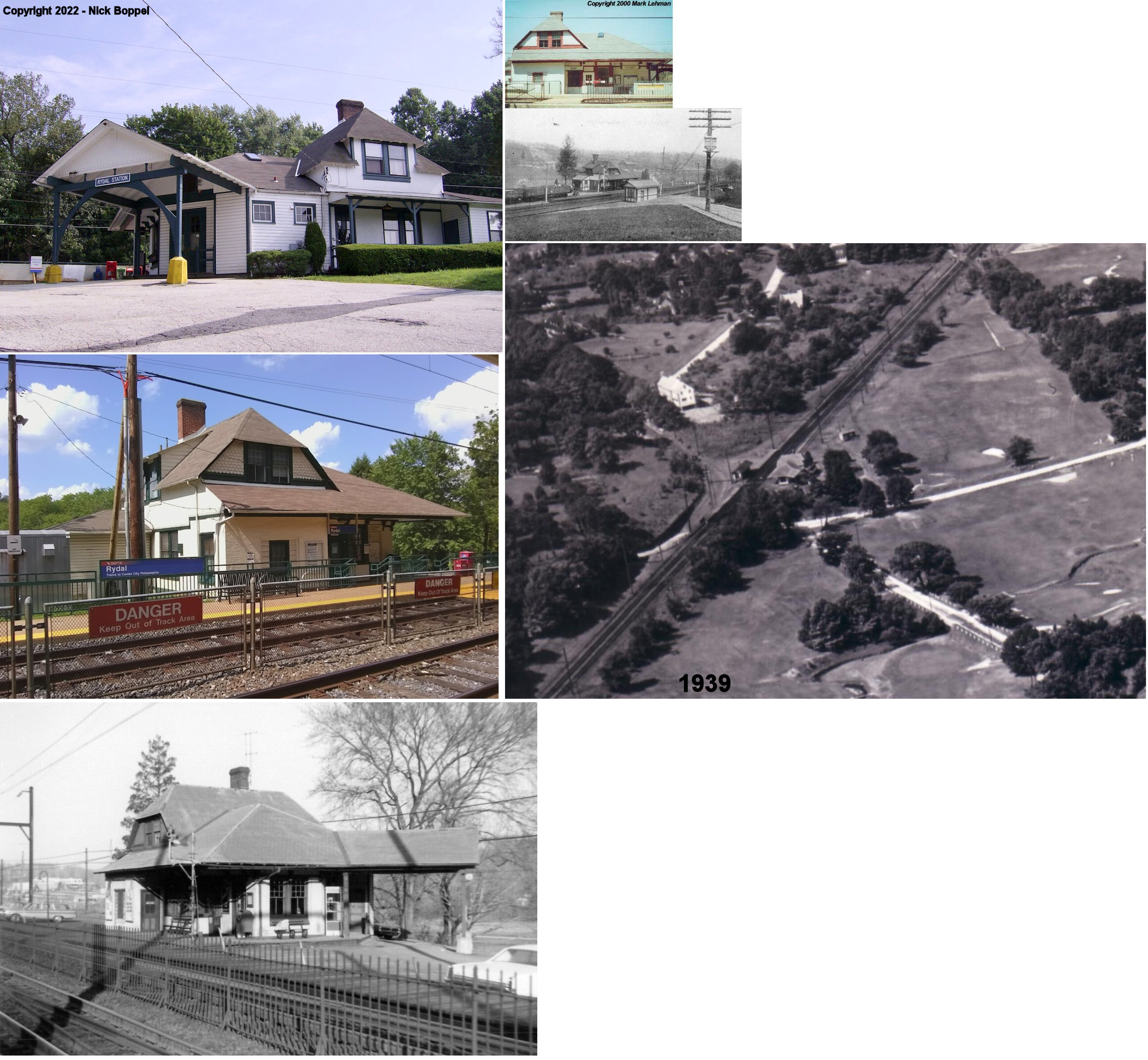
| Rydal (Benezette) |
|
1470 Susquehanna Road (GPS: 40.107506, -75.110709) |
P | Railroad | 1883 | In Use | Brick | |
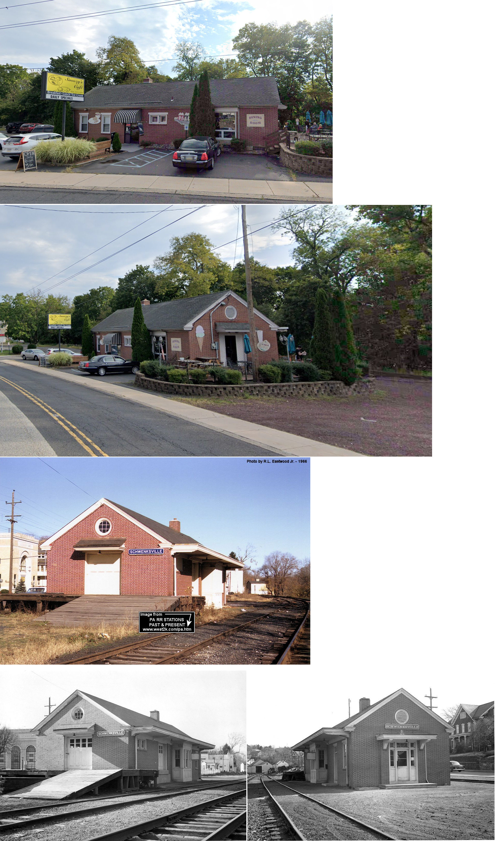
| Schwenksville | |
390 Main Street (Route 29) (GPS: 40.256109, -75.463431) |
P | Business | 1943 | Gone | Brick | |
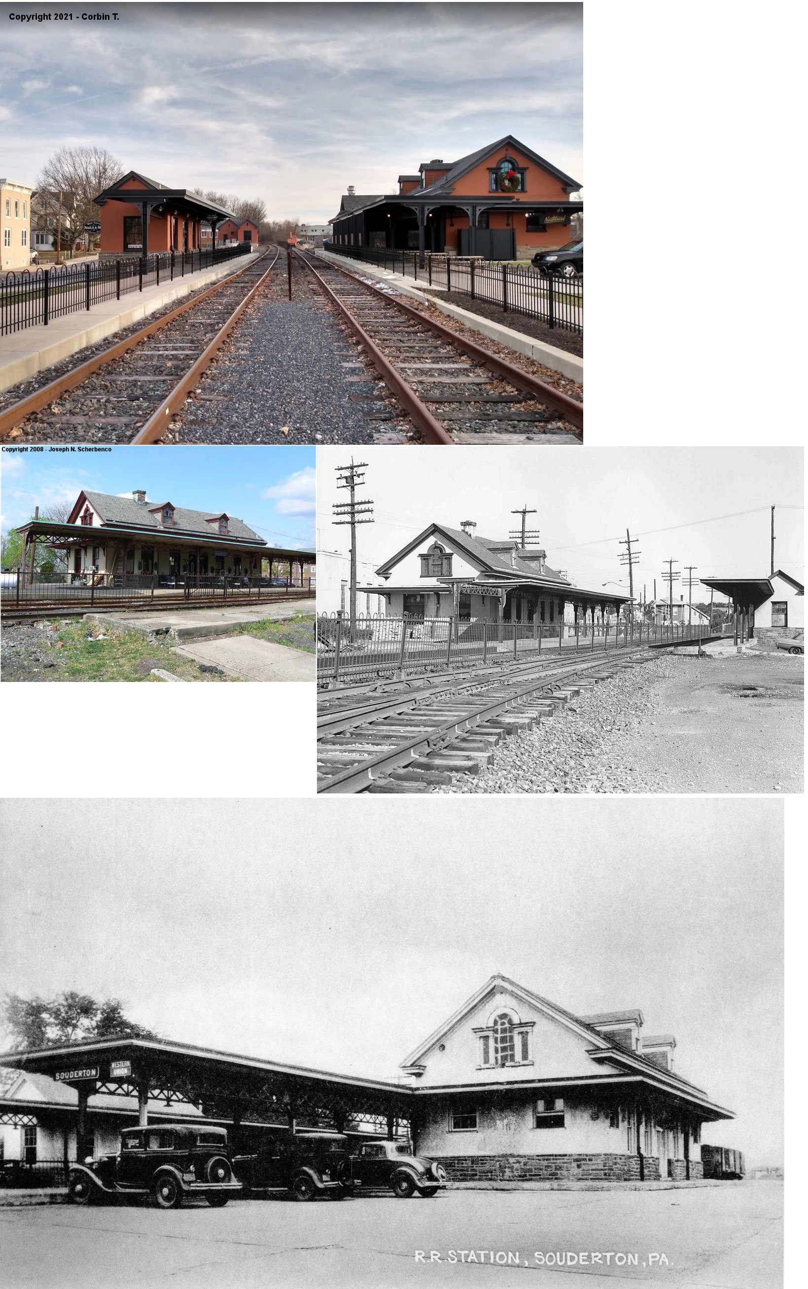
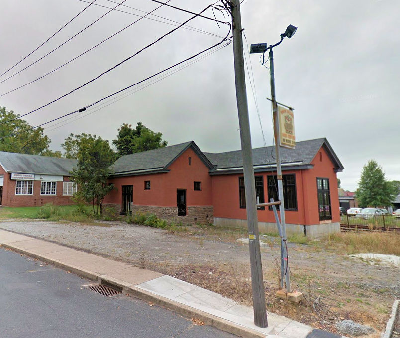
| Souderton | |
2 West Broad Street (off PA 113) (GPS: 40.309008, -75.320533) |
P | Business | 1928 | In Use | Stucco | |
| Souderton | |
South Front Street near Noble Street (40.308491, -75.319572) |
F | Vacant | 1928 | In Use | Stucco | |
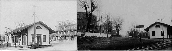
| Spring Mill | |
On North Lane between Lee Street and Station Avenue (GPS: 40.074157, -75.286090) |
P | Railroad | ???? | In Use | Metal | |
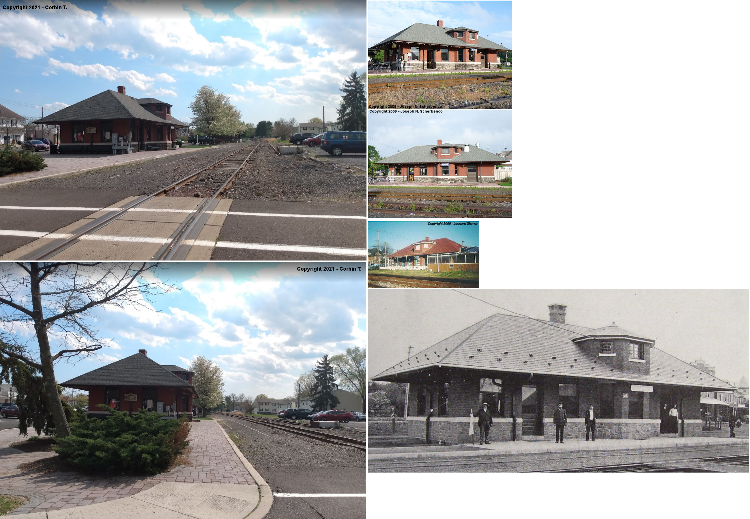
|
Telford (W. Telford) |
|
50 North Main Street (Main Street at Penn Avenue). (GPS: 40.325289, -75.329220) |
P | Business | 1904 | In Use | Brick | |
|
Telford (W. Telford) |
|
131 Penn Avenue (40.324800, -75.329765) |
F | Business | 1904 | In Use | Brick | |
| Whitehall | |
804 County Line Road in Bryn Mawr (GPS: 40.018053, -75.322417) |
P | Civic | 1860 | Gone | Wood |
|
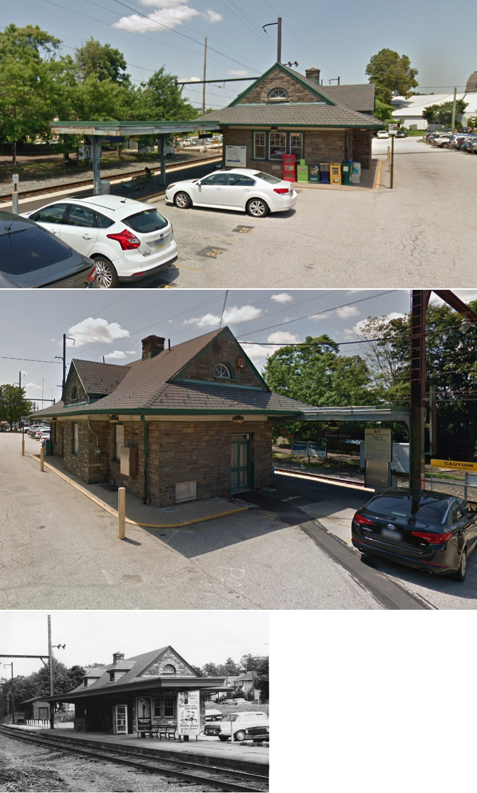
| Willow Grove | |
215 Davisville Road (GPS: 40.143661, -75.114268) |
P | Railroad | 1939 | In Use | Stone | |
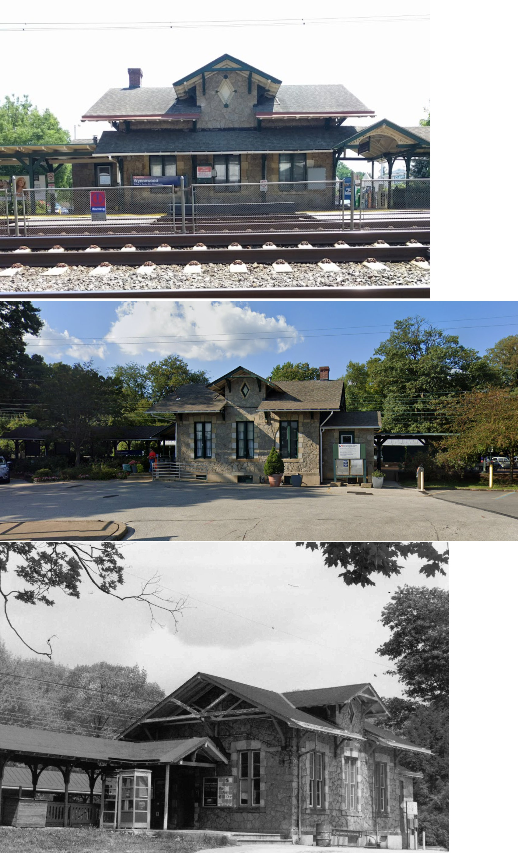
| Wynnewood | |
75 East Wynnewood Road (GPS: 40.002728, -75.273080) |
P | Railroad/ Business |
1870 | In Use | Stone |
|
| STATIONS OF THE PAST | ||||||||
| Station Name |
Original Railroad |
Notes | ||||||
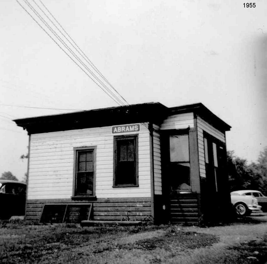
| Abrams (Merion) |
|
The station was built in 1877. | ||||||
| Acorn Station |
|
This station was on the north side of Township Line Road on the west side of the tracks (GPS: 40.191647, -75.290231). | ||||||
| Ambler (Wissahickon) |
|
The first station was built here in 1855. The town was renamed from Wissahickon to Ambler in 1869 in honor of Mary Johnson Ambler, a local Quaker woman who heroically assisted during The Great Train Wreck of 1856, in which 59 people were killed instantly and dozens more died from their injuries. | ||||||
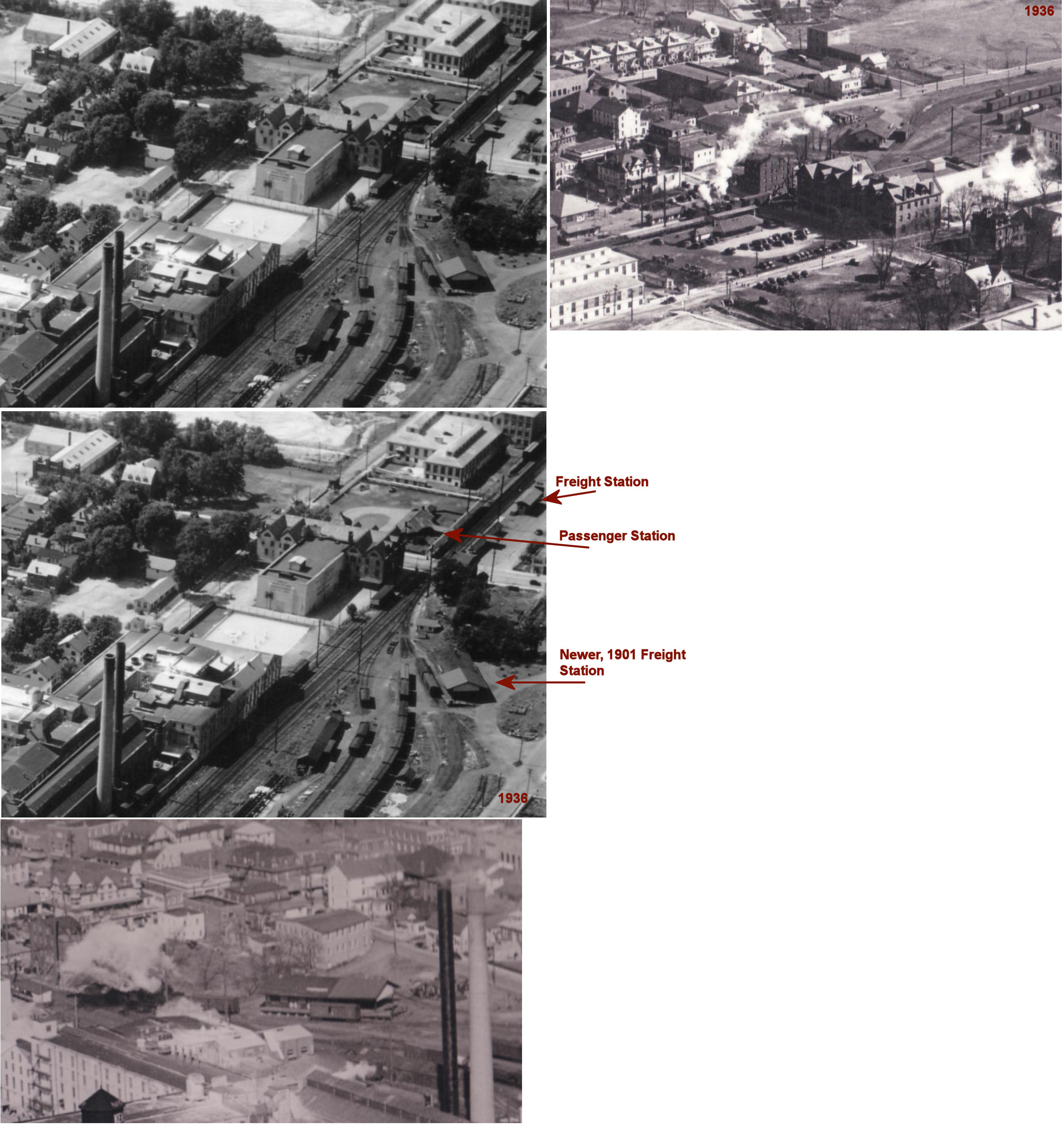
| Ambler |
|
The 1896 map shows two small freight stations in Ambler. The first is the one listed above that is still standing on West Race Street. The other was on the south side of West Butler Pike on the SW side of the tracks at GPS: 40.152980, -75.224557. This is where the modern SEPTA passenger shed is today. | ||||||
| Ambler |
|
A larger freight station was built here in 1901. It was on the west side of South Main Street between Butler Pike and Rosemary Street at GPS: 40.152812, -75.223620. | ||||||
| Arcola |
|
Built in 1883, this station was near the intersection of Arcola Road and Cider Mill Road in the vicinity of GPS: 40.152905, -75.457194. | ||||||
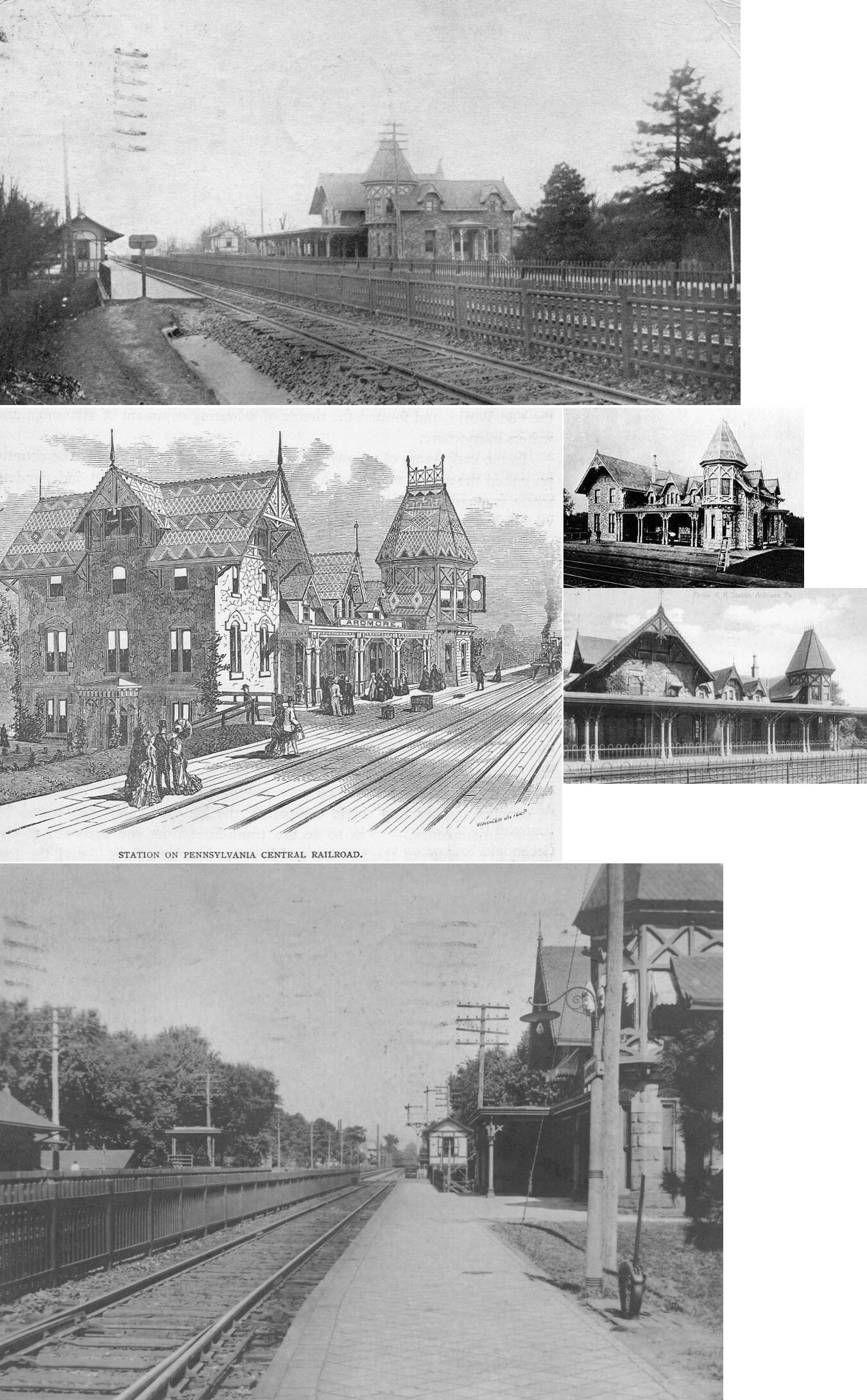
|
Ardmore (Athensville) |
|
Built in 1859. | ||||||
|
Ardmore (Athensville) |
|
Built 1873, this station was built by the Wilson Brothers & Company. | ||||||
| Ardmore | |
A new freight station was built here in 1882. | ||||||
| Ardmore | |
This 1950s-era brick station was on Station Avenue at GPS: 40.008309, -75.290320. It was demolished in April 2022. As part of an project updating the station area. | ||||||
| Arlingham |
|
This station was on the Cresheim Branch and was opened in 1893. The station was built on the property of the Arlingham Estate, owned by I.D.H. Ralphs. The estate is now the Sandy Run Country Club. | ||||||
| Asbestos (Wyndmoor) (Nelmoor) |
|
This station was on the Cresheim Branch. This was likely a shelter or platform only. It was located on the SW side of Queen Street on the NW side of the tracks at GPS: 40.080629, -75.181729. The name Nelmoor (as shown on the 1916 North Penn Section Map) is a portmanteau of Nelson (for the valve factory that was at this location) and Wyndmoor. | ||||||
| Ashbourne |
|
Before the Elkins Park station was built in 1899, there was a station here called Ashbourne. It was on the north side of Park Avenue. | ||||||
| Bala | |
This station was built in 1884. | ||||||
|
Barmouth (West Laurel Hill) |
|
This station was located at GPS: 40.016084, -75.227458 where the existing Barmouth SEPTA shelter is today. | ||||||
| Belfry | |
On the Stony Creek Branch. | ||||||
| Bethayres |
|
There was a small freight station across the tracks to the SE of the passenger station at GPS: 40.116522, -75.068180. | ||||||
| Betzwood Station | |
This station was on what was originally the property of John Betz. It was about a mile SW of Port Indian Station obn the east side of what is now US-422 north of Trooper Road at GPS: 40.110628, -75.419044. | ||||||
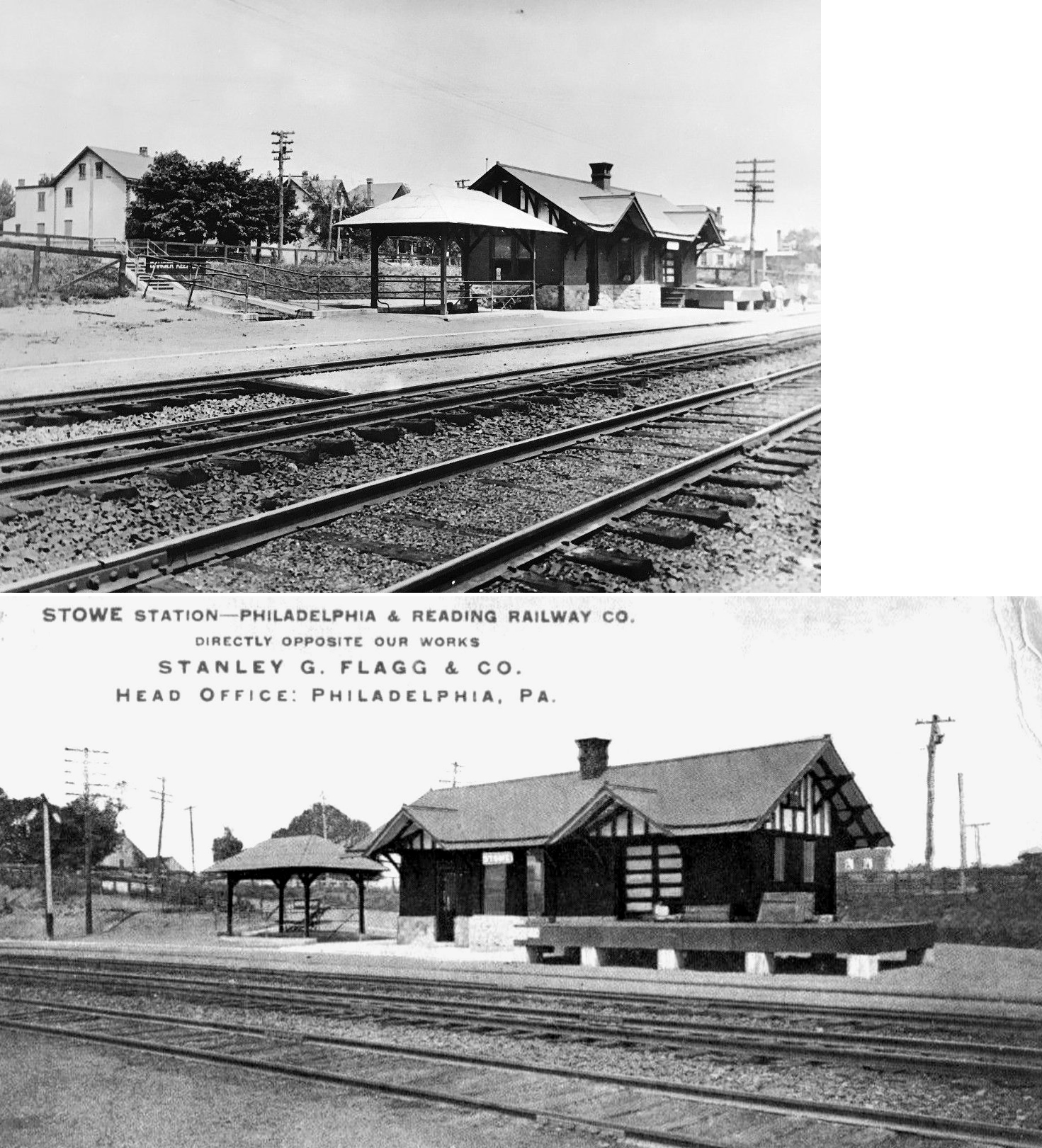
|
Bramcote (Stowe) |
|
|||||||
|
Bramcote (Stowe) |
|
This station was known as Bramcote until 1910 when the name was changed to Stowe. | ||||||
| Bridgeport | |
The original passenger station here was on the east side of Depot Street on north side of the tracks at GPS: 40.106371, -75.341448. It was retired in 1882 as a passenger station with the intent that it would then be used as a freight station (Daily Independent, 8-4-1882). | ||||||
| Bridgeport | |
This second-generation passenger station was on the east side of Depot Street north of 4th Street. It was a three-story former hotel building on the south side of the tracks (GPS: 40.106034, -75.341465. The hotel was converted into a station in 1882 (Daily Independent, 8-4-1882). It was used until 1919 when the Reading began to route its traffic north through Norristown. The building was used from 1919 through 1937 by railroad yard men. It was torn down in 1941 (The Philadelphia Inquirer, 7-7-1963) and the lot is shown as vacant on the 1948 updated Sanborn map. | ||||||
| Bridgeport |  |
Was this station at Ford and Front Streets? Does anyone know for sure? | ||||||
| Bryn Mawr | |
This gothic station sat at the northwest corner of Bryn Mawr and Morris Aves. Built in 1869, it was remodeled in 1900 and demolished in 1963. The baggage house portion, which was on the south side of the tracks, remains and is occupied by a restaurant. | ||||||
| Camp Hill |
|
This station was near the intersection of Camp Hill Road, Valley Green Road and Walnut Avenue at GPS: 40.124563, -75.199499. | ||||||
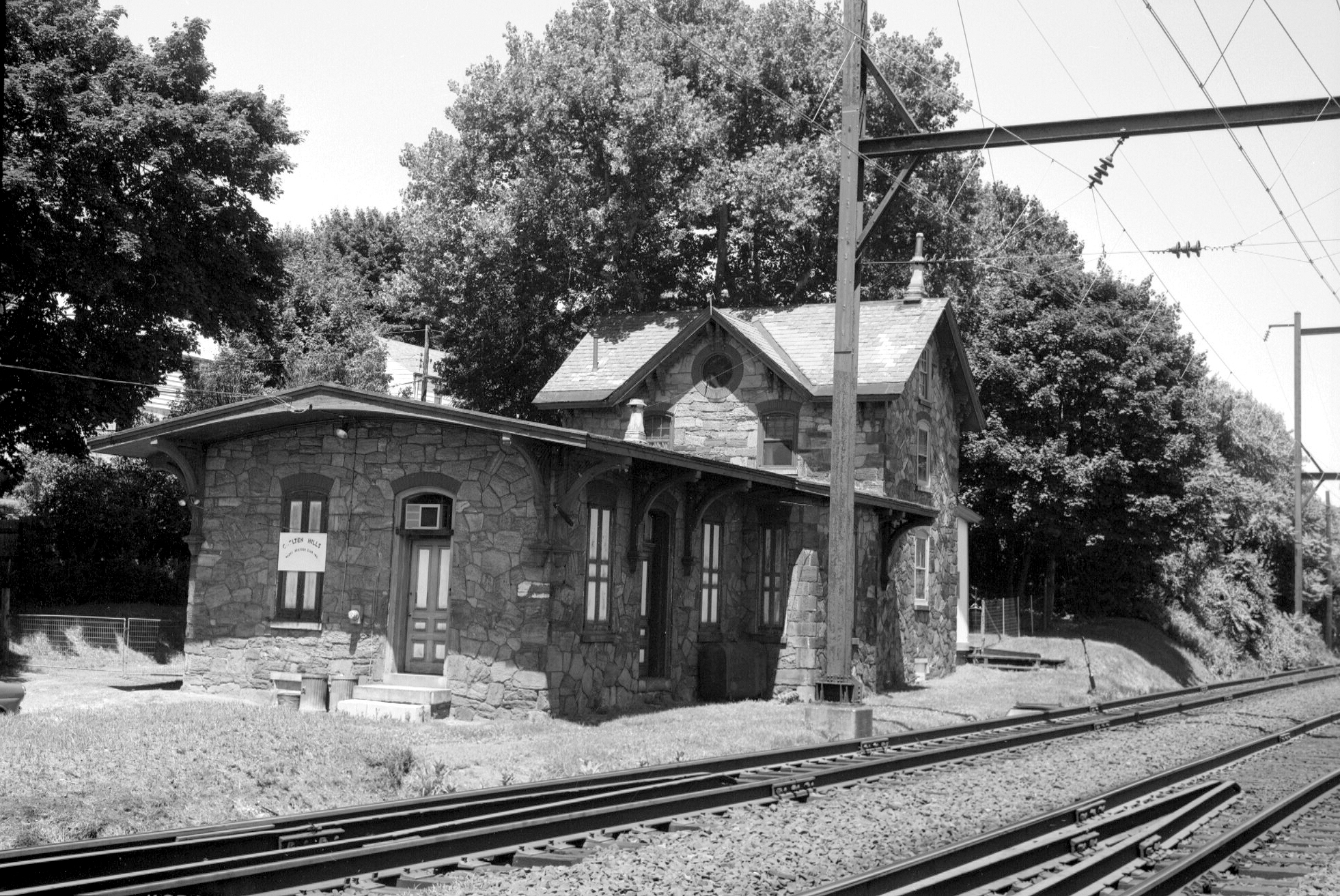
| Chelten Hills |
|
This station was on the south side of Washington Lane on the east side of the tracks near GPS: 40.087591, -75.135159. | ||||||
| City Line Station |
|
This station was in the vacinity of Melrose and Mountain Avenues south of Elkins Park and Ashbourne stations. This station later become known as Melrose Station, but it was a bit north of the current Melrose Park station. | ||||||
| Cold Point |
|
|||||||
| Collegeville |
|
The passenger and freight stations were on the SW side of Main Street between 2nd and 3rd Avenues at GPS: 40.185499, -75.451505. | ||||||
| Collegeville |
|
Freight station. | ||||||
| Colmar |
|
The North Pennsylvania Railroad line from Philadelphia to Bethlehem was built through Hatfield Township in 1856, with the Lansdale-Doylestown branch being constructed that same year. A railroad station was built where the Doylestown branch crossed Bethlehem Pike, and was named "Line Lexington". As a village grew around the Line Lexington Station, it needed its own name to avoid confusion with the village of Line Lexington, one and a half miles away in Bucks County. In January 1871, a post office, called Jenkins, was established in the village. In June 1871, the post office was renamed Ainsworth, perhaps after a hotel owner. But two weeks later, both the post office and the train station were renamed Colmar. By 1896, Colmar consisted of some 20 dwellings built on both sides of the railroad. --Adapted from the Hatfield Township Website. The station was built in 1867. | ||||||
| Colmar |
|
This was a later-generation passenger shelter. | ||||||
|
Conshohocken (Eastbound) |
|
This station was more substantial than the westbound station due to heavier passenger traffic to Philadelphia. | ||||||
| Conshohocken | |
The 1886 map shows a small brick freight station on the west side of Poplar Street at GPS: 40.071874, -75.302145. It was built in 1884 at the same time the passenger station was built (Reading Times, 9-4-1884). Later a larger brick station was built at this same location (or the original station was expanded). | ||||||
| Conshohocken | |
The first station here was part of the Ford Hotel in the 1830s. It occupied the site on which the first P&R station was built years later. | ||||||
| Conshohocken | |
This station was on the NW side of Fayette Street on the south side of the tracks at GPS: 40.071950, -75.308565. It was built in 1882 and significantly altered several times throughout its history. The second floor was added and the cupola was removed in 1917. In 1970 most of the station burned, but a new roof was added to what was left of the first floor and the station soldiered on in quite a different form. | ||||||
| Conshohocken | |
There was a brick freight house closer to the river on the SW side of the canal (now gone). This freight house, built in 1890, was located at approximately GPS: 40.072585, -75.311384. | ||||||
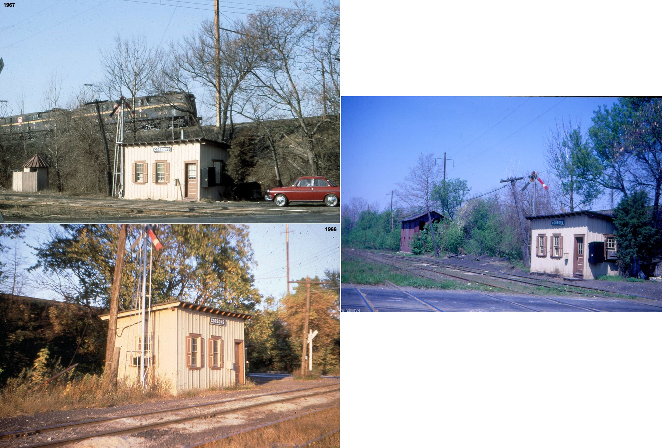
| Corsons | |
|||||||
| Crestmont | |
|||||||
| Custer Station (Norriton) |
|
This station was on West Township Line Road at approximately GPS: 40.158603, -75.324891. | ||||||
| Cynwyd (Norriton) |
|
This station was on West Township Line Road at approximately GPS: 40.158603, -75.324891. | ||||||
| Delphi (Zeiglerville Station) |
|
Built 1888, closed in 1953. | ||||||
| Doylestown Pike Station |
|
This station was on the west side of what is now Easton Road (PA-611) on the north side of the tracks (GPS: 40.159584, -75.122821). The Bucks County Railway junctioned near the station. | ||||||
|
Dreshertown (Dresher) |
|
This station was near the intersection of Susquehanna Road and Limekiln Pike (GPS: 40.139257, -75.165902). | ||||||
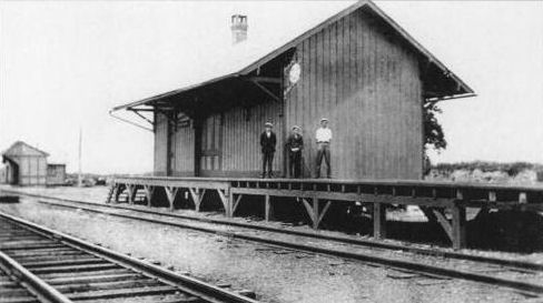
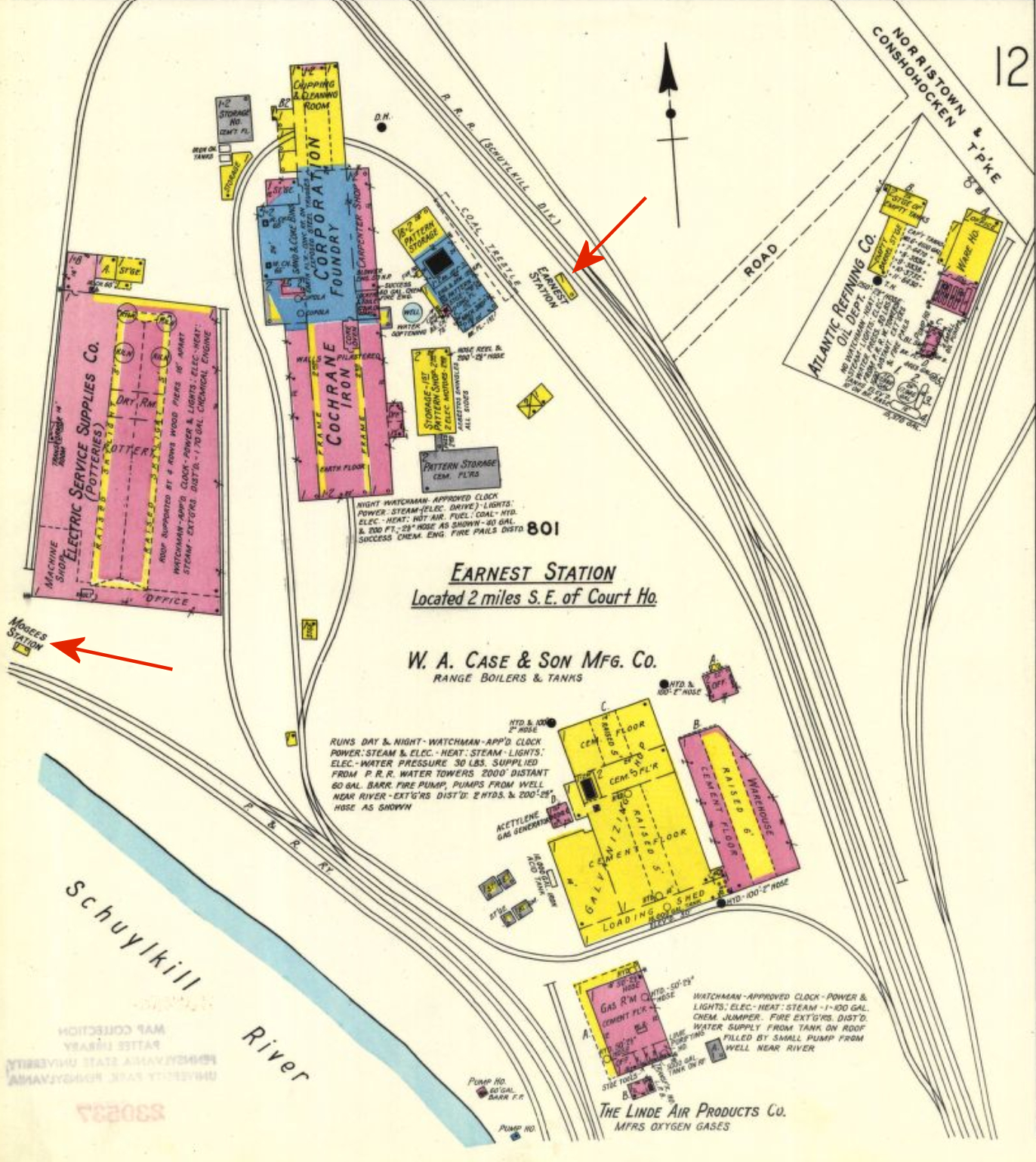
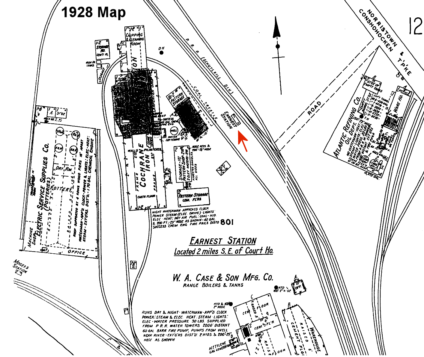
| Earnest | |
A station was built here in 1891 when passenger service began on this part of the Trenton Cutoff. The station was on Earnest Station Road at approximately GPS: 40.102124, -75.319697. | ||||||
| East Greenville |
|
The original station in East Greenville was at Railroad and 3rd Streets on the NE side of the tracks (GPS: 40.403616, -75.505826). | ||||||
| East Greenville |
|
Freight station. | ||||||
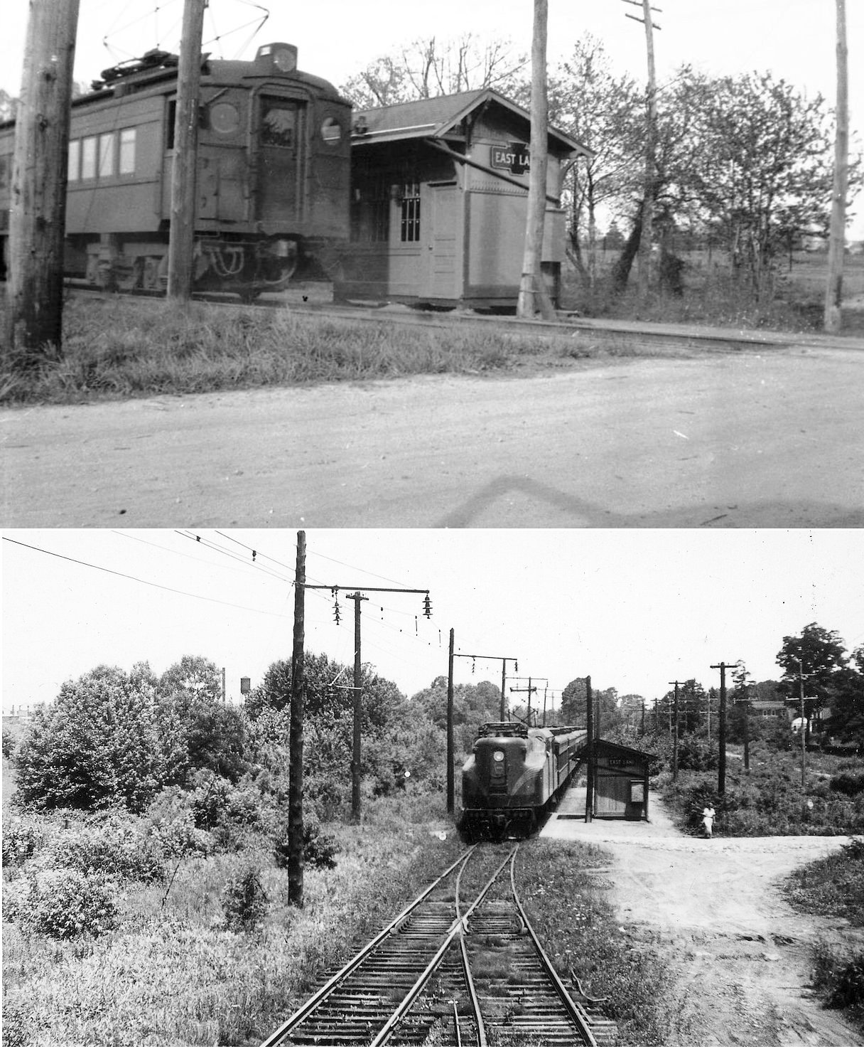
| East Lane (Ivy Hill) |
|
This station was on the Cresheim Branch. It was located on Ivy Hill Road at Hazelwood Drive (GPS: 40.075302, -75.186318). It is shown on the 1916 North Penn Section map as Ivy Lane station. East Lane used to intersect Ivy Lane at this location. The station served E.T. Stotesbury's Winoga Stock Farm so horses could be shipped right from the gates of the stables into a railroad car. | ||||||
|
Edge hill (North Hills) (North Glenside) |
|
See the listing below for North Glenside. | ||||||
| Enfield |
|
This station was on the Cresheim Branch. This was likely a shelter or platform only. It was located on Papermill Road at what is now the Fort Washington Expressway (GPS: 40.101558, -75.193761). | ||||||
| Ernest |
|
This station was on Ernest Station Road on the west side of the tracks (GPS:40.102175, -75.319773). | ||||||
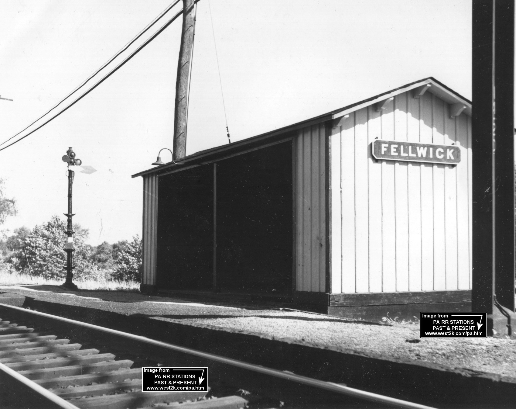
| Fellwick Station |
|
This station is shown on the 1950 county map | ||||||
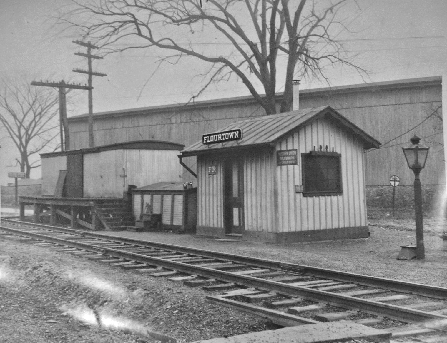
| Flourtown |
|
This station was ont he east side of Bethlehem Pkie on the south side of the tracks at GPS: 40.107961, -75.213879. The station is shown on the 1883 NPRR map. | ||||||
| Flourtown Road |
|
A new station was built here in 1893. | ||||||
| Fort Hill |
|
This station was on Camp Hill Road at approximately GPS: 40.126942, -75.207041. It was on the Cresheim Branch which was opened in 1893. A shelter-type station was built here in 1896. | ||||||
| Fort Washington |
|
There was an NPRR station here that predated the Reading station. | ||||||
| Fortuna |
|
|||||||
| Fulmor Station |
 |
This 8'x10' shed-type station, placed here from elsewhere in 1897, was on the NW side of South Warminster Road on the west side of the tracks (GPS: 40.166337, -75.104784). | ||||||
| Fulmor |
|
This shelter was on the the SE side of South Warminster Road on the west side of the tracks at GPS: 40.165803, -75.104906. The concrete base remains there as of 2015. | ||||||
| Gladwyne
Station (Rose Glen) |
|
This station sat 2.5 miles from Gladwyne along the Reading line near the intersection of Rose Glen (Mill Creek Road in this area on some maps) and River Roads at approximately GPS: 40.044867, -75.255799. It is shown on the 1900 Atlas of Properties Along the Rennsylvania Railroad. It was built around 1877, so it may have been a second-generation station. It was initially named "Rose Glen" and changed to "Gladwyne" in the 20th Century. It was also the site of the Gladwyne to Shawmont ferry, which operated from 1850 to 1912. | ||||||
| Glenside | |
There was a freight station on some siding tracks on the north side of Glenside Avenue just west of Harrison Avenue at GPS: 40.101387, -75.155060. | ||||||
| Graterford (Gratersford) |
|
This station was onthe north side of Bridge Street at GPS: 40.225524, -75.454171. | ||||||
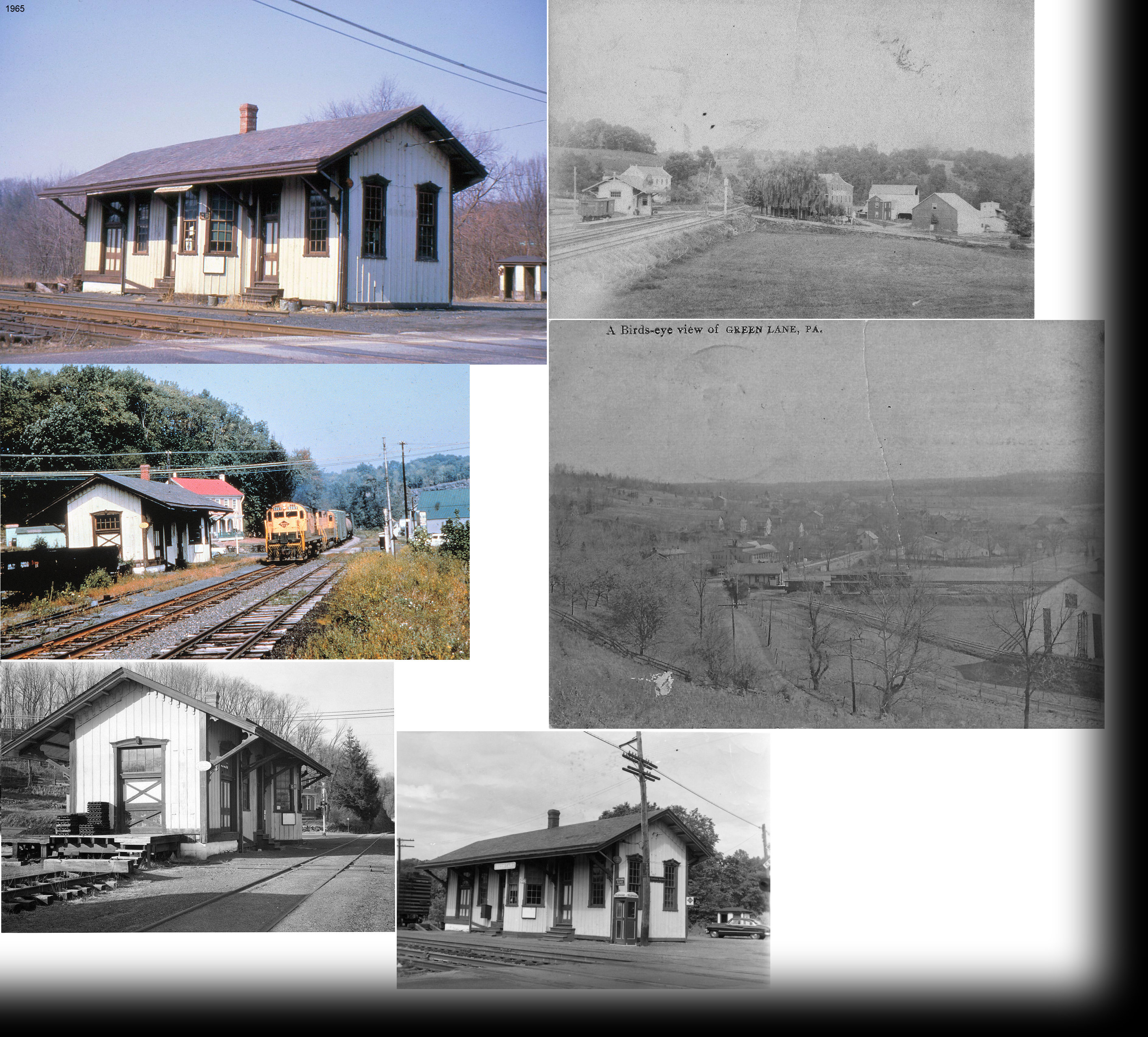
| Green Lane |
|
This station was on the SW side of PA29 (Gravel Pike) on the NW side of the tracks at GPS: 40.340476, -75.472729. It was built in 1872 and torn down in 1966 to make room for an Agway. The tracks here were removed in 1980. | ||||||
| Harper Station |
|
This station was east of Anna Road in what is now Huntingdon Valley. It was near GPS: 40.091646, -75.081907. | ||||||
| Hatboro |
|
The original Hatboro station was in approximately the same location as the existing Hatboro station (GPS: 40.175642, -75.102960). It was built in 1871 and replaced in 1935. | ||||||
| Hatboro |
|
There was a small freight station, also built in 1871, just south of the passenger station. | ||||||
| Hatfield (UPPER HATFIELD) |
|
The freight station was on the east side of the tracks just north of the passenger station at GPS: 40.282276, -75.296292. | ||||||
| Heaton (Morgans Millls) |
|
This 8'x10' shelter-type station was on the North side of Terwood Road on the west side of the tracks (GPS: 40.157238, -75.107127). It was built in 1897. | ||||||
| Heaton |
|
This station was on the north side of Fitzwatertown Road near York Road (GPS: 40.160475, -75.112758). | ||||||
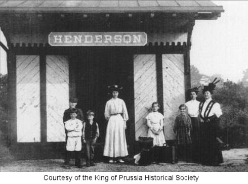
|
Henderson (Henderson Park) |
|
This station was on Henderson Road near Church Road. | ||||||
| Hillcrest |
|
This station was on the Cresheim Branch and was opened in 1893. It was at the NE end of Mermaid Lane at West Cheltenham Avenue (GPS: 40.086385, -75.179014). | ||||||
| Hillegas Station |
|
This station was on the NW side of Hendricks Road on the north side of the tracks (GPS: 40.375101, -75.471660). This station is shown on the 1893 county map. | ||||||
|
Hillside Station (Roslyn) |
|
This staion was near where the current Roslyn SEPTA stop is today at Susquehanna and Easton Roads. In 1893 the staion was on the NE side of Susquehanna Road on the SE side of the tracks at approximately GPS: 40.121265, -75.133130. | ||||||
| Hoopeston Station |
|
This station was on the Trenton Cutoff near what is now the I-276 and Fort Washington Expressway interchange (GPS: 40.130563, -75.201228). | ||||||
| Hooverton |
|
This station was on the north side of West Germantown Pike on the west side of the tracks (GPS: 40.148550, -75.330776). | ||||||
| Horsham |
|
This station was on the NW side of Twining Road (GPS: 40.152405, -75.141724). | ||||||
| Huntingdon Valley |
|
This station was on the south side of Old Welsh Road at Terwood Road at approximately GPS: 40.121109, -75.072929. The original station here burned int he late 1800s and this shelter was then built with some of the salvaged wood. | ||||||
| Ivy Hill |
|
This station was on the Cresheim Branch and was opened in 1893. | ||||||
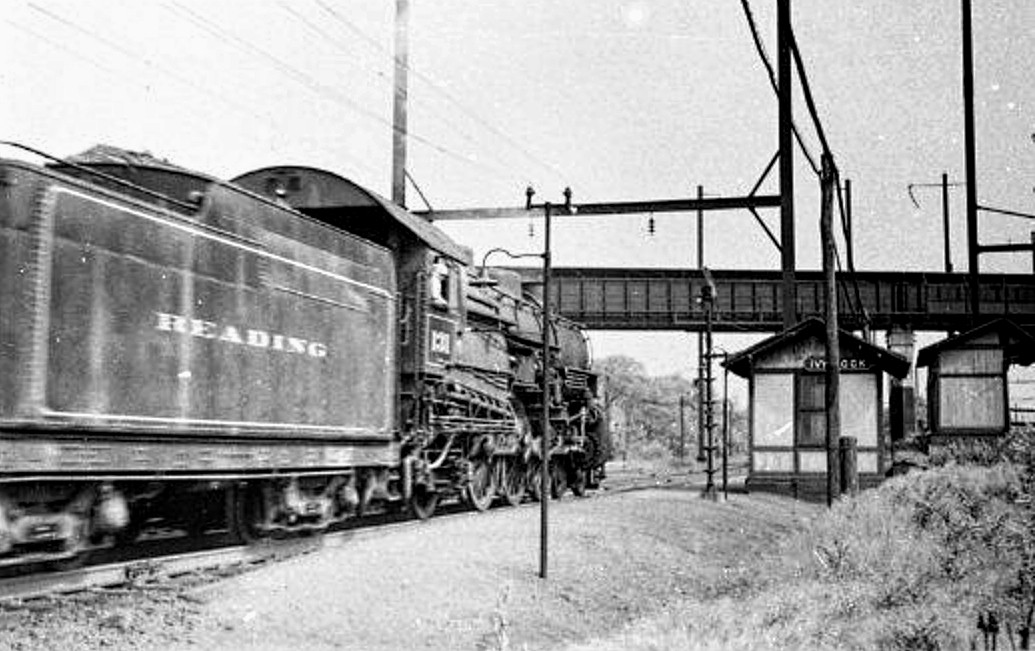
| Ivy Rock |
AND |
This station was located at approximately GPS: 40.090635, -75.320051 just south of the Upper Merion & Plymouth Rail Bridge. It served the Alan Wood Iron & Steel Company. It appears that there were two passenger shelters here (as seen in the photo), perhaps one for the RDG and one for the PRR. On the 1928 and 1942 Sanborn maps it is shown as one structure. The tracks next to it are designated as RDG on the 1928 map, but as PRR on the 1942 map. | Jenkintown |
|
This station was built in 1872 but was replaced in 1932 by the current station on the same site. | |||
| Jenkintown |
|
There was a freight station on a spur track near the intersection of Greenwood and Glenside Avenues at approximately GPS: 40.091926, -75.138309. | ||||||
| Kenilworth |
|
This small station/shelter was on the east side of Pottstown on NW side of South Keim Street at approximately GPS: 40.237904, -75.634498. | ||||||
| Kneedler Station |
|
This station was on the west side of the tracks near GPS: 40.221857, -75.292065. The station is shown on the 1893 county map. | ||||||
| King Of Prussia |
|
|||||||
| King Of Prussia |
|
This station was on the Trenton Cutoff. | ||||||
| Kratz |
|
|||||||
| Lafayette |
|
Both the Reading and PRR Lafayette station were on Manor Road as the tracks were close to each other and ran parallel here. This 1912 brick station replaced an earlier 1901 wood frame station. | ||||||
| Lafayette |
|
|||||||
| Lansdale |
|
The original wooden NPRR station was built in 1856. | ||||||
| Lansdale |
|
The second wooden NPRR combination station was at approximately the same location as the Reading (SEPTA) station that is still standing, just a bit to the south (GPS: 40.242706, -75.285117 ). It was built in 1868. | ||||||
| Laverock |
|
This station was on the Cresheim Branch which was opened in 1893. A shelter-type station was built here in 1896. | ||||||
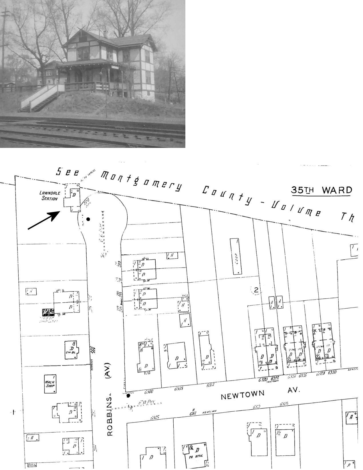
| Lawndale |
|
This station was at the NW end of Robbins Street on the SE side of the tracks (GPS: 40.051597, -75.102672). It was technically in Philadelphia County as the tracks followed the county line. Sanborn maps from 1927 indicate that the station also served as a dwelling. The station was closed in 1906 when the nearby New York shortline opened, but Lawndale reopened in 1916 as local demand grew again. | ||||||
|
Linfield (Limerick) |
|
The original station here was privately owned by two businessmen (messers Evans & Nettles). The railroad vacated that station in 1873 and took up residence in a hotel room. | ||||||
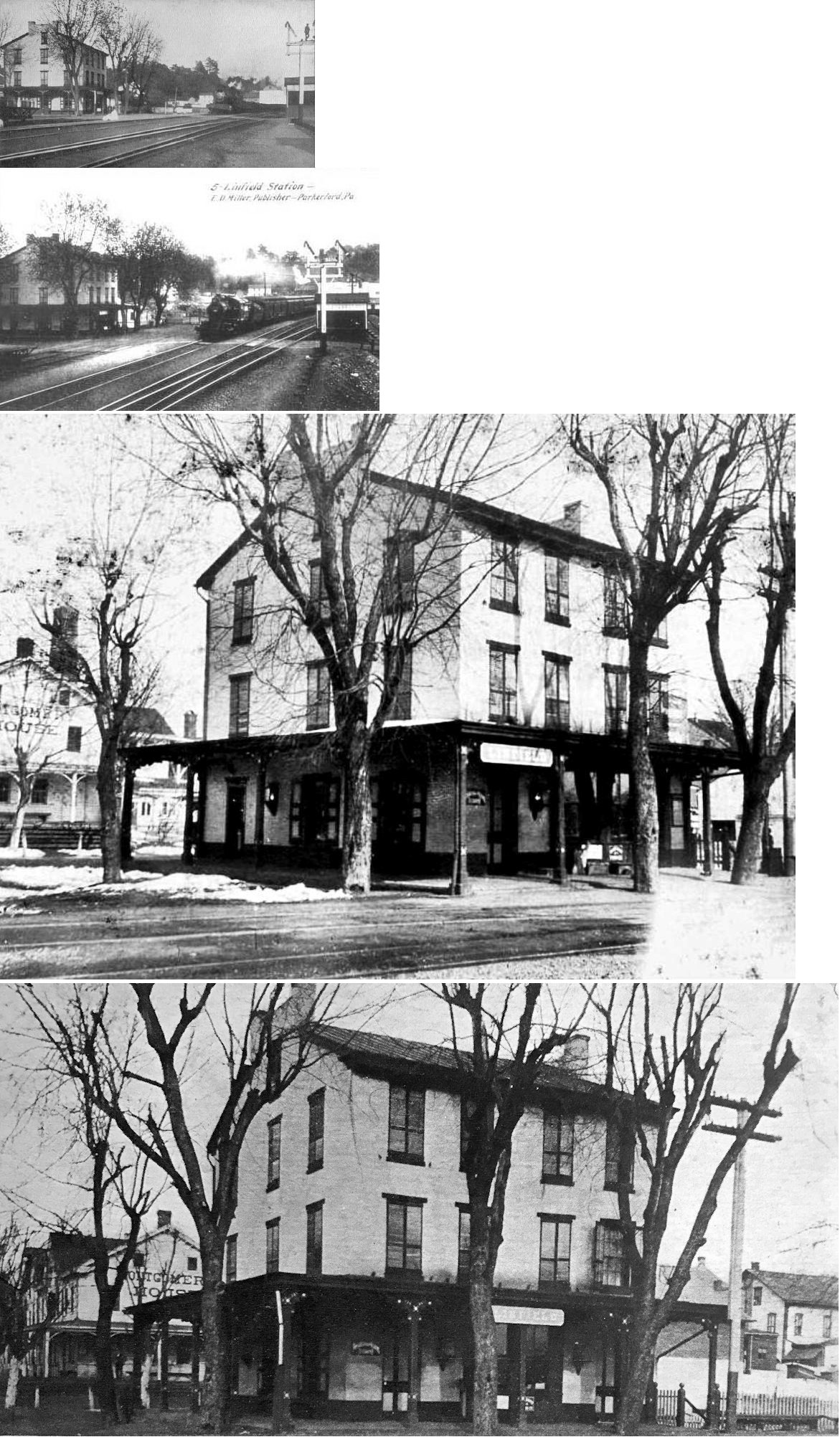
|
Linfield (Limerick) |
|
Built in 1877, this station was on the east side of Trinley Mill Road on the north side of the tracks (GPS: 40.210239, -75.566285). On the 1877 map, this town is called Limerick Station. There was a freight station just to the SW on a siding track at GPS: 40.210064, -75.566854. Although the station was built in 1877, it was constructed from plans from the 1850s which were inspired by 1830s tavern designs. The name was changed to "Linfield" in 1887. | ||||||
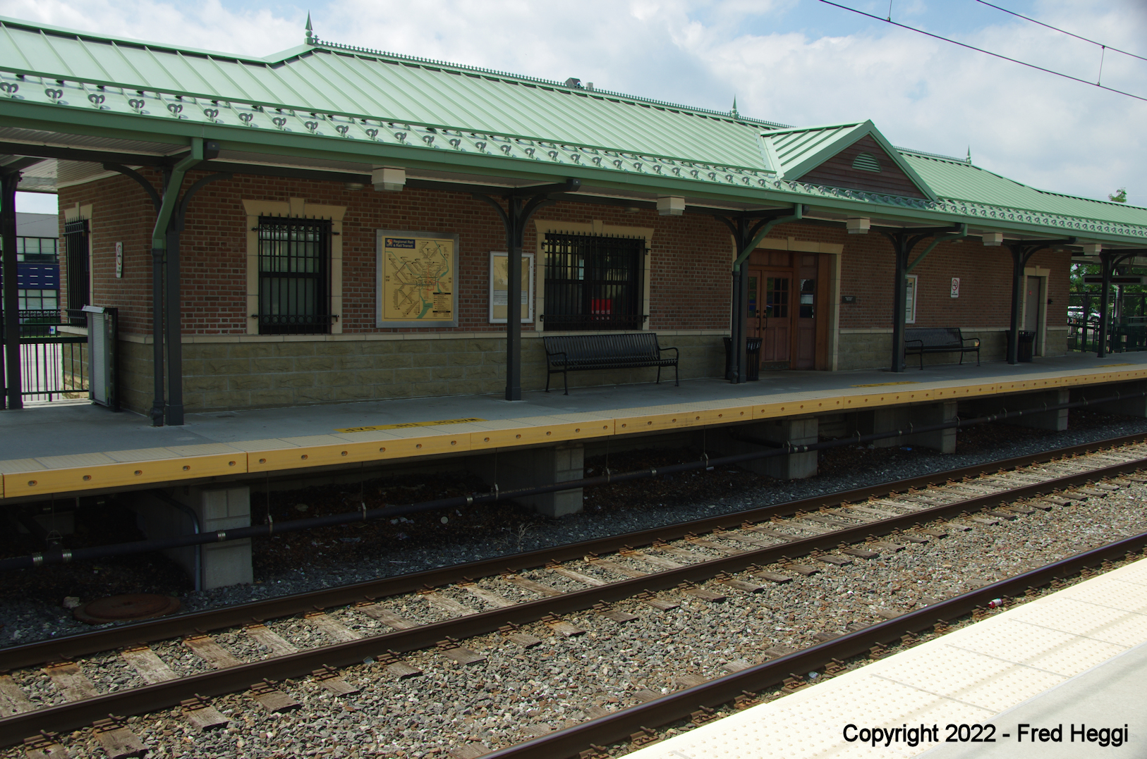
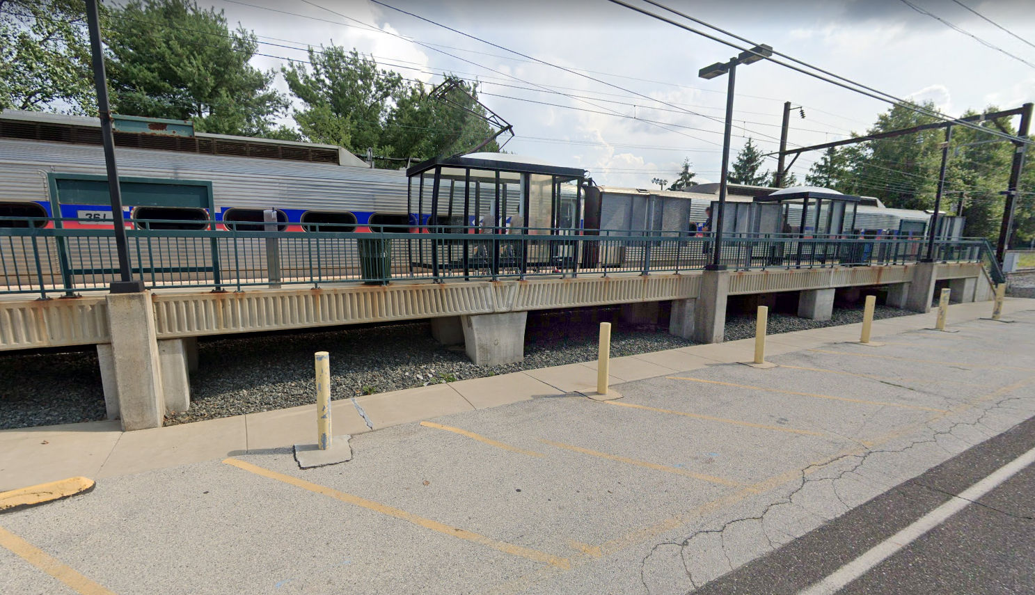
| Link Belt | |
The original Link Belt station was built in 1952. That station was replaced with the current platform and shelters by SEPTA. | ||||||
| Locustwood | |
This station was in the vicinity of Pawlings Road and Station Avenue around GPS: 40.114111, -75.455535. | ||||||
| Maple Station |
|
This flagstop station was on the east side of South Warner Road at approximately GPS: 40.079332, -75.400574. | ||||||
| McLeans |
|
This station was in the vicintiy of what is now McLeans Station Road and Gravel Pike (PA29). | ||||||
| Meadowbrook (Paul Brook) |
|
This station was on Old Valley Road at GPS: 40.111399, -75.092875. It burned down in April, 1995. | ||||||
| Melmar Station |
|
Melmar Station was west of where Melmar Road is today. It was on the West side of the tracks at approximately GPS: 40.105073, -75.074268. | ||||||
| Melrose |
|
This station was in the vacinity of Melrose and Mountain Avenues south of Elkins Park and Ashbourne stations. This station Was originally known as City Line Station (even though Oak Park was closer to the actual city line), but it was a bit north of the current location of the existing Melrose Park station. | ||||||
| Merion |
|
A new station was built here in 1864. | ||||||
| Mill Road Station |
|
On the Plymouth Branch. | ||||||
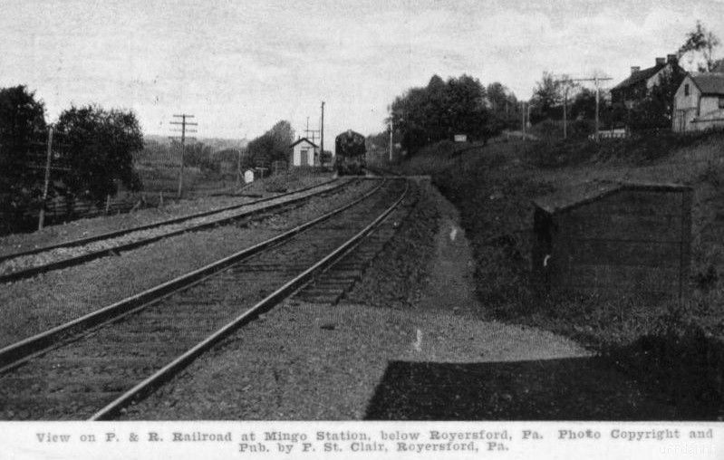
| Mingo Station | |
|||||||
|
Mogee (Mogeetown) |
|
This station was a bit NW of Ross Street at approximately GPS: 40.106989, -75.326680. As shown onthe 1893 map. | ||||||
|
Mogees (Earnest) |
|
This station was off of what is now Earnest Station Road on the east side of the RDG tracks at approximately GPS: 40.101769, -75.322035. | ||||||
| Mont Clare | |
This station was on the NW side of Bridge Street on the east side of the tracks (GPS: 40.137051, -75.505273). This station opened in 1884 when the railroad was completed between Pottstown and Norristown. | ||||||
|
Narberth (Elm Station) |
|
This station was built in 1870. It was renamed from "Elm" to "Narberth" in 1892. | ||||||
| Narcissa |
|
This station was on the Trenton Cutoff and is shown on the 1900 PRR List of Stations & Sidings at MP 17.8 (distance from Glen Loch station). | ||||||
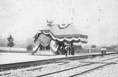
| Noble |
|
In the photo, the station is decorated for an 1889 visit from President Harrison. | ||||||
| Norristown (DeKalb Street) |
|
Built 1862, closed in 1932 and replaced with station that stille exists at this location on the west side of DeKalb Sreet at East Washington Street (GPS: 40.112586, -75.344206). | ||||||
| Norristown (Main Street) |
|
This was the Main Street Station located at the corner of Main and Markley Streets (GPS: 40.116844, -75.349147). The station was on the Stony Creek Branch that connects Norristown and Lansdale Pennsylvania. It was replaced with a modern shelter in the 1960's that is served today by Septa's R6 commuter rail line. | ||||||
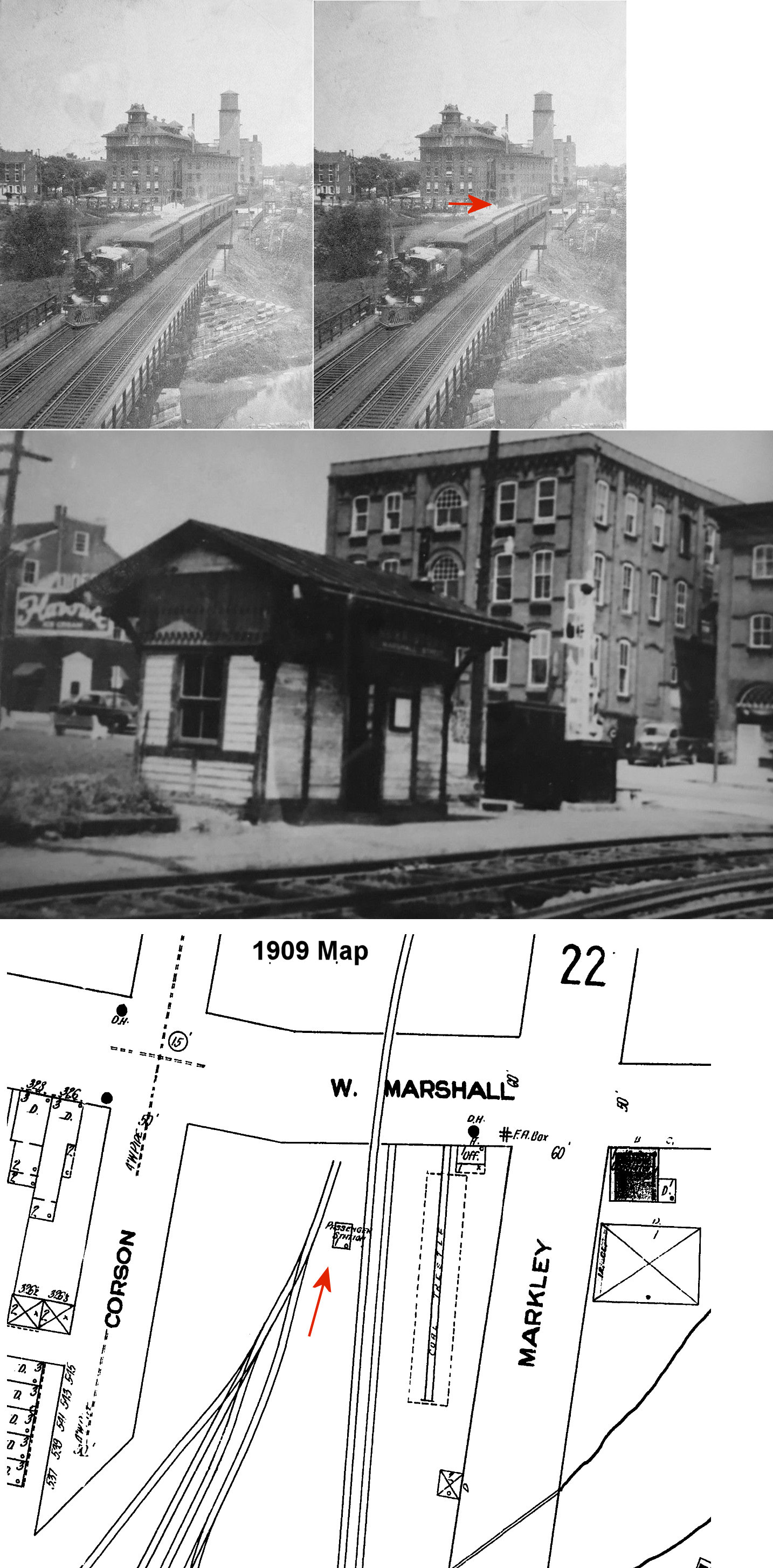
| Norristown (Marshall Street) |
|
This station was on Marshall Street between Courson Street and Markley Street (GPS: 40.118936, -75.347149). | ||||||
| Norristown | |
There was a small freight house under the West Airy Street bridge at GPS: 40.118130, -75.349085. | ||||||
| Norristown (Elm Street) |
|
There was a passenger platform and freight station on the north side of West Elm Street on the west side of the tracks (GPS: 40.122589, -75.345067) which was torn down in 1899. | ||||||
| Norristown (Mill Street) |
|
This combination station was on the corner of Mill and Washington Streets at GPS: 40.111781, -75.341049. There was a P&R engine house just to the north and the old Exchange Hotel was across Mill Street. | ||||||
| Norristown (Hospital Sta.) |
|
This station served the state hospital and was located on the NE side of Sterigere Street on the NW side of the tracks (GPS: 40.128106, -75.345818). The station is shown ont he 1893 county map. | ||||||
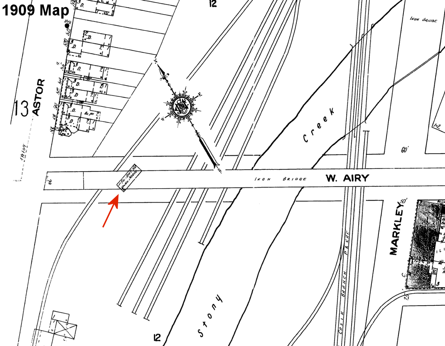
| Norristown | STONY CREEK RR |
The Stony Creek RR station was on the south side of West Airy Street between Courson Street (which no longer extends to Airy Street) and Astor Street at GPS: 40.118021, -75.349244. This station is shown on the 1893 map of the town and is shown as still standing and used as a freight station (under the West Airy Street overpass) on the 1920 map. | ||||||
| Norristown | |
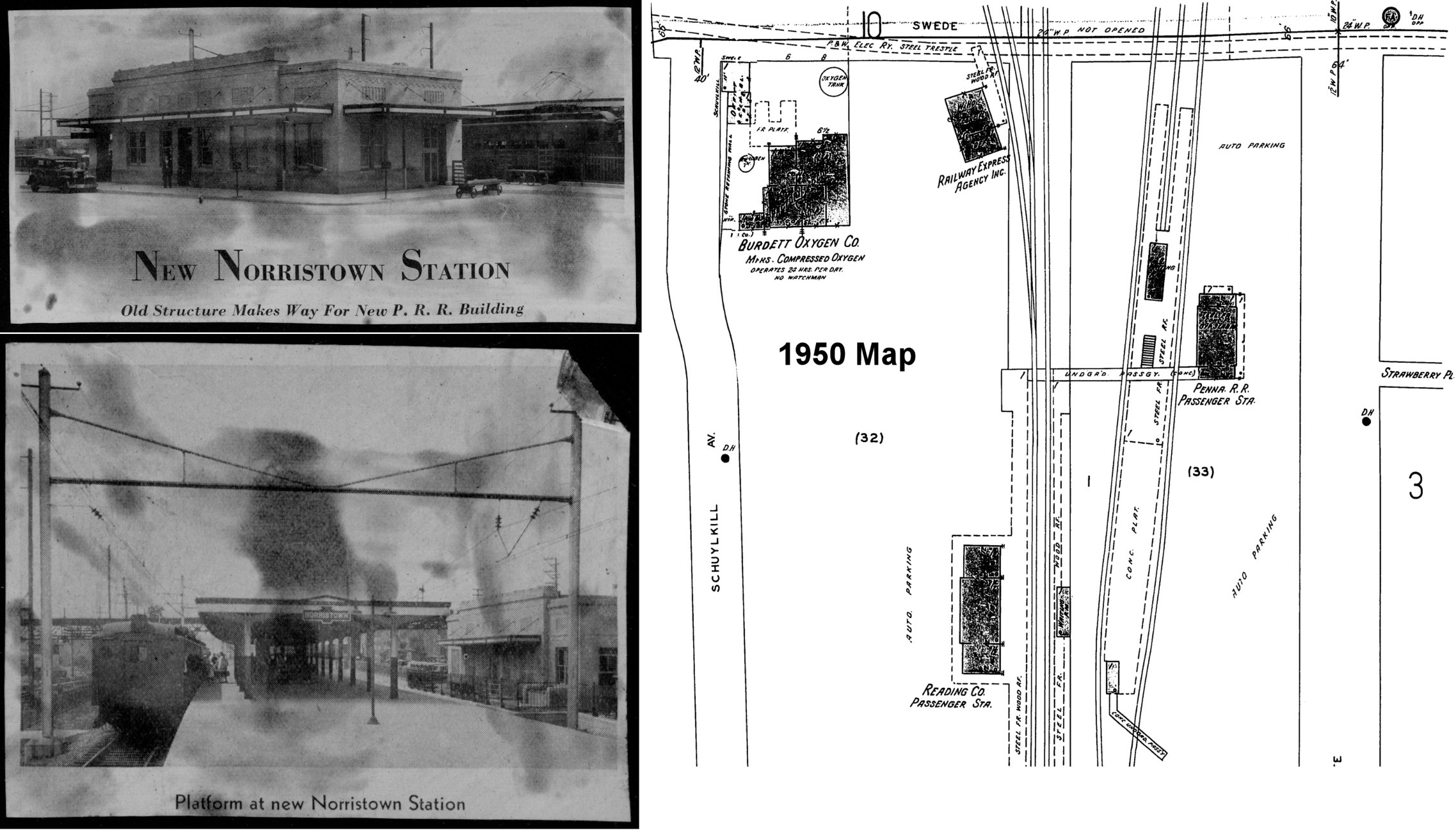
The original passenger (GPS: 40.112795, -75.342634) and frieght station (GPS: 40.112606, -75.342736) were on the corner of Lafayette and DeKalb Streets. All or part of the original passenger station became a freight shed (as seen on the 1920 Sanborn Insurance Map). The original one-story freight station was in the same location as the two-story freight station that replaced it in 1932. | ||||||
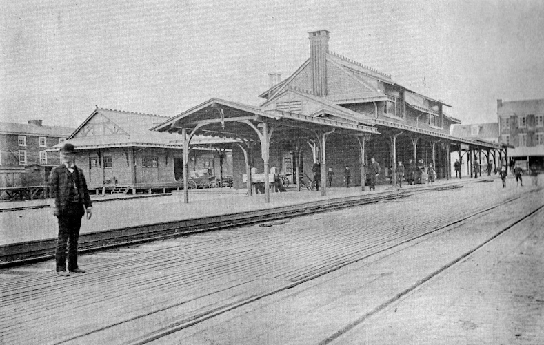
| Norristown | |
The second passenger station here was on East Lafayette between DeKalb and Swede Streets (GPS: 40.113244, -75.344063). It opened in 1903. | ||||||
| Norristown | |
The third-generation passenger station raplaced the one listed above at East Lafayette between DeKalb and Swede Streets (GPS: 40.113244, -75.344063). It opened in 1934 and served commuter trains until 1960. | ||||||
| Norristown (Franklin Ave.) |
|
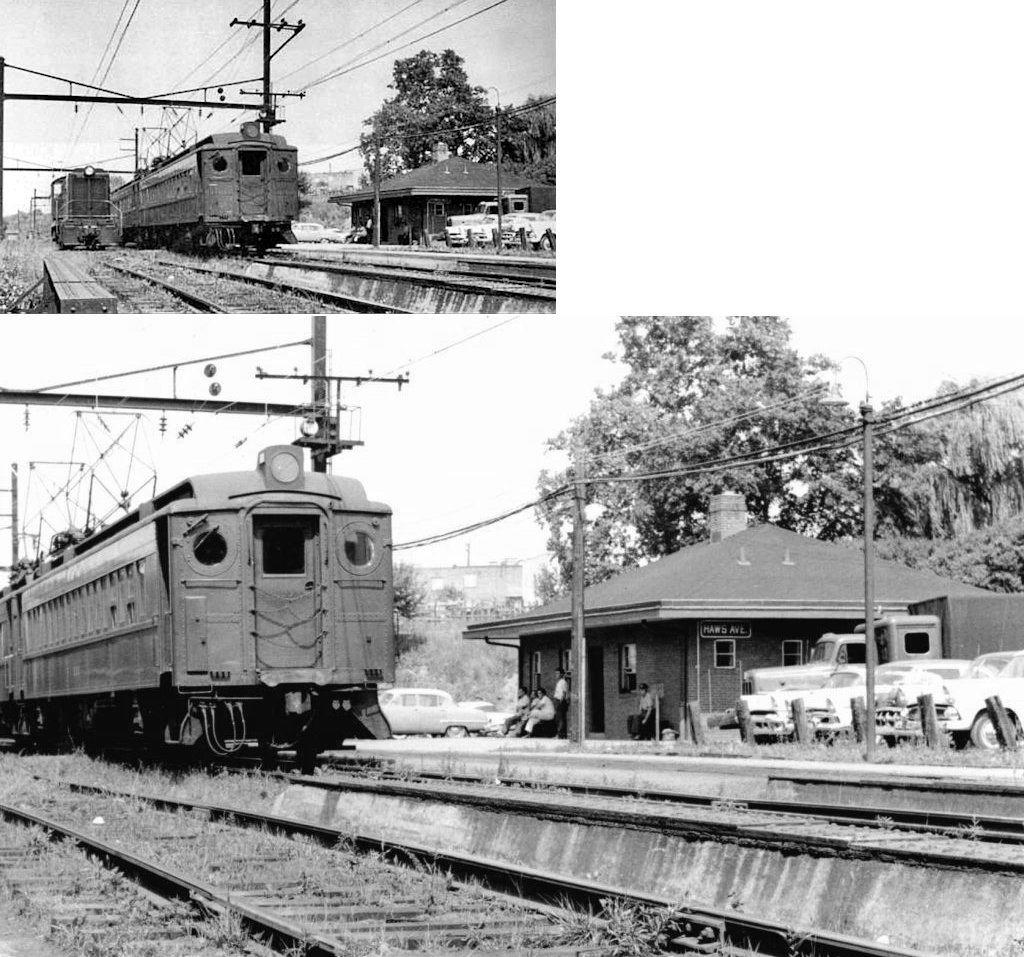
There was a newer passenger station on Haws Avenue at GPS: 40.116463, -75.355986. This was known as the Franklin Avenue Station before the street name was changed to Haws. The PRR YMCA was nearby on the corner of West Washington and Haws. | ||||||
| Norristown (Montgomery Cemetery) |
|
There was a station shown at this cemetery on the 1893 map at approximately GPS: 40.117558, -75.366445. | ||||||
| North Glenside (Edge Hill) |
|
The first station here was established in 1855 with a new one built in 1873 (making it the second station here), which is the station pictured here. This station served the Edge Hill Iron Works. It was SW of Glenside (Abington). The original Edge Hill NPRR station was a wood frame building on the west side of Station Avenue at GPS: 40.112133, -75.169868. This is the same location of the newer North Hills brick station that still exists here. In 1923, the name of the station was changed from Edge Hill to North Glenside, and then renamed to North Hills in 1931, before then being rebuilt when the bridge over North Hills Avenue was built. The original stations were at the same approximate location as the current North Hills station. The NPRR freight house was on the north side of the tracks on the east side of Station Avenue at GPS: 40.112106, -75.169379. | ||||||
| North Hills | |
There was a small wooden freight station here near the passenger station as shown on the 1925 Sanborn map of Glenside and surrounding area. | ||||||
| North Wales |
|
There was a freight station across the tracks to the NE of the passenger station at GPS: 40.214909, -75.277313. It was torn down in 1981 to make a larger parking lot for SEPTA riders. | ||||||
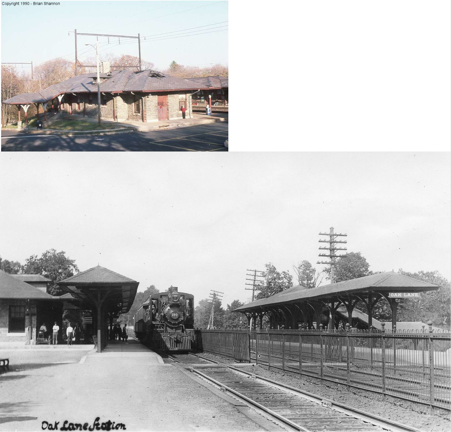
| Oak Lane (Melrose Park) |
|
The inbound (to Philadelphia) ticket office and waiting room (pictured) burned down in the mid-90's. The only piece left of the old inbound station is the southern two sections of the platform shelter. SEPTA has built a new station. | ||||||
| Oak Lane |
|
|||||||
| Oaks |
|
The first station here was built in 1866 and burned down in 1872. | ||||||
| Oaks |
|
The second Perkiomen RR station here was built in 1873. | ||||||
| Oaks (Perkiomen) |
|
This station was on the NE side of the tracks at the intersection of Brower Avenue and Pennco Road at approximately GPS: 40.128974, -75.460621. It was torn down in the early 1970s. The station was originally known as "Perkiomen" with the name changed to "Oaks" in 1910. | ||||||
| Oreland | |
Built 1890, closed in 1931. | ||||||
| Oreland |
|
This station, shown on the 1883 NPRR railroad map, was at the NE end of what is now Plymouth Avenue where the tracks come together at GPS: 40.119314, -75.186753. It was built in 1855. | ||||||
| Orvilla |
|
|||||||
| Palm | |
|||||||
| Paper Mills Station |
|
This shelter-type station was on the north side of Paper Mill Road on the west side of the tracks (GPS: 40.140257, -75.074193). | ||||||
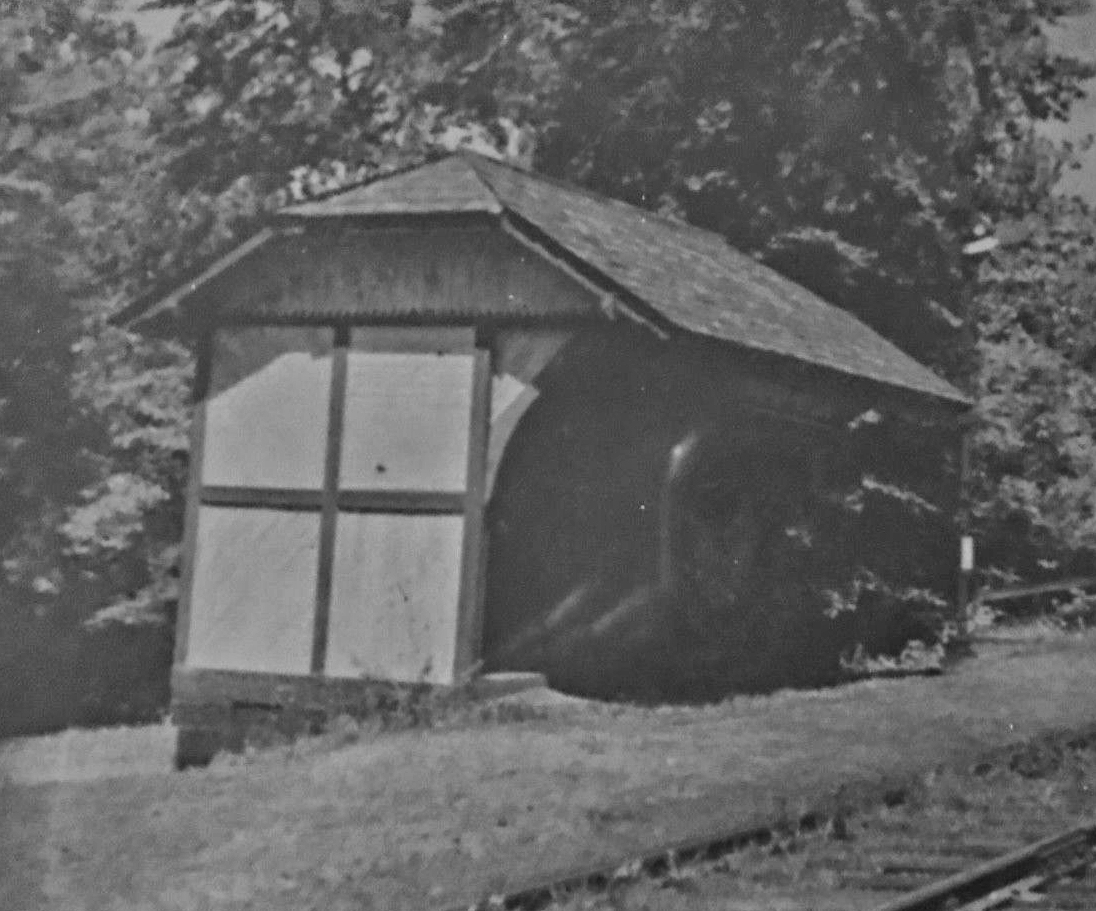
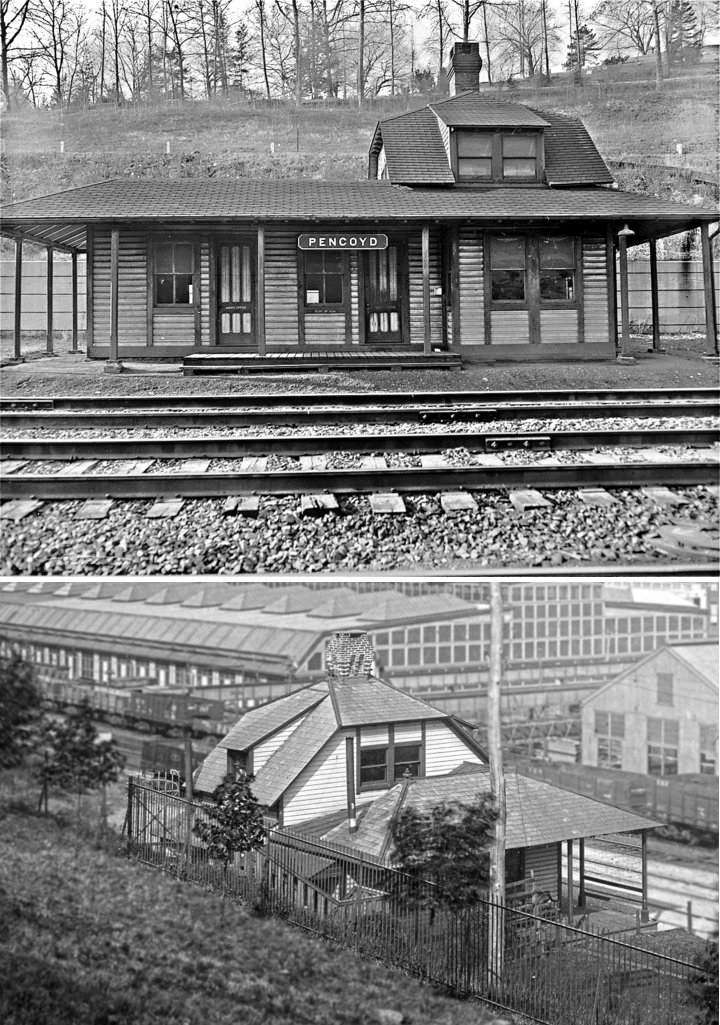
| Pencoyd Station | |
This station was on Righters Ferry Road on the SE side of the tracks and served the Pencoyd Iron Works. It was at approximately GPS: 40.015747, -75.214947. There was also a siding at the station of funeral trains for West Laurel Hill Cemetery. | ||||||
| Penllyn |
|
There was an NPRR station here that predated the Reading station. | ||||||
| Penllyn |
|
There was a freight station across the tracks from the existing passenger station. It was torn down in 2005 to add more parking spaces for the passenger station. | ||||||
| Pennbrook |
|
|||||||
| Pennsburg |
|
|||||||
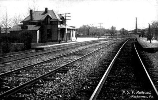
| Perkiomen | |
This station was just south of Oaks where the PRR crossed the Perkiomen RR. | ||||||
| Perkiomen Junction | |
|||||||
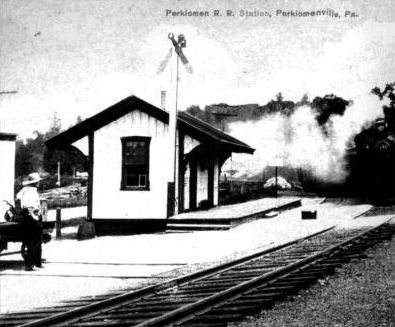
| Perkiomenville |
|
This was the original station. It was built in 1872 and was on the east side of Gravel Pike (PA29) at approximately GPS: 40.326700, -75.476419. | ||||||
| Perkiomenville |
|
This was the second station here. | ||||||
| Plymouth Meeting |
|
|||||||
|
Plymouth Meeting (Tyrol Station) |
|
This was likely a Plymouth RR/RDG station. | ||||||
| Plymouth Meeting |
|
There was a small freight station at the corner of Gravers Road and Chemical Road at approximately GPS: 40.102461, -75.291754. This is shown on the 1942 Sanborn map (of Norristown). | ||||||
| Port Indian |
|
This station was on Port Indian Road at approximately GPS: 40.119621, -75.391448. | ||||||
| Port Kennedy |
|
This station opened in 1884 when the railroad was completed between Pottstown and Norristown. | ||||||
| Port Kennedy |
|
The original station here was in a room at the Port Kennedy Hotel. The original station built by the railroad was built sometime after 1871, but was demolished in a wreck in 1899. After that a temporary station was moved here from Port Richmond which served until the new brick station was built in 1904. | ||||||
| Port Providence |
|
This station was on the west side of Hollow Road on the south side of the tracks (GPS: 40.130918, -75.492897). | ||||||
| Pottstown | |
The original brick P&R station was built in 1867 and closed in 1929. This station was at the same location on the west side of South Hanover Street as the existing station (GPS: 40.245012, -75.652139). | ||||||
| Pottstown | |
There was a brick freight station behind the passenger station on a spur with frontage on High Street at (GPS: 40.245734, -75.652018). Next to it, to the west, was the P&R carpentery shop which was later converted into an additional freight house (as shown on the 1925 map). | ||||||
| Pottstown (Stowe) |
|
The original Stowe station was moved in 1902 at the request of the Stanley G. Flagg Company. | ||||||
| Pottstown (Stowe) |
|
Built 1912 and closed in 1953, this was the second Stowe station. It was on the south side of West High Street on the north side of the tracks at GPS: 40.245552, -75.681021. It served the iron works there via a foot bridge over the tracks. | ||||||
| Pottstown (Mill Park) |
|
This station was on the Coleborookdale Branch north of West King Street at GPS: 40.248891, -75.659110. This station is shown on the 1893 county map. It was likely only a shelter or platform. | ||||||
| Pottstown (Glasgow Sta.) |
|
This station was on the Colebrookdale Branch, on the north side of Glasgow Road, on the west side of the tracks, at GPS: 40.262473, -75.661771. It served the Glasgow Iron Works. This station is shown on the 1893 county map. It was likely only a shelter or platform. | ||||||
| Pottstown |
|
This station was on the east side of Hanover Street on the north side of the tracks (GPS: 40.242805, -75.650814). It was built around 1884 and last used for train service in 1953. It was purchased by the Mrs. Smith Pie Co. in 1963 and then demolished by the company in 1965. | ||||||
| Pottstown |
|
There was a small freight station in the middle of the block bordered by Laurel Street, South Franklin Street, South Evans Street and what is now Industrial Parkway (GPS: 40.240859, -75.645892). At some point this station was replaced or expanded as a larger building is shown at this location on the 1920 map comapred those from the late 1800s. | ||||||
| POTTSTOWN (Steel Works) |
|
This station was inside the Pottstown Iron Company steel plant on the north side of the tracks at GPS: 40.245147, -75.674375. | ||||||
| Pottstown (Bramcote STA.) |
|
Like the Pottstown (Stowe) RDG station and the Steel Works PRR station listed above, this station was likely was built to serve industry on the west side of town. This station was located on the north side of Old Reading Pike at GPS: 40.243353, -75.686683. | ||||||
| Protectory Station |
|
This station is shown on the 1912 county map. | ||||||
| Rahns
(Iron Bridge) |
|
This station was on the south side of Bridge Road on the west side of the tracks. | ||||||
| Rambo |
|
This station was on the Trenton Cutoff at MP 14.4 (distance from Glen Loch station). | ||||||
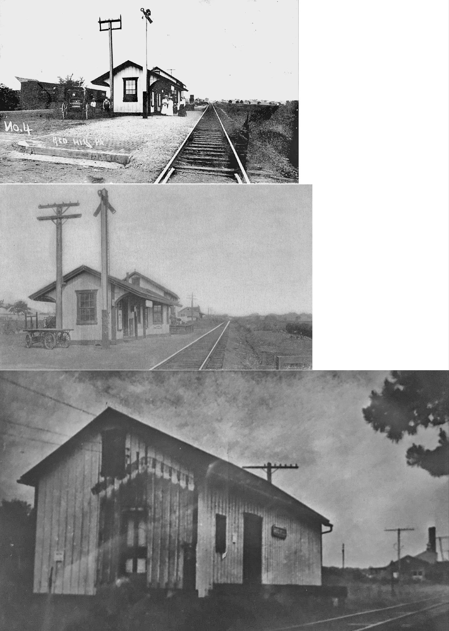
| Red Hill |
|
|||||||
| Reliance |
|
This station was built in 1887 and closed by 1928. It was on the NW side of East Reliance Road (formerly Fairmount) on the SW side of the tracks at GPS: 40.317780, -75.329819. | ||||||
| Ridge Road |
|
This station was on the Plymouth Branch. | ||||||
| Rockledge | |
This station was on Shady Lane. | ||||||
| Rose Glen | |
See listing above for Gladwyne. | ||||||
| Rosemont |
|
A new station was built here in 1863. A second story was added to the station in 1910 (not sure if that was the original station though). | ||||||
| Roslyn Heights (Enfield) |
|
This station was on the Cresheim Branch which was opened in 1893. A shelter-type station was built here in 1896. The station was renamed "Enfield" in 1910. | ||||||
| Roslyn |
|
|||||||
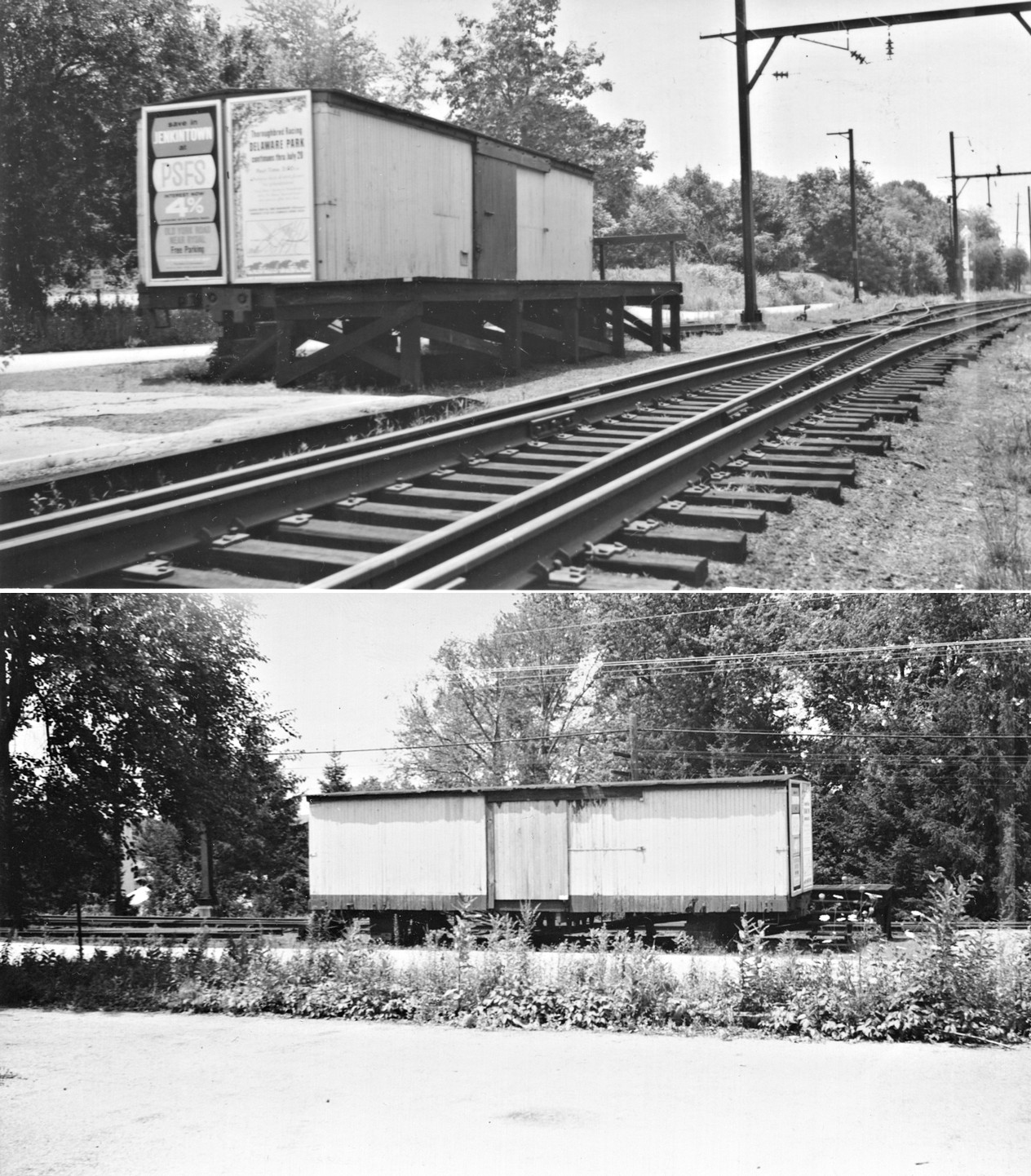
| Roslyn |
|
A old boxcar was used as a freight station here. | ||||||
| Royersford | |
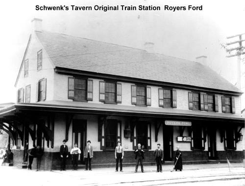
The original Royersford P&R station was a tavern before the railroad came through town. The old Schwenk's Tavern was in service from 1839 until the "new" station went into service in 1867. | ||||||
| Royersford | |
This was the second station at Royersford. It was on the west side of the tracks, but closer to Main Street (GPS: 40.183190, -75.543394) than the current station. There was a freight station behind the passnger station (to the north). Some sources say this building was the original Schwenk's Tavern, but the book Reading Railroad Station Pictorial by Bernhart & Bernhart (1999) idicates that railroad built this station 1867. | ||||||
| Royersford | |
This was the second freight station at Royersford, likely constructed around 1931 when the new passenger station was erected. It was on the west side of the tracks north of Main Street at GPS: 40.184071, -75.543910. | ||||||
|
Rubicam (Crestmont) |
|
This station was on Rubicam Avenue near where the current Crastmont SEPTA stop is. | ||||||
| Salford | |
This station was supposedly dismantled and relocated to Cepp Road. Does anyone know if it still exists or what its eventual fate was? It's original location was on Salford Station Road at GPS: 40.295550, -75.454194. The station was originally called "Zieglers Mill" and was built in 1869. | ||||||
| Sanatoga | |
This station was on Sanatoga Road east of Pottsville. It was likely only a shelter or platform. | ||||||
| Sandy Hill |
|
This station was on the Cresheim Branch. This was likely a shelter or platform only. | ||||||
| Sandy Run Station |
|
This station was on the north side of Camp Hill Road on the SW side of the tracks (GPS: 40.124183, -75.198614). | ||||||
| Schwenksville |
|
Original station, burned down March 8, 1942. | ||||||
| Souderton |
|
This station was built in the 1860s and sat on the NE side of the tracks on the NW side of Broad Street (GPS: 40.309870, -75.321135). | ||||||
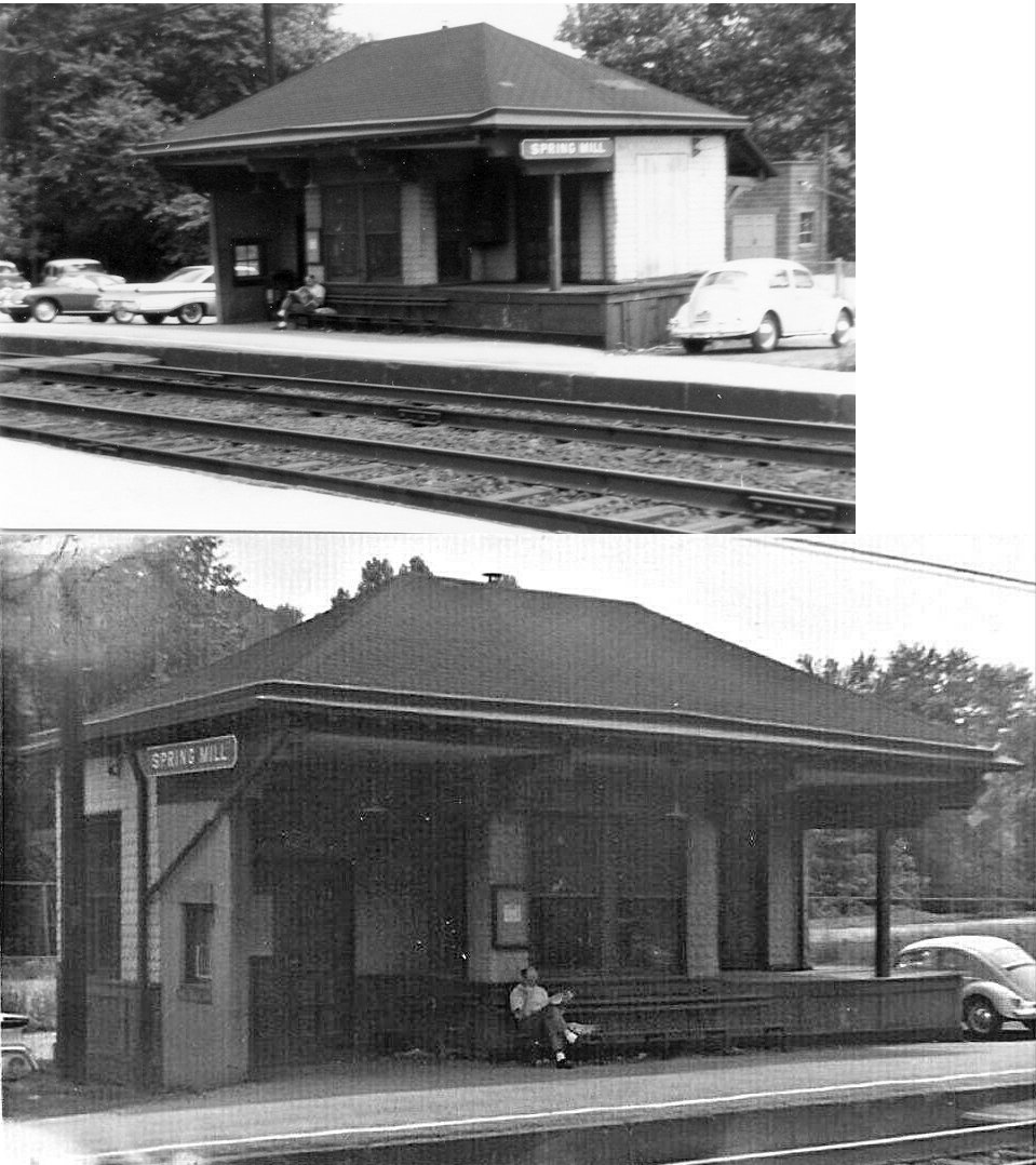
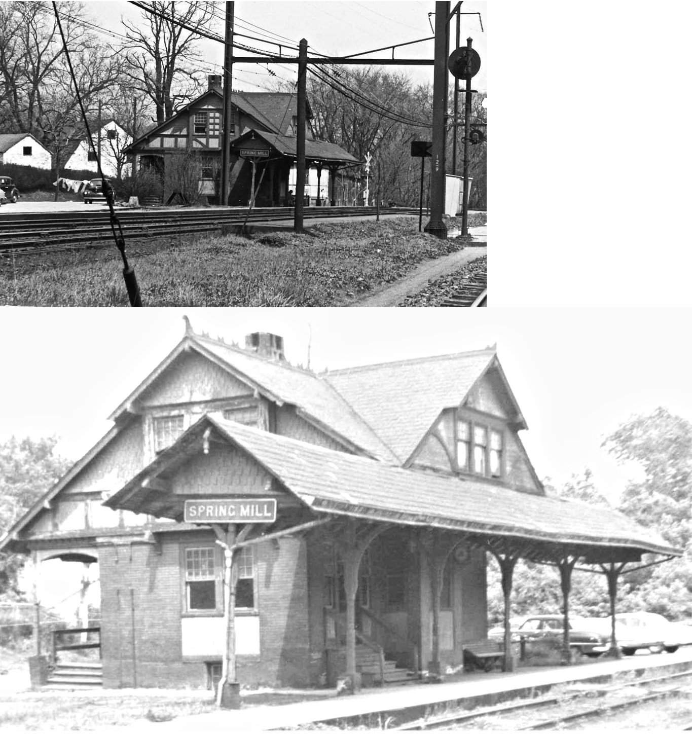
| Spring Mill | |
The first Spring Mill station was closed by the P&R in 1872, but re-opened the next year after public pressure to keep the station. | ||||||
| Spring Mill | |
This small wood frame combination station was built in 1911. It was on the south side of the tracks on East North Lane/Station Avenue at GPS: 40.074160, -75.285812. | ||||||
| Spring Mill |
|
This passenger station was on the north side of the tracks on East North Lane/Station Avenue at GPS: 40.074435, -75.285838. It was across the tracks from the P&R station. | ||||||
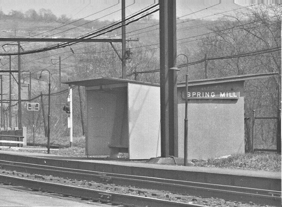
| Spring Mill |
|
A later-generation shelter/waiting shed. | ||||||
| Spring Mount (Frederick Sta.) |
|
An earlier station here built in 1884. Formerly known as Frederick Station. | ||||||
| Spring Mount |
|
A later brick station. | ||||||
| Stowe |
|
See the listings for Pottstown (Stowe) above. | ||||||
| St. Thomas (White Marsh) |
|
A station was built here in 1891 when passenger service began on this part of the Trenton Cutoff. The station was renamed "White Marsh" in 1913. This station was on the south side of the tracks on the north side of Camp Hill Road (GPS: 40.122471, -75.216608). This was the Northern terminus of the Cresheim Branch at the Trenton Cutoff. | ||||||
| Sunnybrook (Arlingham) |
|
This station was on the Cresheim Branch. This was likely a shelter or platform only. It is shown as Arlingham on the 1916 county atlas. It was at the SE end of Fleming Road (GPS: 40.117232, -75.203377). | ||||||
| Swedeland |
|
This station was off River Road near PA-320. | ||||||
| Swedesburg |
|
The 1920 and 1927 maps show a freight station here at GPS: 40.101423, -75.329356. | ||||||
| Telford (W. Telford) |
|
There was an earlier NPRR station here before the 1904 station that still exists. That station burned in May, 1903. | ||||||
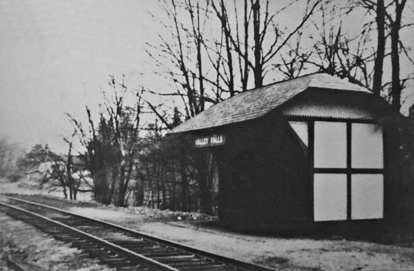
| Valley Falls | |
This station was on Huntingdon Pike north of Pennypack Creek on the west side of the tracks at GPS: 40.113567, -75.072515. | ||||||
| Walnut Hill | |
|||||||
| West Conshohocken | |
This station was on Fayette Street on the NE side of the tracks on what is now Bar Harbor Drive at GPS: 40.069641, -75.310576. | ||||||
| West Laurel Hill |
|
See listing for Barmouth above. | ||||||
| West manayunk (Outbound) |
|
This station was on River Road between Belmont and Ashland Avenues. It was built in 1877 when it replaced an earlier building. Though passenger service ended in 1912, it was used until 1952, when demolished during construction of the Schuylkill Expressway. | ||||||
| West
Manayunk (Inbound) |
|
The inbound station was at River Road, but became accessible via Jefferson Street in 1924. It was built in 1839. After passenger service ended in 1912, it remained as a railroad tool shed and its wood exterior was eventually covered with shingles. It was demolished by Conrail in 1980. | ||||||
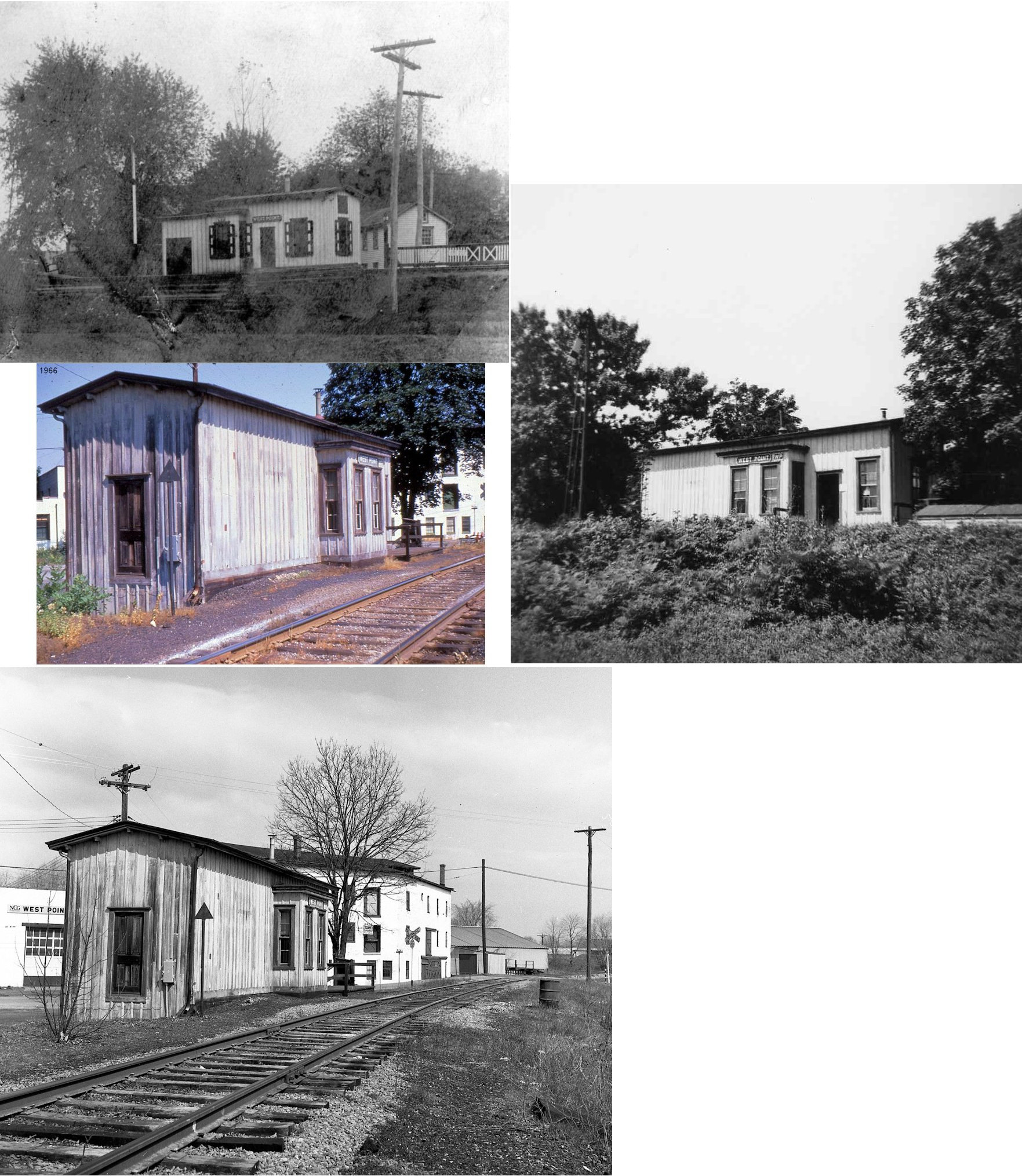
| West
Point (Lukens Station) |
|
Built 1873-4. The station was
named Lukens Station after the owner of the land, Jonathan Lukens. It
was situated in the "west point" end of Upper Gwynedd Township, which
was then farmland. Lukens and his neighbor, Amos Jones, split some of
their farmland into lots, sold them, and houses were built. In 1878 a
Post Office was built, and named the West Point Post Office. Lukens
Station became the West Point station. --Mike Simpson This station was located off of Main Street between Moyers Boulevard and Garfield Avenue. The station derived its later name as a result of 2 businessmen from a neighboring town of North Wales. These men started a feed and grain business there and they named it West Point because it was west of the business they had in North Wales. --George Slater |
||||||
| White Marsh (St. Thomas) |
|
See listing above for St. Thomas. | ||||||
| White Marsh (Abington Road) |
|
This station was between Flourtown and Oreland. | ||||||
| Williams |
|
This station was on the SW side of Stenton Avenue on the north side of the tracks on the Plymouth Branch. | ||||||
| Willow Grove | |
Built in 1886, this station was replaced as passenger station by newer (1939) station that is still standing. | ||||||
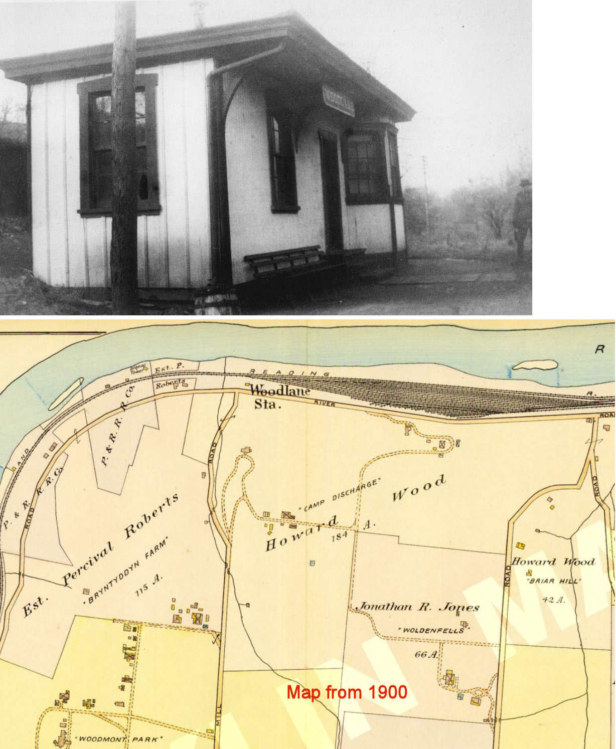
| Woodlane (West Spring Mill) |
|
This station, built in 1882, was near the intersection of Spring Mill and River Roads in the vicinity of GPS: 40.068471, -75.278771. The station was originally known as "West Spring Mill," but was changed to "Woodlane" in the 20th Century, due to the Alan Wood estate, which bordered the property. | ||||||
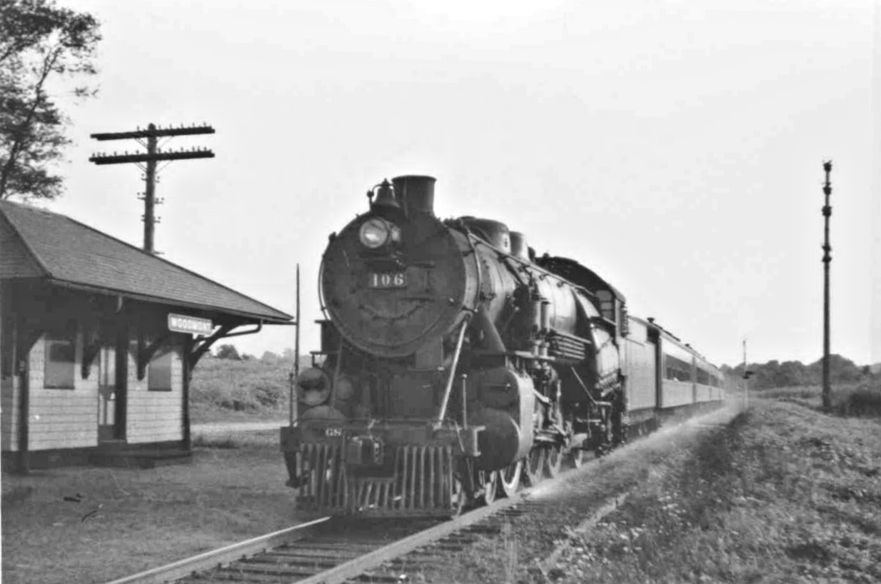
| Woodmont |
|
This station was on the north side of Byberry Road on the west side of the tracks (GPS: 40.157717, -75.072467). It was between Paper Mills and County Line stations. | ||||||
| Woodside Station |
|
This station was on the north side of what is now Creek Road Trail on the east side of the tracks (GPS: 40.151870, -75.074563). | ||||||
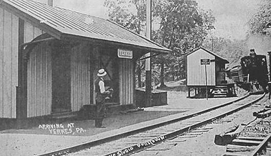
| Yerkes |
|
This station was on the south side of Yerkes Road on the east side of the tracks (GPS: 40.169693, -75.463947). It was built in 1881. A freight house was built in 1895. | ||||||
| Zieglerville |
|
This station was built in 1881. Prior to that there was a privately-owned station here. The station was on the NE side of Gravel Pike (PA73). It was at the south end of the bridge that spanned Swamp Creek near the confluence with Perkiomen Creek at GPS: 40.267950, -75.466549. | ||||||
| 1895 MONTGOMERY COUNTY RAILROAD MAP | ||||||||
 |
||||||||
| Notes About Existing
Stations... Ambler (NPRR - Passenger) - Some sources have this station as being built in 1877. The original station here was built in 1855. It is unclear if this was the original station or the second station. Ambler (NPRR - Freight) - This freight house is shown on the 1896 map. Barmouth (PRR) - This was the Barmouth Station on the Cynwyd Line that branched off from the westbound PRR mainline just west of the Phila Zoo, and ran north through Wynnefield Avenue, Bala, Cynwyd, and then Barmouth Station just north of Belmont Avenue, as it entered West Laurel Hill Cemetery and then ultimately crossed north over abridge that spans the Schuylkill River. It was originally known as the West Laurel Hill Station until the railroad changed the name to "Barmouth" in 1906. Bryn Athyn (RDG) - This is on the Newtown Branch, same line as Churchville and Southampton. This line has been out of service since mid 1980's but SEPTA still plans on reactivating line in the future for commuters. Original Station was enlarged in 1927 to add what is now the post office. Station is located at RR milepost 15.10. SEPTA does not consider tracks as abandoned, only "out-of-service." Bryn Mawr (PRR) - This station is built in mid-20th century colonial style. About 50 feet east of the eastbound station is a stone freight shed, dating to about 1870; it is now a restaurant. On the westbound side is a splendid yellow brick-and-copper interlocking tower. The station that it replaced was torn down in 1963 when this one was erected. Bryn Mawr (PRR - Frieght) - This is the baggage/freight house that was on the opposite side of the tracks from the original combination station. The rest of the old station was torn down, but this portion remains. Conshohocken (PRR) - This station was reduced to one-story following a remodel in the 1940s after passenger traffic dropped. It lay vacant for several years until it was renovated again into a business in 1982. Conshohocken (SEPTA) - Station's ticket office is a portable building with a small waiting shelter sitting adjacent to it. This station is at the former location of Pennsylvania Railroad passenger depot. In 2017, SEPTA announced that a new Conshohocken station and platform would be built, with construction starting in 2019. (according to: https://www.septa.org/rebuilding/station/conshohocken.html.) That new station appears to have not gotten underway so far. Glenside (NPRR) - Formerly called Abington Station. Haverford (PRR) - This brick station and post office was added on the south side of the tracks in 1916. Jenkintown (RDG) - Designed by Horace Trumbauer. This station has been known in more recent times as Jenkintown-Wyncote. Upgrades to the station are planned for the next few years. Here is an article about that. Melrose Park (RDG) - The inbound (to Philadelphia) ticket office and waiting room burned down in the mid-90's. That is the building on the left in the old Oak Lane photo. The only piece left of the old inbound station is the southern two sections of the platform shelter. SEPTA has built a new station. Merion (PRR) - This is truly the best-maintained station on the line. The Merion Civic Association maintains the buildings, and they could easily be placed in Germany. Brick platforms, red brick and yellow stucco walls with green window frames and window boxes full of geraniums, plus a very busy schedule and lots of commuter use make this the ultimate example of a great station. Miquon (RDG) - This is a 1-story red-brick station with a low hipped roof. There is also an inbound wooden passenger shelter. The name "Miquon" is a Lenape Indian word meaning "feather" and was given to William Penn as a humorous nickname after he tried to explain to the natives what his last name meant (they also gave him the respectful name "Onas" meaning "friend"). North Wales (NPRR) - The original station was located about 2500 feet south of the present station. When the new station was built, it had iron supports under the overhanging roof instead of wooden beams. The station also had a cupola located on the roof centered over the ticket agent's office (Similar to Glenside and Doylestown). The station was remodeled by SEPTA in 2008 and there is a concrete platform with passenger shelters for SEPTA passengers. Old York Road Station (NPRR) - This station was also known as Ogontz Station and closed to passenger service in 1899 when the new Elkins Park station (formerly known as Ashbourne Station on the NPRR) opened just a 1/4 mile or so down the line. The station was still used for freight for some time. The station is shown on the 1886 NPRR map where the village there is called Showmakerstown. Pennbrook (SEPTA) - There is no station building here, just two shelters sheds made of metal and plexiglass on concrete platforms. Port Kennedy (RDG) - Passenger service ended 1980. SEPTA renamed this station Valley Forge at some point. Whitehall (PRR) - Built in 1860 this was the first Bryn Mawr station that served the original PRR route. The PRR straightened the line in 1868 and built a new station. Used as the Bryn Mawr Hospital Thrift Shop. The station was built in 1860 by the PRR so they could have a telegraph office in Whitehall. It was subsequently enlarged in 1863. Prior to 1860, the station here was across the street in the White Hall Hotel. The station stopped being used by the railroad in 1868 when the new tracks 1/2 mile north went into operation and passengers began using the Bryn Mawr station. Wynnewood (PRR) - This stone station is in excellent repair. The stonework is finely-cut gray "rubble" with green stone trim. The platforms are herringbone brick and the platform roofs are "railroad gingerbread." |
||||||||