|
|
||||||||
| EXISTING STATIONS | ||||||||
|---|---|---|---|---|---|---|---|---|
| Station Name |
Original Railroad |
Current Location |
Type | Current Use |
Date Built |
Track Status |
Building Material |
More Info |
| Aspinwall |
 |
235 Commercial Avenue (GPS: 40.490120, -79.903538) |
C | Business | 1892 | None | Wood |
|
| Boyce |
 |
1050 Boyce Road (GPS: 40.318262,-80.113576) |
P | Business | ???? | In Use | Wood | |
| Bridgeville |
|
Corner of Station and Railroad Streets (GPS: 40.358096, -80.110749) |
P | Library | 1870 | In Use | Wood | |
| Bridgeville |
|
Bower Hill Road at Railroad Street (GPS: 40.359336, -80.109260) |
F | Business | 1870 | In Use | Wood |
|
| Clairton |
|
East side of State Street (PA837) north of St. Clair Avenue (GPS: 40.293341, -79.874033) |
F | Business | 1903 | In Use | Wood | |
| Coraopolis |
 |
Mill Street between 3rd and 4th Avenues (GPS: 40.518938,-80.163825) |
P | Vacant | 1895 | In Use | Brick |
|
| Coraopolis |
|
Mill Street between 3rd and 4th Avenues (GPS: 40.519158,-80.164447) |
F | Business | 1901 | In Use | Brick | |
| Edgewood |
|
101 East Swissvale (GPS: 40.433395, -79.884846) |
P | Business | 1905 | In Use | Wood | |
| Edgeworth (SHIELDS) (Church Lane) |
 |
SW end of Church Lane above Ohio River Boulevard (PA 65). (GPS: 40.553367, -80.201066) |
P | Residence | ???? | None | Wood |
|
| Elizabeth |
|
Eastern corner of South 1st Avenue and Plum Street (GPS: 40.272618, -79.887630) |
P | Vacant | 1889 | In Use | Wood | |
| Glassport |
|
6th Street & Allegheny Avenue (GPS: 40.325761, -79.893621) |
P | Vacant | ???? | In Use | Brick | |
| Glassport |
|
Oak Way near 3rd Street (GPS: 40.331365, -79.893060) |
F | Business | ???? | Gone | Brick | |
|
Glen Osborne (Osburn) |
|
1105 Ohio River Boulevard, Sewickley (GPS: 40.531869, -80.174283) |
P | Residence | 1892 | Gone | Wood |
|
| Homestead |
|
East 5th & East 6th Streets at Amity Street. (GPS: 40.407998,-79.9124) |
C | Civic | 1906 | In Use | Brick |
|
| Ingram |
 |
2725 Center Street at East Prospect Avenue (GPS: 40.444524, -80.065602) |
P | Business | ???? | Gone | Brick |
|
| Leetsdale |
|
99 Ohio River Boulevard at Spencer Street (GPS: 40.563549,-80.208703) |
P | Business | 1900 | In Use | Block | |
| Library |
 |
East side of Pleasant Street about 70 yards north of the tracks. (GPS: 40.288070, -80.022431) |
F | Museum | ???? | Gone | Brick |
|
| Montour Junction |
AND |
In Coraopolis at northern corner of Montour Street and 4th Avenue at the back of the lot. (GPS: 40.515341,-80.15463) |
C | Business | 1896 | In Use | Wood | |
| Neville Island |
 |
Neville road just NW of Grand Avenue (GPS: 40.503021, -80.103168). |
F | ???? | ???? | In Use | Wood | |
| Pittsburgh |
|
11th Street, Grant Street and Liberty Avenue (GPS: 40.444116, -79.992398) |
P | Apartments | 1901 | In Use | Brick | |
| Pittsburgh |
|
NW side of Liberty Avenue between 12th and 16th Streets (GPS: 40.446303, -79.990922) |
F | Offices | 1950 | Gone | Brick |
|
| Pittsburgh |
|
100 West Station Square Way Carson Street at Smithfield Street Bridge (GPS: 40.433407, -80.003773) |
P | Businesses | 1901 | In Use | Stone |
|
| Pittsburgh |
|
125 West Station Square Way (GPS: 40.433118, -80.004716) |
F | Businesses | 1901 | Gone | Brick | |
| Sewickley |
|
Chadwick Street just SE of the Sewickley Bridge (GPS: 40.534604, -80.185595) |
P | Business | 1929 | In Use | Brick |
|
| Sewickley |
|
20 Chadwick Street (GPS: 40.541131, -80.191989) |
P | Civic | 1887 | In Use | Wood |
|
| Tarentum |
|
East 6th Avenue and Lock Street (GPS: 40.602652, -79.753475) |
P | Restaurant | 1892 | In Use | Brick |
|
| Versailles |
 |
Juniper and 1st Streets (GPS: 40.317952,-79.837212) |
P | Railroad | ???? | In Use | Wood | |
| Wilkinsburg |
|
Hay Street at Sawyer Way (GPS: 40.443372, -79.886663) |
P | Vacant | 1916 | In Use | Brick |
|
| Woodville |
|
385 Old Washington Pike off Old Bower Hill Road (GPS: 40.383028, -80.090892) |
P | Residence | ???? | In Use | Wood |
|
| STATIONS OF THE PAST | ||||||||
| Station Name |
Original Railroad |
Notes | ||||||
| Ackleson |
|
This station is shown on the 1923 timetable between North Star and Boggs. | ||||||
| Agnew Station |
|
This early station on the line (as shown on the 1876 maps) was between Haysville and Glenfield in Aleppo Township. It was located approximately at the GPS coordinates: 40.522763,-80.148826. | ||||||
| Aiken |
|
This station is shown on the 1923 timetable on the Moon Run Branch (former Pittsburgh & Moon Run Railroad which was merged with the Montour RR in 1912) between Clevers and Moon Run. | ||||||
| Allison Park (Dehaven) |
|
This station was built in 1905. | ||||||
| Alpsville |
|
This station was on the NE end of Coulter near where there used to be an Orphan Asylum (east of the old Catholic church). This location is north of the end of Tourman Street (GPS: 40.30579,-79.795375). The station was on the north side of the tracks. | ||||||
| Arlington |
 |
This station served the Arlington Camp Meeting Grounds. It was in the vicinity of Cooke Lane in NW Castle Shannon (GPS: 40.369803,-80.032847). | ||||||
| Arlington (Sturgeon) |
|
This station was later known as Sturgeon, but is shown as Arlington on the 1876 map. The book "The History of The Panhandle" by Newton, Nichols and Sprankle published in 1879, says that the town was known as "Arlington or Willow Grove" at the time with "Willow Grove" being the name used by the railroad. | ||||||
| Armstrong Station |
 |
This station was located on Allegheny River Boulevard approximately at GPS: 40.491446,-79.848901. There was a spur here that ran NE to the M. Graver Coal Company which had its own short line RR with tunnels that ran east into some mines (see 1886 maps). | ||||||
| Aspinwall |
|
The first station here was at the foot of Center Avenue at Freeport Road (GPS: 40.489939, -79.905501). It was a shelter-shed type station (Borough of Aspinwall Diamond Jublilee Historical Book, 1967). This station was replaced in 1892 by the one that is still standing. | ||||||
| Aspinwall |
|
The freight station was also built in 1892. It was on the south side of Freeport Road between Eastern Avenue and Brilliant Avenue at GPS: 40.489083, -79.902522. | ||||||
| Aspinwall |
|
This station was built in 1905 (The Pittsburgh Press, 1-29-1905) and replaced the station that is still standing. The first floor of the station was on the West Penn tracks while the second floor was served the elevated Brilliant Cutoff tracks. It was on the south side of Freeport Street at Brilliant Avenue at GPS: 40.488721, -79.900957. The lower portion of the station was still standing at least as late as 1967 when it houses the "Ski Barn" sportswear shop. | ||||||
| Avalon (Birmingham) |
|
Originally known as Birmingham Station (and later as Avalon), the first station here was on the west side of South Birmingham Avenue on the north side of the tracks (the original rail line was where Ohio River Boulevard is today). Oddly, there were other Birmingham stations in Pittsburgh (see listing below). | ||||||
| Avalon |
|
This station was near the end of South Birmingham Avenue (GPS: 40.498716,-80.072211). | ||||||
| Avenue Station |
|
This station was a mile east of Tarentum and near ("a few minutes walk from") the site of the old fairgrounds (Pittsburgh Dispatch, 9-1-1890).It was renamed "Brackenridge" in 1904 and the station formerly known as "Brackenridge" was renamed "Grovedale." | ||||||
| East Oakmont |
 |
|||||||
| Bairdford |
|
This station was at the end of a branch that went from Curtisville to Bairdford. | ||||||
| Bakerstown |
|
This station was on the east side of the tracks just north of the Station hill Road Crossing at GPS: 40.6529166,-79.9723889. The original stations on this P&W line from south to north were: Pine Creek, Sharpsburg, Etna, Undercliff, Whitmer, Glenshaw, Coaldale, Elfinwild, Eberhardt, Bryant, Semple, Wildwood, Hardies, Gibsonia, Bakerstown and Valencia. | ||||||
| Baldwin |
|
This station was on East Carson Street (PA-837) south of Beck's Run Road (GPS: 40.404681,-79.953496). | ||||||
| Barking |
|
This station is listed on the 1923 PRR List of Stations & Sidings. It was between the Black's Run and Logan's Ferry stations. | ||||||
| Beadling |
|
The Pittsburgh, Chartiers & Youghiogheny Railway extended passenger service to Beadling in 1890. | ||||||
| Beaver Road |
|
This station was near where Beaver Grade Road crossed the tracks between Robb and McCloskey. | ||||||
| Becks Run Station |
|
This station was two miles from the main PRR station at 11th Street. This station is listed on the 1923 PRR List of Stations & Sidings. | ||||||
| Bell Station |
|
This station was near the corner of Boggstown and Sylvania Avenues (GPS: 40.416069,-80.009968). | ||||||
| Belle Bridge |
|
This station was near where Belle Bridge Road intersects with Glassport-Elizabeth Road. | ||||||
| Bellevue |
|
This station was first known as Neville Station. When the name was changed to Bellevue, the next station to the west was changed from Bellevue to West Bellevue (see below). This station was at the end of Spring Avenue. | ||||||
| Bellevue (West Bellevue) |
|
This station was known first as Bellevue Station (see above). It was located on the west side of where Bellevue Creek empties into the Ohio River. There used to be a road to this location (Bellevue Road) that is no longer there (GPS: 40.49294,-80.064331). | ||||||
|
Ben Avon (Laurel) |
|
The original station here was on the west side of Spruce Run Road just north of Ohio River Road (which used to be the original rail bed). A new station was built when the tracks were moved to along the river with the station on the north side of the tracks at the end of Spruce Run at GPS: 40.502503, -80.079246. The final station here was closed in the 1950s. The town was originally called Laurel. | ||||||
|
Ben Venue Station (Millvale) |
|
This station was at the south end of Mathilda Street (when it used to go all the way to the tracks) (GPS: 40.457291,-79.949001). The early name of this station was "Denny's Station." It is called that in a "District Court" article in the Pittsburgh Post (5-28-1856). "Denny Station" is shown on an 1862 map of Allegheny County, which also shows the house of Dr. W.H. Denny on the other side of the tracks. The name of the station was changed from Millvale to Benvenue around 1888. This is not to be confused with the Millvale (Bennett) that is on the north bank of the Allegheny River, nor the Denny station that was between Cheswick and Harmarville. An early mention of "Millvale Station" is a property sale advertisement by Dr. A.H. Gross in the Pittsburgh Commercial (11-26-1864). The 1872 Hopkins Atlas shows Millvale Station, and just to the west, the Millvale Woolen Factory of James Gartside; It's not clear which of these was named "Millvale" first. The sequence of names for this station appears to be as follows: 1. Named Denny Station by 1855, for Dr. W. H. Denny; 2. Changed to Millvale Station about 1864; 3. Changed again to Ben Venue or Benvenue Station about 1888. The naming of this Millvale Station predates the establishment of Millvale Borough (on the north bank of the Allegheny River) in 1868. The name Ben Venue appears to come from a housing development, Ben Venue Place, laid out just to the south of the tracks in 1886. The title of the recorded plan is "Plan of Ben-Venue Place at Millvale Station, P.R.R.," but the name Ben Venue Station was in use by 1888. Presumably Millvale Station was renamed Ben Venue Station to avoid confusion with Millvale Borough. | ||||||
| Bessemer (Port Perry) |
|
A new combination station opened here in 1881. It was on the SE side of the tracks between Jefferson and Madison Streets. Port Perry (SE of U.S. Steel across Turtle Creek) is essentially gone now as there are no streets here. It was in the vicinity of GPS: 40.390513,-79.849577. A new Bessemer station was built in 1892 (Pittsburgh Daily Post, 12-14-1892). | ||||||
| Bessemer |
|
This later station (probably after the demise of the Port Perry area and the earlier Bessemer station) was south of the intersection of Bell Avenue and Keller Road. The shelter was on the south side of the tracks on the north side of Braddock Avenue (GPS: 40.396755, -79.852620). | ||||||
| Birmingham |
|
The 1886 Hopkins map shows a "Birmingham" station located on the SW side of Carson Avenue at the south end of Smithfield Street. The station was built in 1883. | ||||||
| Birmingham |
|
This station was adjacent to the property owned by Captain Birmingham at the Ohio River and Birmingham Avenue. Not to be confused with the Birmingham station in Huntingdon County. | ||||||
| Birmingham |
|
This station was in the vicinity of Stevenson Street and Second Avenue east of the main B&O station at Smithfield and Water Streets. | ||||||
| Black's Run Station |
|
This station is listed on the 1923 PRR List of Stations & Sidings. It was about a mile east of the Hulton (Oakmont) station. | ||||||
| Blacks Run |
|
This station was between Red Raven and East Oakmont. | ||||||
|
Blawnox (Hoboken) |
|
The first station here (shown on the 1886 map) was on the west side of Center Avenue on the north side of the tracks (GPS: 40.489635,-79.864115). The second station (shown on the 1897 map) was a bit to the east near the intersection of Cable Way and 4th Street (GPS: 40.490304,-79.862731). It was known as Hoboken Station. It was torn down to build the next generation station here (shown in the photo) (from the 50th Anniversary History of Blawnox, 1975). Hoboken was renamed Blawnox in November 1920. The first station here was a passenger shelter-type station with benches and an open side on the east side of Fairview Avenue. It was known as Hoboken Station. It was torn down to build the next generation station here (listed below) (from the 50th Anniversary History of Blawnox, 1975). | ||||||
| Blythesdale |
 |
This station was in the vicinity of Parkview Street (GPS: 40.245946,-79.802472). | ||||||
| Boggs |
|
This station is shown on the 1923 timetable between Ackleson and Stuebenpike. | ||||||
| Boston |
|
This station was on the NE side of Donner Street on the SE side of the tracks (GPS: 40.31099,-79.827288). | ||||||
|
Bouquet (W. New Kensington) |
|
This station was between Glassmere and Springdale just south of the west end of the 9th Street Bridge (C.L. Schmitt Bridge) on the east side of the tracks at GPS: 40.563618, -79.773848. | ||||||
| Bower Hill |
|
This station was between Woodville and Kirwan. It is listed on the 1923 PRR List of Stations & Sidings on the Chartiers Branch. | ||||||
| Bower Hill |
 |
|||||||
| Bowerstown Station |
 |
In 1886, the original stations on this line from SW to NW were Bennett, Sample Farm, Bowerstown, Evergreen, Brookville, and Perrysville. | ||||||
| Boyce |
|
This station was between Mayview and Hills. It is listed on the 1923 PRR List of Stations & Sidings on the Chartiers Branch. | ||||||
| Boyd Station |
|
This station was between the Wildwood and Sandy Creek stations at approximately GPS: 40.483572,-79.865284. There was a small town or neighborhood platted here at one time and a station was built, but it never took off or died after a short time. | ||||||
|
Brackenridge (Avenue) |
|
This station was on the west side of Mile Lock Lane on the north side of the tracks at GPS: 40.608114, -79.735614. This station was originally known as "Avenue" and was renamed as "Brackenridge" in 1904. This is not to be confused with the original "Brackenridge" station which had its name change in 1904 to "Grovedale." | ||||||
| Braddock |
|
This station was originally called Braddock's Field Station (see 1876 map). It was located on the SE side of Library Street/Jones Avenue on the NE side of the tracks (GPS: 40.402359,-79.864047). A new station, likely the one pictured, was built here in 1883. | ||||||
|
Braddock (Copeland Sta.) |
|
An early combination station was between 4th Street and Ajax Way in Braddock. The station was on the NE side of the tracks at GPS: 40.408891, -79.867034 with a passenger shelter on the opposite side of the tracks. This station was known as Copeland Station and in 1893 the station was referenced in the PA Supreme Court case of Pennsylvania Railroad vs. Braddock Electric Railroad Co. (152 Pa. St 116). The PA Supreme Court denied Braddock's request for a grade crossing at Copeland Station because it posed great danger since 200 Pennsy trains passed it from 6:00 a.m. to midnight. Over the years, many people were injured or killed near this station. | ||||||
| Braddock |
|
There was a freight station on the NW side of Verona Street on the SW side of the tracks at GPS: 40.400875, -79.862728. | ||||||
| Braddock |
|
This wood frame station was on the north corner of 9th Street and Halket Avenue (GPS: 40.399538,-79.864946). It was closed in 1907 after 30 years of service (Pittsburgh Press, 5-21-1907). | ||||||
| Braddock (Mills Station) |
|
This two-story brick station was on the north corner of 4th Street and Halket Avenue (GPS: 40.404731,-79.872171). It was gone by 1908. | ||||||
| Braddock |
|
This large brick station was Woodlawn Street between 7th and 8th Streets on the NE side of the tracks at GPS: 40.401521, -79.867432. This station, built around 1907, replaced the need for the 9th Street and 4th Street stations. | ||||||
| Braddock |
|
There was a large wood frame freight station on Woodlawn Street SE of 8th Street at GPS: 40.398465, -79.868406. It was built in 1907. The foundation of the station is still there (as of 2017). This station housed the passenger ticket office between the time the old passenger station closed and the new one opened (Pittsburgh Press, 5-21-1907). | ||||||
| Braddock |
|
The passenger station was on the SE side of 8th Street (GPS: 40.399007,-79.869141). | ||||||
| Braddock |
|
The freight station was on the NW side of McCune Street at GPS: 40.398465, -79.868406. | ||||||
| Bridgeville |
 |
This station was on the north side of Murray Avenue on the SE side of the tracks (GPS: 40.360713,-80.112755). | ||||||
| Bridgeville |
|
|||||||
| Brightwood |
|
There was only an umbrella shelter here. It was removed in 1919. Brightwood was 1.5 miles from Groveton. | ||||||
| Brilliant Station |
|
This station was at the north end of Washington Boulevard (formerly River Road) near where the old City Waterworks (numbers 1 and 3) used to be (GPS: 40.484804,-79.907792). | ||||||
|
Brinton's Station (E. Pittsburgh) |
|
This station was about 1/3 mile SW of the East Pittsburgh Station. It was near where East Pittsburgh and McKeesport Boulevard crosses the tracks before crossing Turtle Creek (GPS: 40.393704,-79.835313). There was a station here as early as 1851 when the PRR opened a section of the line between Pittsburgh and Brintons. | ||||||
|
Brookville Station |
|
In 1886, the original stations on this line from SW to NW were Bennett, Sample Farm, Bowerstown, Evergreen, Brookville, and Perrysville. | ||||||
| Brown's Station |
|
This station was in the vicinity of where Brown's Hill Road crosses over the tracks to the Homestead Grays Bridge (GPS: 40.411911,-79.920524). | ||||||
| Brownsdale |
|
This station was between the Monongahela station and the Elkhorn station. It was off Bunola Road. There is nothing left there today, but at one time this station served the W.H. Brown Coal Company (which also had a location at Elkhorn) and there was a ferry across the river there. It was approximately around GPS: 40.210229,-79.935365). | ||||||
| Bruceton |
|
This station was at 1151 Railroad Street (GPS: 40.318387, -79.978841). It was torn down in June 2015. | ||||||
| Bruceton |
|
This station was near where the P&WV crossed over the B&O tracks. | ||||||
| Brushton |
|
The early station was on the west side of Brushton Street on the north side of the tracks at approximately GPS: 40.449502, -79.891734. This is shown on the 1882 Wards map as a small brick passenger station and wood frame freight station. | ||||||
| Brushton |
|
A larger and later brick station was on the east side of Brushton Street at GPS: 40.449204, -79.891257. | ||||||
| Bryant |
|
The original stations on this line from south to north were: Pine Creek, Sharpsburg, Etna, Undercliff, Whitmer, Glenshaw, Coaldale, Elfinwild, Eberhardt, Bryant, Semple, Wildwood, Hardies, Gibsonia, Bakerstown and Valencia. | ||||||
|
Buena Vista (N. Buena Vista) |
|
This station was at the east end of Wood Street (GPS: 40.277267,-79.798175). This was the North Buena Vista Station. | ||||||
| Buena Vista |
|
This station was on the east side of Industry Road at McCorkle Court (40.272394,-79.797446). Some have indicated that this house is the former station. Can anyone confirm that with some evidence or an old photo? | ||||||
| Bunola |
|
This station was in the vicinity of Church Hollow Road and Bunola Road. The tracks used to have a siding that ran up close to this intersection (see 1900 map) (GPS: 40.238146,-79.947145). | ||||||
|
Burdine (Hazeltine) |
|
The railroad changed the name of this station from "Hazeltine" to "Burdine" in 1905 (Pittsburgh Daily Post, 3-31-1905). | ||||||
| Butler Junction |
|
This station sat just over the Butler county line in Allegheny County near Freeport. | ||||||
| Campbell |
 |
This station is listed on the Plum Creek Branch in the 1923 PRR List of Stations & Sidings. It was between Milltown and Unity. | ||||||
| Camden |
|
This station was along Clariton-Dravosburg Road (PA837) between Curry Hollow Road and Lebanon School Road (GPS: 40.338743,-79.894874). | ||||||
| Carnegie |
|
Passenger station. The station was demolished to build the Mansfield Boulevard/West Main Street/Kinney Street intersection in the late 1960s. It was located at GPS: 40.406221, -80.089758. | ||||||
| Carnegie |
|
The freight station was to the NE of the passenger station at GPS: 40.406451, -80.089268. It was built sometime between 1896 and 1901. | ||||||
| Carnegie |
|
There was another, larger, freight station at the intersection of Jefferson Street and 2nd Avenue at GPS: 40.404254, -80.088444. | ||||||
|
Carnegie (Mansfield) |
|
This station sat near 1st Street and East Railroad Street (GPS: 40.393475,-80.087661) in what is now the Heidelberg neighborhood. Carnegie was originally known as Mansfield with the name change taking place in 1894 (same for N. Mansfield). | ||||||
|
Carnegie (N. Mansfield) |
|
This station, called "North Mansfield" on old maps, was in the area of West Main Street just east of I-79 in the NW corner of what is now the Heidelberg neighborhood. See entry for Rosslyn. | ||||||
|
Carnegie (East Carnegie) |
|
This station is listed on the 1923 PRR List of Stations & Sidings on the Duffs Branch. | ||||||
| Carnegie |
|
This station was at the corner of Mary Street and Mansfield Boulevard (formerly Jane Street) (GPS: 40.408374,-80.087666). It appears on the map that the station was 1/2 of a duplex-type residence as the other half is marked as a "dwelling." | ||||||
|
Carnegie (S. Carnegie) |
|
This station/shelter was near the intersection of Hope Street and Maple Avenue on the SE side of the tracks at GPS: 40.395793, -80.082219. It is shown on the 1925 Sanborn map (Volume 12). | ||||||
| Carnegie |
|
This station was on the NE corner of Franklin Street and Station Street at GPS: 40.404661, -80.077679. | ||||||
| Castle Shannon |
|
This station was on Willow Avenue between Poplar Avenue and Shady Lane (GPS: 40.365575,-80.023945). | ||||||
| Castle Shannon |
|
The 1925 Sanborn map shows the West Side Belt RR station at the end of Walnut Street on the north side of the tracks at GPS:40.366234, -80.020209. | ||||||
| Caughey Station |
|
This station was on the south side of Harrison Street on the west side of the tracks in Glassport (GPS: 40.336895,-79.891052). | ||||||
|
Cheswick (Lincoln) |
|
This station was on Pittsburgh Street (Old Route 28) at Low Grade Road intersection. It was demolished in late 1980s. | ||||||
| City Farm Station |
|
This station was in North Homestead on the B&O line along the river. There are no roads to the exact location anymore, but it was a bit SE of the intersection of Pocono and Church Streets (GPS: 40.417588,-79.896966). | ||||||
| City Farm Station |
|
Maps from 1900 also show another "City Farm Station" in Homestead. Although the specific location of the station building is not clear on the map, it appears to be in the vicinity of GPS: 40.411348,-79.903114 on the west side of the old Carnegie Steel Mill. There was a street here that ran north/south approximately extending north from where Library Place is today. That was called "City Farm Street." | ||||||
| Claremont |
|
See listing for Parkview. | ||||||
|
Clairton (Wylies) |
|
Before this location became known as Clairton, the original station here was known as Wylies Station (not to be confused with the station of the same name on the P&LE). The passenger station was on the east side of State Street south of the Mill Drive overpass at GPS: 40.293929, -79.873752. The new brick station was built in 1903 and was the same plan as the one built at Donora the same year. | ||||||
| Clairton (Wilson) |
|
This station was in what would eventually become the north part of Clairton. The first station here was NE of Mill Drive on the NE side of the tracks in the vicinity of GPS: 40.308724,-79.887986. | ||||||
| Clairton (Wilson) |
|
The second station here was north of State Street between Carnegie and Elm Streets on the SW side of the tracks at GPS: 40.309889, -79.890492. This station was torn down in 1985 when the Clairton-Glassport Bridge was built. | ||||||
| Clairton |
|
New passenger and freight stations were built here around 1903 when the line was the Pittsburgh, Virgina & Charleston RR and were located on the east side of State Street between Park Avenue and St. Clair Avenue. The passenger station was behind the U.S. Steel office at GPS: 40.293803, -79.873846. The freight station is still standing. | ||||||
| Clevers |
|
This station is shown on the 1923 timetable on the Moon Run Branch (former Pittsburgh & Moon Run Railroad which was merged with the Montour RR in 1912) between Debold and Aiken. | ||||||
| Cliff Mine |
|
This station was between Stewarts and Jeffreytown. | ||||||
|
Clifton
Station (Emsworth) |
|
This was a later addition to the line as maps from 1876 do not show this station. It was located on the north side of the tracks south of the Holy Family Institute (formerly the Orphan Asylum) at GPS: 40.509355, -80.099888. The station was on stilts on the hillside. | ||||||
| Coaldale |
|
The original stations on this line from south to north were: Pine Creek, Sharpsburg, Etna, Undercliff, Whitmer, Glenshaw, Coaldale, Elfinwild, Eberhardt, Bryant, Semple, Wildwood, Hardies, Gibsonia, Bakerstown and Valencia. | ||||||
| Coal Valley |
|
This station was at the east end of Coal Valley Road (GPS: 40.318811,-79.898586). | ||||||
| Coal Works Station |
|
This station was south of Unity. | ||||||
|
Cochran Station |
|
See listing below for Duquesne. | ||||||
|
Coke Works (Storage) |
|
This station was between Montour Junction and Ewing. | ||||||
| Coleman Station |
|
This station was on Allegheny River Boulevard to the NE of the VA Hospital. It was near the mouth of Shades Run. | ||||||
| Colfax Station |
|
This station was in the vicinity of Colfax Street in Springdale (GPS: 40.536422,-79.784024). | ||||||
| Colon Station |
|
This station was in the vicinity of Freeport Road (Old 28) and the New Kensington Bridge (GPS: 40.562949,-79.773788). | ||||||
| Cooley |
|
This station was in the vicinity of Killarney Drive (GPS: 40.374542,-80.006966). | ||||||
| Copeland |
|
See entry above for Braddock (Copeland). | ||||||
| Copper Works Station |
|
This station was on the corner of Second Avenue and Murphy Street (now gone) on the north side of the tracks. It was located approximately at GPS: 40.434928,-79.966832. | ||||||
| Coraopolis (Middletown) |
|
Before the existing station was built, there was an earlier station here that was likely built around 1879 and sat on the same site as the existing station. According to the Coraopolis Historical Society website, this station was moved across Neville Street where it served as the Mt. Olive Baptist Church for a while. The eventual fate of the building is unknown. | ||||||
| Coraopolis (Middletown) |
|
The original wood-frame freight house here was on the SW side of the tracks between Mulberry and Mill Streets at GPS: 40.518595, -80.162745. It is shown on the 1898-1902 maps and is gone by 1906. | ||||||
|
Corliss (Sheraden) |
|
This station was originally called "Sheraden Station," but was changed to "Corliss" in the late 1910s. | ||||||
| Corliss |
|
This later-generation Corliss PRR station was on the east side of Chartiers Avenue on the north side of the tracks (now the busway) (GPS: 40.452934,-80.054168). The station was demolished to make way for the busway. | ||||||
|
Coulter (Coultersville) |
|
This station was just south of 5th Street at Railroad and Depot Streets (GPS: 40.29778,-79.804768). | ||||||
| Coursin |
|
This station was near where Coursin Road intersects with Glassport-Elizabeth Road. | ||||||
| Crafton |
|
This station was on the north side of West Crafton Avenue on the west side of the tracks (now the busway) (GPS: 40.436175,-80.067705). | ||||||
| Crafton |
|
This appears to be a later-generation station. | ||||||
|
Creighton (Hites) |
|
This station was on the NE side of the intersection of Ferry Street, Freeport Road, and Bailies Run Road on the west side of the tracks at GPS: 40.587435, -79.776114. | ||||||
| Culmerville |
|
This station was built in 1908. | ||||||
| Curtisville |
|
Because of the narrow width of some B&LE depots, they could be joined together for expansion like the one pictured here at the coal-mining town of Curtisville in northern Allegheny County. The buildings could also be repurposed like the signal operator's dwelling below, also in Curtisville. That dwelling is an old station joined together perpendicularly with another building. | ||||||
| Curtisville |
|
This dwelling, in which the signal operator lived, at Curtisville was a repurposed station according to B&LE records. It is not clear what its original location was. It may have been an earlier Curtisville station, or it may be the older station from nearby Culmerville. | ||||||
| Curtisville |
|
Built in 1908, this station was along the east side of the tracks about 600 feet north of Benjamin Street (GPS: 40.636162, -79.839325). It was also a scalehouse and railway express agency. It was torn down in the early 2020s after being vacant for many years. |
||||||
| Dallas Station |
|
This station was on North Dallas Avenue (PA380) in Homewood (GPS: 40.455266,-79.905378). | ||||||
| Davis Island Station |
|
|||||||
| Debold |
|
This station is shown on the 1923 timetable on the Moon Run Branch (former Pittsburgh & Moon Run Railroad which was merged with the Montour RR in 1912) between Ficht and Clevers. | ||||||
| Denny |
|
This station was between Cheswick and Harmarville. | ||||||
| Dixmont |
|
This station was for Dixmont State Hospital. It was torn down in the mid-50s during the widening of PA 65. It was located at approximately: 40.514386,-80.114139. A new station was built here in 1888. | ||||||
| Douglass |
|
This station was only about 500 yards south of the Blythedale station. It was on the NE side of the trestle that crossed Douglass Run (GPS: 40.24265,-79.805803). | ||||||
| Dravo Station |
|
This station was near the NE end of Henderson Road (GPS: 40.288946,-79.778429). The small town that was here is gone save for Dravo Cemetery. | ||||||
| Dravosburg |
|
According to the 1876 map, the original Pittsburgh, Virginia & Charleston RR (later PRR) station was near where Grant Street used to cross the tracks. It was located at approximately GPS: 40.351511,-79.885256. | ||||||
| Dravosburg |
|
This wood frame station was on the NE side of McClure Street on the SE side of the tracks at GPS: 40.350280, -79.886386. | ||||||
| Dravosburg |
|
This brick station was built sometime after 1933 as the Sanborn map for that year still shows the wood frame station here. Perhaps the brick station was built after the 1944 tornado? | ||||||
| Duffs Junction |
|
This station is listed on the 1923 PRR List of Stations & Sidings on the Duffs Branch. | ||||||
| Duncan |
|
This station was located at approximately GPS: 40.292064,-79.800546. | ||||||
| Duquesne (Oliver Station) |
|
This station was on the east side of the tracks on the north side of East Oliver Avenue (which no longer exists at this location) at approximately GPS: 40.376852, -79.847084. The original name for this station was Oliver and was changed to Duquesne in 1910. | ||||||
| Duquesne (South Duquesne) (Cochran) |
|
The South Duquesne (a.k.a. Cochran) station was on South Duquesne Avenue at approximately GPS: 40.365635, -79.842022. The original name for this station was Cochran and was changed to South Duquesne in 1910. This station is listed on the 1923 PRR List of Stations & Sidings. | ||||||
| East carnegie |
|
See listing above for Carnegie. | ||||||
| East Liberty |
|
The original station here was on the west side of station street. On the 1905 Sanborn map, both new and old stations are still standing with the old one marked "to be demolished" and the new station marked as "being built." | ||||||
| East Liberty |
|
This station, designed by Frank Furness / Furness, Evans & Co., was built in 1905, opened in May 1906, and demolished 1963. It is now the site of a shopping center on Penn Avenue. The station was on the east side of Station Street where that street used to cross the tracks at approximately GPS: 40.459903,-79.91851. There was a small freight station just to the east. | ||||||
|
East Liberty (5th Ave. Station) |
|
This station was on the west side of 5th Street (GPS: 40.45685,-79.909669). There was also a freight station along the west side of 5th Avenue across from Thomas Boulevard. This freight station was on a spur and served the East Liberty Stockyards (GPS: 40.455046,-79.911509). | ||||||
|
East Liberty (Lambert Street) |
|
There were three large freight houses on the east side of Lambert Street (now East Liberty Boulevard) north of The National Biscuit Company on Penn Avenue. They were at the end of siding tracks at GPS: 40.458276, -79.915523. These are shown on the 1925 Sanborn map (Volume 6). | ||||||
| East Oakmont |
|
|||||||
| East Pittsburgh |
|
This station was NW of the intersection of 2nd Street and Station Street next to the old foot bridge that crosses the river (GPS: 40.397642,-79.831603). It was built in 1894 and burned down in 1905 (Pittsburgh Press, 1-21-1905). | ||||||
| East Pittsburgh |
|
A new brick station was built here in 1905. The large building in the photo appears to be the new passenger station. The other stations in the photos appear to be different buildings, but this was a large station complex. Can anyone identify the relationships between those buildings? Is one the freight station (listed below) or were there three generations of passenger stations here? | ||||||
| East Pittsburgh |
|
There was a freight station on the east side of Braddock Avenue at approximately GPS: 40.396154, -79.836472. It was near where Arbor Street used to intersect with Braddock Avenue. | ||||||
| East Pittsburgh |
 AND |
The Union RR passenger station was on Linden Avenue just south of Sycamore Street at GPS: 40.397788, -79.837047. The photo shows the station on the left and the Westinghouse plant on the right. On the 1928 map the same building is identified as the B&LE station. | ||||||
| Eberhardt |
|
The original stations on this line from south to north were: Pine Creek, Sharpsburg, Etna, Undercliff, Whitmer, Glenshaw, Coaldale, Elfinwild, Eberhardt, Bryant, Semple, Wildwood, Hardies, Gibsonia, Bakerstown and Valencia. | ||||||
| Edgewater (OAkmont) |
|
This station was on the west side of the tracks at College Avenue in Oakmont near the Edgewater Steel Mill (GPS: 40.513991,-79.843488). | ||||||
| Edgewood |
|
The first station here was built in 1864 and burned down on July 5, 1902. Like the existing station, it was at the Swissvale Avenue crossing. The footbridge over the tracks was erected in 1894 and was repurposed from the PRR's exhibit at the 1893 Chicago World's Fair. | ||||||
| Edgeworth |
|
The original station, according to 1875 maps, was on the SW side of the tracks where Edgeworth Lane used to cross the tracks (before the track bed was moved closer to the river and replaced by Ohio River Road) (GPS: 40.548924,-80.196765). | ||||||
| Edgeworth |
|
The 1925 Sanborn map shows shelters on both sides of the tracks at Edgewoth Lane. The station/shelters were the northwest side of Edgeworth Lane at GPS: 40.549097, -80.196612 and on the SW side of the tracks at GPS: 40.548836, -80.196561 respectively. | ||||||
|
Edgeworth (Quaker Valley) |
|
This station was at the bottom of Academy Avenue. The tracks in the photo were later moved closer to the river and the track bed become PA65 (Ohio River Boulevard). The first PFt.W&C station here was at the end of Hazel Lane on the SW side of the original tracks. A new station was built here in 1888. | ||||||
| Edgeworth |
|
After the tracks were relocated closer to the river, there was one station stop for Edgeworth. There were two waiting rooms for each set of tracks at the foot of Quaker Road at GPS: 40.545094, -80.195248. This can be seen on the 1938 Sanborn map. | ||||||
| Elba Station |
|
This station served the Elba Iron & Bolt Company. It was located at approximately GPS: 40.421999,-79.950471. It was just a short distance to the SE from the B&O's Laughlin's Station. | ||||||
| Elfinwild |
|
The original stations on this line from south to north were: Pine Creek, Sharpsburg, Etna, Undercliff, Whitmer, Glenshaw, Coaldale, Elfinwild, and Eberhardt. | ||||||
| Elizabeth (East Elizabeth) |
|
A new station was built here in 1883. It was abandoned by the PRR in 1905 in a push by the railroad to eliminate unproductive stations during that era. | ||||||
| Elizabeth (West Elizabeth) |
|
The first station here was on the SW corner of Border and 3rd Streets on the NW side of the tracks at GPS: 40.272380, -79.895461. After it was closed in 1905, it served as a freight station. | ||||||
| Elizabeth (West Elizabeth) |
|
Around 1905 the PRR built a new station at West Elizabeth. The new station was built to consolidate traffic from the old West Elizabeth station and the recently-closed East Elizabeth station (Pittsburgh Post 5-23-1905). This new station was NE of Mill Street at GPS: 40.274034, -79.893243. | ||||||
| Elkhorn |
|
This station was near the intersection of Elkhorn Road and Bunola River Road (GPS: 40.221608,-79.963392). | ||||||
| Ellrod (Versailles) |
|
This station was just to the SW of the Boston Bridge (PA48) near the intersection of Kennedy Avenue and First Streets (GPS: 40.313587,-79.829294). | ||||||
| Elwyn |
|
This station was where McNeilly Road crosses under the tracks (GPS: 40.37829,-80.00437) | ||||||
| Emsworth |
|
The original station was on the west side of Western Avenue, on the south side of the tracks. In 1887 the railroad built a new Swiss-style station, the same year the Swiss-style station at Sewickley was built. The new station was on the north side of the tracks at GPS: 40.505471, -80.088258, with a shelter along the single track by the river. | ||||||
| Enlow |
|
This station was near the intersection of Main Street, Enlow Road, Cliff Mine Road and West Allegheny Road. The station was in a general store there that also has a platform across the tracks. | ||||||
| Essen (Painters Run) |
|
This station, originally called "Painters Run Mine" was renamed Essen in 1882. | ||||||
| Etna (Sharpsburg) |
|
This passenger station was located on the east side of the north end of the Fleming (62nd Street) Bridge. It was on the south side of the tracks (GPS: 40.492678,-79.938106). | ||||||
| Etna (Sharpsburg) |
|
There was a freight station south of Short Street between 2nd and 3rd Streets (GPS: 40.493103,-79.937553). It was demolished by Norfolk Southern in 2007. The station is shown on the 1897 maps. | ||||||
| Etna (Sharpsburg) |
|
An early Pittsburgh & Western (later B&O) station was on the north side of Grant Avenue on the east side of the tracks (GPS: 40.503839,-79.948336). The original stations on this line from south to north were: Pine Creek, Sharpsburg, Etna, Undercliff, Whitmer, Glenshaw, Coaldale, Elfinwild, Eberhardt, Bryant, Semple, Wildwood, Hardies, Gibsonia, Bakerstown and Valencia. | ||||||
| Etna (Sharpsburg) |
|
A new passenger station was built at Etna around 1911 (The Pittsburgh Press, 6-10-1911). It was at the corner of Sycamore and Bridge Streets at GPS: 40.496208, -79.941129. The original freight station here was to the north across Bridge Street (as shown on the 1906 map), but a later freight station was to the south (or the original freight station was moved there as shown on the 1927 map). | ||||||
| Etna |
|
This was the original freight station that was north of the passenger station. It was either replaced or moved south of the passenger station in later years. | ||||||
| Evergreen Station |
|
In 1886, the original stations on this line from SW to NW were Bennett, Sample Farm, Bowerstown, Evergreen, Brookville, and Perrysville. | ||||||
|
Ewing (Ewings) |
|
This station was between Coke Works and Knopp. | ||||||
| Fairhaven |
|
This West Side Belt Railroad (P&WV) station was on the west side of Glenbury Street (formerly Fairhaven) on the north side of the tracks at approximately GPS: 40.382953, -79.997677. It is shown on the 1925 Sanborn map, Volume 10. | ||||||
| Fairoaks |
|
This station was between Ambridge and Leetsdale. In 1876, this station was on the SW side of the tracks where Cross Street formerly crossed the mainline there. | ||||||
| Ficht |
|
This station is shown on the 1923 timetable on the Moon Run Branch (former Pittsburgh & Moon Run Railroad which was merged with the Montour RR in 1912) between Magnue and Debold. | Fleming Park |
|
||||
| Floreffe |
|
This station is listed on the 1923 PRR List of Stations & Sidings. The name was changed from "Walton" to Floreffe in December 1907. | ||||||
| Forest Grove |
|
This station is shown on the 1923 timetable on the Moon Run Branch (former Pittsburgh & Moon Run Railroad which was merged with the Montour RR in 1912) between Verners and Magnus. | ||||||
| Fort Pitt |
|
This station was between Walker's Mill and Carnegie. It was closed in 1896 because the RR determined that it was redundant being so close to Walker's Mill and Carnegie (Pittsburgh Post, 4-2-1896). | ||||||
| Gascola |
|
This station was between Universal and Hall. | ||||||
| Gibson Station |
|
|||||||
| Gibsonia |
|
The original stations on this line from south to north were: Pine Creek, Sharpsburg, Etna, Undercliff, Whitmer, Glenshaw, Coaldale, Elfinwild, Eberhardt, Bryant, Semple, Wildwood, Hardies, Gibsonia, Bakerstown and Valencia. | ||||||
| Gladden |
|
This station is listed on the 1923 PRR List of Stations & Sidings on the Bridgeville & McDonald Branch. | ||||||
|
Gladden (Derby) |
|
|||||||
| Glanford |
|
This station is listed on the 1923 PRR List of Stations & Sidings on the Duffs Branch. | ||||||
| Glassmere (Hite) |
|
This station was on the east side of Freeport Road north of Edna Street on the west side of the tracks at GPS: 40.578313, -79.778528. The name was changed from "Hite" to "Glassmere" in April 1907. | ||||||
| Glenfield (Glendale) |
|
The original station here was located just east of where I-79 crosses Ohio River Boulevard on the north side of Dawason Avenue at GPS: 40.517413, -80.131078. The station pictured is the likely the second generation station. The station is listed as "Glendale" on the 1876 map. A new station was built here in 1888. | ||||||
| Glenn Station |
|
This station was south of the Washington Pike (PA50)/Hope Hollow Road intersection (GPS: 40.394709,-80.086706) in Carnegie. It is listed on the 1923 PRR List of Stations & Sidings on the Chartiers Branch. | ||||||
|
Glenover (Montrose) |
|
This small station was off of Freeport Road on the east side of the tracks near the water treatment plant at GPS: 40.500377, -79.851892. This is shown on the 1924 Sanborn Insurance map. The station was known as Montrose until 1907 (Pittsburgh Post Gazette, Nov. 10, 1907). | ||||||
| Glenshaw |
|
The original stations on this line from south to north were: Pine Creek, Sharpsburg, Etna, Undercliff, Whitmer, Glenshaw, Coaldale, Elfinwild, Eberhardt, Bryant, Semple, Wildwood, Hardies, Gibsonia, Bakerstown and Valencia. This station was built in 1915. | ||||||
|
Glenwillard (Shoustown) |
|
According to P&LE valuation records, this station was built in 1891. | ||||||
| Glenwood |
|
This station was in the vicinity of Renova and Dyke Streets (at approximately GPS: 40.40011,-79.939849). | ||||||
| Green Springs |
|
This station was in the vicinity of GPS: 40.401422,-79.878309. Exact location not known. | ||||||
| Green Tree |
|
|||||||
| Greenock |
|
This station was where Twele Road crosses the old grade. The station was on the SW side of the tracks. (GPS: 40.313397,-79.792439). | ||||||
|
Gregg Station (Gregg) |
|
This station was on Gregg Station Road between Rennerdale and Oakdale. The book "The History of The Panhandle" by Newton, Nichols and Sprankle published in 1879, says that there was only a shed and a platform here at that time. | ||||||
|
Grovedale (Brackenridge) |
|
This station was originally known as "Brackenridge" and was renamed as "Grovedale" in 1904. This is not to be confused with the newer "Brackenridge" station which had its name change in 1904 from "Avenue" in a station name swap. | ||||||
| Grove Station |
|
This station was on the north side of East Elizabeth Street in Pittsburgh (GPS: 40.416698,-79.947284). | ||||||
| Grove Station |
|
This station was on the NE side of Grove Road on the east side of the tracks in Castle Shannon (GPS: 40.367241,-80.014855). | ||||||
| Groveton |
|
This station was built around 1880 according to P&LE valuation records. The second floor was used as an agent's dwelling and accessed by a separate set of stairs on the outside of the building. It was located near where the I-79 bridge crosses the tracks today at approximately GPS: 40.507434, -80.136620. | ||||||
| Groveton |
|
The freight station here was a converted boxcar that was placed here around 1904. | ||||||
| Groveton |
|
This station is shown on the 1923 timetable on the Moon Run Branch (former Pittsburgh & Moon Run Railroad which was merged with the Montour RR in 1912) between the P&LE Groveton station and Verners. | ||||||
| Guyasuta Station |
|
This station was just west of the Highland Park Bridge south of Freeport Road (where Freeport Road crosses the tracks) (GPS: 40.493005,-79.911633). | ||||||
|
Guys Mills (Willada) |
|
This station was between McCloskey and Scotts. | ||||||
| Haight's Run Station |
|
This station was located near the mouth of Haight's Run in the vicinity of Butler and Gallatin Streets. | ||||||
| Hall |
|
This station was between Linhart and Gascola. | ||||||
| Harden Station |
|
|||||||
|
Hardies (Hardy) |
|
The original stations on this line from south to north were: Pine Creek, Sharpsburg, Etna, Undercliff, Whitmer, Glenshaw, Coaldale, Elfinwild, Eberhardt, Bryant, Semple, Wildwood, Hardies, Gibsonia, Bakerstown and Valencia. | ||||||
| Harmarville |
|
A new station was built here in 1888. | ||||||
|
Harmarville (REd Raven) |
|
This freight station was only .3 of a mile from the Harmarville passenger station, but was listed as Red Raven on the 1923 PRR List of Stations & Sidings. | ||||||
|
Hawkins (Rankin) |
|
This station was just east of where South Braddock Avenue/Kenmawr Avenue crosses over the tracks. It was on the south side of the tracks at GPS: 40.414049, -79.876293. | ||||||
| Hays Station |
|
This station was near where Baldwin Road goes under the tracks near the south end of the Glenwood Bridge (GPS: 40.393533,-79.932902). A new station was built here in 1885. | ||||||
| Hays |
|
The 1917 Sanborn map for Hays shows the B&O tracks, but no station as of that year. | ||||||
| Haysville |
|
This station was just to the SE of where River Road crosses Ohio River Boulevard. A new station was built here in 1888. The 1927 Sanborn map shows the station on the north side of the tracks at GPS: 40.526297, -80.158672. | ||||||
| Hazelwood Station |
|
This station at the intersection of Second Avenue and Hazelwood Avenue on the east side of the tracks at GPS: 40.411414, -79.944920. | ||||||
| Hazelwood |
|
This was likely a later-generation station. | ||||||
| Herrs Station |
|
This station was on the NE corner of 30th Street and East Ohio Street (GPS: 40.464466,-79.97994). It was gone by 1907. | ||||||
| Higbee |
|
This station was between Bower Hill and Bridgeville. | ||||||
| High Bridge Station |
|
This station was in the vicinity of the SE end of Buffington Avenue (approximate GPS: 40.413284,-80.006561). | ||||||
|
Highlands Station (Salt Works Sta.) |
|
This station was in the vicinity of where Old Brown's Hill Road goes under the tracks (GPS: 40.415102,-79.916241). | ||||||
| Hoboken |
|
See listing for Blawnox. | ||||||
| Homestead |
|
Before the existing station was built in 1908 on the SW side of Amity Street, there was a previous station at the same location (as shown on pre-1908 maps) That previous station was built in 1886. (GPS: 40.407998,-79.9124). | ||||||
| Homestead |
|
There was a long wooden freight station with a two-story brick head house that was on the NE side of West Street at GPS: 40.407132, -79.913479. This location is under the Homestead Grays Bridge now. | ||||||
|
Homestead (West Homestead) |
|
See entry below for Mesta. | ||||||
| Homestead |
|
Located on 6th Avenue and Ann Street (GPS: 40.409587,-79.910442), this station was demolished in 1943 and replaced with a more modern station (see below). There was also a freight station a half block to the northeast (40.409979,-79.909573). | ||||||
| Homestead |
|
The P&LE replaced the station listed above in 1943 with this one. | ||||||
| Homewood |
|
This station, built in 1883, was on the south side of the tracks between North Homewood Avenue and North Lang Avenue. What is now called Jonathan Place was the driveway to the station providing access from both Homewood and Lang Avenues (GPS: 40.453111,-79.900292). As part of a grade elimination project in 1912, the inbound station was raised eight feet and the outbound station was moved back 40 feet and west 15 feet (Pittsburgh Post Gazette, 12-11-1912). This is not to be confused with the Homewood in Beaver County. | ||||||
| Hope Church |
|
This station was in the vicinity of Mifflin Road north of the PA885 overpass (40.384998,-79.932264). | ||||||
| Howard |
|
This station was on the west side of Howard Street on the south side of the tracks in Homestead (GPS: 40.40355,-79.917169). | ||||||
|
Hulton (Oakmont) |
|
This station was located at on the north side of Hulton Road and Allegheny River Boulevard on the east side of the tracks (GPS: 40.525678,-79.840602). It was originally a passenger station and later served as a freight station. It was eventually moved to East Oakmont, but burned down in the 1950s. Sometime between 1900 and 1905 a small iron freight station with a wooden roof was added on the south side of Hulton Road on the west side of the tracks. | ||||||
| Hulton Ferry |
|
This station was between Harmarville and Powers Run Station under the NW approach of the Hulton Bridge. In the photo the shelter station is in the foreground and James Hulton's house is in the background with the ferry landing to the right. This was at approximately GPS: 40.528918, -79.849112. | ||||||
| Idlewood Station |
|
This station was on the NE side of Morgane Road on the east side of the tracks (now the busway) (GPS: 40.425944,-80.072769). | ||||||
|
Iffley (Iffleyville) |
|
This early station was between Rennerdale and Gregg. “Iffley (maybe Iffleyville) was a small shanty town sitting between Rennerdale and Greg’s Station. The small village was west from Carnegie on the Noblestown Road, says Rev. Allison, about an eighth of a mile beyond the Rennerdale School. There are some frame houses here, and the main highway makes a sharp turn north. Straight ahead is an old, unpaved road going down southwesterly and across the Pan Handle Railroad and Robinson Run to join a more modern road northwest of Gregg Station, where once were the Hays’ homes and Walker families. Near the hill’s foot at the bridge over Robinson Run were willows that skirted the road and bordered both sides of the stream. That was Iffley. The Irish gave the settlement its name.” (Information courtesy Lost Towns, Where Did They Go? by Terry Hutchison Cook, 2001.) | ||||||
| Imperial |
|
This station was on the west side of Constantia Street (no longer there) on the south side of the tracks at GPS: 40.449959, -80.244526. Is this the same building as the Findlay Township Activity Center? The station building has the same profile as the activity center building. | ||||||
| Ingram |
 |
This was the original passenger station in Ingram. It was near Craig Way. The Pittsburgh & Steubenville is a PCC&St.L/PRR predecessor. According to PRR records, this station was move to Traveskyn in 1904. | ||||||
| Ingram |
|
This photo shows the original freight station. | ||||||
|
Iona Station (Sylvan) |
|
This station was at the east end of Allegheny Avenue. It was behind where the Verona Giant Eagle store on Allegheny Boulevard is today (GPS: 40.499112,-79.845202). The name of the station was changed to Sylvan sometime in the later 1800s as the name change is shown on maps from 1897. | ||||||
| Ivanhoe |
|
This station was off Station Avenue east of Coraopolis in the vicinity of GPS: 40.509359, -80.140526. | ||||||
| Jacks Run Station |
|
This station was gone by the early 1900s. It is shown on maps from 1876, but not on the 1906 maps. It was located just to the NW of the end of Farrgut Avenue (GPS: 40.484054,-80.051362). | ||||||
| JAcob's Station |
|
|||||||
| Jacobus |
|
The book "The History of The Panhandle" by Newton, Nichols and Sprankle published in 1879, says that there was only a platform here at the time mainly to serve the "extensive Jacobus & Nimick Novelty Works." The book puts the station between Idlewood and North Mansfield (Carnegie). | ||||||
| Jeffreytown |
|
This station was between Cliff Mine and Enlow. | ||||||
| Jones Station |
|
This station was south of West Elizabeth. | ||||||
| Jewell |
|
This station is shown on the 1923 timetable, but listed as freight only. | ||||||
| Karns |
|
Not to be confused with Karns City in Butler County. | ||||||
| Keating |
|
This station was at GPS: 40.415187,-79.888426 at the NW end of Rankin west of Iron Alley and Chartiers Street. | ||||||
| Kendall |
|
This station was near the Duquesne Steel Foundry NW of Coraopolis. P&LE valuation records say the station was built in 1901, whereas other sources say 1903. | ||||||
| Kelly Station |
|
This small station/shelter was near where Greentree Road (formerly Independence) goes under the tracks at GPS: 40.433437, -80.038114. | ||||||
| Kenny Station |
|
This was the station for Kennywood Park. It was at the NE side of the park. | ||||||
| Kerr |
|
This station was in the vicinity of GPS: 40.237212,-79.959569. There are no roads to that area now. | ||||||
| Kirwan |
|
This station is listed on the 1923 PRR List of Stations & Sidings on the Chartiers Branch. | ||||||
| Large |
|
There may have been a freight station here, but it is unlikely there was ever a passenger station. This was on the Peters Creek Branch. | ||||||
| Knopp |
|
This station was between Ewings and Robb. | ||||||
| Lashell |
|
This was an early station on the P&LE. It was between the Stoops Ferry and Middeltown/Coraopolis stations and located on the bank of the Ohio River. The property for the station was owned by Jacob and Sarah Lashell, hence the name. | ||||||
|
Laughlin's Station (Laughlin Jct.) |
|
This station was located near the intersection of Second Avenue and Greenfield Avenue (approximately GPS: 40.425242,-79.953035). | ||||||
| Leasdale Station |
|
This station was on the north side of Greentree Road on the west side of the tracks (GPS: 40.386615,-80.088524) in Carnegie. It is listed on the 1923 PRR List of Stations & Sidings on the Chartiers Branch. | ||||||
| Leasdale |
|
|||||||
| Leetsdale |
|
According to 1875 maps, the original Leetsdale station was on the SW side of the tracks at Ferry (formerly Shoustown Lane) Street. This was when the track was where Ohio River Boulevard is today so the original station would have been located just a few feet to the SE of the current station with the tracks on the opposite side of the building. | ||||||
| Lincoln Station |
|
This station was in the vicinity of Blockade Street in the area of the Cheswick Marina (GPS: 40.540462,-79.806039). | ||||||
| Linden Station |
|
This station was on Second Avenue near the north end of the old RR bridge (due south of Juliet Street). It was located at approximately GPS: 40.42997,-79.957713. | ||||||
| Linhart |
|
This station was between Newtown and Hall. | ||||||
| Lock no. 3 Station |
|
This station was on the SW side of Elizabeth at approximately GPS: 40.264136,-79.898672. | ||||||
| Lockton |
|
This station was between Rosslyn and Idlewood. | ||||||
| Logan's Ferry Station |
|
This station was in the vicinity of Logans Ferry Road and Entrance Drive (GPS: 40.543393,-79.760957). | ||||||
| Long Run |
|
This station was NW of Versailles. It sat in the vicinity of the end of Long Run Road (GPS: 40.323669,-79.839835). | ||||||
| Longview |
|
|||||||
| Longview Junction |
|
This station is shown on the 1923 timetable, but listed as freight only. | ||||||
| Lostock Station |
|
This station was along Clariton-Dravosburg Road (PA837) between Coal Valley Road and Lebanon School Road (GPS: 40.330483,-79.898018). It served the Rock Run Coal Works. | ||||||
| Lynch Station |
|
This station was located just to the SE of where the 13th Street Bridge (now gone) used to cross the river and meet Liberty Way/River Road (GPS: 40.339839,-79.865928). | ||||||
| Magnus |
|
This station is shown on the 1923 timetable on the Moon Run Branch (former Pittsburgh & Moon Run Railroad which was merged with the Montour RR in 1912) between Forest Grove and Ficht. | ||||||
| Manown |
|
This station was near the south end of Boat Club Road (GPS: 40.197204,-79.901955). | ||||||
| Mansfield |
|
See entry for Carnegie above. Mansfield was the old name for Carnegie. | ||||||
|
Mansfield (North) |
|
See entry for Carnegie above. | ||||||
|
Marion Station (Marion Jct.) |
|
This station was just north of where Mobile Street used to intersect with Second Avenue (at approximately GPS: 40.416698,-79.947284). | ||||||
|
Mayview (Marshalsea) |
|
This station was between Bridgeville and Boyce on the Chartiers Branch. | ||||||
| McAbee Station |
|
This station is listed on the Plum Creek Branch in the 1923 PRR List of Stations & Sidings. | ||||||
| McCloskey |
|
This station was between Beaver Road Station and Guys Mills. There may not have been a station here. It is listed on the 1904 timetable, but no stops are listed in the time columns. | ||||||
|
McKees Rocks (Chartiers Sta.) |
|
This station was at Chartiers Avenue (now McKees Rocks Plaza parking lot) and West Carson Street (GPS: 40.465952,-80.054165). This first station at this location was known as Chartiers Station (see 1882 map). The station pictured was built in 1891 with the interlocking tower section on the west end added in 1901. | ||||||
| McKees Rocks |
|
There was a freight station north of Locust Street between Linden and McKee Streets (GPS: 40.467095,-80.057974). | ||||||
| McKeesport |
AND |
This modern station was off of Lysle Boulevard near the U.S. Steel National Sheet & Tube plant. It served the B&O and likely the P&LE also. Can anyone confirm the exact location? | ||||||
| McKeesport |
|
This station was on the east side of Locust Street between 5th Avenue and Lysle Boulevard (formerly Jerome Street) (GPS: 40.35144,-79.862693). It was torn down in 1972 as part of an urban renewal project. | ||||||
| McKeesport |
|
An iron-clad, wood-frame B&O freight station was built here in 1888 (according to the B&O Annual Report of that year). It was located on the west side of Sinclair Street north of Lysle Boulevard (GPS: 40.35144,-79.862693). That freight station burned down on August 28, 1893. Sanborn maps from before and after the fire show the same structure, so it may have simply been rebuilt if the iron frame survived the fire. | ||||||
| McKeesport |
|
The passenger station was on the corner of Walnut and 4th Streets (GPS: 40.351865,-79.865313). | ||||||
| McKeesport |
|
There was a freight house on the corner of Walnut and 3rd Streets (GPS: 40.353876,-79.865753). | ||||||
| McKeesport (Christy Park) |
|
The Christy Park B&O station was located on 28th Street SW of Walnut Street (GPS: 40.332343,-79.847184). There may have also been a freight station here as well. | ||||||
|
McKeesport (Demler Sta.) |
|
This station was about 100 yards down the hill due west of the intersection of Lime Street (formerly Oak) and Cliff Street. | ||||||
|
McKeesport (Demler Sta.) |
|
This station was located along the river about 800 feet NW of the intersection of Sterling and Bowman Streets. It appears to have mainly served the Sterling Steel Company (now gone) (GPS: 40.358947,-79.838398). | ||||||
|
McKeesport (Long Run Sta.) |
|
This station was in the vicinity of the SW end of Will Street just south of the mouth of Long Run (GPS: 40.324978,-79.841042). | ||||||
| McKeesport (Riverton) |
|
This station was just north of the intersection of 5th Street and Bowman Avenue (GPS: 40.353729,-79.845221). The PMcK&Y may have also had a station just north of this one, but it is not clearly marked on the map from 1901. | ||||||
| Mc Laughlin |
|
This station is listed on the Plum Creek Branch in the 1923 PRR List of Stations & Sidings between Unity and Plum Creek. It was .5 mile from Unity station. | ||||||
| Mesta Station |
|
This station was located at the entrance to the Mesta Machine Company in West Homestead. It was at the corner of West 7th Avenue (PA837) and Mesta Street (GPS: 40.398897,-79.922635). | ||||||
| Mifflin Junction |
|
This station is shown on the 1923 timetable, but listed as freight only. This was served via trackage rights via the P&WV. | ||||||
| Milesville |
|
This station was near where Rainbow Run intersects with John Street (GPS: 40.198843,-79.871786). | ||||||
| Millers Grove |
|
This station was just to the NE of Option off Streets Run Road on the east side of the tracks at approximately GPS: 40.348588,-79.970998. | ||||||
| Milltown |
|
This station is listed on the Plum Creek Branch in the 1923 PRR List of Stations & Sidings. | ||||||
| Milltown |
|
|||||||
| Millvale (Bennett) |
|
This combination station was at Grant & Evergreen Avenues. | ||||||
|
Millvale (Bennett) |
|
This terminal-type station was to the NE of the NW end of the 43rd Street Bridge (now gone). It sat at approximately GPS: 40.47704,-79.968104. In 1886, the original stations on this line from SW to NW were Bennett, Sample Farm, Bowerstown, Evergreen, Brookville, and Perrysville. | ||||||
|
Millvale (Bennett) |
|
This station was near the NW end of the 43rd Street Bridge (now gone). It sat approximately at GPS: 40.476587,-79.968844. It is listed on the 1923 PRR List of Stations & Sidings. Prior to 1911 the station was called Bennett and thereafter Millvale. | ||||||
| Moon Run |
|
This station was just east of Moon Run on the south side of the tracks. This is where the Moon Run RR junctioned with the P&LE. It was located at approximately GPS: 40.507159,-80.13601. | ||||||
| Moon Run |
|
This station is shown on the 1923 timetable on the Moon Run Branch (former Pittsburgh & Moon Run Railroad which was merged with the Montour RR in 1912). | ||||||
| Monongahela | |
This station sat to the NE of the PA136 bridge (GPS: 40.201129,-79.915854). This was likely the original passenger station and was then used for freight after the new brick station was built. | ||||||
| Monongahela | |
This appears to be a more modern passenger station. | ||||||
| Montour Junction | |
This was the original station here that served until the 1896 station was built. | ||||||
| Montrose |
|
See listing above for Glenover. | ||||||
| Morath |
|
This early station was between Milltown and East Oakmont. | ||||||
| Morgan |
|
This station is listed on the 1923 PRR List of Stations & Sidings on the Bridgeville & McDonald Branch. | ||||||
| Morningside |
|
This station was north of Butler Street at approximately GPS: 40.48988,-79.927425. | ||||||
| Munhall |
|
This station was on East 8th Avenue just NW of Ravine Street in Homestead (GPS: 40.408844,-79.895443). A new station was built here in 1887. | ||||||
| Nadine (Wildwood) |
|
This station was in the vicinity of the intersection of Nadine Road and Allegheny River Boulevard around GPS: 40.481606, -79.876221. This station is listed on the 1923 PRR List of Stations & Sidings. It was about a mile west of the Sandy Creek Station. The station name was change from "Wildwood" to "Nadine" in 1904. | ||||||
| Natrona |
|
This brick station was on the NE side of Federal Street on the NW side of the tracks at GPS: 40.616798, -79.722091. | ||||||
| Newtown |
|
This station was between Linhart and Turtle Creek. | ||||||
| Nimick Station |
|
This was an early station located south of Glenmawr Avenue. It was on the estate of W. K. Nimick and can be seen on maps from 1876. It was located approximately at GPS: 40.452662,-80.042168. The station was abandoned in 1894 due to competition from trolley lines and it was torn down before 1900. | ||||||
| Noblestown |
|
This station was on the east side of Scotch Hill Road on the north side of the tracks at GPS: 40.389927, -80.198405. | ||||||
| Noblestown |
|
In later years, this station was simply a run down 3-sided corrugated steel bus stop-style passenger shelter. | ||||||
| North Bessemer |
|
|||||||
|
North Star Station |
|
This station was near the Partridge Mine SW of Imperial and north of North Star. | ||||||
| Oak Station |
|
This station served the Oak Mine. There were mine tracks that ran west off the P&CS mainline here at the station. It was located across the creek behind where Overbrook Middle School is today (2011) on Saw Mill Run Boulevard (GPS: 40.390472,-79.998085). | ||||||
| Oakdale |
|
The tracks were removed about 1994/1995. The former right of way is currently part of the Panhandle Bike Trail, which Runs from Walker's Mill through McDonald, PA and into WVA. The station and freight house stood on the west side of Union Avenue with the passenger station on the main line at GPS: 40.397088, -80.185123, and the freight station on a siding track at GPS: 40.396868, -80.184963. | ||||||
| Oakmont |
|
This station was on Allegheny Avenue (formerly West Railroad Avenue) between Ann and Maryland Streets (GPS: 40.519553,-79.842796). | ||||||
| Oakmont |
|
This station opened in 1908 and replaced the station listed above at approximately the same location. It was torn down in June, 1970. | ||||||
| Oliver |
|
See listing above for Duquesne. | ||||||
| Ormsby |
|
See entry below for Pittsburgh (30th Street). This is not to be confused with the Ormsby in McKean County. | ||||||
| Osborne |
|
The original station was at the end of Osborne Lane. | ||||||
| Osceola Station |
|
This station was in the vicinity of GPS: 40.313732,-79.78901. | ||||||
| Overbrook (Fair Haven) |
|
This station was near where Glenbury Street crosses the tracks (GPS: 40.383077,-79.997302). | ||||||
| Overbrook (Fair Haven) |
|
This station was near where Glenbury Street crosses the tracks. The depot was on the SE side of the tracks (GPS: 40.382913,-79.99698). | ||||||
| Parke Station |
|
This station was on Bunola Road where Leech Run empties into the Monongahela River. | ||||||
| Parkview (Claremont) (Warner) |
|
A new station was built here in 1882/1883 when it was known as Claremont (The Pittsburgh Post, 8-28-1882). This station was on the east side of Fairview Avenue on the south side of the tracks (GPS: 40.490304,-79.862731). This station served the old Allegheny County Workhouse and Poorhouse (later known as the Warner Station Poor Farm). The station was known as Claremont until 1907 when it was changed to Warner Station (Pittsburgh Post Gazette, Nov. 10, 1907). In Apri8l 1915 the station was renamed as Parkview and was known by that name until it closed. According to a map of the area from 1906, the poor farm had its own small narrow-gague line that transported supplies from the station up to the farm. | ||||||
| Patterson Station |
|
|||||||
| Patterson |
|
This station was between the Belle Bridge and Vankirk stations along the Monongahela River. The station was named for an early property owner here. | ||||||
| Perrysville Station |
|
In 1886, the original stations on this line from SW to NW were Bennett, Sample Farm, Bowerstown, Evergreen, Brookville, and Perrysville. | ||||||
| Petroleum Station |
|
See listing for Powers Run. | ||||||
| Peterson |
|
This small passenger station was on the west side of Tarentum. It was on the north side of the tracks at the intersection of West 6th Street and Grantham Avenue at approximately GPS: 40.597383, -79.764908. There was a tower next to the station. It is shown on the 1924 Sanborn map of Tarentum. | ||||||
| Picnic Station |
|
This was a very short-lived station. It is shown on the 1897 map, but not on the 1886 or 1909 maps. It was located off Freeport Road just west of Fox Chapel Road (formerly the southern part of Squaw Run Road) (GPS: 40.486926,-79.884574). It was only about 1600 feet to the east of Ross Station. | ||||||
| Pike station |
|
This station was north of Thornburg on the north side of the Stuebenville Pike (off Napor Boulevard). The station was on the west side of the tracks (GPS: 40.44056,-80.083892). It is listed on the 1923 PRR List of Stations & Sidings on the Duffs Branch. | ||||||
| Pine Creek Station |
|
This station was located on the SE side of what is now the Allegheny Valley Expressway in the vicinity of the west end of Ann Street. It was at approximately GPS: 40.489276,-79.95318. The original stations on this line from south to north were: Pine Creek, Sharpsburg, Etna, Undercliff, Whitmer, Glenshaw, Coaldale, Elfinwild, Eberhardt, Bryant, Semple, Wildwood, Hardies, Gibsonia, Bakerstown and Valencia. | ||||||
| Pitcairn (Wall's Station) |
|
This was the first station at Wall/Pitcairn. | ||||||
| Pitcairn (Wall Station) |
|
This second generation station, built in 1881, was on the north side of Wall Yard and was accessed by a bridge from Wall Street in Pitcairn. The bridge is still in place, but abandoned and the road to where the station was is now just a trail (GPS: 40.400155,-79.780068). The station was known as Wall, Wallurbia, and Pitcairn over its lifetime. The PRR YMCA was just north of the station near the river. The station name was changed from Wall to Pitcairn on January 1, 1898. | ||||||
| Pitcairn |
|
A new station was built here in 1900 according to the PRR Annual Report of that year. | ||||||
| Pitcairn (Wall Station) |
|
A new freight transfer station, consisting of two 40'x800' buildings, opened here in 1891. These buildings were in the Pitcairn yard at approximately GPS: 40.397368, -79.782889. The Pitcairn transfer sheds replaced the Torrens freight transfer station. | ||||||
| Pittsburgh |
|
This early Pittsburgh Southern RR station was located near the north end of Main Street on the east side of Saw Mill Run at approximately GPS: 40.44324,-80.028883. The station is shown on the 1882 map of the city, but it was gone by 1886 as the railroad had folded (into the B&O). Just south of this station is where the Pittsburgh Southern trains accessed the Little Saw Mill Run Railroad which began to the NW across Saw Mill Run in West Temperance. | ||||||
| Pittsburgh |
|
Built 1957, torn down 1998, this station was at the corner of Grant and 1st Avenue. | ||||||
| Pittsburgh |
|
The original Pittsburgh & Connellsville passenger station was at the foot of Grant Street at Water as approximately GPS: 40.435587, -79.999074. Although some sources (Pittsburgh and the Pittsburgh Spirit: Addresses at the Chamber of Commerce of Pittsburgh 1927-1928), say it was a two-story frame structure, Sanborn maps from 1884 show it as a three-story brick structure. | ||||||
| Pittsburgh (Grant Street) (Smithfield St.) |
AND  |
Built in 1887 and torn down on July 1, 1957, this station was at the corner of Smithfield and Water Streets. It was designed by Frank Furness and remodeled in 1915. Fort Pitt Boulevard and I-376 now occupy this location (40.436418,-80.00065). This B&O station was also used by the BR&P as it's main Pittsburgh station beginning in 1904. | ||||||
| Pittsburgh (Allegheny City) |
|
There was a Buffalo, Rochester & Pittsburgh freight station on the north bank of the Allegheny River between Darrah (later Dasher) and Balkam (later Alcor) Streets. It sat next to the Alling & Cory Company. These streets are now gone as this is the site of PNC Park. This station is shown on the 1901 map of the city (GPS: 40.447037,-80.005875). | ||||||
| Pittsburgh (Allegheny City) |
|
There may have been a smaller Buffalo, Rochester & Pittsburgh freight station in the School Street B&O yard which was near the site of old Exposition Park. | ||||||
|
Pittsburgh (Allegheny City) |
|
This P&W vintage station sat by the Allegheny River and was known as "The Ark" due to frequent flooding. It was between Anderson and Sandusky Streets on the north side of the tracks. It was just to the SE of the freight house (see below) and closer to Anderson Street than Sandusky Street (GPS: 40.447761,-80.000711). | ||||||
| Pittsburgh (Allegheny City) |
|
The P&W freight house was on Isabella Street between Sandusky and Anderson Streets (GPS: 40.447947,-80.001508).It was replaced by the station listed below. | ||||||
|
Pittsburgh (Allegheny City) |
|
The frame P&W freight house on Isabella between Sandusky and Anderson Streets was replaced by this larger freight station/warehouse sometime after 1906. | ||||||
| Pittsburgh |
|
There was a large freight station at the foot of Grant Street and Ross Street at Water Street where the parkway is located today (GPS: 40.43552,-79.997868). | ||||||
| Pittsburgh |
|
There was a large freight shed between Balkam and Darragh Streets west of Federal Street at GPS: 40.446962, -80.005565. This is where the playing field at PNC Park is today. | ||||||
| Pittsburgh |
|
There was a P&W freight depot on the west side of Preble at Superior Street (this portion of the street now gone) at GPS: 40.464187, -80.036032. This is shown on the 1893 map. | ||||||
| Pittsburgh |
|
There was a P&W freight house on the northeast side of River Avenue at approximately GPS: 40.455163, -79.989181. | ||||||
| Pittsburgh (Lawrenceville) |
|
There was a freight station on the SE side of Liberty Avenue just SW of 33rd Street at GPS: 40.460713, -79.968298. It was served by spur tracks that came off the line at Herron Avenue at a westerly angle. | ||||||
| Pittsburgh (Lawrenceville) |
|
Sometime prior to 1924 the tracks in this small yard were realigned and the old freight station (listed above) as replaced with a new one. The new one was on the same block, just to the SW of where the old one sat. | ||||||
| Pittsburgh |
|
There was a later outbound freight station under the Liberty Bridge in the freight yard at approximately GPS: 40.434717, -79.995461. There was also an REA office nearby. | ||||||
| Pittsburgh |
|
There was a temporary station at Penn and 10th Streets that opened in September 1857 when the PFt.W&C (at the time Ohio & Pennsylvania RR) Allegheny River bridge opened. However, city officials would not give permission for the railroad to cross Penn Avenue and Liberty Street, so the line ended there at the time (Pittsburgh and the Pittsburgh Spirit: Addresses at the Chamber of Commerce of Pittsburgh 1927-1928). A year later the differences between the city and the railroad were settled and the line was extended to PRR Union Station (at Liberty & Grant Streets). | ||||||
| Pittsburgh (Allegheny City) |
|
The first station was near the corner of Stockton and Federal Streets (GPS: 40.449874,-80.005008). This was the first Panhandle (Ohio & Pennsylvania RR at the time) station here. It was a "two-story brick structure with a frame freight station adjoining and was replaced in 1877" (Pittsburgh and the Pittsburgh Spirit: Addresses at the Chamber of Commerce of Pittsburgh 1927-1928). It was likely built around 1852. | ||||||
| Pittsburgh (Allegheny City) |
|
This station, built in 1877, was near the corner of Stockton and Federal Streets (GPS: 40.449874,-80.005008). This was the second Panhandle station here. It was demolished to make way for the new station in 1905. | ||||||
| Pittsburgh (Allegheny City) |
|
This was a temporary station constructed in 1905 to serve for approximately a year and a half while the new station was being built at Stockton and Federal Streets. It was directly behind the site of the new station and was demolished when the new station opened. | ||||||
| Pittsburgh (Allegheny City) (Federal Street) (Northside) |
|
Known as the Northside Station, this station was near the corner of Stockton and Federal Streets (GPS: 40.449874,-80.005008). This was the third station at this location replacing the smaller original Panhandle station (see above) and the original Western Pennsylvania station which was across the tracks to the SE (see below). It opened in 1907 and was torn down in 1955. The station, designed by Philadelphia architects Price and McLanahan, was a brick, stone, and terra cotta building in the Dutch Renaissance style and modeled after Butcher's Hall in the Netherlands. | ||||||
| Pittsburgh (Allegheny City) (Federal Street) (Northside) |
|
This large freight house, known as the Northside Freight Station, was on the east side of Federal Street across from the passenger station at GPS: 40.450084, -80.004513. | ||||||
| Pittsburgh (Allegheny City) (North Avenue) |
|
There was a large freight house near the corner of Brighton Road (formerly Irwin Avenue) and West North Avenue (GPS: 40.454613,-80.015504). There is a more modern warehouse at this site now. On the 1923 PRR List of Stations & Sidings it is referred to as the North Avenue Freight Station and was on the Eastern Division despite its proximity to the Conemaugh Division. | ||||||
| Pittsburgh |
|
In 1851 a temporary station was opened at Liberty and O'Hara (now 12th) Streets in a "white lead warehouse" (Pittsburgh and the Pittsburgh Spirit: Addresses at the Chamber of Commerce of Pittsburgh 1927-1928). That year a section of the line opened between here and Brintons Station in East Pittsburgh. The station closed in 1854 when the one listed below opened. This was the first PRR station in the city. | ||||||
|
Pittsburgh (Union Sta.) |
AND |
In 1854 the PRR opened it's first permanent station between Liberty Street, 7th Avenue and Grant Street. In 1902 Grant Street was relocated slightly with the opening of the Grant Street freight station, so Grant Street now covers the original station site. This one-story wood frame building was the first union station. The PRR tracks were on the west side of the station (connected by a switch as the tracks went down the center of Liberty Avenue), while the PFt.W&C tracks were on the east. | ||||||
|
Pittsburgh (Union Sta.) |
AND |
The station listed above was replaced in 1865 by a new (the 2nd) Union Station at Liberty & Washington Streets. It was destroyed by riots on July 21, 1877. | ||||||
|
Pittsburgh (Union Sta.) |
AND |
Another union station (the 3rd) was built on the same site at Liberty & Washington Streets (GPS: 40.445249,-79.991273) and served from 1878-1901 until the 4th union station (still standing) was built here. | ||||||
| Pittsburgh |
|
The Pittsburgh & Steubenville RR opened a small frame station on Smithfield Street on the south side of the tracks in 1865. | ||||||
| Pittsburgh |
|
The PRR erected a temporary station next to the building site of the Grant Street and Liberty Avenue station while it was being built in 1900-1901. That temporary station was torn down to make room for the new station's train shed in 1901. | ||||||
|
Pittsburgh (4th Avenue Sta.) |
|
This station was at the SE end of 4th Avenue near the west end mouth of the RR tunnel. It is shown on maps from 1903 (GPS: 40.437288,-79.995586). This station also served the Pittsburgh, Virginia & Charleston RR. New awnings were added to the station in July 1900 (Pittsburgh Daily Post, 7-29-1900). | ||||||
|
Pittsburgh (5th Avenue Sta.) |
|
A new station was built here in 1892 (Pittsburgh Daily Post, 12-14-1892). Not sure exactly where this station was along 5th Avenue. | ||||||
| Pittsburgh (Smithfield St.) |
|
This station was on the south side of Carson Street just past Smithfield Street (GPS: 40.431788,-80.003911). | ||||||
|
Pittsburgh (Point Bridge) |
|
This station, originally built by the Pittsburgh & Steubenville RR, was located along Carson Street at the SW end of the first Point Bridge about 100 yards southeast of the Duquesne Incline lower station at GPS: 40.439411, -80.016666. The first Point Bridge was built in 1875 and was replaced in 1927. At some point the original wooden station was replaced with a 2-story brick station (as seen on the 1924 Sanborn map, Volume 8). This station was still standing as of 1945 as it appeared in the PRR list of stations and sidings for that year. | ||||||
| Pittsburgh |
|
The PRR had early freight sheds on Monongahela Wharf. These closed in 1855 with the opening of the Duquesne Freight Station (see listing below). | ||||||
| Pittsburgh (Lawrenceville) |
|
The old station building here was torn down in 1900 (Pittsburgh Daily Post, 7-29-1900). | ||||||
|
Pittsburgh (Lawrenceville) |
|
This station was at the SE end of 33rd Street (next to where the Herron Avenue bridge is today) (GPS: 40.459764,-79.966618). | ||||||
|
Pittsburgh (Duquesne Sta.) |
|
This terminal-style freight station was near where Point State Park is today on the north side of Liberty Avenue. It was between Penn and Liberty Streets when both those streets ran down to the river (GPS: 40.440252,-80.008659). The first freight station at this location was built in 1855 and was 664' x 110'. That station burned in 1860 and a new one was built. Subsequently a new station was built in 1883 and another in 1906. | ||||||
|
Pittsburgh (7th Street) (Grant Street) |
|
There were two generations of freight stations with frontage on 7th Street between Grant Street and Bigelow Boulevard (formerly Grant Boulevard) (GPS: 40.442287,-79.994443). Map and photos show the new station which was erected in 1902. The 1902 station was partially torn down in 1925 when Grant Street was widened and extended from 7th Avenue to 11th Street. Freight business continued in a limited capacity for a while, but most freight business was shifted to the Penn Avenue and 16th Street freight stations (Pittsburgh Post-Gazette, 6-14-1925). Eventually the Grant Street station was completely torn down. | ||||||
|
Pittsburgh (Carson Street) |
|
The Carson Street Freight Station was at the SE corner of Carson Street and East 7th Street at GPS: 40.428403, -79.992485. | ||||||
|
Pittsburgh (11th Street) |
 |
This C&P freight station was on the NW corner of Penn and 11th Streets. It was built in 1874 (according to PRR valuation records from 1919) and was likely replaced by the station below in 1929. Originally, it had a four-story brick head end with a wooden freight shed on the rear. Later the wooden freight shed was replaced by a brick freight shed and the head end was leased to B.H. Voskamp's Wholesale Grocery. Although the freight she continued to be used by the RR, the freight office was moved next door to the newer PRR freight house office at the corner of Penn & 10th Avenues. | ||||||
|
Pittsburgh (Allegheny city) |
|
There was a freight house near the SW corner of Pennsylvania (formerly Greenwood) and Metropolitan (formerly Magnolia) Avenue at GPS: 40.452674, -80.030603. On some maps it is referred to as the Preble Avenue Station. | ||||||
|
Pittsburgh (Penn Ave.) (11th Street) |
|
This old freight station was located on the north side of Penn Avenue between 10th and 11th Street. It was replaced by the freight terminal listed below in 1929. The photo is from around 1915. | ||||||
|
Pittsburgh (11th Street) |
|
A large freight station was located on the north side of Penn Avenue between 10th and 11th Street. It was built in 1929 and was known as the PRR 11th Street Freight Terminal (GPS: 40.445065,-79.994915). The station was raised in 1954 when the tracks were elevated here. The David Lawrence Convention Center now sits on most of this property. | ||||||
|
Pittsburgh (12th Street) |
|
The 12th Street passenger station was actually between 13th and 14th Streets south of Breed Street on the north side of the tracks at GPS: 40.425639, -79.984699.This is shown on the 1924 Sanborn map (Volume 7). | ||||||
| Pittsburgh (23rd St. Sta.) (South Side) |
|
A freight house sat between 23rd and 24th Street just south of Mary Street (GPS: 40.425356,-79.972723). This is shown on the 1924 Sanborn map (Volume 7). | ||||||
|
Pittsburgh (28th St. Sta.) |
|
This station was on the SW side of the 28th Street Bridge (just NW of Brereton Street) (GPS: 40.455707,-79.973211). | ||||||
|
Pittsburgh (30th Street) (Ormsby) |
|
This station, originally known as Ormsby, was a two-story wood frame depot built in 1883. It was on the SE side of South 30th Street between Sarah and Larkins Streets (those two streets do not cross here anymore and the tracks are gone) (GPS: 40.423955,-79.964274). In 1908 the station was renamed "30th Street." Sometime prior to that the original station was torn down and replaced with a long passenger shelter on the southeast side of 30th Street on the NE side of the tracks at GPS: 40.423552, -79.964664. There was a set of stairs leading up from 30th Street to the shelter. It likely served the PRR shops in the area. It is shown on the 1924 Sanborn map (Volume 7) without a station name. | ||||||
|
Pittsburgh (Unknown) |
|
The 1888 and 1900 maps show a station on the SE side of the tracks where the Bloomfield Bridge (Liberty Avenue) crosses. Neither map gives an actual name for the station, although it may have been called Millwood Station. (GPS: 40.46032,-79.955996). | ||||||
| Pittsburgh |
PV&C |
A Pittsburgh, Virginia & Charlestown RR station opened in 1875 at Tye and 4th Streets. The railroad also operated at Pittsburgh Union Station. | ||||||
| Pittsburgh |
|
In 1855 the AVRR built a small passenger station at Taylor Street (now 31st Street) and used Clark & Thaw's former Canal Warehouse as a freight station. | ||||||
| Pittsburgh |
|
There was an early freight station at Penn & Wayne Streets that also saw passenger traffic beginning in 1855. | ||||||
| Pittsburgh |
|
There was a station at 11th and Pike Streets, but this station was abandoned in 1872 when the AVRR was connected to the PRR at 28th Street. Following that connection the AVRR used the PRR Union Station at Liberty & Washington Streets. | ||||||
|
Pittsburgh 29th Street Sta. |
|
This station was near the corner of 29th and Railroad Streets (GPS: 40.459001,-79.97578). | ||||||
| Pittsburgh |
|
There was an 85' x 481' freight house between 16th and 17th Streets that opened in 1881. | ||||||
|
Pittsburgh (34th St. Sta.) |
|
This station was near the NW end of 34th Street (GPS: 40.463503,-79.969558). It was built some time between 1887-1899. | ||||||
|
Pittsburgh (43rd St. Sta.) |
|
This station was near the NW end of 43rd Street (GPS:40.473371,-79.964343). | ||||||
|
Pittsburgh (49th St. Sta.) |
|
This station was near the NW end of 49th Street. It was gone by 1900. | ||||||
|
Pittsburgh (51st St. Sta.) |
|
This station was near the NW end of 51st Street (GPS:40.480186,-79.958067). | ||||||
|
Pittsburgh (54th St. Sta.) |
|
This station was on the NE side of 54th Street at GPS: 40.483815, -79.952197. This station opened in 1904 concurrent with the abandonment of the 57th Street Station. | ||||||
|
Pittsburgh (McCandless Sta.) |
|
This station was on McCandless Avenue (between 52nd and 53rd Streets) (GPS: 40.482854,-79.954602). | ||||||
|
Pittsburgh (Standard Sta.) (57th Street Sta.) |
|
This station was in the vicinity of 57th Street. It was abandoned in 1904 when the AVRR established a new station at 54th Street. | ||||||
|
Pittsburgh (Butler St. Sta.) |
|
This station was in the vicinity of the 62nd Street (Sharpsburg) Bridge (GPS: 40.489668,-79.937274). It was near the National Bolt & Nut Company (as of 1923). | ||||||
| Pittsburgh |
|
Built 1903-1904, the station sat at the corner of Stanwix Street (formerly Ferry Street) & Liberty Avenue. The Wabash-Pittsburgh Terminal Railway went into receivership and in 1908 was bought by the P&WV. The passenger terminals were used until October, 1931. The adjacent freight section burned down on March 22, 1946. The station itself was torn down in 1953-54 to make way for the Gateway Center. | ||||||
| Pittsburgh (Allegheny City) |
|
The original WPRR station here was on the east side of Federal Street north of Lacock Street (GPS: 40.449505,-80.004284). It was built in 1866 and demolished sometime around 1905 when it went out of service as trains used newly-constructed the Brilliant Branch to reach the PRR station. | ||||||
| Pittsburgh (Allegheny City) (Chestnut St.) (Heinz) |
|
This station was at the corner of Chestnut and South Canal Streets (GPS: 40.453732,-79.993435). The station was renamed from Chestnut Street to Heinz in 1915. | ||||||
| Pittsburgh (Allegheny City) |
|
There was a freight house on the SE corner of Anderson and Church (now Stockton/Canal) Streets (GPS: 40.450599,-80.000821). The station was moved in 1906, presumably to make way for new approaches to the new Northside PFTW&C passenger and freight stations to the west. Does anyone know where the building was moved to and what purpose it served after that? | ||||||
| Pittsburgh |
 |
This REA station was located at Smallman Street & 11th Street. This photo shows the building being torn down on 2/17/75. | ||||||
| Pittsburgh |
|
The first P&LE station was on the same lot where Station Square would be built. It was a wood frame terminal station that was on the north side of Carson Street at the approach to the Smithfield Street Bridge at GPS: 40.432492, -80.004083. | ||||||
| Pittsburgh |
|
There was a brick freight office and frame freight house on Carson Street on the lot to the SE of Smithfield Street. The freight office was at GPS: 40.432198, -80.003405,while the freight house, known as the Carson Street Freight House, was at GPS: 40.431890, -80.002573. | ||||||
| Pittsburgh (22nd Street) |
|
There was a small passenger station on the east side of 22nd Street north of Merriman Way at approximately GPS: 40.431083, -79.974138. This station is shown on the Sanborn Insurance maps from 1906-1924. | ||||||
|
Pittsburgh (23rd Street) |
|
There was a freight station on the NE corner of Wharton Street and 23rd Street at GPS: 40.430297, -79.972574. It was built in 1889 (Pittsburgh Dispatch, 1-17-1889). Additions were added in 1901 and 1914. Although this station was on 23rd Street, it was referred to in P&LE valuation records as the "22nd Street Freight Station" likely because the street number matched the nearby passenger station which was in fact on 22nd Street. | ||||||
| Pittsburgh |
|
There was a freight station on the NE side of Carson Street at Steuben Street at GPS: 40.444678, -80.028433. | ||||||
| Plum Creek |
|
This station is listed on the Plum Creek Branch in the 1923 PRR List of Stations & Sidings. It was .4 mile from the end of the Plum Creek Branch. | ||||||
| Pollock (Glassport) |
|
This station was on the South side of Glassport between 10th (now Broadway) and 11th (now Wall) Streets (GPS: 40.318029,-79.891779). | ||||||
| Port Perry |
|
See listing above for Bessemer (Port Perry). | ||||||
| Powers Run (Petroleum) |
|
This station was on Freeport Road just north of the intersection with Powers Run Road (GPS: 40.508929,-79.851841). On the 1876 map the station is labeled "Petroleum Sta." (there was a refinery here in the early days), however newspapers from this period also refer to it as "Powers Run Station" and it is shown as such on later maps as well. The Altoona Tribune (12-10-1874) described it as a "small shanty with an egg-shaped stove." | ||||||
| Presto (Rosevale) |
|
The railroad changed the name of this station from "Rosevale" to "Presto" in 1905 (Pittsburgh Daily Post, 3-31-1905). | ||||||
| Quaker Valley |
|
This station was .5 mile equidistant from the Sewickley and Edgeworth stations. | ||||||
| Rand Station |
|
This station was where Baldwin Road/Streets Run crosses the tracks. It was on the SE side of the tracks between the tracks and the road (GPS: 40.377454,-79.937838). | ||||||
| Rankin |
|
The original passenger station here was at the NE end of Dale Street (now gone) at GPS: 40.408351, -79.877088. It was gone by 1914. | ||||||
| Rankin |
|
This freight station was at the NE end of Dale Street (now gone) next to the original passenger station at GPS: 40.408418, -79.877195. It was gone by 1914. | ||||||
| Rankin |
|
A later, and larger, passenger station was on the north side of the tracks on the NE side of Fleet Street (GPS: 40.407982,-79.876442). It was built in 1907. | ||||||
| Rankin |
|
The first station was at the southwest end of Clara Street in the vicinity of GPS: 40.408939, -79.879295. It is shown on the 1896 and 1901 maps, but was gone by 1908 having been replaced by the larger station listed below. | ||||||
| Rankin |
|
The second PMcK&Y/P&LE station here was located on the SW side of Talbot Avenue SE of Fleet Street at approximately GPS: 40.406469, -79.877156. It was likely built around 1901. | ||||||
| Redman |
|
This station is listed on the 1923 PRR List of Stations & Sidings. | ||||||
| Red Raven (Harmarville) |
|
Originally called "Horne," Red Raven station used to stand along the B&LE tracks at the Gulf Lab Road crossing at the junction where the Cheswick and Harmar Railroad branched off at went toward Harwick. This is at the current north end of the Allegheny River bridge. The photo of the station shows it before the newer Allegheny River bridge was built in 1897. The houses in the background of the photo still exist but the track level is much higher now due to the approaches constructed for the 1897 bridge being raised. | ||||||
| Red Raven (River Valley) |
|
This newer station was built in 1910. At some point the town's name was changed from Red Raven to River Valley. The area is now known as Harmarville. | ||||||
| Red Raven (Harmarville) |
|
This freight station was only .3 of a mile from the Harmarville passenger station, but was listed as Red Raven on the 1923 PRR List of Stations & Sidings. | ||||||
| Reilly's Station |
|
This station was in the vicinity of Streets Run and Delwar Roads (GPS: 40.354099,-79.957834). | ||||||
| Rennerdale (Hays Sta.) |
|
On the 1876 map this location is shown as Hayes Station. Hays station was a freight platform and coal loading area for the Cherry Mine owned by Morris McCue. The mine employed 127 miners in 1879. When the railroad purchased 60 acres to construct Rennerdale, Hay’s Crossing was abandoned and the Rennerdale station was opened. Not to be confused with the Hays Station that was near the Glenwood Bridge or the Hays Crossing Station that was in southern Lawrence County. | ||||||
| Rennerdale |
|
This station was likely built in 1898 (Pittsburgh Daily Post, 12-19-1897). | ||||||
| Rennerdale |
|
In the 1950s the PRR added a shelter on the Pittsburgh side of the tracks for commuters. | ||||||
| Reynoldton Station |
|
This station was on the NE side of Ann Street at the south end of Hickory Alley (GPS: 40.350326,-79.874409). | ||||||
| Rhoads Station |
|
This station was near the intersection of Monongahela Avenue North and Lincoln Street in the northern part of Glassport (GPS: 40.340192,-79.888099). | ||||||
| Risher |
|
This was known as McKeesport Station until 1887. | ||||||
| Robb |
|
This station was between Knopp and Beaver Road. | ||||||
| Rook |
|
This station was on Hawthorne Street between Kenmore Street and Hanover Place at GPS: 40.413523, -80.070248. | ||||||
| Roup's Station (Roup) |
|
This station was on the east side of South Negley Avenue (formerly Roup Street) on the north side of the tracks (GPS: 40.456458,-79.933444). According to an item in the Pittsburgh Dispatch (2-16-1889), a new station was built here in 1889. | ||||||
| Ross Station |
|
Ross Station was located across the street from where the Waterworks Mall is today between Aspinwall and Blawnox at approximately GPS: 40.486542,-79.890872. | ||||||
| Rosslyn Station |
|
This station was NW of the intersection of Locust and Arch Streets (GPS: 40.414137,-80.083836). | ||||||
| Rosslyn Station |
|
A later-generation station here. | ||||||
| Rosslyn Farms |
|
|||||||
| Rural Ridge |
|
This station was between Red Raven (River Valley) and Russelton. | ||||||
| Russellton |
|
This station was built in 1914. | ||||||
| Salt Works Station (Highlands) |
|
This station was between Brown Station and City Farm Station. The name was changed to Highlands Station (see listing above) in the early 1900s. | ||||||
| Saltsburgh |
|
This station was between Port Perry and McKeesport. There are no roads in the area to where the station was. It was in the vicinity of GPS: 40.375353,-79.836659. | ||||||
| Sample Farm Station |
|
In 1886, the original stations on this line from SW to NW were Bennett, Sample Farm, Bowerstown, Evergreen, Brookville, and Perrysville. | ||||||
| Sandy Creek Station |
|
This station was in the vicinity of Allegheny River Boulevard and Sandy Creek Road (GPS: 40.485278,-79.857076). There was an incline RR that junctioned near here from the southeast. | ||||||
| Saunders Station |
 |
This station was on the west side of Saunders Station Road on the north side of the tracks (GPS: 40.409416,-79.728282). It is shown on the 1923 PRR List of Stations & Sidings on the Turtle Creek Branch. It primarily served residents of Monroeville. | ||||||
| Saw Mill Run Station |
|
This station was on the NW side of Saw Mill Run where it empties into the Ohio River. It sat between the P&LE and PRR tracks on the SW side of Carson Street, so it may have served both RRs (Although it appears to have been closer to the PRR). It was at approximately GPS: 40.444596,-80.029111. It was just across Saw Mill Run from the Temperanceville station. Both stations can be seen on the 1886 map. | ||||||
| Scott Haven (Industry) |
|
This station was south of Dad Street on the east side of the tracks (GPS: 40.259715,-79.791094). | ||||||
| Scotts |
|
This station was between Guys Mills and Wilsons. | ||||||
| Scully Station (Scully Spring) |
|
This station was at the south end of the PRR's Scully Yard in Chartiers Township. It is listed on the 1923 PRR List of Stations & Sidings on the Duffs Branch. | ||||||
| Seminary Station |
|
There was a station here sometime prior to 1859. Specific location unknown. | ||||||
| Semple |
|
The original stations on this line from south to north were: Pine Creek, Sharpsburg, Etna, Undercliff, Whitmer, Glenshaw, Coaldale, Elfinwild, Eberhardt, Bryant, Semple, Wildwood, Hardies, Gibsonia, Bakerstown and Valencia. A new station was likely built in 1891 as a newspaper article from late 1890 reported that the P&W had plans to erect a new depot and freight house to meet increasing demand here (Oil City Derrick, 9-28-1890). | ||||||
| Sewickley |
|
There was a freight station on the east side of Chestnut Street on the south side of the tracks. | ||||||
| Shadyside |
|
This station was at the northwest end of Amberson Avenue (GPS: 40.453674,-79.941255). A new station was built here in 1887 on the south side of the tracks. Another station was added on the north side of the tracks in 1905 (Pittsburgh Press 1-21-1905). There was also a freight station on the east side of Amberson Avenue. | ||||||
| Sharpsburg |
|
The first station here was on the west side of 13th Street on the north side of the tracks (GPS: 40.495176,-79.930065). Both this old station and the newer station (see below) are shown on the 1886 map. | ||||||
| Sharpsburg |
|
This station was on the east side of 13th street on the north side of the tracks (40.495524,-79.928986). It was built around 1886. | ||||||
| Sharpsburg |
|
A freight station is also listed here on the 1923 PRR List of Stations & Sidings. It was .4 of a mile from the passenger station, actually closer to the Etna station (see listing for freight station at Etna above). On the 1923 list it is referred to as the Sharpsburg freight station. | ||||||
| Sharpsburg |
|
See listing above for Etna (Sharpsburg). | ||||||
| Shields Station |
|
This station was at the SW end of Church Lane in Edgeworth (GPS: 40.553282,-80.201451). The station appears on the 1906 map. A new station was built here in 1886. | ||||||
| Sheridan Station |
|
See listing for Corliss. | ||||||
| Sinn Station |
|
This station was in the vicinity of where River Ridge Road curves from SW/NE to SE/NW. It was on the property of Ludwig Sinn in 1900 (GPS: 40.327356,-79.847571). | ||||||
| Smith Station |
|
This station was off Denise Street at GPS: 40.398987,-79.998965. | ||||||
| Smithdale | |
This station is shown on the 1931 P&LE Timetable. | ||||||
| Soho Station |
|
This station was where the north end of the Birmingham Bridge is today (formerly Brady Street). It was on the east side of Brady Street on the north side of the tracks. | ||||||
| Springdale |
|
The Sanborn maps show this station at the corner of Keen and Butler Streets at GPS: 40.541919, -79.771882. A new station was built here in 1898. | ||||||
| Steubenpike |
|
This station is shown on the 1923 timetable between Boggs and Geary. | ||||||
| Stewarts (Trafford) |
|
This station was on the north side of 1st Street (Stewart Street) on the east side of the tracks (GPS: 40.38188,-79.766021). | ||||||
|
Stewarts (Lotus) |
|
This station was between Wilsons and Cliff Mine. | ||||||
| Stockyard Station |
AND |
This station probably replaced Herrs Station as the 1907 map shows Herrs Station as gone and this newer station nearby. The map shows that the station property is owned by the Western Pennsylvania RR, but there is a platform along the P&W tracks as well. It was located at approximately GPS: 40.463928,-79.980061. | ||||||
| Stonehouse Station |
|
|||||||
| Stoops Ferry |
|
This station was built in 1909 according to P&LE valuation records. | ||||||
| Stringtown |
|
There is nothing left of this town and no roads to its location. It is in the SE corner of the North Buena Vista Historical Site. It was located at approximately GPS: 40.28289,-79.782484. | ||||||
| Sturgeon |
|
Formerly known as Arlington and Willow Grove. Also see listing for Arlington above. The small passenger station was near the corner of Main Street and Station Street on the west side of the tracks at GPS: 40.379189, -80.213479. In later years, this station was simply a run down 3-sided corrugated steel bus stop-style passenger shelter. | ||||||
| Summit Park |
|
This station is shown on the 1923 timetable, but listed as freight only. | ||||||
| Sumner Station |
|
This station was at 18th and South Canal Streets in Sharpsburg (GPS: 40.496227,-79.921278). | ||||||
| Sunnyside |
|
This station was near the west end of John Street (where it used to cross back over the tracks) (GPS: 40.198312,-79.87822). It was between the Milesville and Watson stations. | ||||||
| Superior Station |
|
This station was near where Superior Avenue intersects with Ohio River Boulevard. | ||||||
| Superior Station |
|
|||||||
| Swissvale |
|
This was an early frame depot here that was built in 1863. | ||||||
| Swissvale |
|
According to an item in the Pittsburgh Dispatch (2-16-1889), a new station was built here in 1889. | ||||||
| Swissvale |
|
This brick station was built in 1908 (The Pittsburgh Post, 11-5-1908) on the SW side of Braddock Avenue where the busway is today (GPS: 40.422651,-79.886723). There was a freight station across the tracks to the NW (GPS: 40.423055,-79.886873). | ||||||
| Sygan |
|
On the Bridgeville & McDonald Branch between Bridgeville and Mayview (Marshalsea). | ||||||
| Sygan |
|
|||||||
| Sylvan |
|
This station was on Railroad Avenue near the east end of Allegheny Avenue in Verona (GPS: 40.499067,-79.845285). | ||||||
| Tarentum |
|
The first station here was likely built in the late 1860s/early 1870s when the line was completed from Blairsville to Allegheny City. This wood-frame depot was one the west side of Corbett Street on the north side of the tracks at GPS:40.602912, -79.752682. The passenger station was near Corbett Street and the original freight house was adjacent on the west side. When the new brick passenger station (still standing) opened in 1892, both the original passenger and freight stations served as a freight station. The original freight station was torn down (or burned) sometime between 1901 and 1909. The old passenger station survived until the new brick freight station in the west part of town (see below) was opened in the 1912. | ||||||
| Tarentum |
|
A new brick freight house was built here in 1912 near the corner of West 6th Avenue and West Center Street on the north side of the tracks at GPS: 40.599221, -79.760426. It formally opened on December 31, 1912 (Pittsburgh Daily Post 1-1-1913). | ||||||
| West Tarentum (Peterson) |
|
There was a small station called "Peterson." Sometime between 1924 and 1943 a larger station was built to replace it and renamed "West Tarentum." These station were on the west side of Grantham Street (formerly Wayman Place) at approximately GPS: 40.597172, -79.765308. | ||||||
| Taylor |
|
This was the last station in Allegheny County going south on the line along the Youghiogheny River. It was located approximately at GPS:40.232347,-79.80649. | ||||||
| Temperanceville |
|
This station was on the SW side of West Carson Street just SE of the West End Bridge Approach at approximately GPS: 40.443383,-80.026903. The station was on the SW side of the tracks. It was just across Saw Mill Run from the "Saw Mill Run" station. Both stations can be seen on the 1886 map. | ||||||
| Thompson |
|
This station was at approximately GPS: 40.387514,-79.857817. This station is listed on the 1923 PRR List of Stations & Sidings. | ||||||
| Thornburg |
|
This station was on Princeton Avenue on the west side of the tracks (GPS: 40.435997,-80.081371). It is listed on the 1923 PRR List of Stations & Sidings on the Duffs Branch. | ||||||
| Thorn Run |
|
This was an early station on the NW side of Coraopolis. | ||||||
| Torrens Station |
|
There was a freight transfer station here at 28th Street and Torrens Road in the late 1800s. It was replaced by a new freight transfer station at Pitcairn in 1891. | ||||||
| Torrens Station |
|
This station was where Torrens Road used to cross the tracks (at the north end of what it now Rainbow Street) (GPS: 40.457381,-79.911032). A new station was built here in 1892. | ||||||
| Treveskyn (Cuddy) |
|
On the Bridgeville & McDonald Branch, this station was between Millers Run Road and South Fayette Street at approximately GPS: 40.348223, -80.158391.According to the PCC&St.L Annual Report of 1904, there was a new combination station built at Treveskyn. | ||||||
| Treveskyn |
|
|||||||
| Turtle Creek |
|
The passenger station was on the north side of the tracks west of the Greensburg Avenue Bridge. There is no street leading to this location anymore (GPS: 40.403007,-79.825491). | ||||||
| Turtle Creek |
|
There was a freight station on the SW corner of Airbrake Avenue and 11th Street at GPS: 40.403229, -79.823453. Is sat diagonally to the tracks and the street as it was on a spur. | ||||||
| Turtle Creek |
|
There was a freight station on a spur track on the north side of the Turtle Creek just to the east of the Greensburg Avenue Bridge (GPS: 40.403364,-79.824117). | ||||||
| Turtle Creek |
|
The Union RR station was on the south side of Negley Avenue on the north side of the tracks just NE of the Osborne Street underpass (GPS: 40.407466, -79.828527). | ||||||
| Undercliff |
|
The original stations on this line from south to north were: Pine Creek, Sharpsburg, Etna, Undercliff, Whitmer, Glenshaw, Coaldale, Elfinwild, Eberhardt, Bryant, Semple, Wildwood, Hardies, Gibsonia, Bakerstown and Valencia. | ||||||
| Unity |
|
This station is listed on the Plum Creek Branch in the 1923 PRR List of Stations & Sidings. | ||||||
| Unity Junction |
AND |
|||||||
| Universal |
|
This was the first station here. | ||||||
| Universal |
|
The second-generation station was where Main Street ended at the tracks (as shown on the 1925 Sanborn map. There is no Main Street now, but I believe the station was at GPS: 40.467180, -79.793899. | ||||||
| Vankirk Station |
|
This station was between Church Avenue and Locust Street in Elizabeth (GPS: 40.27634,-79.882616). | ||||||
| Verners |
|
This station is shown on the 1923 timetable on the Moon Run Branch (former Pittsburgh & Moon Run Railroad which was merged with the Montour RR in 1912) between Groveton and Forest Grove. | ||||||
| Verner Station |
|
This early station was just north of where the McKees Rocks Bridge is today at approximately GPS: 40.479039,-80.044316. It was on the SE side of the old Pittsburgh Forge & Iron plant in 1876. It was gone by the early 1900s. | ||||||
| Verona |
|
This station was at the west end of Centre Avenue on Railroad Avenue (GPS: 40.506511,-79.844937). There was a freight house a short distance to the south of the passenger station at GPS: 40.505943, -79.845056. The Plum Creek Branch of the AVRR began .5 of a mile from the station. A new station was built here in 1879. | ||||||
| Versailles |
|
The freight station was to the south of the existing passenger station about halfway between Juniper and Larch Streets (GPS: 40.317547,-79.837). | ||||||
| Walkers Mill |
|
The station was on the NE side of Walker's Mill Road on the south side of the tracks at approximately GPS: 40.396147, -80.131262. | ||||||
| Wall Station |
|
See listing for Pitcairn. | ||||||
| Wallace |
|
This station was located in the vicinity of Carousel Drive around GPS: 40.237212,-79.959569. | ||||||
| Walton |
|
See listing for Floreffe. | ||||||
|
Warner Station (Claremont) |
|
See listing for Parkview. | ||||||
| Watson |
|
This station was near Gallatin Road and Peach Street (GPS: 40.196929,-79.888901). | ||||||
| West Belt Junction |
|
Also known as Belt Junction. | ||||||
| West Elizabeth |
|
See entries for Elizabeth above. | ||||||
| West Liberty |
|
This station was in the vicinity of Dawn and Hargrove Streets at approximately GPS: 40.413408, -80.010710. | ||||||
| West New Kensington (Bouquet) |
|
|||||||
| Whitmer (Wittmer) |
|
In 1927 there was a small station or shelter here on the east side of the tracks off Old Butler Road at approximately GPS: 40.525359, -79.949345. The original stations on this line from south to north were: Pine Creek, Sharpsburg, Etna, Undercliff, Whitmer, Glenshaw, Coaldale, Elfinwild, Eberhardt, Bryant, Semple, Wildwood, Hardies, Gibsonia, Bakerstown and Valencia. | ||||||
| Wildwood Station |
|
See listing above for Nadine. | ||||||
| Wildwood |
|
The original stations on this line from south to north were: Pine Creek, Sharpsburg, Etna, Undercliff, Whitmer, Glenshaw, Coaldale, Elfinwild, Eberhardt, Bryant, Semple, Wildwood, Hardies, Gibsonia, Bakerstown and Valencia. | ||||||
| Wilkinsburg |
|
The first wood frame station here was an Italianate-style building built in 1860 and burned down in 1873. It was at the corner of Wood Street and Franklin Avenue (40.441216, -79.886348). | ||||||
| Wilkinsburg |
|
The second station here was a 1.5 story Queen Ann structure made of brick/wood and was on the same site as the original station (see above). It served from 1884 until the 1916 station was built. | ||||||
| Wilkinsburg |
|
There was a freight house across the tracks on a spur at approximately GPS: 40.440938, -79.887060 near the intersection of Rebecca and Hay Streets. The station was demolished around 1915 when the RR embankment was elevated above street level. | ||||||
| Wilkinsburg |
|
When the tracks were elevated in 1913 a new freight house was built at 401 Penn Avenue (GPS: 40.445350, -79.889273). It started as one building in 1913 and more adjacent buildings were added on over the years as it grew. It was retired as a freight station in 1964 and the tracks that served the building were eventually removed and the building served other purposes. It was torn down in 2026 to make way for a grocery store. | ||||||
| Willock |
|
This station was in the vicinity of Streets Run and Missionary Roads (GPS: 40.35174,-79.964933). | ||||||
| Willow Grove |
|
This station was located on what is now the SE side of the Allegheny Expressway SW of the intersection with Feilbach Street at approximately GPS: 40.47149,-79.973715. | ||||||
| Wilmerding |
|
The first station was built here in 1880. The photo shows the station next to the construction site of the Westinghouse Air Brake Plant in 1889. | ||||||
| Wilmerding |
|
A new station, built in 1890, was on what is now Wall Avenue just west of the Patton Street Bridge (GPS: 40.39348,-79.805353). The Westinghouse Air Brake Company can be seen in the background of the photo. | ||||||
| Wilmerding |
|
A new brick station was built here sometime in the early 1900s. It was on the NE corner of Westinghouse and Station Streets where the post office is today at GPS: 40.393446, -79.809463. There was a waiting room and platform between the tracks accessible from the subway tunnel that went under the tracks. The entrance to that subway was behind the station. | ||||||
| Wilmerding |
|
There was a freight station north of Station Street and east of Herman Street (GPS: 40.393594,-79.808207). | ||||||
| Wilson |
|
See listings above for Clairton. Wilson became the north part of Clairton. | ||||||
|
Wilsons (Melrea) |
|
This station was between Scotts and Stewarts. | ||||||
| Wireton (Anderson Road) |
|
This station was right near the border of Beaver and Allegheny Counties. Prior to the regrading of the tracks for the P&LE RR, Anderson Road was the Wireton stop. It was located approximately where St. Catherine of Siena Church is now at the intersection of PA-151 and McGovern Boulevard (GPS: 40.568984, -80.233215). All of the streets in that area were ripped out when the Duquesne Light Phillips Power Plant was built in the late 1930s. There were several rows of homes and businesses, including the Rooney Hotel founded by the grandfather of Pittsburgh Steelers founder Art Rooney. When they took out the Anderson Road stop, all traffic for the railroad including mail drops were diverted to the Glenwillard (Shousetown) station. (Info courtesy of the Crescent-Shousetown Historical Association.) | ||||||
| Wood's Run Station |
|
This station was near the eastern end of Westhall Street (formerly Wilkins), just north of where Eckert Street crosses under the tracks at approximately GPS:40.472269,-80.038415. | ||||||
| Woodville |
|
This station is listed on the 1923 PRR List of Stations & Sidings on the Chartiers Branch. | ||||||
| Woodville |
|
|||||||
| Woodville |
|
This station was located on the south side of Old Bower Hill Road on the east side of the tracks. | ||||||
| Woodville Junction |
|
|||||||
| Wylie (Elizabeth) (Van Kirk) |
|
This station was originally called Van Kirk after a nearby property owner. The name was likely changed when a new station was built. | ||||||
| 1895 ALLEGHENY COUNTY RAILROAD MAP | ||||||||
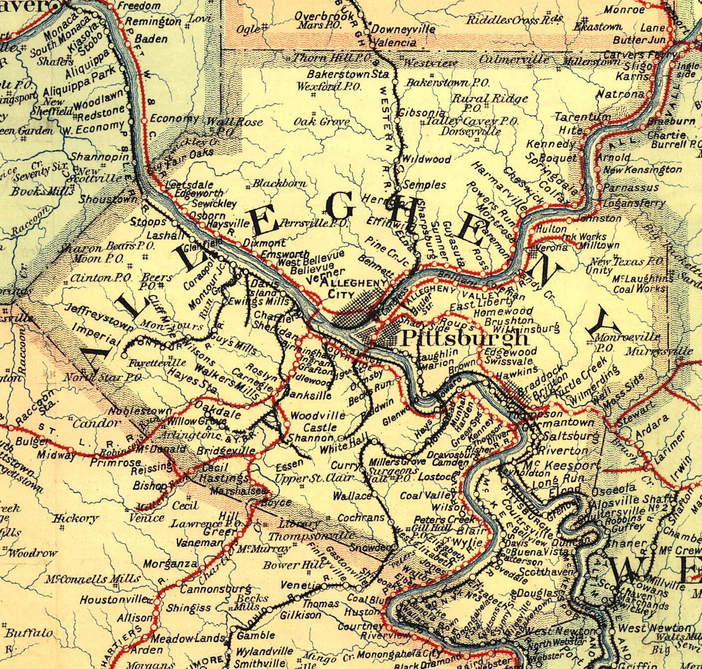 |
||||||||
| Notes About Existing
Stations... Aspinwall (PRR) - This station was moved one block north from its original location in 1922 (Borough of Aspinwall Diamond Jubilee Historical Book, 1967). The original location of this station was on the corner of Freeport Road and Eastern Avenue (GPS: 40.489700, -79.903729). It was built in 1892 (the year Aspinwall was founded) to replace an earlier shelter-shed that was one block to the west. In addition to being used as an American Legion, there is a small restaurant using a portion of the station. After it went out of service (in 1905 it was replaced by a new station to the east that served the West Penn and Brilliant Cutoff lines) it sat abandoned until the PRR started using it as an office in 1911 (The Pittsburgh Press, 12-16-1911). Bridgeville (PRR) - Heavily modified. Coraopolis (P&LE) - This was a large passenger station that handled both people and express/baggage. There is a large central tower. At one time, there were covered platforms on both sides of the tracks, with a pedestrian tunnel under the tracks. The station area was used as a stop for the daily P&LE passenger train between Beaver Falls and Pittsburgh until that service ended. The building was converted to an auto parts store in the late '70s, which resulted in some architectural changes (a new door was put in an odd location). The station has been vacant since the business moved elsewhere. There may be an effort to preserve and renovate the building by a local railroad museum group. The station was designed by Henry Hobson Richardson (1838-1886) who also designed the Allegheny Courthouse and Jail. The station, originally known as the Middletown Station, was completed on February 24, 1879. As of 2018 some repairs were being done to the roof and there was word that a restaurant may occupy the station in the future. Edgeworth (Shields) (PFt.W&C) - This station was on the old right of way which is now where PA 65 is. The station consisted of only the portion with the high roof that includes the triangular dormer. The original steps/railing to the track level platforms are also still there. The Edgeworth station (now gone) replaced Shields on the new alignment at approximately the same location. Shields is an old family name in the Sewickley/Leetsdale area. The dam and lock in the Ohio River located here is called Dashields for David Shields. The old Quaker Valley Station was on the eastern side of Shields Station at Academy Ave. Leetsdale was the next station west. You could see both of them from Shields, that's how close they were located. There were 10 PFWC/PRR Stations on both the old and new alignments in the immediate vicinity of Sewickley. There was Glenfield, Haysville, Osborne (old alignment and still there today), Glen Osborn, Sewickley (old alignment and still there but moved), Sewickley (new alignment-still there), Quaker Valley (the only one demolished in the realignment), Shields, Edgeworth and Leetsdale. Of all of the stations mentioned only Quaker Valley disappeared in the realignment. Five of these stations are still standing today: Osborn, both Sewickley stations, Shields and Leetsdale. Glen Osborne (PFt.W&C) - This station was previously called Osburn, but the PRR changed its name in 1902 due to another station with the same moniker. At some point the tracks were relocated away from the station, but the building remained. The railroad sold it to a private party in 1938 and it has been used as a residence since. Homestead (PRR) - The Allegheny County District Attorney has offices in the station. Ingram (PRR) - ROW is now busway for the Port Authority of Allegheny County. Passenger service ended in Nov. 1964. Passengers used the stairs in the old photo to get down to the tracks where there was a waiting shelter. Library (Montour RR) - The South Park Historical Society has a small museum in the station. Pittsburgh (PRR) - This large freight terminal, built in 1950, is on the NW side of Liberty Avenue and stretches between 12th and 16th Streets. There are two buildings in the complex. Building 1 is between 12th and 14th Streets, while Building 2 is between 14th and 16th Streets. The buildings served as the "Buyer's Mart" (until the early 1980s) after going out of service for the RR and then were subsequently rehabbed into the Penn Liberty Plaza office buildings. Pittsburgh (P&LE) - Read more here about Station Square. Sewickley (PRR) - Here is another photo. Sewickley (PFt.W&C) - This old 1887 station used to sit where the newer 1929 station is now located. In 1929 it was moved by rail to Chadwick Street to make room for the new station. It is now used by the American Legion. Tarentum (PRR) - This station was relocated slightly to the east in 1913 and remodeled. It was finished in 1916. Wilkinsburg (PRR - Passenger) - Here are some photos from the 1984 National Register of Historic Places report. Woodville (PRR) - The photo, from 1925, shows a large building (still standing) and a smaller frame structure (now gone). The smaller structure may have been the freight station and the larger building the passenger station. |
||||||||
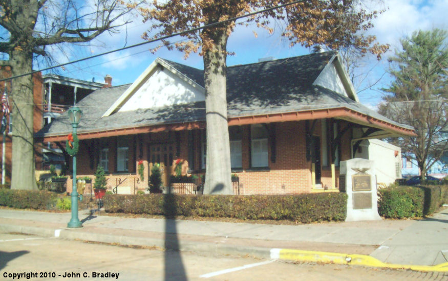
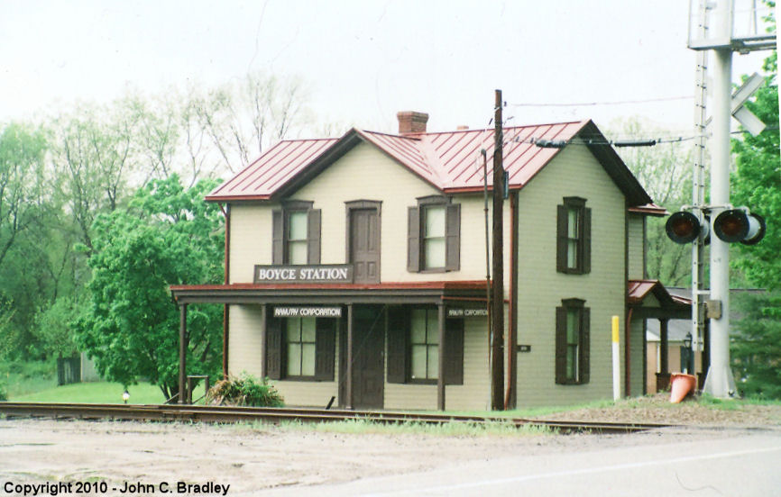
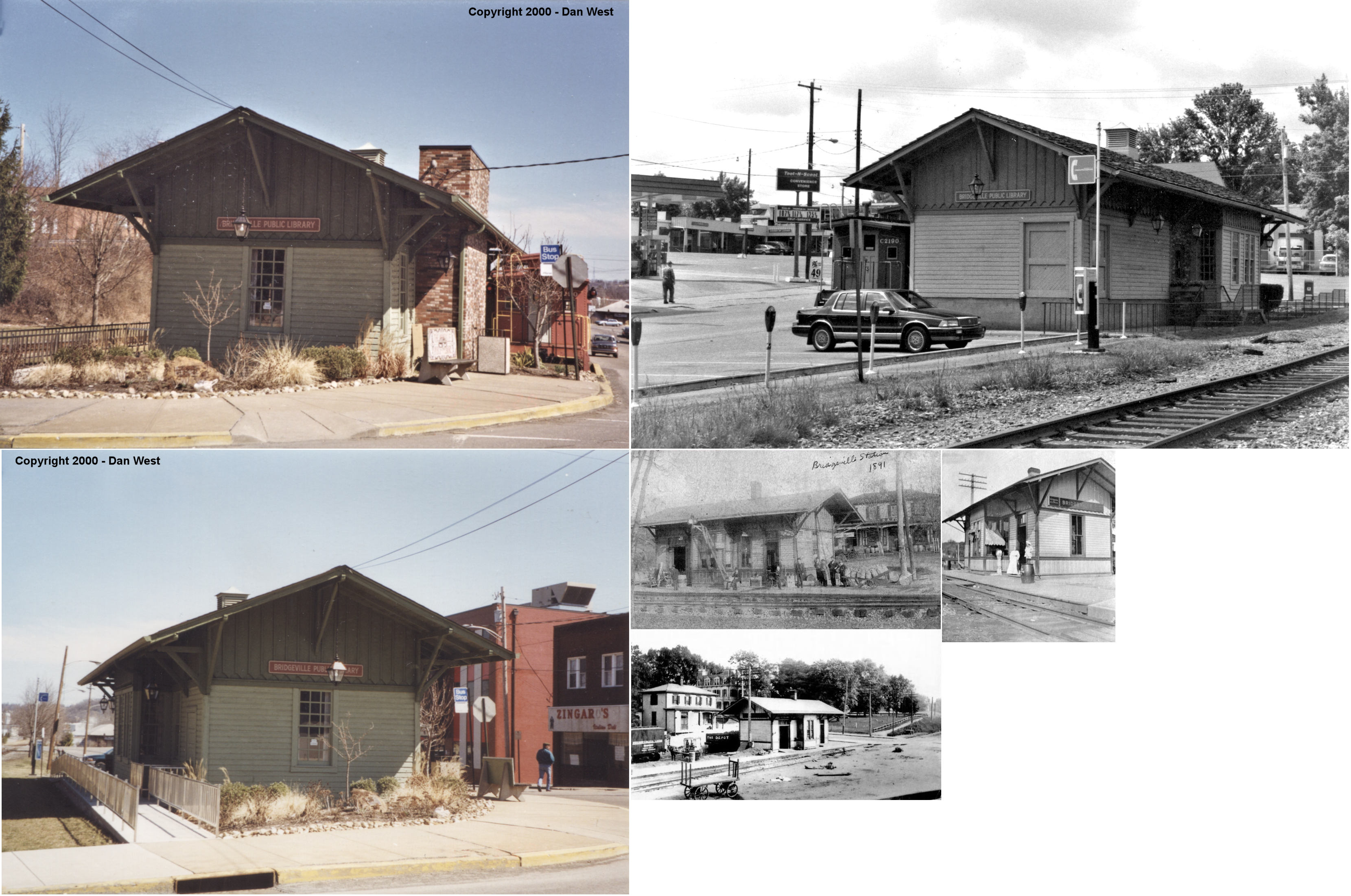
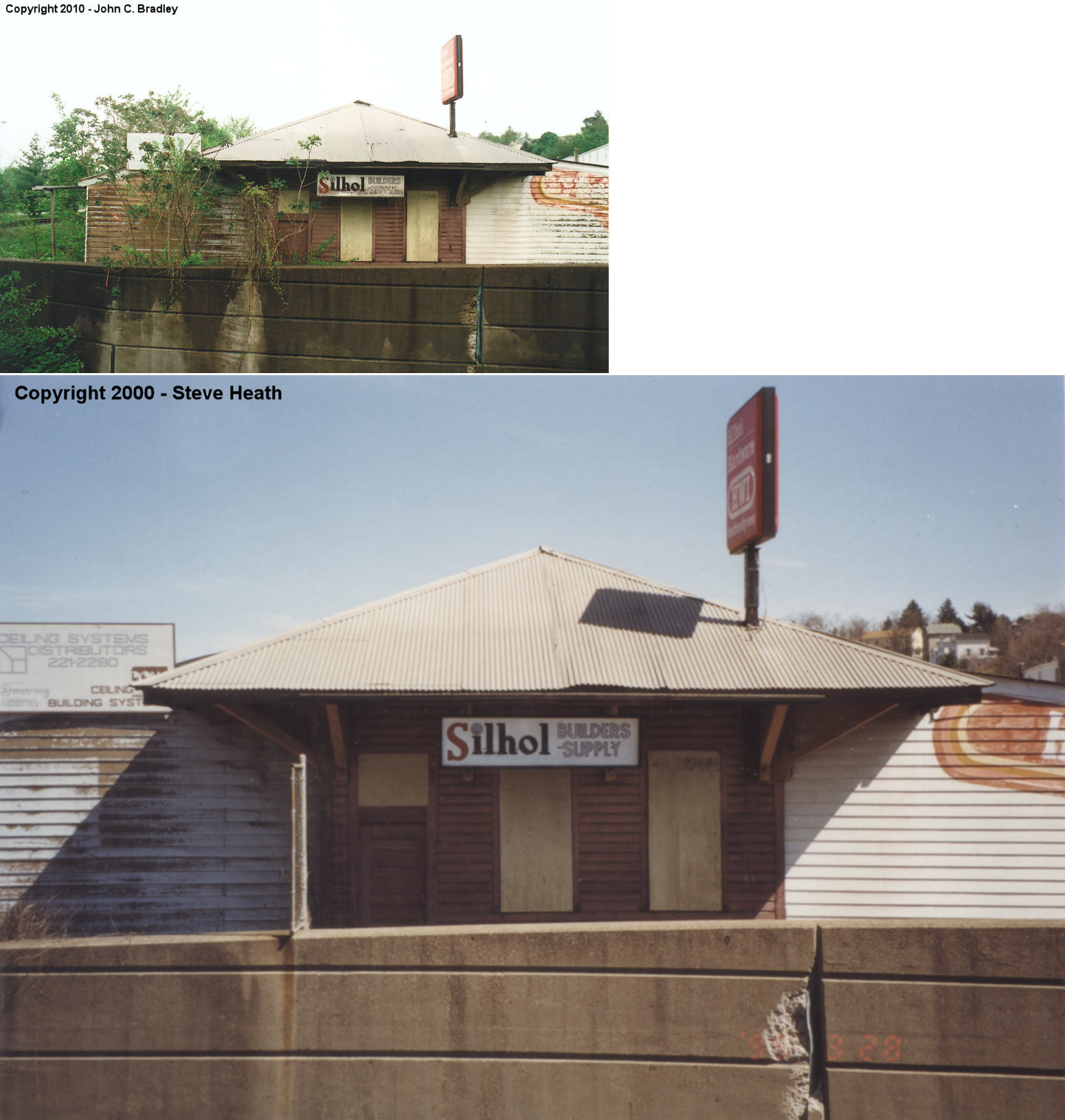
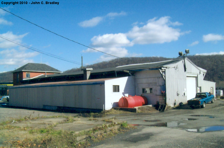
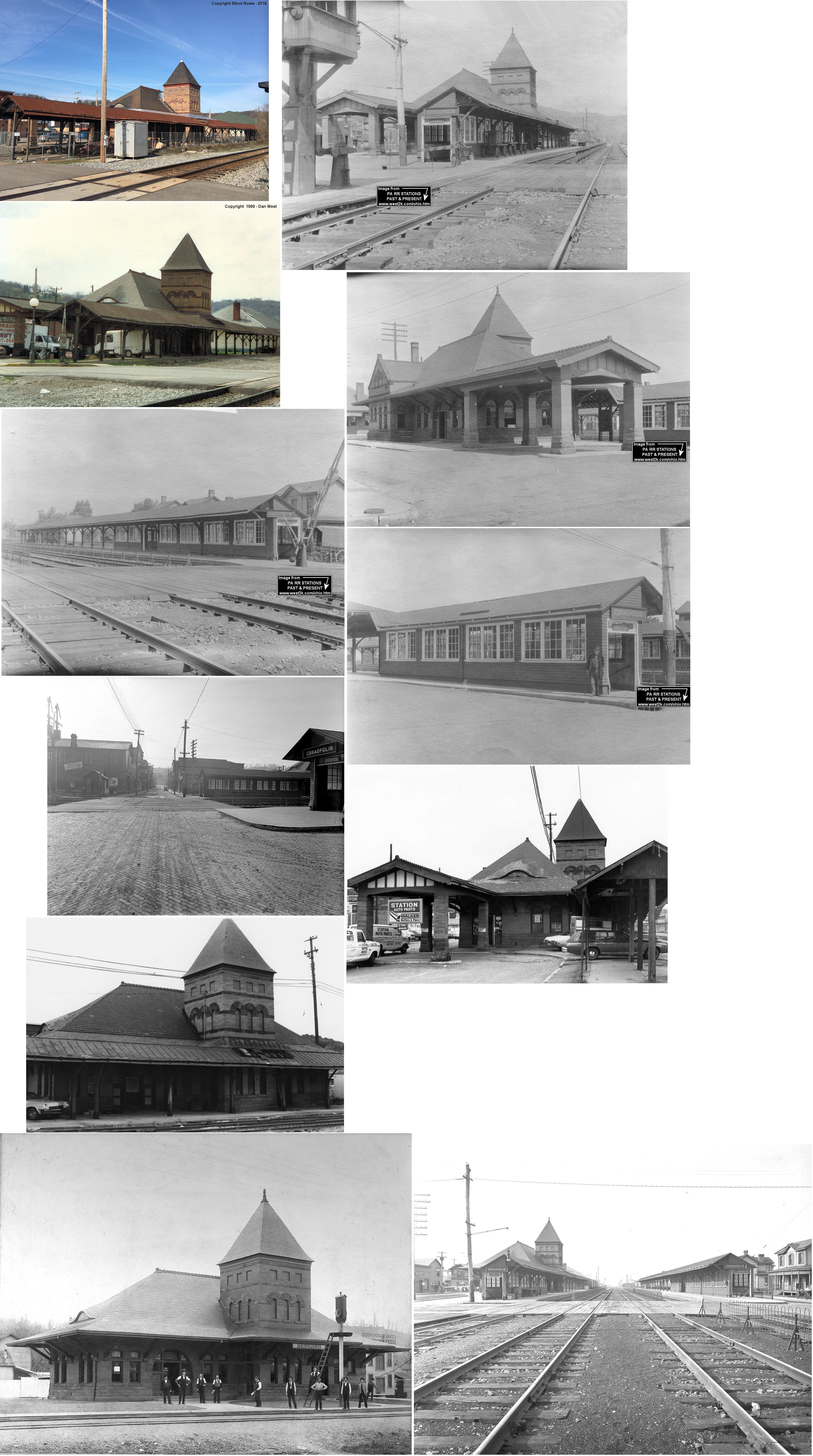
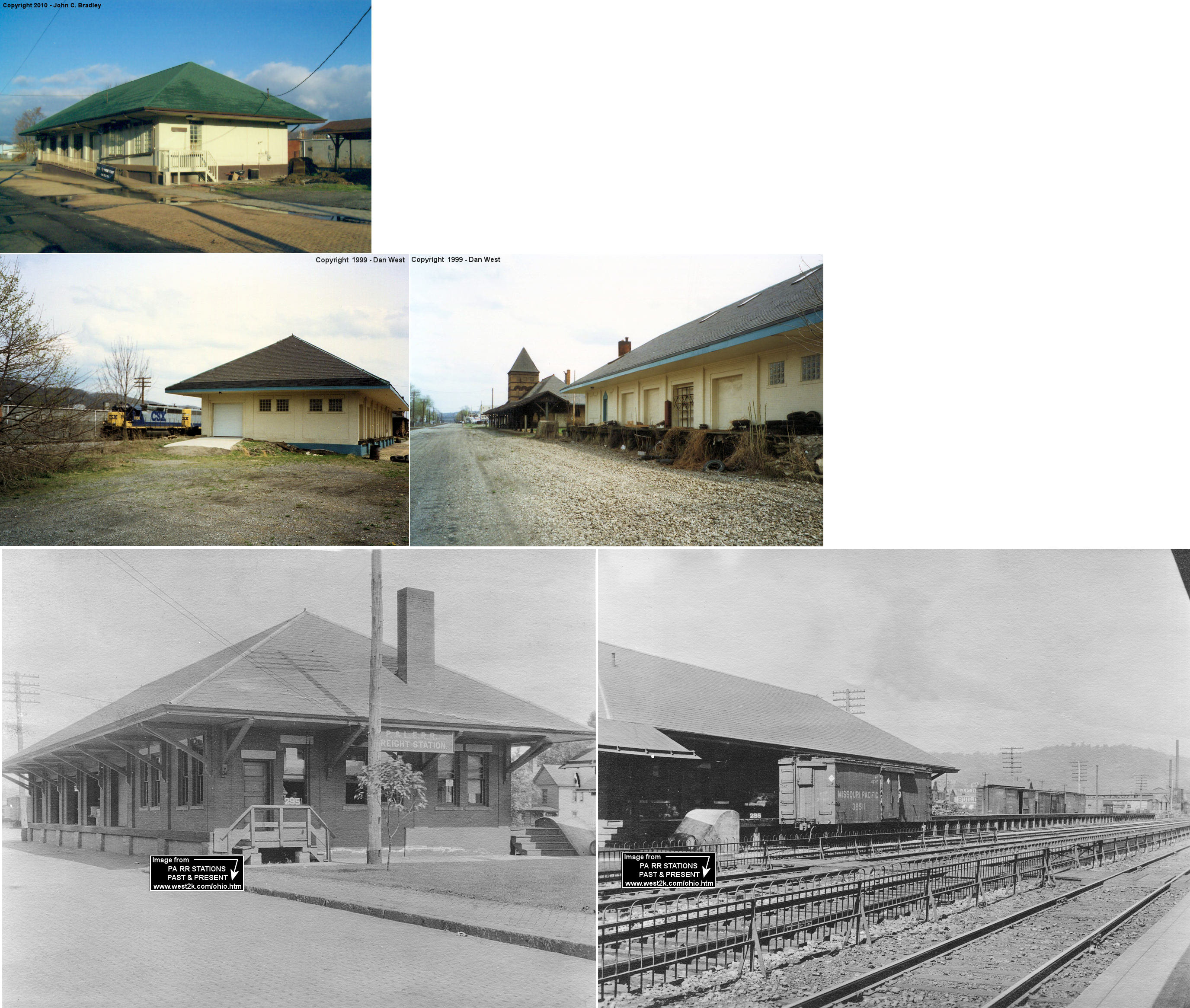
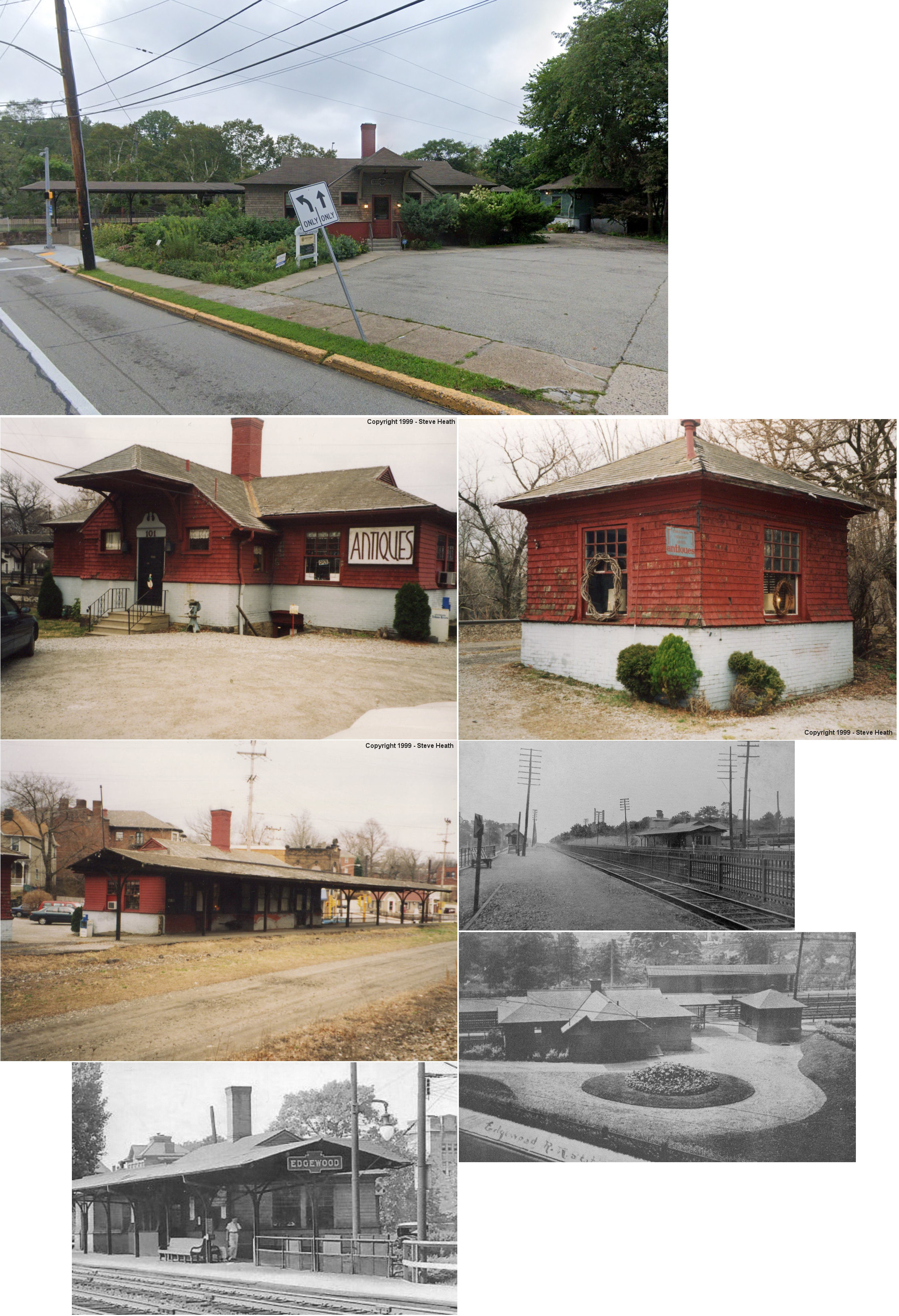
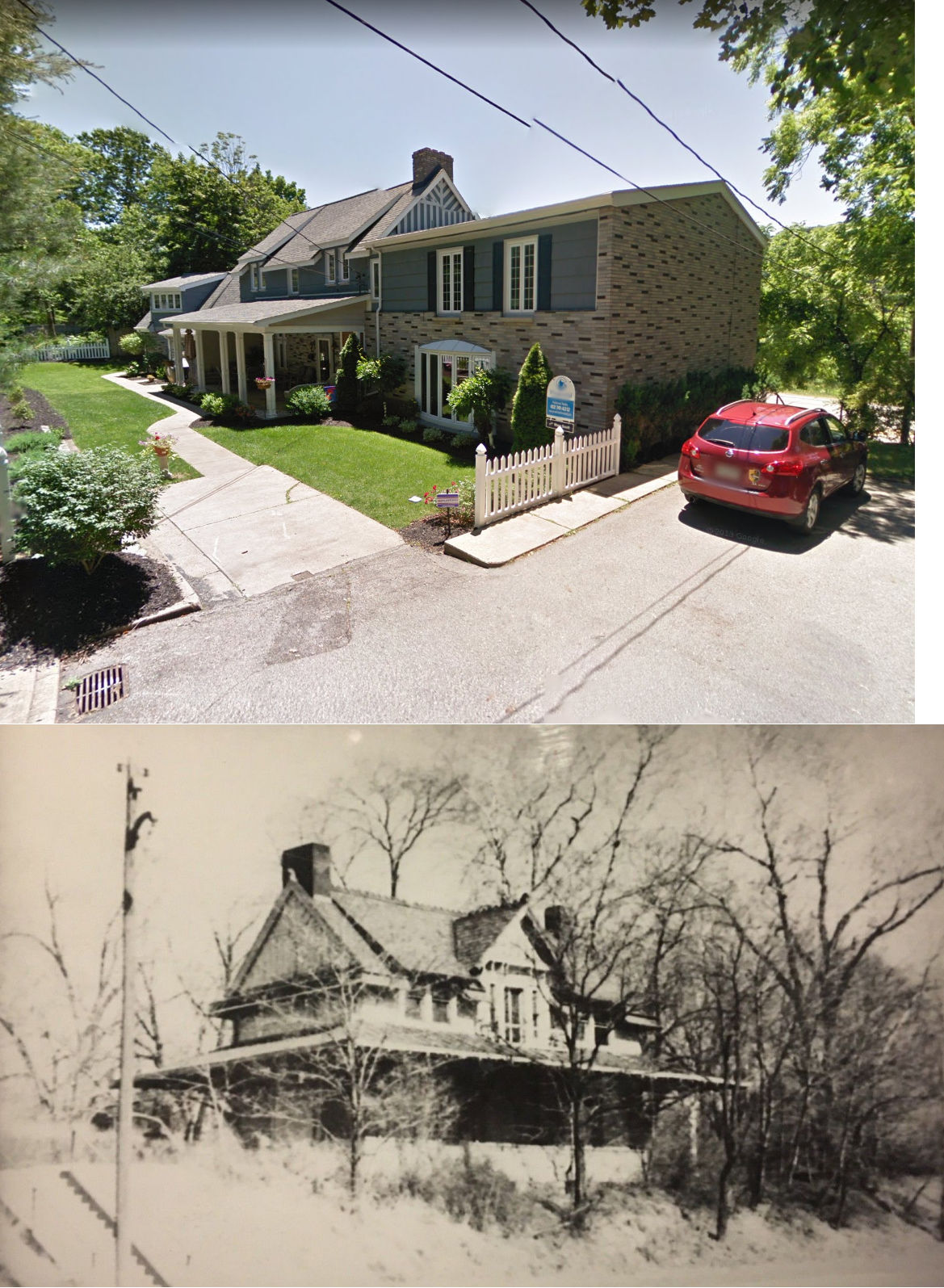
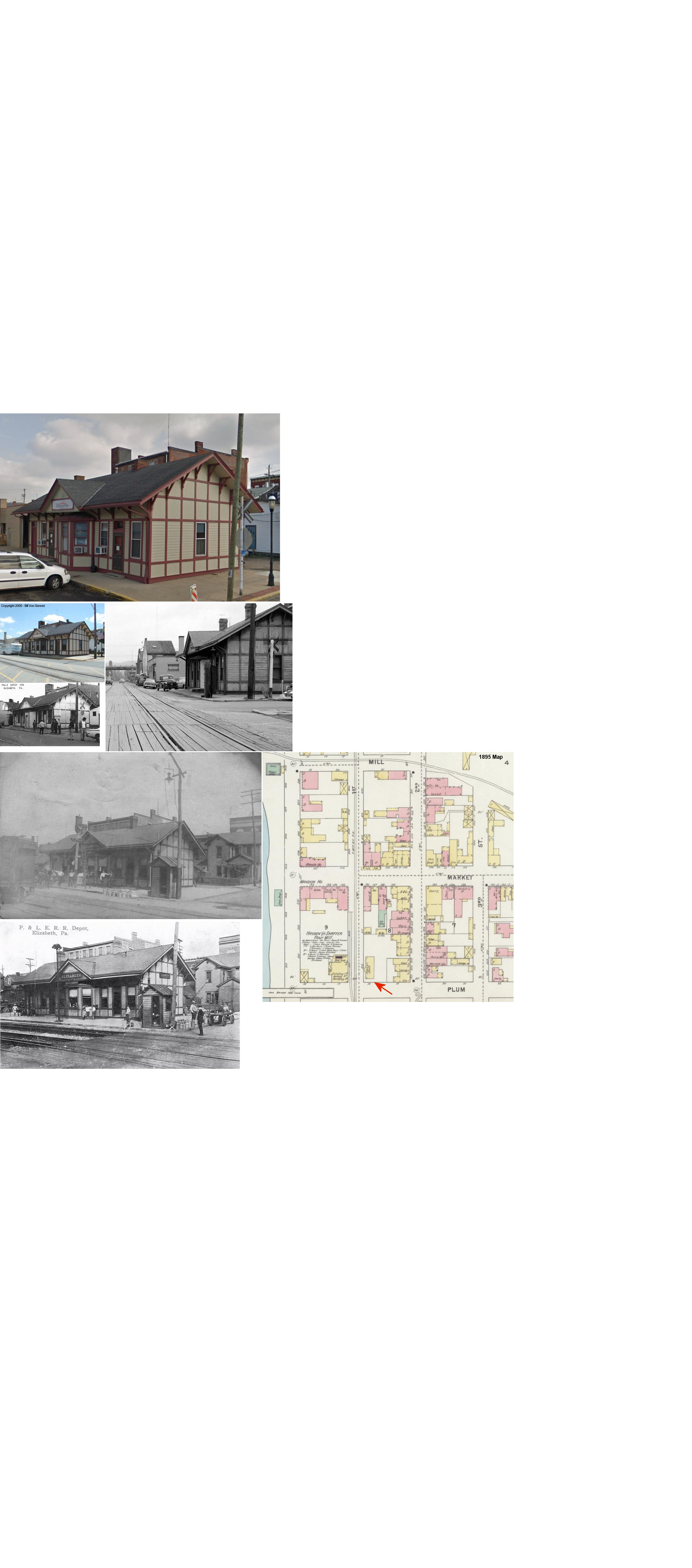
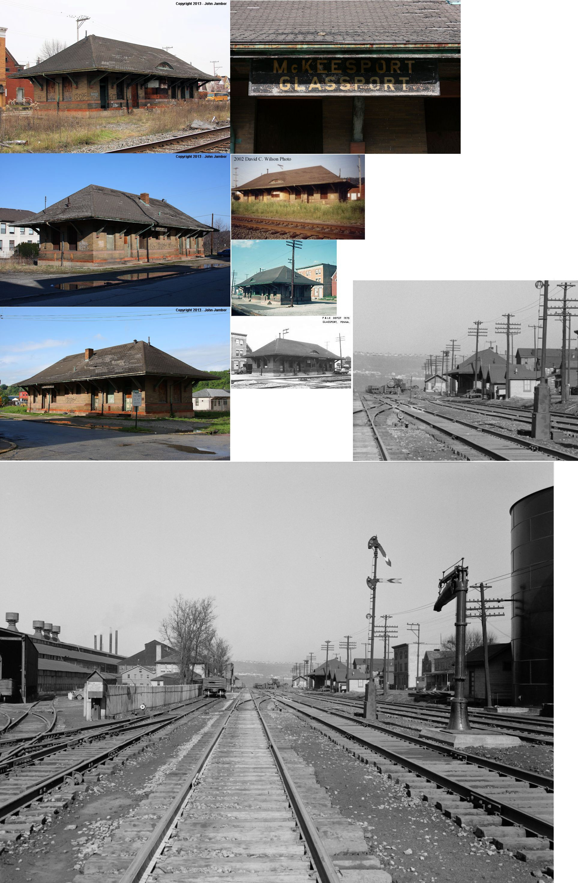
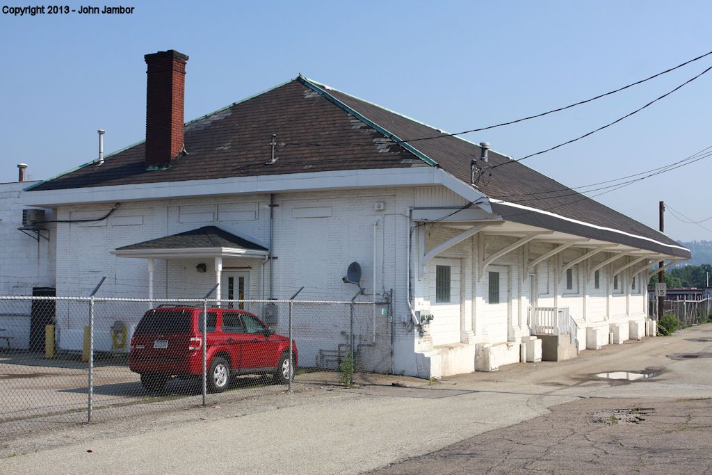
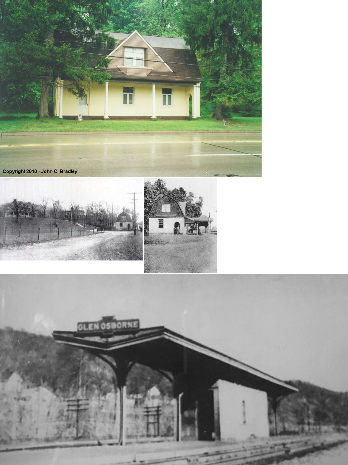
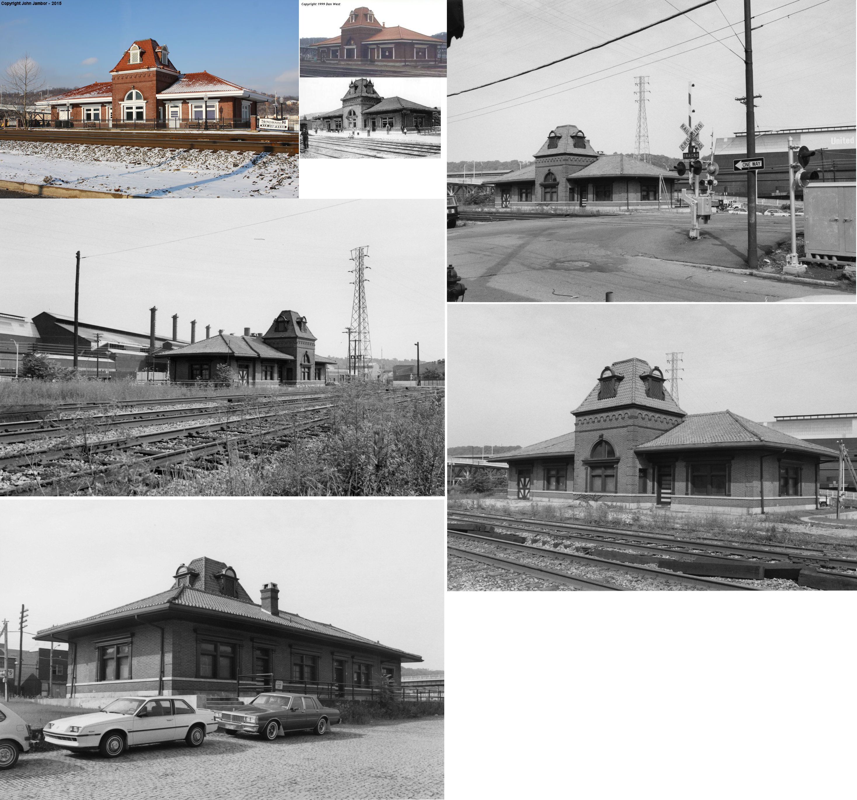
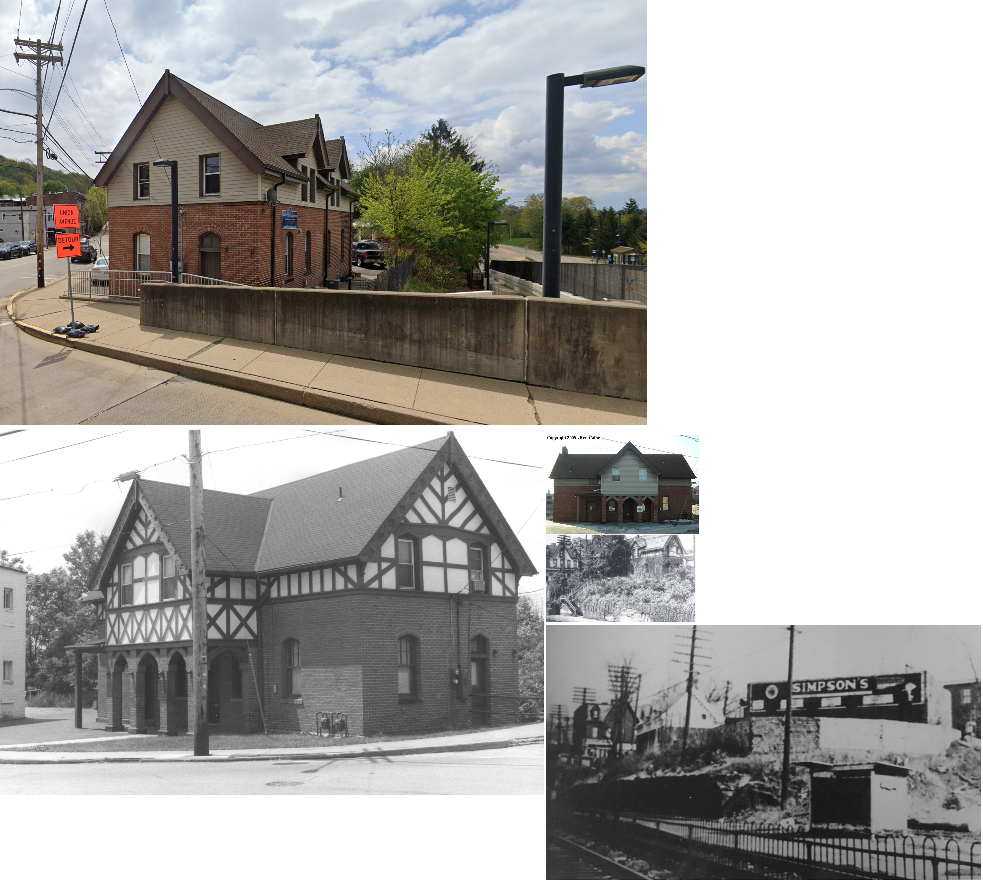
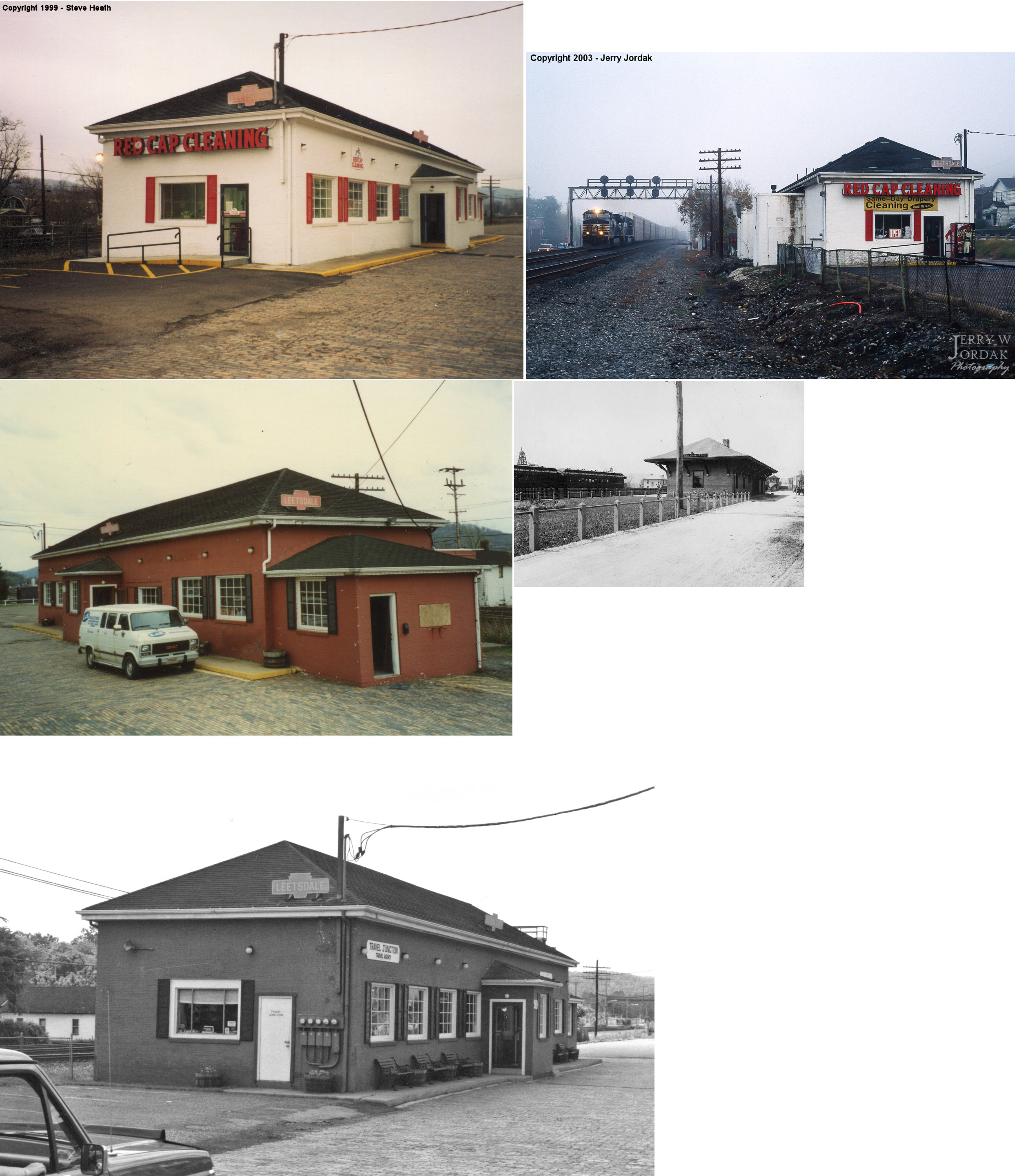
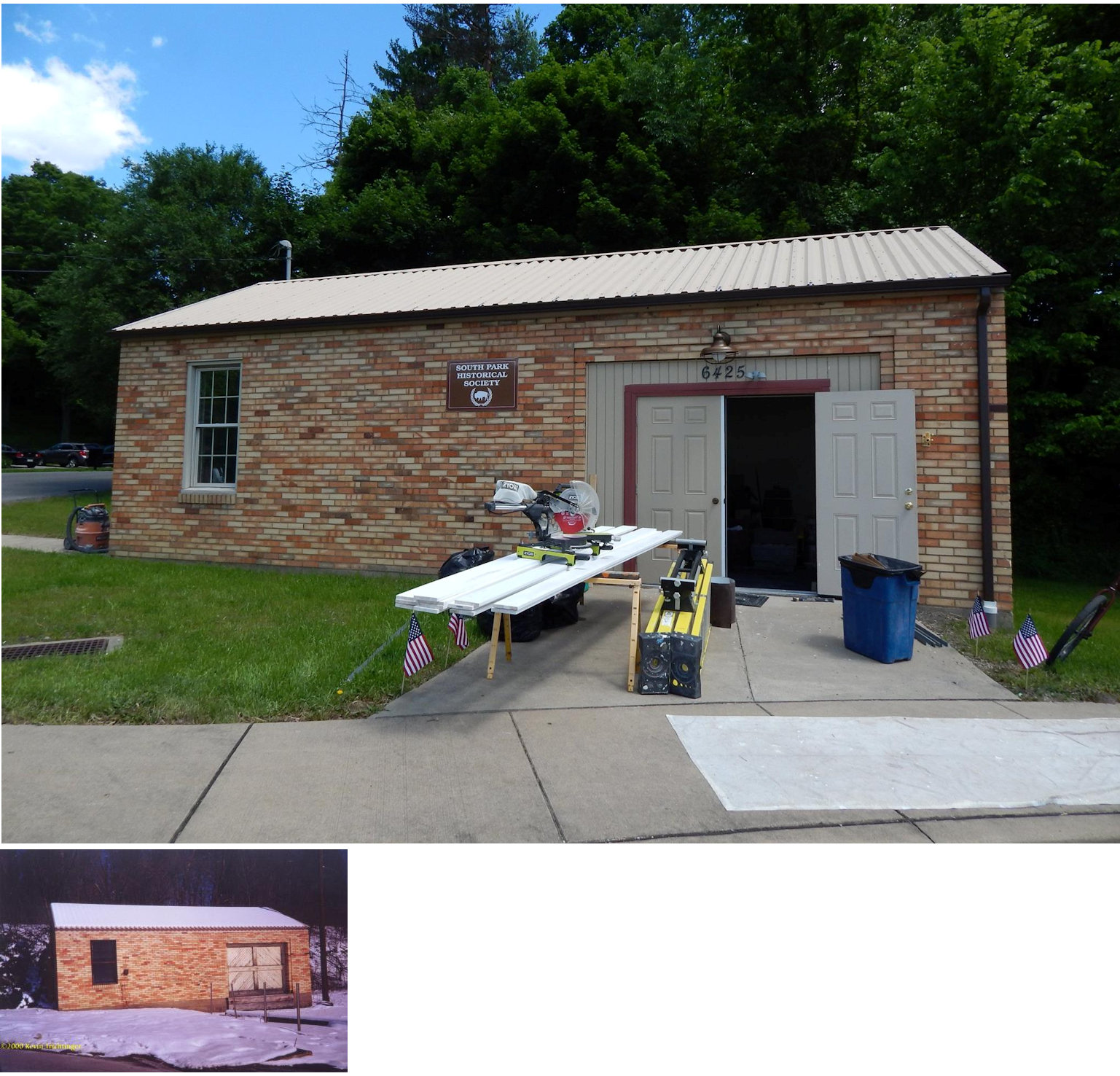
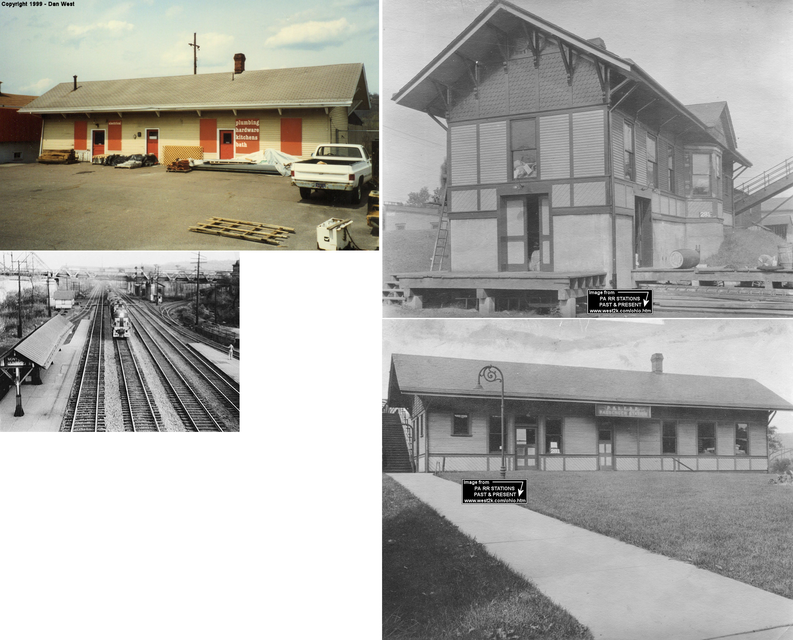
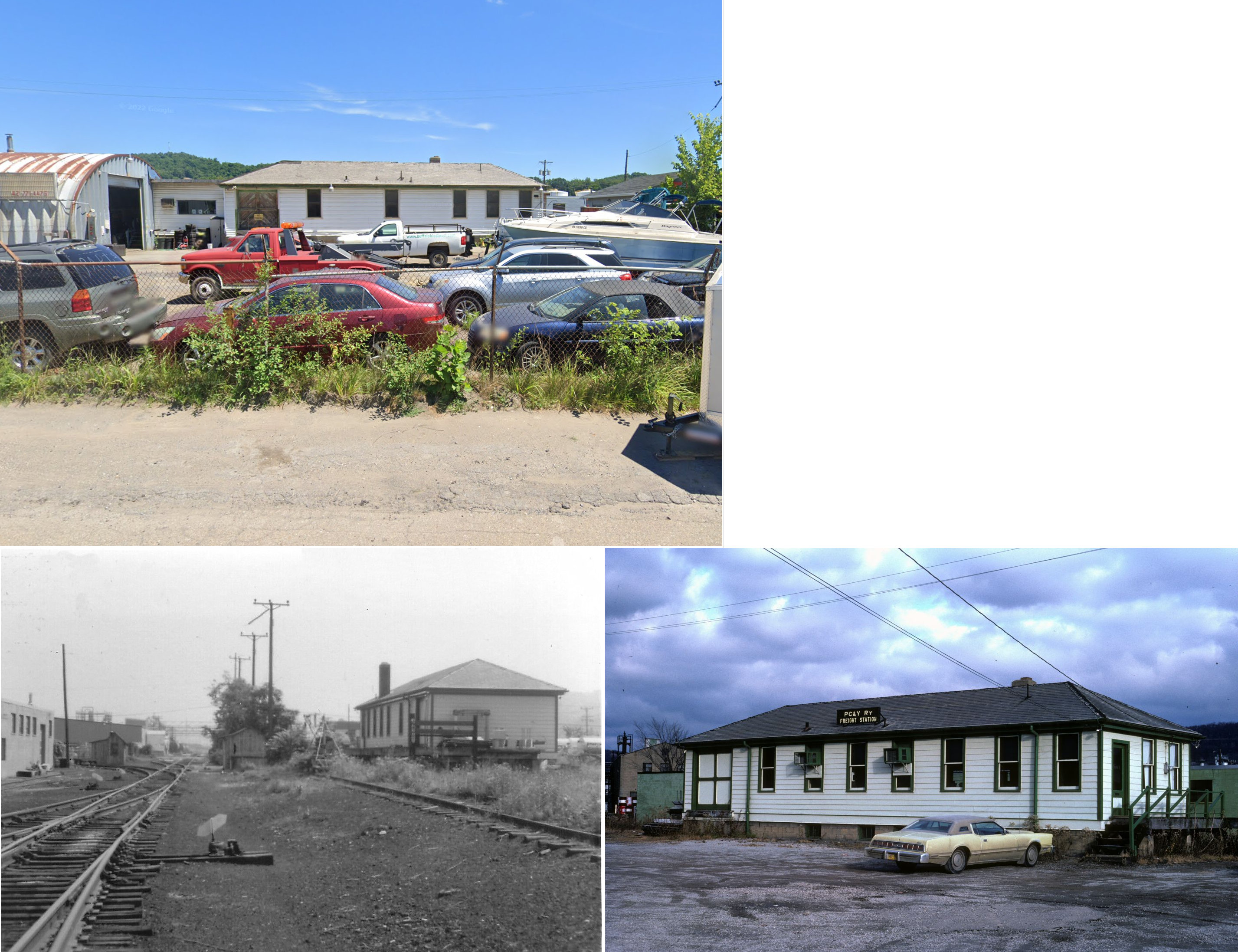
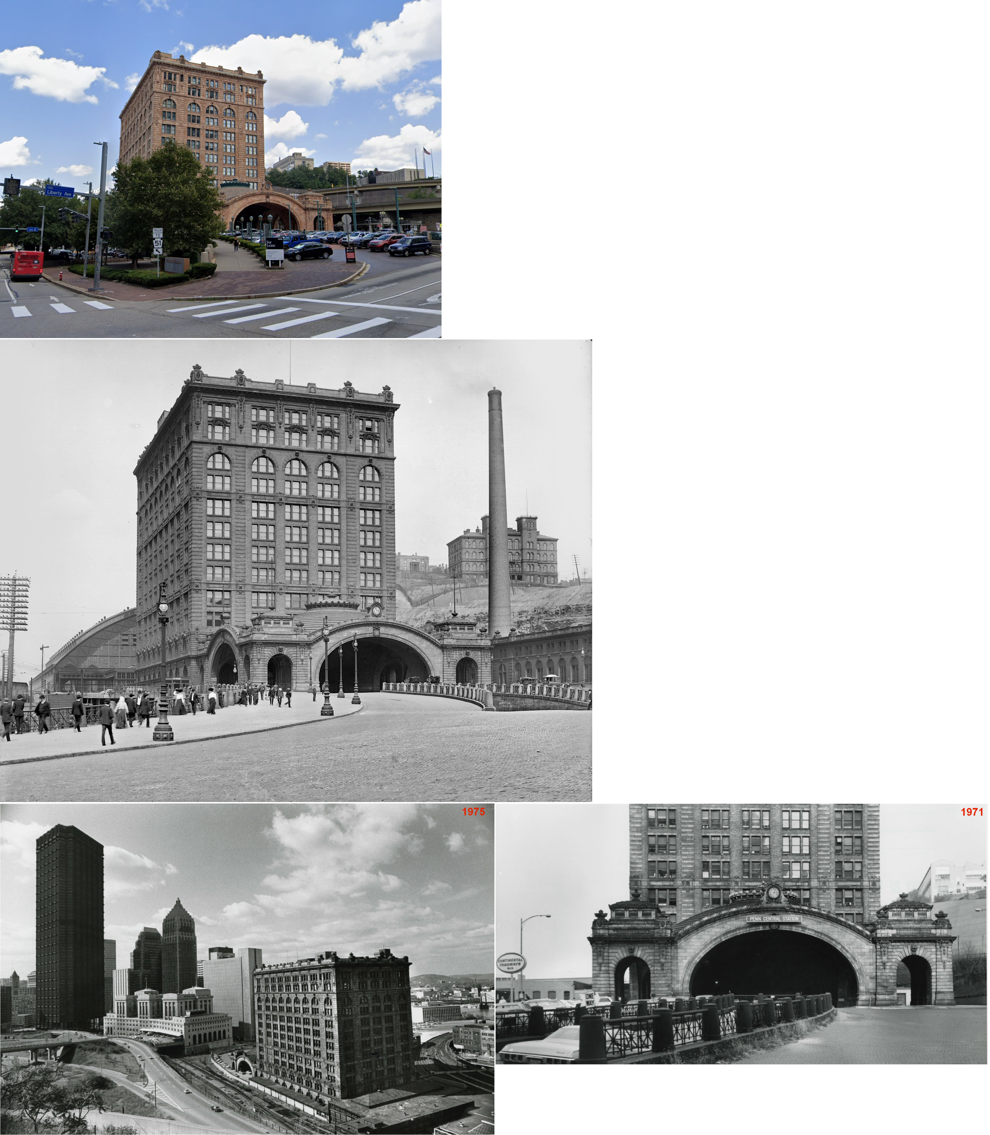
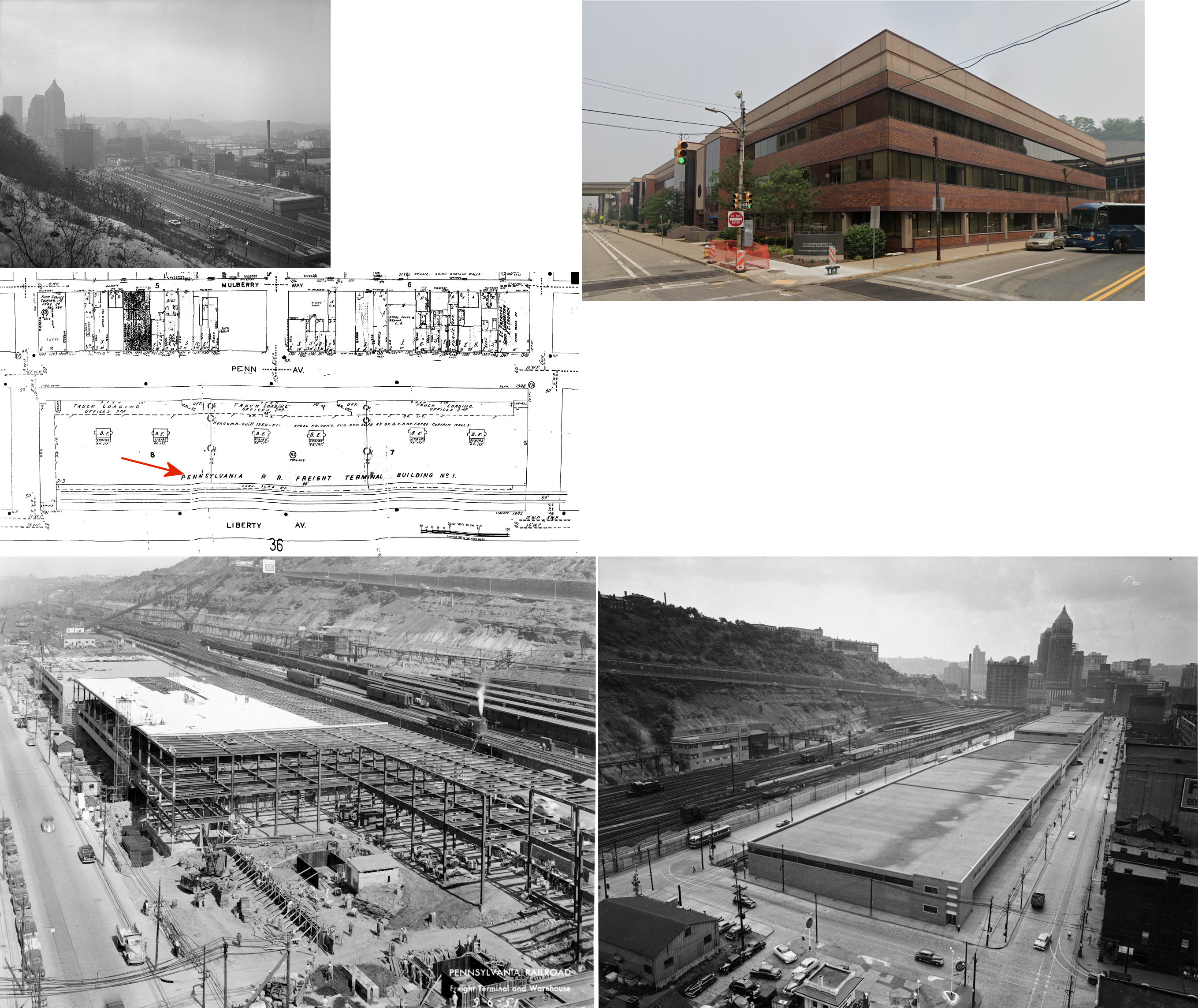
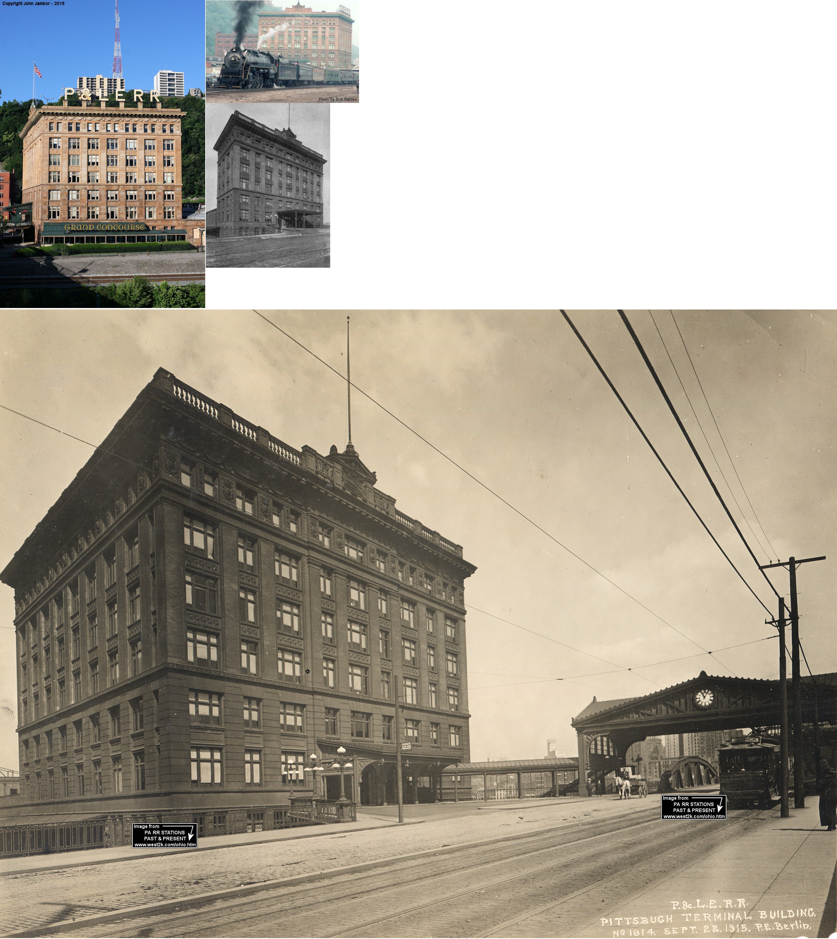
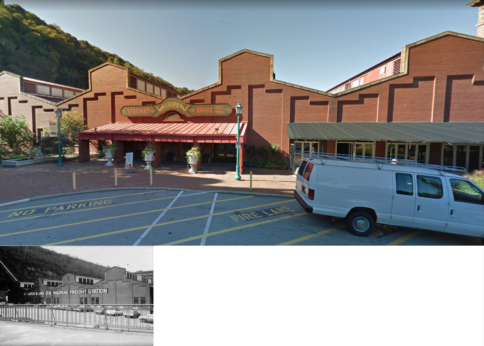
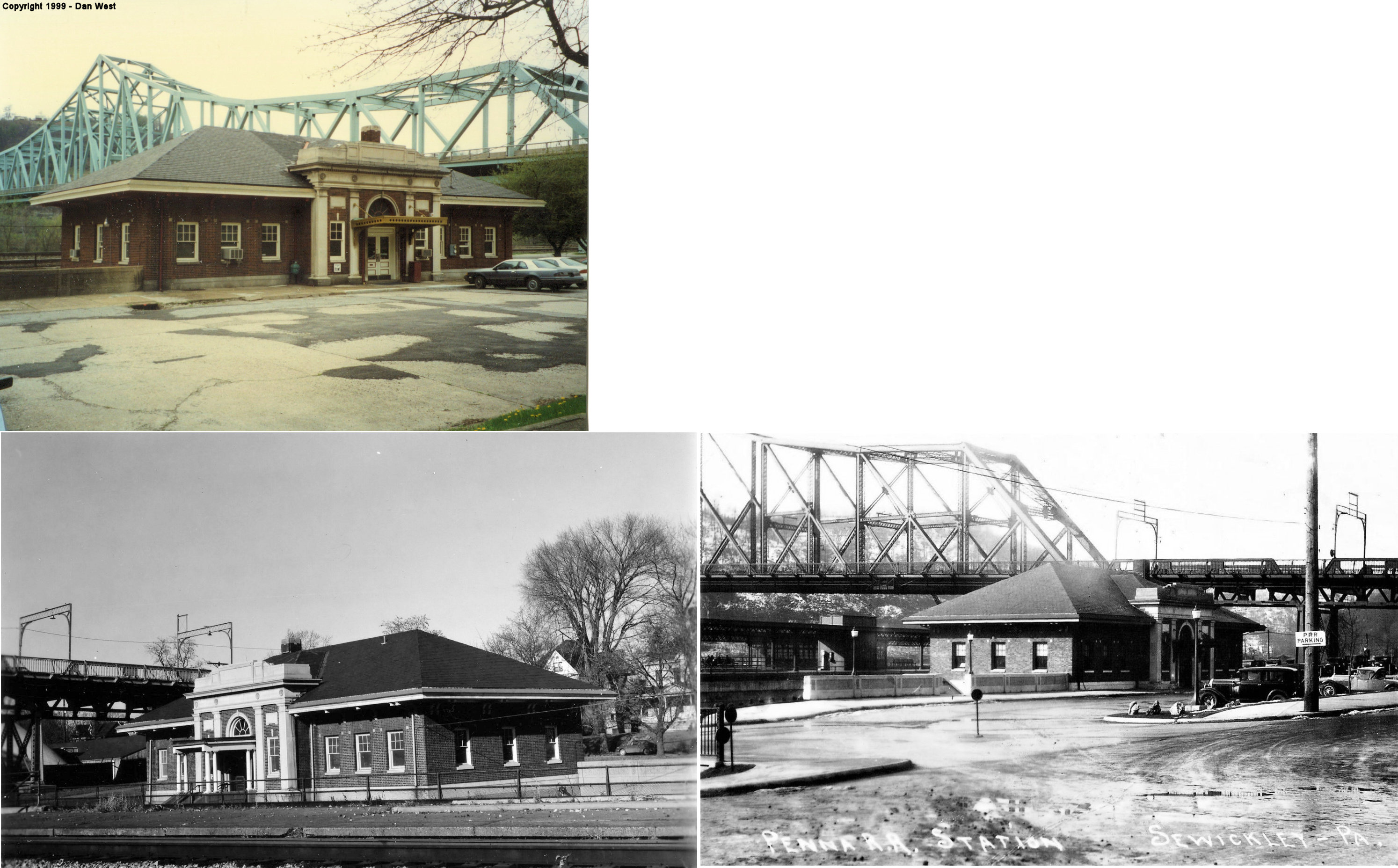
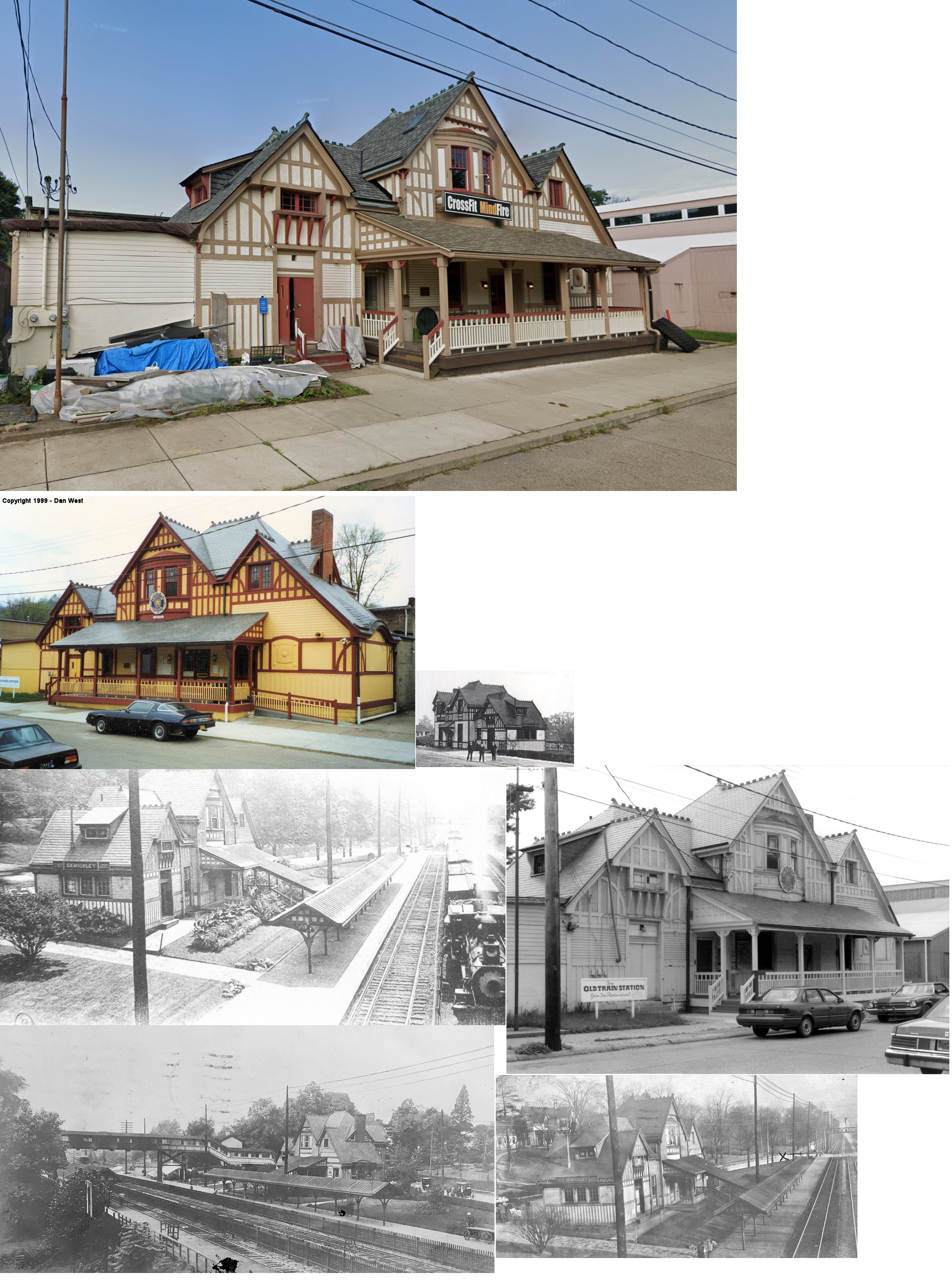
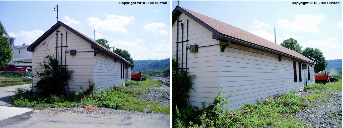
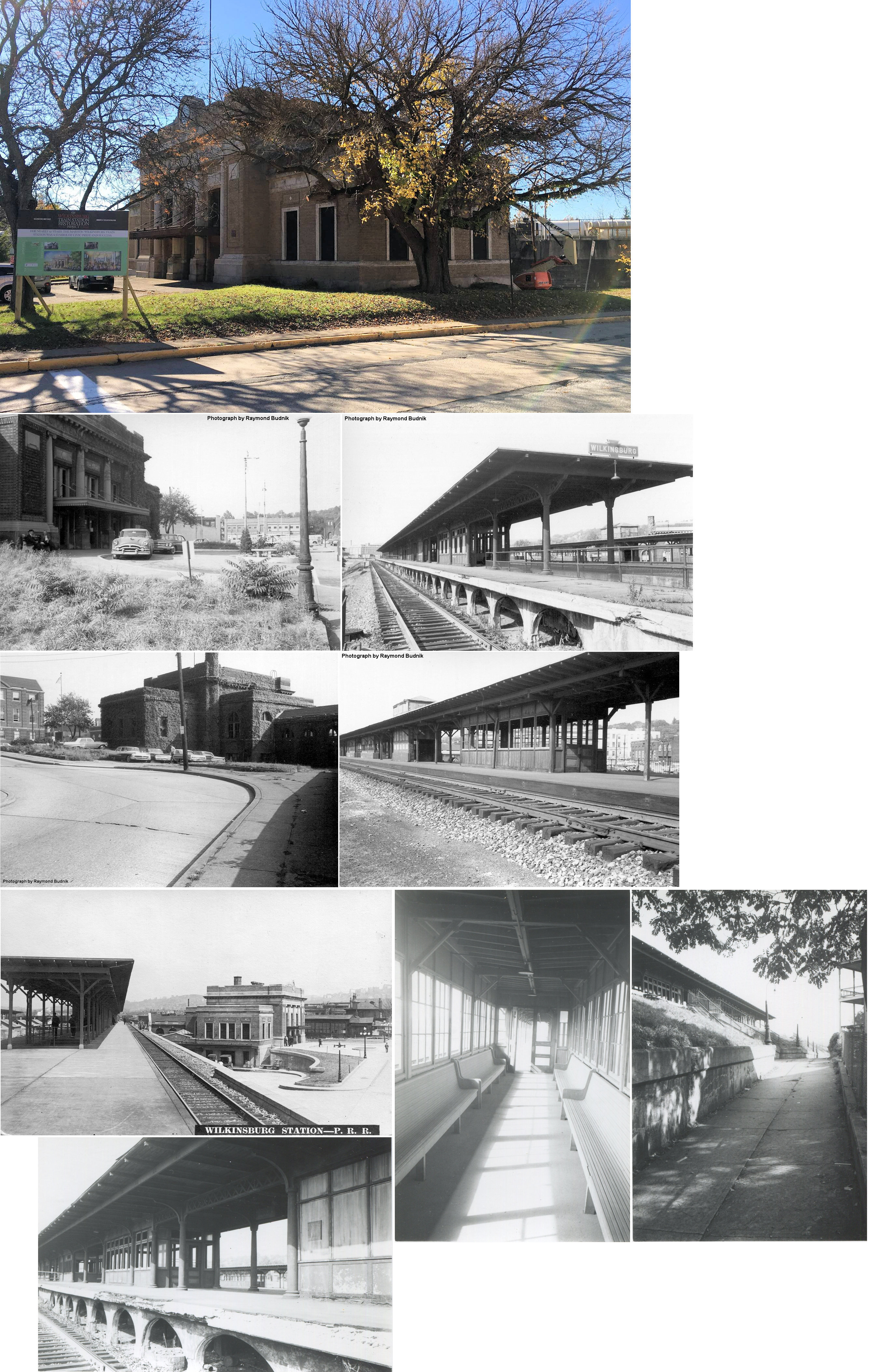
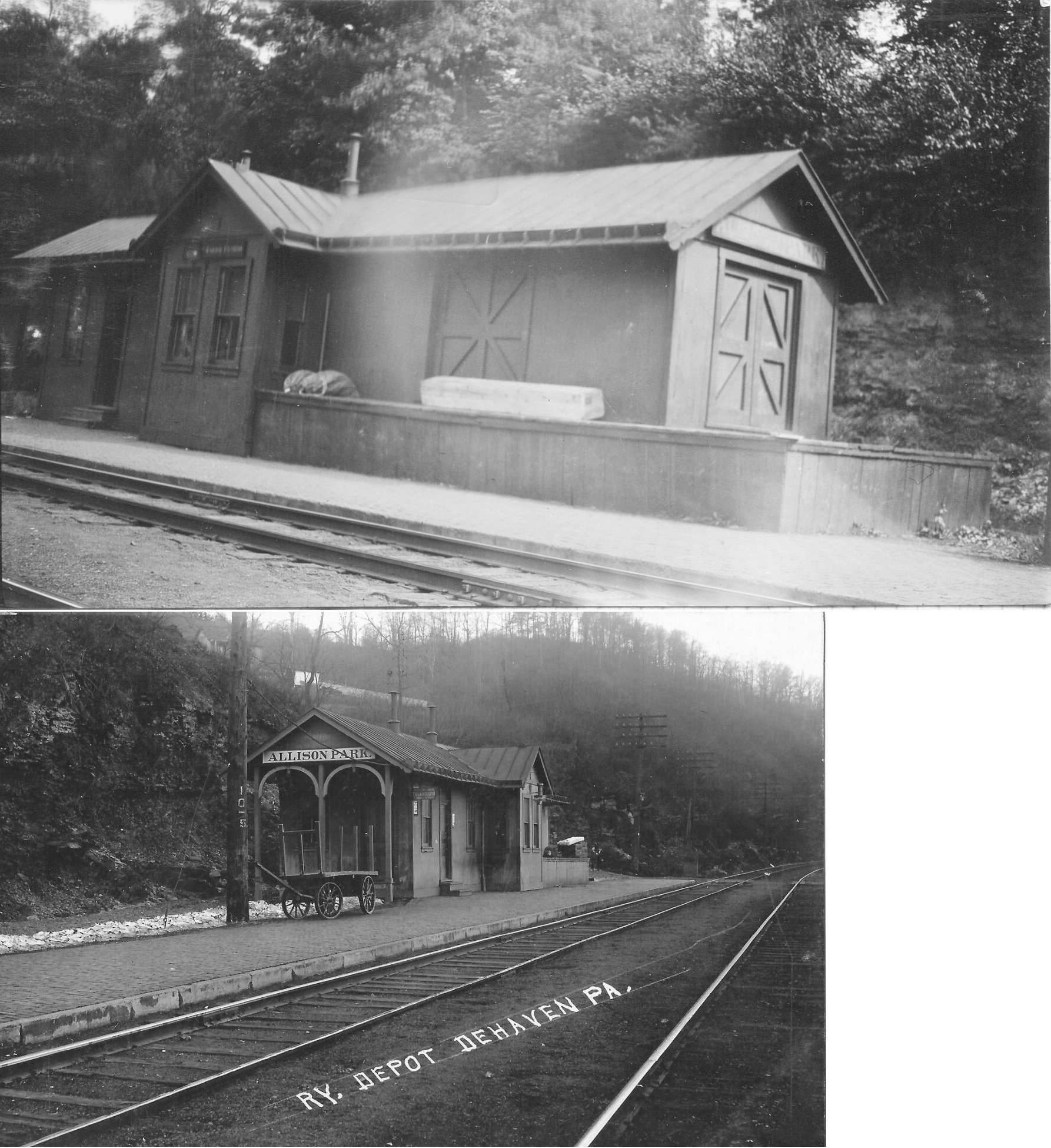
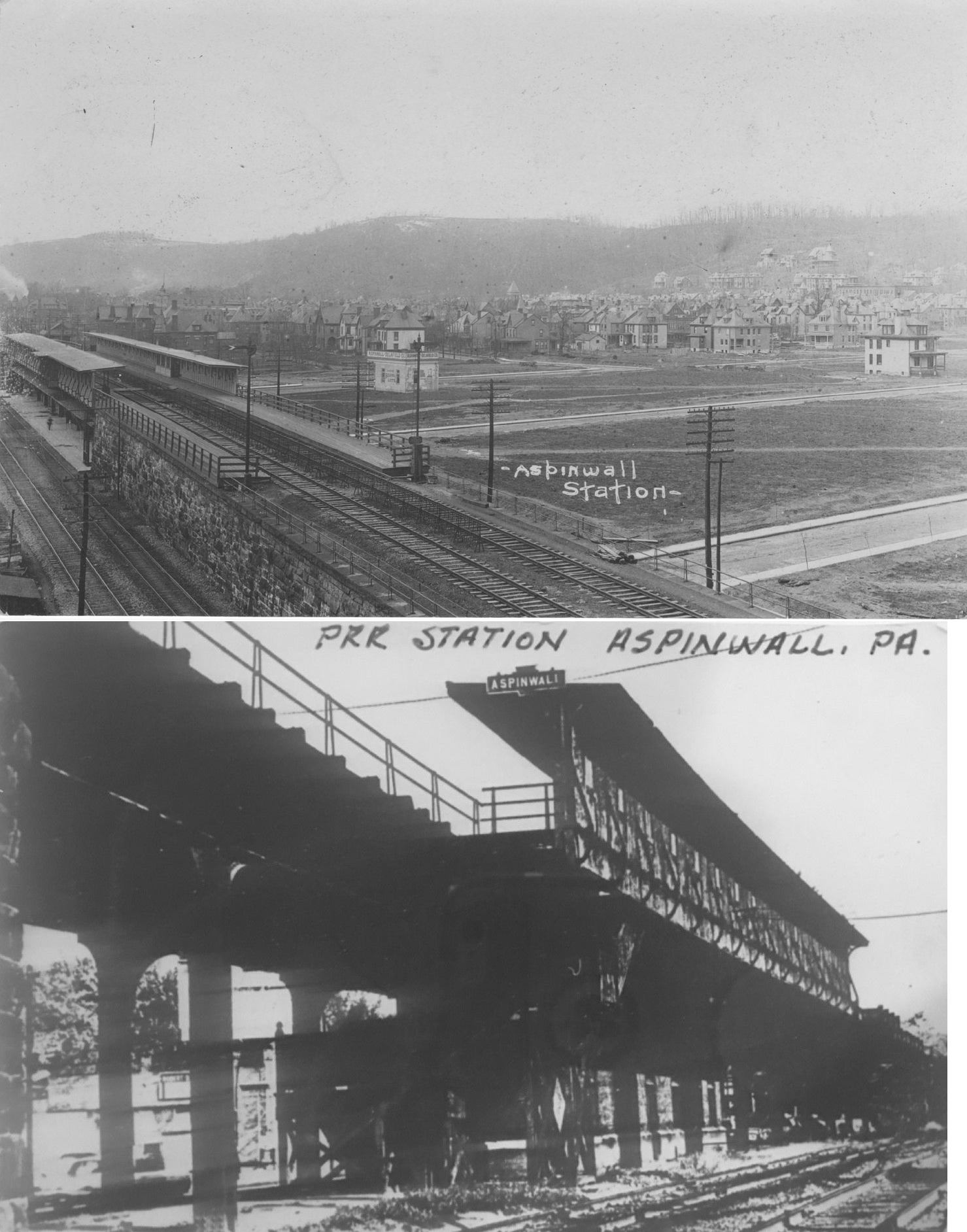
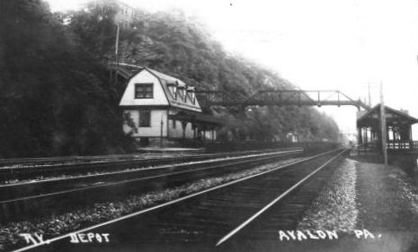
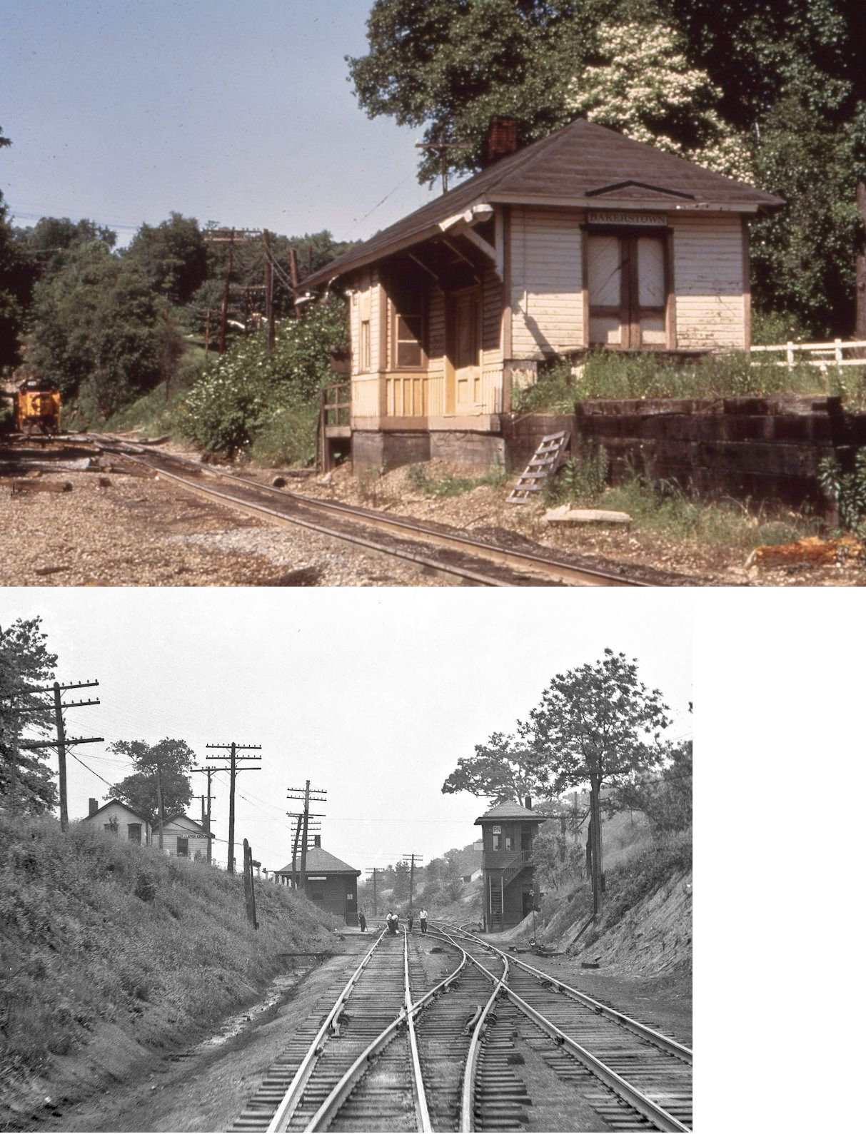
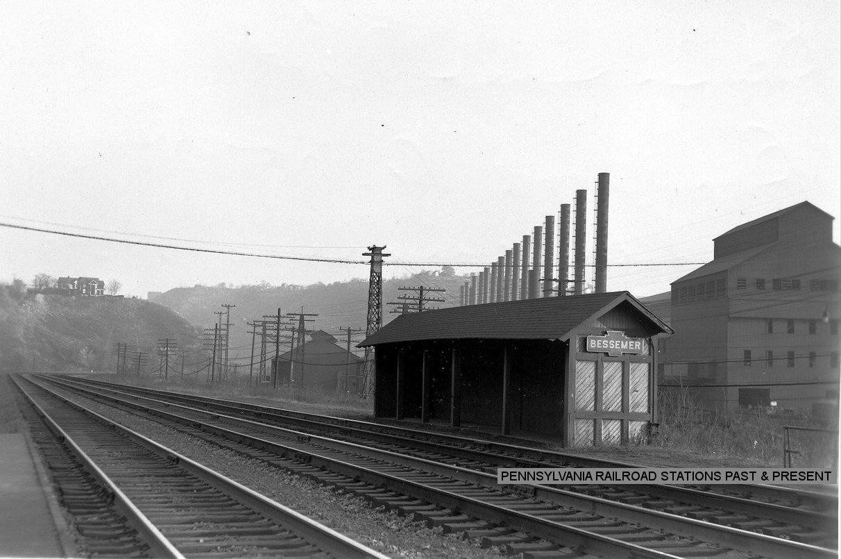
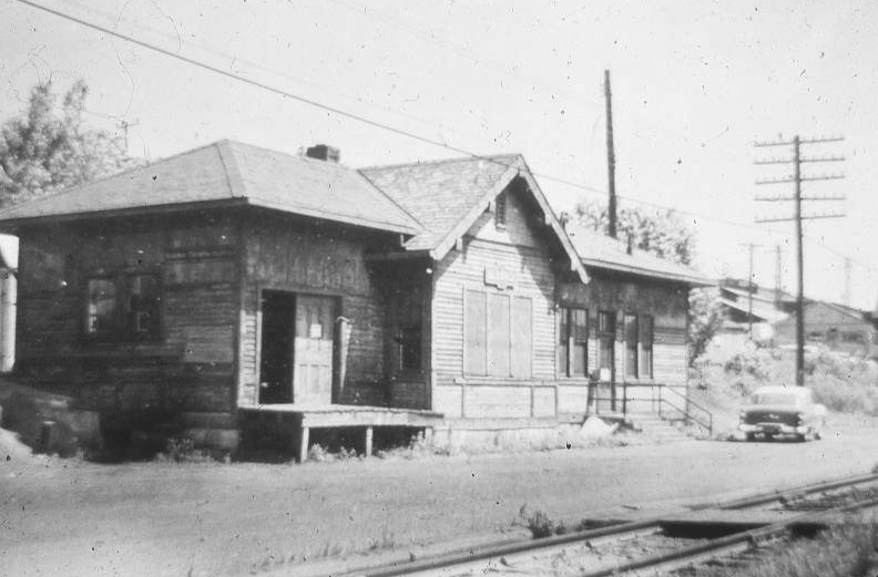
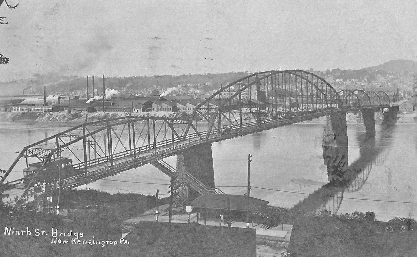
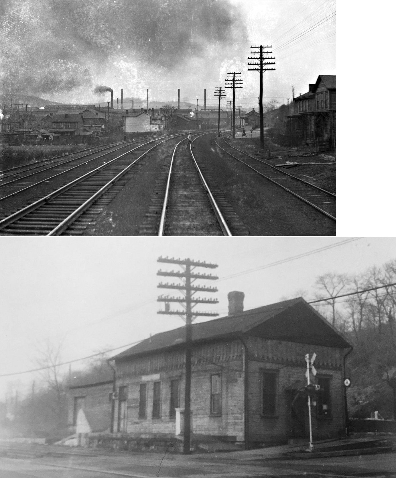
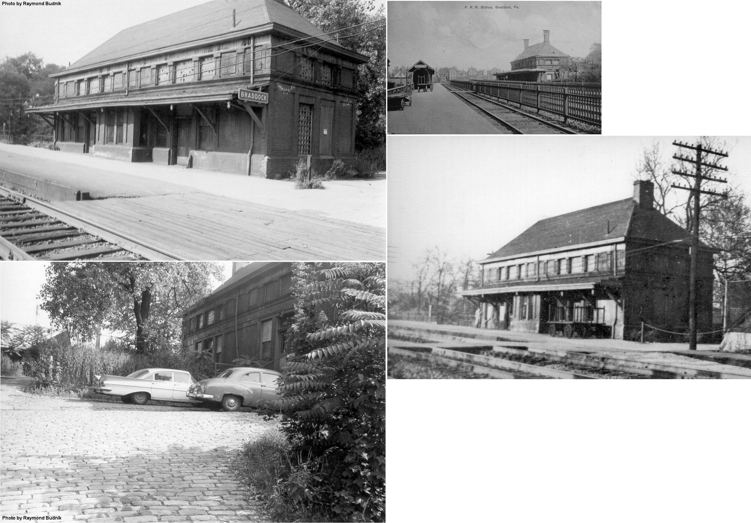
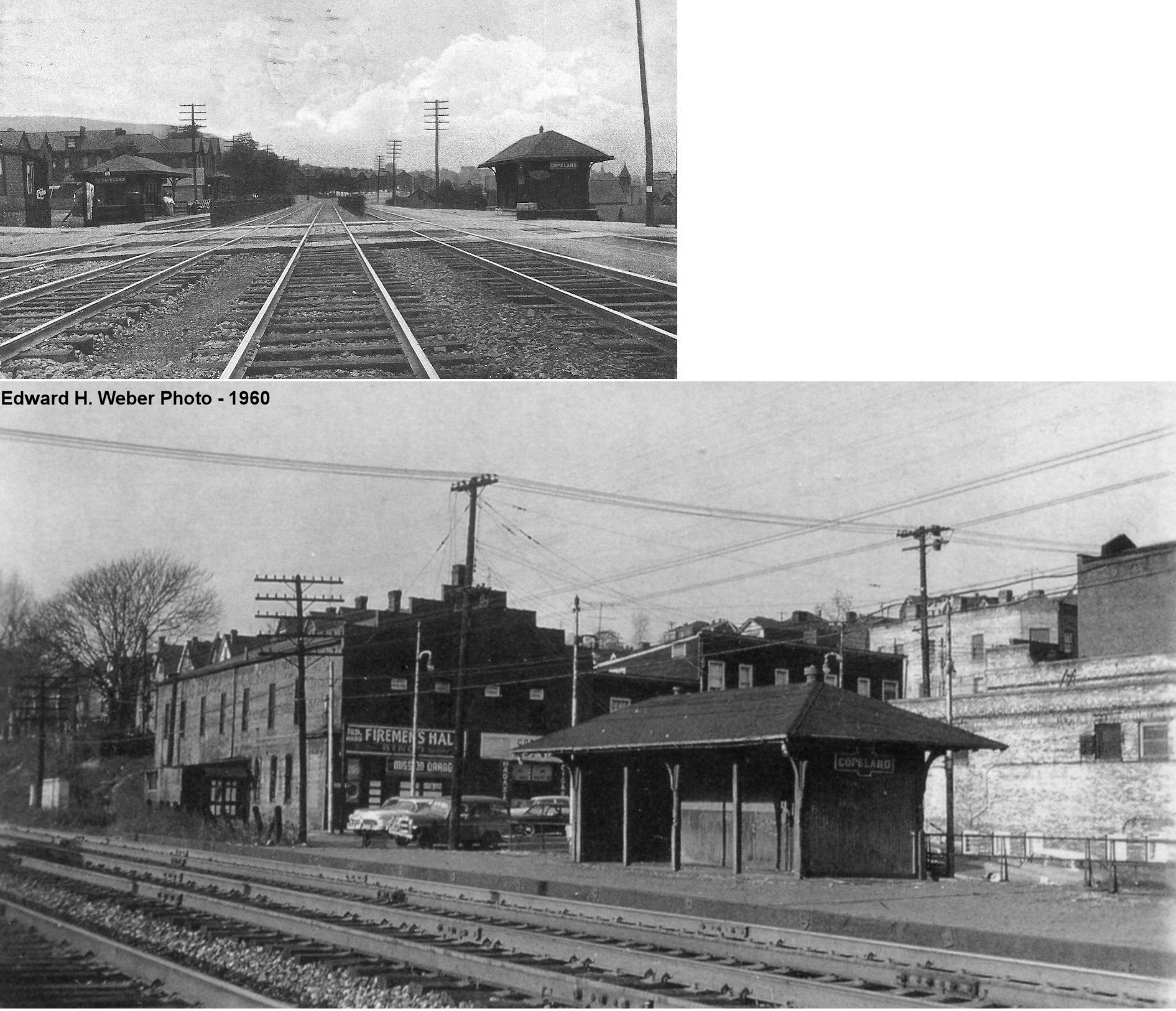
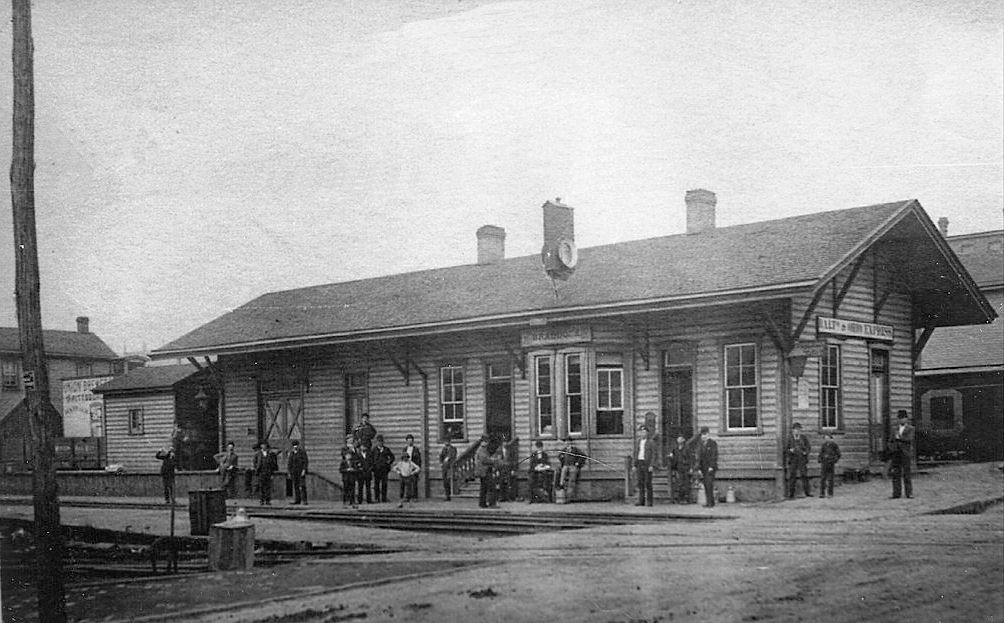
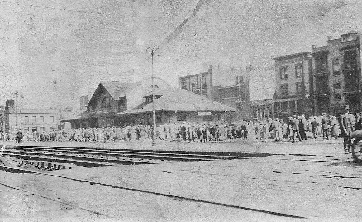
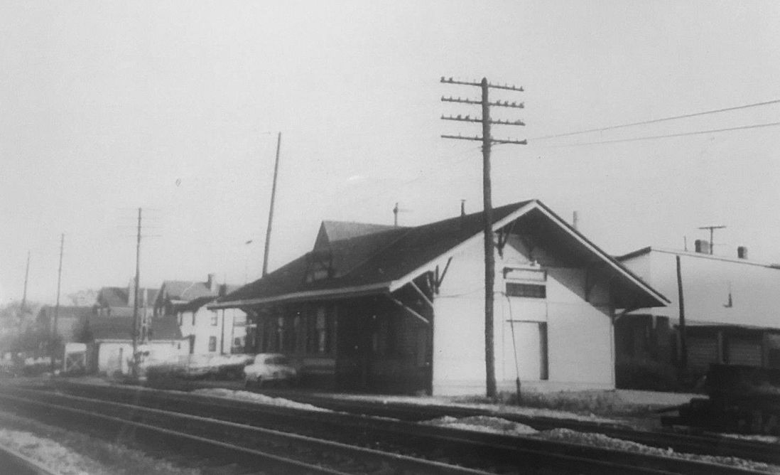
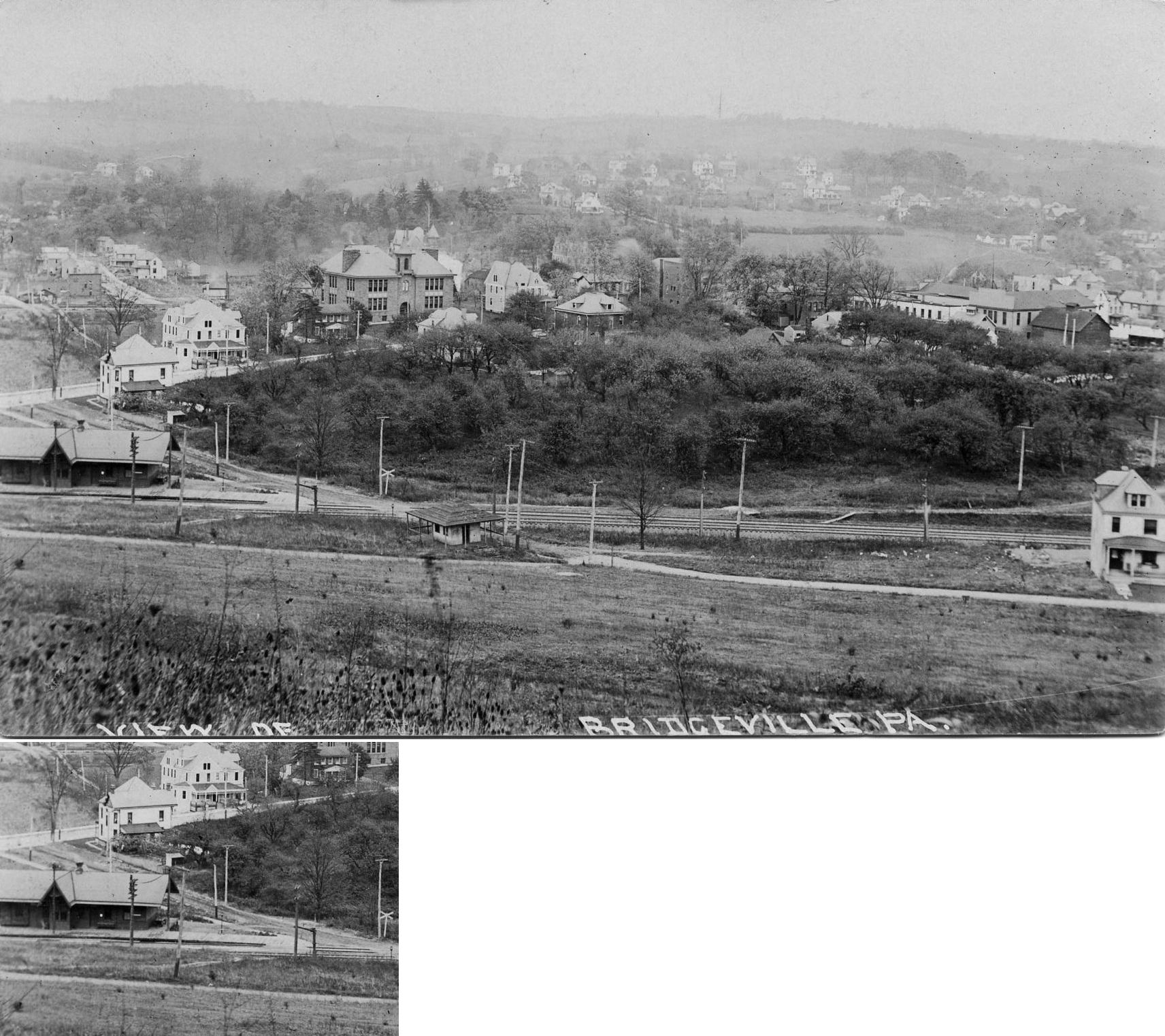
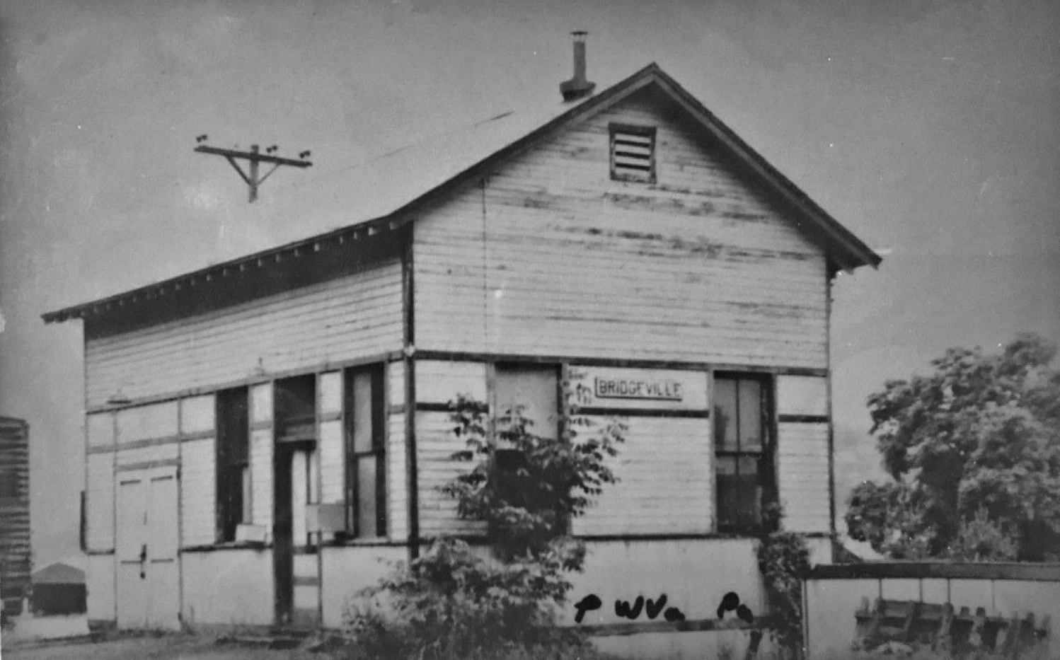
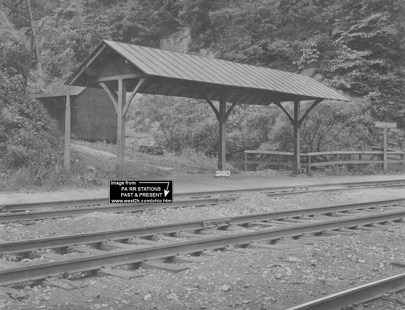
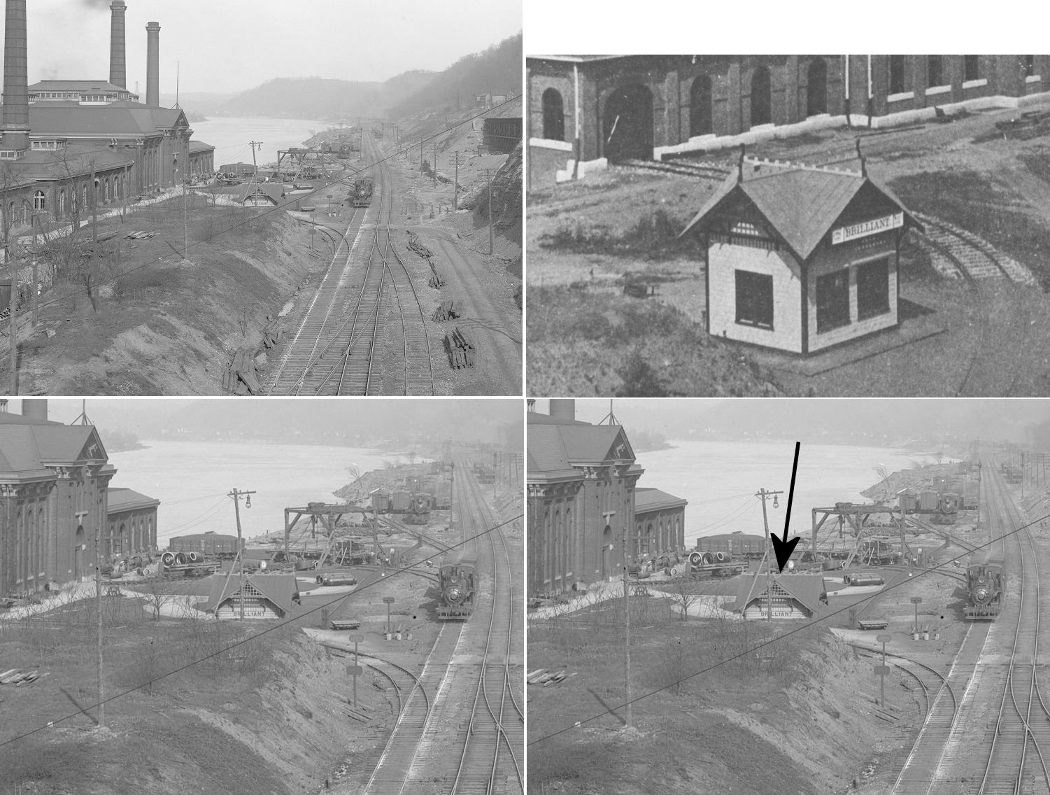
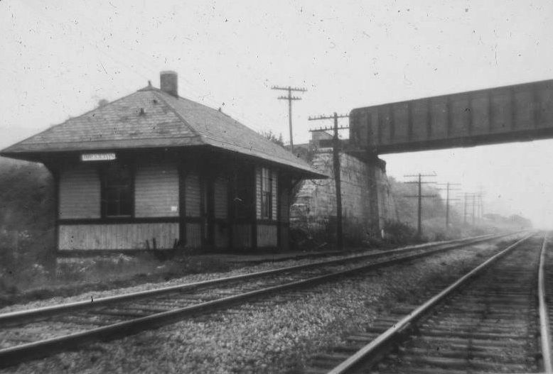
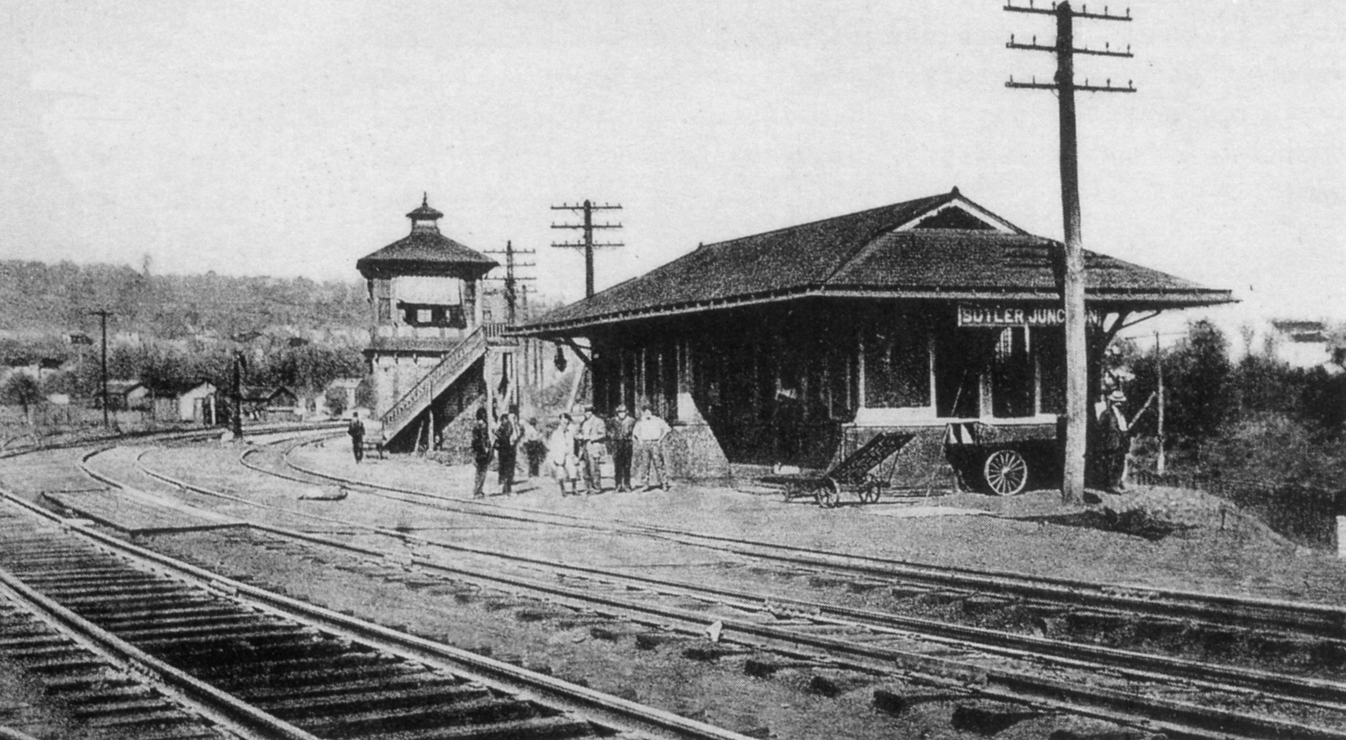
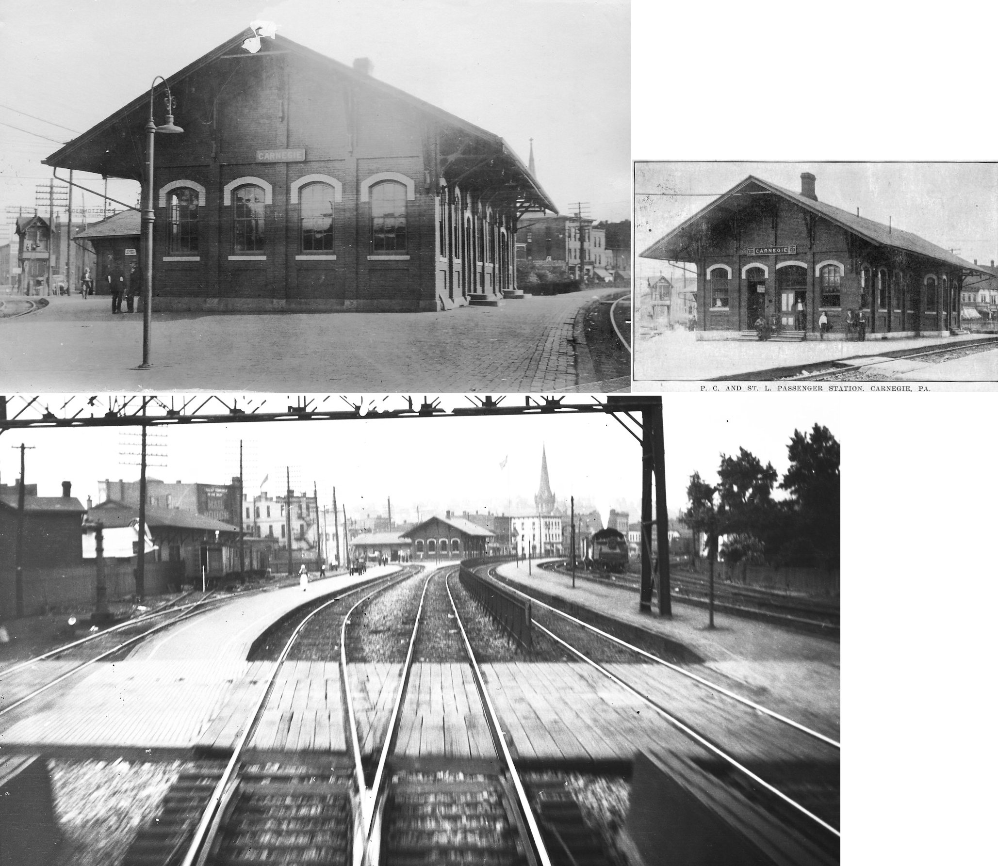
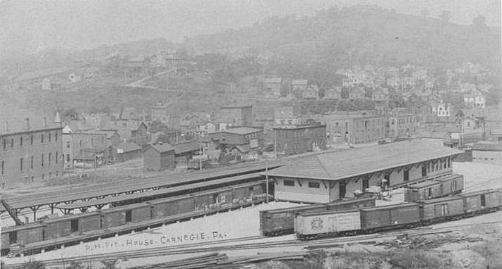
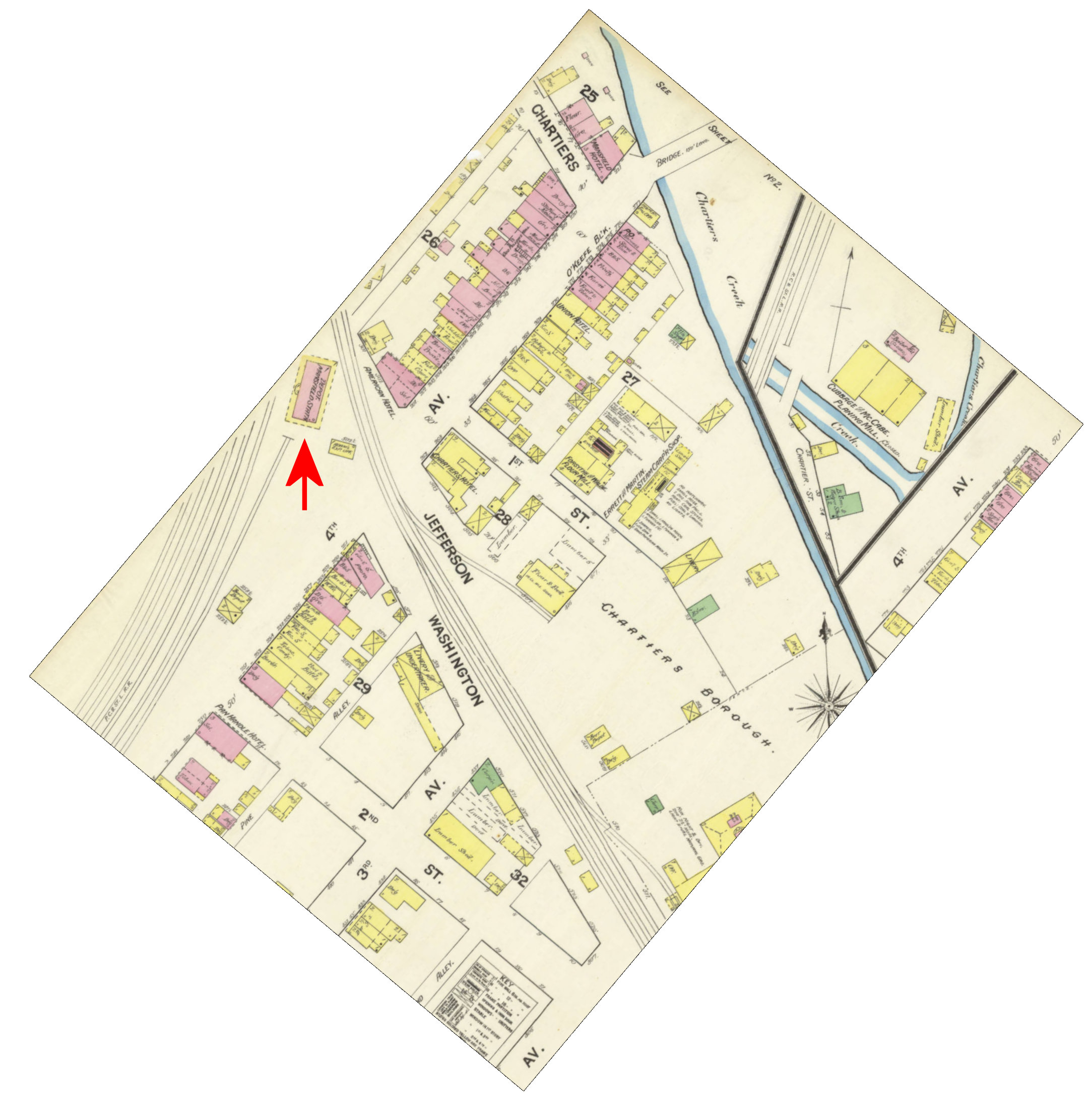
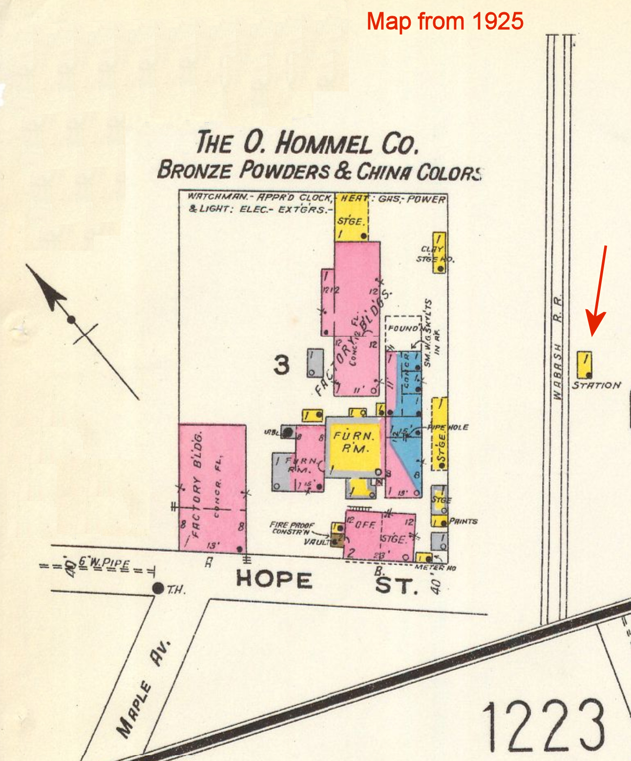
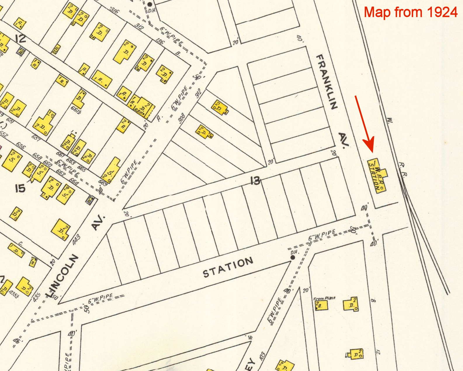
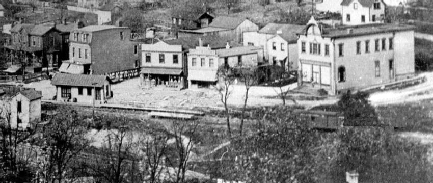
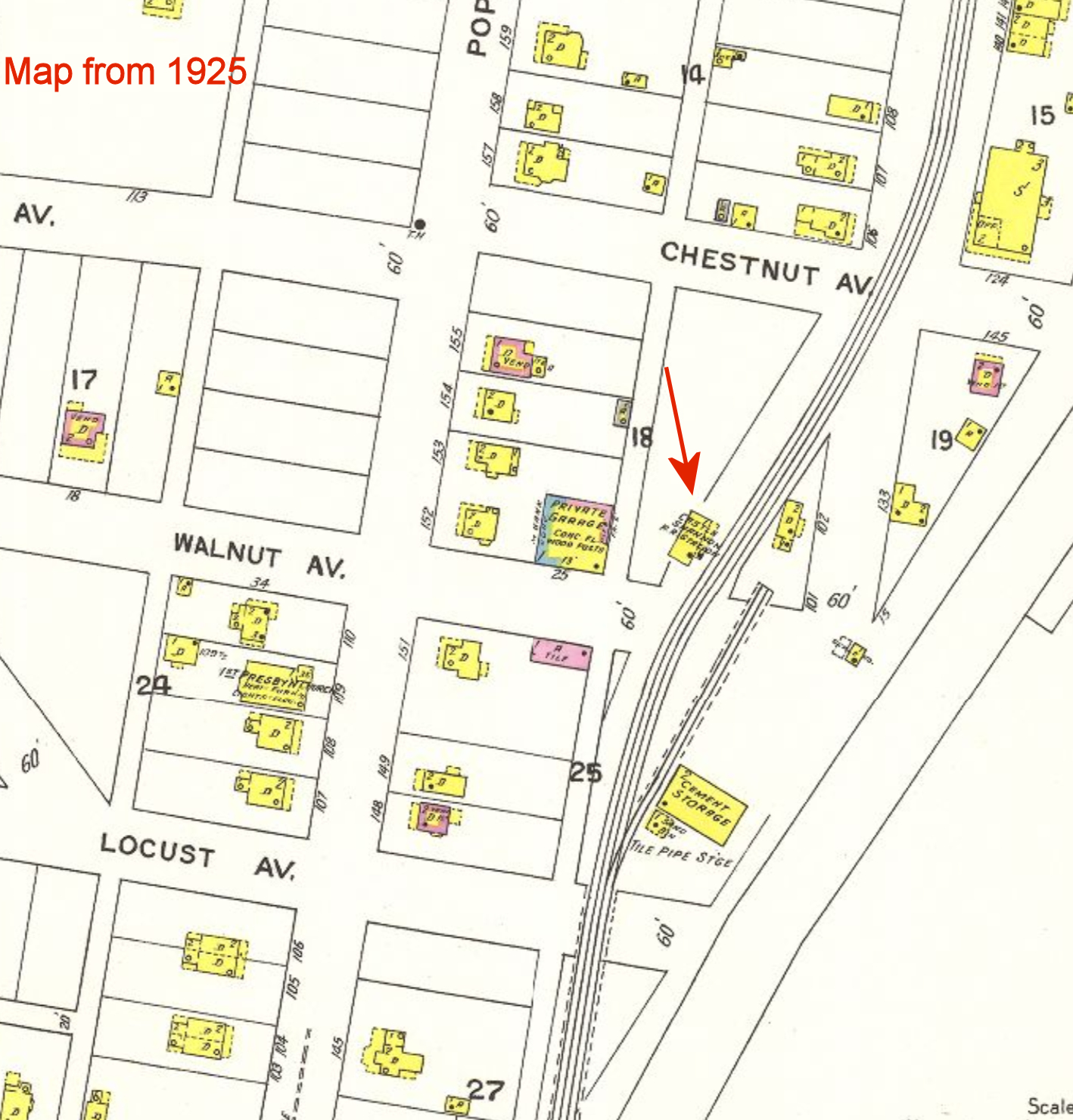
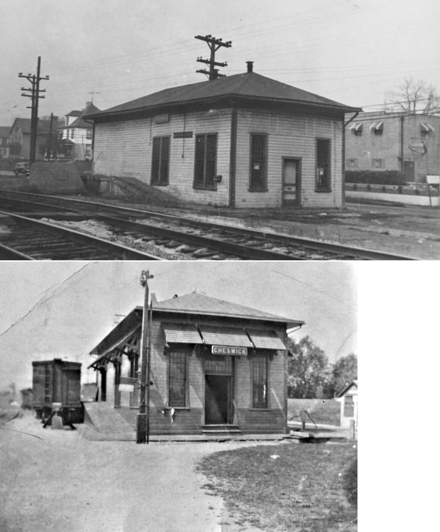
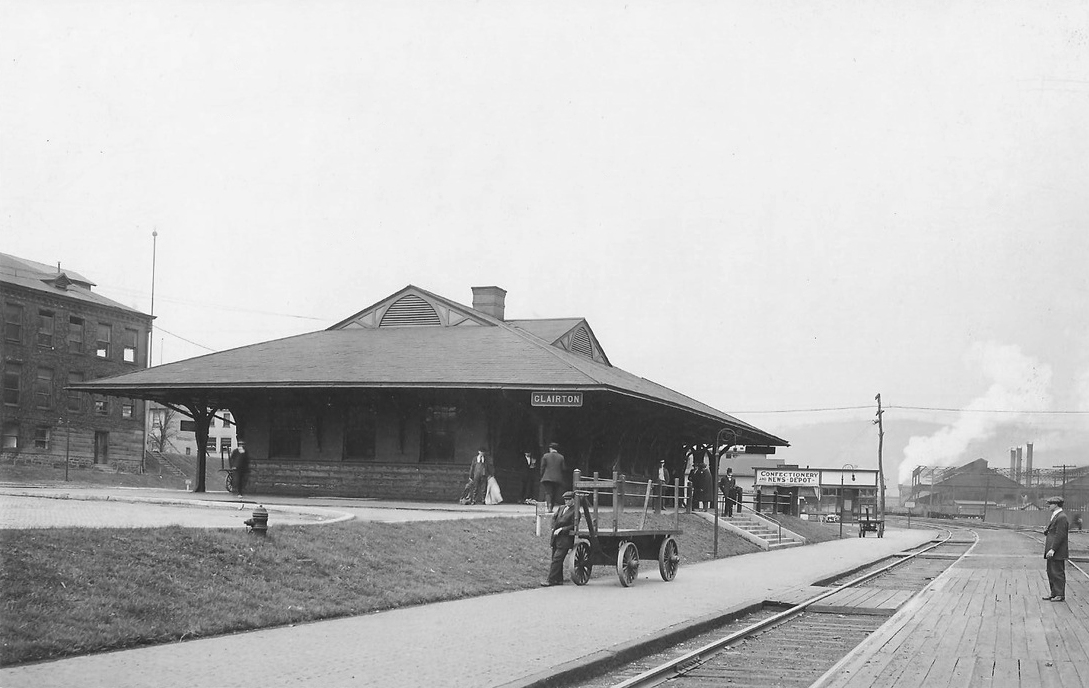
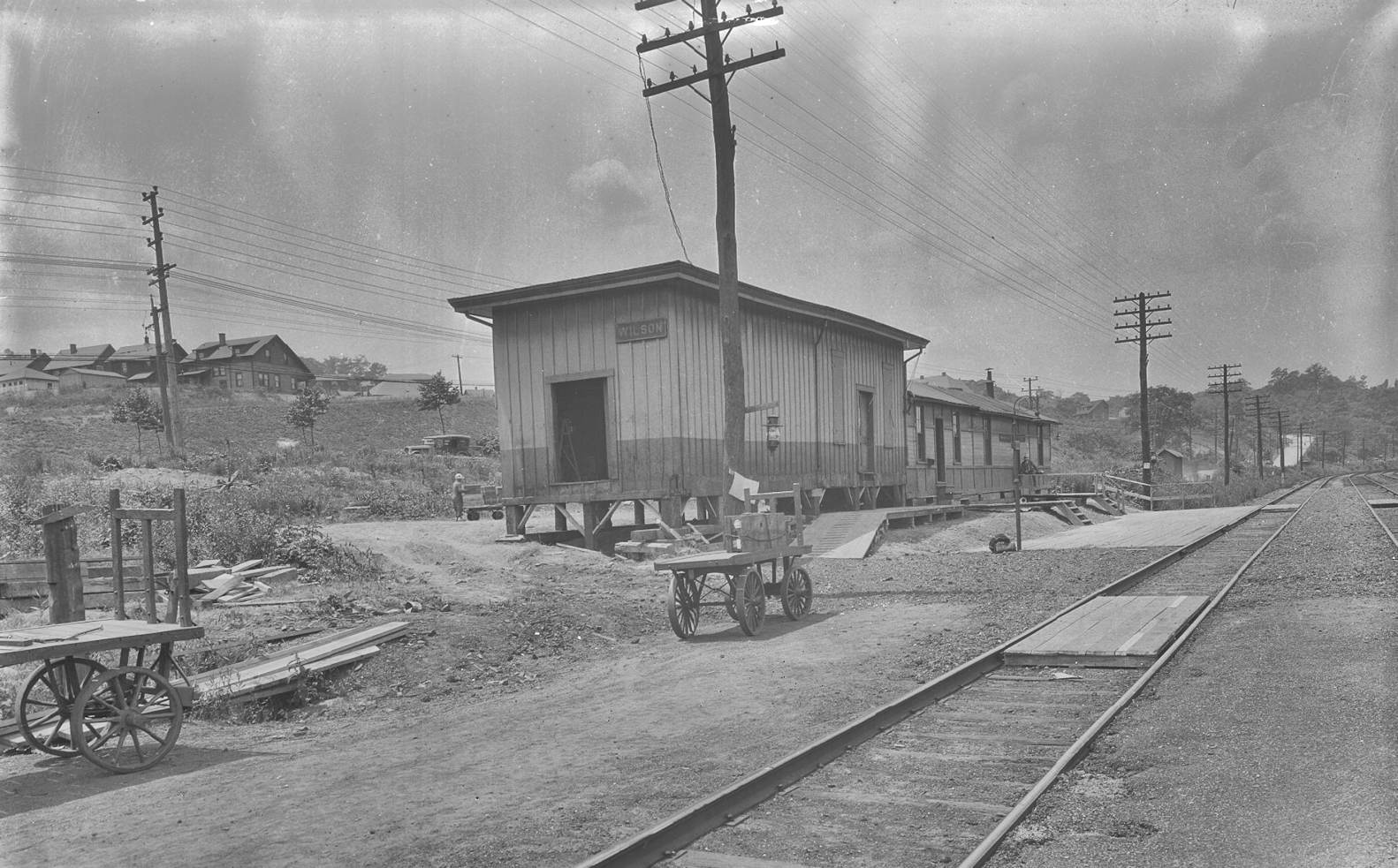
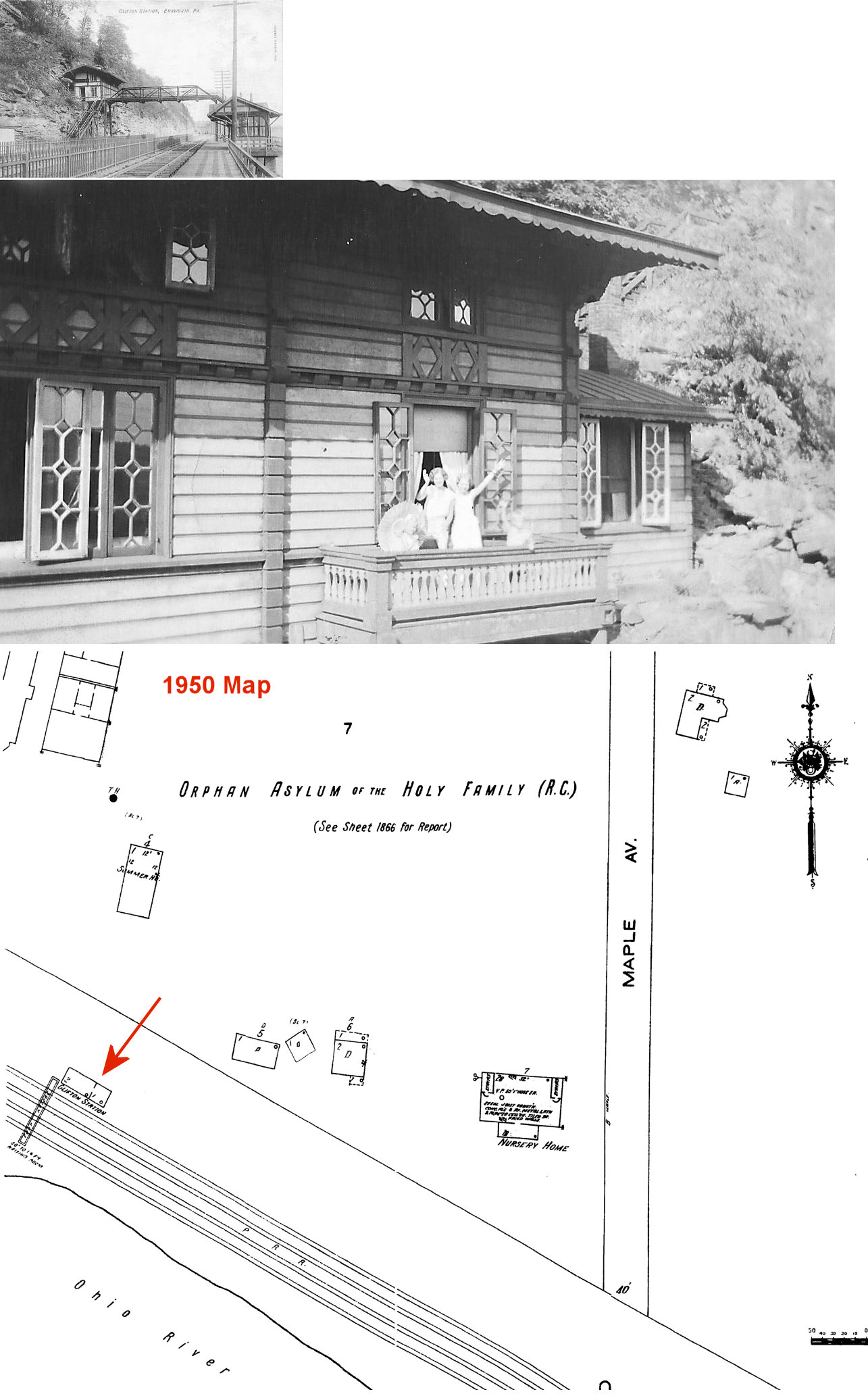
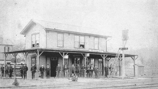
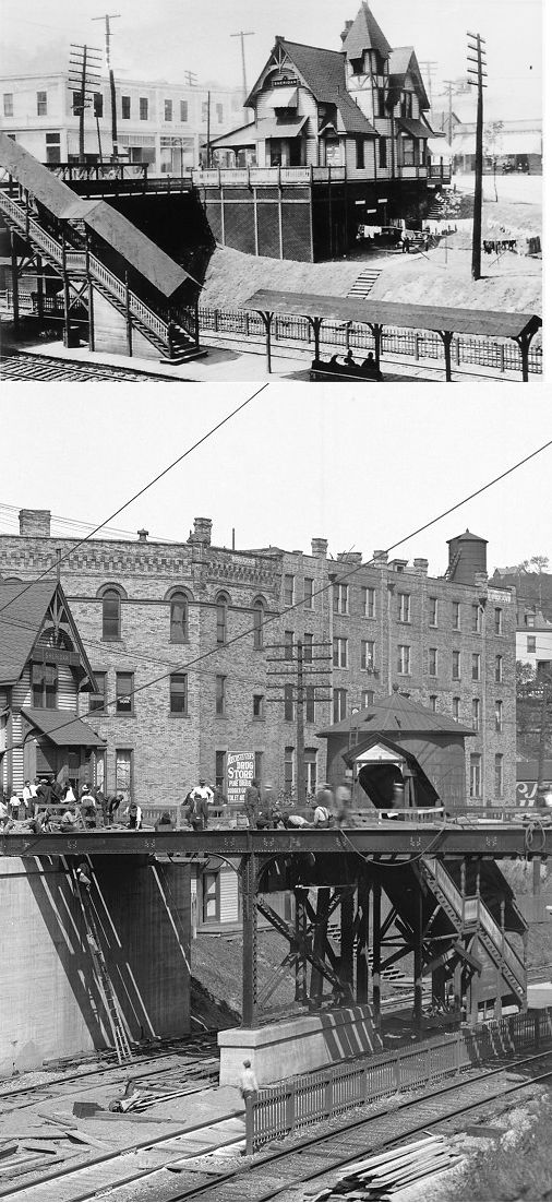
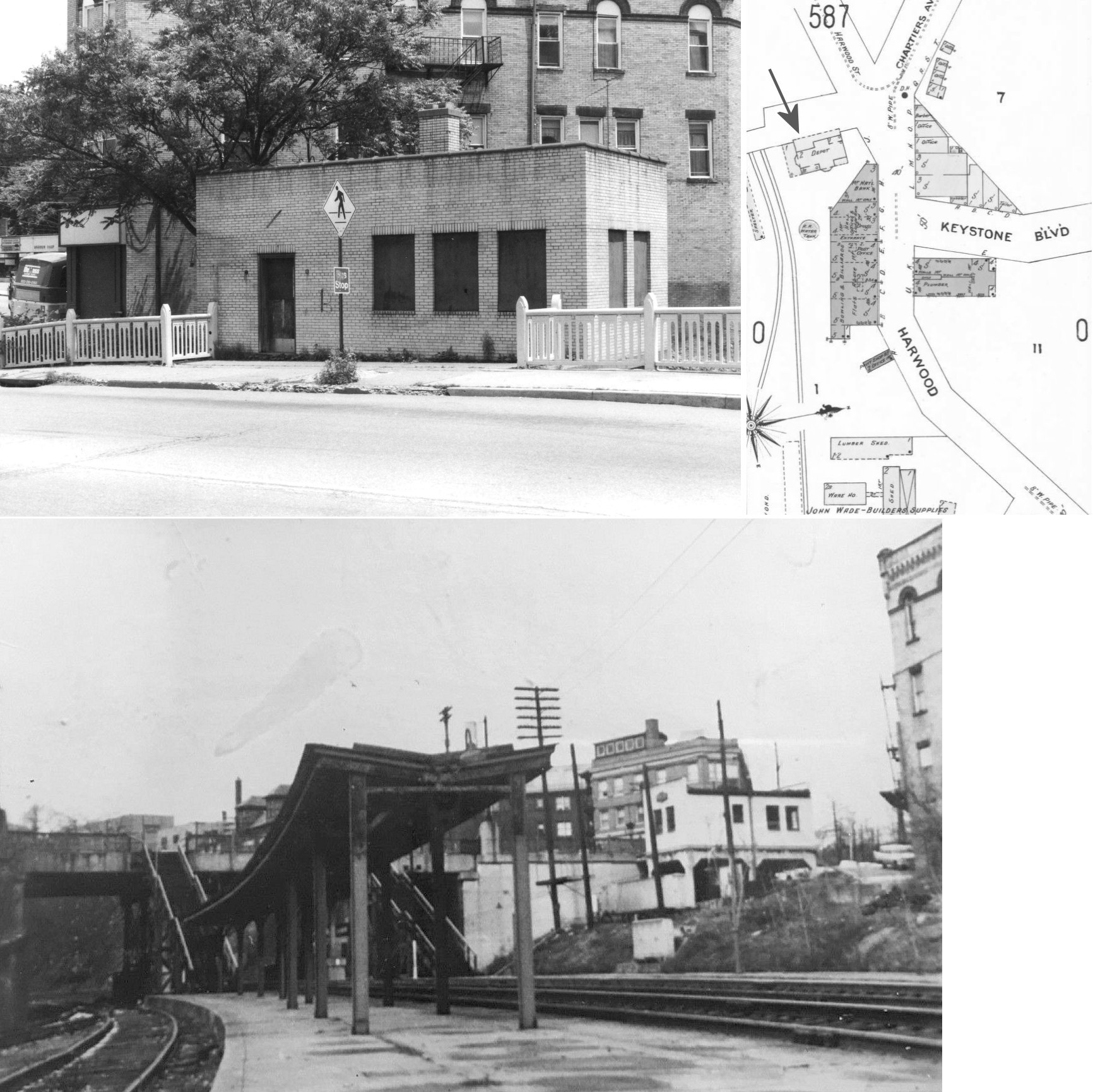
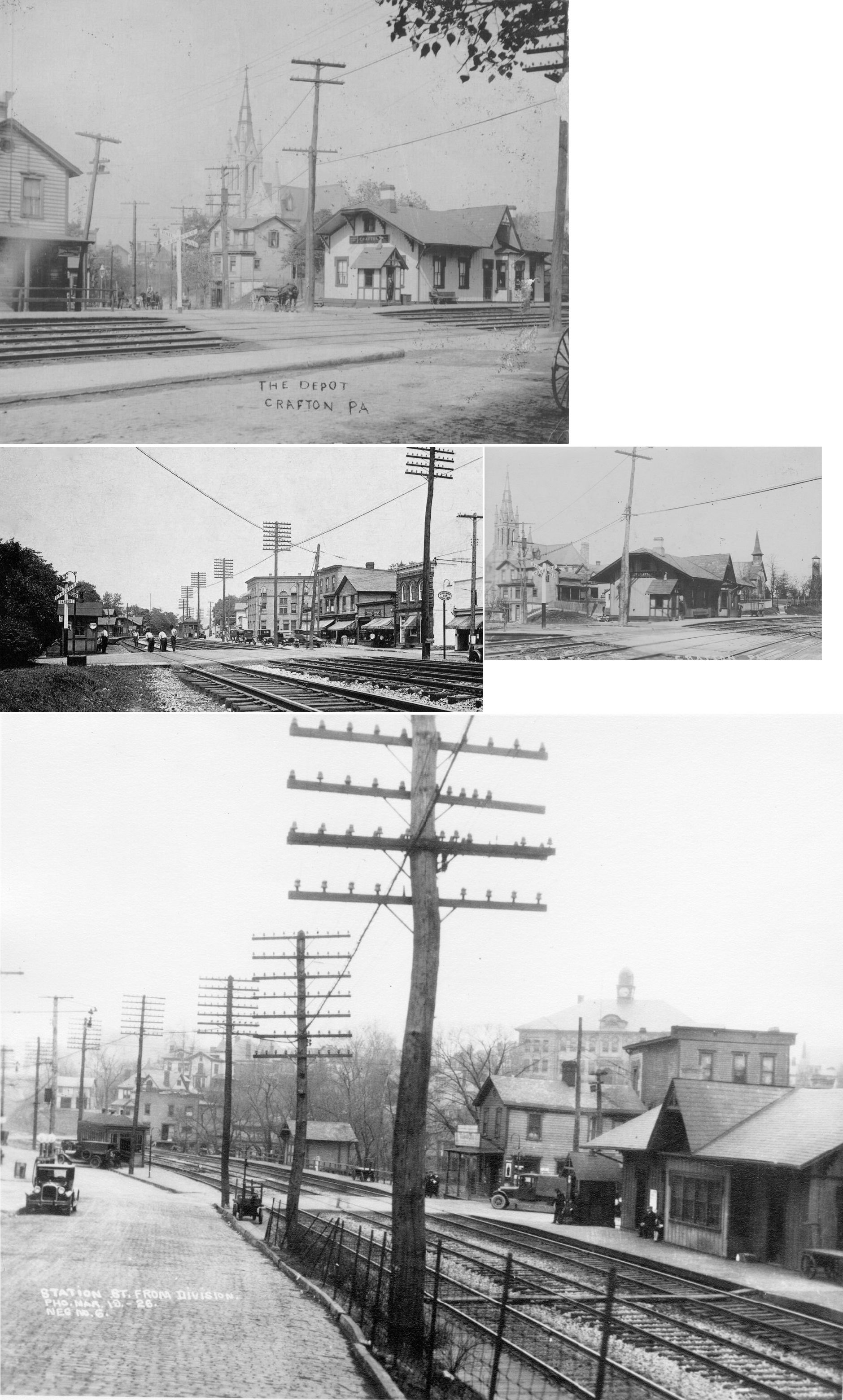
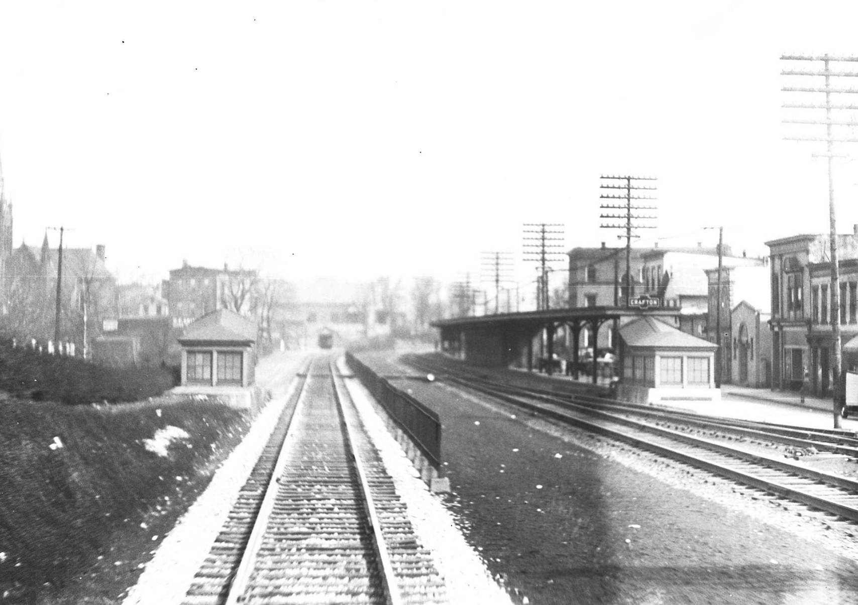
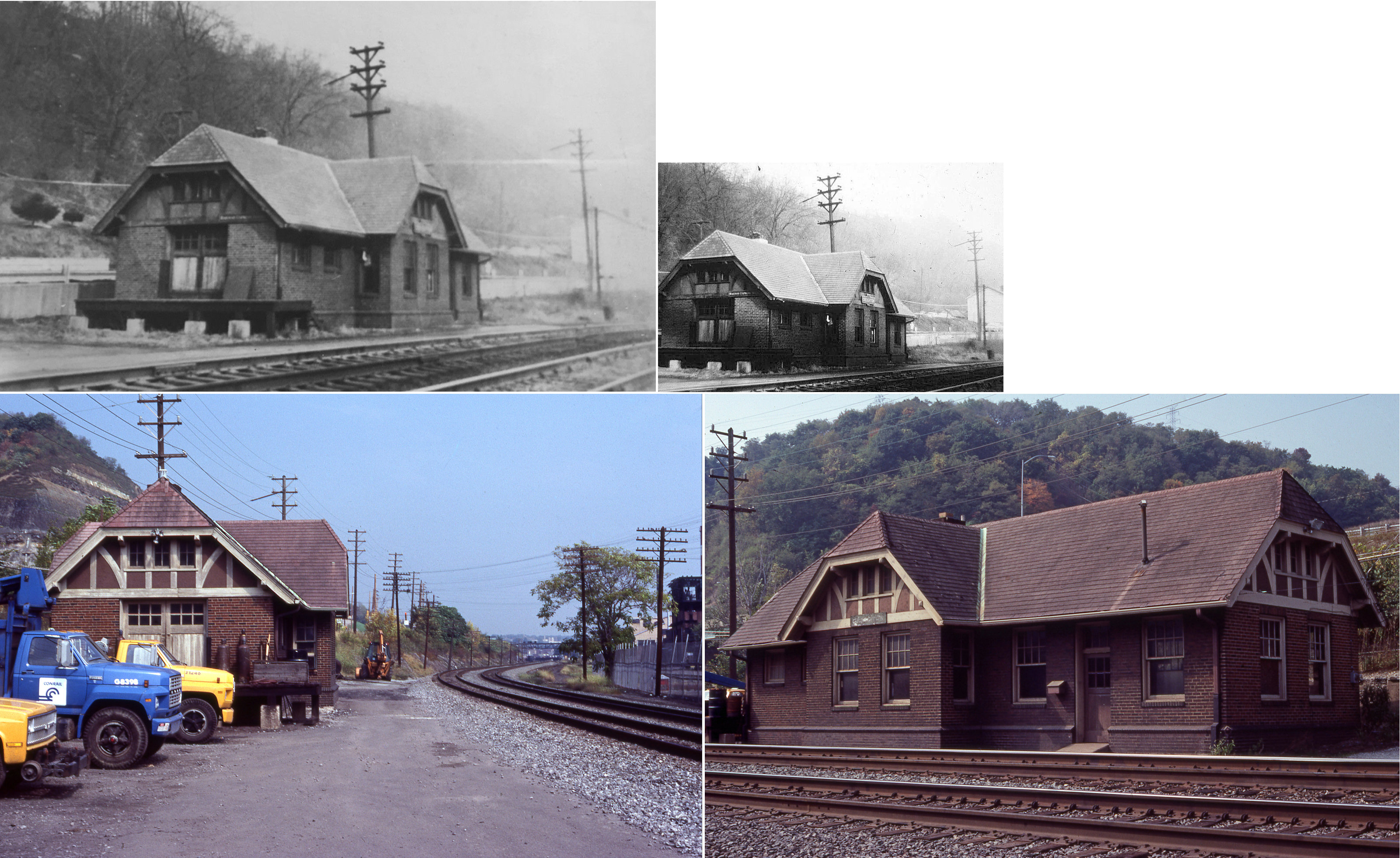
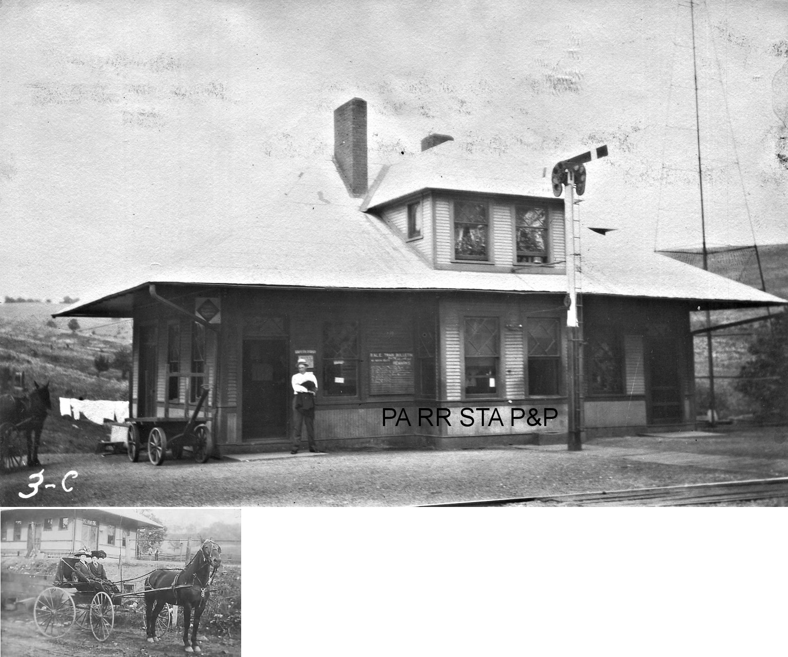
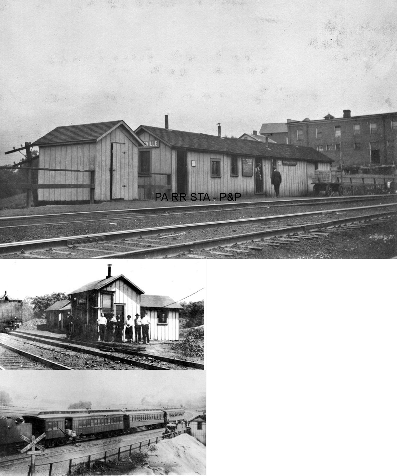
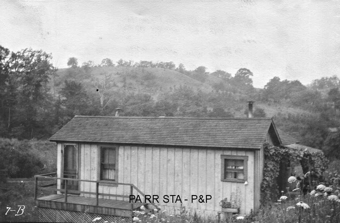
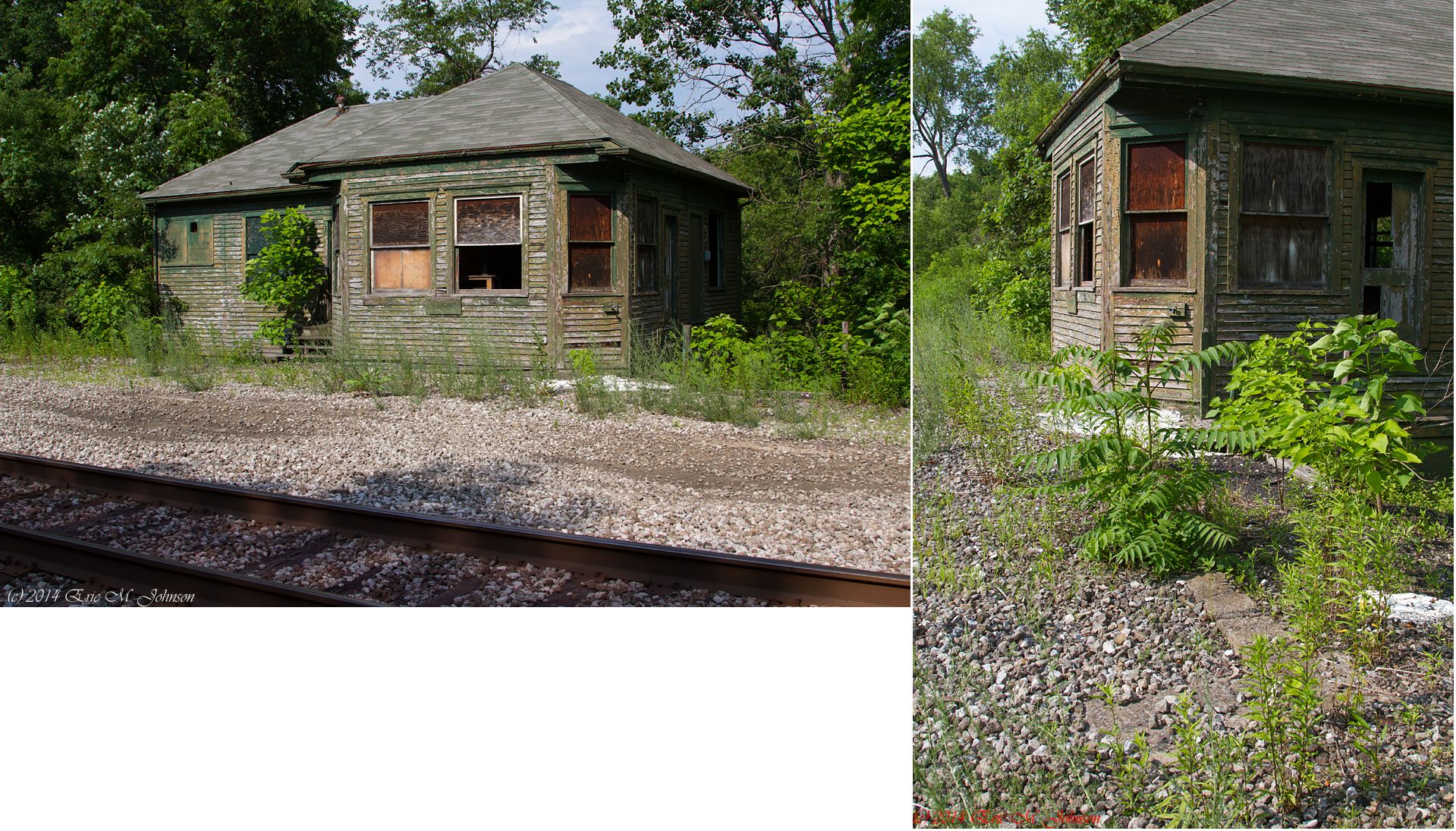
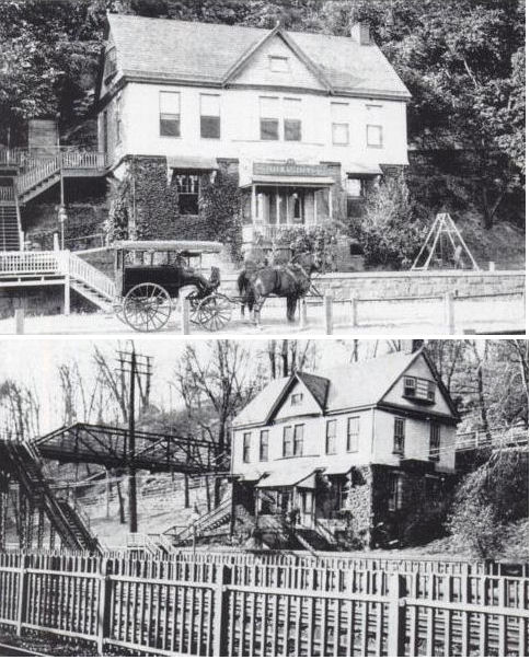
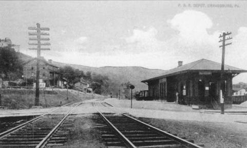
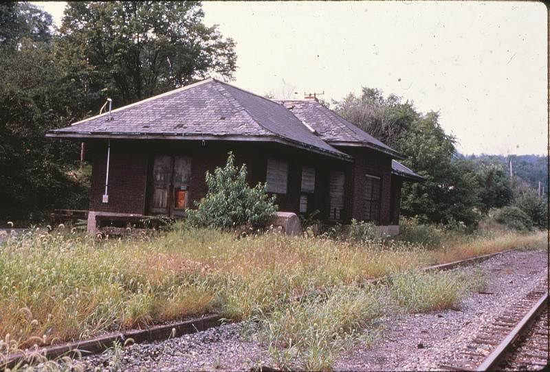
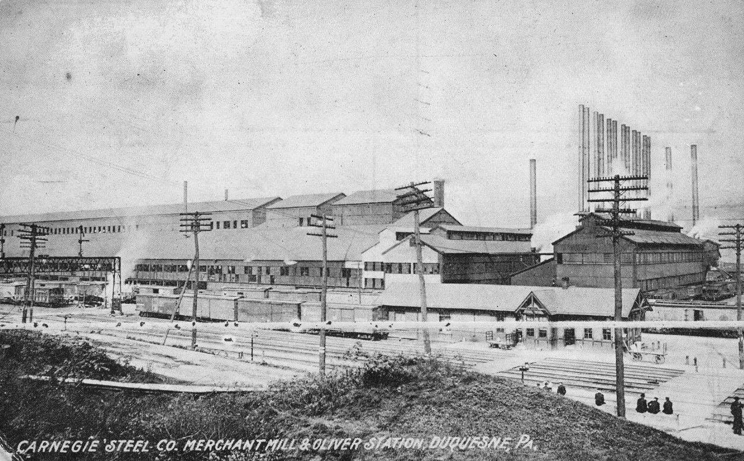
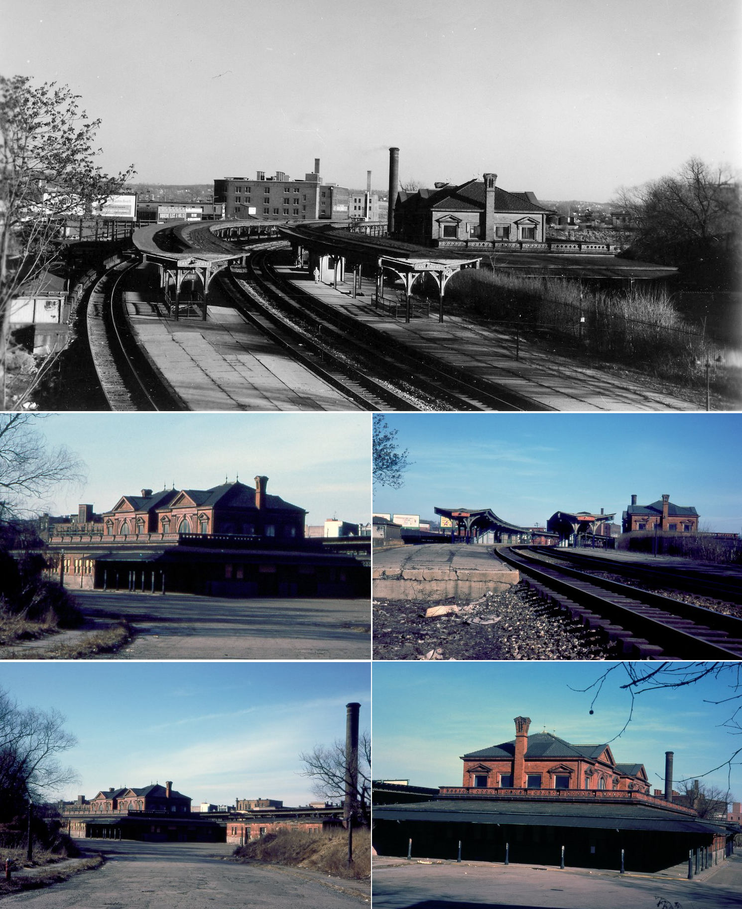
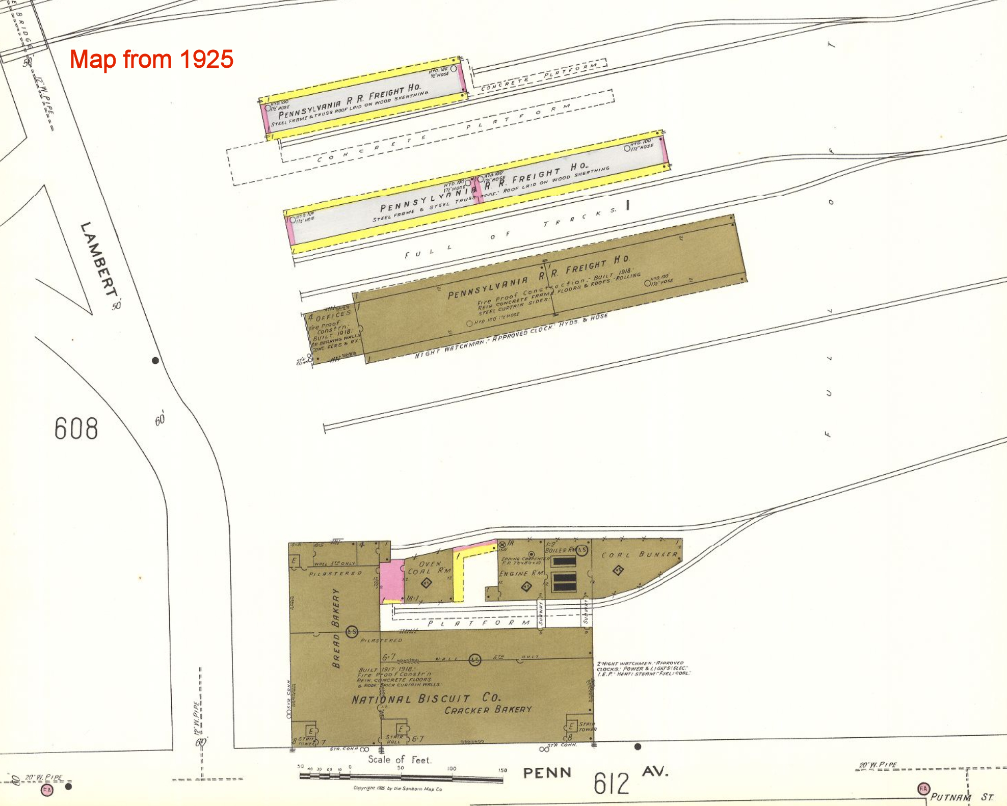
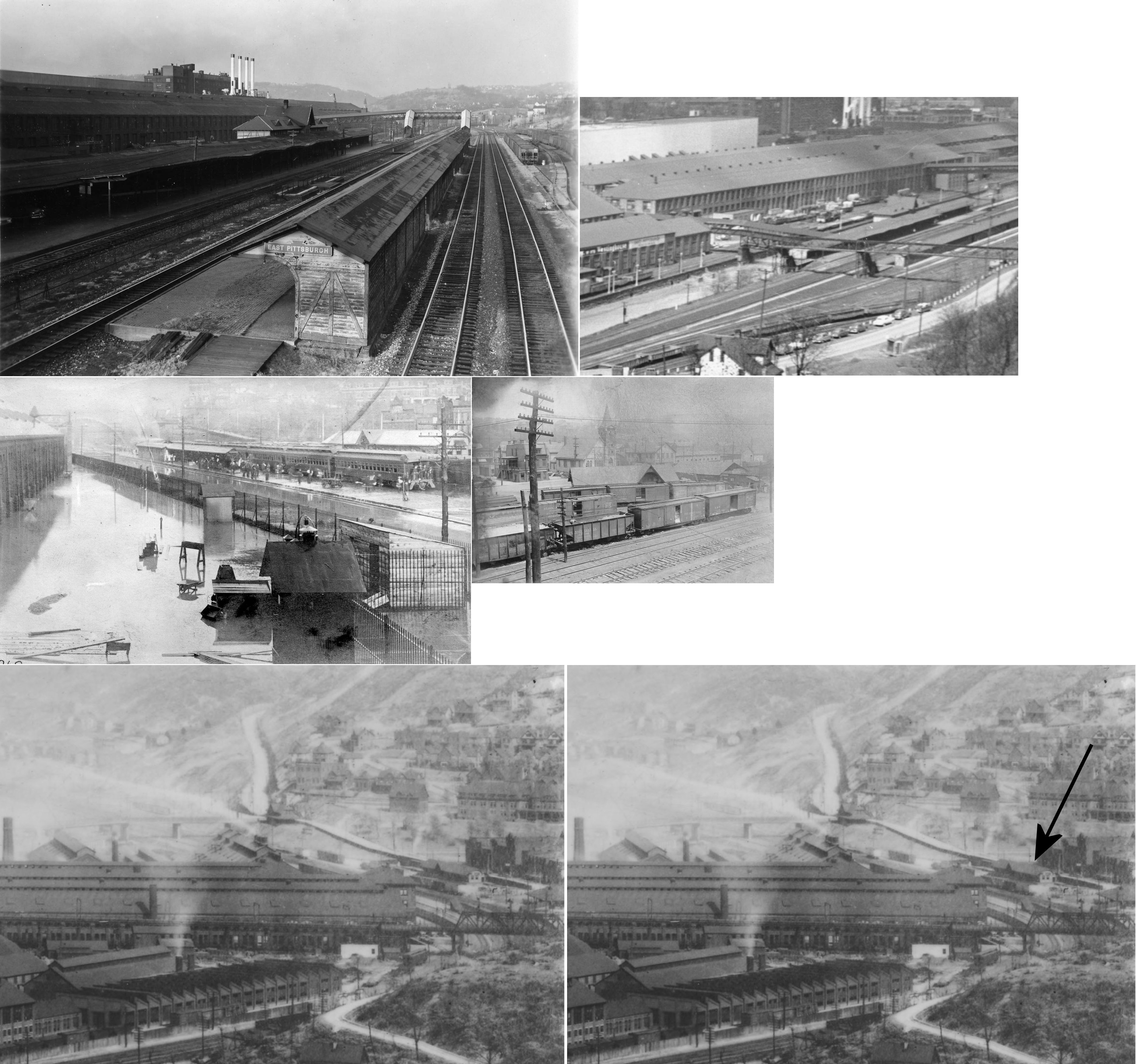
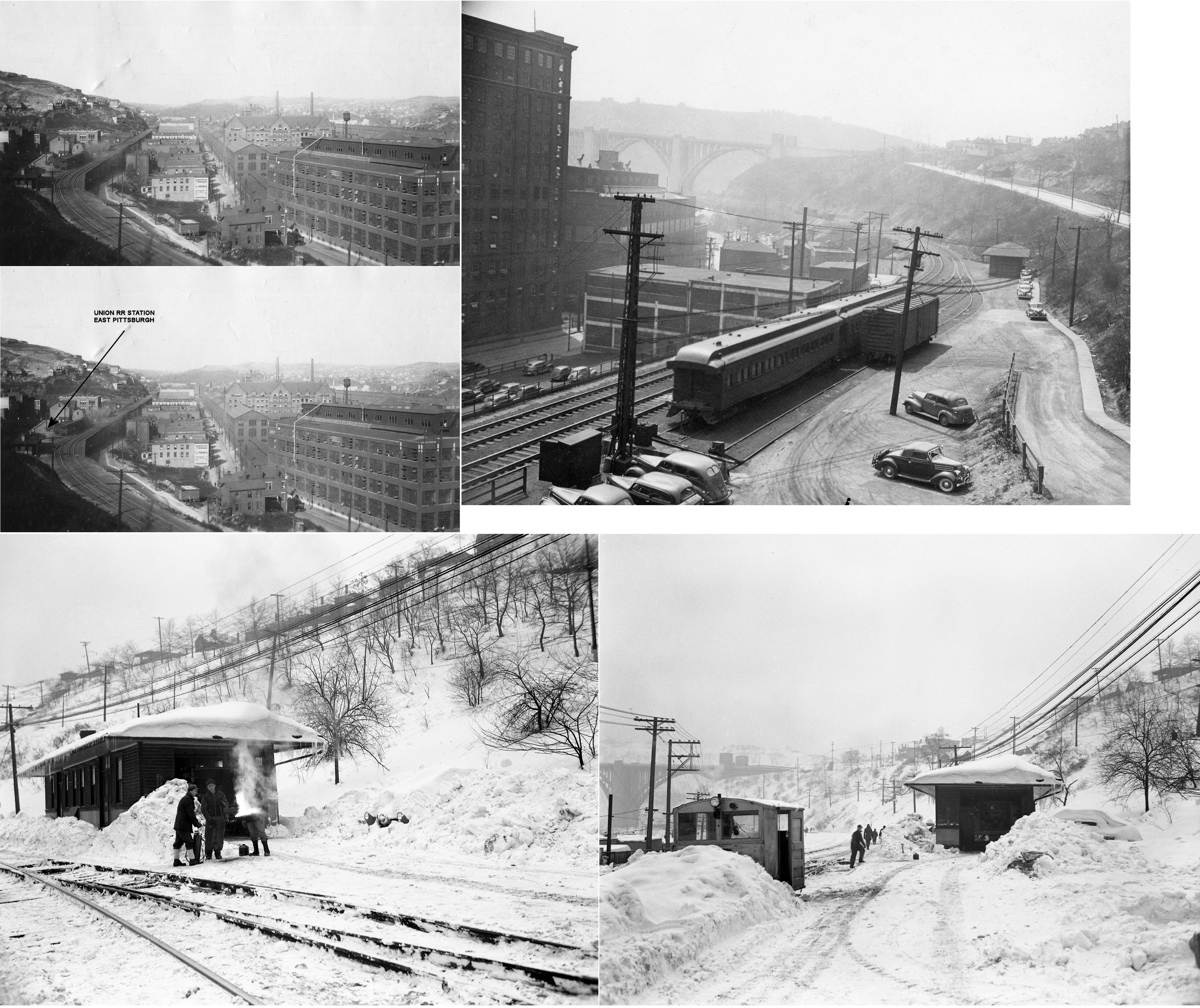
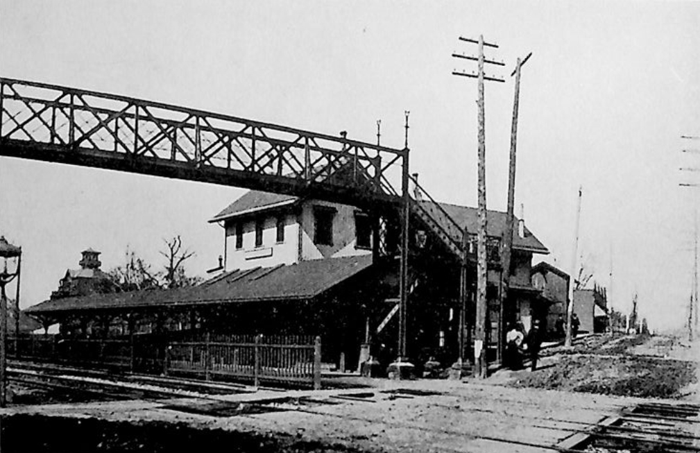
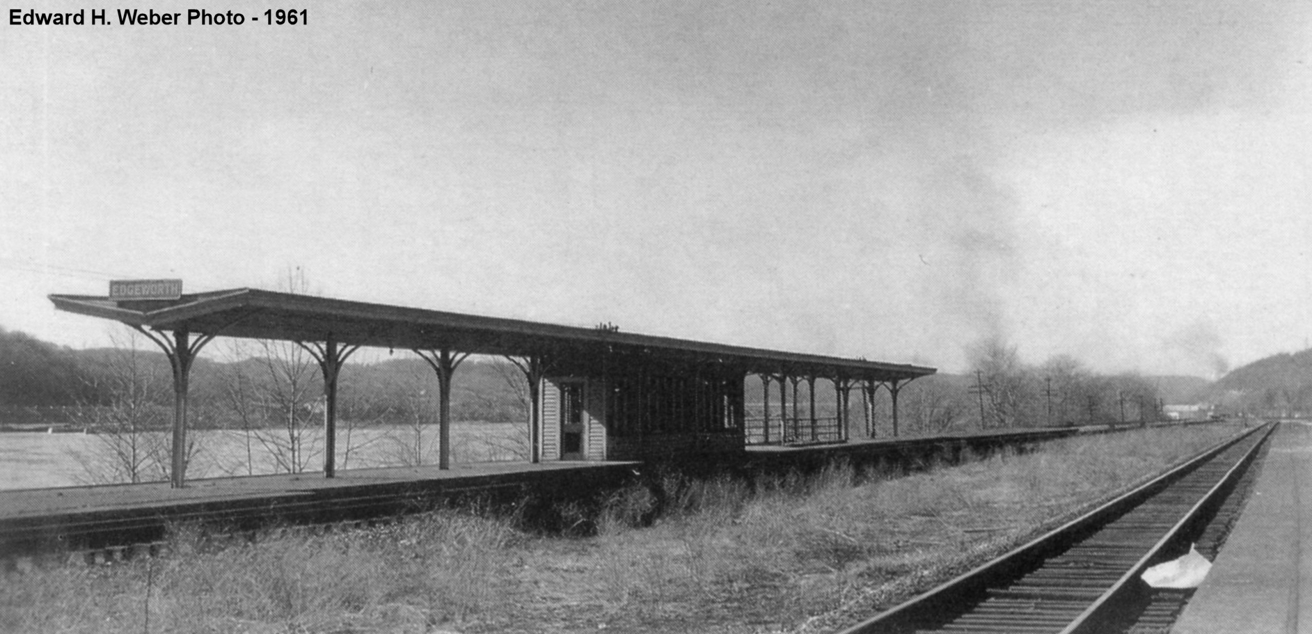
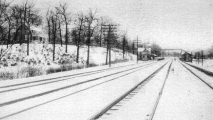
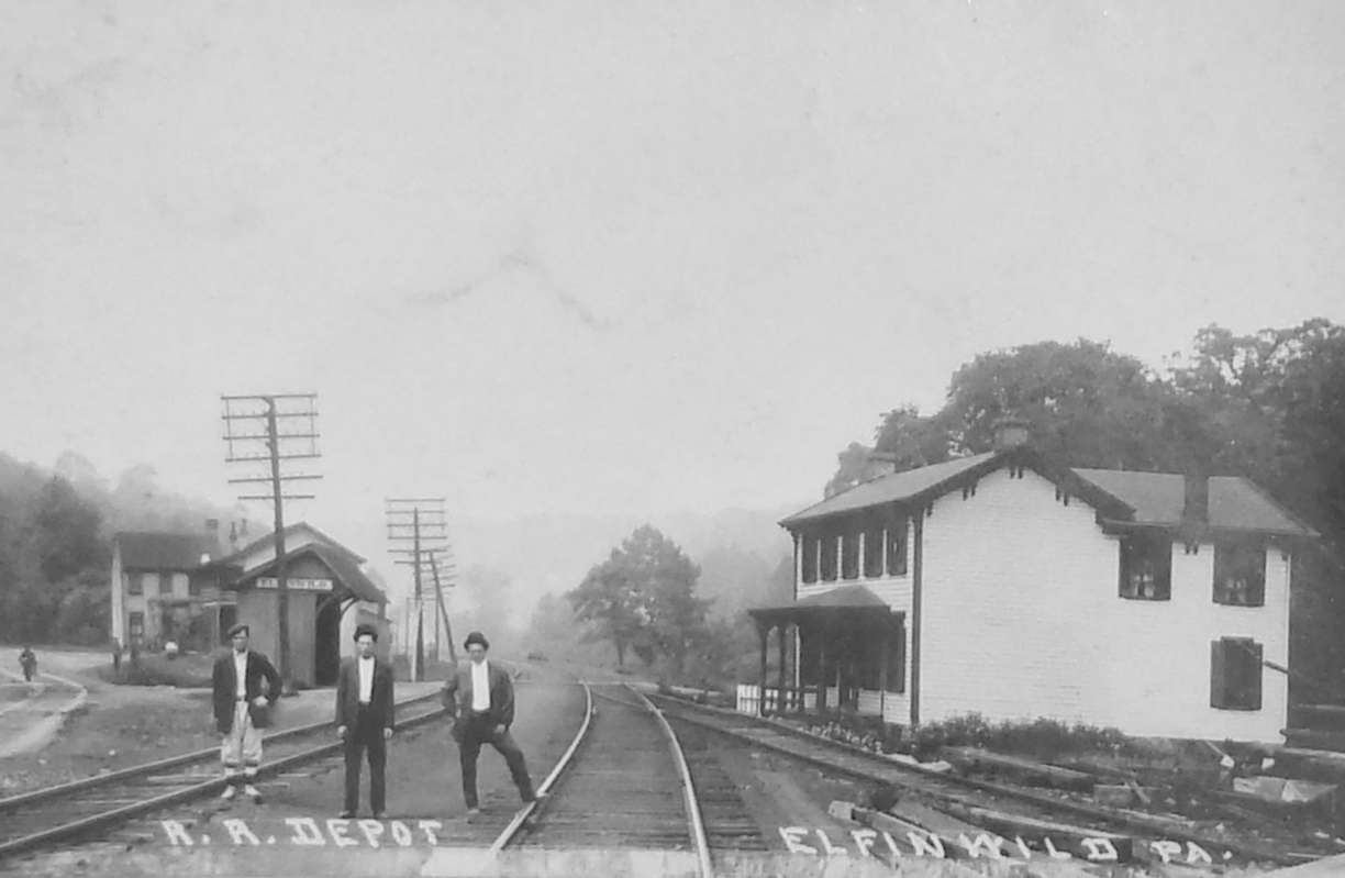
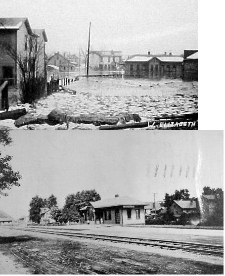
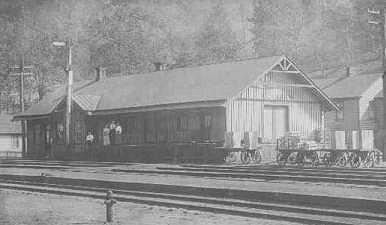
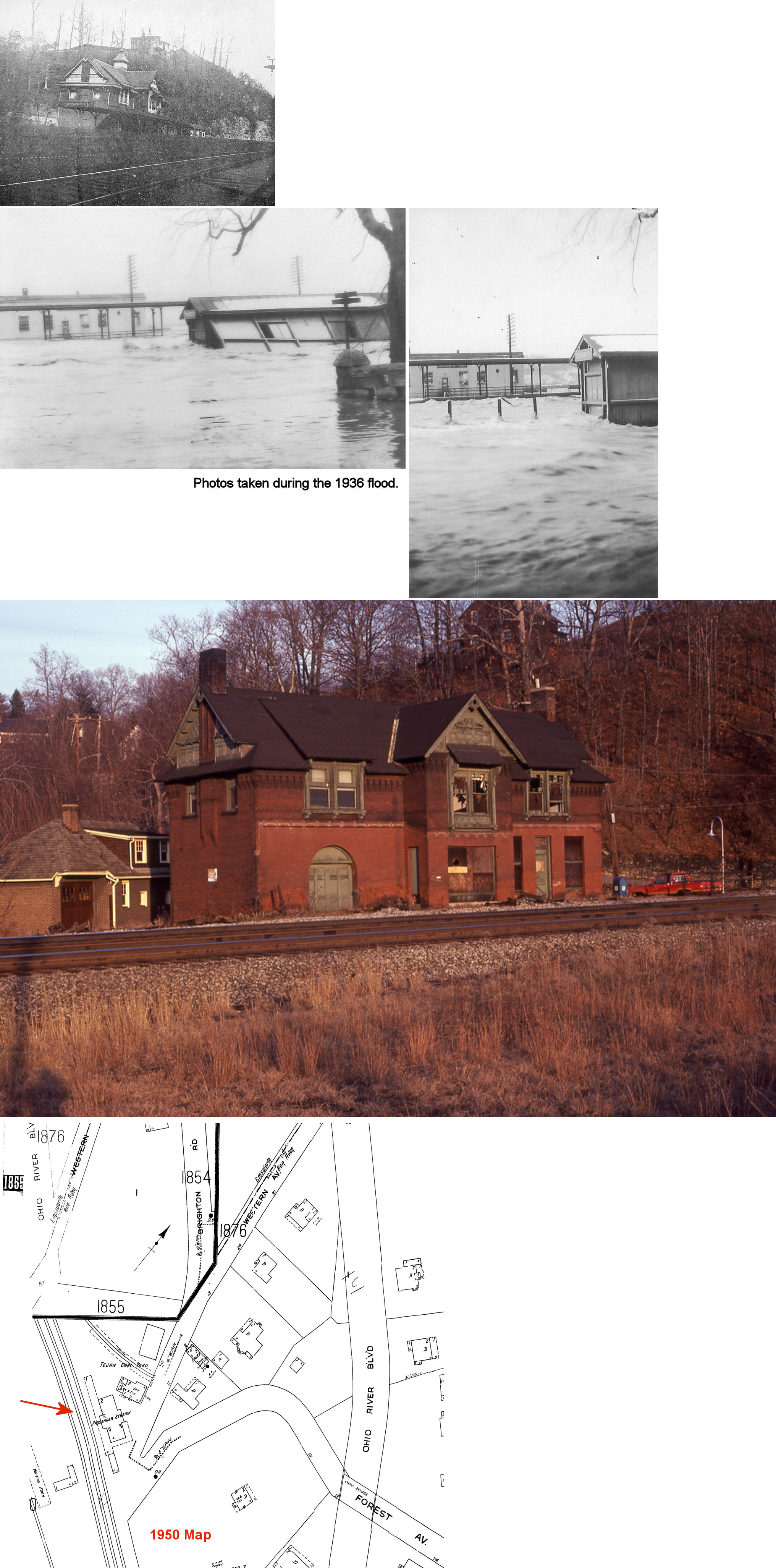
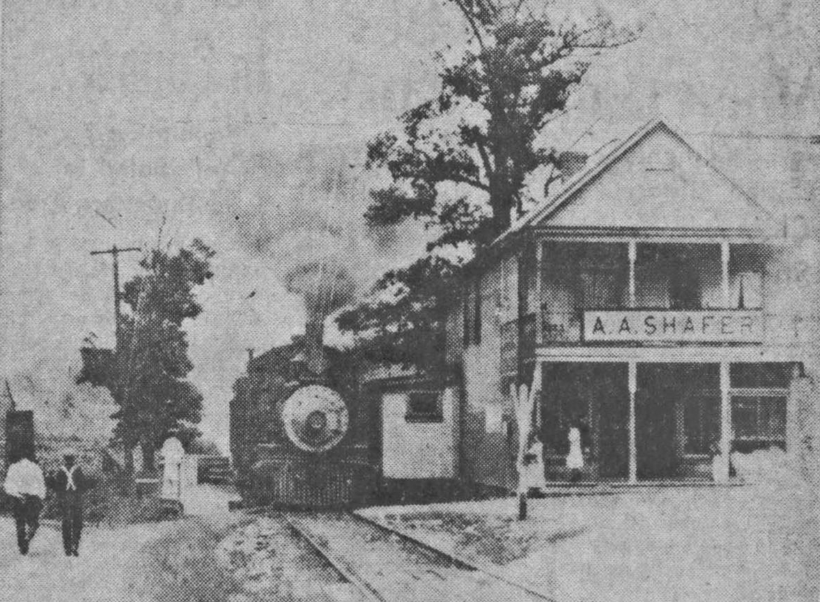
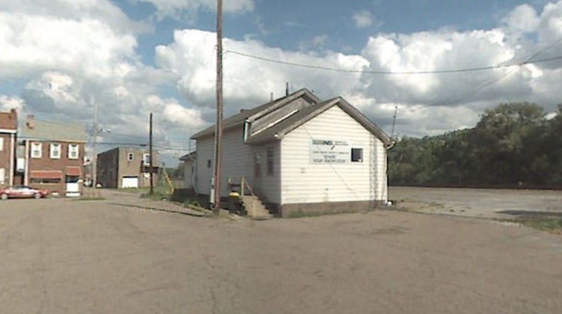
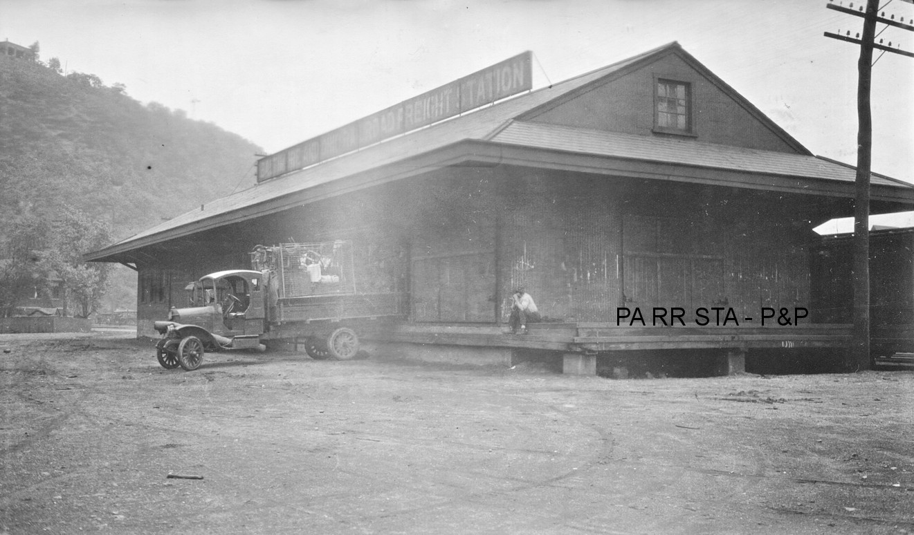
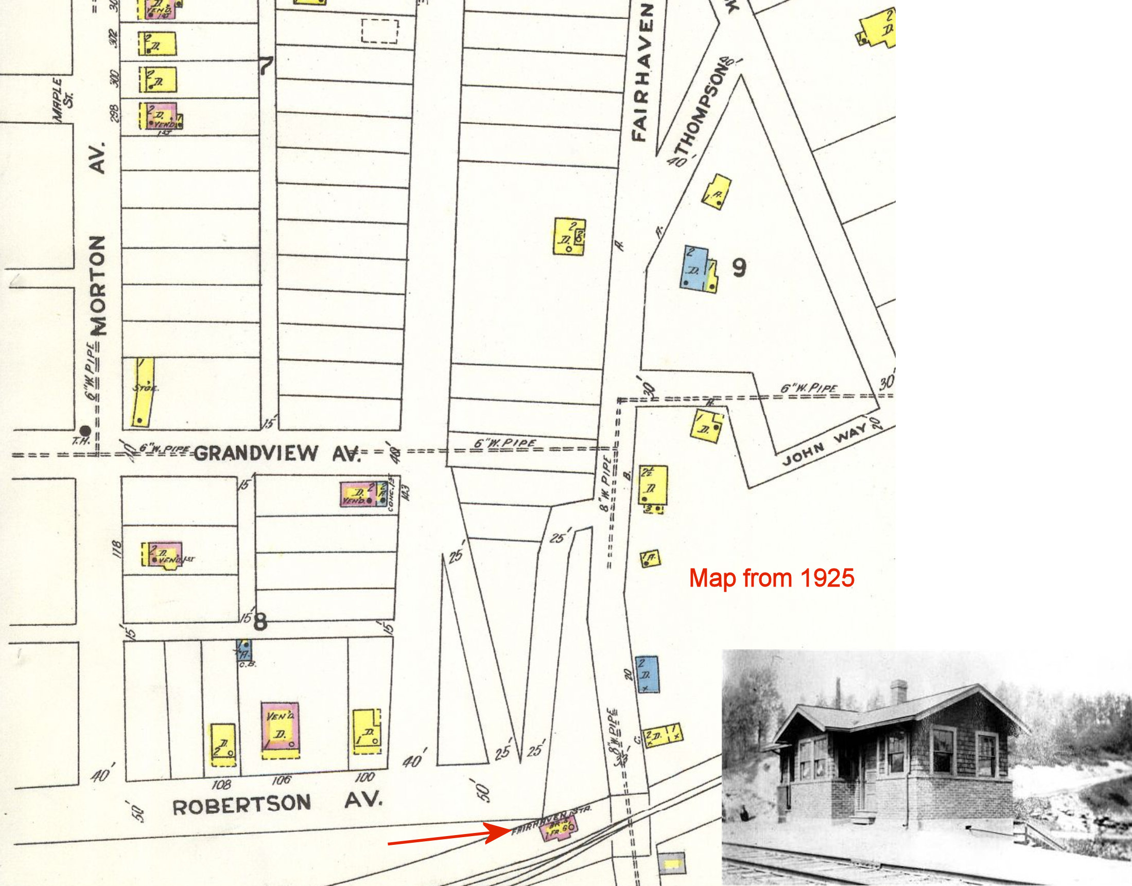
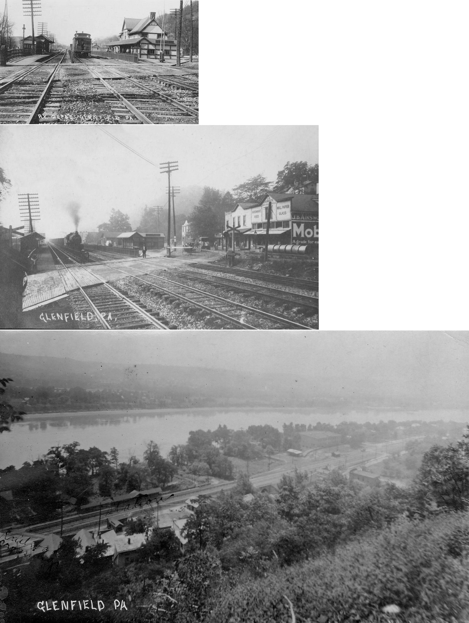
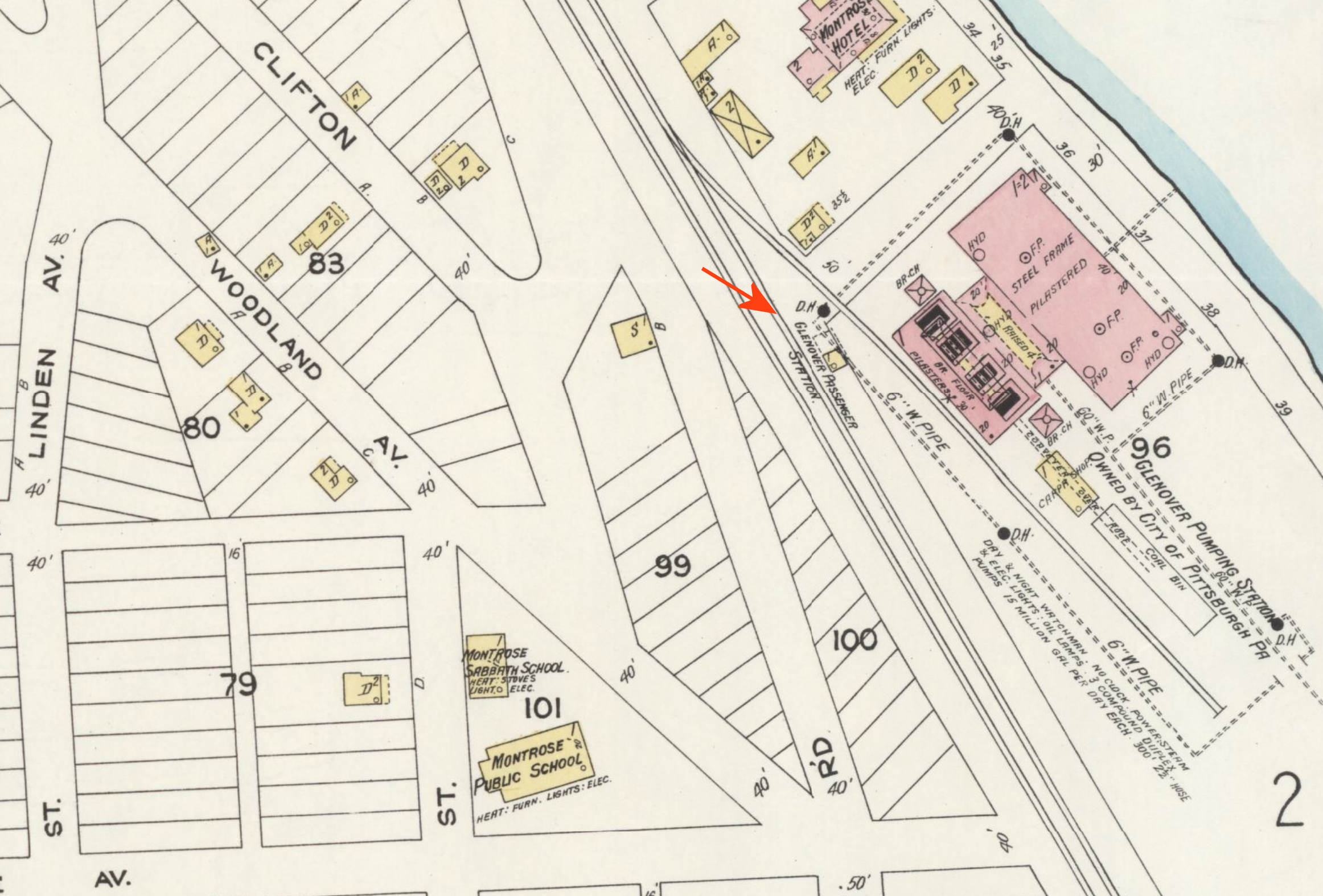
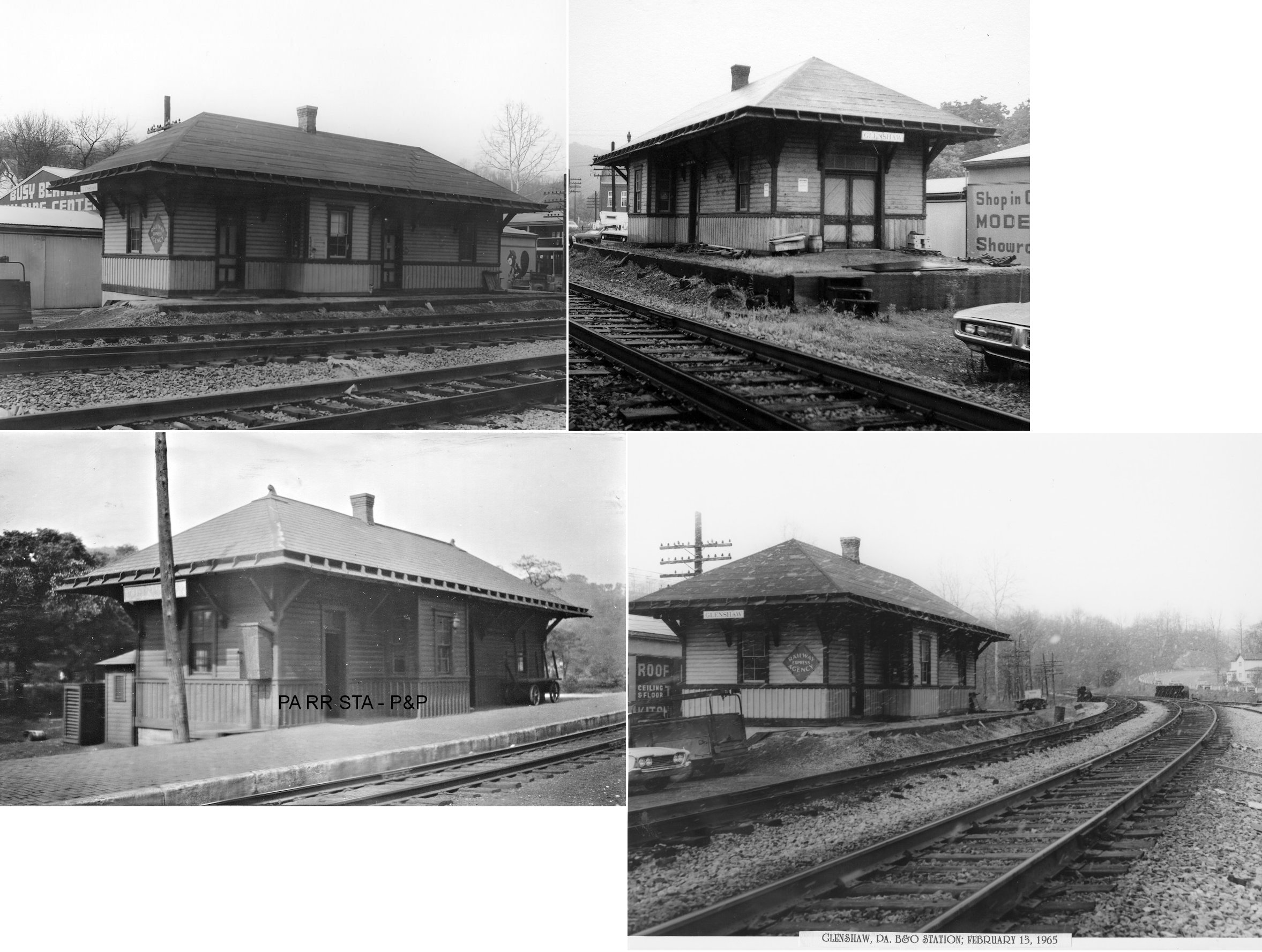
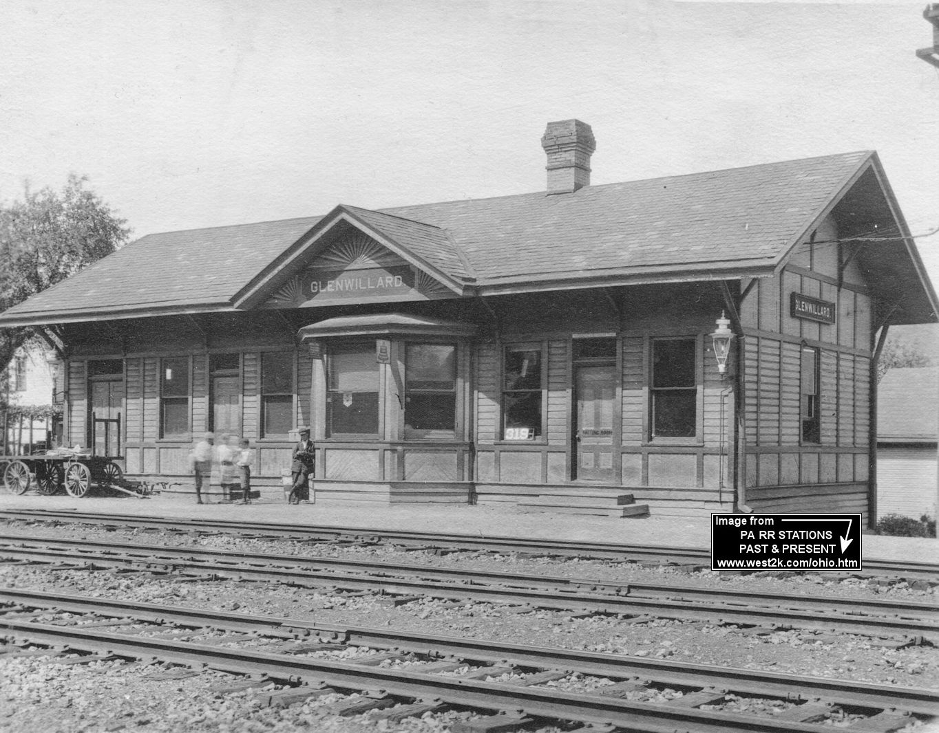
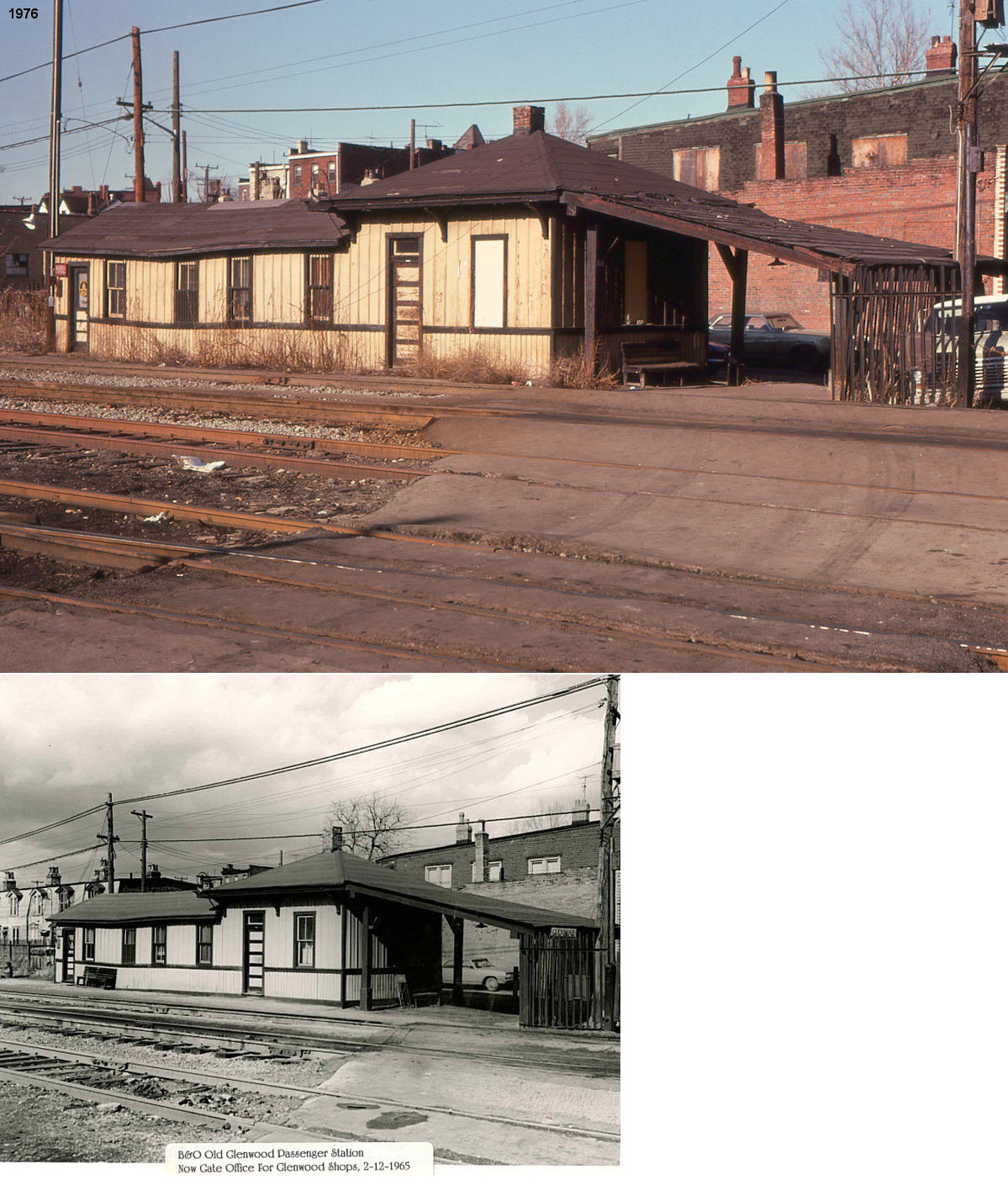
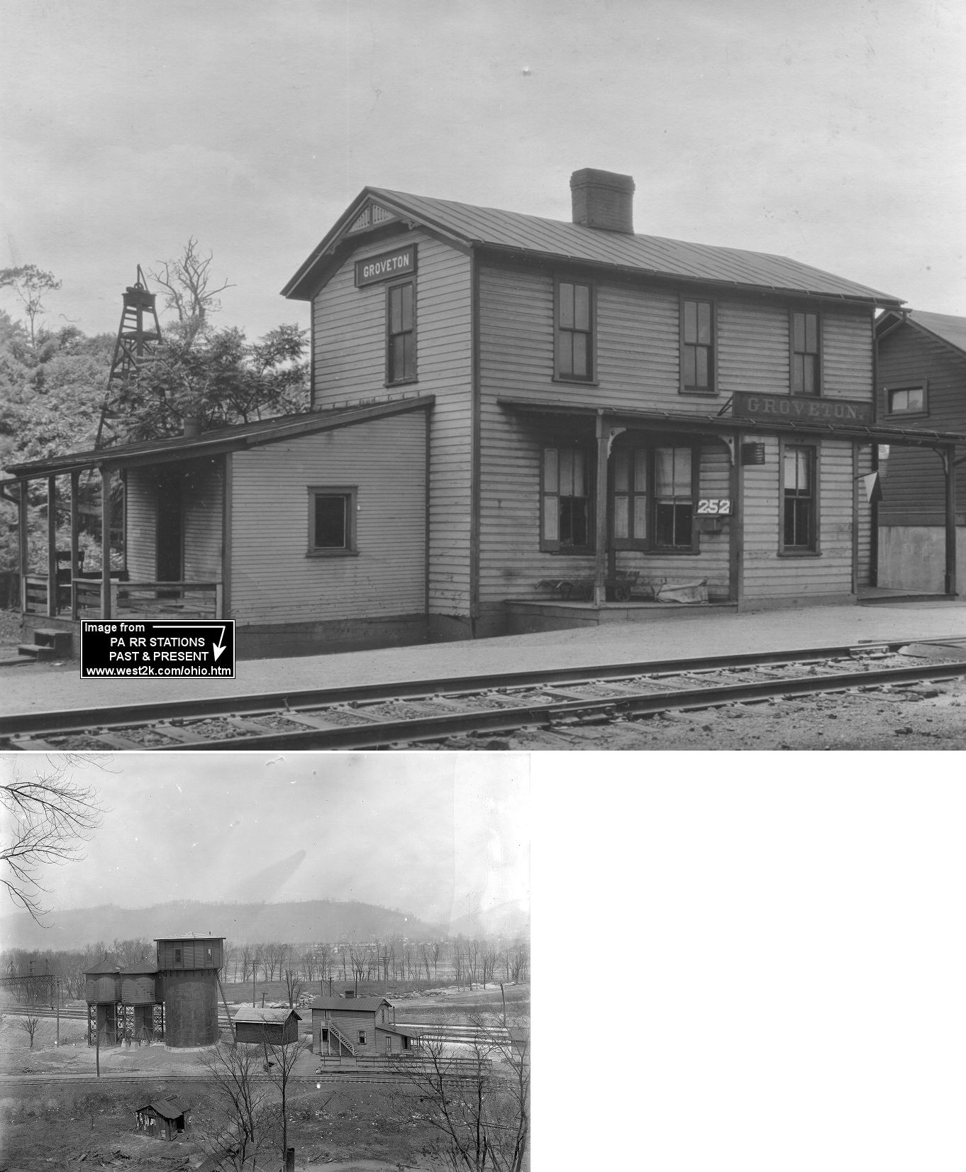
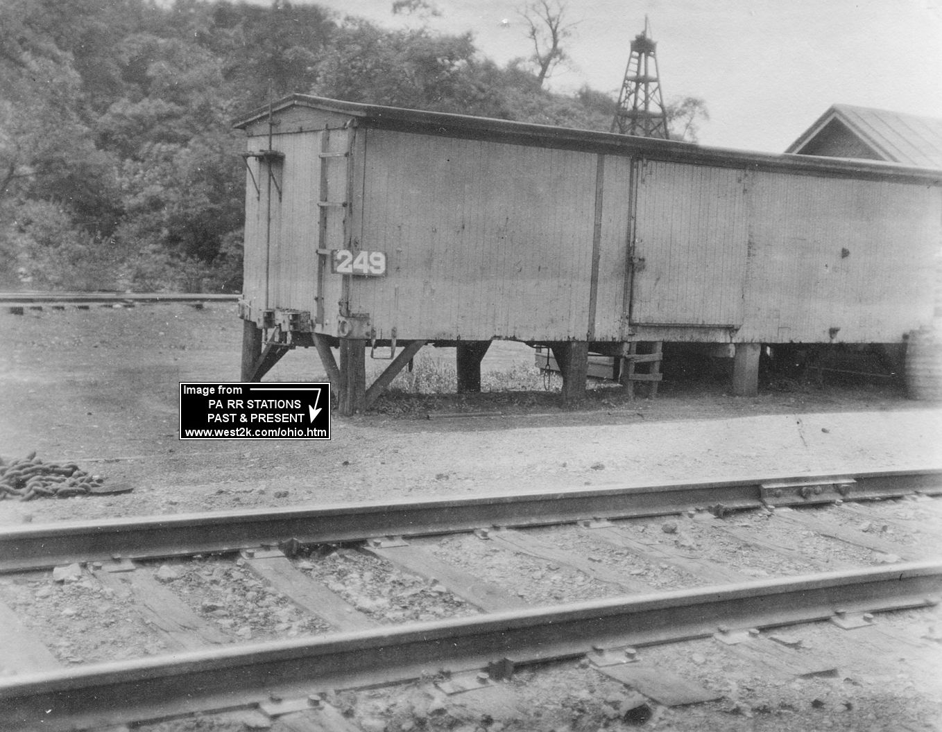
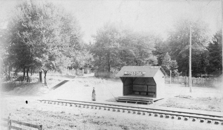
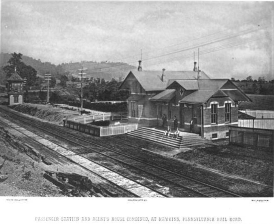
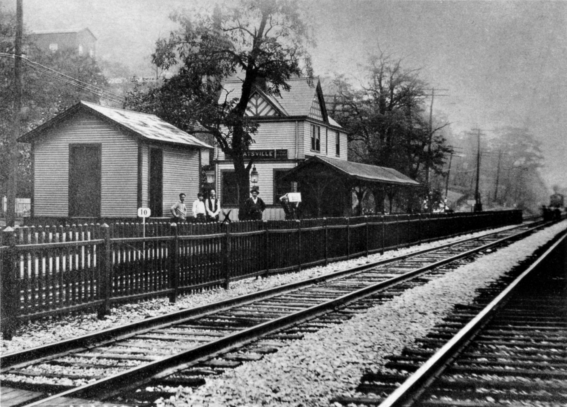
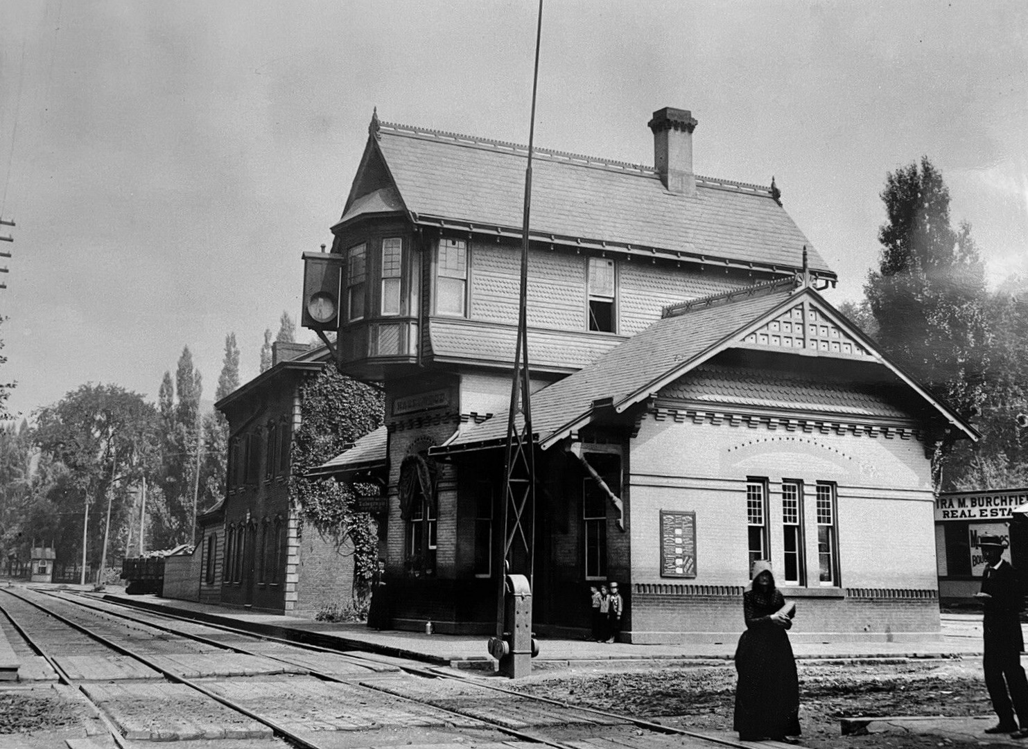
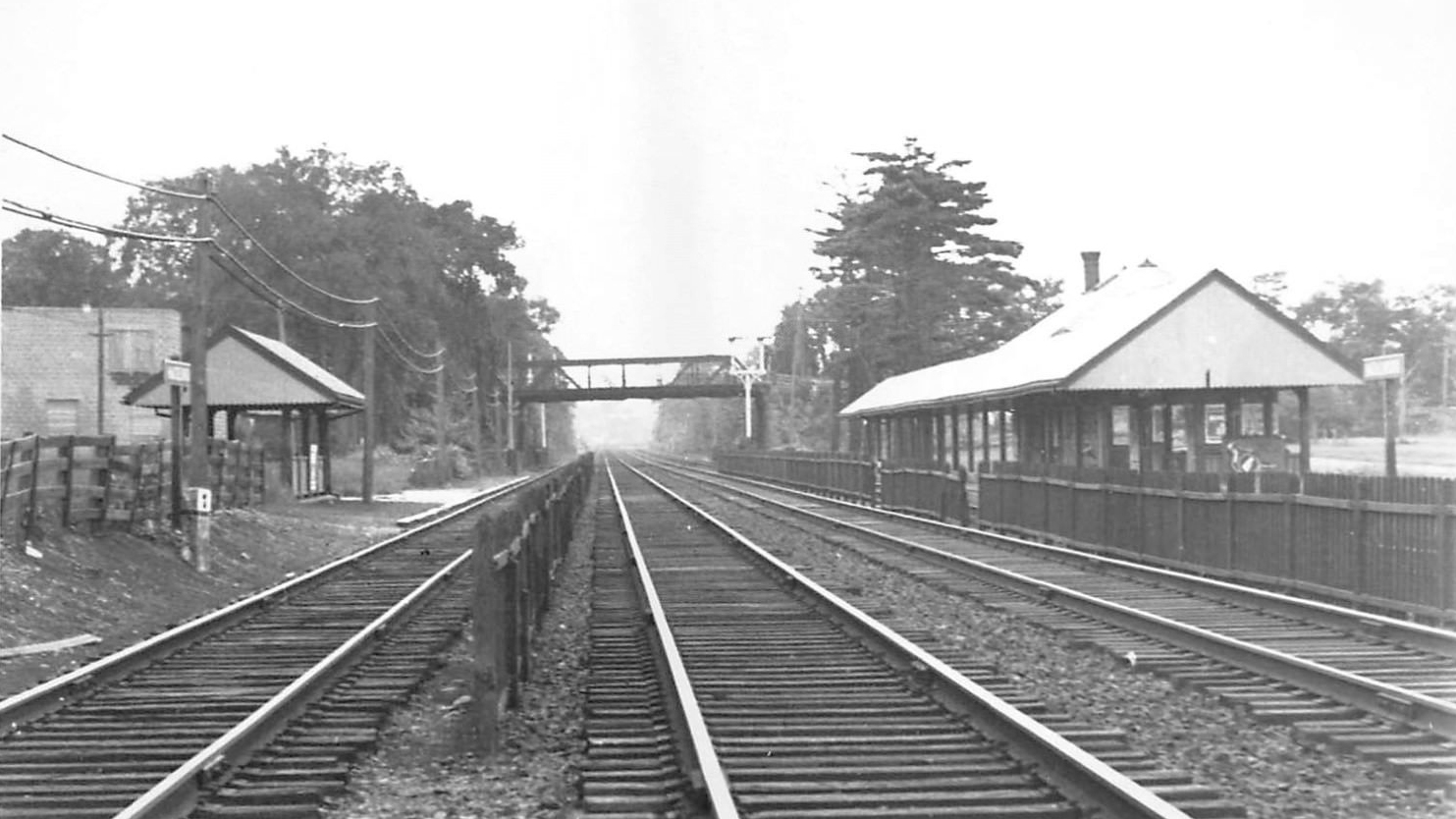
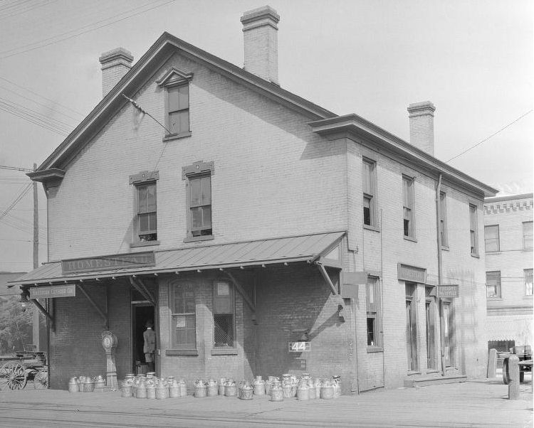
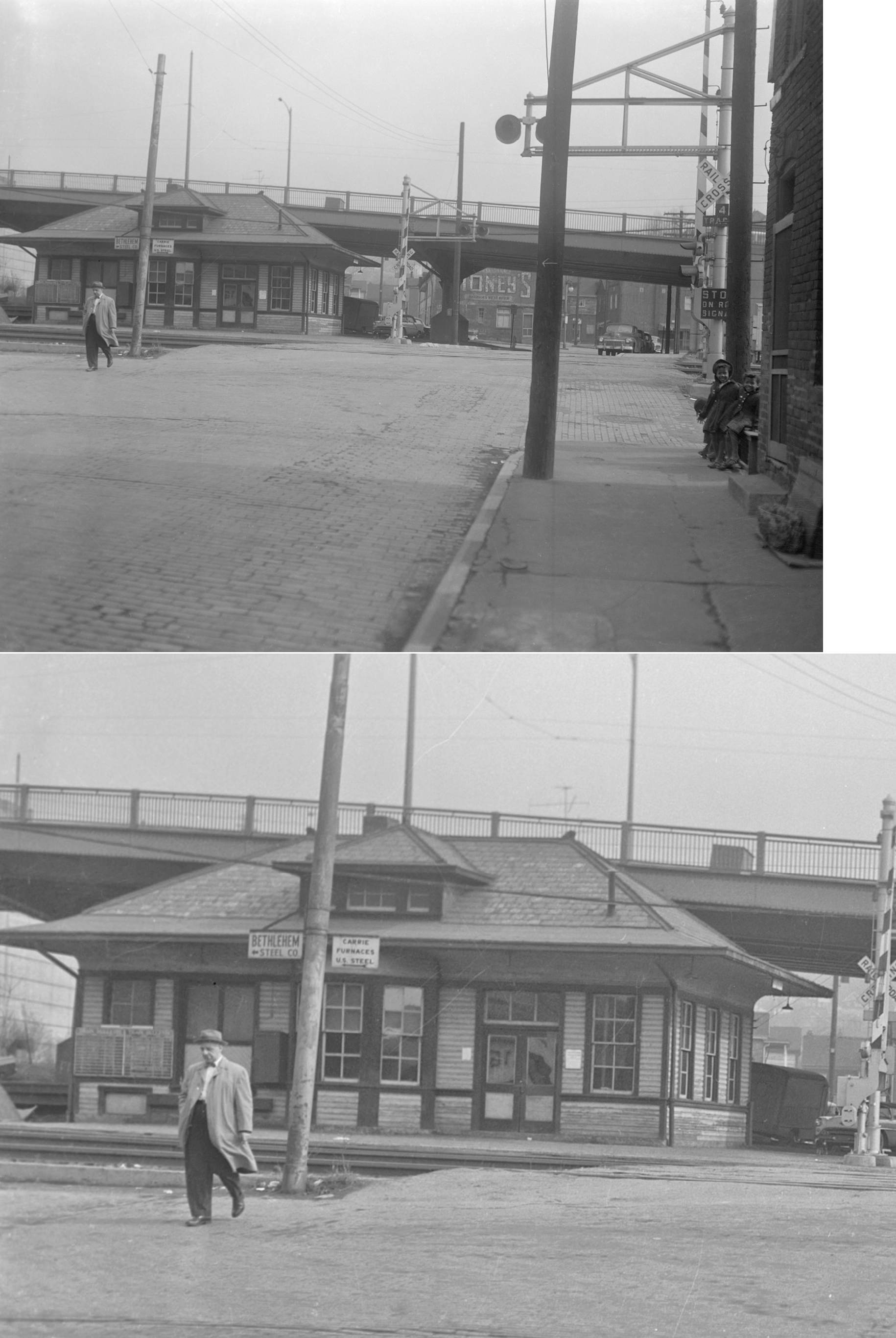
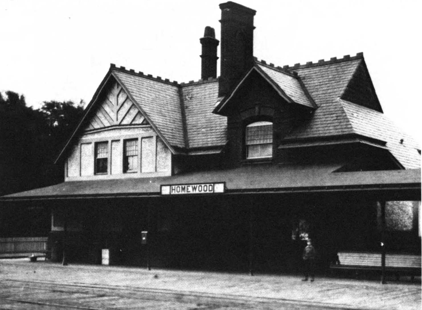
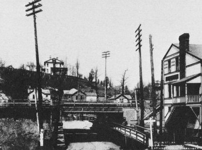
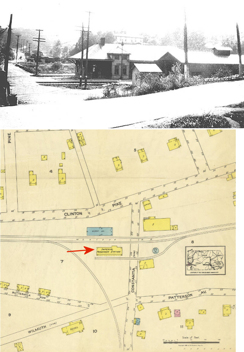
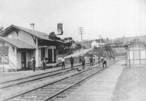
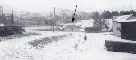
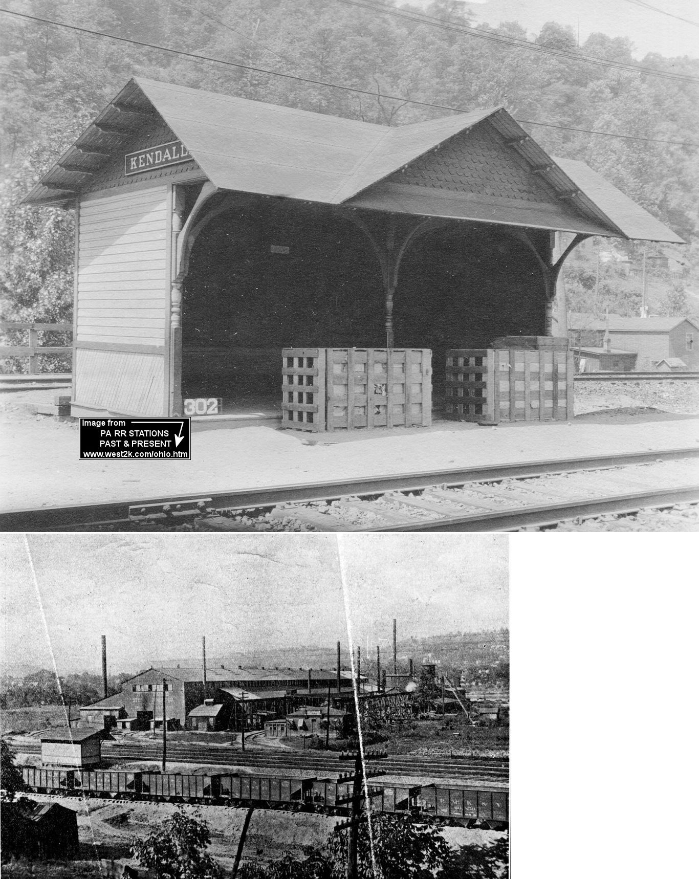
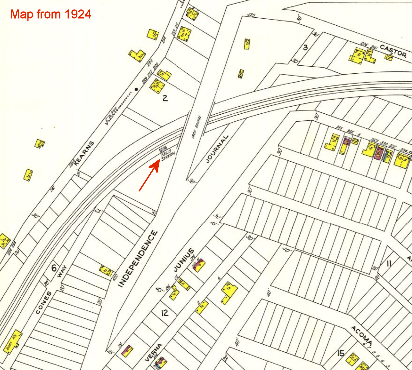
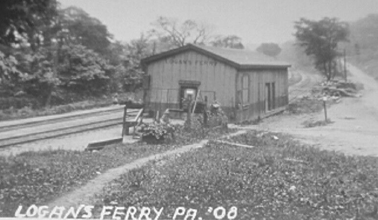
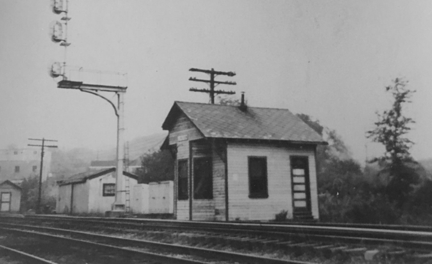
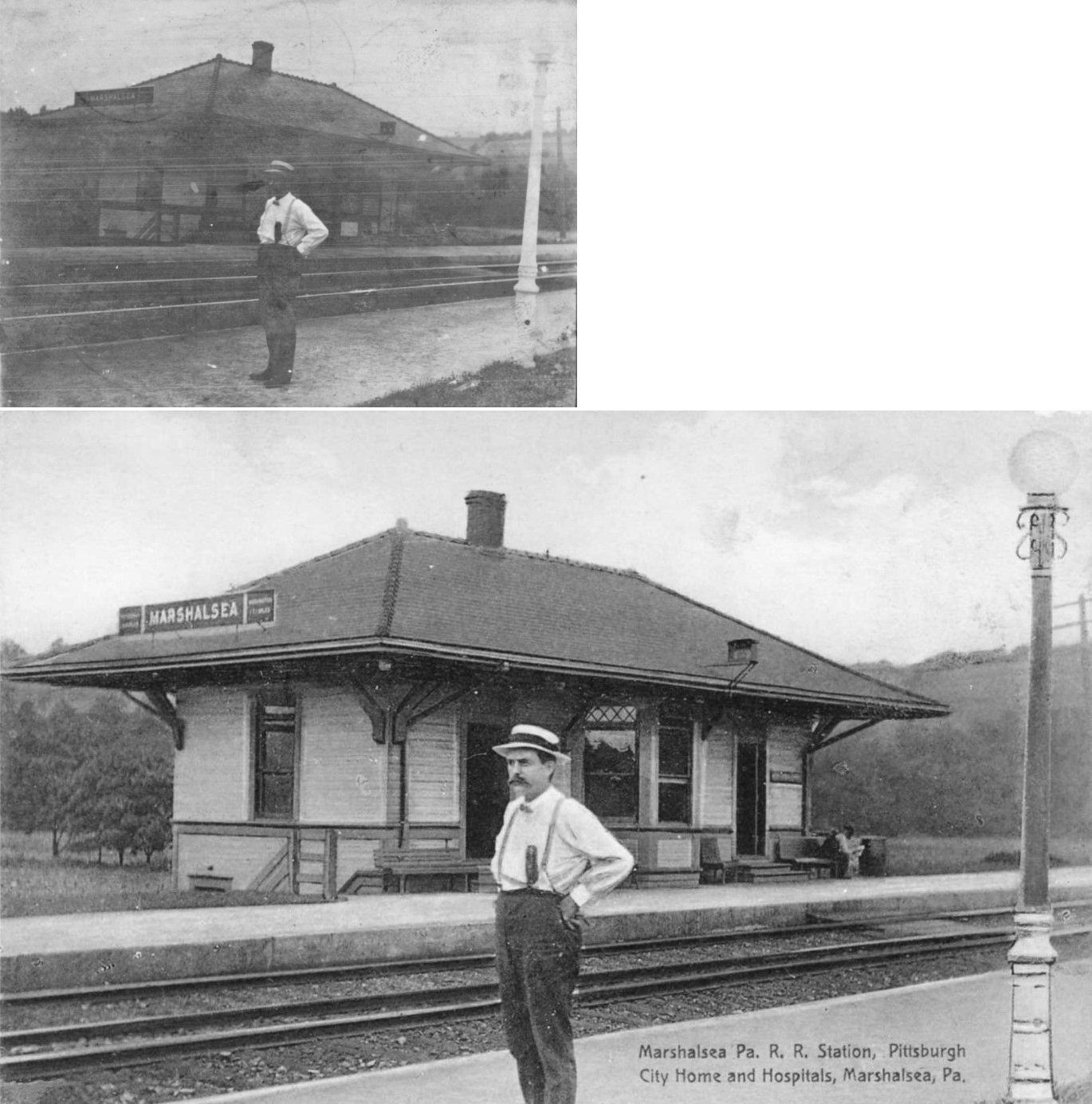
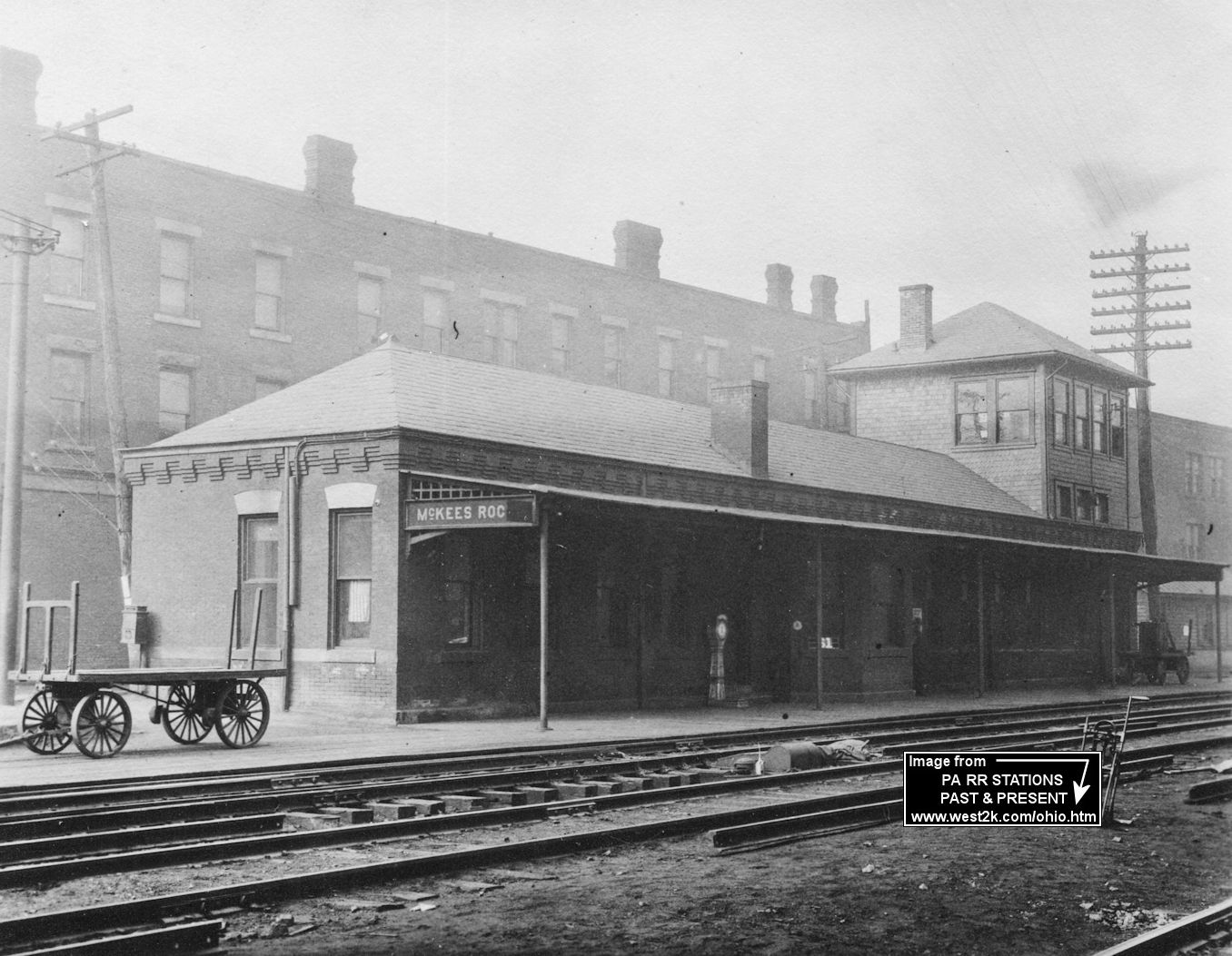
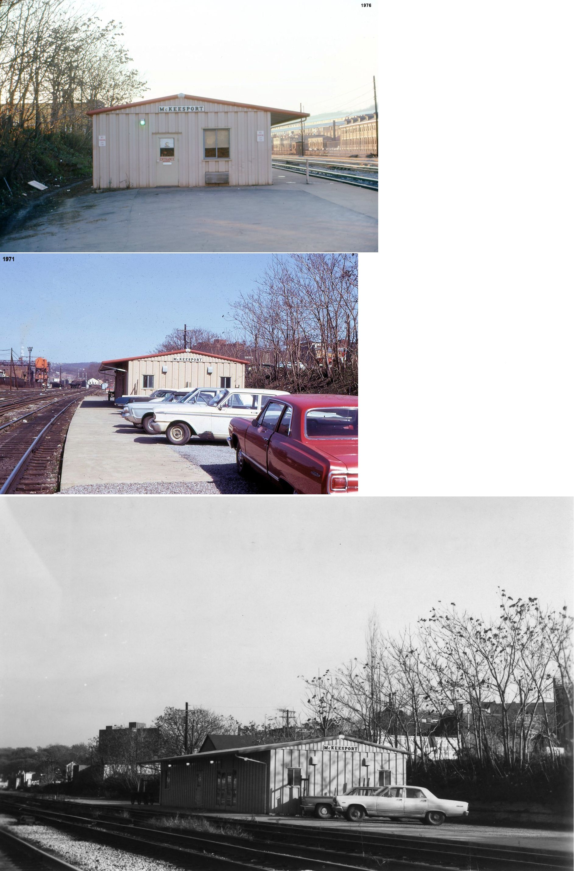
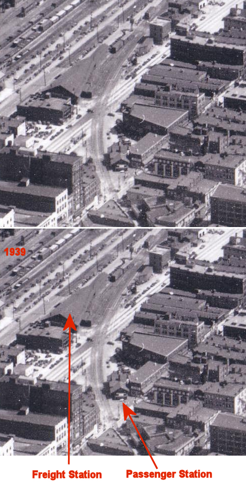
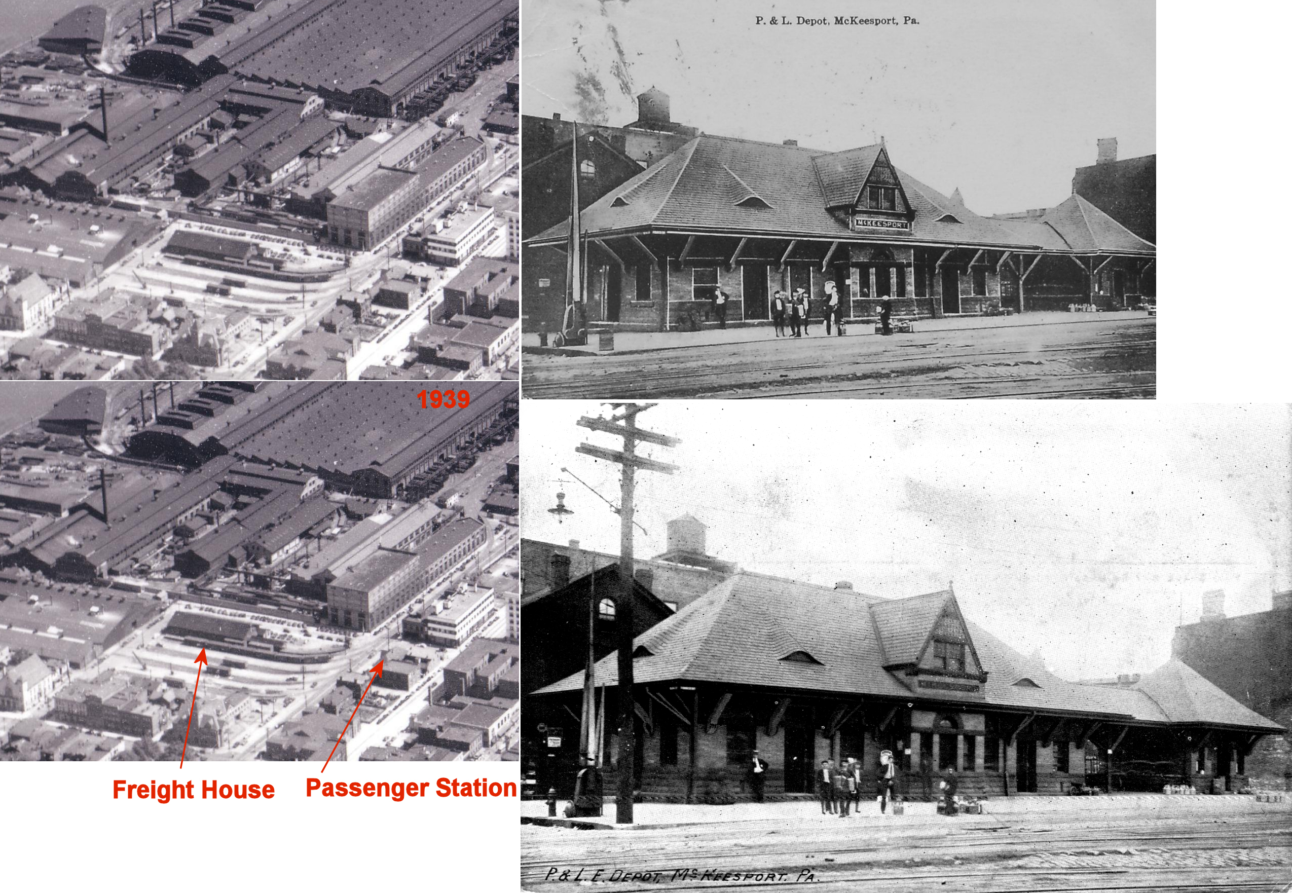
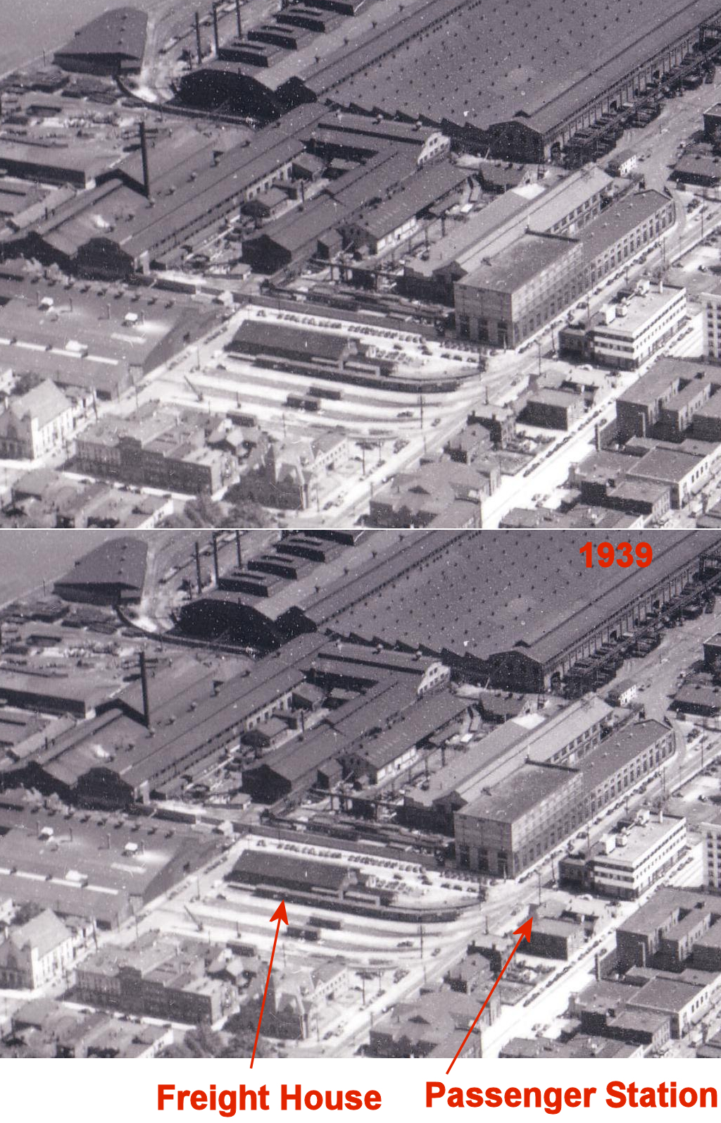
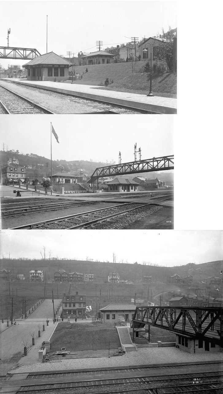
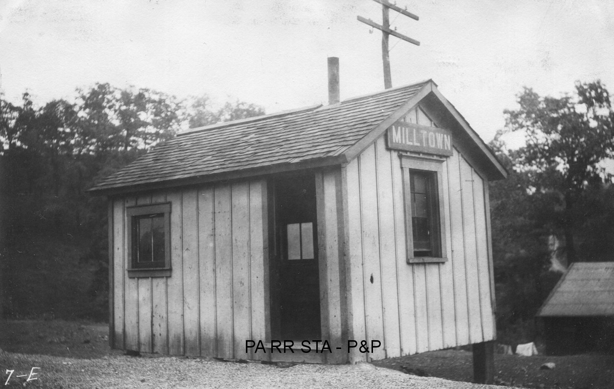
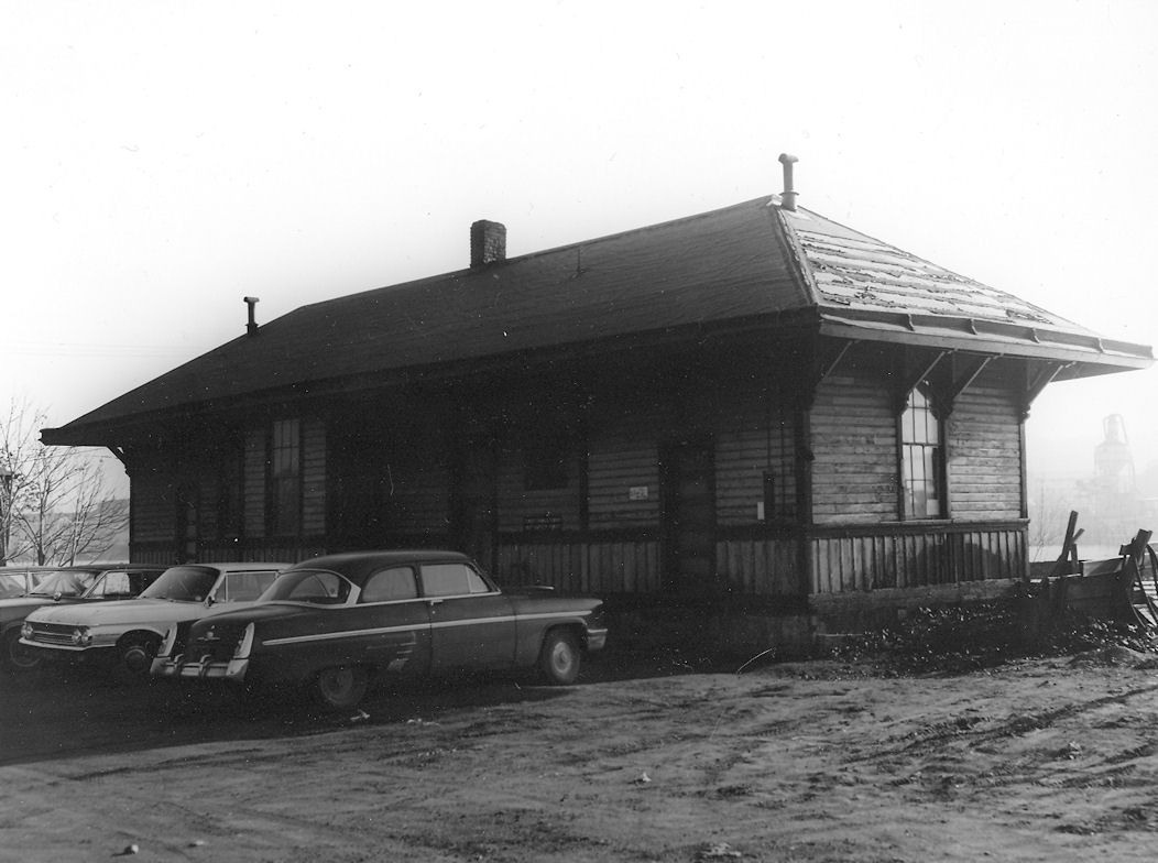
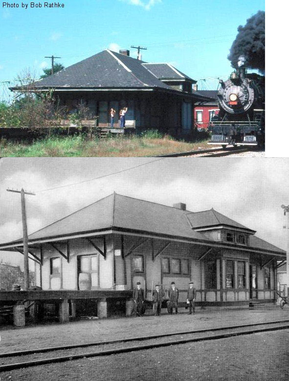
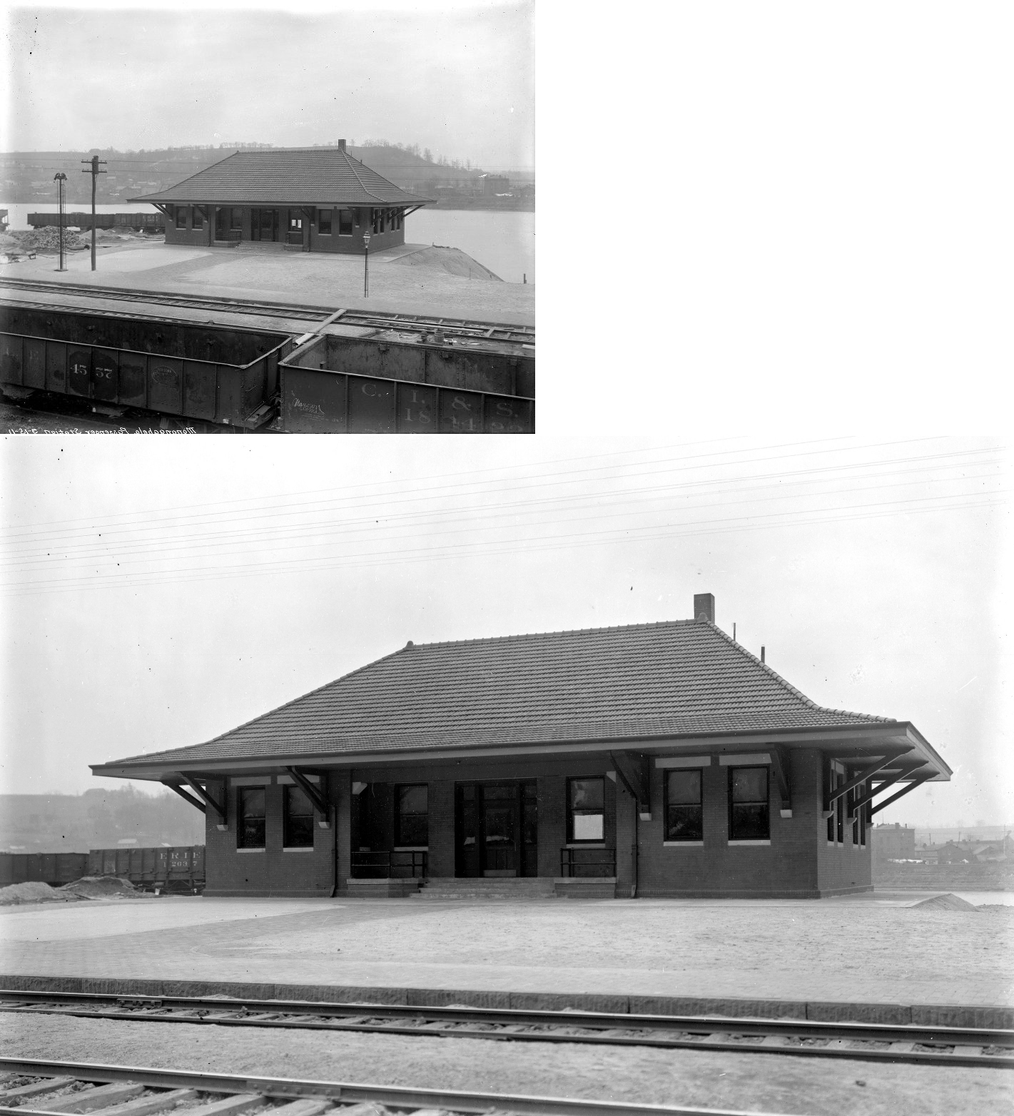
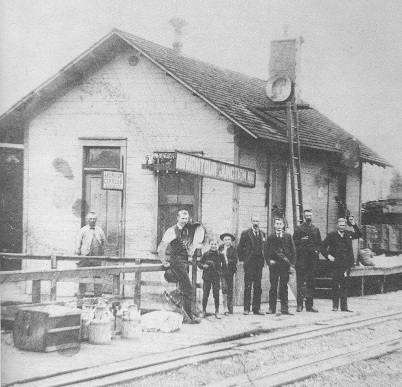
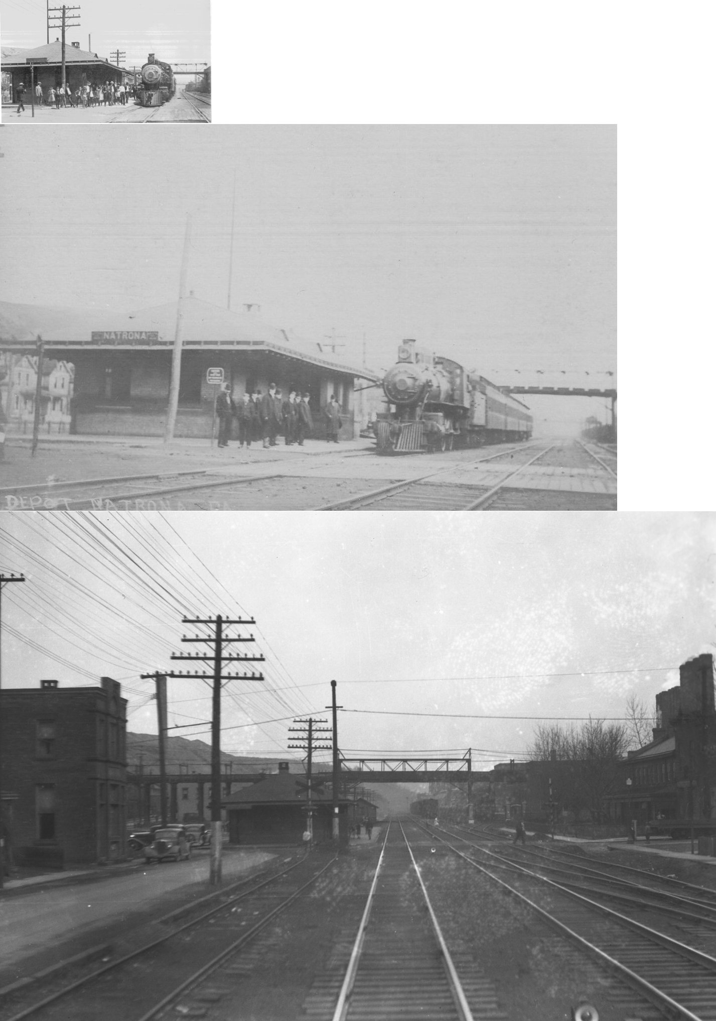
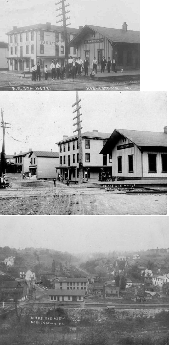
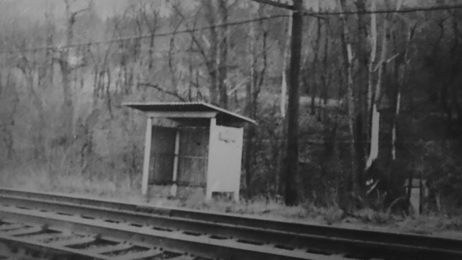
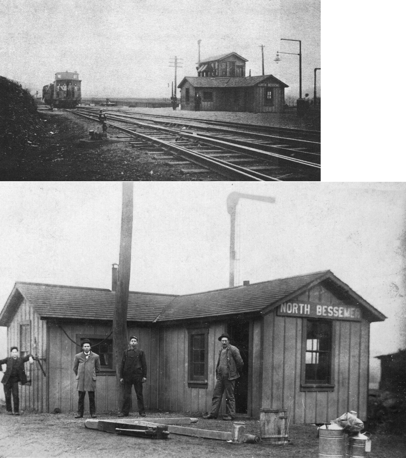
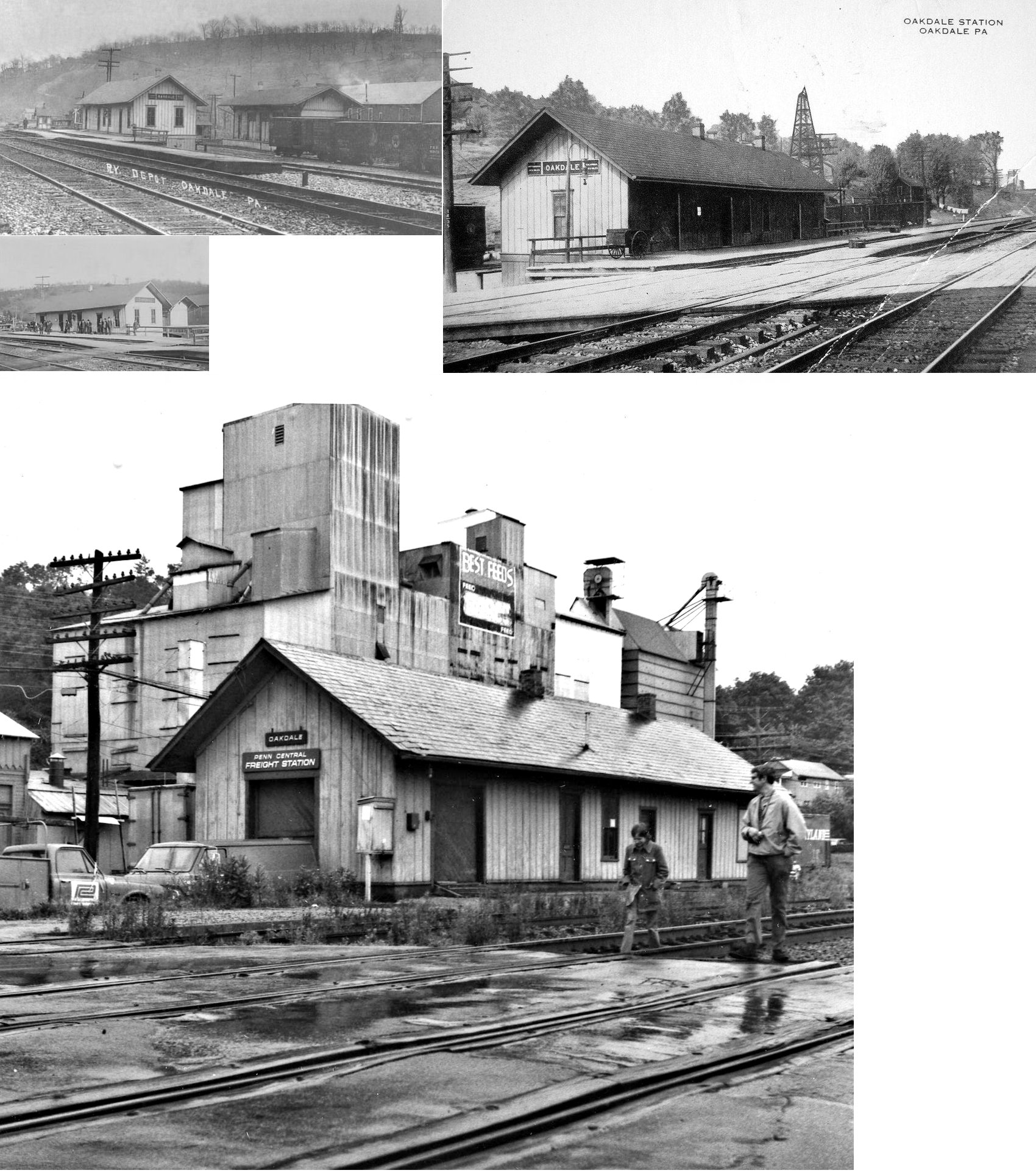
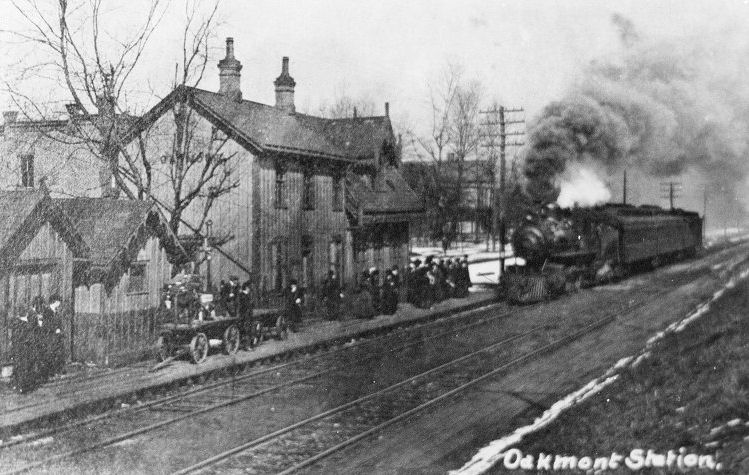
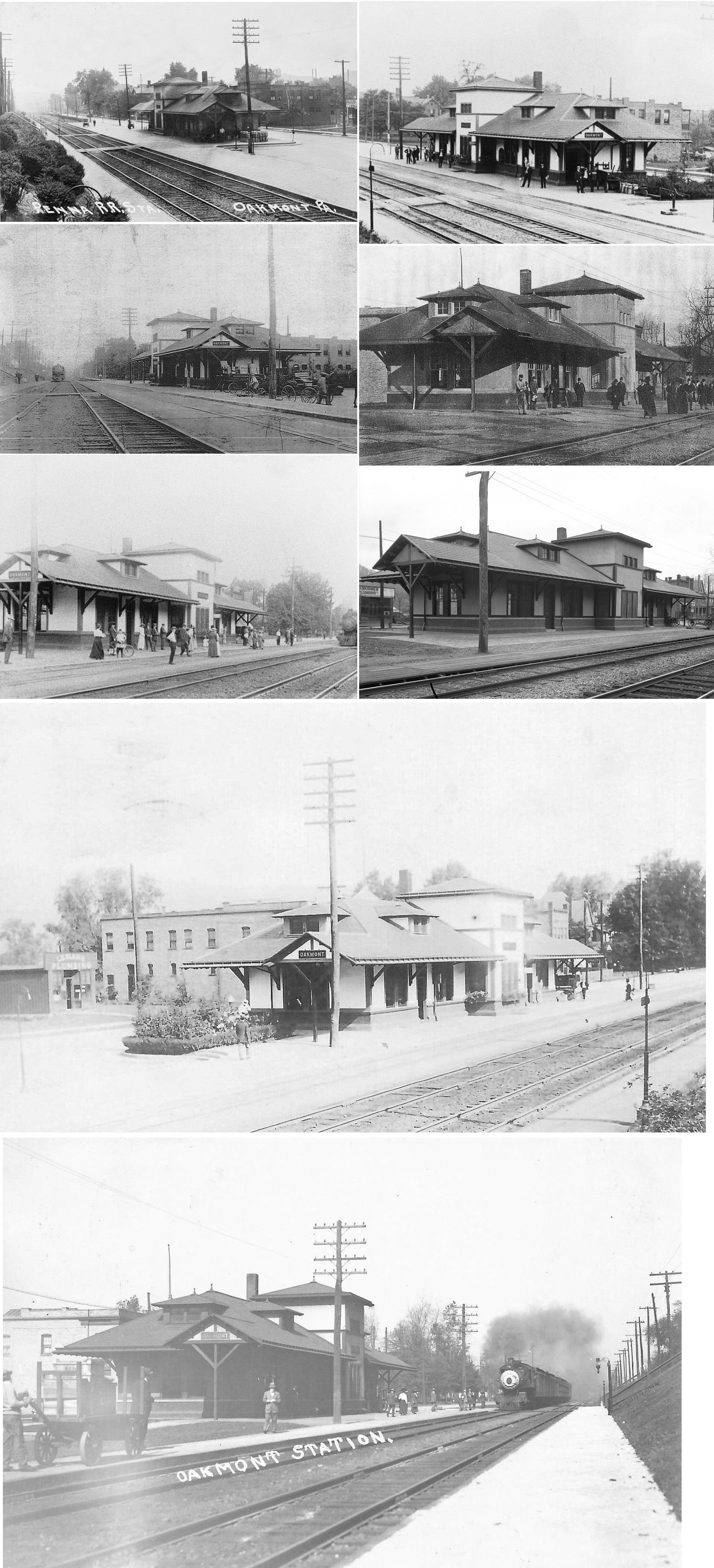
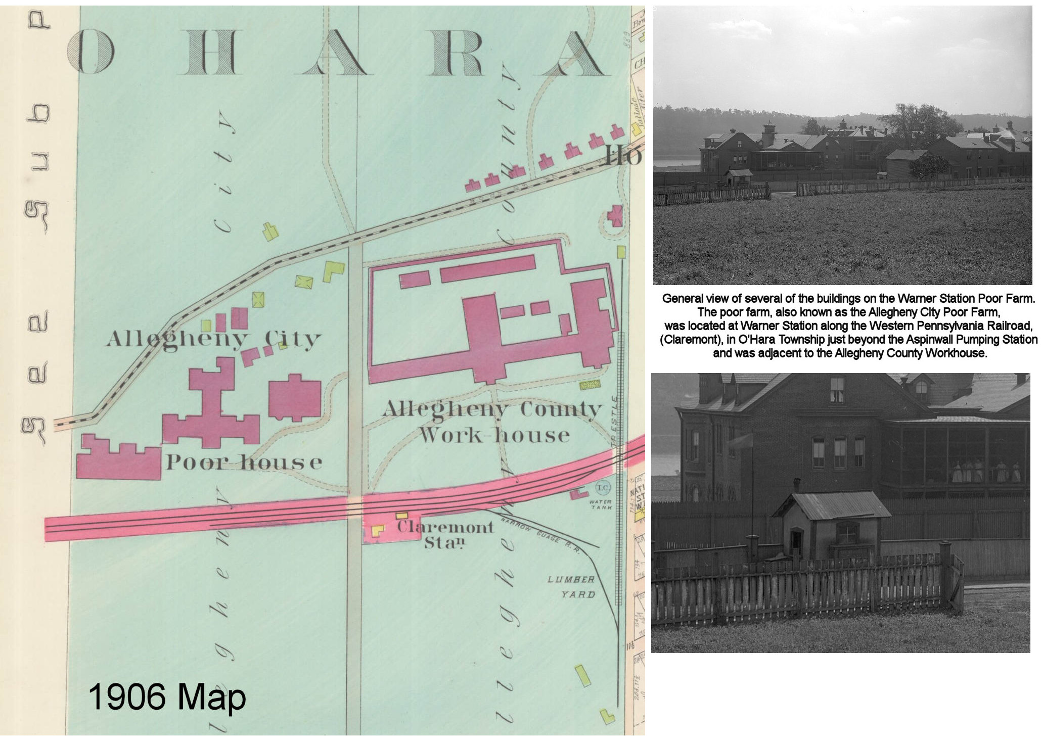
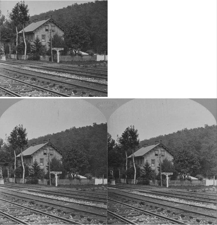
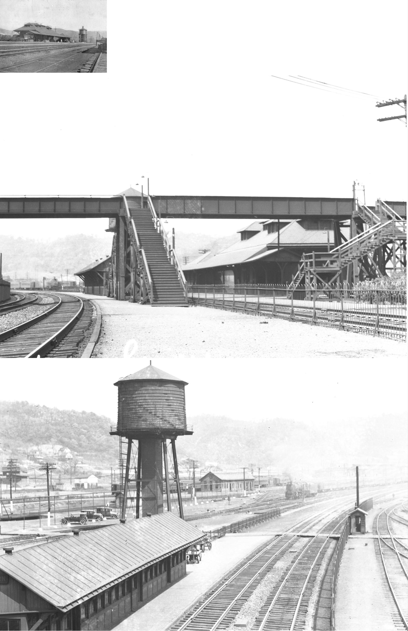
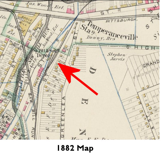
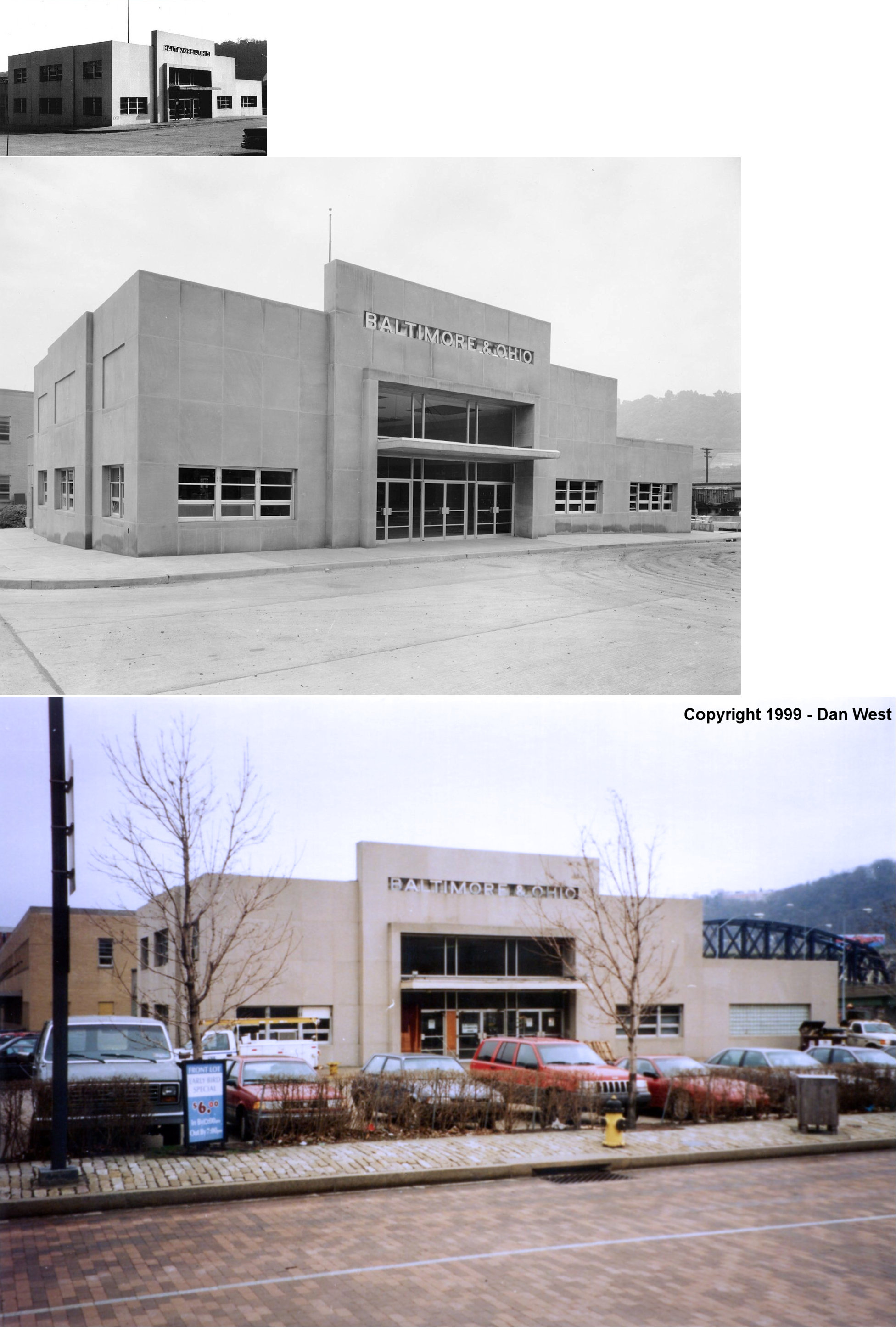
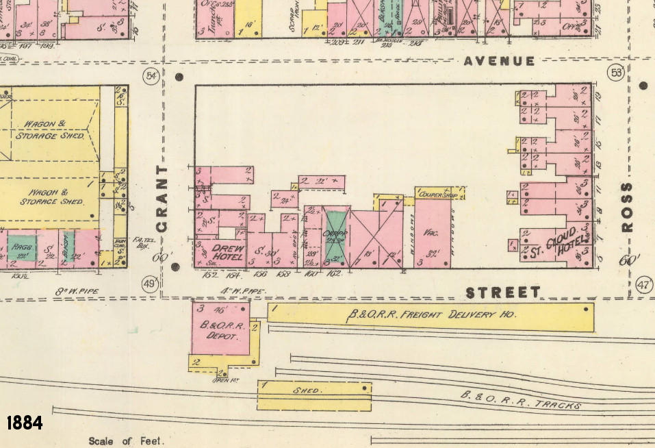
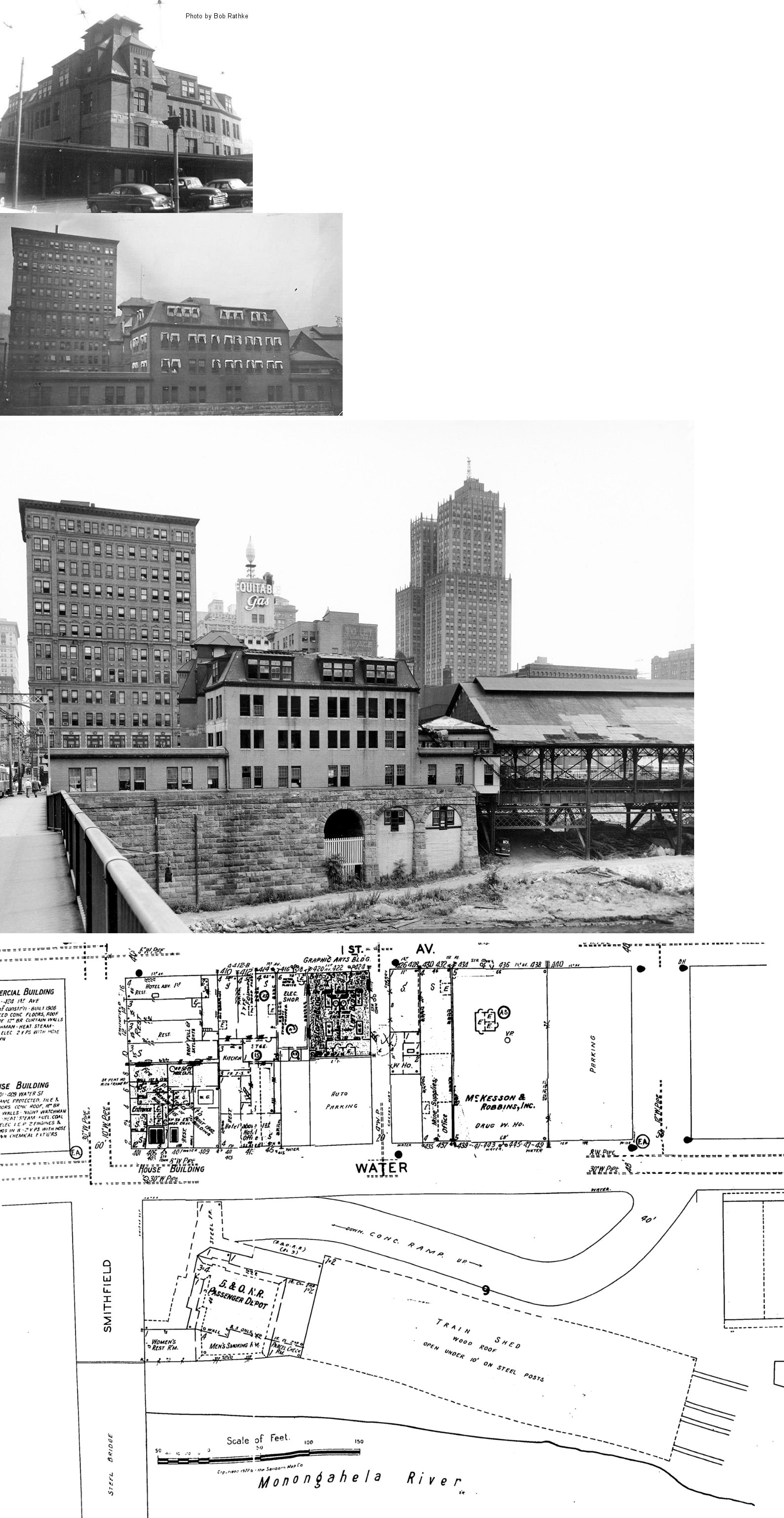
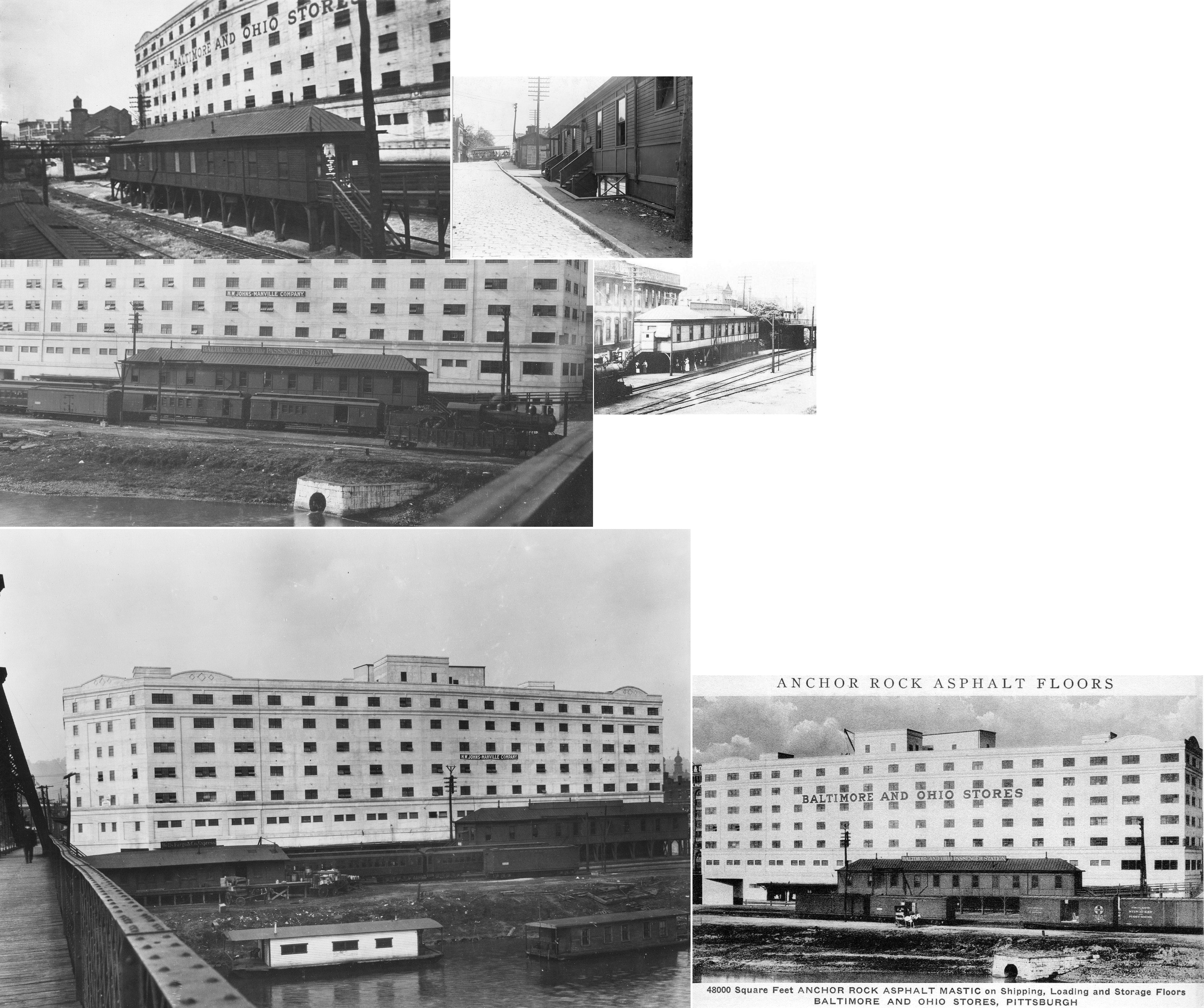
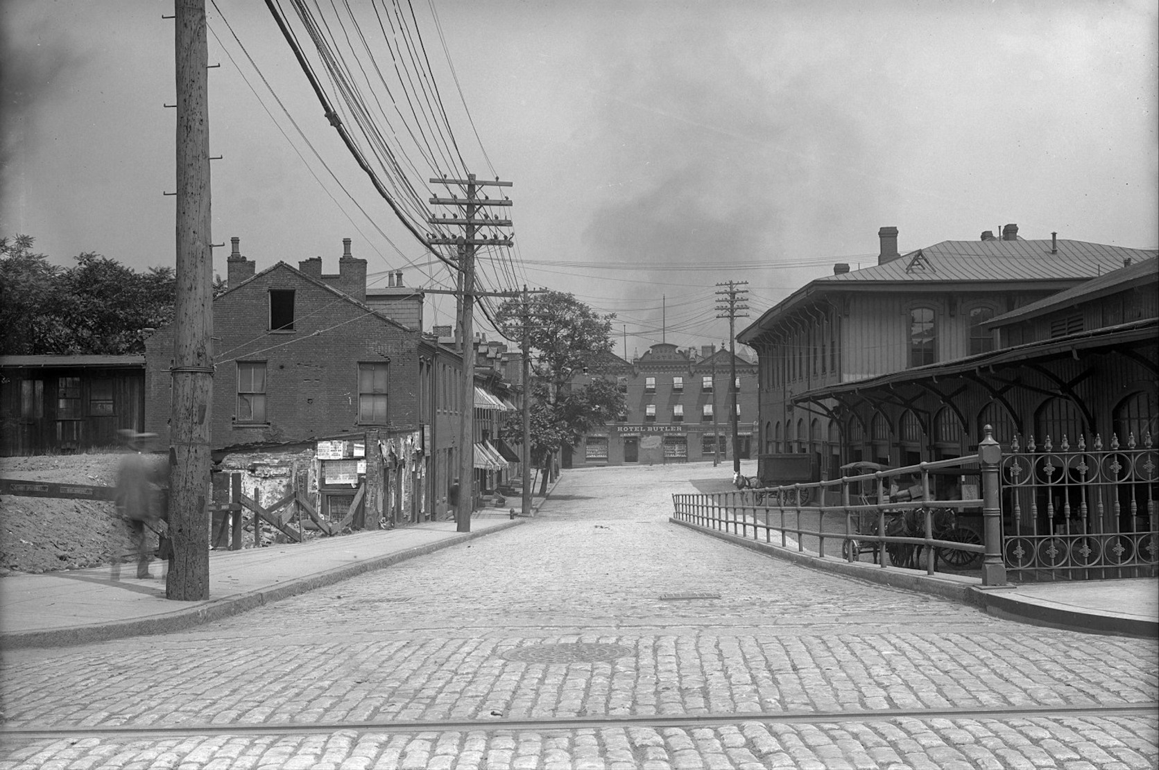
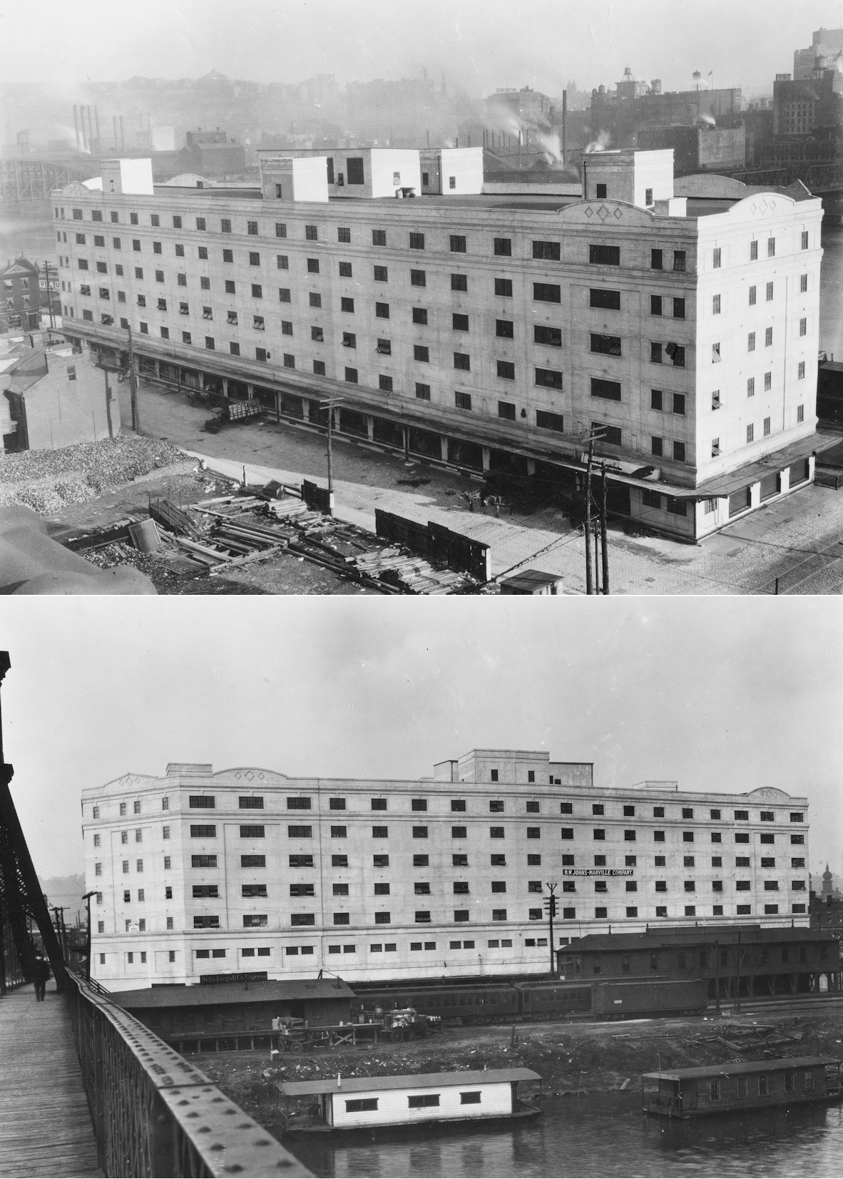
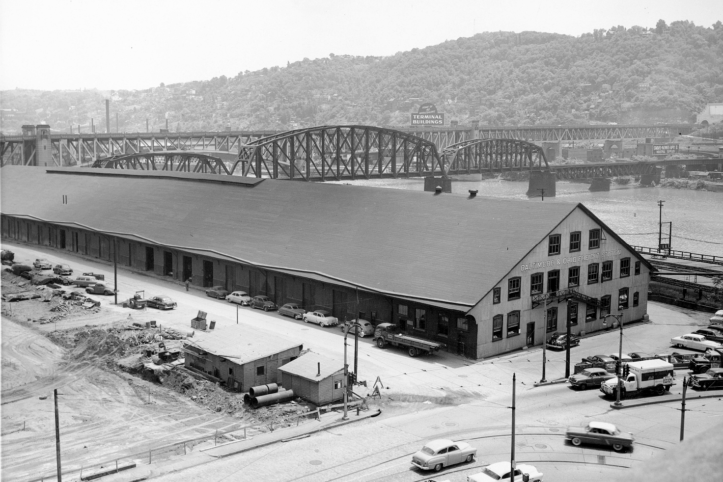
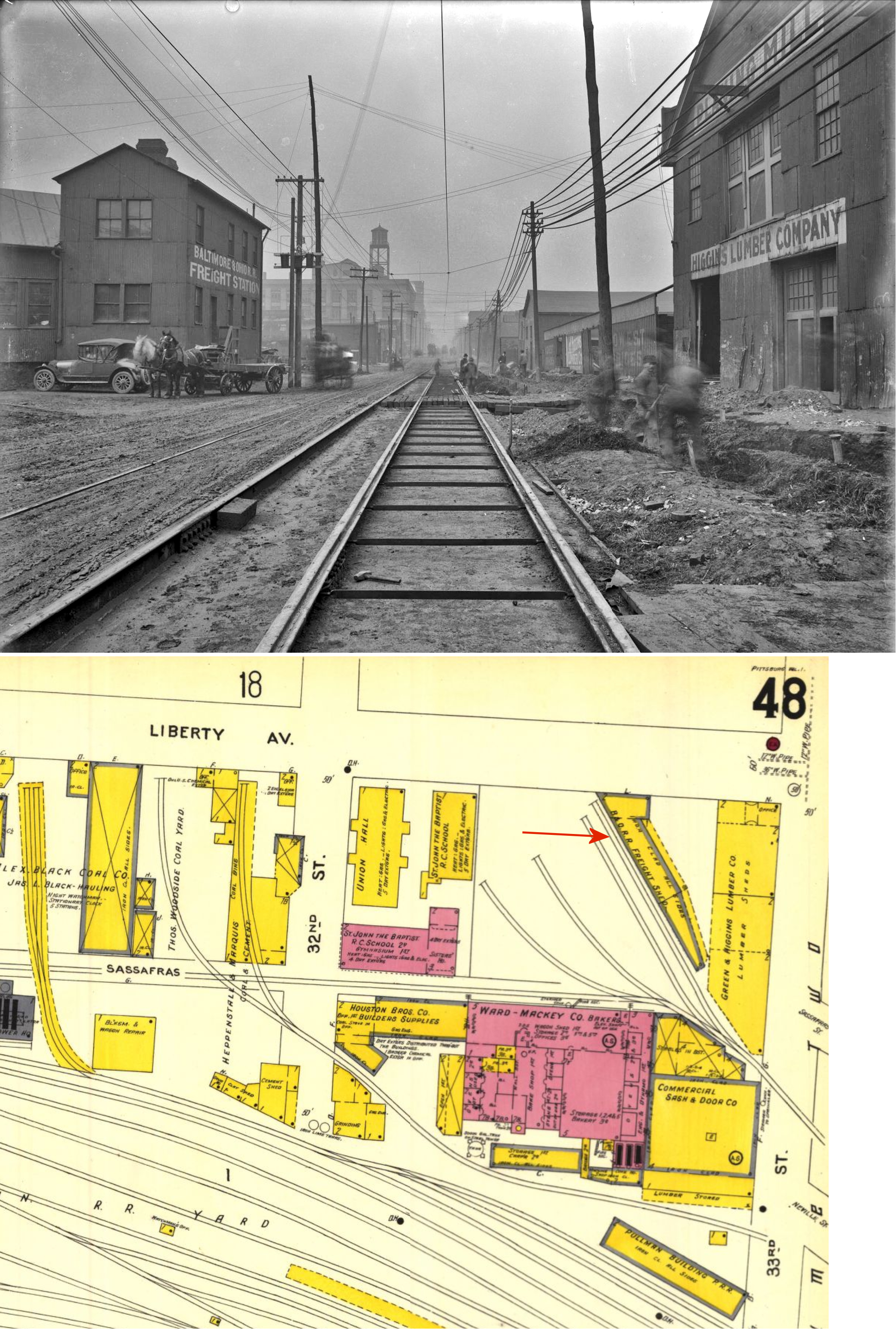
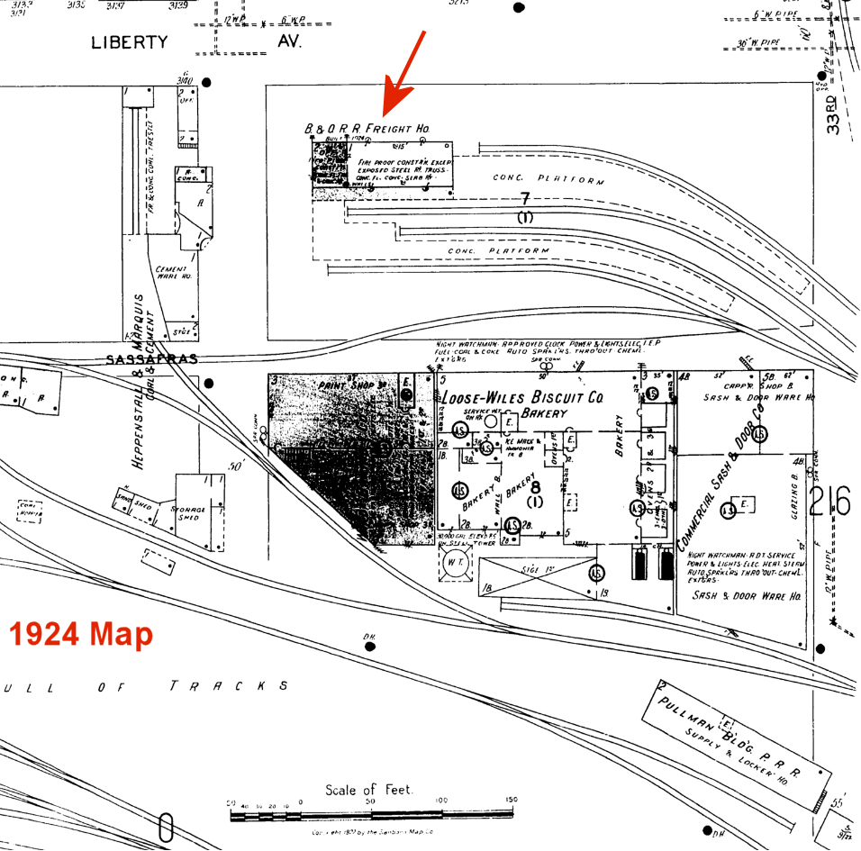
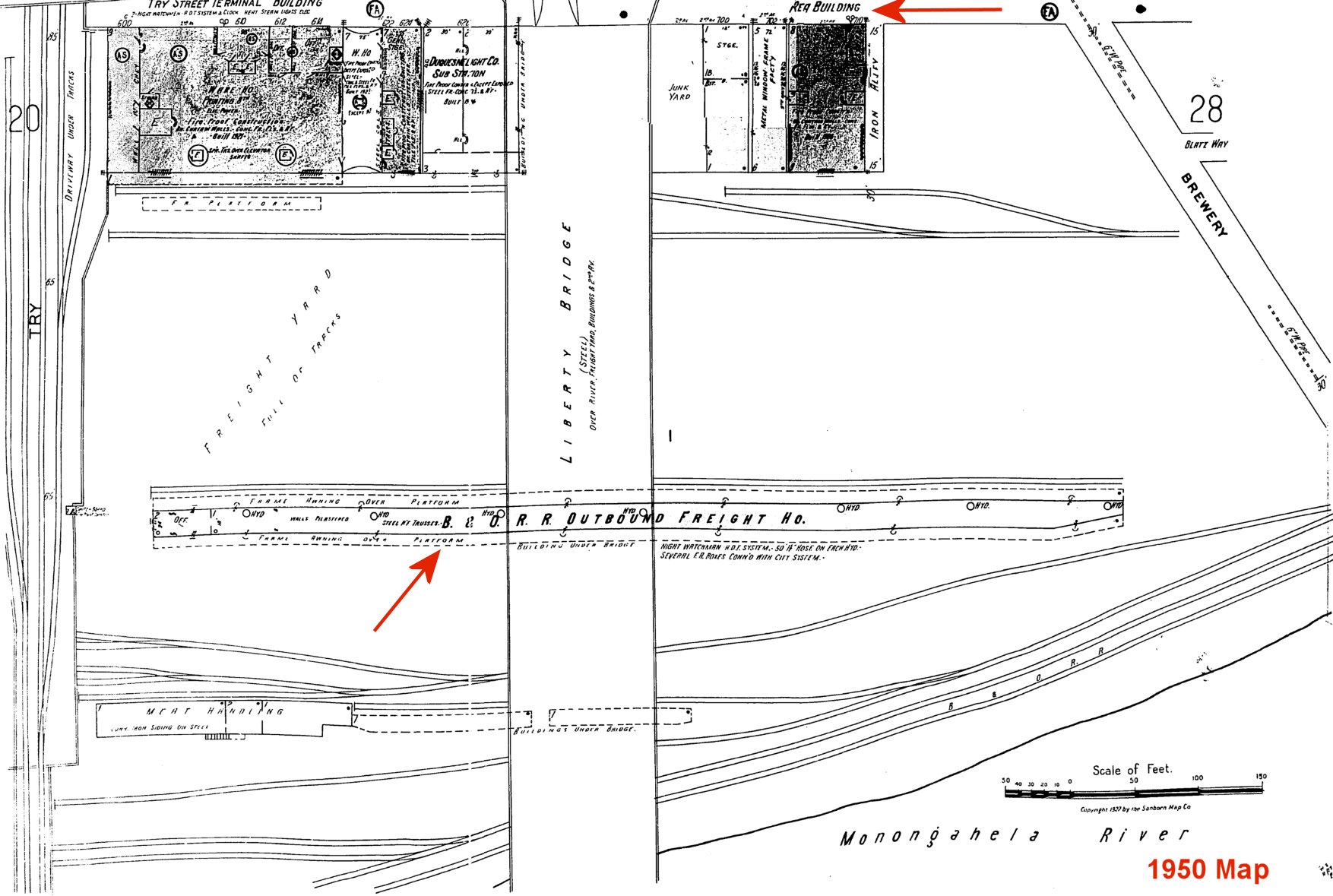
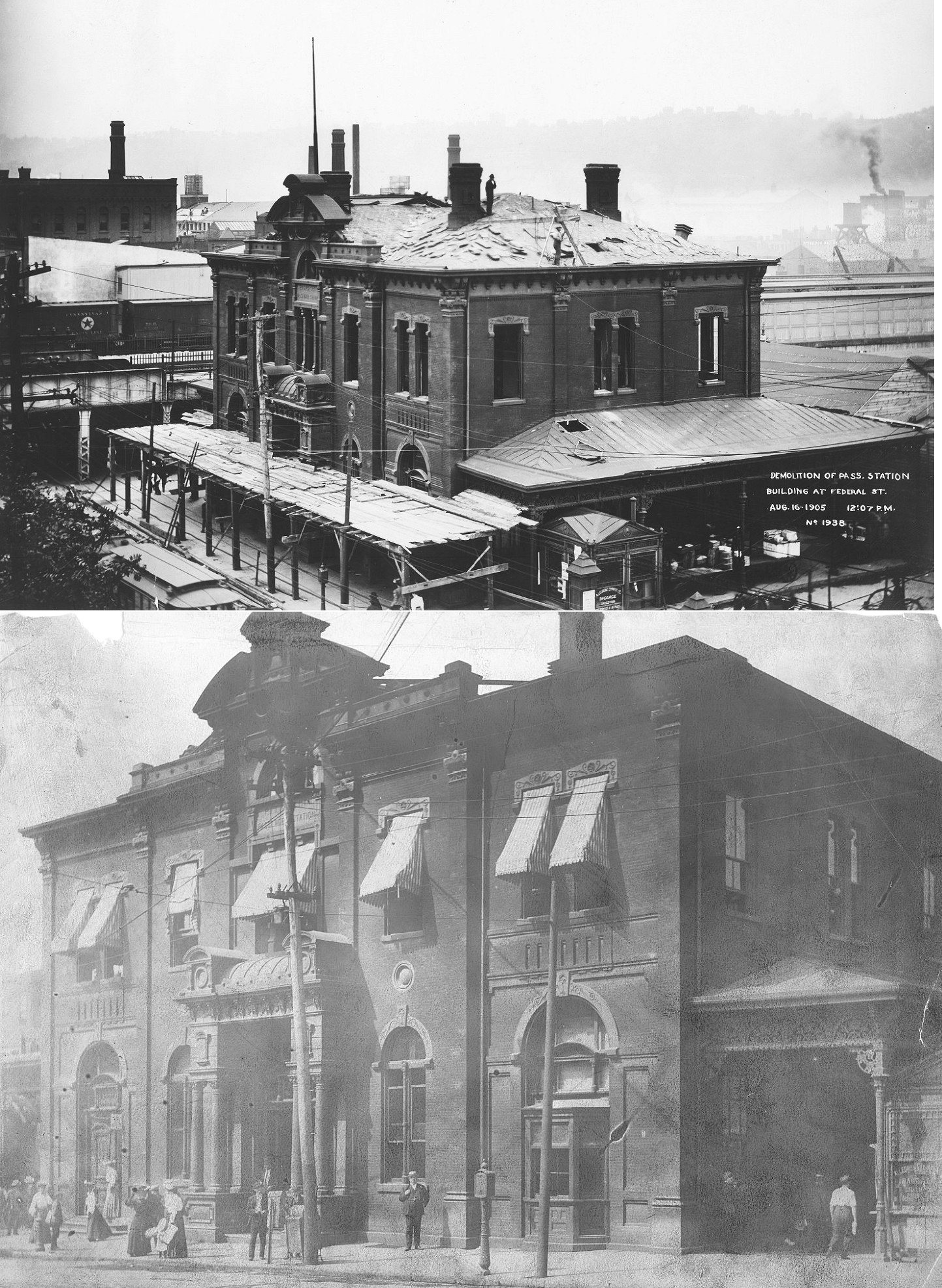
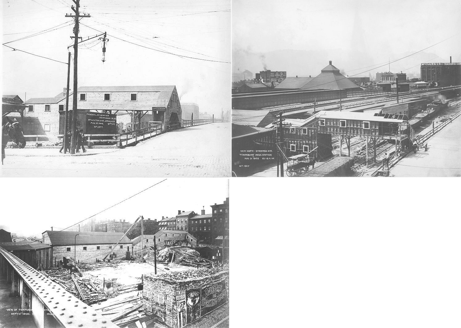
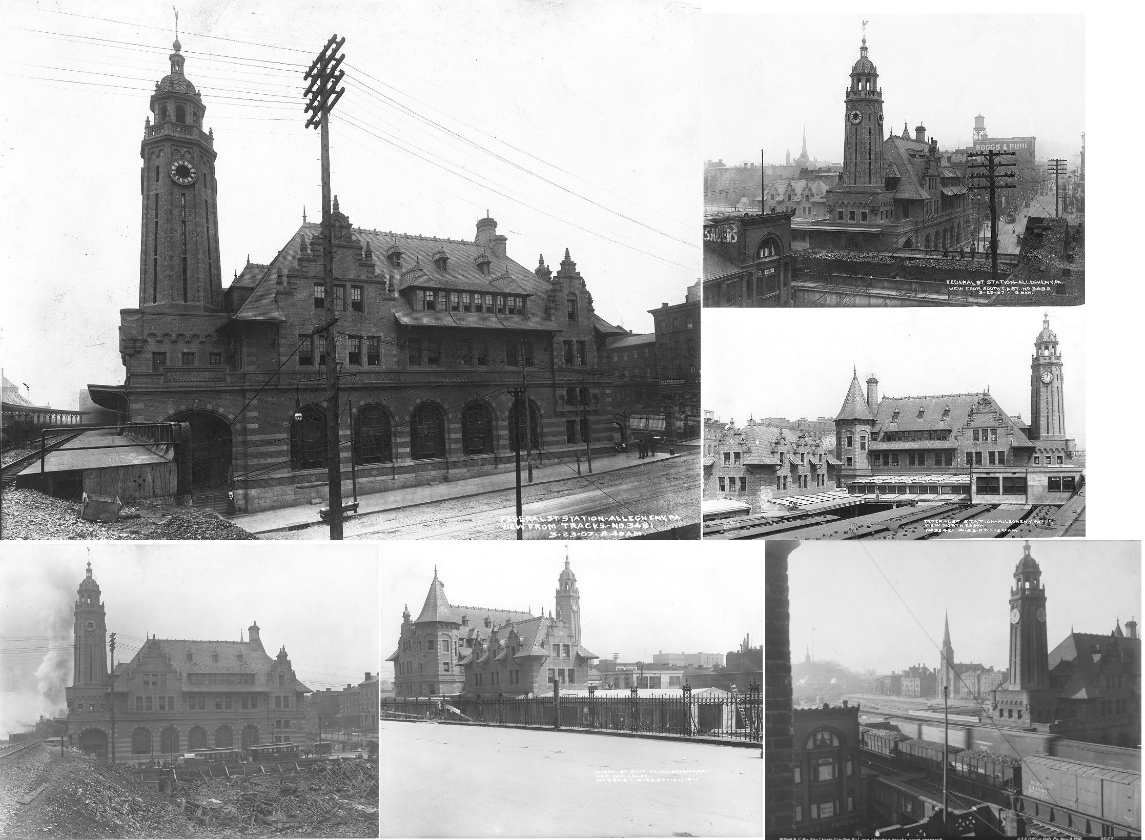
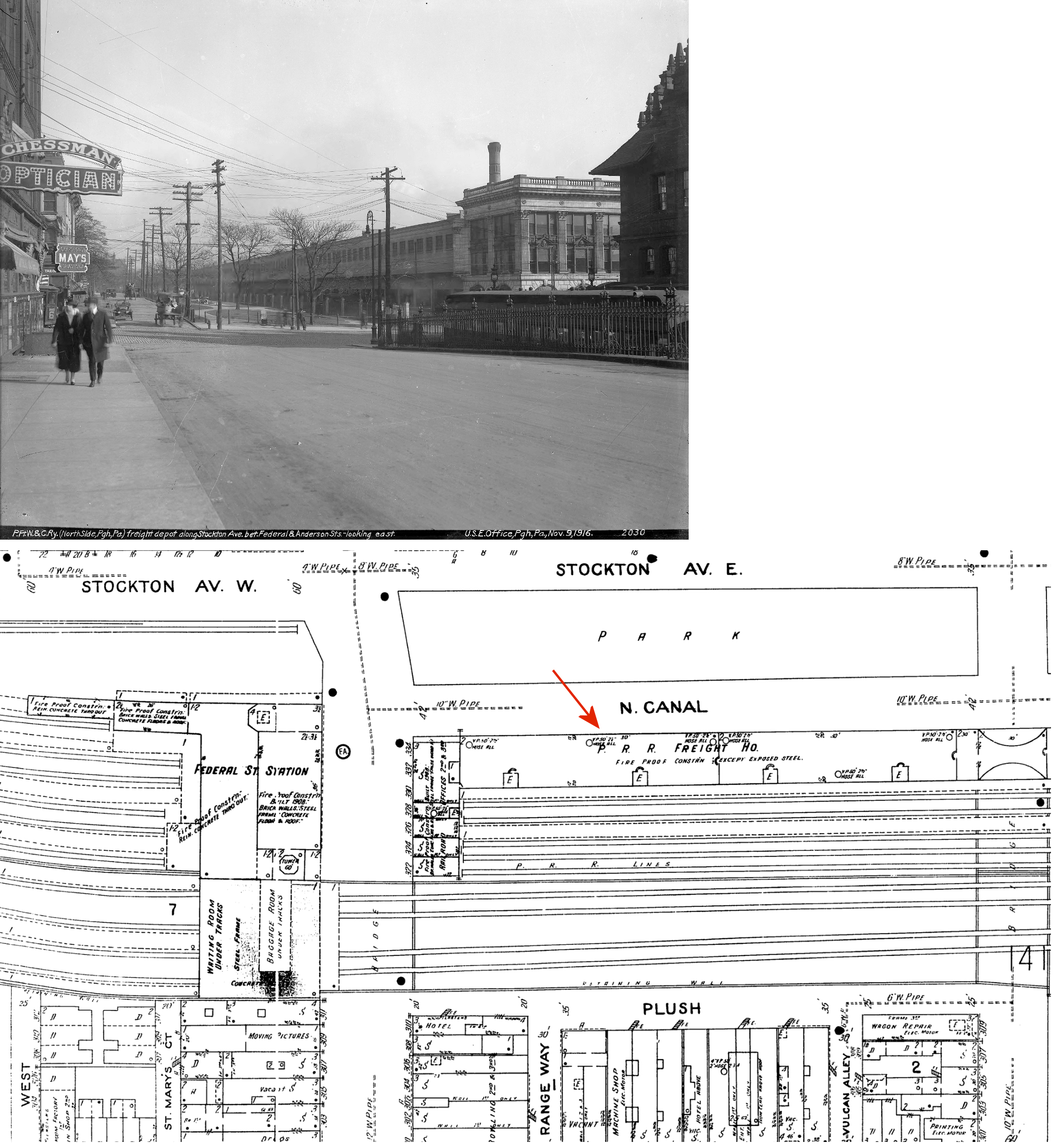
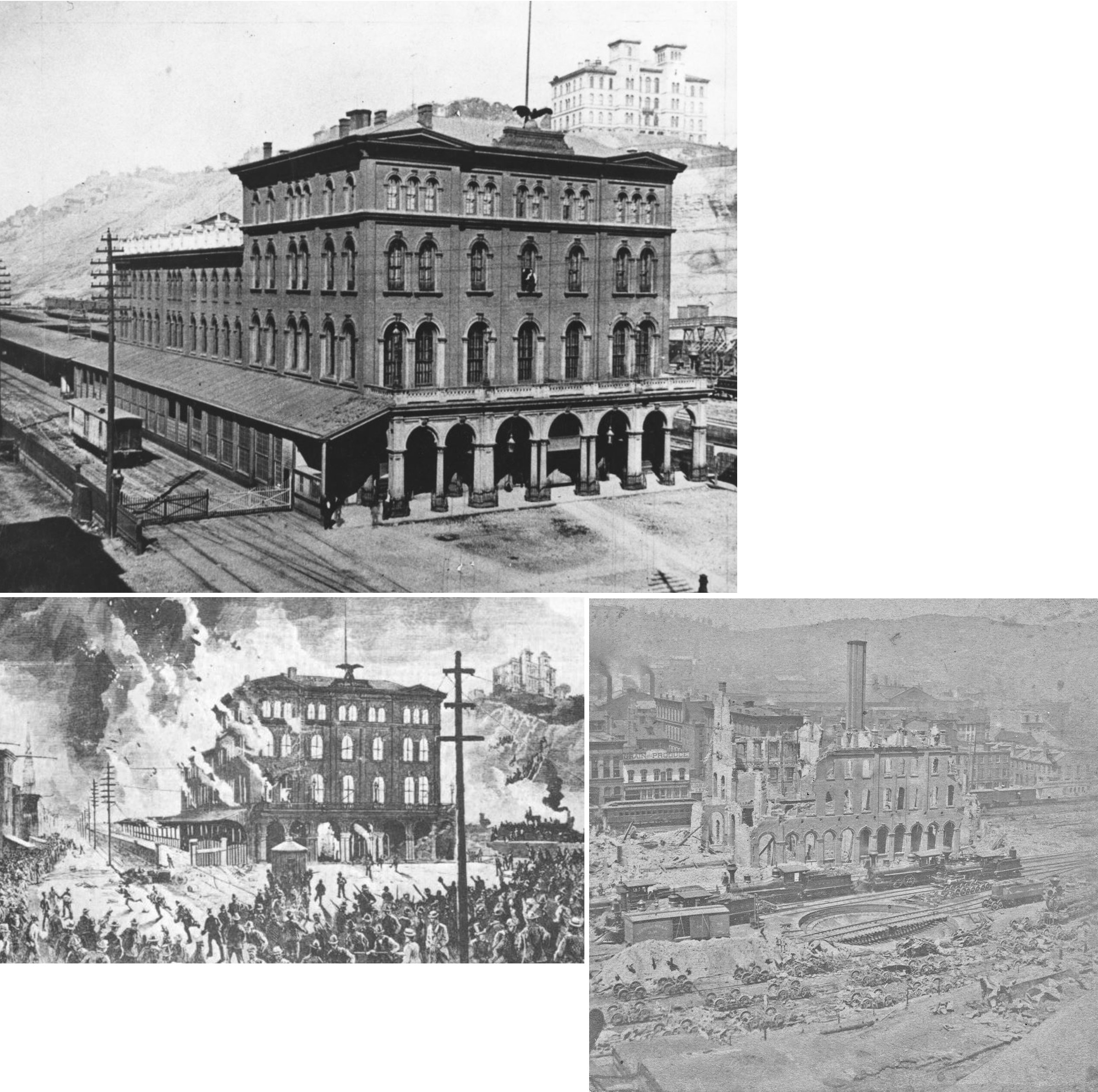
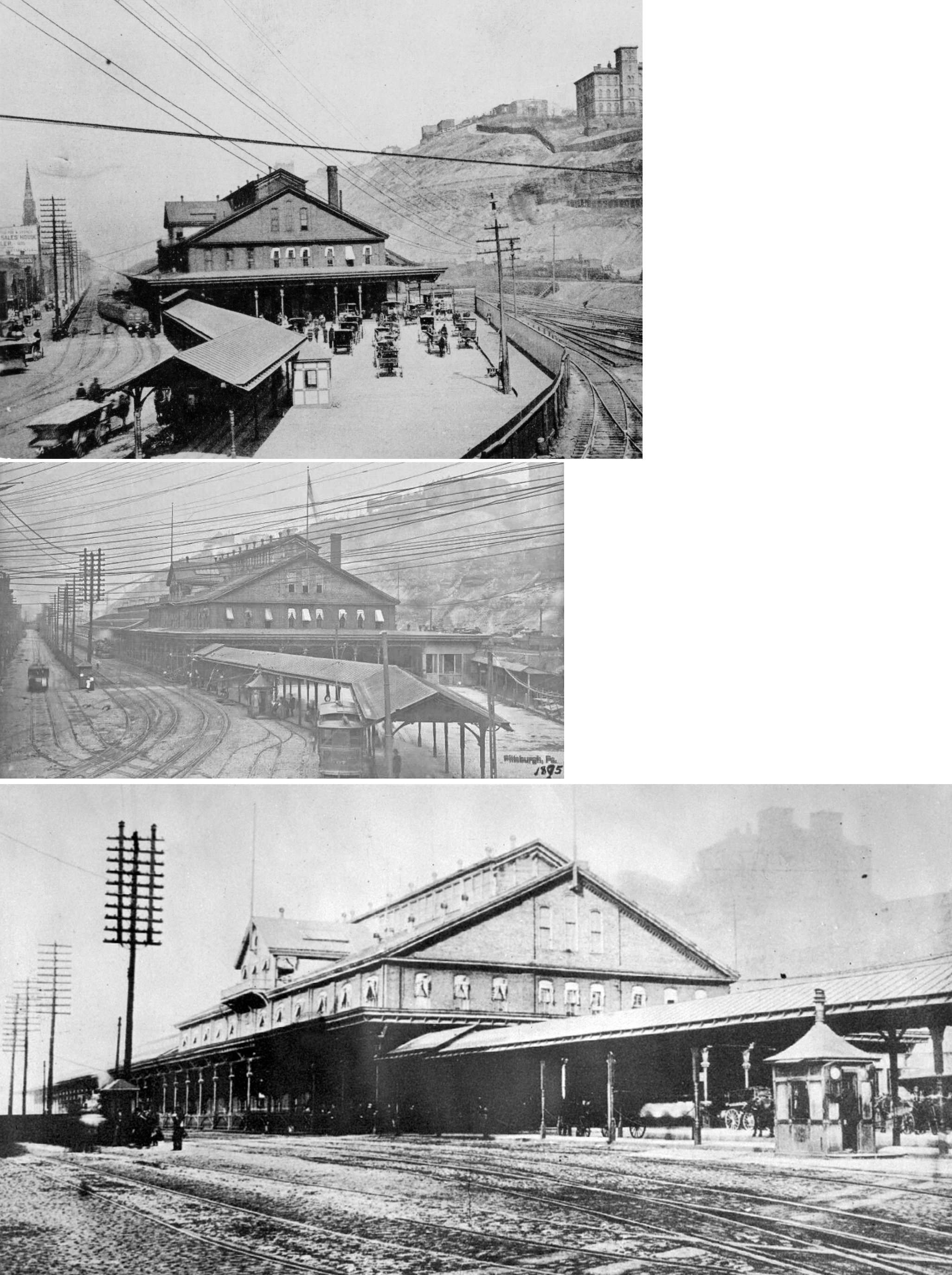
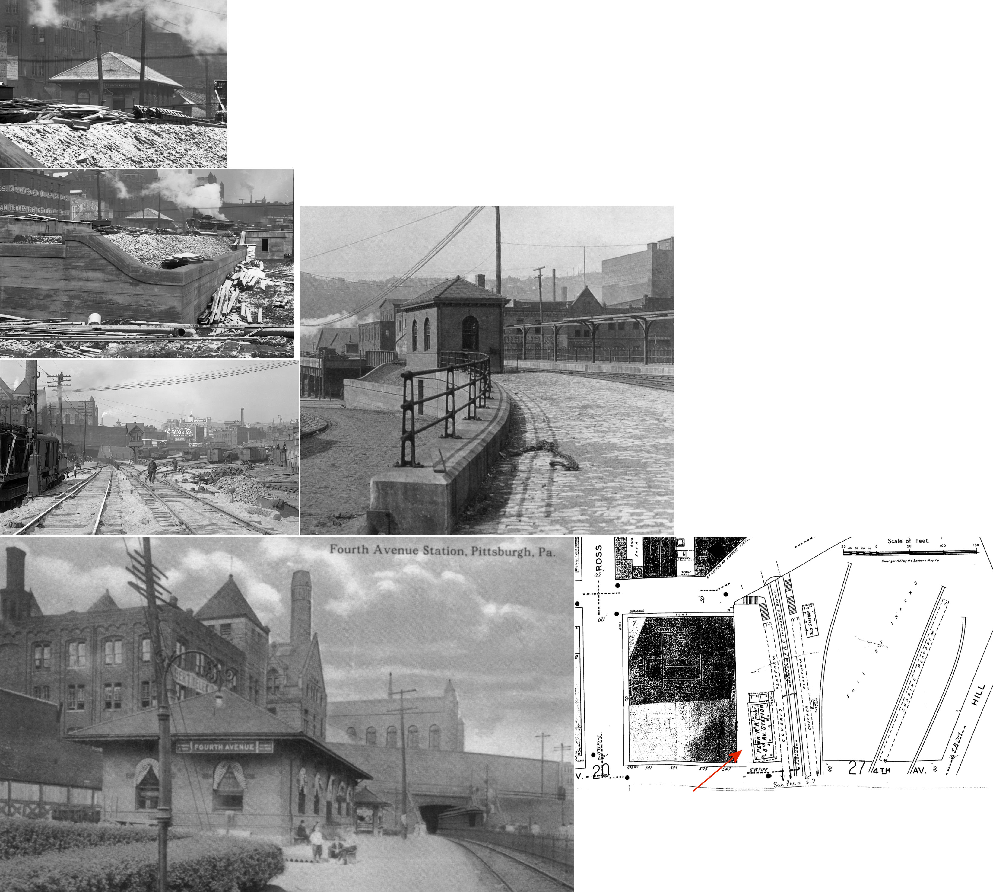
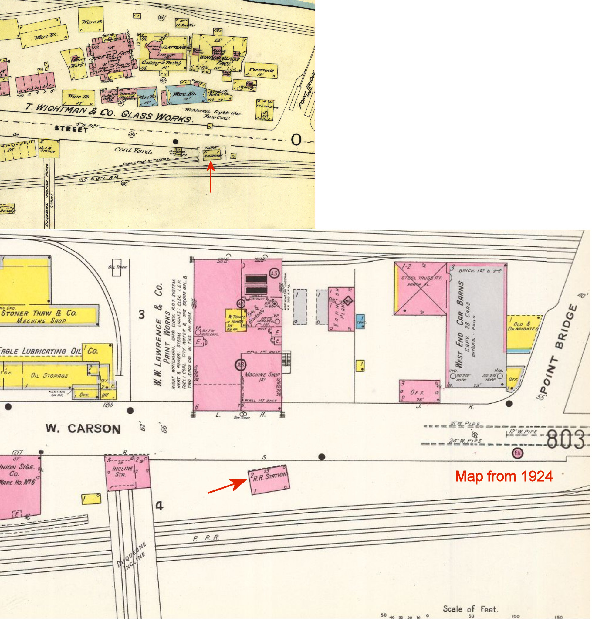
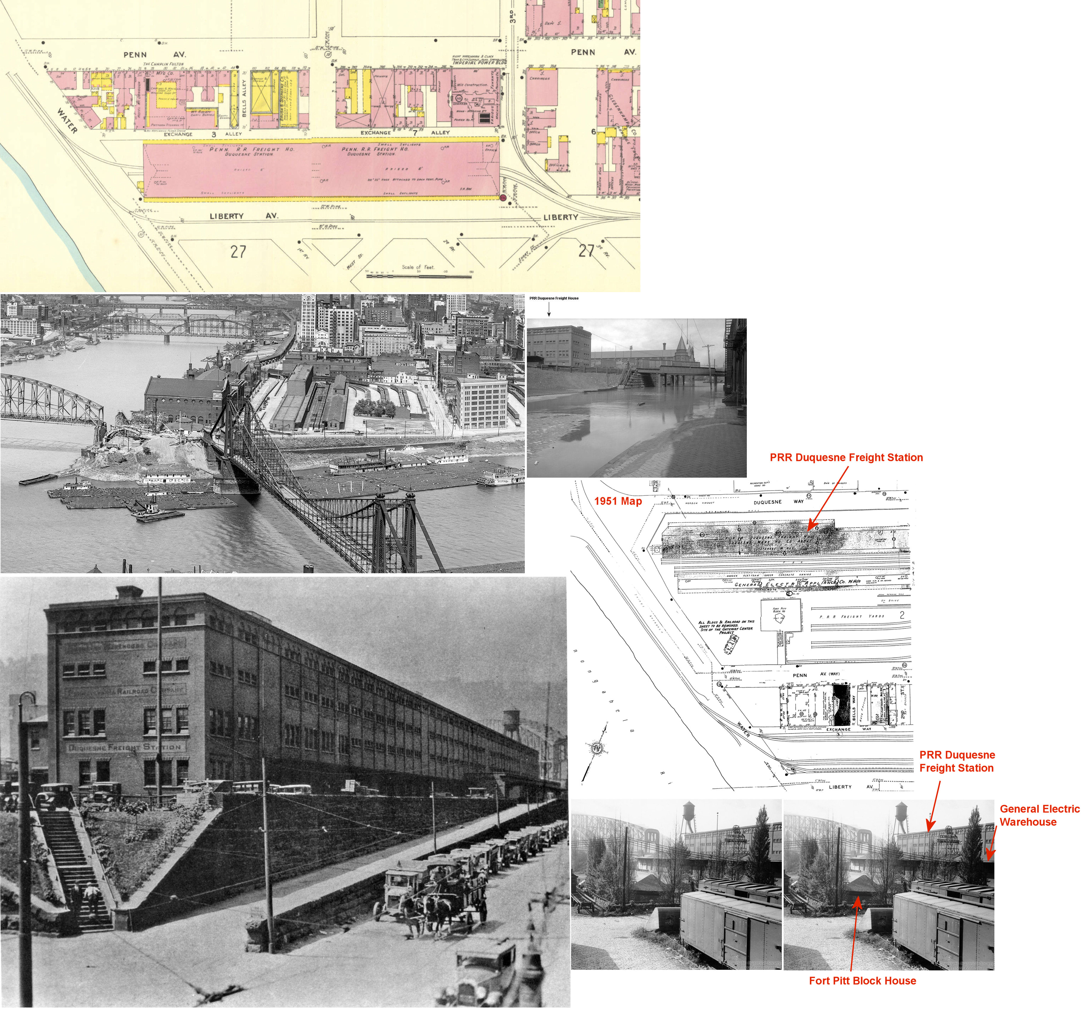
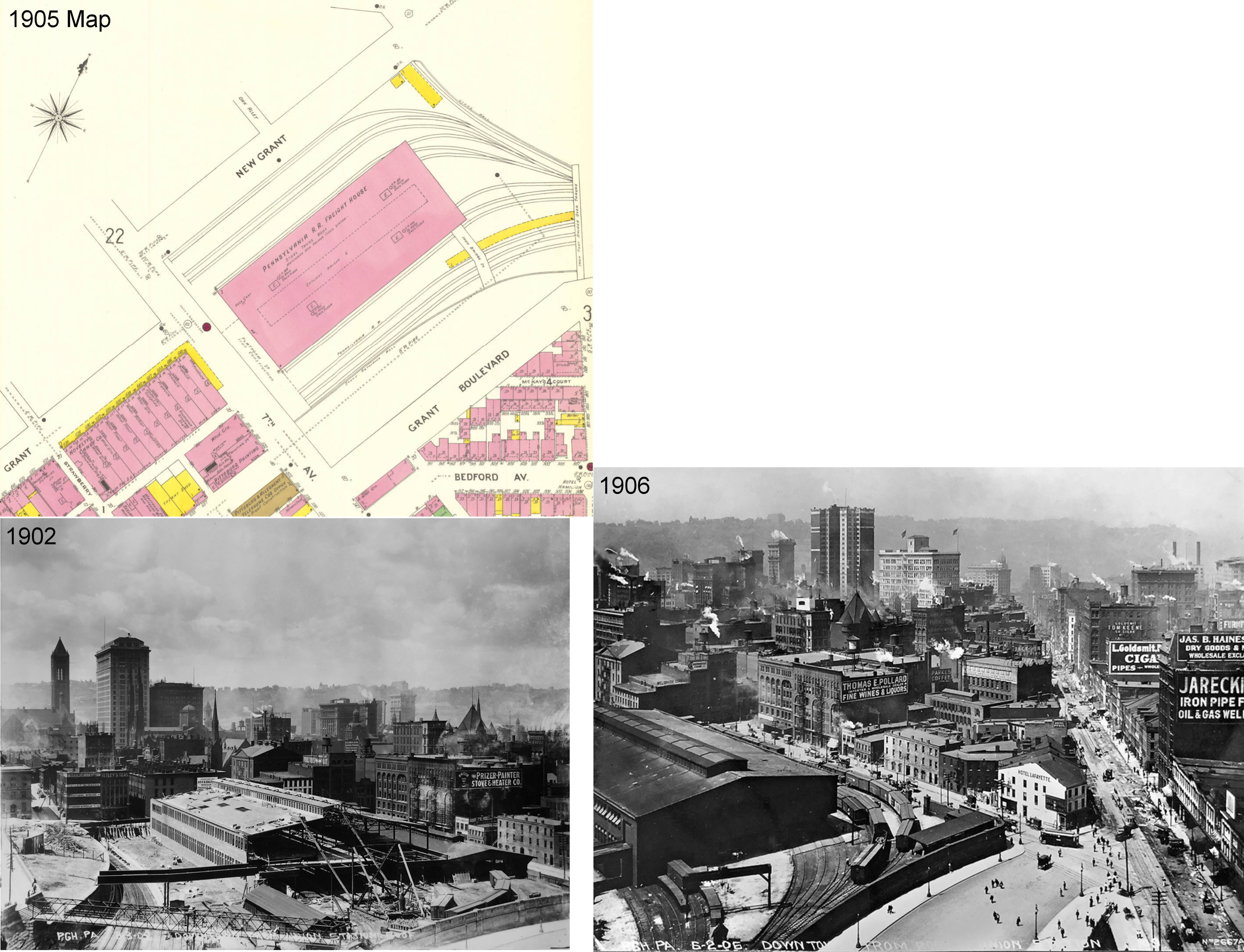
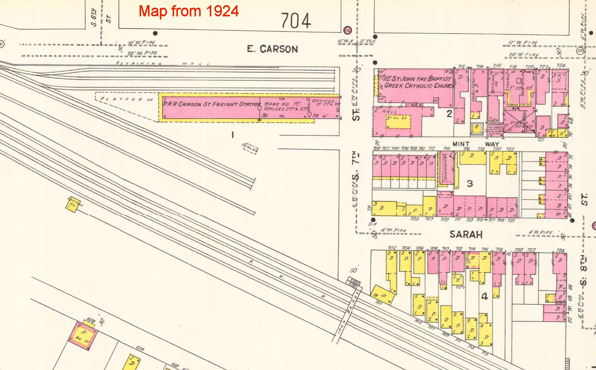
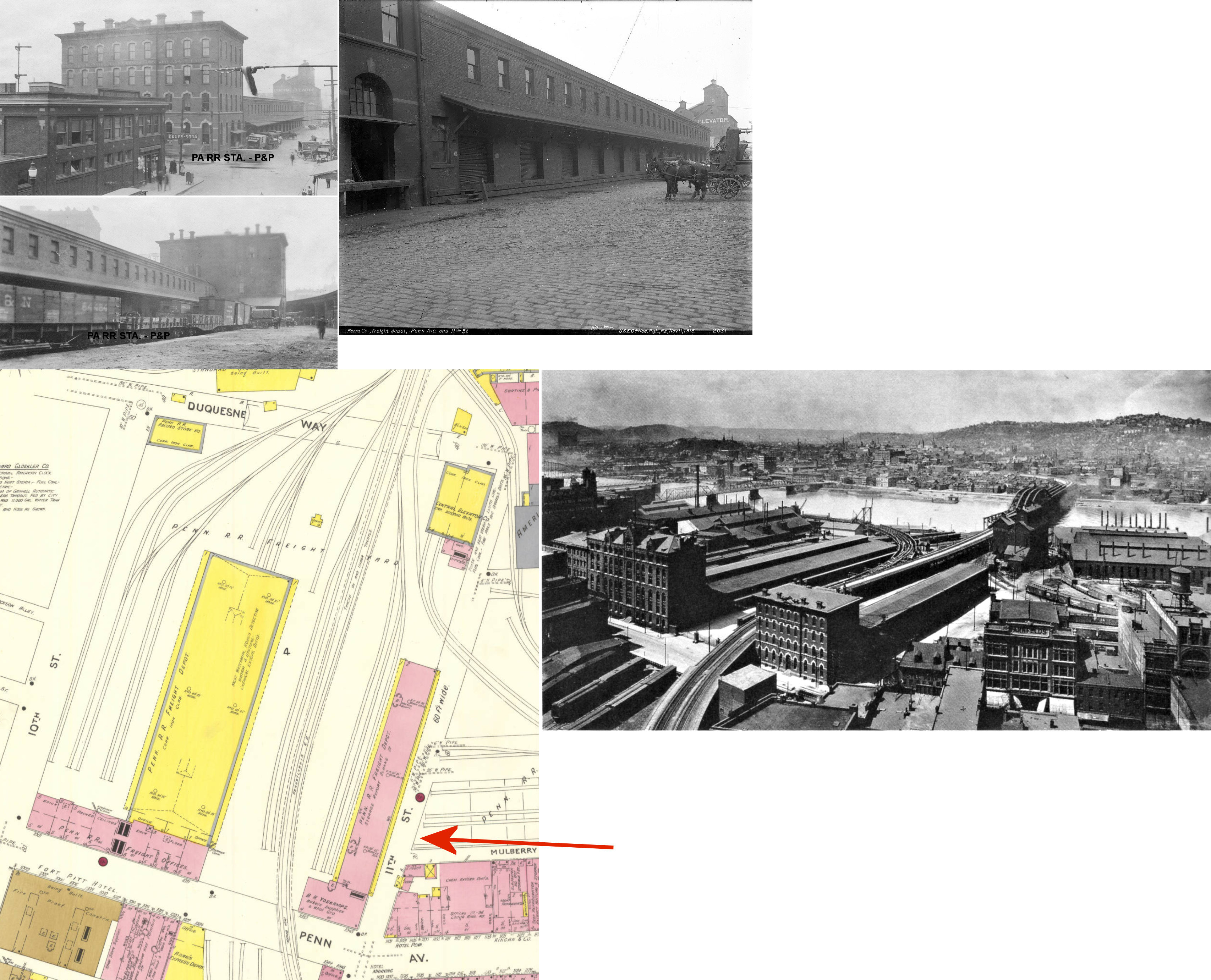
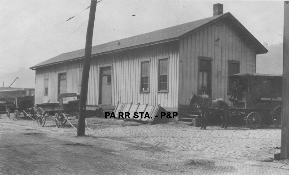
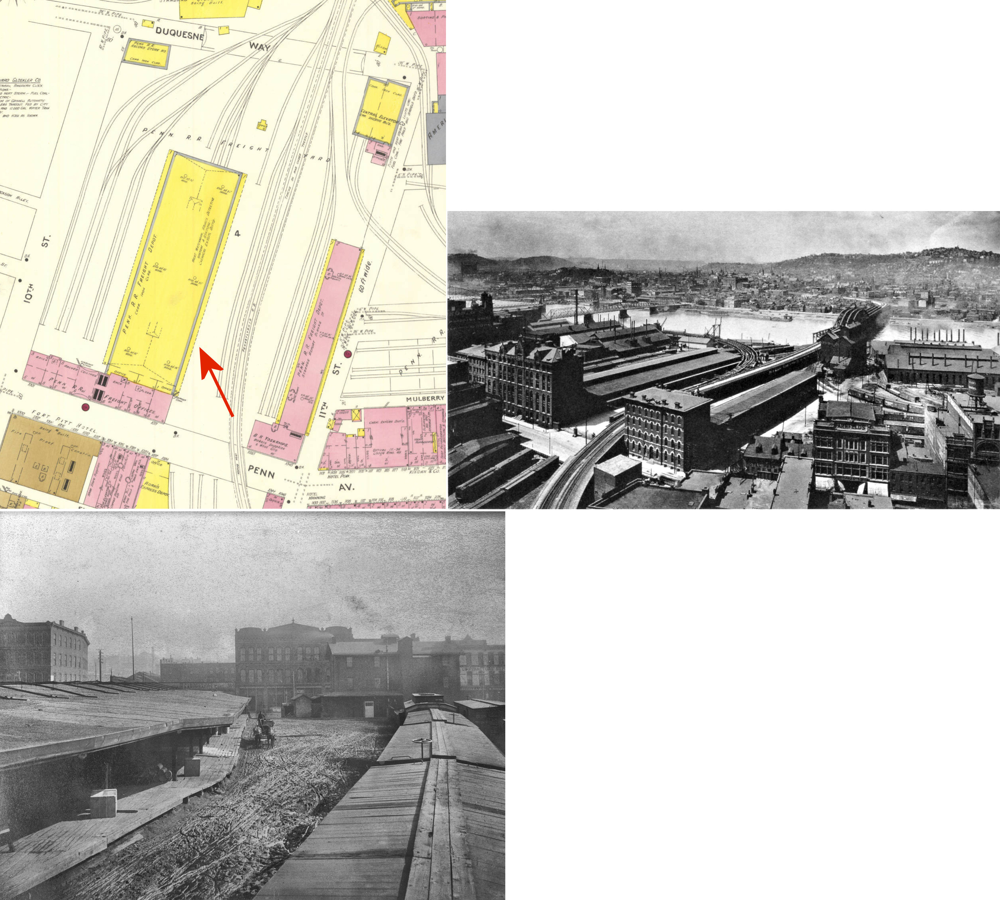
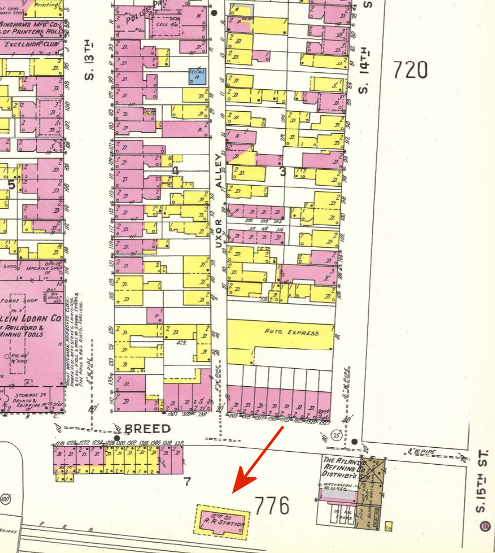
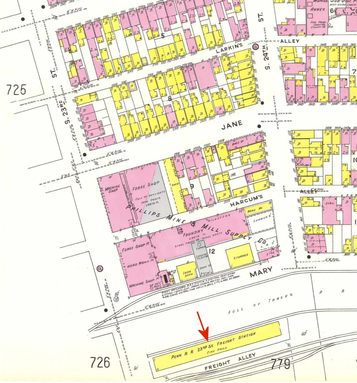
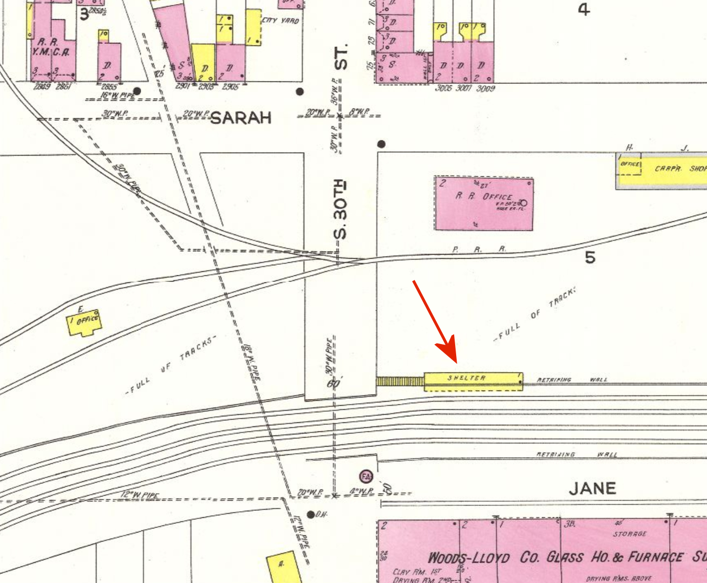
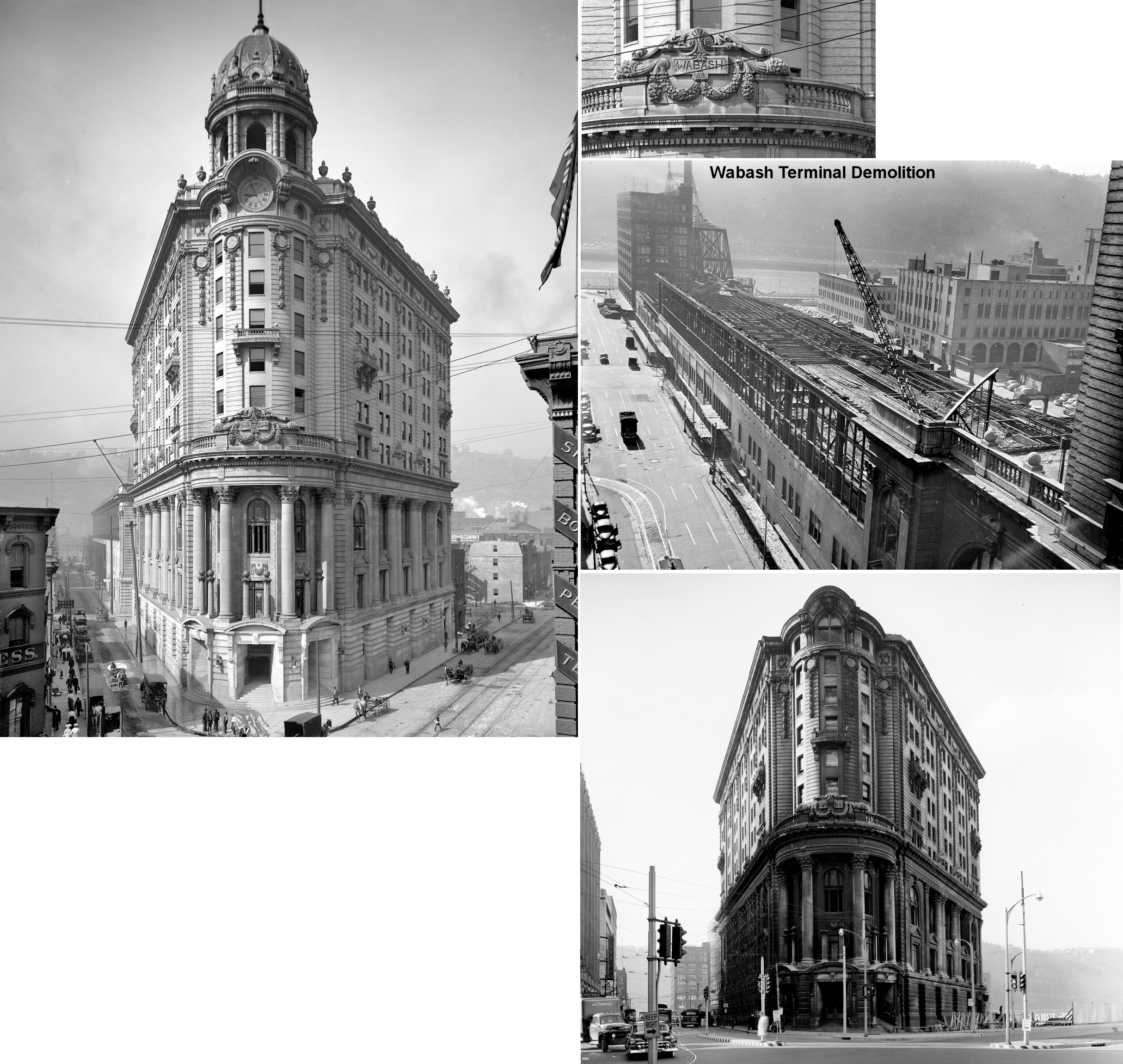
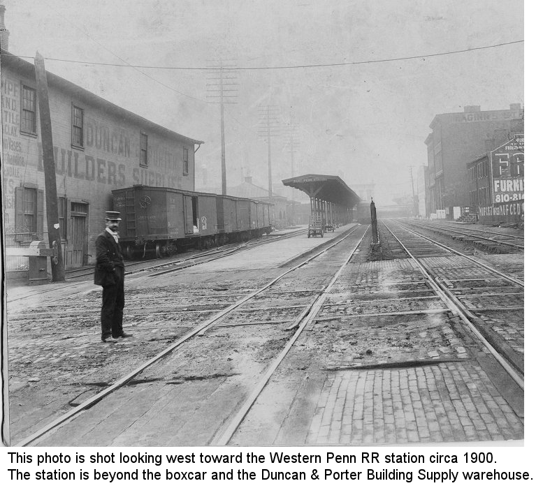
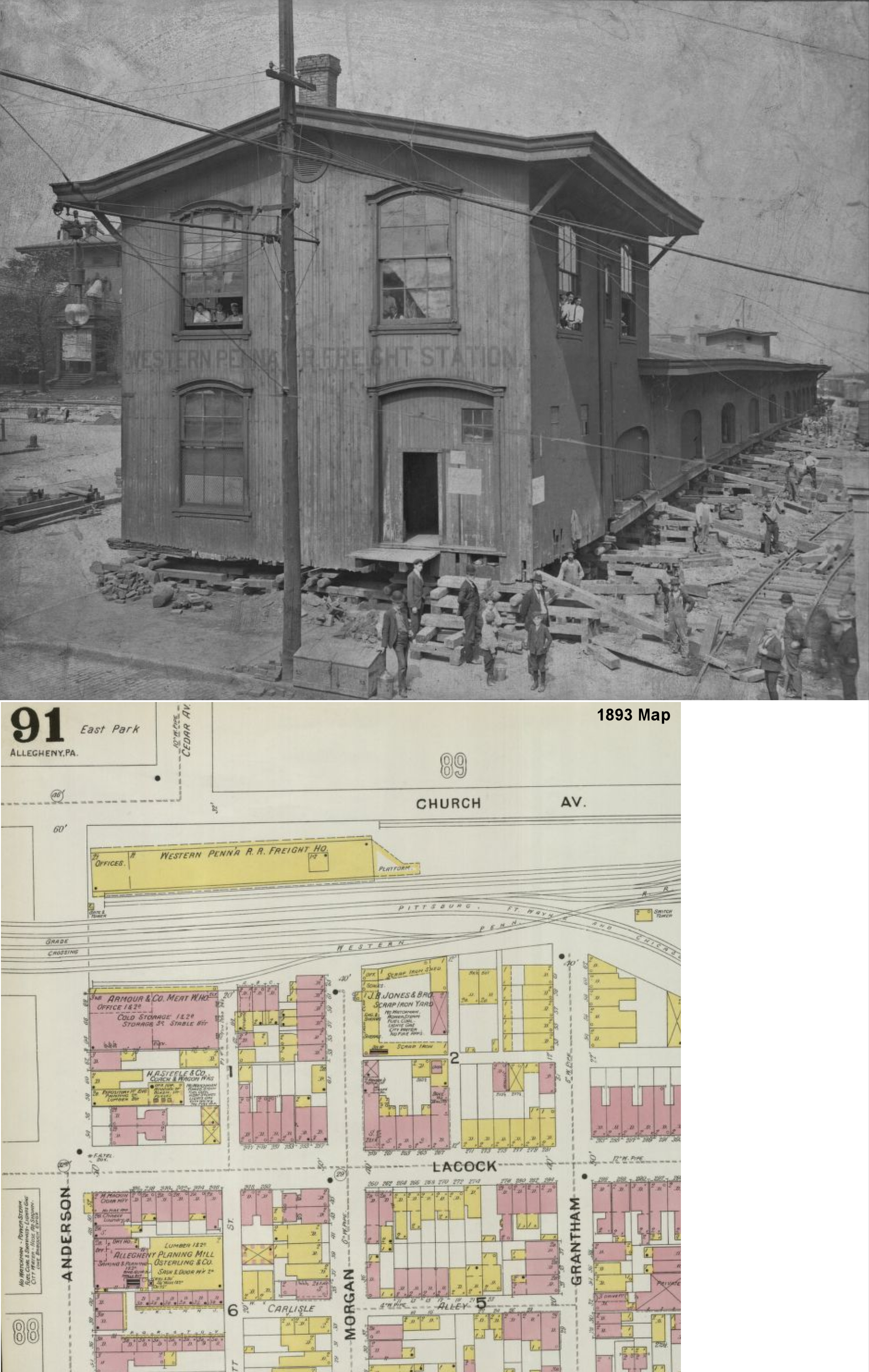
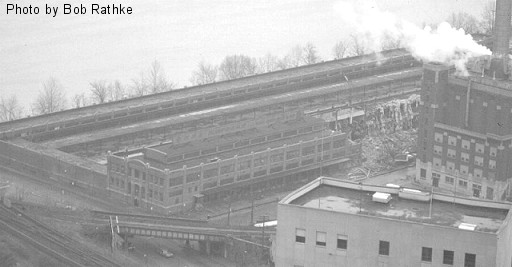
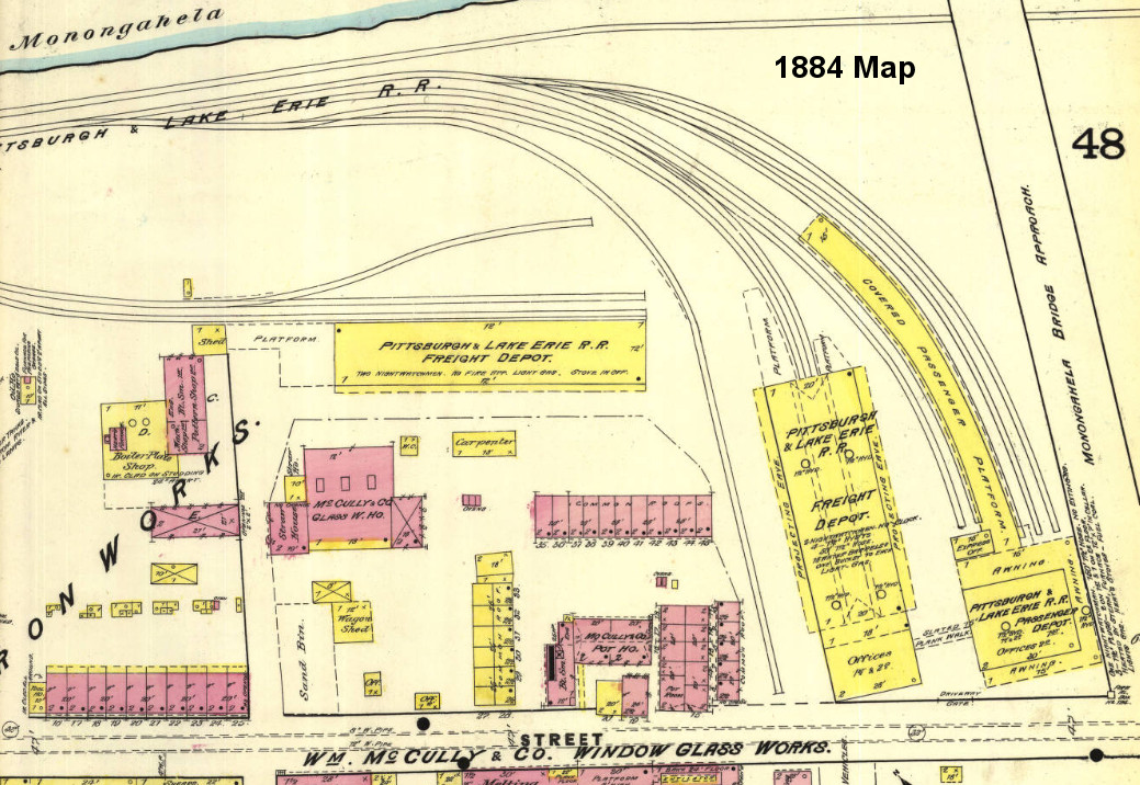
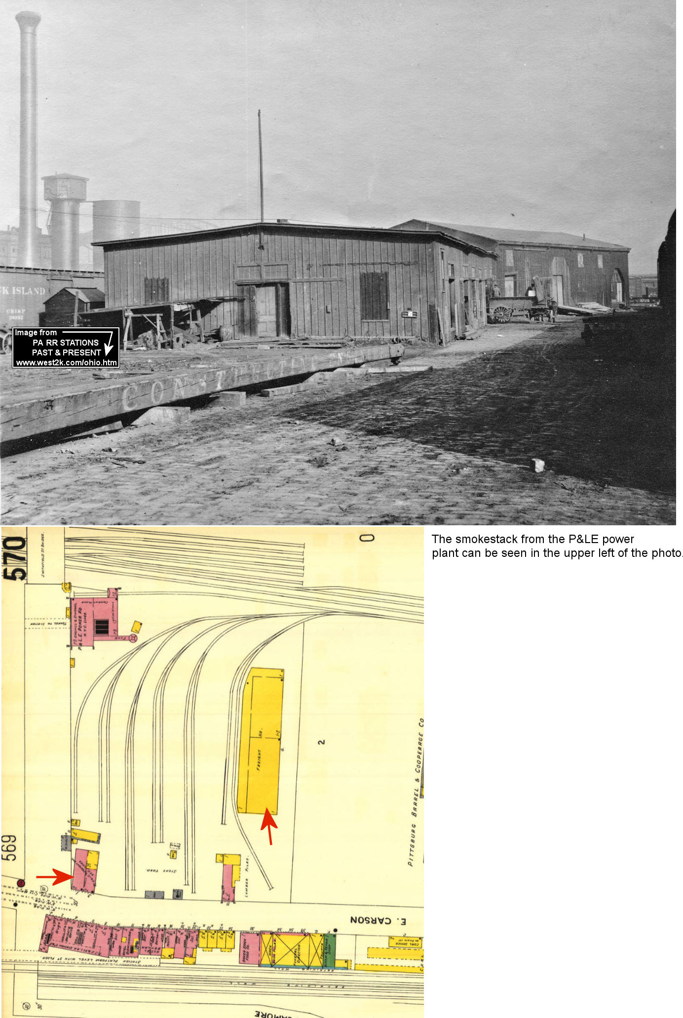
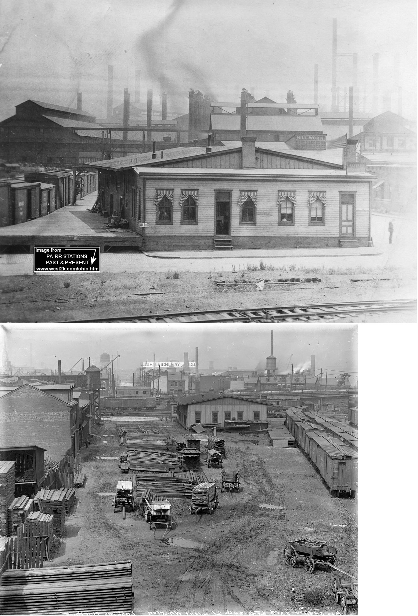
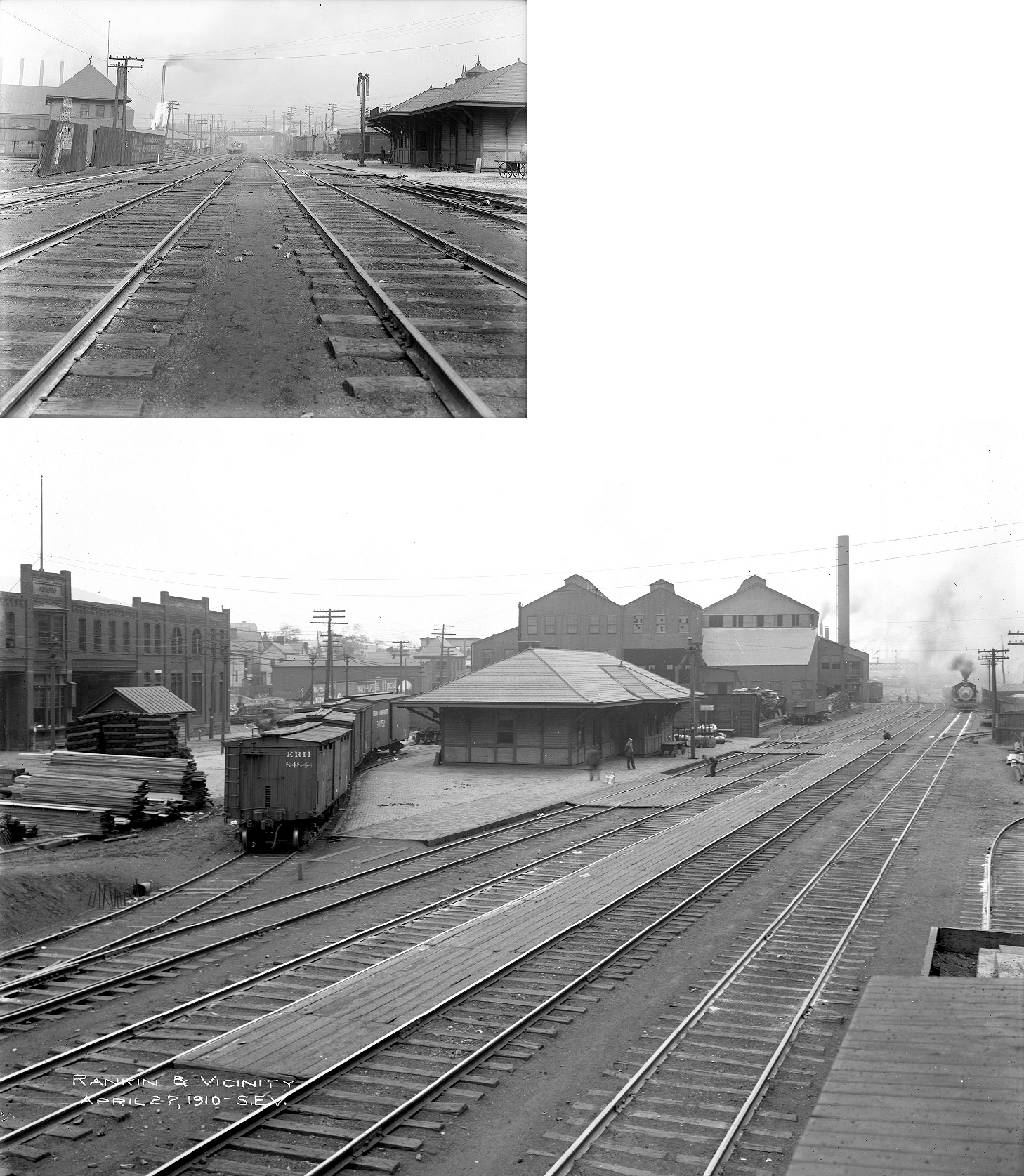
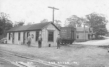
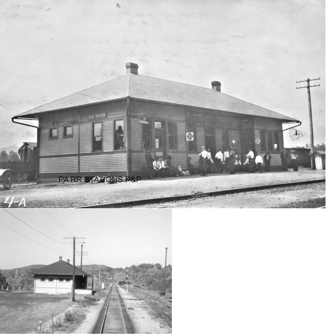
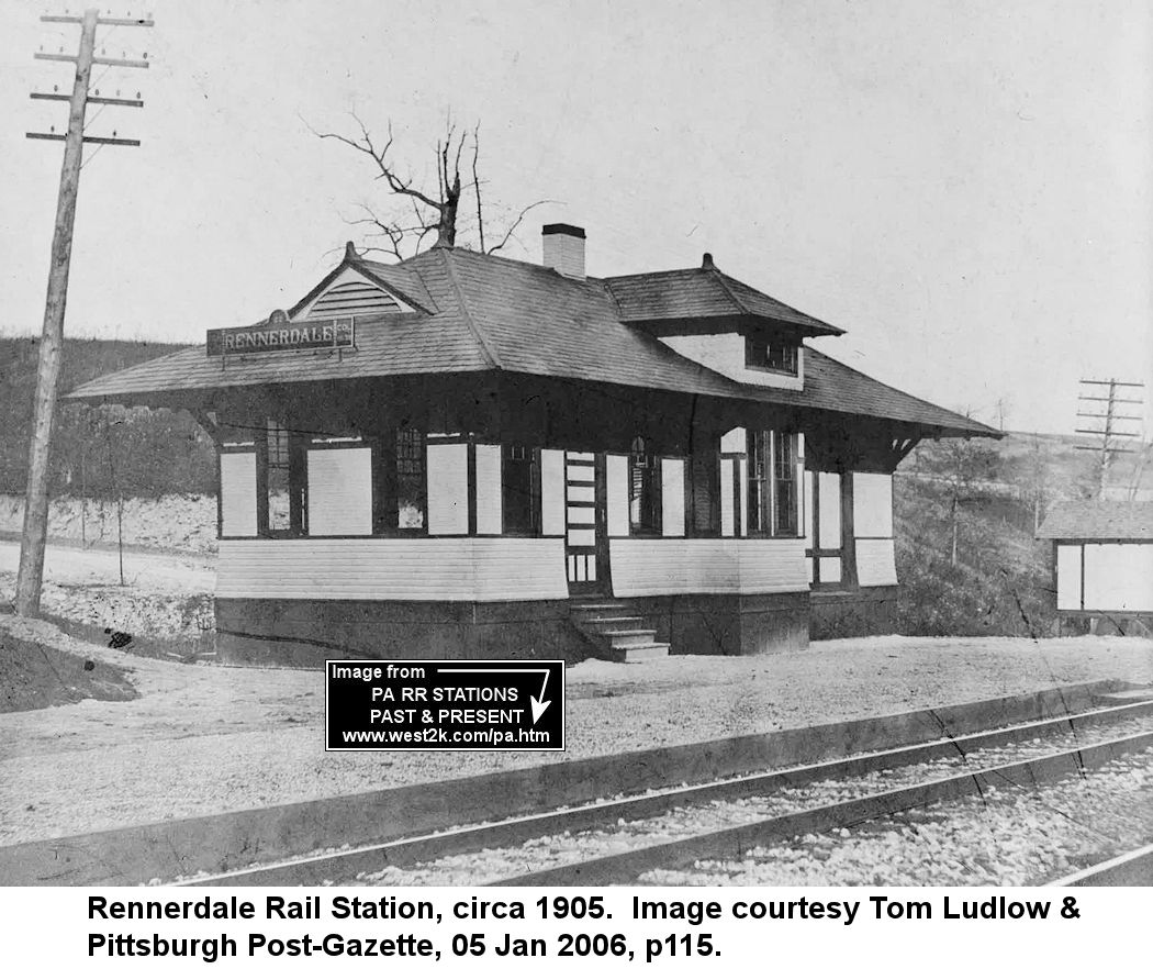
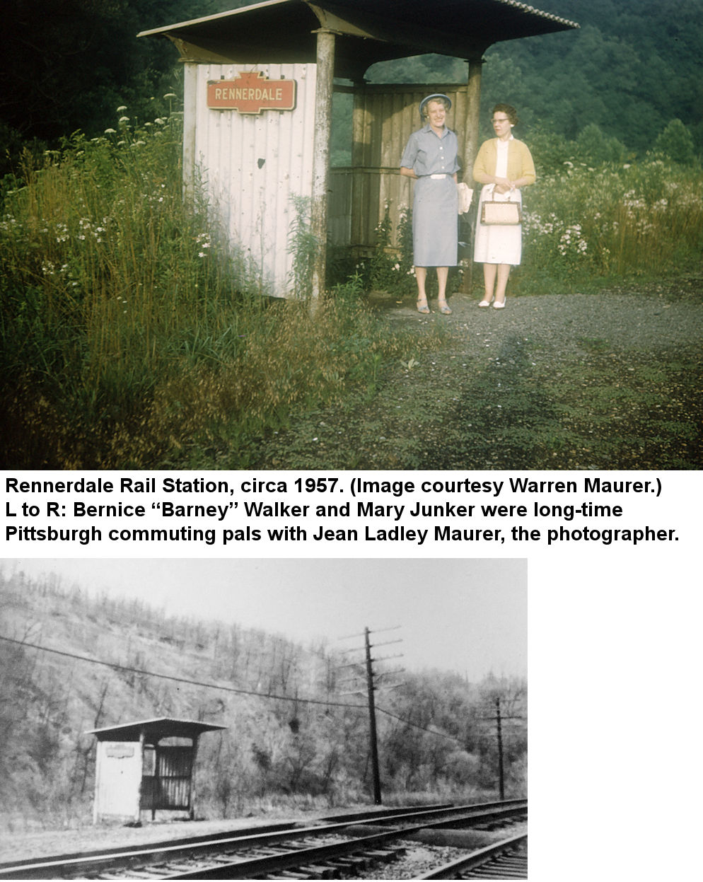
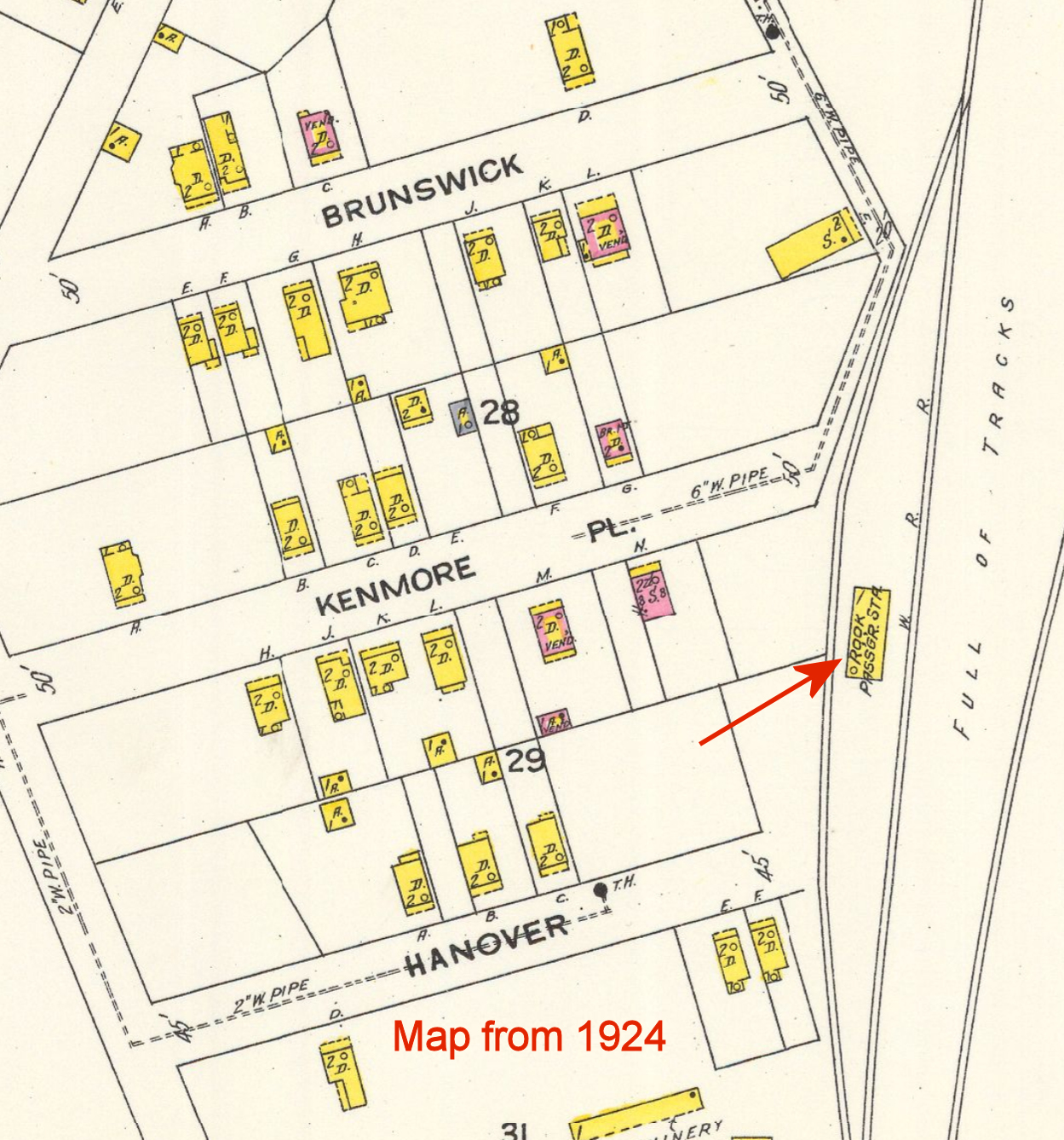
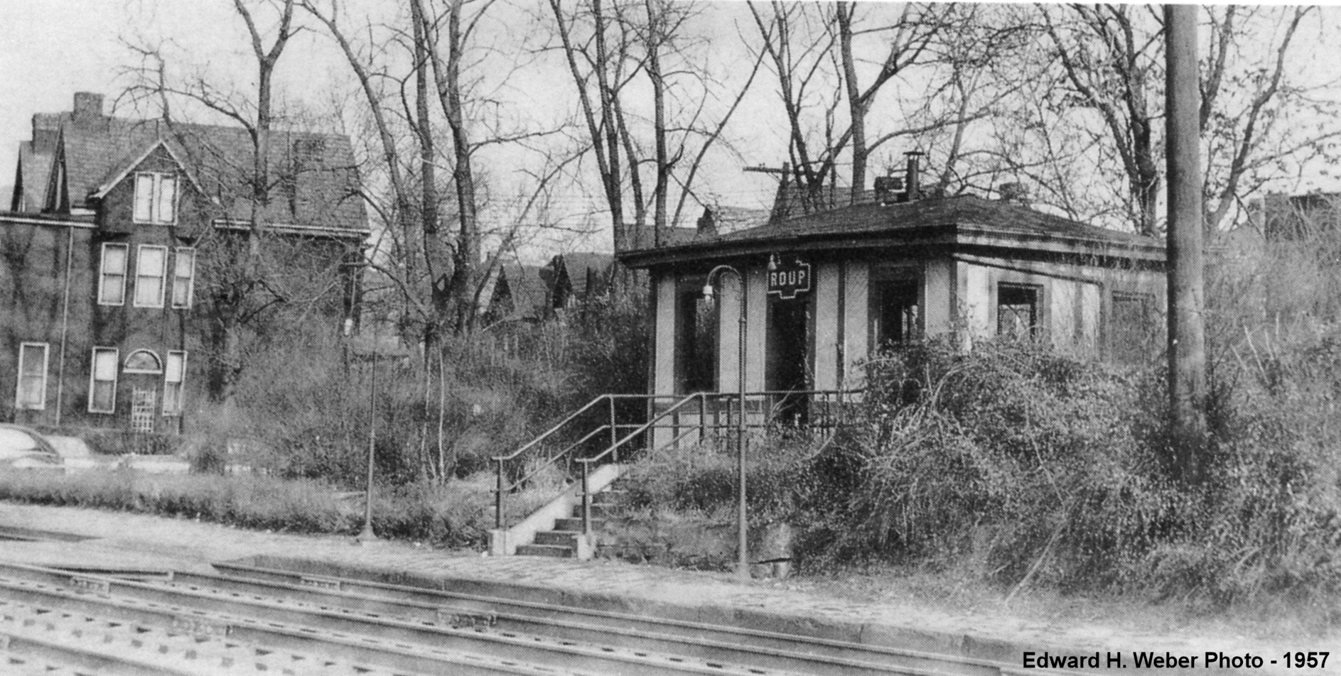
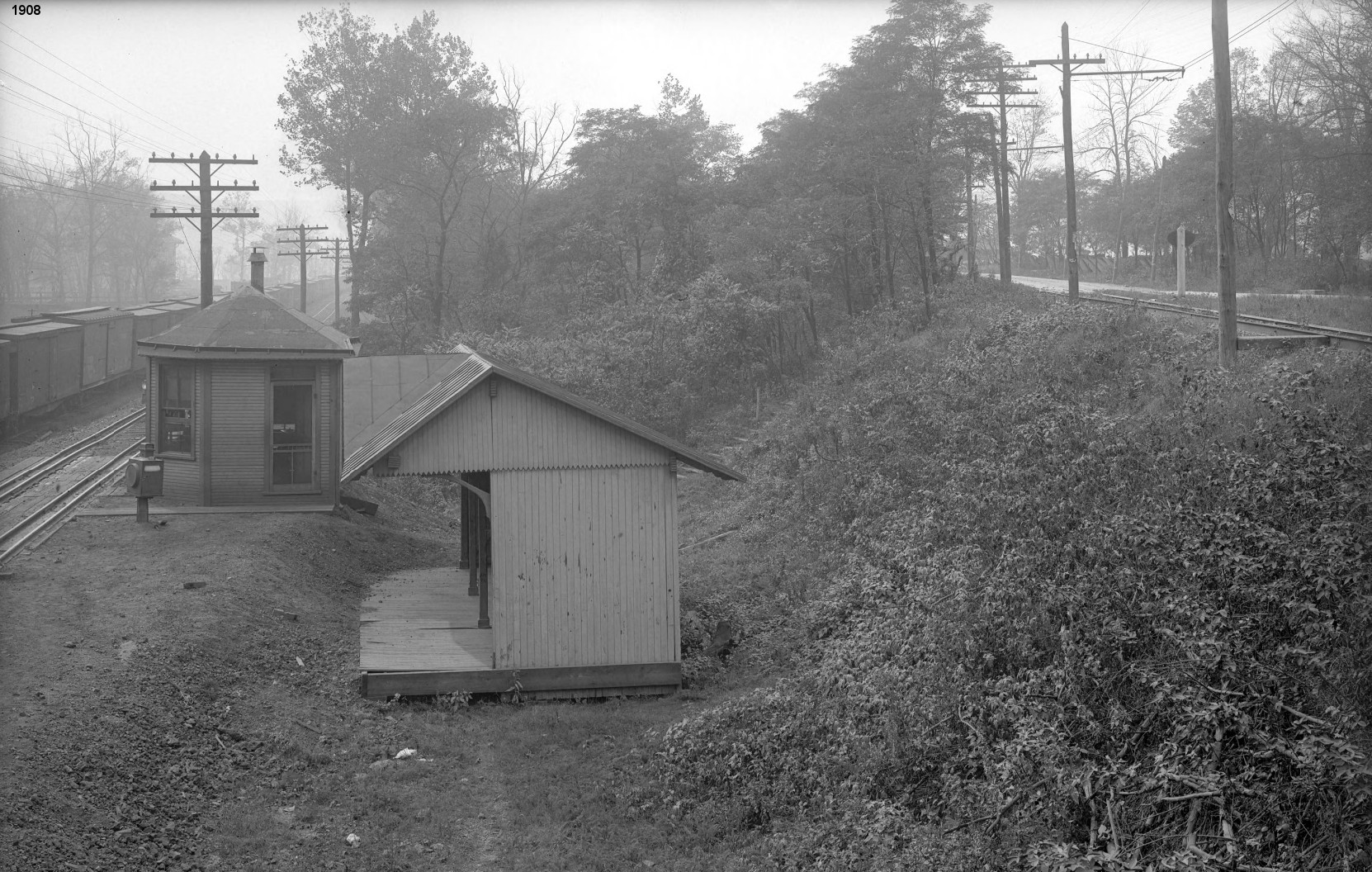
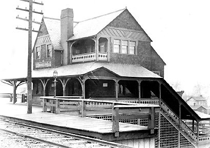
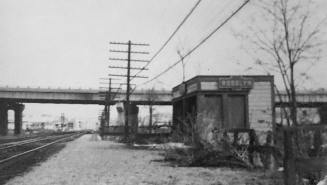
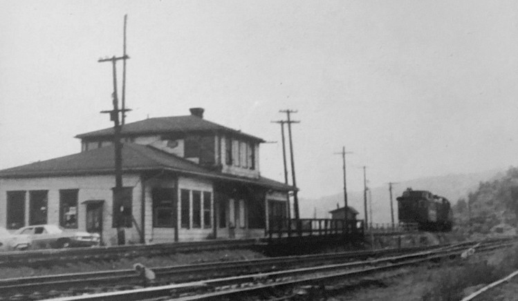
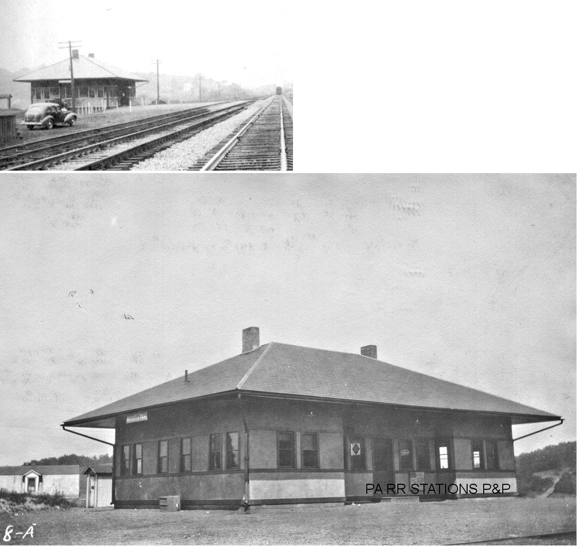
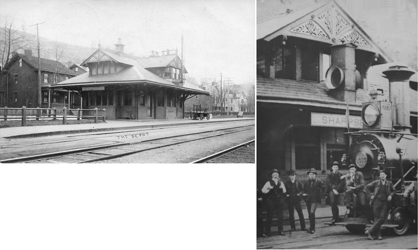
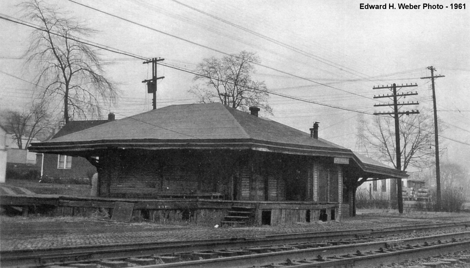
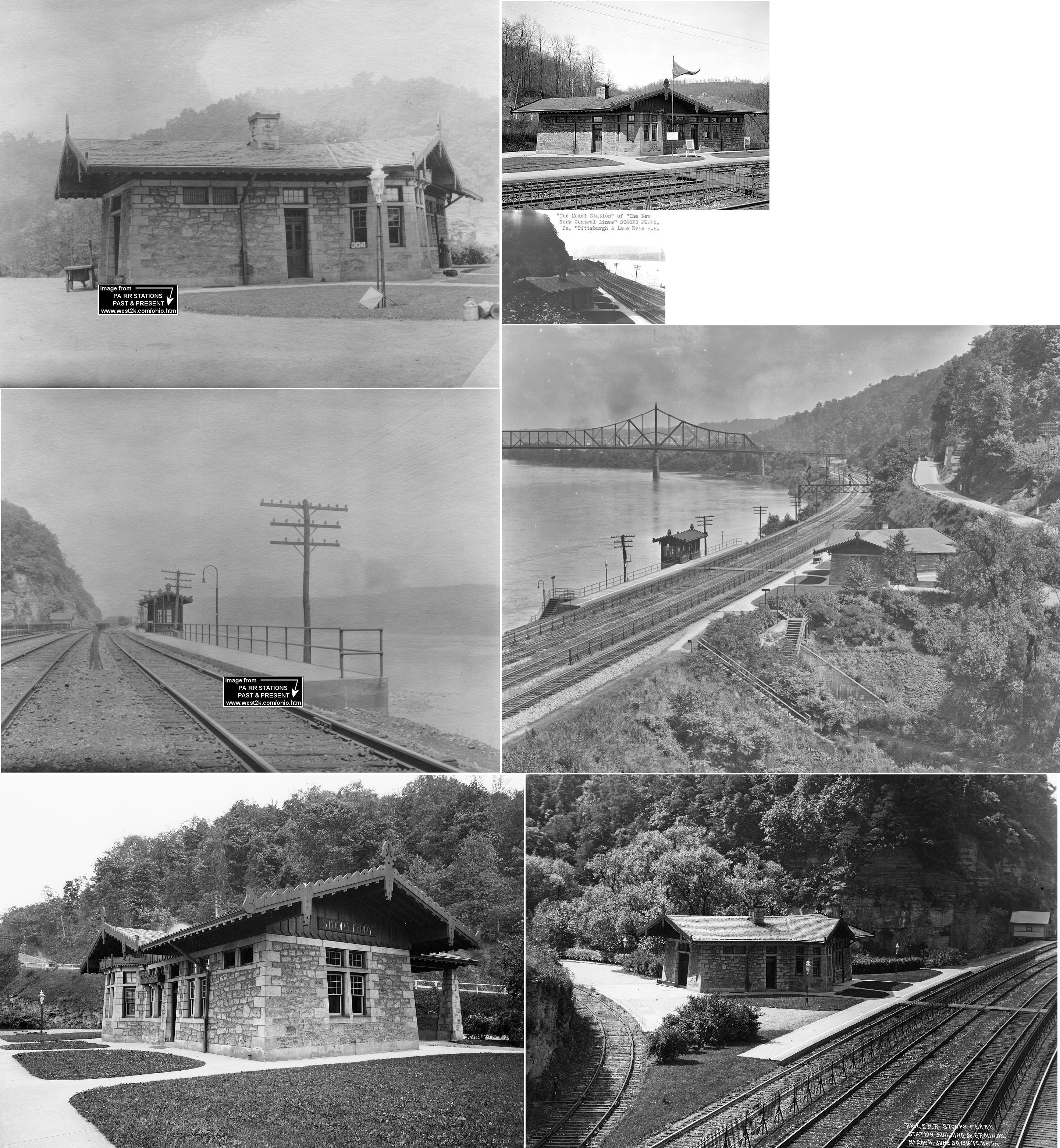
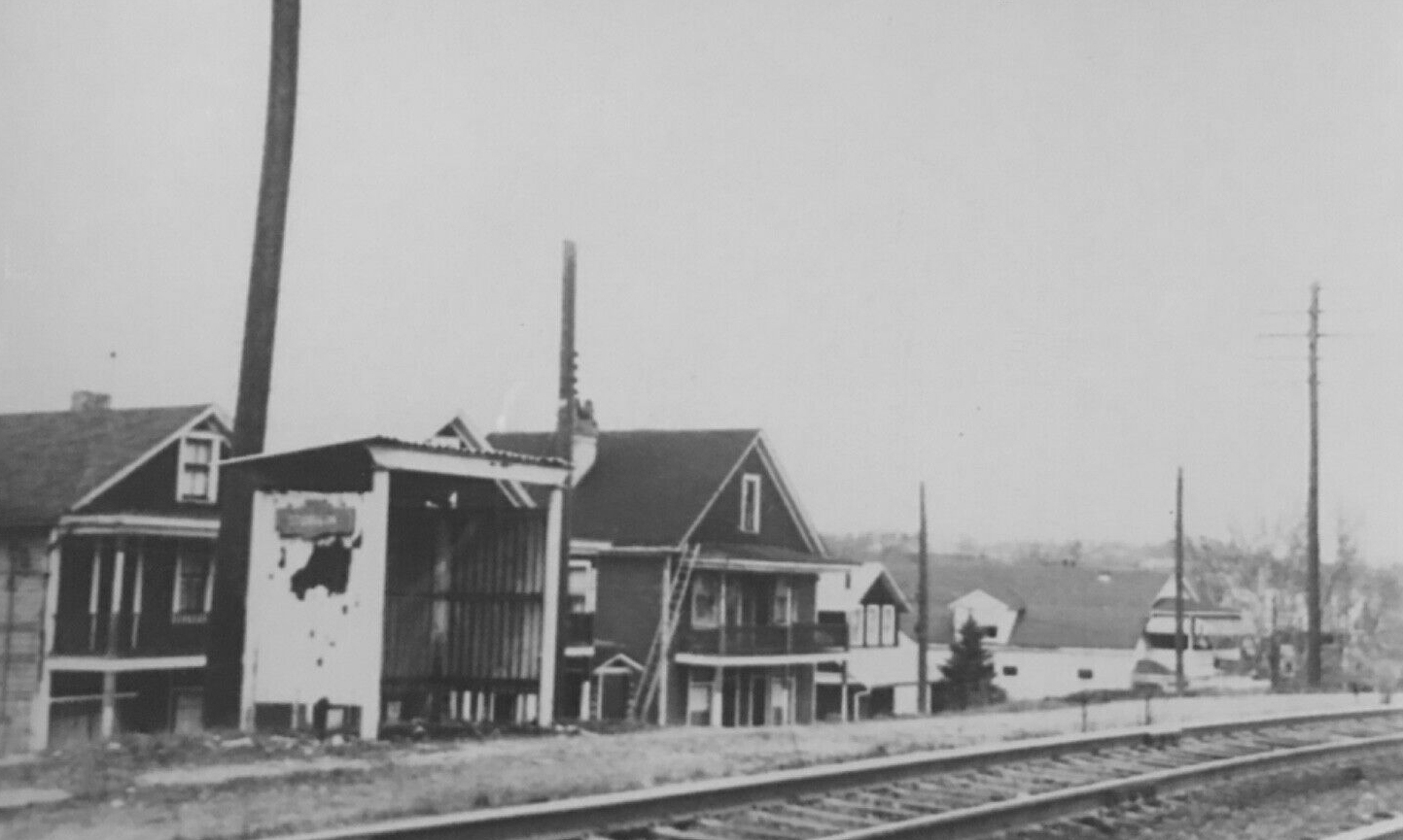
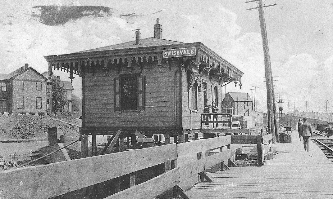
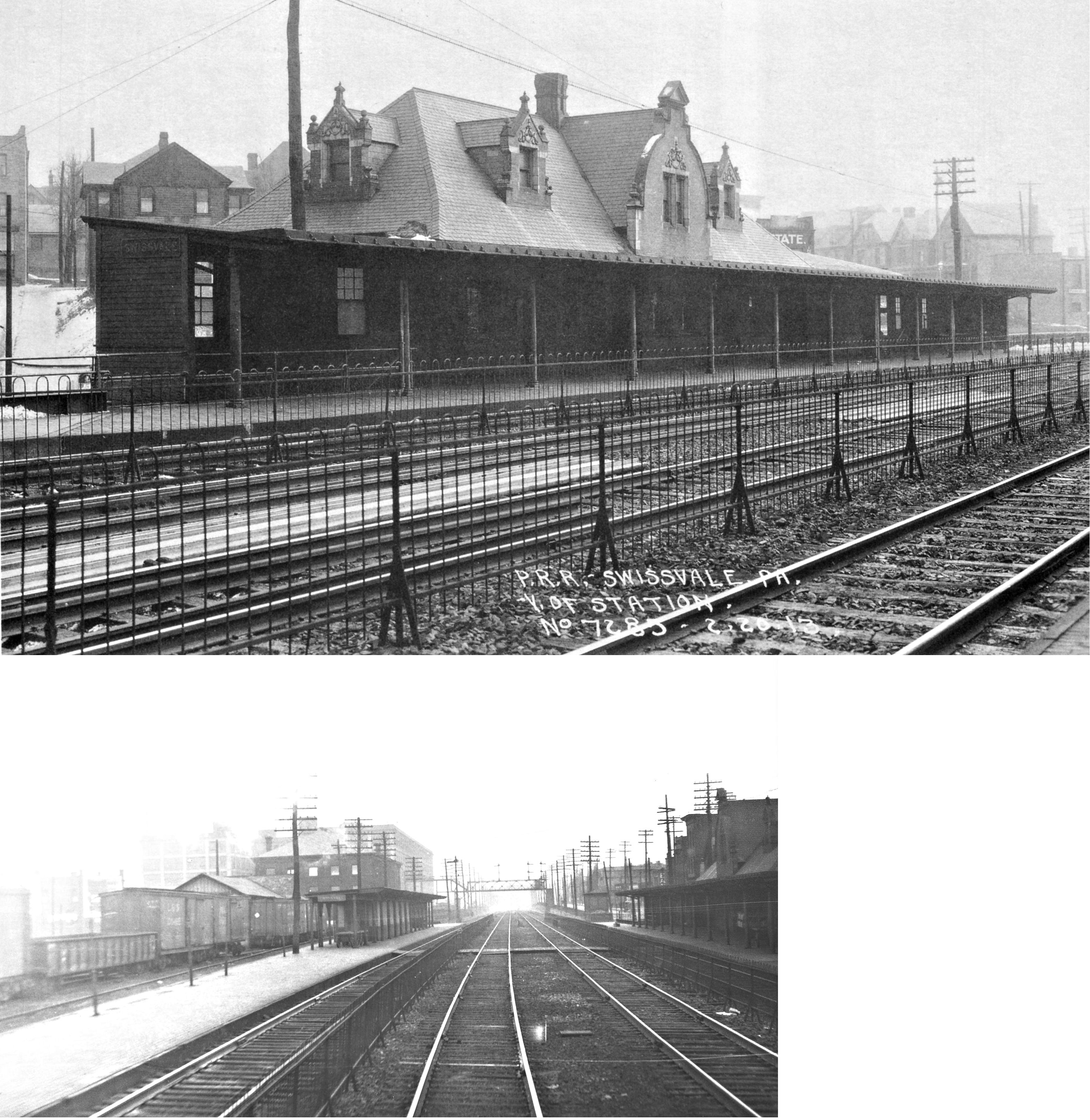
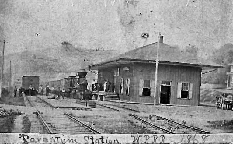
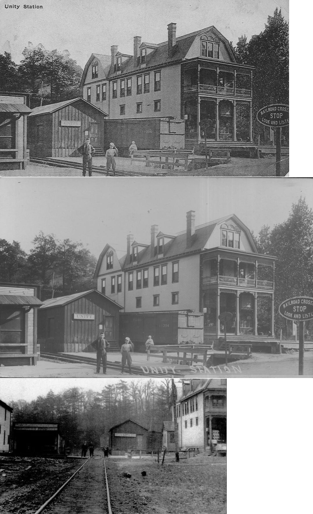
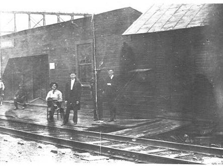
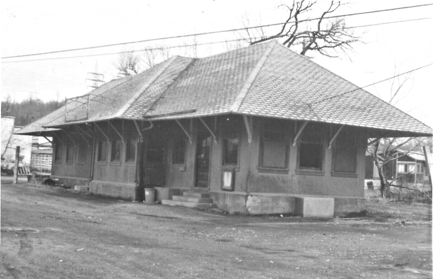
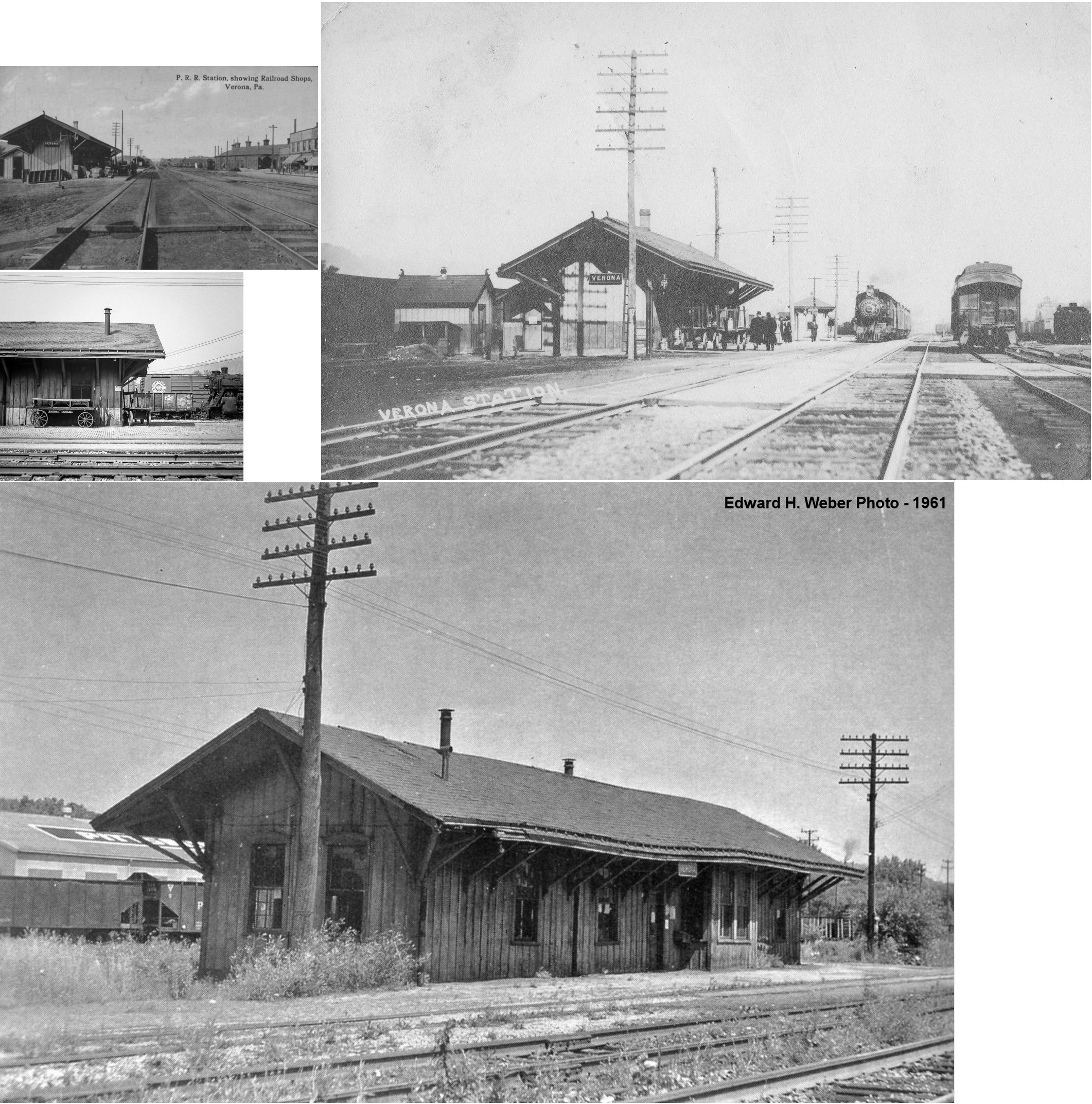
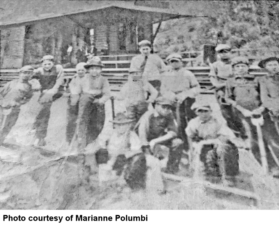
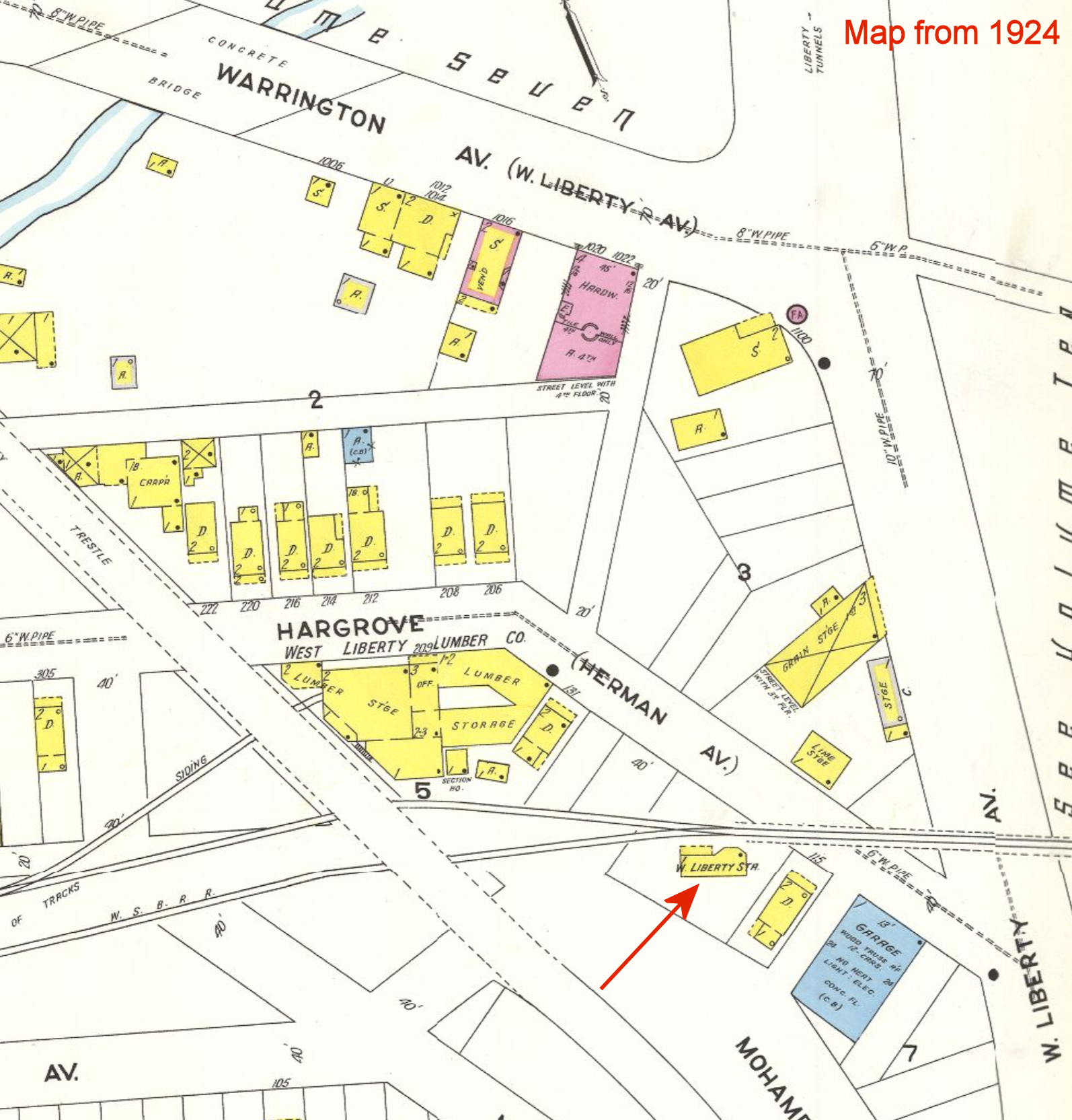
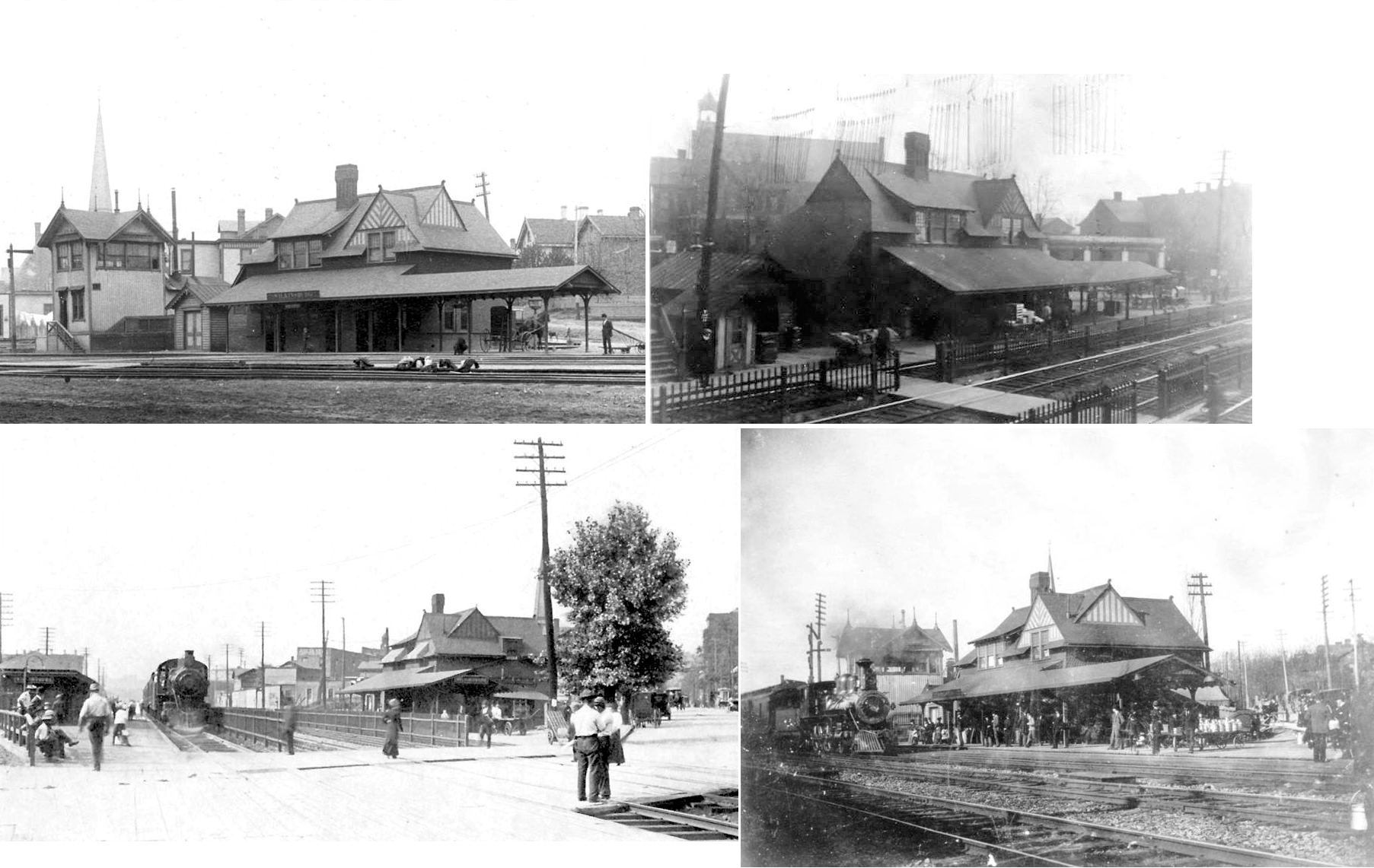
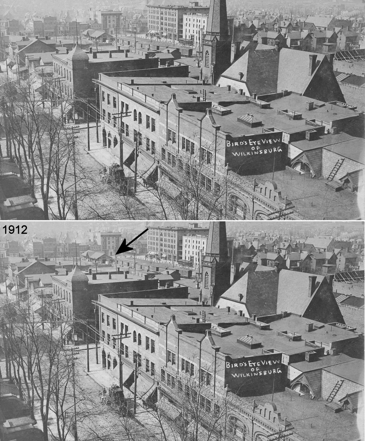
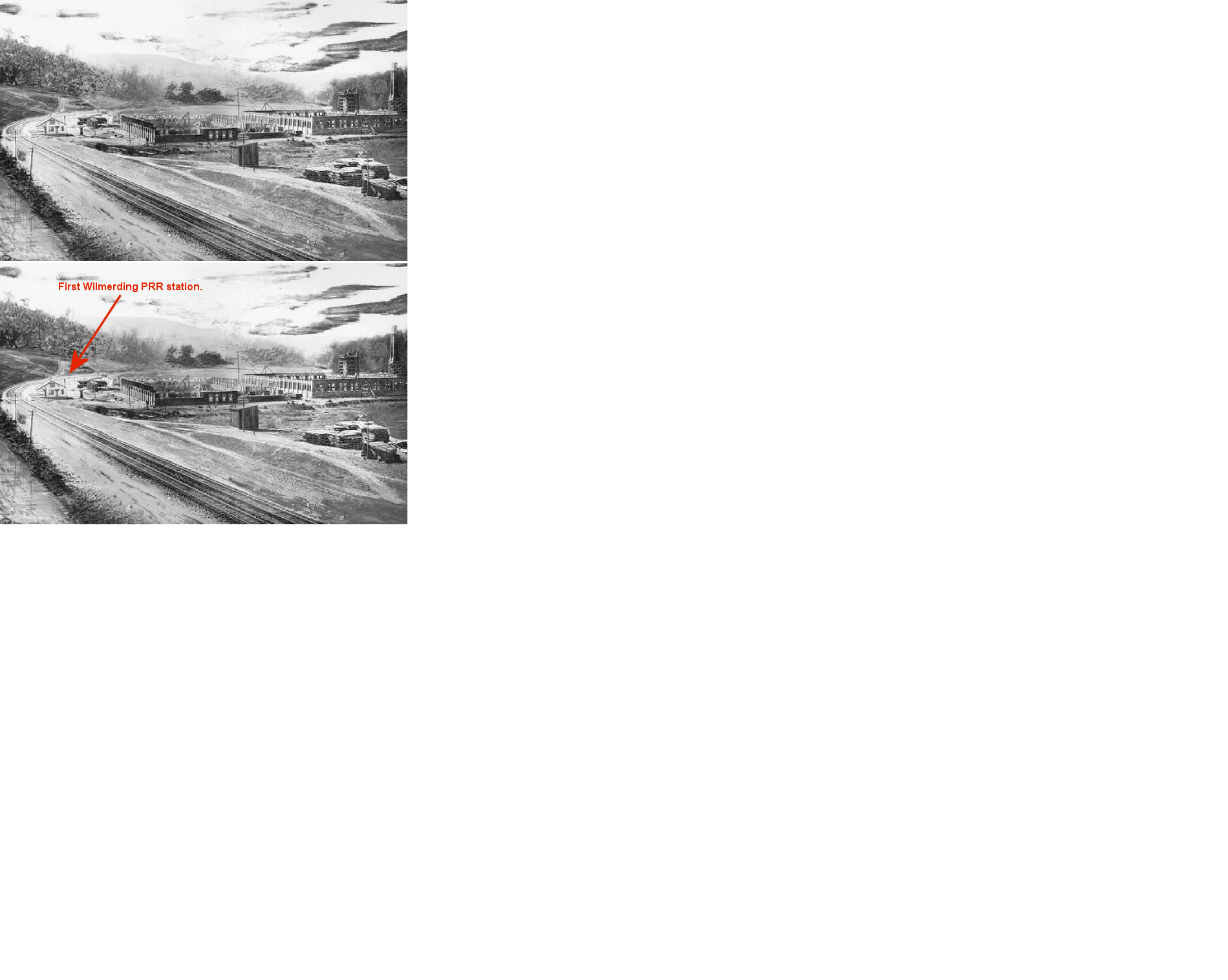
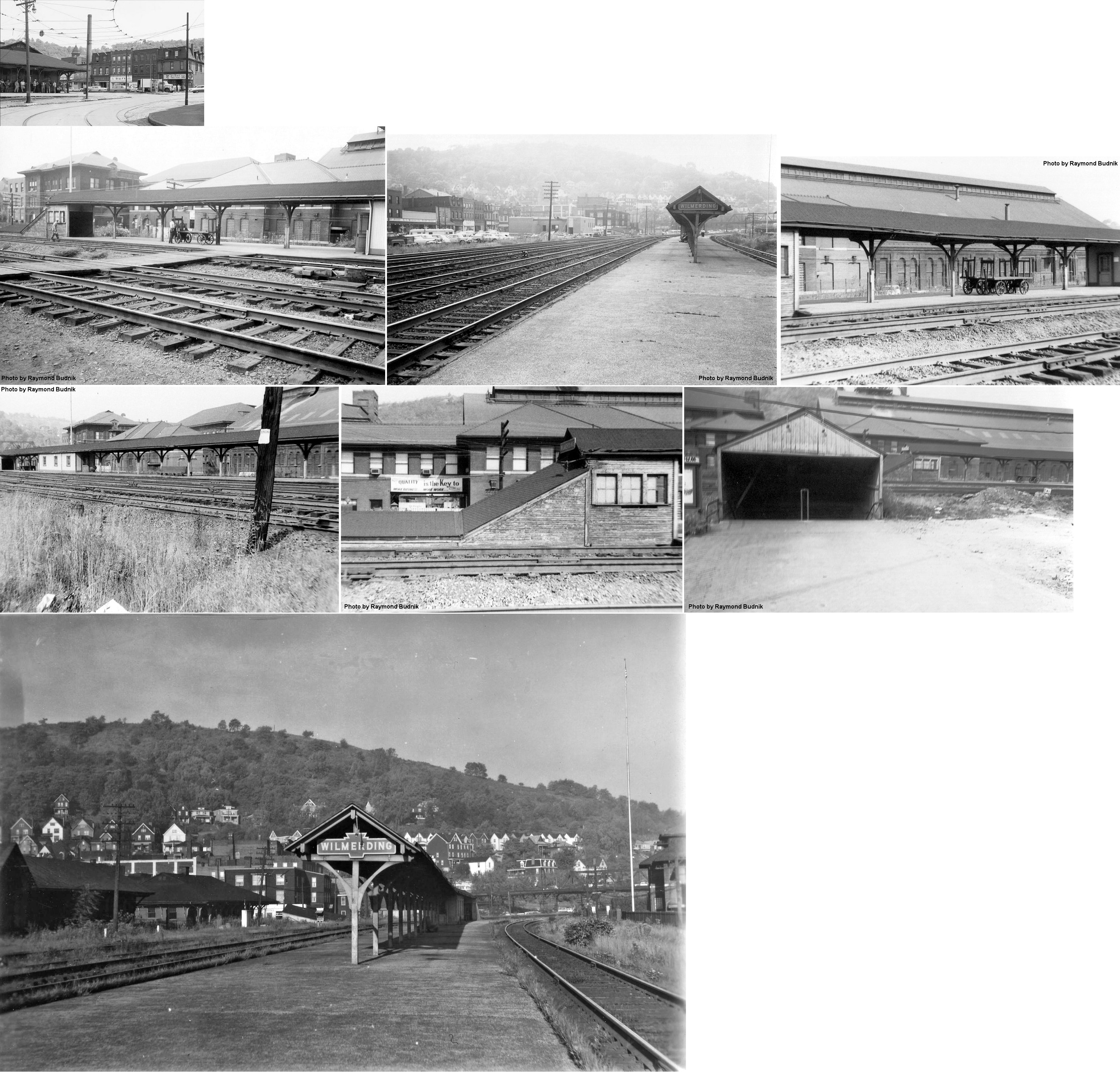
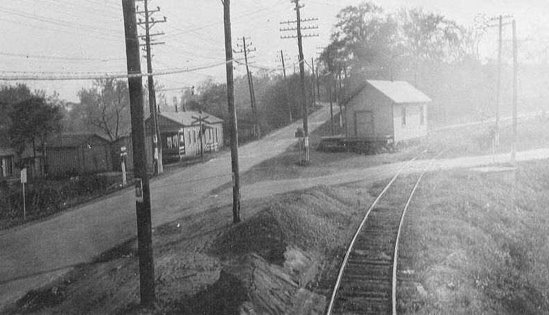
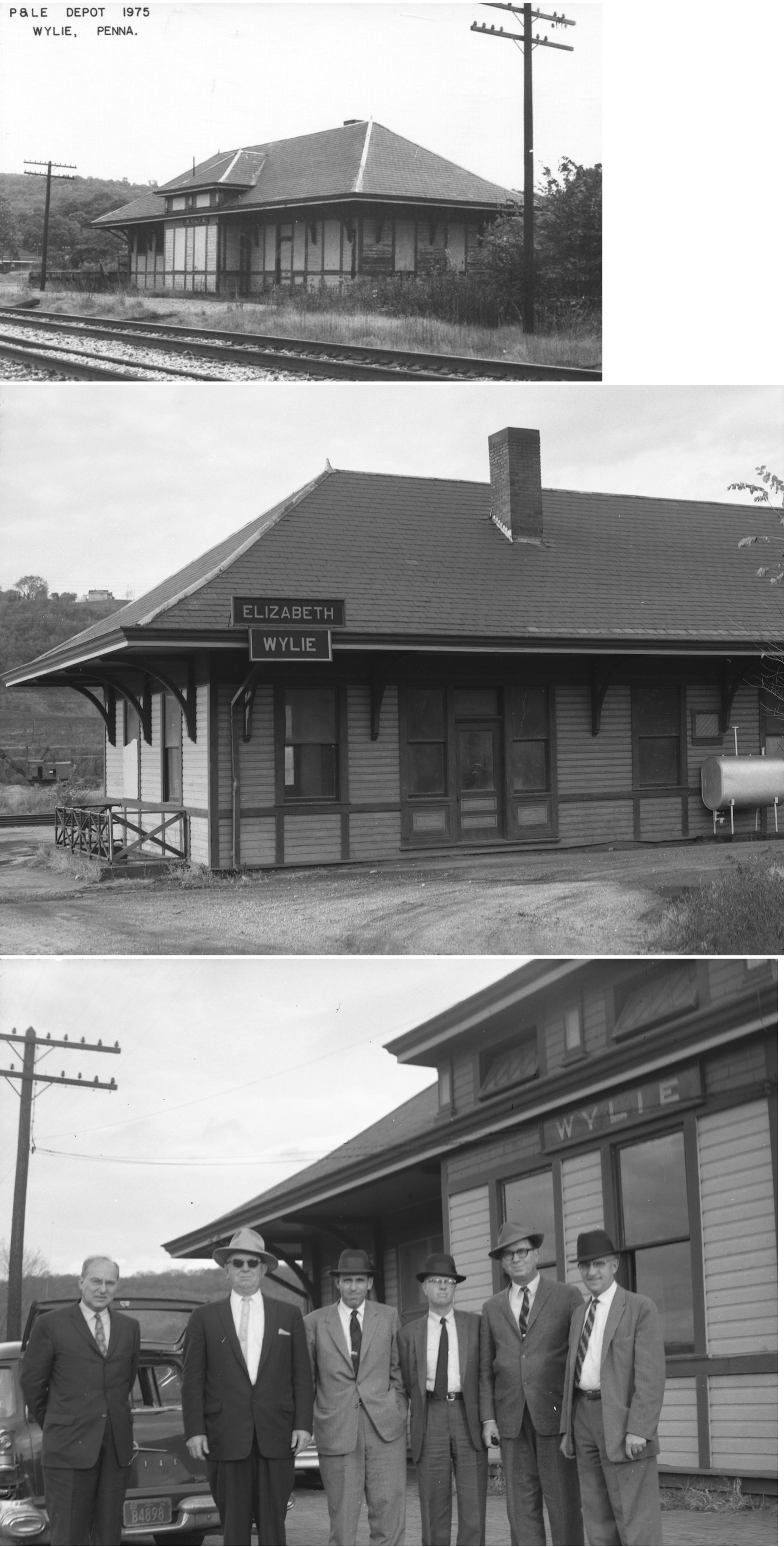
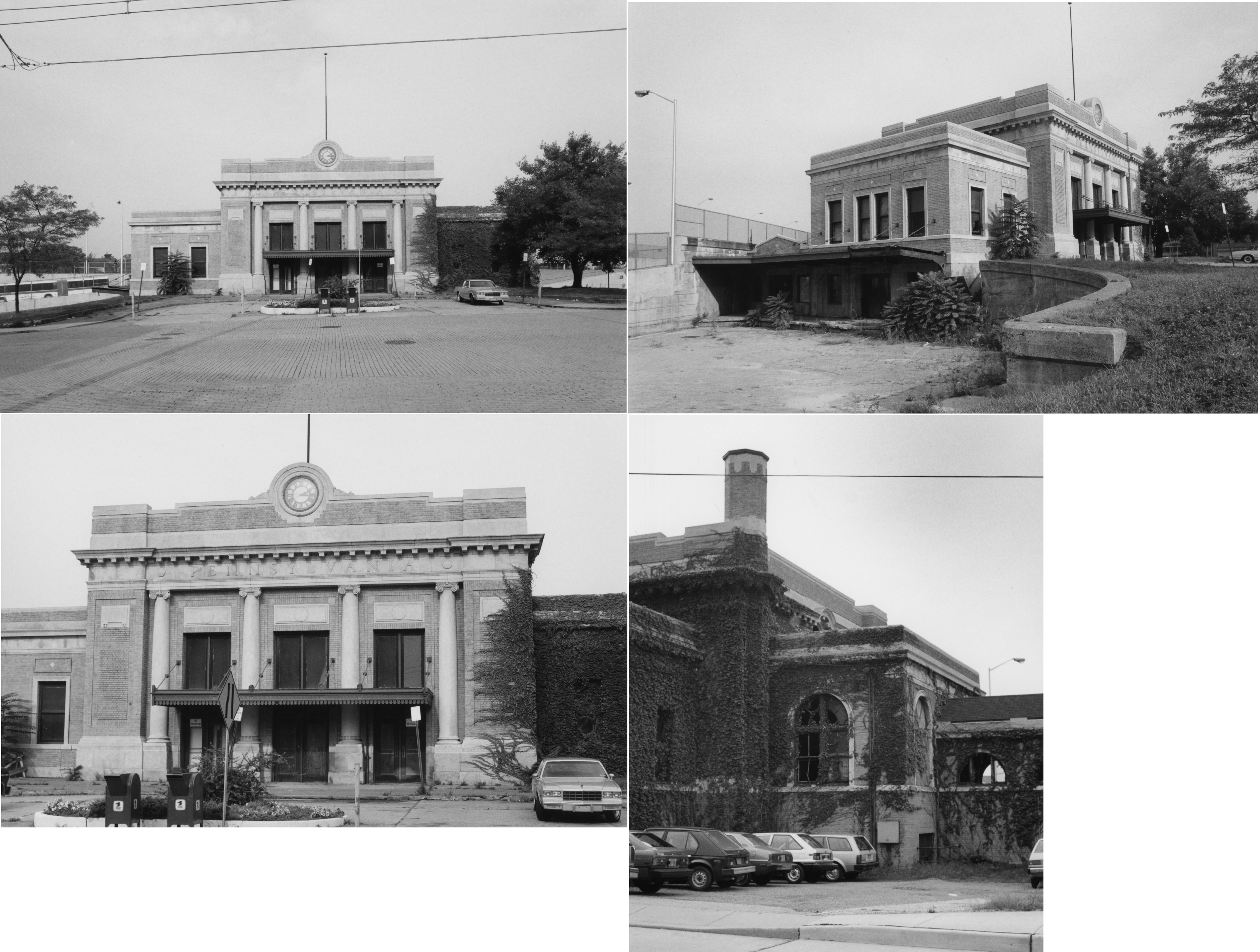