|
|
||||||||
| EXISTING STATIONS | ||||||||
|---|---|---|---|---|---|---|---|---|
| Station Name |
Original Railroad |
Current Location |
Type | Current Use |
Date Built |
Track Status |
Building Material |
More Info |
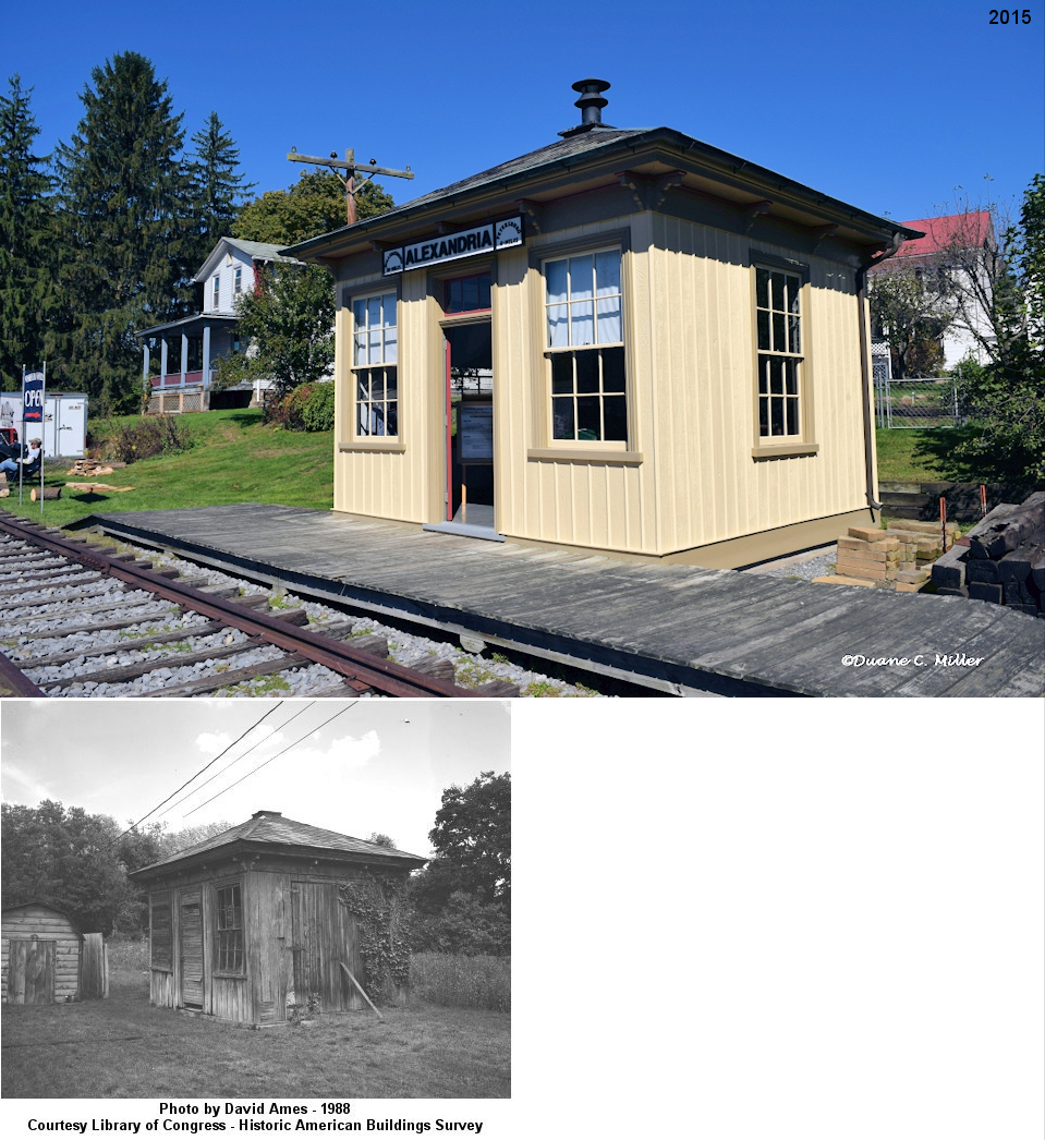
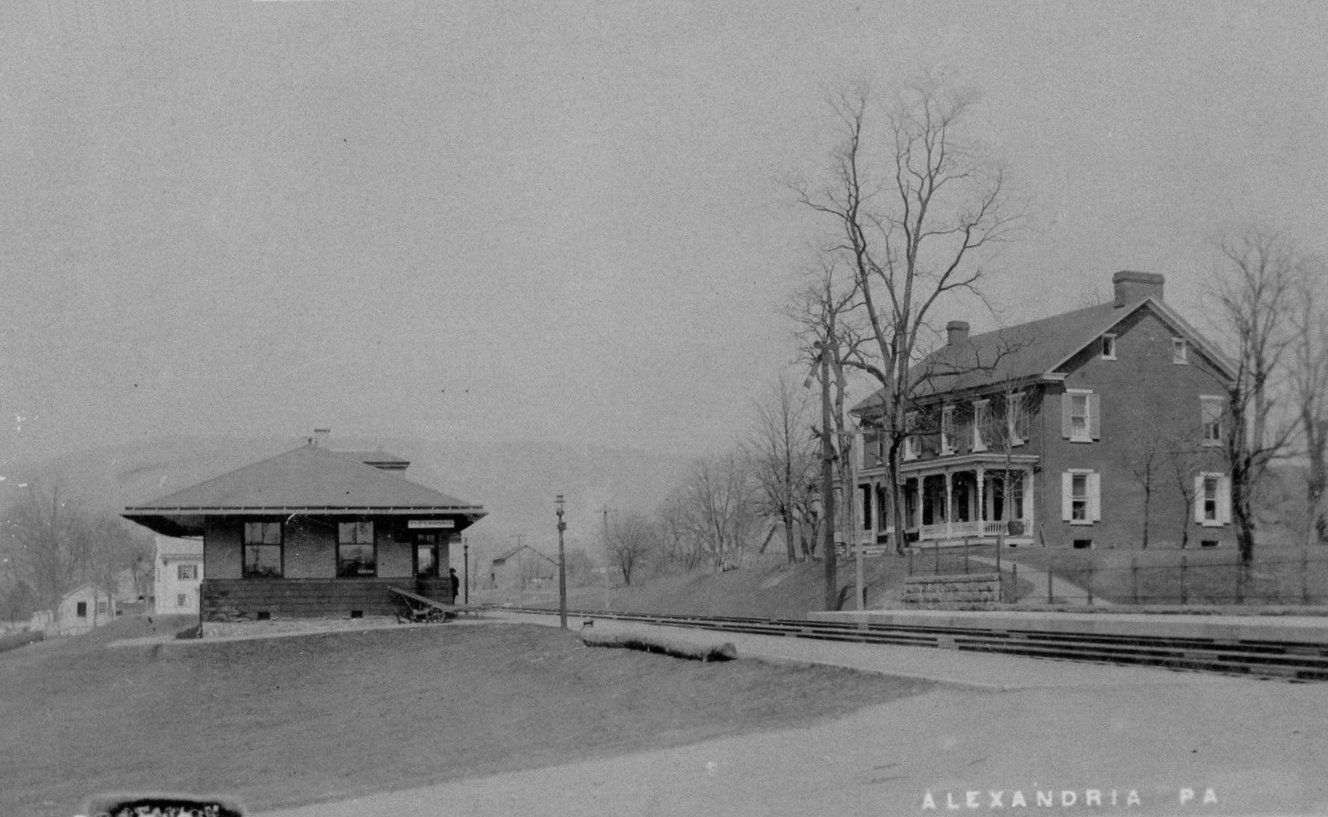
| Alexandria |
 |
Brewhouse Lane and Hartslog Street behind the Hartslog Heritage Museum (GPS: 40.558029, -78.098873) |
P | Museum | 1897 | None | Wood |
|
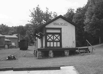
| Broad Top City |  |
Corner of Washington Street and Main Street (PA913) in Dudley (GPS: 40.206495, -78.178135) |
C | Museum | ???? | None | Wood |
|
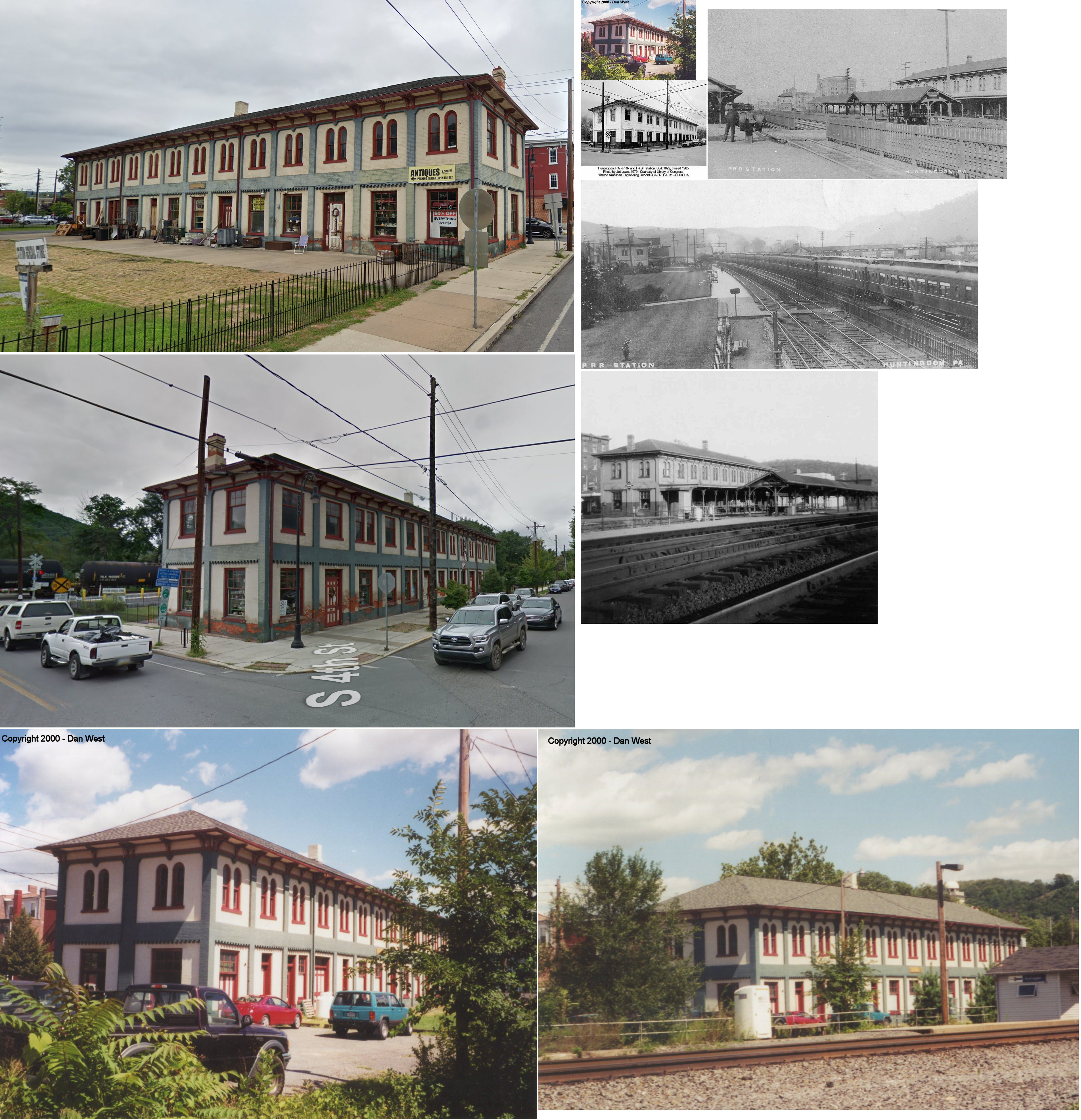
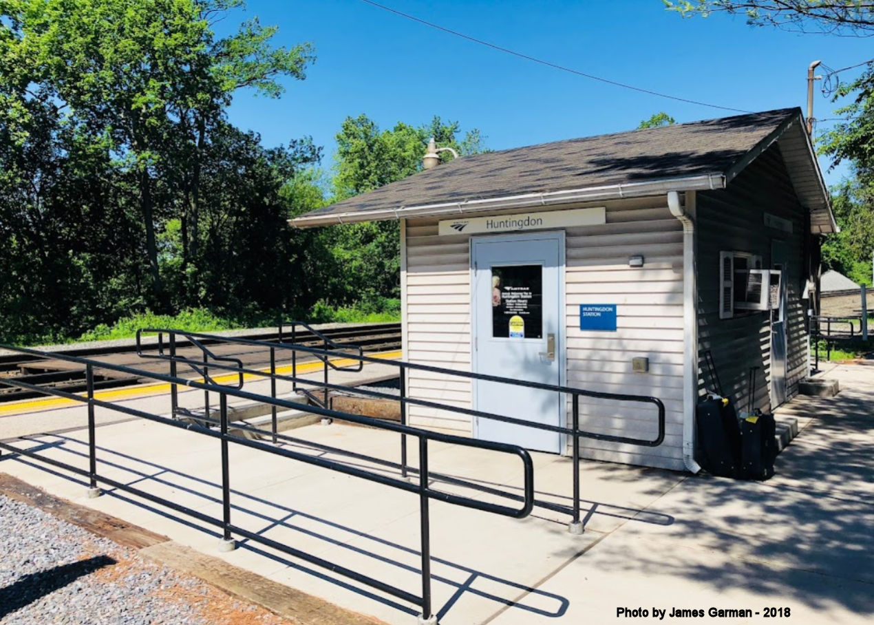
| Huntingdon | AND |
SW corner of 4th Street and Allegheny Street (GPS: 40.483756, -78.011422) |
C | Business | 1872 | In Use | Brick |
|
| Huntingdon |
 |
On the west side of the Allegheny Street and 4th Street intersection (GPS: 40.483639, -78.011778) |
P | Railroad | ???? | In Use | Wood | |
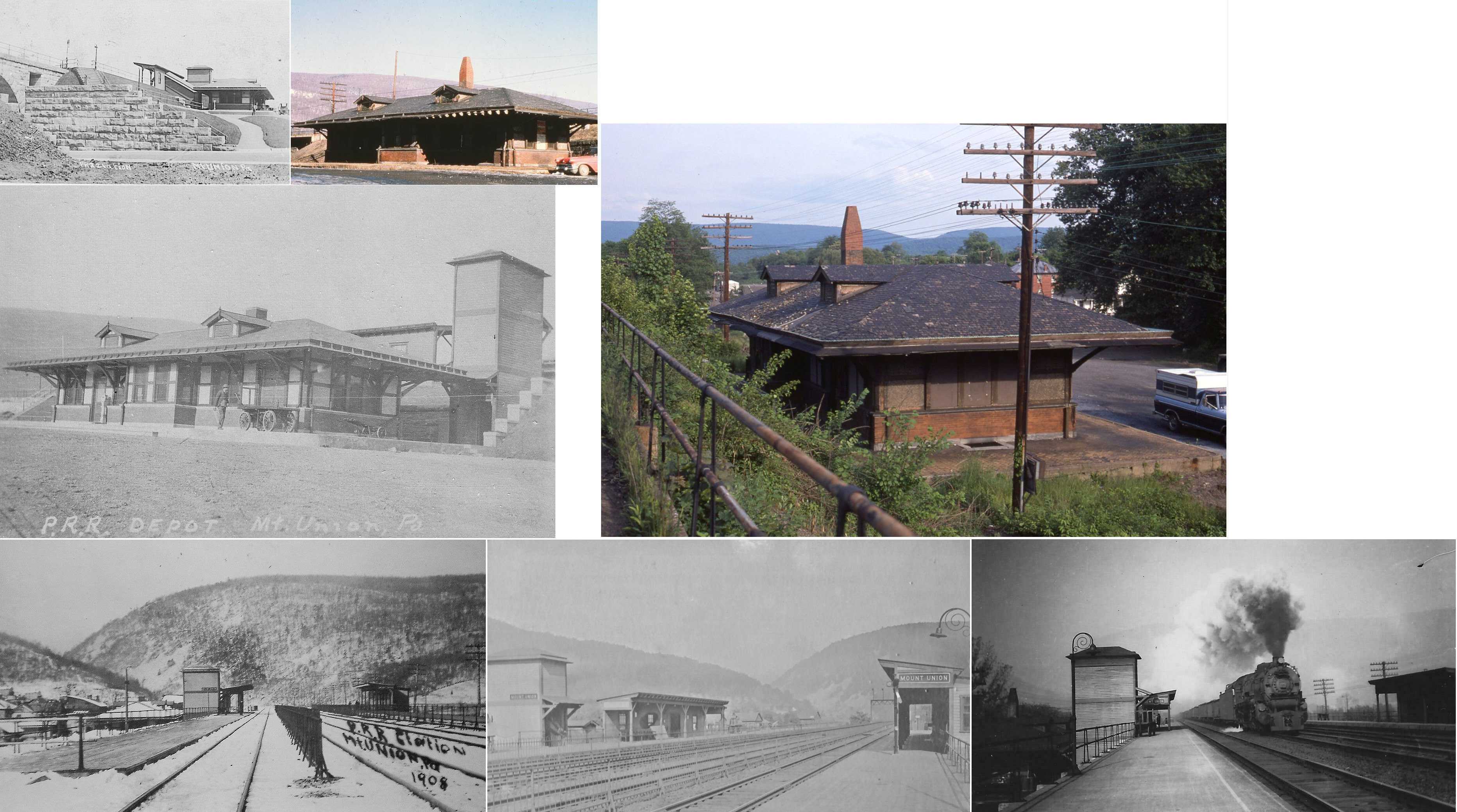
| Mt. Union | |
Washington Street between Small Street and Pennsylvania Street (GPS: 40.386718, -77.885094) |
F | Civic | ???? | In Use | Wood |
|
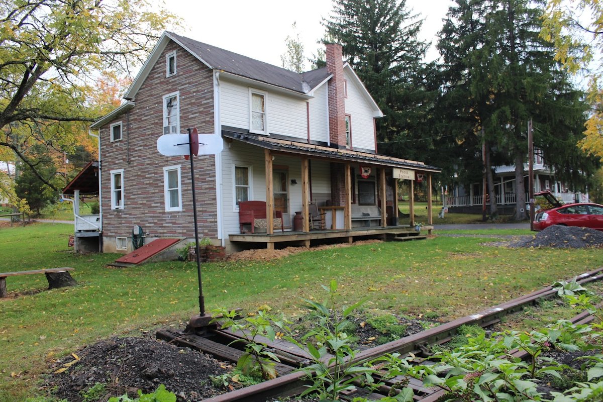
| Pogue |
 |
Spring Creek Road (Hamman Road) northwest of PA994. (GPS: 40.210696, -77.930246) |
P | Residence | ???? | Gone | Wood |
|
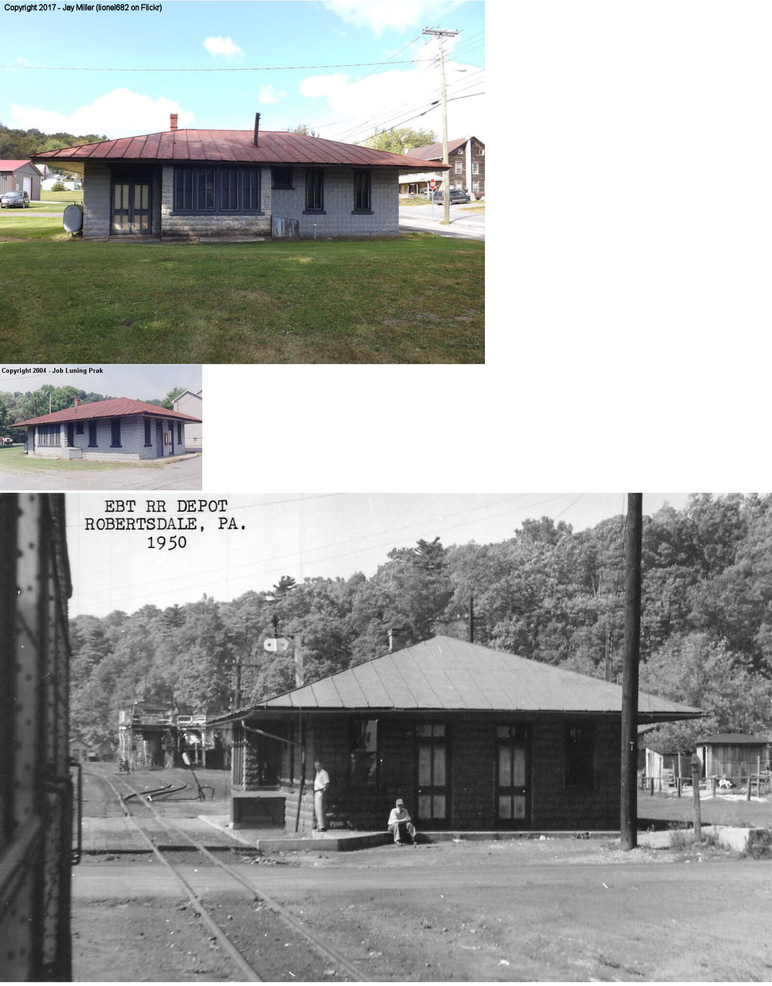
| Robertsdale | |
Main Street (PA913) at Railroad Street (GPS: 40.183156, -78.115301) |
P | Museum | 1917 | Aband. | Block/Frame | |
|
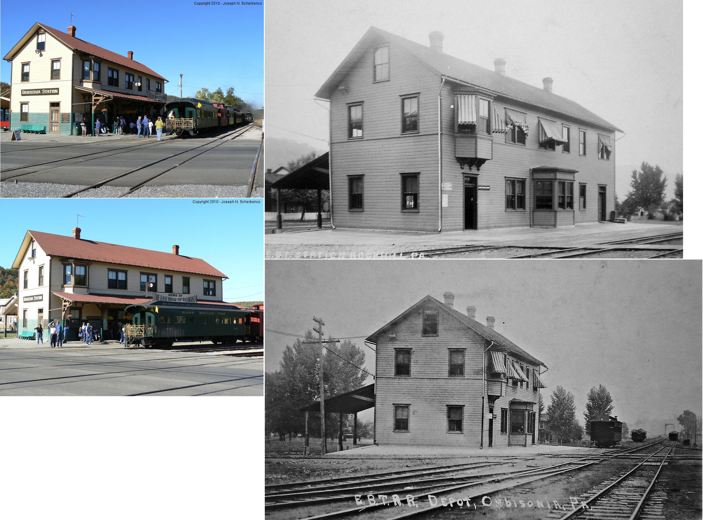
Rockhill FurNACE (Orbisonia) |
|
North side of Meadow Street (PA994) (GPS: 40.241441, -77.898988) |
C | Railroad | 1906 | In Use | Wood |
|
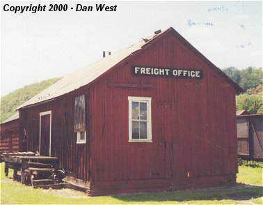
| Rockhill Furnace | |
About 100 yards south of Meadow Street (GPS: 40.240367, -77.898999) |
F | Storage | ???? | In Use | Wood |
|
| Saltillo | |
East side of PA665 (GPS: 40.2092128, -78.0065295) |
P | Railroad | 2025 | In Use | Wood |
|
| STATIONS OF THE PAST | ||||||||
| Station Name |
Original Railroad |
Notes | ||||||
| Adams |
|
|||||||
| Alexandria |
|
Built 1903 to replace the above station. | ||||||
| Alfarata |
|
This station was on the NE side of Main Street (CR4014) at approximately GPS: 40.566735, -78.120879. | ||||||
| Ardenheim |
|
There was a flag stop station here in the early part of the 20th Century. It is listed on the 1900 PRR List of Stations & Sidings. | ||||||
| Aughwick Mills |
|
|||||||
| Barnettstown |
|
|||||||
| Barree Forge |
|
This may have been an older station here. | ||||||
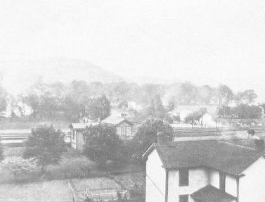
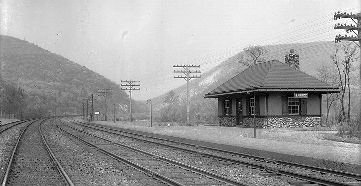
| Barree |
|
This station was on the west side of Barree Road on the north side of the tracks at approximately GPS: 40.584838, -78.102614. | ||||||
| Beaver |
|
|||||||
| Blacklog |
|
This station was near where the tracks crossed U.S. 522 near Blacklog Road in the vicinity of GPS: 40.231795, -77.873144. | ||||||
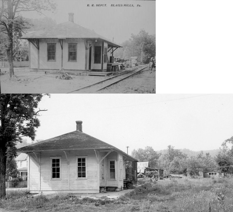
| Blair's Mills |
 |
|||||||
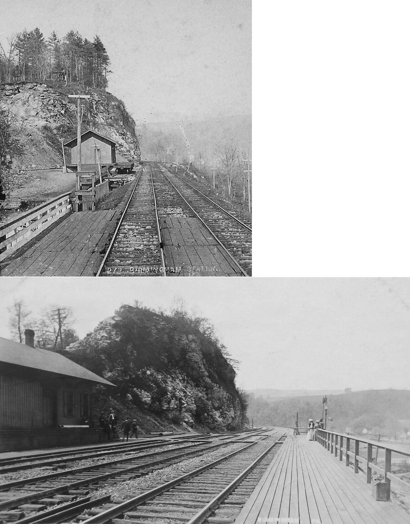
| Birmingham |
|
|||||||
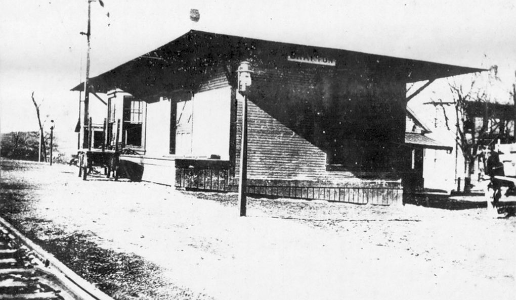
| Bridgeport |
|
This station was between Mapleton and Mill Creek. | ||||||
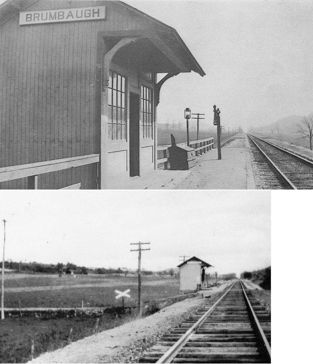
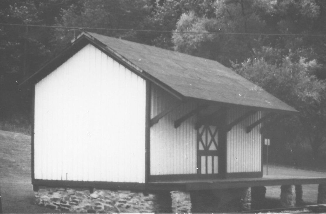
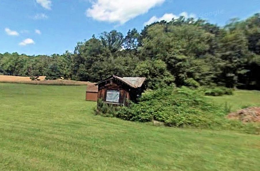
| Brumbaugh |
|
This flag-stop type shelter station was on Garner Road in the vicinity of GPS: 40.386588, -78.146157. | ||||||
| Cedar Rock |
|
|||||||
| Coalmont |
|
|||||||
| Coffee Run |
|
|||||||
| Coles Station |
|
|||||||
| Cooks |
|
According to the 1912 county map, this station was in the vicinity of Twin Creek Lane around GPS: 40.202149, -78.094665. | ||||||
| Creswell |
|
|||||||
| Curfman |
|
Shown on the 1912 county map on the Rocky Ridge Branch. | ||||||
| Dudley |
|
|||||||
| Dungarvin |
 |
The 1915 county map puts this station on Dungarvin Road in the vicinity of GPS: 40.711696, -78.096115. According to PRR valuation records a new station was built here in 1908. | ||||||
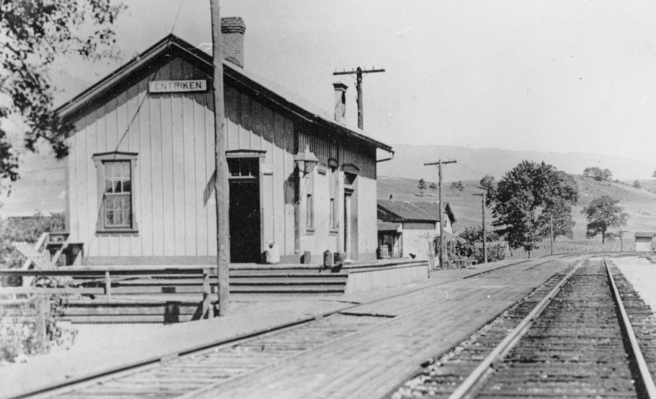
| Entriken |
|
|||||||
| Evanston |
|
Shown on the 1912 county map on the Rocky Ridge Branch. | ||||||
| Eyer |
|
This station was on Eyer Station Road (T-544) in the vicinity of GPS: 40.688024, -78.171907. According to PRR valuation records a new passenger shelter was built here in 1893. | ||||||
| Fouse |
|
|||||||
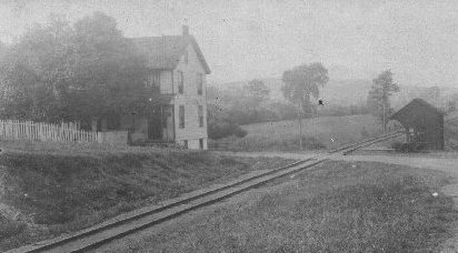
| Furnace Road |
|
This station was on Dry Hollow Road in the vicinity of GPS: 40.723967, -78.061512. There is a building in a field that just a short distance SW of that location at GPS: 40.722556, -78.063602. This building looks like it could have been a station. See this photo. Can someone in the area confirm or deny this? According to PRR valuation records a new passenger shelter was built here in 1893. | ||||||
| Glazier |
|
Shown on the 1912 county map on the Rocky Ridge Branch. | ||||||
|
Goshorn (McNeal) |
|
This station was at the end of the Shade Gap Branch. | ||||||
|
Grafton (Hesston) |
|
This station was on Grafton Road in the vicinity of GPS: 40.420001, -78.109037. | ||||||
| Hostler |
|
This is shown as a flag-stop station between Marengo and Pennsylvania Furnace on the 1900 PRR List of Stations & Sidings. | ||||||
|
Hummell (Beaver) |
|
|||||||
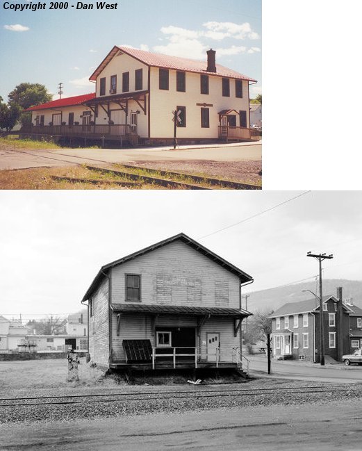
| Huntingdon |
|
This old station, shown on the left side of the photo, was demolished in April 2001. It was located across the tracks from the large Huntingdon station at 4th and Allegheny at GPS: 40.483390, -78.011669. Several groups tried to obtain the station but it was demolished by the RR. The H&BTM had a track that ran on that side of the PRR mainline. In the early years there was just a shared platform here and a subway leading to it from the PRR platforms and station. On the 1901 Sanborn map a building is shown at this location and on the 1906 map it is labeled "H&BT Station." | ||||||
| Huntingdon |
|
There was a brick freight station on the north side of Allegheny Street between 2nd and 3rd Streets (GPS: 40.482911,-78.007978). This station is shown on the 1873 town map and Sanborn maps thereafter. After the new freight houses were built (see listing below), this building was used as a carpenter's shop and storage for the PRR. | ||||||
| Huntingdon |
AND |
Sometime between 1901 and 1906, new wooden freight houses were built for the two railroads. The freight houses were next to each other on the east side of 7th Street at Penn Street. The PRR's station was at GPS: 40.485976, -78.015178, and the H&BT's station was a few feet to the north at GPS: 40.486108, -78.015080 (they shared a common track in between the buildings). The H&BT station was a bit shorter than that of the PRR, but other than that the buildings appear to have the some profile on the map. | ||||||
| Hutchinson |
|
|||||||
| Kimmel |
|
|||||||
| Locke valley |
|
|||||||
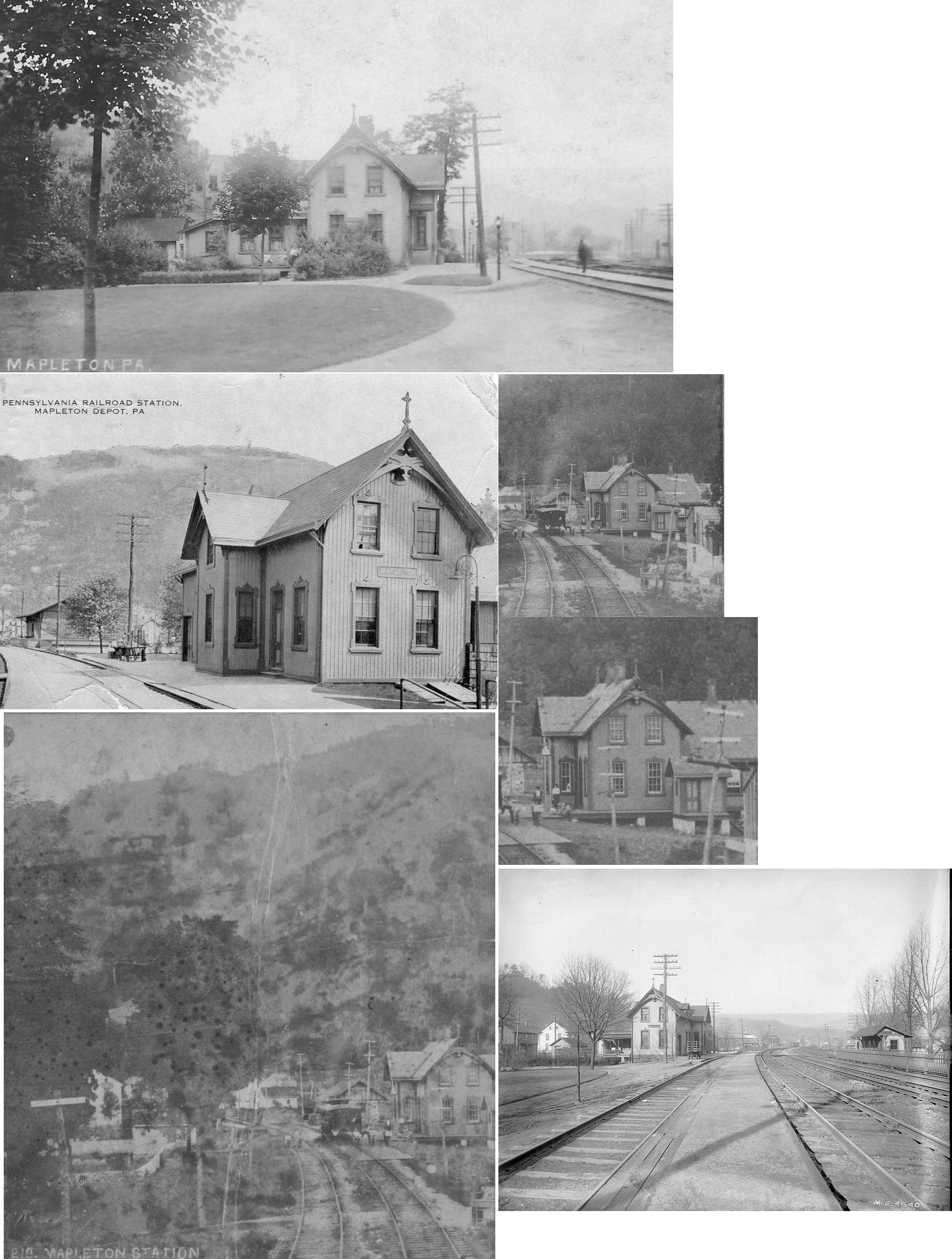
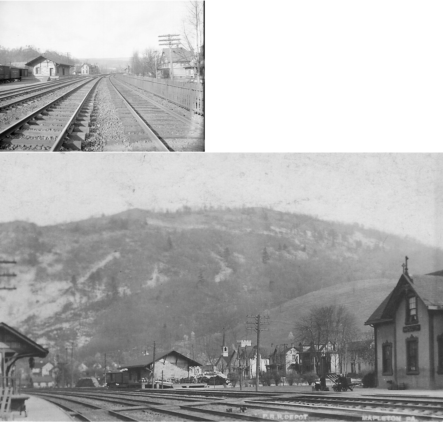
| Mapleton |
|
This station was built in 1867. In 1873 the station was on the north side of Main Street between Hill (Sherman) Street and Sugar Street (GPS: 40.392797,-77.940018). The freight station was just to the SE between Church and Hill (Sherman) Streets. | ||||||
| Mapleton |
|
The freight station was just to the SE of the passenger station between Church and Hill (Sherman) Streets. | ||||||
|
Marklesburg (AITCH/Grantsville) |
|
This station was actually in Aitch (formerly known as Grantsville) which is now gone due to the flooding of the valley for Raystown Lake. The station also served as the post office. The town was renamed Aitch to avoid confusion with the railroad station in Grantsville, MD. The name of Aitch was formed from the last names of prominent families in the town. The station was in the vicinity of where the Aitch Recreation Area is today near what is now the end of Aitch Road. | ||||||
| Martins |
|
This station was on the east side of Cooks Road south of Old Plank Road (PA994) in the vicinity of GPS: 40.211216, -78.088050. | ||||||
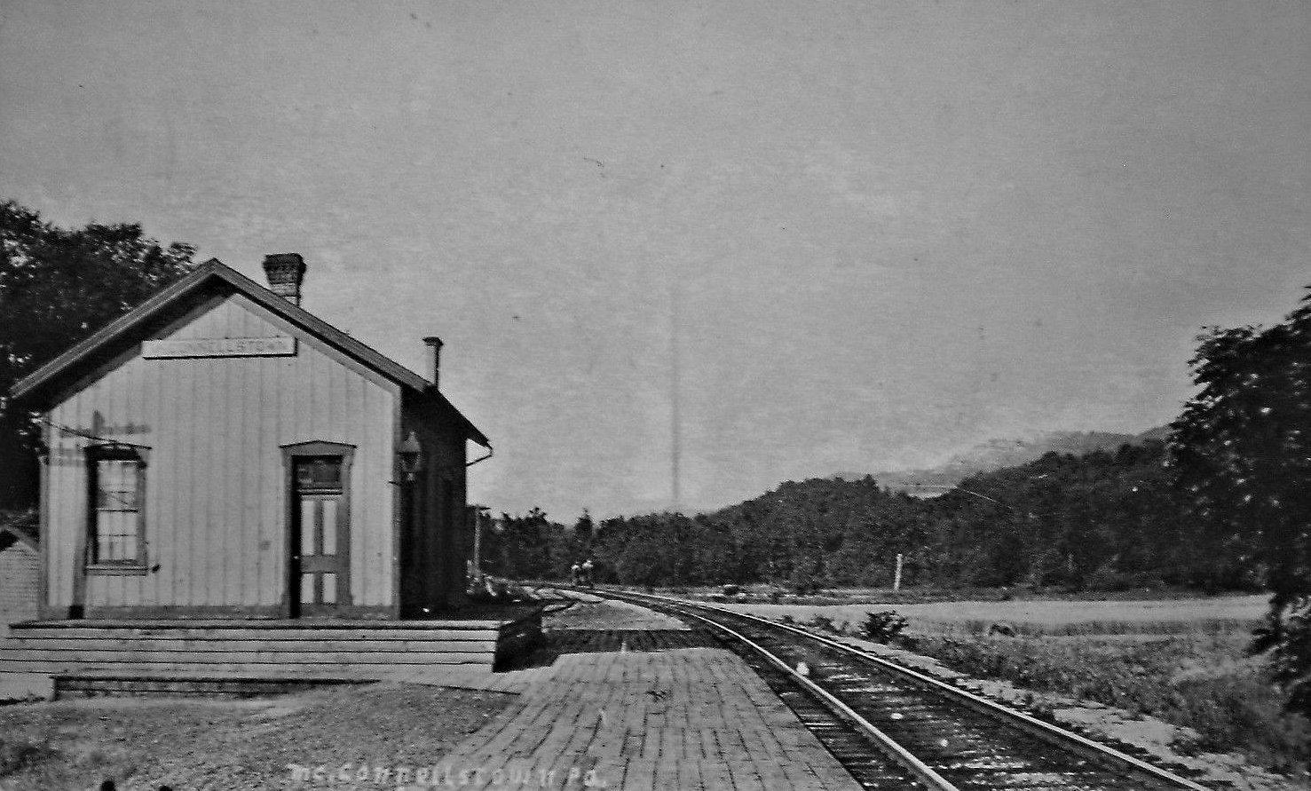
| McConnellstown |
|
|||||||
| McNerland |
|
Shown on the 1912 county map on the Rocky Ridge Branch. | ||||||
| Mill Creek |
|
This station either predated the shelter-type one shown below or was the across the tracks from the shelter and simply not shown in the photo linked below. The photo here is purported to be from the 1870s. | ||||||
| Mill Creek |
|
|||||||
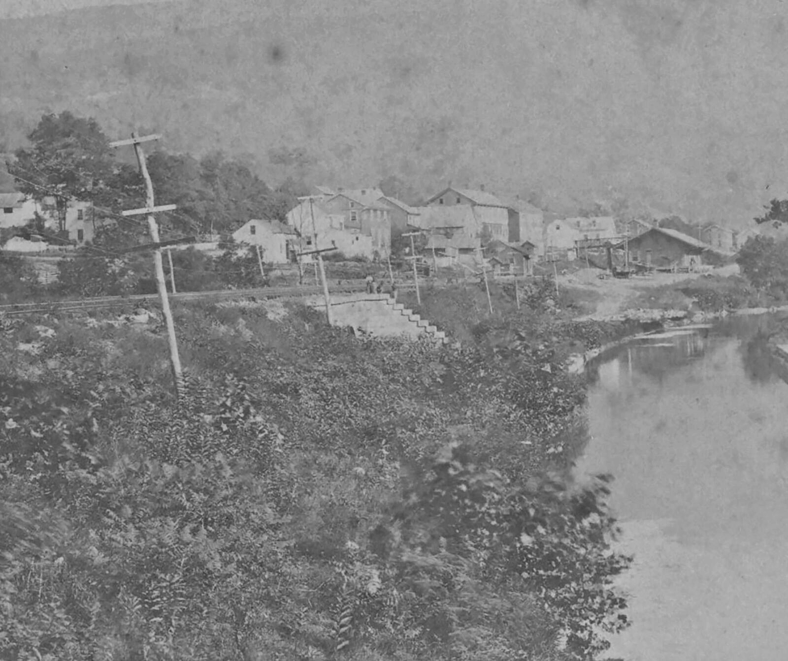
| Mt. Union |
|
This original passenger station was on the corner of North Jefferson and Pennsylvania Streets (GPS: 40.386344,-77.883743). J.C. Sechler was the station agent here in 1873. | ||||||
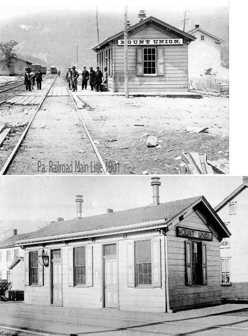
| Mt. Union |
|
This second-generation PRR station, built in 1899, was sold to the EBT when the PRR realigned its right-of-way around 1917. It was on Pennsylvania Avenue (right in the middle of the street) on the SE side of North Jefferson at GPS: 40.386219, -77.883360. | ||||||
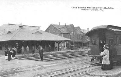
| Mt. Union |
|
This station was built in 1917 when he PRR was realigned and elevated. It was between Jefferson Street and Division Street on the south side of the tracks at GPS: 40.387051, -77.882057. | ||||||
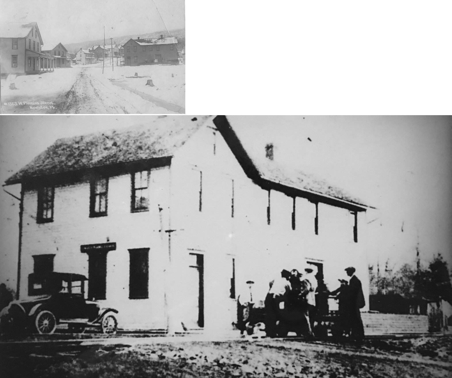
| Neelyton |
|
This station was on the Shade Gap Branch. | ||||||
| Neff |
|
|||||||
| Pennington |
|
According to PRR valuation records a new passenger shelter was built here in 1914. Some records show Pennington and Eyer as the same station, but they were not. Both are listed as distinct stations in the 1919 PRR valuation records. The two stations were one mile apart with Pennington at MP 20.6 and Eyer at MP 21.6. | ||||||
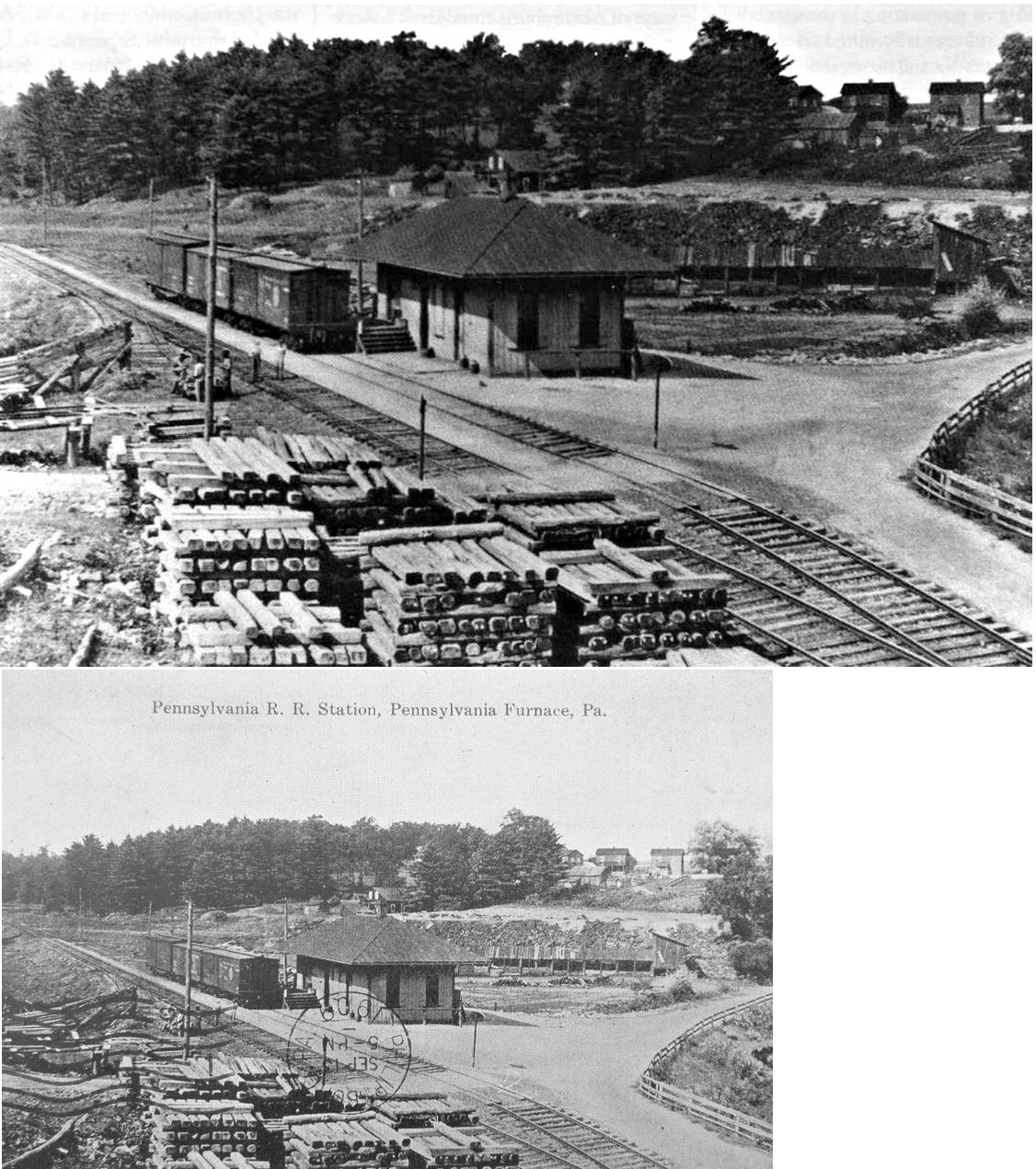
| Pennsylvania Furnace |
|
According to valuation records, the PRR built a new combination station here in 1881-82. | ||||||
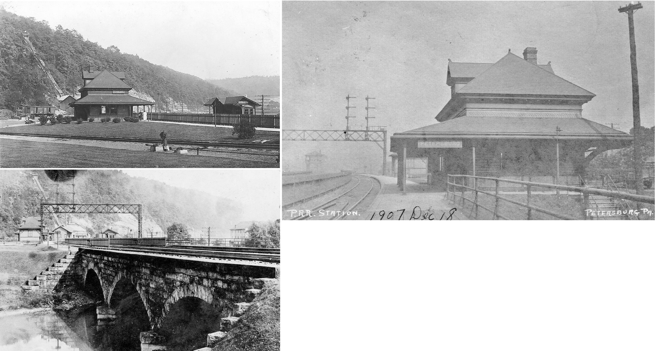
| Petersburg |
|
This station was at the southern end of King Street (GPS: 40.567179,-78.047369). | ||||||
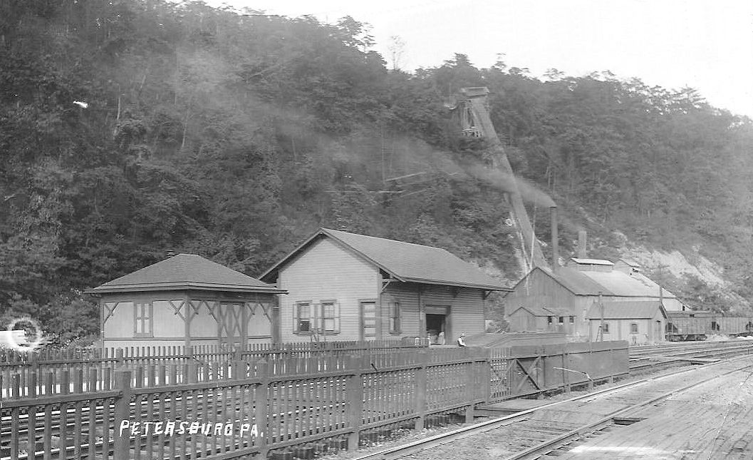
| Petersburg |
|
This freight station was just down the tracks from the passenger station. | ||||||
| Rocky Ridge |
|
Sat abandoned in the woods for years and finally collapsed in 1997. It was a two-story frame station that was likely built in 1892. It was located at approximately GPS: 40.223168, -78.060367 near the west portal of the Wrays Hill Tunnel. | ||||||
| Russell |
|
|||||||
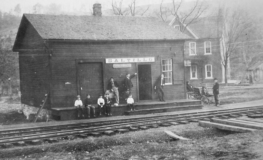
| Saltillo |
|
This was the first station here. | ||||||
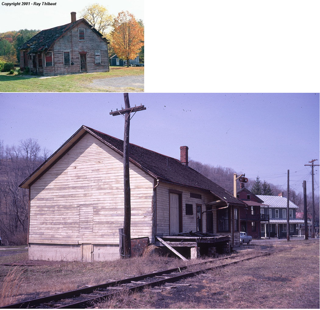
| Saltillo |
|
Built in 1892, the station was located at PA 655 just south of PA2022. It sat abandoned for many years and received some stabilization work in 1999. The station was razed on 12-31-2004. The borough approached the railroad and asked them to demolish the building. The Friends of the EBT documented the building in detail, and both the FEBT & EBT saved examples of siding, sashes, doors and windows in case the station can be rebuilt in the future. | ||||||
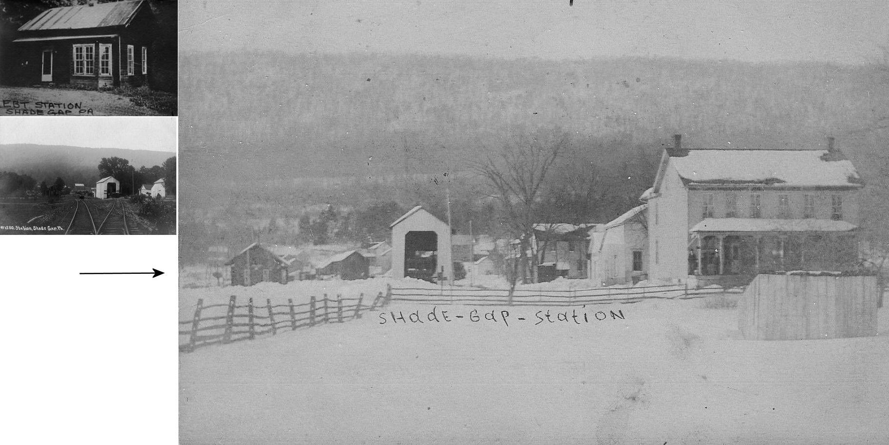
| Shade Gap |
|
Built in 1885, the station met its demise when it was burned in a fire department training exercise. The original station location was due north of the intersection of Taylor Road and Shade Valley Road in what is now just an empty field. The upper picture is the station as it looked after being sold & moved to a new site. The bottom picture is looking NW at the original site. The station sits on the left side of the tracks behind a tree, the water tank would be just beyond it. The covered structure to the right of the main is a spur serving a small coal trestle for local deliveries. The track behind the photographer would continue SE to Neelyton. | ||||||
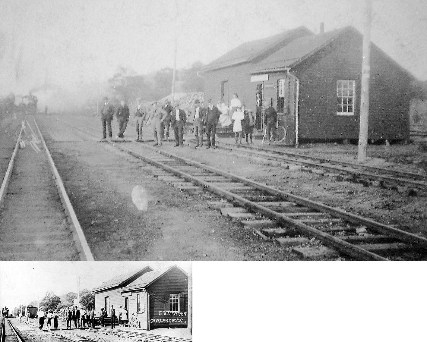
| Shirleysburg |
|
In 1873 this station was on the north side of Bullet Lane (now 2nd Street) on the east side of the tracks (GPS: 40.300046,-77.877013). | ||||||
| Shoenberger |
|
|||||||
| Sleeman |
|
Shown on the 1912 county map on the Rocky Ridge Branch. | ||||||
| Spruce Creek |
|
A. McBean was the station agent here in 1873. There was also a freight station here. A new station was built here in 1886. | ||||||
| Starr |
|
This station was on the Shade Gap Branch. | ||||||
| Stover |
|
This station was on PA550 (Pennington Road) in the vicinity of GPS: 40.673173, -78.209633. According to PRR valuation records a new passenger shelter was built here in 1914. | ||||||
| Stump Hill |
|
|||||||
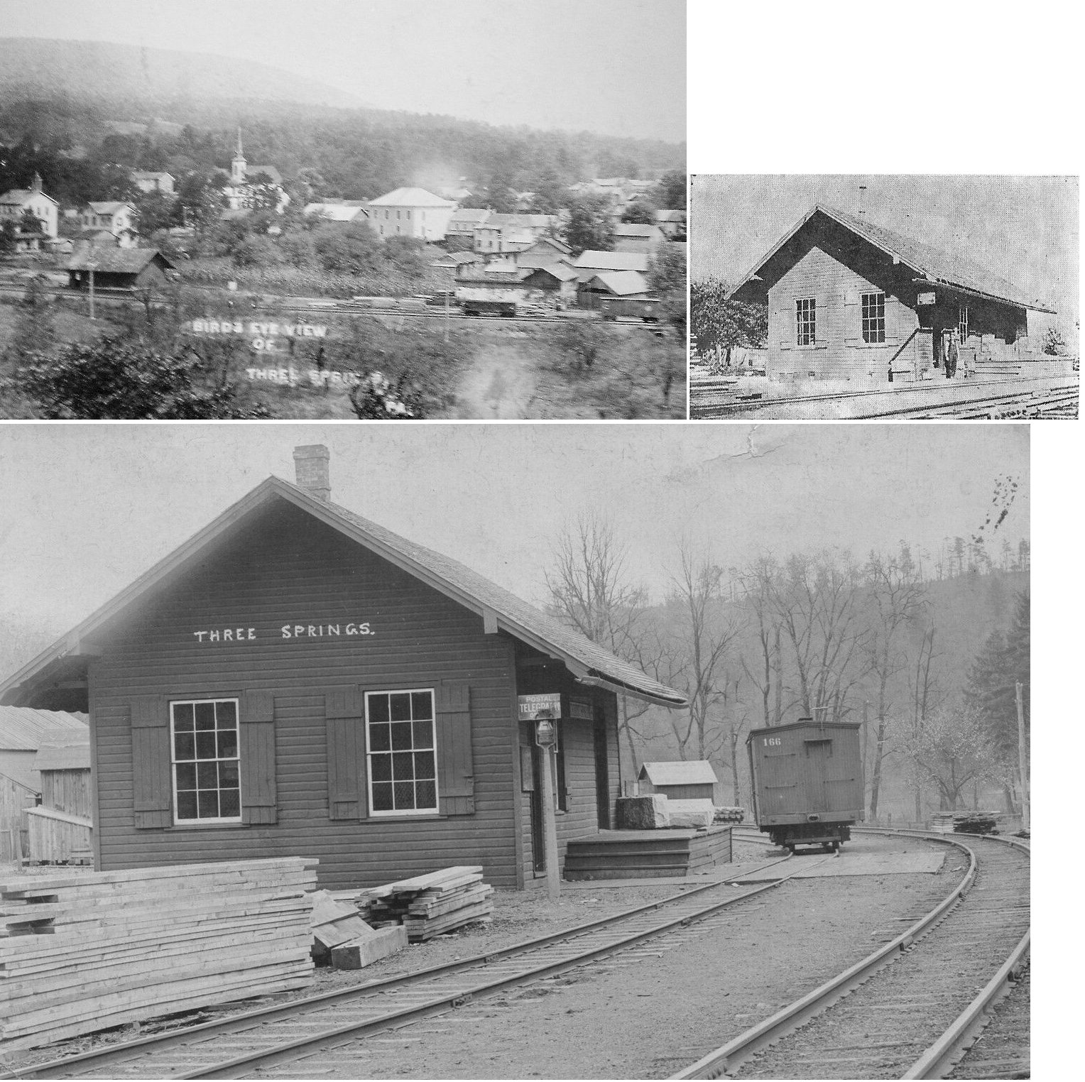
| Three Springs |
|
|||||||
| Tyrone Forge |
|
|||||||
|
Union Furnace (Morrell) |
|
|||||||
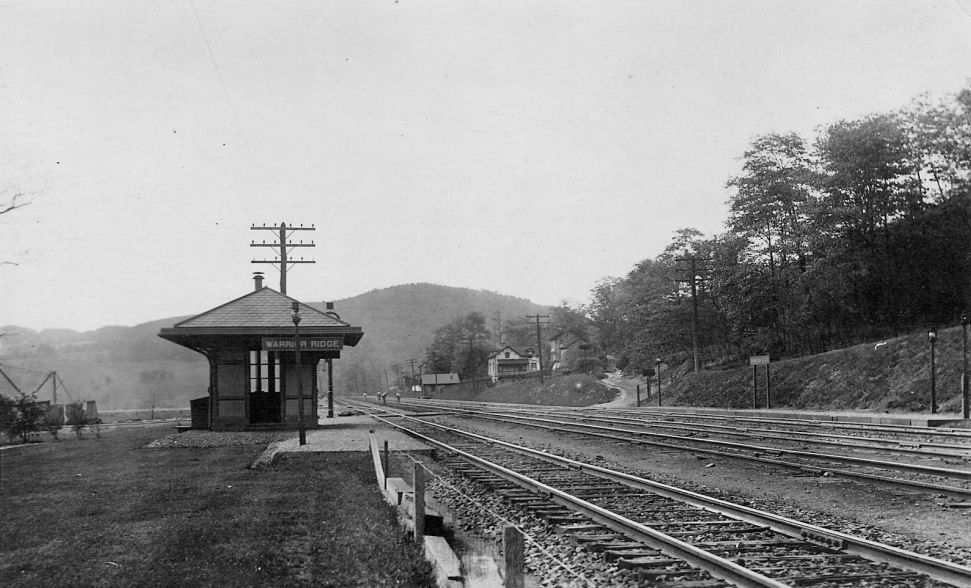
| Warrior Ridge |
|
|||||||
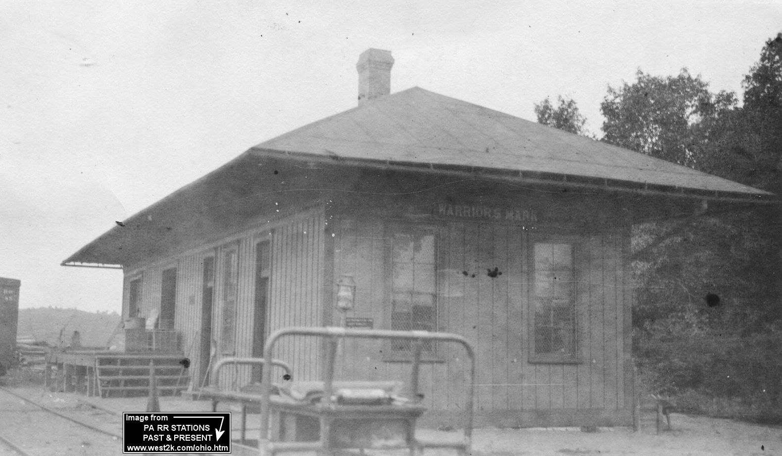
| Warriors Mark |
|
This station was near the intersection of Warriors Mark Path (PA350) and Station Road in the vicinity of GPS: 40.700180, -78.126710. The PRR built a new station here in 1881. PRR valuation records say a new station was built in 1888. | ||||||
| Water Street |
|
|||||||
| Wrays hill |
|
According to the 1912 county map, this station was between Martins and Rocky Ridge. | ||||||
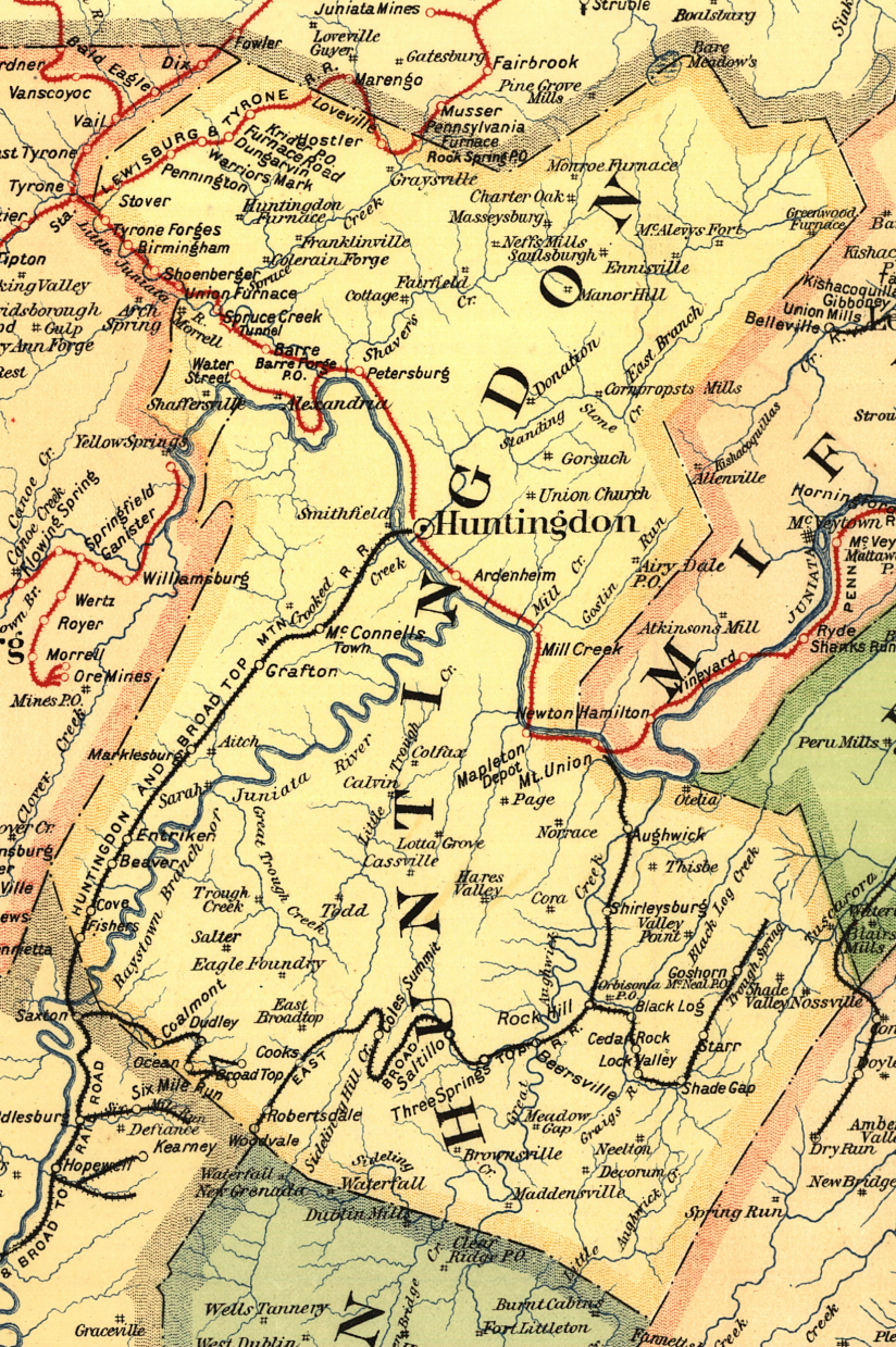
| 1895 HUNTINGDON COUNTY RAILROAD MAP | ||||||||
 |
||||||||
| Notes About Existing
Stations... Alexandria (PRR) - Built in 1897 when the PRR first extended the tracks to Alexandria from the mainline in Petersburg, this station served Alexandria until 1903. This station was still standing in the late 1980s. It was previously located on the North side of Shelton Ave. Broad Top City (H&BTM) - Moved from Broad Top City to nearby Dudley. Huntingdon (PRR/H&BTM) - The tracks were originally on the north side of the station. They were rerouted to the south side of the station in 1892 to eliminate some grade crossings (the tracks essentially ran down the middle of Allegheny Avenue before 1892). Mount Union (PRR Freight) - This building has been through a number of different configurations. The two-story part of this building was added to the freight house that was built here sometime before 1894. In the early 1900 the freight station was extended and then sometime between 1911-1919 this two story section was added on. Then, sometime after it went out of service, the original part of the freight house was torn down leaving only the two story addition. The one-story extension is a replica of the original freight house and was added on when the station was restored. Pogue (EBT) - This was a farmhouse and general store that also served as a flag stop for the railroad. Rockhill Furnace (EBT) - Located in Rockhill Furnace but called Orbisonia Station to avoid confusion with other stations named "Rockhill" in Pennsylvania. Rockhill Furnace (EBT) - May have been the original passenger station prior to 1906. Saltillo (EBT, Replica) - This replica station is based on the original 1894 structure that was razed 12/31/2004, on the same site. It was built in 2025 through a partnership of the EBT Foundation and the Friends of the East Broad Top with funding from FEBT. The resurrection of this station was initiated as the destination point for the railroad's current southbound track restoration. The exterior of the structure closely matches the original, thanks to the extensive documentation of that building prior to its demolition, whereas the interior will see changes to accommodate ADA requirements and space uses. |
||||||||