 COUNTY COUNTY
|
|
||||||||
| EXISTING STATIONS | ||||||||
|---|---|---|---|---|---|---|---|---|
| Station Name |
Original Railroad |
Current Location |
Type | Current Use |
Date Built |
Track Status |
Building Material |
More Info |
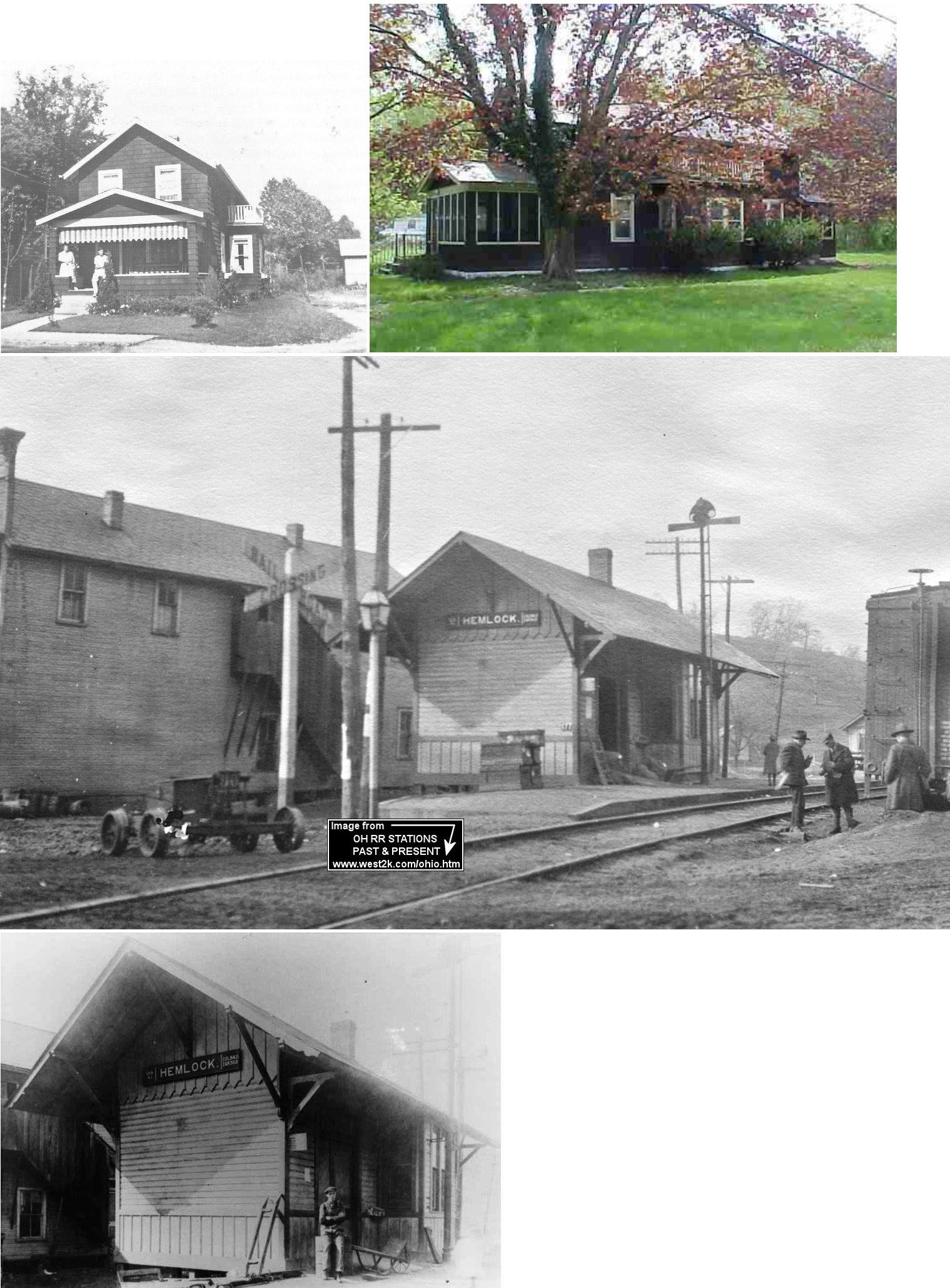
| Hemlock |  |
8755 Main Street SE at SR-155 (GPS: 39.589709, -82.155437) |
C | Residence | 1912 | Gone | Wood |
|
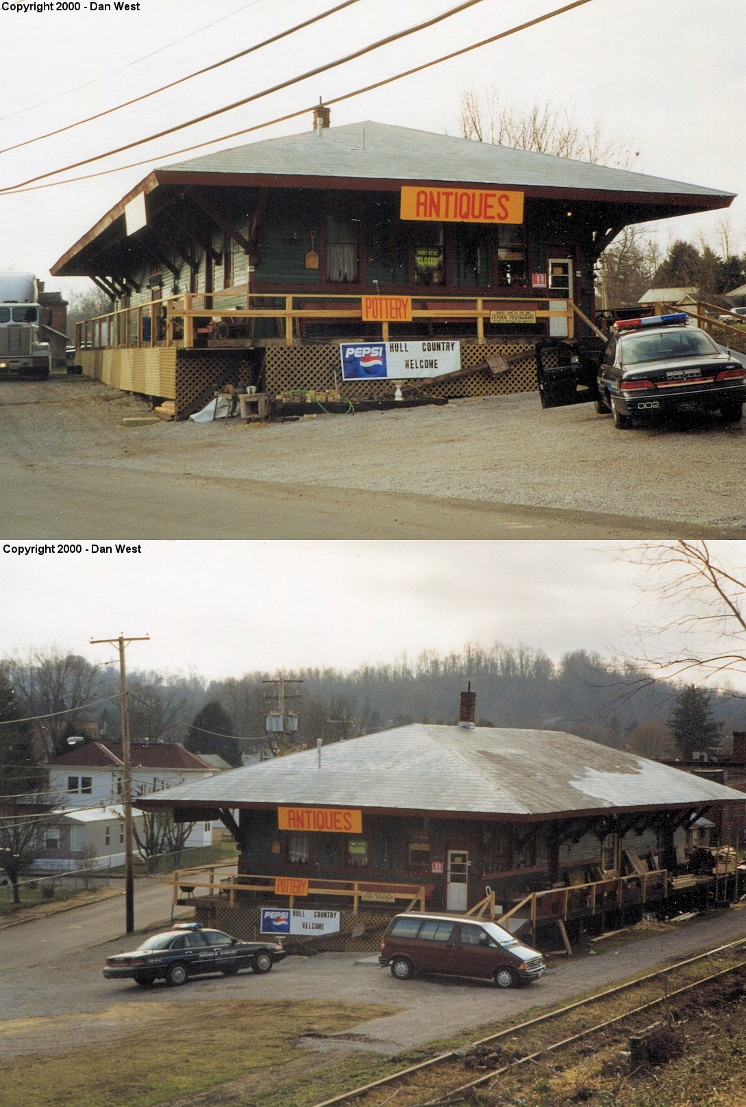
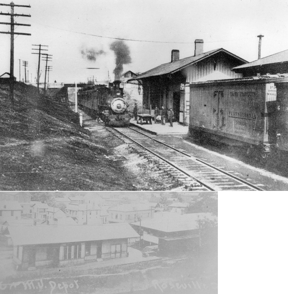
| Roseville |  |
139 Perry Street (GPS: 39.807127, -82.073860) |
F | Business | ???? | In Use | Wood | |
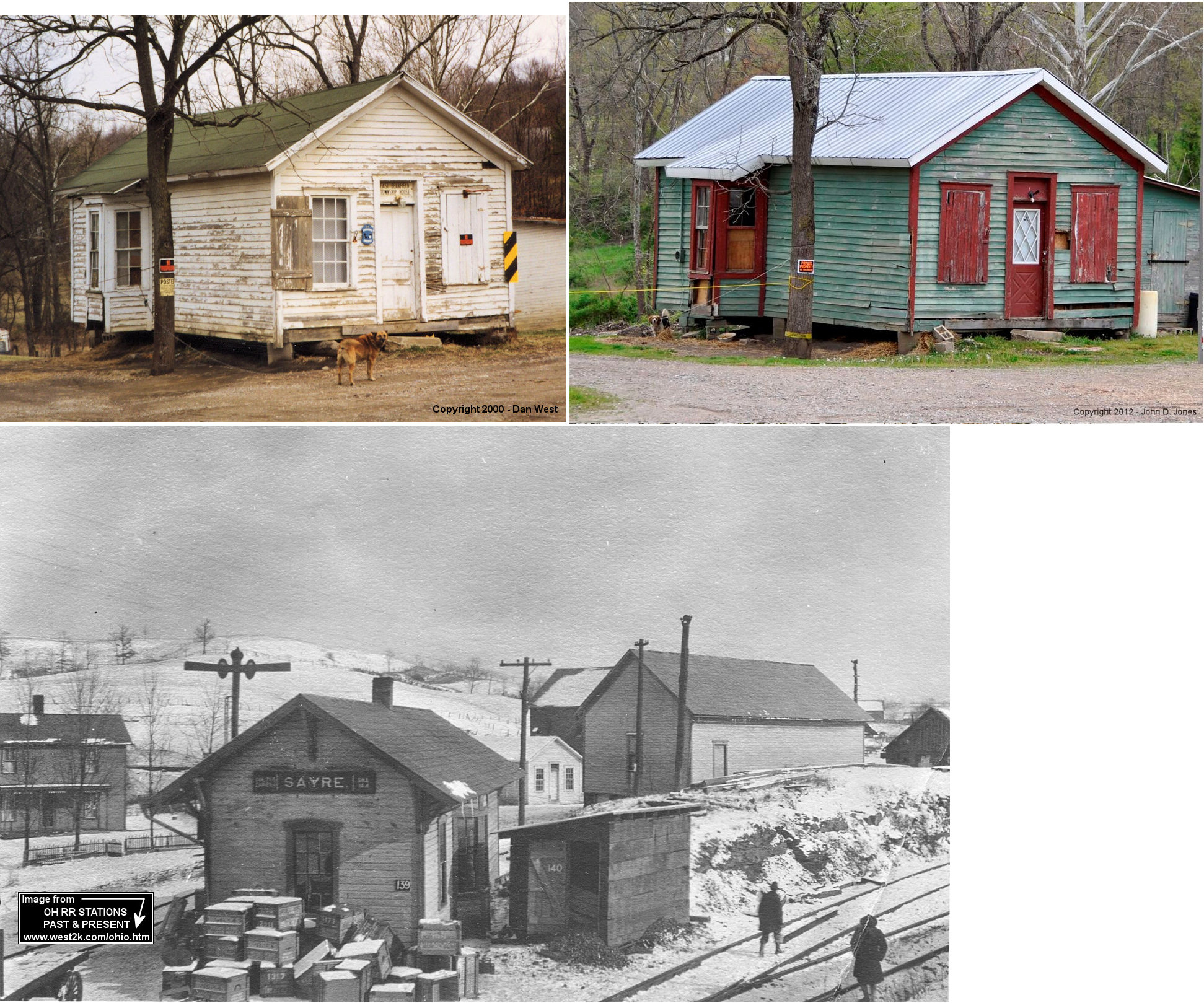
| Sayre | |
14569 SR-37 (GPS: 39.684814, -82.058468) |
P | Vacant | 1886 | Gone | Wood | |
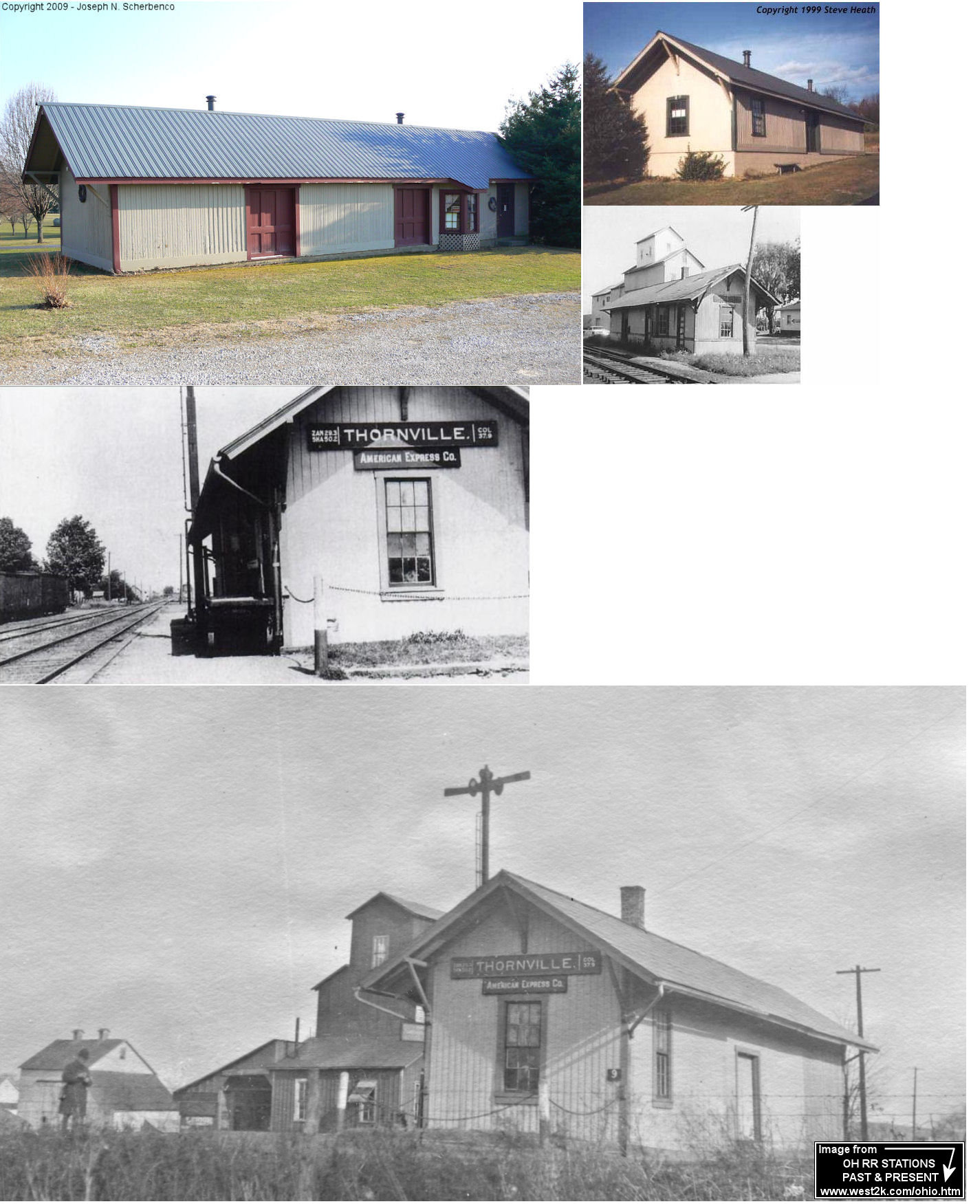
| Thornport (Thornville) |
|
7345 Newark Road (SR-13), Mount Vernon in Knox Co. (GPS: 40.342252, -82.467786) |
P | Business | 1883 | None | Wood |
|
| STATIONS OF THE PAST | ||||||||
| Station Name |
Original Railroad |
Notes | ||||||
| Buckingham | |
According to NYC valuation records, a passenger shelter was built here in 1912. | ||||||
| Carrington | |
According to NYC valuation records, a passenger station made of an old car body was built here in 1912. | ||||||
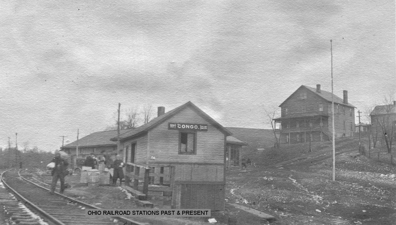
| Congo | |
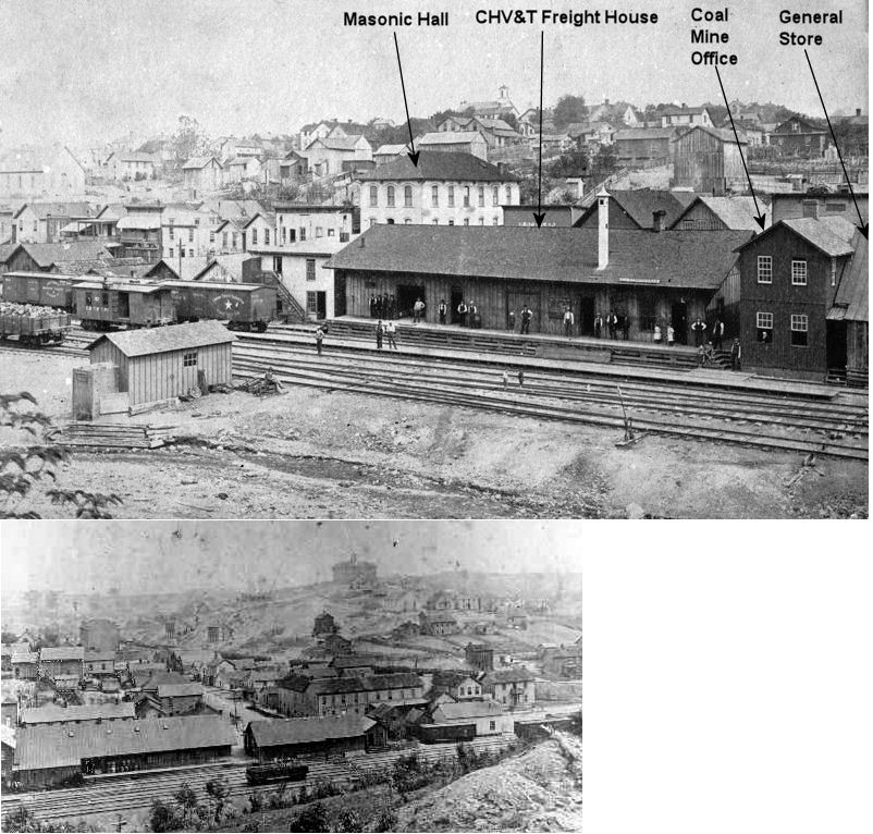
This station was built in 1886. The town was founded by the Congo Mining Company. In the photo the street going up the hill on the right is "White Hill" or Main Street. The Congo Sunday Creek Company Store is behind the depot and the hotel is the large building on top of the hill. | ||||||
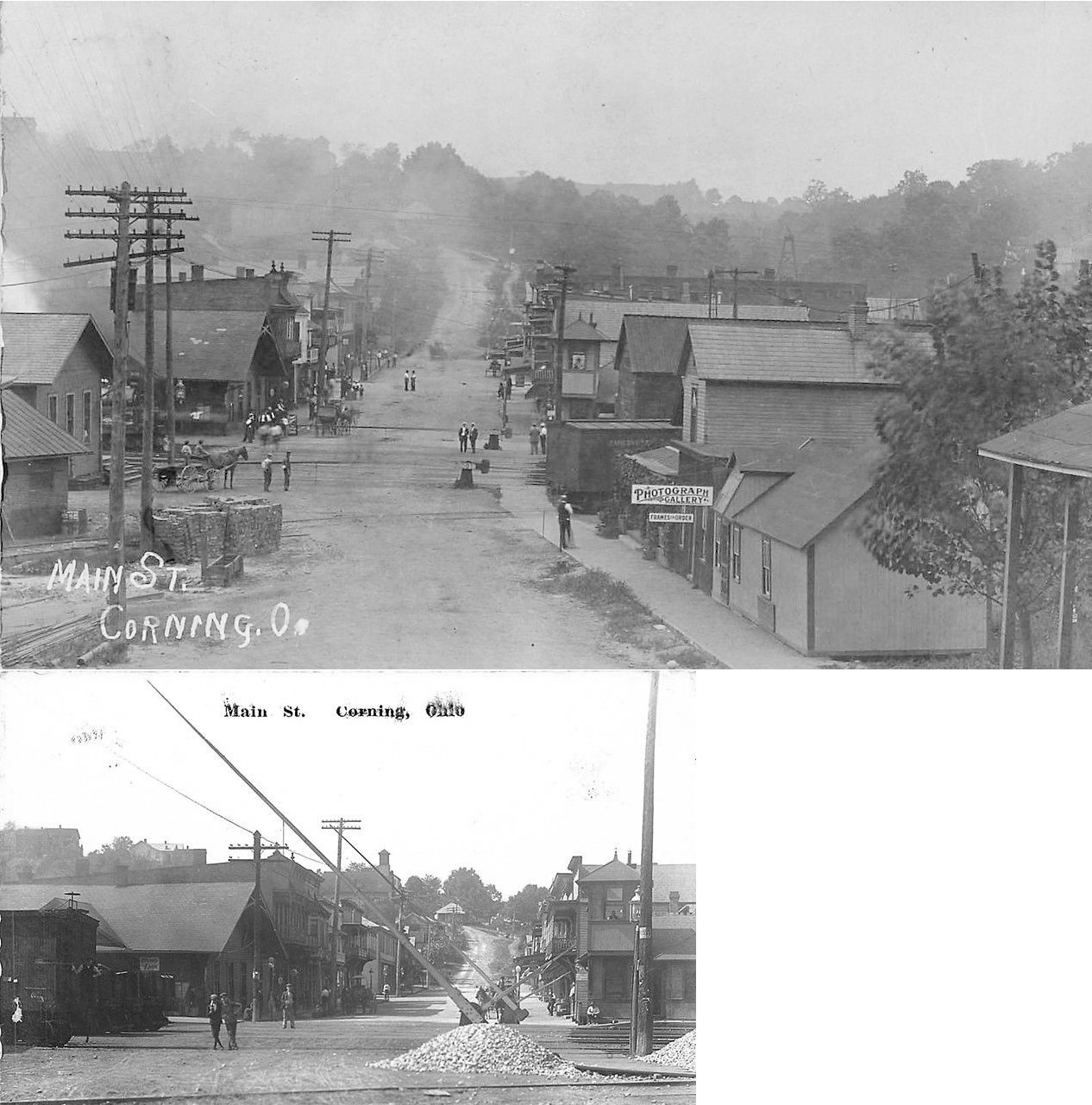
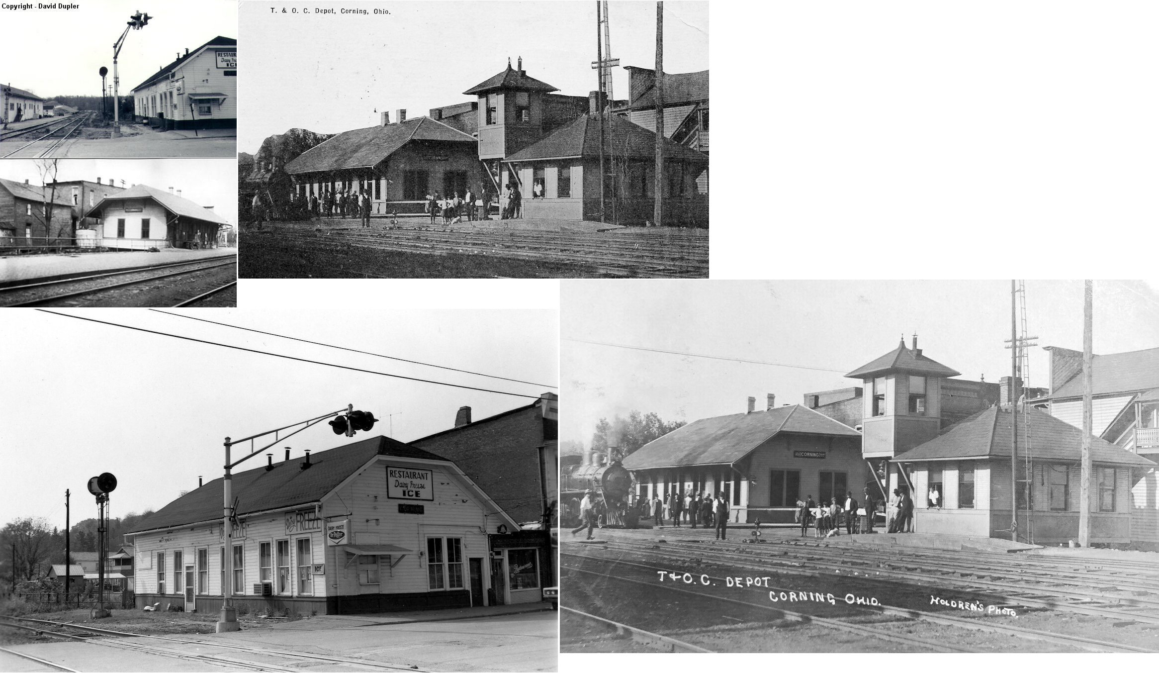
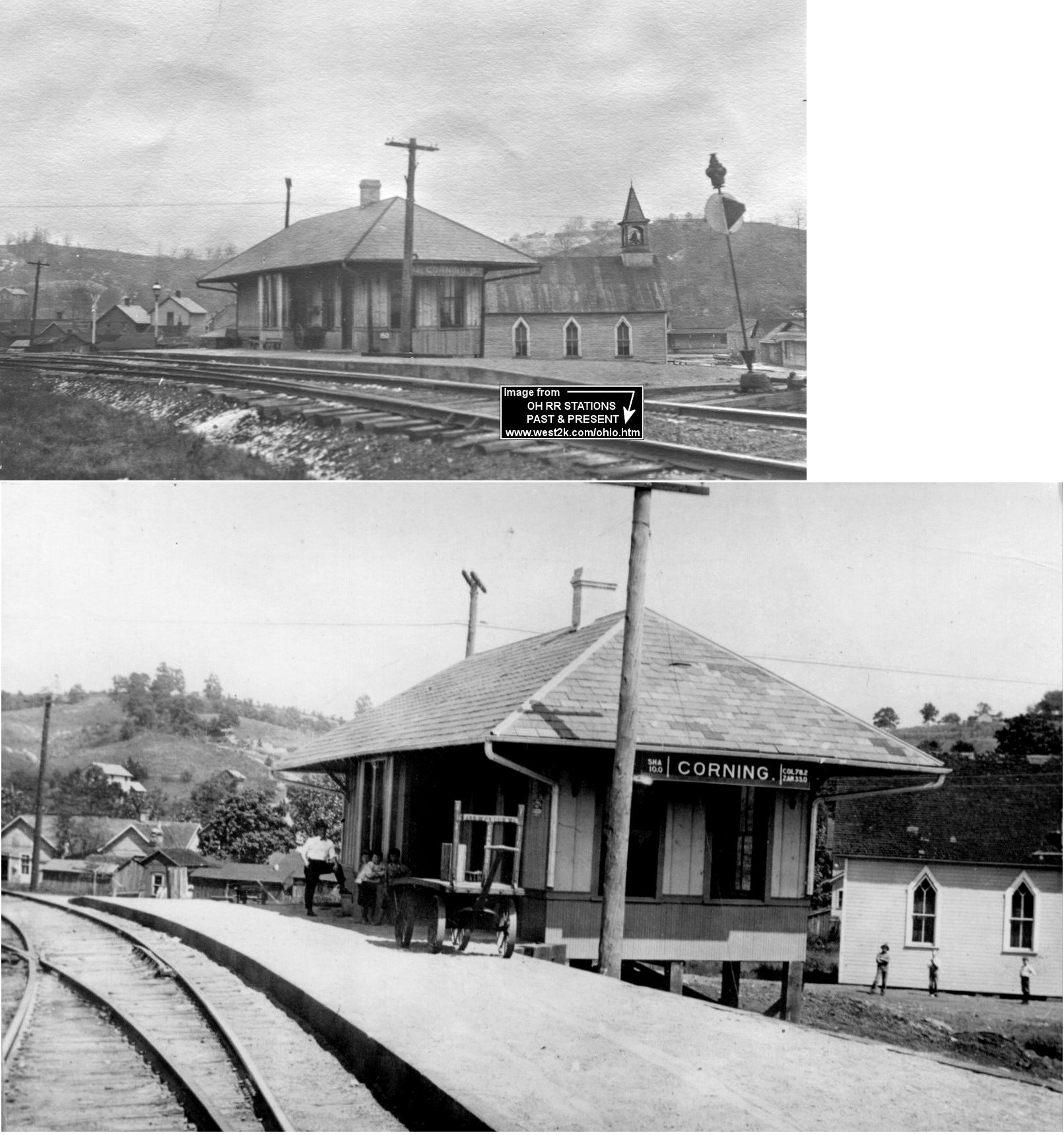
| Corning |  |
This photo shows the first T&OC station in Corning. The passenger and freight stations sat on the south side of Main Street with the passenger station on the west side of the tracks and the freight on the east. | ||||||
| Corning | |
This photo shows the "newer" passenger station. The passenger and freight stations sat on the south side of Main Street with the passenger station on the west side of the tracks and the freight on the east. | ||||||
| Corning | |
Freight station. | ||||||
| Corning |  |
The original Columbus, Sandusky & Hocking station for this line sat at the corner of North Valley and North Streets. Sanborn Fire maps from 1900 show the station at that location. The 1909 map however shows the Z&W station one block southwest on Rodgers Street (see listing below) across from the Christian Church now on the opposite side of the tracks. So the original station was moved down the line or replaced with a newer station sometime during that decade. The maps show buildings of similar size and shape, so the moving theory has support. | ||||||
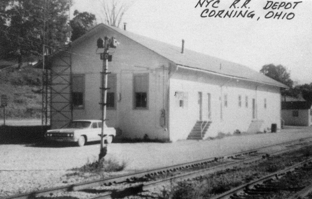
| Corning | |
This station sat on what is now called Rodgers Street north of Stanton Street. According to NYC valuation records, it was built in 1908. | ||||||
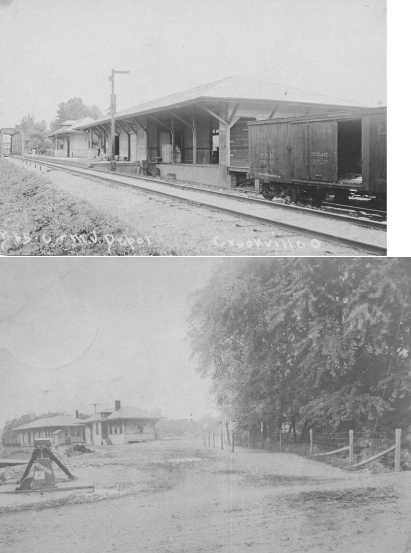
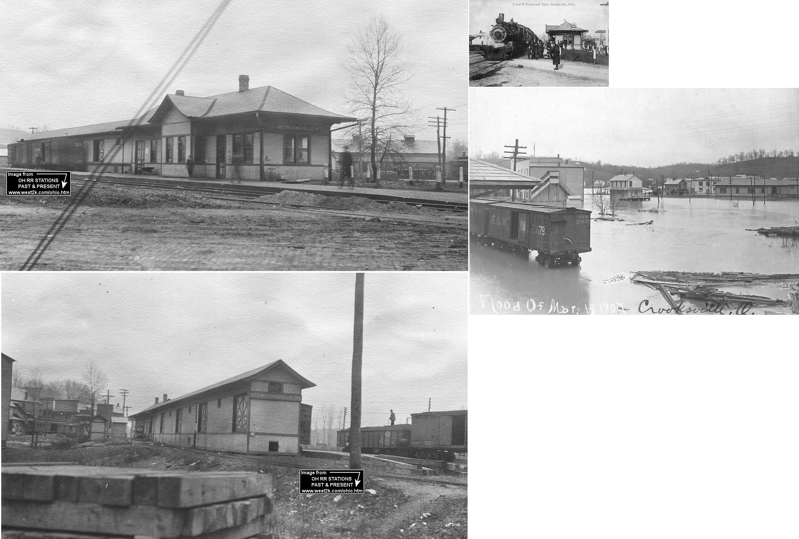
| Crooksville | |
The passenger station was off China Street north of West Main Street at GPS: 39.771020, -82.096084. In the photo the freight station is in the foreground and the passenger station is in the background near the trestle. | ||||||
| Crooksville | |
The freight station was just to the north of the passenger station at GPS: 39.771323, -82.096060. | ||||||
| Crooksville | |
This station stood where the old Elliot Lumber building is on the north side of Main Street between China Street and Elizabeth Street at GPS: 39.770476, -82.097503. According to NYC valuation records, this station was built in 1905. | ||||||
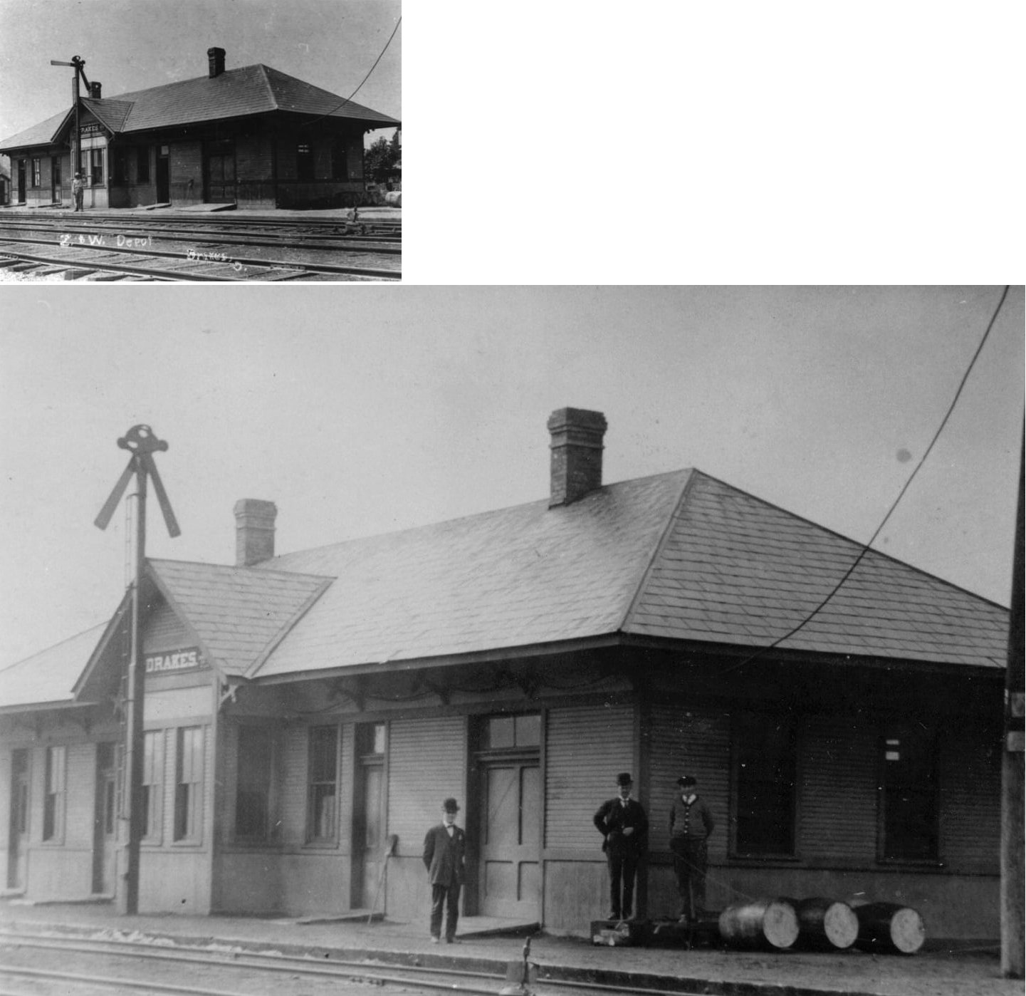
| Drakes | |
According to NYC valuation records, this station was built in 1902. | ||||||
| Glassrock | |
According to NYC valuation records, a passenger platform and freight house were built here in 1909. | ||||||
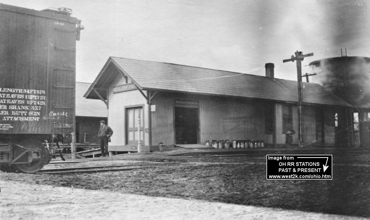
| Glenford |
 |
Both stations are shown in this photo. The NS&S (B&O) station is on the left and the Z&W is on the right. | ||||||
| Glenford | |
According to NYC valuation records, this station was built in 1882 and then extended 15 feet in 1916. | ||||||
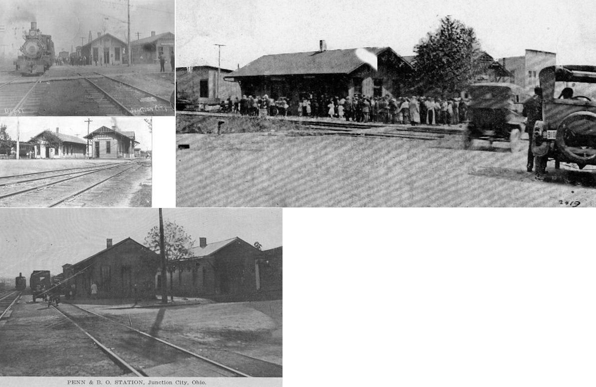
| Junction City |  |
Photo shows both stations which were side-by-side. | ||||||
| McCuneville |
|
|||||||
| Misco |
|
According to NYC valuation records, a passenger shelter was built in 1912. | ||||||
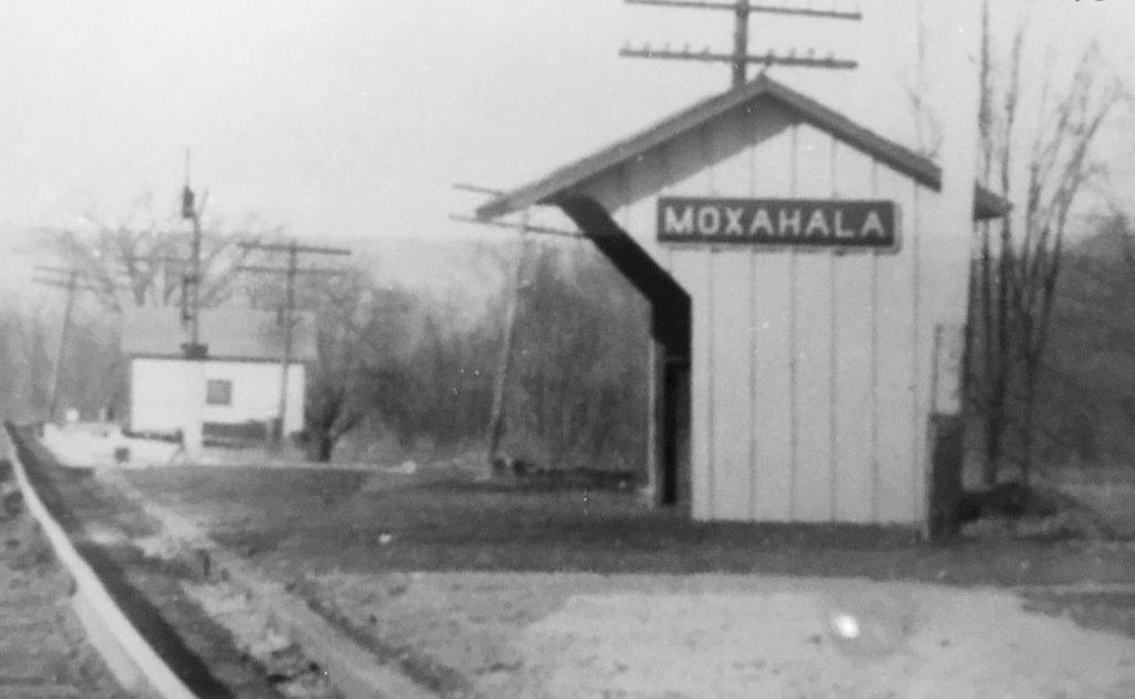
| Moxahala |
|
|||||||
| Moxahala |
 |
This passenger shelter was likely added in later years after the original station was gone. | ||||||
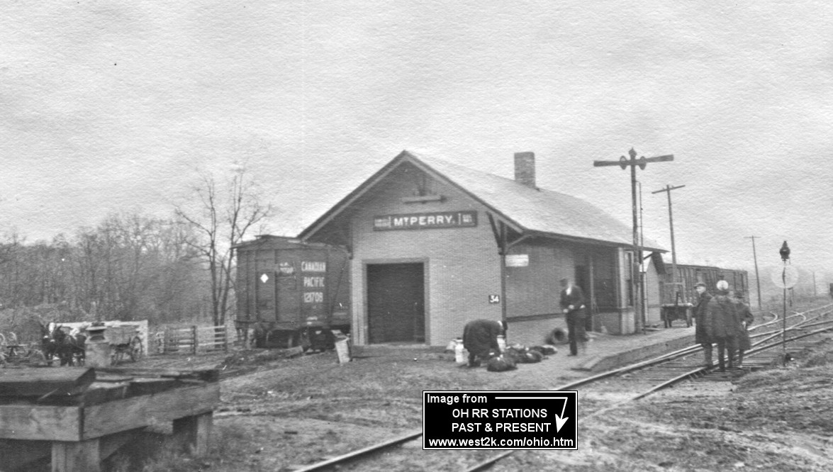
| Mt. Perry |
|
This station was built in 1882 according to NYC valuation records. It was at the intersection of Coopermill Road and SR-204 on the NE side of the tracks at GPS: 39.879098, -82.216284. | ||||||
| New Lexington | AND |
This station, which appears to be of C&MV design, sat between the two tracks at the end of Clayton Street. There was also a shared freight station on the west side of Madison Street. The C&MV may have used the Valley Hotel as its first station. This hotel was on the corner of Railroad Street and Center Street and had a platform that stretched along the tracks. Next to the hotel was warehouse that also had a platform facing the tracks. | ||||||
| New Lexington | AND |
The aforementioned freight station. | ||||||
| New
Straitsville (Passenger?) |
 |
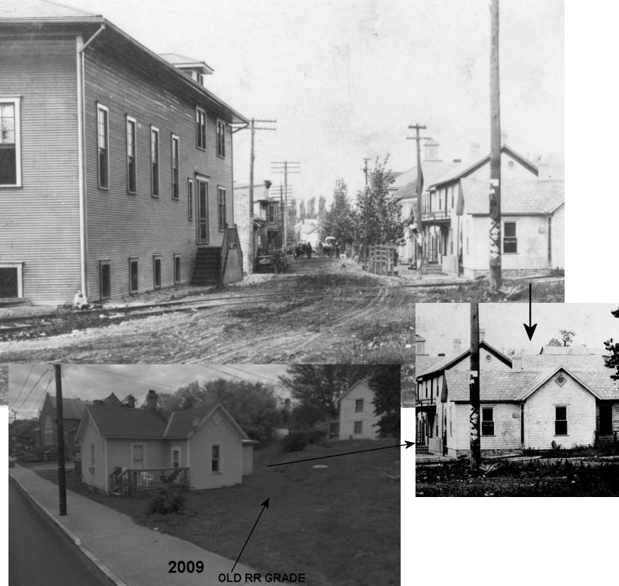
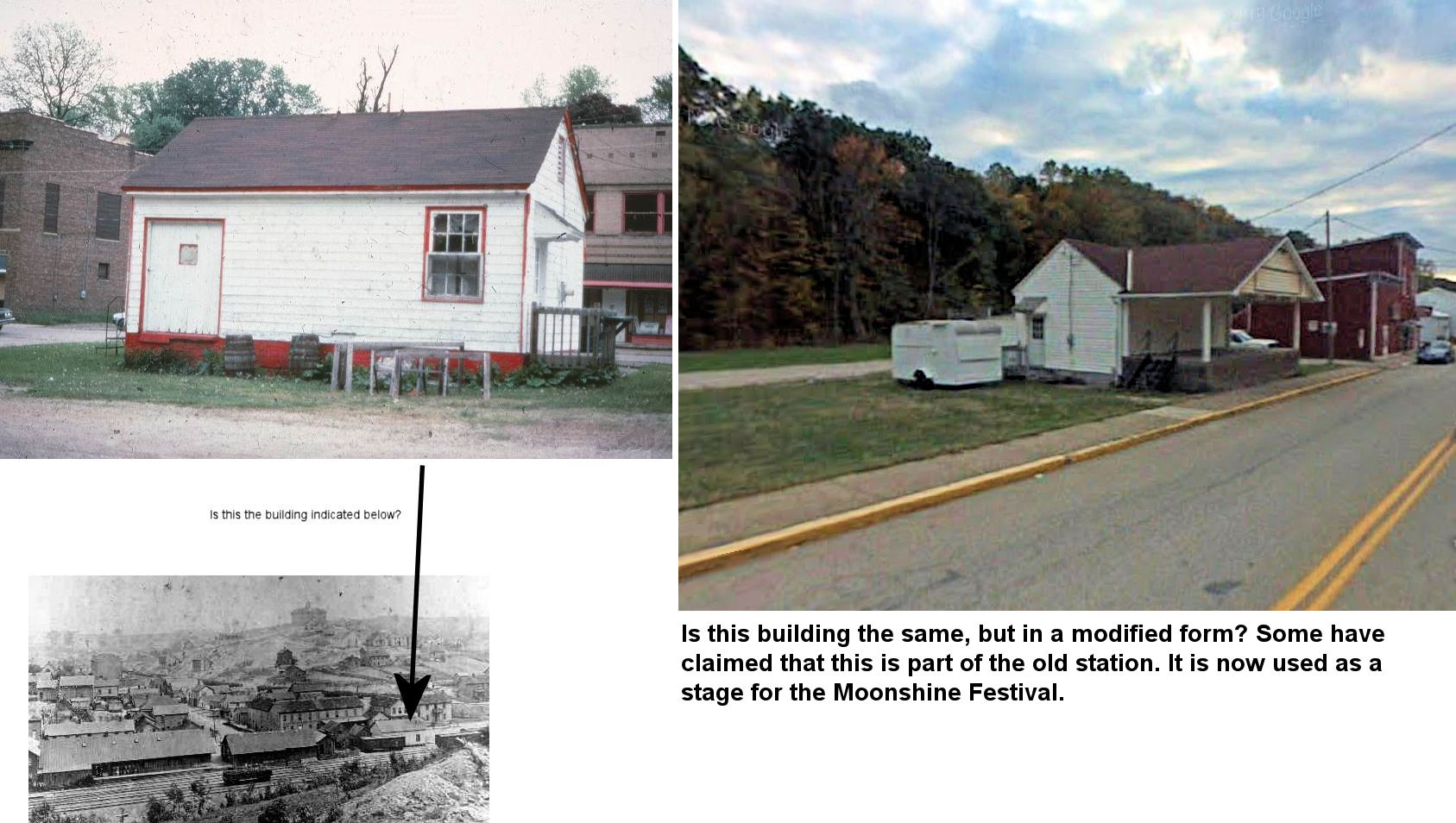
Is this the station on the right in this photo? The large building on the left is the Athletic Club. On old Sanborn maps it is not labeled as a depot, but it looks like it could have been one. This building is still standing directly across from the public library on Main Street which occupies the space where the Athletic Club was located. This building, now a residence, is next to the old grade for the tracks that went up into the town from the mainline. I could not find mention of the HV passenger station on the maps I consulted (see below). --Dan West | ||||||
| New
Straitsville (Freight) |
|
This building was clearly marked "CHV&T Freight Station"
on several maps. There was no mention of passenger service from this
building which leads me to believe that there was a separate passenger
station somewhere in town, but it is not clear where that was (see above).
Sanborn maps are pretty good at distinguishing between passenger and
freight stations. Can a local person do some research on this?
Here are two maps showing
the station marked as a freight station and then just as a "depot." Here are
the leading theories: 1. The "freight station" was not marked correctly on the maps and was actually a combination station. 2. The building marked "passenger?" station above was the passenger station (and not marked correctly on maps) or the building was designed as one, but never used for that purpose. The branch line that ran north along Clark Street served nearby mines, so it could have been used as a station for local workers going to the mines. 3. The passenger station was in a part of town not covered by the old maps. -- Dan West |
||||||
| New Straitsville | |
Unknown. Hopefully someone will come along here and be able to explain what all these building were or were not. | ||||||
| Roseville | |
The passenger station was just to the north of the existing freight station at GPS: 39.807494, -82.073744. | ||||||
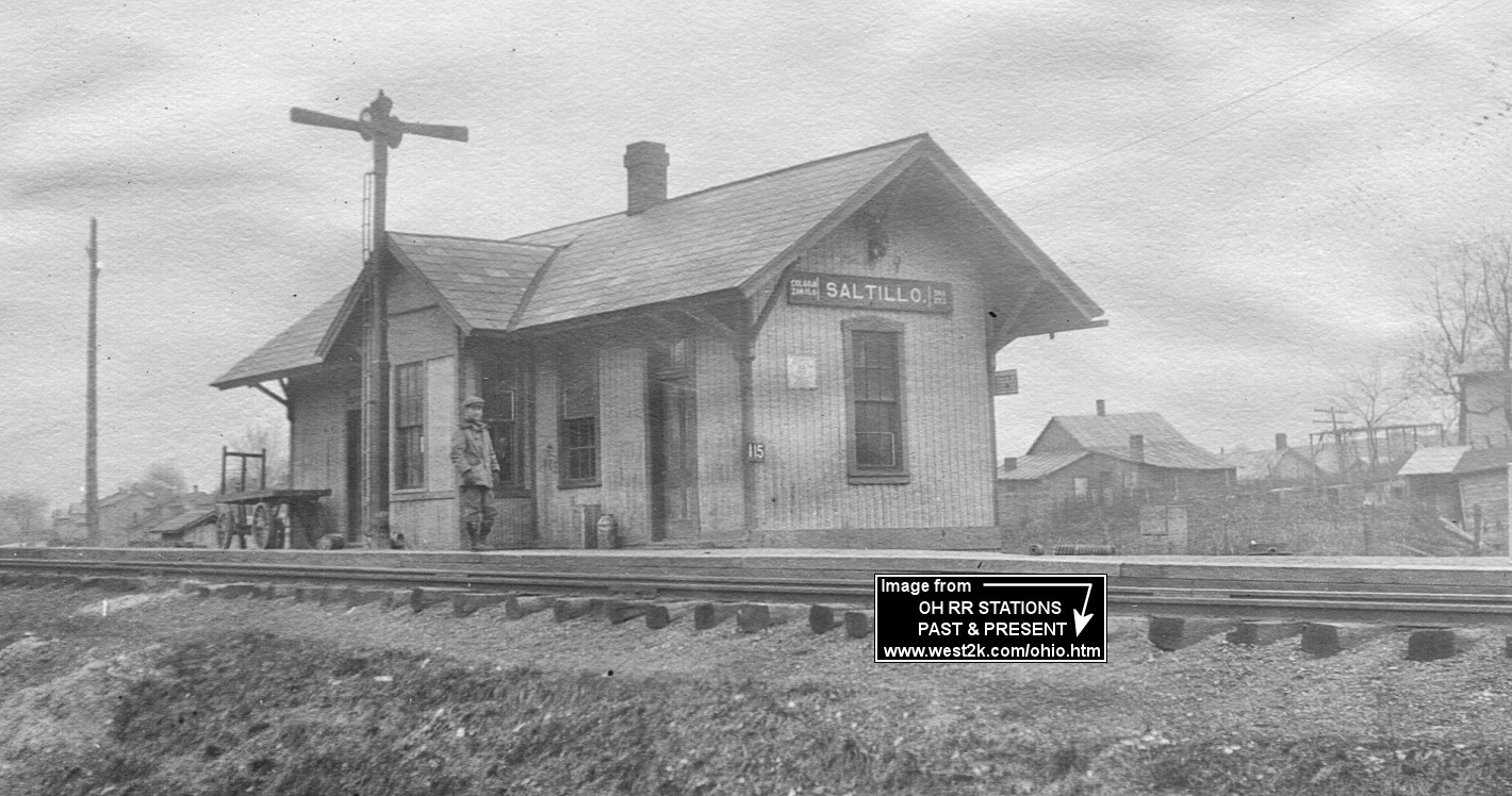
| Saltillo | |
This station was built in 1885 according to NYC valuation records. | ||||||
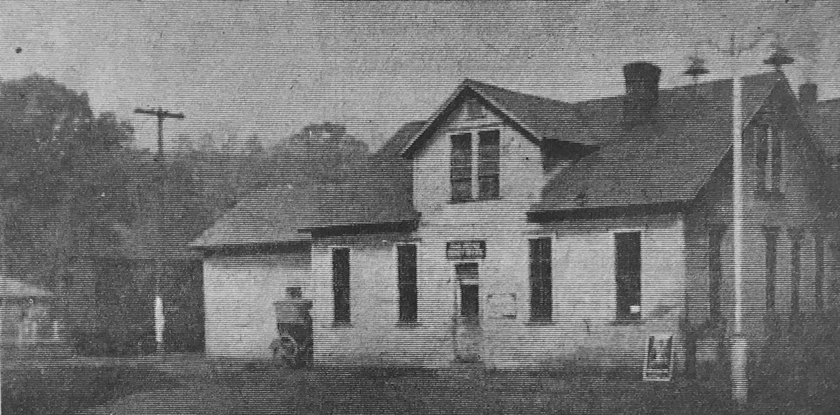
| San Toy |
|
San Toy Was the site of the Sunday Creek Coal Company mine. Not sure if the building pictured was the station or if it served as a station and also had another function. | ||||||
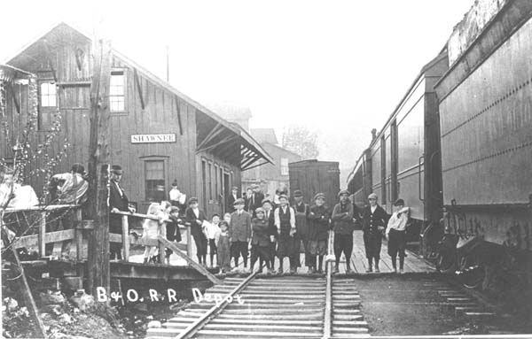
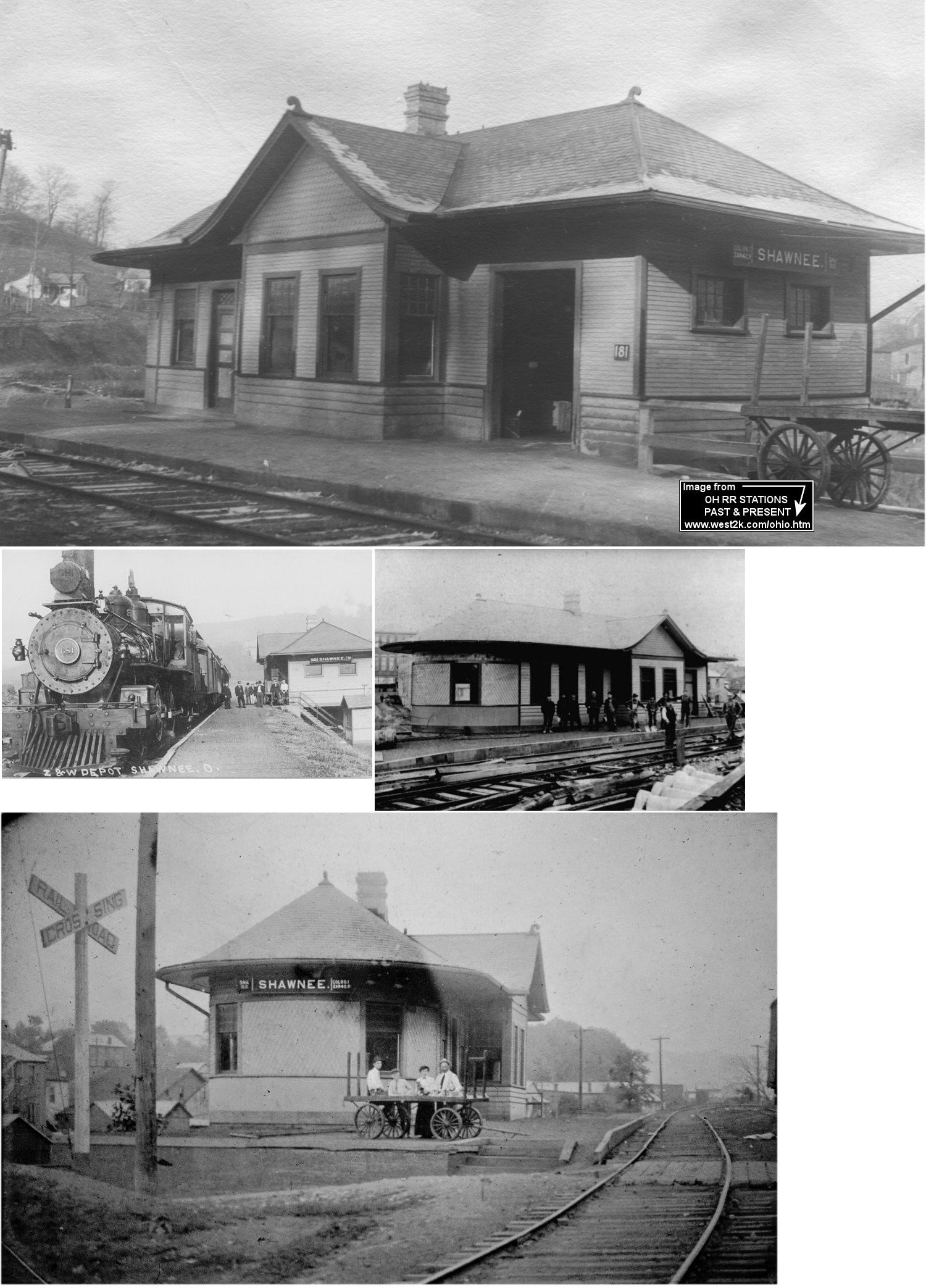
| Shawnee | |
This combination station was on the SW corner of Main and First Streets. It may predate the B&O and might have been built by the Newark, Somerset & Straitsville RR (later called that Newark, Somerset & Shawnee). | ||||||
| Shawnee | |
The passenger station was built in 1906. | ||||||
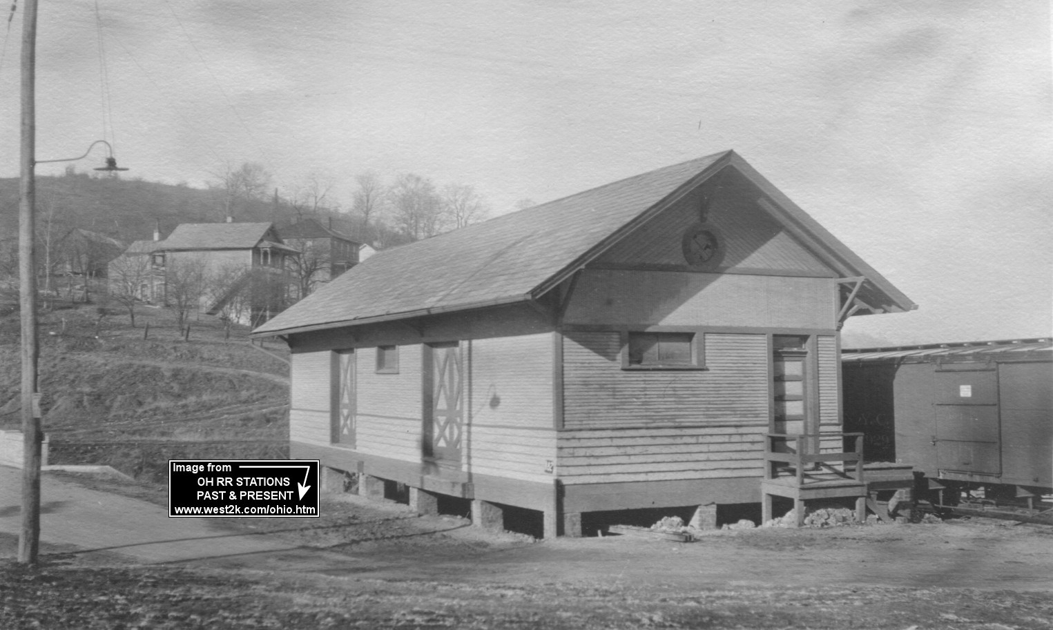
| Shawnee | |
This freight station was built in 1907. | ||||||
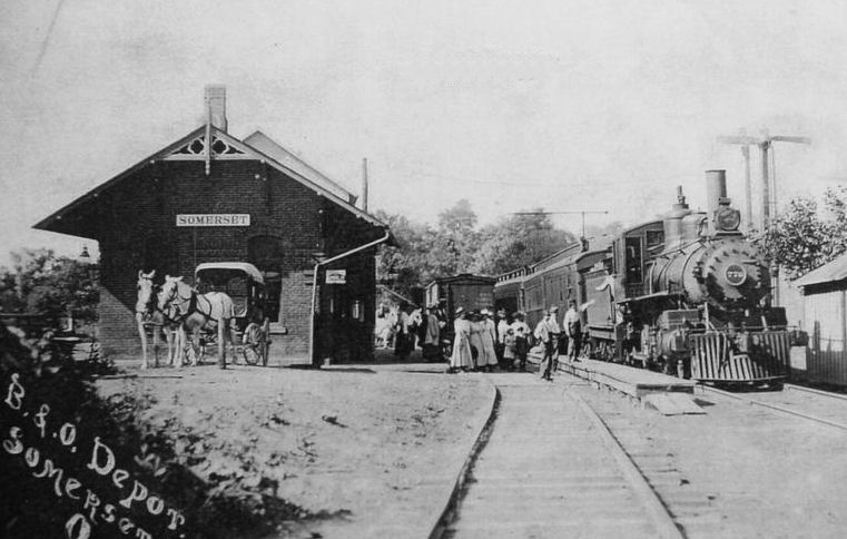
| Somerset | |
This combination station was on the north side of Main Street on the west side of the tracks. | ||||||
| Tatmans | |
According to NYC valuation records, a passenger shelter was built in 1890. | ||||||
| Thornport |
|
This NS&S (later B&O) station was on the corner of Mill Street (now Twp 1069) and 2nd Avenue (now Twp 1068). | ||||||
| Walser |
|
According to Z&W valuation records, this combination station/agent's dwelling was built in 1888. | ||||||
| Yost |
|
According to NYC valuation records, this station was built in 1883. | ||||||
| Yost |
|
|||||||
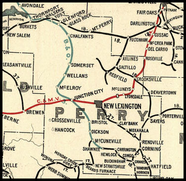
| 1898 PERRY COUNTY RAILROAD MAP | ||||||||
 |
||||||||
| Notes About Existing
Stations... Hemlock (Z&W) - This station is in its original location. It was heavily remodeled and made into a residence by a Mr. Fitzer that owned Fitzer’s Garage that sat across Sanders Street (SR-155) from the depot. The depot outhouses are still standing as well and they are located across Main Street from the depot. According to NYC valuation records, this station was built in 1912. Thornport (T&OC) - This station's original location was on the east side of CR-20 (Zion Rd.) just north of the intersection with Twp. 1061 next to the old grain elevator at the south end of Thornport. It also served Thornville. According to NYC valuation records, the station was built in 1883. |
||||||||