 COUNTY COUNTY
|
|
||||||||
| EXISTING STATIONS | ||||||||
|---|---|---|---|---|---|---|---|---|
| Station Name |
Original Railroad | Current Location |
Type | Current Use |
Date Built |
Track Status |
Building Material |
More Info |
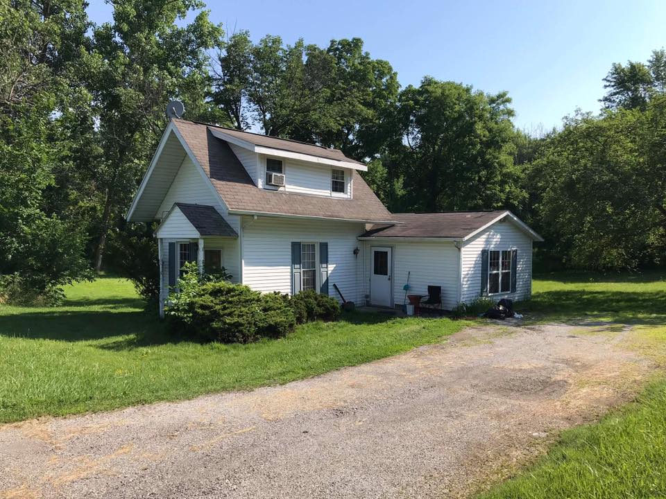
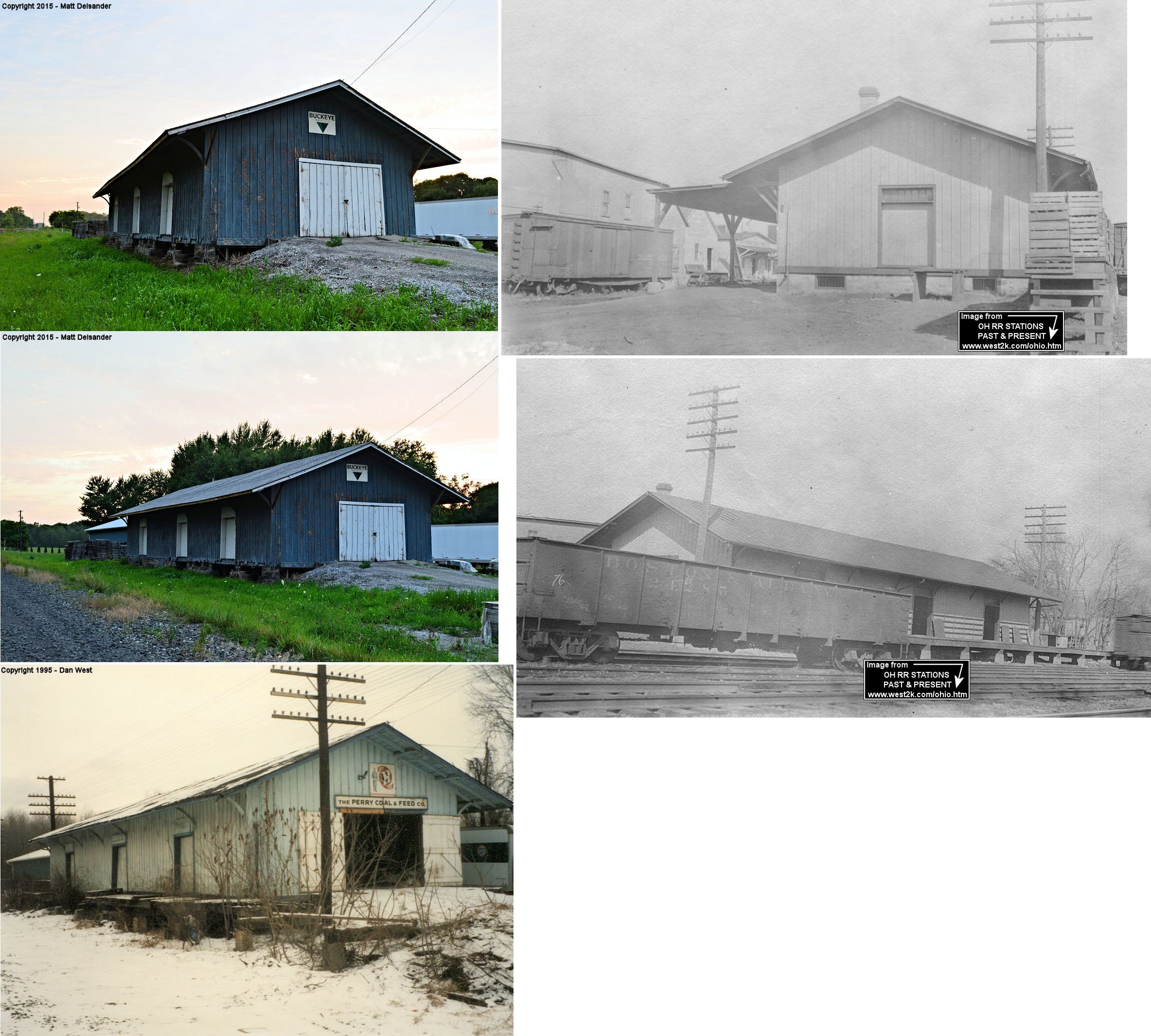
| Concord |
 |
6675 Ravenna Road (Old 44) (GPS: 41.688505, -81.231134) |
C | Residence | ???? | None | Wood |
|
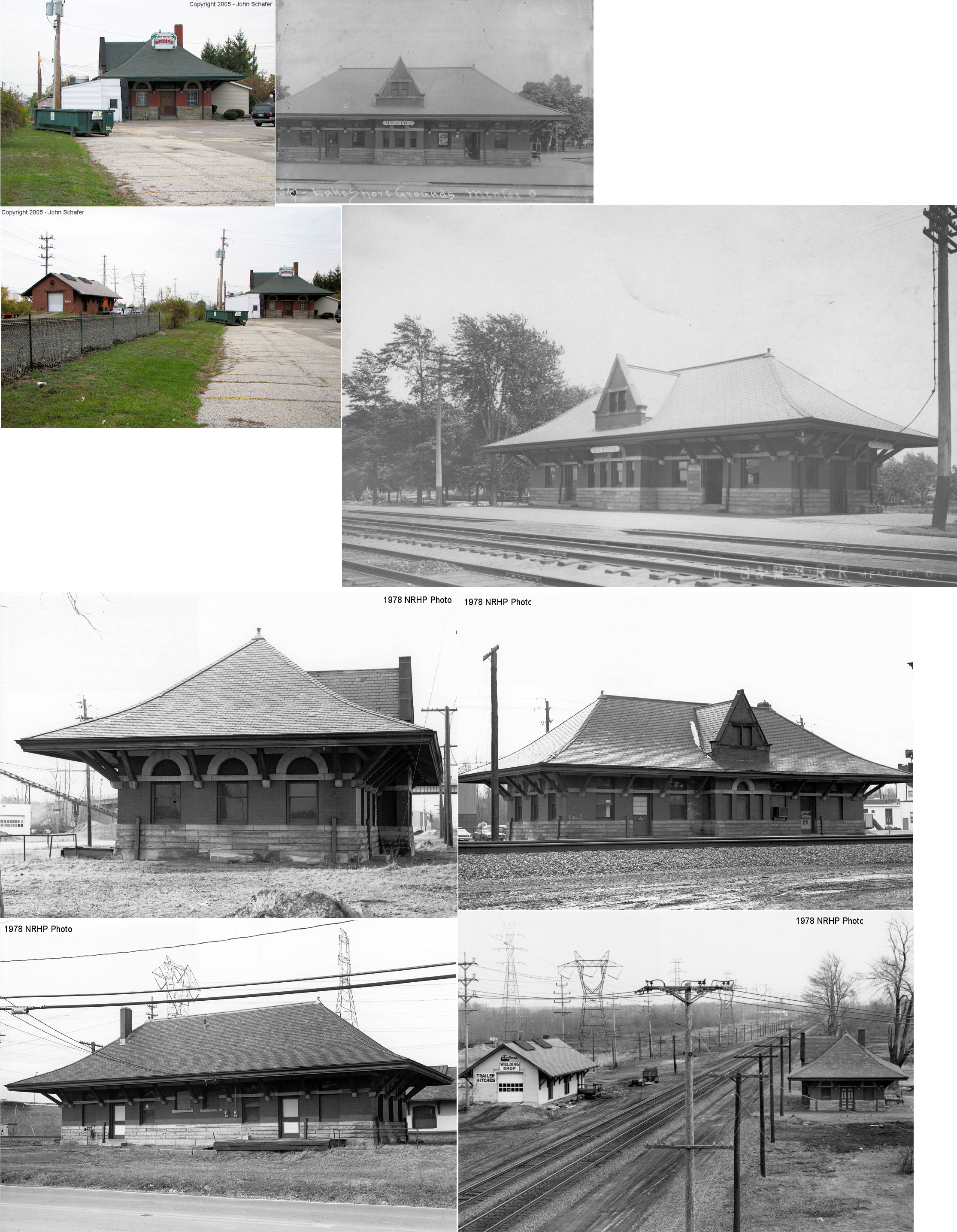
| Mentor |  |
8455 Station Street on SE side of tracks. (GPS: 41.678847, -81.338208) |
P | Business | 1902 | In Use | Brick |
|
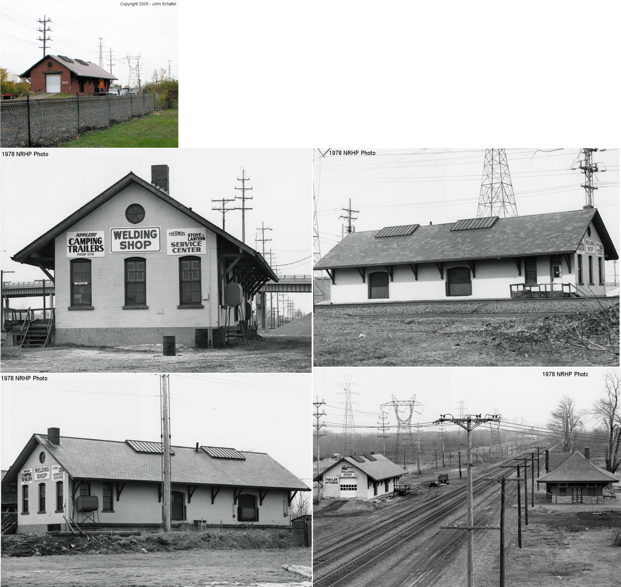
| Mentor |  |
East Side of Station Street on NW side of tracks. (GPS: 41.679126, -81.338486) |
F | Business | 1906 | In Use | Brick |
|
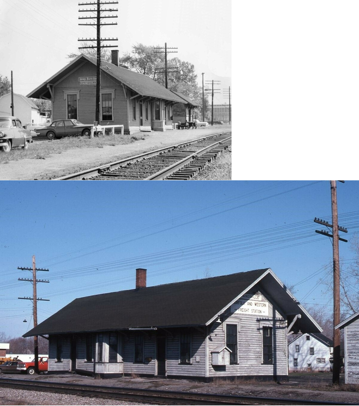
| Painesville | |
475 Railroad Street (GPS: 41.733416, -81.243608) |
C | Museum | 1893 | In Use | Stone |
|
| Perry | |
4204 Main Street (GPS: 41.757367, -81.138919) |
F | Business | 1854 | In Use | Wood | |
| Willoughby |
 |
37900 Depot Street (GPS: 41.645054, -81.410272) |
P | Business | 1852 | None | Wood |
|
| STATIONS OF THE PAST | ||||||||
| Station Name |
Original Railroad |
Notes | ||||||
| Clarks |
|
This station was on Clark Road at approximately GPS: 41.626595, -81.237754. | ||||||
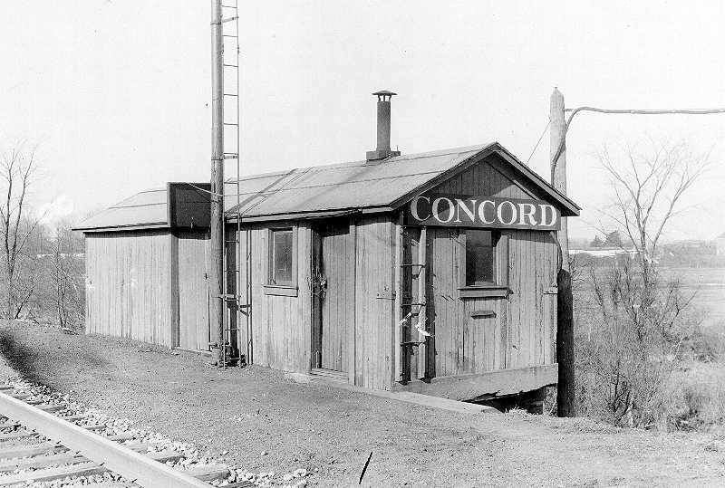
| Concord |
|
A later-generation station was located on the west side of
Painesville-Ravenna Road (Old SR-44) at GPS: 41.665306, -81.221722. This
station is shown on a B&O track map from 1918. --Note by Scott Stasa.
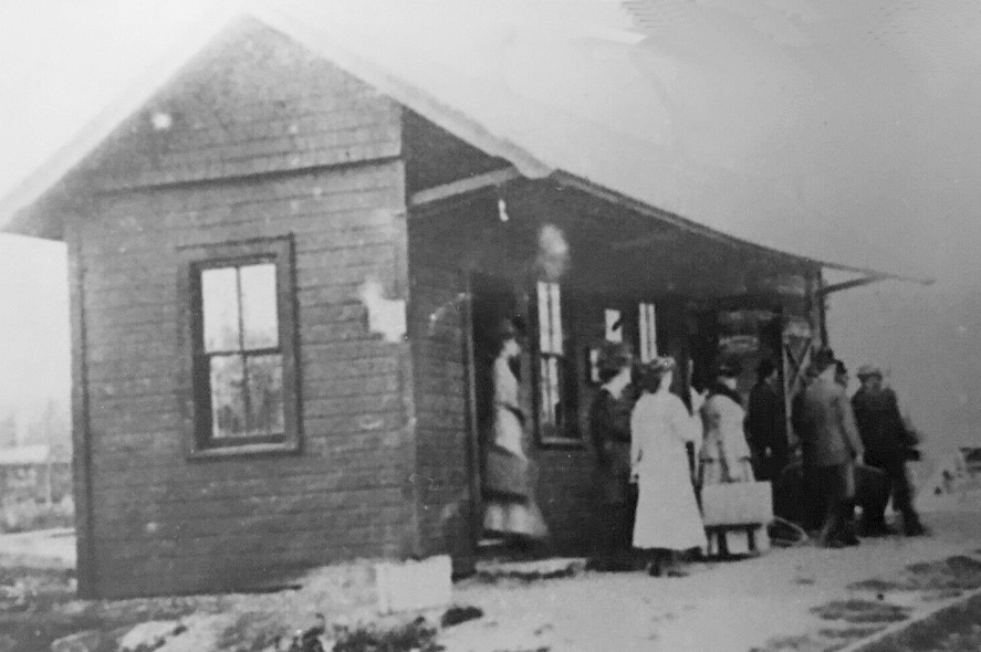
Note: Although the station pictured here is thought by some to be from Concord, OH, it is more likely a temporary station or freight station from Concord, PA on the Erie Railroad (see listing on the Erie County, PA page on PA RR Stations Past & Present). Some have calimed that the station in the photo was the Concord, Ohio station at the Kellogg Creek viaduct, but this is quite a bit north of Concord and where the maps indicate that the station was. More evidence is needed to settle this matter. |
||||||
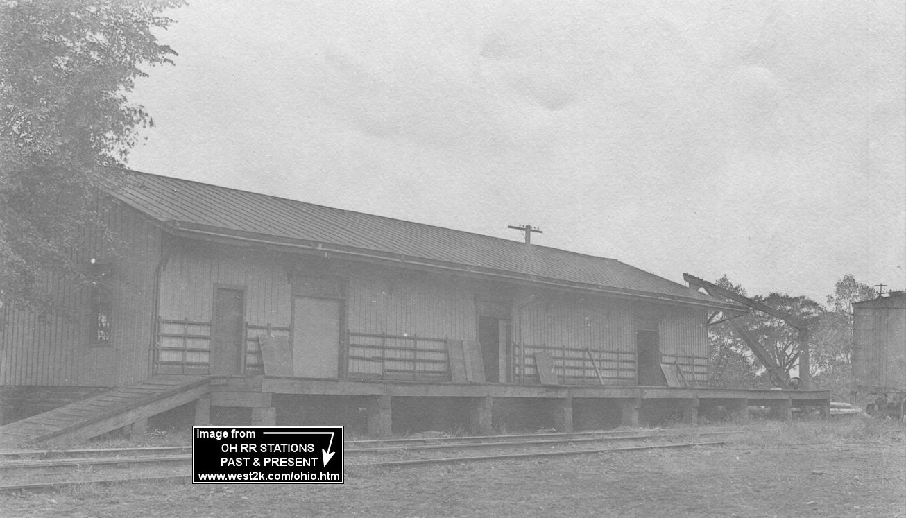
| Fairport Harbor |
|
The modern freight station is pictured. It was located in the B&O yard that was just south of the Grand River between Richmond Road and Richmond Street. It was at approximately GPS: 41.733792, -81.266847. | ||||||
| Heisley Station | |
There may have been a station here in the very early days of the RR. This was where Heisley Road crosses the tracks east of Mentor. According to NYC valuation records, this 10'x12' station was built in 1898 and was still standing as of 1916. | ||||||
| Lane Station |
|
This station was on Lane Road at NE corner of the tracks near Shepherd Road In 1889 the property belonged to J.F. Skinner. In 1915 the property map shows "Lane Sta." so it would appear the station was built between 1889 and 1915. This was where Lane Road (formerly called "Lane Station Road) crosses the tracks west of Perry. The station measured 8'x12' according to NYC valuation records. | ||||||
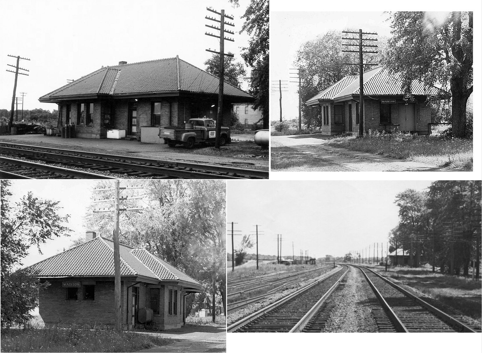
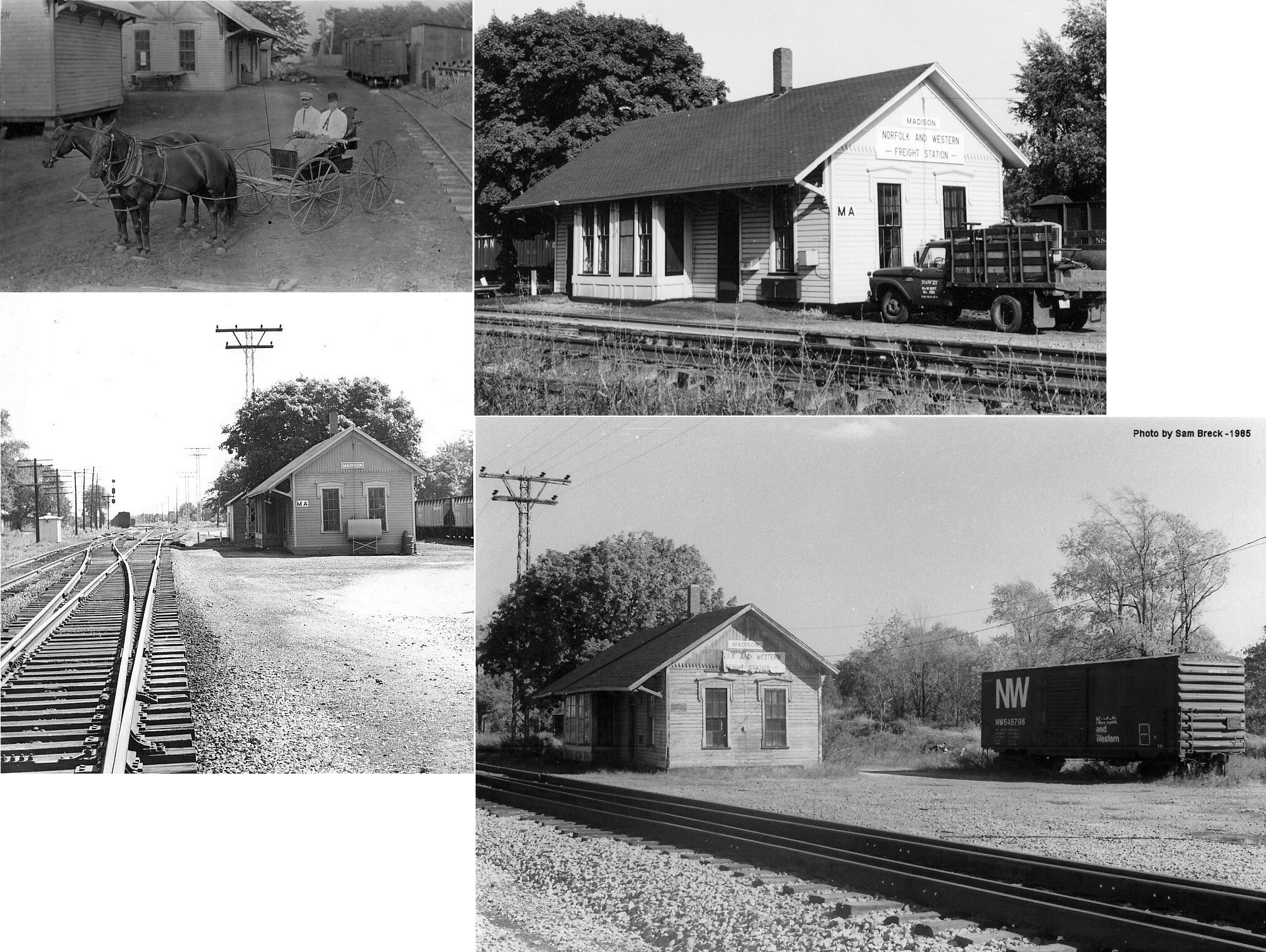
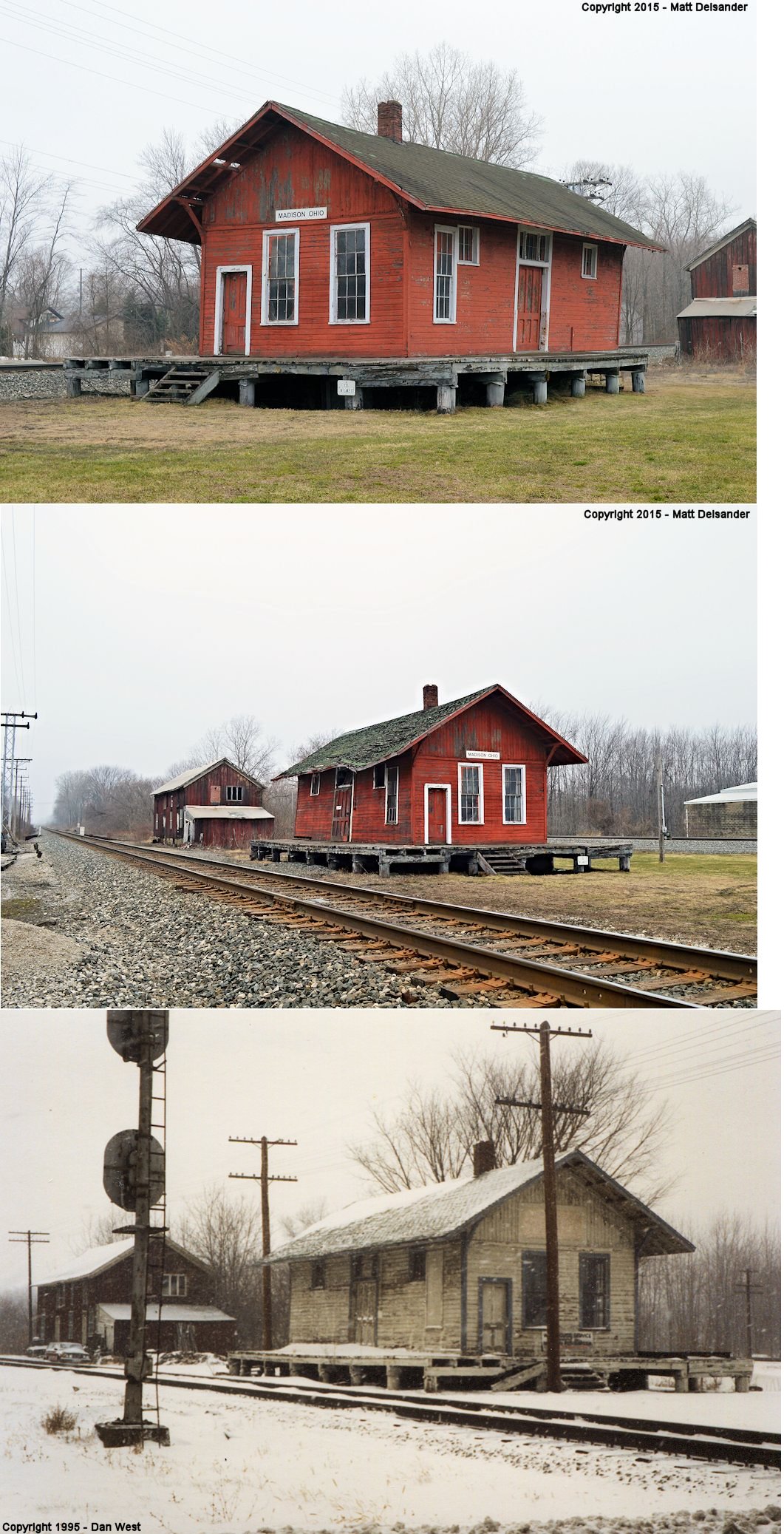
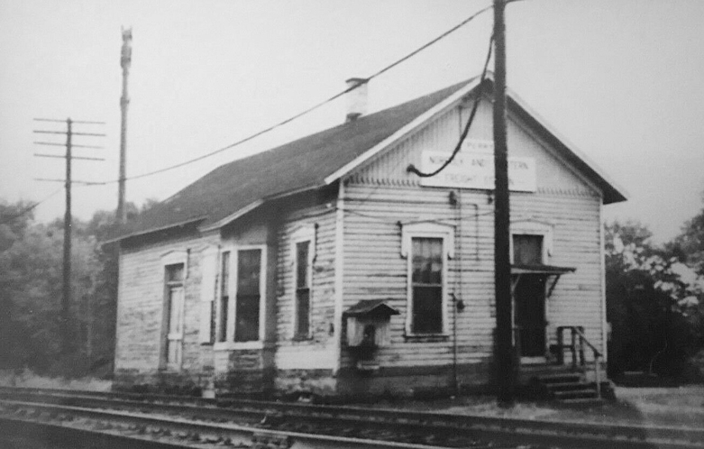
| Madison | |
This station sat on the east side of SR 528. It was used by the Lake County Road Department prior to being demolished in 1999. This was the original 1852 station (extended in 1870) which was moved across the tracks (to the north side) and connected to the original 1852 freight house upon construction of the newer brick station across the tracks (on the south side) in 1910. The original freight house was located at GPS: 41.775730, -81.045416. | ||||||
| Madison | |
This brick station was demolished sometime prior to 1997. Access to the brick station was via Safford Street by crossing the NKP tracks. It was located at GPS: 41.775695, -81.044521. According to NYC valuation records, this station was built in 1910. | ||||||
| Madison |  |
The passenger station was on the east side of SR 528 and on the south side of tracks at GPS: 41.774853, -81.046198. | ||||||
| Madison | |
This freight station, built in 1882, was on the west side of North Lake Street (SR 528) (GPS: 41.774805, -81.047715). A group was working on taking the depot apart piece by piece than moving it behind the old fire station #1 and restoring it. It was previously fixed up some, but again fell into disrepair. The process was delayed a few years ago due to insurance issues with NS railway and their budget. It was torn down by the railroad on 8/8/2016. |
||||||
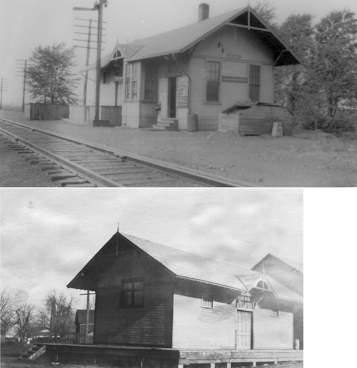
| Mentor | |
Passenger station. | ||||||
| Mentor | |
This station was on the east side of Center Street. on the north side of the tracks. It probably started as a passenger station and later, when a new and larger passenger station was built (see above), served as a freight station as only this building is shown there on 1941 maps. | ||||||
| Mentor |
|
The previous wood frame station was on the same site as the existing station. It burned down on November 9, 1901. | ||||||
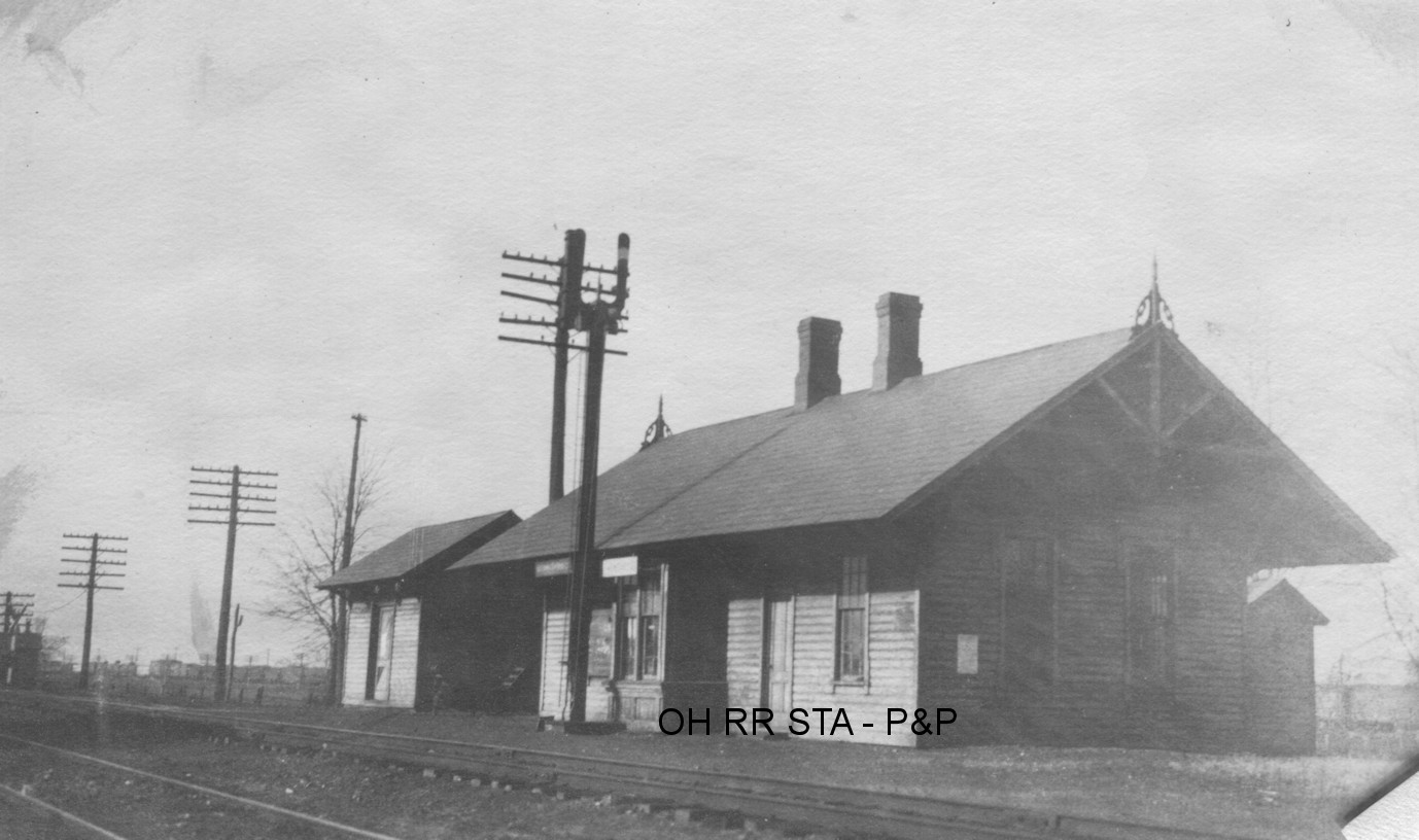
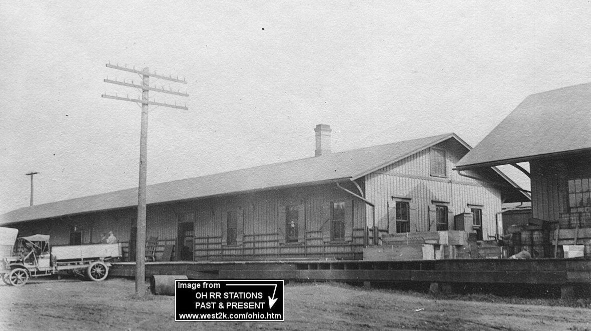
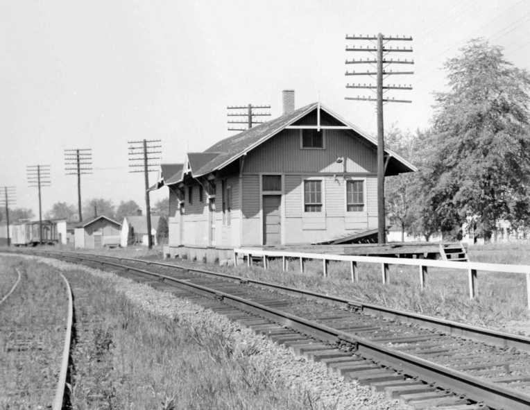
| Painesvile | |
The original 1852 (according to NYC records) frame station existed here before the stone station was built in 1893. It was essentially in the same location (on the north side of Railroad Street) as the station that replaced it. It was moved across the tracks next to the original freight station on Storrs Street to make way for the new passenger station. It was partially destroyed by fire in 1896 and rebuilt. It served as a freight station until both freight stations were demolished. It is partially visible in the photo of the freight station. | ||||||
| Painesville | |
The passenger station was on the west side of State Street. | ||||||
| Painesville | |
The freight station was also on the west side of State Street. | ||||||
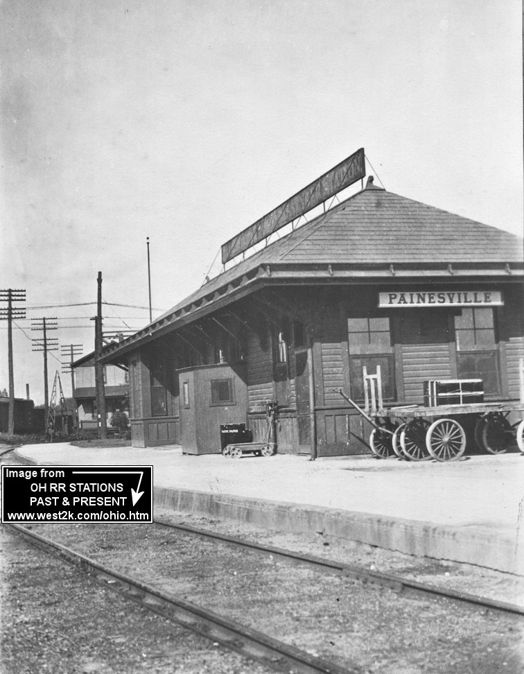
| Painesville |
|
The passenger station was on the SW side of Richmond Street next to the power plant at GPS: 41.726855, -81.254496. The freight station was farther to the SW of the passenger station at GPS: 41.726769, -81.255247. | ||||||
| Perry |
|
|||||||
| Perry | |
This station was built in 1898. It was relocated and moved to a new foundation in 1909 to make room for a new eastbound slow speed track. | ||||||
| Perry | |
|||||||
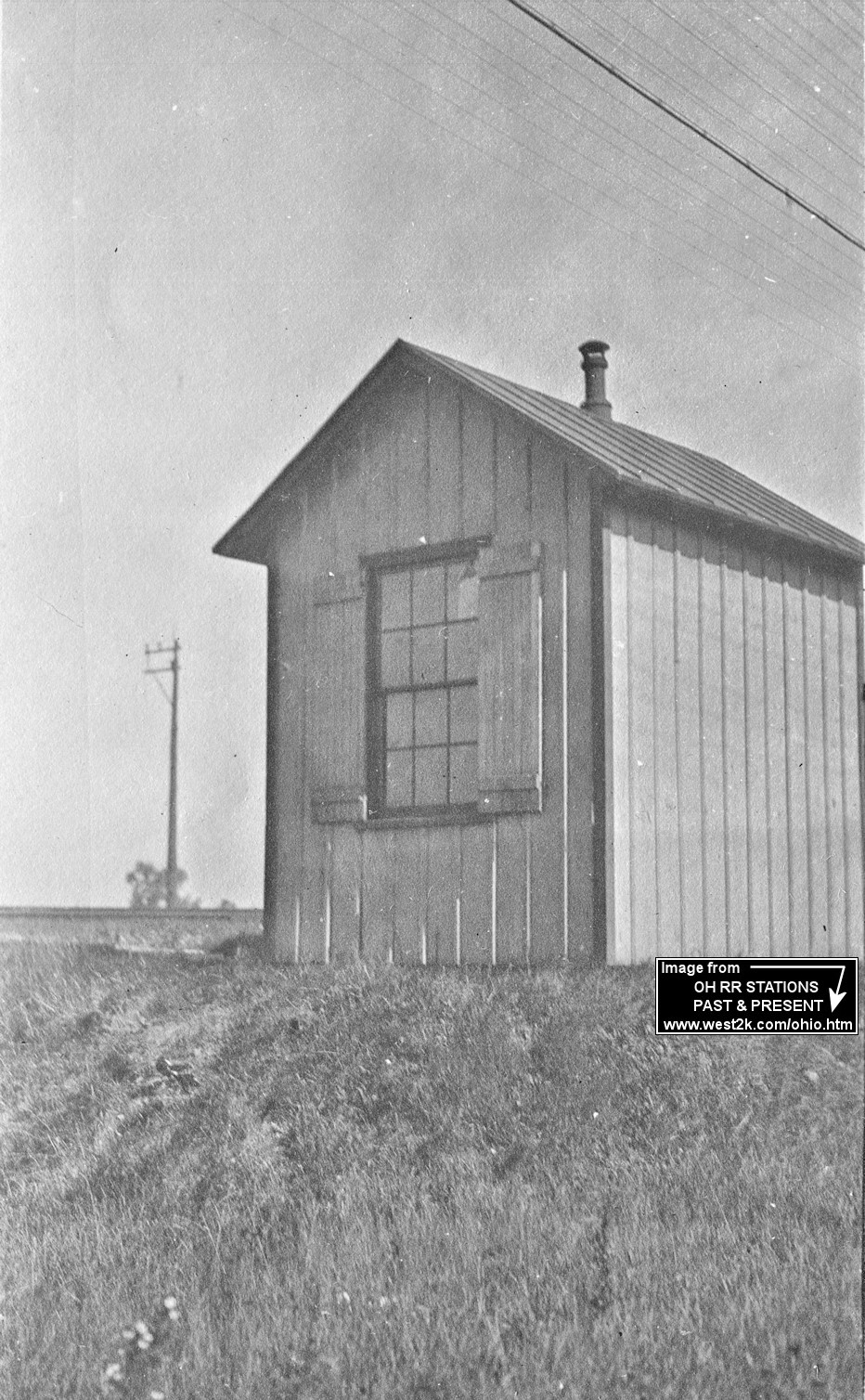
| Reynolds | |
There was a small passenger shelter here. The station was established in 1874 (Northern Ohio Journal, 11-28-1874). According to NYC valuation records, this station was built in 1896 so there may have been an earier station here. | ||||||
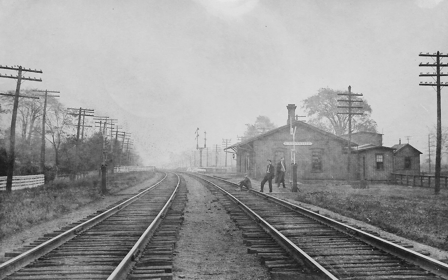
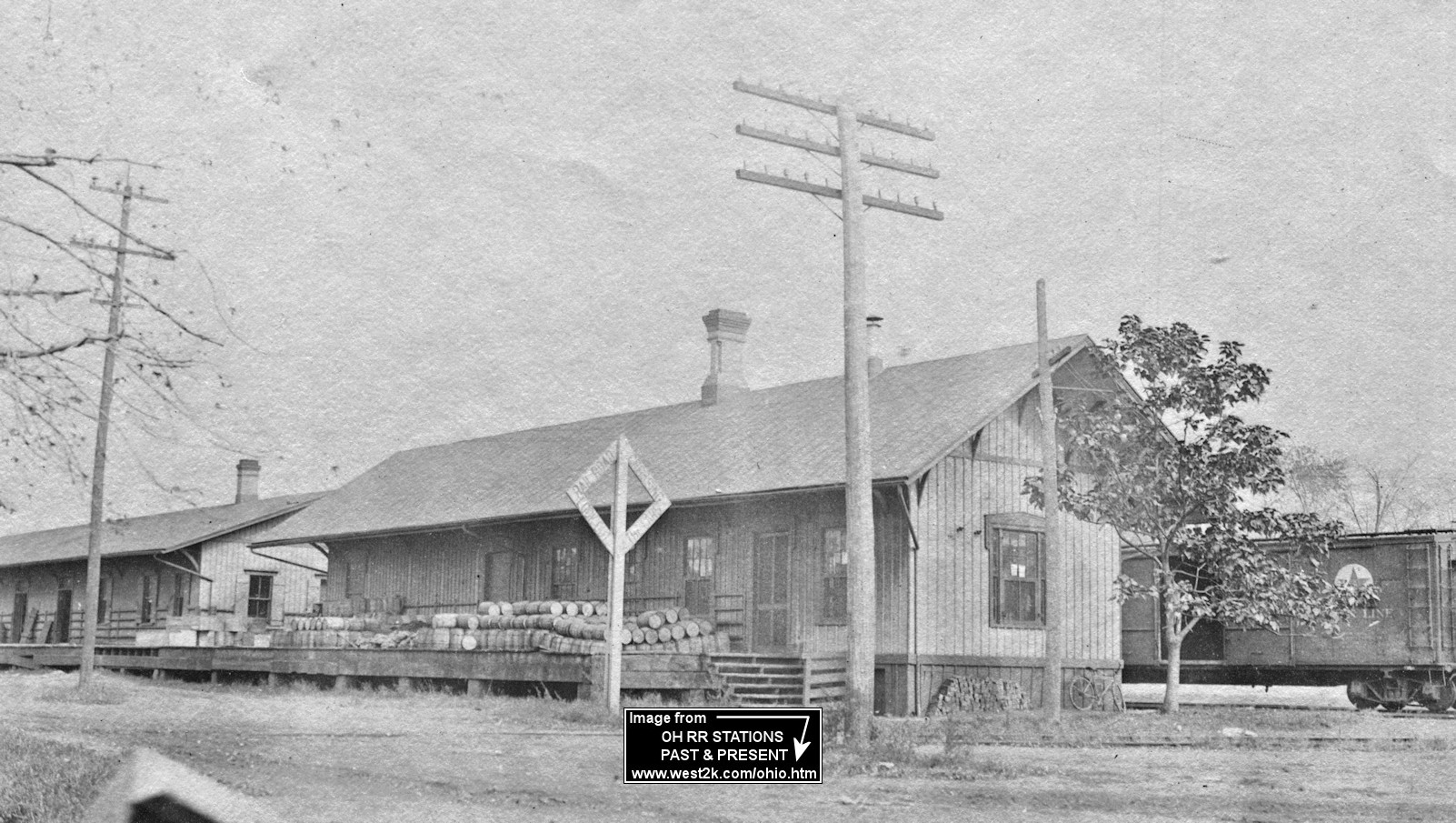
| Unionville | |
This was the original 1854 station at Unionville. When the new passenger station was built next to it, this building was then used as a freight house. | ||||||
| Unionville | |
This was the second passenger station at Unionville. The original station can be seen in the photo serving as the freight house. | ||||||
| Unionville | |
This freight station later became part of a small complex of buildings. It may still exist (there is a building at the same location with the same footprint), but if it does, it's been remodeled beyond recognition. It was on the west side of County line Road at GPS: 41.786297, -81.002980. | ||||||
| Unionville | |
|||||||
| Willoughby | |
The freight station was on the south side of Stevens Boulevard on the north side of the tracks (GPS: 41.646296,-81.409051). According to NYC valuation records, this station was built in 1853 and extended by 24 feet in 1871. | ||||||
| Willoughby | |
The passenger and freight stations were on the west side of Erie Street with the passneger station on the south side of the tracks (GPS: 41.64424,-81.407447). The passenger station was still standing as of 1966. | ||||||
| Willoughby | |
The freight on the north side of the tacks across from the passenger station. It was at GPS: 41.644352,-81.407833. | ||||||
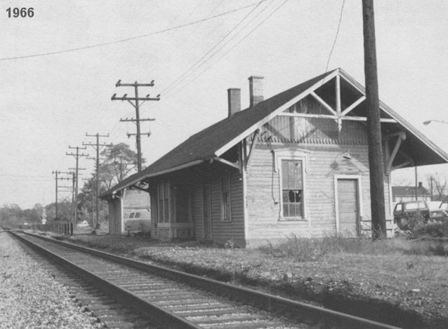
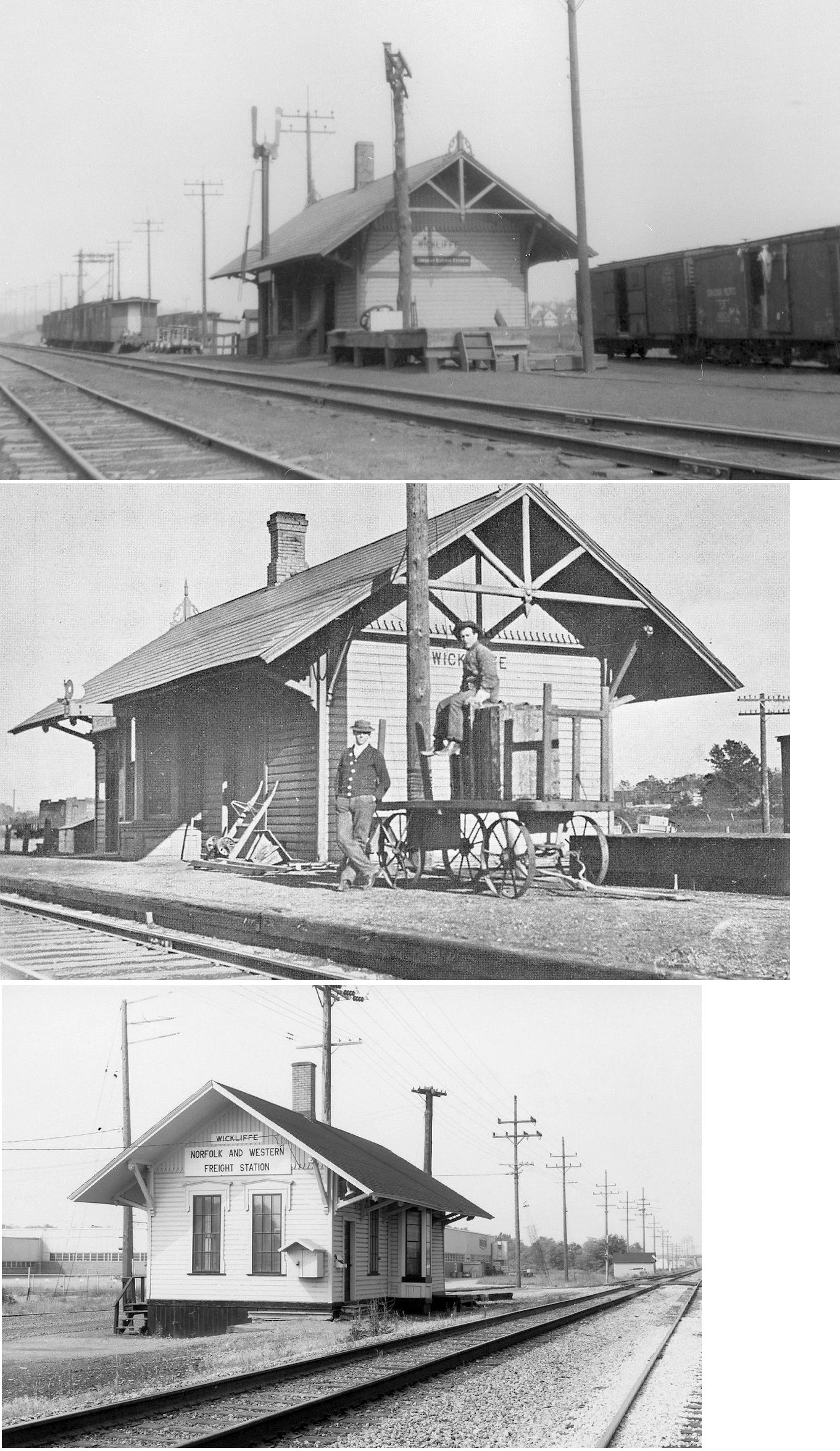
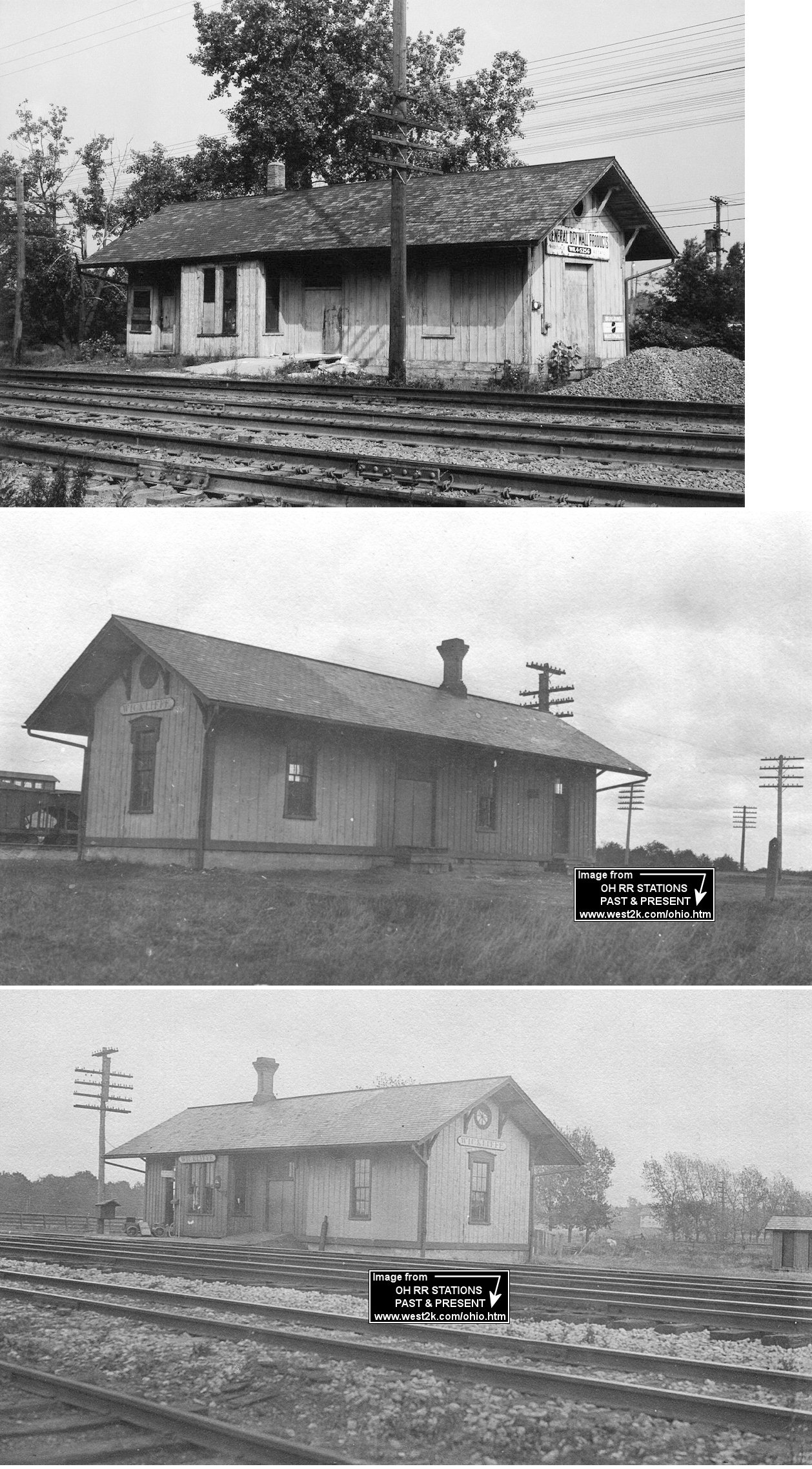
| Wickliffe | |
This station was at the NW end of 289th Street on the SE side of the tracks at GPS: 41.606027, -81.483828. | ||||||
| Wickliffe | |
According to NYC valuation records, this station was built in 1884 and set on a new concrete foundation in 1903. A 20' extension was added in 1914. | ||||||
| 1898 LAKE COUNTY RAILROAD MAP | ||||||||
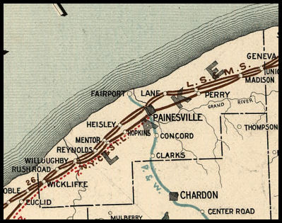 |
||||||||
|
Notes About Existing Stations... Concord (B&O) - A former owner of this house claims that this was a freight station moved a few hundred feet from original location. According to the Lake County Auditor's website, the depot was built in 1900, but it may be older. The Concord Historical Society confirms that this was a railroad station. --Note by Scott Stasa Mentor (LS&MS) - On National Register of Historic Places. The building is currently a restaurant and has housed several different ones over the years. According to NYC valuation records, this station was built in 1902. Mentor (NYC) - The original LS&MS freight station was damaged by derailment and replaced with this one. On National Register of Historic Places. According to NYC valuation records, this station was built in 1906. Painesville (LS&MS) - This station replaced the original wood frame LS&MS station. Design is of Richardsonian Romanesque style and came from the firm of Shepley, Rutan and Coolidge of Boston. The depot is now called the "Painesville Railroad Museum" and is operated by the Western Reserve Railroad Association. Learn more at http://painesvillerailroadmuseum.org/ Willoughby (CP&A/LS&MS) - Moved from its original location which was on Depot Street closer to Erie Street. The building was moved in 1904 south of the new main track and east of a site designated for a new passenger station which was never built. At some point prior to the 1950s, it was moved again to its current location and used for storage. According to NYC valuation records, this station was built in 1852 (the year the Cleveland, Painesville & Ashtabula RR opened) and extended by 24 feet in 1871 (as was the freight station). |
||||||||