|
|
||||||||
| EXISTING STATIONS | ||||||||
|---|---|---|---|---|---|---|---|---|
| Station Name |
Original Railroad |
Current Location |
Type | Current Use |
Date Built |
Track Status |
Building Material |
More Info |
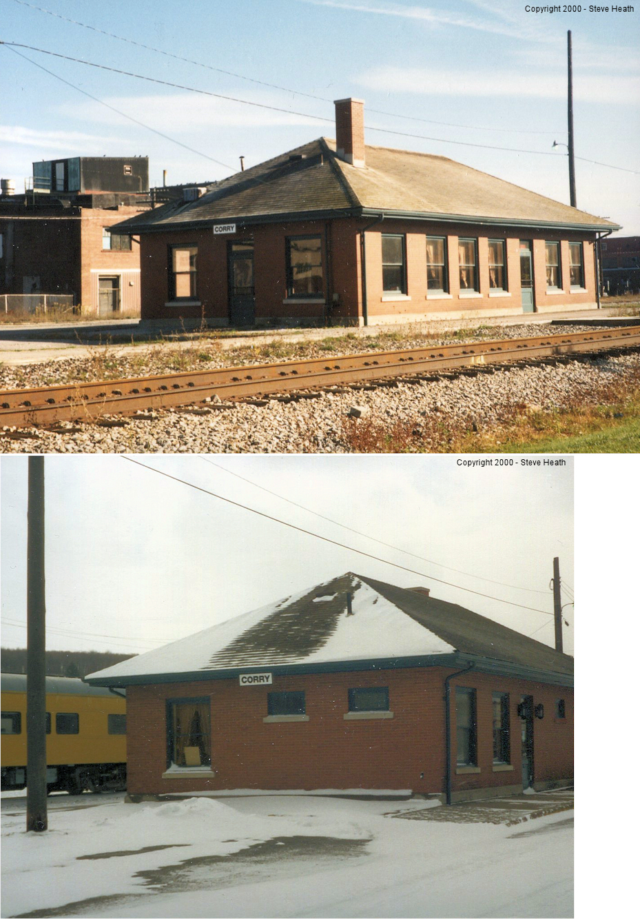
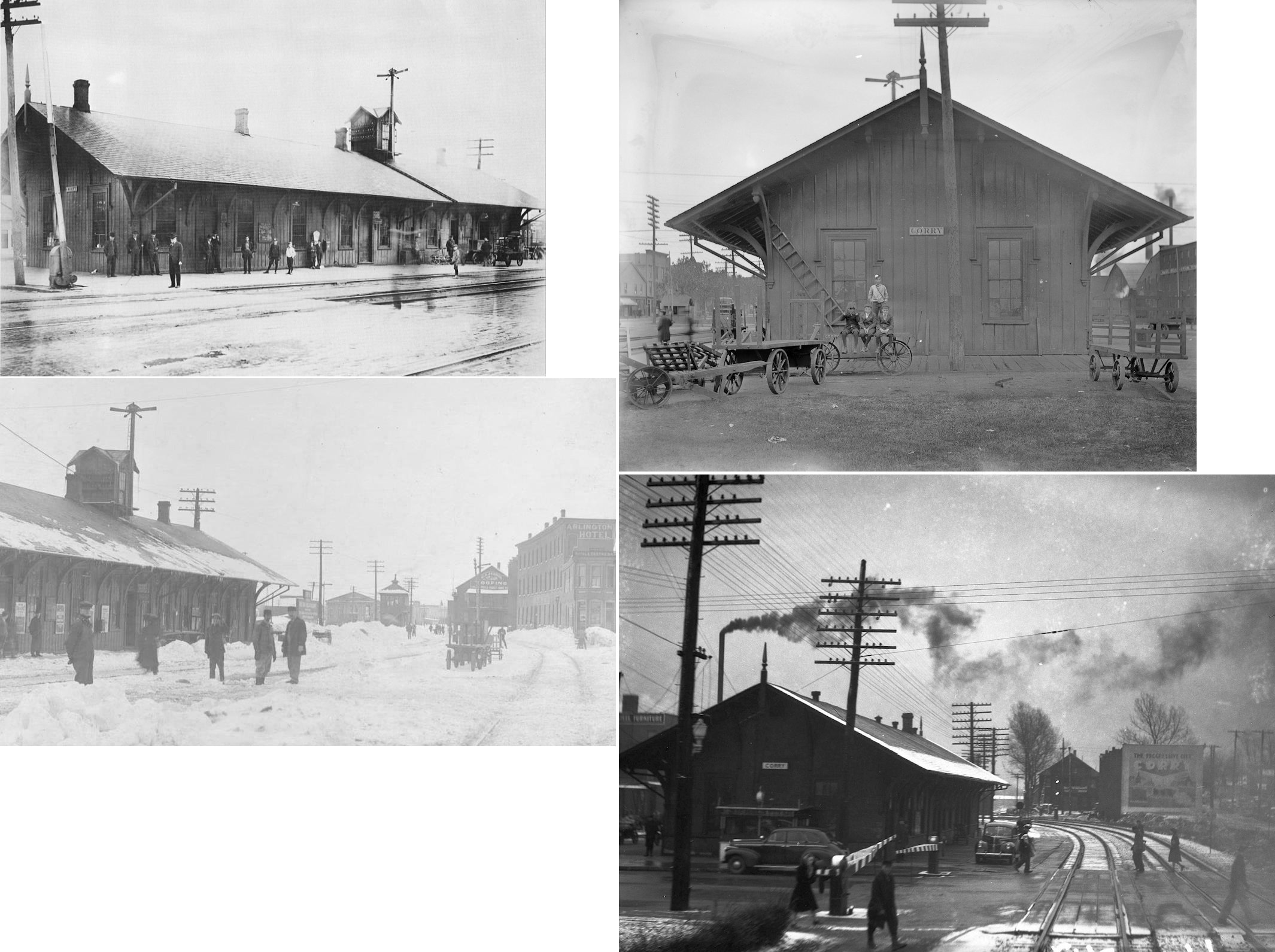
| Corry |
 |
North side of West Main Street between Center Street and North 1st Avenue (GPS: 41.920396, -79.641706) |
P | Railroad | 1951 | In Use | Brick | |
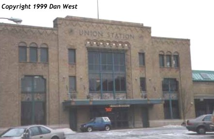
| Erie |
 AND  |
123 W 14th Street (GPS: 42.120994,-80.081856) |
P | Business | 1927 | In Use | Brick | |
| Erie |
 |
1304 Sassafras Street (GPS: 42.120934,-80.084678) |
F | Business | 1905 | Gone | Brick |
|
| GIRARD (North Girard) (Lake City) |
AND |
2203 Rice Avenue (GPS: 42.015092, -80.343360) |
P | Business | ???? | In Use | Wood |
|
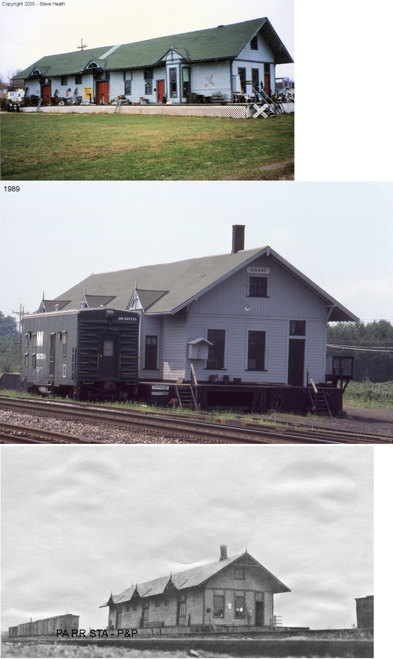
| Girard |
 |
Mechanic Street north of the tracks (GPS: 42.012432, -80.327576) |
C | Business | 1882 | None | Wood |
|
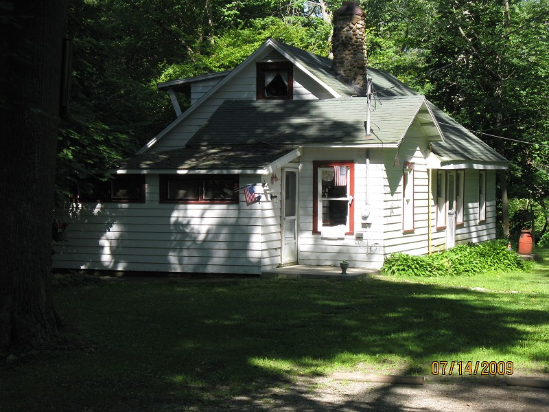
| Lake City |
 |
500 Culbertson Drive (GPS: 42.032301, -80.333216) |
???? | Residence | ???? | None | Wood |
|
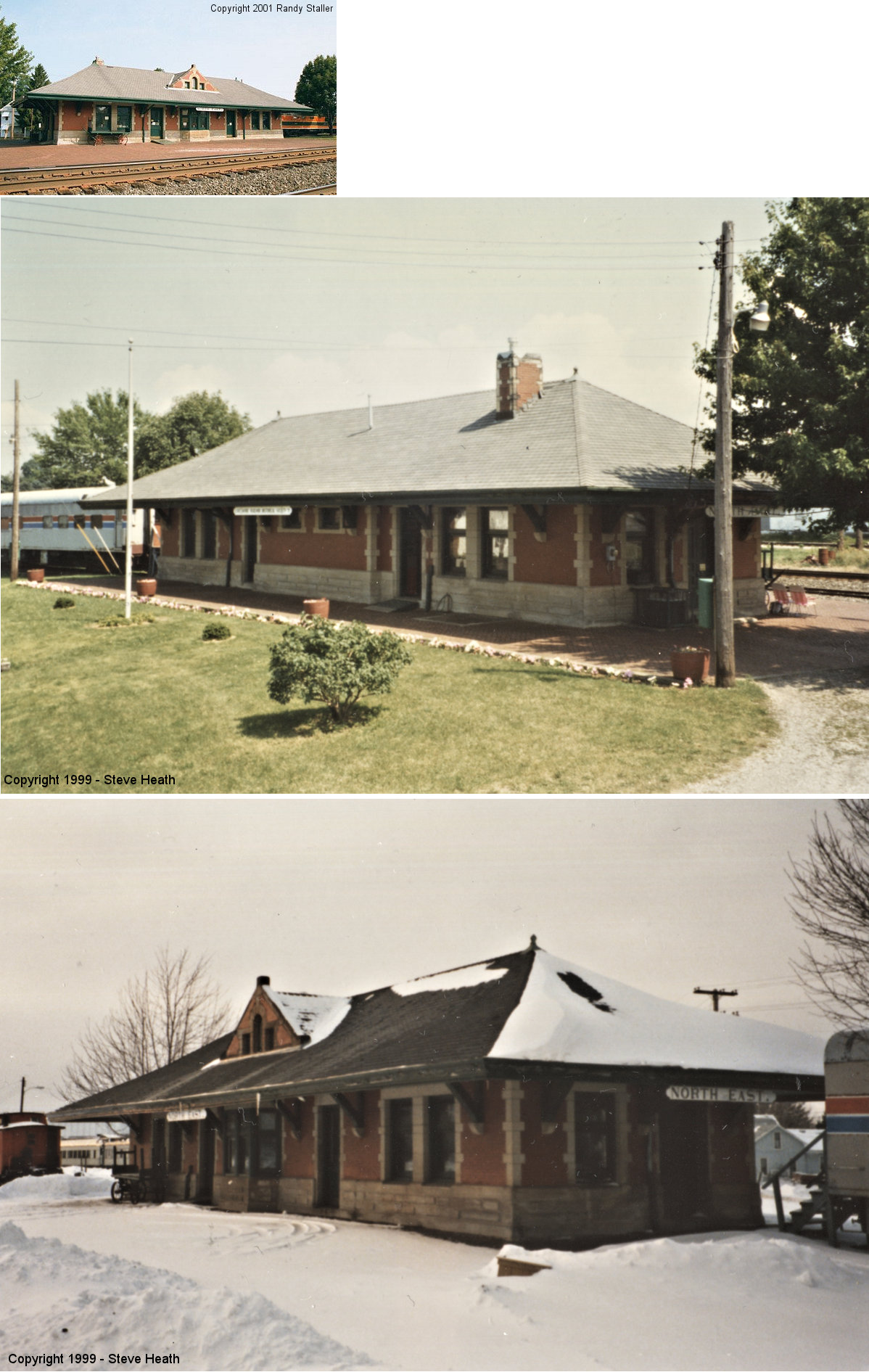
| North East |
|
Wall Street &
Robinson Street (GPS: 42.209799, -79.838541) |
P | Museum | 1899 | In Use | Brick |
|
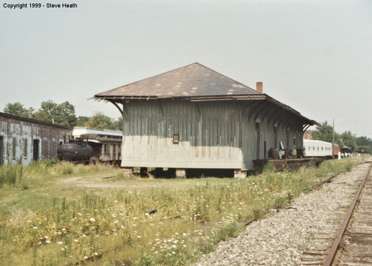
| North East |
|
Wall Street & Robinson Street (GPS: 42.209066, -79.840497) |
C | Museum | 1869 | In Use | Wood |
|
|
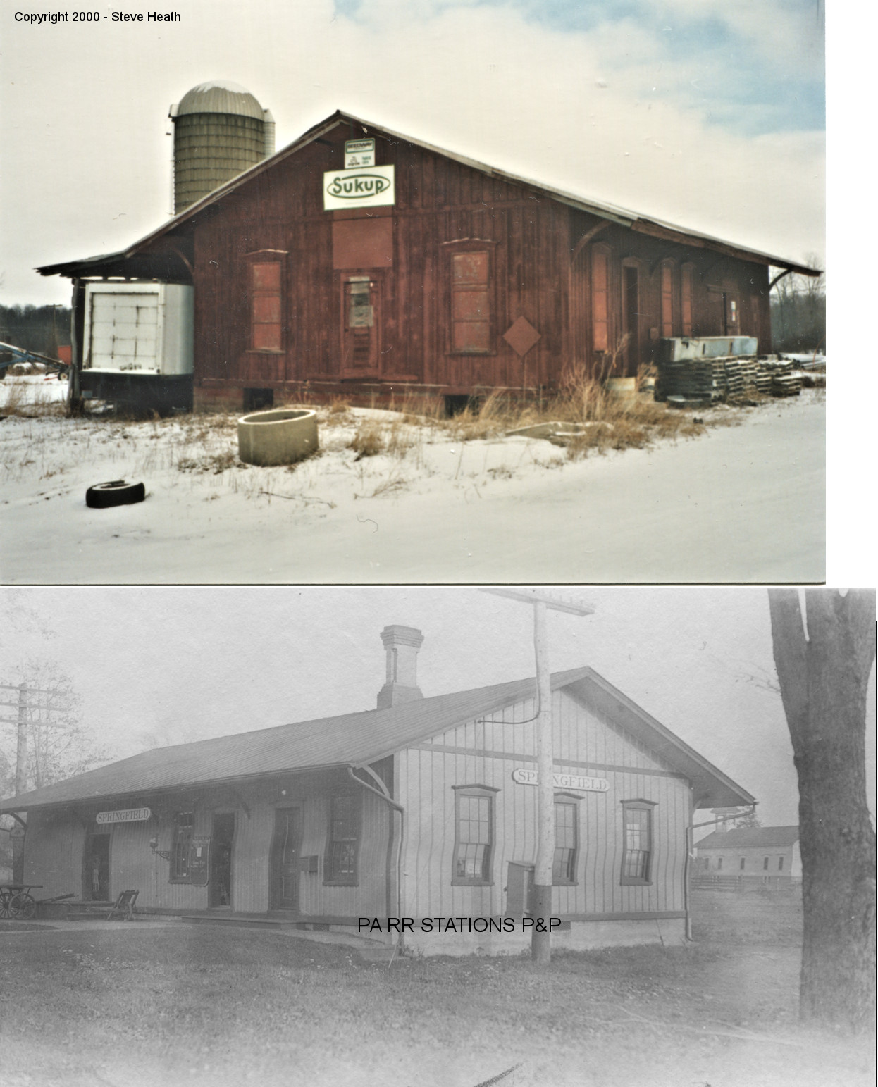
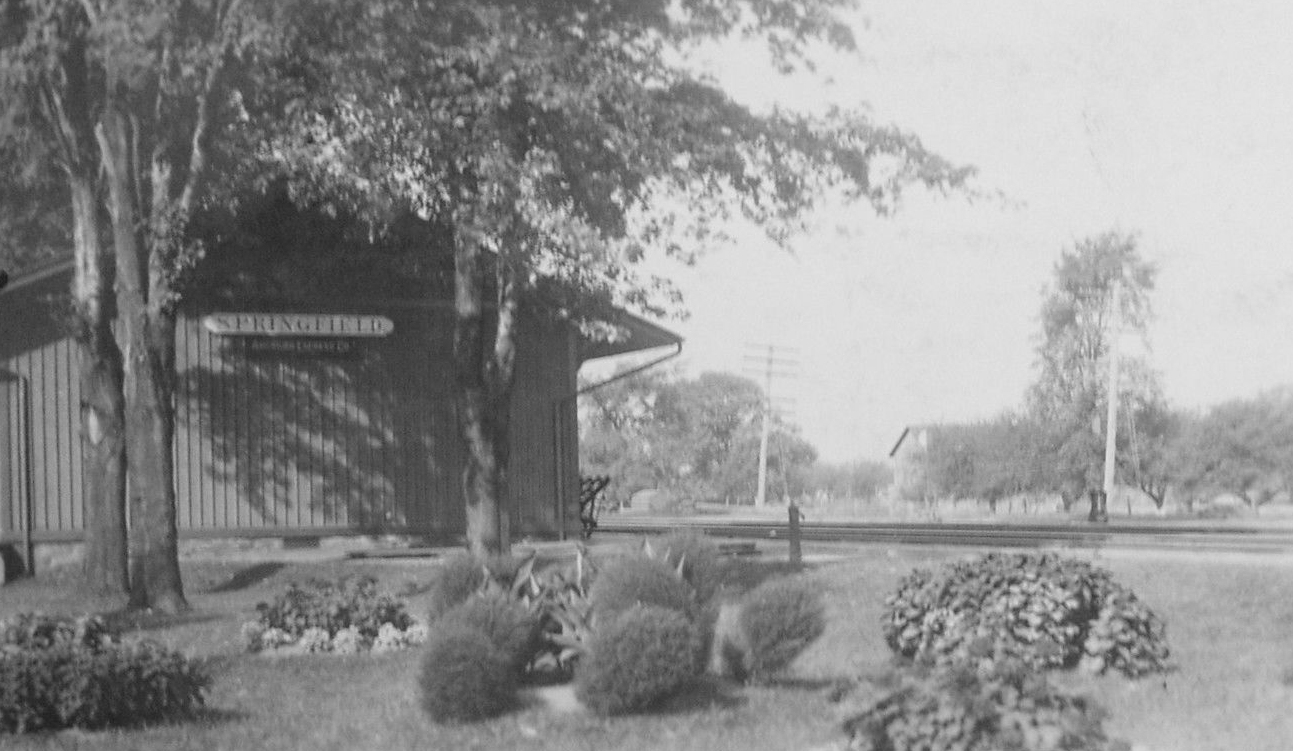
Springfield (W. Springfield) |
|
Holiday Road south of PA-5 | C | Private | 1854 | None | Wood |
|
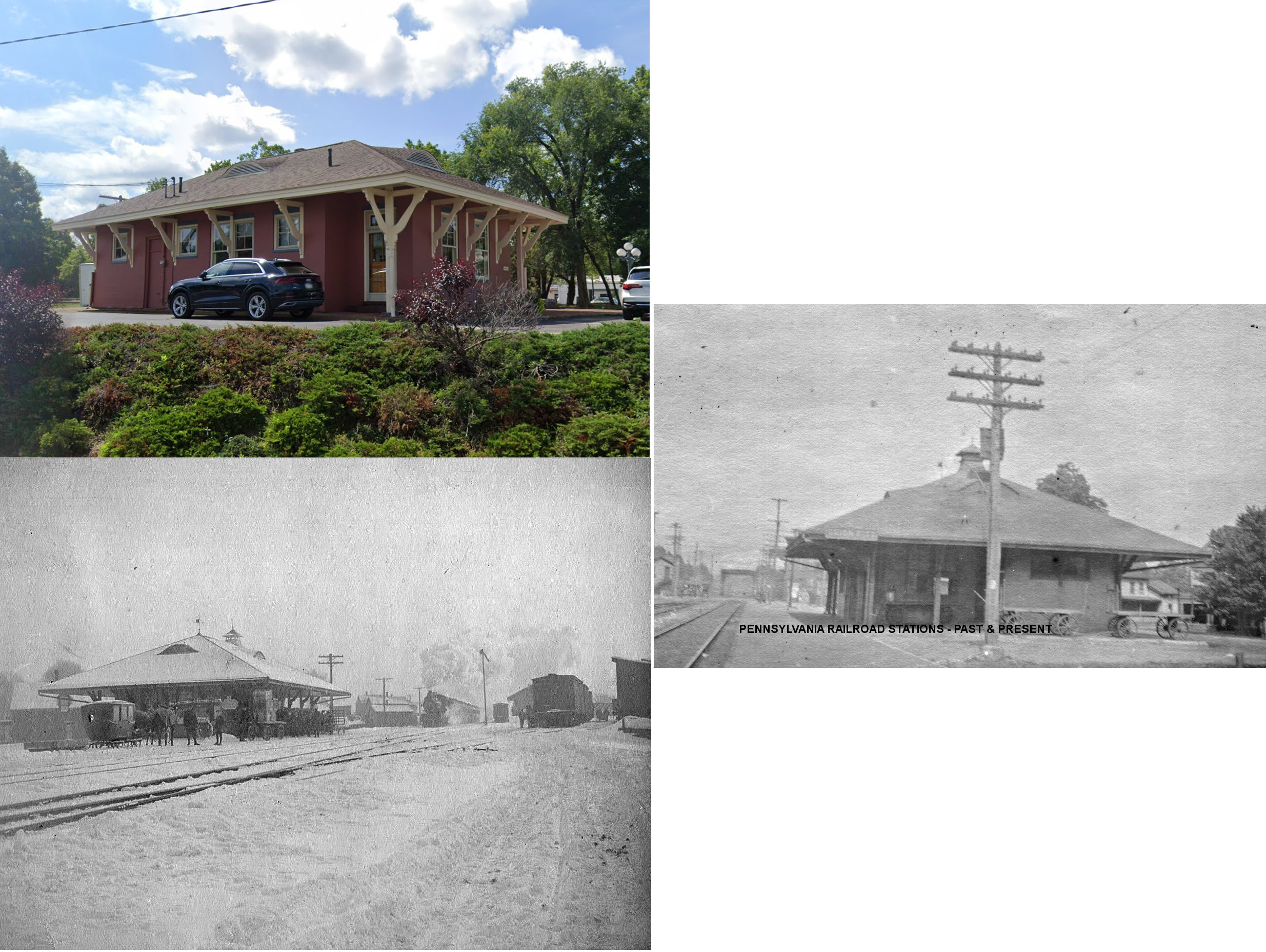
| Union City |
 |
East High Street (US 6) (GPS: 41.899381, -79.844211) |
P | Business | 1901 | In Use | Stucco | |
| STATIONS OF THE PAST | ||||||||
| Station Name |
Original Railroad |
Notes | ||||||
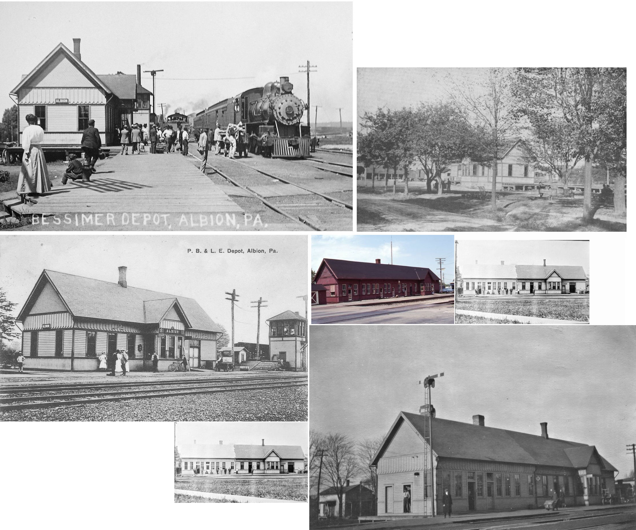
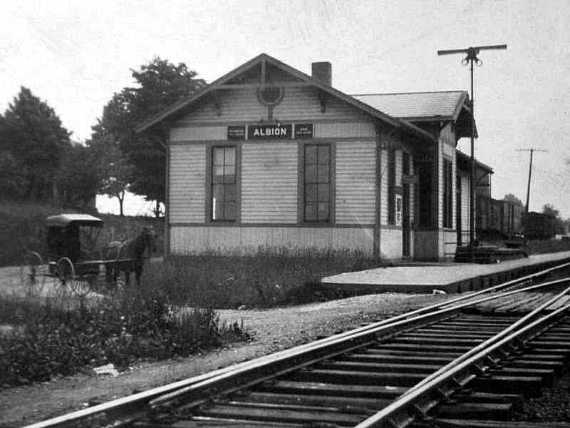
| Albion |
 |
This station was on the north side of Pearl Street on the west side of the tracks at GPS: 41.892630, -80.362323. It was built in 1891 (Conneautville Courier, 8-6-1891) and extended in 1914 (according to B&LE valuation records). It also served as a trainmaster's office. | ||||||
| Albion Station (Wannetta) |
 |
This station was on the south side of Wannetta Road on the east side of the tracks at approximately GPS: 41.887721, -80.384752. | ||||||
| Belle Valley |
|
In 1876 the station was on the south side of Norcross Road on the northwest side of the tracks (GPS: 42.107249,-80.010542). Later maps have the station on the north side of the road on the NW side of the tracks at approximately GPS: 42.107636, -80.009950. | ||||||
| Concord Station (Elgin) |
|
In 1876 the station was on the east side of Elgin Road on the south side of the tracks (GPS: 41.892778,-79.734762). | ||||||
| Concord |
|
This station was on the west side of Elgin Road on the south side of the tracks at approximately GPS: 41.892671, -79.735003. | ||||||
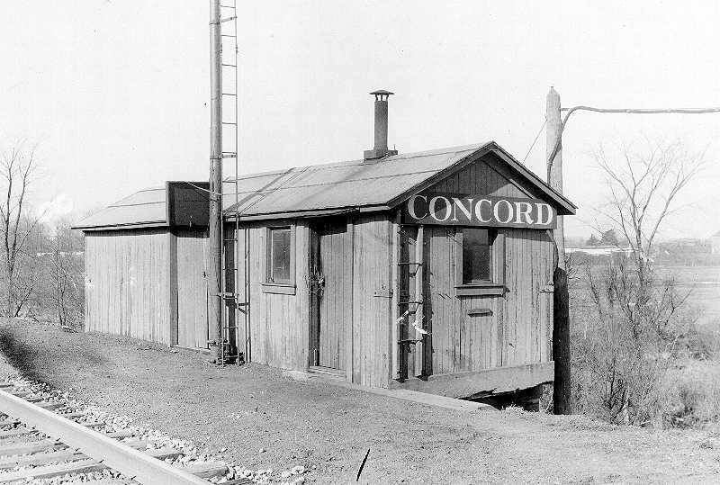
| Concord |
|
Some have identified this as the Concord, OH B&O station, but it is more likely from Concord, PA. The landscape in the photo matches Concord, PA more than Concord, OH. This was likely a temporary station or freight station here. It appears to be a repurposed boxcar. The Erie RR used those quite a bit for temporary stations, add-ons to existing stations and as freight stations in small towns. The font on the depot sign also matches the style of the Erie stations (compare to the Concord sign on the station above). | ||||||
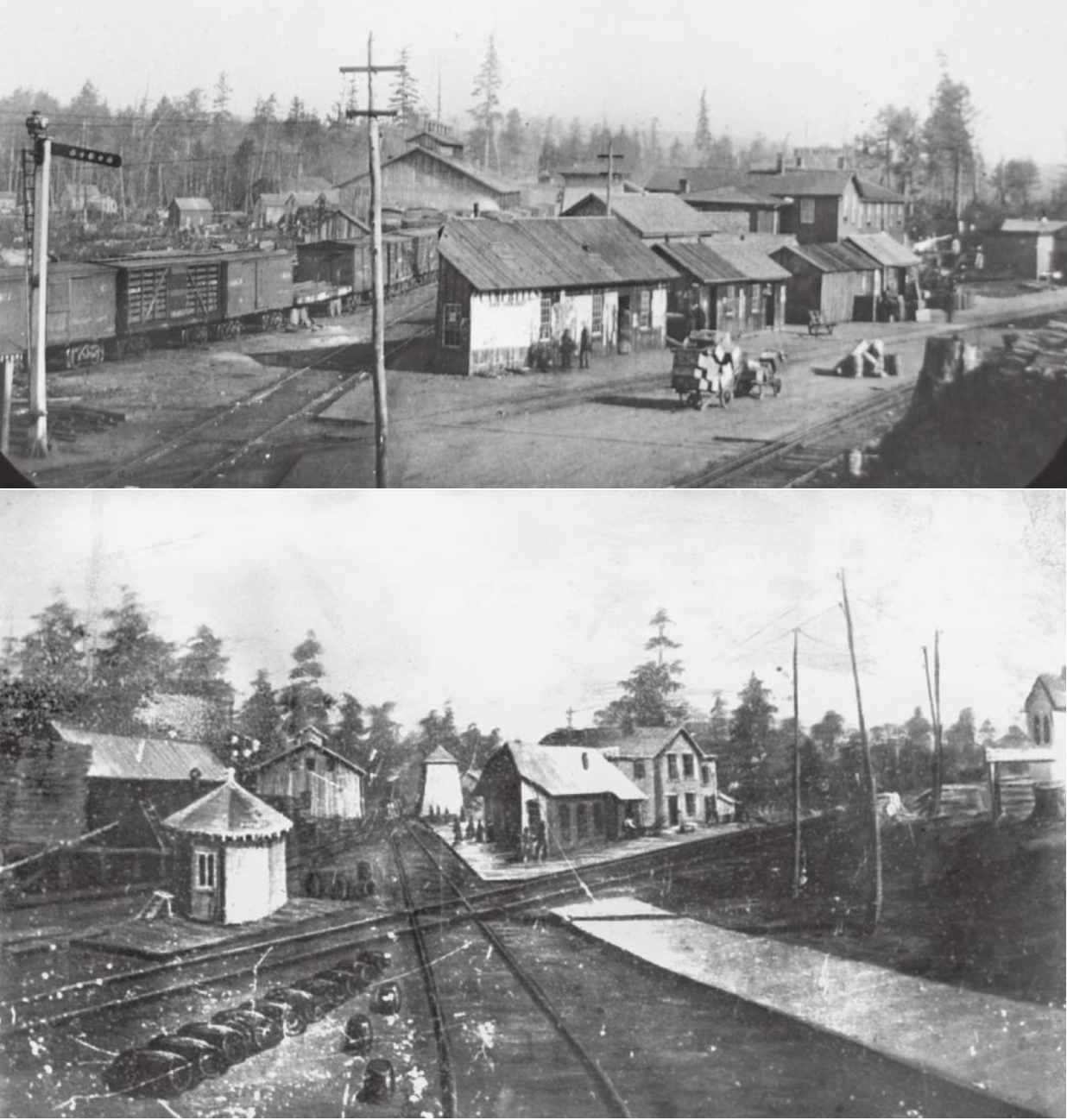
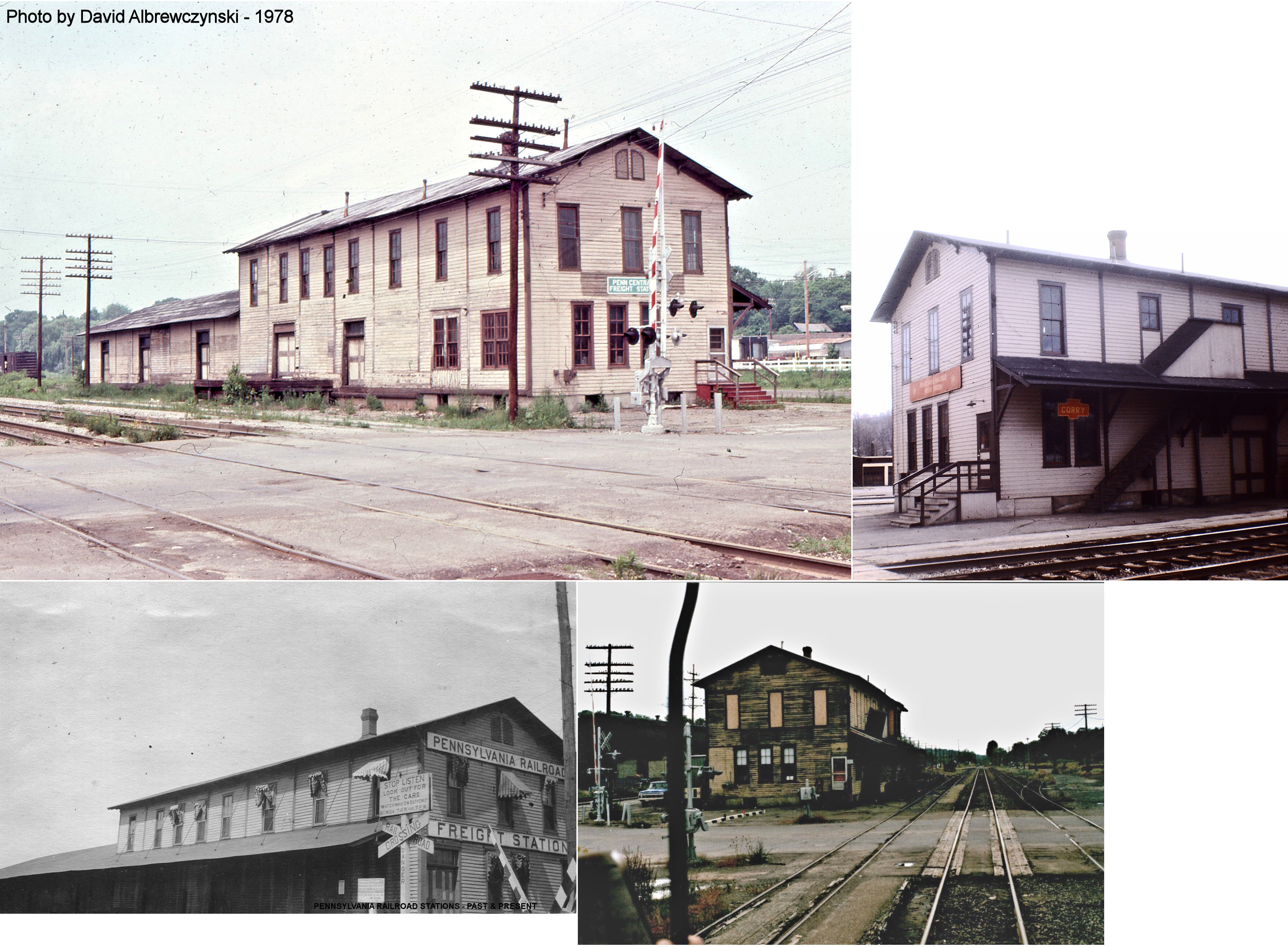
| Corry |
 AND |
The first station here was likely built around 1862 soon after the tracks were laid. It was a angular building at the crossing of the A&GW (later the Erie RR) and the Sunbury & Erie RR (later the P&E/PRR) The railroad named the station after land owner Hiram Cory, the resulting "Corry" was a misspelling that carried on.The original (proper) union station, built in 1866 by the A&GW, and used by the P&E and the Oil Creek RR, was on the east side of Center Street (GPS: 41.920752,-79.6403). The Union Depot Hotel was next to the station to the east. That hotel was gone by 1904. Erie valutaion records list this station as being built in 1892, however other newspaper sources list it as being built in 1866 which is more likely. | ||||||
| Corry |
AND |
|||||||
| Corry |
|
Before moving passenger operation into the union depot, the P&E had its original station at Cross Street (now Maple Avenue). Does anyone know the details of this station? | ||||||
| Corry |
|
The Erie RR freight house was on the east side of 1st Avenue at GPS: 41.920104, -79.642952. According to the 1888 NYLE&W Annual Report, a new freight station was built here that year, but it was actually finished in late 1889. | ||||||
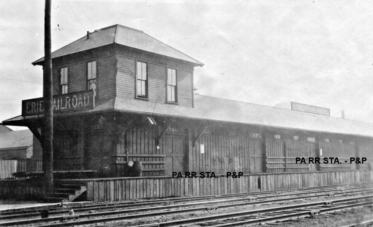
| Corry |
|
The P&E freight house was on the west side of 1st Avenue at GPS: 41.920012, -79.644056. This freight house, built in 1883 (PRR valuation records say 1888) with a two-story head end, was later expanded with long sheds on the west side of the original building (as shown on the 1915 map). This station may have housed passenger operations after the union station went out of service. | ||||||
| Corry |
AND  |
A joint freight transfer station was built here in 1885. It was on the east side of North 1st Avenue at GPS: 41.919962, -79.643782. This building and platforms may have just been part of the P&E freight house listed above. | ||||||
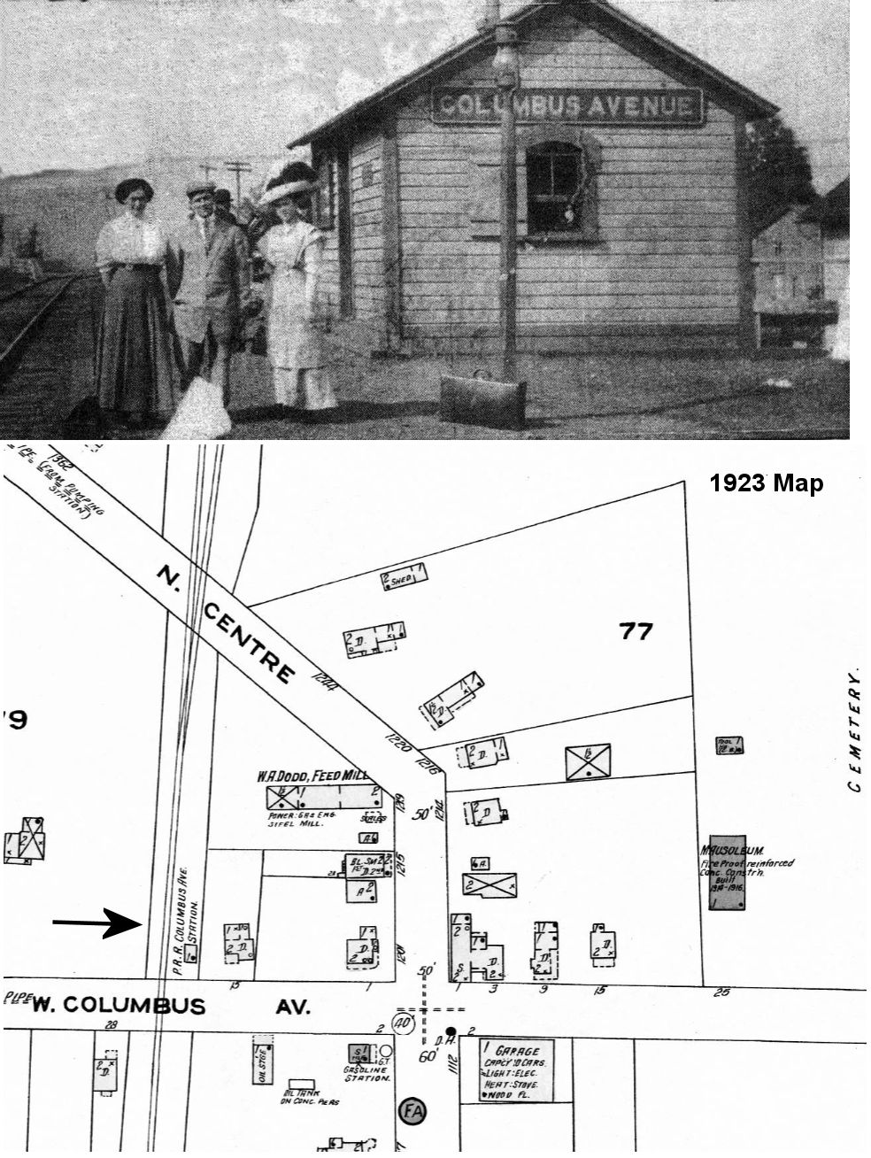
| CORRY (North Corry) (Columbus Avenue) |
 |
This station was on the north side of West Columbus Avenue west of North Center Street at GPS: 41.936701, -79.642028. This was the former Buffalo, Corry & Pittsburgh RR line. Passengers would disembark from this station and walk to the nearby trolley and take that into town as is was often quicker to do so since the trains on this line would have to switch onto the mainline westward and then back east to get to the main Corry P&E station. | ||||||
| Cranesville |
|
This station was at the east end of Gage Road at approximately GPS: 41.903345, -80.350267. It was built in 1892 (Conneautville Courier, 8-18-1892). | ||||||
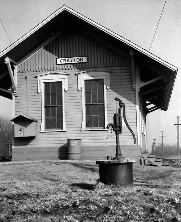
| Crayton |
|
This station was on Crayton Road in Springfield Township in the vicinity of GPS: 41.961109, -80.476021. | ||||||
| Cross |
|
This was the E&P station for East Springfield, being 1.5 miles from there. The depot was on the south side of Cross Station Road on the east side of the tracks at approximately GPS: 41.970315, -80.375318. This station is not shown on the 1912 map, but is on the 1923 map and is referenced in Nelson's Biographical Dictionary and Historical Reference Book of Erie County, Volume 1 (1896). | ||||||
| East Springfield |
|
This station was on the west side of Summerville Road on the north side of the tracks at approximately GPS: 41.932506, -80.399716. | ||||||
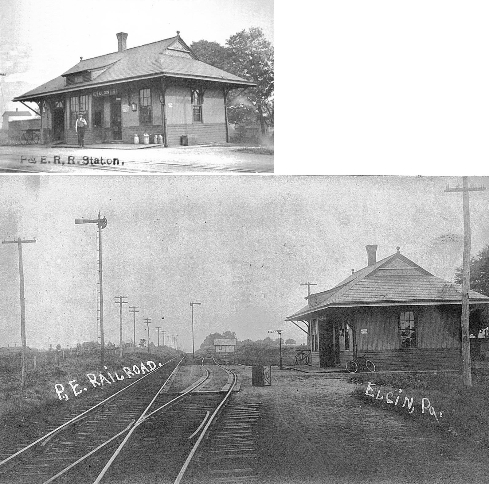
| Elgin |
|
This station was on the east side of Cross Street on the south side of the tracks in the vicinity of GPS: 41.901328, -79.746475. A new station was built here in 1897 according to PRR valuation records. | ||||||
| Elk Creek |
|
This station was on Elk Park Road at approximately GPS: 41.997462, -80.356928. The station is shown on the 1941 map. | ||||||
| Elk Creek Siding |
|
Elk Creek Siding was between Platea (Lockport) and Girard. It is listed as a passenger stop on the 1891 timetable that appeared in newspapers. There may not have been a station there, but four trains (two north and two south) per day stopped there. | ||||||
| Erie |
|
The first passenger station here was on the south side of 12th Street between Peach & Sassafrass Streets. It was built in 1891, but only served for 6 years. It was moved in 1897 so the new brick and stone station listed below could be built. It was likely torn down after that. | ||||||
| Erie |
|
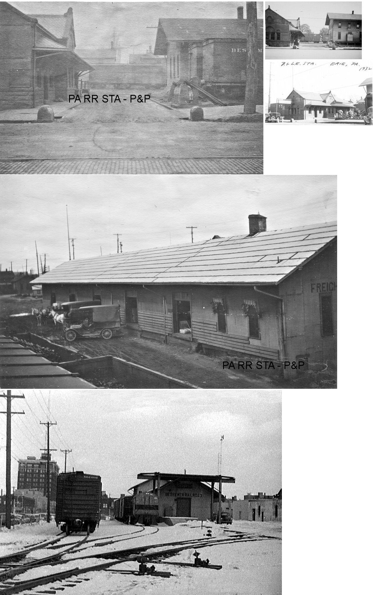
The photo shows the passenger and freight station which were next to each other. The second photo is of the passenger station. They were located on the south side of 12th Street between Peach and Sassafrass Streets (GPS: 42.122426,-80.083627). This was a terminal-type station as the tracks ended here so the passenger station was perpendicular to 12th Street. The brick passenger station was built in 1898. The first freight station was one-story and was opened in 1893 (Conneautville Courier, 7-20-1893). It was extended in length in 1903. At some point between 1917-1921 a two-story head end was added. For some reason the B&LE bought a church on the SW corner of Peach and 12th Street in 1903 and it was rumored that the RR might build a new depot there which was odd given that the RR had just built the passenger station five years earlier. The rumors of a new station were unfounded as the church was still standing, but vacant, in 1921 (according to the Sanborn map of that year). Passenger service ended in 1955, and the passenger station was eventually torn down in 1957. | ||||||
| Erie |
|
The original P&E passenger station, likely built in 1859 when the section of line opened from Erie to Warren, was on the east side of the State Street Bridge over the railroad below where Hamot Hospital is today. After the P&E moved passenger operations to the new union station in 1866, this depot continued to be used as a freight station until it was torn down sometime between 1900-1920. | ||||||
| Erie |
 |
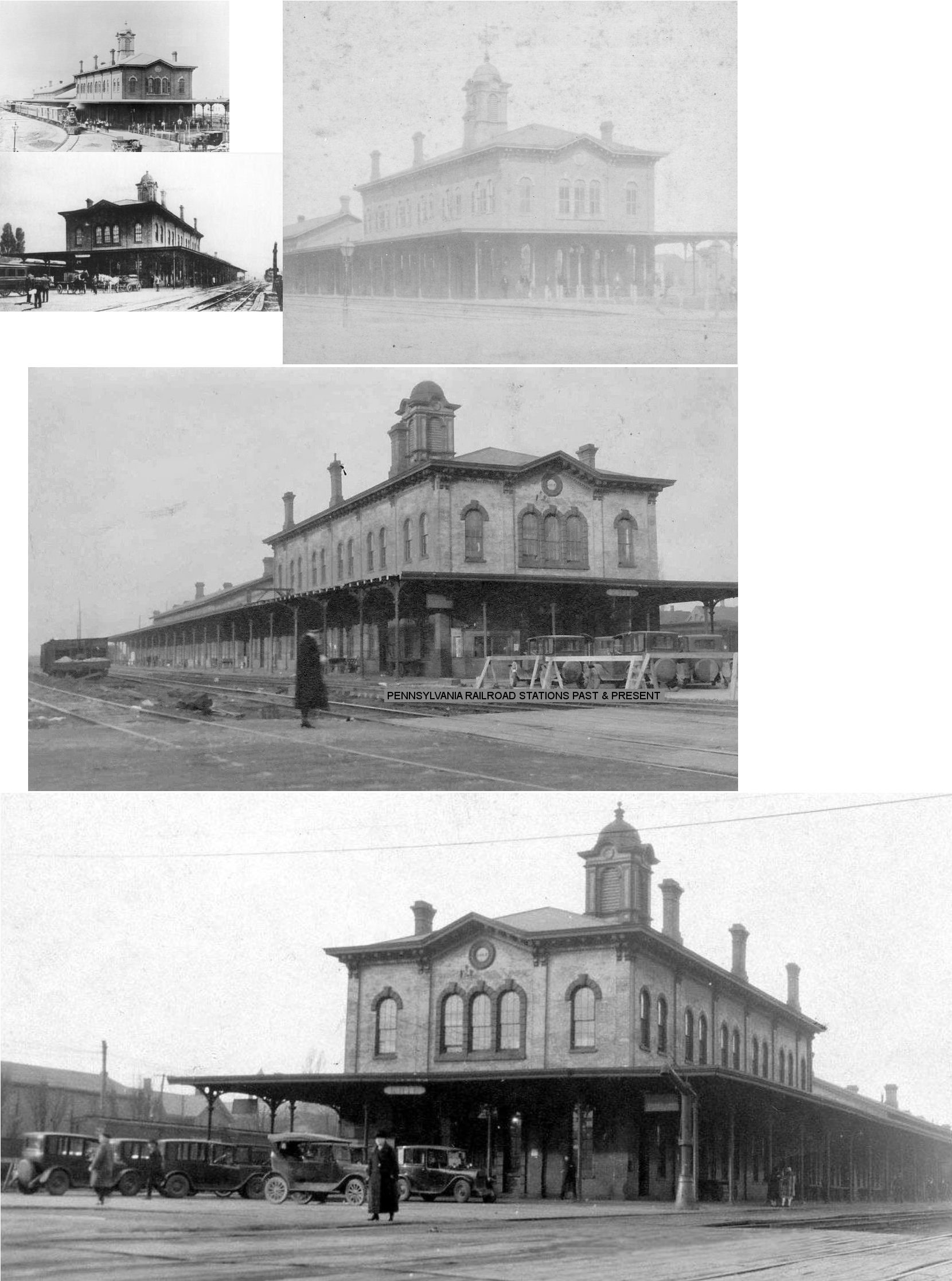
This old union station sat on the block bordered by Peach Street and Sassafrass Street between 14th and 15th Streets in the same location as the existing union station (GPS: 42.120764, -80.082386). It was built in 1865, opened in 1866, and was jointly owned by the Erie & Northeast RR (later LS&MS) and the Cleveland, Painesville & Ashtabula RR (also later LS&MS). The Philadelphia & Erie RR was a tenant. The NYC tracks were on the north side of the station and the PRR tracks were on the south side. | ||||||
| Erie |
|
While the new Union Station was being built on the site of old Union Depot, a temporary station was erected on East 14th Street between French and Holland Streets at GPS: 42.122449, -80.077149. The station operated from November 1925 until the Union Station opened in December 1927. | ||||||
| Erie |
|
The original Erie & Northeast (later Buffalo & Erie, later LS&MS) brick depot here, built in 1851 and opened in 1852 with the first passenger train, was demolished in 1865 with the erection of the new Union Depot (see above) as it was in essentially the same spot (Nelson's Biographical Dictionary and Historical Reference Book of Erie County, Pennsylvania, Vol. 1, 1896). | ||||||
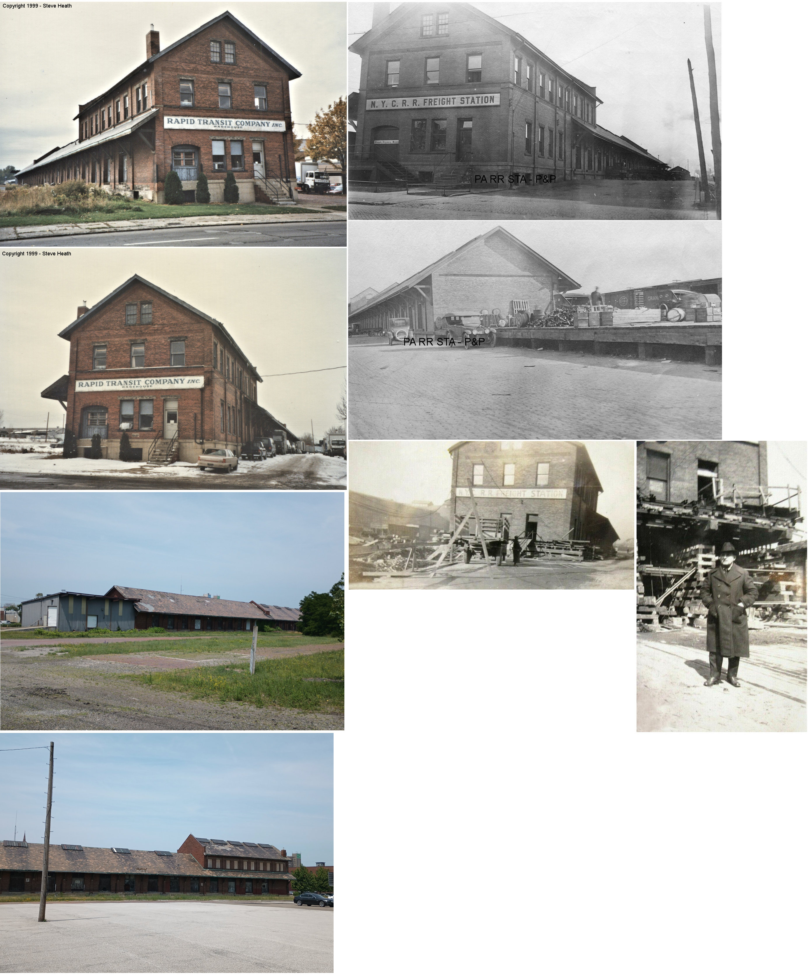
| Erie |
|
The original brick freight station was just to the north of where the existing freight station is. It was at GPS: 42.121095, -80.084879. The newer and larger NYC freight station (still standing) was built in 1905 and opened in February 1906. | ||||||
| Erie (Dock Junction) |
|
This station was somewhere NE of Pittsburgh Avenue in the vicinity of GPS: 42.101114, -80.125656. | ||||||
| Erie |
|
There was a freight house on the north side of West 13th Street at Sassafrass (GPS: 42.121376,-80.084989). According to PRR valuation records, this station was built in 1917. | ||||||
| Erie |
|
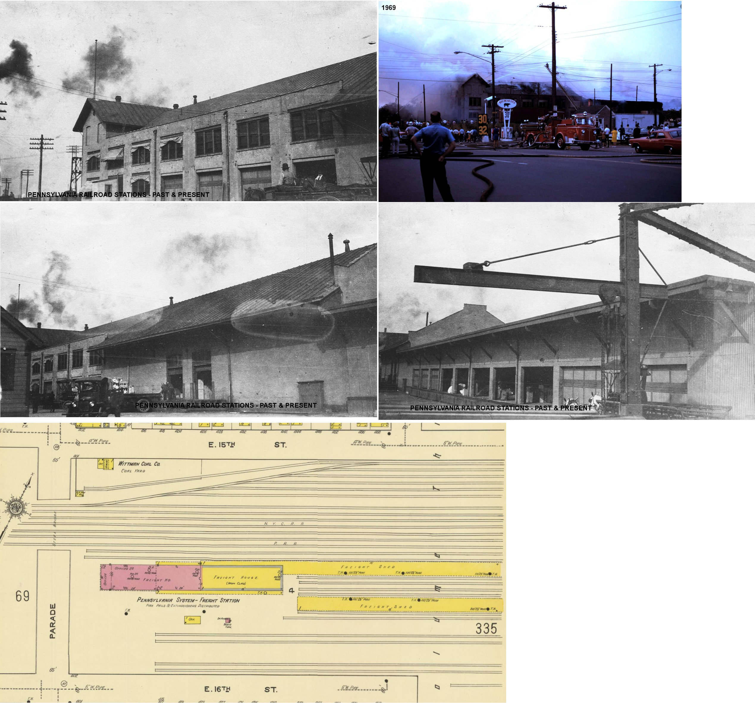
There was a freight house was on the east side of Parade Street between 15th and 16th Streets (GPS:42.124066,-80.070151). It was enlarged in 1891 adding 100 more feet of covered storage space (Erie Times-News, 8-21-1891). The freight shed for this station stretched to the NE past Wallace Street almost to Ash Street. It burned down in October 1969. | ||||||
| Erie |
|
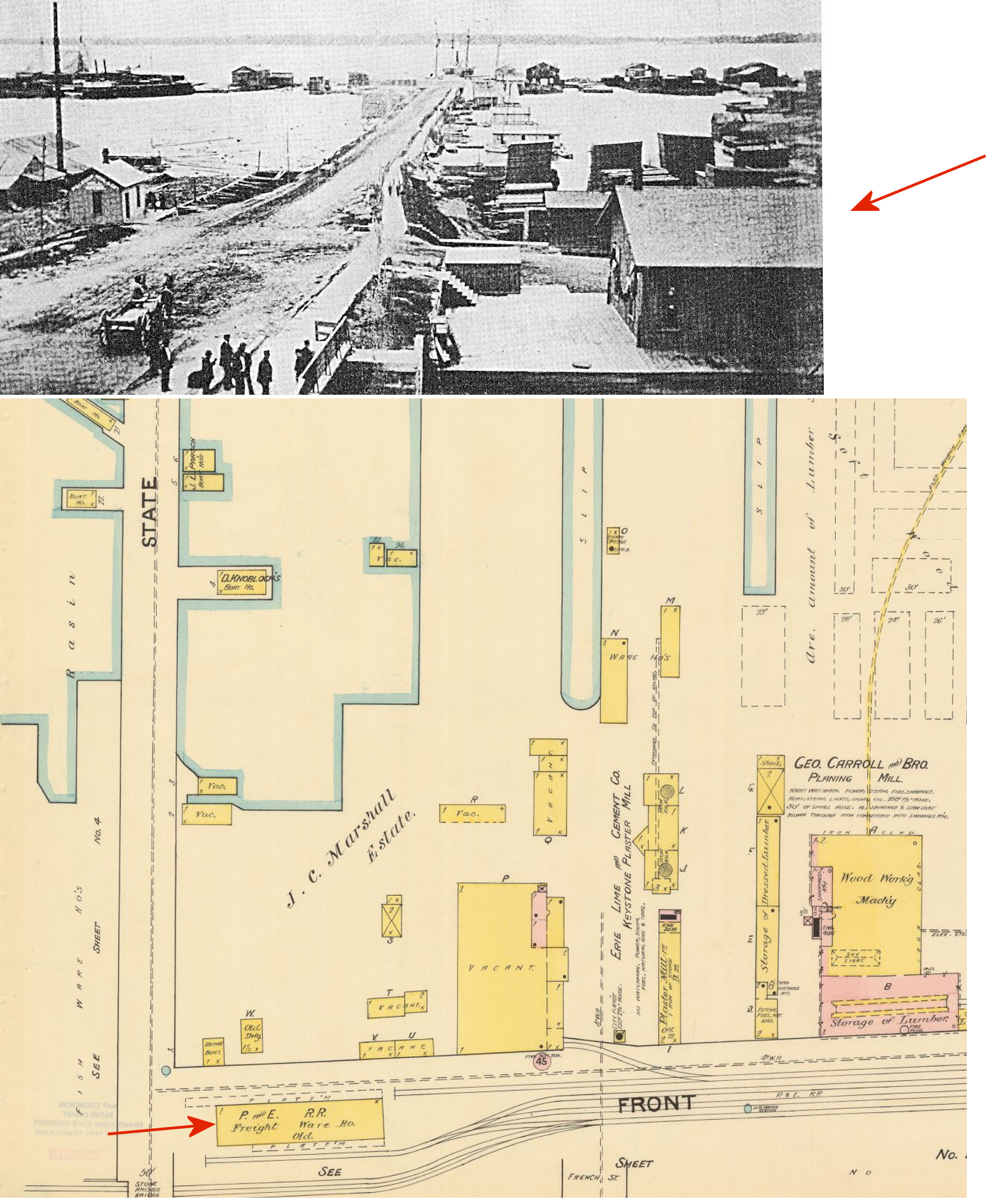
There was a freight station on the west side of French Street at Front Street (now the south side of Bayfront Parkway) at GPS: 42.134669, -80.087440. | ||||||
| Erie |
|
There were two large freight stations (and a couple smaller ones) on the waterfront north of East Bayfront Parkway at GPS: 42.139251, -80.085116. These were owned by the PRR and Erie & Western Transportation. | ||||||
| Erie |
|
This passenger station, built in 1882, was on the north side of 19th Street between Holland and German Streets (GPS: 42.119355,-80.072393). The passenger station and it's baggage house/storage (later freight station) were next to each other and the buildings looked similar (see below). | ||||||
| Erie |
|
This was originally the baggage shed and storage for the passenger station and later it was used as the freight station. It was next to the passenger station. | ||||||
| Erie |
|
This freight house was on the eastern corner of German and East 19th Street (GPS: 42.119952,-80.071063). | ||||||
| Esmer Station |
|
The station here was likely in the vicinity of PA832 in the vicinity of GPS: 42.092990, -80.141347. It is shown on the 1941 county map. A 1919 issue of "Railroad Telegrapher" notes that a "Miss Smith" was the operator here. | ||||||
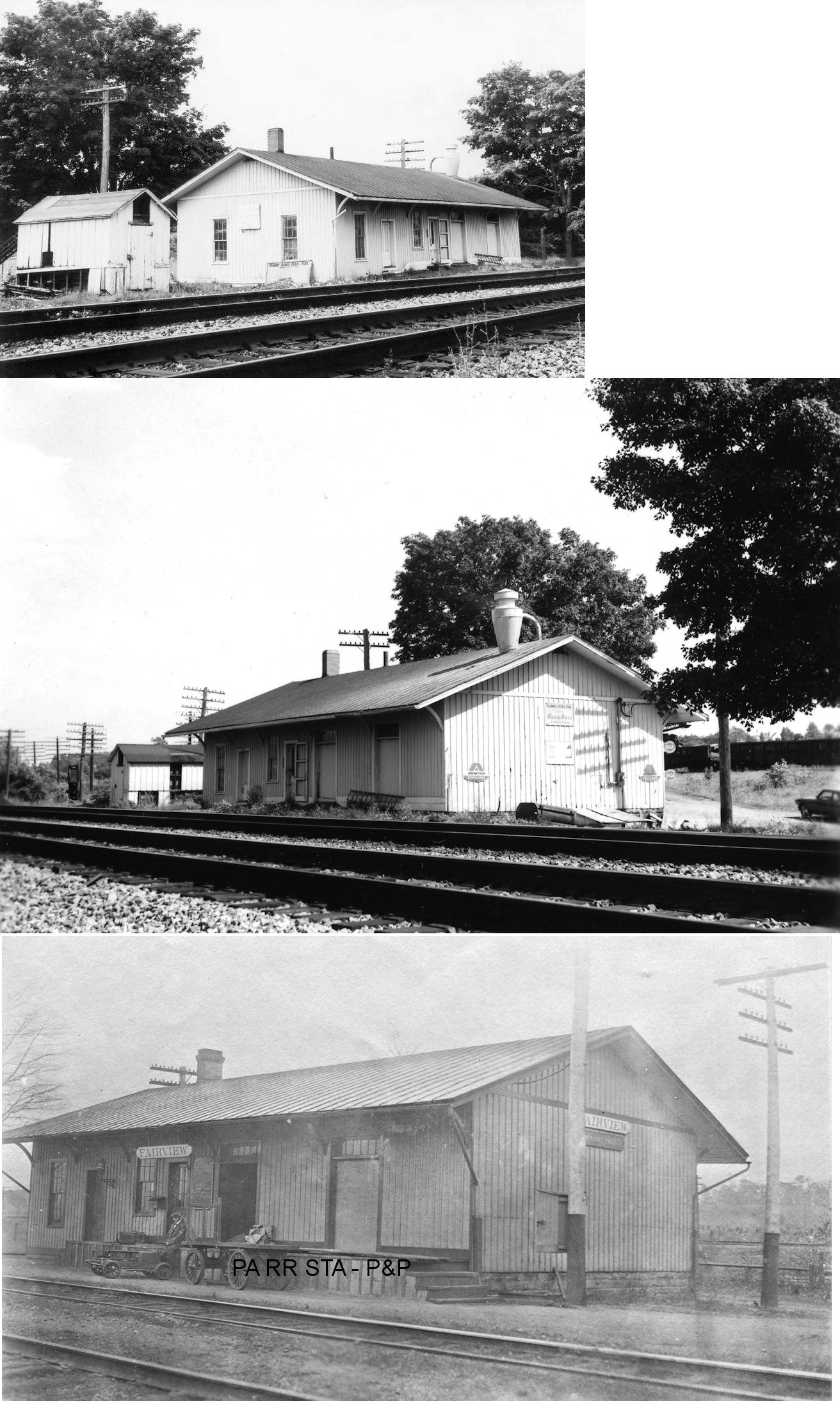
| Fairview (AVONIA) |
AND |
In 1876 this station was on the east side of Avonia Road on the south side of the tracks (GPS: 42.039843,-80.26444). A new station was built here in 1913 according to NYC valuation records. | ||||||
| Fairview |
AND |
|||||||
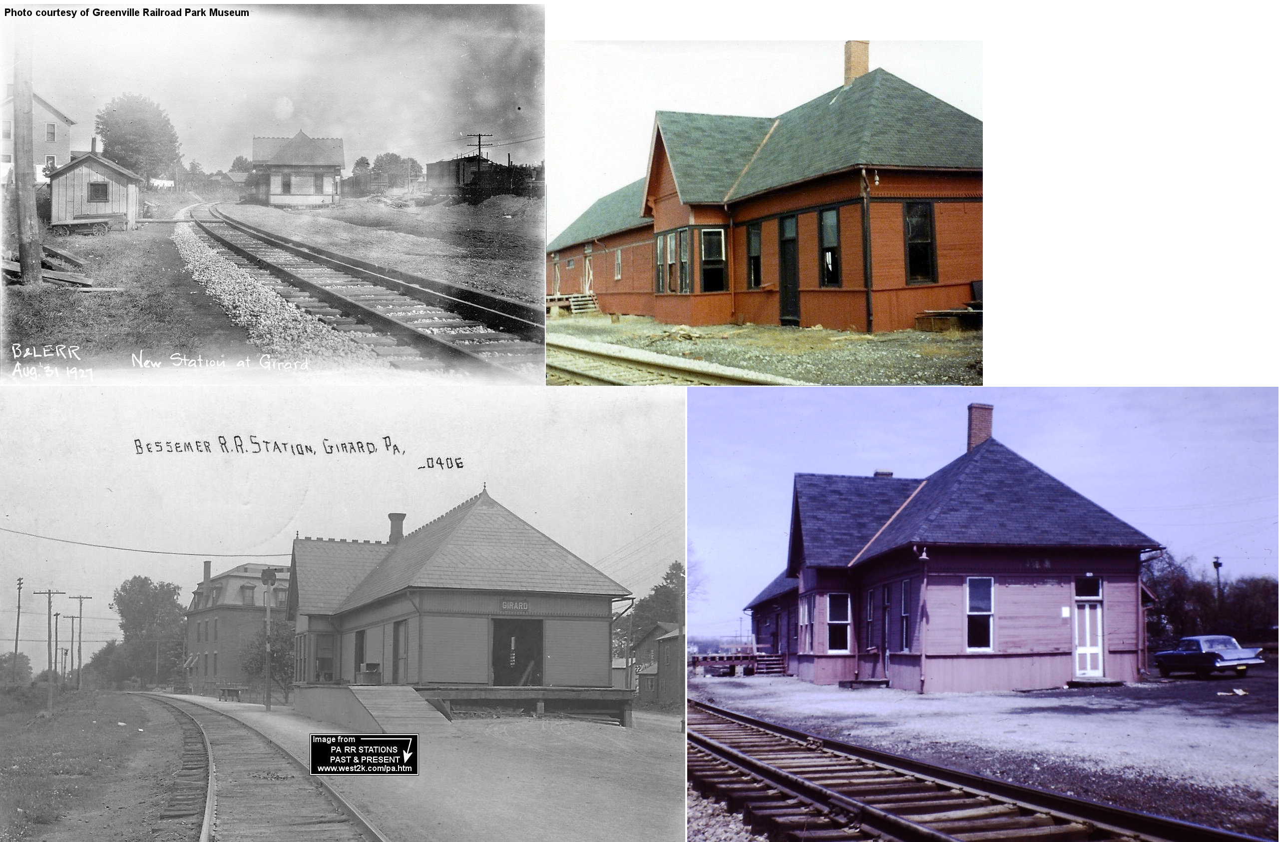
| Girard |
|
The first station here was built in 1891 and was on Rice Avenue (PA18) just north of US 20 on the west side of the tracks at GPS: 41.999995, -80.319997. | ||||||
| Girard |
|
A new station was built here in 1927. | ||||||
| Girard |
|
The LS&MS freight station was on the north side of the tracks along Depot Street near Walnut Street at approximatley GPS: 42.015751, -80.342866. | ||||||
| Girard Jct. Station |
AND |
This station was between West Lake Road and East Creek Road in the vicinity of GPS: 42.013265, -80.370984. There used to be a road to this location that ran along the north side of the LS&MS tracks. | ||||||
| Harborcreek |
|
This station was on the NE side of Depot Street (when this street continued north over the tracks) on the north side of the tracks at approximately GPS: 42.167990, -79.952110. It was built in 1865 according to NYC valuation records. | ||||||
| Harborcreek |
|
This station was on Depot Street on the north side of the tracks at approximately GPS: 42.167262, -79.951889. | ||||||
| Hewett |
|
This station was on the east side of Pond Road on the south side of the tracks at approximately GPS: 41.935230, -80.501006. The station is shown on the 1912 Erie county map, but timetables don't list the station so there may not have been a depot there. | ||||||
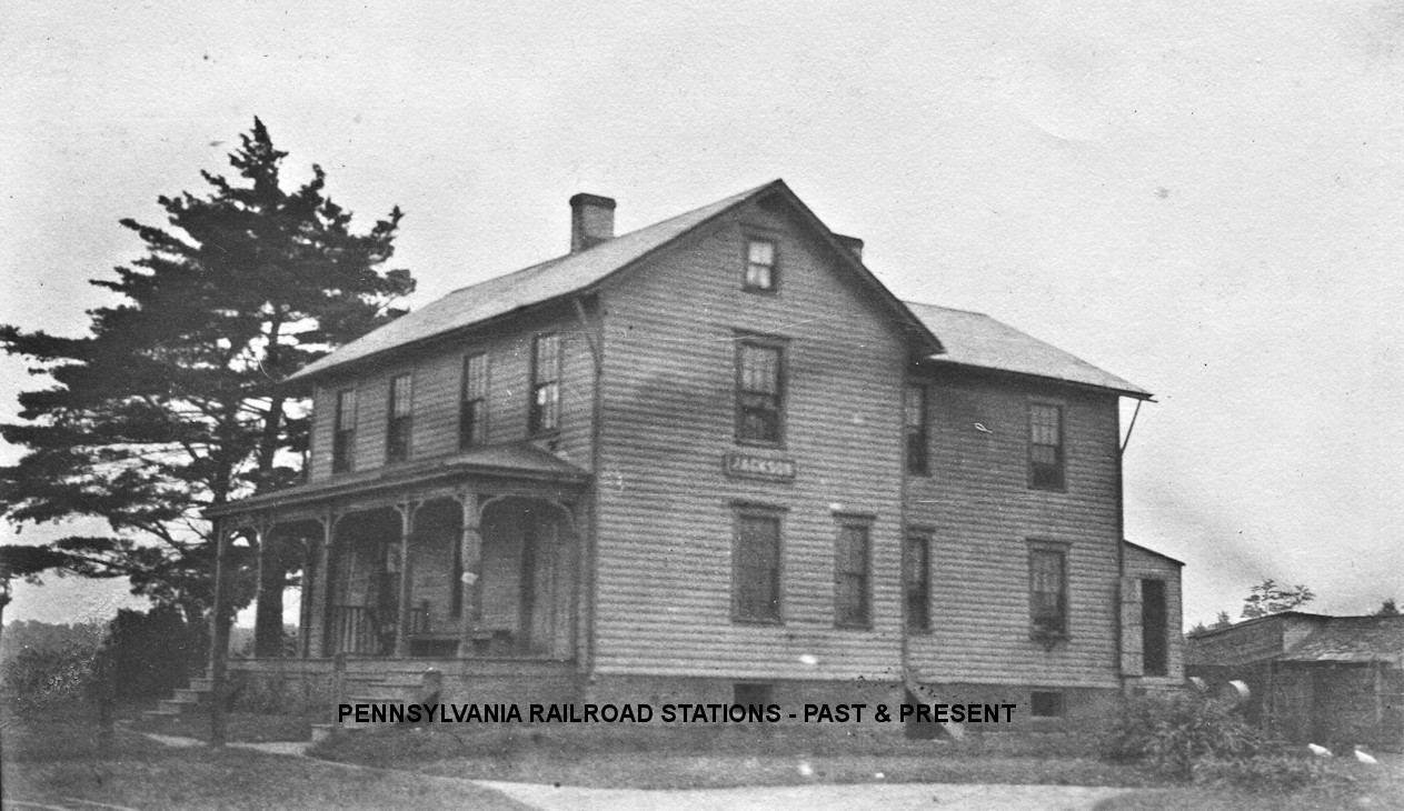
| Jackson Station |
|
According to old maps, this combination station/foreman's dwelling was on the north side of Jackson Station Road on the west side of the tracks at approximately GPS: 42.028625, -80.009835. However, there is evidence to suggest that it was on the east side of the tracks and looking at the lay of the land, that would make more sense. According to PRR valuation records, it was built in 1898. | ||||||
| Kanty |
|
This station was between East 39th Street and Shannon Road in the vicinity of GPS: 42.122505, -80.008137. It is shown on the 1941 county map. According to PRR valuation records, an 8'x12' passenger shelter was built here in 1912. | ||||||
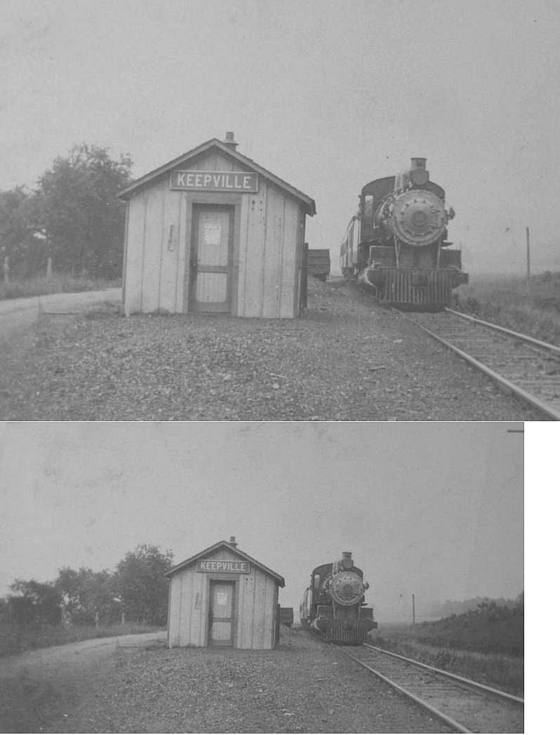
| Keepville |
|
This station was on the north side of Carter Road on the west side of the tracks at approximately GPS: 41.868315, -80.394327. | ||||||
| Keepville |
|
|||||||
| Lake City |
|
This station was moved from ???? to 500 Culbertson Drive (GPS: 42.032301, -80.333216). Paul Warner writes, "My parents bought this home in 1973 from the dentist, Dr. Baxter. It was a train station, was moved in the 1940's and then the upstairs was built. A lady and her son pulled in the driveway one day...she explained that her husband built the upstairs and they had lived there when he worked for the railroad. The house was sold in 2010, but had to be torn down and re-built when it was discovered there was a problem with termites." The building has the profile of an NKP station, can someone confirm whether this was the Lake City NKP station or from somewhere else? | ||||||
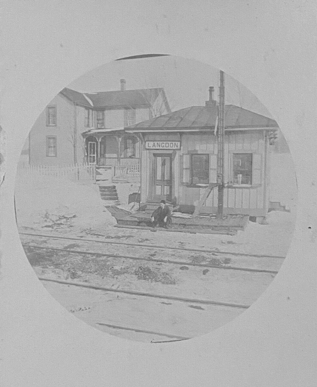
| Langdon |
|
This station was on the south side of Langdon Road on the west side of the tracks at approximately GPS: 42.077040, -80.027795. It is not shown on the 1912 map, but is on the 1923 map. According to PRR valuation records, the station was built in 1893. | ||||||
| Le Boeuf Station |
|
This 8'x9'x12' passenger shelter was on the north side of Wheelertown Road on the SE side of the tracks at approximately GPS: 41.906378, -79.909424. According to P&E valuation records, it was built in 1898. | ||||||
| Lexington Station |
|
This station was on the east side of Lexington Road on the south side of the tracks at approximately GPS: 41.930666, -80.377047. The station is shown on the 1912 Erie county map, but timetables don't list the station so there may not have been a depot there. | ||||||
| Lexington Station |
|
The maps from 1912 and 1923 show both a B&LE station and an E&P station here near where the lines crossed, but neither station was at the diamond. The E&P station was on the east side of the tracks on the old road (now gone) that used to run west/east from Church Road to Lexington Road where Chruch Road turns south today. The station was at approximately GPS: 41.929506, -80.380482. | ||||||
| Lockport |
|
See listing for Platea below. | ||||||
| Lovell |
|
This station was on the west side of PA89 on the north side of the tracks at approximately GPS: 41.907467, -79.703640. According to PRR valuation records, the station was built in 1903. | ||||||
| Merritt |
|
This station was one mile west of West Springfield Station and five miles east of Conneaut. It was on the south side of the tracks on the west side of Huntley Road at approximately GPS: 41.936831, -80.478103. The station is shown on the 1912 Erie county map, but timetables don't list the station so there may not have been a depot there. | ||||||
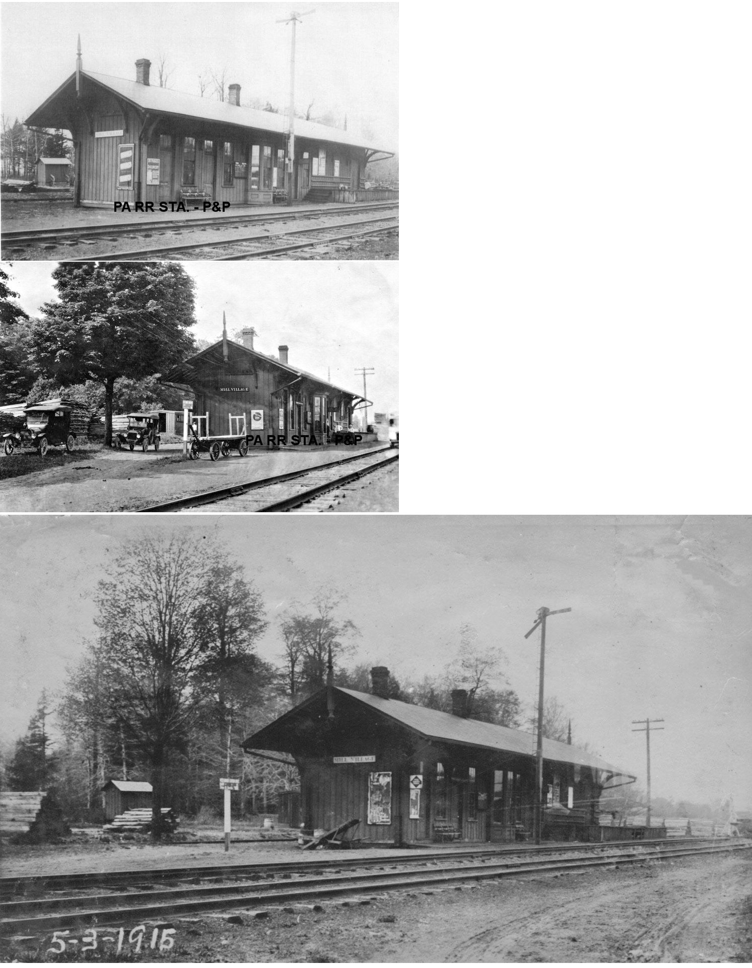
| Mill Village |
|
This station was built in 1864 according to Erie RR valuation records. When the new double track project was completed in 1913, this station on the former mainline became the westbound station and a new station (see below) was added on the eastbound line. | ||||||
| Mill Village |
|
This station was added in 1913 when the Erie installed the new eastbound line between Meadville and Corry. | ||||||
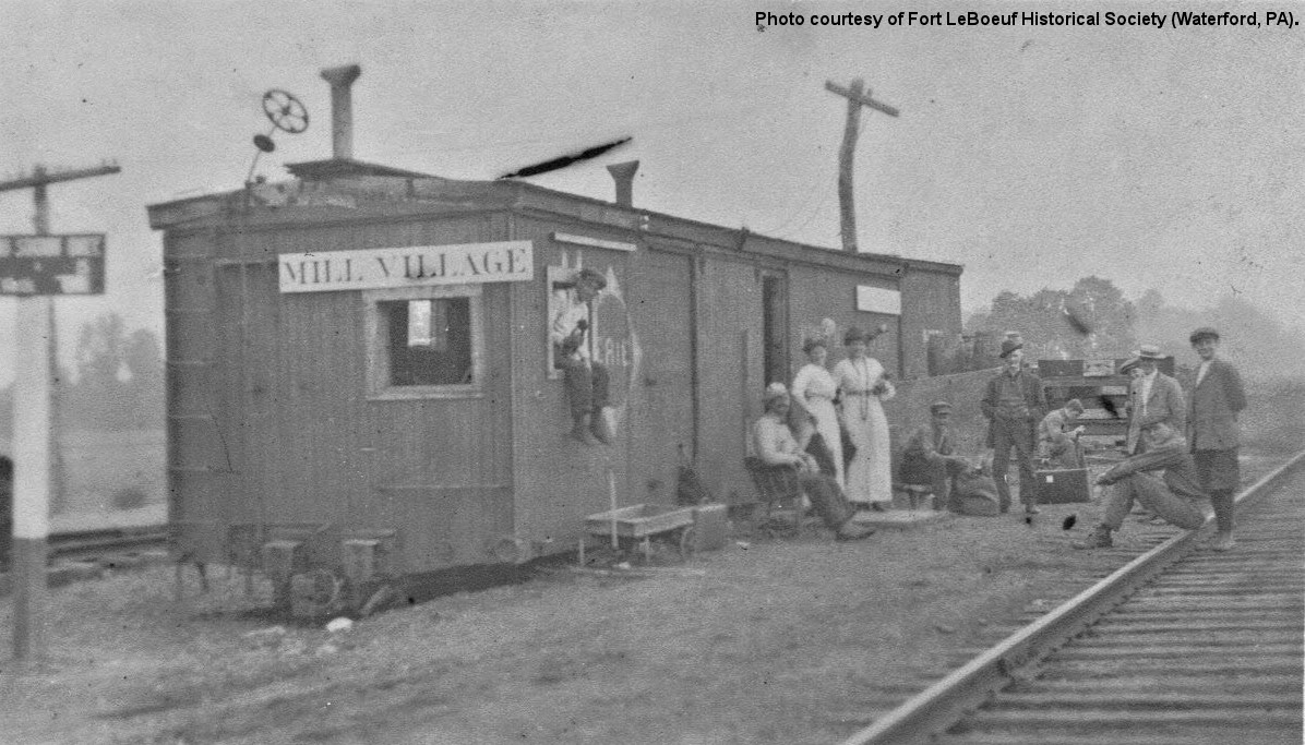
| Mill Village |
|
This converted boxcar station must have been used temporarily. The reason is unknown. Can anyone clarify? | ||||||
| Moorhead (Moorheadville) |
|
In 1876 this station was on the east side of Moorheadville Road on the south side of the tracks (GPS: 42.185706,-79.9035). Later maps place the station on the west side of the road on the north side of the tracks. | ||||||
| Moorhead (Moorheadville) |
|
This station was on the west side of Moorheadville Road on the south side of the tracks (GPS: 42.185317, -79.903664). | ||||||
| North East |
|
The passenger station was east of South Lake Street and north of Grahamville Street at GPS: 42.210057, -79.836084. | ||||||
| North East |
|
There was a freight station on the east side of South Lake Street on the north side of the tracks at GPS: 42.209995, -79.836715. | ||||||
| North Springfield (Springfield Sta.) |
|
This station was on Holliday Road at approximately GPS: 41.994298, -80.425047. | ||||||
| OrmsbEE Road |
|
A passenger station is listed here on the 1923 PRR List of Stations & Sidings. It was likely a shelter. It was int he vicinity of GPS: 41.878745, -79.729263. The station is not shown on the 1923 or 1941 county maps, so it may have been short-lived anbd it's unclear why there was a station here. | ||||||
| Pennside |
|
This station was on the north side of Pennside Road on the west side of the tracks at approximately GPS: 41.850816, -80.401998. | ||||||
| Pennside |
|
The E&P and and B&LE may have shared a station here. | ||||||
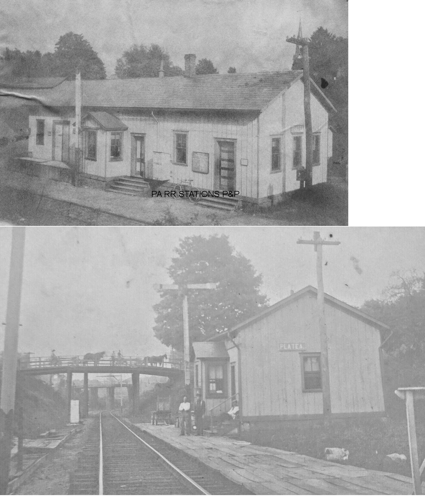
| Platea (Lockport) |
|
The Platea station (formerly known as Lockport) was built in 1891-1892 when the line was opened as the PS&LE (Meadville Evening Republican, 6-30-1891) (B&LE valuation records say 1895). It was remodeled in 1899 and 1913. | ||||||
| Reilly |
|
This station was at MP 64.7 (distance from the Kane P&E passenger station) between Union City and Elgin. It appears on the 1900 PRR timetable. According to PRR valuation records, a new passenger shelter was built here in 1905. | ||||||
| Sampson (Sampsonville) |
|
This station was on the south side of Sampson Road on the west side of the tracks at approximately GPS: 42.009092, -79.997697. The 1900 PRR timetable lists this station as "Samson." According to PRR valuation records, a new freight shed was built her in 1914. | ||||||
| Shannon |
|
This station was at MP 89.6 (distance from the Kane P&E passenger station) between Erie and Belle Valley. | ||||||
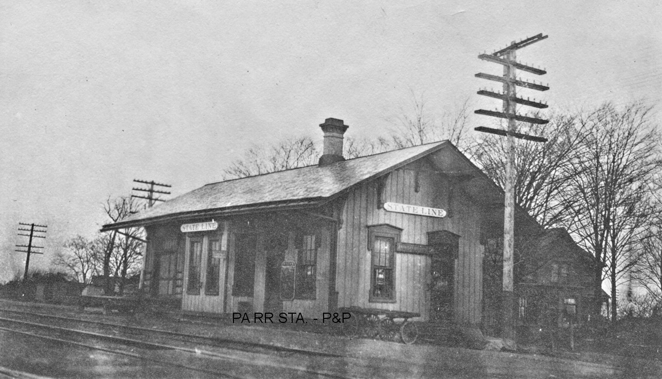
| State Line Station |
|
This station was SE of US 20 near the state line on the south side of the tracks at approximately GPS: 42.240847, -79.763064. According to NYC valuation records, it was built in 1886. | ||||||
| State Line Station |
|
This station was on the east side of Gulf Road on the north side of the tracks at approximately GPS: 42.230266, -79.771452. | ||||||
| Stewart Station |
|
This station was on the north side of Stewart Road on the east side of the tracks at approximately GPS: 41.897776, -79.661163. This station is shown on the 1912 map, but the line was torn up by the 1920s. | ||||||
| Summit Station |
|
Not to be confused with the E&P RR station in Crawford County. This station was on the west side of what is now PA77 at approximately GPS: 41.866580, -79.647973. This station is shown on the 1912 map, but the line was torn up by the 1920s. | ||||||
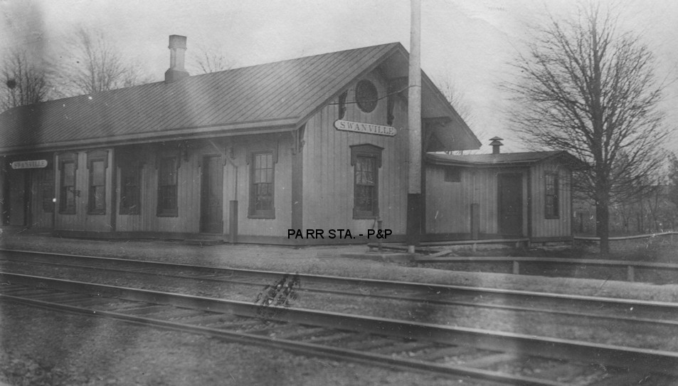
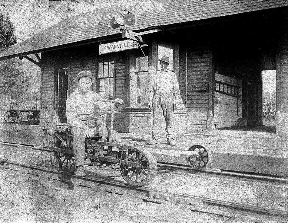
| Swanville |
AND |
In 1876 this station was on the southwest side of Millfair Road on the south side of the tracks (GPS: 42.068243,-80.201719). | ||||||
| Swanville |
|
The NKP and B&LE stations were on Manchester Road. They likely shared the NKP station. Does anyone know the details? | ||||||
| Swanville |
|
|||||||
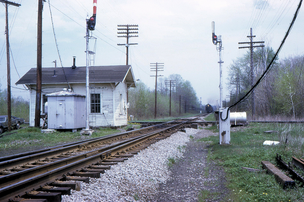
| Thornton Junction |
AND |
This station was around GPS: 41.991339, -80.375473. There are no roads to this location now, but it is south of West Middle Road and east of Townline Road. | ||||||
| Tucker Siding |
|
Tucker Siding was between Cranesville and Platea (Lockport). It is listed as a passenger stop on the 1891 timetable that appeared in newspapers. There may not have been a station there, but four trains (two north and two south) per day stopped there. | ||||||
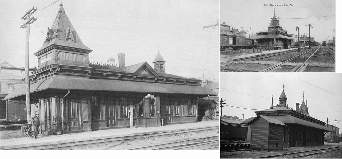
| Union City |
|
The original station here was likely built in 1862. | ||||||
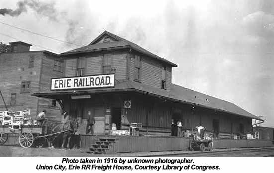
| Union City |
|
This passenger station, built around 1880 (some sources say 1871), sat between Miles Street and Lincoln Street about 100 feet south of Concord Street at GPS: 41.895261, -79.846205. Photo taken 1916. | ||||||
| Union City |
|
The freight station was on the east side of Lincoln Street at GPS: 41.895136, -79.845459. | ||||||
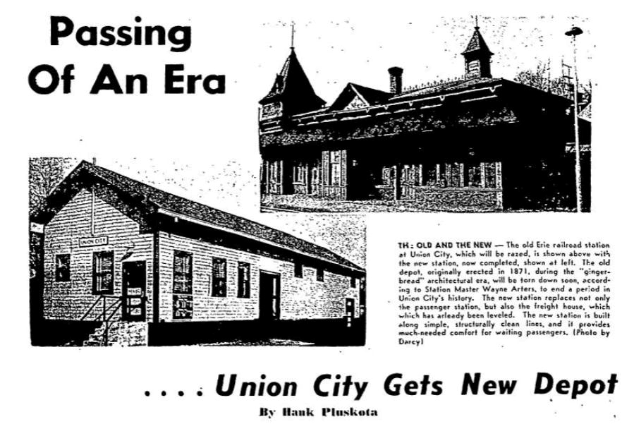
| Union City |
|
A new generic-looking combination station was built to replace the 1880s passenger and freight stations in 1953 (when those old station were torn down). | ||||||
| Union City (Miles Mills) |
|
The first station here was built in 1859 with the opening of the railroad through town. William Putnam was the first agent here. | ||||||
| Union City (Union Mills) |
|
The second wood frame combination P&E station, built in 1871, was on the NW side of Market Street (formerly Crooked Street), on the south side of the tracks (GPS: 41.898592,-79.842619). 1871 also was the year the town changed its name from Union Mills (formerly Miles Mills) to Union City. The OC&AV RR also used this station as there was a spur to the south side of the station on that line as well. The new station (still standing) was built in 1901 (according to PRR valuation records), but the original station survived serving as a freight station until an unknown date as it is still shown on the 1911 Sanborn map marked as a freight station. | ||||||
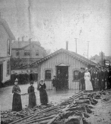
| Union City |
|
The photo shows the June 5, 1892 flood damage to a station near the Philadelphia and Erie RR tracks in Union City. This station was most likely used by the Union and Titusville line, which at that time was a division of the Western New York and Pennsylvania RR. | ||||||
| Wallace Junction |
AND |
This station was east of Nursery Road (Township Road 980) at approximately GPS: 42.014826, -80.318113. | ||||||
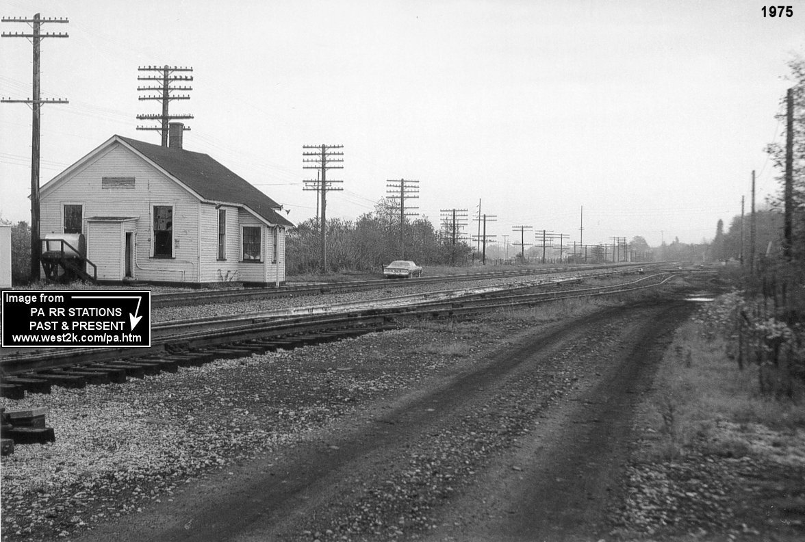
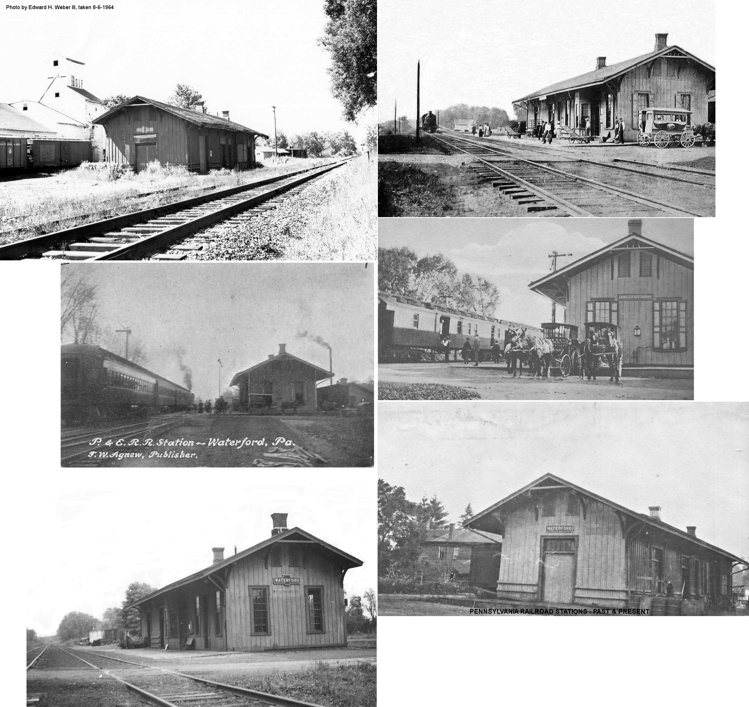
| Waterford |
|
This station was on the south side of Depot Road on the west side of the tracks (GPS: 41.948986,-79.965282). According to PRR valuation records, it was built in 1868. | ||||||
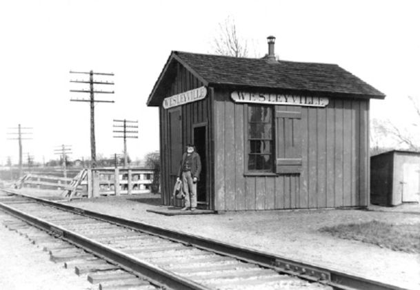
| Wesleyville |
AND |
This union station was located on the west side of Water Street/Lawrence Parkway (formerly Crowley Road) (GPS: 42.144748,-80.014742). | ||||||
| West Mill Creek |
AND |
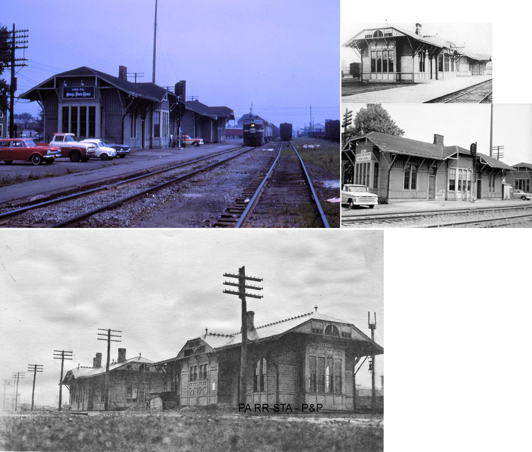
This station was likely on Powell Avenue in the vicinity of GPS: 42.084073, -80.162558. The station is listed on the 1900 B&LE timetable, but it was owned by the NKP. The Bessemer ran from Wallace Junction (near Girard) to Erie on trackage rights over the Nickel Plate. The B&LE had no facilities of their own between those two points. Once the B&LE trains got to Erie they diverged back onto their own city trackage and Bessemer-owned buildings at Erie. | ||||||
| West Springfield Station |
|
This station was on the north side of Old Albion Road on the south side of the tracks at approximately GPS: 41.938622, -80.456625. | ||||||
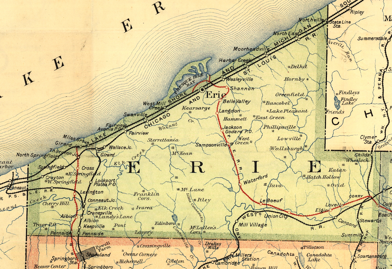
| 1895 ERIE COUNTY RAILROAD MAP | ||||||||
 |
||||||||
| Notes About Existing
Stations... Erie (LS&MS Freight) - Some photos that have been claimed to be from 1928 show this station up on cribbing (see photos) so it can be moved, raised/lowered, or have a new foundation. The Sanborn map from 1921 shows the station at its current location, so it having been moved in 1928 seems unlikely. So, it may have been moved sometime prior to that or the raising of the station onto cribbing was for another reason. Girard (LS&MS) - Girard Station was the original name for the station on the LS&MS. When the town of North Girard was established the station took that name. The PRR officially changed the name of the station to "North Girard" in Februray 1905. In the mid 50's the town name was changed to Lake City. I spent many hours as a youngster at the station when the freight agent was still there. At one time both the NYC and PRR had passenger service to North Girard, as late as the late 40's. The tracks are the old New York Central water level route from Buffalo to Erie to Cleveland. The Pennsylvania had trackage rights from Girard Junction a few miles west of North Girard to Dock Junction on the west side of Erie, PA where I-79 now crosses the tracks. The people that bought the station and made it a restaurant called it Girard Station as the sign shows but the station is in the center of "downtown" Lake City, PA. --C. Melville Hazen Girard (NKP) - In order to move the building it was split in half and moved one section at a time. When you see it today you can still see where it was split. In 1912 the location of the station was on the NE side of Lake Street on the south side of the tracks at GPS: 42.008987, -80.340218. Lake City (Unknown) - I have been told that this is a railroad station that was converted into a residence at 500 Culbertson Drive. This seems dubious, but can anyone verify this for sure? Northeast (LS&MS) - Houses the Lake Shore Railway Historical Society Museum. Northeast (LS&MS) - This was the second LS&MS passenger/freight station in North East replacing the first one that was built in 1852. It was moved west about 400 feet when the LS&MS built the "new" passenger station in 1899. After it was moved it served as a freight station. The brick passenger station was last used by NYC 1960 and the wooden combo station was last used in 1957. The Lake Shore Railway Museum features several locomotives, passenger cars, and rolling stock on the grounds. West Springfield Station (NYC) - Moved from original location. Now used for storage on a farm. The build date of 1854 comes from NYC valuation records from 1919. |
||||||||