|
|
||||||||
| EXISTING STATIONS | ||||||||
|---|---|---|---|---|---|---|---|---|
| Station Name |
Original Railroad |
Current Location |
Type | Current Use |
Date Built |
Track Status |
Building Material |
More Info |
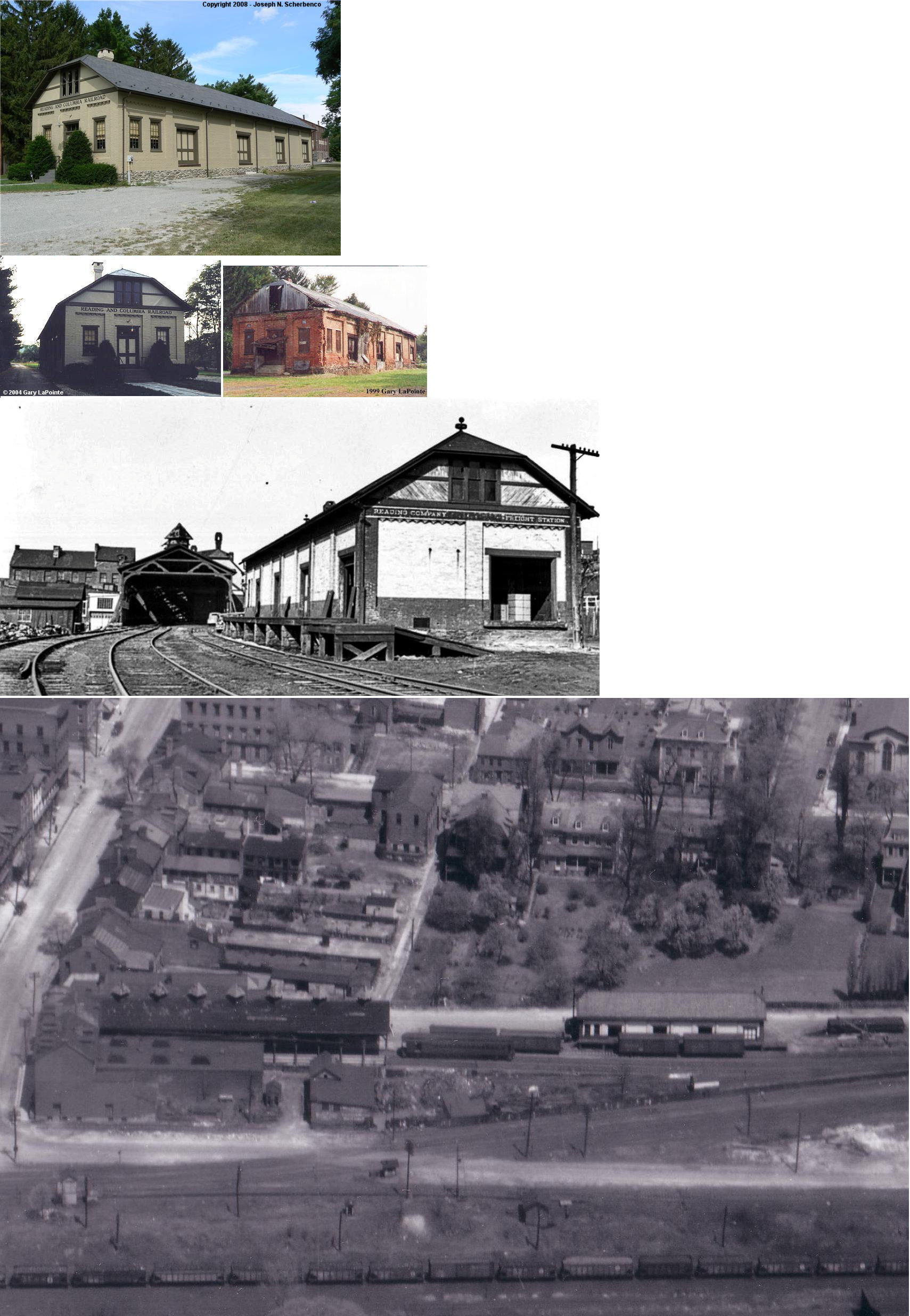
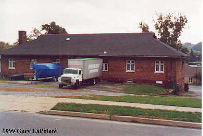
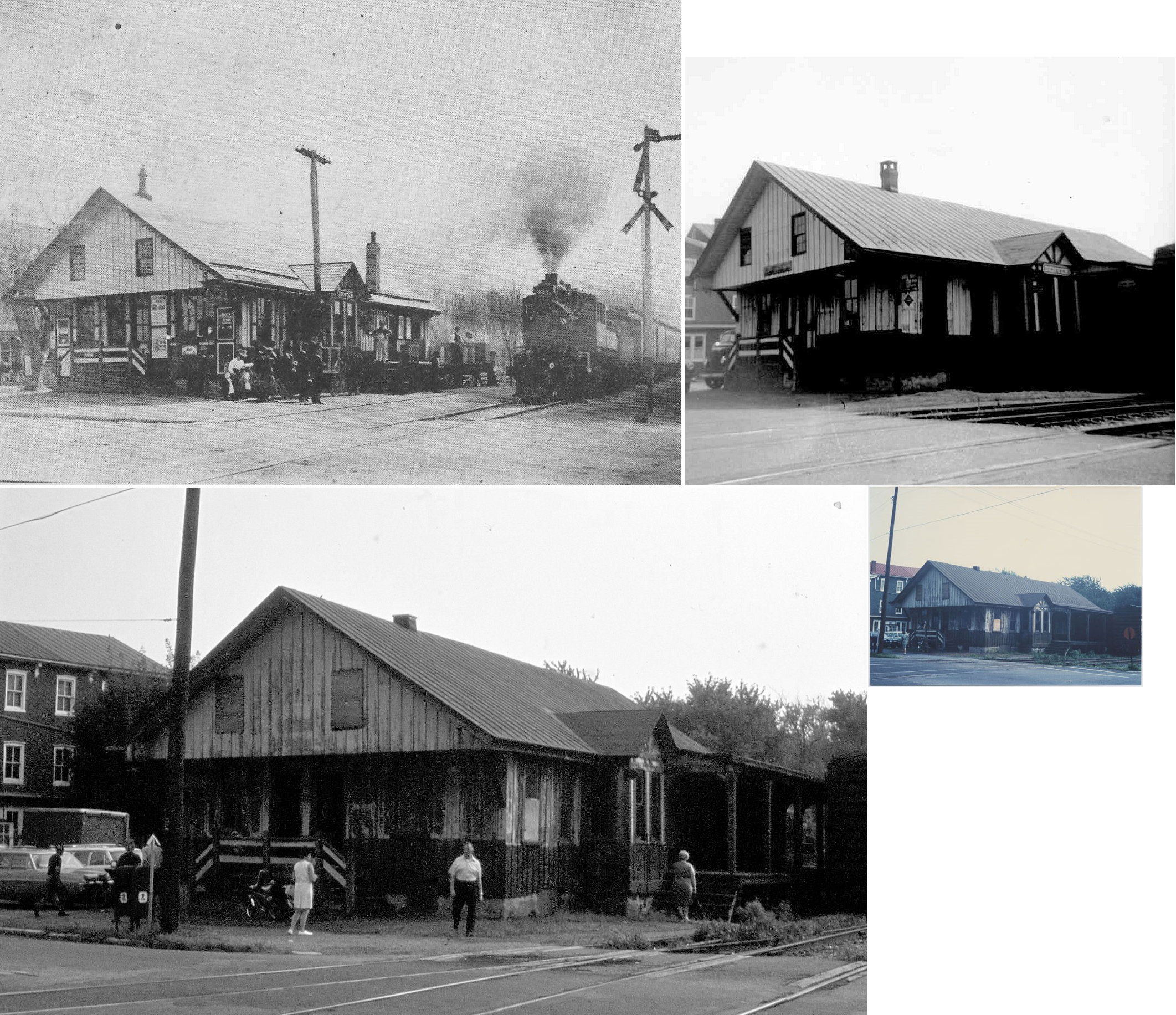
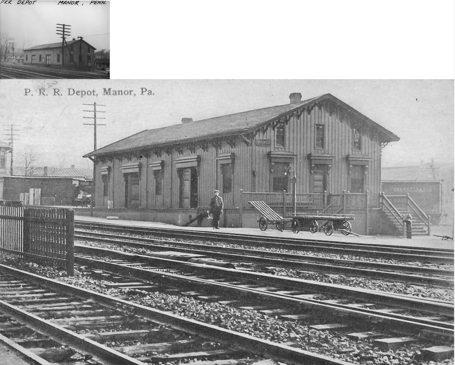
| Akron |
 |
NW corner of Fulton and Front Streets. (GPS: 40.163179, -76.210105) |
C | Apartments | ???? | Gone | Wood |
|
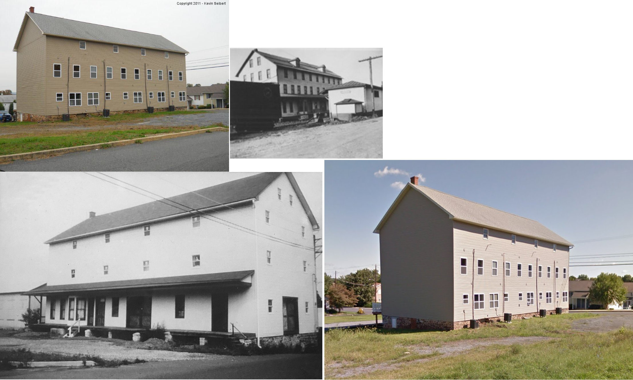
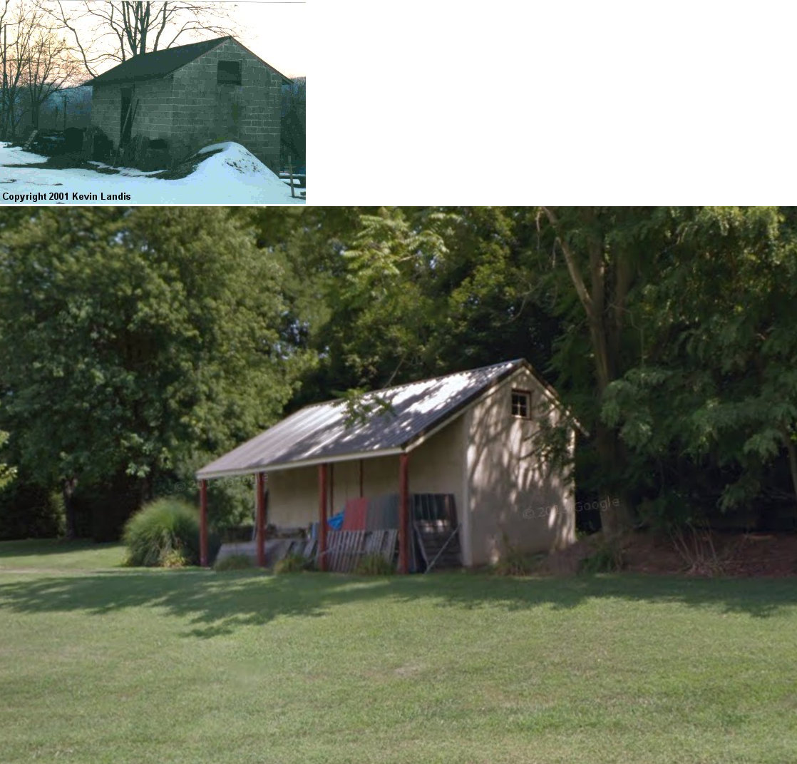
| Bareville |
 |
In a backyard on the west side of Graybill Road across from Hershey Avenue (GPS: 40.090297, -76.163903). |
P | Private | ???? | None | Wood |
|
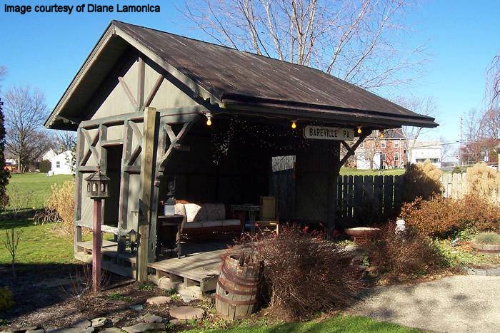
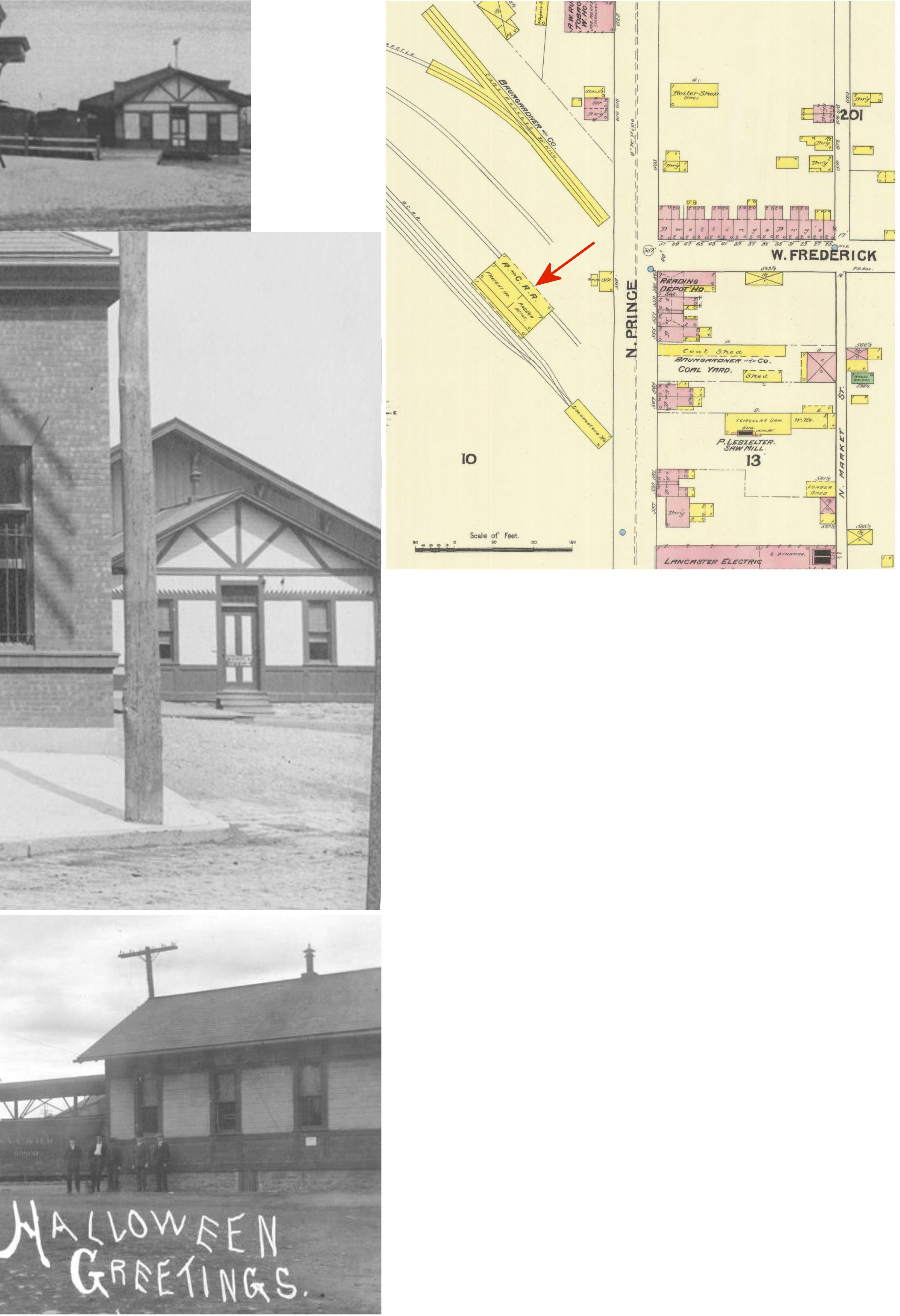
| Baumgardner |
|
Rawlinsville & Baumgardner Roads (GPS: 39.960818, -76.281202) |
C | Business | 1880 | Gone | Wood | |
| Bird-In-Hand |
|
Railroad Avenue (GPS: 40.038097, -76.181969) |
F | Business | 1871 | In Use | Brick | |
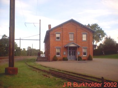
| Christiana |
|
Branch Street & Gay Street (GPS: 39.955075, -75.995422) |
P | Business | 1900 | In Use | Stucco |
|
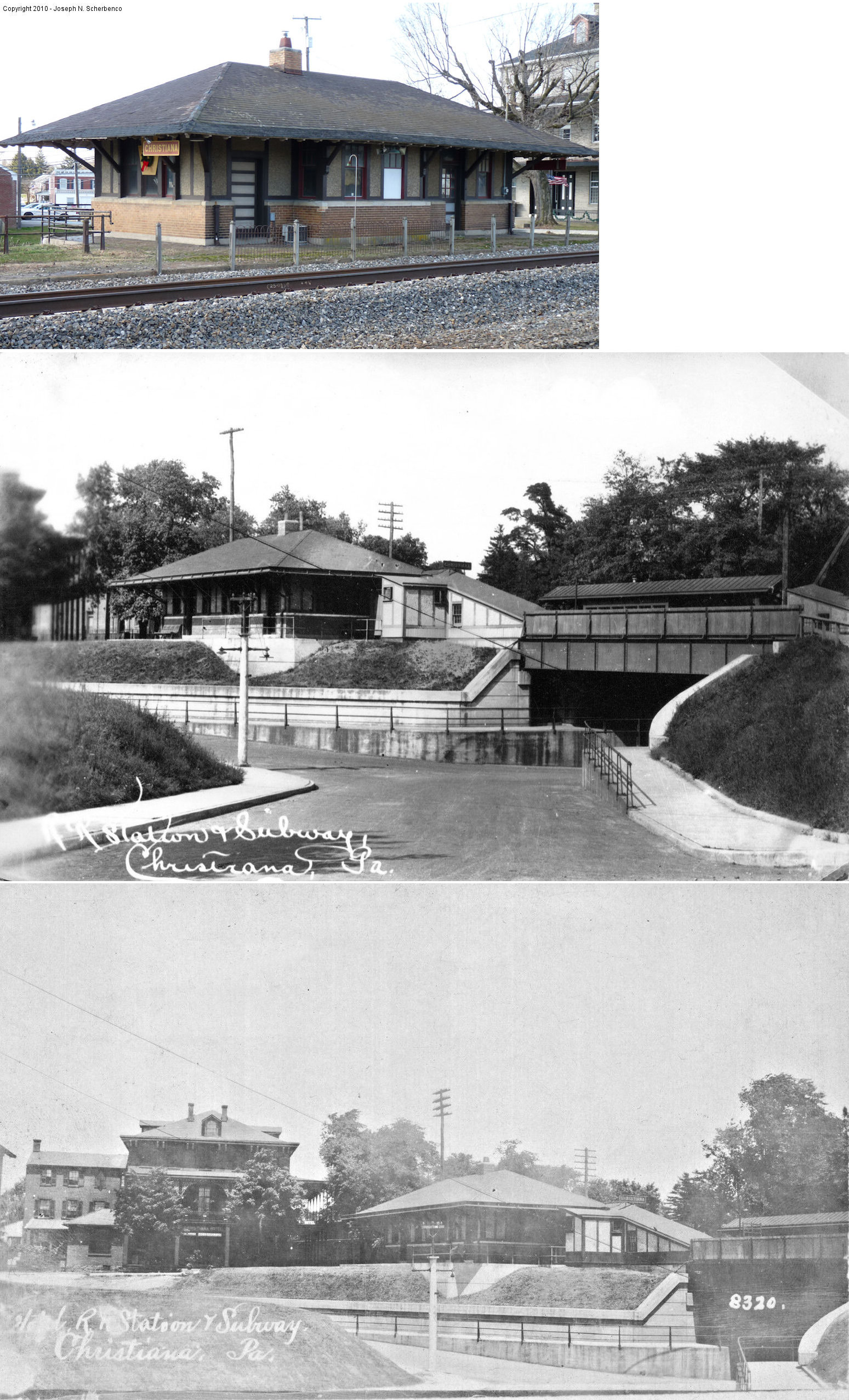
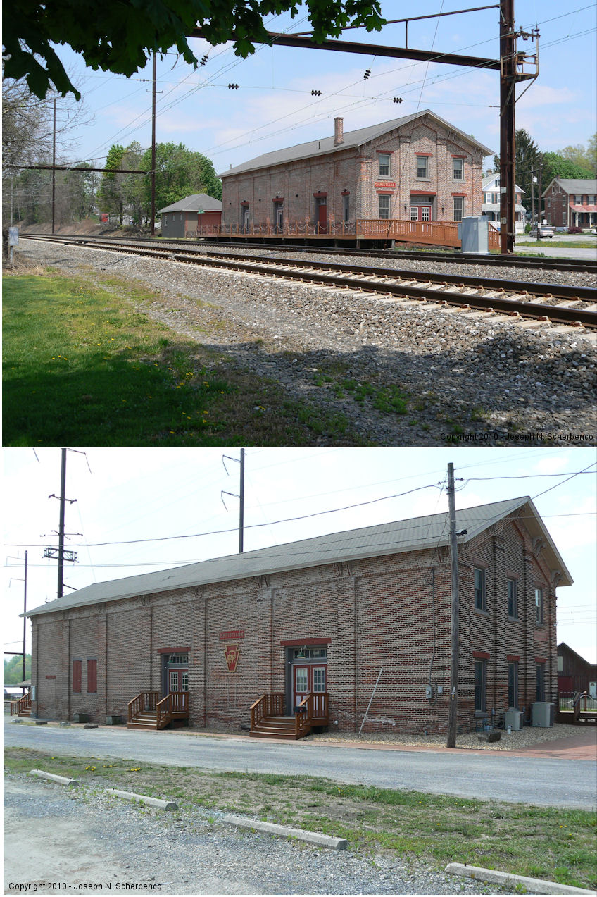
| Christiana |
|
10 Railroad Avenue (GPS: 39.955932, -75.995640) |
C | Civic | 1882 | In Use | Brick |
|
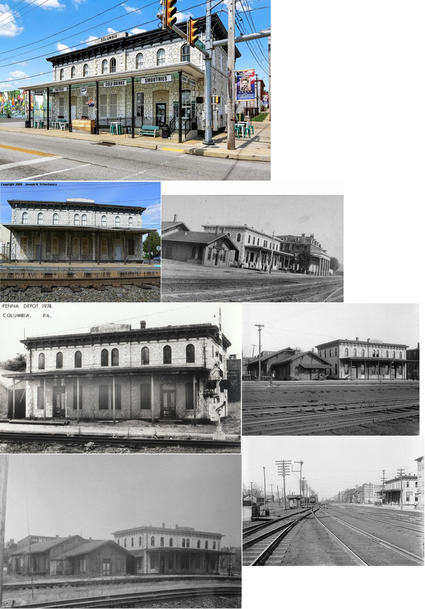
| Columbia |
|
Corner of Walnut & North Front Streets (GPS: 40.030973, -76.506929) |
P | Business | 1870 | In Use | Stone | |
| Columbia |
|
Bank Avenue between Locust Street and Union Street (GPS: 40.029484, -76.503945) |
F | Vacant | 1883 | Gone | Brick |
|
| Columbia |
 |
South 10th Street (915 Lancaster Avenue, behind bank) (GPS: 40.032919, -76.490883) |
F | Business | ???? | Gone | Brick | |
| Cordelia (Ironville) |
|
2531 Ironville Pike (GPS: 40.052833, -76.470951) |
C | Storage | ???? | Gone | Concrete |
|
| Dorsey |
 |
Peach Bottom Road at Peters Creek Road (GPS: 39.761217, -76.223615) |
C | Vacant | 1870 | Gone | Wood | |
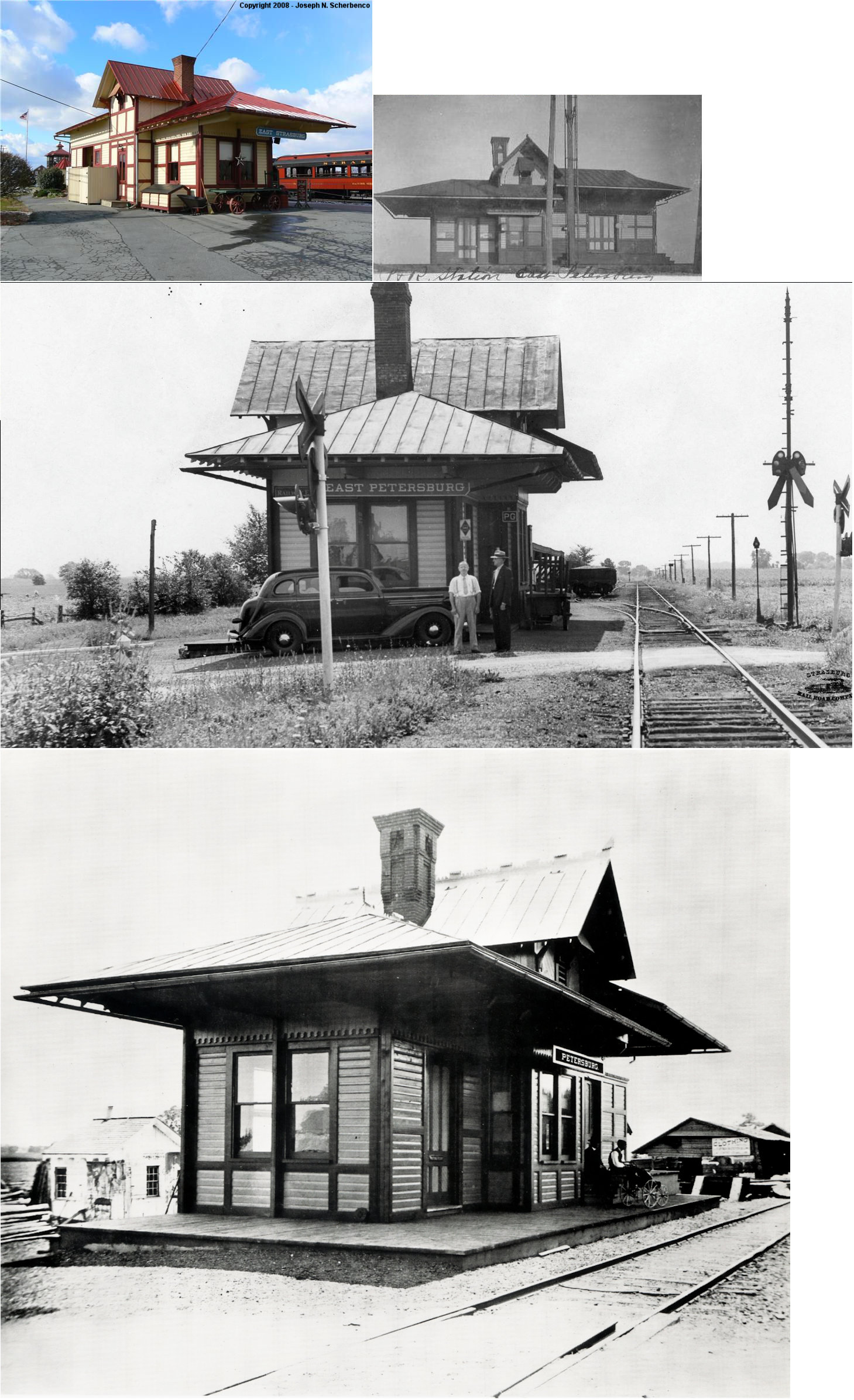
| East Petersburg | |
310 Gap Road (PA897), East Strasburg (GPS: 39.983024, -76.160696) |
C | Museum | 1900 | In Use | Wood |
|
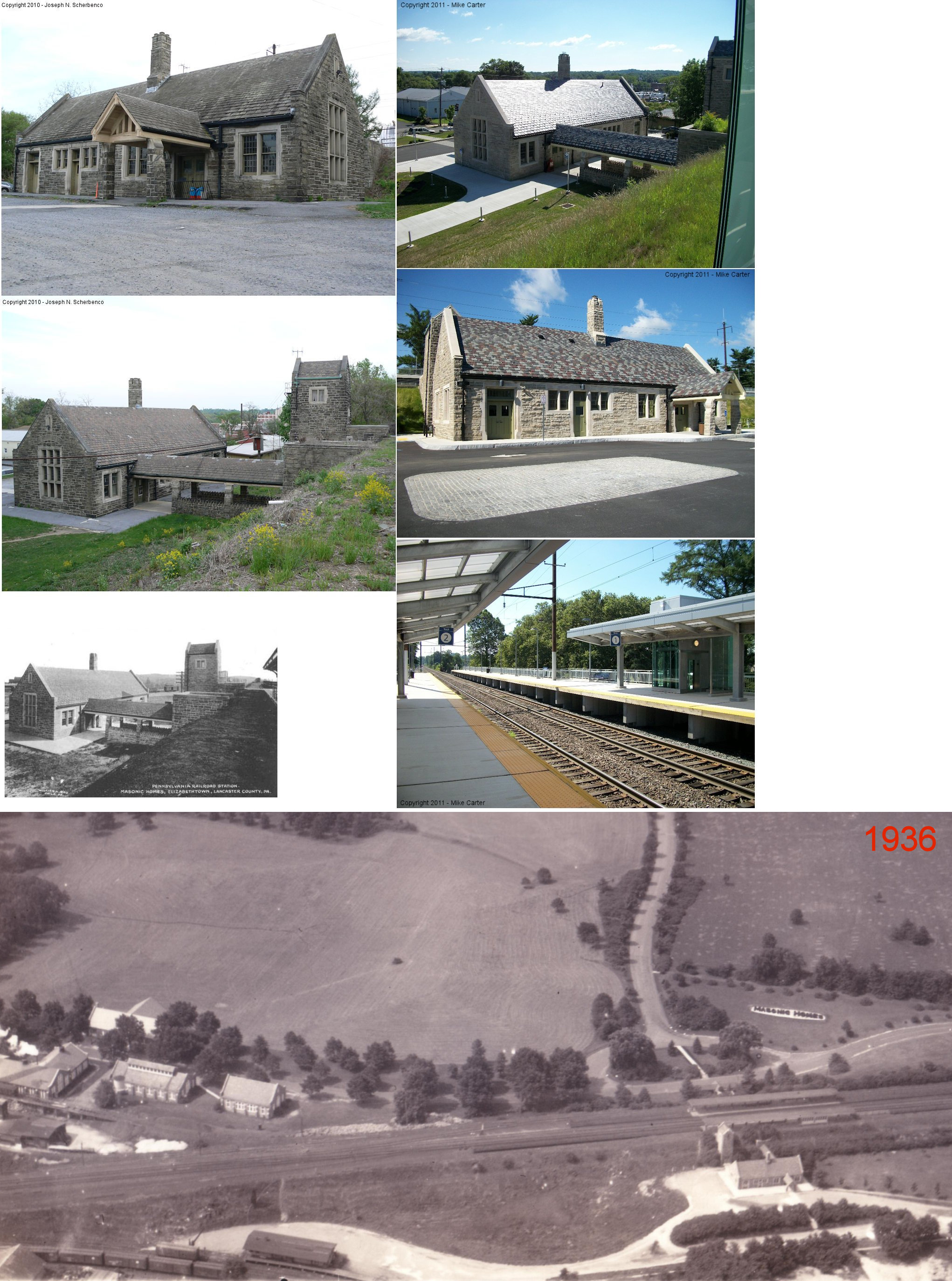
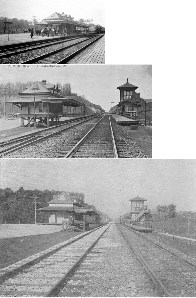
| Elizabethtown |
|
Wilson Avenue off West High Street (GPS: 40.146933, -76.612247) |
P | Railroad | 1915 | In Use | Stone/ Brick |
|
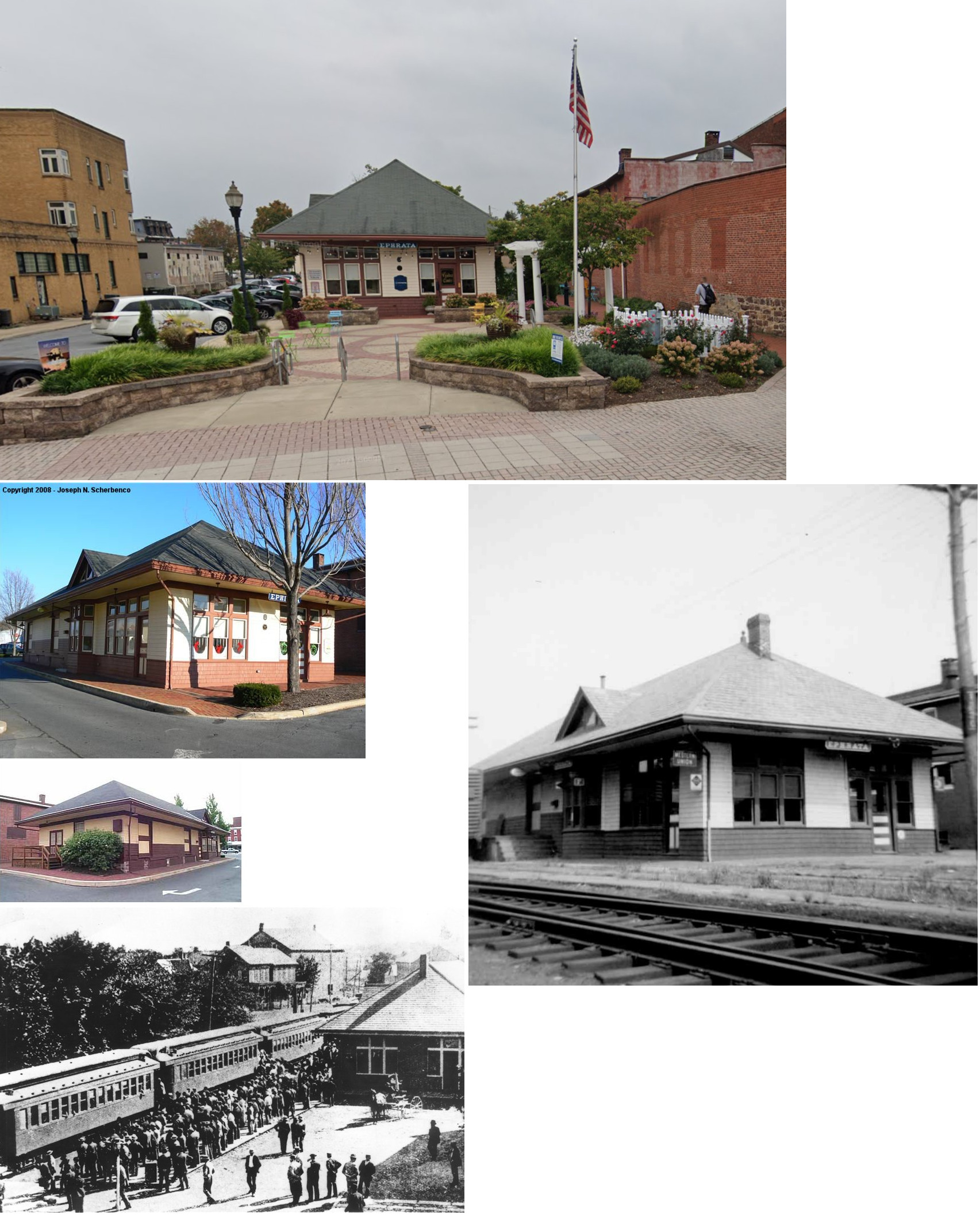
| Ephrata |
|
Northeast side of Main Street, just SE of State Street. (GPS: 40.178756, -76.176527) |
P | Civic | 1889 | Gone | Wood | |
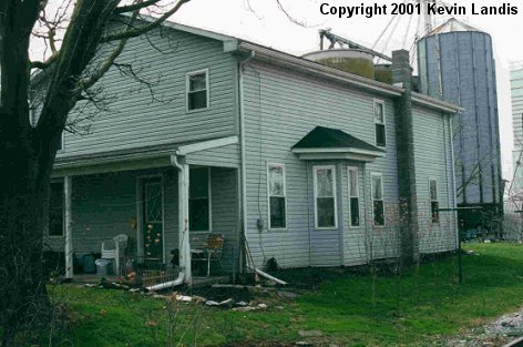
| Goshen |
|
Goshen Mill Road & Pilgrims Pathway (GPS: 39.802085, -76.175488) |
P | Residence | 1906 | Gone | Wood | |
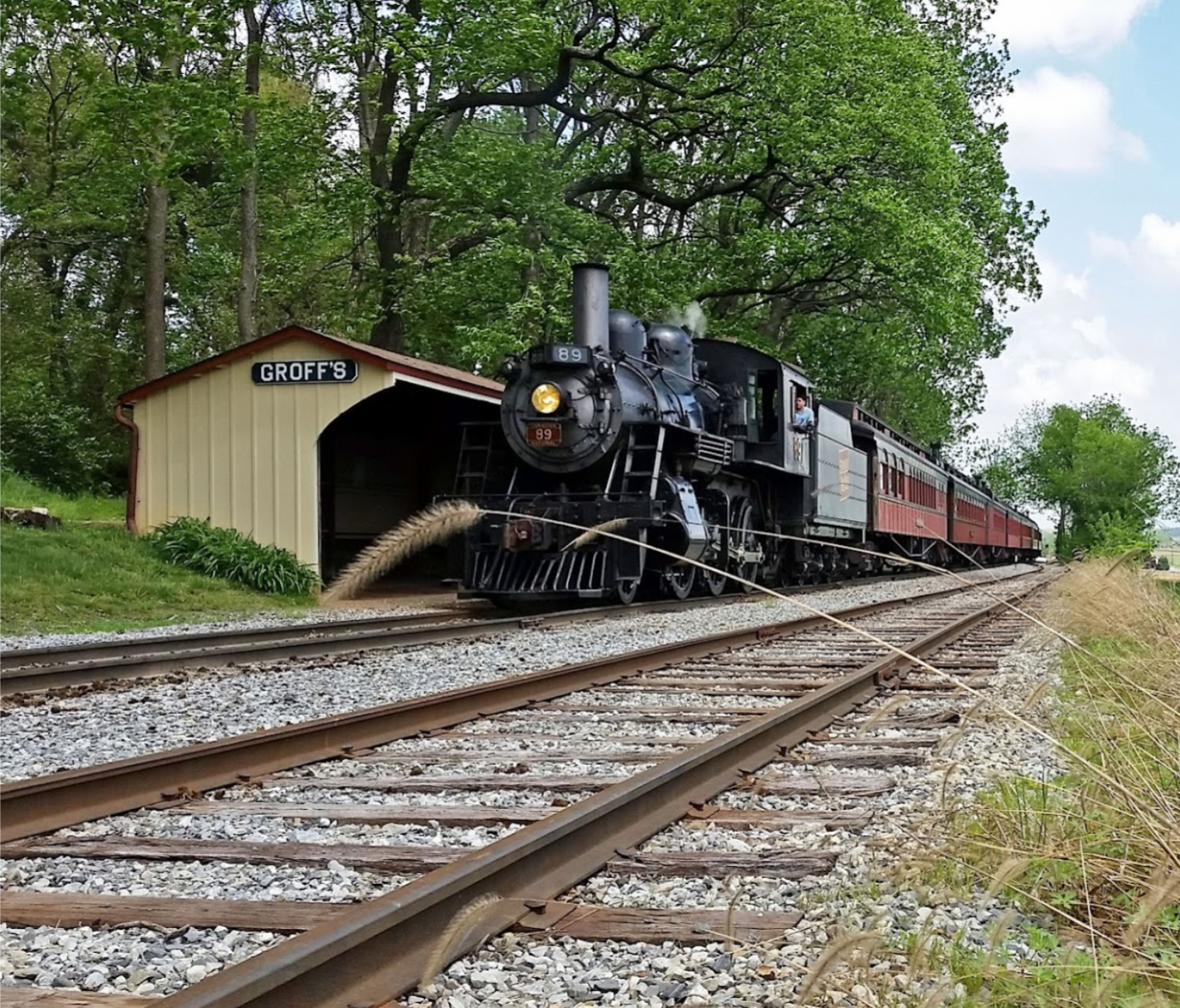
| Groff's Grove (Ronks) |
 |
East of Cherry Hill Road (GPS: 39.993347, -76.126330) |
P | Railroad | ???? | In Use | Plastic | |
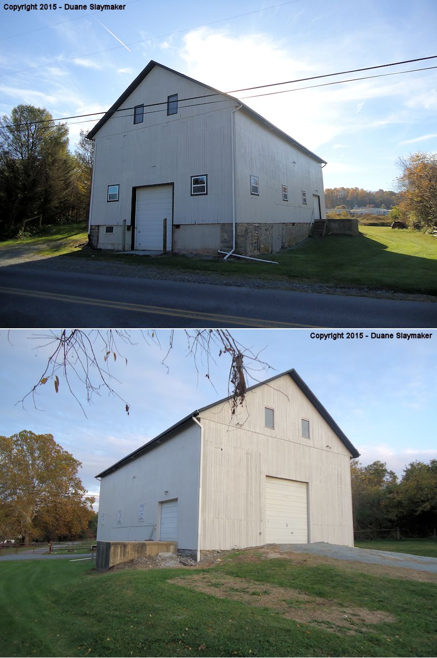
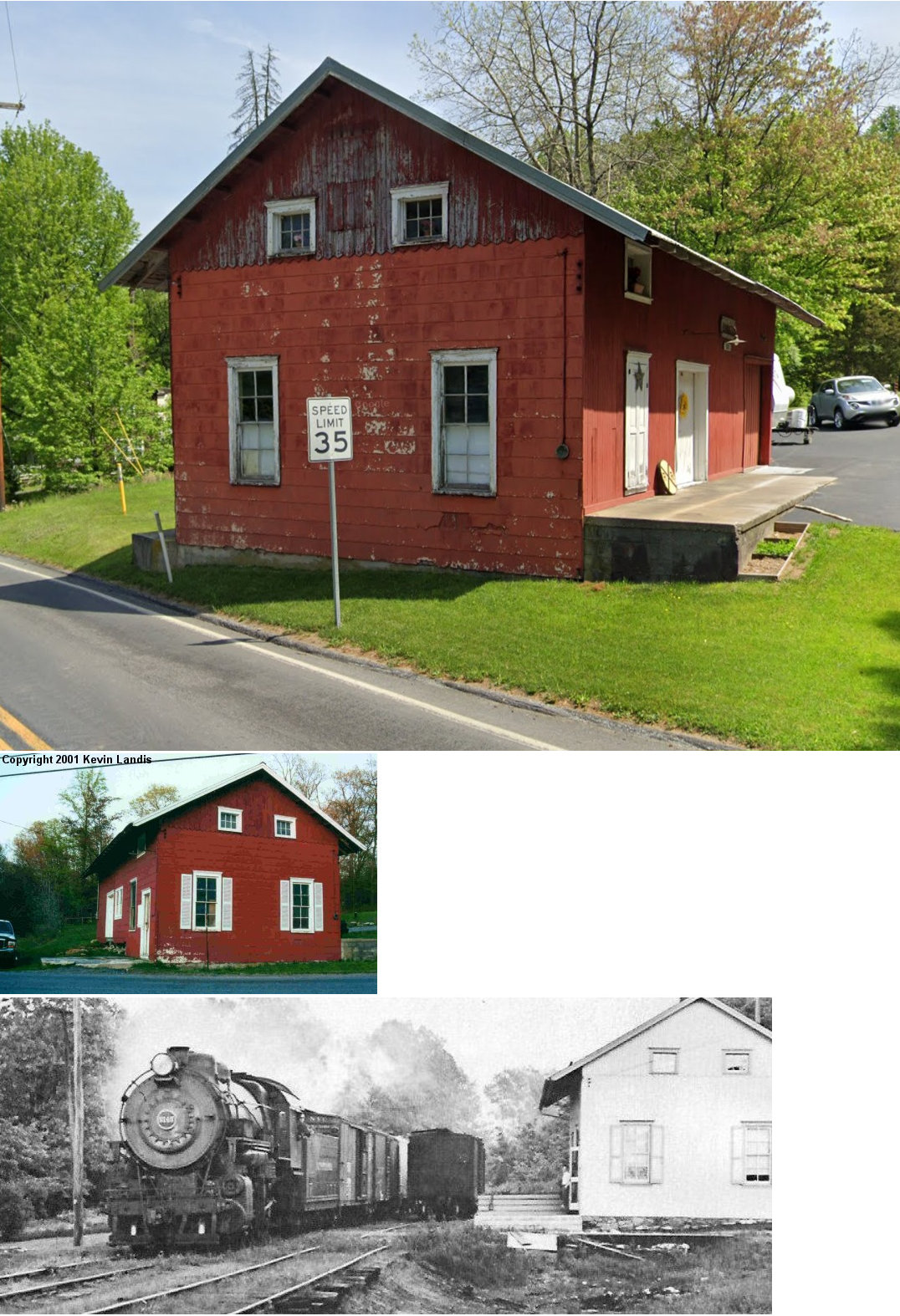
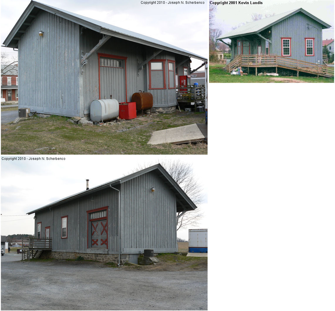
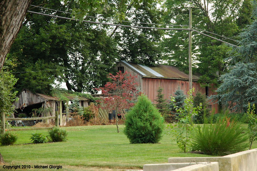
| Herrville |
|
108 Herrville Road north of Brooks Road (GPS: 39.951893, -76.260587) |
F | Business | ???? | None | Wood |
|
| Lancaster |
|
53 McGovern Avenue at North Queen Street (GPS: 40.054296, -76.307754) |
P | Railroad | 1928 | In Use | Brick | |
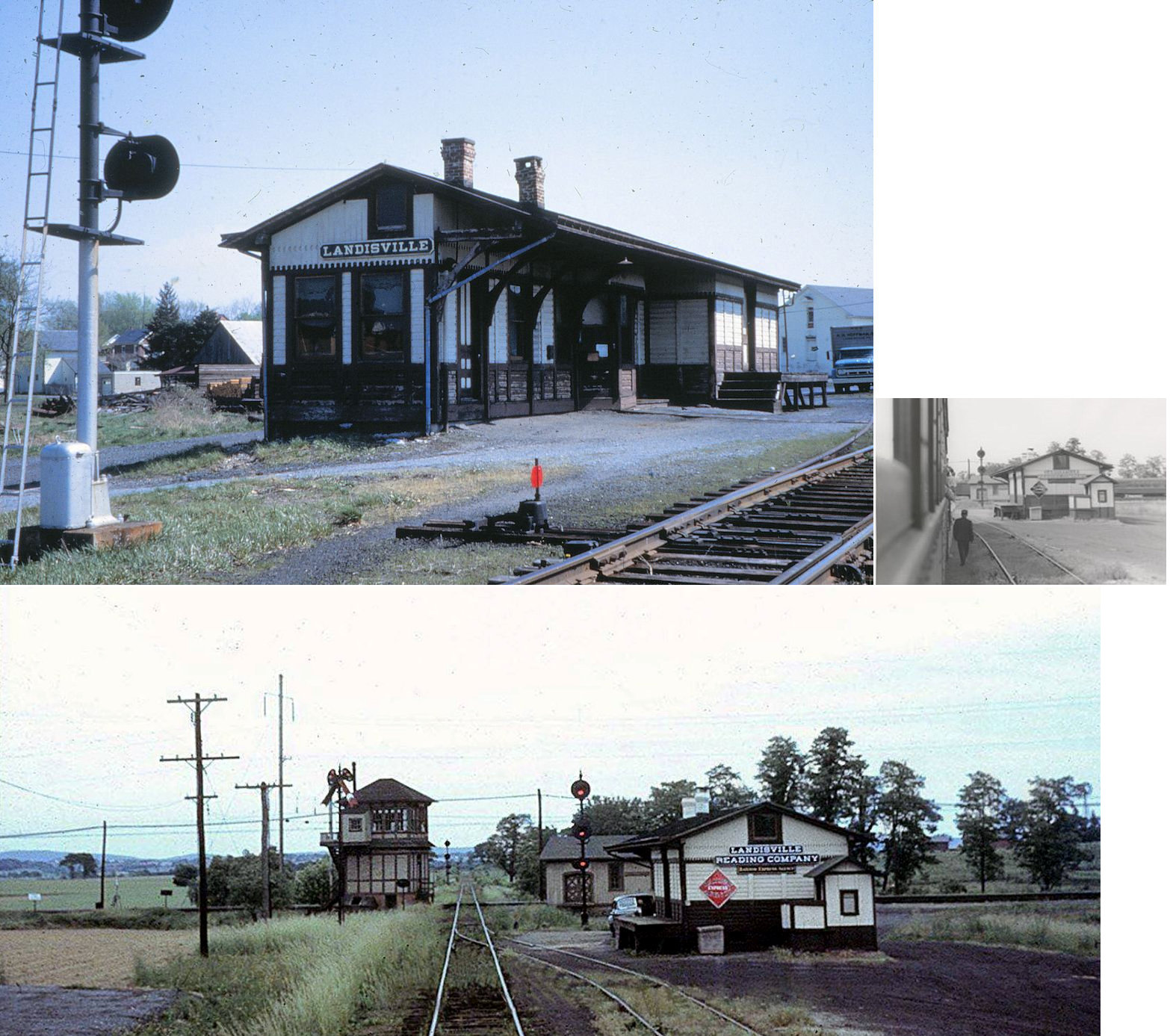
| Landisville |
|
Snavely Lumber Yard on Main Street at railroad crossing. (GPS: 40.099220, -76.416342) |
P | Vacant | 1930 | In Use | Wood |
|
|
Leaman
Place (Paradise) |
|
Stock Lumber where RT. 30 crosses the railroad (in Paradise). (GPS: 40.005608, -76.113253) |
F | Office | 1880 | In Use | Brick | |
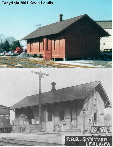
| Leola (Leacock) |
|
Horseshoe Road & Maple Avenue at Stauffers (GPS: 40.085836, -76.182296) |
C | Business | 1890 | In Use | Wood |
|
| Limerock |
|
Limerock Road off PA772 (GPS: 40.159460, -76.339995) |
C | Residence | 1900 | In Use | Wood | |
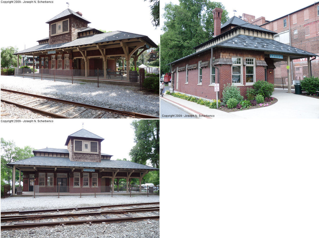
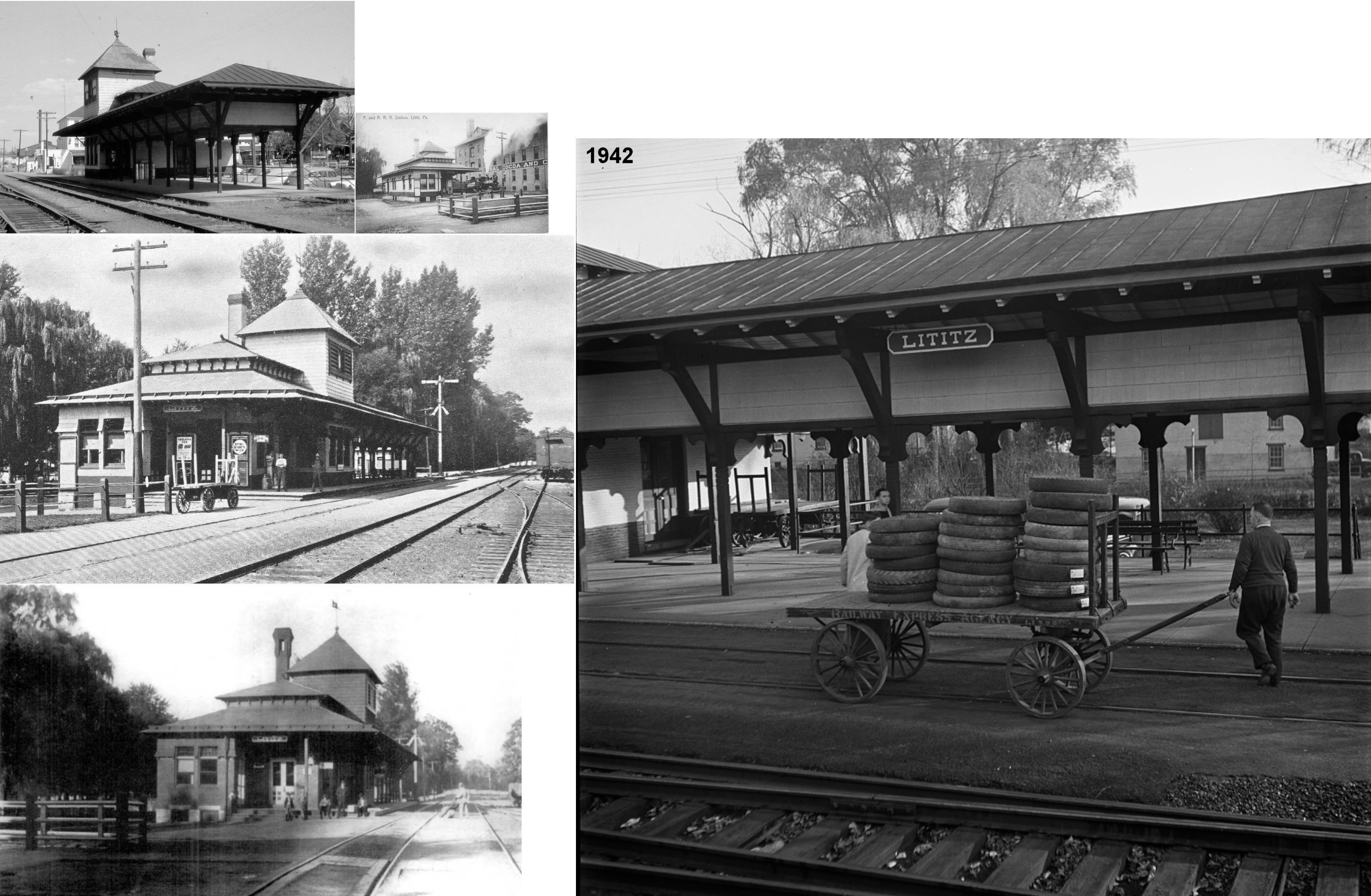
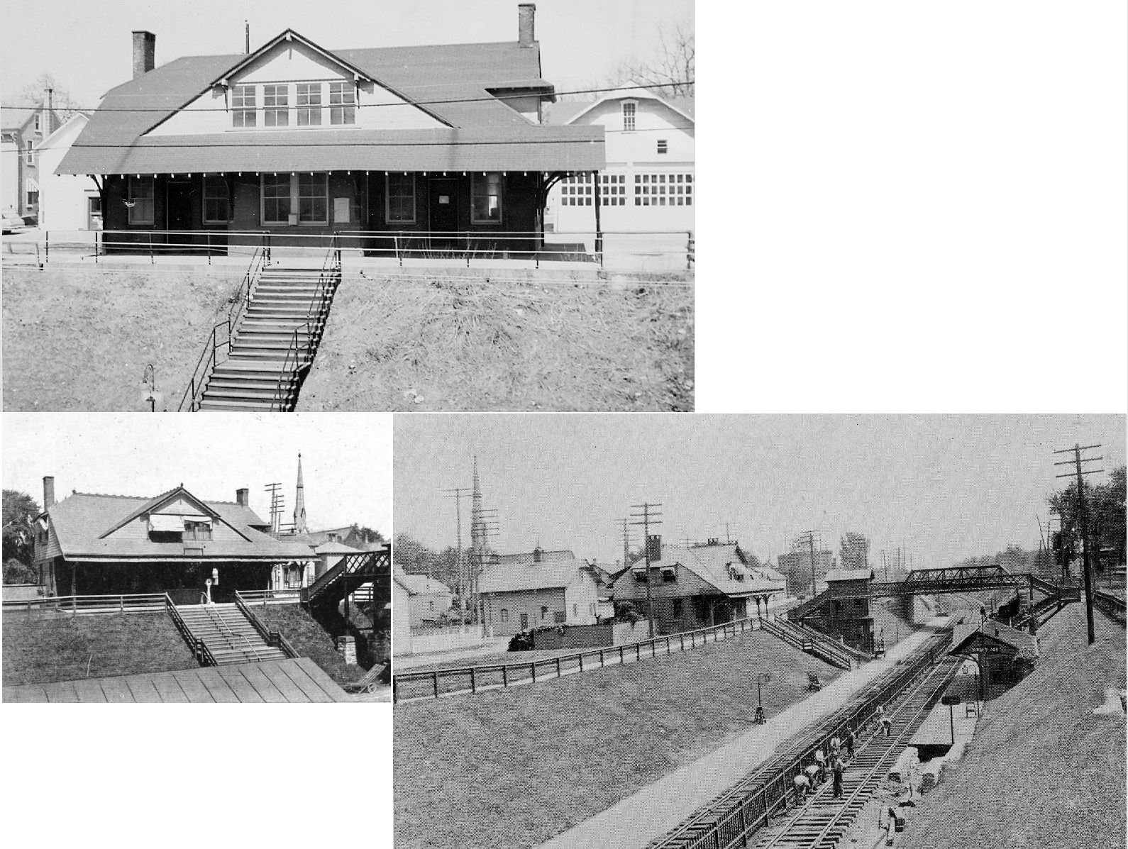
| Lititz |
 |
West side of North Broad Street (GPS: 40.158228, -76.307835) |
R | Civic | 1999 | In Use | Brick |
|
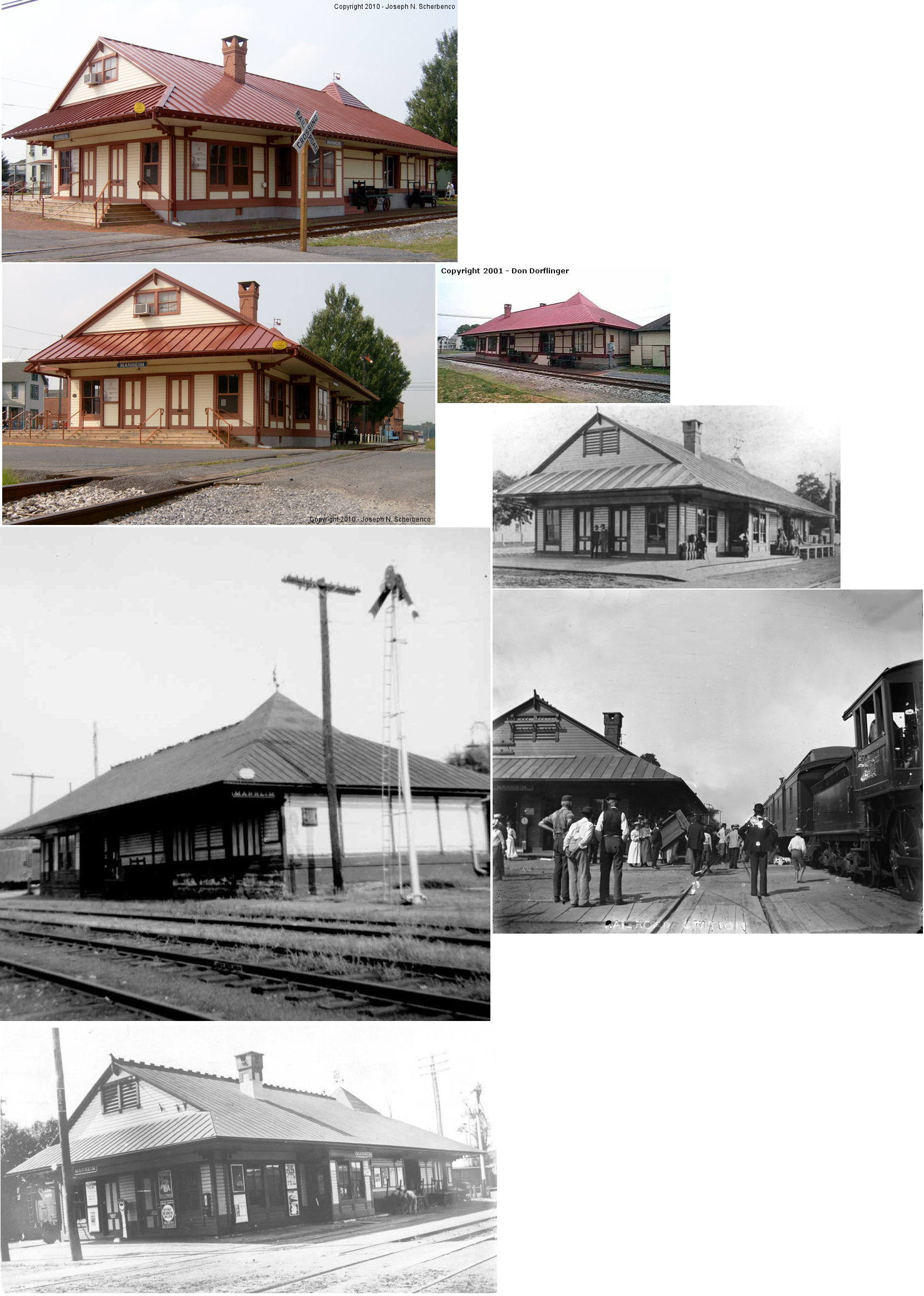
| Manheim |
AND  |
210 South Charlotte Street (GPS: 40.158199, -76.392203) |
C | Museum | 1882 | In Use | Wood | |
| Marietta |
|
280 West Front Street (GPS: 40.054669, -76.559992) |
P | Business | ???? | In Use | Brick |
|
| Marietta |
|
West side of Perry Street at Front Street (GPS: 40.05464,-76.560428) |
C | ???? | 1860 | In Use | Brick |
|
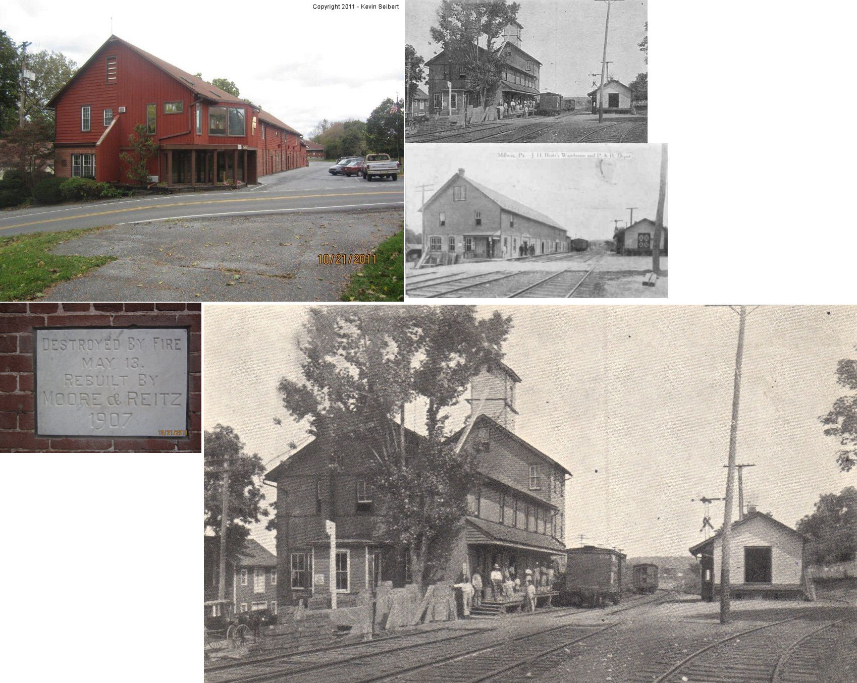
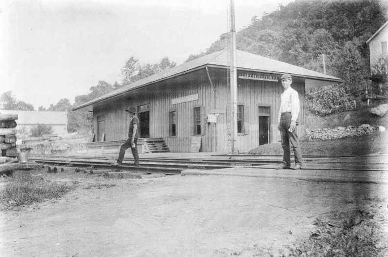
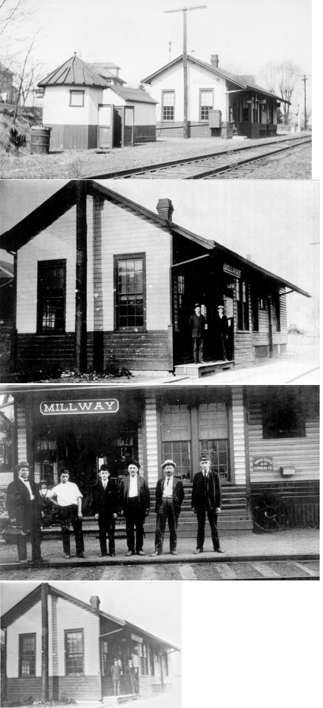
| Millway |
|
312 East Meadow Valley Road (GPS: 40.161125, -76.235657) |
P | Business | 1890s | Gone | Brick/ Wood |
|
| Mt. Joy |
|
Sassafrass Terrace (GPS: 40.108357, -76.493402) |
F | Apartments | ???? | In Use | Brick |
|
| Mt. Joy |
 |
25 South Market Street (GPS: 40.109059, -76.503492) |
P | Railroad | 2016 | In Use | Brick | |
| Narvon (Beartown Sta.) |
|
Narvon Road across from quarry entrance. (GPS: 40.102889, -76.977735) |
C | Garage | 1880 | Gone | Wood | |
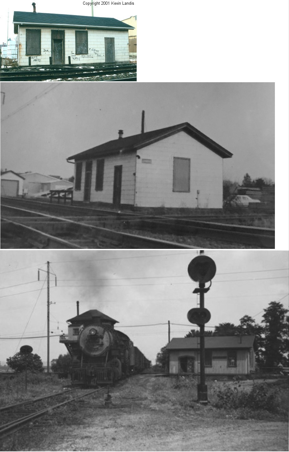
| Refton |
|
SW side of Refton Road (T-498) between Chruch and Main Streets (GPS: 39.946104, -76.234835) |
C | Storage | ???? | Gone | Wood |
|
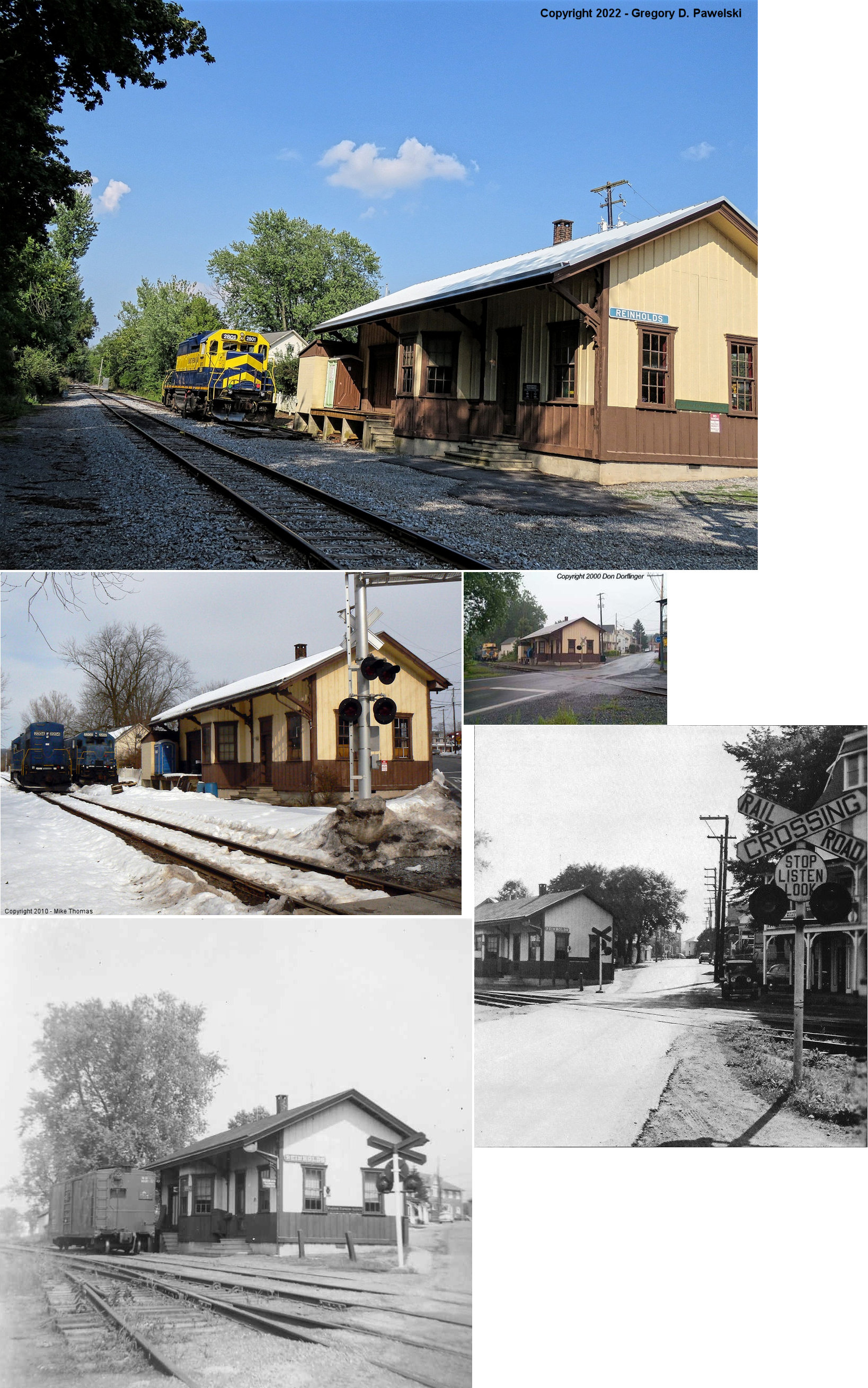
| Reinholds |
|
North side of West Main Street (PA897) (GPS: 40.266864, -76.116686). |
C | RR Office | 1885 | In Use | Wood | |
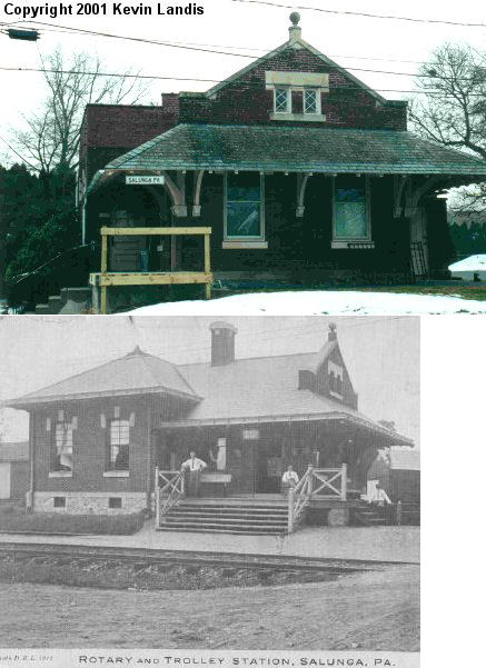
| Salunga |
|
Stoney Battery Road, Oak Lane and West Brandt Boulevard. (GPS: 40.099449,-76.42592) |
C | Offices | ???? | Gone | Brick |
|
| West Willow |
|
730 Millwood Road at West Willow Road (GPS: 39.972816, -76.288598). |
C | Business | 1875 | Gone | Wood | |
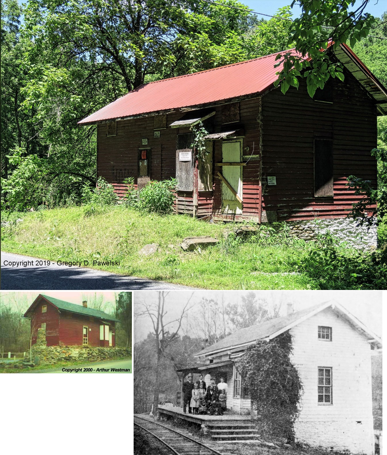
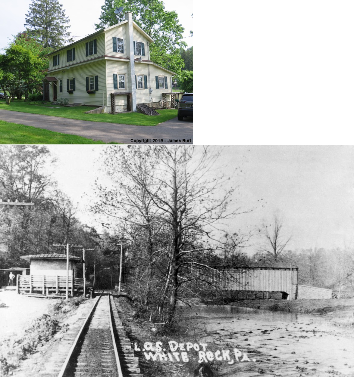
| White Rock |
|
King Pen Road just south of White Rock Road (GPS: 39.824211, -76.089902) |
C | Residence | ???? | Gone | Wood |
|
| STATIONS OF THE PAST | ||||||||
| Station Name |
Original Railroad |
Notes | ||||||
| Aberdeen |
 |
This station was on the west side of Mill Road on the south side of the tracks, altough different maps show the station in slightly different locations. According to the 1899 map the station was near GPS: 40.177903, -76.623922, a slight distance down the tracks, west of Mill Road. | ||||||
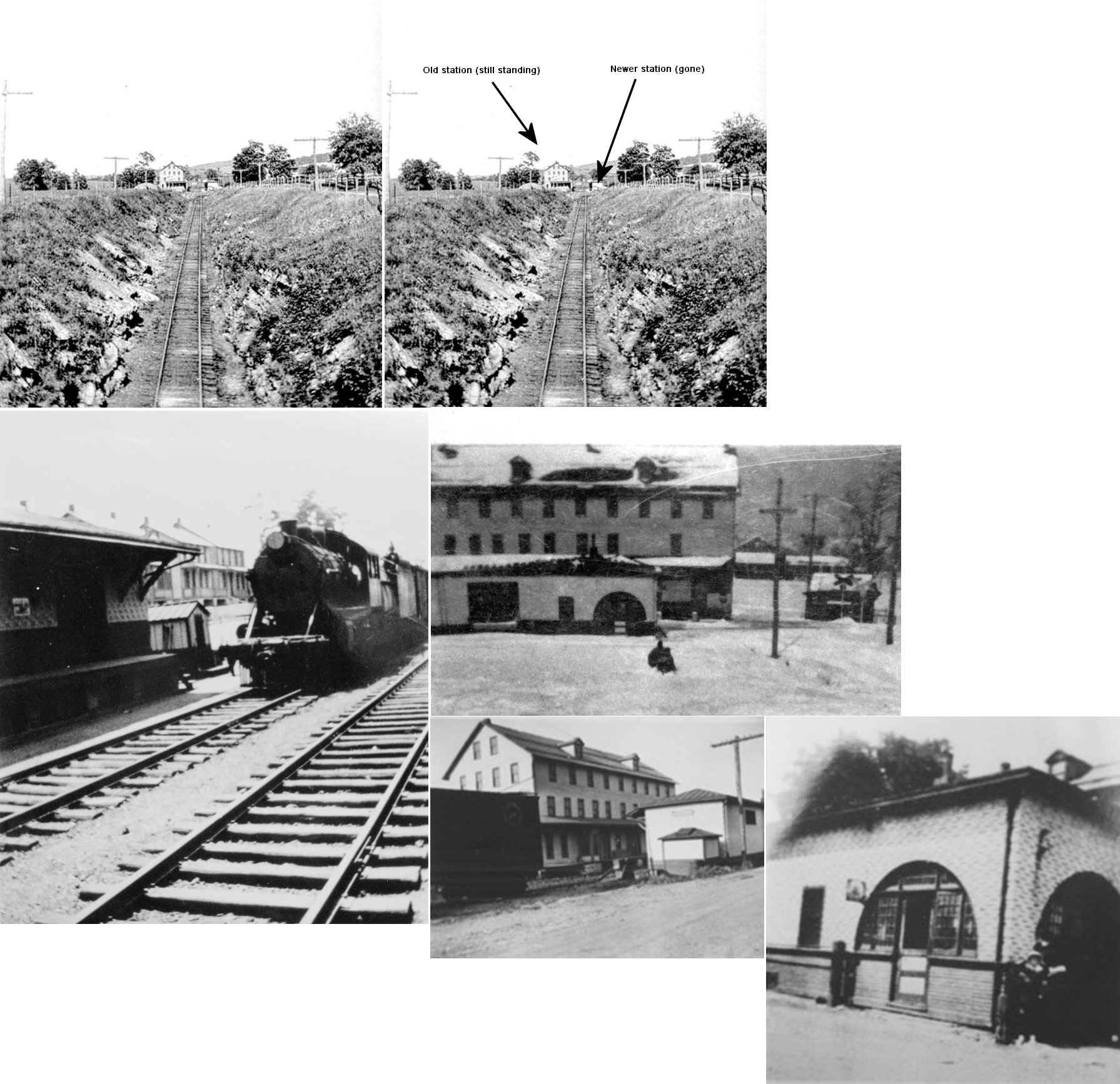
| Akron |
|
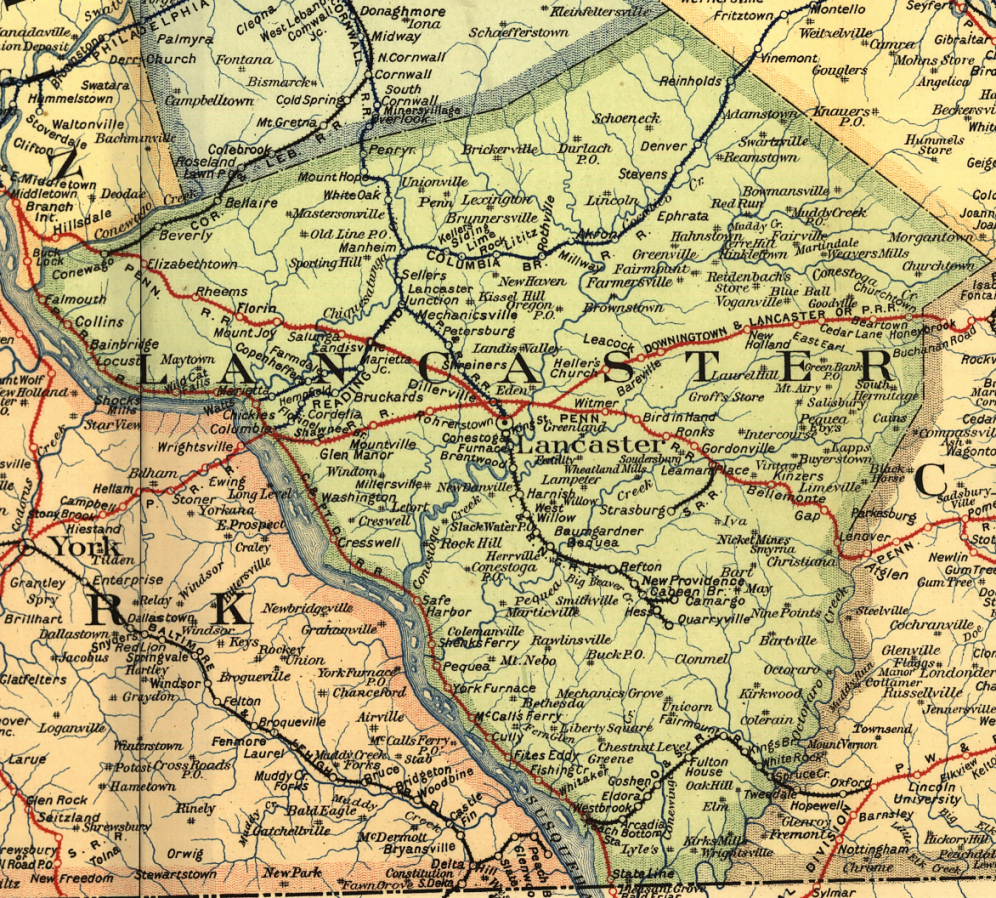
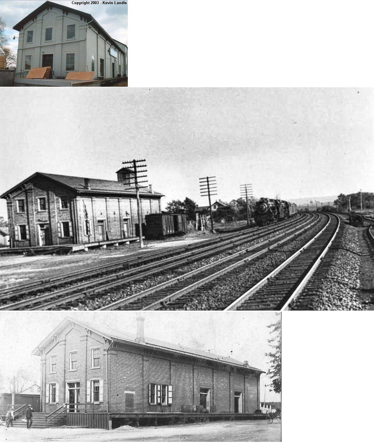
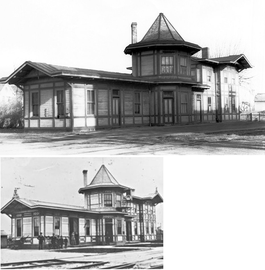
Akron was known as New Berlin on the 1864 county map. The building that is still standing was a warehouse and the station fuctions were carried out within it until this station was built in 1889 across the tracks at GPS: 40.162987, -76.210110. | ||||||
| Arcadia |
|
This station was on the north side of Arcadia Trace Road and the tracks and south of Puddle Duck Creek (andwiched between the tracks and the creek) at approximately GPS: 39.758052, -76.206363. | ||||||
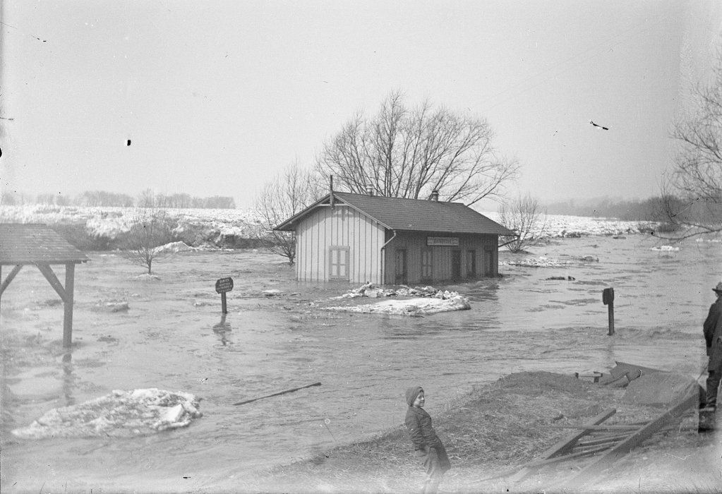
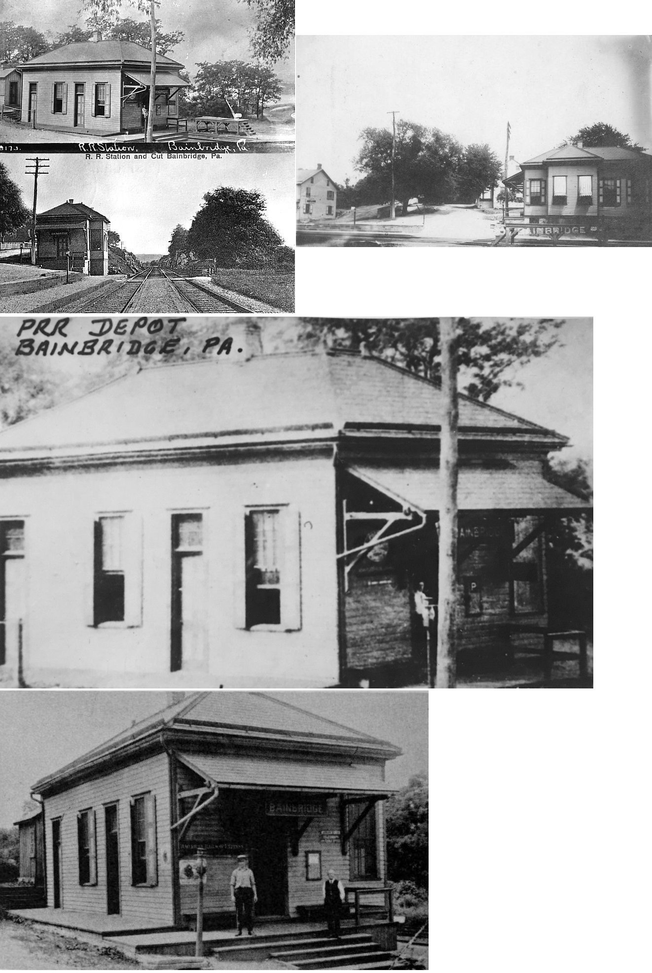
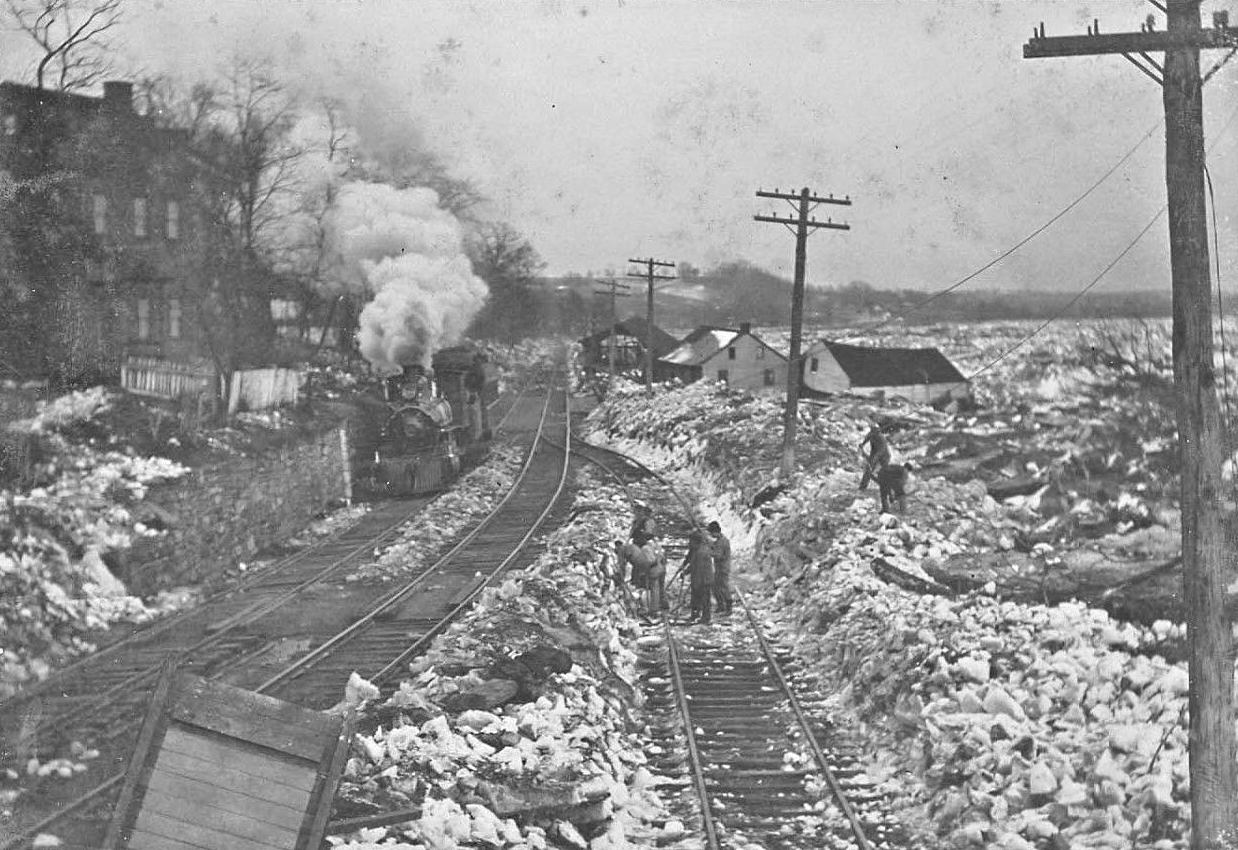
| Bainbridge |
|
This station was swept away in a flood, as pictured, and was replaced by the station listed below. The March 8-10, 1904 ice jam caused this flooding (Lancaster New Era, 5-17-1904). The station likely sat on the west side of the tracks at approximately GPS: 40.090209, -76.670616. | ||||||
| Bainbridge |
|
After a period of time with a temporary station (Lancaster New Era, 5-17-1904), this station was built at the intersection of Front and Race Streets on the east side of the tracks at GPS: 40.089881, -76.670165. It replaced the station that was swept away in the flood of Spring 1904 (see listing above) and sat ten feet higher than the old station. | ||||||
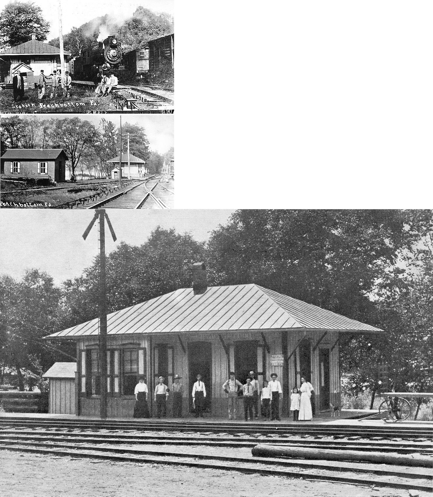
| Beartown |
|
See the listing above for Narvon. | ||||||
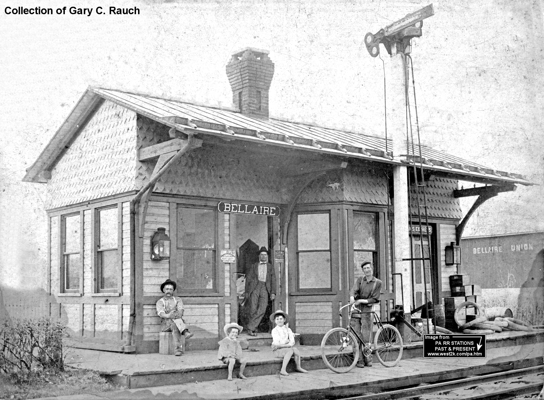
| Bellaire |
|
This station was at the southwest corner of the Bellaire Road crossing at approximately GPS: 40.193180, -76.575815. | ||||||
| Benton Station |
|
This station was at the end of Benton Hollow Road in the vicinity of GPS: 39.776818, -76.251526. | ||||||
| Beverly Station |
|
This station was on the east side of Old Hershey Road on the north side of the tracks. Different maps show the station in slightly different locations, but the general location is the same. Using the 1899 sites for coordinates, the station was near 40.182403, -76.611073. | ||||||
| Billmeyer |
|
This station was closed due to quarrantine for 18 days in March/April of 1914 due to an outbreak of smallpox (The Morning Journal, 3-18-1914). The station served the Billmeyer Quarry and was likey located in the vicinity of GPS: 40.076060, -76.657877. Billmeyer became a ghost town after 1960, with most of the remnants being torn down by 2007. | ||||||
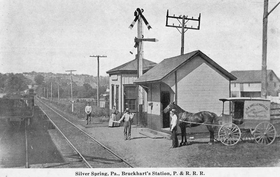
| Bruckharts (Silver Spring) |
|
This station was on the south side of Marietta Avenue on the west siade of the tracks at GPS: 40.062895, -76.429946. | ||||||
| Buzzard Rock |
|
This station was at the end of Brenner Hollow Road, on the east side of the former Enola Low Grade tracks, near GPS: 39.921779, -76.37974. | ||||||
| Cabeens Branch Station |
L&QRR |
The Lancaster & Quarryville RR opened a station here in 1875. The L&Q eventually become part of the PRR in 1909. The station, most likely an open platform or shelter, was near a wye connection that was wiped out by the current location of Route 222 passing through the area. The Lancaster to Quarryville Branch Reading Railroad's Cabeen and Hess Branches were built shortly after the main branch went into operation, primarily to service numerous iron ore pits in the New Providence area. The Cabeens Branch was built in 1875 and orders were given to dismantle it in 1887. Something else complicating the precise location of the Cabeen's Branch is the later construction of the trolley line from Lancaster to Quarryville. The trolley may have used a portion of the Cabeen's Branch grade. | ||||||
| Cedar Lane |
|
This station was on the SE side of Sheep Hill Road at approximately GPS: 40.106237, -76.024142. | ||||||
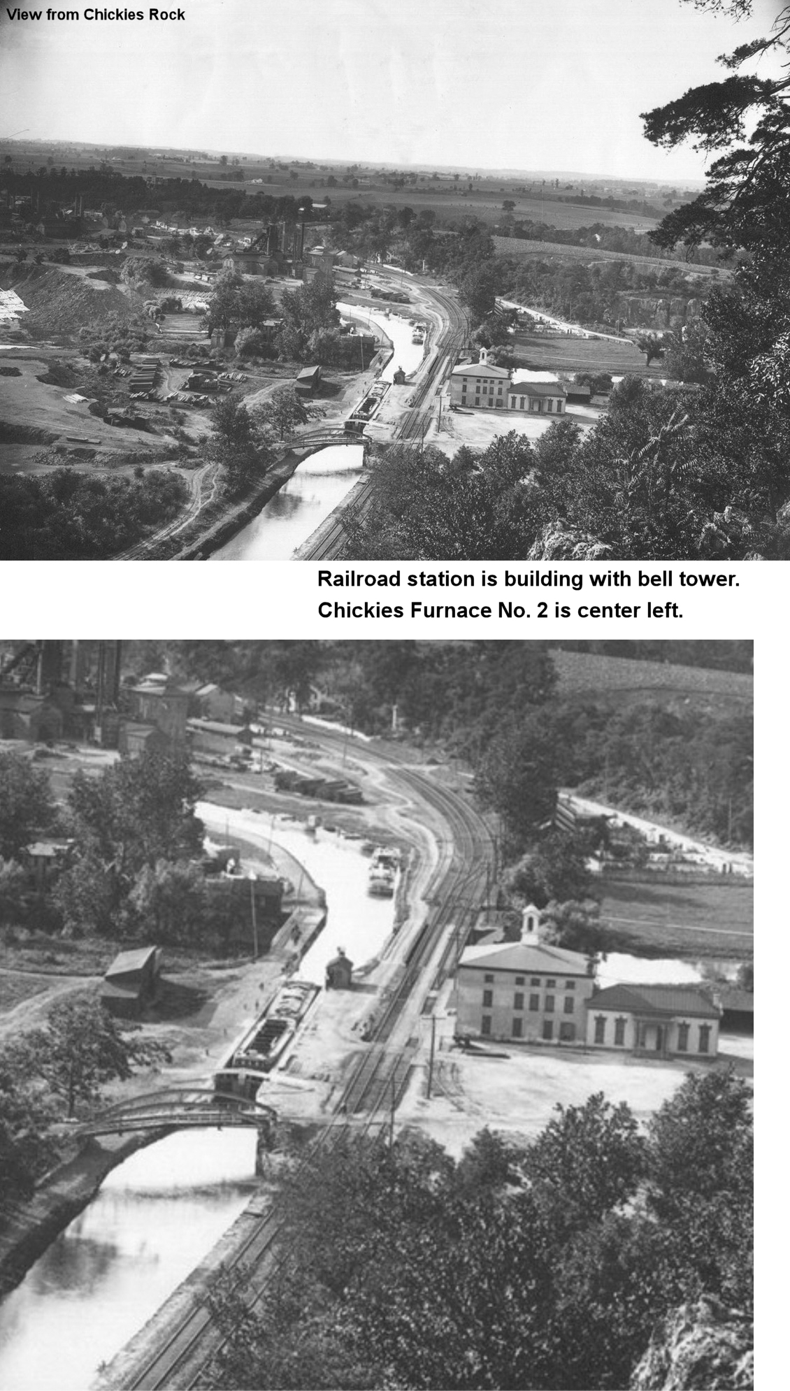
| Chickies Station (Chiquies) |
|
This station was west of Chickies Hill Road on the east side of the tracks at approximately GPS: 40.055005, -76.526556. As this was a large building, it likely had another purpose aside from being the station. | ||||||
| ChurchTown Road Station |
|
This station was on the east side of Chruchtown Road at approximately GPS: 40.107582, -75.952503. When the line was in service a wooden bridge carried Churchtown Road over the tracks. | ||||||
| Collins |
|
This station was just SE of Falmouth in Cono Township. Not sure if one of the building in the photo is the station (likely not). The photo was captioned, "Ice gorge at Collins Station 1904." The station was likely on the east side of Collins Road on the north side of the tracks at around GPS: 40.120076, -76.707960. | ||||||
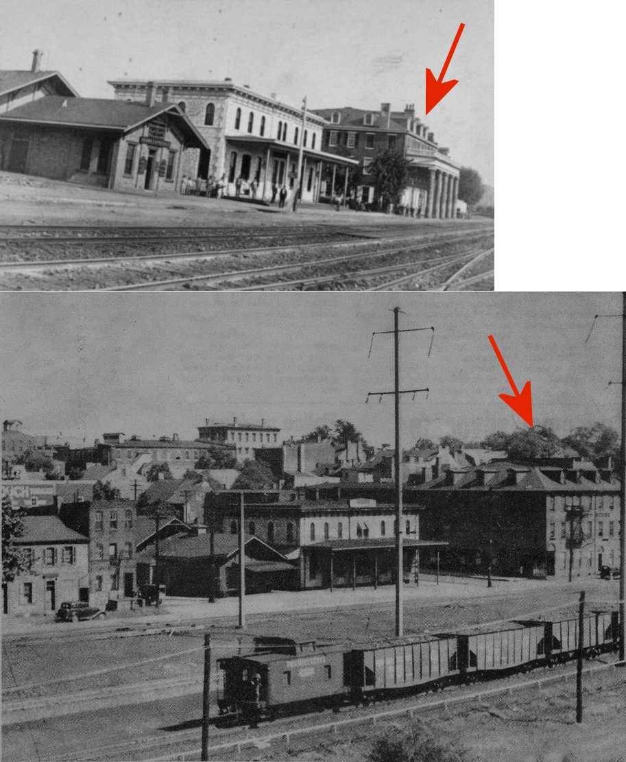
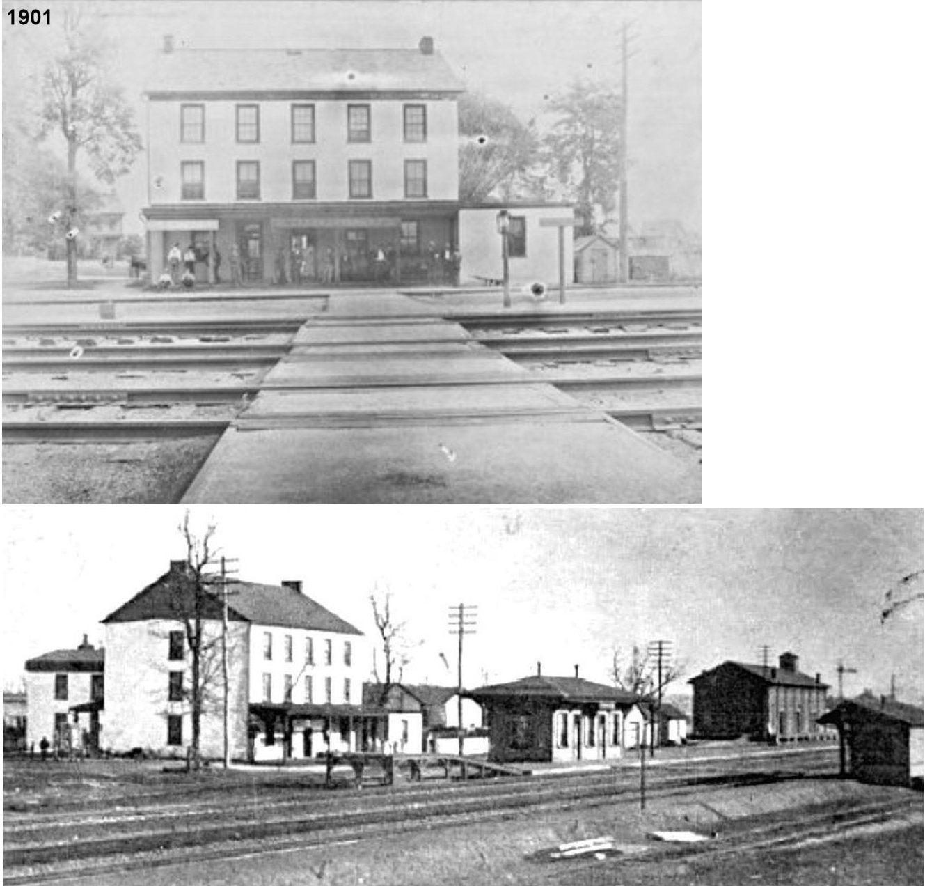
| Columbia |
|
The first station here was in the Washington House Hotel (later known as the Tremont House) which was on the SE corner of Wanut and North Front Street (GPS: 40.030687, -76.506610). It served as the station until the new station was built on the other side of Walnut Street in 1870 (Sunday News, 1-10-1993). | ||||||
| Columbia |
|
The freight station was on the NW side of passenger station on North Front Street at GPS: 40.031186, -76.507143. | ||||||
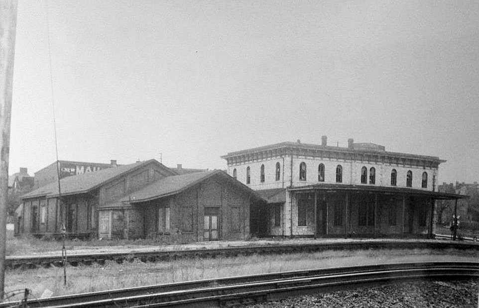
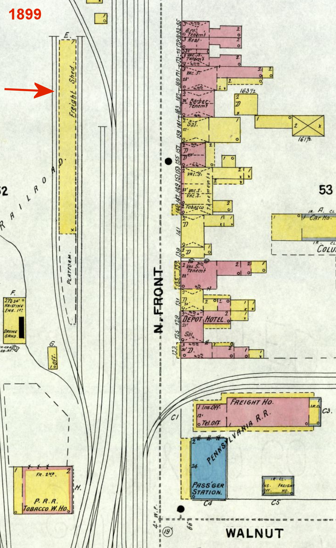
| Columbia |
|
There was a long open-sided freight shed off North Front Street on the SW side of the tracks at GPS: 40.031253, -76.508129. This shed was gone by 1904, by which time the PRR had opened a new freight house next to its roundhouse (see listing below). | ||||||
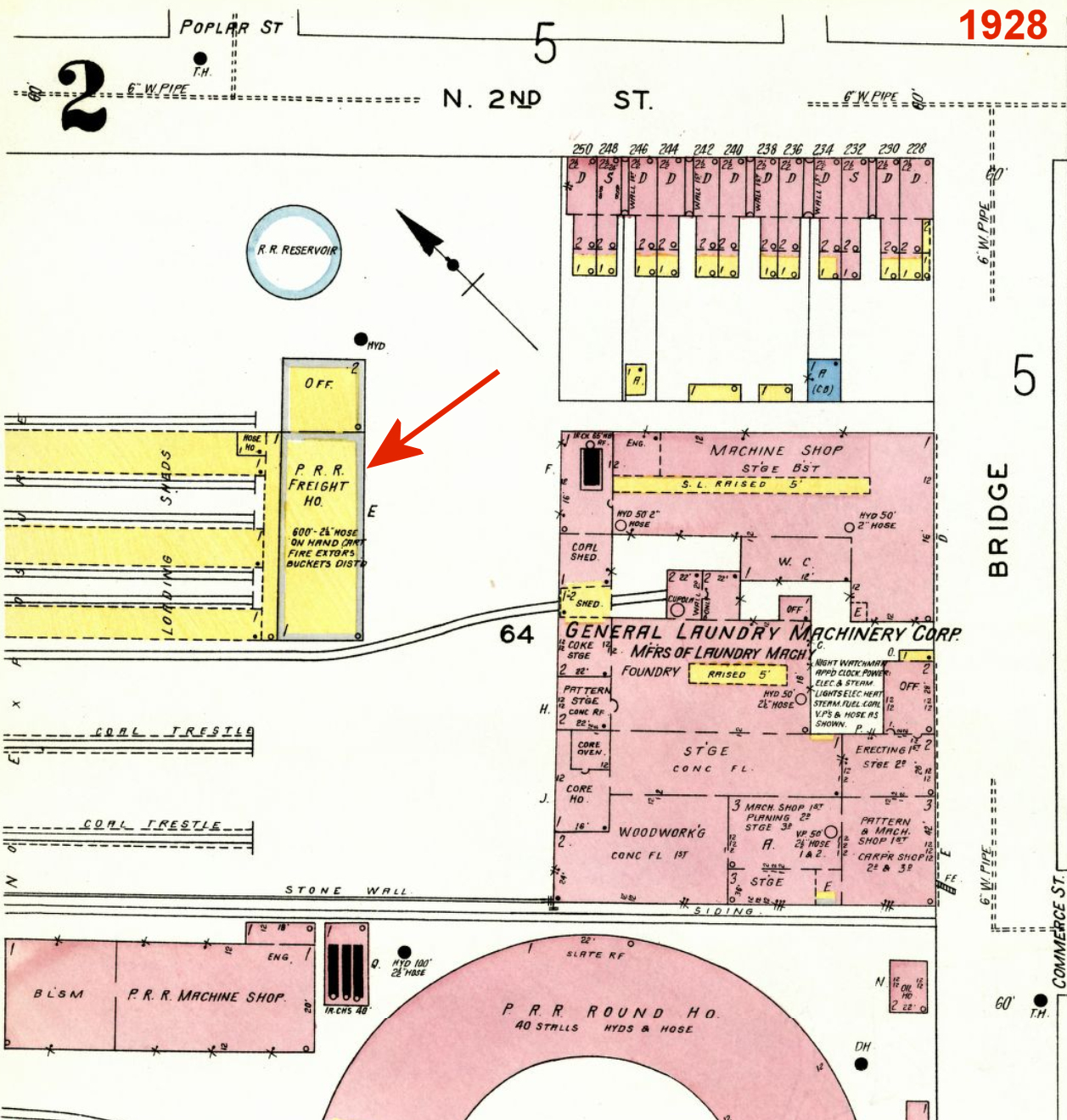
| Columbia |
|
There was a terminal-type freight house next to the PRR roundhouse on the SW side of North 2nd Street at Poplar Street at GPS: 40.033916, -76.507761. It was of frame construction, ironclad on the outside and had three parallel loading sheds jutting out towards the northwest, perpendicular to the main building. It was still standing as of the 1920 Sanborn map, but was gone by the 1951 aerial photo of the area. | ||||||
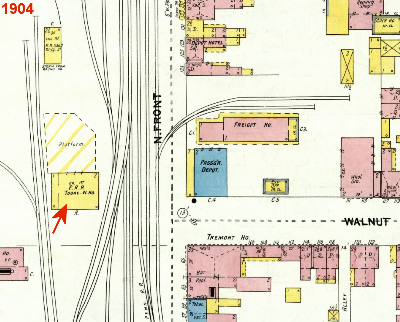
| Columbia |
|
The railroad also owned a "tobacco warehouse" freight station with a large platform. The first floor was brick whicle the second floor was wood frame. It had previously been occupied by J. Fendrich & Son. It was across the tracks from the passenger station on the corner of Walnut and Locust Streets at GPS: 40.030571, -76.507346. It is shown on maps from 1886-1904. Sometime around 1899 it became the property of the railroad. | ||||||
| Columbia |
|
The first station here was built in the 1860s and was at "Carpet Hall" at the corner of Locust and Bank Streets (same location as the station below). The building housed other businesses as well as the railroad station. | ||||||
| Columbia |
|
The second passenger station was on the south corner of Locust and Bank Streets at GPS: 40.029928, -76.504920. It was a terminal-type station with a large train shed, built in the 1883 when passenger traffic increased significantly. The shed was torn down in 1941 and the rest of the station was torn down in 1966. | ||||||
| Conestoga |
|
This station was at the end of the Downington & Lancaster branch's junction with the mainline. It was between Greefield Road and Pitney Road, likely at GPS: 40.046038, -76.263042. | ||||||
| Conestoga Furnace |
|
This station, most likely just a passenger shelter, served the Conestoga Furnce Company. It was just south of the Engleside Railroad Bridge over the Conestoga River in the vicinity of GPS: 40.020928, -76.304218. The Harrisburg Telegraph newspaper reported that station was abolished as of 2/15/1900. | ||||||
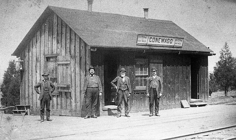
| Conewago |
AND |
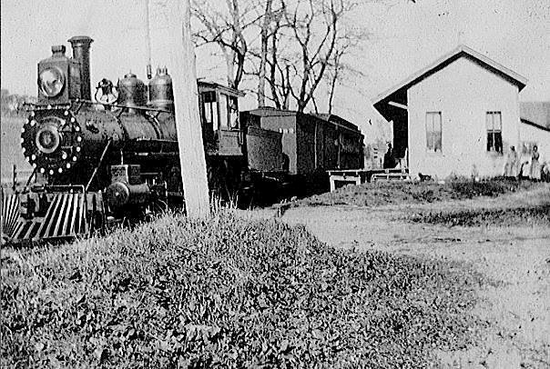
This station was between Bossler Road and the tracks at GPS: 40.156538, -76.655739. In the photo, Richard Leber is 2nd from the left in the picture. He acted as a station master, ticket agent, and caretaker. A new station was built here in 1888. | ||||||
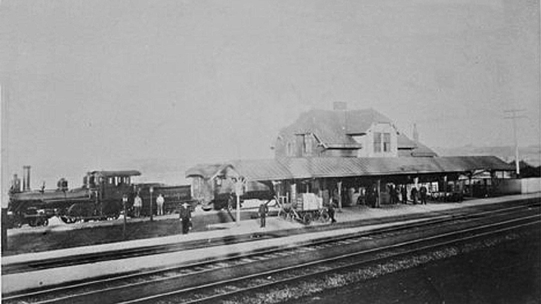
| Conewago |
AND |
This is the newer station. | ||||||
| Cordelia (Kauffmans) |
|
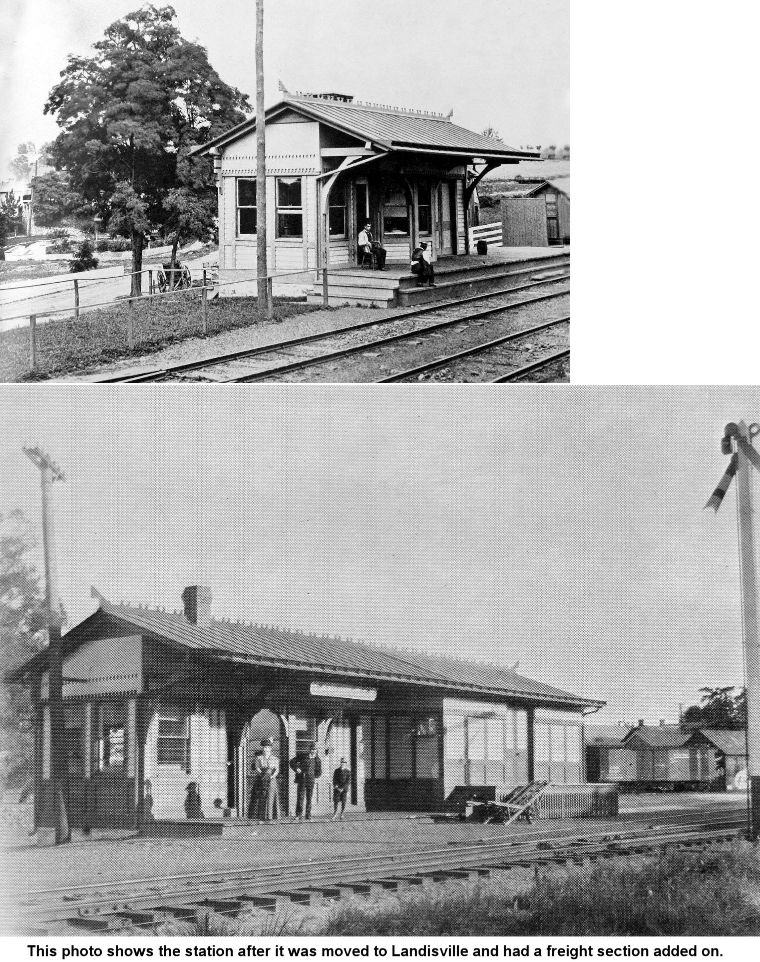
This station, built in 1882, was located on Burma Road. In 1909 it was moved to Landisville after traffic at Cordelia dwindled. It appeared on the first R&C timetable from 1863 listed as "Kauffmans." | ||||||
| Cordelia |
|
This is the second Cordelia depot which was essentially only a flagstop. When the building became run down, a new, but also modest, concrete block structure (still standing) was built. This location was originally called Kaufmans Station (see 1864 Lancaster Co. atlas). | ||||||
| Creswell (Turkey Hill) |
|
Originally known as Turkey Hill, renamed Creswell in 1879. The station was on the east side of the tracks near GPS: 39.967892, -76.456607 (at what is now a parking area for the Enola Low Grade Trail). There is an unmarked road to access the parking lot from River Road which may be the original road to the station. | ||||||
| Cullys (Face Rock) |
|
This station was in the vicinity of GPS: 39.825167, -76.327779. It was not far from the location of the Minqua station, so one may have replaced the other as both so close at the same time would have been redundant. On the 1895 and 1912 maps the station is called "Cullys," but it is called "Face Rock" on the 1923 map. A 1902 newspaper article used the two names interchangeabley (Lancaster New Era, 2-25-1902). | ||||||
| Denver (Union Station) |
|
This settlement area was/is known as Bucher Thal, but the original name for the Denver station was "Union Station."" Originally the railroad wanted to call it "Reamstown Station," but the citizens of Reamstown objected due to the railroad choosing to bypass their village so it was dubbed "Union Station." As the town grew near the station, residents objected to the name "Union Station" (which the town itself was becoming known as) as they didn't want the town to carry the (generic) name of the railroad station. The name of the town and the station was changed to "Denver" (named after Denver, CO) in 1881. The station was built in 1863 and torn down in 1971 (LNP Always Lancaster, 4-8-2019). It was on the SW side of Main Street on the SE side of the tracks at GPS: 40.231584, -76.135851. | ||||||
| Dillerville |
|
An old map of Dillerville plots shows the approximate location of the PRR station there. The Harrisburg Portsmouth & Lancaster Railroad had a depot between what was then Market Street to the north and the HP&L RR, (or H&L RR) to the south. According to the William Dryden interactive map the station was in the vicinity of GPS: 40.057361, -76.324112. The station was closed around 1920 (Lancaster Examiner, 9-24-1920). However the same source of the plat map mentioned above also claims the station was on the south side of the tracks: "The Pennsylvania Company built a frame shelter east of the Dillerville Lane, on the south side of its right-of-way. It consisted of three sides and a roof, being open on the track or north side. At this point Dillerville Lane crossed the Pennsylvania tracks at grade and went up very steeply to cross the Reading track over a bridge." (James I. Pyle, "The Story of Dillerville" in Journal of the Lancaster County Historical Society, Vol. 53, 1949). | ||||||
| Dillerville |
|
"The Reading Company never erected any building or weather shelter at Dillerville. A levelled stretch along the track, covered with gravel or cinder, was their stopping point. As this was located in a deep cut of possibly twenty-five feet, a flight of steps led upward to the Dillerville Lane level" (James Pyle, "The Story of Dillerville" in Journal of the Lancaster County Historical Society, Vol. 53, 1949). | ||||||
| Drumore (Fishing Creek Sta.) |
|
See listing below for Fishing Creek Station. | ||||||
| East Earl |
|
A new station was built here in 1892. It was on the east/south side of the dogleg on East Earl Road at GPS: 40.109718, -76.032800. The station was still standing in 1958, but gone by 1969. | ||||||
| Eldora |
|
This station was on the east side of Route 272 (Lancaster Pike) on the north side of the tracks near where the old creamery is. It was at GPS: 39.793317, -76.184263. | ||||||
| Elizabethtown |
|
The first station here on the narrow-gague Lancaster, Mt. Joy & Elizabethtown RR was a large wood frame structure built in 1832 off of West High Street. The line itself was chartered in 1829 and built in 1833-34 (Elizabethtown Chronicle, 8-14-1975). This station was abandoned because a spring was found when the railroad dug a tunnel (near where Mount Tunnel Cemetary is). Because of that spring, it was decided to build a station closer to the tunnel so the water could be gravity-fed down to the new station (listed below on West BainBridge Street). The original station thus served from 1832-1838 and stood until it eventually burned down in 1880. | ||||||
| Elizabethtown |
|
The second station of the Lancaster, Mt Joy & Elizabethtown RR was a two-story stucco building that was on the SE side of West Bainbridge Street at GPS: 40.145119, -76.607754. It was built in 1838 at the time the tunnel (now a cut) was completed to the east. It closed in 1900 as the new double track alignment of that year had rendered it obsolete. The station is shown on the 1902 Sanborn map and marked as "vacant." | ||||||
| Elizabethtown |
|
This station was built in 1900 when the new double track alignment was established. It was just NW of the High Street underpass on the south side of the tracks at GPS: 40.147136, -76.614423. There was a shelter and telegraph tower on the north side. The station served for 15 years until the existing station was built. The existing station was built to conform to the achitectural style of, and better serve, the nearby Masonic Village that was being constructed at the time. | ||||||
| Elizabethtown |
|
This freight station was on Wilson Avenue, one block east of the passenger station. It was demolished on April 30, 2013 to make way for an expanded Amtrak parking lot. The PRR constructed the freight building in 1912. The Railway Express Agency operated the station from 1929 to 1972. | ||||||
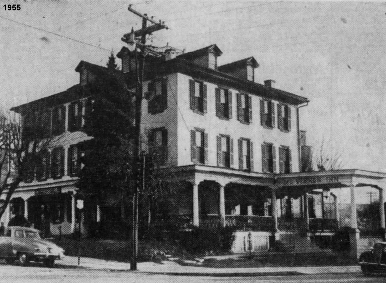
| Ephrata |
|
Before the (extant) station was built in 1889, the railroad had a station in the barroom on the south side of Mount Vernon House Hotel (also known as the Martin Gross Hotel). Eventually the railroad took over the barroom for its sole use as a passenger station after concerns about passenger comfort amidst the drunken crowds at the bar in the evenings (there was also a smaller room used for the ticket and telegraph office). The hotel was built in 1854 and torn down in 1955 (Intelligencer Journal, 2-14-1955). It was on the east corner of Main and State Streets on the NW side of the tracks at GPS: 40.178845, -76.177057. | ||||||
| Fairmount |
|
This was west of the intersection of Black Road and Little Britain Road North in the middle of the wye where the LO&S branch line ran north to Quarryville (that branch was opened in 1906). It was near GPS: 39.818237, -76.137440 | ||||||
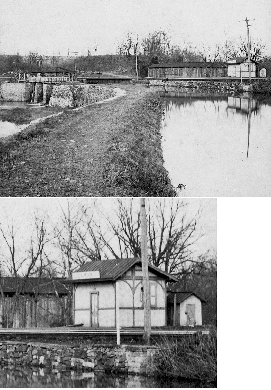
| Falmouth |
|
In 1899 the station was located between the tracks and River Road just south of Conewago Creek. The station was gone by 1937, and was likely destroyed in the flood of 1904 that also destroyed the nearby covered bridge. In the photo, the photographer is standing on the canal towpath in Lancaster County looking northeast into Dauphin County at the confluence of Conewago Creek into the Susquehanna River (river off the photo to the left and to the camera's back). --Tom Kipphorn | ||||||
| Fishing Creek |
|
This station was at the end of Fishing Creek Road on the NE side of the tracks in the vicinity of GPS: 39.791194, -76.264520. | ||||||
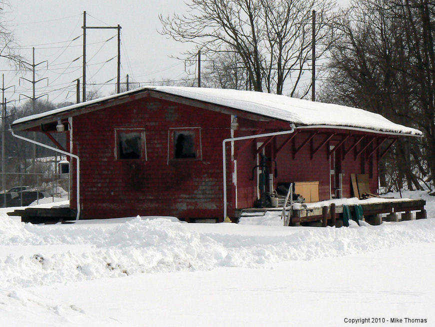
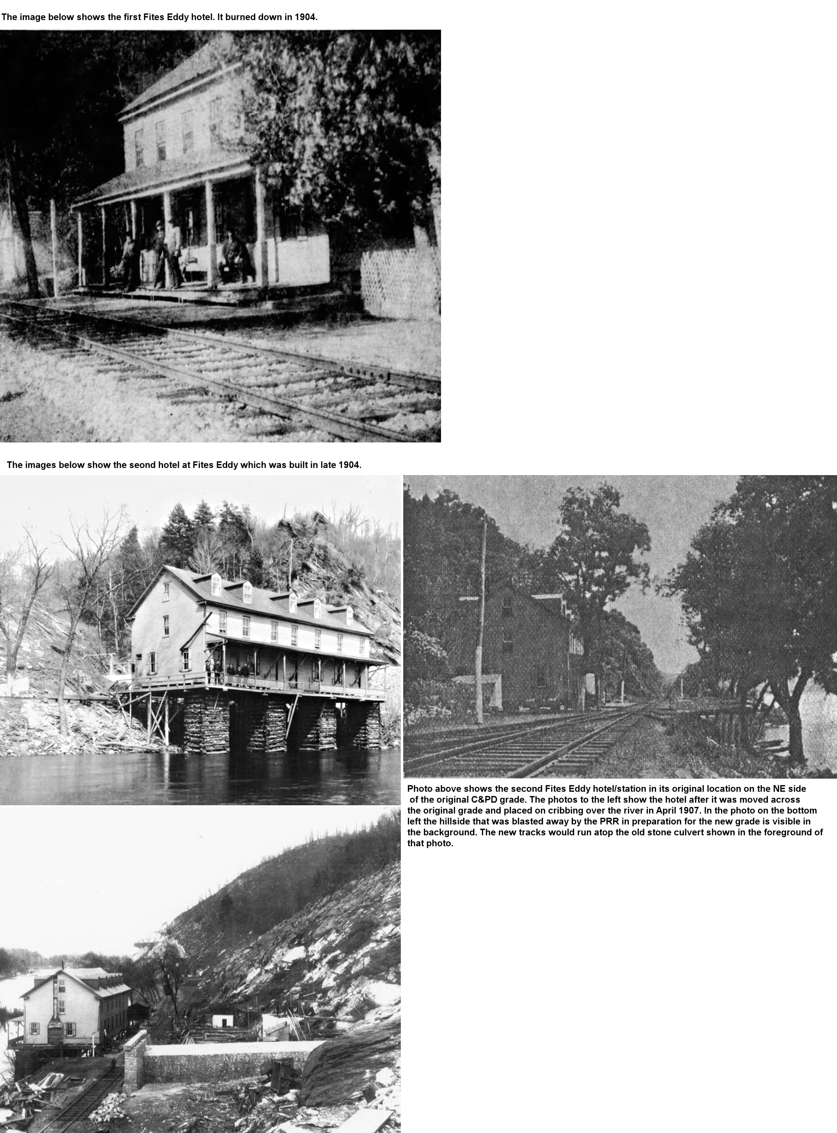
| Fites Eddy (Midway) |
|
This station was between Drumore and Bonview as shown on the 1899 map. The 1900 PRR List of Stations & Sidings lists Cully, Fites Eddy (Midway) and Fishing Creek in order. Over the years there were two hotels here that also served as station and ticket office. The first hotel was likely built in the 1870s at the foot of Hawk Point and was on the NE side of the tracks at approximately GPS: 39.799797, -76.286448. Those coordinates are now on the SW side of the current tracks, but at that time the original tracks were closer to the river. That first hotel burned down in 1904 (York Dispatch, 2-6-1904). The second hotel was built later that same year on the same (NE) side of the original tracks. However, due to the construction of the dam at McCalls Ferry, this line needed to be elevated and moved away from the riverbank. In preparation for the new line, the second hotel was purchased by the railroad and moved across the tracks by a crew of 2,000 men and placed on cribbing on the river (at approximately GPS: 39.799642, -76.286521) in April 1907 (The Semi-Weekly New Era, 4-17-1907). In July 1907 the railroad used a whopping 300 tons of powder and dynamite to blast away the whole side of the hill at Fites Eddy (The Inquirer, 7-13-1907). The blast was so powerful that it knocked a two-story clubhouse located on an island opposite the blast (Roher's Island at the time, which is not there anymore, but was near present day Sicicily Island) 30 feet off its foundation collapsing the first floor. After that the Fites Eddy hotel was used to house railroad workers until the PRR finished the new elevated grade. The hotel was sold to a local resident and torn down in 1908 or 1909 with the lumber being used to construct some houses (Sunday News, 11-15-1959). The railroad closed off the two roads to Fites Eddy in 1910 (much to the chagrin of local landowners who sued the railroad) and today the area remains isolated without road access. | ||||||
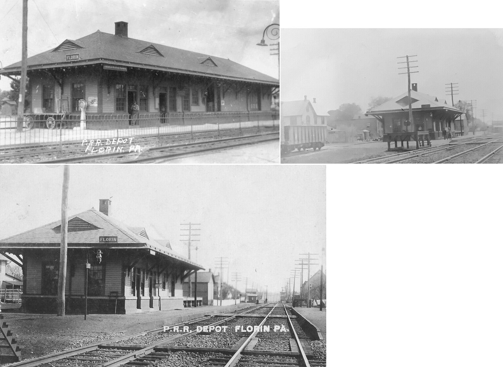
| Florin (Springdale) |
|
This town sat between Mt. Joy and Rheems on the PRR main. Prior to 1882 this station was known as Springdale. The station was on the SE side of Plum Street on the north side of the tracks at GPS: 40.113483, -76.524527. | ||||||
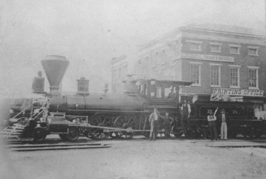
| Fulton (Fulton House) |
|
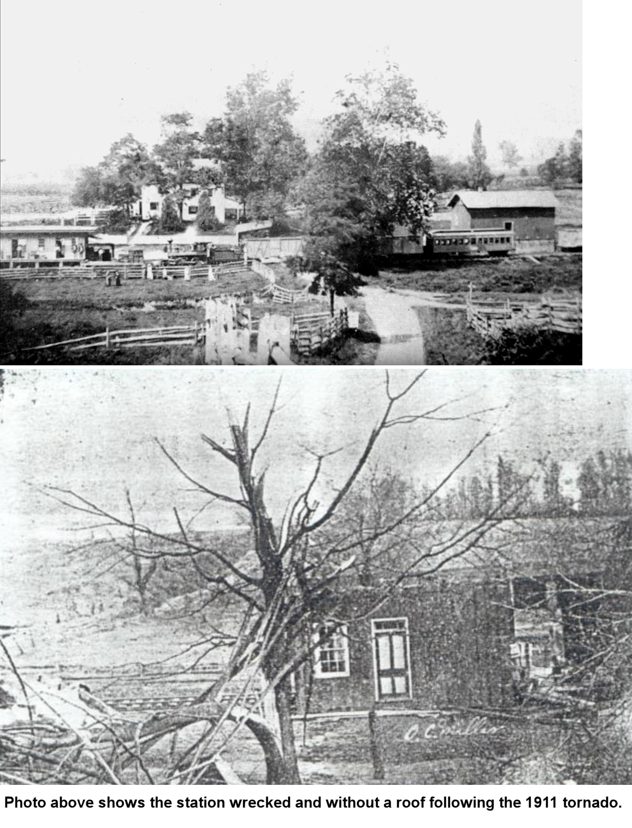
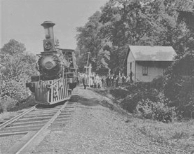
This station was on the west side of US-222 on the north side of the tracks just south west of the Fulton House. The photo is of the first train to reach the station in 1874. In the photo, the station is on the left. The building on the right is a tobacco or grain warehouse (accourding to the Southern Lancaster Historical Society) which is still standing. The station was wrecked by a tornado in April 1911. It's not clear if it was rebuilt after that. | ||||||
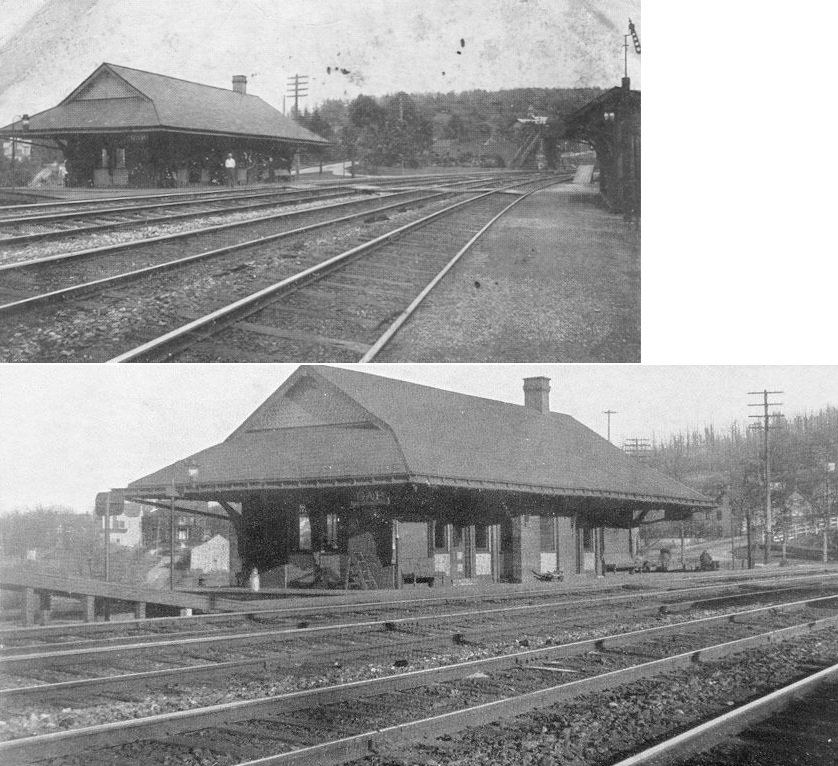
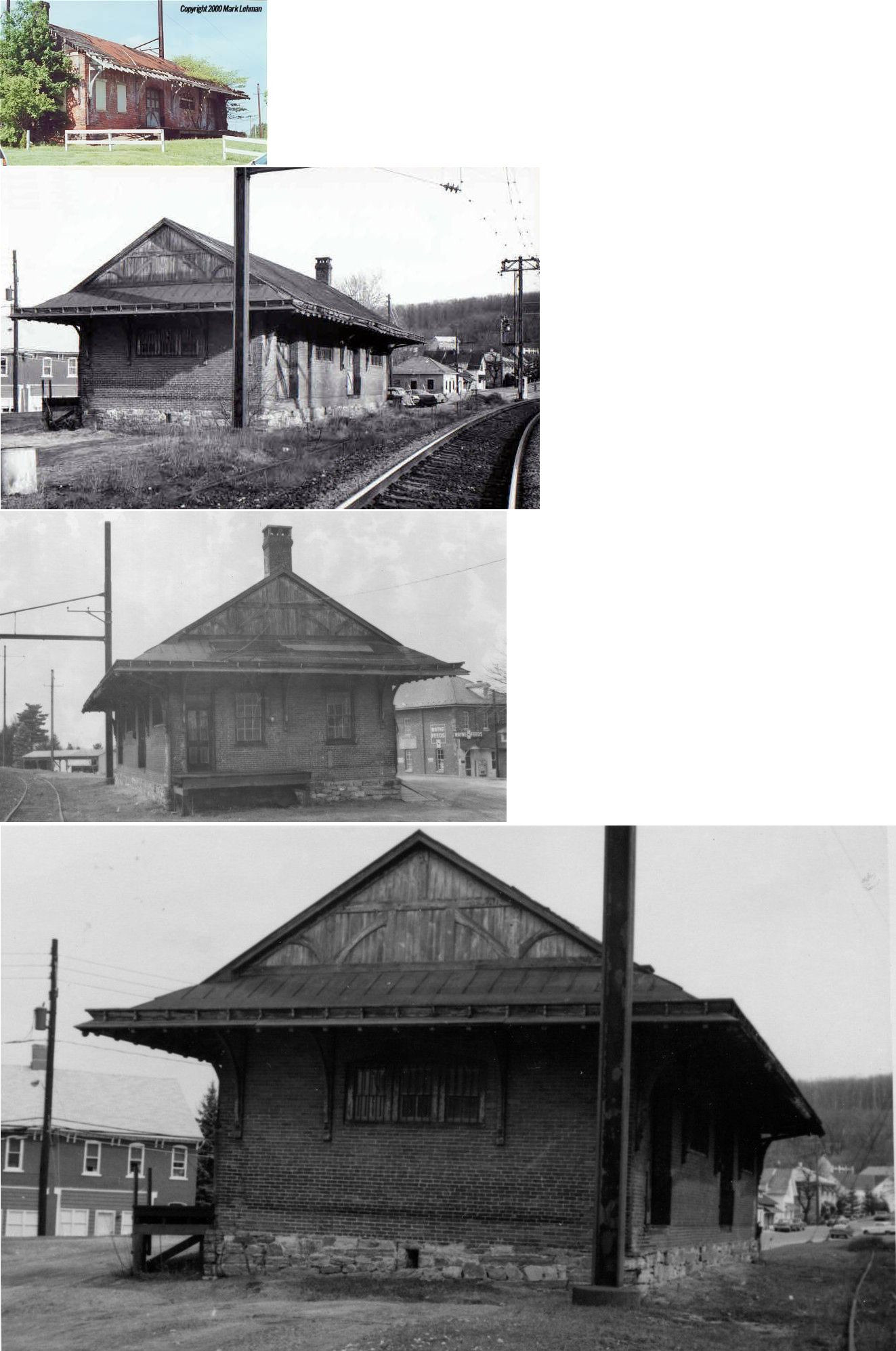
| Gap |
|
The passenger station here opened in 1884. It was on the SW side of Pequea Avenue around GPS: 39.986841, -76.019675. | ||||||
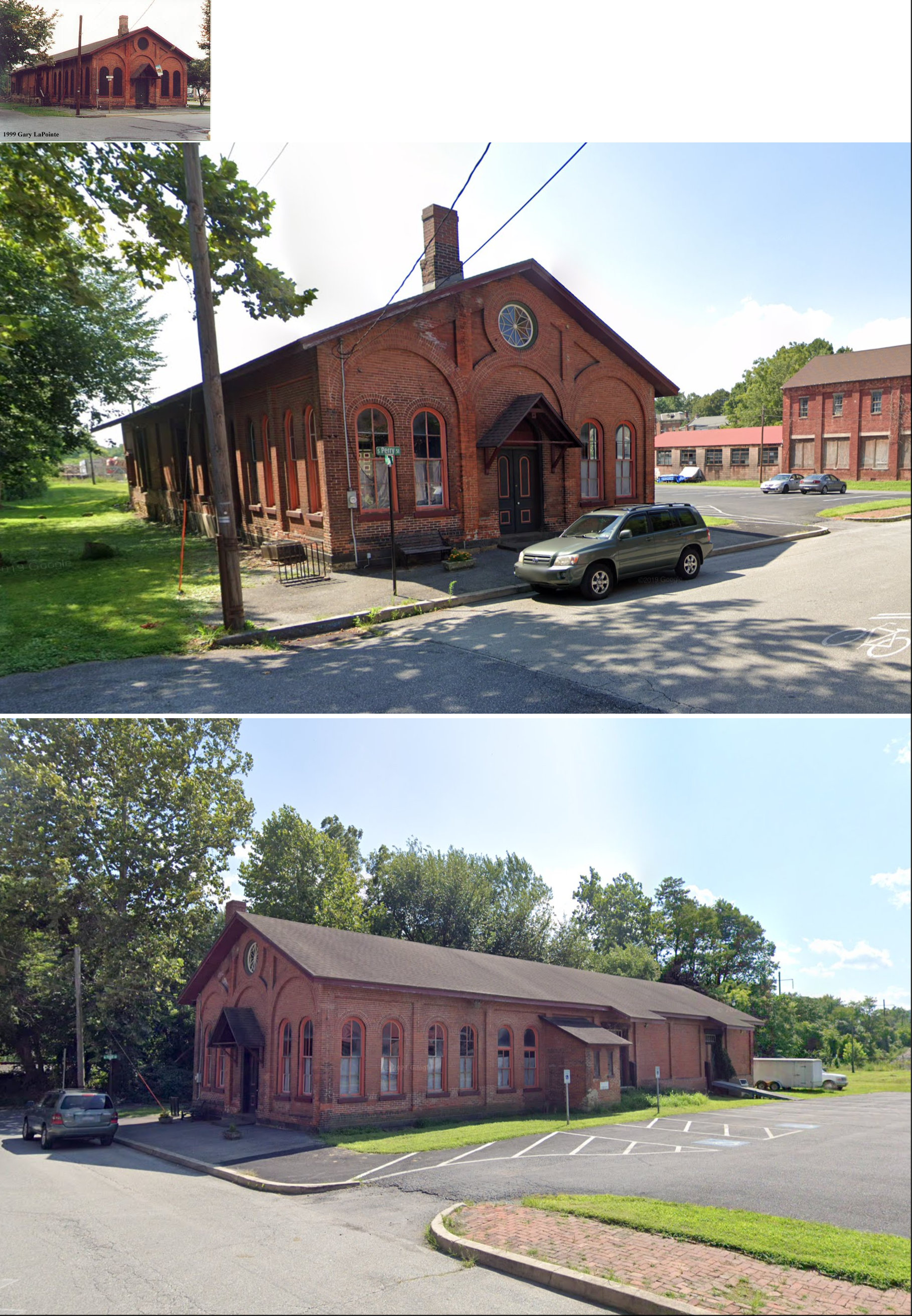
| Gap |
|
The freight station was on Pequea Avenue just NW of Resevoir Avenue at GPS: 39.987507,-76.021088. It was torn down by Amtrak in February, 2011 after having been vacant and run down for many years. It was the style of the other very early brick railroad buildings on this line and may be a leftover of the Philadelphia and Columbia Railroad era. Some sources say it was built in the 1850s and some say 1884. | ||||||
| Glen Manor |
|
This station was between Columbia and Mountville on the Columbia Branch. It is shown on the 1895 map below. It was likely on Prospect Road in the vicinity of GPS: 40.027154, -76.455146. | ||||||
| Gordonville |
|
This station was built in 1889. It was at least the second station here as there was an earlier station established in the early days of the railroad. | ||||||
| Greenfield |
|
This station is shown on the 1899 map as being on Greenfield Road at approximately GPS: 40.047017,-76.255138. | ||||||
| Groffs Station (Groffdale) |
|
This station was on the east side of South Groffdale Road in the vicinity of GPS: 40.090458, -76.138498. | ||||||
| Haines Station |
|
This station was where Haines Station Road used to end at the tracks in the vicinity of GPS: 39.733238, -76.224431. | ||||||
| Hartman |
|
This station was between Heller's Chruch station and Greenfield. It was along Hartman Station Road at approximately GPS: 40.063944, -76.217951. | ||||||
| Hellers (Hellers Church) |
|
This station was between Leola and Hartman. It was on Horseshoe Road at GPS: 40.072771, -76.204974. | ||||||
| Hempfield Station |
|
This station was originally known as "Silver Spring" and appeared on the first R&C timetable in 1863. It was on the east side of Hempfield Hill Road on the north side of the tracks at GPS: 40.054780, -76.444916. | ||||||
| Herman (Harnish) |
|
This station was between Levans Mill and West Willow on the Lancaster & Reading RR narrow guage. The station is shown on the 1900 PRR List of Stations & Sidings. This location is in the vicinity of the intersection of Brenneman Road and Eckman Road. The station was called "Harnish" when the Reading owned the line. | ||||||
| Hess |
|
This was a station on the Lancaster & Reading Narrow Gauge Railroad (up until 1904 when the corporate name was changed to "Lancaster & Quarryville Railroad;" later part of the PRR in 1915). The station, built in 1874-75, was on the west side of what is now Beaver Valley Pike (US-222) at approximately GPS: 39.907248, -76.184573. Passenger service ended in 1909 and the station was gone sometime before 1940. | ||||||
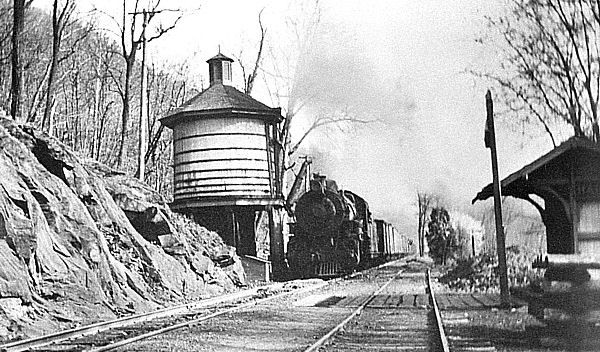
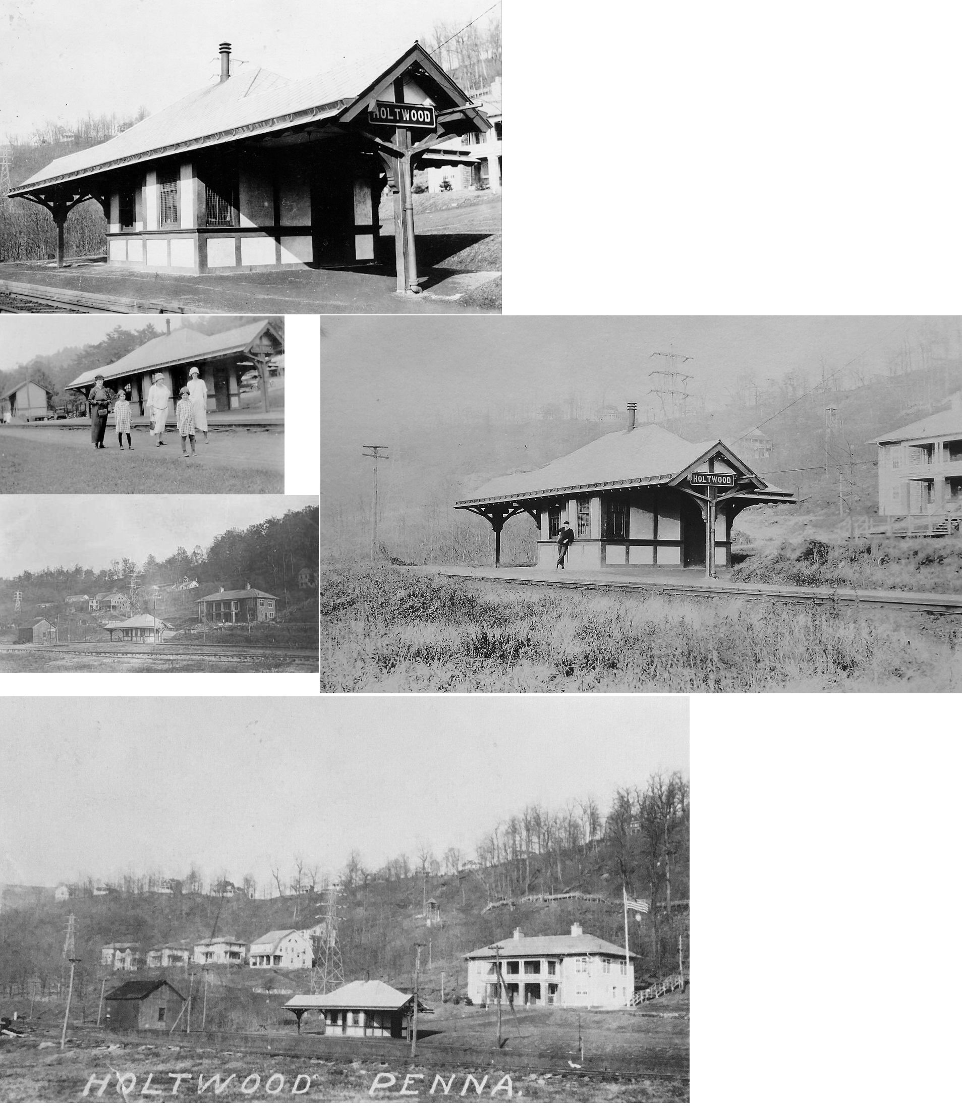
| Holtwood (Minqua) |
|
The 1912 county map shows this station between Bonview (McCall's Ferry) and Cully's Station. The 1900 PRR List of Stations & Sidings does not list this station. The station was on the east side of the tracks on Old Holtwood Road at approximately GPS: 39.828367, -76.330052. | ||||||
| Kellers Station |
|
This station is shown on the 1864 and 1875 maps and was located just NW of Limerock. There are no roads to this location today. It was at approximately GPS: 40.162497,-76.350625. It is not shown on the 1899 map. The station was named after Frederick Keller (1794-1879) whose land the station was built on (or near). This was according to his 1879 obituary. | ||||||
| Kellers Station |
|
In 1864 there were two Kellers Stations on the line; here and the one listed above which was NW of Limerock. This Kellers Station was located NE of Ephrata on West Mohlers Church Road and Cocalico Creek near GPS: 40.192801, -76.165621. | ||||||
| Kings Bridge |
|
This station was on the northern corner of Wesley Road and Noble Road (GPS: 39.830397, -76.101308). The tracks ran along the NE side of Wesley Road. The station was stripped down and the basic shell of the station was incorporated into the stone house that sits on the same lot there. The station is virtually unrecognizable now as part of that house. | ||||||
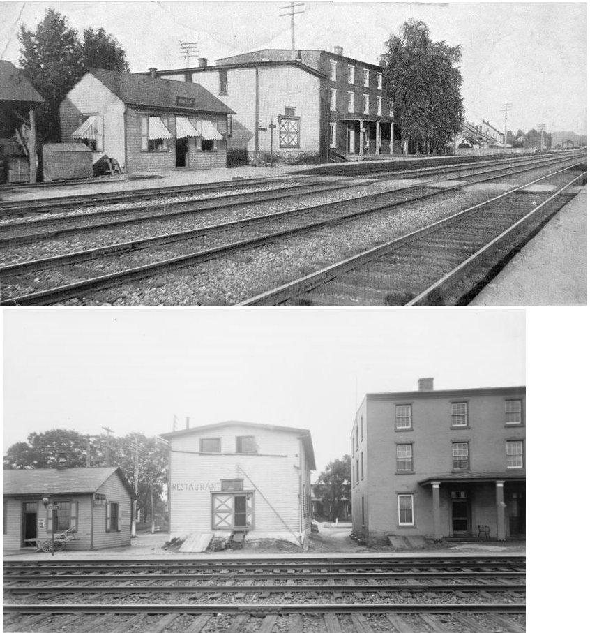
| Kinzer |
|
This station was on the south side of Lincoln Highway (US-30) on the north side of the tracks west of North Kinzer Road at GPS: 39.998536, -76.063990. | ||||||
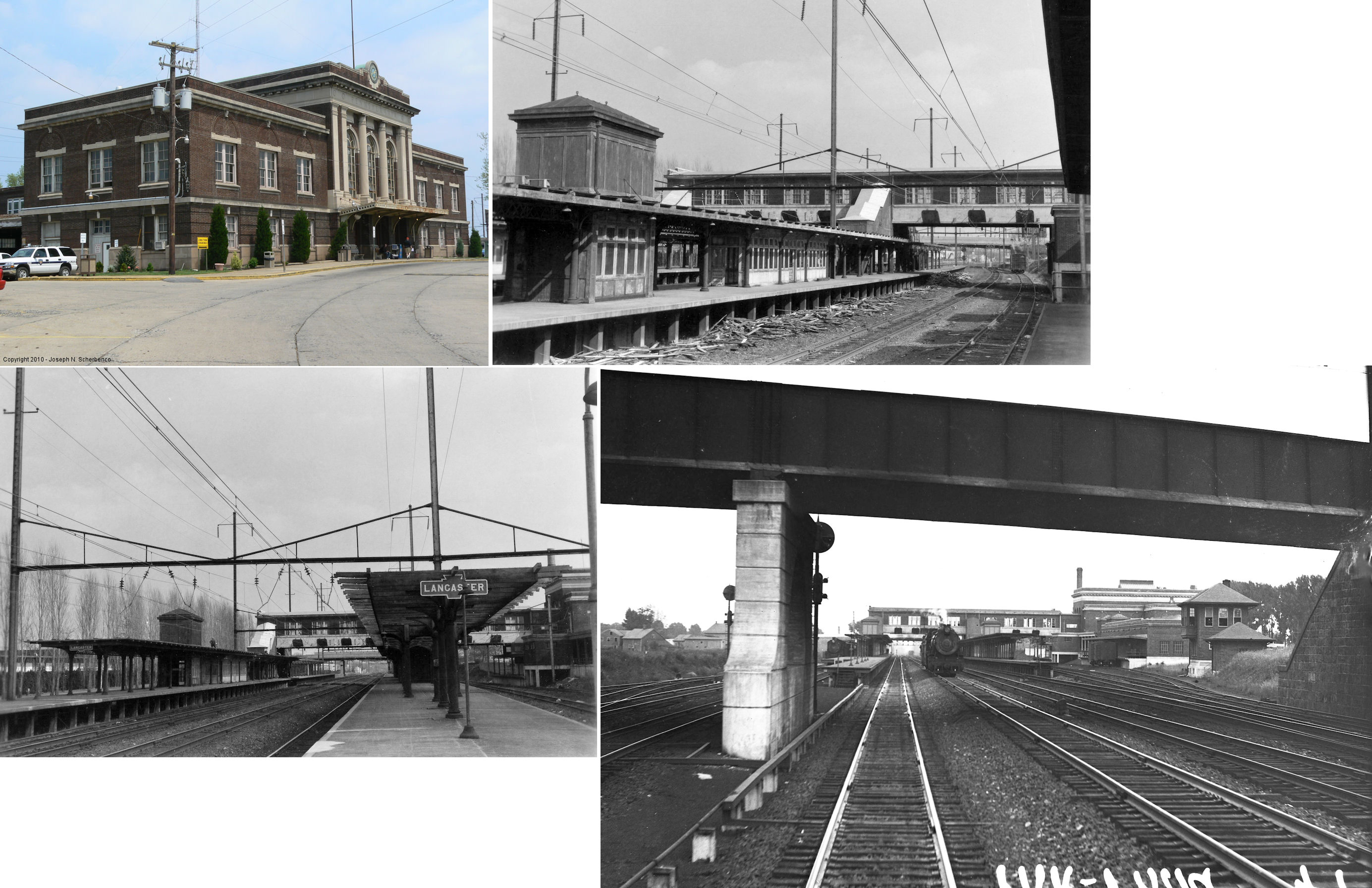
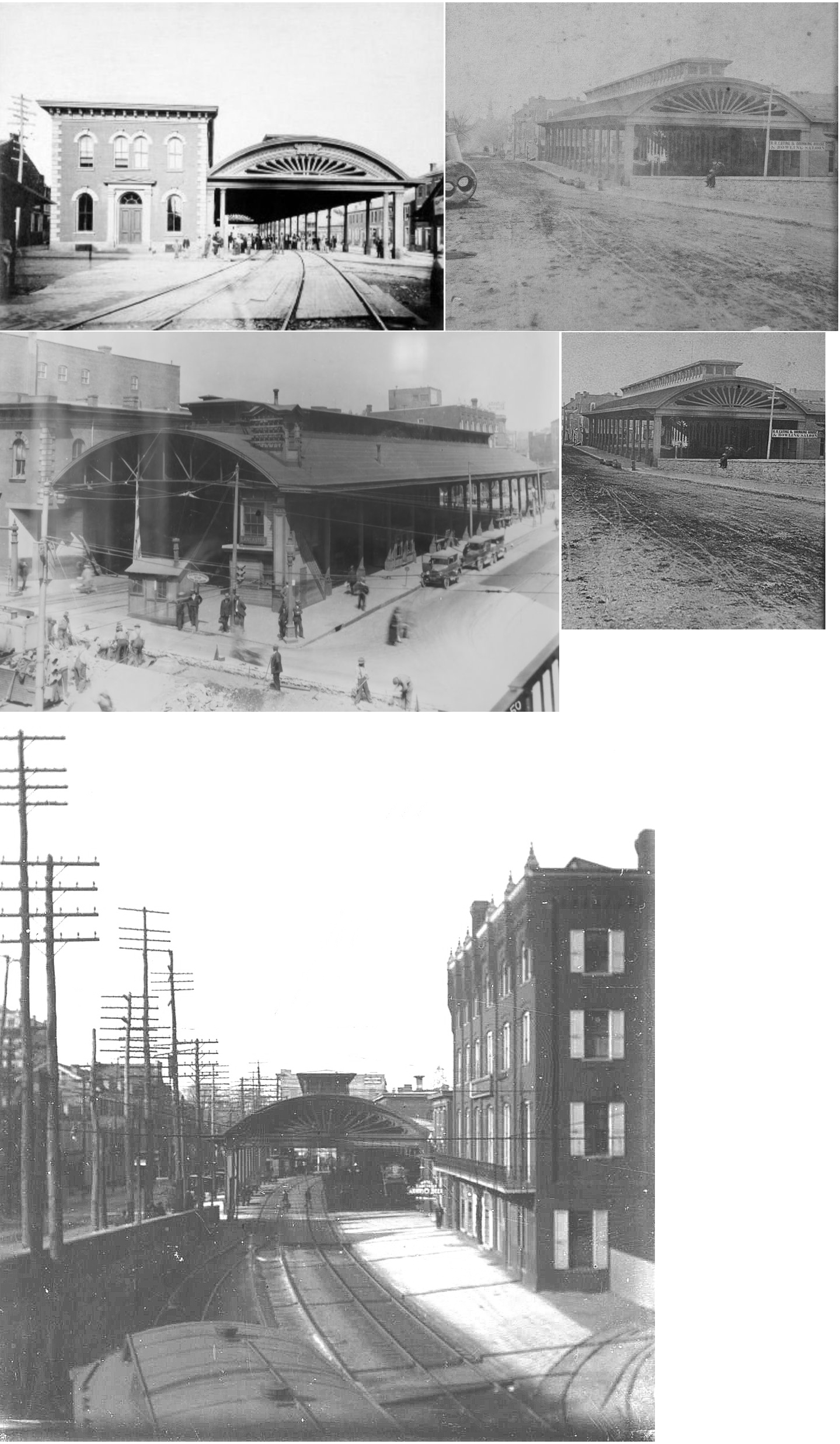
| Lancaster |
P&C RR |
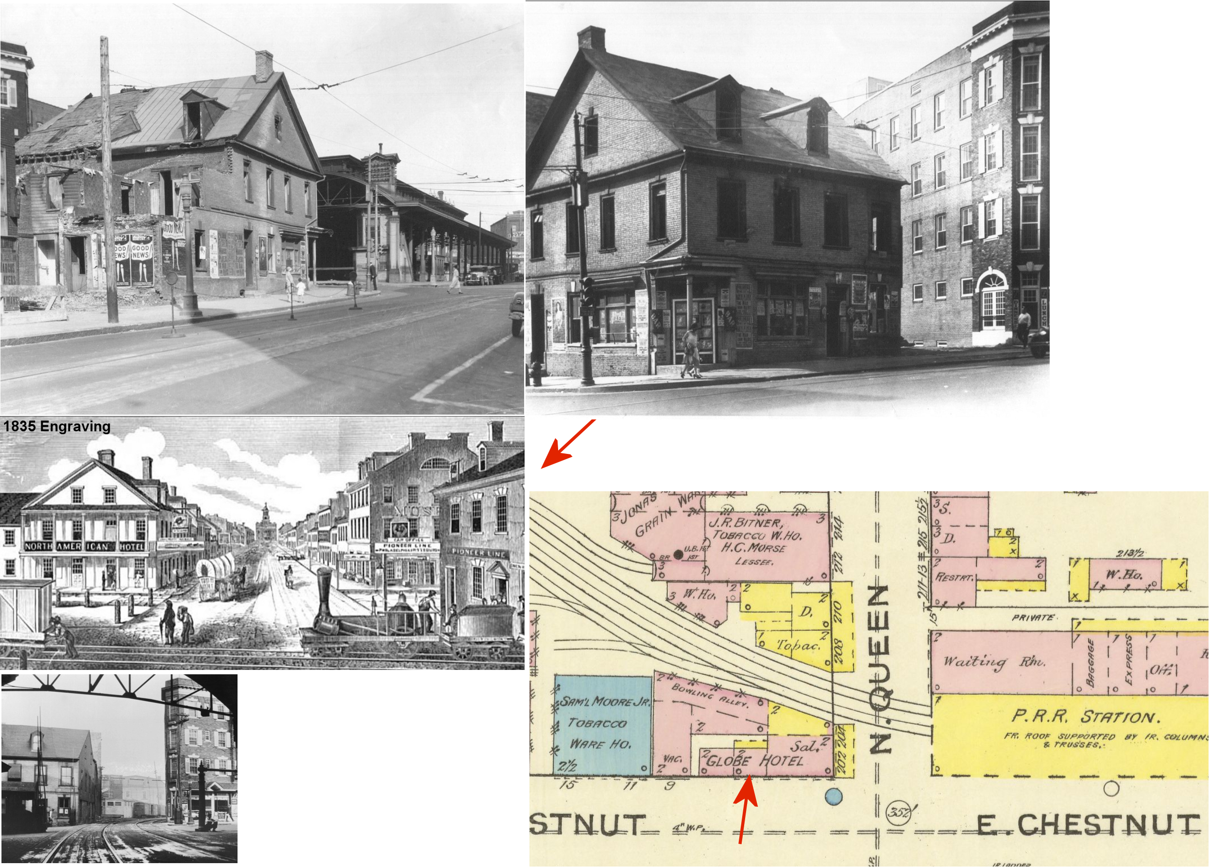
The first station here was operated by the Philadelphia & Columbia RR in 1834. It was housed in an already existing building (that possibly dated to the mid-1700s or early 1800s) that was on the NW corner of West Chestnut and North Queen Streets at GPS: 40.041244, -76.306515. William Hull, who was associated with the railroad, purchased the building and remodeled it into the "Globe Tavern" where the barroom served as the first ticket office (Sunday News, 7-13-1930). Over the years it was known as the Globe Hotel, The Eagle Hotel, Pennsylvania House, and Hotel Bissenger. It served as the station until the new PRR station opened across Queen Street in 1860-61. It continued to operate as a hotel through 1929 and was torn down around 1930. | ||||||
| Lancaster |
PCRR |
In 1859 the PRR (Pennsylvania Central) built a new station which opened in September 1860 or 1861. This station was on the NE corner of North Queen Street and East Chestnut Street (GPS: 40.041349,-76.306121). The station was remodeled in 1900 and torn down in April 1929 (Lancaster New Era, 3-3-1989). | ||||||
| Lancaster |
|
There was an article in the June 10, 1891 Lancaster Intellegencer about a barn owned by the Jacob Weh estate that burned down near the intersection of Walnut and College Streets. The article mentions that the barn was built of "material [that was] part of the old Pennsylvania railroad station, torn down when the present brick structure was erected. The barn was ornamented with the same cornice that also was on the old station." This suggests that the brick freight station (listed below) on the west side of North Queen may have replaced an earlier frame building at that location. If there was a predecessor to the brick station listed below, it was gone before 1886, per the Sanborn map and could well have been dated to the 1830s, or earlier when the Philadelphia & Columbia RR first came through. It is likely that wood from this old frame predecessor station was hauled to Walnut and College and the barn was built. Due to the early date of this station, no confirmation can be found, but logically this makes sense given the facts about the barn when it burned down. | ||||||
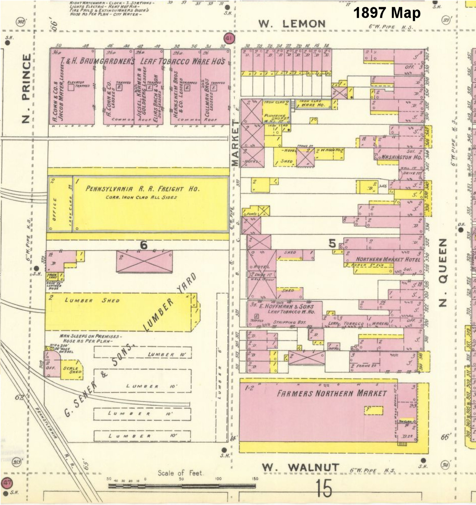
| Lancaster |
|
There was a brick freight station on the west side of North Queen Street between Chestnut and Walnut Streets at GPS: 40.041946, -76.306776. It is shown on the 1886 and 1891 Sanborn maps. It was torn down when the station listed below was built. | ||||||
| Lancaster |
|
A new wood-frame freight station was built in 1895 (The Semi-Weekly New Era, 7-17-1895). It was on the east side of North Prince Street between Lemon and Walnut Streets at GPS: 40.043560, -76.308519. The station's 2-story front office end faced North Prince Street. The whole station was covered with corrugated iron siding. The station and a freight yard was originally slated to be built on North Queen Street between Walnut and Lemon to alleviate the congestion at the previous freight station on the West side of North Queen between Chestnut and Walnut (see listing above). However, the yard (which was put in service before the station) and station faced several delays. The railroad bought most of the property along Queen Street on that block, but, due to not being able to secure all the properties along Queen and not being able to close off Market Street, the station ended up being built on the opposite side of the block on Prince Street instead on the site of a former lumber yard (which already had some tracks running to it) (The Semi-Weekly New Era, 10-29-1892 and The News-Journal, 3-13-1893). This station was only in service for about 6-7 years until the orientation of the tracks at the freight yard complex was changed from an east/west orientation to a north south orientation and a new larger freight house with two long sheds was built in 1902/03 (see lsiting below). | ||||||
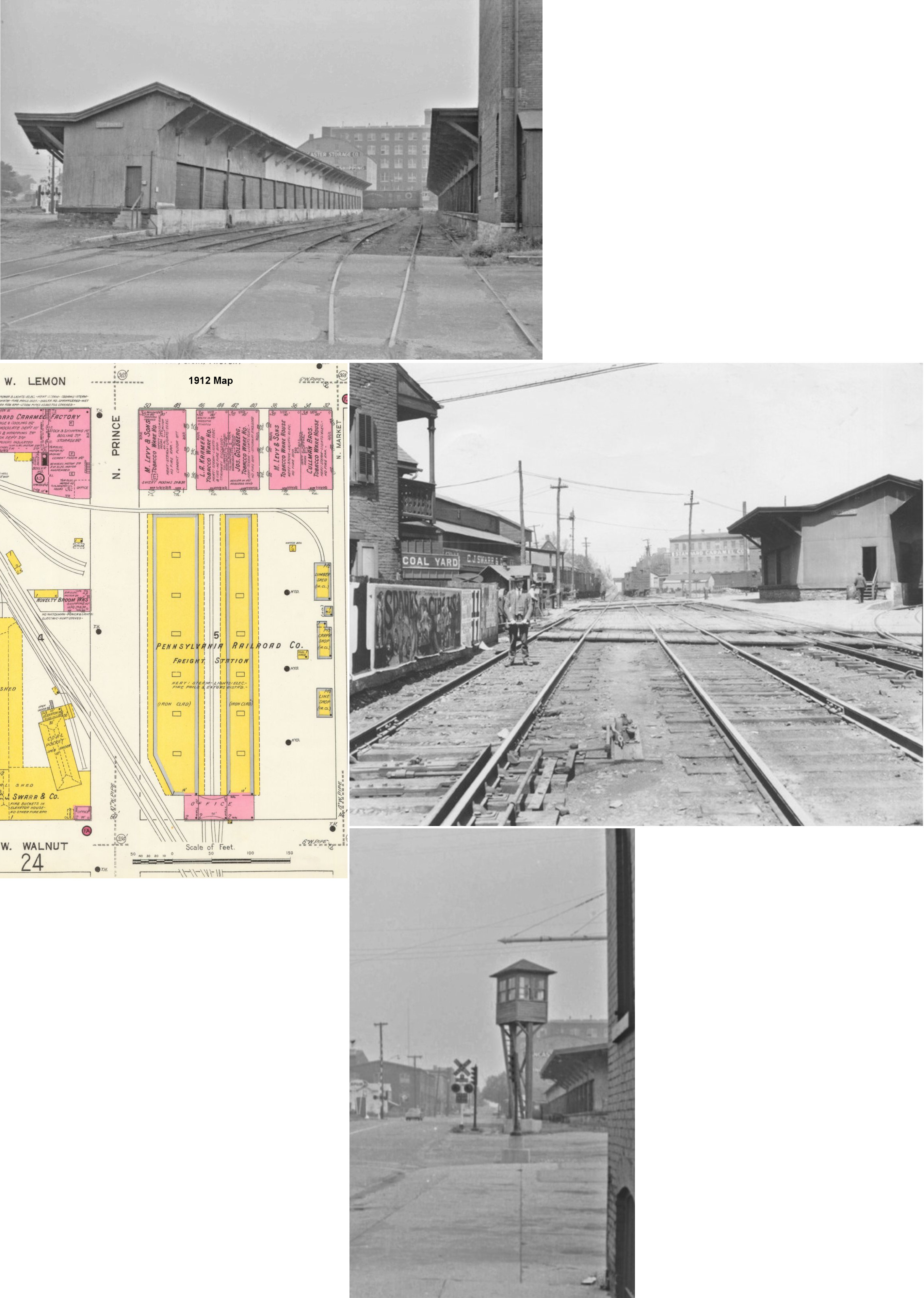
| Lancaster |
|
An even larger two-building wood-frame freight complex with a brick head end was finished in 1903. It ran along on the east side of North Prince between Lemon and Walnut Streets (Intelligencer Journal, 1-08-1904). The station's head end faced Walnut Street whereas the previous freight station here had its head end on North Prince Street. This station is shown on the 1912 Sanborn map. Later maps show that the brick head end was contracted so that it only adjoined the east freight shed. It was was still standing in 1971, but was gone by 1982. | ||||||
| Lancaster |
|
There was a wood frame station (originally Manheim & Lancaster RR according to the 1872 map) here prior to the 1907 station listed below. It was on the west side of Prince Street at Frederick Street (GPS: 40.047090, -76.309650) (essentially the same location as the station listed below but a few feet to the north). It may have served as the freight station for a few years until the new, longer freight station was built in its place. | ||||||
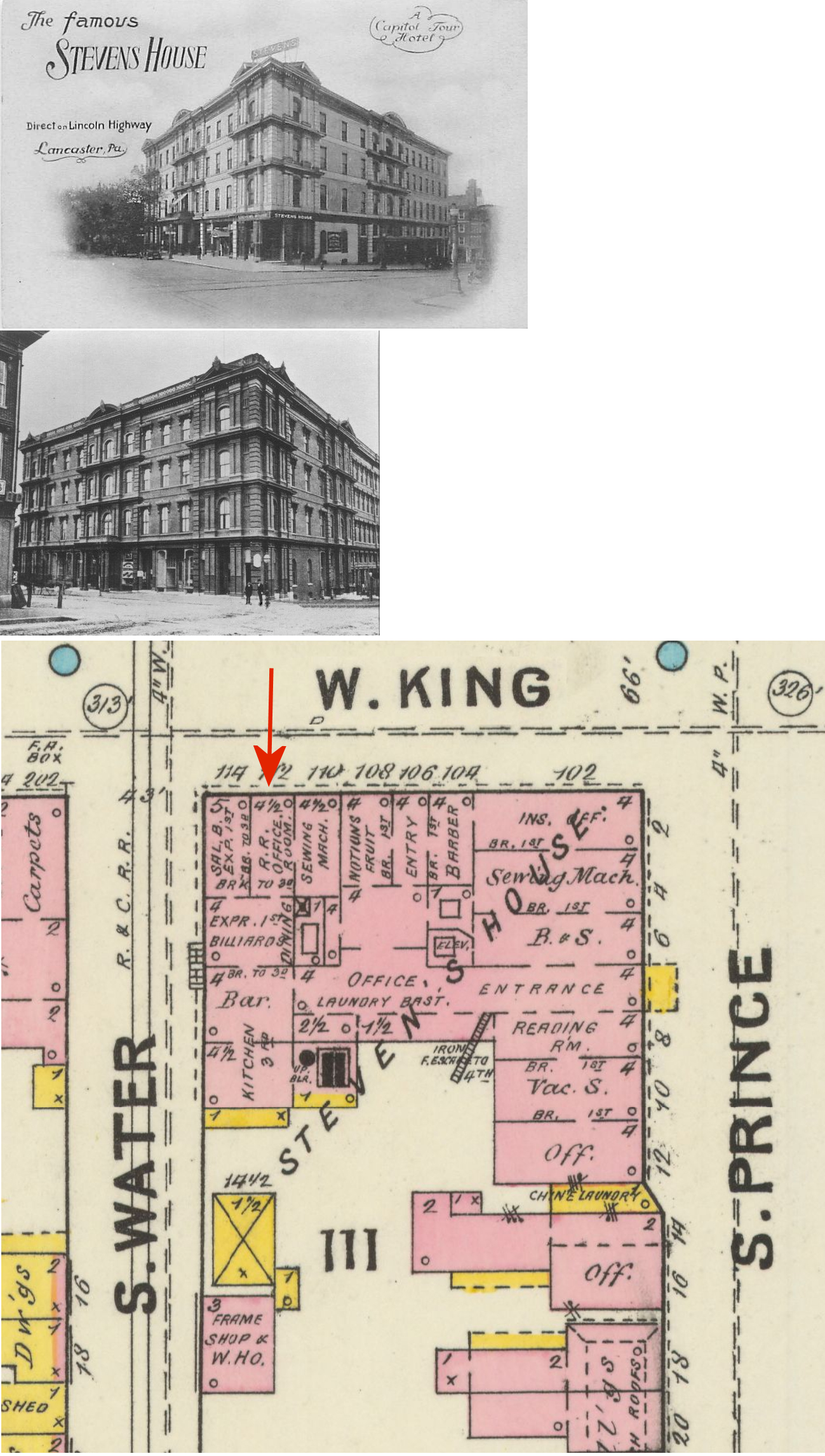
| Lancaster (King Street) |
AND |
Aside from the R&C station at Prince & Frederick Streets, the Reading wanted a station closer to the center of town. In 1875, at the time of the establishment of the Quarryville Branch (Lancaster & Quarryville RR), the railroad opened a ticket office/waiting room and express office the Stevens House Hotel on the south side of West King Street between South Prince Street and South Water Street at GPS: 40.037571, -76.308175. The tracks ran down the middle of South Water Street. The Reading gave up its lease on the Quarryville line in 1895 and it was acquired by the PRR. The Reading vacated their three rooms at the hotel in 1902. The hotel stood until early 1964 (Intelligencer Journal, 12-21-1964). | ||||||
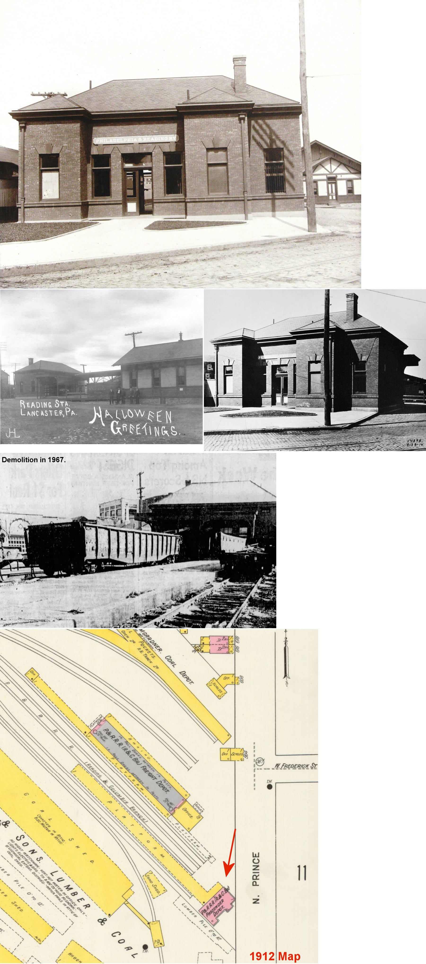
| Lancaster |
|
Built in 1907, this brick passenger station was on the west side of Prince Street at Frederick Street (GPS: 40.047247, -76.309706). The old R&C station (then used as a freight station) is shown in the background of the photo. It was torn down in 1967 and housed a restaurant for a few years prior (Lancaster New Era, 11-7-1967). | ||||||
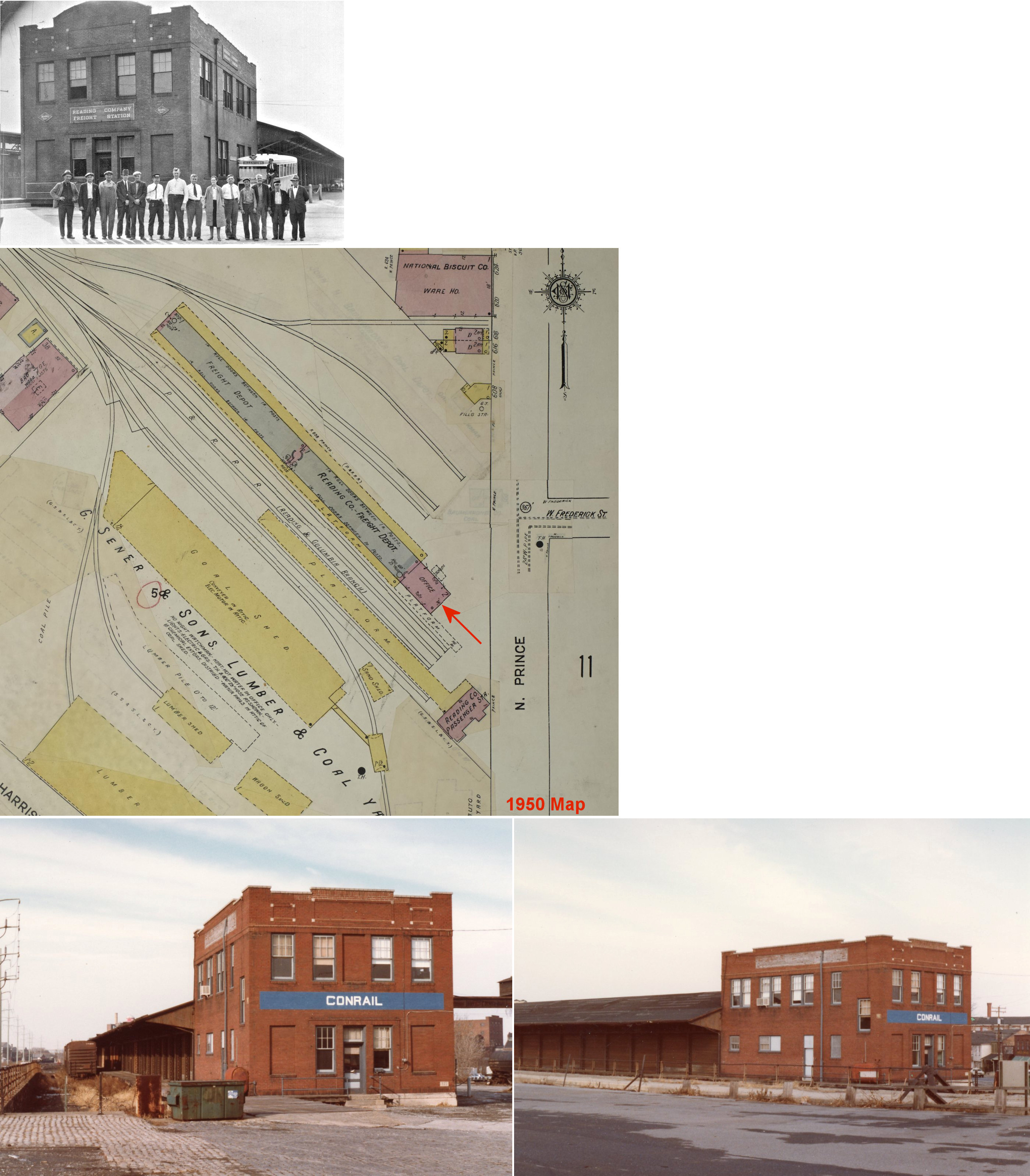
| Lancaster |
|
A new freight station was built here to to the north of the passenger station sometime prior to 1912. It appears as part of the old original station served as the headhouse fronting Prince Street. | ||||||
| Lancaster |
|
An even larger freight station with a brick headhouse was completed in 1926 (Intelligencer Journal, 1-21-1926). Work on the station actually started in 1914, but was then delayed by World War I (Lancaster New Era, 10-23-1926). A fire damaged the station in 1946, but it was repaired by the railroad (Lancaster New Era, 12-19-1946). It met its demise in 1990 when a fire started by a vagrant consumed the building (Intelligencer Journal, 11-13-1990). | ||||||
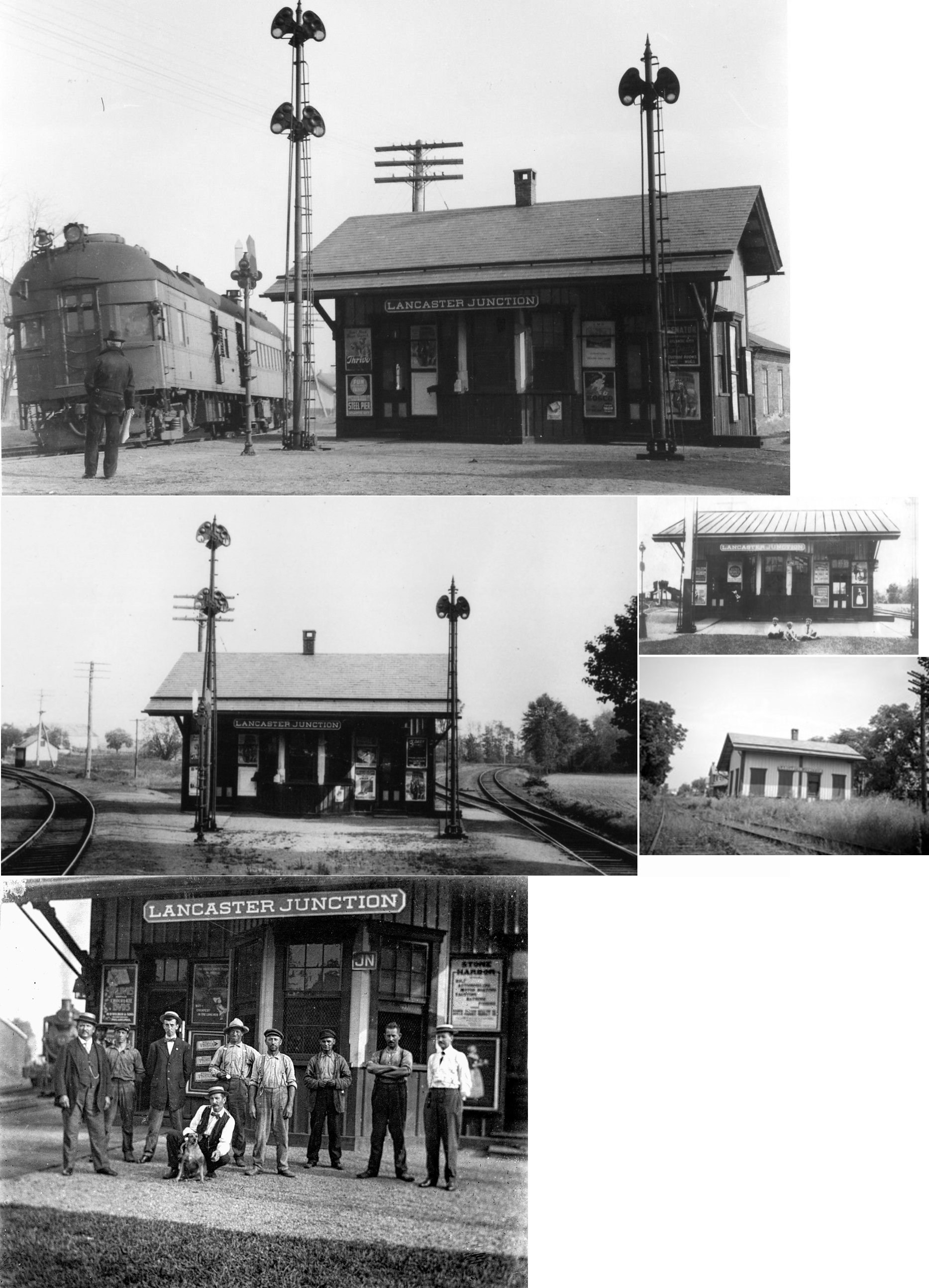
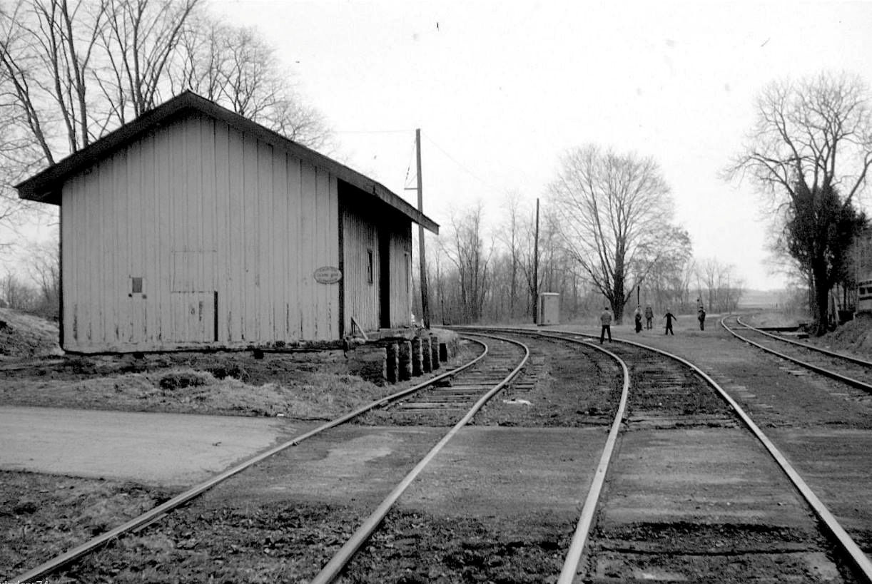
| Lancaster Junction |
|
The passenger station was south of Auction Road and west of Warehouse Road at GPS: 40.130974, -76.401964. This station was listed as "PRR Crossing" on the first R&C timetable in 1863. | ||||||
| Lancaster Junction |
|
The freight station was on the south side of Auction Road on the east side of the tracks at GPS: 40.131517, -76.402104. It was torn down sometime between 1983-1992. | ||||||
| Landisville |
|
The 1864 map shows a Reading & Columbia station here on the NE corner of the diamond (when the PRR was the Harrisburg & Lancaster RR). The station from Cordelia was moved here in 1909 and a freight section was added to the building. Business at the this station was consolidated with the PRR station in 1918 (see listing below). | ||||||
| Landisville |
|
The PRR built a new station here in 1863. Business at the PRR and RDG stations was consolidated in 1918 with all business being handled at the PRR station by one agent (O.K. Bushong of the RDG) (The Lancaster Examiner, 8-17-1918). | ||||||
| Leacock |
|
See listing a notes for the Leola station in the existing stations section. | ||||||
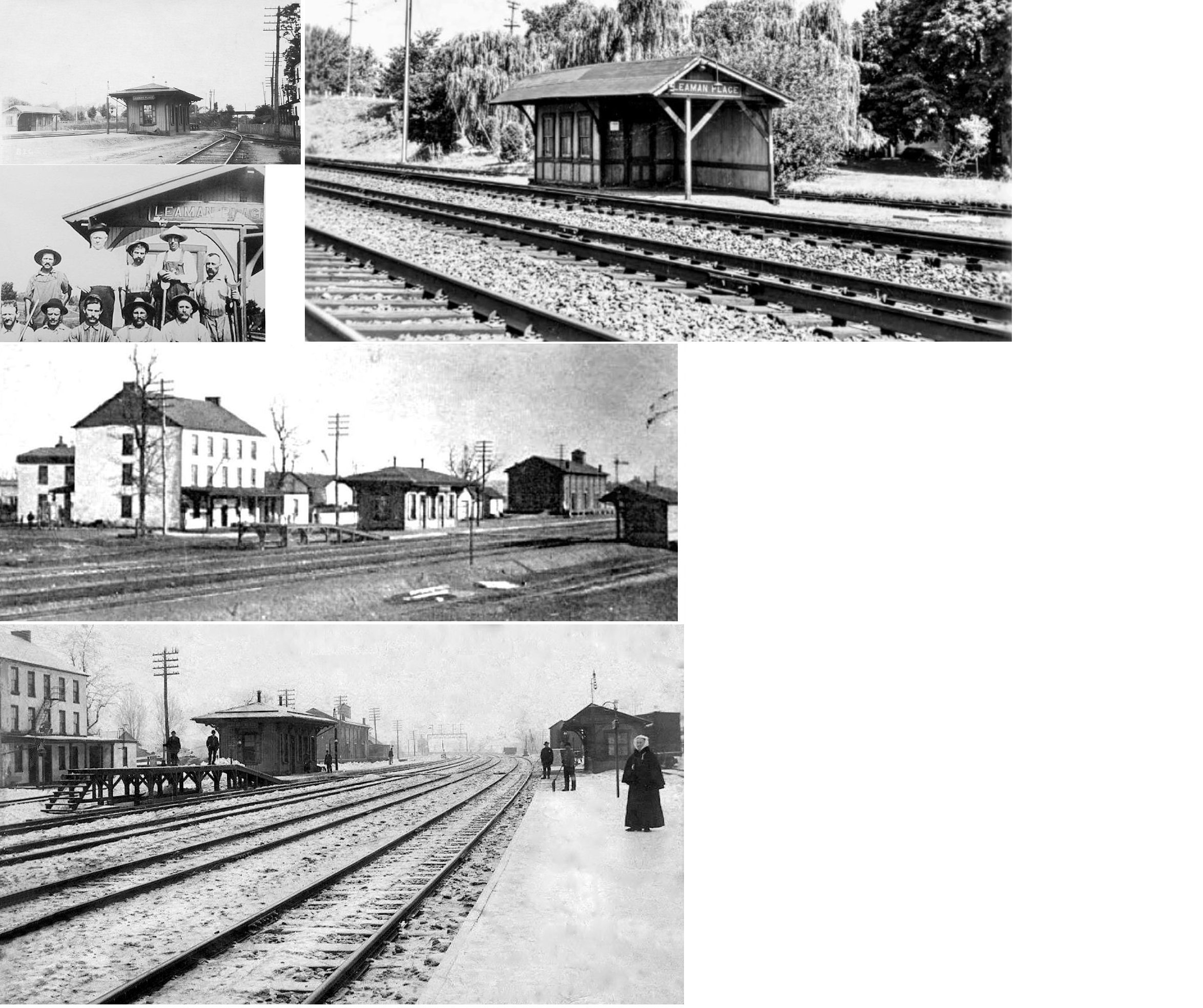
| Leaman Place |
|
The first station here was a hotel built by Henry Leaman in 1835 that also served as a station on the Phidelphia & Columbia Railroad. It was at GPS: 40.006299, -76.114164. See photos for the listing below which show this old station and the newer station. | ||||||
| Leaman Place |
|
The second generation station was at GPS: 40.006177, -76.114447. It was torn down in the 1940s (Intelligencer Journal, 2-3-1983). It appears that a passenger shelter was added across the tracks (at GPS: 40.005922, -76.114601) in later years and that may have stood until the late 1960s. | ||||||
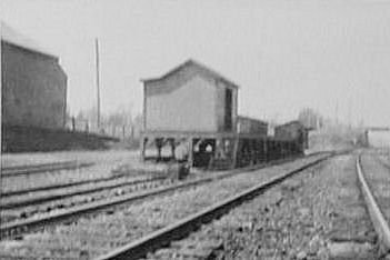
| Leaman Place |
|
The old freight station was at approximately GPS: 40.005627, -76.113989. | ||||||
| Levans Mill (Brentwood) |
|
This station was two miles from the Lancaster King Street station at milepost 70.8 on the Lancaster & Reading Narrow Gauge Railroad (former P&R then PRR). It was in the vicinity of GPS: 40.010190, -76.302499. It was likely not more than a loading platform or shelter. | ||||||
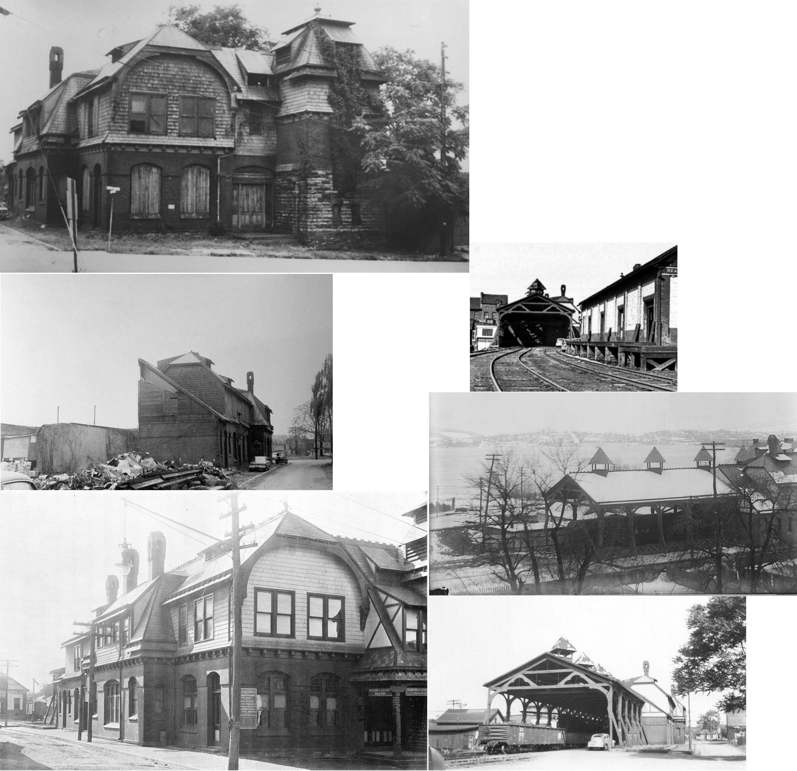
| Lititz |
|
Built in 1884 and designed by Frank Furness, the station was demolished in 1957 so a new park entrance could be built. The railroad leased the land for the station from the Lititz Moravian Chruch. An exact replica was rebuilt in 1999 on the same site (see existing station in above table) on the west side of North Broad Street at GPS: 40.158228, -76.307835 (Lancaster New Era, 11-11-1998). | ||||||
| Lititz |
|
The original freight station was on the west side of North Broad Street on the north side of the tracks (at the site of the Wilbur Chocolate building) at GPS: 40.158482, -76.307668. | ||||||
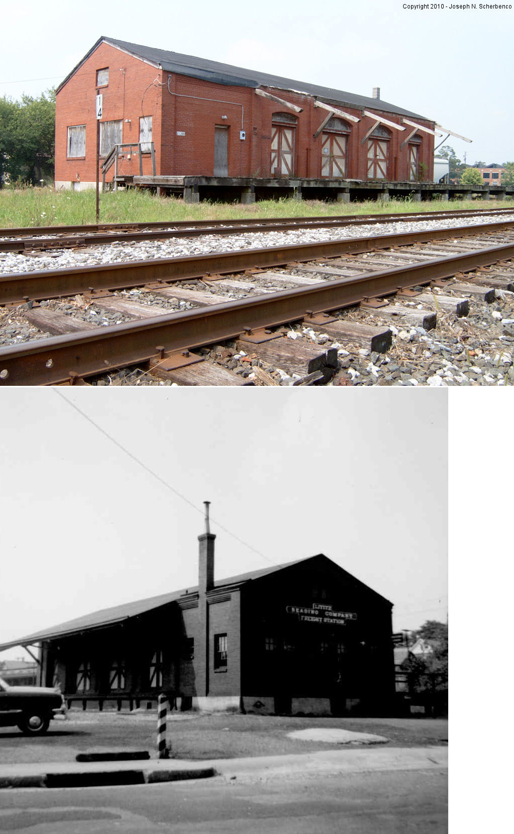
| Lititz |
|
This freight station was on the west side of North Water Street on the south side of the tracks at GPS: 40.157740, -76.302002. It was built in 1921 and demolished in August 17, 2013. | ||||||
| Long Park (Long's Park) |
|
This station was between Dillerville and Rohrerstown. It was on the SW side of Harrisburg Pike in the vicinity of GPS: 40.057445, -76.332664. The station was established around 1908 (Intelligencer Journal, 9-5-1908), and is shown on the 1923 county map. The railroad set up a temporary station 1000 feet east of the station at the entracnce to the Lancaster County fairgrounds during fair week (Harrisburg Daily Independent, 9-24-1910). | ||||||
| Lutz |
|
Lutz station was at Railroad Street and South Ridge Road between Denver and Reinholds. The depot was at approximately GPS: 40.254702,-76.12114 in 1864. The station is not shown on the 1875 or 1899 maps, so it may have been removed early on. In fact, as late as 1880, the Lutz family was still petitioning the railroad for a station here (Lancaster Daily Intelligencer, 4-13-1880). It is unclear whether the railroad ever agreed to that, so there may have never been an actual station building at Lutz. | ||||||
| Manahans (Manahan's) |
|
This may have been an early station on the Columbia & Philadelphia RR. In an 1840 article (The Lancaster Examiner, 5-20-1840) about how the railroad operated, an engineer mentioned this as a station along with other Lancaster County stations including Dillerville, Lancaster and Bird-in-Hand. It's not clear where it was though. The Concord area near the railroad is the only place this name comes up, when searched through 1899. Concord was absorbed into Gordonville on later maps. There is a property sale notice from the Lancaster Examiner published in 1842 indicating that William Manahan was co-owner with his brother, James, and another, William McKenney, of a store in Georgetown. Thus, some evidence from 1840 and 1842 newspaper articles suggest that the Manahan name may be tied to an earlier Gordonville Station. The 1875 Gordonville map shows a "depot" in existence prior to the one in the photo for Gordonville listed above. | ||||||
| McCalls Ferry (Bonview) |
|
This station was located between the north side of the tracks and Pinnacle Road West (now a trail) near GPS: 39.837313, -76.341835. | ||||||
| Midway |
|
See listing above for Fites Eddy. | ||||||
| Millway |
|
This was the station, but the building across the tracks, J.H. Reitz's Warehouse (formerly E.M. Schenk's Warehouse, still standing), served as the ticket office/station prior to the P&R erecting this station. The railroad and Shenk got into a dispute over railroad business and the encroachment of the Shenk building onto RR property in the early 1900s. At the time C.R. Schenk (E.M.'s son) was the Reading agent at Millway. In 1901 the railroad removed operations from Shenk's Warehouse and set up shop in an old boxcar until the proper P&R station was built (The Semi-Weekly New Era, 8-7-1901). It was on the east side of East Meadow Valley Road on the south side of the tracks at GPS: 40.160883, -76.235689. It was torn down sometime between 1957 and 1969. | ||||||
| Minqua |
|
See entry above for Holtwood. | ||||||
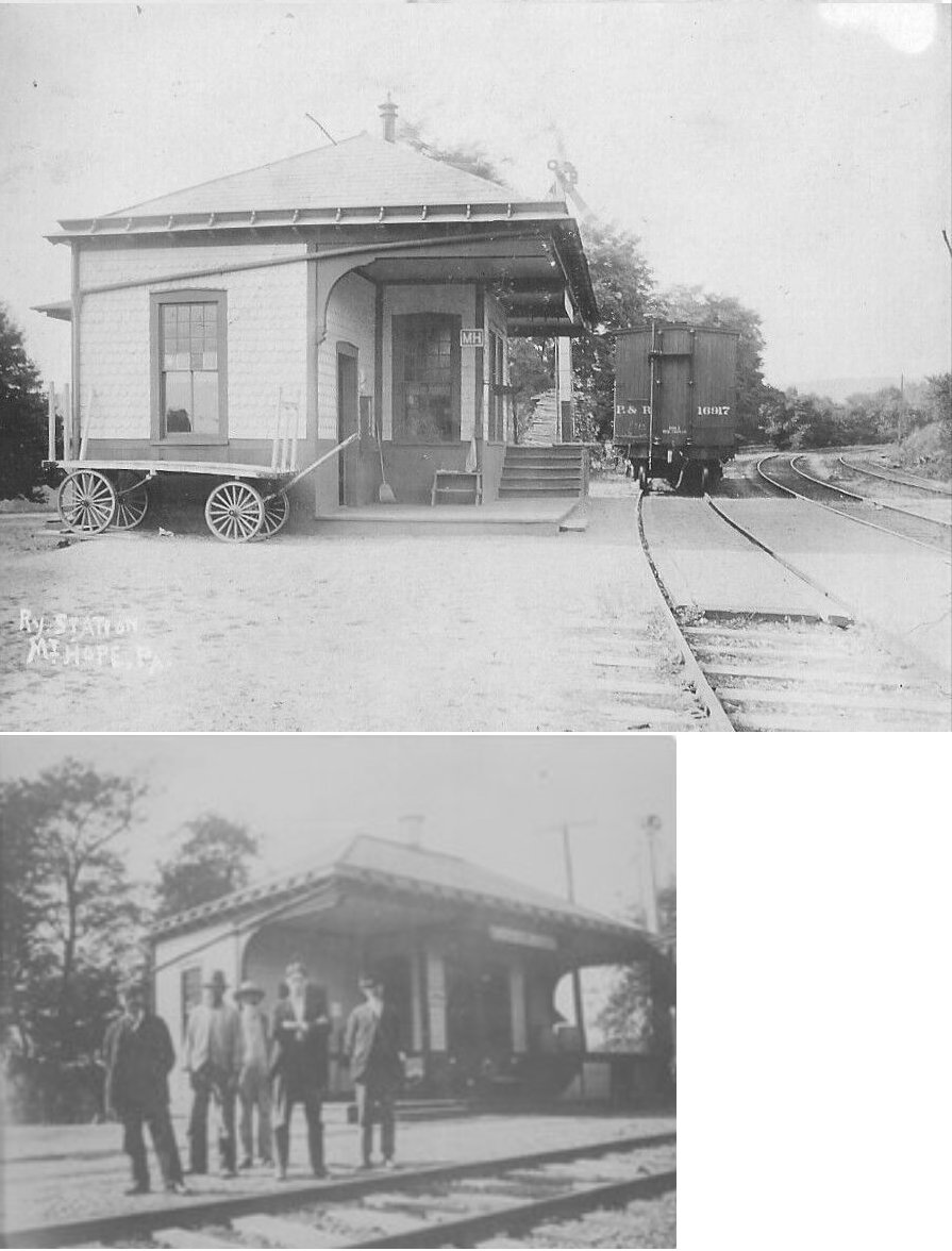
| Mount Hope |
|
This station was on the east side of Mount Hope Road on the west side of the tracks at approximately GPS: 40.223343, -76.422676. | ||||||
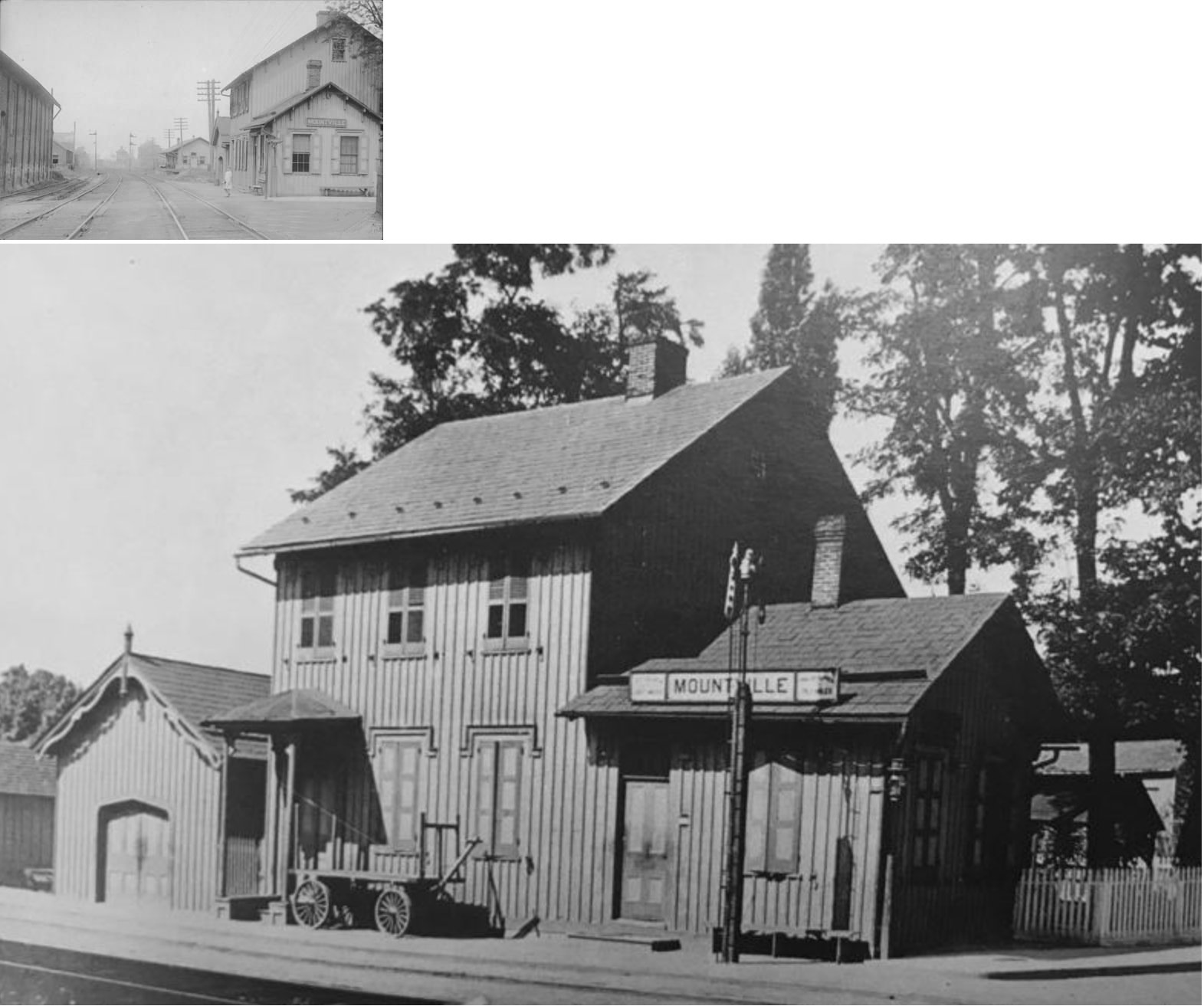
| Mountville |
|
Both the passenger and freight stations here were on the north side of the tracks on the west side of South Manor Street. The passenger station was a two story wood frame building. It was at GPS: 40.037581, -76.431231. According to the 1891 Sanborn map, the second story housed a cigar factory at that time. The freight station was just to the SW of the passenger station at GPS: 40.037312, -76.432183. | ||||||
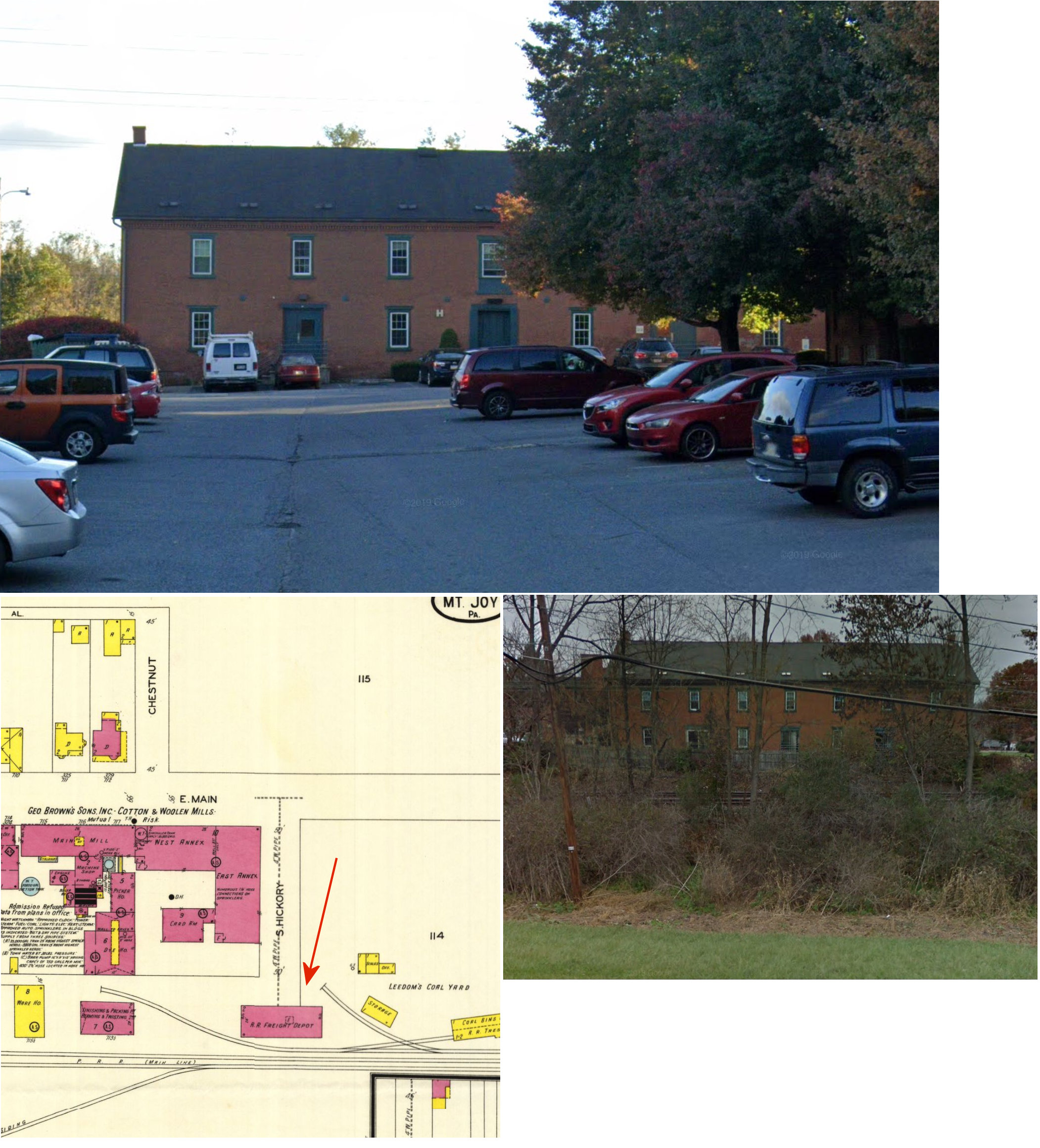
| Mt. Joy |
|
From 1836-1876, the Exchange Hotel on the corner of Barabra and Main Streets served as the station. The line was originally known as the Harrisburg, Portsmouth, Mt. Joy & Lancaster RR. It crossed West Main and traveled on the north side of town to Barbara Street where it jogged south toward where the current line is today. Remnants of this old main line can still be seen on the north side of town. | ||||||
| Mt. Joy |
|
The railroad built its first station in 1876. It was located on the east side of North Market Street across from Spangler's Flour Mill on the north side of the tracks at GPS: 40.111092, -76.502763. This was when the original main line ran through the north part of town. It served until 1896, but was still standing at least until the 1930s when it was being used as a warehouse and dwelling. | Mt. Joy |
|
This station was built in 1896 and was located at Delta & Henry Streets when the railroad built the "big ditch" cut for the new mainline. It was at GPS: 40.109003, -76.502639. It was torn down in January, 1976. The old platforms are still used by Amtrak and the site of the station is now a parking lot. | |||
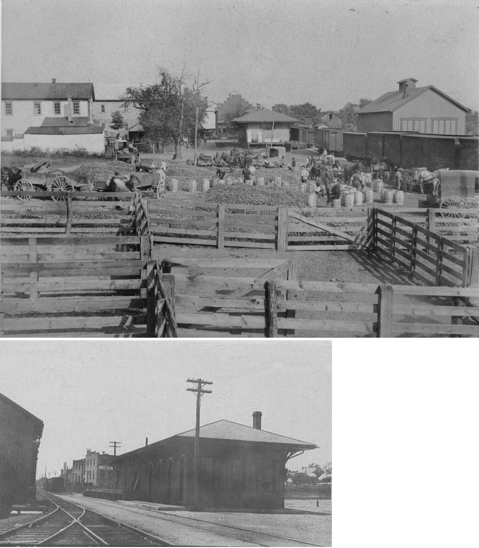
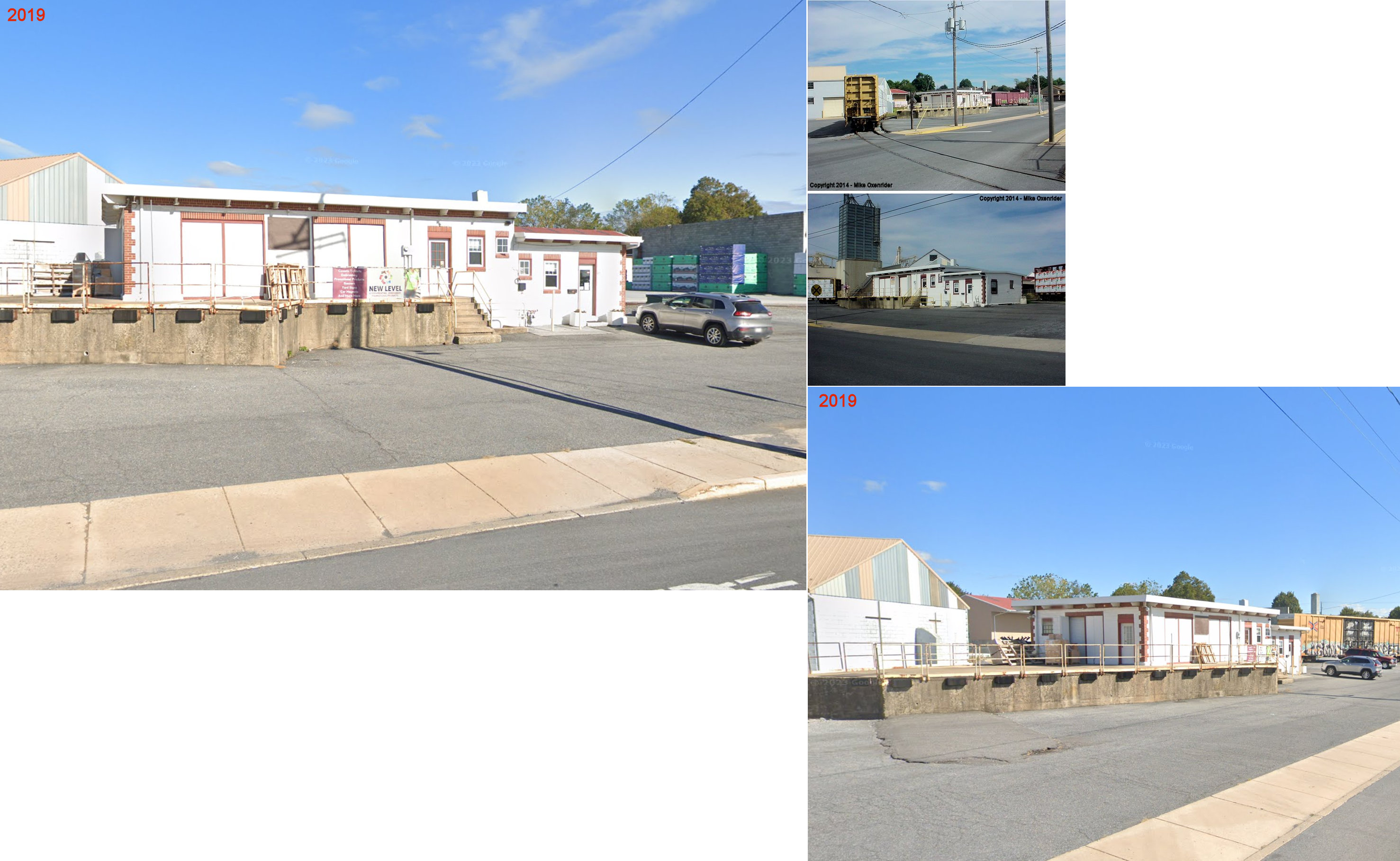
| New Holland |
|
This station was built in 1892. The view in the photo is looking east from Custer Avenue. The building on the right is a locomotive house. In 1913 the station was on the east side of South Railroad on the north side of the tracks at GPS: 40.101423, -76.086504. This station appears to have stood until at least 1969. | ||||||
| New Holland |
|
This freight station, built in 1947, was at 217 South Railroad Avenue (GPS: 40.101143, -76.085169). It was torn down in early 2023 to make way for a new building on the site. | ||||||
| New Providence |
L&QRR |
The Lancaster & Quarryville RR opened a station here in 1875. The L&Q eventually become part of the PRR in 1909. The station was on Main Street near Pennsy Road behind the Refton Ambulance Building at GPS: 39.924946, -76.199218. It was dilapdated in later years, but stoof until around 2012-2013. | ||||||
| Norwood |
|
This station was on the north side of the tracks on the west side of Springhill Road near GPS: 39.823504, -76.120774. | ||||||
| Peach Bottom |
|
Peach Bottom, York County and Peach Bottom, Lancaster County were across the Susquehanna River from each other, but the PRR was on the Lancaster County side of the river. The Maryland & Pennsylvania RR (and it's predecessors) served Peach Bottom in York County. Peach Bottom in York County is now under water due to a dam being built downstream from it. The station was along Peach Bottom Road between the tracks and the river at GPS: 39.755486, -76.232456. Around 1929 it was moved across the tracks (which were also relocated) so it would not be flooded due to rising water levels from the construction of the dam and hydro-electric plant on the Susquehanna River at Conowingo, Maryland. The station was torn down in 1972. | ||||||
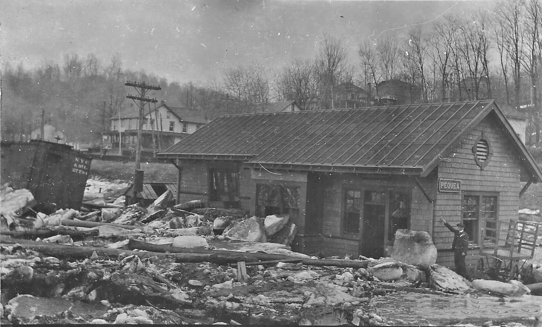
| Pequea |
|
This station was west of Bridge Valley Road on the east side of the tracks at GPS: 39.886838, -76.367818. | ||||||
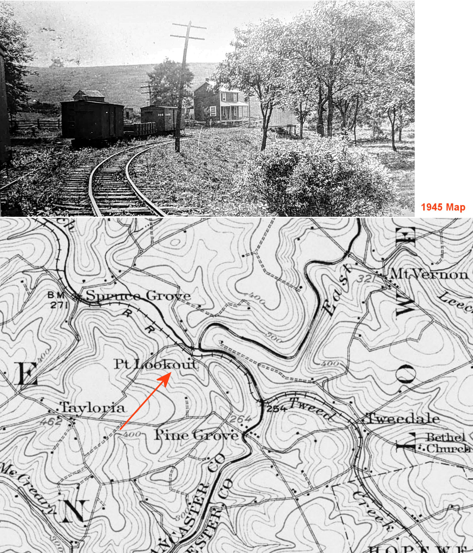
| Point Lookout |
|
This station was between Spruce Grove and Tweedale (Chester Co.). | ||||||
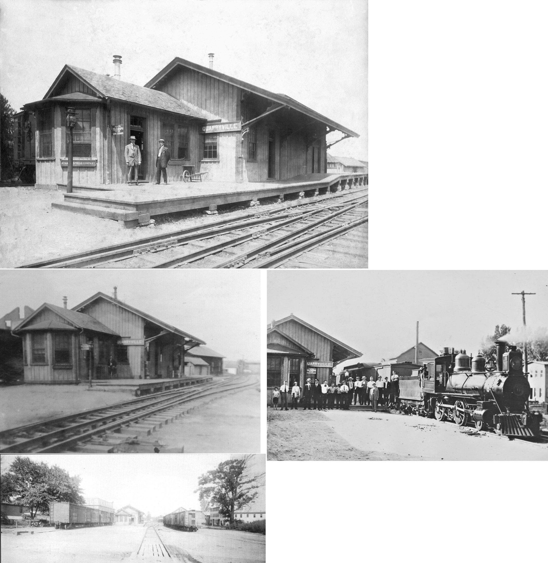
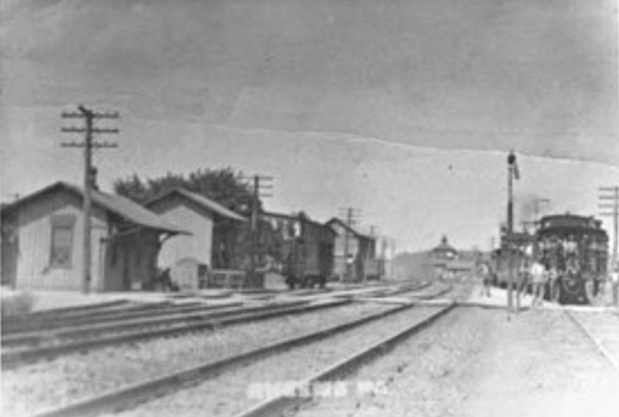
| Quarryville (Barr's Quarry) |
|
Station was located north of East State Street and east of North Church Street at GPS: 39.897909, -76.163160. The Lancaster & Quarryville RR opened a station here in 1875. The L&Q eventually become part of the PRR in 1909. | ||||||
| Rheems |
|
This station was on the north side of the tracks and on the west side of Anchor Road at the tunnel area at approximately GPS: 40.131520, -76.575963 It is unknown whether the station was on the lower level or up at the tracks. | ||||||
| Rohrerstown |
|
This station was likely at the Rohrerstown Road crossing. According to timetables, the Mountville station was at milepost 75.7 and we know that station was at GPS: 40.037581, -76.431231. The Rohrerstown station was at milepost 71.5. Measuring that distance on Google maps puts the station at the Rohrerstown Road crossing. According to the 1905/1912 county map, the station was on the east side of the road on the south side of the tracks at approximately GPS: 40.054082, -76.359372. | ||||||
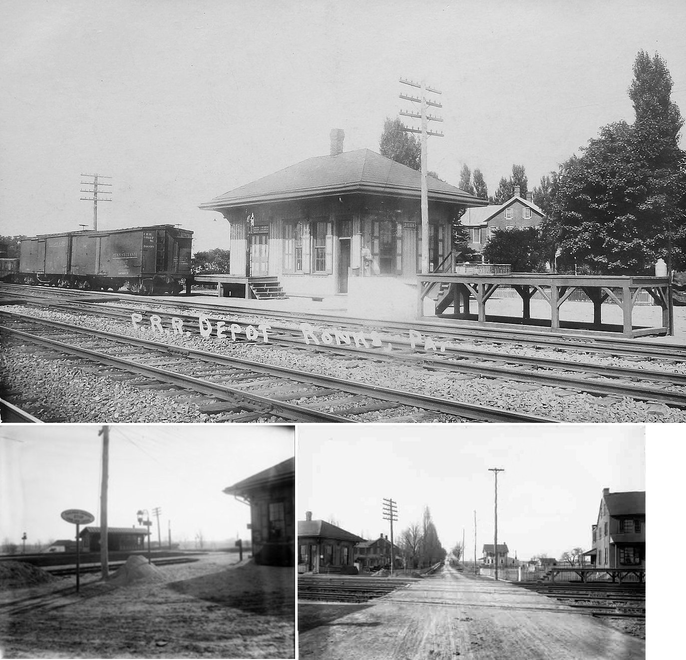
| Ronks Station |
|
This combination station was on the north side of the tracks and the west side of North Ronks Road at approximately GPS: 40.027452, -76.169299. It was built in 1883. | ||||||
| Rothsville Station |
|
This station was on the west side of Rothsville Station Road on the south side of the tracks. | ||||||
| Safe Harbor |
|
This was on the old Columbia & Port Deposit RR (later PRR). The station appears to have been at approximately GPS: 39.925404, -76.385109. | ||||||
| Sellers Station |
|
This station was on Mill Road just west of Junction Road (T884) and is shown on the 1864 map. It was listed as "Seller's Mill" on the first R&C timetable in 1863. | ||||||
| Shenks Ferry |
|
This station was likely in the vicinity of the parking lot for the Shenk’s Ferry Wildflower Preserve, probably on the east side of the tracks around GPS: 39.905465, -76.368467. | ||||||
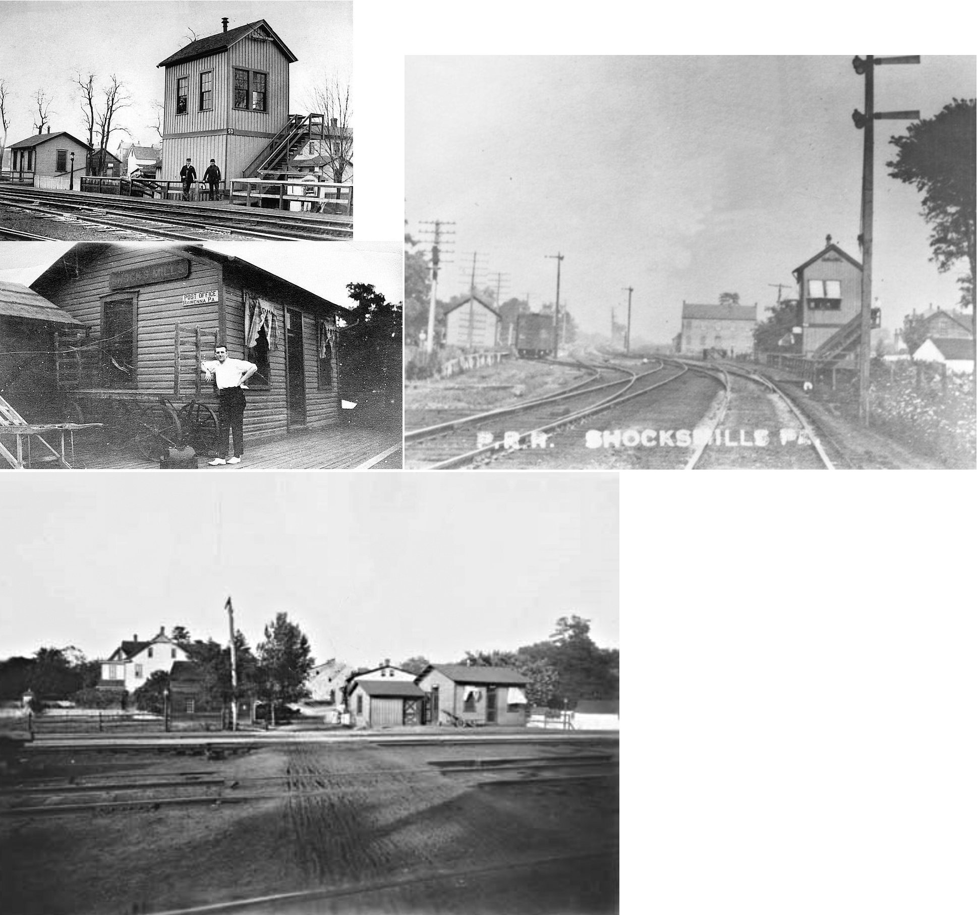
| Shocks Mills (Rowenna P.O.) |
|
This station was near the intersection of Railroad Avenue and Old River Road. Known as "Schock's Station" on the 1864 county atlas. The station was south of the tracks and east of the crossing near GPS: 40.062391, -76.612127. It was gone sometime before 1957. | ||||||
| Shreiner Station |
|
Shreiner Station Road formerly ran from Harrisburg Pike to near Flory's Mill. The road still exists near Park City Center, but has been relocated at the southern end and cut off at the railroad crossing point. It then follows the original course up to near Flory's Mill. The area where present McGovernville Road crosses the railroad tracks is called Shreiners. This road and the bridges over Little Conestoga Creek and the tracks were under construction in 1969. Shreiner Station Road previously crossed the tracks about 170 ft southeast of the railroad overpass, but has since been closed off. That would put the likely location of the this shelter-type station at about GPS: 40.076085, -76.346859. | ||||||
| Smithville |
|
This station was on the Atglen and Susquehanna Branch (now the Enola Low-Grade Trail). There are two stone tunnels where the low grade line ran over two different roads. The easternmost was an old section of Route 272 and the other was another road that existed at the same time, but was separate from 272, but became the southbound portion of present 272, while the northbound portion follows what was the main road. I suspect the station was somewhere near the eastern, or main section of road and the stone tunnel. --Thomas Kipphorn | ||||||
| Spook House |
|
This station was between Sellers and Lancaster Junction on the R&C and appeared on the first timetable issued by the railroad in 1863. It probably didn't last long since it is not included on an 1864 listing of stations. It was in the vicinity of GPS: 40.110174, -76.413307. A short distance north of Landisville, there was a small house along the tracks that was supposedly haunted. The house was vacant for many years and one story was that one night some sheep found their way into the vacant building. Their bleating gave rise to the theory that the building was haunted. The quaint building with its thatched roof was finally torn down about 1899, but the legend of the "Spook House" remained. Although "Spook House" and "Sellers Mill" are long gone from Reading timetables, there is still today a "Spooky Nook" road at the site of what was once "Spook House." (John Denney, Jr. Note) | ||||||
| Spruce Grove |
|
This station was on the east side of the old course of Spruce Grove Road on the south side of the tracks at approximately GPS: 39.807079, -76.06225. This location is now under Octoraro Lake. | ||||||
| Star Rock |
|
This station was in the vicinity of GPS: 39.938749, -76.434140. There may have been an old road to this location, but that no longer exists.This is on the Columbia & Port Deposit Branch. The 1945 PRR List of Stations & Sidings indicates that there was a station here. | ||||||
| Stehmans (Stehman's) |
|
This may have been an early station on the Columbia & Philadelphia RR. In an 1840 article (The Lancaster Examiner, 5-20-1840) about how the railroad operated, an engineer mentioned this as a station along with other Lancaster County stations including Dillerville, Lancaster and Bird-in-Hand. It's not clear where it was though. | ||||||
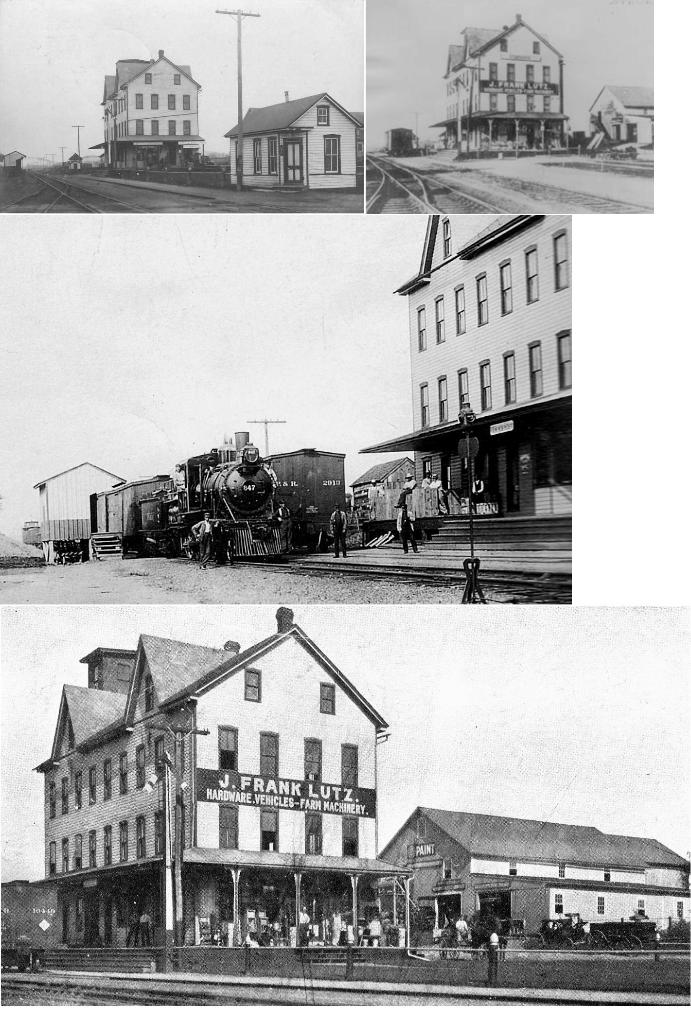
| Stevens (Reamstown Station) |
|
The Reading built a small platform here at the request of a local dairy, but later the station was housed in a building owned originally by J.S. Heiser and later was the Lutz Hardware Store & Carriage Repository. | ||||||
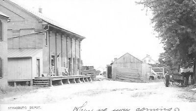
| Strasburg |
Strasburg RR |
|||||||
| Tucquan Station |
|
This station was at the end of Tucquan Glen Road when that road went all the way to the tracks. There are now no roads in the area where the station was. | ||||||
| Turkey Hill |
|
See listing for Creswell above. | ||||||
| Washington Boro (MANOR) |
|
In 1899 the station was on the west side of Water Street (PA-441) just south of Rockfish Street (GPS: 39.996703,-76.472676). | ||||||
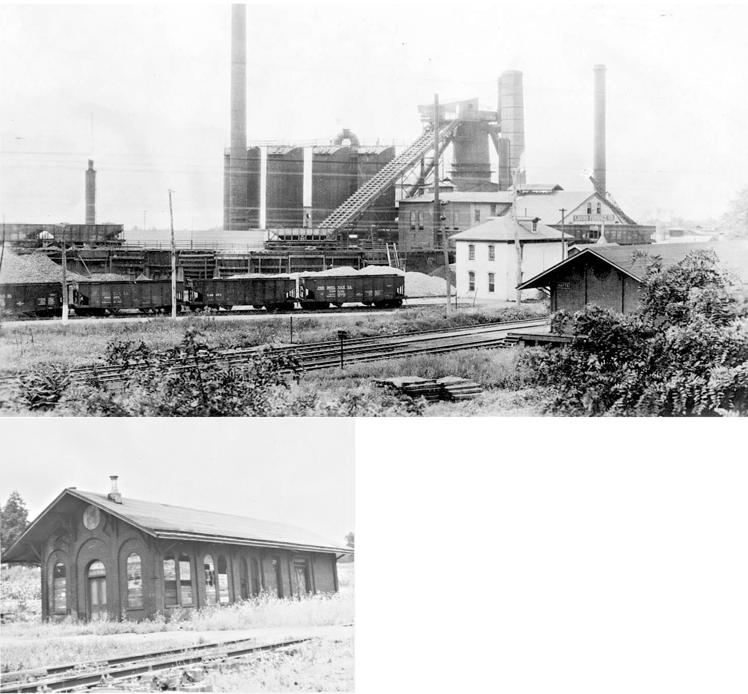
| Watts Station |
|
This station was in the vicinity of Furnace Road and Donegal Place in Marietta. It is shown on the 1899 map. It was located at approximately GPS: 40.059083,-76.534906. Jim Kelling writes, "Watts Station, on the east side of town, was built by Henry Miller Watts in 1869 to serve the nearby Vesta Furnace, which he and Henry Musselman cofounded, producing pig iron from 1868 until the 1920s. The brick combination station (type B-101) was smaller than the Marietta station but had the same style doors, windows, overhang, and detailing. The furnace buildings are all gone, except for the recently restored office building, which now stands alone in the riverside park; it is reputed by some to have been a PRR station. If so, it could have been only for a short time, until completion of the Watts Station. [ICC Valuation 1918, Box 6016]" | ||||||
| Westbrook |
|
This station was in the area of Westbrook Road and Peach Bottom Road. The station was on the west side of the road and east side of the tracks around GPS: 39.775926, -76.192418. | ||||||
| White Oak |
|
This station on the Mount Hope Branch was on the north side of White Oak Road on the east side of the tracks near GPS: 40.205630, -76.392342. The Mount Hope branch connected the R&C to the Cornwall RR at Conrwall Junction. A local resident named Connelly built the 16'x30' station there in 1888 for $500 and subsequently served as the agent and postmaster (Reading Railroad Station Pictorial, Vol. 2, 1999 and Manheim Sentinel, 3-23-1888). | ||||||
| Whittaker |
|
This station was between Benton and Peach Bottom. It was near the border of Drumore and Fulton Townships in the vicinity of GPS: 39.768112, -76.242607. There are no roads to this location today. | ||||||
| Wild Cat Falls |
|
This station was north of Marietta and served the Wild Cat Club. It was built to accommodate the people that wanted to ferry across the river, and the stop became known as Wildcat Falls Station. Folks were ferrying across the river since 1895, or earlier, and some type of shelter may have been built. In a 1914 newspaper article, visitors to the Wild Cat Club called on the PRR to build an actual station. The station site was likely around GPS: 40.057660, -76.595223. | ||||||
| Wissler |
|
This station was between Midway and Face Rock. | ||||||
| Witmer |
|
This station was on the west side of Mt. Sidney Road on the north side of the tracks (as shown on the 1899 map). | ||||||
| York Furnace |
|
Pictured is the original Columbia & Port Deposit RR station here circa 1875. | ||||||
| York Furnace |
|
This station was at approximately GPS: 39.878111, -76.370861. | ||||||
| 1895 LANCASTER COUNTY RAILROAD MAP | ||||||||
 |
||||||||
| CURRENT LANCASTER COUNTY MAP WITH STATIONS BY WILLIAM DRYDEN | ||||||||
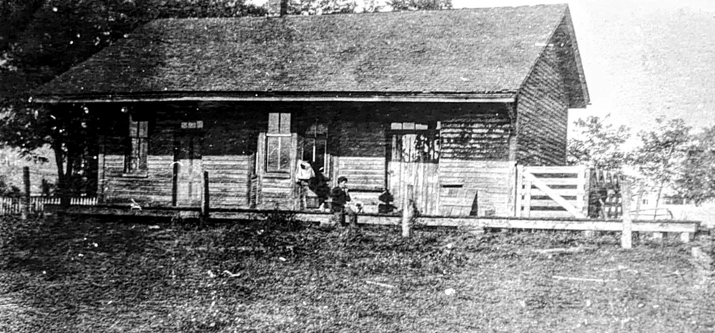
| Notes About Existing
Stations... Akron (R&C) - This station was in its origional condition until 2009 when it was converted into apartments. Akron was known as New Berlin on the 1864 county map. This building was a warehouse and the station fuctions were carried out within it until a new station was built across the tracks in 1889. Bareville (PRR) - This passenger shelter was originally moved and converted into a storage building, but the owner has since torn the extra wood off and returned it to its shelter form for use as a patio/deck (including a "Bareville" station sign). According to the 1899 county map, the shelter was on the west side of Graybill Road on the north side of the tracks (GPS: 40.089678,-76.163385). Christiana (PRR - Passenger) - This is an interesting one-story structure built of brick, stucco and "half-timber" style, with a low hipped roof. Philadelphia and Columbia RR stone blocks are found in curious places throughout the town. Christiana (PRR - Combination) - Restored by the Lancaster chapter of the NRHS. Originally used for freight and passengers, later just for freight. Columbia (R&C) - Restored in 2001. Cordelia (RDG) - Only remaining flag stop in Lancaster Co. Rebuilt on earlier foundation. Roof sheathing is old wood walls including the station sign. East Petersburg (RDG) - At the RR Museum of Pennsylvania. This station was moved to East Strasburg from East Petersburg in 1960. It was formerly on the Reading and Columbia branch of the Reading RR. The station was designed by Frank Furness ("Frank Furness, The Complete Works" by G. Thomas/J Cohen/M. Lewis, Revised ed., 1996). Other sources say the station was constructed in 1882. Gap (PRR) - This is a freight station. The passenger station was located about 100 feet to the east (track direction). It is in very poor condition (a tree is growing through part of the roof!). It is in the style of the other very early brick railroad buildings on this line and may be a leftover of the Philadelphia and Columbia Railroad era. Herrville (PRR) - The building that served as the Herrville freight station was originally built as a tobacco barn circa. 1900. The loading dock is intact and the track bed is still visible beside the building. The building has been repurpoposed into a cabinet shop called "The Wood Shed." Landisville (PRR) - Station is built on foundation of old tower that controlled crossing of Reading. There is office in the station for the tower operator. Leola (PRR) - A station was built here when the line opened in 1890. At the time the station was known as Leacock. In 1895 it was proposed that the station name be changed to Glenola. The railroad rejected that idea as it already had stations at Glenolden and Glenora and wanted to avoid confusion with a similar station name. The names Leacock and Glenola were then combined to form "Leola" and the station was given that name in 1896 (Intelligencer Journal, 4-3-1958 and Sunday News, 10-10-1976). Leola and Leacock were separate entities (although the demarcation between the two has been debated), but the station was the same. Bareville, also considered a tri-town with Leola and Leacock, had its own station. Lititz (Replica) - The original station at Lititz was demolished in 1957. The replica of the Lititz passenger station was built in the exact spot the original station stood. It is along the tracks and in the park (the tracks boarder the one side of the park). The tracks end on the east side of town about 1/4 mile past the freight station. At one time the tracks continued onto Ephrata, Denver, and Reading. The line was known as the Reading and Columbia branch on the Reading Railroad. Today the tracks no longer exist between Lititz and Ephrata. -- Jeff Smith Marietta (PRR) - This building served as the first station in Marietta. It was built between 1820-23 to provide accomodations for canal traffic before the RR was built. After the RR was built it was used as a station and ticket office until a new station was constructed in 1860. This building is shown as the station on the 1864 map of Marietta. See the Railroad House B&B web site for more information. Marietta (PRR) - Although some sources say this station was built in 1860, the 1864 map of Marietta does not show this station as having been built yet. The 1864 map still shows the hotel across the street as the station. The map may be incorrect or the station build date may be incorrect. Mt. Joy (PRR Freight) - The old freight station is now part of the Sassafras Terrace Apartment Complex. The main building of the complex is the old George Brown Cotton & Wollen Mill. It was built sometime prior to 1882 as there is mention of the station from that year in an article about the construction of the woolen mill. (The Semi-Weekly New Era, 3-4-1882). Prior to the mill expanding to the east, the PRR had a stock yard to the north of the freight station as shown on the 1886 Sanborn map. Refton (PRR) - On Quarryville track which was abandoned in 1972. Salunga (PRR) - This building was in fact the Salunga PRR station. When the tracks were realigned in the mainline improvement project in the 1890's, the building was sold to the Conestoga Traction company and used as a rotary station. The obvious evidence is the sturdiness of the structure and the presence of platforms and the street is named Railroad Ave. It is also shown in Bridgens Atlas (1889) as PRR (Lancaster County Historical Society). It is also reported as an existing building when bought by the Conestoga Traction Company in 1898 (CTC Annual Report 1900). - Kevin Landis White Rock (LO&S) - According to the current (2019) owner, the rails were removed in 1920 and the depot was sold. The new owner added a second story and the lean-to section on the creek side. Much original woodwork remains inside. It's clearly recognizable on the inside, but not on the outside. |
||||||||