|
|
||||||||
| EXISTING STATIONS | ||||||||
|---|---|---|---|---|---|---|---|---|
| Station Name |
Original Railroad |
Current Location |
Type | Current Use |
Date Built |
Track Status |
Building Material |
More Info |
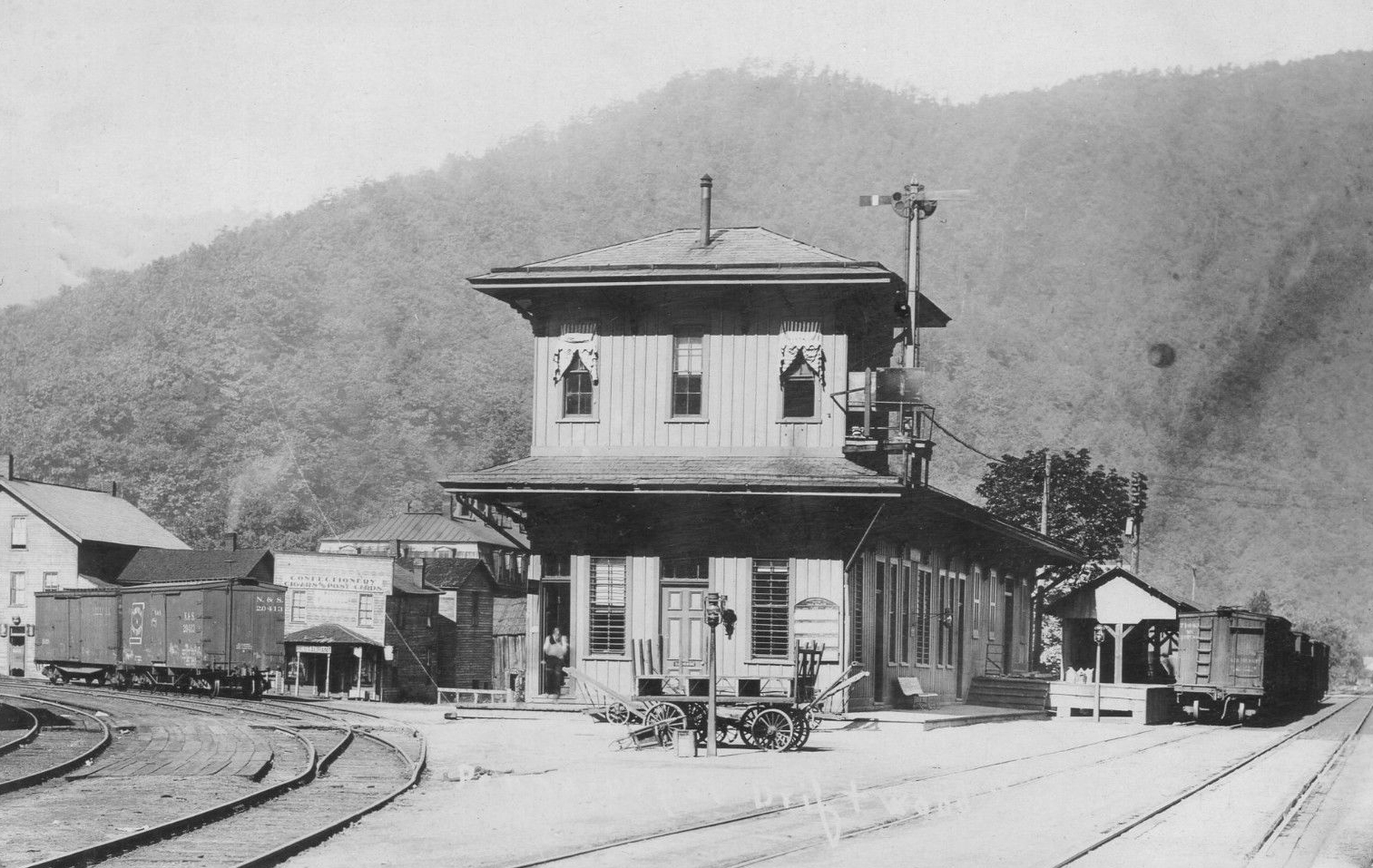
| EmporiuM Junction |
 |
East Second Street at Emporium Junction
(Near Route 120) (GPS: 41.508057, -78.223353) |
F | MoFW | ???? | In Use | Wood | |
| Emporium |  |
South side of East Third Street between Walnut Street and Spruce Street (GPS: 41.510786, -78.231939) |
F | Business | 1888 | Gone | Wood | |
| STATIONS OF THE PAST | ||||||||
| Station Name |
Original Railroad |
Notes | ||||||
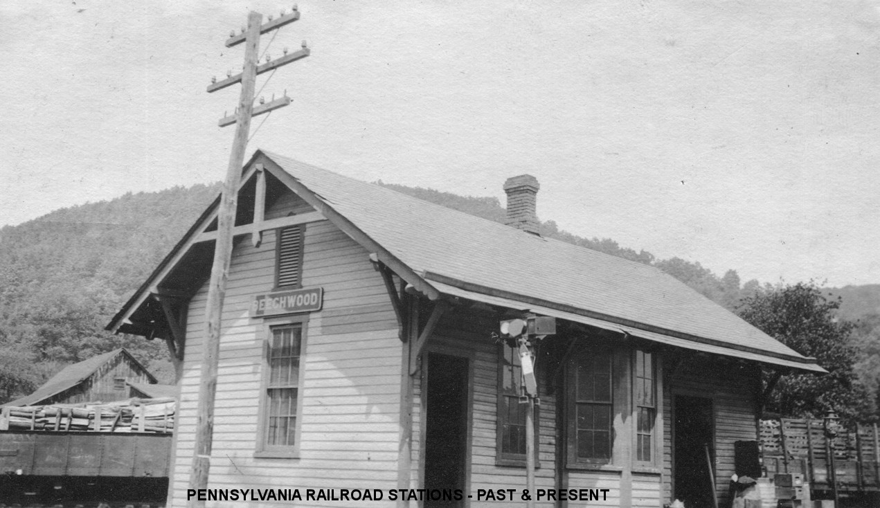
| Beechwood | |
A new station was built here in 1886. PRR valuation records claim the station pictured was built in 1893. | ||||||
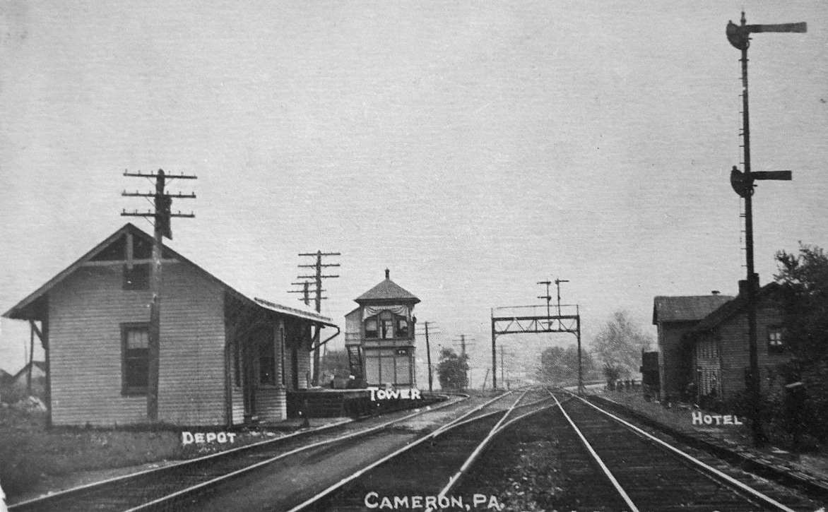
| Cameron | |
This station was built in 1891. | ||||||
| Canoe Run | |
|||||||
| DriftwooD Junction | |
This station was built in 1882. | ||||||
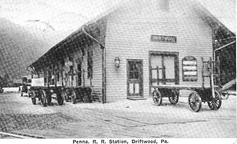
| Driftwood | |
|||||||
| Driftwood |
 |
This station was in the southeast quadrant of the former bridge location carrying Karthaus Mountain Road over Bennetts Branch (which has since been reconstructed on a new alignment to the north), south of the town of Driftwood at GPS: 41.333507, -78.135350. The Driftwood station was mentioned as "not yet under construction" in October 1904. It was a small depot, likely a wood one-story building. Due to the steep slope to the stream, the B&S anticipated that the rear of the building would need to be placed on stilts (but not sure if it was eventually built that way). It appears on the 1918 B&S Valuation Map. | ||||||
| Elk River (Elk Fork) |
 |
|||||||
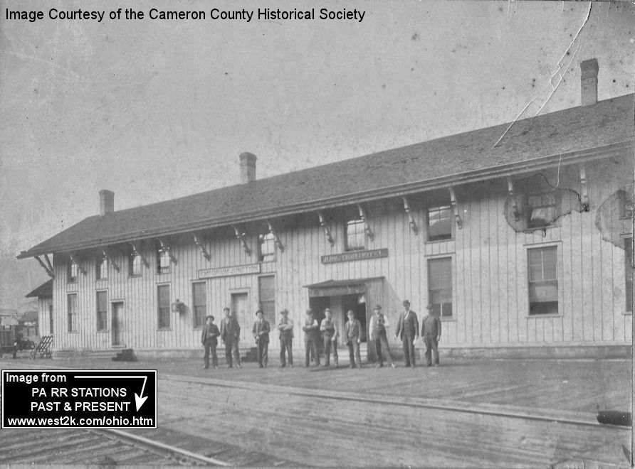
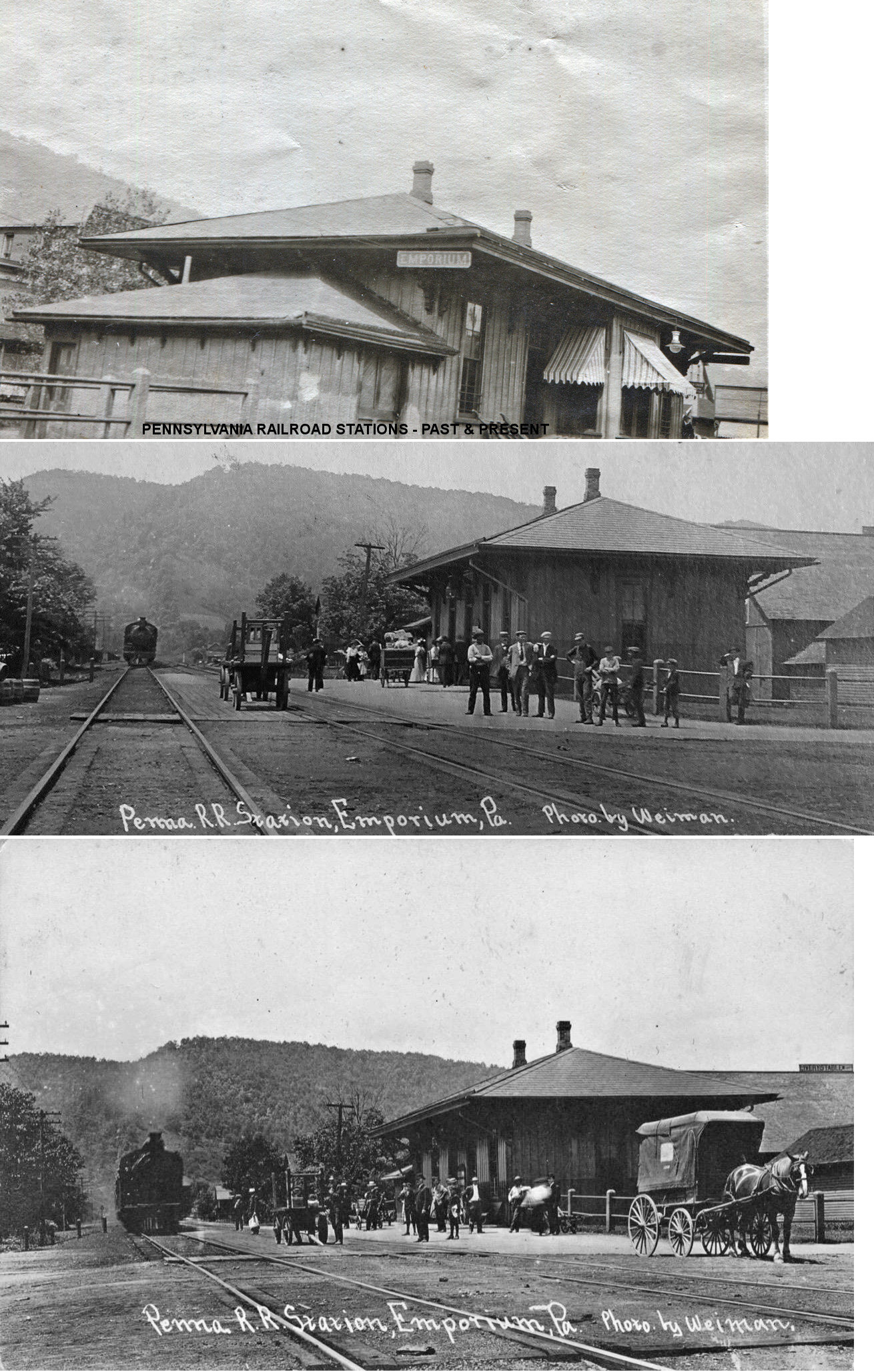
| Emporium (Emporium Jct.) |
|
The original main PRR passenger station here was at Emporium Junction on the south side of Allegheny Avenue at GPS: 41.508387, -78.224190. This was a long wood frame building that was identified on maps as a station and "Emporium Junction Hotel." The structure was on the east side of Portage Street at East Allegany Avenue fronting onto the PRR tracks. The PRR’s roundhouse, coal tipple and water tank sat on the opposite side of the tracks from this station until the 1960’s. The coal tipple and water tower were taken down in the late 1950’s or early 1960’s. The second generation “Emporium Junction” station (listed below) was located SE of this site right at the V junction of the PRR’s line to Buffalo and the P&E’s line to Erie. | ||||||
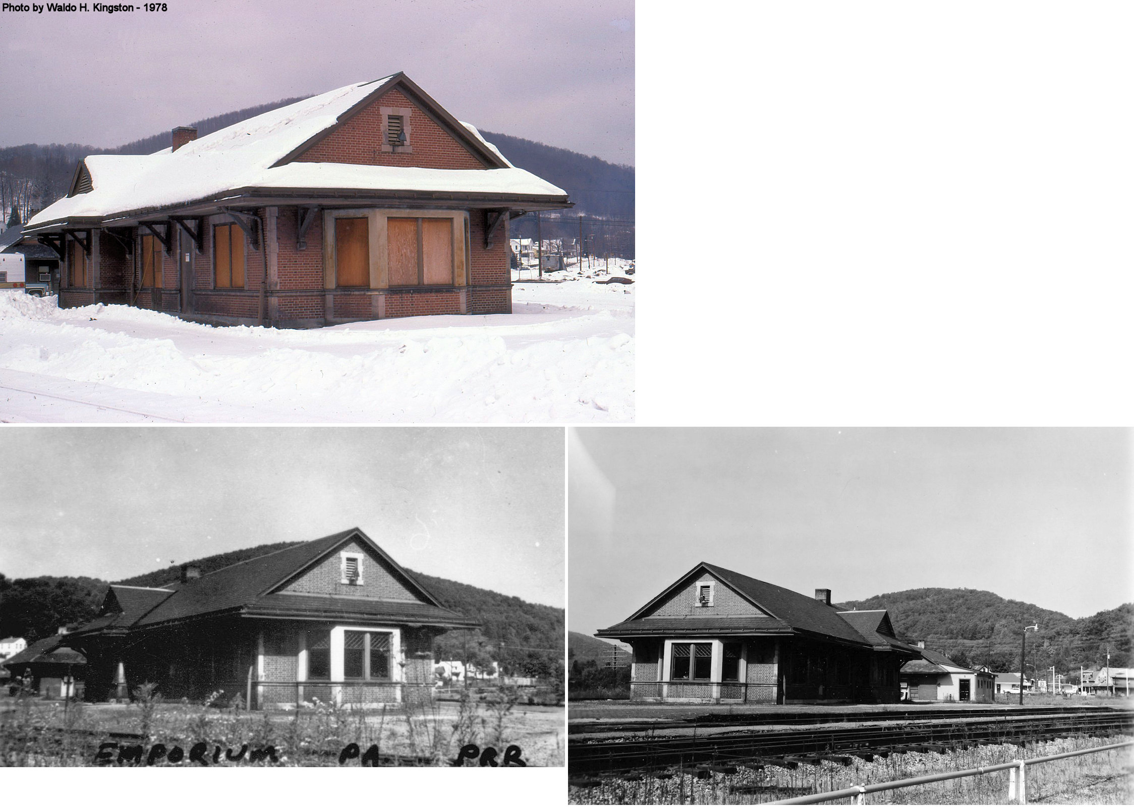
| Emporium (Emporium Jct.) |
|
The second generation station here was a red brick structure that
was eventually demolished in the early 1970's after passenger service
ceased. It was on the SE side of where the extant freight station now
sits. This passenger station was at approximately GPS:
41.507799, -78.223118.
This station was built sometime between 1909-1915. Up until the
late 1950's there was also a large wooden roundhouse, coal tipple and
water tower at Emporium Junction to serve the steam engines -- all now
demolished although the foundations remain. Emporium Junction was the
dividing point on the PRR's main line up the Susquehanna River from
Harrisburg. The northeast branch left Emporium Junction for Erie. The
northwest branch left Emporium Junction for Buffalo. The railroads considered "Emporium Junction" and "Emporium" as two separate station stops even thought they were physically all within the Borough of Emporium. "Emporium Junction" on the east side of town had a large passenger station (demolished early 1970s) and a small freight station (still standing). These were originally PRR properties. "Emporium" had the large East Third Street freight station described above and an "uptown" passenger station (see listing below) on South Broad Street in central Emporium about a half-mile west of this second freight station. These were originally P&E properties later absorbed into the PRR. --Jack Cox |
||||||
| Emporium (Uptown) |
|
There was a smaller station on what was 3rd Street between Wood Street and Broad Street on the north side of the tracks at GPS: 41.510788, -78.238185, which was a second "uptown" passenger station in Emporium center approximately 1.5 miles due west of the Emporium Junction. This was on the northeasterly P&E Erie branch. This station was built in 1883 (per PRR valuation records) and demolished in the 1940s. | ||||||
| Emporium | |
This original frieght station here was on the south side of the tracks near where Spruce Street used to connect to Second Street (GPS: 41.510291, -78.232029). This station is shown on the 1892 Sanborn map. On the 1897 map a freight station is shown across the tracks at the location of the existing station. According to a Cameron County Press article from 10-29-1896, the station was moved: "Freight House Moved - Last Monday the Philadelphia & Erie Railroad Company had a force of men here and by systematic labor and excellent management moved the Freight depot building across the track in one hour and a half and interfering with the running of no trains. This was good work and the removal is an excellent thing for the town." | ||||||
| Emporium | |
There was a freight station attached to a general store on the SE side of 4th Street next to the river at GPS: 41.510677, -78.246792. This station is shown on the 1897-1915 maps, although on the 1915 map the building is only labeled a general store and no longer is marked as a freight house. | ||||||
| First Fork |
|
This depot was on the Buffalo & Susquehanna Railroad mainline between Sinnemahoning and Wharton along the First Fork of Sinnemahoning Creek. It was positioned between the highway and the railroad a short distance southeast of where both crossed Norcross Run, near GPS 41.456788, -78.056717. The B&S built southward through this valley in 1901 and it's likely the depot was constructed shortly thereafter. There was a significant head-on collision near this location in 1907. It is not conclusive if the station is present in a 1939 aerial photo; it was certainly lost by 1942 when the railroad was flooded and abandoned shortly thereafter. The site is now part of Sinnemahoning State Park and the former highway is now the park access road. --Nick Puzak | ||||||
| Grove | |
|||||||
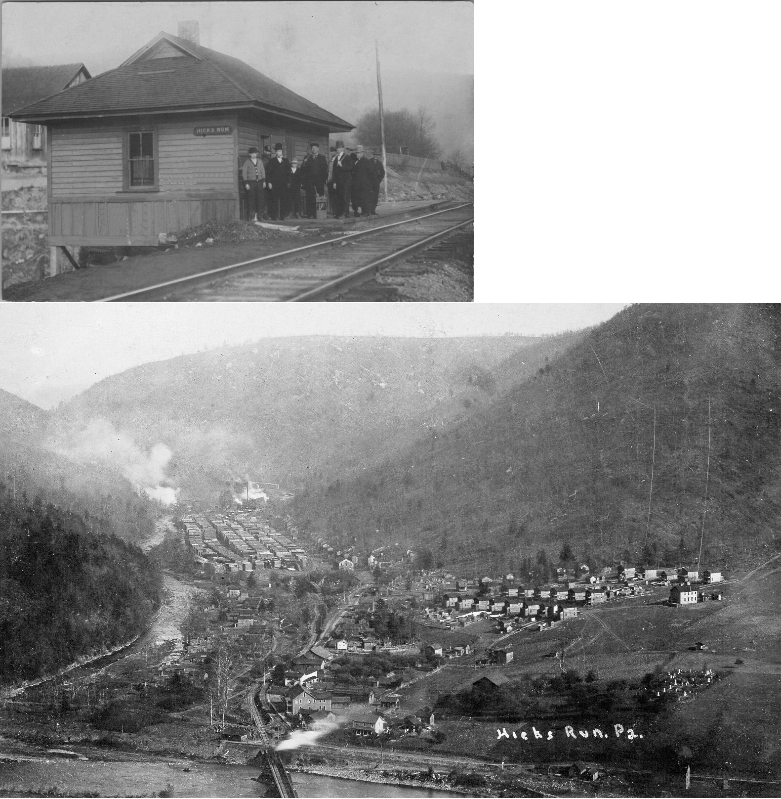
| Hicks Run |
|
|||||||
| Howard | |
According to PRR valuation records, the freight station here was built in 1906. | ||||||
| Huntley | |
|||||||
| Lawn View | |
|||||||
| Lewis Run | |
|||||||
| Lick Island |
|
|||||||
| Lockwood | |
|||||||
| Lushbaugh |
|
This depot was on the Buffalo & Susquehanna Railroad mainline between Sinnemahoning and Wharton along the First Fork of Sinnemahoning Creek. It was located approximately one half mile north of the bridge carrying the railroad over Brooks Run and was positioned on the west side of the railroad near the highway, near GPS 41.427136, -78.034662. The B&S built southward through this valley in 1901 and it's likely the depot was constructed shortly thereafter. The ca. 1918 Valuation Map indicates a telegraph booth and section house were both located immediately to the south, as were a tool house and two parallel sidings. It is not conclusive if the station is present in a 1939 aerial photo; it was certainly lost by 1942 when the railroad was flooded and abandoned shortly thereafter. The site is now part of Sinnemahoning State Park and the former highway is now the park access road. --Nick Puzak | ||||||
| Miller | |
Old maps show a station here, but there isn't one listed by the time of the 1923 PRR List of Stations & Sidings. | ||||||
| Mix Run | |
|||||||
| Mix Run | |
|||||||
| Rich Valley | |
|||||||
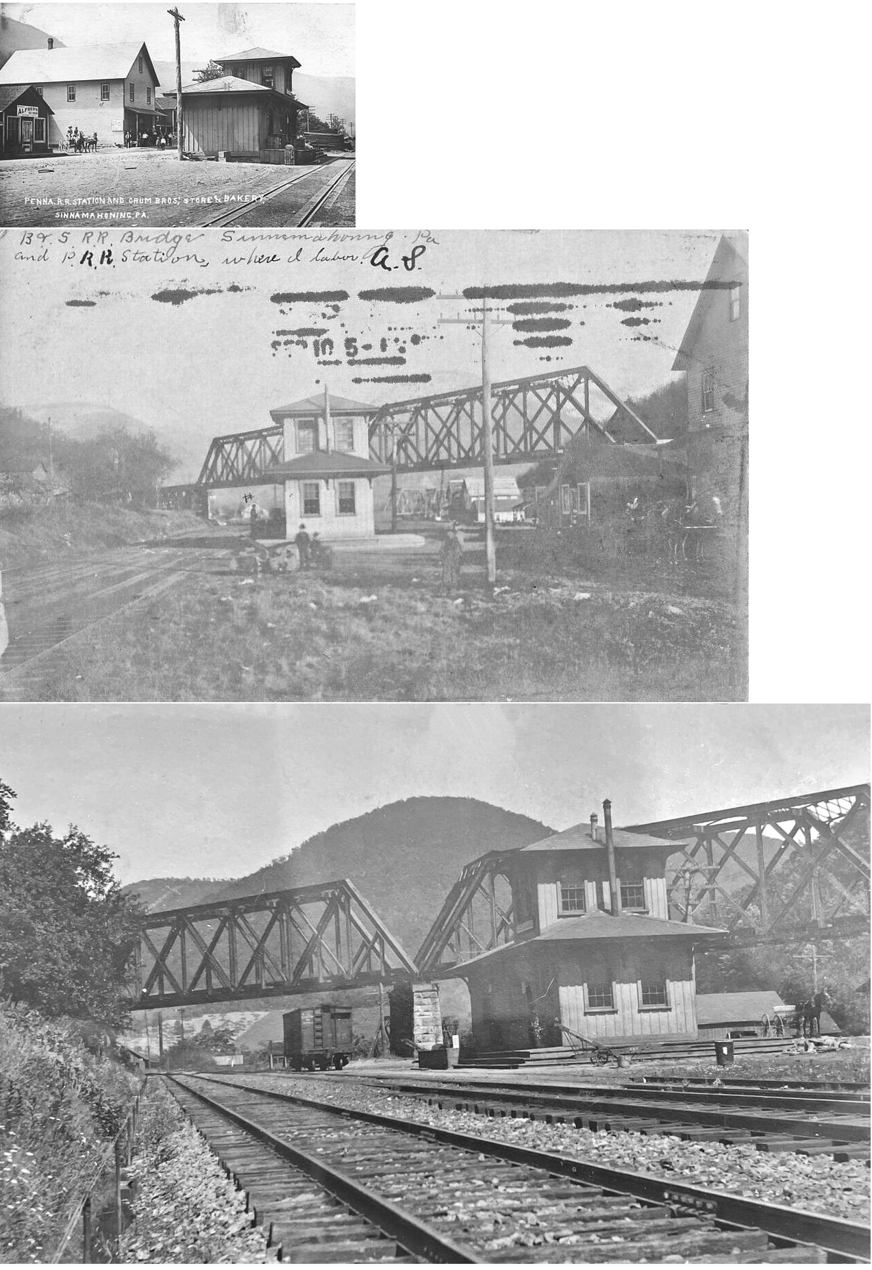
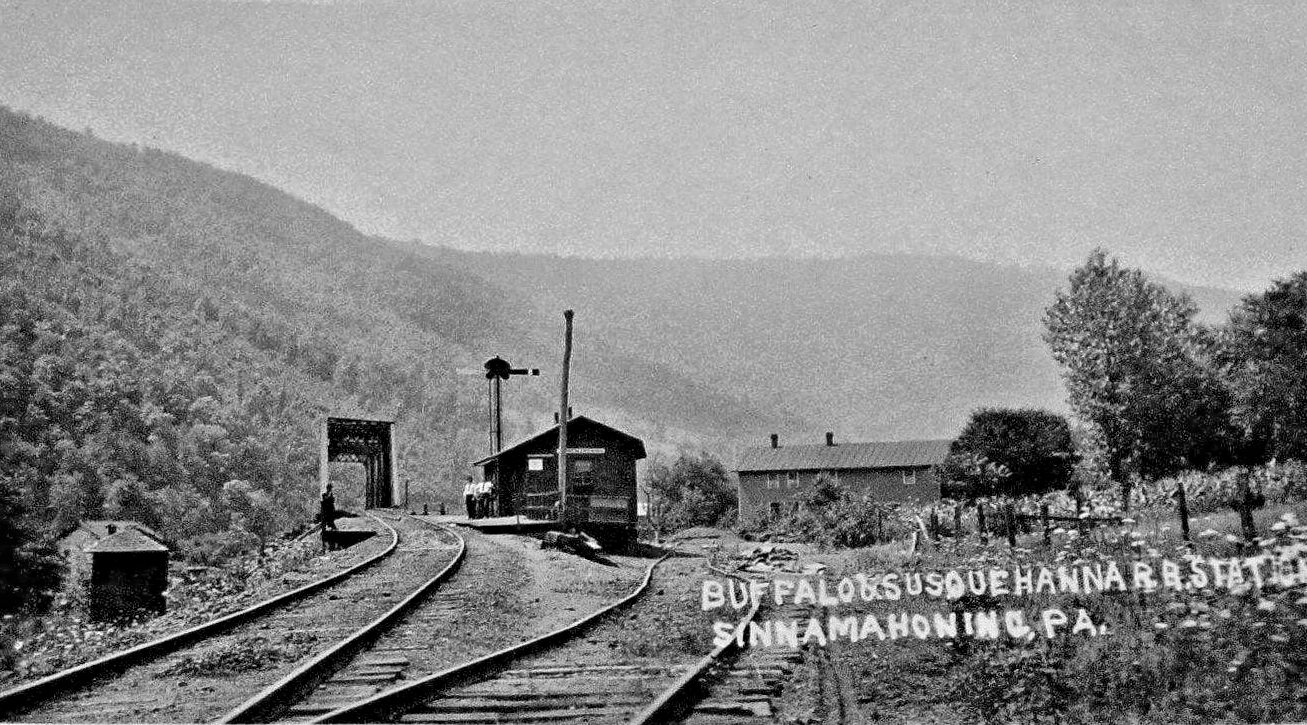
| Sinnemahoning | |
The first station here "fell to the ground of its own accord" on May 2, 1881 (Kane Weekly Blade, 5-19-1881). | ||||||
| Sinnemahoning | |
This station was built in 1882 and sat on Railroad Street. It was torn down circa 1955. | ||||||
| Sinnemahoning |
|
This station was on the south side of Crestline Road, just north of the intersection with State Route 120 (GPS 41.319180, -78.091862). This station was likely built in 1904, as a newspaper article at the time noted that the B&S moved their buildings from the old mainline to the new one in October of that year. The building was small, one story, and wooden. A siding ran behind the building largely (but not entirely) on what is now Crestline Road. | ||||||
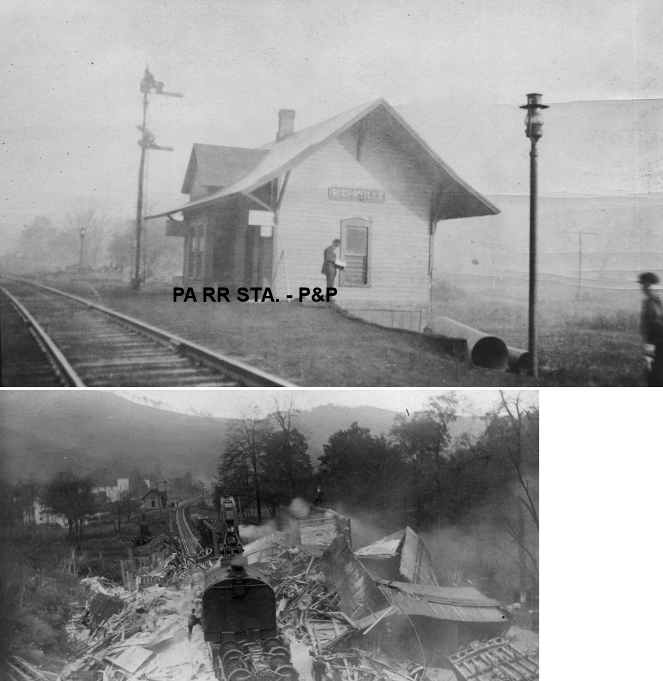
| Sizerville |
 |
|||||||
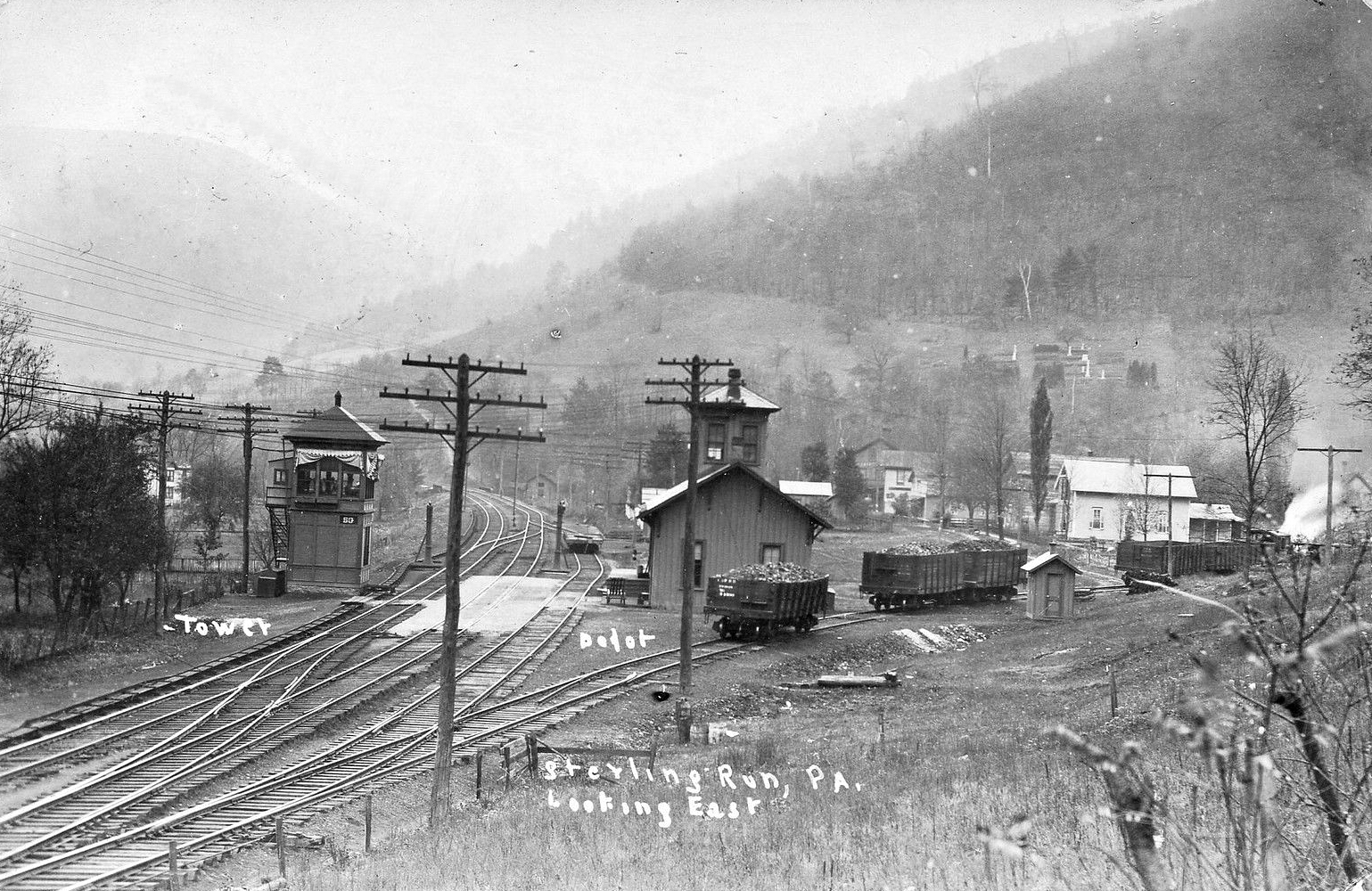
| Sterling Run | |
|||||||
| Wyside | |
|||||||
| 1895 CAMERON COUNTY RAILROAD MAP | ||||||||
 |
||||||||
| Notes About Existing
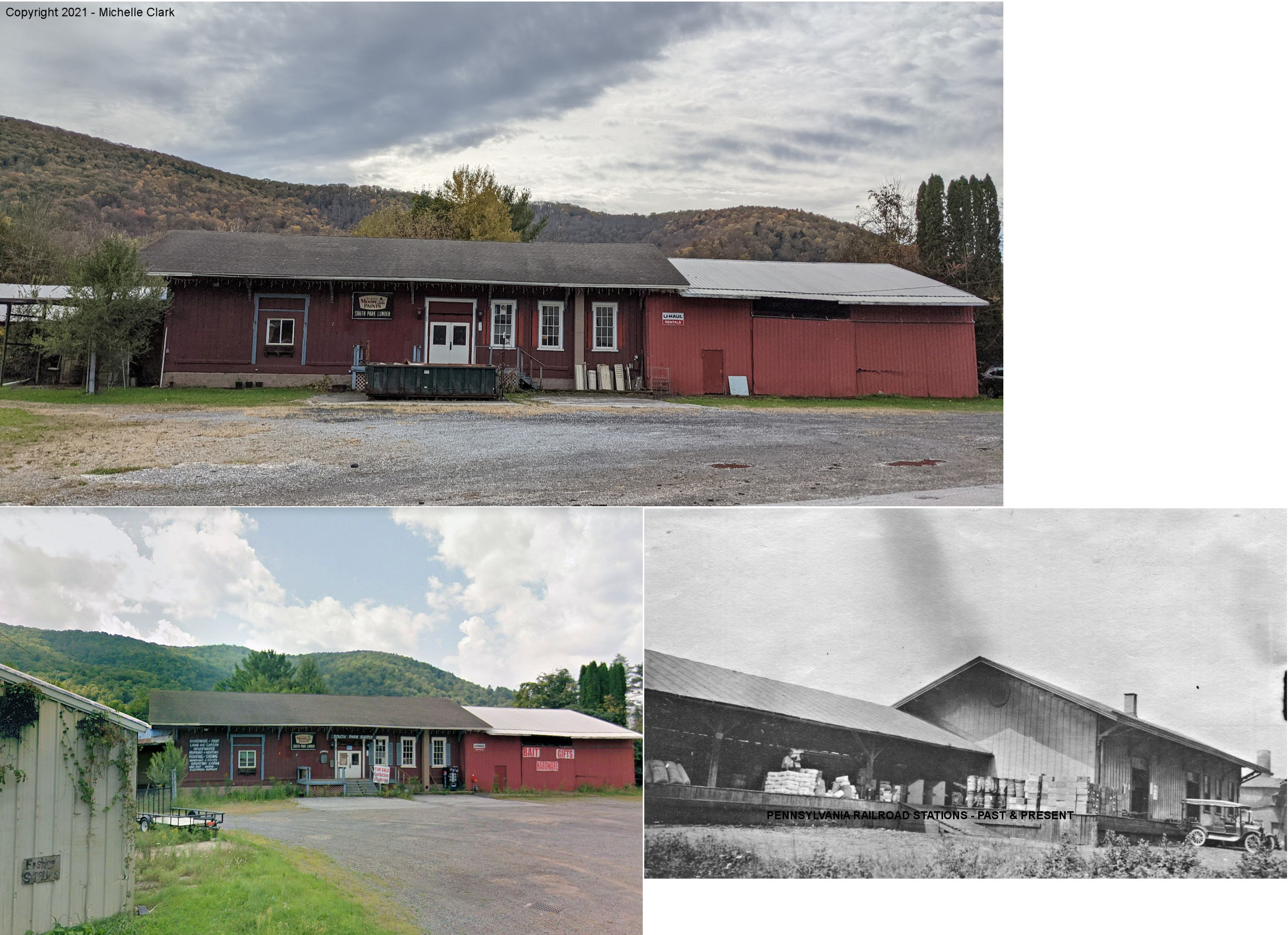
Stations... Emporium (P&E Freight) - This large single story structure, which now houses South Park Lumber, with substantial roofed open platforms was originally built by the P&E in the 1880s. It is located on the north side of what was the P&E's main rail yard in central Emporium on its main line from Emporium Junction to Erie. Until the late 1930s/early 1940s, it was the largest P&E/PRR freight station serving Cameron County and housed the local REA operations. After WWII, the PRR consolidated its local freight operations into its separate freight station at Emporium Junction approximately one-half mile east of this building. This building then reverted to private ownership and has housed several successive building supply businesses to the current time. Boxcars with lumber and building materials continued to be unloaded for the tenant businesses at this site well into the 1970s. The old P&E/PRR tracks between Emporium Junction and Saint Marys which served this station were removed in 2005 by then owner Allegheny and Eastern RR (Hammermill Paper Co.). The 20 miles of rail bed between Emporium Junction and Saint Marys are in the process of being converted into a recreational biking/hiking trail by state and local tourist promotion agencies. --Jack Cox | ||||||||