|
|
||||||||
| EXISTING STATIONS | ||||||||
|---|---|---|---|---|---|---|---|---|
| Station Name |
Original Railroad |
Current Location |
Type | Current Use |
Date Built |
Track Status |
Building Material |
More Info |
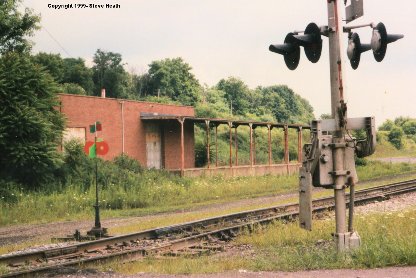
| Butler |  |
NE side of Kittanning Street (GPS: 40.859988,-79.883362) |
F | Vacant | ??? | In Use | Brick | |
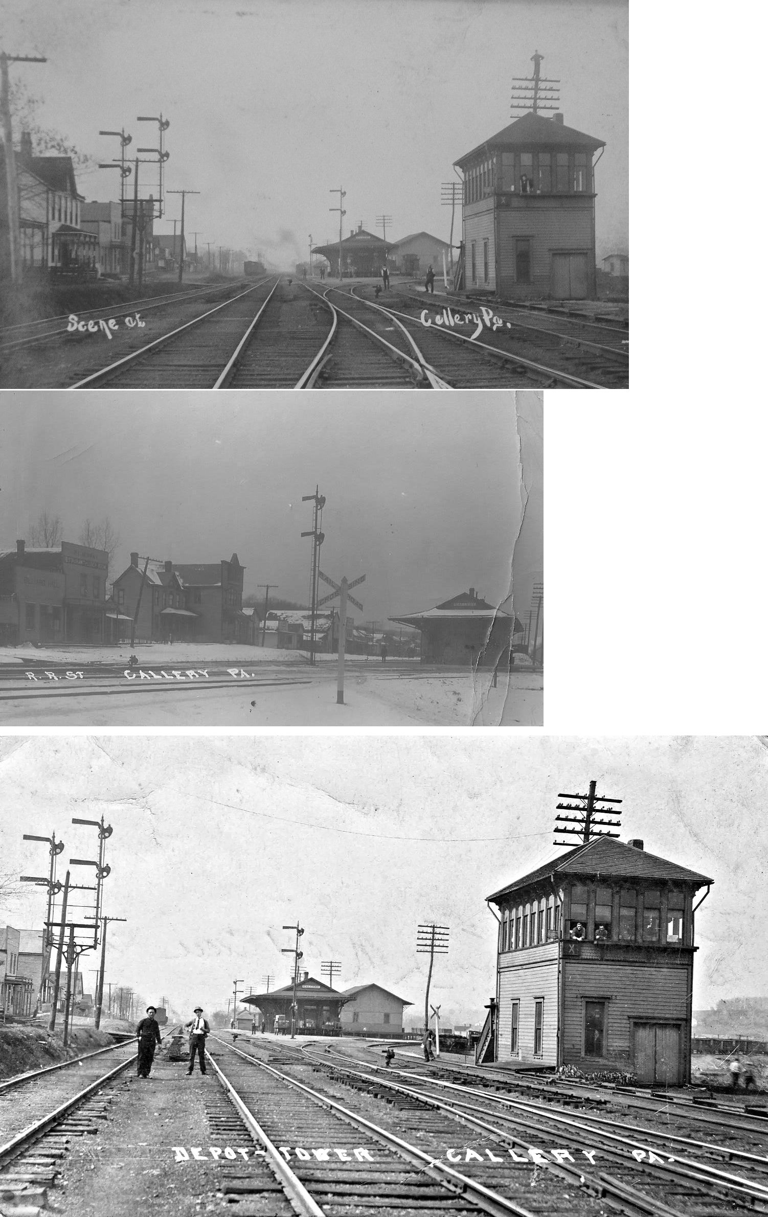
| Callery Junction |  |
Center Street at Railroad Street (GPS: 40.737144, -80.035260) |
P | Residence | ???? | In Use | Wood | |
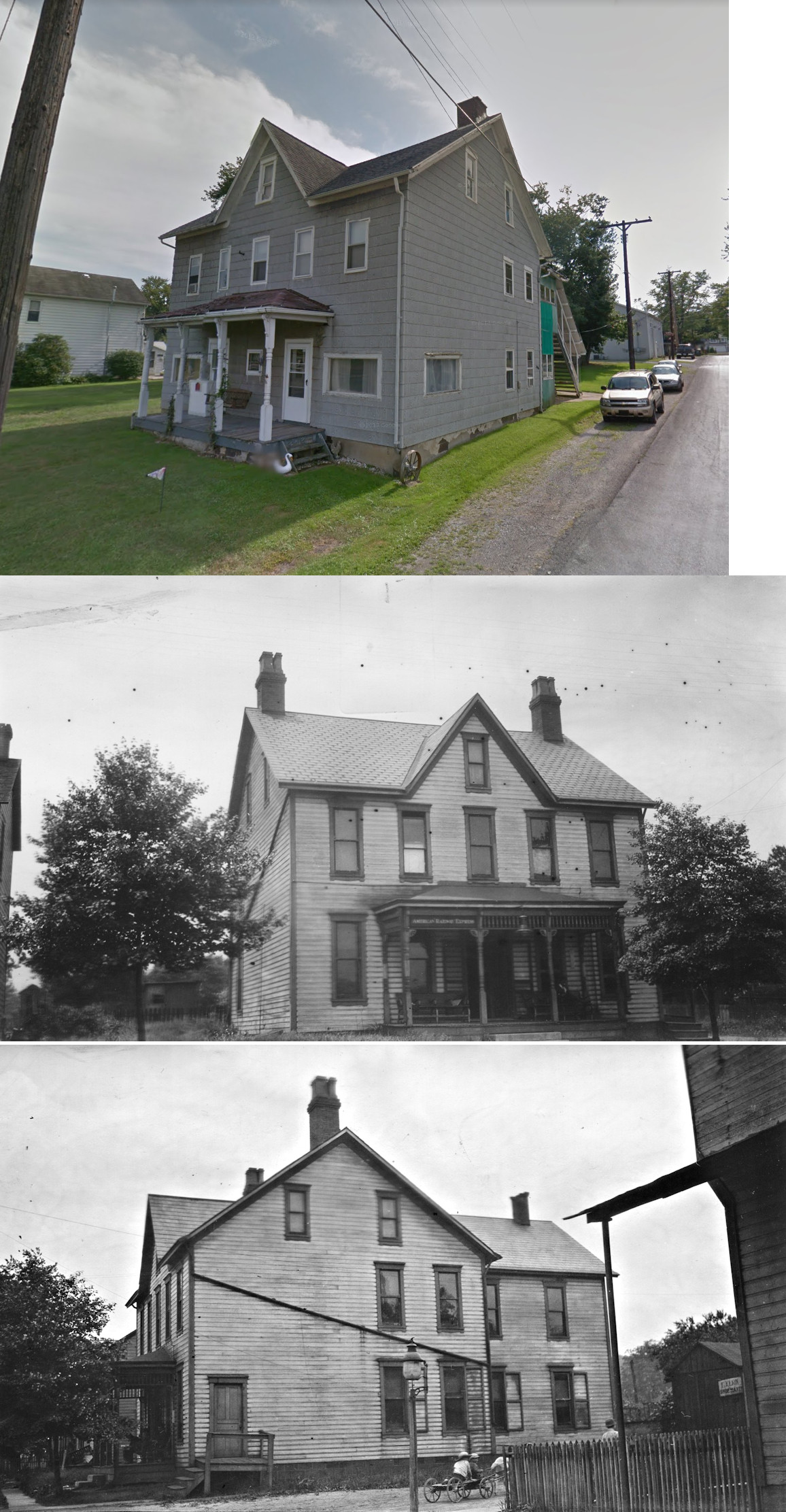
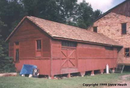
| Harmony | |
Behind the Shever Bros. Hardware Building on Mercer Street (GPS: 40.803177, -80.125437) |
F | Business | 1901 | None | Wood |
|
| Mars | |
Corner of East Street and Mars-Valencia Road (GPS: 40.694787, -80.008465) |
C | Civic | 1897 | In Use | Wood |
|
| STATIONS OF THE PAST | ||||||||
| Station Name |
Original Railroad |
Notes | ||||||
| Angelica |
 |
This was an early station on the KC&BRR. It is shown on the 1876 timetable. | ||||||
| Annandale (Boyers) |
|
On the Hilliard Branch. Old spelling seems to be "Anandale" with recent maps spelling it "Annandale." | ||||||
| Argentine | |
This station was on the Hilliards Branch. | ||||||
| Argyle |
 |
This was an early station on the P&KCRR. It is shown on the 1876 timetable. | ||||||
| Armstrong |
 |
This station was on the PRR's Wolf Creek Branch at MP 12.8 (distance from Leesburg station). It was in the vicinity of Grove City Road and Sankey Lane. | ||||||
| Atwells |
|
This station was on the Hilliards Branch. | ||||||
| Bartley (Ivywood) |
|
The station was on the south side of Ivywood Road at approximately GPS: 40.711837, -79.852226. | ||||||
| Blacksburg |
 |
This station was somewhere near the Butler/Armstrong County line. I have also seen it referred to as Blackburn. It was between Fairmont and Kaylor (Armstrong Co.). | ||||||
| Bonnie Brook |
|
This was an early station on the KC&BRR. It is shown on the 1876 timetable. | ||||||
| Bovard (New Hope) |
|
On the Hilliard Branch. | ||||||
| Boyers | |
|||||||
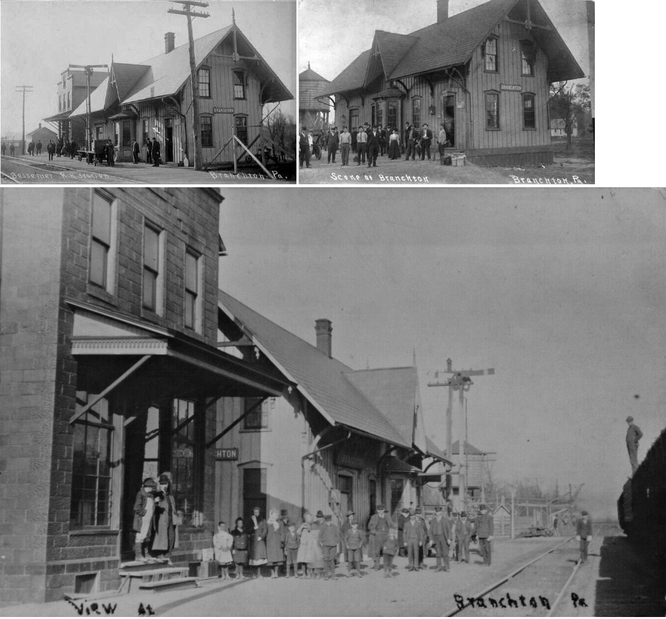
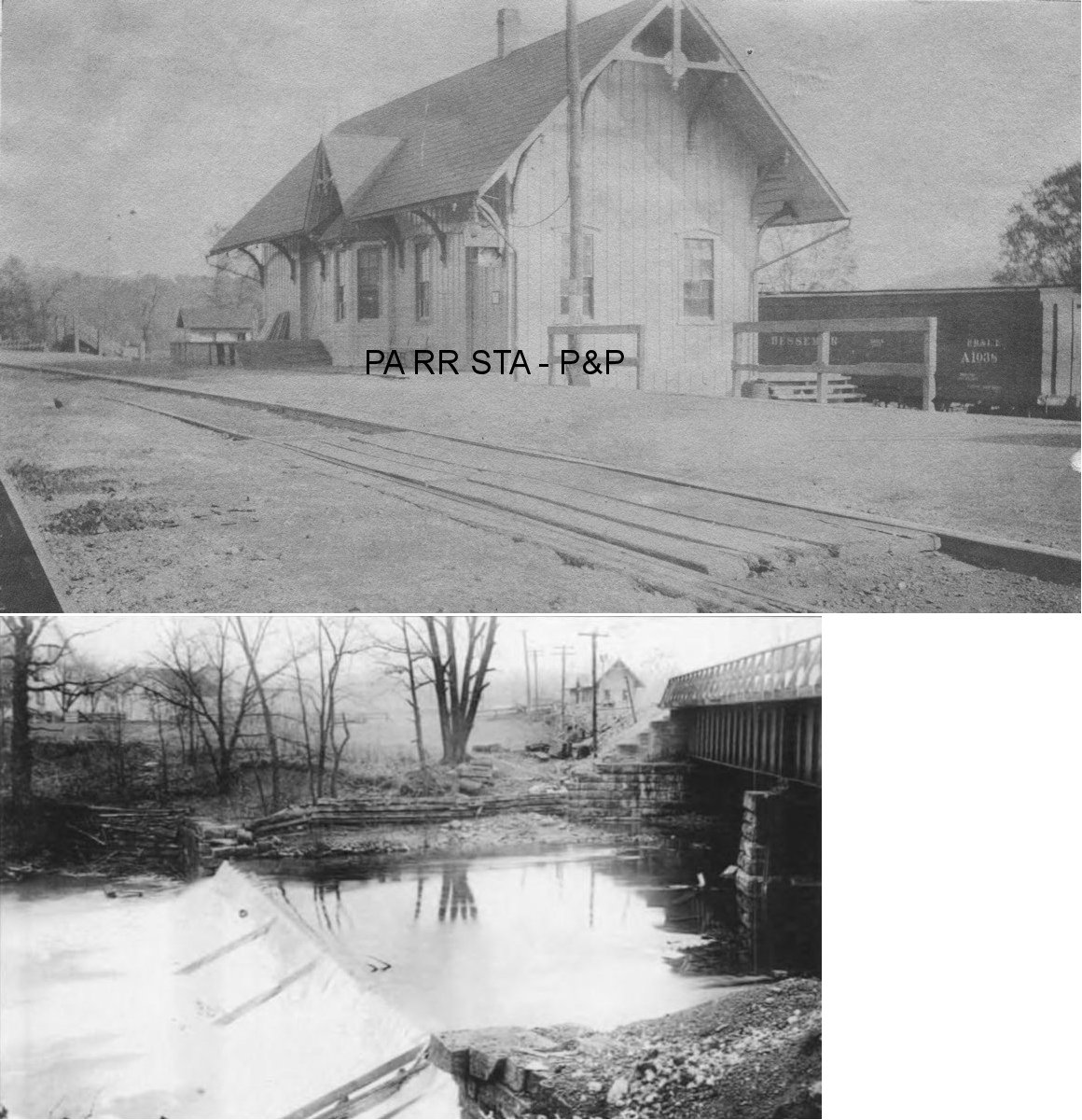
| Branchton | |
This was the beginning of the Hilliard Branch. The station was on the north side of Branchton Road. Although Branchton was a small town, it had a large Bessemer & Lake Erie Railroad station due to the fact that the 10-mile Hillards Branch diverged from the mainline here. That branch line was the source of significant coal and limestone production so by 1910 Branchton also had a yard with a capacity of 1,000 cars for assembling trains to journey north or south on the mainline. | ||||||
| Brannan |
|
|||||||
| Brinker Station |
 |
There was a Butler Branch RR station here in 1874. This station is shown on the 1923 PRR List of Stations & Sidings on the Indiana Branch. | ||||||
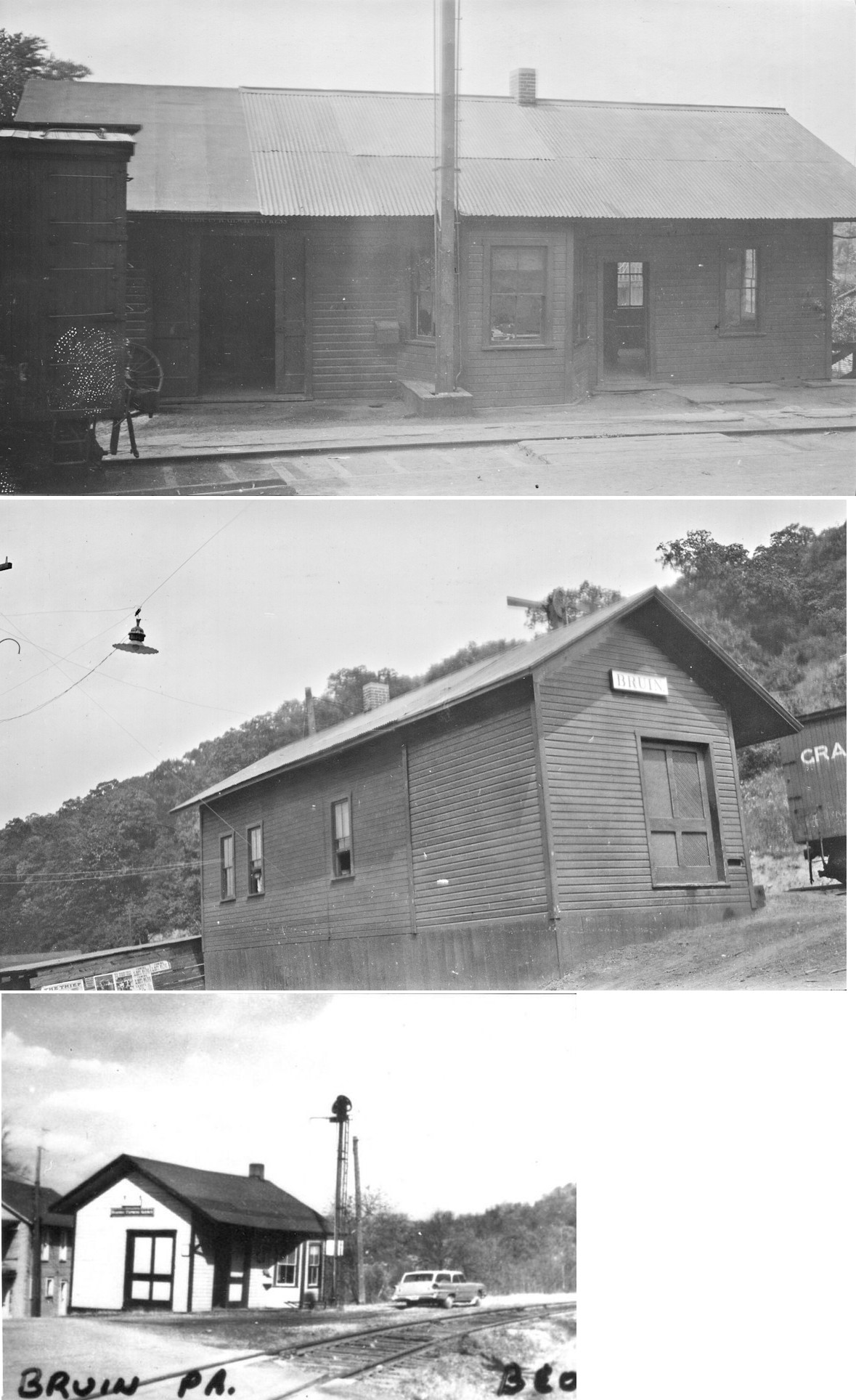
| Bruin | |
|||||||
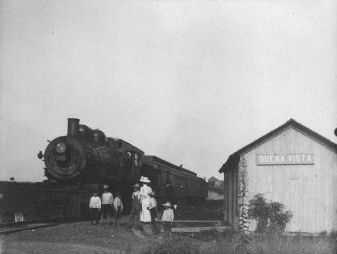
| Buena Vista |
|
|||||||
| Buhls Station |
|
This station was on the north side of Old Route 68 at around GPS: 40.798763, -80.025529. | ||||||
| Butler |
|
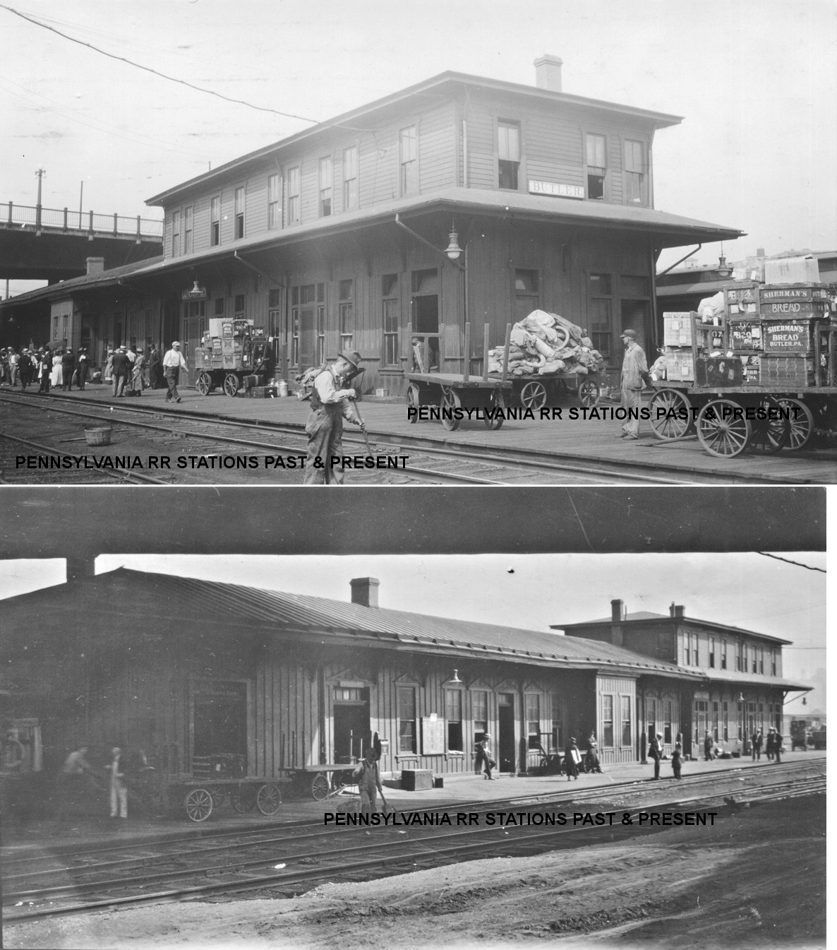
The passenger station was on the south side of Center Avenue at Cliff Street (GPS: 40.856295, -79.893181). The station was closed in 1914 and passenger service was relocated to the B&O depot. On the 1921 map, this building still stands but it is marked "Carpenter and Paint Shop." The Bessemer Hotel (later called the Center Hotel) was adjacent to the station. | ||||||
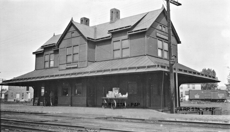
| Butler |
 |
In 1874 there was a Butler Branch RR station on the SW corner of East Jefferson and South Monroe Streets (GPS: 40.86084,-79.888791). On the 1886 map a brick combination station appears here on the map and that Western Penn RR building remains the station into the PRR years. According to the Butler Citizen (8-7-1911) the station was built in 1871. | ||||||
| Butler |
|
This was an early station on the KC&BRR. It is shown on the 1876 timetable. | ||||||
| Butler |
 AND  |
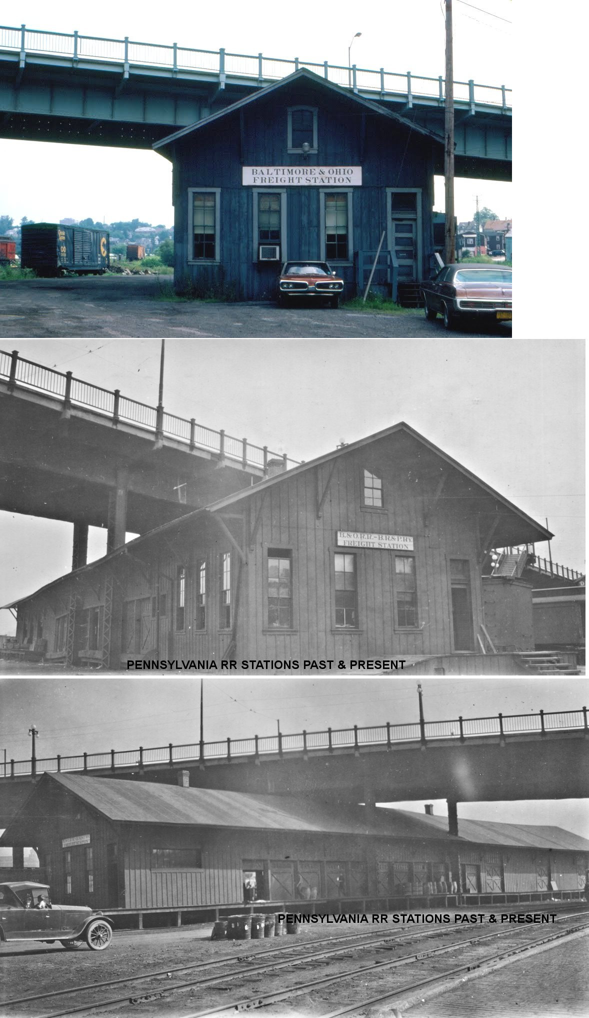
There was a freight station across a siding track to the north of the above listed passenger station at GPS: 40.856394, -79.891742. | ||||||
| Butler | AND |
The passenger station was built in 1881 near the NW end of Chantler Avenue east of Center Avenue on the north side of the tracks at GPS: 40.856311, -79.891356. Sometime between 1891-1896 a two-story section with offices and a restaurant were added on to the NE end of the station. Sometime between 1911-1921 a baggage house was added to the SW end of the station. The station served well into the B&O years. When the Wayne Street viaduct was constructed, parts of the passenger and freight stations were under the viaduct. The B&LE also used this station following the closure of its Center Avenue station in 1914. | ||||||
| Butler | |
|||||||
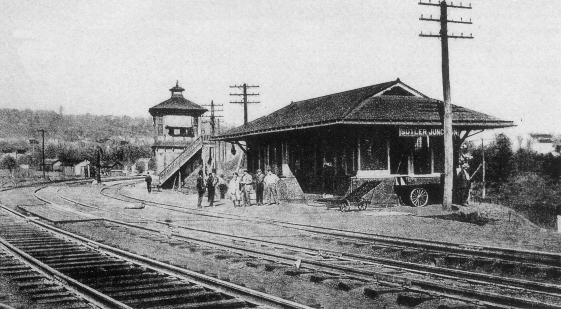
| Butler Junction | |
This station sat just over the county line in Allegheny County near Freeport. However, on the 1876 Armstrong County map, the station is shown on the Butler side of the county line. | ||||||
| Butler Junction | |
|||||||
| Butler Transfer | |
Also known as "Pittsburgh & Western Juction" and "Reiber." | ||||||
|
Cabot (Saxonburg) (Saxon City) |
|
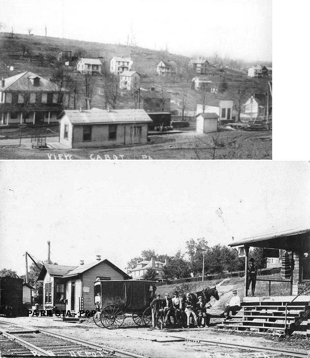
In 1874 there was a Butler Branch RR station here when the town was known as Saxon City. The station was called "Saxonburg Station" until January 1908 when the name was changed to "Cabot." | ||||||
|
Callery Junction (Hiawatha Sta.) |
|
The original Callery Junction depot burned down in a village-wide fire on October 29, 1892. | ||||||
| CallerY Junction | |
This station burned down on December 12, 1917. | ||||||
| campbell |
|
This was an early station on the P&KCRR. It is shown on the 1876 timetable. | ||||||
| Carbon Center |
|
This was an early station on the KC&BRR. It is shown on the 1876 timetable. | ||||||
| Carbon Center | |
This station was south of the intersetion of Carbon Center Road and TR-1014 (GPS: 40.872928, -79.793536). | ||||||
| Carter | |
This station was between Harrisville and Reed. It was likely on Browntown Road in the vicinity of GPS: 41.120222, -80.038485. | ||||||
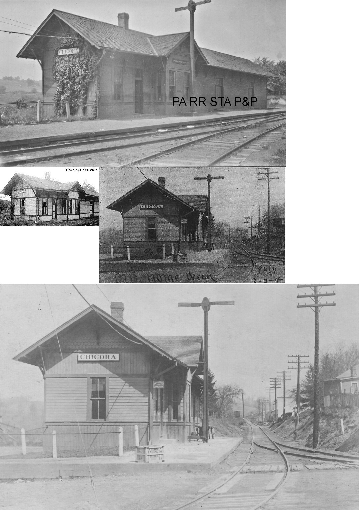
| Chicora (Millerstown) |
|
This combination station was at the intersection of Railroad Street and Railroad Alley on the west side of the tracks at GPS: 40.948964, -79.745870. The town and station were previously known as "Millerstown" and "Barnharts Mills," with the name "Chicora" being adopted in 1891. | ||||||
| Claytonia | |
The station was on Vance Lane east of Claytonia Road. It was built in 1905. | ||||||
| Coaltown (Coalville) |
|
|||||||
| Coaltown Junction | |
|||||||
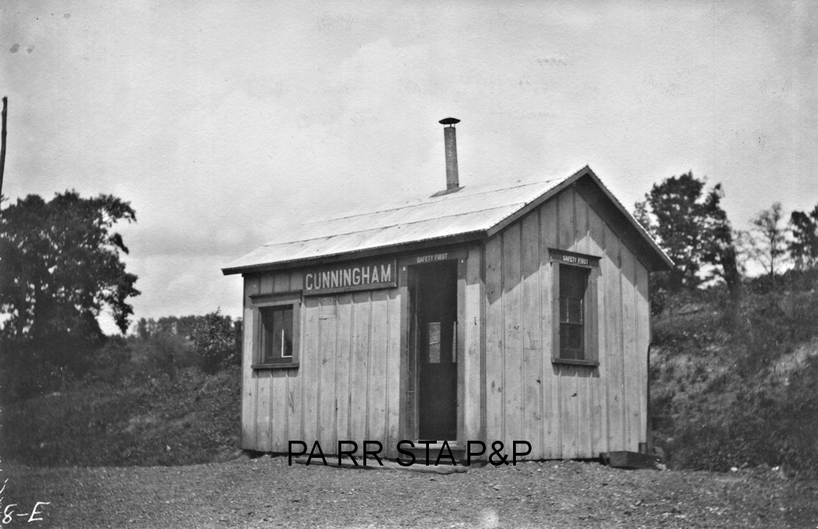
| Cunningham | |
This station was on the south side of Anderson Road at approximately GPS: 40.676692, -79.824269. | ||||||
| Donnelly |
|
This was an early station on the P&KCRR. It is shown on the 1876 timetable. | ||||||
| Downieville | |
|||||||
| Dudley | |
This station was just north of Bruin. | ||||||
| Dudley Siding |
|
This was an early station on the P&KCRR. It is shown on the 1876 timetable. | ||||||
| Durkins |
|
This was an early station on the KC&BRR. It is shown on the 1876 timetable. | ||||||
| East Butler | |
This station was on the SE side of East Butler Road. | ||||||
| East Butler (Noeline) |
|
This station was along Railroad Street on the NW side of East Butler Road. | ||||||
| Eidenau | |
This station was just SE of Hartman Road. The 1941 map shows this station and another station just SE of Textor School Road. I believe that station was Harmony Junction, even though Eidenau was also at the junction. | ||||||
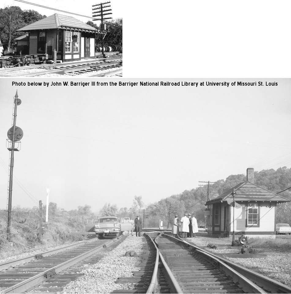
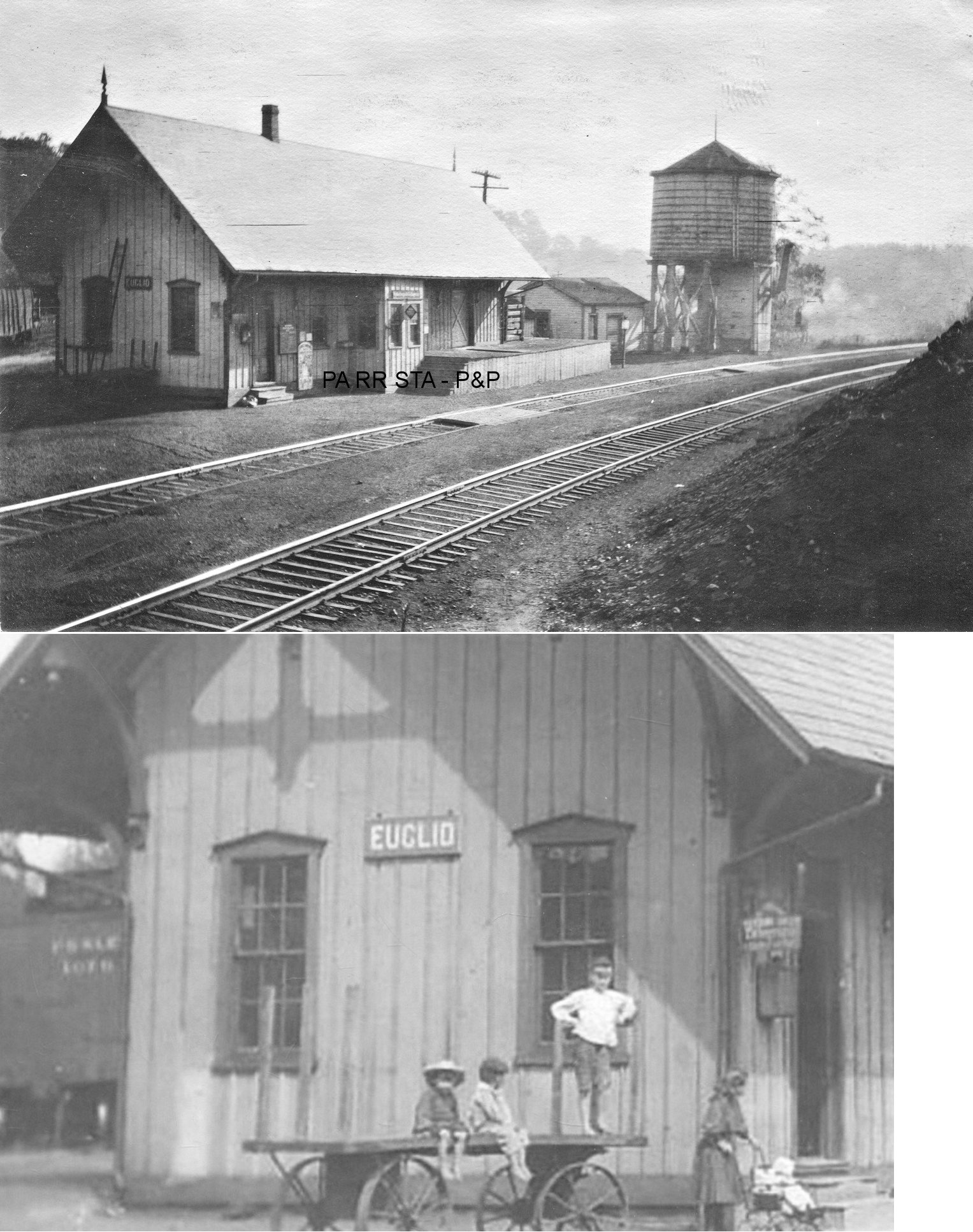
| Euclid (Sunbury Station) |
|
The original description of this station was "between the big cut and the big fill, and is the station for Sunbury, which is a town two miles to the north and east of the station" (Butler Citizen, 8-22-1883). B&LE valuation records say that the station was bought by the railroad in 1882 and remodeled, so it may have served another purpose before that or may have been moved from another railroad. | ||||||
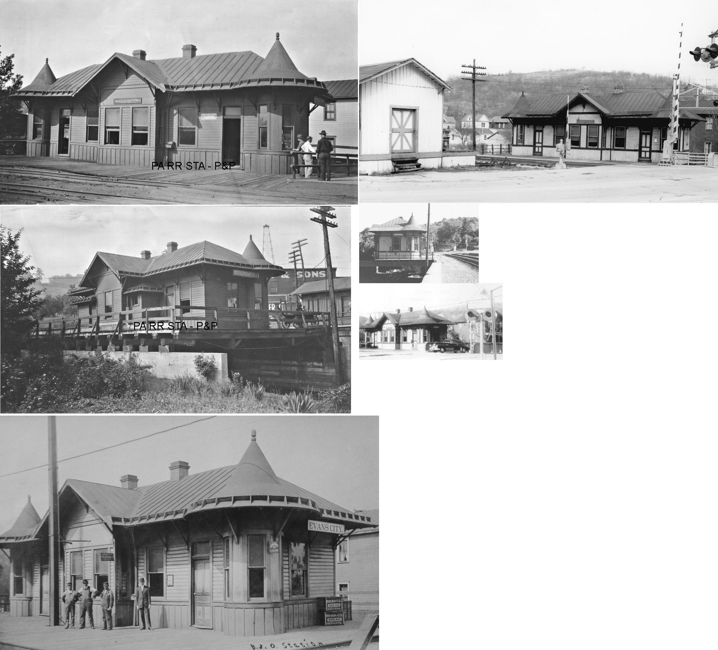
| Evans City | |
The passenger station was on the north side of PA68 on the east side of the tracks. The station sat on a platform over Breakneck Creek at GPS: 40.768980, -80.064136. According to B&O valuation records, the station was built in 1905. It was supposedly noted by Ripley's Believe It Or Not to be the only railroad station in the world to be built over water. Part of this platform remains as of 2014. That station was demolished by the railroad around 1980. | ||||||
| Evans City | |
The freight station was on the west side of the tracks ont he north side of PA68 across the tracks from the passenger station at GPS: 40.768959, -80.064374). | ||||||
| Fairmount (Fairmont) |
|
This station was just north of where the B&O crossed the old Western Allegheny line at about GPS: 40.980021, -79.737308. | ||||||
| Fairmount (Fairmont) |
|
|||||||
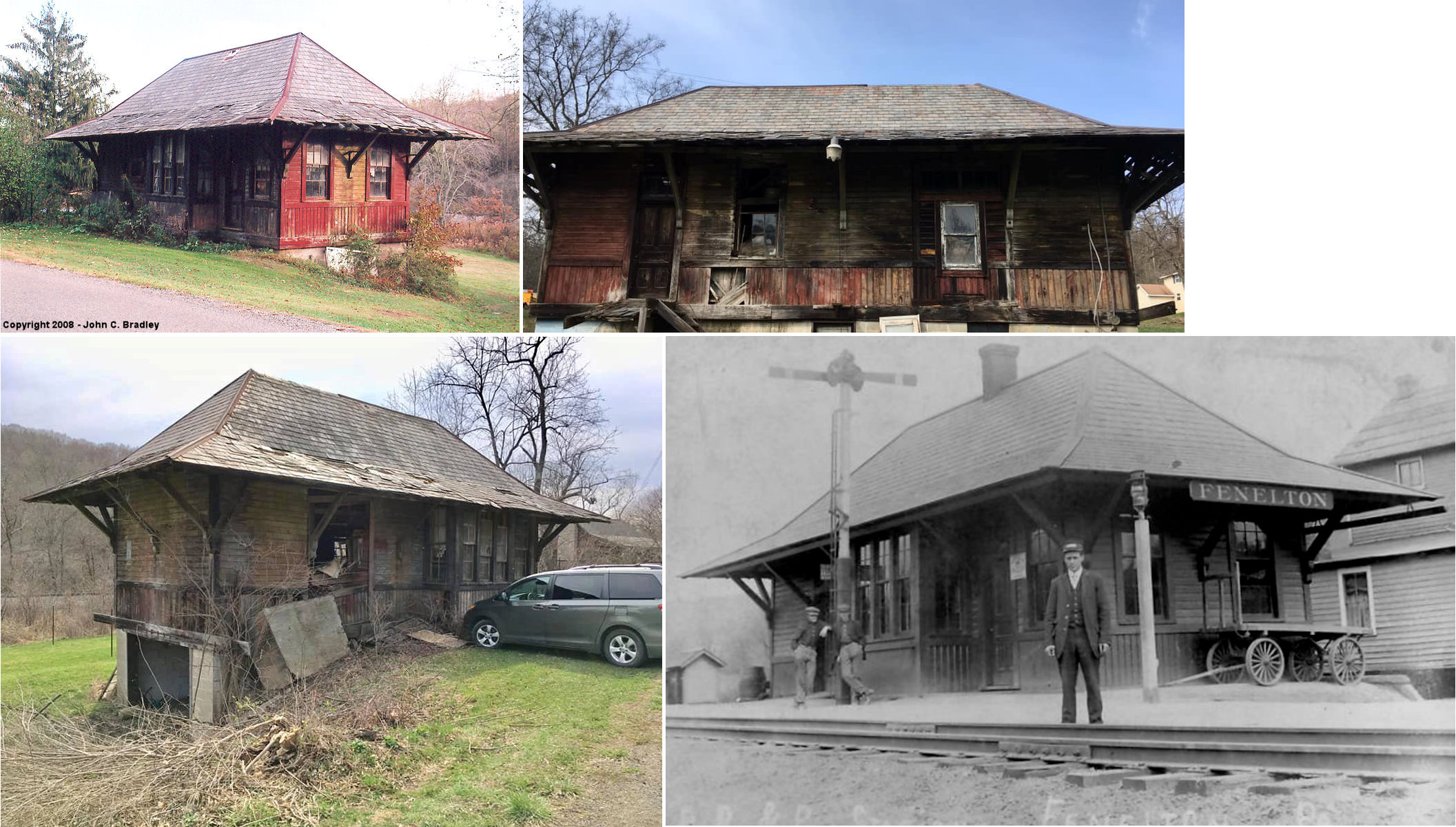
| Fenelton | |
The station was moved in 1956 about one-third mile from its original location. It sat at Carbon Center Road west of South Clearfield Road (GPS: 40.870328, -79.730838) and served as a residence until it was demolished in the late 2010s. It was built in 1904. | ||||||
| Ferris | |
On the Hilliard Branch. Also known as Burnett and Roy on different timetables. | ||||||
| Gilbert |
|
|||||||
| Great Belt (Coyles Sta.) |
|
In 1874 there was a Butler Branch RR station here when the town was known as Coyles Station. | ||||||
| Hallston (PUMP) |
|
The station was on the south side of Hallston Road. | ||||||
| Harbison |
|
This station is shown on the 1923 PRR List of Stations & Sidings on the Indiana Branch. | ||||||
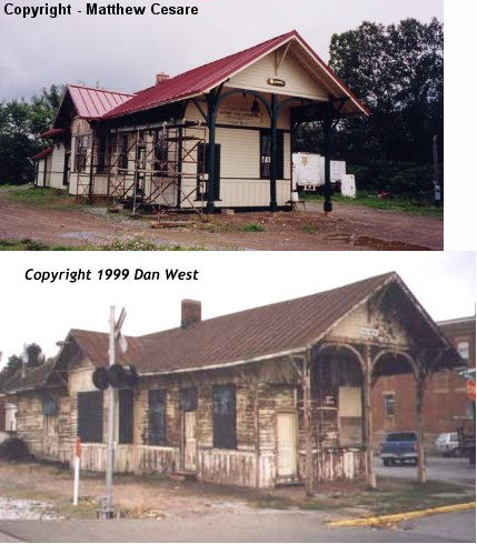
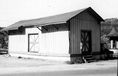
| Harmony | |
The passenger station was on the east side of Spring Street on the north side of the tracks (GPS: 40.802475, -80.125708). The freight station (still standing elsewhere) was on the east side of the passenger station. New stations were built here in 1901 and the old station "moved away" (Butler Citizen, 1-17-1901). | ||||||
| Harmony Junction | |
This station was just SE of Textor School Road. The 1941 map shows this station and another station to the NW just SE of Hartman Road. I believe that station was Eidenau, even though both station can be considered as being at the junction. | ||||||
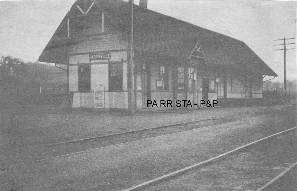
| Harrisville Sta. (Forestville) |
|
There was a station here as early as 1874 when the line was the Shenango & Allegheny RR. It was on Station Road on the east side of PA8 in 1941. The station pictured was built in 1877-78 with an addition enlarging the station in 1882. | ||||||
| Hazelwood |
|
This was an early station on the P&KCRR. It is shown on the 1876 timetable. | ||||||
| Heiner Station |
|
This station was one mile north of Bruin. | ||||||
| Herman Station |
|
There was a Butler Branch RR station here in 1874. | ||||||
| Hickory Mills |
|
See listing below for Keisters. | ||||||
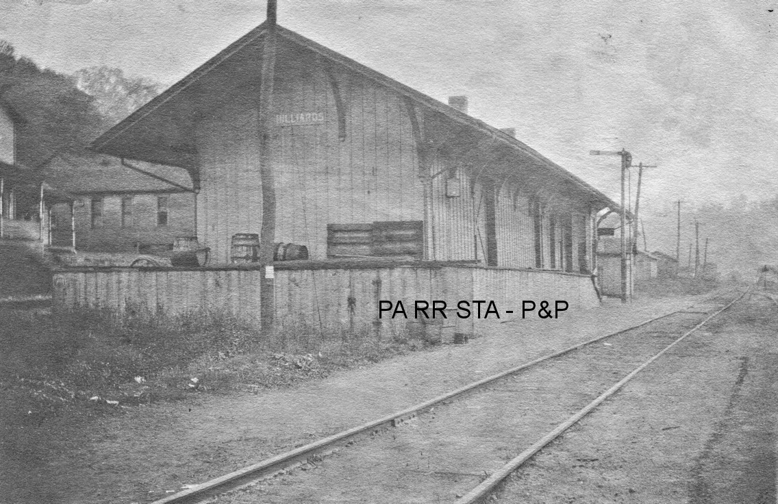
| Hilliards | |
On the Hilliard Branch. This station was built in 1875-76. | ||||||
| Hooker |
|
|||||||
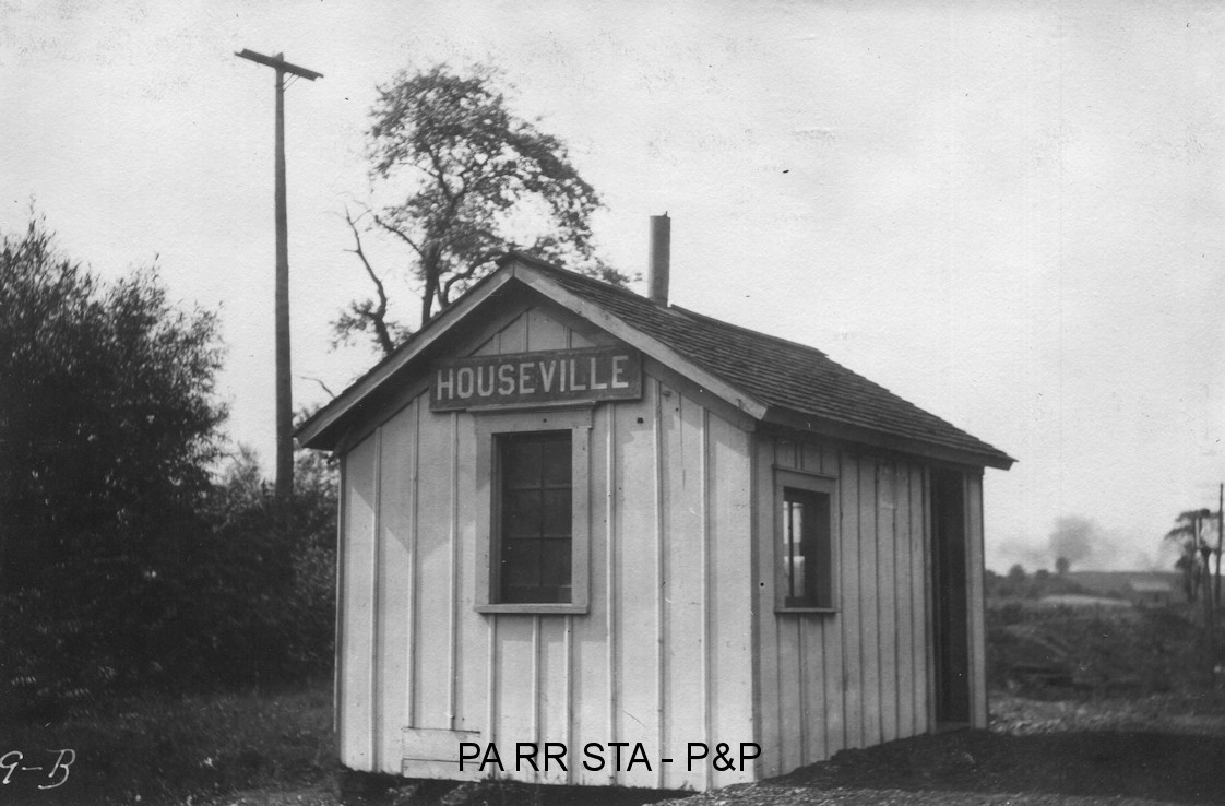
| Houseville (Frazier) |
|
|||||||
| Isle (Prospect) |
|
"Isle" was the name chosen by the railroad, but in 1906 the residents of the town wanted it to be known as Prospect (which was nearby). | ||||||
| Ivywood (Bartley) |
|
|||||||
| Jamisonville | |
The first station here was built on the farm of Samuel Miller. A new station was built here in 1886 (Greenville Record-Argus, 7-22-1886). | ||||||
| Jeffersonville |
|
This was an early station on the KC&BRR. It is shown on the 1876 timetable. | ||||||
| Karns City |
|
This was an early station on the P&KCRR/KC&BRR. It is shown on the 1876 timetable. | ||||||
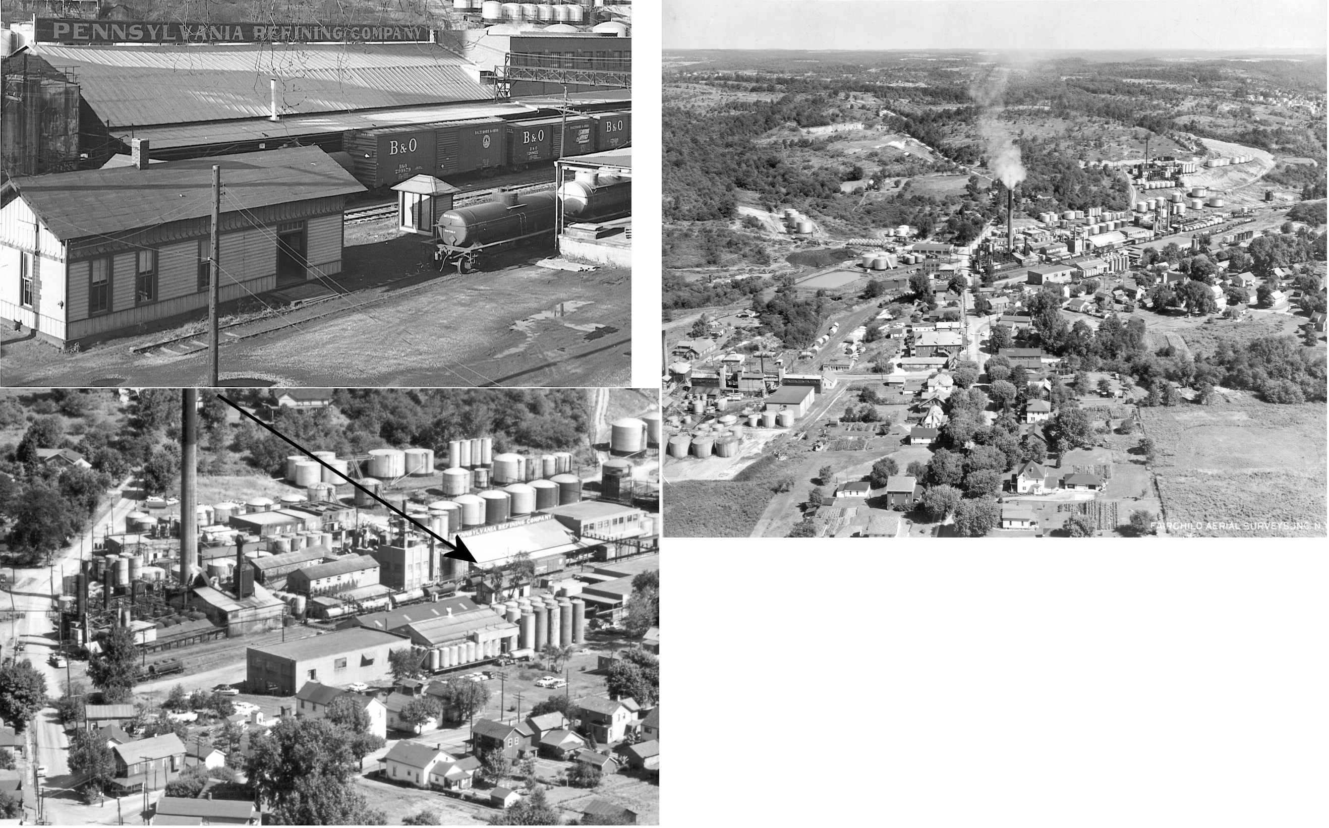
| Karns City | |
This station was located inside what is now a petro-chemical facility called Calumet-Penreco. which was formerly known as the Pennsylvania Refining Company (or Penreco, or Penn-Drake). The station was located at GPS: 40.996039, -79.725513. | ||||||
| Keenan | |
On the Hilliard Branch. | ||||||
| Keisters (Hickory Mills) |
|
The station was on the east side of Keister House Road (CR-4006). This station was "on the Keister property in Slippery Rock Township near the mills" (Butler Citizen, 8-22-1883). It was built in 1883. This station may have also been known as "Slippery Rock Park" at some point in its history. | ||||||
| Lane |
|
This station is shown on the 1923 PRR List of Stations & Sidings on the Indiana Branch. | ||||||
| Liggett |
|
|||||||
| Lucasville Sta. | |
This station was on the west side of Game Preserve Road at spproximately GPS: 40.879050, -79.778162. | ||||||
| Mahood |
|
|||||||
| Martinsburg |
|
This was an early station on the P&KCRR. It is shown on the 1876 timetable. | ||||||
| Martinsburg | |
|||||||
| Marwood (Delano) |
|
In 1874 there was a Butler Branch RR station here when the town was known as Delano. The name of the station was changed from "Delano" to "Marwood" by the PRR in 1902. The station was on Railroad Street at Elder Street on the east side of the tracks. It was a combination station/store/post office. There was still a PRR station here in 1941. | ||||||
| Mayne |
|
This station was between Mercer Road and Isle. | ||||||
| McBride | |
The station was near where the SW end of Township Lane is today at approximately GPS: 40.797125, -79.924434. | ||||||
| Mc Clure |
|
This was an early station on the KC&BRR. It is shown on the 1876 timetable. | ||||||
| Meharg |
|
This station was between McBride and Rockdale. | ||||||
| Mercer Road |
|
|||||||
| Millerstown |
|
This was an early station on the KC&BRR. It is shown on the 1876 timetable. | ||||||
| Monroe Sta. (Monroeville) |
|
There was a Butler Branch RR station here in 1874. This station was located just to the west of where the line crossed Little Buffalo Creek just to the west of the confluence of the Little Buffalo with Buffalo Creek. Monroeville is now known as Silverville. | ||||||
| Moore Farm |
|
This was an early station on the KC&BRR. It is shown on the 1876 timetable. | ||||||
| Myoma |
|
|||||||
| Nealey |
|
|||||||
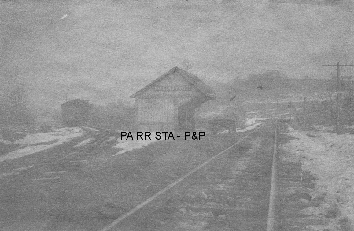
| Nelsons
Bridge (Nelson) |
|
This station was on the Hilliards Branch. | ||||||
| New Hope |
|
This was an early station on the Shenango & Allegheny located somewhere between Harrisville and Hilliars'd Mills. There was a reference to it in the news report about this section of the line opening in 1876. Not to be confused with the New Hope in Bucks County. | ||||||
| North Oakland Station |
|
This station was on the south side of what is now Medical Center Road just east of PA68. | ||||||
| Odell |
|
See listing for West Saxonburg as two stations from Odell were moved there. One served as the West Saxonburg depot and the other as a residence. | ||||||
| Oneida (Calvin) |
|
A station is shown here on the 1941 map on the south side of Glenwood Way. This station was for McGrath Mills and Pine Tract. | ||||||
| Osbournes |
|
This station was on the Hilliards Branch. | ||||||
| Payne |
|
|||||||
| Peachville |
|
|||||||
| Petrolia |
|
This was an early station on the P&KCRR. It is shown on the 1876 timetable. | ||||||
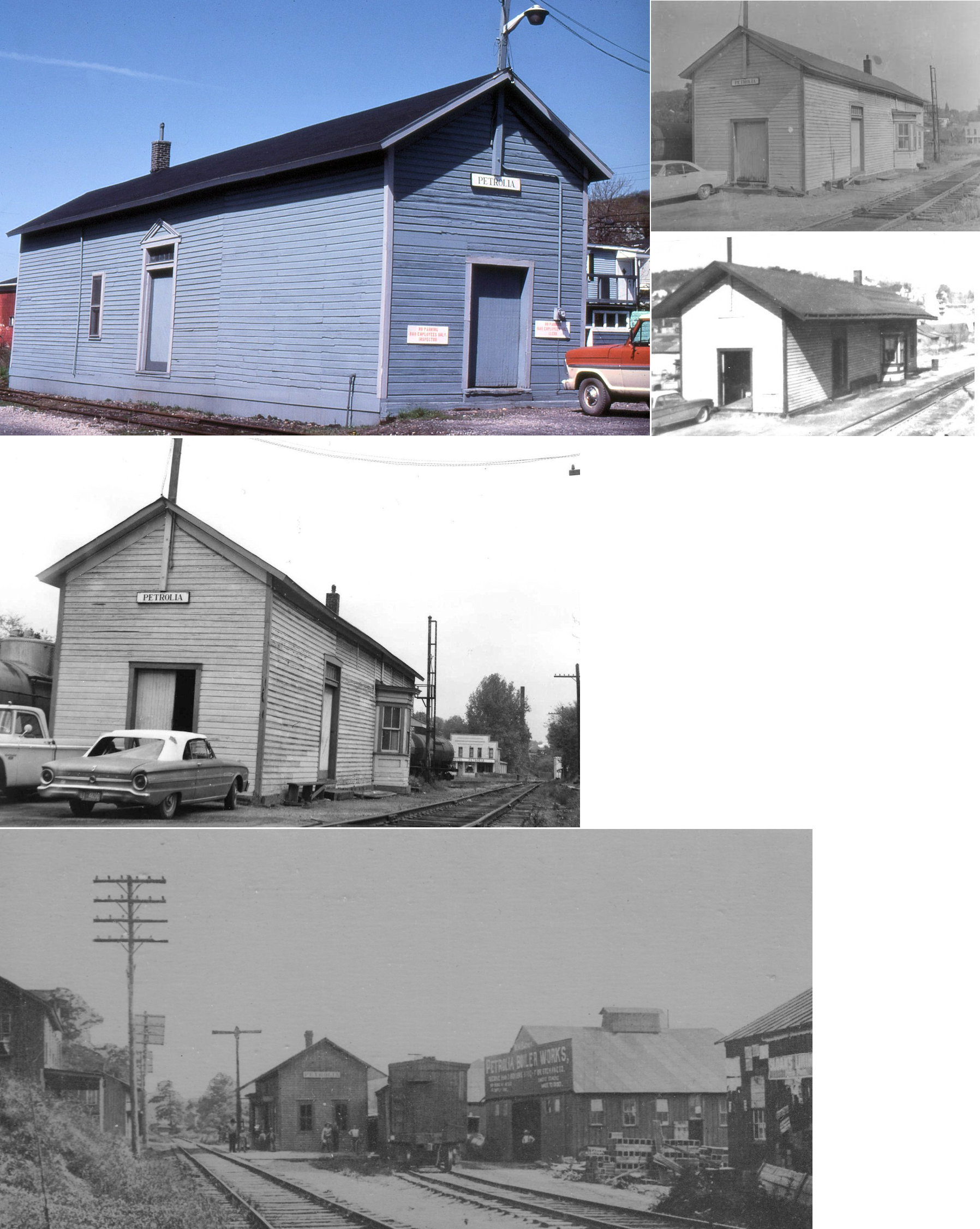
| Petrolia | |
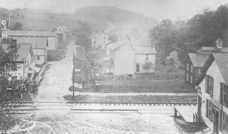
The station was on the north side of Nesbit Avenue between the tracks at GPS: 41.015297, -79.717423. | ||||||
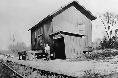
| Portersville |
|
This town was flooded in 1965 when Lake Arthur was created. | ||||||
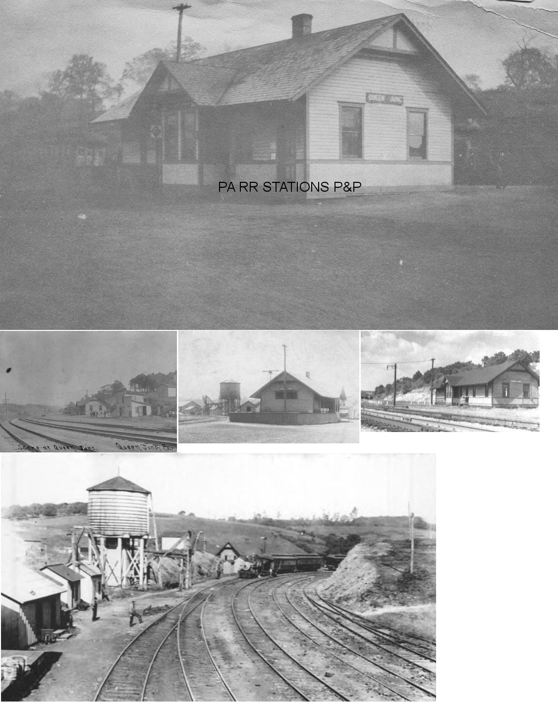
| Queen Junction | AND |
The Western Allegheny RR ran from West Pittsburg to Queen
Junction. It was later part of the BR&P which was later part of the B&O.
The line connected with the B&LE at Queen Jct. The station was built
here in 1907 (B&LE records say 1904). Some stations along the line were East New Castle (Punkintown), Princeton, Rose Point, Isle, Grant City and Grantboro. Those last few towns are gone now, having been erased by dam/lake in the late 1960s. The line followed the Muddy Creek Valley right through the middle of what is Lake Aurthur today. You can still see the line emerge from the water on the NE corner of the lake. |
||||||
|
Redmond (North Slippery Rock) |
|
This was the terminus of the 13.9-mile PRR Wolf Creek Branch. It was renamed Redmond in 1903. This branch ran SE from Leesburg Station in Mercer County to this small town. It also ran through Armstrong in Butler County and Heath in Mercer County. It was primarily to serve collieries along the route, but the 1923 PRR list of stations and sidings list stations along the branch at these locations. | ||||||
| Refractory Station | |
This station was on the west side of Brewer Road at approximately GPS: 40.693419, -79.834135. | ||||||
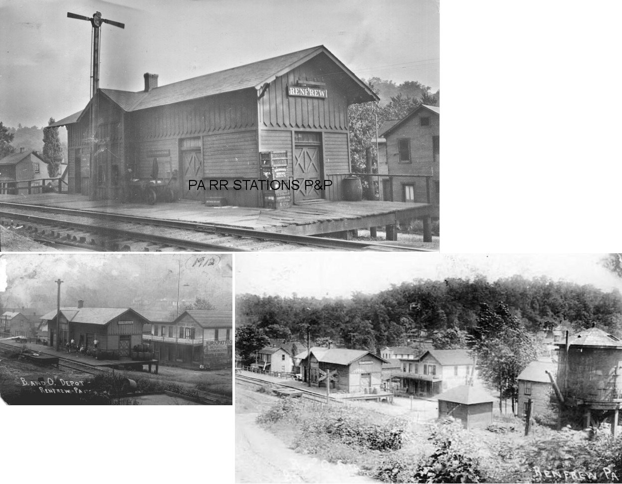
| Renfrew | |
|||||||
| Renfrew | |
|||||||
| REibold | |
This station was on the west side of Reibold Road. | ||||||
| Rockdale | |
The station was on the NW side of Rockdale Road. Not to be confused with the LV Rockdale station in Lehigh County. | ||||||
|
Sarver (Sarversville) |
|
There was a Butler Branch RR station here in 1874. There was still a PRR station here in 1941. | ||||||
| Sherwin |
|
This station was on the north side of Kildoo Road at approximately GPS: 41.005164, -79.948657. It is not listed on the 1900 B&LE timetable, but the county map from 1941 shows a station here. | ||||||
| St. Joe |
|
This was an early station on the KC&BRR. It is shown on the 1876 timetable. | ||||||
| ST. Joe |
|
The station was on the south side of St. Joe Road (TR-603). | ||||||
| Stone House |
|
This was an early station on the P&KCRR. It is shown on the 1876 timetable. | ||||||
| Summit |
|
This was an early station on the KC&BRR. It is shown on the 1876 timetable. | ||||||
| Thorn |
|
This station was between Gilbert and Mahood. | ||||||
| Troutman |
|
|||||||
| Utley |
|
|||||||
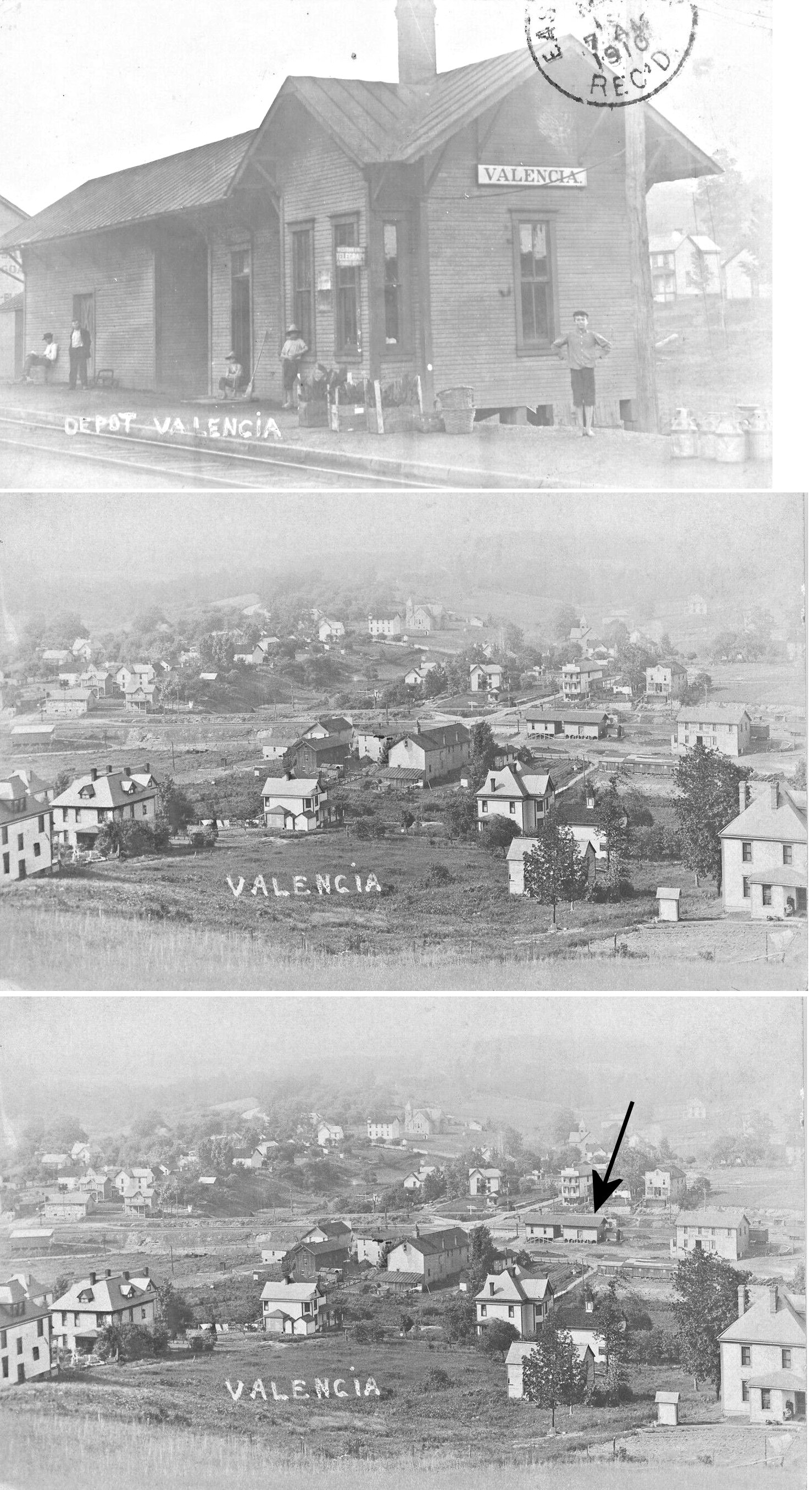
| Valencia | |
|||||||
| Wadsworth | |
This station was on the west sied of Bonniebrook Road. It may have also served the B&O here. | ||||||
| Wahlville | |
This station was on the Ribold Cutoff. A station is shown here on the 1941 county map on the east side of Prospect Road (PA528). | ||||||
| West Jefferson |
|
This station was between West Saxonburg and Rockdale. | ||||||
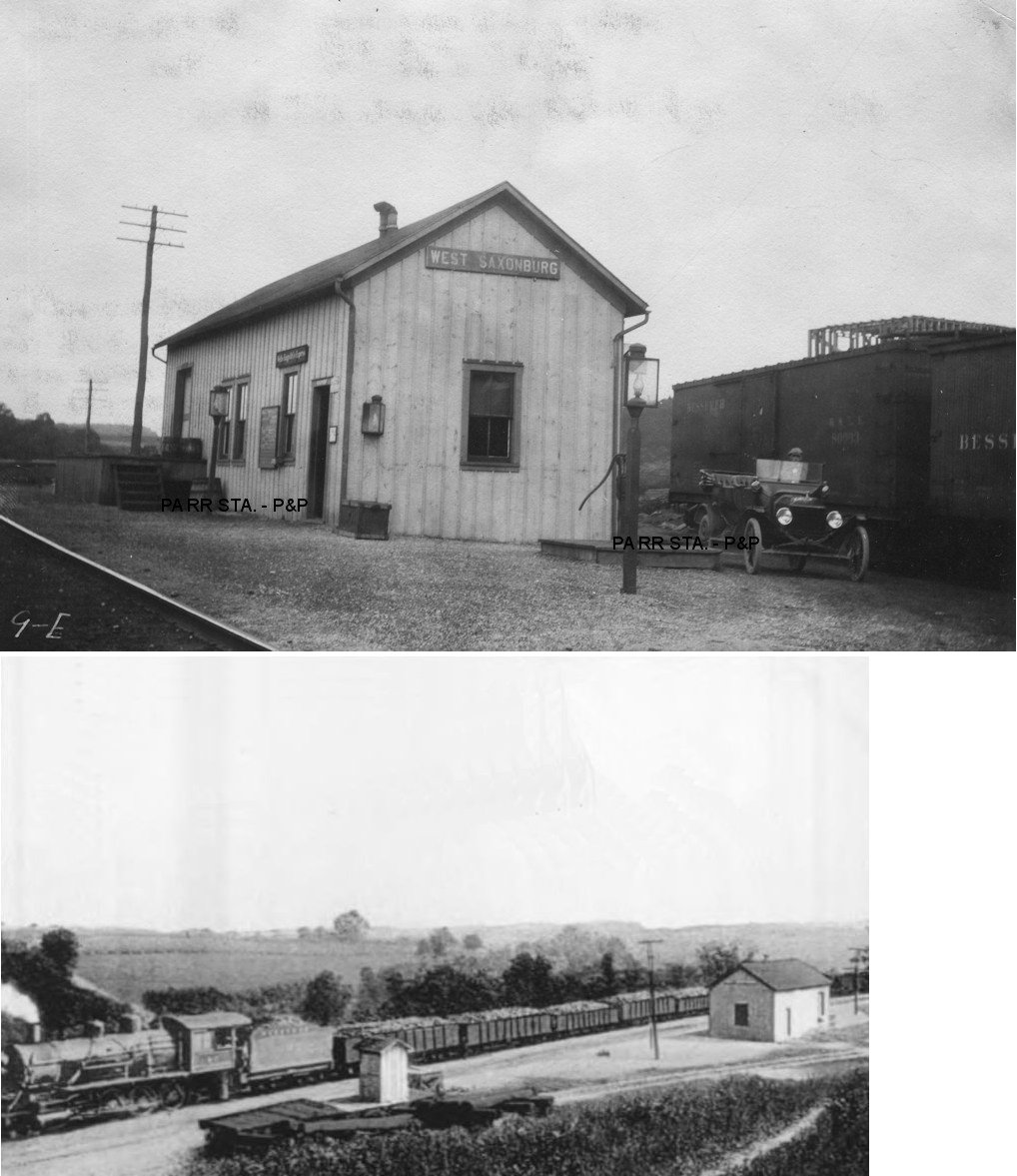
| West Saxonburg | |
In 1919 the B&LE valuation records list this as a company dwelling that was assembled from the two ends of the former station at Odell. Does anyone local know if this is still standing? Those same records say that the station listed below was also moved from Odell. West Saxonburg was known as "Turin" at sometime in the past. | ||||||
| West Saxonburg | |
According to B&LE valuation records, this station was built at Odell in 1905 and then moved to West Saxonburg in 1911 and remodeled. | ||||||
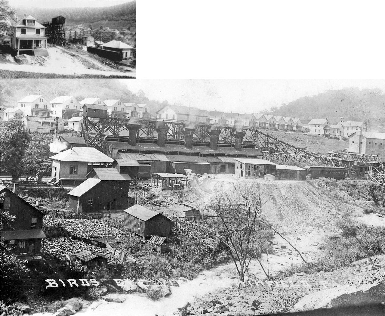
| West Winfield |
 |
This station was known as Rough Run until 1901. Photo also shows PPG mine. The Winfield RR was later part of the West Penn RR (PRR). | ||||||
|
Wick (Centreville) |
|
This station was closed in 1901. It is not known whether it reopened at a later date. | ||||||
| Zelienople |
|
The first station was opened here in 1879 when the railroad was known as the Pittsburgh, New Castle & Lake Erie. It became the Pittsburgh & Western in 1880. | ||||||
| Zelienople |
|
This second-generation passenger station was on Front Street near the west end of Walnut Street at GPS: 40.793319, -80.147759. It was built in 1897 according to B&O valuation records (some newspapers say 1896). | ||||||
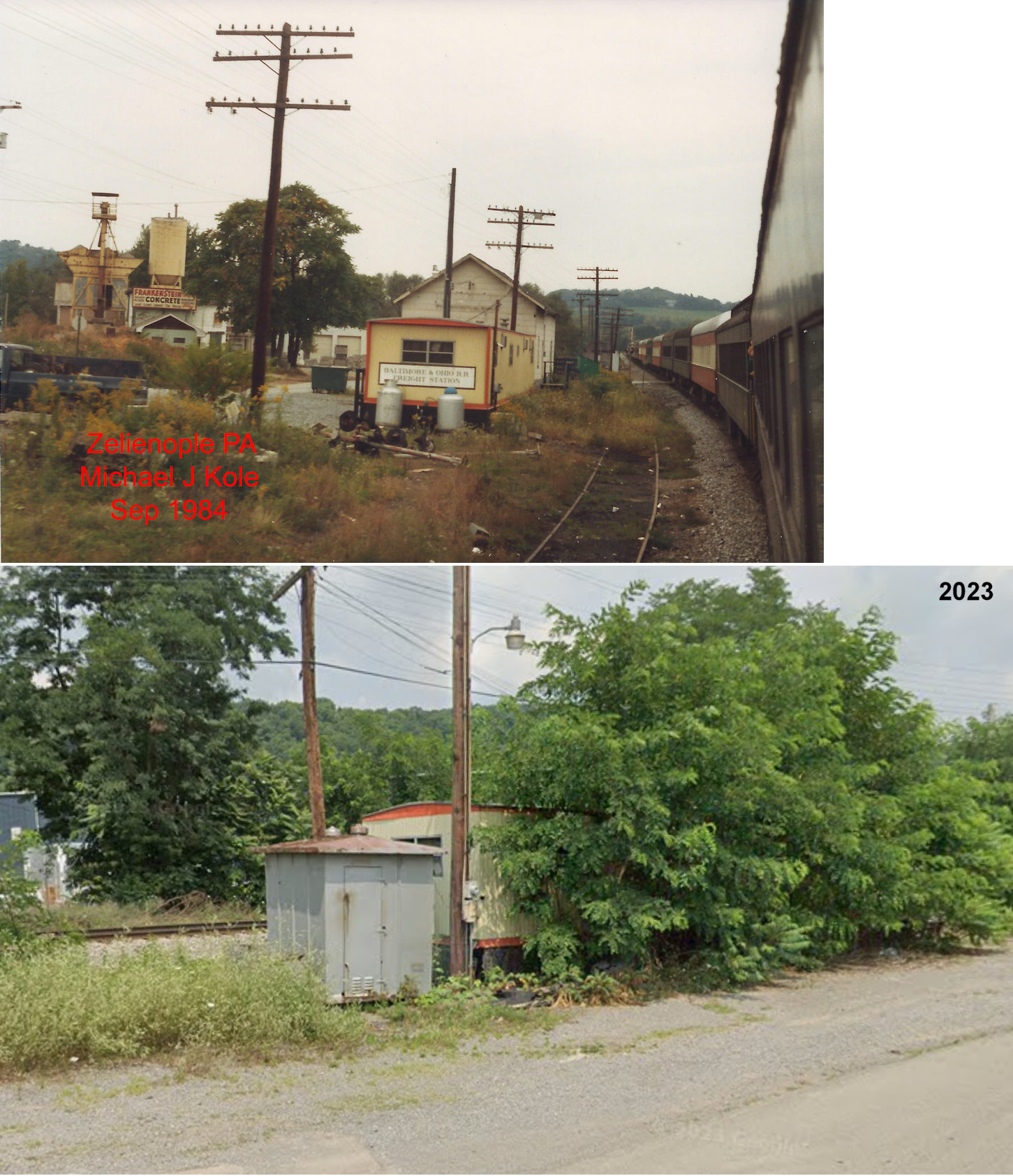
| Zelienople |
|
The freight house was on Front Street just south of the end of Chestnut Street at GPS: 40.793843, -80.147509. In later years it appears that a house trailer was part of the freight "complex" there. As of 2024 the trailer was still there (amidst overgrown weeds), but the adjacent freight house is gone. | ||||||
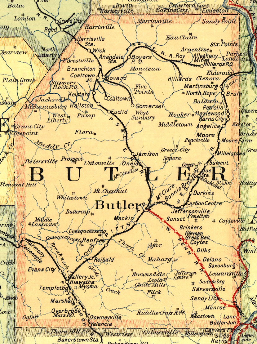
| 1895 BUTLER COUNTY RAILROAD MAP | ||||||||
 |
||||||||
| Notes About Existing
Stations... Harmony (B&O) - Moved a short distance and attached to another building. It's original location was at GPS: 40.802561, -80.125341 on the east side of Spring Street. Mars (B&O) - The Mars railroad station was relocated in August of 1999. It was moved down the line across from the B&O caboose and restored. The society also has a 1921 Plymouth diesel, a small platform car and has also constructed a replica of a small railroad shed. The original location of the station was on the south side of Marshall Way on the west side of the tracks at GPS: 40.695883, -80.009294. |
||||||||