|
|
||||||||
| EXISTING STATIONS | ||||||||
|---|---|---|---|---|---|---|---|---|
| Station Name |
Original Railroad |
Current Location |
Type | Current Use |
Date Built |
Track Status |
Building Material |
More Info |
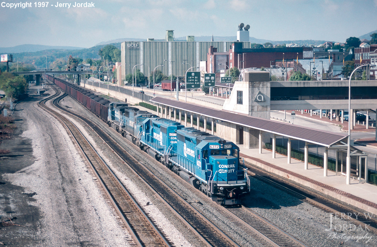
| Altoona |
 |
1231 11th Avenue (GPS: 40.514762,-78.401613) |
P | Railroad | 1990s | In Use | Cement | |
| Ganister (Grannas) |
 |
Lower Piney Creek Road (GPS: 40.473691, -78.226729) |
C | Civic | ???? | Gone | Wood | |
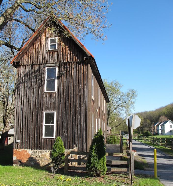
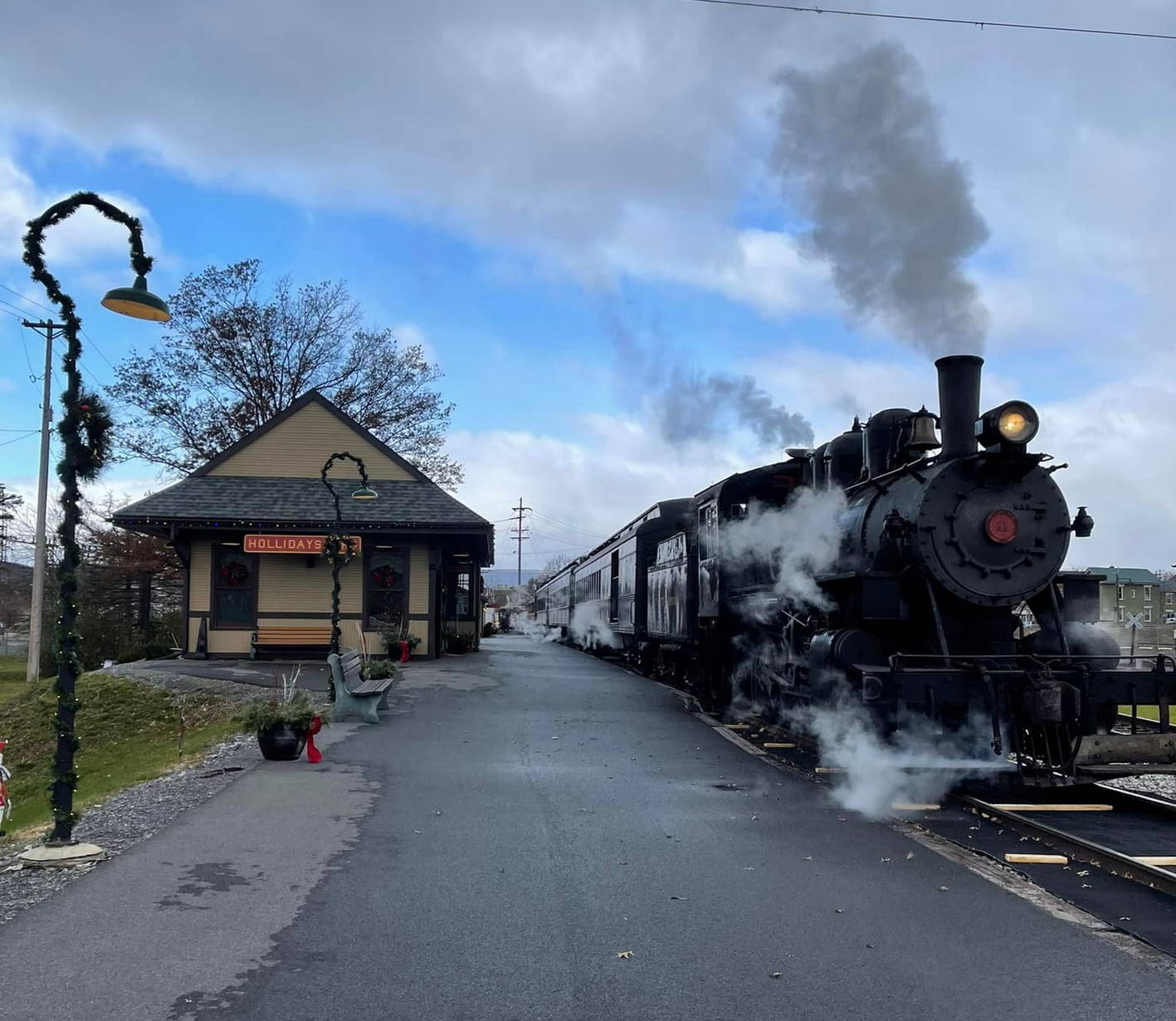
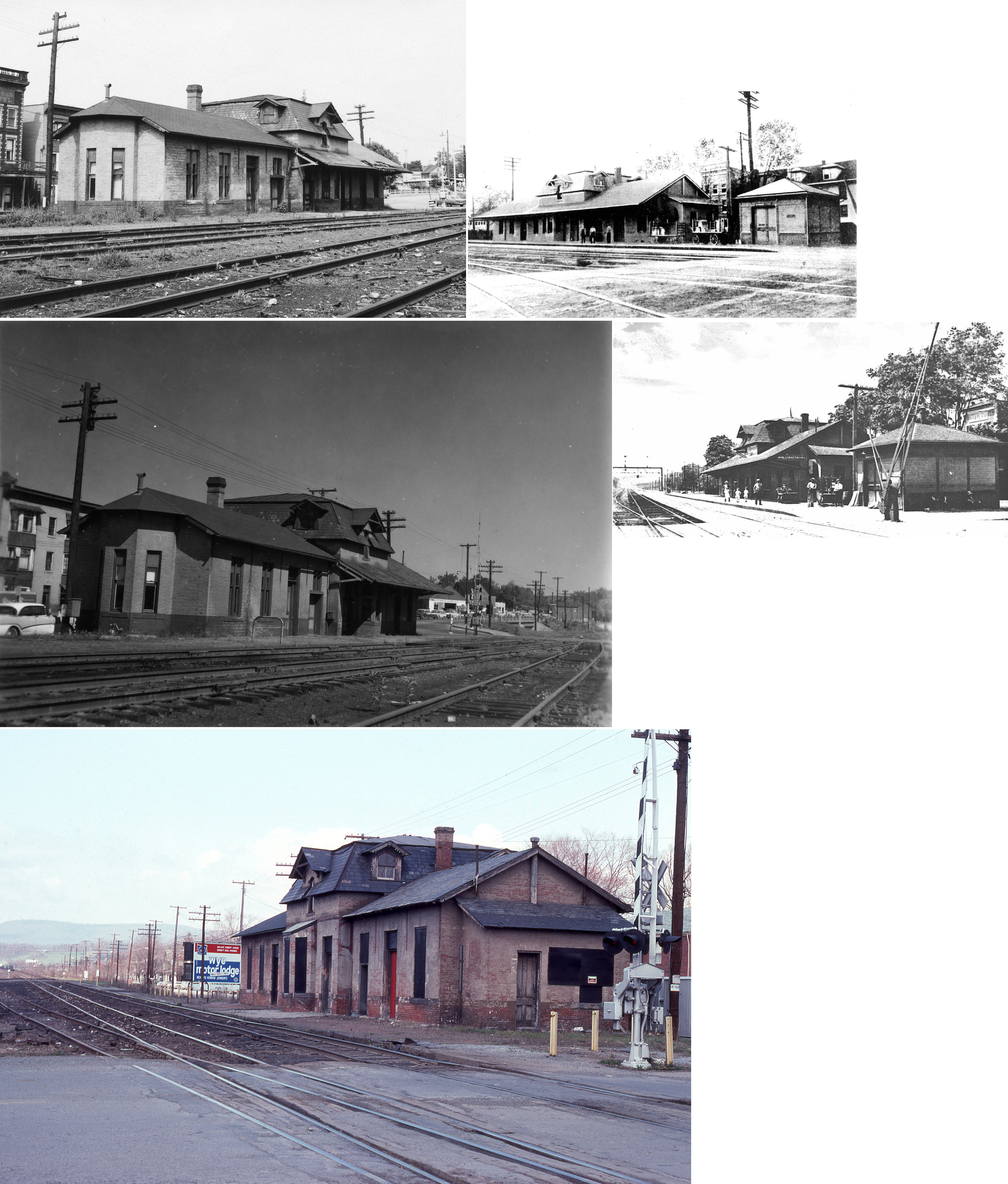
| Hollidaysburg |
 |
244 Pullman Drive (GPS:40.426042, -78.390144) |
P | Railroad | 2015 | In Use | Wood | |
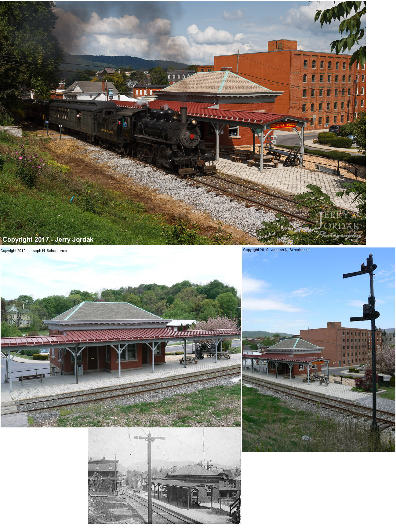
| Roaring Spring | |
500 Main Street (GPS: 40.333516, -78.402976) |
P | Civic | 1906 | In Use | Brick |
|
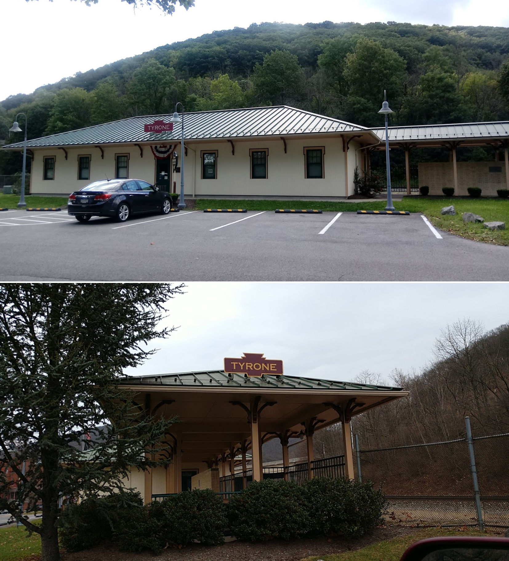
| Tyrone |
|
850 Pennsylvania Avenue (GPS: 40.668180, -78.239718) |
P | Museum | 2000 | In Use | Wood |
|
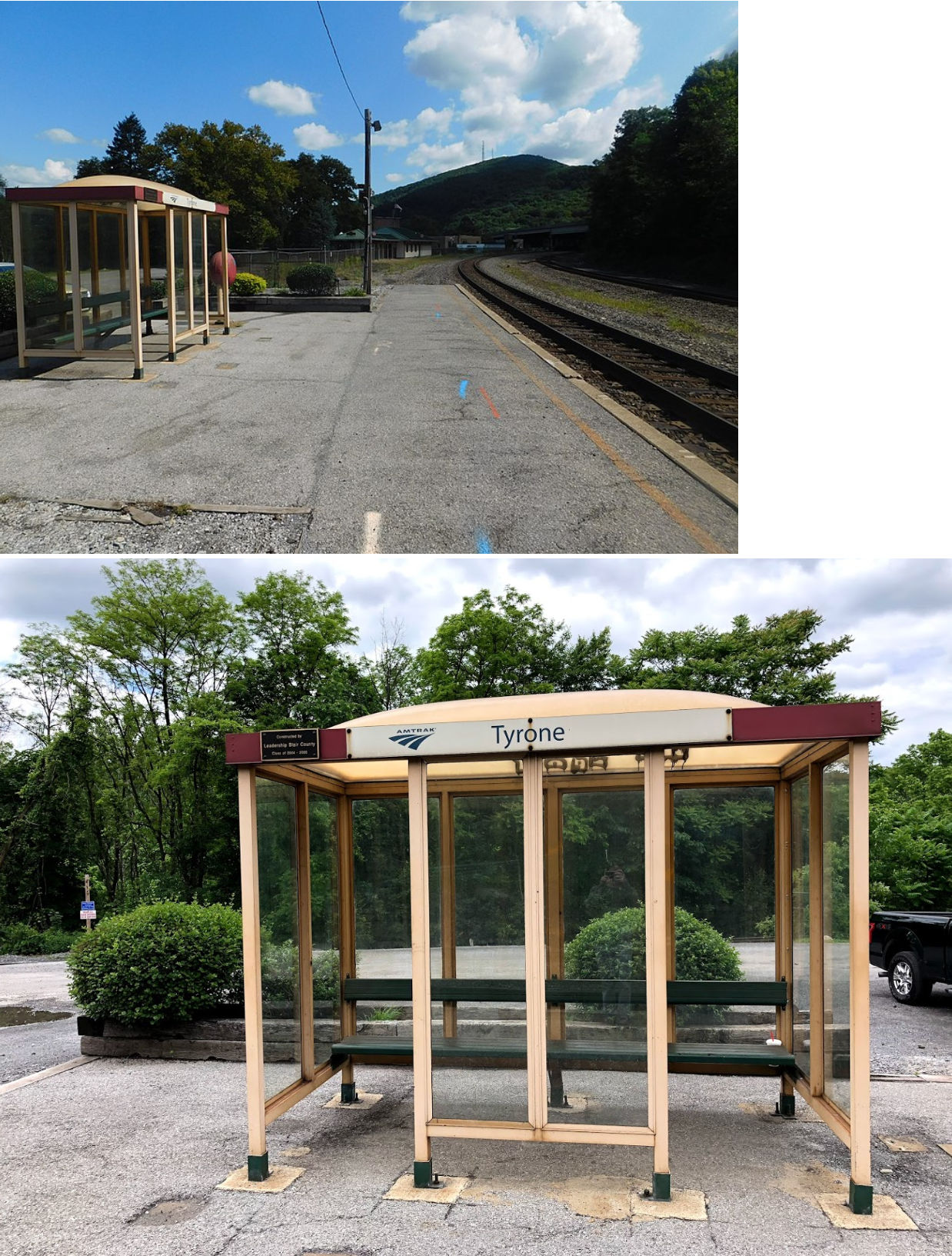
| Tyrone |
|
South end of Pennsylvania Avenue (GPS: 40.667658, -78.240500) |
P | Railroad | ???? | In Use | Metal | |
| STATIONS OF THE PAST | ||||||||
| Station Name |
Original Railroad |
Notes | ||||||
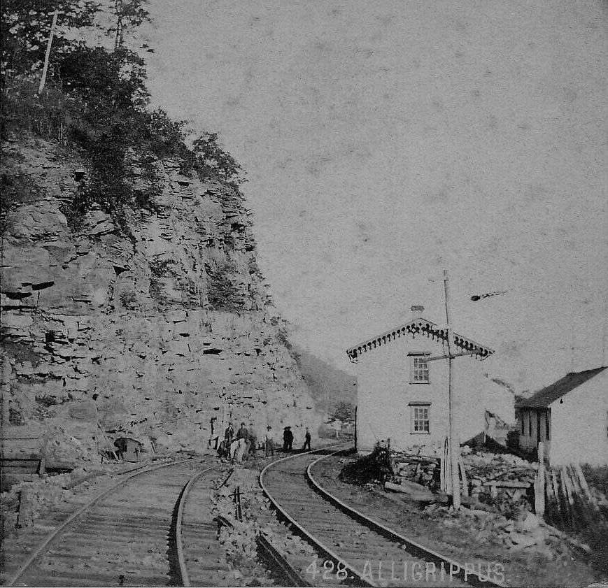
| Alligrippus Station |
|
A station is shown here on the 1873 county atlas. This station was in Allegany Township between Gallitzin and Horshoe Curve. | ||||||
| Altoona |
|
A construction trailer served the RR here throughout the 1980s. | ||||||
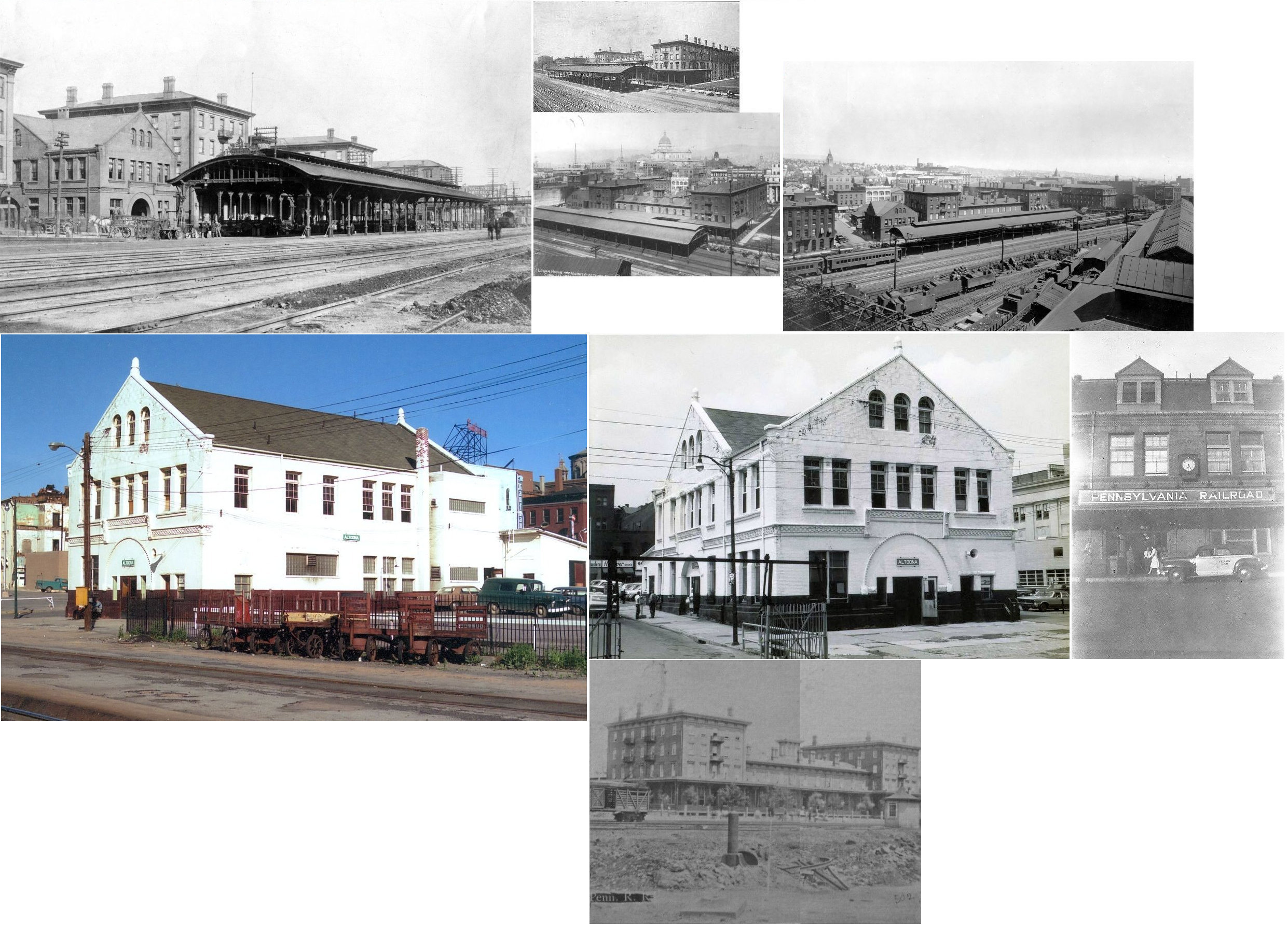
| Altoona | |
The station was at the corner of 10th Avenue and 13th Street (GPS: 40.514594, -78.401523) next to the Logan House Hotel. The passenger shed stretched from the station across the entire front of the hotel. The PRR had offices in the hotel bulding as well as offices on the next block to the north. The depot was first located in the hotel which opened in 1854. The station was built next to the hotel in 1887. | ||||||
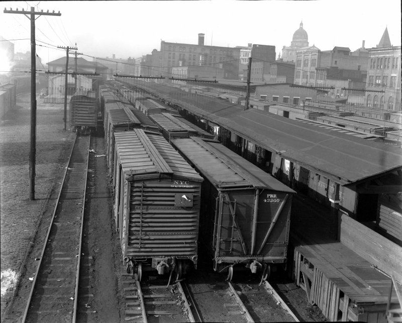
| Altoona | |
There was a brick freight station on the NW side of the tracks between 10th and 11th Streets (GPS: 40.516042, -78.398548). This station is shown on the 1888 and 1894 maps. On the 1909 map this station has either been replaced, remodeled, or the freight complex has been expanded at this location with the addition of an inbound (made of wood) and outbound (possibly the original brick freight station) freight house. The photo shows a view of the freight complex looking to the SW from the 9th Avenue footbridge. The original brick freight house (possibly) is on the left in the photo. | ||||||
| Altoona |
|
A new freight transfer station opened here in 1898. | ||||||
| Altoona (29th Street) |
|
The 1931 PRR timetable shows a station at 29th Street. | ||||||
| Bald Eagle Station (Olivia) |
 |
|||||||
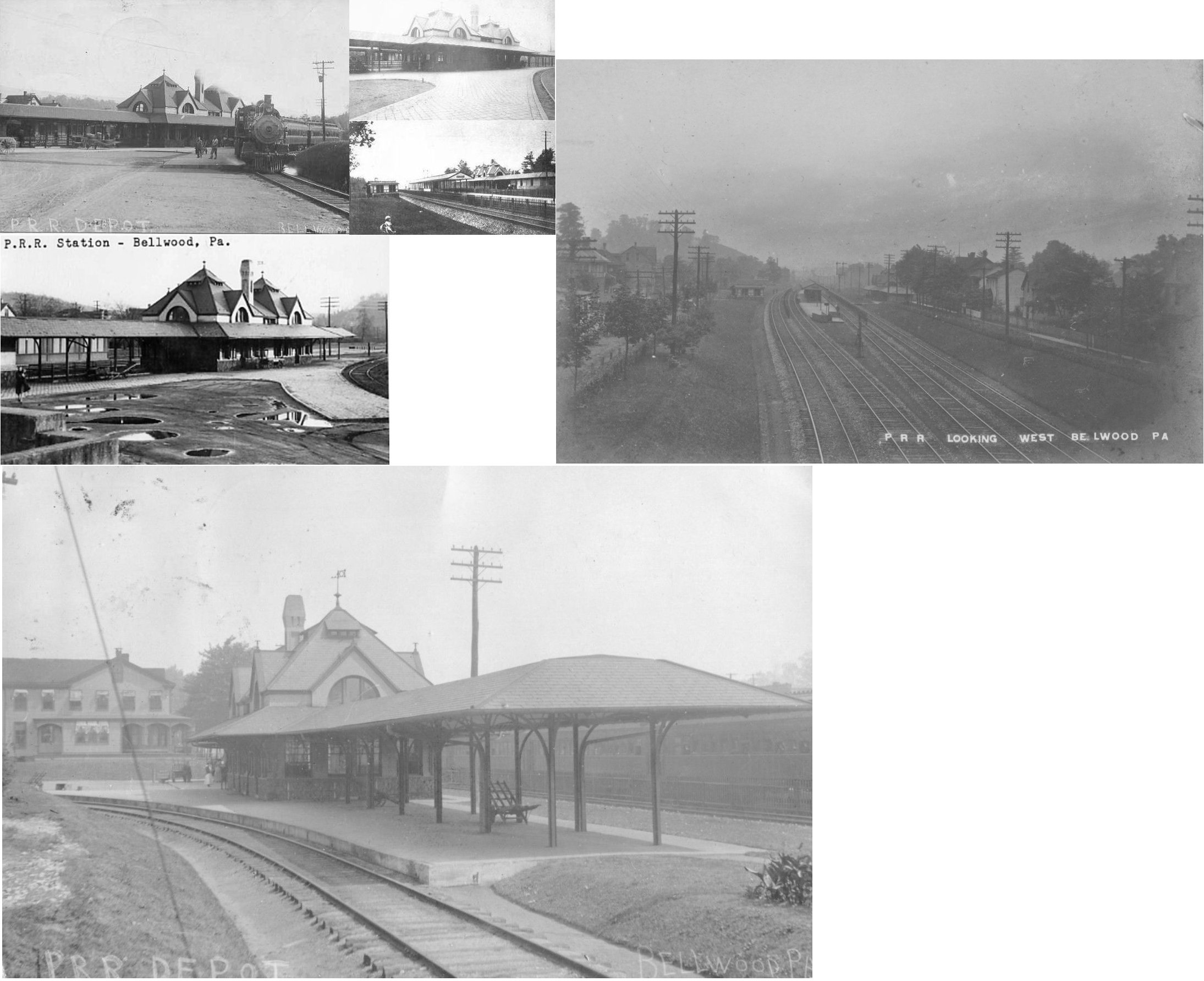
| Bellwood (Bells Mills) |
|
The original PRR passenger station was located just to the SW of the end of Boyles Street on the SE side of the tracks at GPS: 40.599034, -78.334813. When the new, larger PRR station was built around 1900, this station was moved to the north corner of Boyles Street and Main Street at GPS: 40.599200, -78.334031. It was then used as a trolley station, newsstand, and restaurant. According to aerial photos, the station stood until at least the 1950s, perhaps longer. | ||||||
| Bellwood (Bells Mills) |
 |
The original Bell's Gap station was located under where the current pedestrian bridge crosses the tracks from Station Street on the west side of the main line (GPS: 40.599051,-78.335282). It was torn down sometime around the early 1900s as the new PRR/Bell's Gap station was built at this location (see listing below). | ||||||
| Bellwood | AND |
The station was located under where the current pedestrian bridge crosses the tracks from Station Street on the west side of the main line (GPS: 40.599051,-78.335282). It was built around 1900 and torn down in 1953 according to the book Altoona Area Railroad Pictorial History. | ||||||
| Bellwood | |
There was a freight station on the NW side of the tracks between PA865 and Cambria Street (GPS: 40.601845, -78.332789). | ||||||
| Bennington Furnace | |
A station is shown here on the 1873 county atlas. This station was in Allegany Township, just east of Gallitzin. | ||||||
| Beryl (Cross Keys) |
|
This station appears in the 1947 book by Harry A. McGraw "Blair County Place Names. This is likely the same station as Spring Meadow (see listing below) as it was the closest station to Beryl. This was on the Hollidaysburg Branch. | ||||||
| Birmingham Station |
|
The town of Birmingham is in Huntingdon County, but the station was in Blair County. | ||||||
| BlairFour | |
This station was between Goodman and Mt. Etna in Catherine Township. | ||||||
| Blair Furnace (East Altoona) |
|
A new station was built here in 1887. The station was renamed "East Altoona" in 1904. | ||||||
| Bossler | |
This station was on the south side of Cove Lane (SR-2006) at GPS: 40.287061, -78.341447. | ||||||
| Brooks Mills | |
Originally a station on the Morrison's Cove RR. | ||||||
| Calcite | |
|||||||
| Canan Station | |
This station appears in the 1947 book by Harry A. McGraw "Blair County Place Names." It was in Allegheny Township. | ||||||
| Cloe (Canoe Creek) |
|
This station was originally called Canoe Creek but was renamed Cloe in 1907. | ||||||
| Carlim | |
|||||||
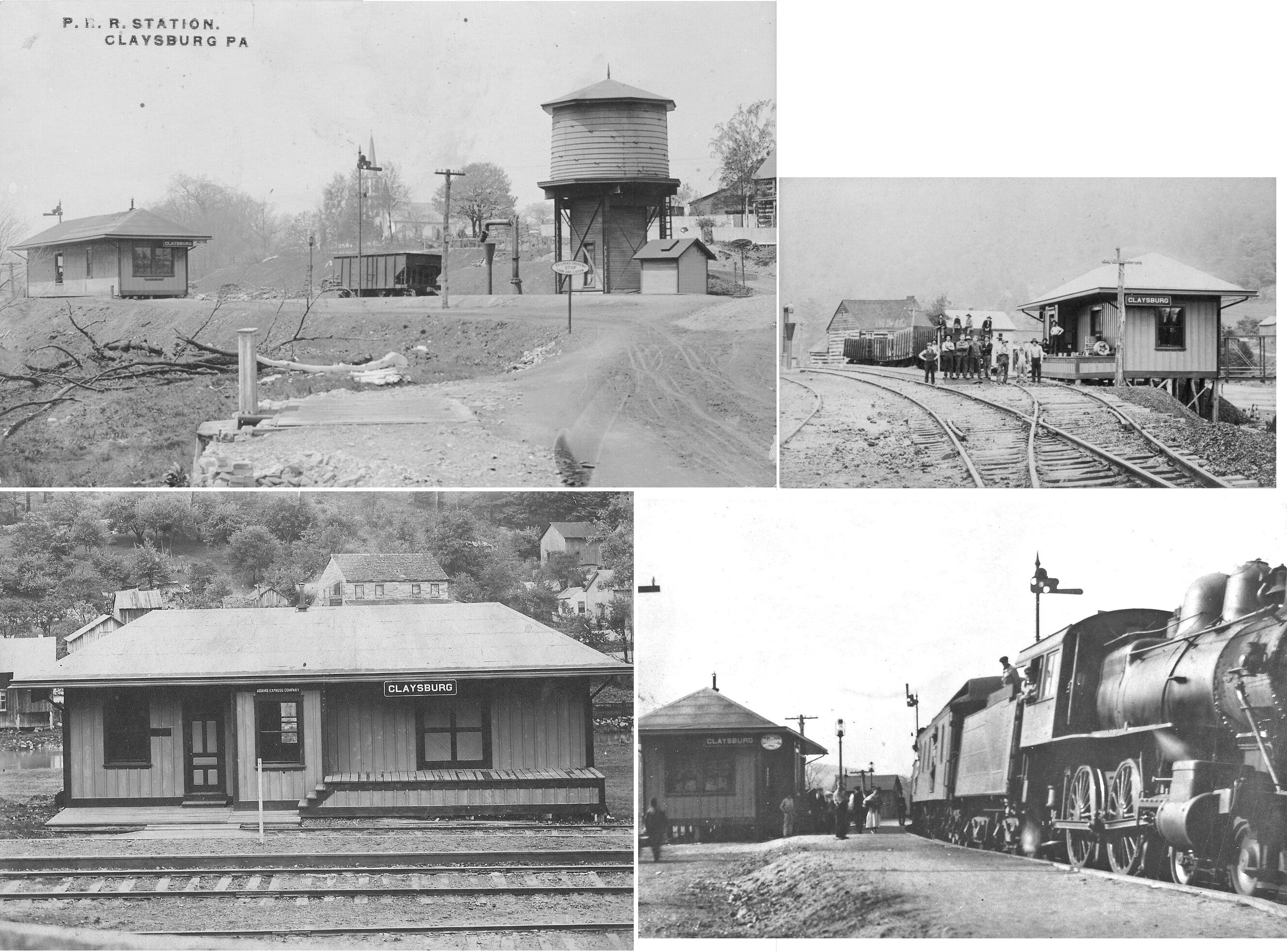
| Claysburg | |
|||||||
| Cold Spring | |
|||||||
| Collier |
|
|||||||
| Cove Dale |
|
Was on the PRR Clover Creek Branch. | ||||||
| Cove Forge |
|
|||||||
| Curryville |
|
|||||||
| Diehl |
|
This station appears in the 1947 book by Harry A. McGraw "Blair County Place Names." It was somewhere in North Woodbury Township. | ||||||
| Dix |
|
|||||||
| Duncansville | |
The station was just to the northeast of the Portage Iron Company. I believe it was at the end of what is now 13th Street at approximately GPS: 40.422474, -78.434148. The street names have changed. It was at the end of what used to be called Balm Alley which was east of Blair Street. The station was built in 1883 and can be seen on the 1901, 1906 and 1911 Sanborn maps for Hollidaysburg (and on its own map for 1927). Does anyone know for sure its exact location? | ||||||
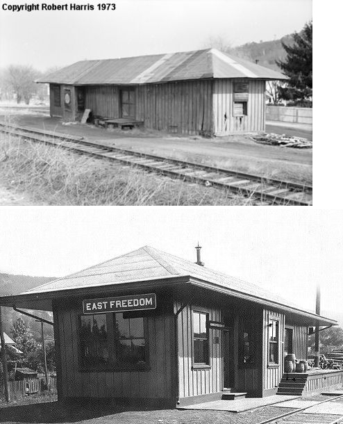
| East Freedom | |
|||||||
| East Tyrone | |
This station was at the corner of Lincoln and 3rd Streets (I think this is now West 22nd Street). A new station was built here in 1892. This station was on the Tyrone Branch. | ||||||
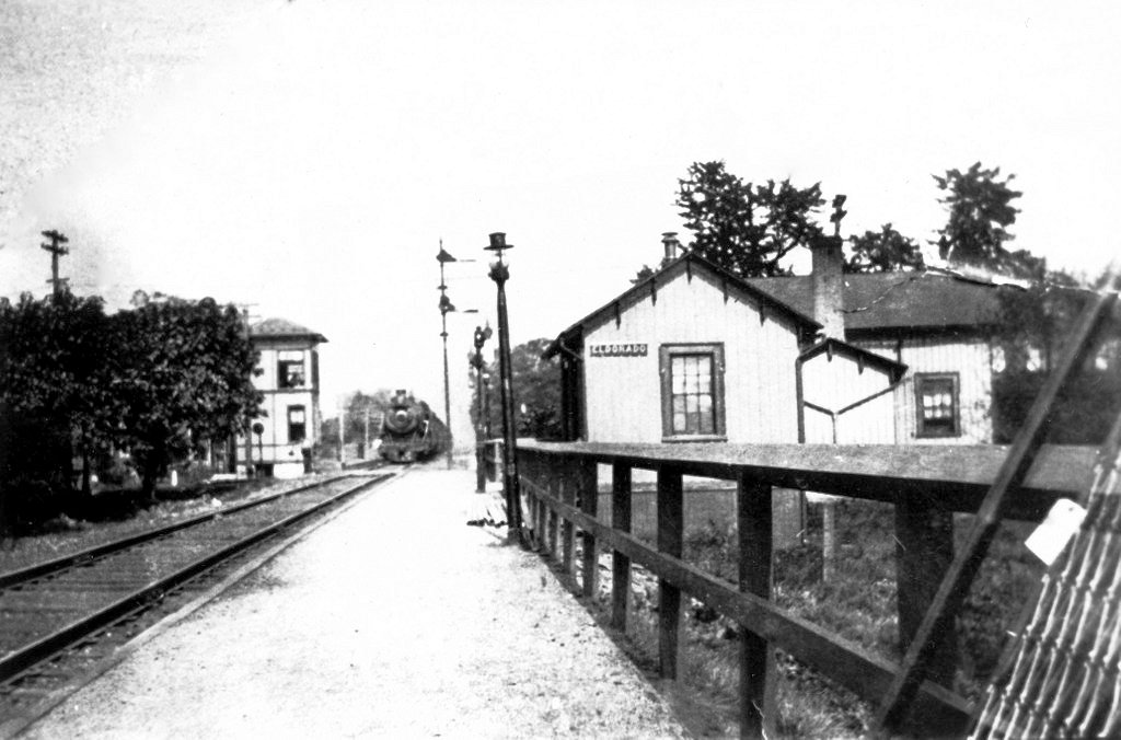
| Eldorado (Canan Station) |
|
This station was where 58th Street crosses the tracks at approximately GPS: 40.473001, -78.425857. | ||||||
| Elizabeth Furnace (Sabbath Rest) |
|
This early station is shown on the 1873 county atlas. It was in the SE corner of Antis Township between Altoona and Bellwood. It is also listed as a station on the 1900 PRR List of Stations & Sidings. | ||||||
| Erb | |
|||||||
| Flowing Spring | |
|||||||
| Fostoria | |
|||||||
| Franklin Forge |
|
The first station here was opened in 1873 when the Willimasburg Branch opened. | ||||||
| Frankstown | |
The first station here was opened in 1873 when the Willimasburg Branch opened. | ||||||
| Gardner | |
|||||||
| Goodman | |
This station appears in the 1947 book by Harry A. McGraw "Blair County Place Names." It was somewhere in Catharine Township. | ||||||
| Grazierville | |
|||||||
| Gwin Station |
 |
No idea where this was, but it appears in the 1947 book by Harry A. McGraw "Blair County Place Names" as a "station on the old Wopsy Railroad." | ||||||
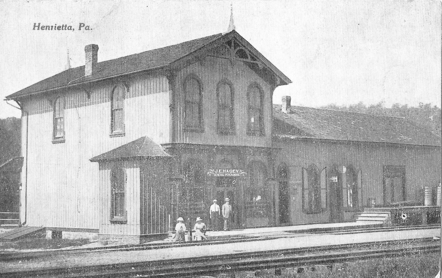
| Henrietta | |
Originally a station on the Morrison's Cove RR. This was the end of the PRR Morrison's Cove Branch. | ||||||
| Hollidaysburg | |
The passenger station was on Broad Street just west of Newry Street on the north side of the tracks (GPS: 40.427651,-78.398395). A station at this location was built in 1871 and is shown on the 1873 map. | ||||||
| Hollidaysburg | |
There was a freight station on South Juniata Street near the intersection with Blair Street (GPS: 40.427006, -78.394211). | ||||||
| Homer |
|
No idea where this was, but it appears in the 1947 book by Harry A. McGraw "Blair County Place Names" as a "station on the old Wopsy Railroad." | ||||||
| Hoover | |
|||||||
| Horrell | |
Former location of a large powder works. | ||||||
| Ironville | |
|||||||
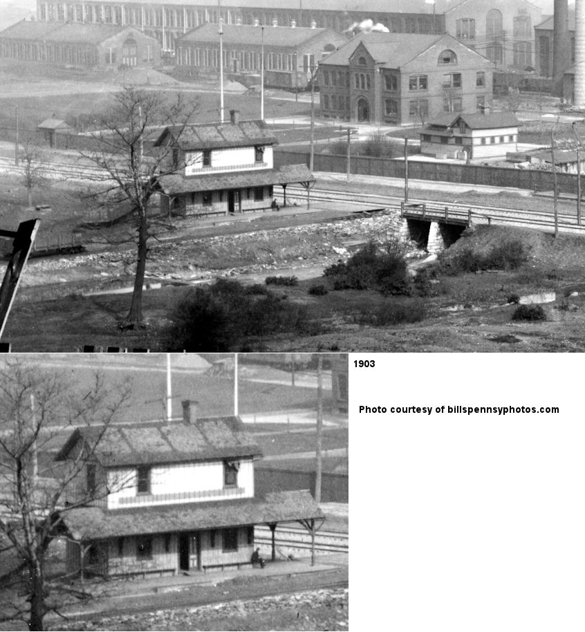
| Juniata |
|
This was the first Altoona & Wopsononock station in Juniata. | ||||||
| Juniata |
|
This Altoona & Wopsononock station was on Second Street. For more infomation about this RR visit: A History of the Wopsononock Railroad & Resort. The railroad opened in 1896 and was converted to standard guage in 1916. | ||||||
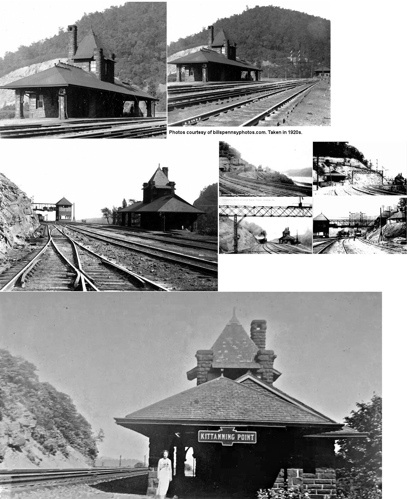
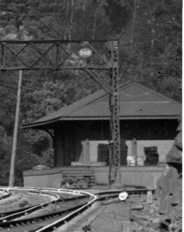
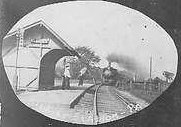
| Kittaning Point | |
This station was on the east side of Horseshoe Curve. A frame station was built here in 1864. This stone station was built in 1892 (Pittsburgh Daily Post, 12-14-1892). The tower nearby was built the same year. | ||||||
| Kittaning Point | |
Freight station. | ||||||
| Kladder | |
This town was between Reservoir Station and Brook Mills. Originally a station on the Morrison's Cove RR. There was a monastery here in the old days. | ||||||
| Lamers | |
This was an early station that opened in 1873 when the Willimasburg Branch opened. | ||||||
| Lind's Crossing | |
This station appears in the 1947 book by Harry A. McGraw "Blair County Place Names." It was somewhere in Frankstown Township. | ||||||
| Lookout |
|
This station was between Shaw Run and Rhododendron Park. | ||||||
| Loop Station | |
Originally a station on the Morrison's Cove RR located between Williamsburg Junction and Reservoir Station. | ||||||
| Martinsburg | |
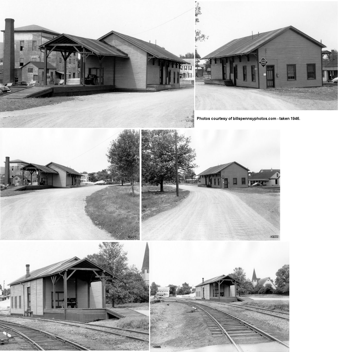
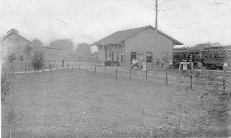
According to the 1873 map, the original Morrison's Cove RR station here was on the SW side of Allegheny Street on the SE side of the tracks near where Ed's Riverside Plaza is today (GPS: 40.311678, -78.326982). The 1905 map shows the PRR station at this same location, so it may have been the same building. It was later used as a freight station as shown in the photos from 1946. Here is an older photo of the station showing it in use for passenger traffic. | ||||||
| Matthews Summit | |
This station appears in the 1947 book by Harry A. McGraw "Blair County Place Names." It was somewhere in North Woodbury Township. | ||||||
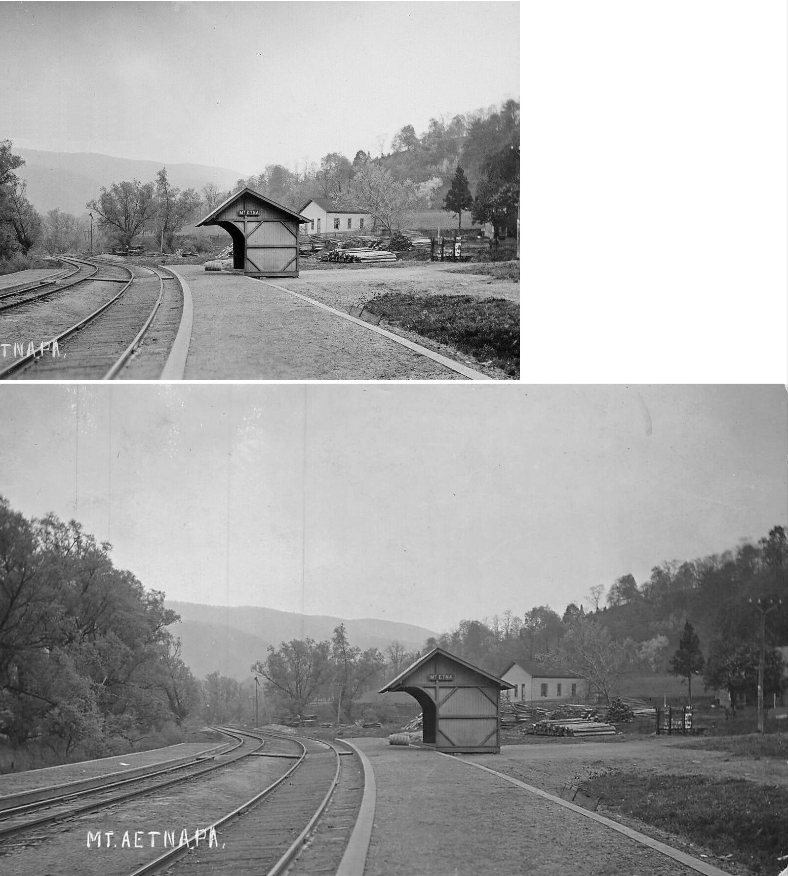
| Mt. Etna | |
|||||||
| McGarvey | |
This station appears in the 1947 book by Harry A. McGraw "Blair County Place Names." It was somewhere in Logan Township "west of Altoona." | ||||||
| McKee | |
|||||||
| Merrivale |
|
No idea where this was, but it appears in the 1947 book by Harry A. McGraw "Blair County Place Names" as a "station on the old Wopsy Railroad." | ||||||
| Morell | |
|||||||
| Moyston | |
This station appears in the 1947 book by Harry A. McGraw "Blair County Place Names." It was somewhere in Woodbury Township "on the Springfield Branch." | ||||||
| Mt. Etna | |
|||||||
| Mule ShoE | |
A station is shown here on the 1915 county map. It was on the south side of Old Route 22 on the west side of the tracks at approximately GPS: 40.434891, -78.520375. | ||||||
| Nealmont |
 |
|||||||
| New Portage Junction | |
|||||||
| Newry |
Newry Branch Railroad |
This railroad operated both passenger and freight service. It connected with the PRR at Duncansville. It went into operation in 1870 and was abandoned around 1900. The passenger and express freight stations were on the north side of Allegheny Street between Conrad Street and Old US 220 (GPS: 40.393817,-78.436833). The line ended on the south side of Allegheny Street. There are houses here now on both sides of where the old right of way was on the north side of the street. Are either of these houses the old RR buildings? | ||||||
|
Ore Hill (Bloomfield Mines) |
|
A station is shown here on the 1873 map. | ||||||
|
Oremenia (Mines) |
|
This was the end of the PRR Springfield Branch. | ||||||
| Page Station |
|
This station was between Henrietta and Curry in Woodbury Township. | ||||||
| Peck |
|
|||||||
| Plack |
|
No idea where this was, but it appears in the 1947 book by Harry A. McGraw "Blair County Place Names" as a "station on the old Wopsy Railroad." | ||||||
| Plane |
|
|||||||
| Point View |
|
There was an old summer resort here. | ||||||
| Pomeroy |
|
This was an old station on the New Portage Railroad near Mule Shoe. | ||||||
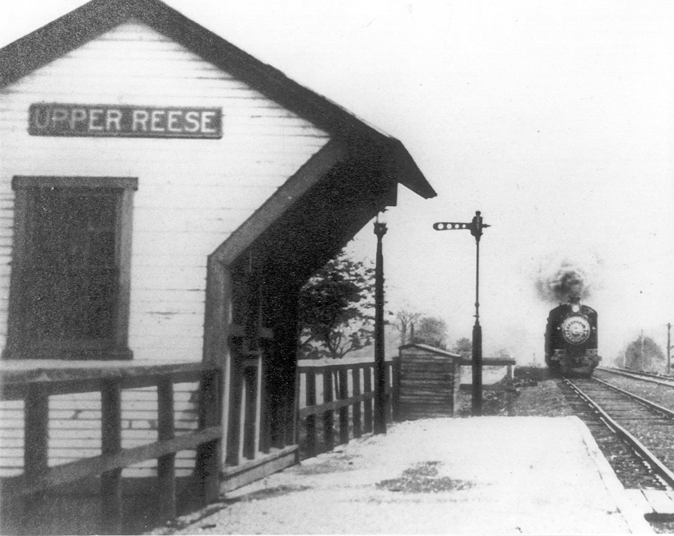
| Reese |
|
Two railroad stations were on the property of Abram Reese in Frankstown Township. Word has it that when the RR wanted to go through Reese's property he agreed to it, but the railroad had to put a station at the beginning of his property and at the end. One station was named "Reese Station" and the other "Upper Reese Station." It took the train approximately two minutes to travel from one station to the other. | ||||||
|
Reese (Upper Reese) |
|
|||||||
| Resevoir Station |
|
Originally a station on the Morrison's Cove RR. | ||||||
| Riddles Station |
|
Originally a station on the Morrison's Cove RR. | ||||||
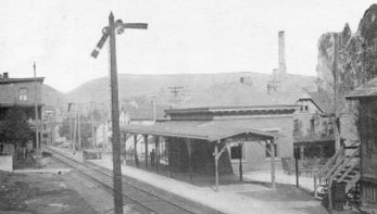
| Roaring Spring |
|
The original Morrison's Cove RR station here was in about the same location as the existing PRR station, but just a bit to the south (GPS: 40.333307, -78.402871). This station is shown on the 1873 county atlas. A wooden PRR station is shown at this same location on the late 1800s maps as well. | ||||||
| Rodman |
|
This station was just north of Roaring Spring along what is now PA-164/36. A station is shown here on the 1873 map. | ||||||
| Roots |
|
|||||||
|
Royer (Springfield) |
|
Also known as Springfield Furnace. | ||||||
| Sandy Gap |
|
A station is shown here on the 1915 county map. By that time the railroad was called the Altoona Northern. | ||||||
| Sarah Furnace |
|
In the SE corner of Greenfield Twp. Not to be confused with the Sarah Furnace in Clarion County. | ||||||
|
Shaw Run (Jacks Sta.) |
|
Jacks Station was renamed Shaw Run Station in 1881. | ||||||
|
South Altoona (Burket) |
|
Formerly known as Burket (or Bucket) Station. The name was changed to "South Altoona" in 1903. | ||||||
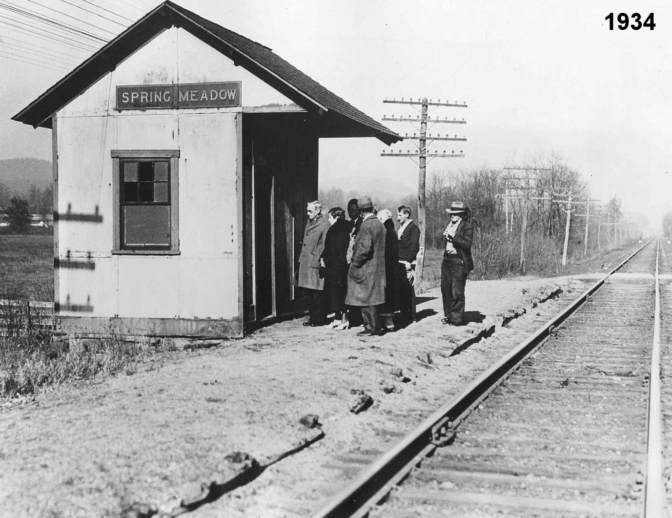
| Spring Meadow |
|
This station was likely at the end of Spring Meadow Drive around GPS: 40.444711, -78.425159. It may have also been known as Beryl earlier on and Cross Keys later. | ||||||
| Springfield Junction |
|
The first station here was opened in 1873 when the Willimasburg Branch opened. | ||||||
| Stanfield |
|
This station appears in the 1947 book by Harry A. McGraw "Blair County Place Names." It was somewhere in Blair Township. | ||||||
| Sun Brook |
|
|||||||
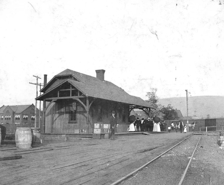
| Tipton | |
This station was on Clearfield Avenue on the north side of the tracks in 1873. The Tipton RR branched off here to the NW 3.5 miles to the former site of the Tipton Coal Mines. | ||||||
| Tyrone | |
The first wood-frame station here burned in 1880 and the station below was built later that year. | ||||||
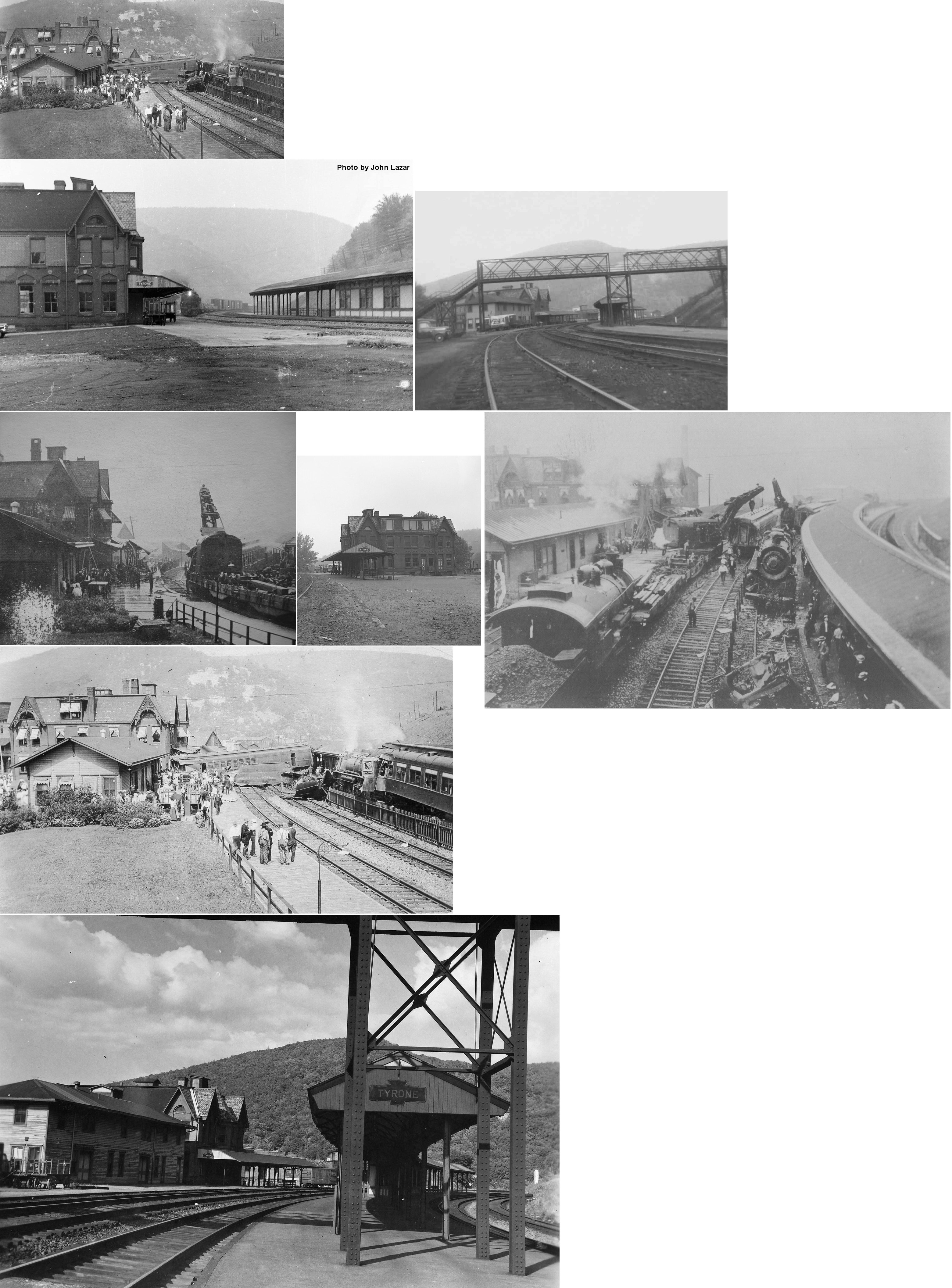
| Tyrone | |
This brick station was built in 1880. This photo probably shows the wreck that occurred on July 30, 1913. Engineer George K Funk was killed and 163 passengers were injured when Chicago Mail Train No. 13 collided with the rear end of Pittsburgh Express Train No. 15 at 2:38 PM. The building in the foreground was the freight station whereas the passenger station was the taller building in the background. These stations were at the south end of Main Street (now Pennsylvania Avenue) (GPS: 40.668235, -78.239758). The passenger station was torn down in March 1968. | ||||||
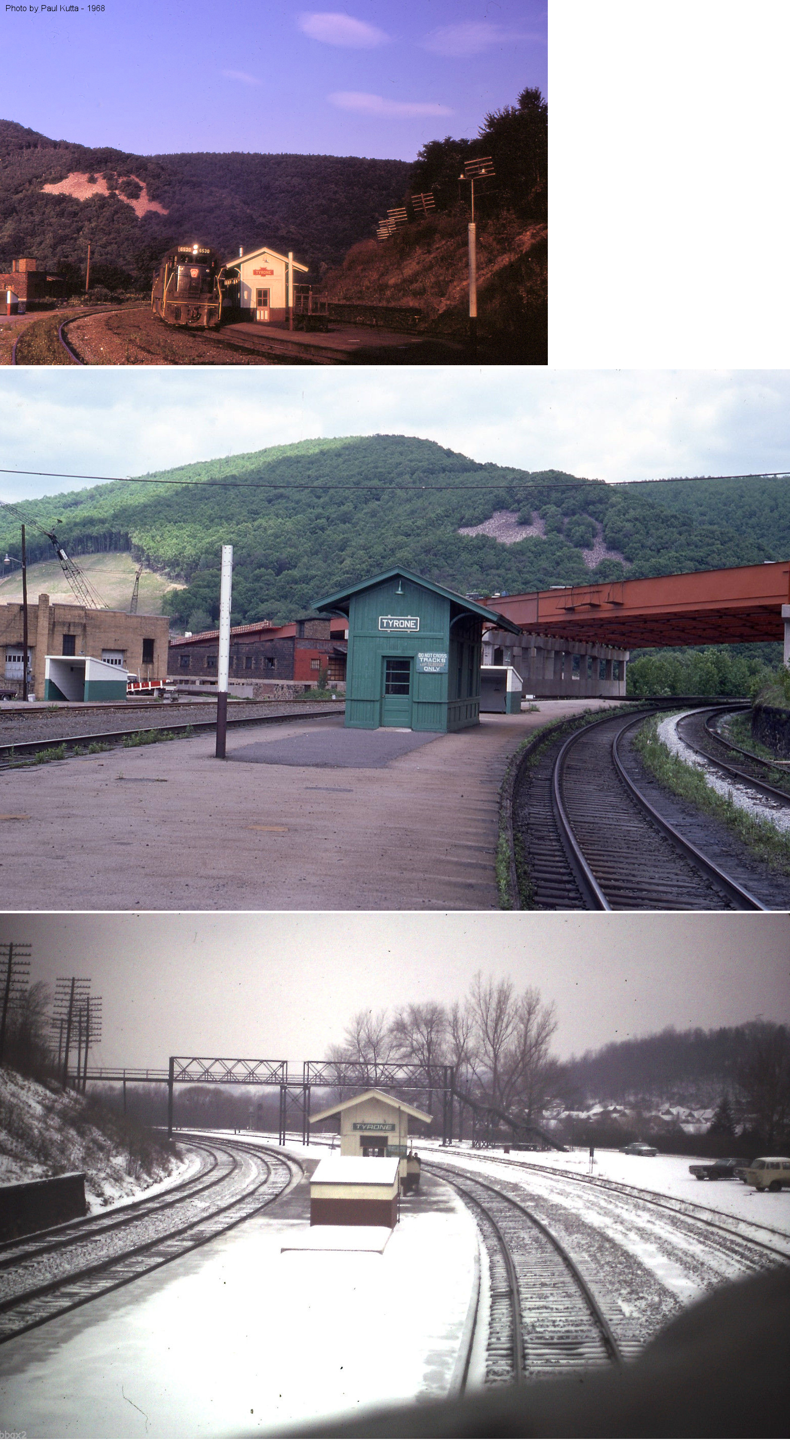
| Tyrone | |
After the brick passenger station was torn down, the PRR replaced it with this small station which served into the Penn Central years. | ||||||
| Tyrone | |
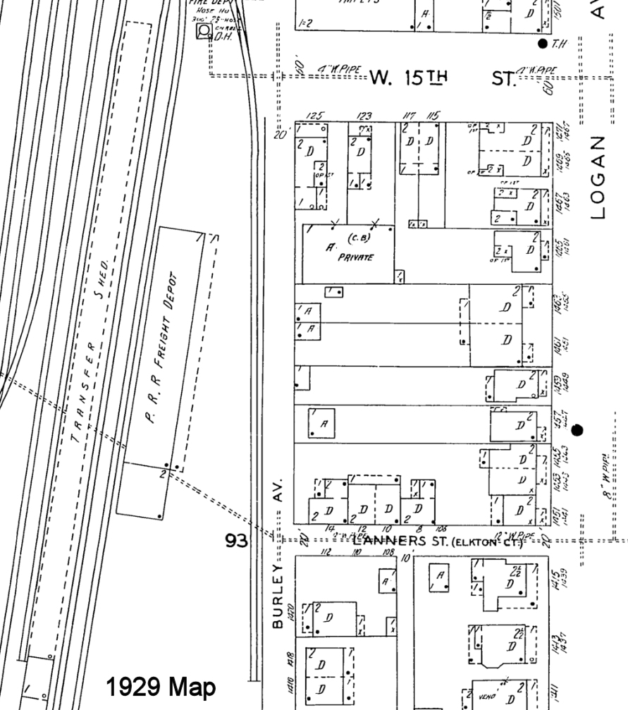
There was a freight station on Burley Avenue south of West 15th Street (GPS: 40.677240, -78.238124). It is shown on the 1929 Sanborn map as a freight station, but by the 1946 map is is shown as a lumber storage facility for M.L. Claster & Sons. | ||||||
| Tyrone Forge | |
|||||||
| Vail (Intersection STA.) |
|
Known early on as Intersection Station, later called Vail. This station was at the end of the Tyrone Branch and at the junction of the Bald Eagle Valley RR and the Tyrone & Clearfield RR. A new station was built here in 1890. | ||||||
| Vanscoyoc | |
|||||||
| Wertz | |
|||||||
| Weston |
|
This station was between Nealmont and Stover. Not sure if it was in Blair or Huntingdon County. | ||||||
| Whitebridge | |
This station appears in the 1947 book by Harry A. McGraw "Blair County Place Names." It was somewhere in Frankstown Township. | ||||||
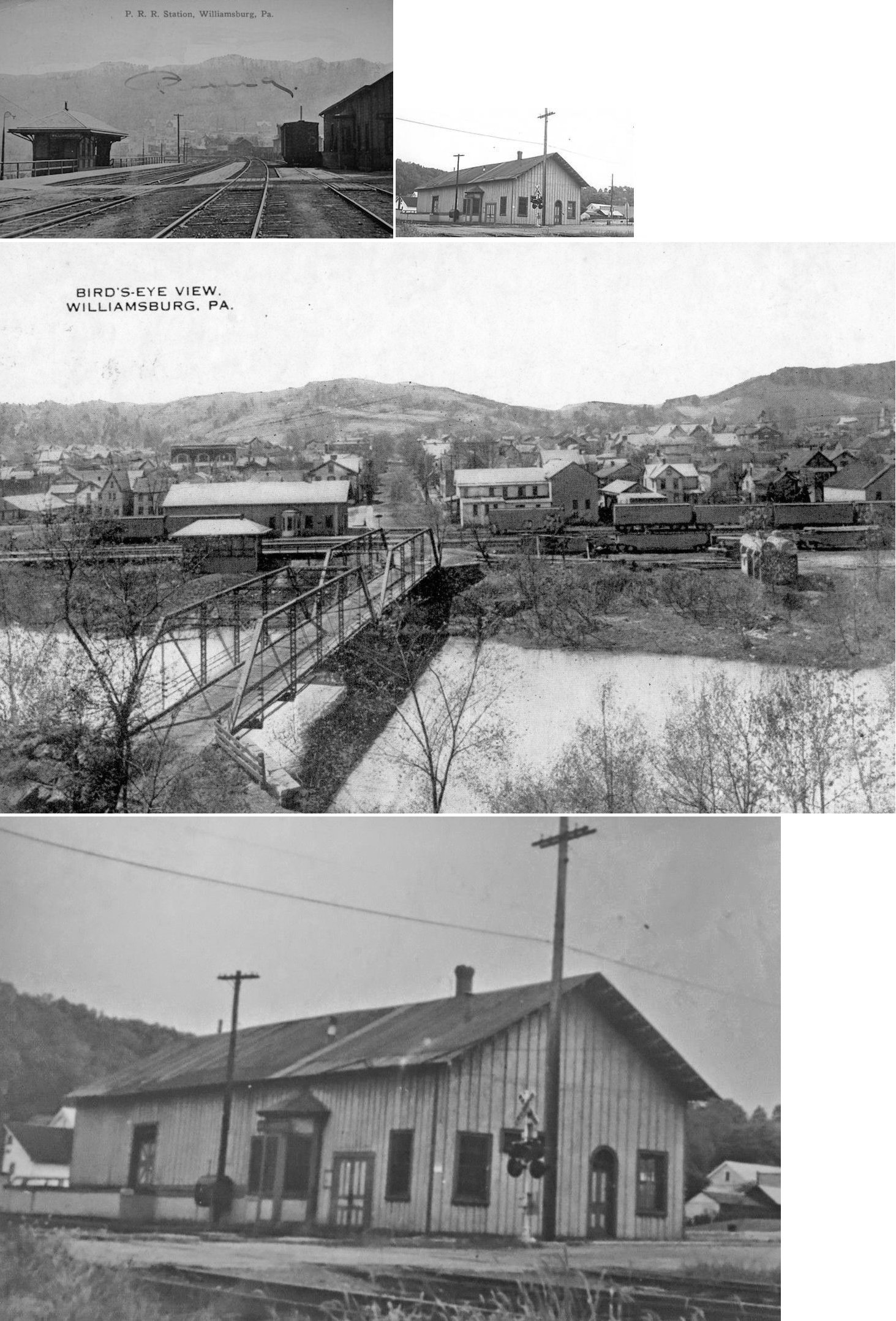
| Williamsburg | |
This combination station was on the east side of High Street on the south side of the tracks at GPS: 40.462696, -78.200300. | ||||||
| Williamsburg JCT. Station |
|
This station was renamed to Morrison's Cove Junction in 1901. | ||||||
| Wopsononock |
|
According to the Altoona Mirror from Thursday, June 18, 1891, a station was built here that year with a walkway leading to hotel grounds and the dance pavilion. | ||||||
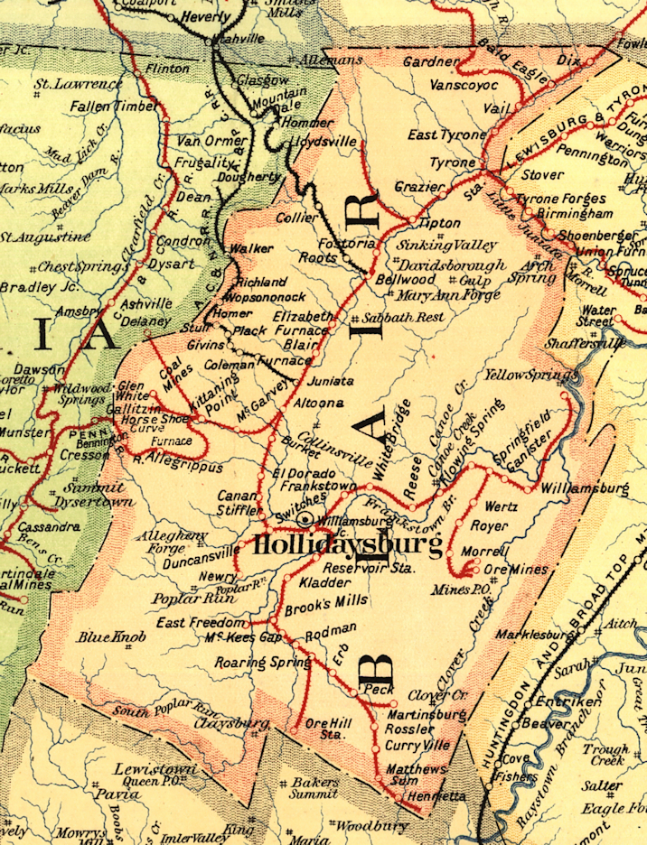
| 1895 BLAIR COUNTY RAILROAD MAP | ||||||||
 |
||||||||
| Notes About Existing
Stations... Roaring Spring (PRR) - See old photo. This is the only known remaining vintage RR station in Blair County. Now owned and operated by the Roaring Spring Historical Society. Records and memorabilia available by arrangement. PRR caboose on site. Call (814) 224-4814 for more info. Tyrone (Replica) - Near site of the old station, this is now occupied by the Typrone Area Historical Society. |
||||||||