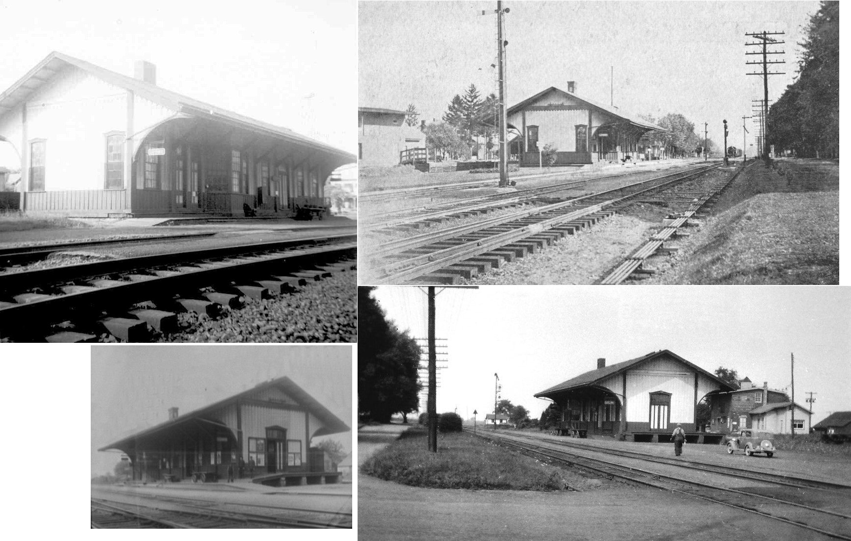
|
|
||||||||
| EXISTING STATIONS | ||||||||
|---|---|---|---|---|---|---|---|---|
| Station Name |
Original Railroad |
Current Location |
Type | Current Use |
Date Built |
Track Status |
Building Material |
More Info |
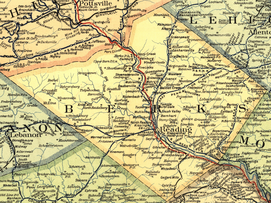
| Barto |  |
143 Barto Road (GPS: 40.391577, -75.610272) |
P | Residence | 1871 | Gone | Wood |
|
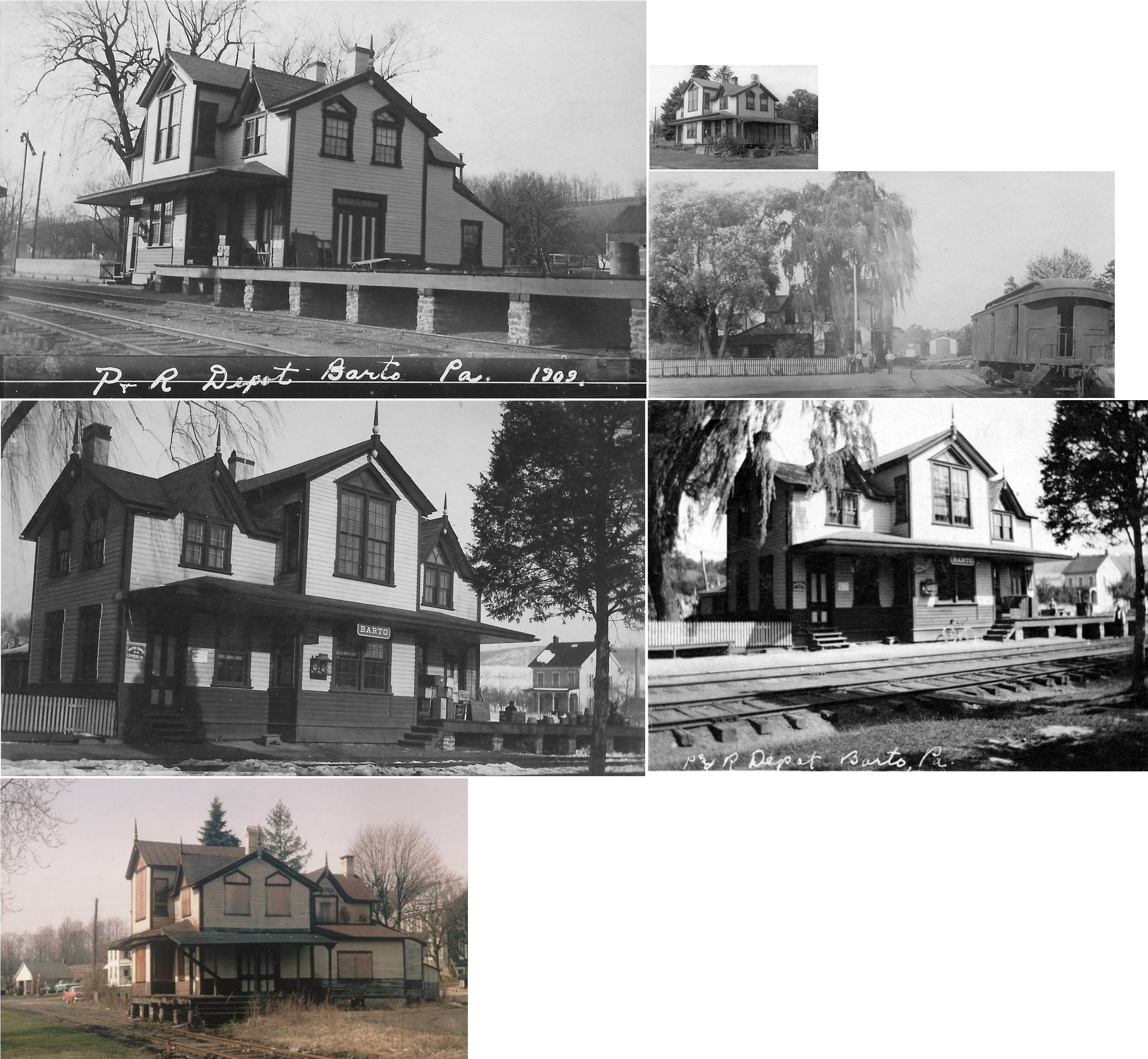
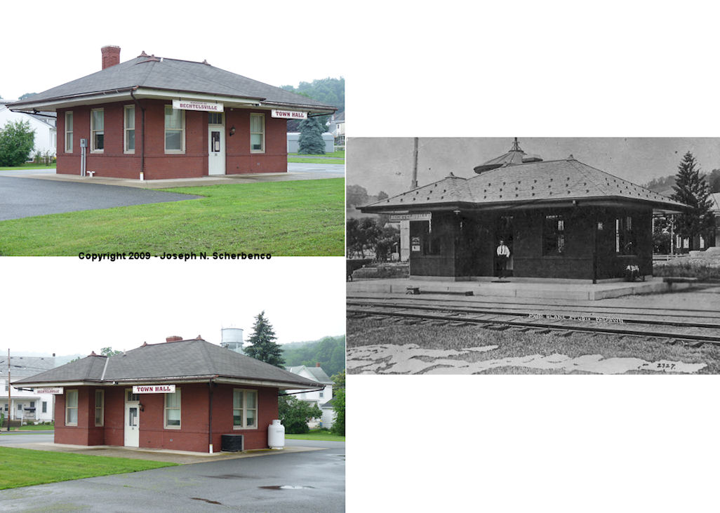
| Bechtelsville | |
Chestnut Street and Railroad Street (GPS: 40.372458, -75.627652) |
C | Civic | 1912 | Gone | Brick |
|
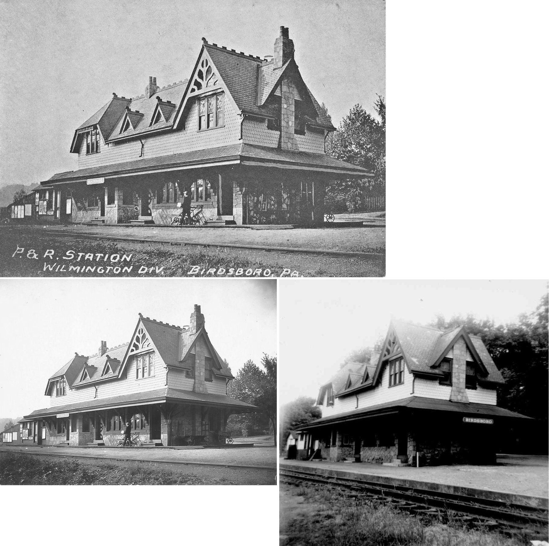
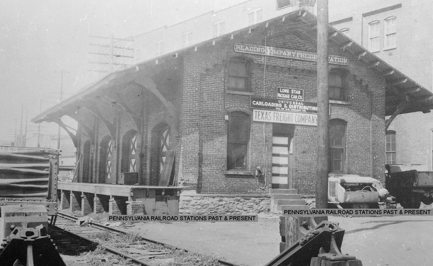
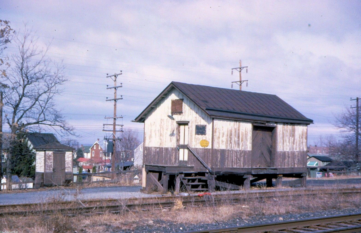
| Birdsboro |  |
NW corner of Furnace Street and West 1st Street (GPS: 40.263810, -75.807911) |
C | Business | 1884 | Gone | Brick | |
|
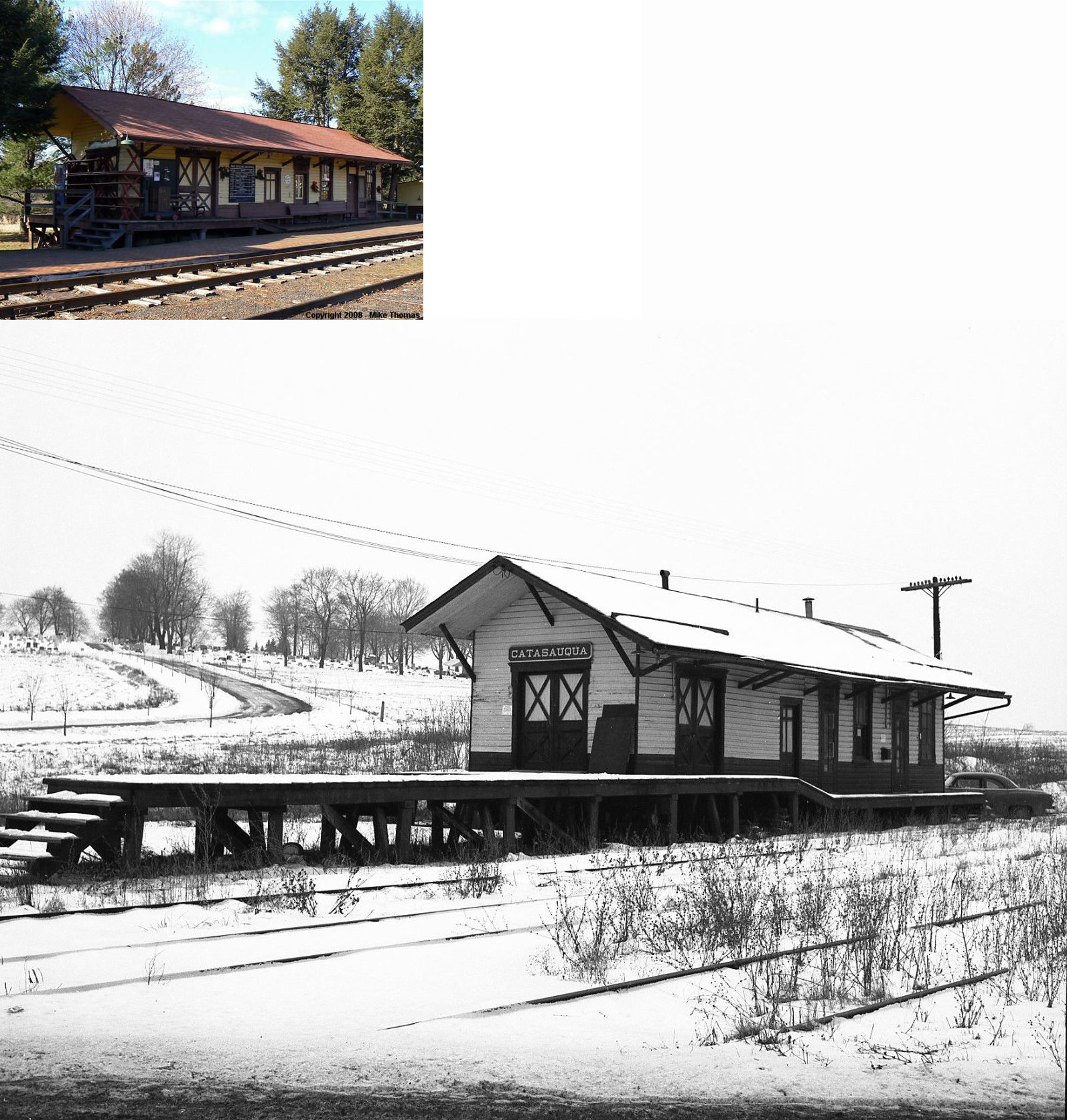
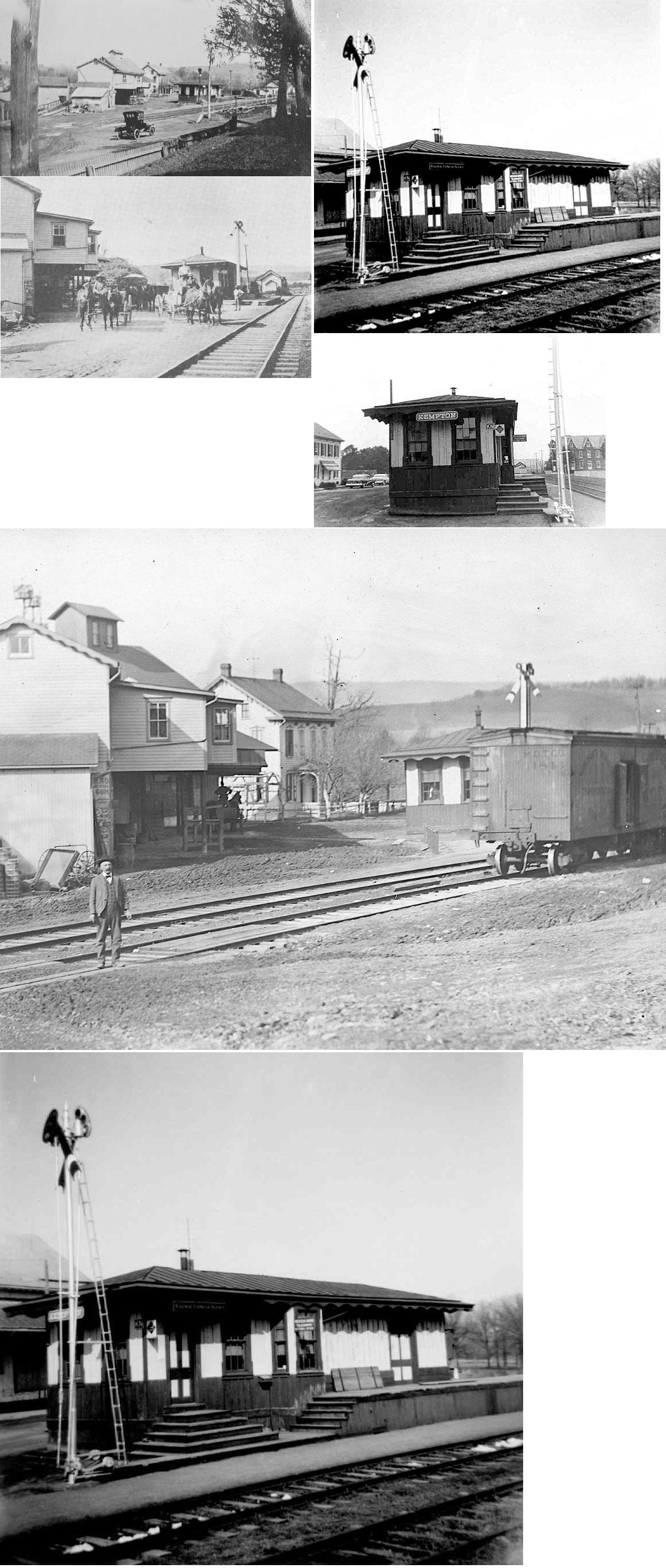
Catasauqua (W. Catasauqua) |
|
Near the north end of Community Center Drive (off PA143 at Kistler Valley Road and Creek Road), Kempton (GPS: 40.629233, -75.853562) |
F | Railroad | 1896 | In Use | Wood |
|
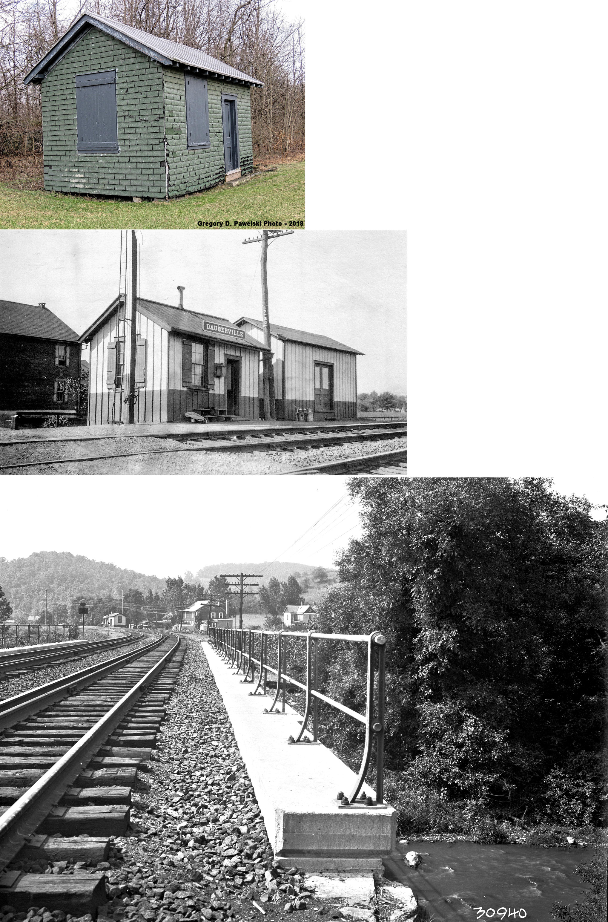
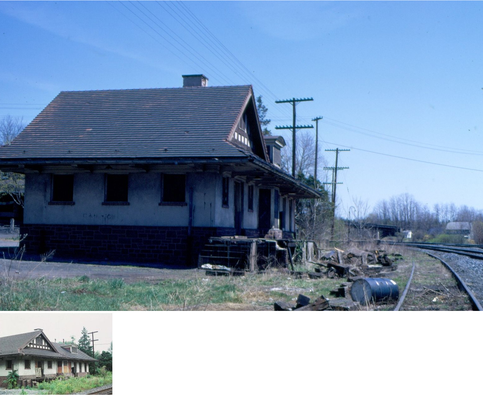
| Dauberville | |
South side of Bellmans Church Road between the tracks and Schuylkill Hill Road (GPS: 40.456691, -75.979961) |
P | Private | 1905 | In Use | Wood |
|
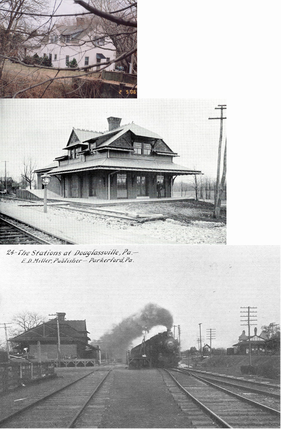
| Douglassville | |
Old Philadelphia Pike NW of Britton Street (GPS: 40.254723, -75.726630) |
C | Apartments | 1884 | Gone | Wood |
|
| Fleetwood | |
Richmond Street (PA662) at Brown's Feed Mill (GPS: 40.451765, -75.820103) |
P | Business | 1924 | In Use | Brick |
|
| Fleetwood | |
South Walnut Street, one block south of Locust Street (GPS: 40.453667, -75.814458) |
C | Vacant | 1859 | In Use | Wood |
|
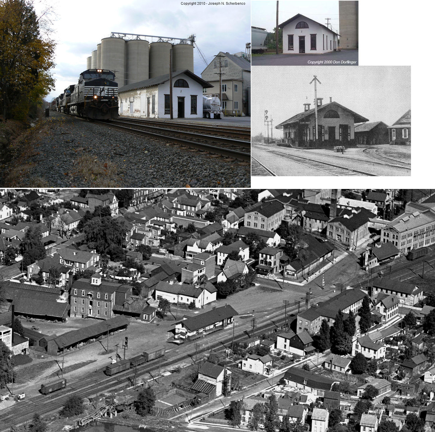
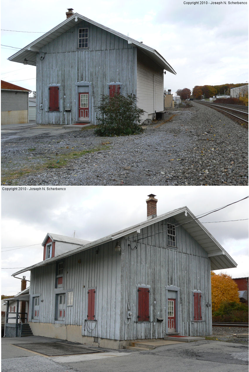
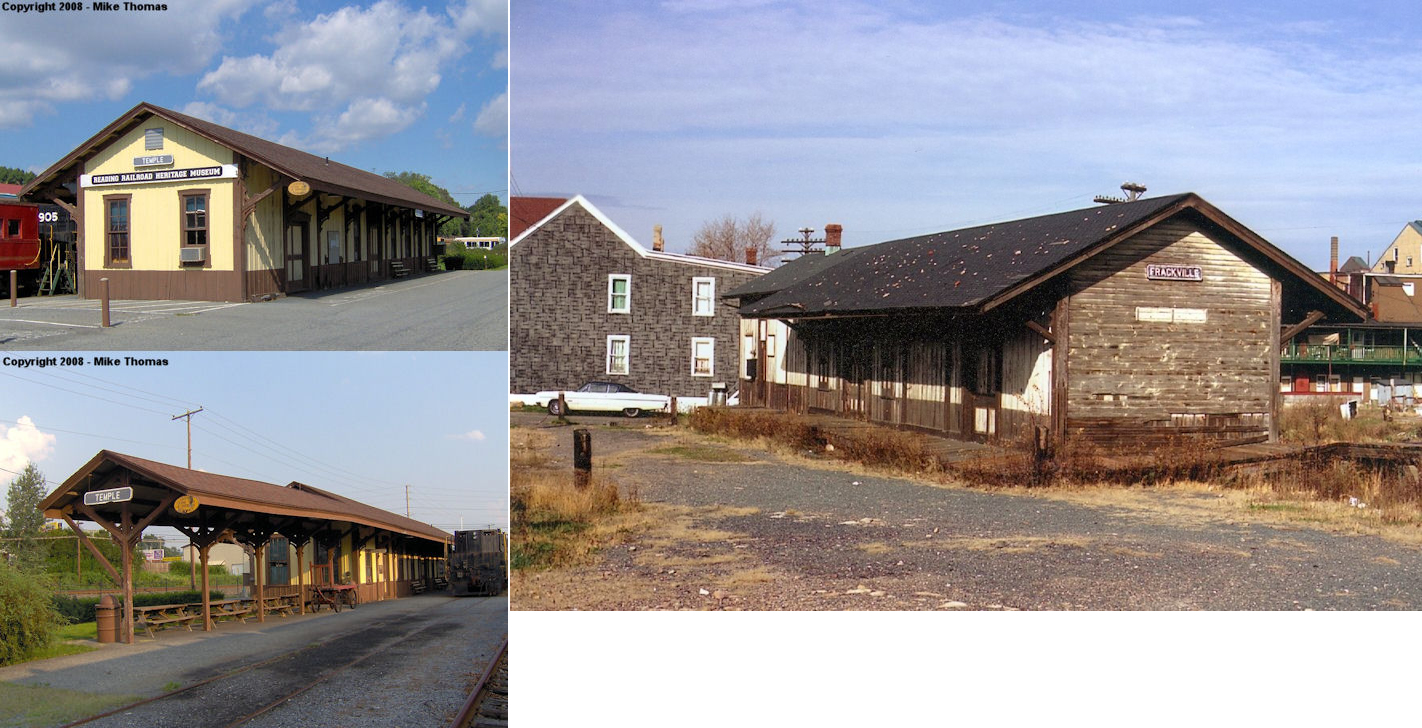
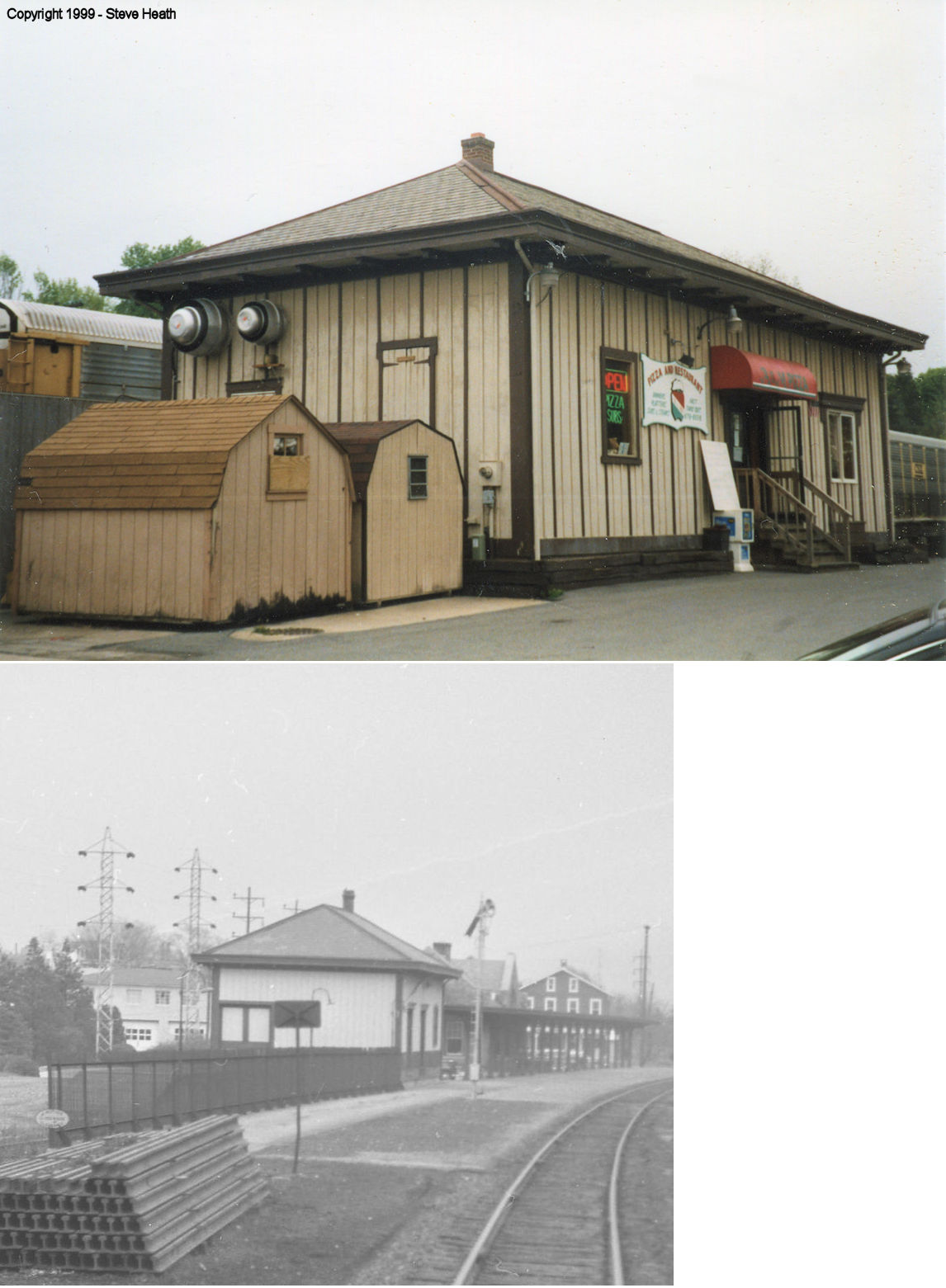
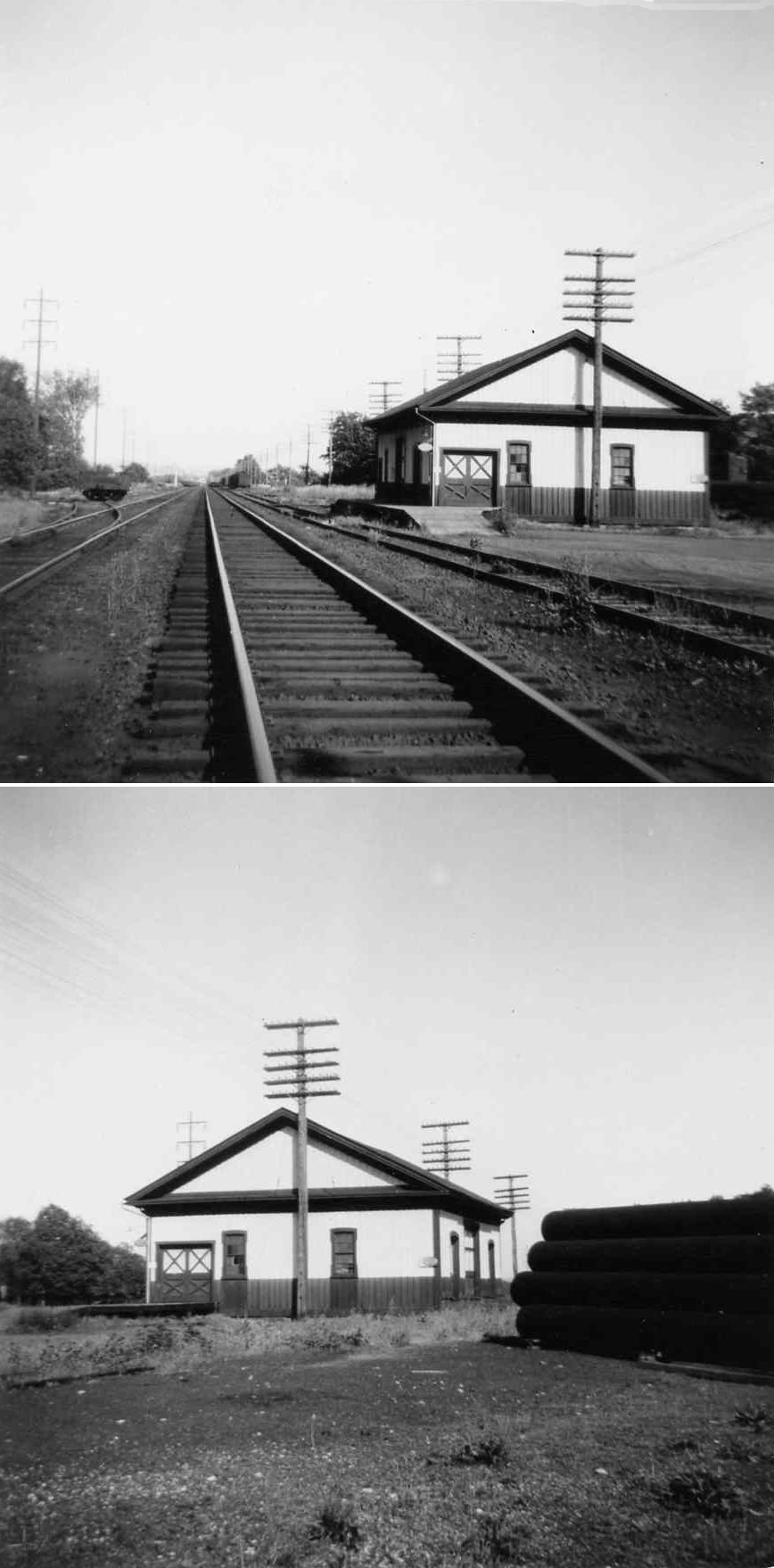
| Frackville | |
141 Tuckerton Road, Temple (GPS: 40.407951, -75.929804) |
F | Railroad | 1905 | In Use | Wood |
|
| Gibraltar | |
South side of PA724 (GPS: 40.283529, -75.869784) |
P | Residence | ???? | None | Wood |
|
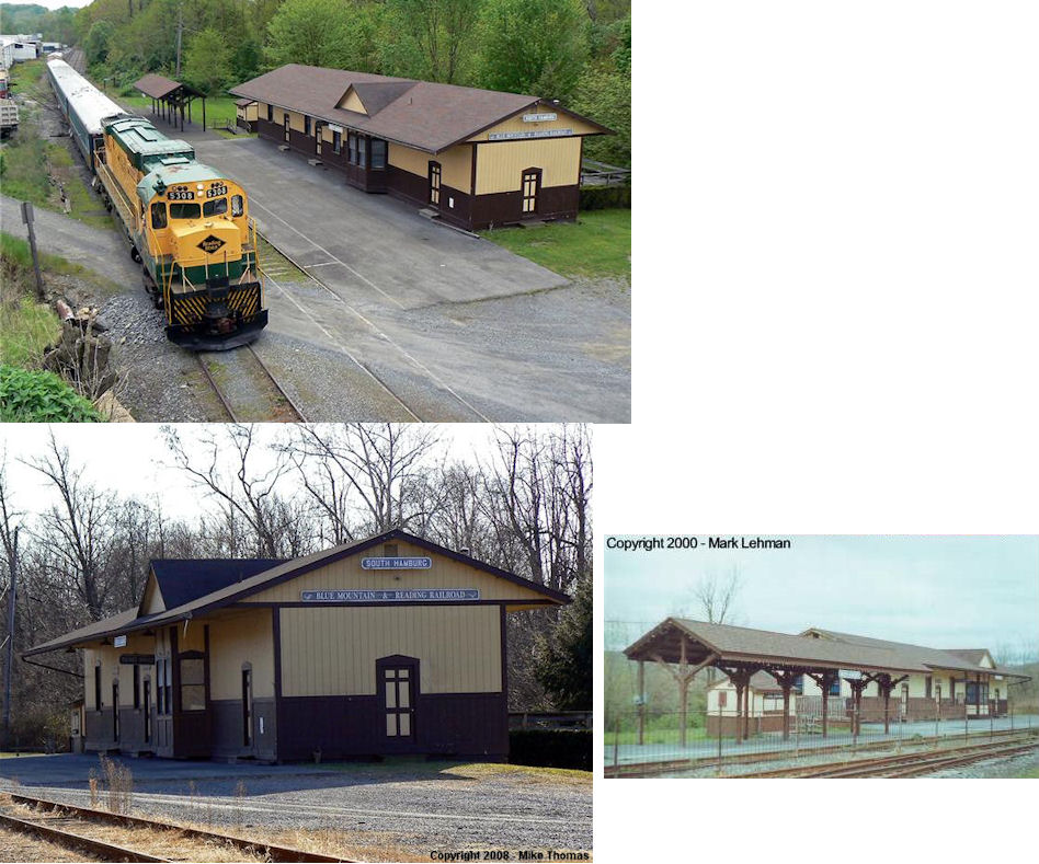
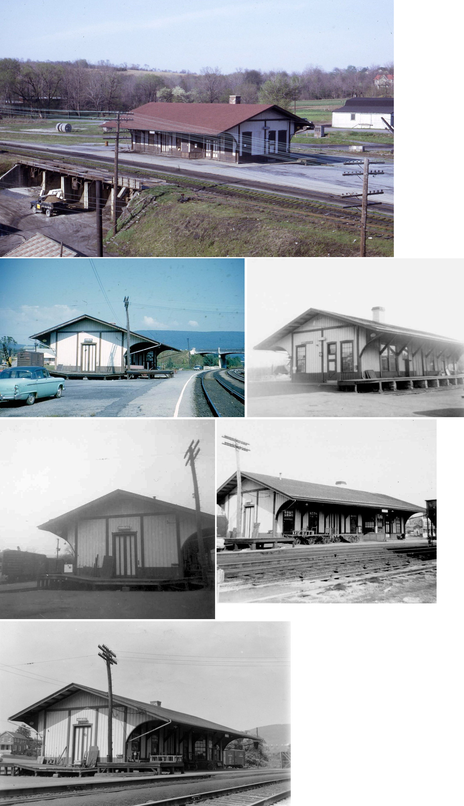
| Hamburg |
 |
4th Street at PA61 (GPS: 40.543100, -75.980182) |
P | Railroad | 1987 | In Use | Wood | |
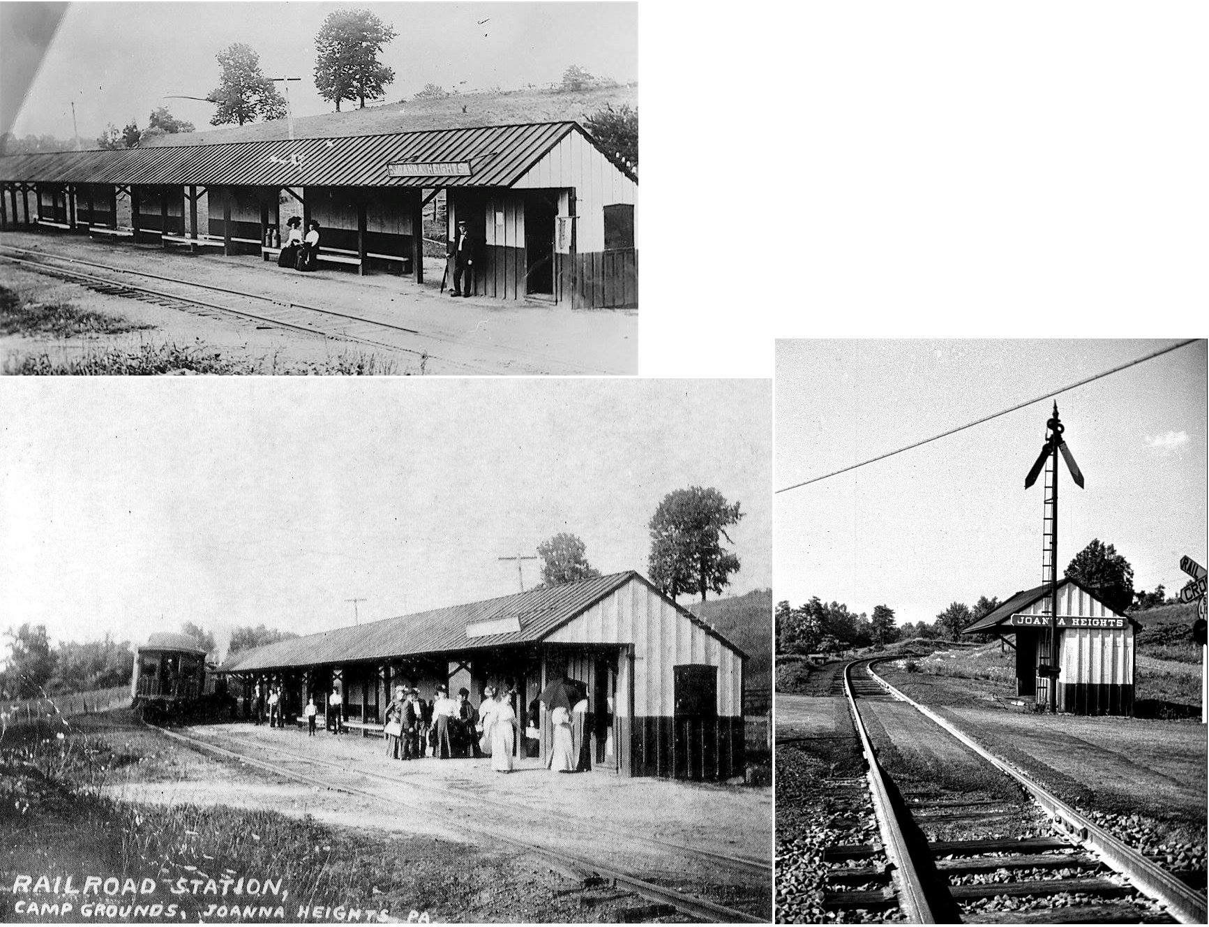
| Joanna |
 |
Near the north end of Community Center Drive (off PA143 at Kistler Valley Road and Creek Road), Kempton (GPS: 40.629043, -75.853551) |
P | Railroad | 1888 | In Use | Wood |
|
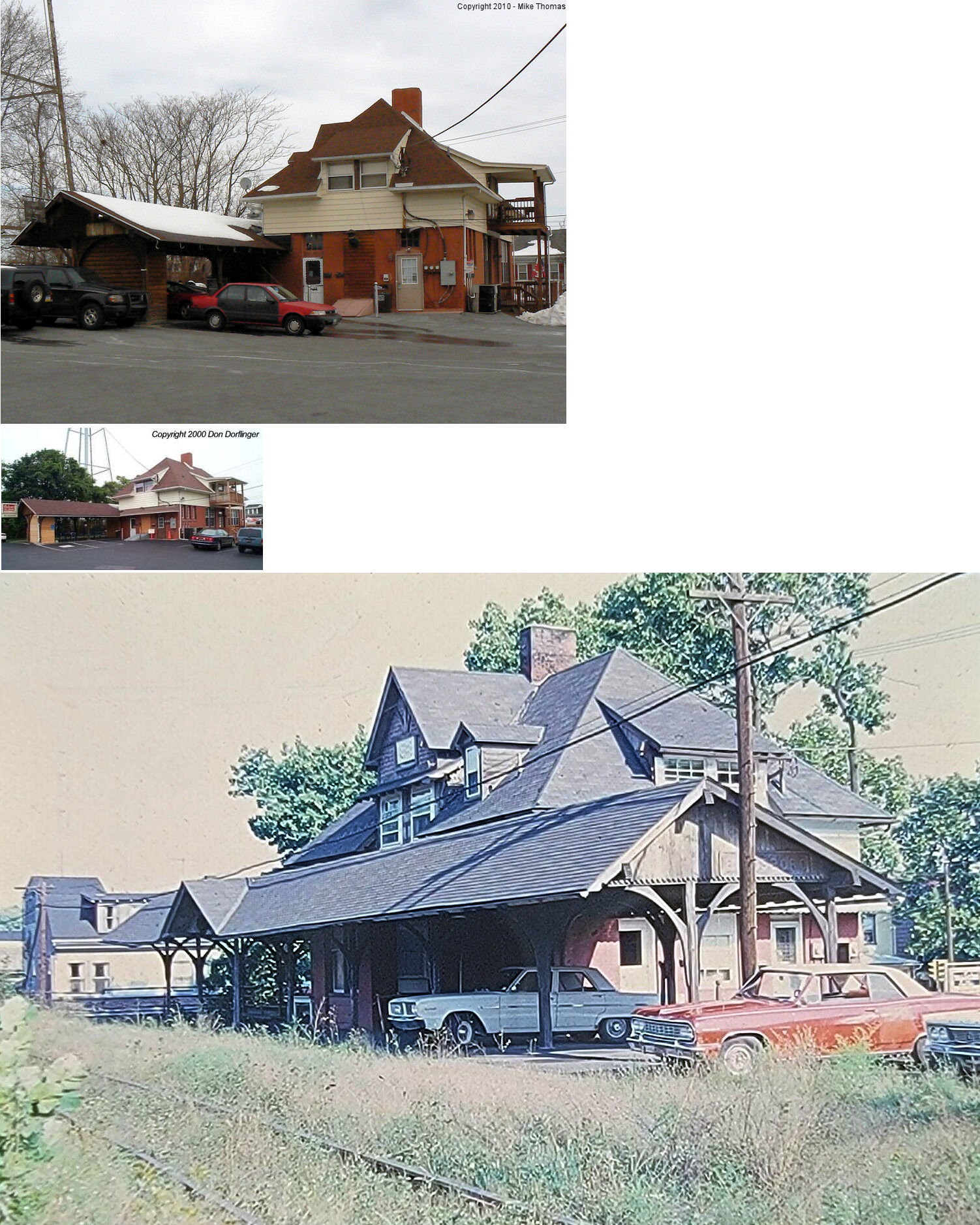
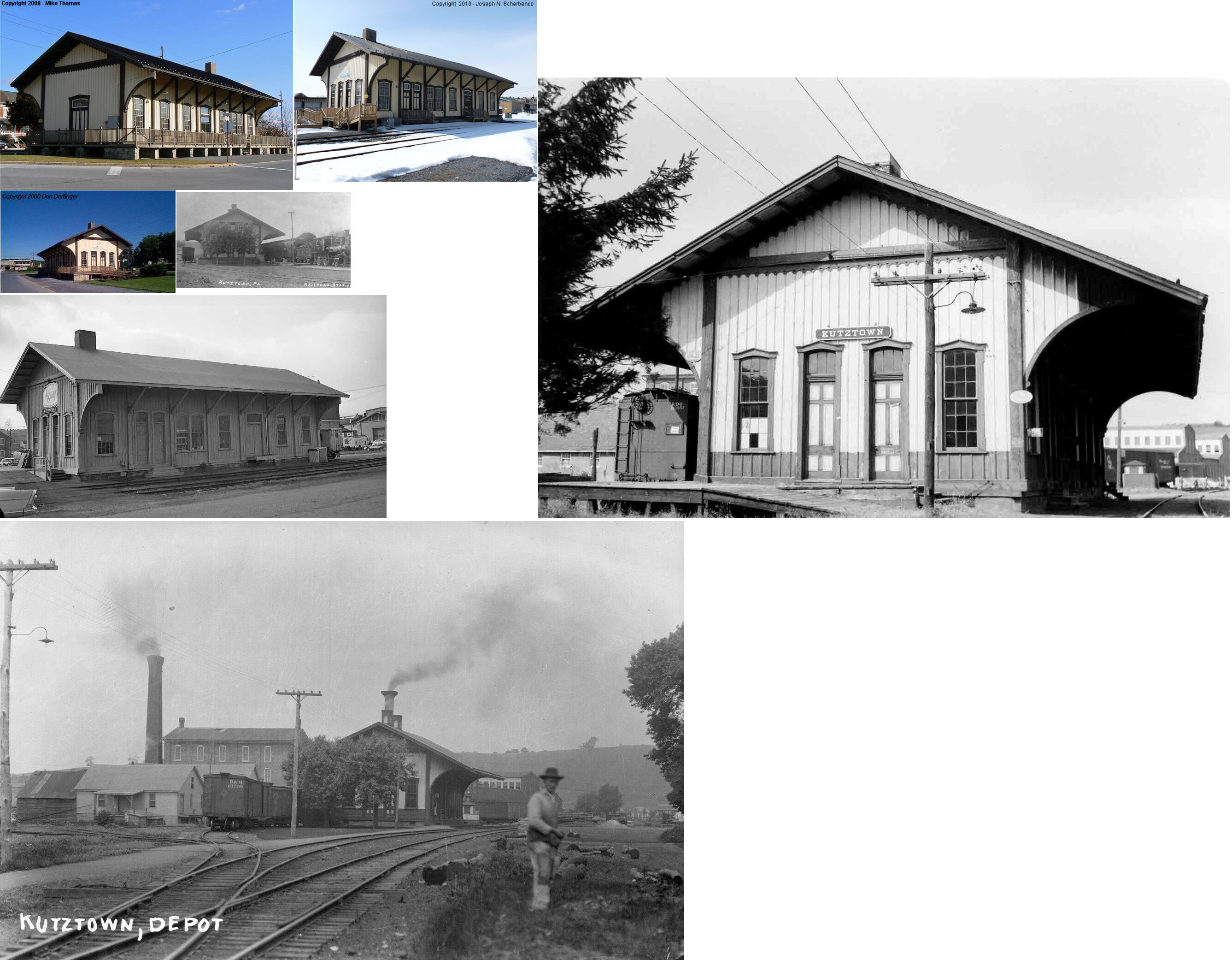
| Kutztown |
 |
106 Railroad Street at Peach Street (GPS: 40.521531, -75.776428) |
C | Vacant | 1869 | In Use | Wood |
|
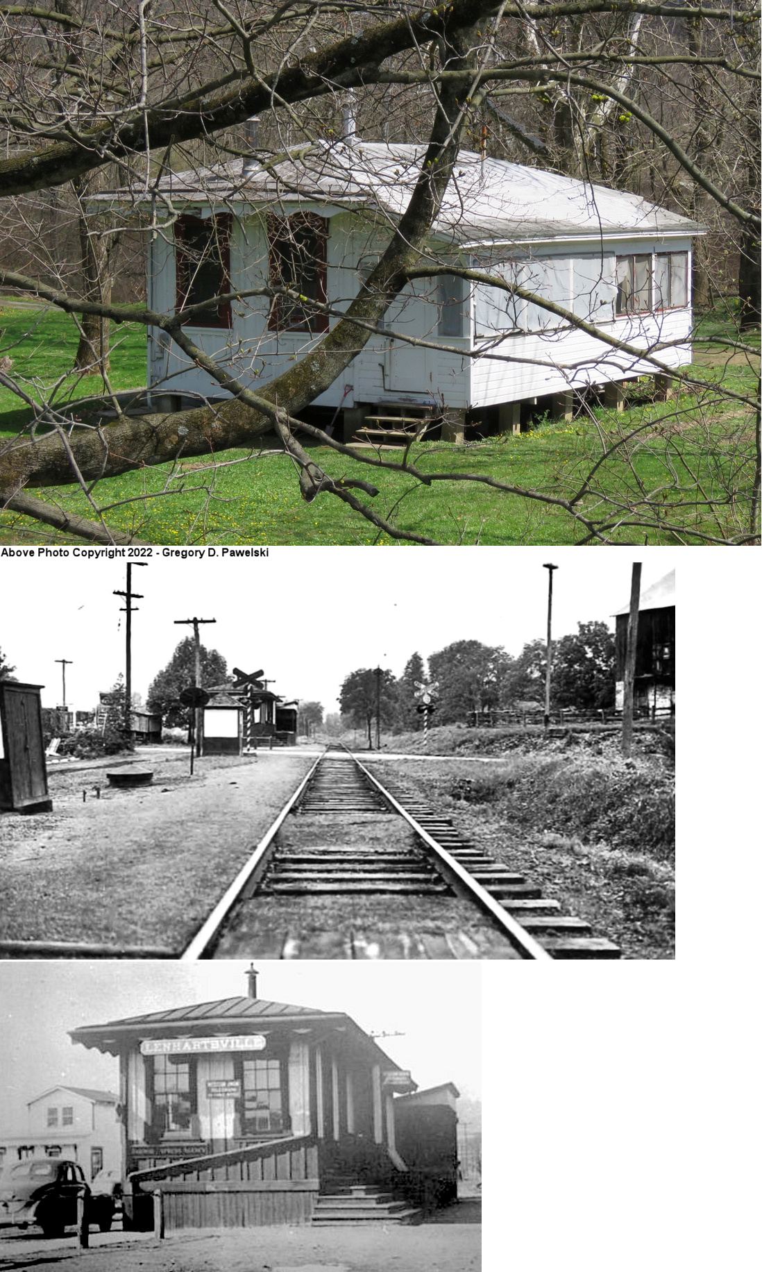
| Lenhartsville | |
South side of Old US-22 on the east bank of the river. (GPS: 40.572325, -75.883717) |
P | Private | ???? | None | Wood |
|
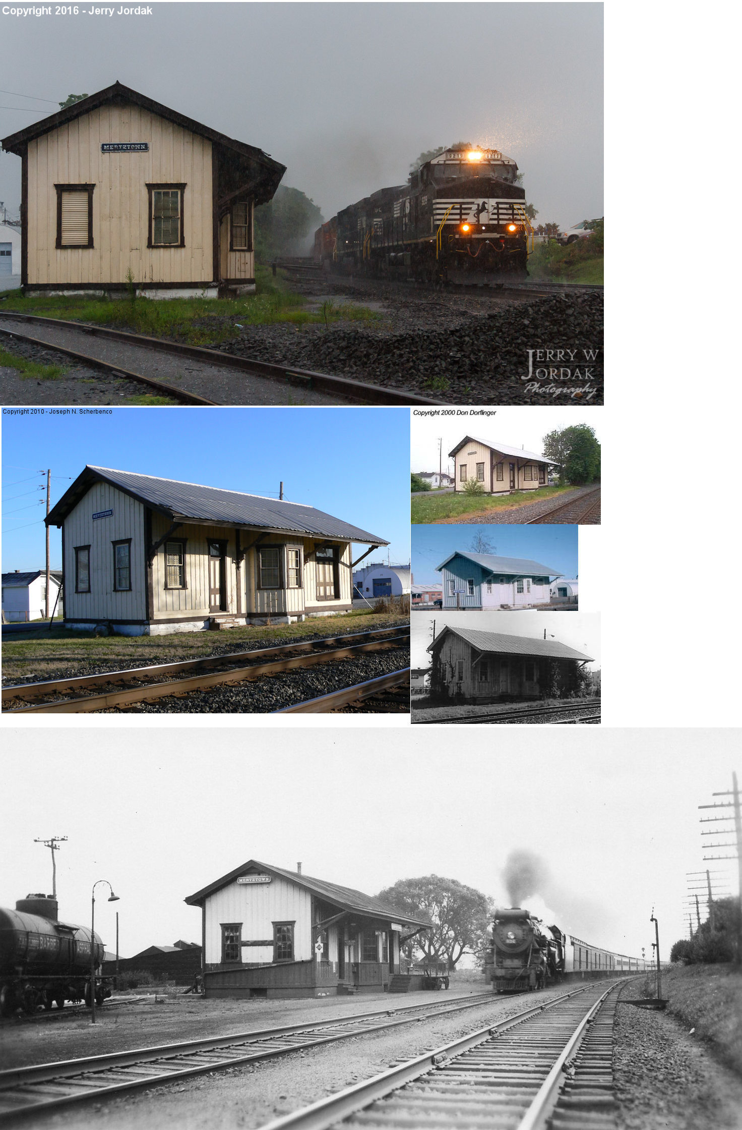
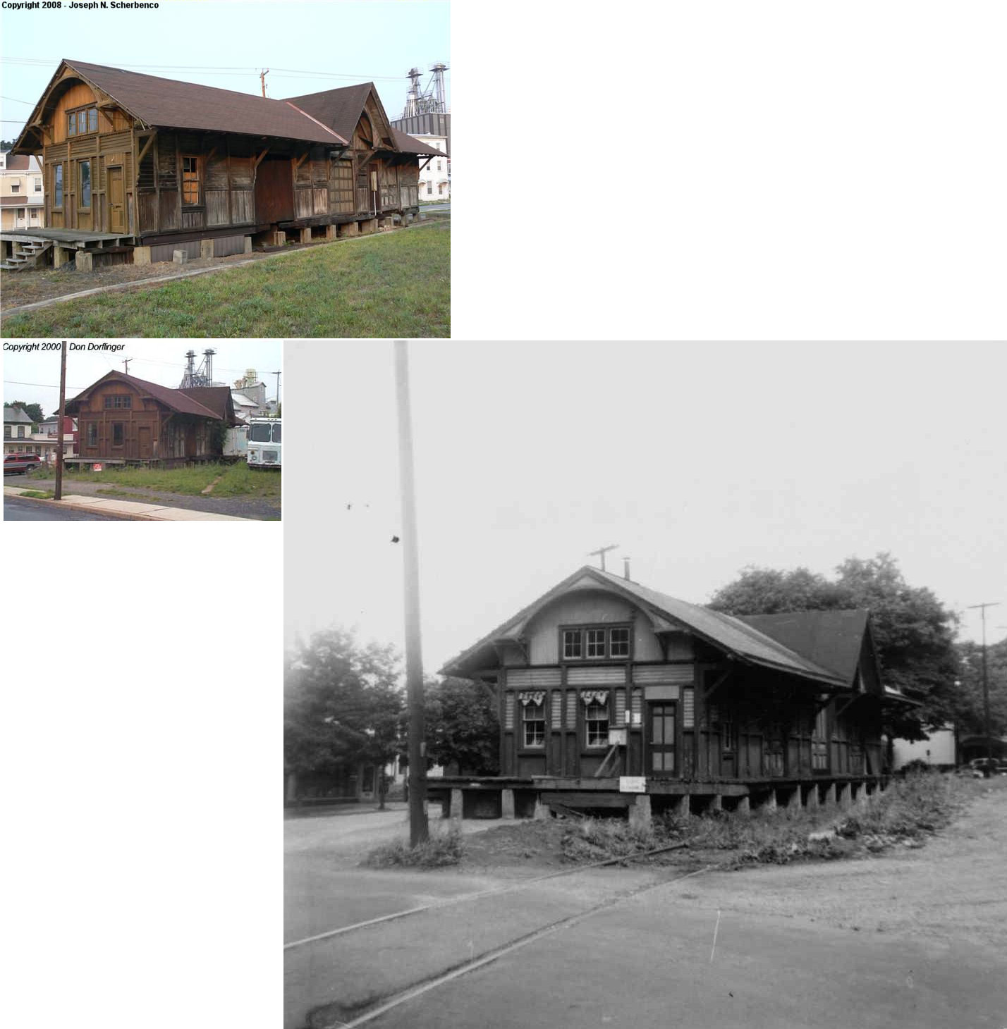
| Mertztown | |
North side of the tracks at Chestnut Street (GPS: 40.507062, -75.666108) |
C | Storage | 1895 | In Use | Wood |
|
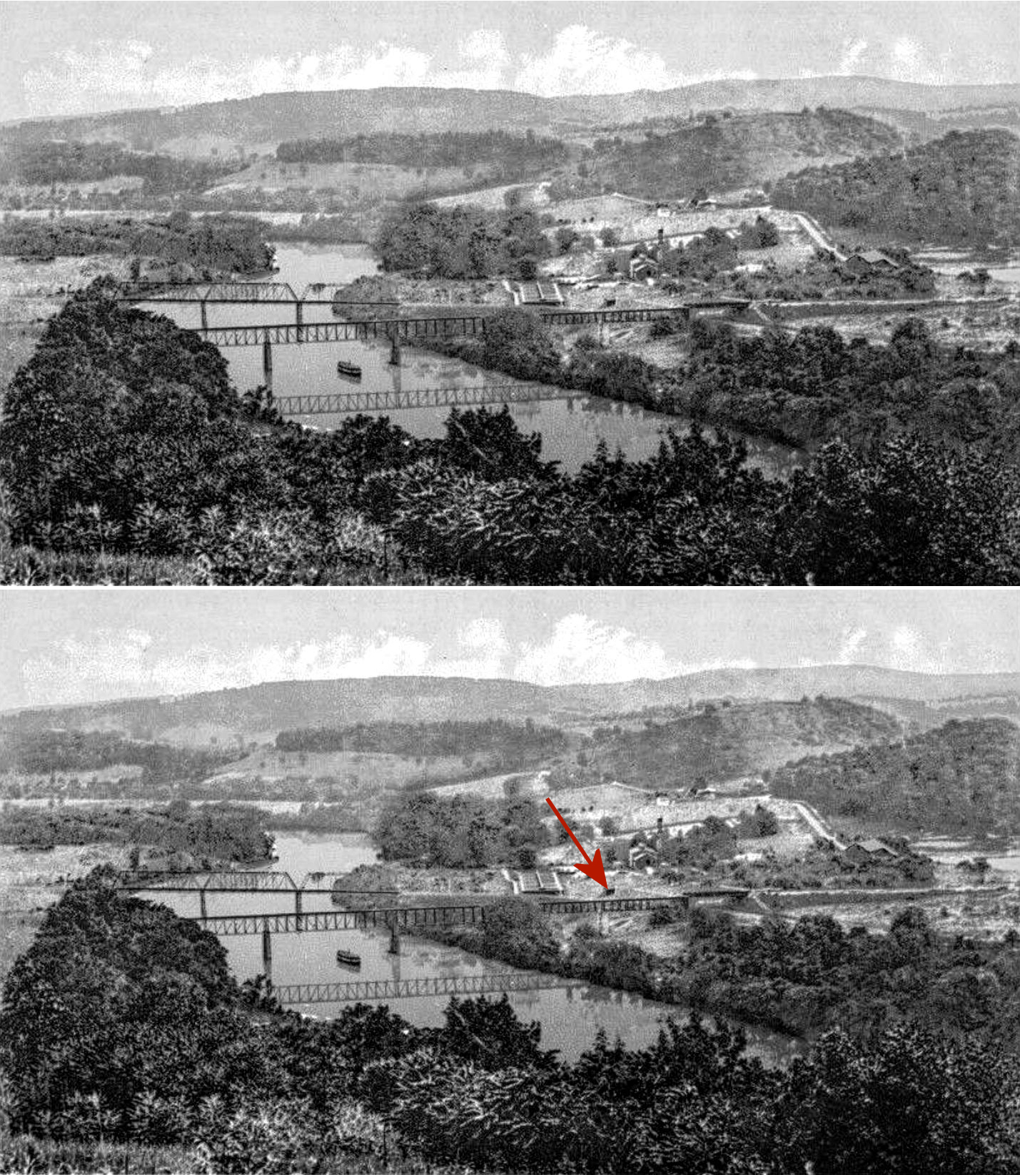
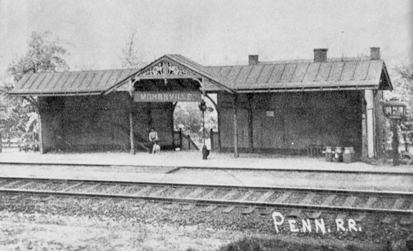
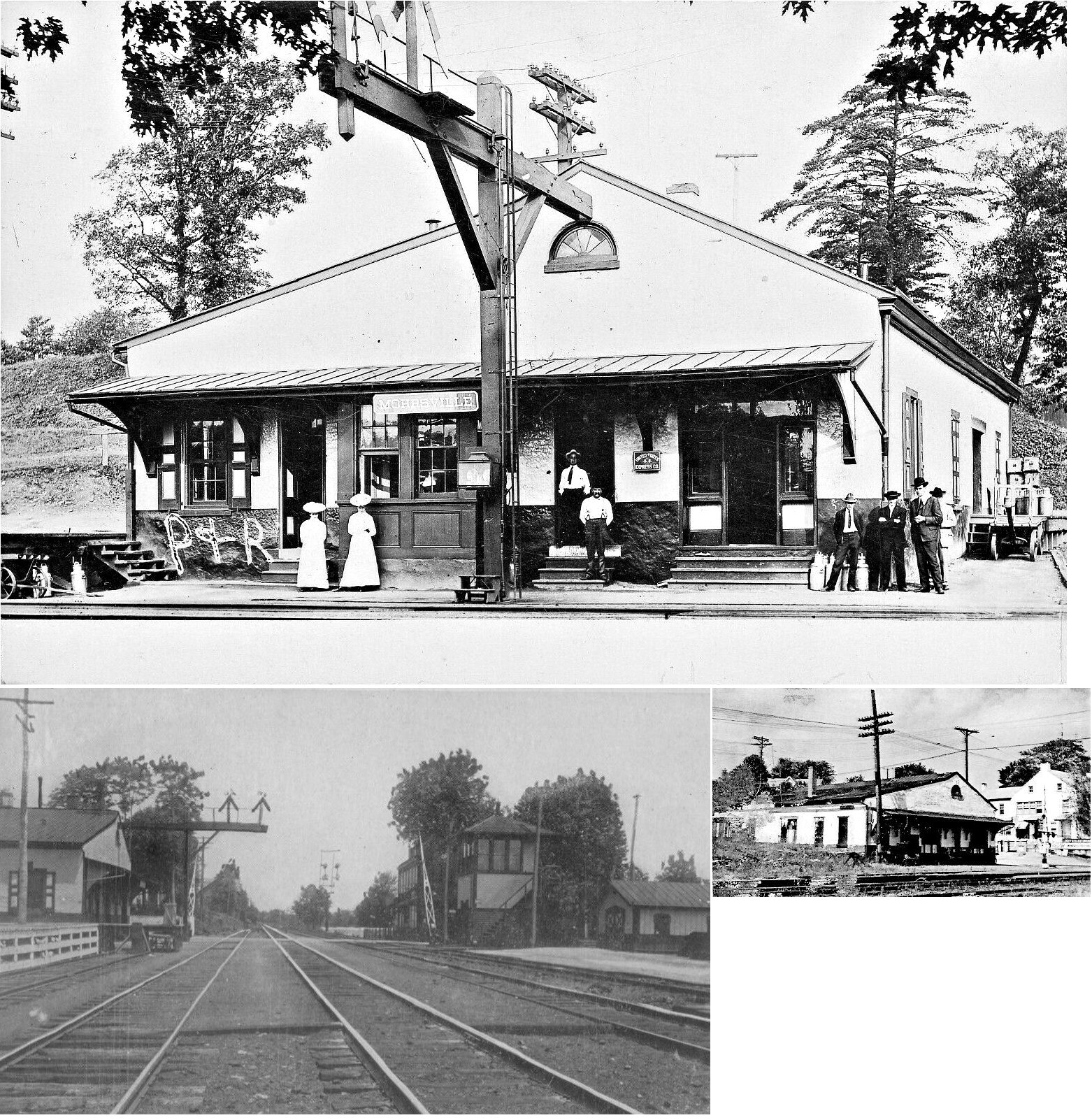
| Mohrsville | |
Mohrsville Road just south of Main Street (GPS: 40.470436, -75.971971) |
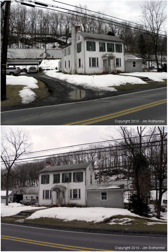
P | Residence | ???? | In Use | ???? |
|
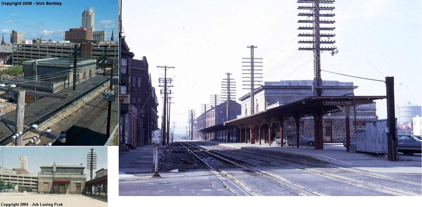
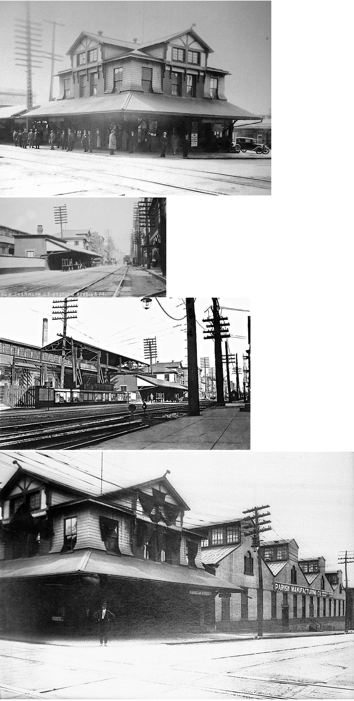
| Reading (Franklin Street) |
|
Plum Street between Franklin & Chestnut Streets (GPS: 40.332945,-75.924271) |
C | Vacant | 1929 | In Use | Stone |
|
| Reading (Outer Station) |
 |
3501 Pottsville Pike (GPS: 40.385539, -75.933746) |
P | Railroad | 2017 | In Use | Wood |
|
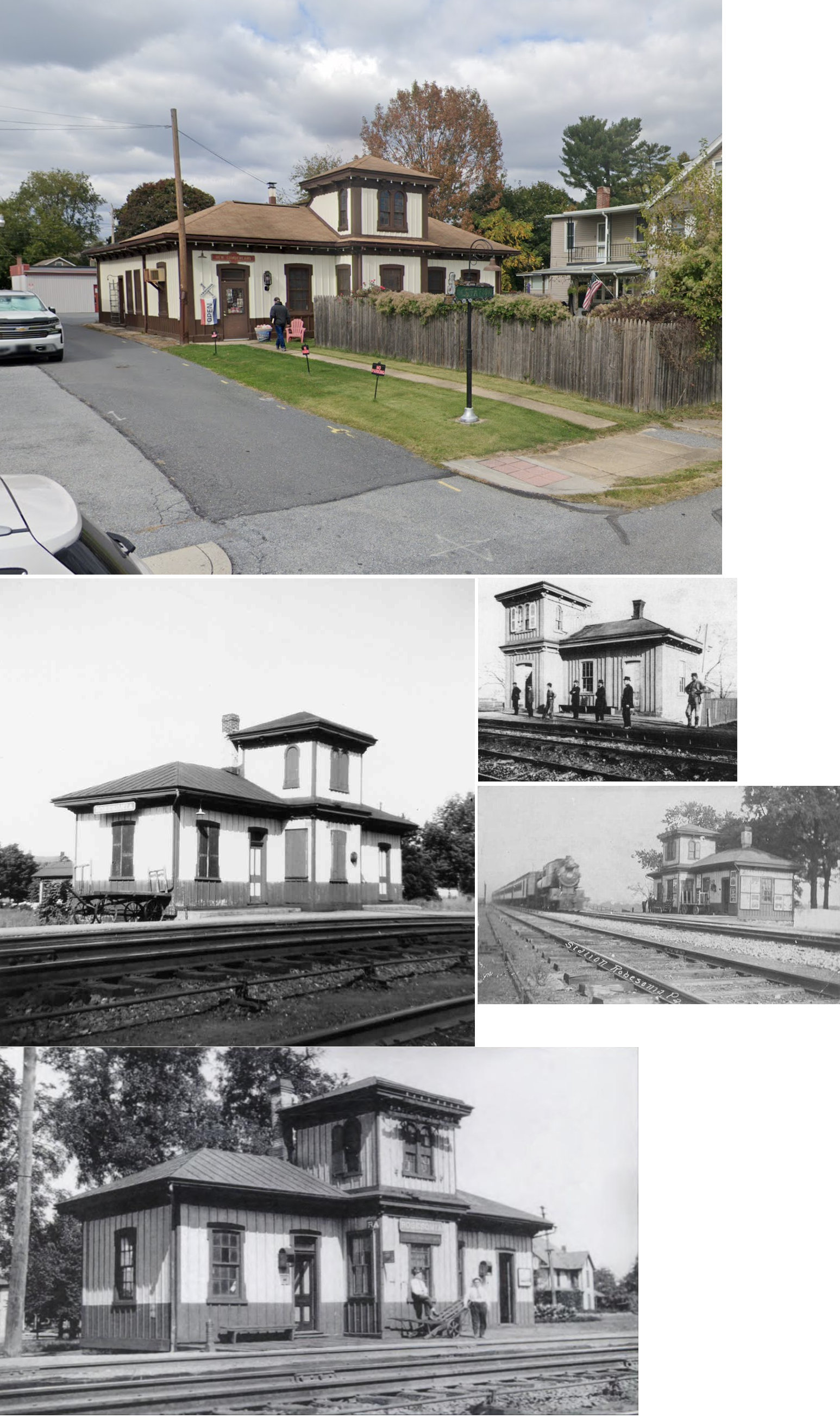
| Robesonia |
 |
213 9th Street, New Cumberland, Cumberland County (GPS: 40.231687, -76.871347) |
P | Business | 1856 | None | Wood |
|
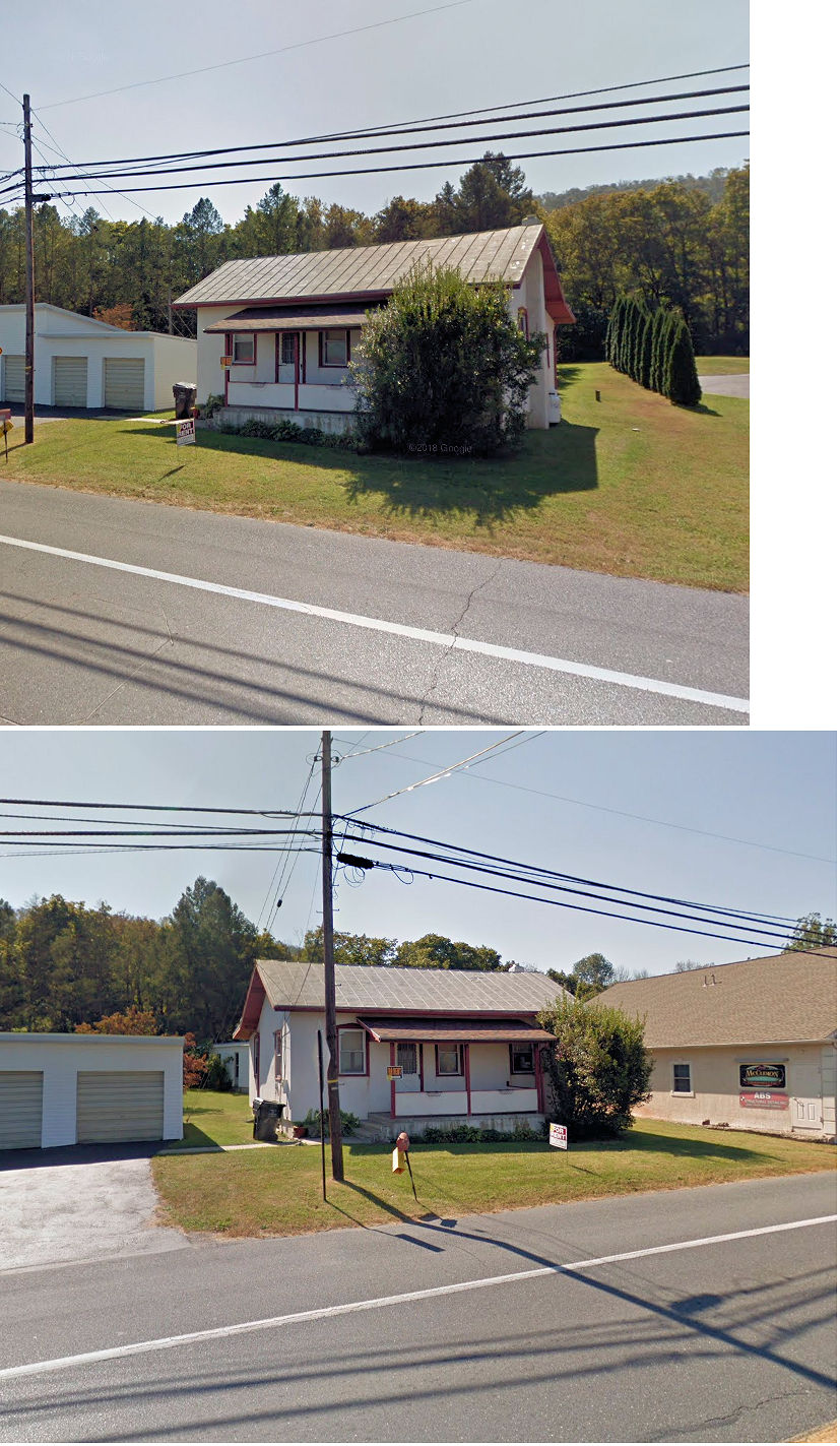
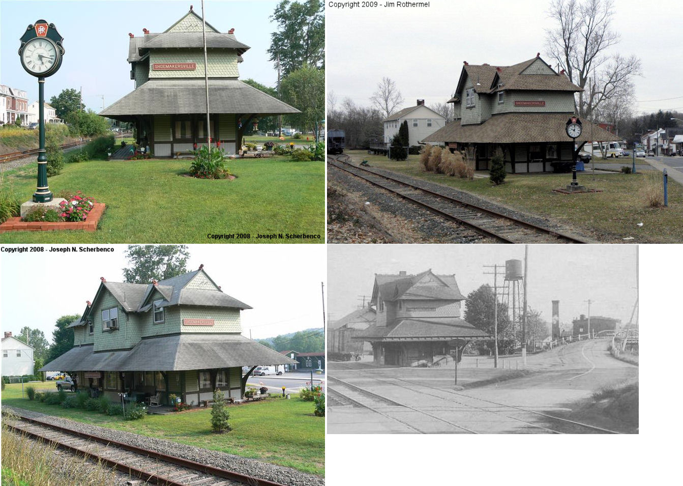
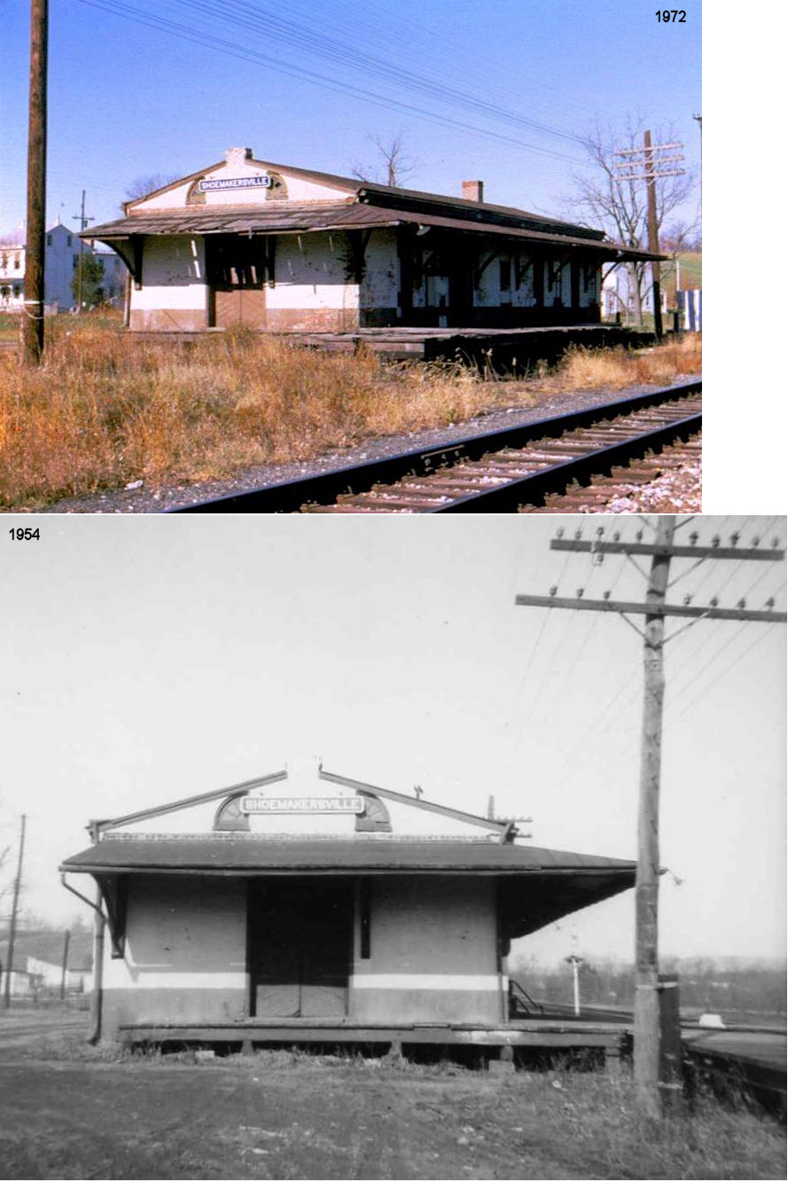
| Shoemakersville | |
379 Main Street (GPS: 40.498334, -75.969906) |
P | Residence | 1884 | In Use | Wood |
|
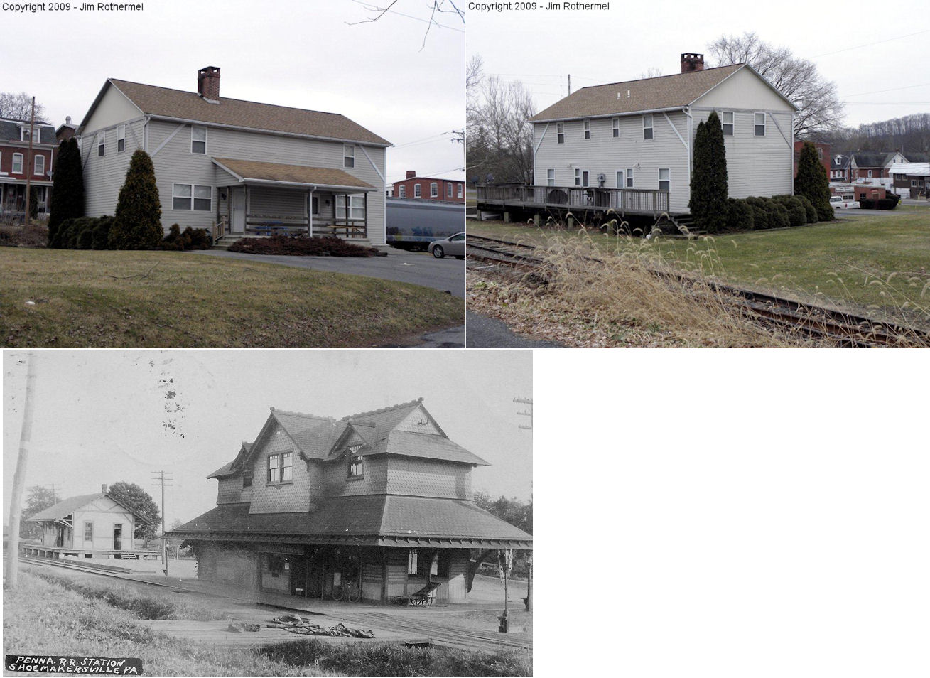
| Shoemakersville | |
Canal Street, just SE of the passenger station (GPS: 40.497906, -75.969588) |
F | Apartments | ???? | In Use | Wood | |
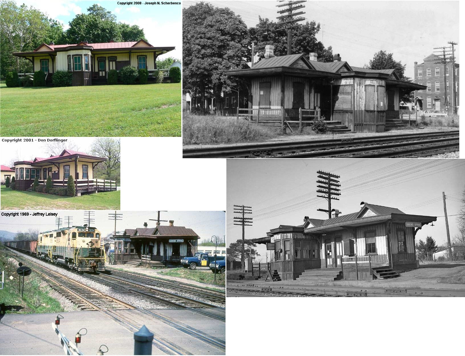
| Sinking Spring | |
In Heritage Park along the north side of the ex-RDG, off Keller Avenue (GPS: 40.322182, -76.030368) |
P | Civic | 1872 | None | Wood |
|
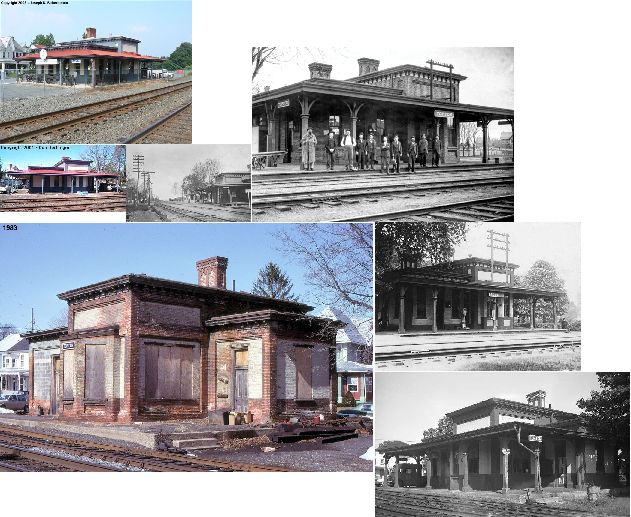
| Topton | |
Home Avenue, near State Street and East Centre Avenue (GPS: 40.504183, -75.700749) |
P | Business | 1875 | In Use | Brick |
|
| Vinemont (Deep Cut) |
 |
West side of Vinemont Road on the north side of the tracks (GPS: 40.279145, -76.078408) |
P | Residence | ???? | In Use | Stucco |
|
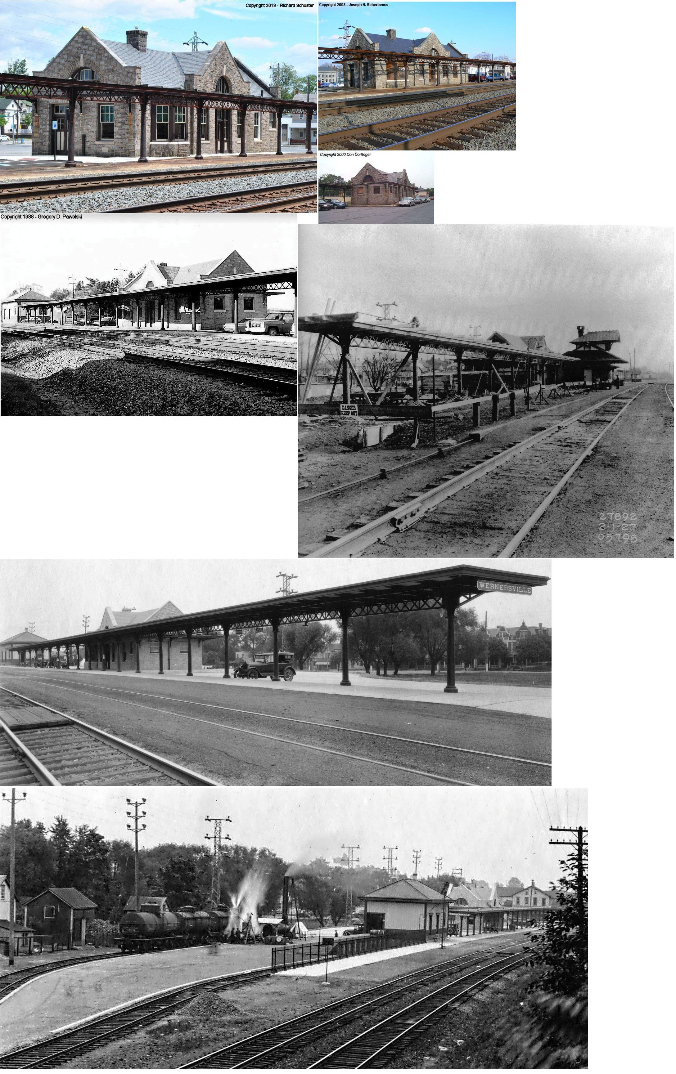
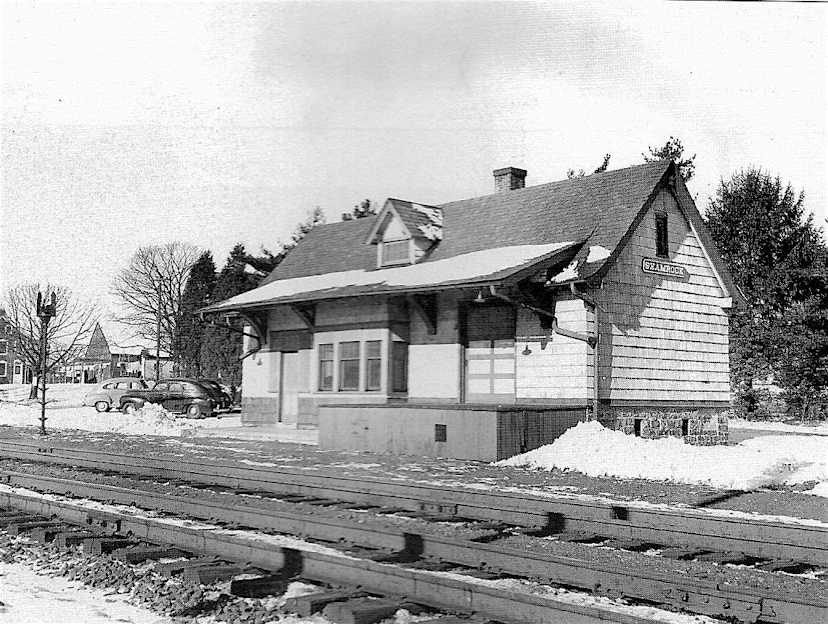
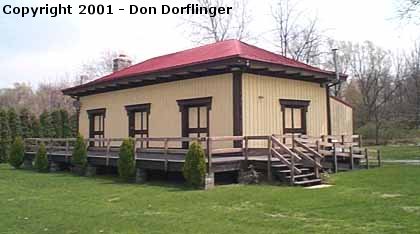
| Wernersville | |
20 East Penn Avenue between Werner Street and Stitzer Avenue (GPS: 40.279145, -76.078408) |
C | Civic | 1927 | In Use | Stone |
|
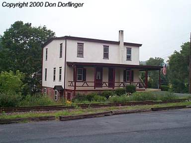
| Wernersville |
|
SW corner of West Holland Street and Stitzer Avenue (GPS: 40.328940, -76.080097) |
F | Business | 1856 | In Use | Wood | |
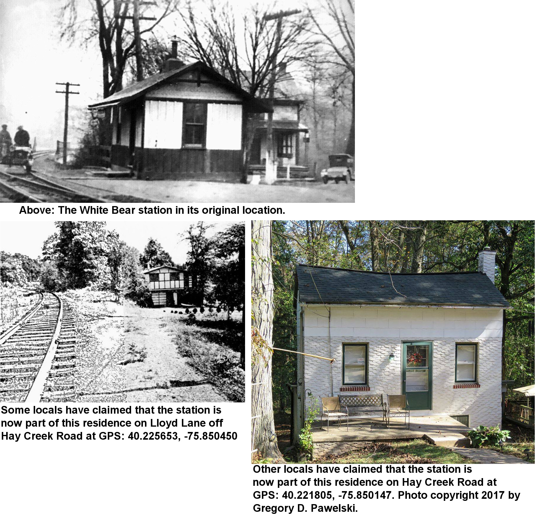
| White Bear (Scarlets Mills) |
|
Unknown. See photo for description of possibilities. |
C | Residence | 1895 | Gone | Wood |
|
| STATIONS OF THE PAST | ||||||||
| Station Name |
Original Railroad |
Notes | ||||||
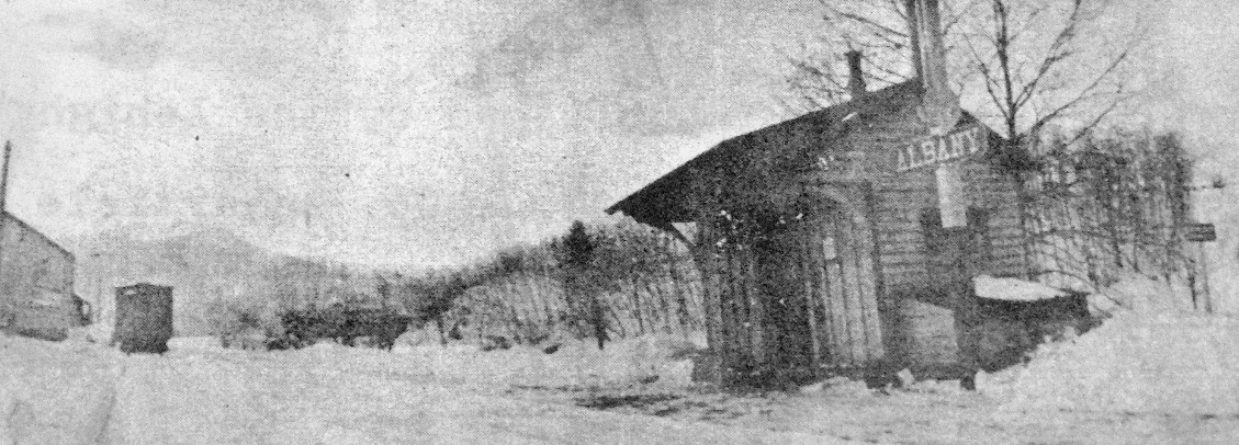
| Albany | |
A station is shown here on the 1876 county atlas. | ||||||
| Bechtelsville | |
The original station here was in about the same location as the existing station. | ||||||
| Berkley | |
|||||||
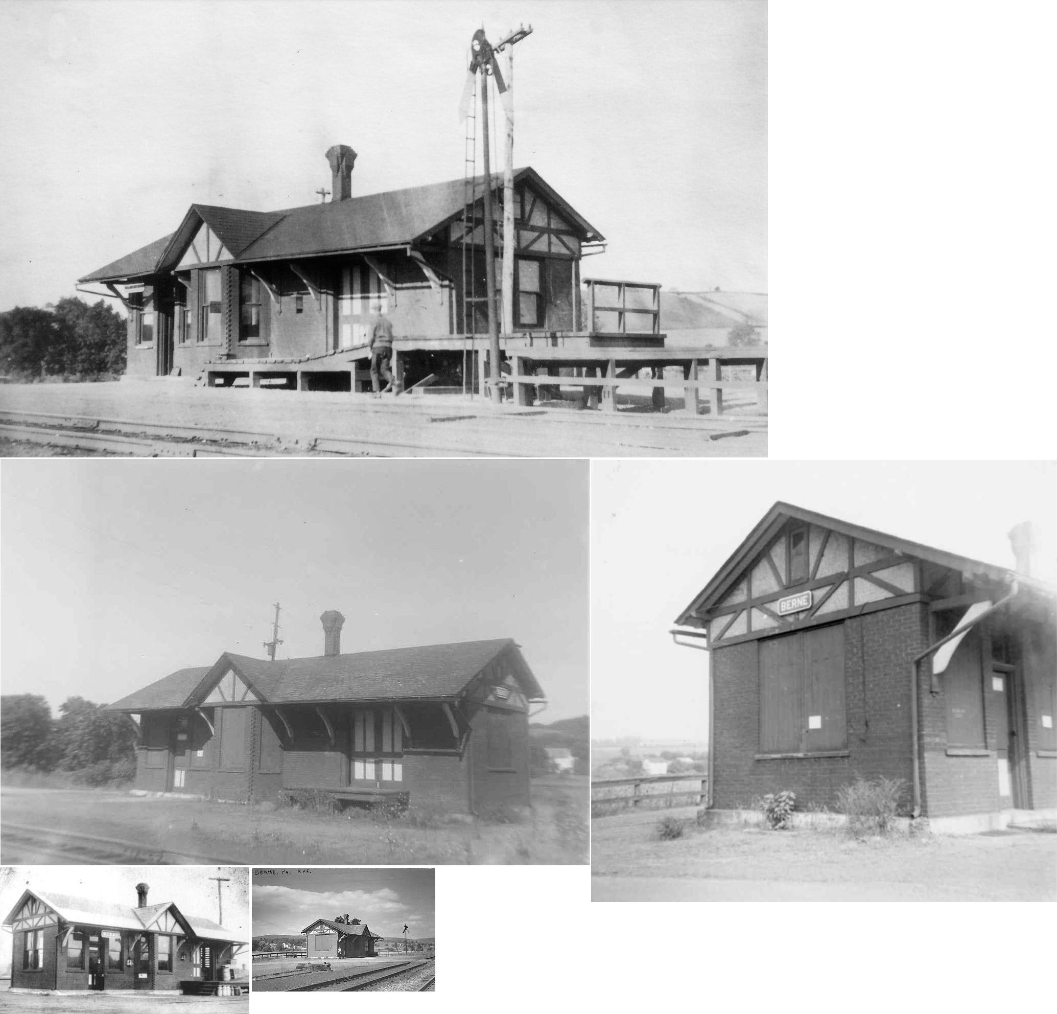
| Berne | |
The original station here was a small frame structure. | ||||||
| Berne | |
This brick station was built in 1914. | ||||||
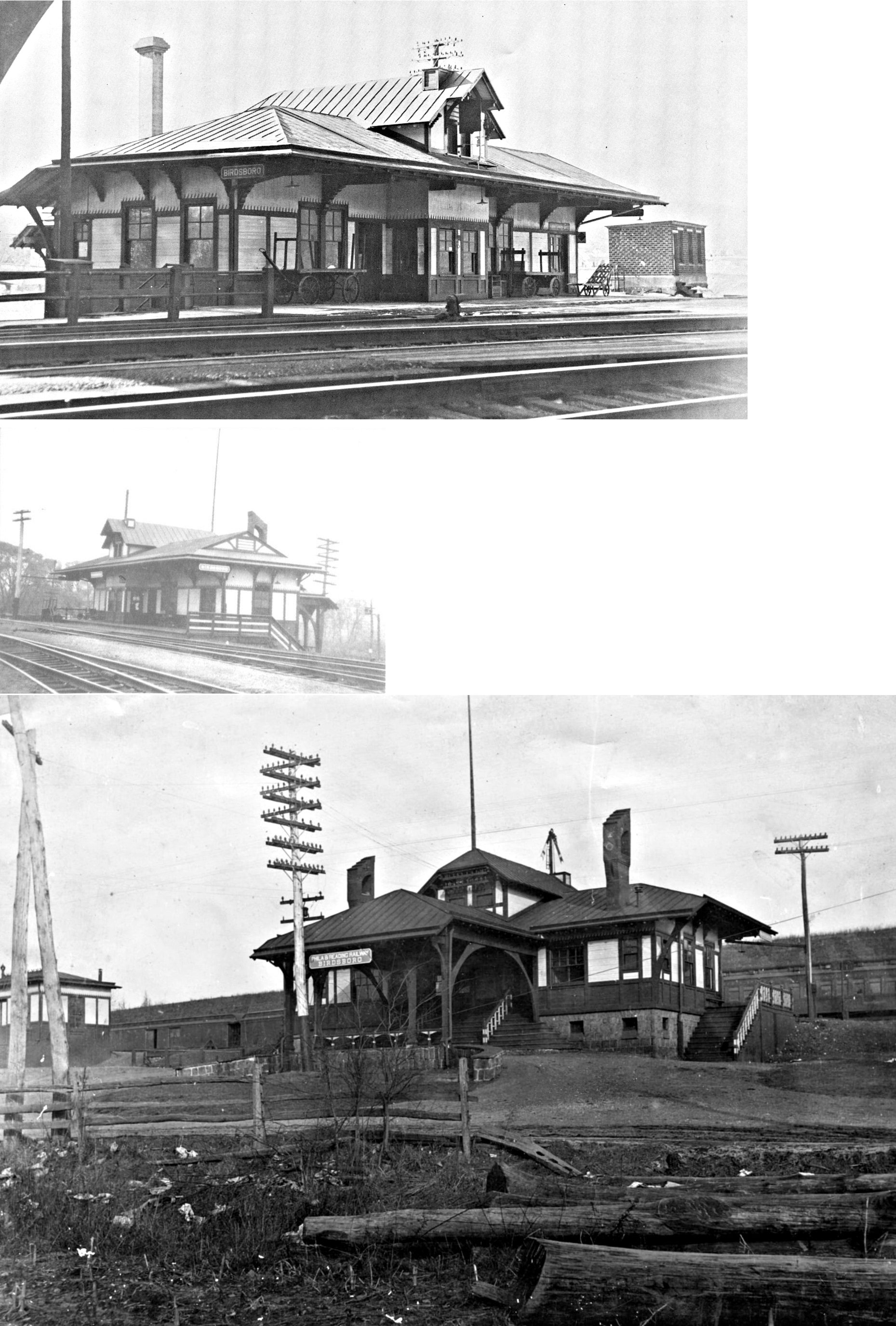
| Birdsboro |
|
According to the 1876 county atlas, the original Wilmington & Reading station here was on South Furnace Street on the south side of the tracks a bit north of Office Street (GPS: 40.262617,-75.807182). It was torn down in 1963. | ||||||
| Birdsboro |
|
There was a freight station virtually next door to the PRR freight station on the south side of 1st Street west of South Furnace Street on the east side of the tracks at GPS: 40.263409, -75.808113. | ||||||
| Birdsboro | |
Aside from the W&N station, there was also a station on the Reading main line where the Reading Belt began. This station was built in 1887. | ||||||
| Birdsboro | |
This freight station, built in 1914, was on the SW corner of Furnace Street and West 1st Street (GPS: 40.263411, -75.807758). It was dismantled in October 2024 and the pieces were catalogged and it is now (November 2024) for sale for $90,000. | ||||||
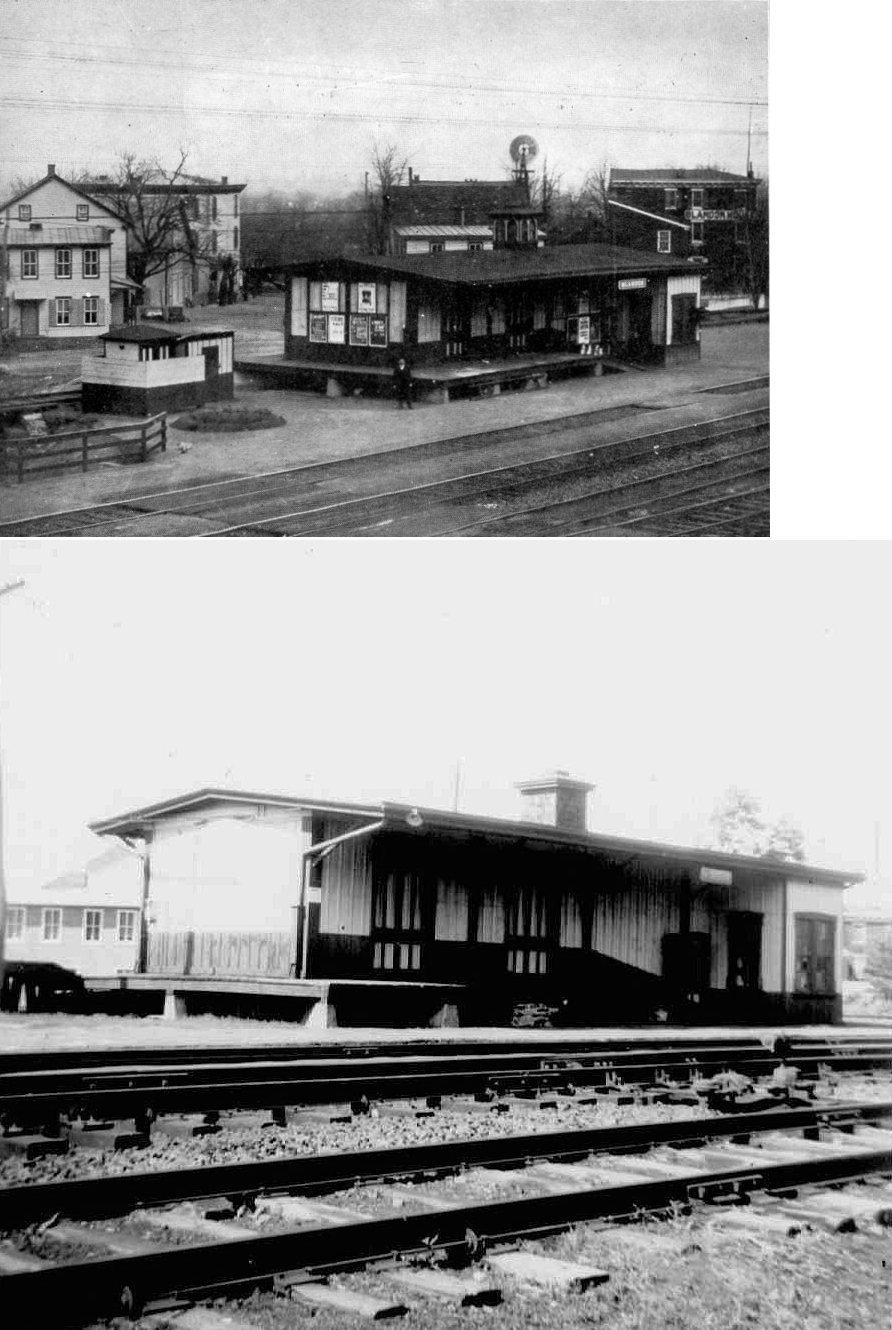
| Blandon | |
According to the 1876 county atlas, the original station here was on Chestnut Street about halfway between Main Street and Lindbergh Avenue. It was on the south side of the street and on the north side of the tracks (GPS: 40.439055,-75.884312). This was the same location of the station on the 1933 Sanborn map. The station was torn down in 1955 (Reading Eagle, 10-20-1982). | ||||||
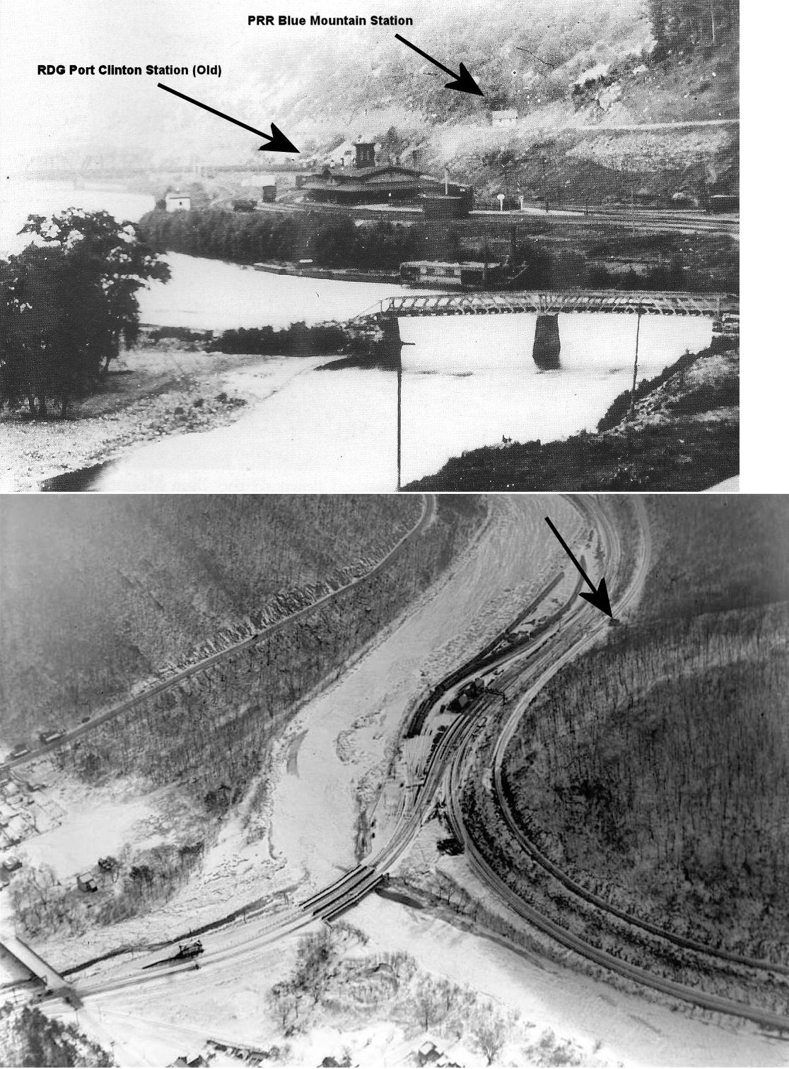
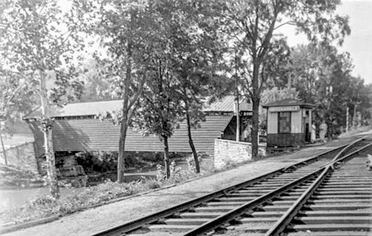
| Blue Mountain | |
This shed-type station was on the hill above the RDG Port Clinton station at approximately GPS: 40.575884, -76.025064. Hamburg was at milepost 76.6 and Blue Mountain was at 78.4 on the PRR. | ||||||
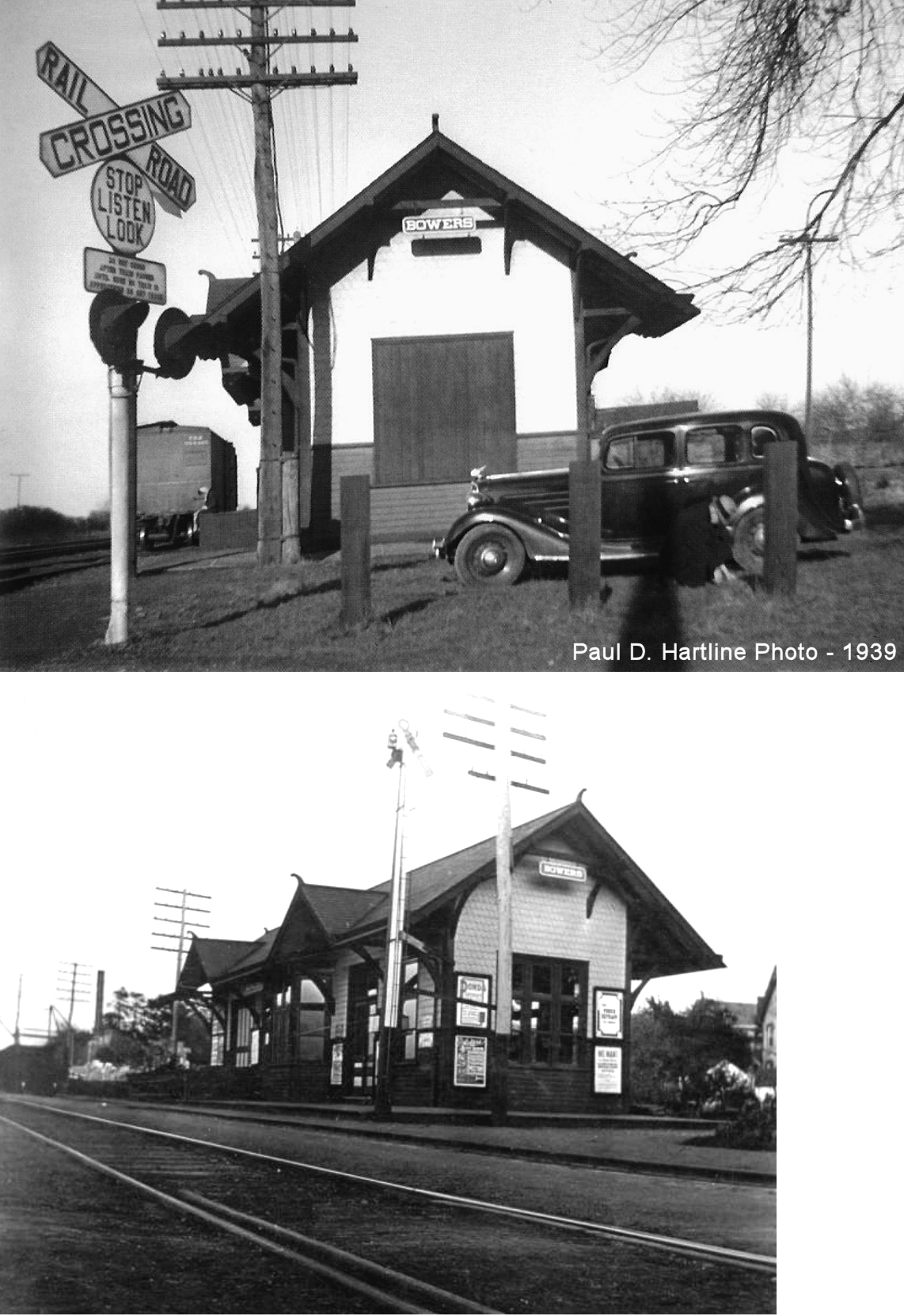
| Bowers | |
The original station here was burned down by burglars on October 4, 1894 (Greenville Record Argus, 10-11-1894). The station in the photos was on the east side of Bowers Road on the south side of the tracks at GPS: 40.487927, -75.741746. | ||||||
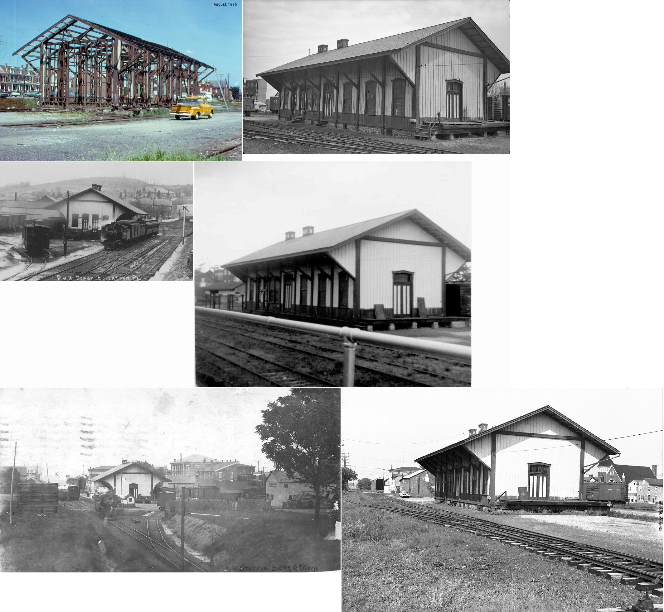
| Boyertown | |
Also known as Colebrookdale, this combination station was built 1868 and was located on the northeast side of Third Street between South Chestnut and South Washington Streets (GPS: 40.331436,-75.636637). The station was dismantled in August, 1975. Passenger service ended on the Colebrookdale Branch on January 23, 1933. | ||||||
| Clingan | |
Shown on the PRR List of Stations & Sidings from 1900. This station was between Birdsboro and Robeson. | ||||||
| Clingan | |
|||||||
| Cold Run Station |
|
A station is shown here on the 1876 county atlas. It was on the NE side of Cold Run Road on the SE side of the tracks at GPS: 40.196833, -75.832898. | ||||||
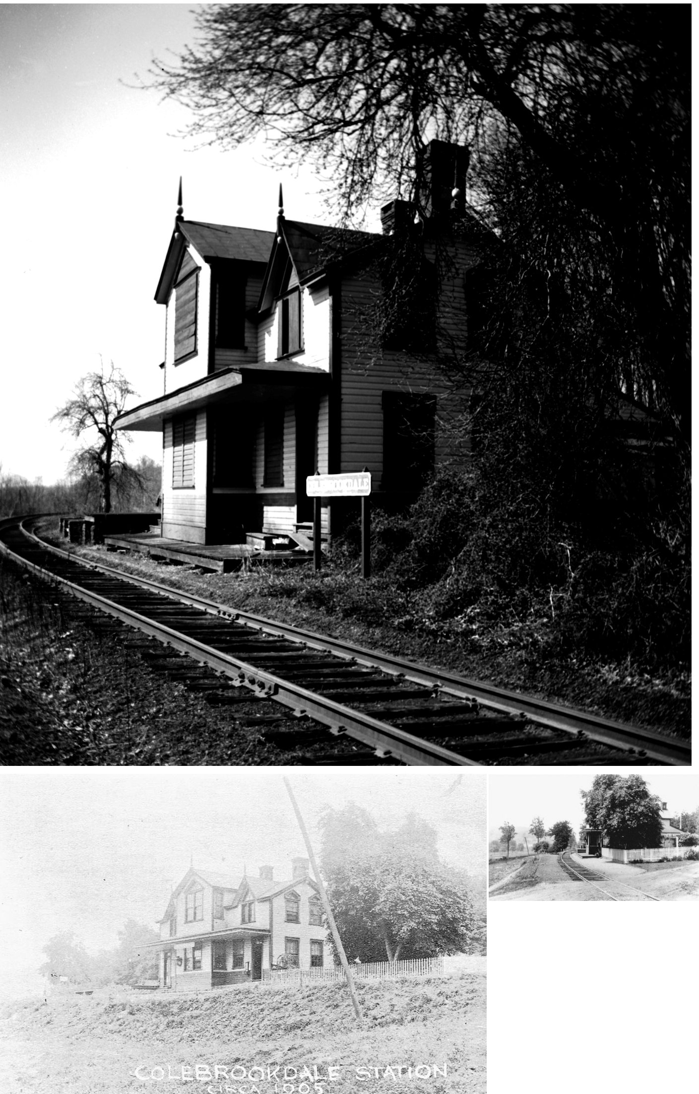
| Colebrookdale | |
This station was built in 1871. It was a standard plan also used at Barto and Pine Forge. | ||||||
| Dauberville | |
A new freight station was built here in 1916 (Reading Times, 4-26-1916). | ||||||
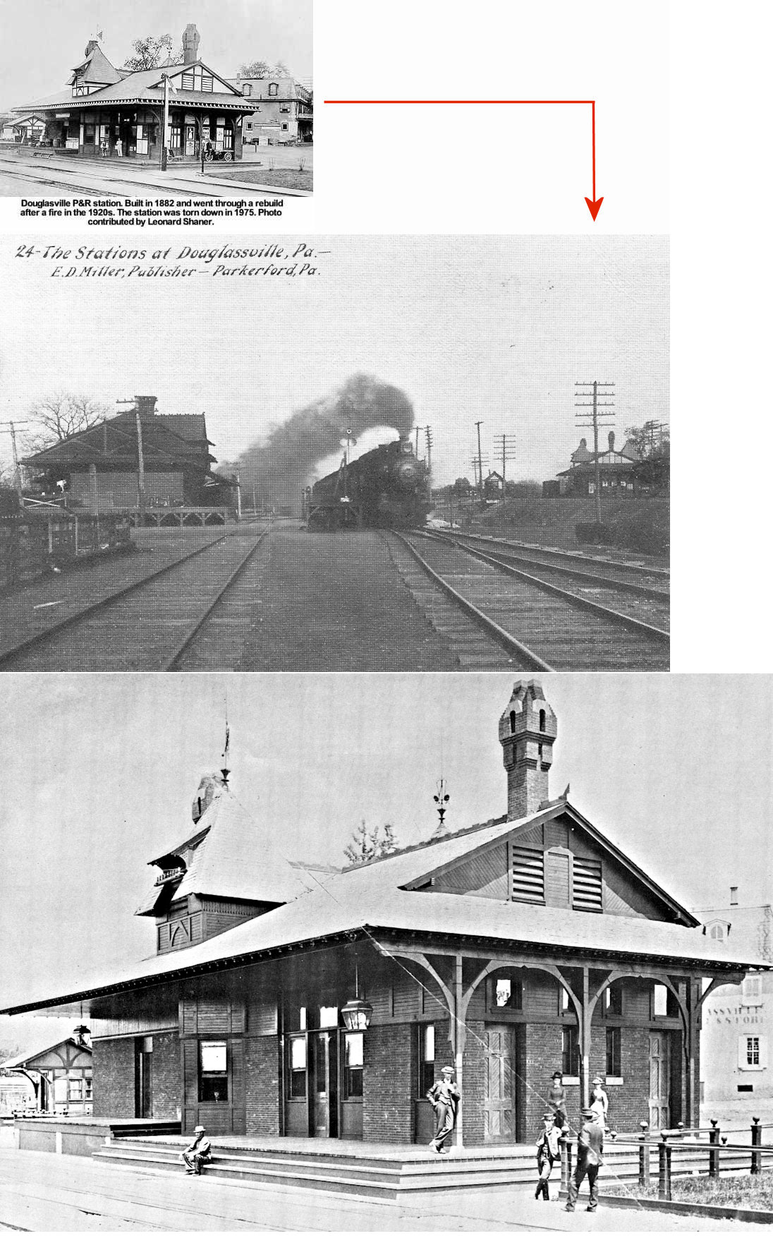
| Douglassville | |
The first station here stood near where the Douglassville Hotel is today. According to Bernhart & Bernhart's Reading Railroad Station Pictorial (1999), it was a private station rented by the railroad. That station was nearly destroyed by fire in 1869 (The Jeffersonian, 9-4-1869). A newspaper report from late 1870 said that the railroad intended to construct a new brick station (presumably in 1871) after the town had raised $1,500 as its contribution to the project which cost $10,000 in total (Reading Times, 12-28-1870, 4-17-1871). As of May 1872 the station had not yet been completed (Reading Times, 5-29-1872). Apparently that station was constructed from stone rather than brick. When the station was torn down to make way for the third station (see below) the railroad donated the stone for the construction of a new church in Douglassville (Daily Village Record, 1-7-1882). This was likely the new stone building at St. Gabriel's Episcopal Church which was constructed between 1881-1884. | ||||||
| Douglassville | |
This brick station was built in 1882, was designed by Frank Furness, and also sat on the north side of the tracks near the Douglassville Hotel. | ||||||
| Douglassville | |
Built 1916, this was at the fourth Reading station here. It was south of the Old Swede Road/US-422 intersection on the north side of the tracks at GPS: 40.255532, -75.727431 (essentially the same site as the previous stations). It was still standing in the early 1970s, but was abandoned by then. | ||||||
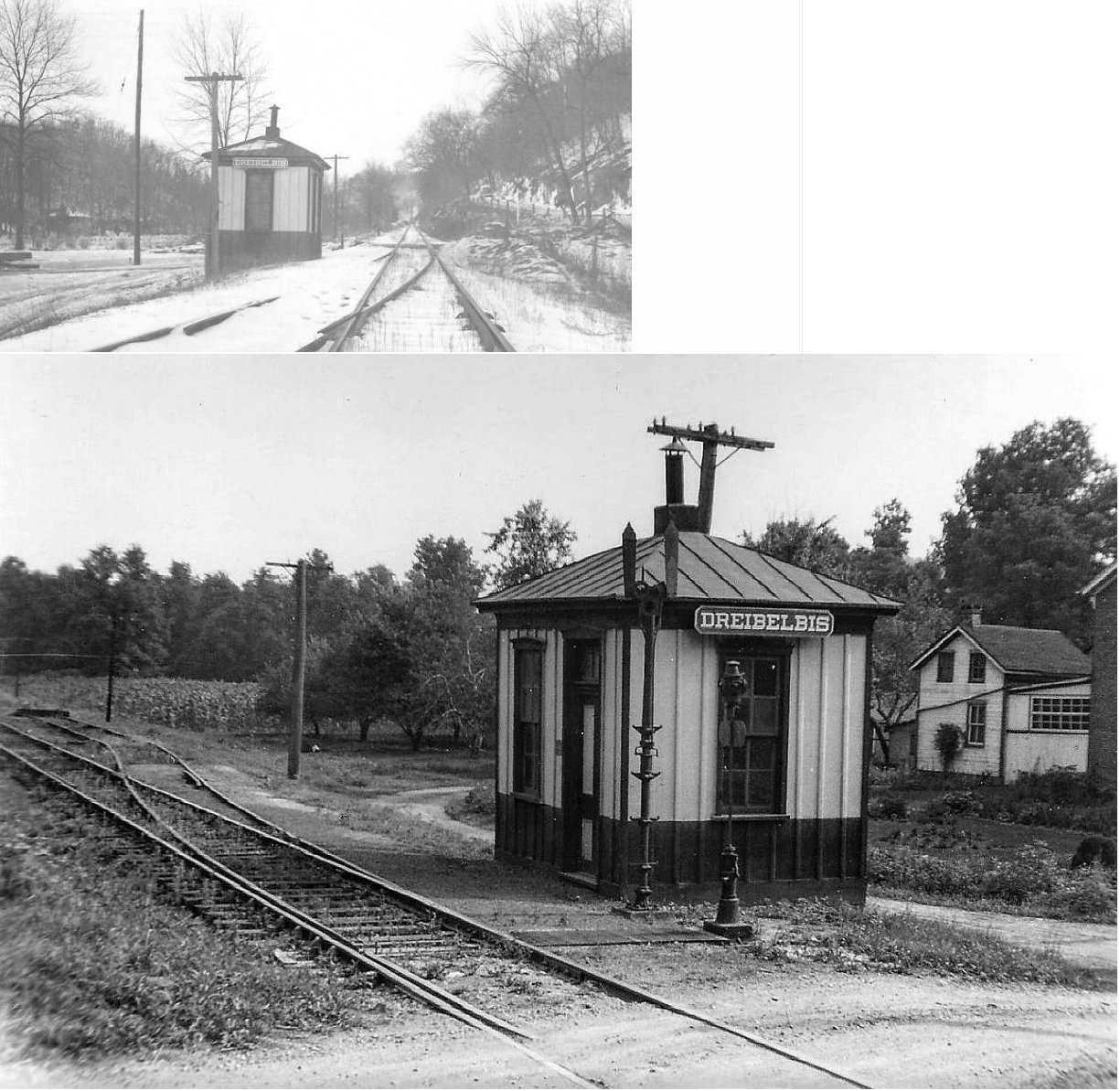
| Driebelbis | |
Built in 1891. | ||||||
| Eschbach | |
This Reading station on the Colebrookdale Branch was near the intersection with Stauffer Road. | ||||||
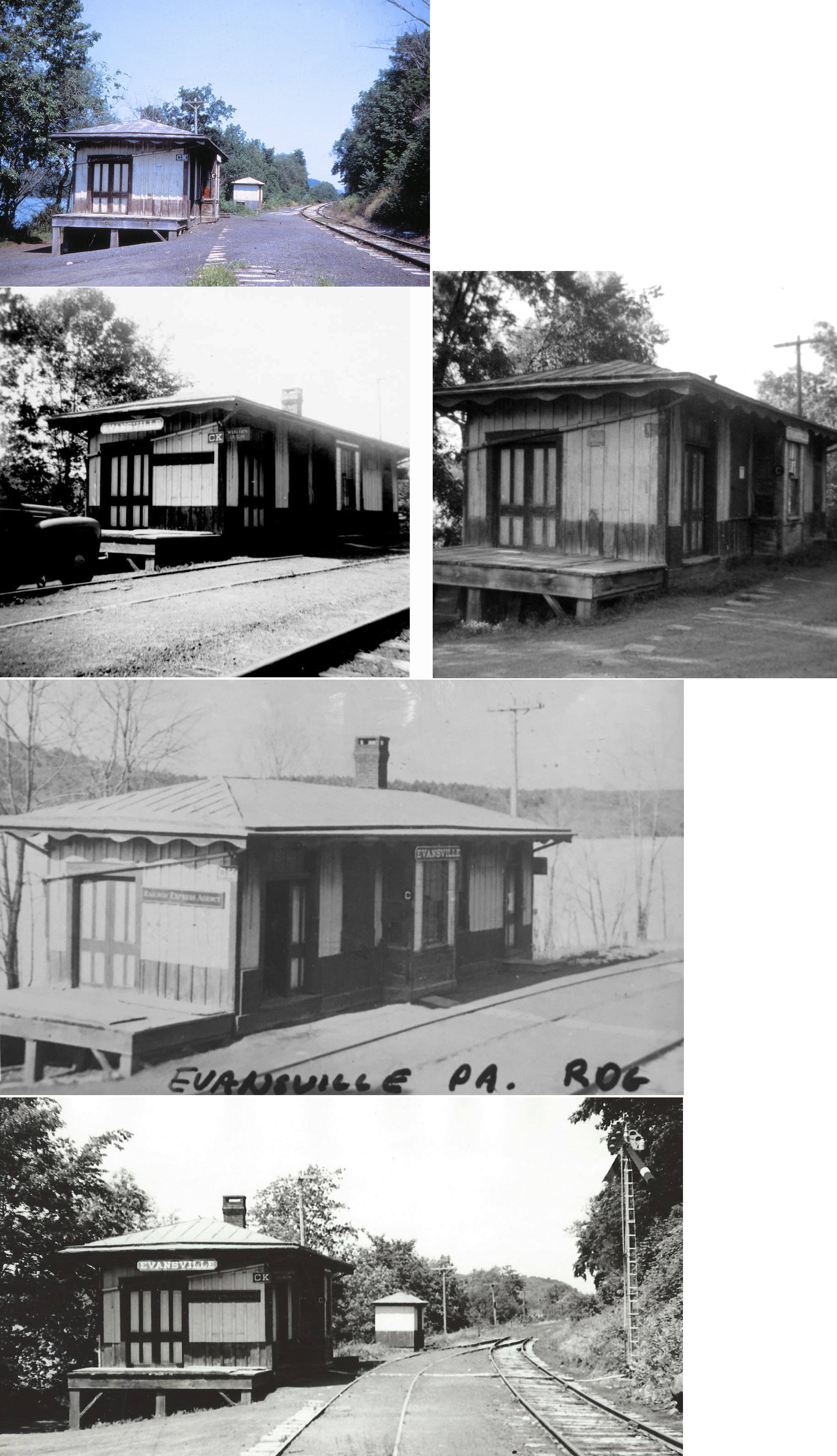
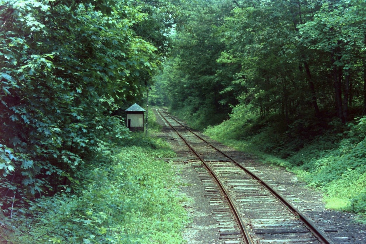
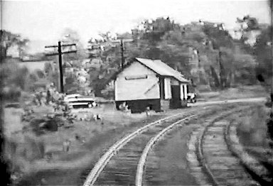
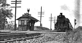
| Evansville | |
Built 1877. | ||||||
| Exeter | |
See listing for Lorane. | ||||||
| Farmington | |
A Catasaqua & Fogelsville RR station is shown here on the 1876 county atlas. There was a passenger and freight station here at that time. | ||||||
| Five Locks Station | |
This station was on Five Locks Road at approximately GPS: 40.525888, -75.985634. | ||||||
| Fritztown | |
A passenger shelter was built here in 1886. | ||||||
| Fuhrmans Grove | |
This stop was just north of Trexler at the Fuhrmans Grove picnic area. There was a small shelter-type station here a little larger than a phone booth. It was torn down around 1990. The picnic area itself, not much more than a couple of picnic tables, was destroyed by a wind storm in 2011. | ||||||
| Geigertown |
|
This station was on Geigertown Road at GPS: 40.218022, -75.830719. In 1970 the Reading Eagle reported that this station was moved to Joanna. Can anyone confirm whether this station still exists? The paper also reported that the Kempton station (now in Joanna) had been razed, so maybe the reporter got those two stations mixed up? | ||||||
| Gibraltar |
|
This shelter was at the Boonetown Road crossing (not a thru street there anymore) at approximately GPS: 40.281866, -75.861691. | ||||||
| Gibraltar |
|
|||||||
| Greenawald |
|
This station was at what is now the intersection of Little Round Top Road and Kirk Road at the bridge that crosses over to PA143 at approximately GPS: 40.603532, -75.872368. The right of way was next to the current day roads/overlapping. As shown in the photo, the station sat right at the bridge which is now a concrete bridge (not the old covered bridge). This was an original stop on the S&L branch. The tracks were removed in the 1960s. | ||||||
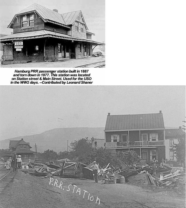
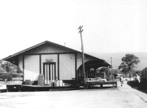
| Hamburg |
|
This combination station was on the west side of the tracks south of State Street and east of Hill Drive at GPS: 40.551896, -75.993925. | ||||||
| Hamburg | |
Built in 1885 when the Pennsylvania Schuylkill Valley RR opened between Hamburg and Reading. Torn down in 1977. This station was at 2nd Street (formerly Station Street) & State Street (formerly Main Street) (GPS: 40.554304, -75.986547). Station was used for the USO in the WWII days. Second photo shows station after a flood in 1906. | ||||||
| Hamburg | |
There was a freight station east of 2nd Street between Pine and Walnut Streets. The station was on the east side of the tracks at GPS: 40.552145, -75.984793. | ||||||
| Hancock | |
This station was between Topton and Mertztown. | ||||||
| Hinterleiter | |
This station was on the Allentown Branch between Topton and Kutztown. | ||||||
| Ironstone Station | |
This shelter-type station was between Colebrookdale and Manatawny just south of Red Shale Road on the west side of the tracks. A station is shown here on the 1876 county atlas. | ||||||
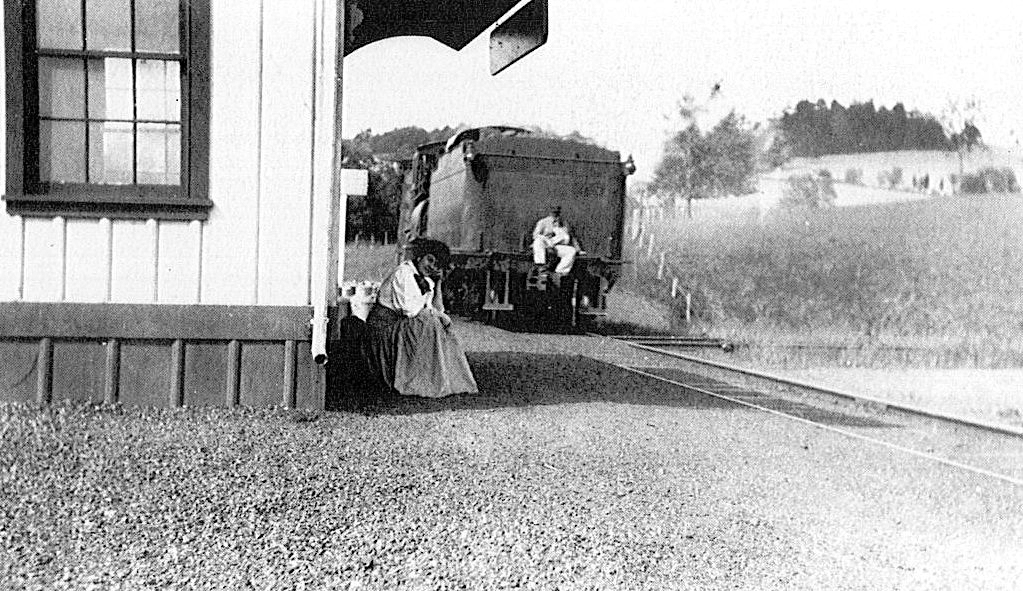
| Joanna Heights |
|
This station was on the east side of Hay Creek Road on the SE side of the tracks at GPS: 40.185330, -75.854824. | ||||||
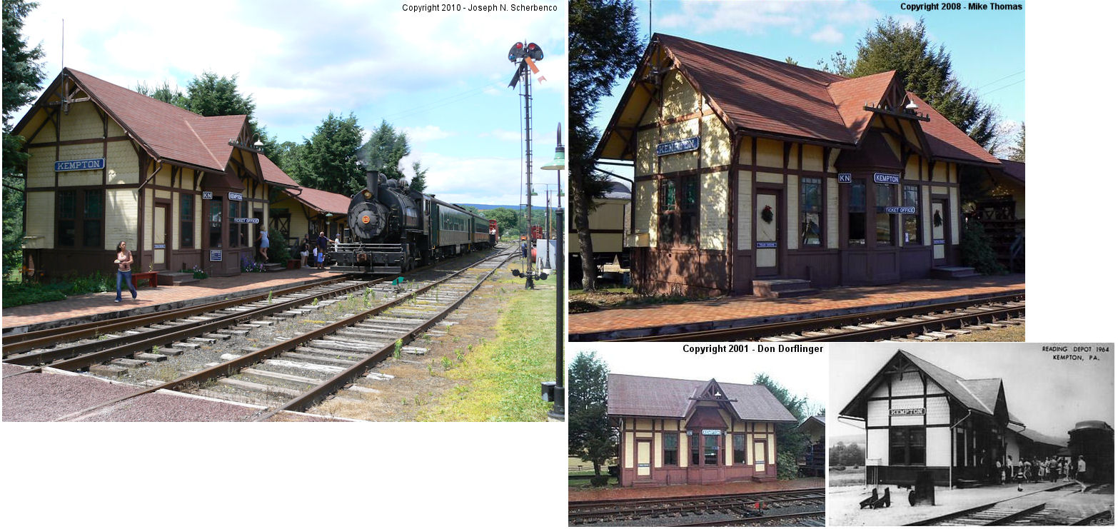
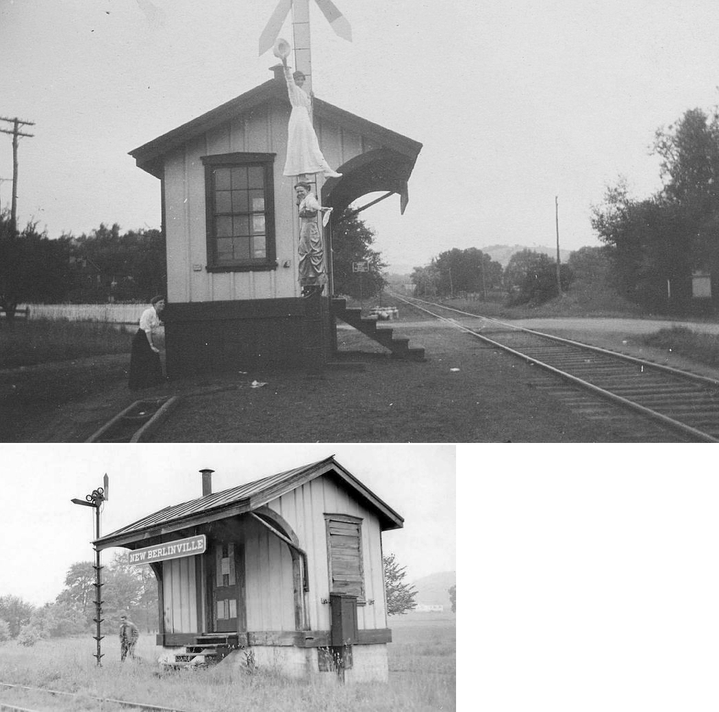
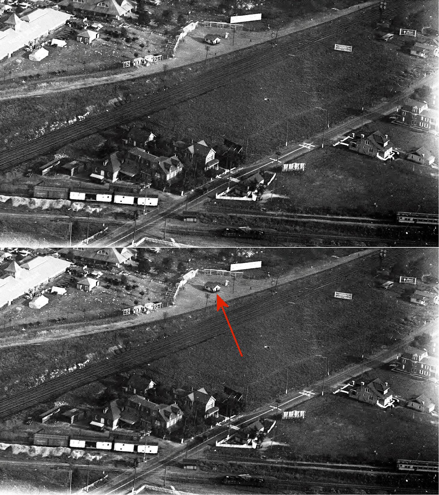
| Kempton |
|
This station was built in 1880 and demolished in the mid to late 1960s. It was on the west side of Kistler Valley Road on the west side of the tracks just south of 2nd Street at GPS: 40.625540, -75.853458. | ||||||
| Kenneys |
|
|||||||
| Kissinger (Reading) |
|
See listing below for Reading (Kissinger). | ||||||
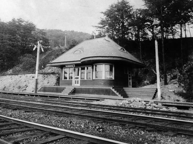
| Klapperthal Junction |
 AND |
The Neversink Mountain was a standard-gauge electric railroad that was closed in 1917. The station was closed by the Reading in 1902. | ||||||
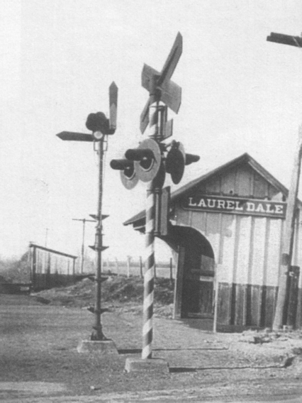
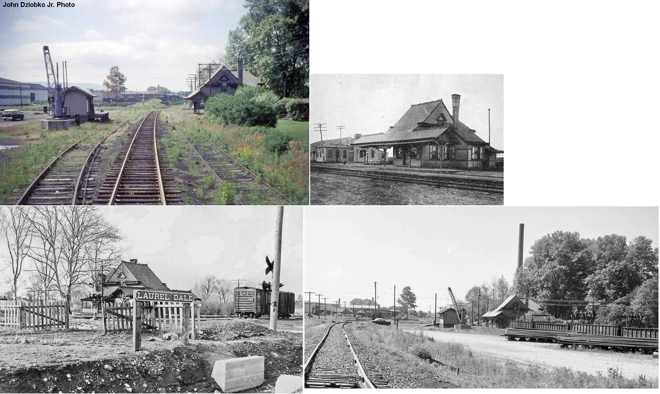
| Laurel Dale |
|
This station was on the south side of Tuckerton road on the west side of the tracks at GPS: 40.407304, -75.929544. It was just to the SE of the Temple PRR station (which was on the north side of the road on the west side of the PRR tracks. | ||||||
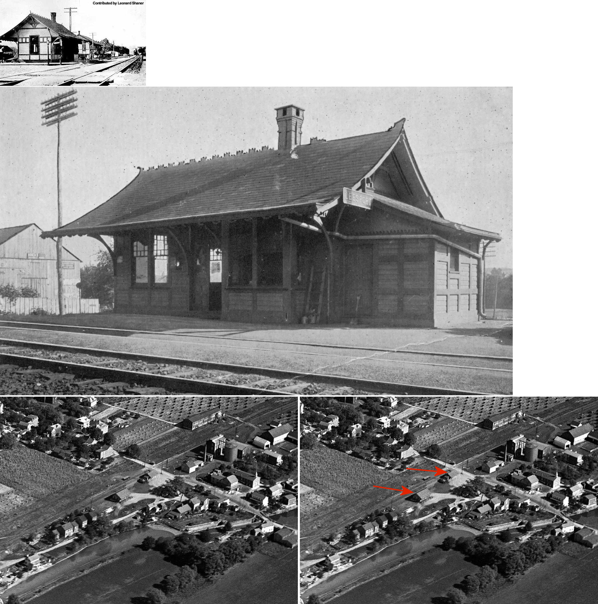
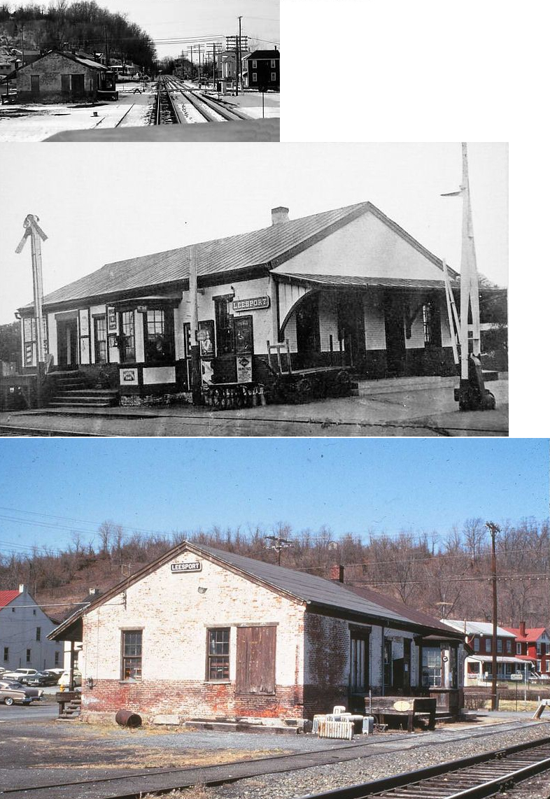
| Leesport | |
This station was built in 1885 when the Pennsylvania Schuylkill Valley RR opened between Hamburg and Reading. The passenger and freight stations were on the NW side of Wall Street on the SW side of the tracks at GPS: 40.447558, -75.966066. | ||||||
| Leesport (West Leesport) |
|
The Reading Railroad Station Pictorial (Vol. 2) claims the station was built in 1877, whereas the book Reading's Victorian Stations claims it was built in 1859. | ||||||
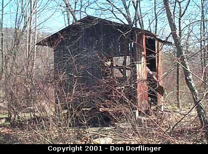
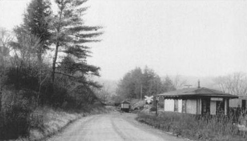
| Lenhartsville | |
Freight station. Sat near a cottage that was an old RDG toolshed in the woods off Old 22. Collapsed into a pile of debris around 2005-2006. The tool/shed cottage was dismantled around 2016 and taken to the Colebrookdale RR to be reassembled there. | ||||||
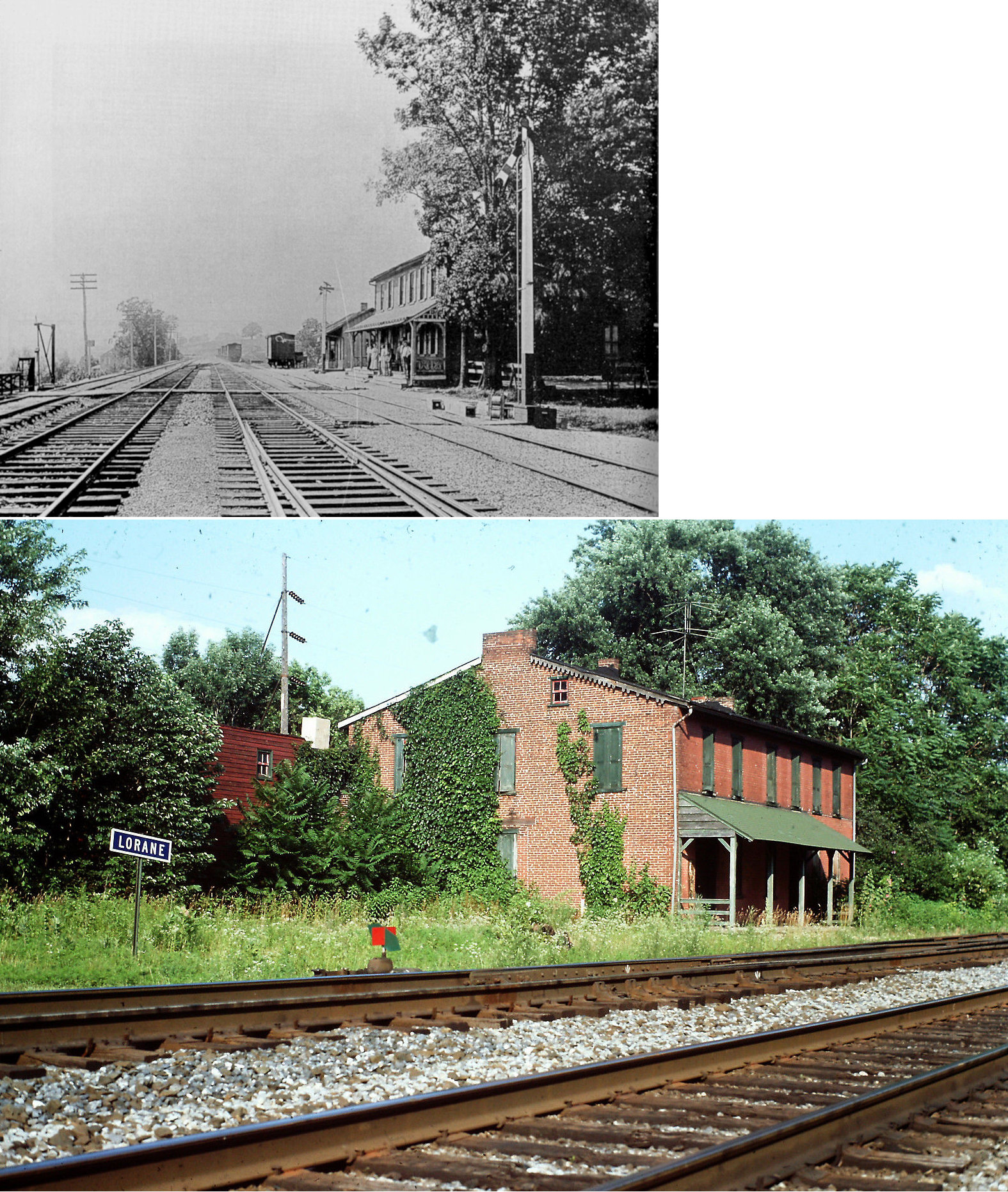
| Lorane (Exeter) |
|
A station is shown here on the 1876 county atlas as "Exeter." Later a brick station with the name Lorane was built in 1884. On the 1915 county map the station is still listed as Exeter, however it is listed as Lorane on the 1926 map. | ||||||
| Lyons | |
This station was on the west side of Kemp Street on the north side of the tracks at GPS: 40.481421, -75.759664. | ||||||
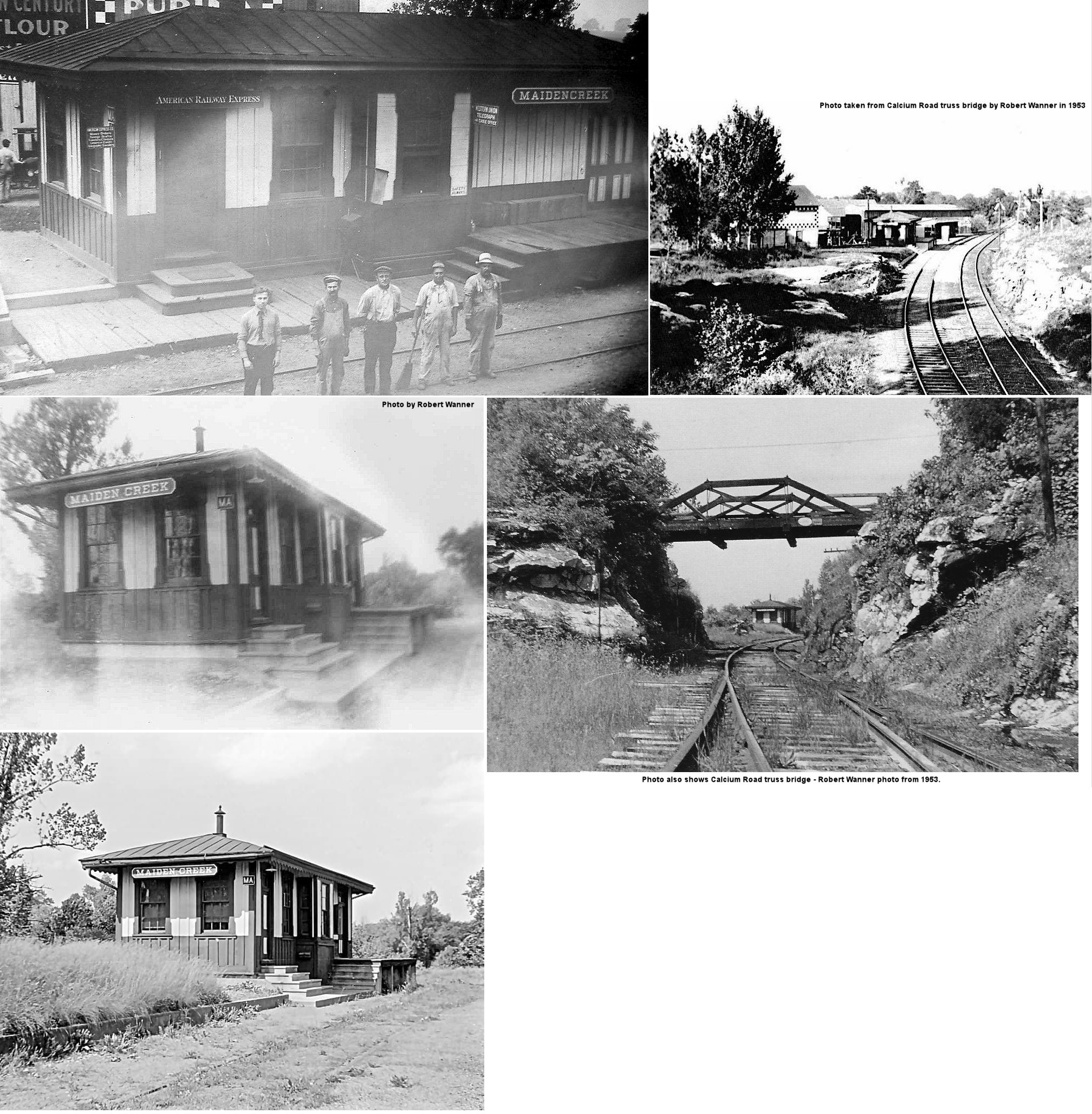
| Maiden Creek | |
|||||||
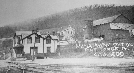
|
Manatawny (Pine Forge) |
|
|||||||
| Mertztown | |
An East Penn RR freight station is shown here on the 1876 atlas. | ||||||
| Millmont | |
This flag stop station was three miles from the Reading Outer station. It was in the vicinity of GPS: 40.310605, -75.920821. It adjoined the Sewage Purification Works, right by the filter beds (now the location of Brentwood Industries), before the line went under the PRR bridge The station was on the Wilmington & Northern Branch, before the Belt Line was built in 1902. The Belt Line was built in 1902 right over the Millmont Station. The 1891 W&N Timetable shows the Millmont Station 3.2 miles south of the S. Front & Cherry Street Station. Not to be confused with the Millmont station in Union County. | ||||||
| Mohrsville | |
This photo shows only the platform which is gone. The main station building is still standing down the hill. | ||||||
| Mohrsville | |
Built in 1864. | ||||||
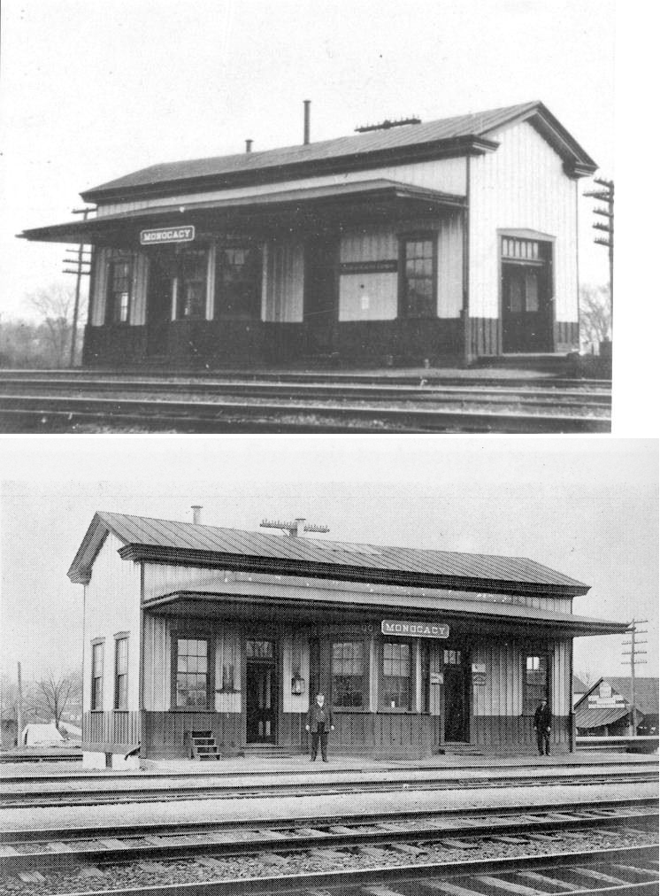
| Monocacy | |
Built in 1882. | ||||||
| Monocacy | |
|||||||
| Monocacy (West Monocacy) |
|
|||||||
| Montello (Meitzeltown) |
|
This station was about a mile south of Sinking Spring. A passenger shelter was built here by a local resident in 1886. Later, the station was on the SW side of Montello Road on the NW side of the tracks at GPS: 40.313017, -76.039489. | ||||||
| Moselem | |
|||||||
| Muhlenberg | |
There was a flagstop passenger shelter here. It was on the south side of East Bellevue Avenue on the west side of the tracks at GPS: 40.385154, -75.932508. | ||||||
| Muhlenberg | |
|||||||
| Naomi Station (Ridgewood) |
|
This station was on the north side of Philadelphia Avenue (PA724) on the west side of the tracks at approximately GPS: 40.295840, -75.896447. | ||||||
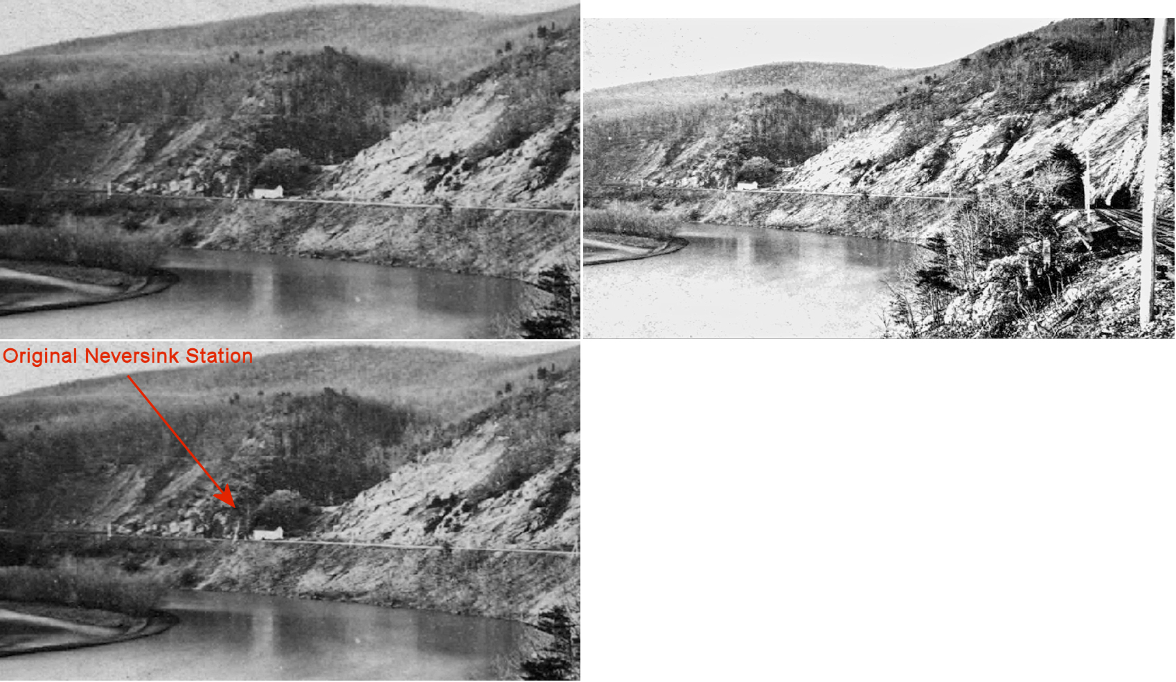
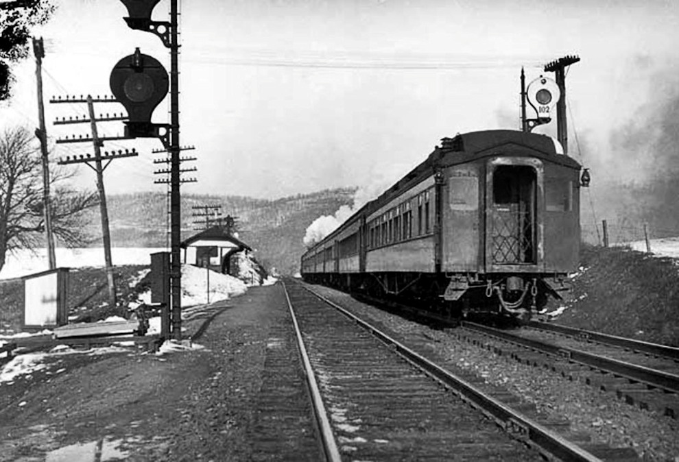
| Neversink Station | |
The original P&R Neversink Station was a two-story structure at the crevice on the south side of Neversink Mountain circa 1860-1870. The station agent at Neversink Station was Jones DeTurk where he lived with his wife Kate G. DeTurk. According to The Geology of the South Mountain Belt of Berks County, Volume 14, Issue 2, a limestone area was comprised in the Neversink Hills synclinal, cut through 25 feet by the P&R Railroad, in the first big bend south or Reading, where it had been considerably altered and metamorphosed by pressure and showed a crystalline texture. This was probably the reason for the first station being placed where it was. The limestone here was generally white and so contorted and twisted that all attempts to get reliable dips were abandoned. By 1876 (as shown on the 1876 Historical Atlas) the original Neversink Station was moved east to the West Neversink Road intersection with the railroad. | ||||||
| Neversink Station | |
This was the second generation Neversink Station that was on West Neversink Road at approximately GPS: 40.303570, -75.887435. | ||||||
| New Berlinville | |
This station was on North Reading Avenue just south of Hughes Avenue in Colebrookdale Township. | ||||||
| Ontelaunee | |
This station is shown on the 1915 and 1926 maps. It was on the Pottsville Pike (PA61) on the south side of the tracks at GPS: 40.417907, -75.938951. | ||||||
| Orrton | |
This station was on the east side of Morgantown Road at Orrton Avenue (GPS: 40.315457, -75.924687). The station is shown on the 1920 Sanborn map. | ||||||
| Pine Forge | |
This station, on the Colebrookdale RR, was built in 1870. It was built from the same plan as the Barto station (still standing). | ||||||
| Poplar Neck | |
This station was three miles from the Reading Outer station. | ||||||
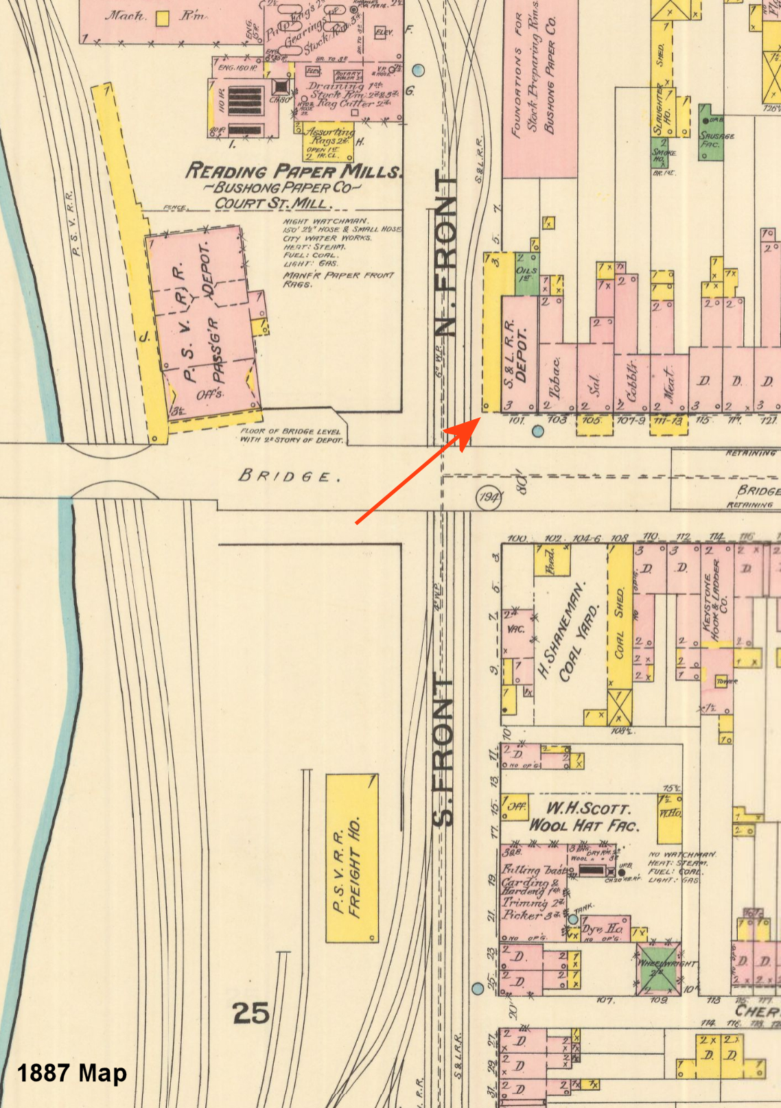
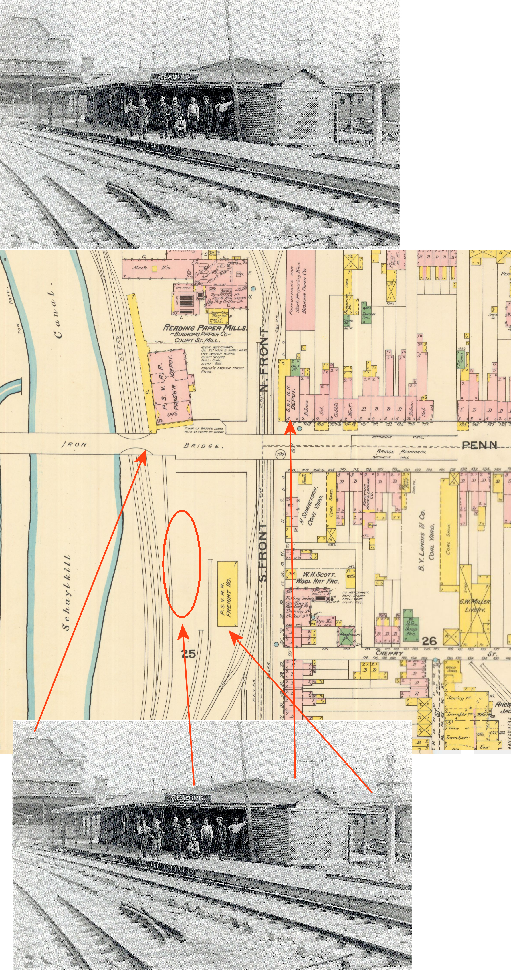
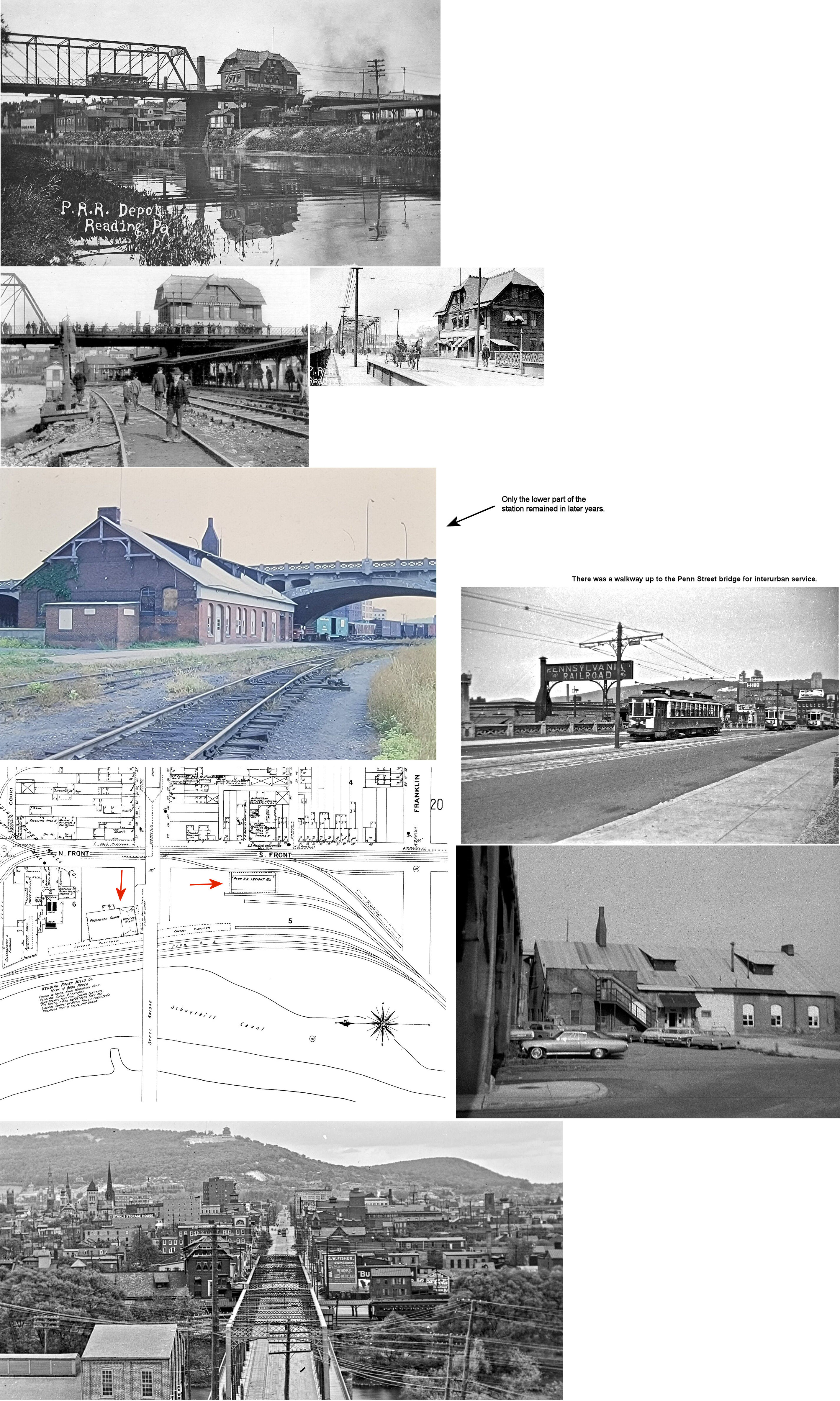
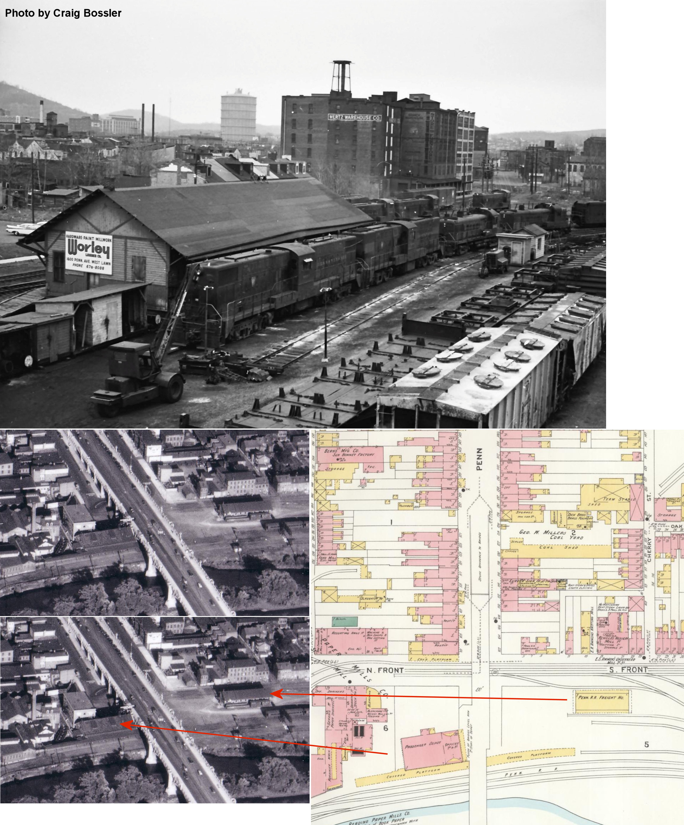
| Reading | |
The first station at Reading was built by the Berks County RR (later the Schuylkill & Lehigh RR, later the P&R) in 1871. This 3-story, brick passenger depot was at the NE corner of Penn and North Front Streets (GPS: 40.335627, -75.935341). The tracks ran along North Front Street. After most of the P&R traffic was moved to the Outer Station, W&N trains bound for Wilmington still used this station until 1888. It is shown on 1887 Sanborn map. By the 1904 map, the building was used as a restaurant and by 1933 it was torn down. | ||||||
| Reading |
|
In 1887 there was a freight station on the west side of 2nd Street between Franklin and Cherry Streets (GPS: 40.334141, -75.934109). This freight station was gone by 1904. Later, a coal shed was built on the site. | ||||||
| Reading | |
The first station built at the junction of the East Penn, Lebanon Valley and P&R at 7th and Chestnut Streets was a frame structure built in 1859 that served until the nearby Outer Station opened in 1874. | ||||||
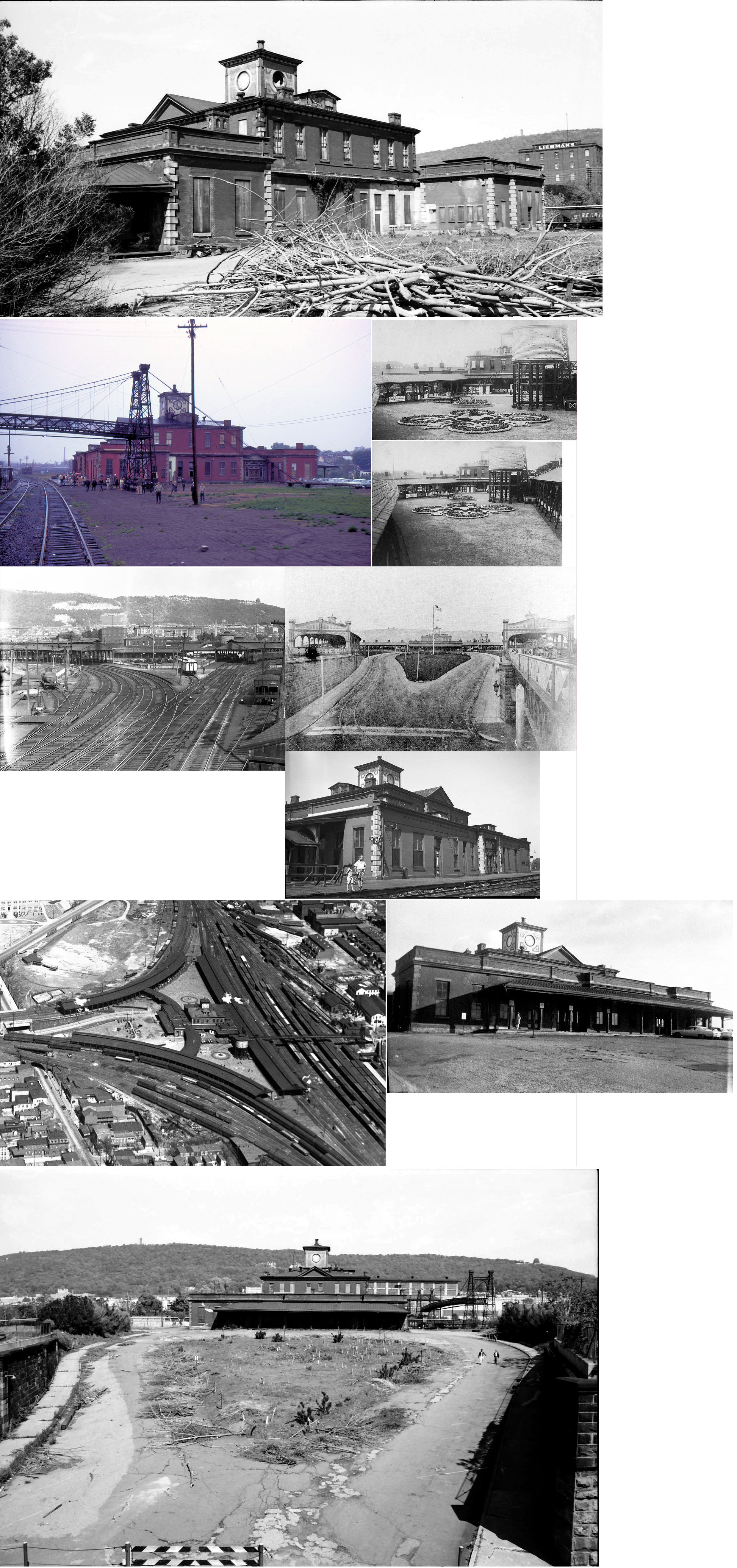
|
Reading (Outer Station) |
|
Built in 1874, and known as the Outer Station, this structure with extensive landscaping was on the east side of 6th Street between Buttonwood and Greenwich Streets (GPS: 40.342868, -75.924251). The station burned in 1978. | ||||||
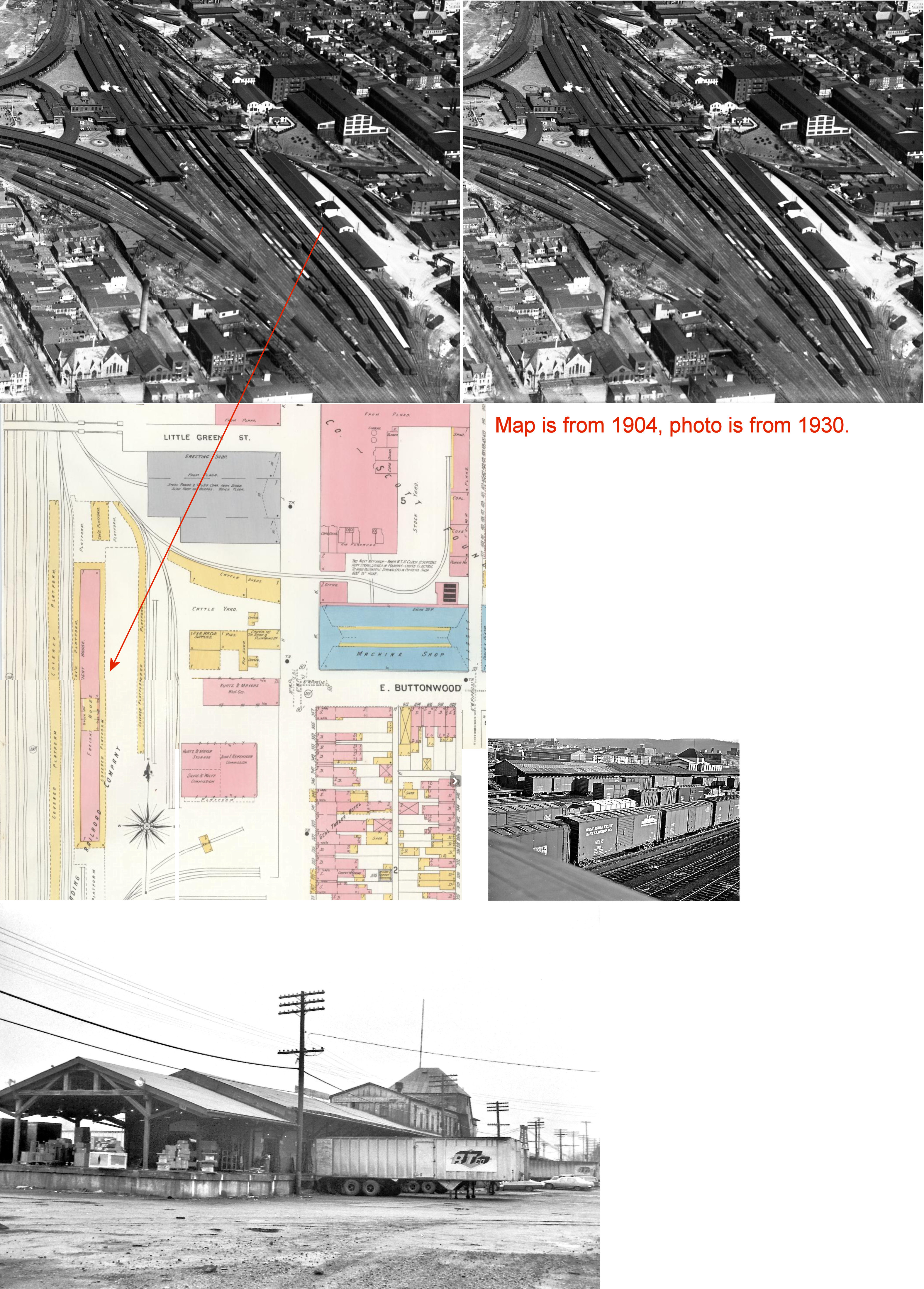
| Reading | |
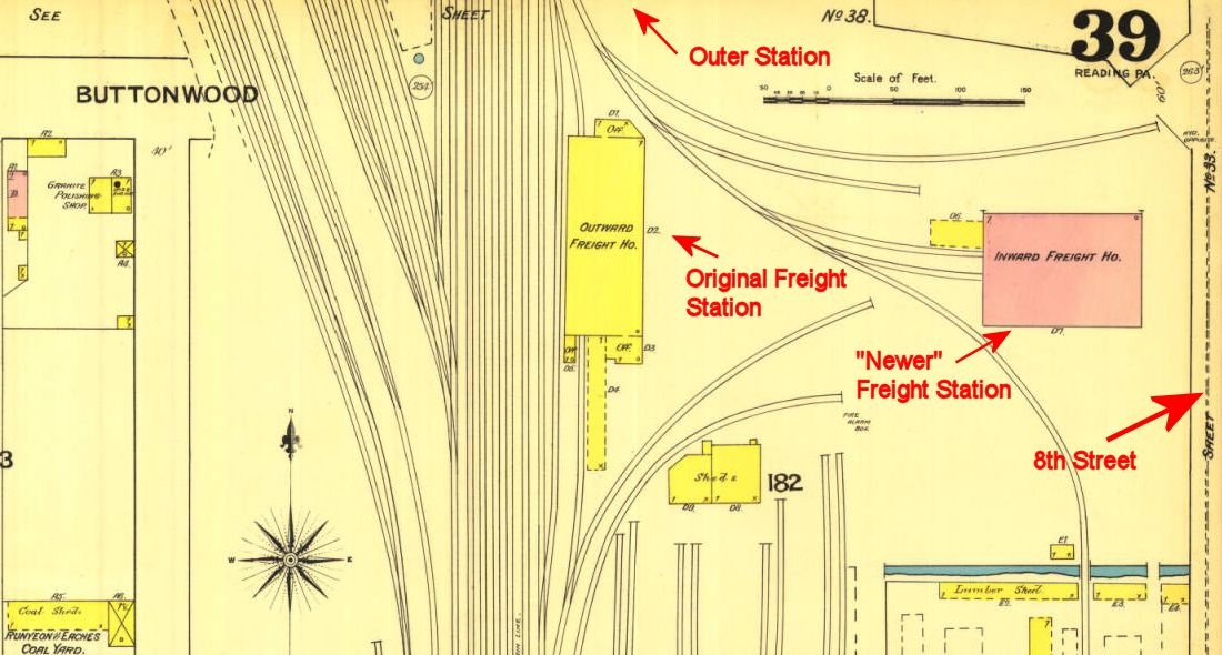
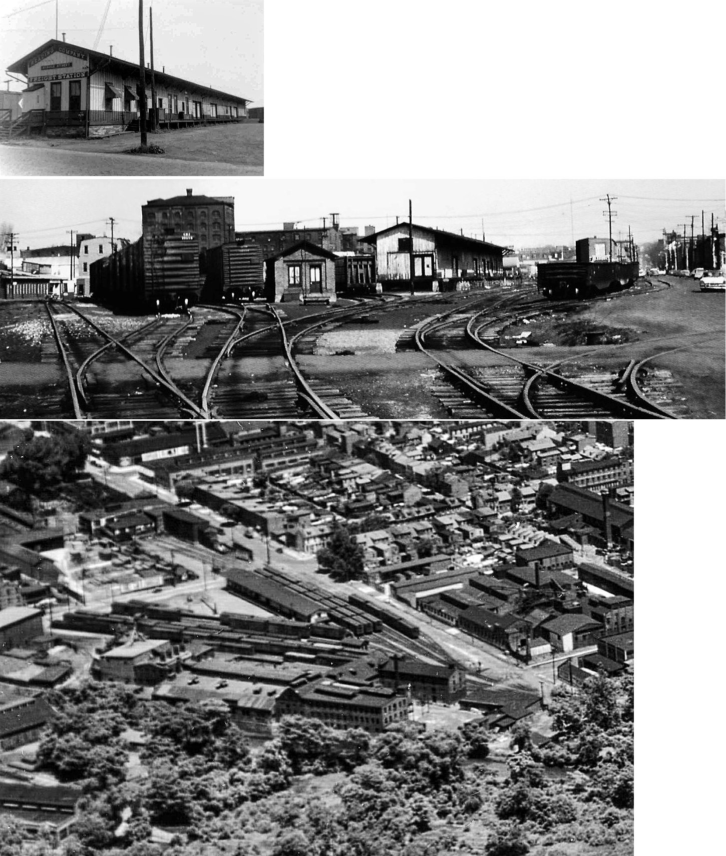
The original wood frame freight station was on the south side of Buttonwood Street between Reed and Eighth Streets (GPS: 40.341271, -75.923533). Later, this was designated as the outbound freight house and a brick inbound terminal-style freight house was built on the west side of North 8th Street in 1880 (shown on the 1887 map) (Reading Times & Dispatch, 4-22-1880). This station burned in 1921 after it had been out of service for many years and was being used as storage for various merchants (Reading Times, 6-22-1921). | ||||||
| Reading | |
The next generation of freight station at the 8th Street and Buttonwood Street location was a long brick structure with a wooden cupola in the middle. | ||||||
| Reading | |
The "Spruce Street Freight Station" was on the SW corner of Spruce and 2nd Streets (GPS: 40.330609, -75.934278). This freight station survived until at least the early 1970s. | ||||||
| Reading (3rd Street) |
|
There was a brick freight station on the 3rd Street north of Buttonwood at GPS: 40.342880, -75.931945. The initials "P&R" were set in the brick above the second story windows of this station. It survived until at least the early 1970s when it was used for railroad storage. | ||||||
| Reading (Franklin Street) |
|
This was the first station built on Franklin Street in 1884. It was was replaced by the stone station in 1930 (still standing). | ||||||
| Reading (Fairgrounds Sta.) |
|
There was a station at the Reading Fairgrounds here. The small station is shown on the 1918 Sanborn map. The station was just west of the exhibition buildings on the east side of the tracks at approximately GPS: 40.382264, -75.932983. This location is now on the property of the Fairgrounds Square Mall. | ||||||
| Reading (Sixth Street) |
|
This station was on the south side of Canal Street at 6th Street at GPS: 40.324782, -75.926483. The W&R Railroad had their trains leave at the foot of Penn Streets and stop also at the foot of South Sixth Street (the W&R trains did not run to the new Outer Station until 1888). On the 1891 Wilmington & Northern Timetable, the starting and ending point in Reading was the P&R Reading Outer Station, west on the Lebanon Valley Branch to N. 3rd Street, south on N. 3rd Street, downhill 30-degrees at Walnut Street to Front & Penn Street Station (taking one mile), along Canal Street to the base of S. 6th Street Station (another 1.2 miles), then over the Canal Street Bridge to Millmont (another one mile), Poplar Neck and beyond. --Greg Pawelski | ||||||
| Reading | |
This temporary station was built by the PSV on the south side of Penn Street while the larger, permanent brick station was being built. According to the Reading Times from October 18, 1884, the temporary station featured men's and women's waiting rooms, a baggage area and a platform that surrounded the depot on all sides. The station was only there for about a year. The Reading Times of September 15, 1885 indicates that the railroad was planning to lay some siding tracks at the site of the former temporary depot. The Sanborn map of 1887 (the earliest Reading map available) confirms this, showing a vacant lot at that location. Some claim that this was actually an old Wilmington & Reading station that was leased by the PRR as its temporary station, but the newspaper article seems to indicate that the station was built specifically for the PSV in 1884. | ||||||
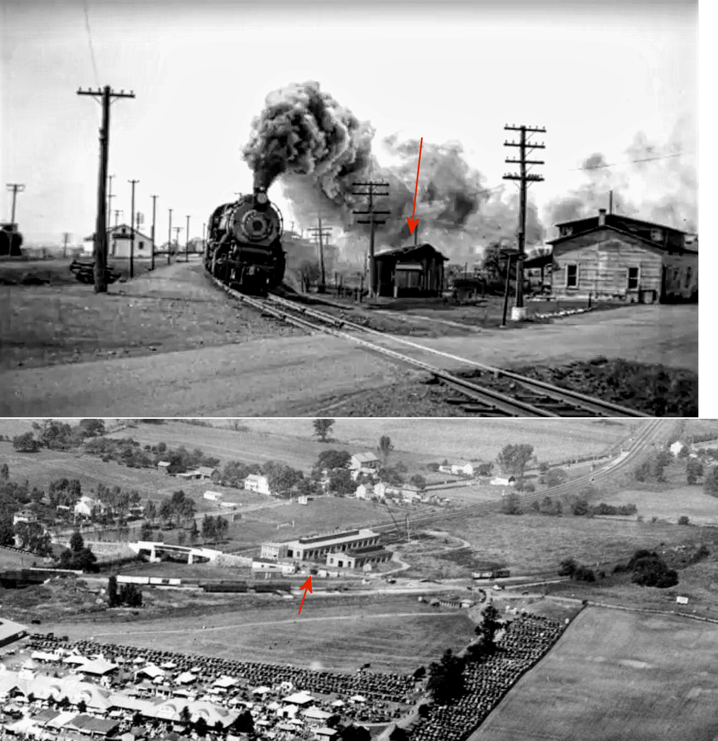
| Reading | |
This station was on the north side of Penn Street west of Front Street at GPS: 40.335627, -75.936295. It was built in 1884-1885 by the Pennsylvania & Schuylkill Valley (PSV) Railroad which was leased by the PRR starting in 1885. The station survived at least until the 1970s and was used as offices by Penn Central. | ||||||
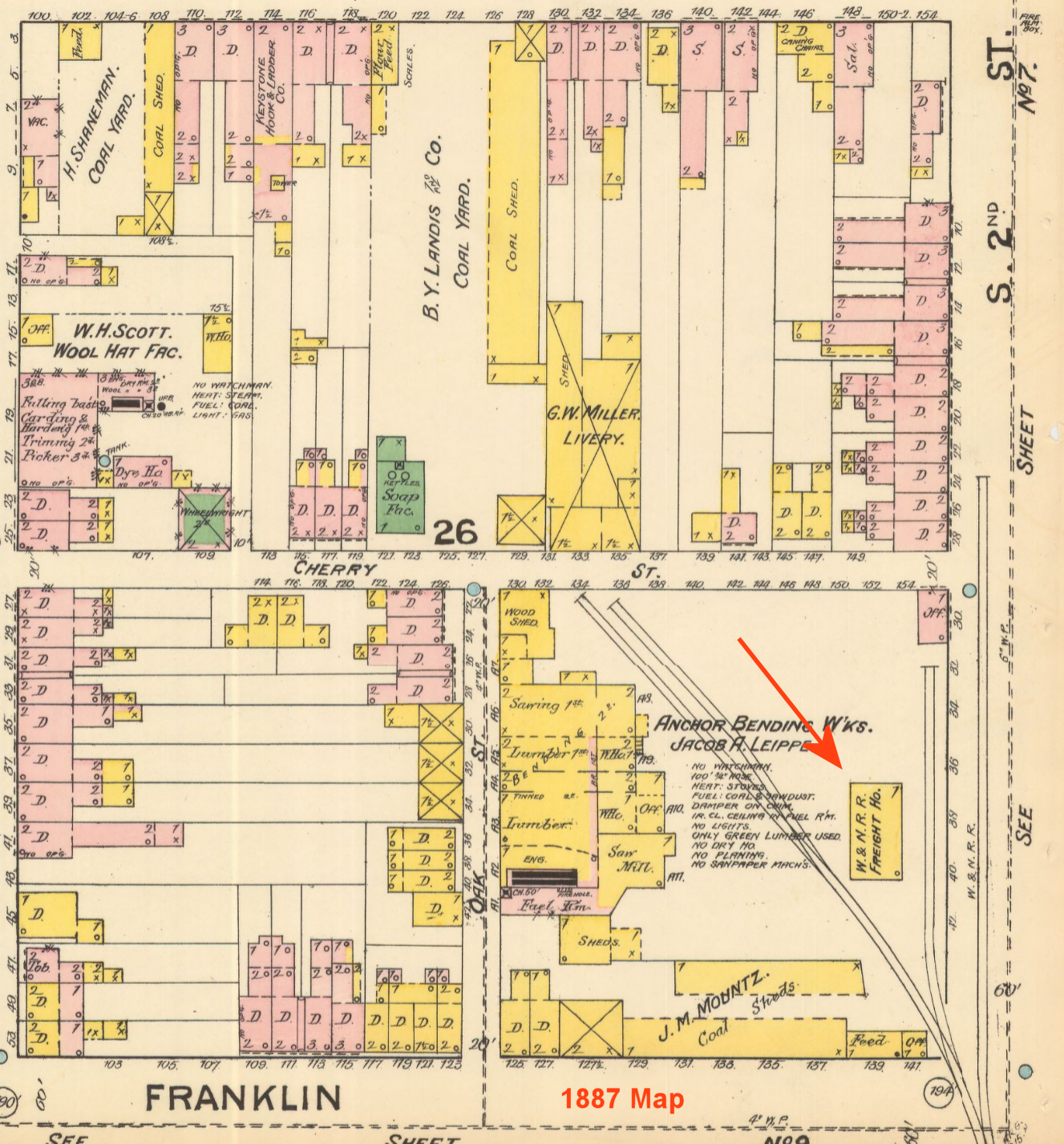
| Reading | |
There was a large wood-frame freight station west of South Front Street at GPS: 40.334808, -75.935832. | ||||||
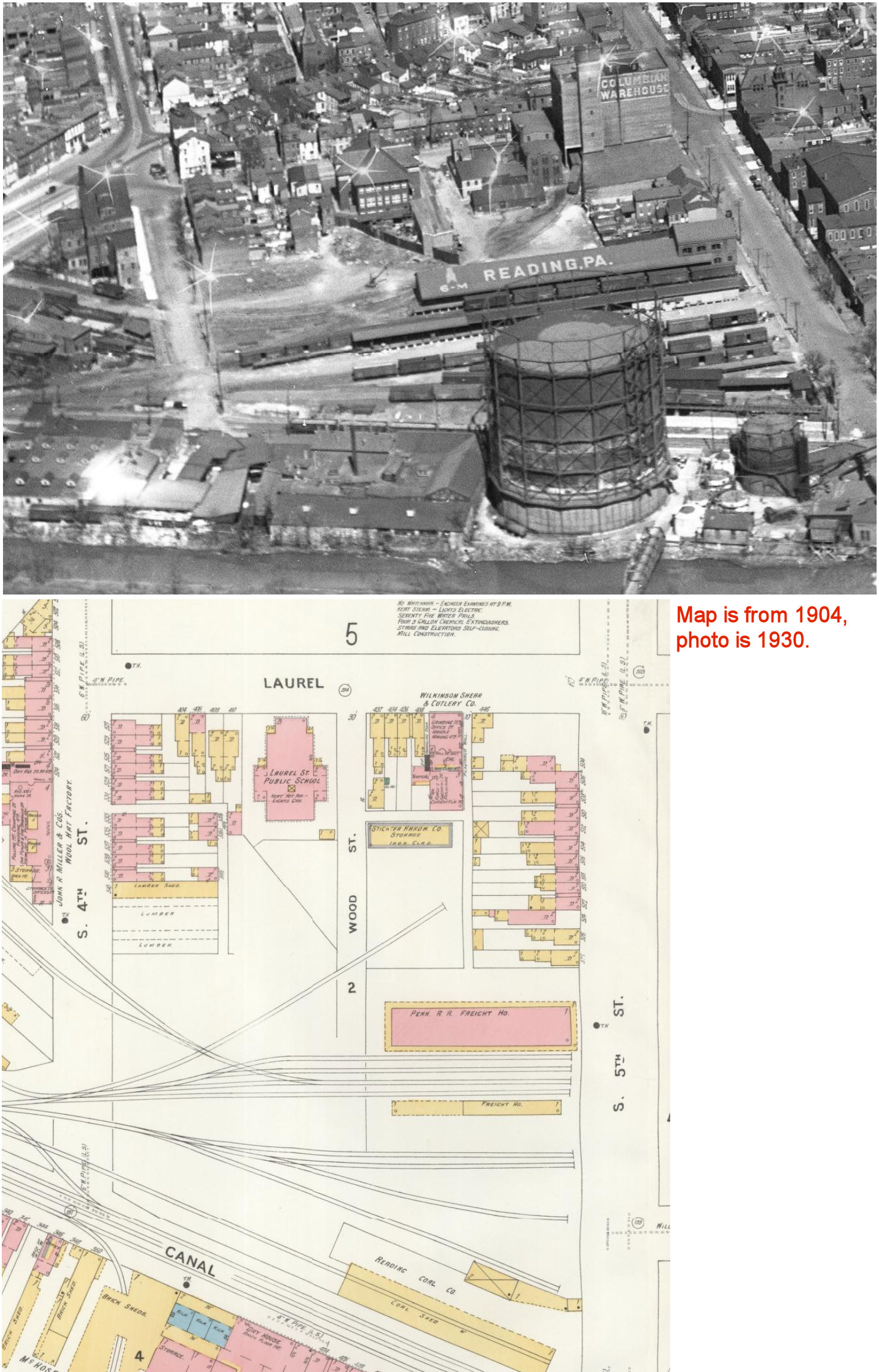
| Reading | |
In 1887 there was a freight house at 536 South 5th Street (on the west side of South 5th Street between Laural and Canal Streets) (GPS: 40.326917, -75.928572). This station was still around until at least into the 1970s when it served as a leather storage facility. | ||||||
| Reading (Kissinger) (Schuylkill Ave.) |
|
This station was between the Reading PRR station and the Exeter Street Station NE of where Schuylkill Avenue crosses the tracks at GPS: 40.350592, -75.942152. It is shown on the 1918 map, but not the 1913 map, so it was likely built sometime between those years. It is listed on the 1920 PRR List of Stations & Sidings as "Kissinger." It was called Kissinger because the bridge at the station over the river at that time was called Kissinger Bridge. The Atlas of the City of Reading from 1884 shows this. The Kissinger Bridge was replaced by the Schuylkill Avenue Bridge during 1924-1925. | ||||||
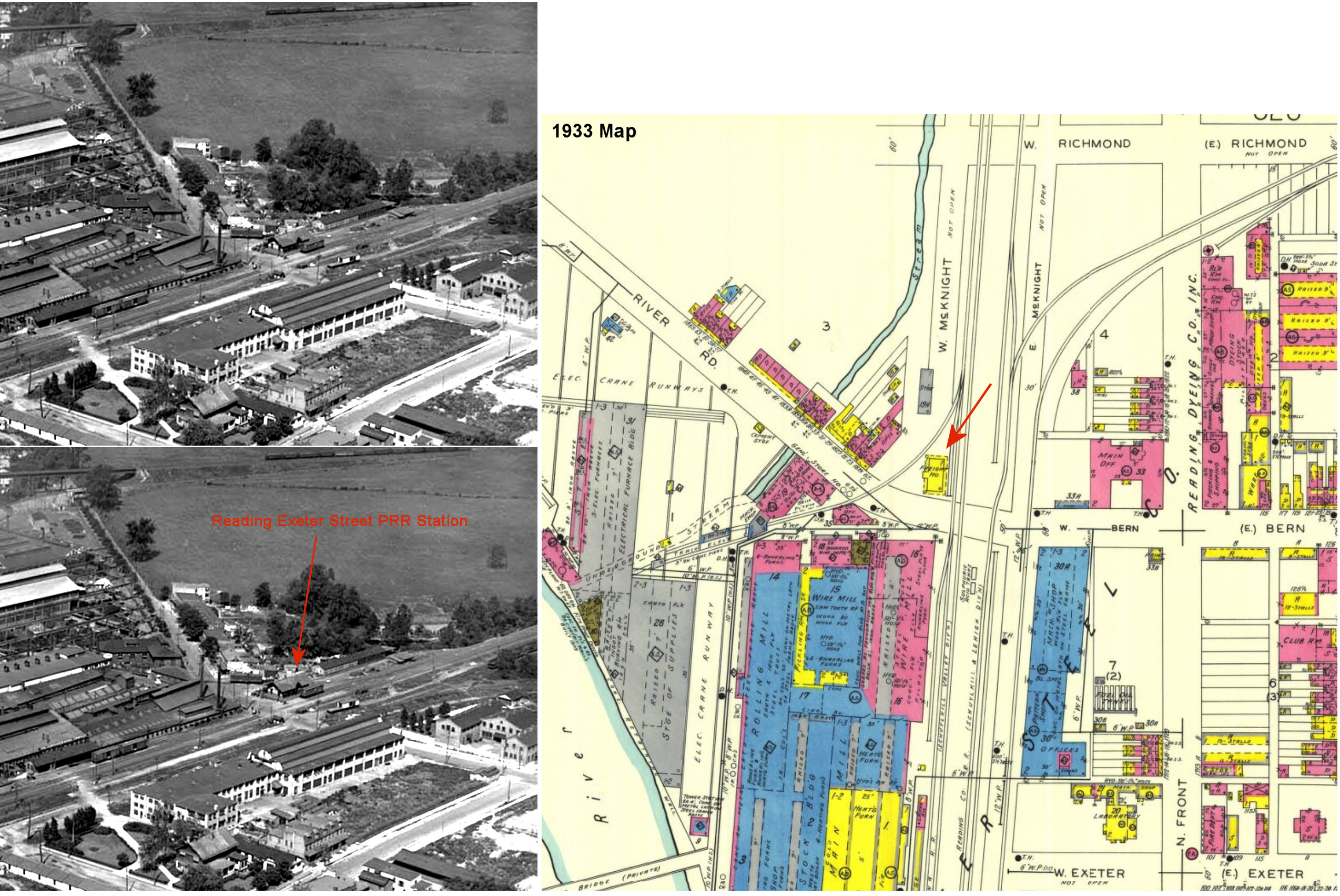
| Reading (Exeter Street) |
|
This station, built in 1891, was on the north side of Bern Street on the west side of the tracks at GPS: 40.362645, -75.936074 as shown on the 1918 Sanborn map. It was one block north of Exeter Street. On the 1920 PRR List of Stations & Sidings, it is listed as "Exeter Street Station" and on the 1933 Sanborn map it is shown as just a freight station. | ||||||
| Red Lion | |
A Catasaqua & Fogelsville RR station is shown here on the 1876 county atlas. | ||||||
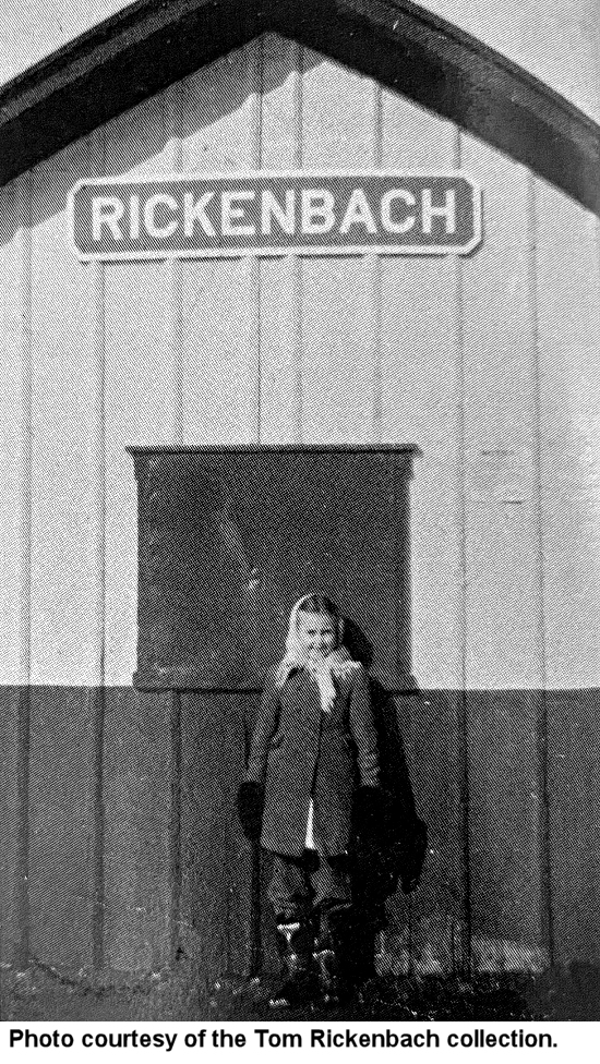
| Rickenbach | |
There was originally a passenger shelter here built in 1887. That shelter was blown onto the tracks by storm winds and was demolished by a passing train on October 3, 1894 (Greenville Record Argus, 10-11-1894). A replacement shelter was likely erected. A new station was built here in 1912. | ||||||
| Ridgewood Station | |
|||||||
| Robeson Station |
|
Not to be confused with Robesonia, this station was in Robeson Township between Naomi and Birdsboro. | ||||||
| Robeson |
|
Shown on the PRR List of Stations & Sidings from 1900. This station was between Clingan and Gibraltar. | ||||||
| Robesonia |
|
Freight station. | ||||||
| Seyfert |
|
Shown on the PRR List of Stations & Sidings from 1900. This station was between Gibraltar and Ridgewood. | ||||||
| Seyfert |
|
|||||||
| Shamrock | |
The first East Penn station here caught fire in 1879 from the spar of a passing locomotive, but the fire was extinguished and the station was saved (Reading Times, 10-10-1879). It was on the west side of Kennedy Avenue on the south side of the tracks at GPS: 40.502166, -75.648901 according to the 1876 atlas of Berks County. This station served until 1883. It may have been a store with a room inside serving as a station, but that's not clear. | ||||||
| Shamrock | |
The second station here was built in 1883 (Reading Times, 5-19-1883) (railroad records list it as 1899, but that is an error as is common in valuation records). It burned down in 1920, also from the spark of a passing locomotive (Reading Times, 1-15-1920). It was likely in the same place as the first station. | ||||||
| Shamrock | |
This is the station that was built in 1920. It was on the west side of Kennedy Avenue on the north side of the tracks at approximately GPS: 40.502424, -75.649168. | ||||||
| Sinking Spring | |
Built in 1858, this freight station was in Heritage park along the north side of the ex-RDG, off Keller Avenue next to the passenger station (GPS: 40.322116, -76.029987). Both the passenger and the freight stations originally sat within one hundred yards west of Railroad Street (now called Woodrow Avenue), on the NORTH side of the double tracks of the Lebanon Valley Line of the old Reading Railroad. After being abandoned and vacant, both structures were moved in the late 1970s to Heritage Park and renovated. The freight station burned in March 2025 and was subsequently torn down due to its condition with the foundation remaining. As of late summer 2025 plans were being made to build a replica of the station at the same site. | ||||||
| Shoemakersville | |
The original station here was on the south side of Miller Street (Shoey Road) on the west side of the tracks. A later station was built in 1877. | ||||||
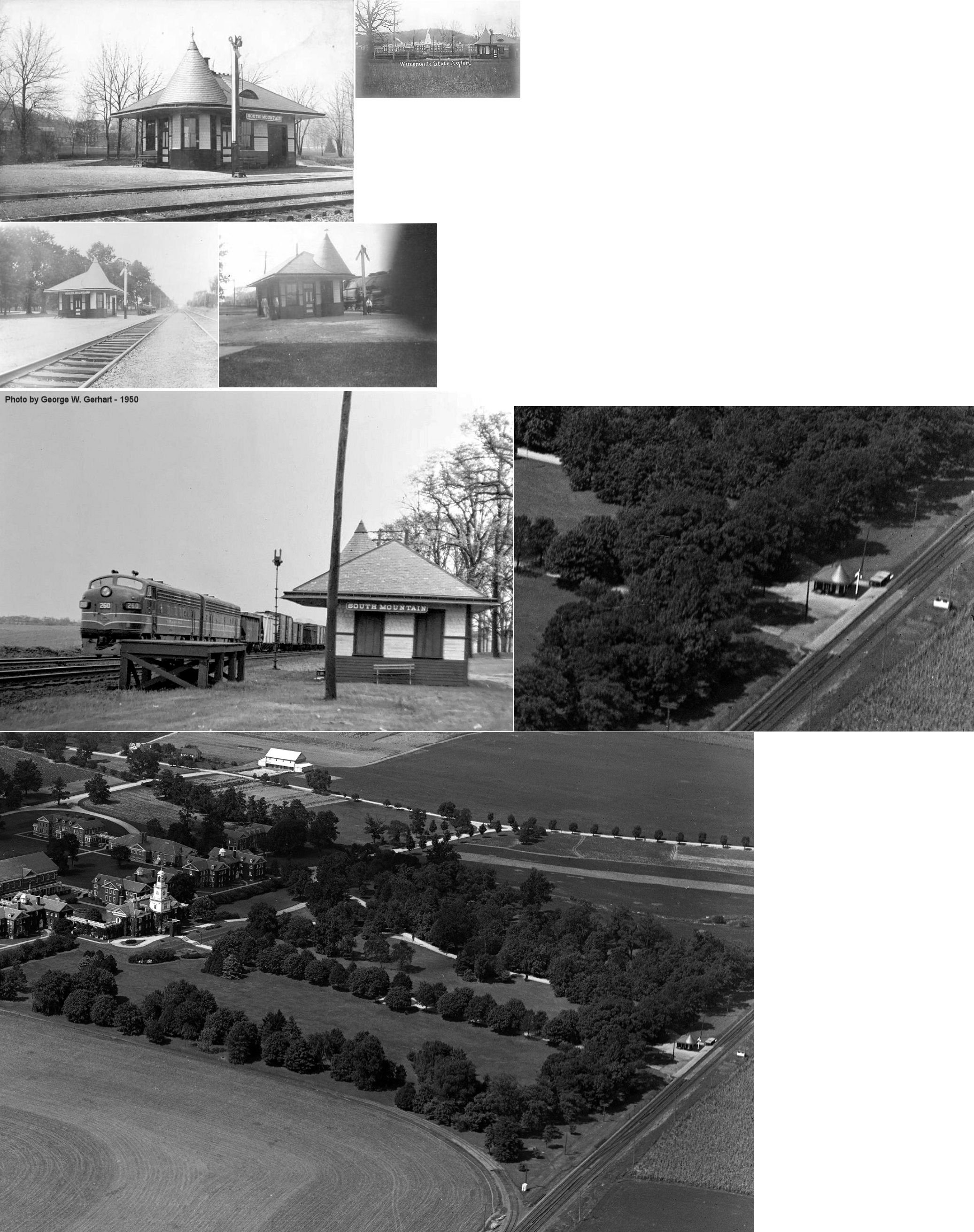
| South Mountain | |
Built in 1895 adjacent to the grounds of the Wernersville Station Hospital, this station was halfway between Sportsman Road and Point Road at GPS: 40.332436, -76.102198. | ||||||
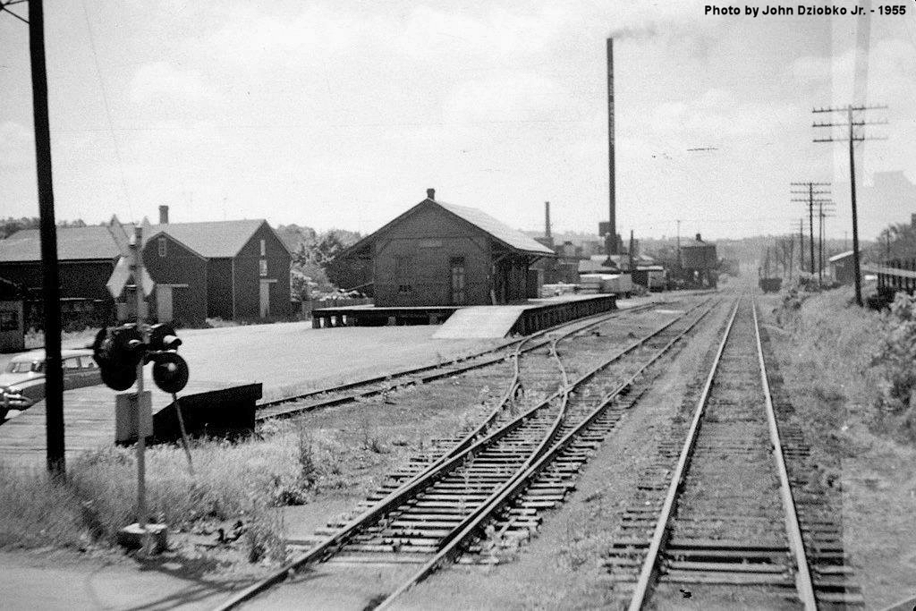
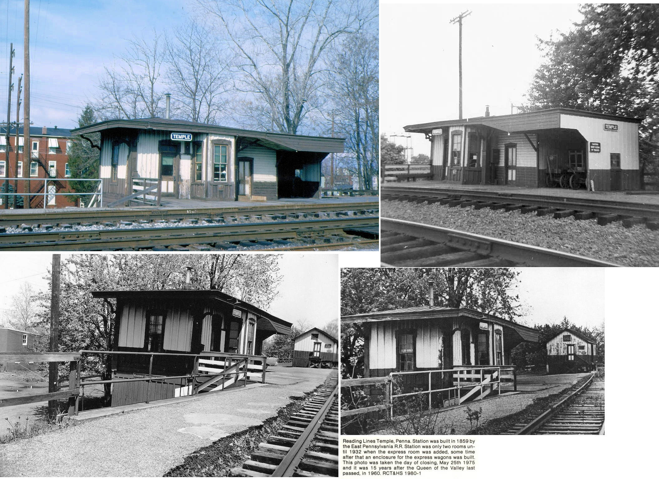
| Temple | |
Built in 1885 when the Pennsylvania Schuylkill Valley RR opened between Hamburg and Reading. This station was on the north side of Tuckerton Road on the west side of the tracks at GPS: 40.407646, -75.930043. The Reading S&L Branch's Laurel Dale shelter station was nearby on the line that paralleled here (hence the Laurel Dale sign in the foreground of the one photo). | ||||||
| Temple | |
A new brick freight house was built here in 1890 that measured 40' x 60' (Reading Times, 6-30-1890). | ||||||
| Temple | |
Passenger station. The station was on Mt. Laurel Road. The station was built in 1859 by the East Pennsylvania RR. | ||||||
| Temple | |
Freight station. | ||||||
| Topton | |
The first station here was a wood frame building that was described as a "miserable apology of a shanty" (Reading Times, 10-24-1873). | ||||||
| Topton | |
The freight station here was built in 1875. | ||||||
| Tower Station (Company Farm) |
|
Later timetables have this listed as Company Farm. | ||||||
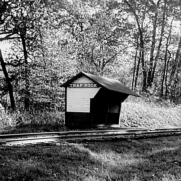
| Trap Rock Station |
|
This station was 1.5 miles south of the Birdsboro station near the Hay Creek Road crossing. | ||||||
| Trexler | |
According to "Reading's Victorian Depots" by Edward A. Lewis, Trexler had a 1 story frame depot measuring 30' x 15' built in 1879 and retired as a passenger depot in 1954. A station is shown here on the 1876 county atlas. | ||||||
| Tuckerton | |
|||||||
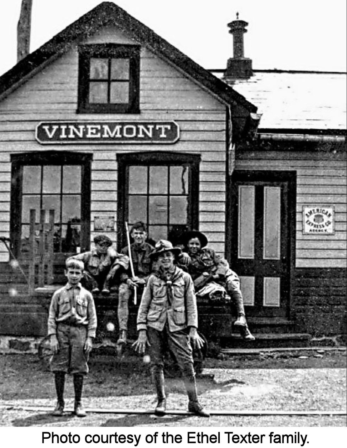
| Vinemont | |
This 10'x26' station opened in 1905. It was on the east side of Vinemont Road on the south side of the tracks at GPS: 40.279027, -76.078052. The Reading Eagle newspaper had this building labeled wrong. They wrote about it in 2009 as the Vinemont Trolley Station. There was no trolley station within five-ten miles of Vinemont and this is obviously an RDG station from the sign and the colors. There was also a freight station just to the east of the passenger station. | ||||||
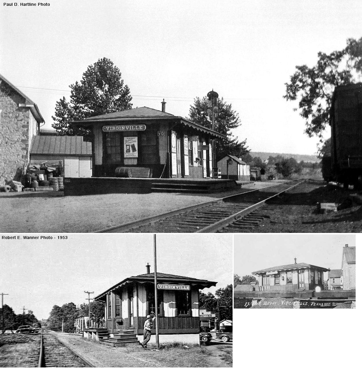
| Virginville | |
In 1876 this station was on Main Street on the east side of the tracks. A new station was built in 1878. | ||||||
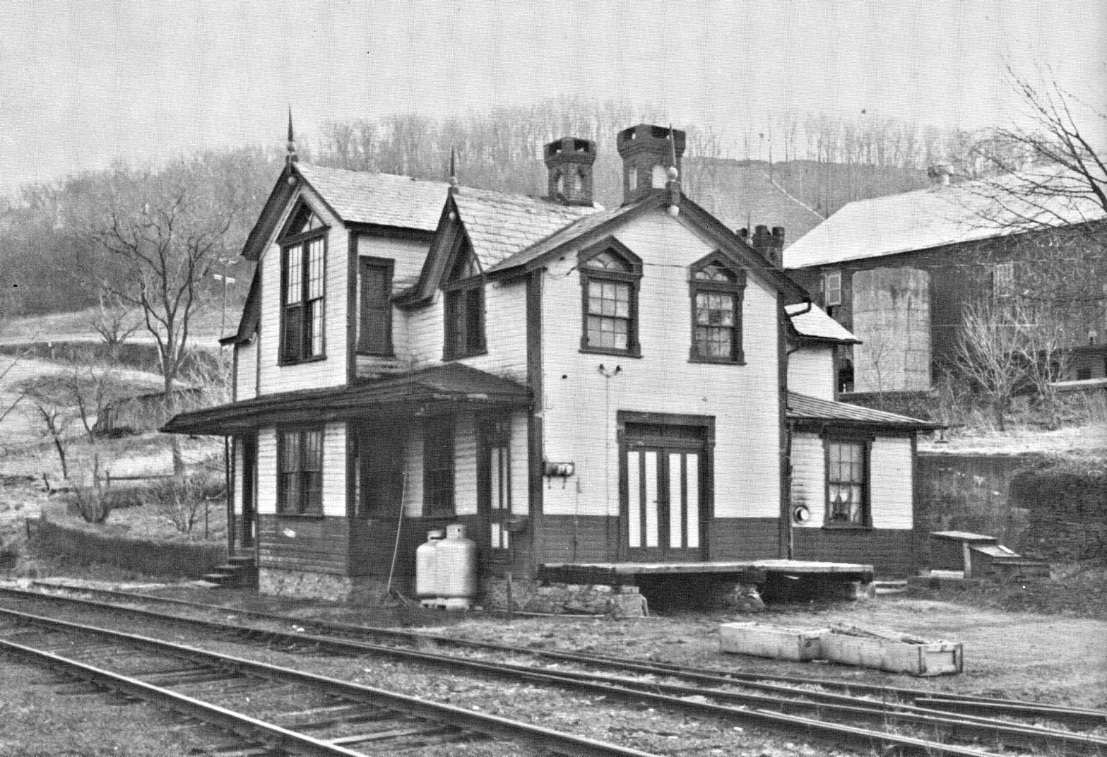
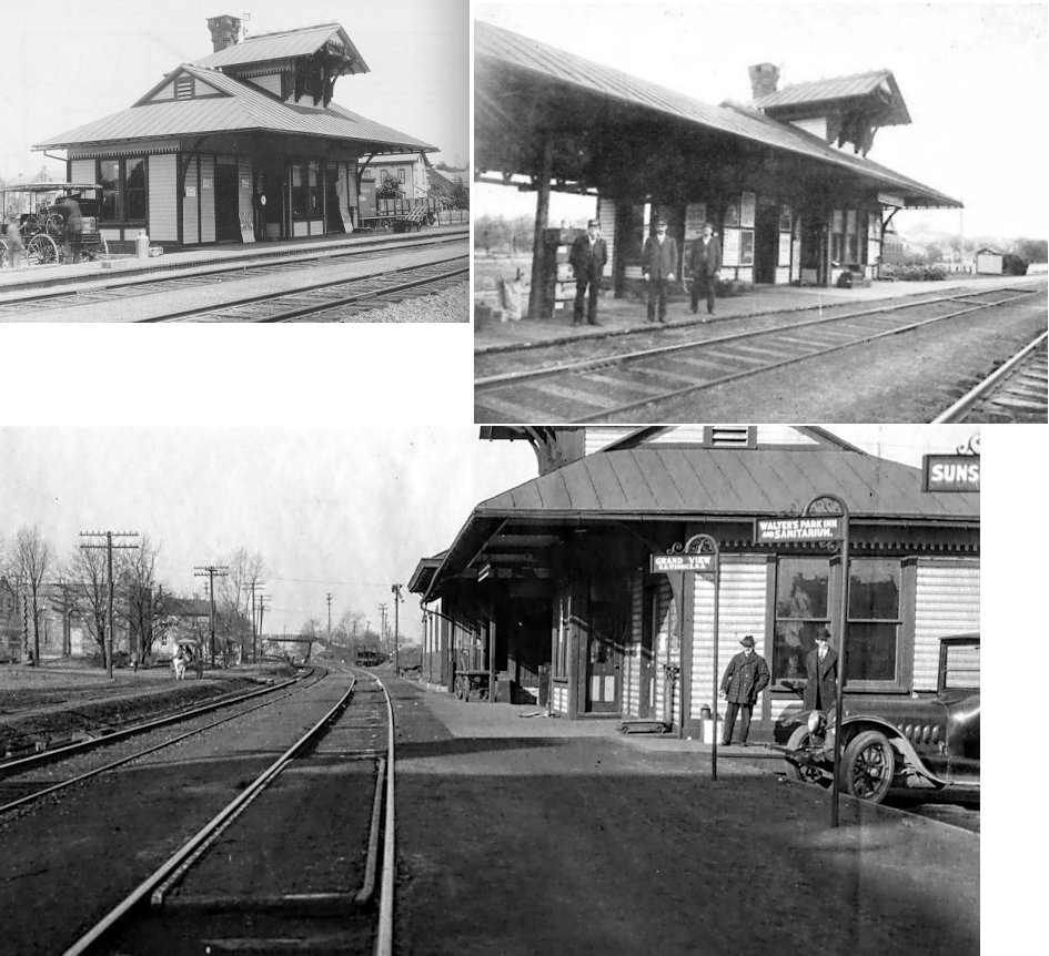
| Wernersville | |
Built in 1881, this station was in the same location as the extant 1927 station (GPS: 40.279145, -76.078408). | ||||||
| Wernersville |
|
The earliest station here was a freight station constructed in 1856. It and the former passenger station (listed above) were replaced by the existing combination station in 1927. | ||||||
| West Hamburg | |
Built 1877. This station was rumored to have been dismantled and taken to another location. Can anyone confirm or deny that? | ||||||
| Windsor Castle | |
|||||||
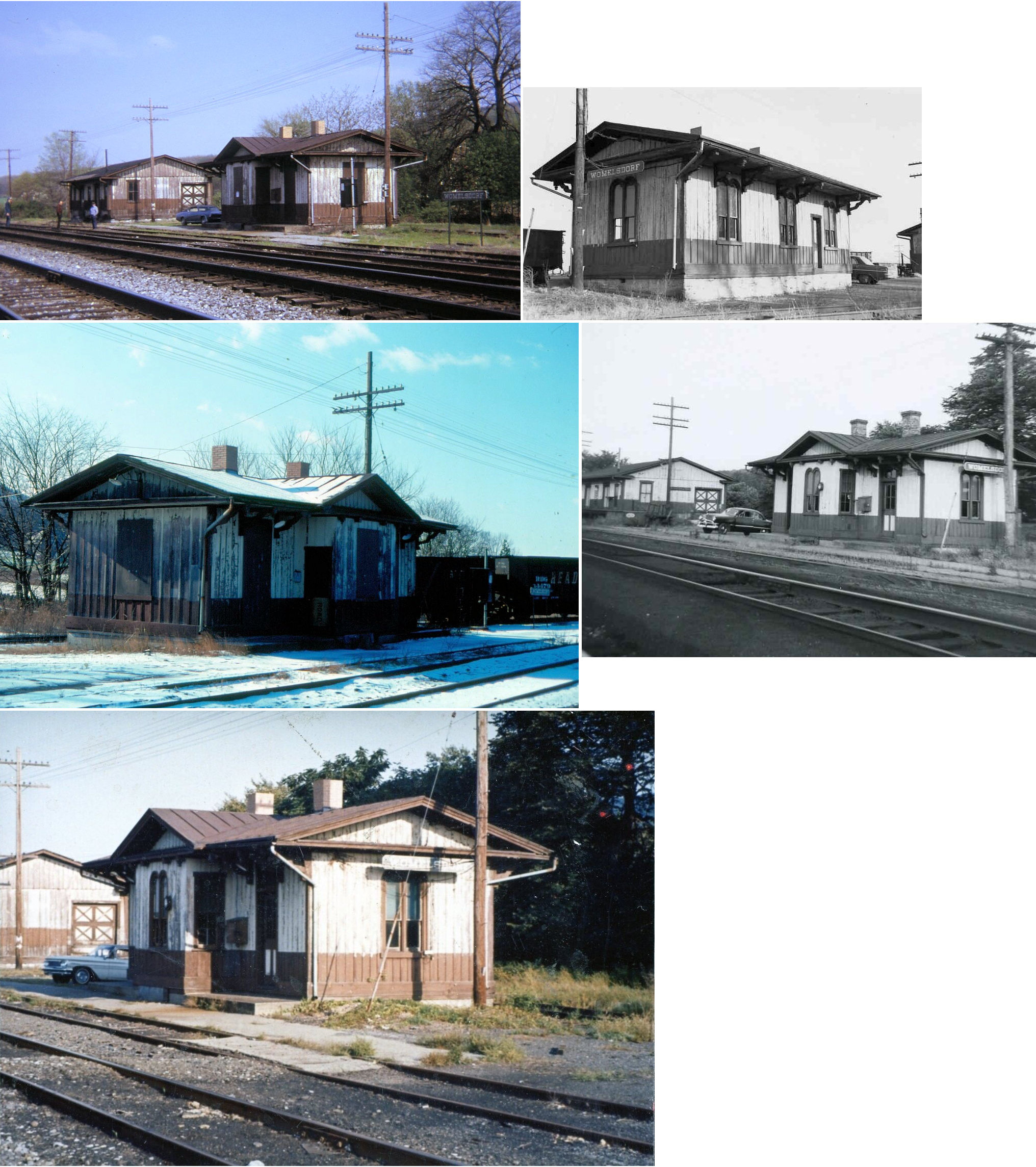
| Womelsdorf |
|
Built in 1856. There was a freight station here as well. The passenger station was torn down in 1977, the freight station was also likely torn down in the 1970s. | ||||||
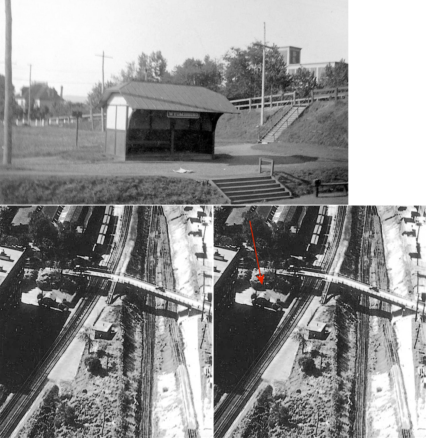
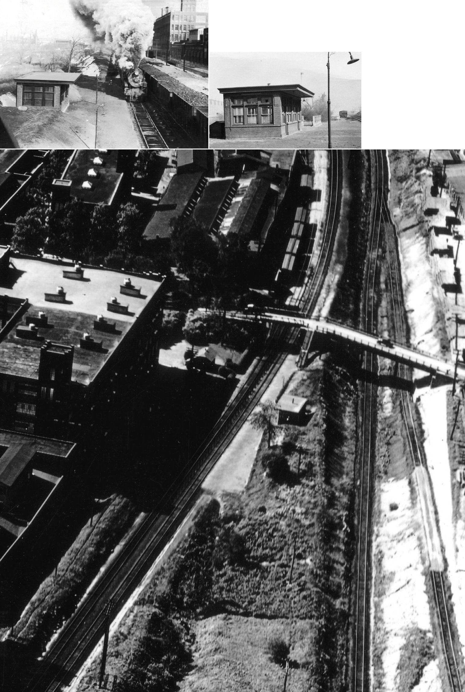
| Wyomissing | |
The first flagstop station here was a 10'x14' frame shed on the east side of North Park Road at GPS: 40.338699, -75.956569 near where the Berkshire Knitting Mills factory was. When a brick flagstop was built across the tracks in the 1920s, this building served as the eastbound passenger shelter. | ||||||
| Wyomissing | |
The second flagstop station here was a brick building that was erected in the 1920s. | ||||||
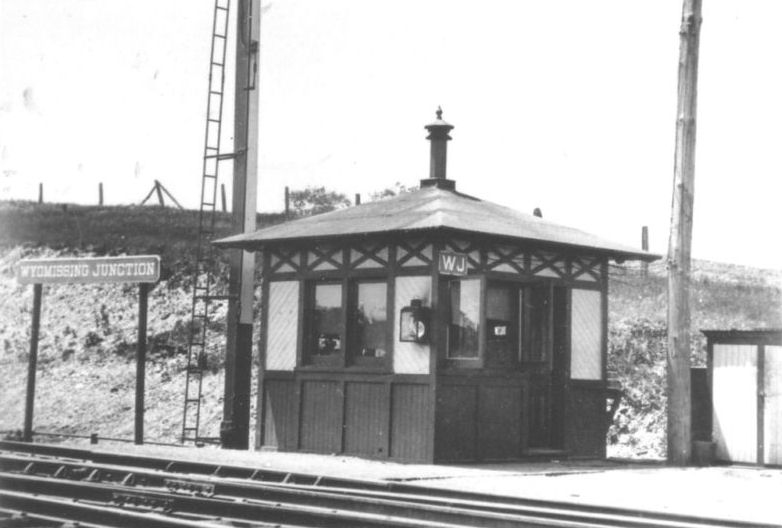
| Wyomissing Junction | |
|||||||
| 1895 BERKS COUNTY RAILROAD MAP | ||||||||
 |
||||||||
| Notes About Existing
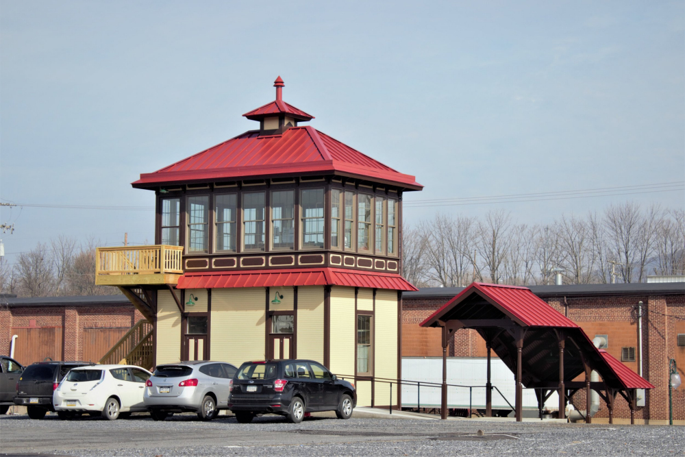
Stations... Barto (RDG) - This station was the terminus of the Colebrookdale Branch. The station closed 1965. There were two shanties that were still located on the property, one was an original outhouse and the other one was believed to be a small storage. The Colebrookdale Railroad received permission to save the small buildings for posterity. They were moved to Boyertown and are awaiting restoration by the railroad (2016). Bechtelsville (RDG) - Municipal building, on Colebrookdale Branch. Station closed 1965. Catasauqua (RDG) - Originally built by the Catasaqua & Fogelsville RR. It was moved to Kempton for the WK&SRR in the mid 1960s. Dauberville (RDG) - The station's original location was on the north side of Bellmans Church Road on the west side of the tracks. At some point after it was retired it was moved to the south side of the road where it is now. The small freight addition is now gone and the station is covered with shingles. Douglassville (PRR) - Earl Schurr of Douglassville bought the station from the railroad in 1947 and converted it into a 3-unit apartment building (The Mercury, 4-15-1947). Fleetwood (RDG) - Here is an old photo of the Fleetwood station. Fleetwood (P&R) - Was this moved from elsewhere? Frackville (RDG) - Moved from Frackville (Schuylkill Co.) to Temple in 1984 by the Blue Mountain & Reading. Gibraltar (RDG) - This station was moved about 350 feet from its original location in the early 1940s. Joanna (W&N) - The Kempton Passenger Station is the ex-Joanna station of the RDG W&N branch. It was moved in 1963 when the WK&SRR started up the tourist line. The station was built in 1888 and the first ticket (to Joanna Heights) was purchased by building contractor John Jacobs (Reading Times, 6-30-1888). Kutztown (A&A) - Built for the Allentown and Auburn RR by the P&R in 1869. The P&R operated the A&A until 1945 at which time it was merged into the Reading system. The station is currently owned by the borough of Kutztown. At times there are community events held at the station. Recently, East Penn Rail excursions used the station from 1996-99 as the starting and ending station for scenic rides from Kutztown to Topton, a distance of 4.4 miles one way. That operation went belly up in winter of 1999. The actual railroad was recently purchased by the borough of Kutztown from the Commonwealth of PA. East Penn Rail Excursions has been an on again/off again proposition. It operated in the early 2000s, but the last train was July 2005. However The Freight operation is taking off! Just come and see all the gondola cars sitting in front of the station. They are loaded with Scrap Steel for the McConway and Torley Steel Mill in Kutztown. The Borough of Kutztown, which owns the station, has received a $275,825 grant from the Transportation Enhancement Program of The Commonwealth of Pennsylvania in 2006 for the express purpose of once again restoring the station to more modern standards The project will start in 2007 and will include heat, water , sewage, installation of handicapped access. The station will retain its original look . -- Submitted by Jim Schlegel, Chairman Kutztown Transportation Authority. Lenhartsville (RDG) - The original location was on Penn Street. Mertztown (RDG) - Restored. Station was closed by the RR in 1964. The Mertztown station was owned by Atlas Minerals and Chemicals, which is the industry located adjacent to the station and tracks. It was used for storage by Atlas before being purchased by the Longswamp Township Historical Society in 2019. As of 2022 the LTHS is raising funds to move the station to a park. The "Mertztown" sign was built and painted by an Atlas employee who was also responsible for convincing Atlas to repaint the station into original colors. More information about the preservation of the station can be found at this page. Mohrsville (PRR) - There were steps that led from the building to a waiting platform up at the tracks. According to an item in the Reading Eagle from Oct. 12, 1970, the station was purchased by a private owner in 1928 and converted to a residence. Originally the first floor was the ticket office and waiting room while the second floor was the station agent's residence. Reading (RDG) - As of Fall, 2008 the city of Reading (owner of the station) and BARTA (local public transport agency) have compiled around $2,000,000 in grant money to renovate the station. At this point, they are looking for someone to submit a viable business idea. Reading (R&N) - From the Reading & Northern Employee Magazine (Winter, 2018): "The strip mall, which previously was on this site, was demolished in fall of 2016. [In the spring of 2017] a two story tower replicating the Pennsylvania Railroad “J” Tower was built next to a newly laid siding. The project was incorporating a Victorian Era structural design that would also comply with modern practices. The 'tower' has two modern restrooms on the first floor and an operations room on the second. The appearance of every detail reminds one of the 19th century styles. Even the platform for the station carries the theme, by using street lighting of the same time period. To tie it all together, a staircase from tower to platform was built from an old Reading Railroad station picture." Robesonia (Lebanon Valley) - Moved to New Cumberland in 1957. The original location of this station was on the west side of Robeson Street where it used to cross the tracks. The station was on the north side of the tracks (GPS: 40.349553,-76.136295). Shoemakersville (PRR) - There was a section gang shanty to the south of the freight station and the foundation for that could still be seen as of 2010. Sinking Spring (RDG) - Both the passenger and the freight stations originally sat within one hundred yards west of Railroad Street (now called Woodrow Avenue), on the NORTH side of the double tracks of the Lebanon Valley Line of the old Reading Railroad. After being abandoned and vacant, both structures were moved in the late 1970s to a section of the Borough Playground (now called Heritage Park) and renovated to their current condition. Topton (RDG) - Restored! Now used by the Market Cafe. Vinemont (RDG) - Also served as general store/post office the postmaster likely serving as ticket agent. This was the station before the railroad put a station here in 1906. Vinemont was known on early timetables as Deep Cut. Wernersville (RDG) - The station was purchased by the Heidelberg Heritage Society in 2003. The Society embarked on a restoration program which was completed in May 2013. A re-dedication ceremony was held on June 8, 2013. The station serves as an adjunct to the society's main building and is now furnished and open to the public by appointment. Visit heidelbergsociety.org for further information. White Bear (Scarlets Mills) (RDG) - Built in 1895, this station was moved a short distance (but still near the tracks) and became a summer home. There are multiple homes that have been submitted as possibilities. One is off Lloyd Lane and the other is south of its original location on Hay Creek Road. See photo for more details. The station was retired by the railroad in 1955. |
||||||||