|
|
||||||||
| EXISTING STATIONS | ||||||||
|---|---|---|---|---|---|---|---|---|
| Station Name |
Original Railroad |
Current Location |
Type | Current Use |
Date Built |
Track Status |
Building Material |
More Info |
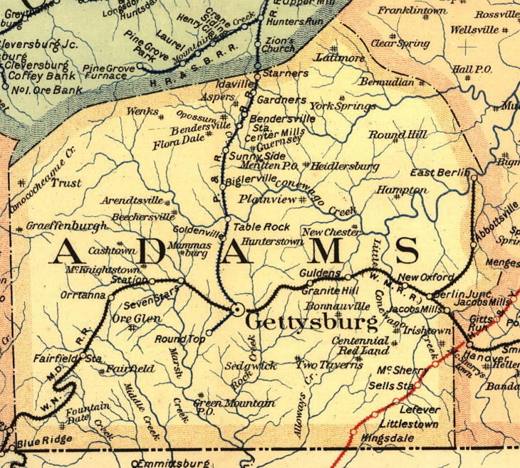
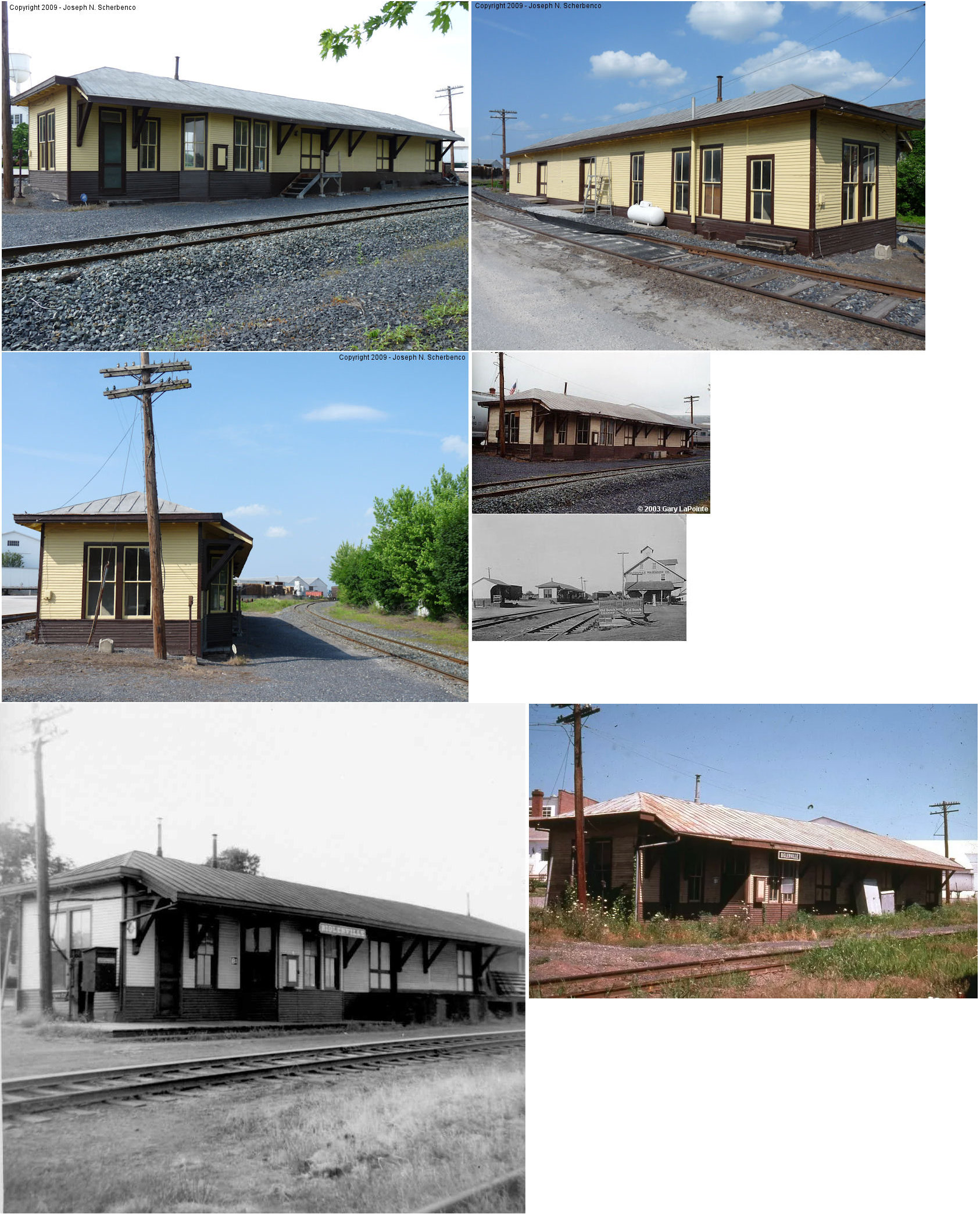
| Biglerville |
 |
West side of the tracks north of East York Street
(PA234) (GPS: 39.931232, -77.243389) |
C | Vacant | 1912 | In Use | Wood | |
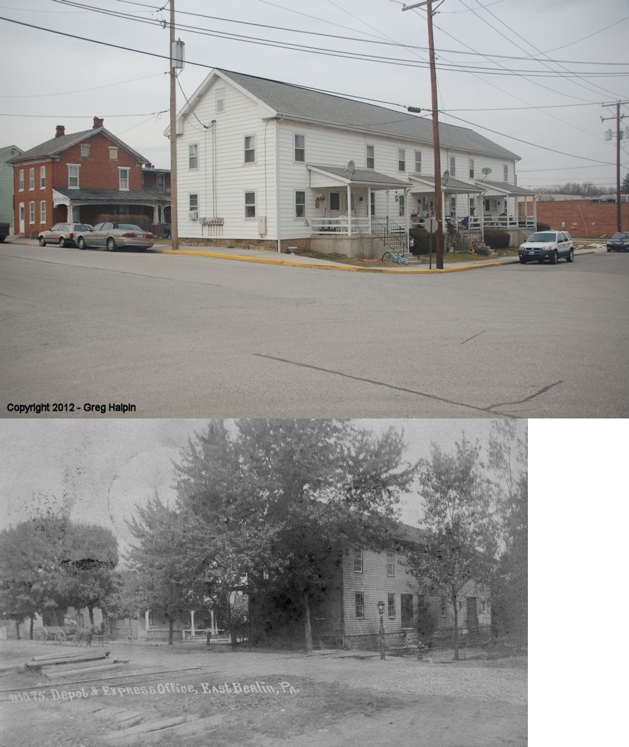
| East Berlin |
 |
Northern corner of 3rd and Locust Streets (GPS: 39.937479,-76.981917) |
C | Residence | ???? | Gone | Wood |
|
| East Berlin |
|
Southern corner of 3rd and Locust Streets (GPS: 39.937115,-76.981802) |
C | Business | ???? | Gone | Wood | |
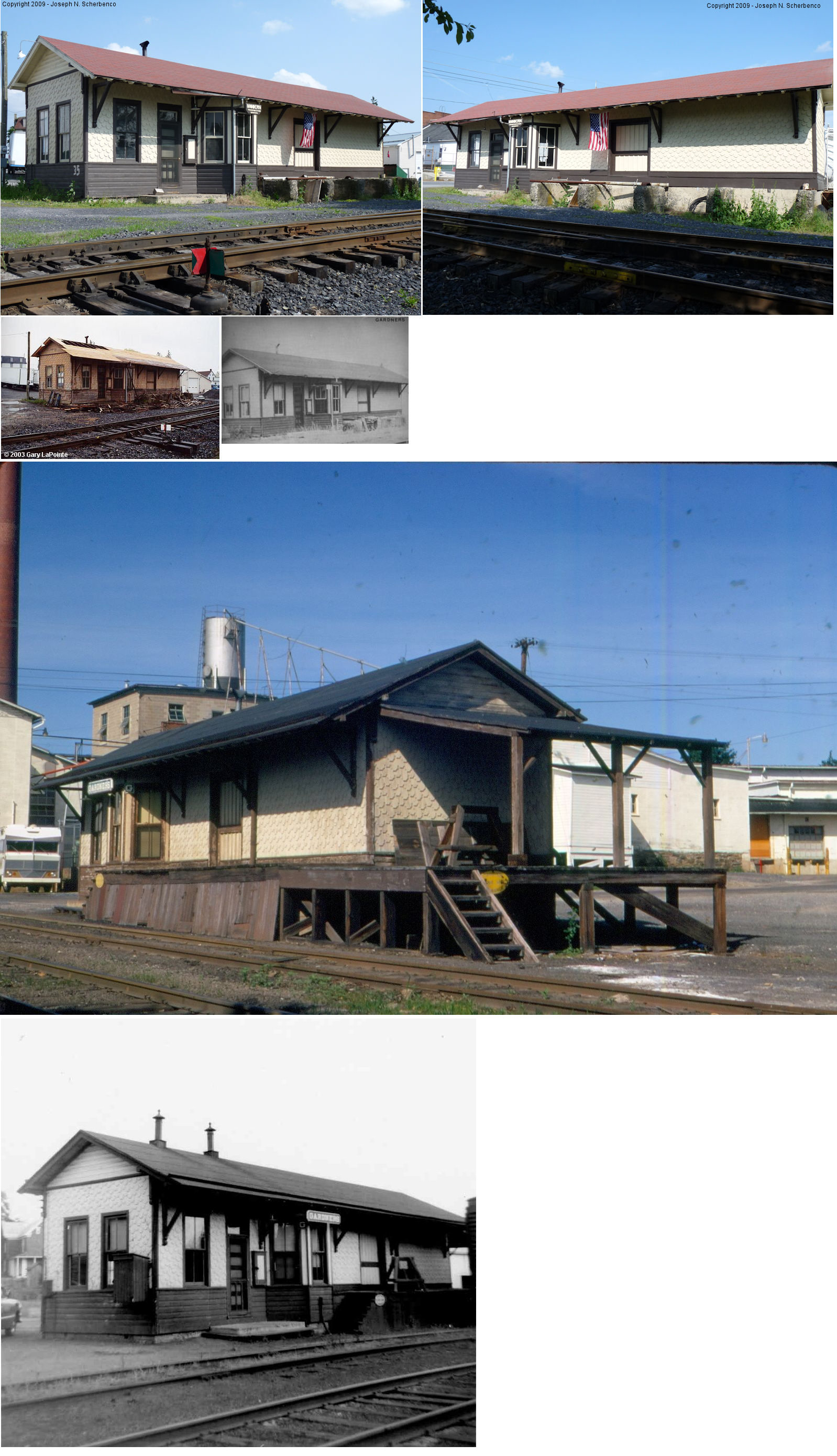
| Gardners |
|
Upper Bermudian Road between Gardners Station Road and Carlisle Road
(PA34) (GPS: 40.006520, -77.207766) |
C | Business | 1912 | In Use | Wood | |
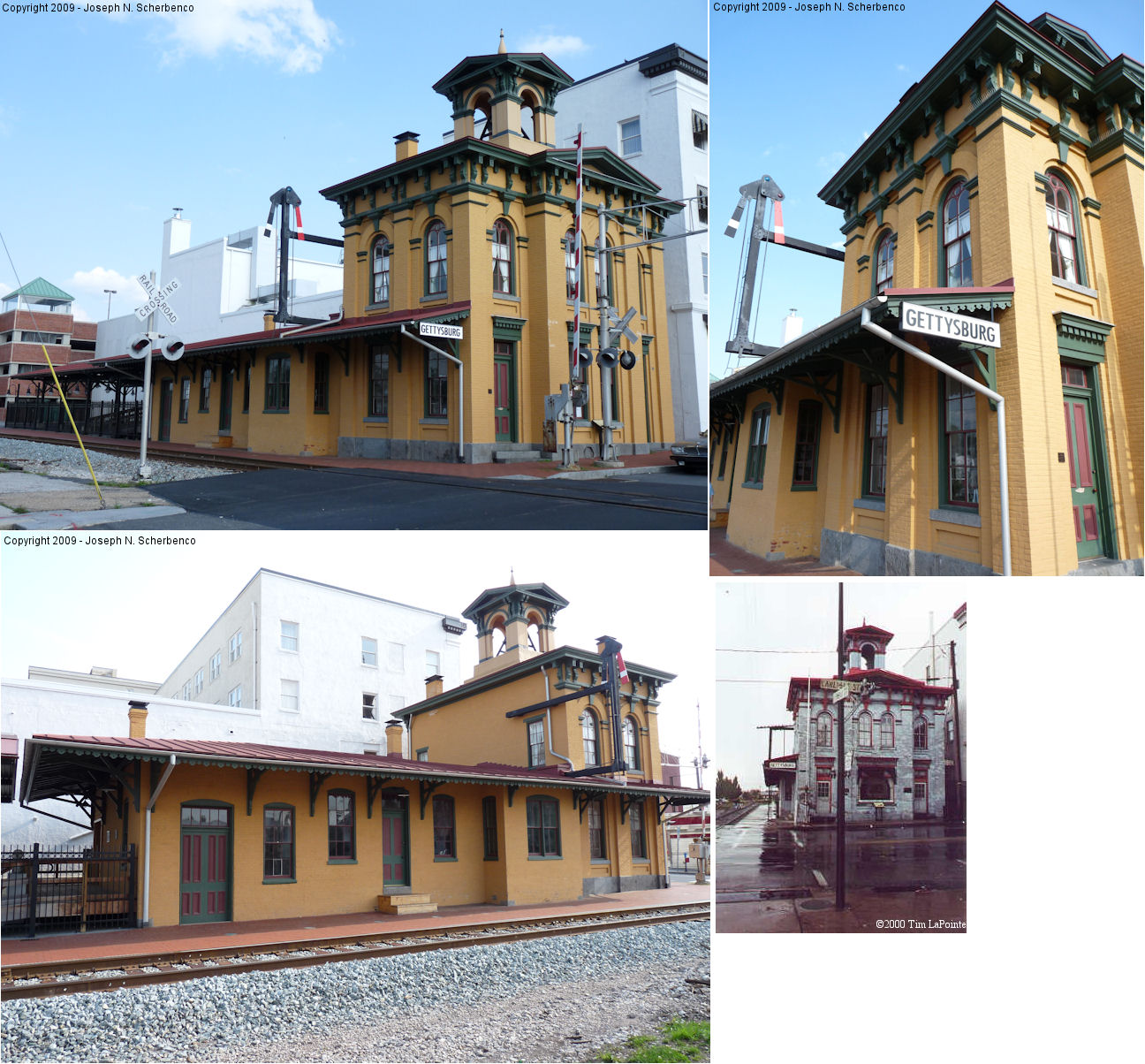
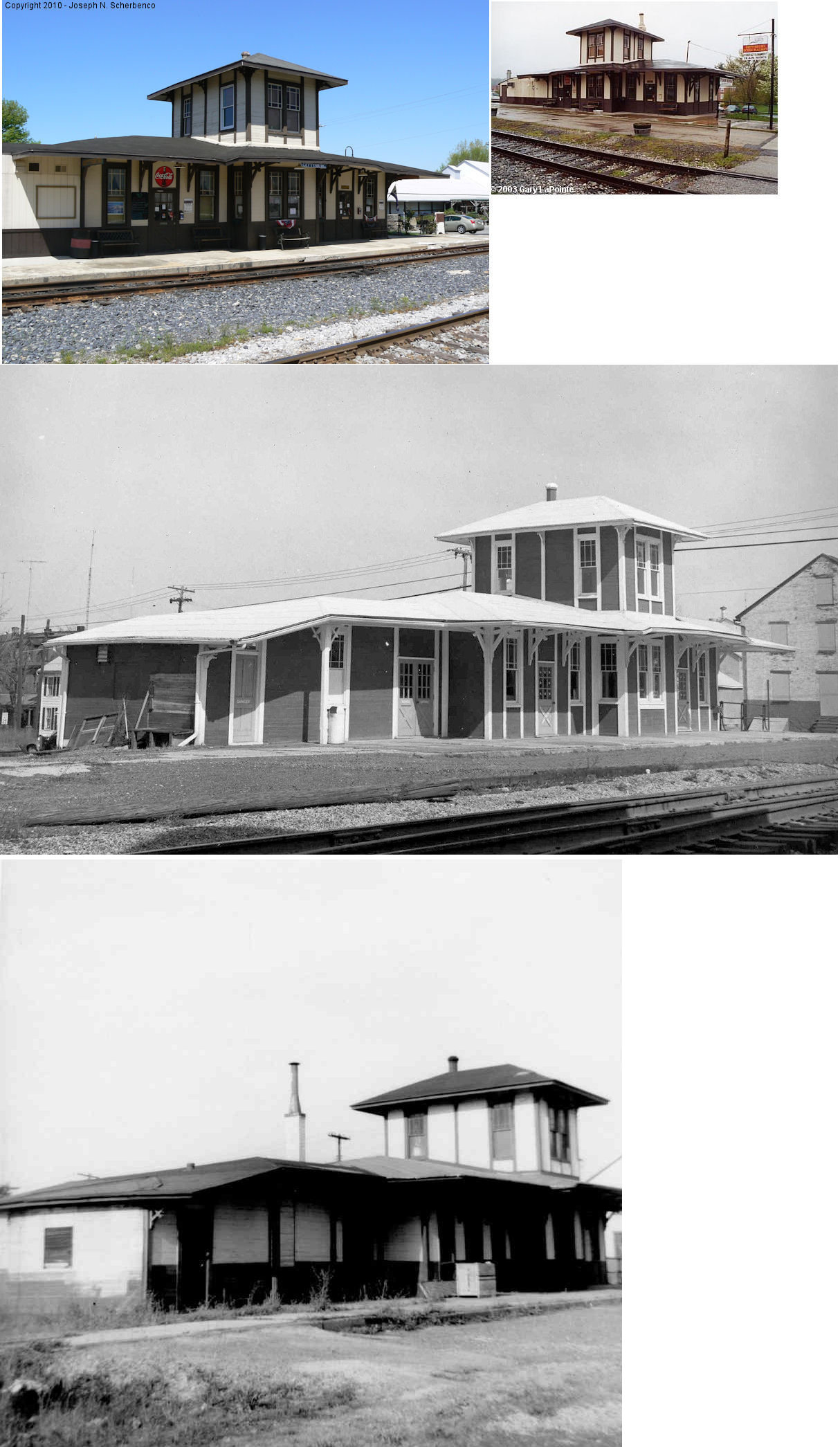
| Gettysburg |
 |
35 Carlisle Street at Railroad Street (GPS: 39.832029, -77.230718) |
P | Civic | 1859 | In Use | Brick |
|
| Gettysburg |
|
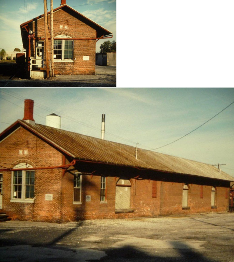
West side of Washington Street at Railroad Street (GPS: 39.832216, -77.233563) |
P | Storage | 1884 | In Use | Wood |
|
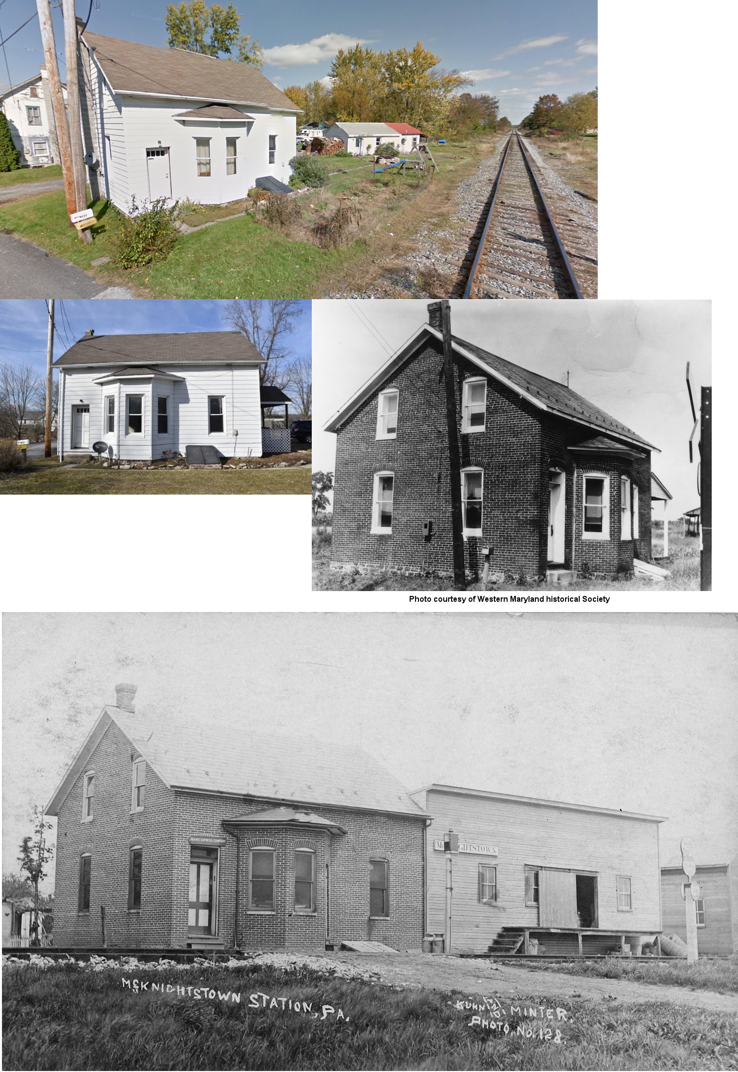
| McKnightstown Station |
|
498 Tilletown Road (GPS: 39.856868, -77.325319) |
P | Residence | ???? | In Use | Wood | |
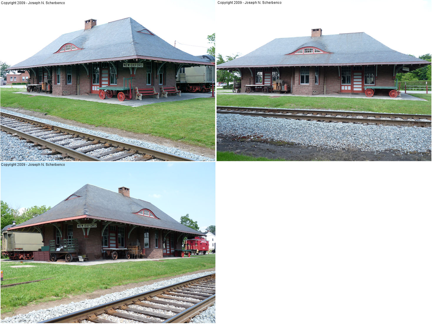
| New Oxford |
|
North side of U.S. 30 (GPS: 39.863363, -77.059476) |
P | Civic | ???? | In Use | Stone | |
| Starners |
|
Starners Station Road (GPS: 40.027056,-77.220594) |
P | Storage | ???? | In Use | Wood | |
| STATIONS OF THE PAST | ||||||||
| Station Name |
Original Railroad |
Notes | ||||||
| Abbottstown |
|
|||||||
|
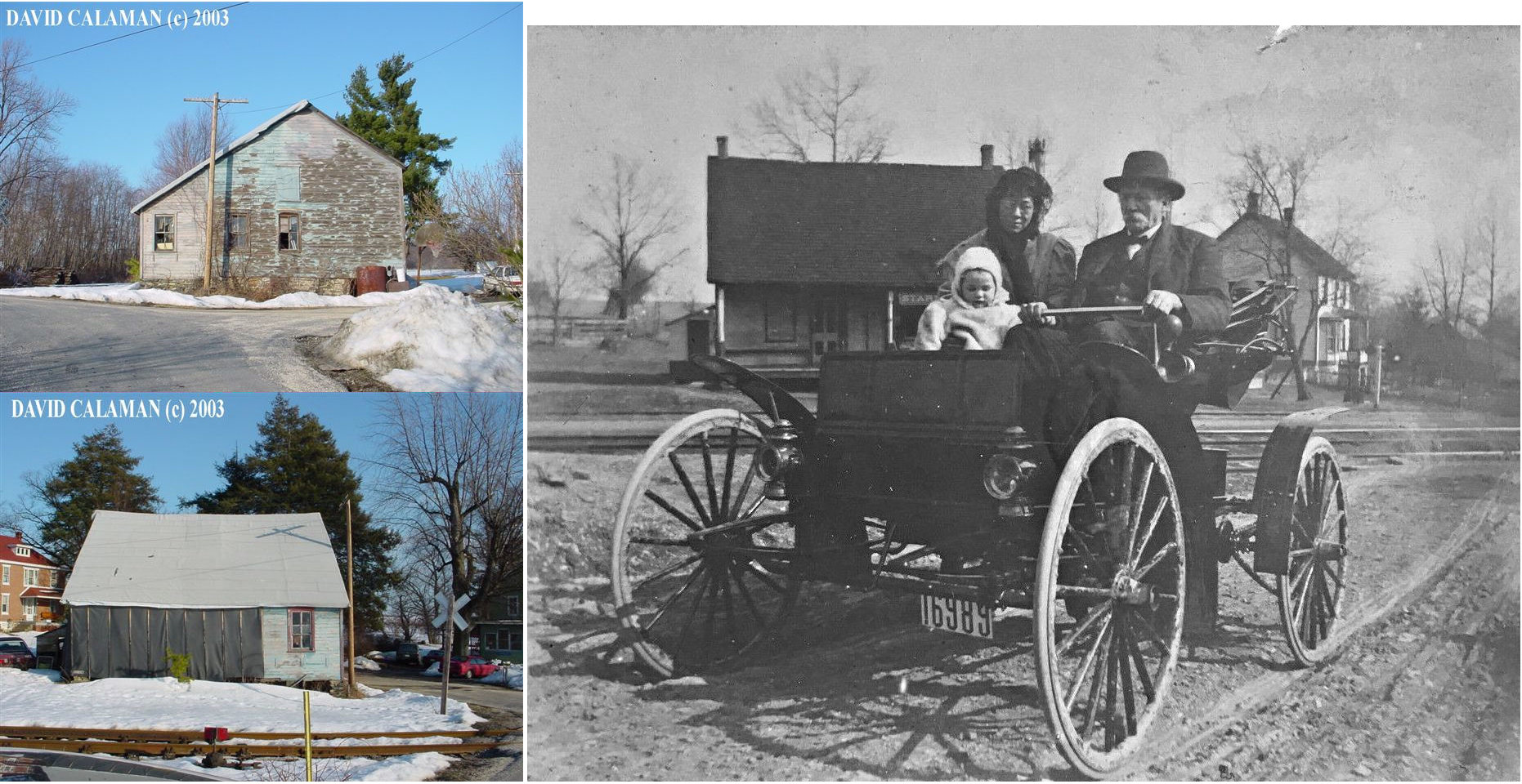
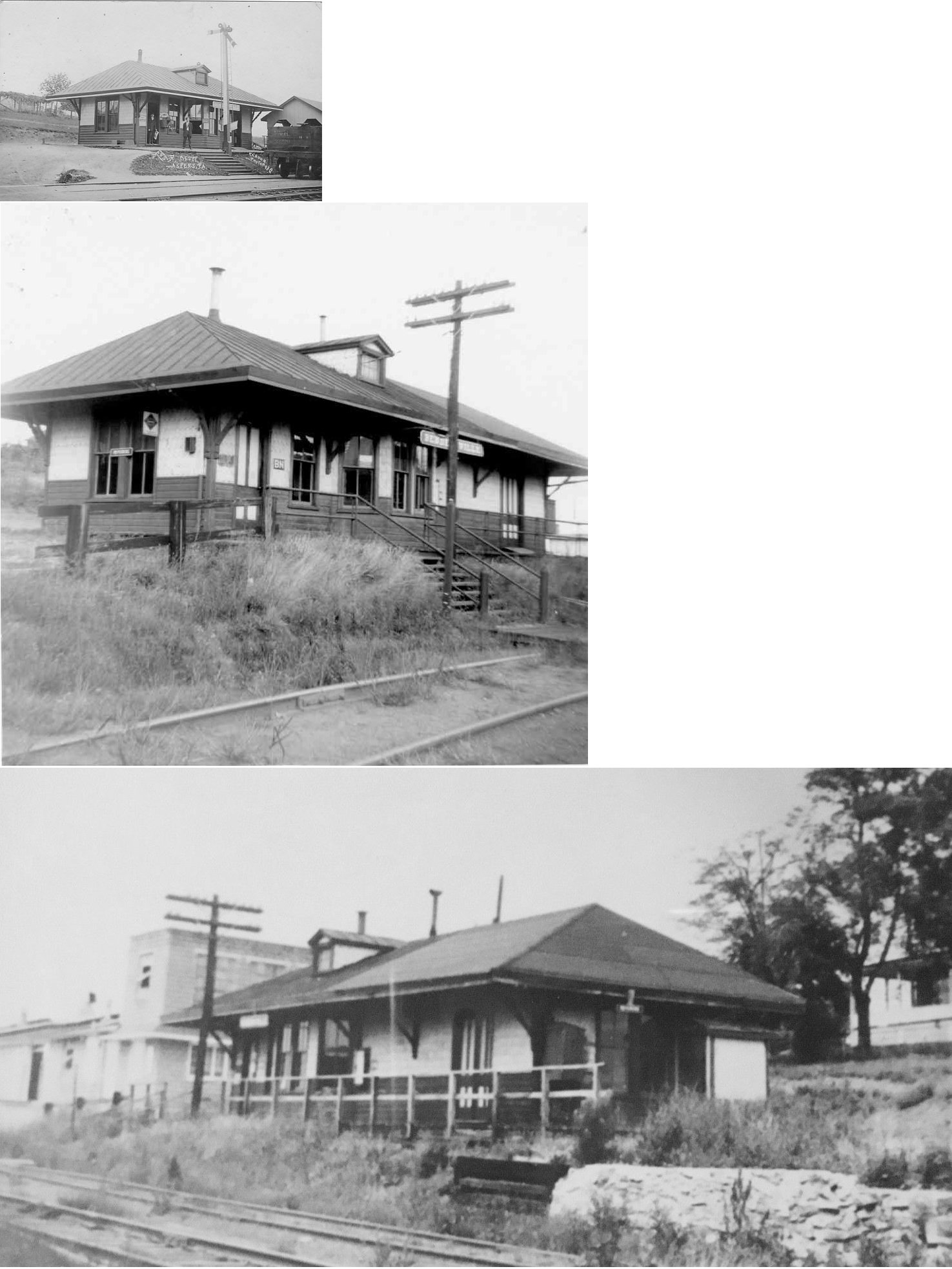
Bendersville (Aspers) |
|
|||||||
| Berlin Junction |
|
|||||||
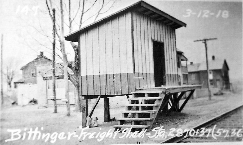
| Bittinger |
|
Bittinger was on Hanover Street between Hanover and New Oxford at GPS: 39.837773, -77.014547. | ||||||
| Brush Run |
|
|||||||
| Centre Mills |
|
This station was built in 1894. | ||||||
| Church Station |
 |
A station is shown here in 1872 when the line was the Littlestown Branch RR. This station was between Sells Station and Littlestown. | ||||||
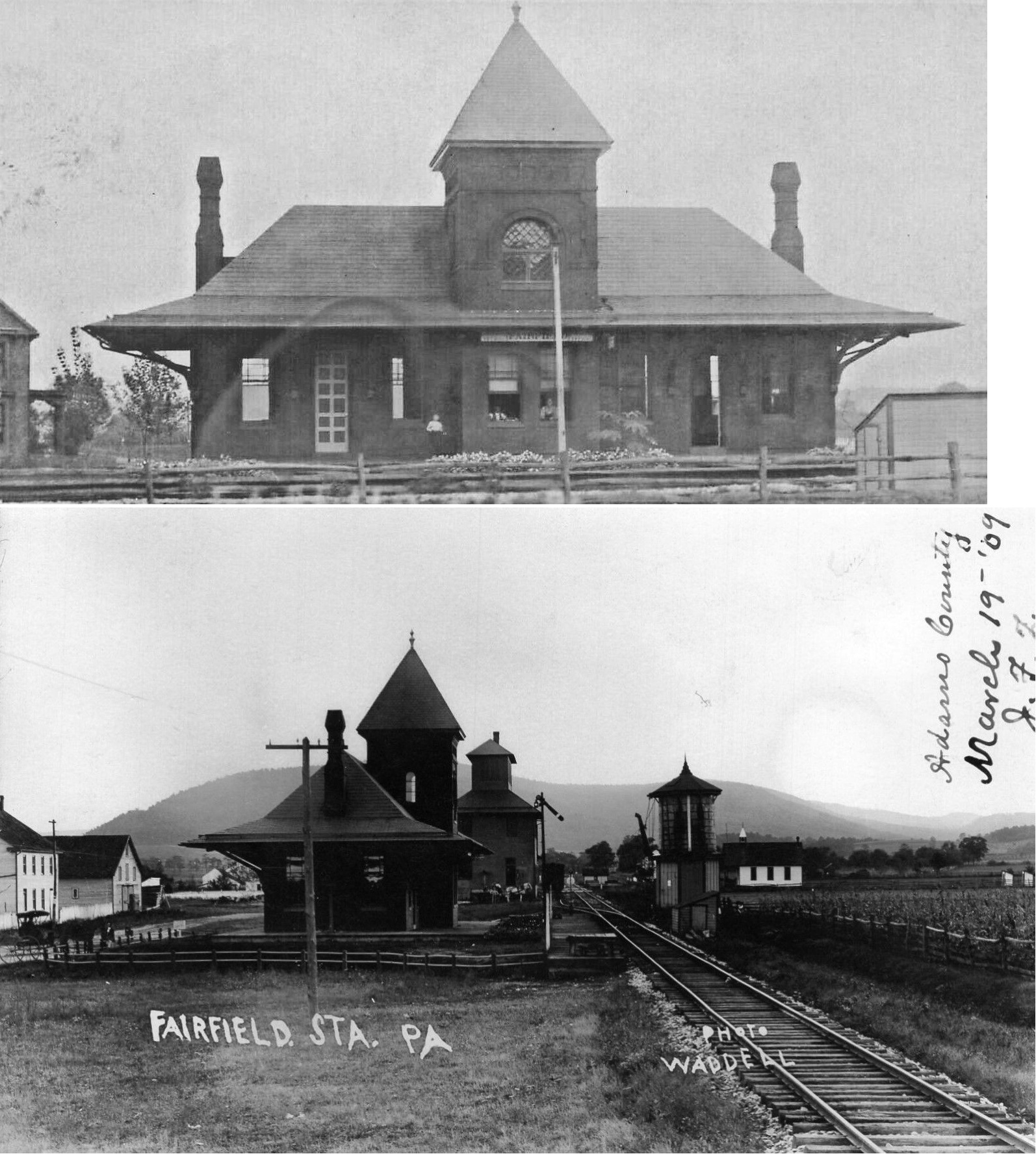
| Fairfield |
|
This station was on Fairfield Station Road at approximately GPS: 39.791721, -77.38533. | ||||||
| Gettysburg |
|
There was a freight station that stood on the east side of North Stratton Street near where the Gettysburg Fire Department now sits. The brick station was used through the 80's and torn down in 1992 to make way for the new fire station and its parking lot. It was located at approximately GPS: 39.831983, -77.227916. | ||||||
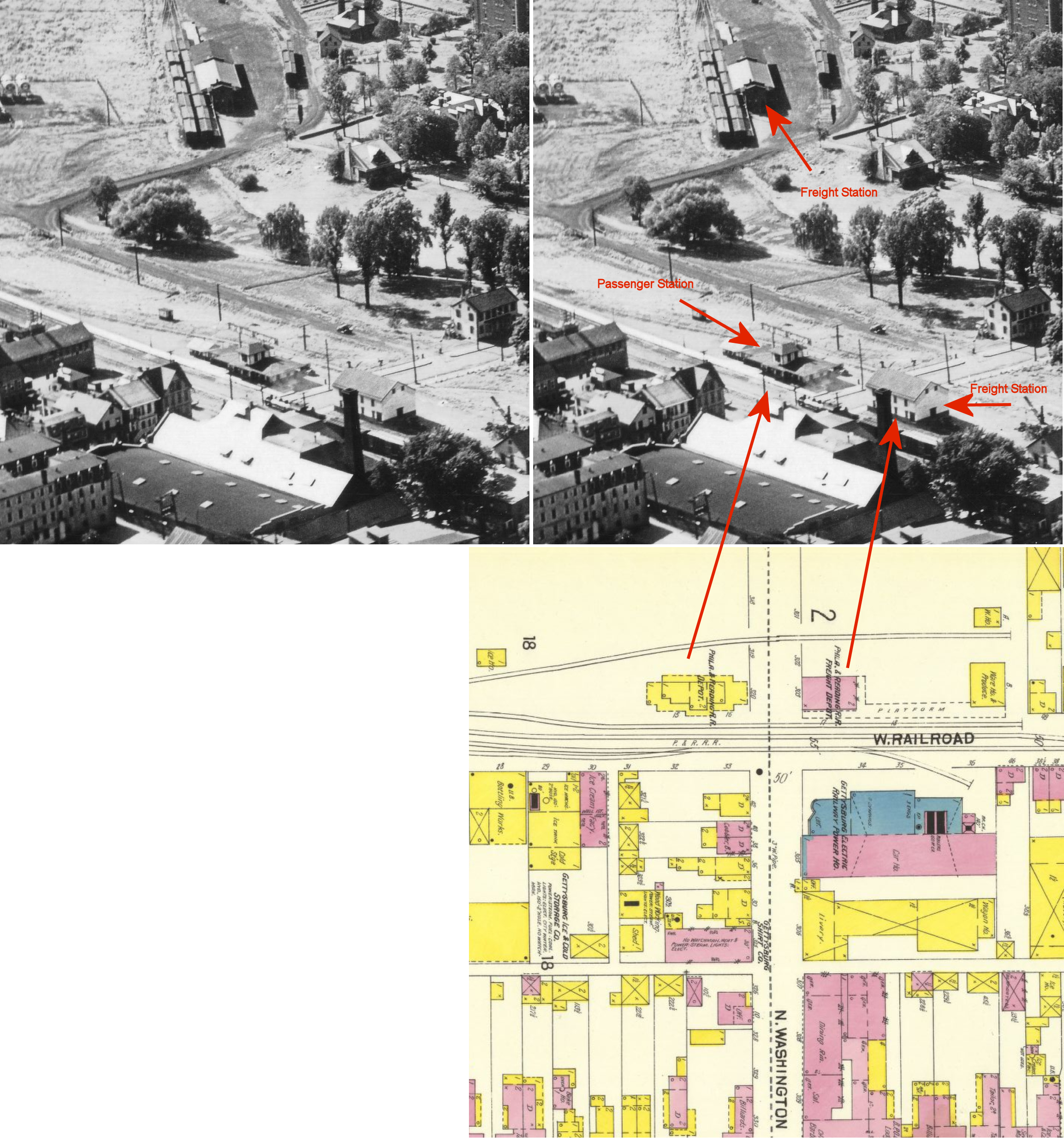
| Gettysburg |
|
The original Gettysburg and Harrisburg Railway freight station was built in 1865 and was on the west side of Washington Street across from the passenger station at GPS: 39.832215, -77.233153. It had a two-story brick front with a 1.5 story frame back end. | ||||||
| Gettysburg |
|
The original freight station was replaced sometime between 1902-1907 at the same location as the original freight station. This station was shorter in length than the original station, but was two stories and made of brick as indicated on the Sanborn map of 1907. | ||||||
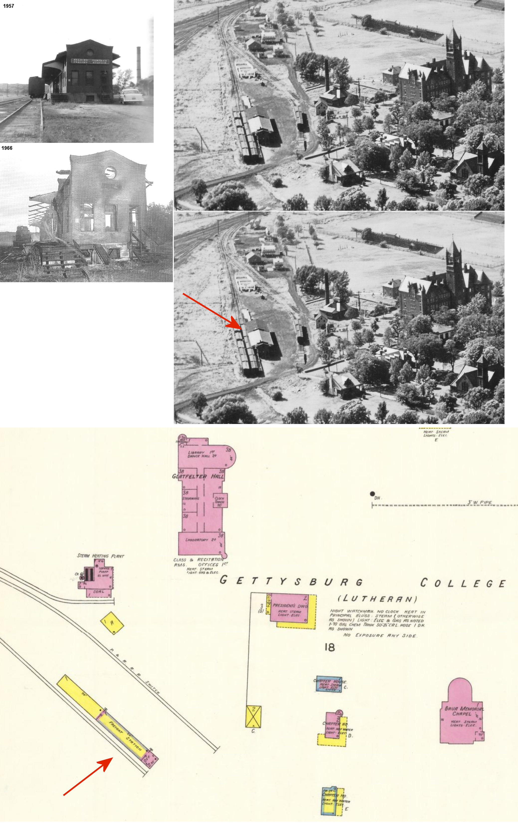
| Gettysburg |
|
This freight station was on the west side of Penn Hall Drive at West Water Street at GPS: 39.833489, -77.235593. This station burned in 1966. | ||||||
| Glad Hill |
|
|||||||
| Goldenville |
|
|||||||
| Granite Hill |
|
There was a Gettysburg RR station here in 1872 on Granite Station Road at approximately GPS: 39.855443, -77.159207. | ||||||
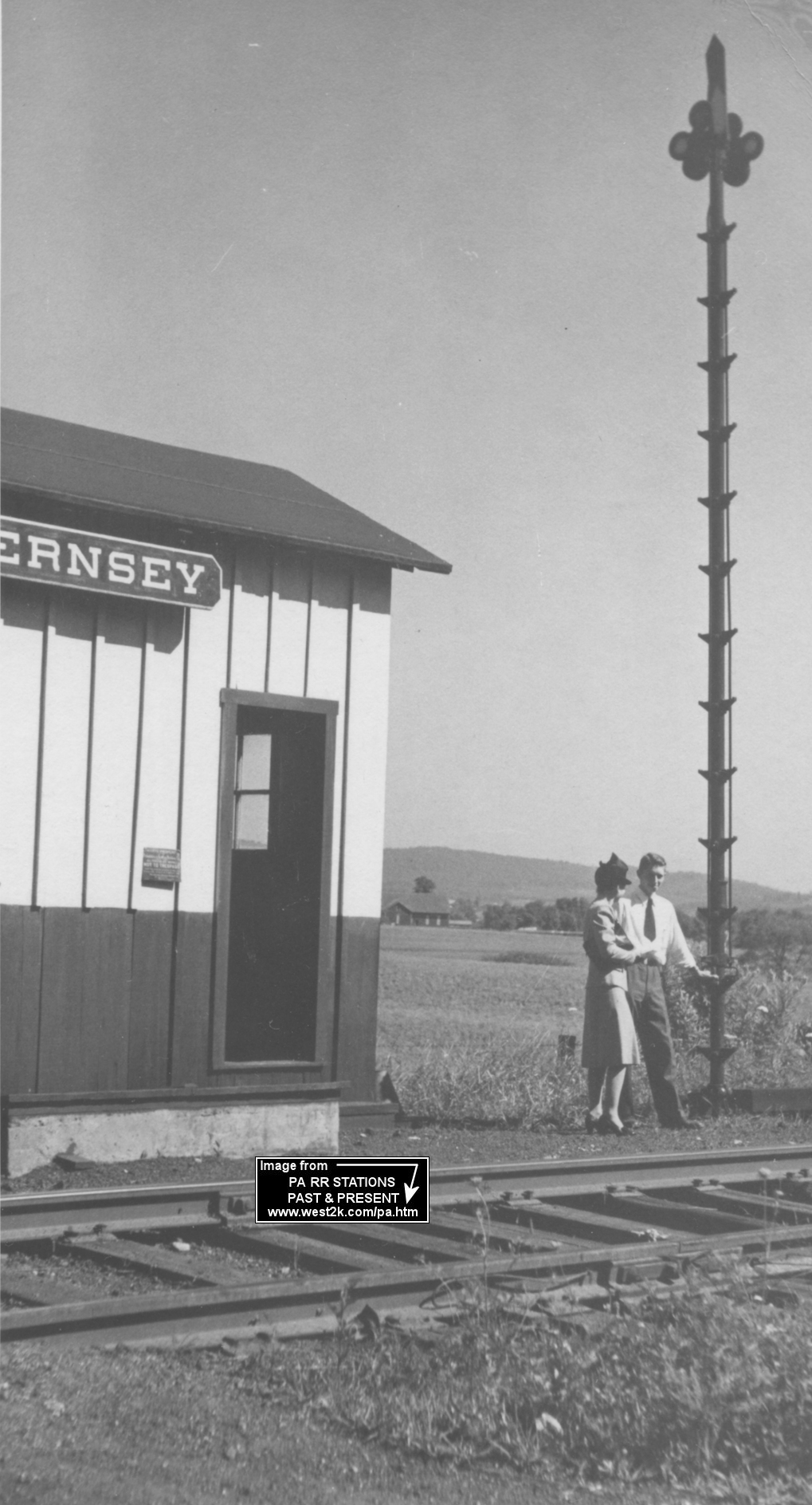
| Guernsey |
|
|||||||
| Guldens |
|
Gulden's station was on the old alignment between New Oxford and Gettysburg. It was on the York & Gettysburg Turnpike (now U.S. 30) east of Low Dutch Road. Back then the tracks crossed the turnpike and also Low Dutch Road. The tracks, which once curved south of the turnpike/highway for a short way have been relocated north of pike/hwy because crossing the roadway at shallow angle caused too many accidents. The station was on the SE corner of the York-Gettysburg Turnpike (now US-30) and Low Dutch Road. The old grade can still be seen there. There is still an old brick warehouse at the location near where the station was. The station was just south of the warehouse in the vicinity of GPS: 39.858002, -77.139037. | ||||||
| Idaville Station |
|
|||||||
| Iron Spring |
|
|||||||
| Jacks Mountain |
|
|||||||
| Kingsdale (Kingstown) |
|
Some report that this station still stands as a residence on Georgetown Road. Others say it is not. Can anyone confirm? The station is listed on early timetables, but was likely out of service by the 1930s. | ||||||
| Lefevre |
|
This station is shown on the 1900 PRR List of Stations & Sidings as well as the 1916 county map. | ||||||
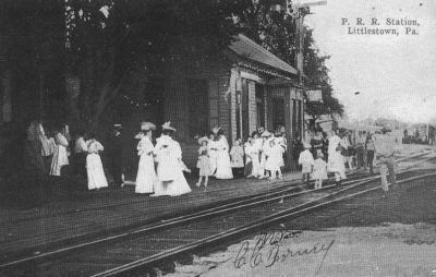
| Littlestown |
|
Was located on the NE side of South Queen Street on the NW side of the tracks at GPS: 39.743379, -77.086217. It was right behind the old National (Patterson) Hotel. | ||||||
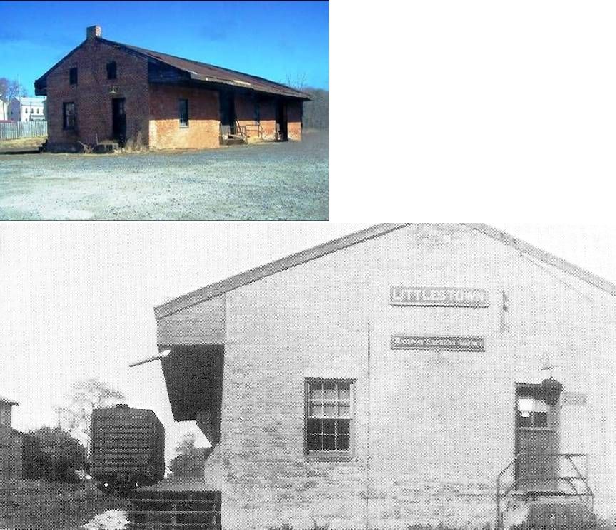
| Littlestown |
|
The freight station was on the NE side of South Queen Street on SE side of the tracks at GPS: 39.743155, -77.086195. It was used by the Crouse Moving Company, but was torn down in early 2007 to make way for a new building. | ||||||
| Maria Furnace |
|
|||||||
| Marshalls |
|
|||||||
| McKnightstown Station |
|
The original station here was built in 1907 of a standard WM design. Prior to that it was a flag stop. When the original station went out of service, an old store/house was converted for use as the station (still standing, see listing above in the "Existing Stations" section). | ||||||
| McSherrystown Station (McSherry) |
|
This station was south of town. | ||||||
| New Oxford |
|
There was a freight station just to the NW of the passenger station at GPS: 39.863605, -77.059896. | ||||||
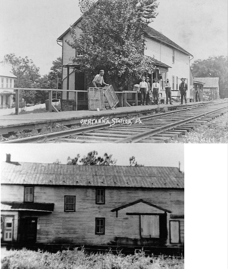
| Orrtanna |
|
|||||||
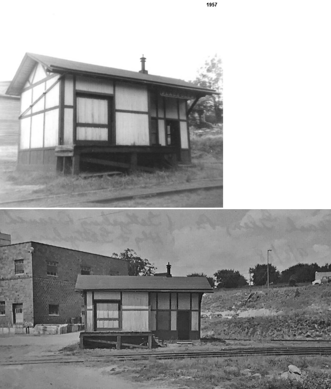
| Peach Glen |
|
This station was in the vicinity of Peach Glen-Idaville Road around GPS: 40.022254, -77.225452. | ||||||
| Round Top Station |
|
The RR owned a 12-acre park here called Little Round Top Park and thus had a short branch to this location from Gettysburg. | ||||||
| Sells Station |
|
A station is shown here in 1872 when the line was the Littlestown Branch RR. | ||||||
| Seven Stars |
|
|||||||
| Sprenkles |
|
|||||||
| Stremmels |
|
|||||||
| Table Rock |
|
|||||||
| Virginia Mills |
|
|||||||
| 1895 ADAMS COUNTY RAILROAD MAP | ||||||||
 |
||||||||
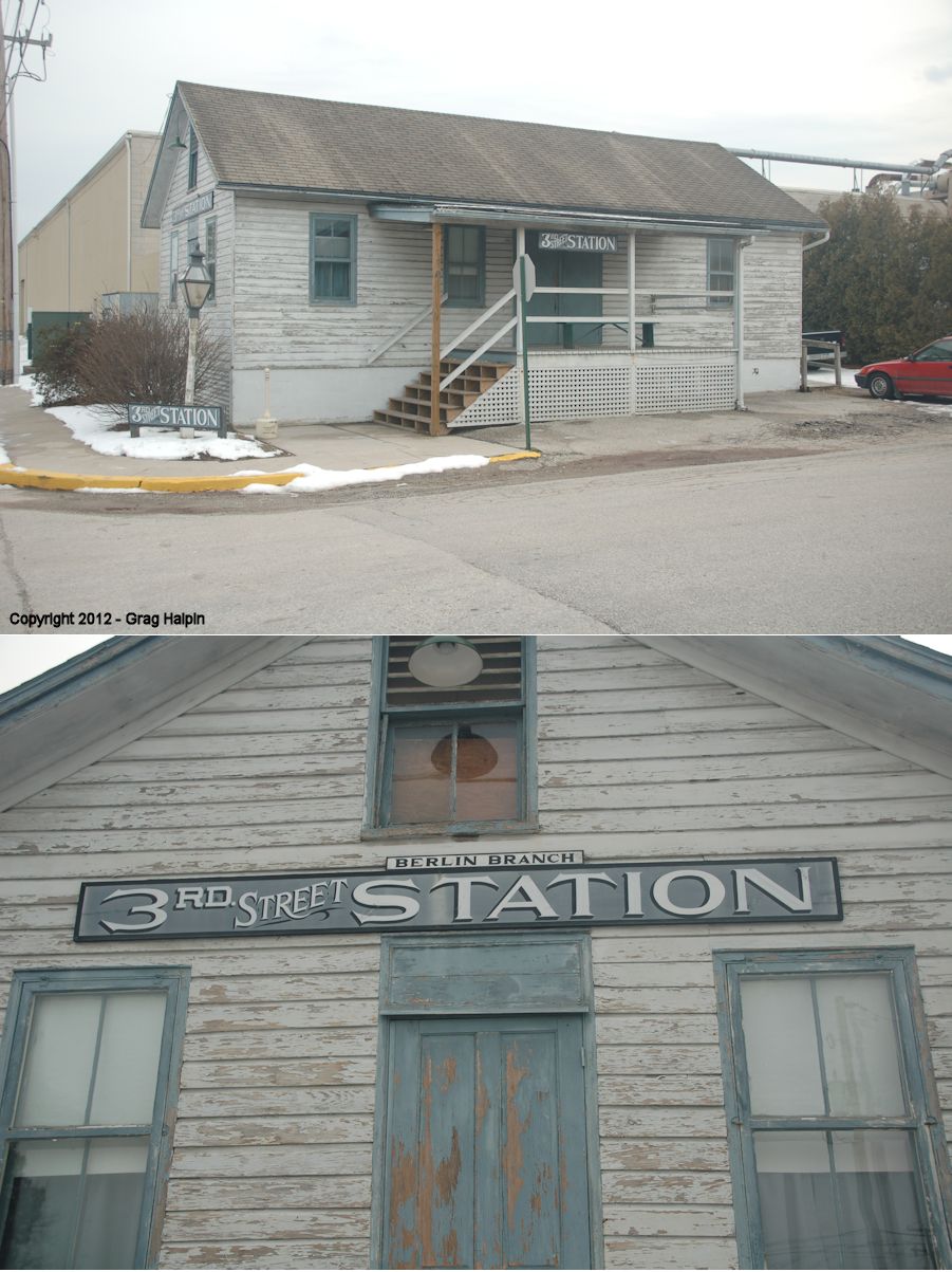
| Notes About Existing
Stations... East Berlin (WM) - In 1903 the Berlin Branch RR, a subsidiary of the Western Maryland, became independent and known as the East Berlin Railway. Gettysburg (Hanover Junction RR) - See this site for more info. Gettysburg (Reading) - Some claimed that this was built by the BR&P as their Rockton depot in Clearfield County and moved in the 1980s to Gettysburg by the Gettysburg Railroad's previous owner. This is NOT the station that was moved to Gettysburg. This station is the original Gettysburg and Harrisburg Railway station according to old postcards and the current management of the Gettysburg RR. The station that was moved from Rockton was moved again to Kane, PA (see McKean County or Clearfield County pages for listing). |
||||||||