 COUNTYCOUNTY
|
|
||||||||
| EXISTING STATIONS | ||||||||
|---|---|---|---|---|---|---|---|---|
| Station Name |
Original Railroad | Current Location |
Type | Date Built |
Current Use |
Track Status |
Building Material |
More Info |
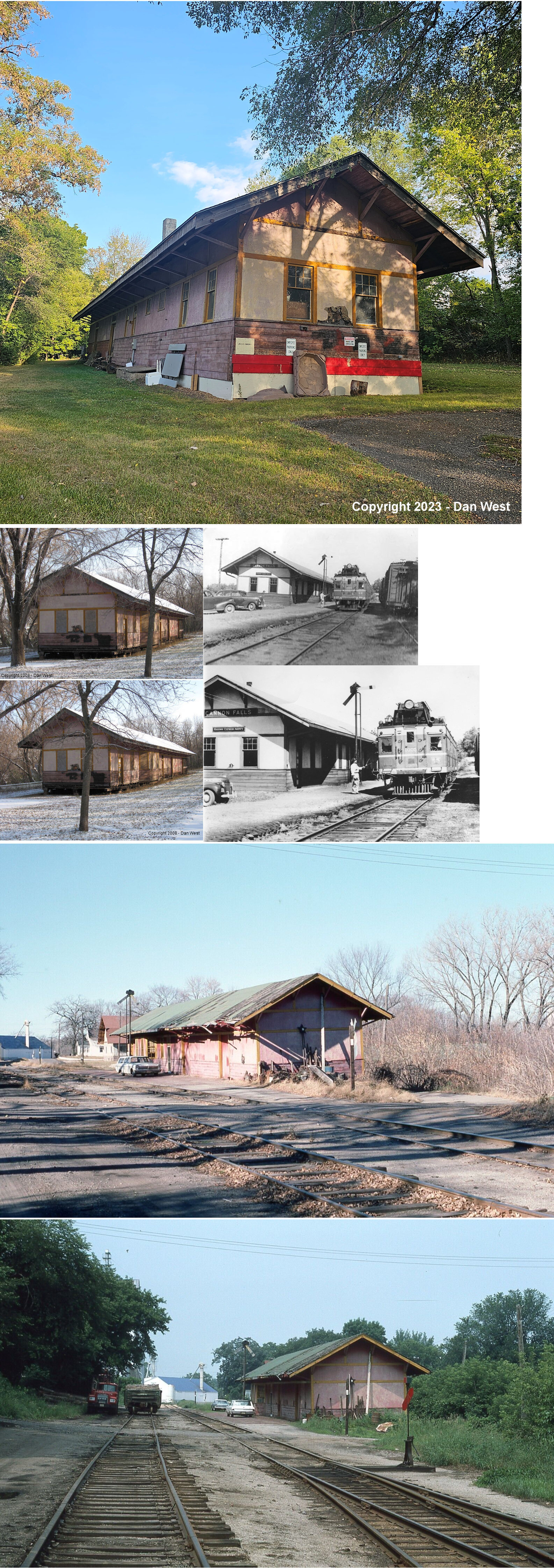
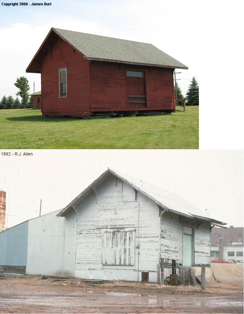
| CANNON FALLS |
 |
Corner of 2nd and
Water Streets (GPS: 44.512140, -92.901915) |
C | 1915 | Vacant | Gone | Wood |
|
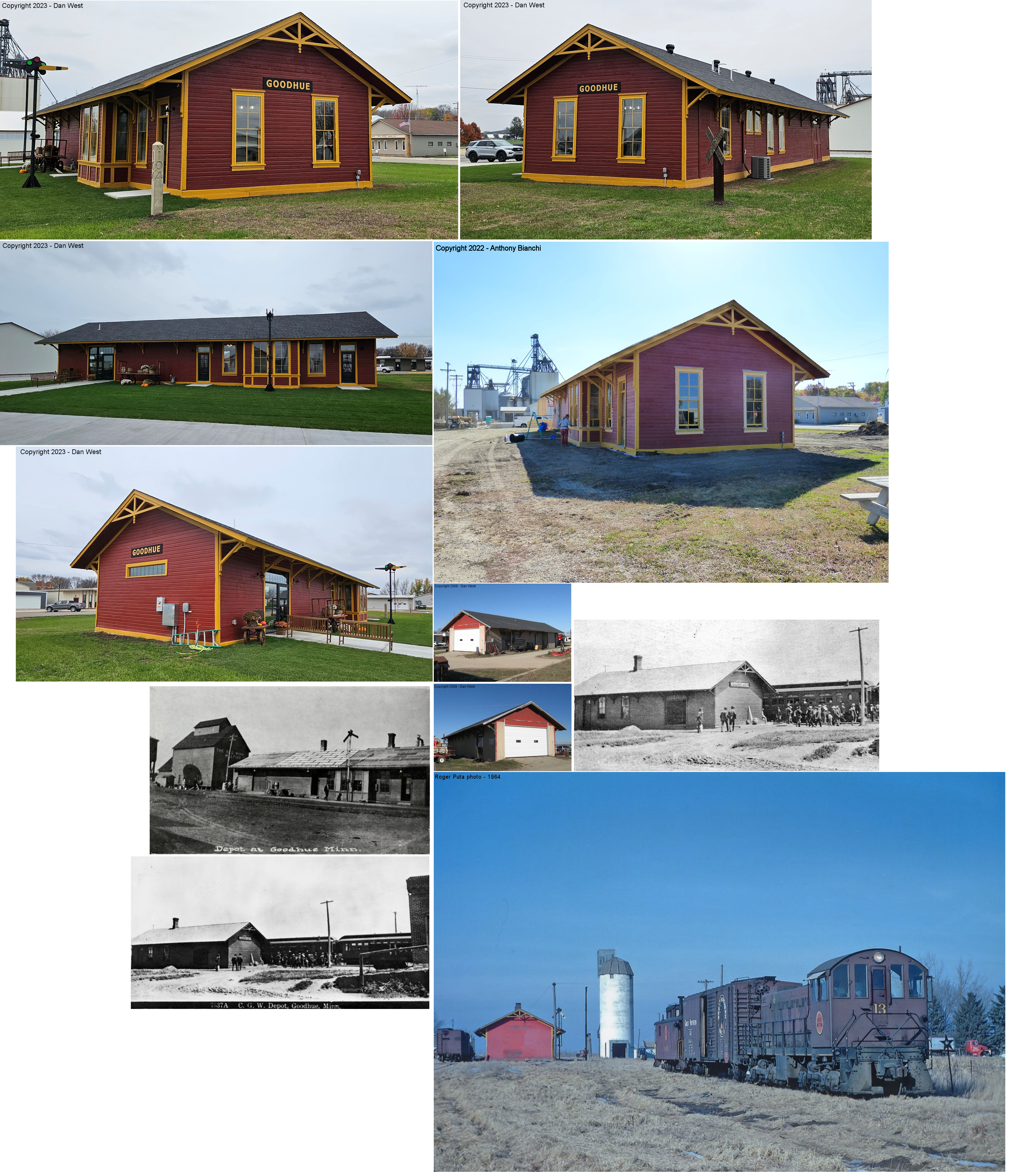
| GOODHUE |
 |
Third Avenue between
Broadway and MN58 (GPS: 44.401400, -92.622392) |
C | 1889 | Business | Gone | Wood | |
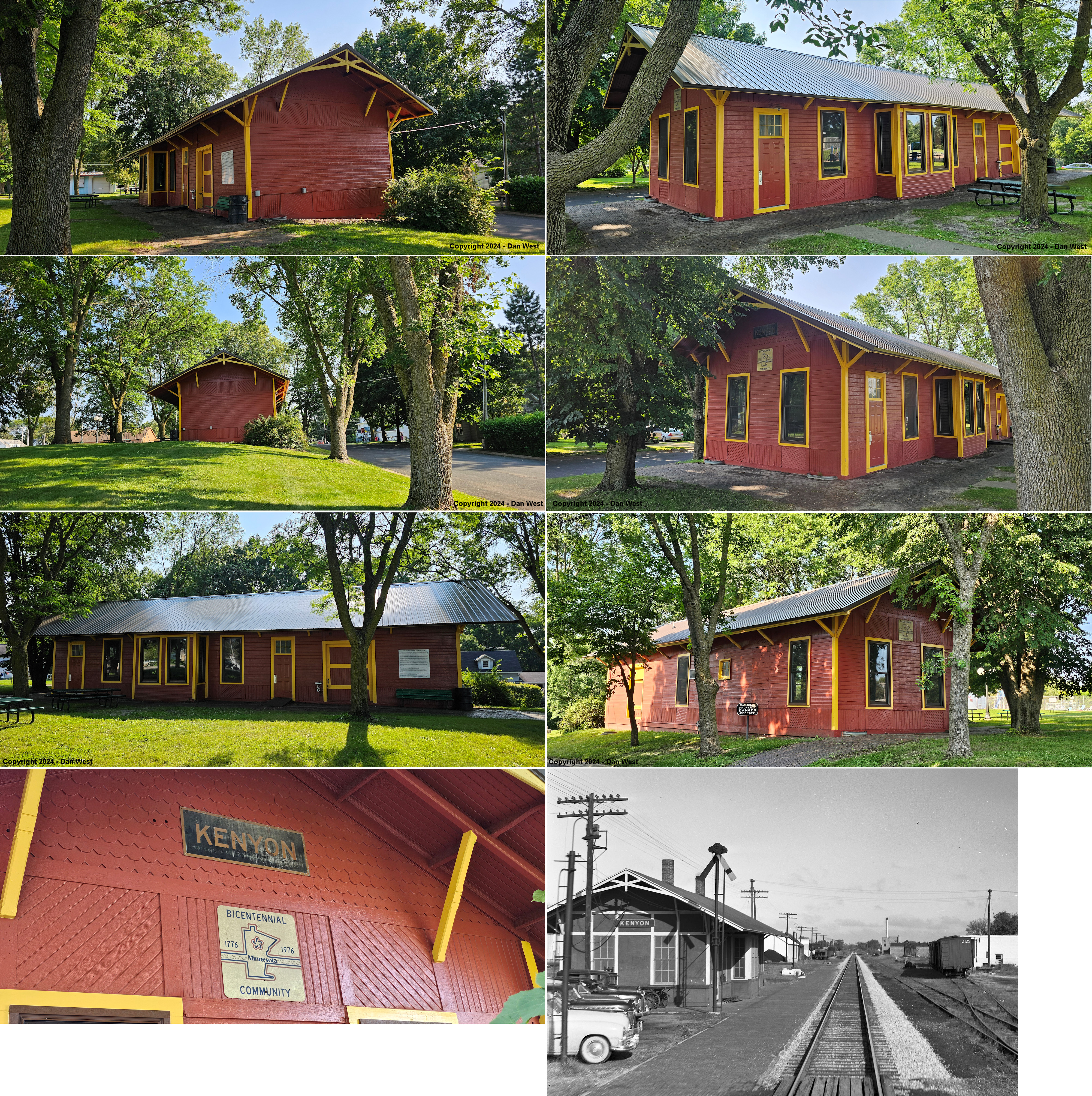
| Kenyon |
|
East side of Washington Street just north of 1st Street. (GPS: 44.273568,-92.991849) |
C | ???? | Civic | None | Wood |
|
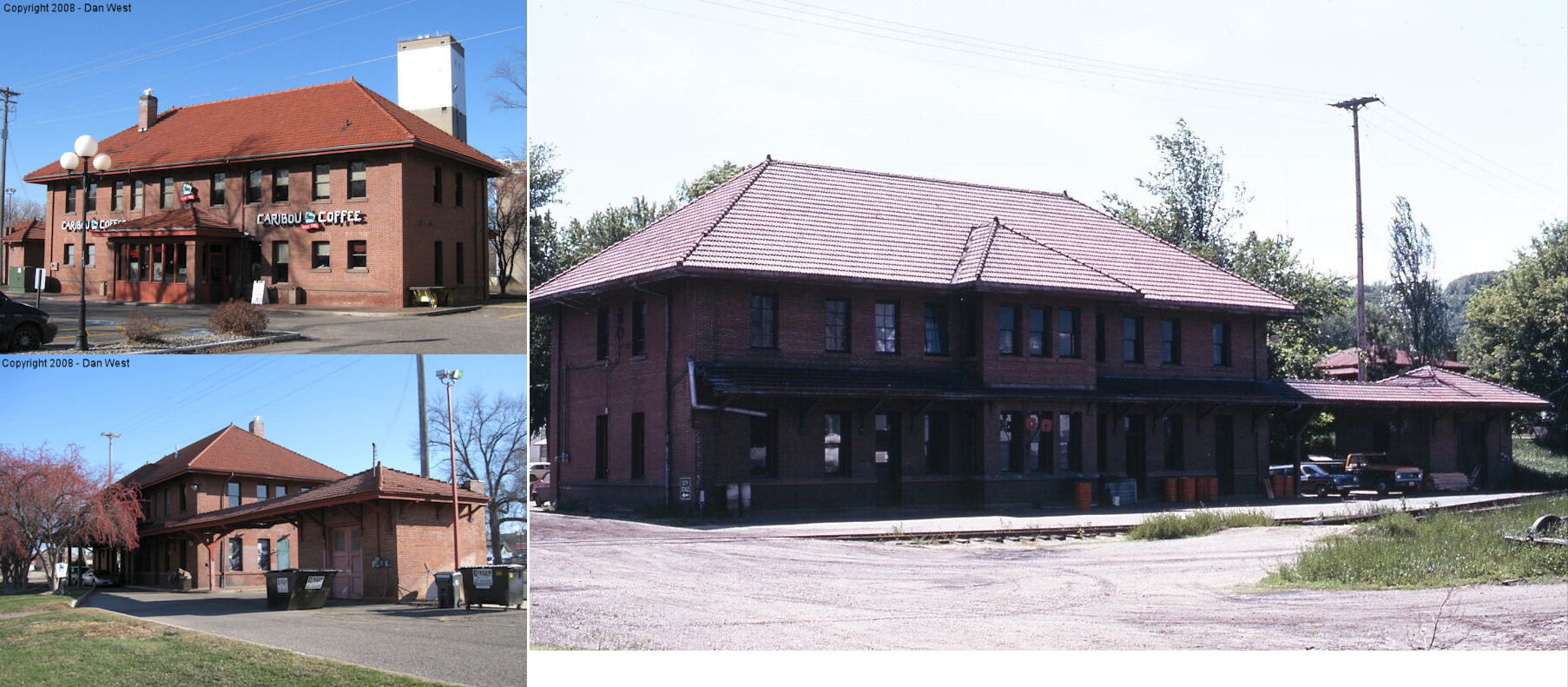
| RED WING |
|
726 Main Street (GPS: 44.564601, -92.539480) |
P | 1906 | Business | Gone | Brick |
|
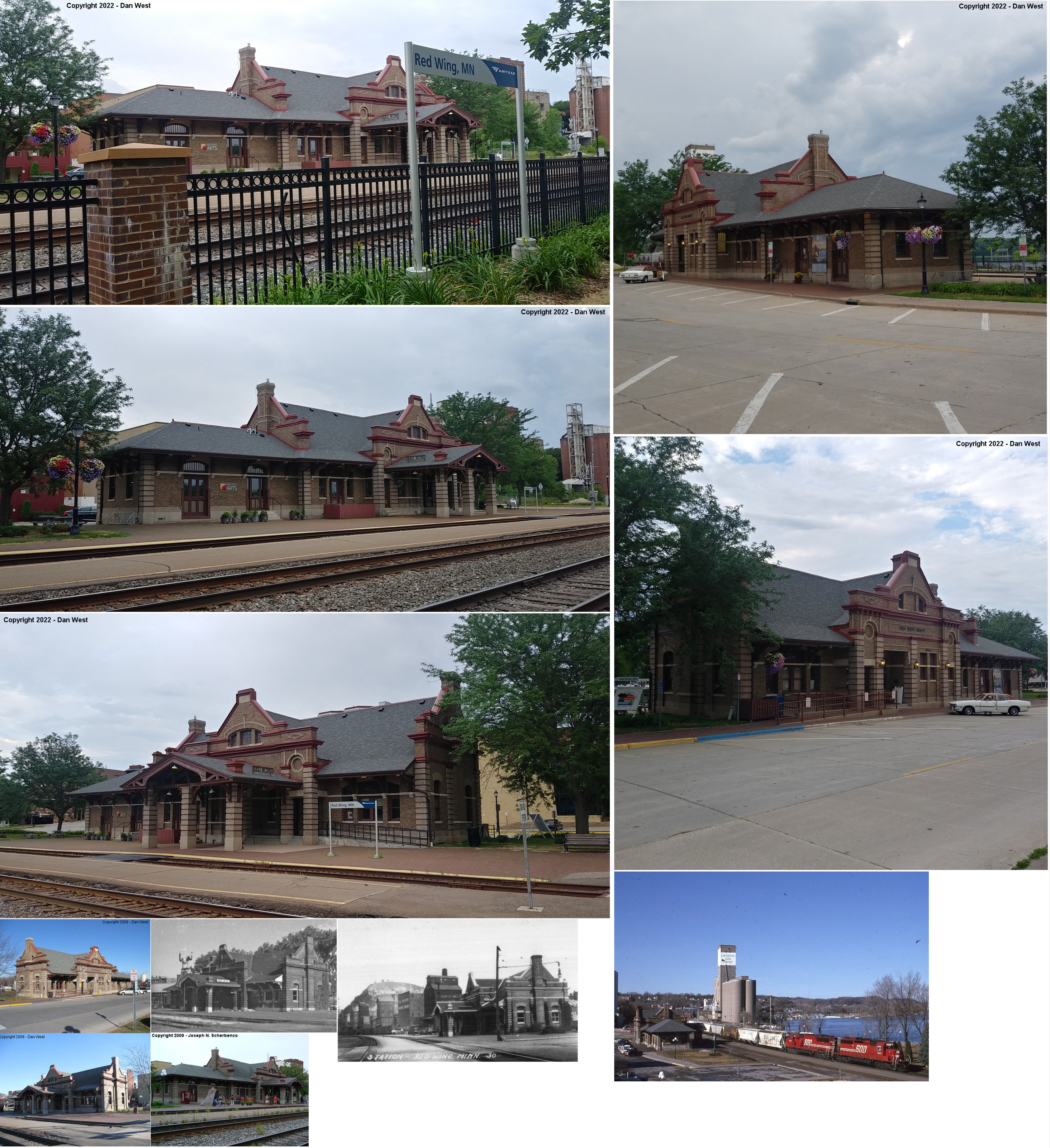
| RED WING |
 |
420 Levee Street (GPS: 44.566305, -92.537157) |
P | 1904 | Mixed | In Use | Brick | |
| Red Wing |
 |
Little Log House
Pioneer Village 220th Street, Hastings, Dakota County (GPS: 44.630296, -92.838568) |
F | ???? | Muesum | None | Wood |
|
| WANAMINGO |
|
At Holden Community Park, 6525 County 30 Boulevard, Kenyon (GPS: 44.320713, -92.901694) |
C | ???? | Civic | None | Wood | |
| Zumbrota |
 |
Little Log House
Pioneer Village 220th Street, Hastings, Dakota Co. (GPS: 44.630700, -92.837773) |
F | ???? | Museum | None | Wood | |
| STATIONS OF THE PAST | ||||||||
| Station Name |
Original Railroad |
Notes | ||||||
| Bakko |
|
Bakko (or Bakke) was in the SW corner of Section 14, Kenyon Township. There was likely no depot here. | ||||||
| Bellechester |
|
This station was built in 1912 and was on 1st Street. It was built with some lumber salvaged from the Manly, IA depot. The station was closed in 1945. | ||||||
| Bellechester Junction |
|
This station was south of Goodhue where the line to Bellechester junctions with the CGW between Goodhue and White Willow. | ||||||
| belle creek |
|
This location should not be confused with the Belle Creek that still exists in Belle Creek Township. See listing below for the CGW station at Welch. | ||||||
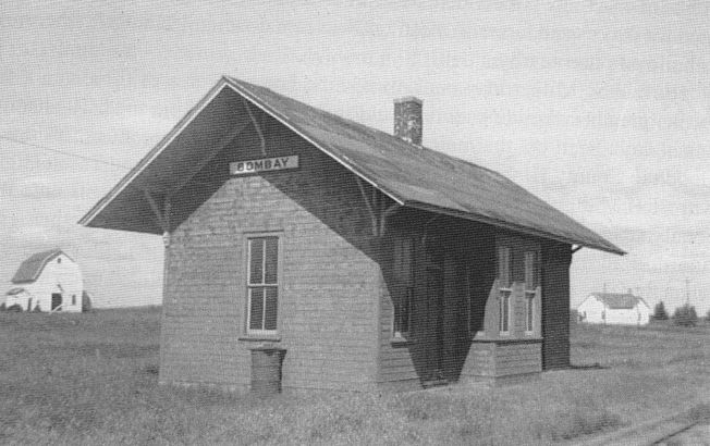
| Bombay |
|
The first station here was built in 1903 with the opening of the line from Zumbrota to Fairibault. This was small freight shed that also served passengers. | ||||||
| Bombay |
|
This 16'x36' station was built in 1904/05 when the original small freight shed proved to be too small to handle the town's needs. The station went out of service in 1930, but stood until at least the early 1940s. The line was abandoned in 1979. | ||||||
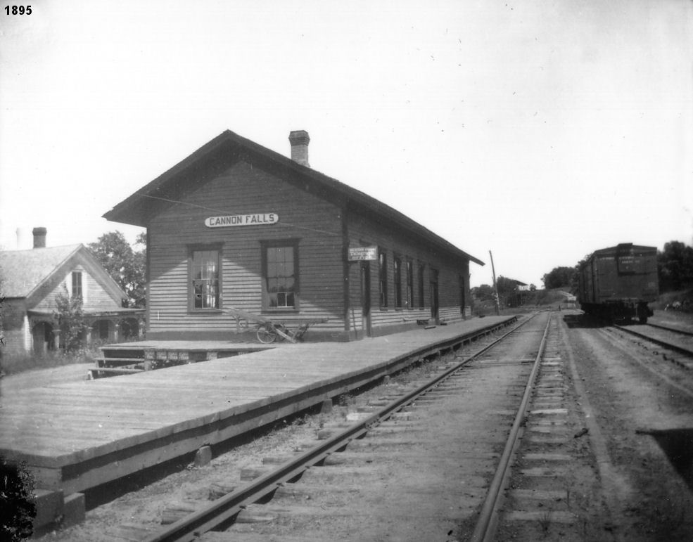
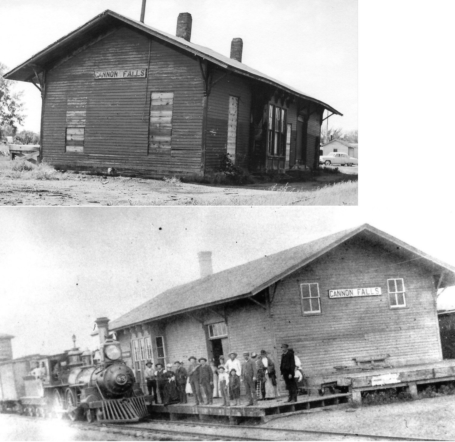
| Cannon Falls |
|
This station was built in 1882 and replaced by the station that is still standing. | ||||||
| Cannon Falls |
|
|||||||
| Cannon Junction |
|
|||||||
| Cascade (Granville Mills) |
|
This station, in the NW corner of Stanton Twonship was called Granville Mills in the early years by both the Minnesota Central (CGW) and CM&St.P. Both railroads erected stations here. This station was built around 1882. | ||||||
| Cascade (Granville Mills) |
|
This station was built around 1882. | ||||||
| Central point |
|
|||||||
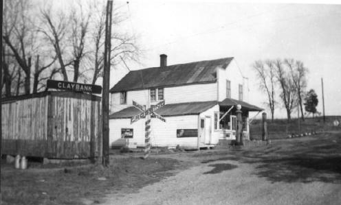
| Clay Bank |
|
The depot here was a remodeled boxcar. It was gone by the 1950s. The line, later CGW, was abandoned in 1965. The store in the photo was razed in the late 1960s after serving as a residence for a few years. | ||||||
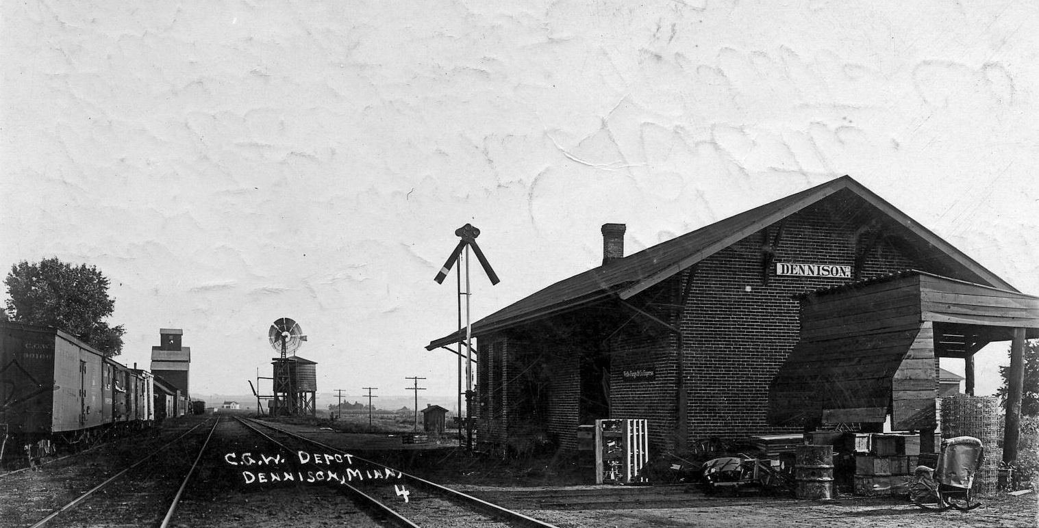
| Dennison |
|
This station, built in 1905, was just south of CR 31/CR 9. The station was on the east side of the tracks. It was closed in 1955 and demolished in 1964. | ||||||
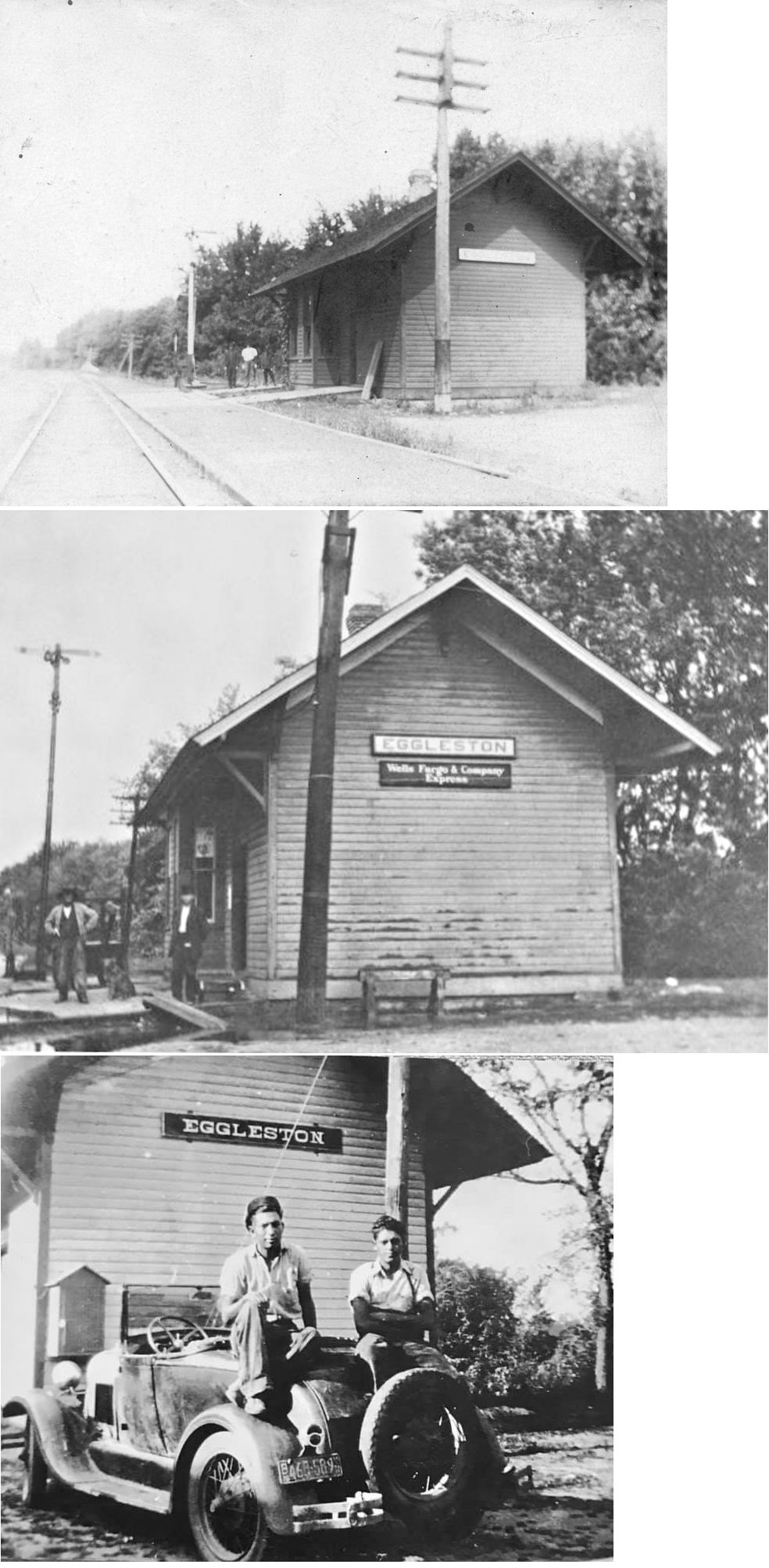
| Eggleston |
|
The line here was abndoned in 1941 in favor of the newer line that ran across Prairie Island. The depot was demolished in 1946. | ||||||
| Fagen |
|
This station was located on the Fagen farm (SW corner of Section 6 in Warsaw Township), between Stanton and Dennison, on the border of Rice County. The "milk shake" train picked up cans of milk and cream at stations along the railroad line, carrying the filled cans to the Twin Cities in the morning and returning the empty cans to the stations in late afternoon. Between Kenyon and Stanton, the train, which also carried a passenger car, made pickups at Finseth, Hildebrant, Nerstrand, Hukie, and Fagen. Source: Newspaper articles from the Kenyon Leader Feb.12,1976 and May 18,1978 | ||||||
| Finseth Station |
|
Finseth Station was in the north central part of Section 32 in Holden Township. | ||||||
| Florence |
|
This early station was between Lake City and Frontenac. The town, which was located in Section 24 of Florence Township, died out prior to 1900. It was in the vicinity of GPS: 44.502655, -92.320686. Photo is from the 1870s. | ||||||
| Forest Mills |
|
This station was just south of the race for the flour mill. It sat just to the NW of the butter tub factory, north of what used to be Main Street. This area is unidentifiable now and located on private property (part of which appears to be a junkyard). The depot also housed the post office from 1888-1898. The post office and depot were closed in 1898. The tracks were removed in 1955. According to a March 1956 article in Minnesota History titled, "The Story Of Forest Mills" by Roy W. Meyer, the depot/post office building was still standing as of 1955. | ||||||
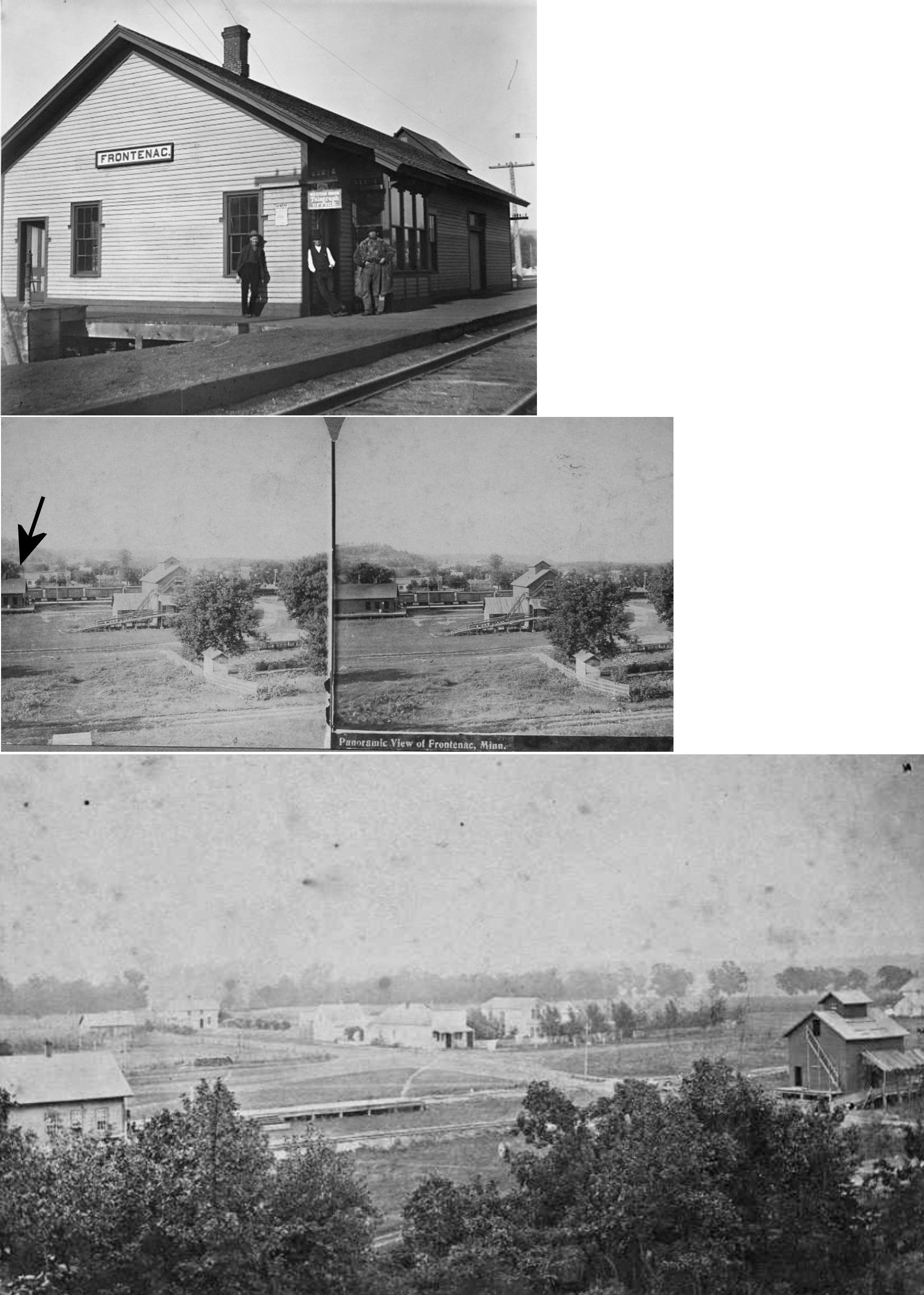
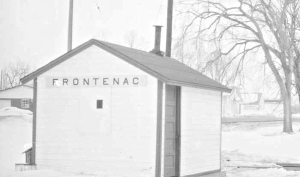
| Frontenac Station |
|
This station, built in 1871, sat in the middle of the block formed by Caledonia (on the west), Scandinavia (on the east), Columbia (on the north), and Sclavonia (on the south) Streets at approximately GPS: 44.510264, -92.354953. | ||||||
| Frontenac Station |
|
A later-generation station. | ||||||
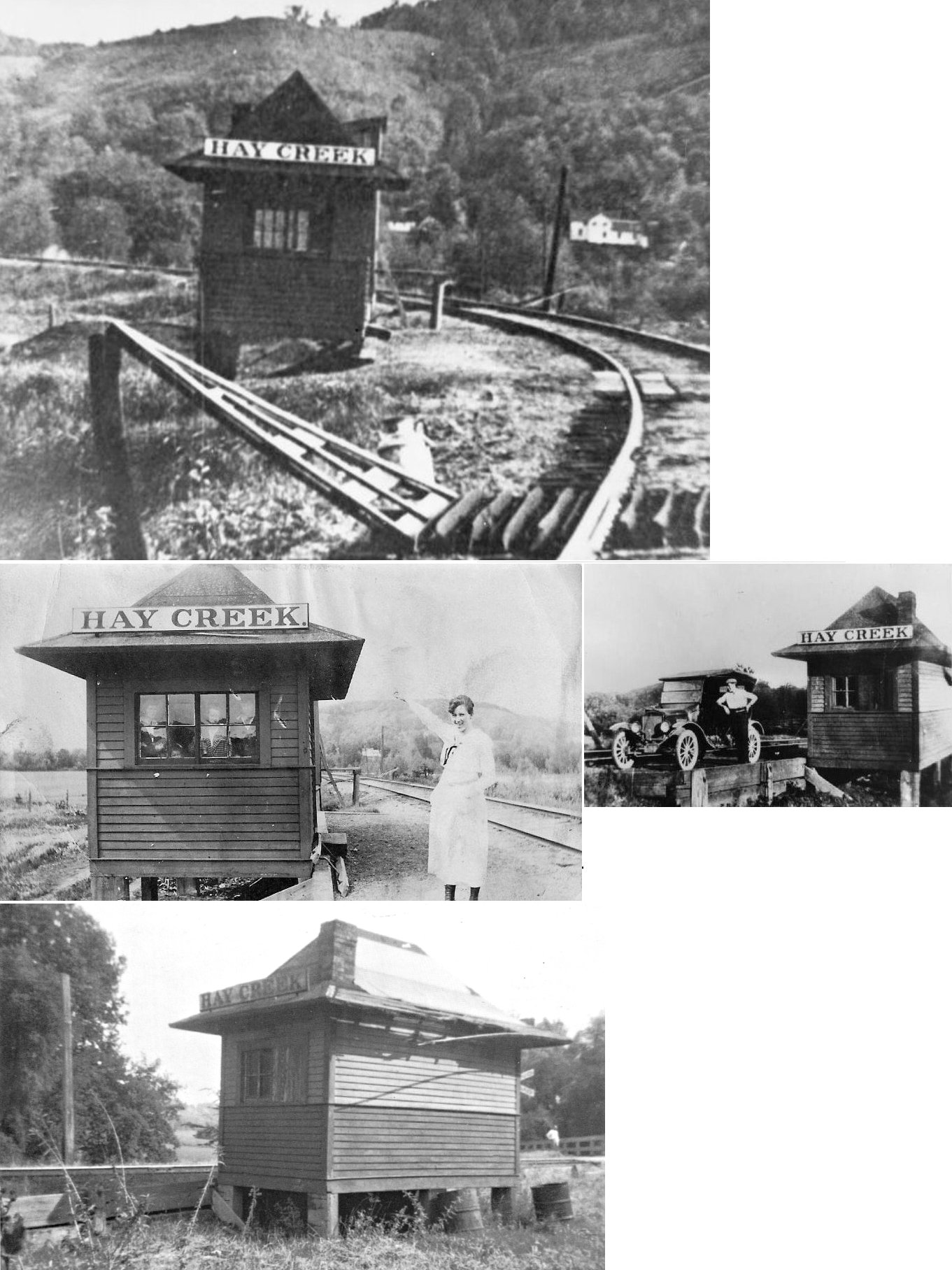
| hay creek |
|
This railroad ran from Red Wing Junction to Zumbrota with a spur from Claybank to the nearby clay pits. It's main purpose was to serve the pottery and stoneware factories in Red Wing. The tracks were removed here in 1937. It was first chartered as the Red Wing & Iowa Rwy. in 1881, renamed the DRW&S in 1886, and was sold to the Wisconsin, Minnesota & Pacific in 1901. The line finally ended up as part of the Chicago Great Western. | ||||||
| Kenyon |
|
In a 1938 aerial photo, the station is located west of Bullis Street on the north side of the tracks and 5th Street. | ||||||
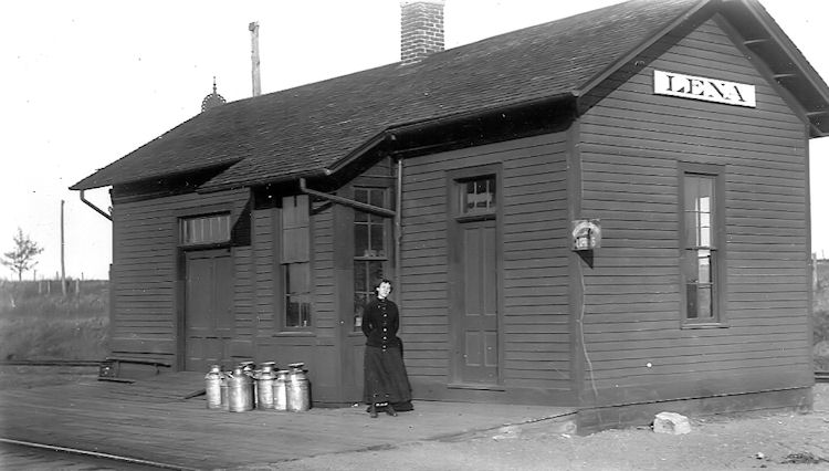
| Lena (New Jerusalem) |
 |
This depot was on the SW corner of CR 55 and MN 60 in Pine Island Township. There was also a warehouse next to the station. The name of the town was changed from New Jerusalem to Lena shortly after the RR station was built around 1878. | ||||||
| Lena |
|
The CGW erected a new depot at Lena in 1903. It was torn down in 1938 and the line was abandoned in 1965. | ||||||
| Mineral Springs |
|
Mineral Springs may have been an early town, but was better known for the tuberculosis sanitarium that was here. Although is referred to as an early RR station in the book Ghost Towns & Discontinued Post Offices of Goodhue County (1991) by Roy Meyer, there may or may not have been an actual station building here (the train may have simply stopped at the sanitarium as the tracks were a few feet from the building itself). The sanitarium was at the south end of 95th Avenue Way/County 40 Boulevard at about GPS: 44.52447,-92.842305. | ||||||
| Minneola |
|
The station was on the south side of the Zumbro river near the trestle that carried the spur north across the river to where the old Barr Clay Plant. | ||||||
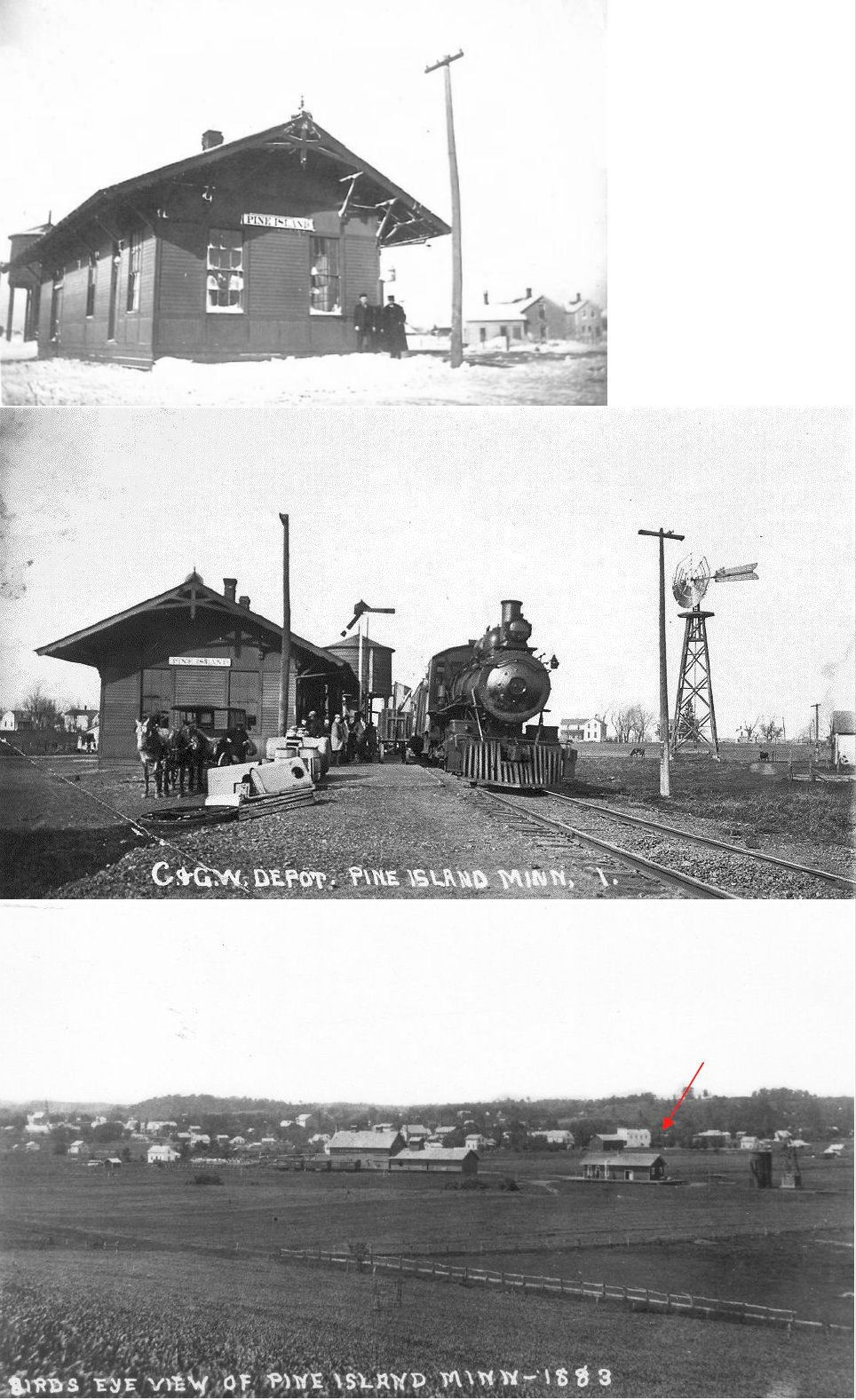
| Pine Island |
|
The first station here was built in 1878. | ||||||
| Pine Island |
|
Built in 1903 (according to the book "Chicago Great Western: Depots Along The Cornbelt Route," 2004), this station was eventually bought by the 7th Day Adventist Church. The church tore the station down in 1937 and used the salvaged lumber for the building of the the church. Its original location was on Park Avenue, which would be somewhere near the intersection of 5th Street and 3rd Avenue today as the town stripped most of its street names for the boring numbered system. | ||||||
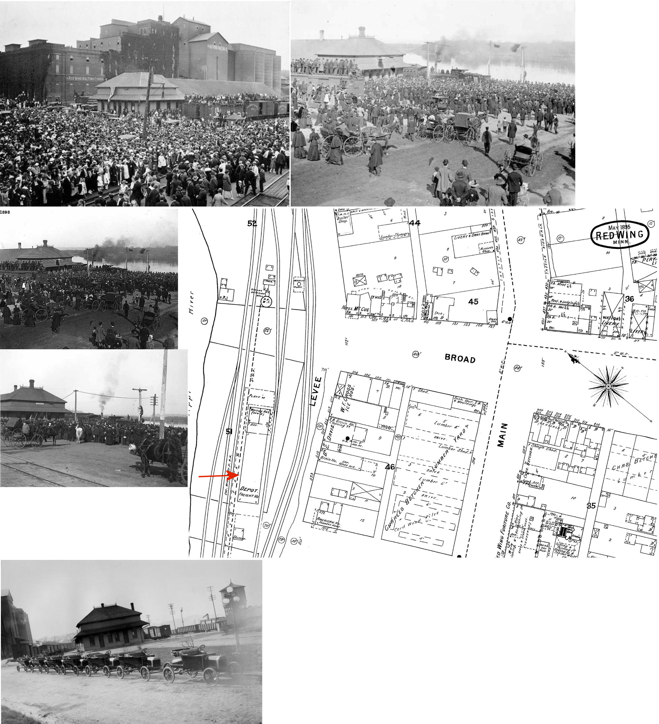
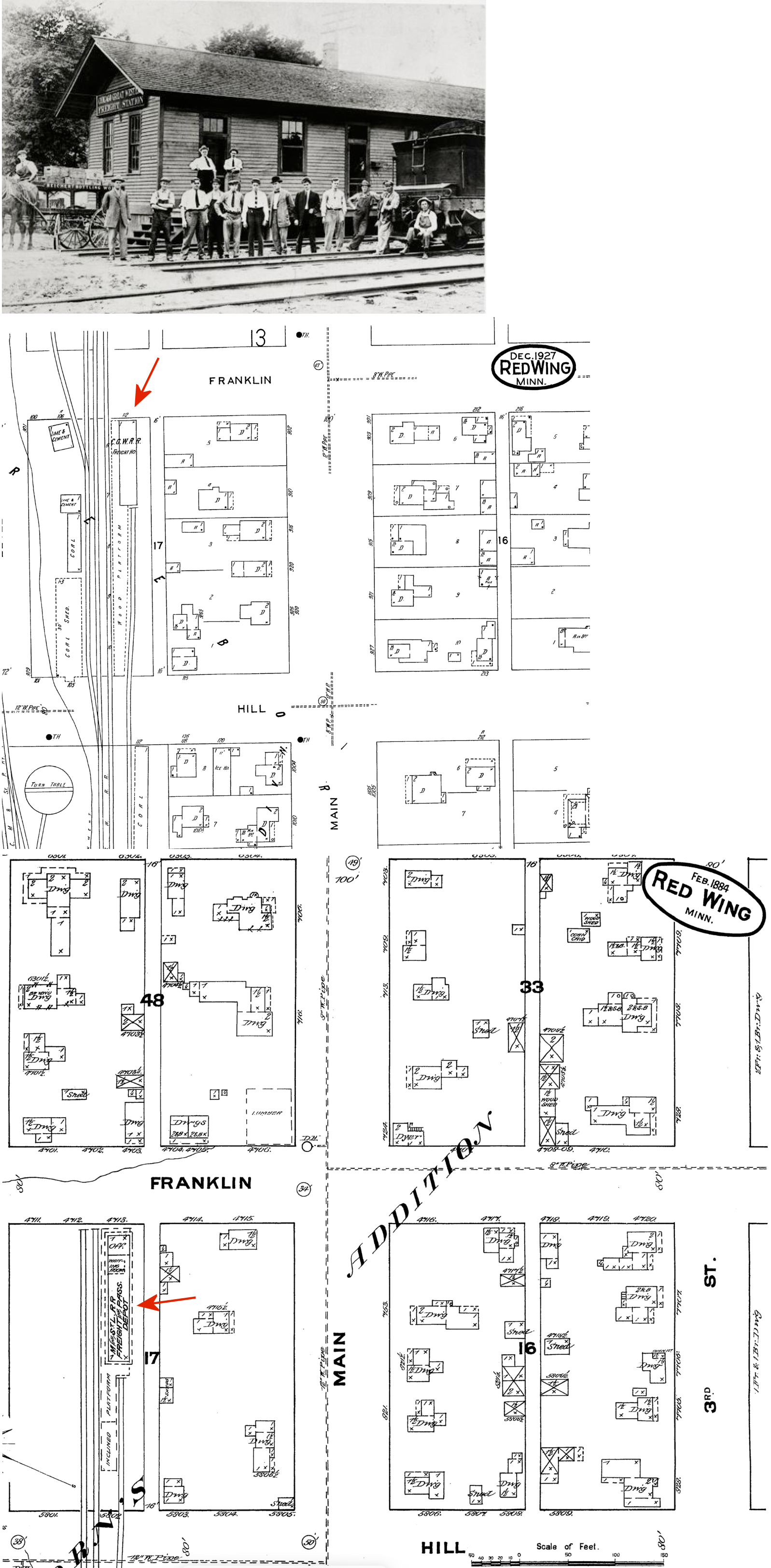
| Red Wing |
|
The first CM&St.P station was a combination station along the tracks between Dakota and Broad Streets (just SW of where the current station is located). It was built in 1870 as a wood frame station and in 1874 a freight section was added to the rear of the building. Then, in 1887, it appears that the station was moved slightly back from the street so a waiting room addition with a brick veneer face could be added. The first photo on the upper left shows the two distinct parts of the building. | ||||||
| Red Wing |
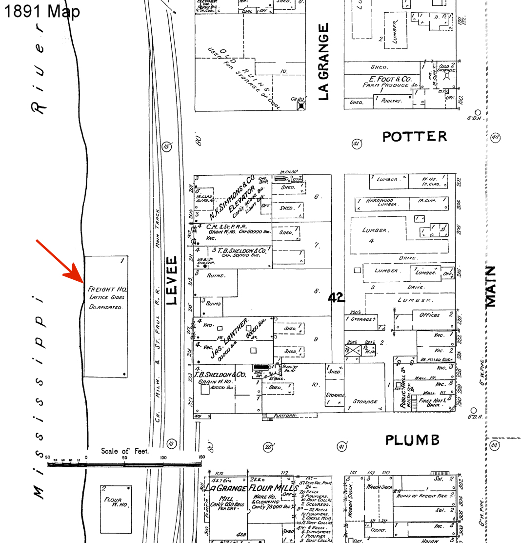
|
The 1884 Sanborn map shows a freight house along the river between the end of Potter Street and the end of what is now Hiawatha Pioneer Trail (formerly Plum Street) at GPS: 44.568175, -92.535472. On the 1891 map the freight house is still shown, but marked as "dilapdated." 44.566082, -92.537833 | ||||||
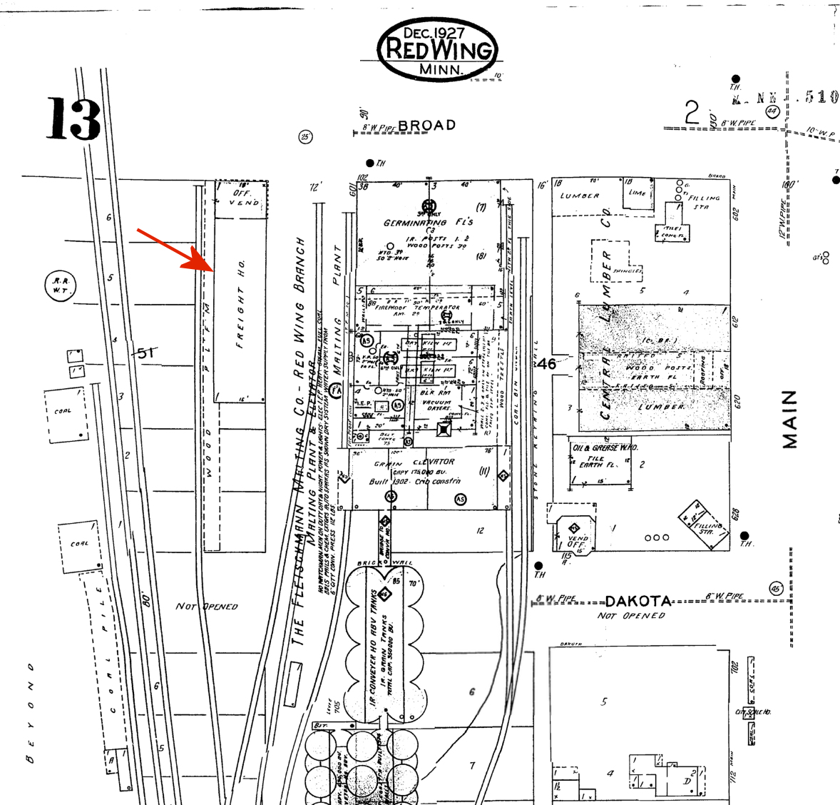
| Red Wing |
|
A newer freight station was on the SW side of Broad Street at GPS: 44.566082, -92.537833. | ||||||
| Red Wing |
|
The freight station was on the west side of Franklin Street on the south side of the tracks at GPS: 44.564053, -92.541272. This freight station was the original combination station for the Wisconsin, Minnesota & Pacific RR (despite the labels on the maps) as the 1884 map indicates that is was a passenger and freight station. Later, after the new station was built, it served as the freight station. | ||||||
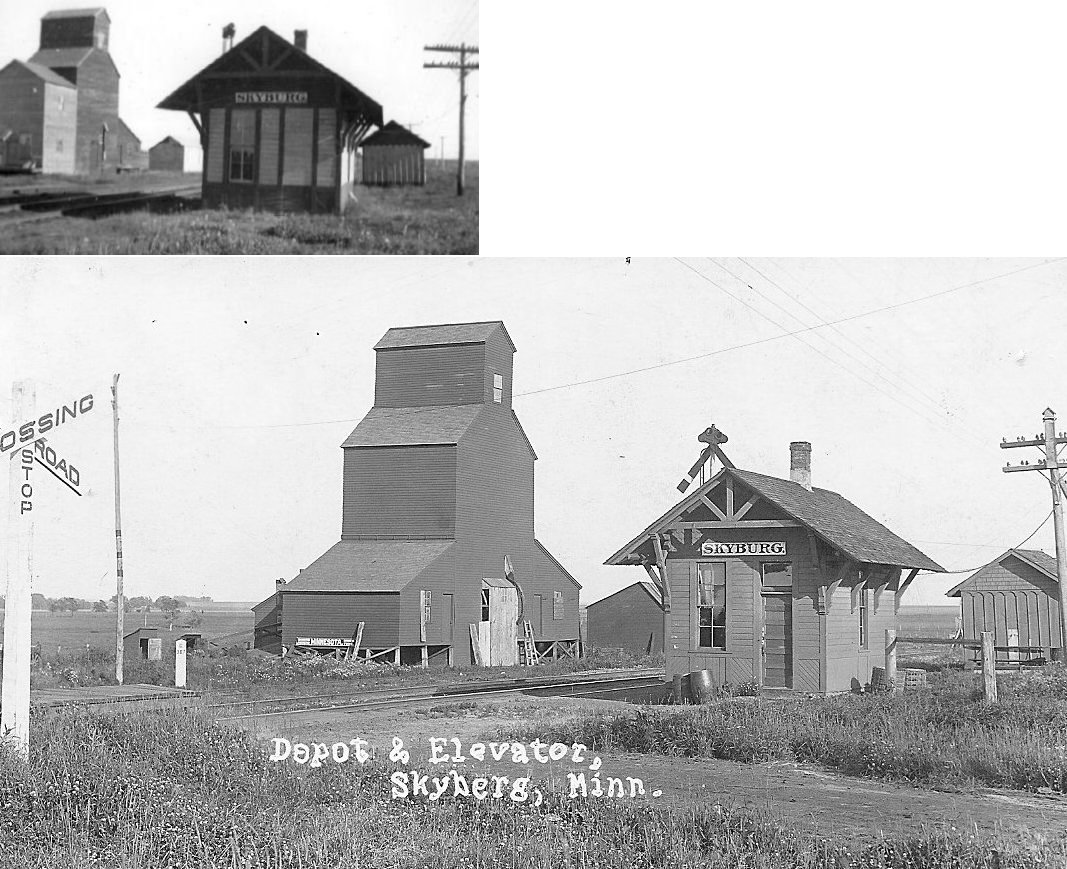
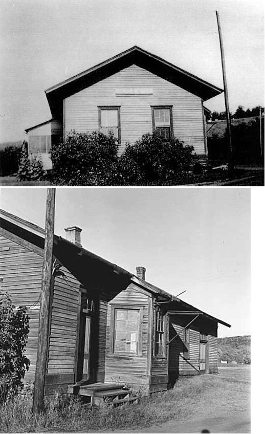
| Skyburg (Skyberg) |
|
Skyberg was on the southern border of Section 25, Kenyon Township. The first station here was in service around 1885. The depot pictured was built in 1891. It was on the SE corner of County Road 11 and MN-56 on the west side of the tracks at GPS: 44.211289, -92.930986. The depot was retired in 1949 and replaced with 1/2 of a boxcar body (the other half was installed at Stanton). That boxcar depot was retired in 1957 and moved to a farm one mile west and one mile south where it was used as a chicken coop. Is that still standing? | ||||||
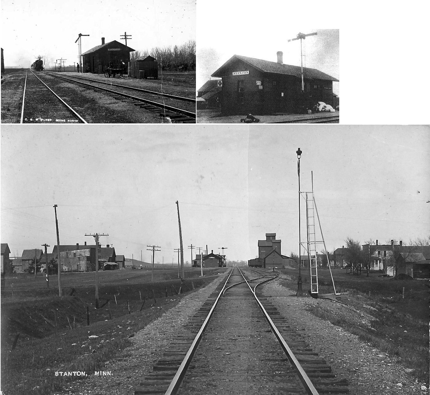
| Stanton |
|
This station was just north of MN 19. It was built in 1885. Also in this vicinity were two elevators, a warehouse, a and a store/post office. Just to the NW of the station was the Stanton Creamery Cheese Factory. The depot was retired in 1949 and replaced with 1/2 of a boxcar body (the other half was installed at Skyberg). | ||||||
| Stroms |
|
|||||||
| Trout Brook |
|
This early RR station was between Red Wing and Hay Creek in Section 12 of Featherstone Township. The town/station was gone by 1900. | ||||||
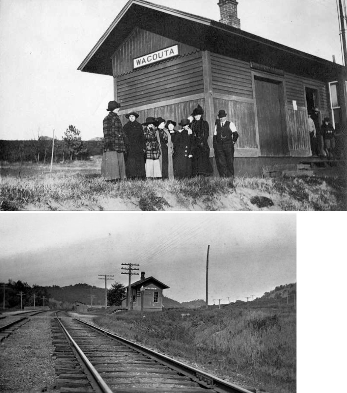
| Wacouta |
|
This was the first RR station in the county, built in 1870. When the station opened, the town name was spelled "Wacoota." | ||||||
| Welch (Eagle Mills) |
|
This station was just south of the intersection of CR 7 and Welch Trail. The name of the town was changed from Eagle Mills to Welch in 1886. | ||||||
| Welch (Belle Creek) |
|
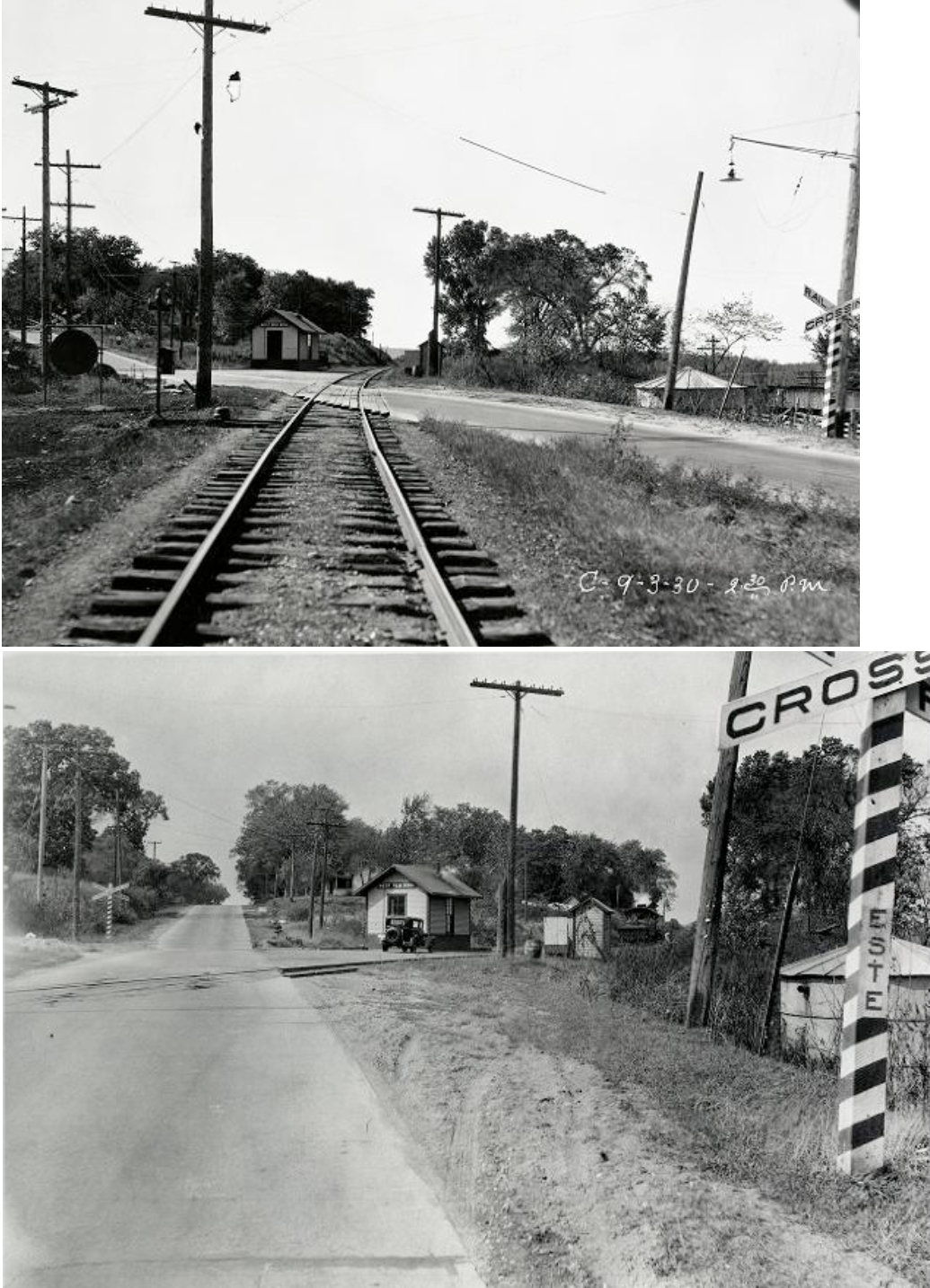
This station was on the southeast side of main street. The depot sat between the main line and a siding track. The town of Belle Creek exists in name only now and failed early after it was platted. It was located on the south bank of the Canon River, just to the southeast of Welch in Vasa Township. This location is currently off 264th Street Path about 300 years north of the junction with County Road 7. The station was built in 1882 and in 1899 the station was loaded onto a flatcar and moved a bit to the west and renamed Welch Station. The depot was retired in 1964 and the line was torn out in 1982. This location should not be confused with the Belle Creek that still exists in Belle Creek Township. | ||||||
| West Red Wing |
|
This station was on the north side of West Main Street at the intersection with Bench Street at GPS: 44.565532, -92.567413. It was built in 1929 and retired in 1946. | ||||||
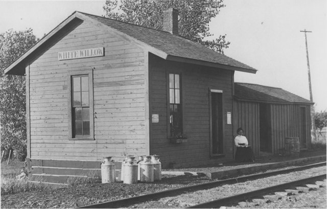
| White Willow (Rice) |
|
The station, which was originally a small freight
structure, was originally known as Rice and the town of White Willow was
actually two miles east of Rice Station. In 1905 a new, larger depot was
built. That depot was out of service by 1919 and torn down sometime in
the 1930s. The agent in the photo is Agnes Schafer, who lived on a
nearby farm with her parents. From the Goodhue newspaper: "In January,
1905, the Great Western shipped a passenger shelter by flat car to White
Willow, presumably from some flag stop fallen into decline. The car
stood on the siding for many days, and one night, wind blew the shed
off, almost in the right spot. The B&B crew declared
themselves satisfied and so there it stood, complimenting the wooden
platform then 13 years old. Two years earlier the Great Western had
changed the station's name from Rice to White Willow. Too many
passengers and too much freight were arriving here and not at James
Hill's Rice on the Northern Pacific near St. Cloud." The station was located on the east side of County Boulevard (GPS: 44.362473,-92.651782). The station was retired by the CGW in 1937. |
||||||
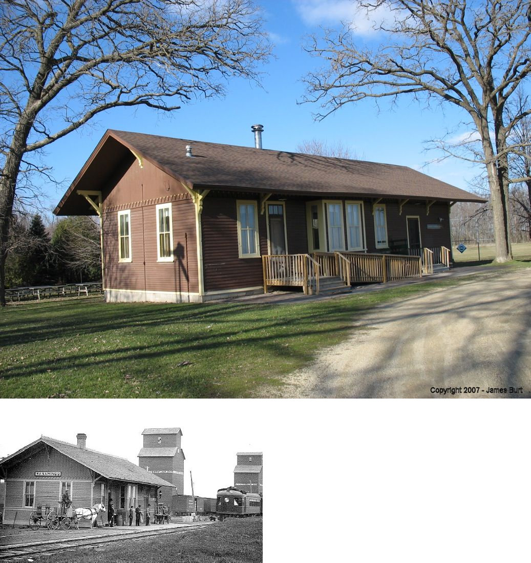
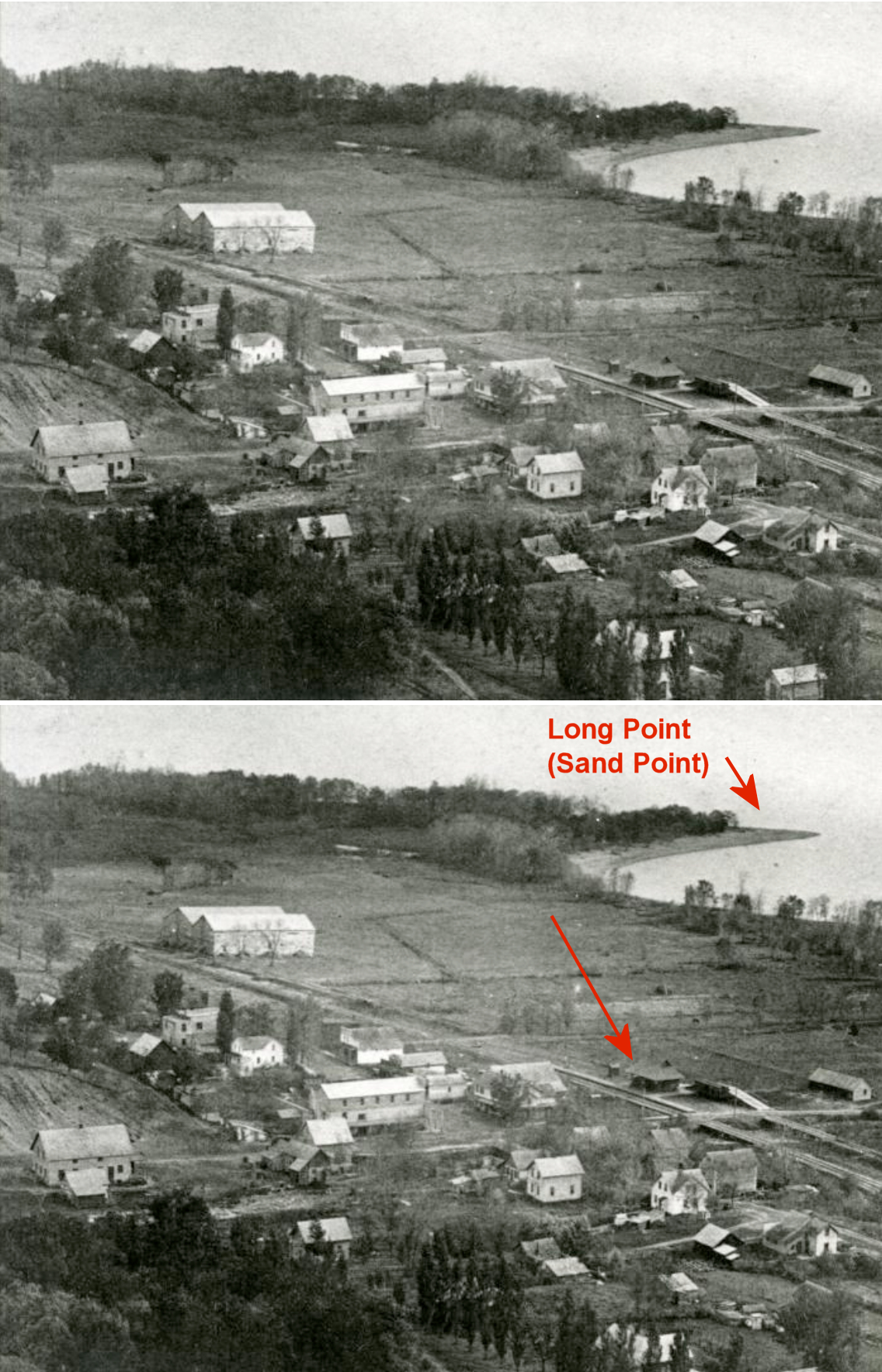
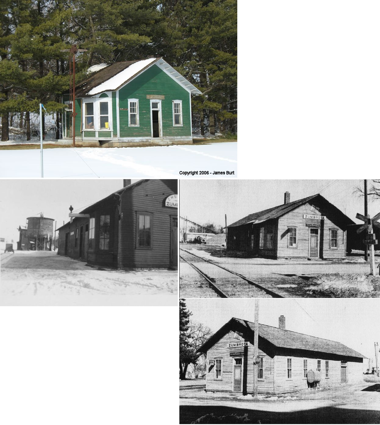
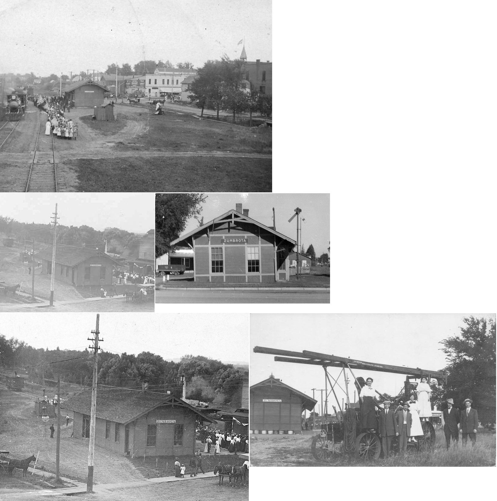
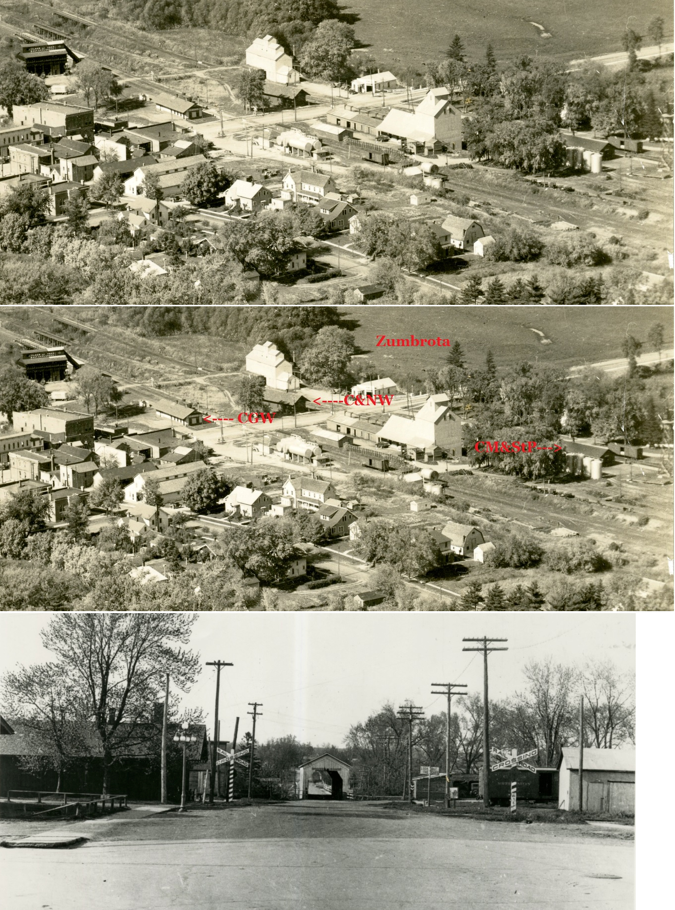
| zumbrota |
|
The station was moved to the Covered Bridge
Park on the north side of the Cannon River. Repeated spring floodings
damaged the building so the city finally tore it down after the flood of
2006. The original station here was for the 3'0" narrow-gauge Minnesota Midland which was built in 1873, sold to the CM&St.P in 1883, converted to standard gauge in 1903, and was removed in 1952. |
||||||
| Zumbrota |
|
This station was built in 1903. | ||||||
| Zumbrota |
|
This railroad become part of the Chicago & North Western in 1881. | ||||||
| Zumbrota |
AND |
The Duluth Red Wing & Southern shared the C&NW depot in a shipping and line use agreement from 1889-1901. This allowed the DRW&S to go all the way to Rochester. This line was shut down in 1913 and removed in 1933. | ||||||
| 1898 GOODHUE COUNTY RAILROAD MAP | ||||||||
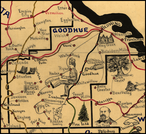 |
||||||||
|
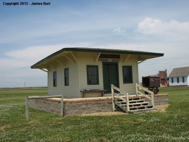
Notes About Existing Stations... Cannon Falls (CGW) - The Goodhue County GIS office claims this station was built in 1903. Goodhue (DRW&S) - The station received an addition of about 25' in 1916 according to CGW records. Kenyon (CGW) - This original location of this station was just north of Main Street on the west side of the tracks. Red Wing (CGW) - The last train on the line was in 1976. The building formerly housed a Hardees restaurant and now houses a Caribou Coffee. Red Wing (CMSt.P&P) - This station now houses the Red Wing Visitor's And Convention Bureau and the Red Wing Arts Association And Gallery. Red Wing (Express Agency) - This express agency depot was originally next to the brick CGW station in Red Wing. This may be the only remaining stand-alone express agency in the state of MN. |
||||||||