 COUNTYCOUNTY
|
|
||||||||
| EXISTING STATIONS | ||||||||
|---|---|---|---|---|---|---|---|---|
| Station Name |
Original Railroad | Current Location |
Type | Date Built |
Current Use |
Track Status |
Building Material |
More Info |
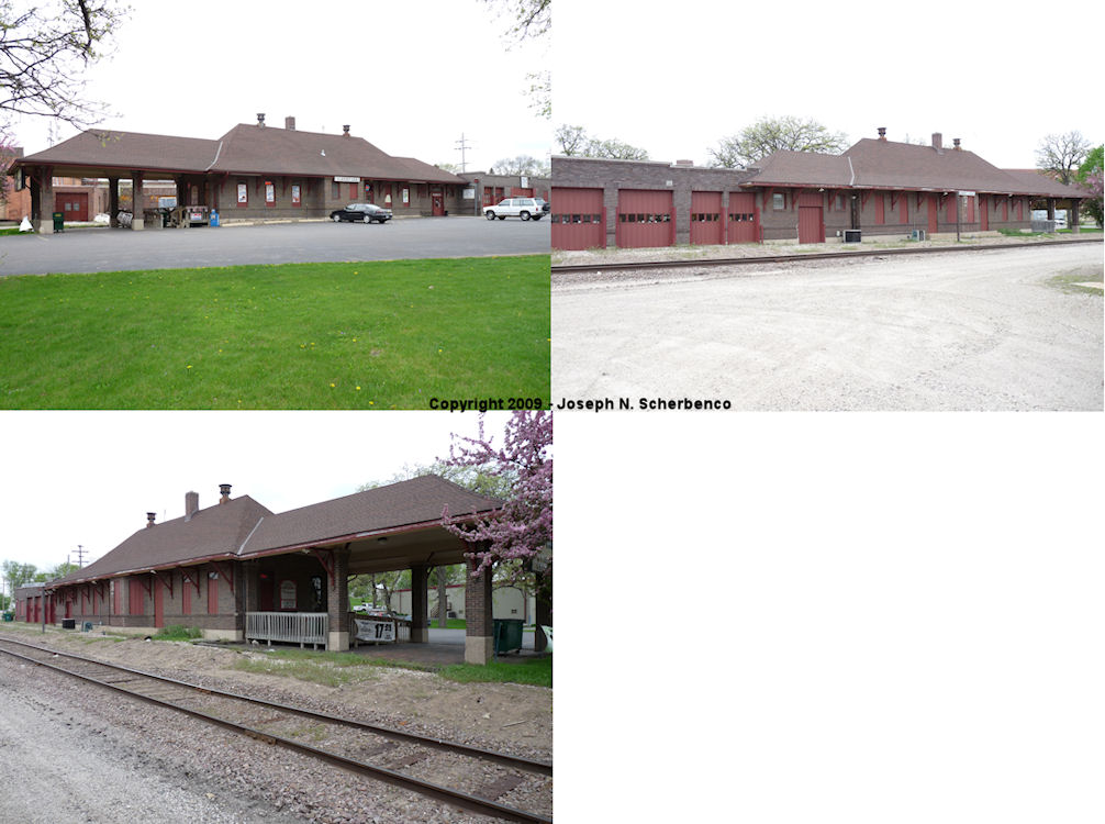
| Albert Lea |
 |
606 South Broadway Street (GPS: 43.644686,-93.36937) |
P | 1914 | Business | In Use | Brick | |
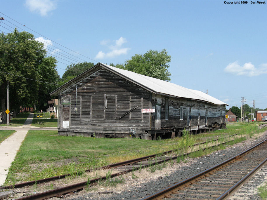
| albert lea |
|
Corner of Mill Street and South Pearl (GPS: 43.644065,-93.371859) |
F | 1900 | Storage | In Use | Wood | |
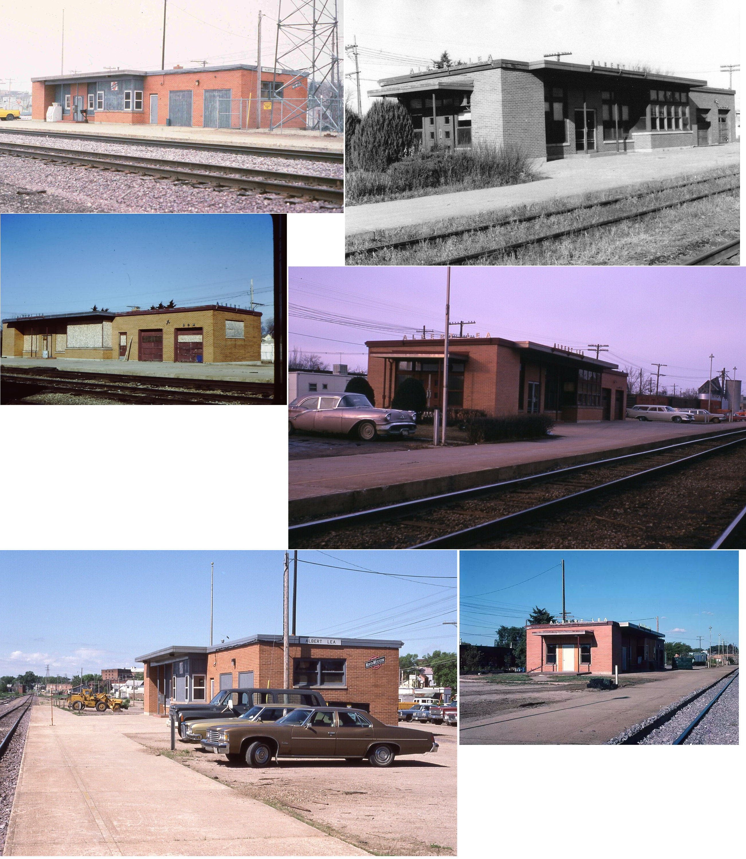
| albert lea |
 |
SE of US 65 near Clark Street (GPS: 43.649367,-93.361119) |
P | 1954 | Railroad | In Use | Brick | |
| Albert Lea |
 |
625 West Main (under the Main Street viaduct off Ermina Avenue) (GPS: 43.647434,-93.376268) |
C | 1915 | Business | Gone | Brick | |
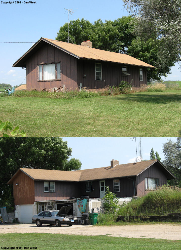
| conger |
|
14740 720th Street (CR 71) just north of U.S. 69 in Twin Lakes (GPS: 43.564814, -93.423164) |
C | ???? | Residence | None | Wood | |
| oakland |
|
In Austin at Mower County Fairgrounds off 12th Street SW (GPS: 43.660301, -92.990200) |
C | 1886 | Museum | None | Wood | |
| STATIONS OF THE PAST | ||||||||
| Station Name |
Original Railroad |
Notes | ||||||
| Albert Lea |
|
This station was on the NW side of the tracks between William and Main Streets at GPS: 43.648426, -93.362638. | ||||||
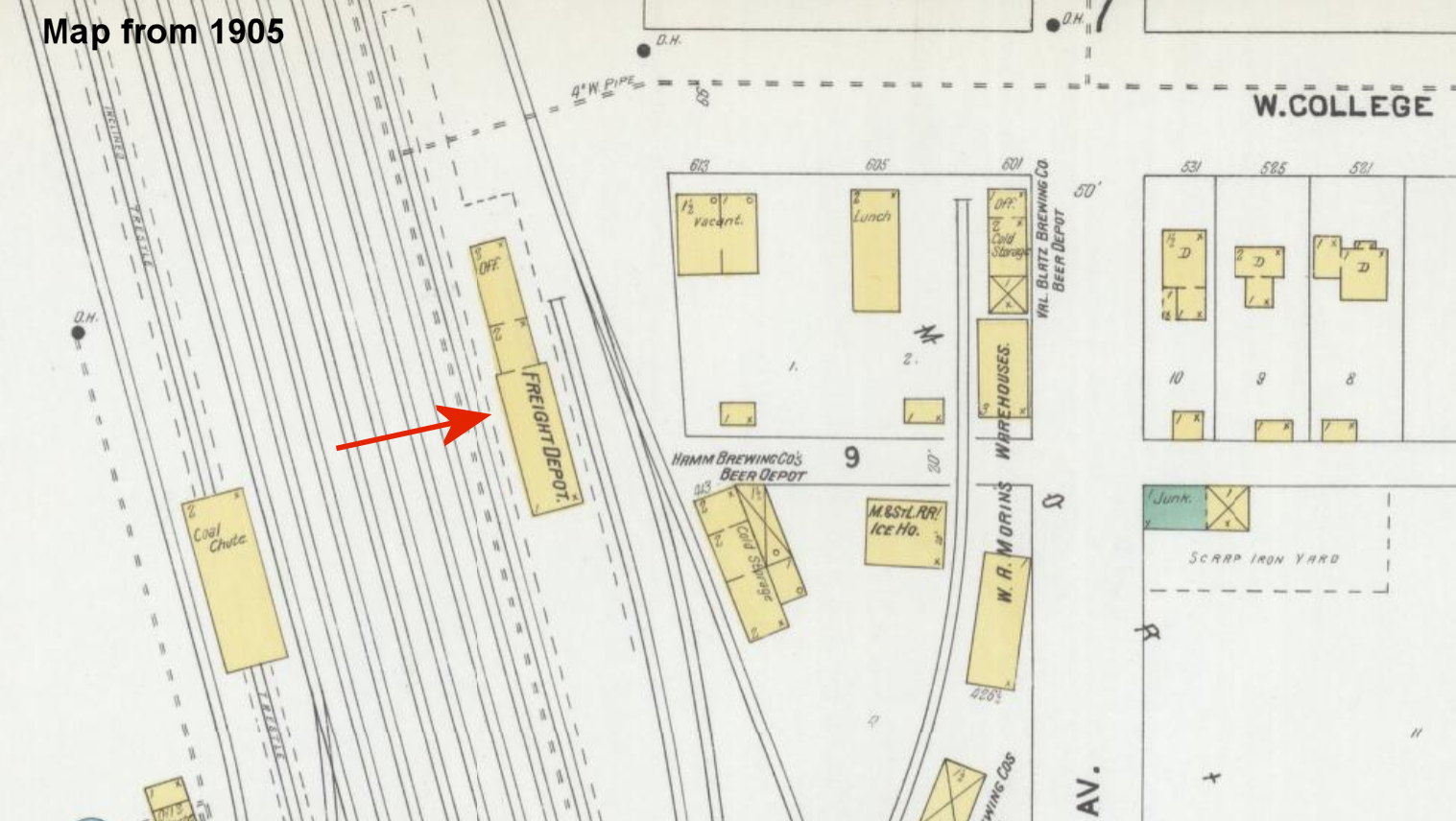
| Albert Lea |
|
The original freight station was near the former intersetion of Lake Avenue and Main Street at approximately GPS: 43.647634, -93.363829. | ||||||
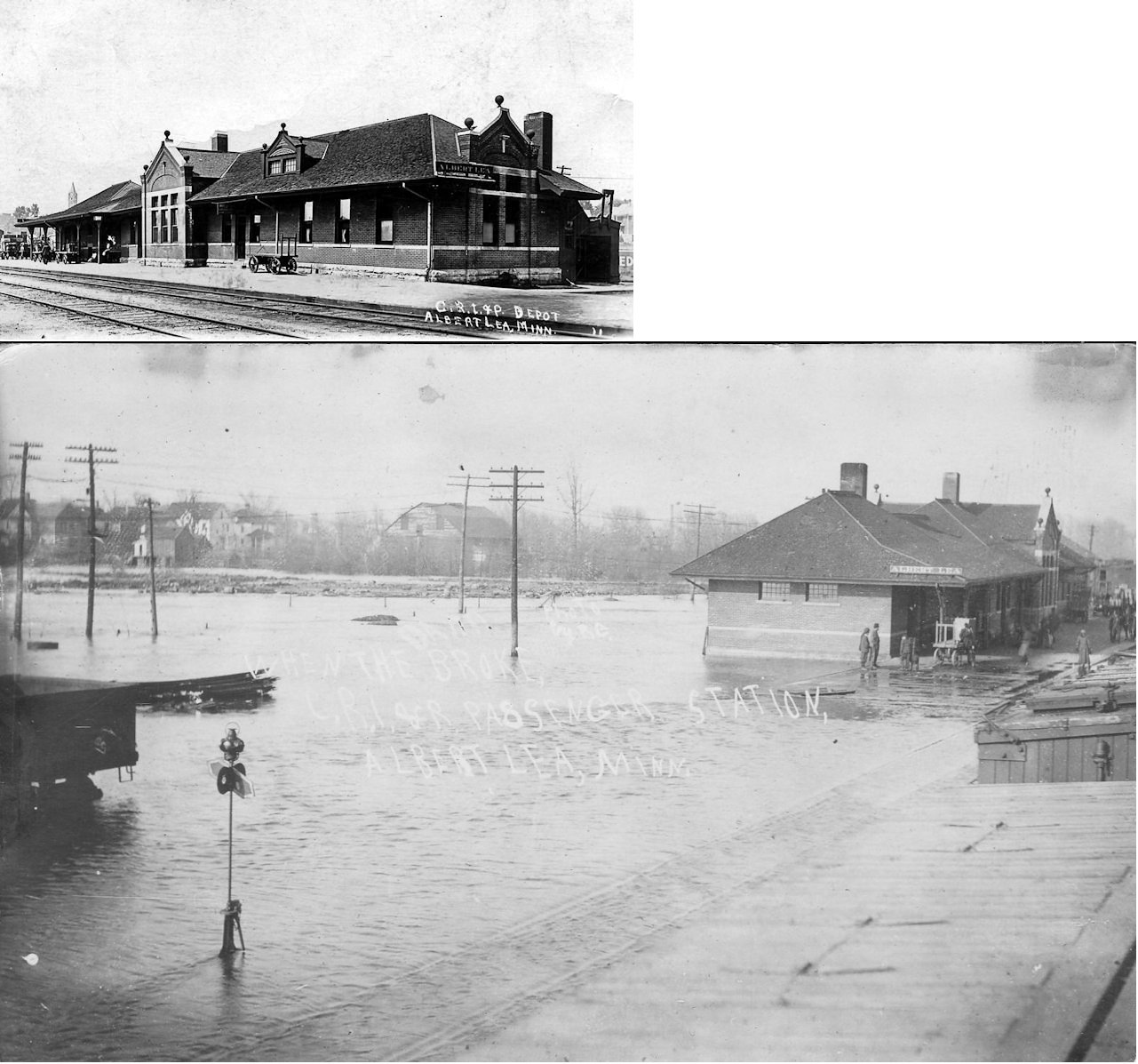
| Albert Lea |
|
Not sure where this more modern freight station was. Was it at the same location as the freight station listed above? | ||||||
| Albert Lea |
 |
In 1874 this station was on the east side of Madison Avenue on the south side of the tracks (across the tracks from the existing freight station). | ||||||
| Albert Lea |
|
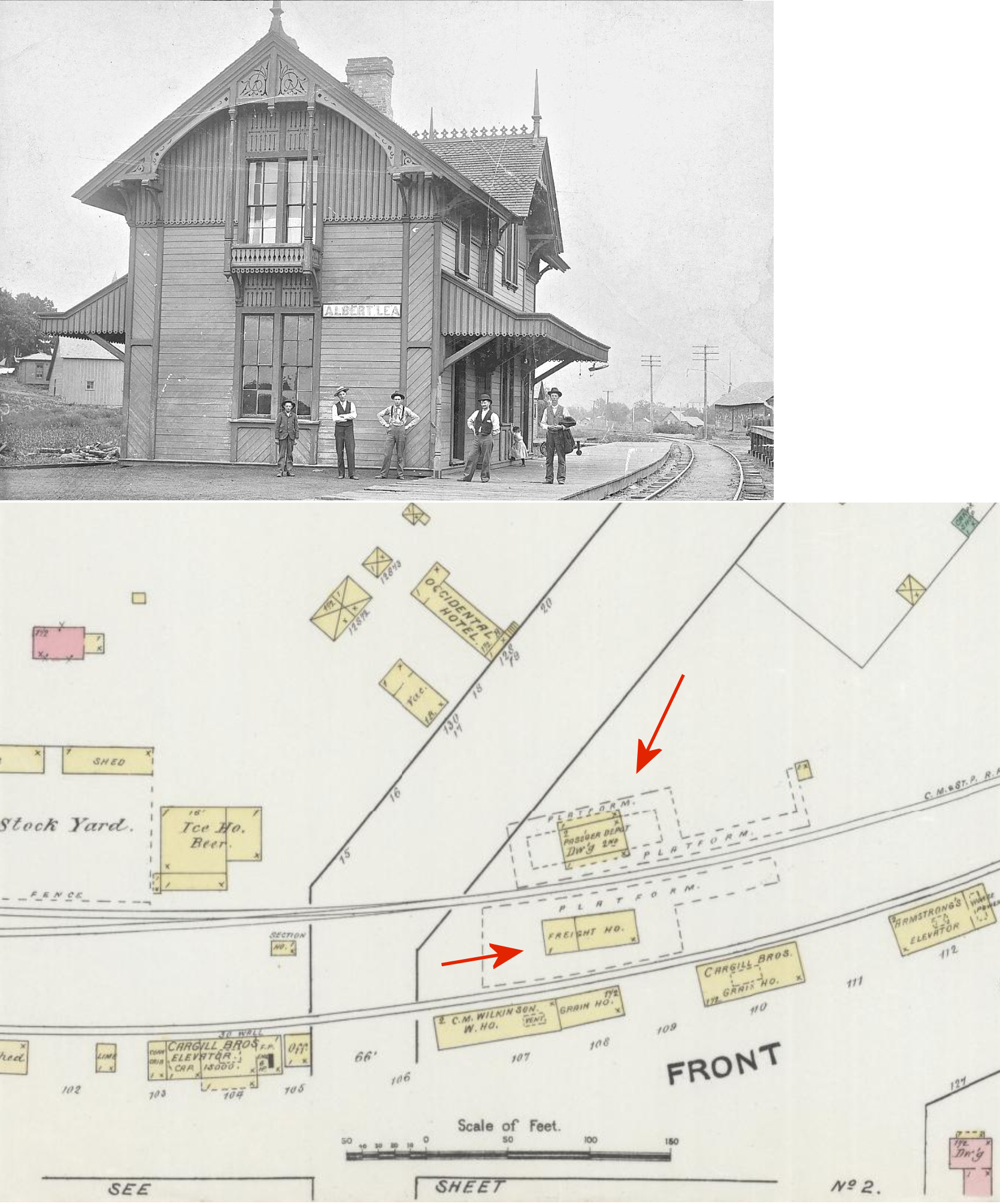
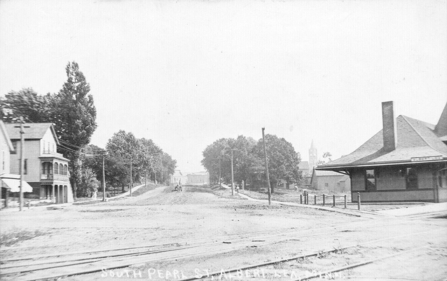
The first Milwaukee Road station was on the east side of Madison Avenue/South Pearl Street on the north side of the tracks at GPS: 43.644013, -93.372011. Built in 1869, it was a two-story station with agent's quarters on the 2nd floor. There was a freight station across the tracks. Both the passenger and freight station burned down in October 1899. The fire, which started in the freight station, also consumed two neaby warehouses (Freeborn County Times, 10-13-1899). | ||||||
| Albert Lea |
|
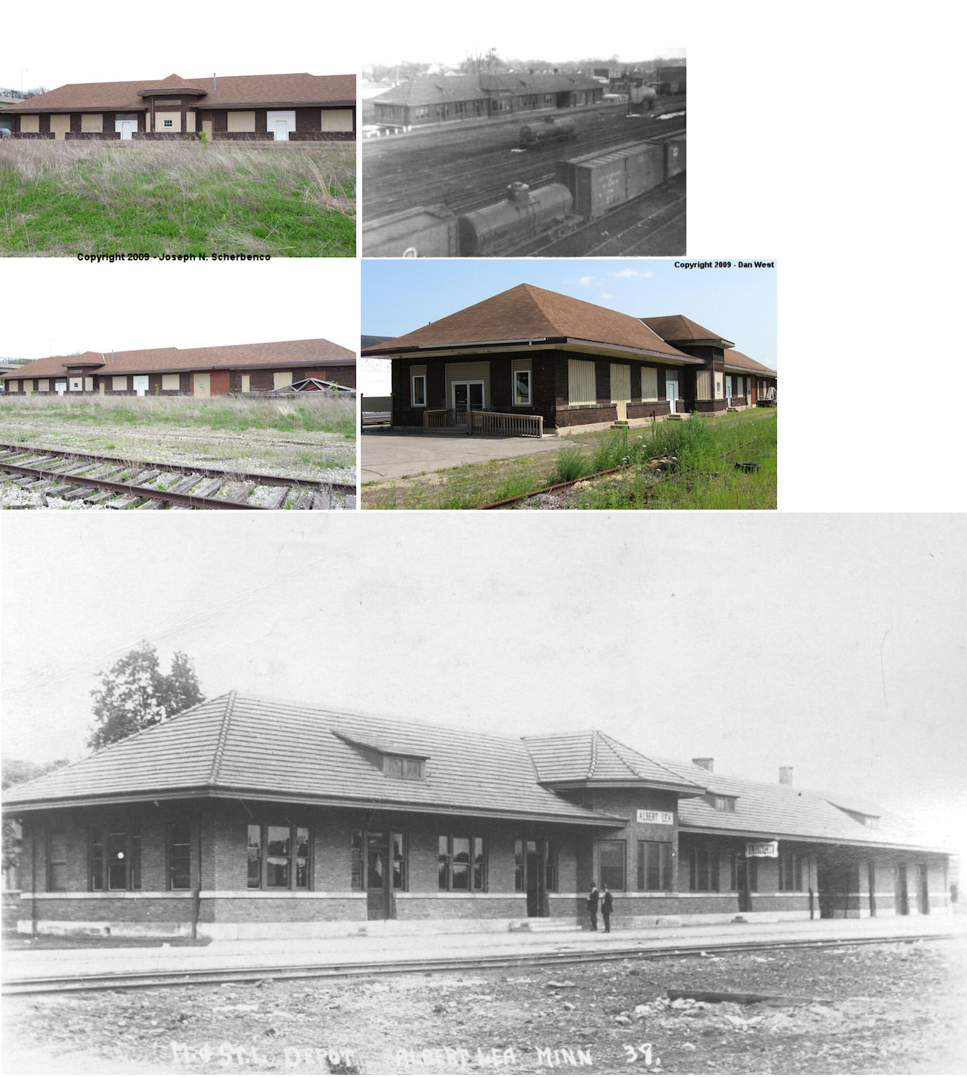
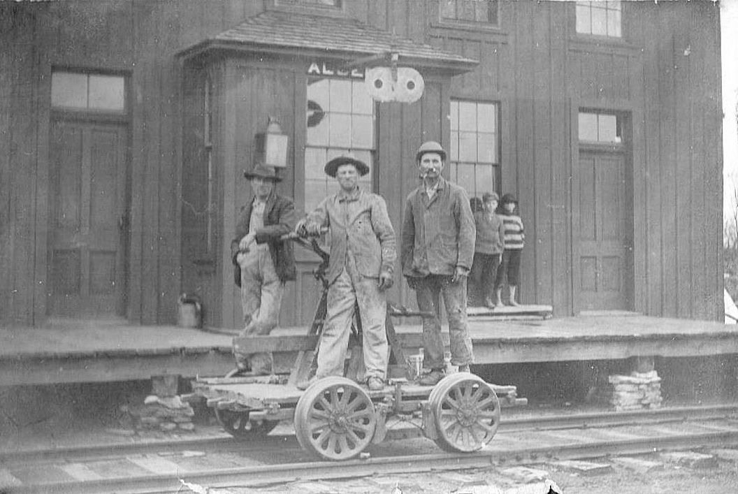
This was the second Milwaukee Road station on the east side of Madison Avenue/South Pearl Street on the north side of the tracks (same location as the first station listed above). It was built in 1899/1900 (The Albert Lea Tribune, 10-21-1969). This station was actually moved to the new depot site on Broadway Street (The Times-Enterprise, 9-24-1913) before being torn down and replaced with the new brick station in 1914. It appears that the railroad intended to fix up the old depot, but changed plans and built a new one instead. Some newspaper articles of the time implied that the new station was planned to be built around the frame of the old station, but it seems unlikely. | ||||||
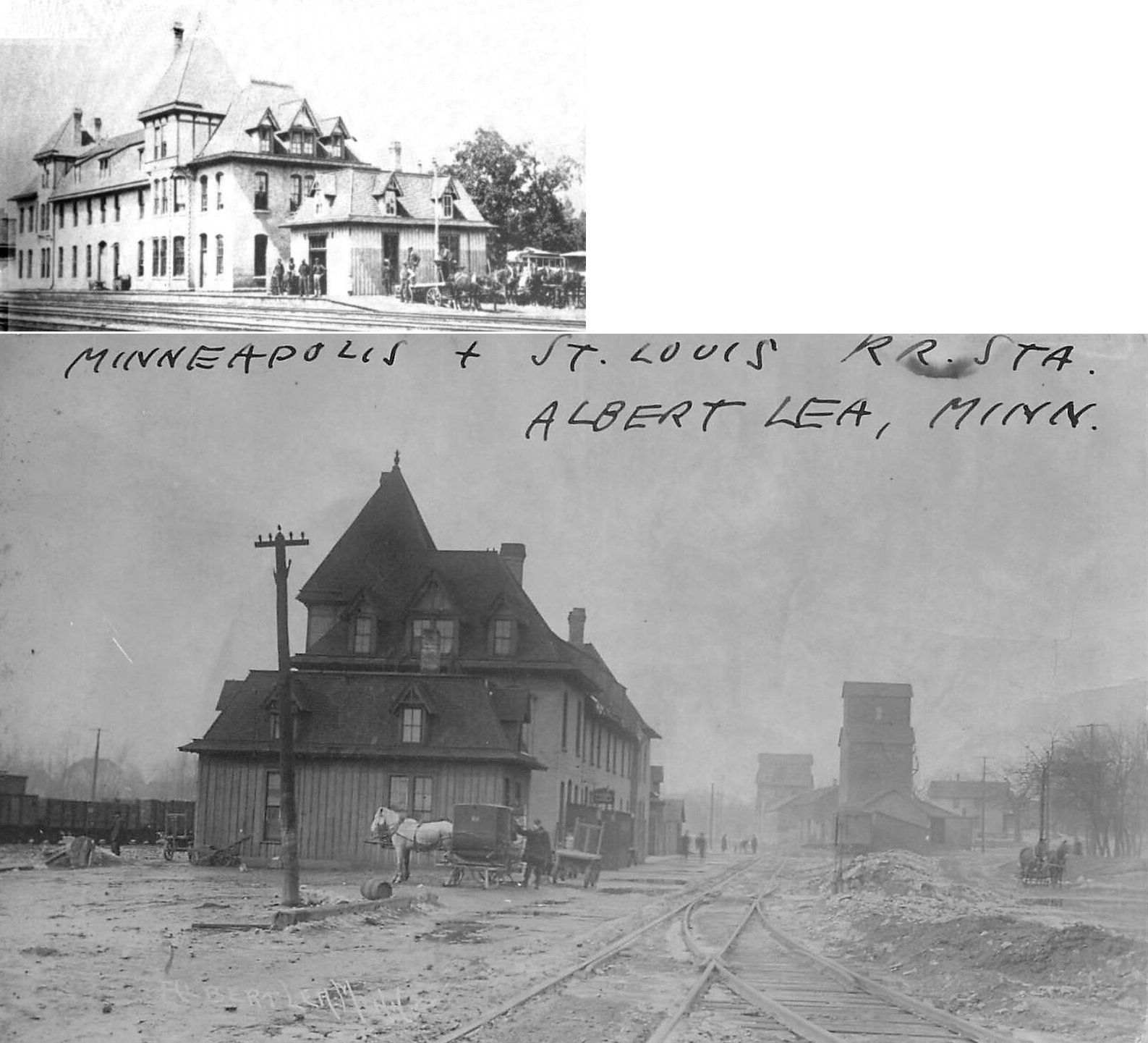
| Albert Lea |
AND |
This was an earlier station built in March 1878 by the M&St.L and the BCR&N (predecessor of the Rock Island). It also included a hotel that was called the Bunker House and later was known as the Winslow House. This station was located in roughly the same spot as the existing M&St.L station is. There was a freight house to the south. The building was torn down in June 1915 (The Times-Enterprise, 6-23-1915) to make room for the new brick station at the same site. | ||||||
| Albert Lea |
|
The old freight station was on the east side of the tracks on the south side of College Street at GPS: 43.646654, -93.376064. | ||||||
| Alden |
|
An earlier station. | ||||||
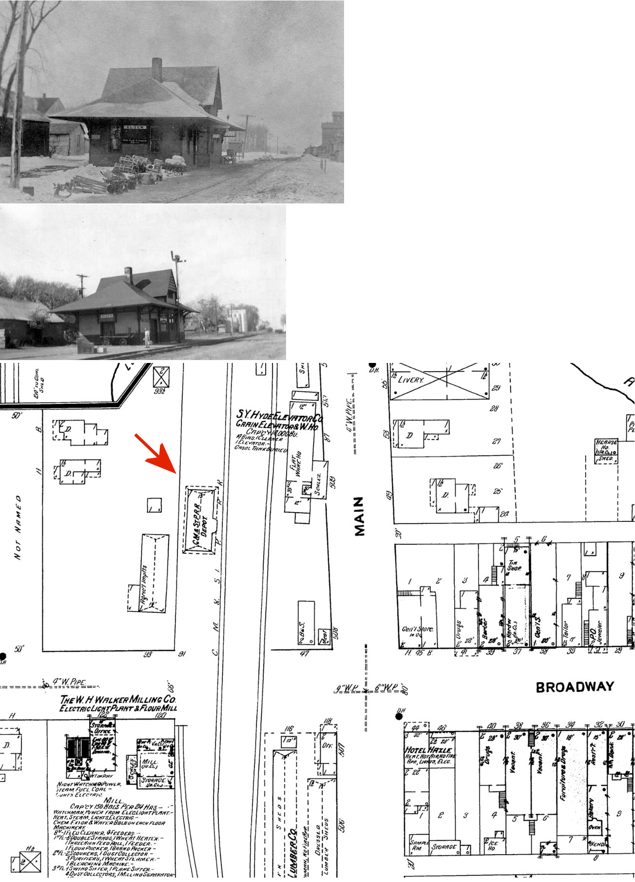
| Alden |
|
A later station. This station was on the west side of Broadway on the south side of the tracks at GPS: 43.670159, -93.576665. | ||||||
| Armstrong |
|
|||||||
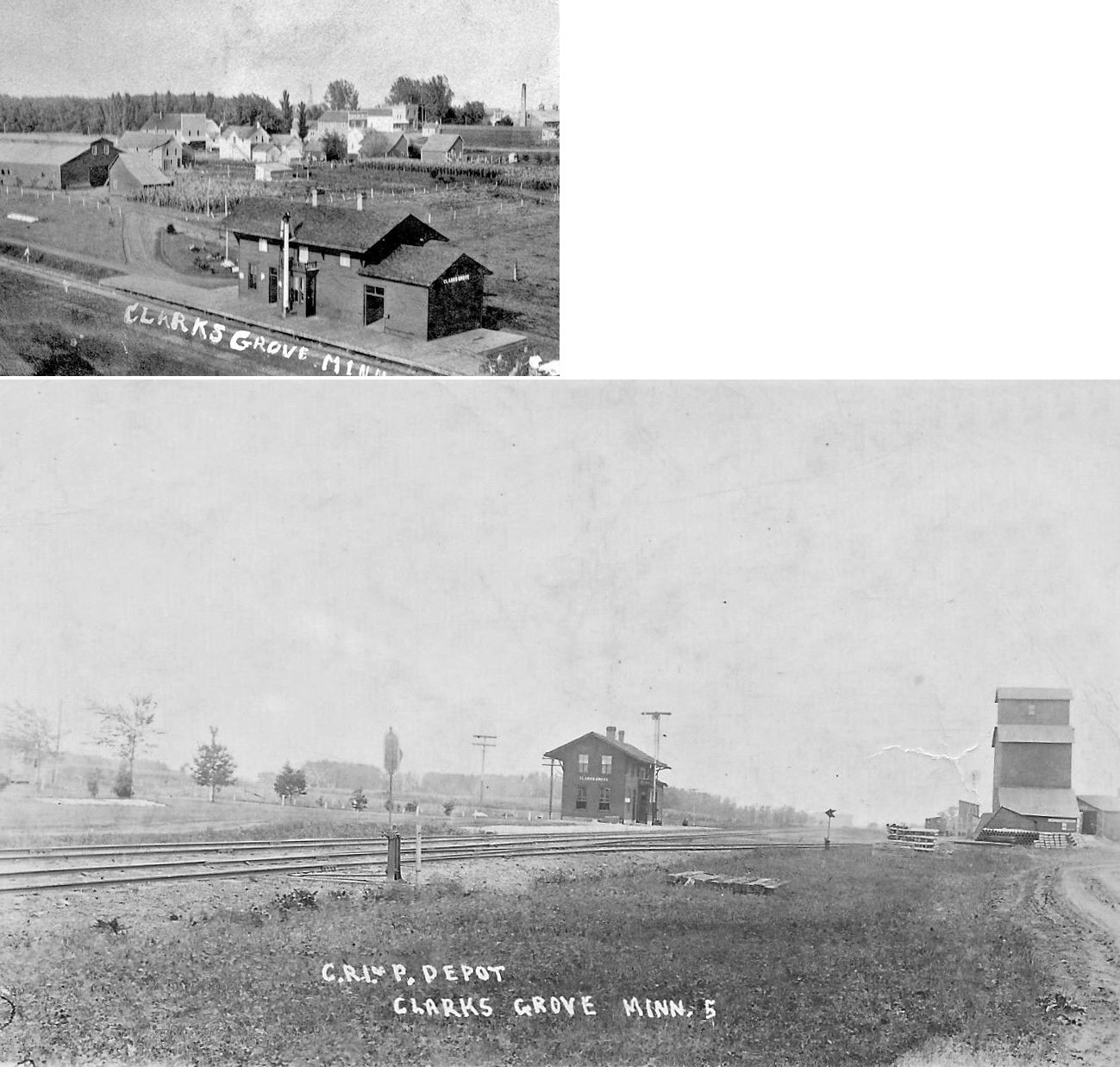
| Clarks Grove |
|
This station was built by the Burlington, Cedar Rapids & Northern at the town site of Dorwart (which was one mile south of Clarks Grove). It was moved to Clarks Grove when residents resisted that site for the town. | ||||||
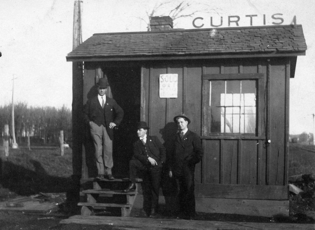
| Curtis Junction |
AND |
Curtis Junction was in the vicinity of South Brodway and West 7th Street in Albert Lea. | ||||||
| Emmons |
|
This station was originally built one mile south in Norman, Iowa and was moved to Emmons in 1904 after a Supreme Court ruling in February of that year. The case centered around whether railroads were obliged to construct a depot at every village on a line. The court affirmed the law that required that and the station was moved to near the state line. --See MINN. & ST. LOUIS R. R. CO. v. MINNESOTA, 193 U.S. 53 (1904) | ||||||
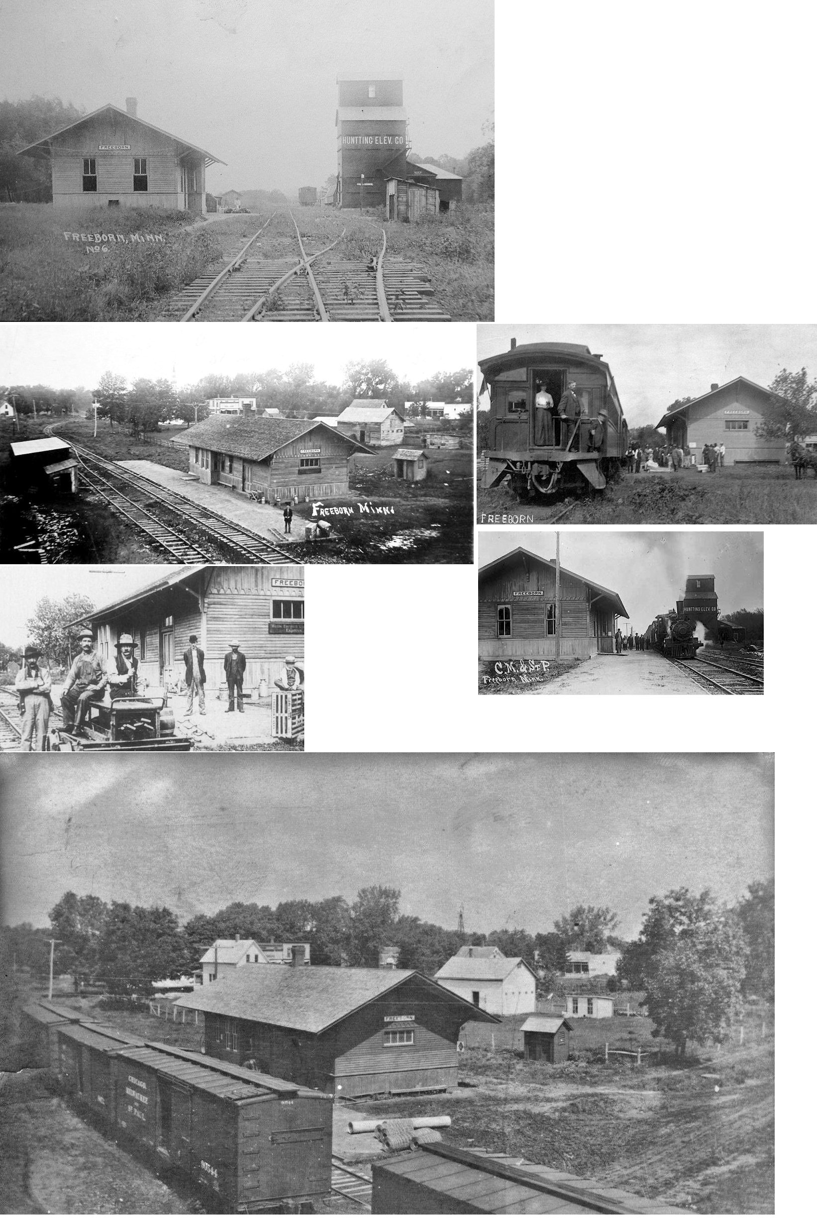
| Freeborn |
|
This station was built for the Duluth, St. Cloud, Glencoe & Mankato RR (a.k.a. The Alphabet Line, a.k.a. The Bug Line) which was sold to the CM&St.P in 1907. | ||||||
| GlEnville |
 |
The station was on the south side of the tracks on the block bordered by 2nd Avenue NW, 3rd Avenue NW, 1st Street NW and 2nd Street NW (GPS: 43.574358, -93.282734). There was a siding that wrapped around the south side of the station as well. This is shown on the 1938 aerial photo of the town. | ||||||
| Glenville (Shell Rock) |
|
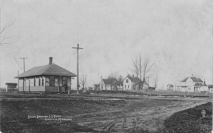
This station was on the northeast side of the tracks along U.S. 65 at the west end of main street where the grain elevator is today at GPS: 43.573442, -93.286820. The BCR&N depot here burned down in 1900 (The Wells Forum, 2-27-1900). Not sure if the station pictured is the one that burned or the replacement for the one that burned. | ||||||
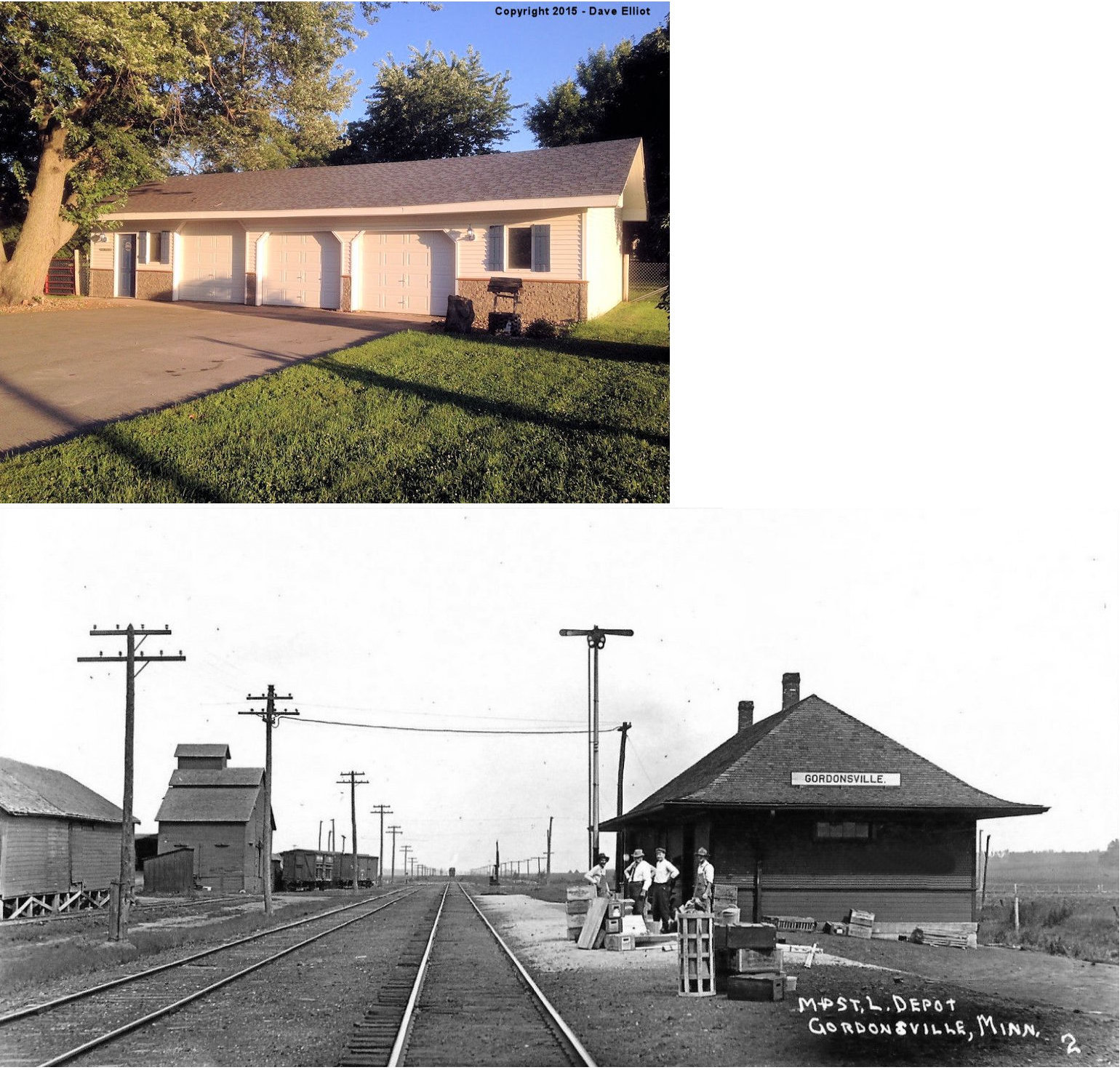
| gordonsville |
|
There are reports that this station still stands after being moved to Northwood, IA where it is being used as a garage (see photo). If that is the station building it has been heavily altered and is unrecognizeable. The owner clains that he was informed that it was the station and he has the ticket window that was in the building. | ||||||
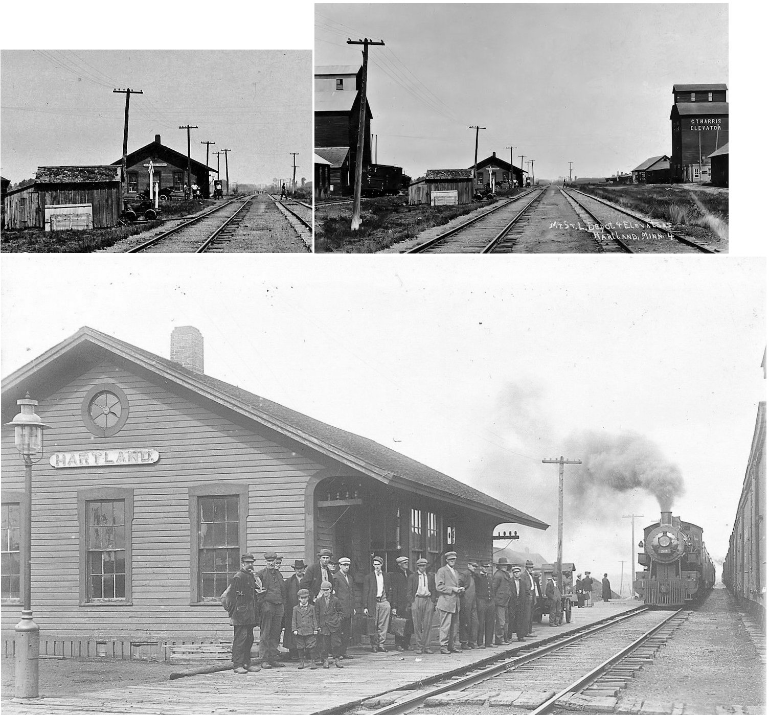
| Hartland |
|
Most likely the first generation station here. | ||||||
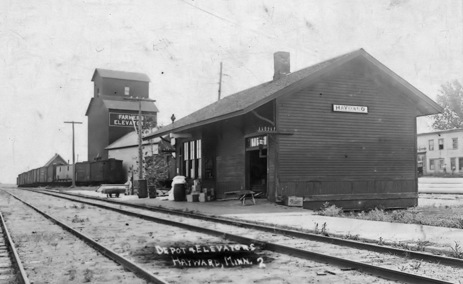
| Hayward |
|
|||||||
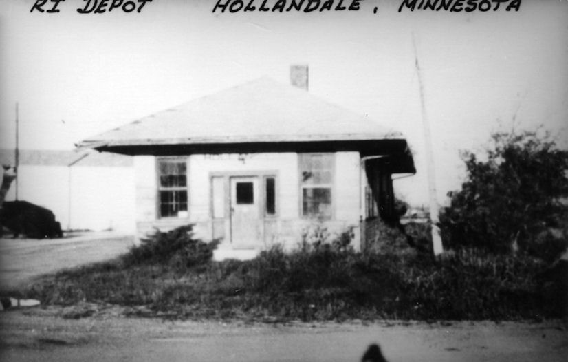
| Hollandale |
|
Hollandale was served by a 6-mile branch line off the Rock Island. It was also served by a similar branch off the Milwaukee Road. The Rock Island depot was still standing as of the late 1980s on the north side of town. | ||||||
| Hollandale |
|
|||||||
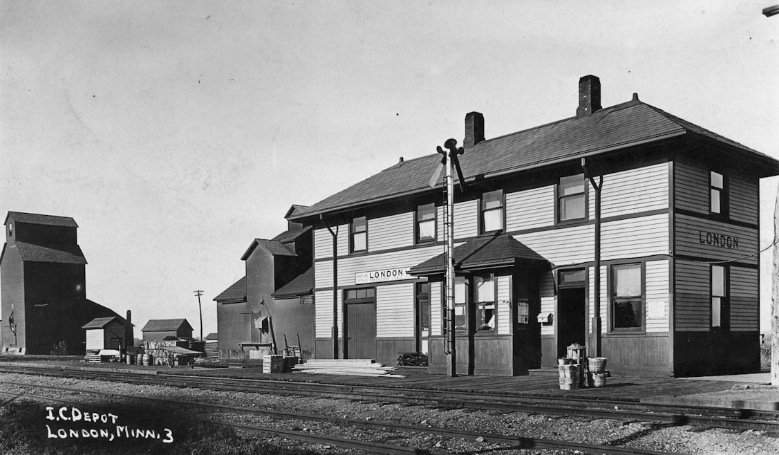
| London |
|
|||||||
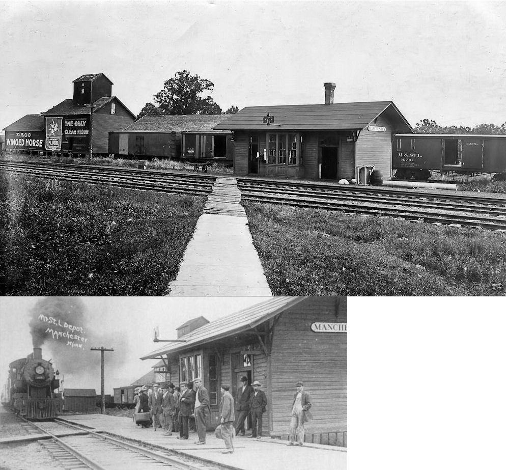
| Manchester |
|
This station burned in 1914, killing the depot agent Mrs. Irene Coleman. According to a newspaper report, murder was suspected and the depot was burned to cover up the crime. | ||||||
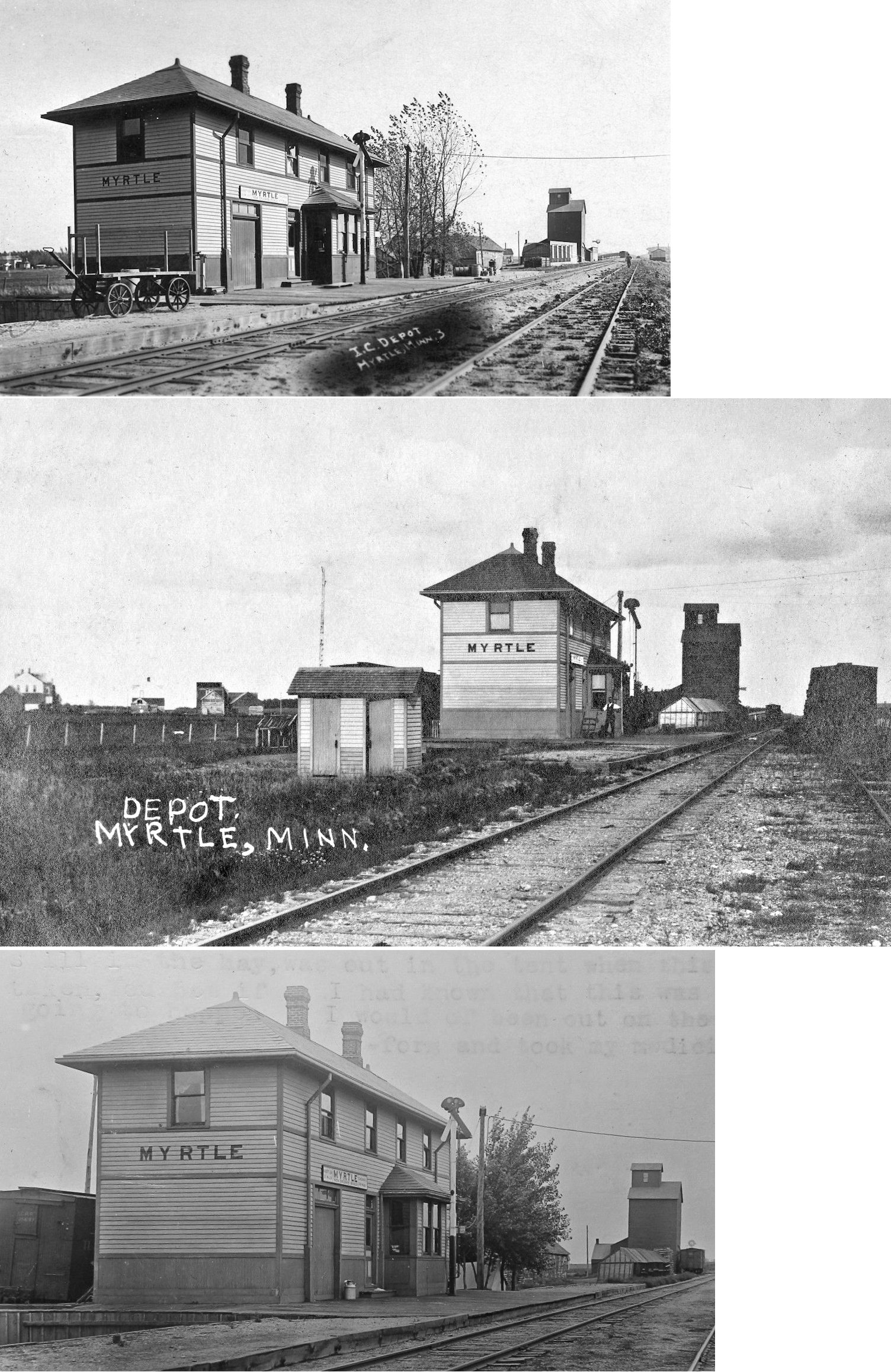
| Myrtle |
|
|||||||
| Petran (Crayon Park) |
|
|||||||
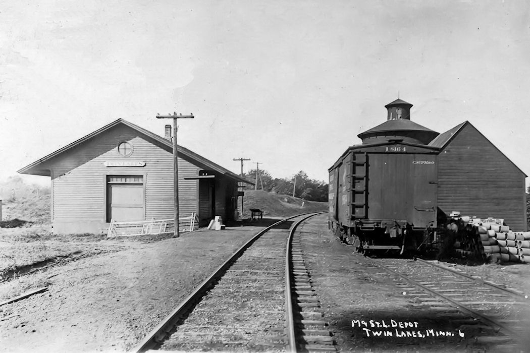
| Twin lakes |
|
|||||||
| 1898 FREEBORN COUNTY RAILROAD MAP | ||||||||
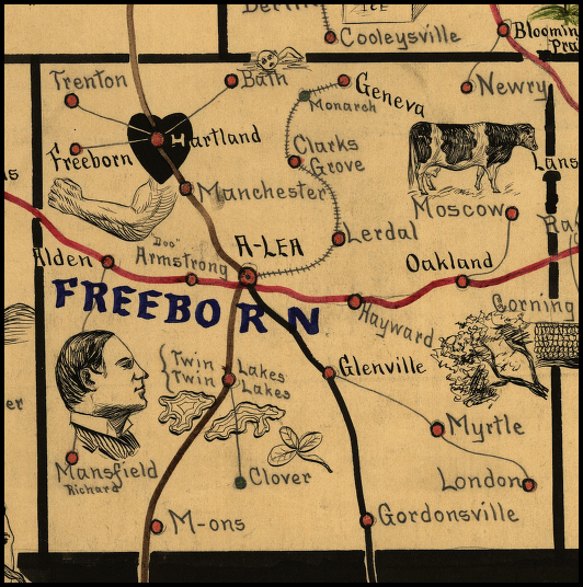 |
||||||||
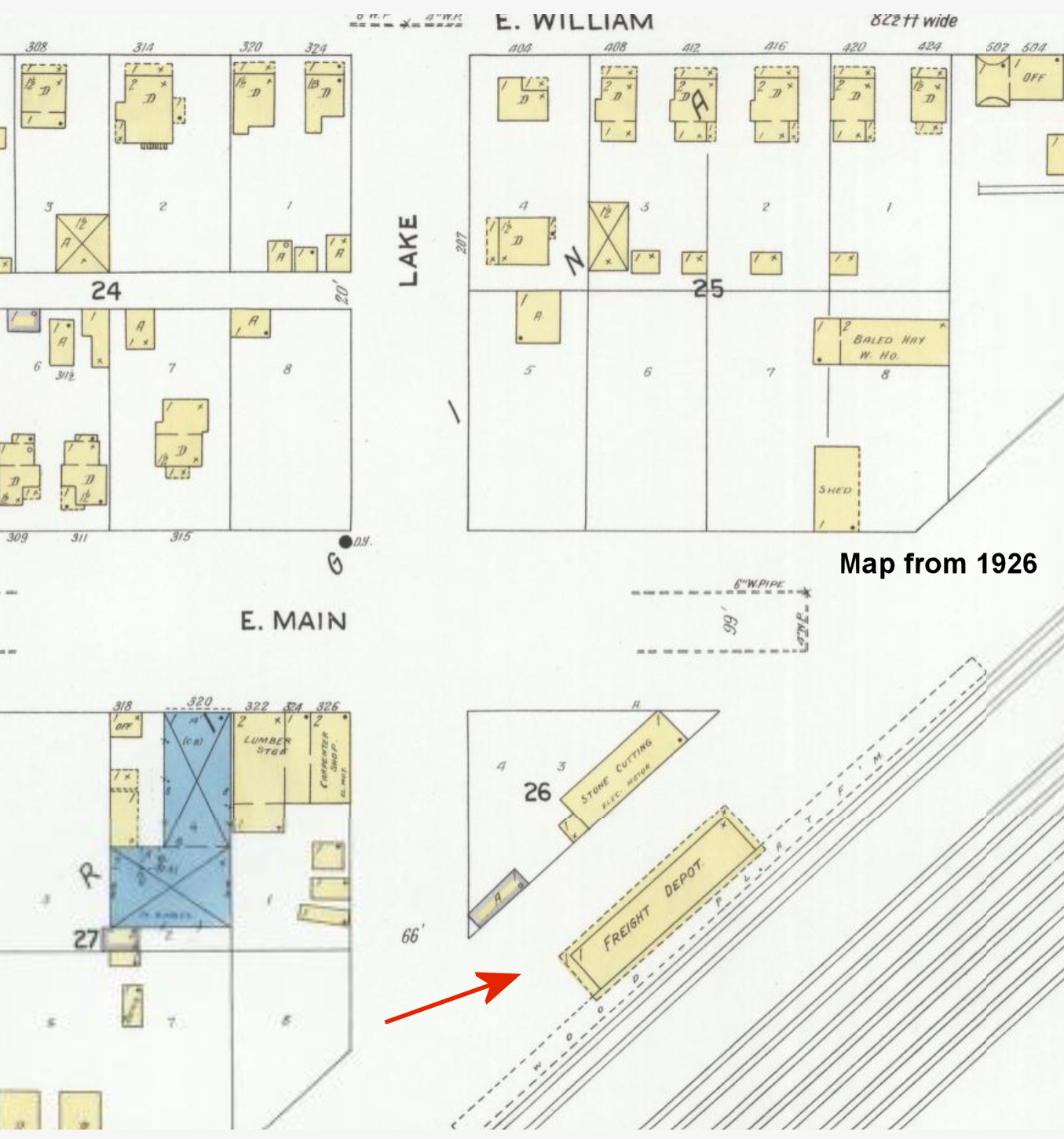
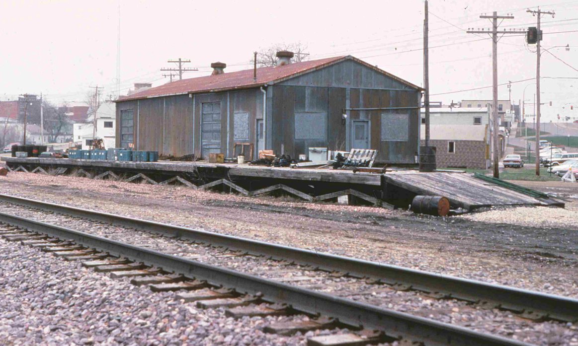
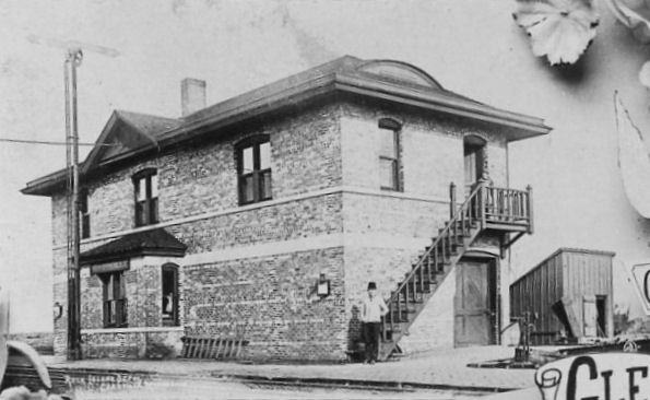
Albert Lea (CM&St.P Freight) - This freight station was moved from its original location on the east side of Euclid Avenue at GPS: 43.643949, -93.373511. In 1913 when the old passenger station was moved, the freight station was moved to that site and elarged (where it sits today). |
||||||||