 COUNTYCOUNTY
|
|
||||||||
|---|---|---|---|---|---|---|---|---|
| EXISTING STATIONS | ||||||||
| Station Name |
Original Railroad | Current Location |
Type | Date Built |
Current Use |
Track Status |
Building Material |
More Info |
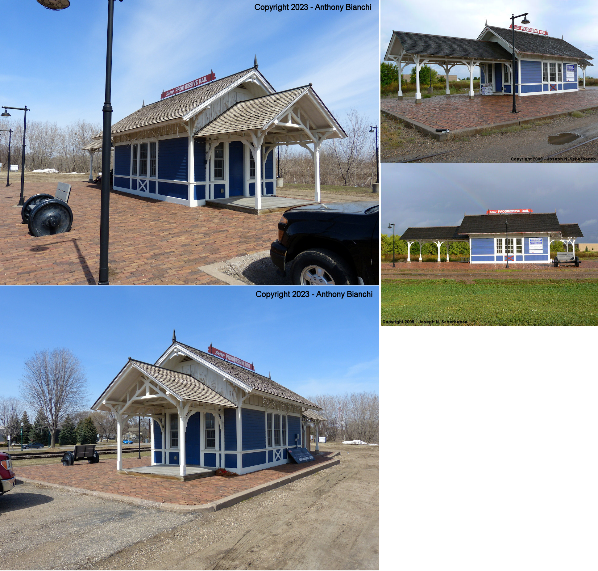
| dahlgren (Carver Co.) |
 |
Dakota County
Fairgrounds 4008 220th Street West, Farmington (GPS: 44.627726, -93.149280) |
C | 1872 | Museum | None | Wood |
|
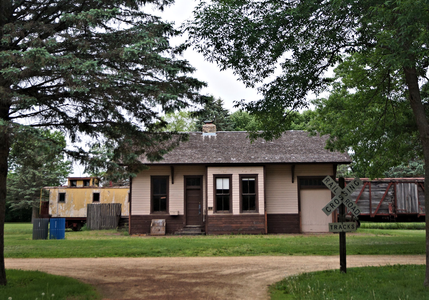
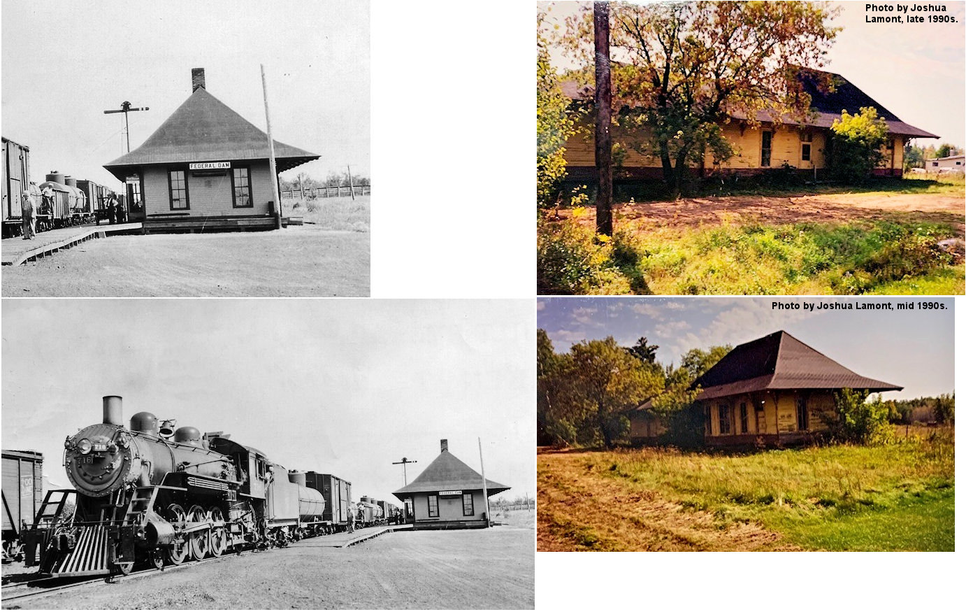
| federal dam (cass co.) |
 |
Little Log House
Pioneer Village 220th Street, Hastings (GPS: 44.630314, -92.837307) |
C | 1908 | Museum | None | Wood |
|
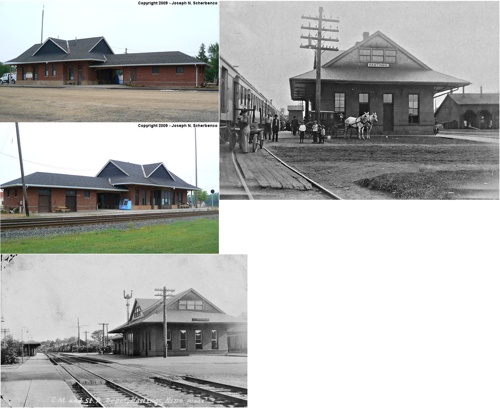
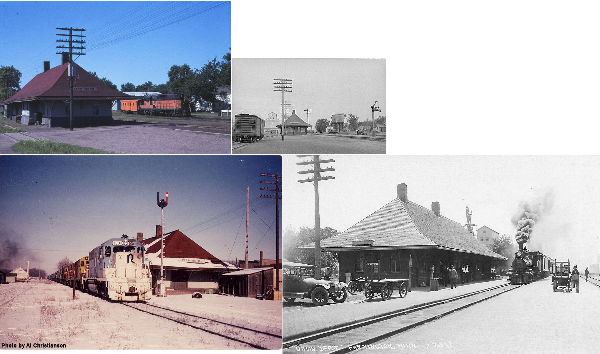
| hastings |
|
500 East 2nd Street (GPS: 44.744056, -92.847459) |
C | 1890 | Railroad | In Use | Brick | |
|
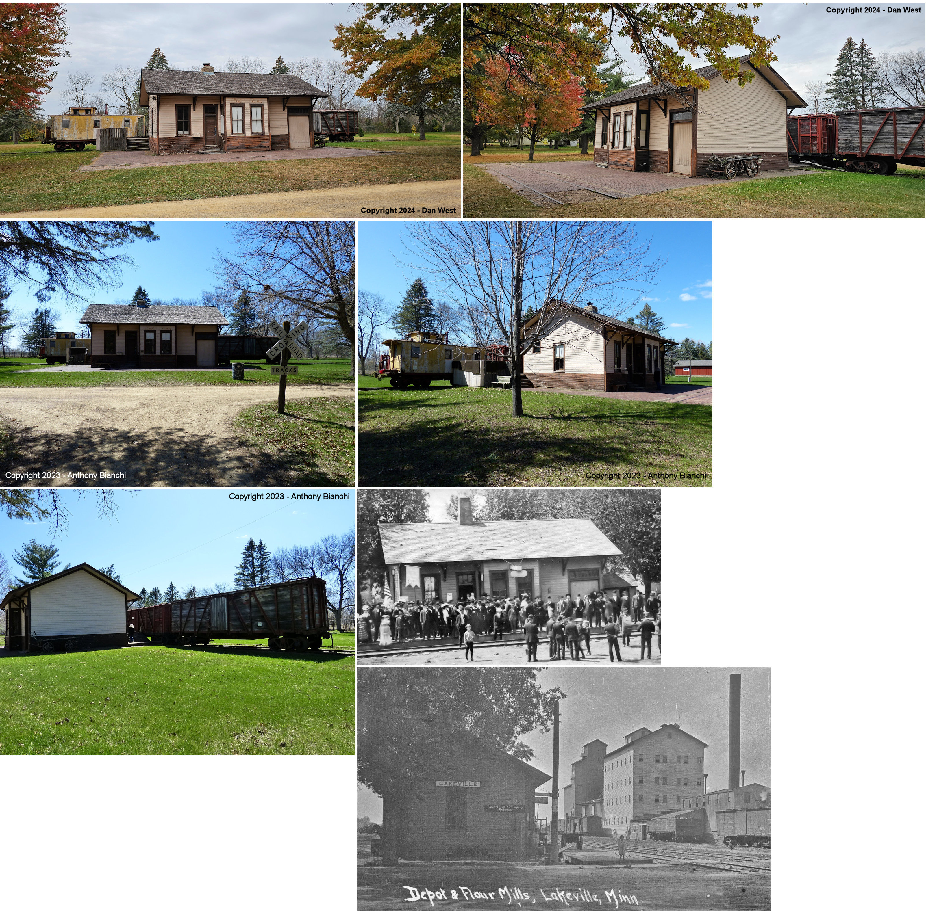
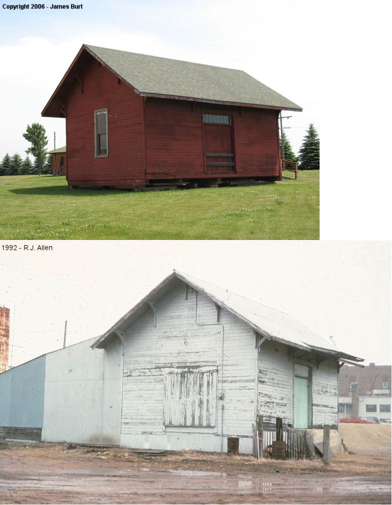
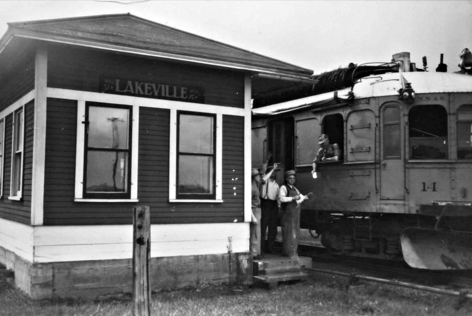
Lakeville (Fairfield) |
|
Dakota City Heritage Village 2nd Street (GPS: 44.627722, -93.149315) |
C | 1869 | Museum | None | Wood | |
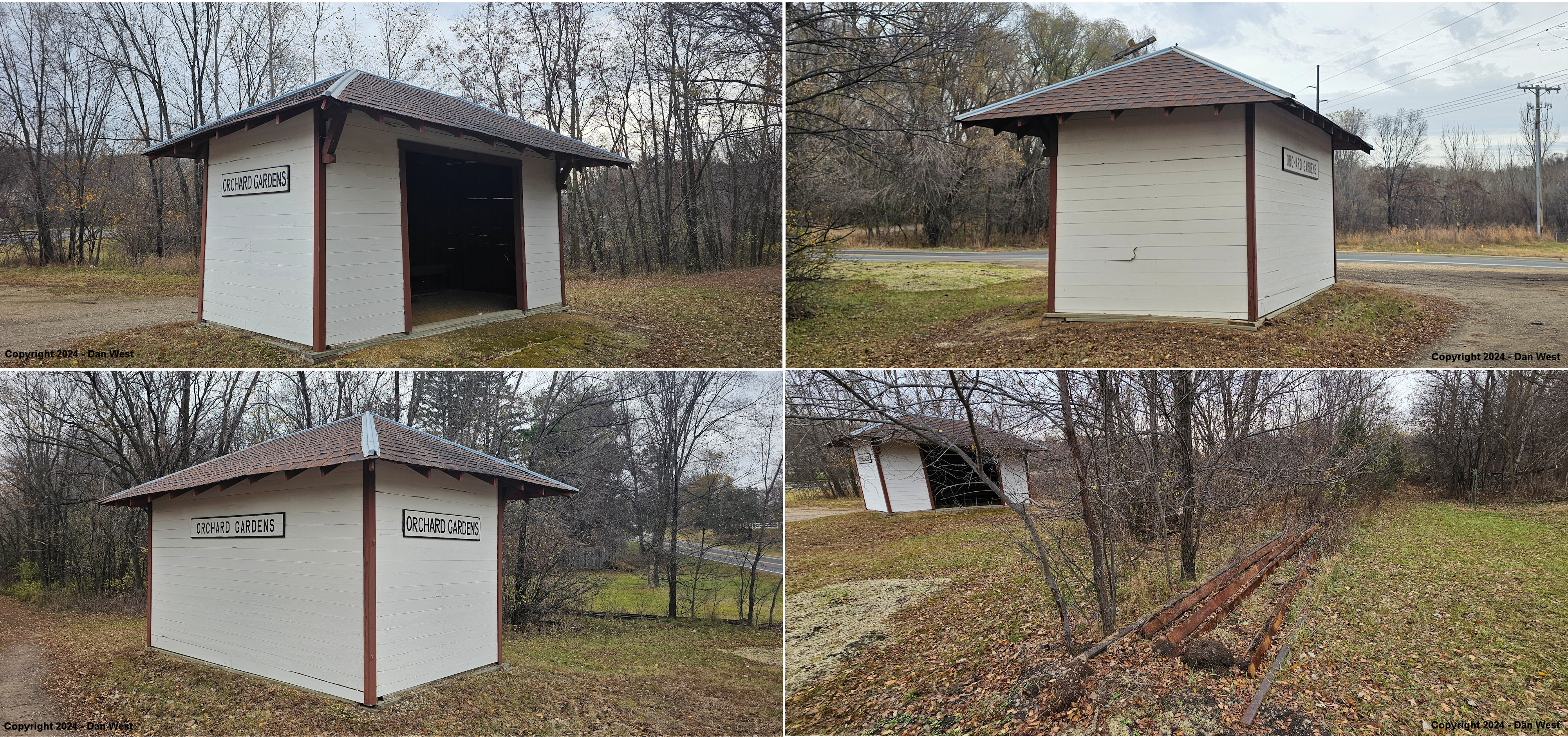
| orchard gardens |
 |
CR 5 and West
155th Street, Burnsville (GPS: 44.722754, -93.298448) |
P | 1910 | Private | In Use | Wood | |
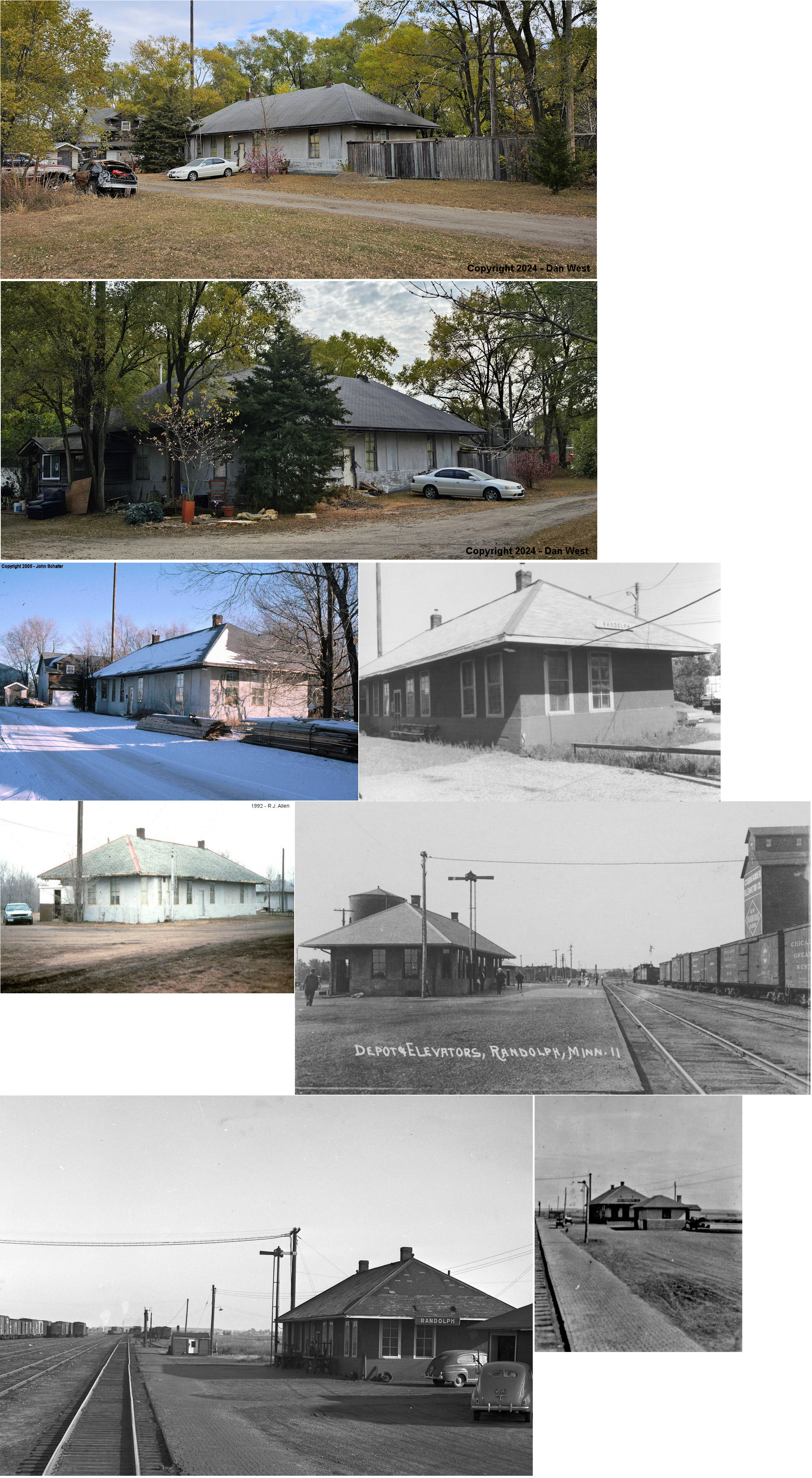
| randolph |
 |
North side of 292nd Street East, behind Walco USA parking lot. (GPS: 44.526954, -93.016540) |
C | 1914 | Residence | In Use | Stucco | |
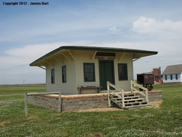
| Red Wing (Goodhue Co.) |
 |
Little Log House
Pioneer Village 220th Street, Hastings (GPS: 44.630296, -92.838568) |
F | ???? | Muesum | None | Wood |
|
| rosemount |
 |
NE corner of CR 42 and MN 3 (GPS: 44.732639, -93.126441) |
P | ???? | Museum | In Use | Wood | |
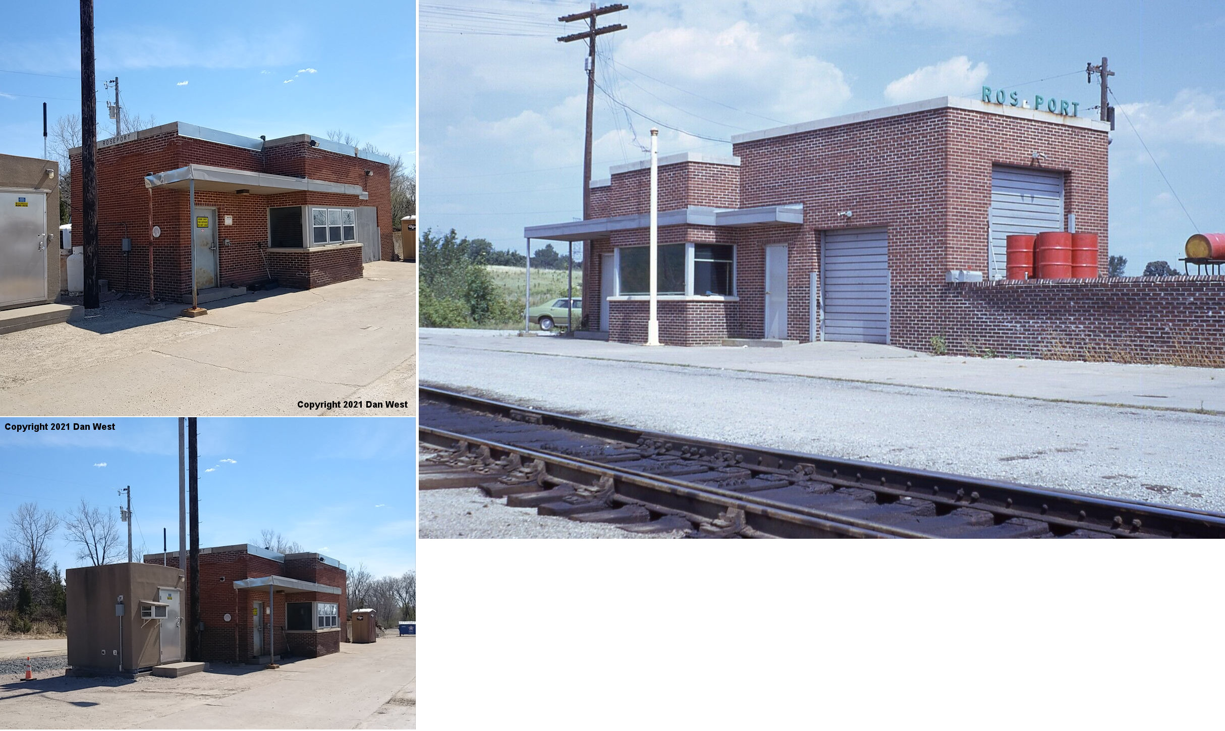
| Roseport |
|
200 yards south of 117th Street East (GPS: 44.777543, -93.049315) |
P | 1955 | Railroad | In Use | Brick | |
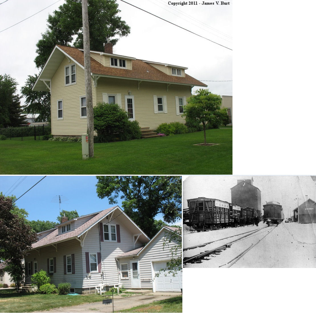
| vermillion |
|
110 Park Avenue North (GPS: 44.674378, -92.965656) |
C | 1881 | Residence | None | Wood |
|
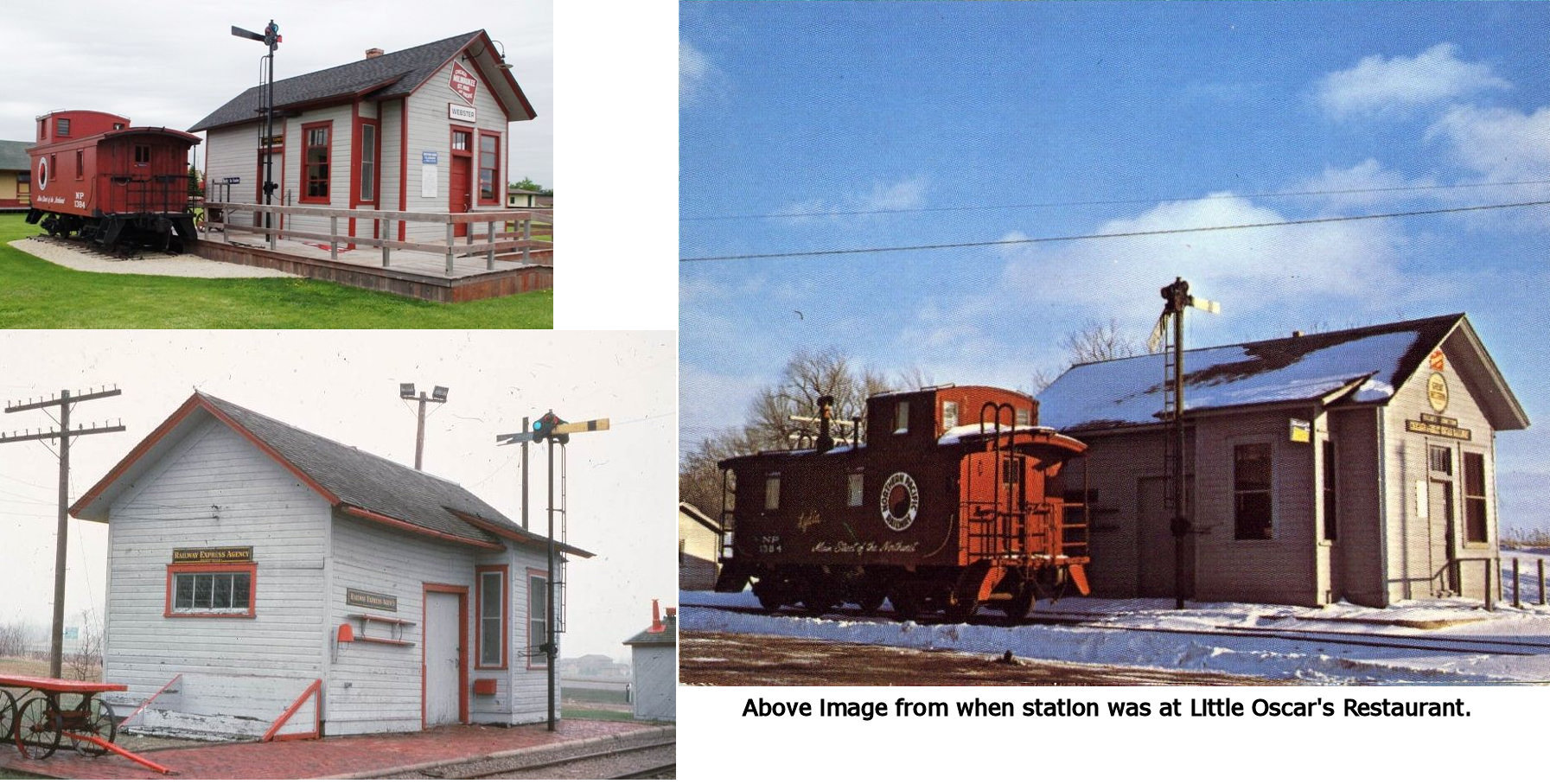
| webster (rice co.) |
|
Little Log House
Pioneer Village 220th Street, Hastings (GPS: 44.630704, -92.837383) |
C | 1903 | Museum | None | Wood |
|
| zumbrota (goodhue co.) |
 |
Little Log House
Pioneer Village 220th Street, Hastings (GPS: 44.630700, -92.837773) |
F | ???? | Museum | None | Wood | |
| STATIONS OF THE PAST | ||||||||
| Station Name |
Original Railroad |
Notes | ||||||
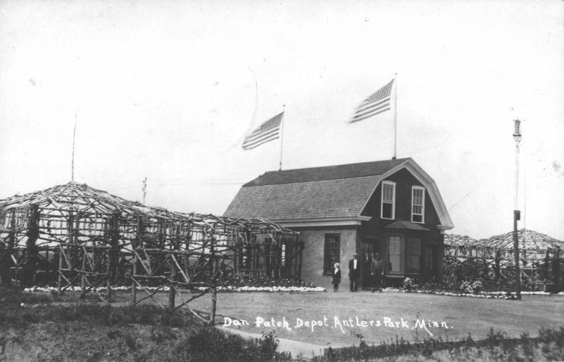
| Antlers Park (Lakeville) |
|
|||||||
| Castle Rock |
AND  |
This station was north of 280th Street West, on the east side of the tracks. | ||||||
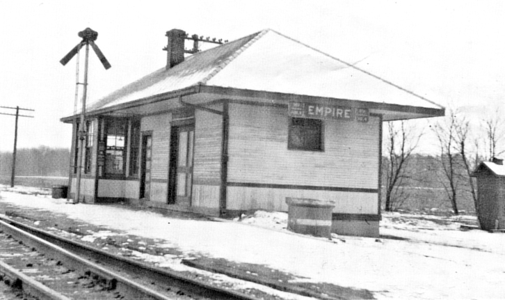
| Empire (Auburn) |
|
The first station here was destroyed by fire in 1927. That station, like its replacement had an interlocking tower as part of the station which controlled the CGW/MILW crossing. | ||||||
| Empire |
|
The second station, built in 1928, was on the corner of Vermilion Street and 2nd Street. 2nd Street and Vermilion Street have been turned into one street known now as Vermilion Avenue. That puts the station at approximately GPS: 44.658697, -93.014207. The station closed in 1951. | ||||||
| Empire |
|
Was there a Milwaukee Road station here? | ||||||
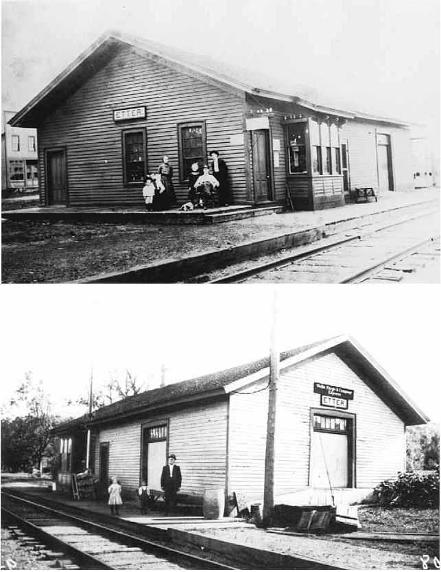
| Etter |
|
|||||||
| Eureka Center |
|
Station was on corner of County Road 80 and Cedar Avenue. The current Eureka Town Hall is across the street from where the station was located. | ||||||
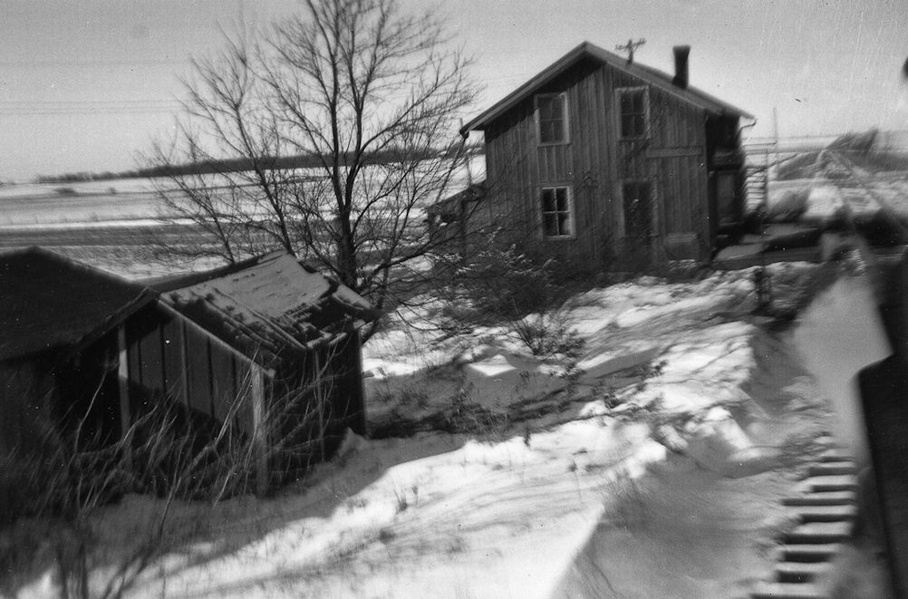
| Farmington |
AND |
This station was located at 400 2nd Street (at the corner with Oak Street) at GPS: 44.639049, -93.146631. It was built in 1894, put on the National Register of Historic Places in 1979, and torn down in 1984. Prior to 1894 there was a smaller station at essentially the same site. That original station burned down on February 25, 1894 (The Saint Paul Globe, 2-26-1894). | ||||||
| Fort Snelling |
|
According to 1896 maps, there was a station for Fort Snelling near what is now the Mendota Bridge. A RR bridge was here previously that held a line that curved out of Mendota and up toward the fort. I believe the station was on what is now called Picnic Island. | ||||||
| Fort Snelling |
|
There was a platform-only station at the bottom of the hill down from the commandant's quarters. | ||||||
| Greenvale (Greenville) |
|
|||||||
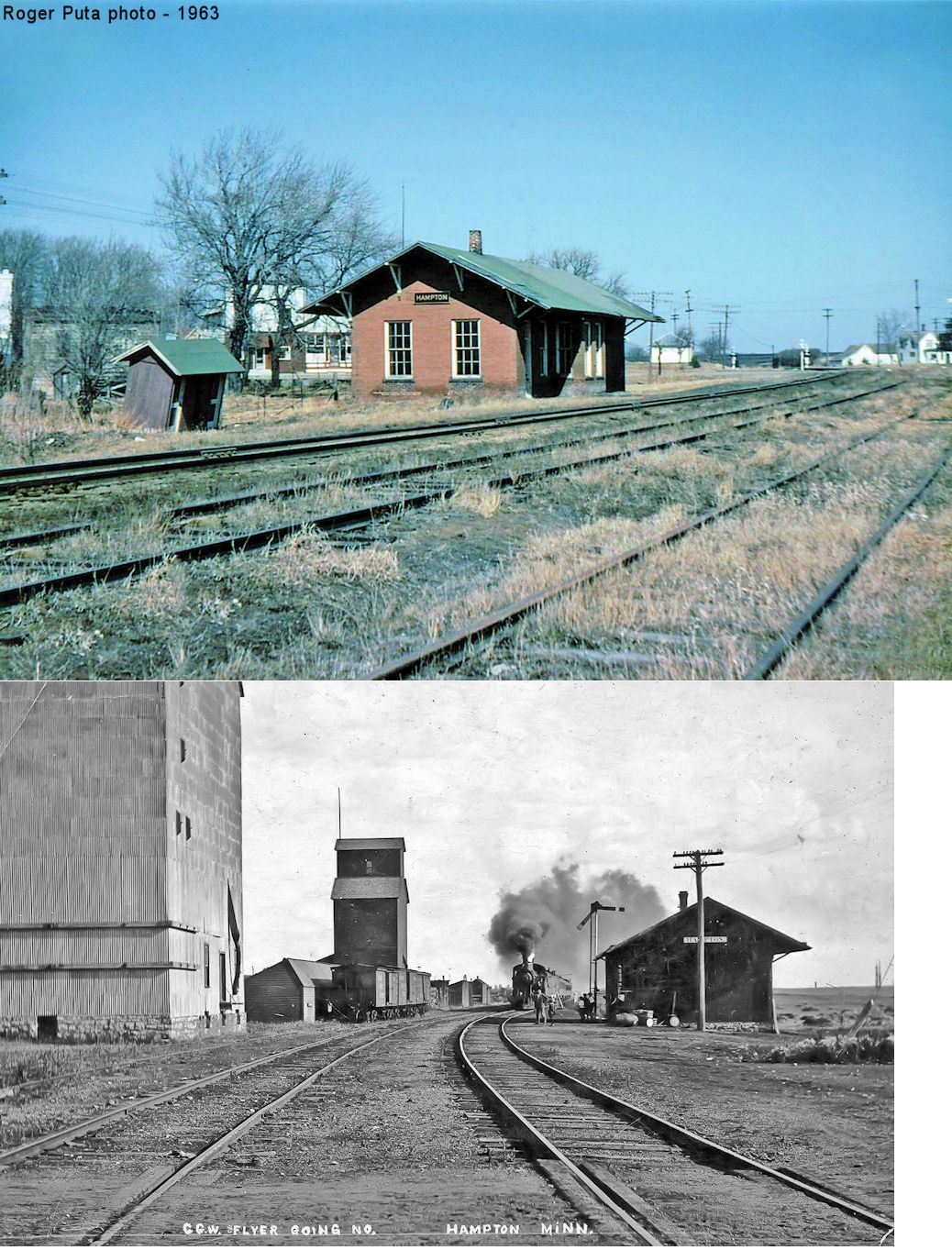
| Hampton |
|
This station, built in 1905, was at the corner of Water and Main Streets, on the east side of the tracks. It was demolished in 1964. | ||||||
| Hastings |
AND Hastings & Dakota |
An earlier wooden union station existed here in roughly the same location as the existing station on 2nd Street. It was originally built by the Hastings & Dakota RR in 1868. There was a roundhouse directly to the SW of the station. It was likely torn down in 1890 to make way for the new brick station (the brick station is shown on the 1891 Sanborn map). | ||||||
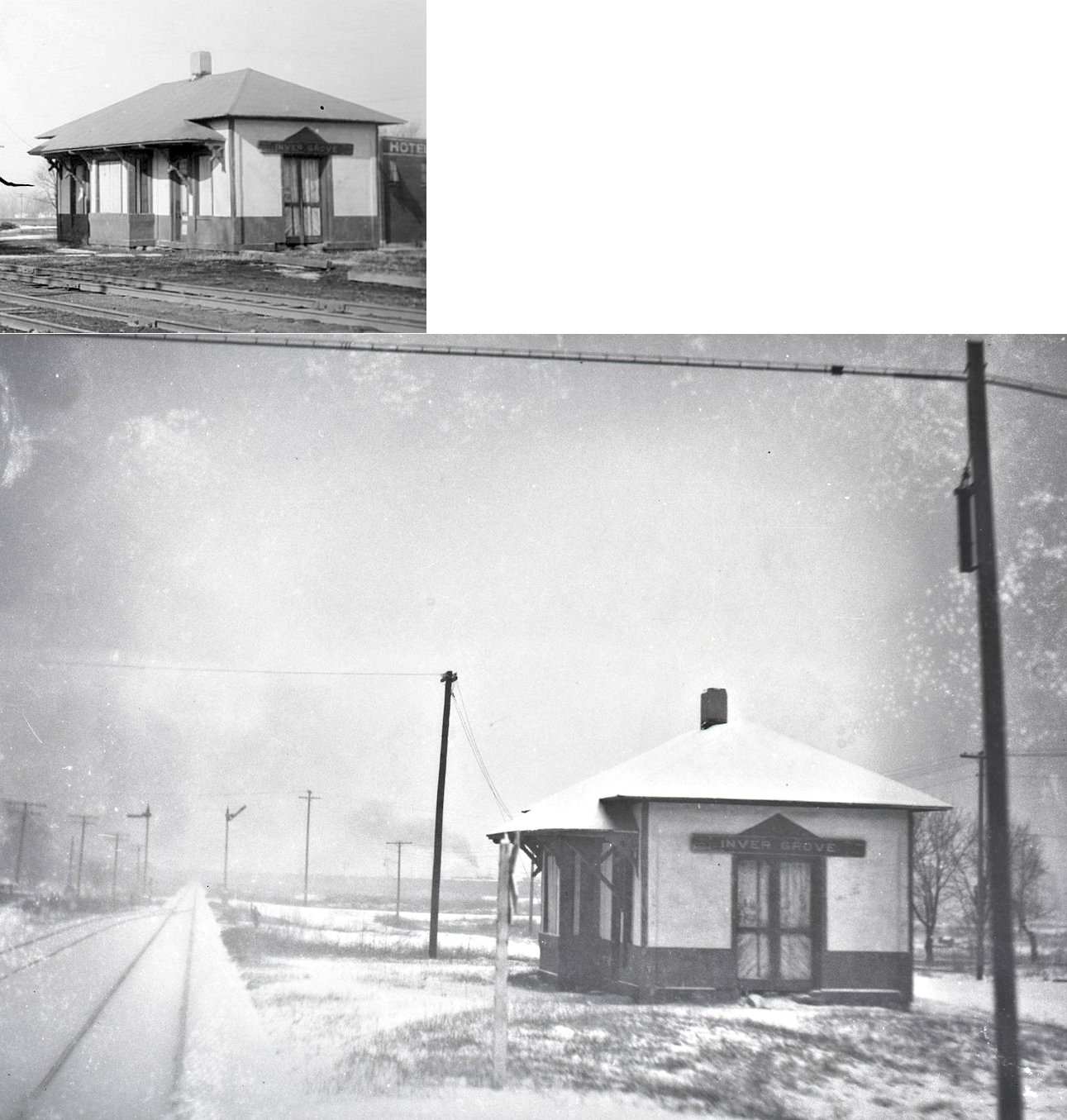
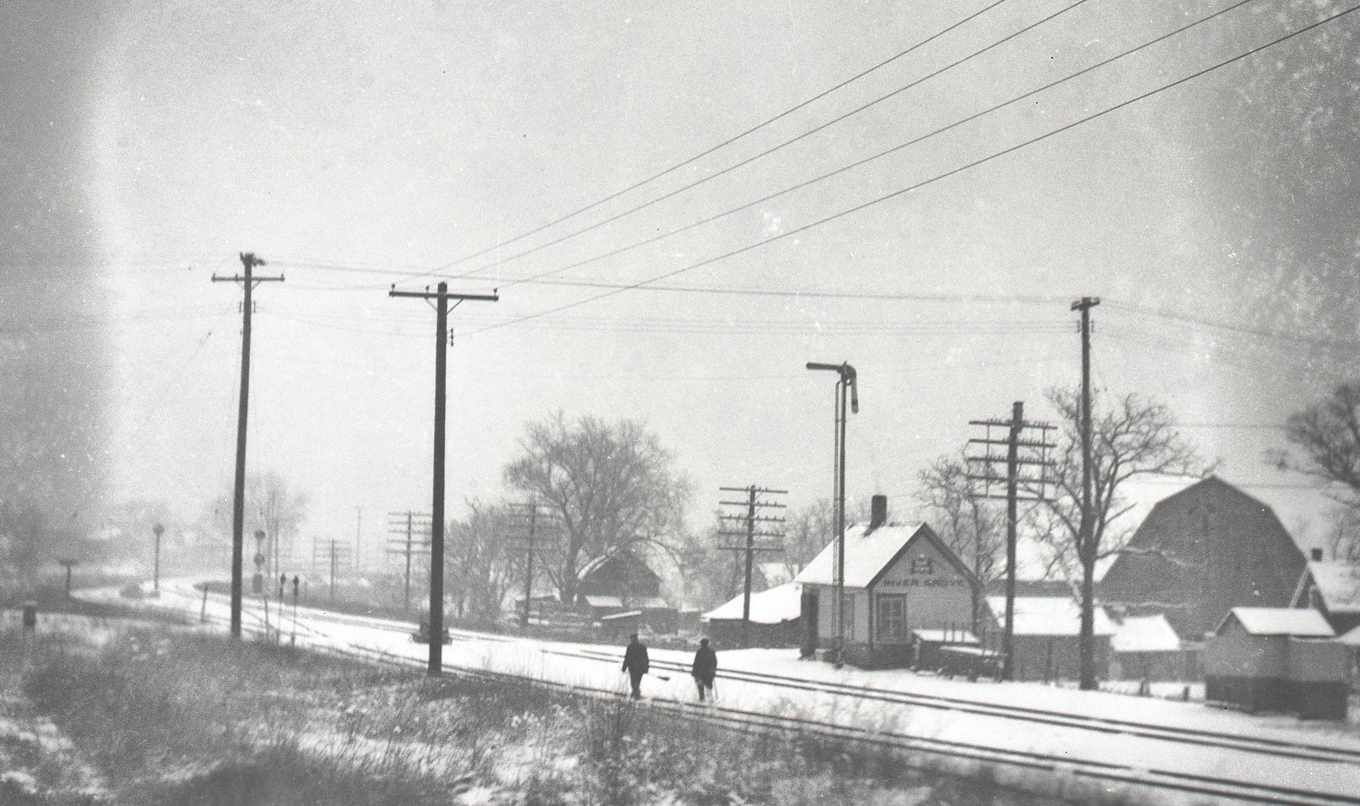
| Inver Grove |
|
In 1896, this station was located off 66th Street East near Concord Boulevard (MN 56). The station was made of brick, but in later years the exterior was covered with stucco or painted white. The station was retired in 1949. | ||||||
| Inver Grove |
|
|||||||
| Lakeville |
|
|||||||
| Lewiston |
|
There may have been a joint station here as the CM&St.P and MSt.L ran parallel through town. | ||||||
| Lewiston |
 |
|||||||
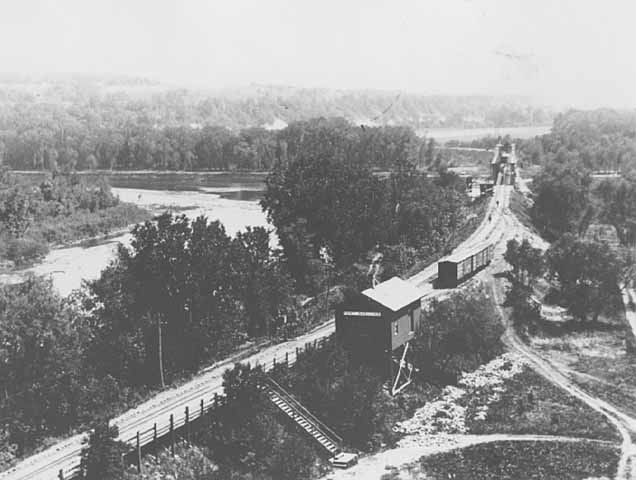
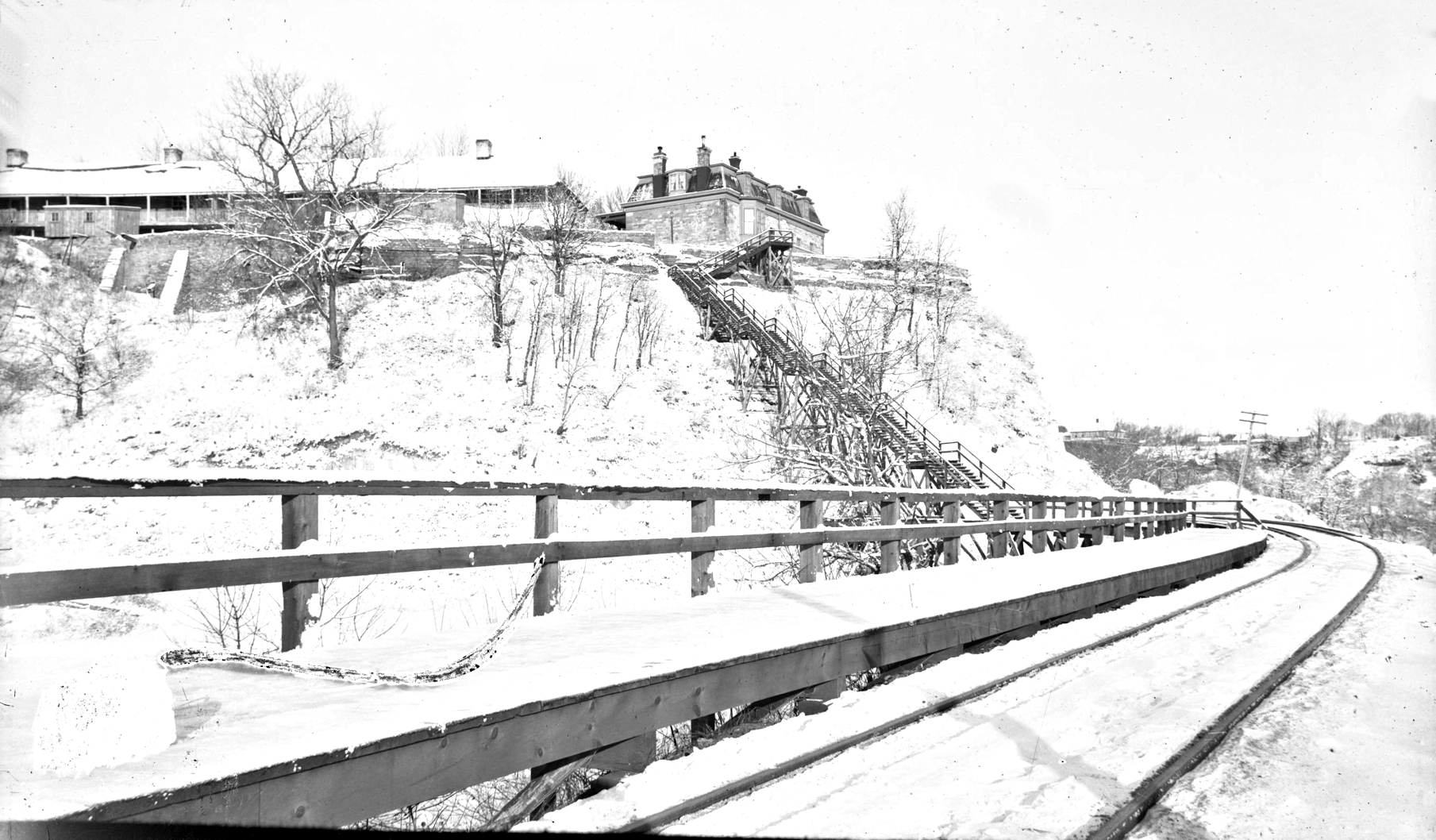
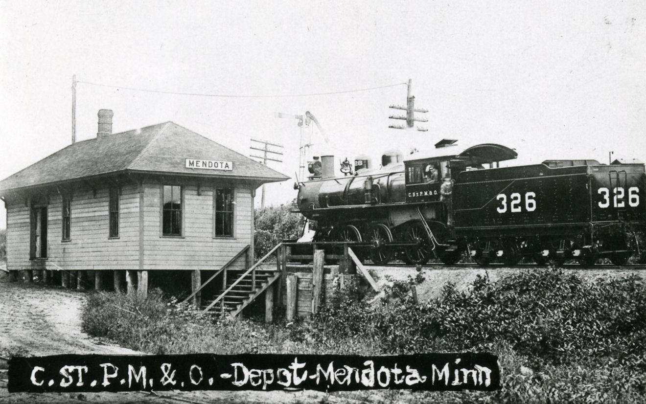
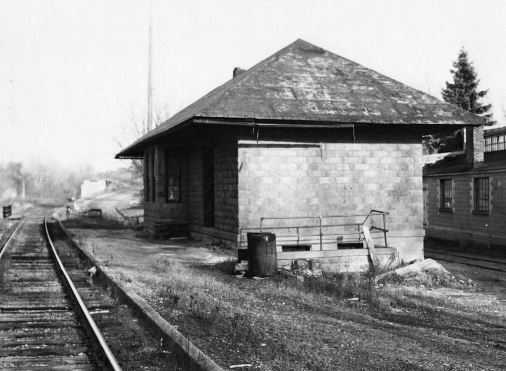
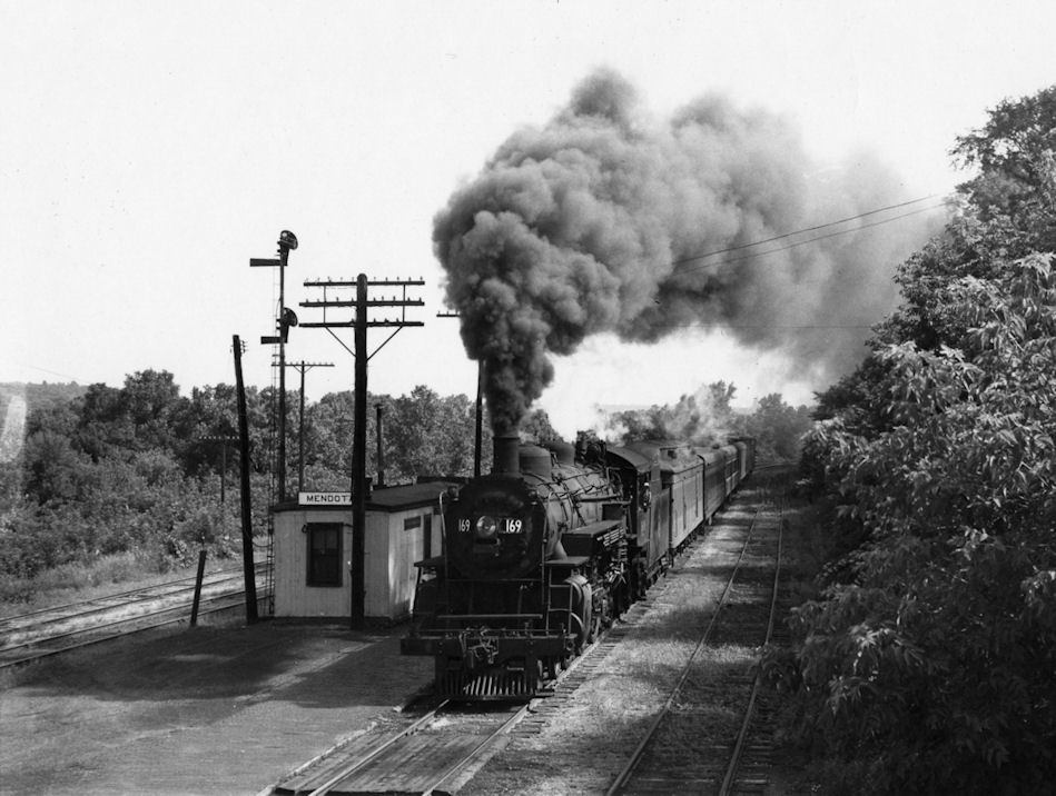
| Mendota |
 |
There was a station off what is now Sibley Memorial Highway at the NE edge of town (out to the NE of G Street). A later station was erected in 1913. The original ine here was the Minnesota Valley RR. The last station here was demolished in the 1970s. | ||||||
| Mendota (St. Paul Jct.) |
|
This station appears to have been built from the same plans as the one at Wilder (Jackson County). | ||||||
| Mendota |
|
The first station here was opened in 1865 by the Minnesota Central Railway (The Weekly Pioneer and Democrat, 9-10-1865). | ||||||
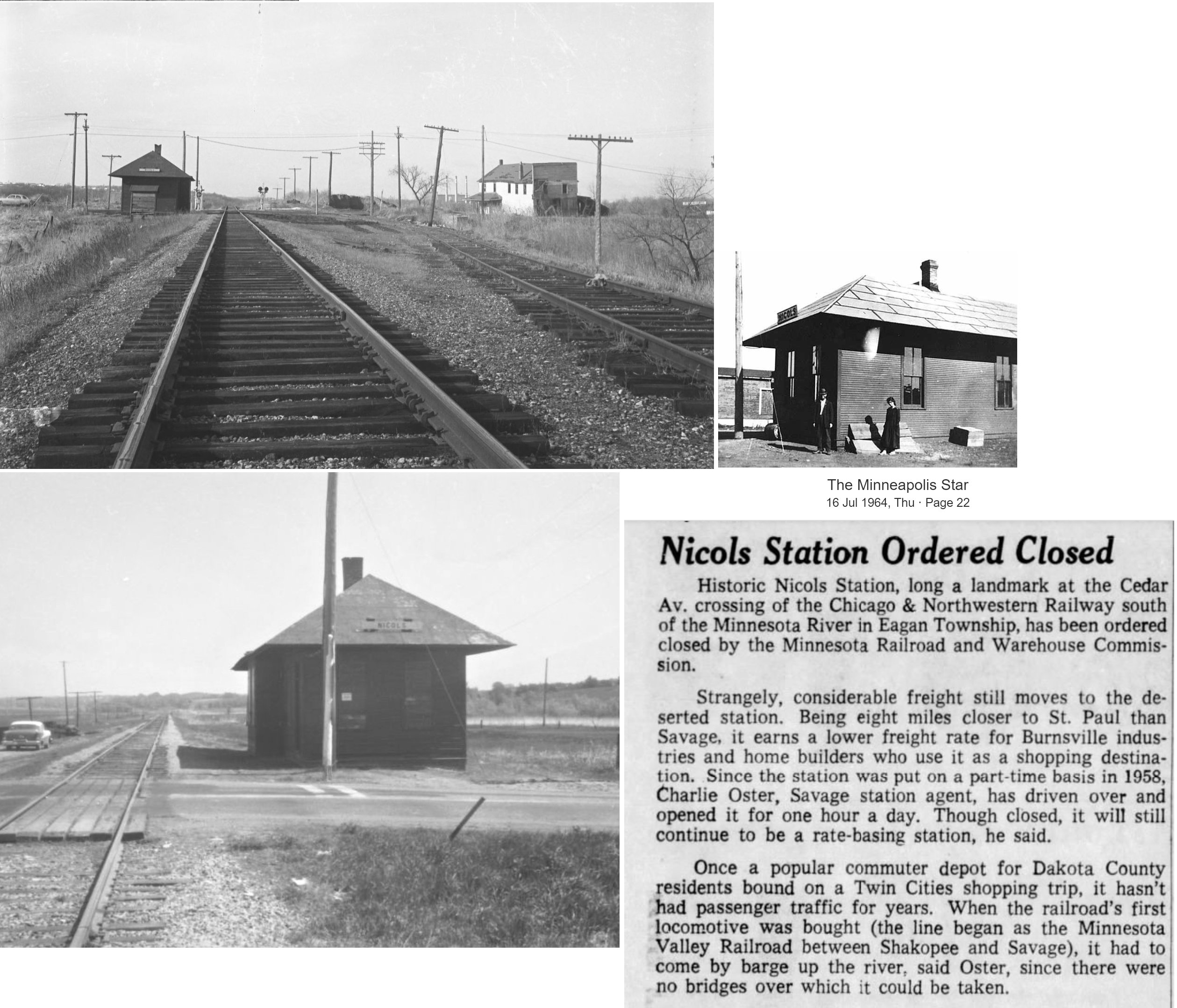
| Nicols (Eagan) |
|
This station was on the east side of the Nicols Road (formerly Cedar Avenue) crossing at GPS: 44.822021, -93.220342 in Eagan. It was built in 1913 and burned down in a fire training exercise in 1964. Prior to 1913 it was a flag stop (not sure if there was an earlier station building). | ||||||
| Oak Dale |
|
|||||||
| Oakland Station |
|
This town, which no longer exists, was near where US 52/MN 55 crosses the tracks south of Inver Grove Trail. | ||||||
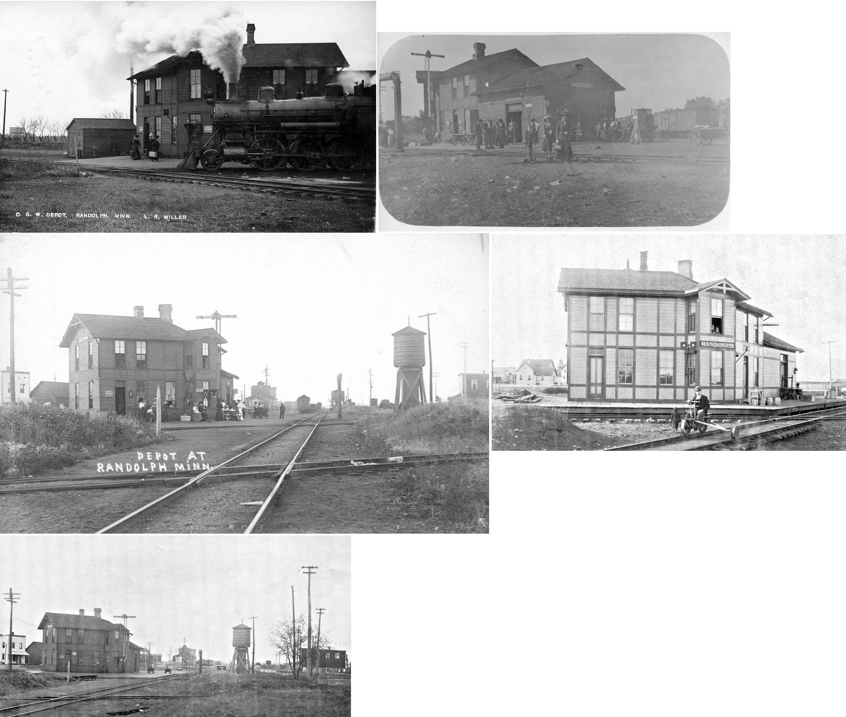
| Randolph (Cascade) |
AND AND |
At one time there was a union station here. It was a backward L-shaped station in the northwest corner of the CGW/MSt.L diamond at GPS: 44.524510, -93.018171. This was between Dixie Avenue and Divers Path (formerly called Dakota Avenue). When the new CGW station was built in 1914, this old station was moved a short distance and served as the freight station. | ||||||
| Rich Valley |
|
This station was north of 140th Street on the east side of the tracks. It was retired in 1939. | ||||||
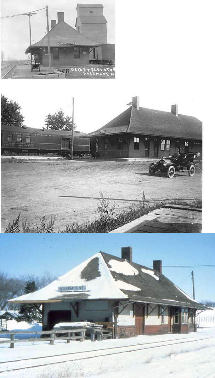
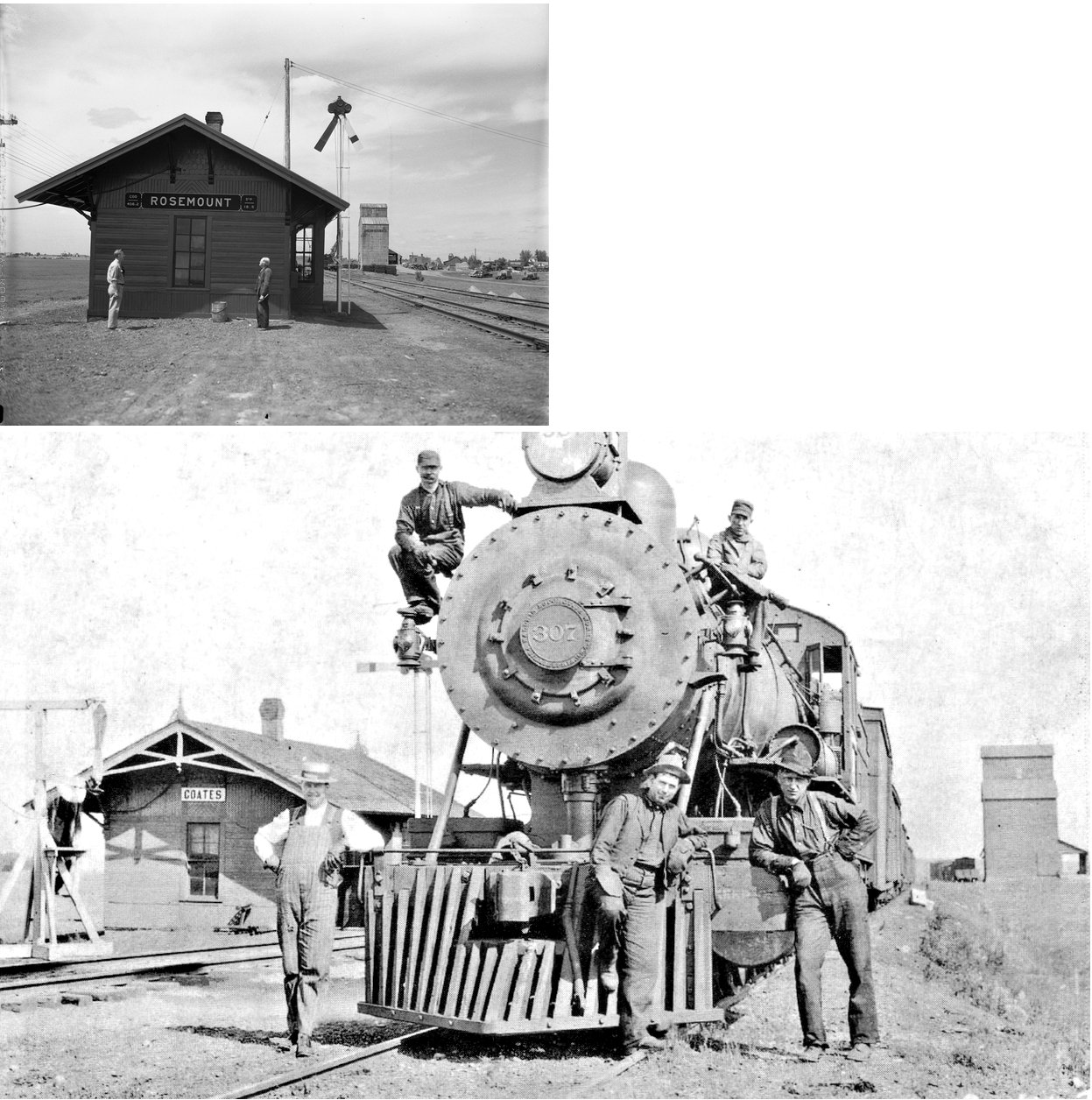
| Rosemount |
AND |
This station was just SE of the intersection of Main and Maple Streets. Today, this would be Lower 147th Street West and Burma Avenue West. The station burned down in July 1977. The first station here was opened in 1865 by the Minnesota Central Railway (The Weekly Pioneer and Democrat, 9-10-1865). Not sure if this is the same station as the one pictured. | ||||||
|
Rosemount (Coates) |
|
The station was closed, but in 1943 it was reopened and renamed Rosemount to primarily serve the Gopher Ordinance plant. It was retired in 1951. | ||||||
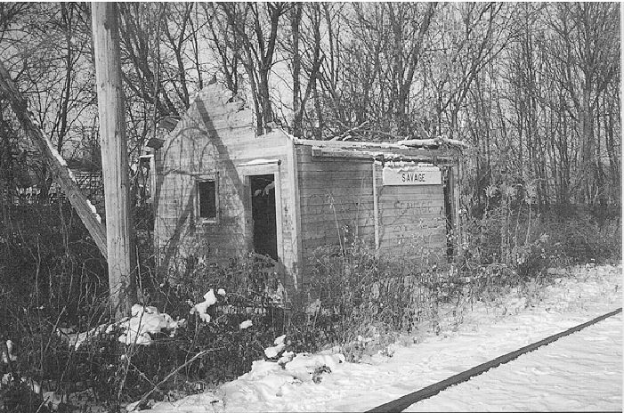
| Savage |
|
This building has collapsed, but the remains are located about 80 yards south of MP 28 (South of MN 13 at ROW) (GPS: 44.776569, -93.348494). | ||||||
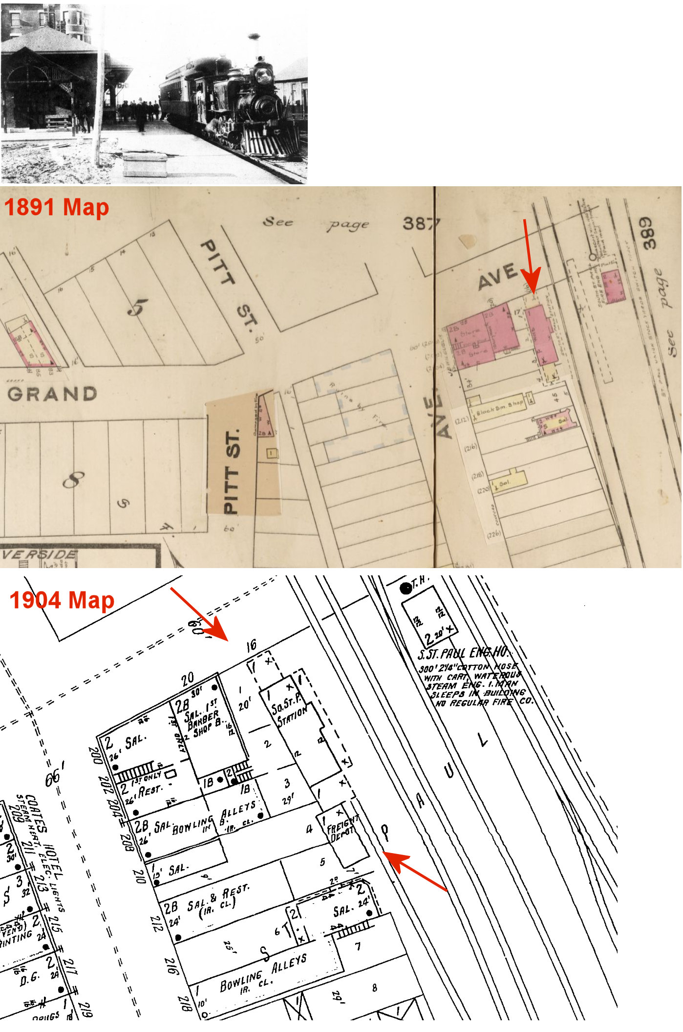
| South St. Paul |
|
This station was on the SW corner of Grand Avenue West and Concord Street North across Grand Avenue from the Concord Exchange Building at GPS: 44.892856, -93.034396. The CGW tracks here used to run where Concord Street is now. There was also a freight station to the south and an engine house across the tracks to the east. These stations are shown on the 1903 Sanborn Map. | ||||||
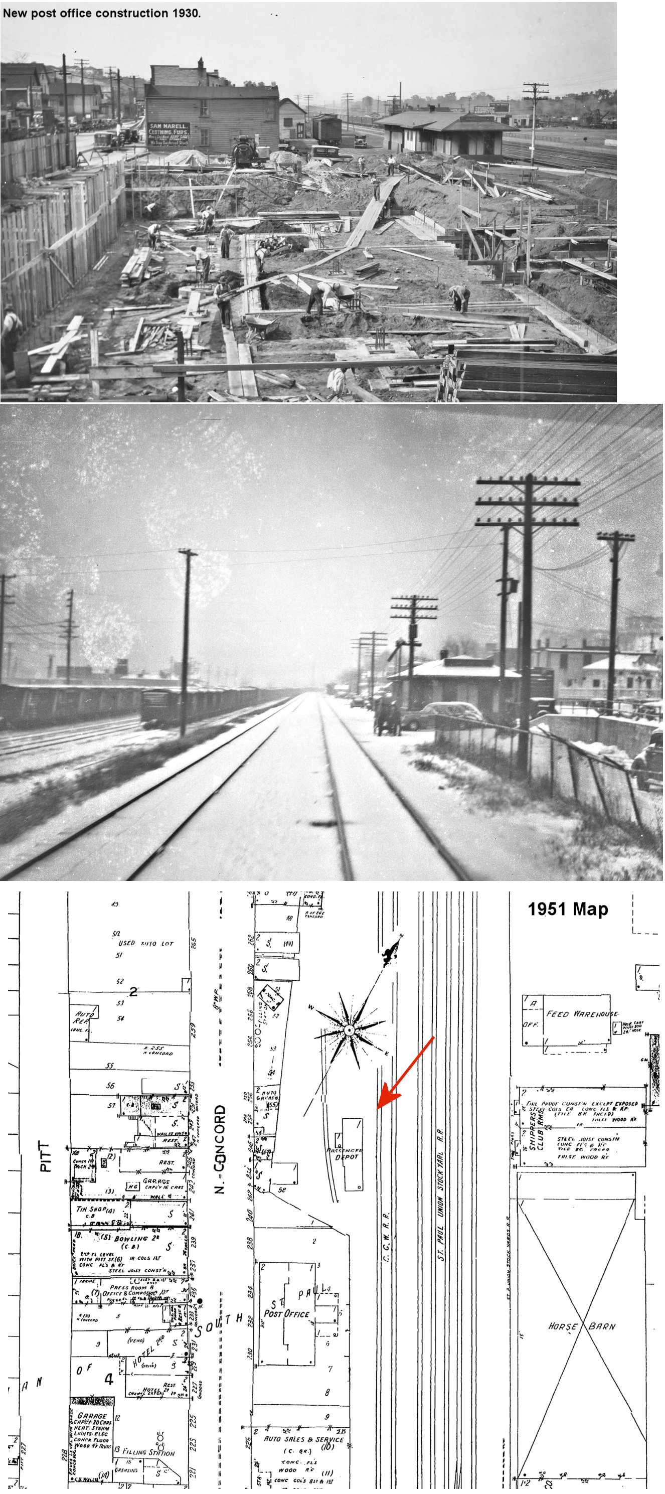
| South St. Paul |
|
In 1911 a new South St. Paul station was built to replace the one listed above. This new station was just north of the post office at GPS: 44.894639, -93.035624 along what is now Concord Street (which used to be railroad right-of-way). The address was 242 Concord Street. The station was enlarged and remodeled in 1921 | ||||||
|
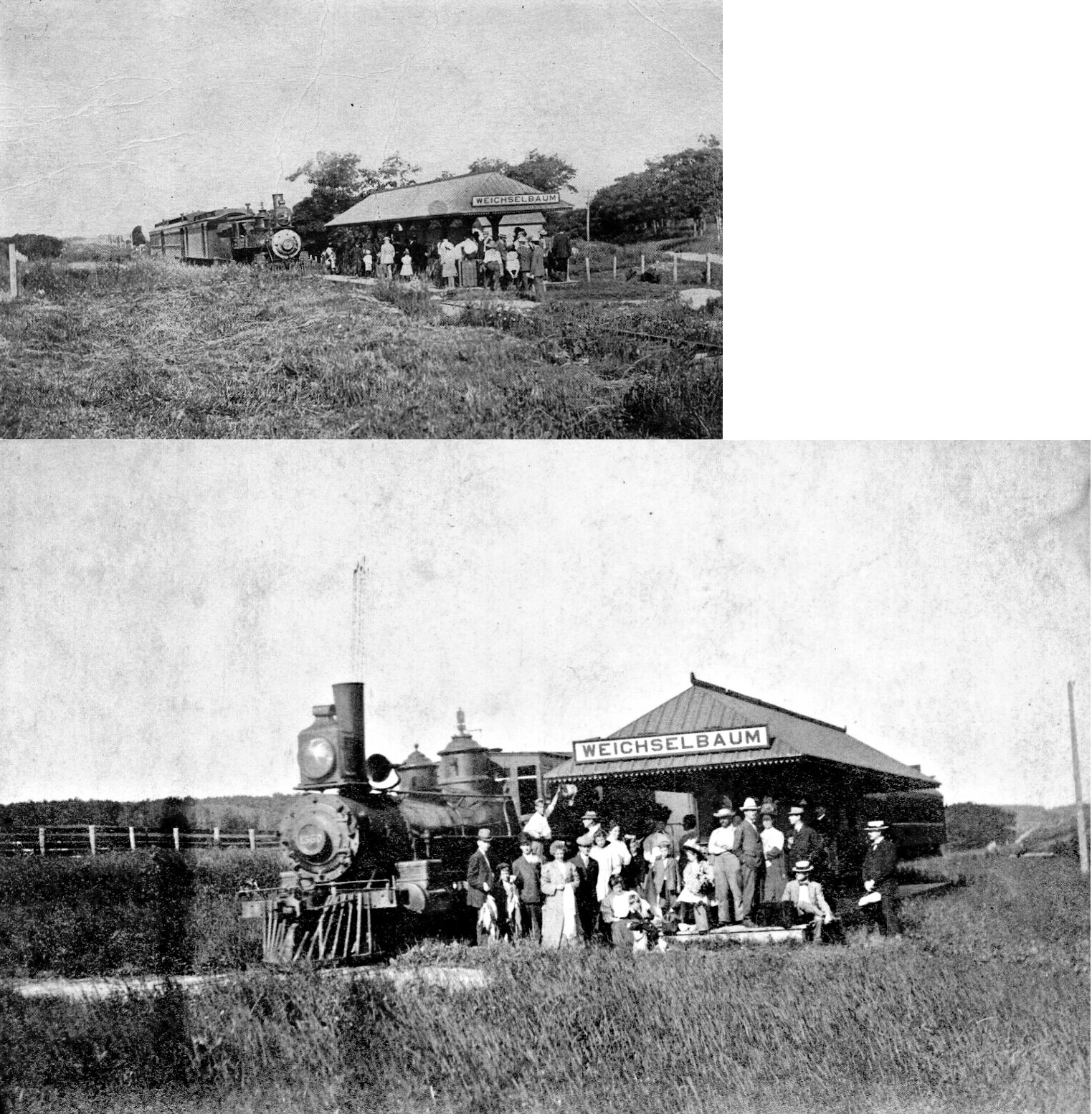
Weichselbaum Resort (Lakeville) |
|
This resort was off what is now 205th Street. | ||||||
| Wescott (Westcott) (Radio Center) |
|
The station was on the northeast side of the tracks near the main intersection. The first station here was the Westcott Inn which predated the RR, but served as a flag stop when the line came through (at the time it was the Minnsota Central RR). | ||||||
| Westwood |
|
This station, on the Hastings & Dakota Branch, was NE of Farmington where the tracks used to cross Ahern Boulevard at approximatly GPS: 44.654885, -93.080555. The station is shown on the 1896 Plat Book of Dakota County. | ||||||
| 1898 DAKOTA COUNTY RAILROAD MAP | ||||||||
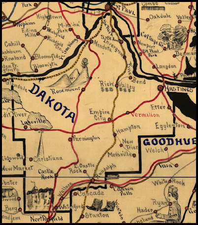 |
||||||||
|
Notes About Existing Stations... Dahlgren (CMStP&P) - This station was originally from Dahlgren in Carver County, but has been moved twice. It was moved to Lakeville first and then to Farmington at the Dakota County Fairgrounds which is the site of "Dakota City." A plaque on the station claims the station was built in circa 1860 and moved to Lakeville in 1870, however the station wasn't built until 1872 (Weekly Valley Herald, 9-19-1872). Federal Dam (Soo Line) - This station originated in Federal Dam (Cass County) and was built in 1908 by the Soo Line Rail Road. The Soo Line Rail Road was shut down after World War II and the building was moved to an Indian Reservation with plans for renovation. The plans fell through and the depot was sold to a private individual from Boy River (Cass County). The depot was moved again to Boy River, Minnesota with the idea of making a restaurant out of the building. Once again, the plans fell through. The building sat vacant until 1998 when it was moved to the Little Log House Pioneer Village. Lakeville (CM&St.P) - This is an original Hastings & Dakota RR station (the only one left). The original name of Lakeville was "Fairfield." This station's original location was at the corner of Front and Main Streets in Lakeville. The downtown area has changed quite a bit since the tracks ran through, but Main Street is now called Holyoke and Front Street is now Upper 208th Street West. That puts the former location of the station at approximately GPS: 44.647862, -93.243229. The station was moved to the fairgrounds in Farmington in 1970. Red Wing (Express Agency) - This express agency depot was originally next to the brick CGW station in Red Wing. Roseport (CGW) - This station was built in 1955 to serve the nearby oil refinery and other industries. Prior to 1955 there was no station here. Vermillion (CMStP&P) - This station was moved from its original location. Webster (CMStP&P) - This station was moved from its original location to Little Oscar's Cafe on US 52 in Hampton where it was for a number of years. The former owner of the cafe, Oscar Palrud, was well-known railroad buff from Faribault who traveled all over the world via rail. Around 2008-09 it was moved to Little Log House Pioneer Village. |
||||||||