 COUNTYCOUNTY
|
|
||||||||
| EXISTING STATIONS | ||||||||
|---|---|---|---|---|---|---|---|---|
| Station Name |
Original Railroad | Current Location |
Type | Date Built |
Current Use |
Track Status |
Building Material |
More Info |
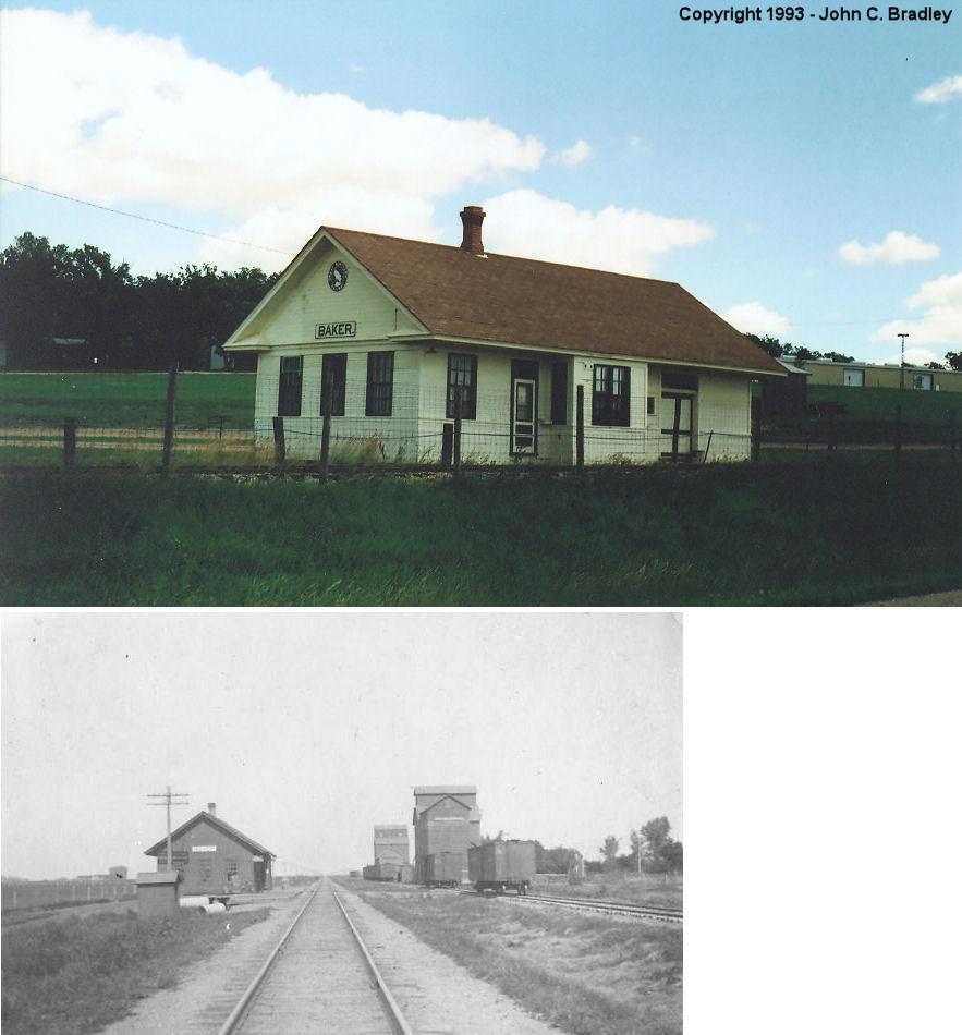
| baker |
 |
Western MN Steam Threshers Reunion grounds MN-32, Rollag (GPS: 46.743689, -96.227876) |
C | 1900 | Museum | None | Wood | |
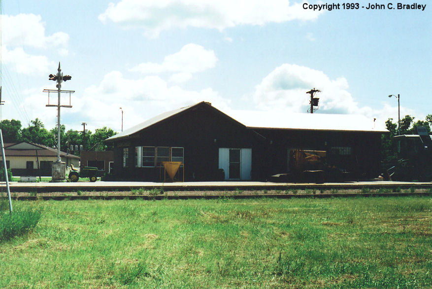
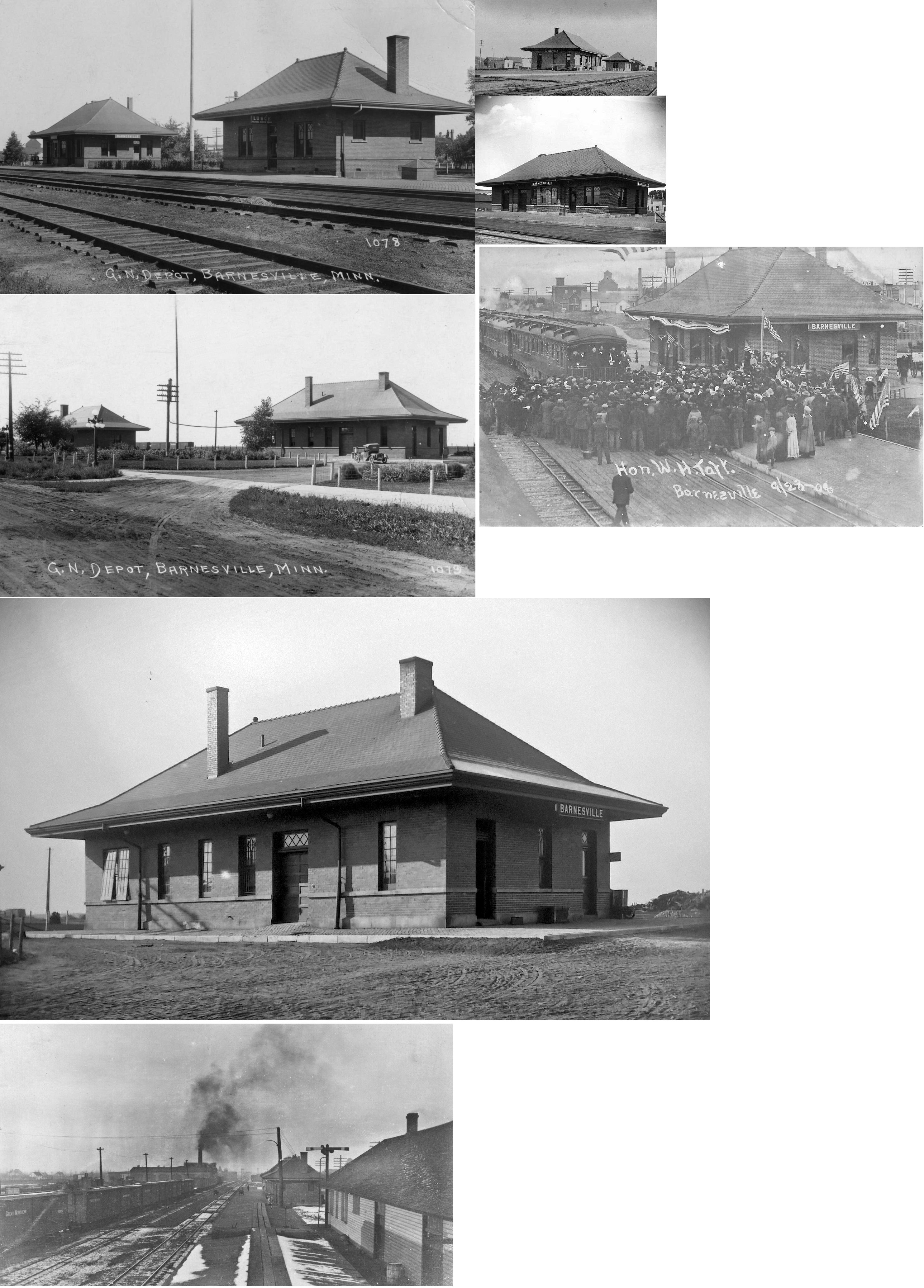
| Barnesville |
|
Front Street south of 4th Avenue. (GPS: 46.649893,-96.420511) |
C | ???? | Business | In Use | Brick | |
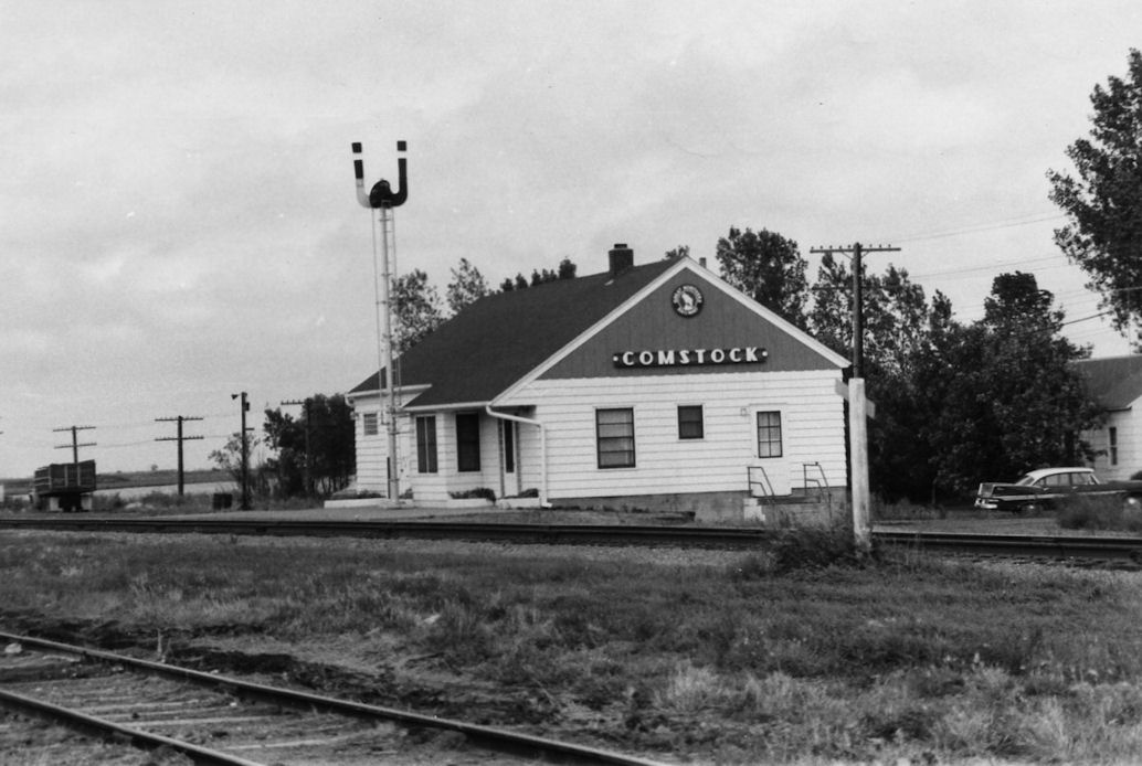
| Comstock |
|
???? | C | 1891 | ???? | In Use | Wood | |
|
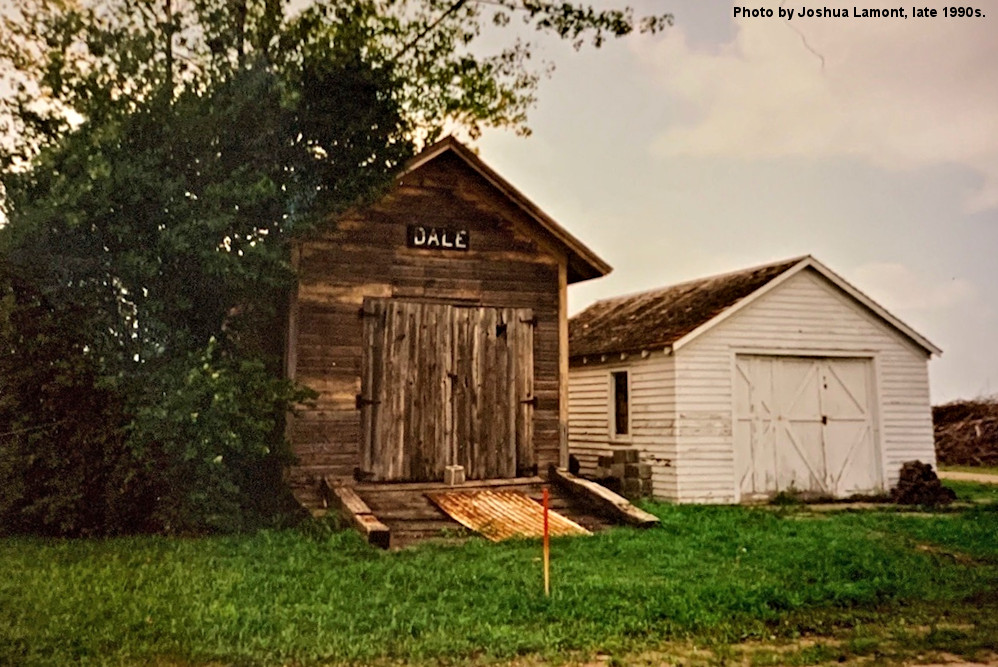
Dale (Hillsdale) |
 |
Near the intersection of 23rd and 28th Avenues (GPS: 46.905223, -96.219720) |
C | ???? | Storage | None | Wood | |
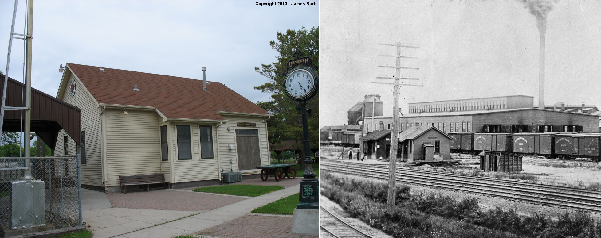
| Dilworth |
|
At the Whistle Stop Park on the NE corner of US-10 (Center Ave) and SE 4th Street. (GPS: 46.876772,-96.697106) |
C | 1909 | Civic | None | Wood | |
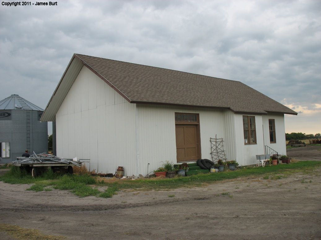
| downer |
|
North of Downer on MN-9, west side, 1/2 mile north of 50th Avenue South. (GPS: 46.826779,-96.508327) |
C | 1903 | Storage | None | Wood | |
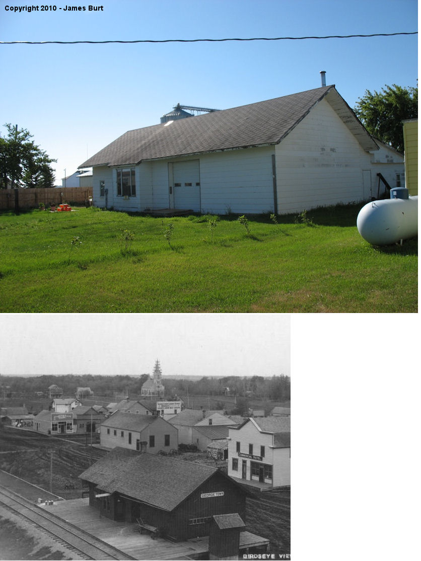
| georgetown |
|
North side of Howard Street between Bridge and Probstfield Streets. (GPS: 47.081891,-96.794862) |
C | 1885 | Residence | None | Wood |
|
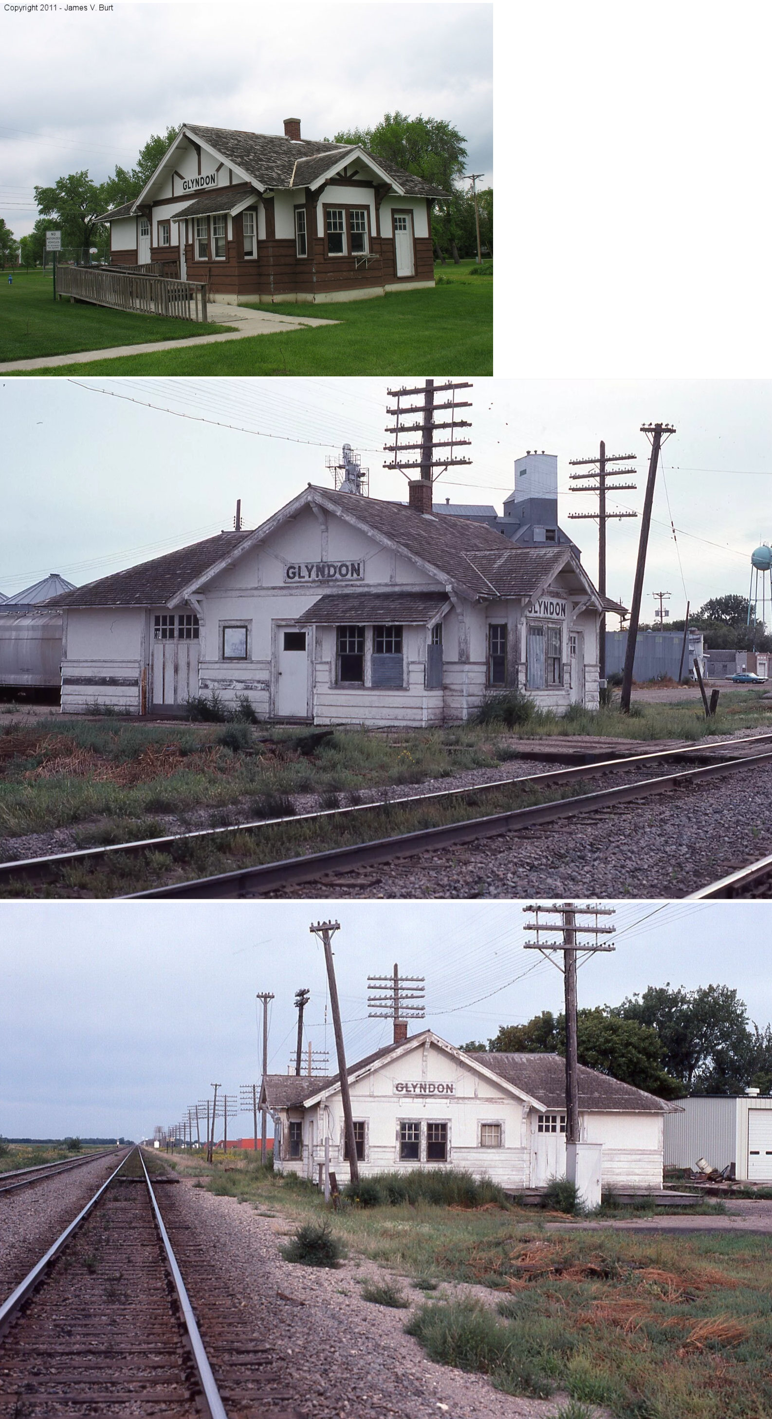
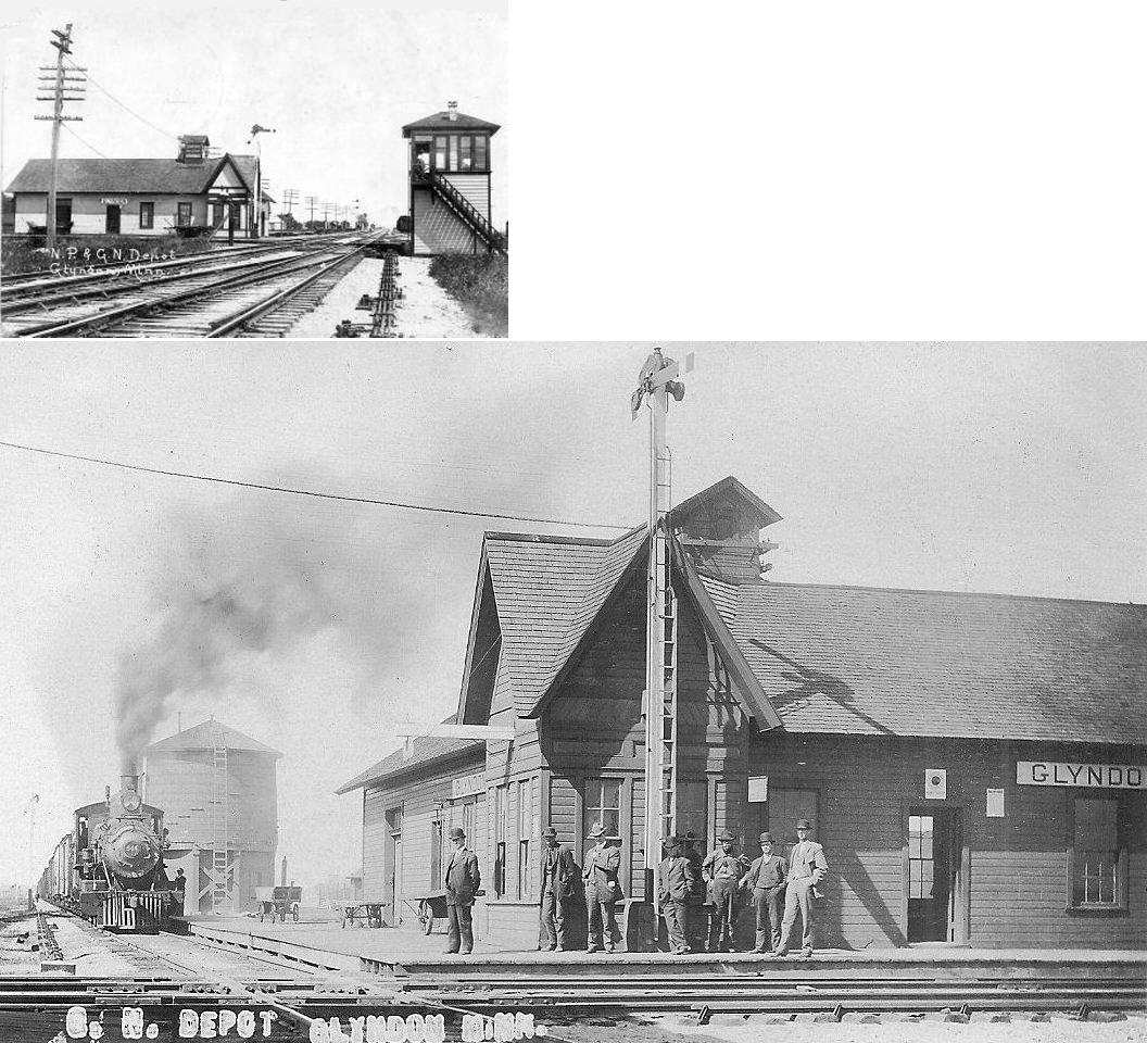
| glyndon |
AND |
At the NE corner of 3rd Street and Partridge. (GPS: 46.873453,-96.578922) |
C | 1899 | Civic | None | Wood |
|
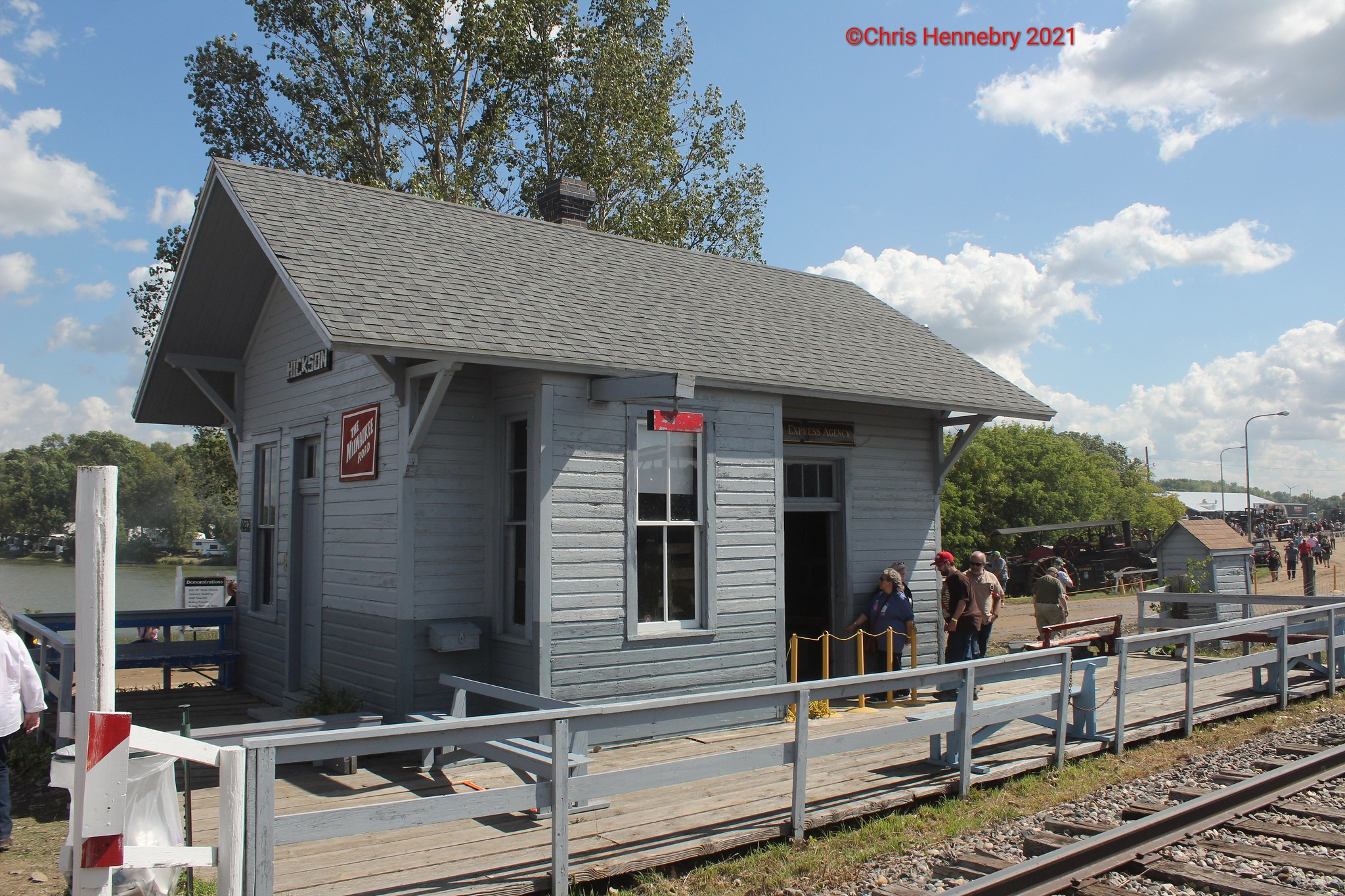
| Hickson, ND |
 |
Western MN Steam Threshers Reunion grounds, MN 32, Rolag (GPS: 46.746078, -96.234755) |
C | ???? | Museum | None | Wood |
|
| Hitterdal |
|
Western Minnesota Steam Threshers Reunion grounds, MN
32, Rollag. (GPS: 46.745211, -96.227874) |
C | 1902 | Museum | None | Wood |
|
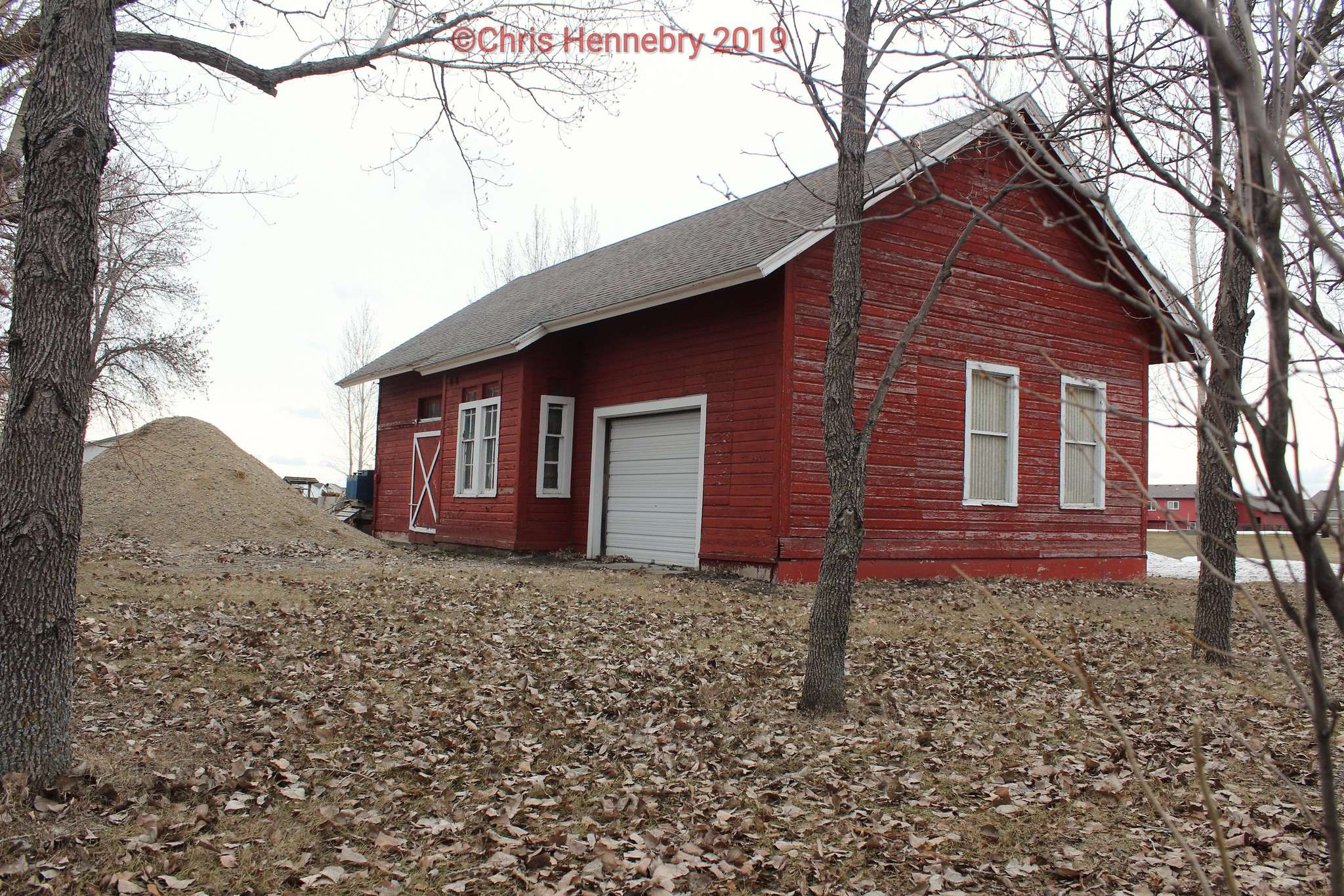
| Rustad (Kurtz) |
|
4284 14th Street South, Moorhead (GPS: 46.828360, -96.755620) |
C | 1901 | Storage | None | Wood | |
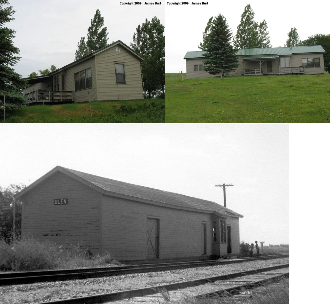
| ulen |
|
1351 County Highway 36 (420th Street), three miles NW of Syre on Frenchmans Bluff (out in field south of the current farmstead in a cow pasture) (GPS: 47.200775, -96.179745). |
C | 1902 | Vacant | None | Wood |
|
| STATIONS OF THE PAST | ||||||||
| Station Name |
Original Railroad |
Notes | ||||||
| Averill |
|
According to the 1915 GN Vaulation Record, the station here was built in 1881 and measured 12'x34'. | ||||||
| Barnes Spur (Barnes) |
|
According to the 1917 NP Vaulation Records, there was only a 4,800 square foot platform at this location then. | ||||||
| Barnesville |
 |
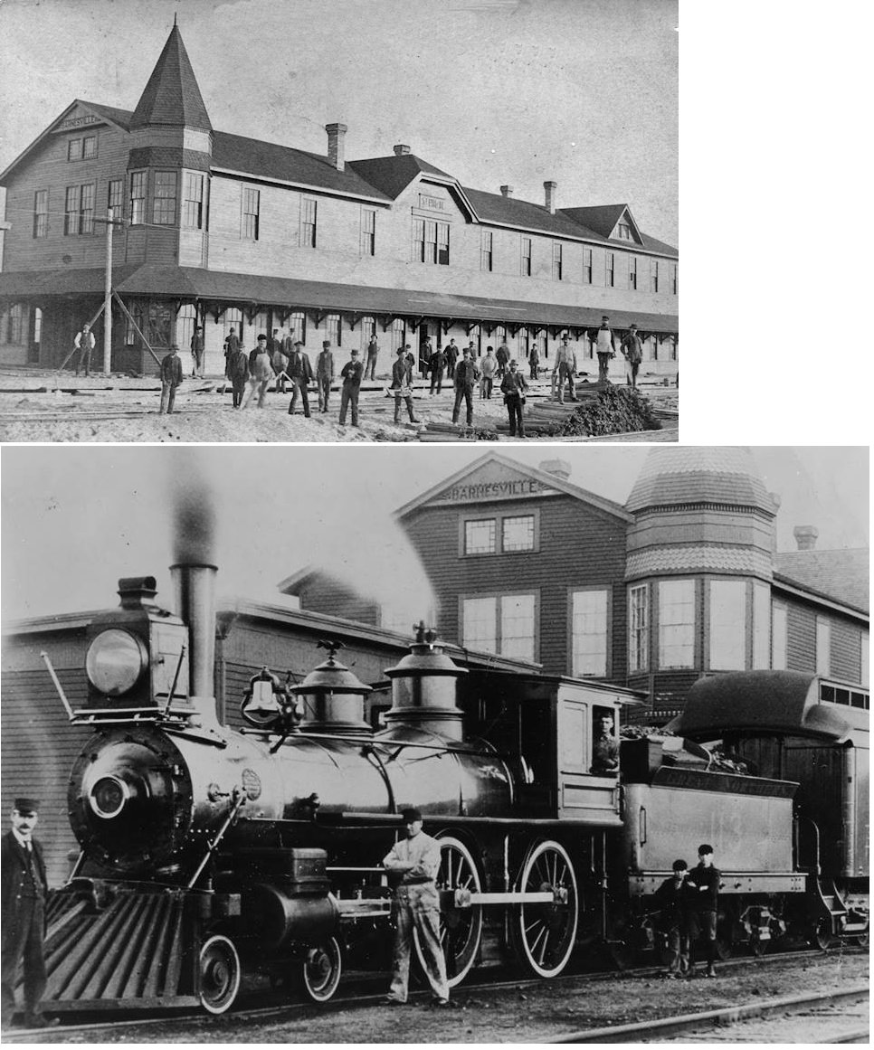
This was the original station built built in 1872. Photo is from 1883. This station was on Front Street at 6th Avenue at GPS: 46.648193, -96.419715. It burned down in 1905 (Star Tribune, 1-291-1905). The freight station was just to the SE. | ||||||
| Barnesville |
|
This was the second depot in Barnesville built in late 1905. It was on Front Street at 5th Avenue at GPS: 46.649269, -96.420249. It replaced the one listed above (it was in turn replaced by the station that is still standing). The wood frame building in the photos is the original freight station which was moved NW to the site of the old passenger station after that station burned down. | ||||||
| Barnesville |
|
According to the 1915 GN Vaulation Record, there was a frame freight station here that measured 30'x113'. It was built in 1896 and remodeled/expanded in 1906. | ||||||
| Crawford |
|
According to the 1915 GN Vaulation Record, there was only a station sign and a 12'x100' platform here at that time. The station was abandoned by the GN in 1954. | ||||||
| Dilworth (Richardson) |
|
The original name of this station was Richardson Siding in 1883, but was changed a year later (Clay County Historical Society Newsletter, January/February, 2002). | ||||||
| Felton |
|
This station was just NE of the corner of Pacific Avenue and 5th Street. According to the 1915 GN Vaulation Record, the station here was built in 1881 and measured 24'x60'. | ||||||
| Finkle |
|
According to the 1915 GN Vaulation Record, this stop had only a waiting/loading platform and station sign. The platform measured 12'x100' and was built in 1899. | ||||||
| Glyndon |
AND |
This combination station, which measured 43'x53', was built in 1889/1890 and replaced by the station that is still standing. According to the 1917 NP Vaulation Records, it was owened 50/50 by the GN and NP. Those records list the dimensions as 24'x60' and 20'x26'. | ||||||
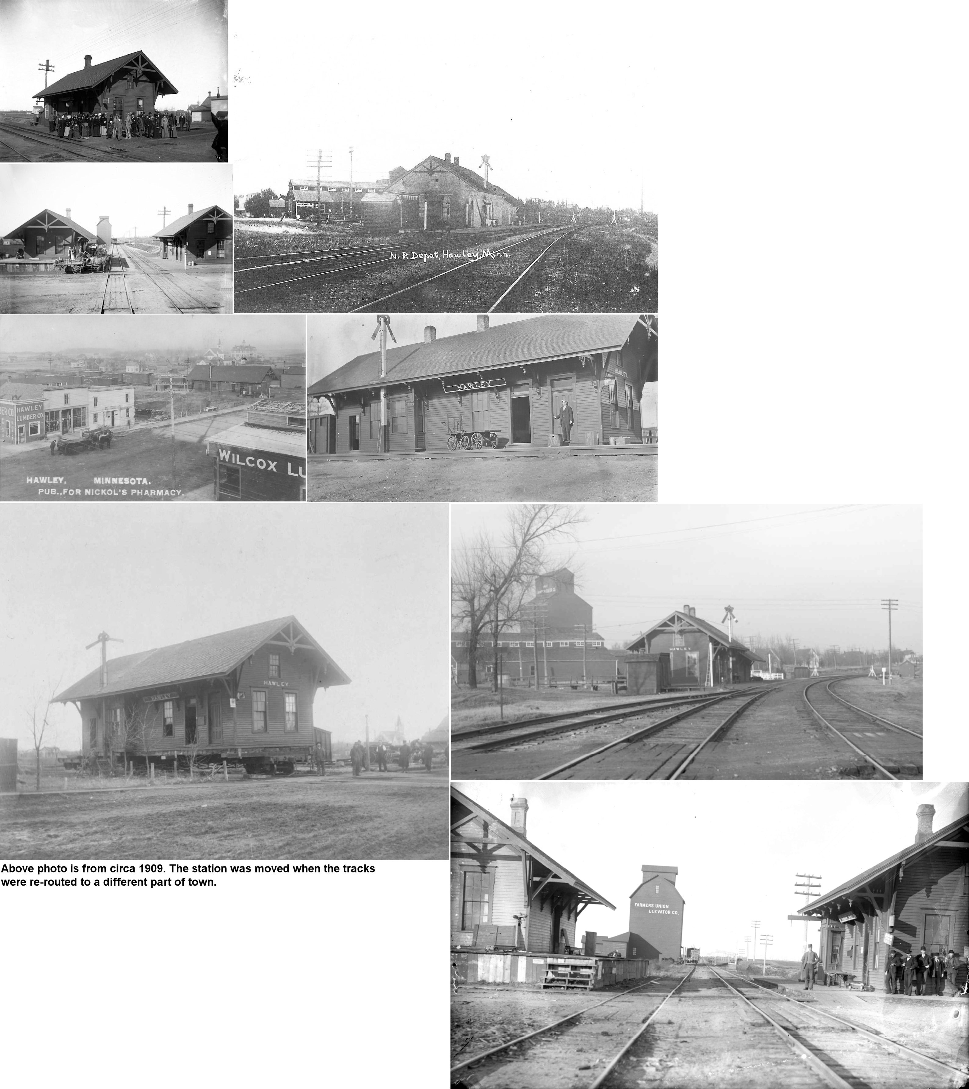
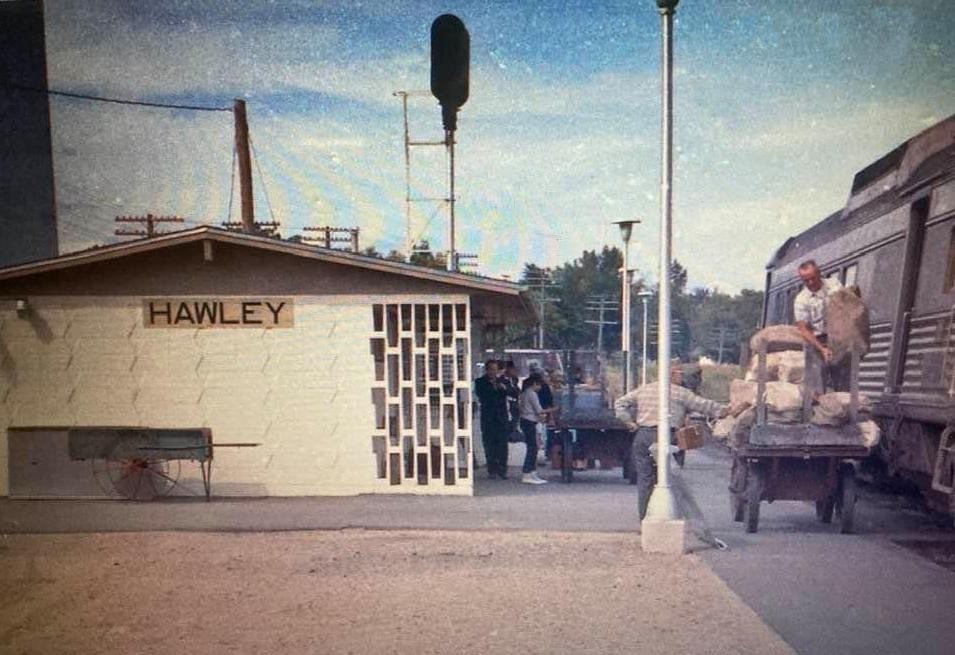
| Hawley |
|
This station was on the corner of Front and 5th Streets, on the NW side of the tracks. According to the 1917 NP Vaulation Records, the passenger station was built in 1877 and measured 20'x56' and the freight station was built in 1884 and measured 20'x40'. | ||||||
| Hawley |
|
A later-generation station. | ||||||
| Kragnes |
|
According to the 1915 GN Vaulation Record, a new station was built here in 1901 that measured 24'x48'. | ||||||
| Lambs Siding |
|
According to the 1915 GN Vaulation Record, this stop had only a waiting/loading platform and station sign. The platform measured 12'x100' and was built in 1899. This station was abandoned by the GN in February 1942. | ||||||
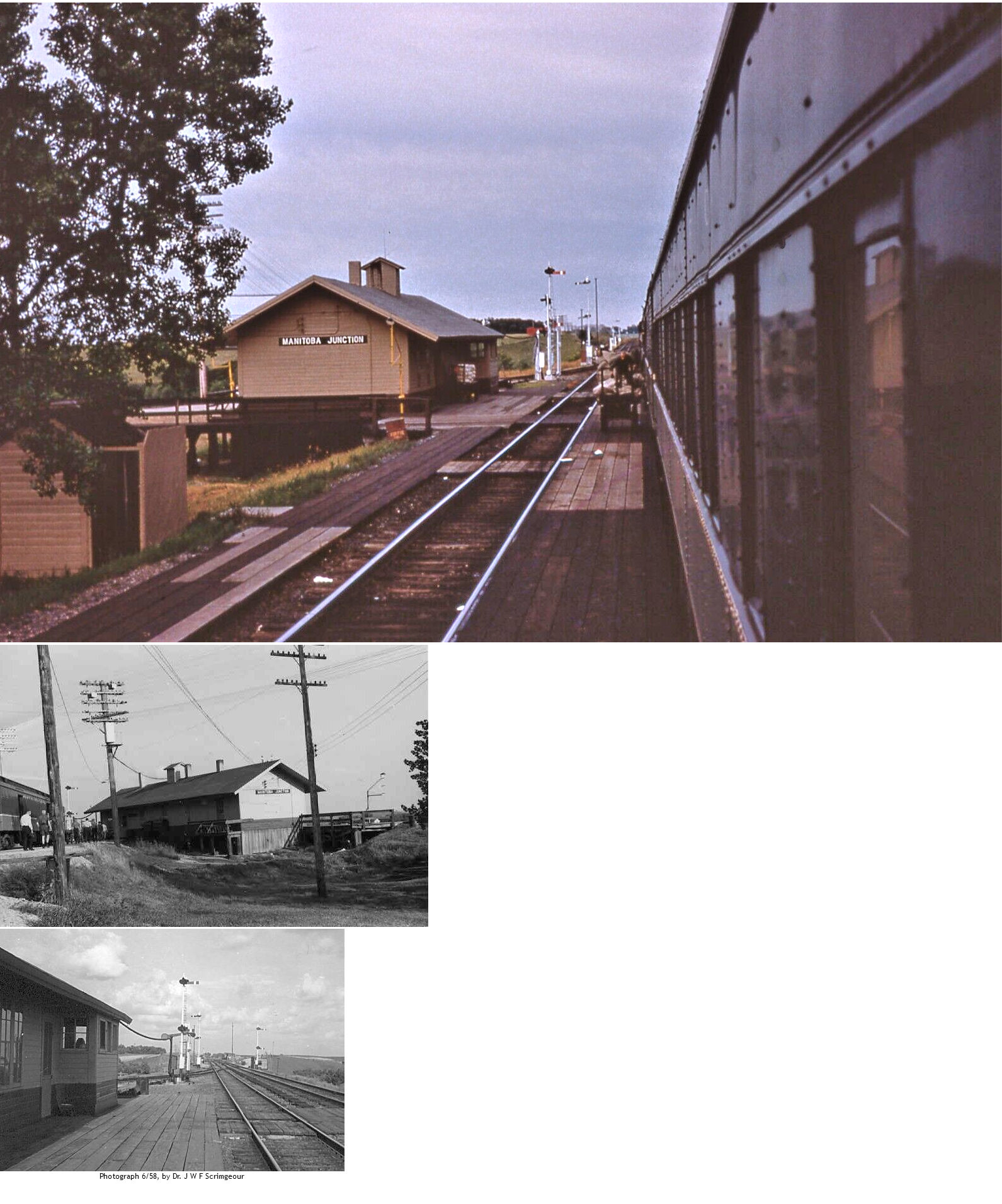
| Manitoba Junction (Summit) |
|
According to the 1917 NP Vaulation Records, the station here was built in 1886 which means it probably was moved here from Winnipeg Junction when that connection became obsolete in 1909 and the new junction was formed. Manitboa Junction was an exchange station for passengers traveling to/from Canada on the NP line that went north from here. There was no road access to this station. Today the location is off 28th Avenue North at GPS: 46.906953, -96.247943. The interlocking was controlled from the station. | ||||||
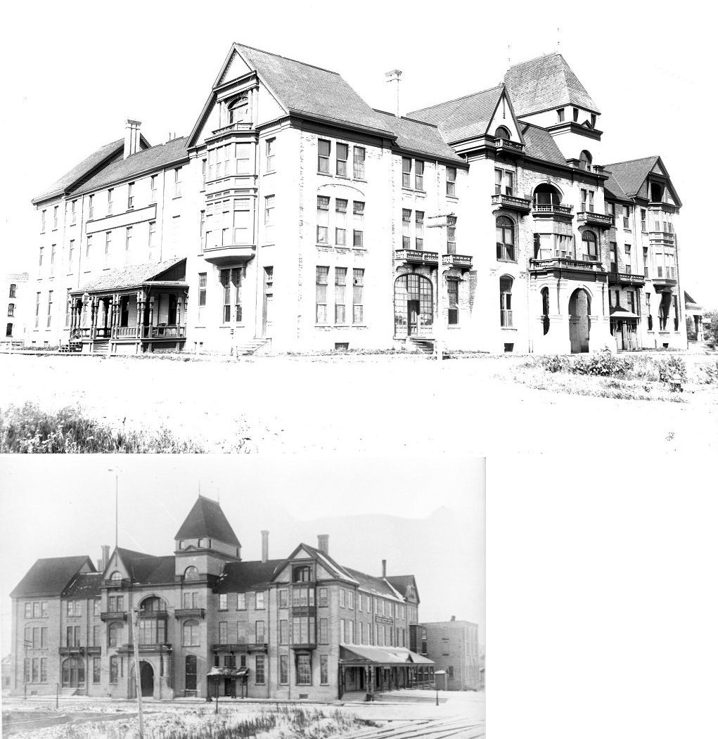
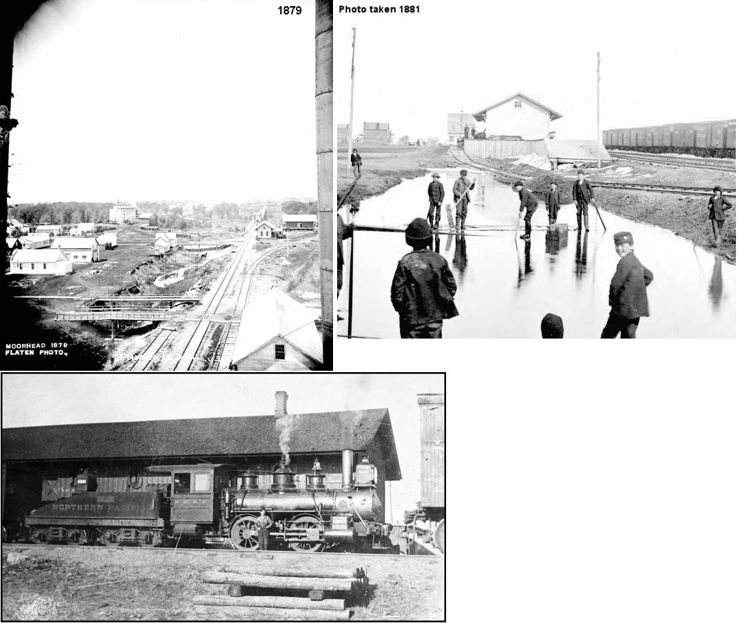
| Moorhead |
 |
The first passenger station here appears to have been part of the Grand Northern Hotel which was on the south side of the tracks between 8th and 9th Streets at GPS: 46.875663, -96.766577. The first floor had a railroad ticket office and there was a platform on the north side of the hotel and a baggage house to the west of the platform. This is shown on the 1884 and 1890 Sanborn maps. | ||||||
| Moorhead |
|
The original freight station was on the corner of 1st Avenue North and 10th Street North on the north side of the tracks at GPS: 46.875822, -96.764554. This station is shown on the 1884 and 1890 Sanborn maps. | ||||||
| moorhead |
|
This 30'x74' sandstone passenger station was built in 1896. It was on the south side of the tracks between 8th and 9th Streets at GPS: 46.875746, -96.766814. | ||||||
| Moorhead |
|
A new brick freight station was built in 1894 by the Great Northern at the same location as the original St.PM&M frame freight station on the corner of 1st Avenue North and 10th Street North and measured 30'x80'. | ||||||
| Moorhead |
|
The original NP passenger and freight stations were on the corner of 4th and Front Streets. The freight station was behind the passenger station and perpendicular to it in orientation. Although new stations had been built by 1884, the Sanborn map show the original freight station still standing and being used as storage. The original passenger station was gone by then. The original passenger station survived until at least 1899 as it is appears on that years map with the notation that it was "dilapidated." It does not appear on the 1906 map. | ||||||
| Moorhead |
|
The second generation passneger station was built in the early 1880s. It was on the west side of 8th Street between Center Avenue and Main Avenue at GPS: 46.874471, -96.767998. It burned down on September 13, 1893 (Jamestown (ND) Weekly Alert, 9-14-1893). | ||||||
| Moorhead |
|
The second generation freight station was on the north side of the tracks between 6th and 8th Streets (behind where Moorhead Billiards is today) at GPS: 46.874486, -96.769530. | ||||||
| moorhead |
|
The third generation NP passenger station was built after the previous passenger station burned in 1893. It was built on the same spot as the previous station (on the west side of 8th Street). According to the Jamestown (ND) Weekly Alert of 11-30-1893, when the Moorhead NP depot burned down earlier in the year, the railroad immediately constructed a "handsomer" depot as a replacement. Not sure if the station pictured is the thrid or fourth generation depot. | ||||||
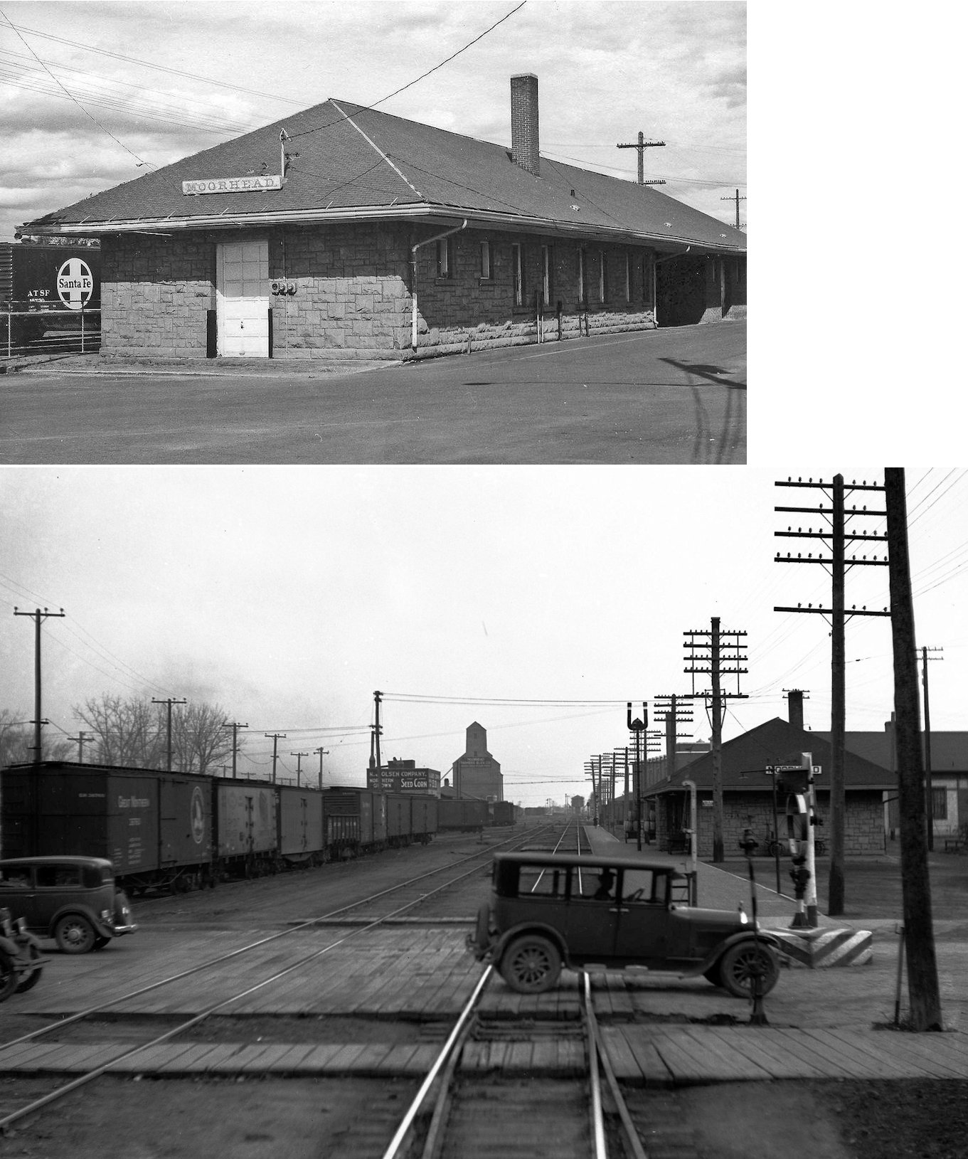
| Moorhead |
|
The fourth generation NP passenger station was made of brick and built in 1901. According to the NP Valuation Records of 1917, it measured 24'x128'. | ||||||
| Moorhead |
|
The third generation freight station was on the north side of the tracks with frontage on 6th Street (GPS: 46.874555, -96.770645). According to the NP Valuation Records from 1917, this brick station was built in 1909 and measured 30'x160'. | ||||||
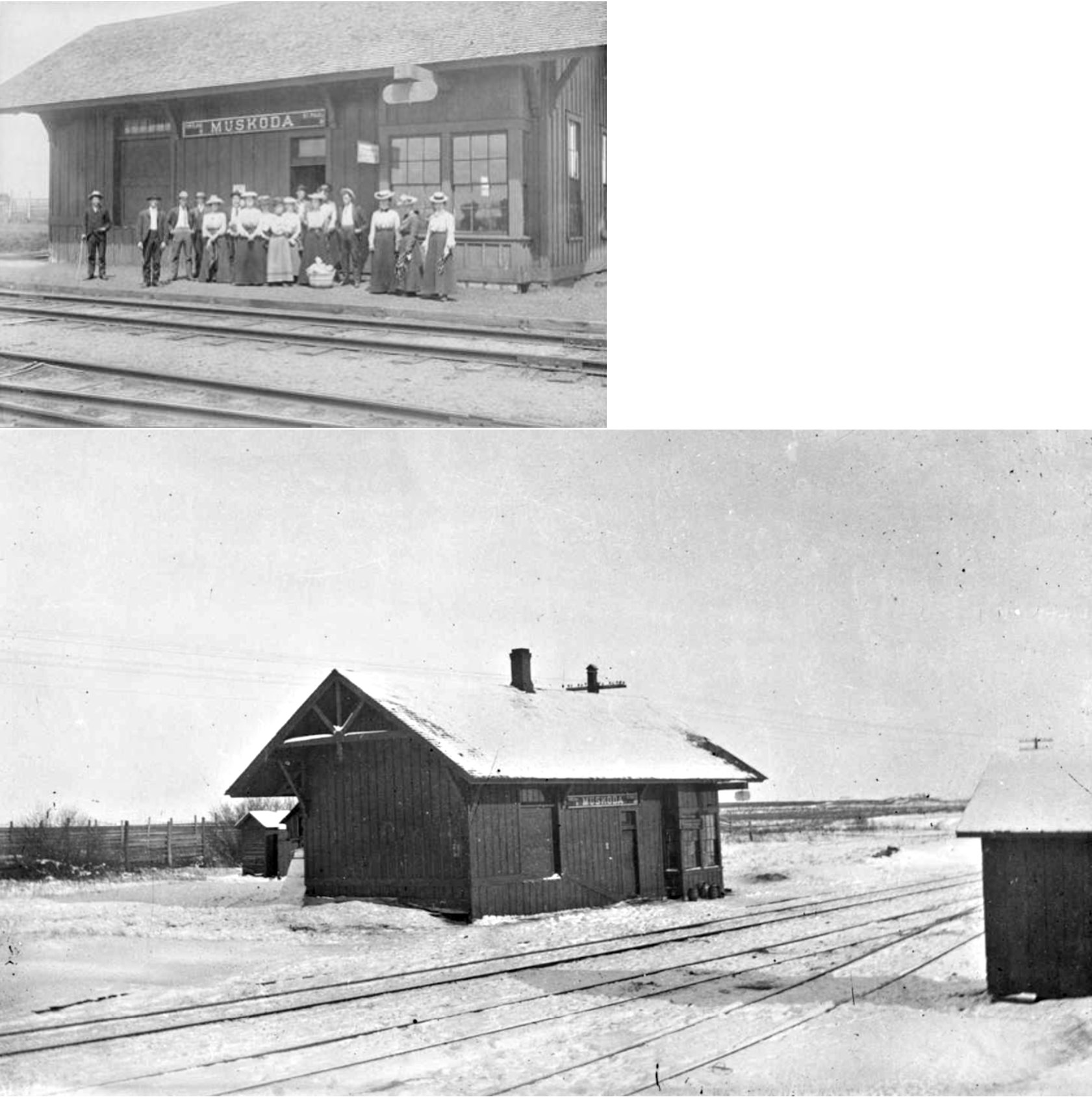
| Muskoda |
|
According to the 1917 NP Vaulation Records, this combination station was built in 1897 and measured 18'x36'. "Originally located between sections 7 and 8, Hawley Township (on the Clay County landfill road, half a mile south of Highway 10), the grade change shifted the station about 2/3 mile south, along the Buffalo River" (Clay County Historical Society Newsletter, January/February, 2002). | ||||||
| Ruthruff (Schreiber) |
|
According to the 1915 GN Valuation Record, this location only had a 100' long platform and sign. The platform was built in 1901. It was abandoned as a station in December 1950. | ||||||
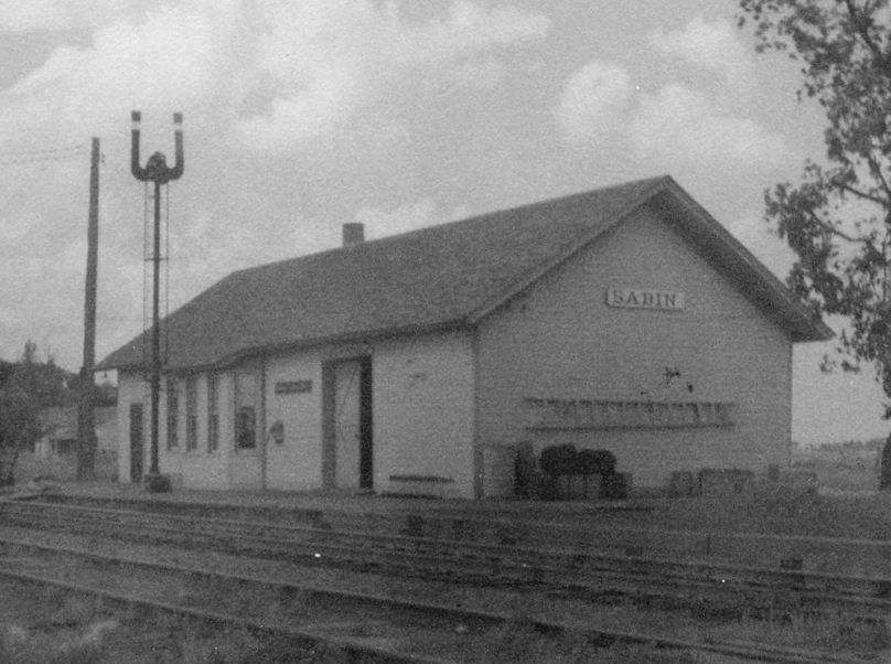
| Sabin (Elmwood) |
|
This station was between 4th and 5th Streets, on the NE side of the tracks. According to the 1915 GN Valuation Record, the station was built in 1881. | ||||||
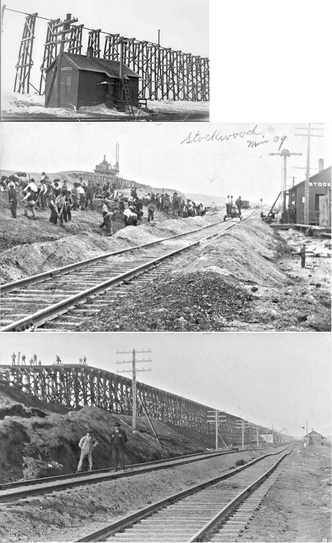
| Stockwood |
|
According to the 1917 NP Vaulation Records, there was a 10'x12' passenger shelter constructed here in 1902. The photo shows a station there around 1906-07 when the Stockwood fill was being completed. In 1883, this station was known as Harmony, then Magnolia in 1885, and Stockwood in 1886. | ||||||
| Ulen |
|
The first station here was the subject of an incident in 1898. The railroad company moved the depot south (no idea where it was originally) about 500 feet. A group of local citizens attempted to stop the move by tying ropes to the station to prevent the move while another person went to Moorhead to seek a court injunction to stop the move. The citizens were no match for the hydraulic equipment and engine and the depot was successfully moved (Warren Sheaf, 8-25-1898). It's not clear from the newspaper article why the citizens protested the depot being moved. | ||||||
| Watts (Tenney) (Gantz) |
|
According to the 1917 NP Vaulation Records, there was a 9'x16' station constructed here in 1914. | ||||||
| Winnipeg Junction |
|
This station was the original connection to the line running north to Canada, but when the main line was rerouted about a mile to the north in 1909 it become a ghost town and Manitboa Junction became the connection point. The station here was likely moved north to the new junction. See listing for Manitoba Junction above. The station here was originally known as Hawley Junction until 1884. | ||||||
| Witherow (Camp #2) |
|
"The rerouting of the Northern Pacific mainline through Clay County between 1906 and 1909 caused several NP sidings and stations to be moved or renamed. The NP established this station on its new line in section 12, Riverton Township, east of Buffalo River State Park in 1909" (Clay County Historical Society Newsletter, January/February, 2002). | ||||||
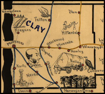
| 1898 CLAY COUNTY RAILROAD MAP | ||||||||
 |
||||||||
|
Notes About Existing Stations... Dale (NP) - According to the 1917 NP Vaulation Records, a new station was built here in 1897 that measured 12'x18'. The station was still around in 2018 and was moved to a farm and covered with aluminum siding. Does anyone know its exact location? "The NP built this station on their mainline in 1882 in the east half of section 35, Highland Grove Township. The name referred to the hills and dales (valleys) in the area. Around 1900 the railroad shortened the name to Dale. The moving of the NP mainline also moved Dale. The "new" Dale is in the northeast corner of section 34, Highland Grove Township" (Clay County Historical Society Newsletter, January/February, 2002). Georgetown (GN) - According to the 1915 GN Valuation Record, this station was built in 1885 and remodeled in 1904. Glyndon (GN) - The original location of this depot was in the NE corner of the diamond past the west end of 3rd Street SE. Hitterdal (NP) - The original location of this depot in Hitterdal was on the south side of Front Street, on the east side of the tracks. According to the 1917 NP Vaulation Records, this station was built in 1902 and measured 16'x49'. Hickson, ND (CMSt.P&P) - This station was moved to Rolag from Hickson, North Dakota and is part of the Western Minnesota Steam Threshers Reunion grounds and museum. Ulen (NP) - The original location of this depot in Ulen was on the west side of 1st Street SE at Cottage Avenue. According to the 1917 NP Vaulation Records, this station was built in 1902 and measured 16'x78'. |
||||||||