 COUNTYCOUNTY
|
|
||||||||
| EXISTING STATIONS | ||||||||
|---|---|---|---|---|---|---|---|---|
| Station Name |
Original Railroad | Current Location |
Type | Date Built |
Current Use |
Track Status |
Building Material |
More Info |
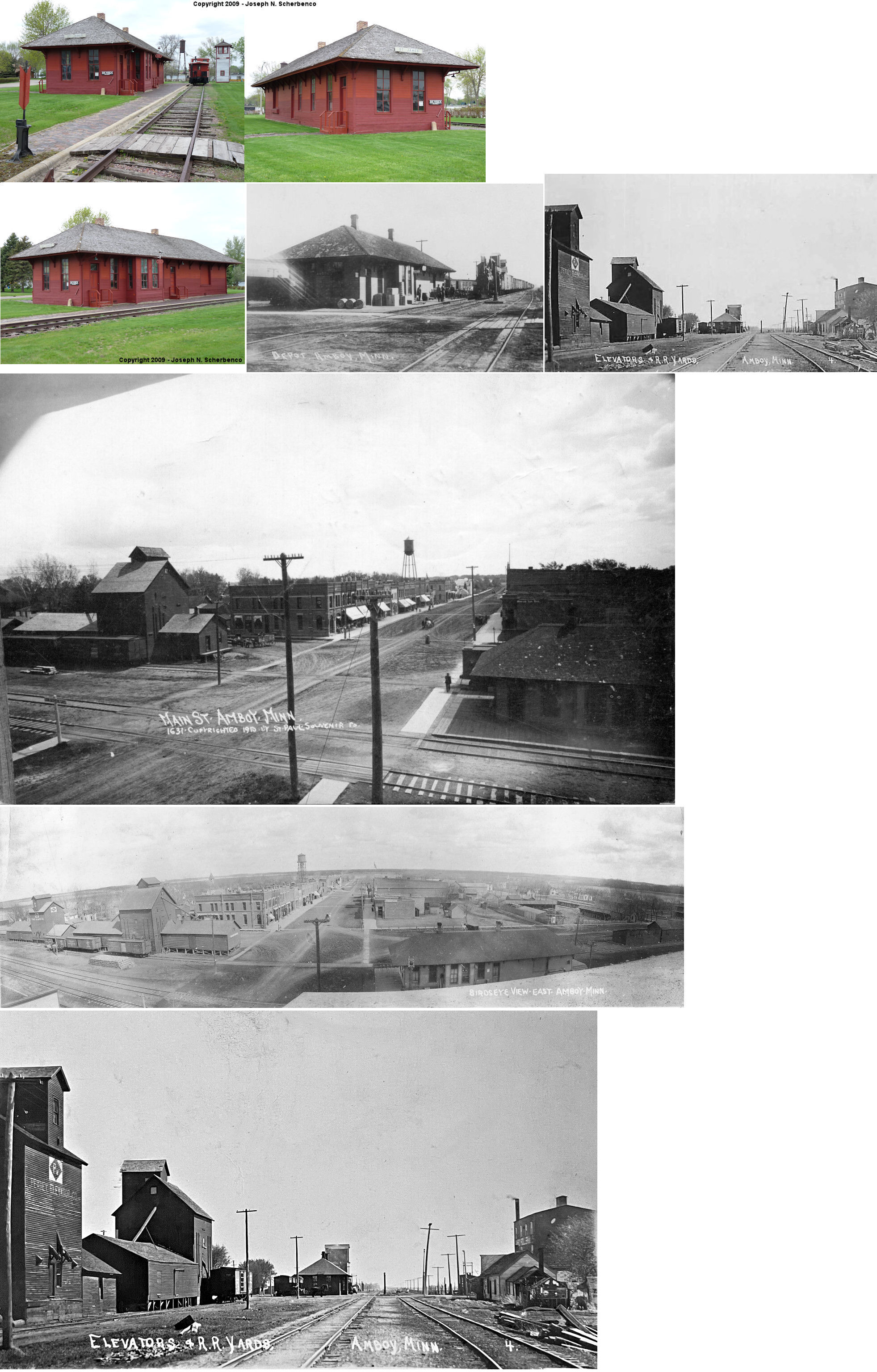
| Amboy |
 |
112 Sunset Drive in St. James (Watonwan County) (GPS: 43.974146, -94.641332) |
C | 1894 | Museum | None | Wood |
|
|
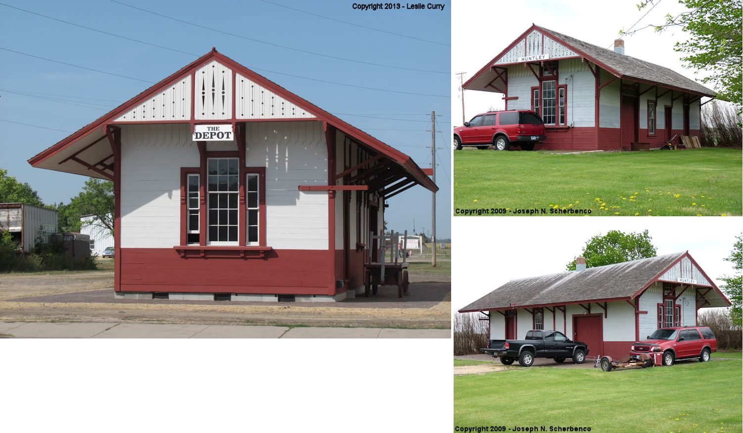
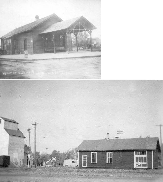
Huntley (Fairibault Co.) |
 |
110 West Maine Street in Amboy (GPS: 43.888226, -94.158826) |
C | 1879 | Business | None | Wood |
|
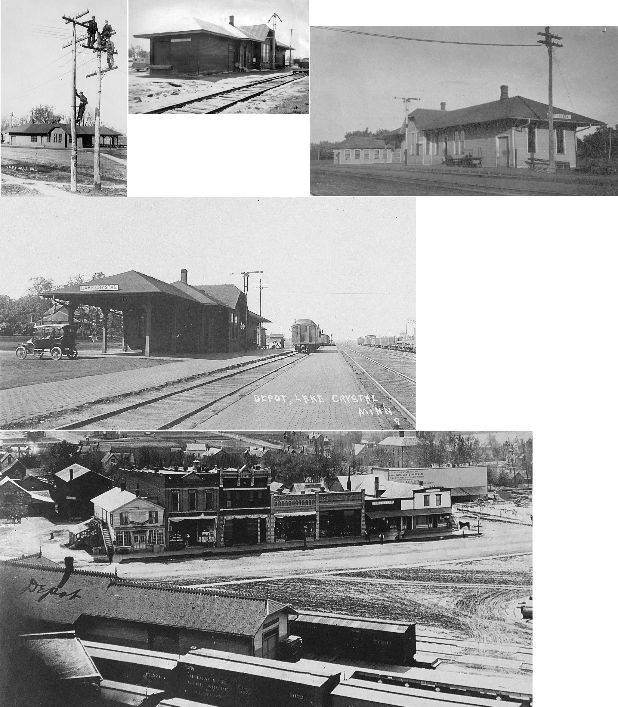
| lake crystal |
|
12346 Shag Road (Township Road 110), SE of New Ulm. (GPS: 44.274639, -94.430028) |
C | ???? | Storage | None | Wood | |
| Mankato |
 AND |
South Riverfront Drive, SW of Main Street (GPS: 44.167493, -94.004394) |
C | 1896 | Business | In Use | Brick | |
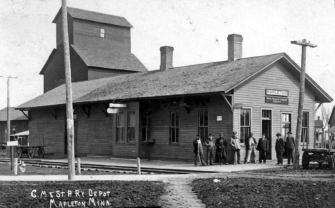
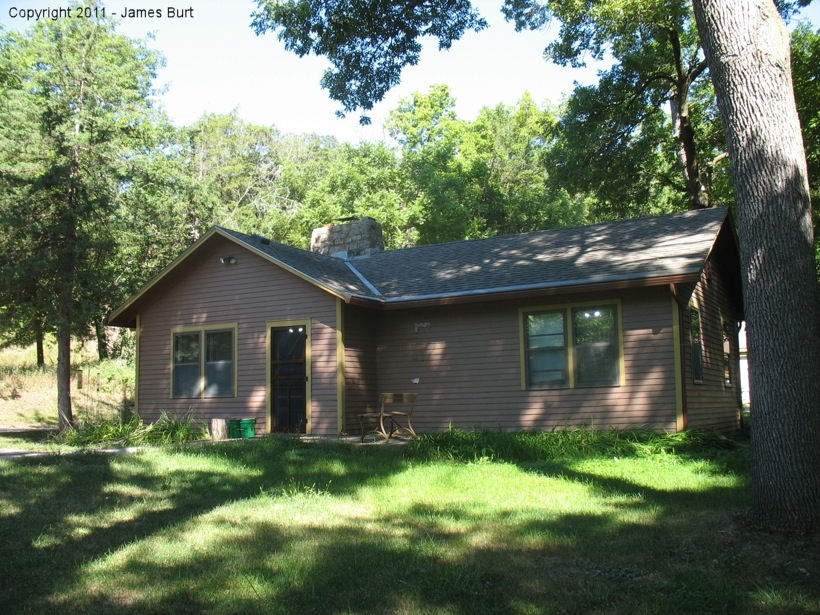
| Mapleton |
|
North side of 11158 CR 7 (GPS: 43.880000, -93.959266) |
C | ???? | Farm Use | None | Wood | |
| Minneopa |
|
21099 547th Avenue Northeast corner of Gadwall and 547th at the Minneopa State Park Maintenance yard. (GPS: 44.149734, -94.090890) |
C | ???? | Civic | None | Wood |
|
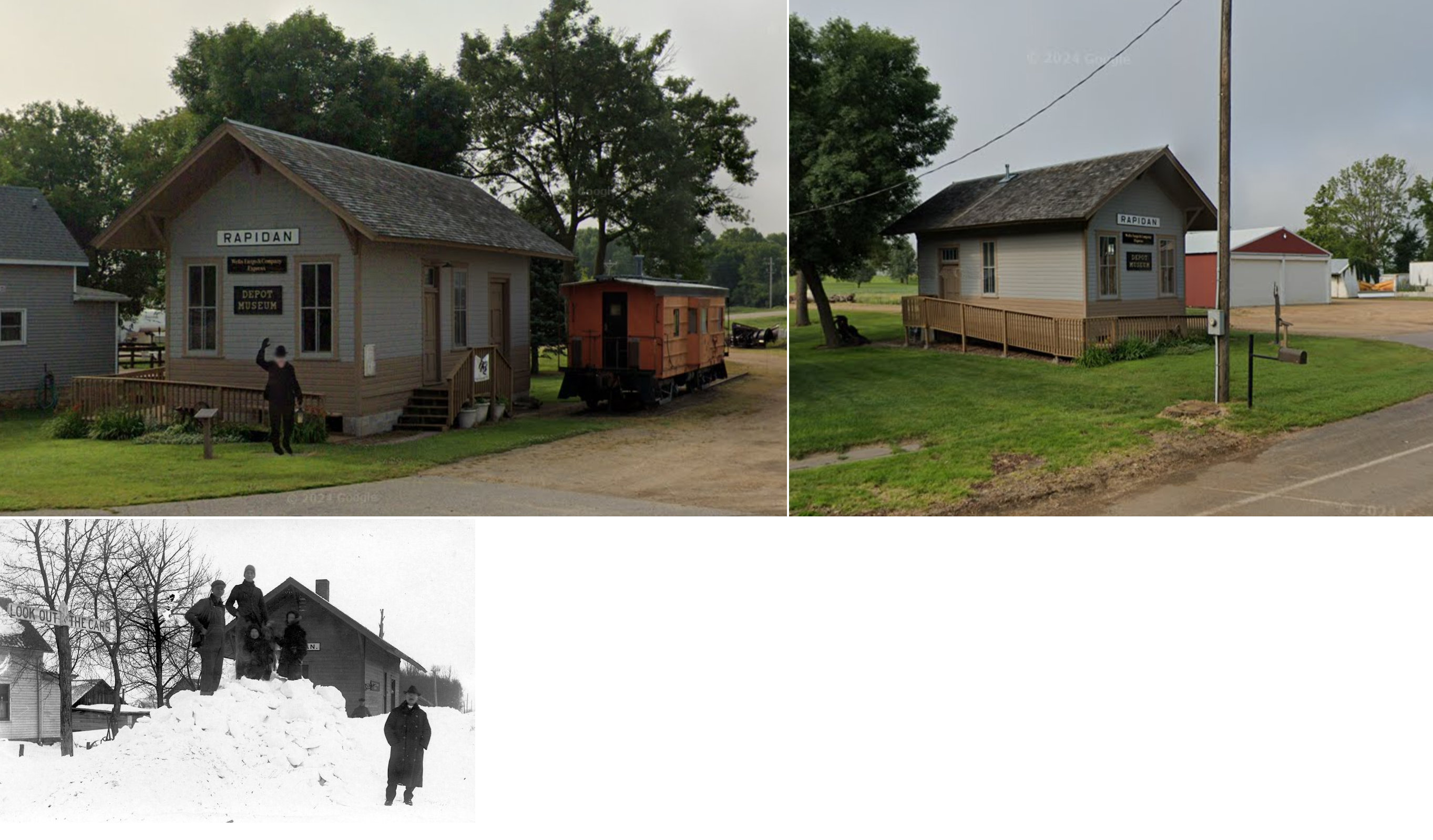
| Rapidan |
|
190th Street/Main Street just west of 552nd Avenue (GPS: 44.094242, -94.069196) |
C | 1906 | Museum | Gone | Wood | |
| STATIONS OF THE PAST | ||||||||
| Station Name |
Original Railroad |
Notes | ||||||
| benning station |
|
Four different lines crossed here. Not sure which had stations though aside from the CGW. | ||||||
| Benning station |
|
|||||||
| Benning station |
|
|||||||
| Benning Station |
 |
And addition for living quarters for the station agent was made 1916 after the station agent threatened to quit. The station was closed in 1940. | ||||||
| Burdette (Mankato Jct.) |
|
|||||||
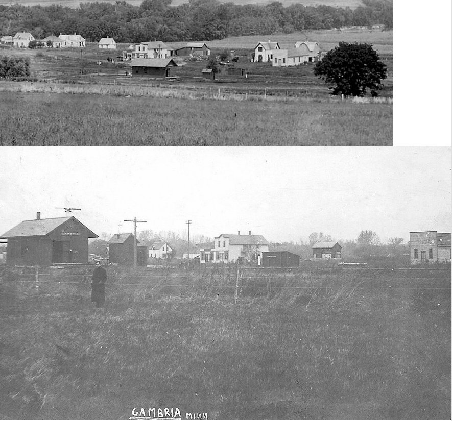
| cambria |
|
This station was on the SE side of Maple Street (CR 6). It was wood with a stone foundation and was built in 1900.It was torn down and replaced with a portable depot which was then later removed to a different site. | ||||||
| Cream |
|
A station was originally slated to be built one mile southwest of Pemberton at the townsite of Cream, but when the land was purchased at Pemberton, that spelled the end for the town of Cream. Although, Cream did have boxcar for a depot when the RR came through in 1907. | ||||||
| bradley Station |
AND |
Not sure if there was one station here or two as the tracks ran next to each other. There was a train wreck on the CSt.PM&O line near here on April 18, 1875. | ||||||
| Eagle Lake (Speir) |
|
This station was just west of 3rd Street. It was built in 1885. | ||||||
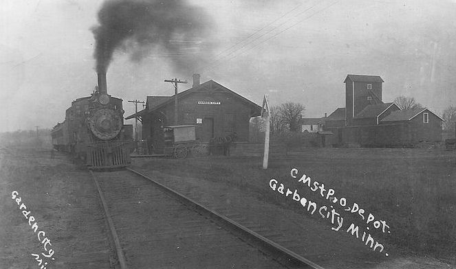
| Garden City |
|
This station was on the north side of CR 13 (Red River Ridge Road, formerly Washington Street). This frame station was built in 1879. | ||||||
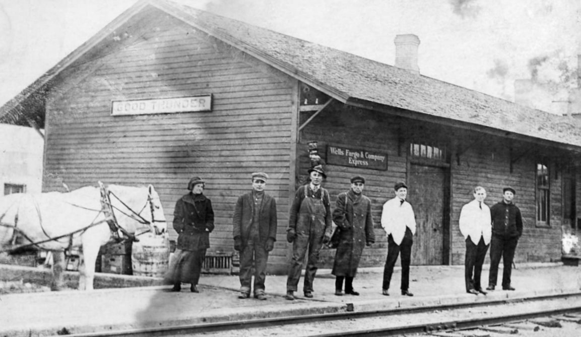
| Good Thunder |
|
This depot was on the north side of Main Street just west of Front Street. | ||||||
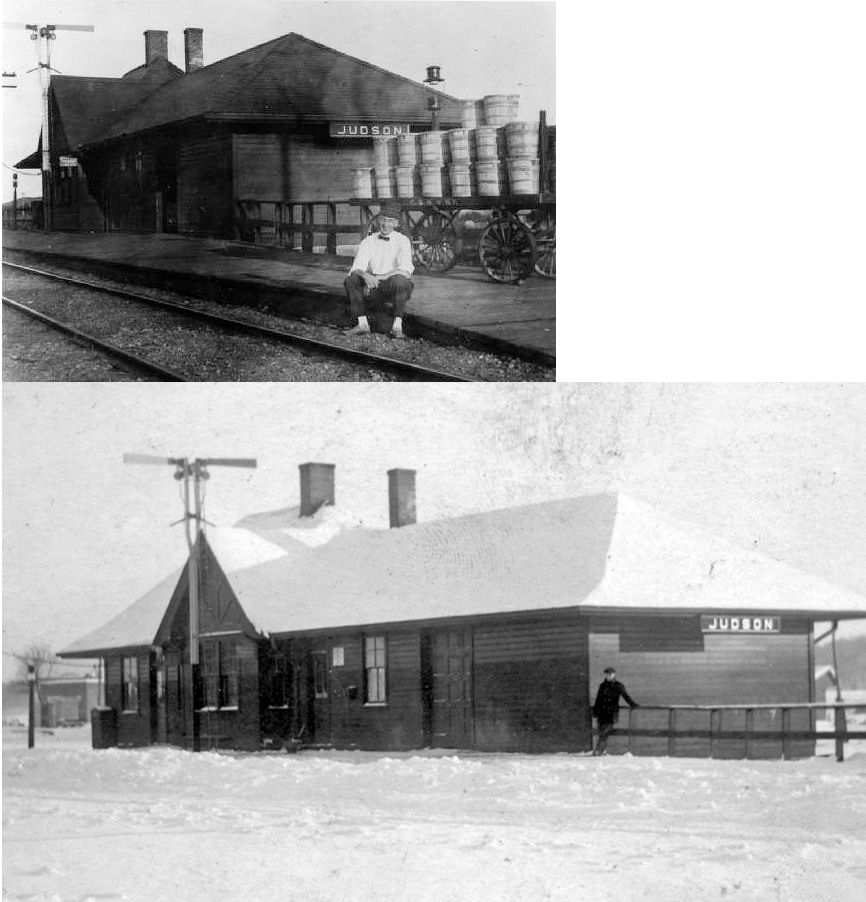
| Judson |
|
The depot was at the corner of Railroad and Broad Streets and was built in 1900. | ||||||
| Lake Crystal |
|
This station was built in 1889. It was originally on the SW corner of Humphrey & Main Street (where Grace Thrift Store is now) at GPS: 44.106740, -94.218810. It is shown there on the 1894 and 1900 Sanborn maps. The depot, along with the tracks, were relocated to the south shore of Lily Lake in 1904. The station was placed at the corner of Dean and Lilly Street (which no longer intersect) at GPS: 44.110142, -94.222512. Around 1970, the station was sold to Elmer Rolloff Jr. of New Ulm. The east end of the station was raised, and the rest of the depot was moved to New Ulm where it resides today (as of 2024 still owned by the Rolloff family). | ||||||
| Lime Siding (Lune) |
|
|||||||
| Madison Lake |
|
This 24'x48'station was on the north side of Spruce Avenue (formerly called Race Street) between 5th and 6th Streets. It was built in 1887, moved a short distance in 1904, and torn down in 1962. | ||||||
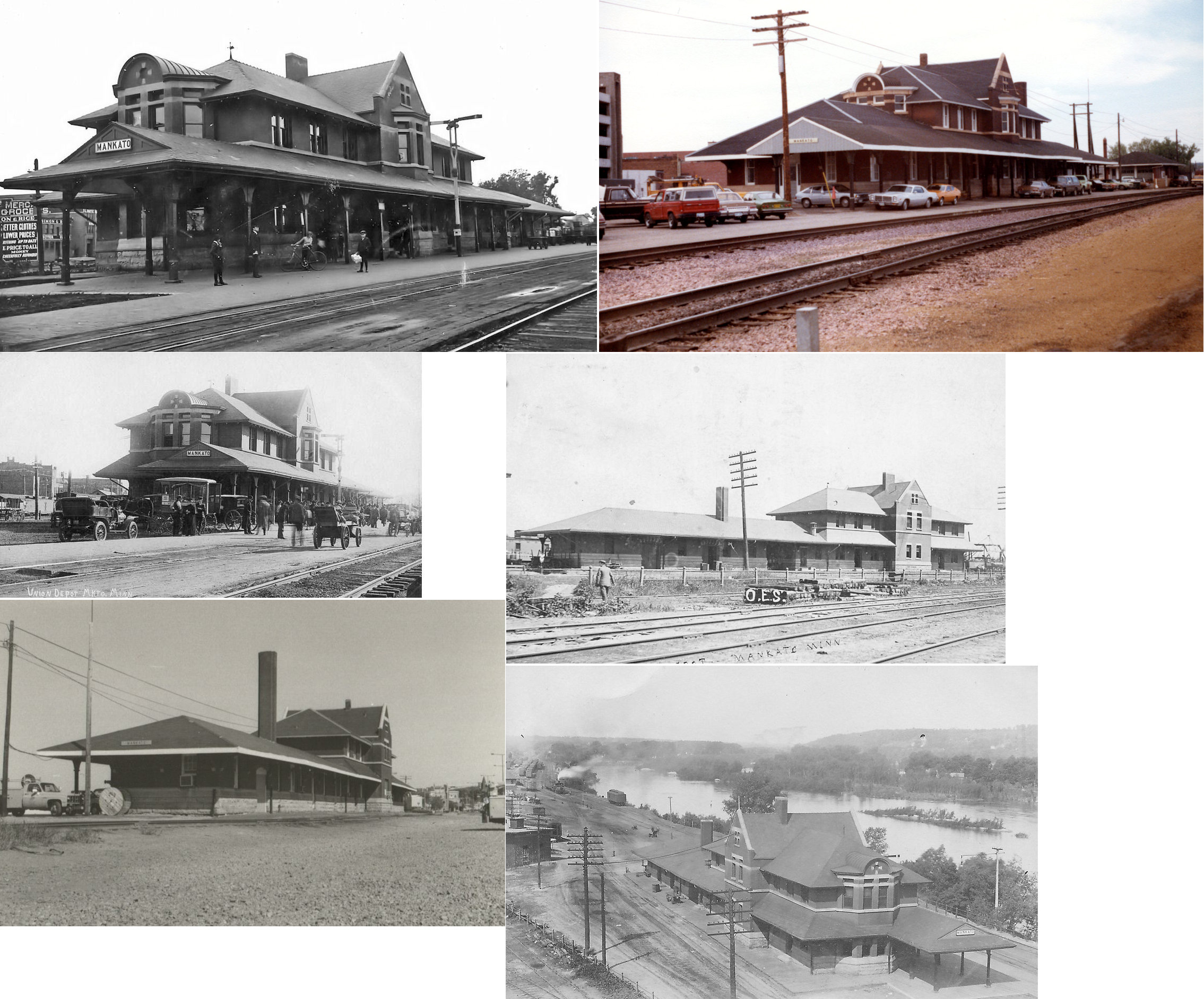
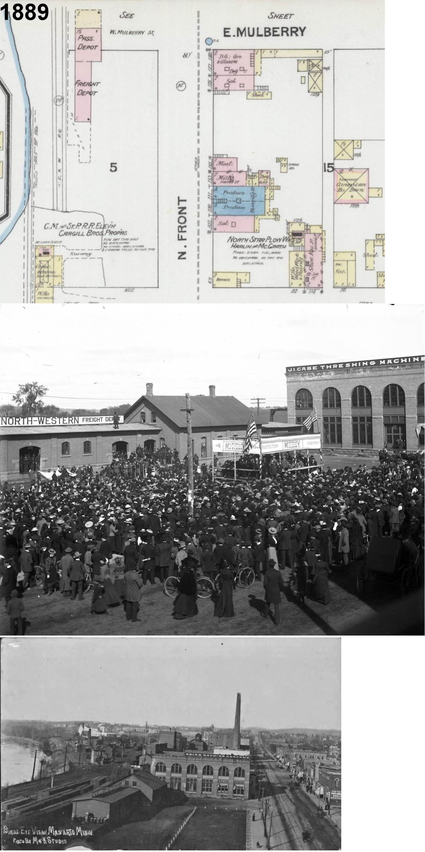
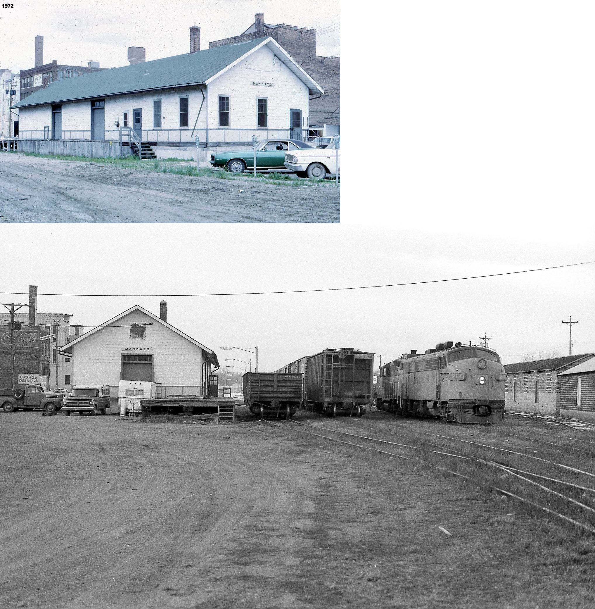
| Mankato |
 |
The first W&St.P (C&NW) passenger and freight stations were on the SW side of East Spring Street at GPS: 44.171450, -94.000044. | ||||||
| Mankato |
|
The second C&NW passenger/freight station was at the end of Mulberry Street at GPS: 44.168765, -94.002479. They were connected and made of brick. These stations are shown on the 1889 and 1894 Sanborn maps. After the union station was built, this served as the freight station. | ||||||
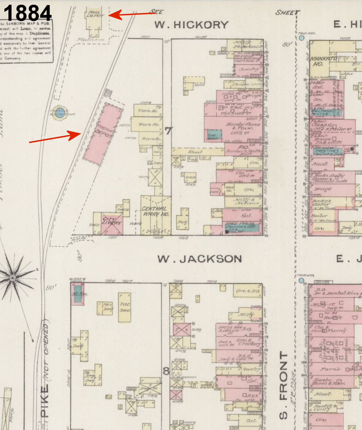
| Mankato |
|
The original wood frame station was at the NW end of East Hickory Street at GPS: 44.166615, -94.006503 with a large brick freighthouse to the south. These station were shown on the 1884-1894 Sanborn maps. | ||||||
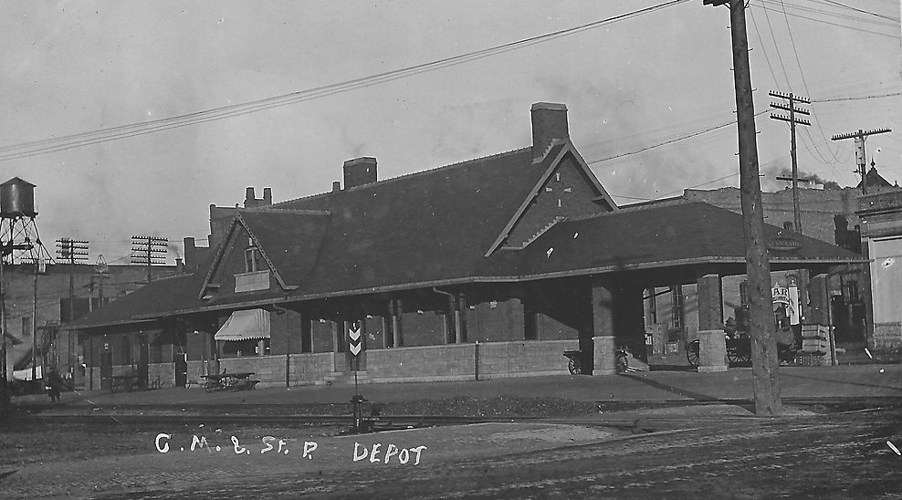
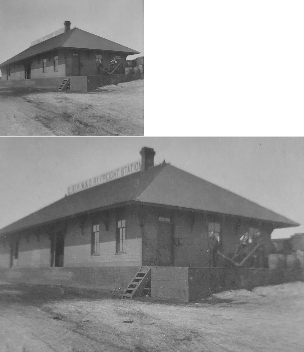
| mankato |
AND |
This brick passenger station was northwest of Front Street between Jackson and Hickory Streets at GPS: 44.165666, -94.006983. The railroads has separate freight stations on each side of the passenger station with the CGW freight station to the SW (at GPS: 44.165358, -94.007467) and the CM&St.P freight station to the NE (at GPS: 44.166411, -94.006125). On the 1909 Sanborn map the CGW freight station is labeled as a Dan Patch frieght station. In later years the CGW had a small, modern brick freight station with a large ramp and concrete loading platform. | ||||||
| Mankato |
|
Freight station (see location referenced in the listing above). | ||||||
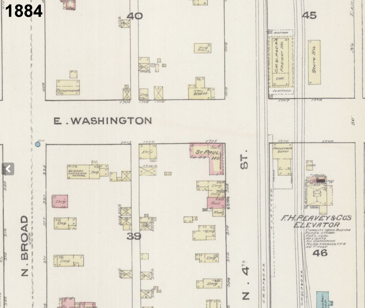
| Mankato |
|
The first Omaha passenger station in Makato was on the south corner of North 4th and East Washington Streets at GPS: 44.168172, -93.996051. It had a long platform that ran along 4th Street to the SW. It is shown on the 1884 Sanborn map. | ||||||
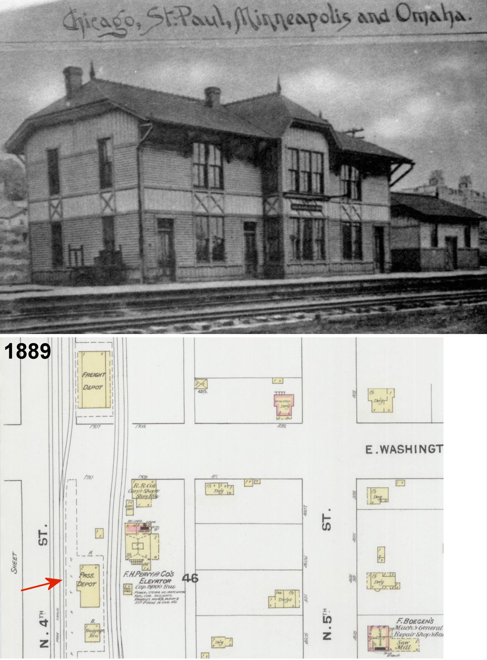
| mankato |
|
The second Omaha passenger station was a 2-story wood frame station on North 4th Street just SW of Washington Street at GPS: 44.168071, -93.996174 (just a bit SW of where the original station was). It is shown on the 1889 and 1894 Sanborn maps. Although it was out of service, it was still shown on the 1900 Sanborn map, but gone by 1908. | ||||||
| mankato |
|
The original freight station was on the east corner of North 4th Street and East Washington Street at GPS: 44.168368, -93.995887. This station was torn down or moved when the new union station was built around 1896. | ||||||
| mankato |
|
There was a freight station on the northwest side of Pike Street. Today this location is near the river north of South Riverfront Drive halfway between Cherry and Hickory Streets. A later brick freight station was built in 1910. | ||||||
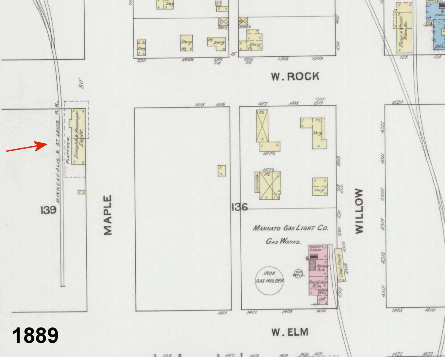
| Mankato |
|
This original Minneapolis & St. Louis RR (later purchased by the CGW) station was on the west corner of West Rock Street and Maple Street at GPS: 44.174287, -94.000151. It is shown on the 1889-1900 Sanborn maps. The tracks ended just SW of the station. | ||||||
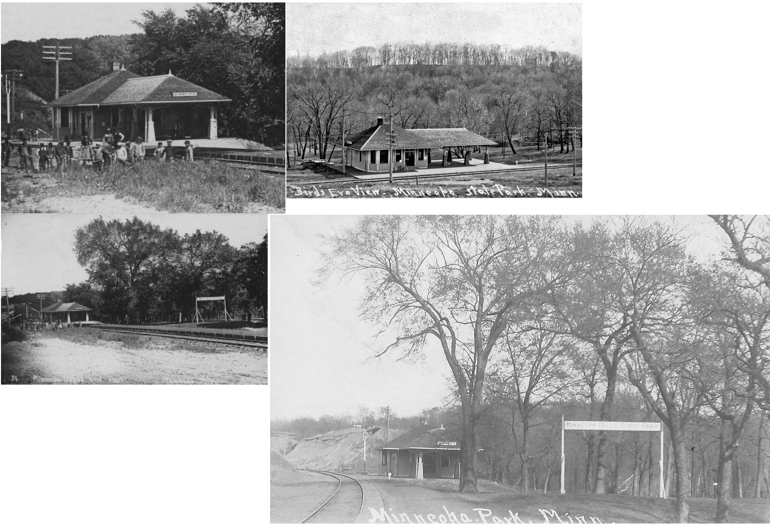
| minneopa |
|
This station was located at Minneopa State Park due north of the falls on what used to be called Depot Street. It was built around 1870 and the small village of Minneopa was north of the depot with the falls and picnic grounds to the south. | ||||||
| Minneopa |
|
This later station was built in 1906. | ||||||
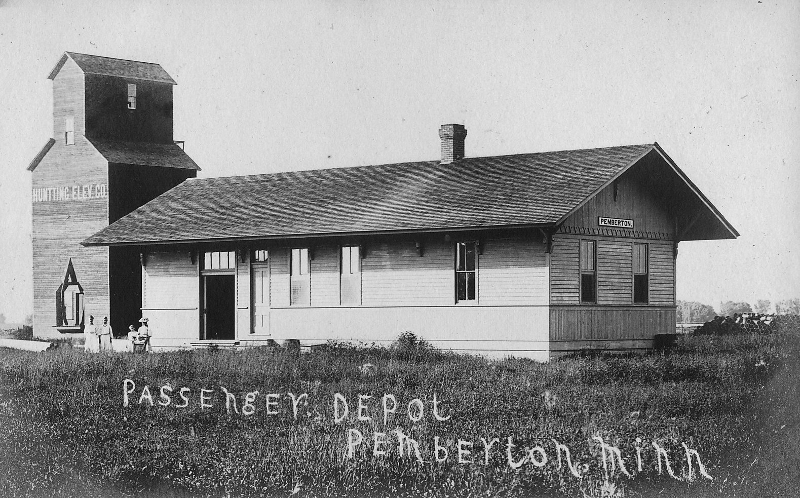
| Pemberton |
|
This depot was located on Railway Street (MN 83) between Main Street and 1st Avenue (where 2nd Ave used to intersect Railway Street). | ||||||
| Perth (Iceland) |
|
This station was known as "Iceland" until 1905. | ||||||
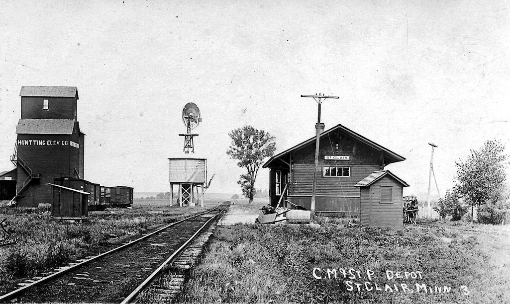
| St. Clair (Hilton) |
|
This station was at the bend in Railroad Street. | ||||||
| Stone Station |
|
There was a short spur here that went to a quarry to the NW. The station here was known as Quarry or Carney Quarry Spur until 1902. | ||||||
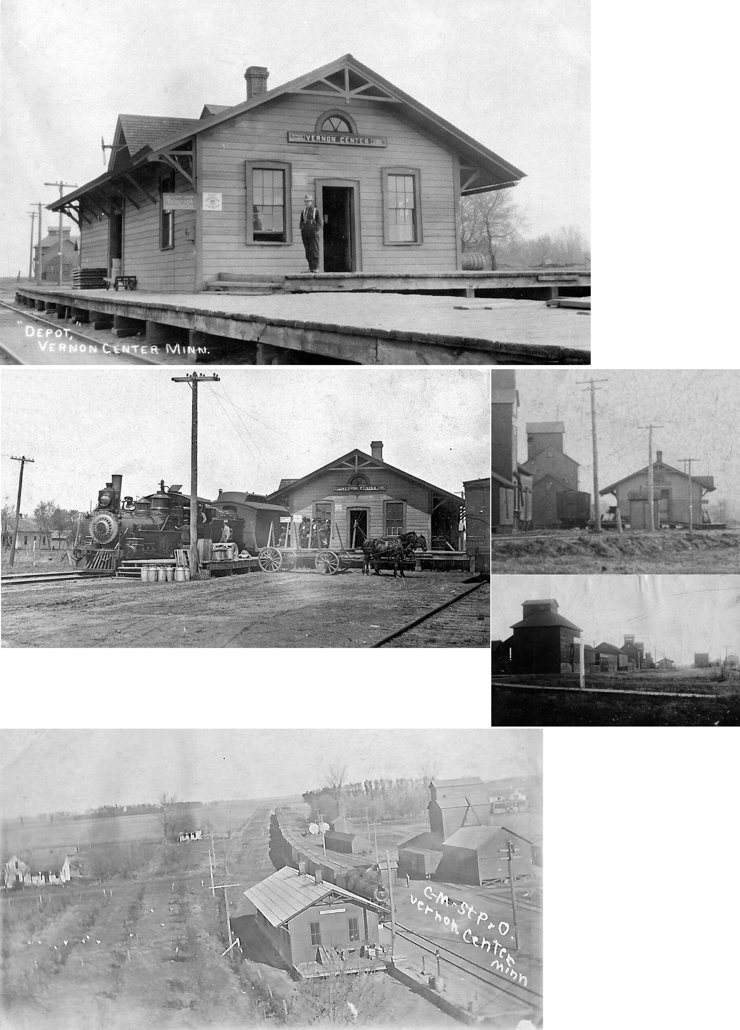
| Vernon
Center (Edgewood) |
|
This station was on the south side of Main Street on the west side of the tracks. It was built in 1879 and known as Edgewood until 1885. | ||||||
| Watters |
|
There was no depot here, only a station sign and perhaps a platform. | ||||||
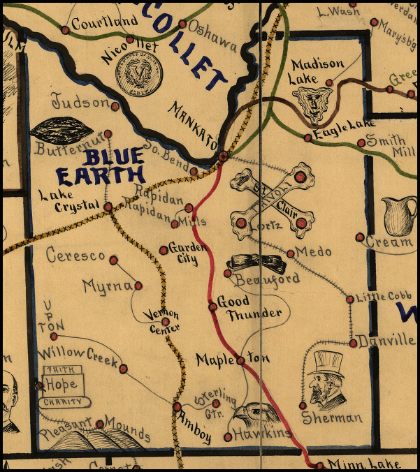
| 1898 BLUE EARTH COUNTY RAILROAD MAP | ||||||||
 |
||||||||
|
Notes About Existing Stations... Amboy (CSt.PM&O) - The original location of this station in Amboy was at the SW corner of 1st and Maine Streets at GPS: 43.887682, -94.158803. Huntley (CM&St.P) - Moved from original location to 31710 170th Street, then to Amboy, MN. The depot was given to the Amboy Area Community Club free of charge with the condition that it be restored. The project was started in 2011 and the station was restored by 2013. This station is across the street from where the original Amboy station was located before it was moved. Mapleton (CM&St.P) - This station's original location was on the north side of Main Street at 3rd Street. It was moved to a farm where it has sat derelict for many years. As of 2026 it was almost collapsed. This was the second depot at Mapleton as the first burned down in late March 1892 (New Richland Star, 4-7-1892). Minneopa (C&NW) - Minneopa, a ghost town just west of Mankato and now the site of Minneopa State Park. Town folded early but the RR kept the station there for a while to serve excursions to Minneopa Falls. The state park started about 1905 and at sometime later the state bought the station, moved it north across the tracks to serve as the Park Superintendents house. Now it is the Maintenance office for the Park. |
||||||||