 COUNTYCOUNTY
|
|
||||||||
| EXISTING STATIONS | ||||||||
|---|---|---|---|---|---|---|---|---|
| Station Name |
Original Railroad | Current Location |
Type | Date Built |
Current Use |
Track Status |
Building Material |
More Info |
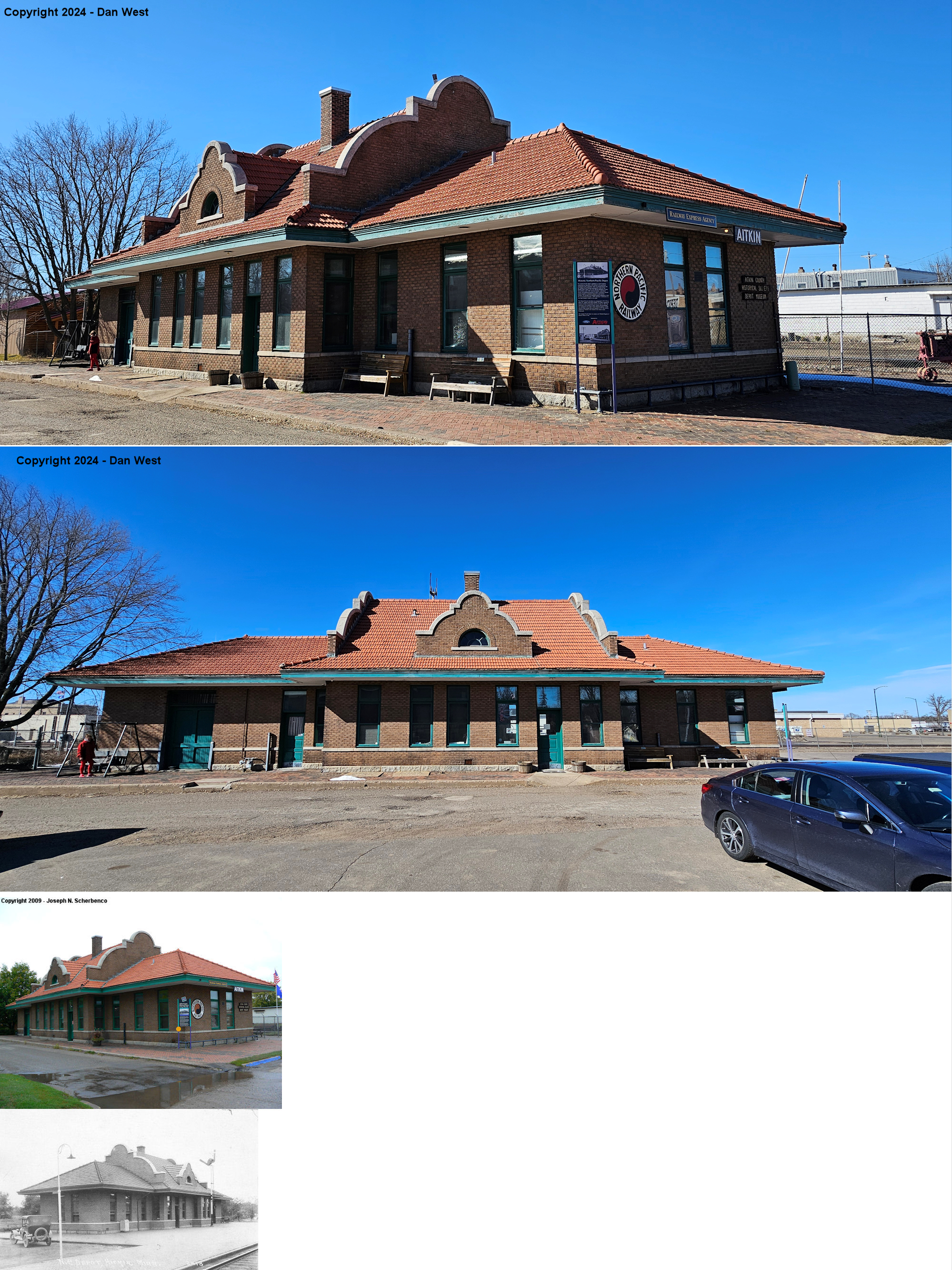
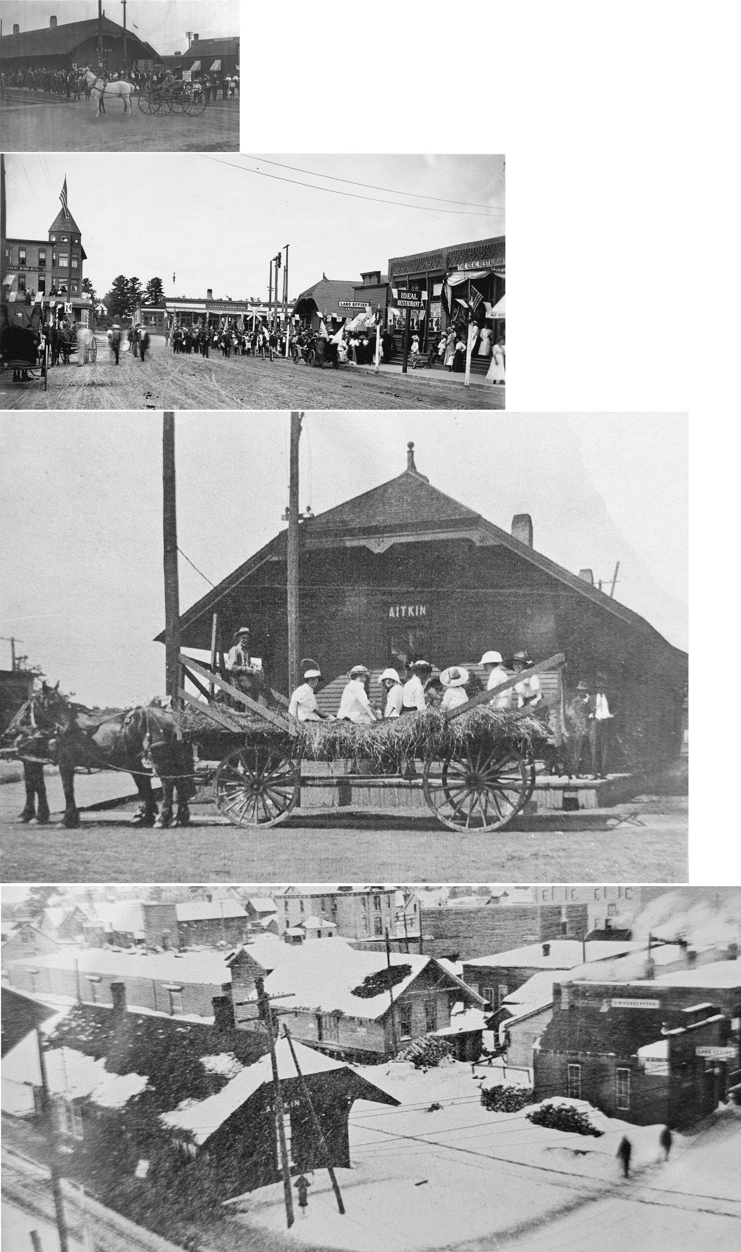
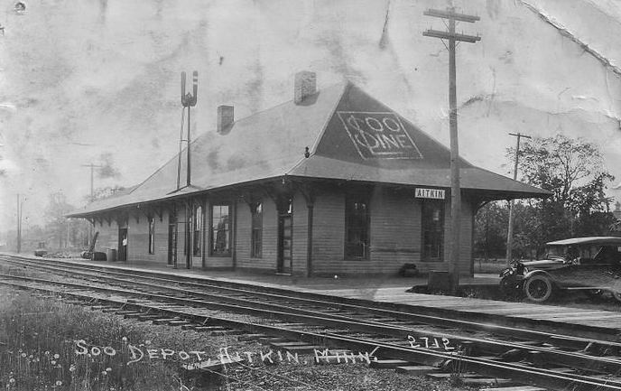
| Aitkin |
 |
20 Pacific Street SW (GPS: 46.531513, -93.707703) |
C | 1916 | Museum | In Use | Brick |
|
|
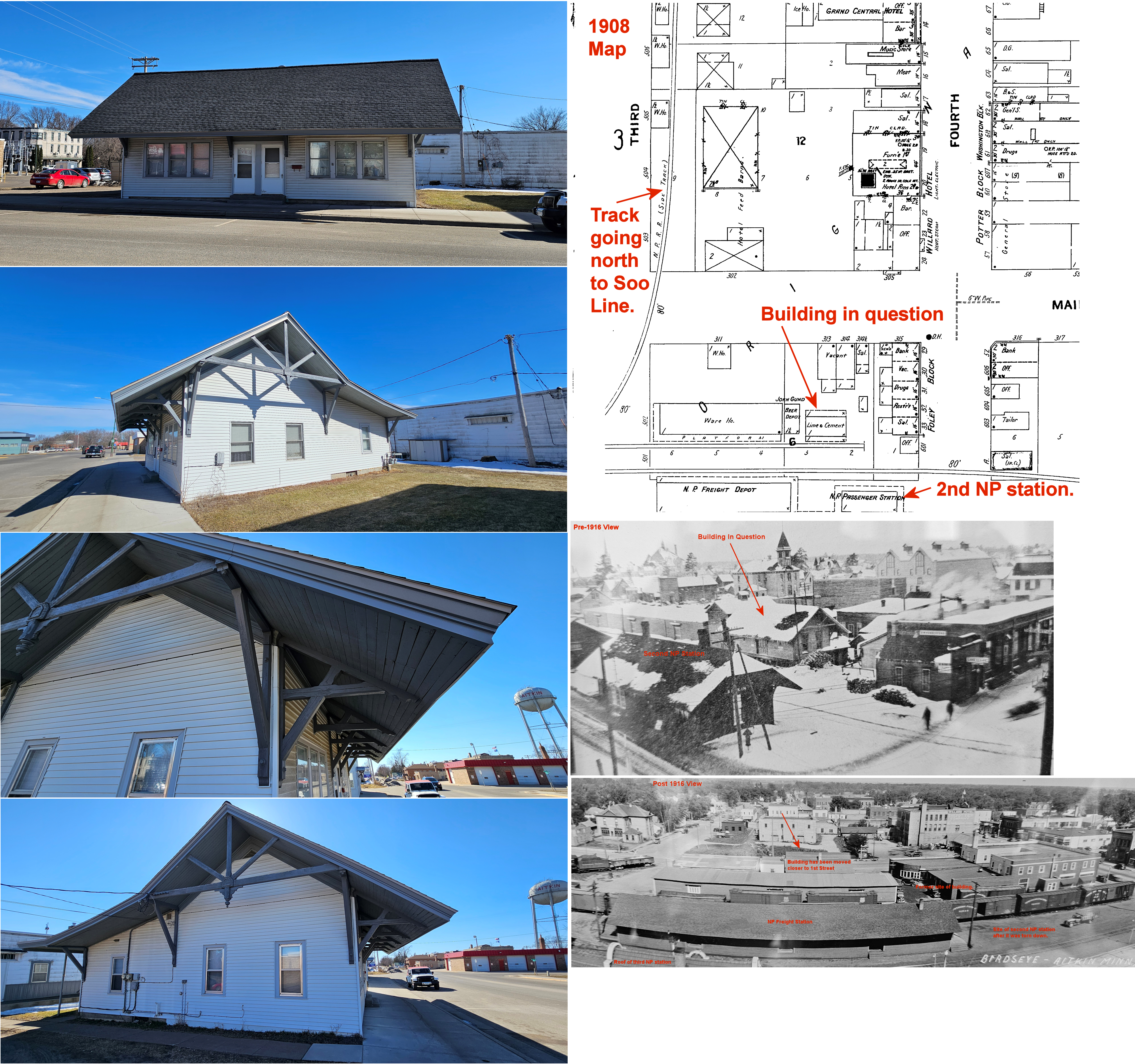
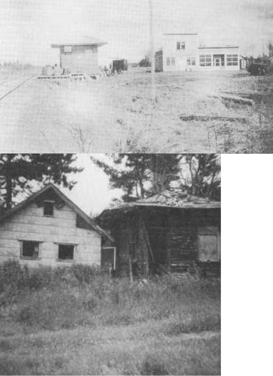
Aitkin (????) |
|
South side of 1st Street (GPS: 46.532195, -93.707534) |
C | ???? | Residence | None | Wood |
|
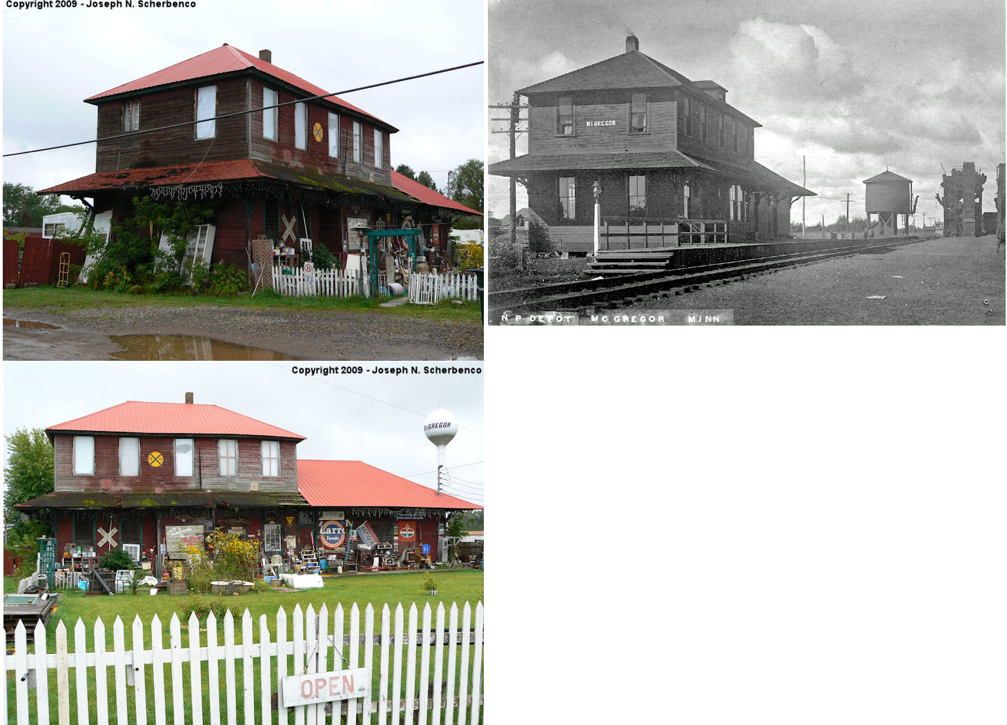
| MCGregor |
|
County Road 8 at Mable Avenue (GPS: 46.608328, -93.313084) |
C | 1907 | Business | In Use | Wood | |
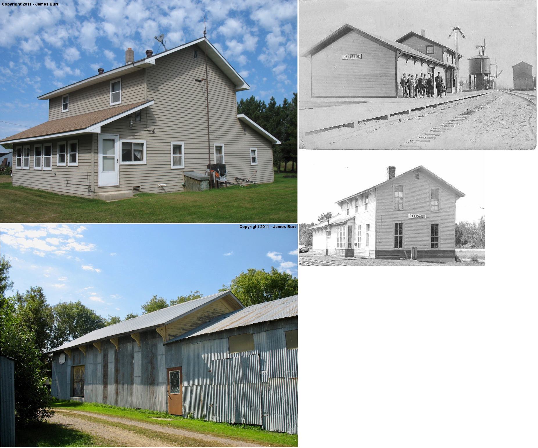
| Palisade |
 |
3 miles SW of town on Great River Road (County Road 10) (GPS:46.688022, -93.542446) |
C | 1910 | Residence | None | Wood |
|
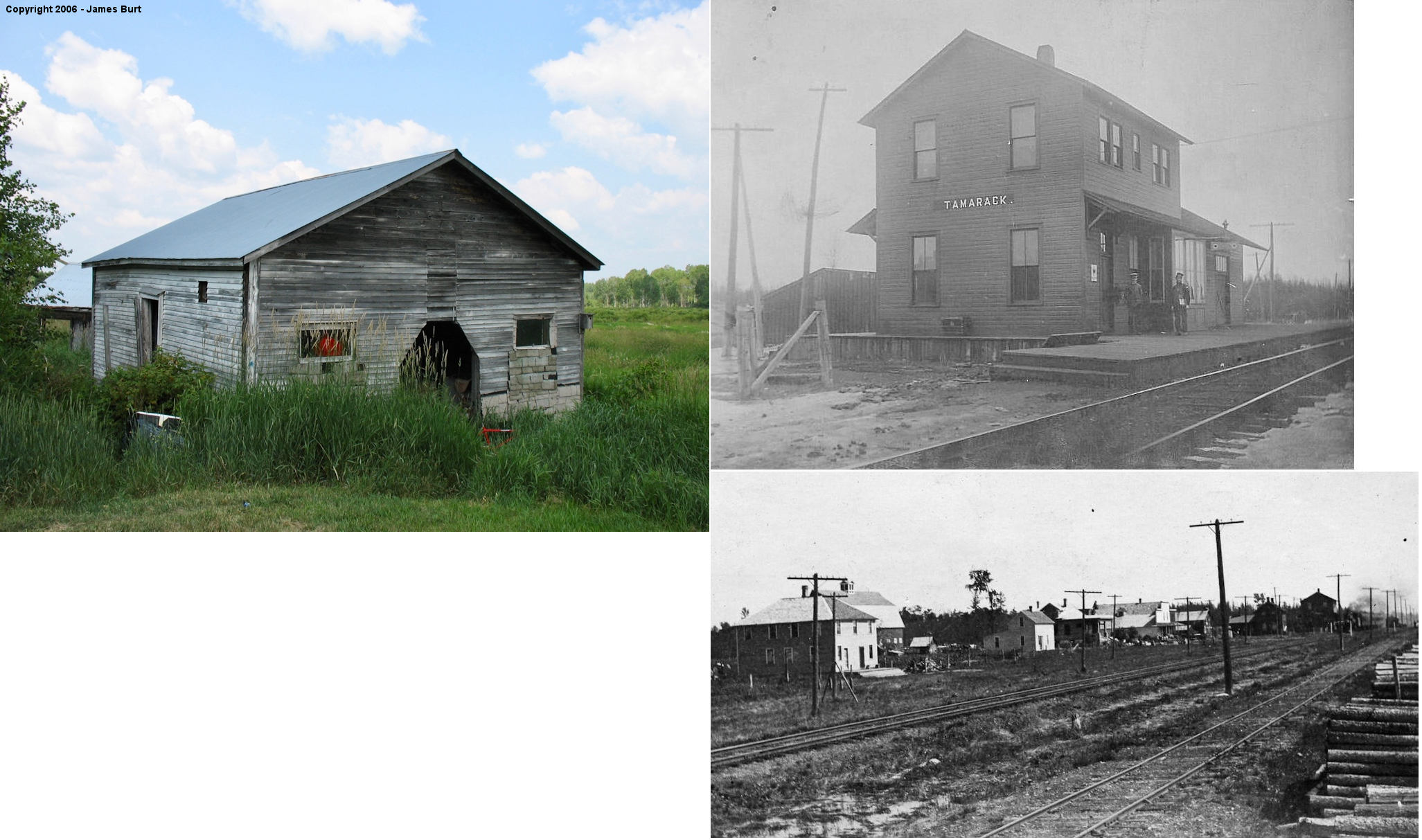
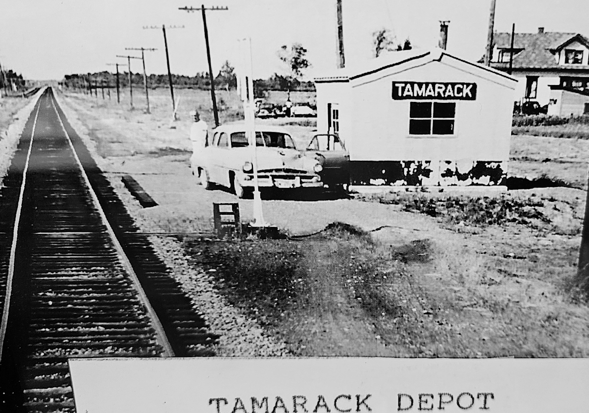
| Tamarack |
|
13856 430th Street, 1 mile Southwest of Tamarack, Just
east of the intersection of 430th and 140th Streets. (GPS: 46.6379 -93.1457) |
C | 1906 | Storage | None | Wood |
|
| STATIONS OF THE PAST | ||||||||
| Station Name |
Original Railroad |
Notes | ||||||
| Aitkin |
|
The original passenger station here was destroyed by fire in December 1884 (The Sun, 12-4-1884). | ||||||
| Aitkin |
|
The second passenger station was on the
west side of Minnesota Avenue on the north side of the tracks at GPS:
46.531798, -93.706931. It was built in 1885 (The Minneapolis Journal, 3-3-1885) and torn down when the new station
was built in 1916. The original freight station was on the east side of Minnesota Avenue on the north side of the tracks at GPS: 46.531827, -93.706299. |
||||||
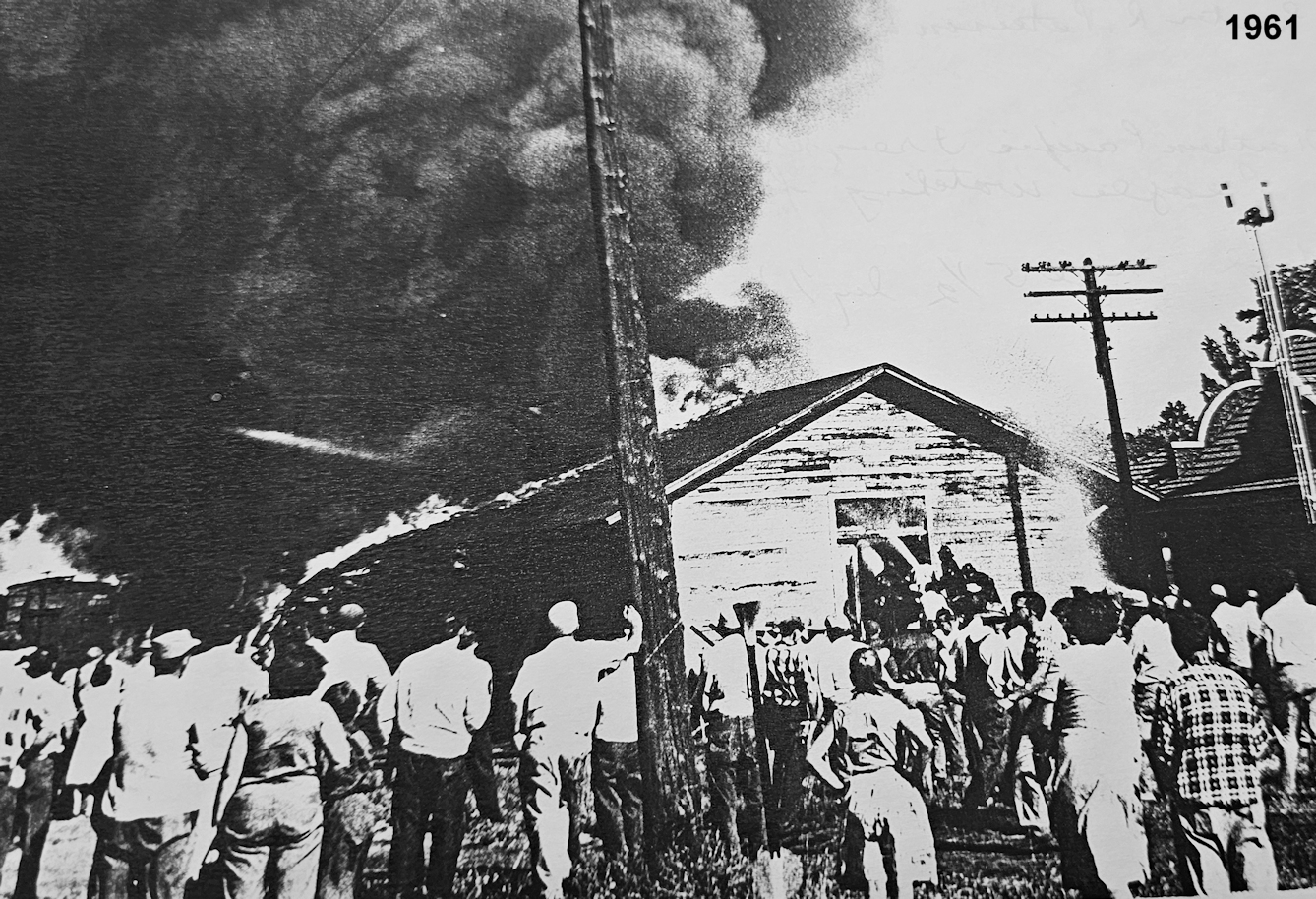
| Aitkin |
|
A new freight station was built in 1897 that mesured 30'x150'. It was on the north side of the tracks on the east side of 1st Avenue NW at GPS: 46.531858, -93.707898. It burned down in August, 1961. | ||||||
| Aitkin |
|
The first station here was "a miserable little combination freight and passenger depot, set up on blocks," according to a report in the Aitkin Age of August 16, 1910 (as reprinted in the The Pioneer, 8-18-1910). However, the railroad had not yet finished laying tracks at that time and denied that the building was meant to be the depot. The permanent depot would be built soon after. | ||||||
| Aitkin |
|
This station was built in 1910. According to the 2015 book "The Soo Line In Minnesota" the station was moved in 1930, but the book does not say where the depot was moved to. | ||||||
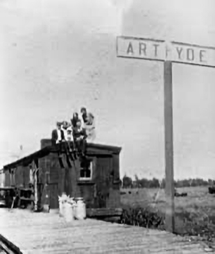
| Arthyde (Arthyde Spur) |
|
The station here was a converted boxcar. | ||||||
| Axtell (Round Lake) |
|
There was a boxcar body here that served as the station. | ||||||
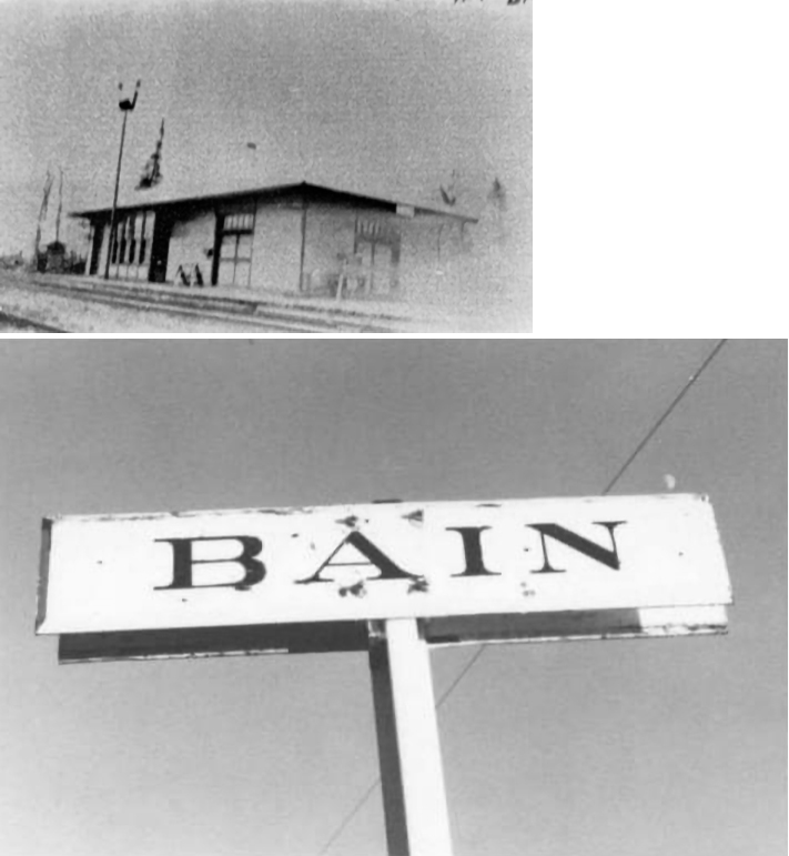
| Bain |
|
|||||||
| Brauer (Brower) |
 |
This Mississippi, Hill City & Western station was between Hill City and Washburn at mile post 20.5 (from Swan River) and was 3.7 miles from Hill City. This line ran from Hill City to Mississippi Junction and then into Swan River via the GN. The line opened in 1910 and was abandoned in 1935. | ||||||
| Cedar lake |
|
According to the NP Valuation Records of 1917, a 16'x37' combination station was built here in 1897. This station was also known as Cedar Lake Connection. | ||||||
| Darina (West Lake) |
|
This town vanished when the Soo gained trackage rights on the NP between Deerwood and McGregor in the 1920s. The Soo Line originally named this station "West Lake," but the post office objected to that name (ironically, a post office was ultimately not established here). A boxcar was placed here in 1918 to serve as the station. It was retired in 1930. | ||||||
| East Lake |
|
This station was in Section 20 of Spalding Township. A 24'x24' station was built here in 1913. | ||||||
| Grass Twine Spur |
|
There was likley no station building here, but it was at least a passenger flag stop. There were a couple of hay shed here for the Grass Twine Company. Passenger service was disconinuted here in 1907 (The Brainerd Daily Dispatch, 12-6-1907). | ||||||
| Grayling |
|
According to the NP Valuation Records of 1917, a 10'x19' passenger station was built here in 1898. This area was alson known as "Sandy River Crossing" or "Sandy River Bridge," although it's unclear whether the RR ever used those names for the station itself. | ||||||
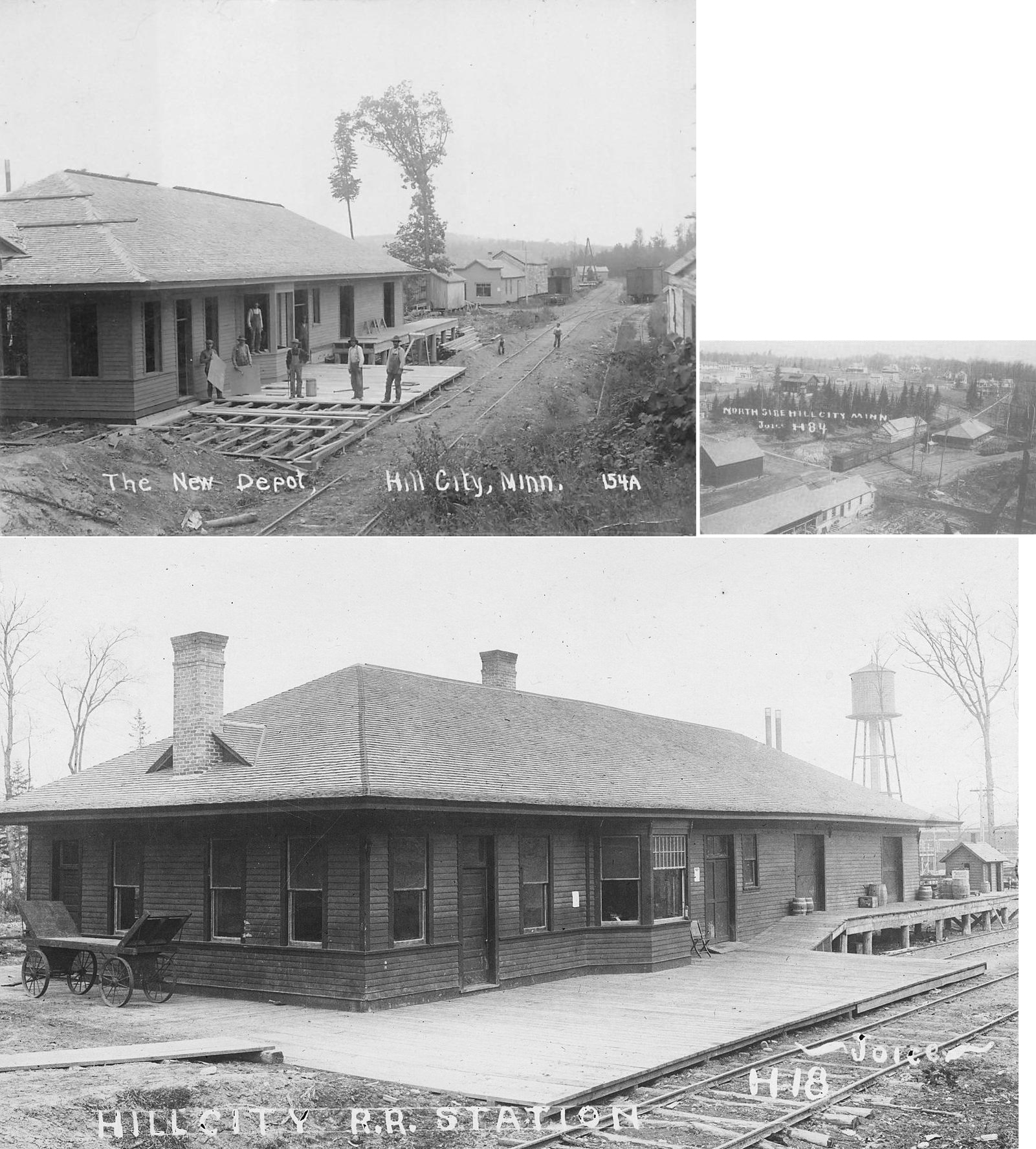
| Hill City |
|
This was the terminus of the 24-mile Mississippi, Hill City & Western Railway. It ran from Swan River to Hill City. It had trackage rights on the GN from Mississippi Junction to Swan River. | ||||||
| Jacobson (Mississippi) |
|
Jacobson was formerly known as "Mississippi" and "Mississippi Landing." | ||||||
| Kimberly |
|
According to the NP Valuation Records of 1917, a 30'x48' combination passenger station was built here in 1908. | ||||||
| Lansford (Ude) (Portage) |
|
According to the NP Valuation Records of 1917, a 10'x14' passenger station was built here in 1902. This station was formerly known as "Ude" and "Portage." This station, which was in Section 35 of Jevne Township replaced the "Portage Crossing" station in Section 32. | ||||||
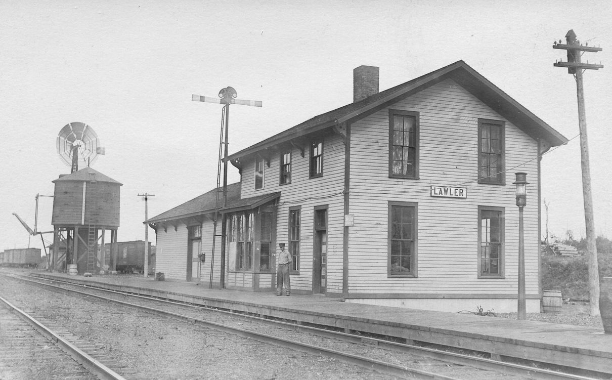
| Lawler |
|
This station was built in 1910 and burned down in 1918. Not sure if a subsequent station was built here after that. | ||||||
| Maplehurst |
|
This was an early Soo Line flag stop, but there was likely no station building here. There was a stock ranch here which is where the flag stop was located. | ||||||
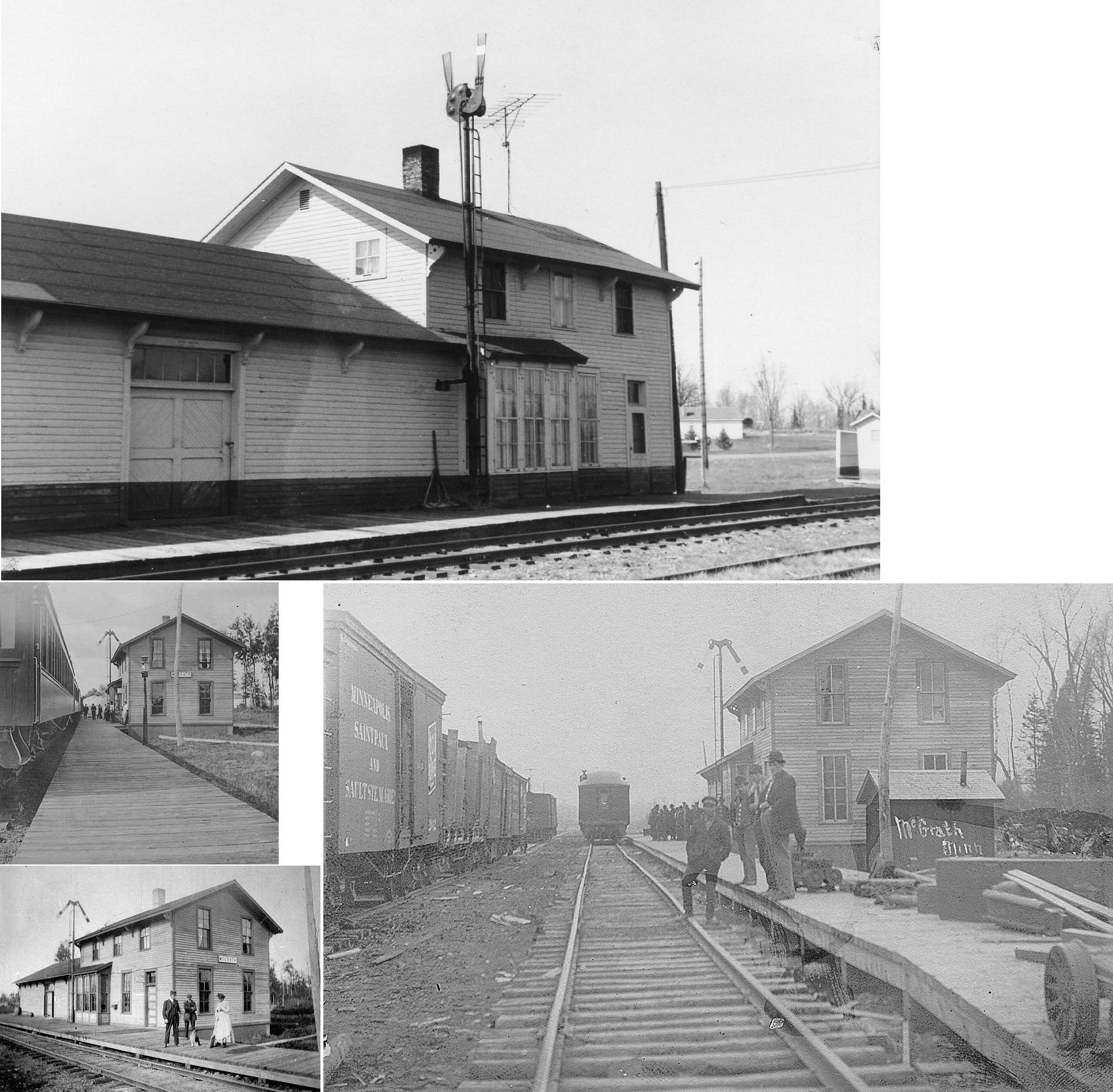
| McGrath (Elmwood) |
|
This station, built in 1909, was burned down for fire department practice on October 25, 1984. | ||||||
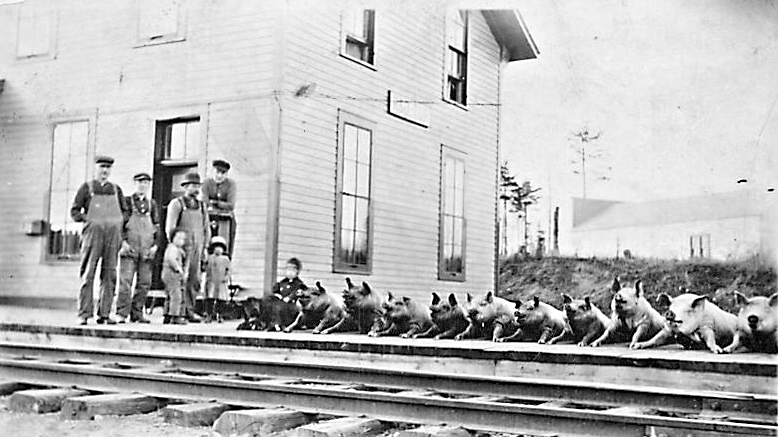
| McGregor |
|
|||||||
| Pierceville |
|
The book "Minnesota Place Names" lists this as a station on the Hill City Railway in Section 18 of Ruth Township (which became part of the Unorganized Territory of NW Aitkin in 1937). Not sure where this station was exactly. | ||||||
| Rabey |
|
The station was later moved from its original location to the "Michelson Farm" on River Road not far from where the grade crosses. Does anyone know the fate of this station? Its original location was likely where Rabey Road crosses the old grade around GPS: 46.999098, -93.379354. | ||||||
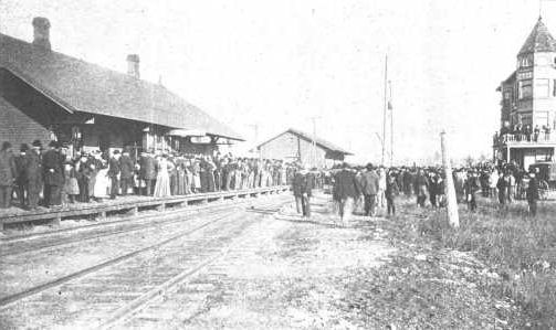
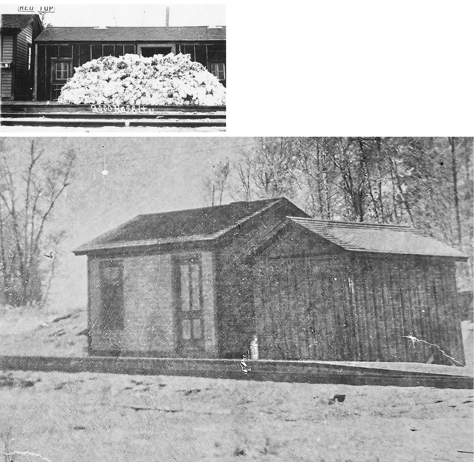
| Redtop |
|
Top photo shows 2,000 rabbits stacked on the depot platform; bottom photo is of depot. | ||||||
| Redtop |
|
This two-story station was likely a newer station. | ||||||
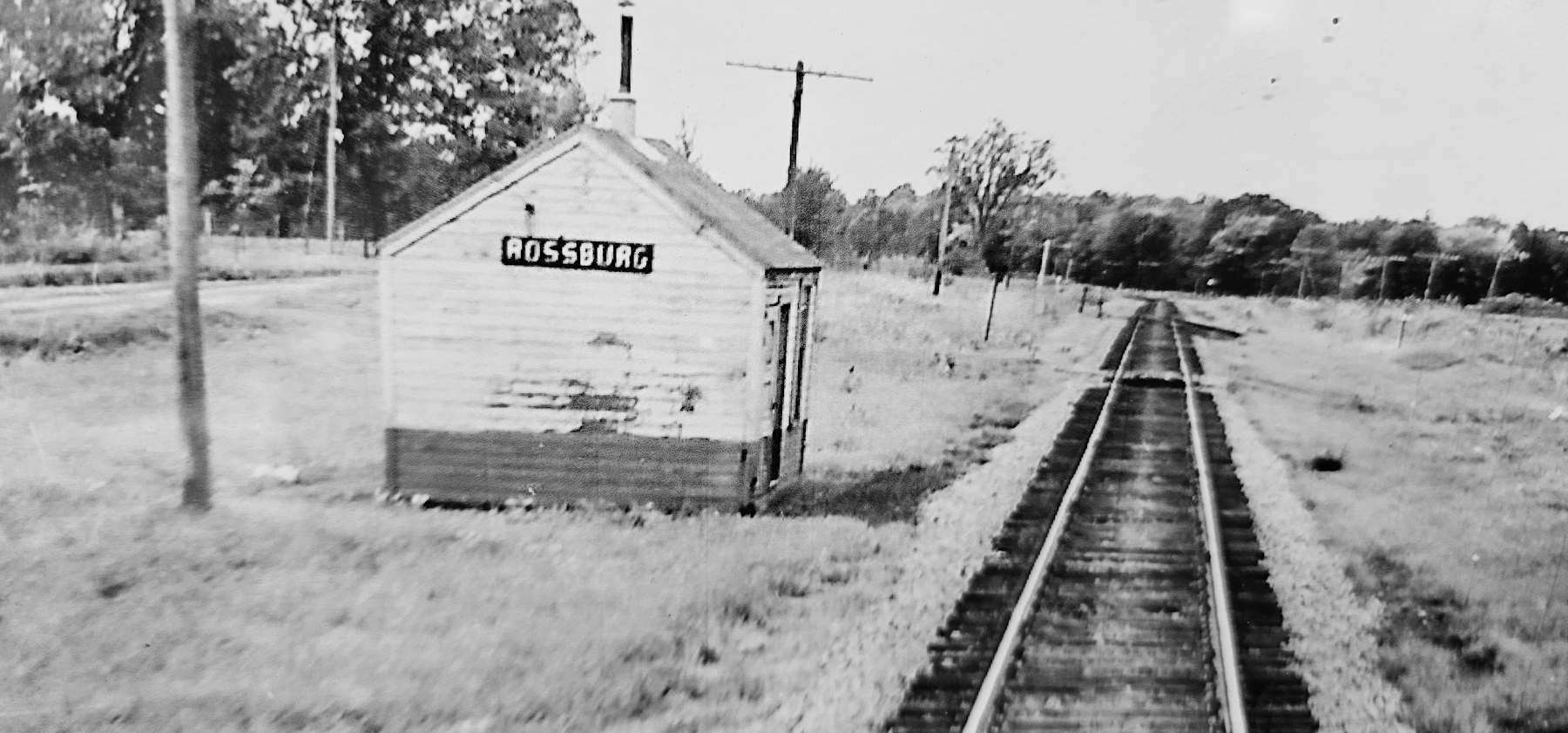
| Rossburg |
|
According to the NP Valuation Records of 1917, a 12'x16' passenger station was built here in 1890. | ||||||
| Seaver |
|
This station was between Rabey and Mississippi Junction. It was in the vicinity of Great River Road where the grade crosses around GPS: 47.016053, -93.294668. | ||||||
| Shovel Lake |
|
This station was built in 1912. | ||||||
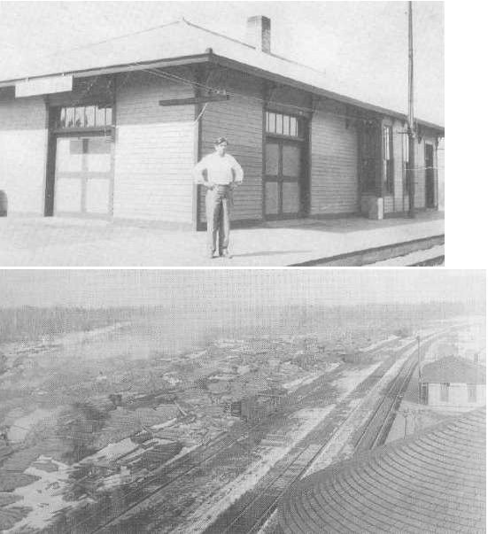
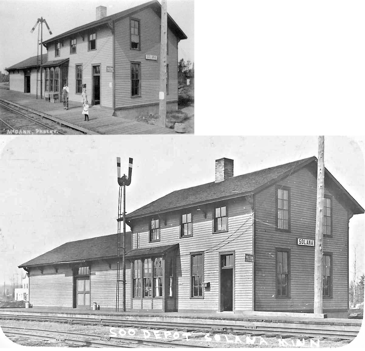
| Solana |
|
This station was built in 1909. It was replaced by a carbody station in 1940. | ||||||
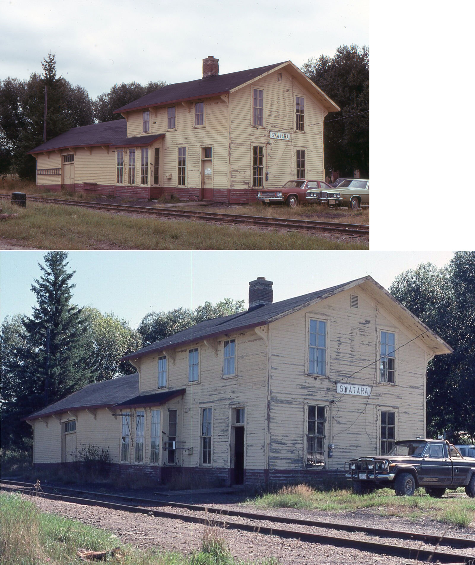
| Swatara |
|
This station was on the south side of Main Street. A platform was installed here in 1911 followed by the depot in 1912. The station was enlarged with a two-stopry section in 1917 and closed in 1972. | ||||||
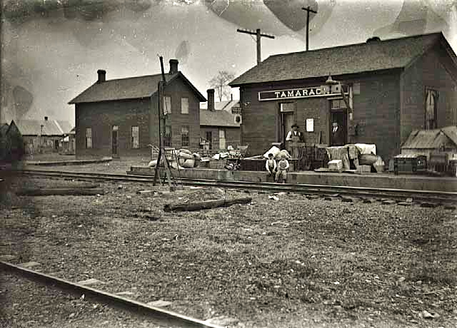
| Tamarack (Sicottes) |
|
The earliest station here was called "Sicottes." The name was changed to Tamarack in 1883. | ||||||
| Tamarack |
|
|||||||
| Washburn |
|
This station may have also been known as Marshfield early on. It was on the north side of Washburn Lake in the general vicinity of GPS: 46.981663, -93.466369. | ||||||
| Whitepine (Longfellow) |
|
This station was at the end of a 3.2-mile branch line that went NW out of Solana. There likely was only a station sign here. | ||||||
| 1898 AITKIN COUNTY RAILROAD MAP | ||||||||
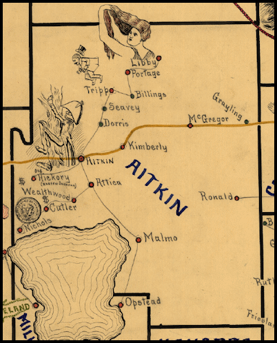 |
||||||||
|
Notes About Existing Stations... Aitkin (NP) - See the historical society's web site for more information. Aitkin - ???? (NP) It unclear what this building was, although it appears to be an NP station by the design. The pitch of the roof and corner support matches the original Aitkin NP station, however the original passenger station here was destroyed by fire in December 1884 according to The Sun, 12-4-1884. It's possible that the station never did burn down and was moved instead. The building was not there on the 1892 or 1898 Sanborn maps. It first appears on the 1902 and is on the 1908-1924 maps labeled as "Lime & Cement Warehouse" On the 1928-1950 maps it is moved to it's current location and the building that was east of it was enlarged. The Aitkin musem has a photo of the building from 1966 with the text on the back indicating that it was the Soo station. However, that is incorrect. It couldn't have been THE Aitkin Soo station as it was there prior to the construction of the Soo station station north of town (and both this building and the Soo station stood at the same time). The leading theories are that it was the original NP station (which would make newspaper accounts of its fiery demise untrue) that was turned into a warehouse OR an NP station moved from elsewhere and re-purposed. It could just be a warehouse, but it seems awful depot-like and ornate for such a purpose. The design of the building matches that of the original Wahepton, SD NP station. I am not saying that it was from there, but rather that the design of it is of NP origin. More research is need on this one to verify its origin. Palisade (Soo Line) - The station has been split with the passenger section serving as a house and the freight section serving as a barn. Tamarack (NP) - Is the existing station the same one shown in the historical photos? According to the NP Valuation Records of 1917, the station was built in 1906 with the two-story section measuring 24'x29' and the one story section measuring 24'x30'. The existing building may be the one-story section. This has not been confirmed for sure. |
||||||||