|
|
||||||||
| EXISTING STATIONS | ||||||||
|---|---|---|---|---|---|---|---|---|
| Station Name |
Original Railroad |
Current Location |
Type | Current Use |
Date Built |
Track Status |
Building Material |
More Info |
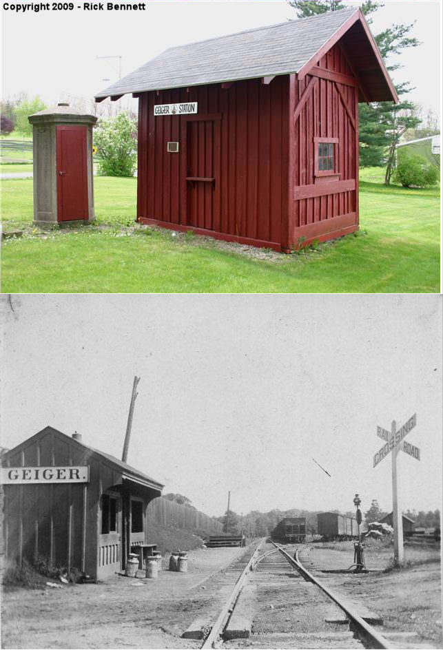
| Geiger |  |
Geiger Road at Culligan Road. | P | Display | ???? | None | Wood |
|
| Hollsopple (Benson) |
|
Railroad Street (GPS: 40.208590, -78.926828) |
C | Society | 1916 | In Use | Wood |
|
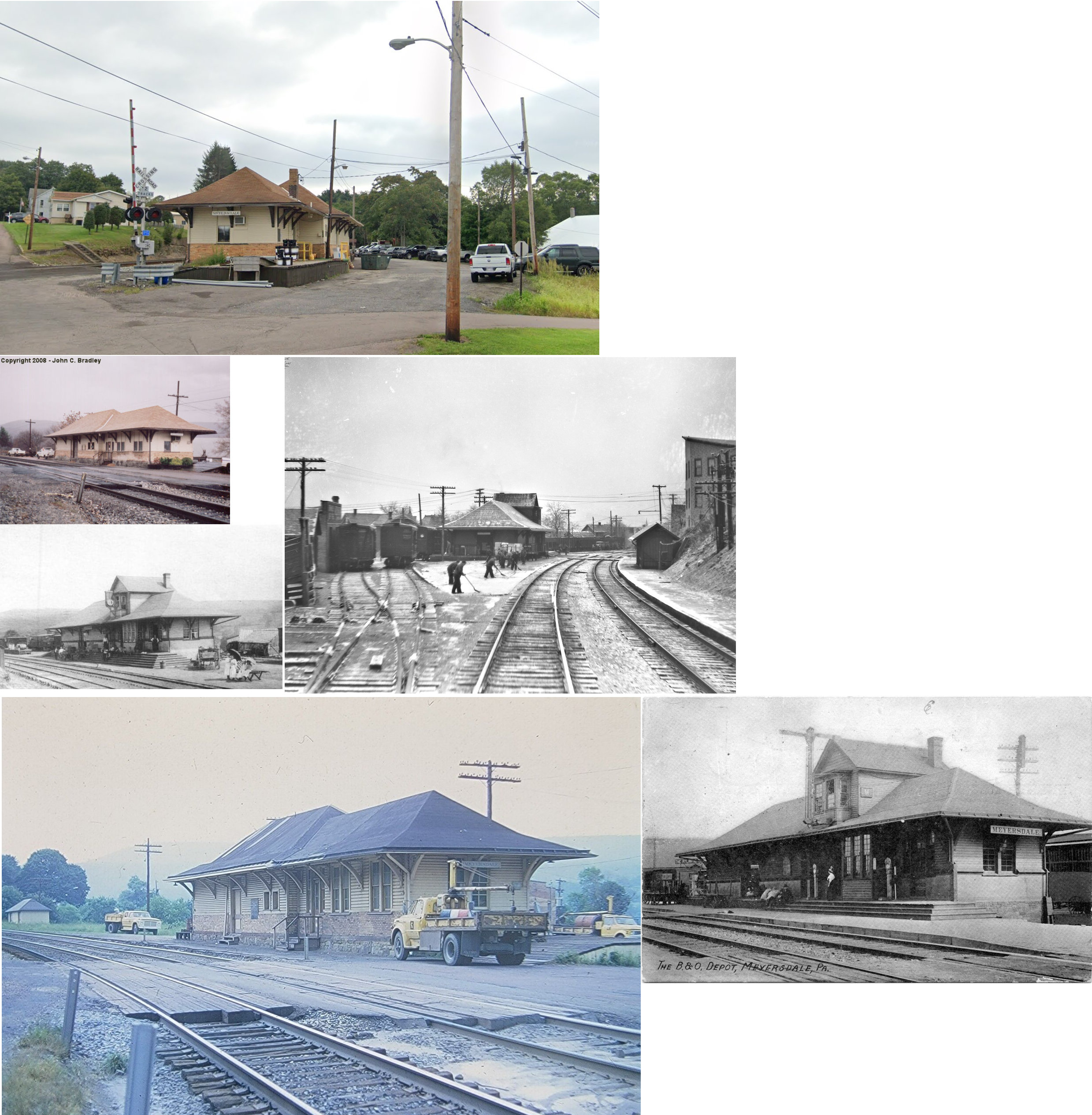
| Meyersdale | |
324 Meyers Street (GPS: 39.814985, -79.020902) |
C | Railroad | ???? | In Use | Wood & Brick | |
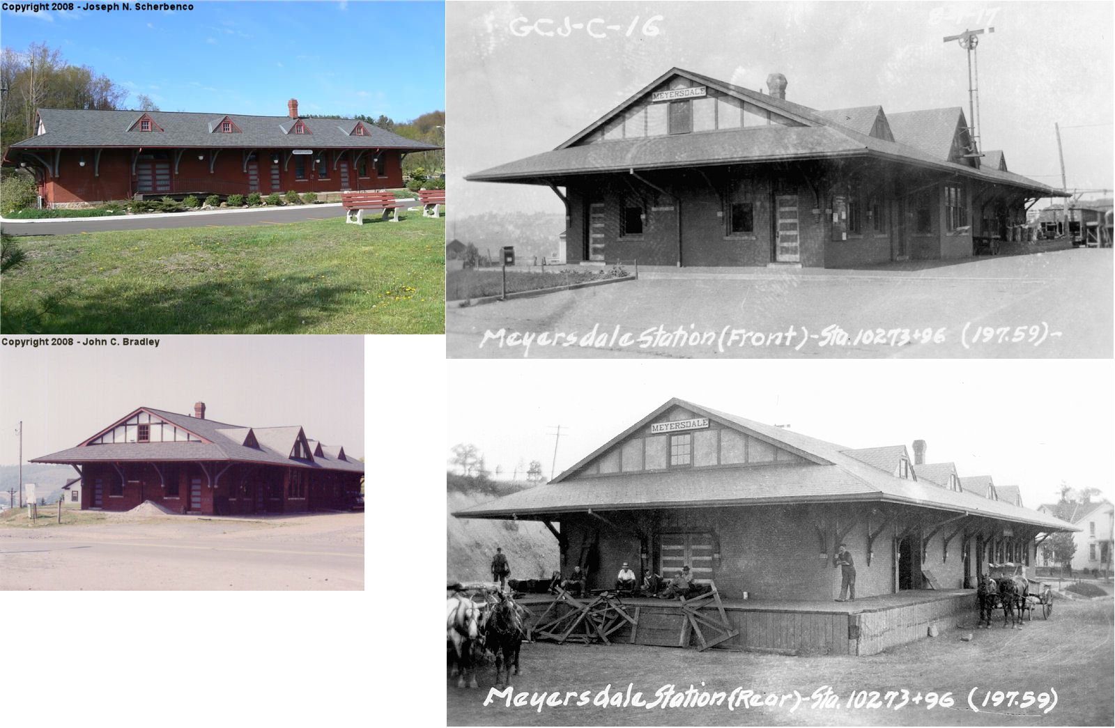
| Meyersdale |  |
523 Main Street (GPS: 39.816383, -79.020885) |
C | Museum | 1912 | Gone | Brick | |
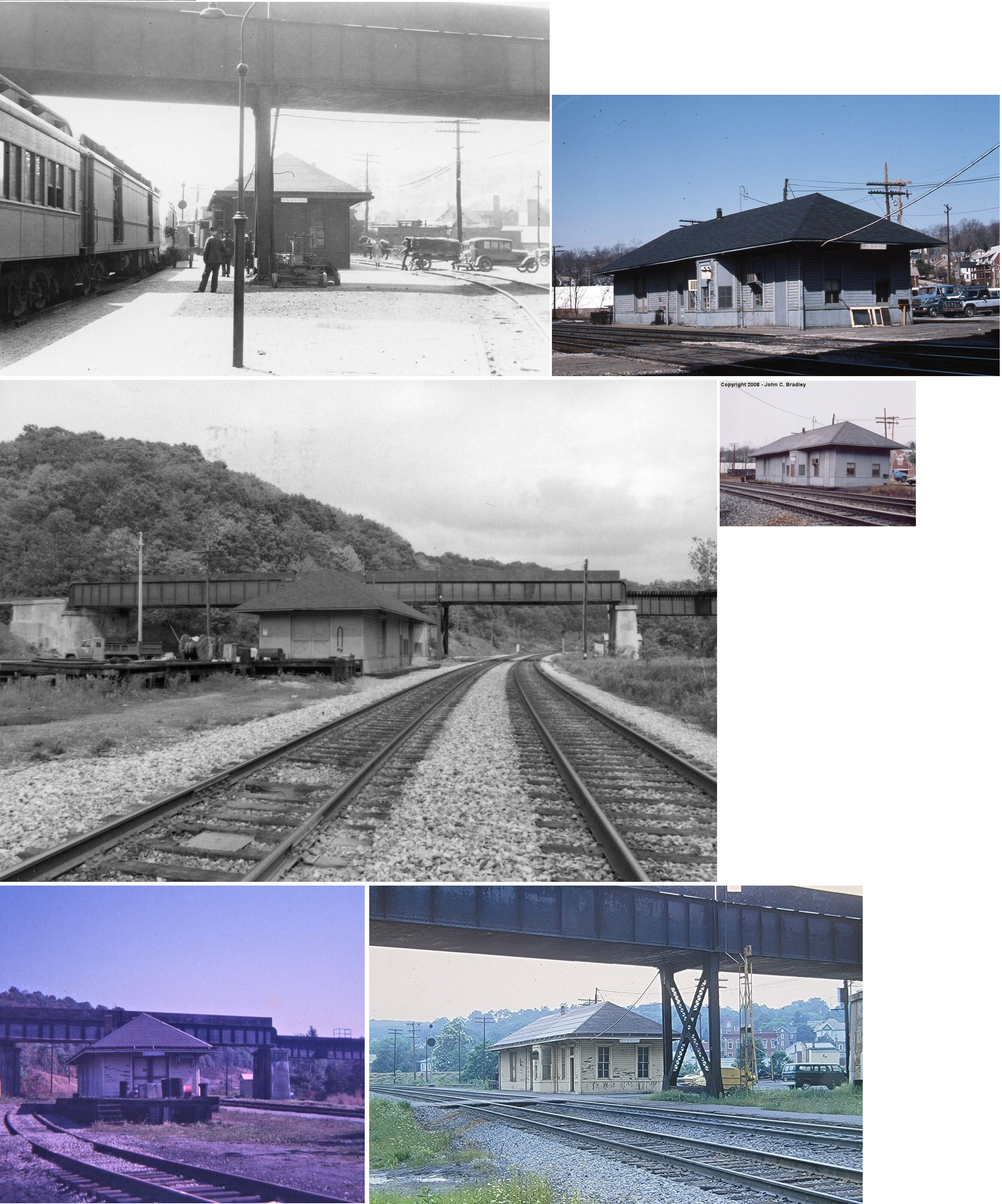
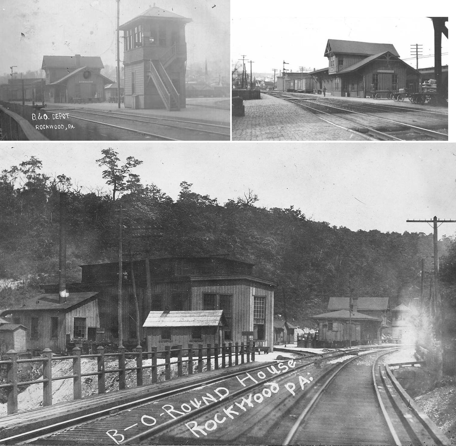
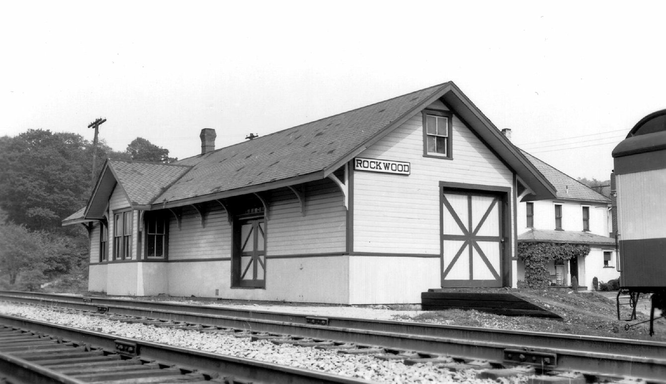
| Rockwood Station | |
South end of Market Street (GPS: 39.914157, -79.151418) |
C | Railroad | ???? | In Use | Wood | |
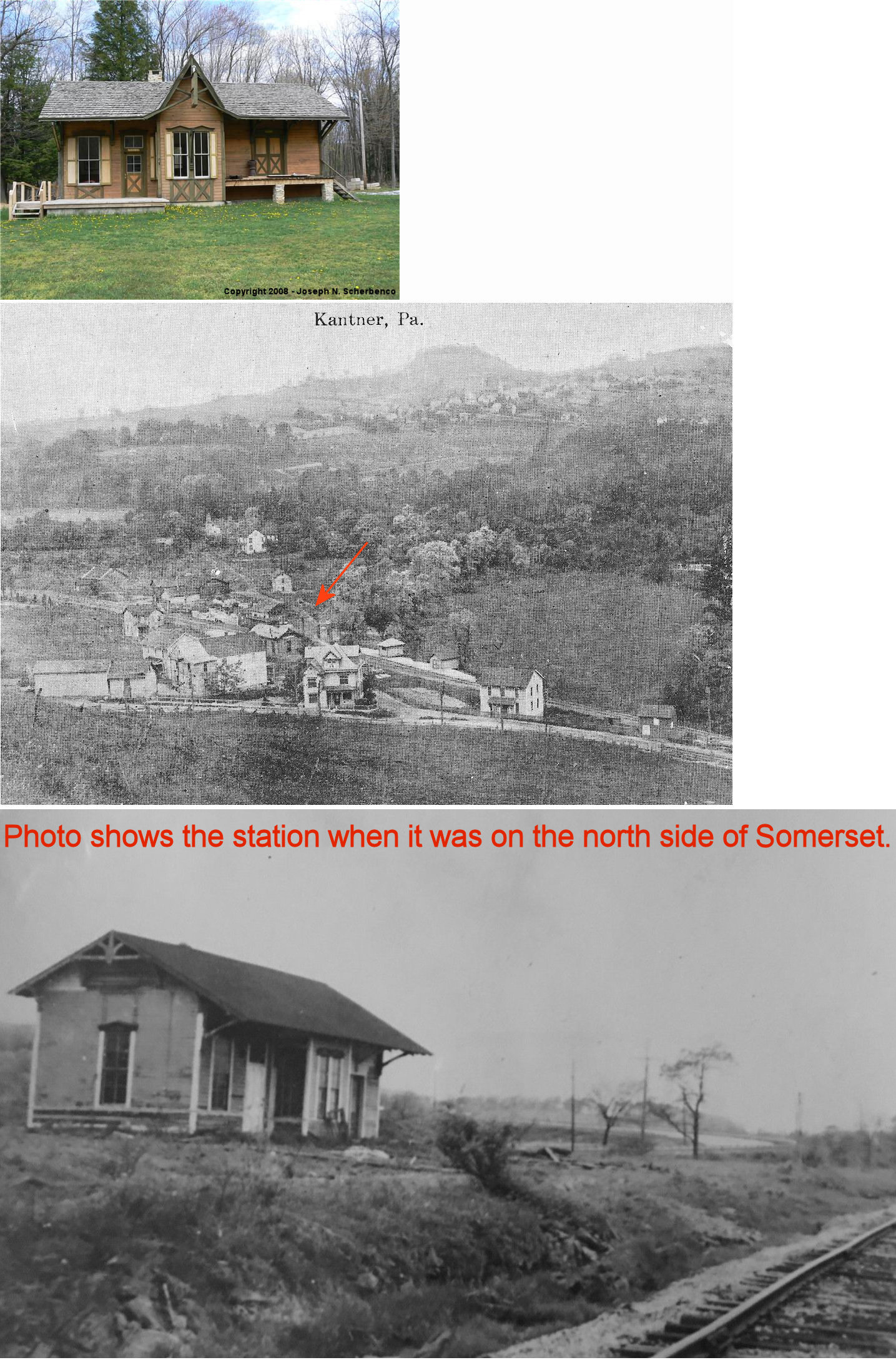
| Stoystown (Kanter) |
|
Stoystown Lions Park on North Club Road (GPS: 40.094701, -78.944579) |
C | Society | ???? | None | Wood |
|
| Windber |  |
Graham Avenue at 14th Street (GPS: 40.236176, -78.831565) |
P | Business | 1916 | In Use | Brick | |
| Windber | |
1801 Stockholm Avenue (GPS: 40.232433, -78.828947) |
F | Business | 1916 | Aband. | Brick | |
| STATIONS OF THE PAST | ||||||||
| Station Name |
Original Railroad |
Notes | ||||||
| Acosta |
|
|||||||
| AllenVale |
 |
The Pittsburgh, Westmoreland & Summit Railroad began in 1899, but the full route from Ligonier to Somerset only operated for ten years (1906-1916). | ||||||
| Arrow |
|
The 1923 PRR List of Stations & Sidings lists a freight station here. This was on the Curry Mill Branch. | ||||||
| Ashtola |
|
|||||||
| Bakers |
 |
The Somerset & Mineral Point Railroad ran NE along Coxes Creek connecting Somerset with the Pittsburgh & Connellsville Railroad. The railroad owned one passenger car among its rolling stock and there were eight stations along the line. It was eventually owned by the B&O. | ||||||
| Barronvale |
 |
Although it maily hauled lumber and coal, in 1888 the Ursina & North Fork Railway reported having a passenger car and income from passenger traffic. It is unclear whether the railroad had physical depots on the line. | ||||||
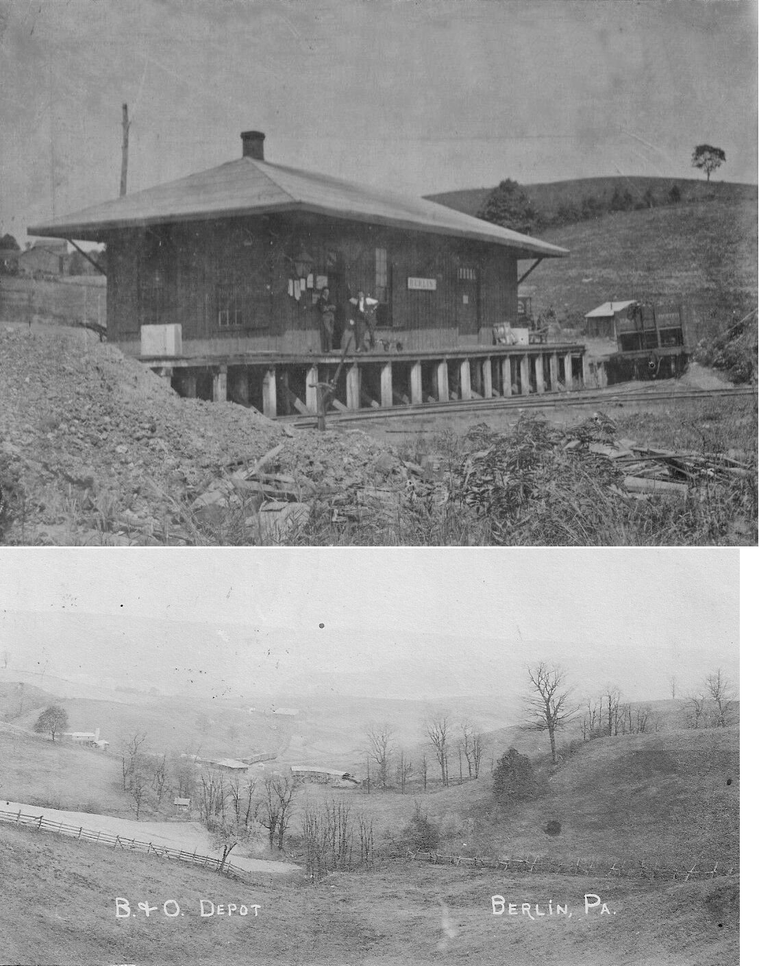
| Berlin |
|
|||||||
| Blough |
|
This station was located in the southeast quadrant of the original crossing location of Route 403 and the railroad. The station was approximately 100 feet north of the small bridge carrying the railroad over an unnamed tributary to the Stonycreek River near GPS 40.171419, -78.907955. There was no station shown in a set of highway plans from 1964, and the site was ultimately covered when the bridge over the Stonycreek River was replaced south of the old bridge in 1991. The station would have sat within the southbound roadway shoulder immediately opposite the current bridge. --Nick Puzak | ||||||
| Borde |
|
|||||||
| Boswell |
|
This station was on Atkinson Way at the NW end of Stoneycreek Street (GPS: 40.163781, -79.029721). | ||||||
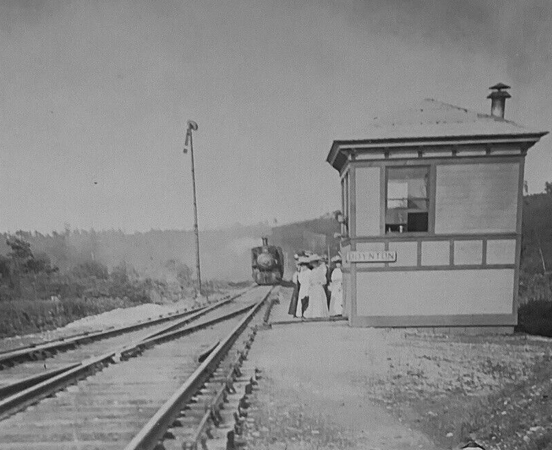
| Boynton |
|
|||||||
| Brook |
|
|||||||
| Buffalo Bridge |
|
|||||||
| Cairnbrook |
|
|||||||
| Cantner |
|
|||||||
| Casselman |
|
|||||||
| Casselman |
|
|||||||
| Central City |
|
This small station (it may have been a shelter) was on the north side of the tracks just east of Sunshine Avenue at GPS: 40.107740, -78.806135. | ||||||
| Coleman |
|
This station was on the north side of Coleman Station Road on the south side of the tracks at GPS: 40.052658, -78.964085. The first house in the photo is still standing (as of 2021). | ||||||
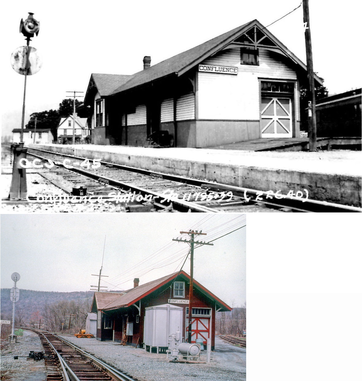
| Confluence | |
This station served until 1902. It was on Latrobe Avenue NW of Baxter Street at GPS: 39.813177, -79.360072. | ||||||
| Confluence | |
This station was at the NE end of Baxter Street (GPS: 39.812998, -79.359680). It was built in 1902 and was just a few feet to the SE of the previous depot. | ||||||
| Confluence |
|
|||||||
| Deal |
|
This station was on Old Deal Road at GPS: 39.761278, -78.931259. Supposedly it was moved nearby and coverted to a residence. Can anyone confirm that with some photos and specific location? | ||||||
| Dumas |
|
|||||||
| Enoch |
|
|||||||
| Eureka No. 35 Mine Station |
|
The stations for the Eureka Mines were on the Windber Branch. Stations are listed for these mines in the 1923 PRR List of Stations & Sidings. | ||||||
| Eureka No. 36 Mine Station |
|
|||||||
| Eureka No. 41 Mine Station |
|
|||||||
| Eureka No. 42 Mine Station |
|
|||||||
| Fairhope |
|
|||||||
| Ferrellton |
|
|||||||
| Foley |
|
|||||||
| Fort Hill |
|
This building was the station, post office and general store. Is it still standing? The building at the tracks viewed in Google Maps loooks the same, but it's hard to tell. Can someone confirm from the ground? | ||||||
| Fort Hill |
|
|||||||
| Foustwell |
|
|||||||
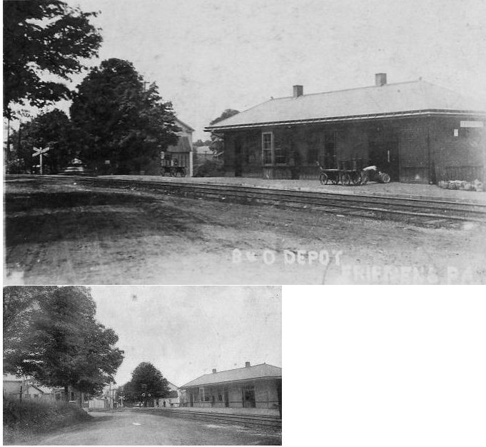
| Friedens | |
|||||||
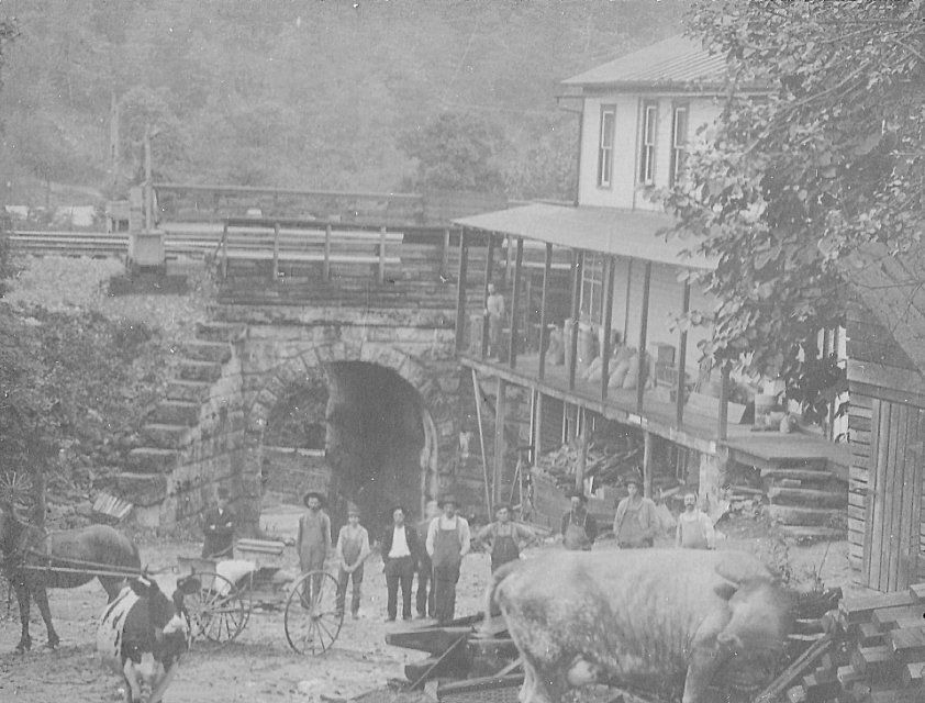
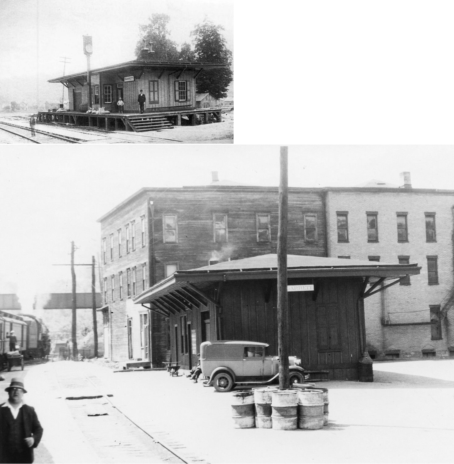
| Garrett | |
This was the first B&O station at Garrett. | ||||||
| Garrett | |
This was a later-generation station that replaced the one listed above. | ||||||
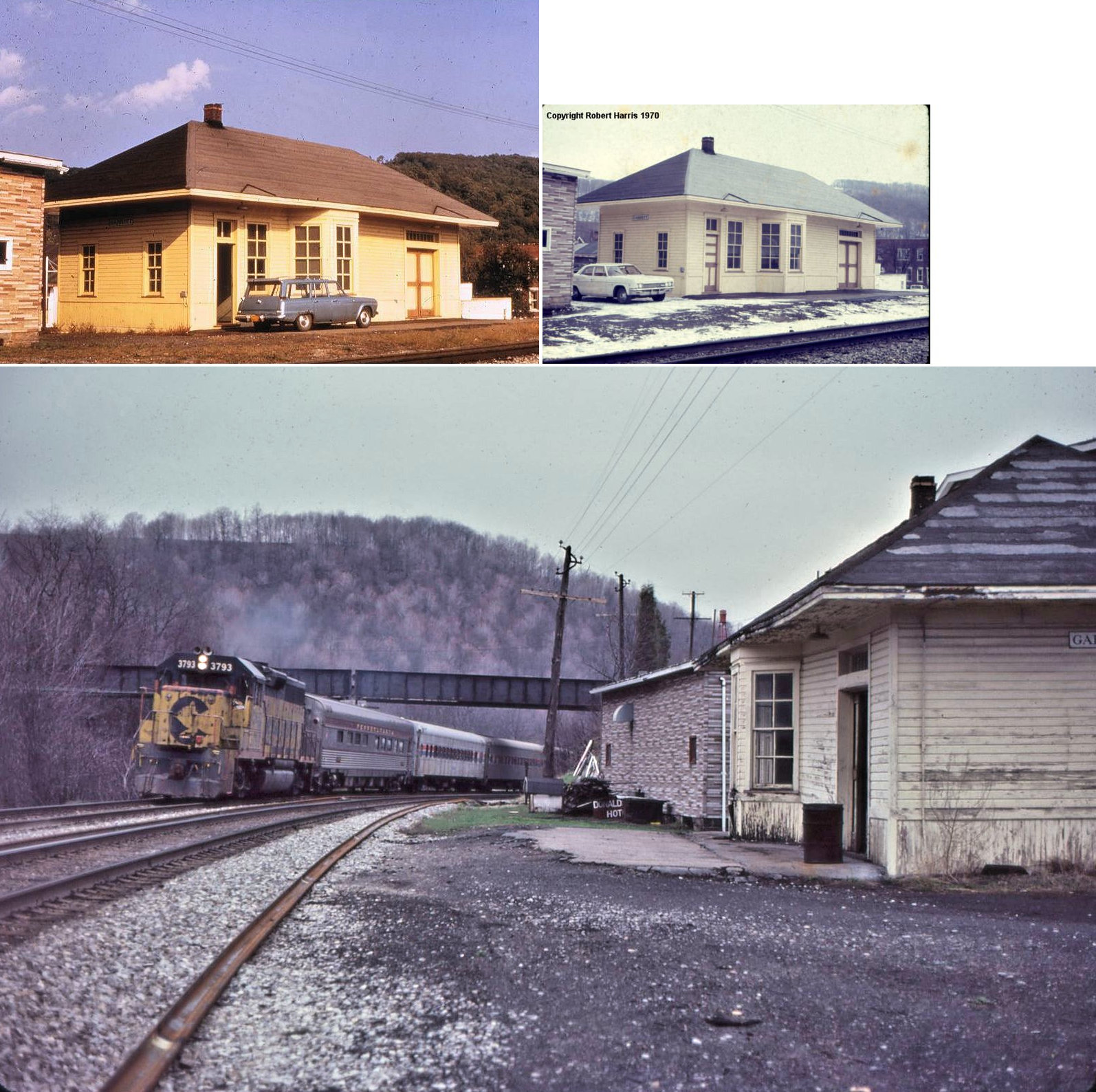
| Garrett |
|
This station was south of Berlin Steet in the vicinity of GPS: 39.860512, -79.063040. In the B&O Historical Society convention book from Somerset in 2012 it mentions that the WM depot at Garrett, PA was torn down and re-erected in Listie, PA. Does anyone know if the station is still standing and, if so, its exact location? | ||||||
| Gillette |
|
The Pittsburgh, Westmoreland & Summit Railroad began in 1899, but the full route from Ligonier to Somerset only operated for ten years (1906-1916). | ||||||
| Glencoe | |
|||||||
| Grassy Run Junction | |
|||||||
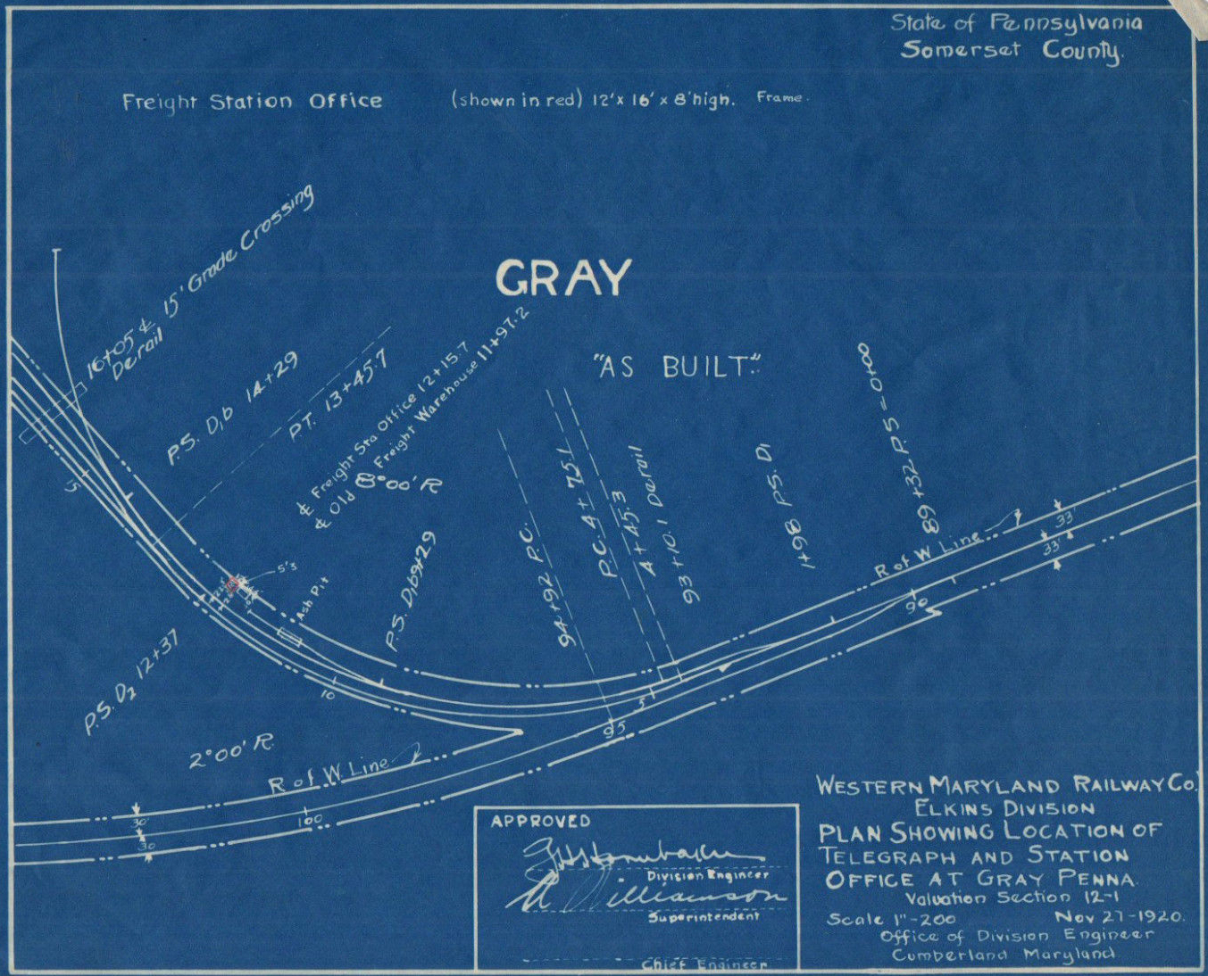
| Gray |
|
|||||||
| Hagevo |
|
|||||||
| Hillsborough (Hillsboro) |
|
|||||||
| Hocking Juntion | |
|||||||
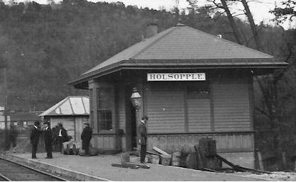
|
Holsopple (Benson) |
|
Built in 1890, this station burned in July, 1915. | ||||||
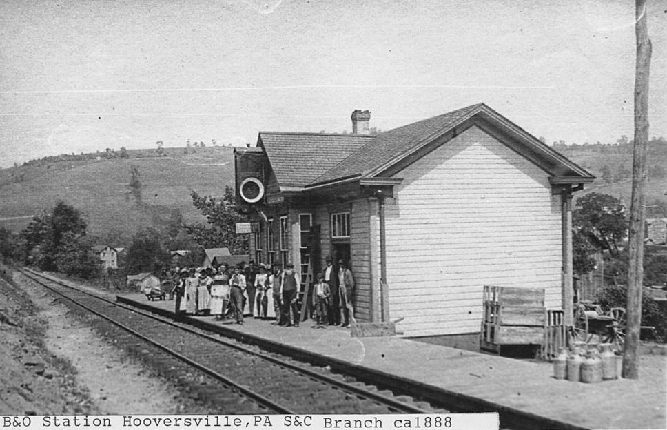
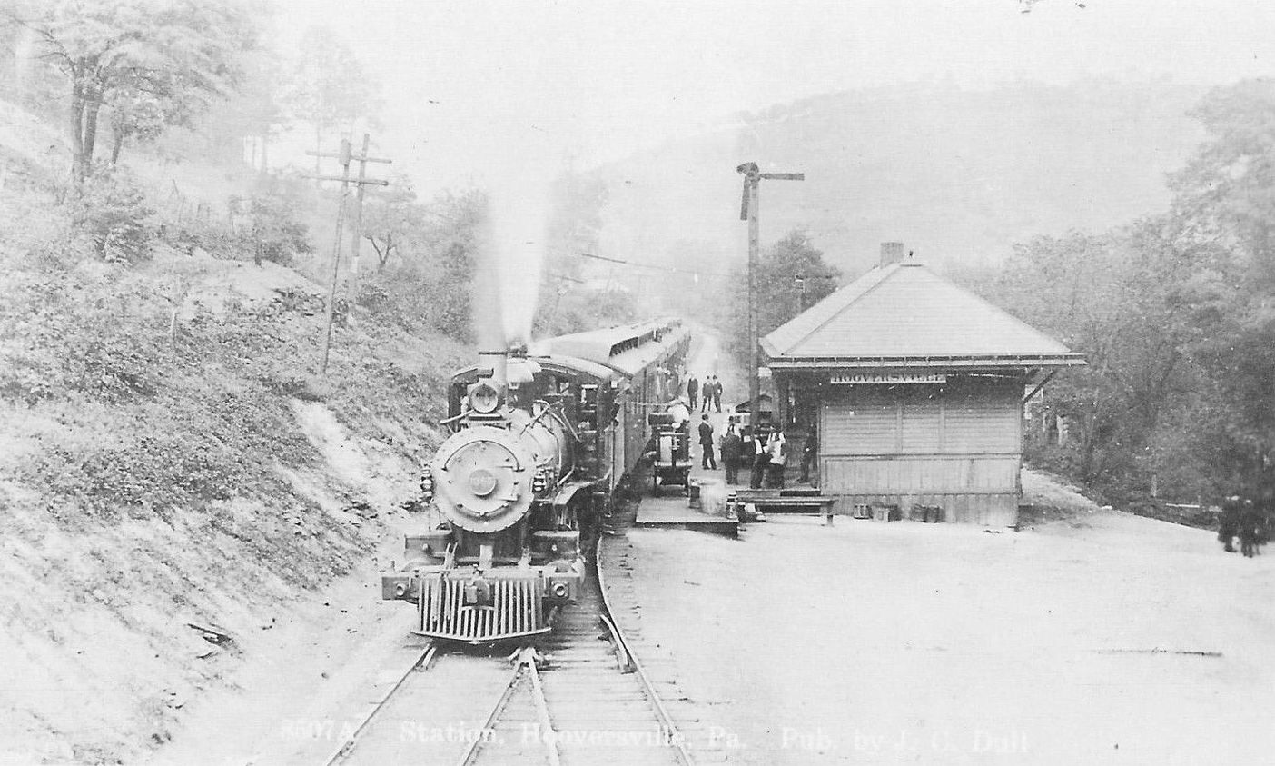
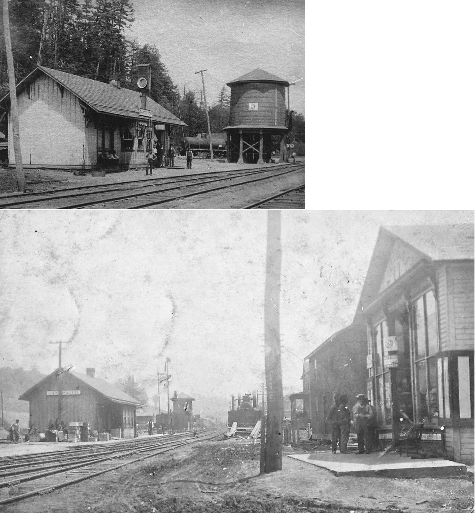
| Hooversville | |
The first station here was likely at the same location as the 1905 station listed below. | ||||||
| Hooversville | |
This station was on the west side of Water Street on the east side of the tracks at GPS: 40.146988, -78.915573. It was built in 1905. | ||||||
| Humbert | U&NF | This station was on the Ursina & North Fork Railway. | ||||||
| Husband |
|
This was a station on the Pittsburgh, Westmoreland & Summit Railroad. | ||||||
| Husband | |
|||||||
| Huskin |
|
|||||||
| Jenner | |
|||||||
| Jerome | |
|||||||
| Jerome Junction | |
|||||||
| Kesslerville |
|
This Pittsburgh, Westmoreland & Summit Railroad station is shown on the 1915 county map. | ||||||
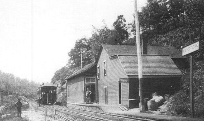
| Keystone Station | |
|||||||
| Landstreet | |
|||||||
| Laurel Summit |
|
This was a station on the Pittsburgh, Westmoreland & Summit Railroad. | ||||||
| Lichty | |
|||||||
| Listie | |
|||||||
| Listonburg | |
|||||||
| MacDonaldton | |
|||||||
| Mance | |
|||||||
| Markleton | |
|||||||
| Markleton Station |
|
|||||||
| Marrison | |
|||||||
| McSpadden | |
|||||||
| Metzler |
|
This station was on the Ursina & North Fork Railway | ||||||
| Milford |
|
|||||||
| Miller Run |
|
|||||||
| Mineral Point |
|
|||||||
| Mineral Spring | |
|||||||
| Mostoller | |
|||||||
| Mountain Park |
|
This station was between Laurel Summit and Gillette as shown on the 1910 timetable. | ||||||
| Mud Pike Crossing |
|
|||||||
| New Ashtola |
|
|||||||
| Niver Junction | |
|||||||
| North Fork | |
|||||||
| Paint |
|
|||||||
| Paint Creek Station | |
|||||||
| Philson | |
|||||||
| Pine Hill | |
|||||||
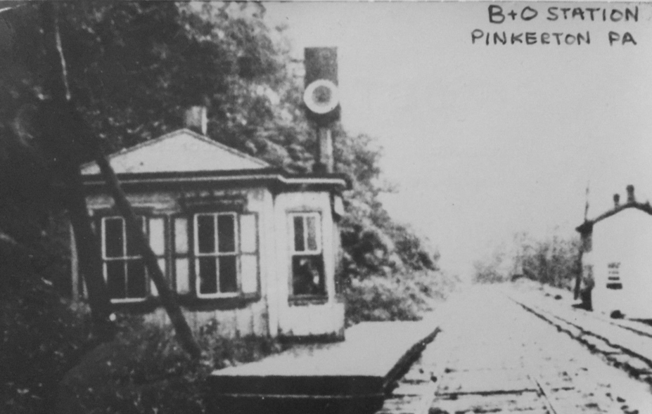
| Pinkerton | |
|||||||
| Quemahoning Junction | |
|||||||
| Ralphton | |
|||||||
| Randolph | |
|||||||
| Reitz |
|
|||||||
| Roberts |
|
|||||||
| Rockingham |
|
|||||||
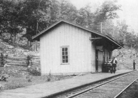
| Rockwood |
|
This was an earlier station. | ||||||
| Rockwood |
|
|||||||
| Rowena | |
|||||||
| Salisbury Junction | |
|||||||
| Sames |
|
|||||||
| Sand Patch | |
|||||||
| Seanor |
|
|||||||
| Shamrock | |
|||||||
| Sipesville Station | |
|||||||
| Somerfield | |
This town was on National Road (now US 40) until town was demolished in 1940s to build Youghiogheny Dam and Reservoir. | ||||||
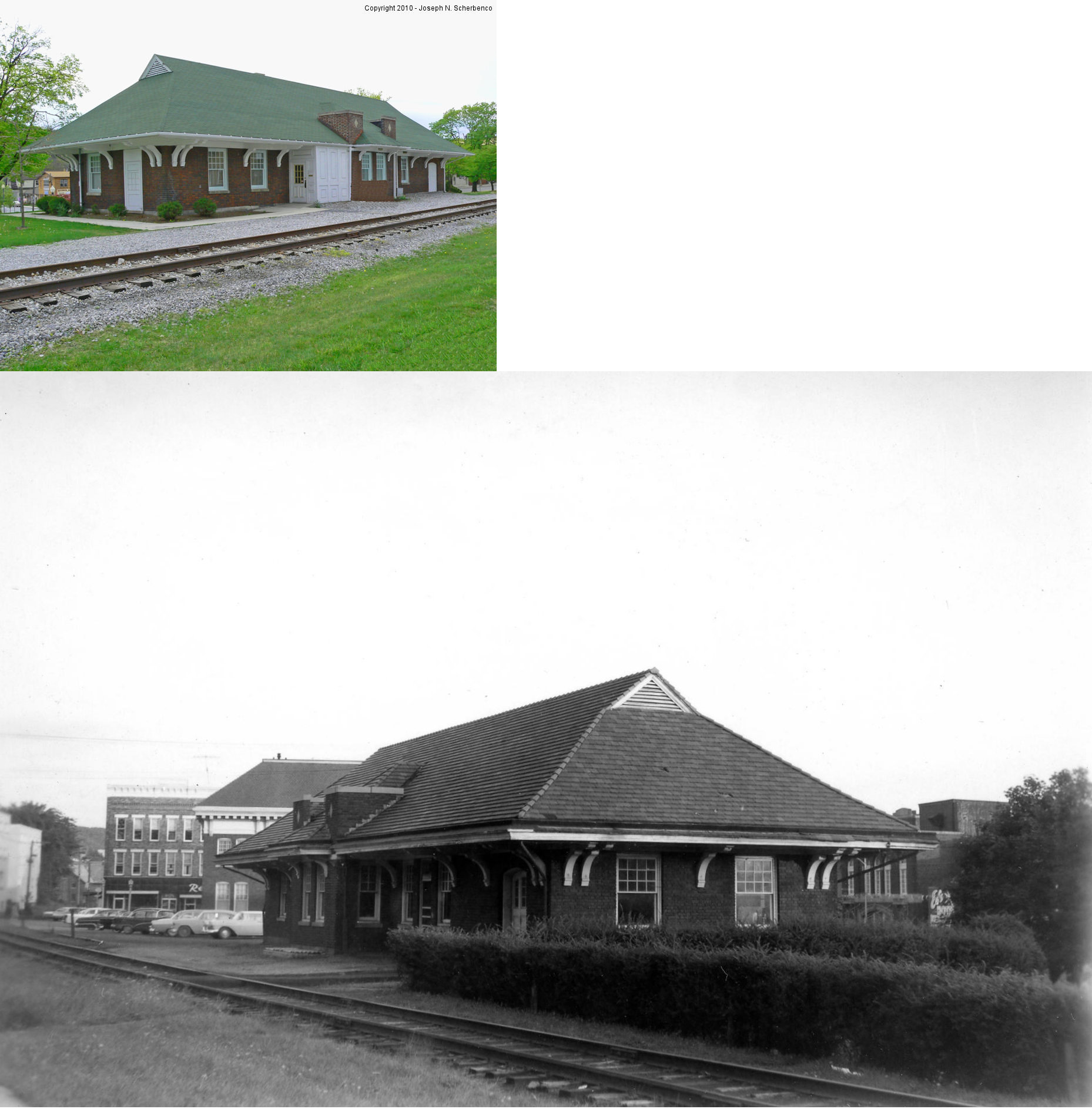
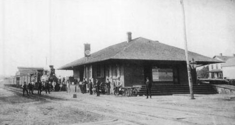
| Somerset | |
The first station here a brick station on the south side of East Patriot Street at South Pleasant Street on the west side of the tracks (GPS: 40.007401, -79.073951). When it was replaced with a new brick station around 1915, this station was moved across the tracks became a freight station. It was moved to the north side of East Patriot Street on the east side of the tracks at GPS: 40.007458, -79.073656. | ||||||
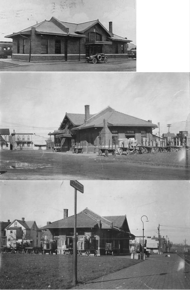
| Somerset | |
This station, built in 1915, replaced the previous station at essentially the same location on the south side of East Patriot Street at South Pleasant Street on the west side of the tracks (GPS: 40.007401, -79.073951). | ||||||
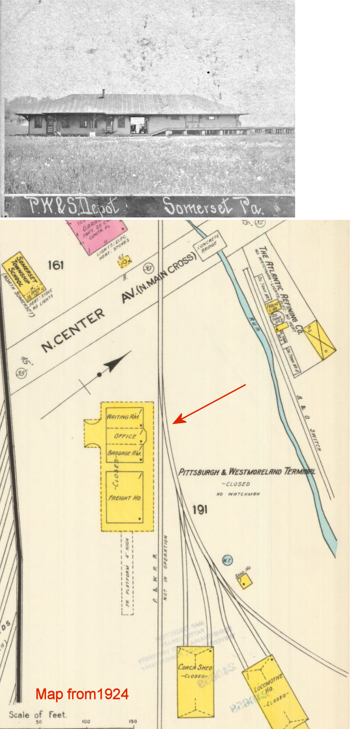
| Somerset |
|
This was a station on the Pittsburgh, Westmoreland & Summit Railroad. It was on the east side of North Center Street on the south side of the tracks at approximately GPS: 40.018890, -79.077051. | ||||||
| Somerset |
|
|||||||
| Stahls |
|
This Pittsburgh, Westmoreland & Summit Railroad station is shown on the 1915 county map. | ||||||
| Stoughton | |
|||||||
| Unamis | |
|||||||
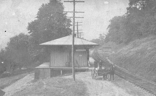
| Ursina | |
|||||||
| Ursina |
|
Although it maily hauled lumber and coal, in 1888 this railroad reported having a passenger car and income from passenger traffic. It is unclear whether the railroad had physical depots on the line. It may have used the B&O station in Ursina. | ||||||
| Wellersburg | |
|||||||
|
Wells Creek (Adams Station) |
|
|||||||
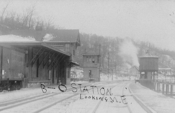
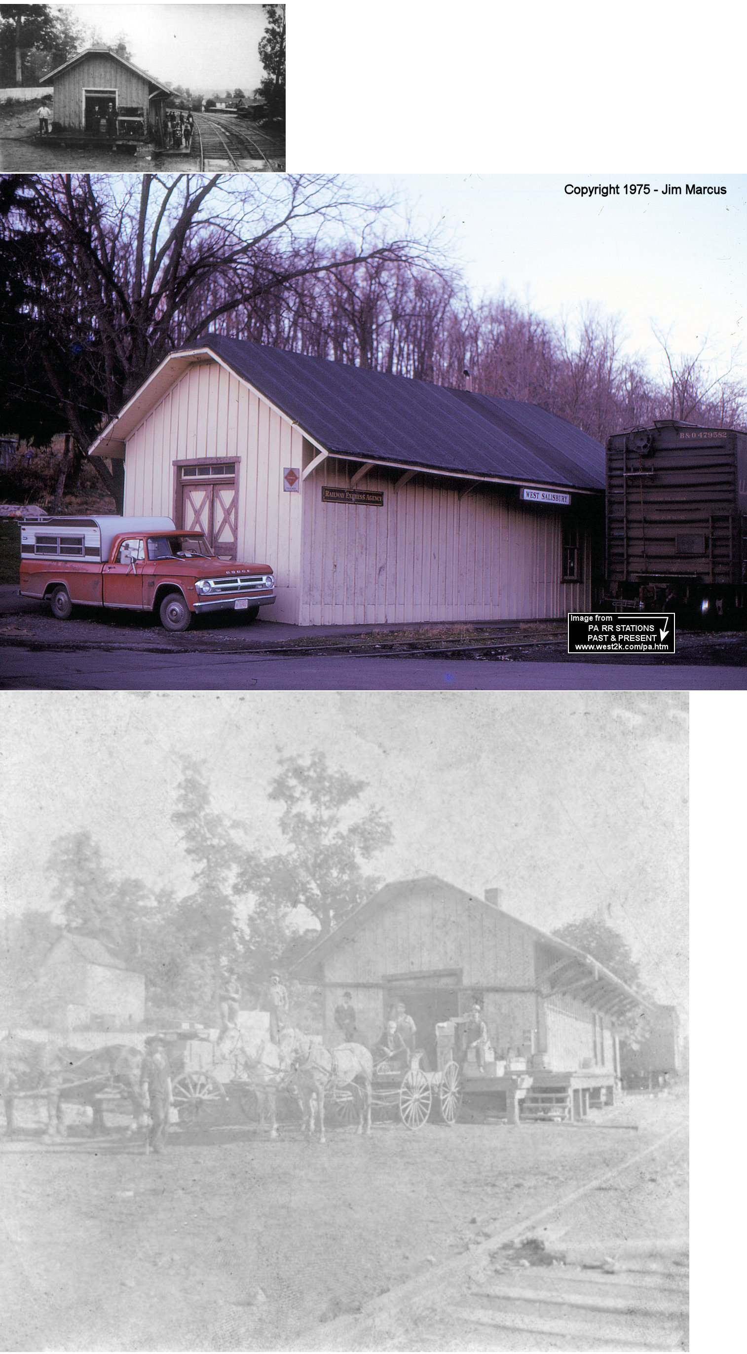
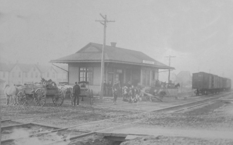
|
West Salisbury Branch Station |
 |
The Salisbury RR later became part of the B&O. | ||||||
| Williams | |
|||||||
| Wilson Creek | |
|||||||
| Wilson Creek Junction | |
|||||||
| Windber |
|
The original wood frame station here was on 15th Street between Graham and Somerset Streets (GPS: 40.235783, -78.830675). The original wooden freight house was just a few feet NW of the original passenger station. | ||||||
| Worth |
|
|||||||
| Zimmerman |
|
|||||||
| Zufall |
|
This was a station on the Pittsburgh, Westmoreland & Summit Railroad. | ||||||
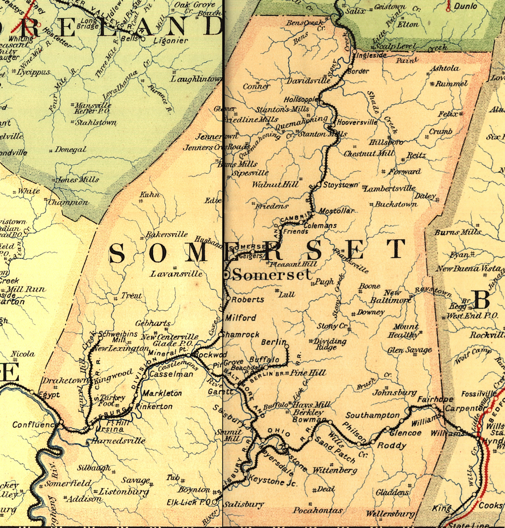
| 1895 SOMERSET COUNTY RAILROAD MAP | ||||||||
 |
||||||||
| Notes About Existing
Stations... Geiger (B&O) - This station may have been built by predecessor railroad Pittsburgh & Connellsville. It was moved from it's original location. Holsopple (B&O) - The original station burned down and this replaced it in 1916. It was repainted in 2008. See the Holsopple Station Website for more information.. Stoystown (B&O) - This station was moved from its original location. It was first moved from Stoystown/Kantner to a location on the north side of Somerset where is was intended to serve the ill-fated Laurel Mountain RR. It was then moved to Stoystown. It has been completely restored by Amish craftsman. The station now houses the Stoystown Historical Society. |
||||||||