|
|
||||||||
| EXISTING STATIONS | ||||||||
|---|---|---|---|---|---|---|---|---|
| Station Name |
Original Railroad |
Current Location |
Type | Current Use |
Date Built |
Track Status |
Building Material |
More Info |
| Coudersport |  |
201 South West Street at West Maple Street (GPS: 41.770613, -78.022286) |
P | Civic | 1899 | Gone | Brick | |
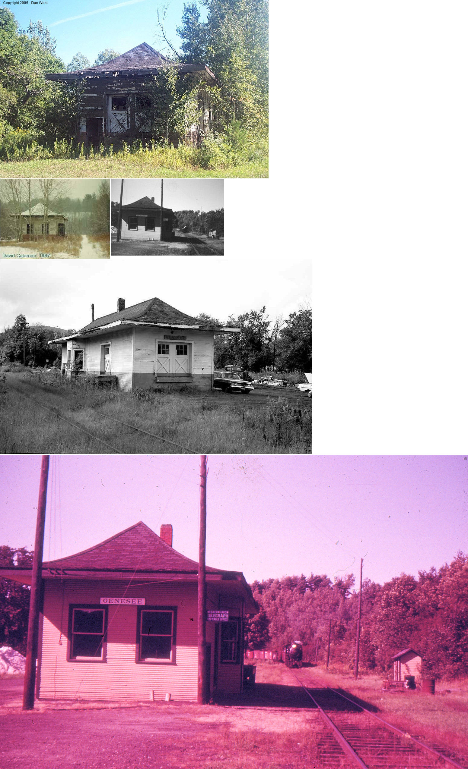
| Genesee |  |
North side of PA244 (Commercial Street) (GPS: 41.994937, -77.868472) |
C | Vacant | ???? | Gone | Wood | |
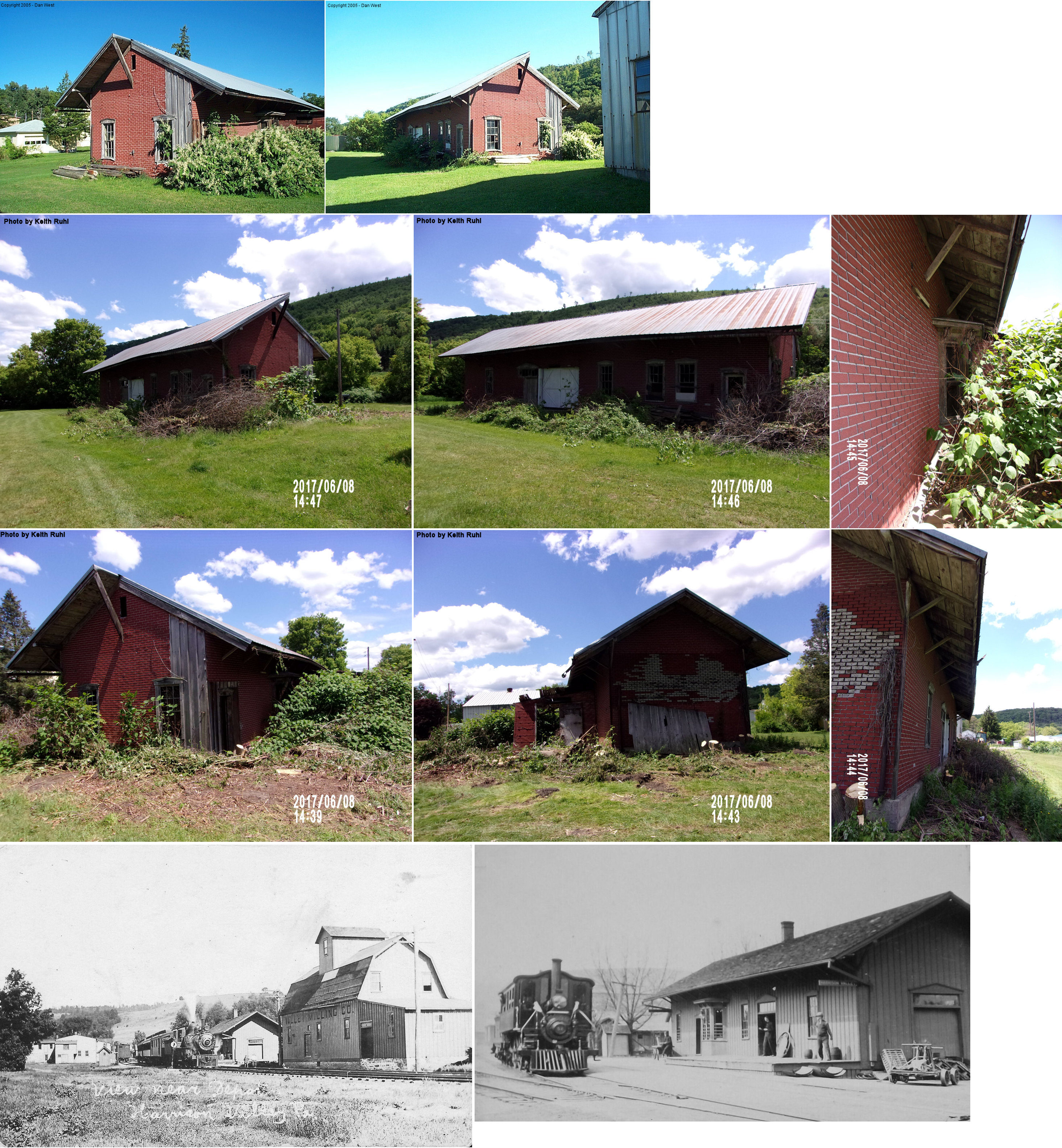
| Harrison Valley |  |
SE side of South Street SW of Main Street (GPS: 41.939910, -77.648171) |
C | Vacant | ???? | Gone | Wood | |
| STATIONS OF THE PAST | ||||||||
| Station Name |
Original Railroad |
Notes | ||||||
| Andrews Settlement |
 |
|||||||
| Austin |
|
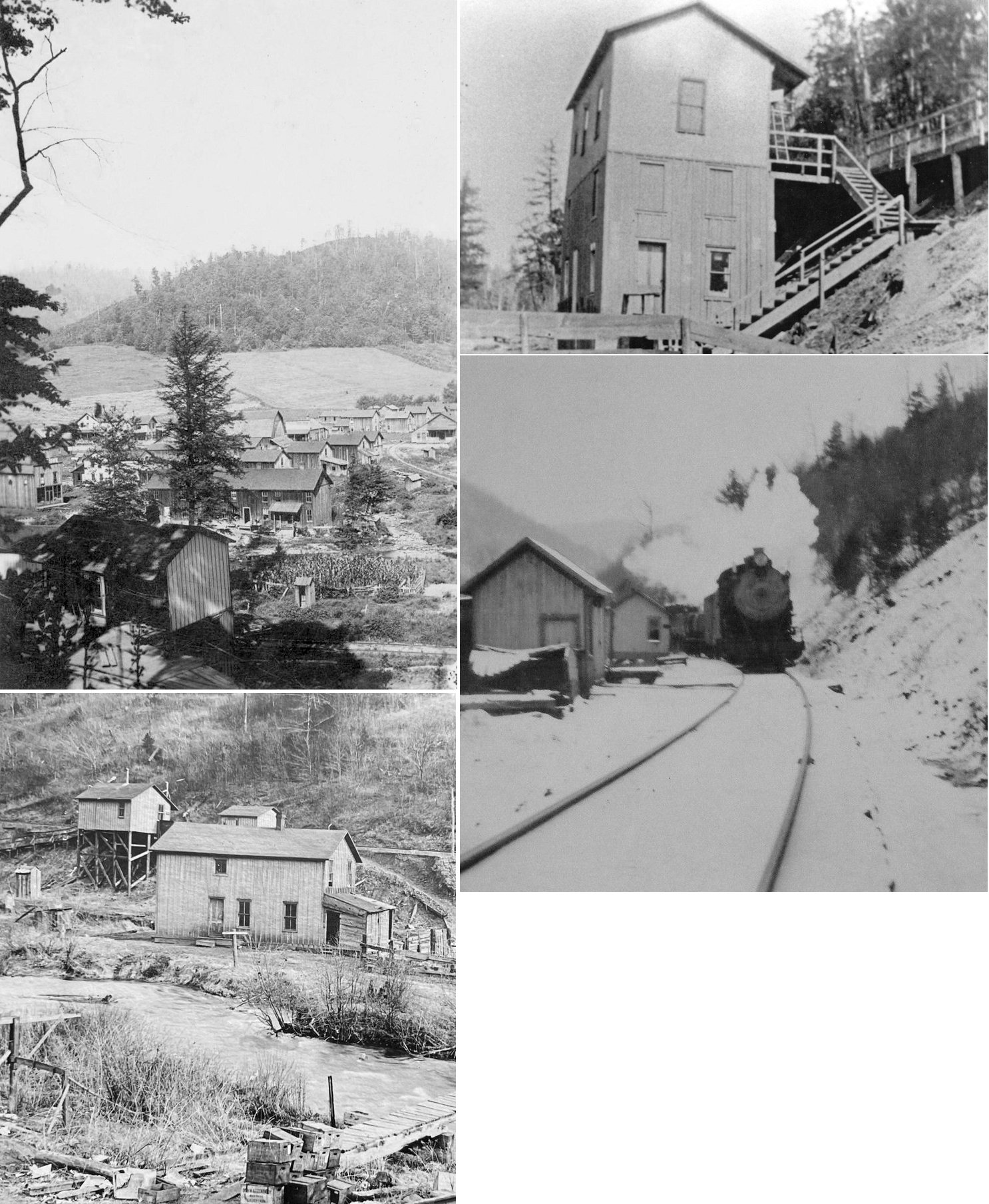
The station was at the foot of Goodyear Street at GPS: 41.630320, -78.092683. It was destroyed in the 1911 Bayless Dam breach and subsequent flood which destroyed most of the town and killed 78 people. | ||||||
| Austin |
|
There was a new wood frame depot here by early 1912. It was a bit smaller than the original, but was built at the same location. A new freight station was also erected at GPS: 41.630334, -78.092187. | ||||||
| Austin |
|
One the 1898 map there is no freight station shown. On the 1903 map there is a small freight station next to the passenger station on the SE side. On the 1911 map that freight station is now marked as an "office," and there is a new two-story freight warehouse just to the NE of the passenger station (as seen in the photo above of the passenger station). These stations were destroyed in the flood. On the 1928 map, a new passenger and freight station are shown with the new one-story freight station to the east of the new passenger station. | ||||||
| Berge Run |
|
|||||||
| Bingham |
|
|||||||
| Brooks Station |
|
This station is shown on the 1941 Potter County map between Wharton and Hammersley. | ||||||
| Burrows |
|
This station was between Lyman Run and Corbett. | ||||||
| Burtville |
|
|||||||
| Carpenter |
|
Listed as a flag stop on the 1901 timetable. | ||||||
| Chapmans |
|
|||||||
| Cherry Springs |
|
|||||||
| Clara |
|
|||||||
| Colesburg |
|
|||||||
| Coneville |
|
|||||||
| Conrad (Hulls) |
|
The station was called Hulls on the B&S. The station was in the vicinity of GPS: 41.609364, -77.889191. | ||||||
| Corbett |
|
|||||||
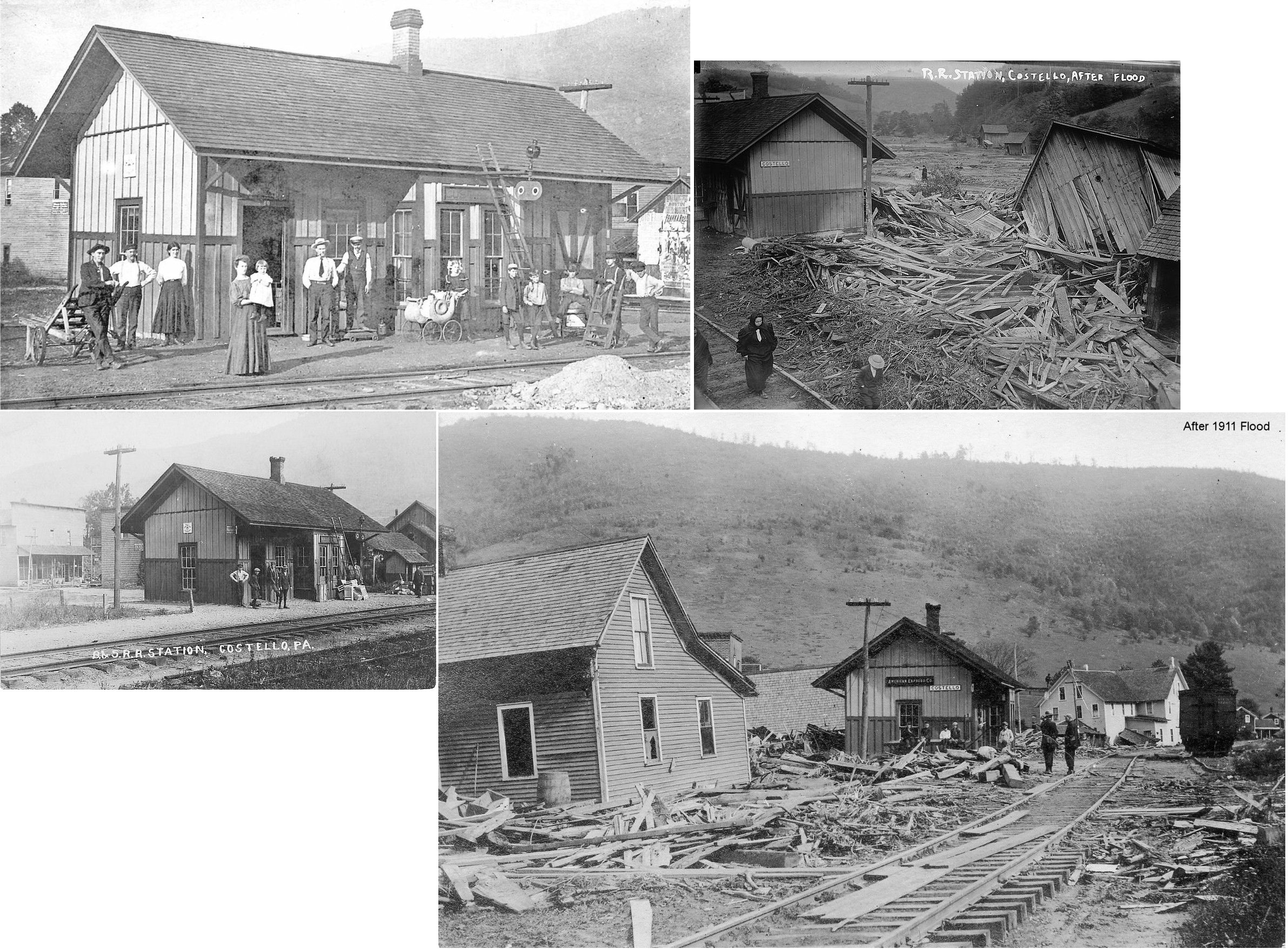
| Costello |
|
Although the station survived the Austin damn break flood in 1911, it was torn down sometime before 1939. It was located in the northeast quadrant of the intersection of Steiner Street and Railroad Street near GPS: 41.593398, -78.059491. Railroad Street lies on the former B&S alignment, and the station site is presently occupied by a newer home. | ||||||
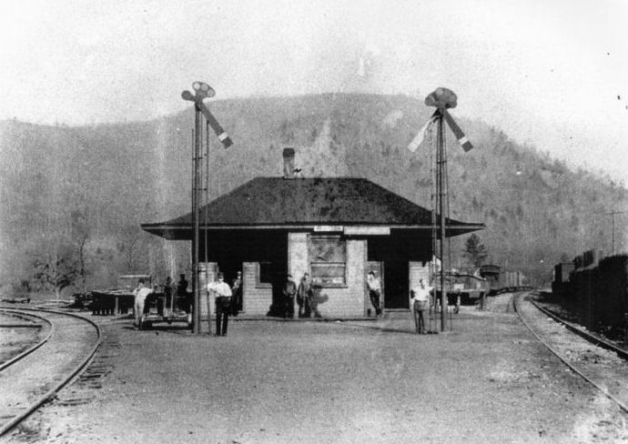
| Coudersport |
|
The first station here was a wood-frame building that was on the west side of South Main Street just north of East Maple Street at GPS: 41.770788, -78.021516. This station is shown on the 1897 Sanborn Insurance map. It was removed when the new brick station was built in 1899. | ||||||
| Coudersport |
|
The freight house was on the NE corner of South West Street and Chestnut Street at GPS: 41.769856, -78.022474. It was built in 1899. | ||||||
| Crossfork |
|
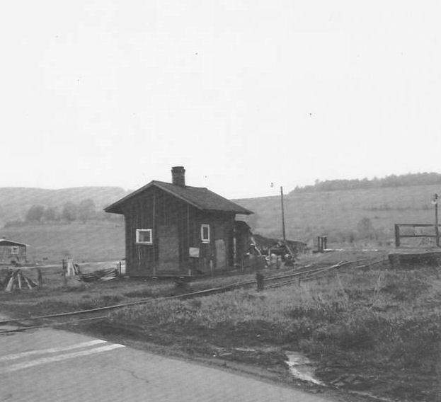
The station in the photo is from the town of Cross Fork. Cross Fork Junction was located up on the ridge line at the top of the B&S switchbacks, while the town of Cross Fork was down in the valley below as seen in the photo. This station was on the B&S branch to the town of Cross Fork, which was abandoned in 1913 with the closing of the sawmills. | ||||||
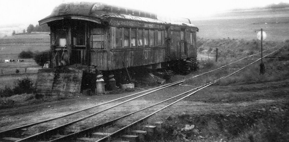
| Crossfork |
|
This old car was used as a temporary station after the station listed above burned down. | ||||||
| Crossfork Juction |
|
There are reports that this station still exists as a camp at the intersection of Junction Road and Cross Fork Road. That needs to be confirmed with more information and a photo though. | ||||||
| Crowell |
|
|||||||
| Ellisburg |
|
|||||||
| Elmer |
|
|||||||
| Frinks |
|
This station was between North Coudersport and Colesburg. | ||||||
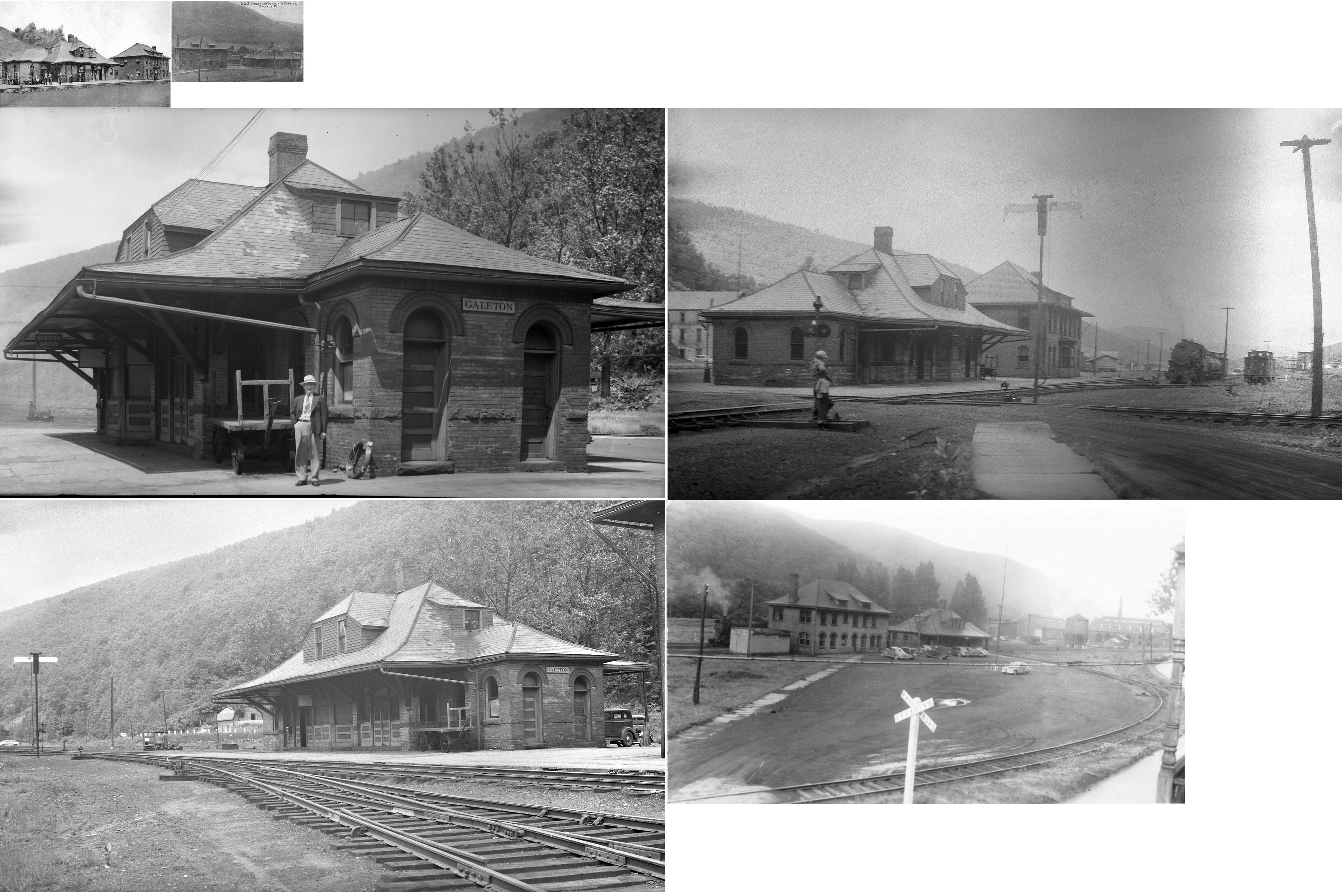
| Galeton |
|
This passenger station was on West Street near Industrial Park Road at GPS: 41.731275, -77.654162. In the photo, the freight station/office building on left is still standing, depot is gone. | ||||||
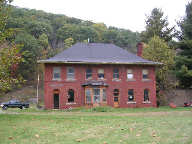
| Galeton |
|
This building, built in 1894, served as both a freight station and and B&S (later Wellsville Addison & Galeton) offices. It was on the south side of West Street between Unon Street and Industrial Park Road at GPS: 41.731357, -77.653844. After serving as storage for several years, it was torn down in 2021. | ||||||
| Galeton |
|
There was a small passenger station of the south side of the bridge at the intersection of Germania Street and Bridge Street at GPS: 41.733049, -77.641826. This station is shown on the 105 and 1911 Sanborn maps. | ||||||
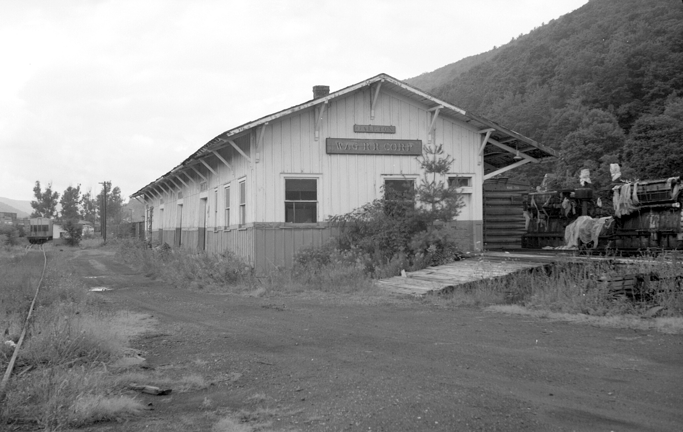
| Galeton |
|
This freight station was on the west side of Union Street just south of West Street at GPS: 41.732552, -77.650710. It was used by the Wellsville, Addison and Galeton RR in later years. | ||||||
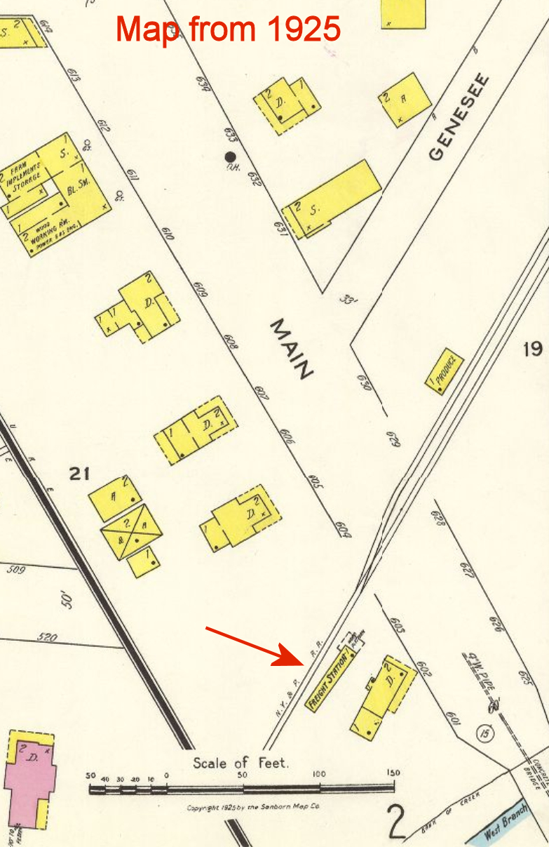
| Genesee |
|
The 1925 Sanborn map shows a freight station on the SW side of main street on the SE side of the tracks at approximately GPS: 41.991975, -77.870667. | ||||||
| Germania |
|
This station was on Crippen Run Road in the vicinity of GPS: 41.711231, -77.700516. | ||||||
| Gold |
|
|||||||
| Gold |
|
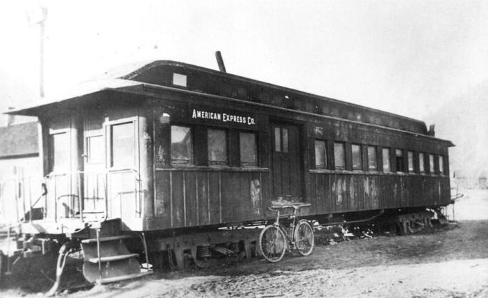
At some point, maybe after the station was torn down, an old passenger car was used as a station here. | ||||||
| Greco |
|
|||||||
| Hammersley |
|
|||||||
| Hammond |
|
This station was between Olmsted and Coudersport. It was a flagstop for one train per day. | ||||||
| Hulls |
|
See listing above for Conrad. | ||||||
| Jamison |
|
This station was 2 miles from Hull and about 4 miles from Logue. | ||||||
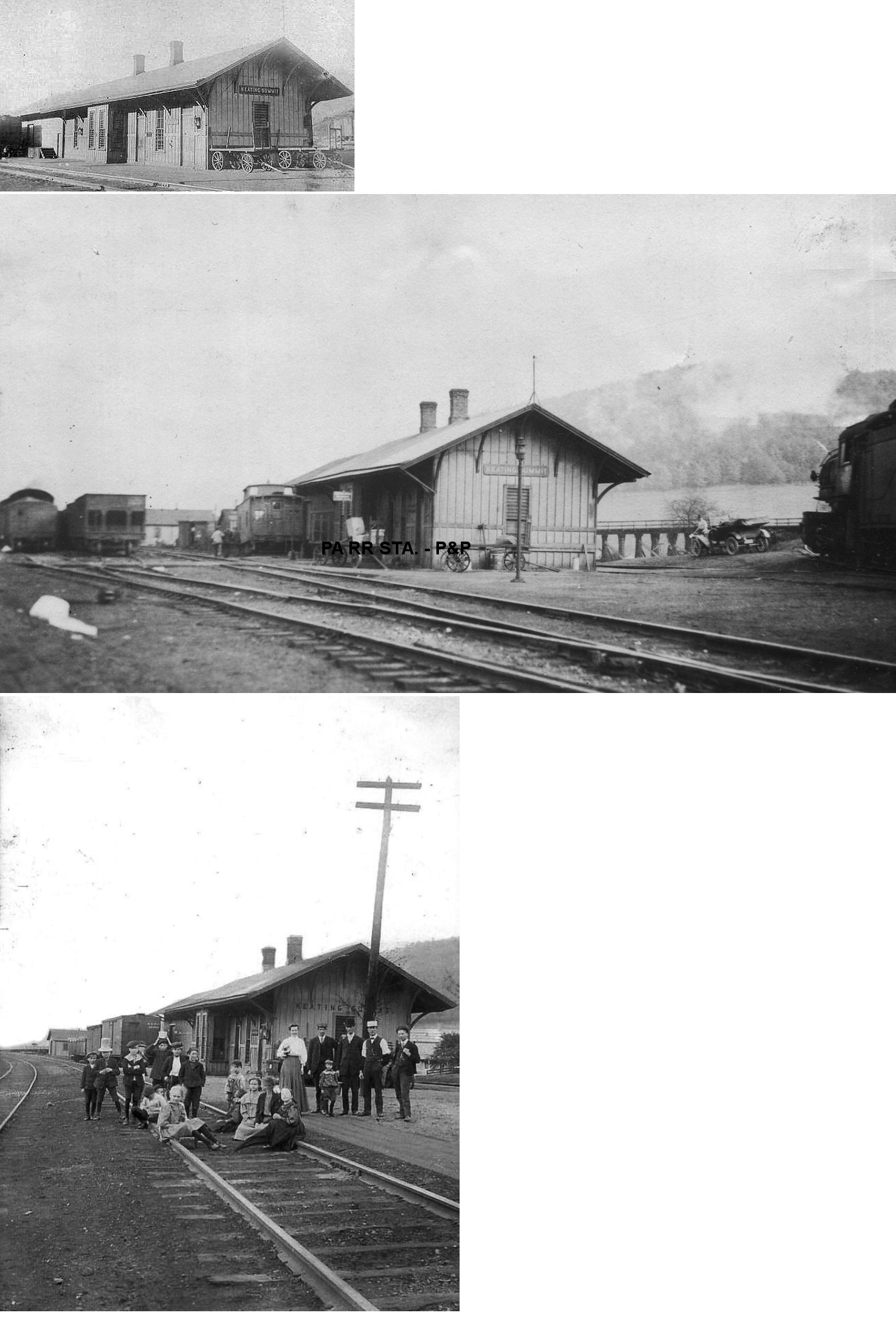
| Keating Summit |  AND |
This was the original station. | ||||||
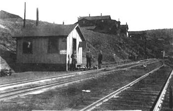
| Keating Summit | |
This was used as the station in later years when a large station was not needed after the interchange with the B&S was discontinued. | ||||||
| Knowlton |
|
|||||||
| Logue (Logue Run) |
|
|||||||
| Lyman Run |
|
This station was between Germania and Burrows. | ||||||
| Mills | |
|||||||
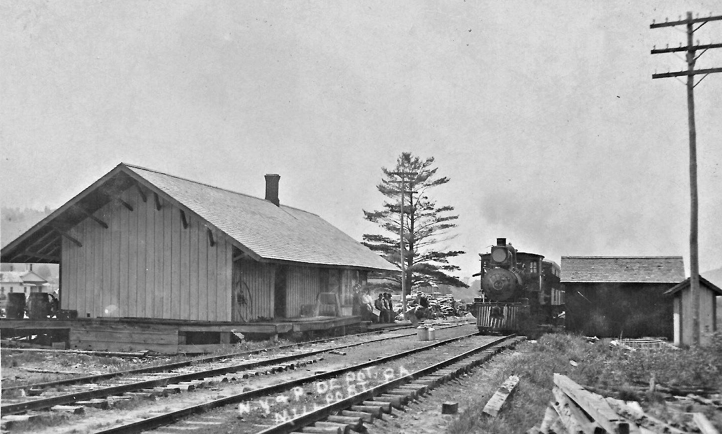
| Millport |
|
|||||||
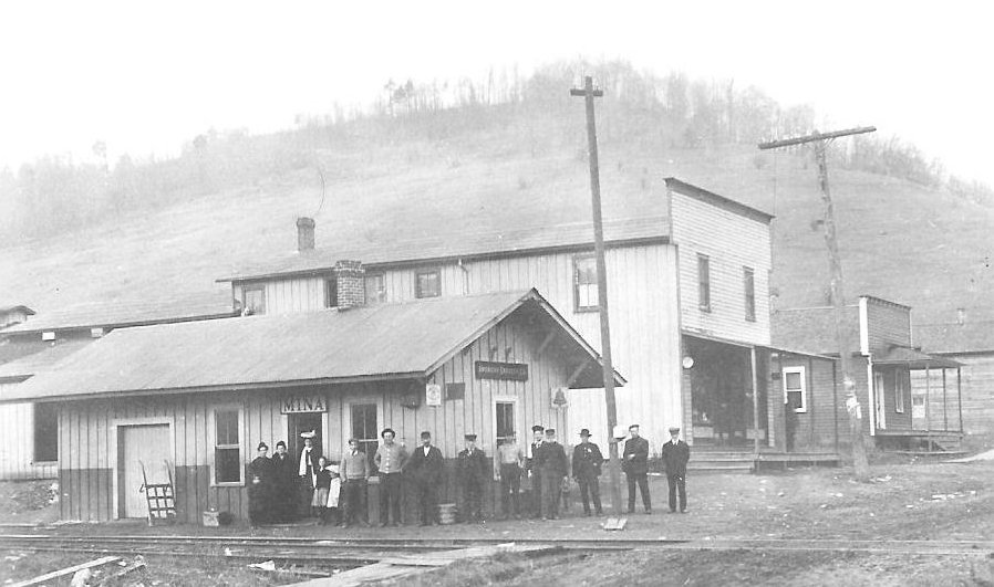
| Mina | |
|||||||
| Newfield |
|
|||||||
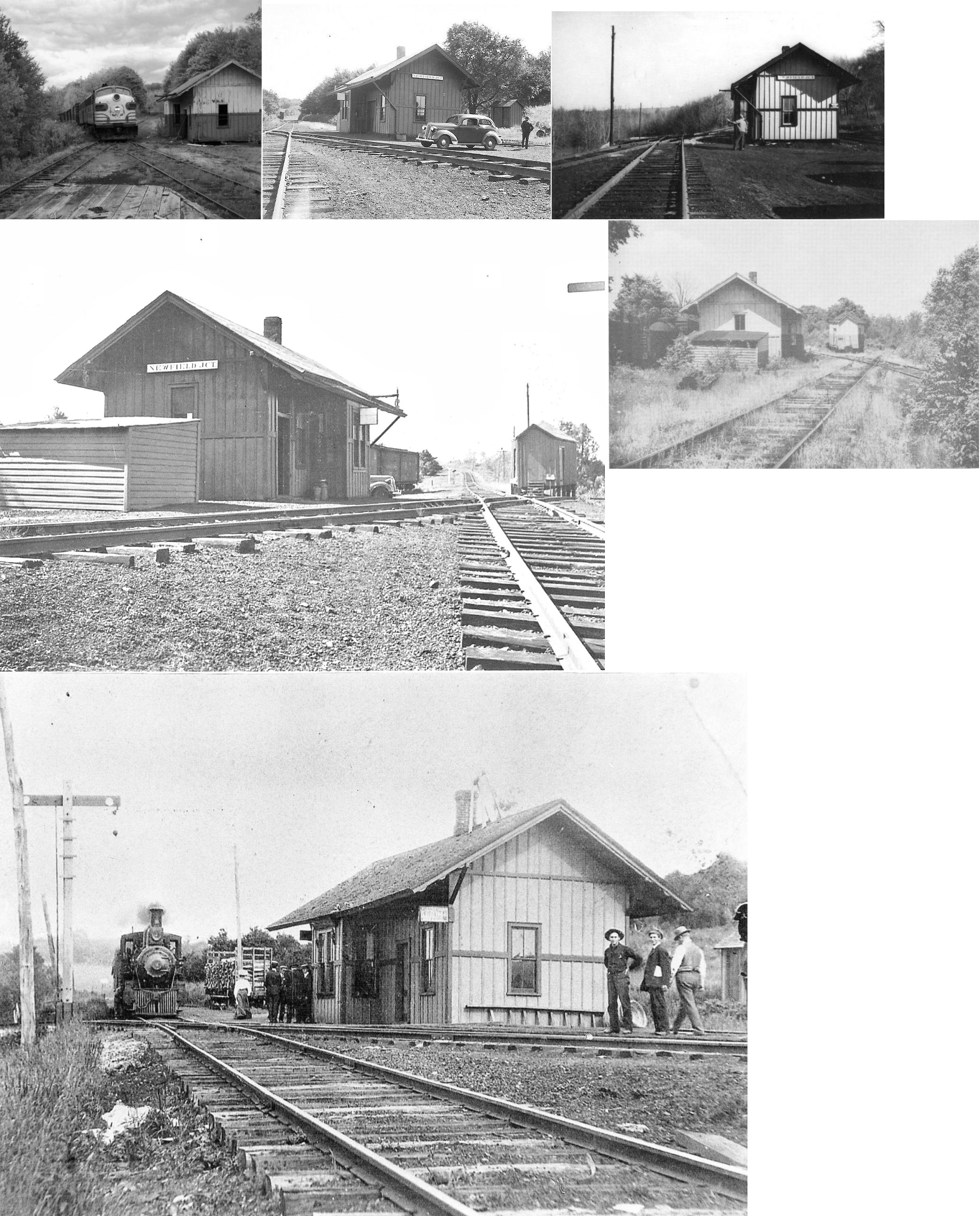
| Newfield Junction |
AND |
This station was east of Newfield Junction Road on the south side of the diamond at GPS: 41.867922, -77.820803. There was a joint freight transfer house on the west side of the diamond. | ||||||
| North Coudersport |
|
Listed as a flag stop on the 1901 timetable. | ||||||
| Olmsted |
|
|||||||
| Oswayo |
|
|||||||
| Perkins |
|
Listed as a flag stop on the 1901 timetable. | ||||||
| Raymond |
|
|||||||
| Rose lake |
|
|||||||
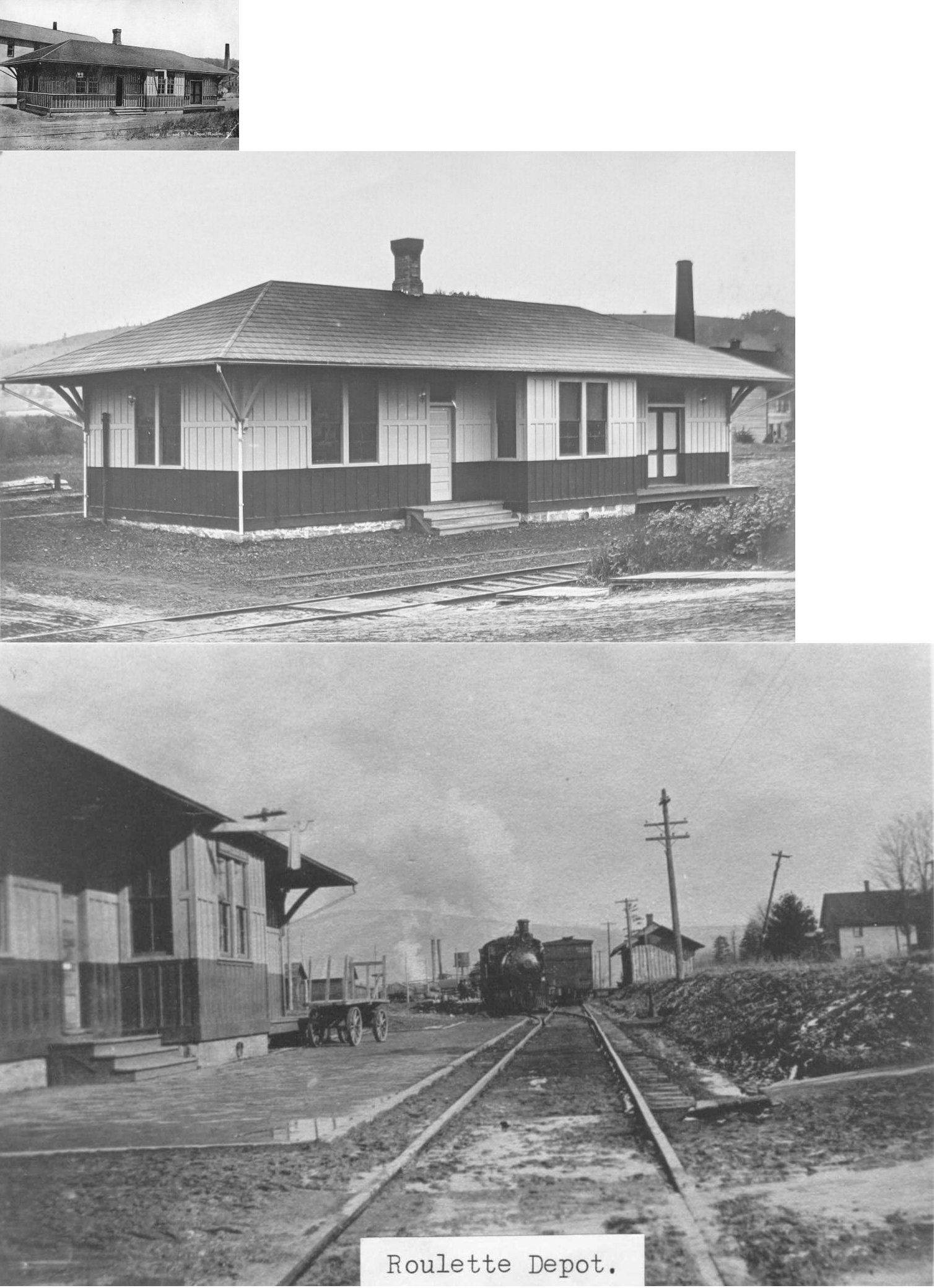
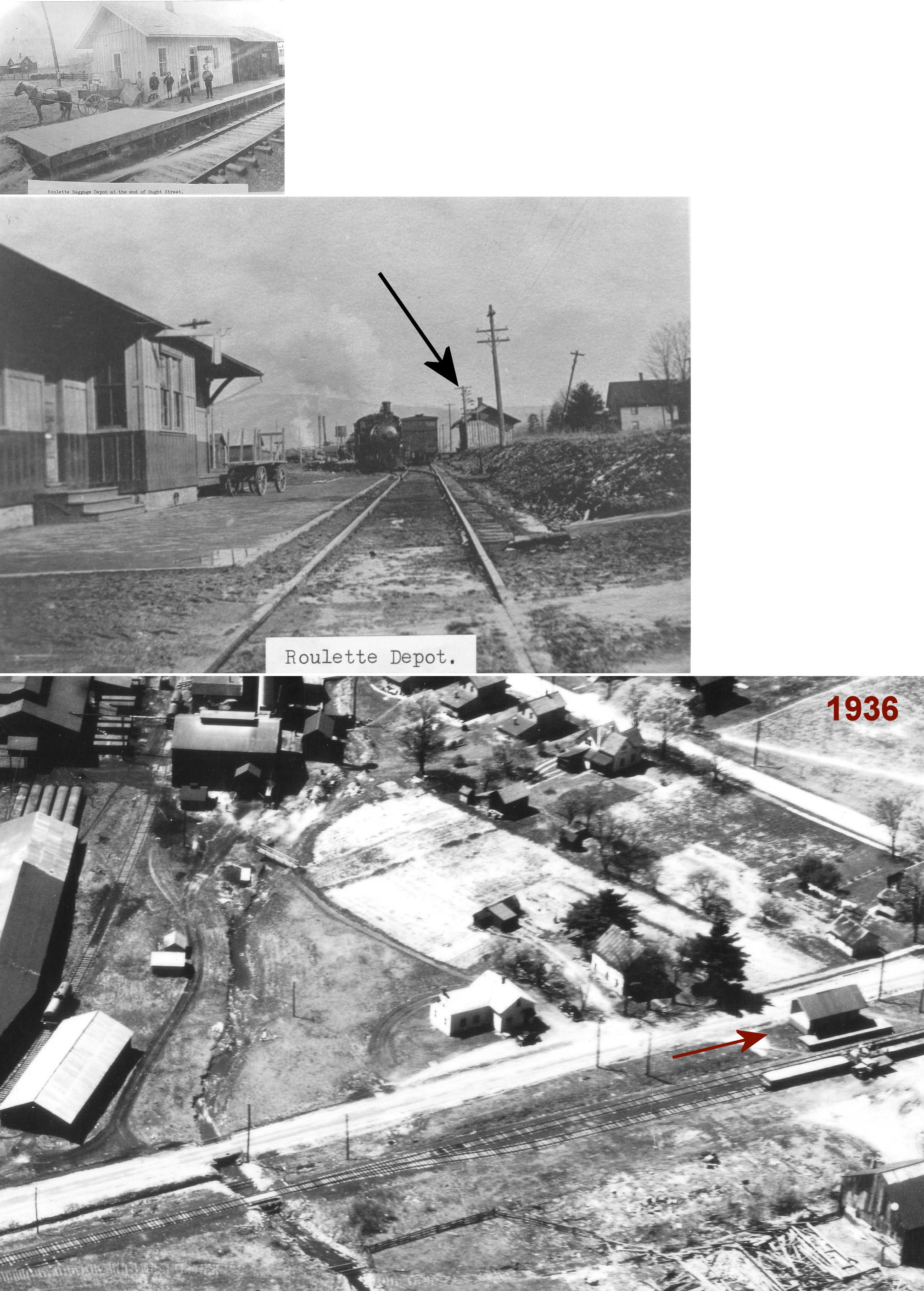
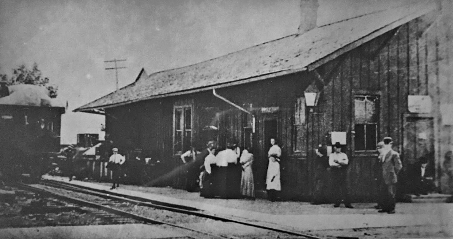
| Roulette | |
This station was torn down in January, 1989. | ||||||
| Roulette | |
The freight station was just down the tracks from the passenger station at the end of Ought Street. | ||||||
| Seven Bridges |
|
|||||||
| Sharon Center |
|
|||||||
| ShingleHouse |
|
This station was on the south side of Academy Street just east of Puritan Street at GPS: 41.963749, -78.191617. | ||||||
| Tyler |
|
|||||||
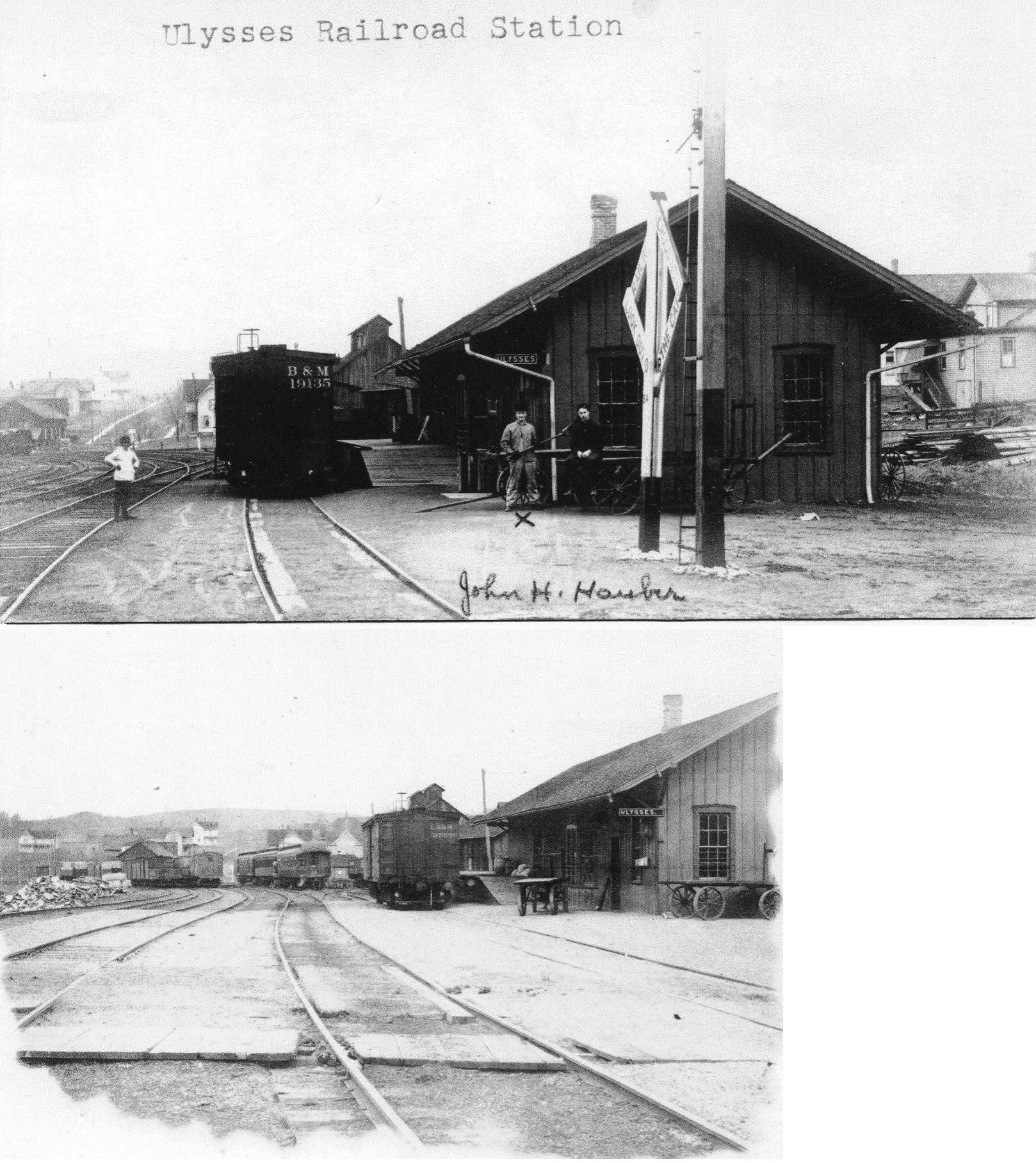
| Ulysses | AND  |
This union station was on the north side of Church Street on the east side of the tracks at GPS: 41.901821, -77.764052. | ||||||
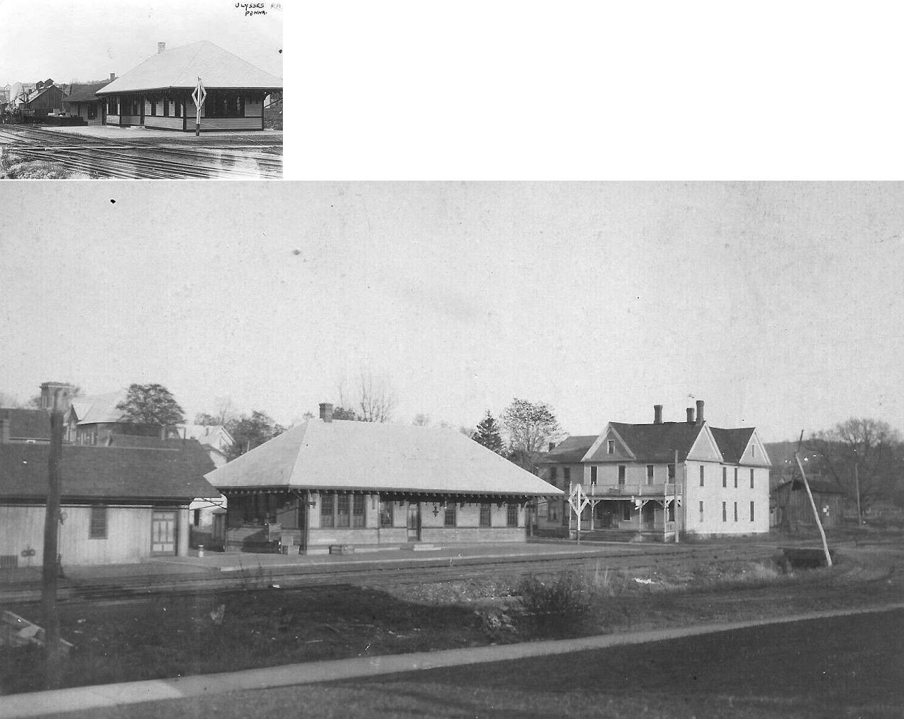
| Ulysses |
 |
A new depot was built here in 1911. It was on the same site as the previous depot (listed above). | ||||||
| Van Housen |
|
This station was between Corbett and Cherry Springs. | ||||||
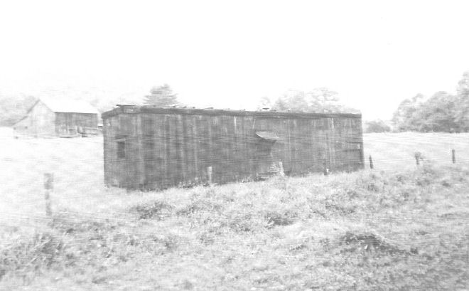
| Wharton |
|
This one-story wood frame depot was between located between the two eastern ends of the wye in Wharton off of what is today a private lane (GPS 41.529854, -78.018300). The B&S reached this location around 1891 and Wharton is listed as stop in an 1898 timetable. The station can be seen on an 1939 aerial photo as well. It was likely demolished in the flood of July 1942 that decimated the former B&S lines (purchased in 1932 by the B&O) in the First Fork of Sinnemahoning Creek valley or as part of the abandonment activites shortly thereafter. --Nick Puzak | ||||||
| Wharton |
|
This converted boxcar served as the station in later years. | ||||||
| Woodville |
|
|||||||
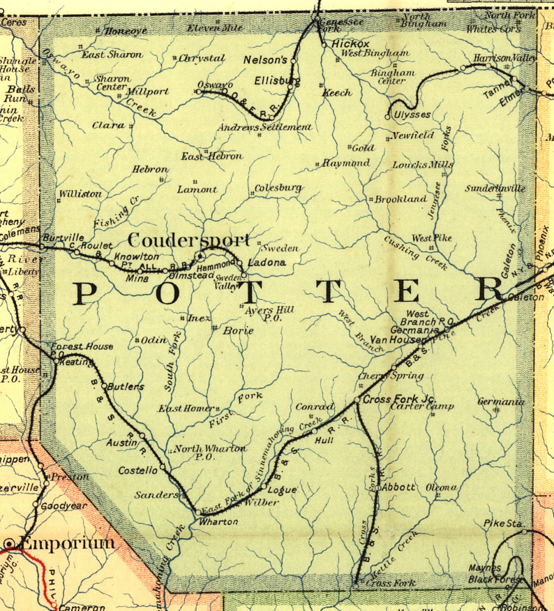
| 1895 POTTER COUNTY RAILROAD MAP | ||||||||
 |
||||||||
| Notes About Existing
Stations...
|
||||||||