|
|
||||||||
| EXISTING STATIONS | ||||||||
|---|---|---|---|---|---|---|---|---|
| Station Name |
Original Railroad |
Current Location |
Type | Current Use |
Date Built |
Track Status |
Building Material |
More Info |
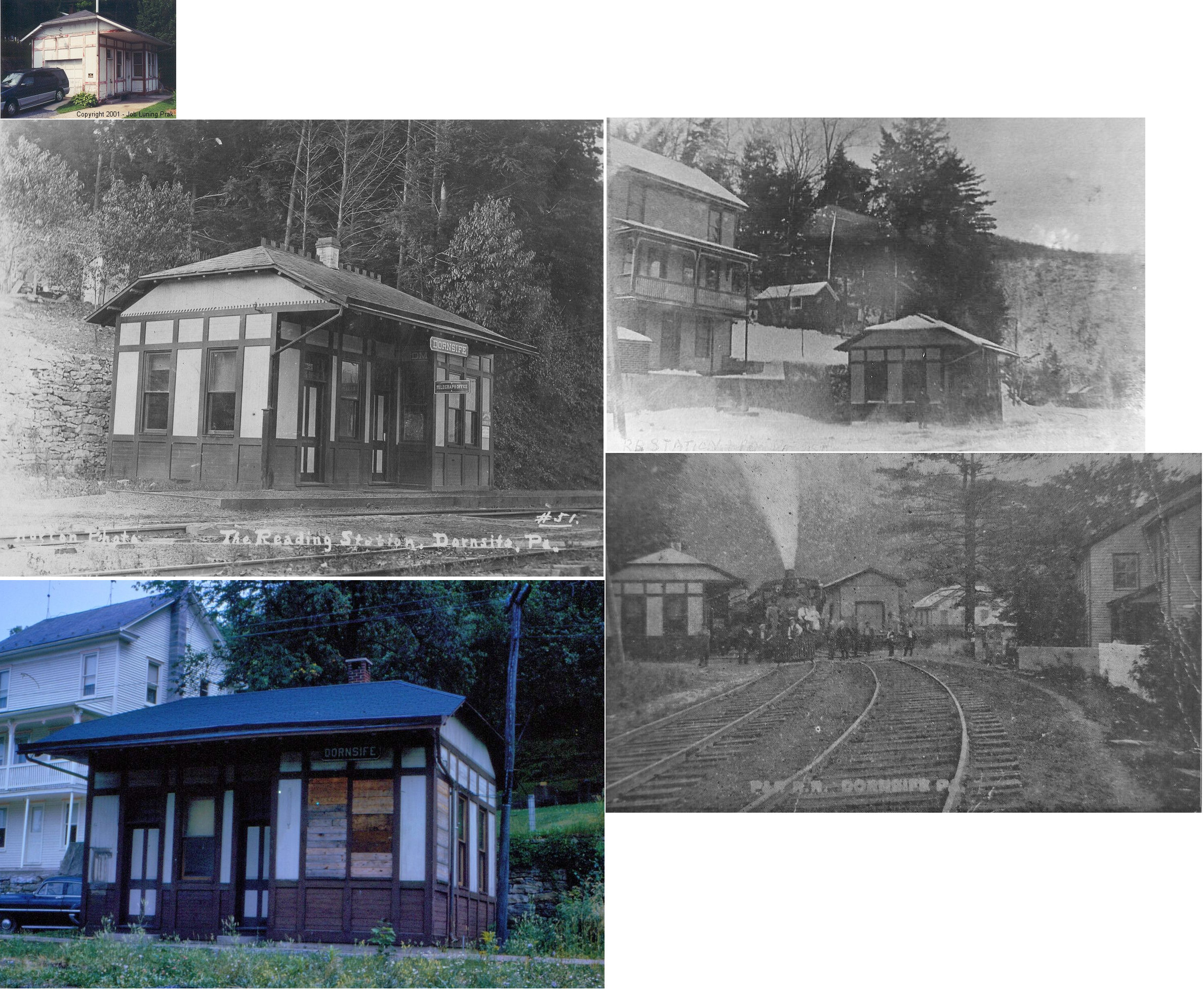
| Dornsife (Gap) |
 |
Off PA225 next to 405 Creek Road (Is it still there?) |
P | Garage | ???? | Gone | Wood |
|
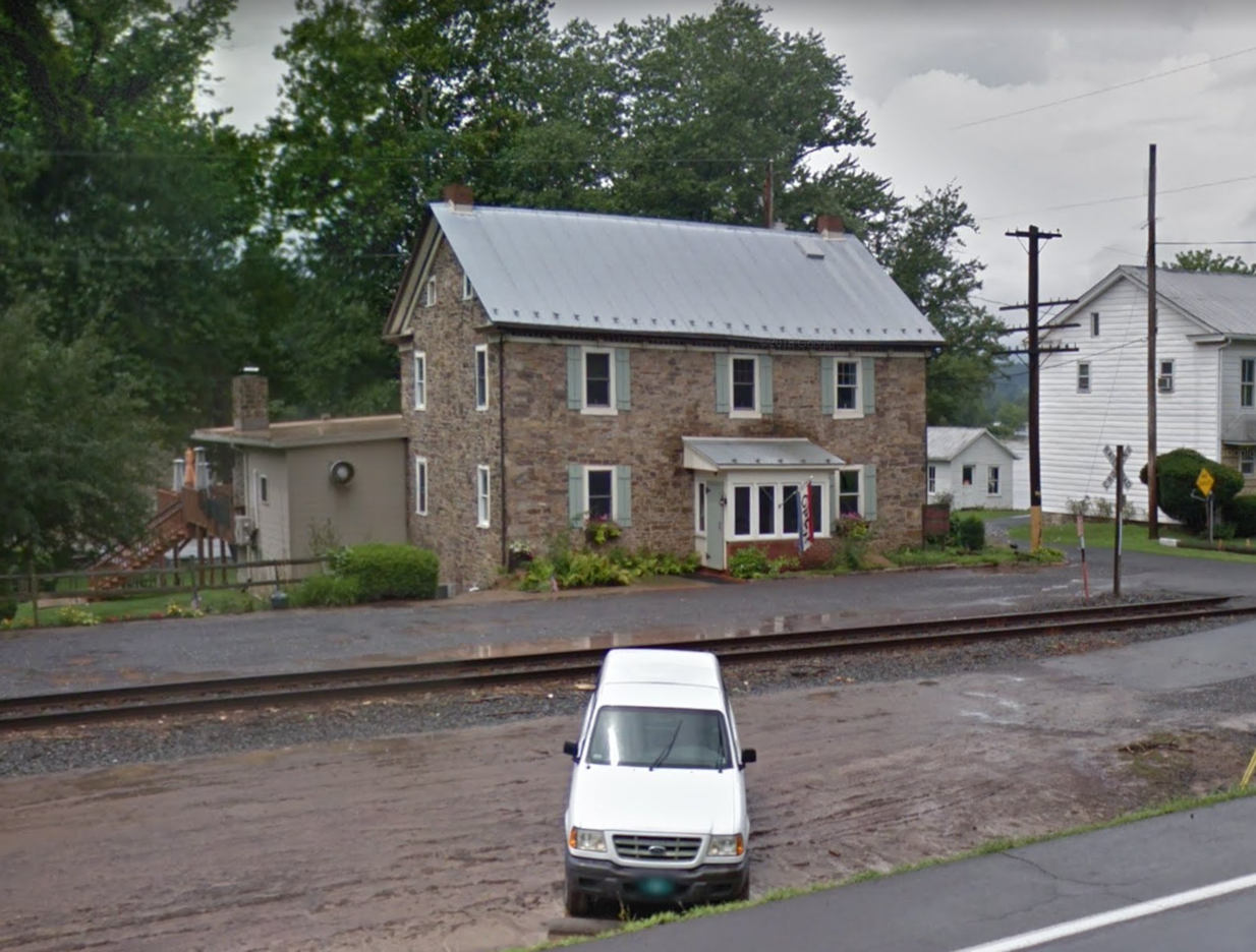
| Fishers Ferry (Port Trevorton) |
 |
113 River Road (GPS: 40.767958, -76.843780) |
P | Business | 1792 | In Use | Stone |
|
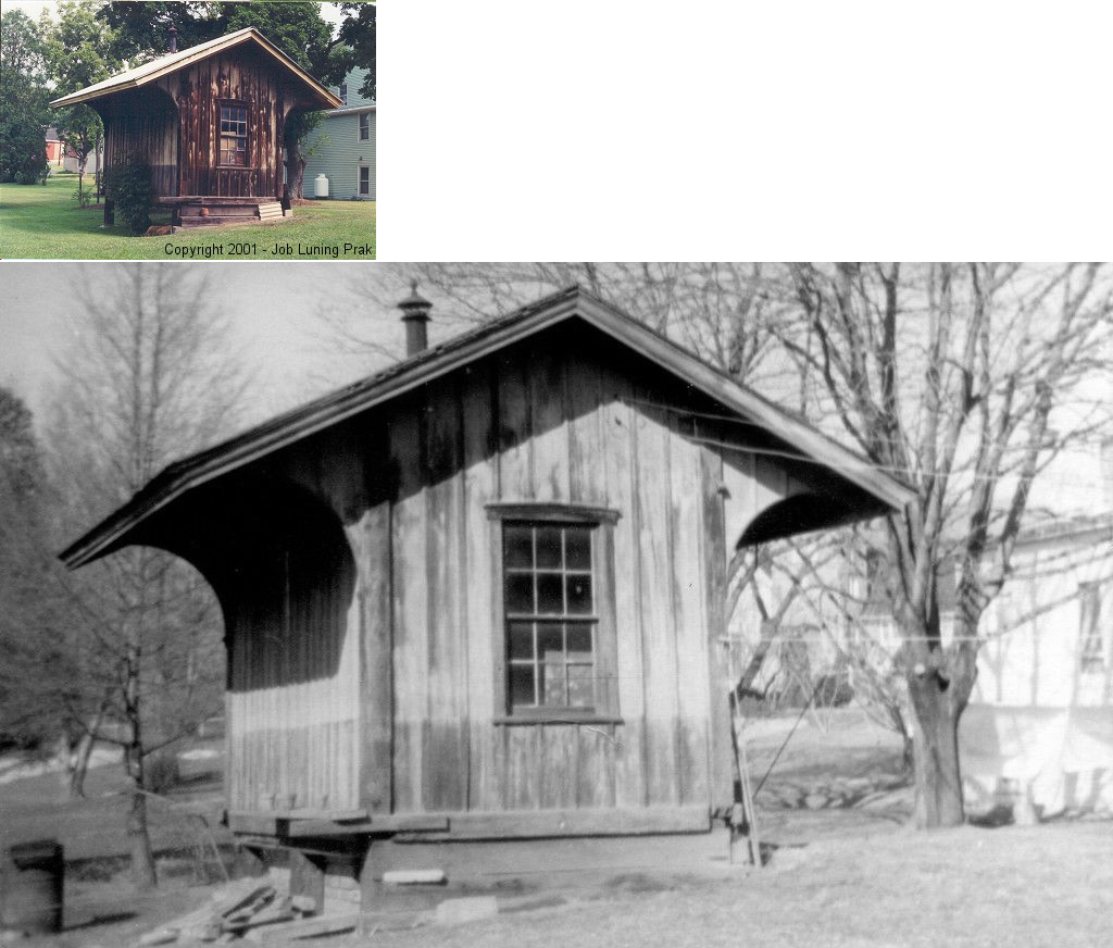
| Hunter (Rakers) |
|
Backyard of 116 Lower Road (SR 3004) (GPS: 40.756537, -76.755972) |
P | Storage | 1905 | Gone | Wood |
|
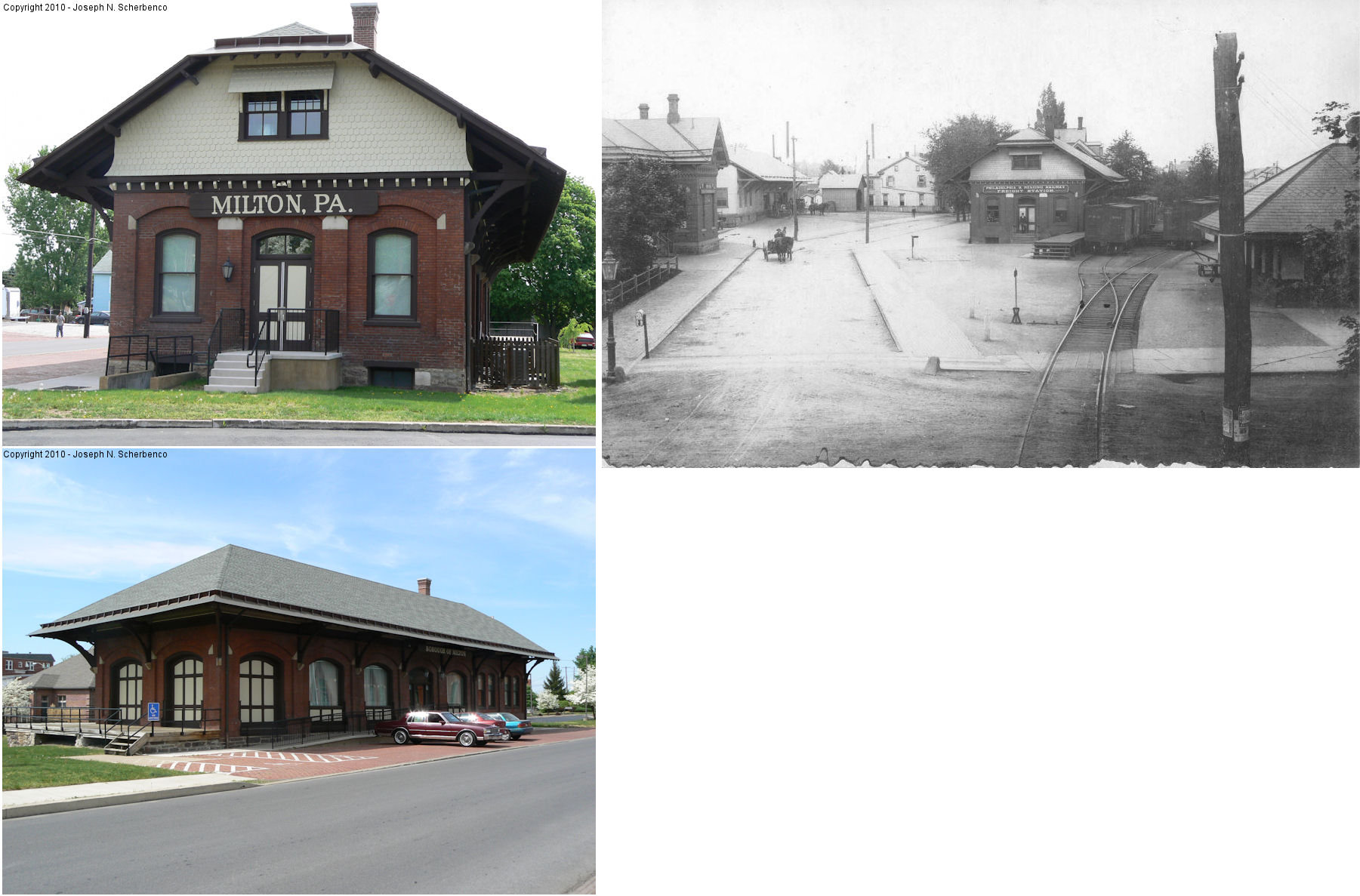
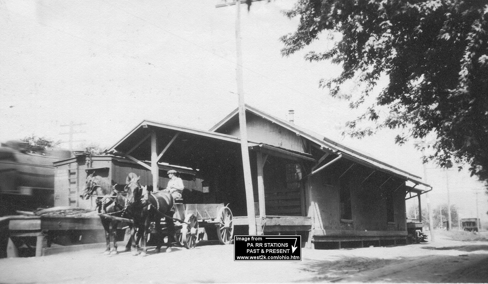
| Milton |  |
29 North Filbert Street (GPS: 41.019846, -76.851986) |
P | Civic | 1881 | In Use | Brick |
|
| Milton | |
2 North Filbert Street (GPS: 41.019633, -76.852407) |
F | Civic | 1890 | In Use | Brick | |
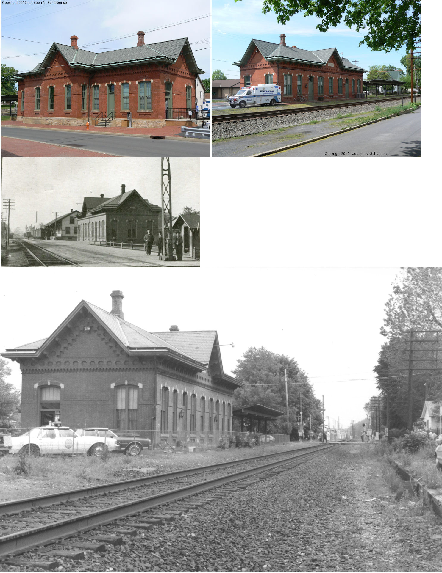
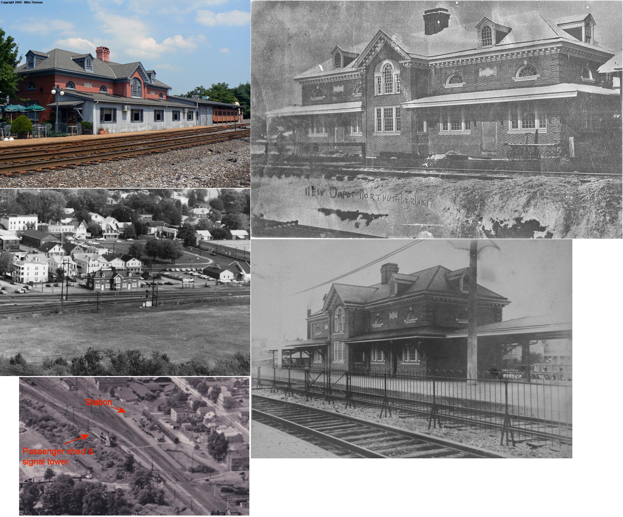
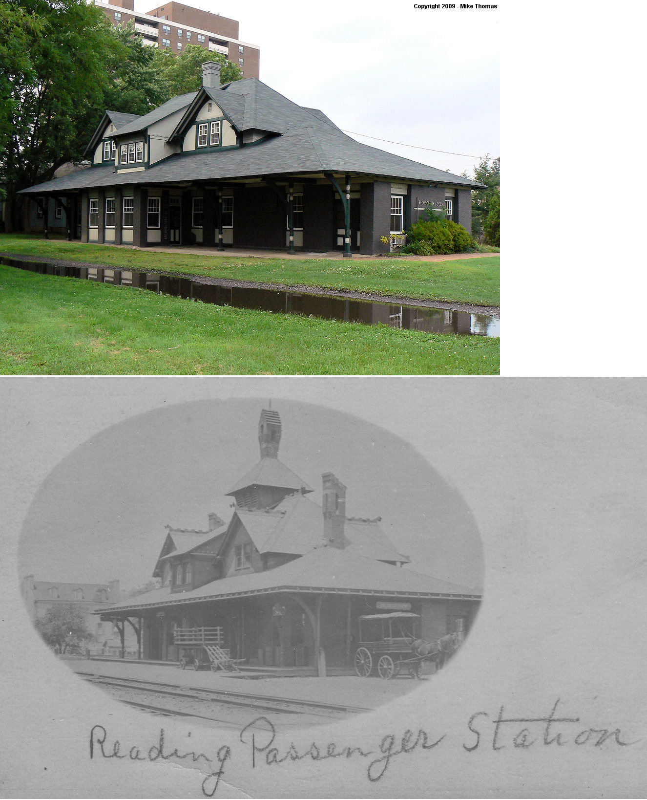
| Northumberland |  |
2 Front Street (GPS: 40.887095, -76.796368) |
P | Restaurant | 1910 | In Use | Brick |
|
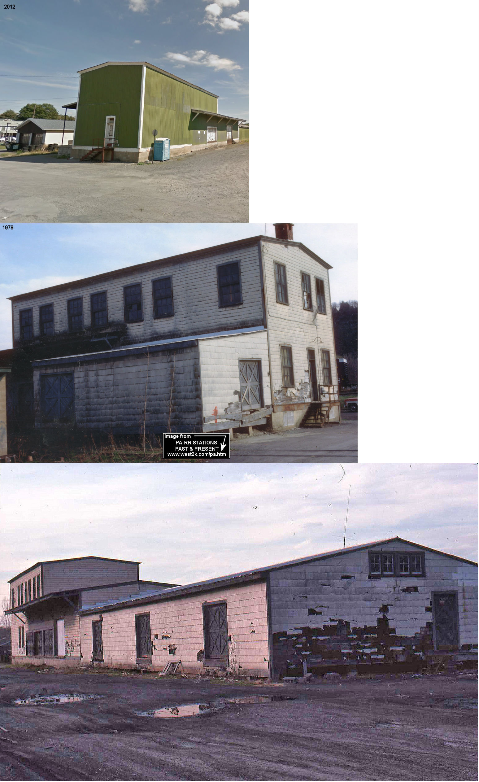
| Northumberland | |
SE side of 4th Street between Way and Duke Streets (GPS: 40.890128, -76.801285) |
F | Warehouse | 1910 | In Use | Wood | |
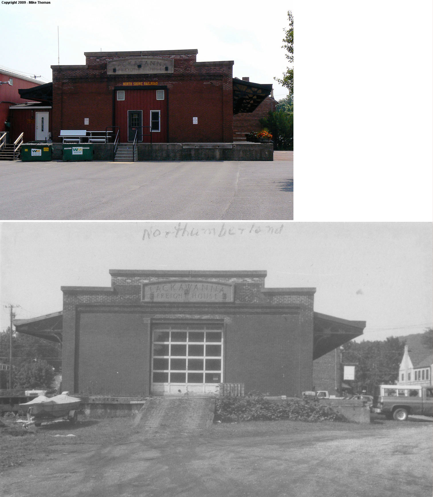
| Northumberland |  |
356 Priestley Avenue (GPS: 40.888963, -76.791325) |
F | Railroad | 1911 | In Use | Brick |
|
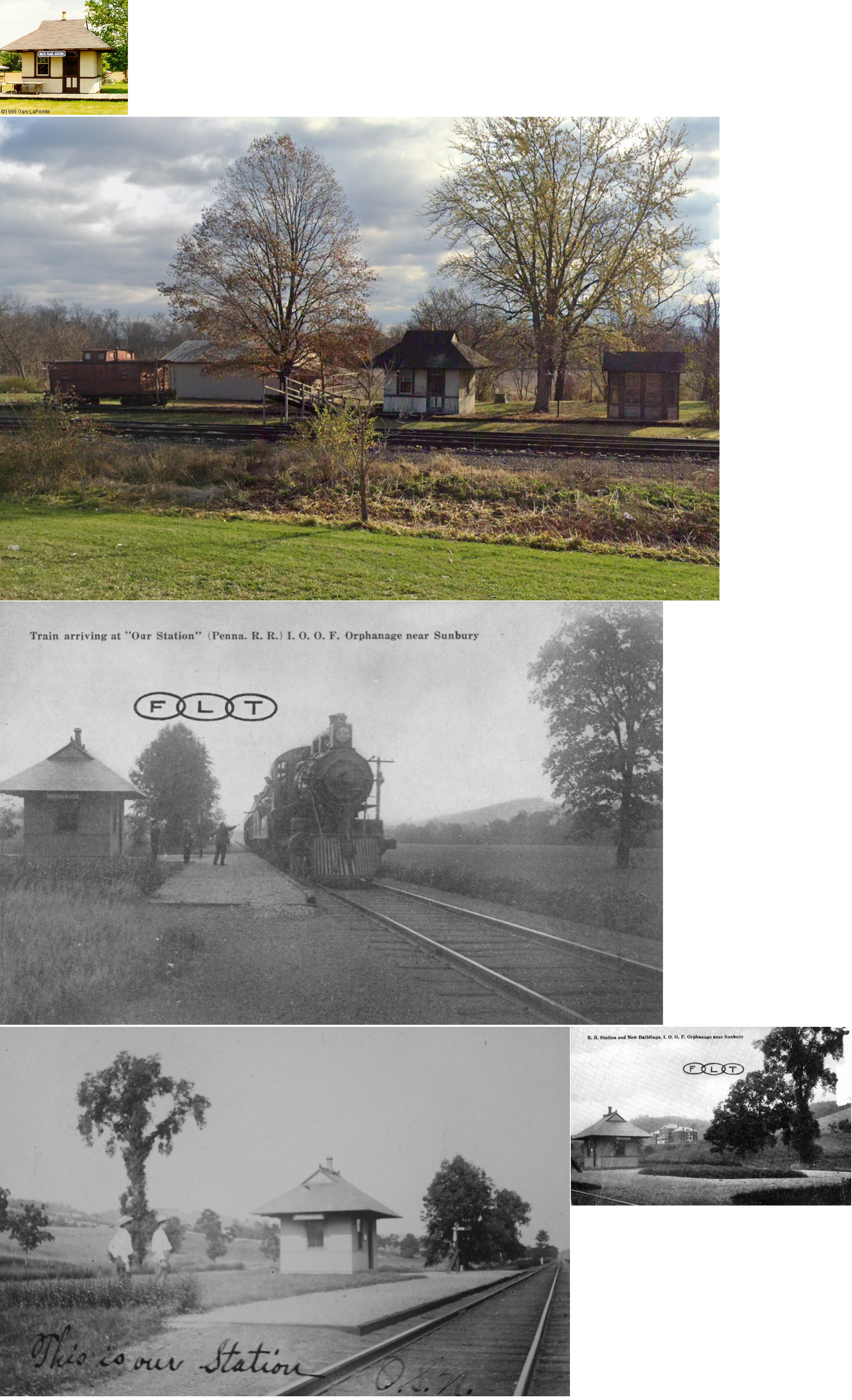
| Orphanage (Delta Place) |
|
SE side of US-15 near Waverly Kennels, in Union County (GPS: 40.988613, -76.876509) |
P | Railroad | ???? | In Use | Wood |
|
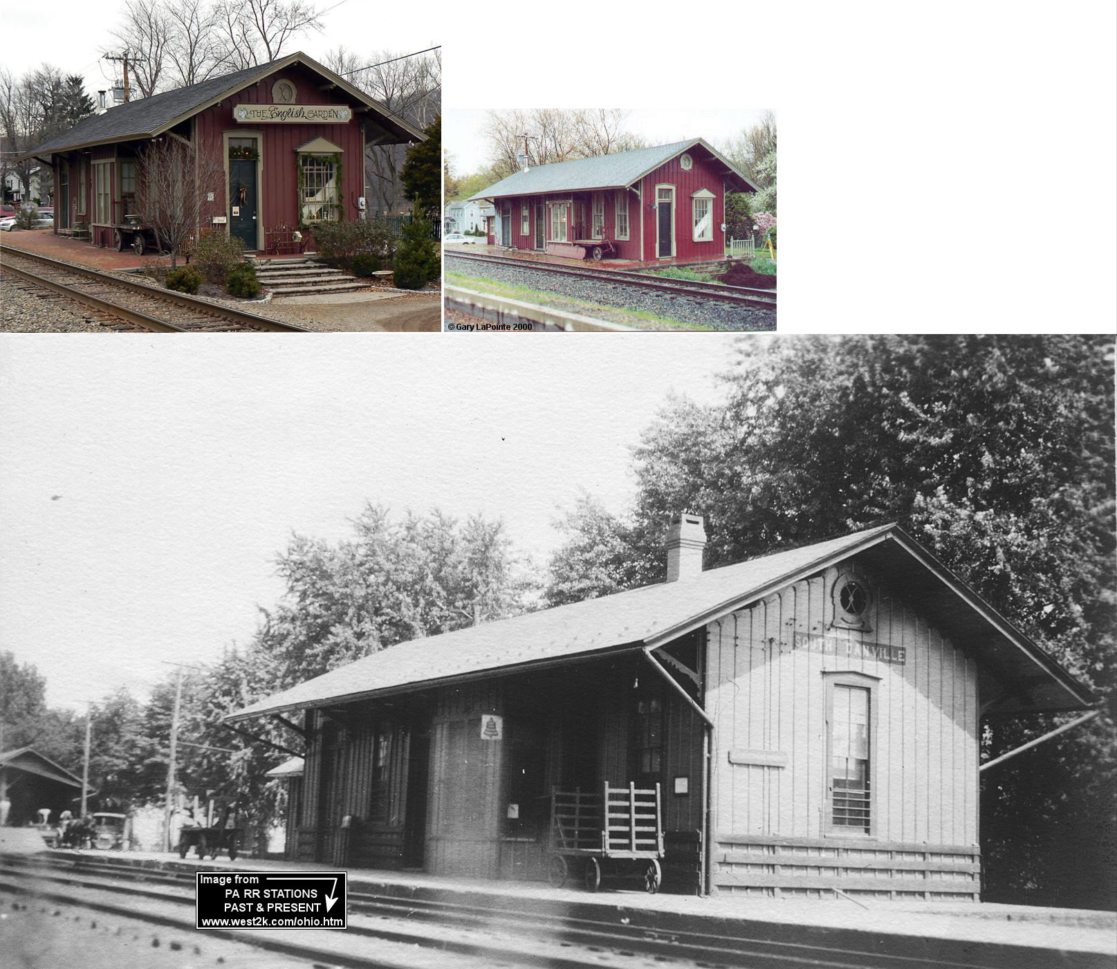
| Riverside (S. Danville) |
|
1 D&H Avenue (GPS: 40.956199, -76.624100) |
C | Business | ???? | In Use | Wood |
|
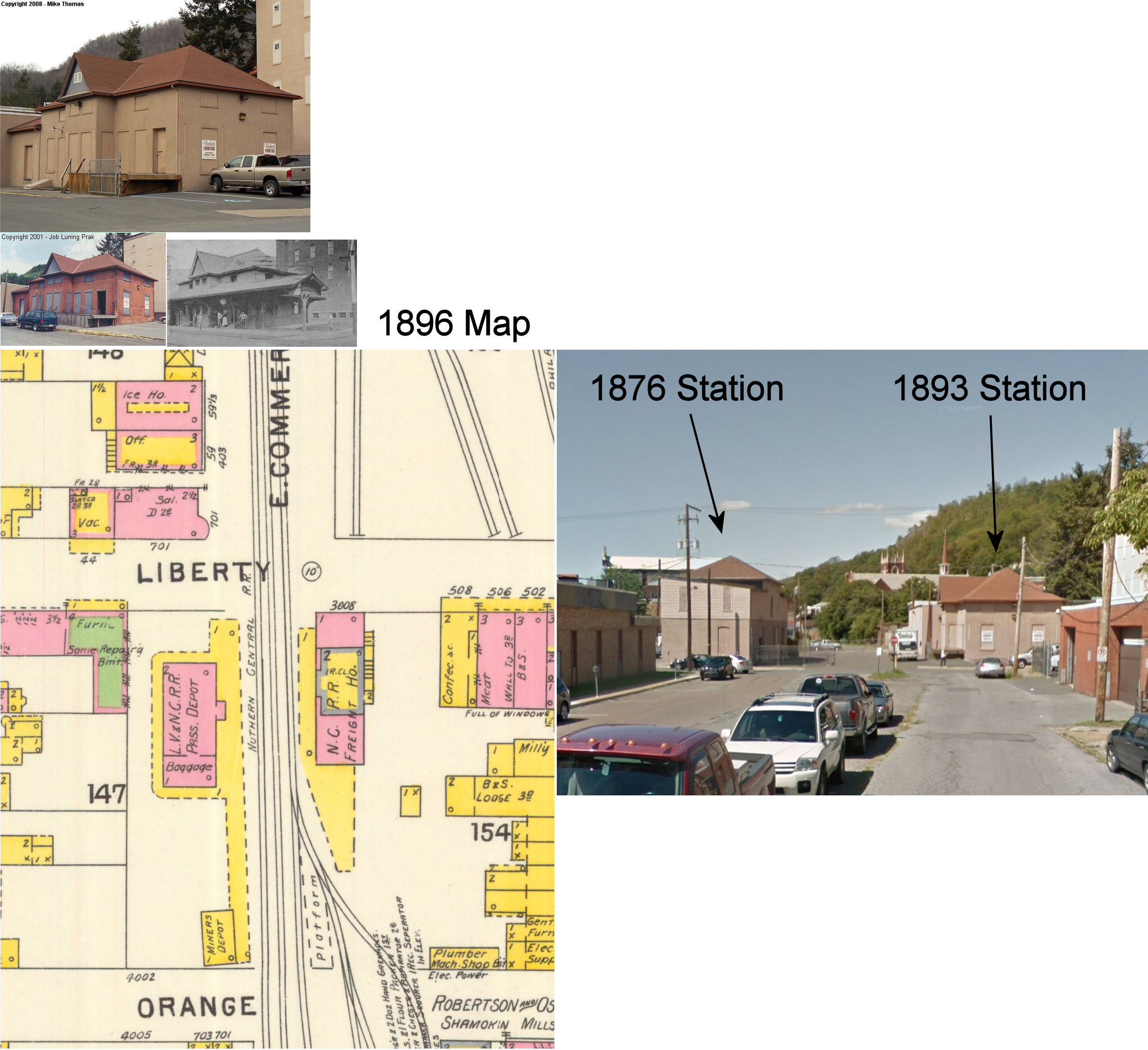
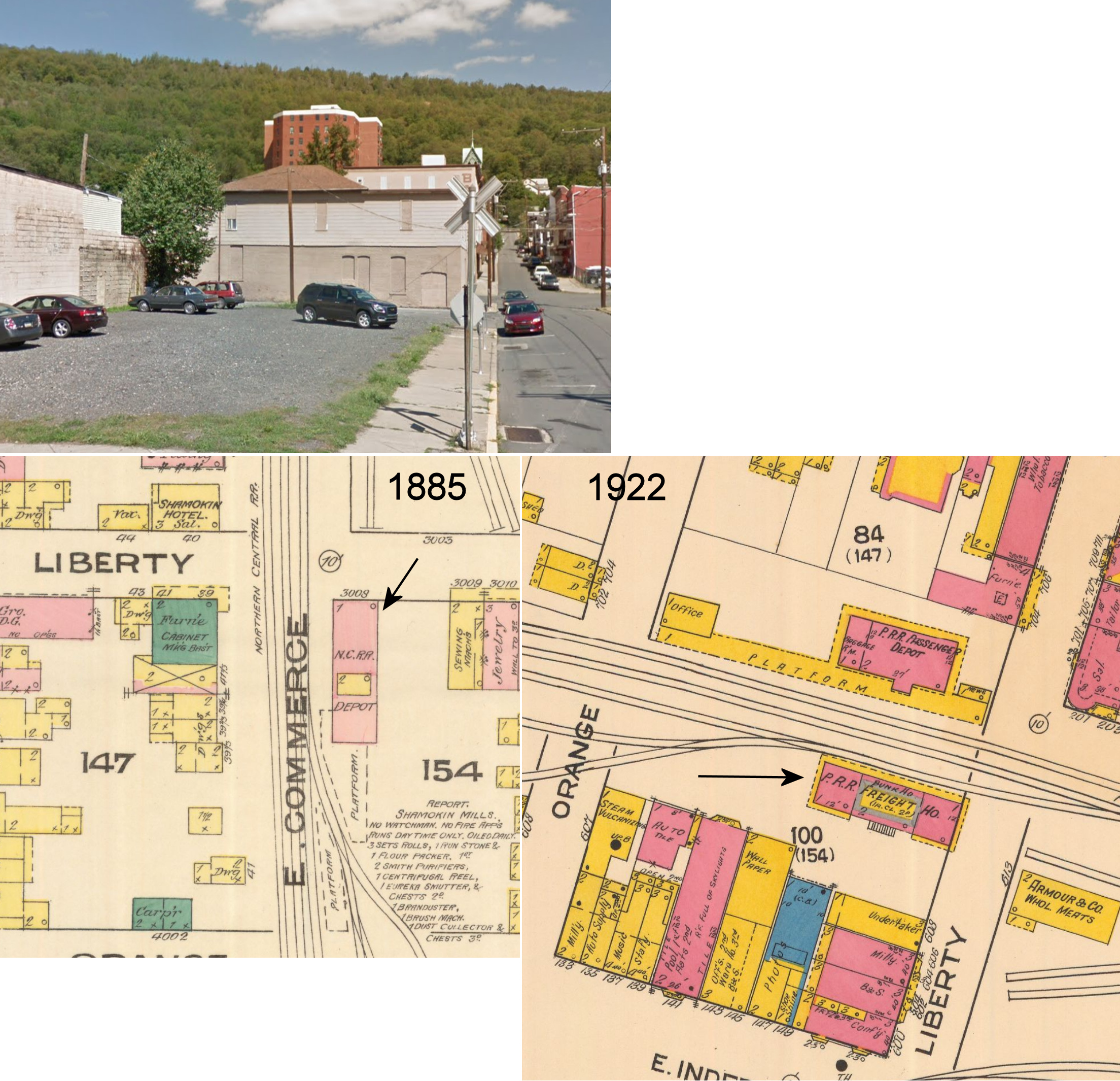
| Shamokin |
AND  |
NW corner of Liberty & Commerce Streets (GPS: 40.792732, -76.554007) |
P | Storage | 1893 | Gone | Brick |
|
| Shamokin |
|
SE corner of Liberty & Commerce Streets (GPS: 40.792488, -76.553964) |
C | Unknown | 1876 | Gone | Brick |
|
| Sunbury | |
100 North Third Street (GPS: 40.863401, -76.791857) |
P | Business | 1872 | In Use | Brick | |
| Sunbury | |
159 South Second Street (GPS: 40.859826, -76.796651) |
P | Business | 1870s | Gone | Wood |
|
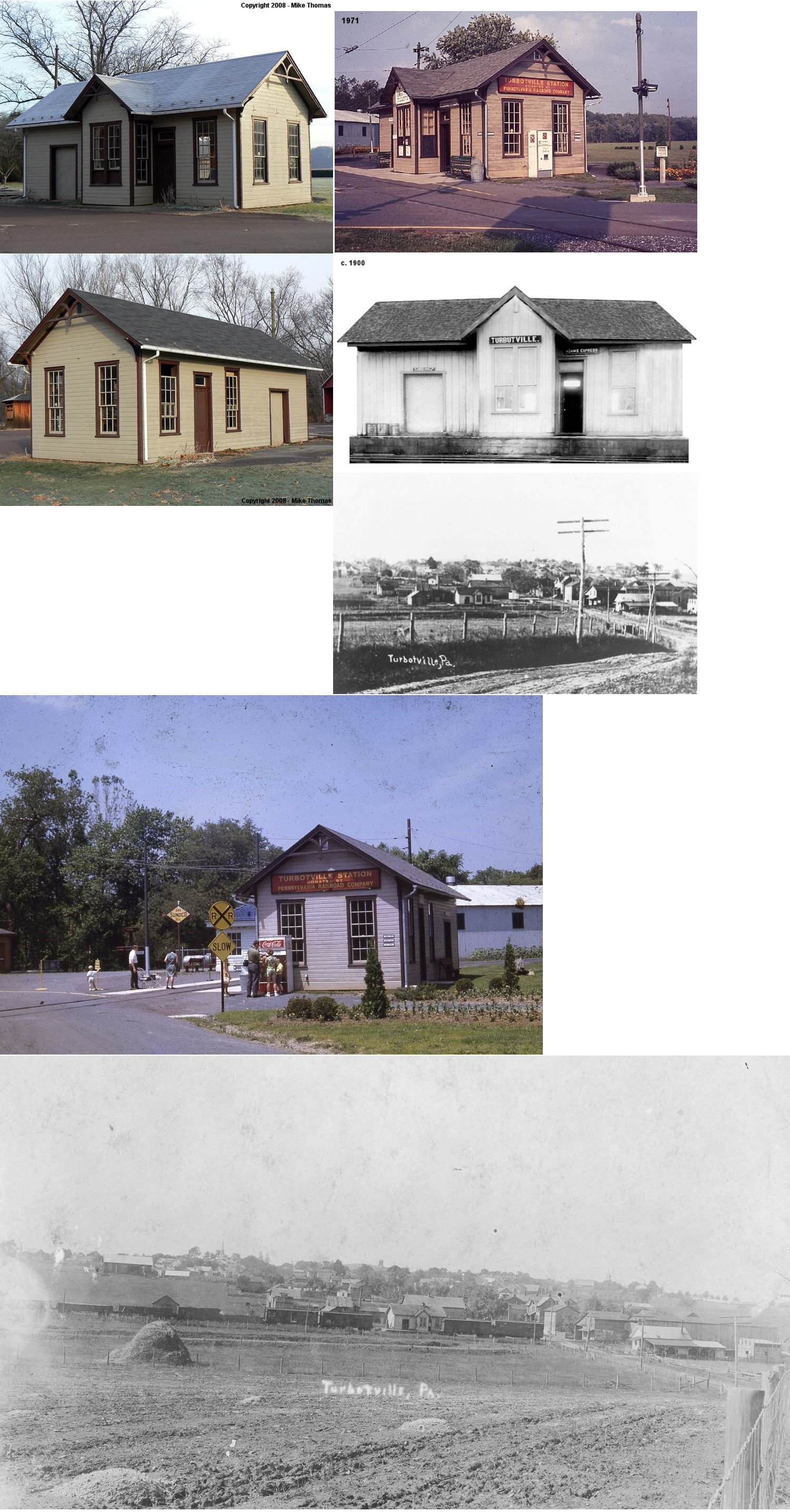
| Turbotville |
 |
Turbotville Community Park Pine Street west of Church Street (GPS: 41.098446, -76.773286) |
C | Museum | 1886 | None | Wood |
|
| STATIONS OF THE PAST | ||||||||
| Station Name |
Original Railroad |
Notes | ||||||
| Alaska |
|
The original station here, built in 1899 to serve miners for the Alaska Colliery (Mt. Carmel Daily News, 10-19-1899) was on the curve which caused a dangerous and incovenient situation for passengers. The local passenger trains did not stop on the track closest to the station, so passengers had to cross the track that was frequently occupied by coal trains. Locals called for a new station and the railroad considered it in 1907 (Mt. Carmel Item, 3-12-1907) and finally built a new station in 1909. It was thereafter known as Mt. Carmel Junction (see listing below for Mt. Carmel Junction). | ||||||
| Arters |
|
There was a waiting shelter here that was built in 1885. | ||||||
| Arters |
|
This station was closed in, or prior to, 1938 (Shamokin News-Dispatch, 8-4-1938) | ||||||
| Cabel (Weigh Scale) |
|
There was a 10'x14' station built here in 1914. | ||||||
| Cameron |
|
There was a waiting shelter here that was built in 1903. | ||||||
| Chulasky |
|
There was only a platform here with a station stop sign. | ||||||
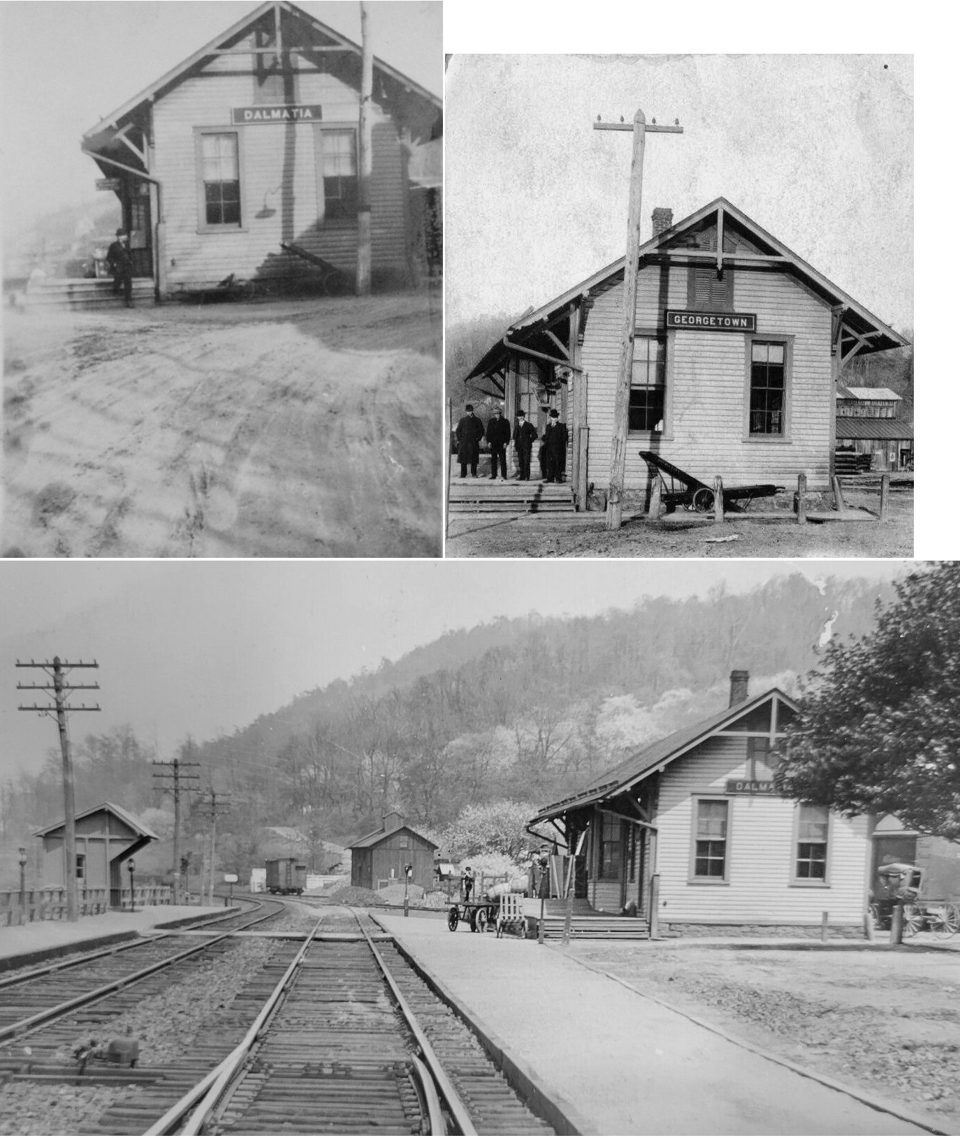
| Dalmatia (Georgetown) |
|
This station was on the SE side of the tracks north of the intersection of Sunbry and Water Streets at GPS: 40.656025, -76.900858. The first station here was built in 1859. | ||||||
| Deibler | |
After the Paxinos station was demolished, the PRR moved this station to Paxinos. It stood there until about 1946. | ||||||
| Deibler | |
A small passenger shelter was built here in 1885. | ||||||
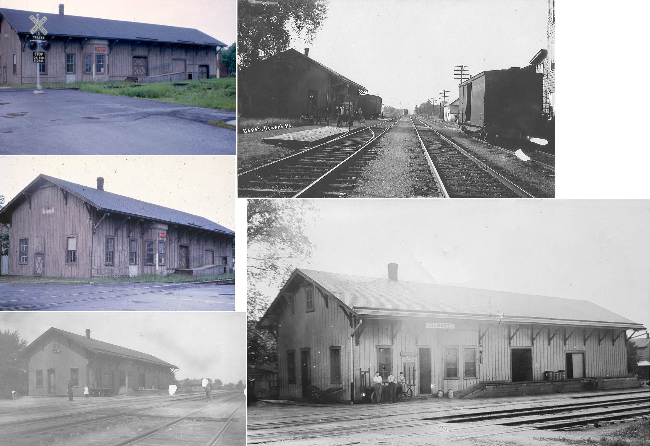
| Dewart | |
Station was on the north side of Main Street on the west side of the tracks. It was torn down in the late 1950s/early 1960s. | ||||||
| Dunkelbergers (Switch Back) |
|
This station was was at milepost 10.9 (from Shamokin) on the Herndon Branch between Trevorton and Hunter. | ||||||
| Enterprise |
|
There were originally two stations (or platforms) near here called "Enterpise Junction" and "Enterprise Colliery." Later those two stops were combined into one known only as "Enterprise" (Barnhart & Barnhart, Reading Railroad Station Pictorial, Vol. 2, 2009). | ||||||
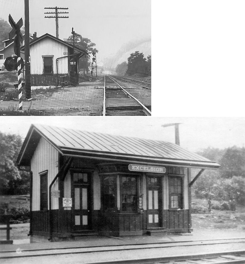
| Excelsior |
|
|||||||
| Excelsior |
|
This station was closed in, or prior to, 1938 (Shamokin News-Dispatch, 8-4-1938) | ||||||
| Gowen |
|
A shelter-type station was built here in 1885. This station was on the Sunbury Division. | ||||||
| Greenback |
|
A gang of theives looted a freight car near this station in 1934. Most of their takings were shoes and ladies' hosiery (Shamokin News-Dispatch, 1-15-1934). | ||||||
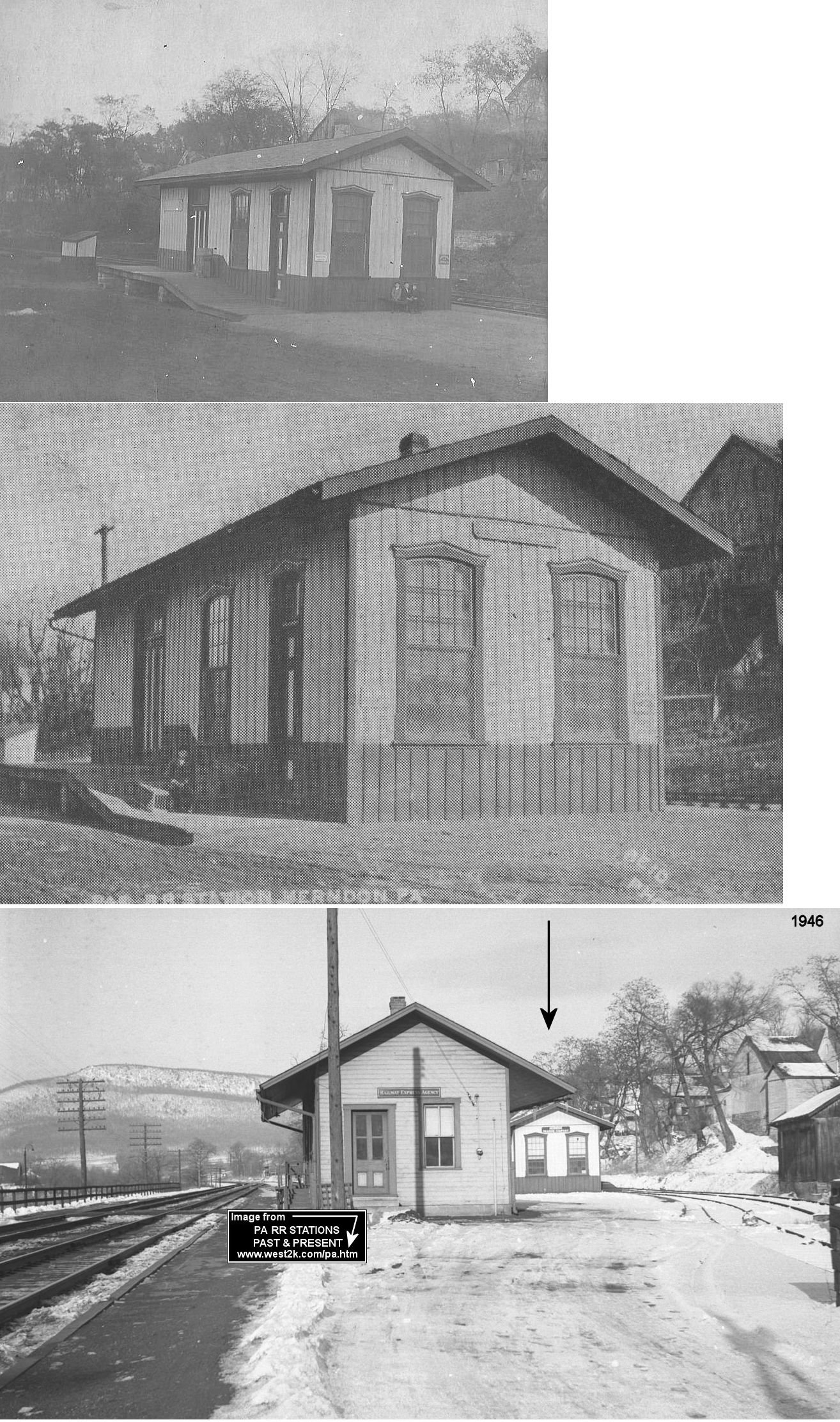
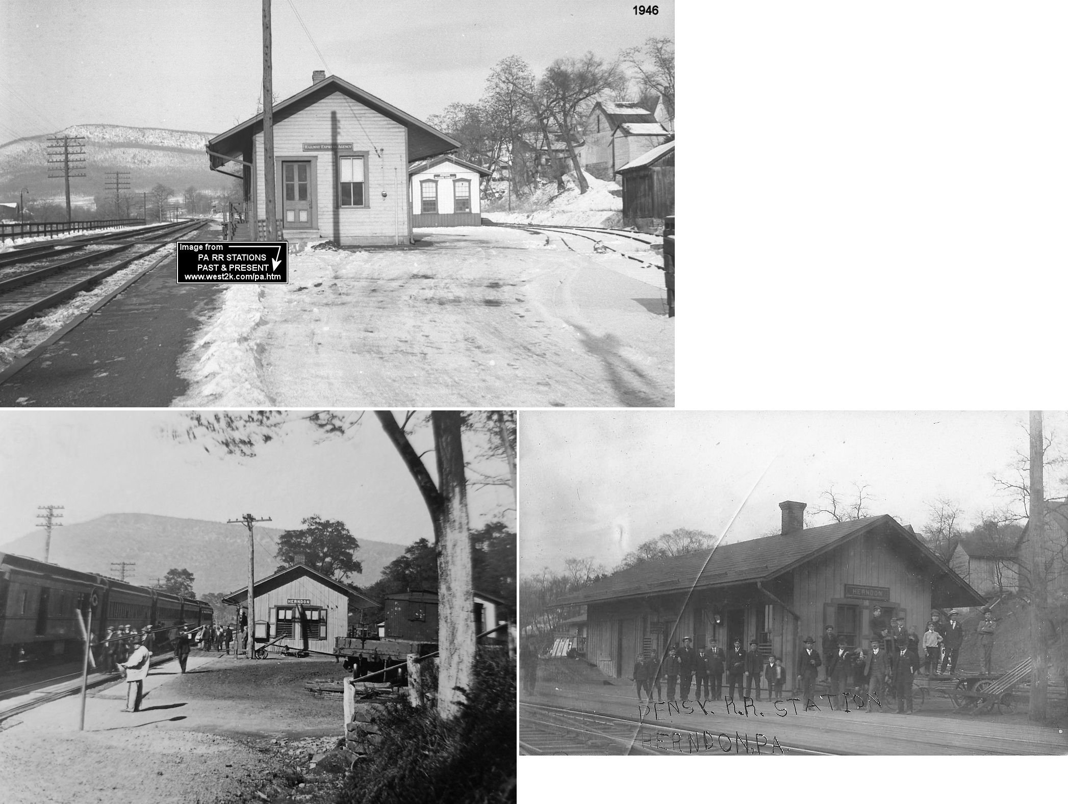
| Herndon (Trevorton Jct.) |
|
The RDG station was north of the Ferry Street crossing and just north of the PRR station. It was at approximately GPS: 40.710886, -76.842742. This was the terminus of the RDG's Herdon Branch. | ||||||
| Herndon |
|
The PRR station was just north of the Ferry Street crossing and just south of the RDG station. It was at approximately GPS: 40.710361, -76.843108. | ||||||
| Herdon Branch Junction |
|
This station was was at milepost 0.8 (from Shamokin) on the Herndon Branch. It is listed on some timetables, and was essentially in Shamokin, but not sure if there was ever a station here. | ||||||
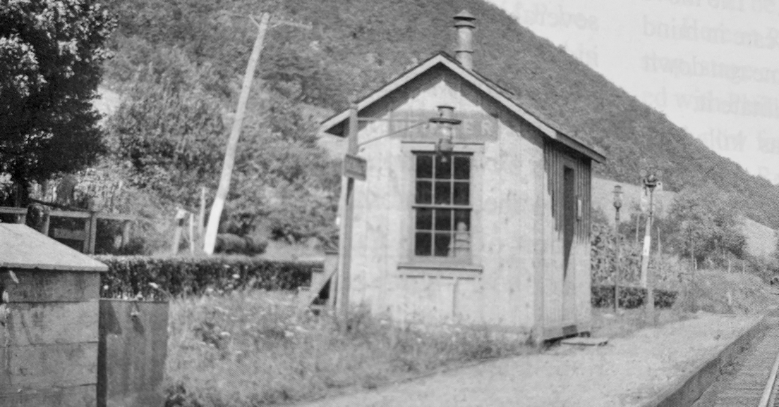
| Hunter (Rakers) |
|
This station was was at milepost 12 (from Shamokin) on the Herndon Branch between Dunkelbergers and Dornsife. | ||||||
| Kieffers |
|
This station was closed in, or prior to, 1938 (Shamokin News-Dispatch, 8-4-1938) | ||||||
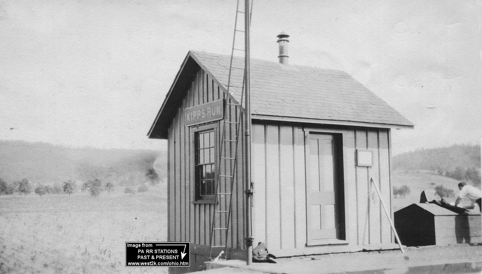
| Kipps Run |
|
|||||||
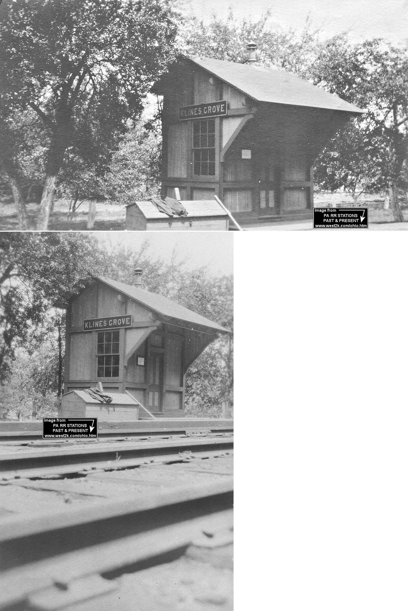
| Klines Grove |
|
|||||||
| Kneass |
|
This station was was at milepost 17.1 (from Shamokin) on the Herndon Branch between Otto and Herndon. It was in the vicinity of GPS: 40.727525, -76.810715 on an access road off Otto Station Road (it was only a mile from Otto station). | ||||||
| Kulpmont |
|
This freight-only station was closed in 1938 (Shamokin News-Dispatch, 7-12-1938). It was at end of a switchback on the Scott Branch. The last freight agent, Harry Evert, happened to be the owner of a lumber company located on a track extension just beyond the station so he was probably always readily available. There was only one short spell when miners' accommodation trains ran on the Scott Branch, but they did not stop at the station, instead getting off at the Scott Colliery near the branch terminus. Evert Lumber was at 10th and Scott Streets, but I don't know where the station was. | ||||||
| Kulps |
|
This station was was at milepost 3.3 (from Shamokin) on the Herndon Branch between Water Station and Trevorton. | ||||||
| Latshaw |
|
This station was was at milepost 15.7 (from Shamokin) on the Herndon Branch between Otto and Dornsife. | ||||||
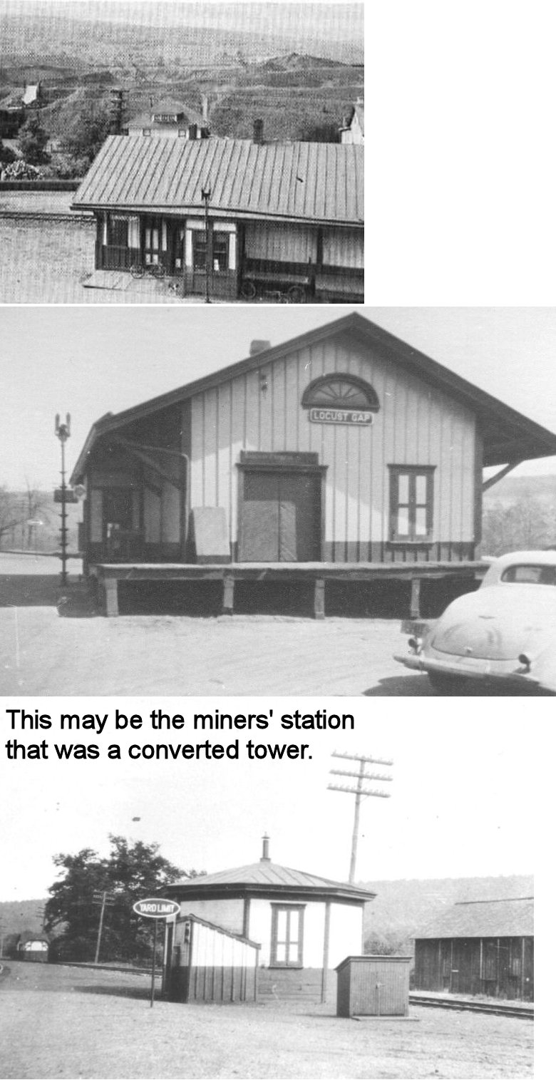
| Locust Gap | |
This station, built in 1875, was at 2nd (formerly Marshall Street) and Railroad Streets on the SW side of the tracks at GPS: 40.770577, -76.438766. That station served the normal traveling public, while a repurposed and dilapidated boxcar next to the station to the east served miners. In 1887 the boxcar was replaced by an old tower from the Catawissa Branch to serve as the miners' station. | ||||||
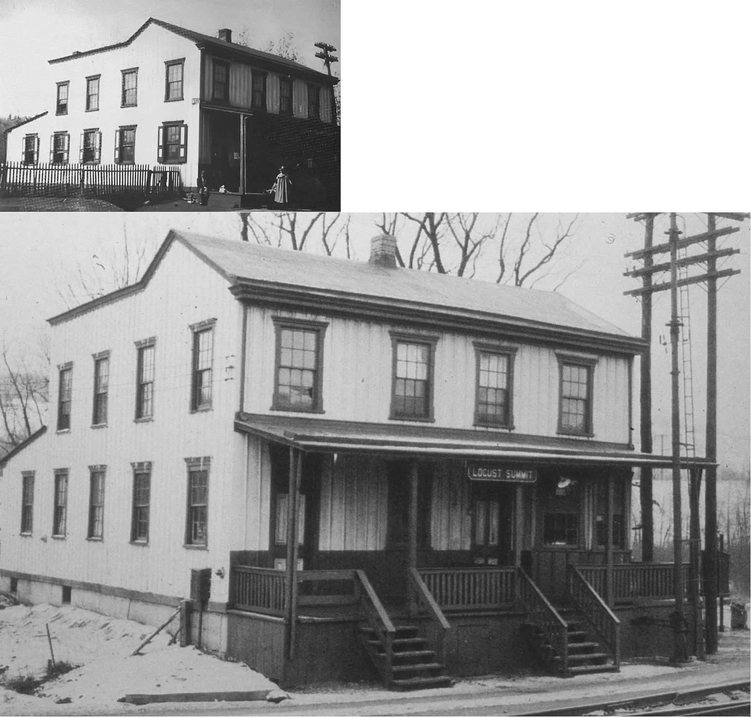
| Locust Summit |
|
In 1860 the railroad acquired an old hotel or large house here and converted it into a station. Like Locaust Summit listed above, there was a seperate miners' station which was in an old passenger car (and later two converted boxcars). | ||||||
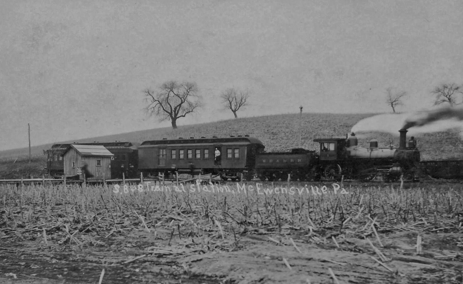
| McEwensville |
|
|||||||
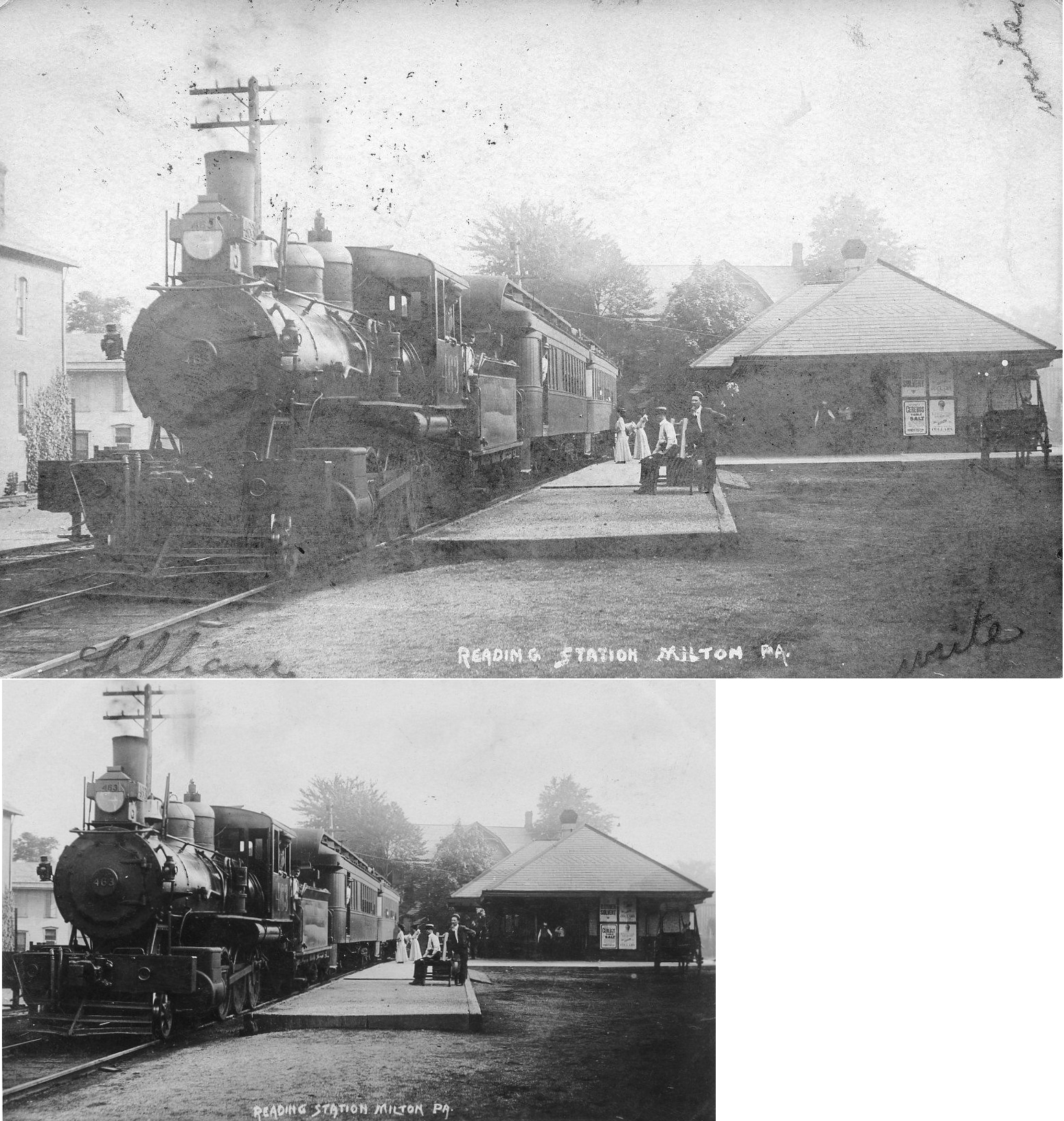
| Milton |
 |
A new Catawissa RR was built here on Front Street in 1872 (Sunbury Gazette, 1-27-1872). It survived the big Milton fire of 1880 (Northumberland County Democrat, 5-21-1880), but burned down in 1890 (Northumberland County Democrat, 9-25-1890). | ||||||
| Milton |
|
The passenger station here was on the south side of Broadway at North Filbert at GPS: 41.020115, -76.852555. It was built in 1884 (The Sunbury Weekly News, 7-18-1884). Prior to this station opening in Milton, passenger service was from West Milton. When the Milton station opened, a special train took passengers from the Milton station to the West Milton station and then returned with those arriving. There were eight trains per day between Milton and West Milton (Northumberland County Democrat, 8-1-1884). | ||||||
| Milton |
|
The first station here was built by the Sunbury & Erie Railroad (later P&E) in 1855. New passenger and freight stations were built on Broadway Street in 1860 (Sunbury Gazette, 8-25-1860).The freight station here was just south of the passnger station on the same side of the tracks. | ||||||
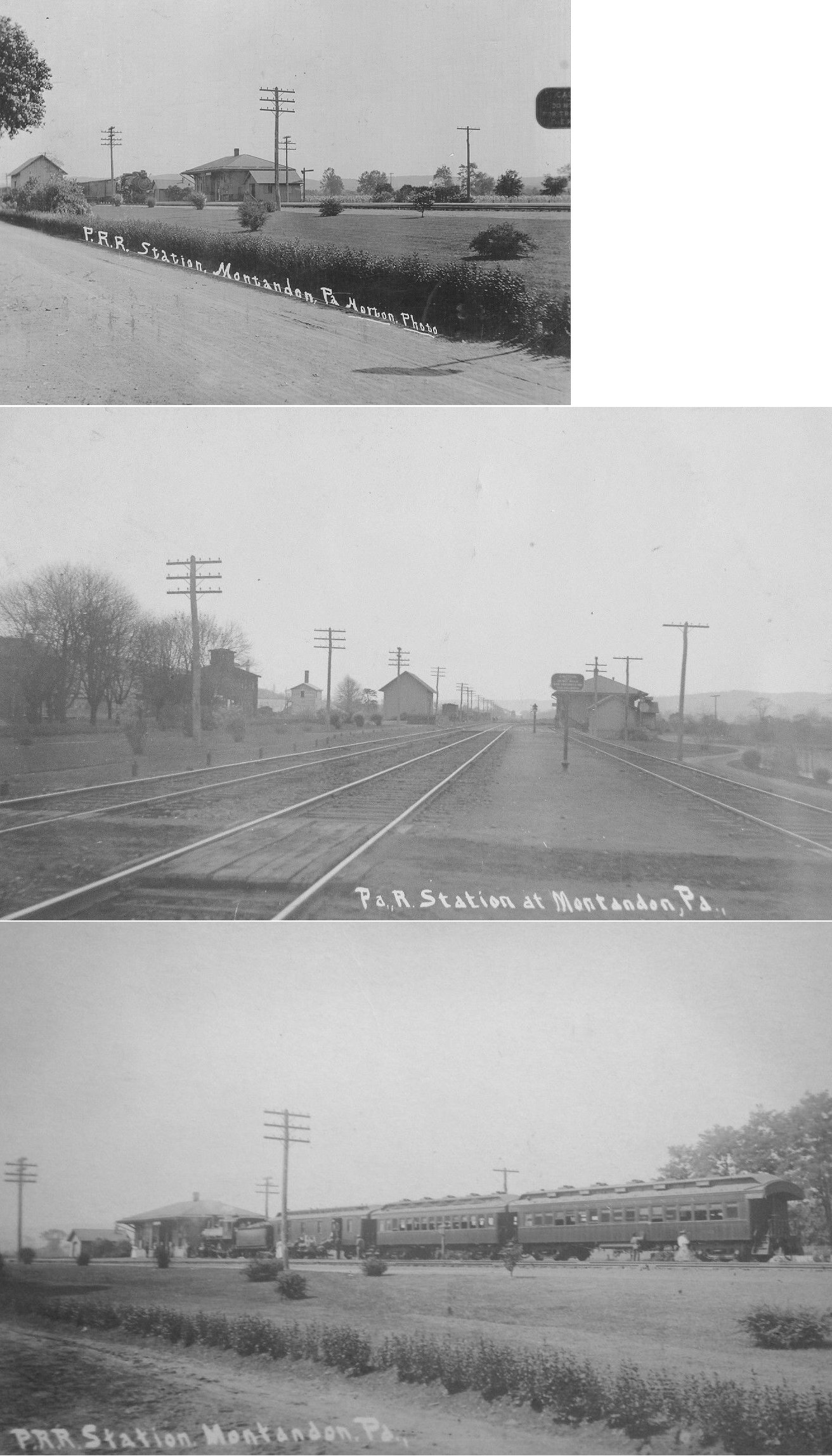
| Montandon | |
|||||||
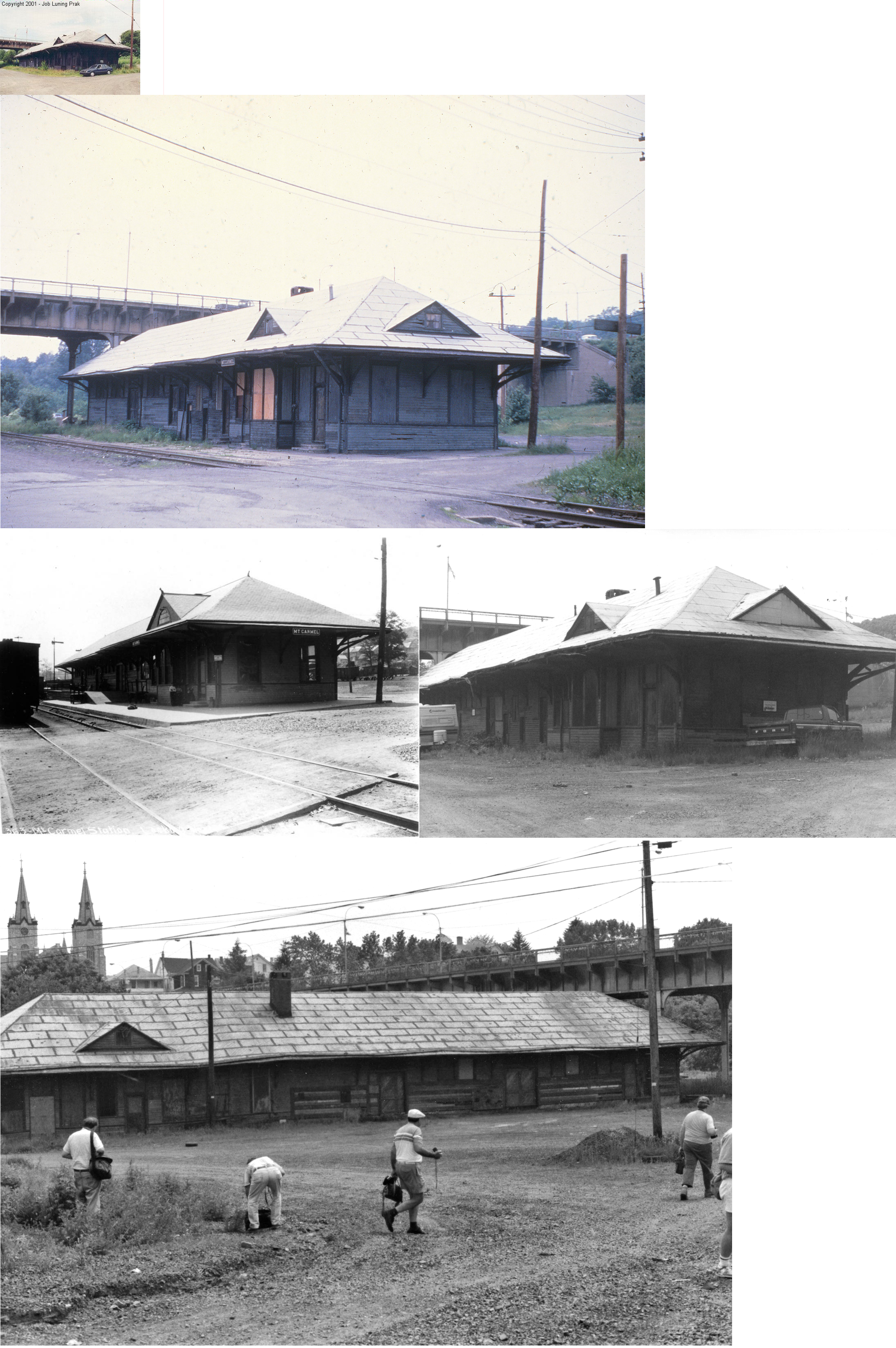
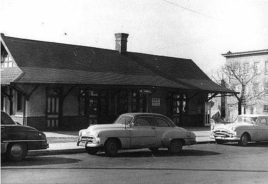
| Mt. Carmel |
AND |
This station was located at Railroad and Turnpike Streets at GPS: 40.799733, -76.418584. It was enlarged sometime between 1901 and 1907. However, later, 16 feet had to be lopped off the western end of the building in order to place footings for the new Poplar Street viaduct that spanned the railroads in the valley and went into service in 1930. The station continued to function even after passenger service stopped in 1938. The agent was let go in 1966 and the building was torn down in 2003. | ||||||
| Mt. Carmel |
|
This station was at the SW corner of 5th and Market Streets at GPS: 40.795063, -76.409882. The railroad built this station and a new freight station in 1889 to replace the original which was a dilapdated house with a small freight shed. | ||||||
| Mt. Carmel |
|
The freight station was just to the SW of the passenger station on the same block at GPS: 40.794664, -76.409991. | ||||||
| Mt. Carmel Junction |
|
This station replaced the older one known as "Alaska" listed above in 1909. It measured 15'x50' and closed in the mid-1950s. | ||||||
| Natalie |
|
The Natalie Branch of the Reading Railroad was a small branch that came off of Mount Carmel Branch which was originally the Mt. Carmel & Natalie RR. From the Reading Railroad Station Pictorial book Volume 2 by Benjamin Bernhardt and John Bernhardt: "At Natalie Junction transfers to the Natalie Branch serving Natalie could be made. Natalie Junction was the junction of the Mount Carmel Branch and the Natalie Branch serving Natalie, a small town to the northwest of Mount Carmel. Little is known of the facilities at Natalie Junction. On May 8th 1897, two cemeteries requested that a flag stop and open platform be constructed a short distance from Natalie Junction for mourners visiting Oak Hill Cemetery and another cemetery serving the Polish community. The railroad offered to construct a flagstop provided that the cemeteries bear the cost, but the representatives of the cemeteries declined." It doesn’t appear that there were ever stations on this branch other than perhaps a platform at the Natalie Mine and a boxcar station at Natalie that was removed y the Reading in 1935. The Mount Carmel & Natalie Railroad was operated in later years by the Reading under lease. | ||||||
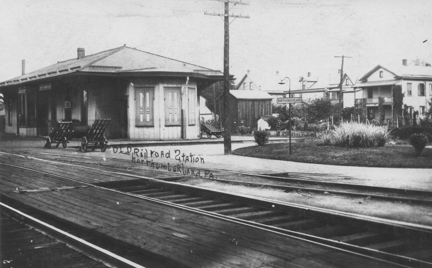
| Northumberland |
|
The Lackawanna & Bloomsburg built a station here in 1861 (Sunbury Gazette, 3-16-1861). | ||||||
| Northumberland |
AND |
Prior to the 1910 brick PRR station being built at 2 Front Street, there was previously a wooden frame station here at the same location. This station dates from 1867 when new passenger and freight stations were built here (Northumberland County Democrat, 4-12-1867). The single-story wood frame freight station was on the NW side of Front Street at GPS: 40.887456, -76.796901. | ||||||
| Otto |
|
This station was was at milepost 16.2 (from Shamokin) on the Herndon Branch. It was in the vicinity of GPS: 40.719039, -76.798186 on Otto Station Road. | ||||||
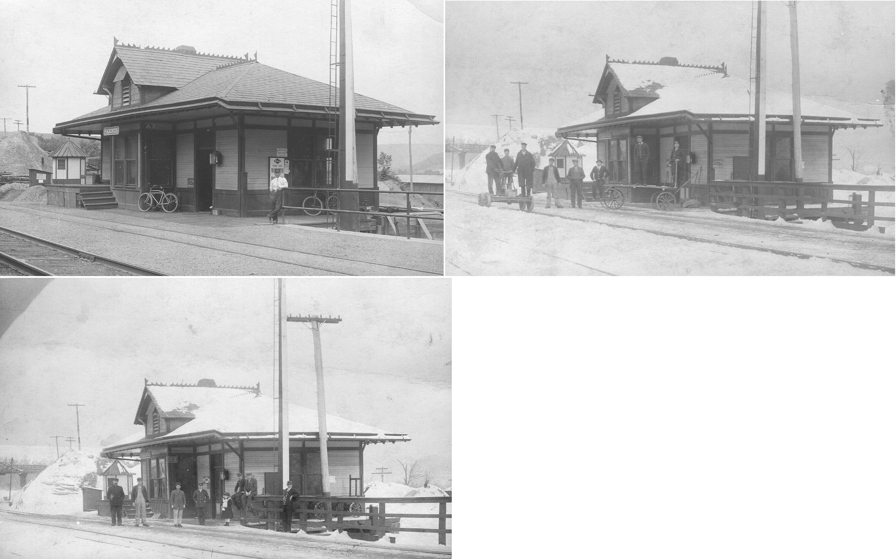
| Paxinos |
|
A new station was built here in 1903. An August 4, 1938 article in the Shamokin News-Dispatch reported that the passenger and freight stations at Paxinos were purchased by Lester Snyder of Elysburg who razed the buildings and transported the materials to Elysburg where he planned to "erect a structure." It's no known if this plan ever came to fruition or if the building(s) were reassembled in their original form or if the lumber was just repurposed. After the station was dismantled, the small depot from Deibler was moved to Paxinos. | ||||||
| Paxinos |
|
This station was built in 1883. | ||||||
| Reed |
|
This station was closed in, or prior to, 1938 (Shamokin News-Dispatch, 8-4-1938) | ||||||
| Reed |
|
This station burned down on April 13, 1901 (Mt. Carmel Daily News, 4-15-1901). It's not clear if the station was rebuilt after that (although it seems likely that it was). | ||||||
|
Riverside (S. Danville) |
|
This freight station was just to the NW of the passenger station on the NE side of the tracks at GPS: 40.956569, -76.624716. | ||||||
| Selinsgrove Junction |
|
Station established as Selinsgrove Station in January 1861, ten years before bridges and line to Selinsgrove built. The station was on the west side of tracks north of present-day Selinsgrove Junction switch south of Sunbury off PA147 at approximately GPS: 40.802218, -76.838557. The station was demolished in 1932. | ||||||
| Selinsgrove Junction |
|
The freight station was just north of the passenger station. | ||||||
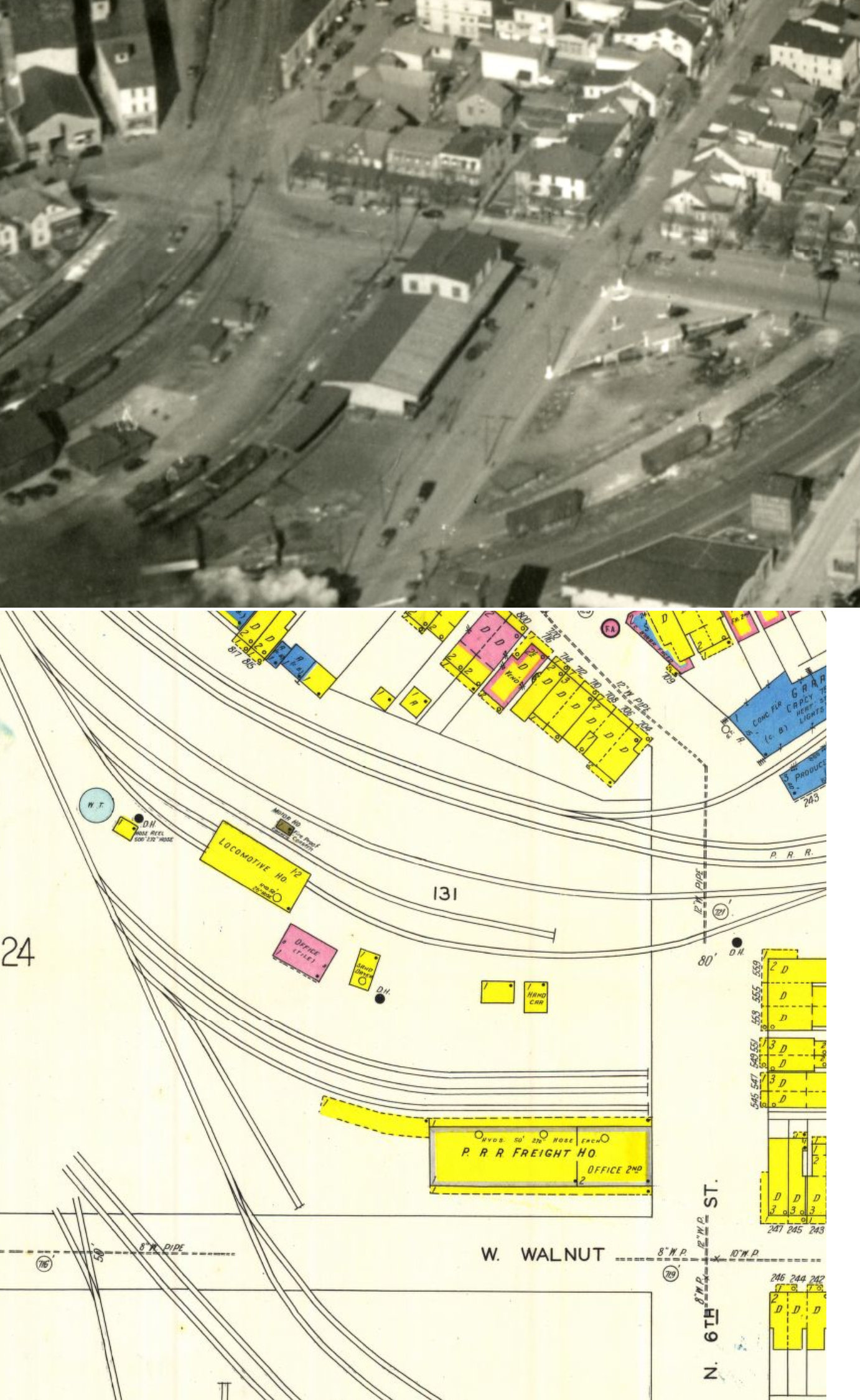
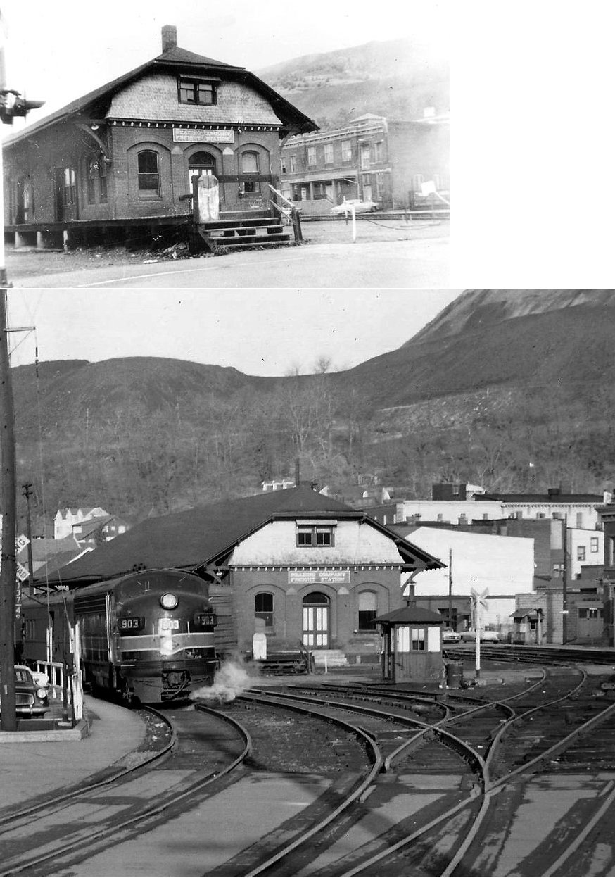
| Shamokin |
|
The original station here fell into disrepair by 1875 and an old railroad car was used for a freight depot (The Sunbury Gazette, and Northumberland County Republican, 7-23-1875). A new combination station was opened here in 1876 and that station is still standing. | ||||||
| Shamokin |
|
There was a freight house on the NW corner of Walnut and Sixth Streets at GPS: 40.790051, -76.560709. According to the PRR Annual Report it was built in 1905. | ||||||
| Shamokin | |
This passenger station was located on Independence Street. It was built in 1880-81 and demolished in October, 1965. | ||||||
| Shamokin | |
Freight station. It was demolished in March 1966 to make room for a parking lot. | ||||||
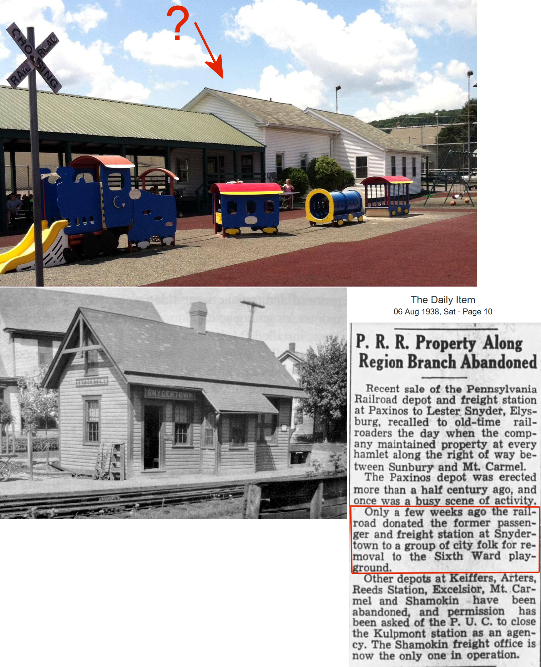
| Snydertown |
|
An August 4, 1938 article in the Shamokin News-Dispatch reported that station at Snydertown was donated by the railroad to an "NYA project at Sunbury." The Sunbury Daily Item reported that the depot was donated by the railroad for a playground in the 6th Ward of Sunbury. It's possible that this station still exists at the Oppenheimer Playground, but this needs confirmation. Theoriginal location of the station was on the west side of South Main Street on the north side of the tracks at GPS: 40.877255, -76.667988. | ||||||
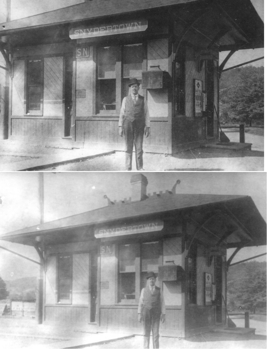
| Snydertown |
|
This station was built in 1906 and closed in 1950 (Shamokin News-Dispatch, 1-23-1950). Not to be confused with the similar-looking Central RR of PA Snydertown station in Centre County (which still exists as of 2025). | ||||||
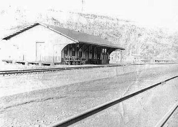
| Sunbury | Philadelphia & Sunbury |
Prior to the building of union station, the Philadelphia & Sunbury had a station at 3rd and Raspberry Alley. At that time the railroad, now known as the Shamokin Valley & Pottsville, closed their station at 3rd and Raspberry and moved to the new central facility. | ||||||
| Sunbury |
AND |
These two lines originally had a joint station in the Central Hotel on North 3rd Street just north of Market Street at GPS: 40.862060, -76.792590. This accommodation lasted until a new station was built in 1863 (see below). | ||||||
| Sunbury |
AND |
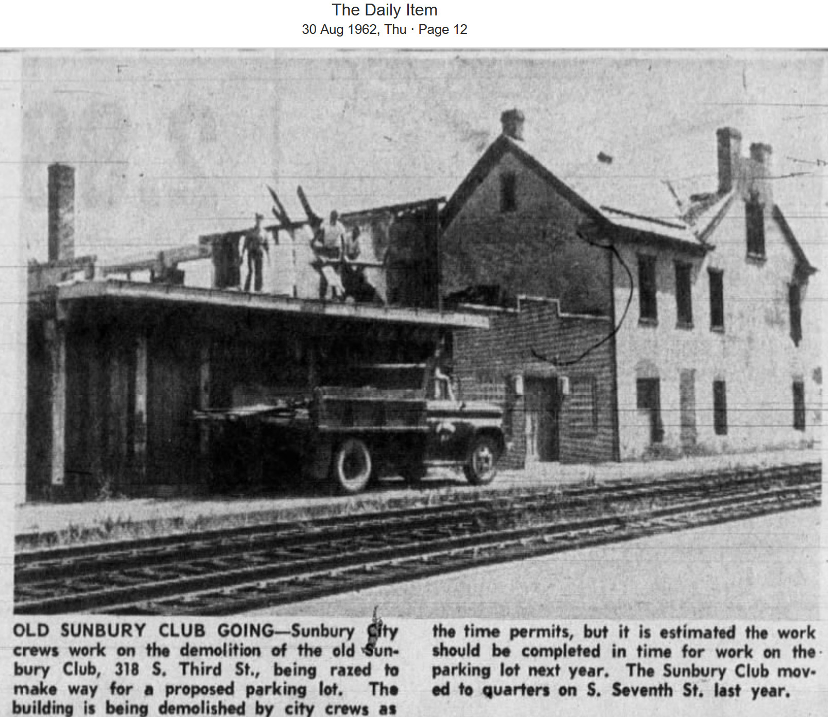
In 1863 a new station was built "at the corner where the Northen Central Road instrsects Blackberry [now Chestnut] Street across from the Presbyterian Church (Sunbury Gazette, 1-3-1863). That station quickly became run down and fell out of favor with the citizens of Sunbury (and the newspaper) who called upon the railroad to construct a new depot over the next few years until the RR relented in 1871 beginning construction on the new brick station (which opened in June of 1872). The old depot was originally slated to become a freight station, but that fell through and for a while it was used as a soup kitchen (Sunbury Gazette, 1-29-1875) and was then remodeled into a residence by H.J. Waltz (Sunbury Gazette, 9-8-1876). It stood until 1962-63 and was for a quite a while the home of the Sunbury Club. The station was on the NE corner of Chestnut and 3rd Streets at GPS: 40.860523, -76.793356. | ||||||
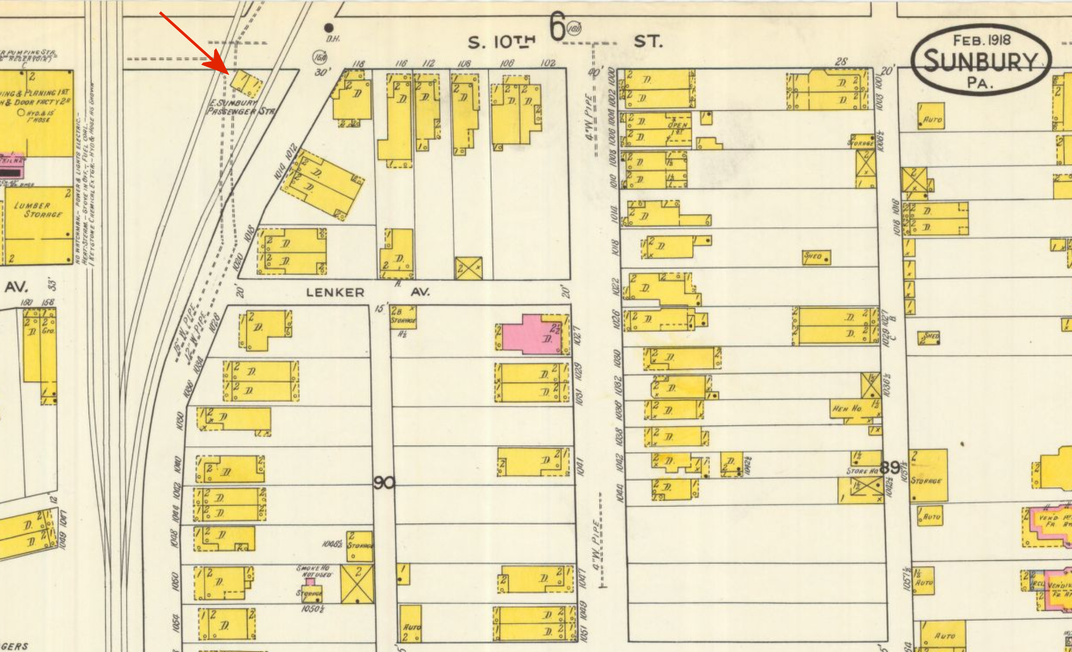
| Sunbury (East Sunbury) |
|
This station was at the intersection of South 10th Street and Wolverton Street at GPS: 40.857528, -76.786386. | ||||||
| Sunbury (East Sunbury) |
|
There was only a small platform at the 10th Street crossing that served as a flag stop. | ||||||
| Sunbury (Orphanage) (Bright) |
|
There was a small station at the I.O.O.F. Orphanage east of town. It was likely located at approximately GPS: 40.871702, -76.728221. That station still stands as "Delta Place" (see listing above in the Existing stations section). That was the second station at the orphanage. The first station was about a quarter mile east of the newer station and was known as "Bright." A siding remained in place when the station was moved. This served as a team track for the orphanage, there being no second track at the Orphanage station. | ||||||
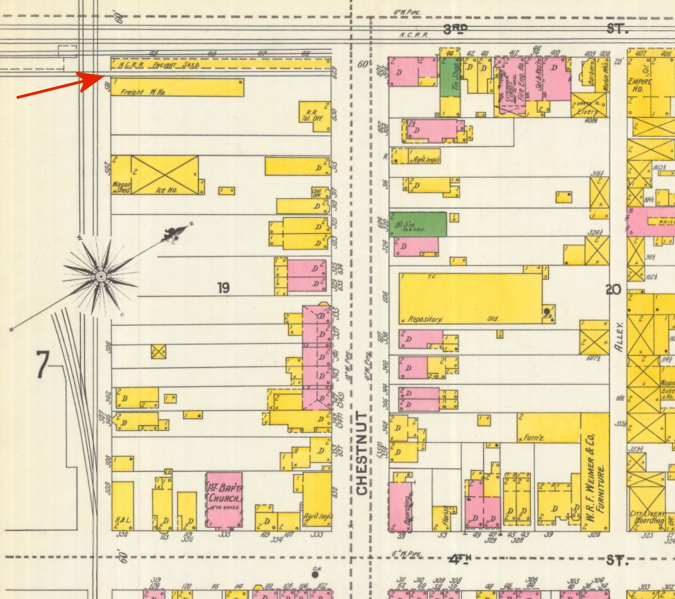
| Sunbury |
|
There was a long freight shed and freight warehouse along 3rd Street at Chestnut Street at GPS: 40.860182, -76.793655. | ||||||
| Sunbury (East Sunbury) |
|
According to the book Reading Railroad Station Pictorial by Benjamin L. Bernhart, a small flag-stop waiting platform was built at the 10th Street crossing. | ||||||
| Sunbury |
|
This freight station was built in 1887 and torn down in 1977. It was on the east side of South Awl Street on the south side of the tracks at GPS: 40.858013, -76.791397. | ||||||
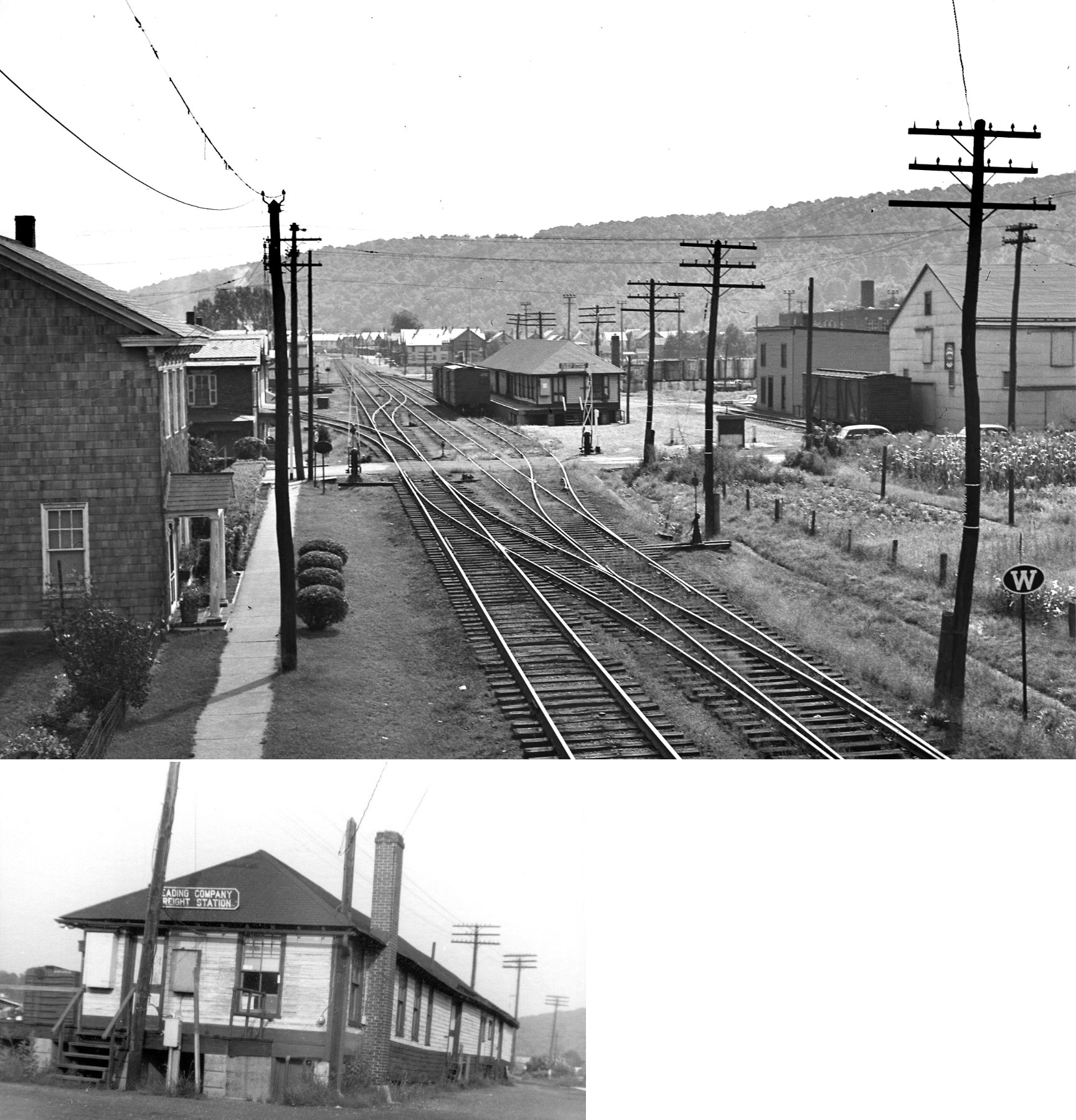
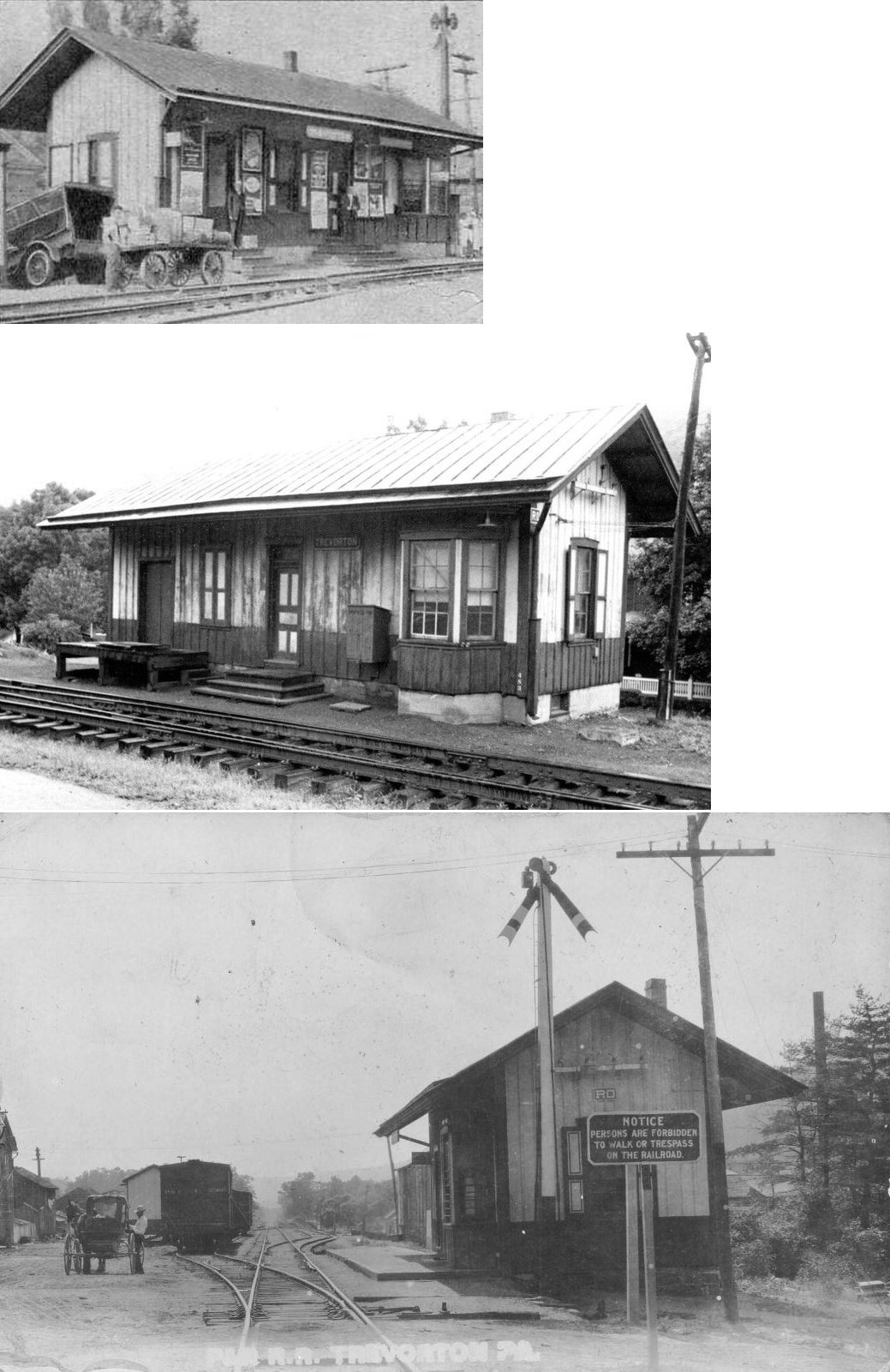
| Trevorton | |
This station was located at 8th and Railroad Streets on the north side of the tracks at GPS: 40.782010, -76.678251. There was also a freight house near the corner of 9th and Railroad Streets on the south side of the tracks at GPS: 40.781724, -76.679153. | ||||||
| Trevorton Junction |
|
The first station here was built in 1859. | Vastine |
|
The first station here was built in 1883 and replaced in 1917. | |||
| Warrior Run |
|
|||||||
| Water Station |
|
This station was was at milepost 2.3 (from Shamokin) on the Herndon Branch between Kulps and Herndon Branch Junction. | ||||||
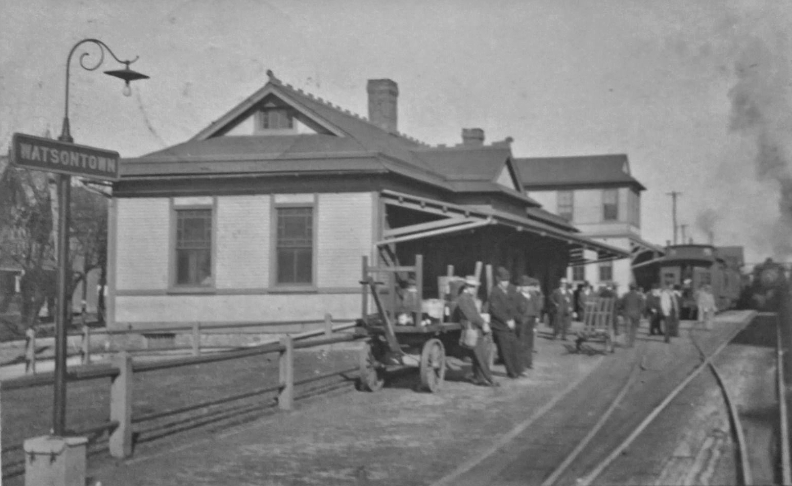
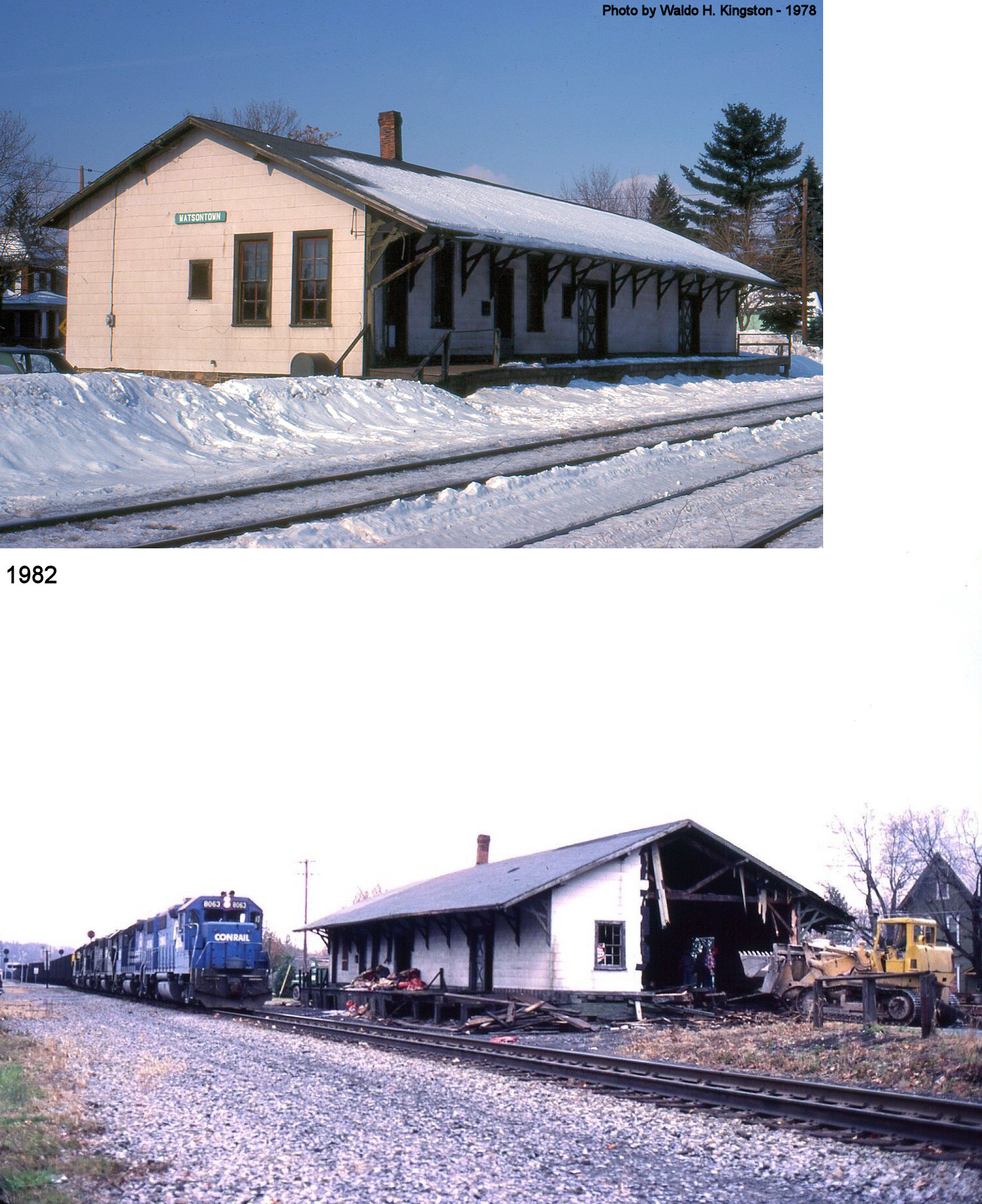
| Watsontown | AND |
This station was between Main Street and Railroad Avenue on the west side of the tracks at GPS: 41.080677, -76.858852. It was built in 1886. | ||||||
| Watsontown | AND |
The freight station was just northwest of the passenger station on the same side of the tracks at GPS: 41.080936, -76.859053. Sometime between 1896 and 1901 either a new station was built here or the original station was expanded to include a 2-story head end on the south side of the building. Eventually that two-story section would be removed from the building. It was a one-story building when demolished in 1982. | ||||||
| Weigh Scales |
|
|||||||
| Wolverton |
|
|||||||
| 1895 NORTHUMBERLAND COUNTY RAILROAD MAP | ||||||||
 |
||||||||
| Notes About Existing
Stations... Dornsife (RDG) - This station was known as "Gap" on the 1870 Traveler's Guide timetable for the Mahanoy & Broad Mountain, East Mahanoy, Little Schuylkill Railroads. Fishers Ferry (NCRy) - This stone tavern, built 1792 or earlier (1792 accepted by historians), was later used as a station stop by the Northern Central Railway when RR was built through in 1858. PRR assumed control of NCRy in 1861. It is not known when RR use ceased, but station stop survived into early 20th Century. The station was also known as "Port Trevorton." Hunter (RDG) - In 1899 the area churches of the United Evangelical Church held their annual camp meeting at Hunter Station on the Herndon Branch (Northumberland County Democrat, 8-3-1899). This station was known as "Rakers" on the 1870 Traveler's Guide timetable for the Mahanoy & Broad Mountain, East Mahanoy, Little Schuylkill Railroads. Milton (P&E) - Now houses the Milton Police Department. Here is an old view showing the freight station. The station at Milton which was part of the PRR was formerly of the Philadelphia and Erie Railroad not the Northern Central Railroad. The Northern Central stopped at Sunbury though it was a part owner the in the Northumberland yard before it was absorbed into the PRR. The Northern Central also owned the Williamsport to Elmira branch at one time but it did not own the tracks or stations between Sunbury and Williamsport. --Greg Stone. According to an item in the Kane Weekly Blade from June 30, 1881, the P&E were building a new depot here at that time. Northumberland (PRR - Passenger) - Station was also used for DL&W Bloomsburg connection. Though wooden "rooms" have been added to extend the restaurant, the station is brick; one can see the brick in the 2nd floor but also in the original exterior walls now inside the restaurant. --Gary Lapointe Vacant for years, it was rebuilt into a dining establishment in 2012 and reopened 2013. Northumberland (DL&W) - The tracks that originally served this building (west side) were removed. The existing tracks are of former Erie origin and are on the east side of the building, and are about 150 ft. away. Concrete sign at north end of building clearly says: "Lackawanna Freight House." Orphanage (PRR) - This was originally the PRR depot at Orphanage, a flag stop on the PRR's Shamokin branch about 4 miles east of Sunbury. It was moved to "Delta Place,"" north of Lewisville, in the late 1980s. Riverside (PRR) - This town was formerly called South Danville. Shamokin (PRR and LV) - This was the third NC/PRR station in Shamokin, built in 1893 (The Daily News, 6-5-1893). The windows of this station are now boarded up and the platform gone. When it was originally built it has a small wooden "miners' depot" at the west end on Orange Street. It was also used by the Lehigh Valley as that RR has trackage rights over the PRR from Mt. Carmel to Shamokin. It was last used as a bus station and is now a warehouse for a furniture store. 1935 was the last time it was used as a passenger train stop. The station is within a block or two of the Lower Anthracite Model Railroad Club at 210 East Independence Street. The Shamokin PRR station was not an ordinary bus stop, it served as the Shamokin stop for the Pennsylvania Railroad Greyhound Lines even while PRR passenger trains were still running at lesser frequency. These buses ran until 1941-43 when Edwards Motor Transit Company took over the routes. It's not clear whether Edwards used this station after it took over./p> Shamokin (NCRR) - This was the 2nd NCRR station at Shamokin, built in 1876 (The Sunbury Gazette, and Northumberland County Republican 2-4-1876). After the new passenger station was built across the tracks in 1893, this served as a freight station. This station is shown on Sanborn maps from 1885-1928. Sunbury (RDG) - First railroad station in the world to use electric lights. Turbotville (WB&W) - Station was destroyed in a storm on Aug. 4, 2012, but parts were salvaged and the station was rebuilt by 2014. Originally moved to the Magee Transportation Museum in Bloomsburg, Columbia County in 1964, but returned to Turbotville on Dec. 16, 2011. Visit the Turbotville Borough Heritage Society for more information. The train station was built by the Wilkes-Barre & Western Railroad in 1886. The railroad was chartered June 22, 1886 and the first train came to Turbotville on December 13, 1886. The train station was built sometime between June and December. It is wood frame construction, tongue and groove interior walls and ceiling, tongue and groove roof that originally had wooden shingles, but today has asphalt shingles. |
||||||||