|
|
||||||||
| EXISTING STATIONS | ||||||||
|---|---|---|---|---|---|---|---|---|
| Station Name |
Original Railroad |
Current Location |
Type | Current Use |
Date Built |
Track Status |
Building Material |
More Info |
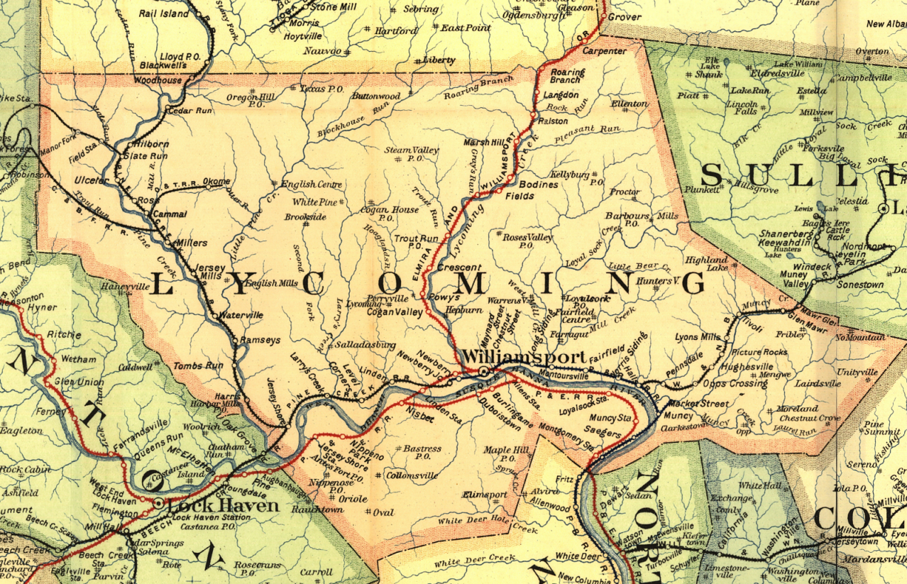
| Antes Fort |
 |
Caboose Lane in Village Park (GPS: 41.192595, -77.227460) |
C | Civic | 2018 | None | Wood |
|
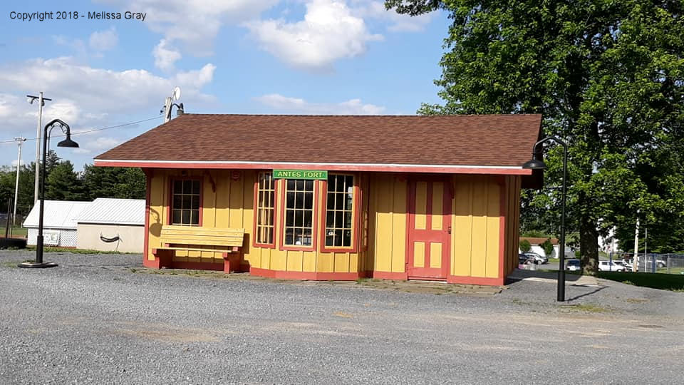
| Jersey Shore |
 |
112 Harris Street (GPS: 41.203867, -77.270701) |
C | Business | ???? | In Use | Wood | |
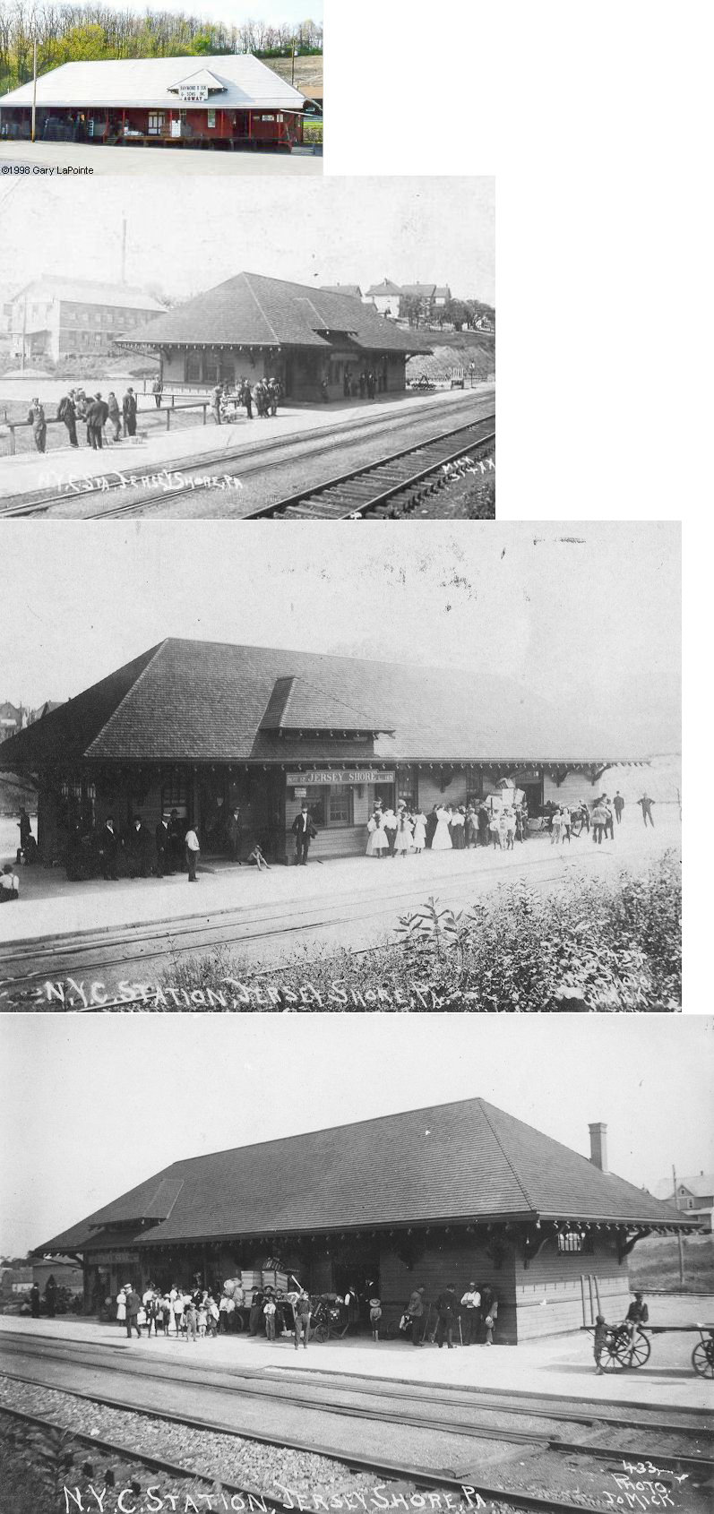
| Pennsdale |
 |
127 North Middle Road (GPS: 41.242310, -76.797721) |
C | Residence | 1892 | None | Wood |
|
| STATIONS OF THE PAST | ||||||||
| Station Name |
Original Railroad |
Notes | ||||||
|
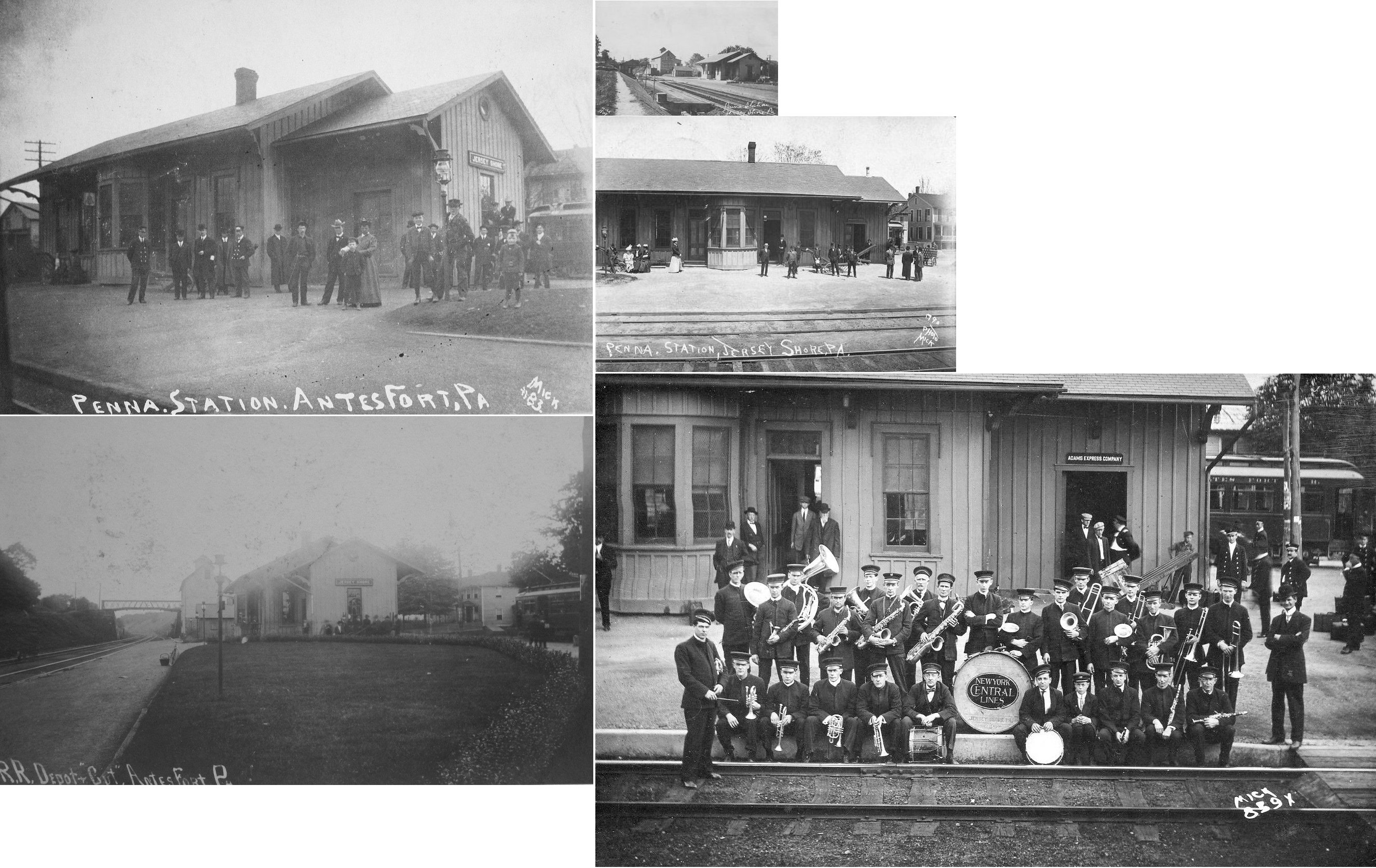
Antes Fort (Jersey Shore) |
 |
The PRR never actually passed into Jersey Shore. The station was at Antes Fort. A trolley line connected the station with Jersey Shore. The station was still called Jersey Shore on the PRR even though it was actually in Antes Fort. | ||||||
| Antes Fort (Granville) |
 |
In 1873 there was a passenger and freight station here. The passenger station was on Front Street at Pine Street (GPS: 41.190814,-77.224553) and the frieght station was just west of Walnut Street (GPS: 41.190903,-77.22216). | ||||||
| Bastian (Sylvan Dell) |
|
From the Williamsport Sun-Gazette, June 14, 1902: "...Pennsylvania Railroad trains 30, 32 and 6 eastward and 3, 31 and 1 westward, will stop on flag, weekdays, at Bastian (Sylvan Dell) to receive and discharge passengers. Round trip rate from Williamsport twenty (20) cents." There was likely no station or shelter here, although there may have been a station sign or small platform. | ||||||
| Blue Stone |
 |
This station was between Jersey Mills and Cammal. | ||||||
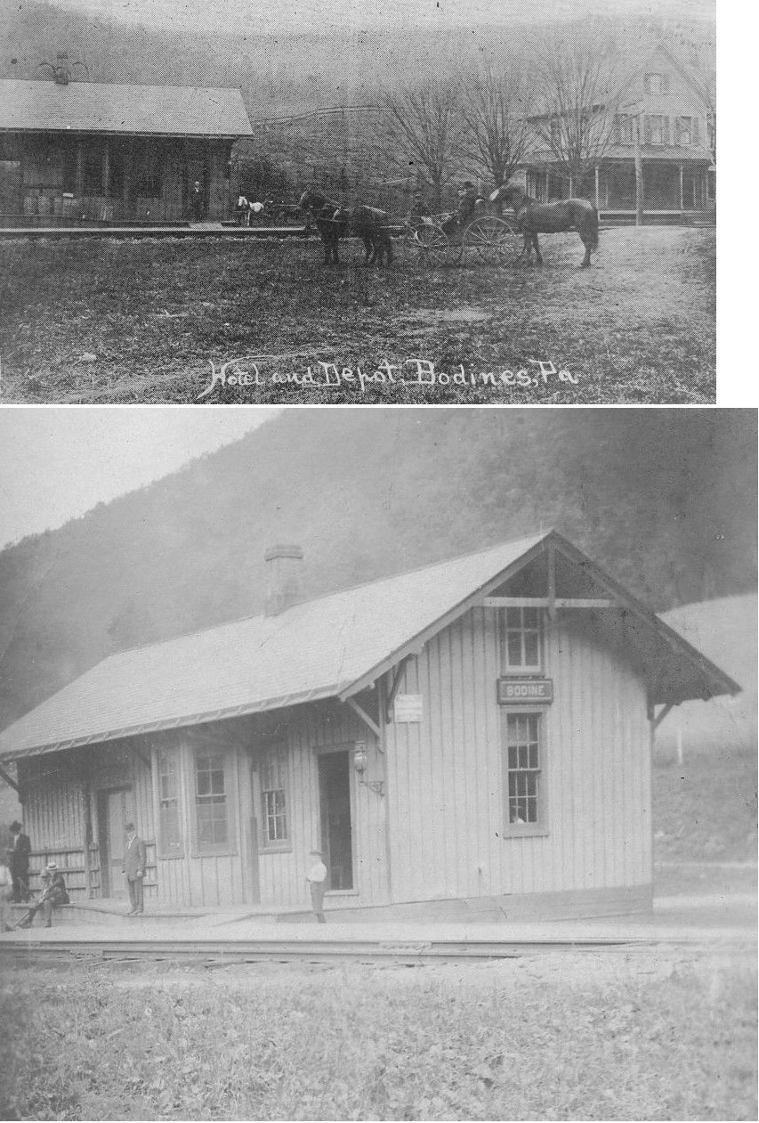
| Bodines |
 |
This station was built in 1890 and measured 20' x 40'. | ||||||
| Campbelltown |
|
|||||||
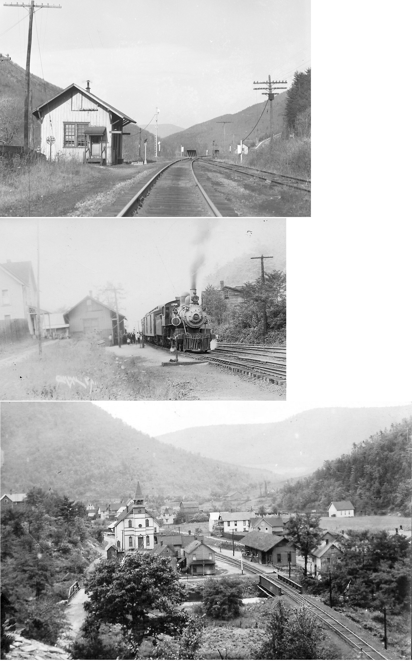
| Cammal |
|
|||||||
| Carpenters Station |
|
|||||||
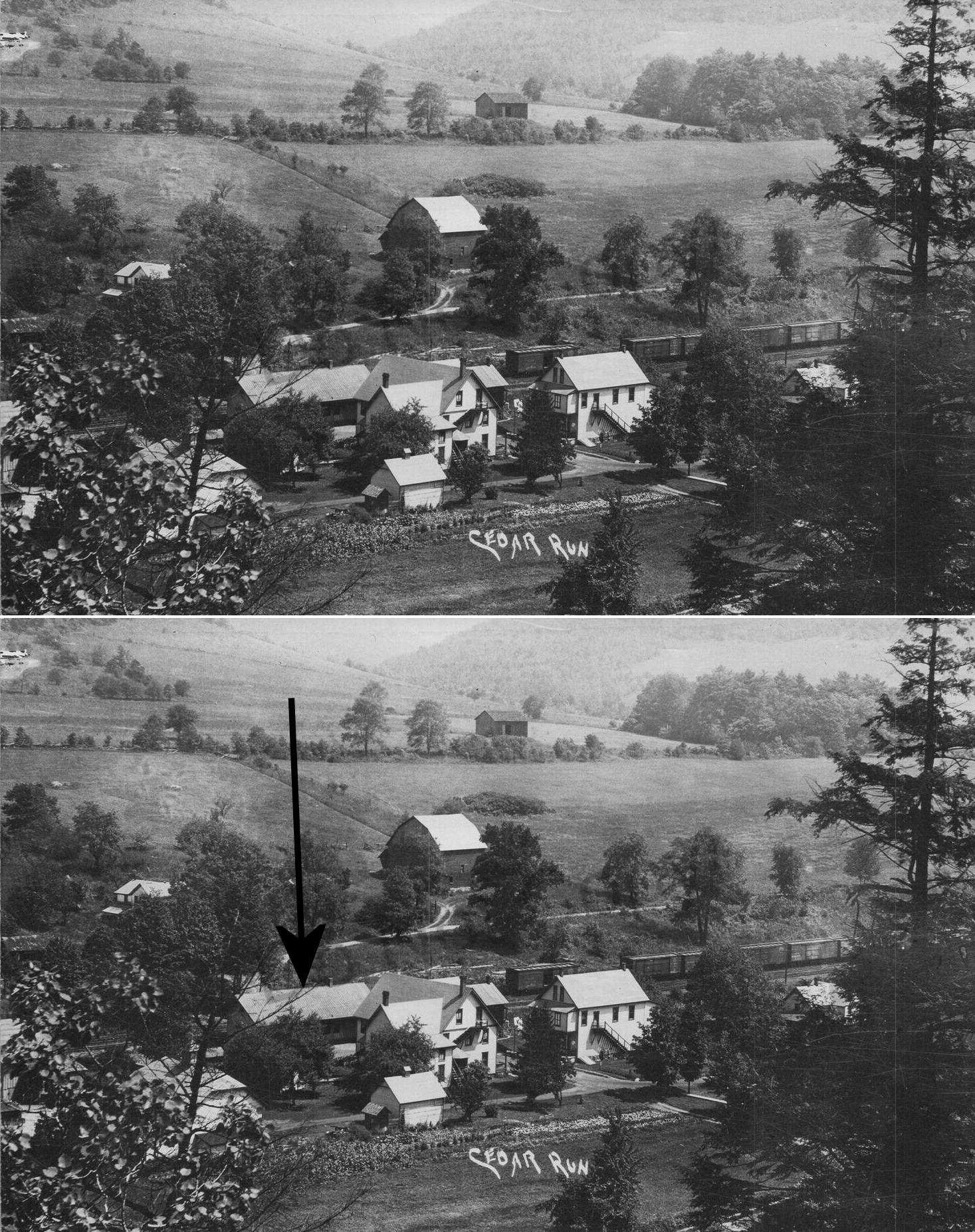
| Cedar Run |
|
|||||||
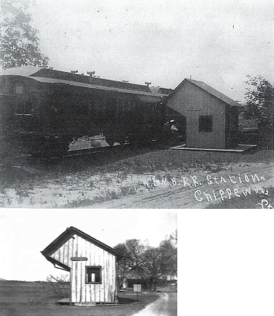
| Chippewa |
|
The shelter-type station was near the intersection of Beacon Light Road and Chippewa Road. It was torn down shortly after the demise of the railroad in 1937. | ||||||
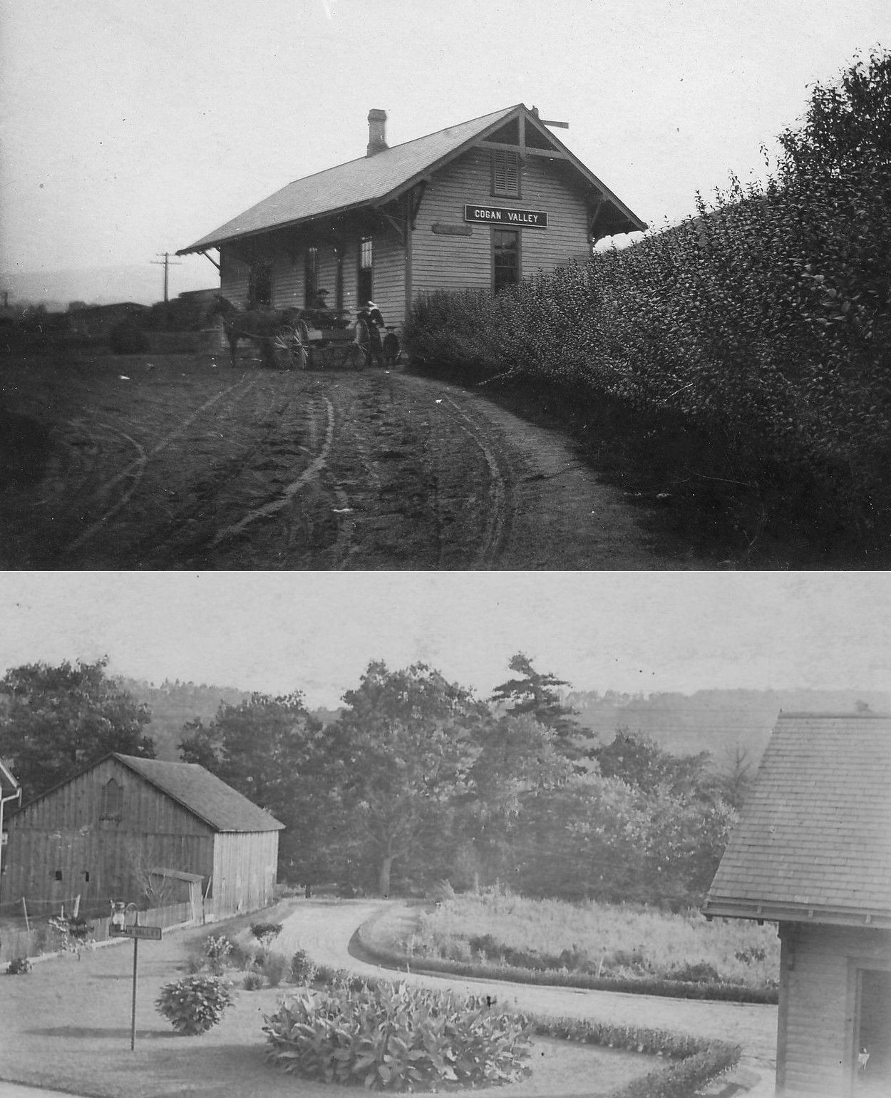
| Cogan Station (Cogan Valley) |
|
According to valuation records, the station was built in 1890. | ||||||
| Crescent Station |
|
|||||||
| Duboistown |
|
|||||||
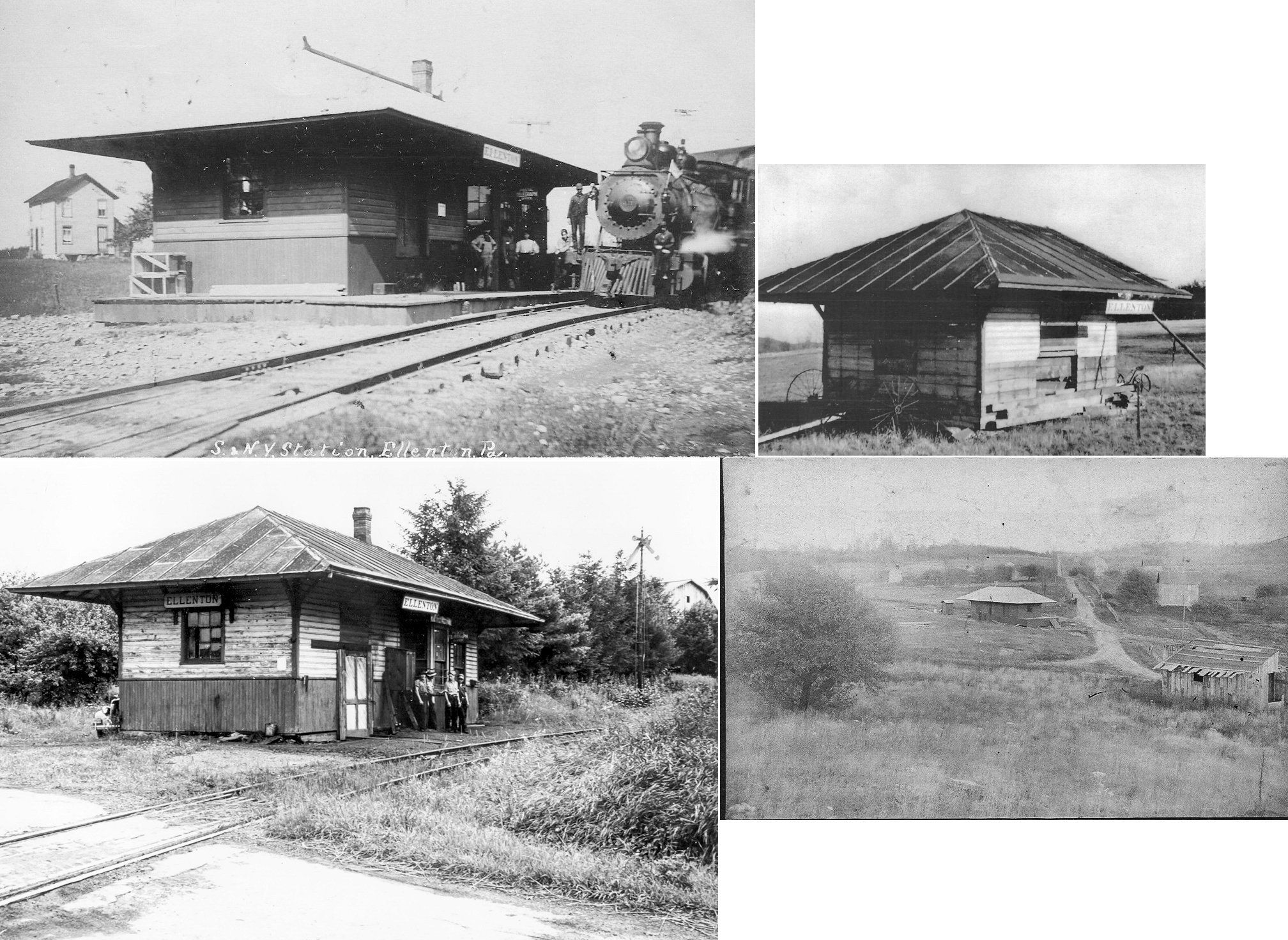
| Ellenton |
 |
This station was on the north side of McIlwain Road on the west side of the tracks at GPS: 41.539589, -76.800637. The station was moved a short distance in the early years when the main line was realigned. The station was partially torn down and a small part of the station survived for several years in a farm field nearby with the station sign hanging from it. | ||||||
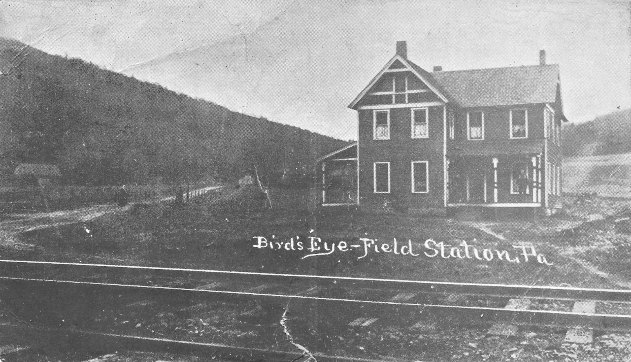
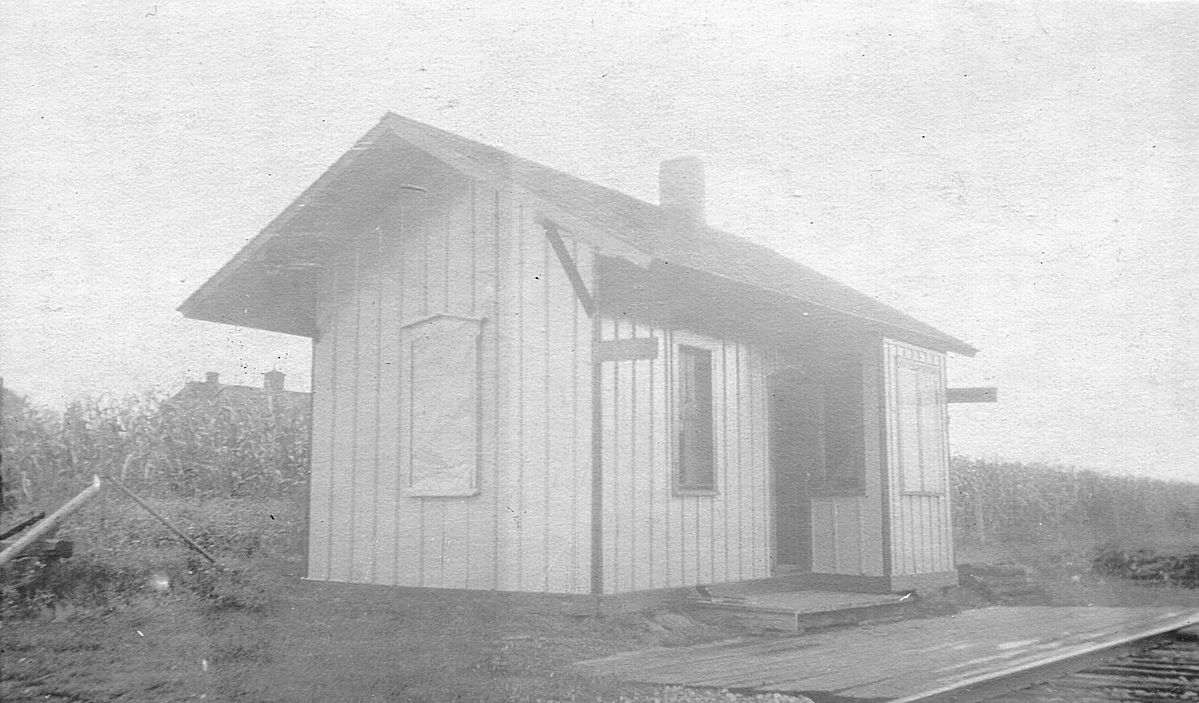
| Field Station |
|
Not sure if the building in the photo is the station or not. | ||||||
| Glen Mawr |
|
|||||||
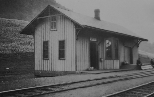
| Gray's Run |
|
The place formerly called just "Gray" is now sign posted as the "Village of Grays Run" on PA14. Apparently the famous Gray's Run Hunting and Fishing Club was once a town called Gray's Run so back then "Gray" was a station on the PRR where the Susquehanna & New York interchanged with PRR. | ||||||
| Halls Landing |
 AND |
Also known as Hall's Station, this sat at the junction of the Reading RR and the Williamsport & North Branch RR. | ||||||
| Hepburnville |
|
|||||||
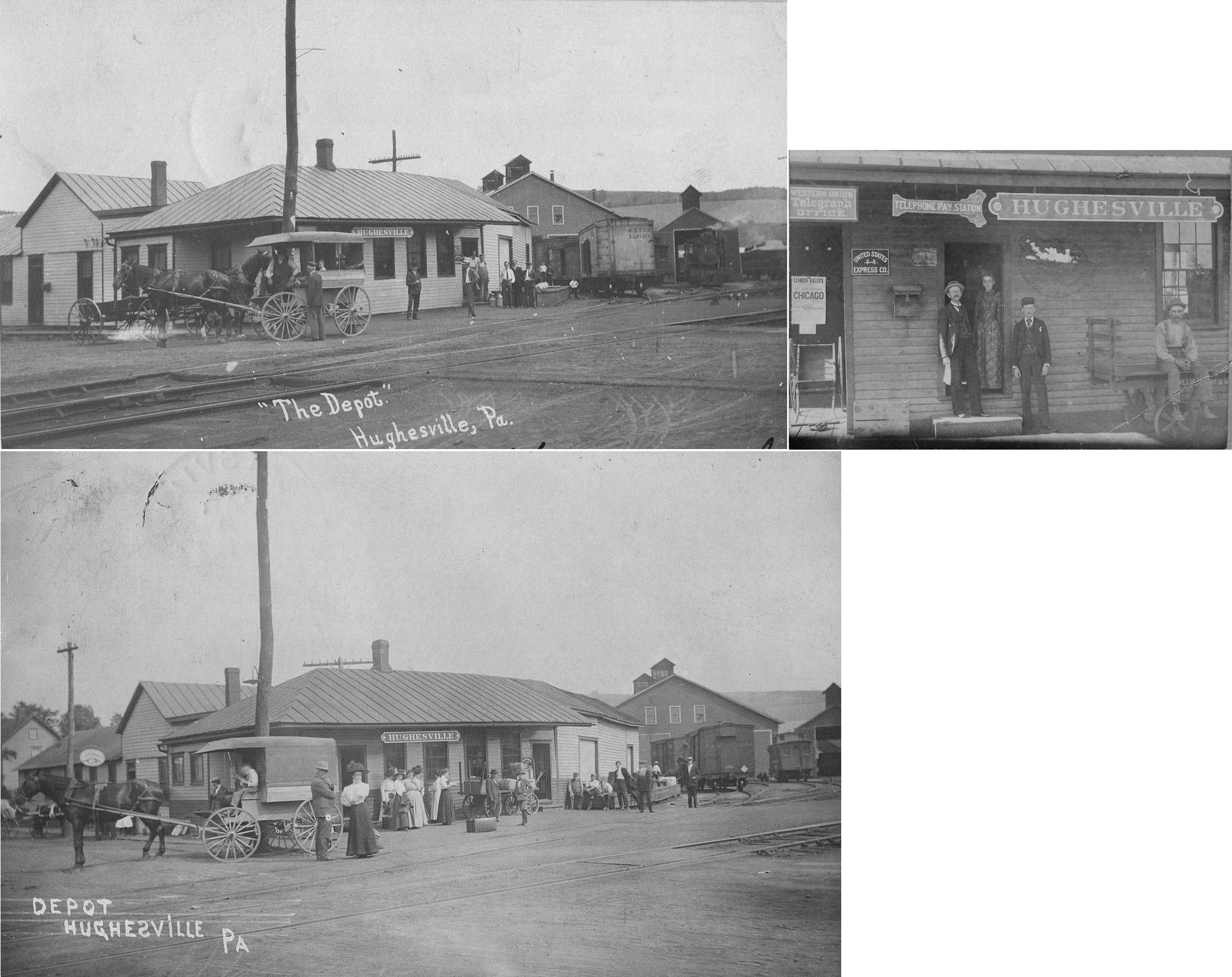
| Hughesville |
|
This station was on the northeast side of Academy Street at GPS: 41.240549, -76.727258. It is shown on maps as early as 1873. | ||||||
| Jersey Mills |
|
|||||||
| LangDon (McIntyre) |
|
|||||||
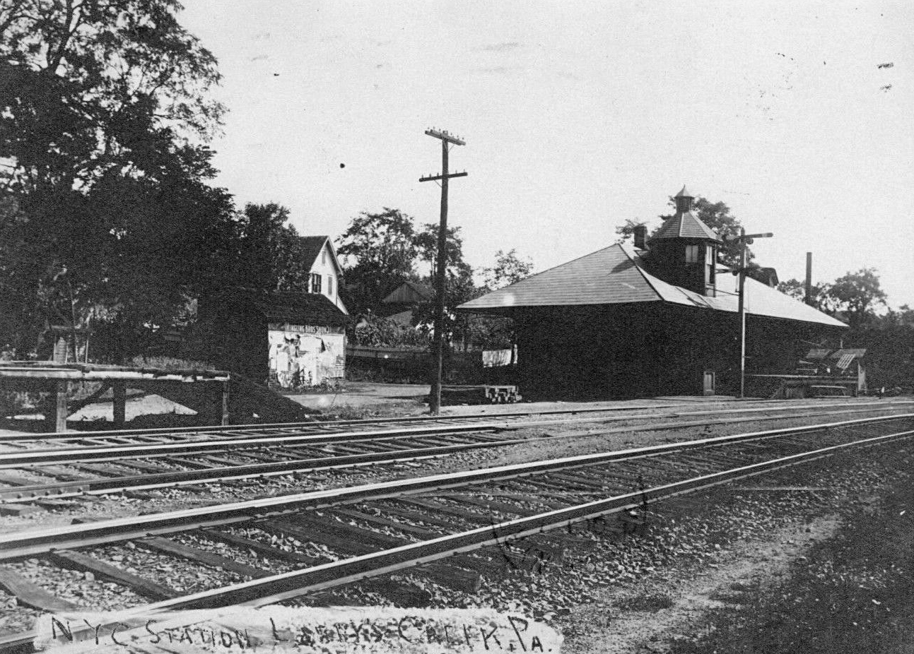
| Larrys Creek |
|
|||||||
| Leolyn (Penbryn) |
|
According to valuation records, the station was built in 1890. The name was changed from "Penbryn" to "Leolyn" in 1923. | ||||||
| Level |
|
|||||||
| Linden |
|
|||||||
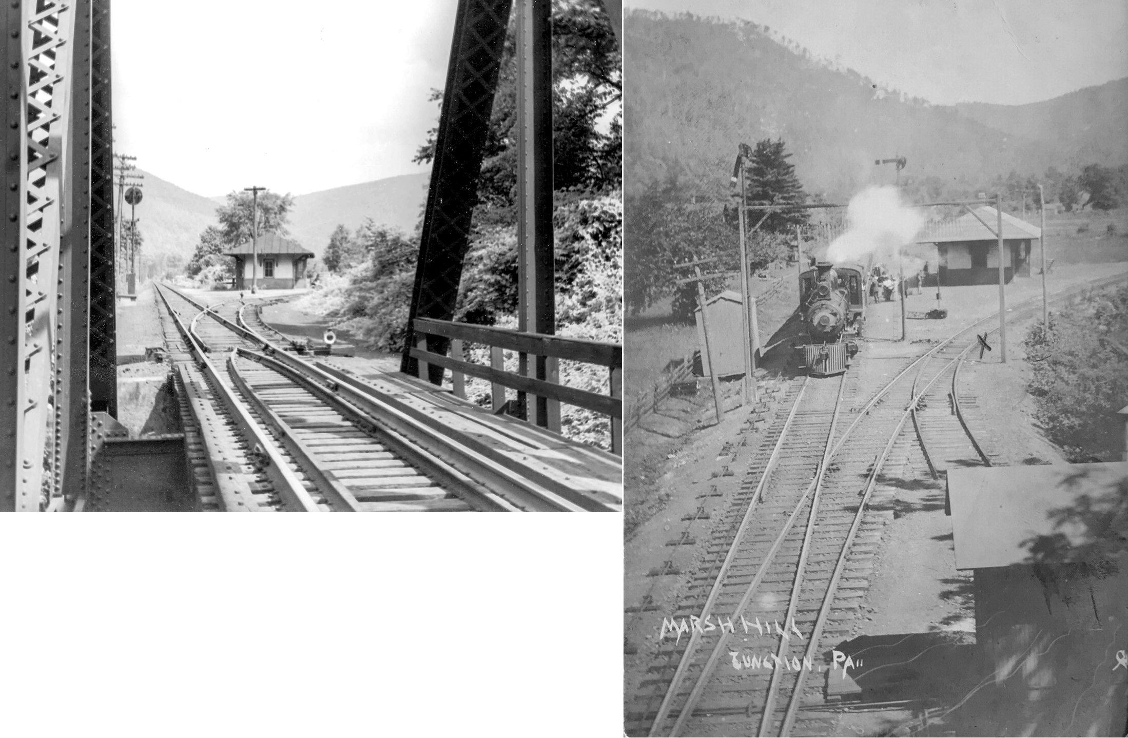
| Marsh Hill Junction |
AND  |
This station was located at what is now the south end of Marsh Hill Road at GPS: 41.471414, -76.975560. | ||||||
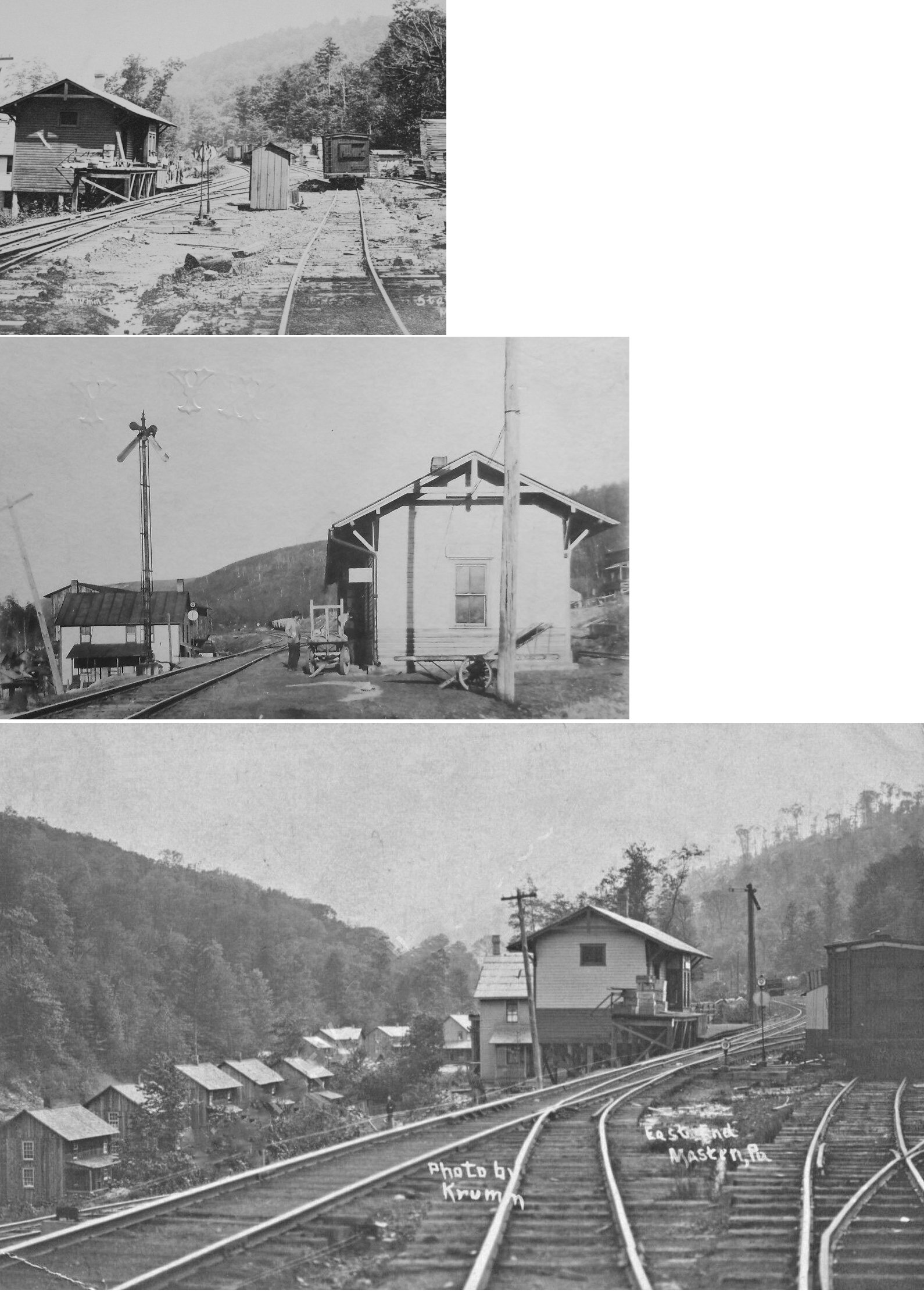
| Masten |
|
|||||||
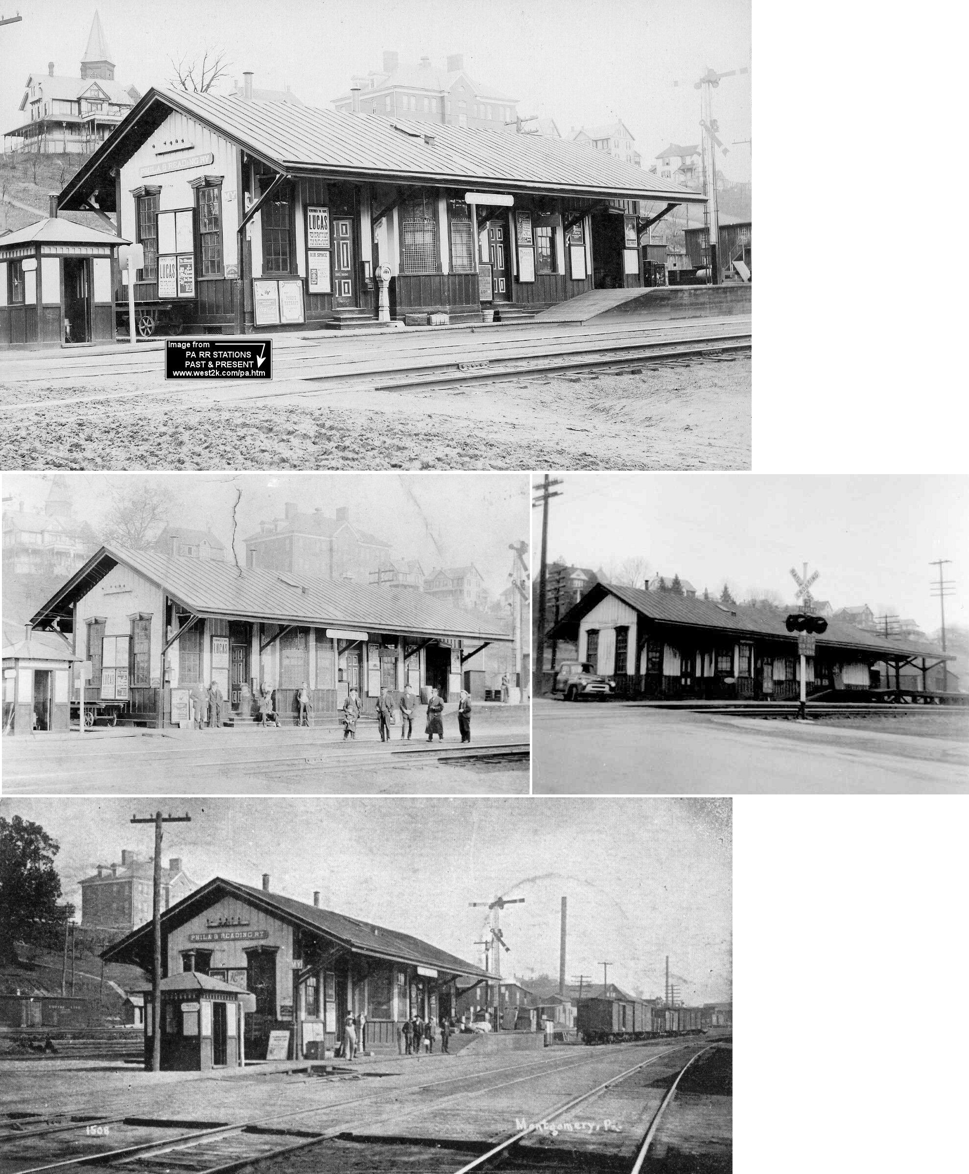
| Montgomery |
|
This station was on the NE side of 2nd Street at GPS: 41.170157, -76.874139. It was on the north side of the tracks. | ||||||
| Mongomery |
|
A station is shown here on the 1873 county atlas. A new station was built here in 1883. That station burned down in 1888 and a new station was built. That station was on the east side of South Main and the south side of Montgomery Street at GPS: 41.169609, -76.875762. Sometime between 1906-1912 the station was moved north a bit as another track was installed there. | ||||||
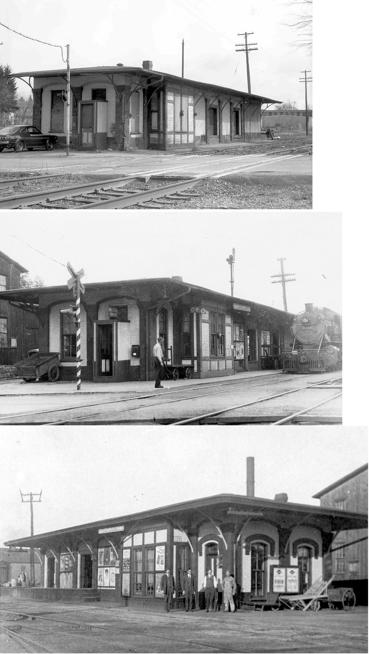
| Montoursville |
|
A Catawissa RR station is shown here on the 1873 county atlas. It was on the east side of Loyalstock Street on the north side of the tracks at GPS: 41.247609, -76.927329. | ||||||
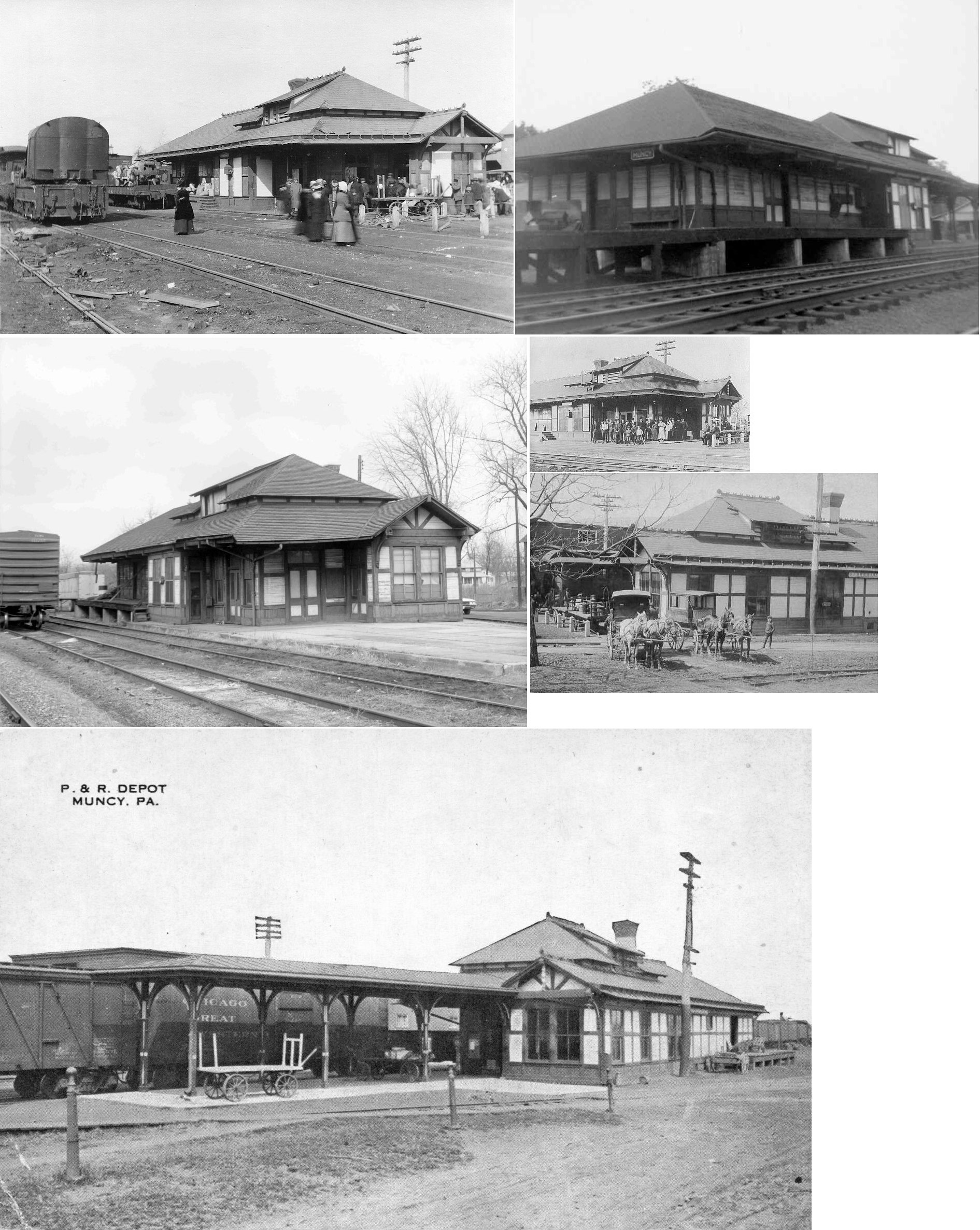
| Muncy |
|
The first station here was made of brick, but the roof was blown off and the walls collapsed during a storm in 1883 (Philadelphia Times, June 19, 1883). | ||||||
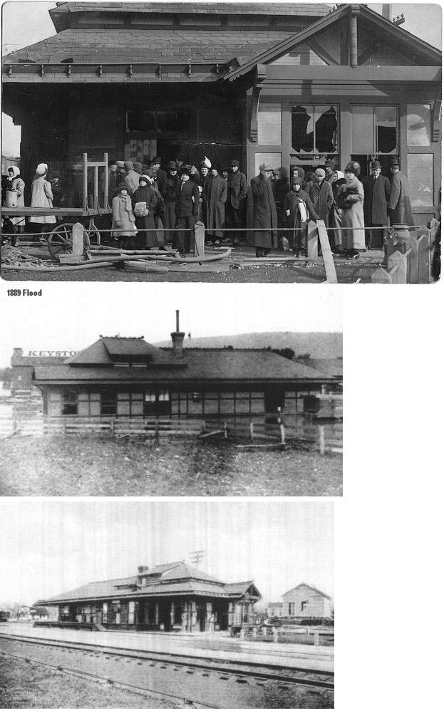
| Muncy |
|
This station was located on West Penn Street across the tracks from the Keystone Company at GPS: 41.201504, -76.797869. Here are some other photos of the station showing how it weathered an explosion and flood. | ||||||
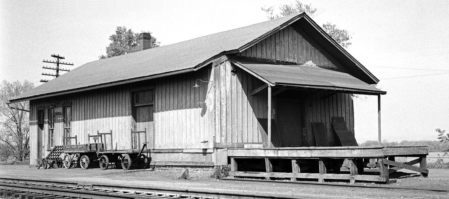
| Muncy |
|
There was a freighthouse here which was likely built along with the original passenger station. It was at the end of what is now Angletown Road (formerly Canal Street, which was also the location of the old "Reading Hotel") at GPS: 41.202001, -76.797993. The station is shown on the 1890 Sanborn map, but not on any thereafter. | ||||||
| Muncy |
|
The Sunbury & Erie RR built a station here in 1855. This station may still be standing across the river and in use as a residence. Can someone provide a specific address and photos? | ||||||
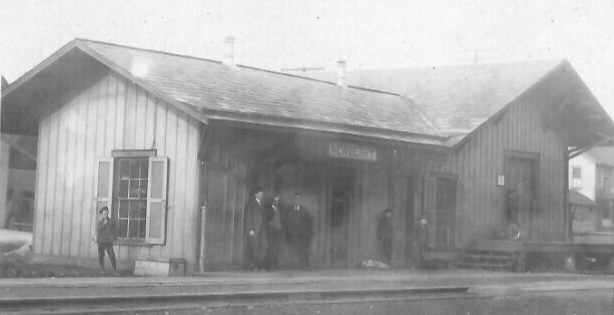
| Newberry |
|
In 1873 this station was on the north side of the tracks at Depot Street (at that time Depot Street ended at the station) (GPS: 41.234034,-77.051218). | ||||||
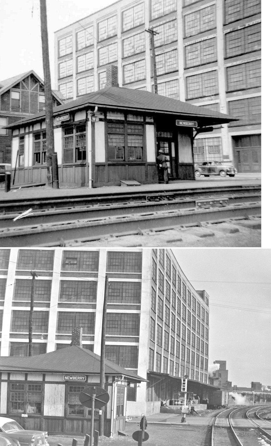
| Newberry |
|
|||||||
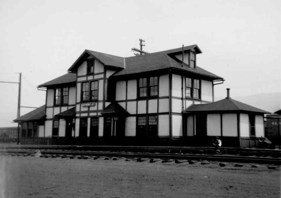
| Newberry Junction |
|
|||||||
| Newberry Junction |
|
|||||||
| Nisbet |
|
|||||||
| Pennsdale (Pennsville) |
|
In 1873 the original station was on the east side of North Middle Road (Middle Street) on the north side of the tracks (GPS: 41.242225,-76.797322). | ||||||
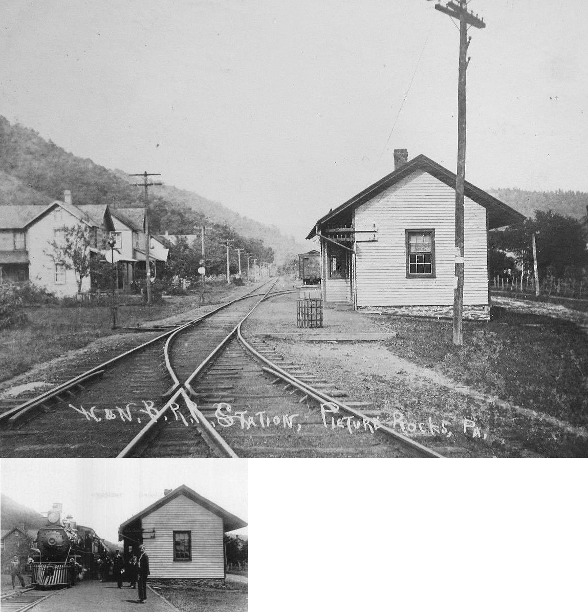
| Picture Rocks |
|
This station was southwest of Laurel Run Street/Road on the east side of the tracks in the vicinity of GPS: 41.280458, -76.715243. | ||||||
| Port Penn |
 |
|||||||
| Powys |
|
This station was known as "Crescent" until 1887. | ||||||
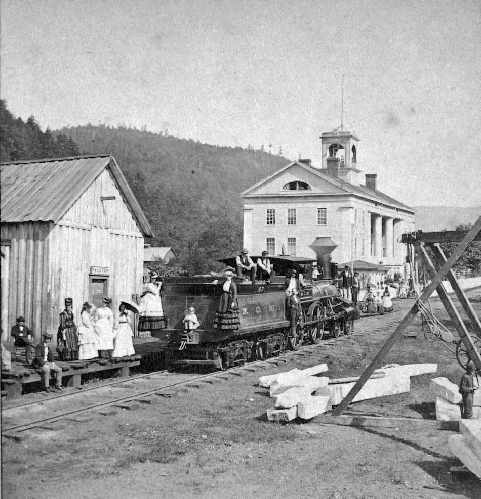
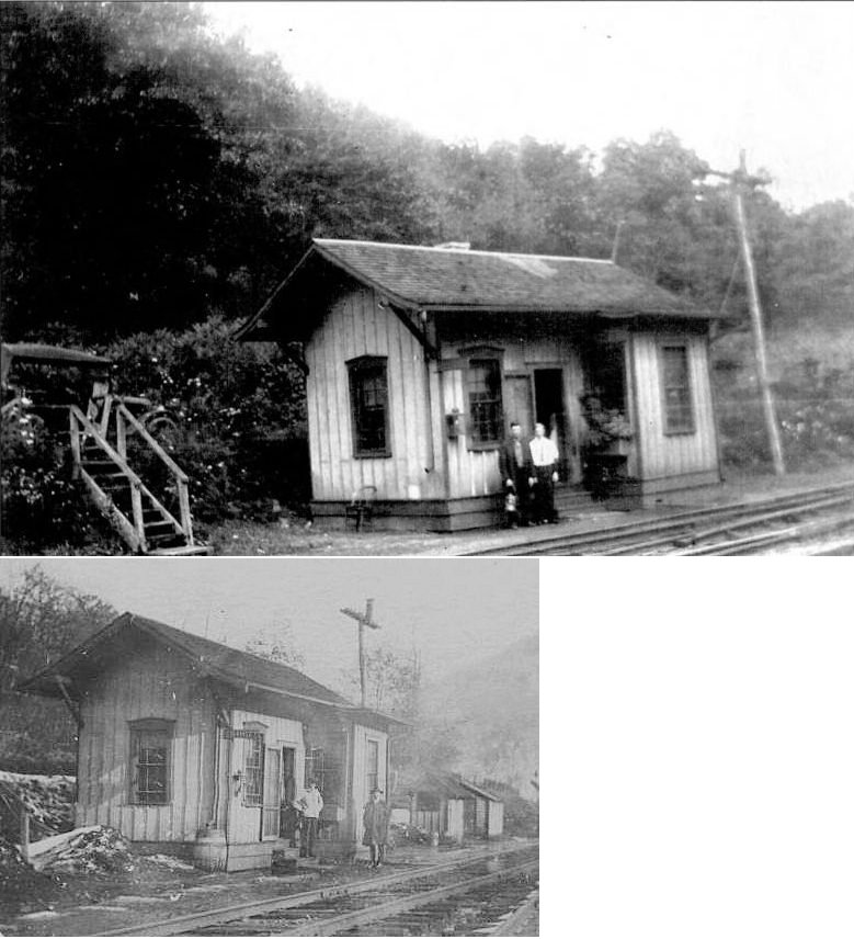
| Ralston |
|
This was the original station at Ralston. The photo dates from the 1870s. | ||||||
| Ralston |
|
This station opened in 1884. It was on Thompson Street. | ||||||
| Ralston |
|
Regarding the large building with columns in the station photo: “Among other enterprises projected was the erection of a great hotel for summer visitors, as it was not expected at that time that the road would soon be, built any further. The hotel was built of stone, with columns in front, and presented all imposing appearance for the time. It was named the Ralston House, and being at the terminus of the railroad, and situated in an extremely wild and secluded spot, became quite famous and was long a favorite place of resort. It still stands in stately pride, the monument of a past enterprise, and is still used for hotel purposes.” --History of Lycoming County, Pennsylvania (1892). | ||||||
| Ramsey |
|
|||||||
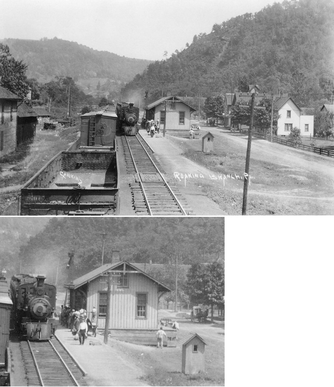
| Roaring Branch |
|
|||||||
| Rocktown |
|
|||||||
| Saegers (Bergers) |
|
|||||||
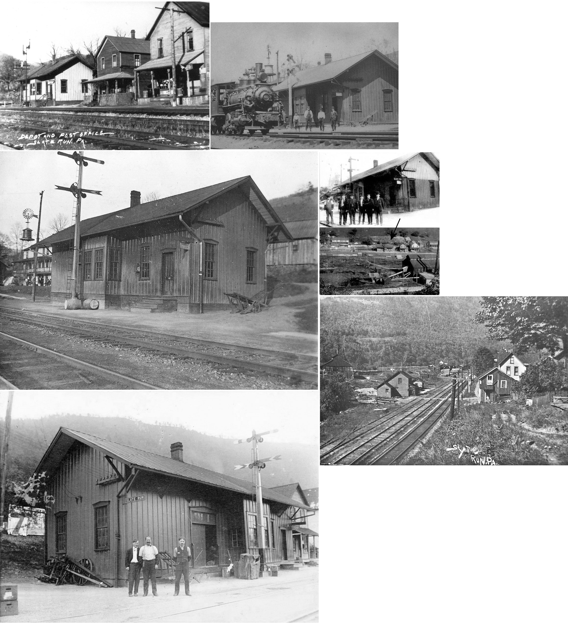
| Slate Run |
|
|||||||
| Tivoli (Essick) (Chamouni) |
|
This station had several names over the years. | ||||||
| Tombs Run |
|
This station was near the north end of West Side Road in the vicinity of GPS: 41.248511, -77.327596. | ||||||
| Torbert Station |
|
This station was near the intersection of Furnace Run Road and PA44 in the vicinity of GPS: 41.220323, -77.318181. | ||||||
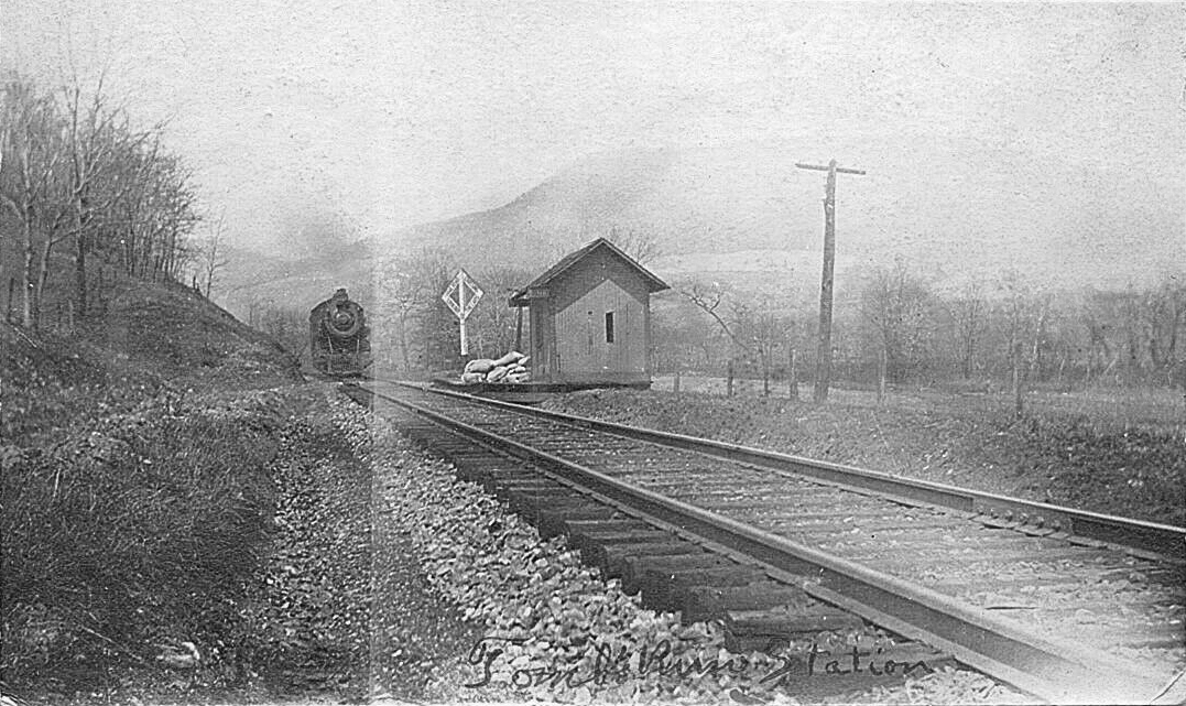
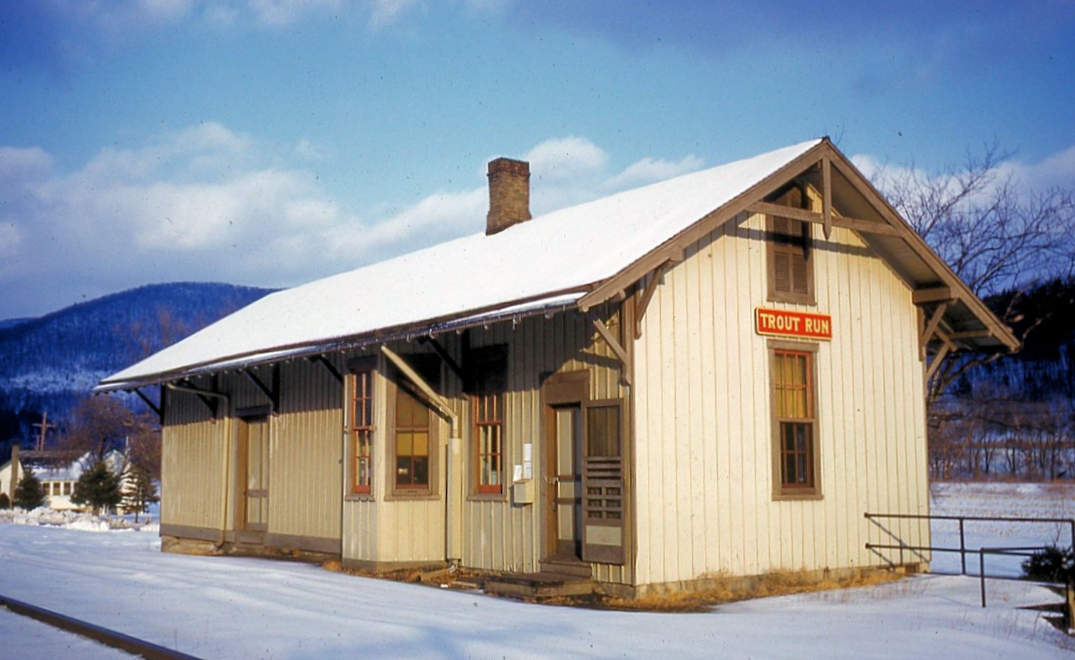
| Trout Run |
|
In 1873 the station was a combination store/depot on the NE side of Liberty Street. | ||||||
| Utceter |
|
|||||||
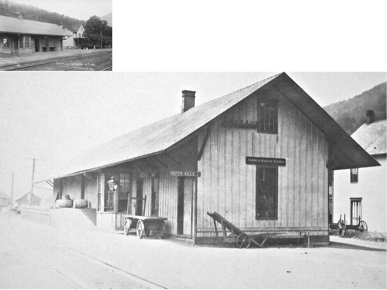
| Waterville |
|
Depot and Carson's store shown in photo. | ||||||
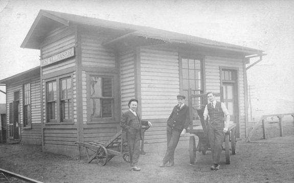
| West Williamsport |
|
|||||||
| West Williamsport |
|
This station was next to the Keystone Glue Company. | ||||||
| Williamsport (South Williamsport) |
|
There was a small freight station on the NE corner of East Lincoln Street and Market Street at approximately GPS: 41.234215, -76.995015. | ||||||
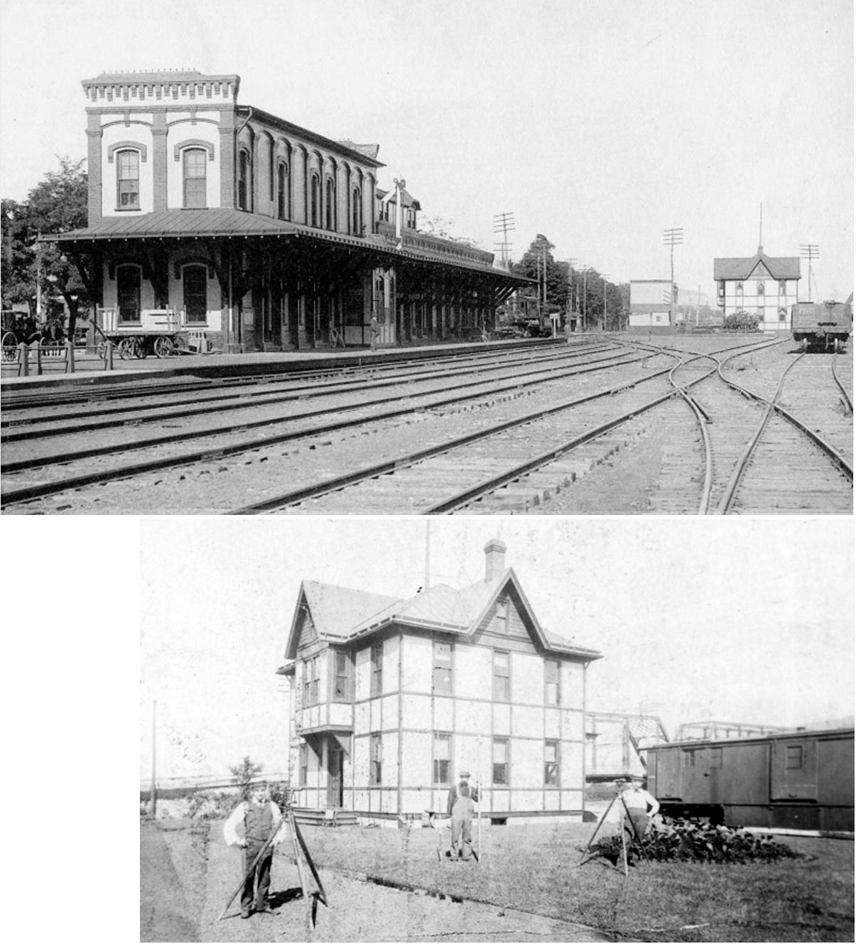
| Williamsport (Trinity Street) |
|
This station was at the north end of Trinity Place (formerly Trinity Street) at GPS: 41.241010, -77.018936. The west end of the building was railroad offices. It was connected to the nearby Park Hotel (formerly the Herdic Hotel, which is still standing) via a wooden walkway that led to the depot platform. The station was built in 1871 and opened in 1872. It was gutted by fire in August of 1979 and subsequently torn down in September of that year. | ||||||
| Williamsport (Market Street) |
|
The first station at this location was a small wood frame depot on the west side of Market Street between North Street and 5th Street at GPS: 41.243444, -77.003399. | ||||||
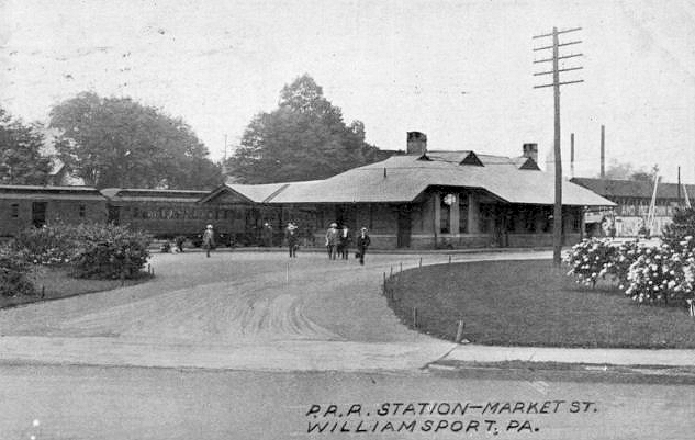
| Williamsport (Market Street) |
|
This second-generation brick station, opened in 1902, was on the south side of the tracks on the south side of 5th Street just west of Market Street. It was called the Market Street Station on timetables and located at GPS: 41.243368, -77.004080. | ||||||
| Williamsport (Trenton Ave.) |
|
This combination station was on Depot Street just north of Trenton Avenue at GPS: 41.236261, -77.052029. | ||||||
| Williamsport |
|
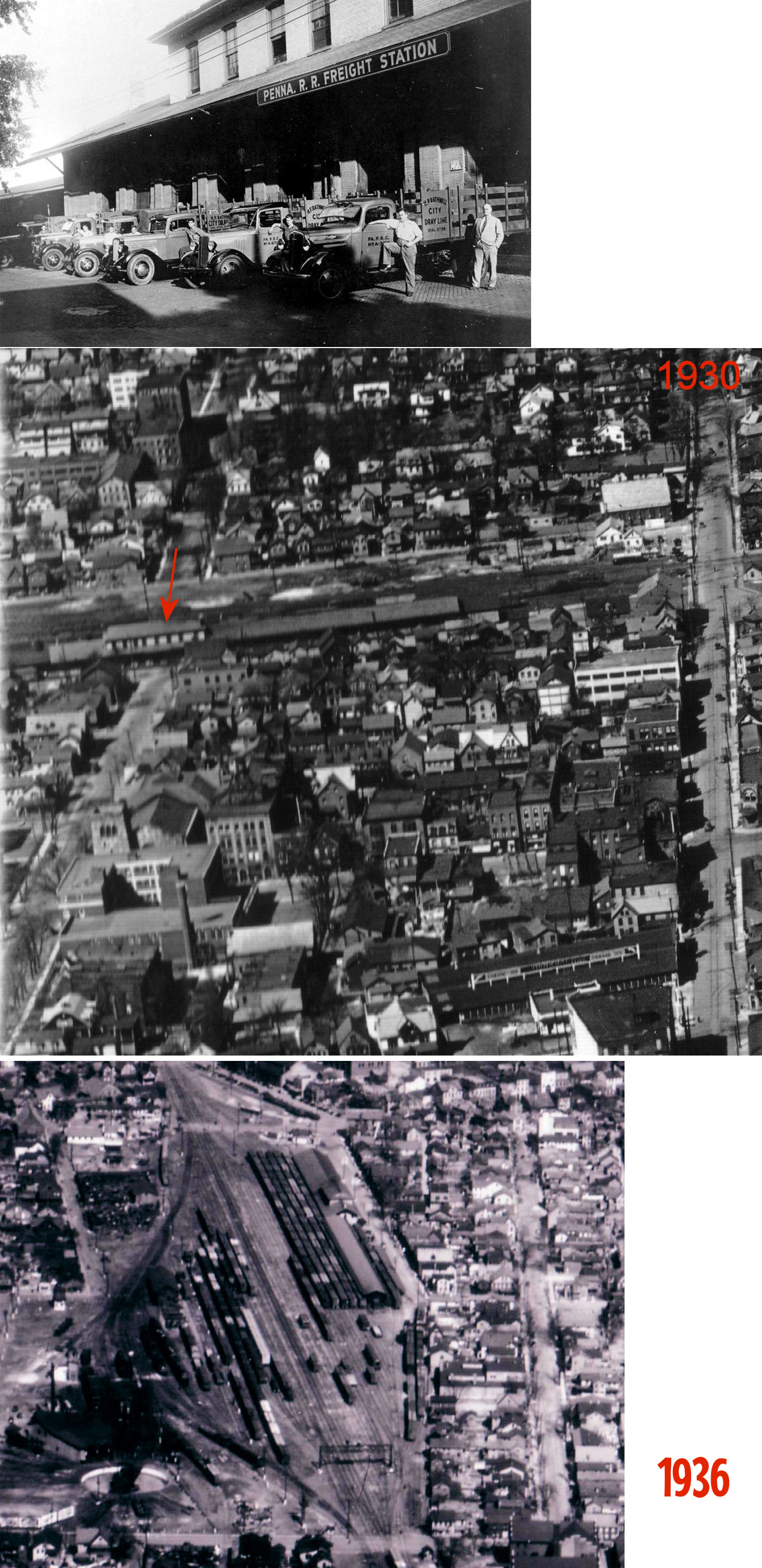
There was a large freight house on the north side of 5th Street (now Little League Boulevard) at the north end of Elmira Street at GPS: 41.242877, -77.008675. Originally a brick freight house, a large wooden addition was added sometime between 1891 and 1912. With this new configuration the brick portion served as the inbound freight house and wood section was the outbound part. The wood section was damaged by fire in August, 1938. It is unclear whether this part of the station was destroyed or subsequently repaired. | ||||||
| Williamsport |
|
In 1873 the Catawissa RR station was at the south end of Pine Street where the Susquehanna Riverwalk is today (GPS: 41.237754,-77.000234). This station was built in 1871 | ||||||
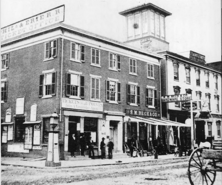
| Williamsport |
|
The P&R had a early ticket office on the SW corner of Market Square (3rd & Market Streets). | ||||||
| Williamsport (Pine Street) |
|
The P&R built this station in 1884 near the site of the original Catawissa RR station at the south end of Pine Street (GPS: 41.237754,-77.000234). | ||||||
| Williamsport |
|
The P&R freight house was on the east side of Pine Street between Front and Jefferson Streets (now both gone) at approximately GPS: 41.238429, -77.000554. This brick freight house was expanded sometime between 1891 and 1912. | ||||||
| Williamsport (Arch Street) |
|
There was a small passenger station and small freight house on the west side of Arch Street north of Boyd Street on the north side of the tracks. The passenger station was at GPS: 41.234368, -77.049774 and the freight station was at GPS: 41.234263, -77.050270. | ||||||
| Williamsport (Maynard Street) |
|
This station was on the east side of Maynard Street on the south side of the tracks at approximately GPS: 41.232297, -77.019173. Although a very small station, it was designed by Frank Furness and built in 1883 (according to the Annual P&R Report of that year). It was primarily a boarding point for vacationers heading to Eagles Mere and Hecla Park. It may have also been used for Northern Central RR trains heading north. Passengers heading east boarded the train at Maynard Street and then bought their tickets at the Pine Street station during a short layover there. The station was closed by the Reading RR in 1940. | ||||||
| Williamsport |
|
|||||||
| 1895 LYCOMING COUNTY RAILROAD MAP | ||||||||
 |
||||||||
| Notes About Existing
Stations... Antes Fort (Replica Station) - Supposedly the station was painted to the color scheme of the original PRR station in Antes Fort. Pennsdale (W&NB) - Station is in original location, but was turned and now sits across the grade. |
||||||||