|
|
||||||||
| EXISTING STATIONS | ||||||||
|---|---|---|---|---|---|---|---|---|
| Station Name |
Original Railroad |
Current Location |
Type | Current Use |
Date Built |
Track Status |
Building Material |
More Info |
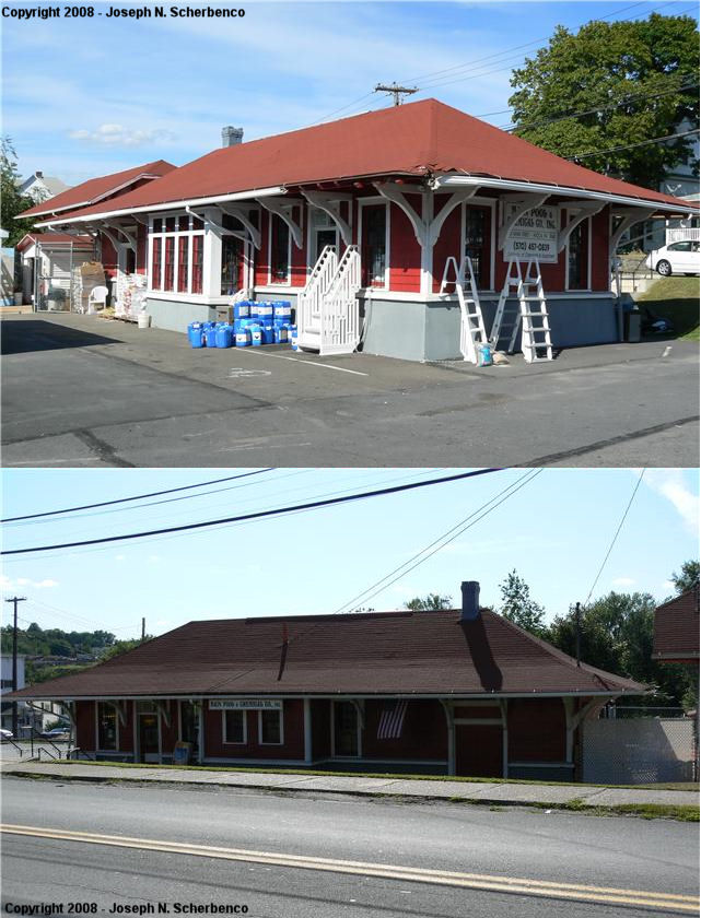
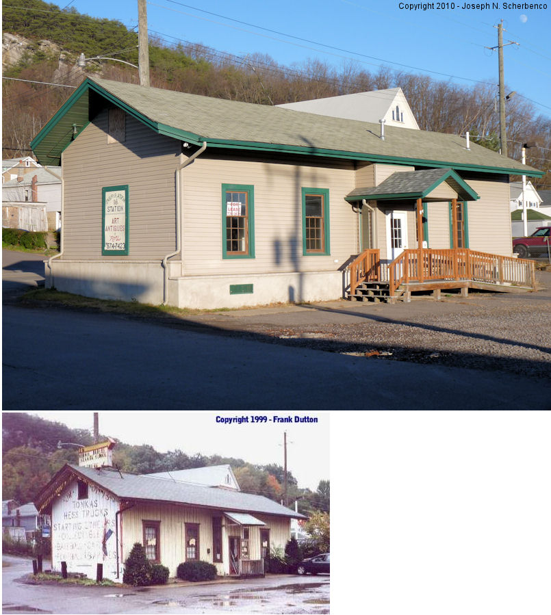
| Avoca |
 |
503 Main Street (U.S. 11 north of McAlpine Street (GPS: 41.335140, -75.743829) |
C | Business | 1912 | In Use | Wood |
|
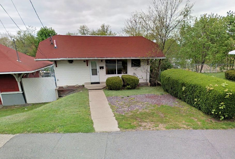
| Avoca |
|
Main Street north of McAlpine Street (GPS: 41.335286, -75.743780) |
C | Residence | 1867 | In Use | Wood |
|
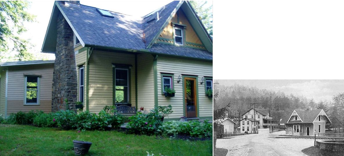
| Bear Creek |
 |
35 Cove Road (GPS: 41.180720, -75.755024) |
C | Residence | ???? | None | Wood |
|
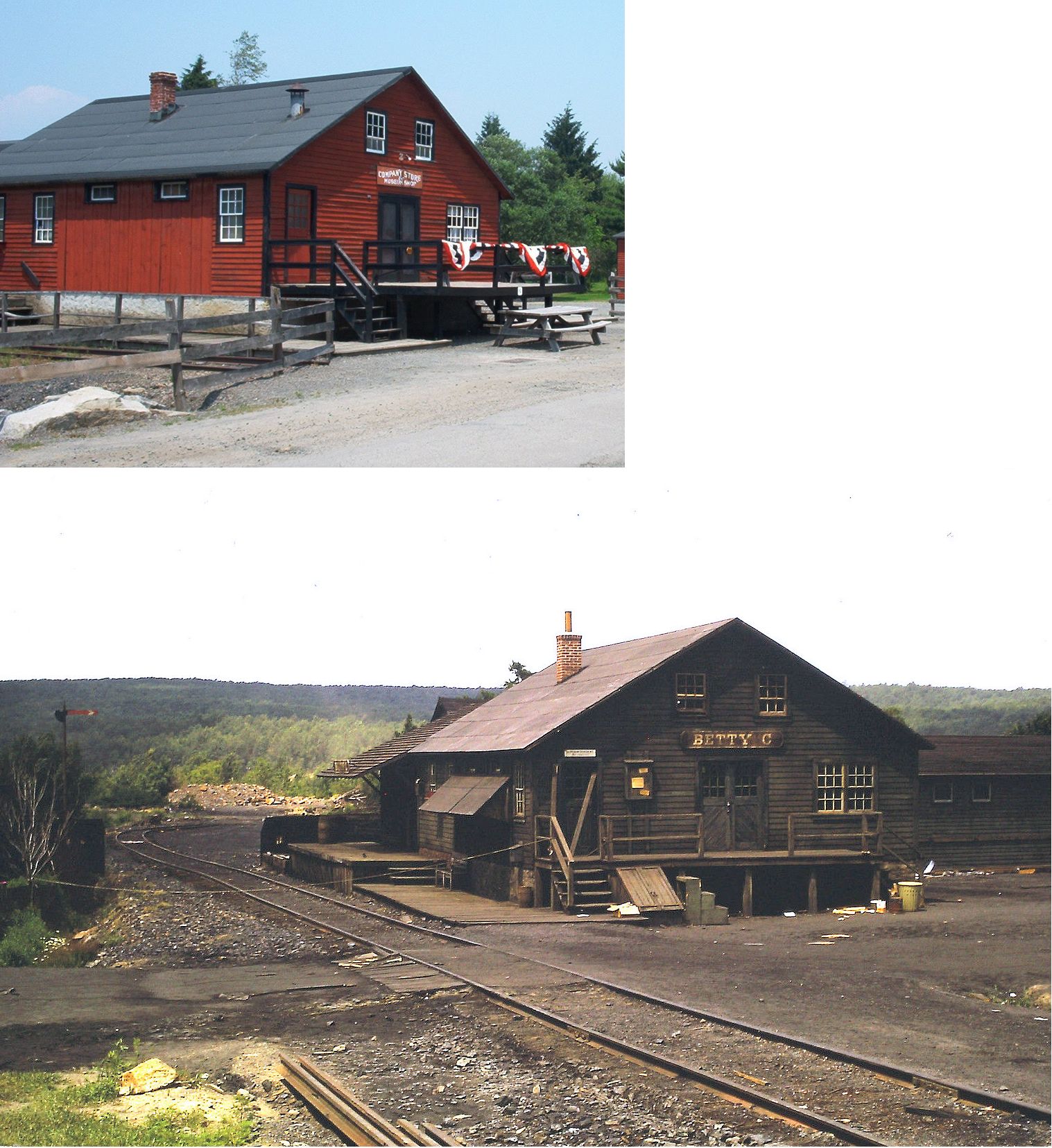
| Eckley |
 |
Main Street at Eckley Miners Village (GPS: 40.993555, -75.862578) |
C | Museum | 1969 | None | Wood |
|
| Hazleton |
|
Corner of West Chestnut & South Vine Streets (GPS: 40.954202, -75.979338) |
F | Business | ???? | In Use | Brick | |
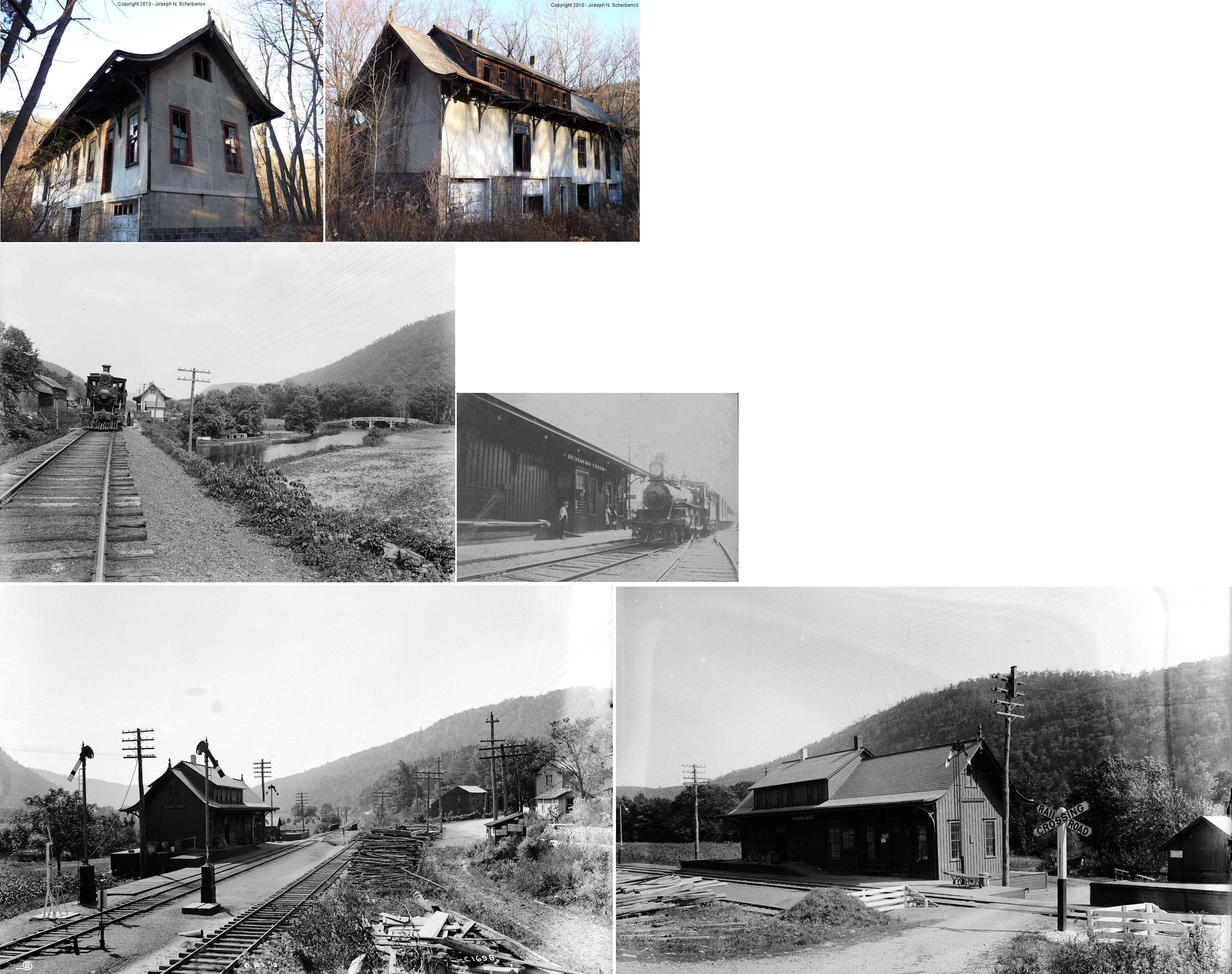
| Hunlock Creek |
 |
SE side of U.S. 11 just east of Hunlock-Harveyville Road (GPS: 41.205806, -76.064673) |
C | Vacant | 1873 | Gone | Wood | |
| Pittston |
 |
North side of Market Street between Lagrange and Spring Streets (GPS: 41.319999, -75.790603) |
F | Civic | 1903 | Gone | Brick | |
| West Nanticoke |
|
5 Ferry Street at U.S. 11 (GPS: 41.217128, -76.007239) |
C | Business | 1873 | Gone | Wood | |
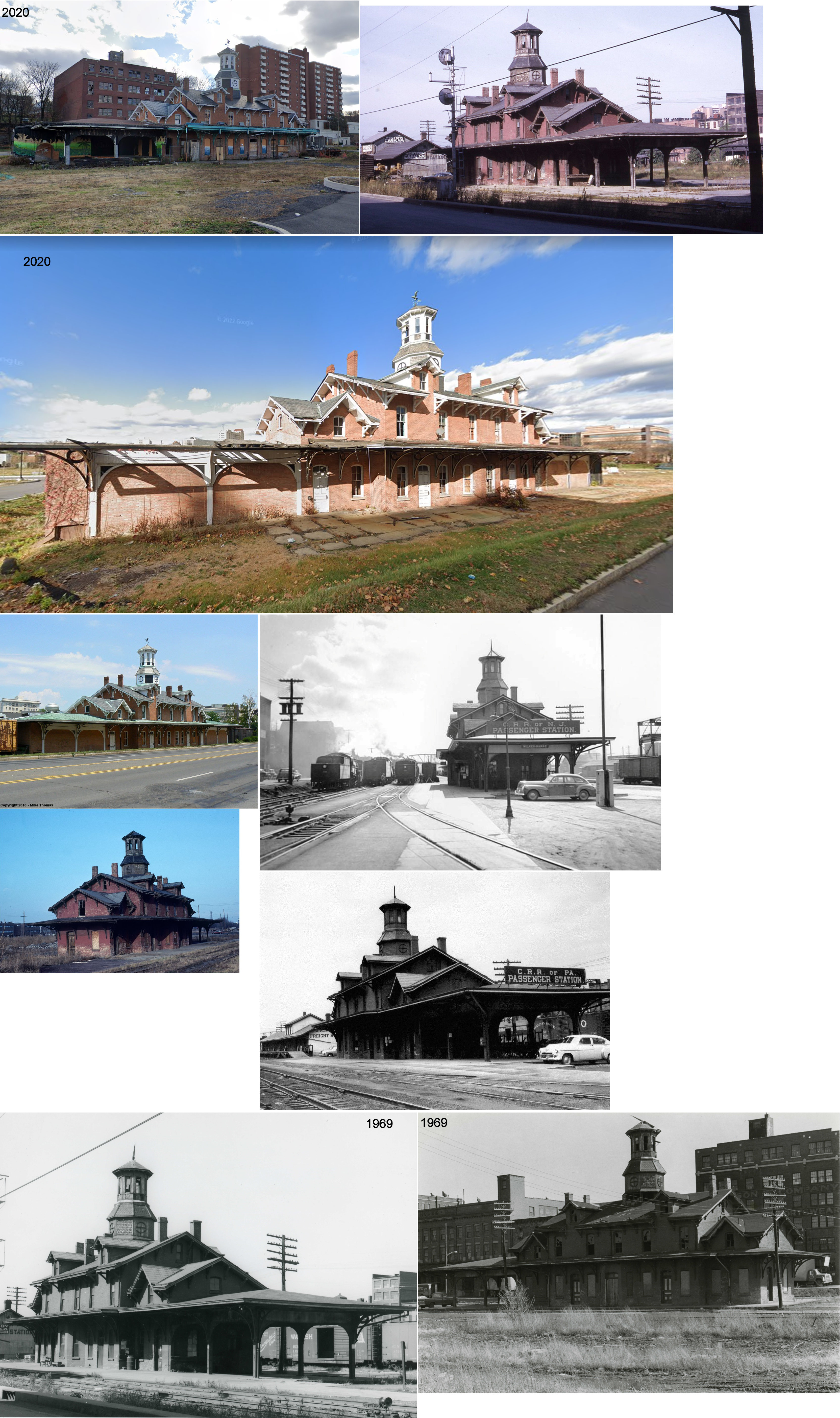
| Wilkes-Barre |
 |
Market Street Square & Wilkes-Barre Boulevard (GPS: 41.241766, -75.879401) |
P | Civic | 1869 | Aband. | Brick/ Wood |
|
| STATIONS OF THE PAST | ||||||||
| Station Name |
Original Railroad |
Notes | ||||||
| Alden |
|
This station burned down on June 4, 1940 (Wilkes-Barre Times Leader Evening News, 6-4-1940). It was abandoned sometime prior to that. It was on Kirmar Avenue at what is now West Railroad Street at approximately GPS: 41.181350, -76.012729. | ||||||
| Alderson (Harvey's Lake) |
|
|||||||
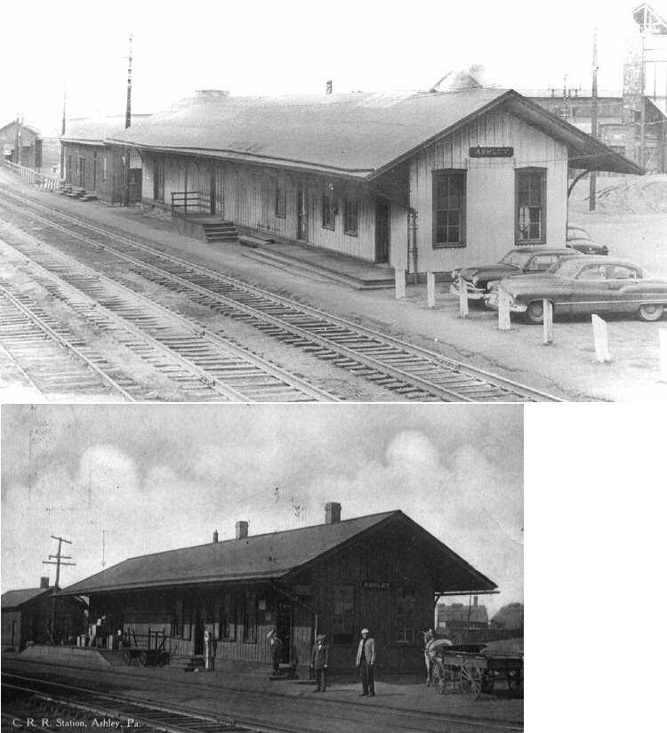
| Ashley |
|
Ashley Station was on the mainline (milepost 169.25) and the Nanticoke Branch (MP 4.86). The passenger and freight stations were next to each other on Cemetery Street just NW of Main Street at GPS: 41.213720, -75.900232. The station was torn down in 1957 during a modernization of Ashley Yard (Wilkes-Barre Times Leader, 7-24-1959). | ||||||
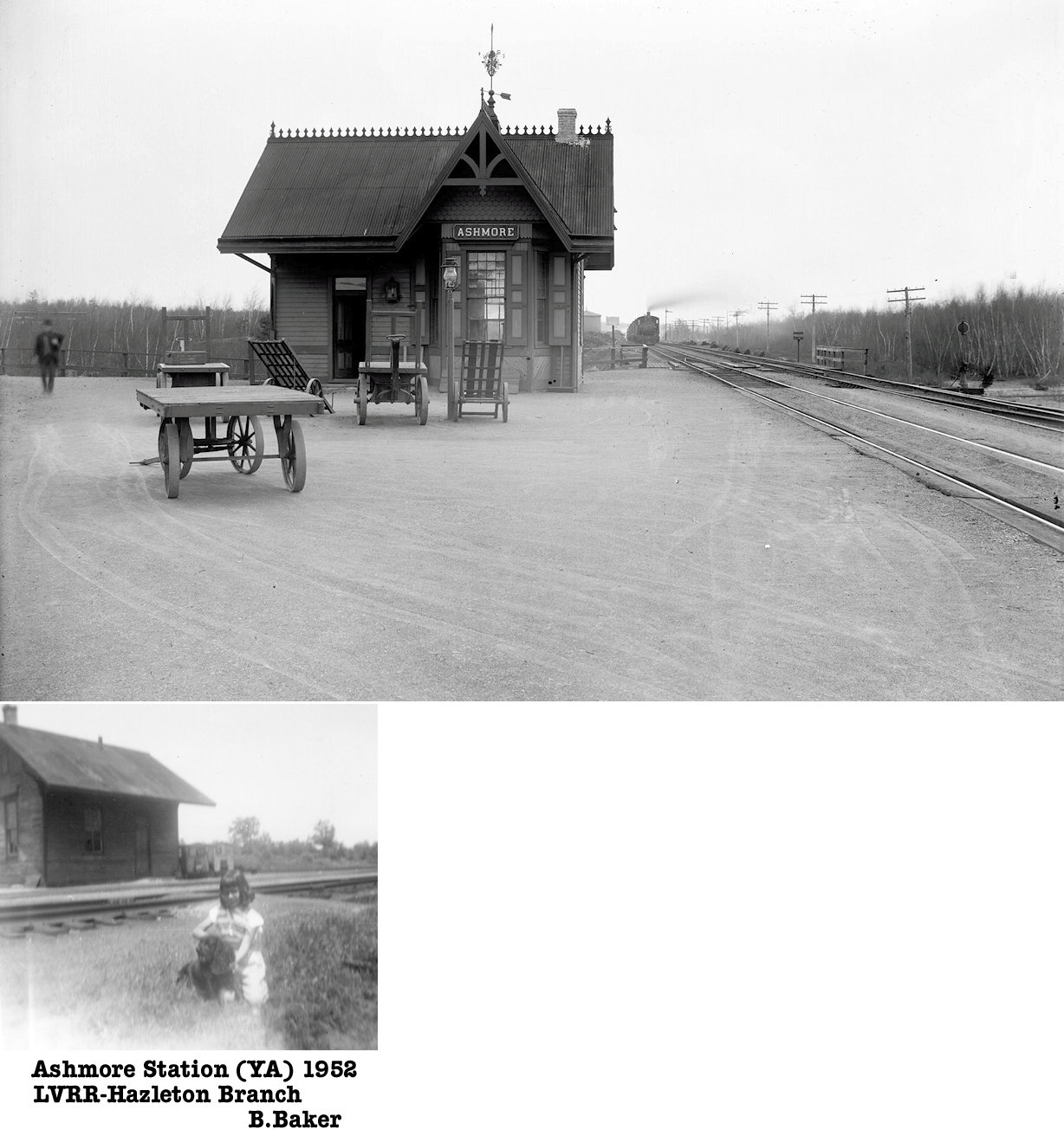
| Ashmore |
|
Was on the Hazleton Brach between Weatherly and Stockton. A five mile branch began here that went to Hazle Brook, Pink Ash Junction, Jeddo, Drifton and Freeland. The station was moved in December 1915 to East Ashmore. | ||||||
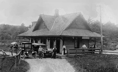
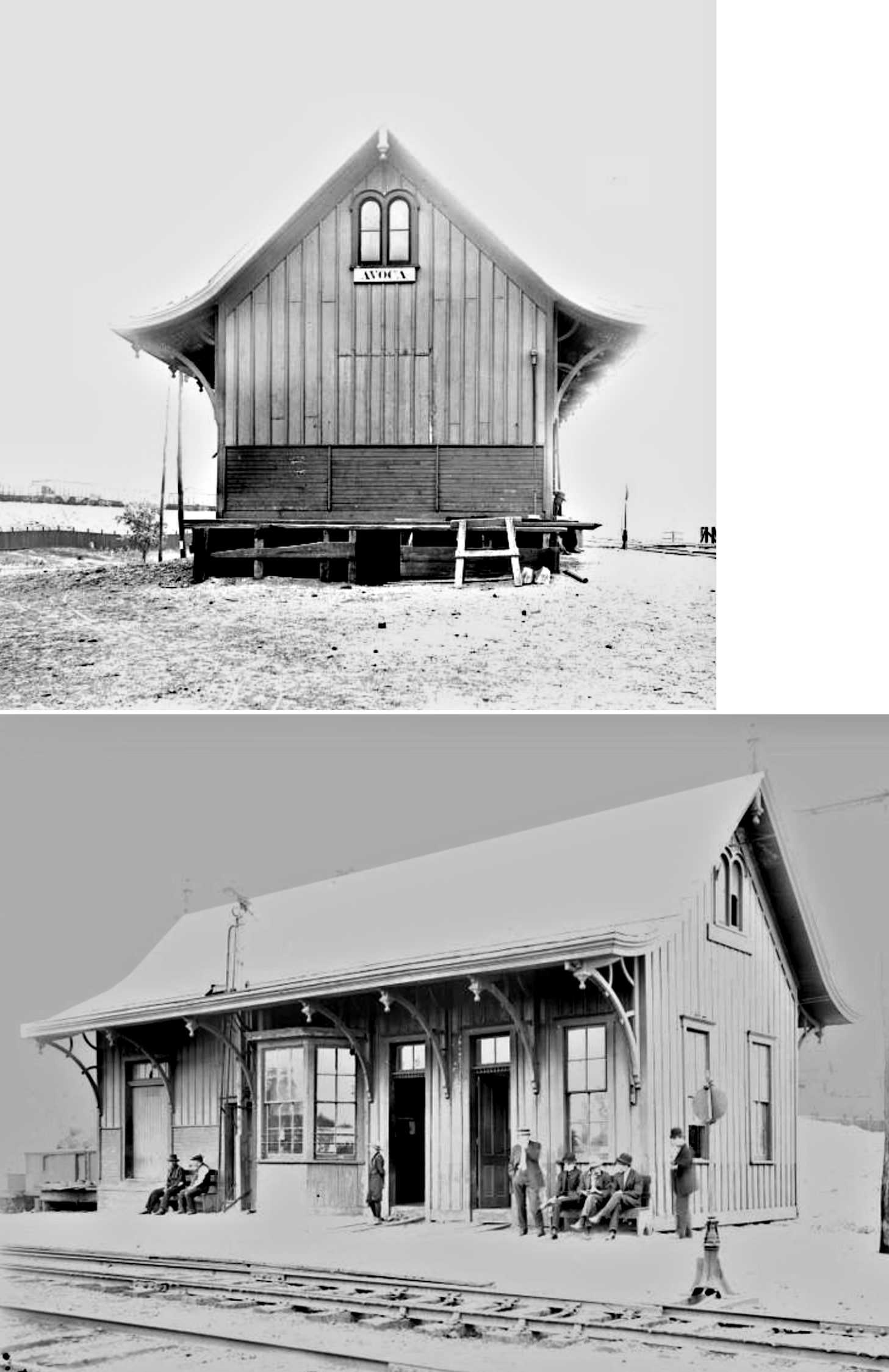
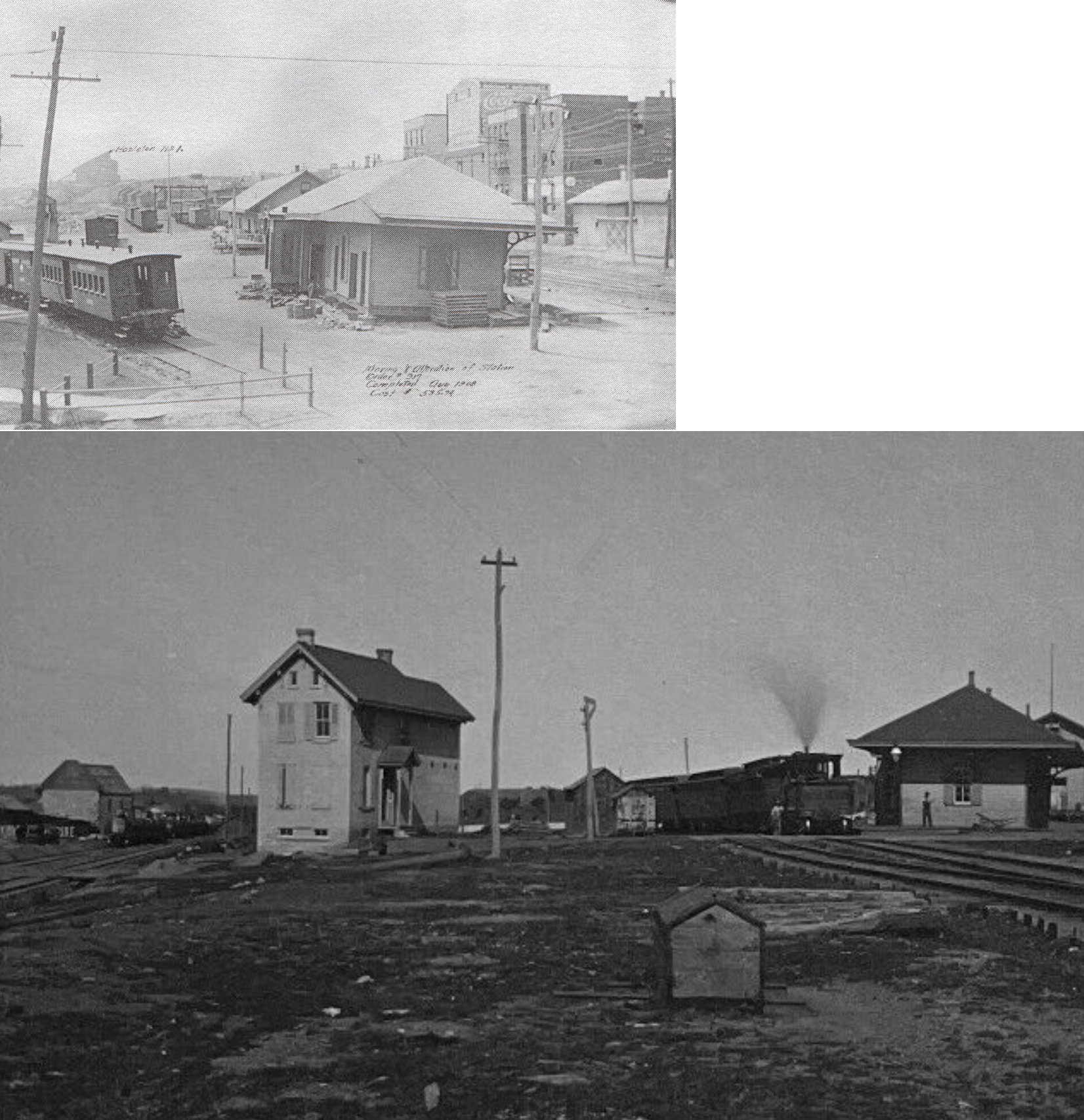
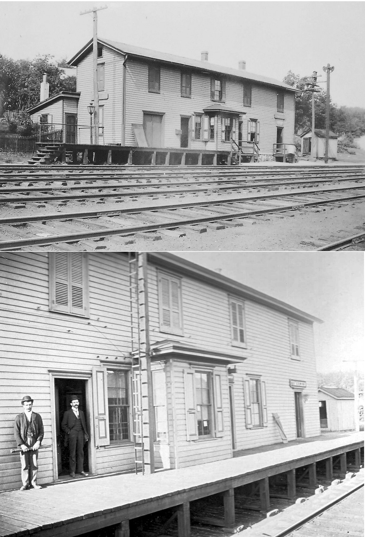
| Avoca |
AND |
Before the existing passenger station was built in 1912, the passenger station was on the west side of the tracks where Mill Street crossed (GPS: 41.335729, -75.744055). This station was built in 1899 and is shown on the 1903 map. It burned down on January 19, 1904. The LV had a branch on the west side of the station, but passenger service between Pittston and Avoca on the LV ended when the trolley line opened. Between the time this station burned and the time the new station was built, passenger service was handled at the freight station (the original combination station which is still standing). | ||||||
| Avoca |
 |
This combination station was built in 1885. This was an example of a D&H-style pagoda depot on the Erie RR. There were a handful of these type stations on the Erie in this area near Scranton and a prevailing theory is that the stations were built by the D&H and then sold to the Erie. | ||||||
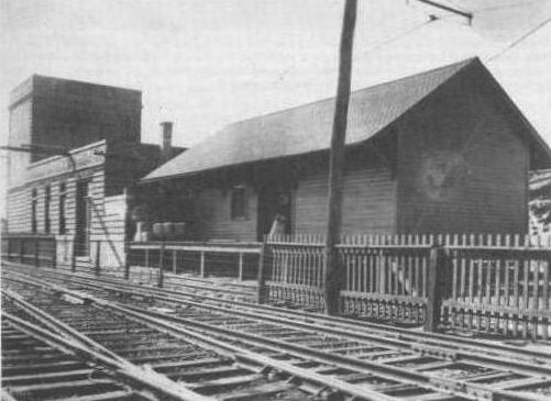
| Avoca |
|
There was a waiting shed/platform and a freight station across the tracks. The photo shows the freight station next to the transformer house/substation. | ||||||
| Avoca |
|
There was a waiting shed and platform at the SW corner of Plane Street and William Street (GPS: 41.342336, -75.735080). | ||||||
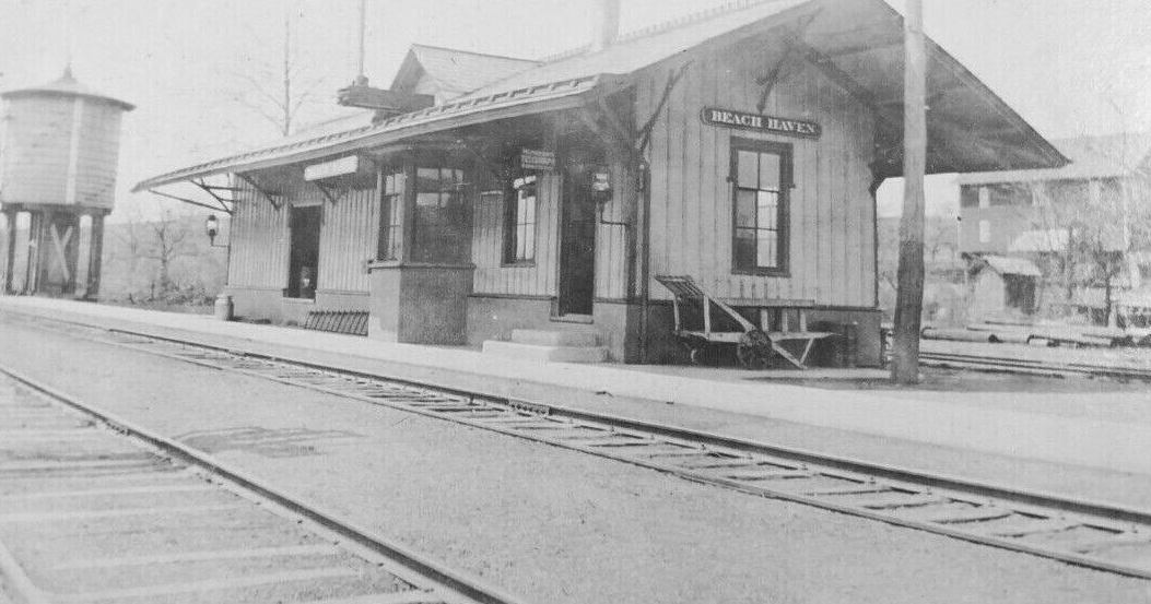
| Beach haven |
|
This combination station was built in 1883. | ||||||
| Beth Run | |
This station was on the Bowmans Creek Branch. | ||||||
| Browns Switch |
|
This was an early station on the Lackawanna & Bloomsburg RR between Duryea and Pittston. | ||||||
| Buttonwood |
 |
A new station was established here in 1900. his station was between Nanticoke and Plymouth Ferry and was likely meant to replace Butzbach station which closed the same year that Buttonwood opened. | ||||||
| Butzbach |
|
This station was between Nanticoke and Plymouth Ferry. It was closed in 1900. | ||||||
| Chestnut Ridge | |
This station was on the Harveys Lake Branch between Outlet and Lehman. | ||||||
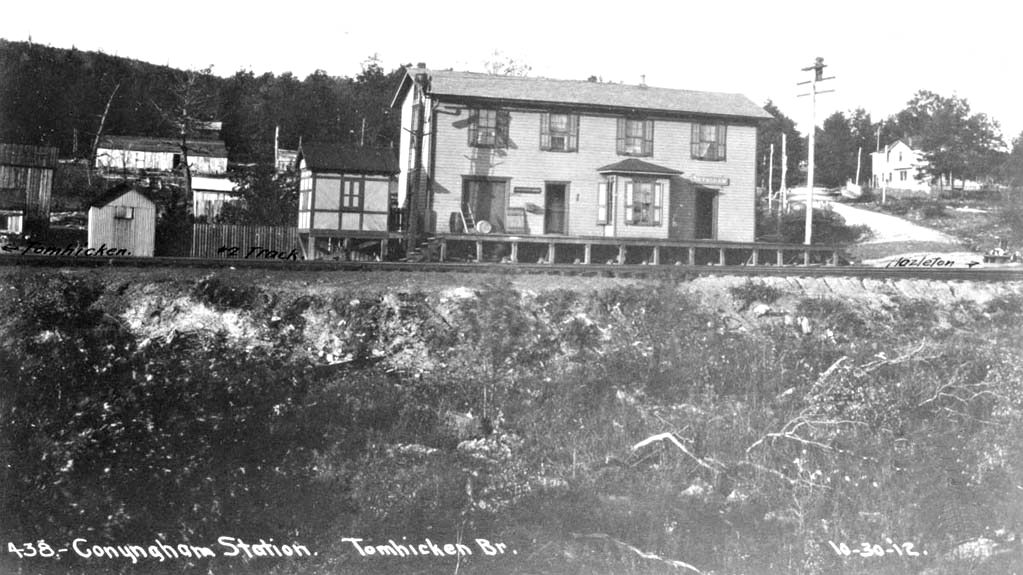
| Conygham |
|
|||||||
| Coxton |
|
The original station here was destroyed in the ice gorge of 1875. | ||||||
| Coxton |
|
|||||||
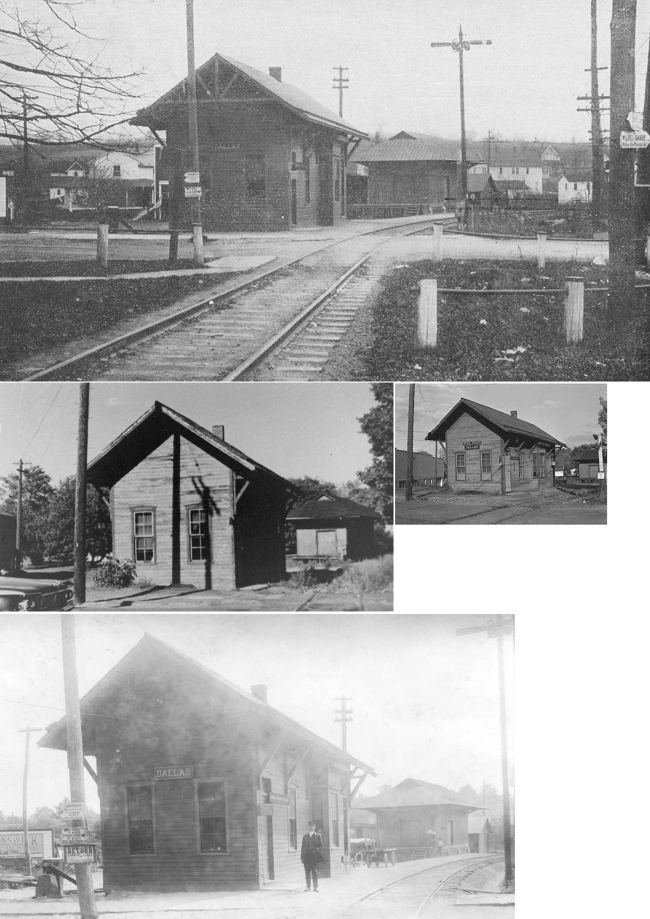
| Dallas |
|
There was a passenger and freight station here. | ||||||
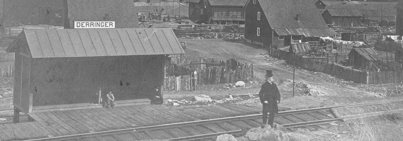
| Derringer |
|
A shelter-type station was built here in 1885. | ||||||
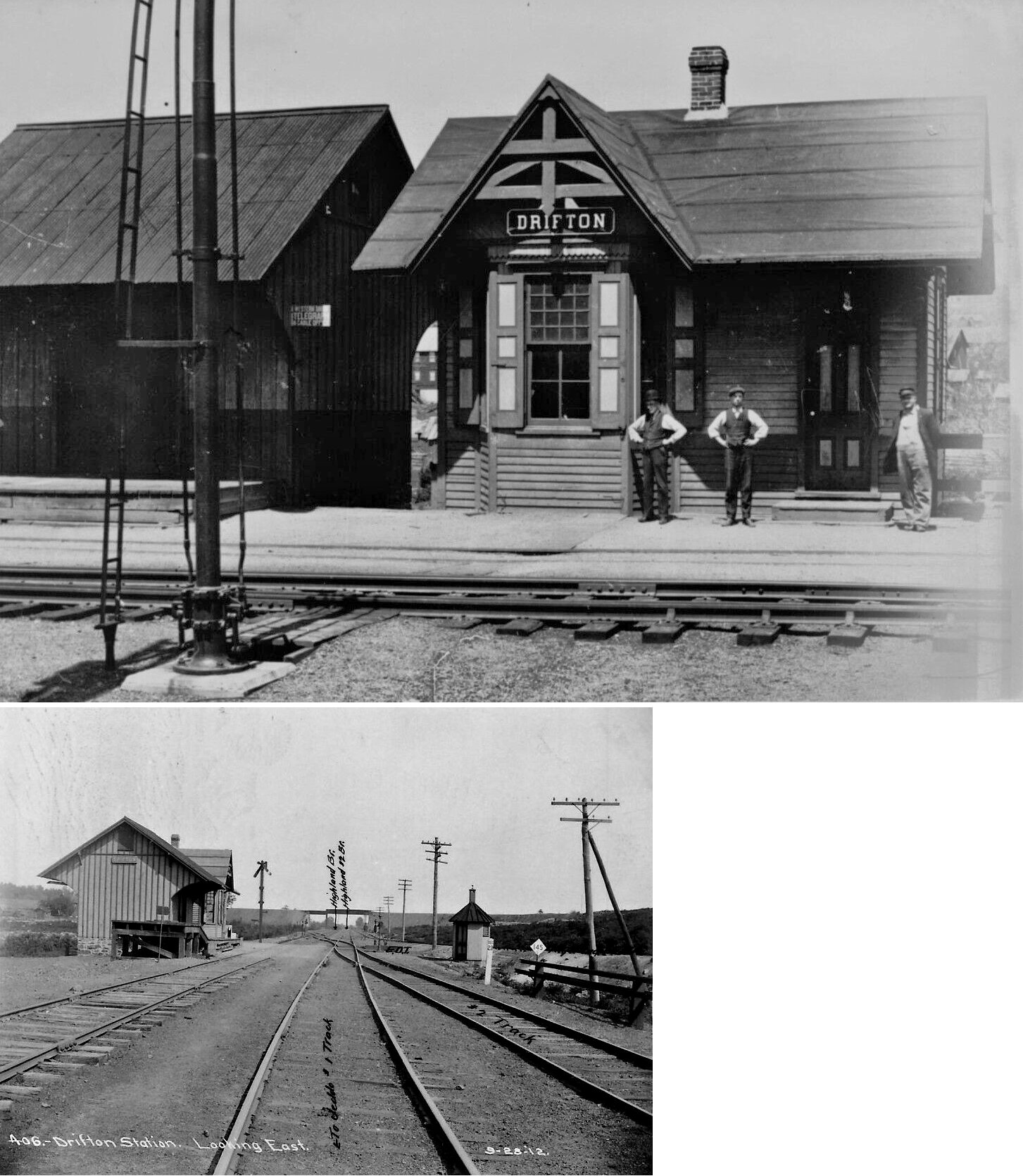
| Drifton |
|
|||||||
| Dupont |
|
Station was off route 11 paralleling Pittston bypass. The concrete bridge abutment and wood from northbound station are still visible from the route 11 Pittston bypass. These were wooden shelters. They were leveled after passenger service terminated in 1952. | ||||||
| Duryea |
|
This combination station was built in 1878. It was on the NW side of the tracks south of Main Street at GPS: 41.352311, -75.757864. | ||||||
| Exeter |
|
The 1910 Sanborn map shows a foundation for a freight station on the NE side of Grant Street on the SE side of the tracks at GPS: 41.323593, -75.818560. It's not clear if this station was being built at the time or remnants of one that was torn down. | ||||||
| Exeter |
|
|||||||
| Fairview |
|
See listing for Mountain Top below. | ||||||
| Fern Glen |
|
A station was built here in 1885 and a second generation station was built in 1892. | ||||||
| Forest Castle |
|
This station was between Exeter and Coxton on the West Pittston Branch. | ||||||
| Forty Fort |
|
This was on the West Pittston Branch. It may have also been called "Dorranceton." | ||||||
| Forty Fort |
|
|||||||
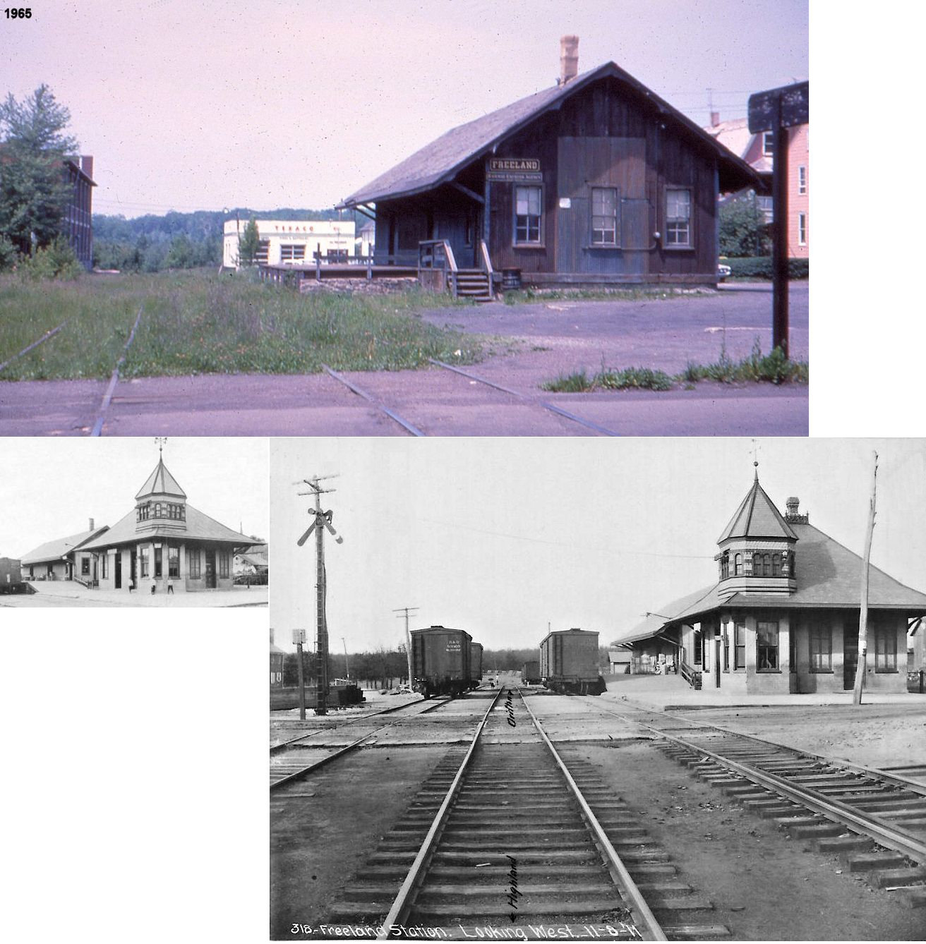
| Freeland |
|
This passenger/freight station combo was on the west side of South Centre Street on the north side of the tracks at GPS: 41.013727, -75.897473. | ||||||
| Glen Lyon |
|
A new station was built here in 1887. The PRR took over the branch from the Susquehanna Coal Company in 1884 and, given the transportation situation at the time, passenger trains were probably used. The 1917 PRR Valuation maps of the branch label it as freight only. | ||||||
| Glen Lyon |
|
The freight station was on the east side of the intersection of Depot and Railroad Streets on the north side of the tracks at GPS: 41.175485, -76.073959. Only this freight station is shown on the Sanborn maps from 1897-1928. Not sure where the passenger depot was. | ||||||
| Gracedale |
|
This station was on the old LV line to the east of Penobscot. On the 1873 map, Penobscot station was on this eastern line. Later, on an 1893 LV map, Penobscot was on the western line here and Gracedale was on the eastern line at approximately GPS: 41.167644, -75.862241. | ||||||
| Harveys Lake | |
This station was on the Bowmans Creek Branch. Also known as Shawanese Lake. | ||||||
| Harvey Junction | |
This junction station was near Luzerne. | ||||||
| Hazleton |
|
The 1873 map directory indicates that a John Hill had a store above the LV depot on the SW corner of Mine and Locust Streets (GPS: 40.955194, -75.980931). This was likely the old Hazleton RR depot as the tracks are marked as such on the map. The HRR was absorbed into the LV by that time (1868). This station was gone by 1884, replaced by a feed mill. | ||||||
| Hazleton |
|
This first LV station here was on the SE corner of Church Street and Mine Street at GPS: 40.954200, -75.977161. This station is shown on the 1873 map. The agent was A.M. Eby. | ||||||
| Hazleton |
|
The second generation LV stations, shown on the 1884 Sanborn map, were on the south side of West Mine Street between Church Street and Vine Street. The passenger station was at GPS: 40.954284, -75.977714, and the freight station was at GPS: 40.954498, -75.978481. The freight station was enlarged sometime before 1891. After the new larger passenger station was built in 1907, the old passenger station was moved, altered, and served as offices for the railroad. The freight station had the dubious distinction of buring down twice within six months. It burned in December 1940 and sat in ruins and a pile of salvaged timbers until it burned again in May, 1941 (The Plain Speaker, 5-7-1941). | ||||||
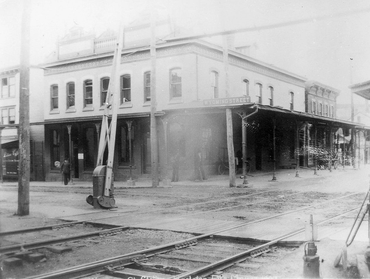
| Hazleton |
|
This brick station was on the NE corner of South Wyoming Street and East Mine Street (GPS: 40.953479, -75.974145). It was known as the Wyoming Street Station. The building was originally a saloon and meat market, but was converted into a station sometime between 1888-1891. | ||||||
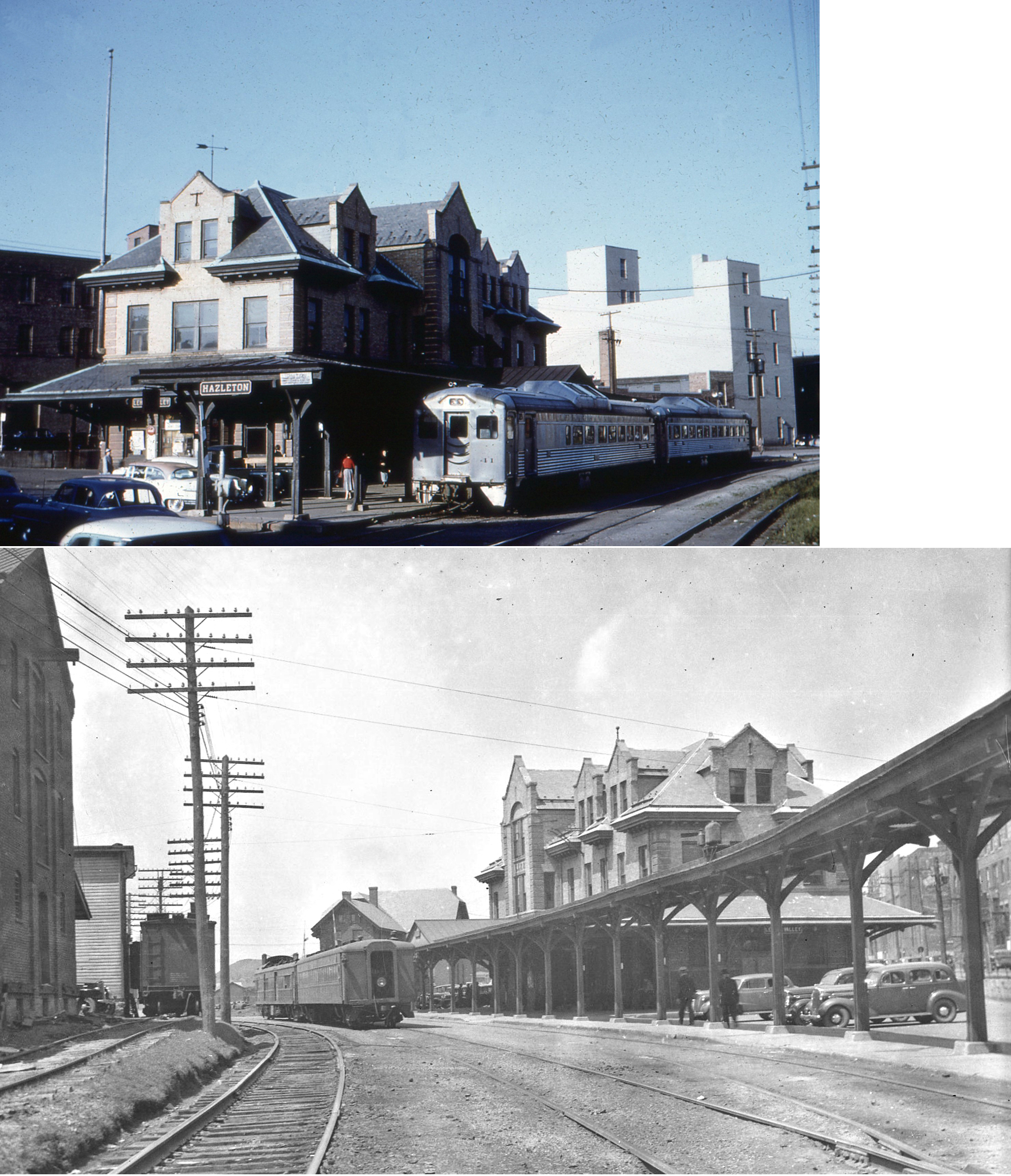
| Hazleton |
AND |
Built in 1907 this station sat on the east side of South Church Street south of West Mine Street at GPS: 40.953953, -75.977071. It was demolished in 1963. It was also used by the PRR. There never was a PRR passenger station in Hazleton because the PRR had trackage rights for its passenger trains from Tomhicken to New Boston Junction on the LV. | ||||||
| Hazleton |
|
There was a freight station on the NW corner of West Juniper Street and South Laurel Street at GPS: 40.952518, -75.976654. This station was built around 1891 as it appear on the Sanborn map of that year even before the tracks have been laid to it. The building is marked "vacant depot" and next to it is "Penn. RR to run here. The PRR has its own track budding off the LV west of downtown. This went into service in 1892 or 93. The freight station continued to function until 1961. " | ||||||
| Hicks Ferry (Beach Grove) |
|
This was a shelter-type station built in 1898. Hick's Ferry was on the east side of the river across from Wapwallopen. | ||||||
| Hudson |
|
Built in 1886, this was a combination passenger and freight station. | ||||||
| Ice Cave | |
This was on the Harveys Lake Branch. | ||||||
| Inkerman |
|
|||||||
| Jeansville |
|
In 1875 the station was on the west side of Main Street on the north side of the tracks. The 1875 map also shows another RR line going trough town a couple blocks north but paralel to the LV. That line is marked, "Old RR to Yorktown (not used)." Yorktown is now known as Audenried in Carbon Co. and this line may have been the Lehigh & Susquehanna as that RR is shown going through Yorktown. | ||||||
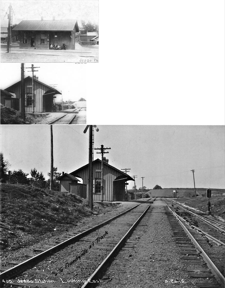
| Jeddo |
|
The station collapsed from heavy snow in the mid-1990s. | ||||||
| Kingston | |
This may have been the same station as Forty-Fort, or the stations may have been consolidated at some point. | ||||||
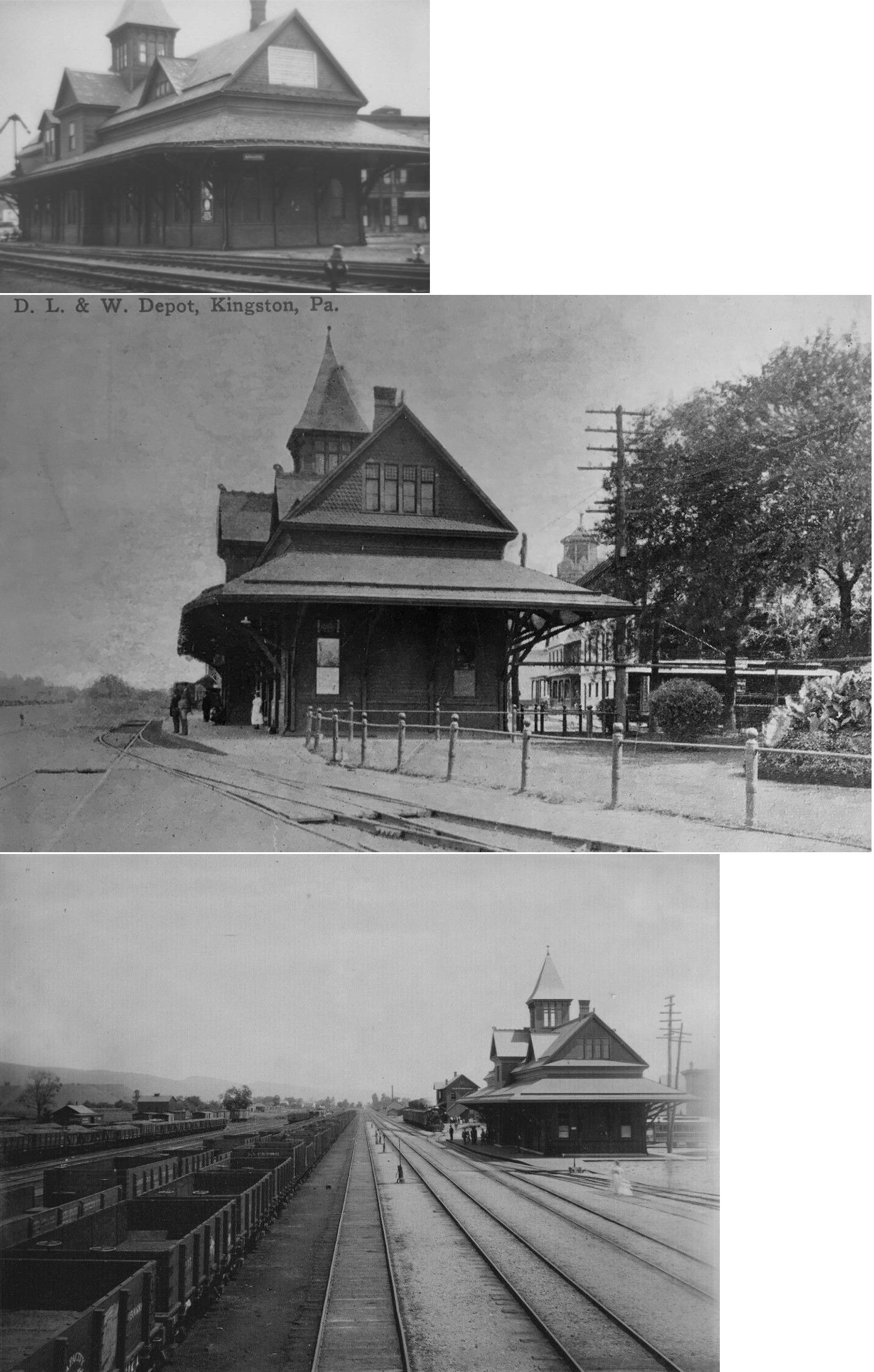
| Kingston |
|
This station was located on the east side of the mainline on the corner of Market Street and Schuyler Avenue, just northeast of the roundhouse at GPS: 41.265872, -75.901201. It, and the freight house, were built in 1878. | ||||||
| Kingston |
|
The freight house was to the NE of the passenger station at GPS: 41.266795, -75.900368. | ||||||
| Kingston |
 |
This station was along the river at the foot of the Market St. Bridge in Nesbit Park. When the railroad line was discontinued the WB&E station was remodeled and used as the Pennsylvania State School of Aero Mechanics. The school operated during WWI and closed and graduated its forst class in 1918 (Wilkes-Barre Evening News, 1-19-1918). The building closed in 1926 (according to Robert Mohowski's book on the NYS&W), caught fire in 1929 (from Harold Fredericks' Wilkes-Barre and Eastern Railroad book) and lost it's roof. It then stood abandoned as an eyesore and hovel for vagrants until December 1937, when it was dismantled by the Works Progress Administration (according to the Wilkes-Barre Record on 12/8/37). | ||||||
| Kunkle | |
This station was on the Harveys Lake Branch. It may have also been called "Ringold." | ||||||
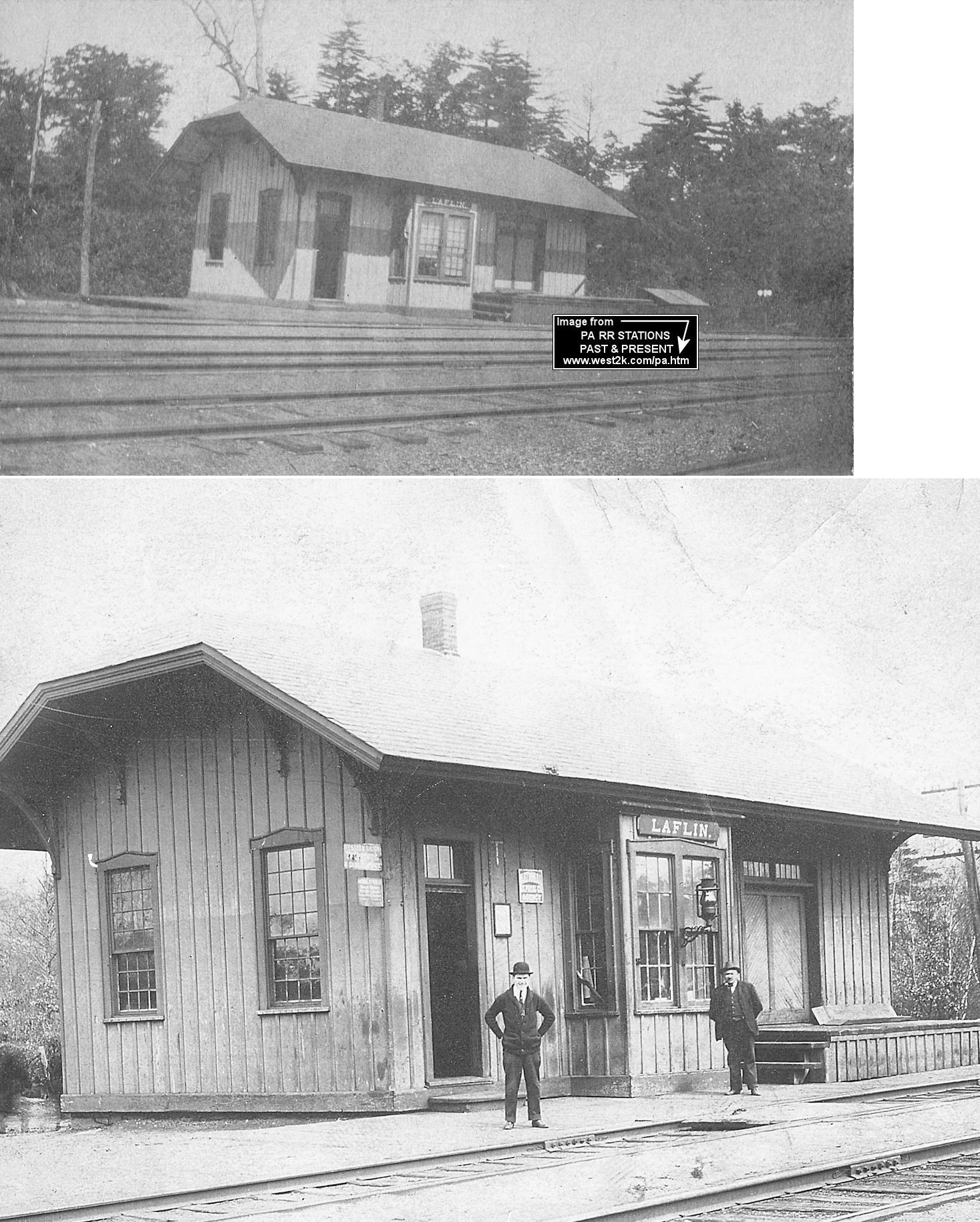
| Laflin |
|
The combination station here was built in 1889 and abandoned in May 1922 (Delaware & Hudson Inspection of Lines - Passenger & Freight Stations, 1928). The CNJ had trackage rights through Laflin, but it's unclear whether it had passenger service to this station. | ||||||
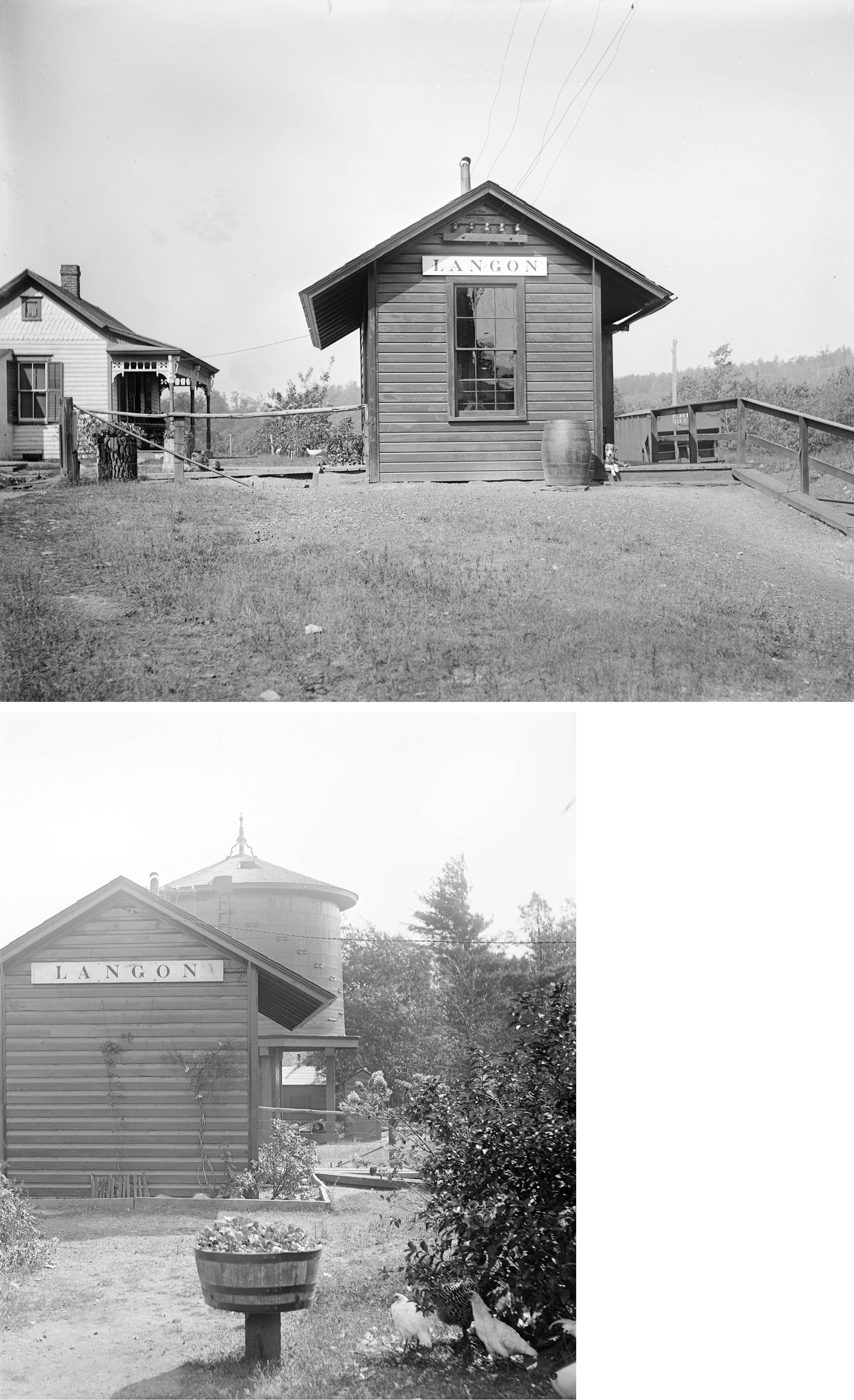
| Langon |
|
This station was built in 1902. | ||||||
| Laurel Run |
|
Sat at the foot of the Northampton St. overpass at MP 161.29. | ||||||
| Lehigh Tannery |
|
There were stations on both sides of the river here about 700 feet from each other as the crow flies. The CNJ station was on the west side of the river (in Luzerne Co.), on the south side of Tannery Road, on the east side of the tracks. The LV station was on the east side of the river (in Carbon Co.) also on the south side of Tannery Road on the west side of the tracks. | ||||||
| Leonards | |
This was on the Harveys Lake Branch. | ||||||
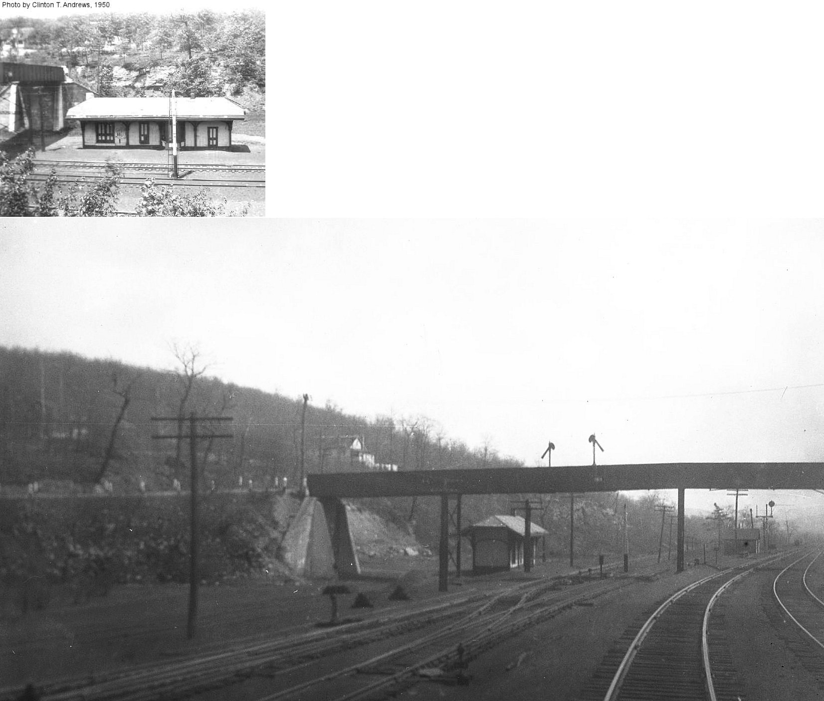
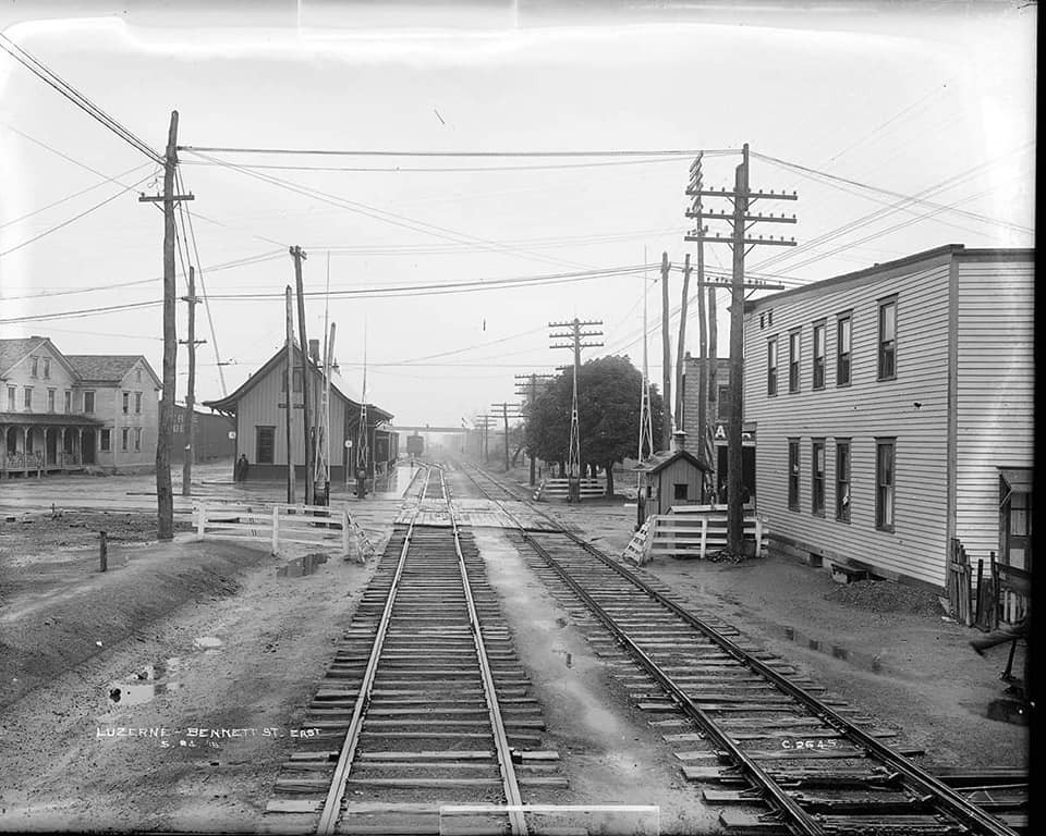
| Luzerne |
|
This station was on the Bowman's Creek Branch (formerly Harvey's Lake Branch). It was on the SW side of North Bennett Street at GPS: 41.285646, -75.894483. | ||||||
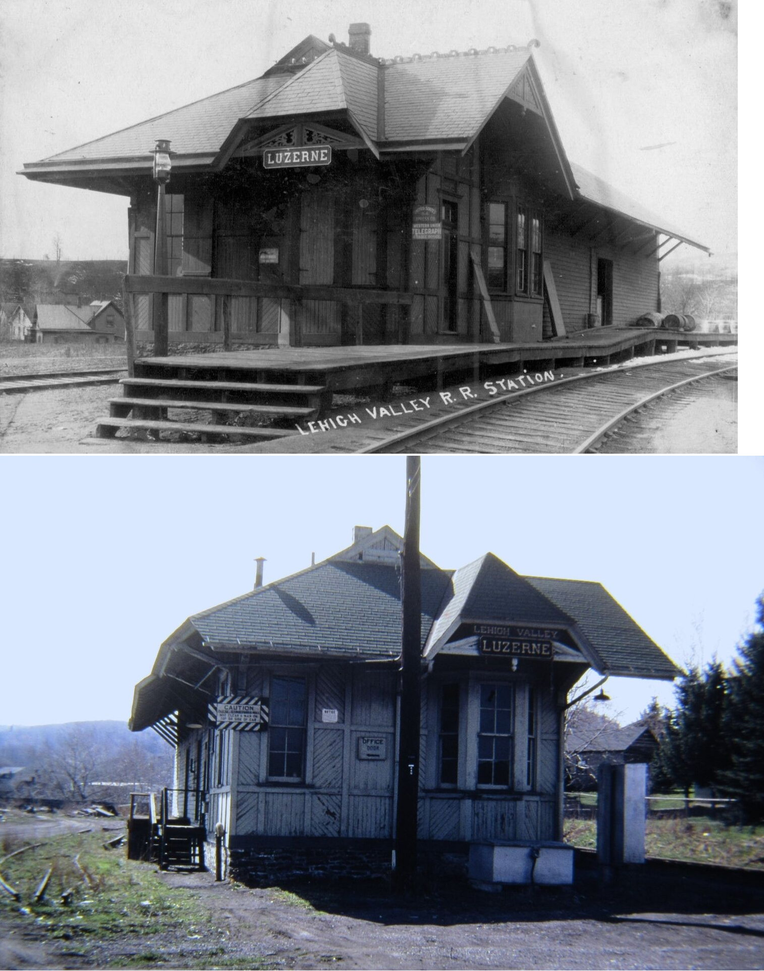
| Luzerne |
|
This was likely the second station here. The original depot was built by the Lackawanna & Bloomsburg RR and may have been called "Bennett." This combination station was on the NE side of West Bennett Street on the north side of the tracks at GPS: 41.278651, -75.887086. Sometime around 1883 it was replaced with a DL&W pagoda-style station. | ||||||
| Maltby |
|
This was on the the West Pittston Branch at mile marker 2.7. | ||||||
| Maltby Junction |
|
This was on the the West Pittston Branch at mile marker 2.0. | ||||||
| Maltby |
|
This was a station on the old Lackawanna & Bloomsburg. | ||||||
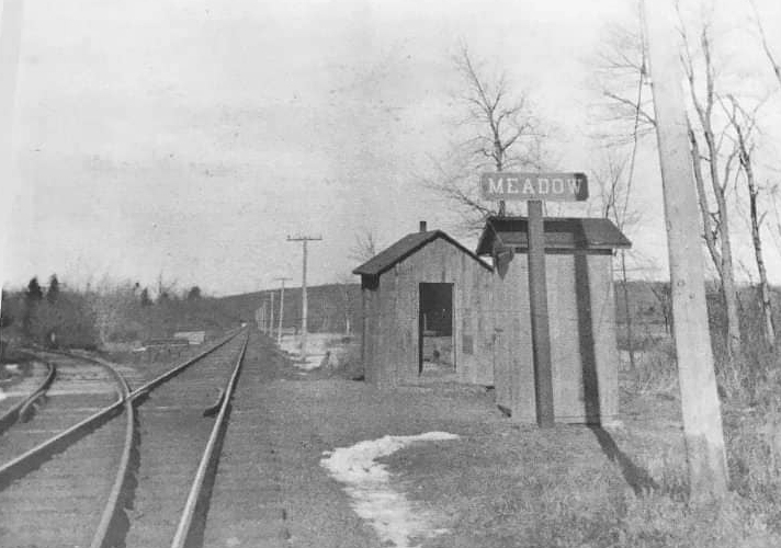
| Meadow | |
|||||||
| Miners Mills |
|
This station was on the south side of Main Street near the end of Central Lane at GPS: 41.269293, -75.839269. It burned down in January 2000 | ||||||
| Miners Mills |
|
The combination station here was built in 1886 and abandoned in September 1908 (Delaware & Hudson Inspection of Lines - Passenger & Freight Stations, 1928), although it is still shown on the 1911 Sanborn map. It was on the SW side of East Main Street on the SE side of the tracks at GPS: 41.269700, -75.839602. | ||||||
| Miners Mills |
|
This station was on the north side of East Carey Street at GPS: 41.273832, -75.845370. | ||||||
| Mocanaqua |
|
A new combination station was built here in 1883. | ||||||
| Mountain
Grove (Wolften) |
|
The photo may be of the original Danville, Hazleton & Wilkes Barre station. The station was alternately known as Wolften in the early days and that station is shown on the 1876 map. | ||||||
| Mountain Springs (Bear Run) |
|
|||||||
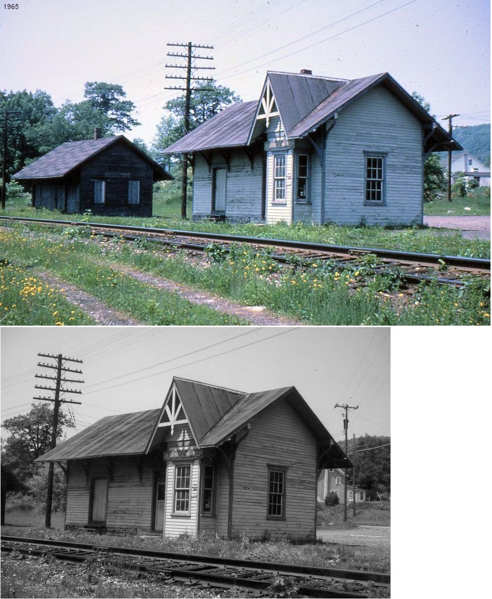
| Mountain
Top (Fairview) |
|
On the 1873 map, this station is called Fairview (Mountain Top P.O.). | ||||||
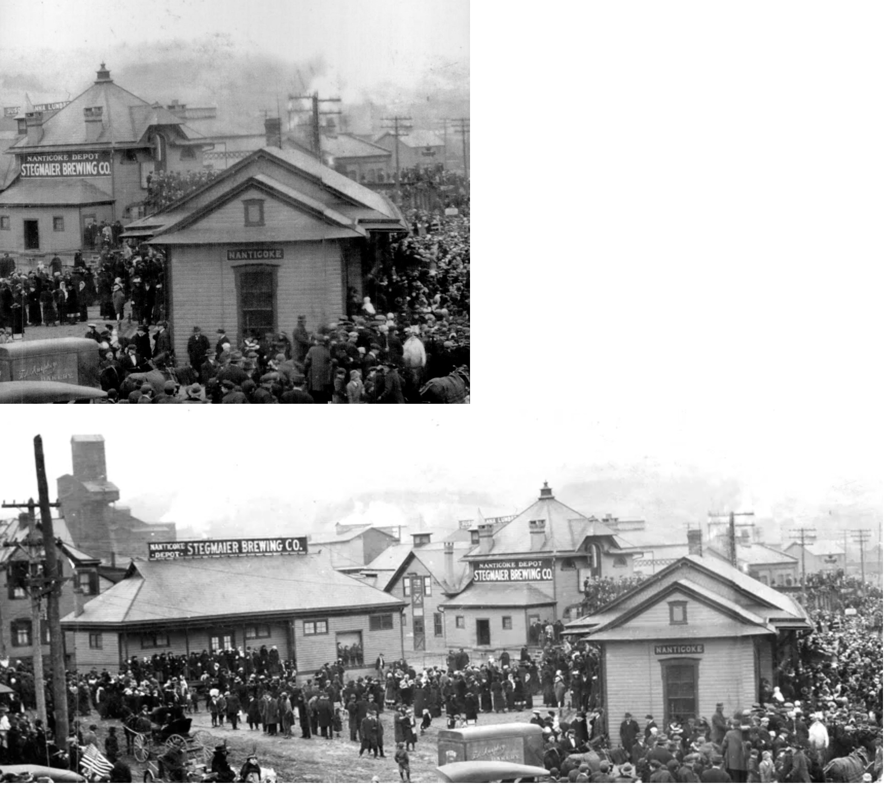
| Nanticoke |
|
A new passenger station was built here in 1883. It was on the north side of Arch Street at GPS: 41.207160, -76.001309. | ||||||
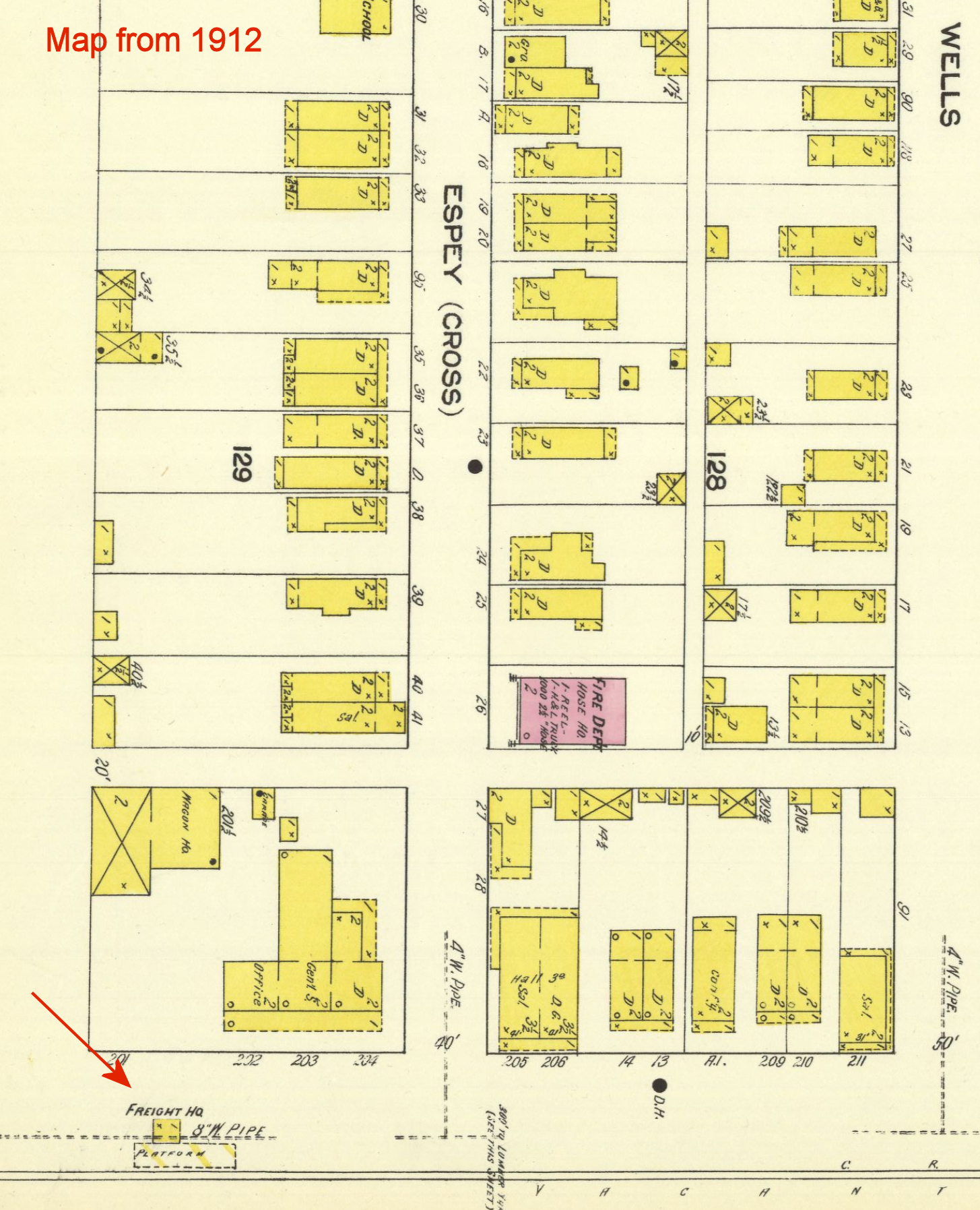
| Nanticoke |
|
The freight station was on the north side of Railroad Street west of Chestnut Street at GPS: 41.206710, -76.000201. | Nanticoke (Hanover Twp.) |
|
There was a very small freight station on the south side of Front Street just west of Espey Street at GPS: 41.184787, -75.986705. This is shown on the 1912 Sanborn map of Nanticoke. | |||
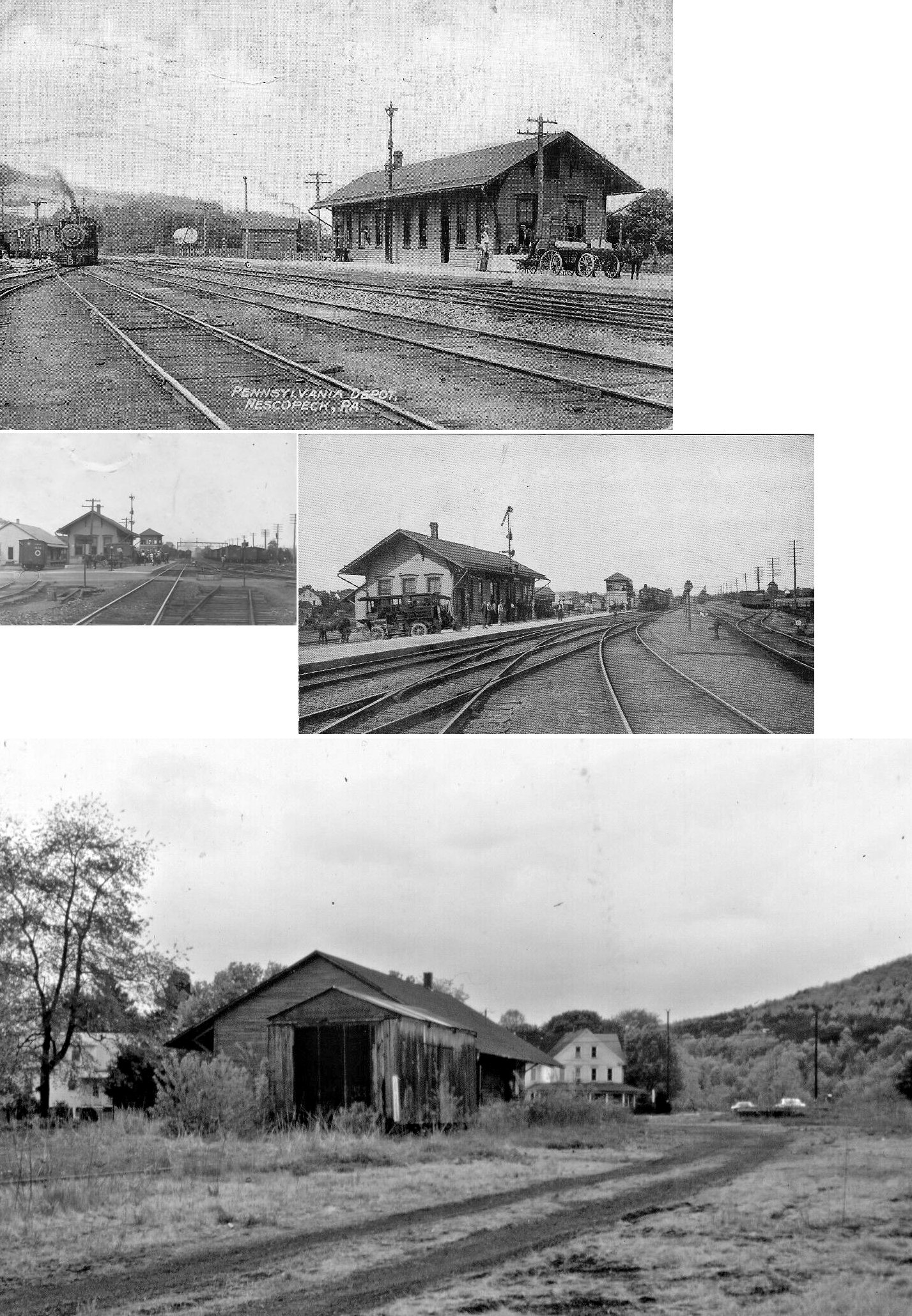
| Nescopeck |
|
This station was opened in 1883 and was located on Broad Street. Passenger and freight stations as well as the tower were all torn down in 1968. | ||||||
| No. 7 Junction |
|
There were passenger and freight stations here. Both were built in 1890. The frieght station was 20' X 30' X 16'. | ||||||
| North Avoca |
|
There was a freight station here. It burned on May 20, 1921 according to the Wilkes-Barre Record (5/21/1921). | ||||||
| Outlet | |
This station was on the Harveys Lake Branch. | ||||||
| Parsons |
|
A combination station was built here in 1886. It was on the SW side of George Avenue at GPS: 41.260041, -75.848333. | ||||||
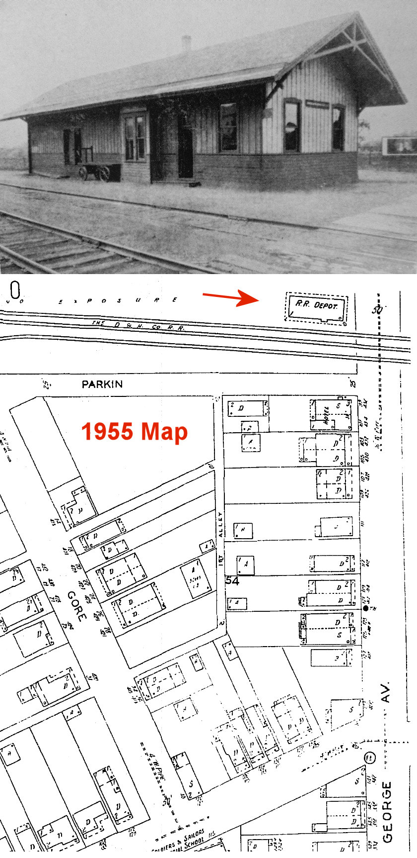
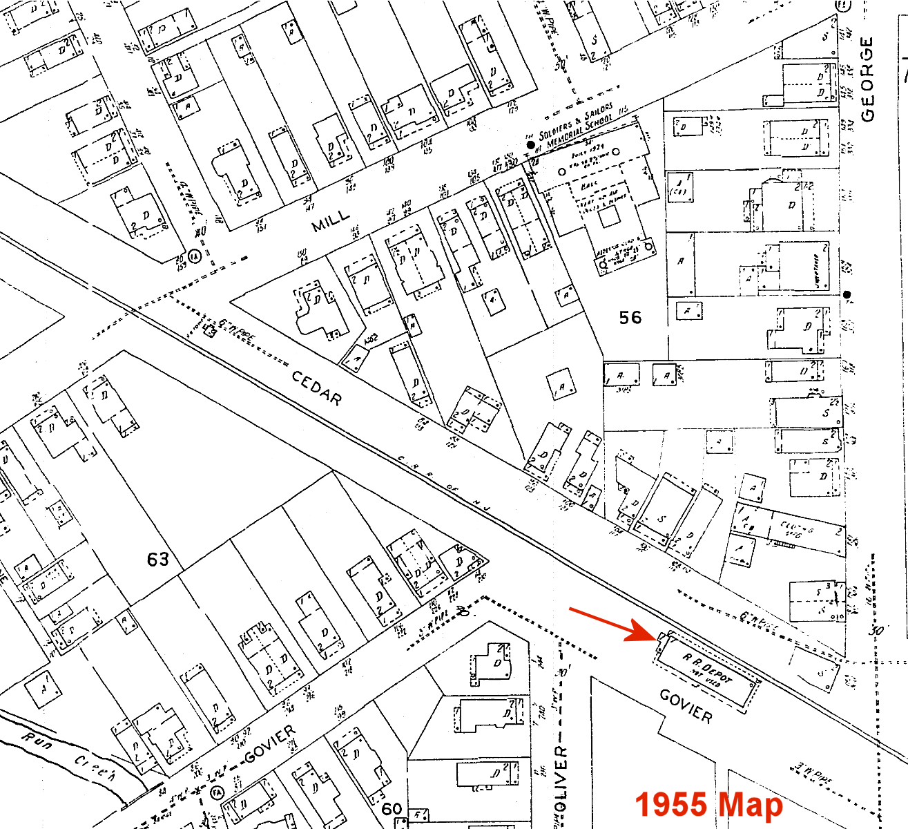
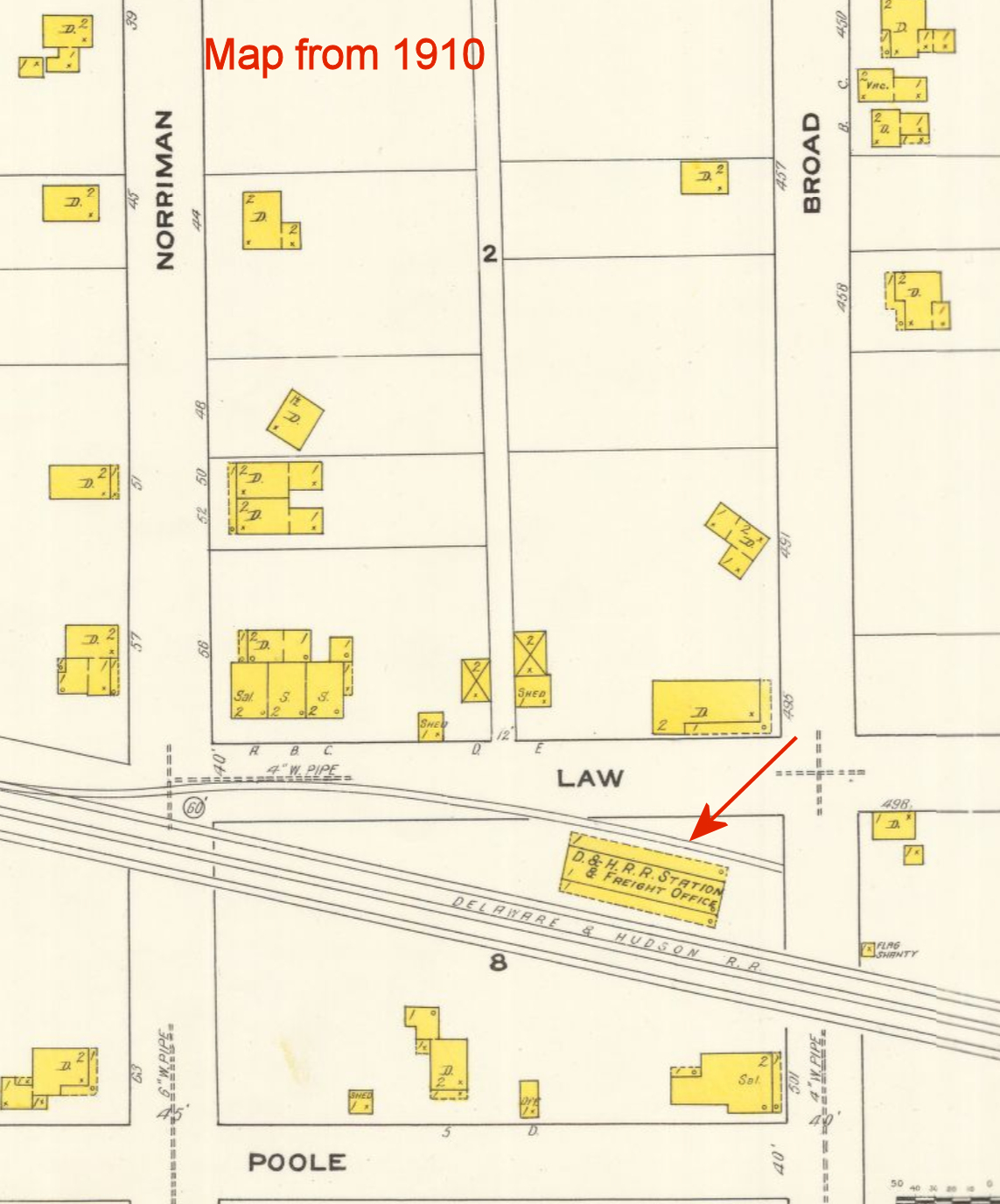
| Parsons |
|
This Lehigh & Susquehanna station was at the intersection of George Avenue and Govier Street at GPS: 41.258747, -75.844892. | ||||||
| Penobscot |
|
Originally Lehigh and Susquehanna RR. This station was torn down in July, 1959 (Wilkes-Barre Times Leader, 7-24-1959). | ||||||
| Pittston |
|
A combination station was built here in 1886. It was on the SE corner of Broad and Law Streets at GPS: 41.317171, -75.776215. | ||||||
| Pittston |
|
Prior to the 1896 station, there was a two-story wooden depot here on the south side of Water Street (at GPS: 41.322999, -75.791541) built in the 1870s and a companiopn freight station. The freight station was built or replaced in 1881 (Elk County Advocate, 7-28-1881). In the late 1880s the main line was rerouted closer to the riverbank. The 1896 Sanborn map shows both the old and new stations side by side. The old depots stood for some time past 1896 and on the 1910 map the old passenger station is shown being used as an office while the freight station was still in service. The building stood until the 1950s (Sunday Dispatch, 11-3-1996). | ||||||
| Pittston |
|
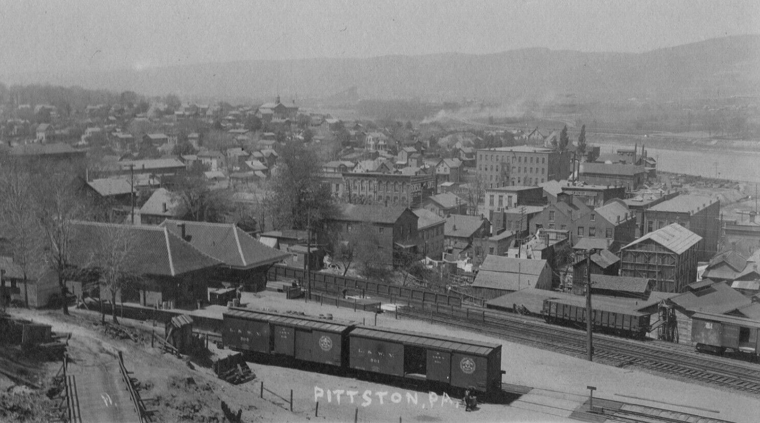
This stone passenger station opened on May 20, 1896, went out of service in 1961, and was demolished in 1965. It was at the corner of Kennedy Boulevard and Water Street (GPS: 41.323169, -75.791940). The sandtone for the station was quarried from Campbell's Ledge. In the early 2000s there was discussiion about buiding a replica of the station (Sunday Dispatch, 2-18-2001), but that never happened. Part of the foundation of the station can still be seen under the Domino's Pizza on the site (as of 2023). | ||||||
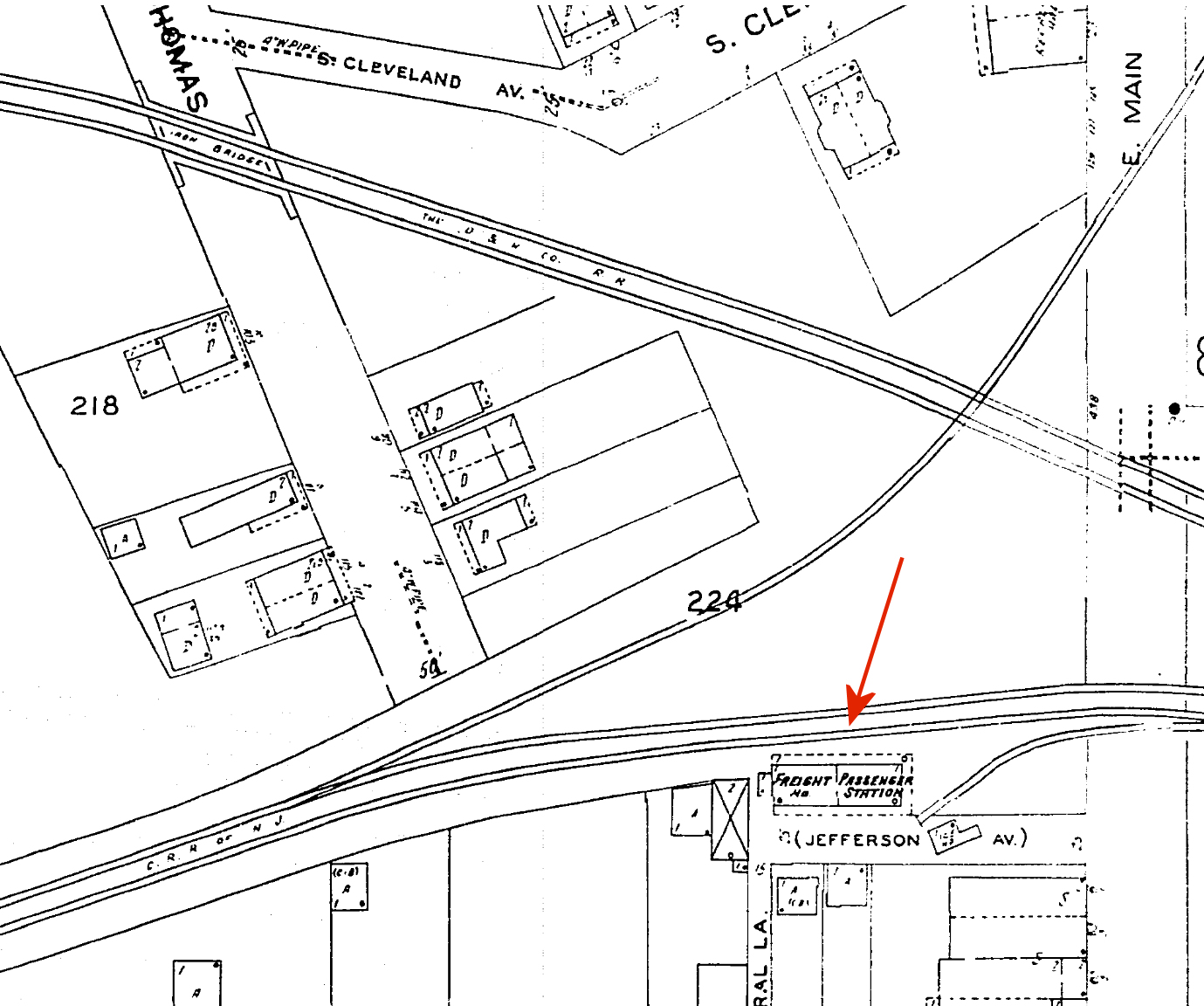
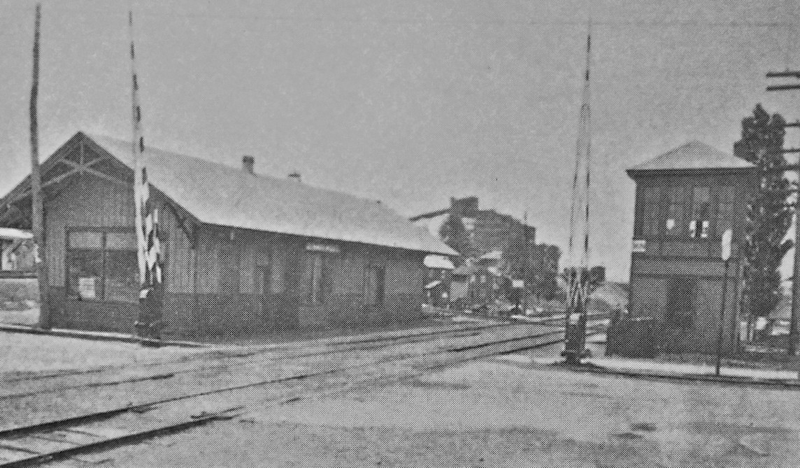
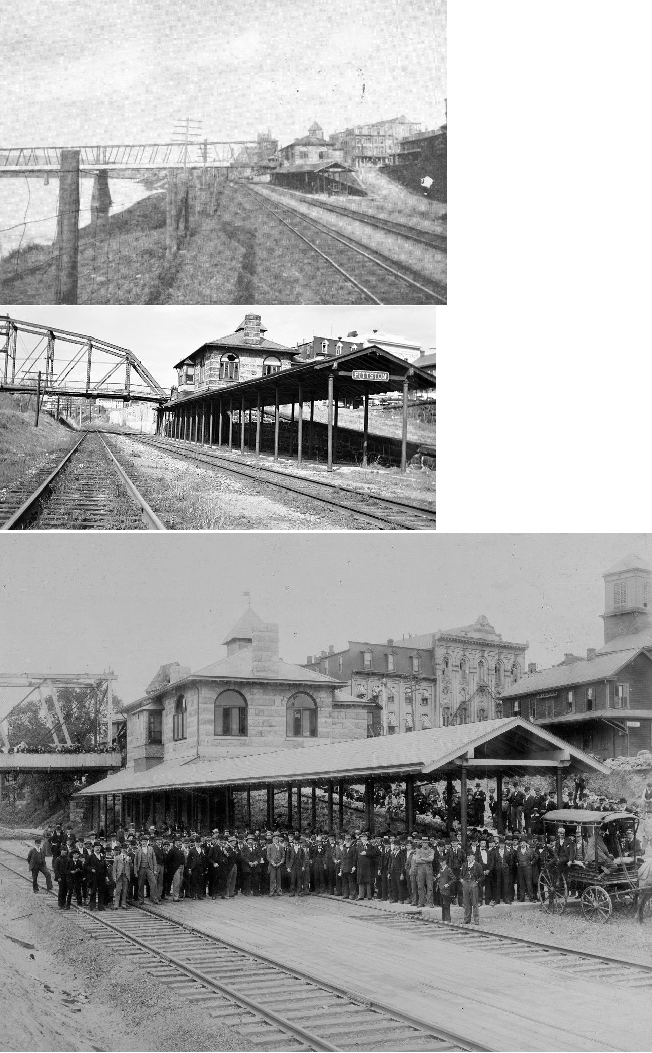
| Pittston |
|
The passenger station was next to the existing freight station on the NE side of Market Street at GPS: 41.320057, -75.790815. The stations were built in 1903. Both the passenger and freight stations are shown in the photo. | ||||||
| Pittston |
|
There was a freight station here that was built in 1878. It may have originally served as a passenger or combination station. | ||||||
| Pittston Junction |
AND |
In the photo, the building closest to the diamond is the joint LV/DL&W passenger station. It was built in 1868 and torn down in 1937 (Pittston Gazette, 2-12-1937). The LV freight station is behind it to the left. The DL&W/PRR freight station is to the right. When the passenger station closed, the DL&W moved its ticket office into its freight station. These stations were in Upper Pittston on the NW side of Main Street near Union Street at GPS: 41.341526, -75.786506. The DL&W freight station was torn down in 1942 (Wilkes-Barre Times Leader, 9-15-1942) | ||||||
| Pittston |
|
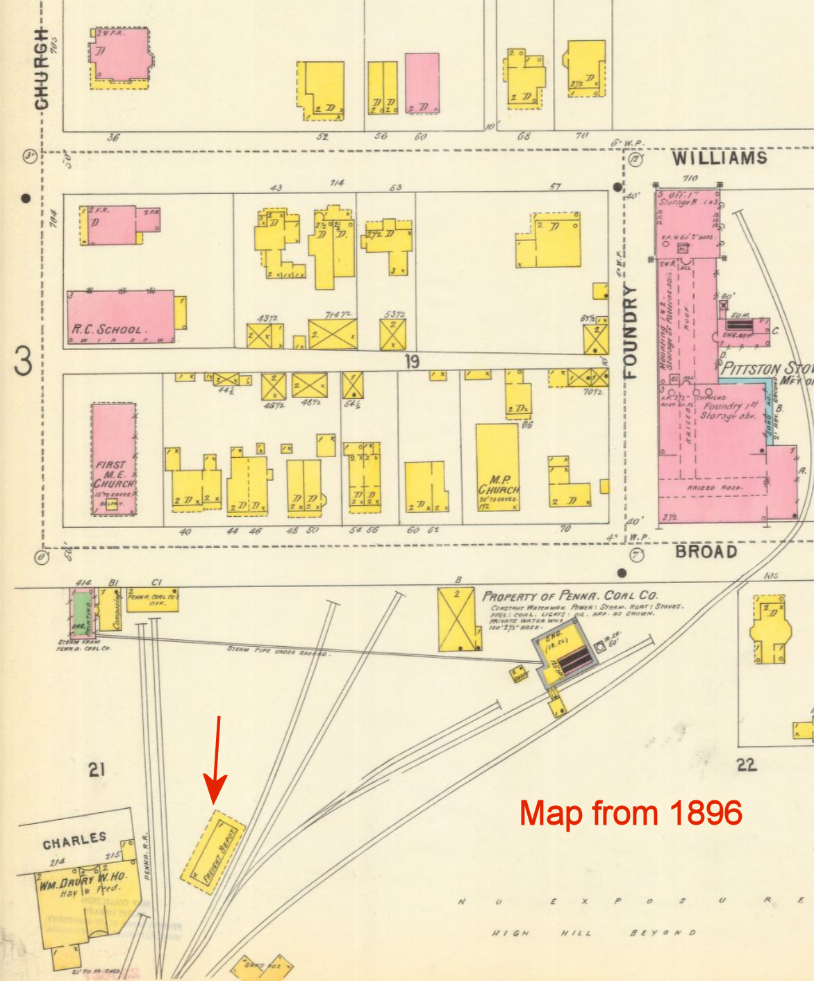
There was a PRR freight station on the south side of Broad Street at the east end of Charles Street at GPS: 41.321428, -75.788923. This is shown on the 1896 Sanborn map. It was torn down sometime between 1896 and 1903 when the Erie station listed below was built. | ||||||
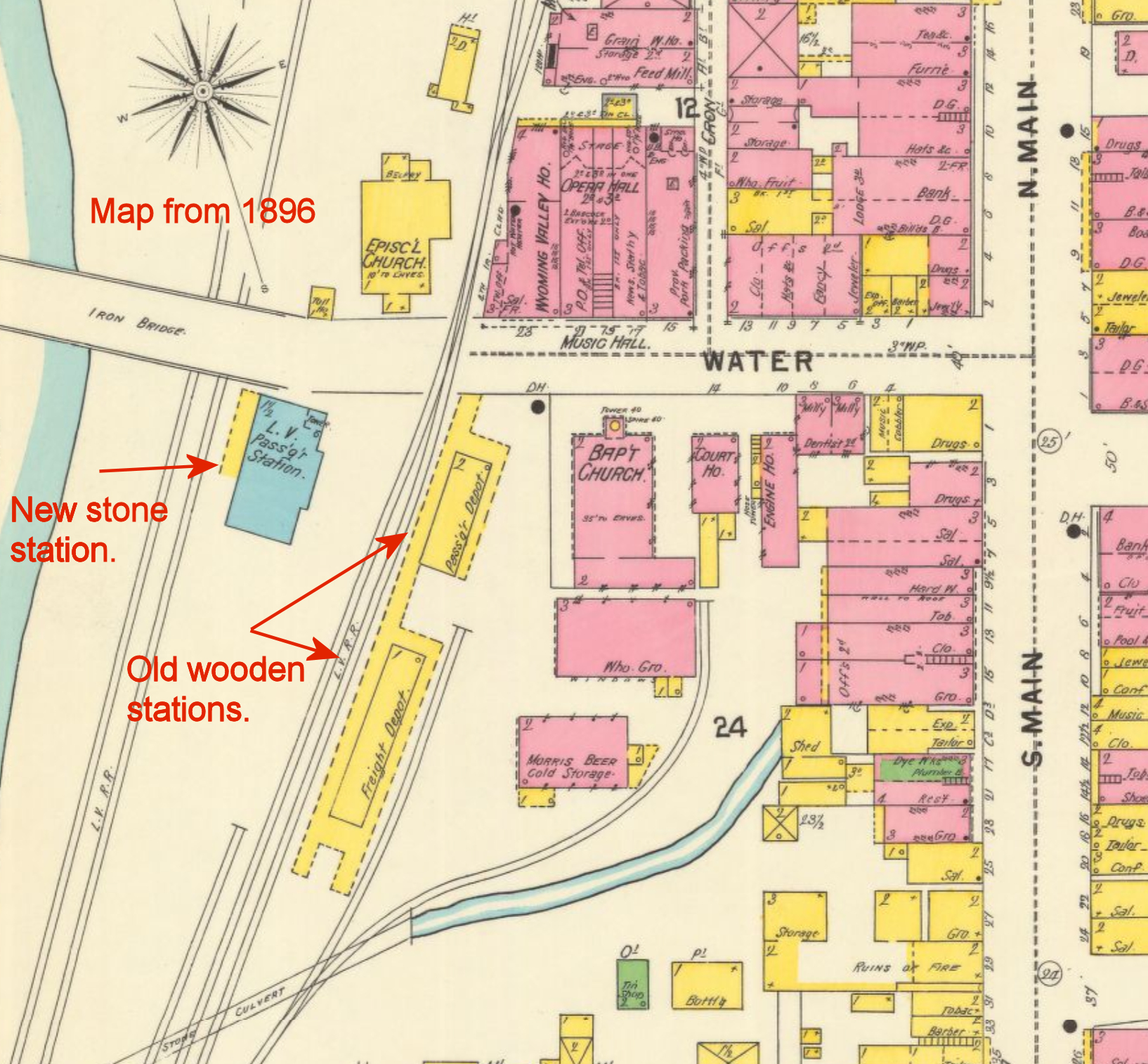
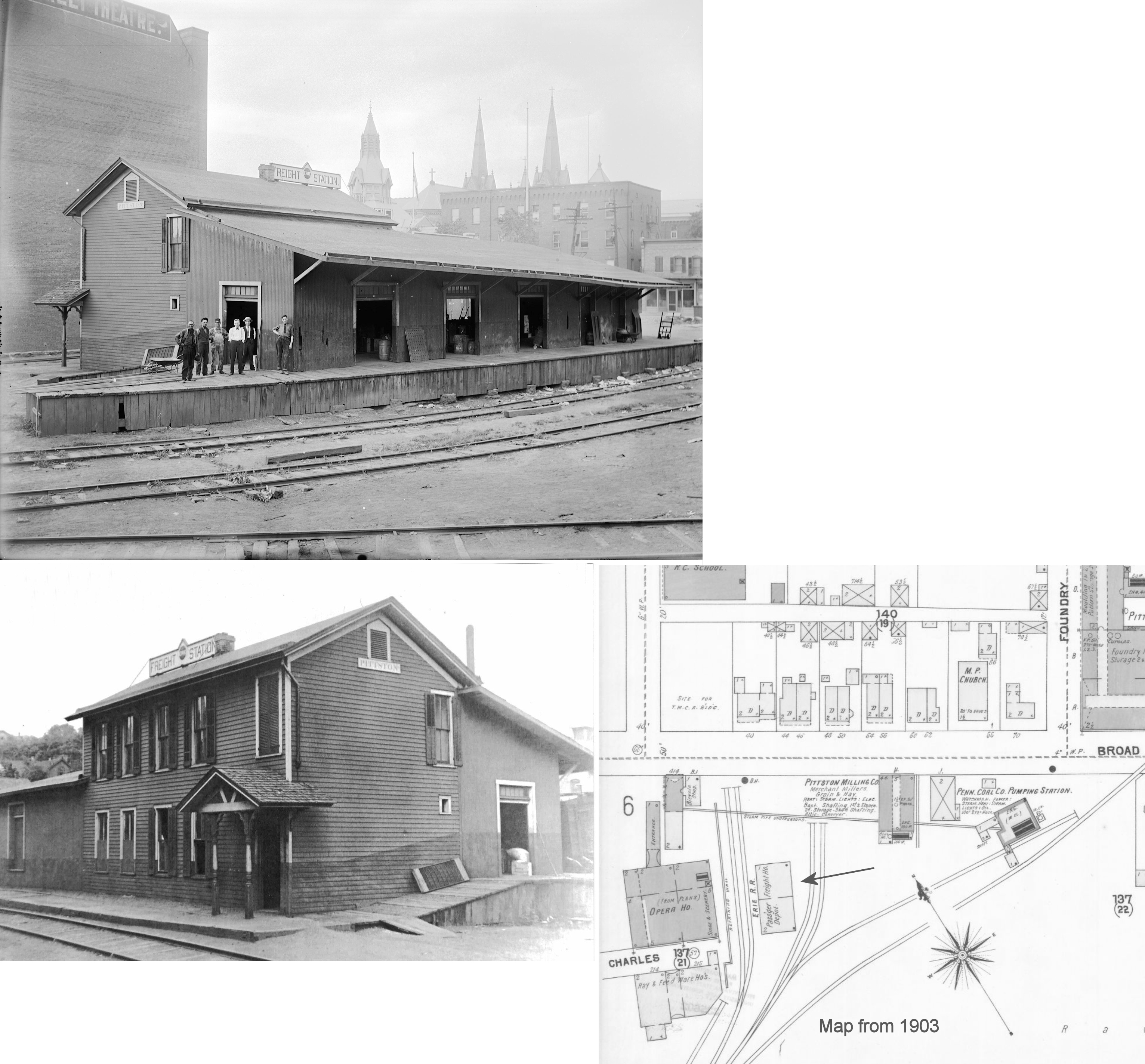
| Pittston |
|
This station was built sometime between 1896-1903 and replaced the PRR freight station on the south side of Broad Street at the east end of Charles Street at GPS: 41.321428, -75.788923. On early maps (1903) it is shown as noth a passenger and freight station while on later maps (1910) it is shown as a freight-only station. | ||||||
| Plains |
|
This combination station was built in 1893. | ||||||
| Plains (Hancock) |
|
|||||||
| Plainsville |
|
This station was on McCullough Road on the NW side of the tracks at GPS: 41.285092, -75.853748. | ||||||
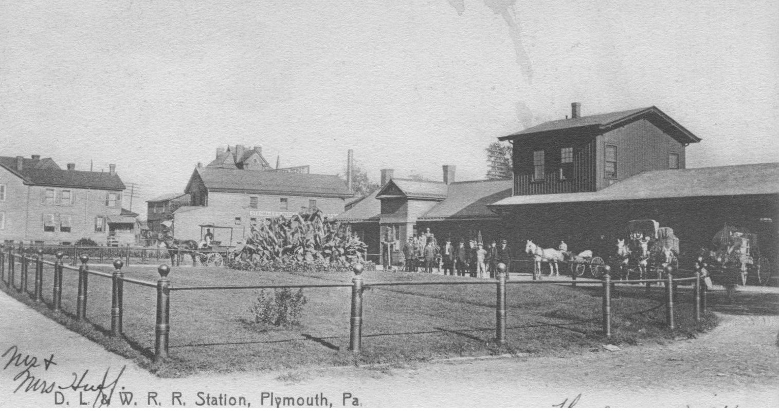
| Plymouth |
|
New passenger and freight stations were built here in 1888 to replace the original Lackawanna & Bloomsburg RR buildings. All generations of stations here were south of the intersection of Main Street and Wadham at GPS: 41.239228, -75.947949. A new freight depot with a two-story head house that was built in 1901. It was built directly behind the old freight station and then the old station was removed. | ||||||
| Plymouth Ferry |
|
In 1901 this station was moved .6 miles closer to Wilkes-Barre. | ||||||
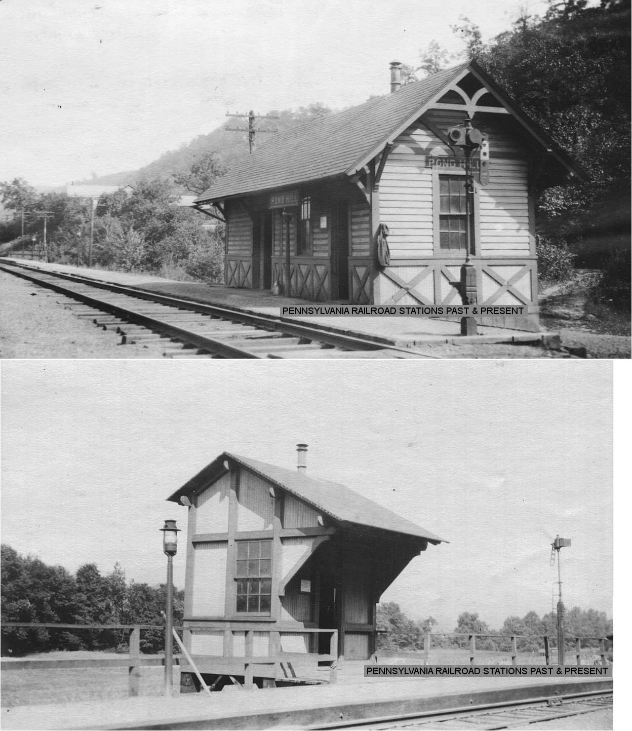
| Pond Hill |
|
This station was built in 1892. A passenger shelter was added on the opposite side of the tracks in 1913. | ||||||
| Port Bowkley | |
|||||||
| Port Griffith |
|
|||||||
| Raubs |
|
This was the start of the West Pittston Branch. | ||||||
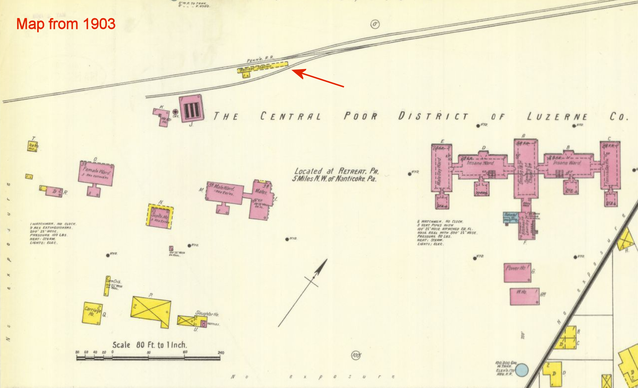
| Retreat Station |
|
This station served the county mental institution/poor farm that was here. The station was in the vicinity of GPS: 41.188204, -76.082363 on Retreat Road. A wood frame station is shown on the 1903 Nanticoke Sanborn map, with a new 2-story brick station appearing on the 1907 map in the same location. | ||||||
| Rock Cabin | |
This station was on the Bowmans Creek Branch. | ||||||
| Rock Glen |
|
A new station was built here in 1889. | ||||||
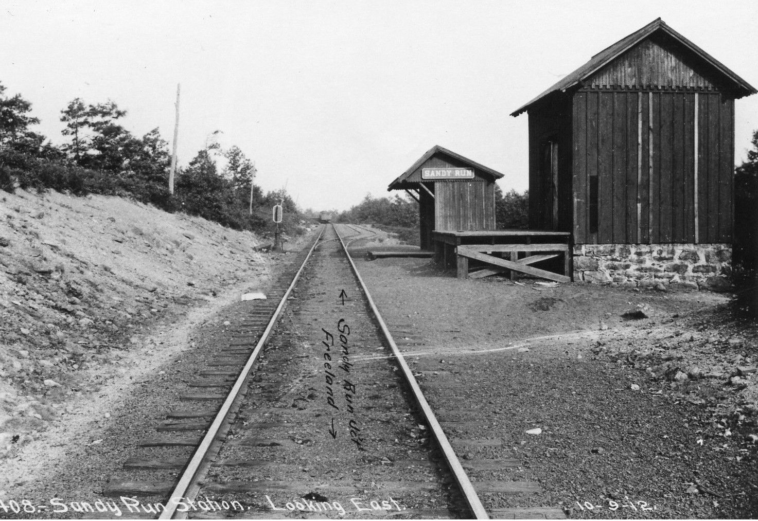
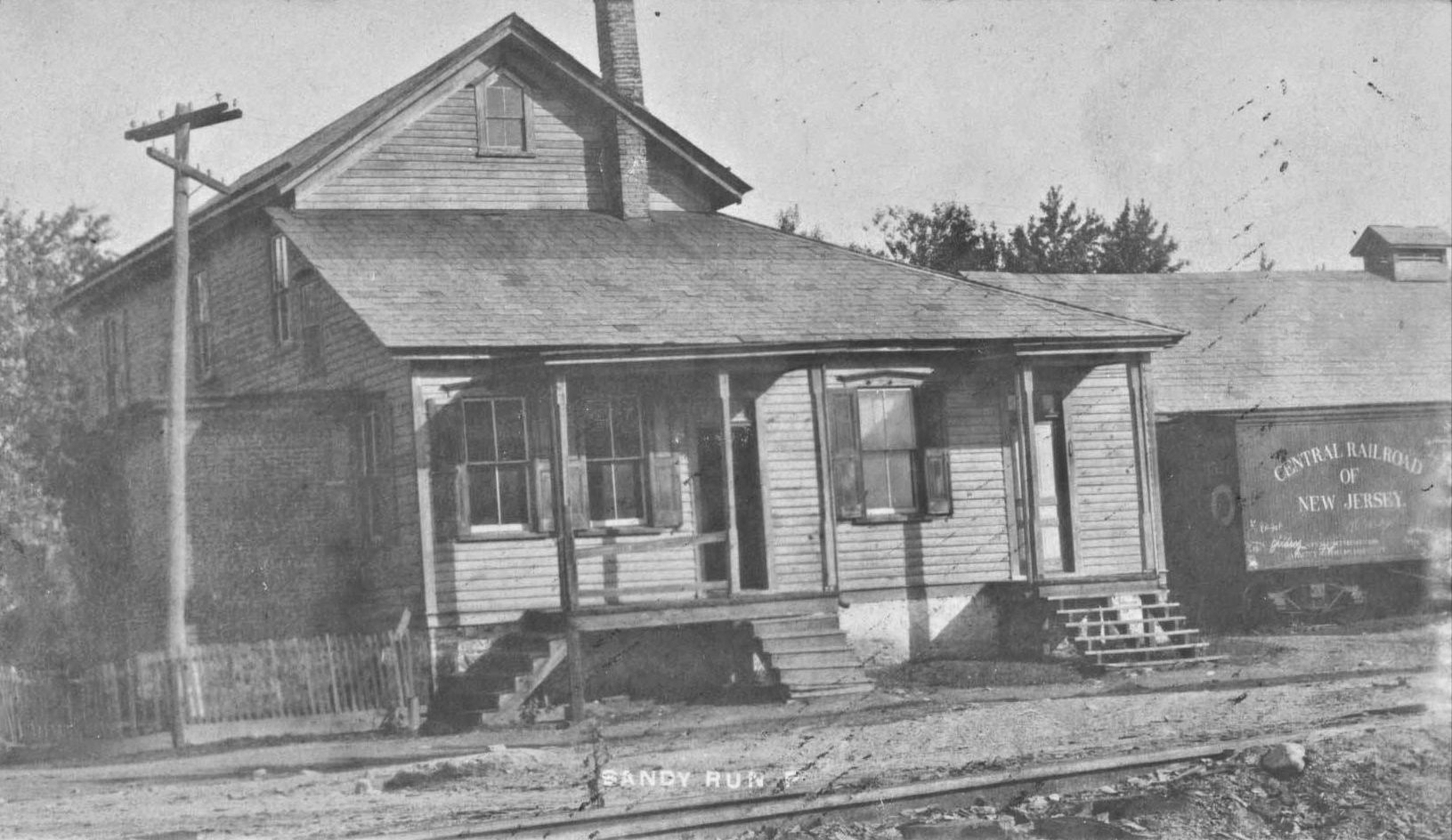
| Sandy Run |
|
|||||||
| Sandy Run |
|
|||||||
| Sebastopol |
|
The 1910 Sanborn map shows a small freight house west of Smith Street at approximately GPS: 41.311302, -75.800022. It was built by the Erie & Wyoming Valley in 1892 (Pittston Gazette, 7-15-1892). | ||||||
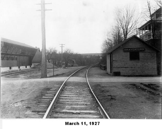
| Shavertown |
|
Some sources have this station listed as "Shakerton." | ||||||
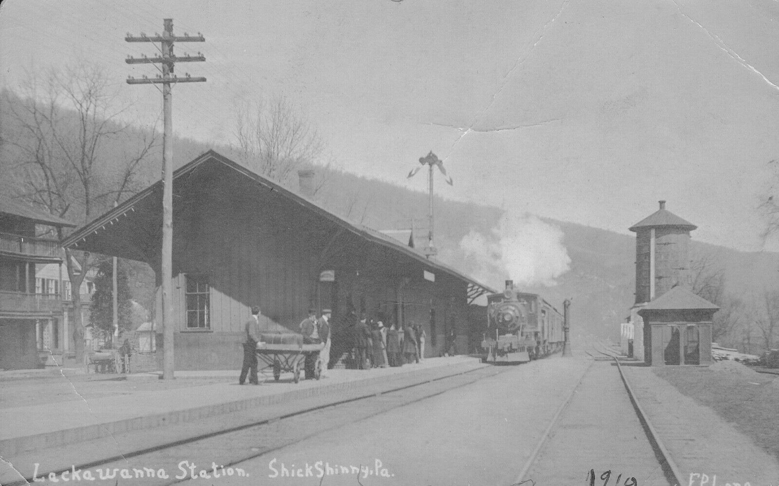
| Shickshinny |
|
This station was built in 1888. It was right in the middle of Susquehanna Avenue between Oak and Ash Streets on the NW side of the tracks at GPS: 41.156205, -76.146577. | ||||||
| Solomon's Gap |
|
This station is shown just north of Mountain Top on the 1873 map. | ||||||
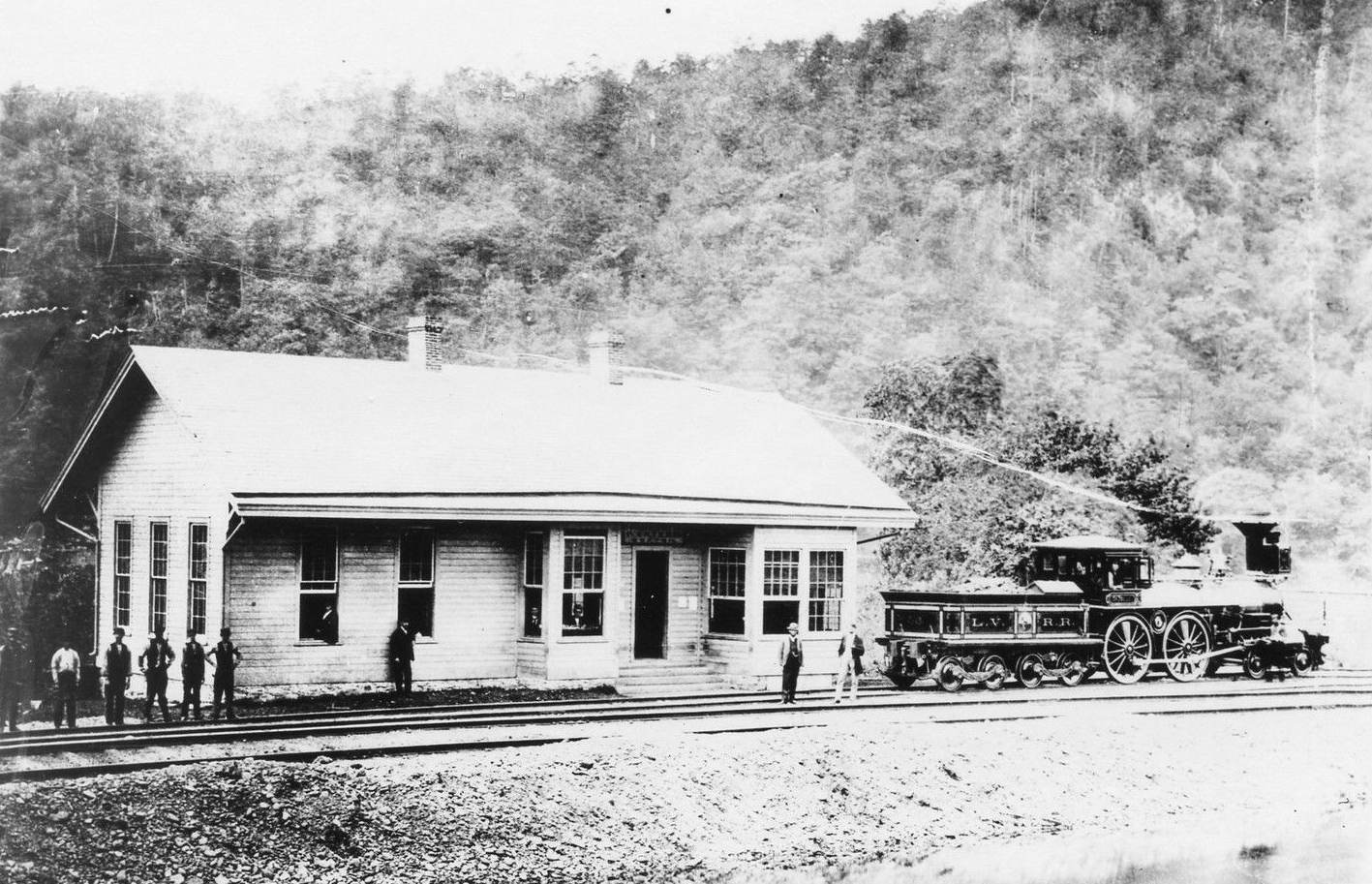
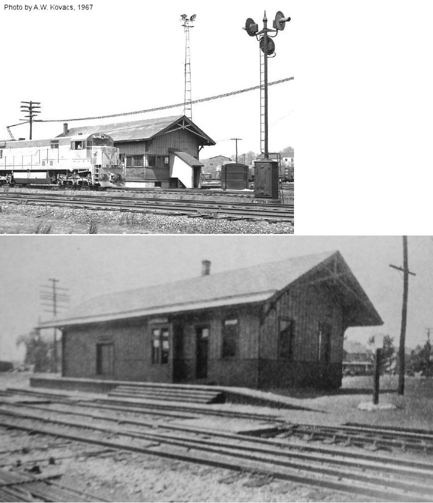
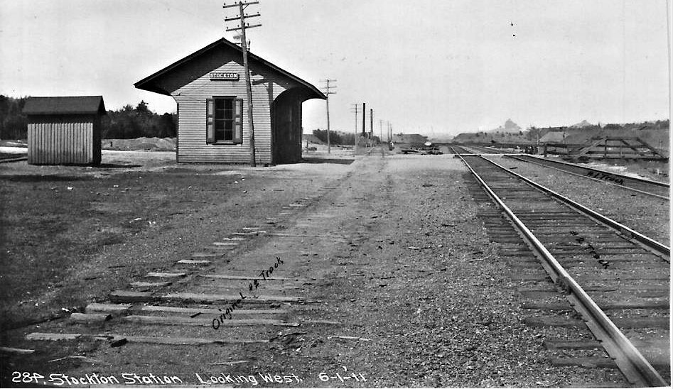
| Stockton |
|
The photo is shot looking west toward Hazleton just east of the current road crossing with the former LV Hazleton line with Hazle Creek to the right and the outline of the Hazleton Shaft Colliery in the distance to the right of center. | ||||||
| Sugar Notch |
|
|||||||
| Sugar Notch |
|
This station was on the Nanticoke Branch. | ||||||
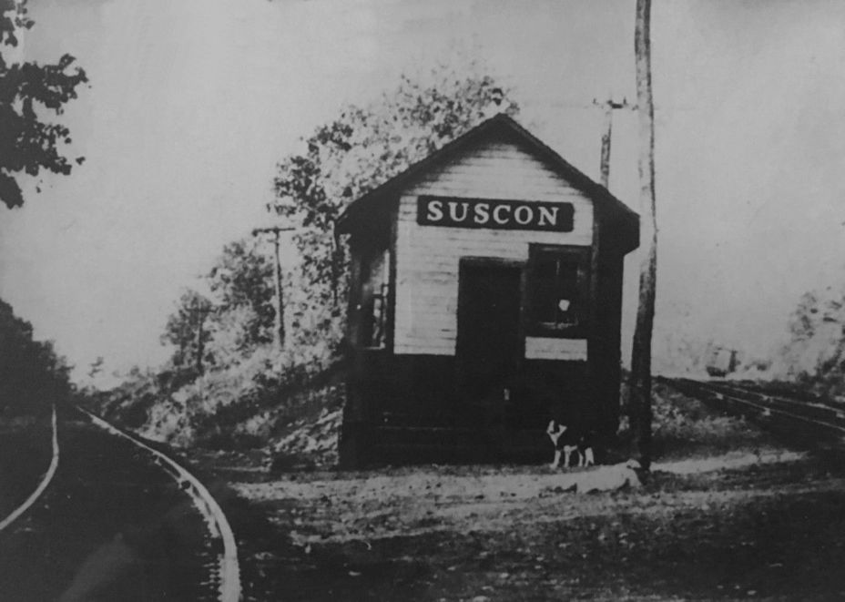
| Suscon |
|
This station was built in 1903. | ||||||
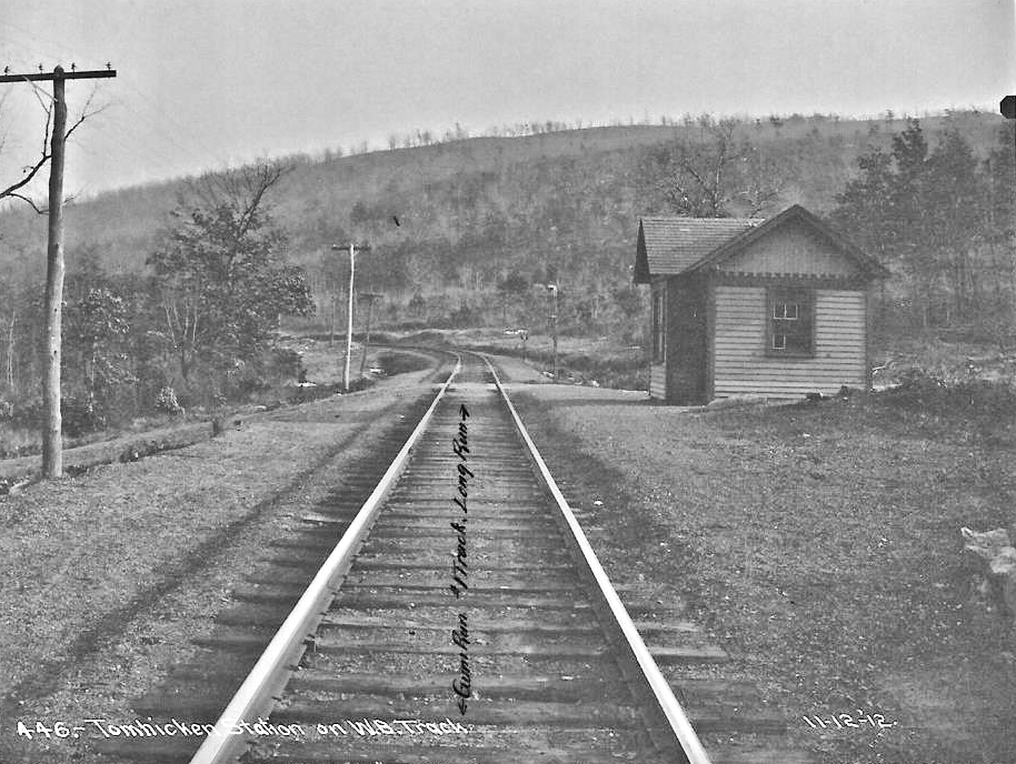
| Tomhicken | |
This station also served the PRR which had trackage rights from New Boston Junction. | ||||||
| Tomhicken | |
This Delaware, Susquehanna & Schuylkill RR station was on what became the Oneida Branch of the LV. | ||||||
| Trucksville | |
This was on the Harveys Lake Branch. | ||||||
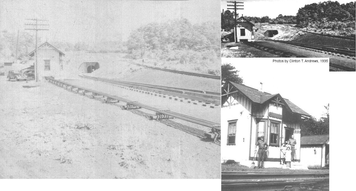
| Tunnel Station |
|
At White Haven Tunnel. Also known as "UN" Tower. | ||||||
| Upper Lehigh |
|
This small station was likely torn down in the early 1950s. Does anyone have a photo? | ||||||
| Wanamie |
|
The narrow-gauge Wanamie Mine Railroad ran behind the station. | ||||||
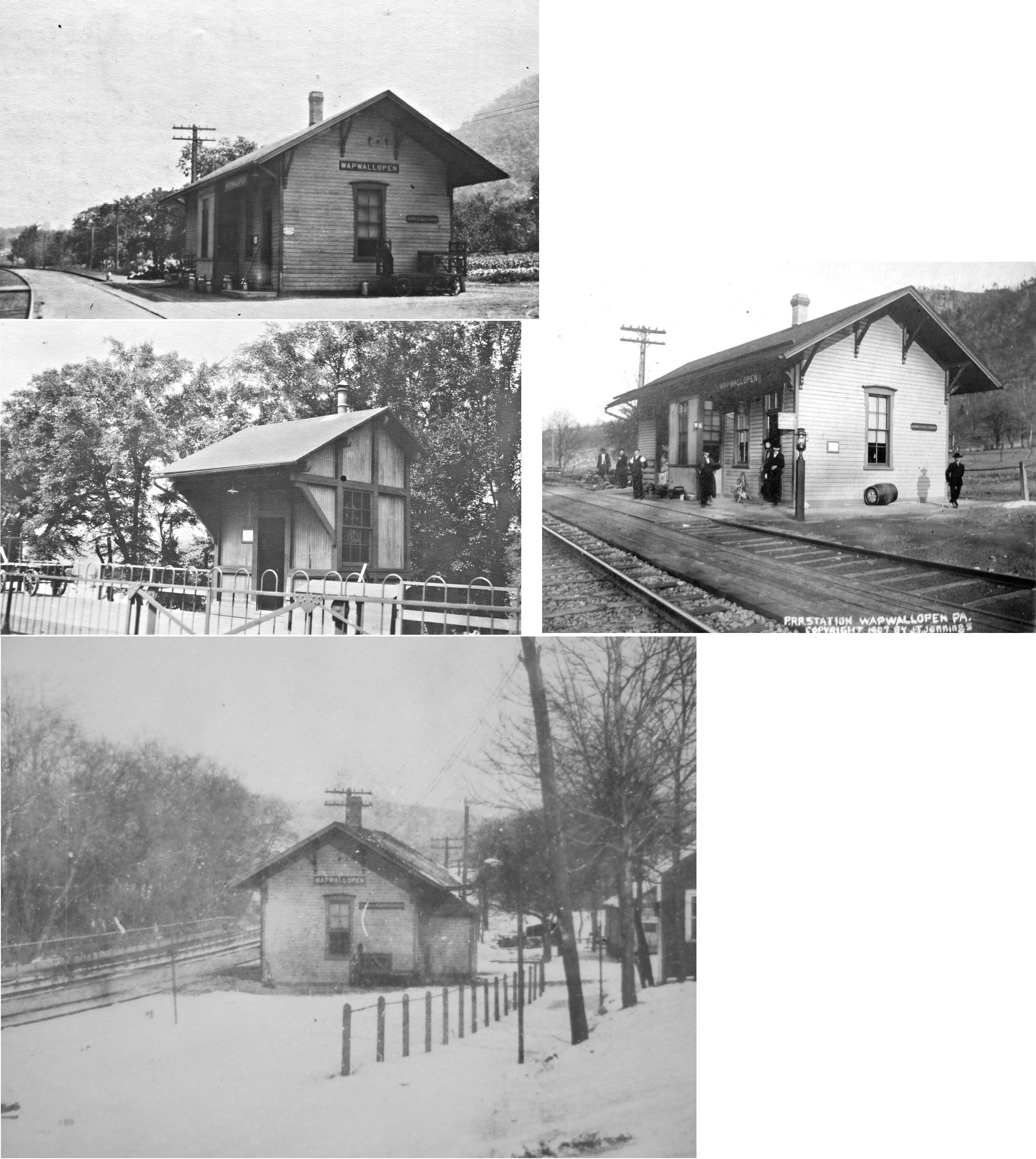
| Wapwallopen |
|
This station was built in 1884. A shelter was added in 1912. | ||||||
| Warrior Run |
|
|||||||
| Warrior Run |
|
|||||||
| Warrior Run |
|
There was a small freight station on the north side of the tracks at the instersection of Hanover and Front Streets at GPS: 41.192548, -75.952677. this station is shown as a freight station on the 1911 Sanborn map (of Sugar Notch), but on the 1927 map it is just listed as a "RR Building." No passenger station is shown on either map, but full coverage of the town is not given. | ||||||
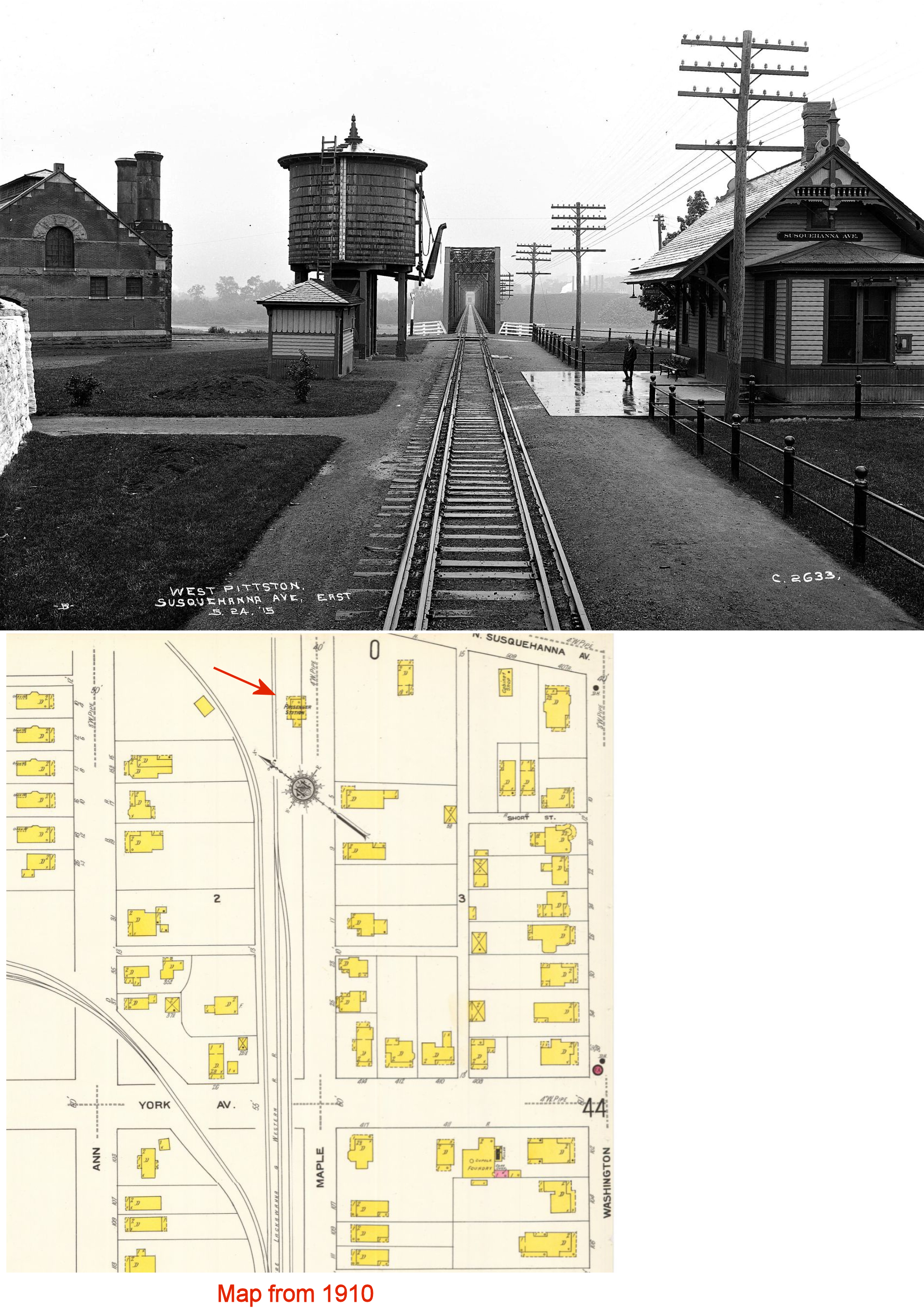
| West Pittston |
|
This station, known as "Susquehanna Avenue," was on Maple Avenue SW of Susquehanna Avenue at GPS: 41.335477, -75.795767. It was built in 1883. | ||||||
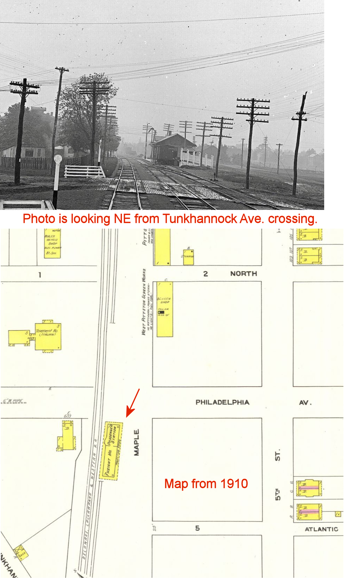
| West Pittston |
|
This station, known as "West Pittston," was on 6th Street (formerly Maple Avenue) at Philadelphia Avenue NE of the Tunkhannock Avenue crossing at GPS: 41.329337, -75.806149. According to a ltter to the editor in The Pittston Gazette (4-12-1929), there was a push at the time for the railroad to build a new station to replace both the West Pittston and Susquehanna Avenue stations as they were not centrally located and the DL&W had applied to abandon the Susquehanna Avenue station. The article says that the "West Pittston" station was built shortly after the Civil War and the Susquehanna Avenue station was built later to serve "influential people around York Avenue." | ||||||
| West Pittston Junction |
|
This was on the the West Pittston Branch at mile marker 6.2. | ||||||
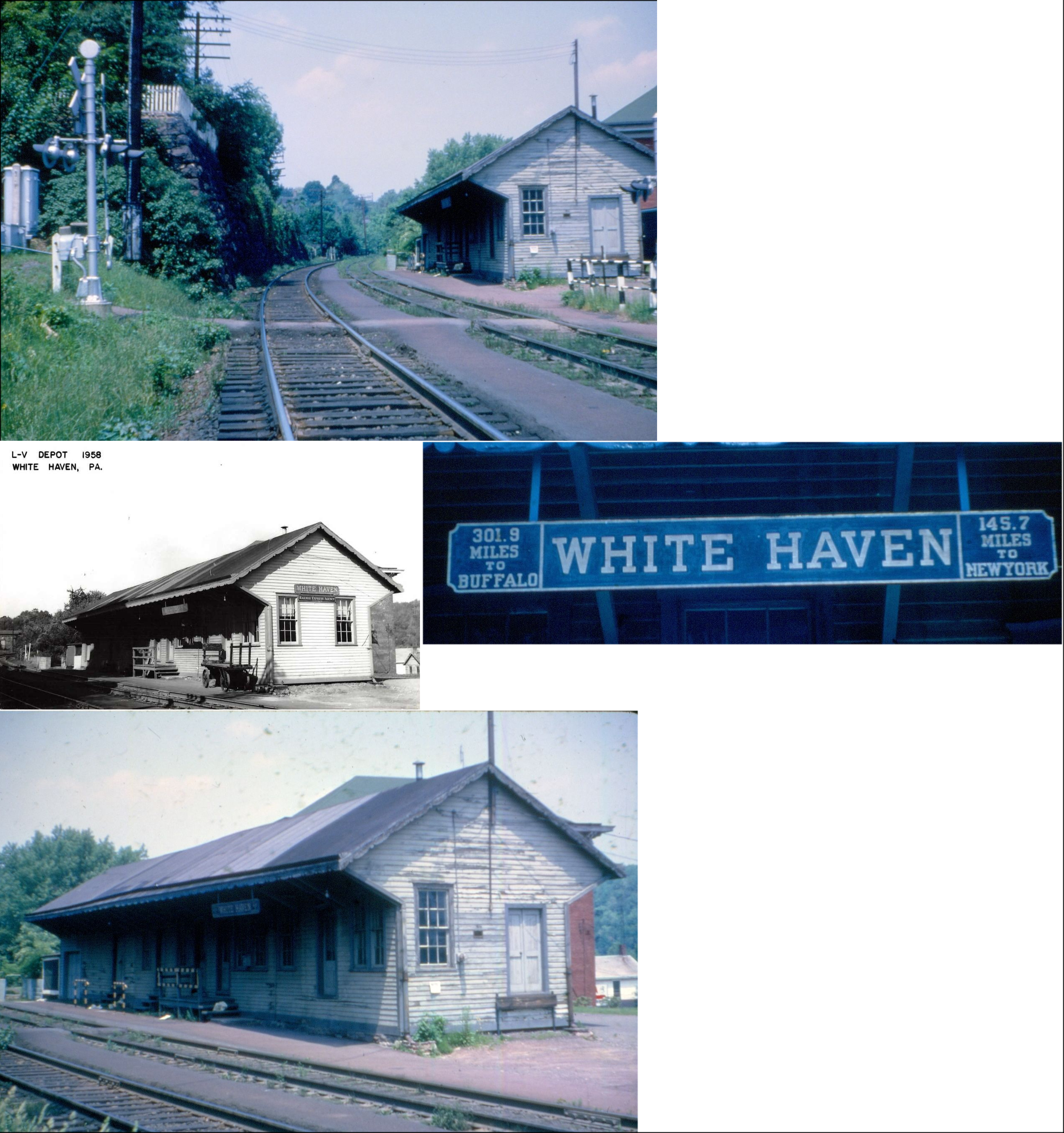
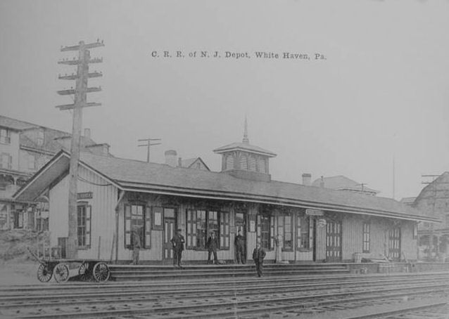
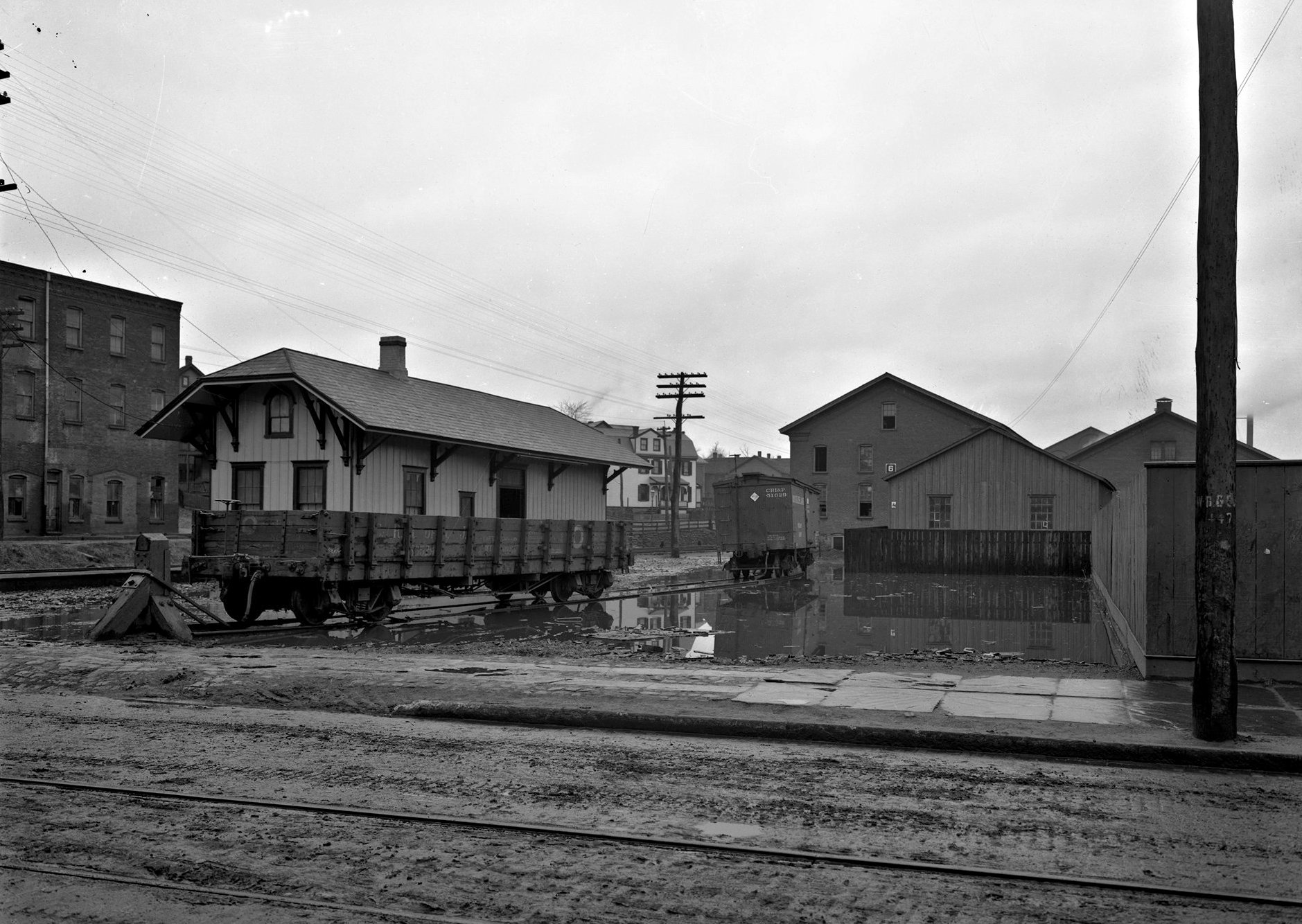
| White Haven |
|
This station was on the north side of Wilkes-Barre Street on the east side of the tracks at GPS: 41.061960, -75.773665. It was torn down in the 1980s. | ||||||
| White Haven |
|
This station was on the east side of Main Street, just south of Wilkes-Barre Street at GPS: 41.061542, -75.773148. | ||||||
| White Haven Tunnel |
|
This station was torn down in 1957 (Wilkes-Barre Times Leader, 7-24-1959). | ||||||
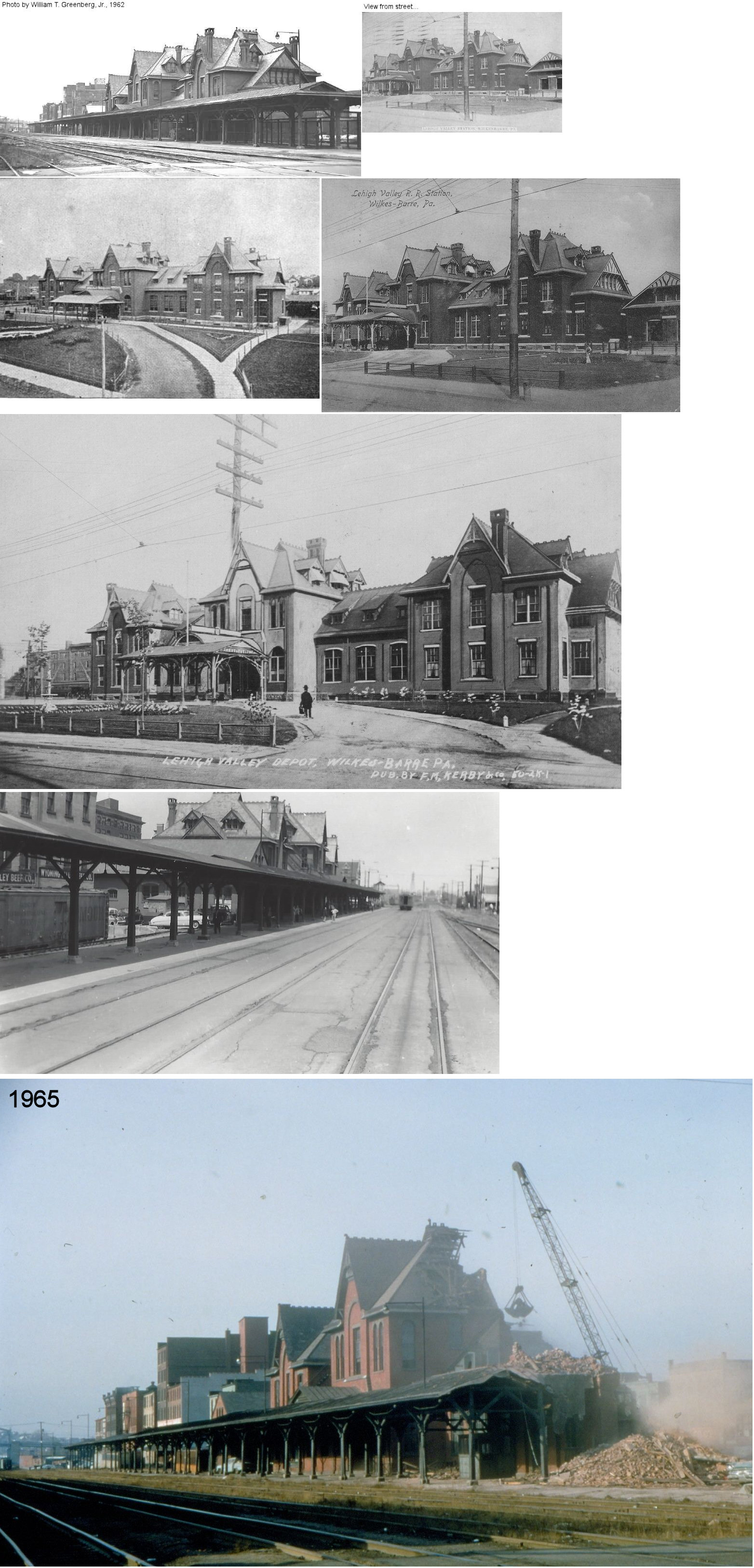
| Wilkes-Barre |
|
The first Lehigh & Susquehanna RR station was on South Street near the river it was built sometime around 1843. | ||||||
| Wilkes-Barre |
|
There was a smaller CNJ passenger at the corner of High Street and Hazle Street (GPS: 41.236705,-75.891001). This station is shown on the 1891 and 1910 Sanborn Fire Insurance maps of the city. | ||||||
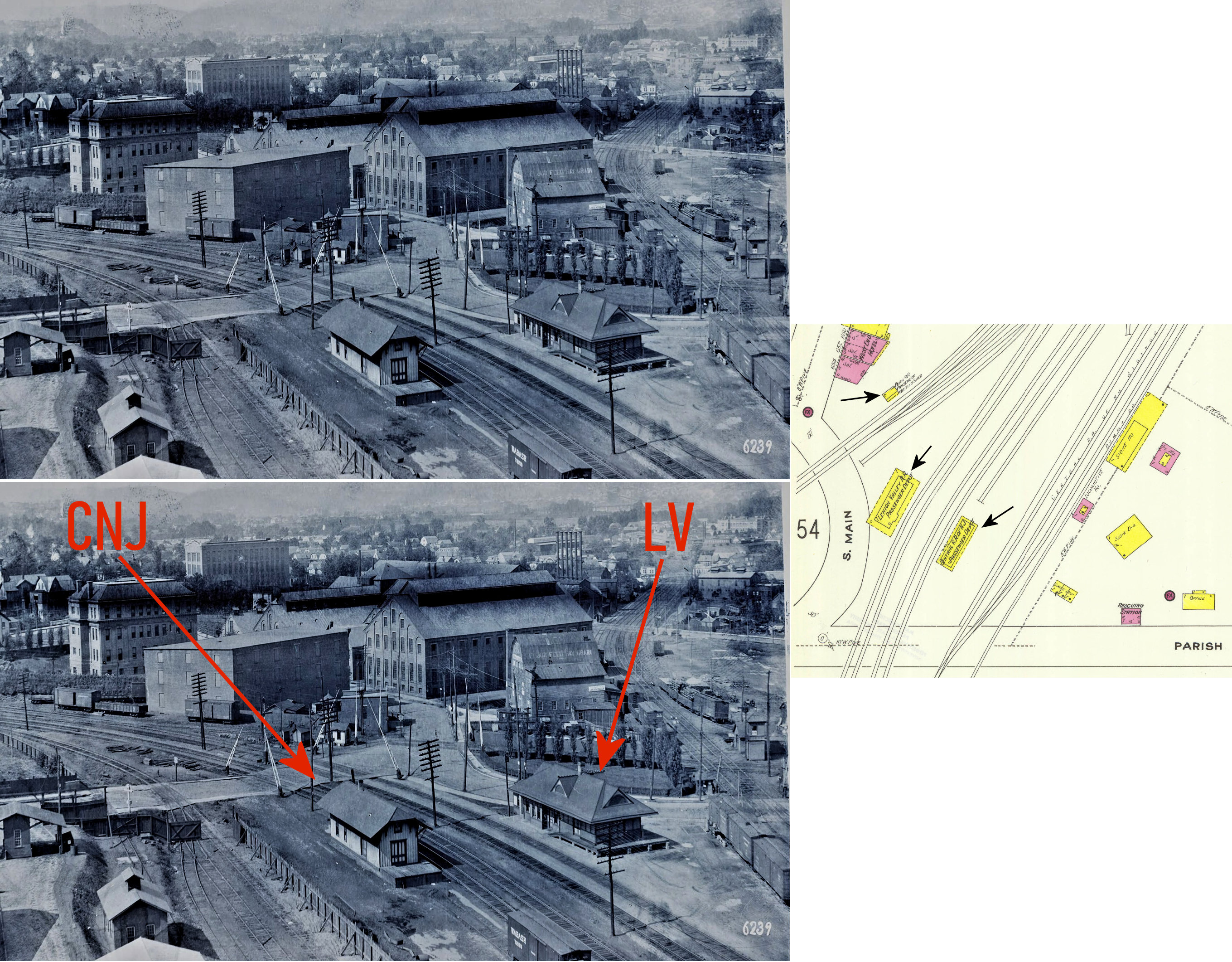
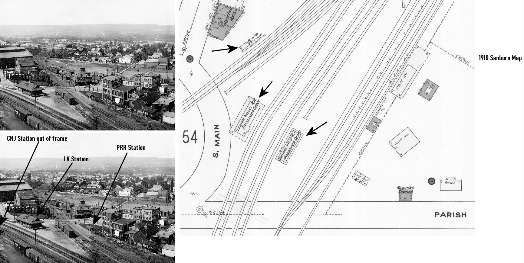
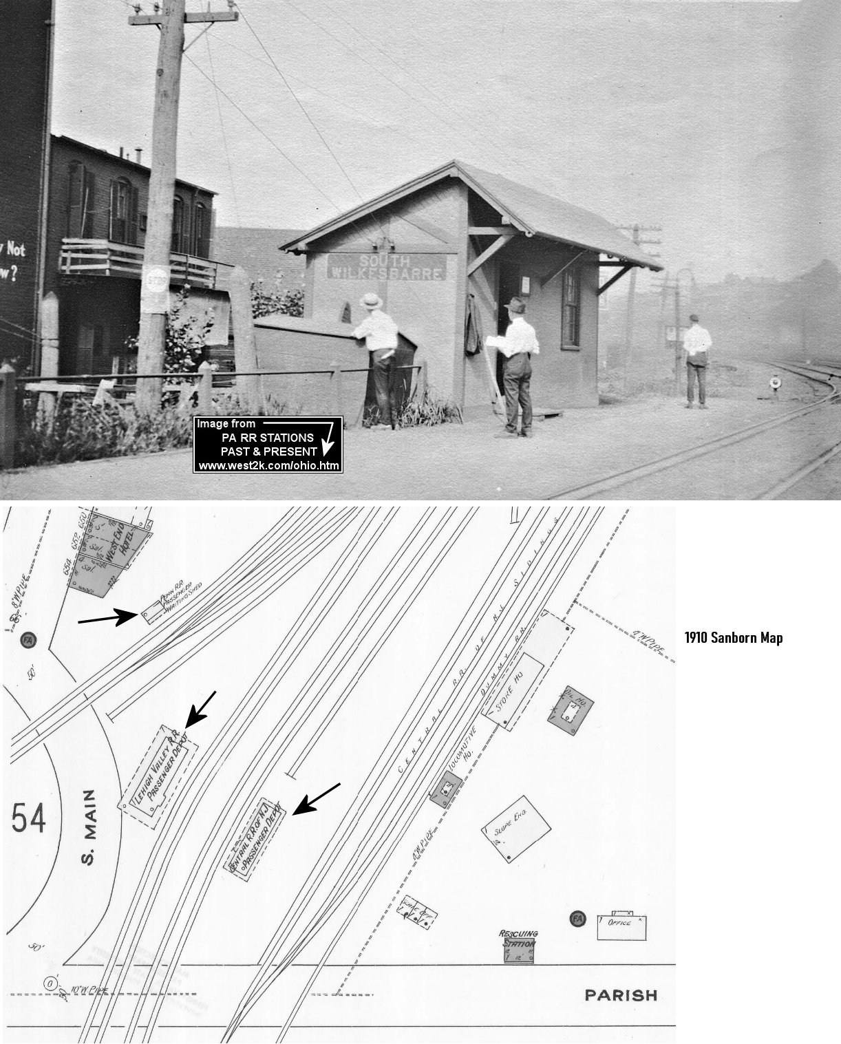
| Wilkes-Barre (South W-B) |
|
There was another small passenger station on the NE side of Parrish Street near South Main Street. Across the tracks on South Main was a small Lehigh Valley passenger station. | ||||||
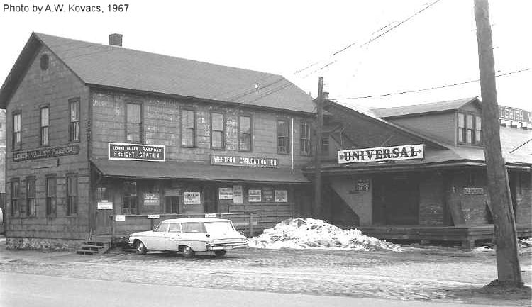
| Wilkes-Barre |
|
The freight station was just to the SW of the main passenger station along South Wilkes-Barre Boulevard (formerly Baltimore Street) at GPS: 41.241258,-75.880483. | ||||||
| Wilkes-Barre |
|
This freight station was along Wilkes-Barre Boulevard NE of Market Street at approximately GPS: 41.243476, -75.877376. It was built in 1886. | ||||||
| Wilkes-Barre |
|
This station was on the SE corner of East Market Street and North Pennsylvania Avenue. | ||||||
| Wilkes-Barre |
|
The original wood-frame passenger station and freight house were just south of Northampton Street in the vicinity of GPS: 41.241468, -75.882981. | ||||||
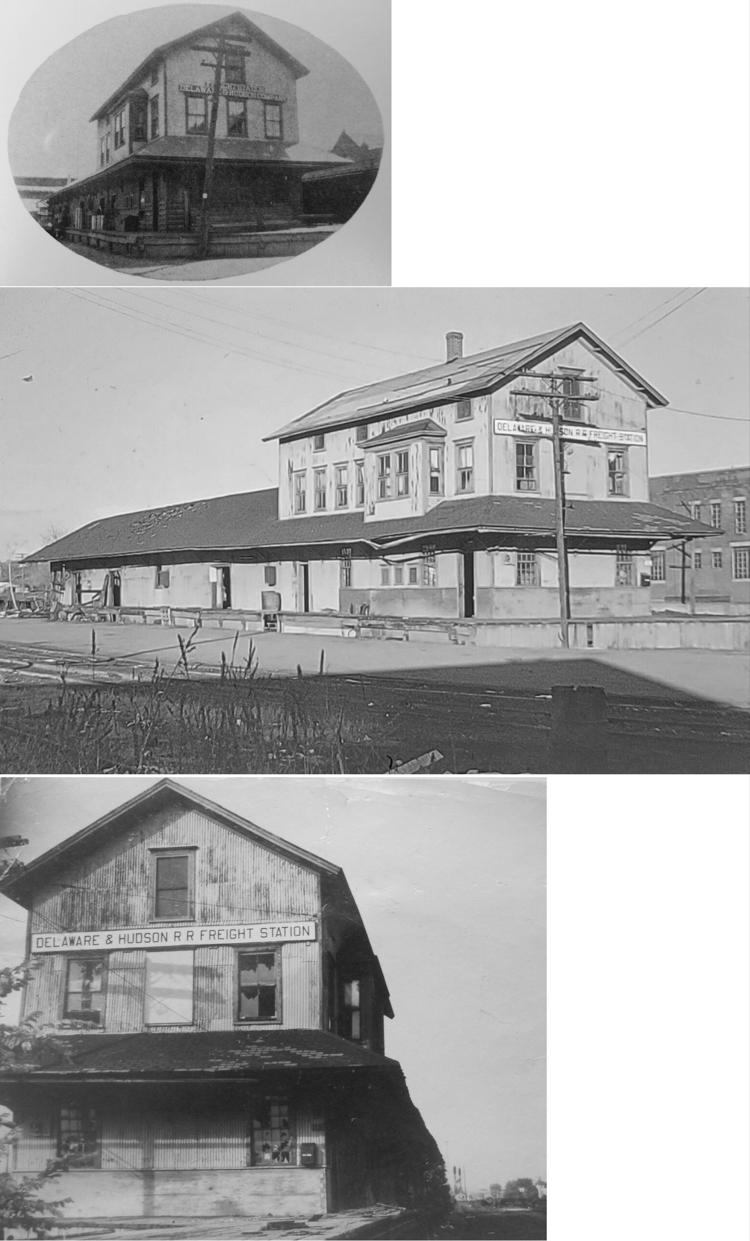
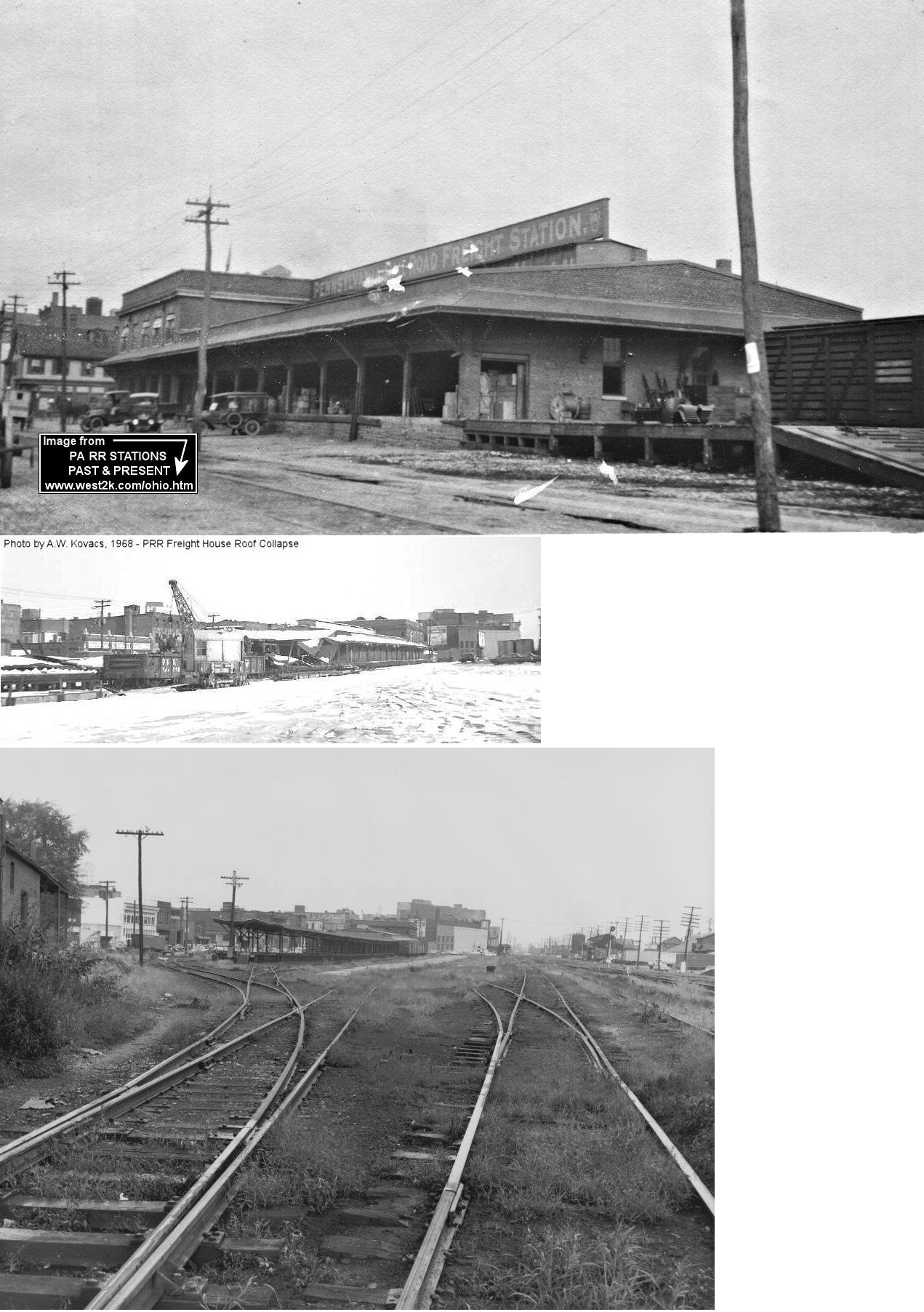
| Wilkes-Barre |
|
Was near the corner of East Pennsylvania Avenue (formerly South Canal Street) and East Market Street. It was built in 1884 and torn down in 1965. It also served the PRR and D&H. | ||||||
| Wilkes-Barre (South W-B) |
|
There was a passenger station on the SE side of South Main Street just NE of Parrish Street. The photo also shows the small PRR waiting shed. | ||||||
| Wilkes-Barre |
|
This freight station was on the southwest side of Northampton Street between Lincoln Street (now Wilkes-Barre Boulevard) and South Canal Street (now South Pennsylvania Avenue) at GPS: 41.241003, -75.882325. | ||||||
| Wilkes-Barre |
|
This freight station was on the corner of Northampton Street and South Canal Street (now South Pennsylvania Avenue) at GPS: 41.241561, -75.882687. | ||||||
|
Wilkes-Barre (South W-B) |
|
This small shelter shed-type station was on the SE side of South Main Street at approximately GPS: 41.234243, -75.902316. According to PRR valuation records, it was built in 1895. | ||||||
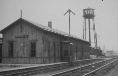
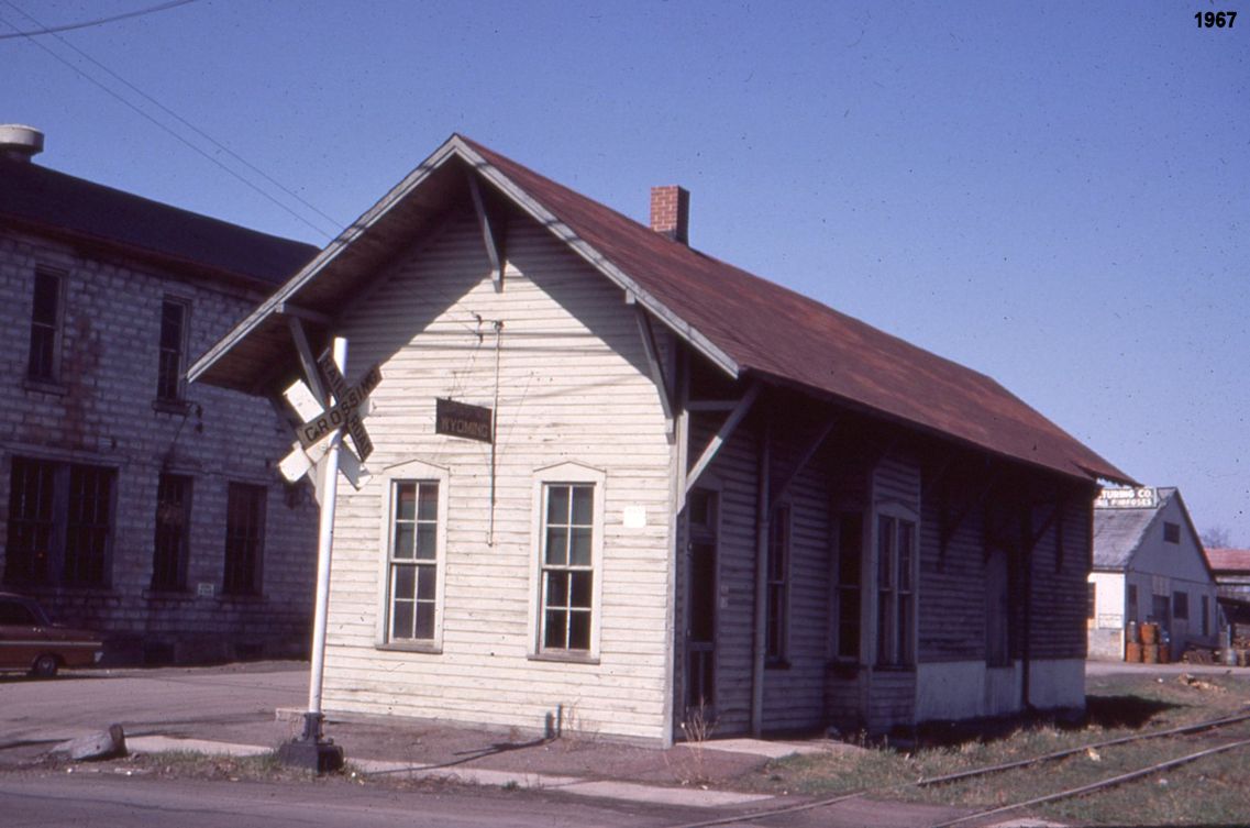
| Wyoming |
|
The water tower in the background of the photo says "Nelson Brothers" which is now Diamond manufacturing. This station was built in 1883. It was on the east side of 8th Street at approximately GPS: 41.314314, -75.839642. | ||||||
| Wyoming |
|
This station was on the east side of 8th Street at GPS: 41.314957, -75.840772. | ||||||
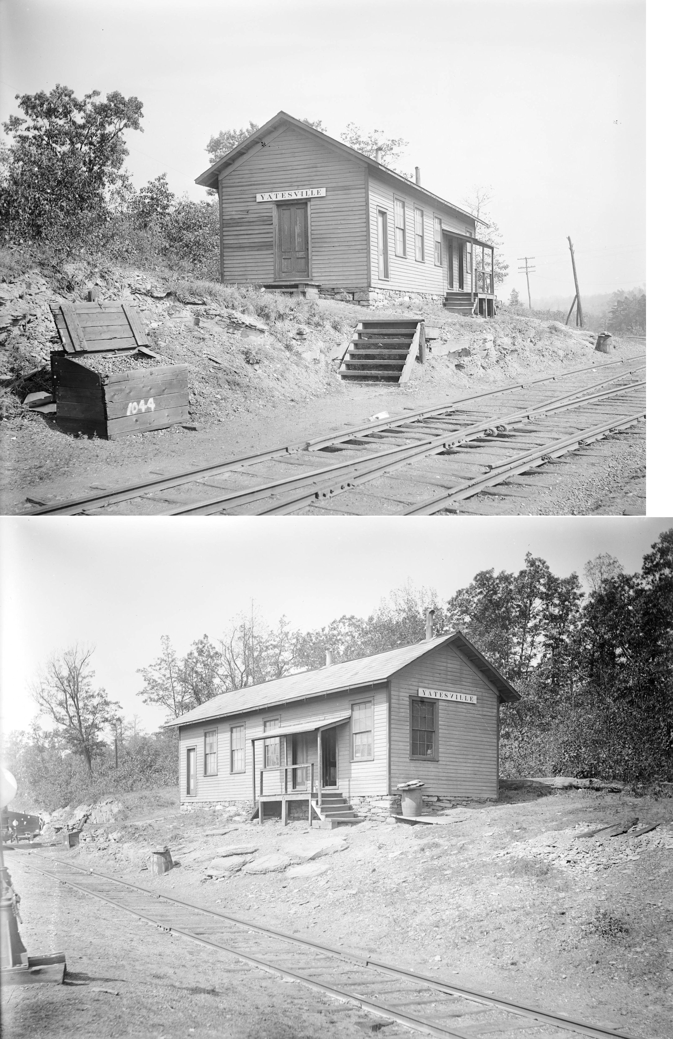
| Yatesville |
|
This station was built in 1893. | ||||||
| Yatesville |
|
The combination station here was built in 1887 and abandoned in December 1927 (Delaware & Hudson Inspection of Lines - Passenger & Freight Stations, 1928). | ||||||
| Zenith |
|
This station was on Zenith Road at approximately GPS: 41.029661, -76.188906. | ||||||
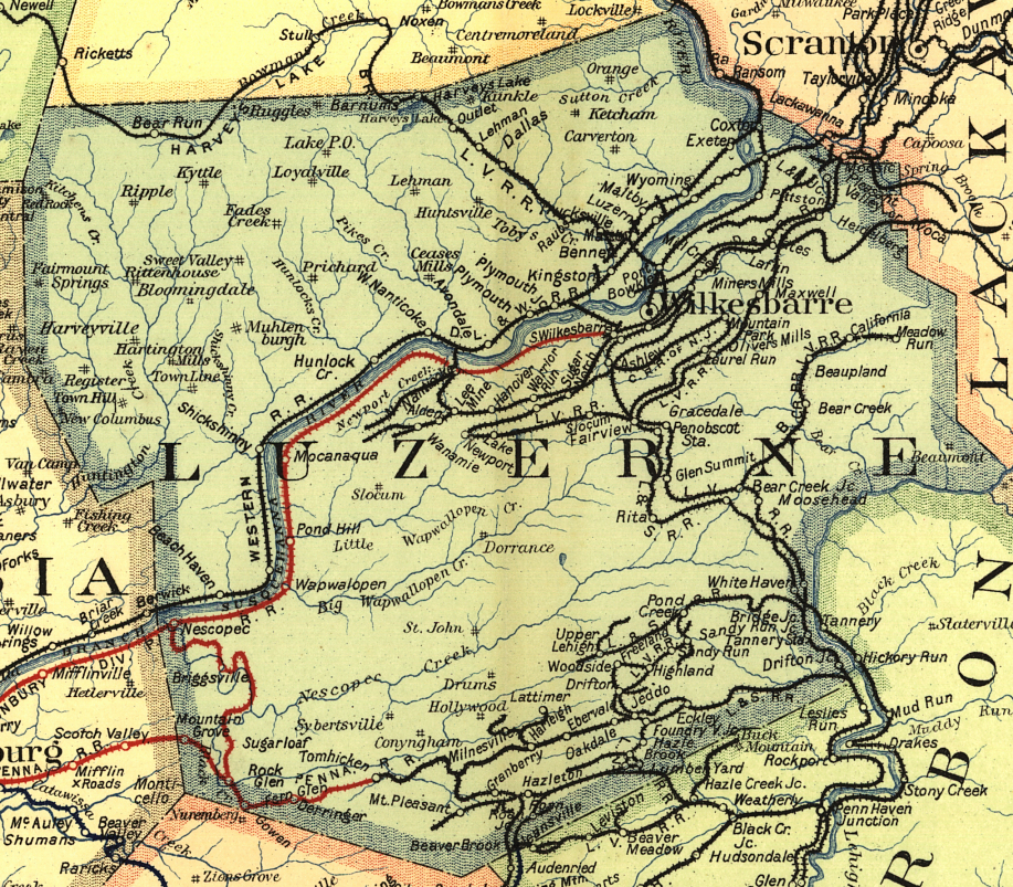
| 1895 LUZERNE COUNTY RAILROAD MAP | ||||||||
 |
||||||||
| Notes About Existing
Stations... Avoca (D&H) - This is the third station to serve Avoca. It is now a pool supply company. Avoca (D&H) - This was the first D&H station. It was a combination station that served from 1867-1899 when a new passenger station was built. At that time this station was remodeled as a freight house. It was pressed into passenger service again in 1904 when second passenger station burned until the new station was built in 1912. It was moved from its original location which was across the tracks to the northwest. Bear Creek (LV) - The old photo shows the station and hotel. The station was acquired and moved by superintendent F.S. Mitten when he moved to the lake in the late 1930s. In the late 1990s it was remodeled and lost some of its outside details. Eckley (Replica) - This station was built for the 1969 movie Molly Maguires and still serves as the museum gift shop here. Wilkes-Barre (CNJ) - This station has been restored and is now in use as the visitors center owned by Visit Luzerne County. The station was built by the Lehigh and Susquehanna Railroad in 1869 (the CNJ leased the L&S in 1871). Passenger service ended in 1963, and the station closed in 1972. It was added to the National Register of Historic Places in 1975. |
||||||||