|
|
||||||||
| EXISTING STATIONS | ||||||||
|---|---|---|---|---|---|---|---|---|
| Station Name |
Original Railroad |
Current Location |
Type | Current Use |
Date Built |
Track Status |
Building Material |
More Info |
| Carbondale | DELAWARE- LACKAWANNA shortline |
Trinity Place north of 7th Avenue (GPS: 41.571865, -75.504908) |
P | Railroad | ???? | In Use | Wood | |
| Clarks Summit |  |
Bedford Street at Powell Avenue (GPS: 41.491452, -75.703493) |
C | Businesses | 1903 | Gone | Brick | |
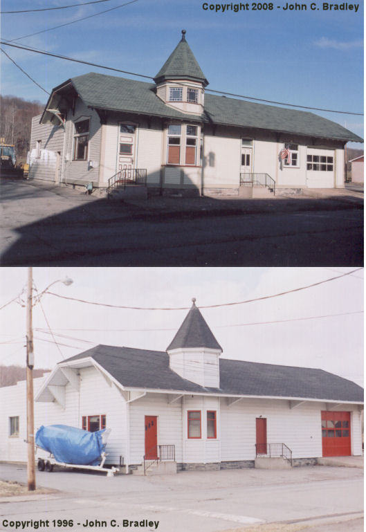
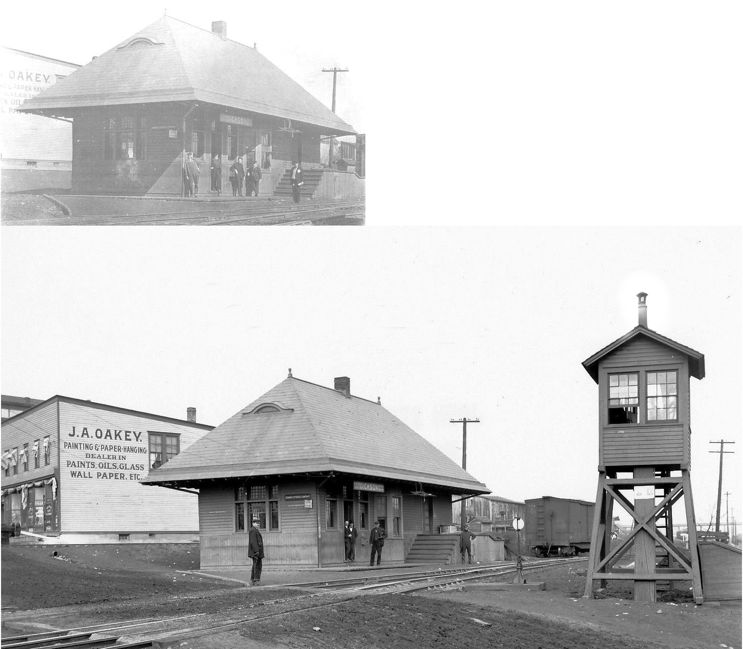
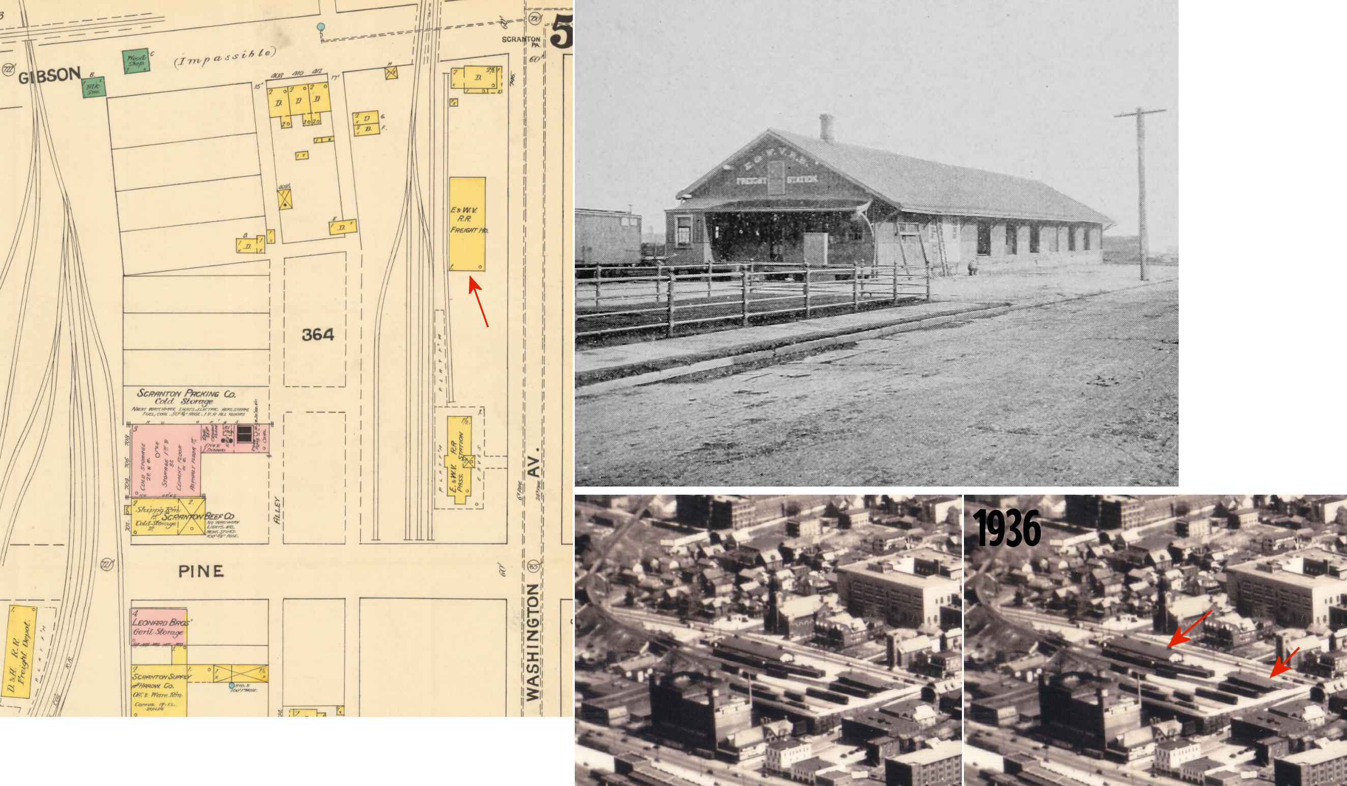
| Dickson City |  |
NE side of Boulevard Avenue on the SE side of the tracks (GPS: 41.458575, -75.623372) |
F | Warehouse | 1912 | In Use | Wood | |
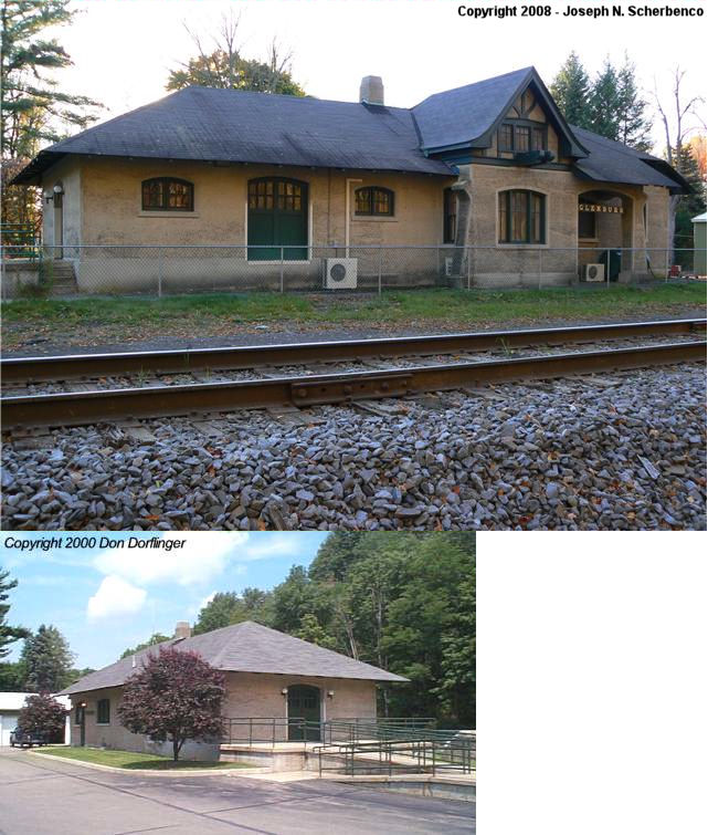
| Glenburn | |
Waterford Road | P | Civic | 1915 | In Use | Concrete | |
| Green Ridge | |
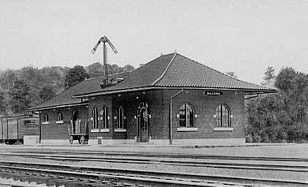
Wyoming Avenue | C | ???? | 1867 | ???? | ???? |
|
| La Plume | |
LaPlume Road | F | Business | ???? | In Use | Wood/ Stucco |
|
| Mayfield | |
Penn Avenue at Walnut Street (GPS: 41.540438, -75.536958) |
P | Civic | 1891 | ???? | ???? |
|
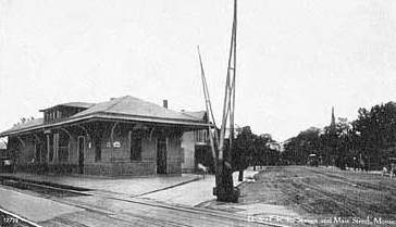
| Moscow |
|
Market Street and PA435 (GPS: 41.337263, -75.518125) |
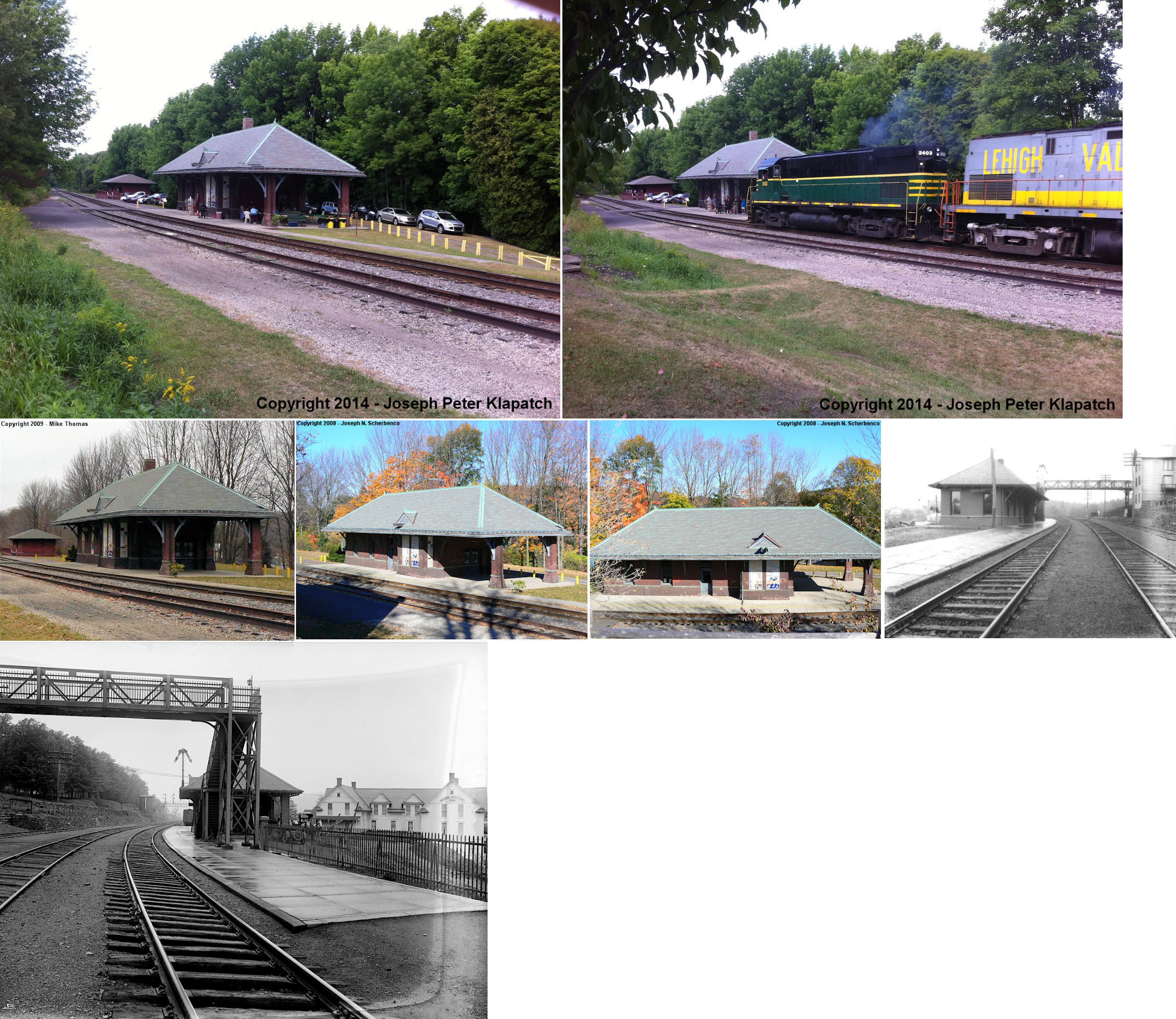
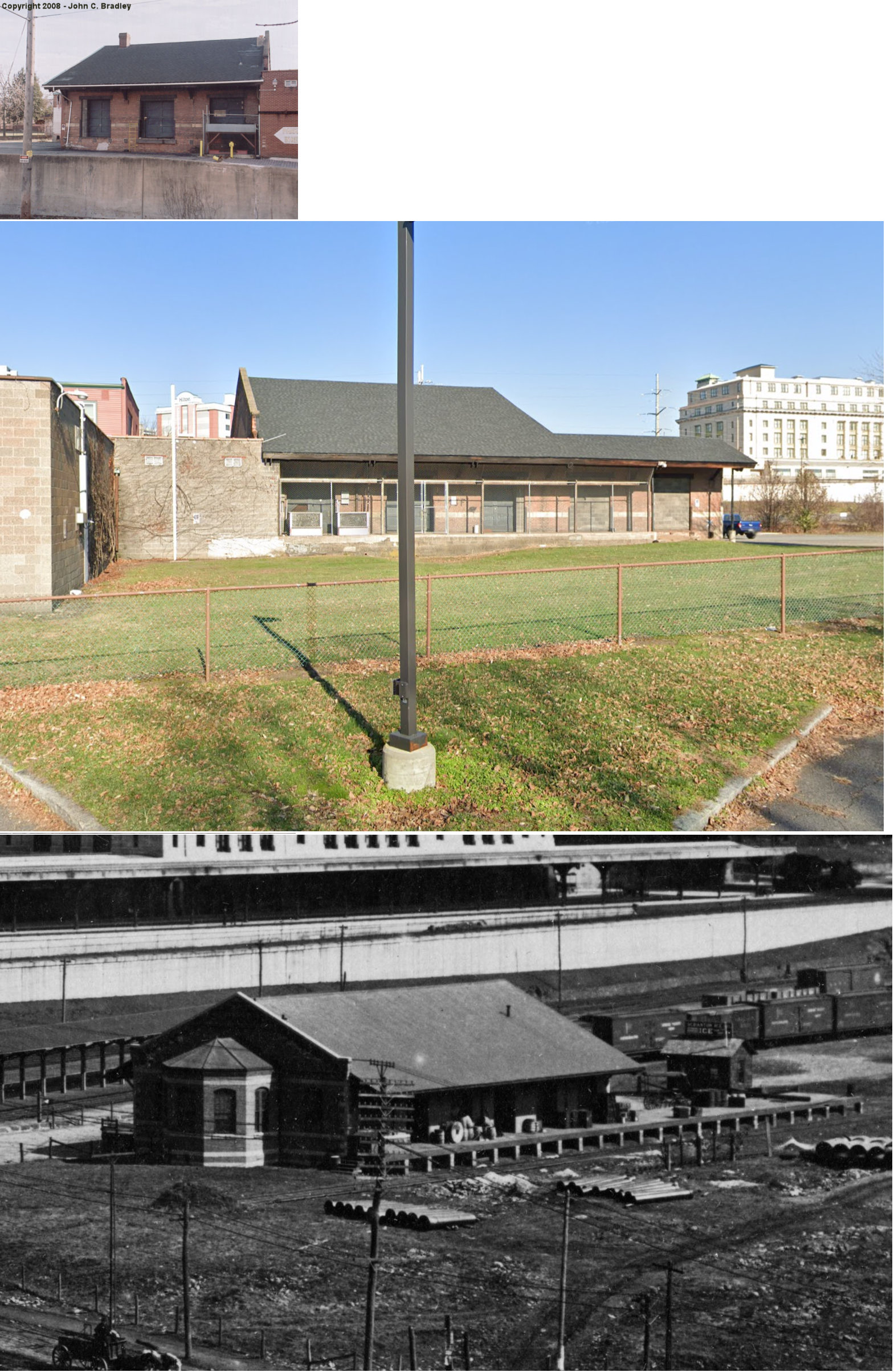
P | Railroad | 1903 | In Use | Brick | |
| Moscow |
|
Market Street and PA435 (GPS: 41.338119, -75.518117) |
F | Railroad | 1903 | In Use | Brick | |
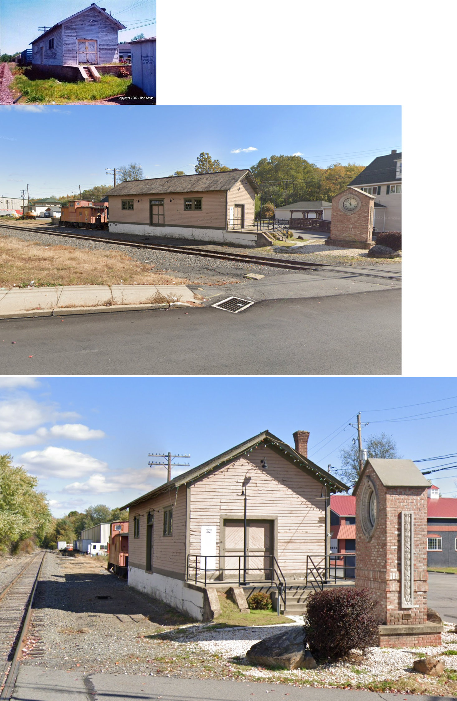
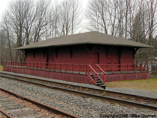
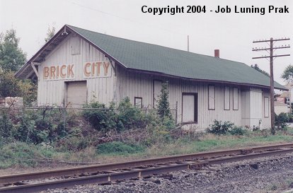
| Old Forge | |
919 South Main Street (GPS: 41.359848, -75.743080) |
P | Office | 1912 | In Use | Brick | |
| Olyphant | DELAWARE- LACKAWANNA shortline |
North Valley Avenue at Lackawanna Avenue (GPS: 41.468325, -75.602976) |
P | Railroad | 2001 | In Use | Wood | |
| Peckville (Blakely) |
 |
601 River Street (GPS: 41.478100, -75.577221) |
C | Business | 1890 | Gone | Wood | |
| Scranton |  |
701 North
Washington Street (GPS: 41.414211, -75.657156) |
P | Business | 1904 | Gone | Wood |
|
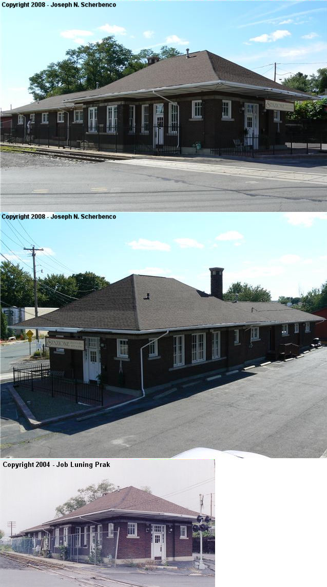
| Scranton | |
700 Lackawanna Avenue (GPS: 41.405535, -75.661382) |
P | Business | 1908 | In Use | Brick | |
| Scranton (Hyde Park) |
 AND |
6th Avenue at Lackawanna Avenue bridge (GPS: 41.411712, -75.671277) |
F | Warehouse | 1891 | Aband. | Brick |
|
| Scranton | |
701 Wyoming Avenue (GPS: 41.415005, -75.658736) |
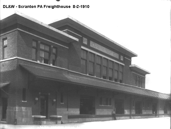
F | Lumberyard | 1931 | In Use | Brick |
|
| Scranton |  |
Rear section of 151 Cedar Avenue (GPS: 41.404516, -75.663231) |
F | Business | ???? | Gone | Brick | |
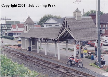
| Wimmers | |
564 Easton Turnpike (PA191/PA196) Hamlin, Wayne County (GPS: 41.402401, -75.397710) |
P | Civic | 1885 | None | Wood | |
| STATIONS OF THE PAST | ||||||||
| Station Name |
Original Railroad |
Notes | ||||||
| Archbald |
|
This station was between Laurel Street (formerly Cedar Street) and the tracks SW of Wayne Street. The location is now the backyard of a house on Laurel Street (GPS: 41.495674, -75.541083). | ||||||
| Archbald |
|
This station was on the south side of Pike Street between Cherry Street and Spruce Street on the west side of the tracks at GPS: 41.493671, -75.539551. It was built in 1873. In 1904 it was moved from the east side of the tracks to the west side and enlarged. | ||||||
| Ash Gap |
 |
|||||||
| Carbondale |
|
This combination station included a steam-powered elevator. It was on Dundaff Street between Salem Avenue and Enterprise Drive, on the site of the present day Post Office (GPS: 41.575459, -75.503297). The tracks were eleveated through town here and some of the piers for the bridge can still be seen in the area. | ||||||
| Carbondale |
|
There was a freight station just south of the passenger station near the corner of Dundaff Street and Salem Street at GPS: 41.574645, -75.503159. This station was on a spur that was not elevated. | ||||||
| Carbondale |
|
The first combination station here was built in 1870 on Dundaff Street. It was retired in 1896 with the addition of the new brick station (listed below), but continued to serve the Stegmaier Brewing Company as a beer depot and then as a D&H dispatcher's office at least until the late 1920s and perhaps beyond that. It was at approximately GPS: 41.576928, -75.503549. | ||||||
| Carbondale |
|
This brick passenger station was built in 1895 and burned down in the early 1970s. This was known as "City Station" and was located at GPS: 41.571865, -75.504908. Prior to this station, there was a small wooden station at this same location as shown on the 1892 Sanborn map. | ||||||
| Carbondale |
|
There was a small shelter-type station on the SW side of Lincoln Avenue on the west side of the tracks that was built in 1911. It was at GPS: 41.570720, -75.494193. | ||||||
| Carbondale |
|
There was a freight house that was built in 1876. It was subsequently cut in half and and moved to the Erie tracks opposite the D&H freight office. It was then used as the Erie freight office. | ||||||
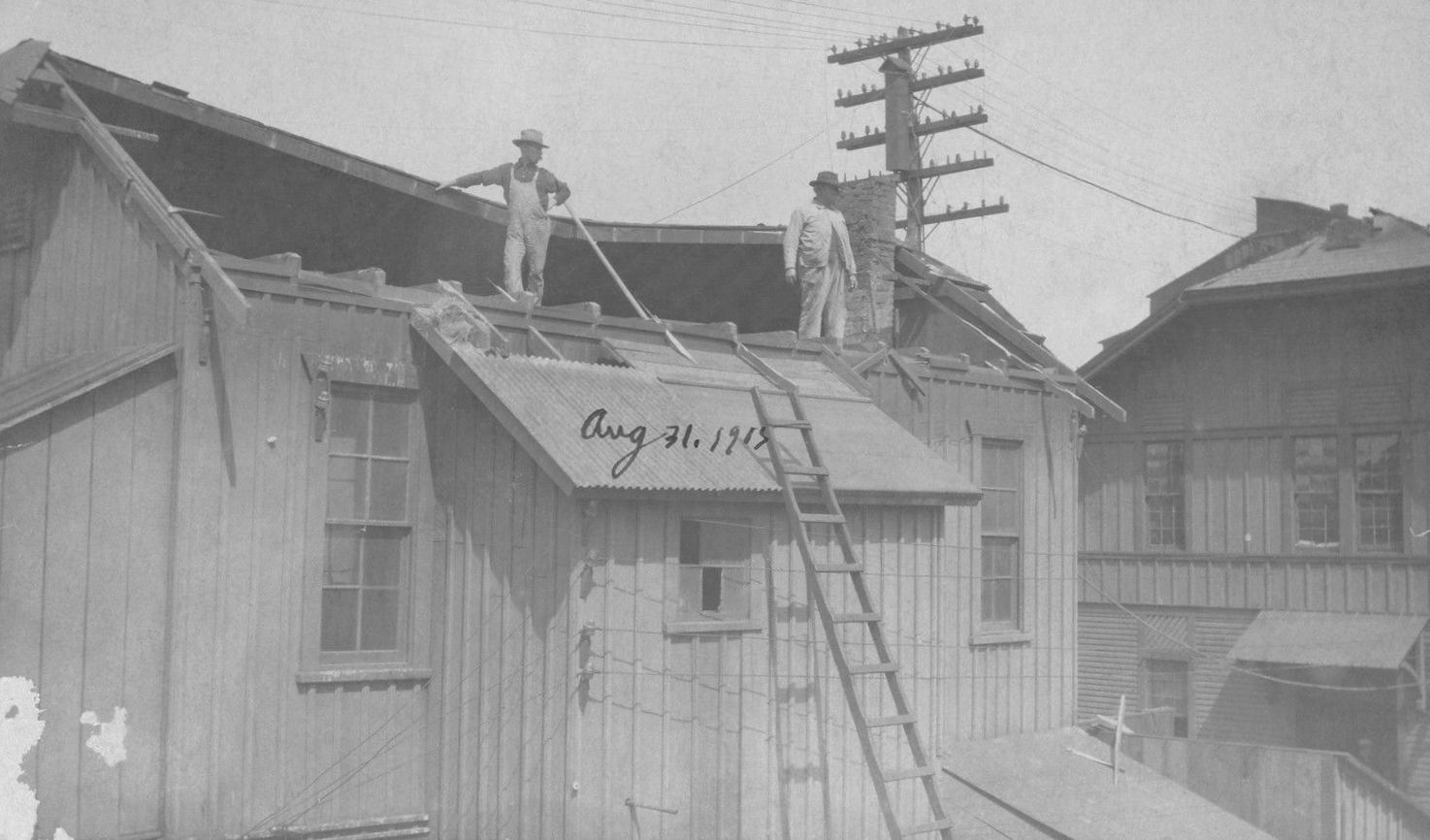
| Carbondale |
|
The image shows the station being rebuilt after a tornado in 1905. | ||||||
| Clarks Summit |
|
There was a frame freight house here built in 1903. It was just to the north of the passenger station. | ||||||
| Clifton |
|
|||||||
| Clifton Siding |
|
ICC records from 1926 list a station at Clifton Siding that was built in 1893 and list a modified boxcar as a passenger station at Clifton that was placed there in 1913. It could be that the boxcar was used as a replacement for the station above after it met its demise. | ||||||
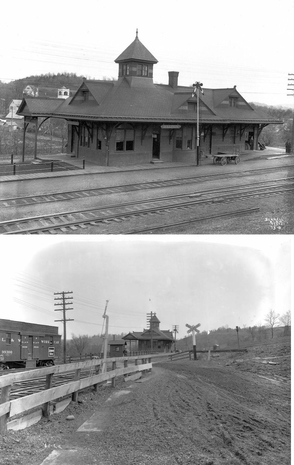
| Dalton | |
This original station was along the old right-of-way which is now the loaction of US-6/11. It was south of Main Street at approximately GPS: 41.533547, -75.737715. | ||||||
| Dalton | |
This newer station, built in 1915, was on Lilly Lake Road along the new alignment. | ||||||
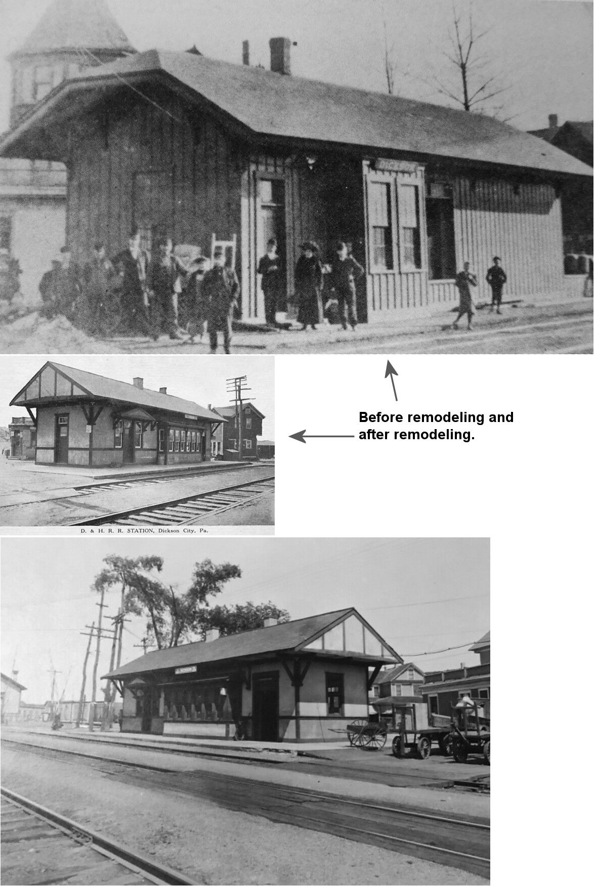
| Dickson City |
|
This combination station was built in 1890. When a seperate freight house was built in 1912, this station was moved about 800 feet north of its original location and remodeled into a passenger-only station. As part of the remodel, the station got a new roof and looked quite a bit different than its original design. Its original location was on the SW side of Boulevard Avenue at GPS: 41.458188, -75.623772. | ||||||
| Dickson city |
|
This station was on the NE side of Boulevard Avenue at GPS: 41.458819, -75.623606. | ||||||
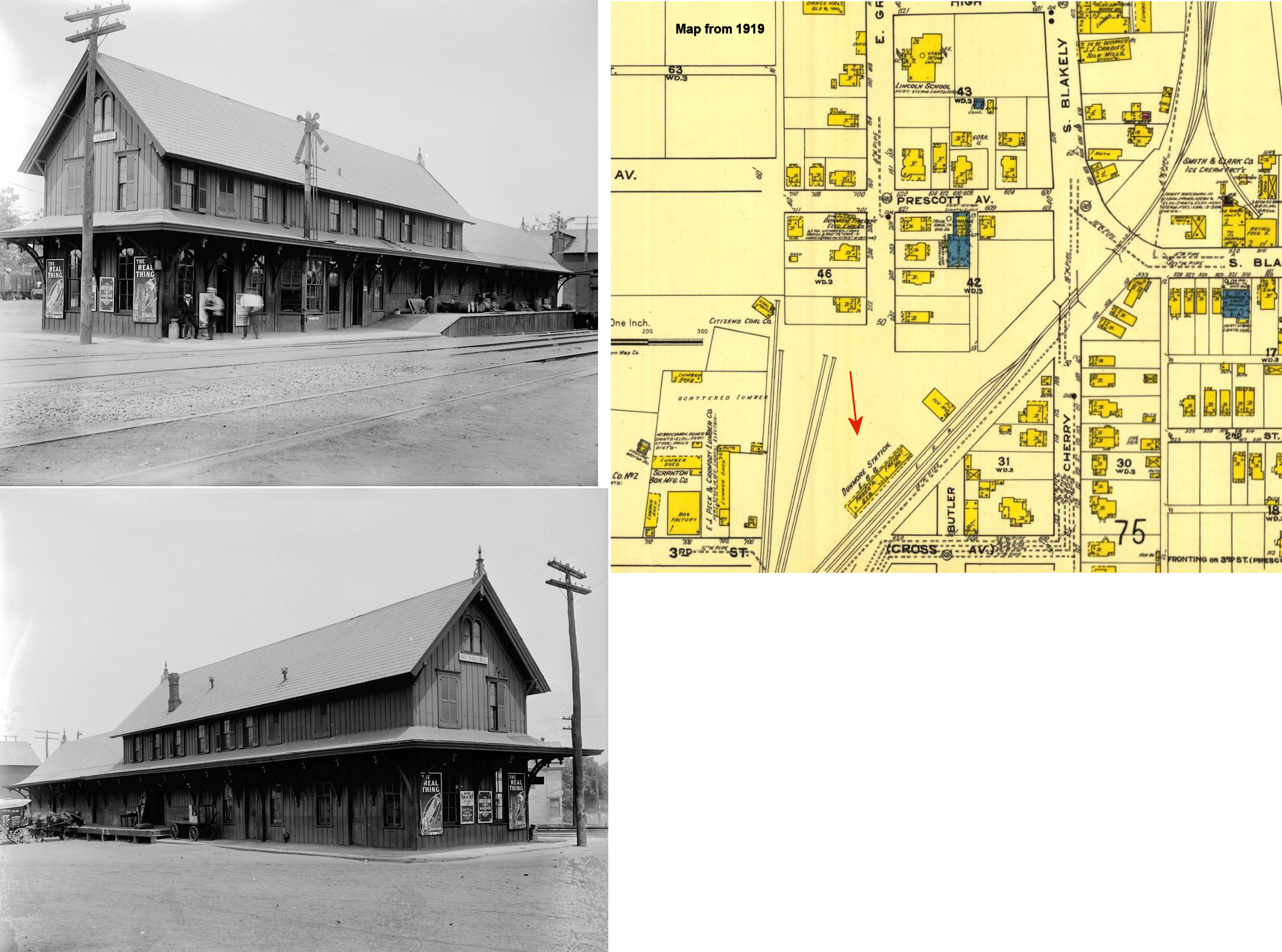
| Dunmore |
|
This combination station, built in 1886, was on the NW side of 3rd Street/Wheeler Avenue on the SW side of the tracks at GPS: 41.414441, -75.636101. | ||||||
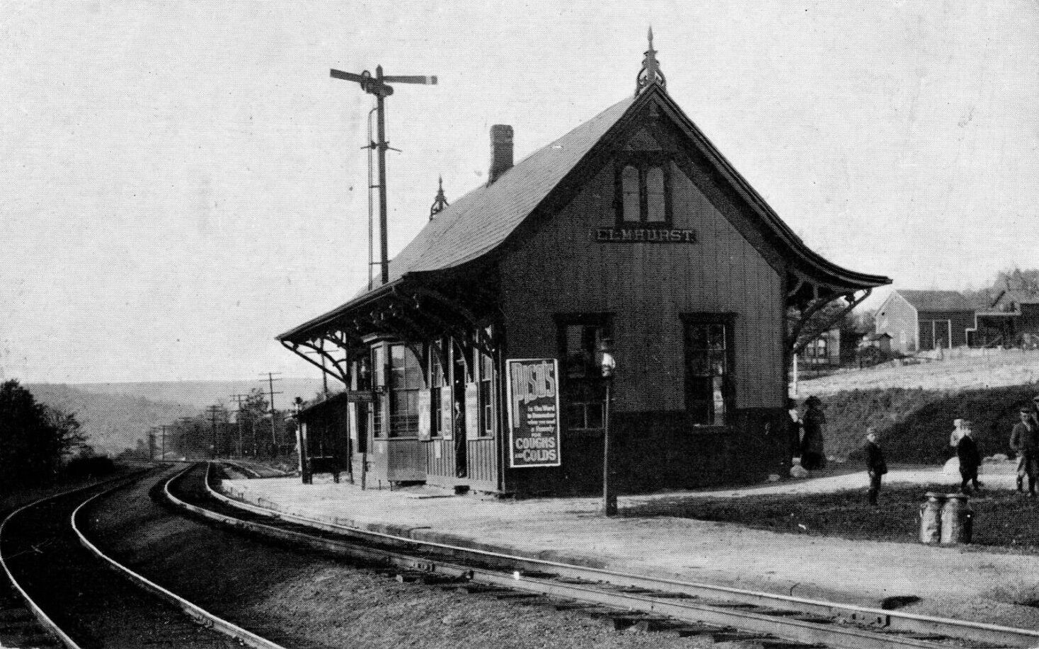
| Elmhurst | |
This station was built in 1894. | ||||||
| Elmhurst | |
This station was built by the Erie & Wyoming Valley in 1885. This was an example of a D&H-style pagoda depot on the Erie RR. There were a handful of these type stations on the Erie in this area near Scranton and a prevailing theory is that the stations were built by the D&H and then sold to the Erie. | ||||||
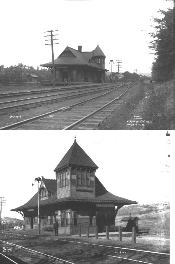
| Glenburn | |
This was the station on the old main line prior to 1915. | ||||||
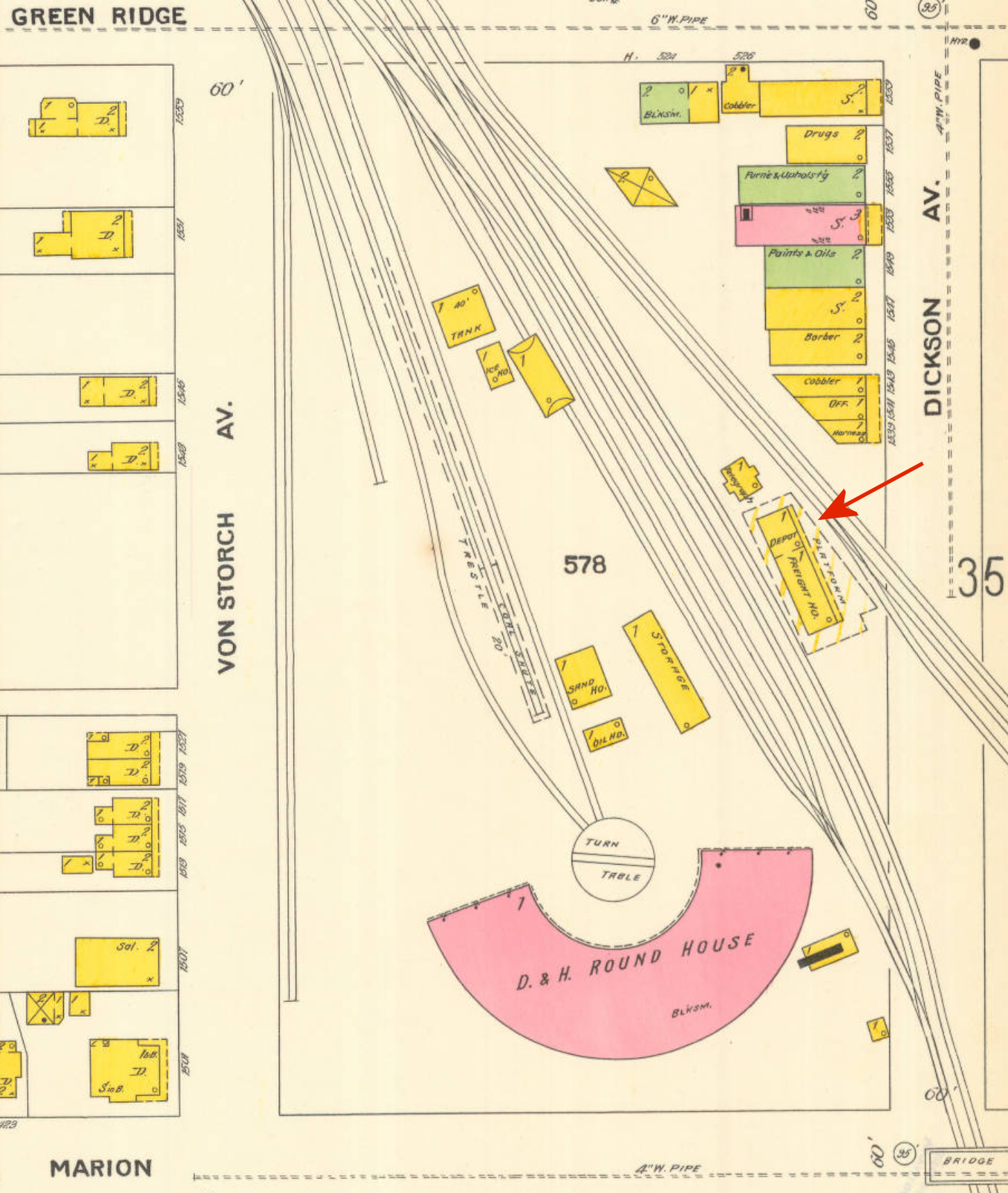
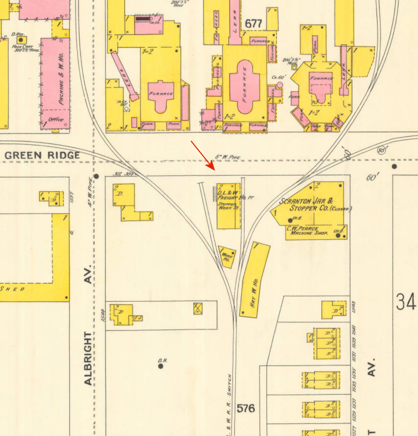
| Green Ridge | |
This combination station was on the NW side of Dickson Avenue between Green Ridge Street and Marion Street at GPS: 41.429120, -75.653639. It was just to the northeast of the roundhouse. | ||||||
| Green Ridge | |
There was a frame freight house here that was built in 1888 on the SW side of Green Ridge Street between Albright Avenue and Meylert Avenue at GPS: 41.431035, -75.656241.This freight house was at the end of a spur. It was two stories with the D&H freight house on the 1st floor. The nearby stopper works used the 2nd floor. | ||||||
| Hollister | |
There was a 6' x 10' x 11' shelter-type station here that was built in 1898. | ||||||
| Jermyn | |
This station, built in 1873, was on the west side of Chestnut Street between Delaware and Hudson Streets. It was on the east side of the tracks at GPS: 41.525078, -75.545354. It was moved back from the tracks 25 feet in 1904. | ||||||
| Jermyn |
|
This station was located on the south side of the east end of Franklin Street on the west side of the tracks (formerly Scott St.) (GPS: 41.530333, -75.544243). There was a freight station (probably the original passenger station) on the north side of Franklin at GPS: 41.531151, -75.543892. | ||||||
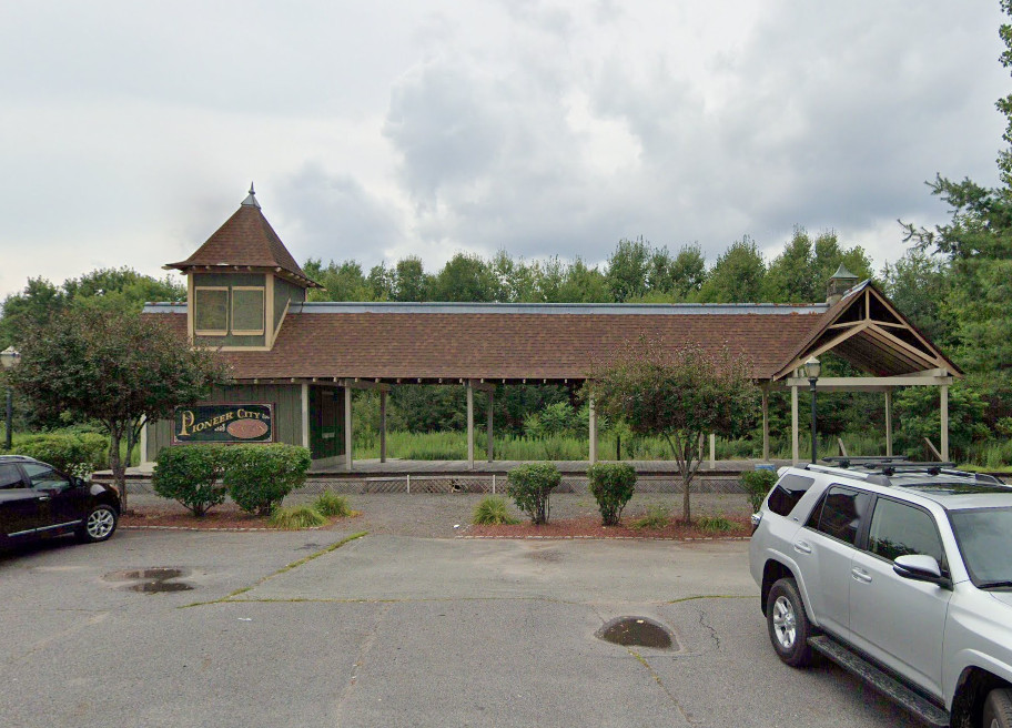
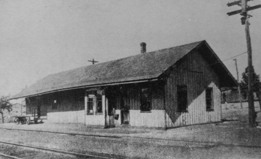
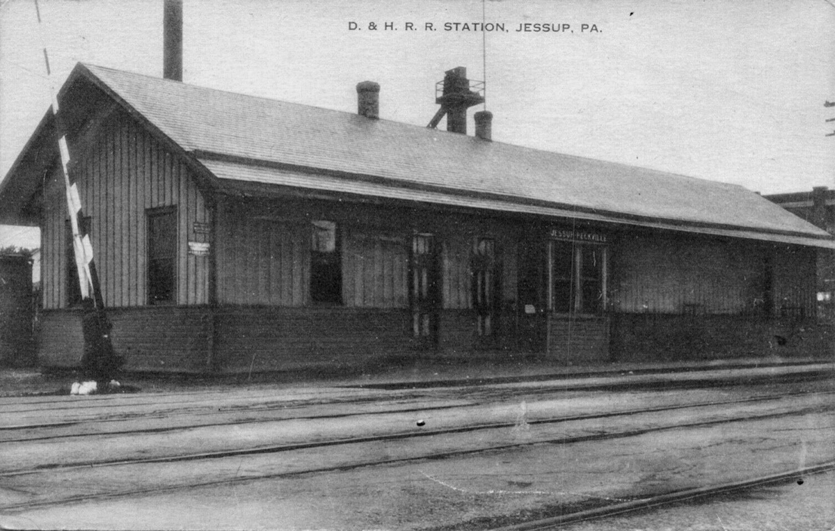
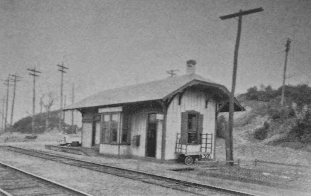
| JessuP-Peckville | |
This station was built in 1873 and enlarged in 1887. It was on the east side of Church Street on the north side of the tracks at GPS: 41.475980, -75.572305. This is the current site of Station Park. | ||||||
| La Plume | |
The final La Plume passenger station was made of concrete and built around 1915. | ||||||
| Lawrenceville | AND  |
This station may have been located just across the line in Tioga Co. NY. | ||||||
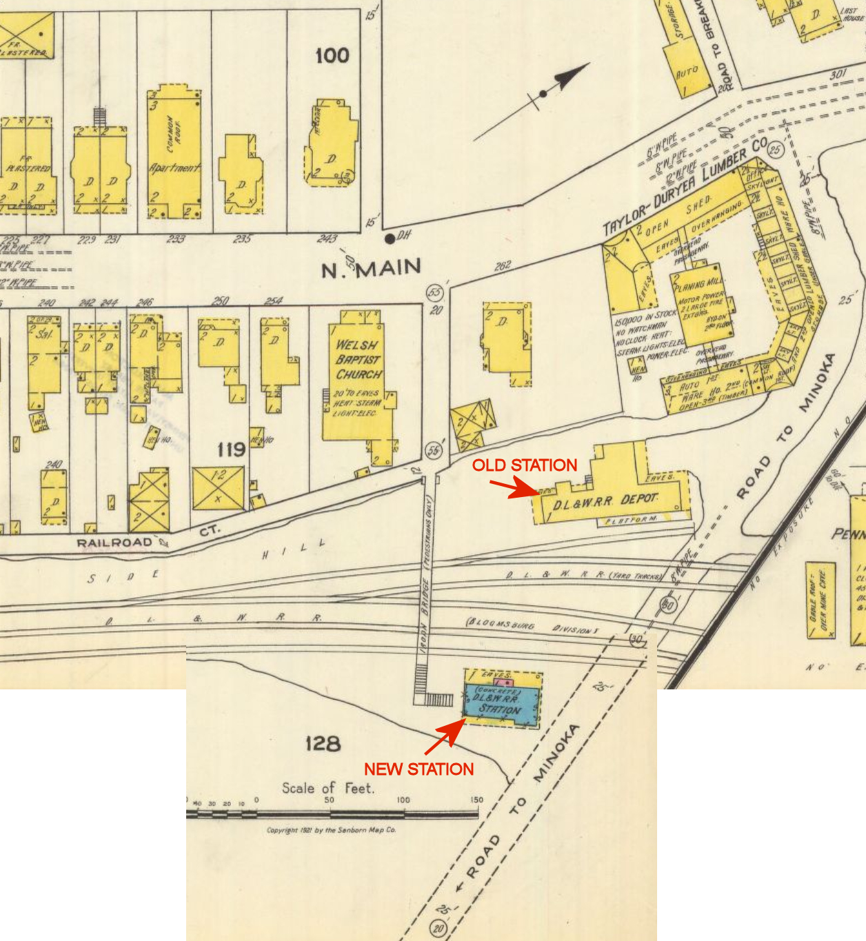
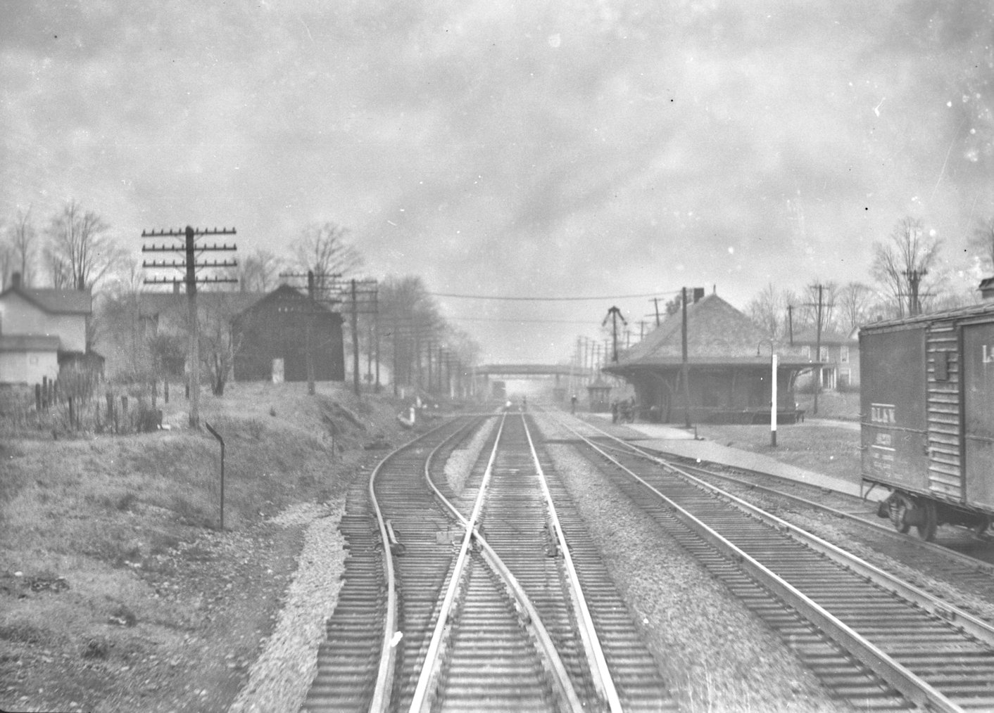
| Minooka-Taylor | |
The combination station here was built in 1887 and abandoned in August 1927 (Delaware & Hudson Inspection of Lines - Passenger & Freight Stations, 1928). | ||||||
| Moosic | |
Built in 1867, remodeled in 1910, this station was on the SW side of Main Street (formerly Wyoming Avenue) on the north side of the tracks at GPS: 41.354556, -75.729121. | ||||||
| Moscow | |
The original wood frame passenger and freight stations were on the east side of Main Street at GPS: 41.336650, -75.518220. The passenger station was on the west side of the tracks, whereas the freight station was on the east. | ||||||
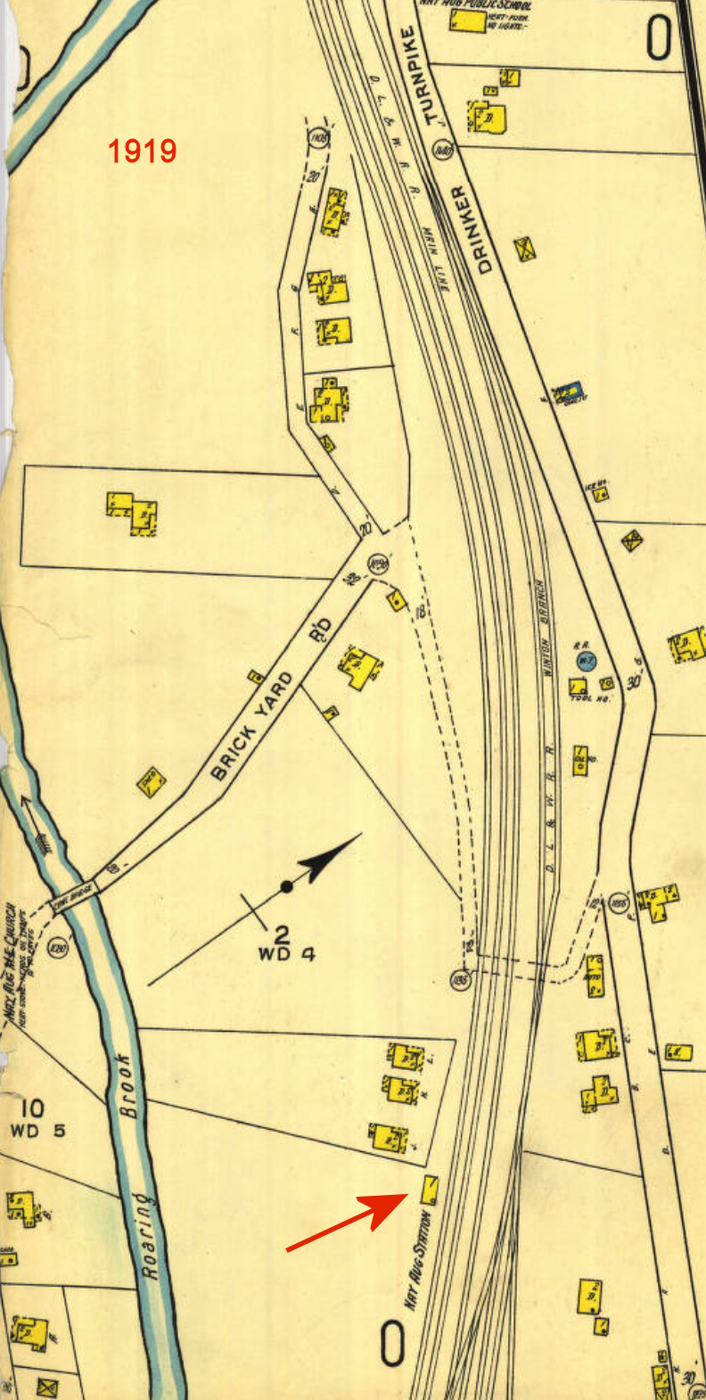
| Nay Aug | |
There was a combination car inspector's office/passenger waiting room building here that was built in 1883. The 1919 Sanborn map shows a very small station/passenger shelter. I can't tell what the current location is from the old map. If anyone else can, please let me know. | ||||||
| Old Forge | |
The original wood frame station was in approximately the same location as the existing station, but on the south side of the tracks as opposed to the north side (at GPS: 41.359646, -75.743106). | ||||||
| Olyphant | |
This combination station, built in 1873, was located off Garfield Avenue on the SE side of the tracks at GPS: 41.469438, -75.599937. It was demolished in 2004. | ||||||
| Olyphant | |
This station was on the south side of West Lackawanna Avenue on the west bank of the river at GPS: 41.470769, -75.606993. | ||||||
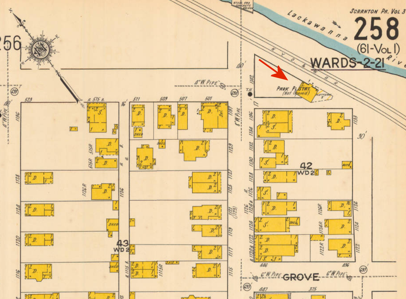
| Park Place | |
This 2-story station was Just to the southeast of the intersection of Albright Avenue and Court Street. On the 1920 Sanborn map, this station is marked as "not opened." | ||||||
| Petersburg |
|
This station was on the northeast side of Ash Street along James Avenue at the intersection of Watrous Avenue at GPS: 41.407371, -75.633179. | ||||||
| Providence | |
This station last sat in a junkyard on East Market Street (west end of the Lackawanna River bridge.) The station and junkyard are now gone. Its original location was on the east side of East Market Street on the south side of the tracks between the tracks and the river at GPS: 41.437714, -75.654434. | ||||||
| Providence | |
The combination station here was built in 1875 and abandoned in March 1928 (Delaware & Hudson Inspection of Lines - Passenger & Freight Stations, 1928). It was on the southwest side of depot street at GPS: 41.438625, -75.647252. | ||||||
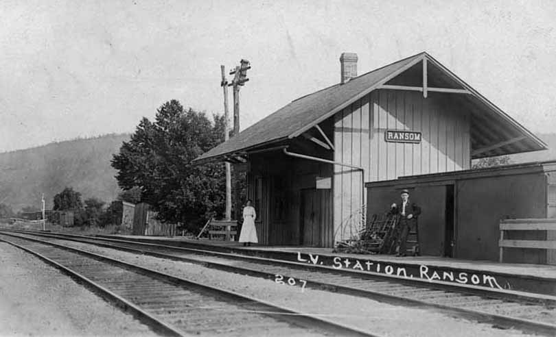
| Ransom |
 |
|||||||
| Rocky Glen |
|
The railroad served the amusement park here. | ||||||
| Saco | |
The passenger station here was a modified bocar body placed in 1916. There may have been a station here prior to that. | ||||||
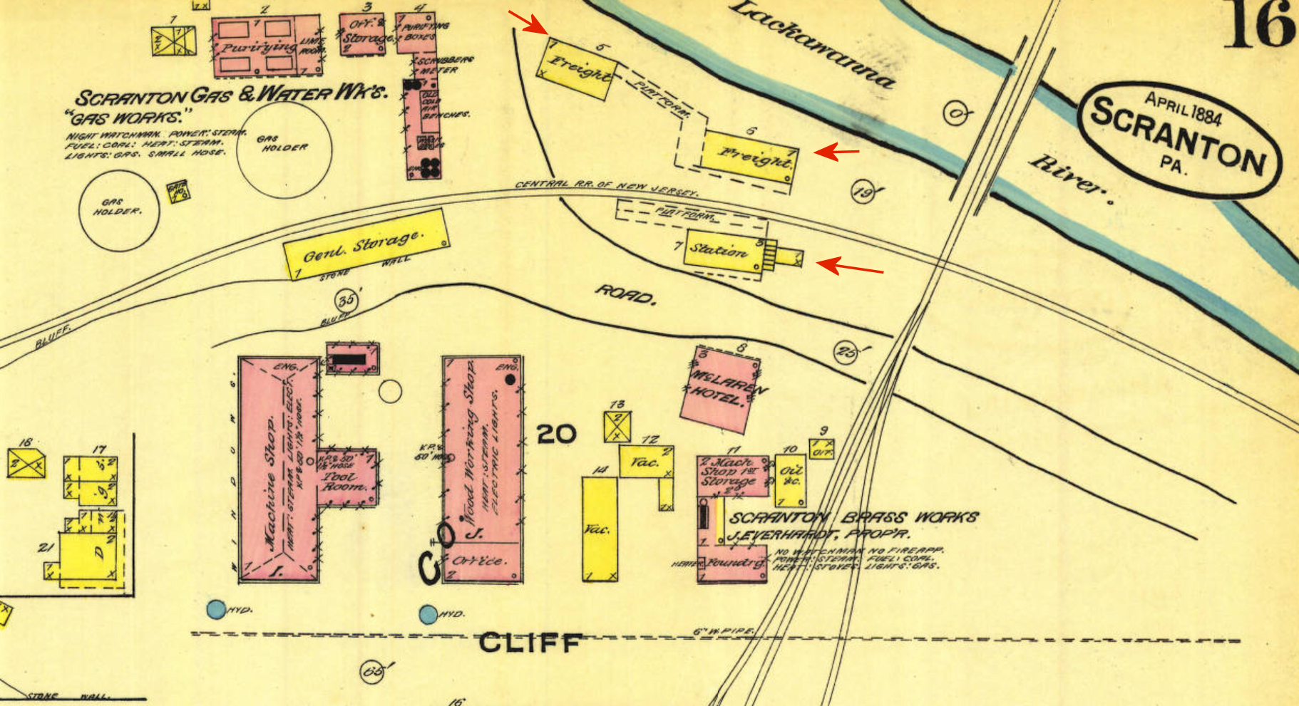
| Scranton |
|
The passenger station was on the east side of Cedar Avenue at GPS: 41.405255, -75.663783. | ||||||
| Scranton | |
The original CNJ passenger and freight stations were north of Cliff Avenue. | ||||||
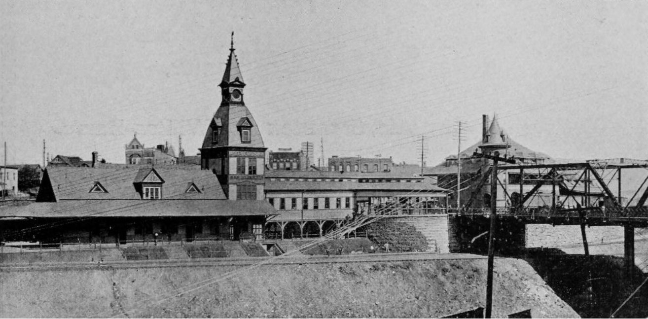
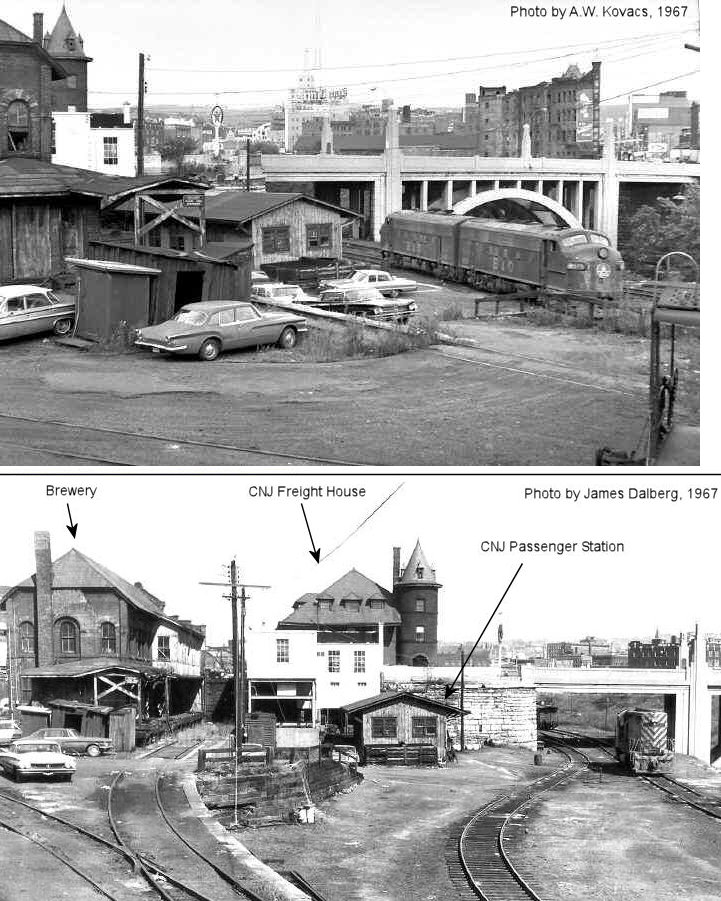
| Scranton | AND |
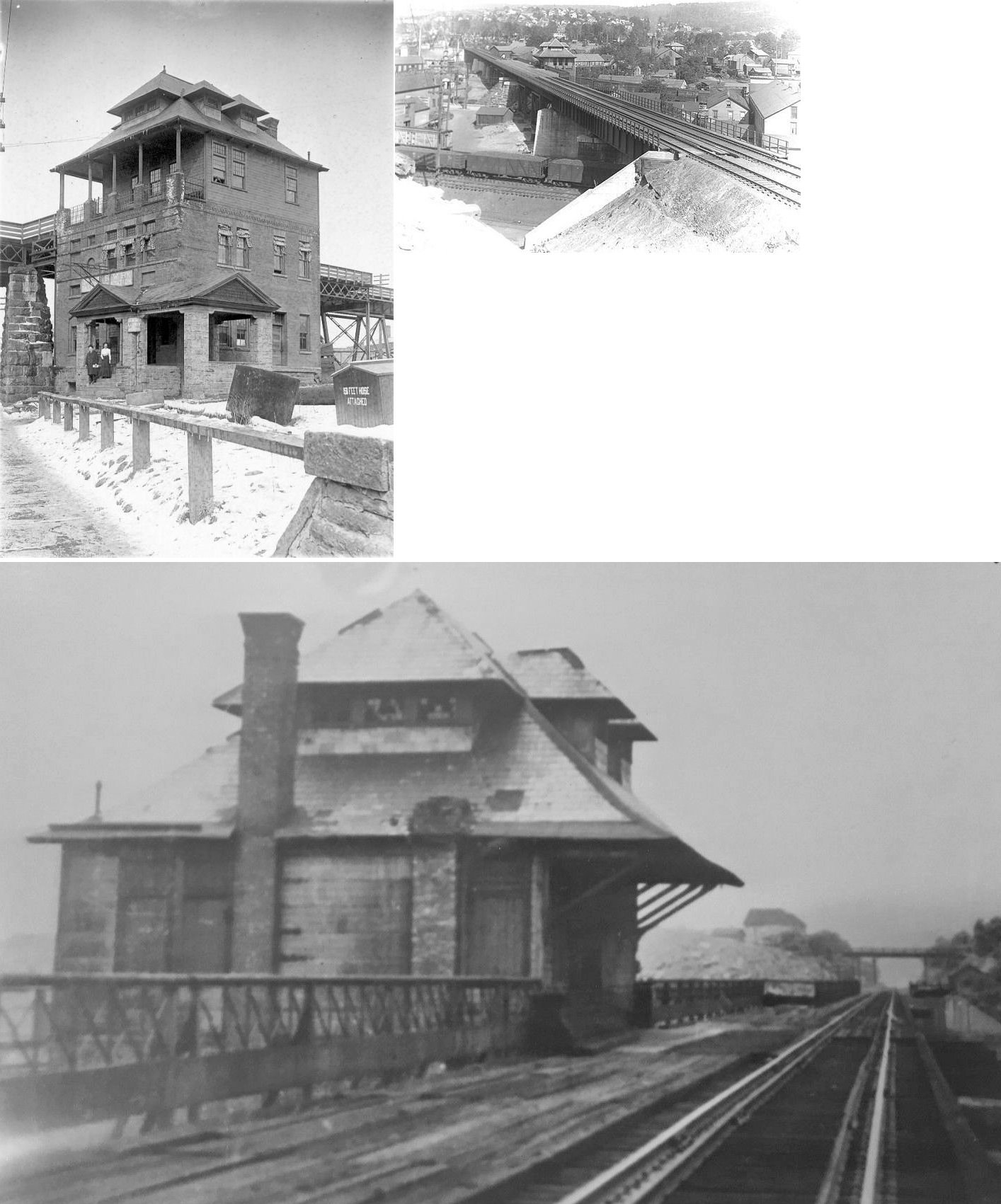
This passenger station, built in 1890, burned on Dec. 18, 1910. Two CNJ coaches were also burned in the blaze. It was on the west side of West Lackawanna Avenue at GPS: 41.411648, -75.671997. | ||||||
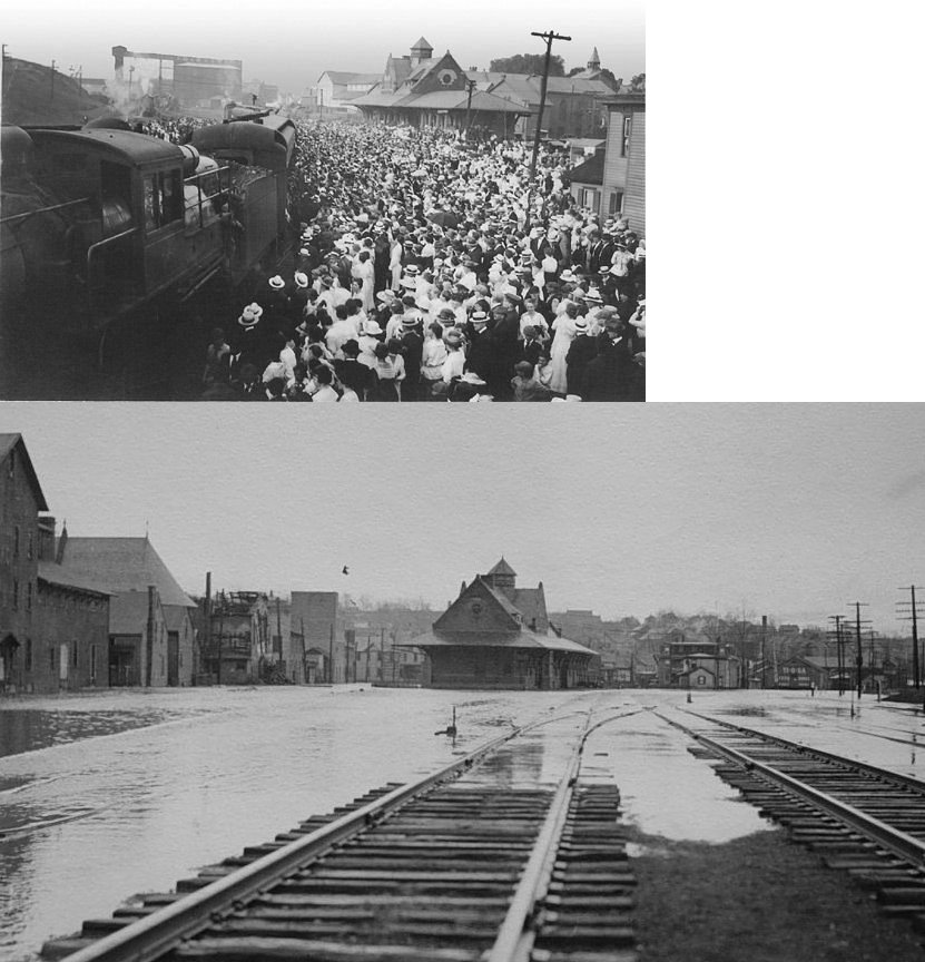
| Scranton | AND |
This small wooden station (just left of the locomotive in the photo) replaced the ornate CNJ passenger station (above listing) after it burned. It was at the same location as the previous station. | ||||||
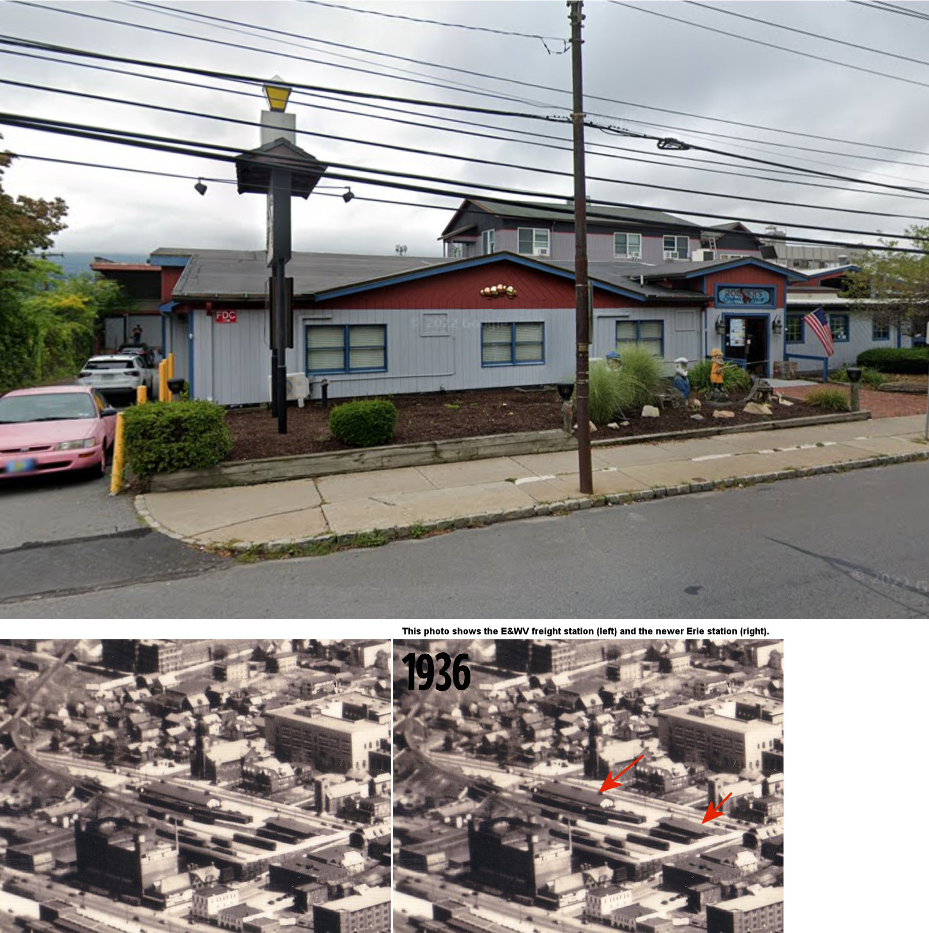
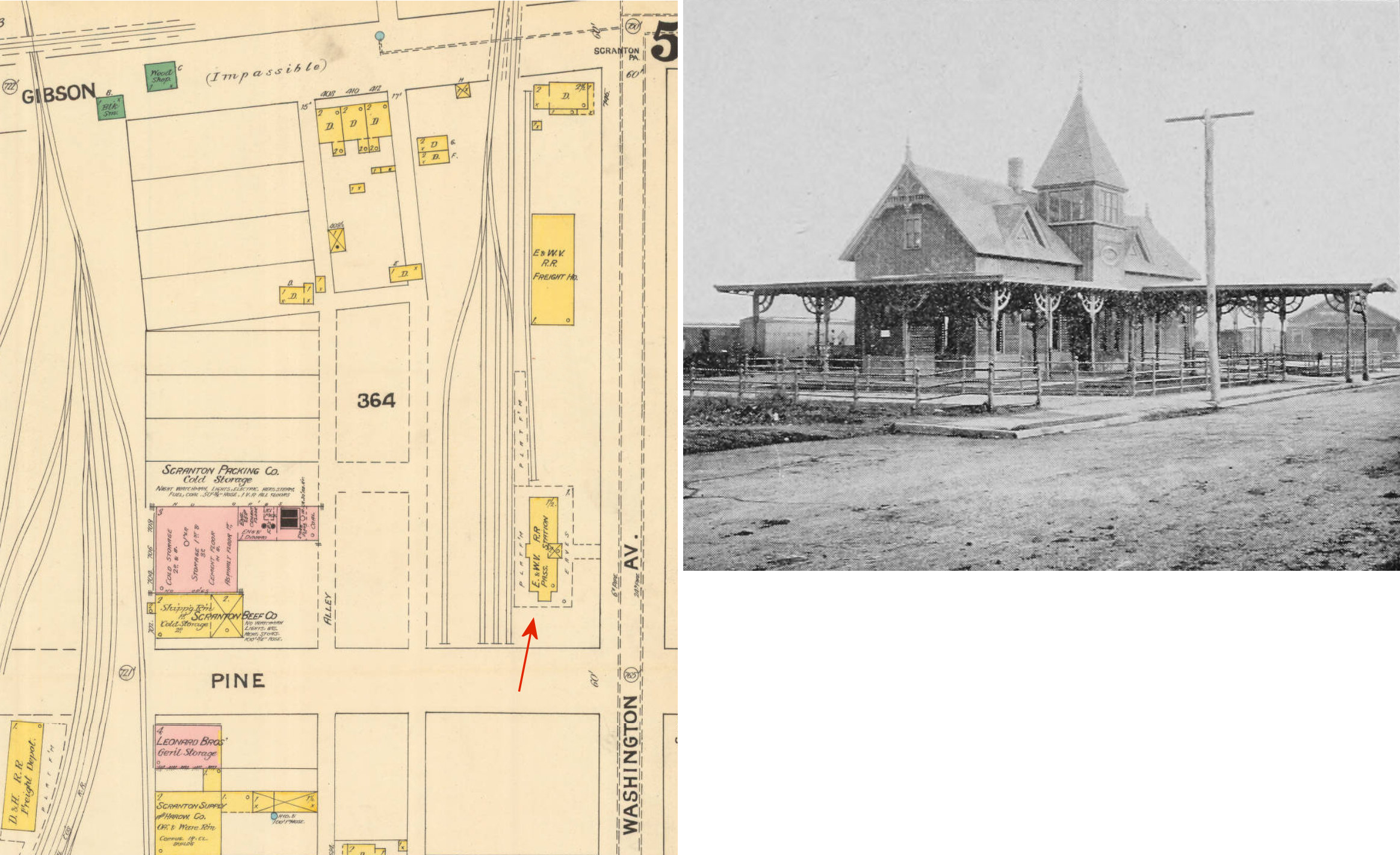
| Scranton | |
The original Erie & Wyoming Valley passenger station was on the north corner of Washington Avenue and Pine Street at GPS: 41.414155, -75.657100. The freight station, built in 1885, was just to the northeast at GPS:41.414783, -75.656438. | ||||||
| Scranton | |
The original Erie & The freight station, built in 1885, was just to the northeast of the passenger station at GPS:41.414783, -75.656438. | ||||||
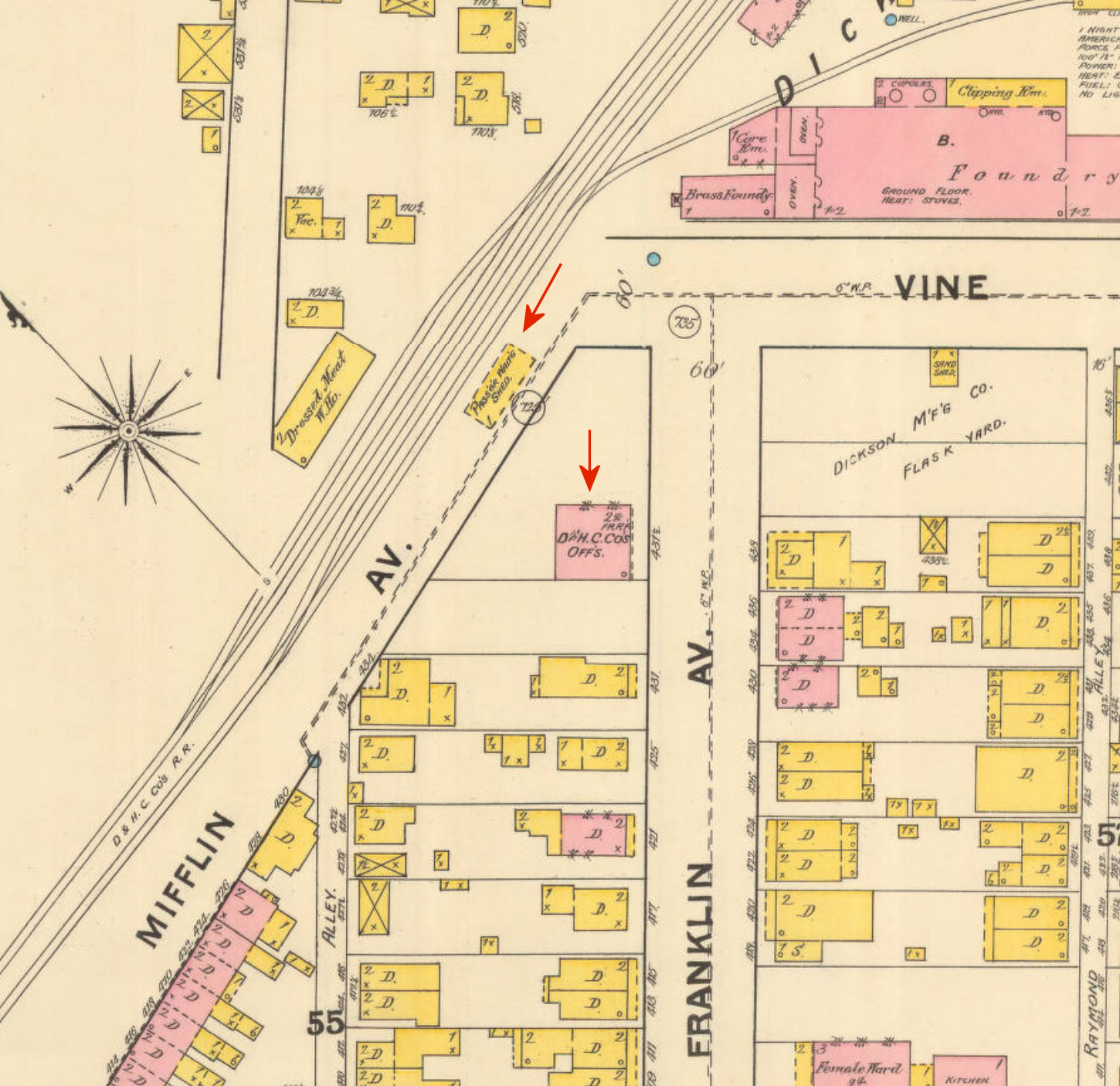
| Scranton | |
The first D&H station was built in 1863 on the corner of Wyoming Avenue and Olive Street (GPS: 41.414059, -75.660120) (Scranton Tribune, 5-28-1927). It was gone by 1888. | ||||||
| Scranton | |
There was a D&H passenger shelter at the corner of Vine Street, Franklin Avenue and Mifflin Avenue at GPS: 41.414003, -75.664147. Is is shown on the 1888 Sanborn Insurance map. There was also a brick D&H building nearby that served as offices. It could be that tickets were purchased at the D&H offices, and then the passenger shelter was next to the tracks. The railroad then tried to build a station south of Lackawanna Avenue in 1894. The building was partially erected when the mayor halted construction at the site (Delaware & Hudson Inspection of Lines - Passenger & Freight Stations, 1928). The railroad abandoned that project and then built the station on the NE of Lackawanna Avenue (see listing below). | ||||||
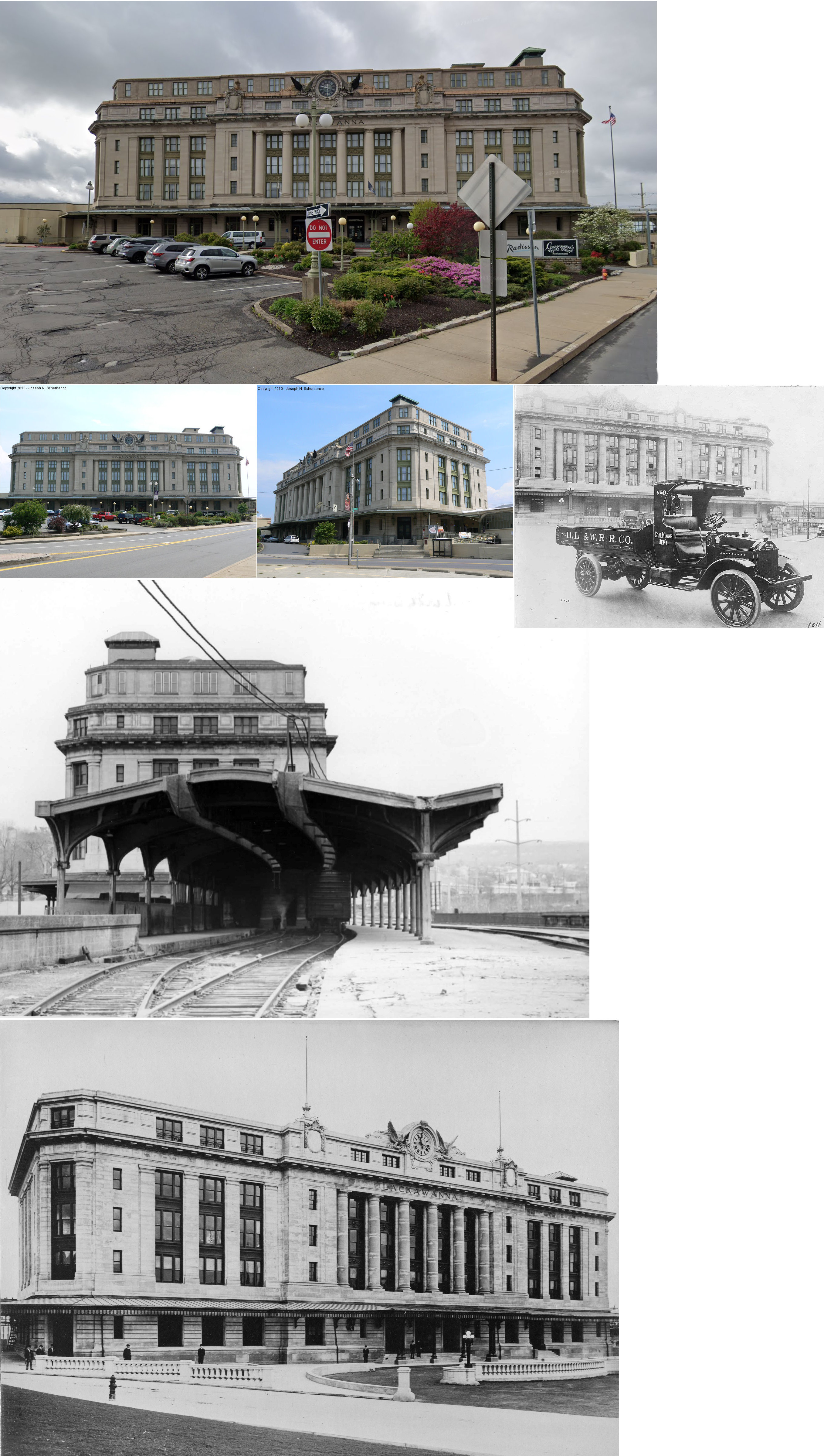
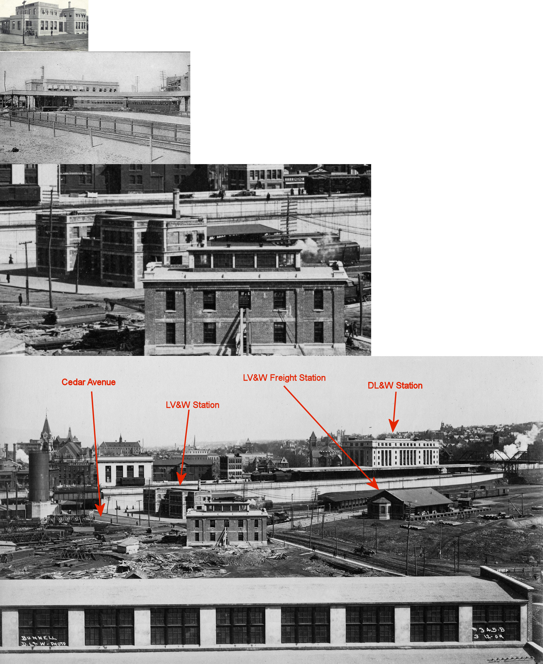
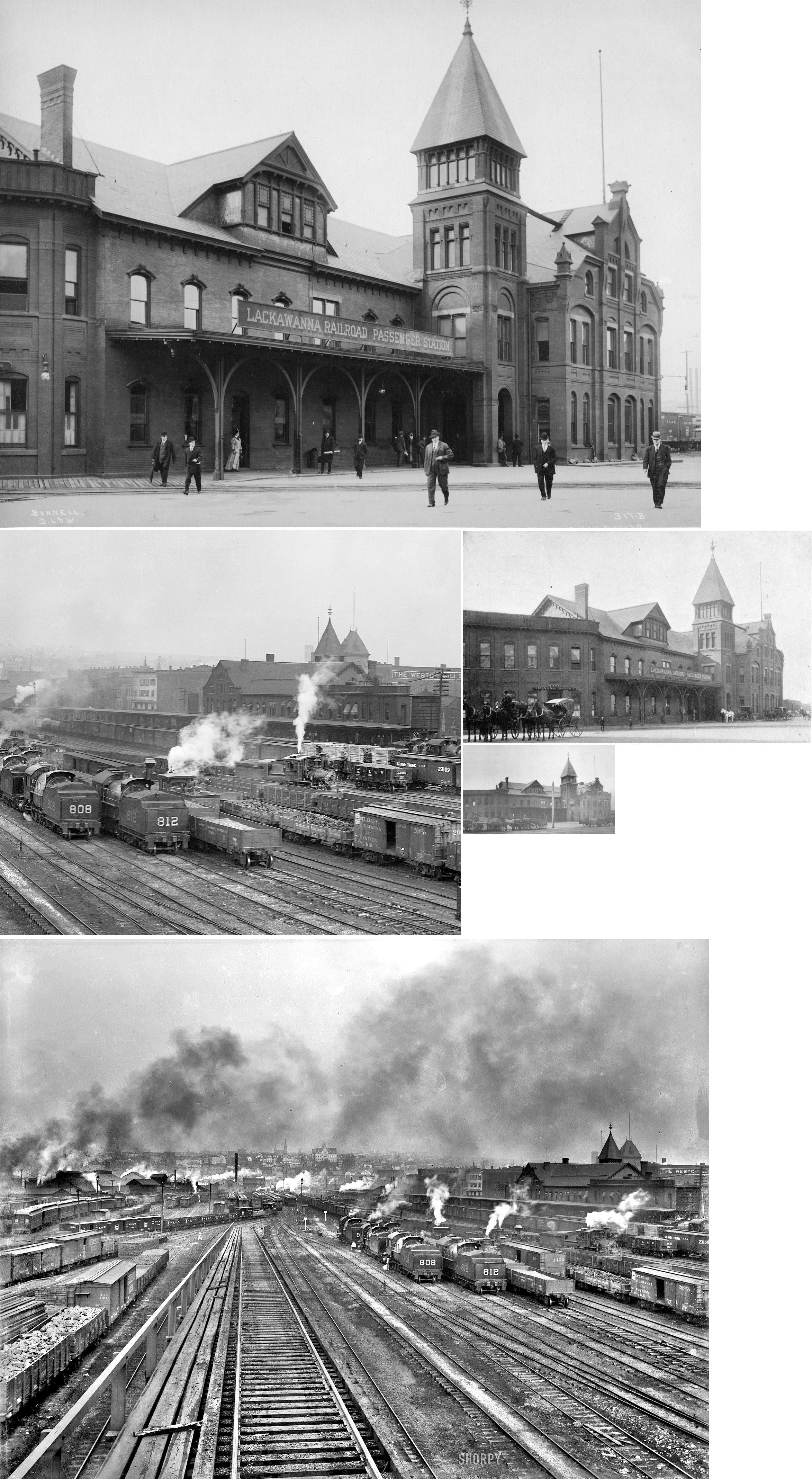
| Scranton | |
Built 1894, the D&H passenger station was on the NE side of Lackawanna Avenue at GPS: 41.410160, -75.669943. The address was 39-41 Lackawanna Avenue. It was abandoned in 1952 then remodeled and served as county and state offices. It was demolished in February 1972. | ||||||
| Scranton | |
There was a four-story brick freight office and freight house next to (SE of) the passenger station on the NE side of Lackawanna Avenue at GPS: 41.409979, -75.669697. The freight office end facing Lackawanna Avenue was a former mill building (The Weston Mill Company) purchased by the railroad in 1901 to which it added the freight house end on the north side. | ||||||
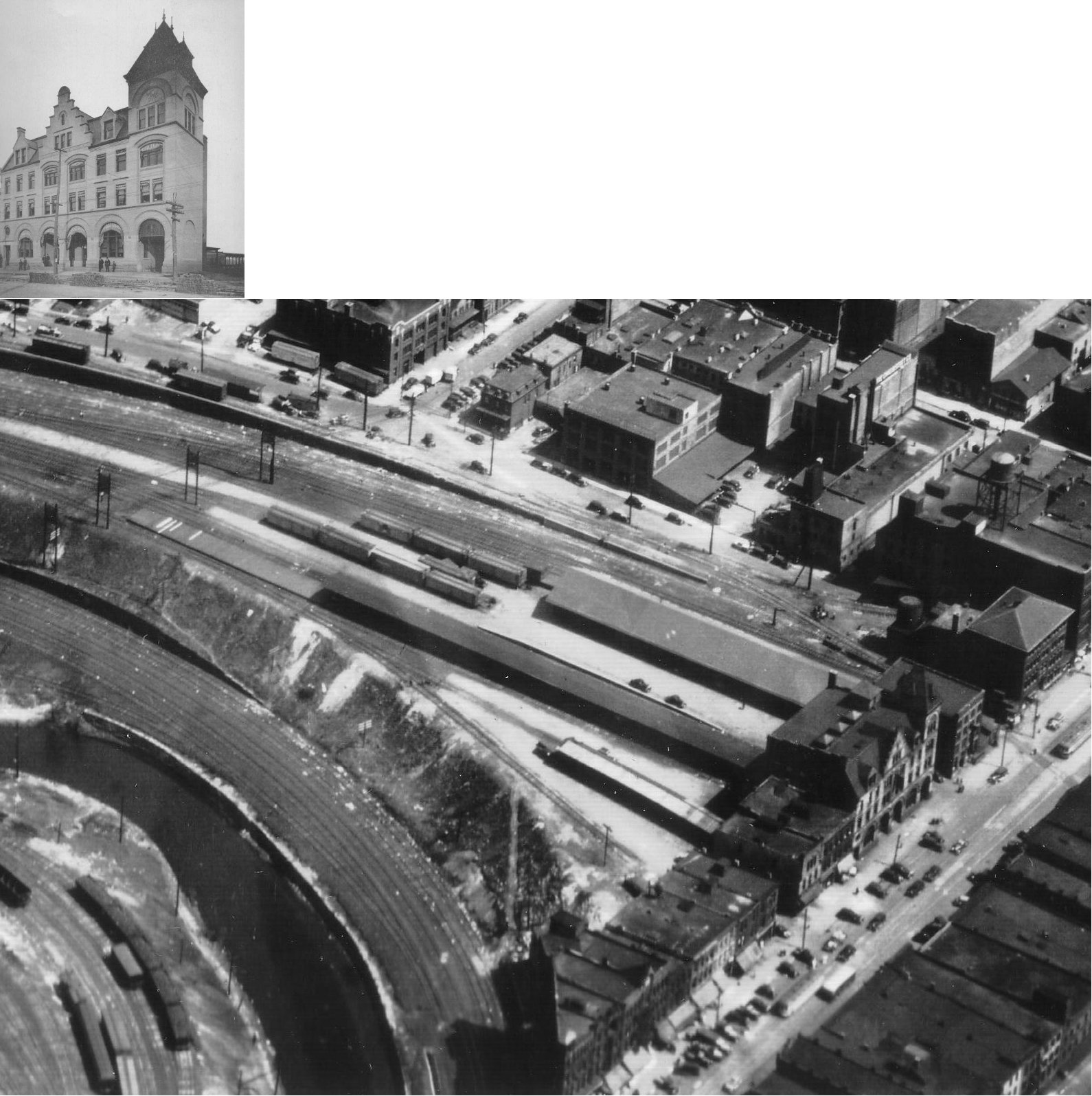
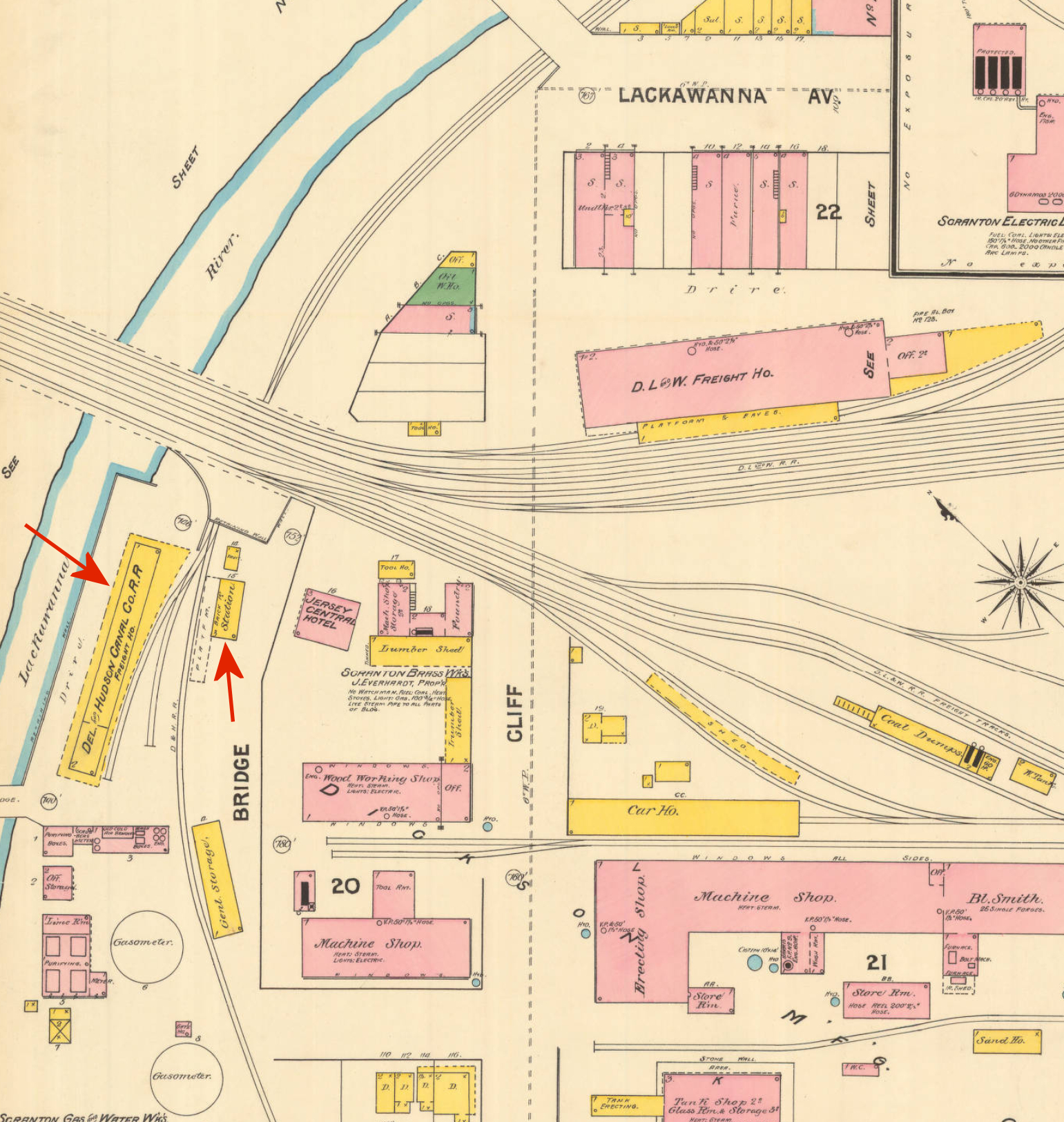
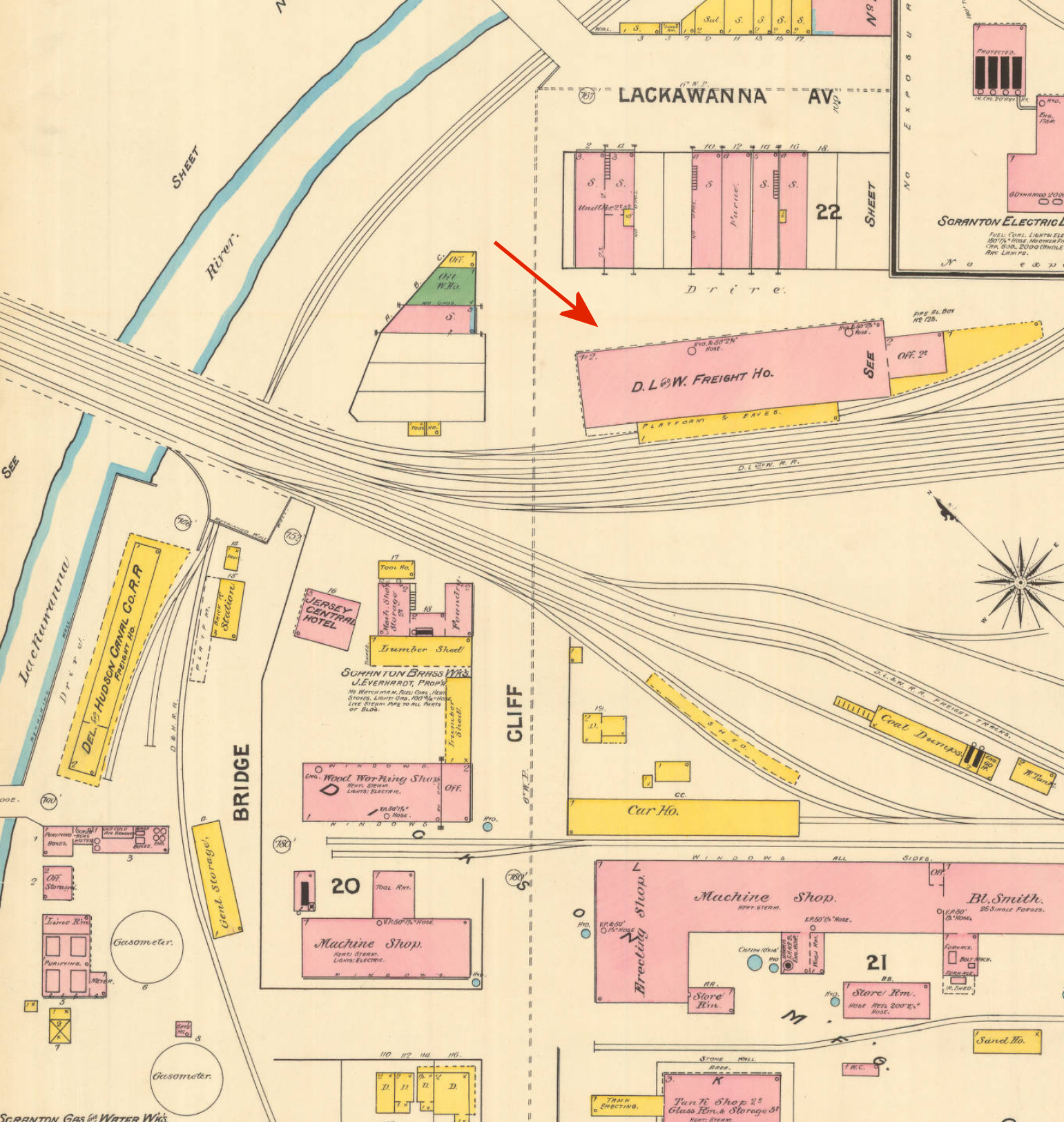
| Scranton | |
There was a wood frame freight house along the river NW of Bridge Street/Cliff Avenue at GPS: 41.410555, -75.673606. There was also a smaller 2-story building marked "station" across the tracks with a platform. The building has a brick first floor and a wood frame second floor. It is not clear if this was another freight station or what its use was. On later maps the building is shown as vacant. | ||||||
| Scranton | |
The Wyoming Avenue freight house was built in 1883. It was a wood-frame building on the corner of Wyoming Avenue and Pine Street at GPS: 41.414796, -75.658886. It was torn down when the new freight station (still standing) was built in 1931. | ||||||
| Scranton | |
The first passenger station was built in 1851 and originally sat on Lackawanna Avenue facing Wyoming Avenue. In 1854 it was moved NW to between Franklin and Mifflin. It served until 1864 (Scranton Tribune, 5-28-1927). | ||||||
| Scranton | |
This brick passenger station was on the southwest side of Lackawanna Avenue between Frankin and Mifflin Avenues at GPS: 41.409170, -75.669367. It was built in 1864 to replace the station listed above and served until 1907 (Scranton Tribune, 5-28-1927).It was demolished in 1909 to make way for a new freight station (The Wilkes-Barre Times Leader, 4-14-1909). | ||||||
| Scranton | |
The original wood frame freight house was on Lackawanna Avenue in the vicinity of GPS: 41.410180, -75.671086. It was built in 1851 and originally was to the SE on Lackawanna Avenue facing Washington Street. Like the passenger station listed above, it was moved to the NW in 1854 and served for ten years until the freight station listed below was built. | ||||||
| Scranton | |
A new brick freight house was bult in 1864 and was near the corner of Lackawanna Avenue and Cliff Avenue at GPS: 41.410388, -75.671598. After the new freight house was built to the east right on Lacakawanna Avenue, this station was used as a gracery warehouse by the Sanker & Willimas Company (as shownon the 1919 Sanborn map. | ||||||
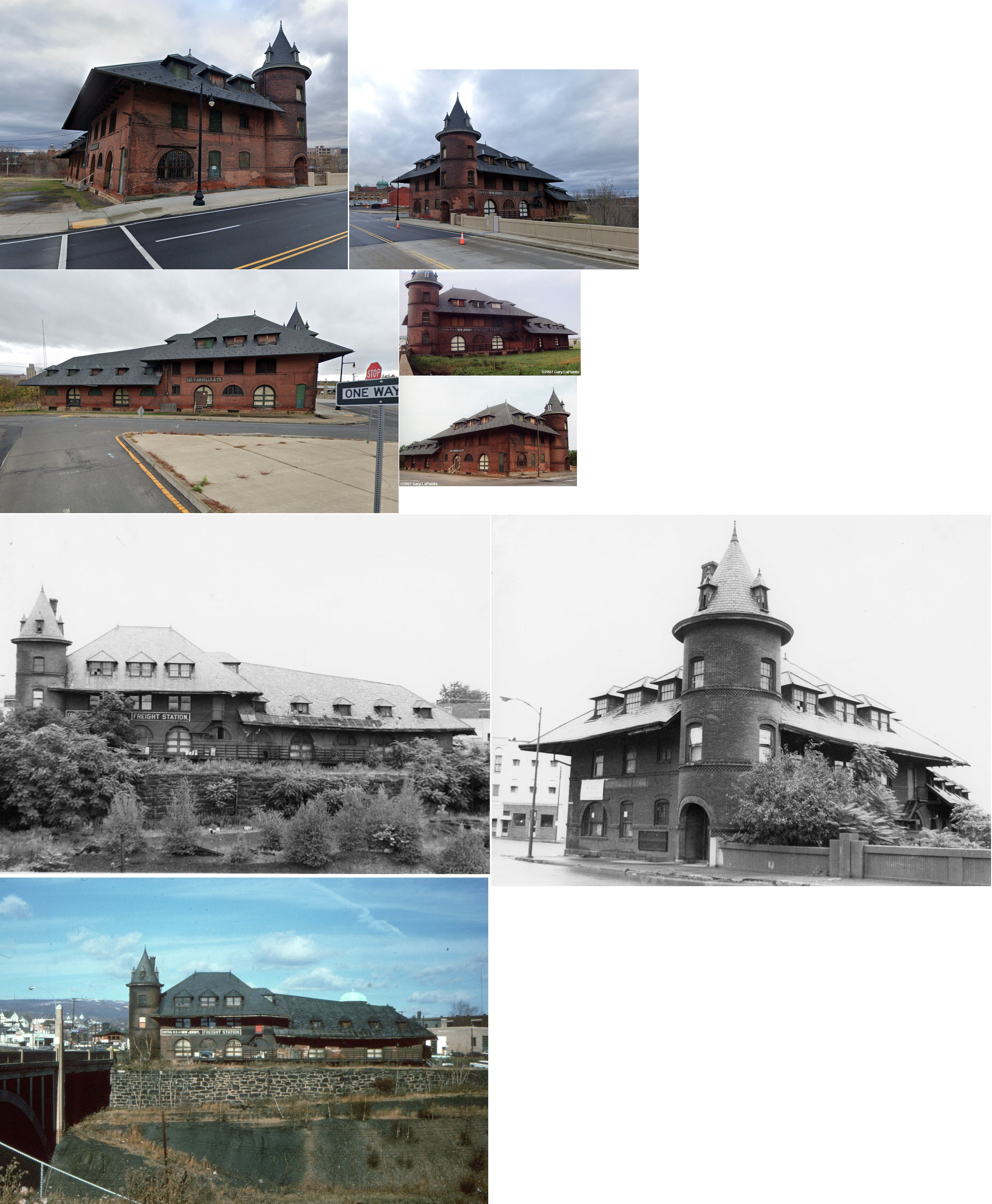
| Scranton | AND  |
There was an freight express house here that was owned 50% by DL&W and 50% by REA. It was a brick building erected in 1908. | ||||||
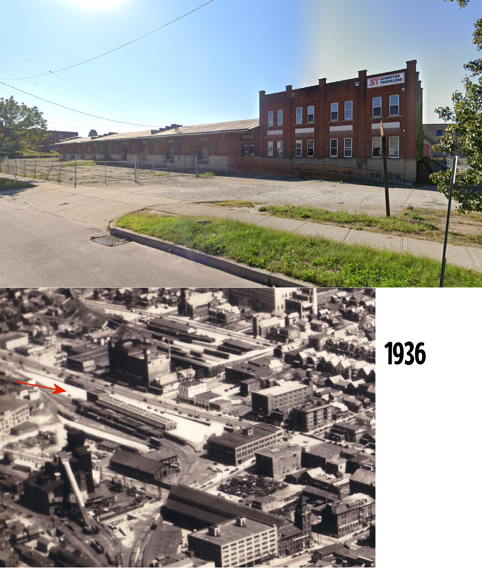
| Scranton | |
There was a brick freight house here with a reinforced concrete roof that was built in 1909. It was just to the east of the old freight station along Lackawanna Avenue at GPS: 41.409130, -75.669304. The headhouse/office was directly across the street from Franklin Avenue. | ||||||
|
South Scranton (Steel Works) |
|
|||||||
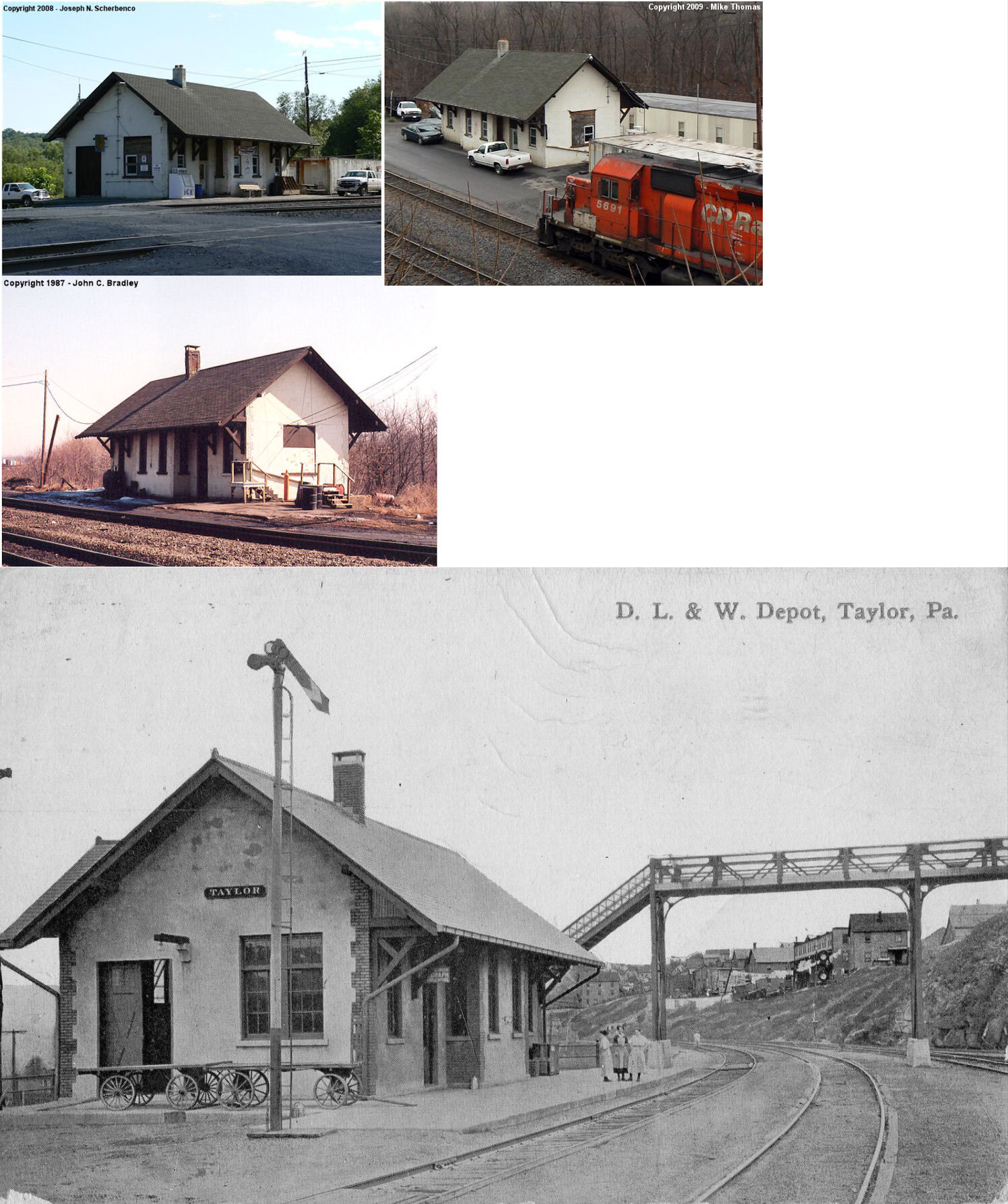
| Taylor | |
The old wooden station here, built in 1878 was across the tracks from the newer concrete station listed below. It was on Depot Street at approximately GPS: 41.386289, -75.705958. It is still shown on the 1921 Sanborn map along with the newer station. It served as a freight station for many years after being retired as the passenger station. | ||||||
| Taylor | |
This station was built in 1908 and last used as an office in the Taylor Yard. It was accessible to pedestrians from a steel bridge from Railroad Street that spanned the tracks. It was demolished in early 2010. It was at the end of Depot Street by the Lackawanna River. Depot Street (a dirt road) is off of the 200 block of North Main Avenue. The station, the tracks and the bridge over the Lackawanna River are all gone. The small bridge over Keyser Creek still remains and is part of the Lackawanna Valley Heritage Trail. | ||||||
| Taylor | |
|||||||
| Taylor | |
See listing for Minooka-Taylor above. | ||||||
| Throop | |
This station was to the northwest of the intersection of Pancoast Street and Boulevard Avenue at approximately GPS: 41.448600, -75.633881. It is shown on the 1925 Sanborn map for Scranton suburbs. | ||||||
| Unknown |
|
ICC valuation records for 1926 list a waiting shed, built in 1908, at MP 146, which was somewhere between Clifton and Langdon. No station name is given on the report. | ||||||
| Waverly |
|
There was a passenger and a freight station here. | ||||||
|
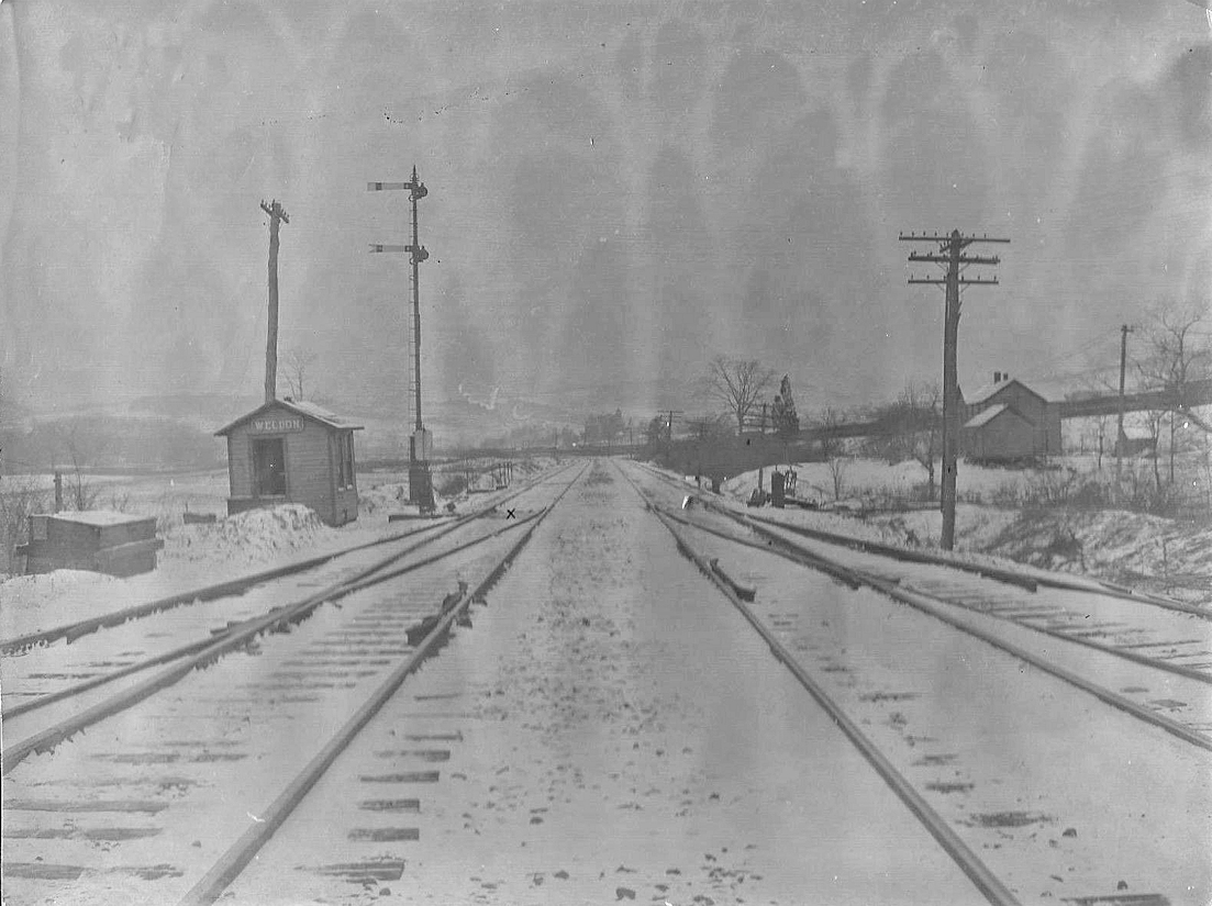
Weldon (Falling Spring) |
|
This station was between Coxton and Ransom. It was 1.6 miles from Ransom. | ||||||
| Winton | |
This station was on the east side of a Winton Road, on the south side of the tracks. It was at approximately GPS: 41.482367, -75.549811. | ||||||
| Winton | |
The combination station here was built in 1873 and abandoned in 1920 (Delaware & Hudson Inspection of Lines - Passenger & Freight Stations, 1928). This station was on the east side of what is now Baker Street, on the north side of the tracks at approximately GPS: 41.481080, -75.548923. | ||||||
| Wyoanna | |
As the name suggests, this station was near the border of Wyoming and Lackawanna Counties. It was 2.6 miles from Falls. | ||||||
| 1895 LACKAWANNA COUNTY RAILROAD MAP | ||||||||
 |
||||||||
| Notes About Existing
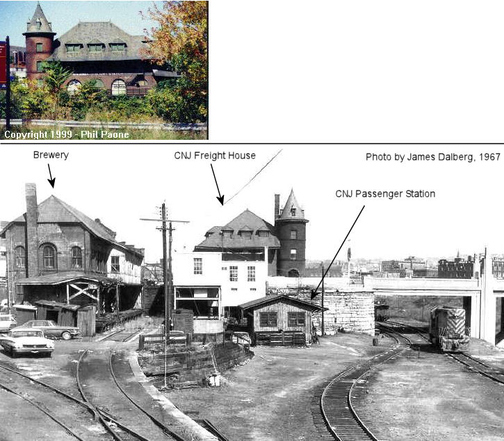
Stations... Green Ridge (D&H) - Station built in 1867 and abandoned by D&H in 1928 (Delaware & Hudson Inspection of Lines - Passenger & Freight Stations, 1928). The Green Ridge Presbyterian Church began meeting at the station from 1868-1873. Mayfield (D&H) - This station was moved. The original location was on the north side of Chestnut Street at Lackawanna Avenue on the NW side of the tracks (GPS: 41.540961, -75.533943). Scranton (Erie) - The former Erie station at 701 North Washington Ave. is Cooper's seafood restaurant, the original station building is still there with several additions attached to it, including a pirate ship facade on the north side. -Frank Dutton Scranton (CNJ) - Passenger station was adjacent but it burned down in 1910. Here are some older photos. Scranton (D&H Freight) - The station opened on February 5, 1931. |
||||||||