Sanborn Maps from 1888 & 1893
What they show: There is a 2-story brick station on Main Street and
a 1-story wooden
station shown on Clinton Street. The index to the map lists the one as Main
Street as the PS&LE station and labels it as “PS&LE Passenger Depot,” but does
not mention the one on Clinton Street. That one is just shown on the map and
marked as “Depot.”
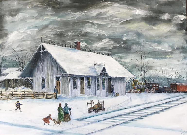
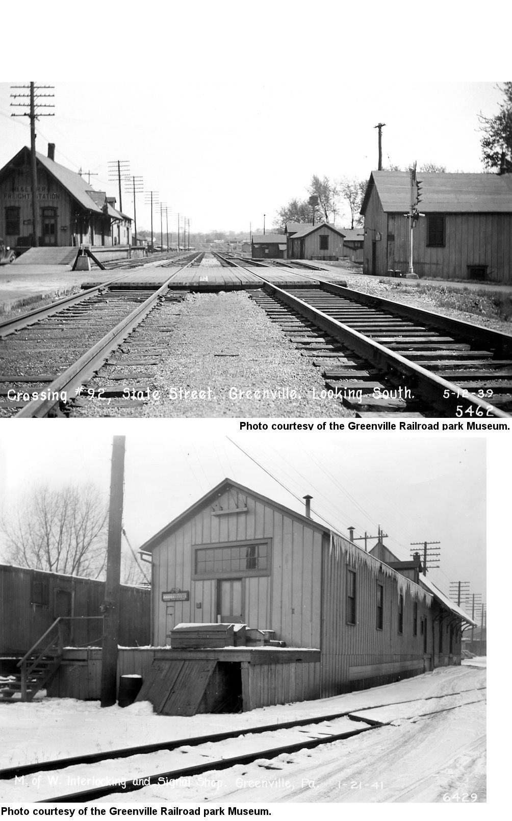
One-story wood frame depot on Clinton Street. This is essentially (by a few feet) the same location as the existing brick station on Clinton Street.
This is a painting of that old wood station on Clinton Street (courtesy of the Greenville Railroad Museum Park):
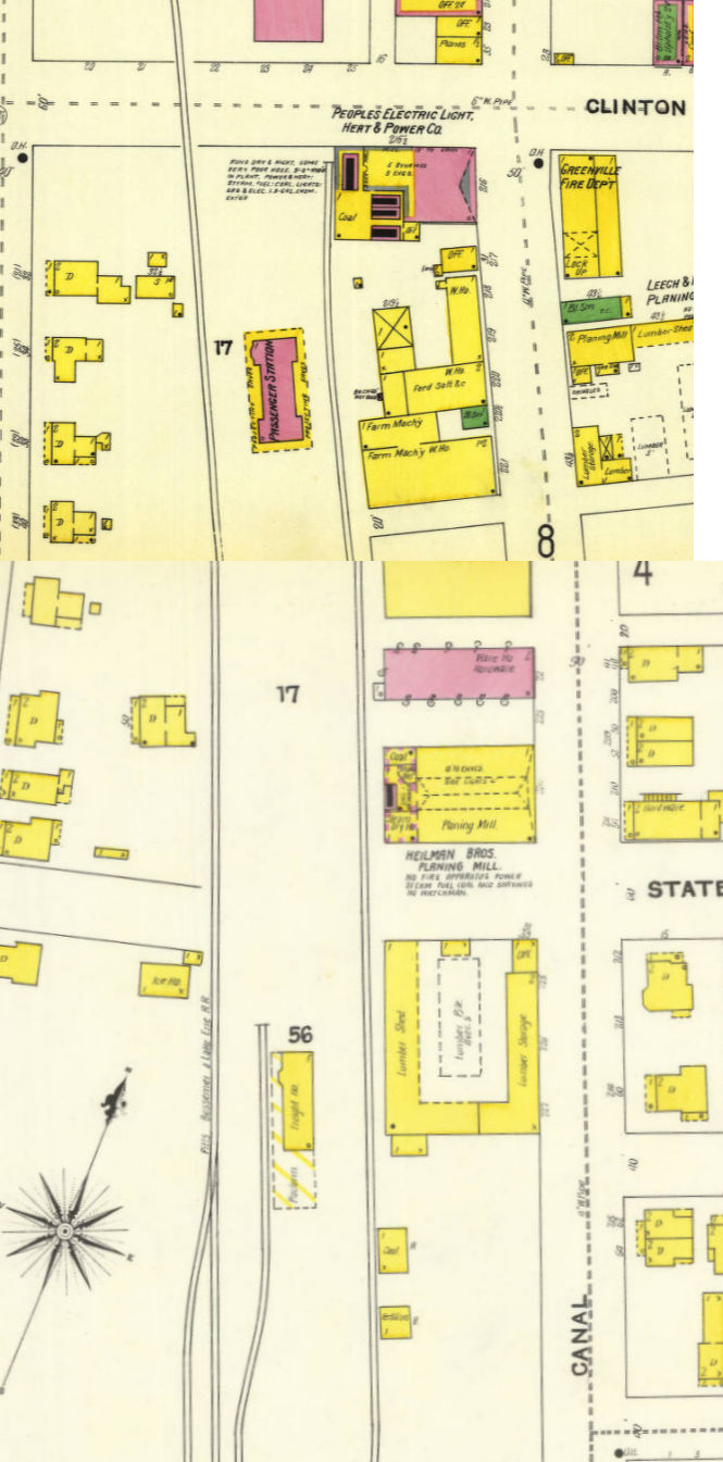
1898 – The brick station on Main Street is still shown and marked as "PS&LE RR Sta." Oddly, the index to the map doesn't list any station for the line (probably an oversight by the map company).
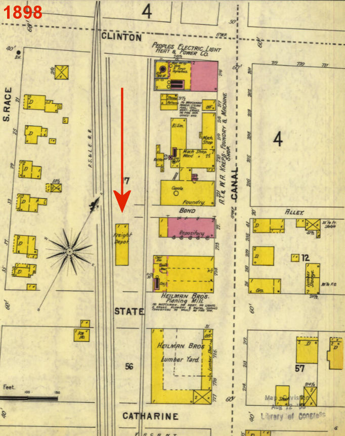
At Clinton Street, the stub-end tracks have been removed and the wood frame station is now moved south on the block to the north side of State Street and is marked as "Freight Station." Presumably this station has been moved to clear the way for the birck station to built in the coming years. The arrow shows where the station was moved from/to.
1904 – The brick station on Main Street is gone and replaced by a longer 3-story brick building marked as "PB&LE Offices, 2nd & 3rd Floor. The new brick passenger station is shown at Clinton Street and the old wooden station is gone. A new freight station is shown south of State Street next to the lumber yard. This may have been the original station moved south yet again, but that seems unlikely.
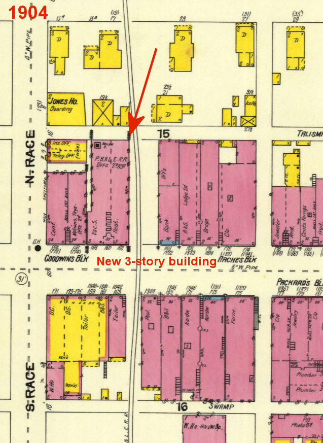
The 1904 map below shows the new brick station on Clinton Street and the previous wood frame station now moved a bit more south again.
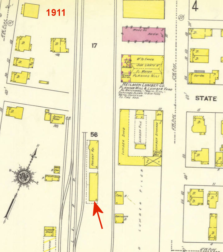
1911 – Nothing has changed since the 1904 map except an additional building was added at the freight station (original passenger station) as shown below.
Here are photos from the north and south showing the old station and the addition to it:
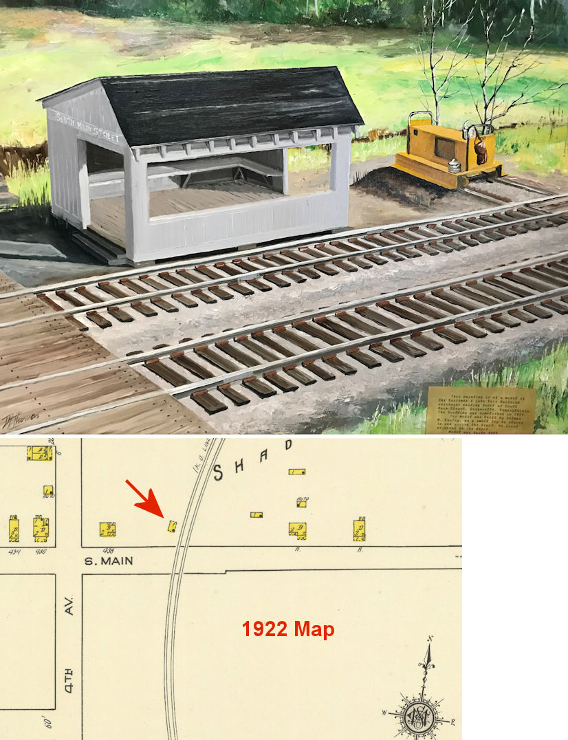
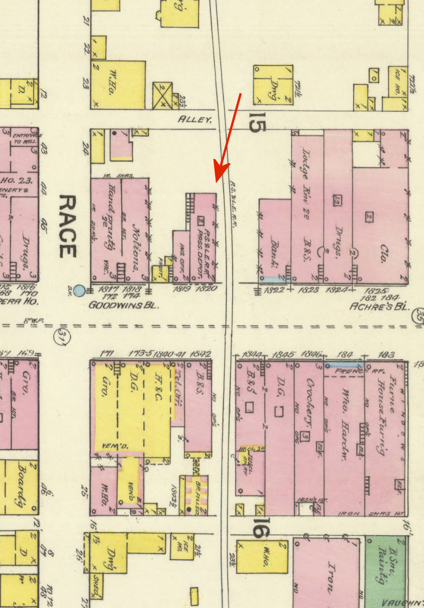
1922 – Nothing changed has changed with the main stations since the 1911 map except some more labeling details on the buildings. The new building next to the freight house (pictured above) is now labeled "Linemen's House #19." However, the South Main Street passenger shelter is (likely) shown on this map. A small building is shown at this location aligned with the tracks on the 1922 Sanborn map, but the building is not labeled. 1922 was the first year this section of town appeared on the map, so we can't know when it was built