|
|
||||||||
| EXISTING STATIONS | ||||||||
|---|---|---|---|---|---|---|---|---|
| Station Name |
Original Railroad |
Current Location |
Type | Current Use |
Date Built |
Track Status |
Building Material |
More Info |
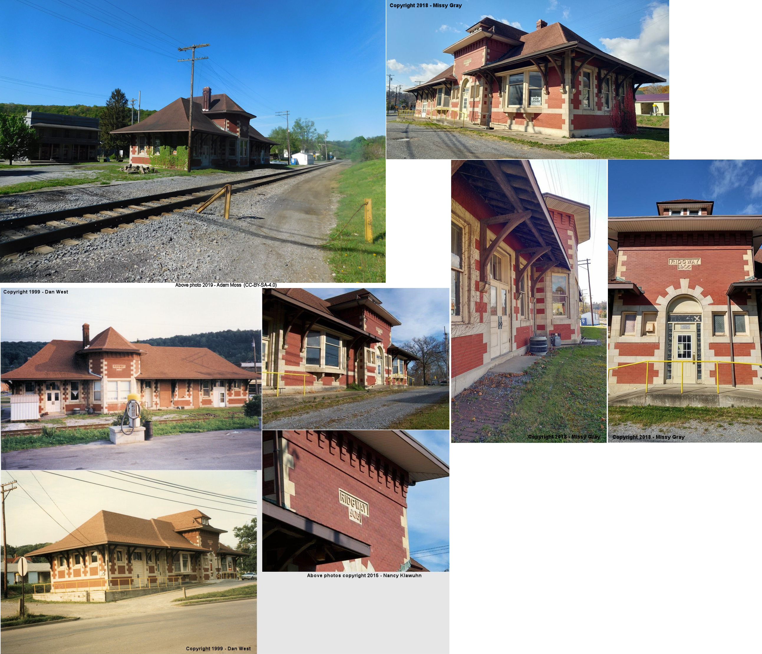
| Ridgway |  |
West Main Street and PA948 (GPS: 41.421035, -78.739426) |
P | Business | 1905 | In Use | Brick | |
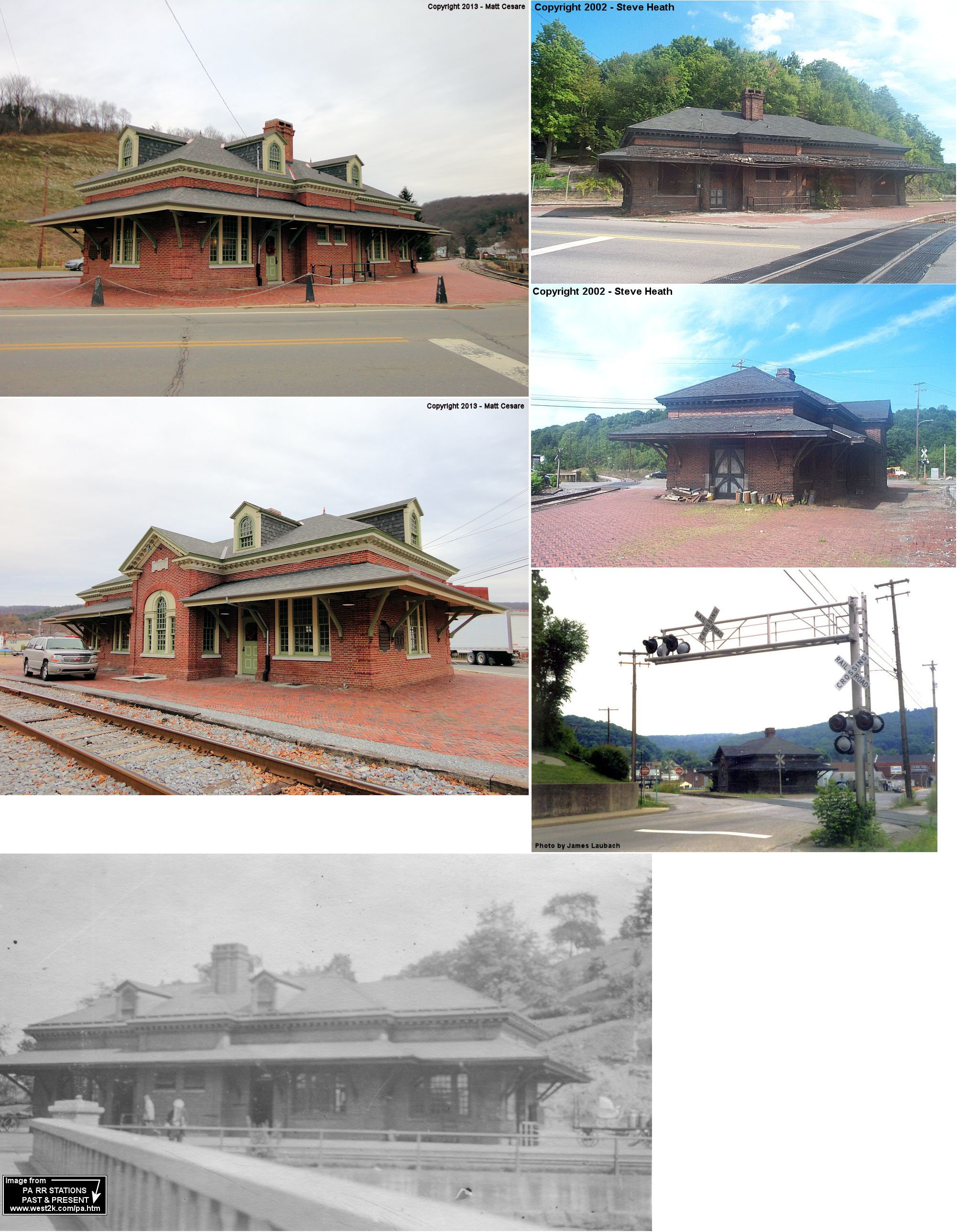
| Ridgway |  |
North Broad Street (GPS: 41.425217, -78.731449) |
P | RR Storage | 1907 | In Use | Brick | |
| STATIONS OF THE PAST | ||||||||
| Station Name |
Original Railroad |
Notes | ||||||
| Arroyo |
 |
This was a Clarion River Railway (later PS&N, and later this branch was Tionesta Valley Rwy.) station. According to a newspaper report, the TVRR freight station here burned down on August 4, 1930 (New Castle News, 8-4-1930). | ||||||
| Barr | |
Was formerly known as Benett's Branch and was the site of the first post office in the county. This station was moved about 1.5 miles and the name was changed to Medix Run (see listing below). | ||||||
| Bear Creek |  |
This was a station on the Clarion River Railway. | ||||||
| Bear Run | |
This station was between Gray Gables and North Fork. | ||||||
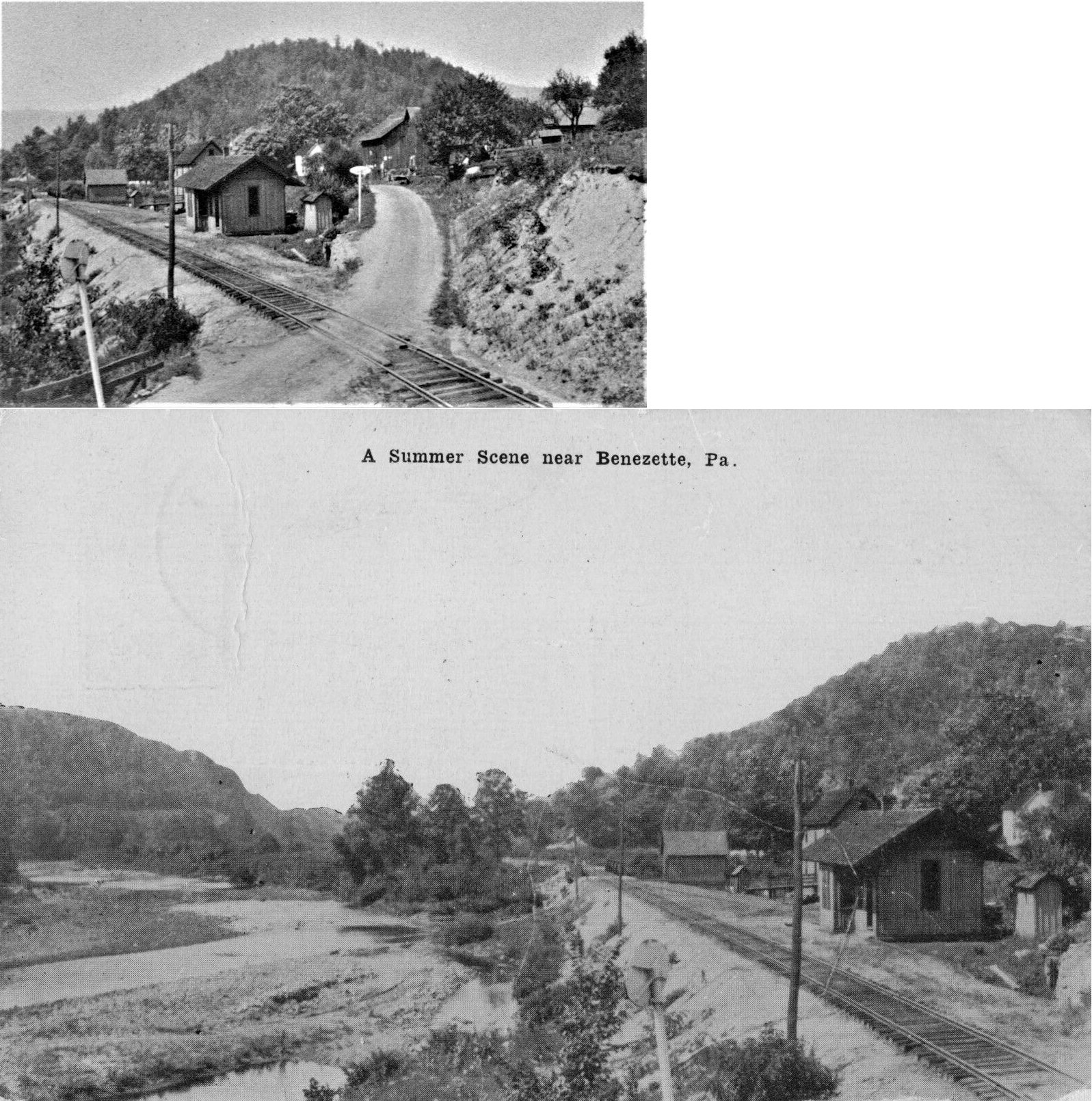
| Benezette |
 |
This station was approximately 50 feet east of the Benezette Store on the south side of PA555 at GPS 41.314640, -78.383765. This station, likely a one story wooden building, was mentioned as "nearing completion" in October 1904. It sat in what is now a parking lot for the current Benezette store, and was slightly to the east of the existing store building. A section house was along PA555 a few feet northwest of the current fuel pumps and a tool house was between the section house and the bridge over Trout Run. The station appears on the 1918 B&S Valuation Map. | ||||||
| Bennezette Station |
|
|||||||
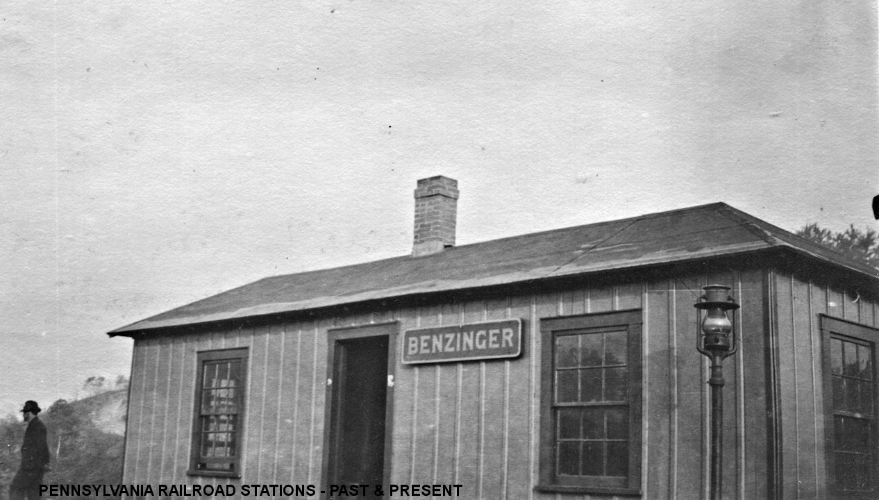
| Benzinger | |
This station was buil in 1916. | ||||||
| Blue Rock | |
|||||||
| Brandy Camp | |
Shown as a flag stop on the 1915 timetable, this station was near the entrance to the Number 5 mine here. The depot stood at least until the 1980s. | ||||||
| Bridge | |
This was a station on the Clarion River Railway. | ||||||
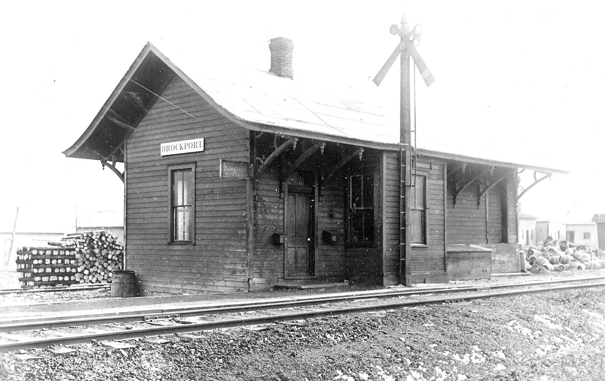
| Brockport |  |
|||||||
| Brockway |
|
This was along the line that followed Millstone Creek. | ||||||
| Byrnedale | |
This line was originally the Kersey Railroad. | ||||||
| Caledonia |
|
|||||||
| Caledonia | |
|||||||
| Cardiff | |
This was the terminus of the Byrnedale Branch. | ||||||
| Carlsons |
 |
This station is on the 1895 timetable. | ||||||
| Carlson |  |
|||||||
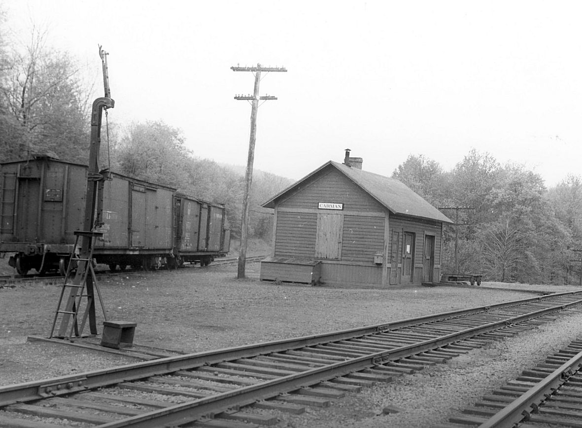
| Carman |  |
|||||||
| Carman | AND |
This station served both the BR&P and the Clarion River Railway and stood at the junction of the two lines. | ||||||
| Carman | AND |
This may have been a later station replacing the one above, or it may be the same station as above after heavy modification. | ||||||
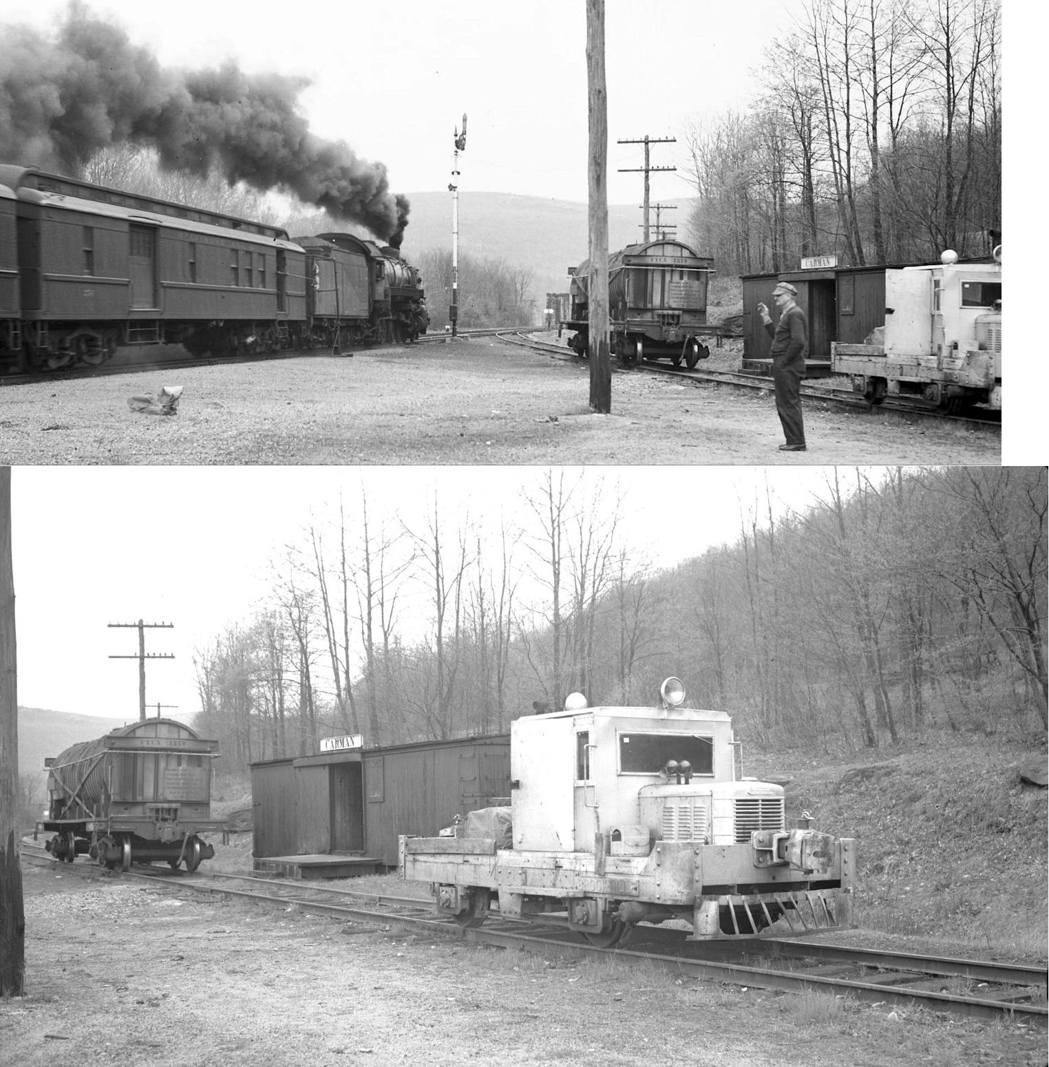
| Carman |
|
An old boxcar may sereved as a the station here for the Clarion River Railway after the previous station burned in the 1920s. | ||||||
| Chaffee | |
|||||||
| Clarion Junction | |
This station was near the confluence of the Clarion River and Indian Run northeast of Johnsonburg. | ||||||
| Croyland | AND |
This station served the Ridgway and Clearfield RR (PRR) and the Clarion River Railway (PS&N). The station was originally in Carman, but was moved to Croyland in 1892. According to PRR valuation records, it was built in 1884. | ||||||
| Croyland Siding | |
According to PRR valuation records, an 8'x12' passenger shelter was built here in 1903. | ||||||
| Cuneo | |
|||||||
| Dagus | |
|||||||
| Daguscahonda | |
According to PRR valuation records a combination station was built here in 1883. | ||||||
| Dahoga | |
According to PRR valuation records a freight shelter was built here in 1902. | ||||||
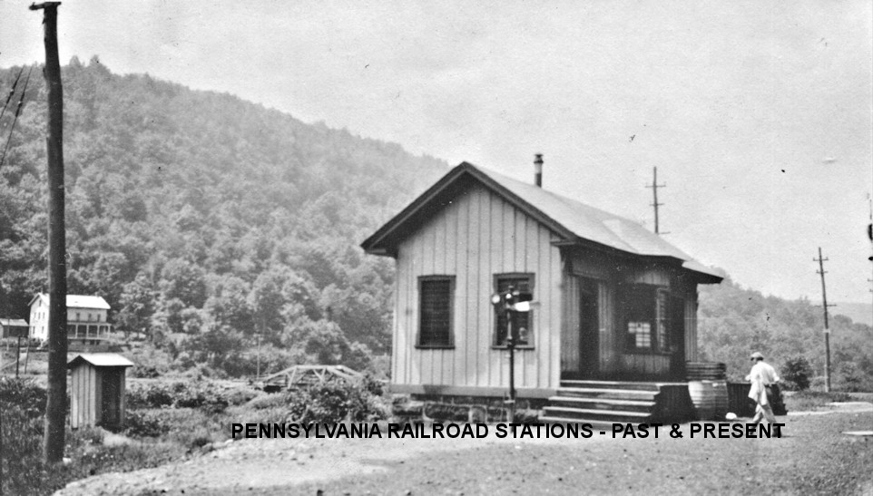
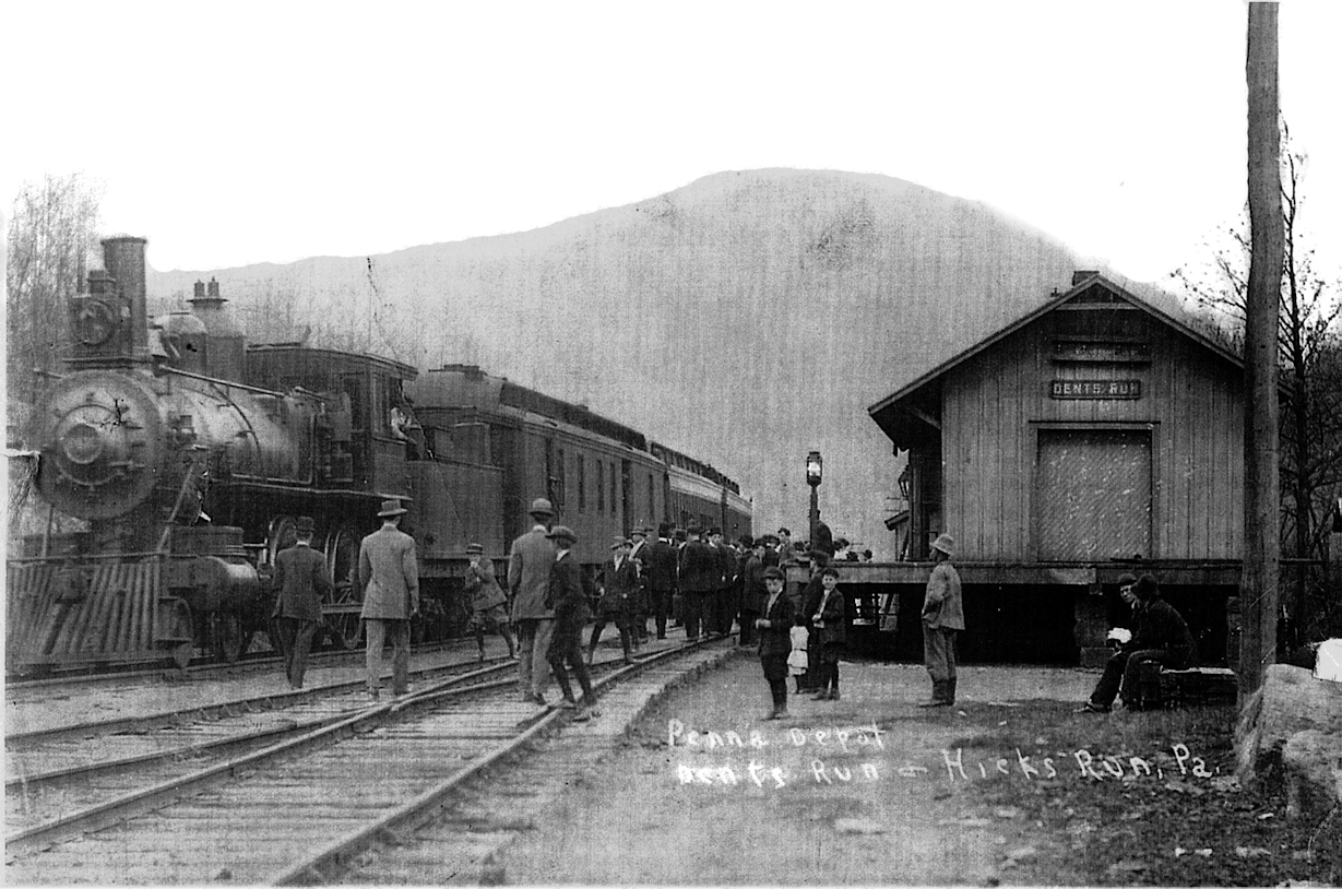
| Dents Run |
|
Station was on the north side of the railroad grade about
500 feet northeast of the bridge over Dents Run. The site would likely be
under part of the northbound PA555 lane here and partly under the grading
between the road and the railroad at around GPS 41.356013, -78.261338. The
station was a single story wood structure on the north side of the
railroad tracks. The railroad was on a small fill several feet above
ground level and thus the station was built upon wooden supports to raise
it to track level. It was likely constructed in 1905 based on an October
1904 letter saying it had not been started yet. It appears on the 1918
valuation map but not in a 1939 aerial photograph. |
||||||
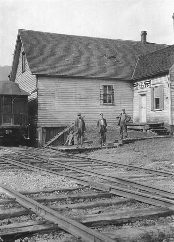
| Dents Run |
|
The sign on above the doorway on the right side of the photo appears to read, "OFFICE/DENT'S RUN RR CO". That may indicate that this building was the DRRR office somewhere in Dent's Run proper, and not the PRR station, but that hasn't been confirmed. A mine map of the Bennet's Branch Coal Co. indicates that the PRR station was near the junction of the Dent's Run Railroad and the PRR Low Grade Line on the south side of the Bennett's Branch. The 1923 PRR List of Stations & Sidings show the station as .2 mile from the junction with the Dents Run RR. The station would have been north of the Dent's Run Railroad's siding near GPS: 41.357398, -78.252481. --Nick Puzak | ||||||
| Dents Run |
|
If the building listed above was in fact a station, perhaps it was an early station and this one was a second-generation station. | ||||||
| Detsch | |
|||||||
| Drummond | |
|||||||
| Elbon | |
|||||||
| Ellmont (Blue Rock) |
|
The photo is from 1894. | ||||||
| Elk Home (County Home) |
|
According to PRR valuation records an 8'x12' passenger shelter was built here in 1900. | ||||||
| Elk Home (County Home) |
|
|||||||
| Empire (Shorts Mills) |
|
This station was built in 1898. | ||||||
| Finland | |
This station was only .5 miles north of Wildwood. | ||||||
| Fitzgerald |
|
This was along the line that followed Millstone Creek. | ||||||
| Force | |
|||||||
| Garovi | |
This Ridgway & Clearfield RR station was located along what is now the Clarion-Little Toby Creek Trail at GPS: 41.340500, -78.827020. According to PRR valuation records, a new passenger shelter was built here in 1898. | ||||||
| Gillen | |
|||||||
| Glen Hazel | |
|||||||
| Grant |
|
|||||||
| Grant | |
|||||||
| Gray Gables | |
This station was between Sands and Bear Run at milepost 5 (from St. Marys). | ||||||
| Greene |
|
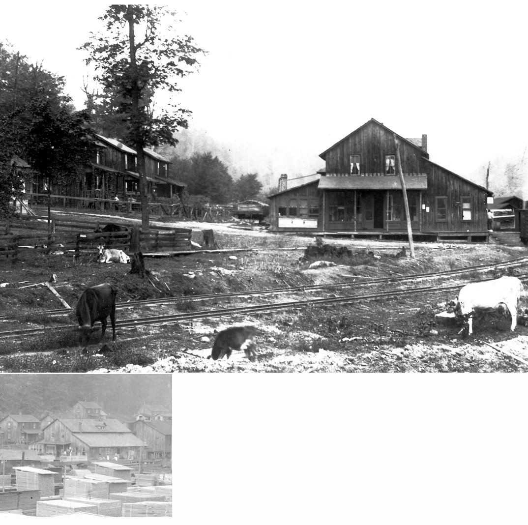
This station was just west of Winslow Hill Road along the Sinnemahoning Creek. This station shelter was located across the Bennetts Branch from the village of Summerson (served by the PRR) along the original alignment of today's Route 555. Greene was approximately half-way between Benezette and Dents Run and north of the Winslow Hill Road intersection. There was a siding and loading docks present here ca. 1917. The shelter was located on the east side of the railroad tracks, opposite the loading docks, near GPS: 41.328545, -78.335809. | ||||||
| Groll (Scheberel) |
|
|||||||
| Hallton | |
This was a Clarion River Railway station and likely served the Tionesta Valley Railway line that came down Spring Creek as well. The station was off Spring Creek/Hallton Road at approximately GPS: 41.401863, -78.933028. | ||||||
| Helen Mills | |
|||||||
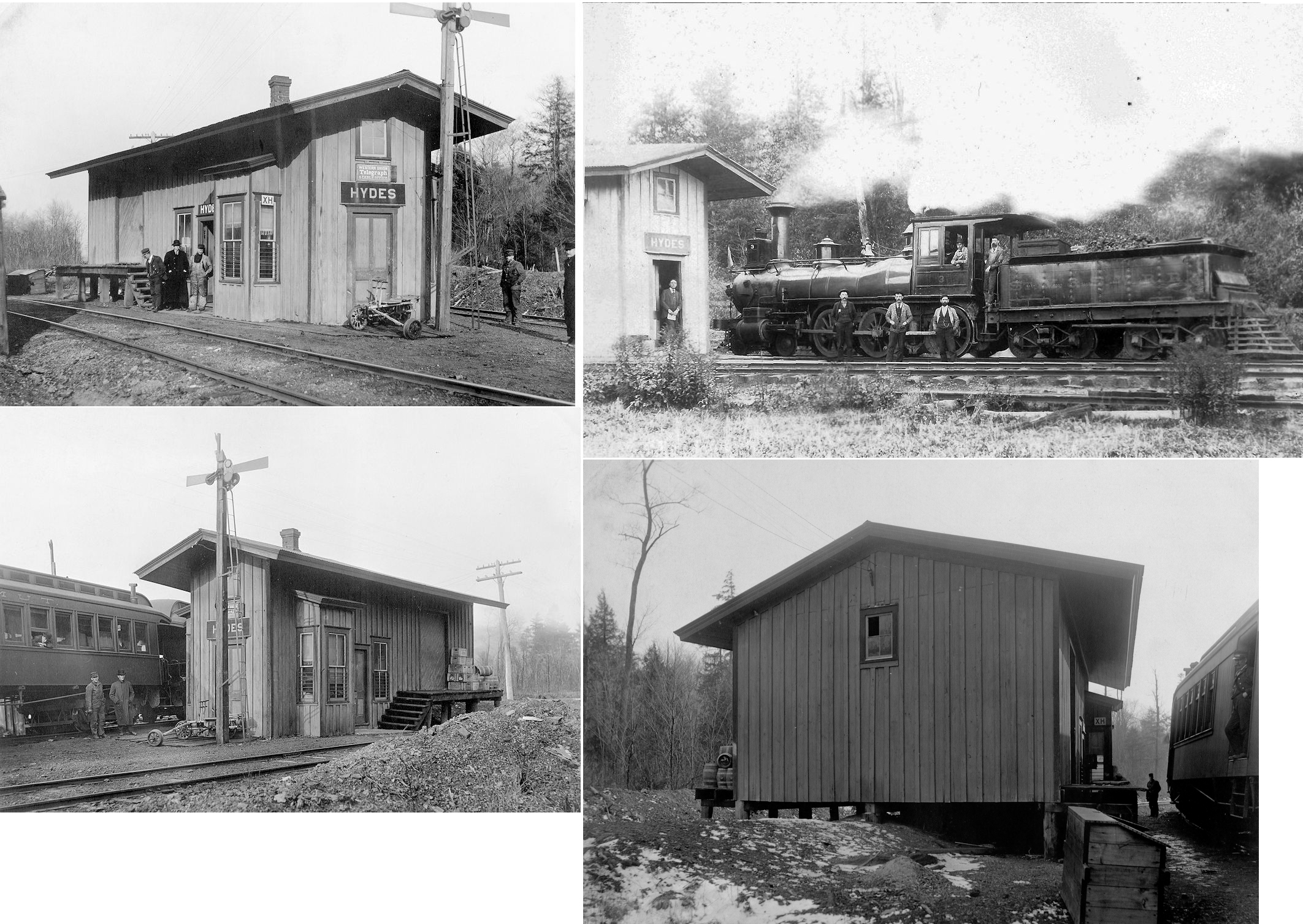
| Hyde | AND |
This location is now known a Challenge on modern maps. It was on the Toby Branch of the Erie RR between Brockport and Kyler's Corners. Not to be confused with the Hyde in Clearfield County on the BR&P. The station was at approximately GPS: 41.284505, -78.686420. | ||||||
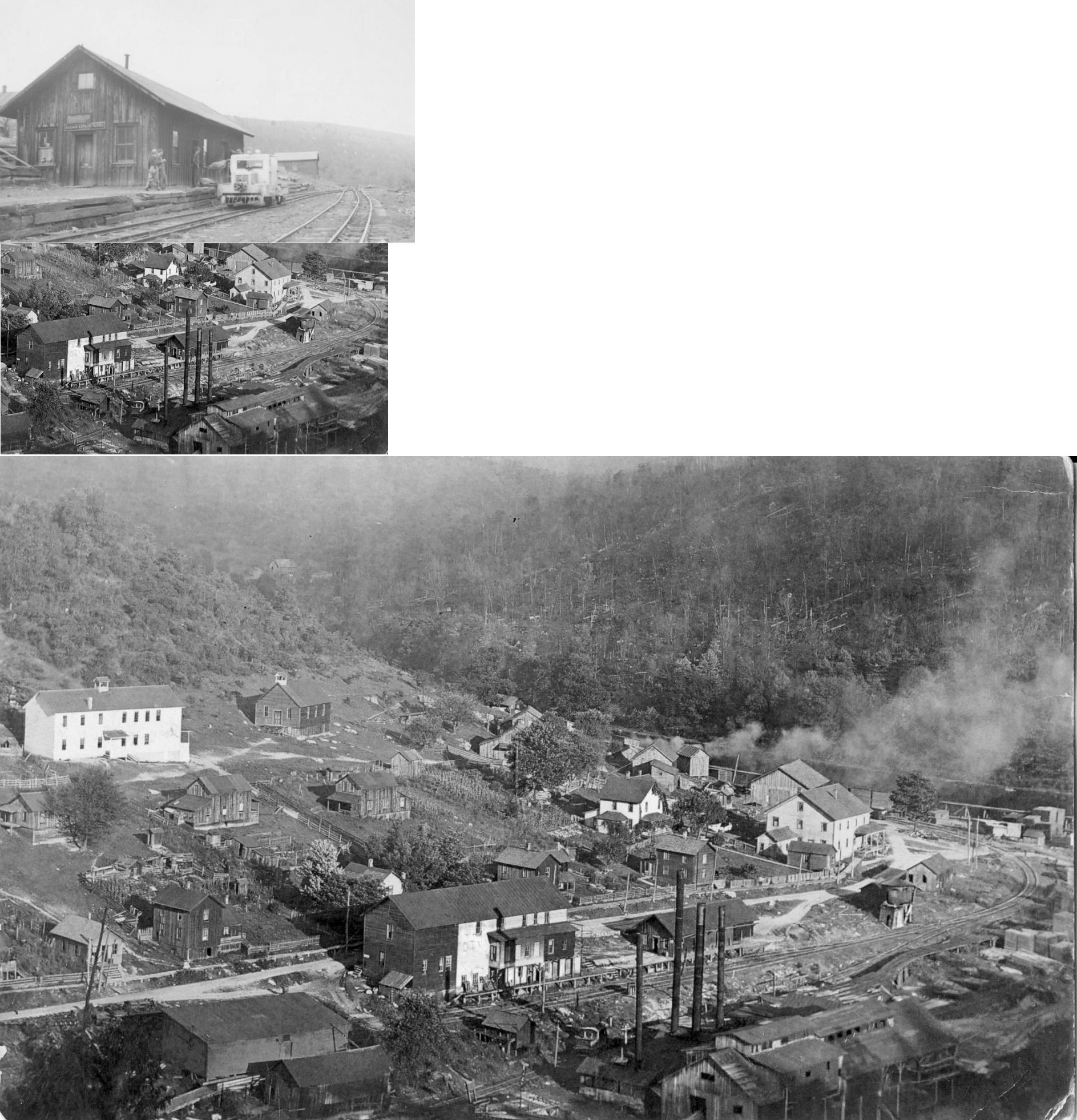
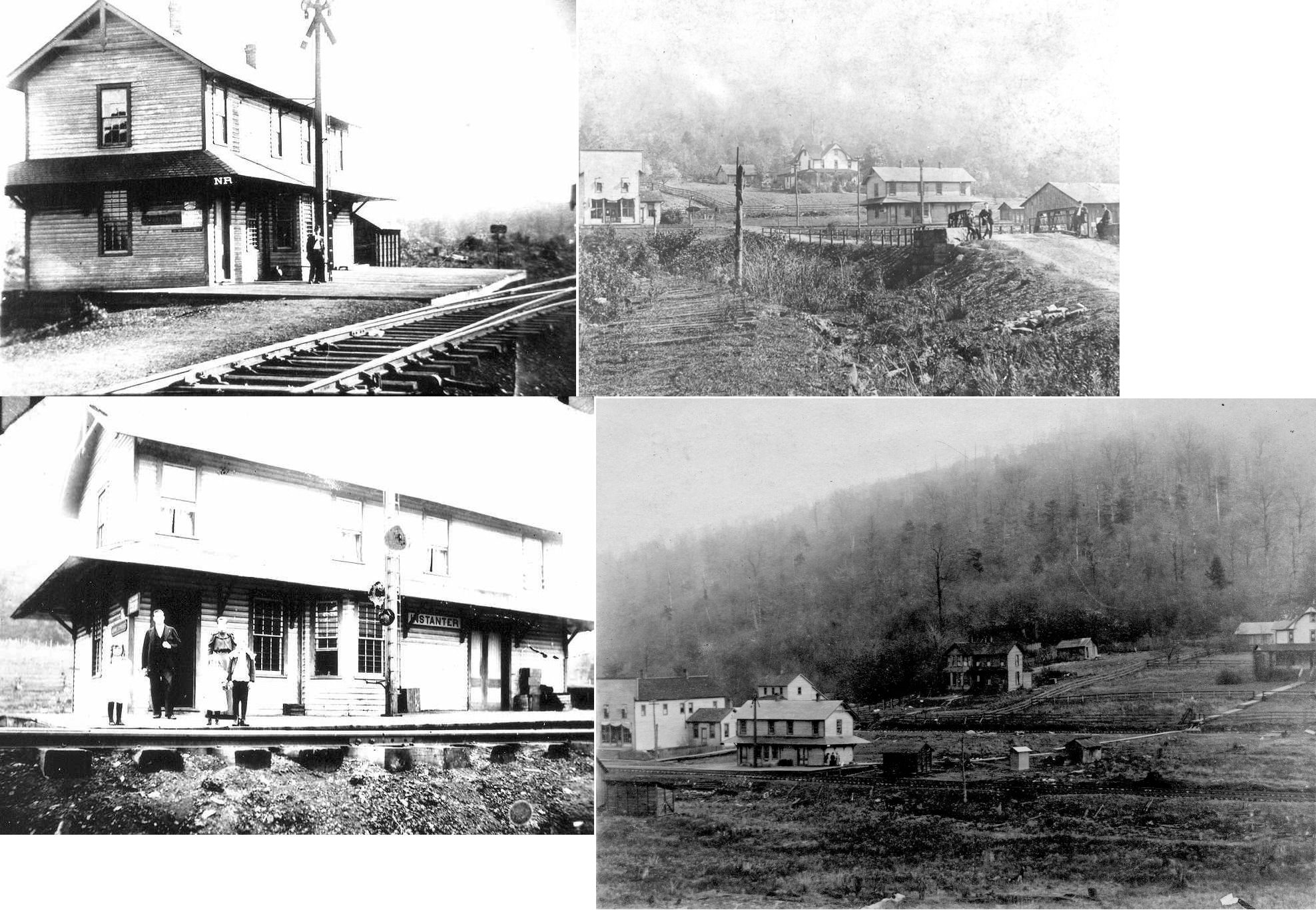
| Instanter | |
According to the book History of the Counties of McKean, Elk, Cameron and Potter, Pennsylvania published by J.H. Beers & Co in 1890, "Instanter, seven miles south of the site of Instanter of ancient times, is the name of a new depot on the new C. & J. Railroad. The tannery of Shultz & Hoyt was established at this point, and opened in January, 1890." The railroad is also referred to as the Johnsonburg and Clermont in the same book and was leased to the PRR. The site of the town is now underwater due to the East Branch Flood Control Dam. | ||||||
| Irwintown | |
This was a station on the Clarion River Railway. | ||||||
| Italy |
|
This was along the line that followed Millstone Creek. | ||||||
| James City | Kane & Elk RR | |||||||
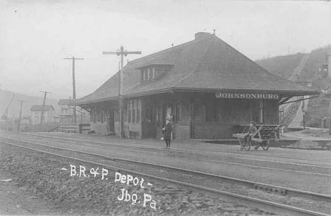
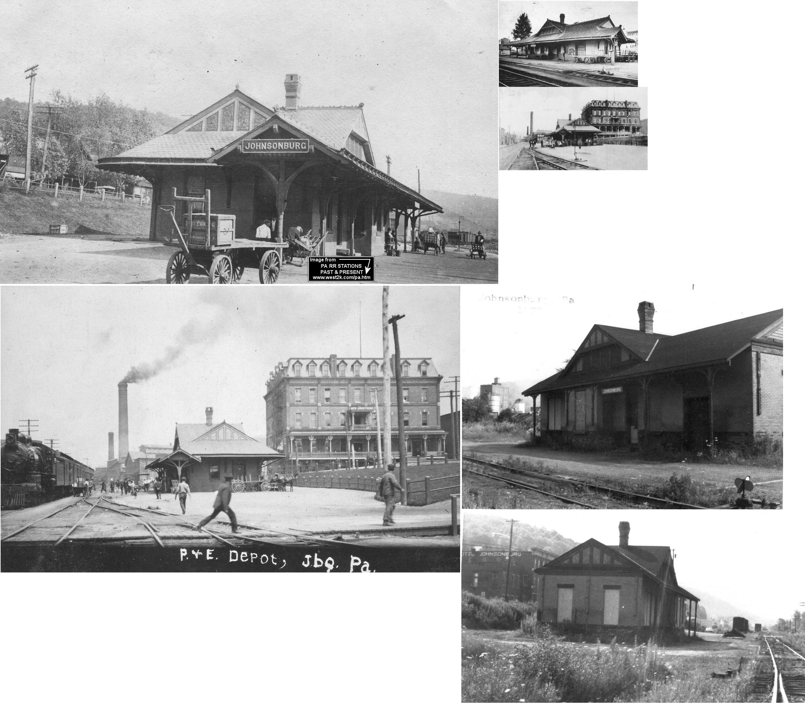
| Johnsonburg | |
The first station here was near where the tracks crossed the West Branch of the Clarion River and the PRR line. Passengers who disembarked here had to walk acorss the PRR bridge to get into town. Since this was dangerous, the BR&P in 1893 began stopping at Grant Street so passnegers going into town could use the wagon bridge there. The next station the RR built in 1900 (see below) was then situated to the south, closer to Grant Street. | ||||||
| Johnsonburg | |
This station was on Baline Street/Ridgway Avenue south of Grant Street on the west side of the tracks at GPS: 41.485184, -78.678461. It was built in 1900. | ||||||
| Johnsonburg | AND |
The first joint station here burned down in 1885. There was a two-year span between when this station burned down and the next one was bult on the same site, so there may have been a temporary station here during that time. | ||||||
| Johnsonburg | AND |
A new station was built here in 1887 on the same site of the station that burned in 1885. It was between the P&E and Erie tracks west of Center Street at GPS: 41.489126, -78.677143. It was replaced by the station listed below, but survived until the mill explanded southward. The PRR Annual Report of 1899 says that the PRR bought the Erie's half interest in the station and then moved the building to a new site to be used as a yard office. A couple of BR&P passenger trains used this station in 1900 as well (according to Buffalo, Rochester & Pittsburgh Railway In Color, Vol. 2, by Mike Zollitsch). | ||||||
| Johnsonburg | |
This second generation station, built in 1892/1893 (according to PRR valuation records), was located near the intersection of Center Street and Bridge Street on the east side of the tracks at GPS: 41.488025, -78.676517. | ||||||
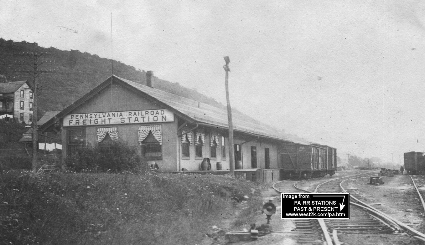
| Johnsonburg | |
This large freight station was at the intersetion of Center Street and Chestnut Street (this street does not go through to the tracks anymore). It was located at GPS: 41.487203, -78.675914 and was built in 1890 (according to PRR valuation records). | ||||||
| Johnsonburg | AND |
This freight house was on the east side of the Erie tracks just west of Center Street at GPS: 41.488851, -78.676725. This was the site of an earlier engine house and turntable. On later maps it is shown as being shared with the BR&P. | ||||||
| Kaulmont | |
|||||||
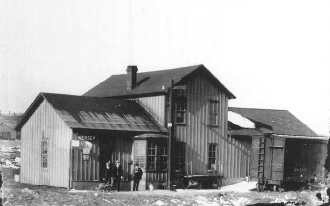
| Kersey | |
This line was originally the Kersey railroad. The station was on the west side of Irishtown Road on the south side of the tracks at GPS: 41.364428, -78.597798. | ||||||
| Ketner | |
|||||||
| Ketner | |
There was an old freight terminal that was used for unloading dam building materials at the end of Ketner Road. | ||||||
| Ketner |
|
|||||||
| Kylers Corners |
|
|||||||
| Loleta |
|
The station stood near the intersection of "Loleta Road" (3002) and "Loleta Grade Road" (labeled "Forestry Road"). This was along the line that followed Millstone Creek. The station also served as the company store for the town. The huge Loleta sawmill was immediately across the TVRy tracks to the NE of the store. "Forestry Road" was built on the TVRy grade all the way to Parrish. | ||||||
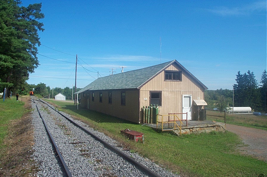
| Madge Station (Lamont) |
|
This building is along the tracks in Lamont (also known as "Madge" by the RR) at GPS: 41.611400, -78.805895. Several people have said that it is and was a gas company and valuation records seem to bear that out. Does anyone know the early history of this building or have an old photo of the station? According to the Jones Twp. website: "Here the James brothers erected the first chemical or "acid" factory in the area. They built a plant in 1882-1883 known as the Lamont Chemical Company. This company operated for nearly forty years. This plant was located about two-miles from the present location of the village along the Highland state Road. The plant contained about 12 retorts, or stills, that were used to extract the various chemicals and acid from the wood. The remaining charcoal would need to be transported by wagon or sled to Lamont for shipment on the Pittsburgh and Western Railroad. In 1896, a railroad was constructed to provide the plant with direct rail service. The plant shipped nearly four rail cars of charcoal a week and a tank car full of wood alcohol monthly. The Lamont Chemical Company closed it's operation is 1921 because of the financial condition of the James brothers and their other companies. A glass plant also existed here at one time, but very little is recorded about it. | ||||||
| Major |
|
|||||||
| Major |
|
This station is listed on the 1923 PRR List of Stations & Sidings. | ||||||
| Medix Run |
|
|||||||
| Medix Run | |
This station was SE of the crossing of the Quehanna Highway and the Low Grade RR through Medix Run. The first station here was moved from Barr (Barr's) which was about 1.5 miles away. | ||||||
| Merrill | |
|||||||
| Midmont Station | |
|||||||
| Mt. Pleasant |
|
This station was across the Sinnemahoning Creek from Summerson. | ||||||
| Nansen | |
|||||||
| Nichols Run | EMPORIUM & RICH VALLEY RR |
This is shown on the 1915 map as the terminus of this line. It was on the eastern border of Jones Township. | ||||||
| North Fork | |
This station is shown on the 1914 county map, but is not shown by the time of the 1941 map. It was between Bear Run and Wildwood stations. | ||||||
| Ogilsby |
|
This was along the line that followed Millstone Creek. | ||||||
| Paine | |
|||||||
| Portland mills | |
A Clarion River Railway station. | ||||||
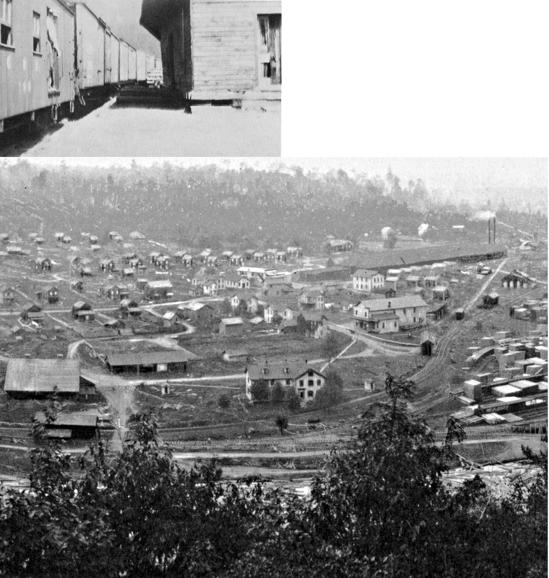
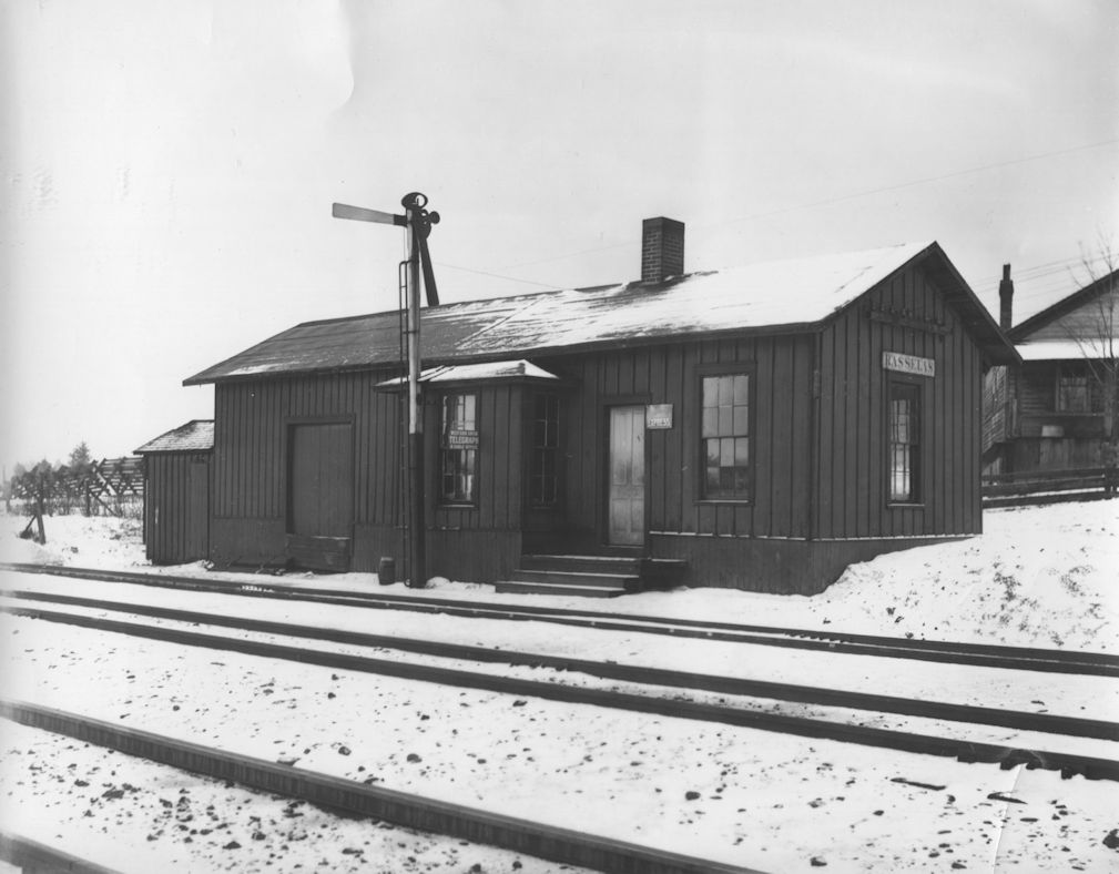
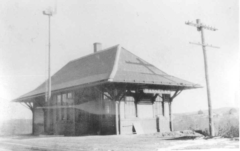
| Rasselas | |
This station was across from the Fritz Road/Rasselas Road intersection. | ||||||
| Rasselas | |
|||||||
| Rathbun | |
|||||||
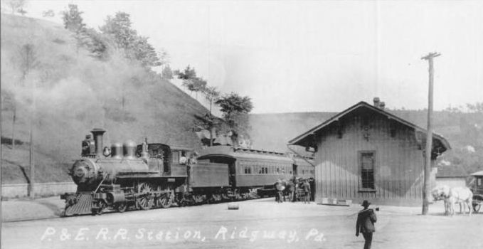
| Ridgway | |
The Erie had trackage rights over the PRR from Johnsonburg to Brockway. If there was Erie service here it likely used the PRR station. | ||||||
| Ridgway | |
The original wood frame P&E passenger station was at the same site as the existing station at North Broad Street (GPS: 41.425217, -78.731449). In 1884 the station was moved 1/4 mile so it was closer to the junction with the Ridgway & Clearfield RR. | ||||||
| Ridgway | |
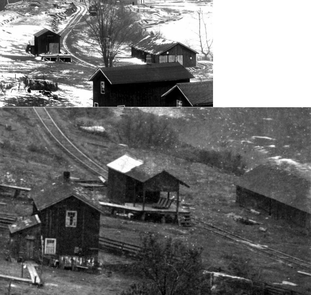
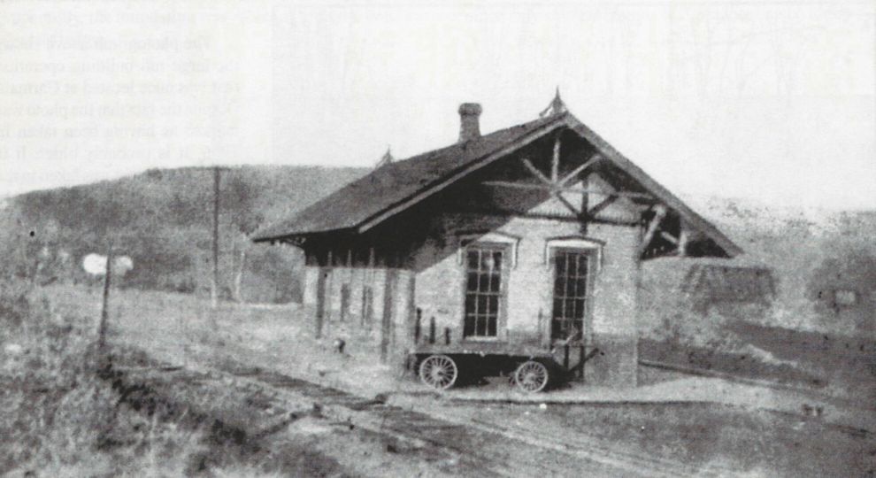
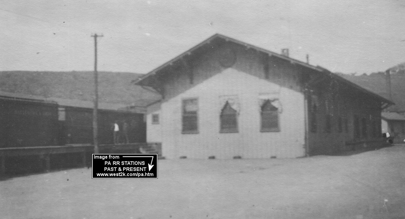
The original freight station, built in 1893 according to PRR valuation records, was on the west side of Broad Street at GPS: 41.425442, -78.732103. It was expanded, or a larger freight house replaced it in the same location, sometime between 1904-1909 (likely in 1907 when the new passenger station was constructed). The photo is from around 1918. | ||||||
| Ridgway | |
The original wood frame combination B&RP depot was at the same location as the existing station at West Main Street and PA948 (GPS: 41.421035, -78.739426). | ||||||
| RIDGWAY | |
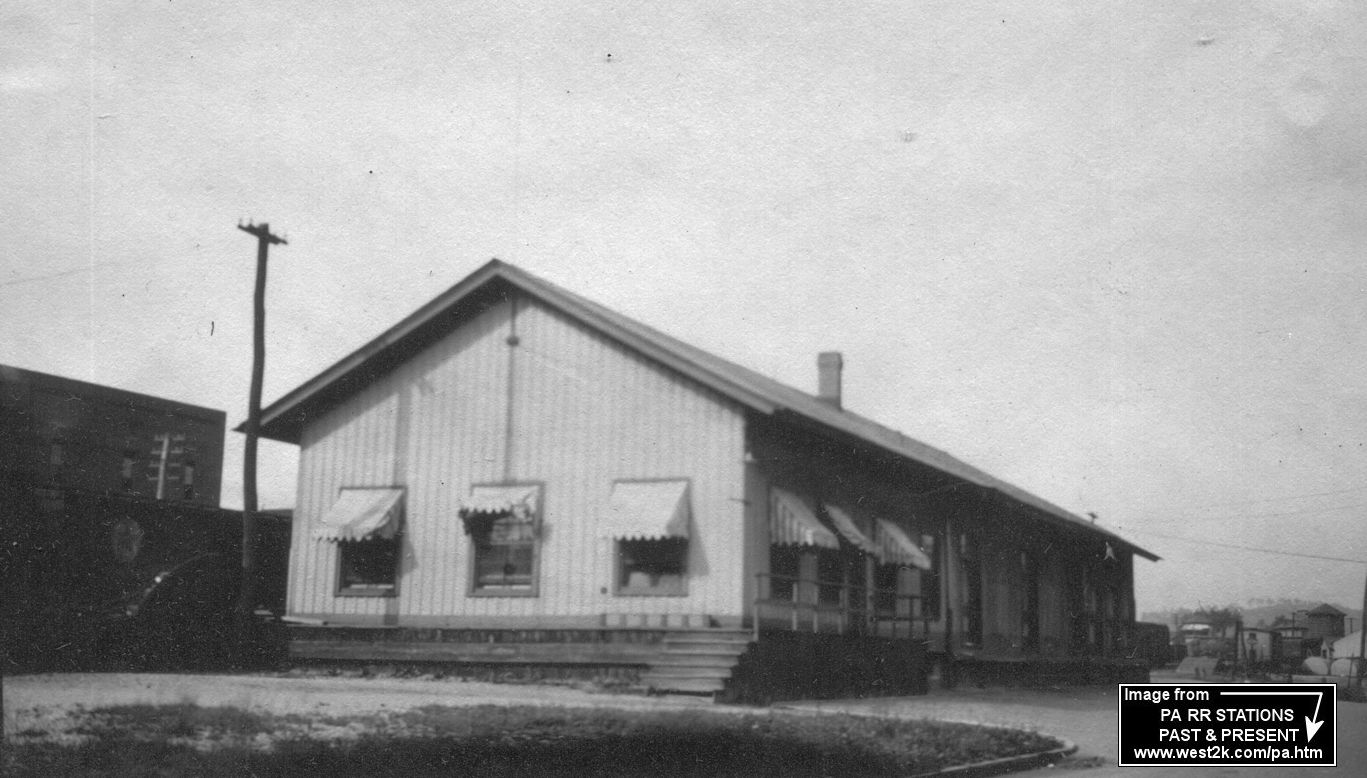
A new freight house was built around 1905 when the new brick passenger station replaced the old wooden compbination station. This freight station was on Main Street on the south side of the tracks at the Chestnut Avenue intersection at GPS: 41.420605, -78.741872. | ||||||
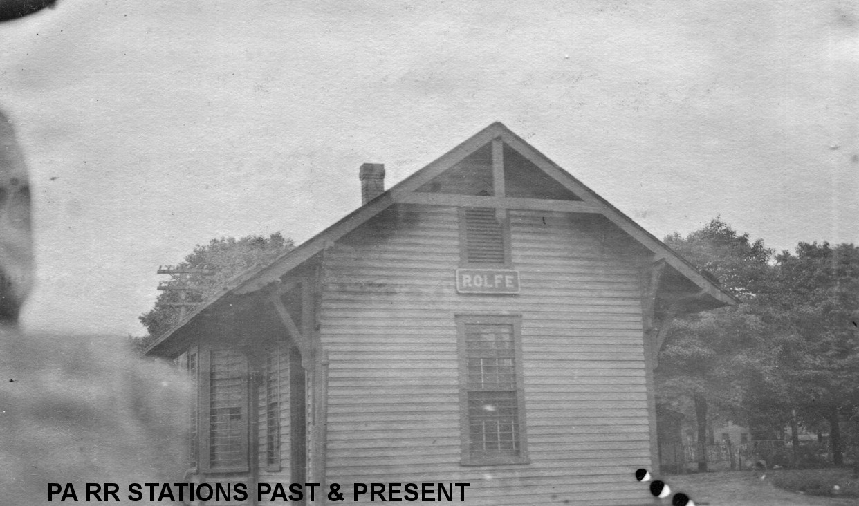
| Rolfe (Wilmarth) |
|
This station was on the north side of Main Street on the NW side of the tracks at GPS: 41.499135, -78.682263. The name of the station was changed from Wilmarth to Rolfe in 1879. In 1882 the 5-mile Rolfe Branch opened from this station. A new station was built here in 1887/1888 (according to PRR valuation records) when the previous station burned down. | ||||||
| Russell City | |
|||||||
| Sands | |
This station was between St. Marys (Elk Home Station) and Gray Gables. It was about 1 mile north of the County Home. | ||||||
| Shawmut | |
|||||||
| Shelvey Station | |
|||||||
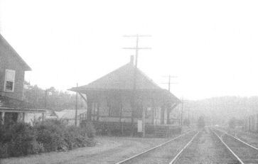
| Spring Creek |
|
This station is on the 1895 timetable. | ||||||
| St. Marys | |
An early station here was destroyed by a fire in 1872. | ||||||
| St. Marys | |
The second station here burned down in July, 1880 (Elk County Advocate, 7-29-1880). | ||||||
| St. Marys | AND |
This station was located on Erie Avenue NE of Lafayette Street on the SE side of the tracks at GPS: 41.428641, -78.559447. It was built in 1881 following the burning of the previous station. Some sources say a new station was built here in 1897, but the Sanborn maps show the same station here from 1887 onward. A new baggage room appears to have been added to the station sometime between 1904 and 1909. At some point the PS&N leased space and shifted its passenger operations to this station. The station was torn down in September 1972 to make way for a municipal parking lot. | ||||||
| St. Marys | |
The freight station was on Erie Avenue at Diamond Street on the SE side of the tracks at GPS; 41.429793, -78.557584. Sometime between 1904-1907 a larger freight station was contructed just a few feet north of that location to replace the original freight house. | ||||||
| St. Marys | |
The PS&N combination depot (later just a freight house) was within the PS&N office/shops complex between Depot Street and Elk Creek. It was on a siding track at approximately GPS: 41.428830, -78.557717. | ||||||
| Straight | |
The town was pretty much abandoned in the mid-1920s and subsequently the location was bought by the U.S. Government in the late 1940s and was flooded to become part of the East Branch Dam impoundment. The station still appears on the 1923 PRR List of Stations & Sidings as do the Lackawanna and Susquehanna wood chemical plants which would soon be retired. Although the town is spelled "Straights" on several maps (including the USGS topographic map), the sign on the station is correct and also reflected in PRR timetables as such. | ||||||
| Straight Creek Junction | |
This station was between Finland and Wellendorf (McKean County). | ||||||
| Summerson (Mt. Pleasant) |
|
The B&S station here was on the noth side of the creek and called Mt. Pleasant. The PRR station was also originally called Mt. Pleasant, but the name was changed to Summerson in 1907. | ||||||
| Swissmont | |
According to PRR valuation records an 8'x12' passenger shelter was built here in 1898. | ||||||
| Tambine | |
This station was between Rolfe and Wilcox. It was 2.7 miles from the station at Rolfe. A new passenger shelter-type station was built here in 1906 (according to PRR valutaion records). | ||||||
| Toby Mines | |
|||||||
| Weedville | |
|||||||
| Weedville Station |
|
This station was located immediately south of the bridge carrying Redwood Street over the Bennetts Branch, in the southwest quadrant of the former crossing, and opposite the entrance to the sewage treatment plant (41.272616, -78.490836). A loading platform was located on the south side of the tracks along what is now the sewage treatment plant driveway and a section house was about 200 feet south of the station. The station is shown on the 1918 B&S Valuation Map. | ||||||
| Weedville Station |
|
This station was near the Atlantic Refining Company. | ||||||
| Whistletown | |
|||||||
| Whistletown | |
|||||||
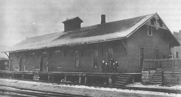
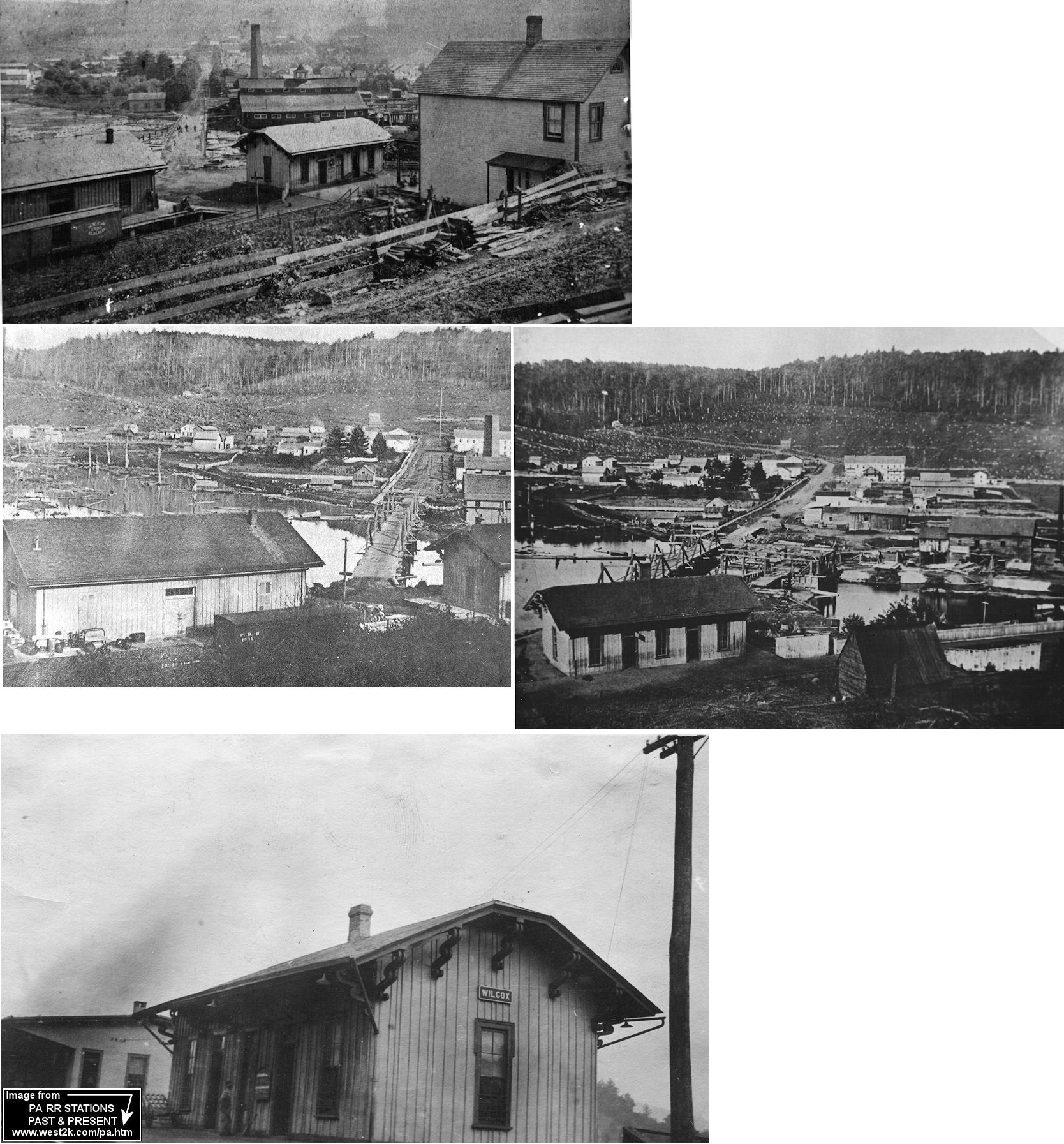
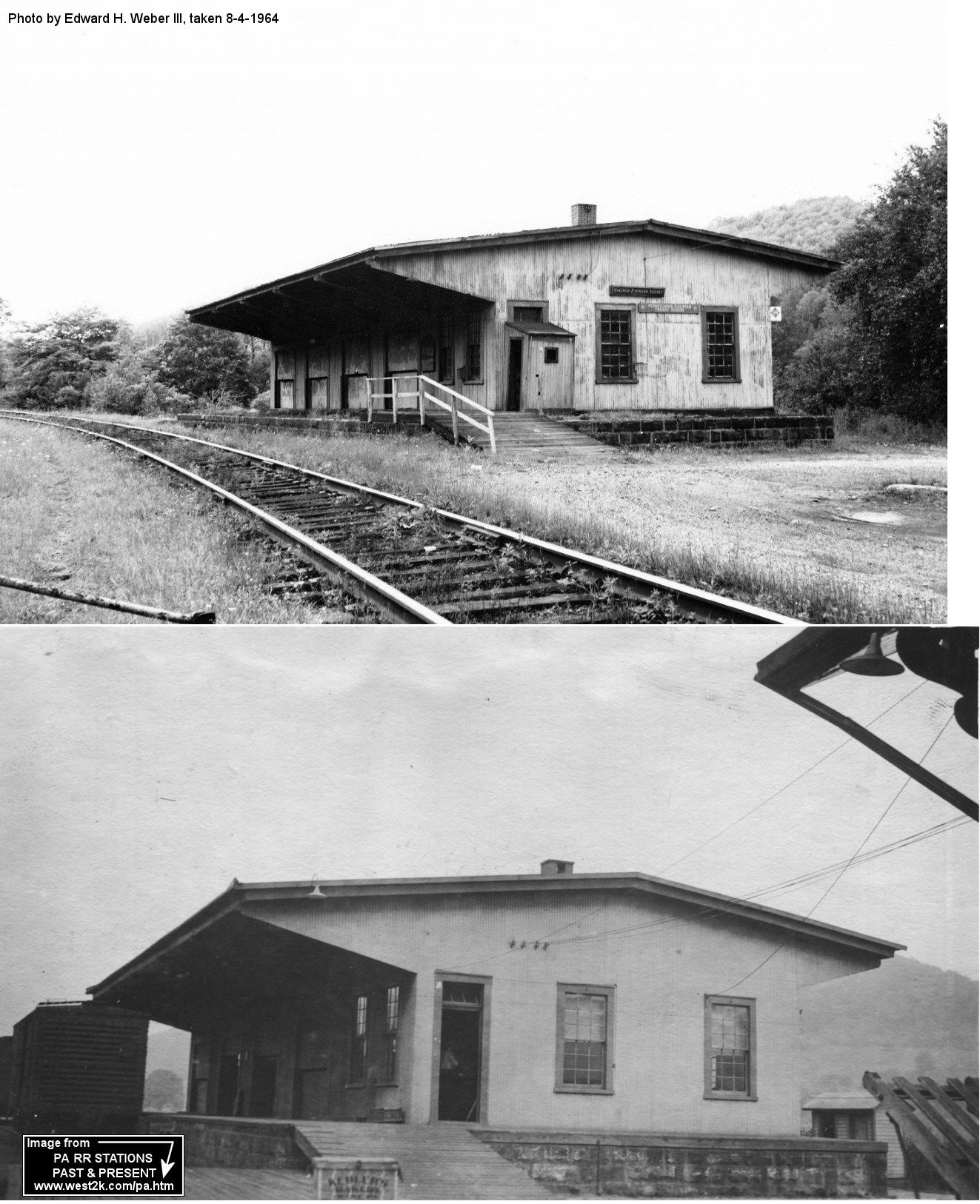
| Wilcox | |
Both the passenger and freight stations were NW of Clarion Street. The passenger station was built in 1873 (according to PRR valutaion records). | ||||||
| Wilcox | |
This freight station was NW of Clarion Street at GPS: 41.575520, -78.693485. It was built in 1907 (according to PRR valutaion records). | ||||||
| Wildwood | |
This station is shown on the 1914 county map, but is not shown by the time of the 1941 map. | ||||||
| Wildwood Summit | |
This station may be the same station as listed above, but they were listed at slightly different locations (Wildwood at MP 13.4 and Wildwood Summit at 13.7. Miles are from St. Marys) | ||||||
| Winlack |
|
This was along the line that followed Millstone Creek. | ||||||
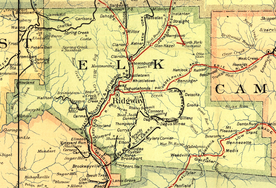
| 1895 ELK COUNTY RAILROAD MAP | ||||||||
 |
||||||||