|
|
||||||||
| EXISTING STATIONS | ||||||||
|---|---|---|---|---|---|---|---|---|
| Station Name |
Original Railroad |
Current Location |
Type | Current Use |
Date Built |
Track Status |
Building Material |
More Info |
| Chester |  |
595 Avenue of the States (6th Street & Welsh Street) (GPS: 39.849341, -75.359913) |
P | Railroad | 1903 | In Use | Brick | |
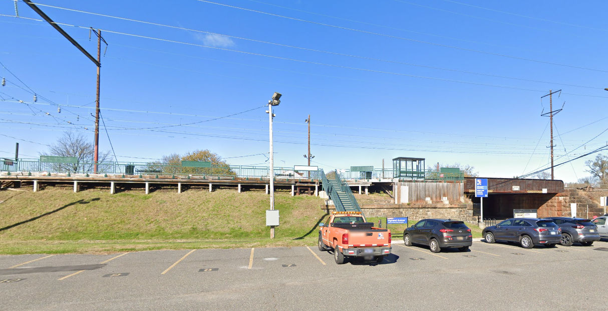
| Chester (Highland Avenue) |
 |
450 Highland Ave (GPS: 39.833645, -75.392841) |
P | Railroad | ???? | In Use | Metal | |
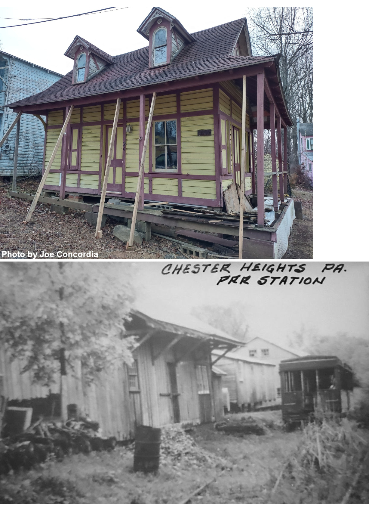
| Chester Heights (Camp Meeting) |
|
Camp Meeting Grounds (GPS: 39.887662, -75.466318) |
C | Private | ???? | None | Wood |
|
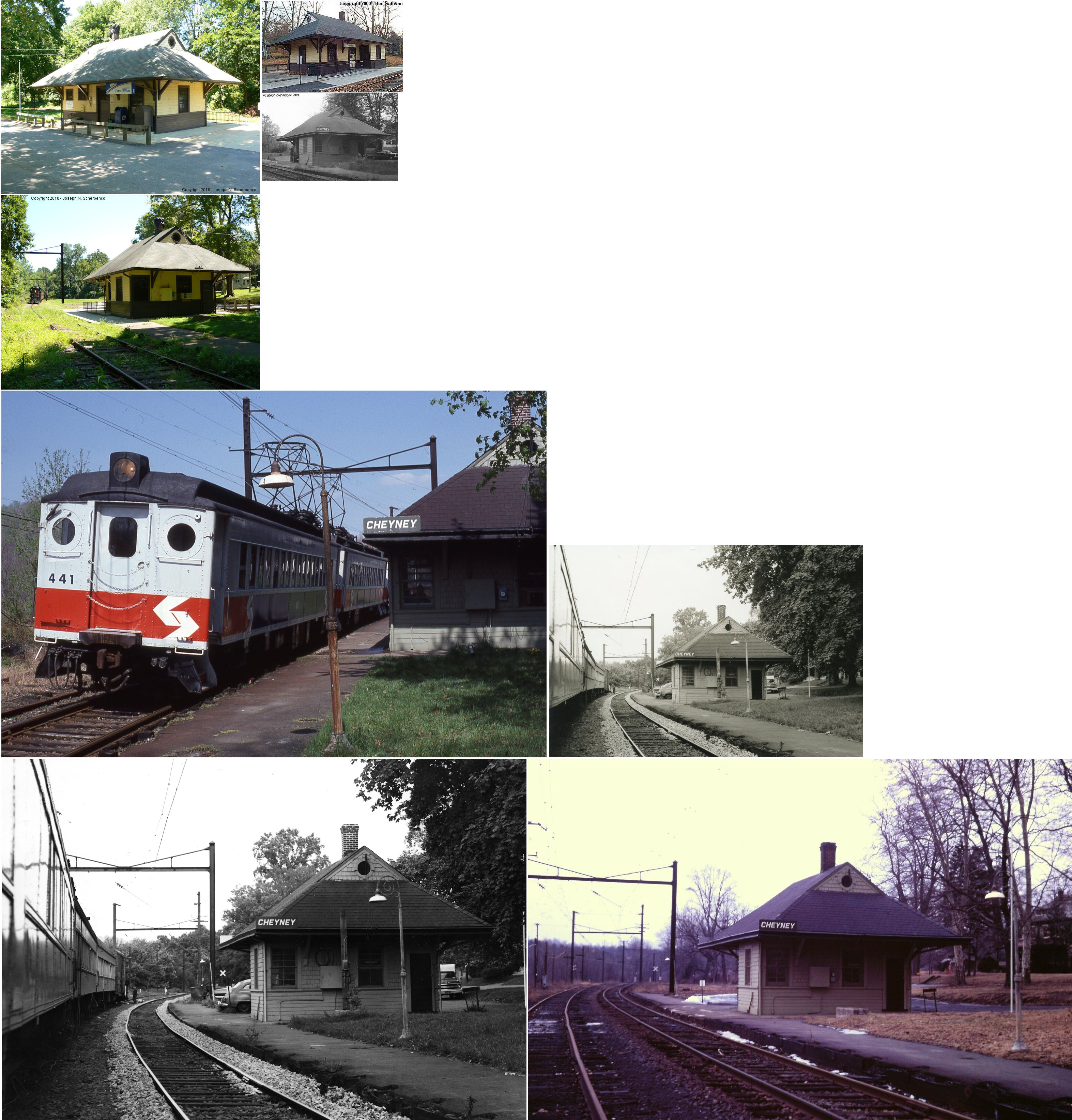
| Cheyney |
 |
Station Road between Cheyney and Creek Roads (GPS: 39.930674, -75.518690) |
P | Post Office | 1900 | In Use | Wood | |
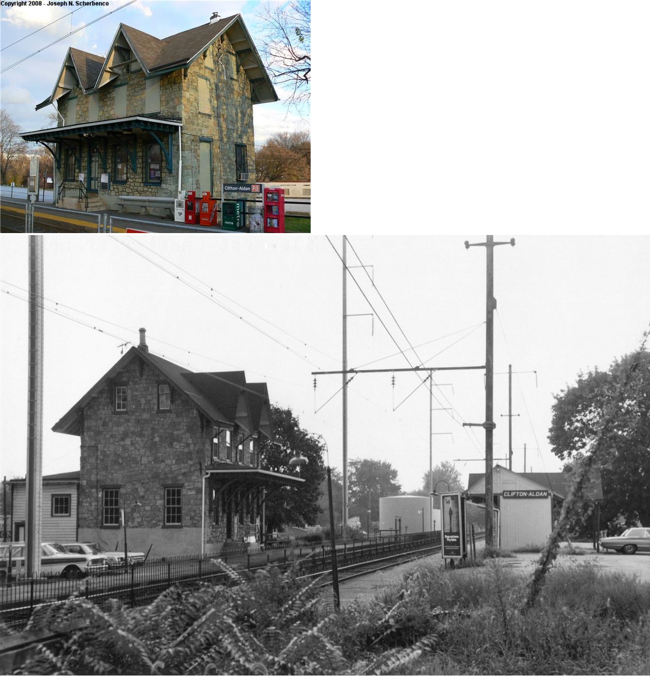
| Clifton-Aldan (Clifton Heights) |
|
NE of Springfield Road off West Maryland Avenue, 1/2 mile south of Baltimore Pike (GPS: 39.926601,-75.290245). |
P | Railroad | 1880 | In Use | Stone |
|
| Crum Lynne | |
North side of West Chester Pike (one shelter) and West Ridley Avenue (another shelter). (GPS: 39.871835,-75.330795) |
P | Railroad | ???? | In Use | Wood | |
| Curtis Park (Academy) |
|
Oak Avenue near Woodland Terrace off Calcon Hook Road (GPS: 39.908086,-75.265135). |
P | Vacant | 1948 | In Use | ???? |
|
| Darby |
|
South side of Pine Street near South 4th Street (GPS: 39.912819, -75.254672) |
P | Railroad | ???? | In Use | Multi | |
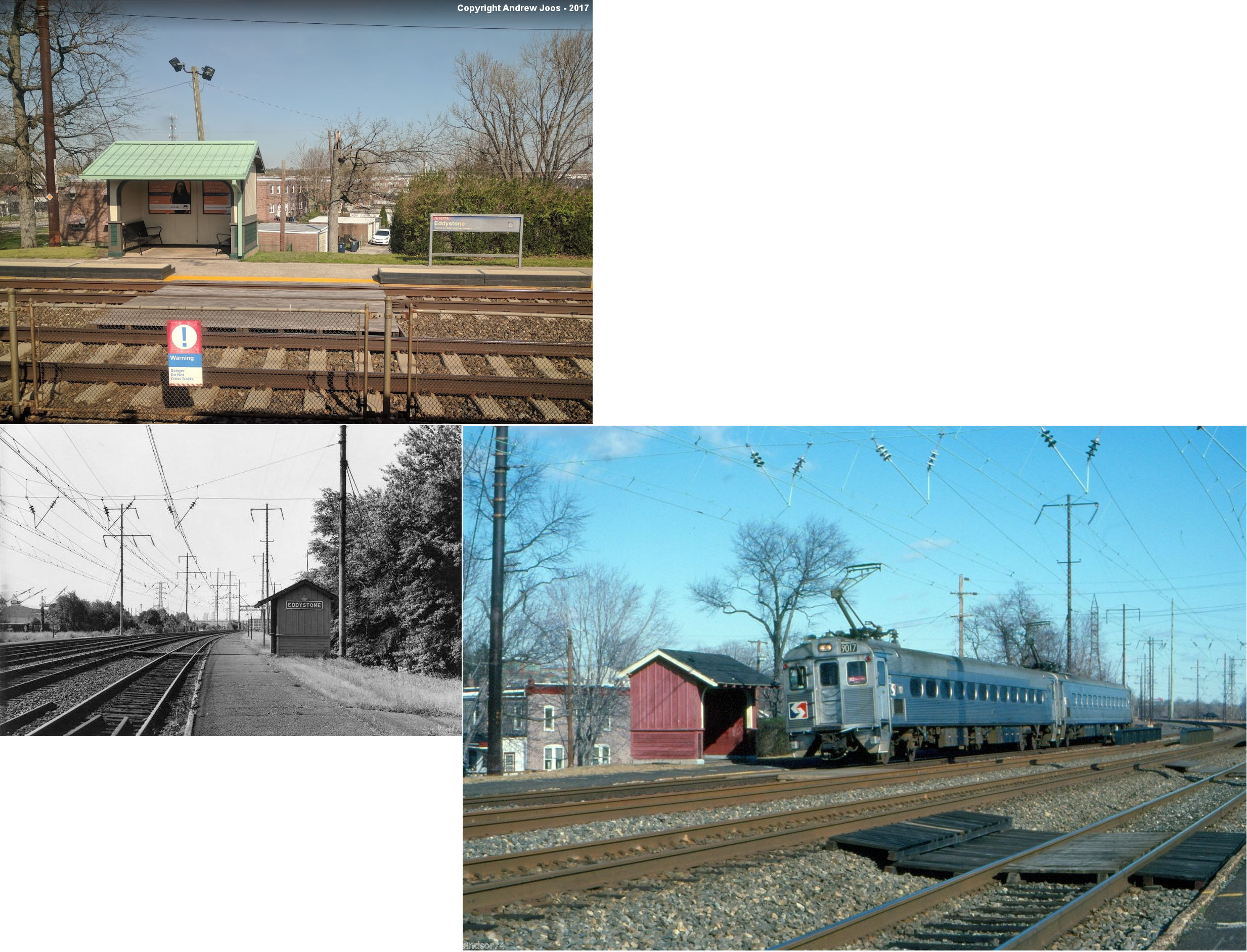
| Eddystone | |
SE side of East 7th Street west of Saville Avenue (GPS: 39.857450, -75.341846) |
P | Railroad | ???? | In Use | Wood | |
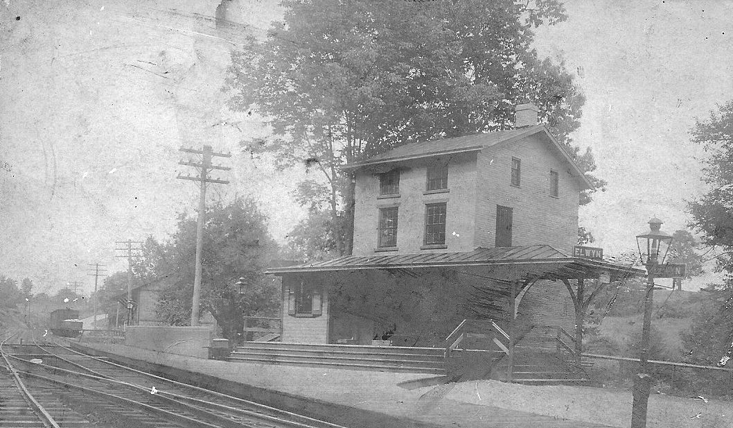
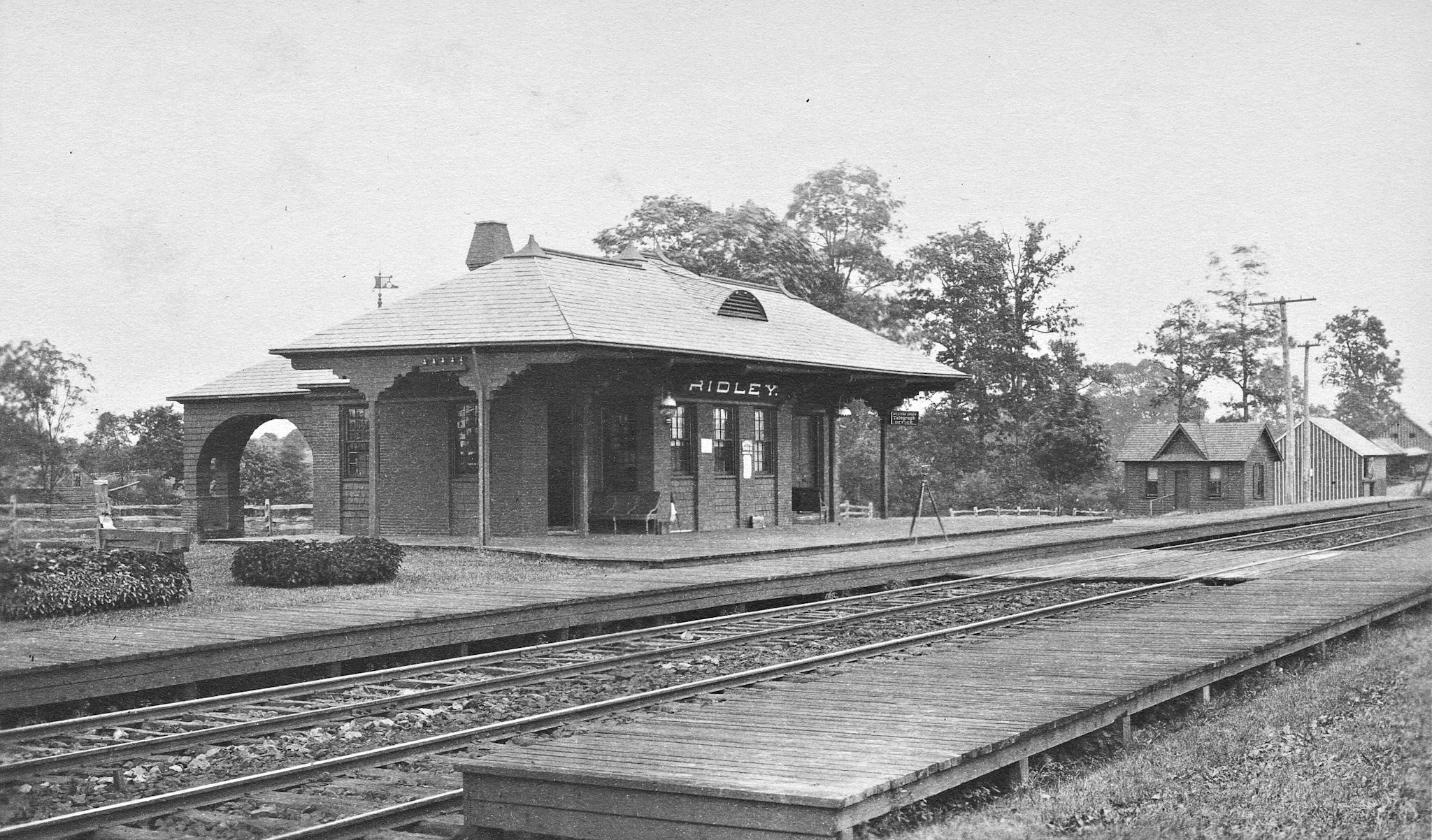
| Elwyn |
|
149 Elwyn Rd near Elwyn Avenue (GPS: 39.907949, -75.411181) |
P | Railroad | ???? | In Use | Metal | |
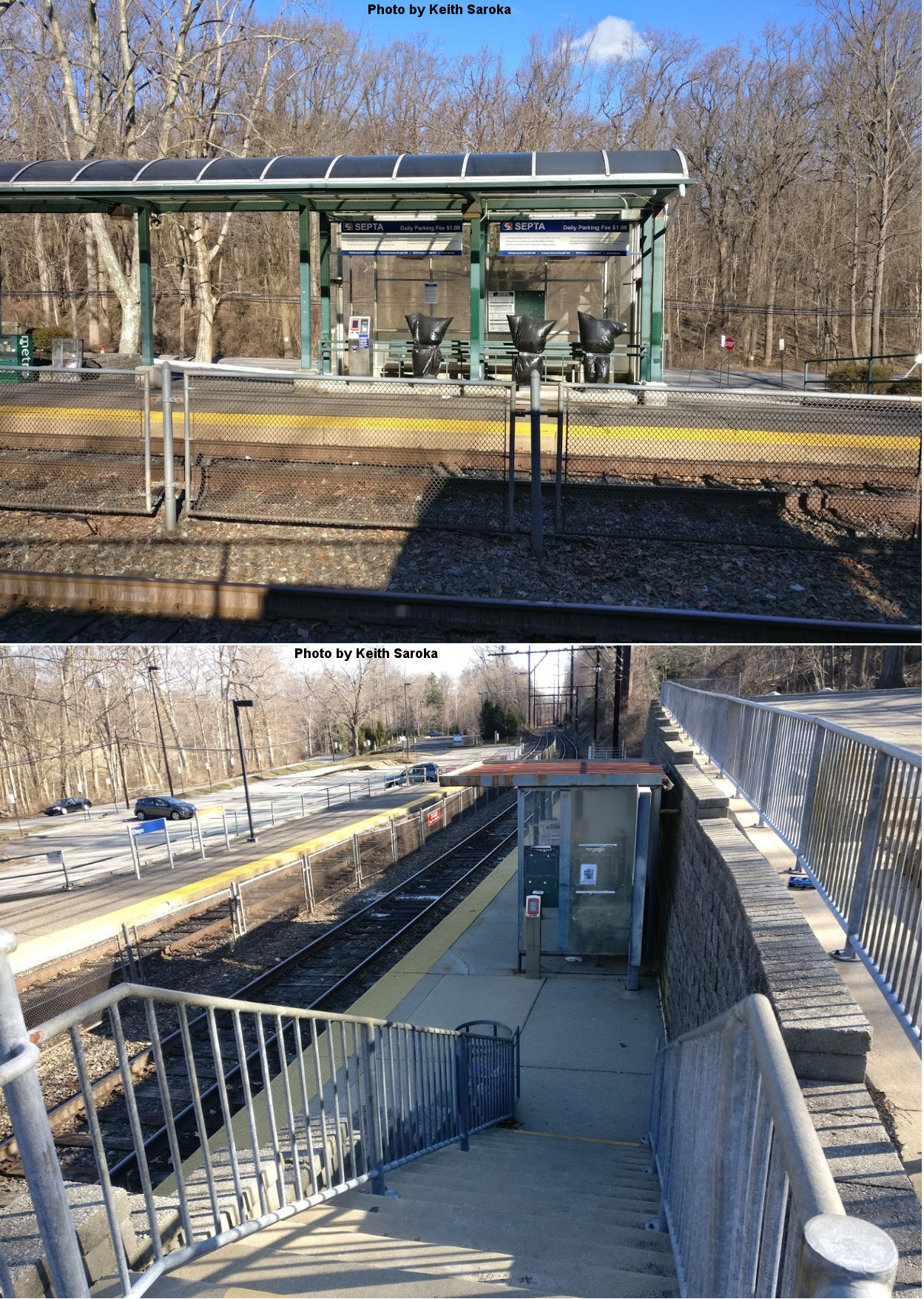
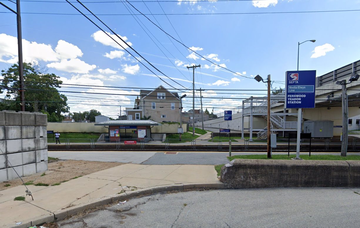
| Fernwood-Yeadon |
|
East
side of Church Lane between Railroad Avenue and Penn Street (GPS: 39.939624, -75.256048) |
P | Railroad | ???? | In Use | Multi | |
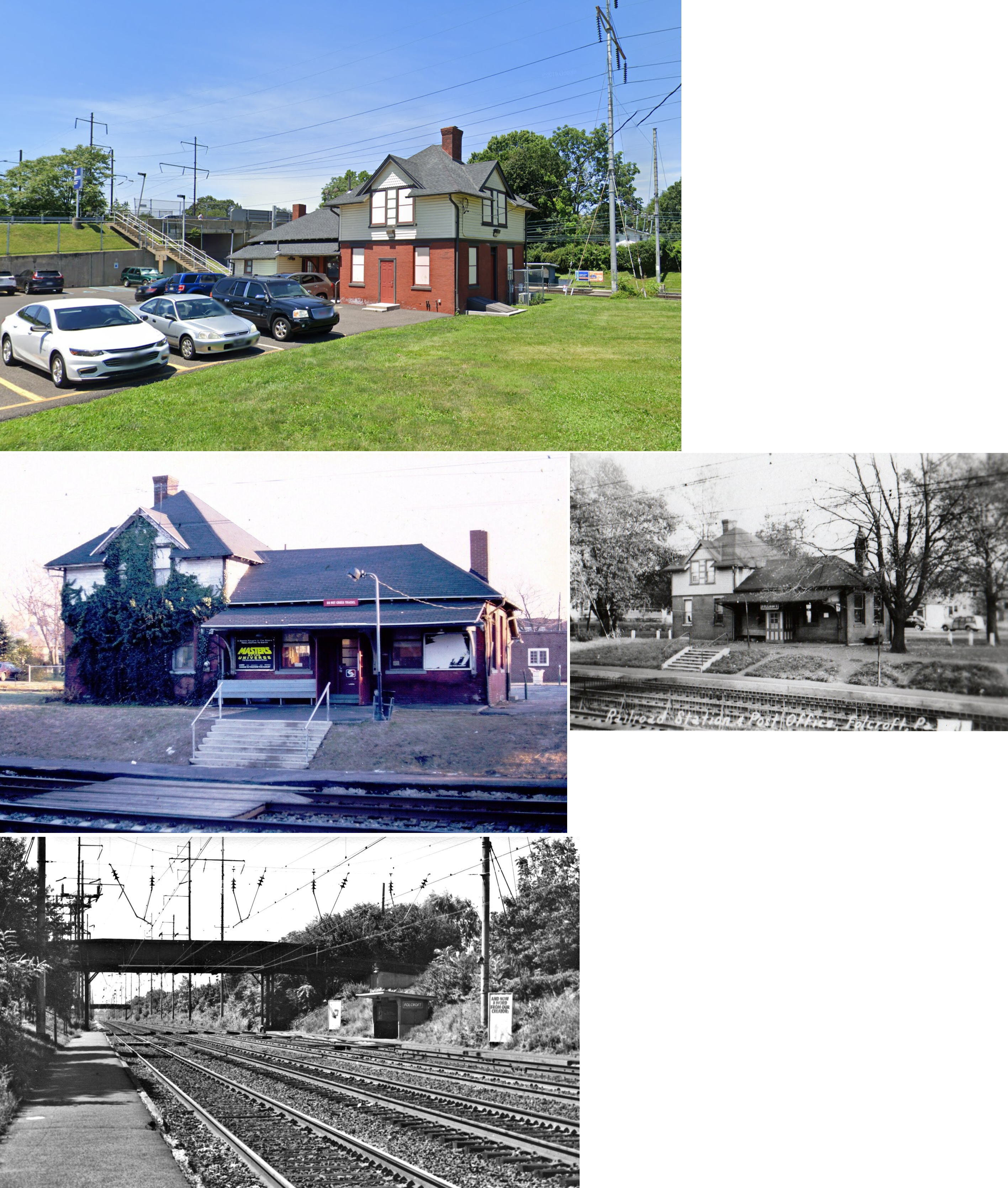
| Folcroft | |
East of Primos Avenue on Baltimore Avenue (GPS: 39.900337,-75.279774) |
P | Railroad | ???? | In Use | Brick | |
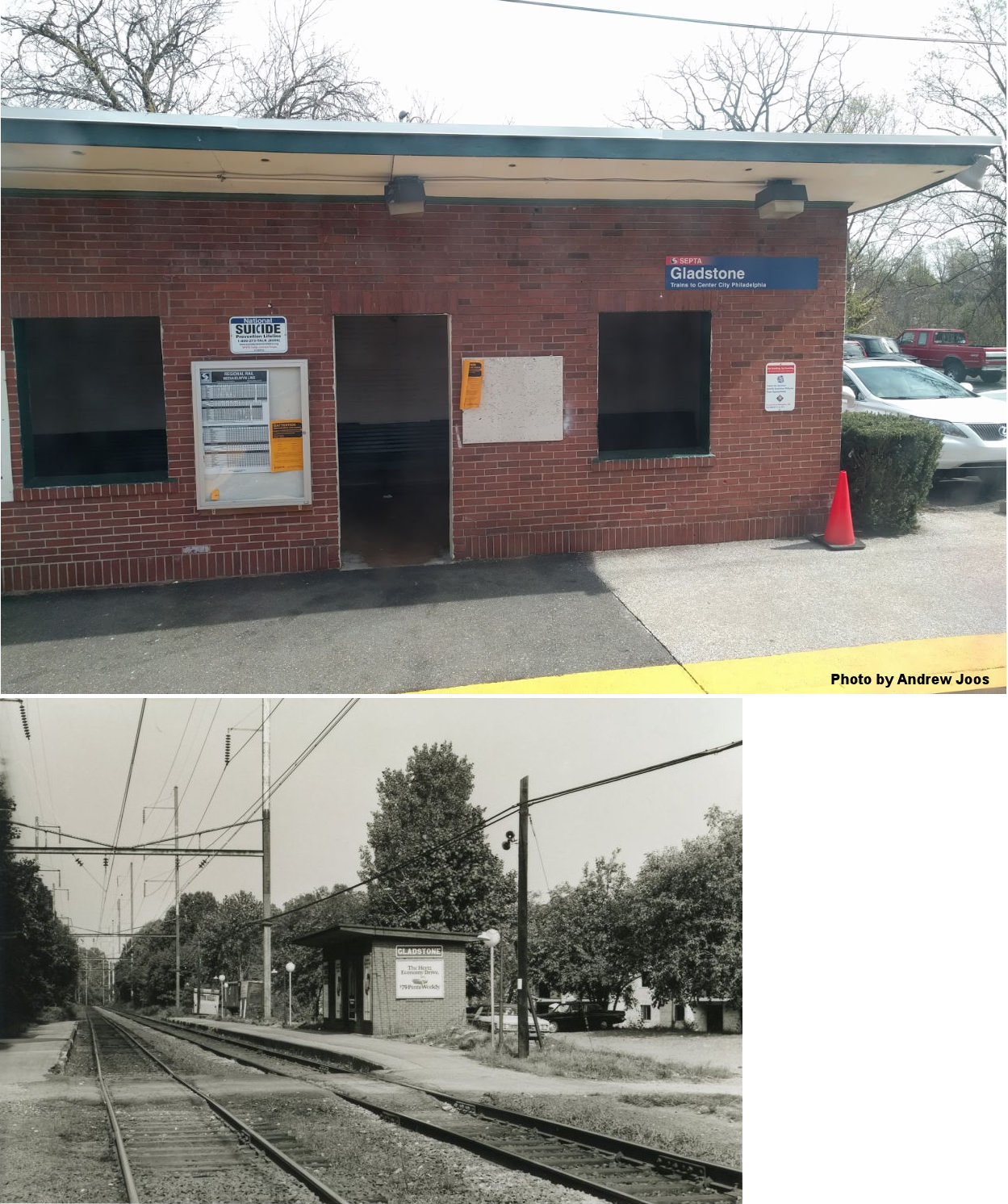
| Gladstone (Burmont) |
|
198 Walsh Road near Scottdale Road (GPS: 39.932693, -75.282082) |
P | Railroad | ???? | In Use | Brick | |
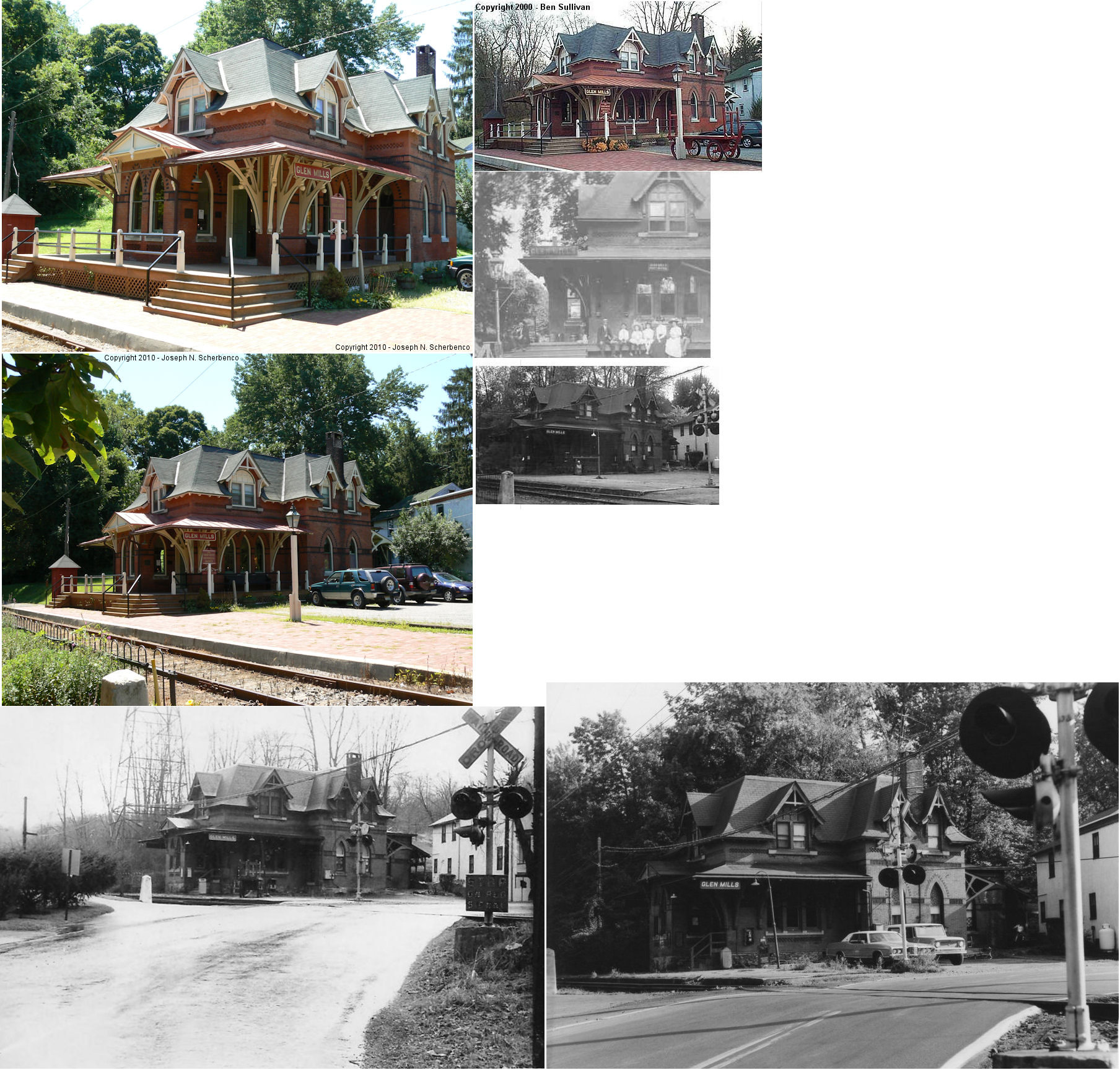
| Glen Mills |
|
Glen Mills Road/Sweetwater Road (GPS: 39.919842, -75.490391). |
P | Railroad | 1880 | In Use | Brick |
|
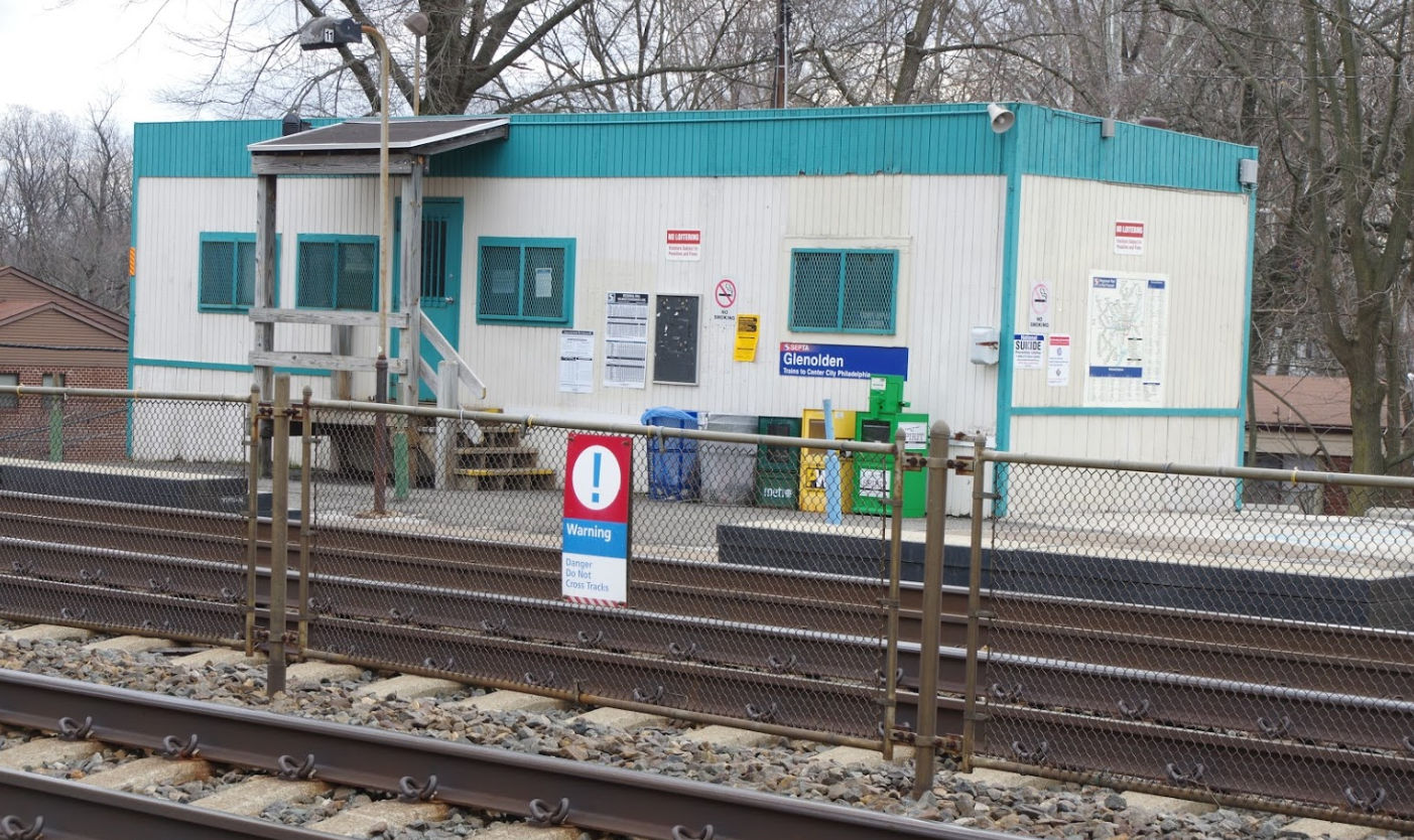
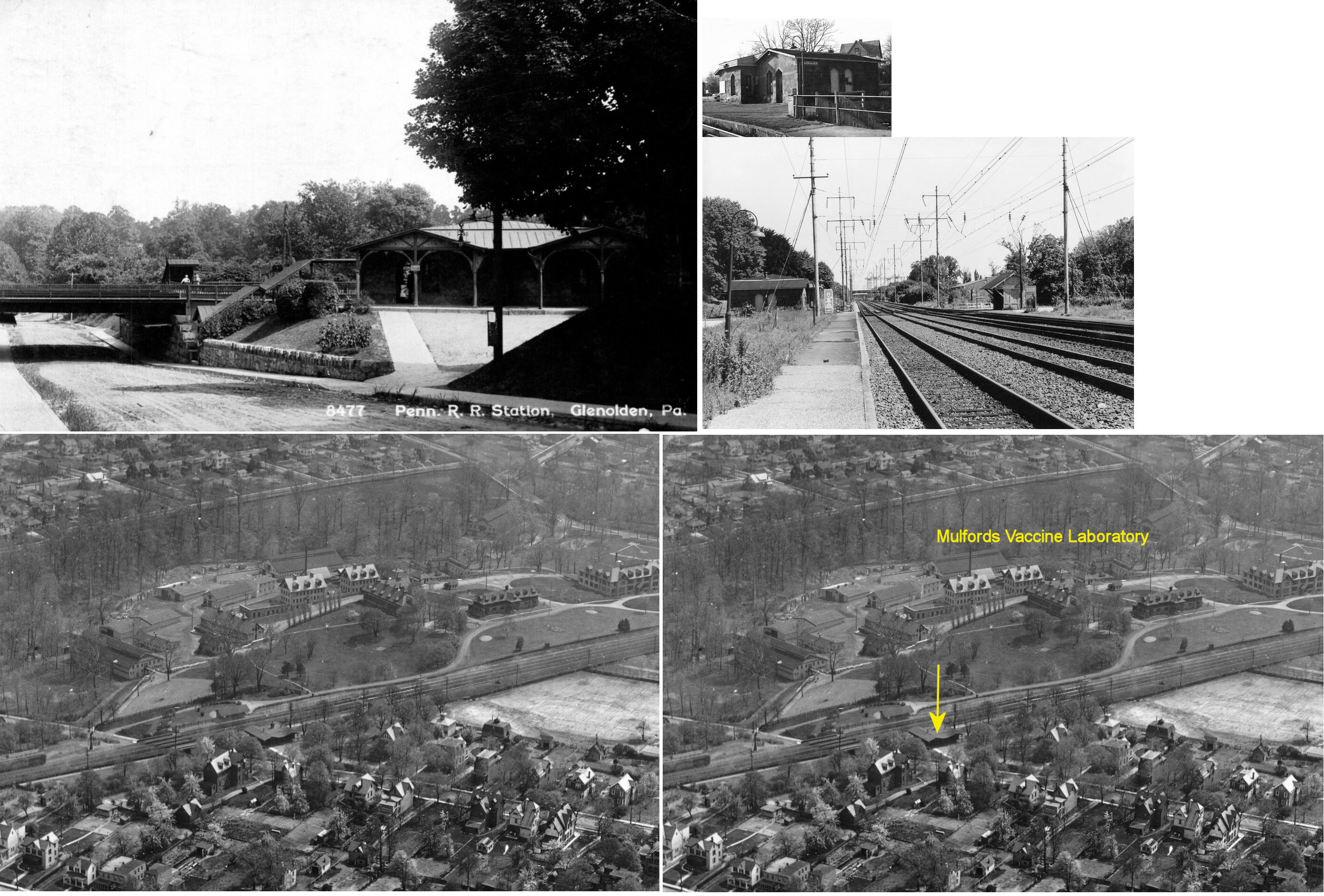
| Glenolden |
|
West
side of Glenolden Avenue near Chester Pike (US-13) (GPS: 39.896216, -75.289899) |
P | Railroad | ???? | In Use | Metal | |
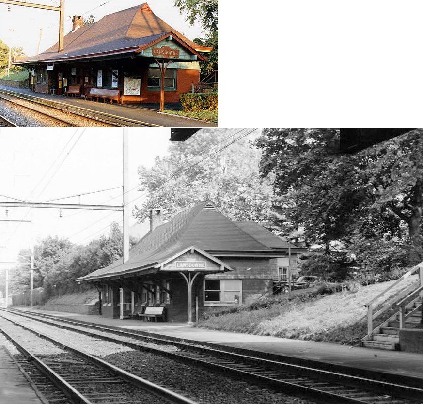
| Lansdowne | |
East side of Lansdowne Avenue, 1 block south of Baltimore Pike. (GPS: 39.937195,-75.27158) |
P | Railroad | 1901 | In Use | Brick |
|
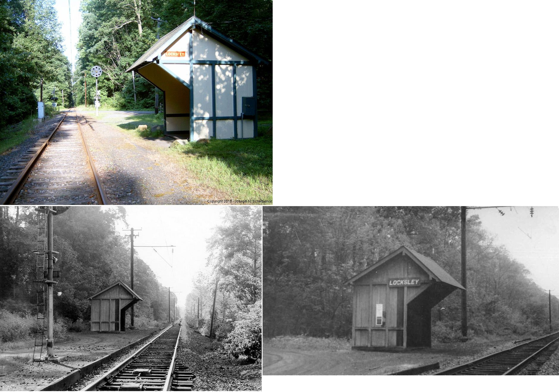
| Locksley |
|
Locksley Station Road 1/8 mile west of Creek Road (GPS: 39.930602, -75.506145) |
P | Railroad | ???? | In Use | Wood |
|
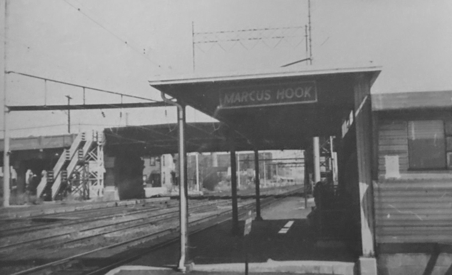
| Marcus Hook |
|
20 West 12th Street near Morton Avenue (GPS: 39.821485, -75.419680) |
P | Railroad | ???? | In Use | Metal | |
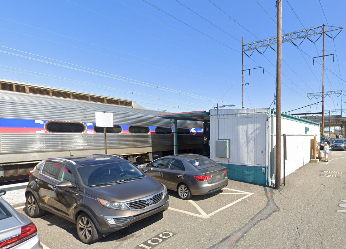
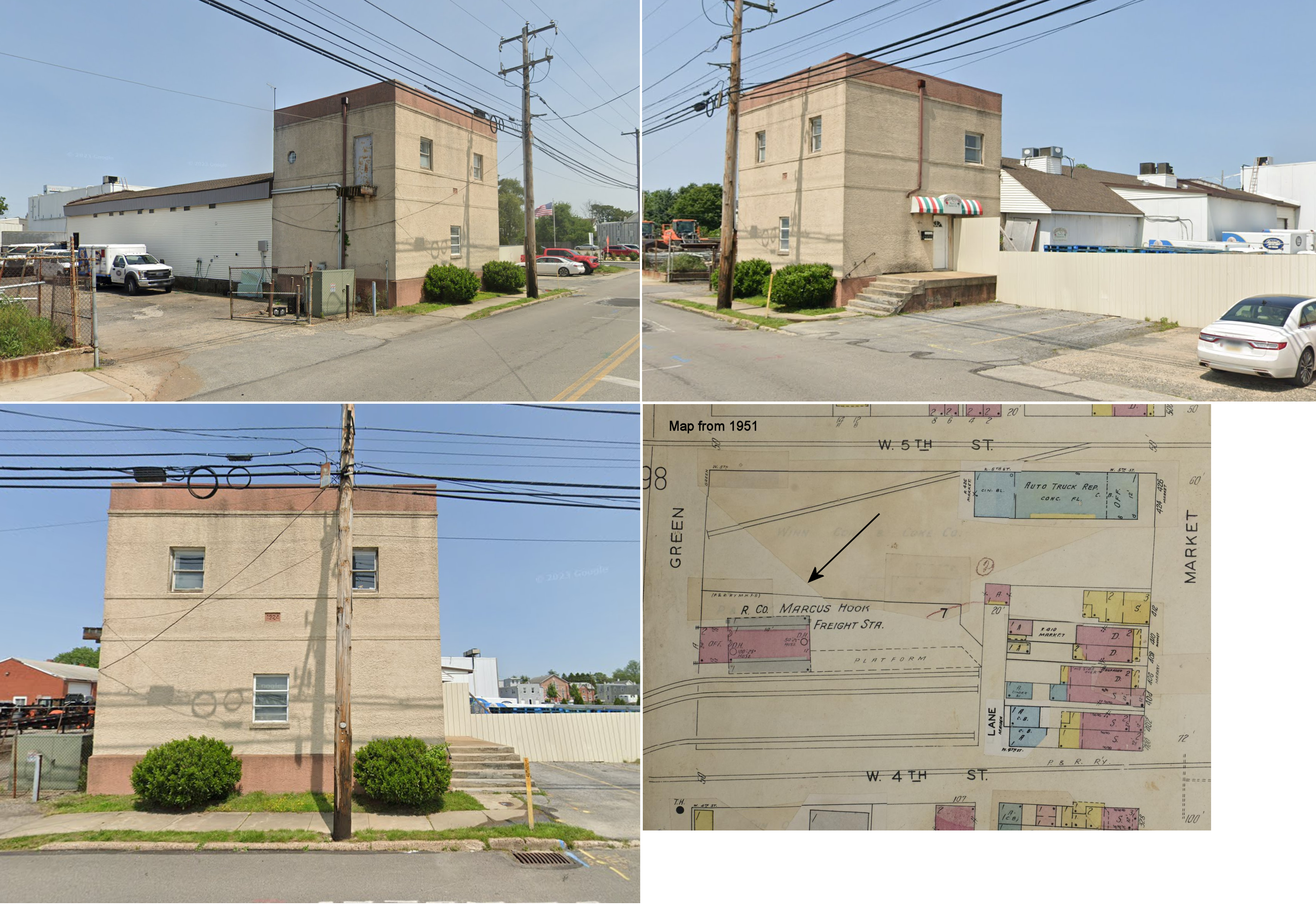
| Marcus Hook |
 |
Green Street between West 4th and 5th Streets (GPS: 39.821485, -75.419680) |
F | Railroad | 1924 | In Use | Stucco | |
| Markham | |
Cheney Road just south of intersection with U.S. 1 (GPS: 39.890269, -75.505943) |
P | Civic | ???? | Aband. | Wood | |
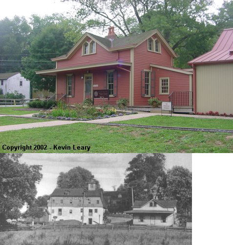
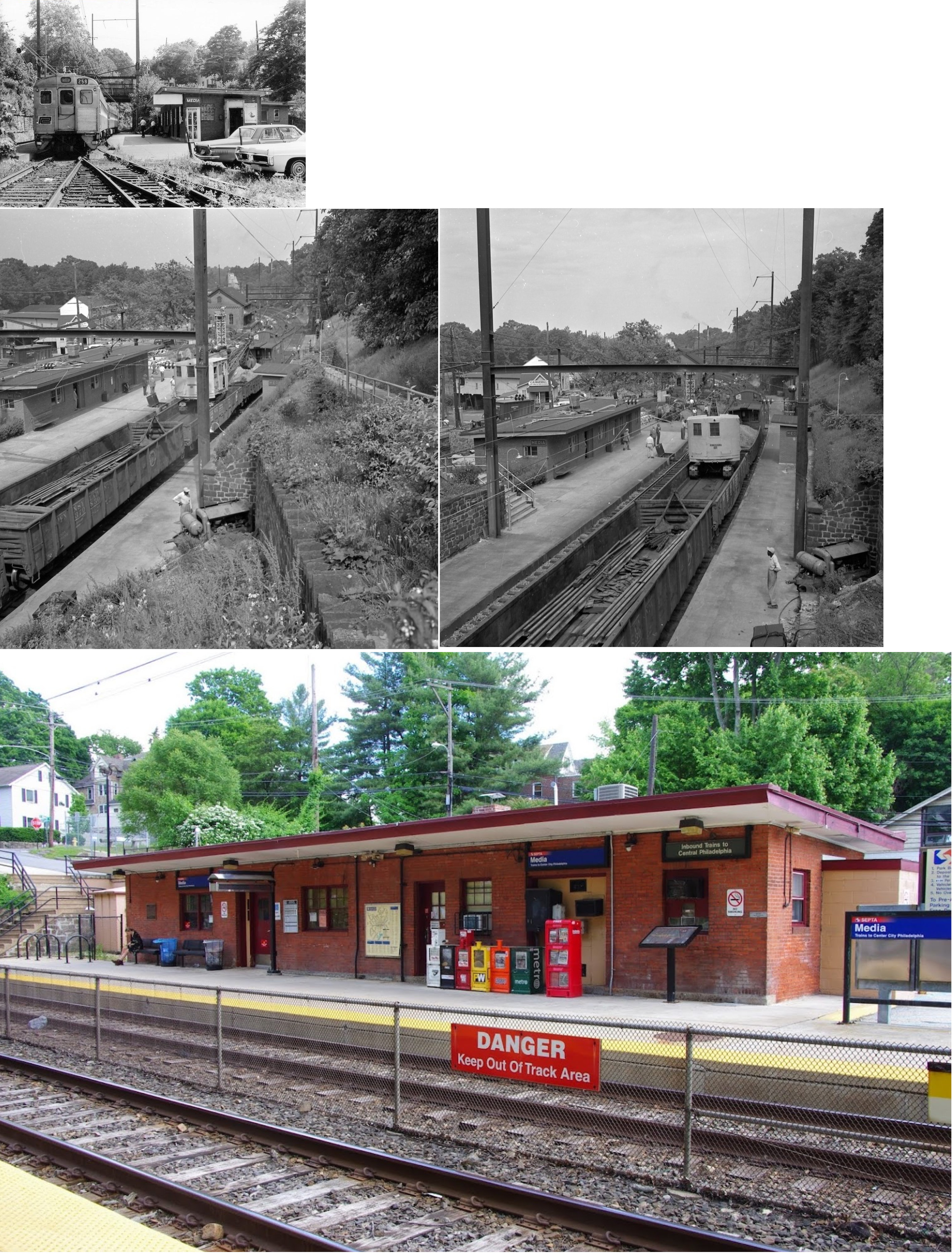
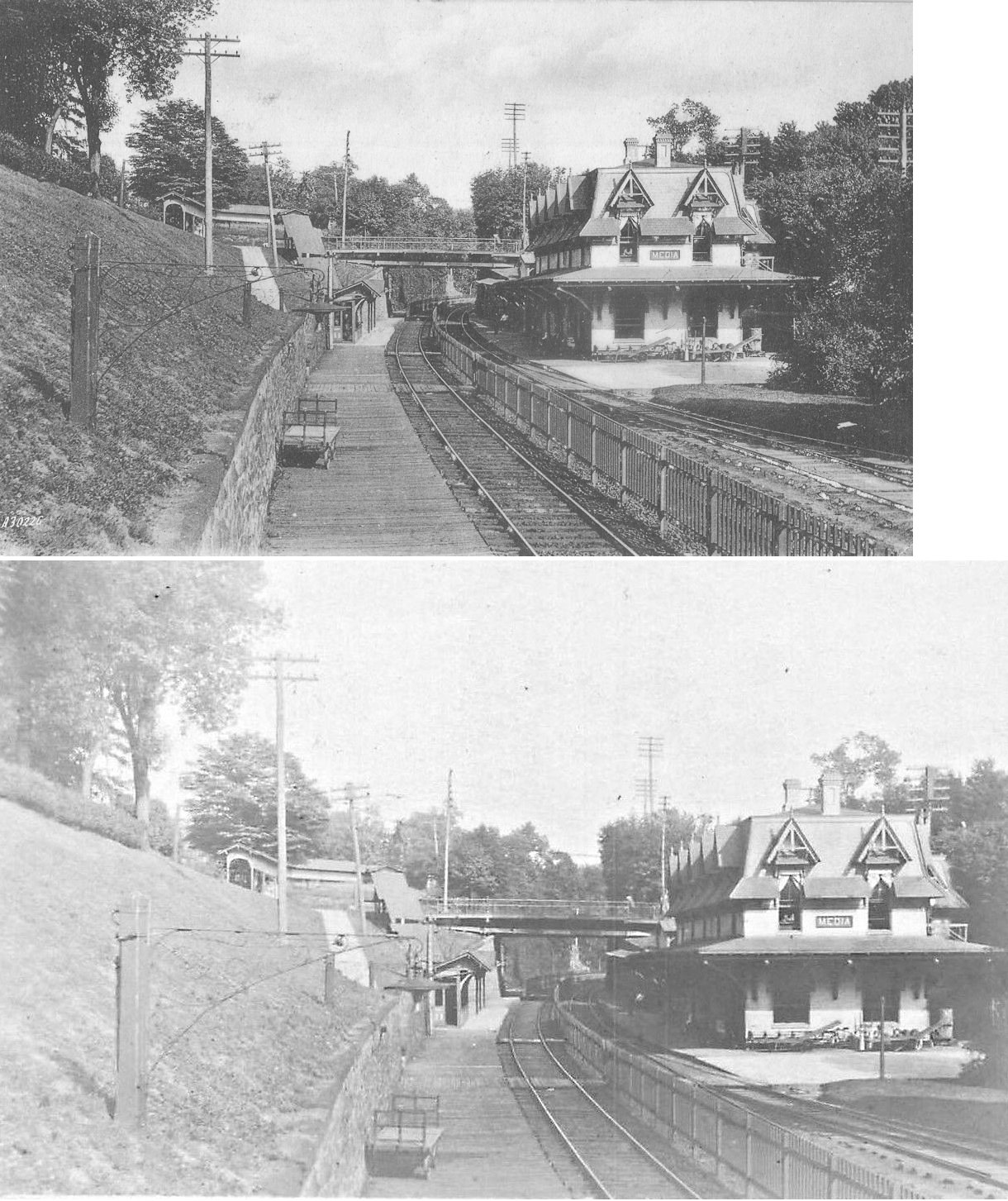
| Media | |
Media Station Road, west of South Orange Street (GPS: 39.914116,-75.394699) |
P | Railroad | 1960 | In Use | Brick | |
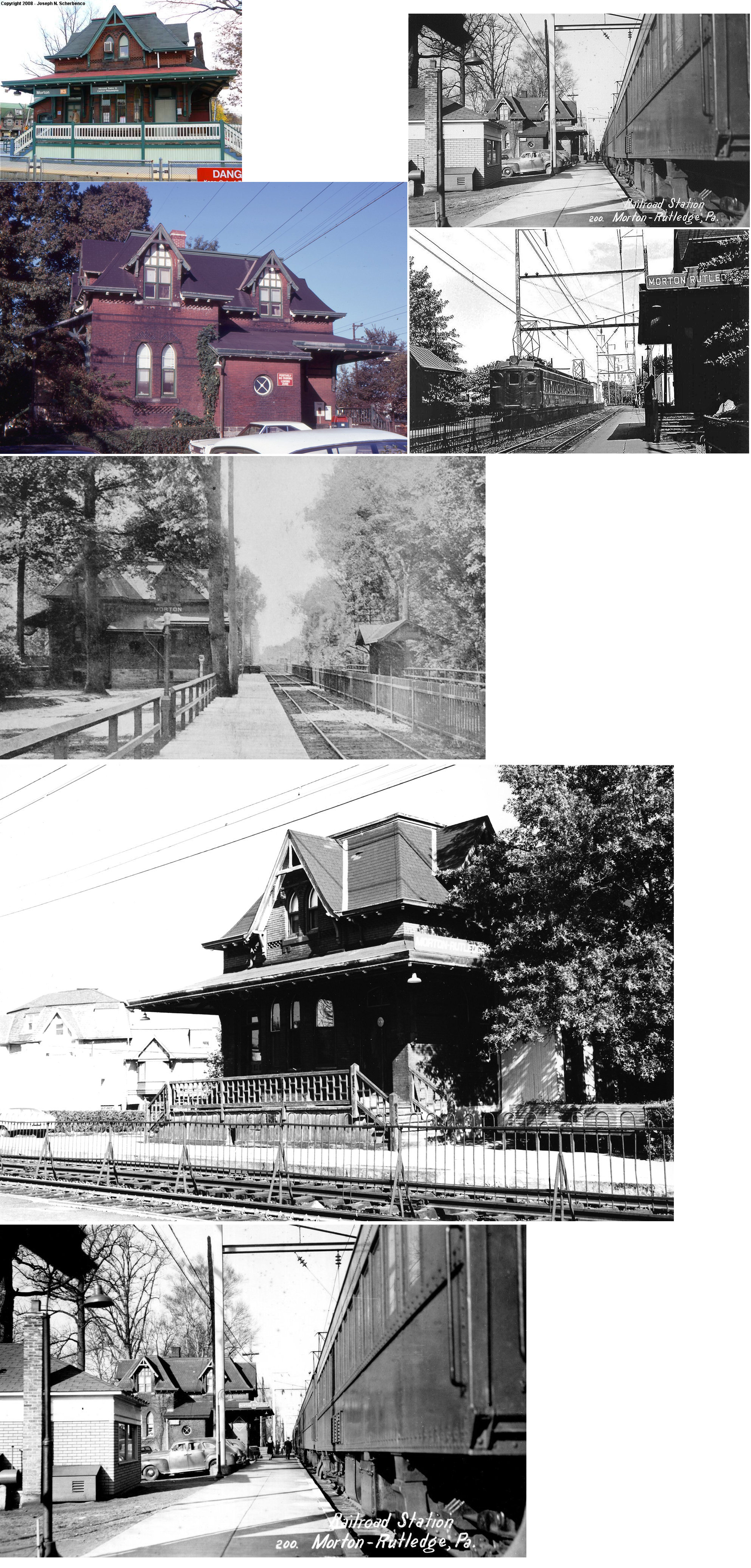
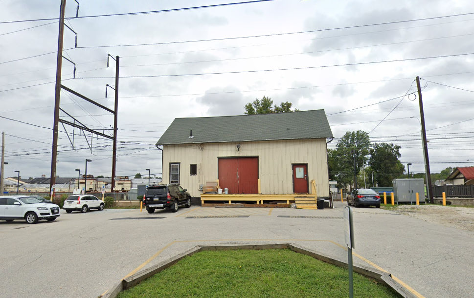
| Morton |
 |
Yale and Morton Avenues, 100 yards west of PA420 (GPS: 39.907977,-75.328322). |
C | Railroad | 1880 | In Use | Brick |
|
| Morton | |
Yale & Morton, just west of the passenger station. (GPS: 39.907858,-75.328673) |
F | Storage | ???? | In Use | Wood | |
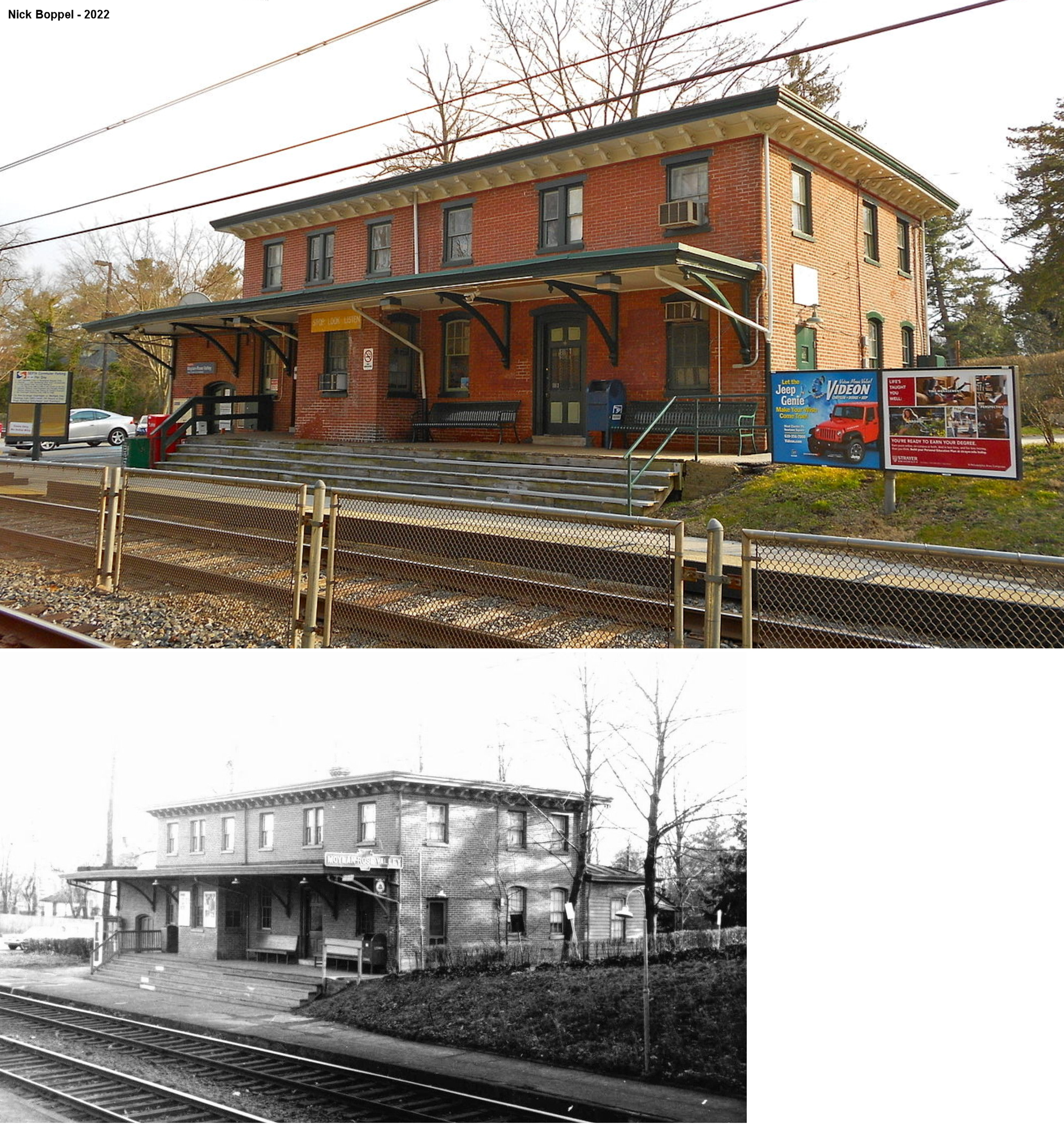
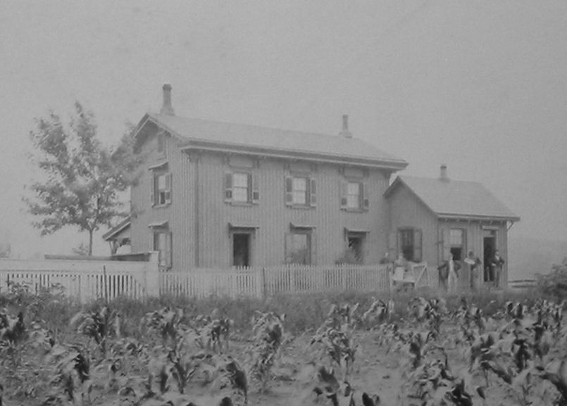
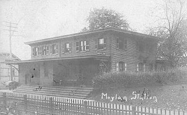
| Moylan-Rose Valley |
|
Manchester Avenue at Bancroft Road (GPS: 39.905737,-75.388159) |
P | Railroad/ Post Office |
1870 | In Use | Brick |
|
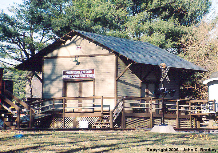
| Newtown Square |
 |
Drexel Lodge Park, on West Chester Pike (PA3) (GPS: 39.981886, -75.423228) |
F | Vacant | 1894 | None | Wood |
|
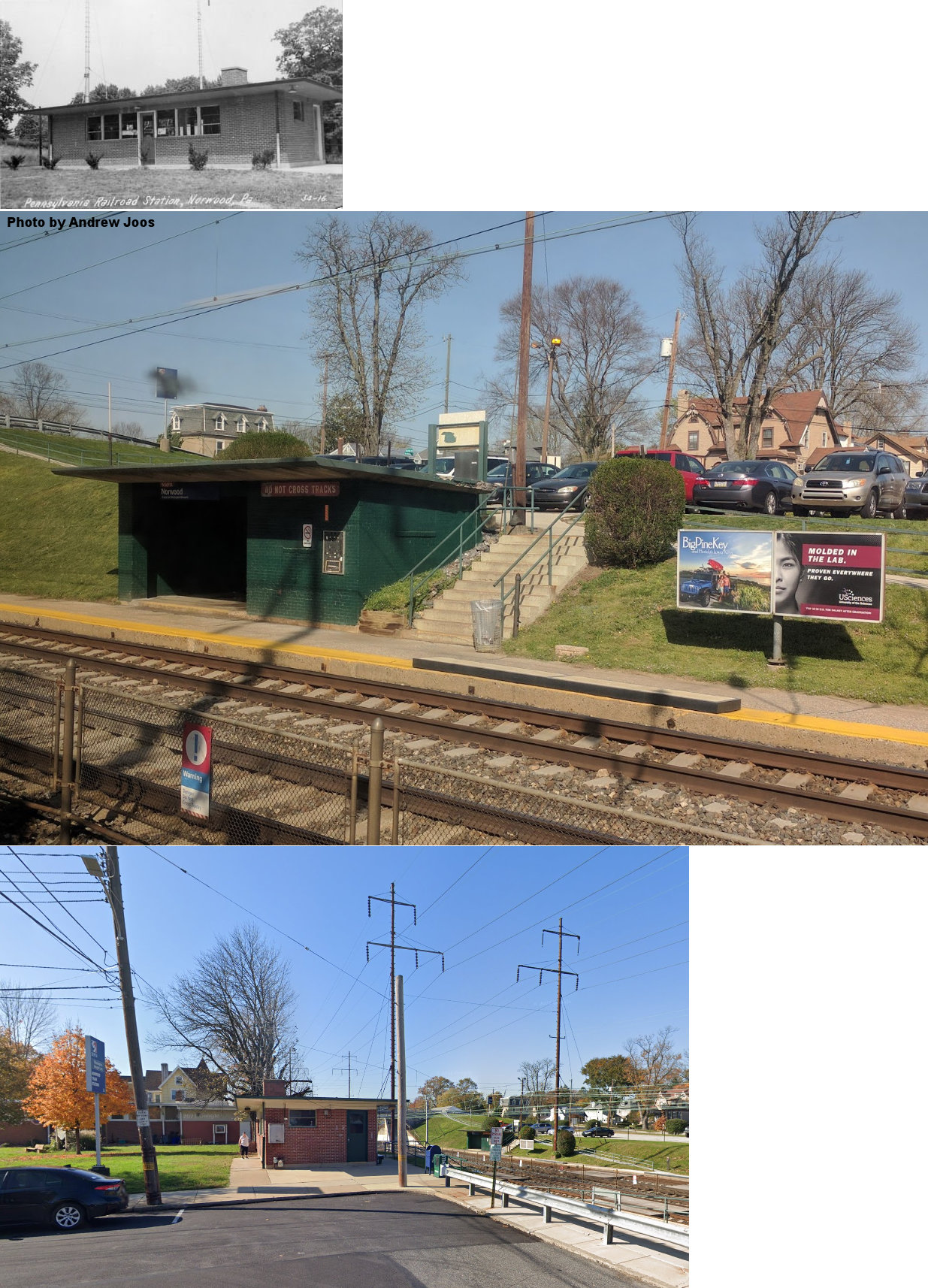
| Norwood |
|
North side of Welcome Avenue between Amosland Road and Winona Avenue (GPS: 39.891209,-75.301715) |
P | Railroad | ???? | In Use | Brick | |
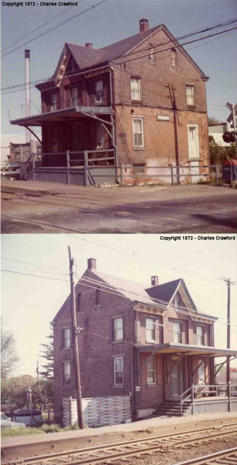
| Primos |
|
East side of Oak Avenue (GPS: 39.921644, -75.298327) |
P | Railroad | 2013 | In Use | Brick | |
|
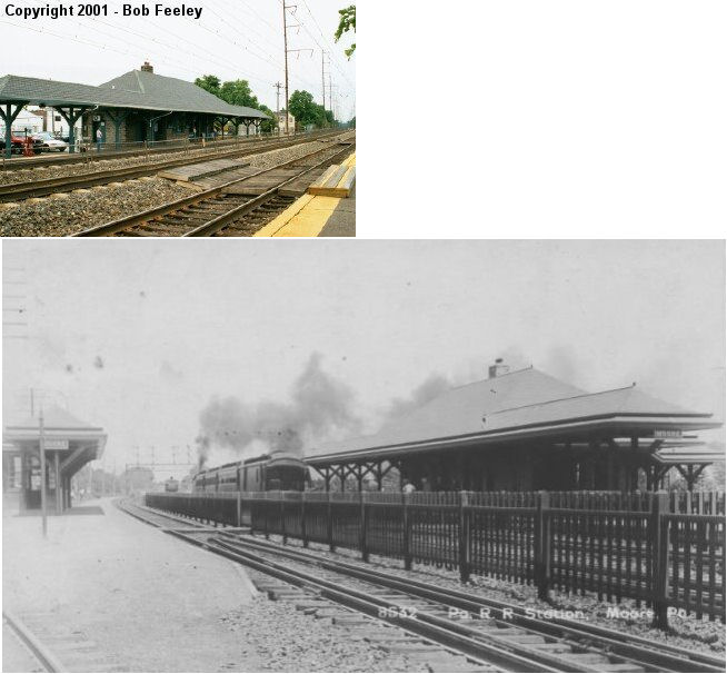
Prospect Park (Moore Sta.) |
|
Maryland Avenue NE of Lincoln Avenue (PA420) (GPS: 39.888023,-75.309387) |
P | Railroad | ???? | In Use | Stone |
|
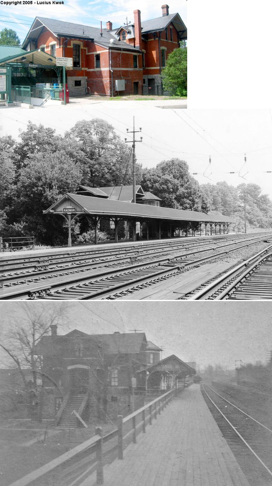
| Radnor | |
291 King of Prussia Road (GPS: 40.044905, -75.359513) |
P | Railroad | 1871 | In Use | Brick | |
| Ridley Park | |
Northwest of the intersection of East Hinckley Avenue and North Morton Avenue (GPS: 39.880449,-75.322022) |
P | Railroad | ???? | In Use | Brick | |
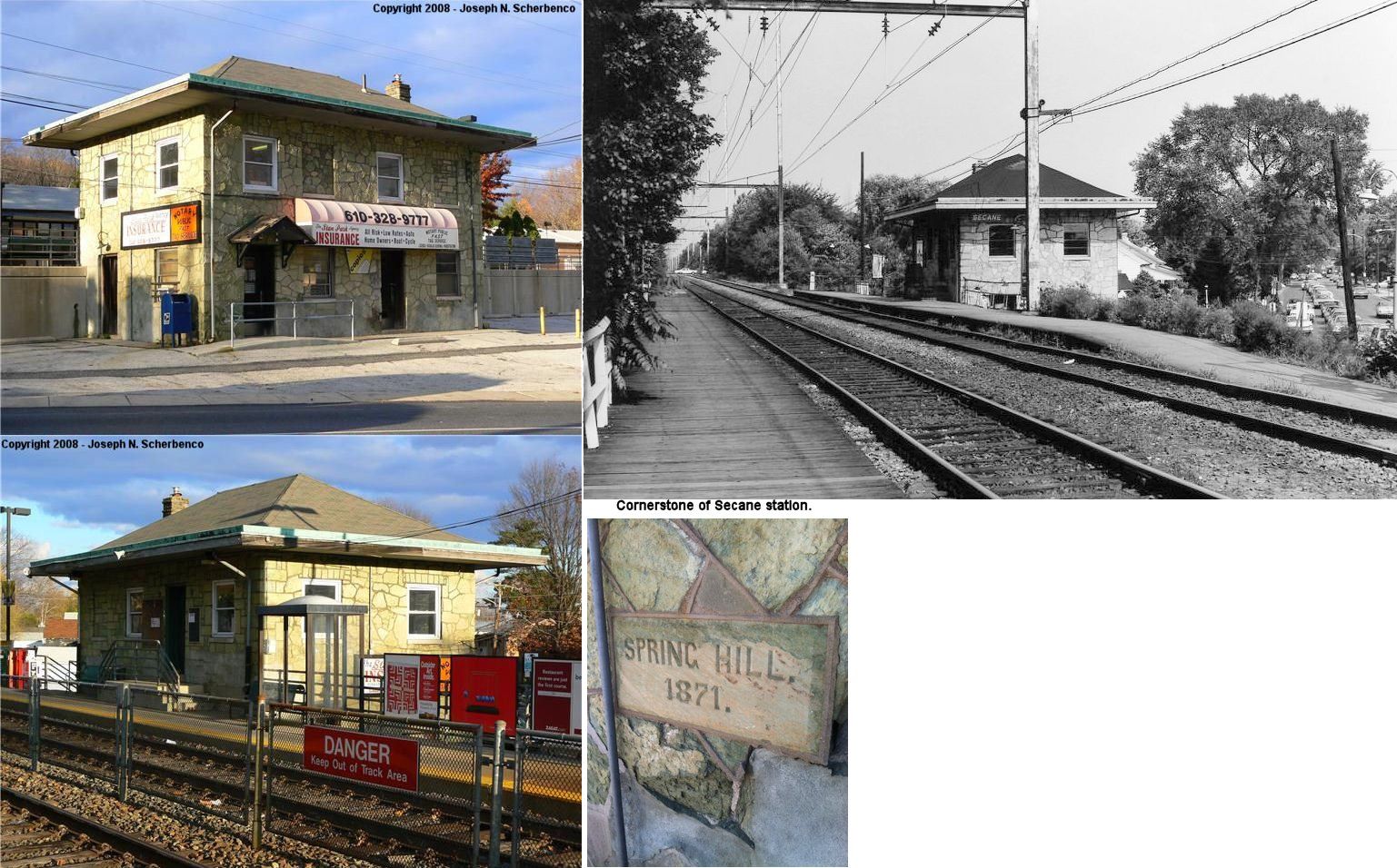
| Secane (Spring Hill) |
|
Providence Road just east of South Avenue (GPS: 39.915682,-75.309836) |
P | Railroad | 1871 | In Use | Stone |
|
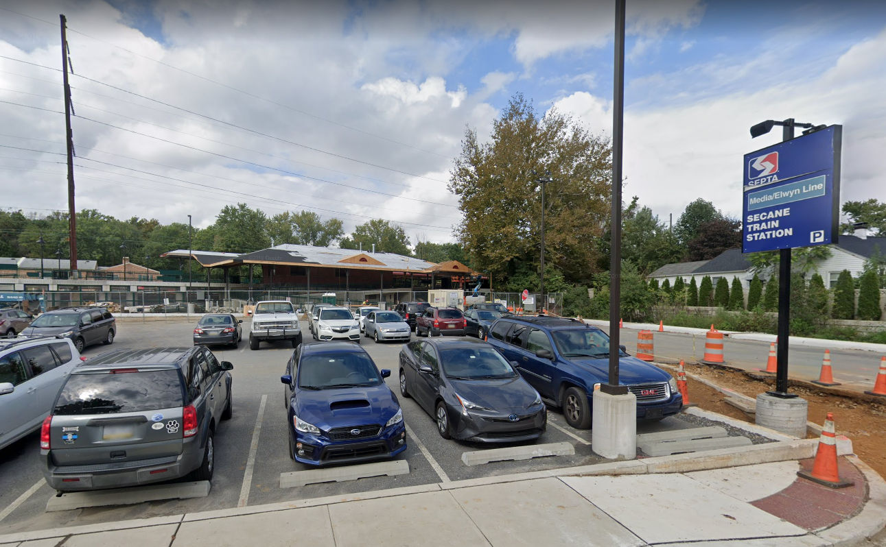
| Secane |
|
North
side of Providence Road near South Avenue (GPS: 39.916165, -75.308870) |
P | Railroad | 2018 | In Use | Brick | |
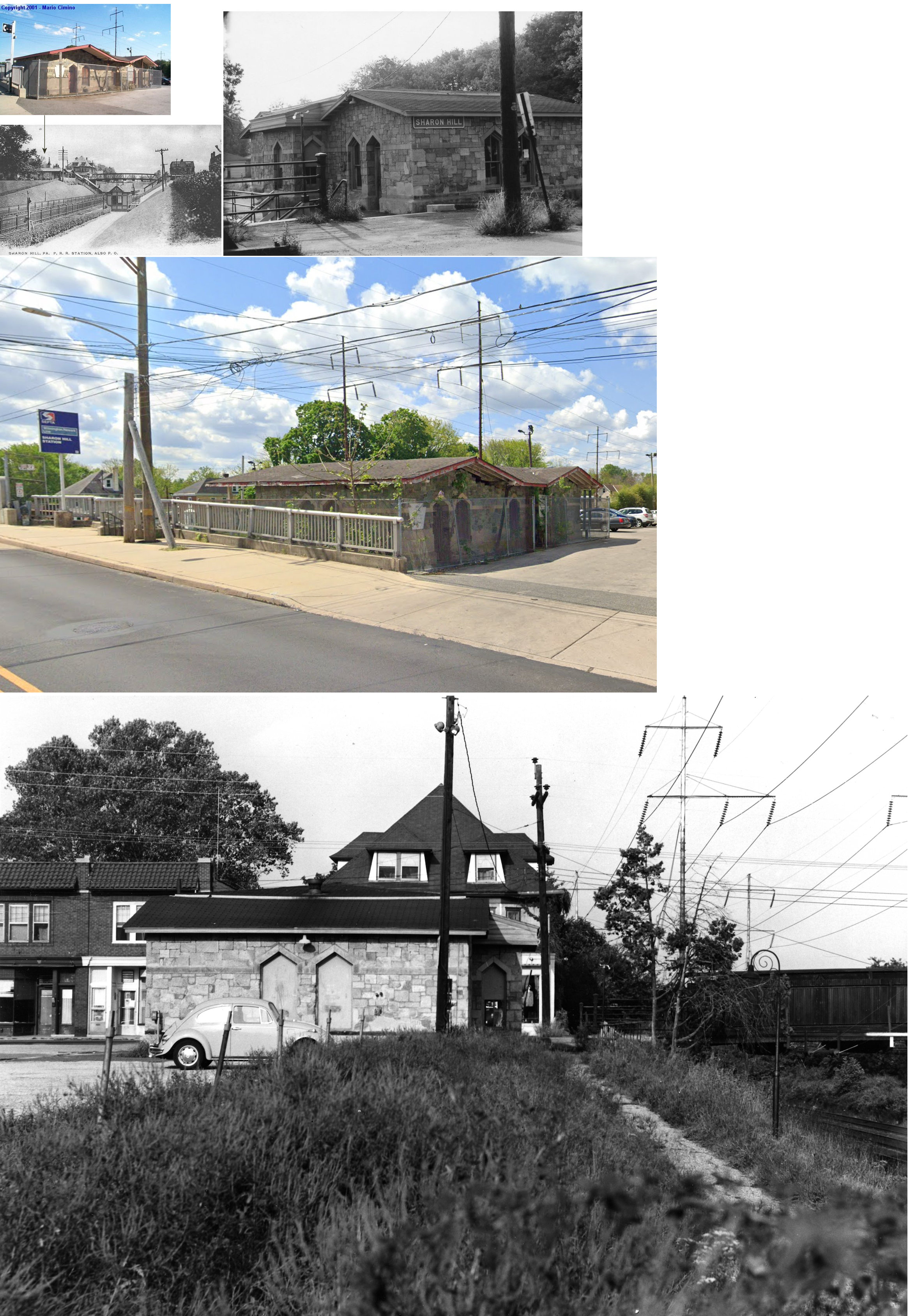
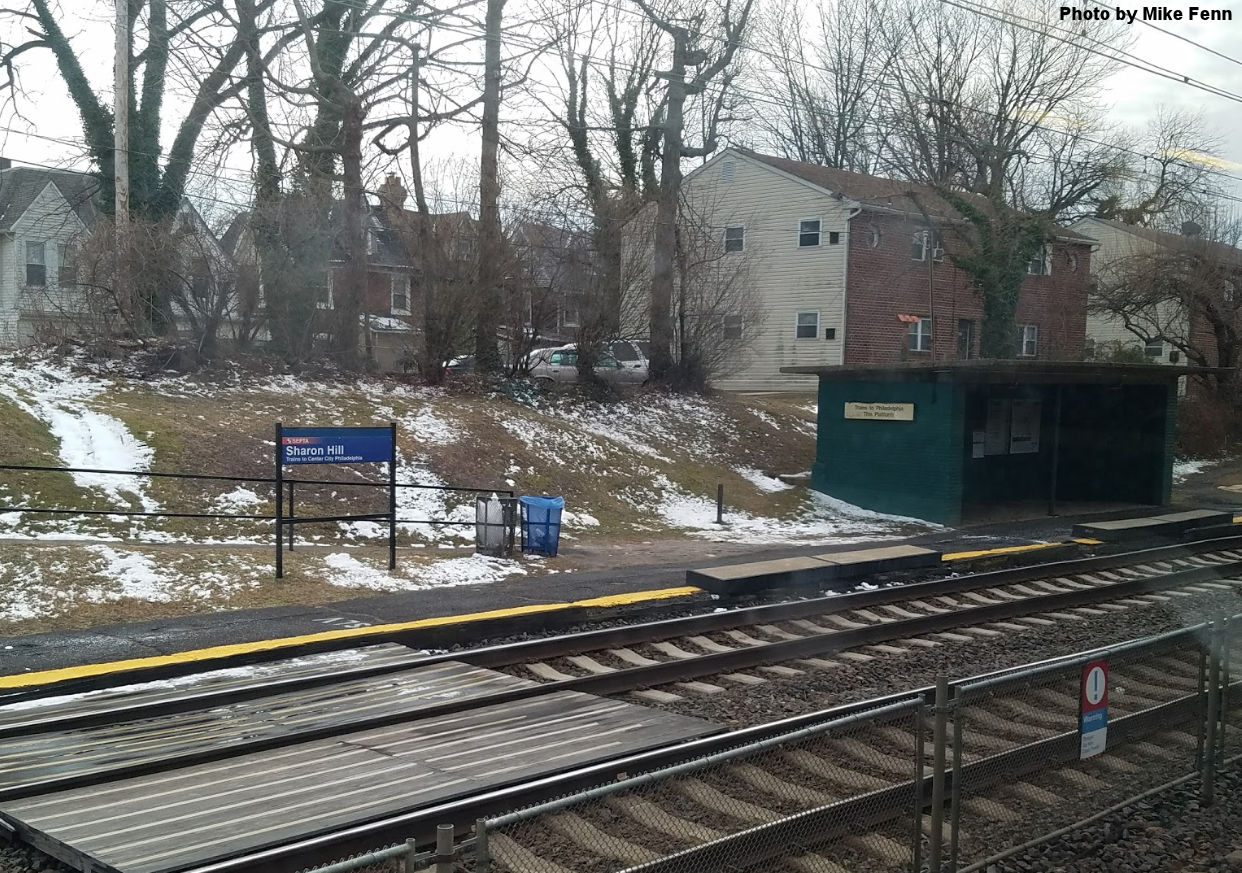
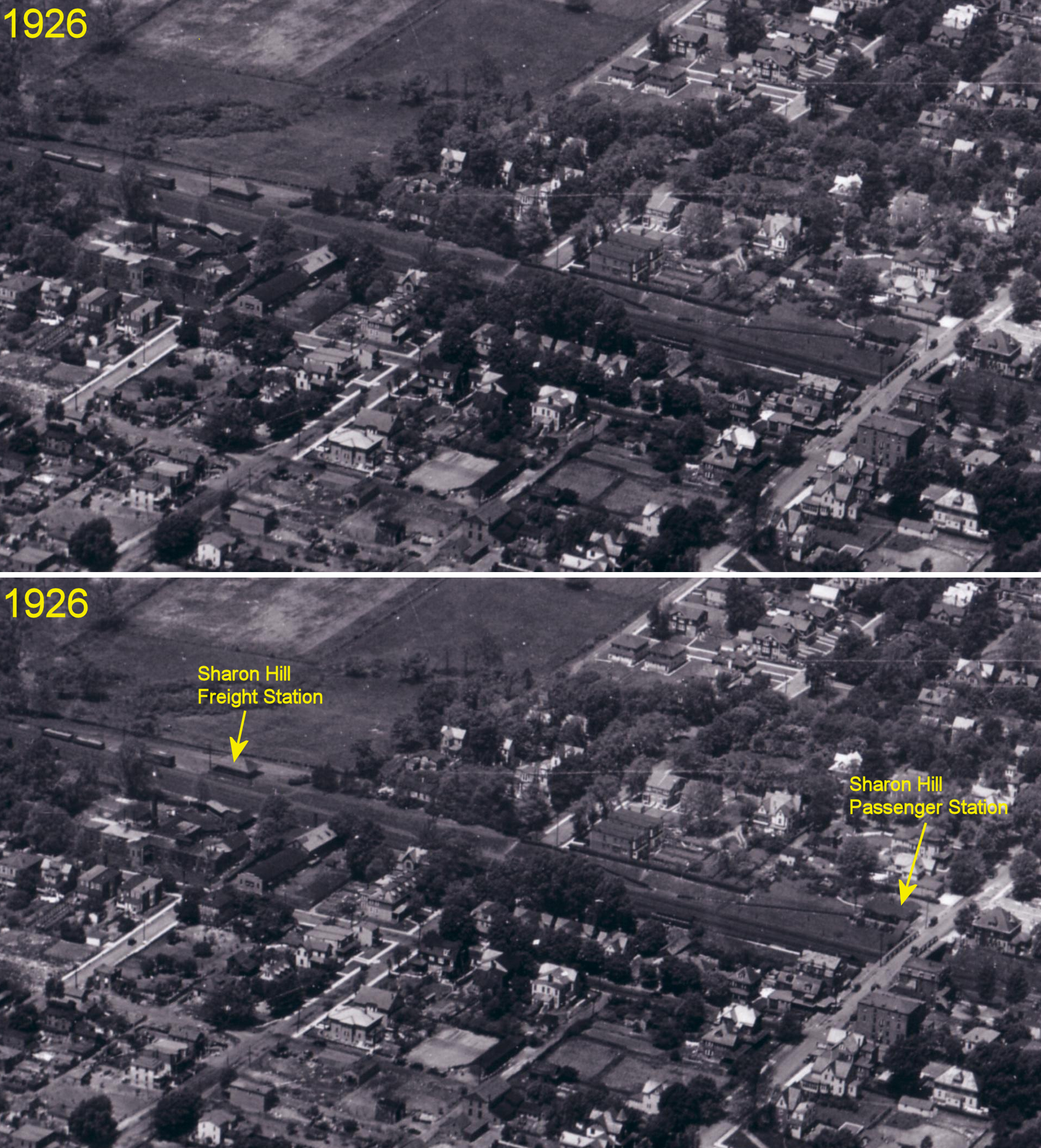
| Sharon Hill | |
400 Block of Sharon Avenue on the north side of the tracks. (GPS: 39.90457,-75.270775). |
P | Vacant | 1872 | In Use | Stone | |
| Sharon Hill |
|
414 Sharon Ave near Elmwood Avenue (GPS: 39.904022, -75.271226) |
P | Railroad | ???? | In Use | Brick | |
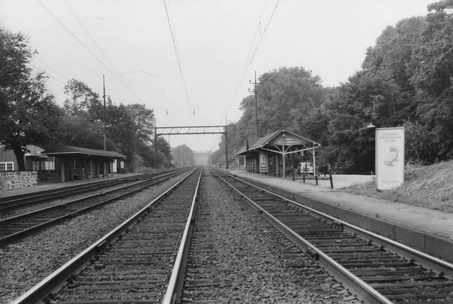
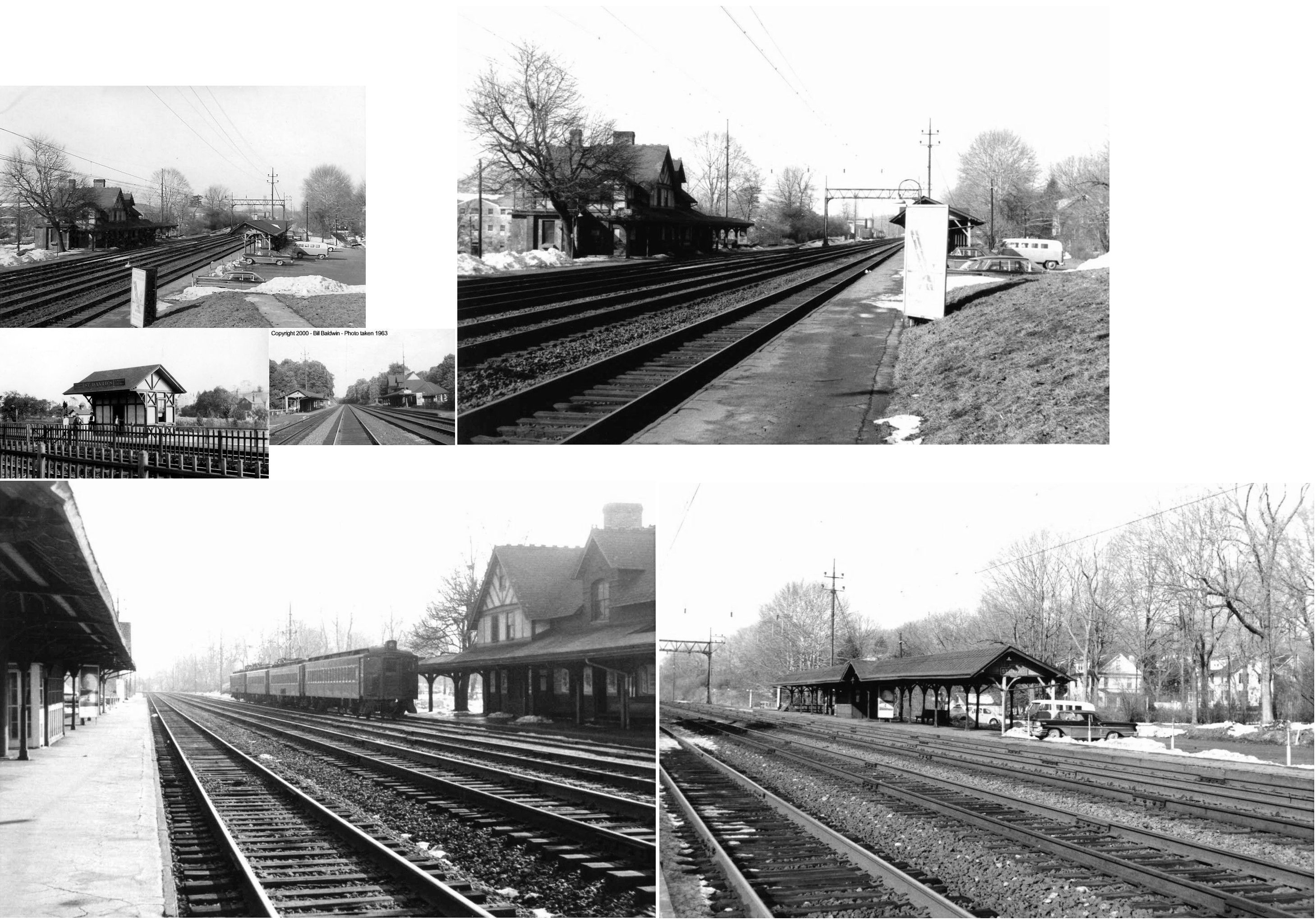
| St. Davids | |
85 Chamounix Road (GPS: 40.044036, -75.373494) |
P | Railroad | 1966 | In Use | Wood | |
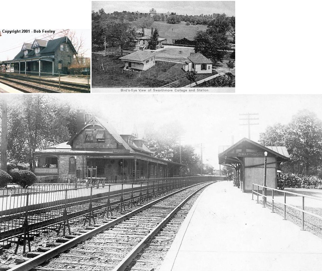
| Swarthmore | |
2 South Chester Road (PA320) (GPS:39.902197,-75.35111). |
P | Railroad | 1880 | In Use | Stone |
|
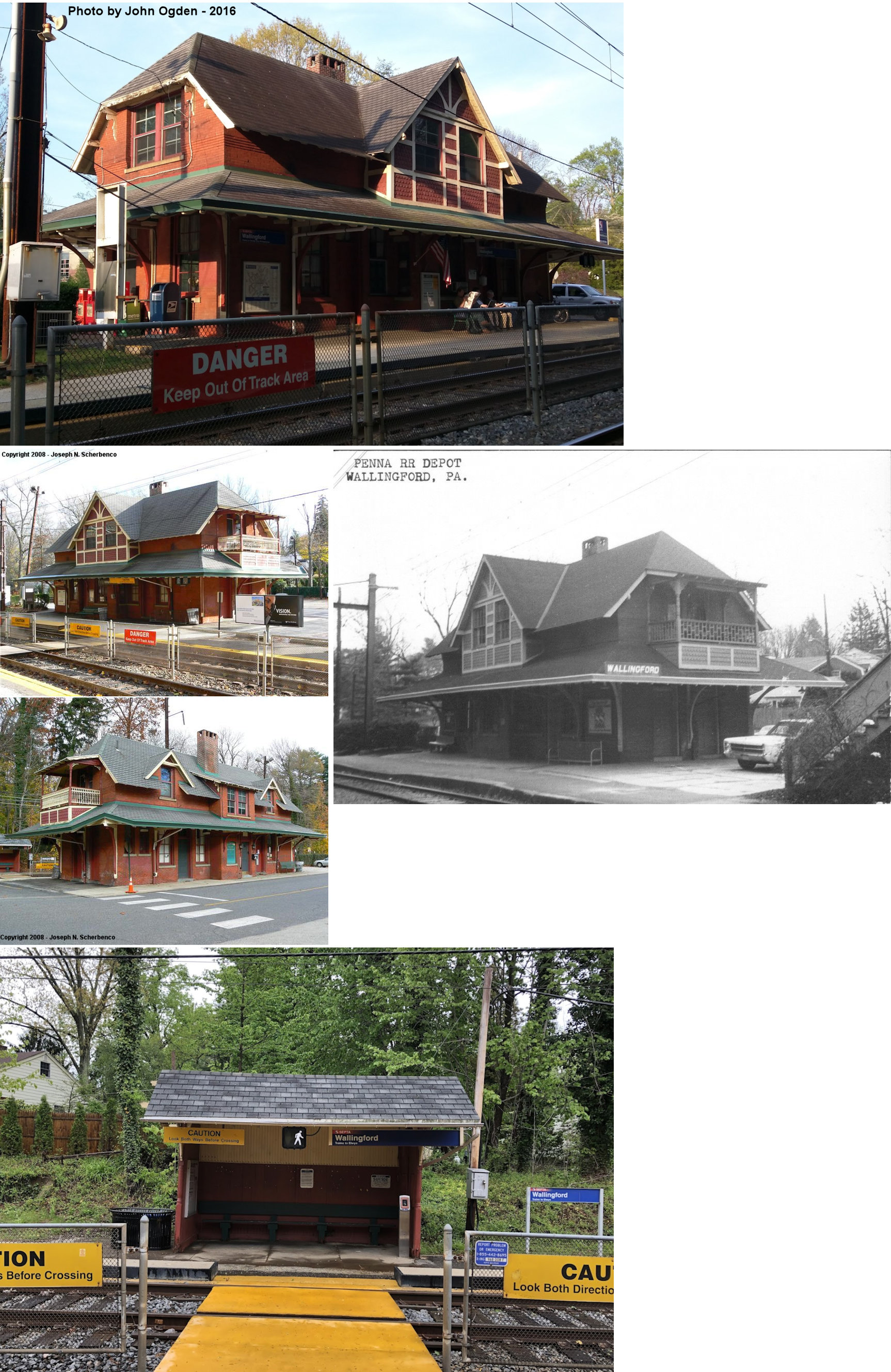
| Wallingford | |
141 East Possum Hollow Road (GPS: 39.903642,-75.371626) |
P | Railroad | 1890 | In Use | Brick |
|
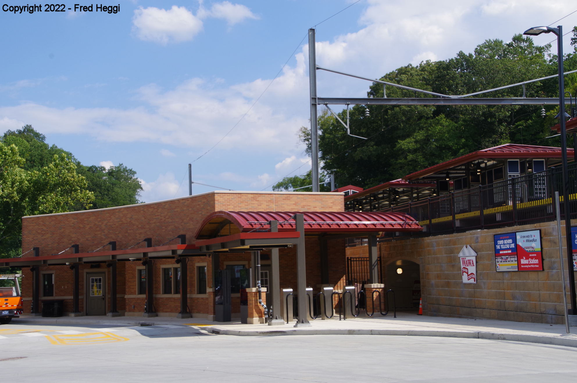
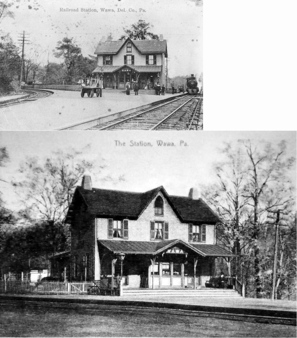
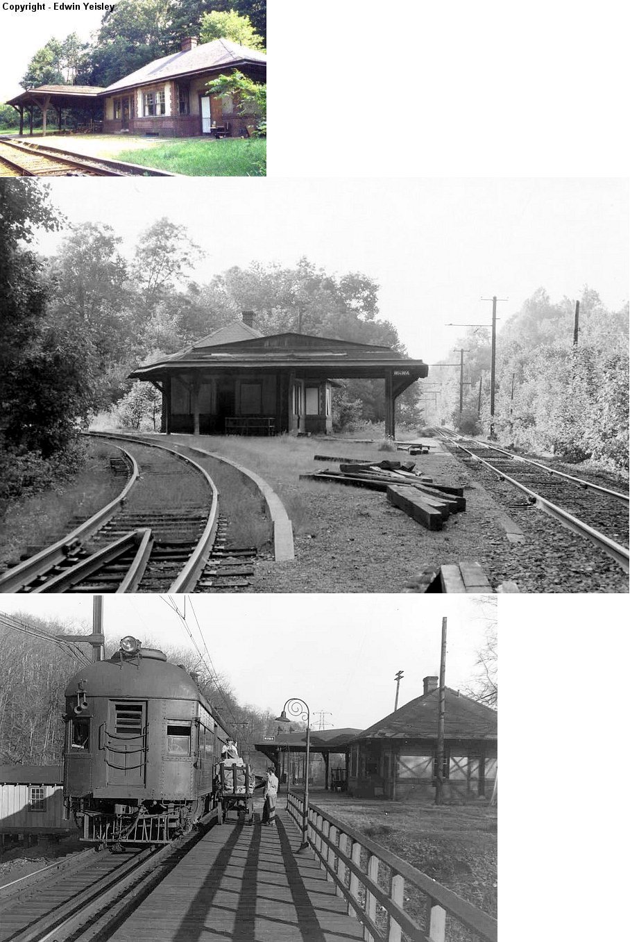
| Wawa |
|
On Route 1 (West Baltimore Pike) (GPS: 39.901391, -75.459388) |
P | Railroad | 2022 | In Use | Brick | |
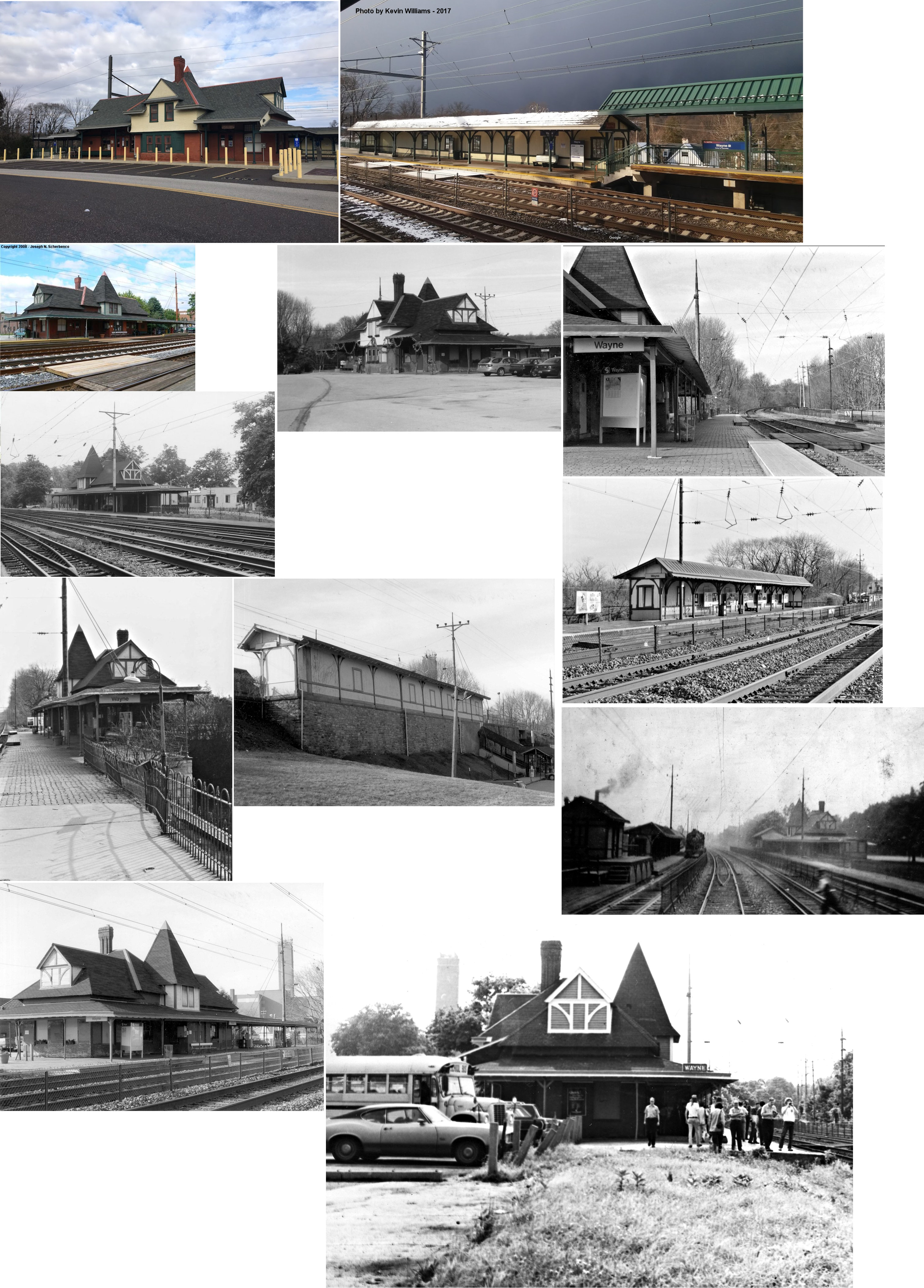
| Wayne | |
177 North Wayne Street (GPS: 40.045687, -75.387219) |
P | Railroad | 1882 | In Use | Brick | |
|
Whitehall Station (Bryn Mawr) |
 |
804 County Line Road (GPS: 40.018036, -75.322411) |
P | Business | 1860 | Gone | Wood |
|
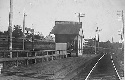
| Williamson School | |
Off Schrencks Way near Station Drive, south of the baseball field on Williamson School property. (GPS: 39.902872,-75.423406) |
P | Vacant | ???? | In Use | Wood |
|
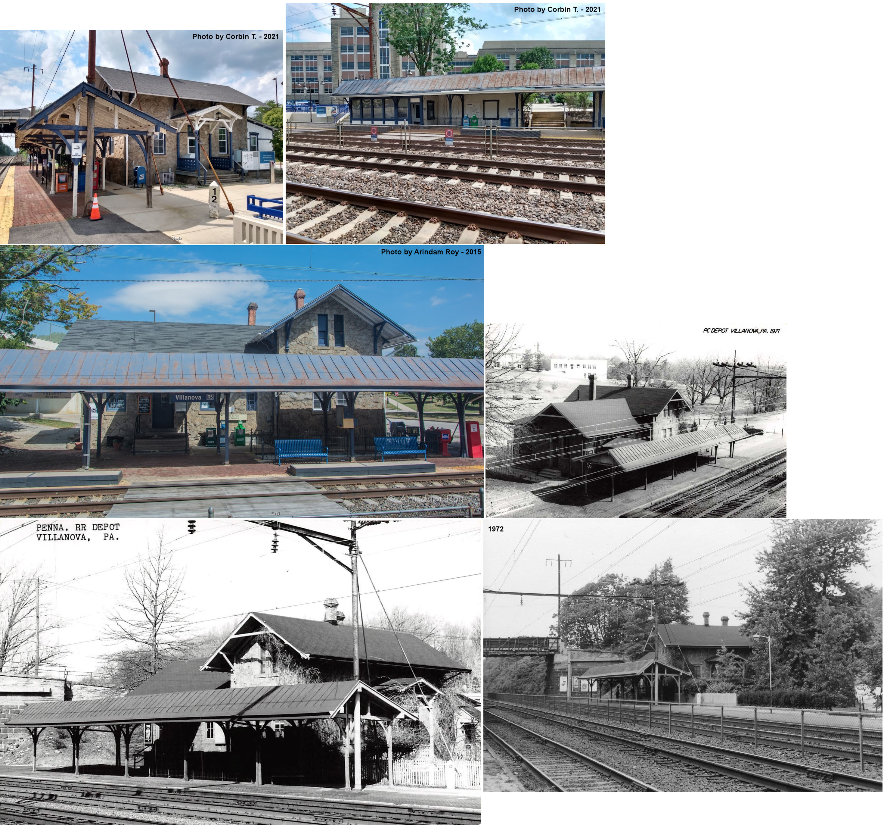
| Villanova | |
308 North Spring Mill Road (GPS: 40.038805, -75.342229) |
P | Railroad/ Residence |
1890 | In Use | Stone |
|
| STATIONS OF THE PAST | ||||||||
| Station Name |
Original Railroad |
Notes | ||||||
| Academy (Curtis Park) |
|
The old Academy station was on the west side of Calcon Hook Road on the south side of the tracks (39.907012,-75.265988). The Curtis Park station (still standing) replaced this station on the line in 1949. | ||||||
| Arlington |
|
This station (likely just a platform or shelter) was between South State and South Cedar Streets in Upper Darby Township. It was on the SW side of the tracks (GPS: 39.961046,-75.285391). By 1896, even as ridership dwindled and service was down to three trains a day, this flag stop was added at MP 7.97 between Garrett Road and Llanerch. | ||||||
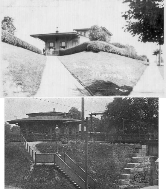
| Ashton (Brookhaven) |
|
This station was was on the SE side of Chester Creek & Dutton Mill Road. | ||||||
| Boone |  |
This station was SW of Darby station where Poplar Street/Lawrence Avenue used to cross the tracks (GPS: 39.91547,-75.26201). | ||||||
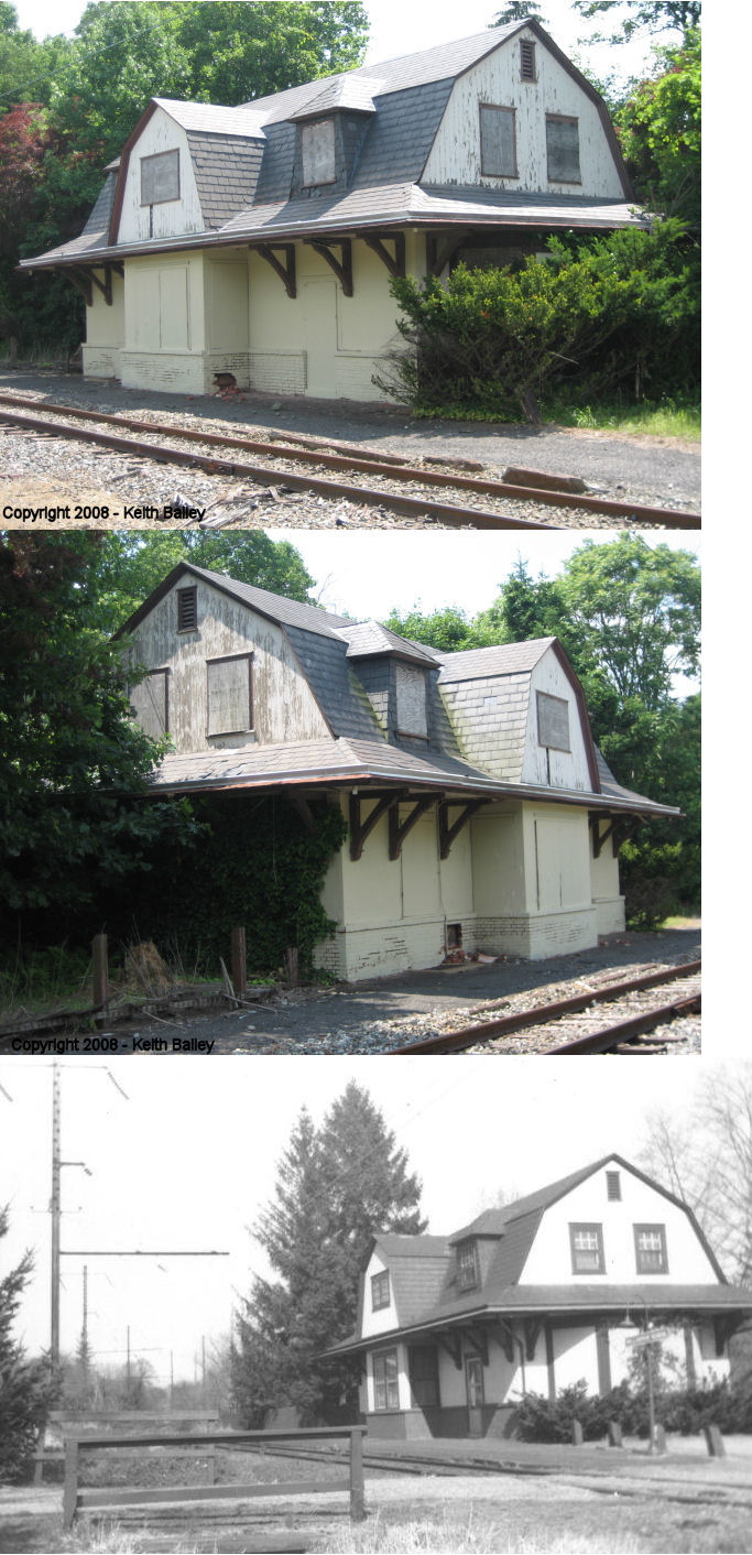
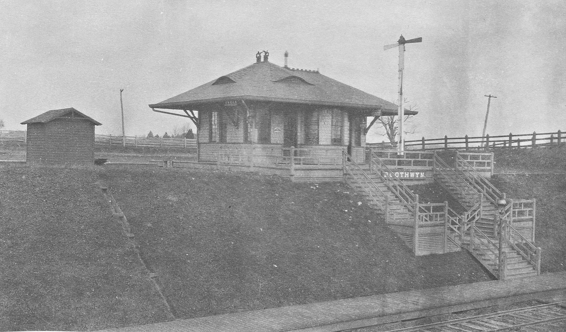
| Boothwyn | |
This station was on the west side of Chichester Avenue, on the north side of the tracks (GPS: 39.834044,-75.441914). | ||||||
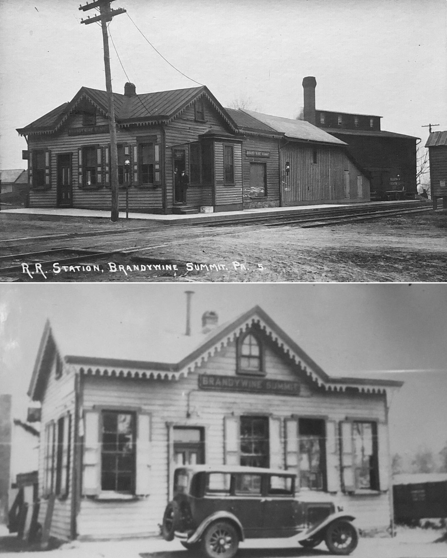
| Brandywine Summit | |
This station was on the east side of US 202 at approximately GPS: 39.873649, -75.544481. | ||||||
| Bridgewater | |
|||||||
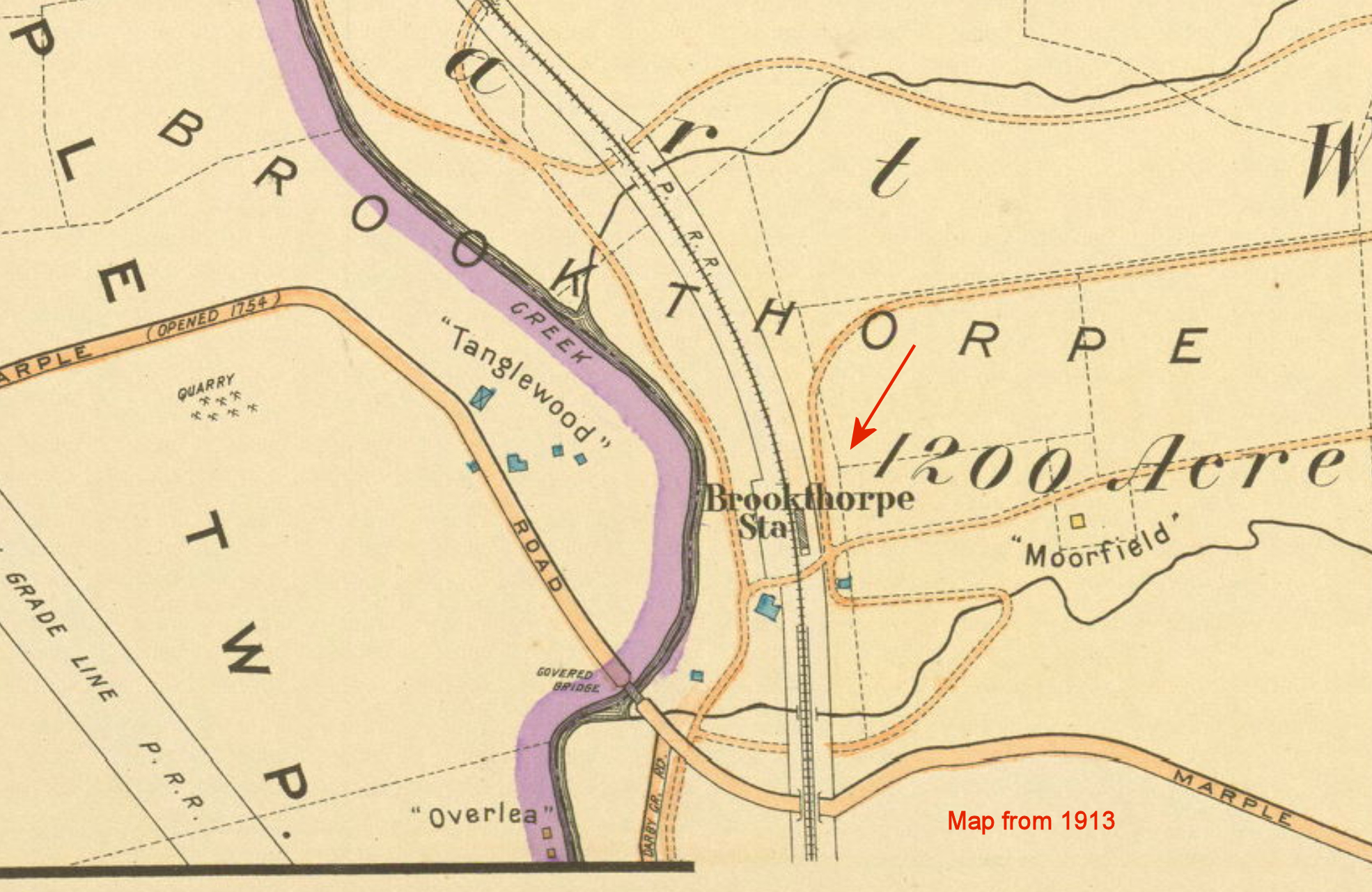
| Brookthorpe (Cooperstown Road) |
|
This station was originally called "Coopertown Road." It was north of Marple Road near where that road crosses Darby Creek in the vicinity of GPS: 39.990731, -75.342855. Although a station is shown here on some maps, it was only a flag stop and likely only had a platform or shelter. This station was eastablished in 1894 with the opening of the P&DC RR. | ||||||
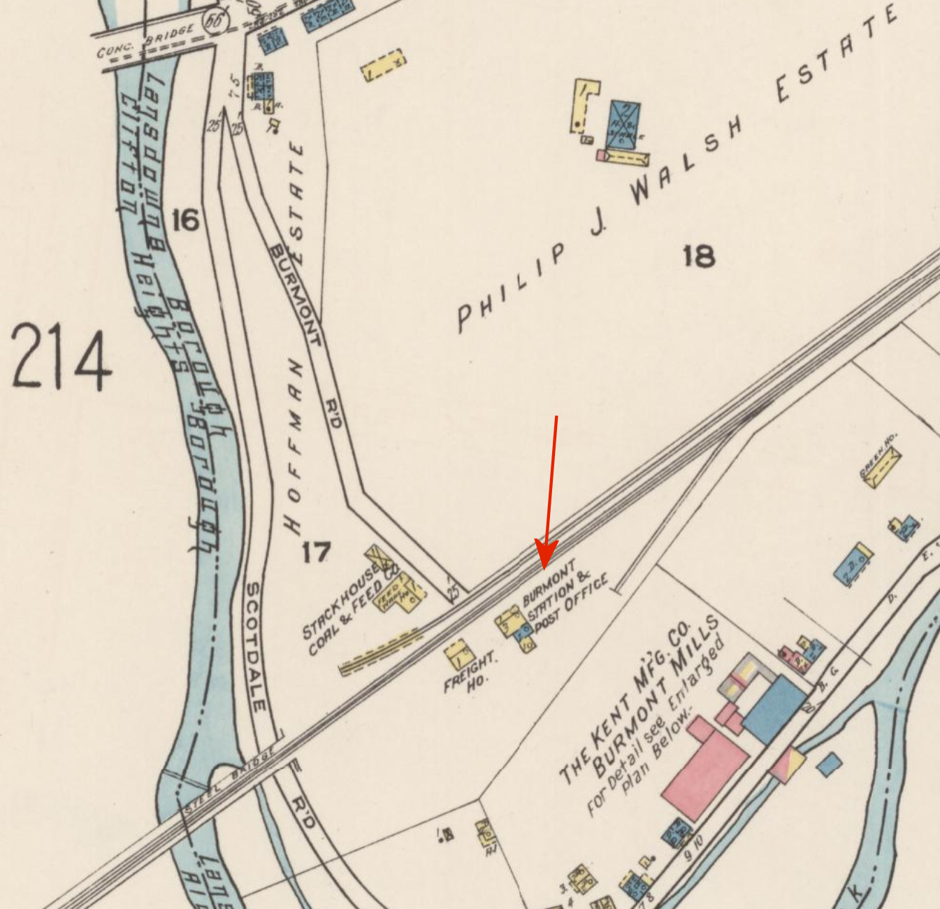
| Burmont (Kellyville) |
|
This station/post office was just east of Scottdale Road on the south side of the tracks near where the current SEPTA Gladstone station is located (GPS: 39.93262,-75.282183). There was also a freight station here. This station was later known as Gladstone (where there is a current SEPTA station) and previously known as Kellyville. | ||||||
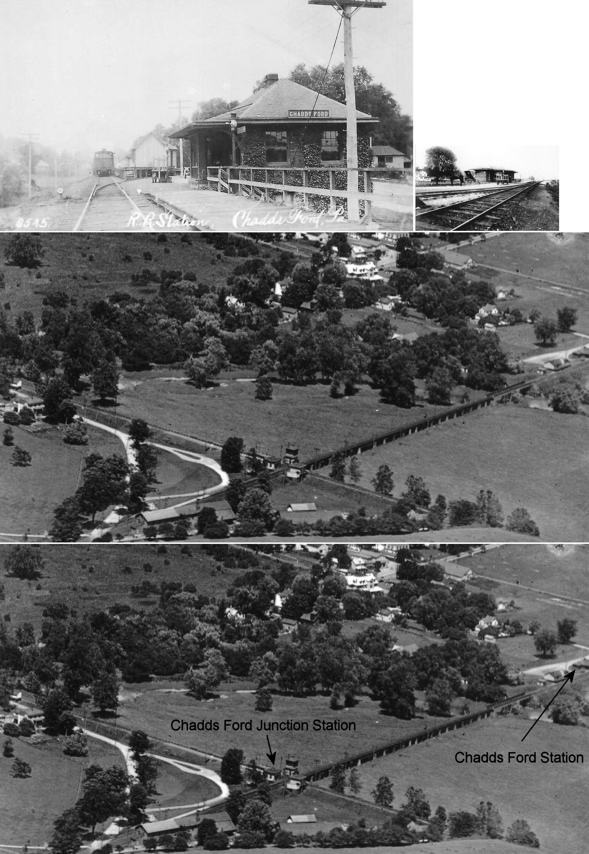
| Chadds Ford Junction |
 AND  |
This station was just a few hundred yards west from the Chadds Ford station listed below and sat just across the creek in Chester County. It was off of Fairville Road at GPS: 39.868936, -75.596027. | ||||||
| Chadds Ford | |
This station was located at the end of Station Way Road at Hoffman's Mill Road (GPS: 39.869905, -75.591911). There was also a freight station just west of the passenger station as can be seen in the photos. | ||||||
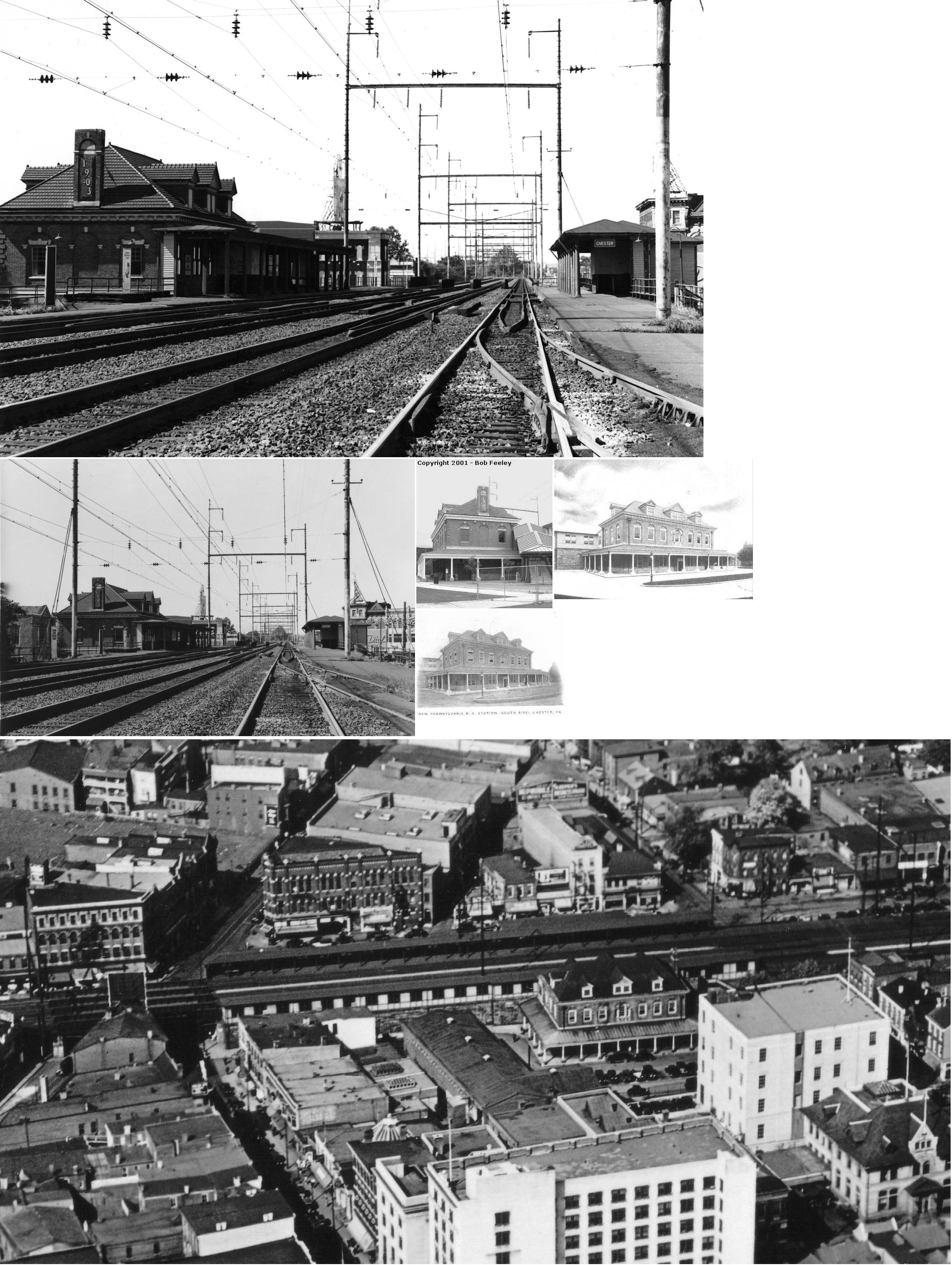
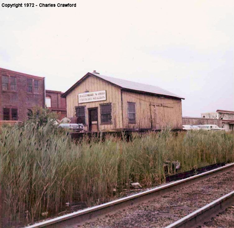
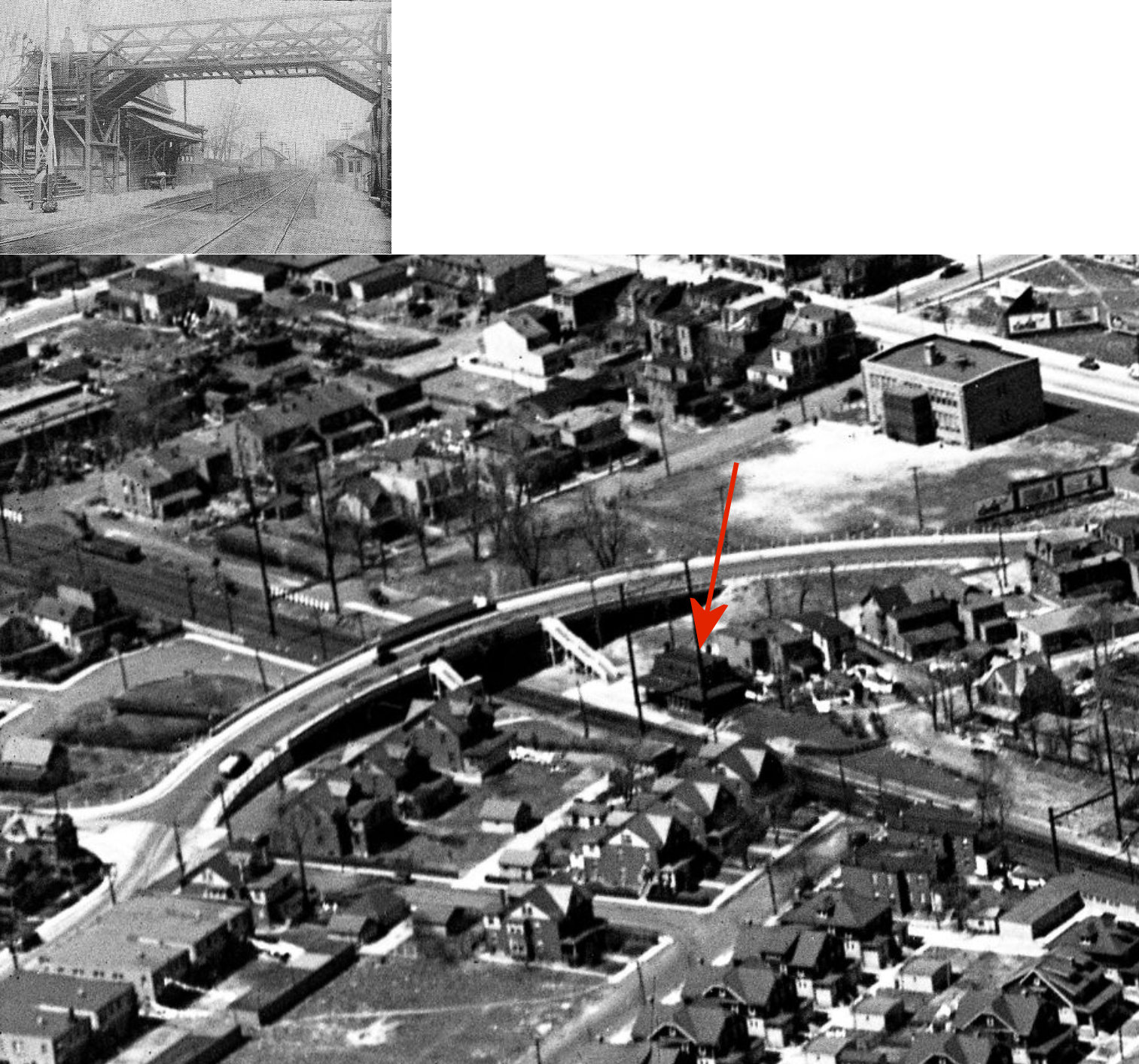
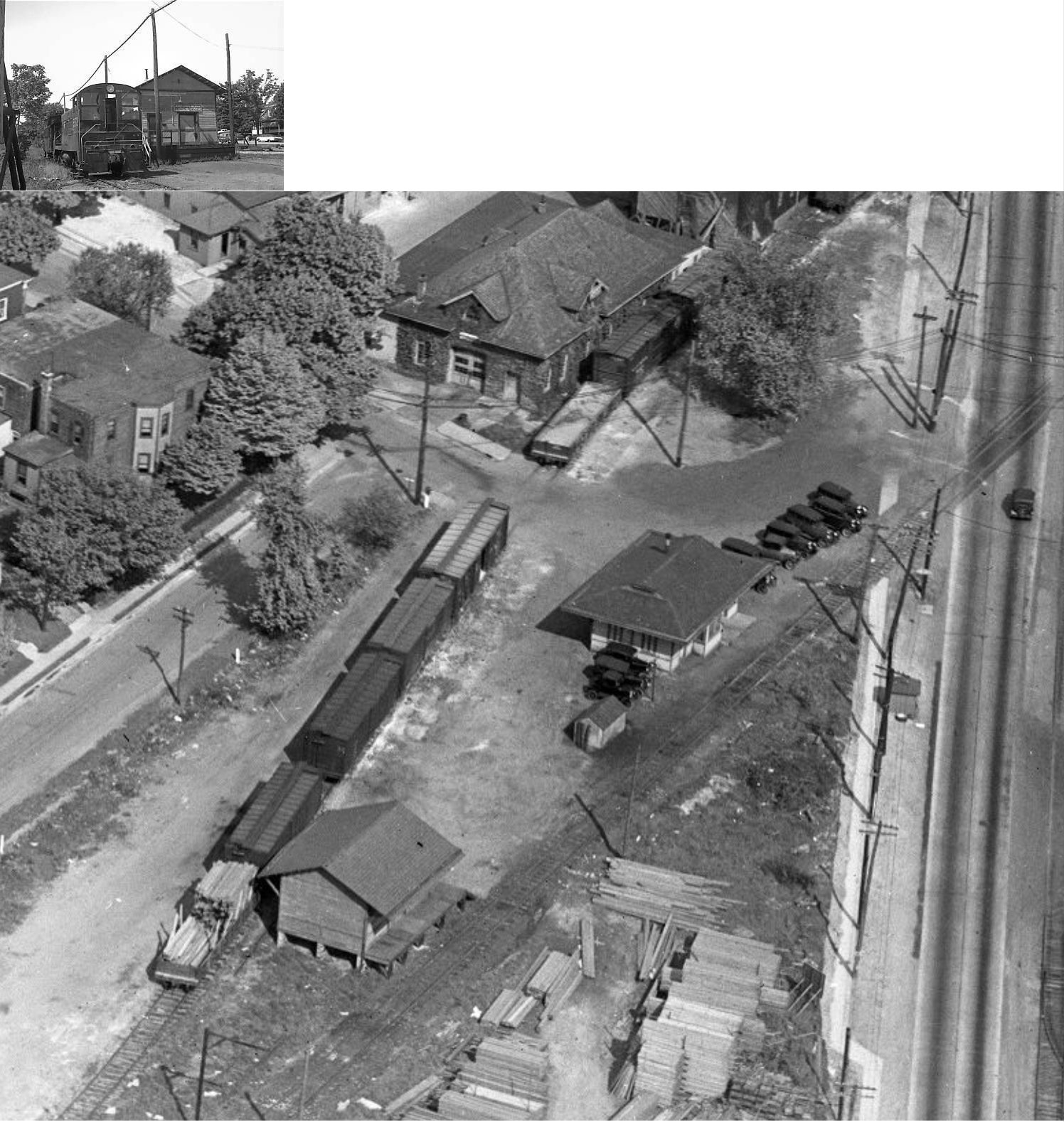
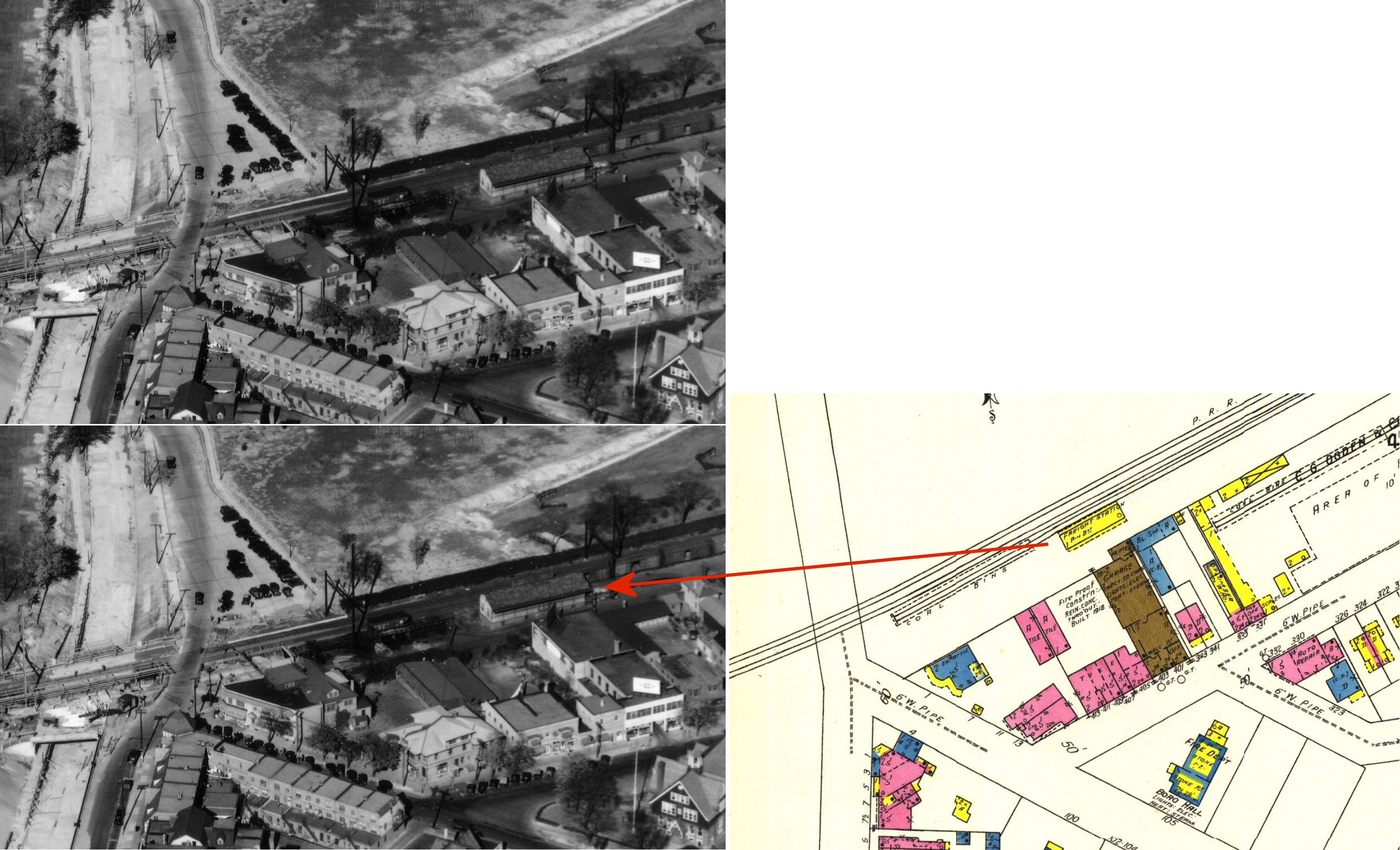
| Chester | |
This station was located at 12th and Providence at approximately GPS: 39.857449, -75.360704. It was torn down in 1960 when the line was put below street level for I-95. | ||||||
| Chester | |
There was a freight station on the west side of Potter Street at 12th Street (GPS: 39.858382, -75.358413). It was on the north side of the tracks. | ||||||
| Chester (Upland) |
|
The first station here was two-story wood frame station/agent's quarters built in 1837. | ||||||
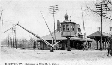
| Chester | |
In 1854, the PW&B built a one-story brick station on 6th Street between Market Street and Welsh Street on the north side of the tracks at GPS: 39.849578, -75.360273. The freight house was on the SE corner of 6th and Welsh Streets on the north side of the tracks at GPS: 39.849887, -75.359512. | ||||||
| Chester (Thurlow) (Wilson St.) |
|
The 1870 map shows a station on the NE side of Thurlow Street on the south side of the tracks at GPS: 39.833361, -75.393533. Thurlow Street no longer goes through to the tracks. The station is labeled on the map as "Thurlow Station." In 1905 the PRR changed the name of the station to "Wilson Street." | ||||||
| Chester | |
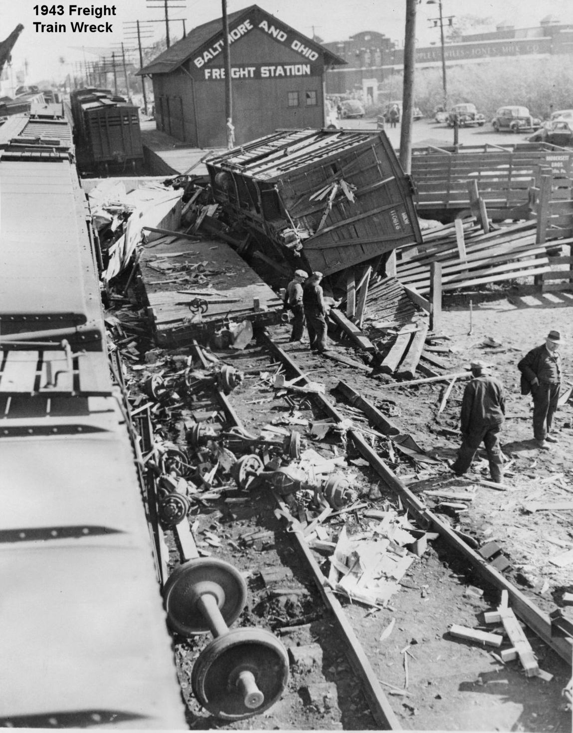
There was a freight station on the east side of Morton Street across from the intersection with East 5th Street at GPS: 39.852090, -75.352697. There was an express agency on the other side of Morton Street that can be seen in the 1940 aerial photo. | ||||||
| Chester | |
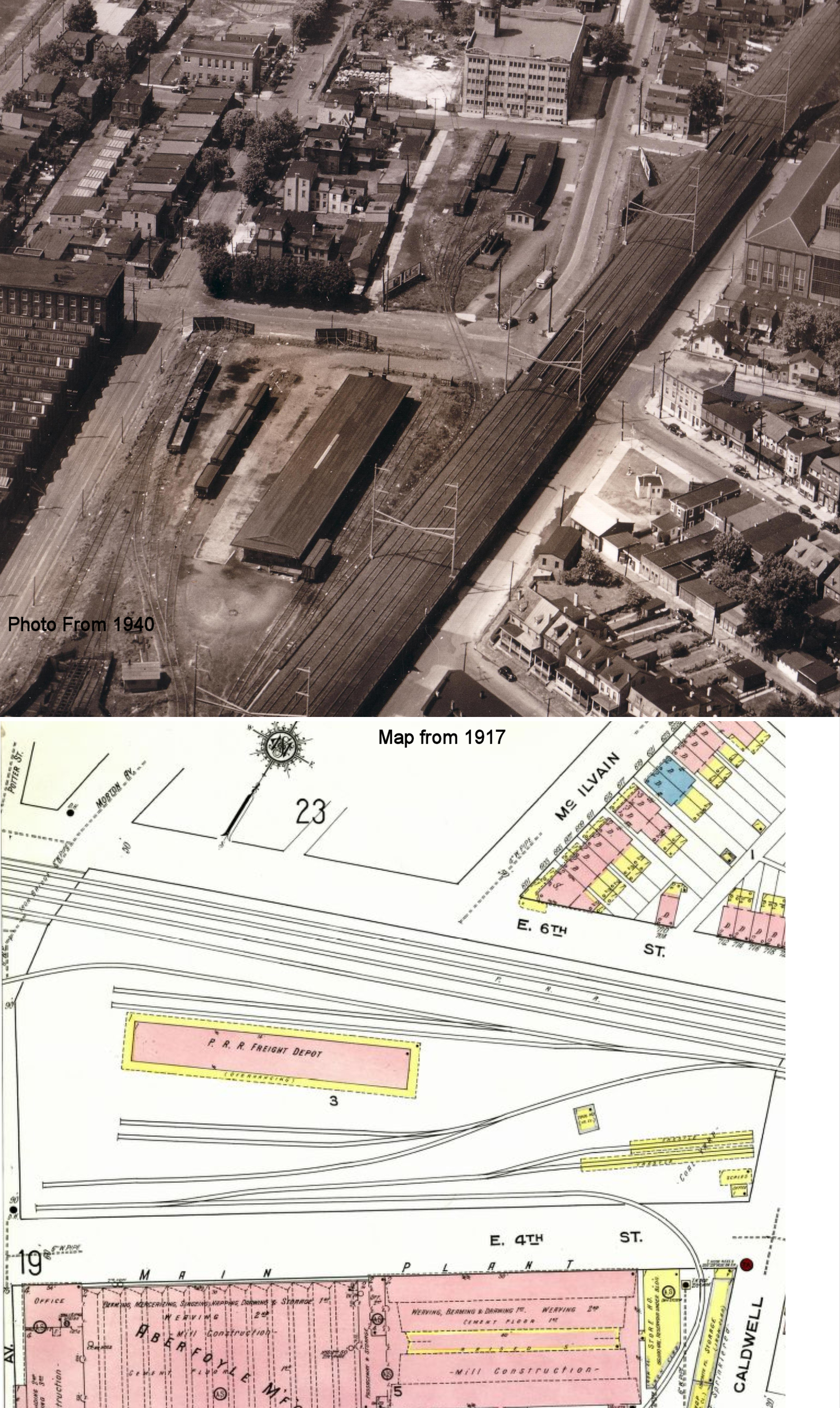
There was a freight station on East 6th Street just east of Welsh Street at GPS: 39.850083, -75.358998. It it shown on the 1885 map, and was torn down prior to 1917. | ||||||
| Chester | |
There was a freight house on the SE side of Tilghman Street between 2nd and 3rd Streets at GPS: 39.838428, -75.376929. This station is shown on the 1917 Sanborn map. | ||||||
| Chester | |
There was a small freight house on the SW side of Wilson Street at GPS: 39.834425, -75.390533 on some siding tracks. This station is shown on the 1917 Sanborn map. | ||||||
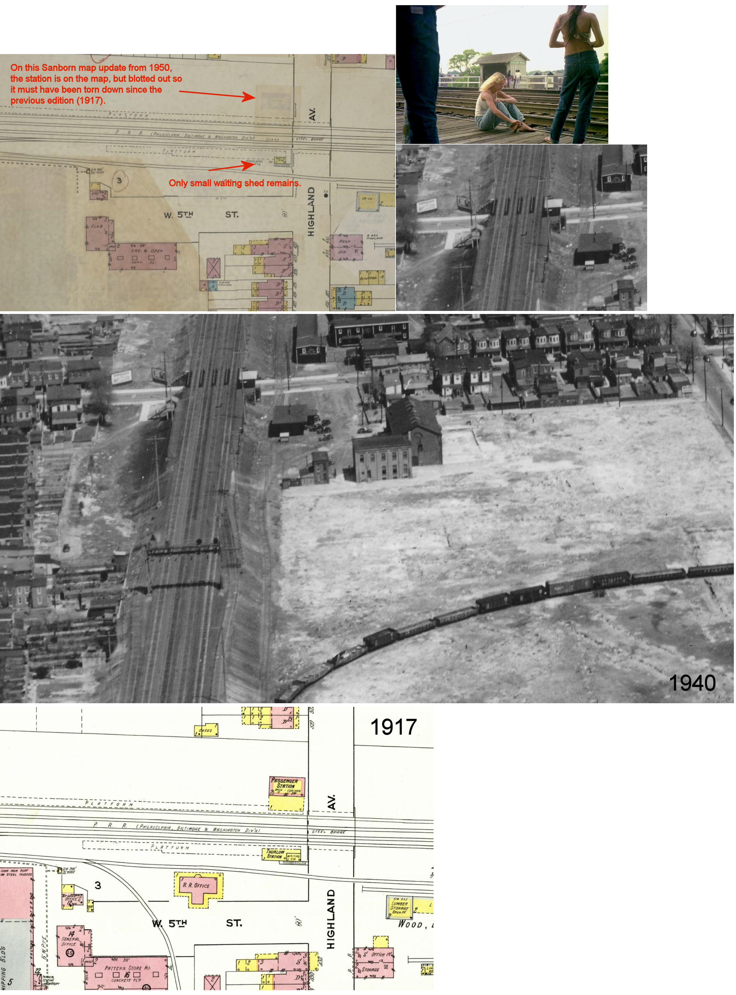
| Chester (Highland Ave.) (Thurlow) |
|
Not to be confused with Highland Station in Philadelphia County. This station was on the SW side of Highland Avenue in Chester on the NW side of the tracks at GPS: 39.833860, -75.393062. | ||||||
| Chester |
|
The first passenger station here was built in 1882. It was in a section of town not covered by Sanborn maps. Can someone advise of its location. It may have been at the corner of Market and Front Streets. | ||||||
| Chester |
|
The second passenger station was brick and stood until at least the 1940s. Can someone advise of its location. | ||||||
| Chester |
|
The 1885-1917 Sanborn maps show a brick, terminal-type freight house on spur tracks near the corner of Market Street and what is now East 2nd Street (GPS: 39.845213, -75.357975). | ||||||
| Chester Heights | |
There was a small passenger shelter here that served the Chester Heights Camp Meeting Grounds. It was similar to the one at Lamokin. | ||||||
| Chester heights | |
There was a flag stop/shelter at the Valleybrook overpass. | ||||||
| Clifton | |
There was a freight station here at the end of Penn Street on the NW side of the tracks (GPS: 39.927144,-75.289886). | ||||||
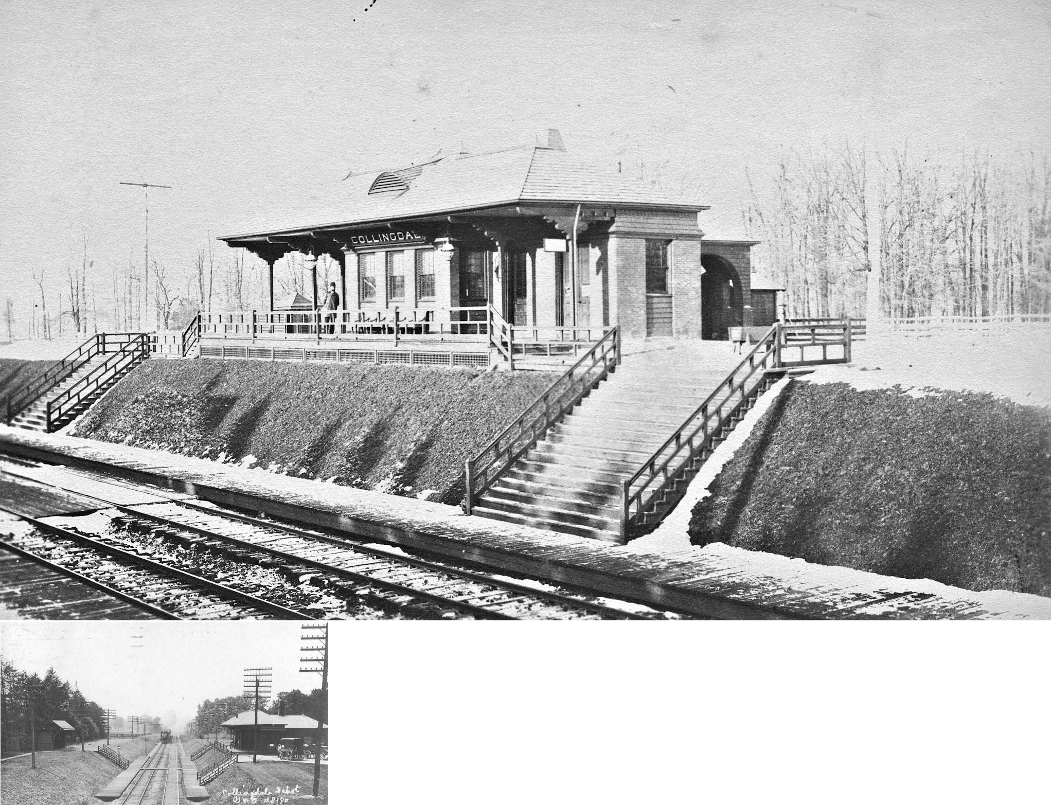
| Collingdale | |
This station was on the west side of Clifton Avenue (GPS: 39.909839,-75.276357). There was also a freight house at the south end of Sharon Avenue at GPS: 39.910458, -75.274908. | ||||||
| Colwyn | |
|||||||
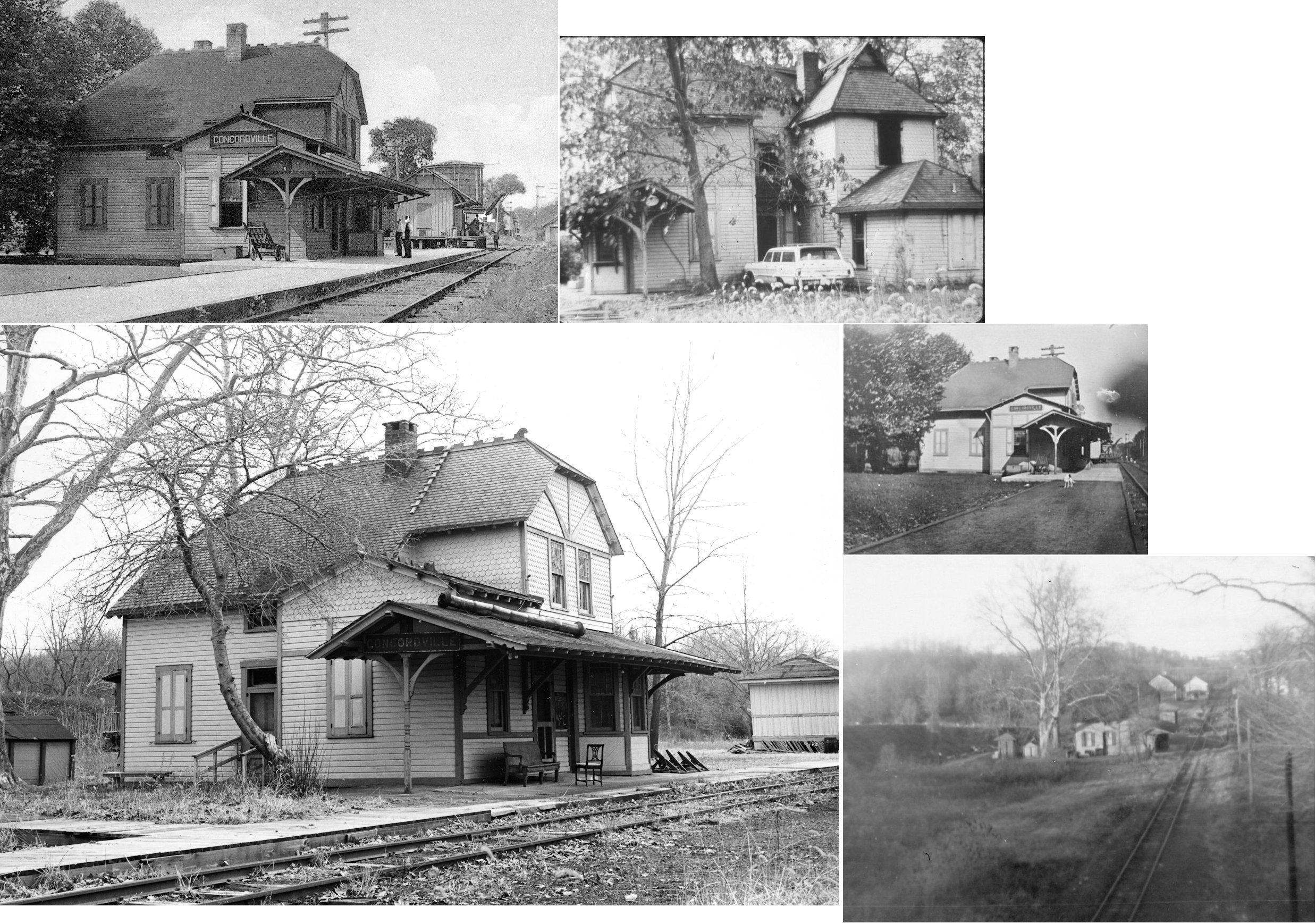
| Concordville (CONCORD) |
|
This station was demolished in 1976. | ||||||
| Cooperstown Road |
|
See listing above for Brookthorpe. | ||||||
| Crum Creek Station |
|
A station is shown here on the 1870 map. | ||||||
| Crum Lynne | |
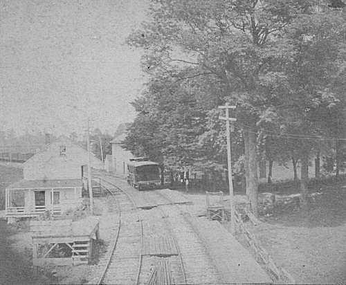
This station was on West Ridley Avenue on the NW side of the tracks (GPS: 39.871835,-75.330795). It was built in 1872 when the Darby Improvement Line opened. There is a shelter there now as well as on the other side of the tracks. The shelter on the SE side of the tracks may have been the old shelter that went with the old station. | ||||||
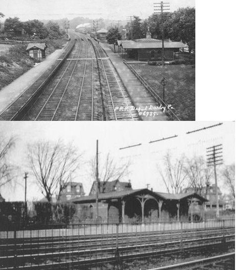
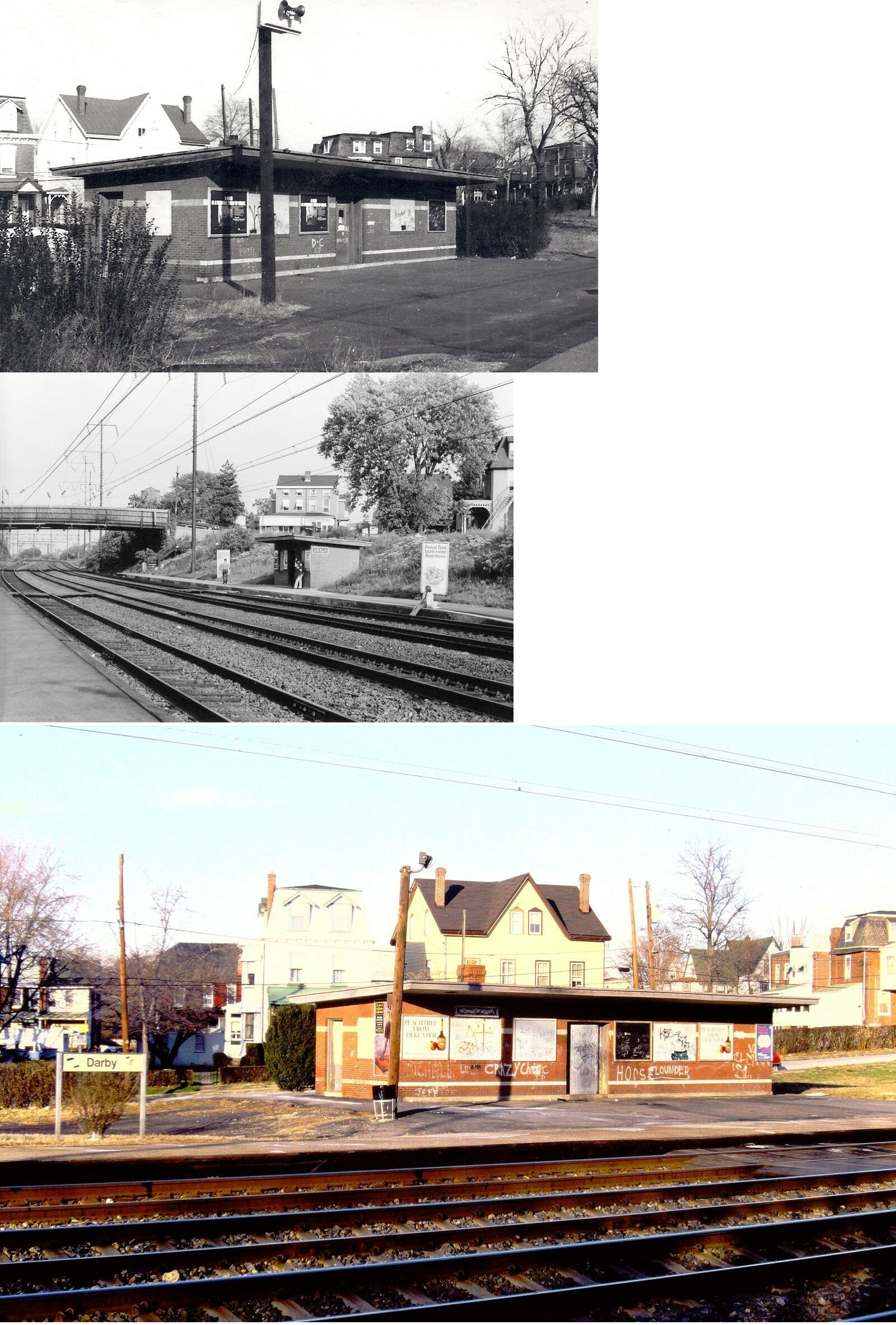
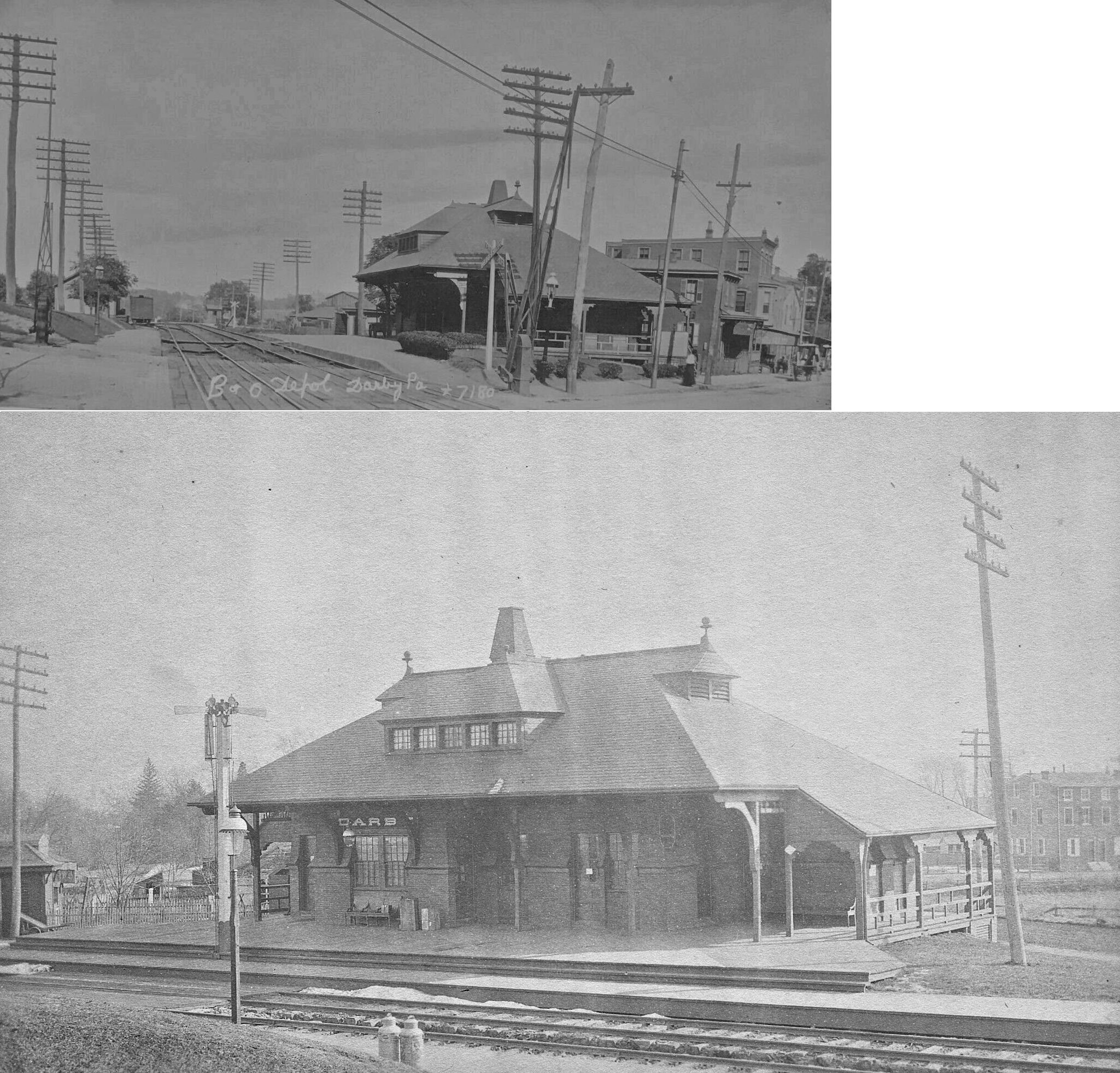
| Darby | |
This station was on Pine Street between 4th and 5th on the north side of the tracks (GPS: 39.913102,-75.254706). It was built in 1872 when the Darby Improvement Line opened. There was a freight house on the west side of 5th Street on the north side of the tracks on a siding at GPS: 39.912933, -75.256019. | ||||||
| Darby | |
This later station was probably on the south side of the tracks across from where the old station had been. | ||||||
| Darby (Colwyn) |
|
There was a freight station on the west side of 5th Street on the north side of the tracks (GPS: 39.912747,-75.256082). This may have been referred to as the Colwyn freight house as it was right on the border between Darby and Colwyn. | ||||||
| Darby | |
This station was on the corner of Main and 6th Streets (GPS: 39.917878,-75.255256). There was a freight house to the NE near the corner of 5th Street and Greenway Avenue at GPS: 39.918430, -75.254311. | ||||||
| Darby Creek Station |
|
This station was west of Essington on the east bank of the mouth of where Darby creek flows into the Delaware River. It was on the south side of the tracks near the trestle over the creek. In the early part of the century it served the boathouses at the Phildelphia Yacht Club which was just to the south of the tracks here (GPS: 39.864952,-75.312108). | ||||||
| Darlington |
|
This station was on the west side of Darlington Road, on the south side of the tracks (GPS: 39.903954,-75.469468). | ||||||
| Darlington |
|
A new two-story brick station with a woodframe second story was built here in 1881. This station was demolished around 1980. | ||||||
| East Lansdowne |
|
There was a freight station on the NW corner of East Baltimore and South Union Avenues at GPS: 39.939740, -75.265414. | ||||||
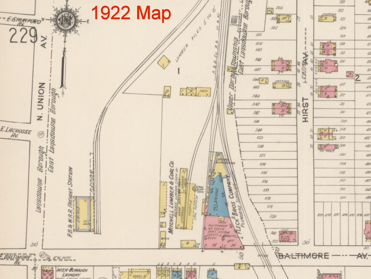
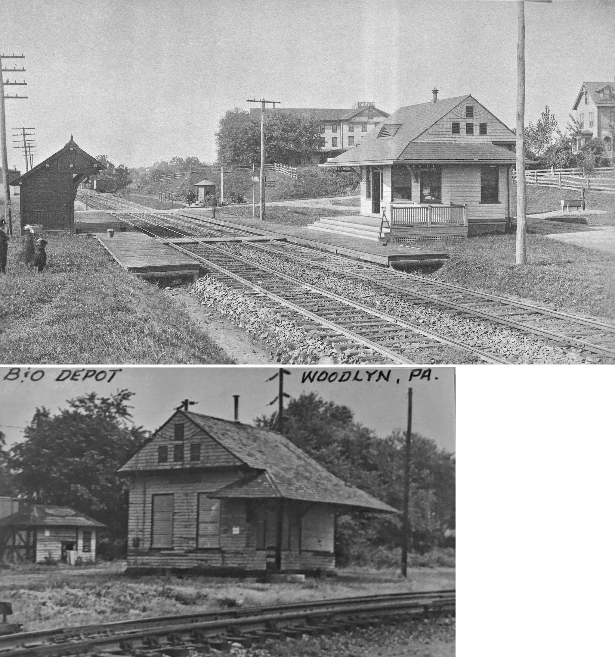
| Eddystone (Woodlyn) (Fairview) |
|
This station sat at the northeast corner of Fairview Road and the grade crossing (GPS: 39.871322,-75.341492). The station was torn down in Feb. 1973. The Baldwin Locomotive plant was nearby. The station had an unusual S.E. corner and a small wood building sat directly behind it (north). It was later called Eddystone Station by the B&O, but it is marked as Woodlyn on the 1909 maps. | ||||||
|
Eddystone (Woodlyn) (Fairview) |
|
This freight station was on the NE side of Fairview Raod on the SE side of the tracks across from the passenger station. | ||||||
| Eddystone | |
The old station was on the west side of Saville Street, just south of 7th Street. It was on the south side of the tracks (GPS: 39.85746,-75.341442). It was likely replaced in 1910 with the smaller shelter that is still standing there. The PRR freight station was on the east side of Saville Street on a siding track which is now gone (GPS: 39.857563,-75.340873). | ||||||
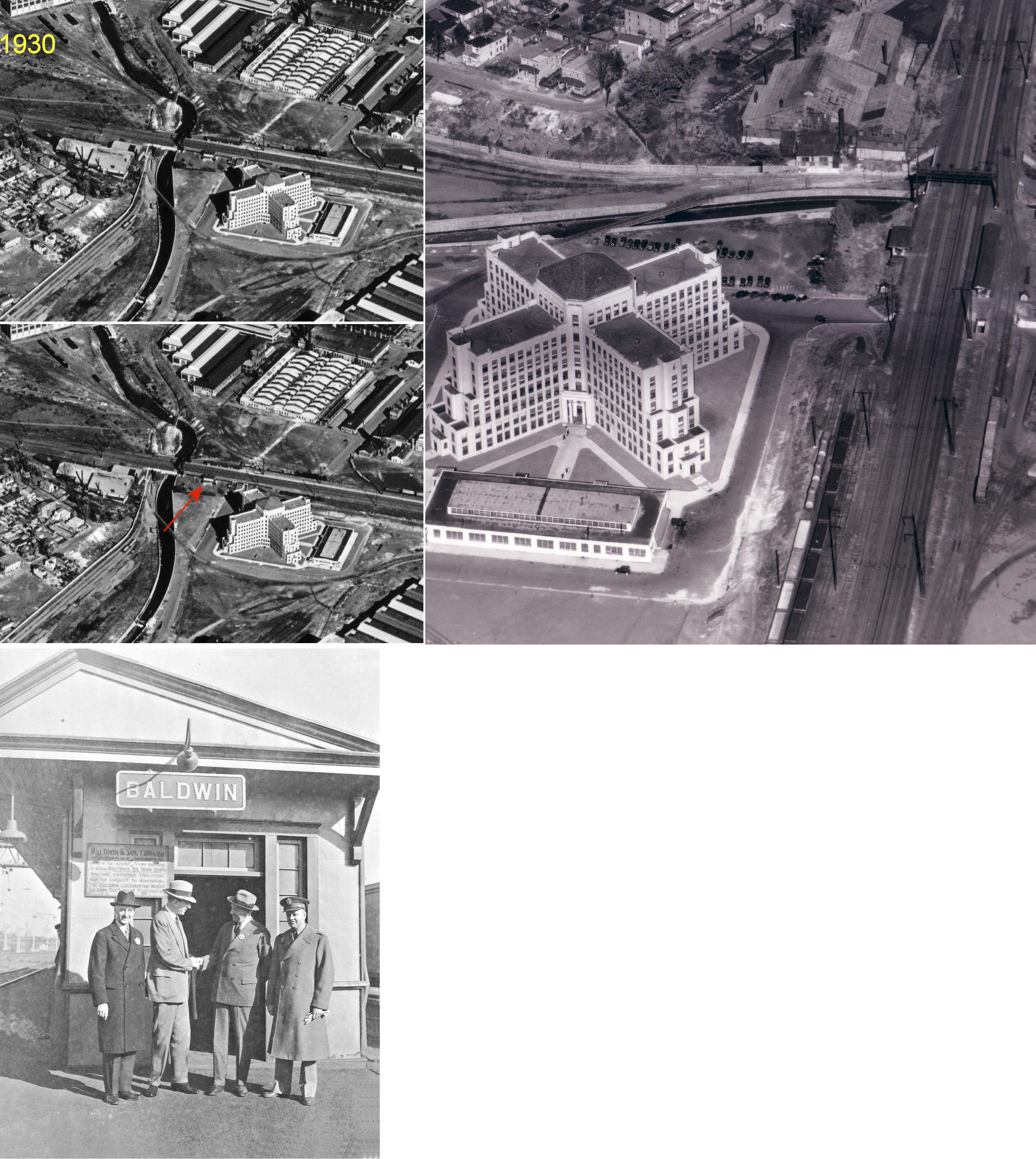
| Eddystone (Baldwin) |
|
There was a passenger station on the west side of the tracks behind where Baldwin Tower office building is today at GPS: 39.863895, -75.336000. The station served the Baldwin Locomotive Works and it is shown on the 1917 Sanborn map (of Chester). | ||||||
| Eddystone |
|
There was a P&R freight station just a few feet due south of the PRR station (on a spur track which ended here, tracks now gone) (GPS: 39.85713,-75.341417). This freight station may have also served the Philadelphia & Chester interurban line as those tracks ran on the north side of the building, while the P&R tracks ran up along the south side. | ||||||
| Elwyn (Greenwood) |
|
This station was at the same location as the current SEPTA platform on Elwyn Road (GPS: 39.907839,-75.41191). The station originally served the Pennsylvania Training School. The PRR renamed the station Elwyn from Greenwood in 1880. | ||||||
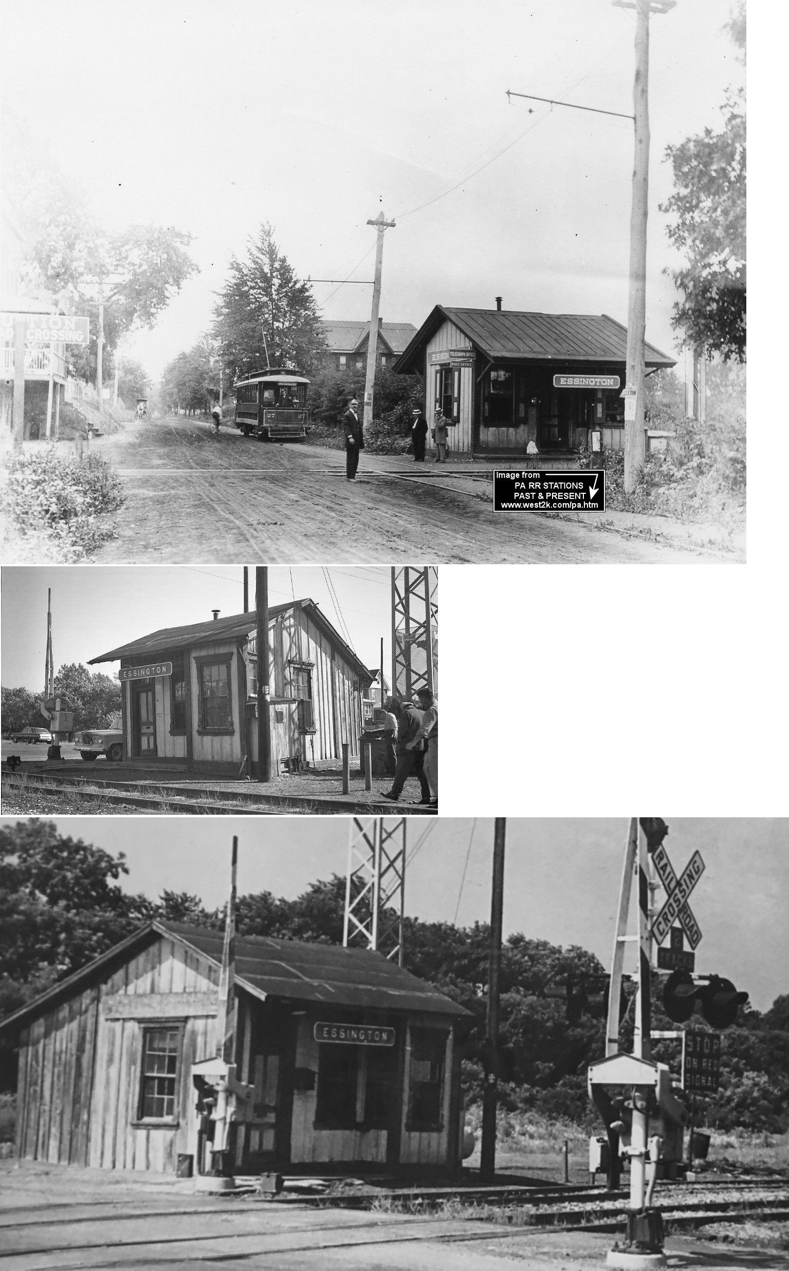
| Essington |
|
This station was on the west side of Wanamaker Avenue on the north side of the tracks (GPS: 39.865568,-75.300945) | ||||||
| Essington (N. Essington) |
|
Just a few blocks from the station listed above, this depot was on the west side of Jansen Avenue on the north side of the tracks (GPS: 39.86605,-75.294845). It was called North Essington Station by the railroad. | ||||||
| Essington |
|
This station was in the vicinity of Jansen and Powhattan Avenues. | ||||||
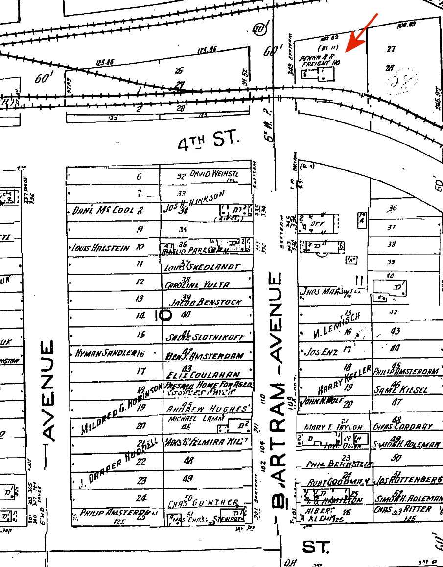
| Essington |
|
There was a freight station at the north end of Bartram Avenue north of 4th Street on the north side of the tracks at GPS: 39.865767, -75.295441. This was on the PRR's Hog Island Branch. | ||||||
| Fairview | |
See listing for Eddystone above. | ||||||
| Felton (Feltonville) |
|
This station was on Felton Avenue just south of its former intersection with Concord Road. Location is now SE part of Greenlawn Cemetery (GPS: 39.846656,-75.39921). | ||||||
| Fernwood-Yeadon | |
This station was just east of Church Lane (39.939778,-75.255919). A station is shown here as early as 1870 when the line was the West Chester & Philadelphia RR and the station was known only as "Fernwood." There was also a freight station just to the east of the passenger station. | ||||||
| Fernwood-Yeadon | |
In later years this station only has a small passenger shelter. | ||||||
| Fernwood | |
This was one of the original stations on the P&DC RR. It was only a flag stop, so there was likely only a platform or passenger shelter here. | ||||||
| First Regiment Range Station |
|
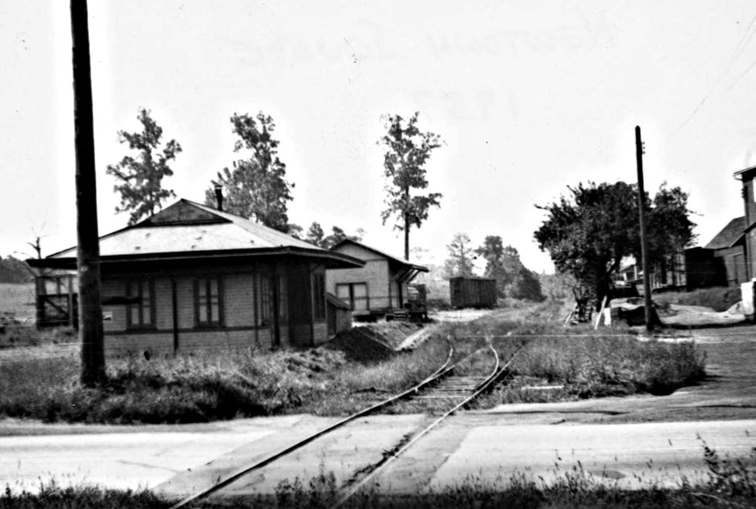
This station, located in Tinicum Township and shown on the 1909 county map, served the First Regiment Rifle Range which was a piece of land bordered by Gun Creek on the west, Darby Creek on the north, Bow Creek on the east and the P&R tracks on the south. The depot was on the north side of the tracks, just west of Bow Creek. I believe this location is somewhere near where the airport is today. Can someone provide an exact location? | ||||||
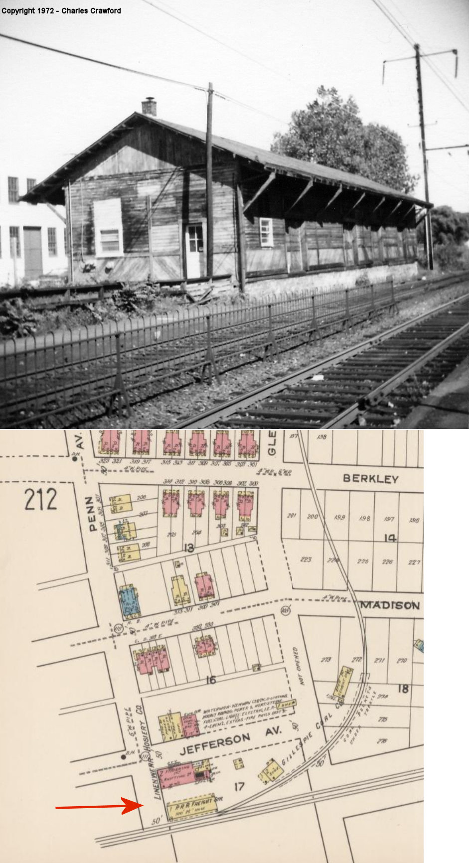
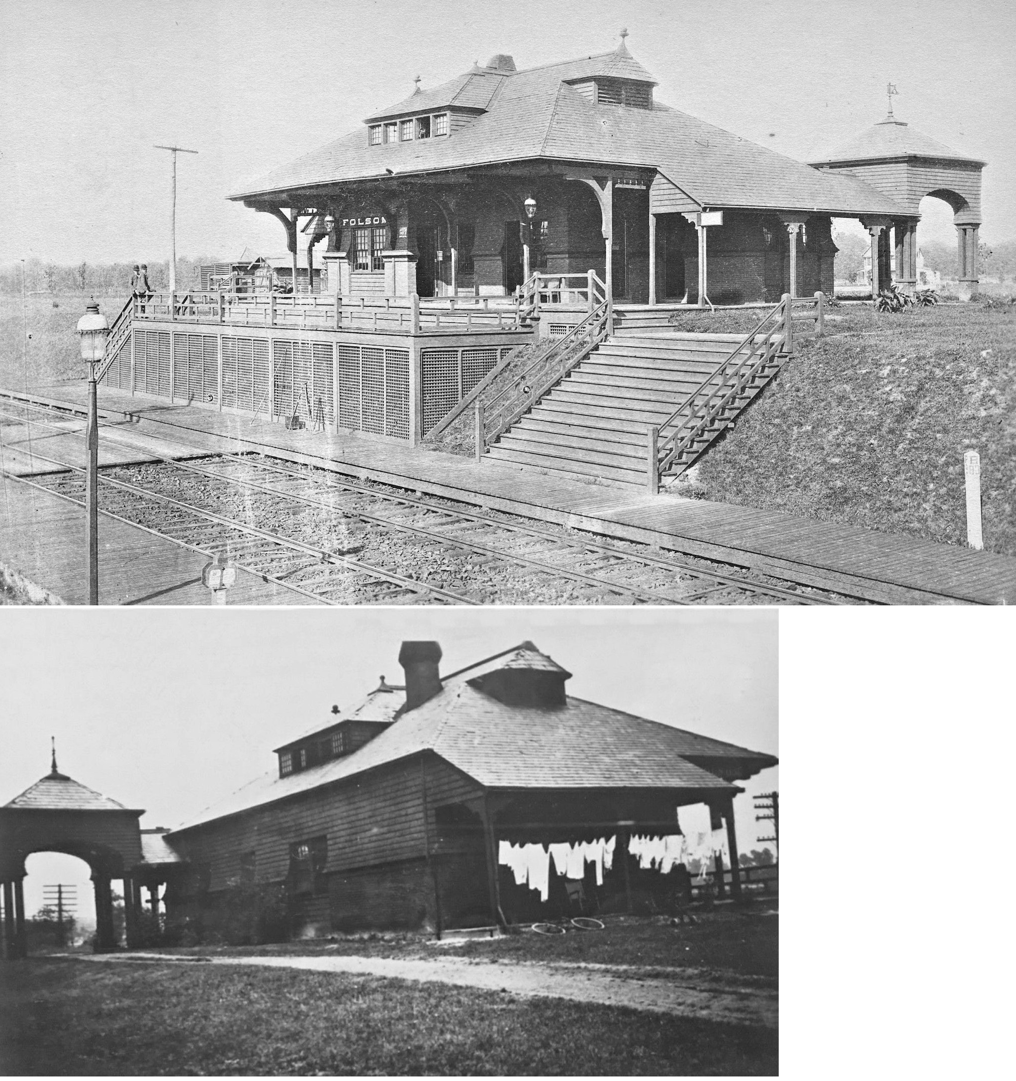
| Folsom | |
This station was between Folsom Avenue and Swarthmore Avenue on the north side of the tracks (GPS: 39.89104,-75.318106). There was also a freight station a few blocks west between Sycamore (formerly Maple) and Sylvania (formerly Forest) Avenues (GPS: 39.889978,-75.320407). | ||||||
| Folcroft |
|
There was a two-story frame station here prior to the brick station and shelter which still stand. | ||||||
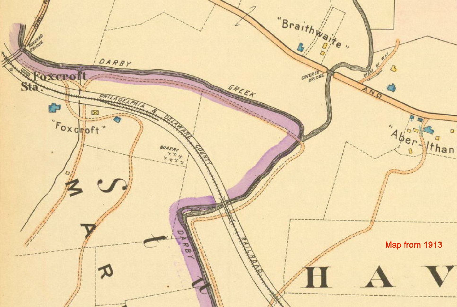
| Foxcroft |
|
This station was built in 1894 with the opening of the P&DC RR. It was in the vicinity of what is now North Sproul Road and Carli Drive around GPS: 39.995561, -75.355516. Although a station is shown here on some maps, it was only a flag stop and likely only had a platform or shelter. | ||||||
| Garrett Road |
|
This station was built in 1894 with the opening of the P&DC RR. Although a station is shown here on some maps, it was only a flag stop and likely only had a platform or shelter. | ||||||
| Gladstone |
|
This station was between the Clifton Heights station and Lansdowne on Walsh Road at approximately GPS: 39.932488, -75.282558. | ||||||
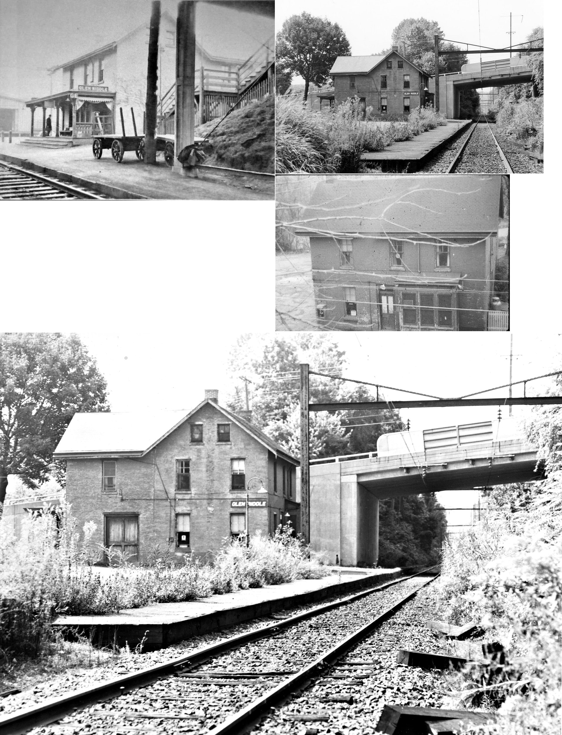
| Glen Riddle |
|
This station was on the east side of Pennell Road (PA452), on the south side of the tracks (GPS: 39.896712,-75.436088). It was built in 1881. There was also a freight station here just to the east of the passenger station. | ||||||
| Glenolden | |
This station was on the SW side of East Glenolden Avenue on the NW side of the tracks (GPS: 39.89643,-75.290028). It was built in 1872 when the Darby Improvement Line opened. There was also a small freight house just to the SW of the passenger station. | ||||||
| Glenolden (Llanwellyn) |
|
This station was on North Bonsall Avenue, just east of West Ashland Avenue (GPS: 39.903685,-75.290058). It was called Llanwellyn by the B&O. Built in the late 1800's this station was left vacant with the platforms and steps to them gone by 1943. A small concrete shelter big enough for one person stood on the other side of the tracks for the crossing guard who held a warning sign up on a pole in the middle of the street when trains passed by in the 1940s before gates were installed. The name "Llanwellyn," which was used by the railroad, was given to the location by Philadelphia lawyer Henry J. Scott in 1886. Scott named the new town, “Llanwellyn” which is Welsh for “spring has come.” It was intended to be a town of its own before eventually being incorporated into the town of Glenolden. | ||||||
| Grasslyn Station (Grassland) (Eagle Rd.) |
|
This station was just west of West Eagle Road (GPS: 39.983874,-75.317432) in Haverford Township. It was built in 1894 with the opening of the P&DC RR. Some maps have the station name as "Grassland." Although most of the other stations on the line were flag stop and only platforms or shelters, there was a formal passenger station here, but it was soon abandoned and became a dwelling because of declining passenger revenue. Passenger service began in 1894 with seven daily trains in each direction and five on Sundays, but by 1905 it was down to one daily train due to the competing Philadelphia & West Chester Traction Company trolley line that paralleled the railroad. All passenger service was discontinued by 1908. | ||||||
| Greenwood |
|
A Philadelphia & West Chester station is shown here on the 1870 map. | ||||||
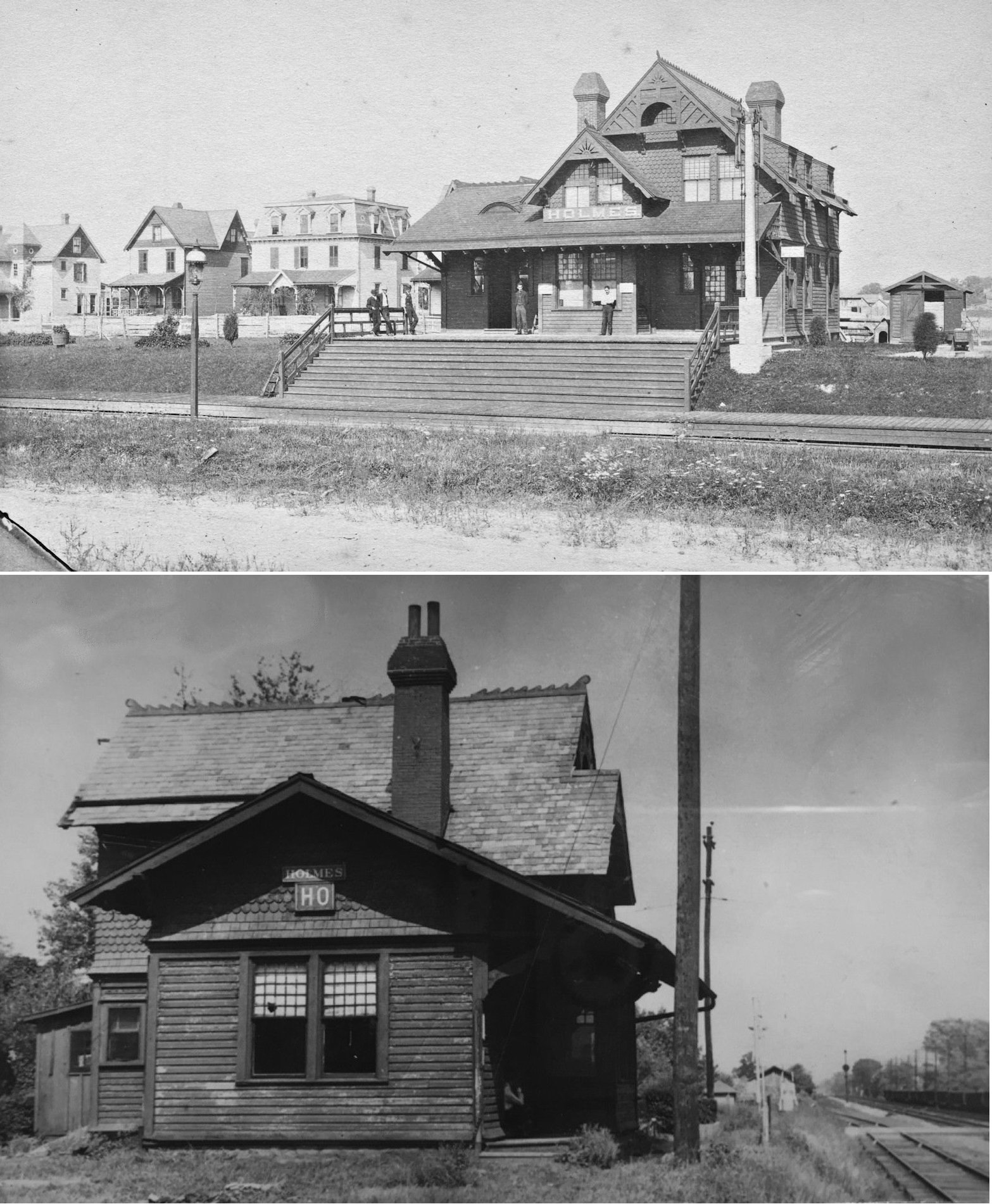
| Holmes Station | |
This station was on the west corner of Amosland Road and Balitmore Avenue (GPS: 39.896009,-75.306607). Photo is from 1891. There was also a freight house on the north side of the tracks between Amosland Avenue and Ridley Avenue at GPS: 39.896841, -75.305405. | ||||||
| Hunt Station (The Hunt) |
|
This station, established in 1894, was on hunt Road SE of Bryn Mawr Avenue at approximately GPS: 39.997901, -75.371756. Although a station is shown here on some maps, it was only a flag stop and likely only had a platform or shelter. | ||||||
| Knowlton | |
This station was between Morgan and Mt. Alverno. It was retired in 1930. | ||||||
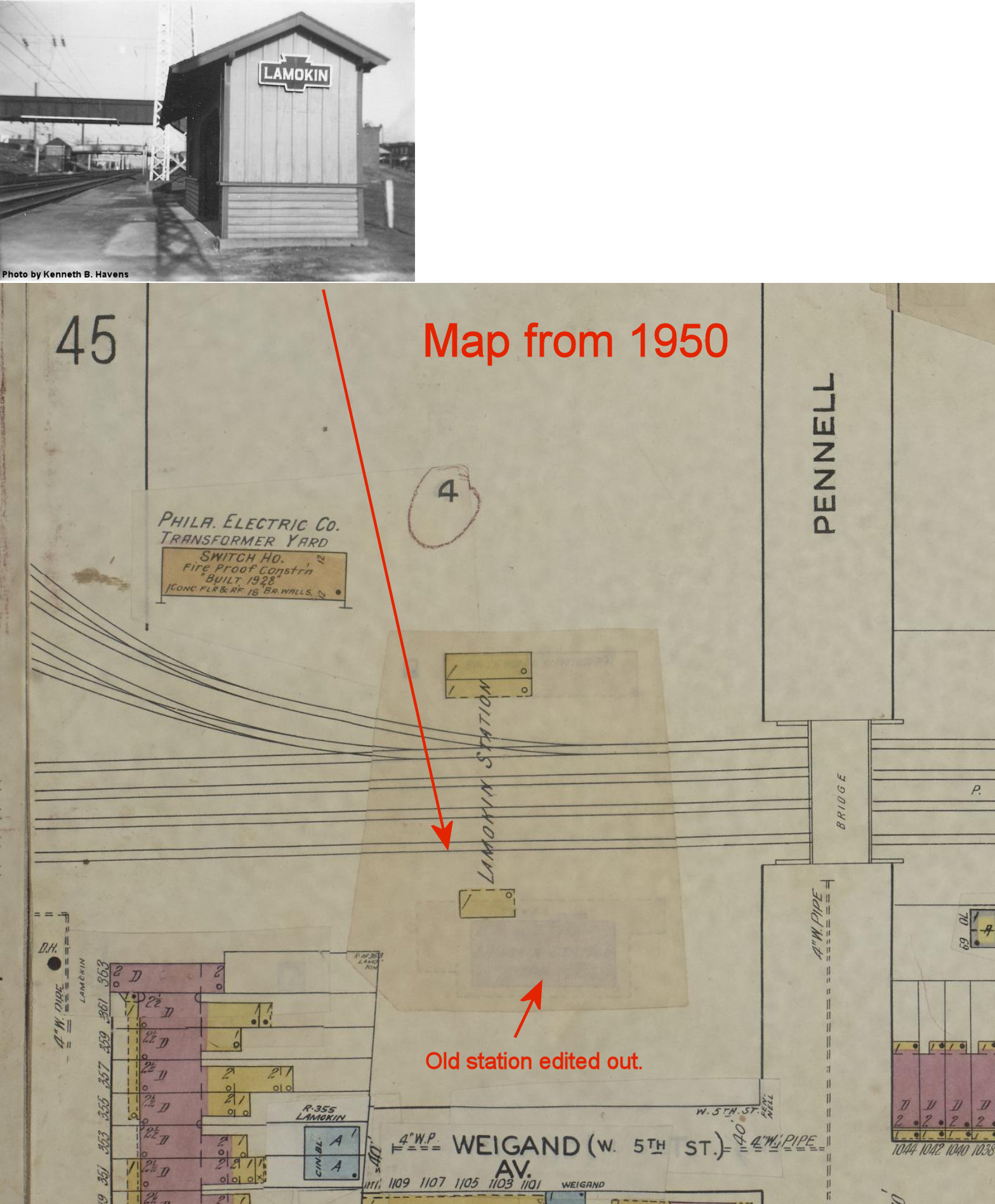
| Lamokin |
|
The original brick Lamokin passenger station was on the NW side of the tracks north of the end of Lamokin Street (formerly Howell Street) at GPS: 39.842237, -75.376040. Lamokin was the junction with the Chester Creek branch which connected the PRR Northeast Corridor line with Lenni and the West Chester and Octoraro branches. The Chester Creek branch was washed out in a 1970s hurricane and never was rebuilt. | ||||||
| Lamokin | |
In 1903 the station above was replaced by a new passenger station on the opposite side of the tracks. It was on the SE side of the tracks between Lamokin Street and Pennell Street at GPS: | ||||||
| LAMOKIN | |
The station pictured for this listing is either a waiting shelter across from the brick station or a later waiting room after the larger station was demolished. | ||||||
| Lamokin | |
There was a freight station on the NW side of the tracks at Norris Street at GPS: 39.841360, -75.377802. This freight house was gone by 1917. | ||||||
| Lansdowne (Darby Road) |
|
This was the original station at Lansdowne that was in service from around 1854-1901. The original RR name for Lansdowne was "Darby Road Station." It appears that it was at the same location as the station that's still standing. | ||||||
| Lansdowne (Darby Road) |
|
There was a freight station on the west side of South Lansdowne Avenue on the south side of the tracks (GPS: 39.9371,-75.272296). | ||||||
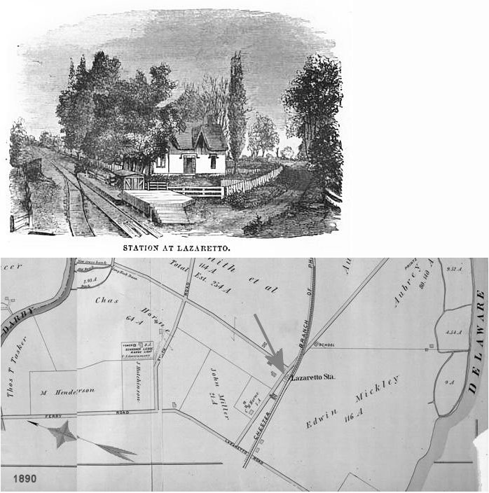
| Lazaretto (North Essington) |
|
This is the original station that served the Lazaretto Quarrantine Hospital (the first such hospital in the U.S., opened in 1799). The illustration of the station is from 1856. The hospital closed in 1895 and from then on the stations that were subsequently built were known as North Essington. | ||||||
| Lenni | |
This station was on the NW side of Lenni Road (GPS: 39.894189,-75.448646). It was demolished in 1961. There was a freight station on the west side of Lungren Road (GPS: 39.893773,-75.444172). | ||||||
| Lester |
|
This small station was between 4th and 5th Streets on the southeast side of the tracks. It was on the north side of the old Lester Piano Company (GPS: 39.869881, -75.280850). | ||||||
| Linwood |
|
A new station was built here in 1890. | ||||||
| Llandaff |
|
|||||||
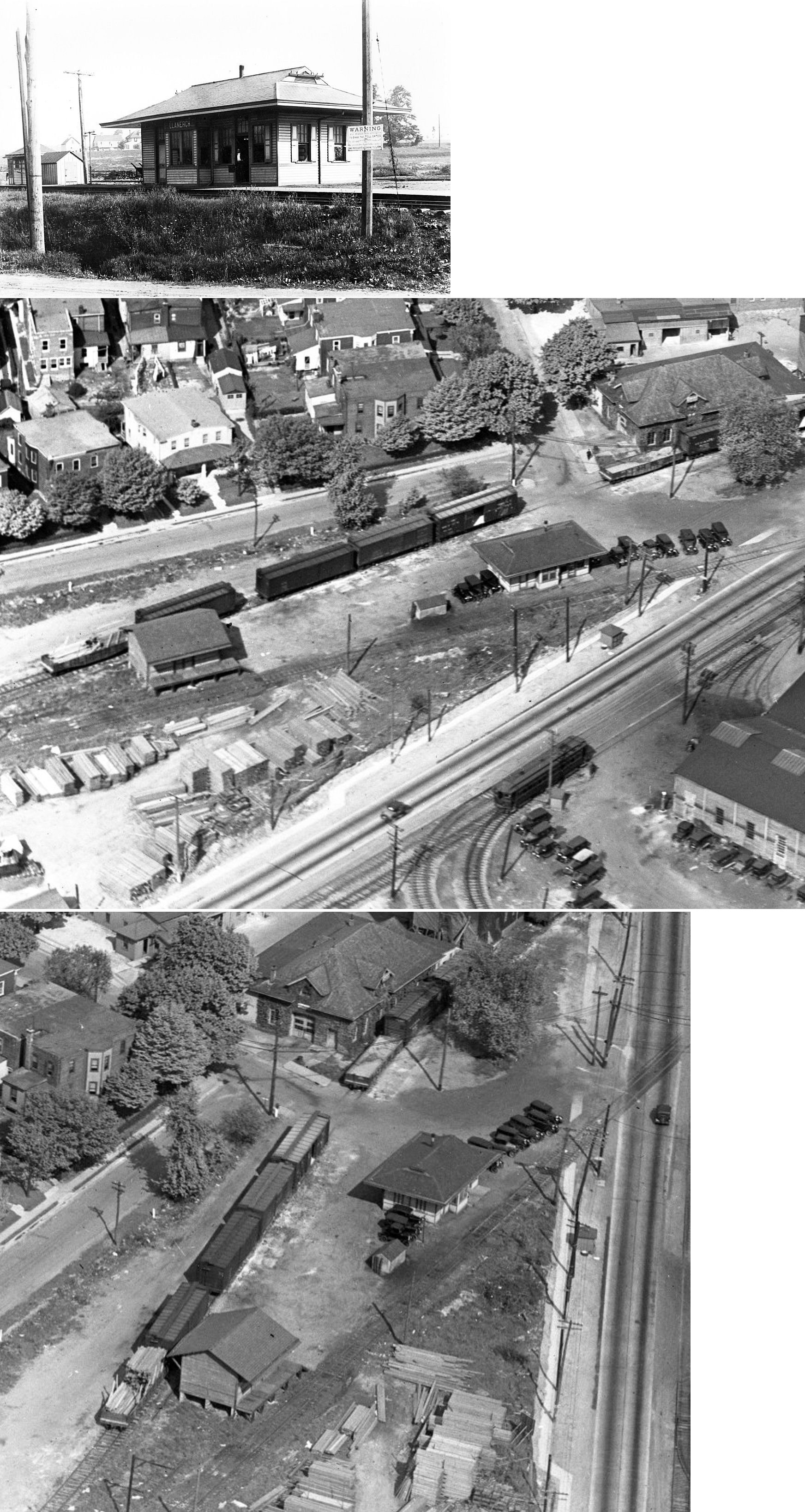
| Llanerch |
|
The Philadelphia & Delaware County Railroad was built in 1888 from Newtown Square to the Philadelphia Wilmington Central RR in Fernwood. In 1894 became part of the Philadelphia and Baltimore Central RR (PRR). The station pictured was likely a P&BC era station. It was near the corner of West Park Road and Llanerch Avenue (39.969848,-75.299075). After it closed, it served as a post office and community gathering place. It was torn down in 1938. | ||||||
| Llanerch |
|
This was the freight station which was just to the NW of the passenger station at approximately GPS: 39.970148, -75.299633. It stood until 1983 when it was demolished after suffering fire damage. | ||||||
| Llanwellyn | |
See listing above for Glenolden. | ||||||
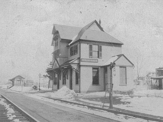
| Marcus Hook | |
This station was on the west side of Market Street
(PA452). (GPS: 39.821635,-75.419364) |
||||||
| Marcus Hook | |
This appears to be a later or temporary station. | ||||||
| Marcus Hook | |
There was a freight station on a spur track (now gone) between Market Street and Chruch Streets half way between East 10th and 12th Streets. There is a softball field and parking lot there today (2010) (GPS: 39.821305, -75.417315). | ||||||
| Marcus Hook | |
It's not clear if there ever was a Reading passenger station in Marcus Hook. There were plans to build one, but then the railroad did not follow through. This may have been due to some legal entanglements with property rights. No Reading passenger station is shown on the 1905, 1912 or 1951 Sanborn maps. | ||||||
| Media |
|
This brick station, built in 1881, was in approximately the same location as the station that is still standing (GPS: 39.914116,-75.394699). It was torn down in 1951 when it was rundown and became costly to repair. Not sure what served as a station here between 1951 and 1960 when the new station was built. When the Central Division of the PW&B moved its headquarters into the station in 1882, the building was enlarged. | ||||||
| Media |
|
There was a freight station just to the NW of the passenger station, also on the south side of the tracks. | ||||||
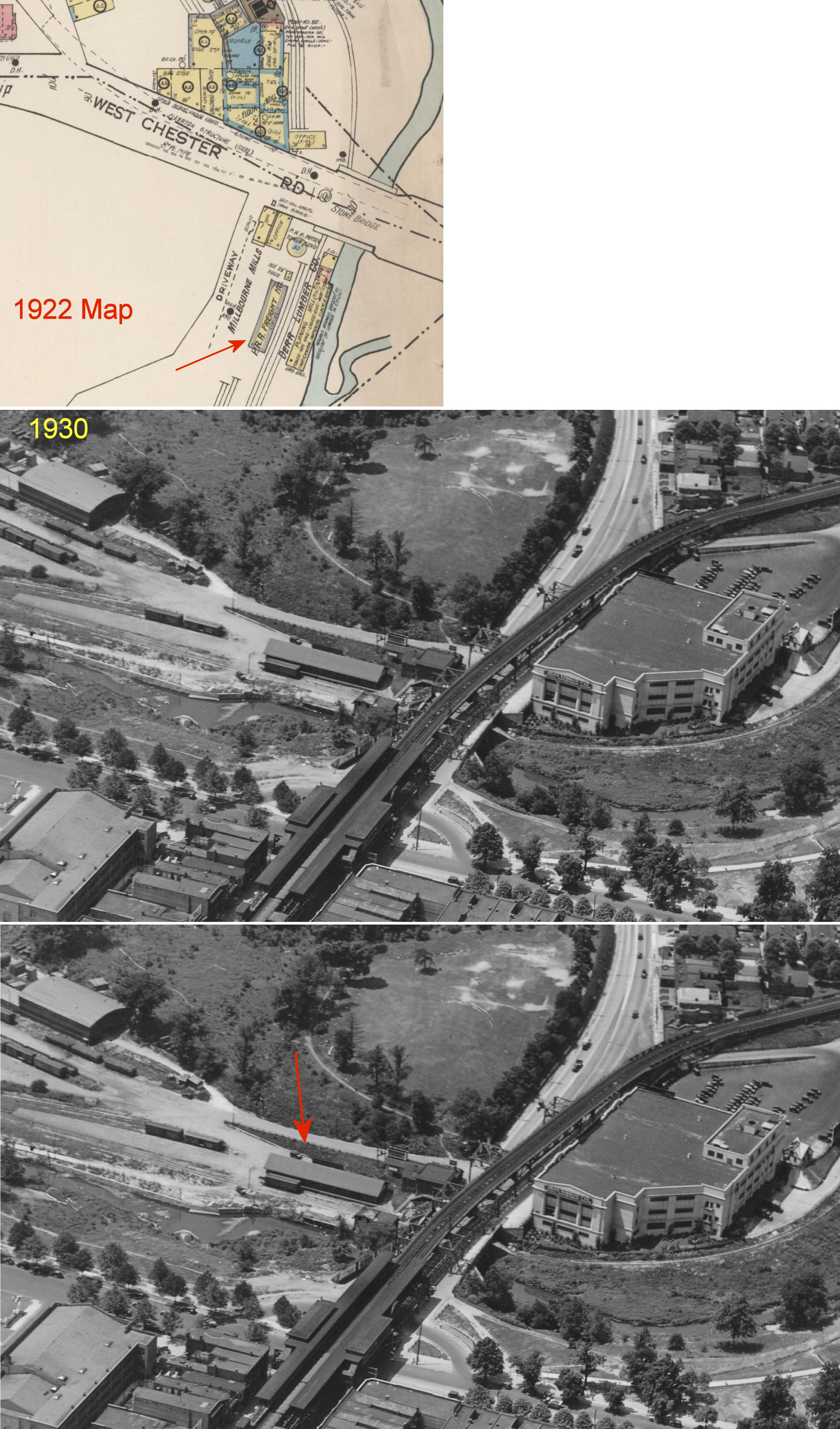
| Millbourne Mills |
|
There was a P&DC (PRR) freight station located just south of Market Street (formerly West Chester Road) (GPS: 39.962299,-75.248285). | ||||||
| Milmont |
|
This station was at what used to be the south end of Milmont Street when that street went though to the tracks (GPS: 39.878991,-75.332972). | ||||||
| Moores Station |
|
A station is shown here on the 1870 map. See listings for Prospect Park. | ||||||
| Morgan |
|
This early West Chester & Philadelphia RR station is shown on the 1875 map. It was in Aston Township in the general vicinity of GPS: 39.865482, -75.405431. | ||||||
| Morgans Corner |
|
This station was located near the current location of Radnor station. Prior to the Radnor station being built in 1871-72, the station here was known as Morgans Corner. | ||||||
| Morton |
|
An early West Chester & Philadelphia RR station is shown here on the 1875 map. It was on the SE side of Morton Avenue SE of Main Street at 39.908452, -75.326969. It is marked as a "station, post office and store" on that map. | ||||||
| Mt. Alverno | |
Station was torn down in 1933. Peter and Harry Mile speculate as to the location of this station: We used to live near Mt. Alverno road, which ran near Chrome Run, a small creek in Middletown township in Pennsylvania. Where the creek ran into Chester Creek, near the end of Mt. Alverno Road, were the tracks of the Chester Creek branch of the PRR, which ran between Chester and Lenni Heights, where it joined the line running between Philadelphia and West Chester. Perhaps this was the location of that long vanished railroad station? | ||||||
| Newtown Square |
|
These stations were on the west side of Newtown Street Road (Rt. 252) and now Winding Way. Photo also shows the freight station which is still standing (see listing in the "Existing Stations" section above). | ||||||
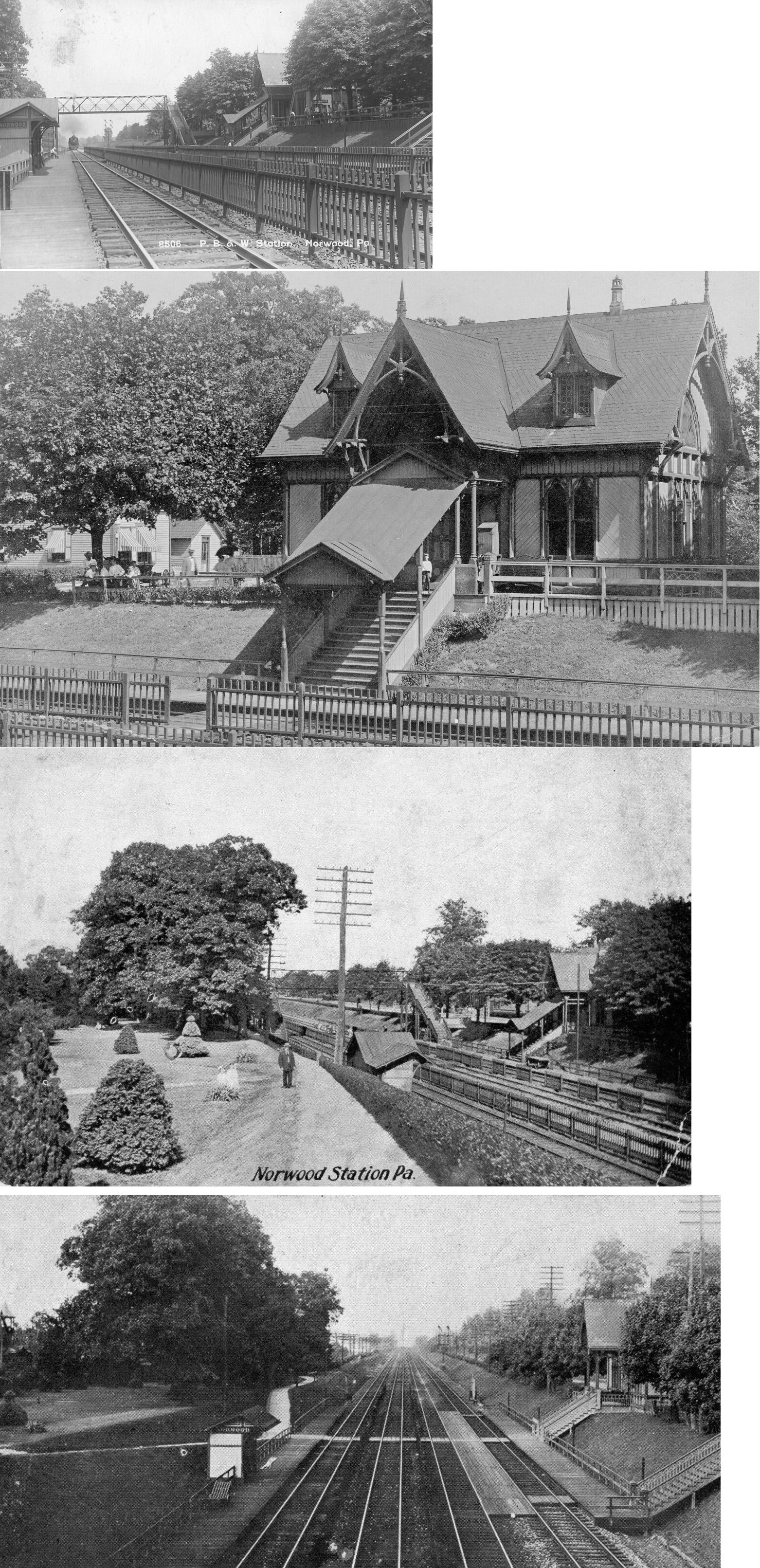
| Norwood |
|
This station was on the NE side of Amosland Avenue (GPS: 39.891199,-75.302566). | ||||||
| Ogden |
|
This station was on the NE side of Naamans Creek Road, on the NW side of the tracks (GPS: 39.828351,-75.453479). A new combination station was built here in 1905. | ||||||
| Okeola |
|
This station was between Collingdale and Llanwellyn. | ||||||
| Pembroke |
|
This was one of the original stations on the P&DC RR in 1894. It was only a flag stop, so there was likely only a platform or passenger shelter here. | ||||||
| Pennelton Station |
|
A Philadelphia & West Chester station is shown here on the 1870 map. | ||||||
| Philadelphia Yacht Club Station |
|
Although the Darby Creek RDG station first served the PYC, the 1912 and 1923 maps show a separate station for the yacht club between the Darby Creek Station and Essington Station. | ||||||
| Primos |
|
Probably built by the WC&P in the 1880s, this brick station sat at the southeast corner of Oak Avenue, sitting very close to the tracks and Oak Avenue (M.P. 8.1) (GPS: 39.92149,-75.298582). The station was about halfway between the Clifton (M.P.-7.5) and Secane (M.P.-8.8) stations. It was torn down in 1970s and replaced by a trailer type station. | ||||||
| Primos |
|
There was a small freight station on the north side of the tracks east of the passenger station on Secane Road at GPS: 39.922365, -75.297205. | ||||||
| Prospect Park (MoorE STA.) | |
This was the original PW&B station and predated the station that still exists. A property owner named Moore donated the property for the original station. He did so, with the "condition" that the station should carry his "family" name for as long as it exists. It was formerly known as "Moore" Station. Today the existing station is known as Prospect Park/Moore Station. It had a population of 390 in 1895. | ||||||
| Prospect Park (MOORE STA.) |
|
There was a freight station here across the tracks and to the NE of the passenger station. This is the current location of the Moore Industrial Park (GPS: 39.888628,-75.308912). | ||||||
| Radnor |
|
A new station was built here in 1862. Not sure if this the same station that is still stanidng. | ||||||
| Radnor |
|
Photo is from 1856 when Radnor was known as Morgan's Corner. | ||||||
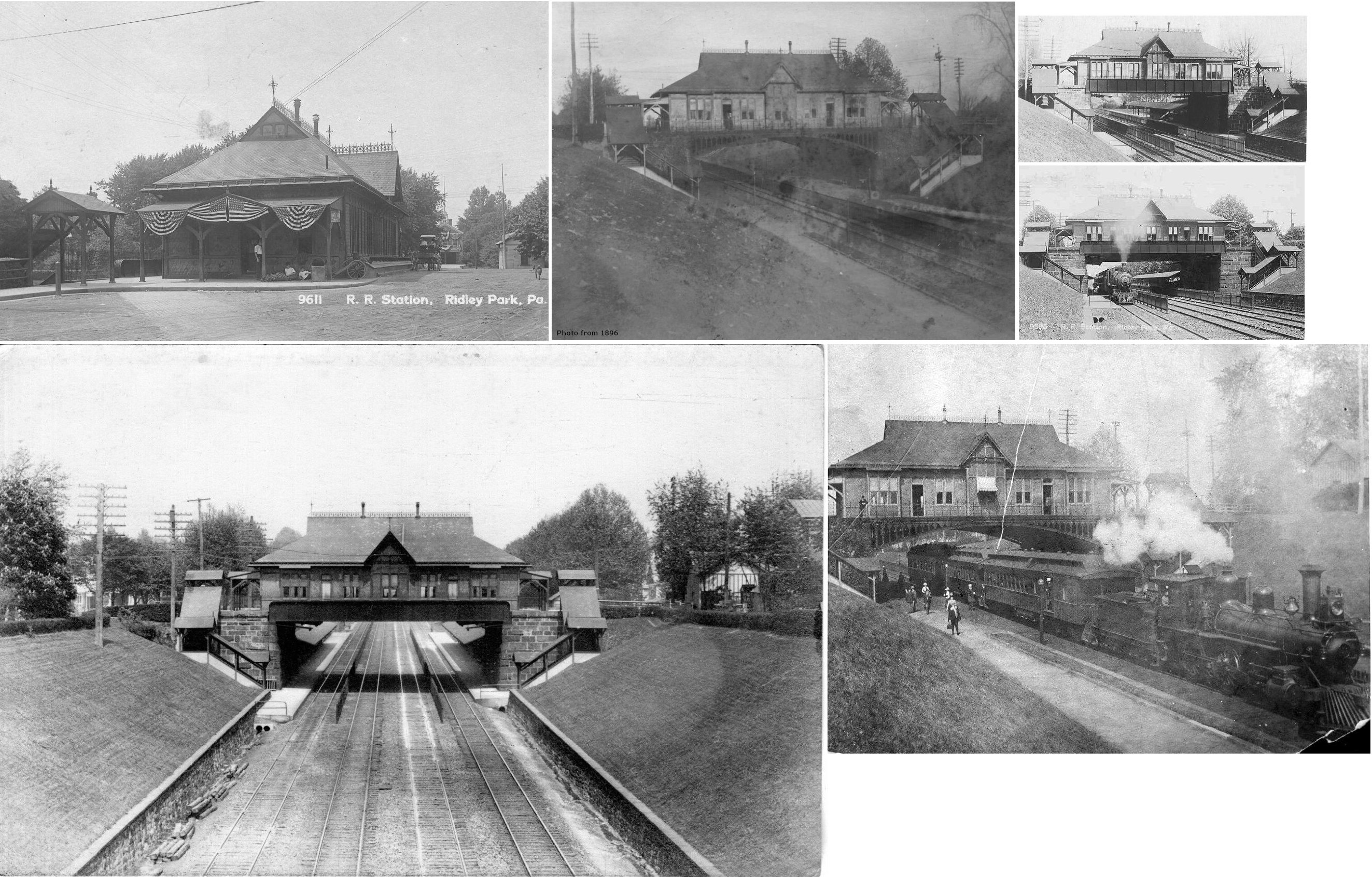
| Ridley Park |
|
This station, built in 1872 when the Darby Improvement Line opened, burned down around 1882. | ||||||
| Ridley Park |
|
This station, built in 1882 to replace the one that burned, was over the tracks where the overpass for East Ward Avenue is today (between East Ridley Avenue and East Hinckley Avenue) (GPS: 39.880089,-75.32281). It was just SW of where the newer, existing Ridely Park station is. | ||||||
| Ridley Park |
|
The freight station was at the end of Thayer Street (GPS: 39.881558,-75.320691). | ||||||
| Ridley PARK |
|
This station was on the southwest side of North Swarthmore Avenue on the northwest side of the tracks (GPS: 39.883102,-75.328773). | ||||||
| Rockdale |
|
This station was on the east side of Mount Road on the north side of the tracks (GPS: 39.892308,-75.433084). | ||||||
| Sharon Hill |
|
There was a freight station west of the passenger station at approximately GPS: 39.903453, -75.273651. There was also a small freight house on the south side of the tracks as well to the SE. | ||||||
| Simpsons |
|
This station was built in 1872 when the Darby Improvement Line opened. | ||||||
| St. Davids |
|
This station, built in 1891, was demolished in 1966 and replaced with the current structure. Also pictured is the first station (waiting room) at St. Davids. | ||||||
| Swarthmore |
|
There was a freight station along Myers Avenue on the south side of the tracks (just to the east of the passenger station). This area is now a parking lot (GPS: 39.902676, -75.349187). | ||||||
| Swarthmore |
|
The West Chester and Philadelphia RR built a new station here in 1876. | ||||||
| Trainer |
|
This 2-story station sat on the east side of Main Street (formerly Mill Street) along Pennsylvania Avenue at GPS: 39.827505, -75.406359. According to the 1909 Chester atlas, there was also freight station to the east near the corner of Pennsylvania Avenue and Bishop Street at GPS: 39.827810, -75.405673. | ||||||
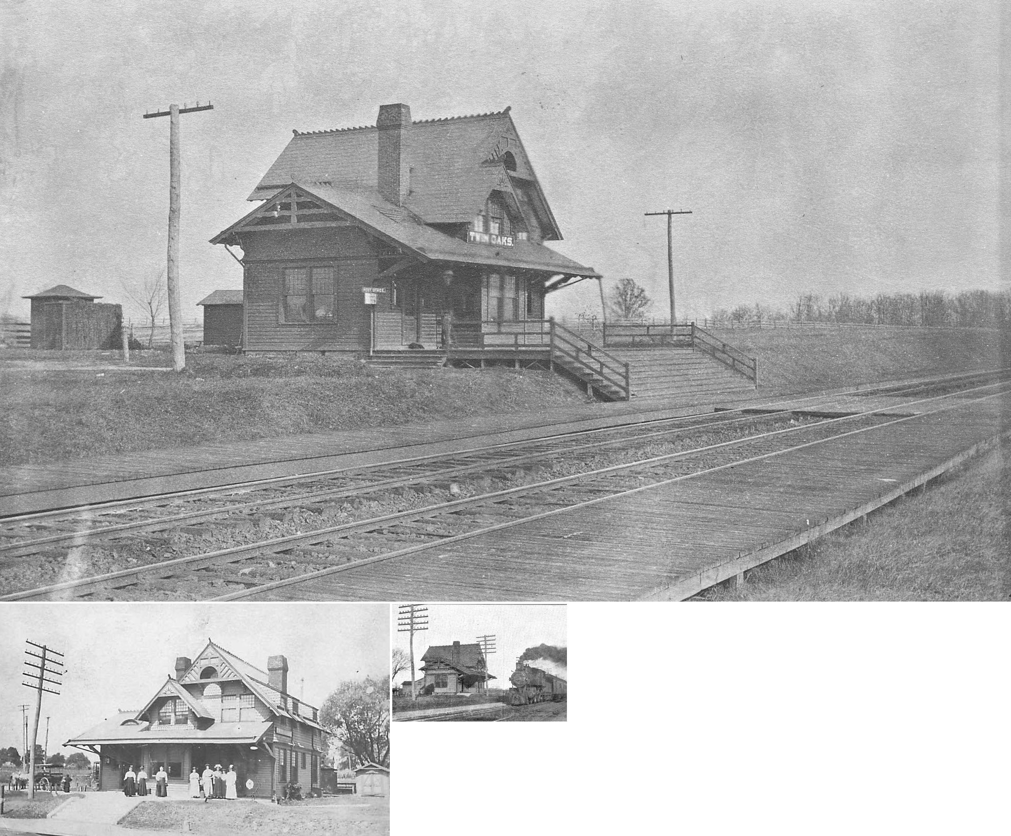
| Twin Oaks | |
This station was on the east side of Market Street (PA452), on the north side of the tracks (GPS: 39.841071,-75.424951). | ||||||
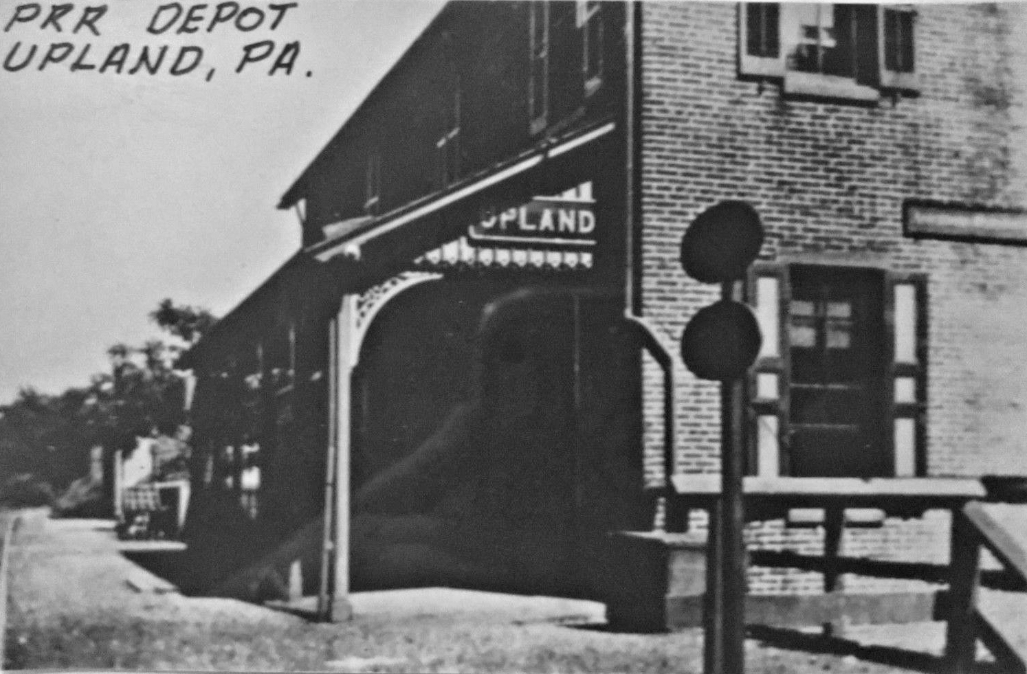
| Upland |
|
This former Chester Creek RR combination station was where Incinerator Road becomes Upland road at the old railroad overpass (GPS: 39.849619,-75.386083). | ||||||
| Upland | |
This station was at 1242 Kerline Street (GPS: 39.852062, -75.374203). It was on the west side of Kerlin Street on the south side of the tracks just north of where I-95 is today. | ||||||
| Upton |
|
This station was northeast of Hilldale Road at approximately GPS: 40.041880, -75.348972. | ||||||
| Villanova |
|
This station was built in 1872. | ||||||
| Wawa |
|
This was the first station. It burned down in 1911 and was replaced by the station listed below. Both generations of stations were located at the end of Station Road (GPS: 39.900643,-75.458506). | ||||||
| Wawa | |
The second station was built after the first burned in 1911 and the second station itself burned down in 1987. | ||||||
| Wayne |
|
Built around 1870 and demolished in the early 1950s. | ||||||
| Wayne | |
This station was moved 14 miles to Wayne from the Centennial Exposition in Philadelphia (held in 1876) and served as a flag stop there for several years before being moved to Strafford. The building was used as a place for people to buy catalogs for the Exposition and was called the Catalogue Building while at the Expo. The photo shows the station in Wayne before it was moved to Strafford. The station was likely built in 1873. | ||||||
| Wayne | |
There was a small one-story freight station here on the south side of Pennsylvania Avenue on the north side of the tracks at approximately GPS: 40.045624, -75.384508. This station is shown on the 1902-1914 Sanborn maps. | ||||||
| West Chester Turnpike (Llanerch) |
|
This was one of the original stations on the P&DC RR in 1894. It was only a flag stop, so there was likely only a platform or passenger shelter here in the early days. Later a station was built by successor line P&BC and the name was changed to Llanerch (see listing for Llanerch above). | ||||||
| Williamson School |
|
This station predated the one that is still standing and was in the same location off Schrencks Way near Station Drive, south of the baseball field on Williamson School property (GPS: 39.902872,-75.423406). There was a spur that split off the main track here and looped around the west side of the school grounds to a stone quarry that was north of where the old infirmary was. | ||||||
| Woodlyn |
|
See listing for Eddystone above. | ||||||
| Wycombe |
|
Not to be confused with the Wycombe in Bucks County. This was one of the original stations on the P&DC RR in 1894. It was at milepost 6.8 between Pembroke and Garrett Road. It was likely near the intersection of North Wycombe Avenue, East Marshall Road, and East Plumstead Avenue in the vicinity of GPS: 39.950928, -75.268101. It was only a flag stop, so there was likely only a platform or passenger shelter here. | ||||||
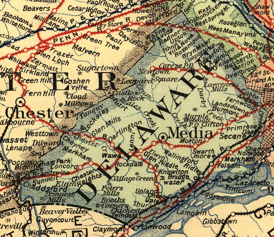
| 1895 DELAWARE COUNTY RAILROAD MAP | ||||||||
 |
||||||||
| Notes About Existing
Stations... Chester Heights (PRR) - This was likely the first station here and then used as a freight station in later years. At some point it was moved up to the Camp Meeting grounds. GPS coordinates are for the Camp Meeting grounds in general; can someone provide specific GPS for the station? Clifton-Aldan (PRR) - This is a substantial building built of "rubble-cut" green serpentine stone. It is in the style of a stone Victorian farmhouse, 2-1/2 stories high. This station was originally known just as Clifton. PRR records list the build date of the station as 1880, but the style of the station is typical of those older than that. According to the book "Pennsylvania Railroad Facilities, Volume 3: Philadelphia Division" by Robert Yanosey, the station was built in 1869. The outbound passenger shelter was added in 1890. Curtis Park (PRR) - Prior to 1948 the stop was known as "Academy Station" believed to have been named from the Holy Child Academy which was once located nearby. The station has been closed and boarded up but still stands (dividing Oak Avenue into two halves on either side of the railroad lines and one block East of Calcon Hook Road. The building there was built by or for the PRR when the name was changed as the Curtis Publishing Co. moved to town. The station officially opened at the end of Feb. 1949. Glen Mills (PRR) - This is an architectural gem--Queen Anne gothic style, red brick with black brick designs. It is believed to have been designed by Frank Furness, the world-class Philadelphia architect, who designed Philadelphia's Broad Street Station. Presently used by the West Chester RR as a scenic railroad. Lansdowne (PRR) - This station was designed by Frank Furness. It was badly damaged by fire a few years ago, but has been restored. The PRR "Keystone" Station sign, resplendent in Tuscan red and gold, gleams from the platform overhang. A new passenger shelter was built in 1890. Locksley (PRR) - This is more of a shelter rather than a station. Morton (PRR) - This is a "gothic cottage"-style station built of red brick with black brick detailing, three stories high. It was probably designed by Frank Furness, and is of similar style and vintage as the Glen Mills station. It was built in the final years of the West Chester & Philadelphia Railroad (which would merge into the PRR in 1881). It is extremely well preserved. About 50 feet west is a wooden freight shed, probably of the same vintage, still in use. Formerly known as "Morton-Rutledge." Moylan-Rose Valley (PRR) - This is a plain mid-19th century red-brick building with restrained architectural details. The original PRR Keystone station sign (said to be the longest station name sign in the PRR system) can be viewed on the north exterior wall of the Town House Restaurant in nearby Media. Here's an old photo. Newtown Square (PRR) - Apparently this is the only structure which survives from the Newtown Square branch of the PRR built in the 1890's. The line went through the back hills of Radnor and Haverford townships and was in partial operation until the 1970's. This freight shed was nearly swallowed by vegetation but was moved in May of 2000 to its new location at the old Drexel University Lodge Grounds. Its original location was on the west side of Newtown Street Road (Rt. 252) and now Winding Way. It is now the Newtown Square Penn Railroad Museum. Prospect Park (PRR) - A property owner named Moore donated the property for the original station. He did so, with the "condition" that the station should carry his "family" name for as long as it exists. It was formerly known as "MOORE" Station. Today it is known as Prospect Park/Moore Station. Secane (PRR) - This is another station of "rubble-cut" green serpentine stone, two stories high with a low-hipped roof. The station was built by the WC&P RR in 1871. The station used to be taller looking much like Clifton/Alden Station, but after a fire in the 1940's, the station was remodeled to its present form. Swarthmore (PRR) - The station is a cut-greystone Victorian "gothic cottage." The walls are "rubble-cut" stone on the gable ends and "square-cut" on the platform side. The windows are tall and narrow, framed in extraordinary stonework and topped by shallow gothic arches. The style appears to be an adaptation of "collegiate gothic" as the station is adjacent to Swarthmore College. The platform shelters are unusually long and substantial. New shelters were added in 1898. Wallingford (PRR) - This is a red-brick Victorian station, complete with platforms and balconies. The style suggests a Frank Furness design. Whitehall Station (P&C) - Used as Bryn Mawr Thrift Shop Offices. Originally part of the Philadelphia and Columbia Railroad, Whitehall Station dates from just before the Civil War, and the line was abandoned after 1870 when the PRR tracks were straightened in the 1870's. It is a splendid example of 1860's "Italianate" architecture. President Lincoln passed through here on the way to his inauguration in 1861, and his funeral train passed by here in 1865. Villanova (PRR) - This is a well-used station, surrounded by Villanova University. The station buildings are in good shape, and the residence is occupied. This stone station is in the same style as Haverford and Wynnewood. Williamson School (PRR) -
A new passenger shelter was built in 1890. |
||||||||