|
|
||||||||
| EXISTING STATIONS | ||||||||
|---|---|---|---|---|---|---|---|---|
| Station Name |
Original Railroad |
Current Location |
Type | Current Use |
Date Built |
Track Status |
Building Material |
More Info |
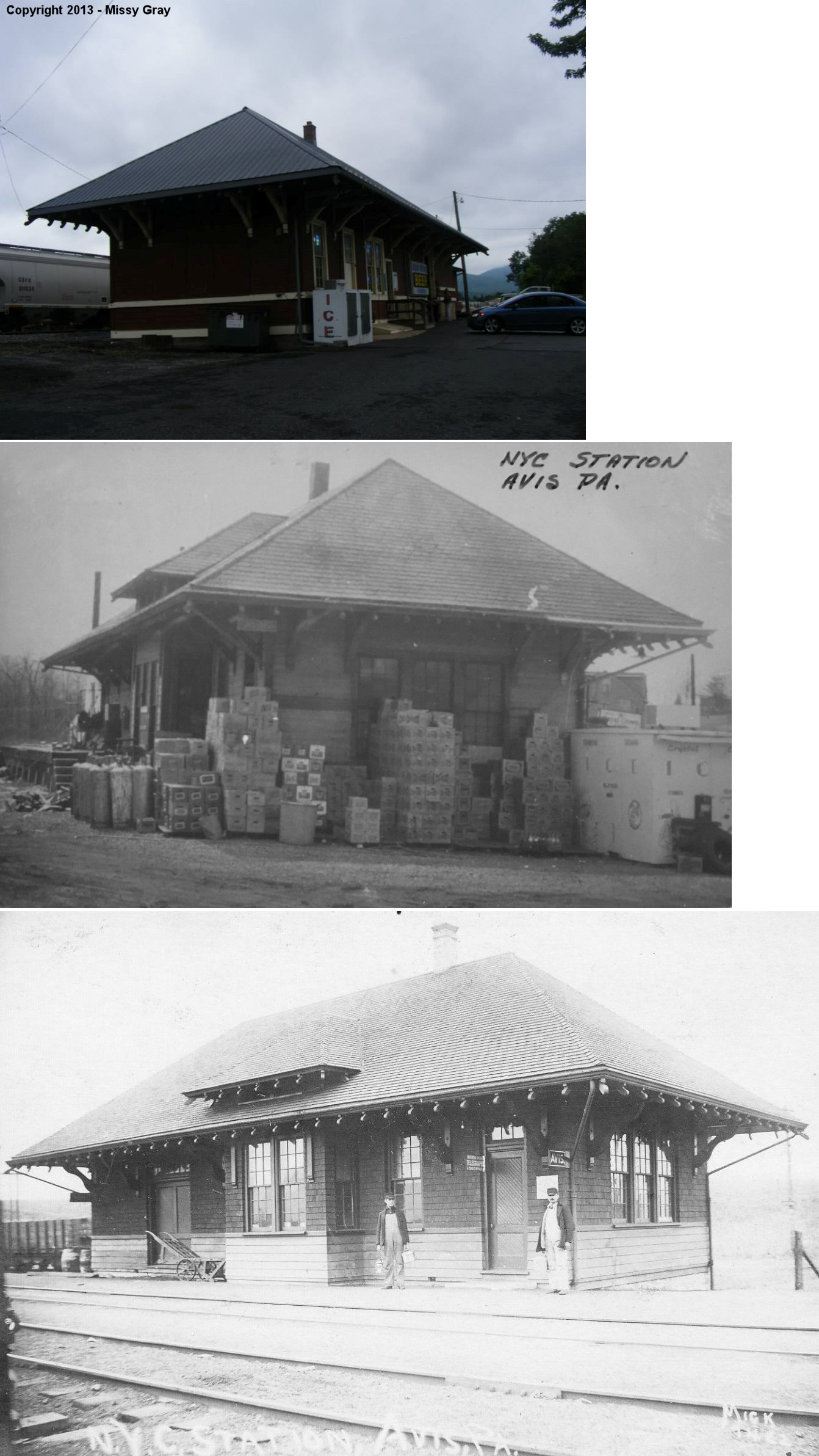
| Avis |  |
Take-A-Peek Road off PA220 (GPS: 41.186447, -77.303254) |
C | Business | ???? | In Use | Wood | |
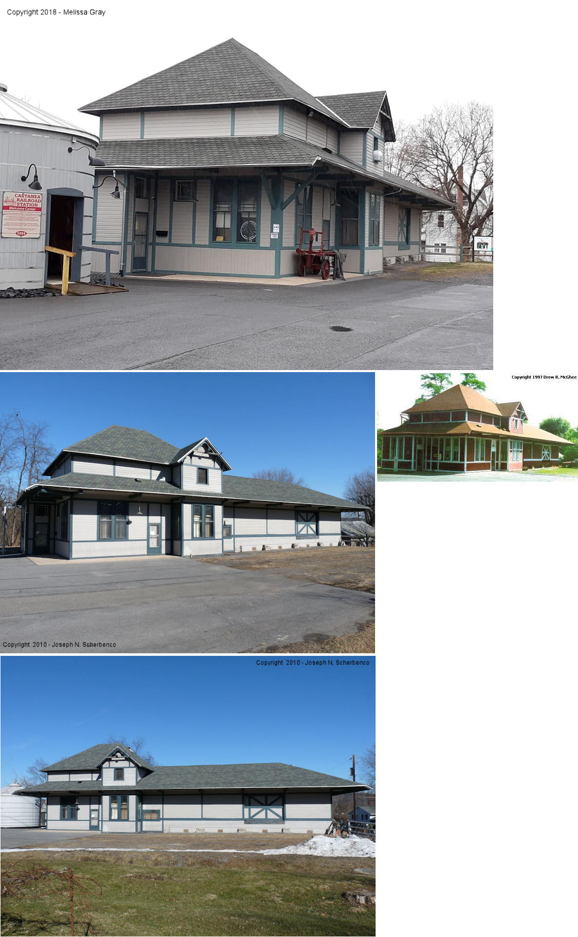
| Castanea (Lock Haven) |
|
Logan Avenue at Caroline Street (GPS: 41.125988, -77.431748) |
C | Civic | 1884 | Gone | Wood |
|
| Hyner |  |
East side of Hyner River Road between PA120 and the RR tracks (GPS: 41.331627, -77.644445) |
C | Private | 1882 | In Use | Wood | |
| Lock Haven |  AND |
Between South Hanna Street and South
Henderson Street (GPS: 41.132995, -77.438725) |
C | Railroad | ???? | In Use | Brick |
|
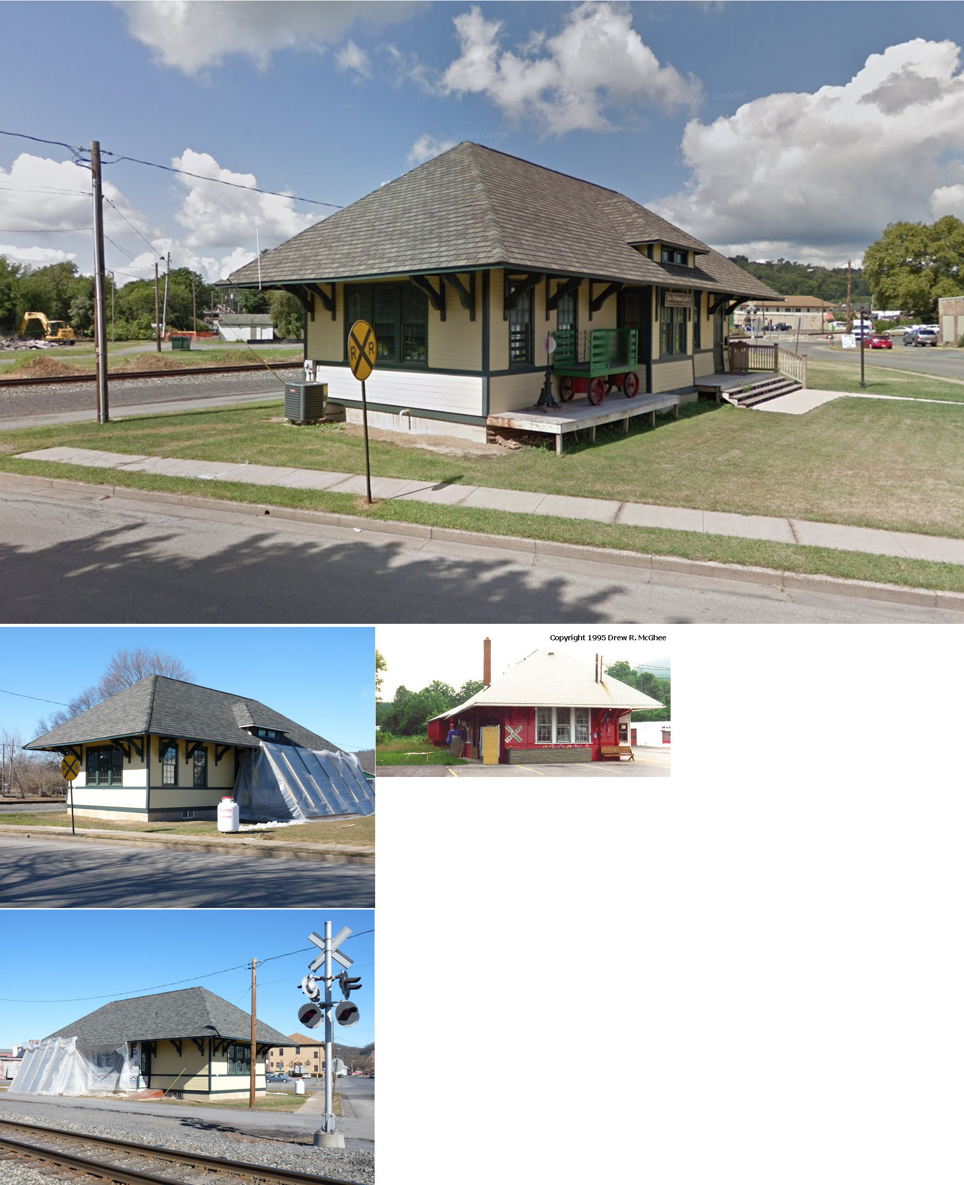
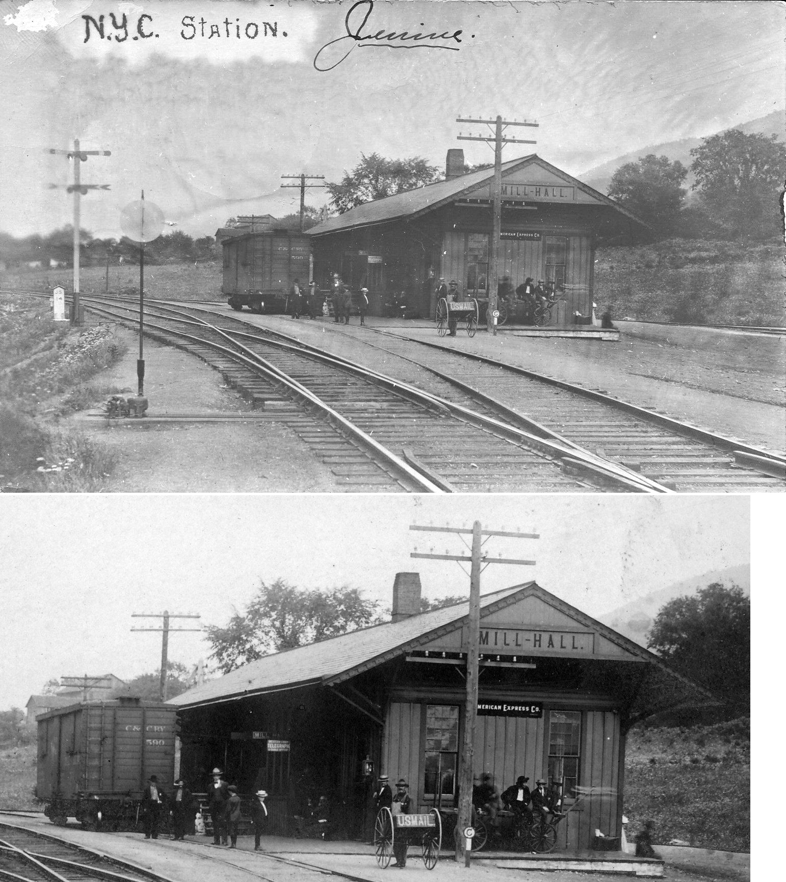
| Mill Hall | AND  |
North Liberty & West Bald Eagle Street, Lock Haven (GPS: 41.135054, -77.448581) |
C | Civic | 1904 | Aband. | Wood |
|
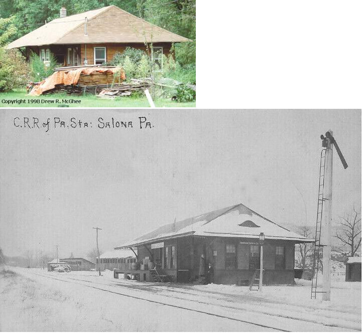
| Salona | |
PA477 (Long Run Road) across from Quarry Road (GPS: 41.084940, -77.470015) |
C | Residence | 1893 | Gone | Wood |
|
| STATIONS OF THE PAST | ||||||||
| Station Name |
Original Railroad |
Notes | ||||||
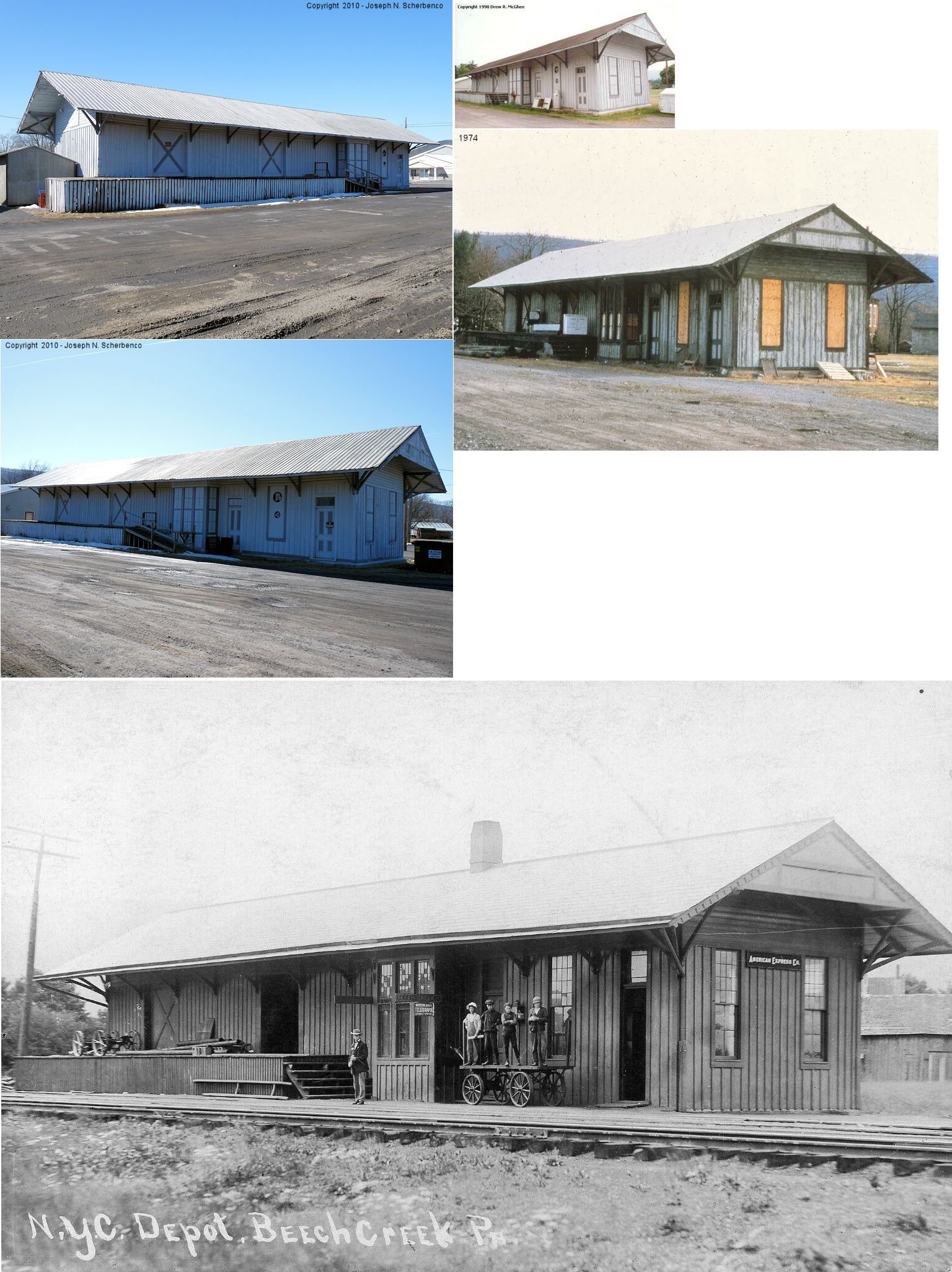
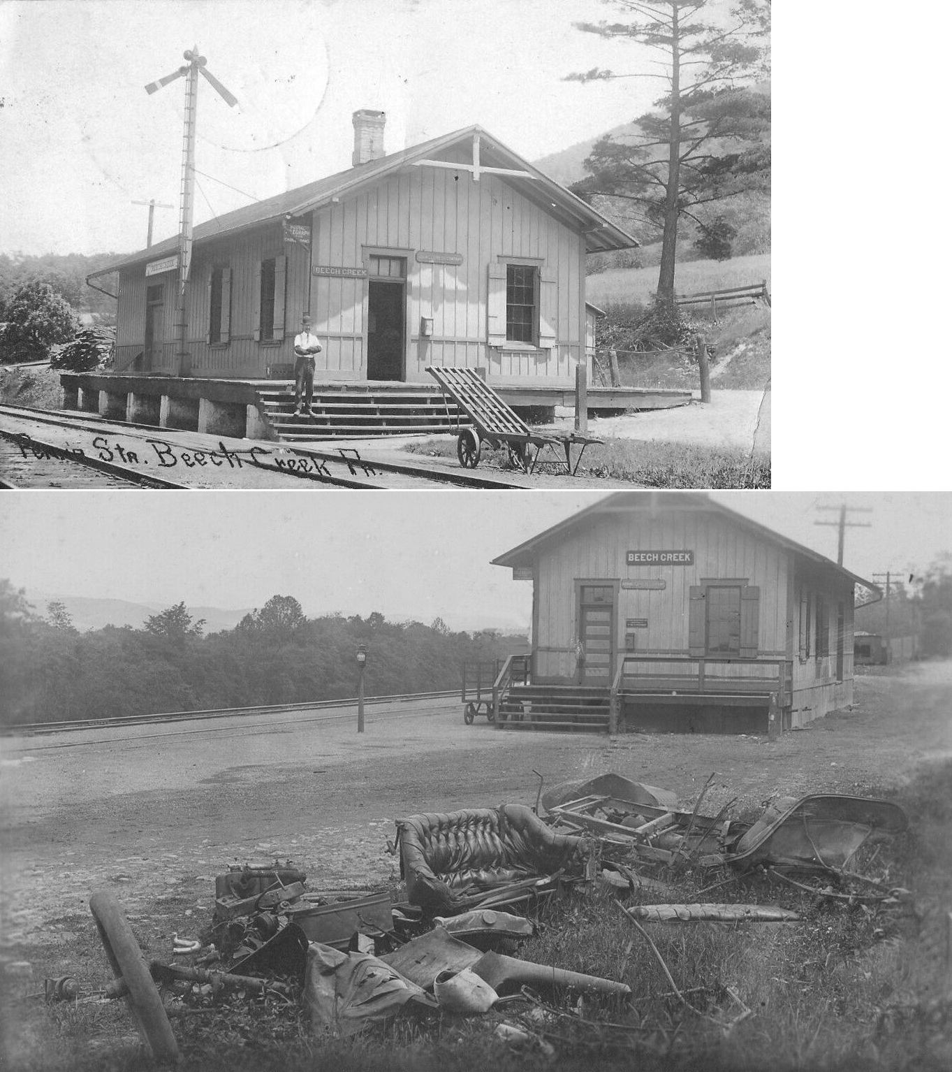
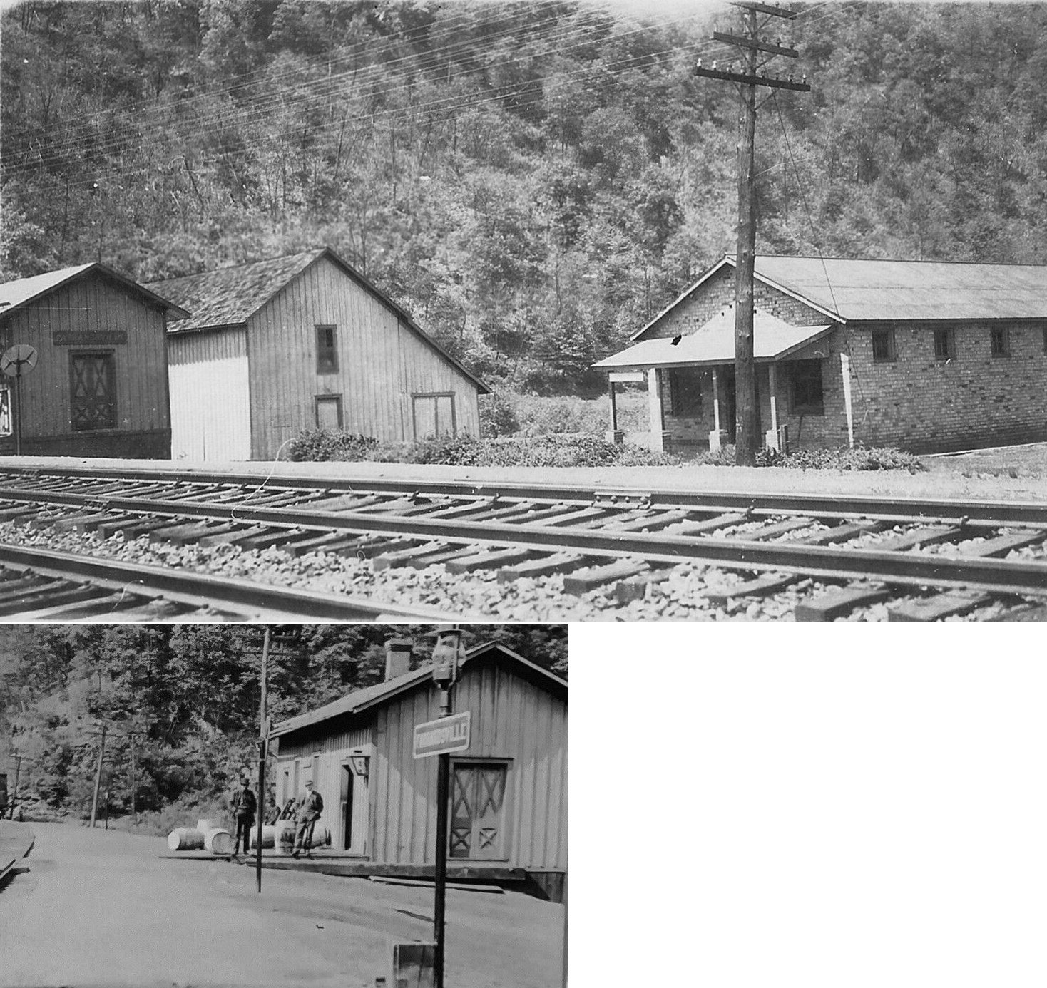
| Beech Creek | |
This station was on the SE side of Locust Street on the south side of the tracks (GPS: 41.076166, -77.587653). It was built in 1884 and was torn down in April 2015 to make room for a new fire station. Before that it was used for storage and as a concession stand for Beech Creek Volunteer Fire Company. The lumber was slated to be reused to build a hunting cabin in the New Garden area near Potters Mills, PA beyond Karthus. The first train arrived at Beech Creek on May 15, 1884. Regular passenger service between Jersey Shore and Beech Creek began July 1, 1884. First coal train went through Beech Creek on July 1, 1884. | ||||||
| Beech Creek |
|
|||||||
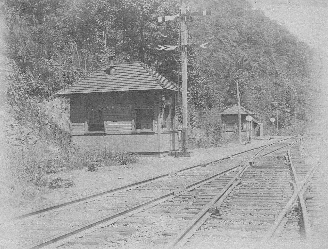
| Birch Island |
 |
This staion was near where the tracks crossed Brich Run in the vicinity of GPS: 41.195757, -77.975666. | ||||||
| Browns Station |
|
This station was near the end of Township Road 437 in the vicinity of GPS: 41.166364, -77.333467 according to the 1941 map. | ||||||
| Brungard |
 |
This station was between Loganton and Carroll Station. | ||||||
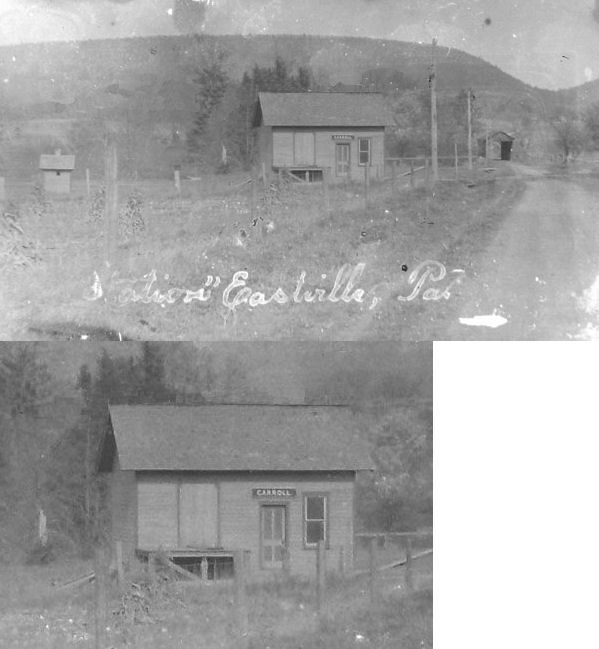
| Carroll Station |
|
See listing below for Eastville-Carroll. | ||||||
| Cedar Springs |
|
This station was on the west side of Mackeyville Road at approximately GPS: 41.078064, -77.479628. | ||||||
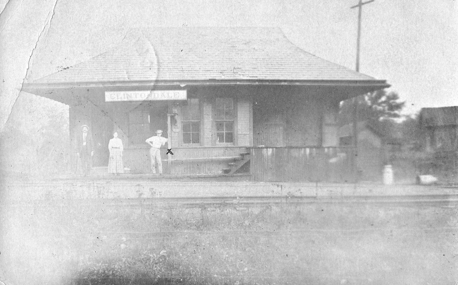
| Clintondale |
|
|||||||
| Cook's Run |
Susq. & Buffalo AND  |
This is where the PRR connected with the Susquehanna & Buffalo Railway. Not to be confused with the Buffalo & Susquehanna Railroad, this line followed Cook's Run up to a mine at Bitumen with a station at Foot Of Plane where another gravity(?) line jutted due west for a short distance presumably to another mine. On the 1929 Steam RR atlas of PA, the line is marked K.C.C.M. Co. Although the line is not shown on the 1941 county map, a PRR station is still shown at Cook's Run. The station was located in the vicinity of GPS: 41.279368, -77.883196. | ||||||
| Eastville-Carroll |
|
This station was on East Winter Road. Does anyone know the exact location? My best guess is around GPS: 41.038658, -77.218634 from the 1915 map and photo. | ||||||
| Farrandsville |
|
This station was on the west side of Farrandsville Road at approximately GPS: 41.170494, -77.515118. | ||||||
| Ferney Station |
|
This station was just south of Ferney Run at approximately GPS: 41.224195, -77.563952. | ||||||
| Flemington Station |
|
This station was located at approximately GPS: 41.118197, -77.463862. | ||||||
| Foot Of Plane |
Susq. & Buffalo |
See listing above for Cook's Run. This station was 1.5 miles north of Cook's Run. | ||||||
| Gaines Station |
|
This station was in the vicinity of GPS: 41.213688, -77.948992. This area is in Sproul State Forest now and inaccessible by road. | ||||||
| Glen Union |
|
This station was off Hyner River Road (Twp. 449) at approximately GPS: 41.250090, -77.604490. | ||||||
| Green's Gap |
|
Not sure if this was in Clinton or Union County. It was 7.6 miles from Loganton. | ||||||
| Hulings Station |
|
This station is not shown on the 1915 map, but is shown on the 1941 map. It was along the Sinnemahoning Creek just east of the county line at approximately 41.293481, -78.027746. | ||||||
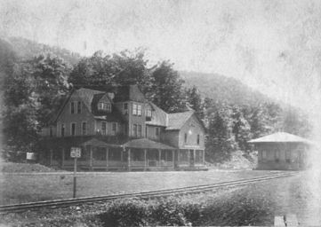
| Keating | |
Photo shows hotel and station. | ||||||
| Keating | |
Not sure if this is the same station as above or a predecessor. | ||||||
| Keating |
|
This was on the West Branch Valley Branch. | ||||||
| Krider's |
|
This station was at the end of what was called Slegle Lane (there is still a street sign there as of 2015) at approximately GPS: 41.025781, -77.498296. | ||||||
| Lamar |
|
|||||||
| Lock Haven |  |
This station sat on the SE side of Bellefonte Avenue on the north side of the tracks at GPS: 41.135823, -77.450460. The BEVRR was bought by the PRR in 1908 and hereafter this station was known as the PRR Bellefonte Street Station. | ||||||
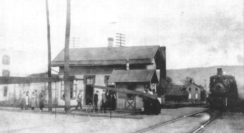
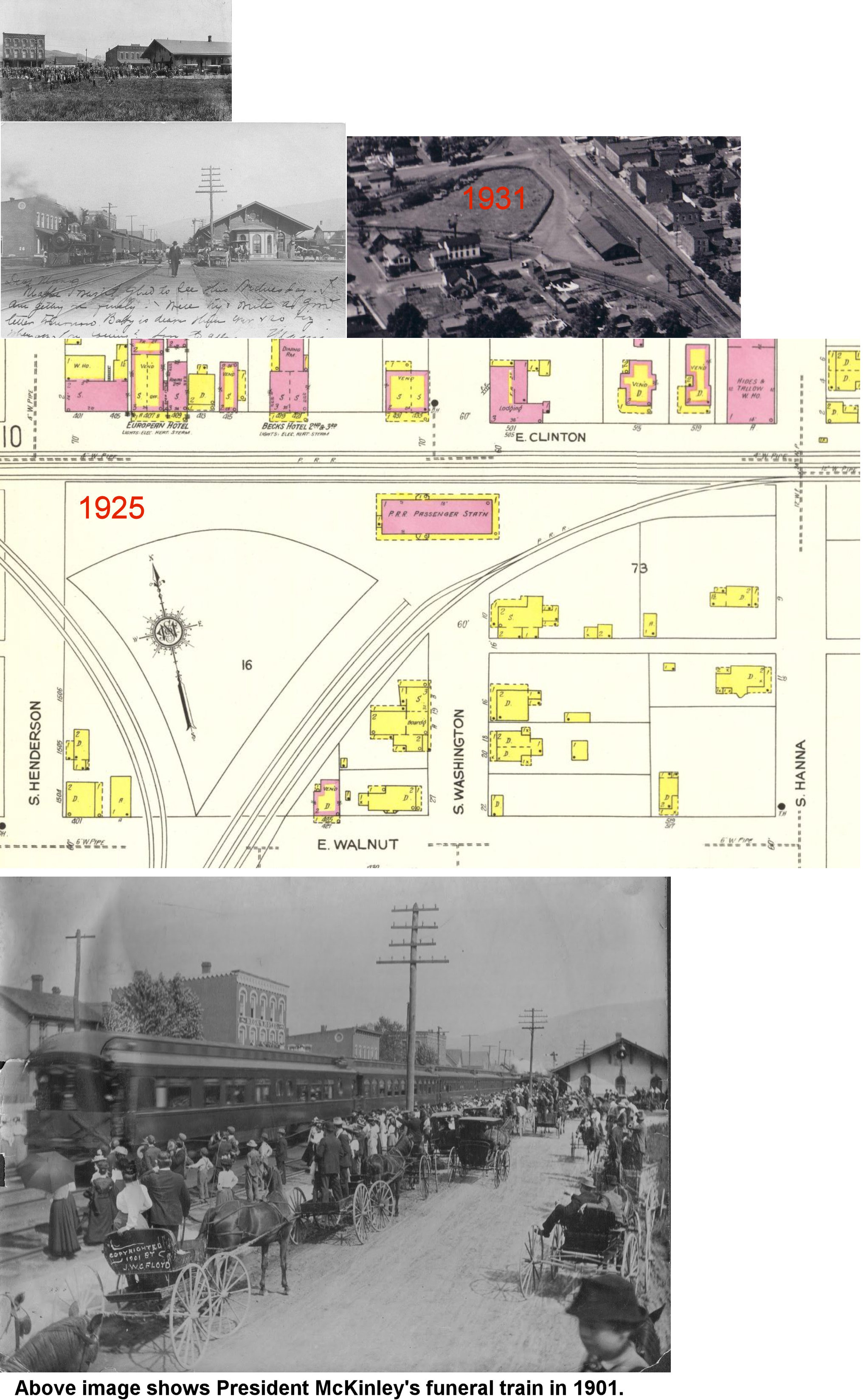
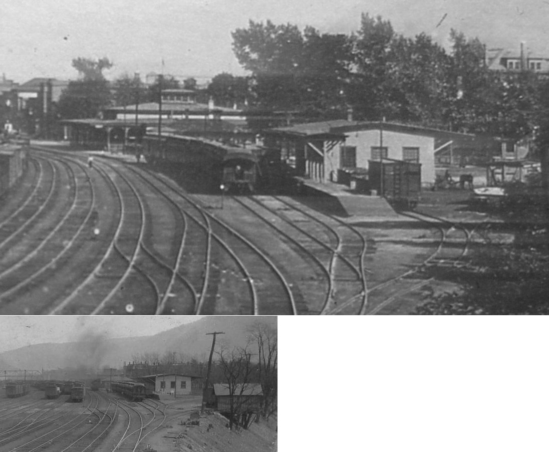
| Lock Haven | |
This station was on Washington Street at Clinton Street on the south side of the mainline tracks at GPS: 41.132983, -77.438308. The Bald Eagle Division tracks came in fron the SW and junctioned to the east of the station. The bottom photo shows William McKinley's funeral train in 1901. The station was built in 1896 and torn down in 1964 (Lock Haven Express, 5-28-1964). | ||||||
| Lock Haven | |
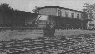
This freight station was at what would have been the south end of 4th Street at the time (it goes through today). It was at GPS: 41.137879, -77.454990. The station was destroyed by fire in July 1974 (The Progress, 7-25-1974). | ||||||
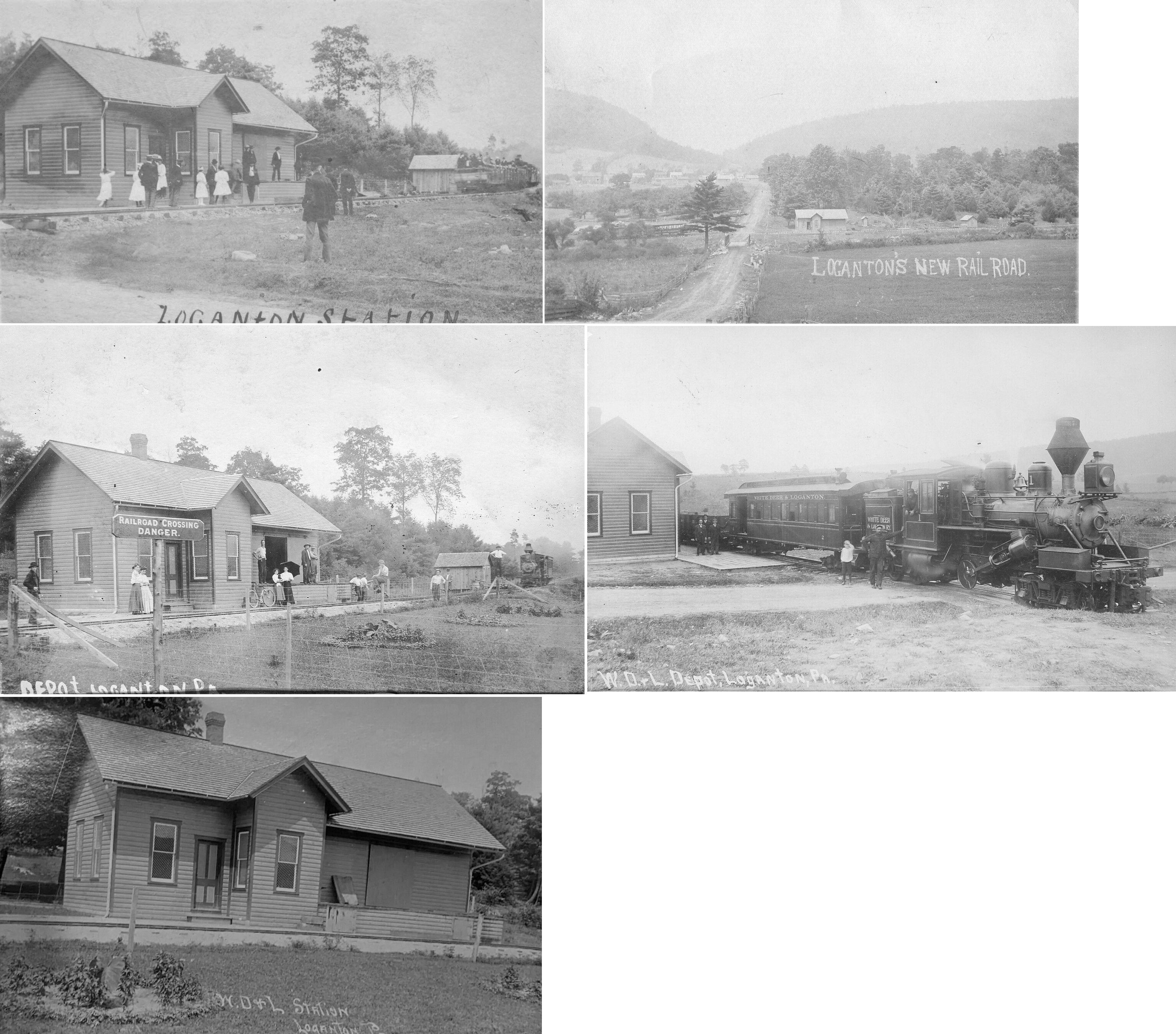
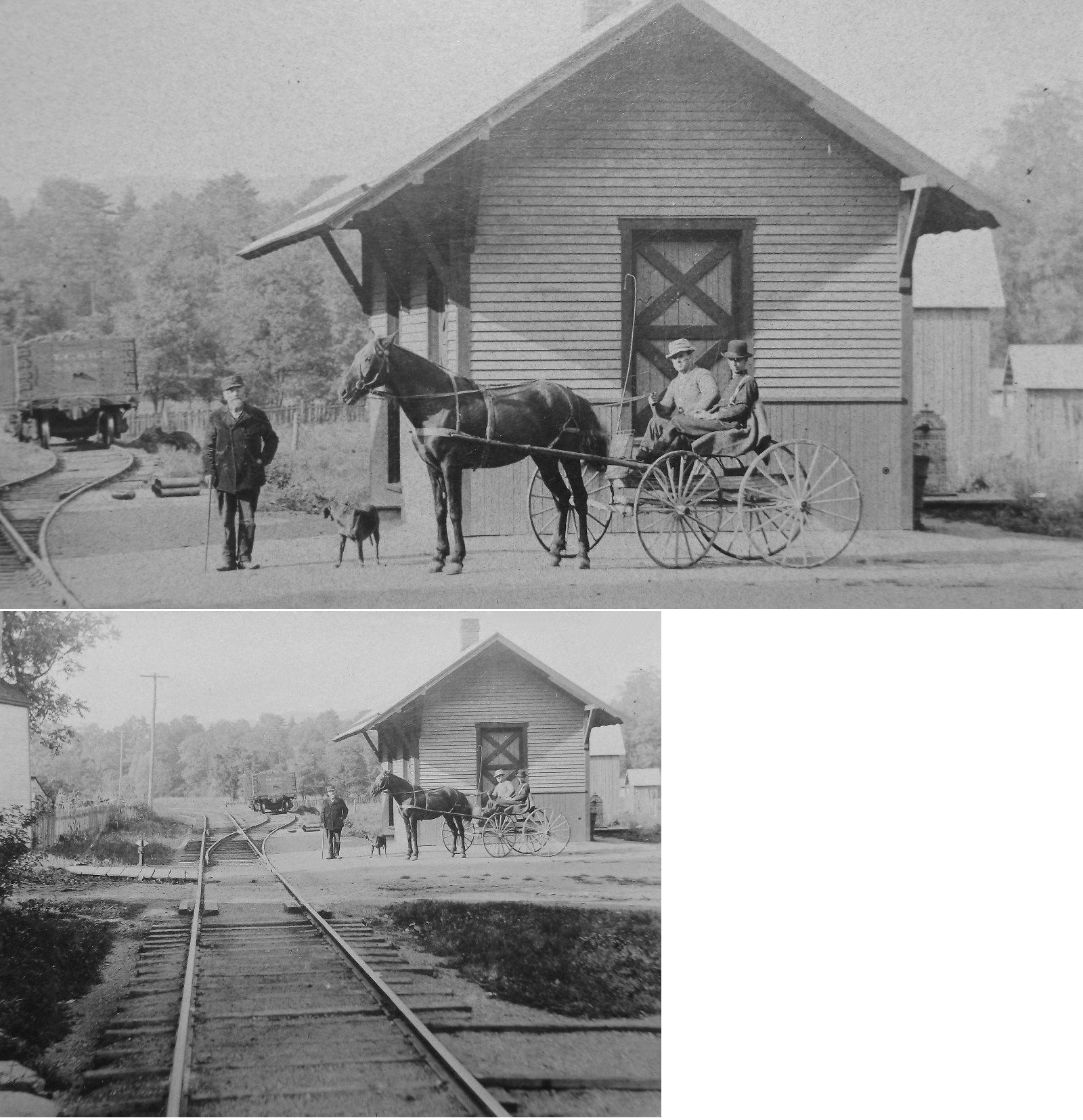
| Loganton |
|
The WD&L operated a 24-mile line between its namesake towns from 1906-1916. | ||||||
| LOOP RUN |
|
This station was near where the tracks crossed Loop Run in the vicinity of GPS: 41.161319, -78.002920. | ||||||
| Mackeyville |
|
|||||||
| Mapes |
|
This station was in the vicinity of GPS: 41.109189, -77.664261 according to the 1941 county map. | ||||||
| Mc Elhattan |
|
This station was on the SW side of McElhattan Drive at Railroad Lane at approximately GPS: 41.160839, -77.362356. | ||||||
| Mill Hall | AND |
The original Beech Creek station at Mill Hall was built in 1884 and replaced by a new station in 1904. | ||||||
| Mill Hall | |
There is an Agway on this site now. | ||||||
| Mill Hall | |
|||||||
| Mill Hall Junction |
AND |
The 1915 map shows a station in the vicinity of GPS: 41.104263, -77.494825. This is where the Bald Eagle valley Branch of the PRR crossed the Beech Creek RR. | ||||||
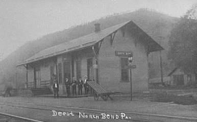
| North Bend | |
This station was ont he SW side of Reese Road at approximately GPS: 41.342579, -77.703230. It was built in 1882. | ||||||
| Paddy Run | |
|||||||
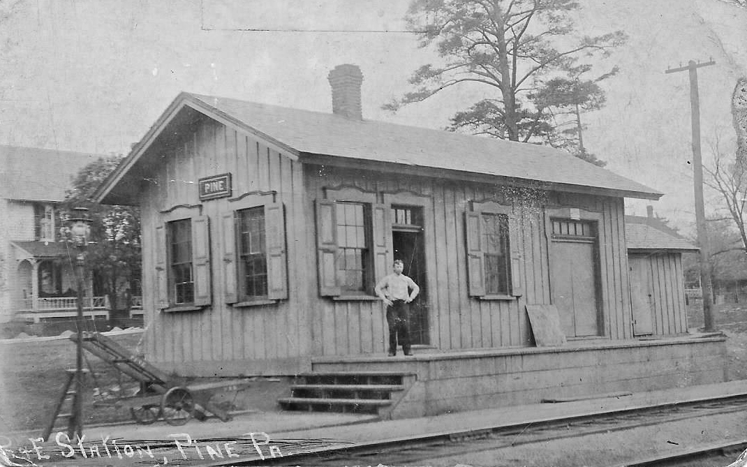
| Pine Station | |
This station was on the east side of Pine Mountain Road at GPS: 41.165529, -77.313877. | ||||||
| Queens Run | |
This station was north of Renovo Road at approximately GPS: 41.173479, -77.483045. There is no road to this location today. | ||||||
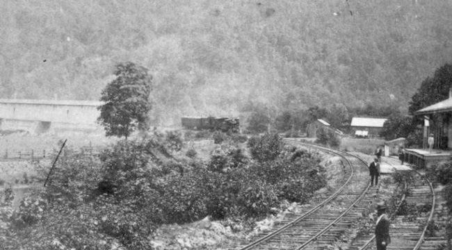
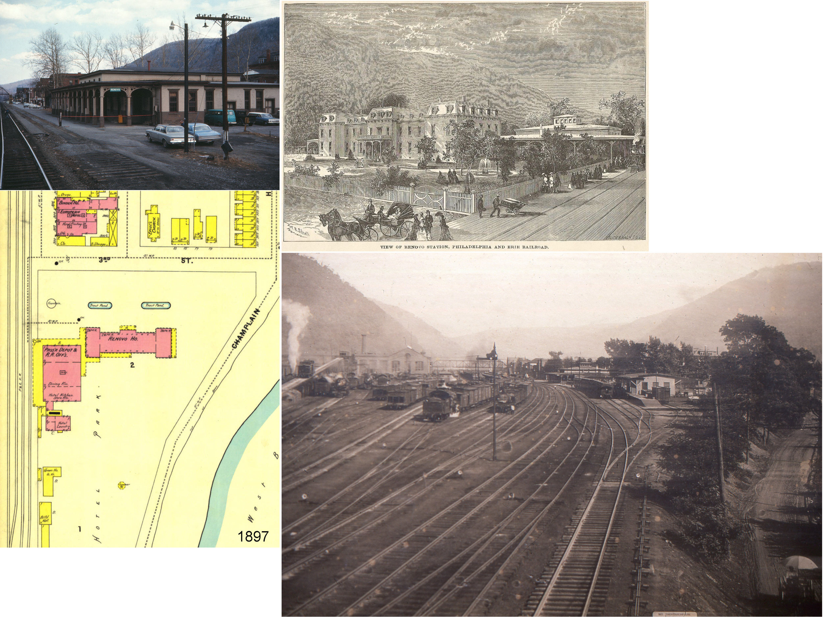
| Renovo | |
This station, opened in 1865, was at the west end of Erie Avenue just past 3rd Street at GPS: 41.326341, -77.758316. It sat next to the large Renovo Hotel which was gone by 1911. The station itself burned on August 27, 1969. The fire burned most of the floor of the station which was vacant at the time (The Express, 8-27-1969). | ||||||
| Renovo | |
There was a freight station on the south side of the tracks at the north end of 5th Street at GPS: 41.327150, -77.755002. It was gone by 1911. | ||||||
| Renovo | |
A new freight station was added just to the west of the passenger station at approximately GPS: 41.326329, -77.759242. This may have been a new building or the old freight station may have been moved from it's original location. | ||||||
| Ritchie | |
This station was off Township Road 449 on the west side of where the tracks cross Ritchie Run at approximately GPS: 41.299030, -77.609760. | ||||||
| Round Island | |
This station is shown in different locations on the 1915 and 1941 county maps, although these maps are usually not very precise as to the exact locations of stations. The station was likely near where Round Island Run empties into the Sinnemahoning at approximately GPS: 41.297440, -77.994785 near Round Island. | ||||||
| Shintown | |
|||||||
| Spruce |
|
This was on the West Branch Valley Branch. It was in the vicinity of GPS: 41.161319, -78.002920. | ||||||
| Three Runs |
|
|||||||
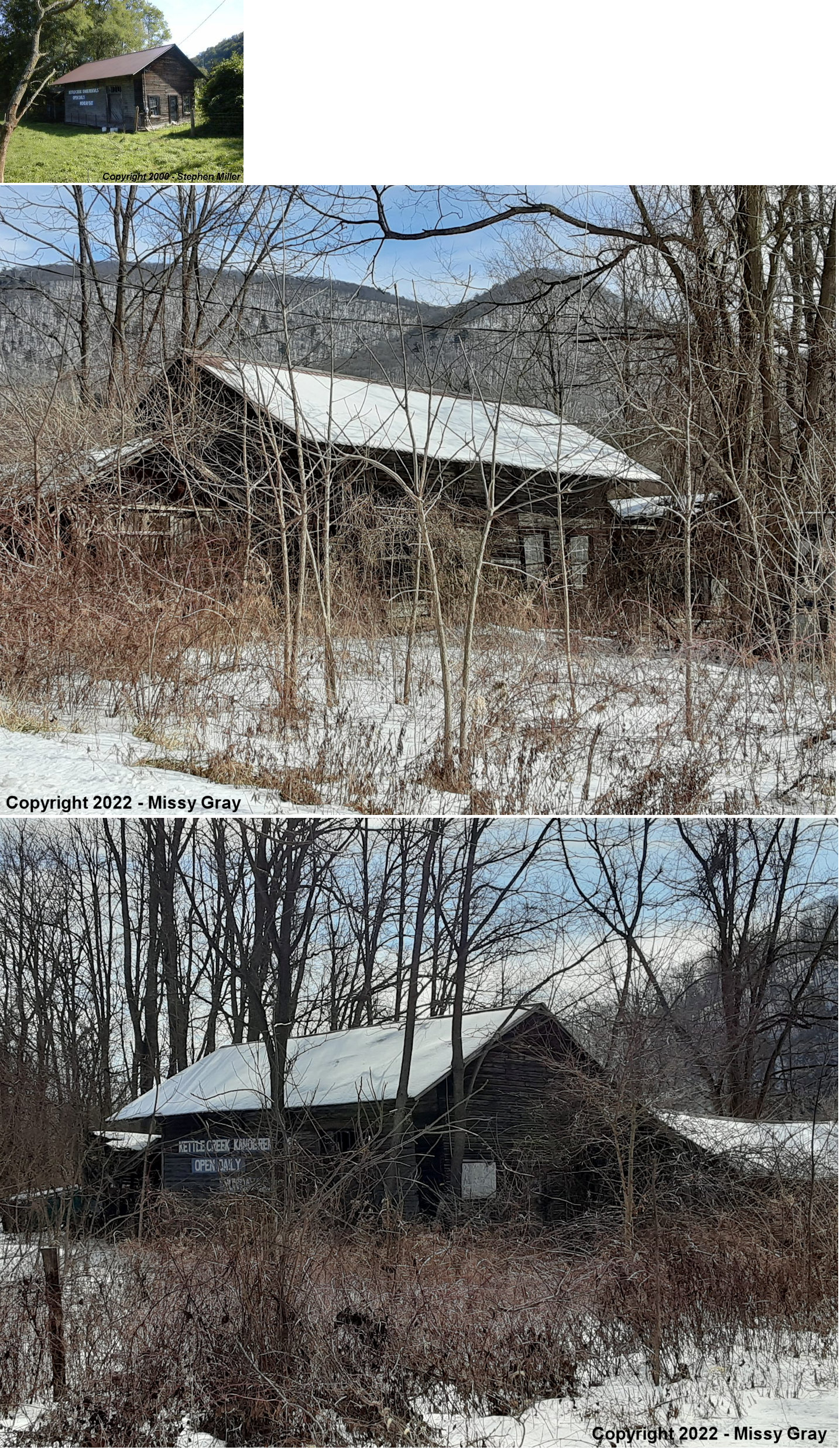
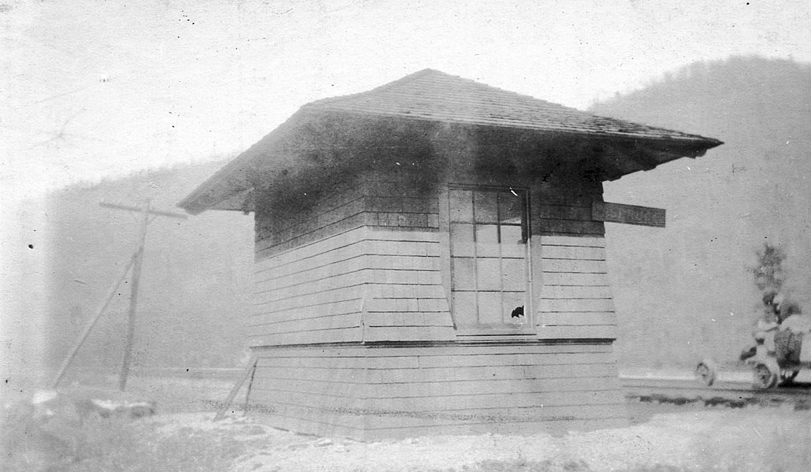
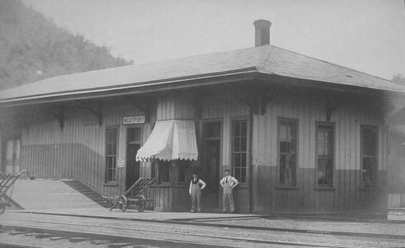
| Westport |
|
This station was on the east side of Renovo Road (PA120) just north of the Kettle Creek bridge at approximately GPS: 41.300750, -77.840424. | ||||||
| Wistar |
|
This station was near where the tracks cross Wistar Run at approximately GPS: 41.270624, -77.944526. | ||||||
| Whetham |
|
According to the 1941 map, this station was along Township Road 449 north of Rattlesnake Run at approximately GPS: 41.270543, -77.593261. | ||||||
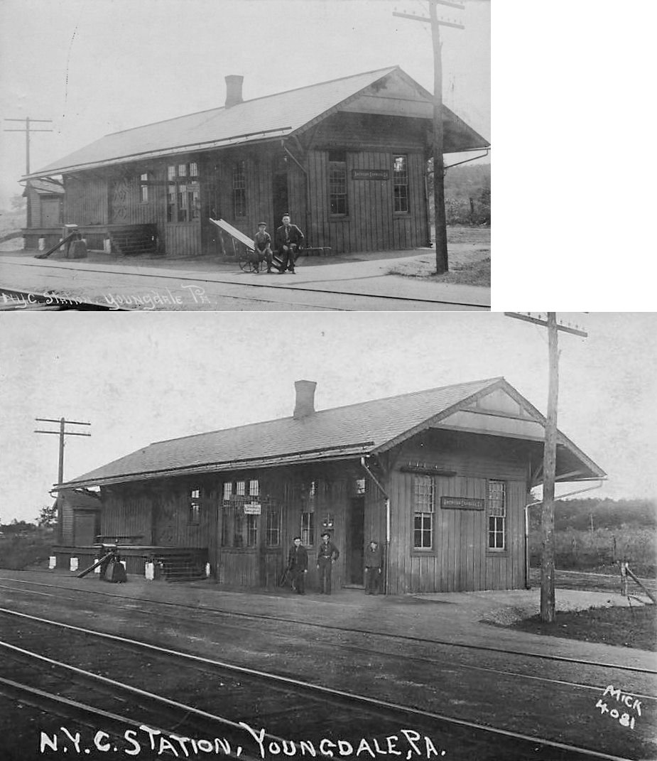
| Youngdale | |
This station was on Youngdale Road at McKinney Road at approximately GPS: 41.150007, -77.364482. | ||||||
| Zanmore (Zan Moore) |
|
This was on the West Branch Valley Branch it was located in the vicinity of GPS: 41.227493, -77.931542. This area is state forest land now and inaccessible by road. The station was named after landowner James A. Moore whose nickmame was "Zan." | ||||||
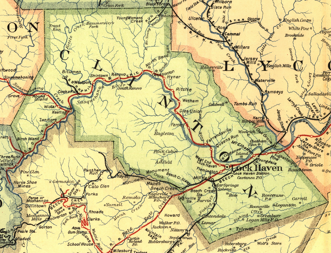
| 1895 CLINTON COUNTY RAILROAD MAP | ||||||||
 |
||||||||
| Notes About Existing
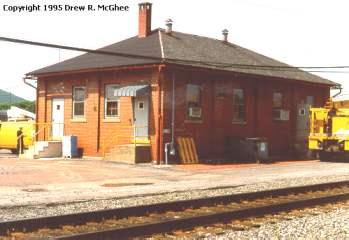
Stations... Castenea (BCRR) - The railroad called this station Lock Haven even though it is physically in Castenea. Emery Chemical Company donated it to the Historical Society when they closed their Castanea operation. The interior of the station is leased to the Clinton Central Model Railroad Club. The Historical Society is developing the exterior areas. The Clinton County Historical Society has installed enough track at the station to currently hold a boxcar and caboose that is already on site. The caboose is set up as lodging and is available for rent. Another addition is a replica water tower that displays transportation history of the county. The water tower was built by local high school vo-tec students. This site is the projected trailhead to a connector trail that will run from Castanea to connect with the Pine Creek Rails to Trails. Lock Haven (PRR/REA) - This express building was remodeled and used by PRR for passenger service after its station was torn down in 1964. Mill Hall (BCRR) - A remnant of this former NYC line ends at the station's original location. This remnant is still in use from just east of the station to Castanea. The station was moved on Tuesday, Oct. 30, 2007 five miles to Lock Haven to a lot behind city hall. This is now The Station Gallery, operated by the Clinton County Arts Council. After the station was moved from Mill Hall, it was restored and made handicapped accessible using grant monies. Salona (Central Of PA) - The Central RR of PA ran from Bellefonte to and Mill Hall. It interchanged with the NYC at the NYC's Mill Hall Station. The Central RR of PA discontinued rail service circa 1920. The NYC continued to use a portion of the line for awhile as a spur to reach the limestone quarry in Salona. There is a very good chance that this former station is the last remaining structure of the Central RR of PA. |
||||||||