|
|
||||||||
| EXISTING STATIONS | ||||||||
|---|---|---|---|---|---|---|---|---|
| Station Name |
Original Railroad |
Current Location |
Type | Current Use |
Date Built |
Track Status |
Building Material |
More Info |
| Johnstown |  |
47 Walnut Street (GPS: 40.329762, -78.921846) |
P | Railroad | 1916 | In Use | Brick |
|
| Johnstown |
 |
Behind PRR station. (GPS: 40.330222, -78.921645) |
P | Railroad | ???? | In Use | Cement | |
| Johnstown | |
Corner of Short Street and Matthew Street (GPS: 40.326097, -78.913125) |
F | Business | 1896 | Aband. | Brick | |
| Nantyglo |
|
Corner of Chestnut Street and 1st Street (GPS: 40.471501, -78.834862) |
C | Civic | 1903 | Gone | Wood | |
| Portage | |
Lee Street at Dulancy Drive (GPS: 40.390118, -78.673333) |
P | Museum | 1926 | In Use | Brick | |
| Portage | |
East side of Main Street at South Railroad Avenue (GPS: 40.388697, -78.671804) |
F | Museum | 1909 | In Use | Wood | |
| STATIONS OF THE PAST | ||||||||
| Station Name |
Original Railroad |
Notes | ||||||
| Adams |
 |
The Cambria & Indiana RR formerly the Blacklick & Yellow Creek RR was originally established in 1904 and changed ownership and names in 1909. It was mostly a coal-hauling RR, but did offer passenger service via mixed trains. Passenger operations ceased around 1932. | ||||||
| Adele |
|
This station was at MP 7.7 (from MP 0 at Colver Heights). | ||||||
| Aldburn |
|
|||||||
| Amsbry |
|
|||||||
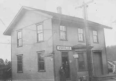
| Ashville |
|
The C&C was later part of the PRR. The station was on the northeast side of Liberty Street on the NW side of the tracks (GPS: 40.560928,-78.548692). The station here burned down in 1892 and a temporary station was erected until the new one was built. | ||||||
| Ashville |
|
|||||||
| Bakerton (Elmora) |
|
This station was between Reed Street and Frazier Street on the south side of the tracks at GPS: 40.602871, -78.745461. | ||||||
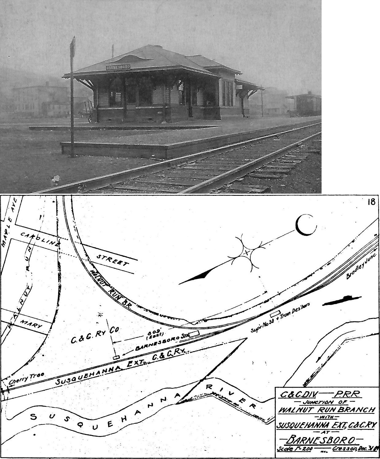
| Barnesboro | |
This station was at the site of what is currently Giant Eagle at the SW end of Cottonwood Street off US-219 (GPS: 40.660502,-78.783646). The town is now called Northern Cambria. A new station was built here in 1893. | ||||||
| Barnesboro (North Barnesboro) |
|
The station was on the east side of Mulberry Street (formerly 3rd Street) on the north side of the tracks. | ||||||
| Beaverdale | |
This small passenger station was near the corner of Jefferson Avenue and Cedar Street (PA869) at approximately GPS: 40.320414, -78.698209. The Beaverdale station was just 1/2 mile north of the Lloydell station. The Lloydell station was built first and then a non-agency station was added at Beaverdale when that town grew larger. Originally, Beaverdale had freight service, but the PRR abandoned that in 1907. Around 1919, residents of Beaverdale petitioned the RR to add freight service, but it was to no avail as there was already an express agent at Lloydell. | ||||||
| Belsano |
|
This station was on the 10-mile C&I branch that ran from Preisser to Nanty-Glo. | ||||||
| Ben's Creek | |
Photos taken by Diehl Photo Studio, Portage, PA. | ||||||
| Beulah |
|
|||||||
| Beulah Road |
|
|||||||
| Big Fill | |
This station is listed on the 1900 timetable, but not on the 1915 map. It was somewhere between Loretto Road and Driscoll. | ||||||
| Blandburg (HOMMER) |
 |
This station was on Railroad Street. | ||||||
| Border |
 |
|||||||
| Bracken |
|
This station was on the Black Lick Branch between Vintondale and Twin Rocks. | ||||||
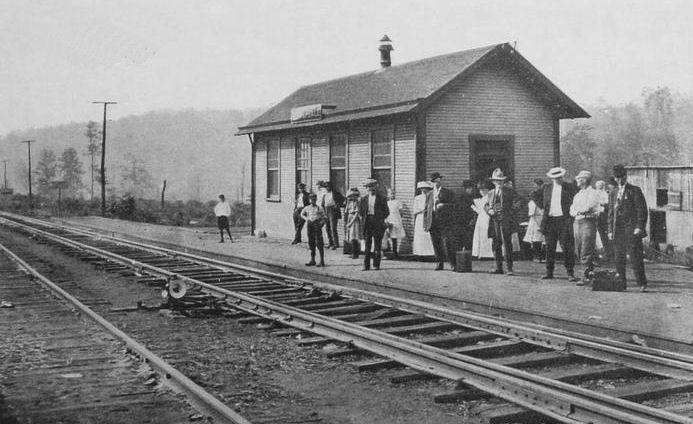
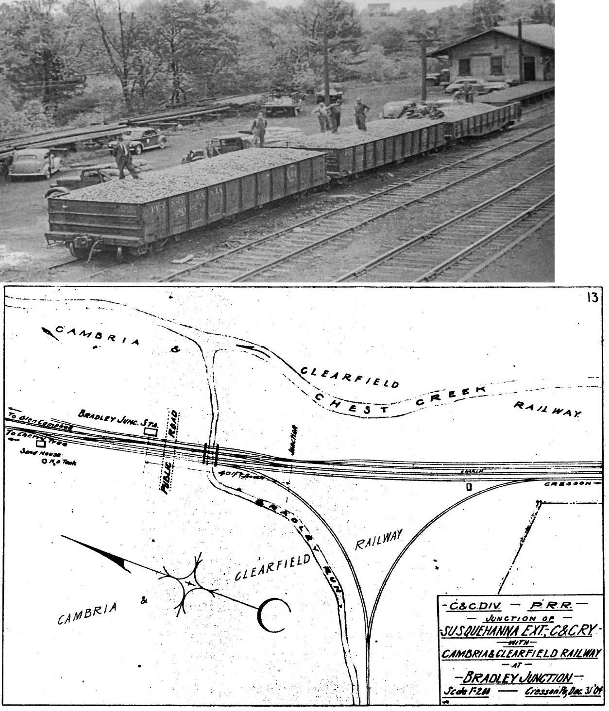
| Bradley Junction |
|
This station was on the north side of Lemon Drop Road (SR-1007) on the east side of the tracks at GPS: 40.551380, -78.669730. This was the junction for the Susquehanna Extension. | ||||||
| Cardiff |
|
This station was on the 10-mile C&I branch that ran from Preisser to Nanty-Glo. | ||||||
| Carrolltown Road |
|
This station was on the south side of Deveaux Street on the east side of the tracks (GPS: 40.597400, -78.727657). A new station was built here in 1893. | ||||||
| Carrolltown |
 |
This station was north of Carrolltown off of Sunset Road behind what is now a Dollar General. | ||||||
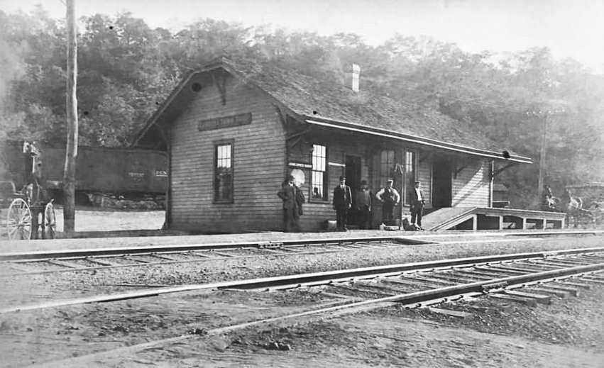
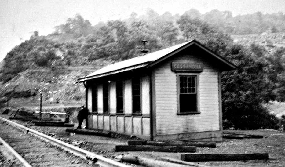
| Cassandra (Derby) |
|
|||||||
| Colver |
|
This station was located near the Cambria & Indiana RR offices and shop at GPS: 40.543918, -78.801264. | ||||||
| Colver Heights |
|
This station was 2.2 miles from the Colver station and was the terminus of the Cambria & Indiana (Black Lick & Yellow Creek RR). | ||||||
| Concrete Bridge |
|
This station was at milepost 6.5 (from MP 0 at Colver Heights). | ||||||
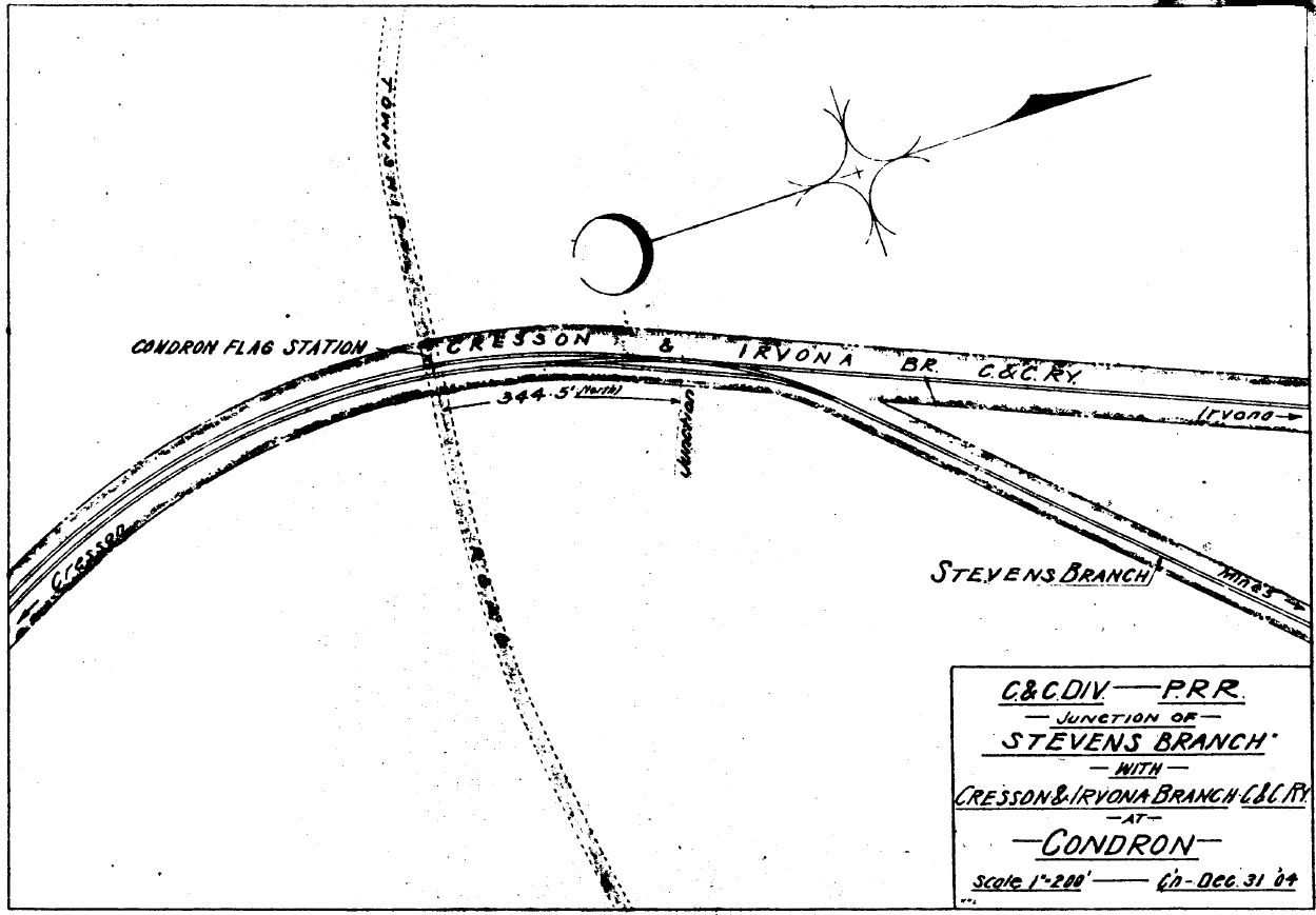
| Condron |
|
A station is shown here on the 1890 county atlas. Later PRR maps show only a flag stop here. This was where the Stevens Branch started off the Cresson & Irvona Branch toward Laurel Run Colliery #2. | ||||||
| Conemaugh |
|
A new station was built here in 1889. | ||||||
| Creslo |
|
|||||||
| Cresson |
|
This was an early station here. The photo is from 1875 and this station was likely built in 1864. | ||||||
| Cresson |
|
This station and its island platforms were built in 1911 on the NW side of Front Street on the SE side of the tracks at GPS: 40.462007, -78.591568. It was in front of what is now the Station Inn B&B. The station itself was small and there were seperate small buildings for the express office and baggage shed. There were long island platforms on both sides of the mainline tracks. | ||||||
| Cresson |
|
|||||||
| Daugherty |
 |
This was a station on the Altoona and Wopsononock RR (later the Altoona, Clearfield, & Northern RR). | ||||||
| Dean Station |
|
|||||||
| Dobson Junction (Colver Junction) |
|
This station was between Concrete Bridge and Adele at MP 7.5. A branch line began here that ran 4.5 miles to Rexis. | ||||||
| Douglass Run |
|
|||||||
| Driscoll |
|
This station was on the south side of Stock Road on the east side of the tracks at GPS: 40.528381, -78.661291. | ||||||
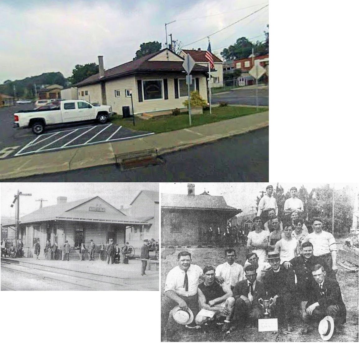
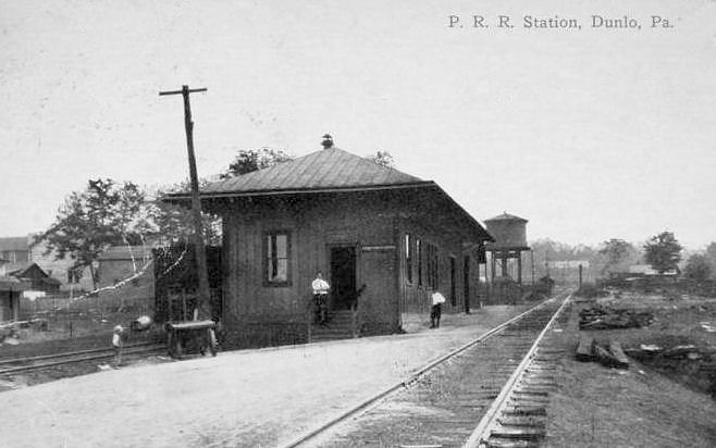
| Dunlo |
|
This station was on the north side of Railroad Street at GPS: 40.293545, -78.722809. | ||||||
| Dysart |
|
|||||||
| East Conemaugh |
|
The original station was on the SE side of Railroad Street across from the end of Cherry Street (GPS: 40.345784,-78.884186). There was a freight house about 300 feet to the NE. These stations were eventually replaced by the station listed below. | ||||||
| East Conemaugh |
|
A later combination station was on the corner of Railroad Street and Oak Street (GPS: 40.347073, -78.882491 ). This station is shown on the 1913 Sanborn map. | ||||||
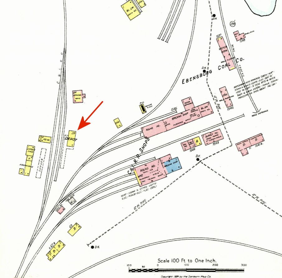
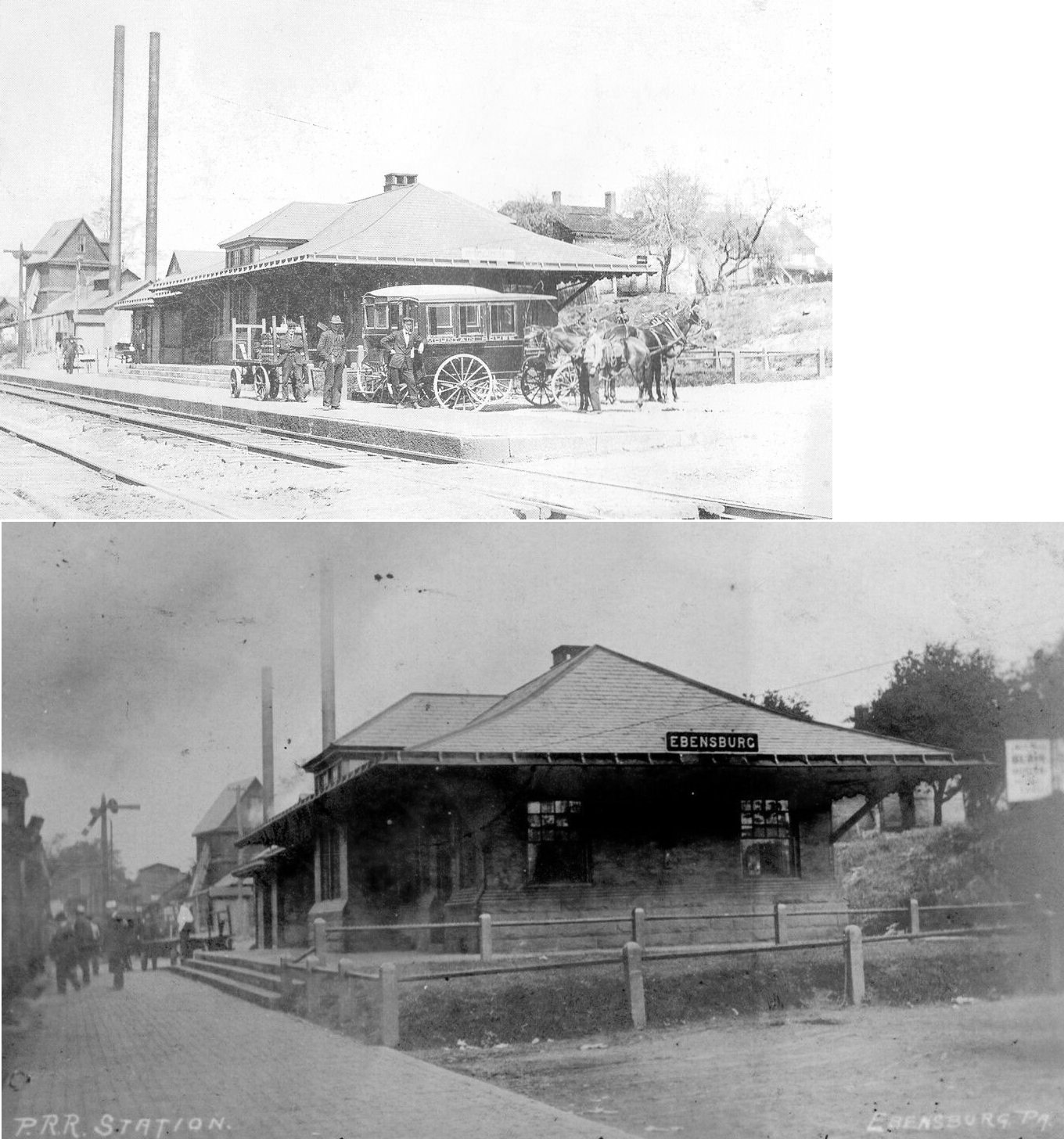
| Ebensburg | |
The first station here was a frame combination station on the west side of South Center Street on the north side of the tracks at GPS: 40.481526, -78.725261. It was replaced with the brick station listed below sometime between 1899-1904. | ||||||
| Ebensburg | |
This brick passenger station was built sometime between 1899-1904 and was on the site of the original combination station (on the west side of South Center Street on the north side of the tracks at GPS: 40.481526, -78.725261). | ||||||
| Ebensburg | |
When the new passenger station (listed above) was built, a freight station was added at the end of Cherry Street (formerly called Station Street) on the south side of the tracks at GPS: 40.481543, -78.726225. | ||||||
| Eckenrode Mill |
|
|||||||
| Eherenfield |
|
|||||||
| Edwards |
|
This station was on the 10-mile C&I branch that ran from Preisser to Nanty-Glo. | ||||||
| Eleanor |
|
|||||||
| Elkdale Junction (White Mill) |
|
|||||||
| Elton (Eltonburg) |
|
|||||||
| Emeigh |
 |
|||||||
| Evans Run |
|
This station was built in 1894 when the Ebensburg & Black Lick Railroad opened. It was operated by the PRR as part of Cambria & Clearfield Division. | ||||||
| Fallen Timber |
|
|||||||
| Ferndale (VicKroy) |
|
|||||||
| Figart |
|
|||||||
| Flinton |
|
|||||||
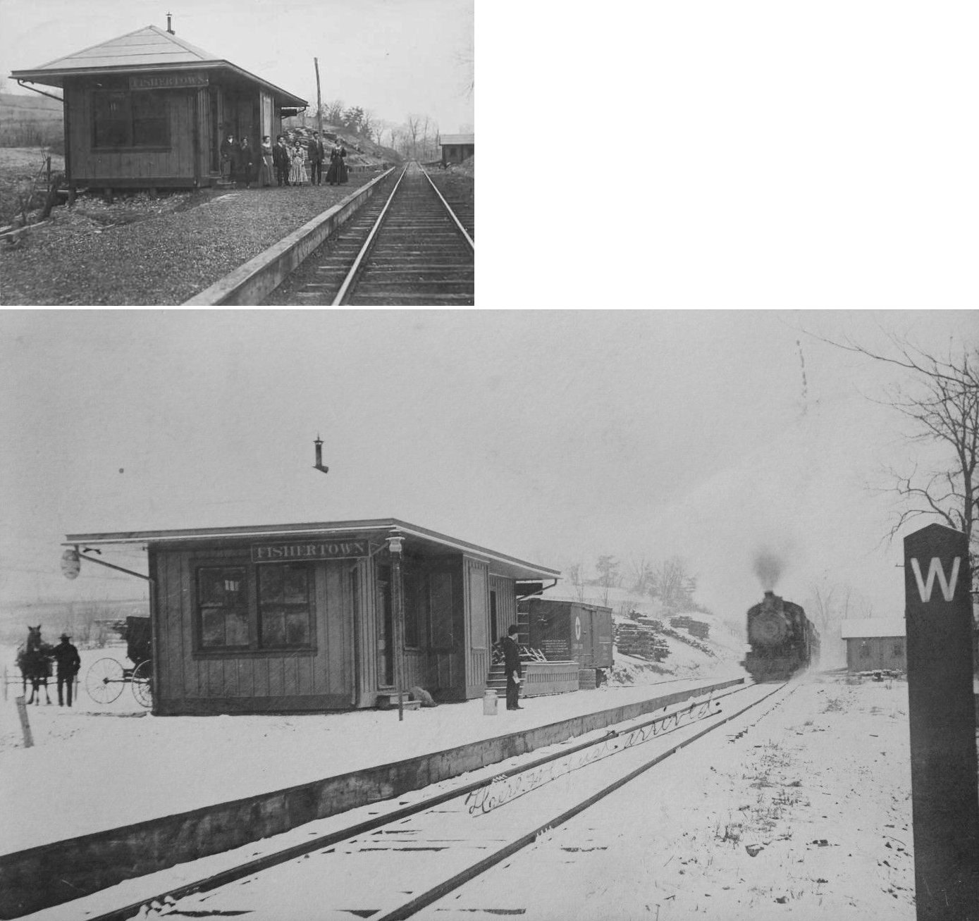
| Fishertown | |
|||||||
| Frugality (Erdon) |
|
A new station was built here in 1895. The station was renamed Erdon in 1910. | ||||||
| Gallitzin |
|
A station was built here in 1864. | ||||||
| Gallitzin | |
The westbound station was on Main Street where it used to cross the tracks at Railroad Street. The station was on the west side of main, on the south side of the tracks. (GPS: 40.481744,-78.552589) | ||||||
| Gallitzin | |
The eastbound station was on South Main Street south of Howell Street. It was on the north side of the tracks (GPS: 40.47715,-78.553078). This station was built in 1899. | ||||||
|
Gallitzin (Tunnel Sta.) |
|
This station was near the portal to the Allegheny Tunnel. It is listed as "storage" on the 1900 timetable. | ||||||
| Garman |
|
|||||||
| Garway |
|
Garway station was 7.5 miles north of Patton according to the NYC timetable. Not sure if this was in Cambria or Clearfiled County. | ||||||
| Glasgow |
|
|||||||
| Hastings | |
In 1890 the station was on the SW side of 4th Avenue on the NW side of the tracks. Later there were sepaerate freight and passenger stations at this location. The stations were between the creek and the tracks. The freight station was at GPS: 40.664250, -78.711257, and the passenger station was at GPS: 40.663986, -78.711514. A new station was built here in 1889 (likely the two stations as the single station on the 1890 map was probably the old station as some of the old maps were not updated with great speed). | ||||||
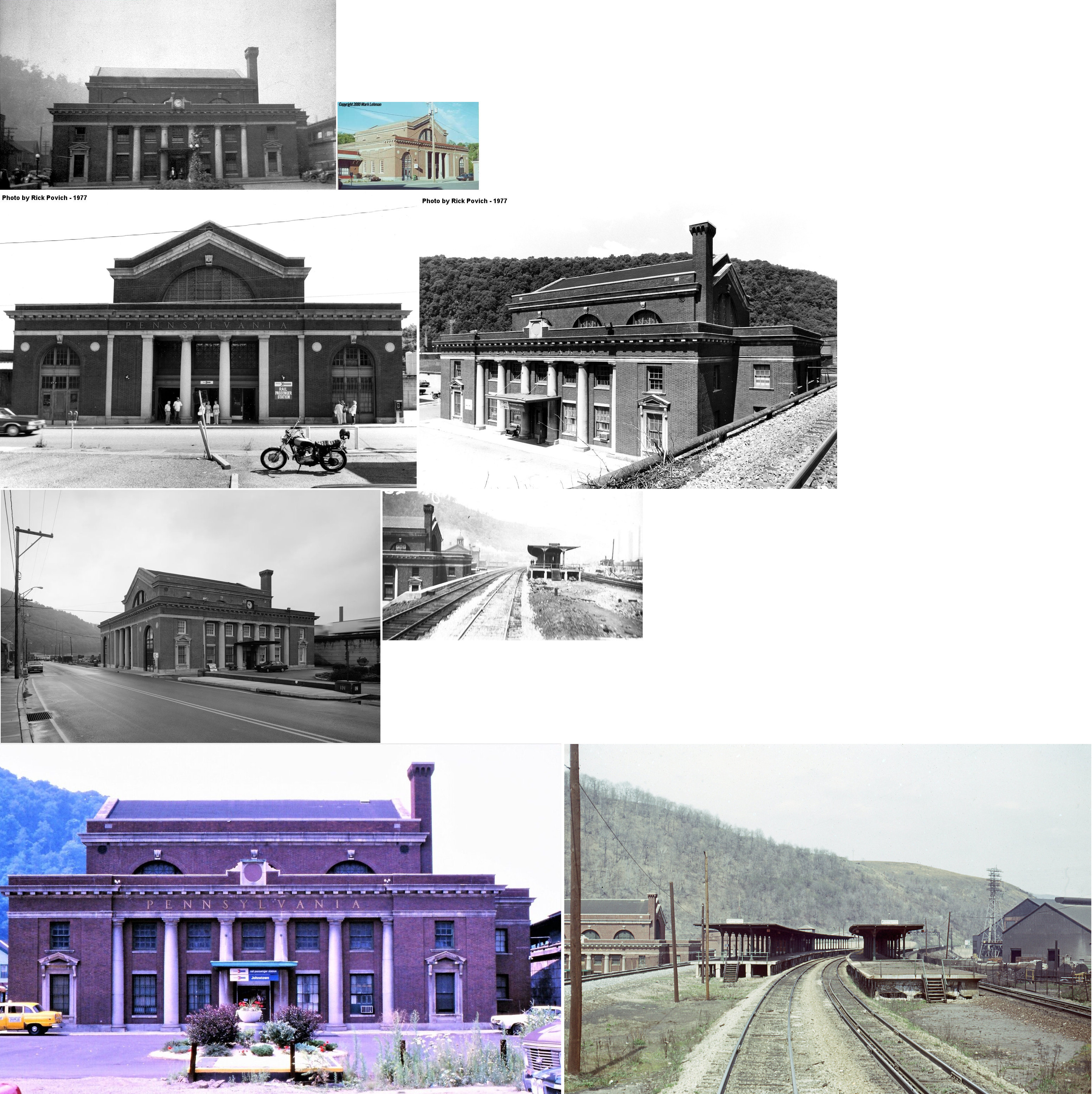
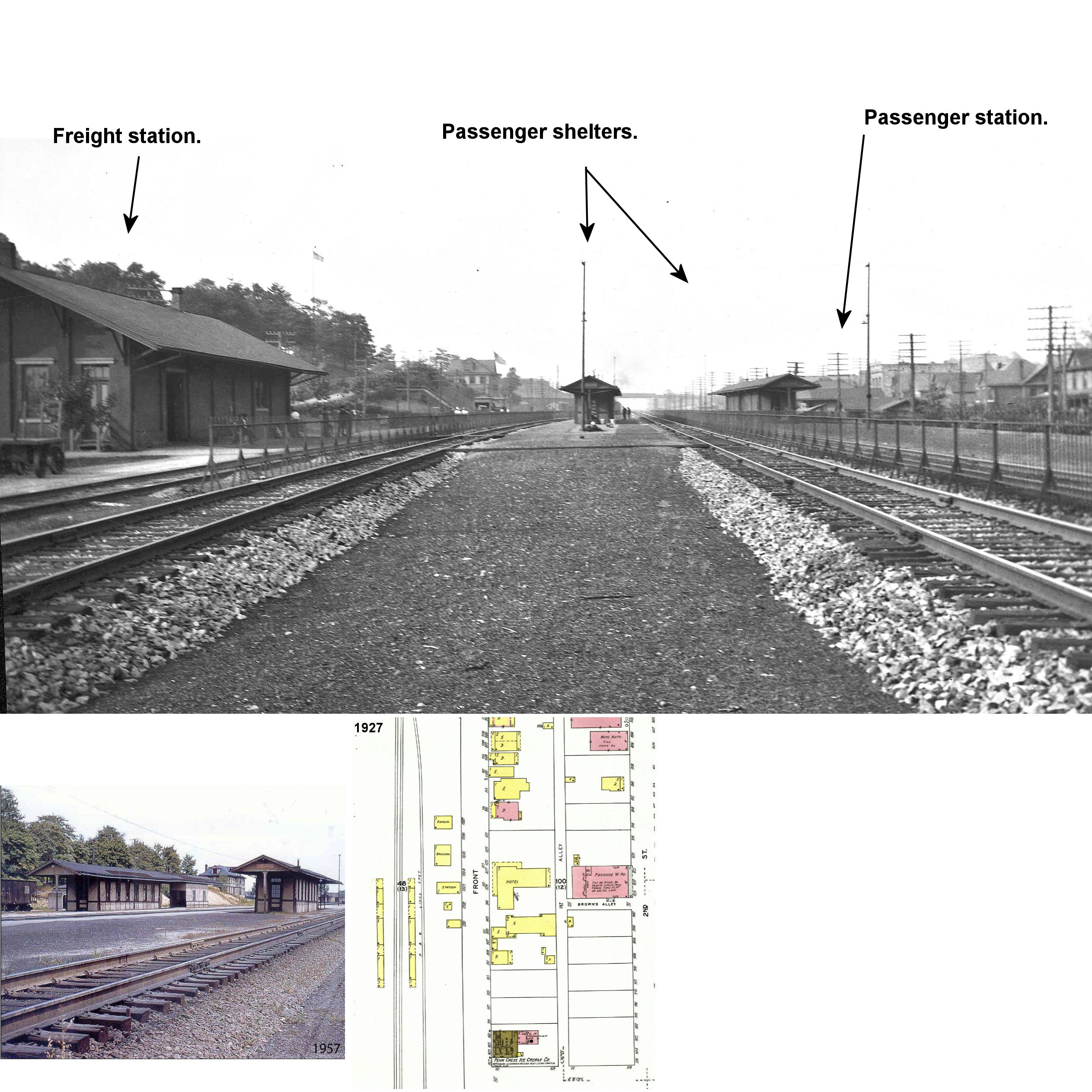
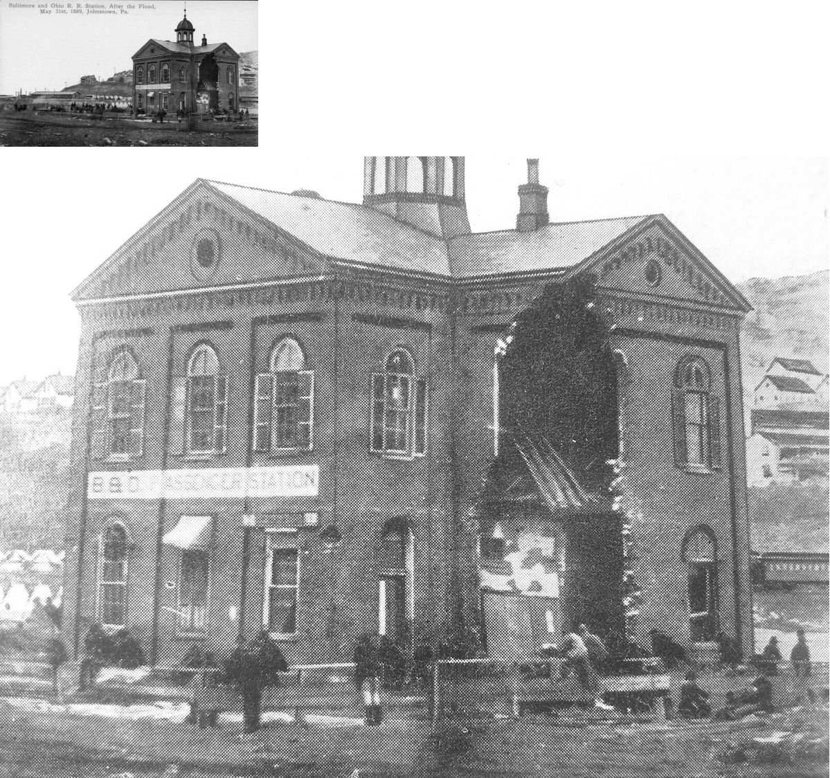
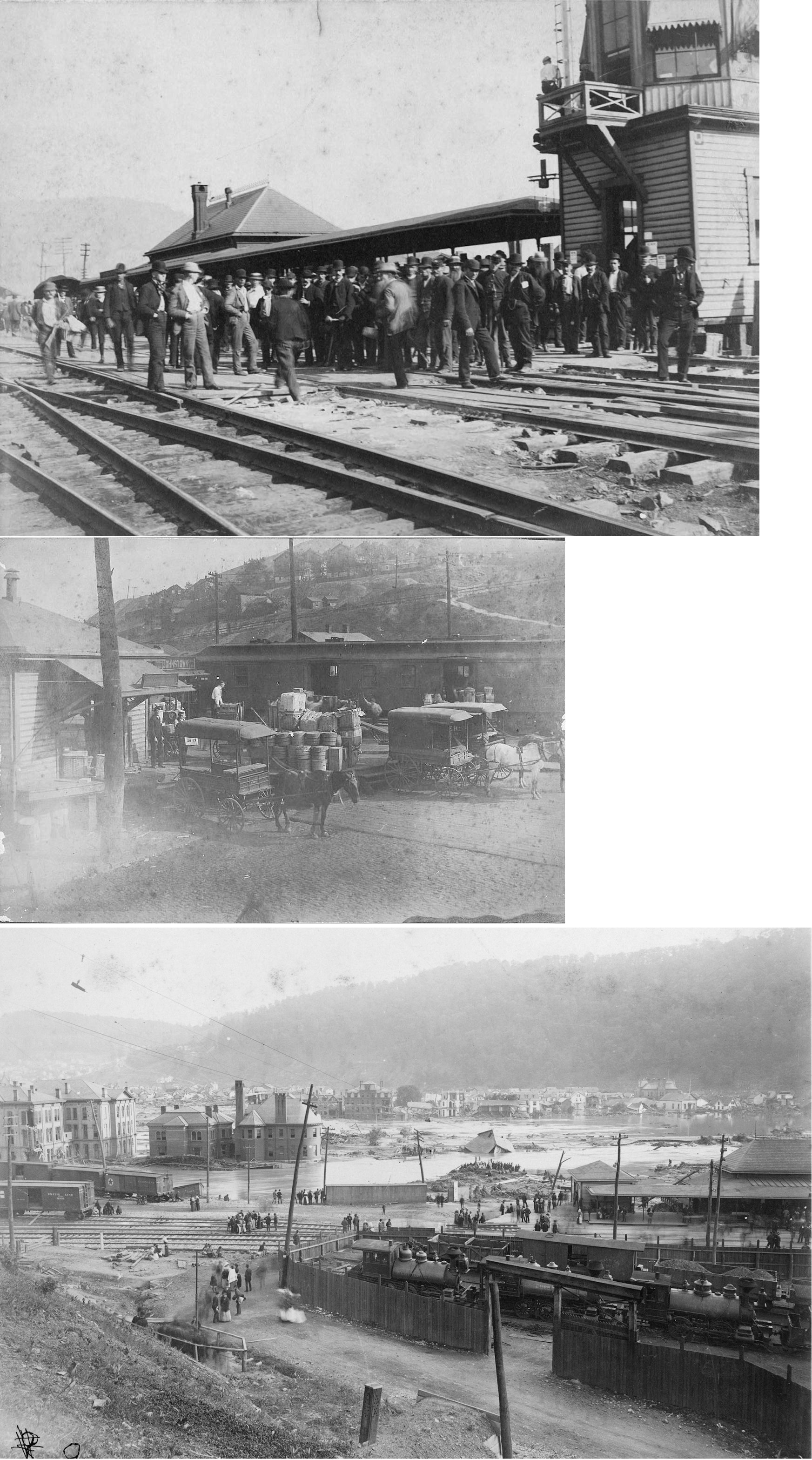
| Johnstown | |
This brick station was on the NE side of Washington Street at Franklin Street (GPS: 40.326698, -78.916673). The passenger station survived the flood, but the freight house did not. The station is shown on Sanborn maps as early as 1891 and as late as 1913. | ||||||
| Johnstown | |
There was a brick freight house just to the SE of the original passenger station at GPS: 40.326486, -78.916080. | ||||||
| Johnstown | |
According to the B&O Annual Report of 1888: "a corrugated iron freight house was erected... to replace the old freight house washed away by the flood." This freight house sat on the same site of the previous freight house (GPS: 40.326486, -78.916080). | ||||||
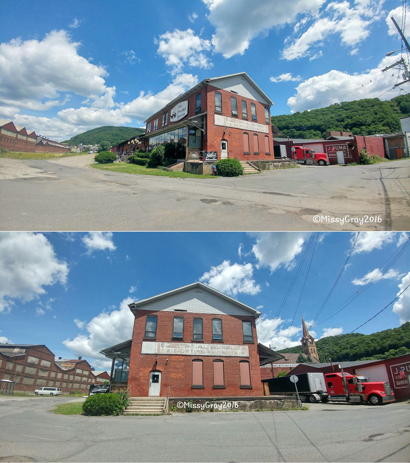
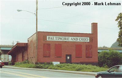
| Johnstown | |
This freight station sat at the corner of Hynes and Bedford Streets. It was torn down in September 2005. | ||||||
| Johnstown |
|
An early station here was moved to the west side of the canal in 1860. | ||||||
| Johnstown |
|
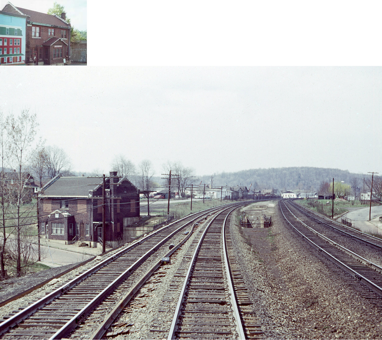
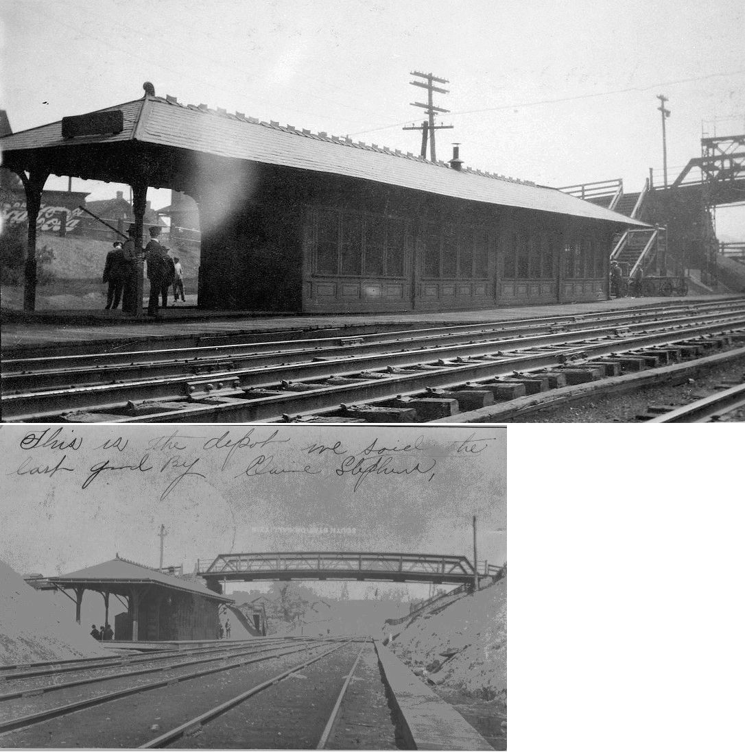
In 1883 the PRR built a new station at the corner of Walnut Street and what was formerly Iron Street (now part of Walnut) at GPS: 40.329545, -78.920781. This station survived at least until it was replaced by the new station in 1916. It is not clear if it was torn down immediately thereafter or put to some other use. | ||||||
| Johnstown |
|
There was a large brick freight house that sat where the Willaim Penn Avenue overpass is on the north side of the Little Conemaugh River at GPS: 40.328821, -78.918821. The freight house had a two-story head end on the west side. This freight house is shown on the 1895 Sanborn map. By the early 1900s the original overpass was built here and the freight house was removed. | ||||||
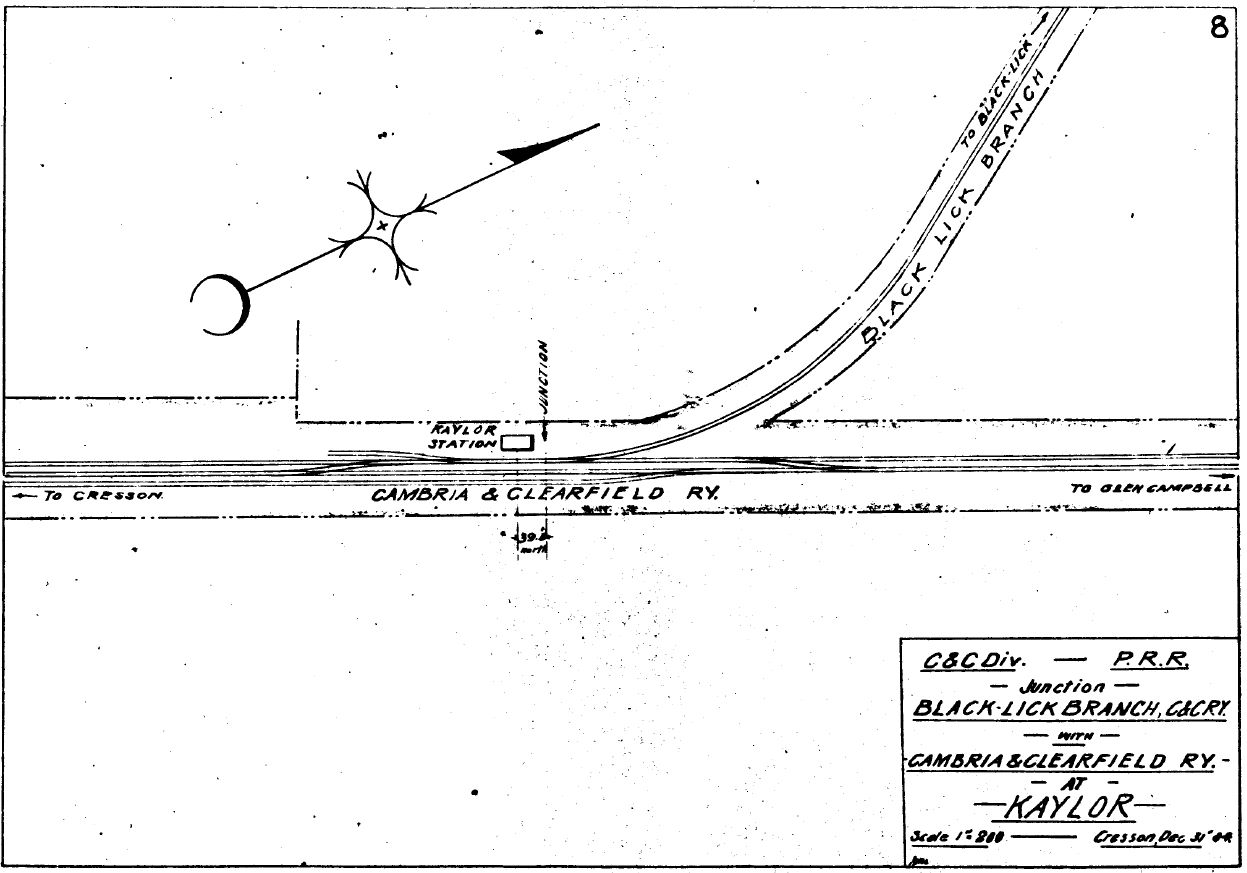
| Kaylor (Ebensburg Jct.) |
|
This station was originally known as Kaylor, but renamed Ebensburg Junction in 1912. | ||||||
| Klines |
|
|||||||
| KringS |
|
|||||||
| Lilly |
|
The station was on the east side of the tracks just north of the end of Cleveland Street at GPS: 40.425950, -78.621571. It was built in 1884. | ||||||
| Llanfair |
|
|||||||
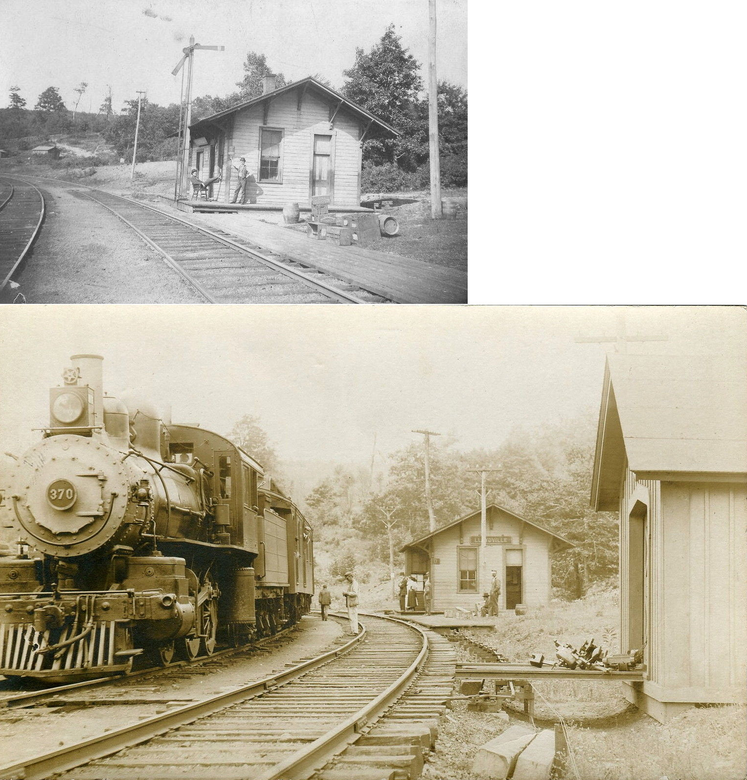
| Lloydville |
|
|||||||
| Lloydell |
|
The combination passenger/freight station was on the east end of Oak Avenue on the east side of the tracks at approximately GPS: 40.314943, -78.692108. This station was just 1/2 mile south of the Beaverdale station. The Lloydell station was built first and then a station was added at Beaverdale when that town grew larger. | ||||||
| Loretto Road |
|
|||||||
| Lovett |
|
|||||||
| Luckett |
|
|||||||
| Maplewood |
|
|||||||
| Martindale |
|
|||||||
| Mineral Point |
|
In 1890 the station was on the east side of Beech Hill Road on the north side of the tracks. | ||||||
| Morrelville |
|
|||||||
| Mountaindale |
|
|||||||
| Munster |
|
|||||||
| Nantyglo |
|
A station was built here in 1894 when the Ebensburg & Black Lick Railroad opened. It was operated by the PRR as part of Cambria & Clearfield Division. | ||||||
| Nantyglo |
|
The Cambria & Indiana station was at GPS: 40.470344, -78.829843. There is no road to this location now, but a road used to extend up to this location to serve the station. This station was likely torn down in the 1930s after the C&I ceased passenger service in 1932. | ||||||
| Nipton |
|
See listing below for Red Mill. | ||||||
| Noel |
|
|||||||
| Northern CambriA |
|
See Barnesboro listings above. | ||||||
|
Osborn Station (Grubbtown) |
|
|||||||
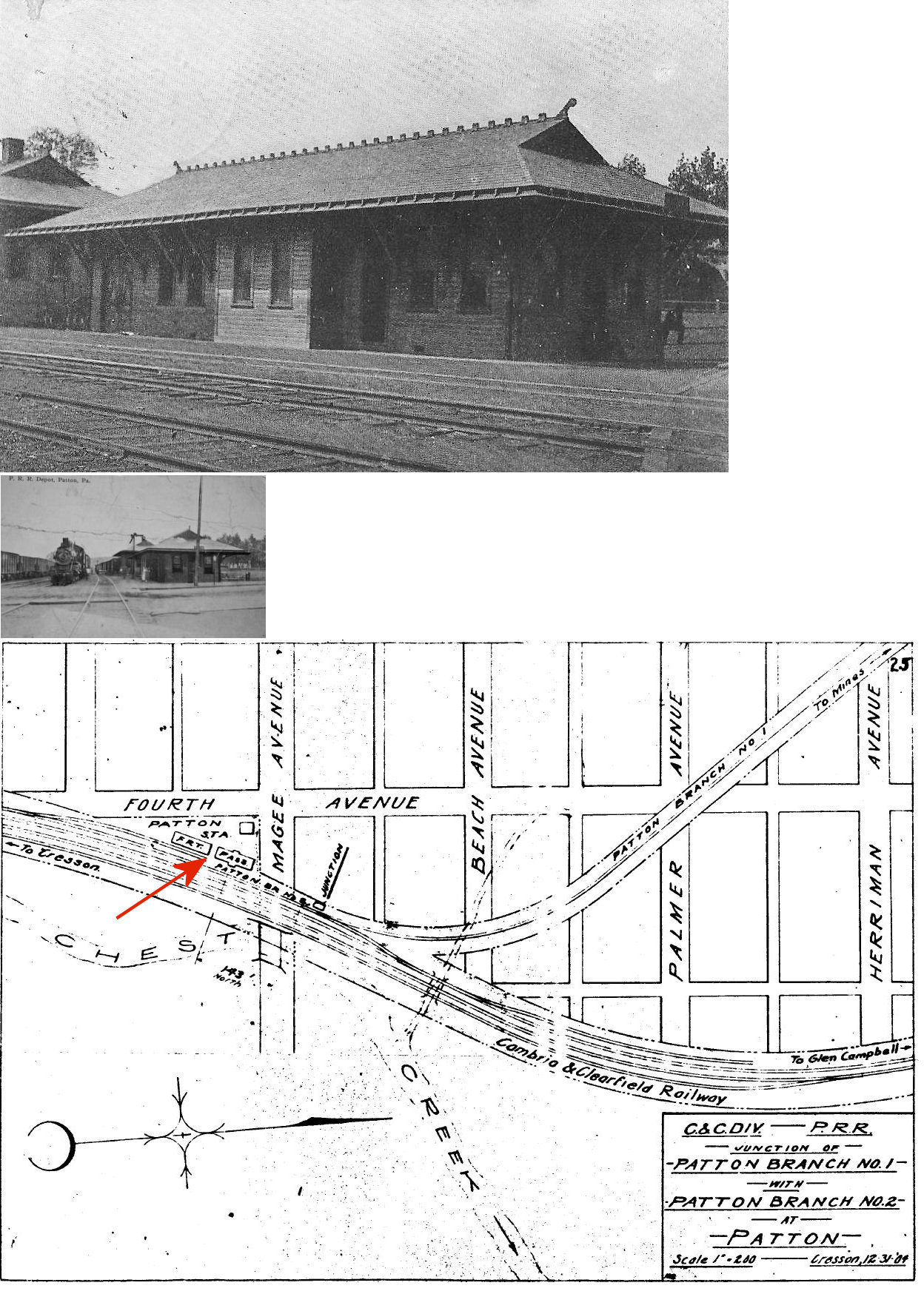
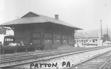
| PATTON |
|
This town sprung up virtually overnight in 1892 with the arrival of the railroad (Beech Creek Extension) and the opening of four new collieries. The first station here, built in 1892, was a combination depot on the south side of Magee street at GPS: 40.633663, -78.647346. | ||||||
| Patton | AND |
Between 1898-1903 new, larger passenger and freight stations were built here on approximately the same site as the original station. The passenger station was at GPS: 40.633726, -78.647330. The stations served the NYC branch here as well. Both the PRR and NYC had secondary branches that diverged from the Cresson branch in close proximity to the station. | ||||||
| Patton | |
The freight station was just to the south of the passenger station at GPS: 40.633386, -78.647461. | ||||||
| Peggs Run |
|
|||||||
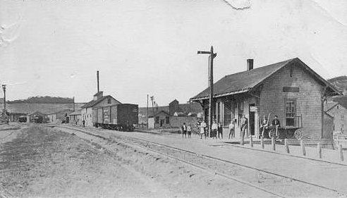
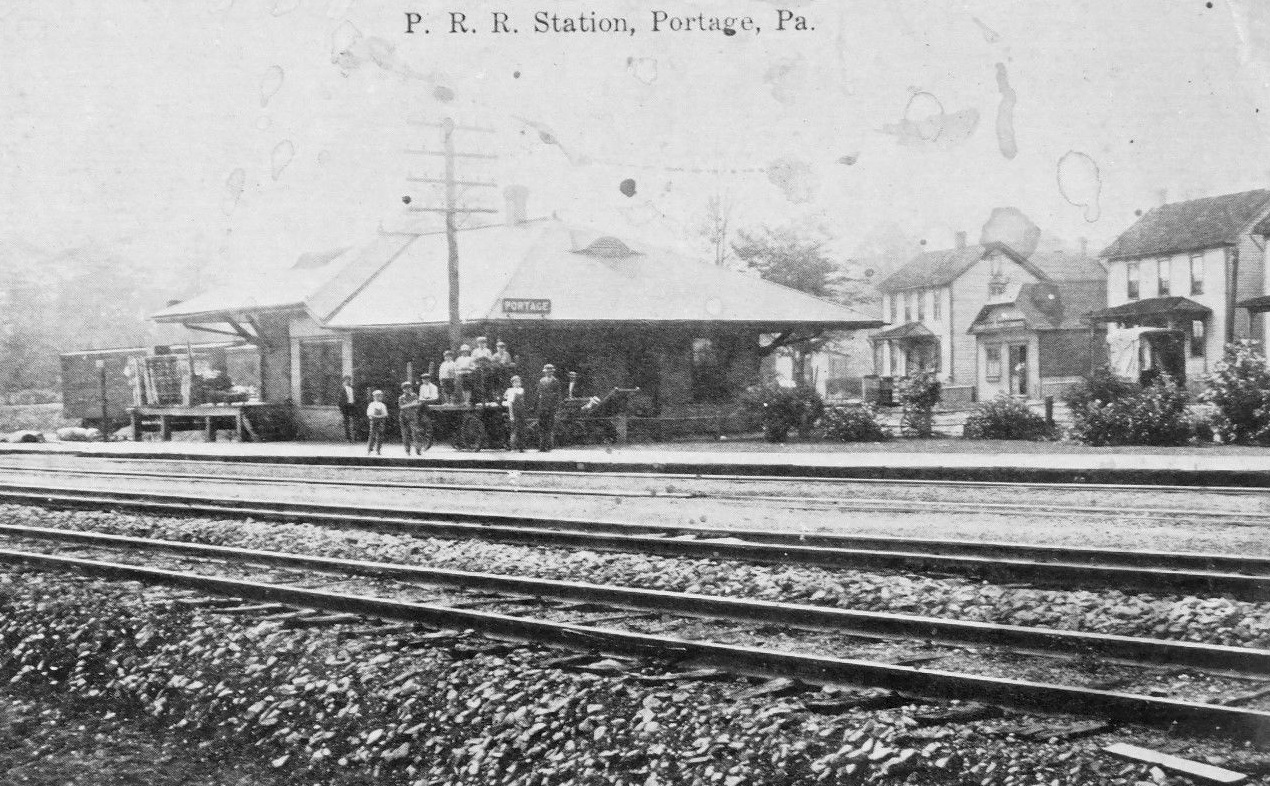
| Portage |
|
An early station here, as shown on the 1890 county atlas, was on the east side of Main Street on the south side of the tracks. | ||||||
| Portage |
|
A brick station was built here in 1899. The map from 1911 shows the station on the south side of Washington Street at 40.390247, -78.674433. Across the tracks to the east was a large wooden waiting shed at approximately GPS: 40.390260, -78.673652 off Lee Street. | ||||||
| Preisser |
|
This was the beginning of a branch line that ran south to Nanty-Glo. | ||||||
| Puritan |
|
|||||||
| Red Mill (Nipton) |
|
This station was on the 4.5-mile C&I branch that ran from Dobson Junction to Rexis. | ||||||
| Regan Junction |
|
|||||||
| Revloc |
|
|||||||
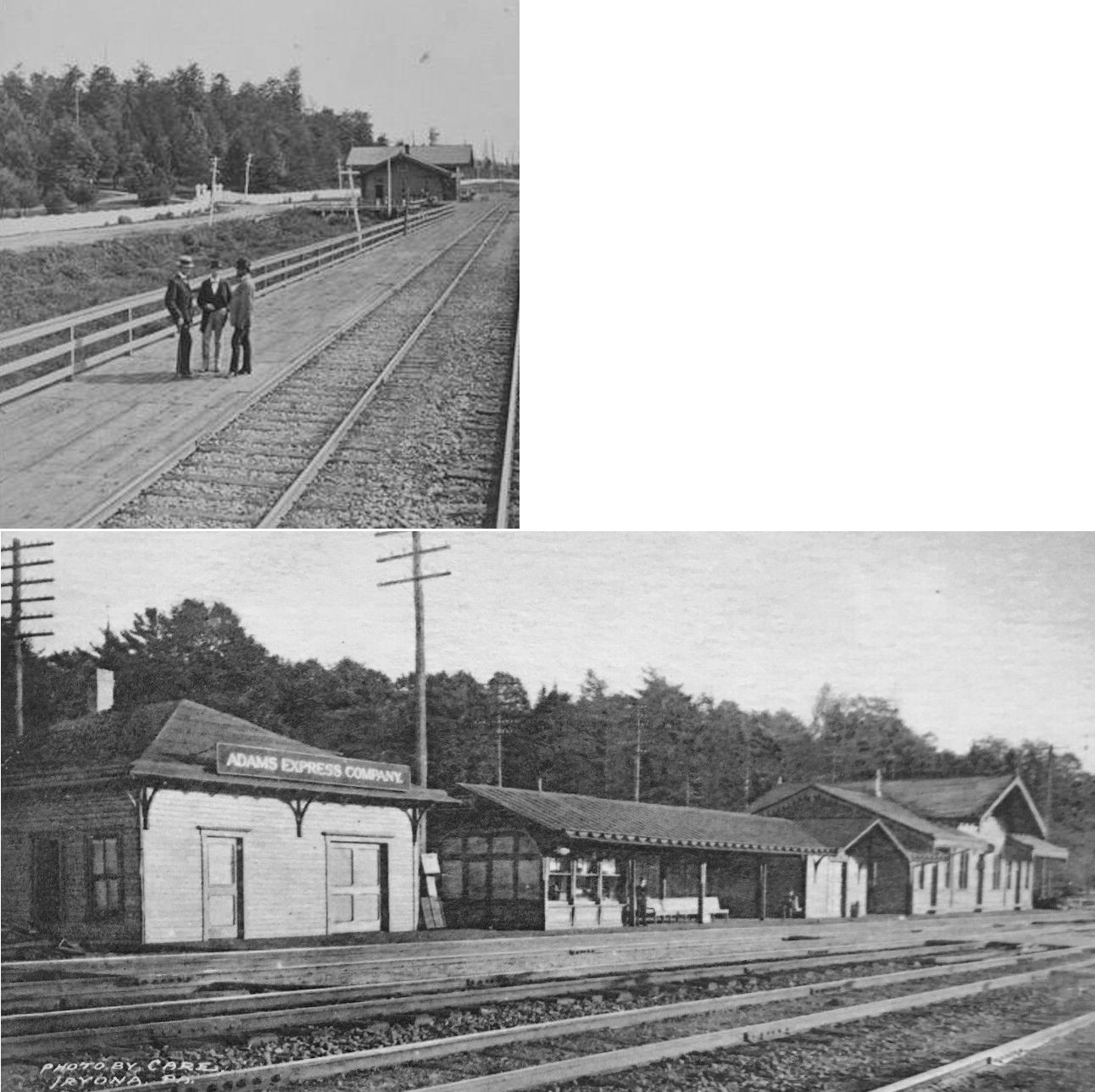
| Rexis-Vintondale |
|
This station was the terminus of the 4.5-mile C&I branch that ran from Dobson Junction to Rexis. | ||||||
| Romar |
|
This station was on the 10-mile C&I branch that ran from Preisser to Nanty-Glo. It was between Cardiff and Nanty-Glo. | ||||||
| Ruthford |
|
|||||||
| Salix |
|
|||||||
| Sang Hollow |
|
This station was supposed to be called "Sand Hollow," but a typo by somone in the PRR office in Philadelphia redered it as "Sang" Hollow instead (Pittsburgh Daily Post, 8-4-1893). | ||||||
| Sautertown |
|
|||||||
| Scalp Level |
|
A new station was built here in 1898. | ||||||
| Sheriden | |
|||||||
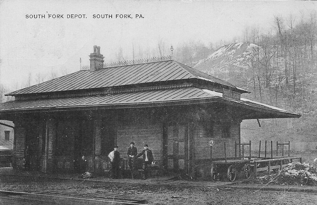
| South Fork |
|
This combination station was on the NW side of the tracks to the NW of the end of Main Street at GPS: 40.366867, -78.792633. It was built in 1883. In later years (the early 1900s) there were also passenger shelters between the tracks (GPS: 40.366663, -78.792706) and along Railroad Street on the south side of the tracks (GPS: 40.366663, -78.792706). | ||||||
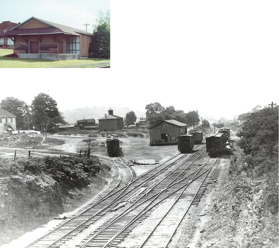
| Spangler |
|
Located on the Susquehanna Extension Branch of the Pennsylvania Railroad. New York Central had trackage rights from Cherry Tree down to Spangler, thence operated on its own Cambria County Railroad from Spangler to Carrolltown (the highest point on the New York Central System). This station was between 4th and 5th streets (what are numbers of these streets now?) on the NE side of the tracks. It was built in 1895. | ||||||
| Spangler |
|
There was a freight station at the end of 6th Street on the NE side of the tracks. | ||||||
| St. Benedict |
|
This station was likely in the vicinity of 176 Dunsmore Road or somewhere along the corridor between Dunsmore Road and Old Post Office Road. | ||||||
| St. Michael |
|
|||||||
| Stiles |
|
This station was at MP 12.4 (from MP 0 at Colver Heights) between Stiles and Kinter (Indiana Co.). | ||||||
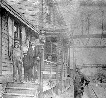
| Summerhill | |
The station was on the south side of the tracks on what is
now Main Street where it runs parallel to the tracks (GPS:
40.374344,-78.760139). There was a shelter on the north side of the
tracks at GPS:
40.374648, -78.759980. There was a tunnel that ran under the tracks
from the passenger station to that small shelter. There was also a freight
station just south of the station on a siding track that ran behind the
station (GPS:
40.374148, -78.760143). Charles Leonard writes: "My parents bought the station and I lived in it for a number of years! I can recall that during the war years a flatbed coal car jumped the tracks and it was leaning against the porch of the house and my mother and I used garden rakes to scrape the coal off the top of the car so that we would have fuel for the kitchen stove. My parents eventually tore the station down and built a new house out of the salvaged lumber and other materials. I can remember hauling boards and the like in my wagon and then removing and straighting the old nails so that we could reuse them." |
||||||
| Syberton (Dawson) |
|
This station was between Wildwood Springs and Amsbry. The station was renamed to "Syberton" from "Dawson" in 1900. | ||||||
| Thomas' Mill |
|
|||||||
| Tunnel |
|
This station was on the north side of US 219 (Plank Road) on the east side of the tunnel protal at approximately GPS: 40.582230, -78.716680. | ||||||
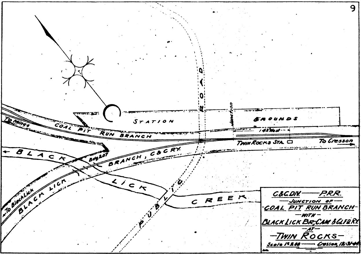
| Twin Rocks |
|
This station was built in 1894 when the Ebensburg & Black Lick Railroad opened. It was operated by the PRR as part of Cambria & Clearfield Division. | ||||||
| Van Ormer |
|
|||||||
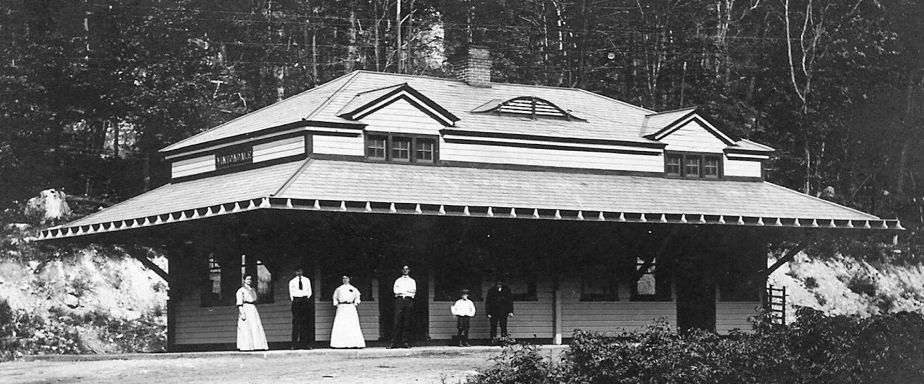
| Vintondale |
 |
The Ebensburg & Cresson RR was later part of the PRR's Black Lick Branch. | ||||||
| Walsall |
|
|||||||
| Walter's Mill |
|
This staton was somewhere near the Cambria/Clearfield County line. | ||||||
| White Mill |
|
This station was on the 4.5-mile C&I branch that ran from Dobson Junction to Rexis. | ||||||
| Wildwood (Wildwood Springs) |
|
|||||||
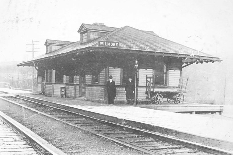
| Wilmore |
|
This station was SW of Main Street at GPS: 40.385278, -78.719861. | ||||||
| Winterset (Bradley) |
|
|||||||
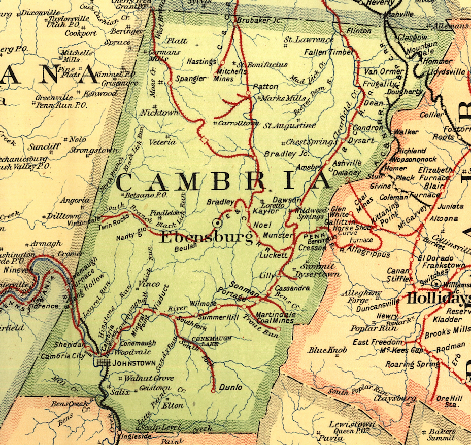
| 1895 CAMBRIA COUNTY RAILROAD MAP | ||||||||
 |
||||||||
| Notes About Existing
Stations... Johnstown (PRR) - Dedication ceremony was held October 12, 1916. Architect was Kenneth Murchison of New York and station was built by W.H. Fissell & Co. This was the second PRR station. The earlier PRR station was located at the corner of Iron and Station Streets. Now serves as the Amtrak station with the newer Amtrak shelter at track level. |
||||||||