|
|
||||||||
| EXISTING STATIONS | ||||||||
|---|---|---|---|---|---|---|---|---|
| Station Name |
Original Railroad |
Current Location |
Type | Current Use |
Date Built |
Track Status |
Building Material |
More Info |
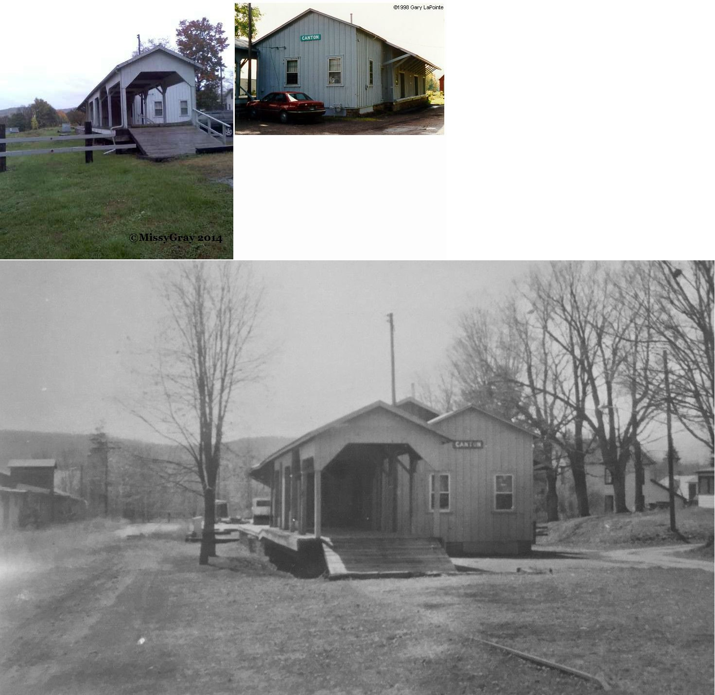
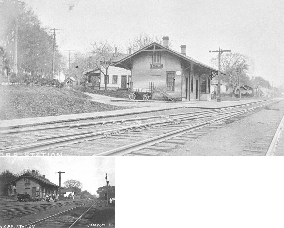
| Canton |
 |
Crooks Terrace, off PA14 (GPS: 41.657684, -76.854139) |
C | Private | ???? | Gone | Wood | |
| Cowley |
|
High Bridge Road that
runs between Route 514 and Granville Summit, about five miles south of Troy. (GPS: 41.719424, -76.774325) |
P | Private | ???? | None | Wood |
|
| Fassett |
|
PA14 across from Walsh Lane (GPS: 41.989346, -76.773681) |
C | Private | ???? | Gone | Wood | |
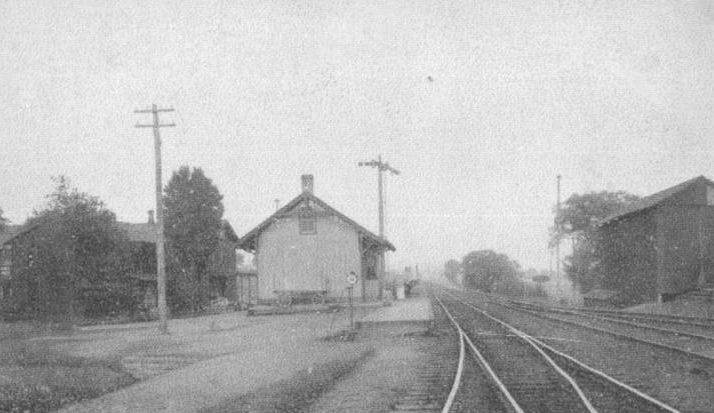
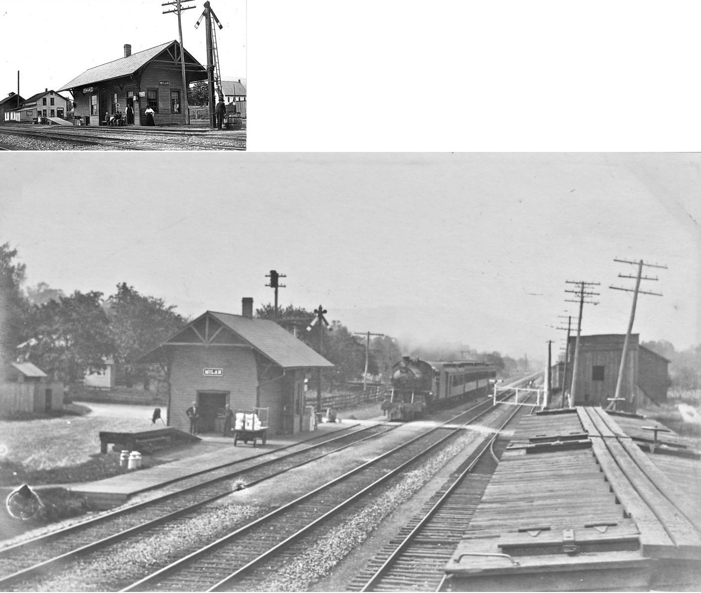
| Milan |
 |
Railroad Lane, off PA220 at PA4014 (41.907180, -76.522634) |
C | Vacant | ???? | In Use | Concrete | |
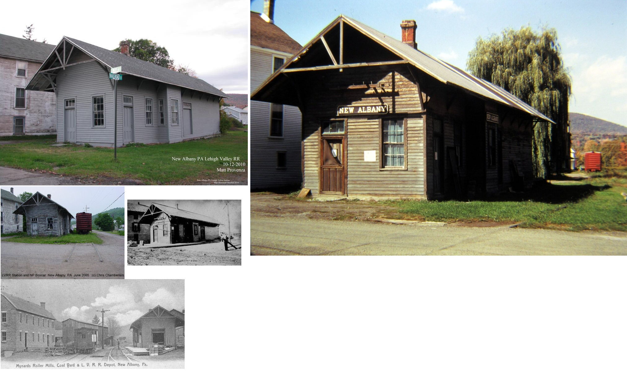
| New Albany |
|
Corner of Railroad & May Streets (GPS: 41.601428, -76.440513) |
C | Vacant | 1896 | Gone | Wood |
|
| Sayre |
|
North Lehigh Avenue between Packer Avenue and Lockhart Street (GPS: 41.981118, -76.514252) |
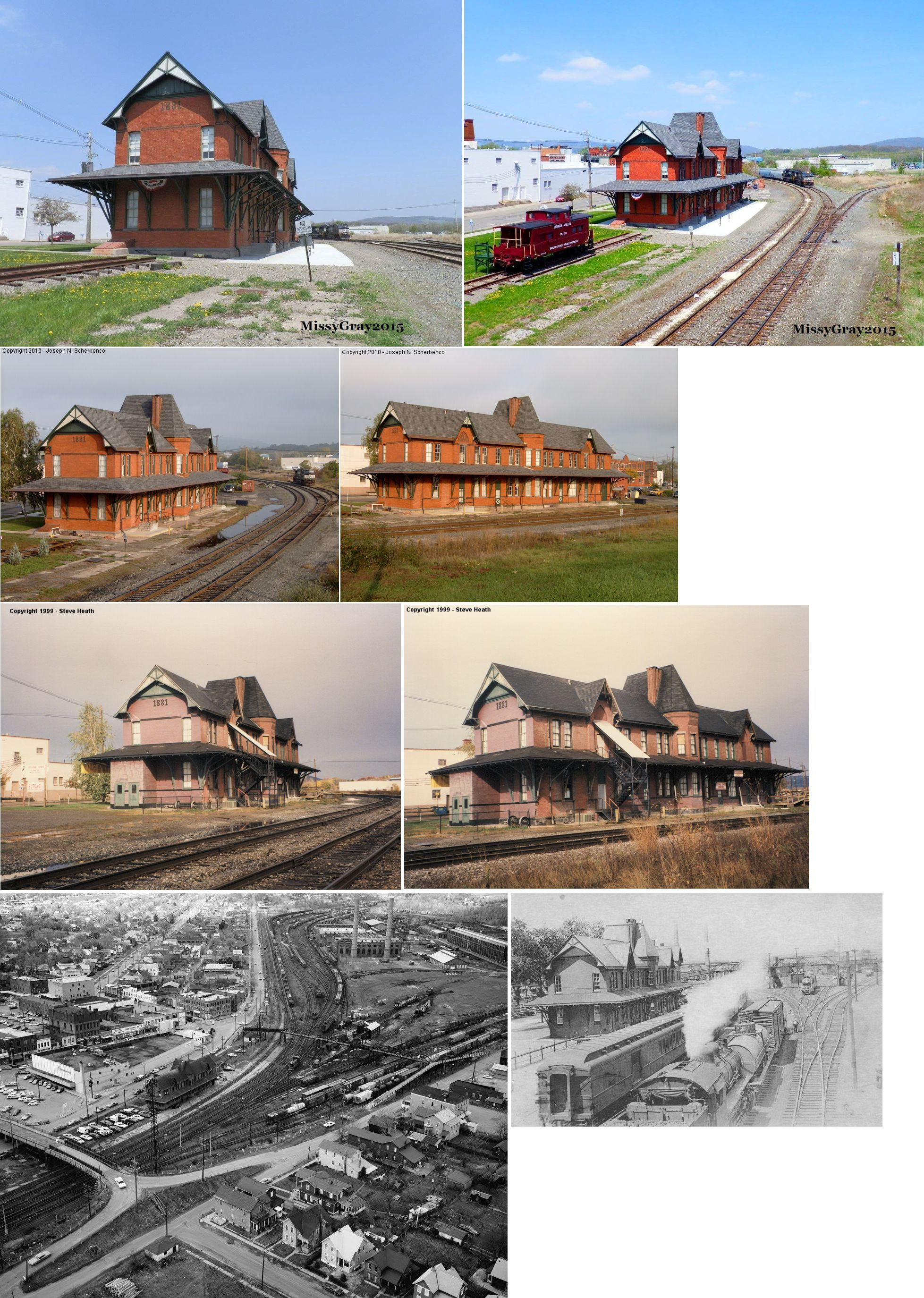
P | Business | 1881 | In Use | Brick | |
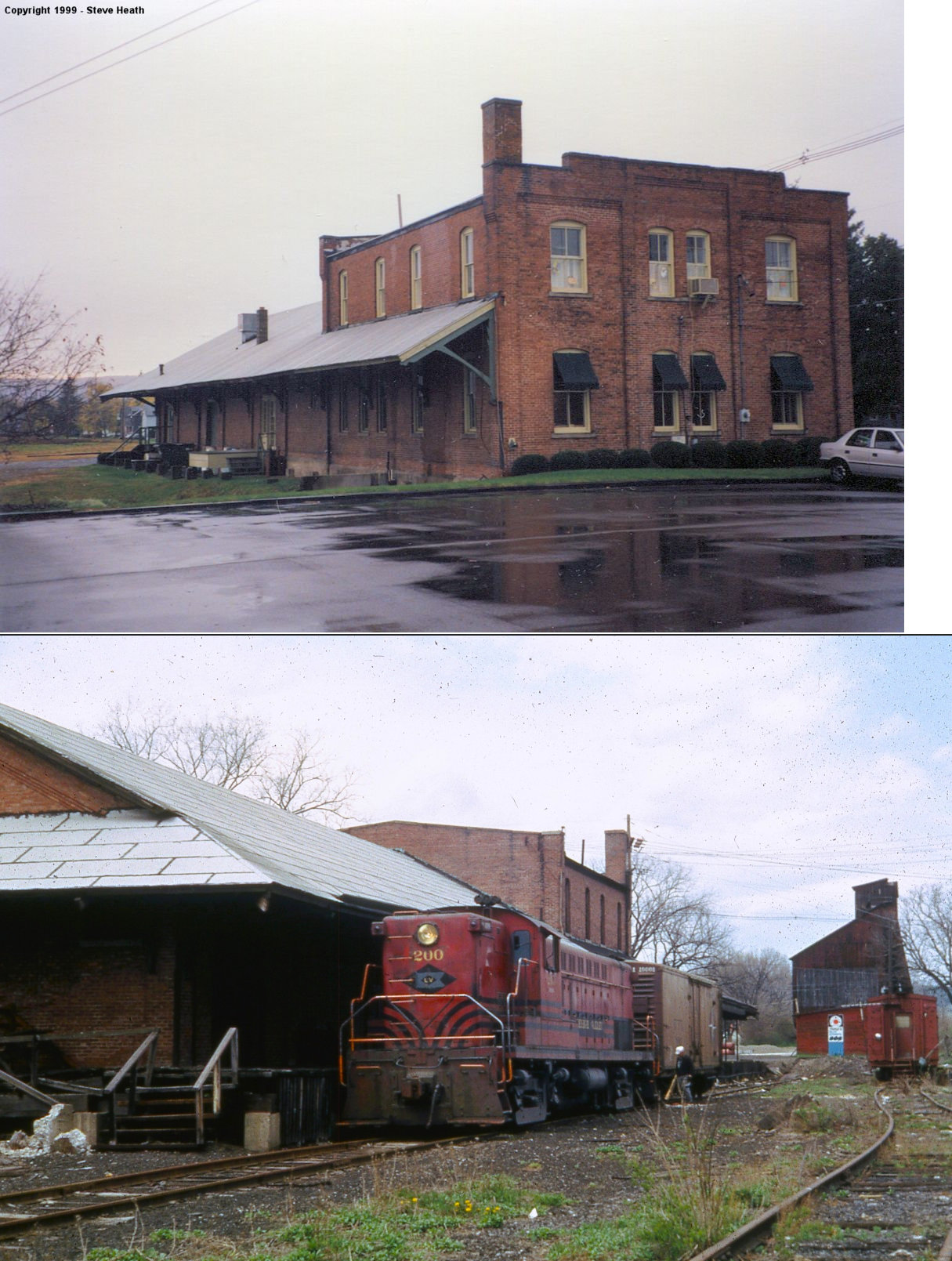
| Sayre |
|
North Lehigh Avenue at Mohawk Street (GPS: 41.990962, -76.521919) |
F | Business | ???? | In Use | Brick | |
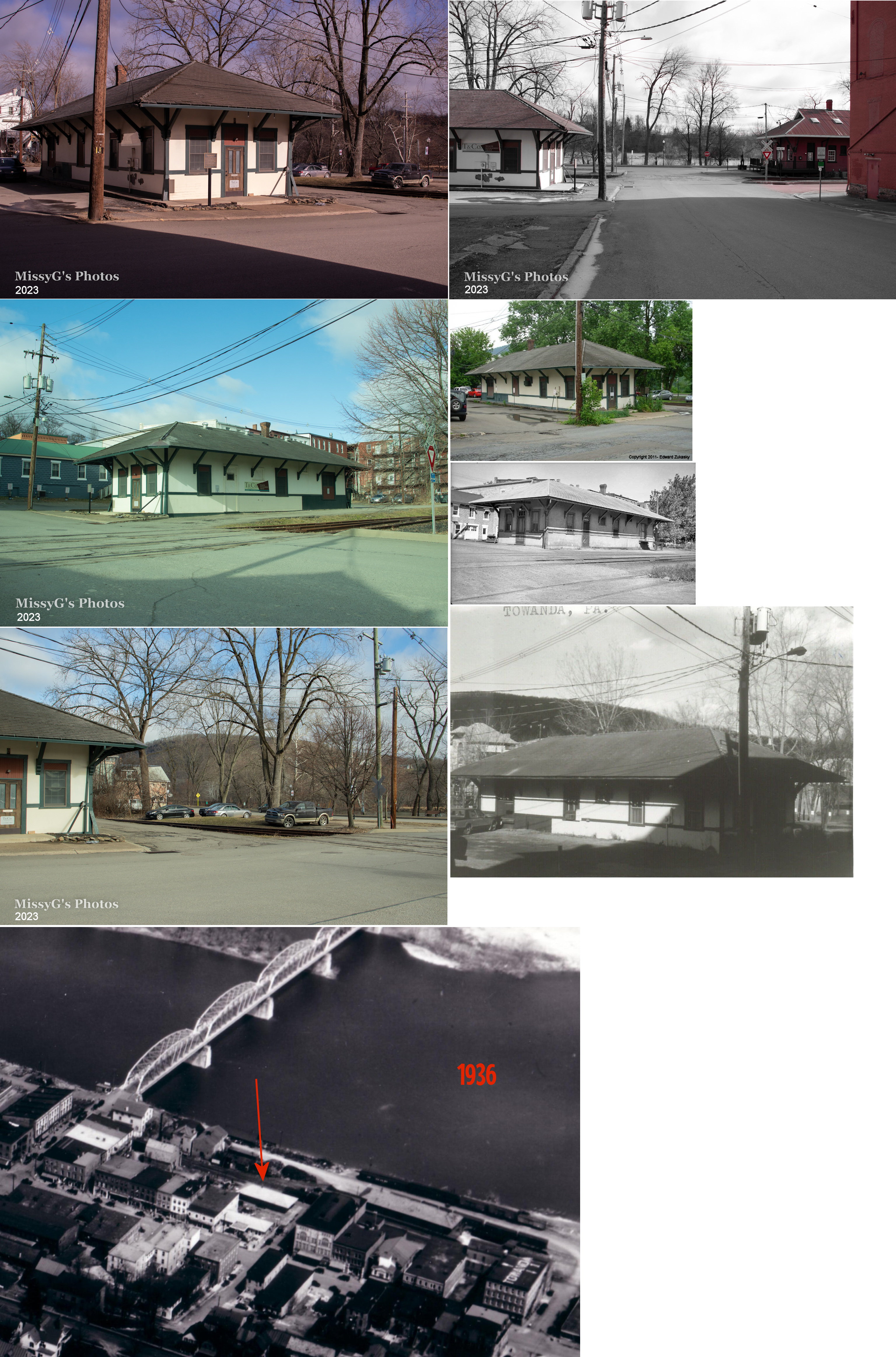
| Towanda |
 |
Merrill Parkway at Washington Street (GPS: 41.764145, -76.442176) |
P | Business | 1922 | In Use | Stucco |
|
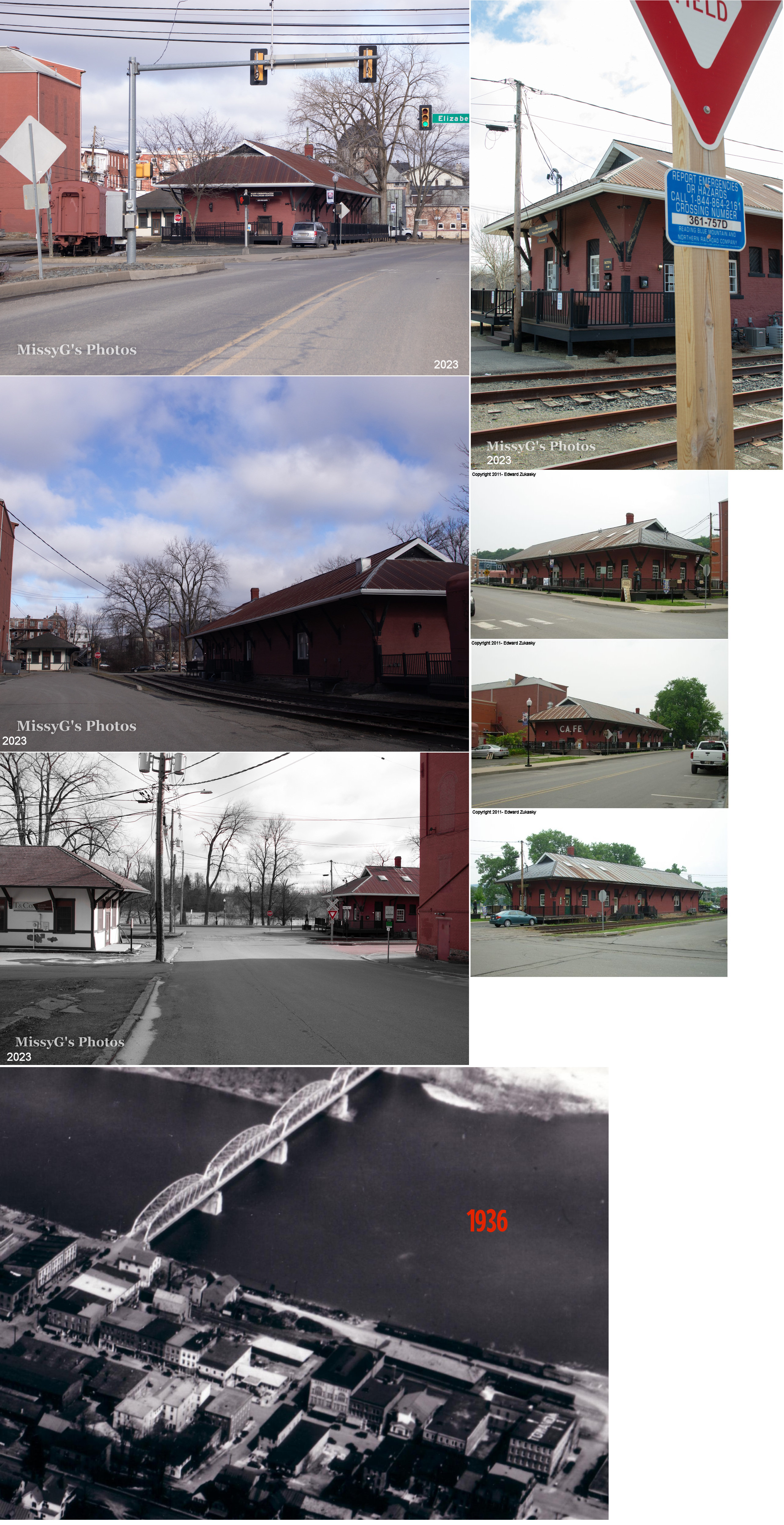
| Towanda |
AND |
1 Washington Street at River Street (41.764158,-76.442195) |
F | Business | 1884 | In Use | Brick |
|
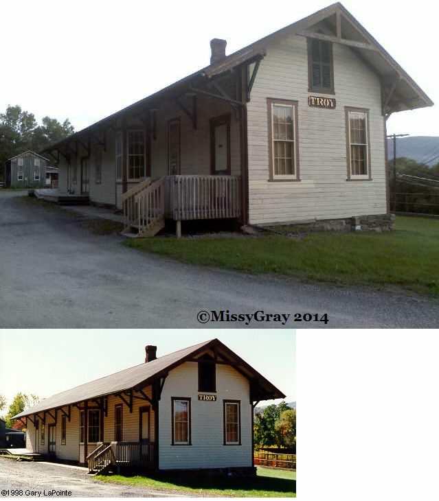
| Troy |
|
Willow Street at Railroad Street (GPS: 41.780735,-76.788836) |
C | Private | ???? | Gone | Wood | |
| Ulster |
|
PA1022 (GPS: ????) |
C | Private | ???? | In Use | Wood |
|
| STATIONS OF THE PAST | ||||||||
| Station Name |
Original Railroad |
Notes | ||||||
|
|
In 1869 the original Williamsport & Elmira RR station was on the east side of PA-3027 (formerly Railroad Street) on the NW side of the tracks (GPS: 41.701379,-76.828393). | |||||||
|
|
Station was on the west side of Main Street (PA-199) at GPS: 41.962694, -76.520571. It was torn down around 1983. | |||||||
| Barclay |
|
A freight house is shown here as early as 1869 on the Barclay RR. | ||||||
|
|
An early Williamsport & Elmira station is shown here in 1869 on the west side of Troy Street between Tioga and Carson Streets. The NCRR opened new passenger and frieght stations at Canton in 1866. This may be that passenger station. | |||||||
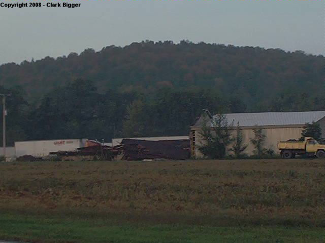
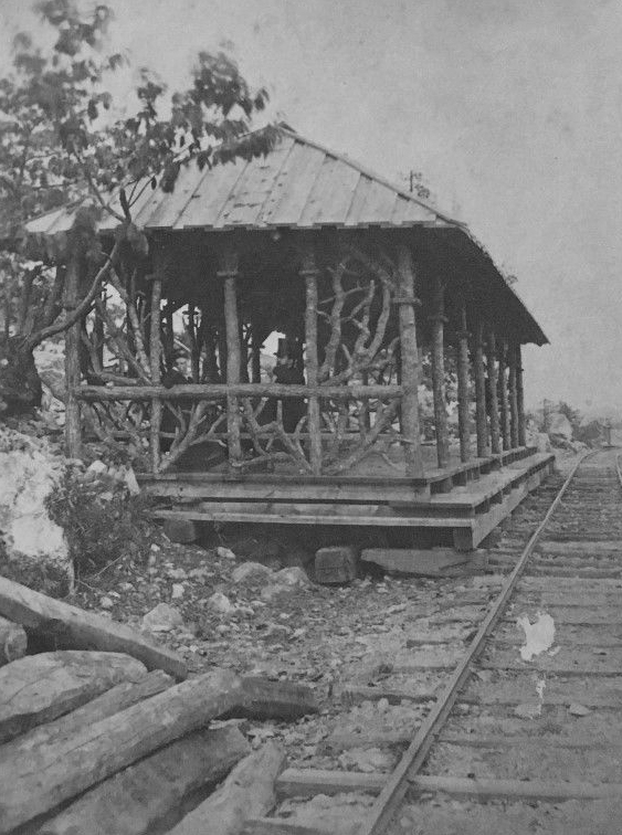
|
Cedar Ledge |
|
The freight station was torn down, or fell down, sometime in September, 2008. Here is a photo of the result. |
||||||
|
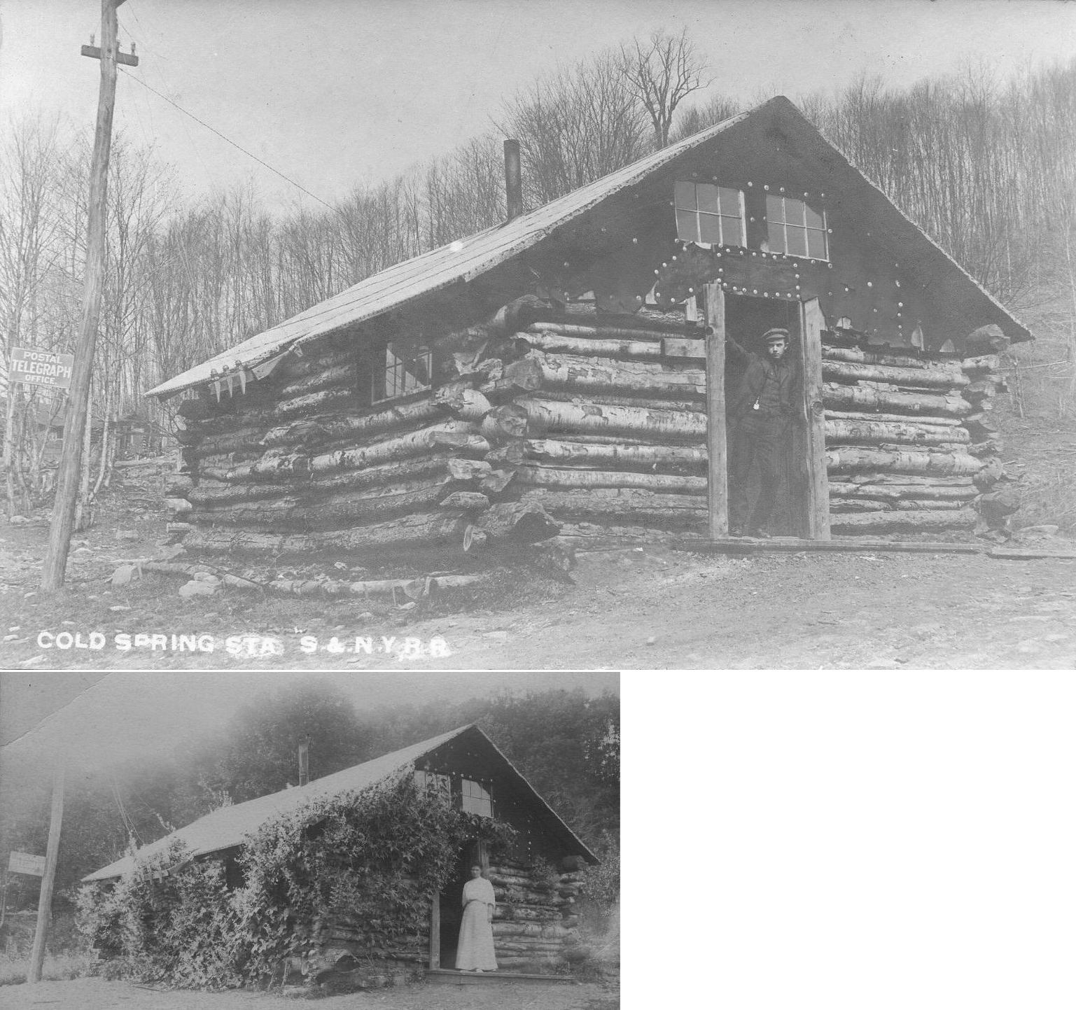
|
Cold Spring station was on Barclay Mountain. The Susquehanna & New York Railroad (S&NY) was a short-line railroad connecting the Lehigh Valley Railroad at Towanda, Pennsylvania with the Pennsylvania Railroad at Marsh Hill allowing freight and passengers to travel between West Williamsport and Towanda by rail rather than using the Susquehanna River. |
|||||||
| Columbia Crossroads |
|
|||||||
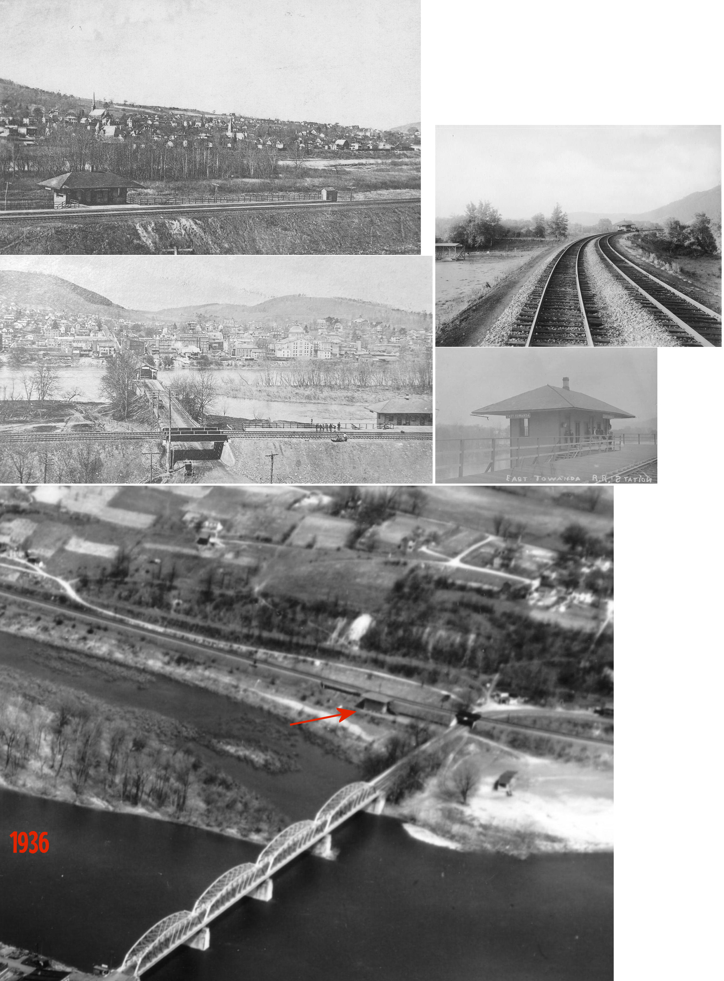
| East Towanda |
|
|||||||
|
Fassett (State Line Station) |
|
Originally known as State Line Station. In 1869 the depot was on the west side of PA-14 on the west side of the tracks (between the tracks and the creek) (GPS: 41.989162,-76.773518). | ||||||
| Gillett |
|
|||||||
|
|
Is this the same station as listed above in the "Existing Stations" section? |
|||||||
| Greens Landing |
|
|||||||
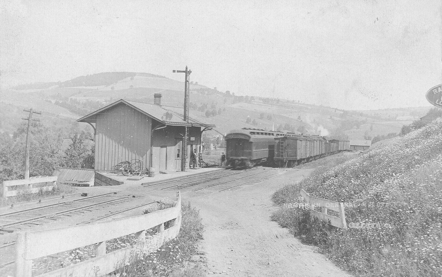
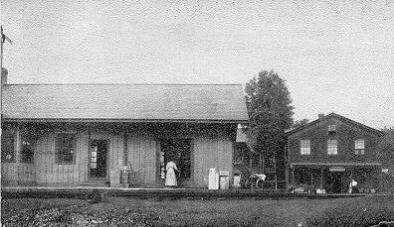
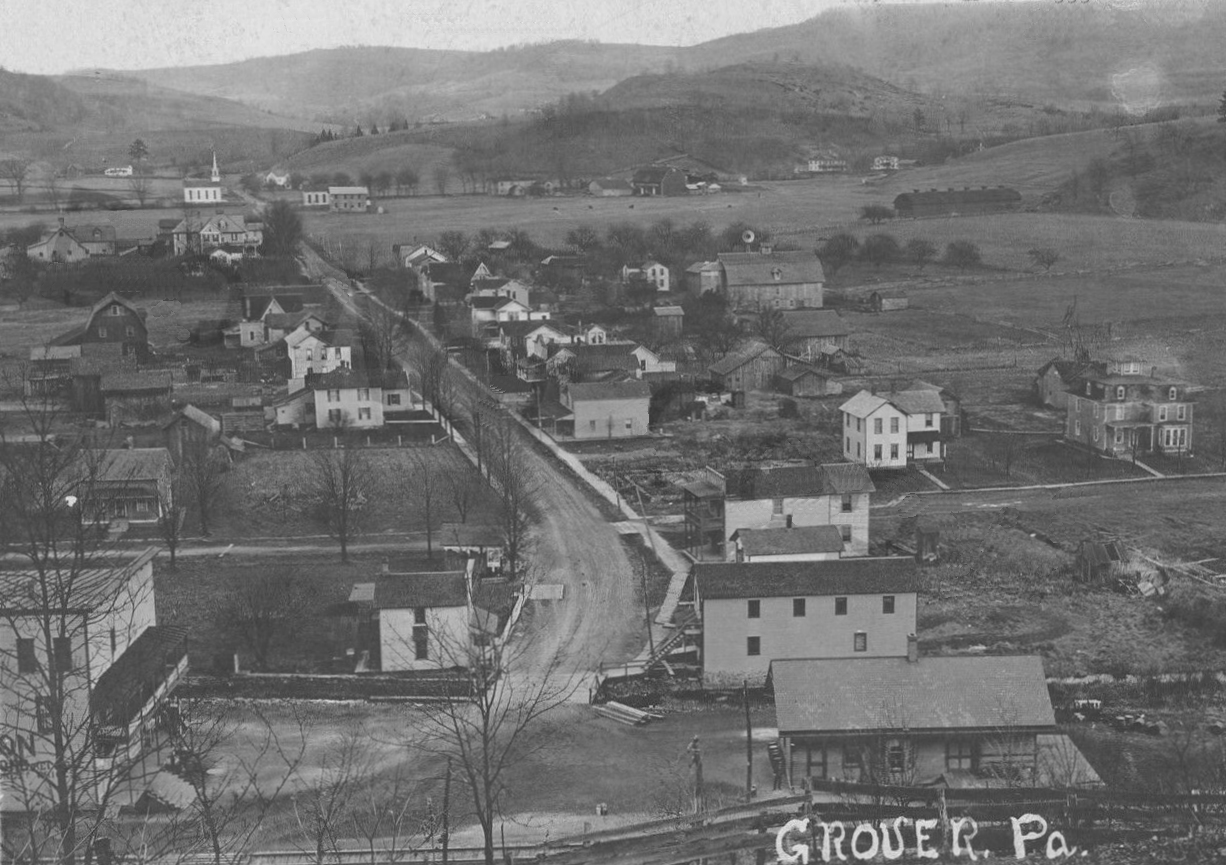
| Grover |
|
The station was on the south side of Main Street on the east side of the tracks (GPS: 41.614195, -76.868016). | ||||||
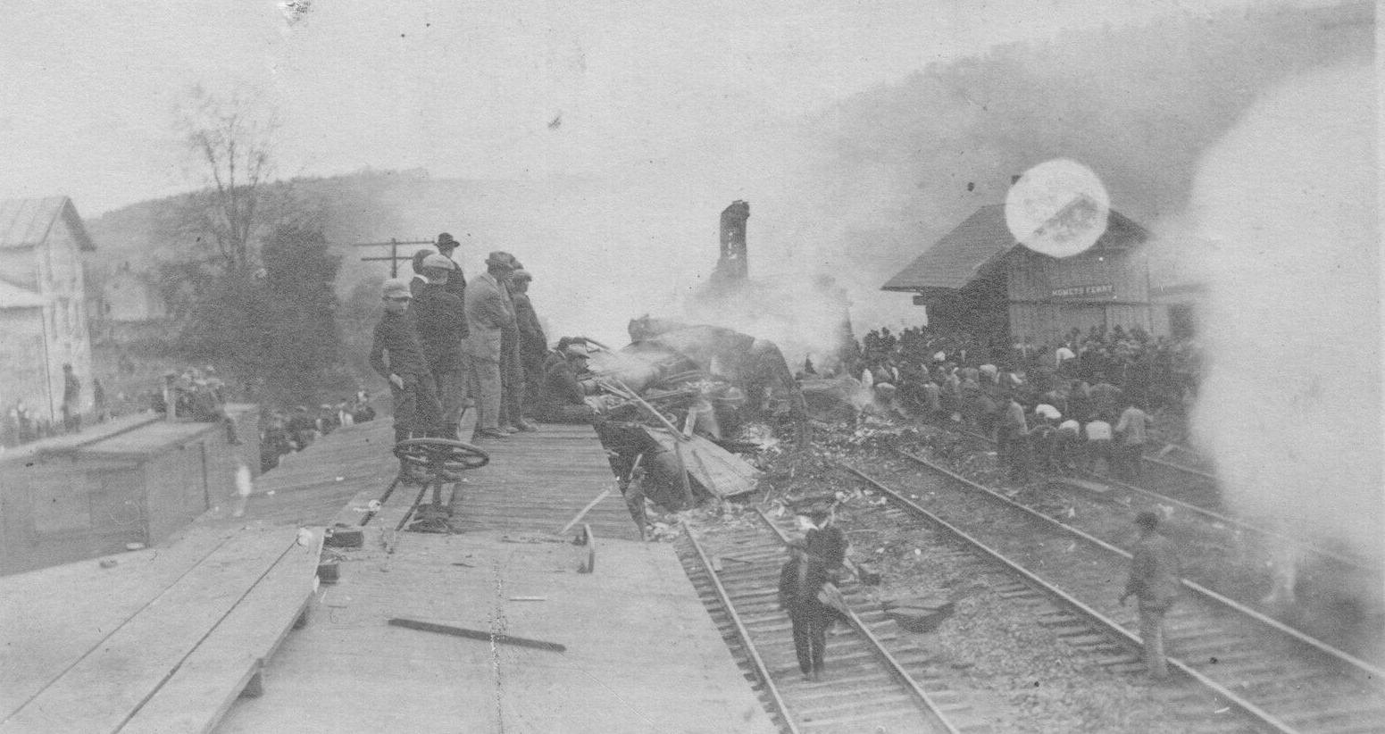
| Homets Ferry |
|
An early station/warehouse is shown here on the 1869 county map. | ||||||
| Kellogg |
 |
|||||||
| Laddsburg |
|
Also known as Millers at some point during its history. | ||||||
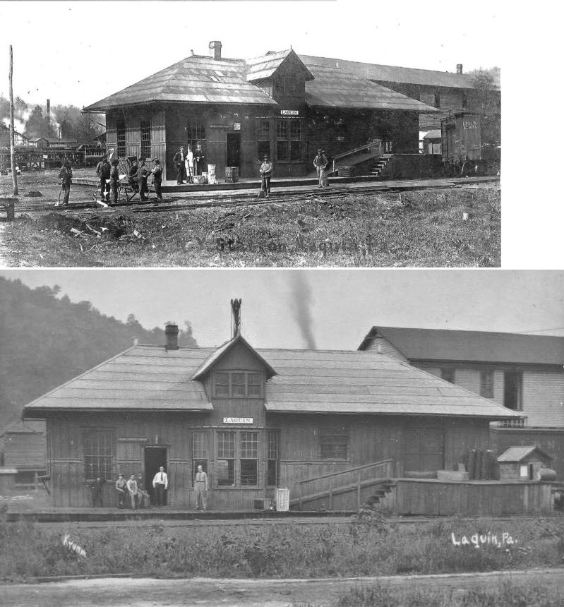
| Laquin |
|
|||||||
| Long Valley |
|
|||||||
| Masontown |
|
I am not sure what name to give this station, but this seems to be the closest guess. The station, listed with no name on the 1869 county atlas, was SW of Monroeton in District 10 of Monroe Township. It was between Monroeton and Powell on the line. | ||||||
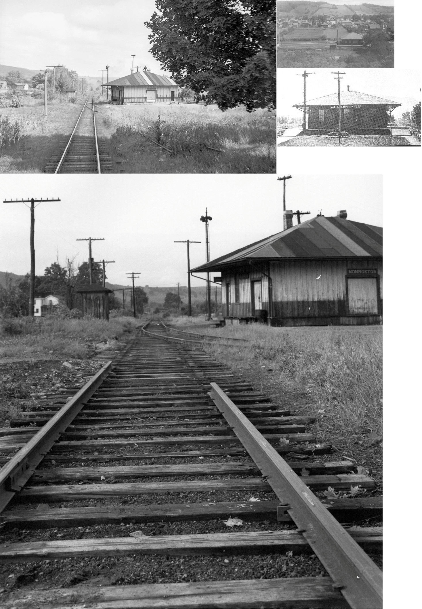
|
|
Predated concrete station. |
|||||||
| Minnequa |
|
|||||||
|
|
This was a union station that had tracks on each side. | |||||||
|
|
||||||||
| New Albany |
|
The original station, which sat at the corner of Railroad and Division Streets was destroyed by a fire March 17, 1894. Some sources list it as built in 1871, however a station is shown here on the 1869 map nso either that date is incorrect or that station was not the first here. | ||||||
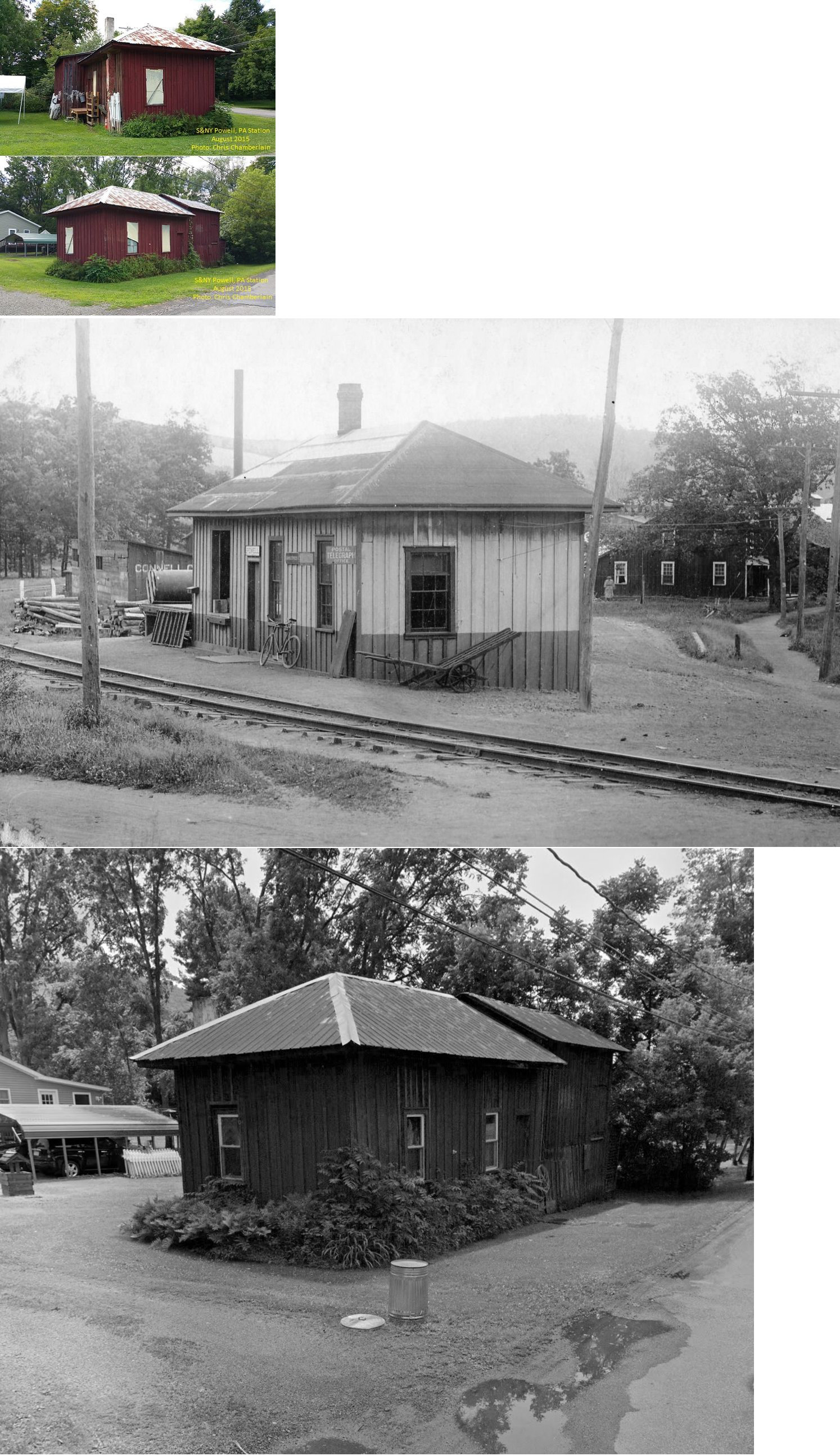
| Powell |
|
This station was originally located near what is currently the intersection of Main Street and Weston Road in Powell (Weston Road follows the S&NY right of way now for a good portion of the old route to Laquin). According to some local long-time residents, at the time of abandonment (around 1942) a local gentlemen who was either an employee, or a relative of one, acquired the building. He subsequently had it moved from its original location to a property on Greenwood Road (Center Street) at GPS: 41.702507, -76.507950. The ownership changed hands a few times but it remained in the same location until it was torn down sometime between 2015 and 2021. Only the outhouse for the station remained as of 2022. | ||||||
|
|
Built by the PA&NY, a predecessor of the LV. | |||||||
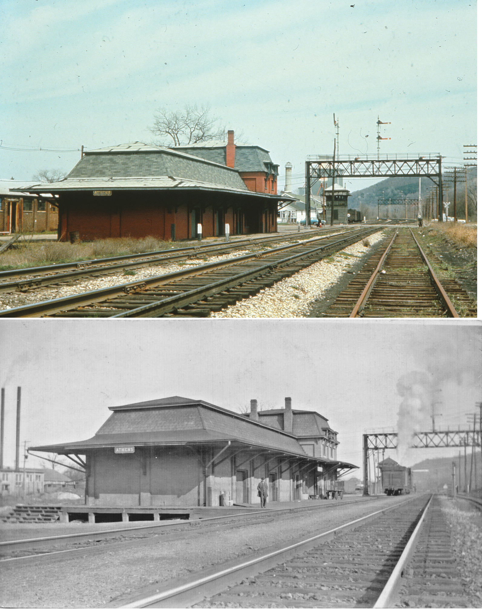
| Sayre |
|
Before the 1881 station was built, an earlier Pennsylvania and New York/Southern Central RR station sat on the North Lehigh Avenue site. It was built in the 1860s and burned in the late 1870s. The town and station were originally known as Southern Central Junction until the town name was changed to Sayre in Honor of LVRR cheif engineer Robert Sayre. | ||||||
| Sayre |
|
This freight station, torn down in 1973, was south of the passenger station on the opposite side of the Packer Avenue overpass at GPS: 41.980053, -76.514206. It was built by the LV and later was an American Express office (as seen on the 1915 map). | ||||||
|
|
||||||||
| South Branch |
|
|||||||
| Standing Stone |
|
In 1869 the station was on the SW side of the tracks on the NW side of Township Road 823 (GPS: 41.738869,-76.361871). | ||||||
| State Line |
 |
At the State Line was the State Line Hotel (built in 1876 which replaced one that burned) which is still standing today (though not used as a hotel). A short road, known as Roy Road, went from the depot to what is now PA 328 near the hotel. The Roy Road also continued past the depot and up on the hill to a farm. Evidence of the road exists between the depot and that old farm and a small stone bridge also exists between the depot and the old farm. Any evidence of a road between the depot and Route 328 is completely gone due to the ravages of Seeley Creek (flood of '72 and several severe floods after that). | ||||||
| State Line |
|
Not to be confused with the station listed above, this one was in South Creek Twonship north of Gillette and is shown on the 1869 county map. | ||||||
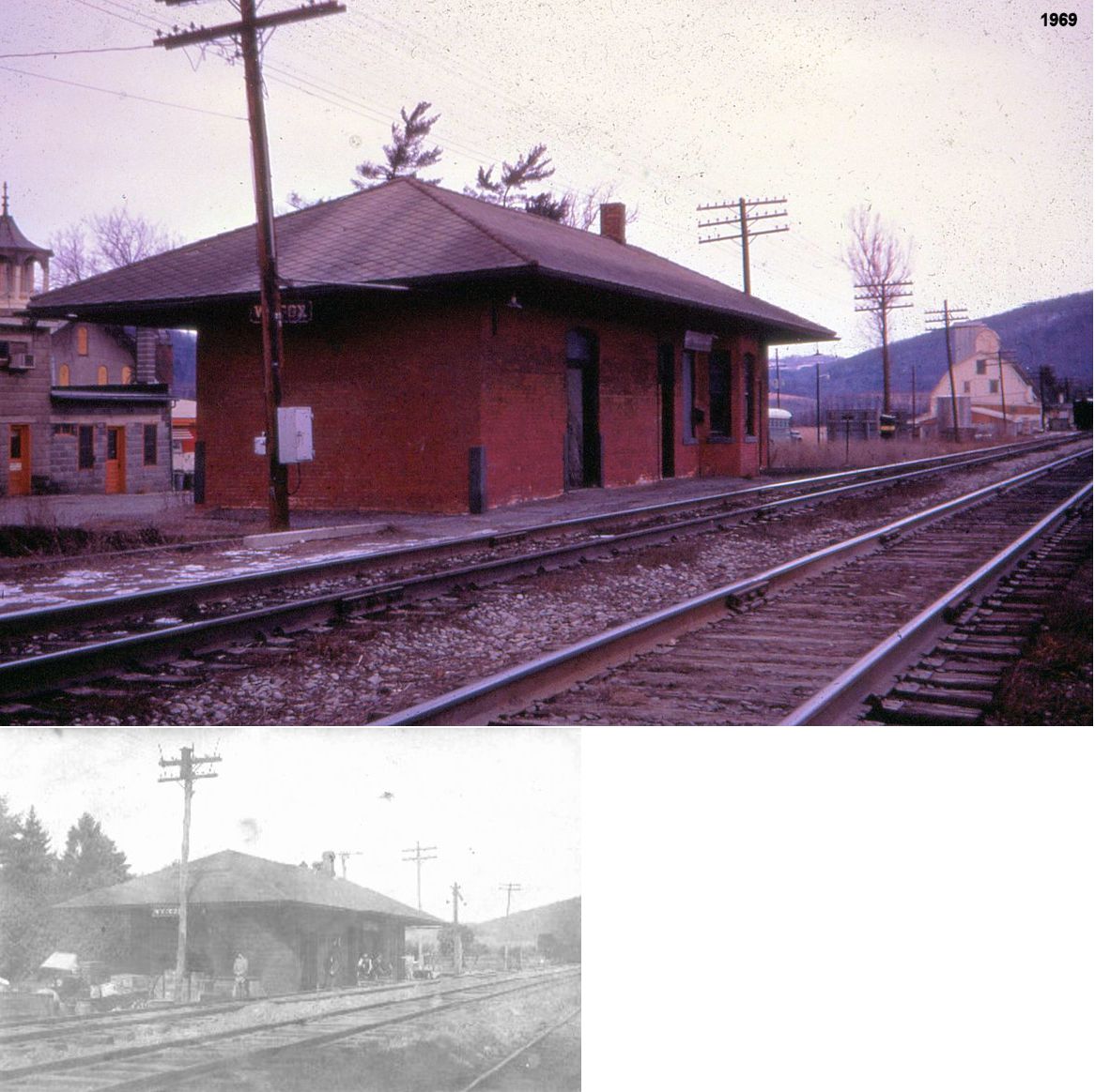
|
Stevenson (Wilcox) |
|
Station name was orignally Wilcox, but was changed by Lehigh Valley Railroad to Stevenson. | ||||||
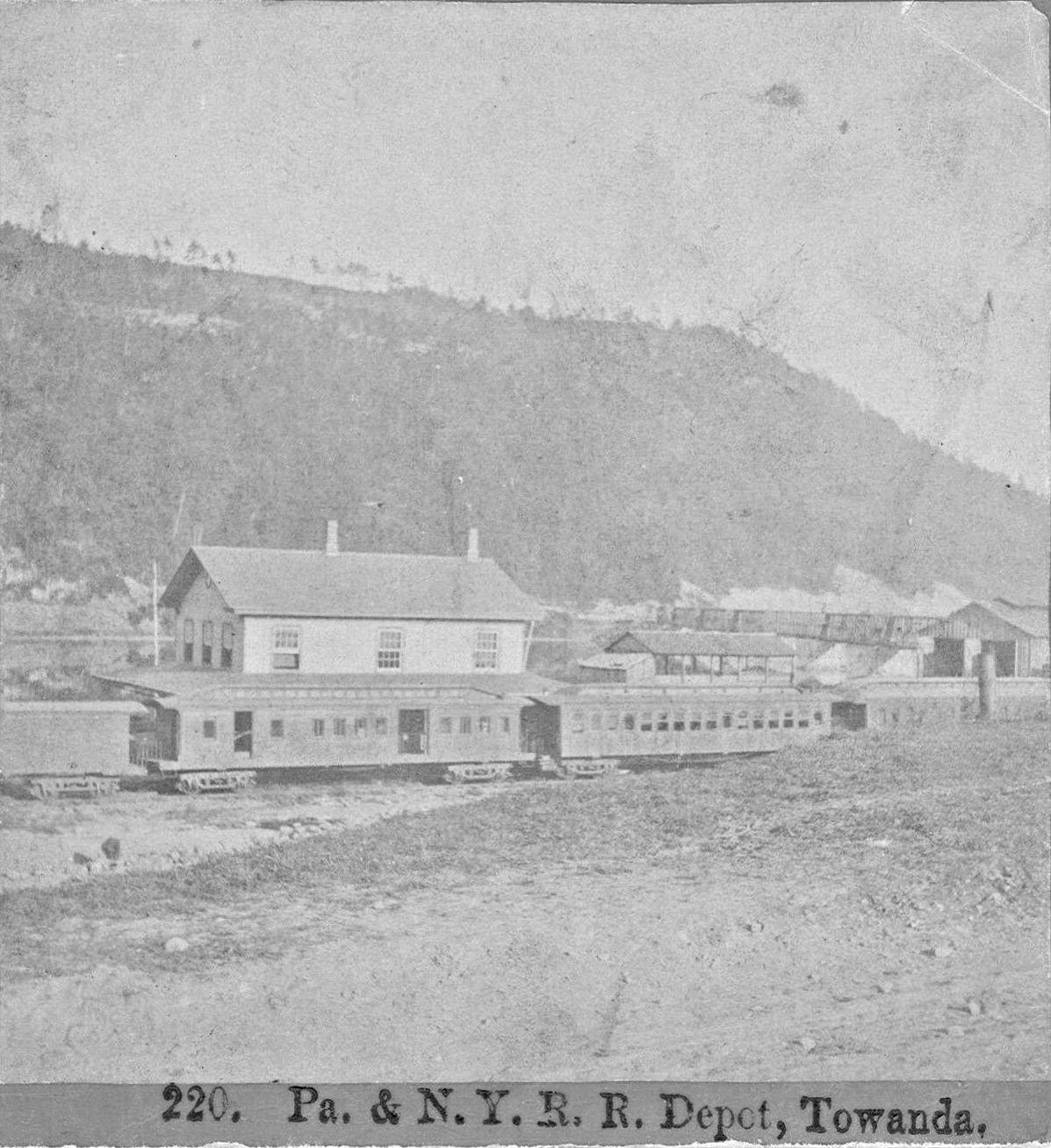
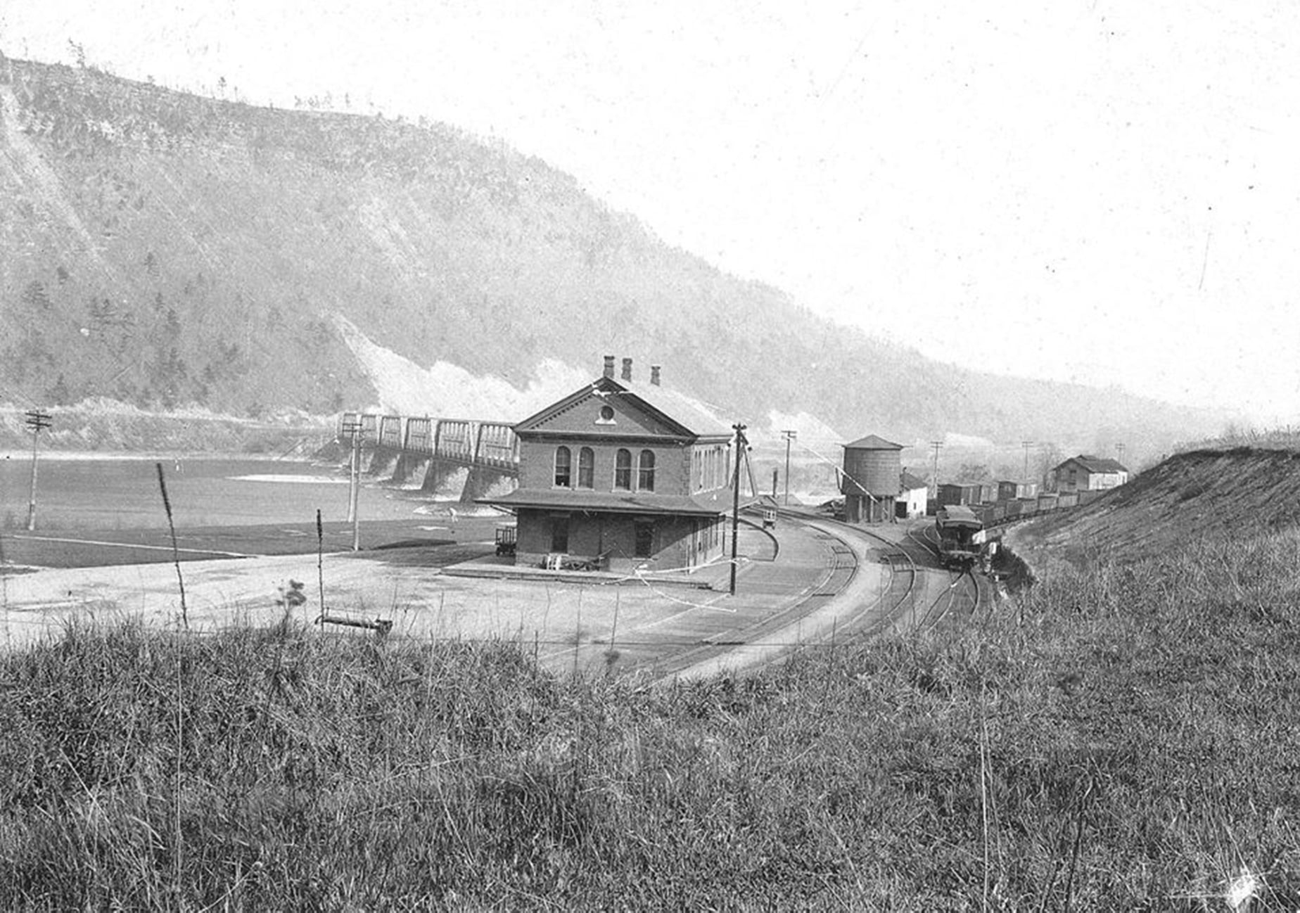
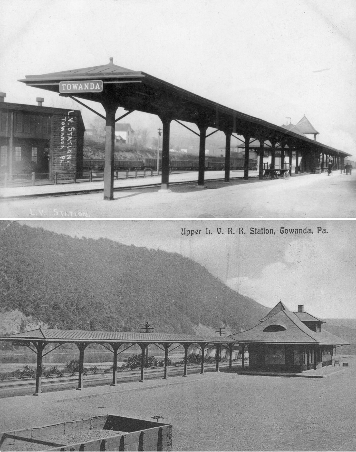
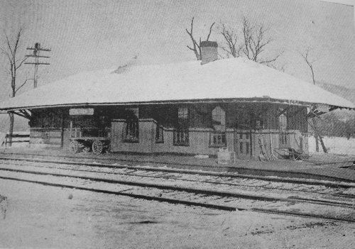
| Towanda |
|
The first Barclay RR station here was on the NW corner of Chestnut Street and Merrill Parkway (GPS: 41.77288,-76.44183). This station is shown on the 1869 map. At the time of the photo, the railroad was known as the Pennsylvania & New York RR. | ||||||
| Towanda |
|
The second Barclay RR passenger station was on Railroad Street on the east side of the tracks (GPS: 41.758370, -76.442136). It was later used by the S&NY as a station. This station is shown on the 1897-1911 Sanborn maps. It burned down on December 23, 1952. By this time the building was being used as a woodworking shop by Clarence Jakway after the SN&Y was abandoned. In the 1952 report of the station burning, The Evening Times claimed the station was 100 years old, but this was incorrect as this building as not the first Barclay RR station (see listing above). | ||||||
| Towanda |
|
There was an early Barclay RR freight house on the east side of the tracks across from the east end of Grant Street (GPS: 41.759096,-76.441873). This is shown on the 1869 map. In 2012 this location is in the middle of the Towanda Iron & Metal scrap yard. | ||||||
|
Towanda (North Towanda) |
|
Before the station below was constructed, there was an earlier Pennsylvania and New York/Southern Central RR station that sat on the same site. | ||||||
|
Towanda |
|
"Upper" station. Torn down around 1970. |
Towanda (South Towanda) |
|
||||
|
Towanda Junction |
|
Also known as Barclay Junction. | Ulster |
|
This combination station burned on January 15, 1915 (Pittston Gazaette, 1/16/1915). The LV placed a passenger coach here to temporarily serve as the station until another one was built. | |||
| Weston Station |
|
|||||||
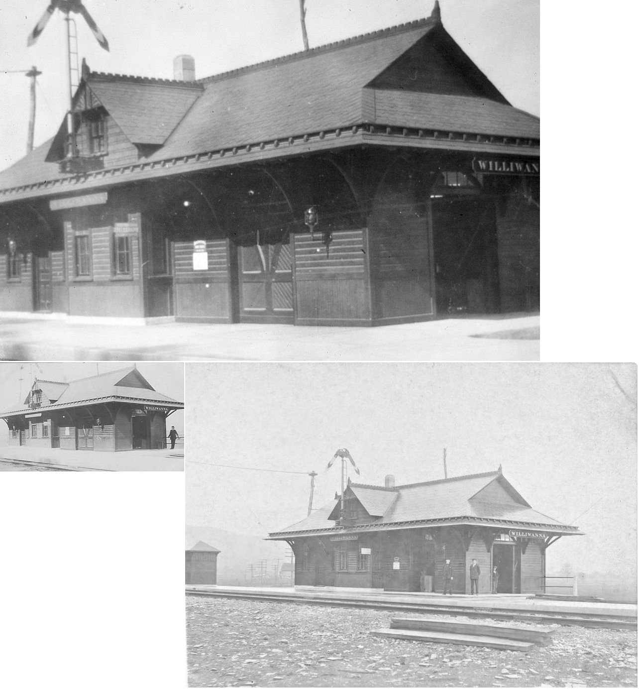
|
Wilawana |
|
|||||||
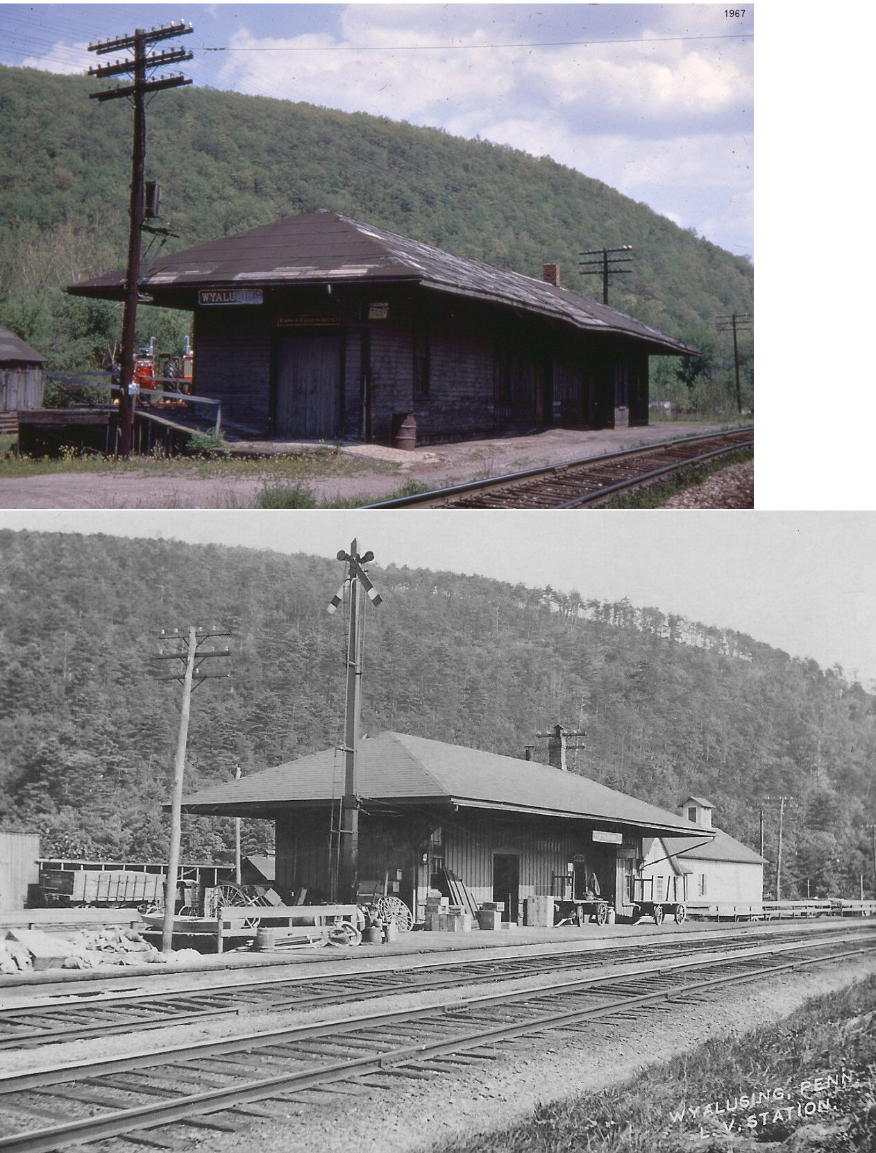
| Wyalusing |
|
|||||||
|
|
This station was on the east side of PA-187 on the north side of the tracks (GPS: 41.773536,-76.399146). | |||||||
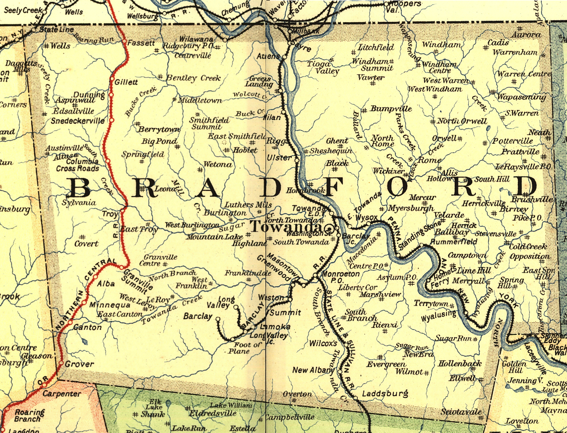
| 1895 BRADFORD COUNTY RAILROAD MAP | ||||||||
 |
||||||||
| Notes About Existing
Stations... Cowley (PRR) - Moved to a residence (the Foust farm) and restored. In 1888 the name of this station was changed to Cowley from West Granville. It is accompanied by a 1901 Soo Line caboose. New Albany (LV) - There was a Northern Pacific boxcar next to the station. Story has it that when the tracks were washed during the flood of 1972, this car was stranded in New Albany. When the LV decided not to replace the line, the boxcar's fate was sealed. The boxcar was moved in 2009 south on Route 220 to a lumber company as storage. It can be seen from the highway. Towanda (S&NY) - From the plaque at the station: "In 1922, the Susquehanna and New York (S&NY) constructed this building, smaller than the freight depot, (20' by 64'), this one story building of steel lath covered with stucco has an asbestos roof. The station had three rooms, ticket office, freight room and a passenger waiting room. The Building was 'City steam heated and electric lighted.' The postal telegraph cable company also had an office in the new station. The main passenger station depot for the rail lines was located in the northern part of Towanda Borough, just south of the present day Sylvania Plant near the intersection of Hayes Street and Packer Avenue." Towanda (LV) - From the plaque at the station: "One cannot over-emphasize the importance of railroads to the continued development of Towanda as a commercial center beginning with the first Pennsylvania and New York (PA&NY) train in September 1869. In the 1870's approximately six passenger, four freight and nine coal trains arrived at and departed from Towanda each way daily. Train traffic persisted even on Sundays when their passing interfered with services at nearby churches. The large red brick structure was built by the PA&NY in 1884 as a freight depot. Later it was used as a station by several rail lines including the Barclay, Lehigh Valley, State Line & Sullivan and Susquehanna and New York. The north side of the building housed the station agent, train dispatcher and western union operator. The freight room was in the rear of the building." Ulster (LV) - Moved 50 yards east of tracks on the north side of SR 1022. Is this gone now? Can someone provide the GPS coordinates if it is still there or let me know if it is gone? |
||||||||

