|
|
||||||||
| EXISTING STATIONS | ||||||||
|---|---|---|---|---|---|---|---|---|
| Station Name |
Original Railroad |
Current Location |
Type | Current Use |
Date Built |
Track Status |
Building Material |
More Info |
| Bard |
 |
Northampton Road just east of PA96 (GPS: 39.927684, -78.659042) |
C | Residence | ???? | Gone | Wood |
|
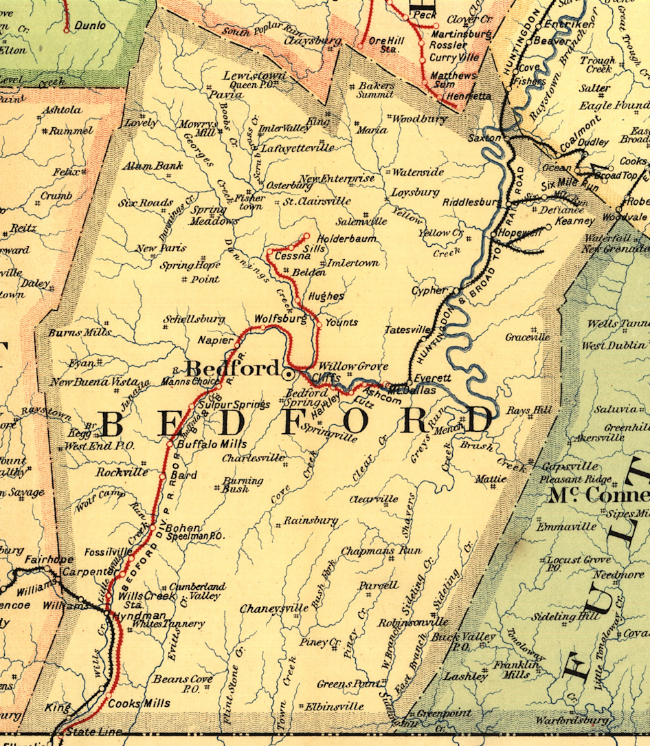
| Everett |
 |
Corner of West 5th Street and Wood Street (GPS: 40.016605, -78.375753) |
P | Civic | ???? | Gone | ???? |
|
| Everett |
|
Corner of West 5th Street and Wood Street (GPS: 40.016852, -78.375684) |
F | Civic | ???? | Gone | Wood | |
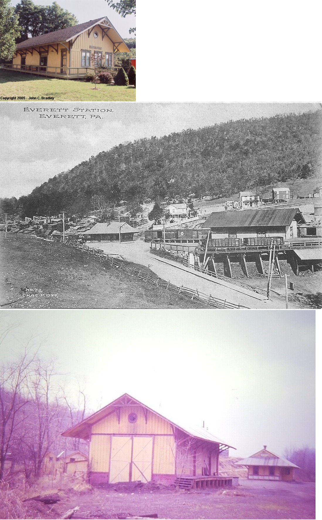
| Hopewell |
|
Southern corner of Broad Street and Oak Street (GPS: 40.135497, -78.267796) |
? | ???? | ???? | Gone | Wood | |
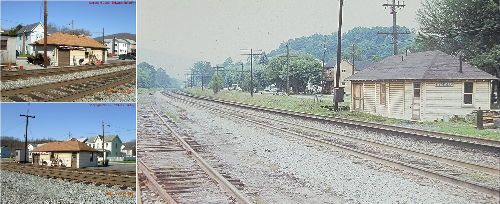
| Hyndman (New Bridegport) |
 |
Second Avenue between Chestnut Street and Market Street (GPS: 39.818337, -78.719544) |
F | Railroad | ???? | In Use | Wood | |
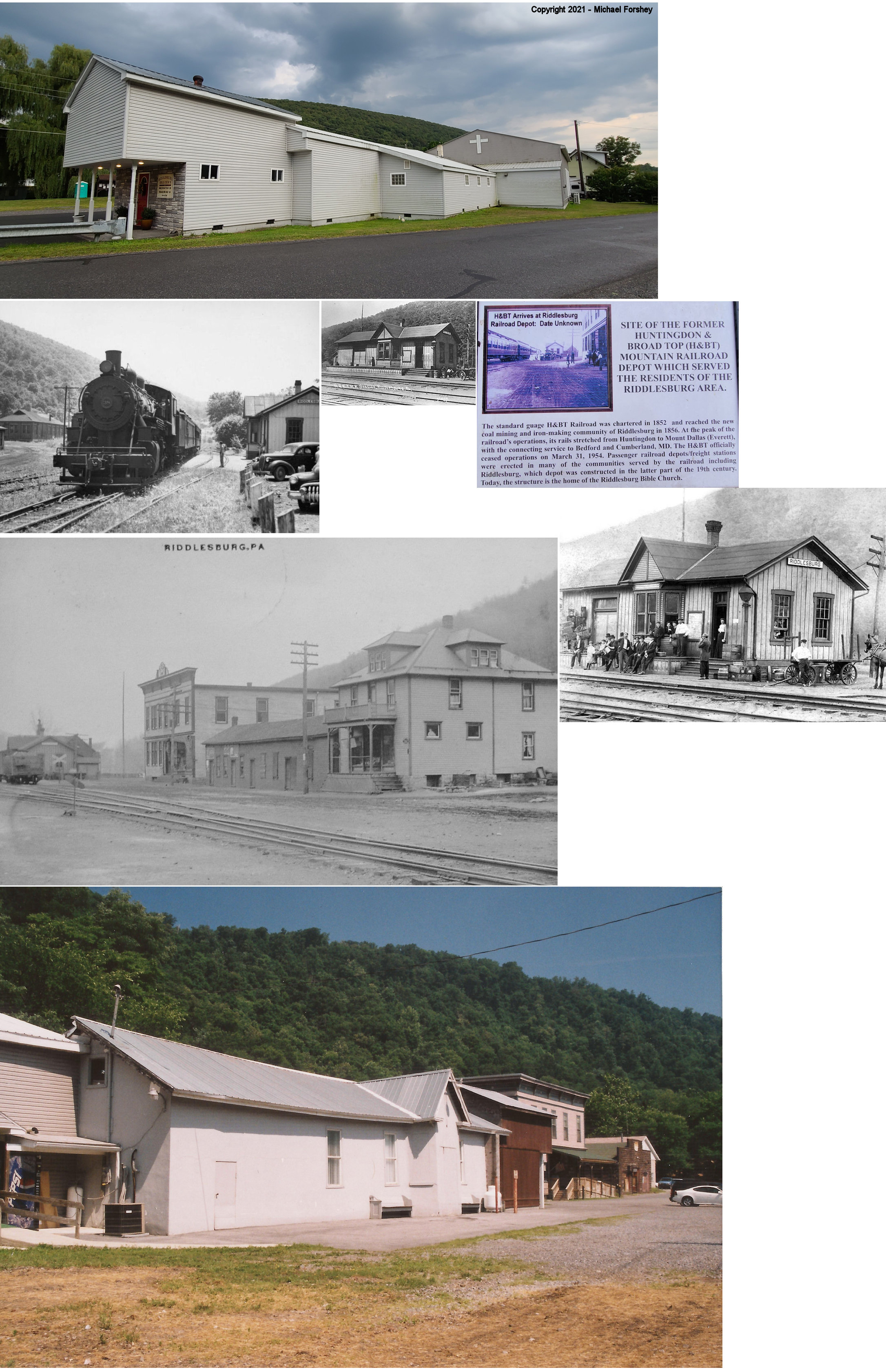
| Riddlesburg |
|
124 Newtown Road (GPS: 40.160719, -78.254704) |
C | Church | ???? | Gone | Wood |
|
| STATIONS OF THE PAST | ||||||||
| Station Name |
Original Railroad |
Notes | ||||||
| Ashcom |
 |
|||||||
| Barclay |
|
|||||||
| Bard |
|
|||||||
| Bedford |
|
According to the 1877 map and photos, the passenger and freight stations were along what is now Industrial Avenue west of Richard Street (US-220). The freight station was closest to Richard Street (GPS: 40.021386, -78.503130) with the passenger station being about 250 feet to the west. | ||||||
| Buffalo Mills |
|
|||||||
| Cessna |
|
This station was on the Dunnings Creek Branch. | ||||||
| Cliffs |
|
This flag-stop station was between Hartley and Dunnings Creek Junction. | ||||||
| Coaldale (Six Mile Run) |
|
This flag-stop station was ont he Six Mile Run Branch. | ||||||
| Coalmont |
|
This station was on the Shoup's Branch. | ||||||
| Cook's Mills |
|
|||||||
| Cook's Mills |
|
|||||||
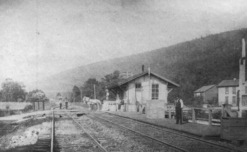
| Cove |
|
The 1877 Bedford County Atlas shows this station right on the Bedford side of the Bedford/Huntingdon County line. Not to be confused with the Cove in Perry County. | ||||||
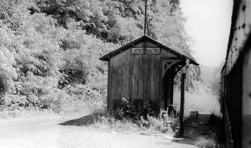
| Cypher |
|
|||||||
| Donelson |
|
This station was on the Shoup's Branch. | ||||||
| Dudley |
|
This station was on the Shoup's Branch. | ||||||
| Dunnings Creek Junction |
|
This may have been just a flag-stop station at the junction. | ||||||
| Everett |
|
The original H&BTM station here was on the east side of the tracks near the corner of West 3rd Street and West Street at approxminately GPS: 40.014502, -78.377970. The station is shown there on the 1905 and 1910 maps. | ||||||
| Fishertown |
|
|||||||
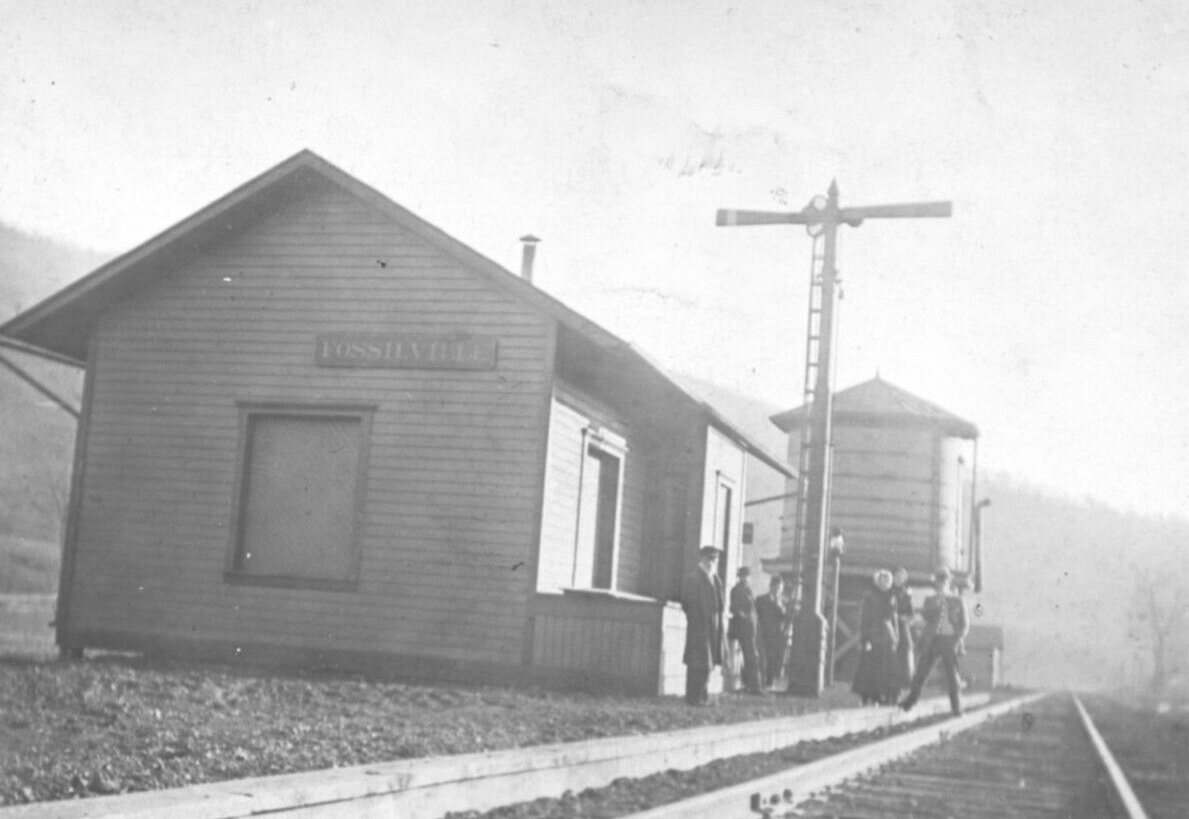
| Fossilville |
|
|||||||
| Frederick Perry |
|
|||||||
| Gravel Pit Station |
|
This station, also known as Fossilville-Gravel Pit, was between Fossilville and Madley. | ||||||
| hartley |
|
|||||||
| Holderbaum |
|
This station was at the end of the Dunnings Creek Branch. | ||||||
| Hopewell |
|
|||||||
| Hughes |
|
This station was on the Dunnings Creek Branch. | ||||||
| Hyndman (New Bridgeport) |
|
The B&O station was constructed in 1883. The photos show all the
stations. The stations were along 3rd Avenue near Market Street (the
B&O stations were south of Market and the PRR station was north of
Market).
|
||||||
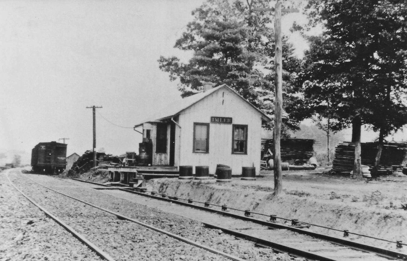
| Imler |
|
|||||||
| Kearney |
|
This station was on the Long's Run Branch (which branched off the Sandy Run Branch). | ||||||
| King |
|
|||||||
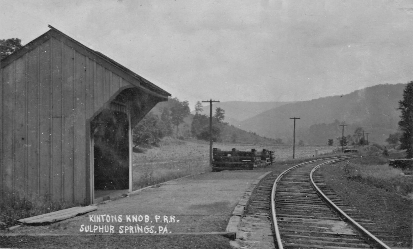
| Kinton's Knob |
|
This shelter was located near Sulphur Springs | ||||||
| Langdondale |
|
This station was on the Long's Run Branch (which branched off the Sandy Run Branch). | ||||||
| Lutzville |
|
|||||||
| Madley |
|
|||||||
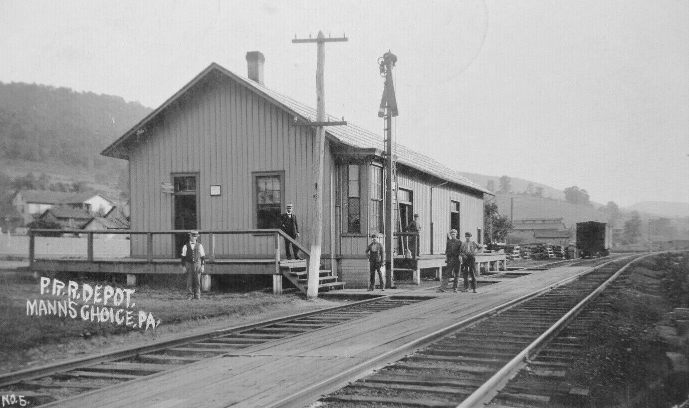
| Manns Choice |
|
|||||||
| Mount Dallas |
AND |
Also called "Mt. Dallas Depot" on old maps. | ||||||
| Napier (Stuckeysville) |
|
|||||||
| North Point |
|
The 1877 map shows a depot here on the north side of the tracks. | ||||||
| Osterburg |
|
|||||||
| Piper's Run |
|
The 1877 map shows a depot here. | ||||||
| Puttstown |
|
This station was on the Shoup's Branch. | ||||||
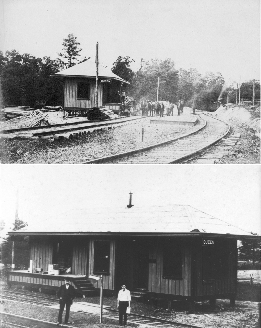
| Queen Station |
|
|||||||
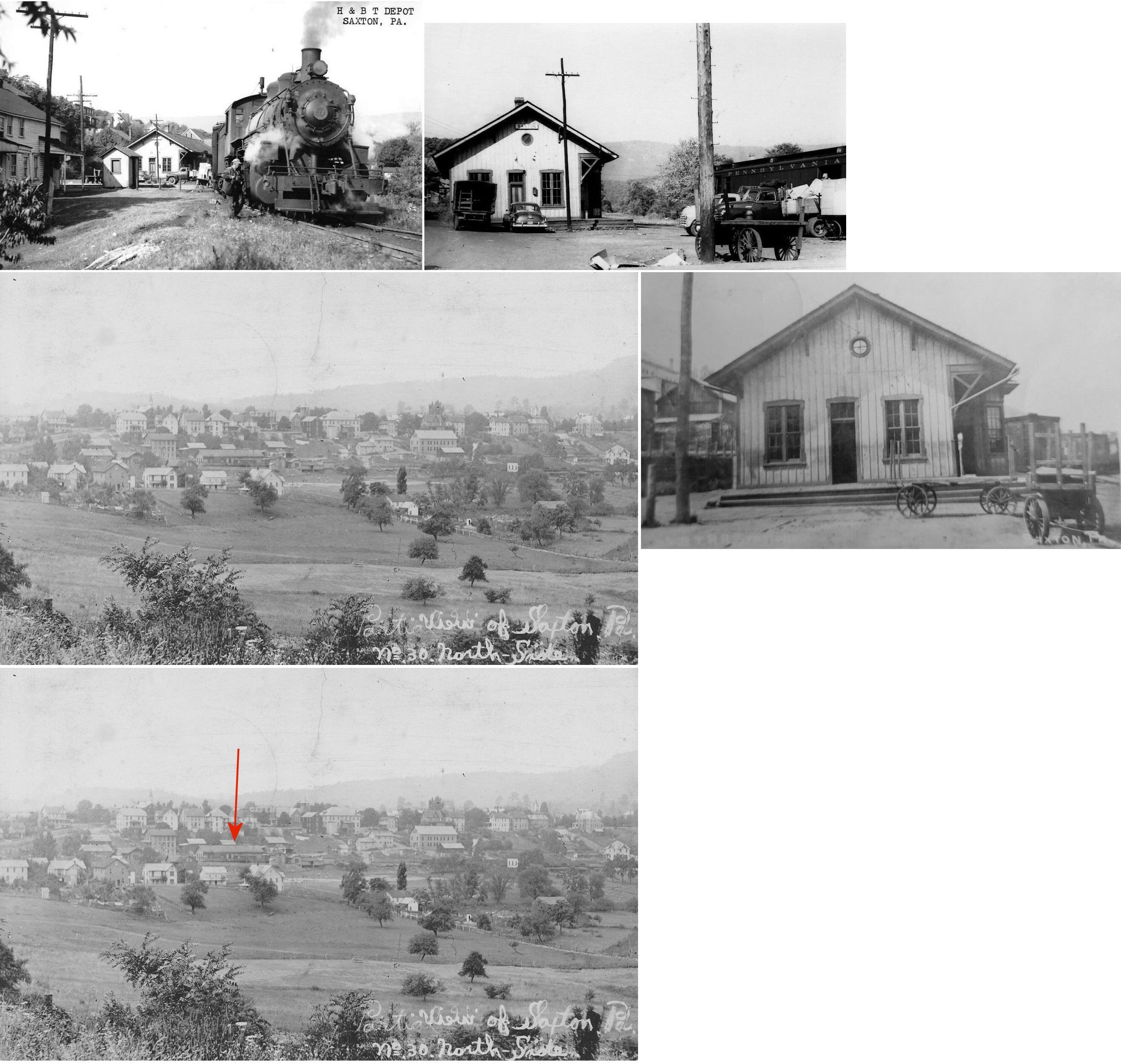
| Saxton |
|
This depot was on Station Street on the south side of the tracks in the vicinity of GPS: 40.217107, -78.243039. | ||||||
| Sill |
|
This station was on the Dunnings Creek Branch. | ||||||
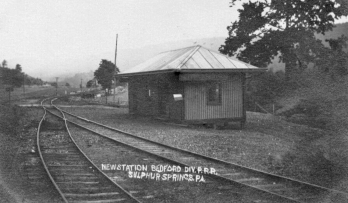
| Sulphur Springs |
|
|||||||
| State Line |
|
|||||||
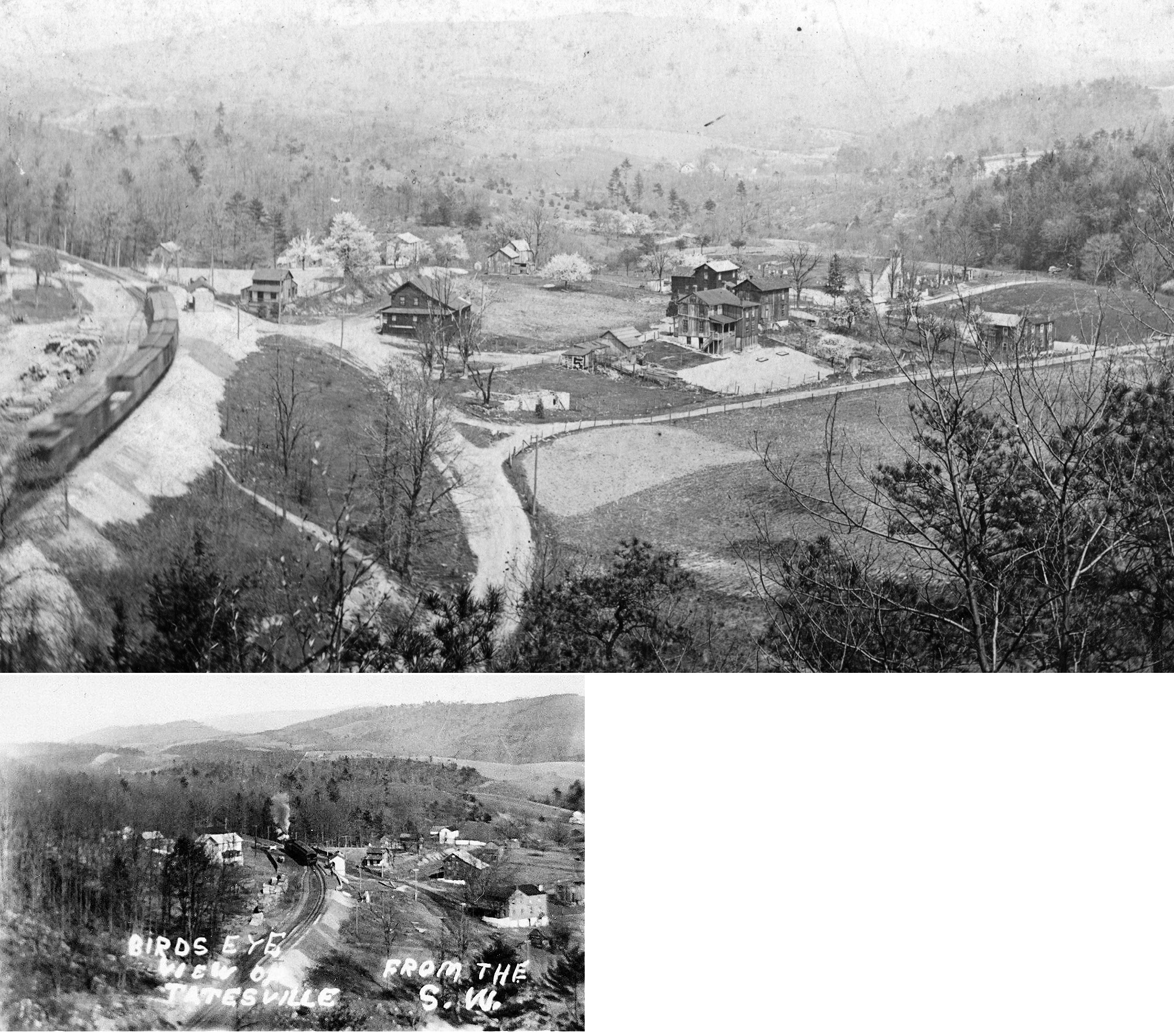
| Tatesville |
|
|||||||
| Wills Creek Station |
|
|||||||
| Wolfsburg |
|
This depot was NW of Country Ridge Road on the south side of the tracks. | ||||||
| YountS |
|
This station was on the Dunnings Creek Branch. | ||||||
| 1895 BEDFORD COUNTY RAILROAD MAP | ||||||||
 |
||||||||
| Notes About Existing
Stations... Bard (MC&H) - Tracey (Pringle) Hinson writes: I lived in this house in the 1970's and was told that it served as a train station for passengers in the late 1800's, early 1900's. It does have an enormous room at the side of the house that could have served as a passenger waiting area. There is also a smaller room near the tracks that possibly served as the ticketing area. I was told when originally built, the house/station also had rooms for rent. My parents left the property abandoned in the mid-late 70's and I believe nobody has lived there since. I have been to this house when I have visited family and although in bad condition, it could be possibly rehabilitated. --Tracey (Pringle) Hinson. Update: It appears that the building has been remodeled and now houses apartments (as of 2014). Everett (H&BTM) - The Huntingdon and Broad Top Mountain RR that was part of the same corporation as the East Broad Top RR but was standard gauge. It ran from Huntingdon to just outside of Bedford (Mt. Dallas) and was abandoned in 1954. See this page for more info. Riddlesburg (H&BTM) - The station still stands, although has been heavily modified. A church currently uses the building. It sits just south of the Huntingdon & Broad Top Rail Trail entrance in Riddlesburg. There is a small plaque on site with notes on the station. |
||||||||