 COUNTY COUNTY
|
|
||||||||
| EXISTING STATIONS | ||||||||
|---|---|---|---|---|---|---|---|---|
| Station Name |
Original Railroad |
Current Location |
Type | Current Use |
Date Built |
Track Status |
Building Material |
More Info |
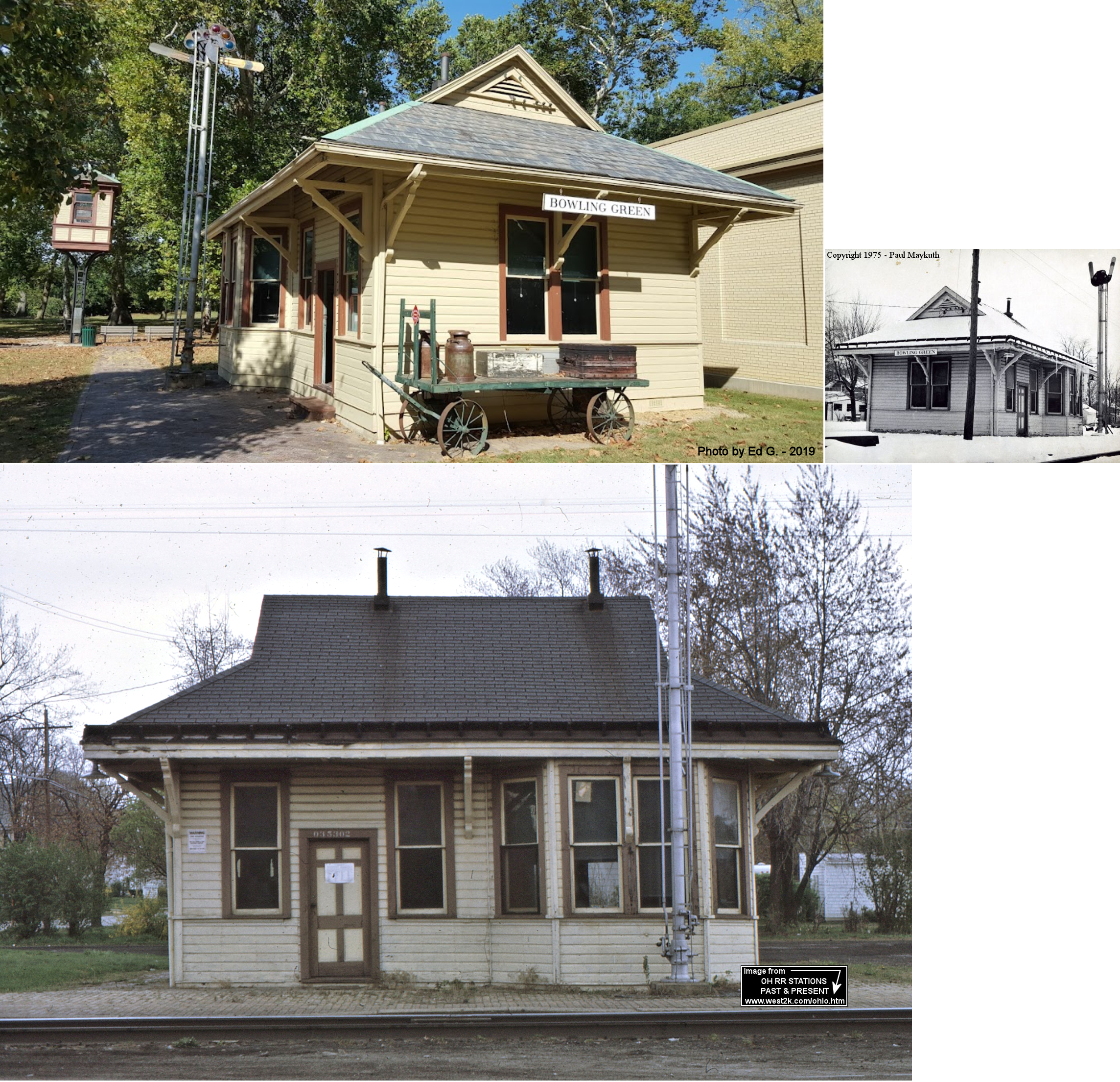
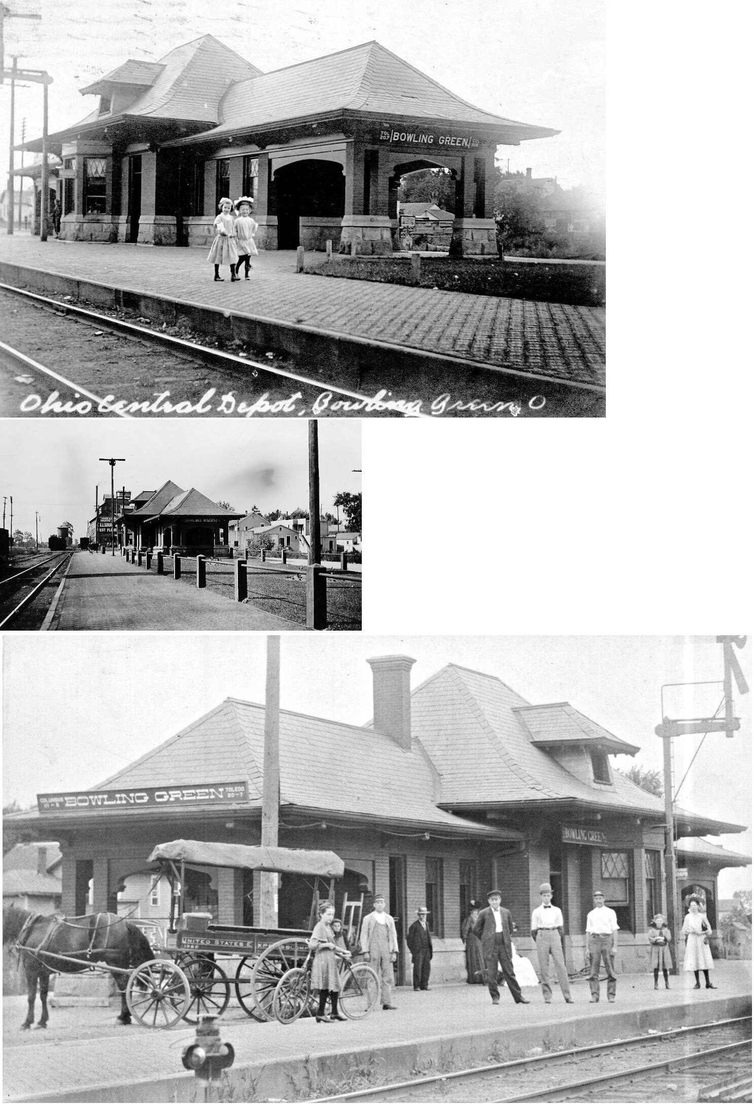
| Bowling Green |  |
Carillon Historical Park 2001 South Patterson, Dayton (Montgomery County) (GPS: 39.728461, -84.202114) |
P | Museum | 1894 | None | Wood |
|
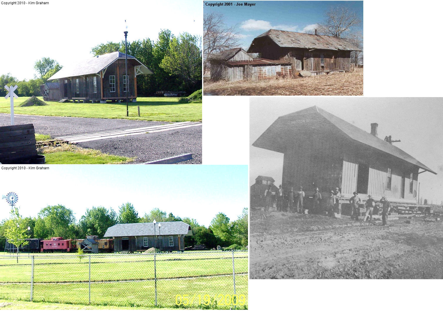
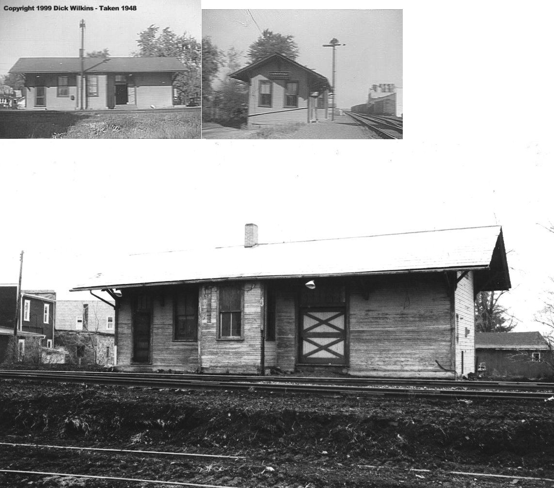
| Hatton (Millgrove) |
 |
12505 County Road 99, Findlay (GPS: 41.083919, -83.641017) |
C | Museum | 1882 | None | Wood |
|
| Lime City | |
South of US 20 east of town (GPS: 41.532687, -83.564591) |
C | Business | ???? | In Use | Wood |
|
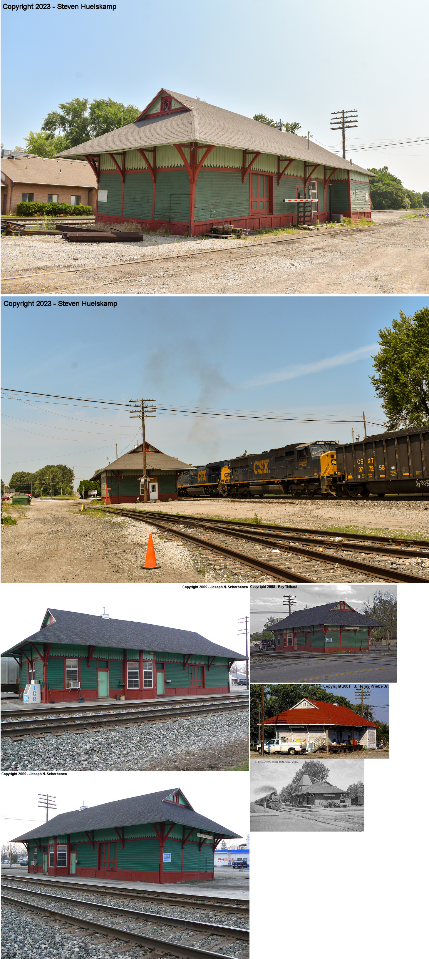
| North Baltimore |  |
Main Street north of State Street (GPS: 41.181303,-83.677905) |
C | Railroad | ???? | In Use | Wood | |
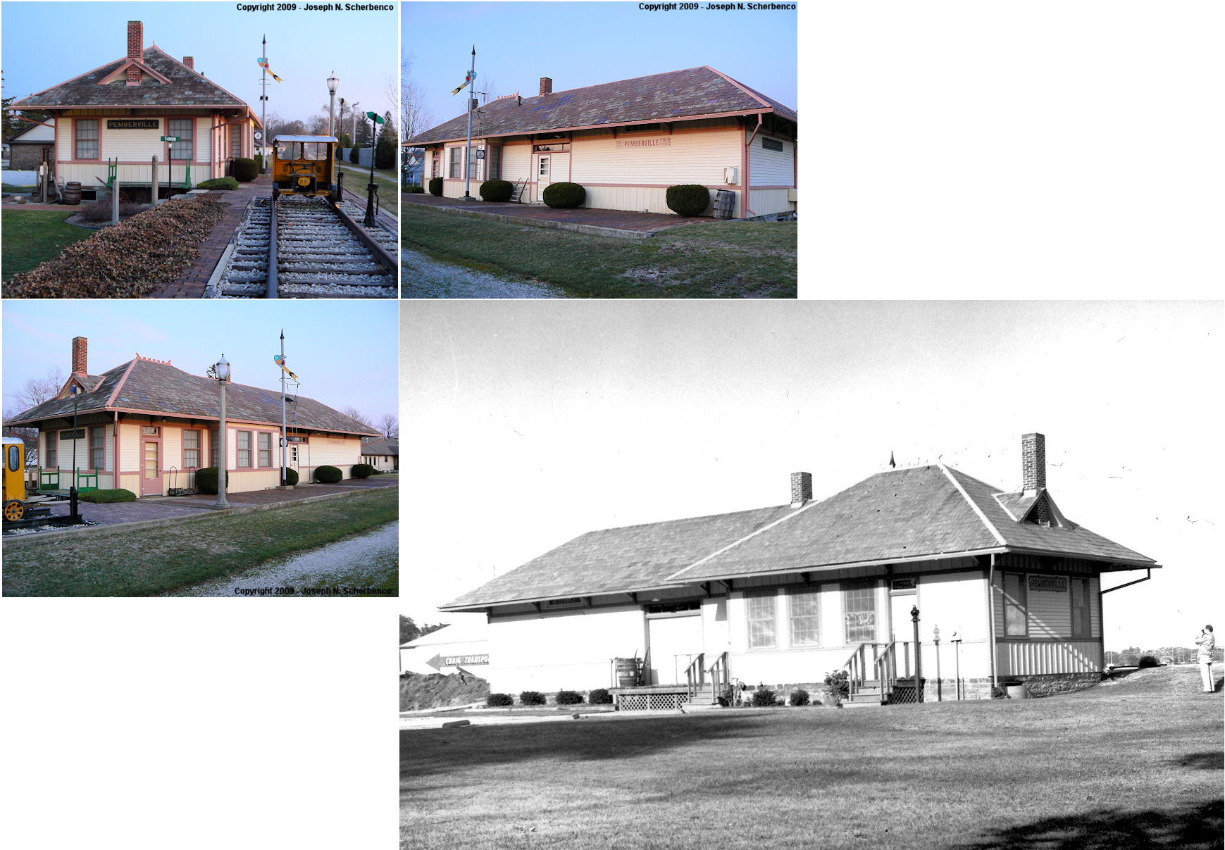
| Pemberville | |
Along Hickory at Main Street (GPS: 41.40986,-83.464626) |
C | Museum | ???? | Gone | Wood | |
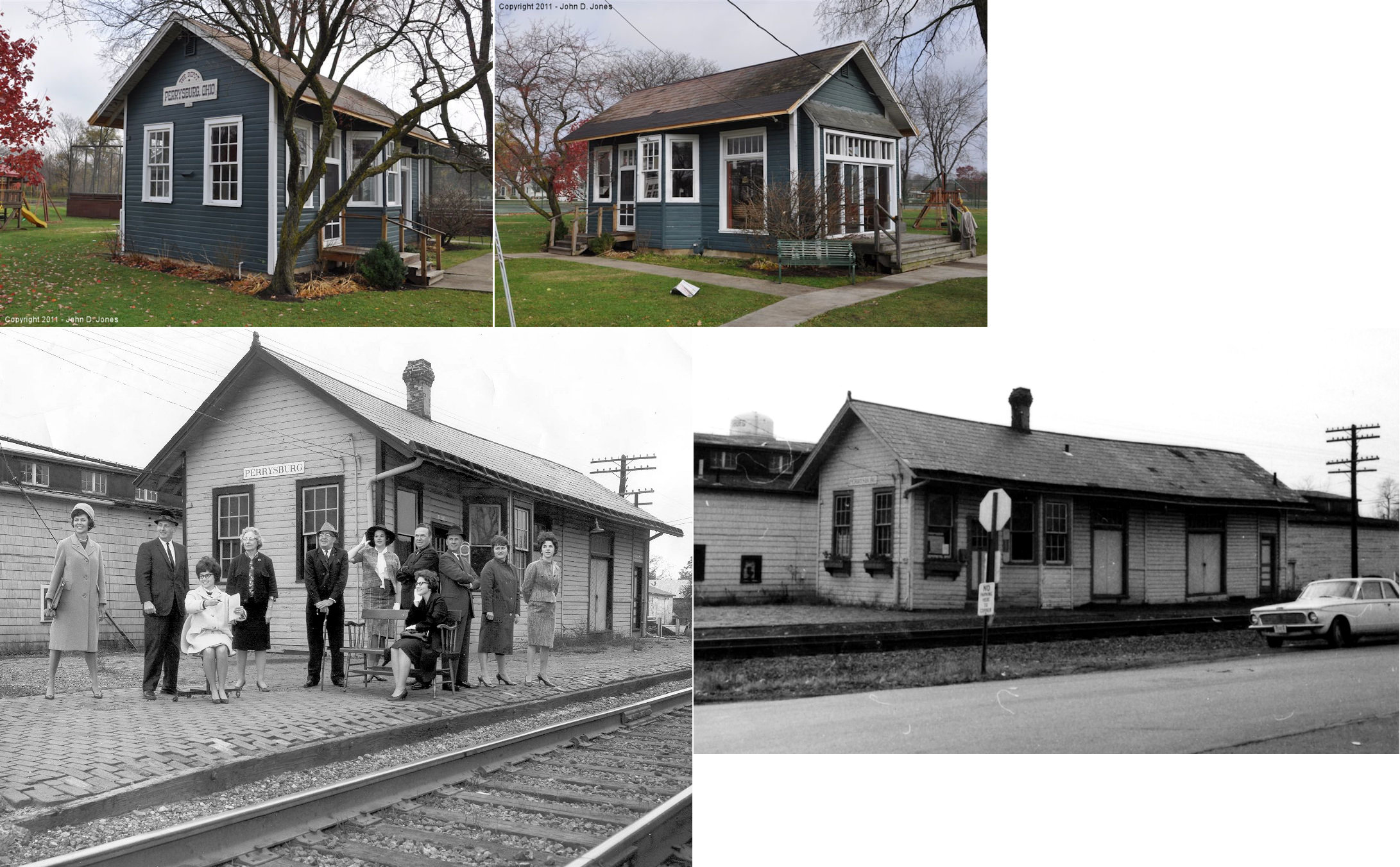
| Perrysburg | |
502 East 2nd Street (GPS: 41.562188, -83.619564) |
P | Private | ???? | None | Wood |
|
| Portage | |
South end of 2nd Street, north of village park. (GPS: 41.32502,-83.649027) |
C | Residence | ???? | None | Wood |
|
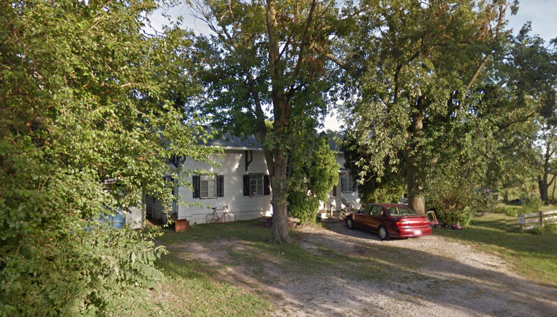
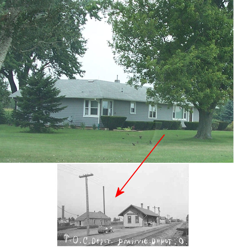
| Prairie Depot (Wayne) |
|
9271 Emerson Road (GPS: 41.286505, -83.535160) |
C | Residence | ???? | None | Wood |
|
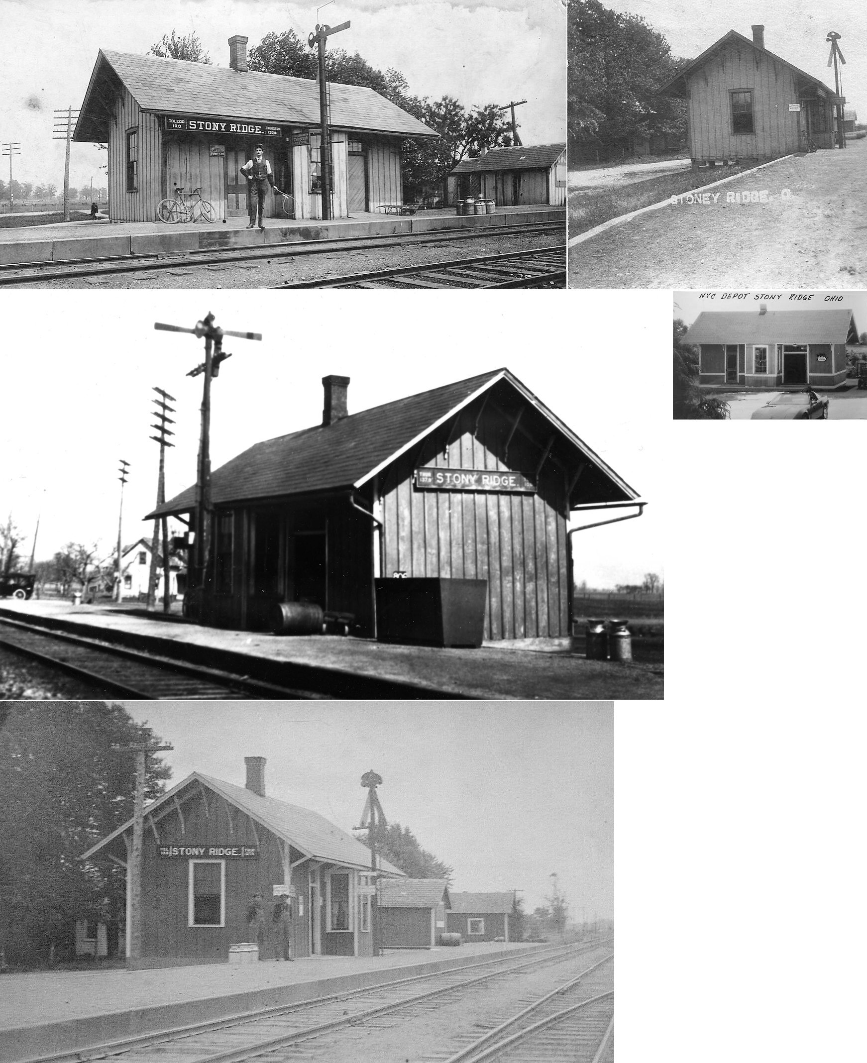
| Stony Ridge | |
5545 Fremont Pike (US-20) at back of property (GPS: 41.503331, -83.502163) |
C | Private | ???? | In Use | Wood |
|
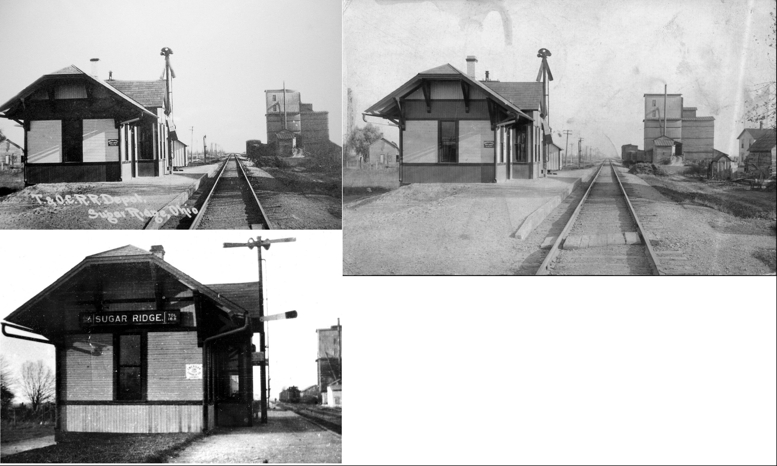
| Sugar Ridge | |
North of town at a pond near I-75 (Need more specific location) |
C | Private | ???? | In Use | Wood | |
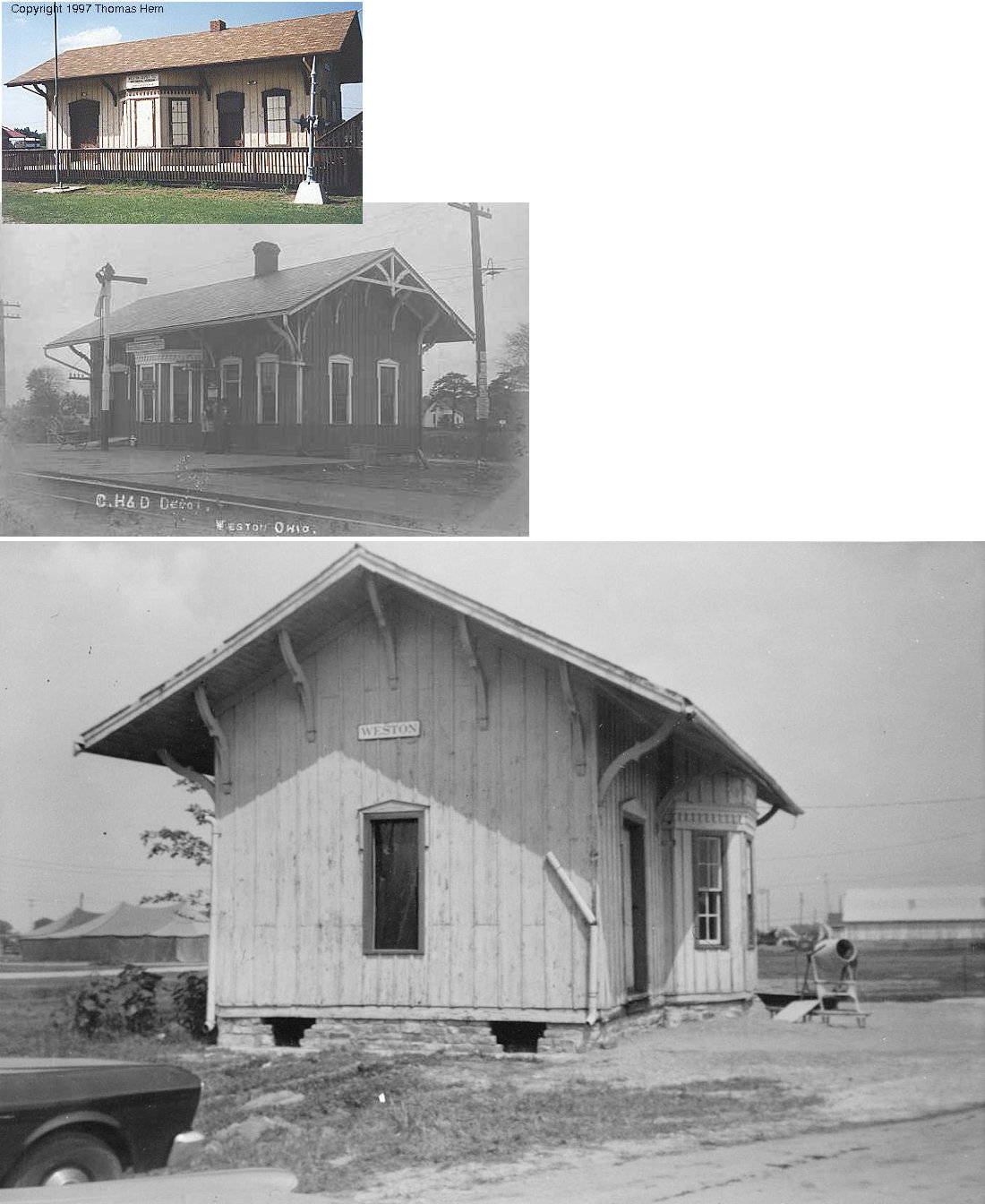
| Weston | |
Wood County Fairgrounds, Bowling Green (GPS: 41.389617, -83.667571) |
P | Museum | 1853 | None | Wood |
|
| STATIONS OF THE PAST | ||||||||
| Station Name |
Original Railroad |
Notes | ||||||
| Bairdstown | |
The station was on the west side of North Randolph Street on the south side of the tracks (GPS: 41.174253,-83.607781) | ||||||
| Bloomdale | |
The station, built in 1874, was on the east side of South Main Street on the north side of the tracks (GPS: 41.168947,-83.554185). | ||||||
| Bowling Green | |
There were two T&OC stations in Bowling Green; an old frame station and newer brick station which replaced it. The first station, located between East Wooster and Court Streets (formerly Thurston Street), was built around 1880 and replaced by the brick station in 1896. | ||||||
| Bowling Green | |
The brick station, built in 1896, was torn down in 1962. This location was the same as the old station, on the west side of the tracks equidistant between East Wooster and Court Streets (formerly Thurston Street). Across the tracks was a holding pond for the Bowling Green Electric Light & Power Company. That pond was originally a quarry for the Snowflake Lime Company. The T&OC also had a freight depot on a siding north of Clough Street which was torn down in 1971. | ||||||
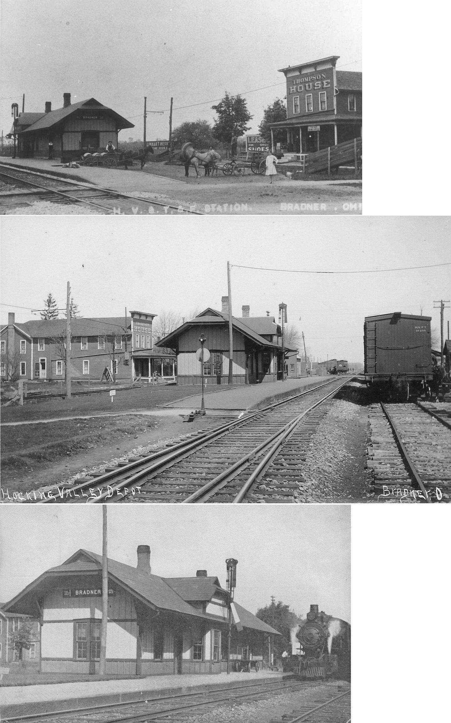
| Bradner |  |
This combination station sat on West Railroad Street (now Plin Street) south of Crocker Street on the west side of the tracks (GPS: 41.322863,-83.438212). It was built in 1895 to replace the original station here. It closed in 1966 and was demolished in 1967. | ||||||
| Bruningsville | |
|||||||
| Cummings | |
In 1886 the station was on the south side of Moline-Martin Road where it used to cross the tracks. The station was on the west side of the tracks (GPS: 41.558403,-83.491931). | ||||||
| Custar | |
The station was on the south side of Main Street on the northwest side of the tracks (GPS: 41.284466,-83.842603). | ||||||
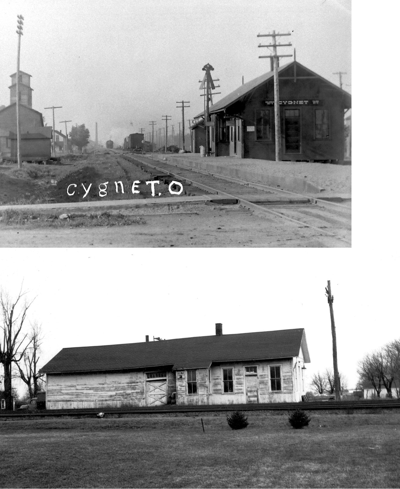
| Cygnet | |
Built in 1883 by the Toledo & Indianapolis RR (later called the Toledo, Columbus & Southern RR), this station was on the south side of Front Street on the west side of the tracks (GPS: 41.239867,-83.645386). Cygnet was formerly known as Pleasant View. | ||||||
| Dowling | |
L. Williamson was the ticket and freight agent here in 1886 for the Toledo, Columbus & Southern RR. | ||||||
| Dunbridge | |
The station was on the north side of SR-582 (Middleton Pike) on the southeast side of the tracks (GPS: 41.457961,-83.608725). | ||||||
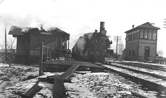
| Galatea (Welker) |
AND |
This L-shaped station served both railroads and was probably built by T&OC predacessors the Toledo & Indianapolis RR or the Toledo, Columbus & Southern RR. | ||||||
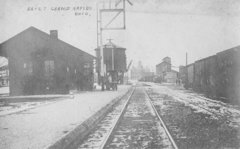
| Grand Rapids |
 |
The station was on the south side of Third Street west of Mill Street on the north side of the tracks (GPS: 41.410202,-83.866496). | ||||||
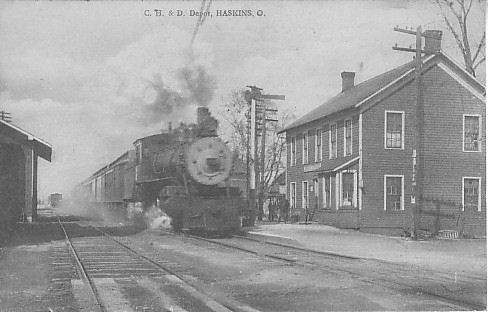
| Haskins | |
The station was on the west side of South Findlay Street on the southeast side of the tracks (GPS: 41.463857,-83.705049). | ||||||
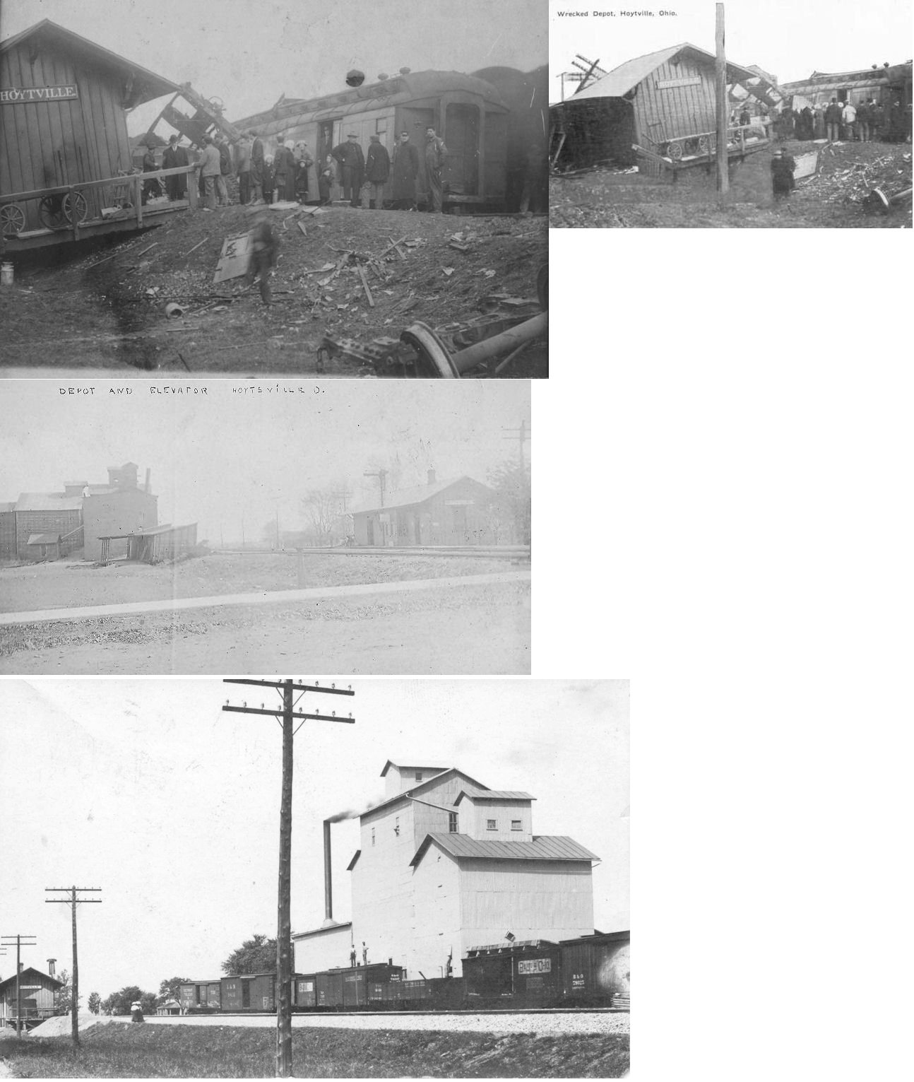
| Hoytville | |
The station was on the north side of Railroad Street just east of Main Street on the south side of the tracks (GPS: 41.191973,-83.783809). This station was demolished in a wreck in 1913. | ||||||
| Hoytville | |
This station replaced the one listed above. It burned down in 1965. | ||||||
| Hull Prairie | |
|||||||
| Latcha |
 |
The station was on the SW side of Railroad Street (GPS: 41.545011,-83.452417). The 1886 county map shows what appears to be a full-sized station here when this was the North Western Ohio RR. | ||||||
| Lemoyne | |
This station, built in 1876 by the Columbus & Toledo RR, was on Lemoyne Road just a bit north of Dennis Street on the east side of the tracks (GPS: 41.494307,-83.473456). | ||||||
| Longley | |
|||||||
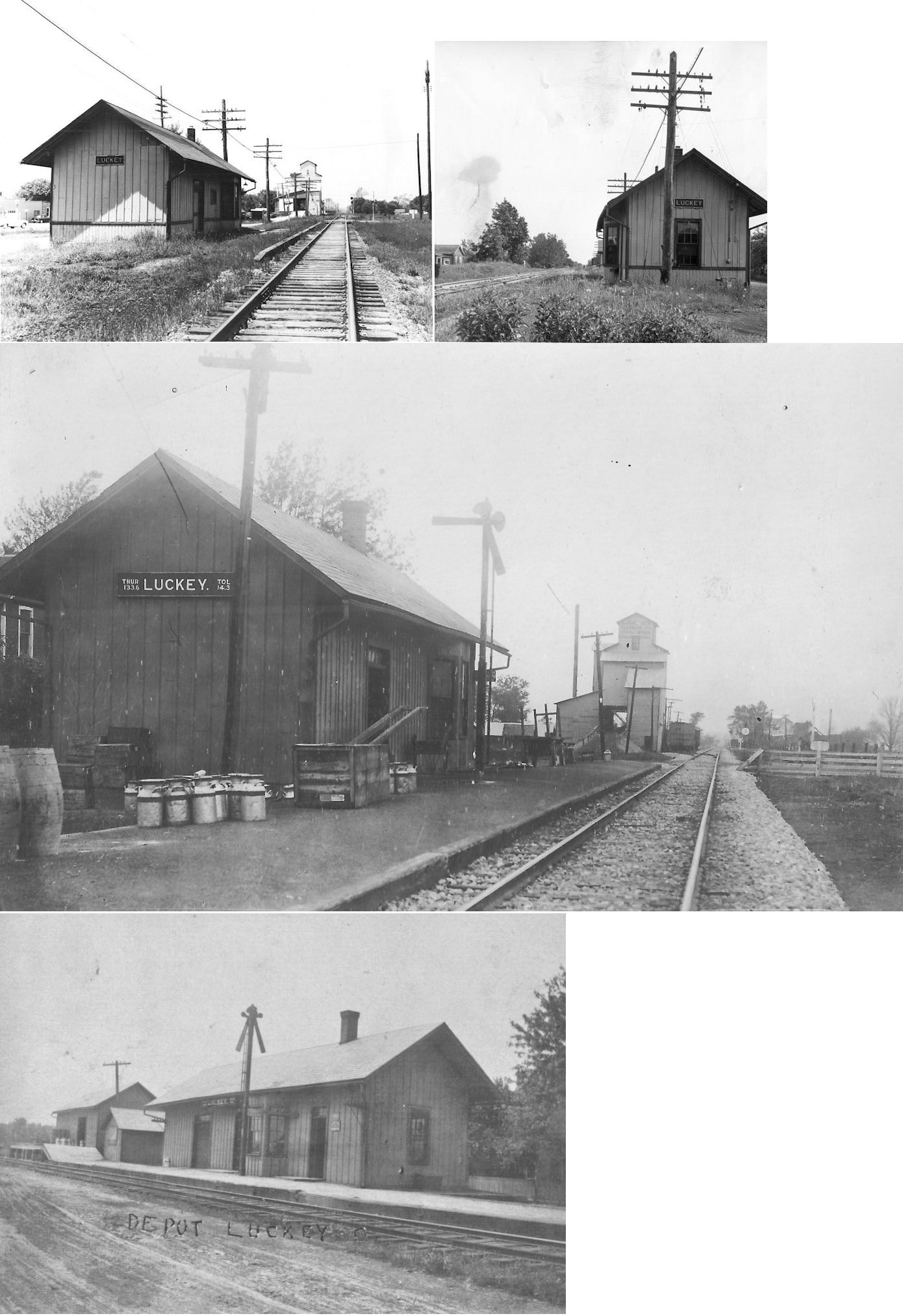
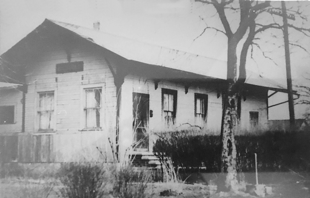
| Luckey | |
In 1886 the station was on the south side of Main Street on the west side of the tracks (just east of Oak Street) (GPS: 41.450495,-83.484153). | ||||||
| Mermill | |
This station was on the north side of Mermill Road on the west side of the tracks (GPS: 41.297751, -83.645649). It was torn down in 1969. | ||||||
| Millbury |
 |
The passenger station was on what is now Marilyn Avenue north of Cherry Street on the southwest side of the tracks (GPS: 41.566648,-83.430122). It was built in 1873. The 30'x30' freight house, which was likely the first passenger station here, was built in 1862. | ||||||
| Milton Center |
 |
In 1886 this station was at the corner of Railroad and Poplar Streets on the northwest side of the tracks (GPS: 41.30108,-83.829846). | ||||||
| Mungen |
 |
A station is listed here on the Toledo, Columbus & Cincinnati RR timetable from 1889. Mungen was between Mermill and Trombley. | ||||||
| Newtons |
|
A station is listed here on the Toledo, Columbus & Cincinnati RR timetable from 1889. Newtons was between Sugar Ridge and Bowling Green. | ||||||
| Norris Station | |
This town no longer exists. It was in Perry Township on what is now Eagleville Road. In 1886 the station was on the north side of Eagleville Road (Township Road 34) on the west side of the tracks (GPS: 41.216427,-83.446097). | ||||||
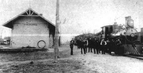
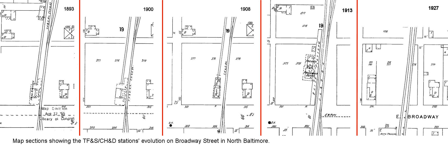
| North Baltimore | |
Built sometime in 1890, there was a TS&F (Toldeo, Finbdlay & Springfield) on the north side of East Broadway Street between Rhodes and Beecher Streets. When the CH&D opened the North Baltimore Extension between NB and Bowling Green it was done under a different corportaion (the TS&F Railway). A freight depot was added to the north side of the building by the CH&D around 1900-1908. | ||||||
| North Baltimore | |
A new, larger CH&D combination station was built in 1901 (North Baltimore Beacon, 11-8-1901). The Sanborn map of 1913 shows this station a bit north of where the original station was with a long brick platform along the tracks. For the evolution of these stations, see these map sections. The station was gone by 1927 (probably in 1919 when it became redundant when the B&O acquired the CH&D). There was a locomotive house nearby between Broadway and the B&O line and it was also gone by 1927. | ||||||
| Oil Center | |
A station is listed here on the Toledo, Columbus & Cincinnati RR timetable from 1889. Oil Center was between Cygnet and Galatea. | ||||||
| Oregon Road | |
A station is listed here on the Toledo, Columbus & Cincinnati RR timetable from 1889. Oregon Road station was between Prentice and Lime City at the crossing of Oregon Road at approximately GPS: 41.586558, -83.537902. | ||||||
| Pemberville | |
This combination station was at the end of Columbus Street off Bierley Avenue (GPS: 41.407748,-83.453157). | ||||||
| Perrysburg |
|
Before the CH&D station was built at the corner of West 3rd and Louisiana Ave. sometime between 1901-1908, the D&M had a two-story station about a half block to the SW. This station was on West 3rd Street about halfway between Louisiana and Walnut. That original D&M station appeared last on the 1893 map. On the 1900 map, the original station is gone and the railroad used a former saloon on the corner of West 3rd and (what is now) Burlingwood Drive as a station. After the new CH&D station was built this saloon building was used as a dwelling, but is now gone as the lot is used for parking (as of 2009). | ||||||
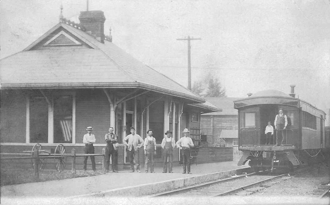
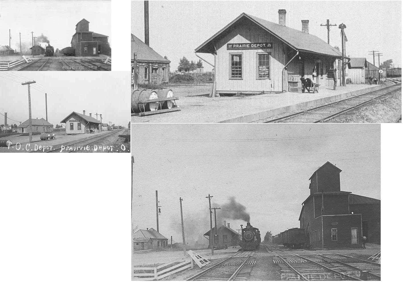
| Prairie
Depot (Kremlin) (Wayne) |
|
This town was first named Freeport, then changed in 1852 to Prairie Depot to avoid postal conflict with the Freeport in Harrison County. At that time there was no depot in the town. Later, whene the T&OC came to town, the railroad referred to the stop as Kremlin, although the residents still preferred Freeport and Prairie Depot and the train conductors would call out the three names as the train stopped there. The town was officially renamed Wayne in 1931 and the other names were discarded. There are two stations in the photograph, the one on the left was probably the old passenger station (then a freight station in later years) and the one on the right a newer station. One of these buildings supposedly was moved and/or became a residence in the 1960s. In 1886 the station was on the north side of Main Street on the west side of the tracks (GPS: 41.301183,-83.466496). | ||||||
| Prentice | |
A station is listed here on the Toledo, Columbus & Cincinnati RR timetable from 1889. This station was somewhere near the Wood and Lucas county line. It was north of the Oregon Road station. | ||||||
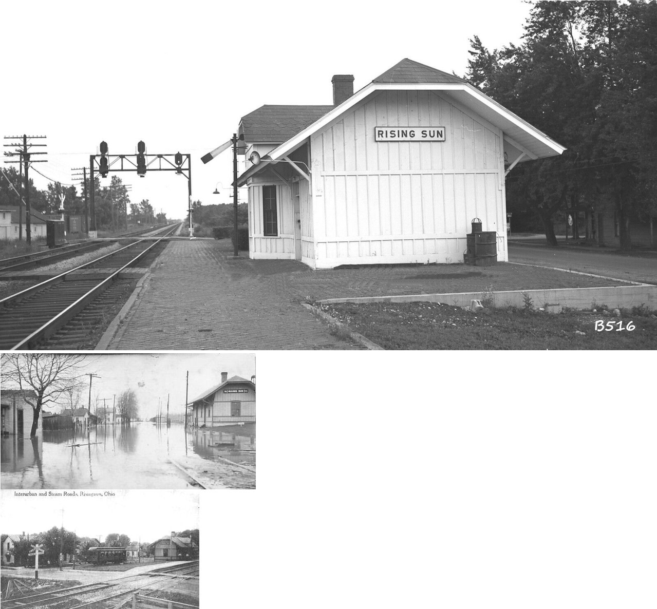
| Risingsun | |
This station was on Railroad Street north of Main Street on the west side of the tracks (GPS: 41.269622,-83.428856). It was built in 1882 and closed in 1966. | ||||||
| Rockwell Junction |
AND |
This station was built by the LS&MS, but was also leased by the HV beginning in 1896. The HV used the LS&MS line from here to access Toledo Union Station. | ||||||
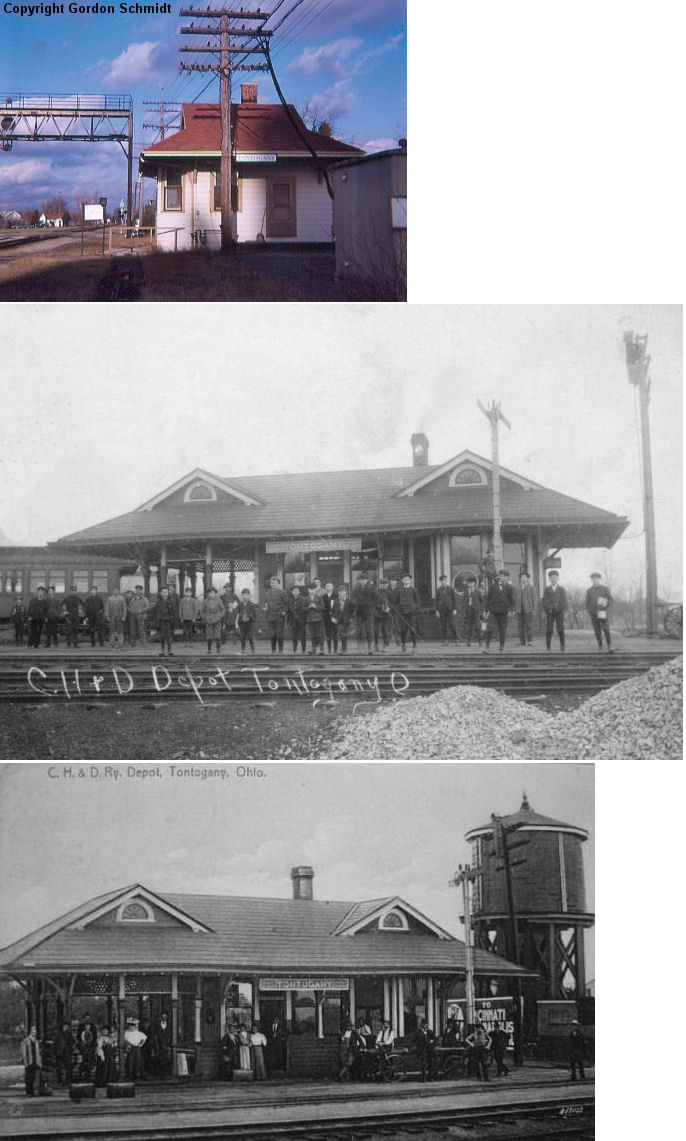
| Tontogany |
|
In 1886 a combination station/hotel is shown on the north side of Main Street on the southeast side of the tracks (GPS: 41.419334,-83.739188). The station listed below was probably built sometime later. | ||||||
| Tontogany | |
|||||||
| Trombley (Blake) |
|
This station was on the north side of Portage Street (now Jerry City Road) on the east side of the tracks (GPS: 41.254065,-83.645225) | ||||||
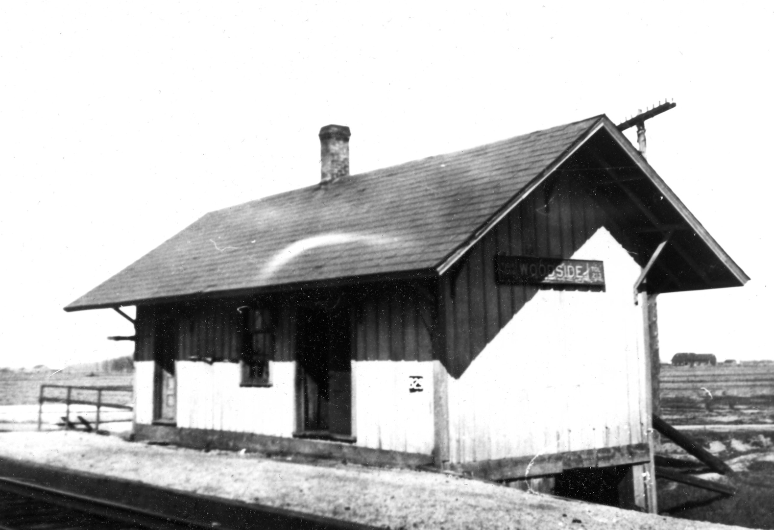
| Woodside | |
|||||||
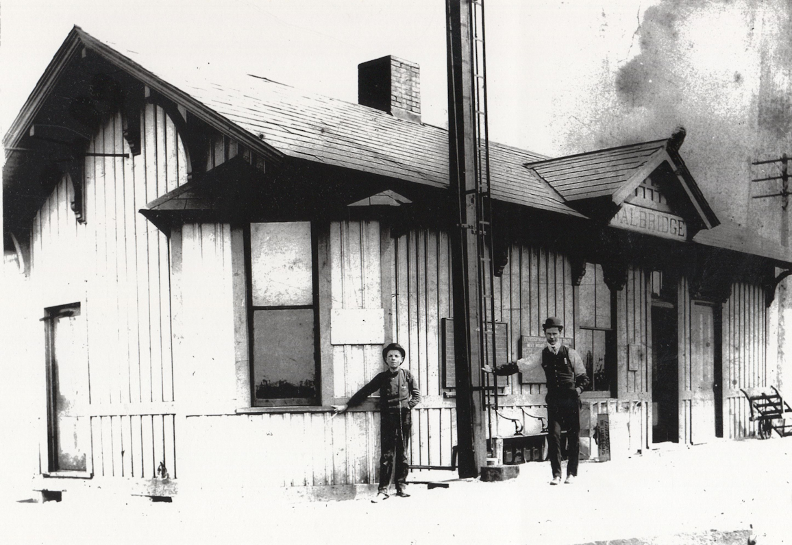
| Walbridge |
AND |
This station was built by the PRR or its predacessor the North Western Ohio RR, but it served both railroads. On the 1886 map it is shown located between both tracks. It was just north of Perry Street at about GPS: 41.589411,-83.496874. | ||||||
| 1898 WOOD COUNTY RAILROAD MAP | ||||||||
 |
||||||||
| Notes About Existing
Stations... Bowling Green (CH&D) - Station moved to park from Bowling Green. Its original location was on West Wooster St. Hatton (T&OC) - This station was moved from it's original location to Jerry City Rd. where it sat for years and fell into disrepair. It was dismantled in 2005 and reassembled in Findlay in 2006 at the NW Ohio Railroad Preservation grounds, 11600 County Rd. 99. It was moved again a short distance to its current location. See the NWORRP website for photos and details. Hatton was previously known as Millgrove Station. Lime City (T&OC) - Radio Station, heavily altered on all sides. Perrysburg (CH&D) - Station moved from original location at the corner of West 3rd Street and Louisiana Avenue in 1971. Now just the passenger end remains at the Carranor Hunt & Polo Club. Portage (T&OC) - Moved twice since original location on the south side of Main Street on the west side of the tracks (GPS: 41.326529,-83.645729). Prairie Depot (Wayne) (T&OC) - I believe this was the original Prairie Depot station that later served as a freight station. It was moved to Emerson Road in 1958 where it became part of a house and is now all but unrecognizable as a station. Stony Ridge (T&OC) - This station has been moved a couple times since its original location. It was moved to its current location sometime in the 1970s. Weston (CH&D) - This station's original location was SW of Main Street near where High Street used to continue on to the tracks. The station was on the NW side of the tracks (GPS: 41.344308,-83.79692). It was moved to the fairgrounds in 1969. |
||||||||