 COUNTY COUNTY
|
|
||||||||
| EXISTING STATIONS | ||||||||
|---|---|---|---|---|---|---|---|---|
| Station Name |
Original Railroad |
Current Location |
Type | Current Use |
Date Built |
Track Status |
Building Material |
More Info |
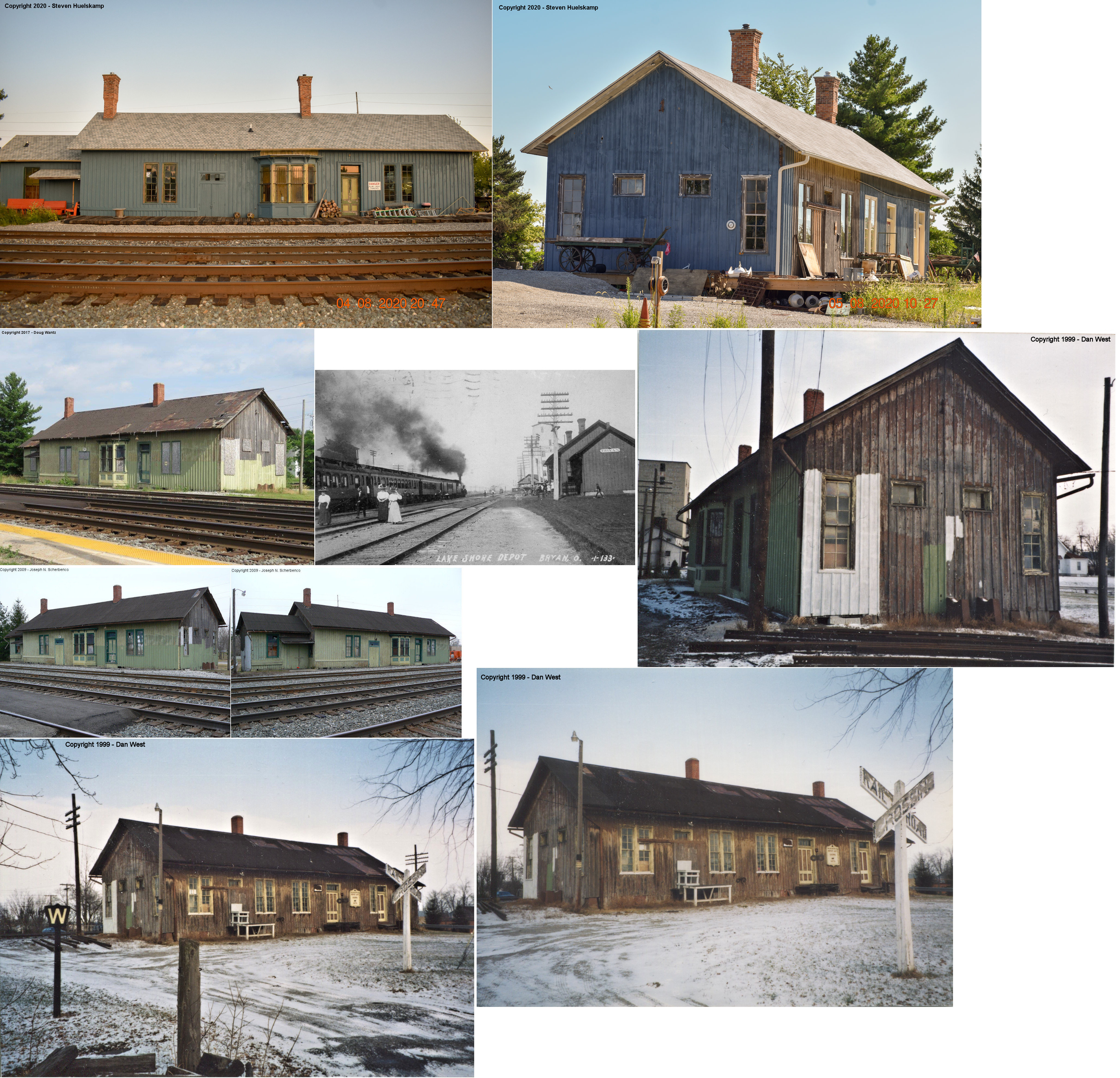
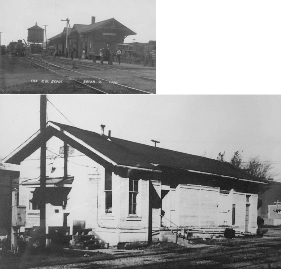
| Bryan |  |
North side of West Edgerton Street on the south side of the tracks. (GPS: 41.480085,-84.551546) |
P | Private | 1867 | In Use | Wood | |
| Bryan |  |
North side of West Edgerton Street on the south side of the tracks west
of the LS&MS station. (GPS: 41.479834,-84.553262) |
C | Railroad | ???? | In Use | Brick | |
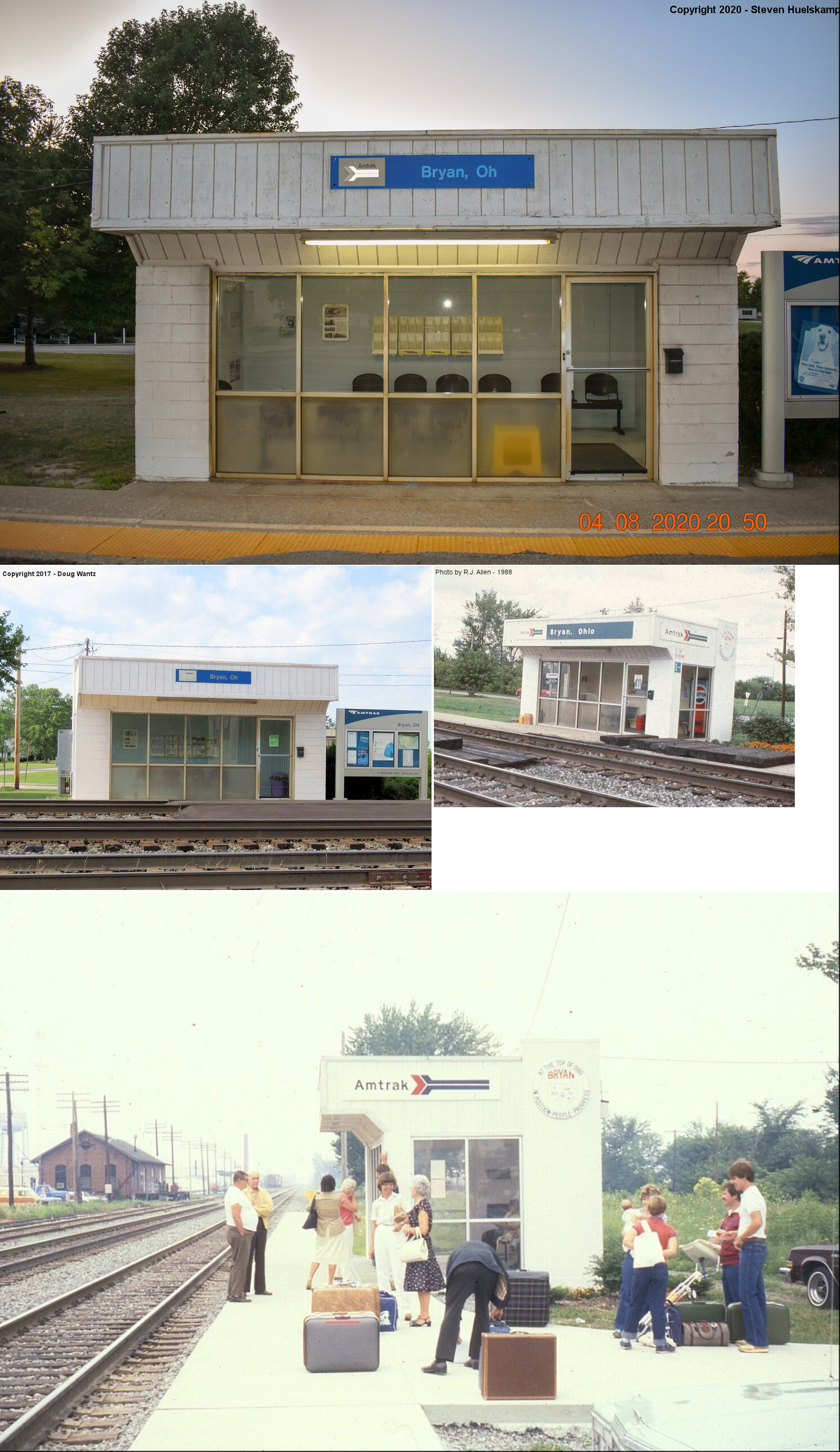
| Bryan |
 |
East end of Paige Street (GPS: 41.480307, -84.551882) |
P | Railroad | ???? | In Use | Metal | |
| Edon |  |
In Walz Park on North edge of town (GPS:41.562273,-84.772106) |
C | Civic | 1893 | None | Wood |
|
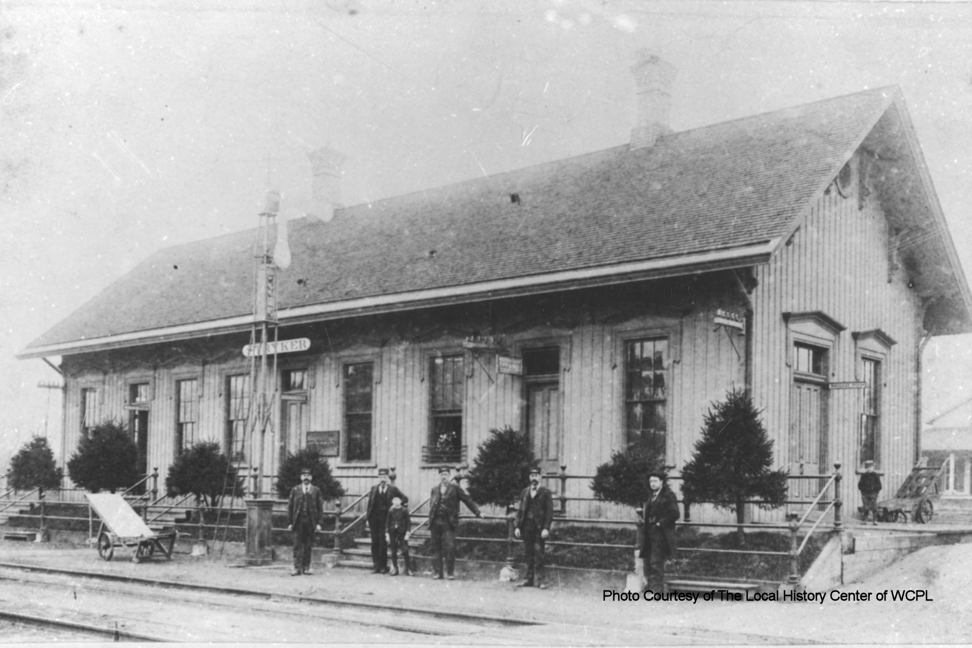
| Stryker | |
North Depot Street (GPS: 41.502808,-84.416789) |
C | Civic | 1901 | In Use | Stone |
|
| STATIONS OF THE PAST | ||||||||
| Station Name |
Original Railroad |
Notes | ||||||
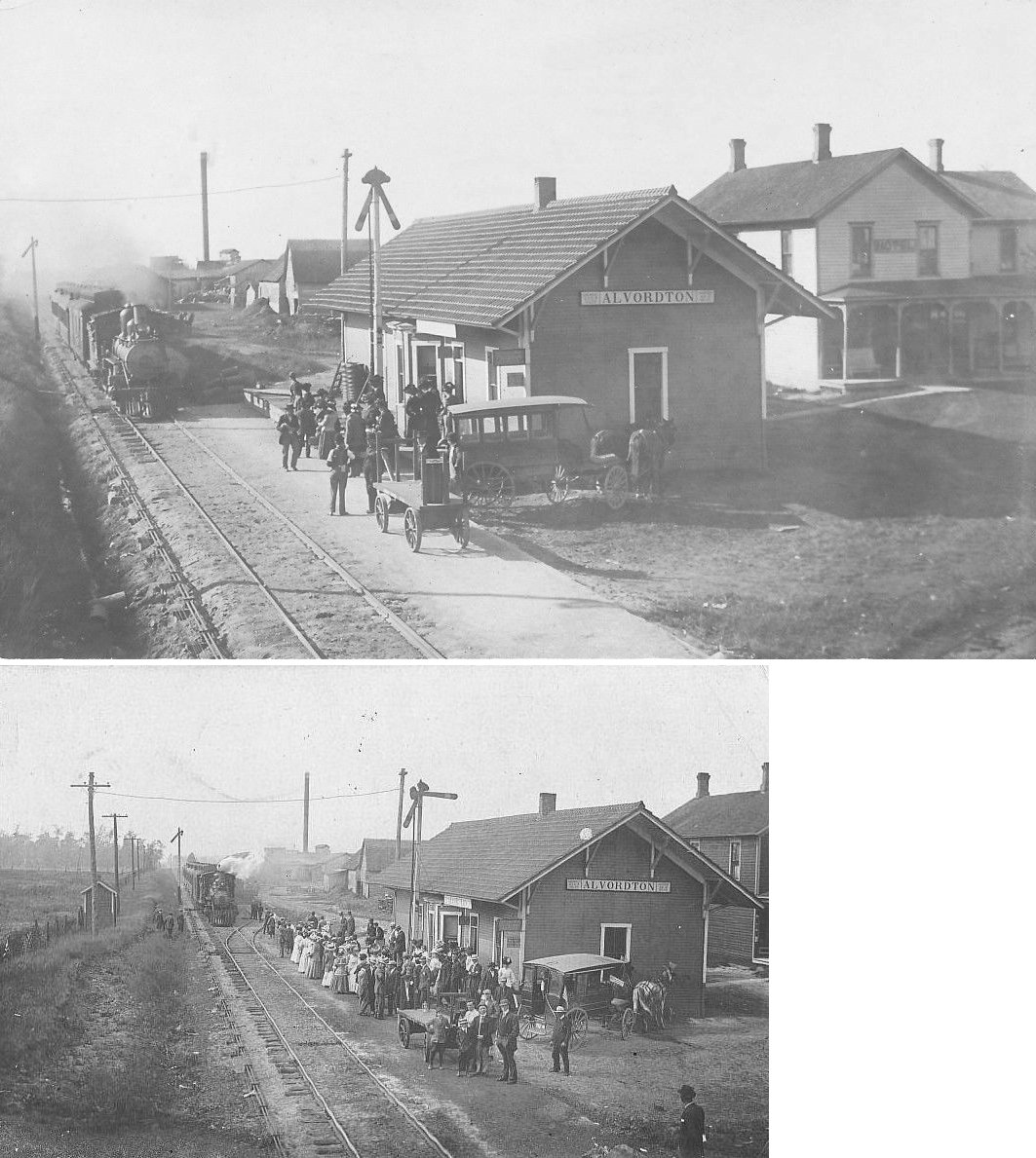
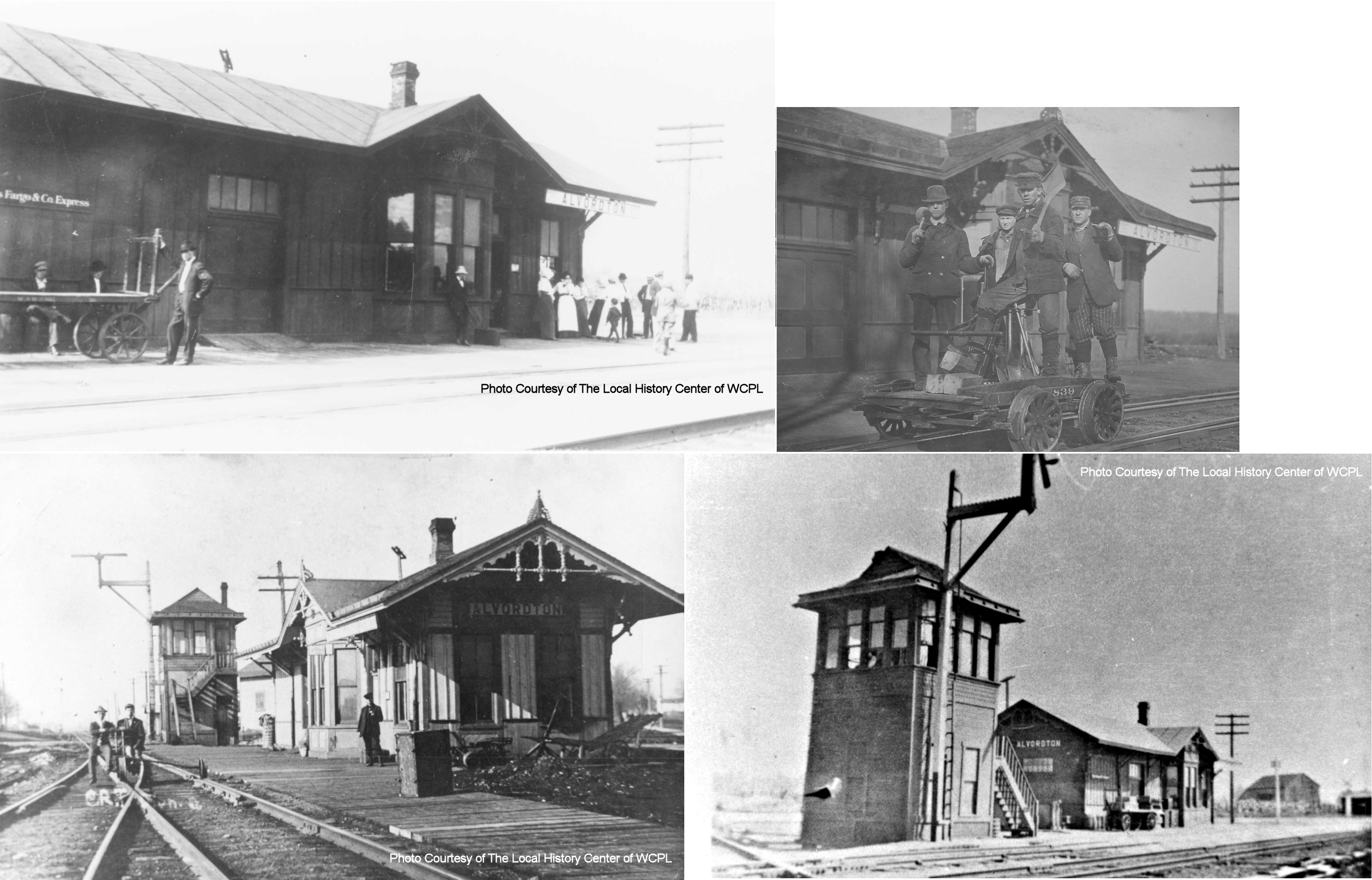
| Alvordton |
 |
This station was on the west side of the tracks east of Brice Avenue. It was in the SW quadrant of the diamond at the Wabash crossing (GPS: 41.665302,-84.428226). There was a freight house across the Wabash tracks on a transfer track that may have been shared by both RRs. According to NYC valuation records, this station was built here in 1914. | ||||||
| Alvordton | |
This station was on the south side of Main Street on the NW side of the tracks. It was in the NE quadrant of the diamond at the CN crossing (GPS: 41.665811,-84.427856). | ||||||
|
Blakeslee (Blakesly) |
|
This station was on the west side of Washington Street on the SE side of the tracks (GPS: 41.523576,-84.731026). | ||||||
| Bryan |
|
This combination station sat on the south side of East Wilson Street on the west side of the tracks (GPS: 41.470869,-84.542552). According to NYC valuation records, a combination station was built here in 1908. | ||||||
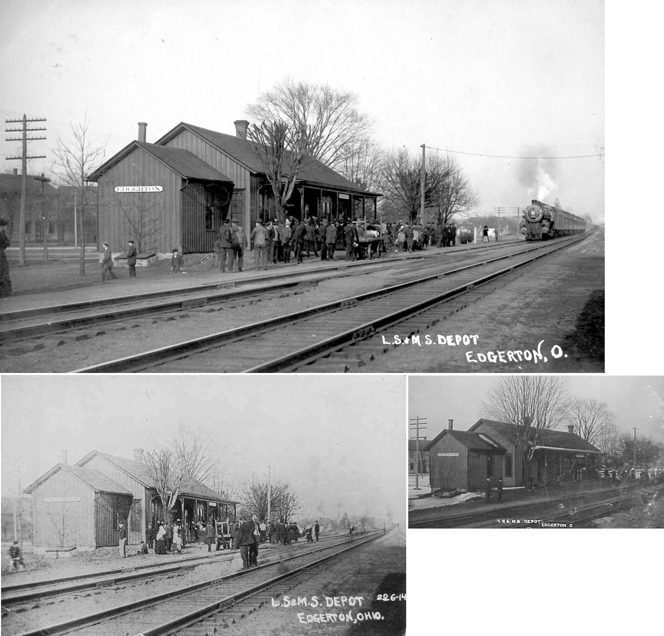
| Edgerton | |
The passenger station sat at the end of Oak Street just Past Indiana Street on the north side of the tracks (GPS: 41.448348,-84.745531). The freight station was on the south side of the tracks along Depot Street (GPS: 41.44793,-84.746073). The freight station may have served as the original passenger station (hence the freight station being on Depot Street) | ||||||
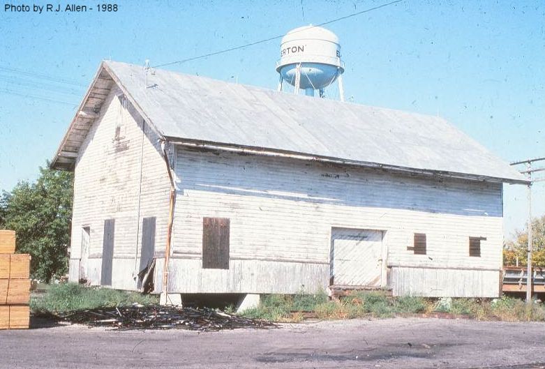
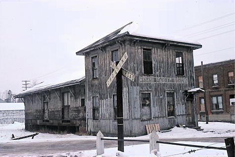
| Edgerton | |
This freight station was last reported as sitting behind city hall, but several visitors did not see it there so it is assumed demolished. | ||||||
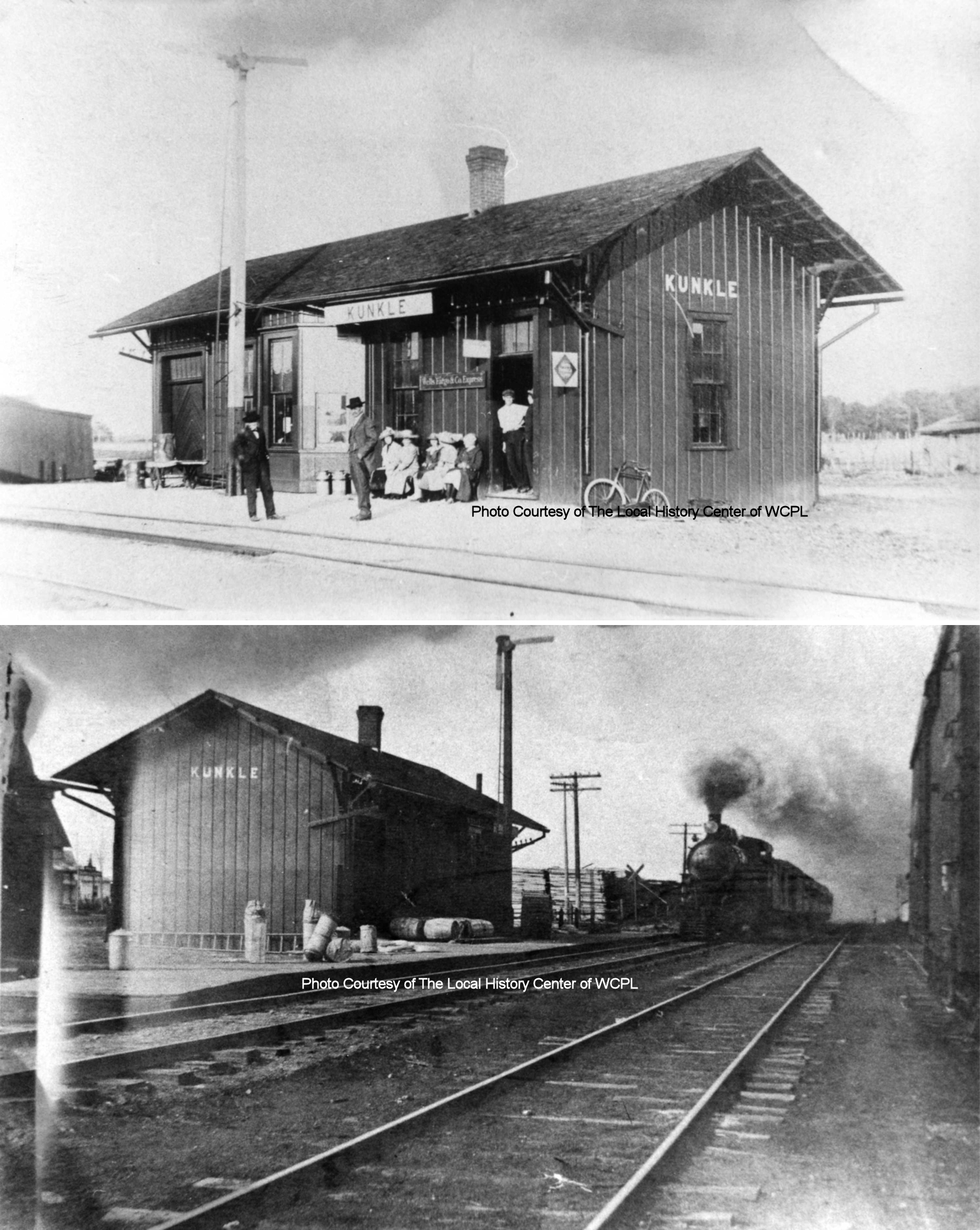
| Kunkle | |
This station was built in 1881 and was on the east side of Pleasant Street on the SE side of the tracks (GPS: 41.632842,-84.495276). | ||||||
| Melbern | |
|||||||
| Montpelier | |
The first station here was built in 1881 and was later moved a bit to the NW on a siding track and converted to a freight house when the new station (see below) was built. | ||||||
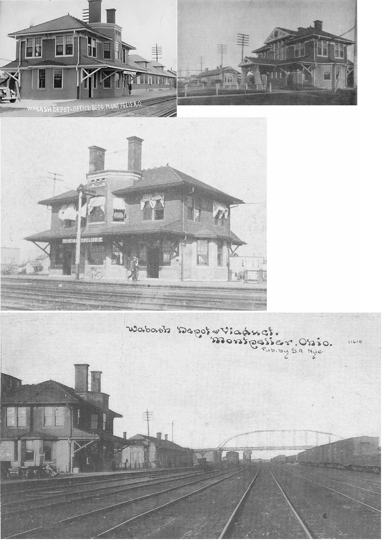
| Montpelier | |
Built in 1895 and torn down in 1981, this station was at the south end of Empire Street at the intersection with Depot Street (GPS: 41.579217,-84.609929). The freight house was directly to the east. Later, this original freight station housed a lunch room, baggage room and express office as another freight station was added to the west of the passenger station. The roundhouse was across the yard to the southeast. | ||||||
| Pulaski |
|
The station was north of Main Street on the SE side of the tracks (GPS: 41.510891,-84.505173). According to NYC valuation records, a shelter-type station was built here in 1890. | ||||||
| Stryker | |
The original LS&MS station here was at the same location as the current station. It burned in 1900. | ||||||
| Stryker | |
There was a freight and grain warehouse across the tracks from the passenger station on South Depot Street. | ||||||
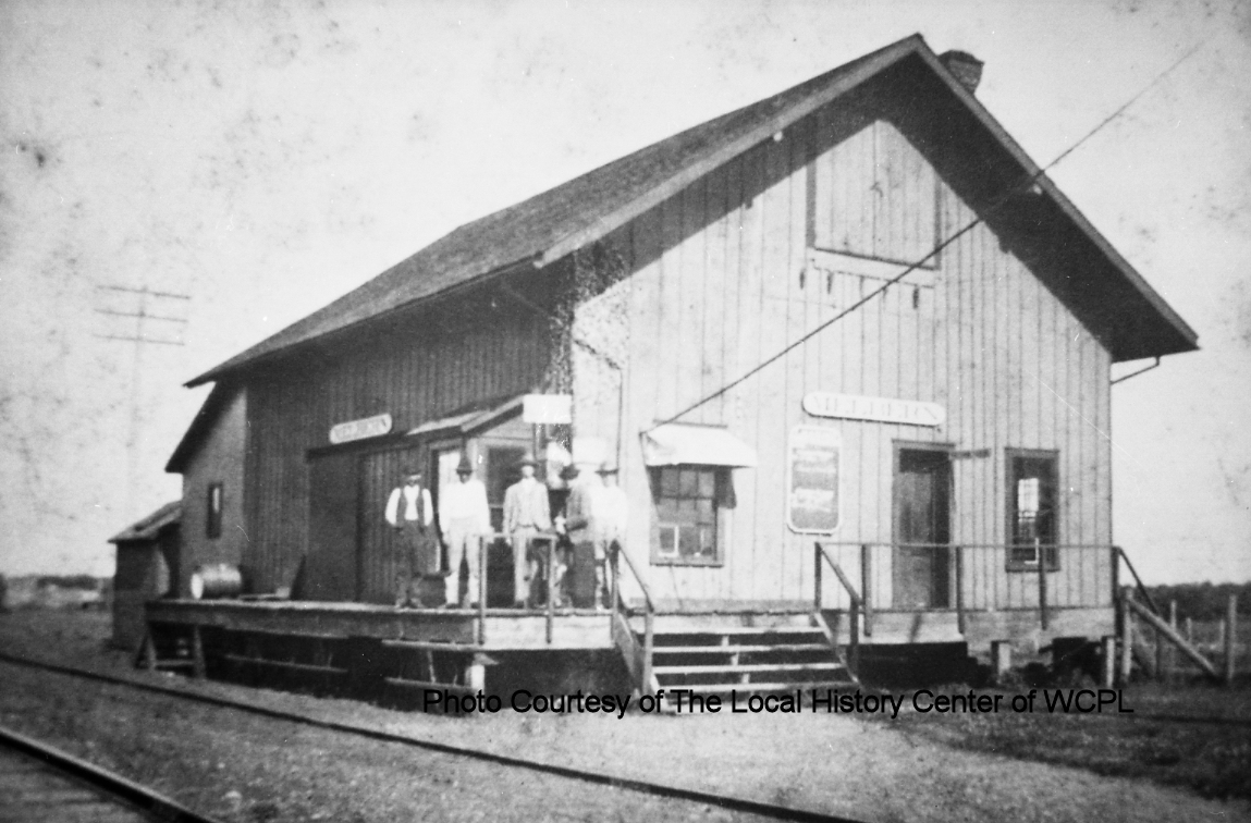
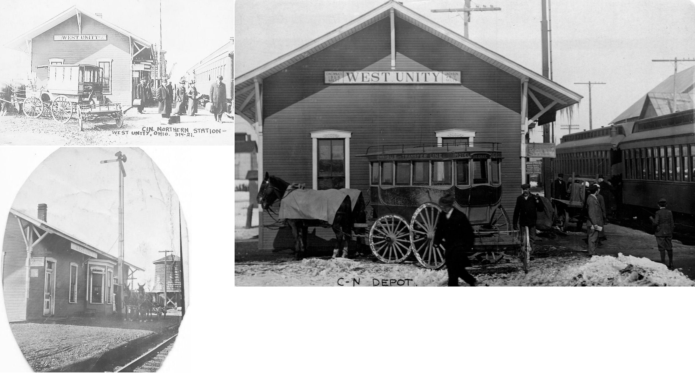
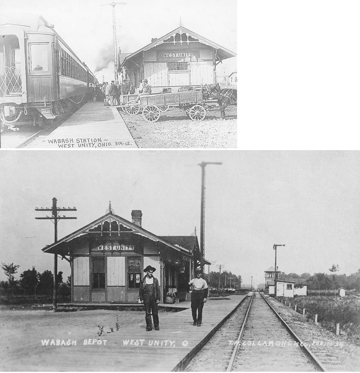
| West Unity |
|
This station was on the east side of North Liberty Street to the NE of West Unity Park. It was on the west side of the tracks (GPS: 41.592129,-84.429583). According to NYC valuation records, this station was built here in 1903. | ||||||
| West Unity | |
This station was on the east side of South Main Street (GPS: 41.583173,-84.433542). | ||||||
| 1898 WILLIAMS COUNTY RAILROAD MAP | ||||||||
 |
||||||||
| Notes About Existing
Stations... Edon (Wabash) - The original location of this station was on the east side of South Michigan Street on the north side of the tracks (GPS: 41.554341,-84.76885). Stryker (LS&MS) - Police Dept. On National Register of Historic Places. Replaced an earlier frame depot at the same location that burned in 1900. |
||||||||