 COUNTY COUNTY
|
|
||||||||
| EXISTING STATIONS | ||||||||
|---|---|---|---|---|---|---|---|---|
| Station Name |
Original Railroad |
Current Location |
Type | Current Use |
Date Built |
Track Status |
Building Material |
More Info |
| This county Has no Existing stations. if you know of one, please submit the information. |
||||||||
| STATIONS OF THE PAST | ||||||||
| Station Name |
Original Railroad |
Notes | ||||||
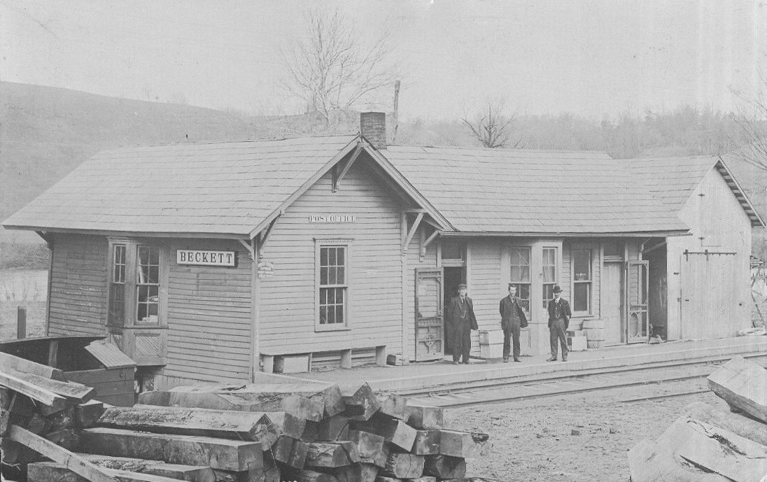
| Beckett |
 |
|||||||
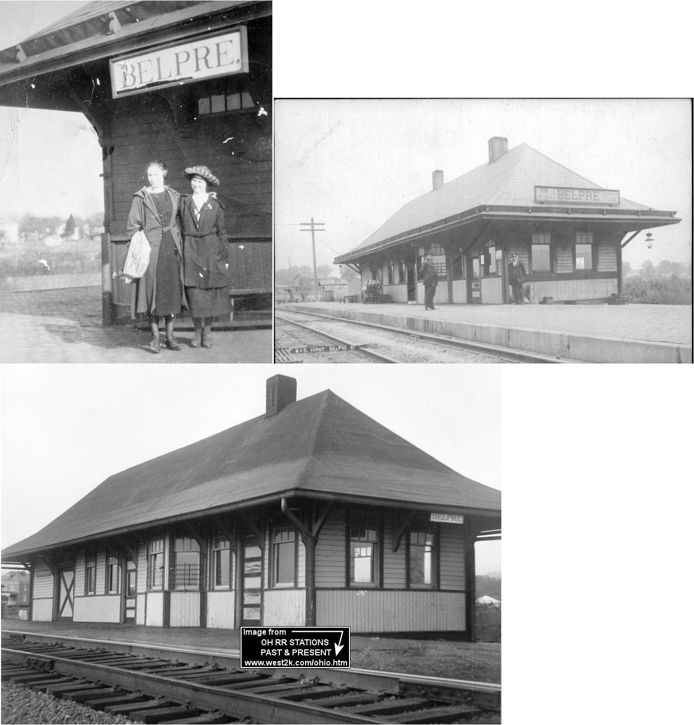
| Belpre |
 AND |
The first station here most likely served both the B&O and M&C (before the M&C became part of the B&O) as it sat between the tracks where the lines junction west of the end of Sixth Street (GPS: 39.278473,-81.575761). J.G. Ellewood was the M&C station agent in 1875. | ||||||
| Belpre |
|
This station was built in 1904 and demolished in 1965. | ||||||
| Caywood |
 |
Train tickets were probably sold here at the store/post office and the waiting area could have been the large log. A station is shown here on the 1923 PRR List of Stations & Sidings. "CW" tower was near the station and there was a passing siding here as well. | ||||||
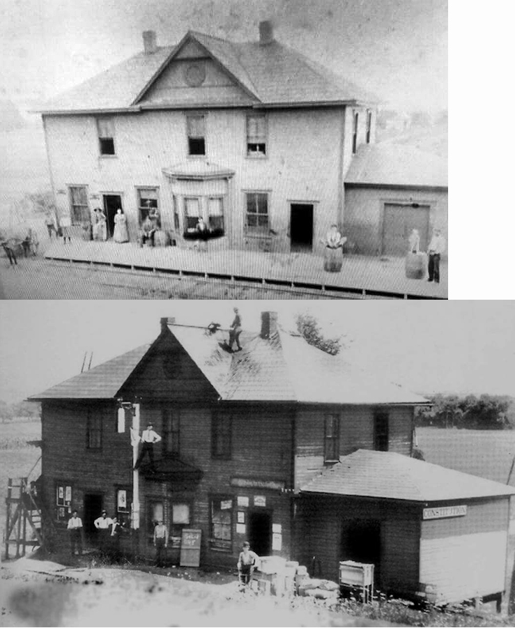
| Constitution |
|
This building housed a store, post office and the station. | ||||||
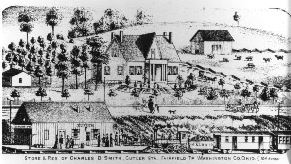
| Cutler |
|
The station was between Broadway and Main Streets on the north side of the tracks. It is unclear where this location is today as all the street names have changed and some are now gone. The drawing of the earliest station here. | ||||||
| Devol |
|
|||||||
| Dunbar |
|
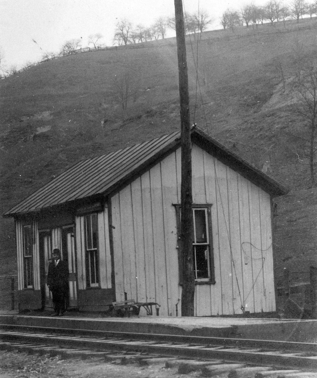
Originally called Little Hocking. This is a different
location from the Little Hocking listed below. It turns out there were two
Little Hockings in Washington County. Modern day Dunbar on the old line
was originally called Little Hocking. Little Hocking on the Short Line, the modern day Little Hocking, where
that river dumps into the Ohio River, was not one of the original
stations.
|
||||||
| Elba |
|
In 1875 the station was on the southern bank of Duck Creek on the north side of the tracks off what was then Front Street (now gone). There was a store on the north side of the creek so there may have been a bridge over the creek near the station as the actual street was on the other side of the creek. The station was located at approximately 39.606841,-81.415236. | ||||||
| Equity |
|
|||||||
| Fleming |
|
|||||||
| Gravel Bank (Riverview) |
|
|||||||
| Harmar (W. Marietta) |
|
This station was between Gilman Avenue and Crawford Street on the NW side of the tracks (GPS: 39.410957,-81.459042). There was an open freight she across the tracks. Shown on the 1884 and 1890 maps, this station was gone by 1900. | ||||||
| Harmar (W. Marietta) |
|
The Ohio & Little Kanawha (formerly Zanesville & Ohio River RR, and later B&O) passenger station was on Harmar Street between Market Street and Lord Street on the east side of the tracks at GPS: 39.410074, -81.462297. | ||||||
| Harmar (W. Marietta) |
|
The Ohio & Little Kanawha (formerly Zanesville & Ohio River RR, and later B&O) freight station was on the SW corner of Lord and Harmar Streets at GPS: 39.410422, -81.462391. This station is shown on the 1900 map, but on the 1907 map it is marked as "vacant," and by 1915 it was gone. | ||||||
| Harmar (W. Marietta) |
|
Sometime between 1900-1907, a new passenger station was built (or the old station was moved) at new location closer to Market Street so that the station was closer to the B&O/T&OC tracks as well. It was on the north side of Market Street at GPS: 39.409648, -81.462395. This was only 30-40 yards from where the previous station was located. | ||||||
| Kingsbury |
|
This station is shown on the 1881 C&M timetable between Elba and Warner. | ||||||
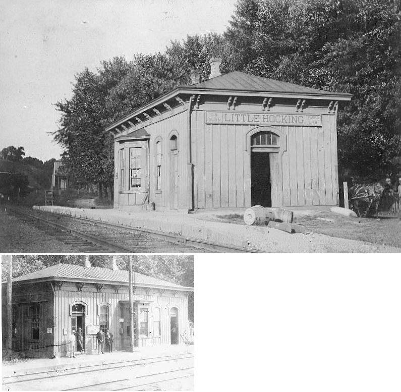
| Little
Hocking |
|
Likely built in 1874. | ||||||
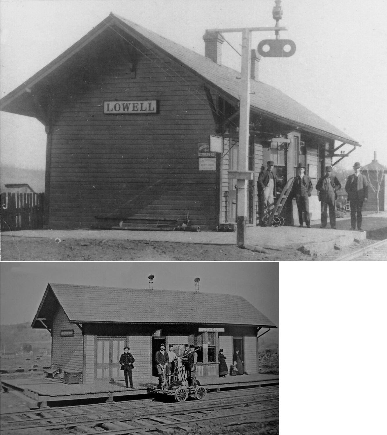
| Lowell |
|
|||||||
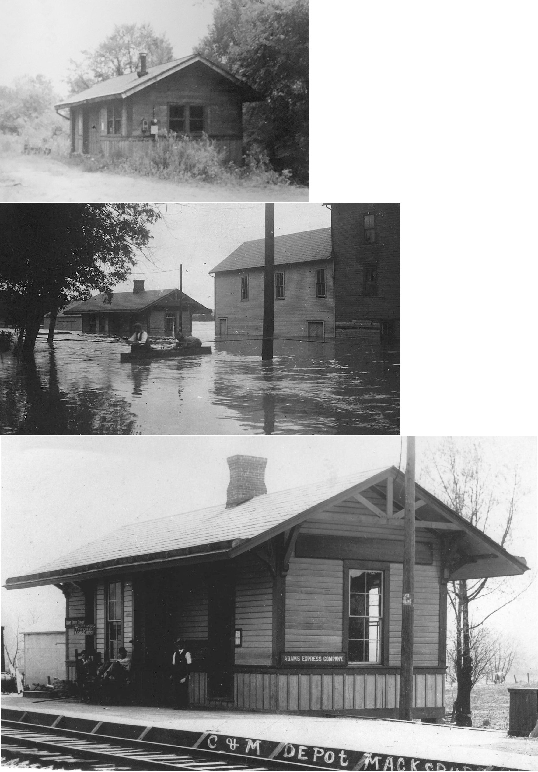
| Macksburg (Macksville) |
|
In 1875 the station was on the east side of Main Street on the north side of the tracks (GPS: 39.630622,-81.455367). W.E. Smithson was the station agent in 1875. A station is shown here on the 1923 PRR List of Stations & Sidings. | ||||||
| Marietta |
|
The original Marietta & Pittsburgh RR (later the C&M) station was at the intersection of Greene and 7th Street (GPS: 39.415346,-81.444075). L. Morton was the RR agent here in 1875. | ||||||
| Marietta |
|
The second generation station here was on the SW corner of 2nd and Butler Streets at GPS: 39.413400, -81.453082. This station was gone by 1946. | ||||||
| Marietta |
|
The freight station was on 2nd Street just NW of Butler Street at GPS: 39.413693, -81.453357. | ||||||
| Marietta |
|
The original passenger station here was on the east corner of Front and Butler Streets at GPS: 39.412552, -81.453756. This appears to have been a regular two-story business row type building with a platform that ran along the NE side of Butler street. Thus, it may not have been built by the railroad, but rather may have been converted from a previous use. | ||||||
| Marietta |
|
The frieght station was just to the east of the original passenger station in the same block at GPS: 39.412833, -81.452850. It was two stories. | ||||||
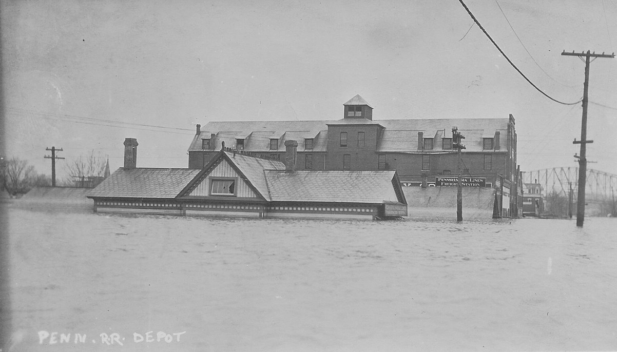
| Marietta |
 |
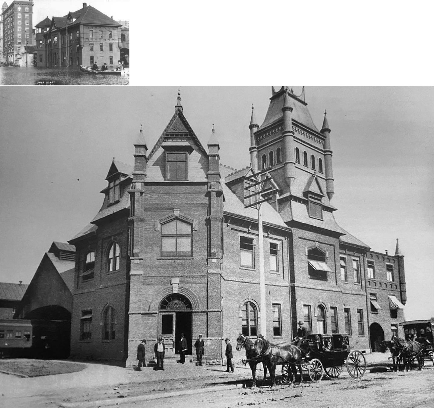
Built in 1890, this union station was located on the NE side of Second Street about 300 feet SE of Putnam Street at GPS: 39.414736, -81.453699. Also see this later photo taken during a flood. The station appearance was dramatically changed over the years, mostly due to a December 3, 1910 fire (Pittsburgh Post Gazette, 12-4-1910) that gutted the fourth floor and necessitated its removal. The train shed was removed in 1932 and the rest of station was demolished in 1944. It was used by the B&O, T&OC Extension RR, and Ohio & Little Kanawha. The station was also known as "Pillsbury's Grand Union Hotel" as the upper floors had rooms and dining facilities. | ||||||
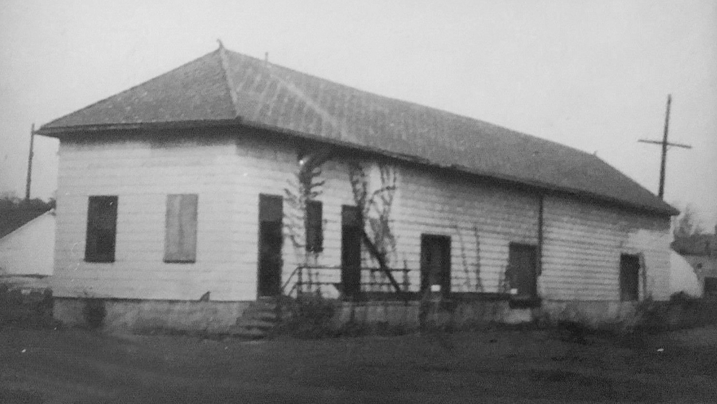
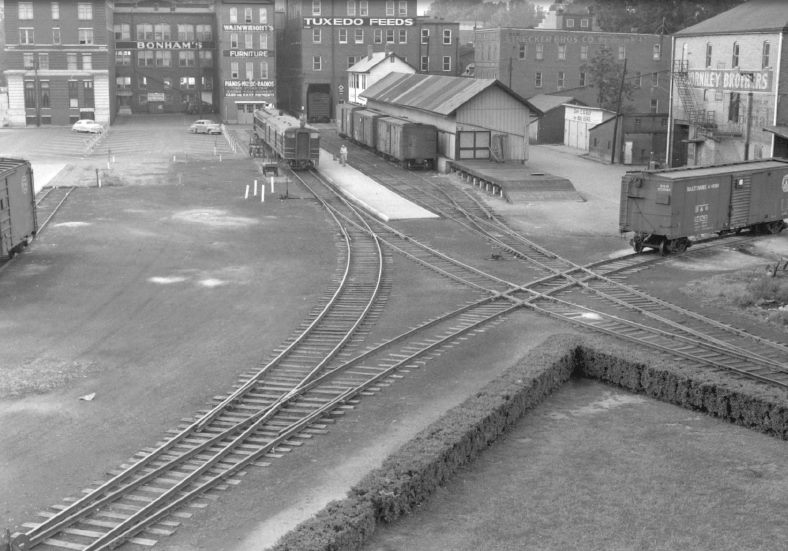
| Marietta |
|
The B&O frieght station was behind Union Station at GPS: 39.415007, -81.453286. In the photo, Union Station would have been just out of the shot to the left. It was likely built at the same time as the new Union Station as it first appears on maps in 1890. | ||||||
| McClure's Station |
|
This early station was just north of where Briggs is today in Dunham Township along Township Road 1305 at approximately GPS: 39.327468,-81.561846. It is shown on the 1875 county map. | ||||||
| Porterfield |
|
|||||||
| Qualey |
|
|||||||
| Rainbow |
|
|||||||
| Relief |
|
|||||||
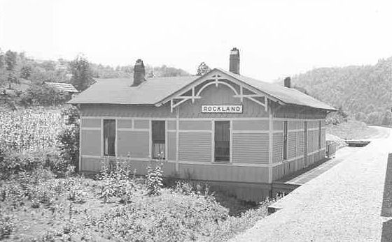
| Rockland |
|
|||||||
| Scotts landing |
|
|||||||
| Stanleyville |
|
A station is shown here on the 1923 PRR List of Stations & Sidings. | ||||||
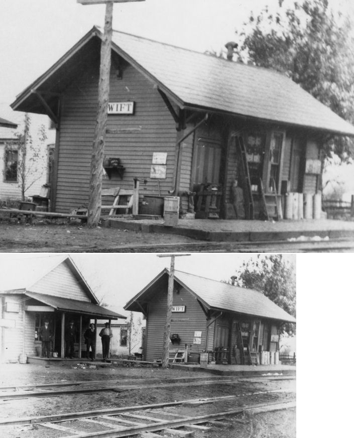
| Swift |  |
This station may have been built by predecessor line Zanesville & Ohio River (later B&O). | ||||||
| Tunnel Station |
|
|||||||
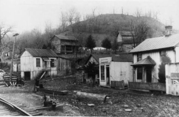
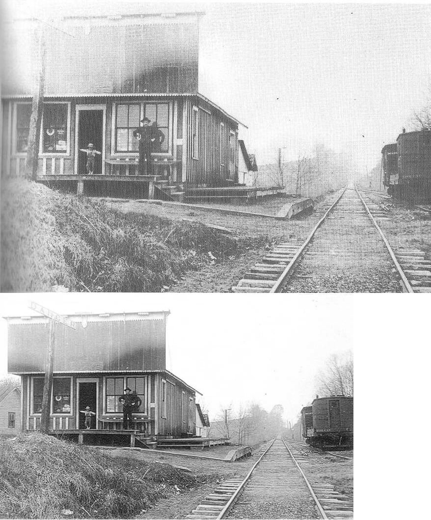
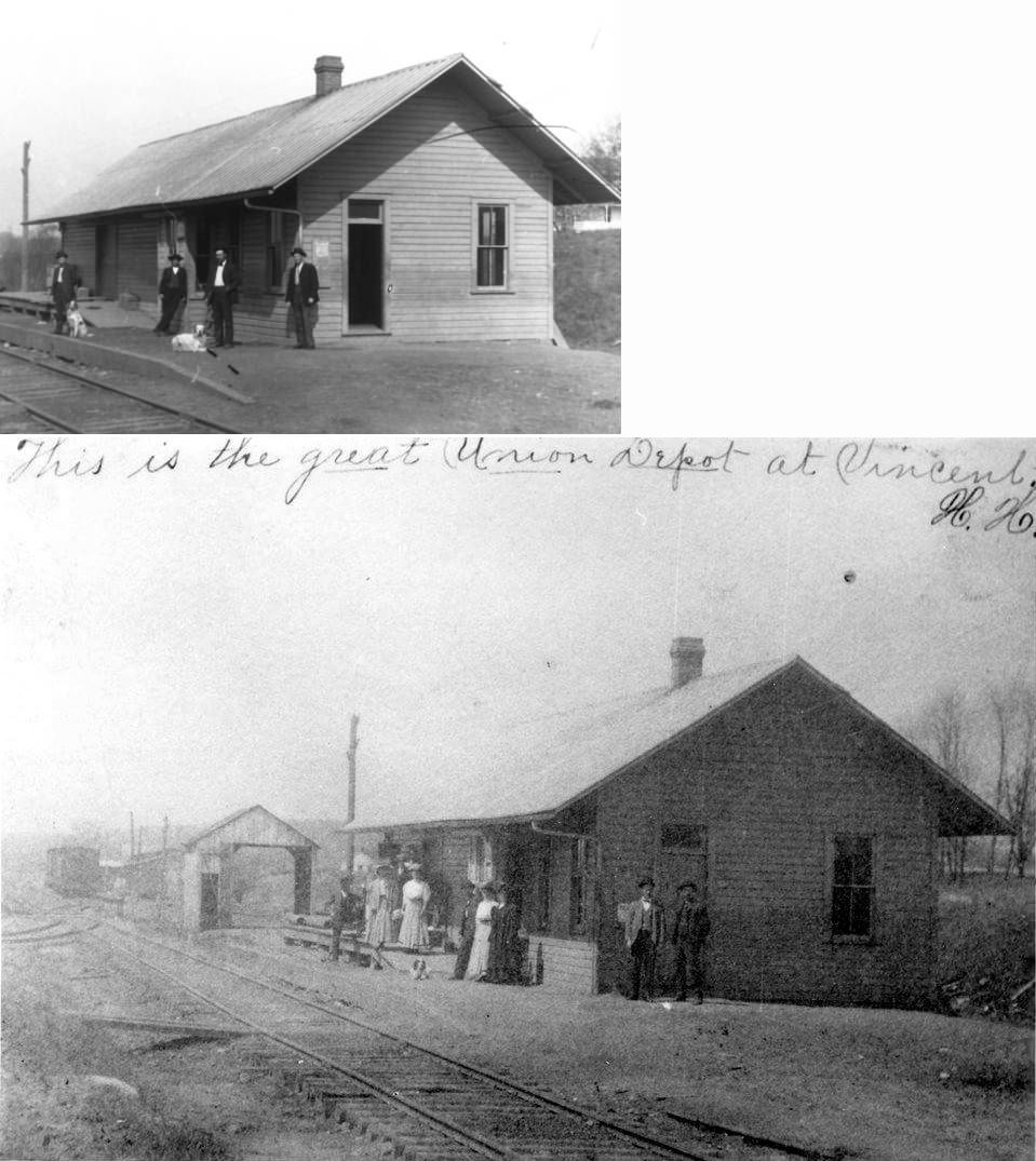
| Vincent |
|
The first station here was on the east side of Chruch Street on the north side of the tracks (GPS: 39.374943,-81.668206). On the 1875 map the building is denoted as a store/post office/depot so it may have been a pre-existing building. The one pictured is probably the second station built by the railroad. Some have said this station still stands along the old grade east of the Dunbar Piers, but I haven't gotten confirmation of that with a specific location or photo. | ||||||
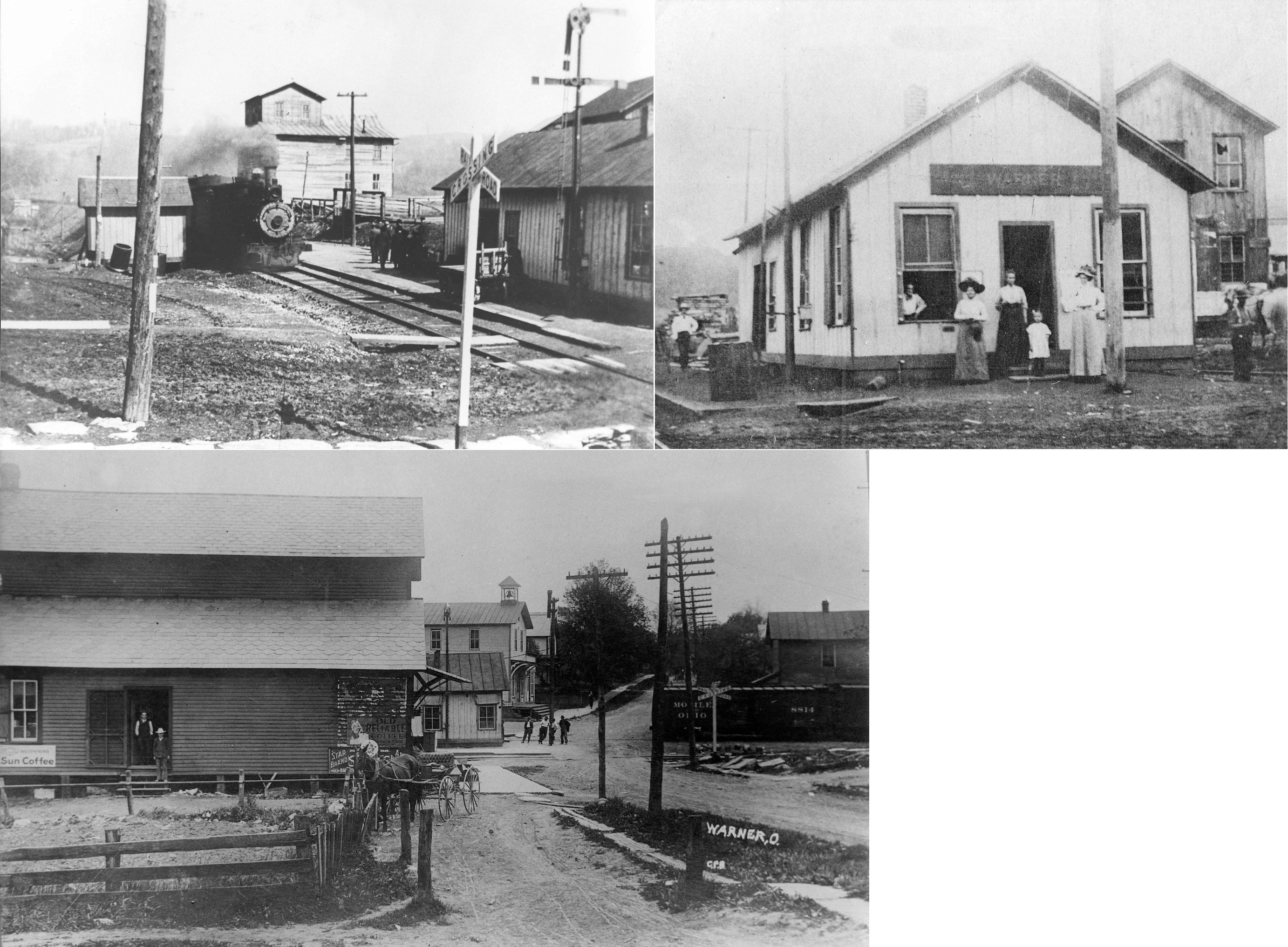
| Warner |
|
The station was on the north side of Main Street on the east side of the tracks (GPS: 39.562493,-81.417966). A station is shown here on the 1923 PRR List of Stations & Sidings. | ||||||
| Waterford (Beverly) |
|
The original Ohio & Little Kanawha (later B&O) passenger and freight stations were on Main Street south of the tracks near the viaduct. There was also a water tower to the east of the freight station. | ||||||
| Wesley |
|
This station is shown on the 1881 C&M timetable between Caywood and Marietta. | ||||||
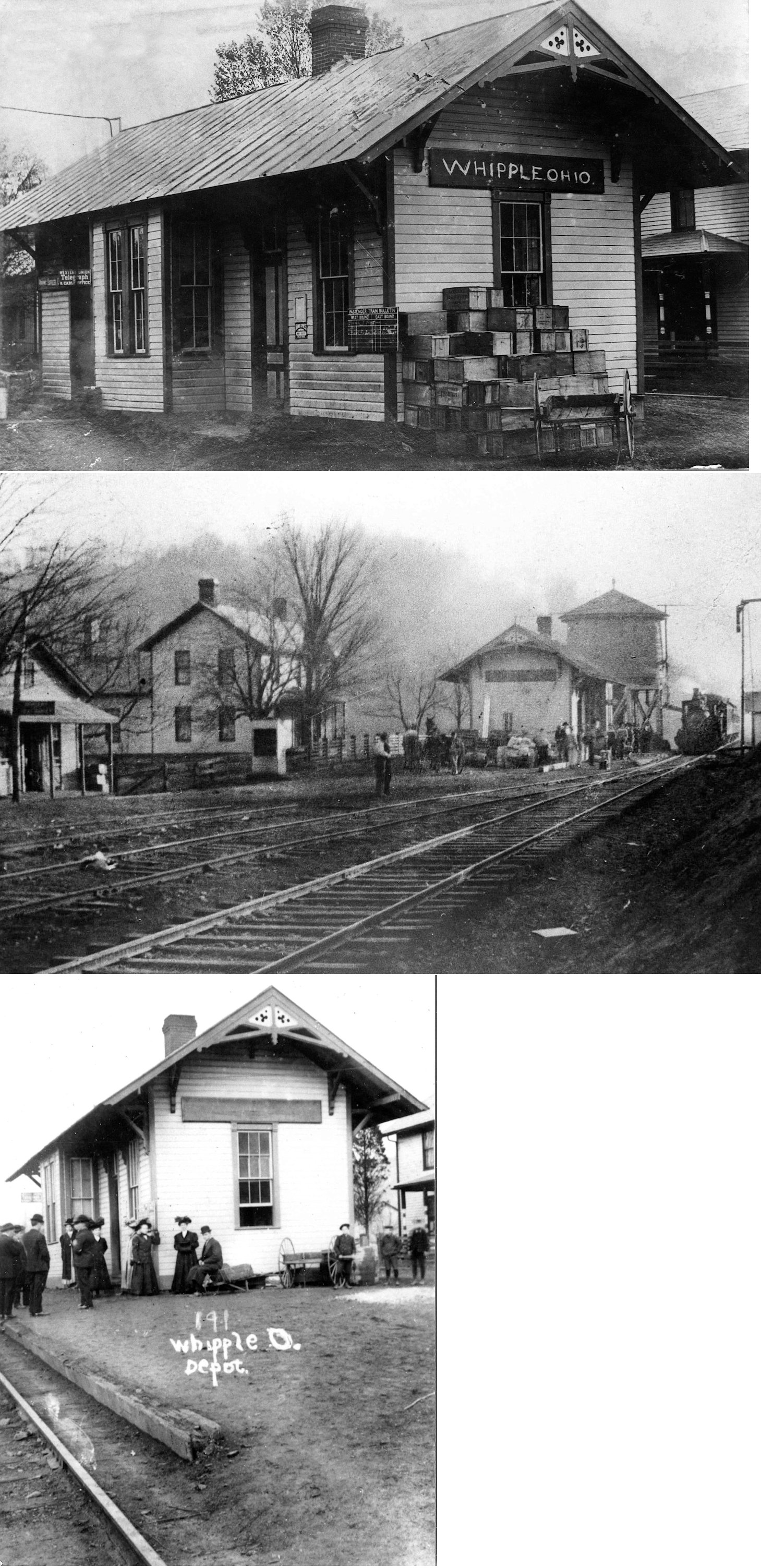
| Whipple |
|
Joseph Palmer was the station agent here in 1875. A station is shown here on the 1923 PRR List of Stations & Sidings. | ||||||
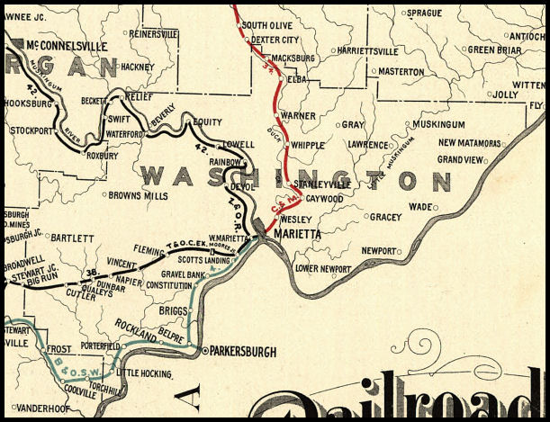
| 1898 WASHINGTON COUNTY RAILROAD MAP | ||||||||
 |
||||||||