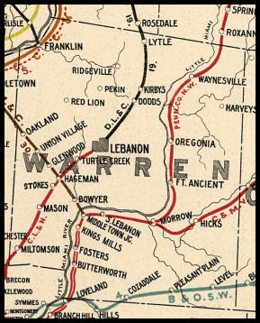
 COUNTY COUNTY
|
|
||||||||
| EXISTING STATIONS | ||||||||
|---|---|---|---|---|---|---|---|---|
| Station Name |
Original Railroad |
Current Location |
Type | Current Use |
Date Built |
Track Status |
Building Material |
More Info |
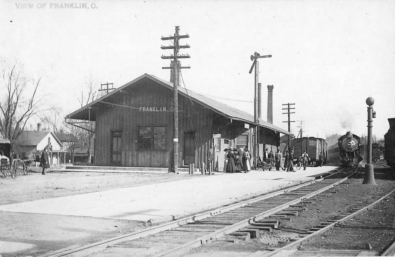
| Franklin |
 AND  |
SE Corner of Main
and 6th Streets (GPS: 39.557332,-84.305563) |
P | Civic | 1902 | In Use | Wood |
|
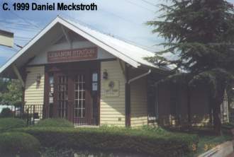
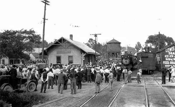
| Lebanon |  |
Broadway & Mechanic | P | Railroad | 1976 | In Use | Wood |
|
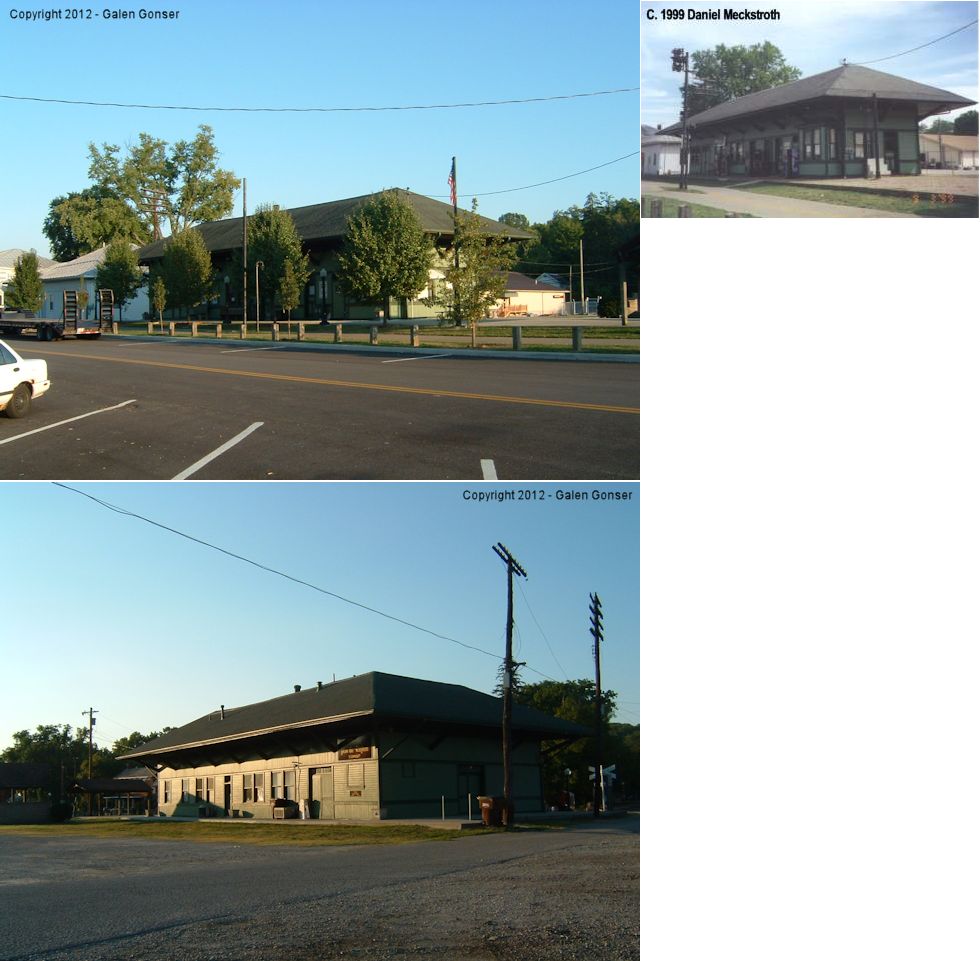
| Morrow |
 AND  |
SW corner of Main and Park Streets (GPS: 39.354435,-84.133301) |
C | Business | Pre 1895 |
None | Wood |
|
| Waynesville |
 |
SE side of U.S. 42 across from Mill Street (GPS: 39.530989, -84.082254) |
C | Business | ???? | None | Brick | |
| STATIONS OF THE PAST | ||||||||
| Station Name |
Original Railroad |
Notes | ||||||
| Butterworth |
 |
The privately-built station was located at the bottom of the pasture of
what was the Butterworth Stone House off Butterworth Road. The location is
mile mark 38.6 out of Xenia on what is now the LM State Park Trail. It
was just downstream from the Butterworth Girl Scout Camp, Maineville. Tim
Butterworth writes: "My ancestors gave the land for the track and the
station. Henry Thomas Butterworth owned the land, donated the ROW, and
provided the water for the water and flag stop. He was hired by the LMRR
to engineer the tracks for some sections, and to supervise the
construction. His wife Nancy was paid to feed the 40 workers who did the
work. Both H.T. and Nancy got passes to ride free on the railroad for
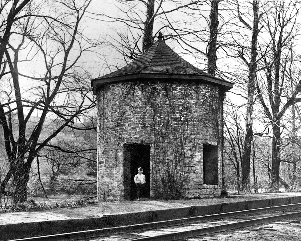
their lifetimes plus two days." This was an odd combination of water tower and station. It was first built as a water tower, but then passengers started waiting in the bottom of it for the trains to come. According to Traditional Architecture, Warren County, Ohio By Hazel Spencer Phillips: "The water-tower was used by the Little Miami Railroad as it crept up the valley in 1841. It became the waiting room for the many descendants of Benjamin Butterworth whose pass over the Little Miami Railroad provided for his life-time [travel]..." Note that although Phillips' book mentions Bejamin Butterworth, he died in 1833, so only his decendents, specifically Henry Thomas Butterworth, enjoyed the free passes. It was Henry Thomas who donated the land and the water tower for RR use. The station appears listed in the Little Miami Annual Report for 1859 as having provided the RR with 99 passengers that year. |
||||||
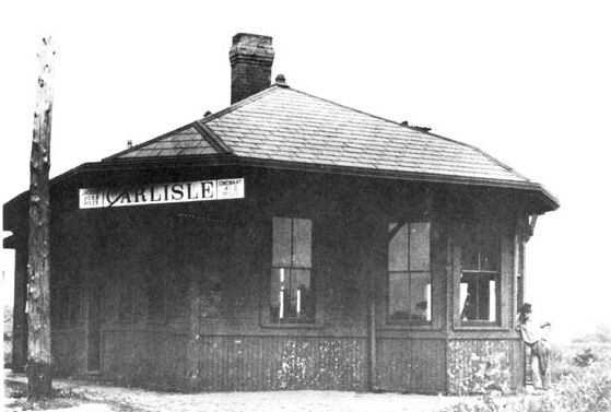
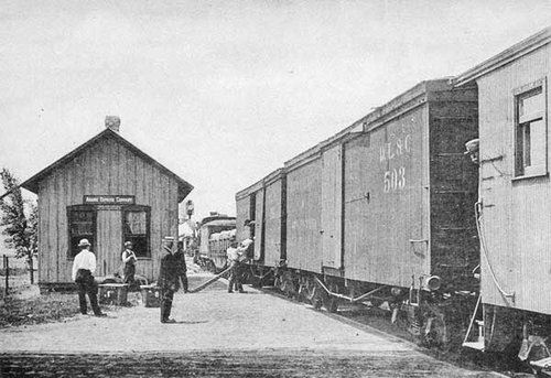
| Carlisle |
AND  |
Station was built by the CH&D, but used by both RRs. According to NYC valuation records, a combination station was built here in 1899. | ||||||
| Claysville Junction |
AND  |
This junction was south of Roxanna (formerly Claysville in Greene Co.). There was a station here where the PCC&St.L junctioned with the Cincinnati, Columbus & Hocking Valley Railway. This was near the SW corner of Spring Valley Lake. The PCC&St.L abandoned its station here in 1887 when the CC&HV was slated to be rerouted. The CC&HV was subsequently purchased by the Ohio Southern RR (DT&I). | ||||||
| Corwin (Waynesville) |
|
The passenger station was on east side of Corwin Avenue the north side of the tracks (GPS: 39.525296,-84.078273) while the freight station was on the west side of Corwin Avenue. | ||||||
| Cozaddale |  |
The station pictured was most likely the second or third station here and was on the SE side of the tracks on the NE side of Cozaddale Road (CR-174). The first station was a combination depot/store and was on the NW side of the tracks (as shown on the 1875 map). | ||||||
| Cozaddale | |
This was identified as the Cozaddale station in 1914, although it seems like it is older. Perhaps it was an older station. Can anyone confirm? | ||||||
| Deerfield (S. Lebanon) |
|
|||||||
| Fort Ancient |
|
This hotel also served as the station. | ||||||
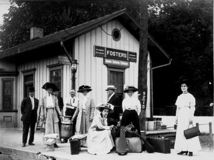
| Fosters |
|
The station was on the north side of Old 3C Highway (CR-10 at Maineville Road) on the east side of the tracks (GPS: 39.322119,-84.251337). | ||||||
| Franklin |  |
This is the original combination Big 4 station that sat on the NE side of 4th Street (GPS: 39.559557,-84.302377). It served passenger traffic until the Carlisle Cutoff went into operation in 1911. After that it was used solely as a freight station. | ||||||
| Franklin |
 |
This station was on the corner of Park Avenue and Cedar Street (GPS:39.566124,-84.313073). | ||||||
| Franklin |
|
According to NYC valuation records, a new freight station was built here in 1890. The record notes say that there was a carbody here in 1917. Not sure if that meant in addition to the freight station or as a replacement for it. | ||||||
| Freeport |
|
|||||||
| Hageman |  |
|||||||
| Hammel (Senior) |
|
|||||||
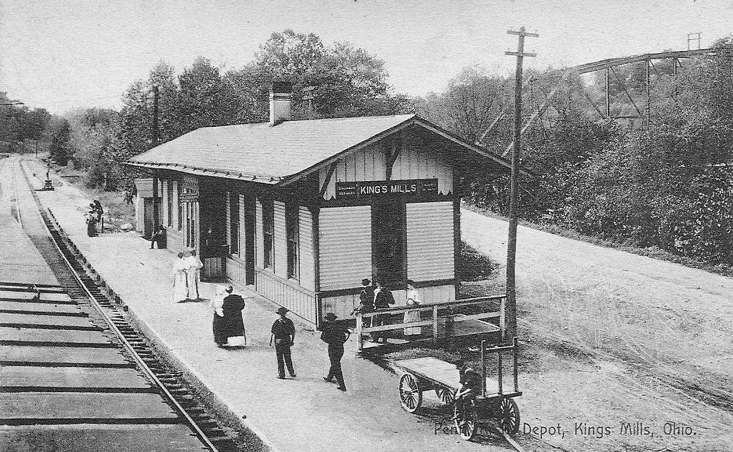
| Kings Mills |
|
The first passenger station here and a freight station were burned down as the result of a huge gunpowder explosion on July 15, 1890. According to the Newark Daily Advocate from July 16, 1890, "Ten or more persons killed, and over thirty seriously injured. Two empty freight cars were being switched onto a side track where a car containing 500 kegs of gunpowder was standing. As the cars struck there was an explosion, and immediately afterward another car containing 800 kegs of gunpowder exploded. WILLIAM FRAULEY, a brakeman in the employ of the Little Miami, was blown to atoms. Five other persons, supposed to be employes of the powder company, were killed." | ||||||
| Kings Mills | |
This station was located along the tracks off Grandin Road. (GPS: 39.351444,-84.241903) | ||||||
| Lebanon | |
Original passenger station was located on the southeast corner of the intersection of South Broadway and East South Streets. | ||||||
| Level (Windsor) |
|
This was an early station. It is shown as a depot/store on the 1875 county map. It was on the NE side of Morrow-Woodville Road on the south side of the tracks (GPS: 39.28483,-84.05005). On later timetables it is listed as Windsor. | ||||||
| Lytle |
 |
|||||||
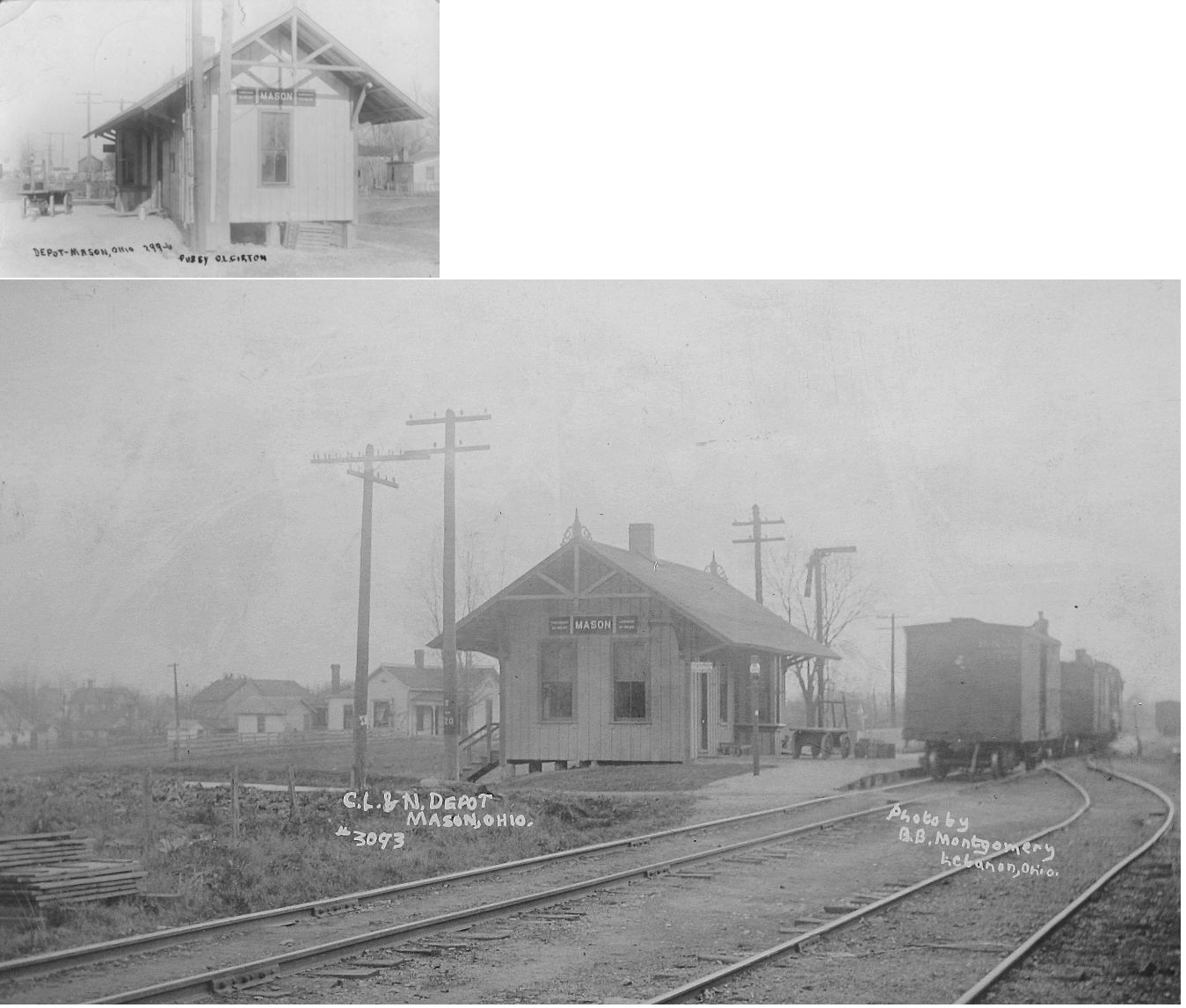
| Mason | |
This station was on the south side of Western Avenue (Dr. Tom Fox Way) on the SE side of the tracks (GPS: 39.359151,-84.316083). | ||||||
| Middletown | |
|||||||
| Middletown Junction | |
|||||||
| Miltomson | |
|||||||
| NEw Columbia (Pleasant Plain) |
|
|||||||
| Oakland | |
|||||||
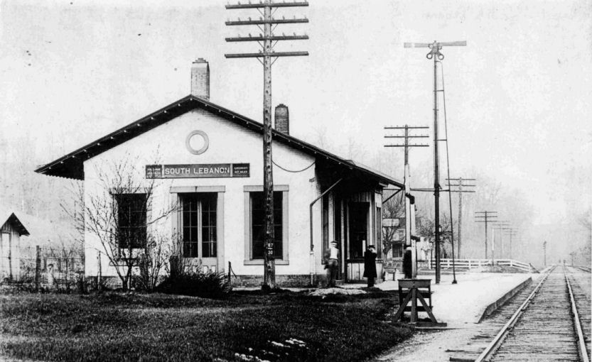
| South
Lebanon (Deerfield) |
|
This station was located on the west side of what was formerly called Depot Street (now Milam Drive). The station was on the south side of the tracks along what is now Zoar Road. In the early days, there was a freight depot on the north side of the tracks as well. The station was originally at Deerfield, but was moved in 1859 to the new South Lebanon location. | ||||||
| Stokes | |
|||||||
| Union Village | |
|||||||
| 1898 WARREN COUNTY RAILROAD MAP | ||||||||
 |
||||||||
| Notes About Existing
Stations... Franklin (CN & CCC&St.L) - Originally just a CN station, this building also served the Big 4 after the Carlisle Cutoff went into operation in 1911. This was the second CN passenger station at this location. According to NYC valuation records, it was built in 1902. The first station, built by the CJ&M, was across the tracks with frontage on Main Street (old name Center Street). Lebanon (Replica) - Replica of the CL&N depot. The Lebanon, Mason, and Monroe scenic railway ceased operations in Lebanon at the close of business December 21, 2008. Two bridges between Lebanon and Hageman on the former Cincinnati, Lebanon, & Northern (later PRR) line no longer passed engineering inspections. LM&M plan to continue operating excursions but will not be operating in Lebanon. The Lebanon Garden Club owns the replica station and plan to continue operation as a tourist stop/recreation area. As of 2009, the two bridges have been repaired and the LM&M is back in operation. Morrow (C&MV and PCC&St.L) - What was once a busy railroad town and station, Morrow is now known as a refreshment stop on the bicycle/hiking/walking/horse riding path on the Greater Miami Bicycle trail. Just south of the station is where the PRR branch to Lancaster (former C&MV)left the Columbus to Cincinnati main of the PRR (former PCC&St.L). Thus the station served both lines as the Lancaster branch ran along the east side of the station while the Columbus-Cincinnati main ran along the west side of it. A lonely signal still looks over the former right of way. In the early years (1895) there was a roundhouse across the tracks to the southeast. |
||||||||