 COUNTY COUNTY
|
|
||||||||
| EXISTING STATIONS | ||||||||
|---|---|---|---|---|---|---|---|---|
| Station Name |
Original Railroad |
Current Location |
Type | Current Use |
Date Built |
Track Status |
Building Material |
More Info |
| This county Has no Existing stations. if you know of one, please submit the information. |
||||||||
| STATIONS OF THE PAST | ||||||||
| Station Name |
Original Railroad |
Notes | ||||||
| Abanka Station |
 |
There was a wreck here in August 1883 when the RR was known as the Toledo, Cincinnati and St. Louis RR. The accident claimed the life of the engineer after he was scalded in the derailment. | ||||||
| Cavett |
 |
According to CN valuation records, this station was built here in 1890. | ||||||
| Converse |
 |
There was a passenger waiting shed here according to Erie valuation records of 1919. | ||||||
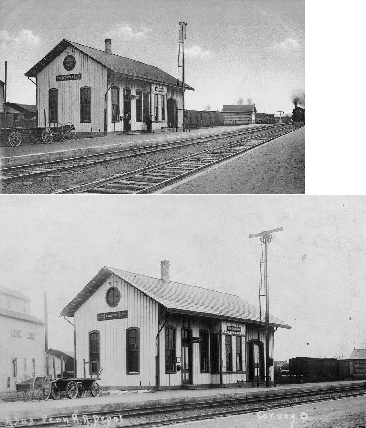
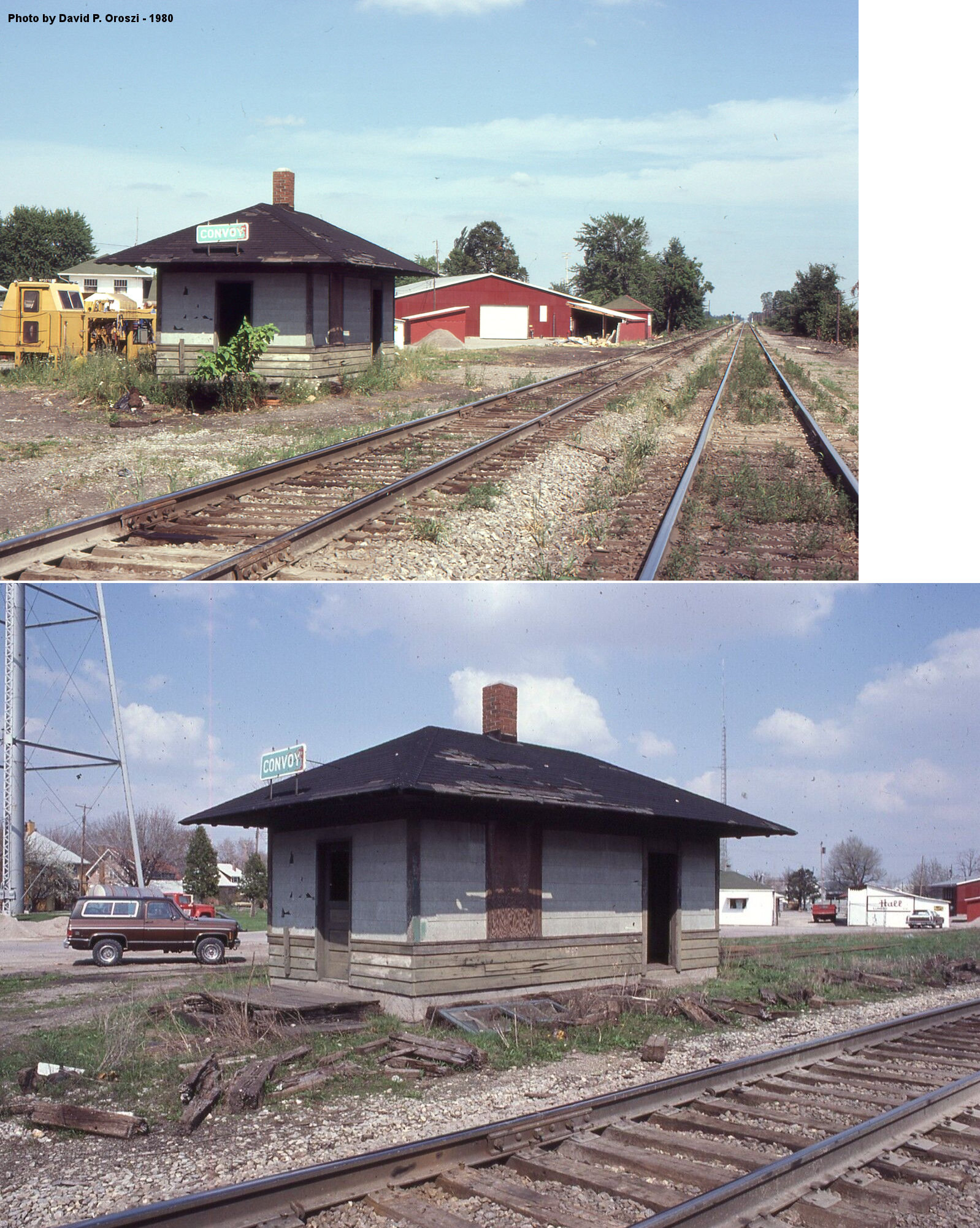
| Convoy |
 |
The original station. | ||||||
| Convoy |
 |
A newer second- or third-generation station. | ||||||
| Dixon |
|
|||||||
| Dull |
|
|||||||
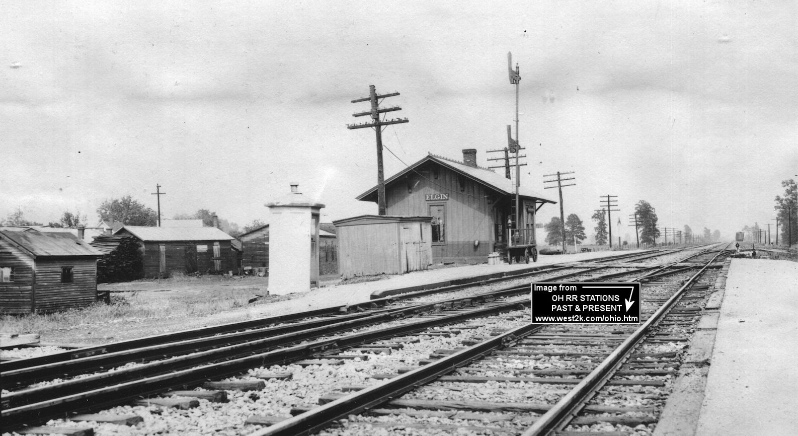
| Elgin (Yorkville) |
 |
Elgin was previously named Yorktown and Yorkville because of its location in the center of York Township. A Chicago & Atlantic (later Erie) station is shown here on the 1886 county atlas. | ||||||
| Elgin | |
|||||||
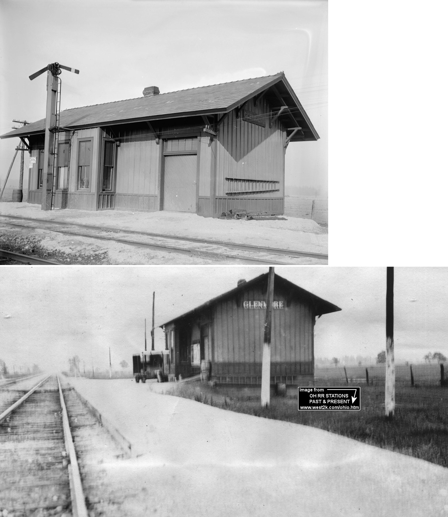
| Glenmore | |
Ben Reigle writes: "I grew up just north of Glenmore and my grandmother lives in Glenmore. The depot was purchased by a family and moved by hay wagon across my grandmother's farm and two others to the farm where it was moved on Willshire-Ohio City Rd.(County Rd. 50). So far as I know they pulled it back in their woods and have either disassembled it or just left it to the elements." | ||||||
| Jonestown |
|
According to the 1886 county atlas, the station was on the south side of the tracks here. There was also a water tank on the north side of the tracks on western edge of town at the river. | ||||||
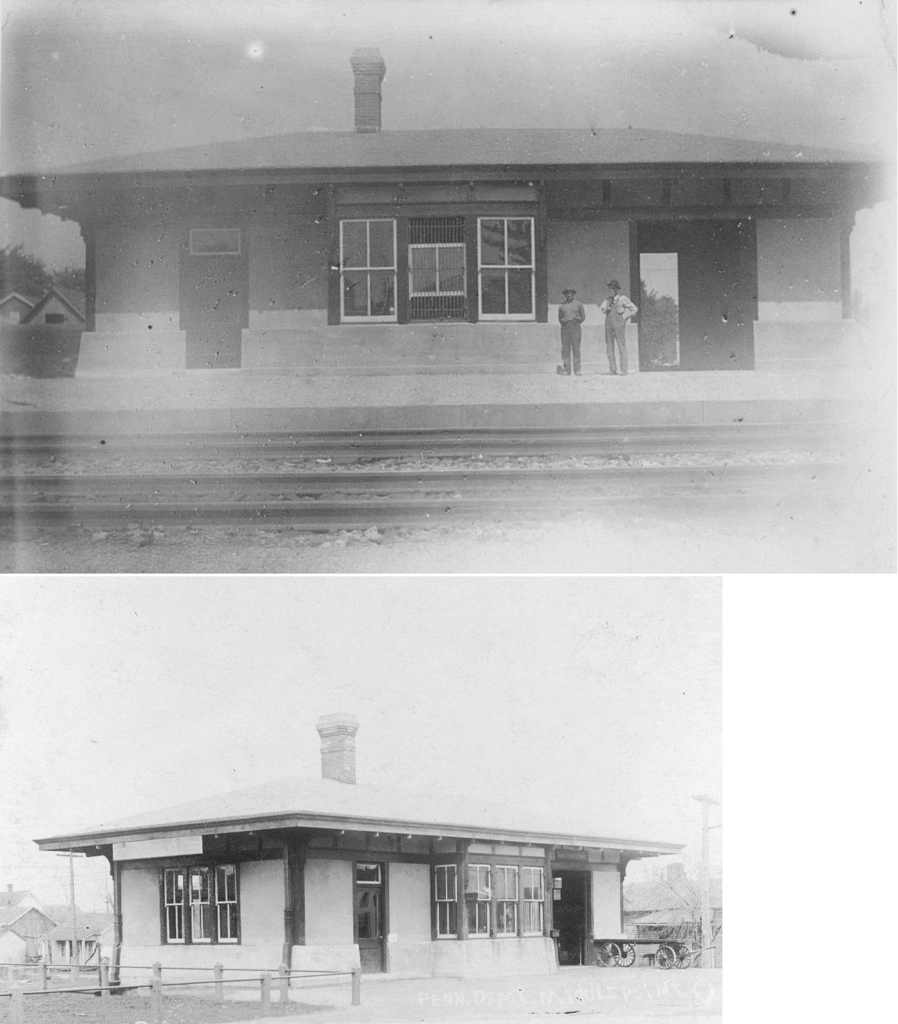
| Middle Point |
|
This station was torn down in the 1970s. | ||||||
| Monticello (Upper Arlington) |
 |
|||||||
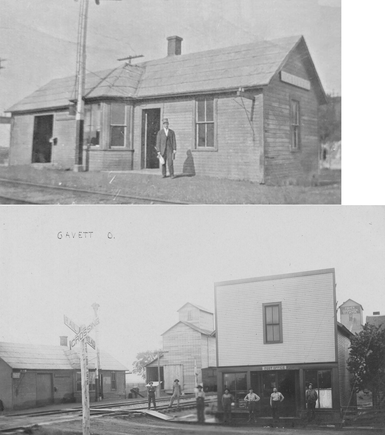
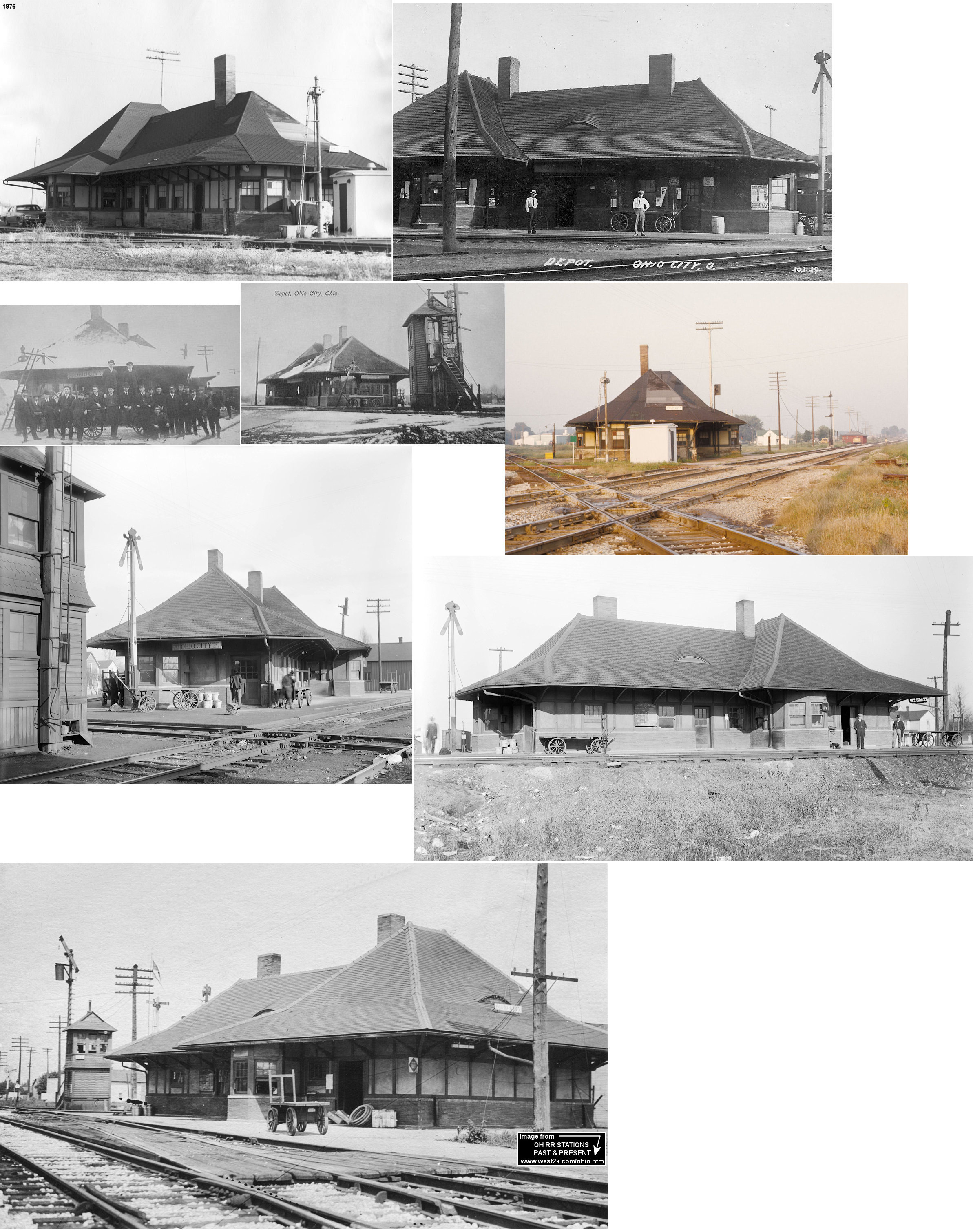
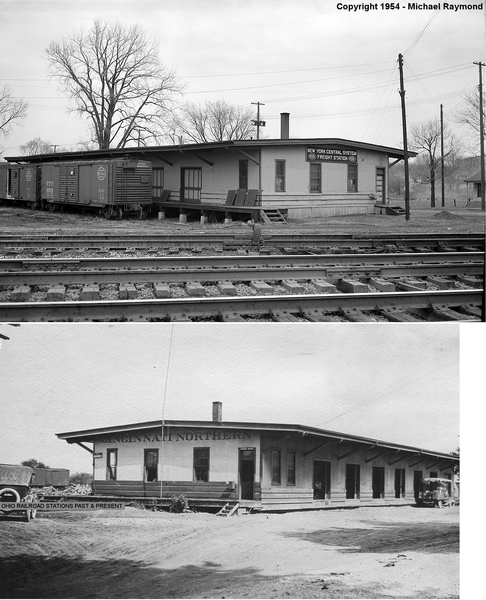
| Ohio City |
 |
The station served the Cincinnati Northern (NYC), Erie, and the Cloverleaf (Toledo, St. Louis & Western, later NKP). The tower at the crossing was Erie's RE tower. The station was between main and Washington Streets at approximately GPS: 40.769970, -84.614271. | ||||||
| Richey |
|
|||||||
| Schumm |
|
This station was on the west side of Schumm Road at approximately GPS: 40.756994, -84.727573. The station was torn down in the 1950s. | ||||||
| Scott |
|
The station was located just south of the Blaine St. grade crossing in Van Wert County. Blaine St. is the county line for Paulding and Van Wert counties. | ||||||
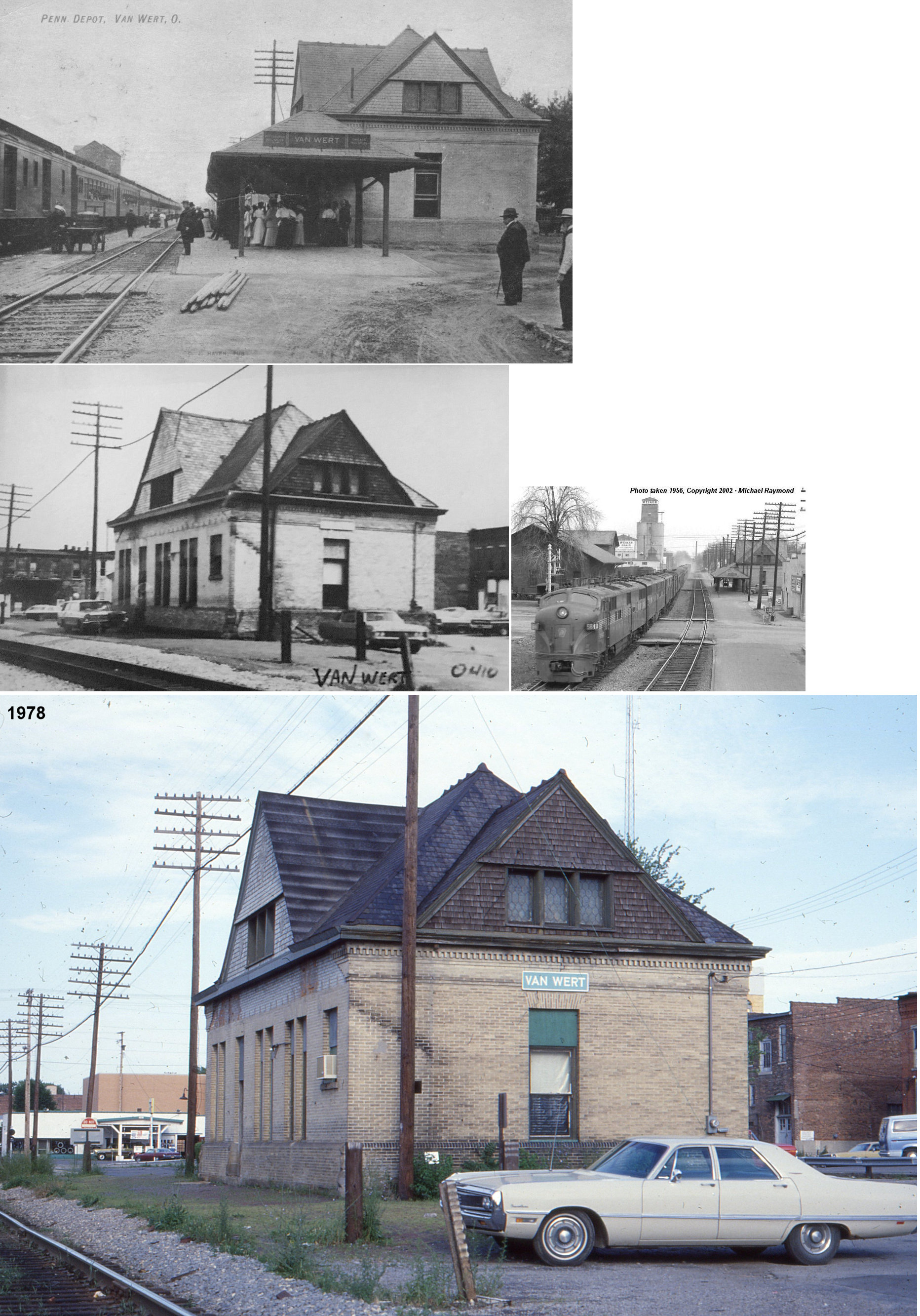
| Van Wert |
|
The PRR passenger station is the building on the right. It opened in 1892. The photo was taken April 1, 1956, the train is the Gotham Limited. The train is crossing North Washington Street. The station was torn down in 1984. The station was on what used to be the public square (now a parking lot). | ||||||
| Van Wert |
|
The freight station is on the left in the photo. This building predated the passenger station listed above and was the original combination station here before the newer passenger station was built. This station was built in 1884, with the newer passenger station appearing on maps around 1895. The freight station was torn down in the early 1970s. | ||||||
| Van Wert |
|
This station was built in 1893 and torn down in 1939. It was located on the north side of Elliot Street at the CN/PRR crossing, SE quadrant at GPS: 40.871797, -84.588627. The building included a restaurant on the first floor and RR offices on the second floor. This location is west of North Wall Street. Originally a combination station with a freight house attached, after the freight station below was built, the freight part was used as a baggage house. | ||||||
| Van Wert |
|
There was a large freight house on North Wall Street in the NE quadrant of the crossing on a siding track. The station was at GPS: 40.872162, -84.587895 and was parallel to Wall Street. It appears that this freight house was built between 1907-1914. | ||||||
| Venedocia |
|
This station was on the west side of Main Street on the north side of the tracks. | ||||||
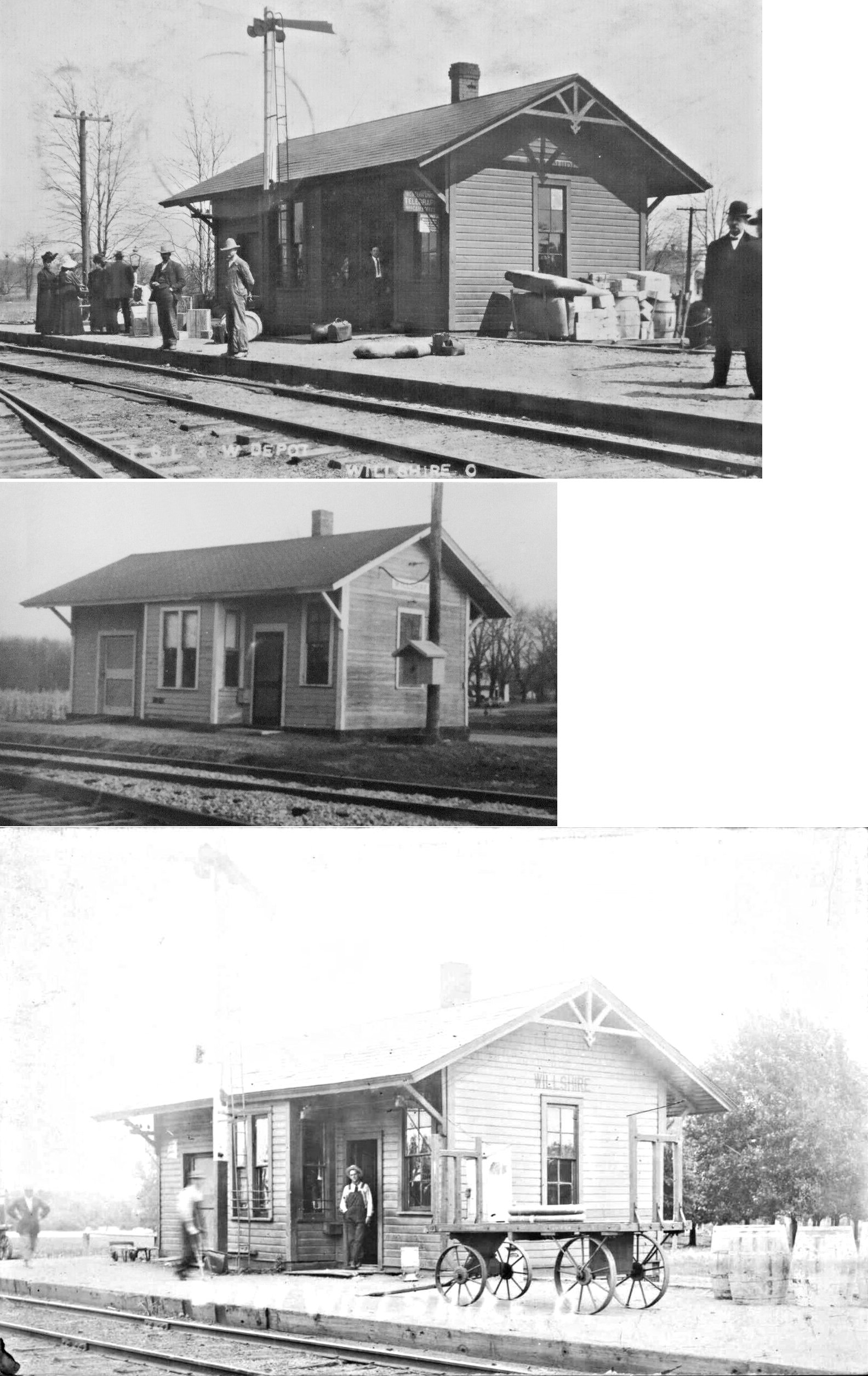
| Willshire |
|
|||||||
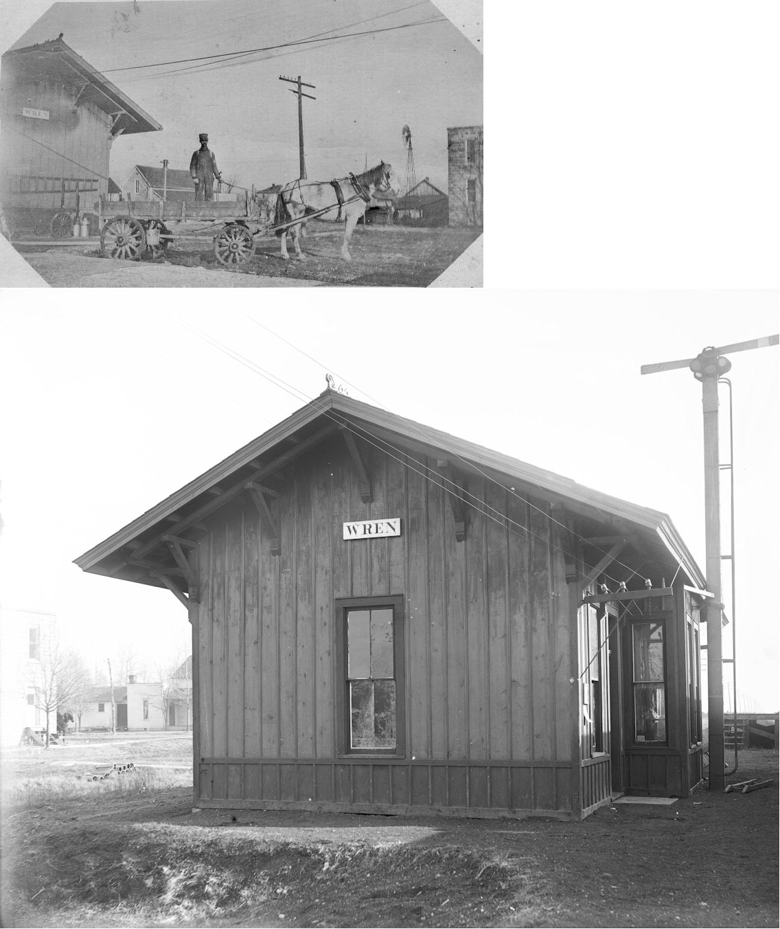
| Wren | |
|||||||
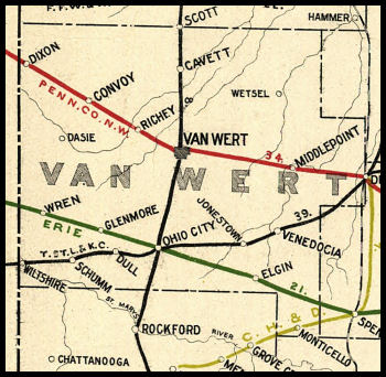
| 1898 VAN WERT COUNTY RAILROAD MAP | ||||||||
 |
||||||||