 COUNTY COUNTY
|
|
||||||||
| EXISTING STATIONS | ||||||||
|---|---|---|---|---|---|---|---|---|
| Station Name |
Original Railroad |
Current Location |
Type | Current Use |
Date Built |
Track Status |
Building Material |
More Info |
| Brookfield Station |  |
5854 Warren-Sharon Road | P | ???? | ???? | In Use | Wood |
|
| Champion (State Road) |
 |
Intersection of State Road (SR-305) and County Highway 205, 5 miles
NW
of Warren. (GPS: 41.300633,-80.897704) |
C | Private | ???? | None | Wood |
|
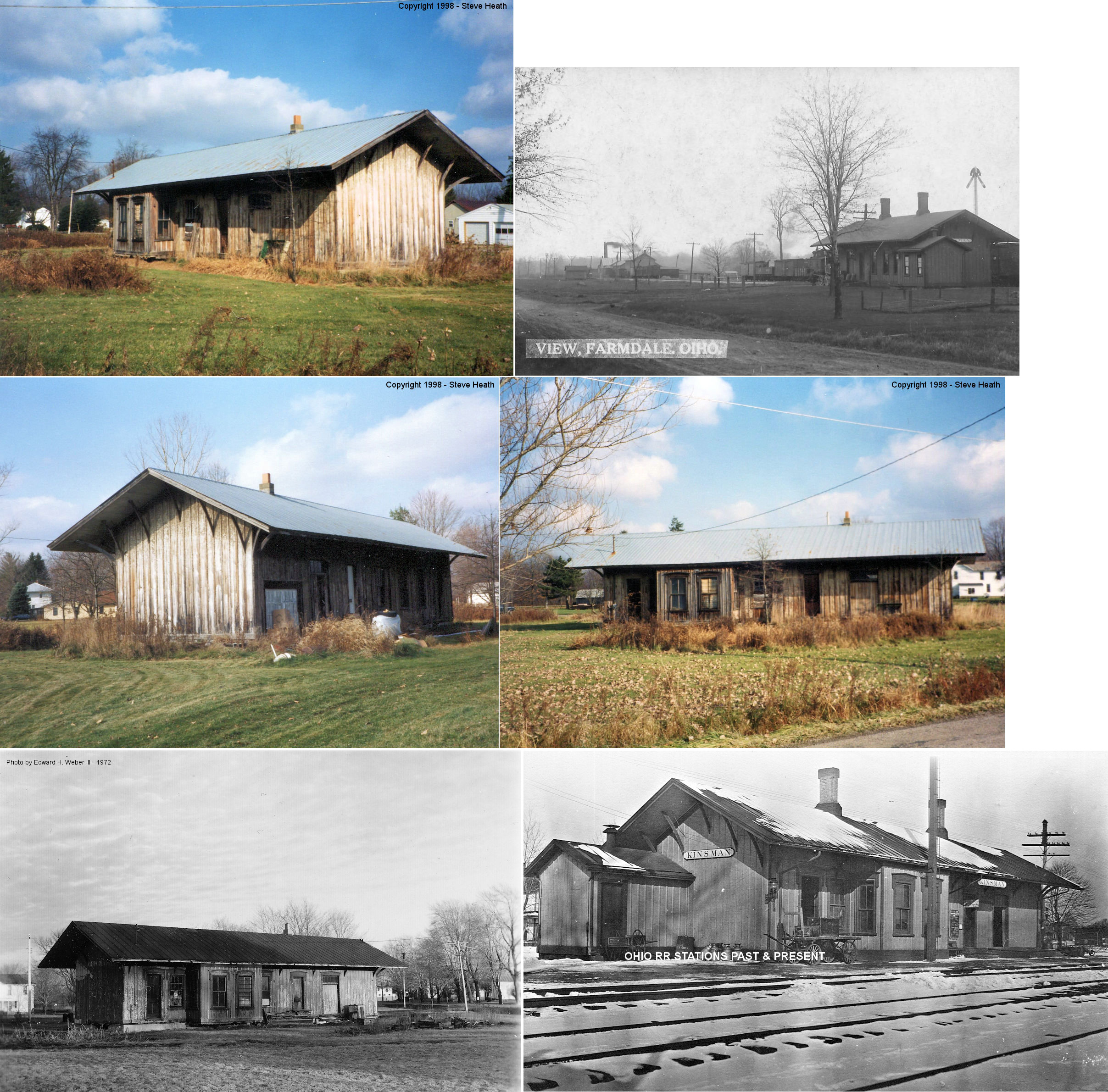
| Farmdale (Kinsman Sta.) |
|
7867 Wayland Avenue (GPS: 41.434615,-80.609122) |
C | Storage | 1873 | None | Wood | |
| Kinsman | |
???? | C | 1873 | ???? | None | Wood |
|
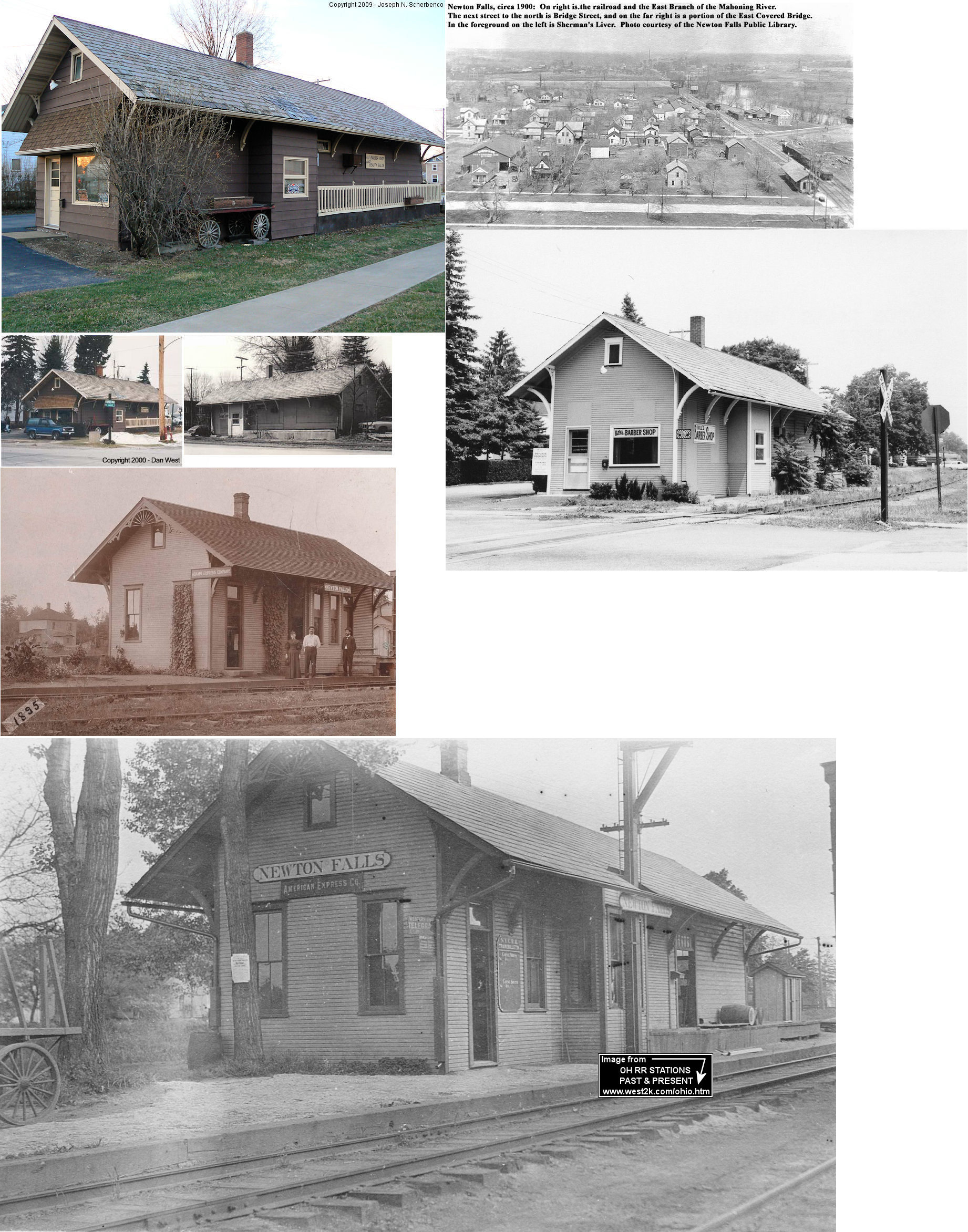
| Newton Falls |  |
East Broad & River Streets (GPS: 41.187132,-80.973068) |
C | Business | 1893 | Gone | Wood |
|
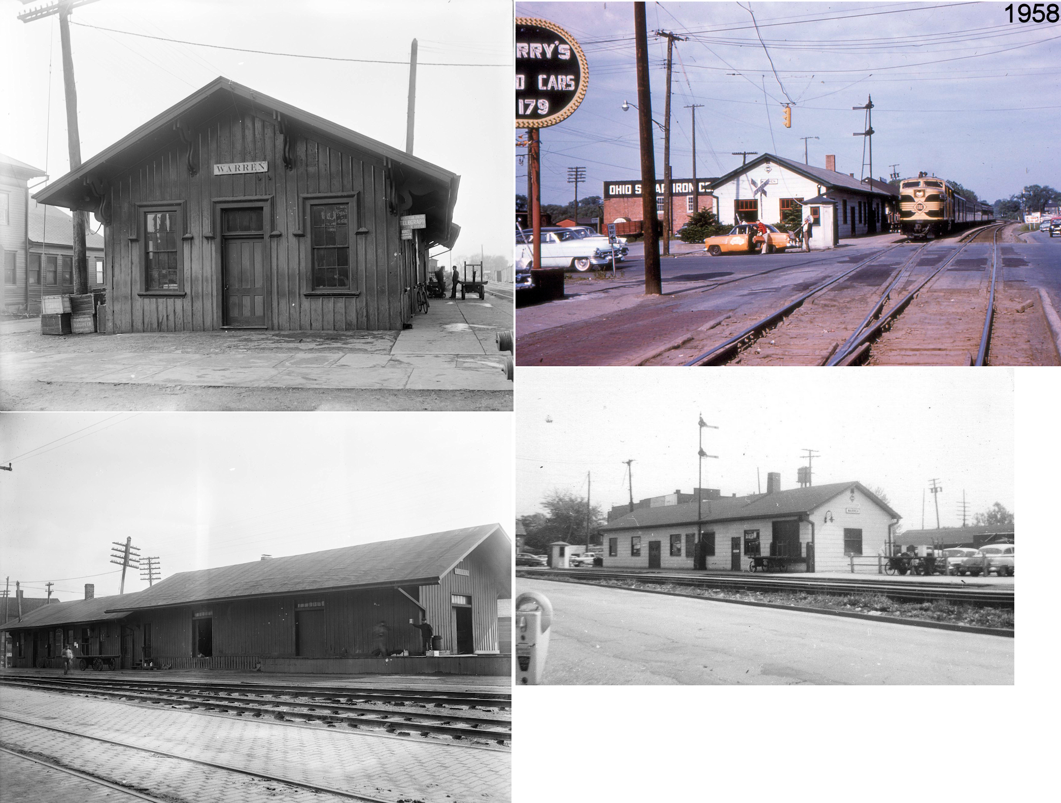
| Warren |  |
East Market Street at tracks (GPS: 41.236527,-80.807517) |
P | ???? | ???? | In Use | Wood |
|
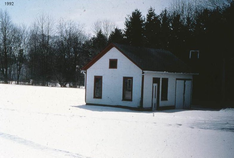
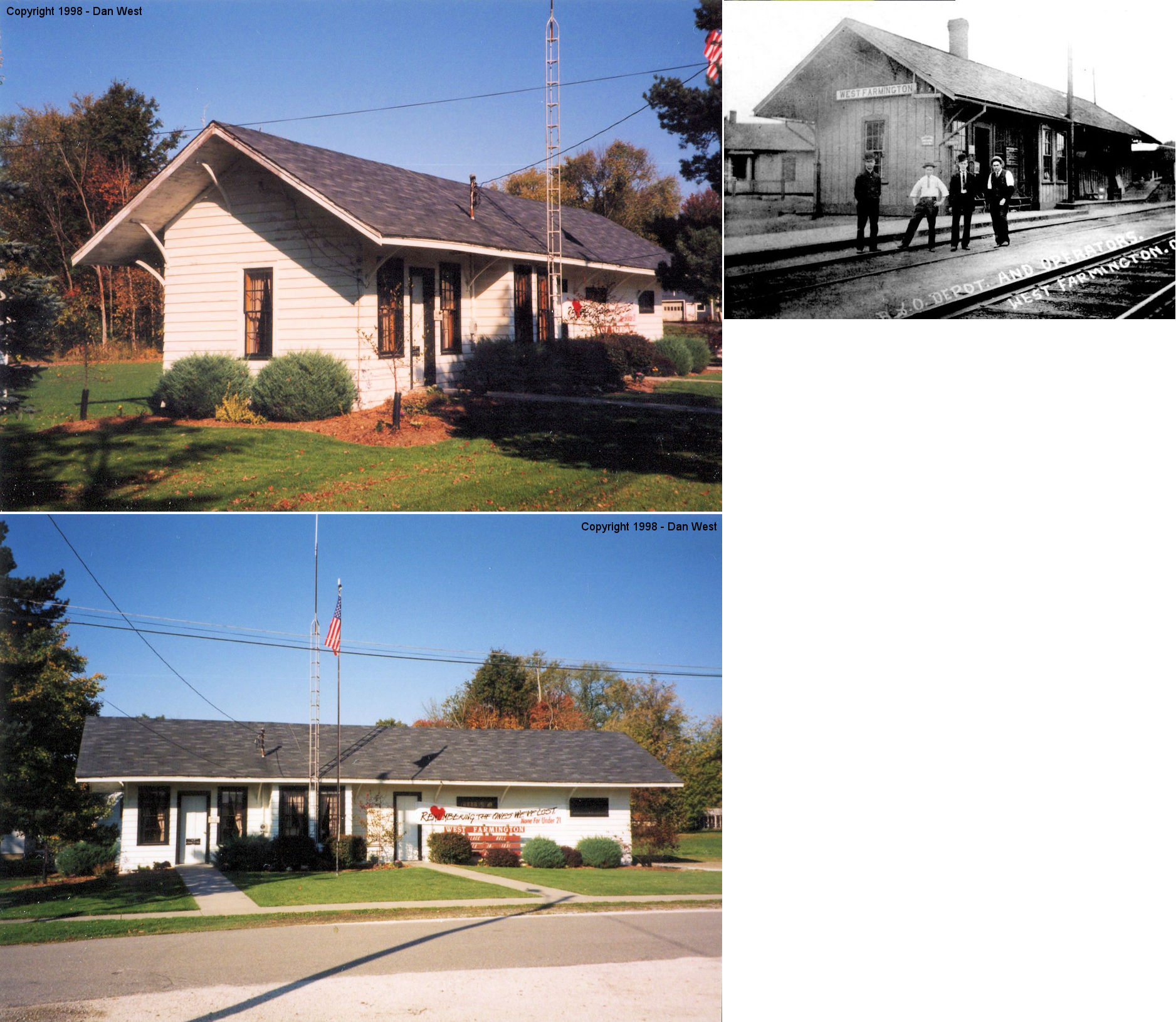
| West Farmington | |
251 Fourth Street (GPS: 41.392848,-80.975389) |
P | Police Station | ???? | Gone | Wood |
|
| STATIONS OF THE PAST | ||||||||
| Station Name |
Original Railroad |
Notes | ||||||
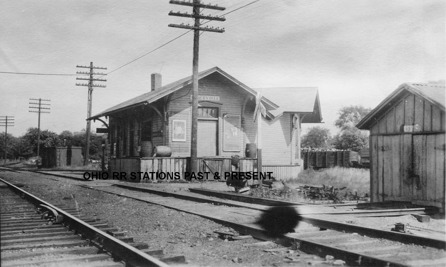
| Braceville |
CLEVELAND AND MAHONING |
The original Cleveland & Mahoning Valley Railroad (pre-A&GW, Erie) station here was demolished by a tornado on July 21, 1860 (Cleveland Morning Leader, July 23, 1860) | ||||||
| Braceville |
 |
This station is shown on the 1874 county map. | ||||||
| Braceville |
 AND |
The 1899 maps shows what appears to be a joint station wedged in the SW corner of the junction with building frontage on both railroads at GPS: 41.229194, -80.958765 between Chruch Street and OH-82. The Erie RR owned this shared station and it was built in 1881-1882. | ||||||
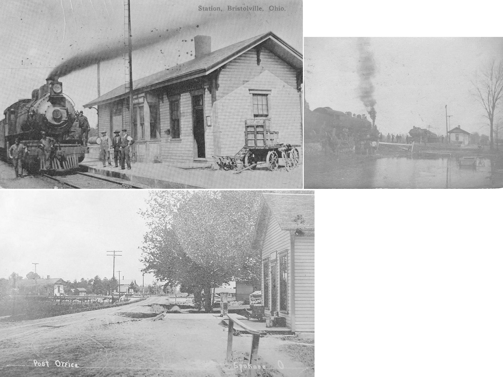
| Bristolville (Spokane) |
 |
Originally known as Bristol Center Station and later as Spokane. The station was on the north side of SR-88 on the east side of the tracks (GPS: 41.391004,-80.848233). | ||||||
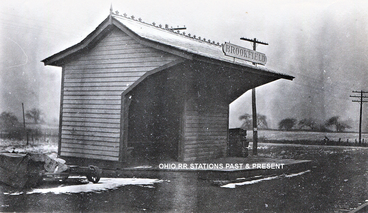
| Brookfield | |
In addition to the normal station (still standing) for Brookfield on the LS&MS Mahoning Coal Line, there was a three-sided passenger shelter on the low-grade line as well. According to NYC valuation records, this 18'x18' station was built in 1900. | ||||||
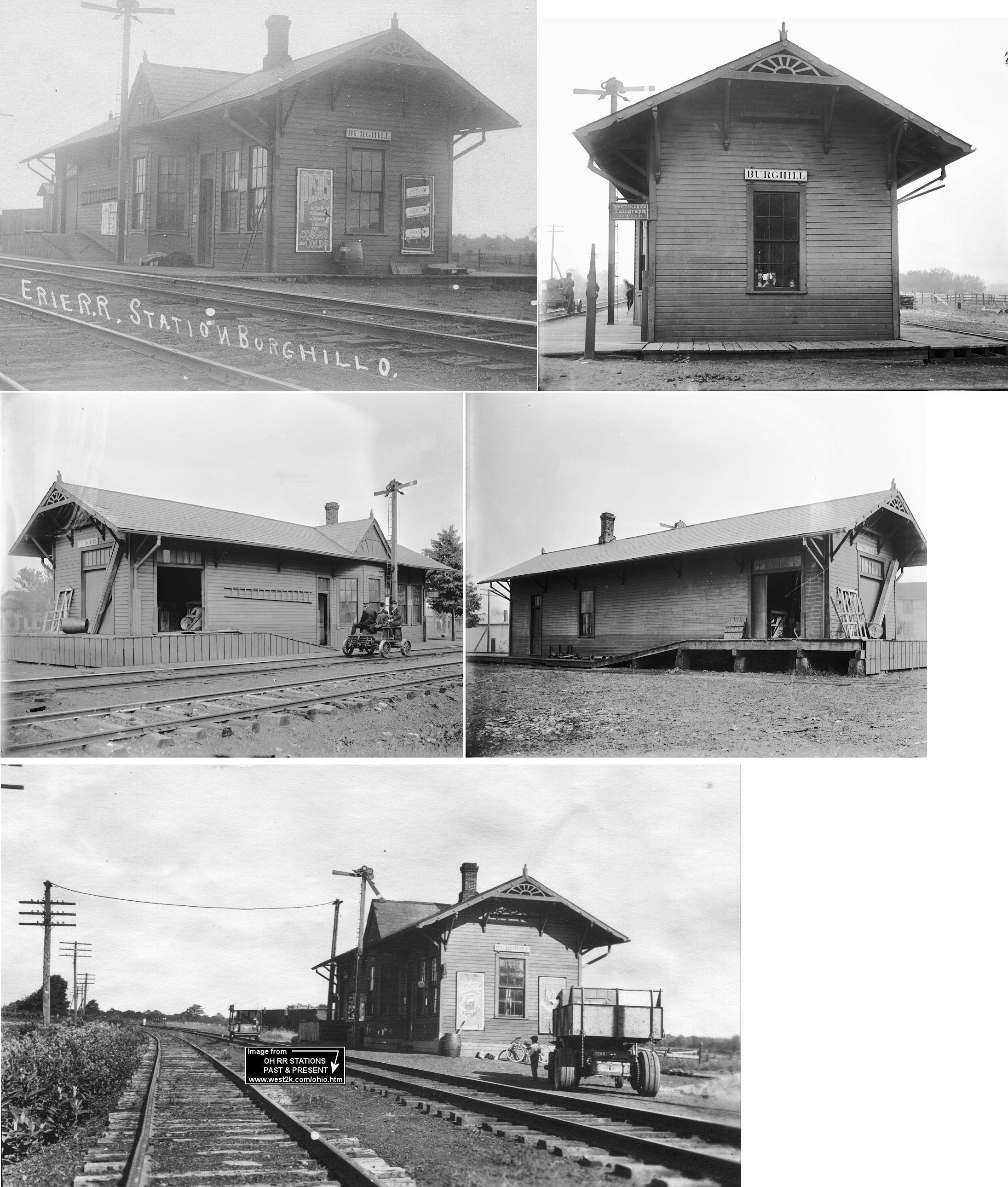
| Burghill |
|
This station was on the west side of SR-7, on the north side of the tracks (GPS: 41.358197,-80.569659). | ||||||
| Champion Station | |
This location was also known as Sunside. The depot was on the east side of the tracks (in 1899) on the north side of Center Street (OH-305) at approximately GPS: 41.308446, -80.832605. | ||||||
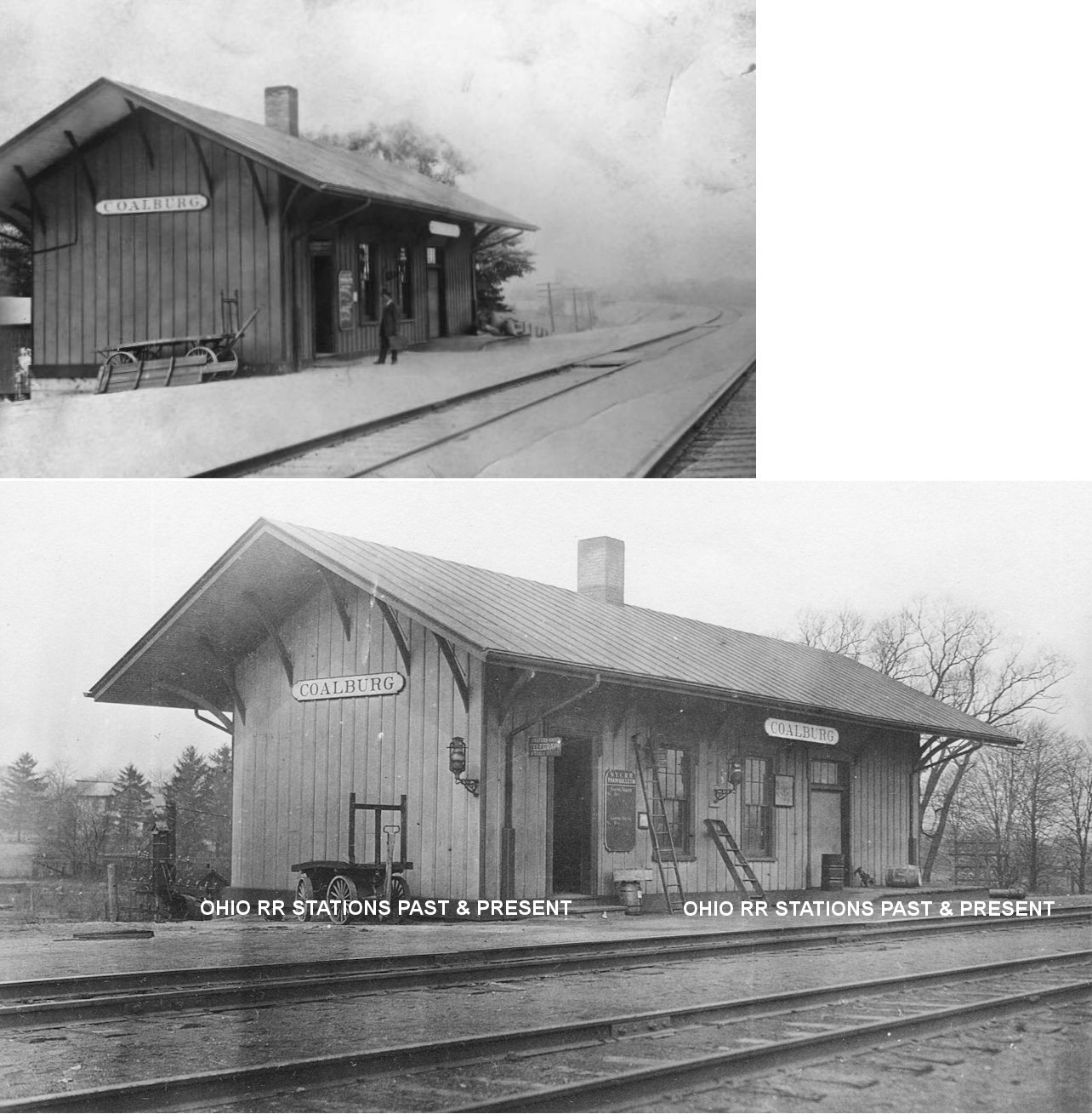
| Coalburg | |
This station was located at the east end of Old Station Road (GPS: 41.190939,-80.585618). According to NYC valuation records, the station was built in 1872 and placed on a new foundation in 1910. A new door was also cut in the north wall in 1910. | ||||||
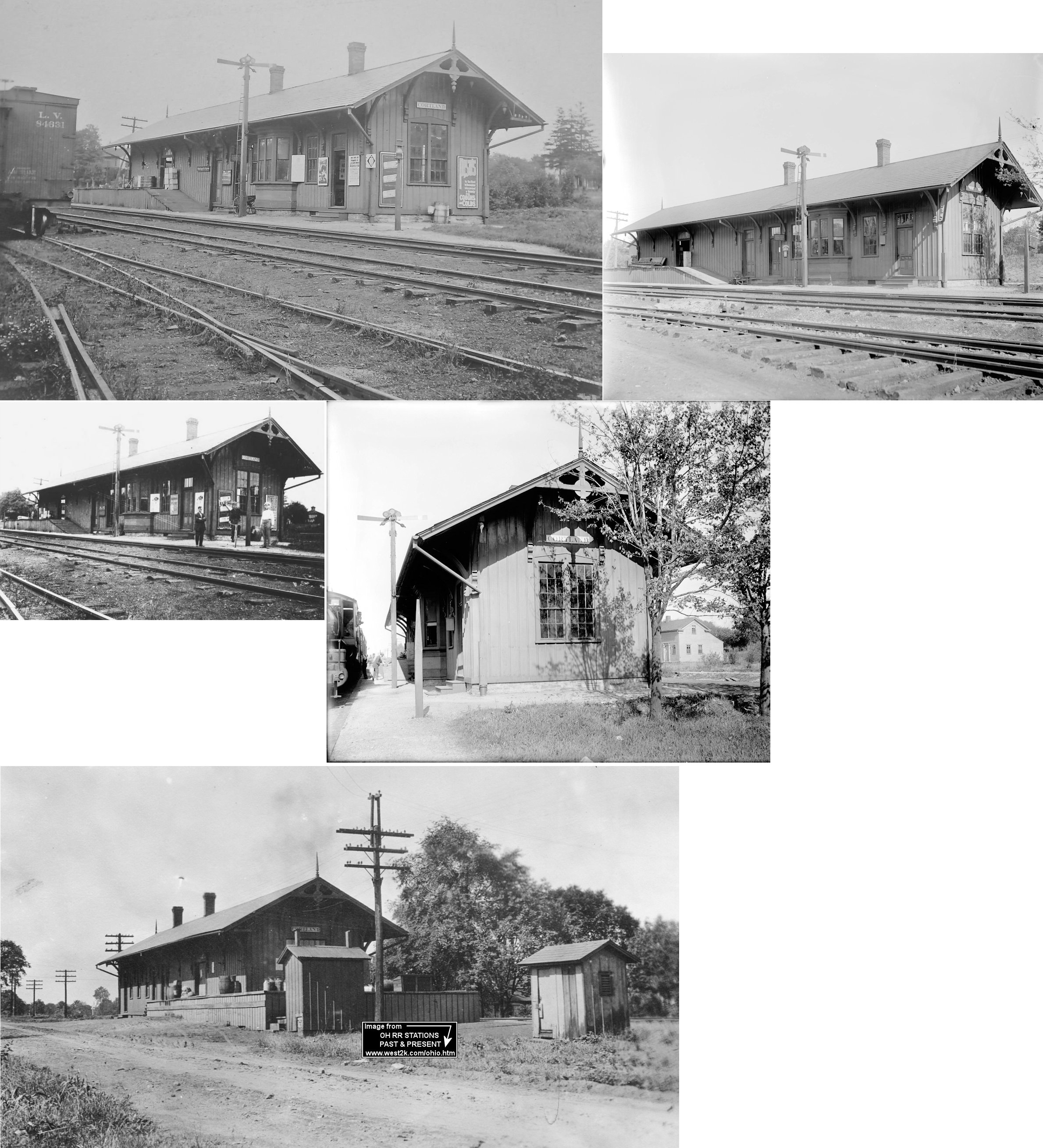
| Cortland (Baconsburg) |
|
A small frame depot served Cortland in the late 1860s before the station below was built. | ||||||
| Cortland (Baconsburg) |
|
This larger, second generation station, built in 1872, was on Erie St. (formerly Front Street) just north of Lattin and South of Market Street. The station was on the east side of the tracks (GPS: 41.331185,-80.730489). | ||||||
| Deforest |
 |
The 1899 county map shows a P&W (B&O) station on the SW side of the tracks south of Deforest-Townline Road at GPS: 41.202754,-80.788817. | ||||||
| Doughton Junction |
|
This station was west of Hubbard Village. The 1899 county map shows a depot here on the north side of the tracks just east of Bell-Wick Road at approximately GPS: 41.165016, -80.596210. | ||||||
| Doughton |
|
|||||||
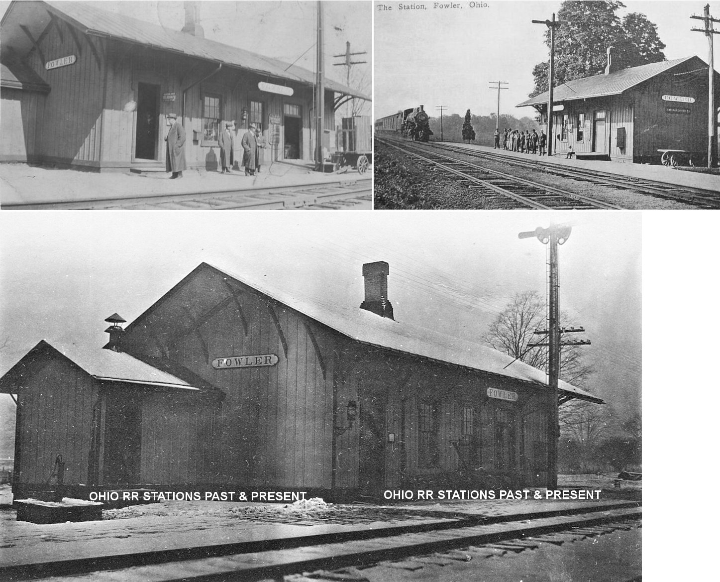
| Fowler | |
Location also formerly known as Nutwood P.O. The depot (in 1899) was on the south side of Wilson-Sharpsville Road (OH-305) on the west side of the tracks at GPS: 41.310902, -80.638217. According to NYC valuation records, the station was built in 1875. | ||||||
| Girard |
|
This station (in 1899) was on the west side of the tracks between Liberty and Elm Streets. | ||||||
| Girard |
 |
|||||||
| Girard |
|
This station (in 1899) was on the north side of Liberty Street on the east side of the tracks. | ||||||
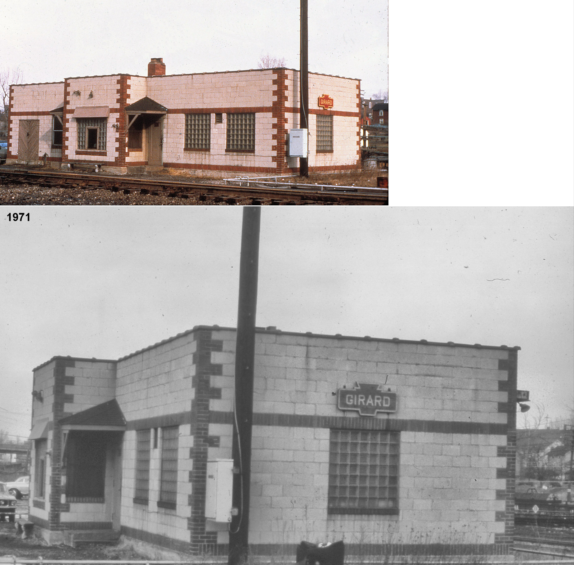
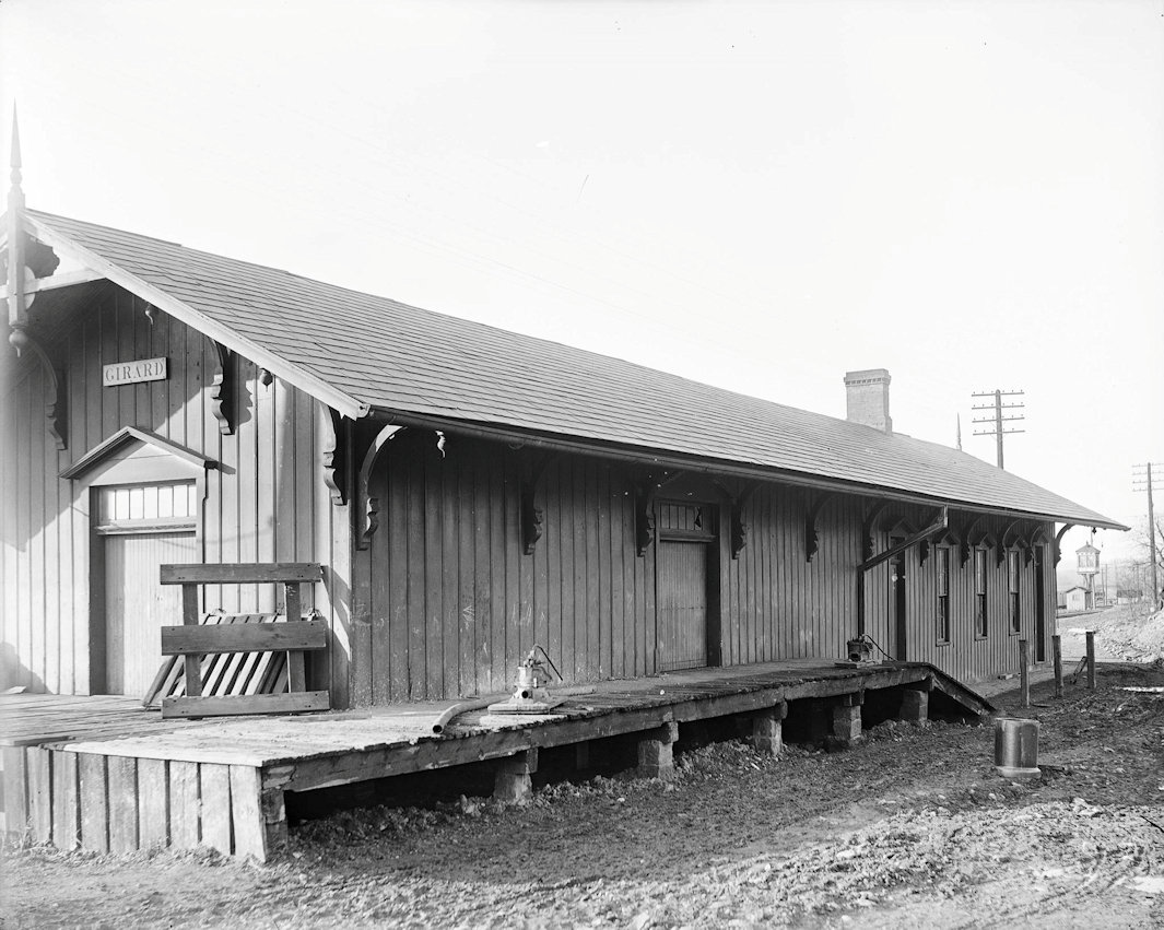
| Girard | |
The combination freight/passenger station was on the north side of Second Street on the east side of the tracks at GPS: 41.152315, -80.704220. | ||||||
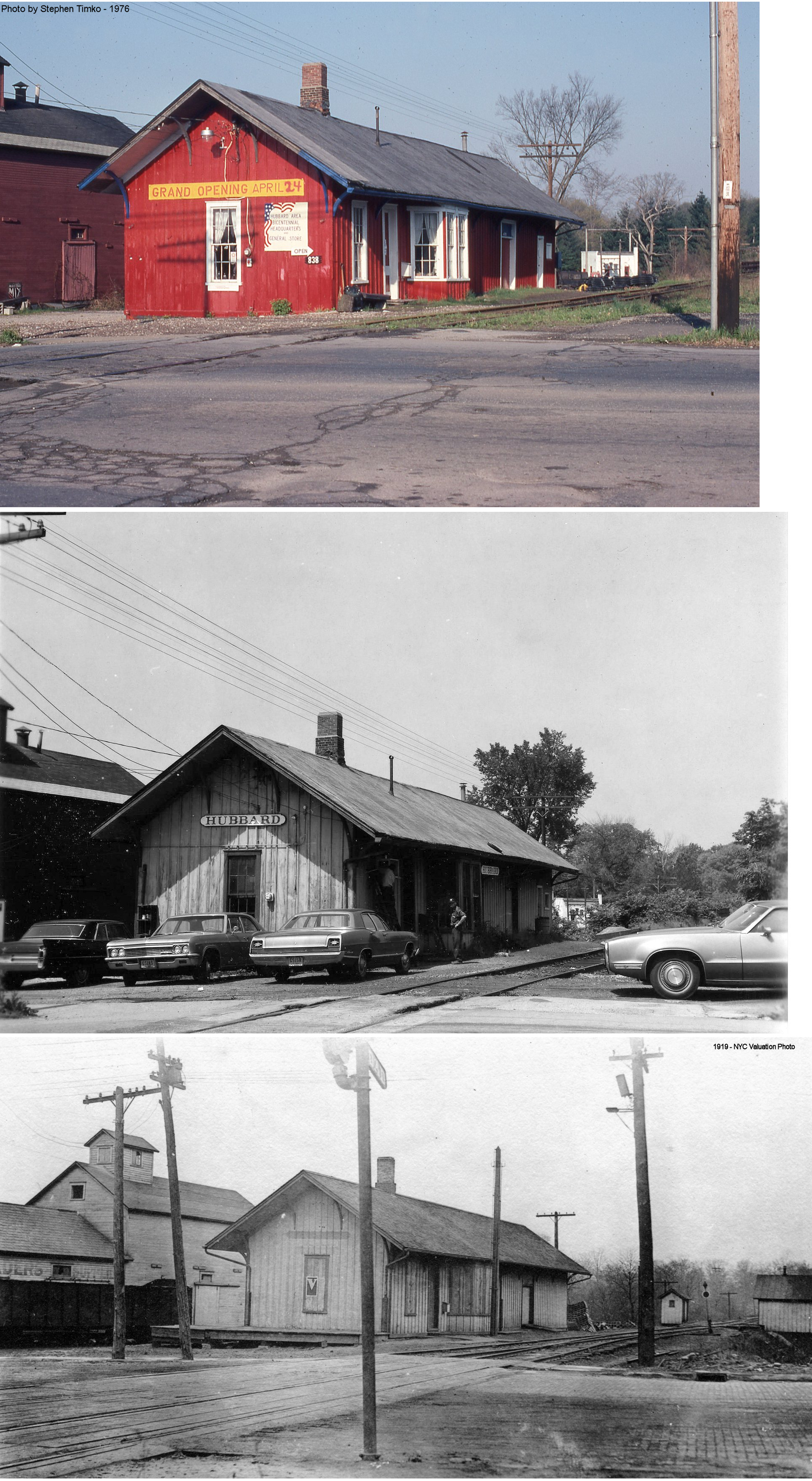
| Hubbard | |
This combination station, built in 1887, was on the west side of North Main Street next to the Hubbard Coal & Supply Company at GPS: 41.166456, -80.569166. It measured 20'x78'. | ||||||
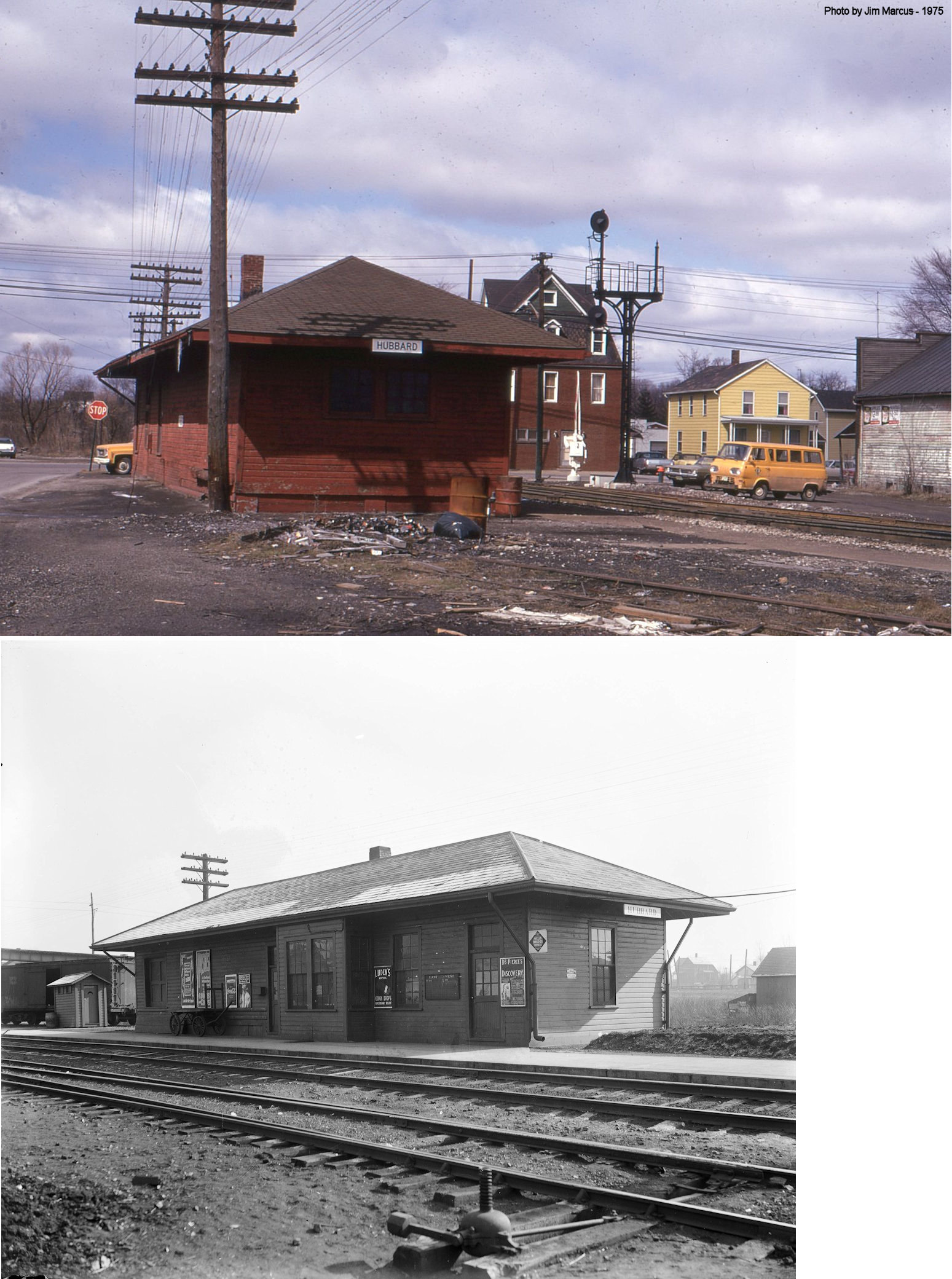
| Hubbard |  |
This combination station was on the East side of North Main Street on the south side of the tracks (GPS: 41.165587,-80.568656). It was torn down in 1981. | ||||||
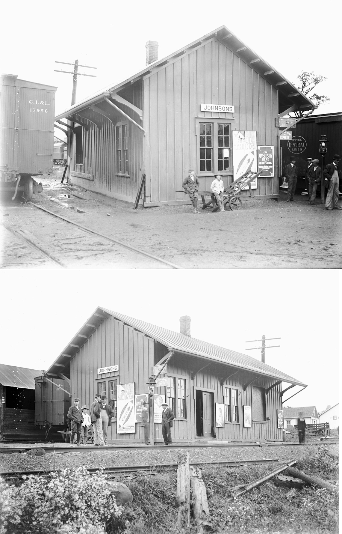
| Johnsons (jOHNSTON sta.) |
|
This station was on the south side of the tracks off Bradley-Browlee Road between OH-193 and Ridge Road at GPS: 41.352769, -80.681216. | ||||||
| Kinsman Fair Grounds (Dewey) |
|
The 1899 county map shows a station (perhaps a waiting shelter, but the map shows a building) labeled "RR Entrance" to the west of the old Kinsman Fairgrounds (GPS: 41.462789,-80.605828). | ||||||
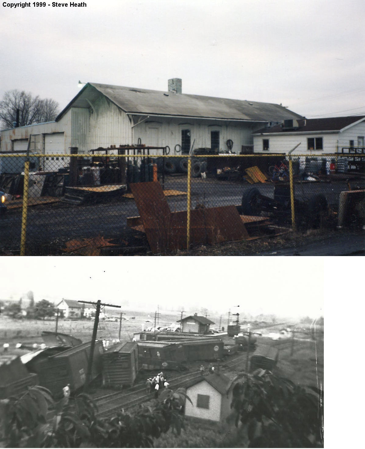
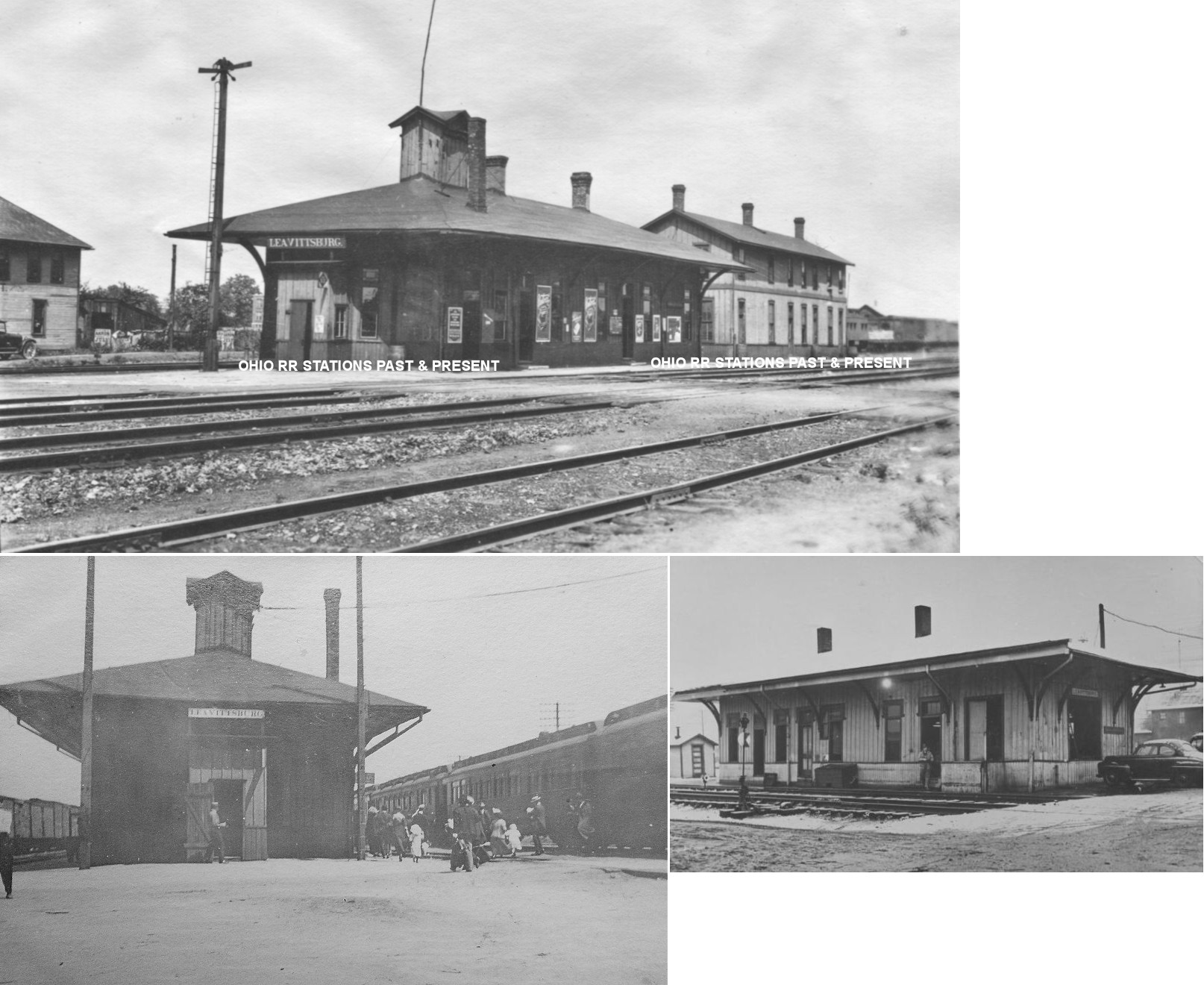
| Leavittsburg | |
This station was on the east side of South Leavitt Road (SR-142) south of Market Street (GPS: 41.23785,-80.880326). The two-story building behind the passenger station in the top photo was an Erie RR storage house. The passenger station was demolished in 1953. | ||||||
| Leavittsburg | |
The freight station, with an open walled end, was on the west side of Leavitt Road at GPS: 41.237903, -80.880866. | ||||||
| Leavittsburg |
|
The B&O station was on the east side of Leavitt Road (SR-142) on the south side of the tracks (GPS: 41.237431,-80.880363). | ||||||
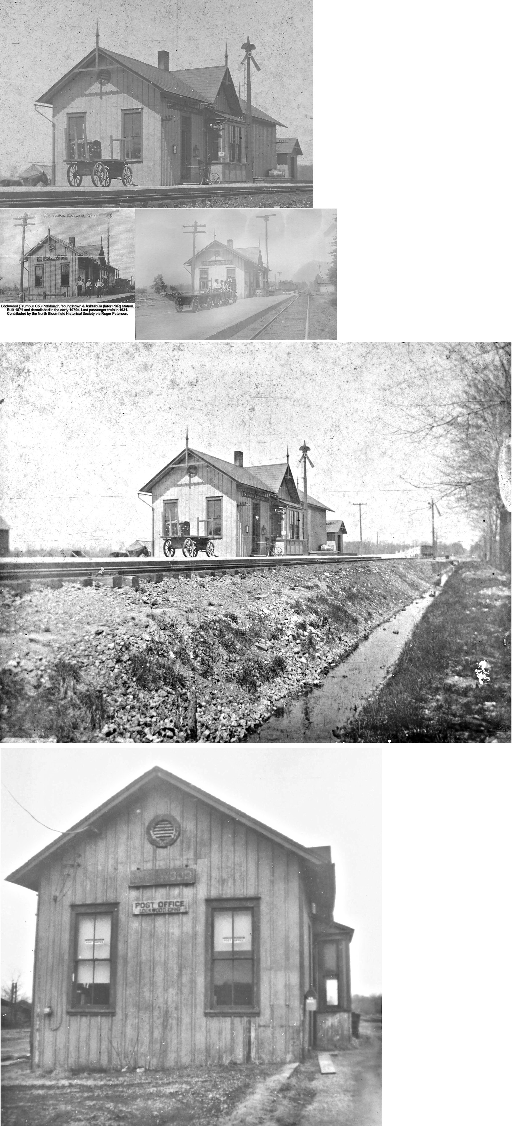
| Lockwood (N. Bloomfield) |
|
This station was built in 1879 (The (Orwell) Weekly Welcome, 4-16-1879 and 7-16-1879) and replaced an earlier station there. | ||||||
| Lordstown (Soaptown) |
|
This station was on the south side of Hallock-Young Road on the NW side of the tracks (GPS: 41.142702,-80.83892). It was on the Alliance Branch of the PRR. A station is shown here on the 1923 PRR List of Stations & Sidings. | ||||||
| Mineral Ridge |
 |
This N&NL (later Erie) station was on the south side of Depot Street (formerly Coal Street) just east of Edwards Street. The station was on the east side of the tracks (GPS: 41.139795,-80.773841). According to Erie RR valuation records, this station was built in 1886. | ||||||
| Newton Falls |
|
According to the 1899 county map, the original station on the P&W (later B&O) was near the intersection of Canal and North Streets on the old B&O line (GPS: 41.192251,-80.975005). | ||||||
| Newton Falls | |
The second B&O station here was at the west end of Jay Street on the south side of the street and on the east side of the old B&O tracks which ran along the river (GPS: 41.190168,-80.977162). There was also a small freight station to the south of the passenger station. According to Sanborn maps, this old B&O station was used by the interurban line later (the CA&MV). | ||||||
| Newton Falls | AND |
The third B&O station here, built in 1905 when the new double-track mainline was opened, was at 13 West Franklin Street (GPS: 41.191072,-80.974989). It served as a CSX tower until it was knocked off its foundation in a March 2011 derailment. The PRR also used this station as part of its MV&W Railway Branch as the station is listed on the 1923 PRR List of Stations & Sidings. | ||||||
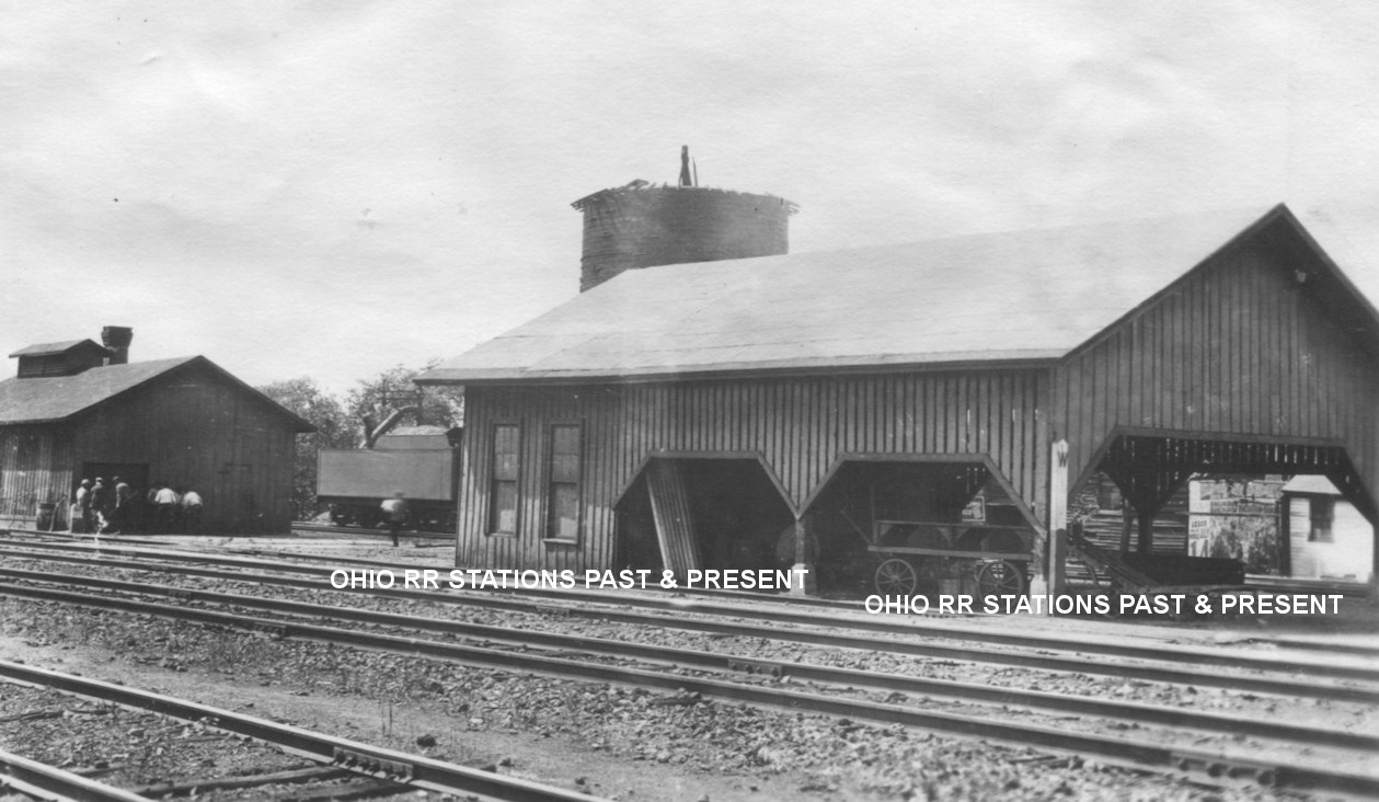
| Newton Falls |
|
This freight transfer house was built in 1882 according to NYC valuation records. It was likely located in the SW corner of the diamond turnout with the B&O along High Street between Lock Street and East Main Street at GPS: 41.194318, -80.969645. | ||||||
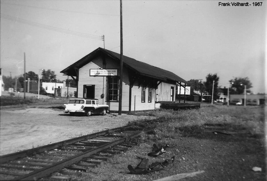
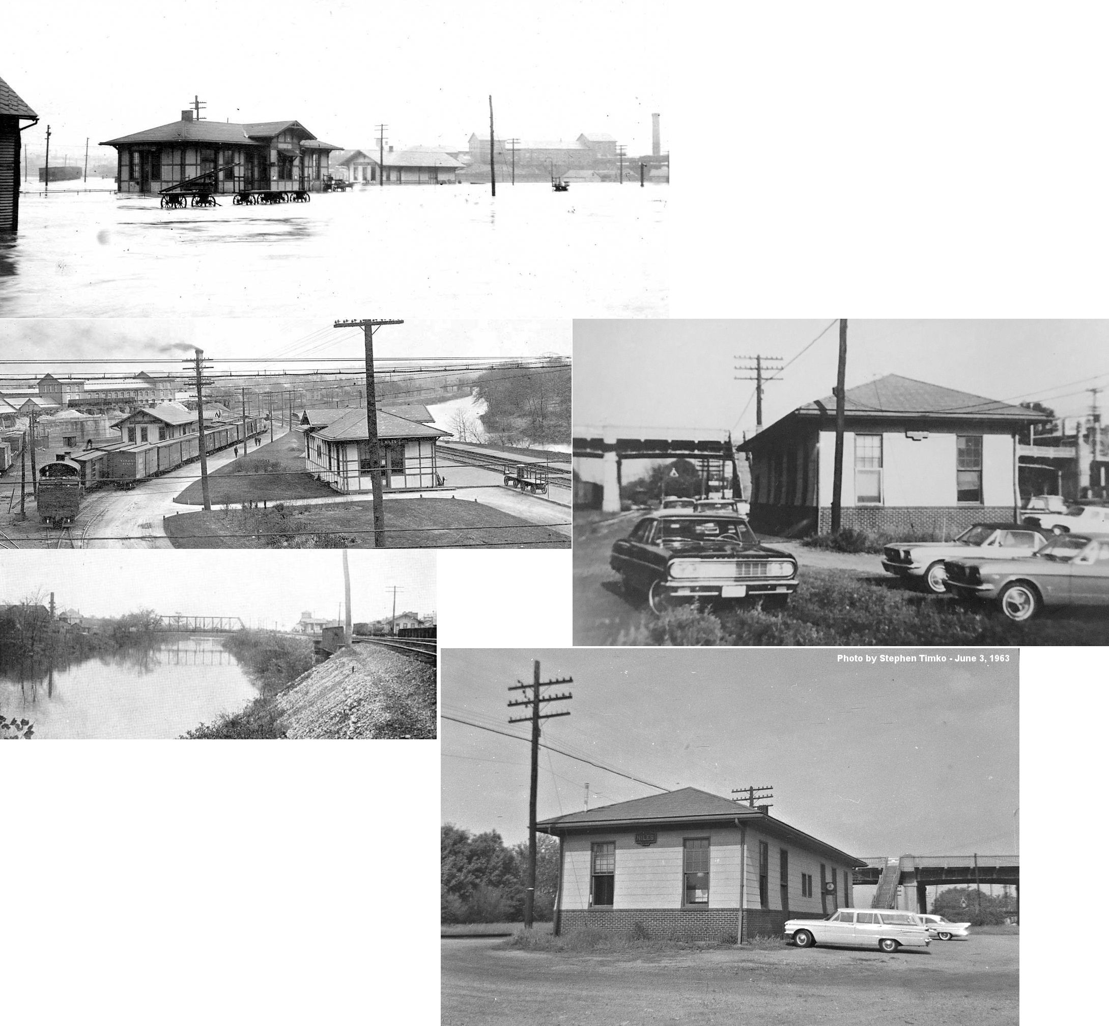
| Niles |
|
This station was on East Church Street at the bend in the road to the east of State Street (directly north of the old Central School). Sometime between 1909-1915, the B&O either built a larger station here or expanded the old P&W station to connect what was once separate passenger and freight buildings that were next to each other. As of 2009 this area is vacant and may now be part of Central Park. | ||||||
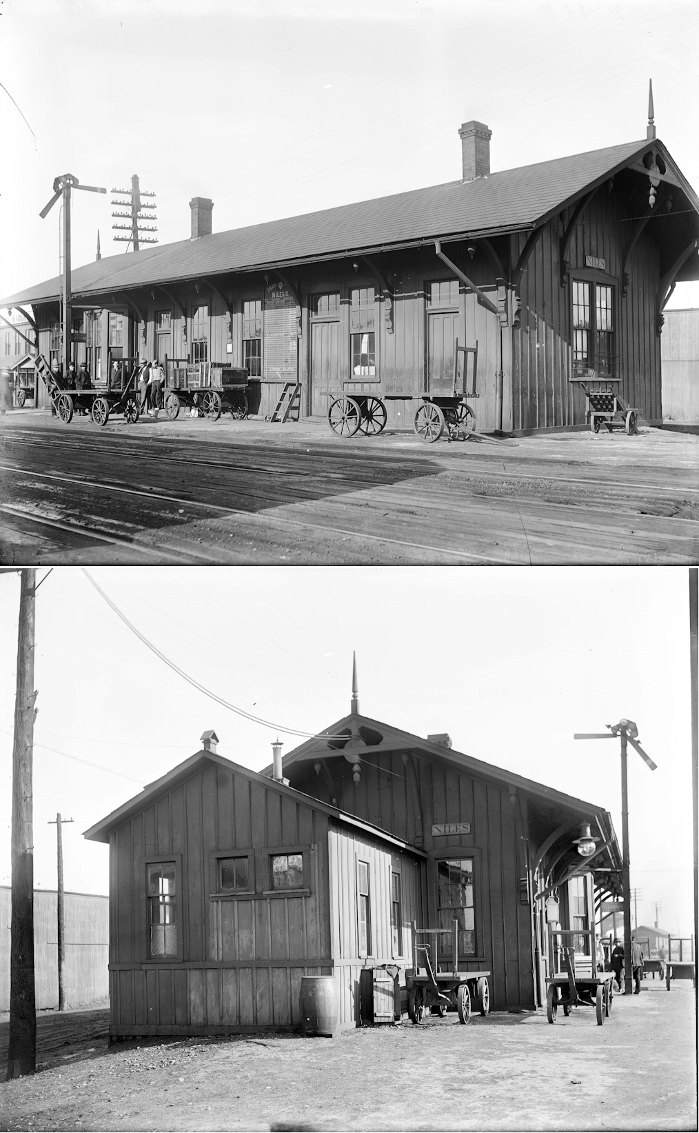
| Niles | |
This frame station was located on Mahoning Street (formerly Depot St.) just west of Pratt Street at GPS: 41.181031, -80.757539. The station was demolished around 1915 when the Erie replaced it with a larger brick station (listed below). | ||||||
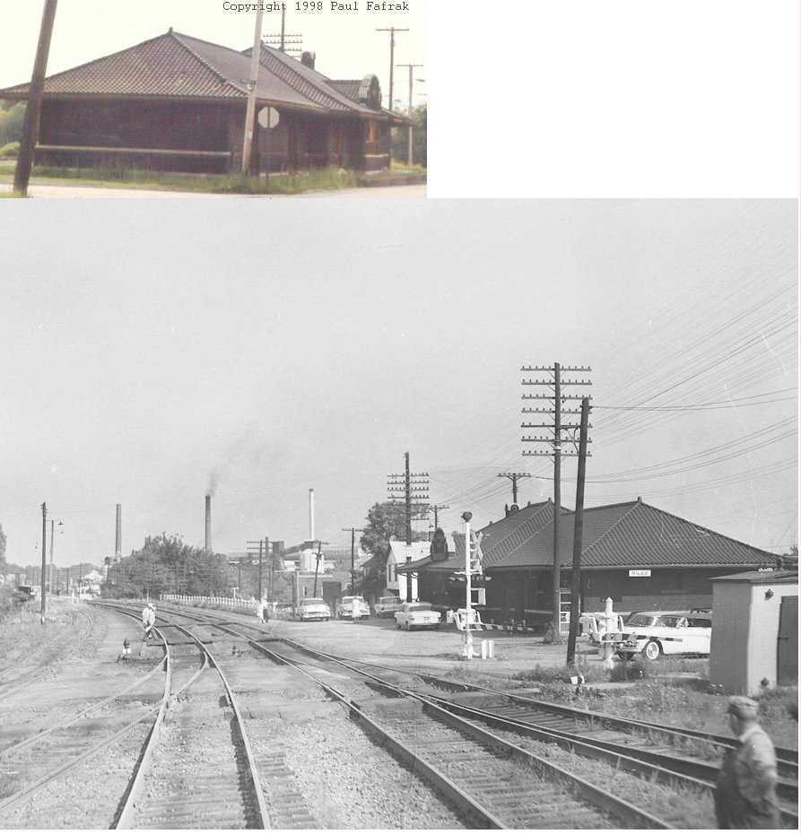
| Niles | |
This brick station, opened in 1915, was located on Mahoning Street (formerly Depot St.) just west of Pratt Street at GPS: 41.181189, -80.757681. The location is now a vacant lot, but the foundation of the station is still visible. This station was demolished in 1981. | ||||||
| Niles | |
There was a freight station on Mahoning Avenue at the south end of Erie Street at GPS: 41.180325, -80.756303. This station was replaced by the station below, probably in the 1950s. There was also an Erie "storehouse" on Mahoning at the intersection with Mason Street. | ||||||
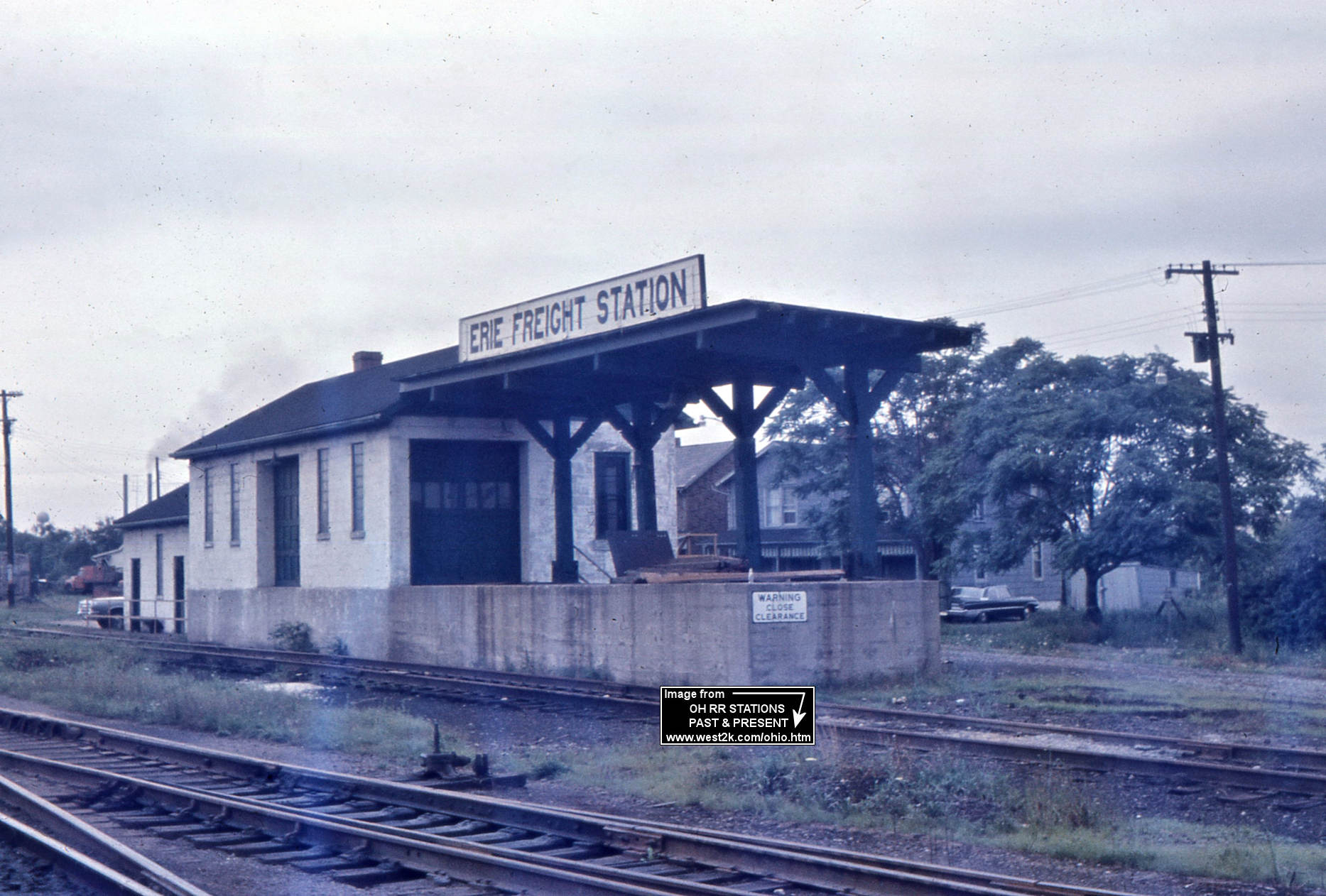
| Niles | |
This modern freight station was on North Langley Street SE at GPS: 41.179893, -80.756684. | ||||||
| Niles | |
The PY&A passenger station was located on the west side of Main Street just south of Water Street. This location is now a vacant lot used for truck parking (as of 2009). The PY&A freight station was located on the south side of Water Street half way between S. Chestnut and S. Mechanic (now called S. Arlington). That location is also now a vacant lot. Both stations were torn down sometime between 1902-1909 when the PRR built the station listed below. | ||||||
| Niles |
|
This station was located the east side of Main Street south of what is now called Utlak Drive at GPS: 41.177618, -80.764148. It was built to replace the old PY&A station sometime between 1902-1909. The station sat between the sets of tracks and the area is empty now. In the late 1800s the Coleman-Shield Rolling Mill sat at this location. The station was used for passengers until 1964 when the last passenger trains came off the line. The station was stripped of its bay widow and overhanging roof in the 1950 under the PRR plan to simplify its structures. The PRR freight station was located about 300 yards to the east of the passenger station at GPS: 41.177817, -80.763404 and was built between 1909-1915. | ||||||
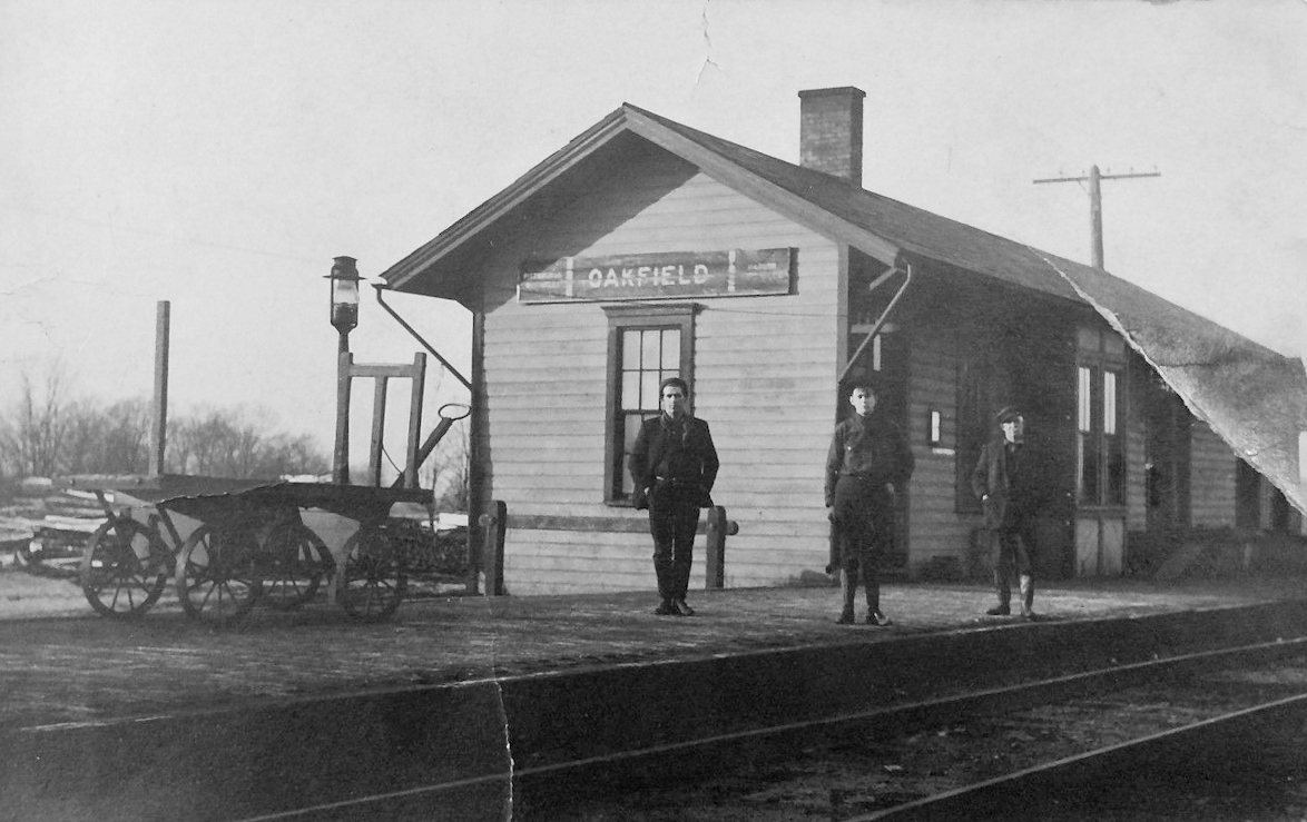
| North Bristol (Oakfield) |
|
This station was on the north side of Hyde-Oakfield Road on the west side of the tracks (GPS: 41.40909,-80.848346). | ||||||
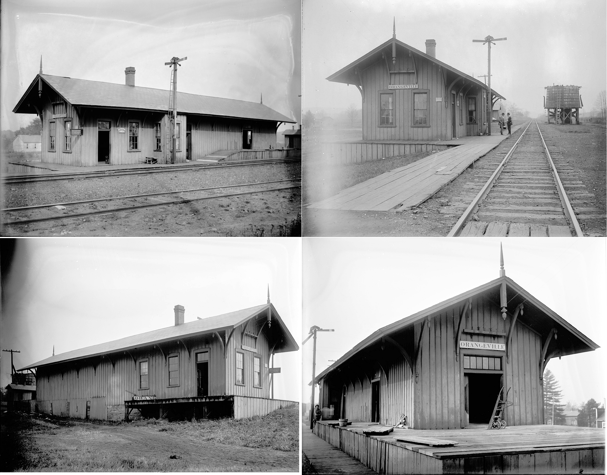
| Orangeville | |
Although the village of Orangeville is in Ohio, the station was located just east of the state line in South Pymatuning Township (Mercer County, PA) on the township road that follows the state line. It was at approximately GPS: 41.337280, -80.518987. The first station here, according to the 1873 map, was on the east side of the road on the north side of the tracks. | ||||||
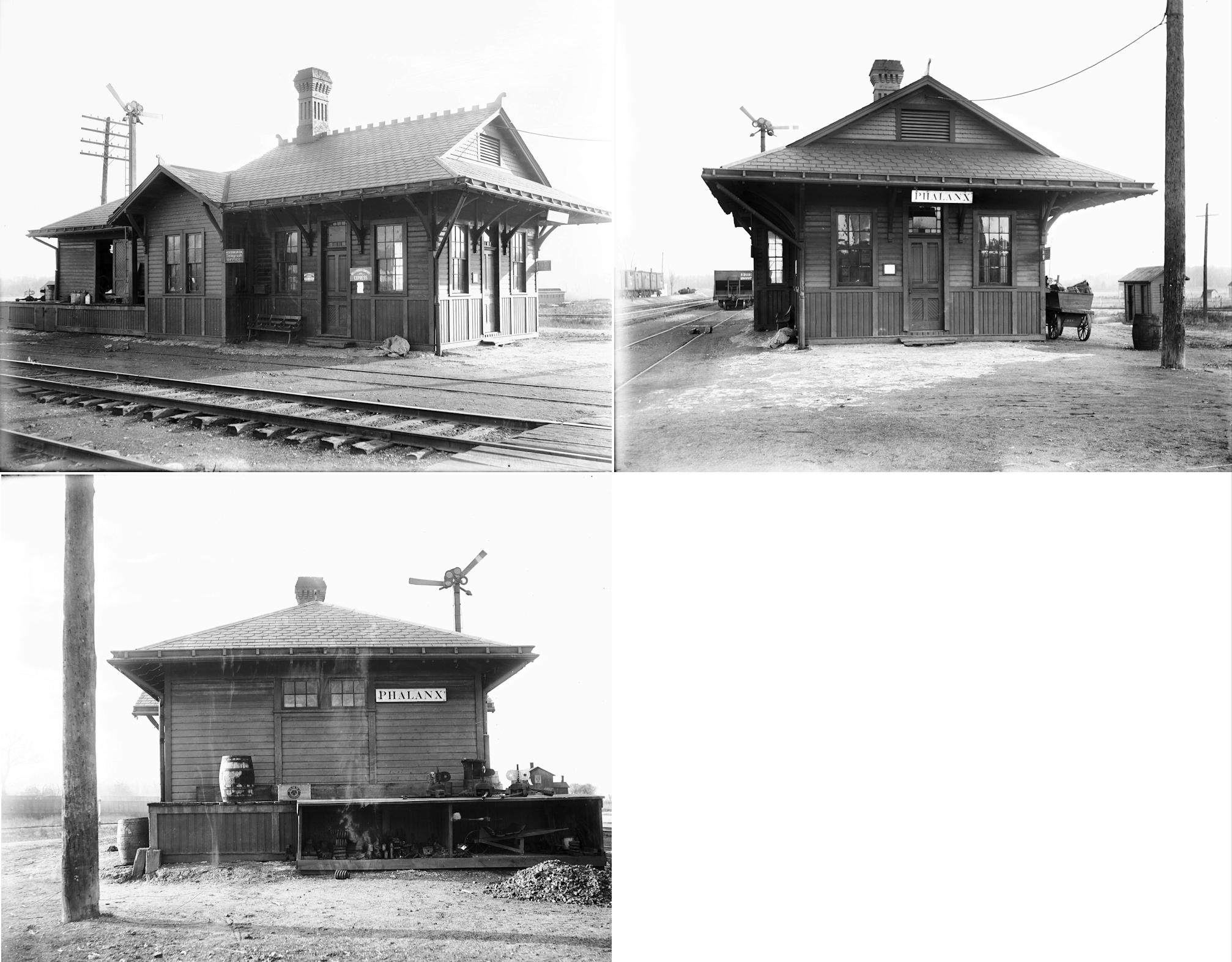
| Phalanx | AND |
This station was on the south side of the tracks off Depot Street west of Braceville-Robinson Road at approximately GPS: 41.248702, -80.956360. The Alliance & Northern RR (LEA&W, NYC) junctioned with the Erie just to the west of the station. The Erie owned the station, but it served the LEA&W as well. | ||||||
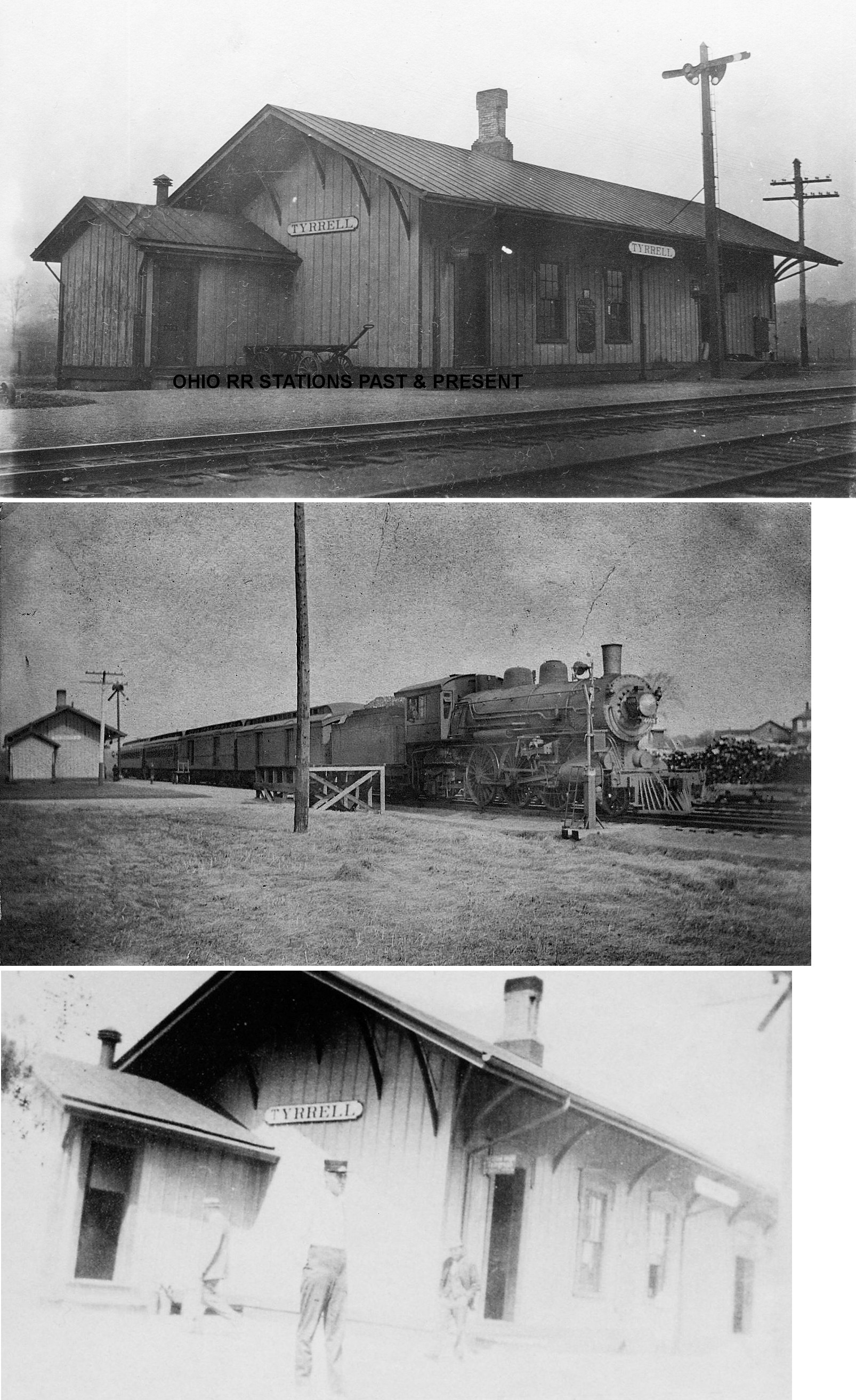
| Tyrrell Hill (Terrill HILL) |
|
According to The Ashtabula Weekly Telegraph (8/28/1874), a station was planned to be constructed here by the Mahoning Coal Railroad by H.B. Castle in September 1874 (date also confirmed on NYC valuation records). It was on the west side of Sodom-Hutchings Road on the south side of the tracks at GPS: 41.269738, -80.636430. This may be the station that is still standing at Brookfield. | ||||||
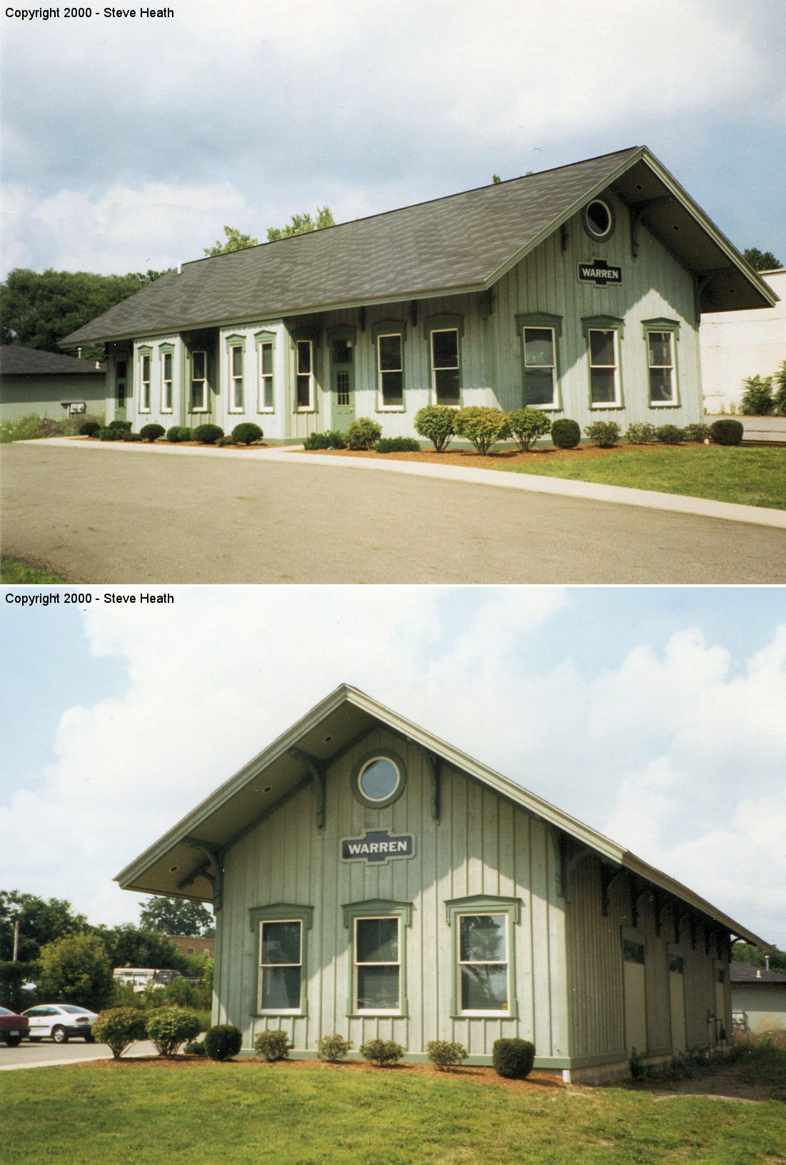
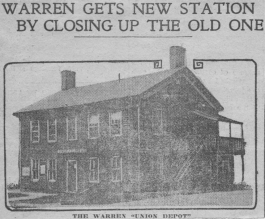
| Warren | |
The original 1883 two-story P&W (B&O) passenger station was on the west side of Main Street south of South Street (GPS: 41.233344,-80.820161). This building was originally a home facing Main Street, but was rotated 90 degrees when it was converted into a station.The original freight station was about 70 feet to the west of the passenger station. | ||||||
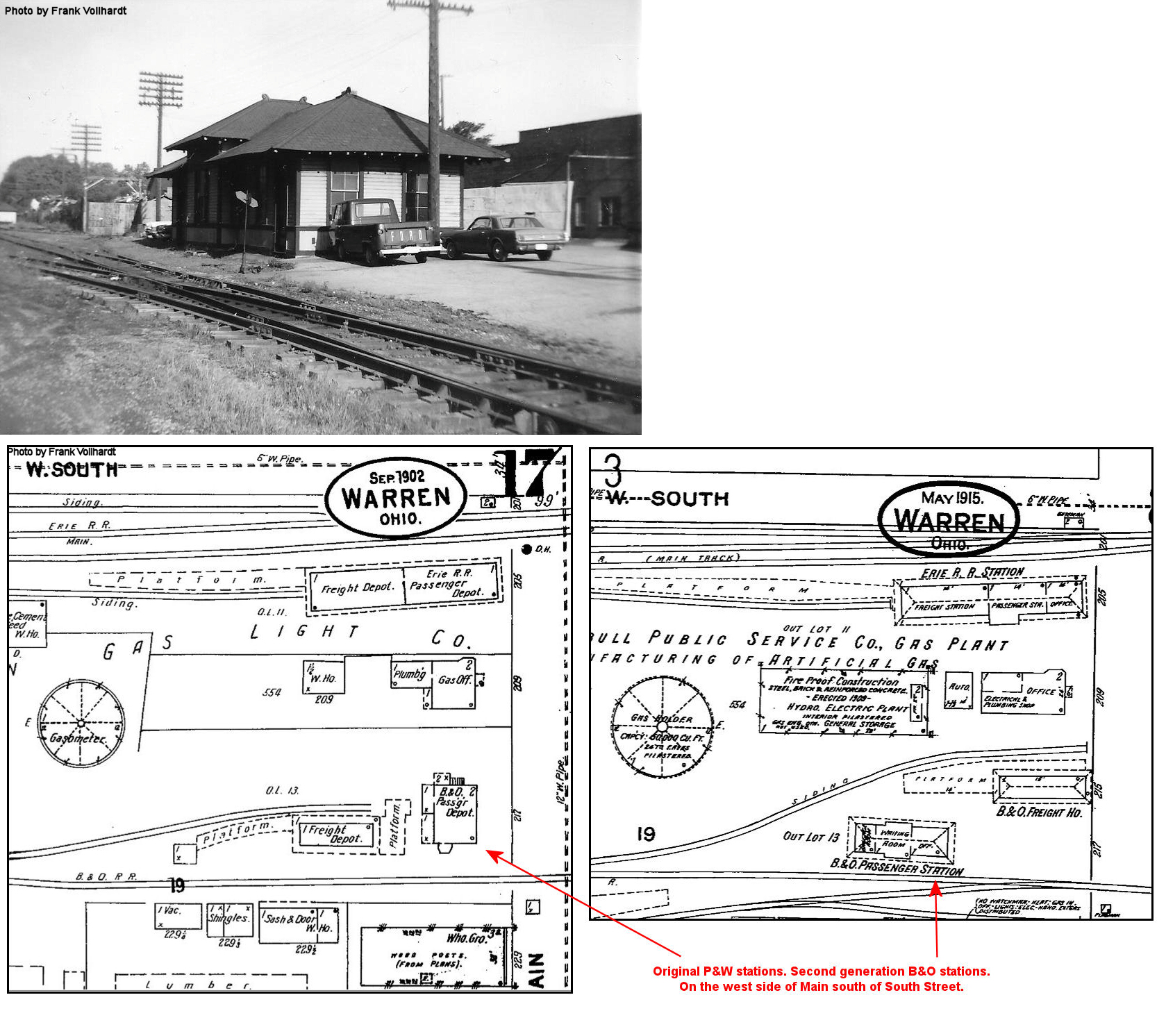
| Warren | |
A new single-story B&O passenger station and new freight house were built on the west side of Main Street replacing the original stations (see above) in 1909. The new freight station was on a siding where the original passenger station had been, and the new passenger station was a few feet to the SW of that. These stations were torn down in 1966 for the rebuild of South Street. | ||||||
| Warren | |
This is the newer freight station mentioned in the listing above. | ||||||
| Warren | |
There was a passenger station on the corner of Washington Street NE and Elm Road NE (GPS: 41.241727,-80.80995). This station is shown on the 1899 county atlas, and may have dated from the days of the Painesville & Youngstown naroow gague railroad. Later maps show a filling station at the same location so the station may have been converted for that use after going out of service. | ||||||
| Warren (N. Warren) |
|
There was a B&O passenger station on the west side of North Park Avenue at the intersection of Dana Street (GPS: 41.247096,-80.818557). It was built in 1905 to replace the station that was previously at the corner of Washington Street and Elm Road. Later this building handled both passengers and freight. | ||||||
| Warren |
C&MV RR |
The Cleveland and Mahoning Valley Station was on the NE side of Mahoning Avenue at GPS: 41.244930, -80.825943. This station is shown on the 1884 Sanborn map, but it was gone by the 1889 map as passenger operations were consolidated at the Main Street station when the C&MV was absorbed into the A&GW. | ||||||
| Warren |
|
There was a combination passenger/freight station on Forest Street NW near Vernon Avenue NW (GPS: 41.246035,-80.822672). This depot is shown on the 1889 and 1898 Sanborn maps of Warren. This may have been an original C&MV station. | ||||||
| Warren |
|
This combination station was on the SW corner of Main and South Streets (GPS: 41.233845,-80.820183). The tracks originally ran down the middle of South Street with the depot on the south side of the tracks. | ||||||
| Warren | |
This second generation passenger station was at the same site as the original combination depot (see above). When it was built, a new freight station and express office was added to its west. They were torn down in 1966 for the rebuild of South Street and passenger operations moved to the Pine Avenue freight station (listed below). | ||||||
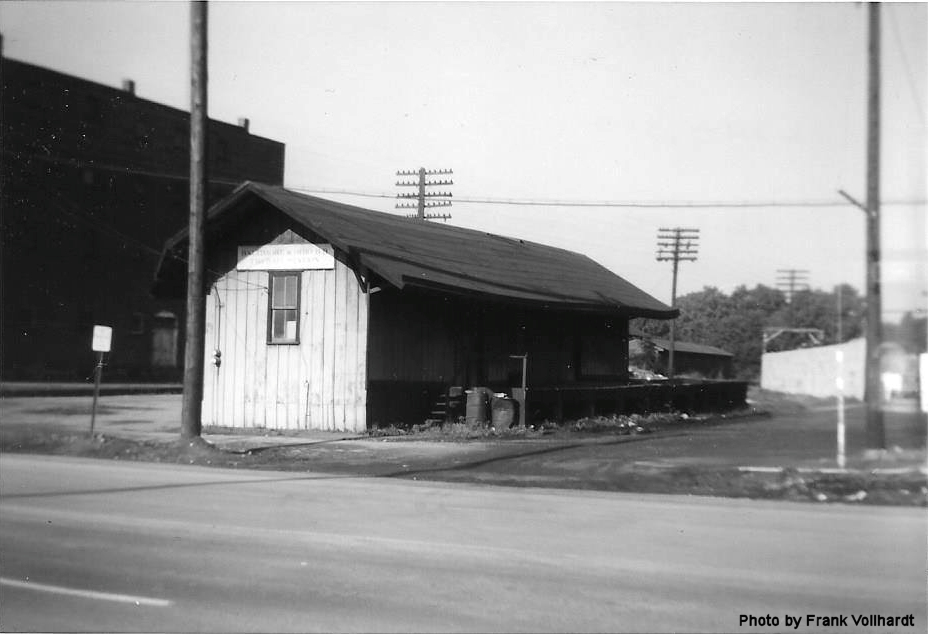
| Warren | |
This was originally a freight house, but when the original A&GW (Erie) passenger station was torn down it handled some passenger traffic in its later years. It was on the east side of South Pine Avenue SE just south of South Street (GPS: 41.233248,-80.815778). It was torn down by Conrail in April 1982. | ||||||
| Warren | |
The original combination passenger/freight station was on the north side of East Market Street on the west side of the tracks (GPS: 41.236527,-80.807517). | ||||||
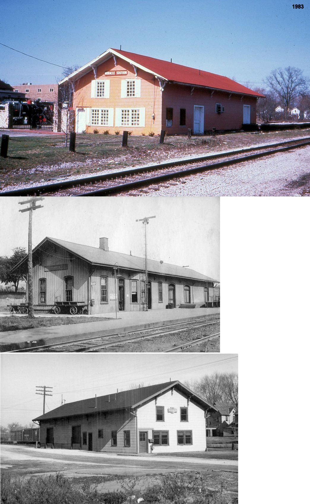
| Warren |
|
This station second generation combination passenger/freight station at the same site as the original PY&A depot (see above) underwent modification in the 1950s and was stripped of it's distinctive depot characteristics and shingled. There is a replica station on this site now, but it is not a replica of the station that was here. In the early 1980s the Property was purchased by Jim Friend. He was the art department director for the Warren City schools and a devout Christian. He brought in a small steam switcher and a caboose that were on display to the left of the building. He renamed the building "The Miracle Station" and served as an outreach for teens. In the front upstairs of the building was an HO scale replica of the Republic steel plant in Warren. In the back half of the building he had G scale trains running around the walls up near the ceiling. And at the very back of the station was a stage and ice cream stand. | ||||||
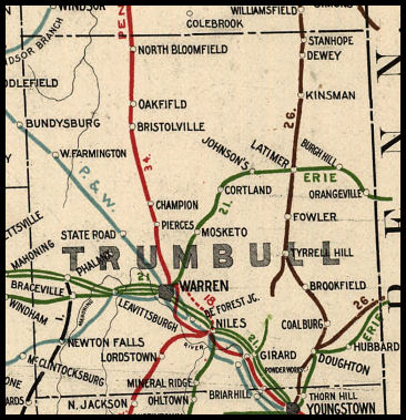
| 1898 TRUMBULL COUNTY RAILROAD MAP | ||||||||
 |
||||||||
| Notes About Existing
Stations... Brookfield (LS&MS) - This may be the station from Tyrell Hill. According to a timeline on the Vienna Historical Society website, the station was moved from Tyrell to Brookfield Center in 1928.The station caught fire on April 4, 2023. It remains to be seen if the building will endure. Champion (B&O) - Not sure this was a station. A station does not appear on the B&O on county maps from 1874 or 1899, however a "State Road" station does appear on the map pictured above. The building is along the grade and oriented as if it may have been a station. Can anyone verify? Newton Falls (LEA&W) - This Lake Erie, Alliance & Wheeling station was built in 1893 according to New York Central valuation records. The station was originally 20'x36', but a 24' extension was added in 1914. Kinsman (LS&MS) - I don't know where this building is located or if it was in fact a station (it does look like one), or even if it is still standing. Could this have been the old station that served the Kinsman Fair Grounds? The 1899 township map (American Atlas Co.) shows a building at the back of the fairgrounds along the RR tracks marked "RR Entrance" at approximately GPS: 41.470700, -80.607519. Warren (Replica) - This is a replica of an LS&MS station, even though Warren originally had a PRR station at this location. West Farmington (B&O) - This station was originally on the north side of Main Street (SR-88) (GPS: 41.390622,-80.967943). It was moved from the tracks to its current location in 1947. |
||||||||