 COUNTY COUNTY
|
|
||||||||
| EXISTING STATIONS | ||||||||
|---|---|---|---|---|---|---|---|---|
| Station Name |
Original Railroad |
Current Location |
Type | Current Use |
Date Built |
Track Status |
Building Material |
More Info |
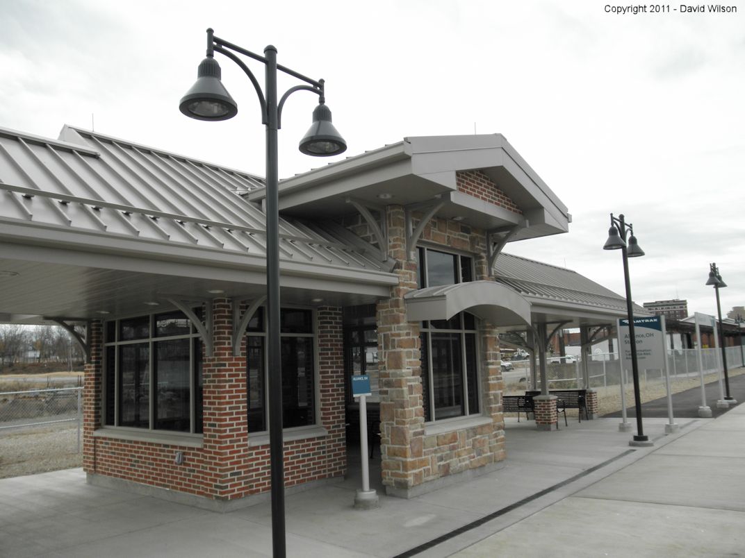
| Alliance |  |
Main Street east of Liberty Street | P | Railroad | 2011 | In Use | Brick | |
| Alliance |
 |
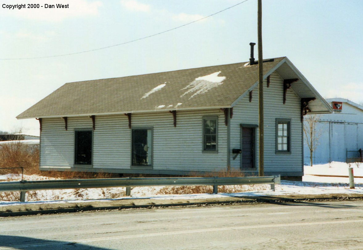
Main Street east of Liberty Street | P | Railroad | 1952 | In Use | Brick | |
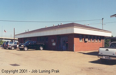
| Aultman (Greentown) |
 |
Century Village, 14653 East Park Street, Burton, OH in Geauga County. | P | Museum | 1878 | None | Wood |
|
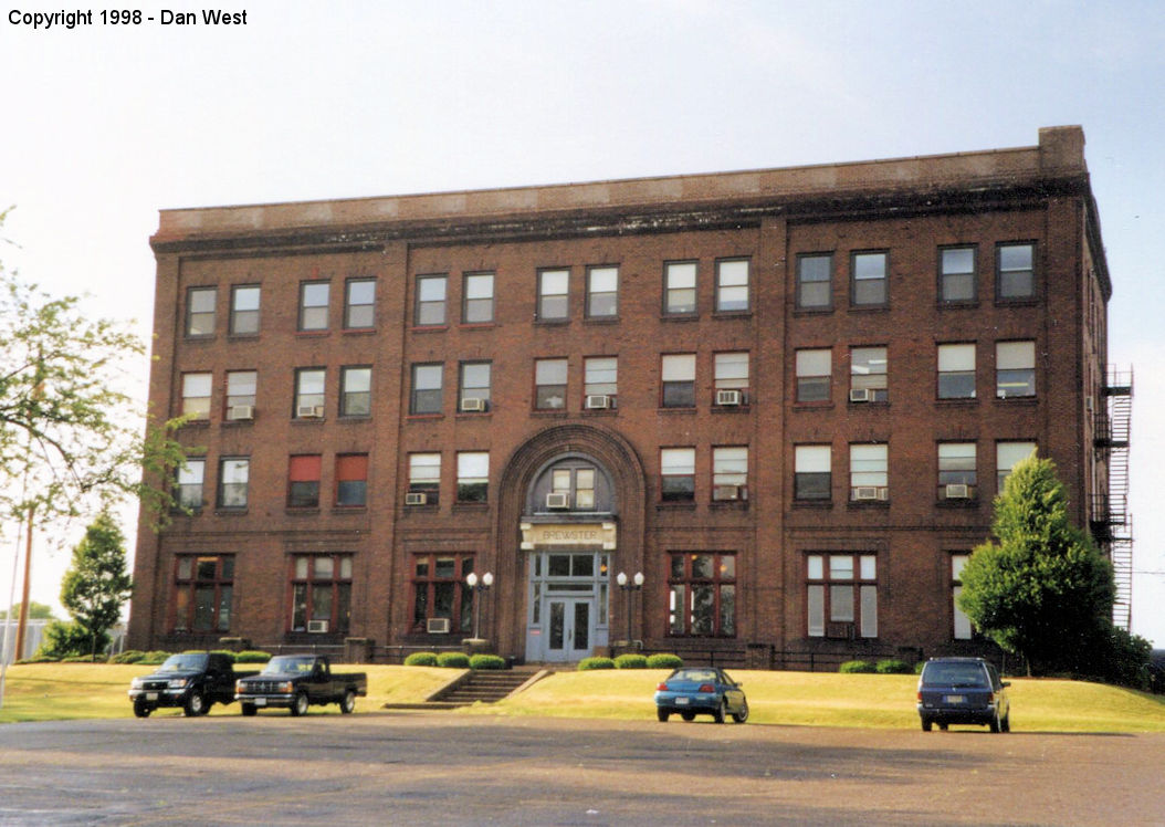
| Brewster |  |
100 1st Street SE (GPS: 40.713355, -81.597159) |
P | Railroad | 1914 | In Use | Brick |
|
| Canton | |
Market Avenue South at 9th Street NW (GPS: 40.792073, -81.376719) |
P | Vacant | 198? | In Use | Brick |
|
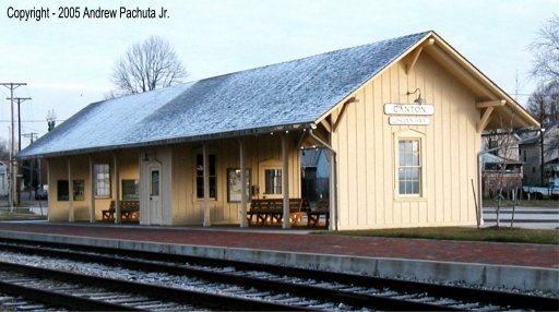
| Canton |  |
1315 West Tuscarawas (GPS: 40.801505, -81.387673) |
P | Railroad | 2004 | In Use | Wood | |
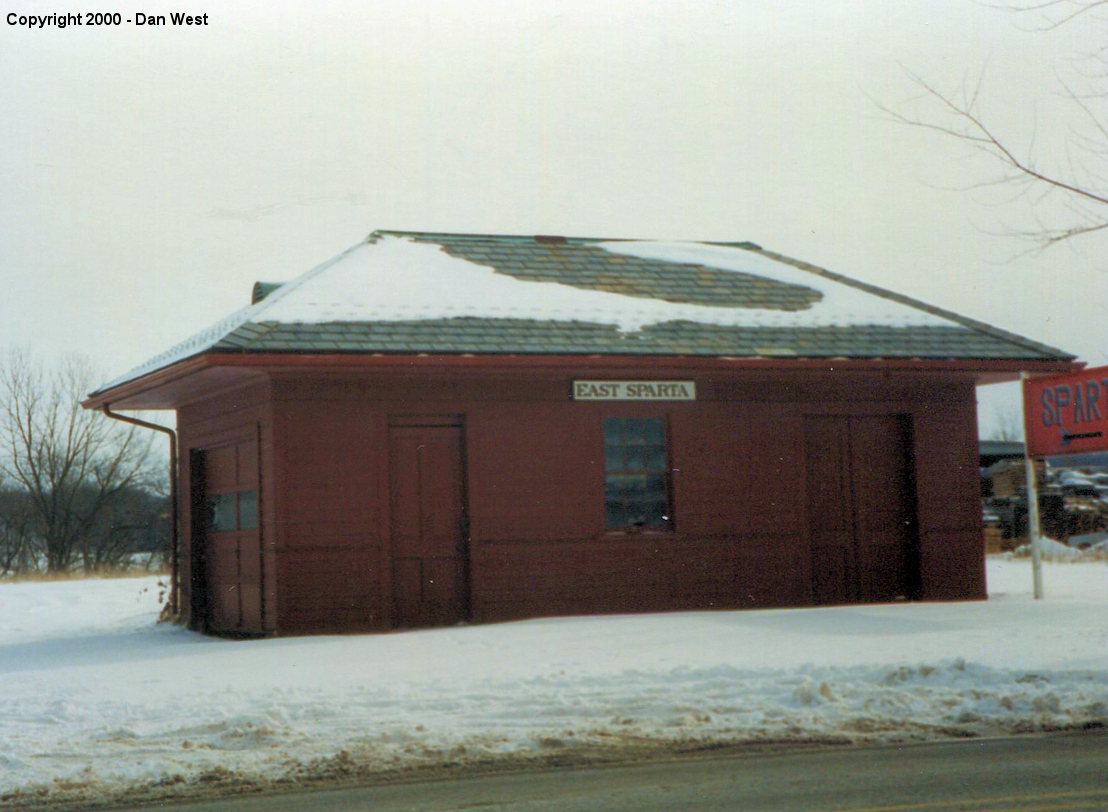
| East Sparta |  |
Across the street from
9875 Chestnut Avenue SE (GPS: 40.662014, -81.356841) |
P | Business | ???? | Gone | Wood | |
| Hartville | |
120 East Maple Street (GPS: 40.963680, -81.330484) |
P | Business | 1892 | In Use | Wood | |
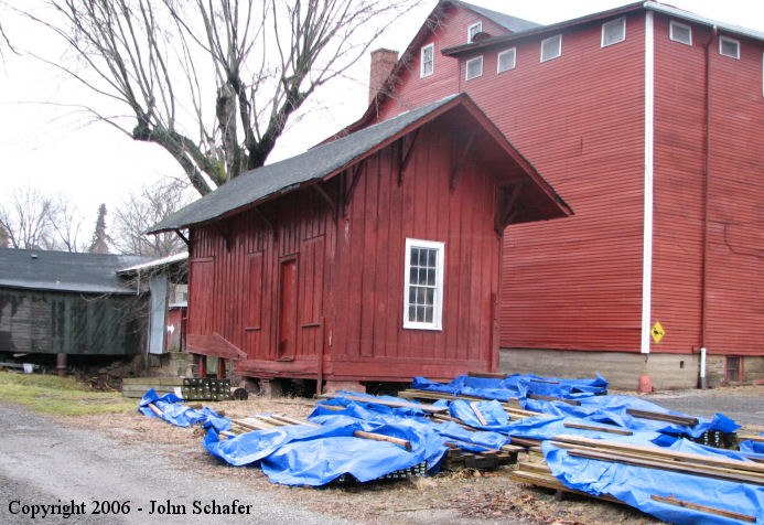
| Magnolia |
 |
Behind Magnolia Flouring Mill on SR-183 (GPS: 40.652805, -81.299512) |
C | Storage | ???? | Gone | Wood | |
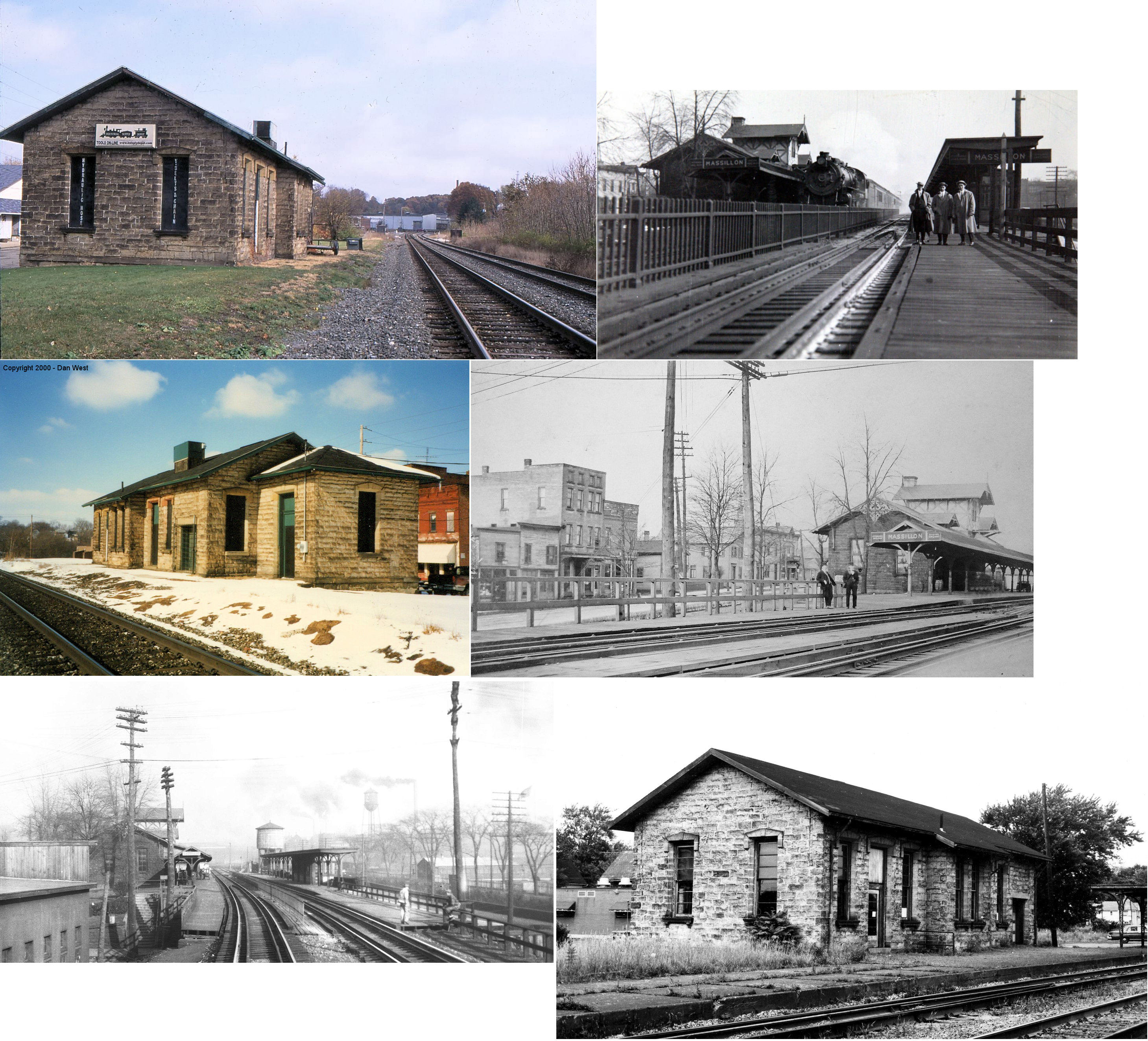
| MassilLon |  |
Penn Avenue SE east of Erie Street (GPS: 40.791597, -81.520111) |
P | Business | 1876 | In Use | Stone |
|
| North
Canton (Marchand) (New Berlin) |
|
South side of Portage Street NW between Whipple and Freedom Aves. (GPS: 40.881487,-81.425069) |
P | Business | 1885 | In Use | Wood | |
| STATIONS OF THE PAST | ||||||||
| Station Name |
Original Railroad |
Notes | ||||||
| Alliance |  |
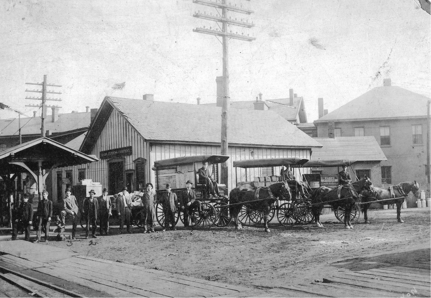
This was the station for the Adams Express Freight Agency which was located near the intersection of Ash and South Webb. | ||||||
| Alliance |  |
This was Alliance's first railroad station, built in 1853 by the Ohio & Pennsylvania Railroad. It was located near the location of East Main Street and Webb Avenue. It burned down in 1863 (when the station served the Cleveland & Pittsburgh RR) according a Sept. 30, 1863 article in The Weekly Steubenville Herald. The first stared in the adjacent Alliance House Hotel and spread to the depot, telegraph office and express office. | Alliance | AND |
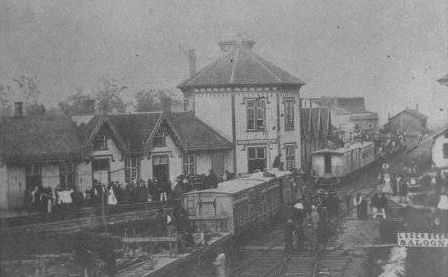
This second generation station/hotel, known as the Sourbeck House, was near the intersection of East Main Street and South Webb Avenue. This station included the Hotel Alliance with a lunch room and large dining room. It opened in September 1866 and was torn down in 1952. | |||
|
(Alliance) North Freedom |
|
Freedom is one of three small towns that merged to become Alliance in 1854. This station was most likely in the vicintiy of North Park Avenue and Keystone Street. Does anyone know the exact location for sure? | ||||||
| Alliance | |
The PRR had a large freight house and transfer station off Patterson Avenue between the C&P division tracks and the PFt.W&C division tracks. It was located at GPS: 40.922737, -81.097018. It was built in 1880 and extended in 1896 (according to PRR valuation records). | ||||||
| Alliance |  |
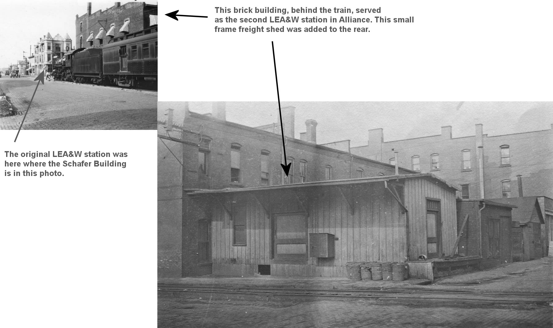
The first LEA&W station in Alliance was on the NE corner of Mechanic Avenue and Main Street in a two-story building with a one-story annex. There is an image of a building on the "AllianceMemory.org" website identified as the first LEA&W station in Alliance, however that building was never used by/for the railroad (it was a Salvation Army building and built after the first LEA&W station was erected according to Sanborn maps). | ||||||
| Alliance | |
After the depot listed above was torn down around 1893-1900, the LEA&W station was then housed in an already extant two-story brick building on the SE corner of Mechanic and Main. There was a one-story wooden building added to the south side of that building to serve as the freight station. These two buildings did not serve the railroad very long (less than ten years). | ||||||
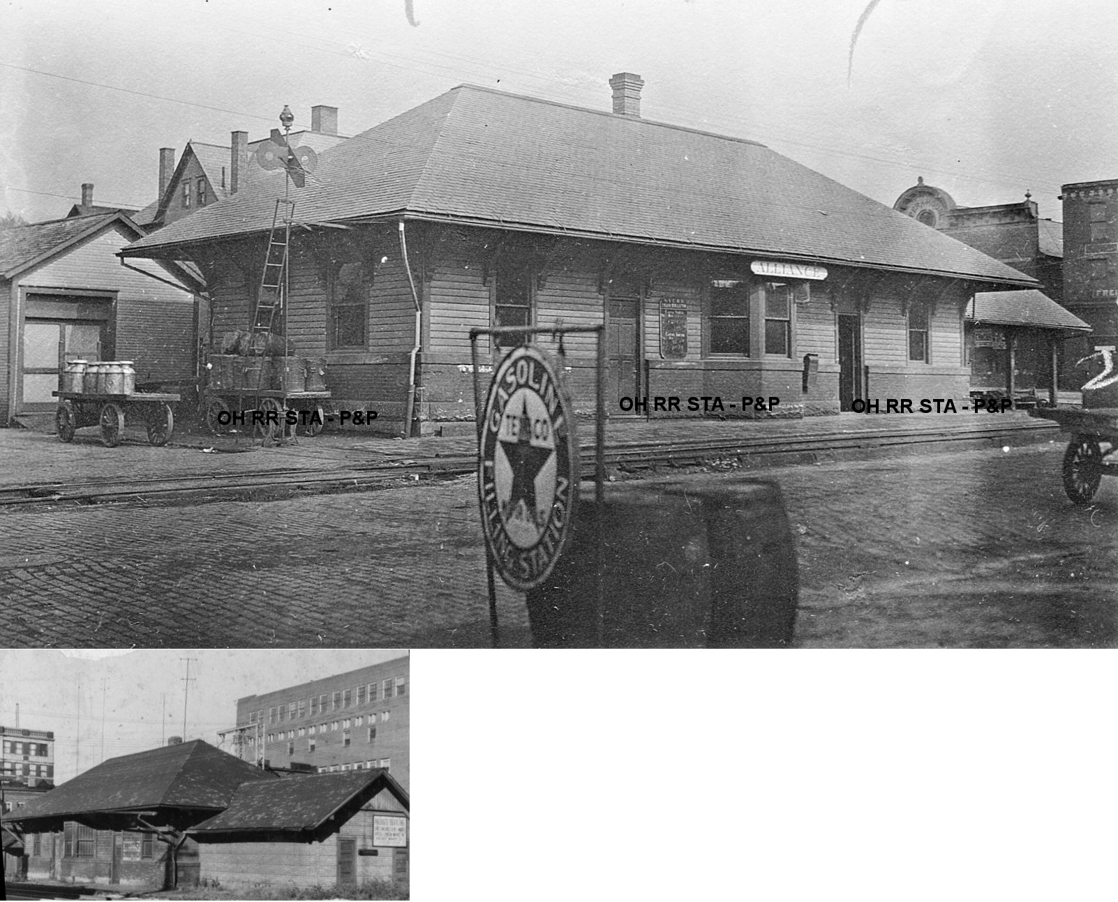
| Alliance | |
In 1902 the railroad built a traditional-style depot on the NE corner of Market Street and Mechanic Avenue. This passenger station, built in 1902, was on the north east corner of East Market Street and South Mechanic Avenue. This was downtown near the Johnson Building (which can be seen in the photo). The station was later a bicycle shop, then abandoned and torn down sometime in the late 1960s or early 1970s. | ||||||
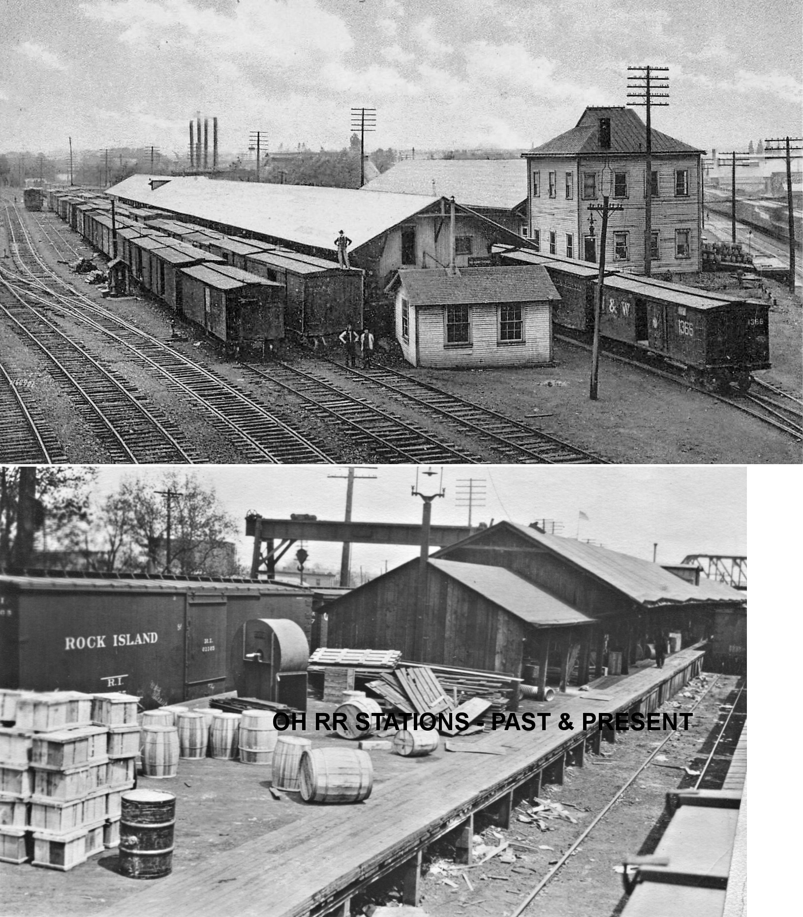
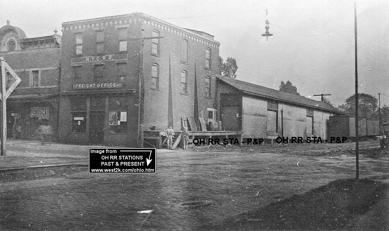
| Alliance | |
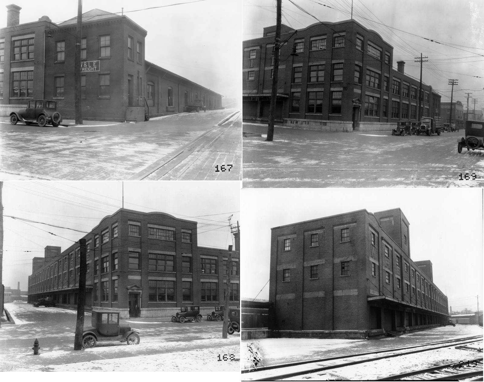
Also in 1902 the railroad moved its freight station into a 3-story already extant 1888 feed mill building on the SE corner of Mechanic Avenue and East Market Street. According to NYC valuation records, a new wooden freight shed was added onto this brick building in 1910 (as pictured). | ||||||
|
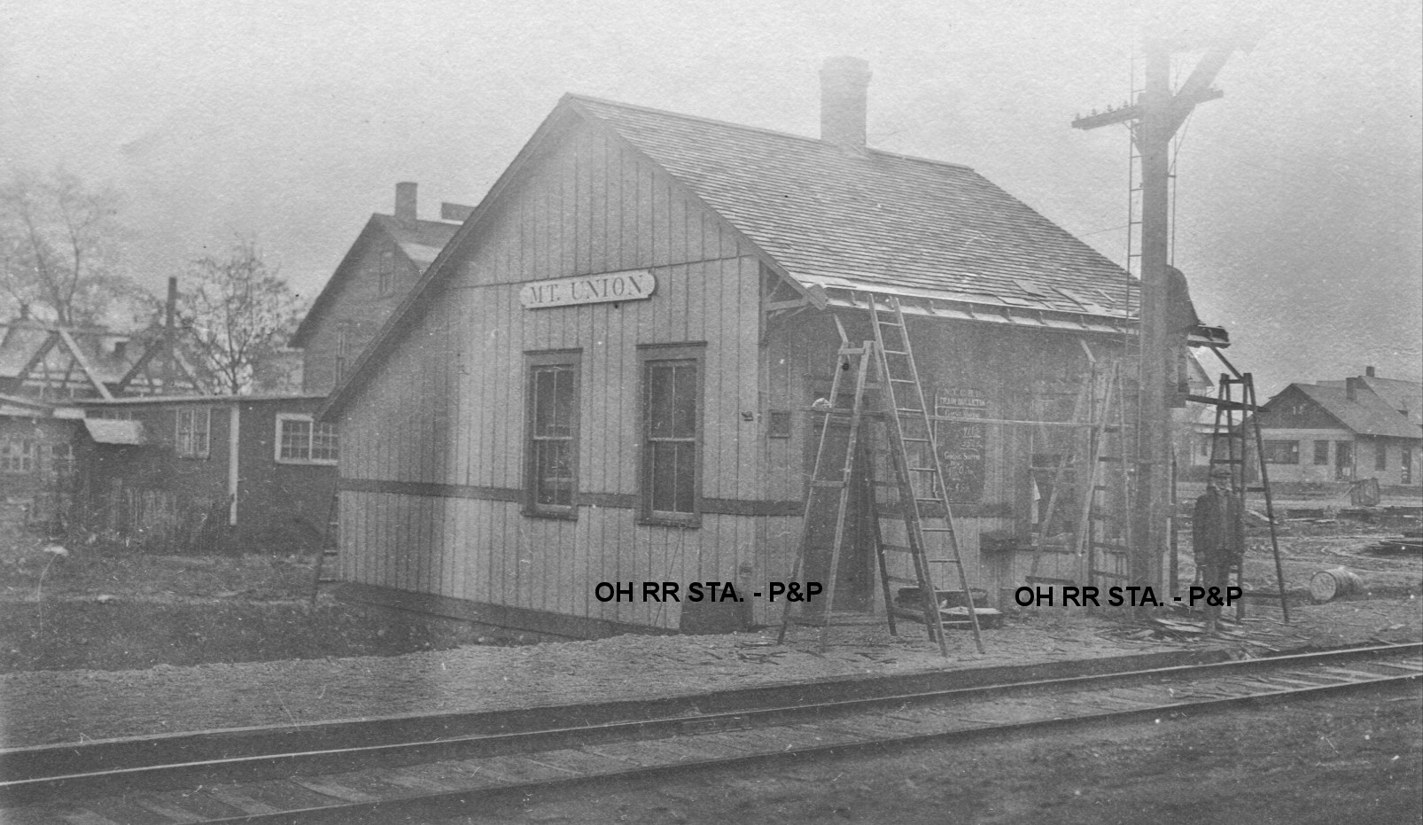
Alliance (Mt. Union) |
|
This 20'x30' combination station, which primarily served Mt. Union College, was located on Penn Avenue just south of West Chestnut Street. The village of Mount Union became part of Alliance in the late 1800s. | ||||||
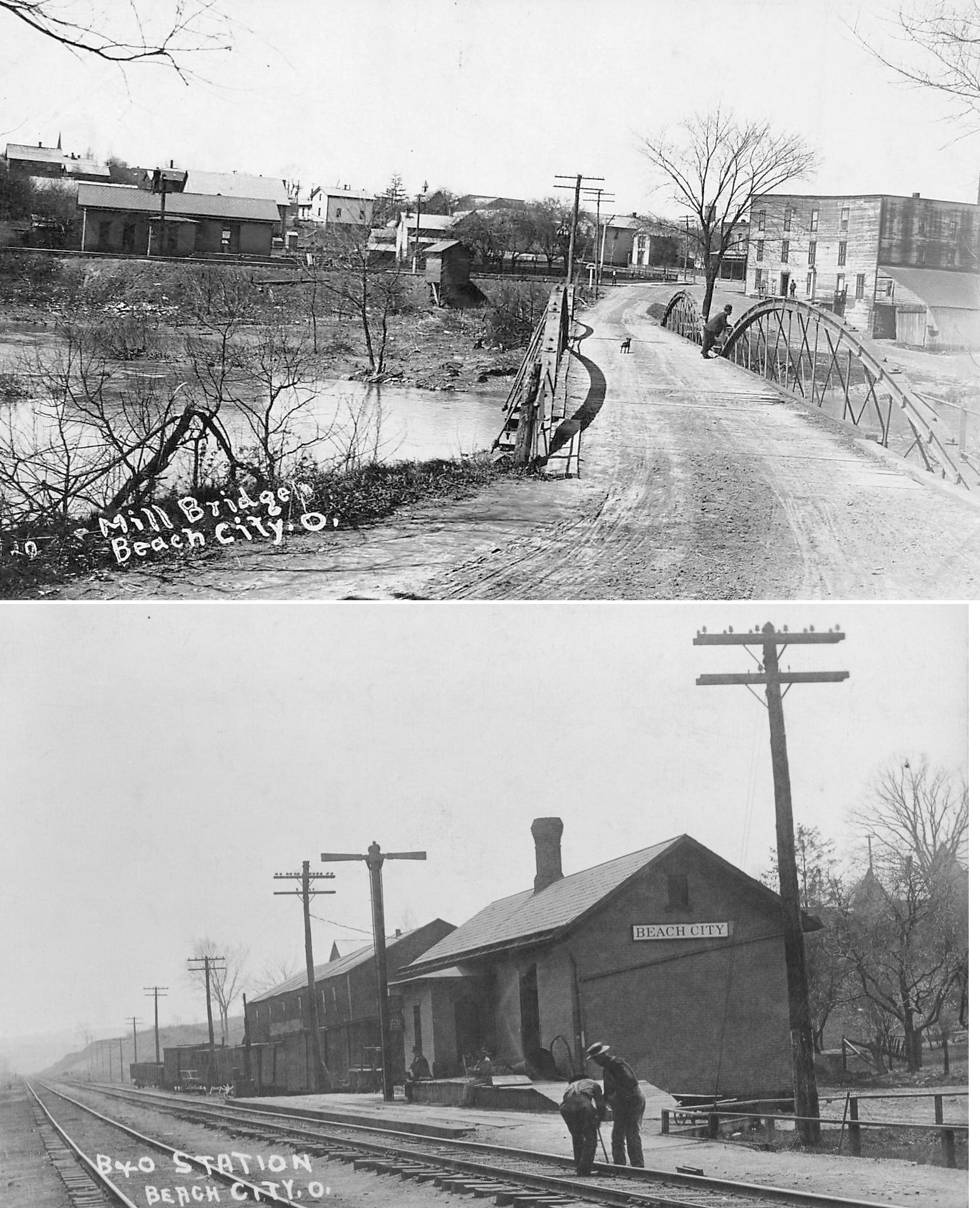
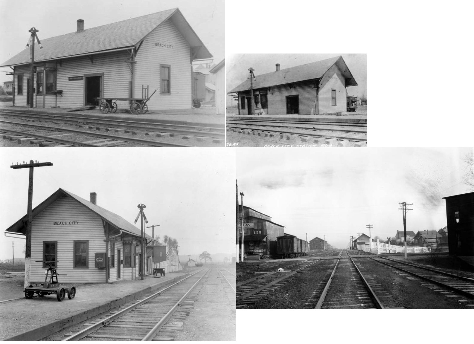
| Beach City |  |
|||||||
| Beach City |  |
This station was ont he south side of Main Street on the east side of the tracks. | ||||||
| Bowdil | |
See listing below for North Lawrence. | ||||||
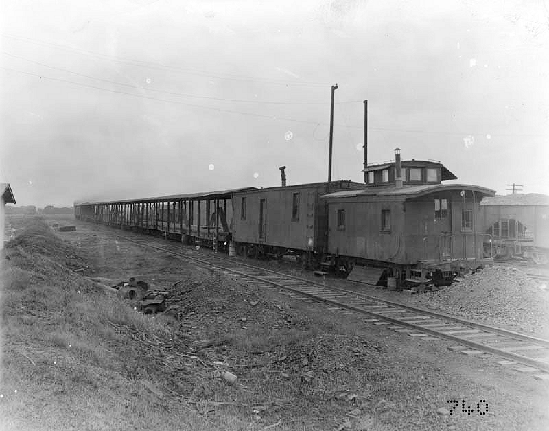
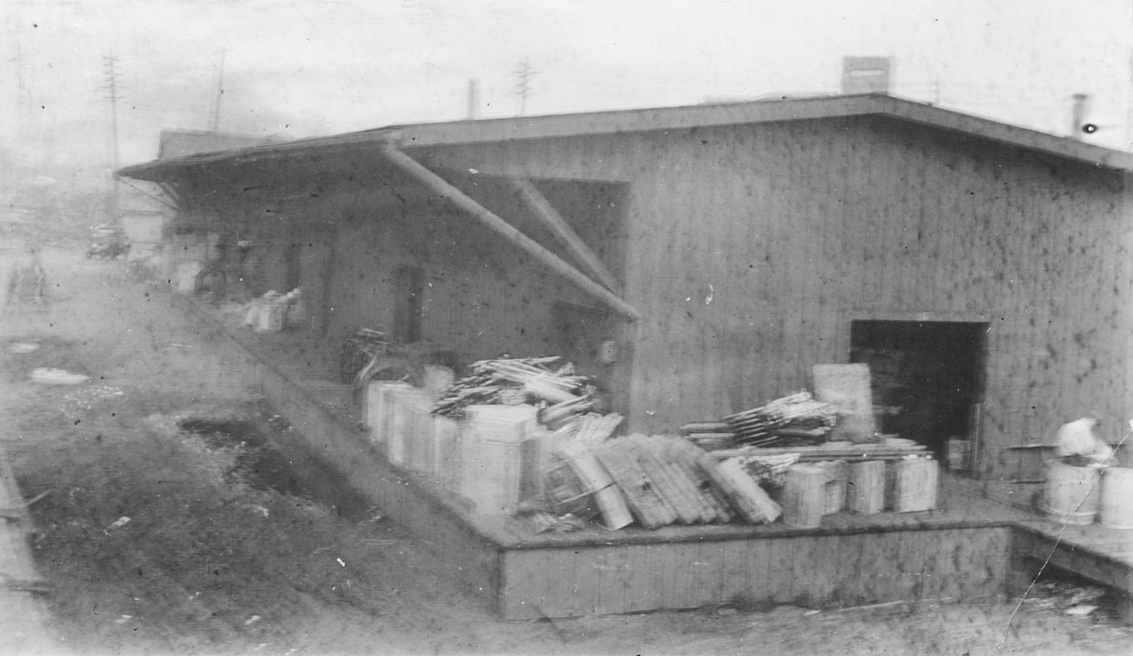
| Brewster | |
This open-sided freight transfer shed was likely in the yard. It appears the caboose and boxcar served as the office end of the structure. | ||||||
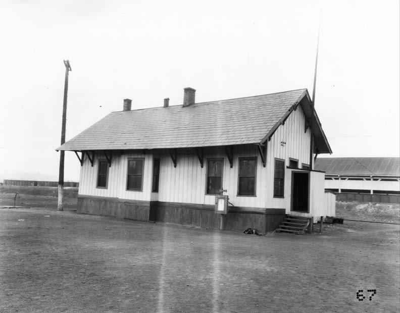
| Brewster | |
This building served as a yard office, but was built to standard depot specifications. | ||||||
| Butter Bridge |
|
This station was listed on the 1923 PRR List of Stations & Sidings on the Massillon & Cleveland Branch. | ||||||
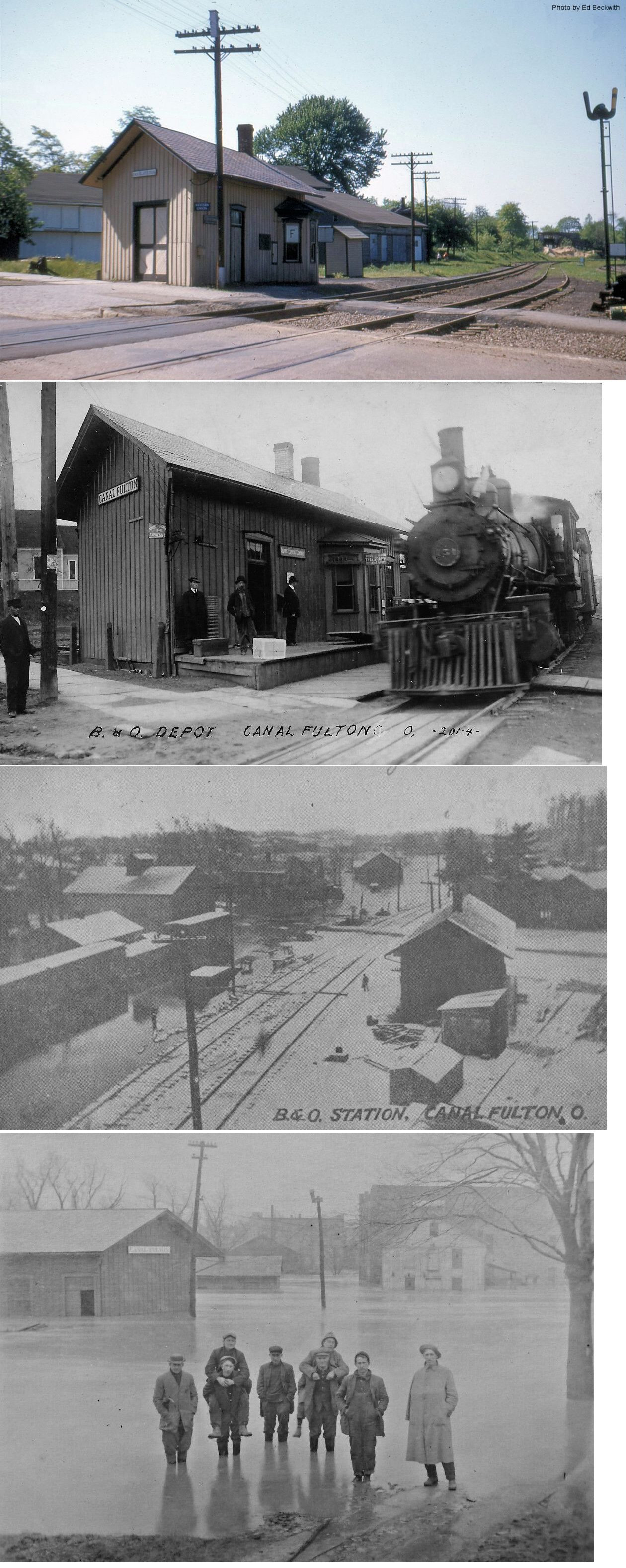
| Canal Fulton | AND |
This station sat on Market Street just northeast of 1st Street. It was built by the CL&W (B&O) but partially leased to the PRR in the later years of passenger service. | ||||||
| Canal Fulton | |
This station was on Market Street on the river side of the tracks. It was about 125 feet northeast of the B&O station. On early maps (1893 & 1898) the building is clearly marked as the passenger station, but on later maps (1911) the building is just shown as a storage facility. The PRR valuation records of 1917 indicate that former station was being used as a residence and give a build date of 1895. By the 1923 map, the building is gone and thereafter the PRR shared the B&O station. In 1964, the PRR requested to demote its presence at the B&O station to a non-agency station with carload-only freight service (Massilon Evening Independent, 12-09-1964). | ||||||
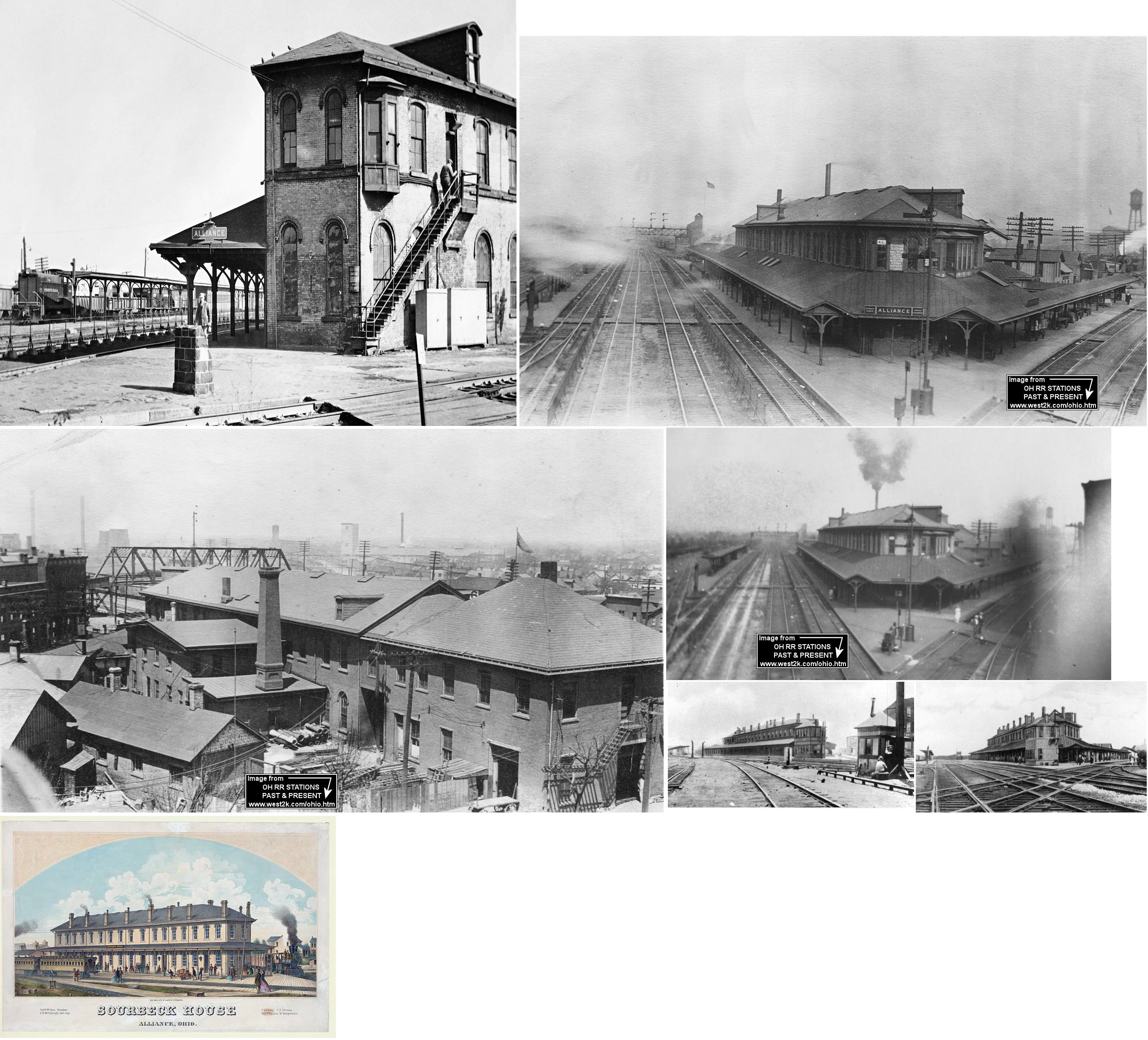
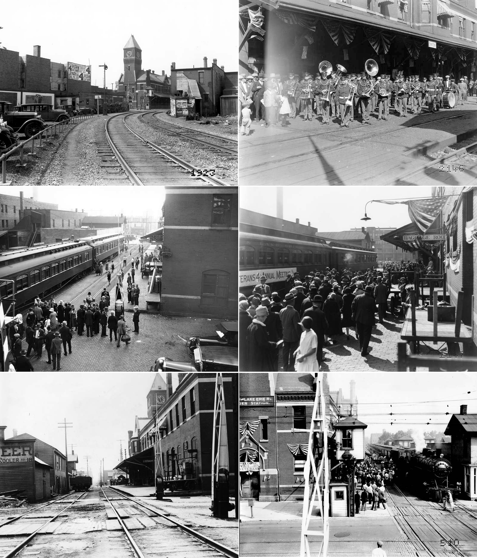
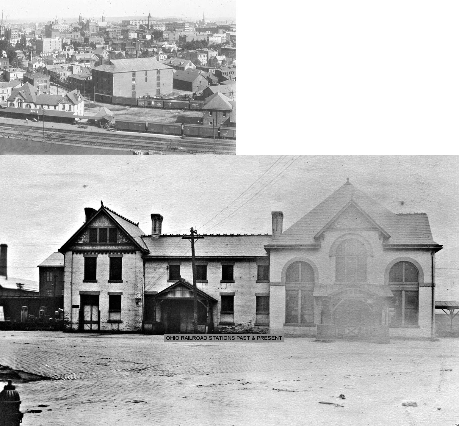
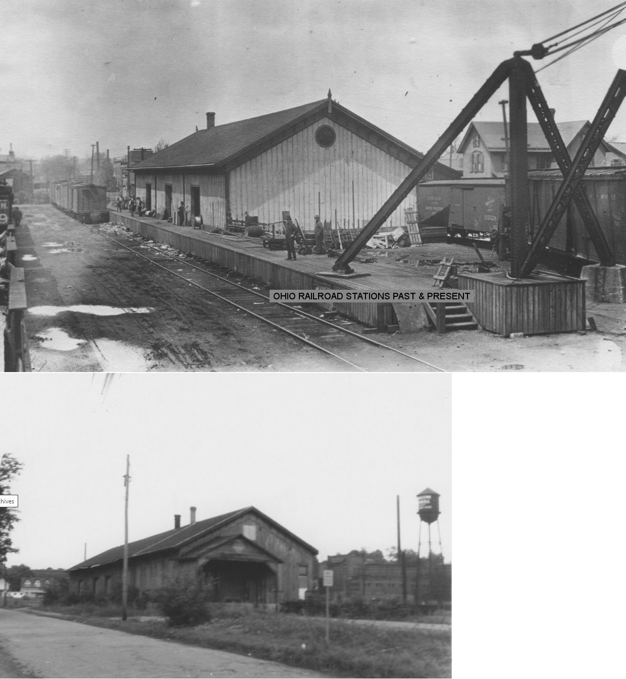
| Canton | |
This combination station was on the the north side of East Tuscarawas Streets between Cherry and Orchard Streets (GPS: 40.797904,-81.370274). It included a large covered platform and a clock tower. It was built in 1888. Prior to this depot being constructed there was a freight station here that handled that type of traffic. | ||||||
| Canton | |
This passenger station, built in 1887,
sat between Cherry and Madison Streets about 100 feet west of the
existing freight station (GPS: 40.794274,-81.371419). According to maps, this building was still
standing, but unused in 1914. In 1919, the PRR valuation records said
the building was being used as an office. Here are three Edison videos shot at the station in 1901 (from the Library Of Congress): Arrival of McKinley's Funeral Train Taking President McKinley's Body From Train President Roosevelt At The Canton Station There was also a freight house on the east side fo Cherry Street south of Mulberry Street (GPS: 40.792475,-81.372331). All the tracks at this location have been removed. |
||||||
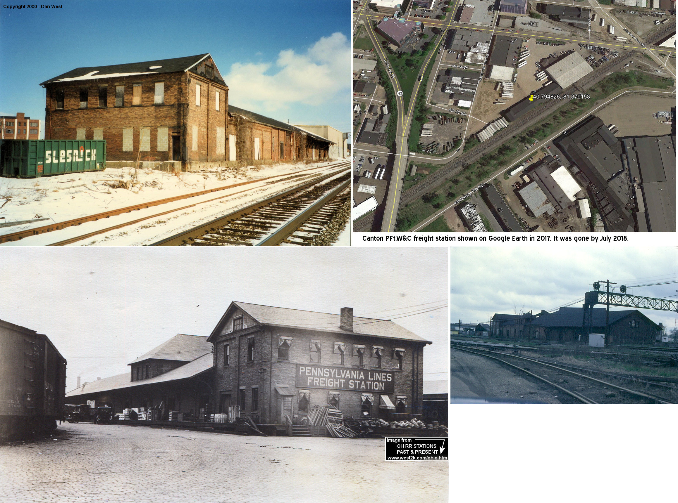
| Canton | |
According to PRR valuation records, the PFt.W&C freight station was built in 1865 and extended in 1903 and 1908. This station could be seen to the east of the Cherry Ave. overpass between Cherry and Madison Streets at GPS: 40.794826,-81.370153. In later years, the building was somewhat run down but still had the fancy trim under the eves. It was torn down sometime between 2017-2018. The old PFt.W&C passenger station was about 100 feet to the west of this building. | ||||||
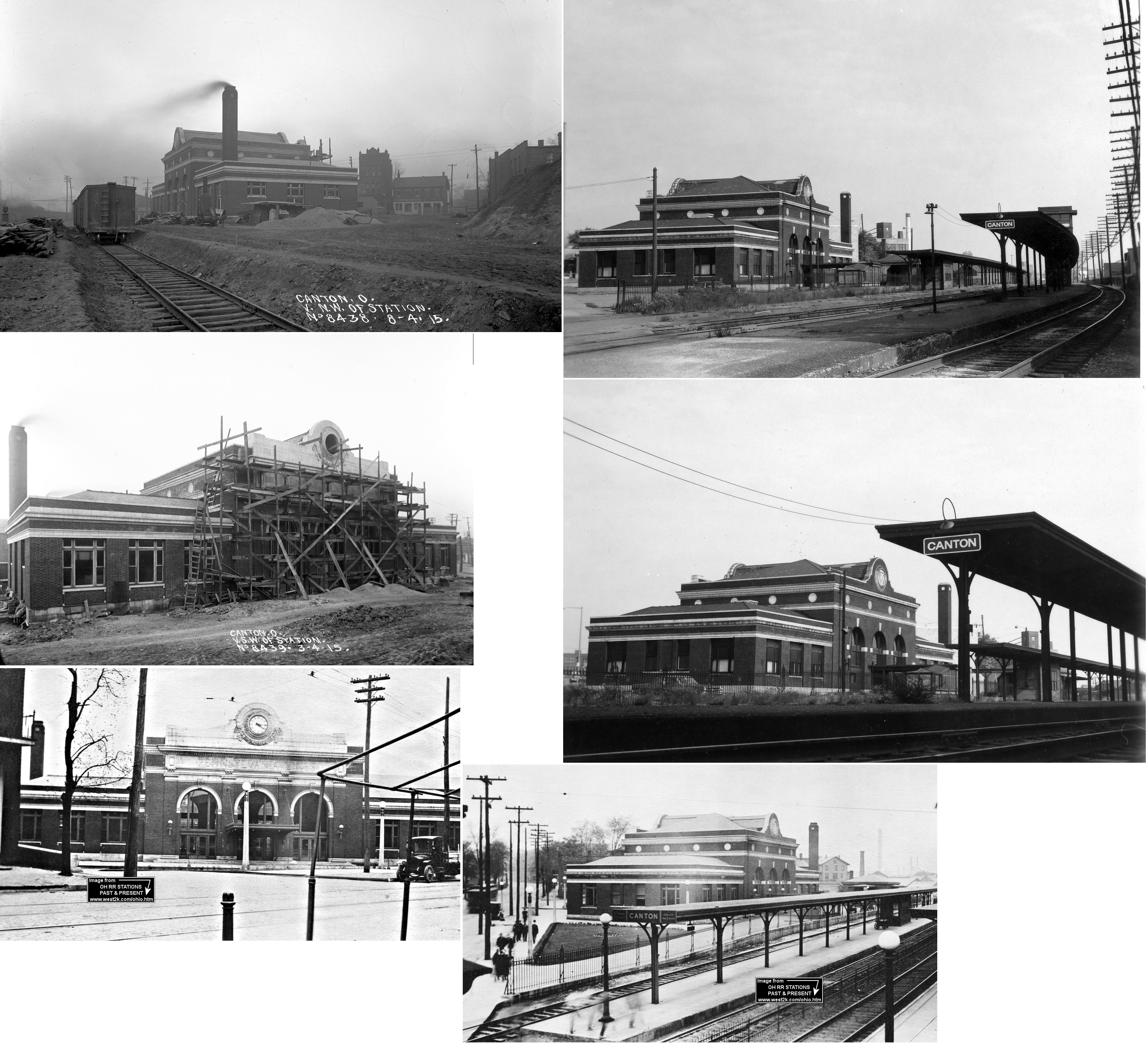
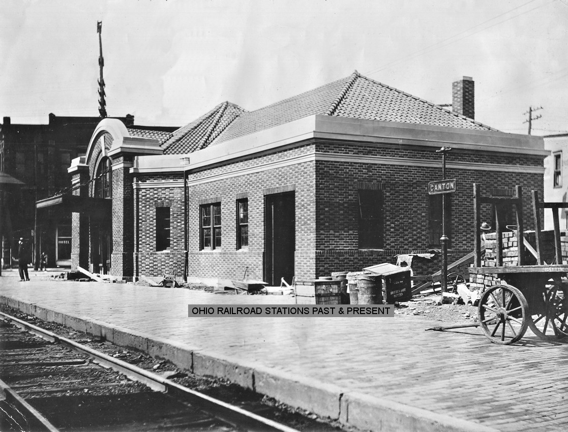
| Canton | |
Built in 1915 and torn down in 1976, this station was on Market Street South and 9th Street SW at the location of the existing Amtrak station (GPS: 40.792065, -81.376729). It replaced the original PFt.W&C station listed above. | ||||||
| Canton |
|
The Valley Railway had its first passenger station and freight station between High Avenue SW and Marion Avenue SW at the crossing of the CT&V and the PFt.W&C (PRR). These were referred to as the "East End" Valley RR stations. The passenger station was in the NE corner of the diamond at GPS: 40.790291, -81.383501. The freight station was on the transfer track near High Avenue at GPS: 40.790558, -81.383212. These stations were just northeast of the Canton Glass Company. The 1887 and 1891 maps indicates that these stations were still standing, but not in use by then. They were both gone by 1914. | ||||||
| Canton |
|
This freight station was on the west side of Cherry Avenue SE at Mulberry Road at GPS: 40.793091, -81.373027. This was the new "East End" freight house built to replace the one listed above. At some point in the 1910s the original station here was replaced with a newer B&O freight station. | ||||||
| Canton |
|
The Valley Railway replaced its original passenger station with one on the south side of Tuscarawas Street on the east side of the tracks at 40.800473, -81.387323. There were two generations of Valley Rwy. stations at this location. The second one was replaced by the B&O station listed below around 1914. | ||||||
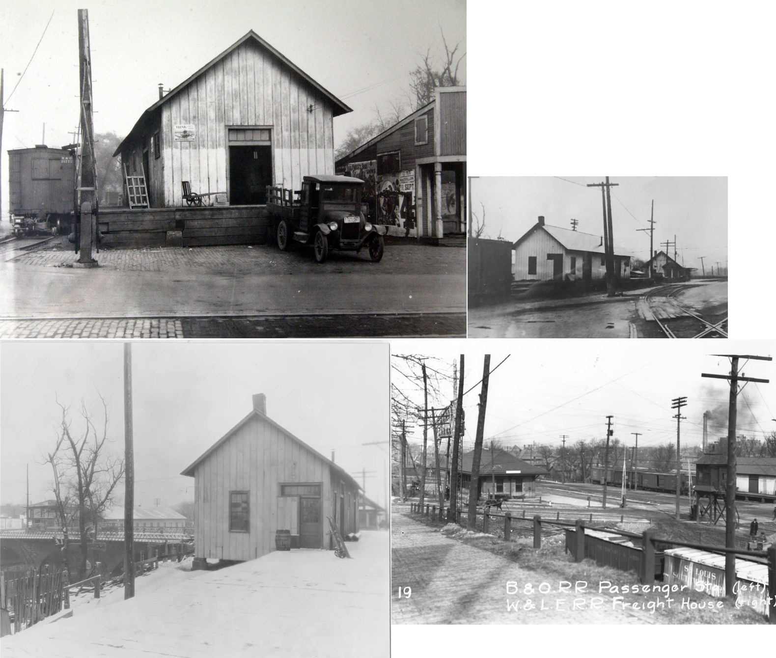
| Canton | |
The B&O had a brick passenger station was on the east
side of the tracks between Tuscarawas Street West and 2nd Street SW
(GPS: 40.800532,-81.38733). Jim Bailey writes: "The second floor was
apparently a significant office for the railroad. There were many women
working there. Regular passenger service did not exist in the 1940s.
However, I saw several troop trains loading from the station. To the best
of my recollection the building was torn down in 1944." The station was
likely built around 1914. |
||||||
| Canton | |
There was a freight station on Cherry Avenue SE across the street from the Valley/B&O freight station listed above. The NKP freight house was on the east side of Cherry Avenue. | ||||||
| Center Road |
|
According to NYC valuation records, there was a 12'x37' passenger platform and a 8'x15' milk platform here in 1917. This stop was between Mt. Union and Freeburg. | ||||||
| Congress Lake | |
This lake is just north of Hartville. Station was retired in 1939, eventual fate unknown. | ||||||
| Crescent |
|
This station was between Paris and Myers. It is shown on the 1913 LEA&W timetable. | ||||||
| Crystal Springs (MILLPORT) |
|
|||||||
| Crystal Springs |
|
This station was listed on the 1923 PRR List of Stations & Sidings on the Massillon & Cleveland Branch. | ||||||
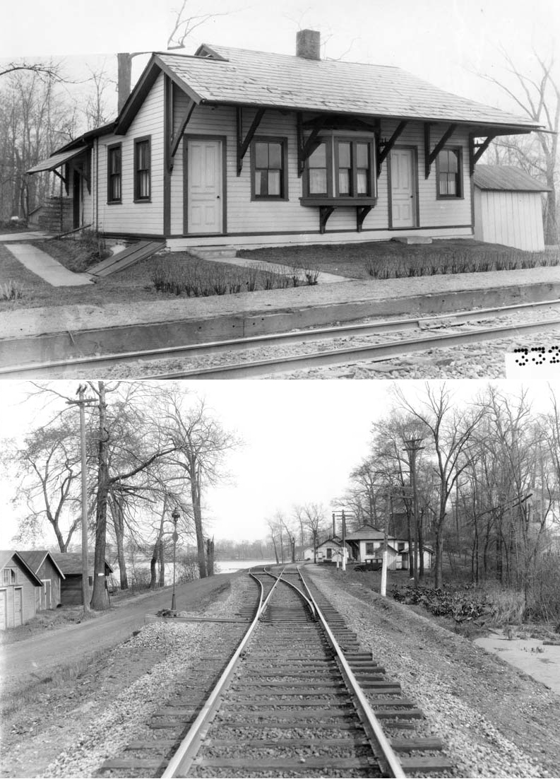
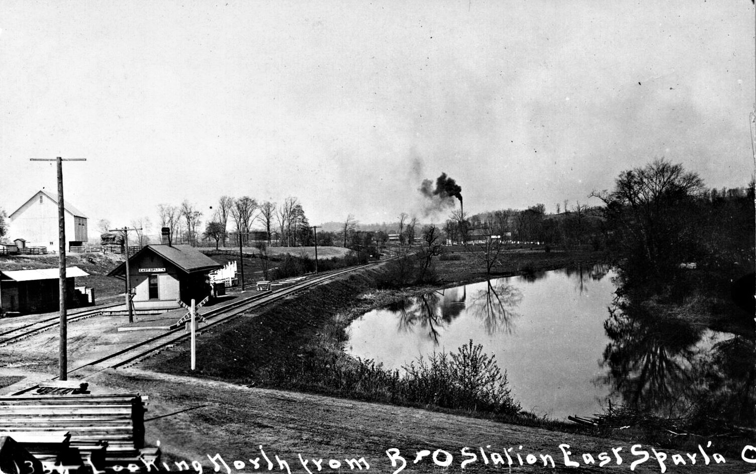
| East Sparta | |
This was a predecessor to the station listed above that is still standing. This was the original depot north of town. It was a victim of numerous flooding so a new depot was built south of town on the new alignment that went around the west side of town. | ||||||
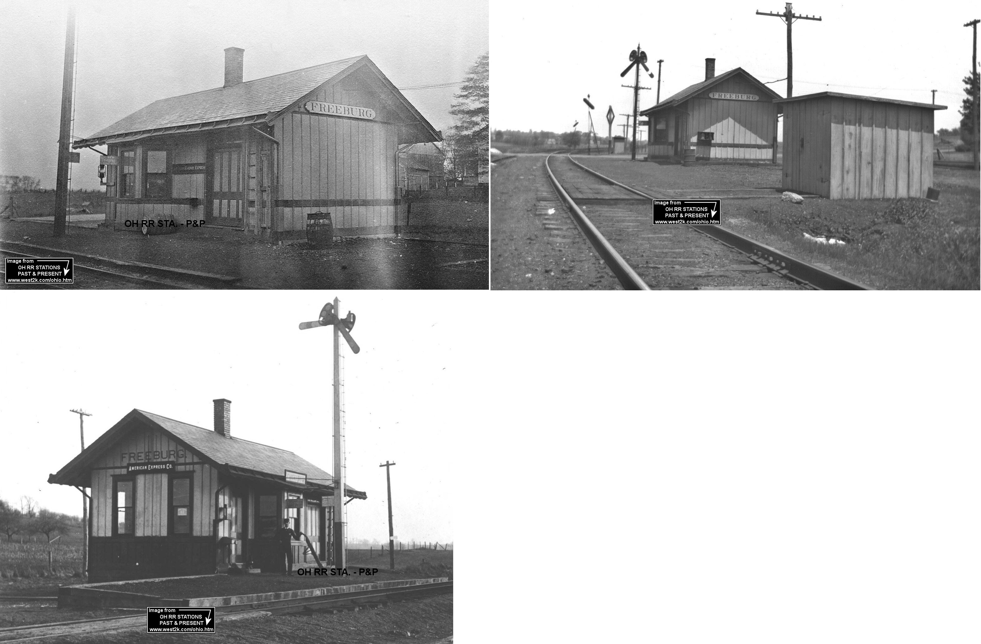
| Freeburg | |
According to NYC valuation records, this station was built in 1902. It measured 16'x30' and at some point it was moved back from the tracks 8 feet in order to make way for a new track alignment. | ||||||
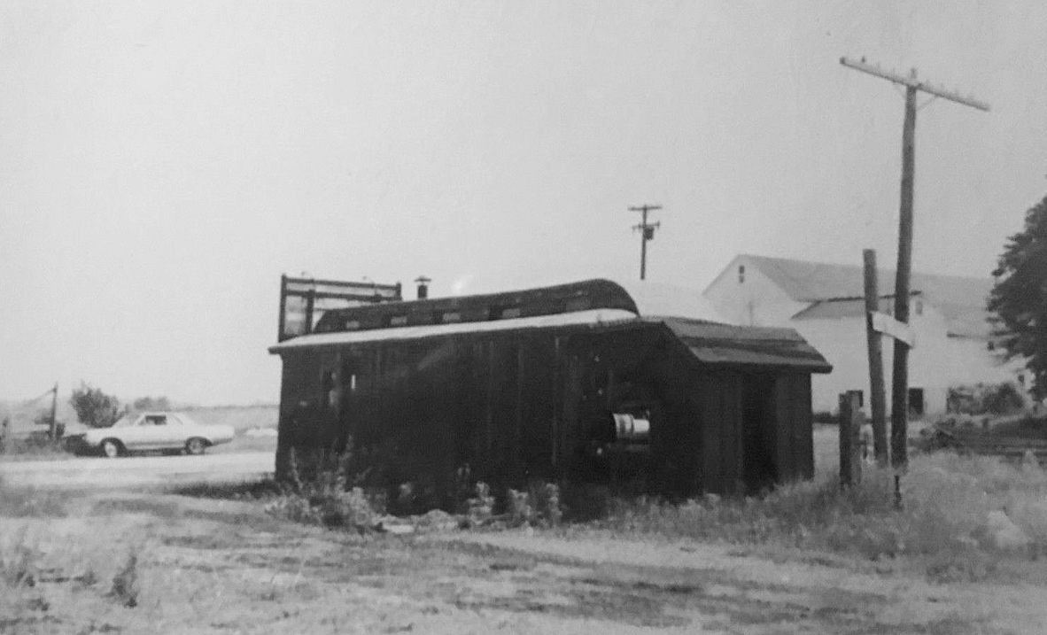
| Freeburg | |
This appears to be a converted carbody that was used as a replacement station. | ||||||
| Greentown Station |
|
This station was down the hill from Greentown on State Street NW. It was torn down in 1959. | ||||||
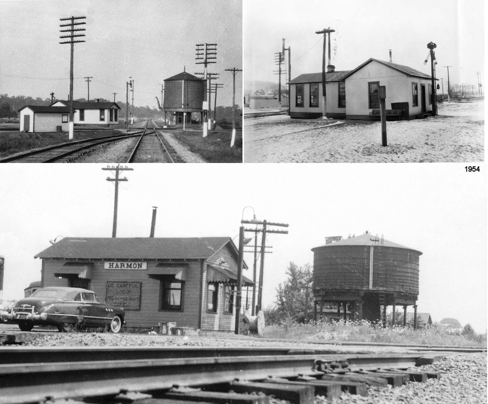
| HarmoN Junction | |
This station was built at the new junction of the WLE's Toledo and Cleveland divisions in 1910. A lunch counter, electric lighting, and safety fencing were added in 1911. This station was closed in 1917 (New Phildelphia Daily Times, 6-26-1917). The building was eventually moved to Brewster. | ||||||
| Harmon | |
This was the replacement for the station listed above. It mainly served as a telegraph office. Unsure how much passenger traffic it saw if any. | ||||||
| Howenstine |
|
|||||||
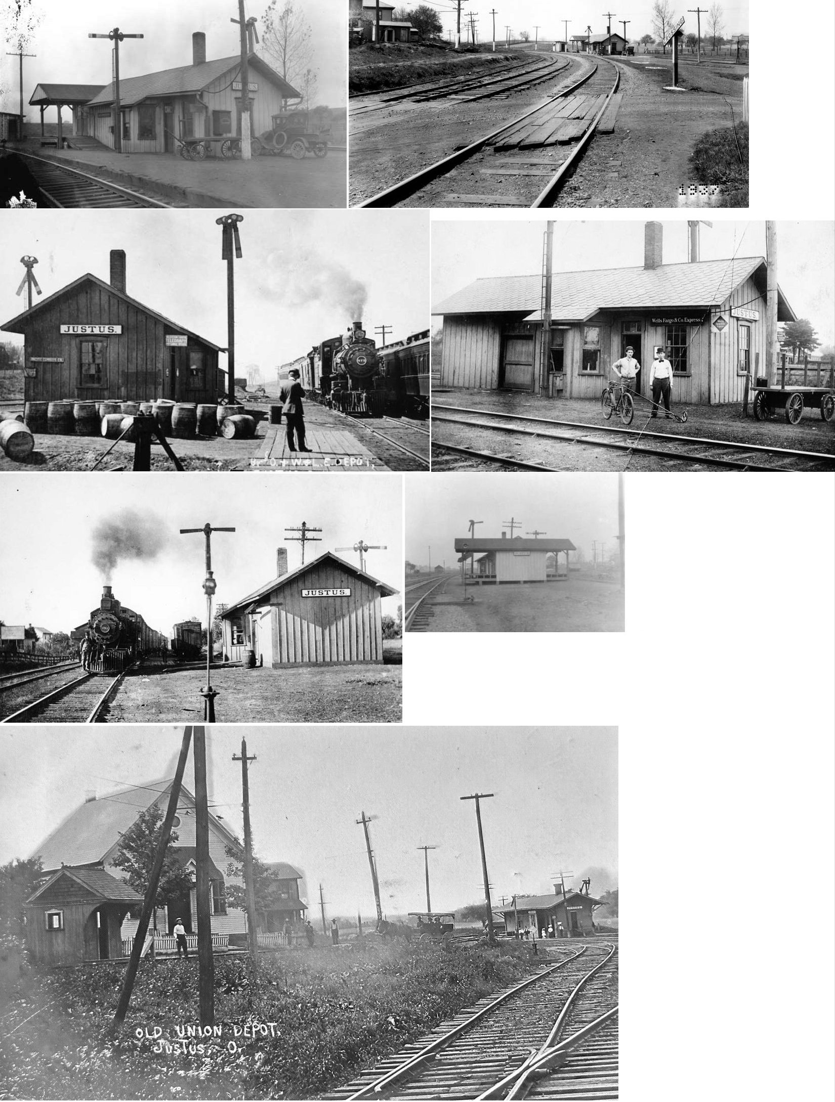
| Justus | AND |
This station served both RRs as it sat between the two lines. The station was built by the LS&TV Railway (Lake Shore & Tuscarawas valley) in 1874 when the station was added to the line (Stark County Democrat, 9-03-1874). | ||||||
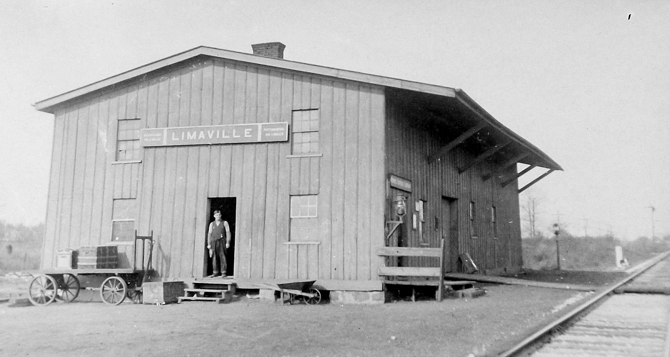
| Limaville |
|
This station was located at the east end of Church Street (across Iowa Avenue). The interurban station was also at this end of Chruch Street. | ||||||
| Louisville | |
This passenger station sat on North Depot Street. According to PRR valuation records, both the passenger and freight stations were built in 1865. The freight house (which can be seen in the photo) was directly SW of the passenger station. Both of these stations were gone by 1933. The 1933 Sanborn map shows a different freight station at that location and no passenger station. However, the map also shows some fire ruins nearby, so perhaps the station was destroyed by fire. In 1909 a mail car crashed into the depot (Lima News, Dec. 3, 1909). The article reported that the mail car was demolished, but did not note the condition of the depot. | ||||||
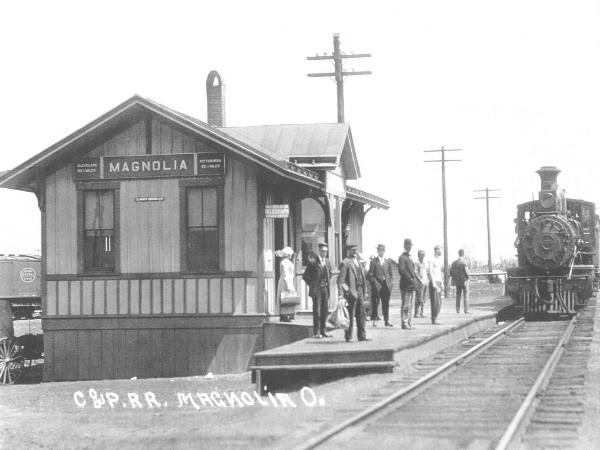
| Magnolia |
|
|||||||
| Mapleton Station |
|
The depot was on the NW side of Mapleton Street on the south side of the tracks (GPS: 40.753503,-81.227192). | ||||||
| Marchand |
|
|||||||
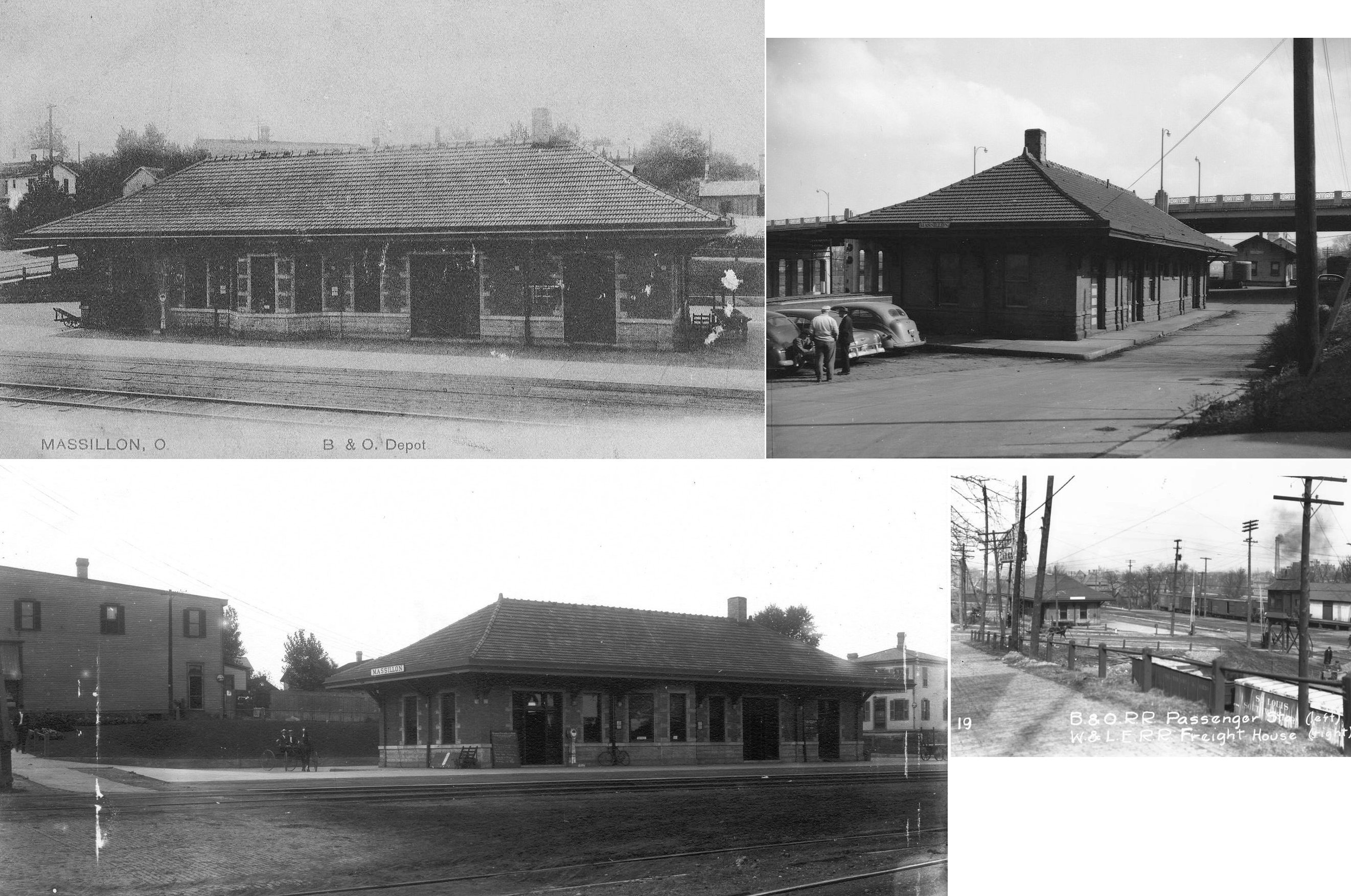
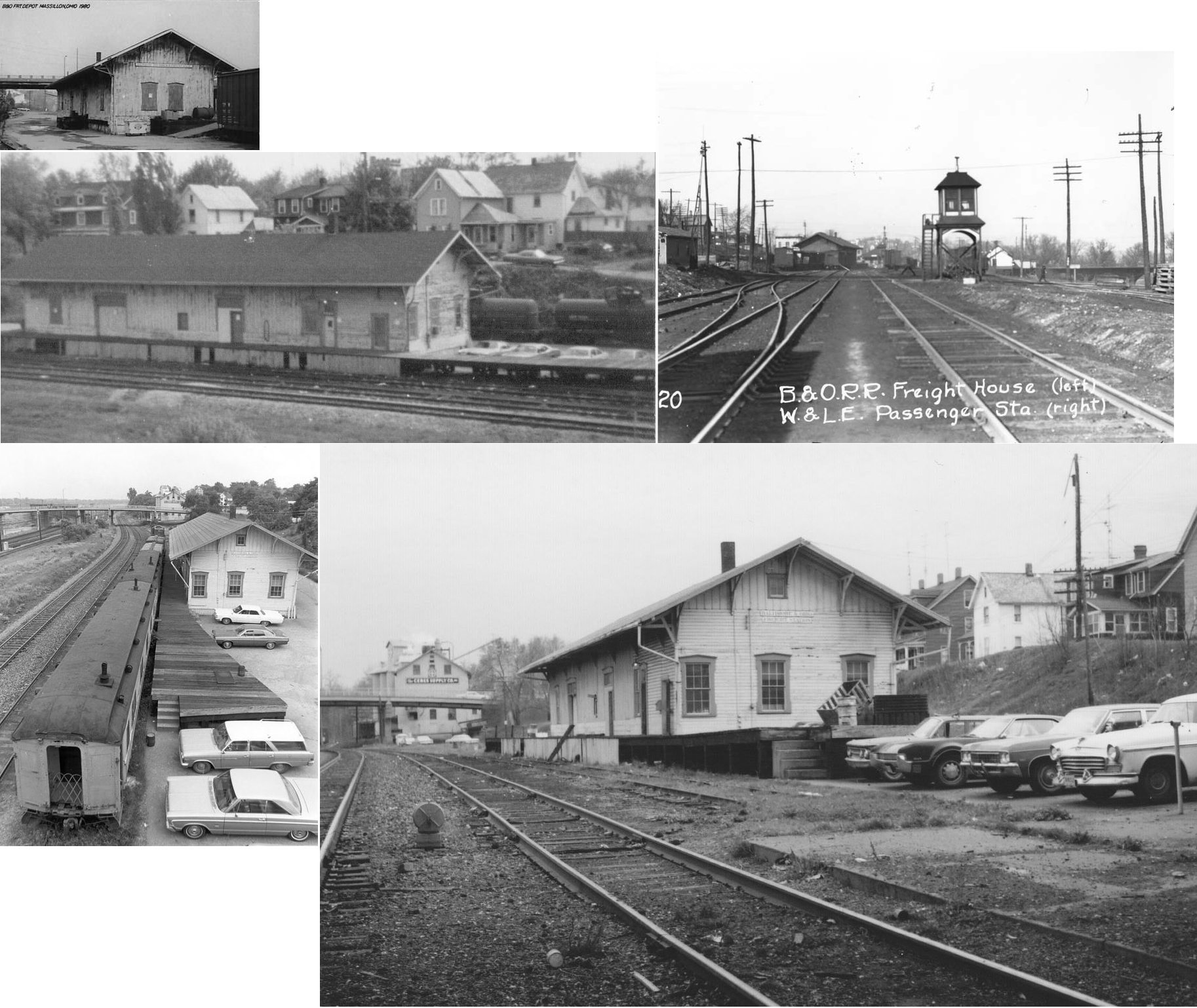
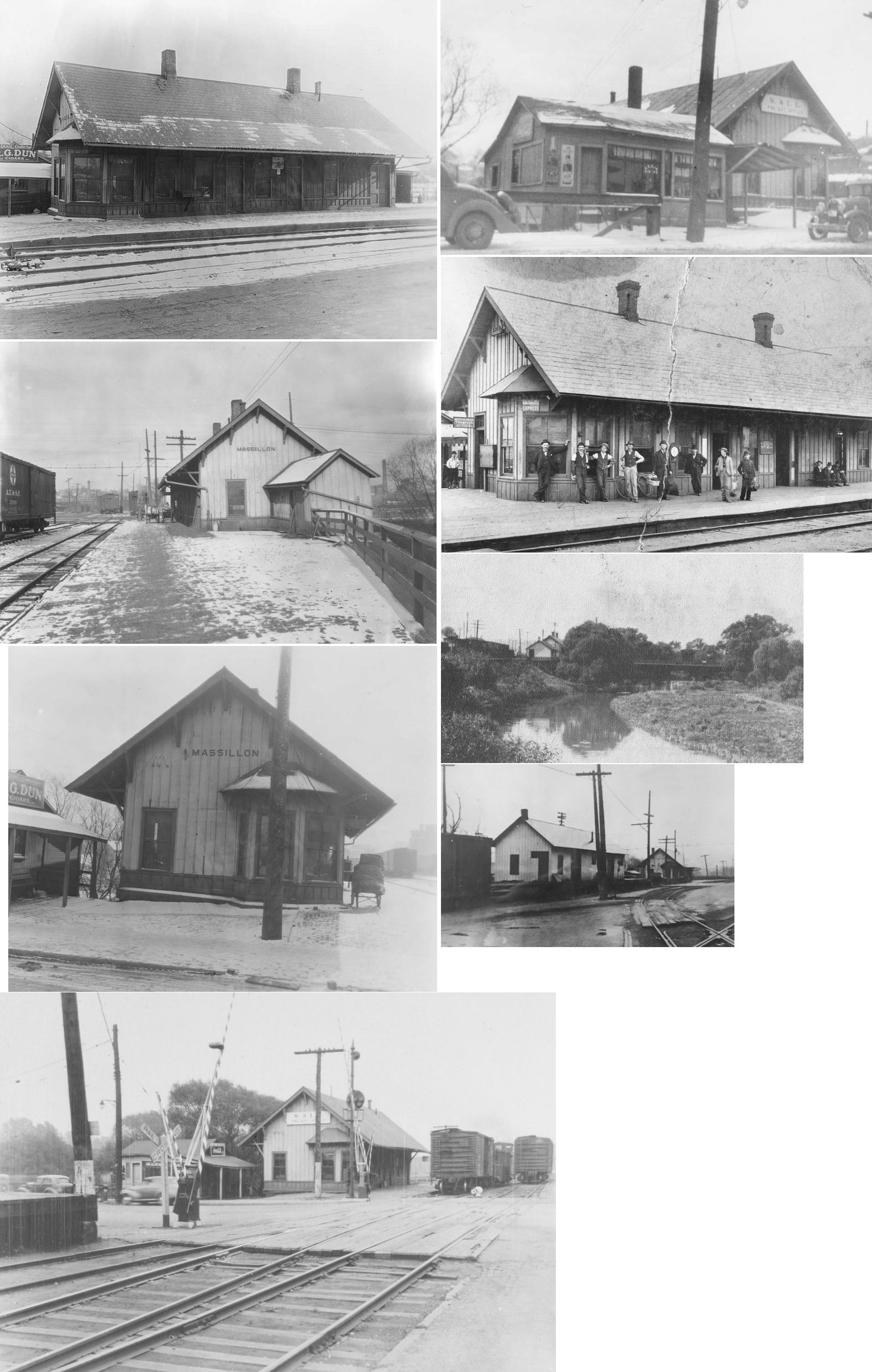
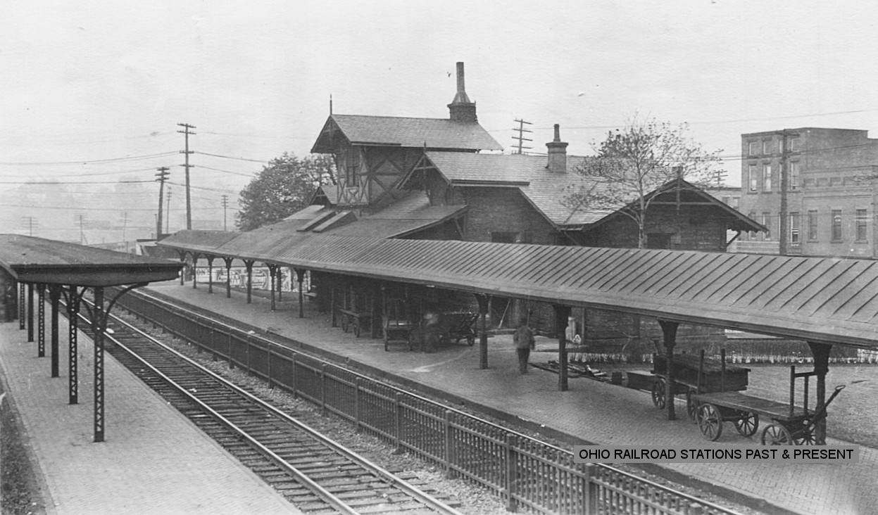
| Massillion | |
The original CL&W passenger and freight stations were on the west side of the tracks between Main and Water Streets with the passenger station bordering Main and the freight station bordering Water. Later only the passenger station was at that location and a "new" freight house was built on the south side of Main Street (see listing below). | ||||||
| MassilLon | |
The old passenger and freight stations were demolished and this brick station was built on the site between Main and Water Street in 1905 at GPS: 40.794923, -81.529423. | ||||||
| MassilLon | |
This freight station, also likely built in 1905, was on the south side of Main Street at GPS: 40.794163, -81.528920. | ||||||
| MassilLon | |
This station was on the south side of Main Street just west of the stone bridge that crossed the Tuscarawas River (where Lincoln Way NW crosses the river now) at GPS: 40.794750, -81.528473. There was a small cigar/candy shop (later a restaurant) wedged between the station at the end of the bridge as shown in the photos. | ||||||
| Massillon | |
The W&LE freight house was on the north side of Main at the same location as the passenger station. | ||||||
| Massillon | |
The original station here was built in 1852 and burned down in 1875 (Summit County Beacon, 4-21-1875). | ||||||
| MassilLon | |
The freight station was to the northeast of the passenger station on Penn Avenue (formerly Railroad Street) at the end of Albright Street. The building itself was on a siding track that ran right next to Penn Avenue. According to PRR valuation records, the station was built in 1875. | ||||||
| Maximo | |
This station was on the north side of Easton Street on the east side of the tracks (GPS: 40.875837,-81.174272). According to PRR valuation records, this station was built in 1889. | ||||||
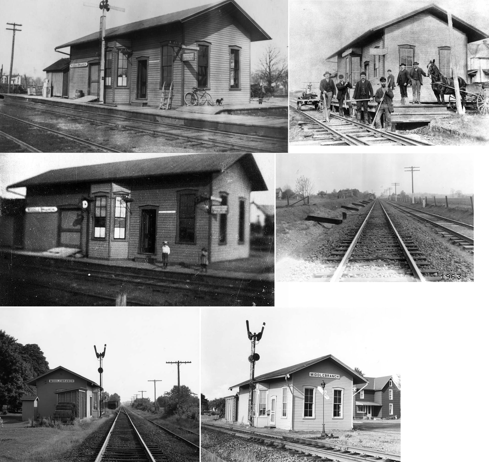
| Middlebranch (Oval City) |
|
This station was at the bend in Depot Street NE. | ||||||
| Mount Union | |
See listing above for Alliance (Mt. Union). | ||||||
| Myers | |
|||||||
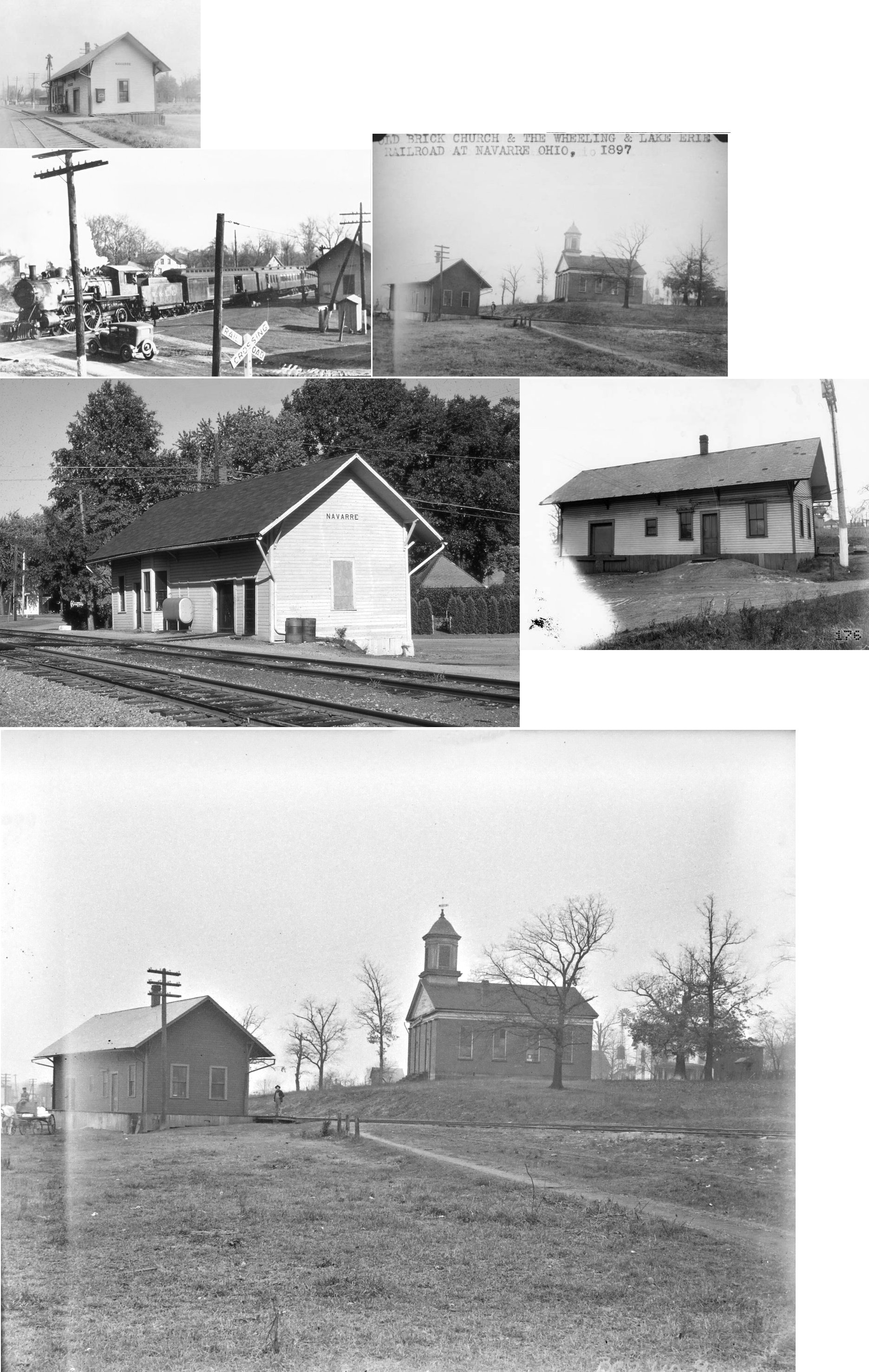
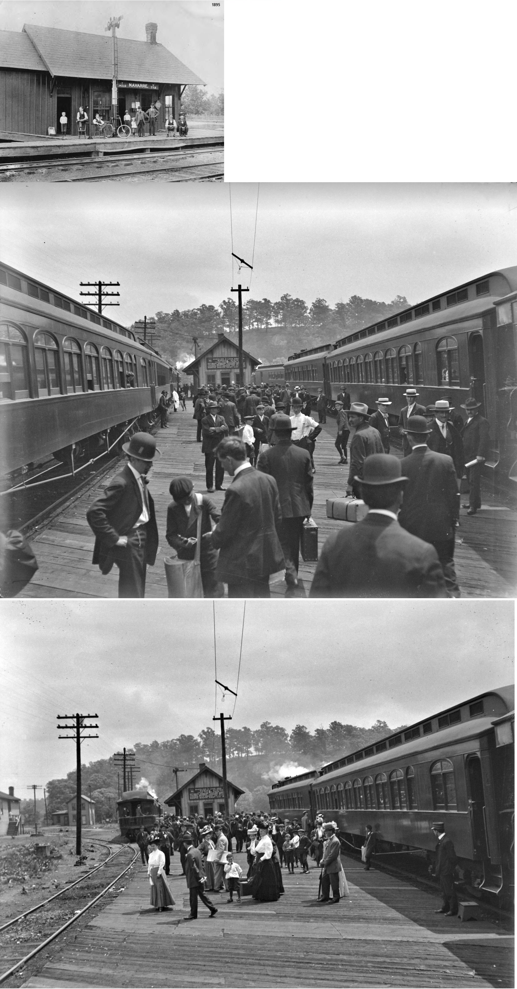
| Navarre | |
This station was located near the corner of Church and Basin streets on the south side of the tracks. | ||||||
| Navarre | |
In the early days, there were both CC&S and W&LE stations in town. The W&LE combination station was on the west side of Main Street just south of the canal and Navarre Mills. The station was gone by 1911 as it, and the line, had become redundant. By that time the W&LE tracks were abandoned or torn out to the east of Main Street, but kept in on the east side as a spur to serve Navarre Mills. | ||||||
| Newman | |
A passenger shelter was built here in 1916. It was on Beaumont Avenue NW in the vicinity of GPS: 40.821550, -81.551234. The station is listed on the 1923 PRR List of Stations & Sidings. | ||||||
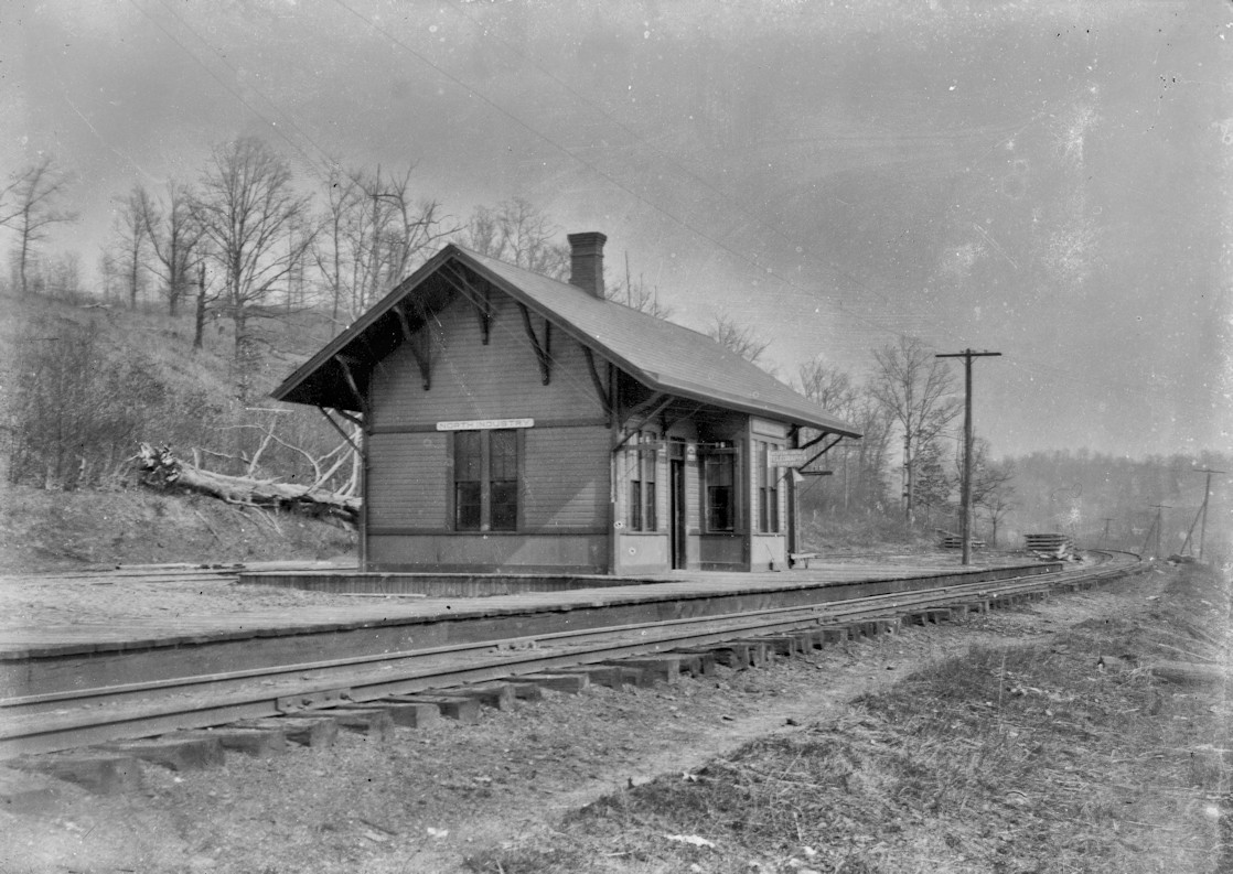
| North Industry |
|
This station was on the SE side of Baum Street (GPS: 40.740839, -81.364515). | ||||||
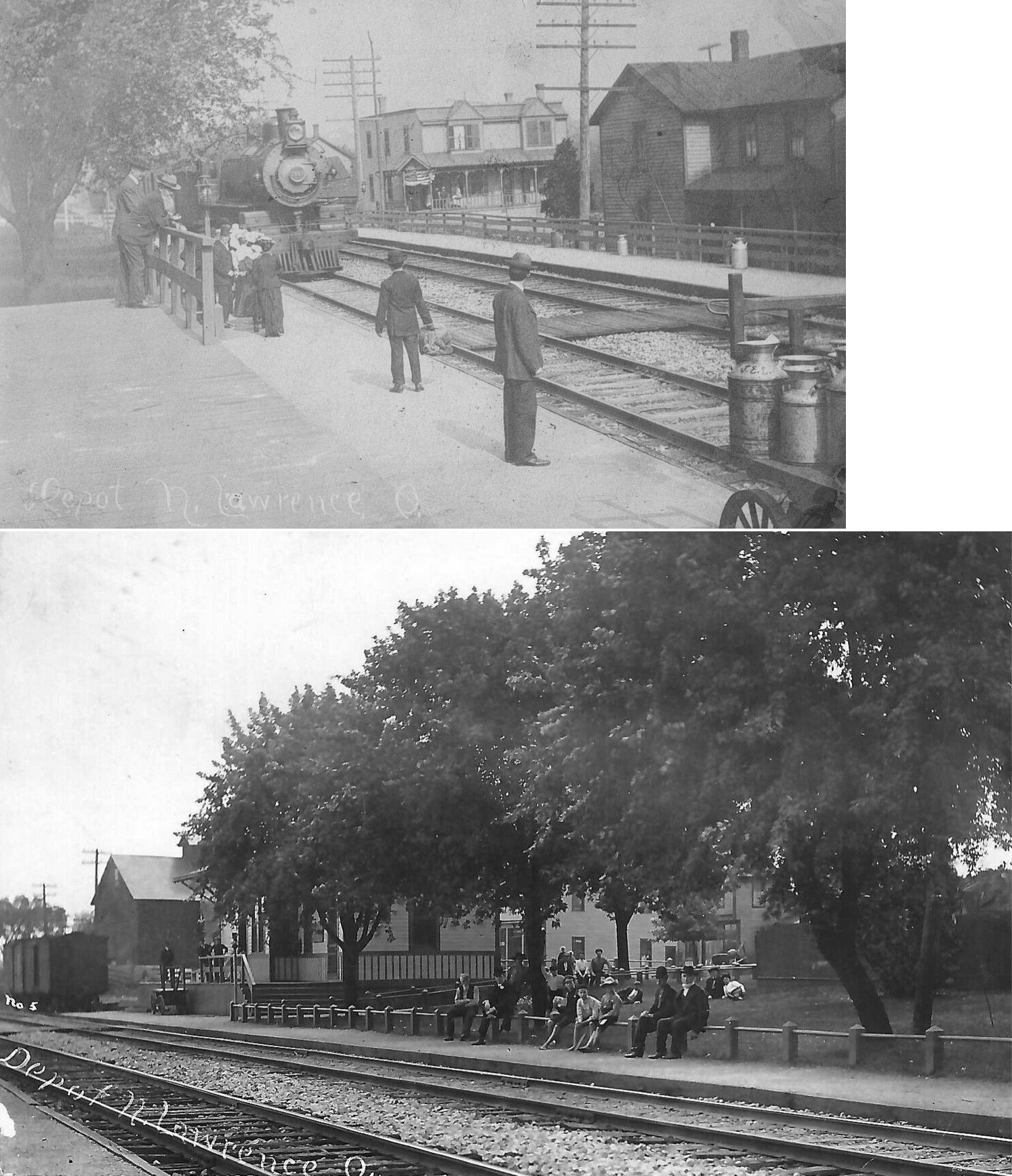
|
North Lawrence (Bowdil) |
|
This station was at the north end of Millside Avenue on the south side of the tracks (GPS: 40.842349,-81.627729). According to PRR valuation records, it was built in 1888. The station is called Bowdil on the 1923 PRR List of Stations & Sidings. | ||||||
| Osnaburg (E. CANTON) |
|
Built in 1880, this station was on the west side of South Cedar Street on the north side of the tracks at GPS: 40.784558, -81.284274. It was previously used by the East Canton Model Railroad Club before being torn down in the late 2000s. | ||||||
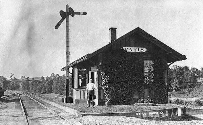
| Paris | |
According to NYC valuation records, this station was built in 1902 and measured 16'x30'. | ||||||
| Pauls |
|
This station was listed on the 1923 PRR List of Stations & Sidings on the Massillon & Cleveland Branch. | ||||||
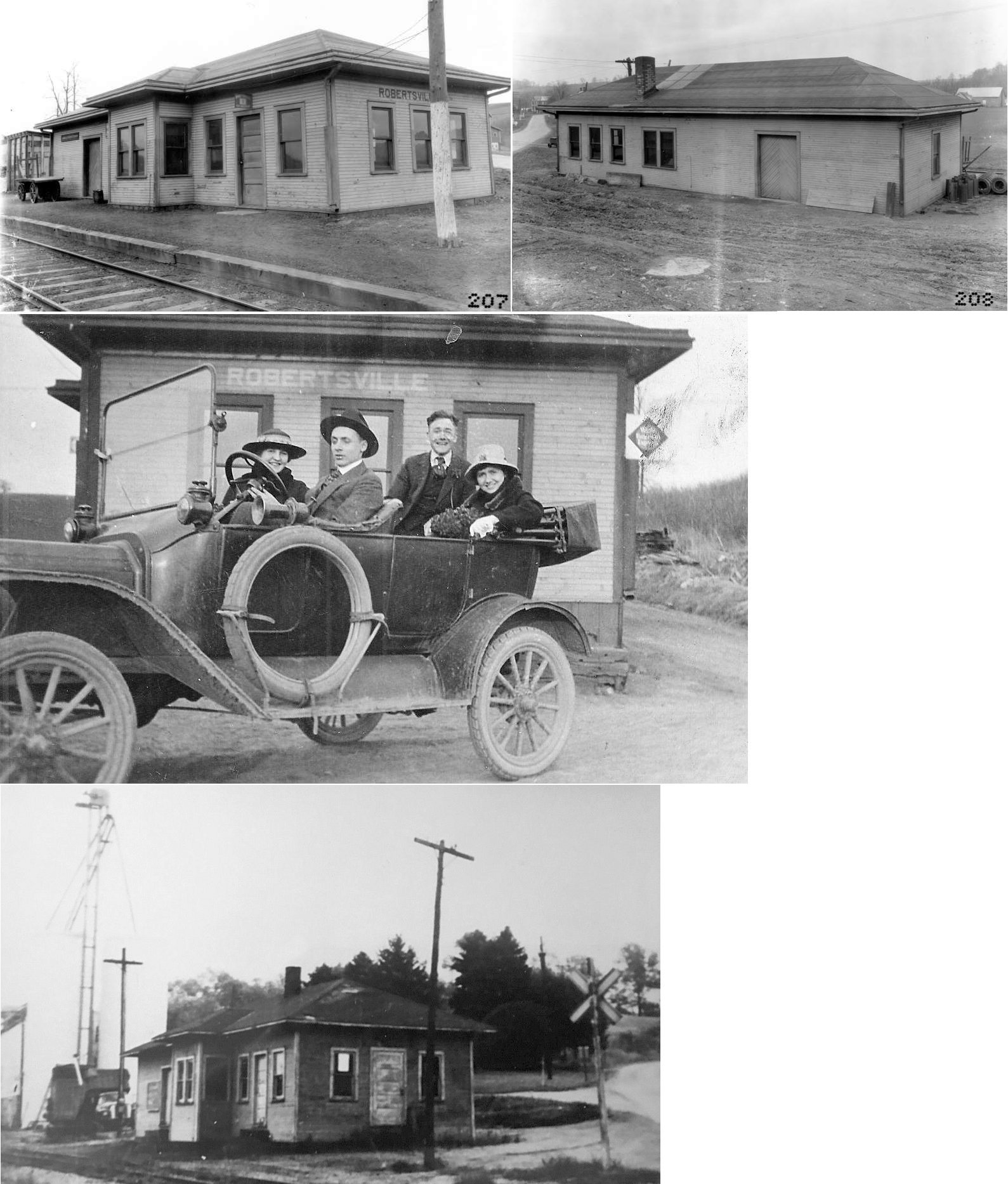
| Robertsville | |
This station was on the NE side of Baywood Street SE on the south side of the tracks (GPS: 40.760809,-81.188369). | ||||||
| Shaffers | |
|||||||
| Washington | |
This tiny town is now gone. According to the 1896 county map, I believe it was on what is now called Salem Church Street NE just west of Hartzell Avenue NE (Formerly Freeburg-Strasburg Road). The station was on the east side of the tracks at the end of what used to be Main Street (as Salem Church Road would have ended at the depot grounds there) (GPS: 40.850351,-81.149204). | ||||||
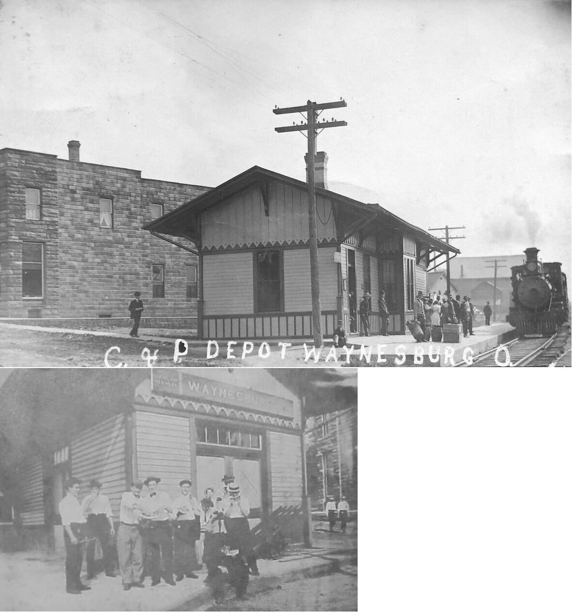
| Waynesburg |
|
This station was on the west side of Main Street on the south side of the tracks (GPS: 40.669238,-81.257737). | ||||||
| 1898 STARK COUNTY RAILROAD MAP | ||||||||
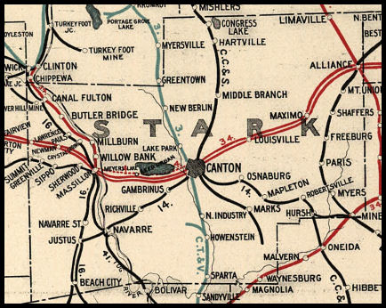 |
||||||||
| Notes About Existing
Stations... Aultman (B&O) - The station is located at Century Village. Brewster (W&LE) - This is a large brick structure that houses the W&LE dispatchers, the yardmasters, and the crew callers. Canton (Amtrak) - The Amtrak station sits on the site of the former Pennsylvania RR station. All that remains of the former station is the tunnel that led from the station to the passenger shed between the tracks. The station is now closed. Massillon (PFt.W&C) - According to PRR valuation records, the station was built in 1875 and extended in 1879. The station was stripped of its second floor and passenger shelters by the PRR in 1953. In 1983 a fire started by arsonists gutted the station, but the stone walls remained intact and the building was repaired. Here is the 1919 PRR valuation photo of the station. Osnaburg (CC&S) - Tracks are used for bringing plastic pellets to NEXPAC Inc. by W&LE Railway. |
||||||||