 COUNTY COUNTY
|
|
||||||||
| EXISTING STATIONS | ||||||||
|---|---|---|---|---|---|---|---|---|
| Station Name |
Original Railroad |
Current Location |
Type | Current Use |
Date Built |
Track Status |
Building Material |
More Info |
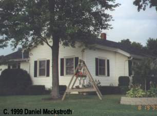
| Anna |
 |
514 West Main (SR 119) (GPS: 40.395277,-84.182611) |
P | Private | ???? | None | Wood |
|
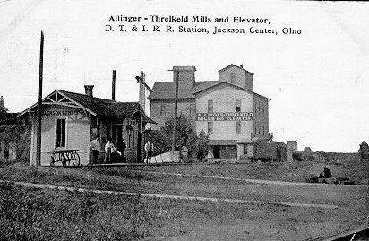
| Jackson Center |
 |
Baker Road south of St. Paris Pike in Springfield, Clark Co. (GPS: 39.97571,-83.845704) |
C | Private | 1893 | None | Wood |
|
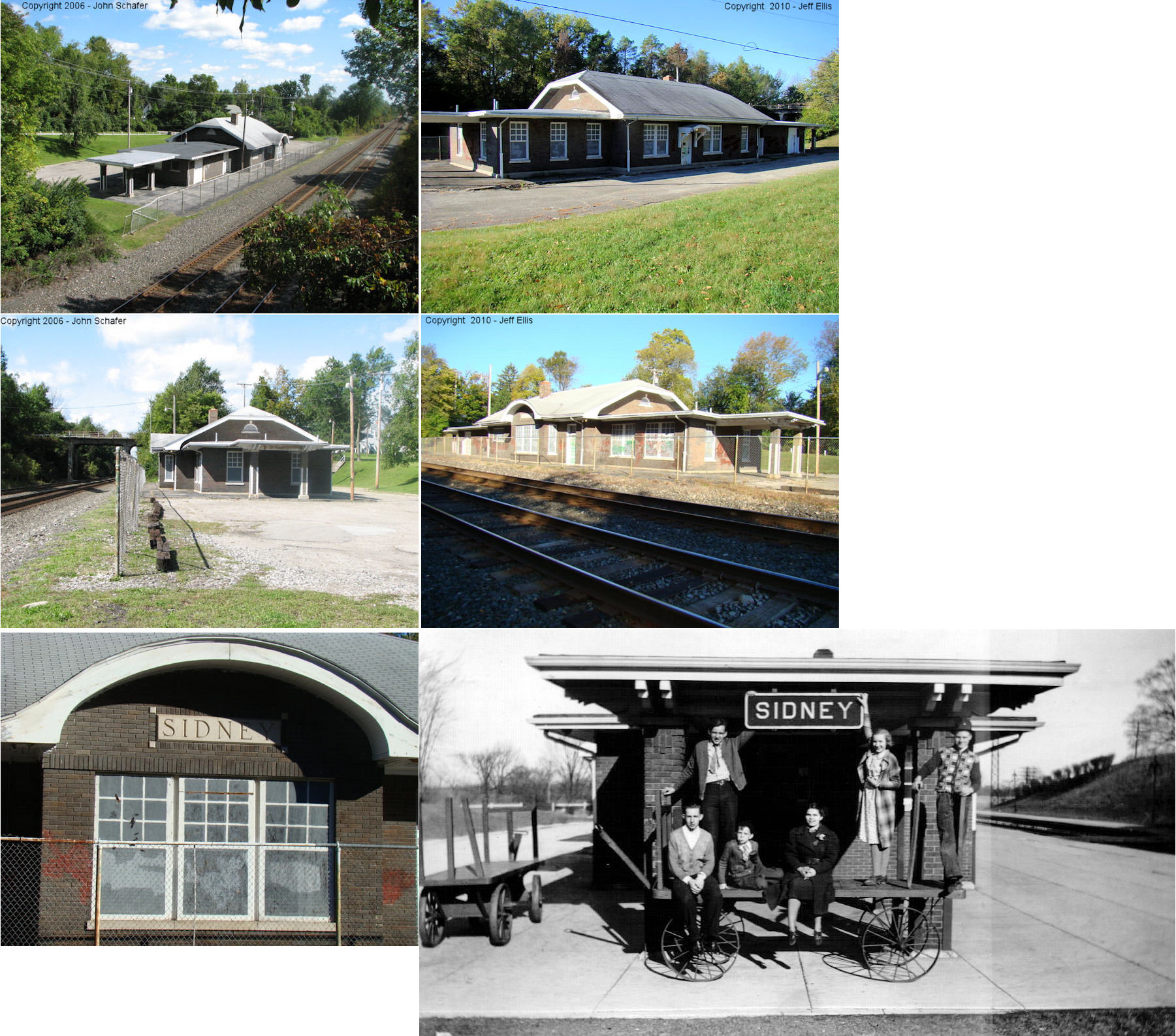
| Sidney |
 |
900 Chestnut Avenue at Lincoln Street (GPS: 40.274148,-84.160691) |
C | Society | 1923 | In Use | Brick | |
| STATIONS OF THE PAST | ||||||||
| Station Name |
Original Railroad |
Notes | ||||||
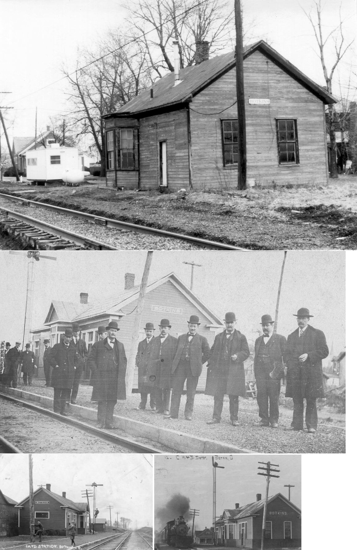
| Botkins |
|
This station was on the south side of West State Street (formerly Railroad Street) on the east side of the tracks (GPS: 40.467654,-84.185341). In later years the station was painted green. After the station was torn down some of the wood was repurposed for a barn on South Street. | ||||||
| Botkins |
|
There was a freight station across the tracks from the passenger station listed above. | ||||||
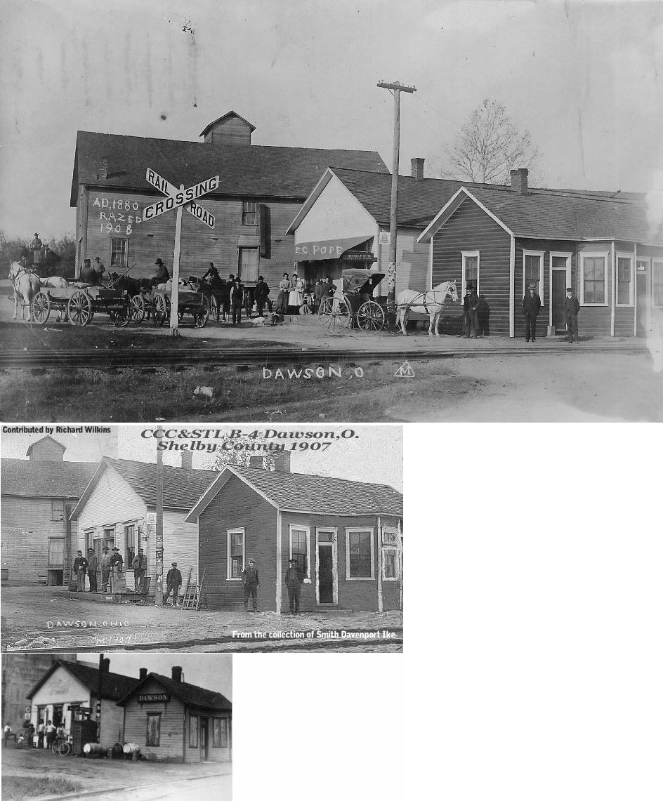
| Dawson |
|
The station was on the north side of the tracks north of County Highway 25 (GPS: 40.26175,-84.317633). | ||||||
| Hardin |
|
|||||||
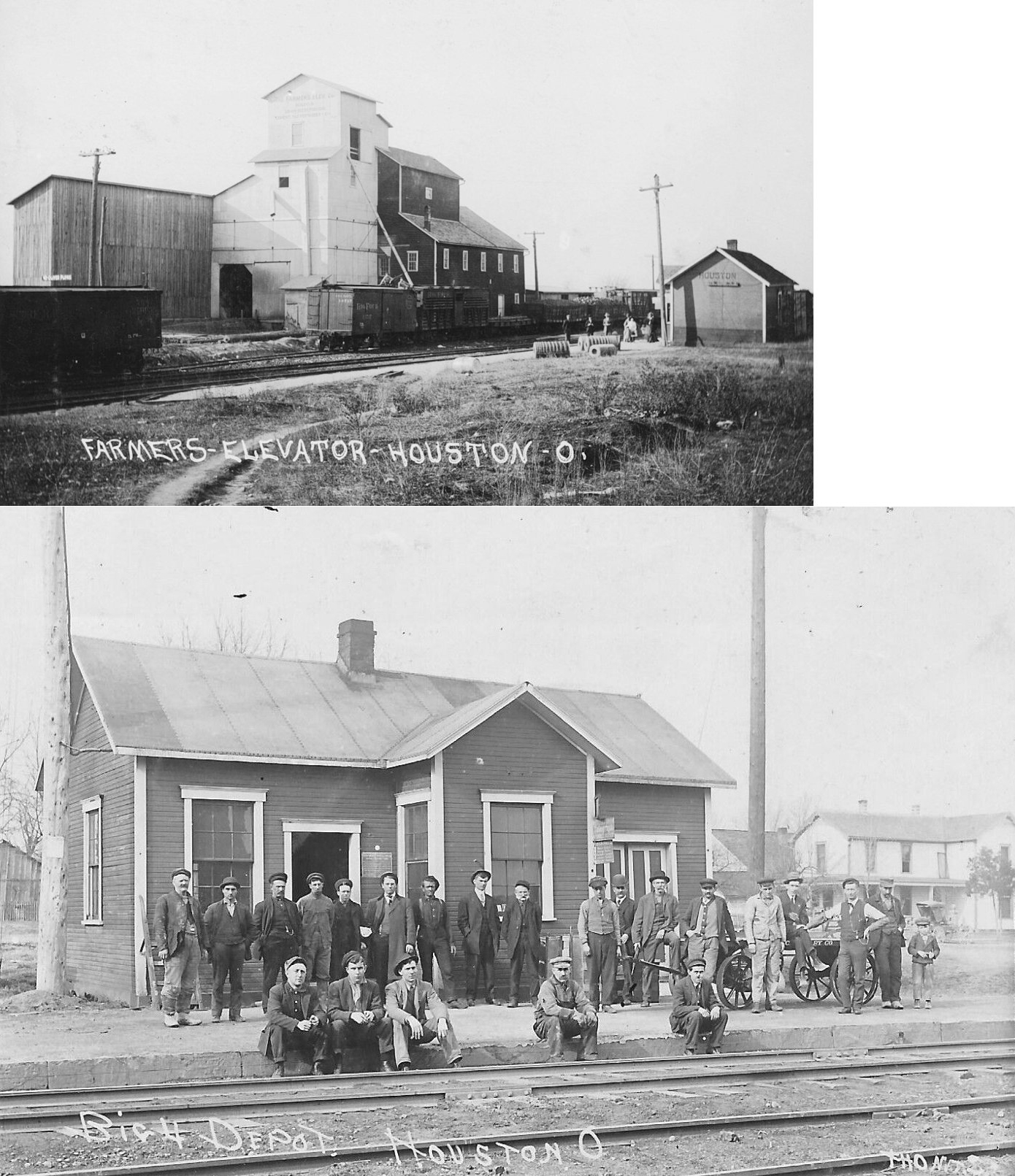
| Houston |
|
Also known as North Houston, the original station was on the north side of the tracks a bit west of where SR-66 is today (GPS: 40.254973, -84.337702). | ||||||
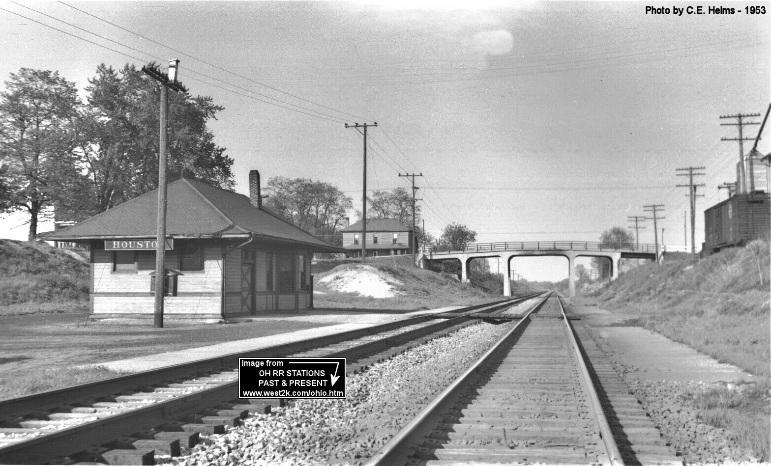
| Houston |
|
This was a later-generation station that was in the same location as the original station. The highway bridge shown in the photo is now gone as the highway overpass was moved to the east, but the house in the background is still standing (as of 2022). | ||||||
| Kirkwood |
|
Torn down in 1993 and the wood was burned. The station was located just a few houses from the CSX right-of-way. This building was given to the station agent upon his retirement in 1954 and moved to his yard a few doors west of the railroad. | ||||||
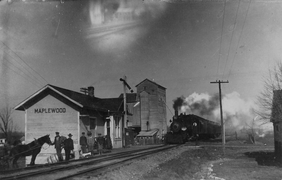
| Maplewood |
|
This station was on the south side of Maplewood Road (CR-36) on the west side of the tracks (GPS: 40.376093,-84.02428). | ||||||
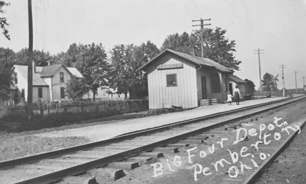
| Pemberton |
|
The station was on the east side of Main Street on the south side of the tracks (GPS: 40.293455,-84.033469). | ||||||
| Russia |
|
The station was near the corner of Lynn and Cordonnier Streets on the south side of the tracks (GPS: 40.235672,-84.410115). | ||||||
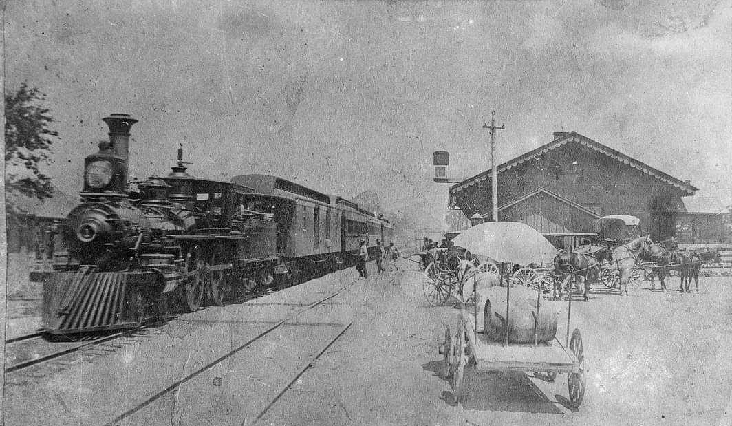
| Sidney |
 |
The Bellefontaine and Indianapolis RR (later the CCC&I, later still part of the CCC&ST.L) was completed through Shelby Co. in July 1853. This station was constructed around that same time. It sat on the south side of West North Street between Walnut and West Avenues (GPS: 40.286564,-84.159007). | ||||||
| Sidney |
|
At some point the station above was replaced with this newer Big 4 station. The old main line made a significant descent into the Great Miami River Valley and was relocated south of Sidney during 1922-1925. This station was subsequently retired and removed sometime after 1924. After the cut off was complete, the line east of downtown was abandoned, and trains called at the newly-built brick passenger station on Chestnut Avenue which still exists today. | ||||||
| Sidney |
|
This freight station was at West North Street & Northwest Avenue (GPS: 40.287326,-84.158471). It sat vacant for many years before being torn down in late 2015/early 2016. | ||||||
| Sidney |
 |
The passenger station was on the north side of West Court Street on the east side of the tracks (GPS: 40.284551,-84.161593) and the freight station was south of West Court Street, also on the east side of the tracks (GPS: 40.283986,-84.161453). | ||||||
| Sidney |
|
This new passenger station was built to replace the original D&M station around 1900. It was built in the same location. | ||||||
| Swanders |
|
This station was on the north side of Fort Loramie-Swanders Road (CR-27) on the east side of the tracks (GPS: 40.360298,-84.17495). | ||||||
| 1898 SHELBY COUNTY RAILROAD MAP | ||||||||
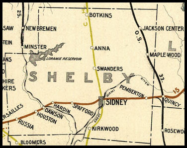 |
||||||||
| Notes About Existing
Stations... Anna (CH&D) - Has been a private residence since 1952. The owner said it had huge wooden beams in the attic and basement that made the station part of the residence much stronger than the addition. The current owners moved into the house in 1952, and said the structure had been occupied for six months prior by a renter. Given this information, I'm guessing the structure was moved in 1951, added on, and opened for residency in 1952. --Daniel Meckstroth The original location of the station was on the north side fo Main Street on the east side of the tracks (GPS: 40.395208,-84.178319). Jackson Center (Ohio Southern) - This station was moved from Jackson Center by a private individual in the 1970s. It was restored and maintained in near original condition some 40 miles from its prior location. It features the distinctive 1920 style of Henry Ford when he owned the D T & I railroad and selected gray as the station color and with large signs. A very good example of Ford influence on the railroads under his ownership in that era. - Scott Trostel. The original location of the station was on the north side of College Street on the west side of the tracks (GPS: 40.440803,-84.037337). |
||||||||