 COUNTY COUNTY
|
|
||||||||
| EXISTING STATIONS | ||||||||
|---|---|---|---|---|---|---|---|---|
| Station Name |
Original Railroad |
Current Location |
Type | Current Use |
Date Built |
Track Status |
Building Material |
More Info |
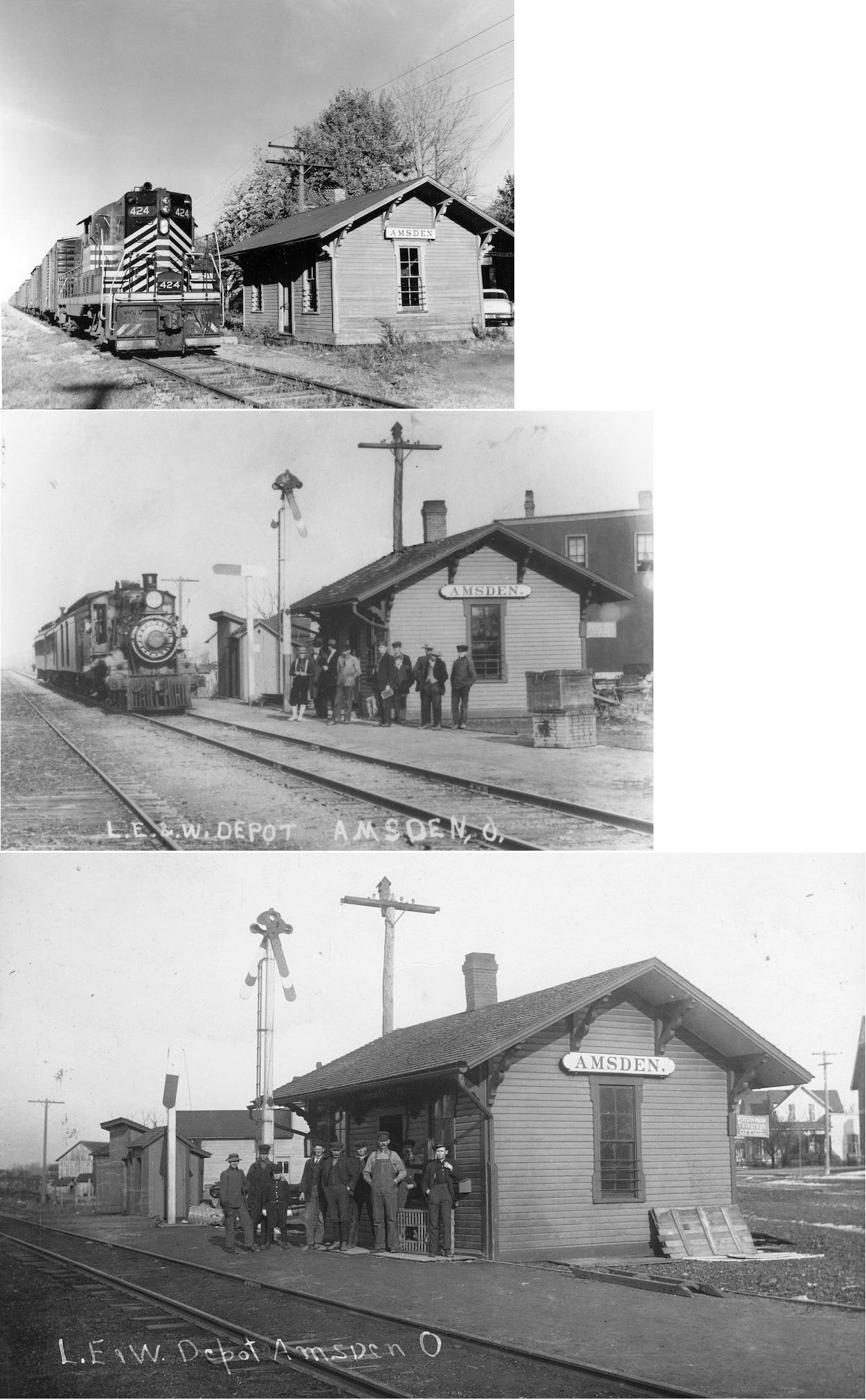
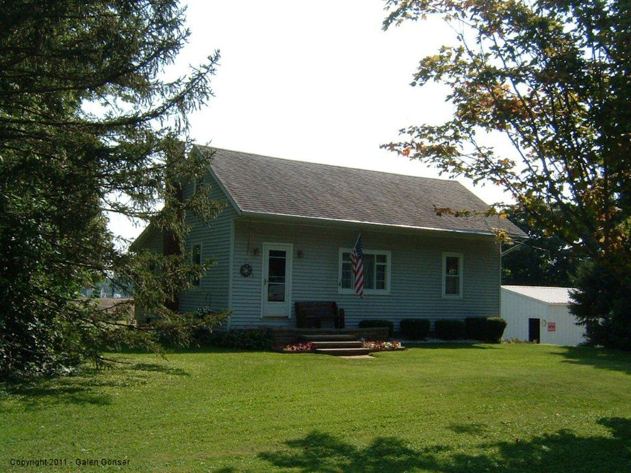
| Amsden |  |
County Road 28 | P | Residence | ???? | None | Wood |
|
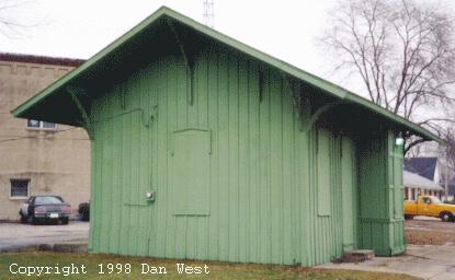
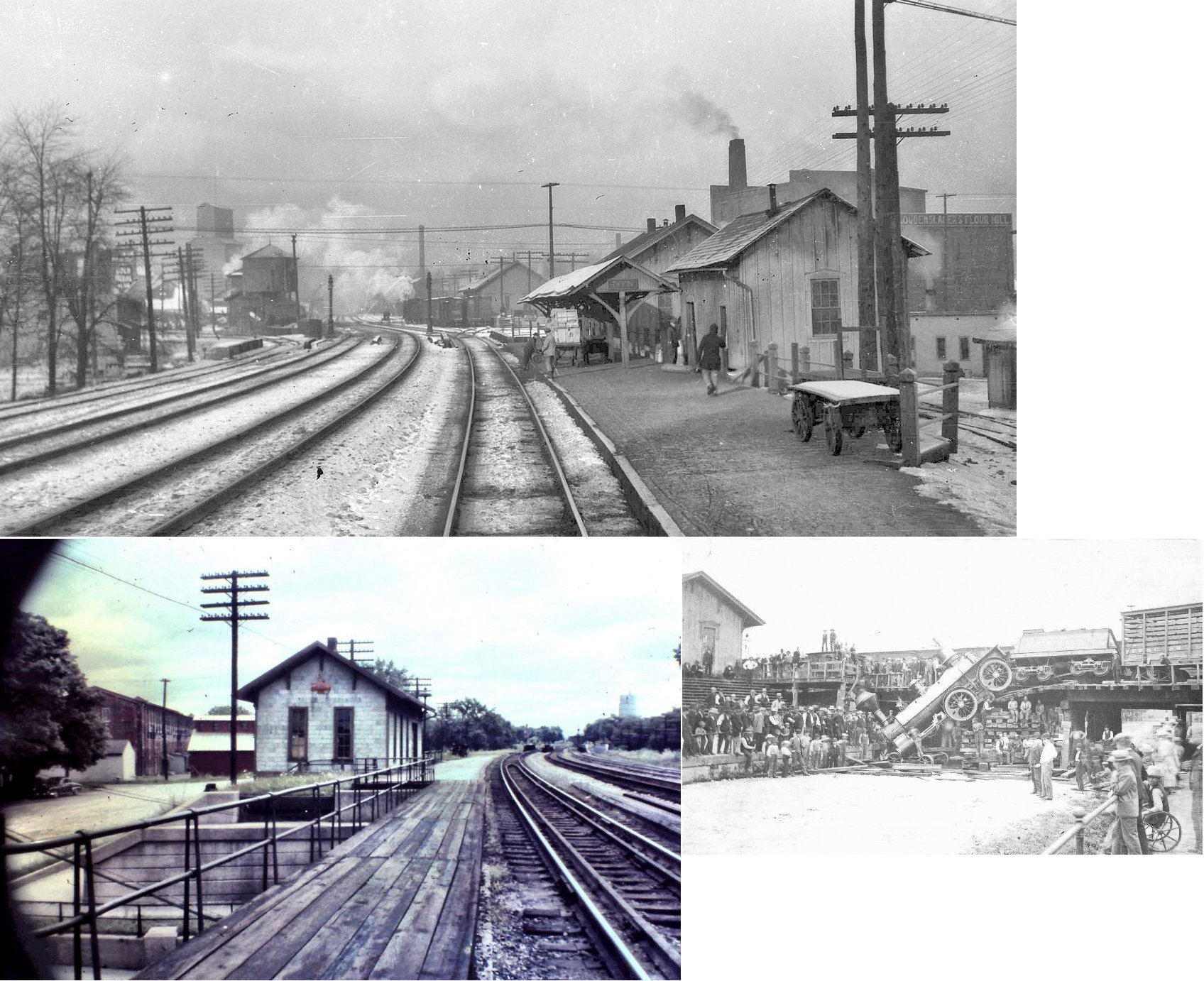
| Berwick |
 |
SR 587 | C | Garage | ???? | None | Wood |
|
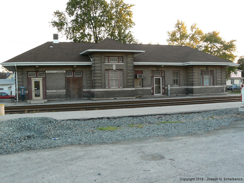
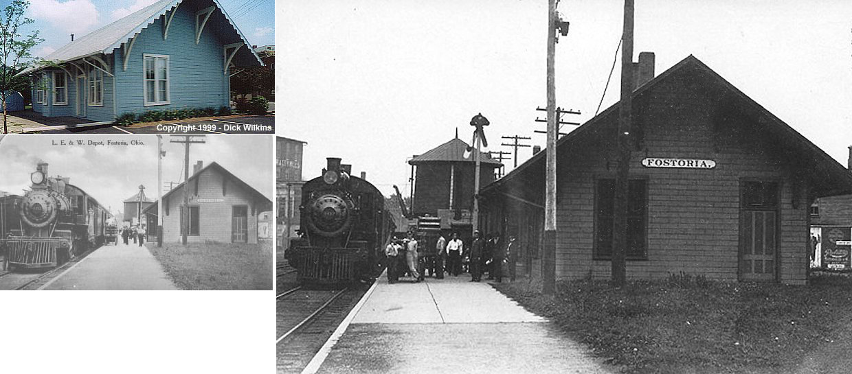
| Fostoria |  |
500 South Main Street (GPS: 41.152689,-83.413779) |
P | Railroad | 1907 | In Use | Brick |
|
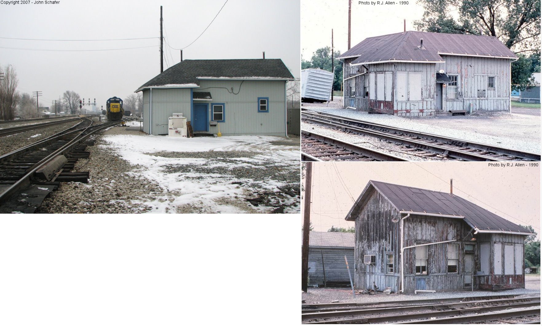
| Fostoria | AND  |
East end of East 6th Street at CSX yard. (GPS: 41.149798,-83.406841). |
P | Railroad | ???? | In Use | Wood |
|
| Fostoria | |
128 West North Street (GPS: 41.15869,-83.415353) |
P | Civic | 1889 | Gone | Wood |
|
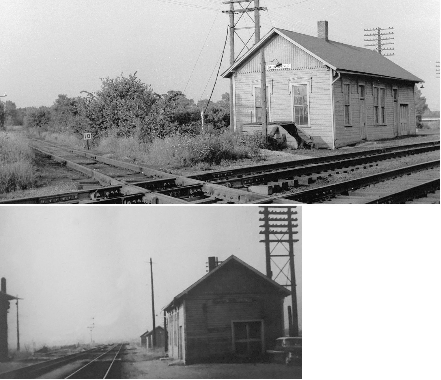
| Green Springs |
|
South Broadway (SR19) at Railroad Street (GPS: 41.254146,-83.05178) |
C | Storage | ???? | Gone | Wood |
|
| McCutchenville |
 |
7331 Baseline Road, just east of McCutchenville. | P | Residence | ???? | None | Wood |
|
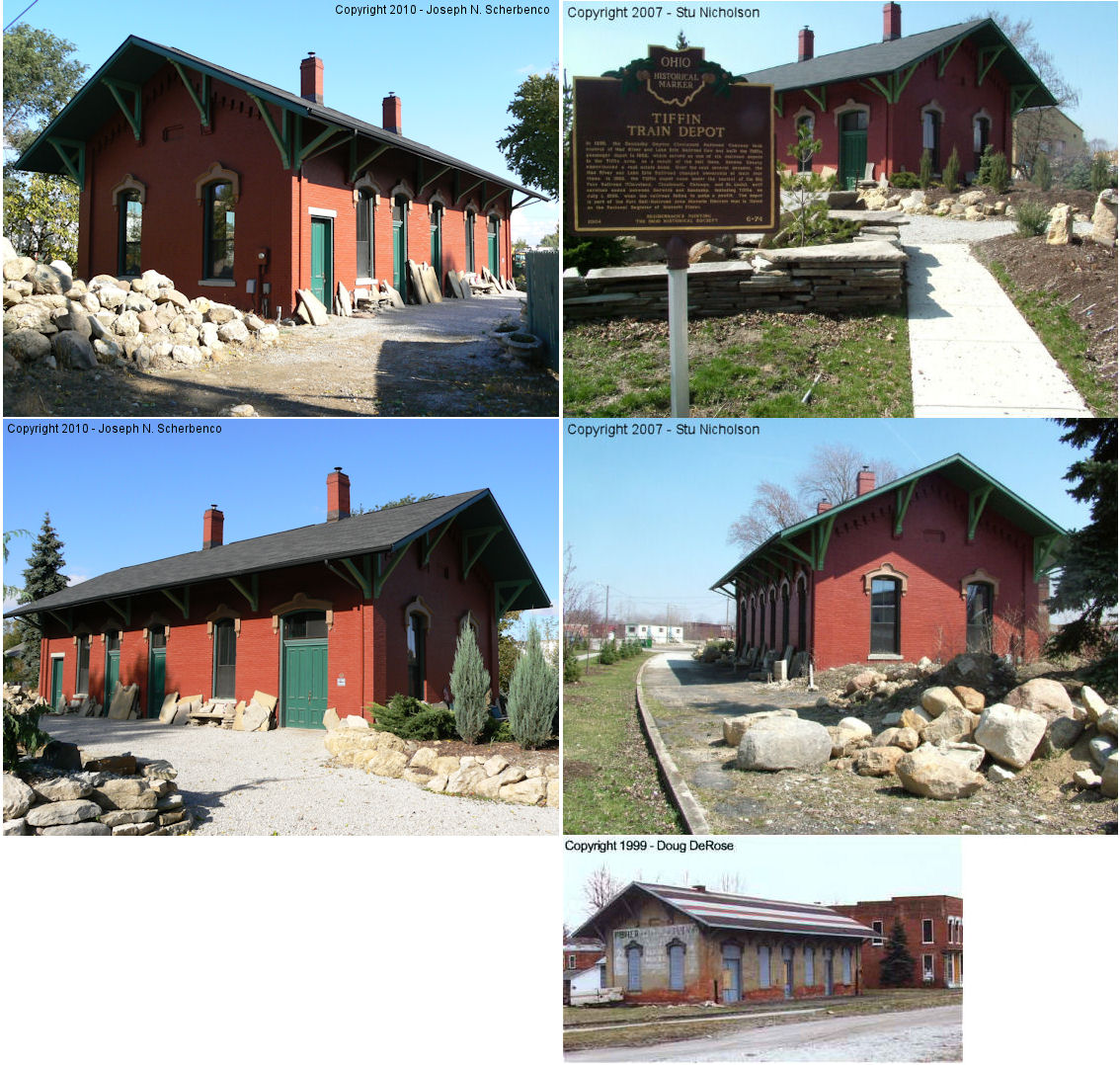
| Tiffin |  |
65 North Monroe Street (GPS: 41.118941, -83.179337) |
P | Restored | 1862 | Gone | Brick |
|
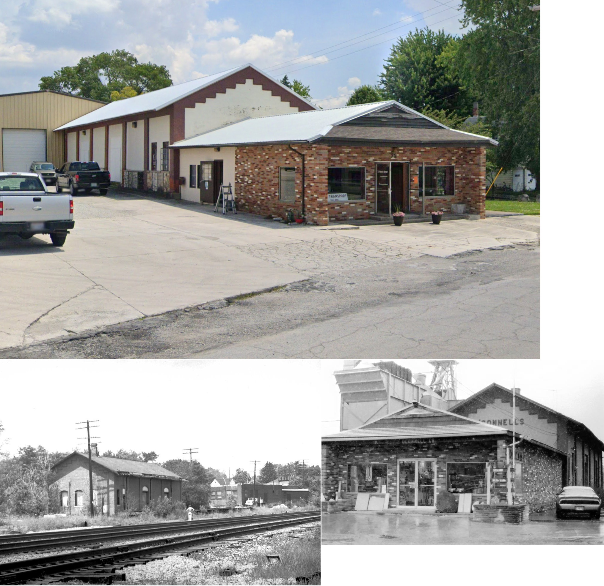
| Tiffin | |
North corner of Benner & Adams Streets (GPS: 41.118857, -83.180073) |
F | Storage | ???? | Gone | Brick | |
| STATIONS OF THE PAST | ||||||||
| Station Name |
Original Railroad |
Notes | ||||||
| Adrian |
|
|||||||
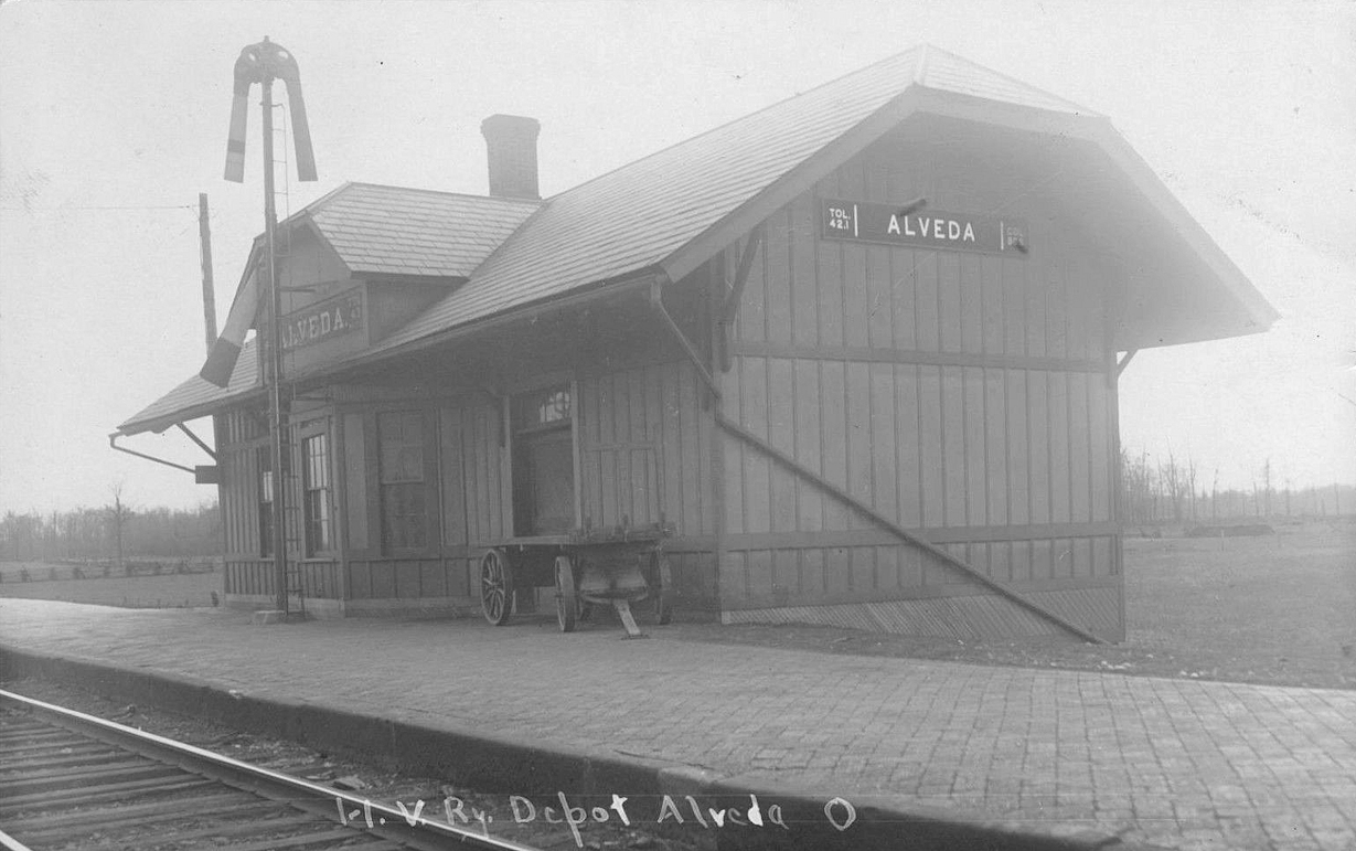
| AlvEda |
|
This station was on the south side of Main Street (West County Road 10) on the west side of the tracks (GPS: 41.050024,-83.406481). | ||||||
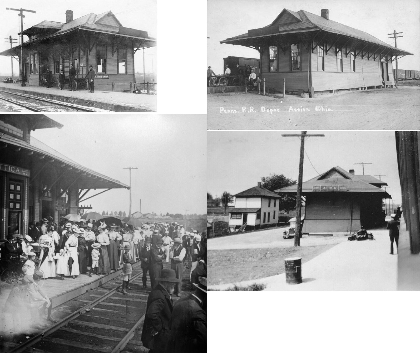
| Attica |  AND  |
This station was on the south side of E. Tiffin Street. At one time it served the PRR and the Sandusky & Columbus Short Line RR. | ||||||
| Attica | |
The station was built in 1888 (according to the B&O Annual Report of that year). It was demolished by a collision between a local stopped at the depot and a through train on August 17, 1891 (Lima News, August 17, 1891). | ||||||
| Attica | |
This station replaced the one listed above. | ||||||
| Bascom | |
The combination station here was on the west side of Beech Street (SR 635) on the south side of the tracks (GPS: 41.134351,-83.285444). | ||||||
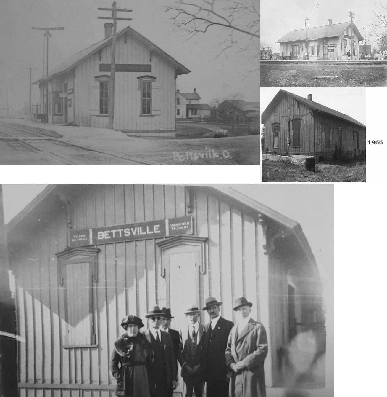
| Bettsville |
AND |
LE&W had either its own track extending down to Bettsville, or had trackage rights to Bettsville on the PRR according to an 1898 map. The station was on the south side of State Street on the west side of the tracks (GPS: 41.244778,-83.236853). | ||||||
| Berwick |
AND |
This station was in the north corner of the diamond, north of County Road 6 (GPS: 41.029915,-83.293362). | ||||||
| Berwick |
 |
|||||||
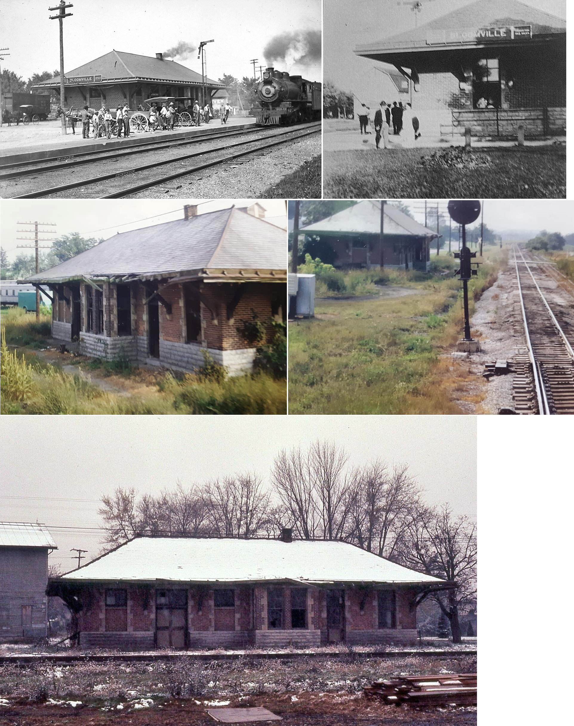
| Bloomville |
|
This station was near the intersection of Prospect and Railroad Streets on the NE side of the tracks (GPS: 41.053644,-83.010131). | ||||||
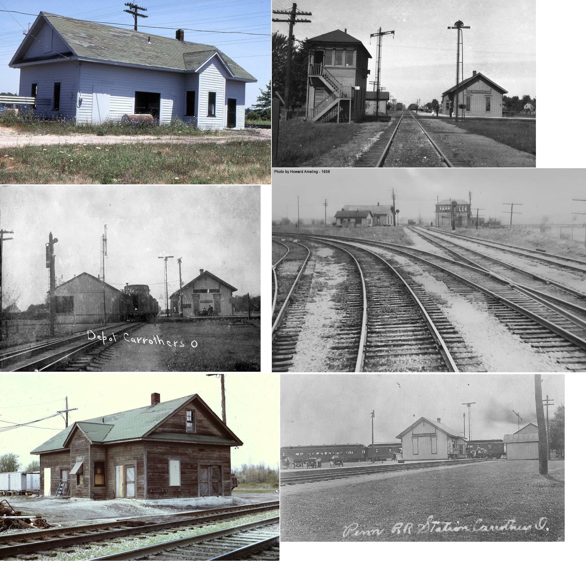
| Carrothers |
 |
The original station was on the SE side of Columbus-Sandusky Road (SR-4) on the SW side of the tracks (GPS: 40.998249,-82.92017). | ||||||
| Carrothers | AND |
This station was in the western corner of the diamond. | ||||||
| Cromer Station |
|
|||||||
| Flat Rock |
|
This station was on the north side of the end of Water Street on the east side of the tracks (GPS: 41.235099,-82.861043). | ||||||
| Fostoria | |
The original frame passenger station was at the same location on South Main Street as the 1907 brick passeneger station (GPS: 41.152689,-83.413779). | ||||||
| Fostoria | |
The freight station was on the west side of Sourth Poplar Street on the south side of the tracks (GPS: 41.152376,-83.411848). | ||||||
| Fostoria |
|
The freight station was across the tracks from the passenger station on West North Street (GPS: 41.158923,-83.415531). | ||||||
| Fostoria | |
The original Columbus & Toledo RR station was on the north side of Sandusky Street at the same location as the newer HV station (see below). The original freight station was across the tracks. | ||||||
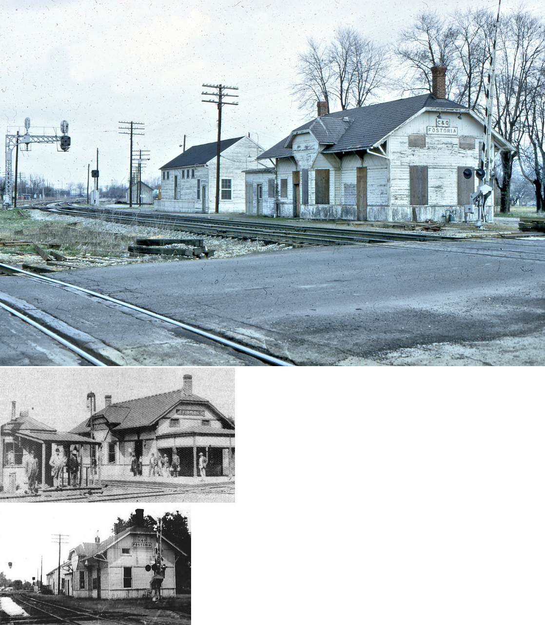
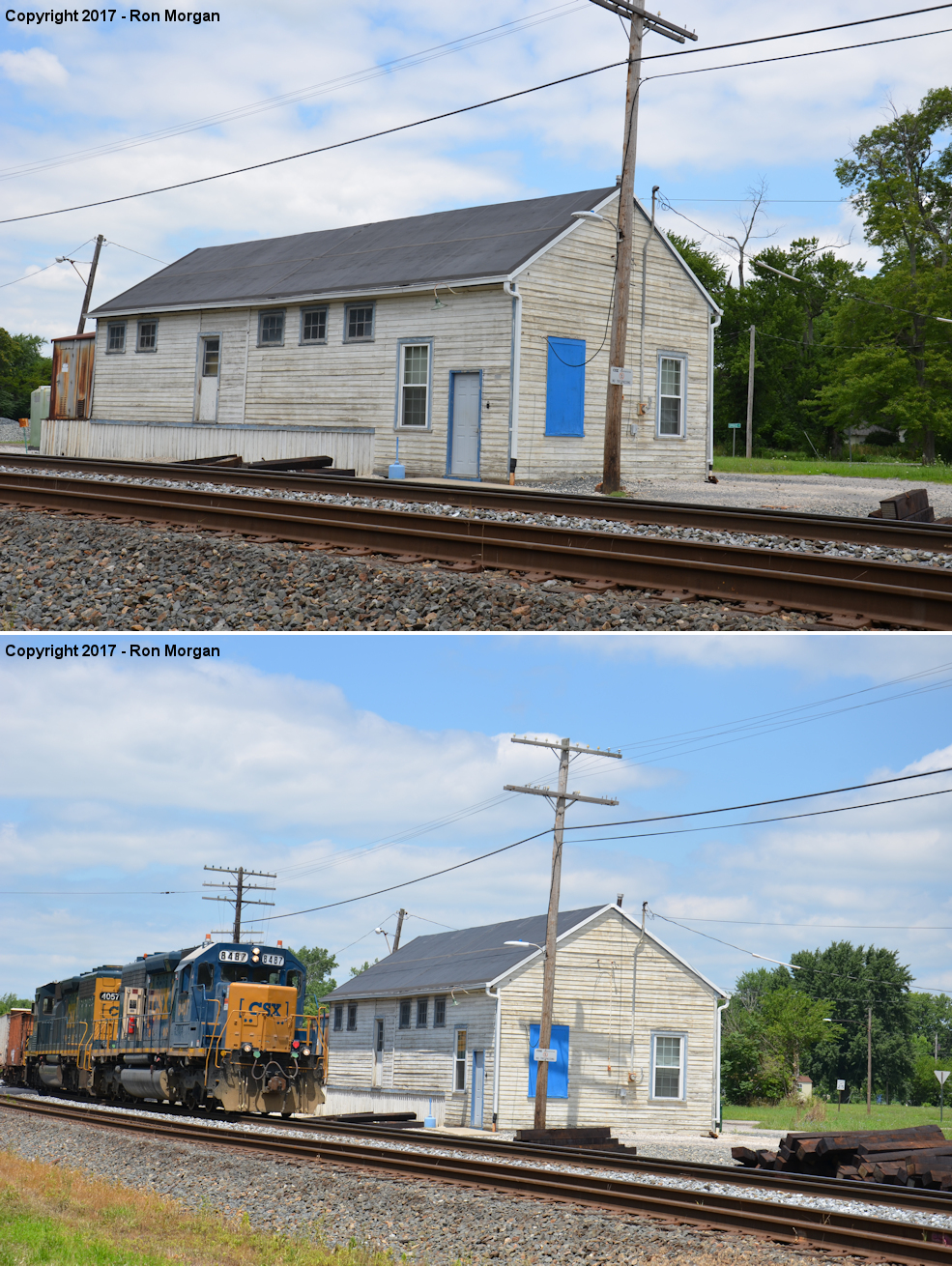
| Fostoria | |
This station, built in the early 1890s, was on the north side of Sandusky Street NE of Fremont Street. It was on the east side of the tracks (GPS: 41.161298,-83.409928). The original freight station was across the tracks. The newer freight station (still standing) was built to the north of the passenger station. | ||||||
| Fostoria | |
There was a freight station at the NW corner of Spruce and High Streets on a spur (GPS: 41.16194,-83.4097). | ||||||
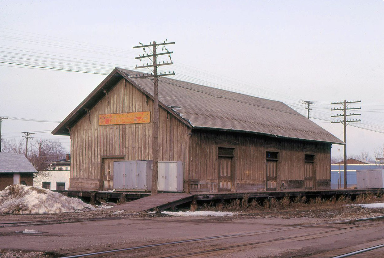
| Fostoria |  |
This freight station was on the south side of East High Street near Spruce Street at GPS: 41.161567,-83.409998. It was gone as of early 2023 and was likely torn down sometime prior. This structure was not the original HV freight station as it is not shown on maps from the early 1900s. The 1930 revised Sanborn map shows the original freight station (which was a bit to the NE of this building) as gone and no building at this location. So this building was either added as a freight station after 1930 or served some other purpose (there were other RR buildings in the area including a bunk house to the north of this location). | ||||||
| Fostoria |  |
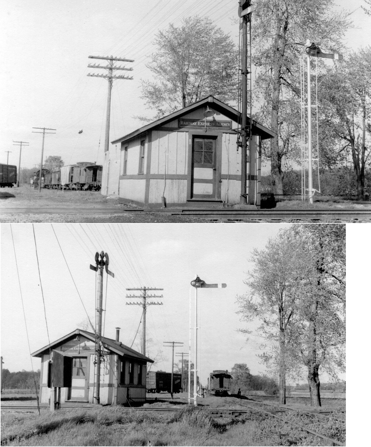
This station was on the east side of South Union Street, just north of Bricker Street. It was on the north side of the tracks (GPS: 41.153156,-83.418562). There was an REA depot to the east. The passenger station was demolished in 1967. There was also a freight warehouse on the west side of South Union Street on a spur track (GPS: 41.153507,-83.419034). | ||||||
| Fostoria | |
The original Ohio Central RR station here was at the corner of McDougal and North Cadwallader Streets (north of where the newer station, which is still standing, is located). | ||||||
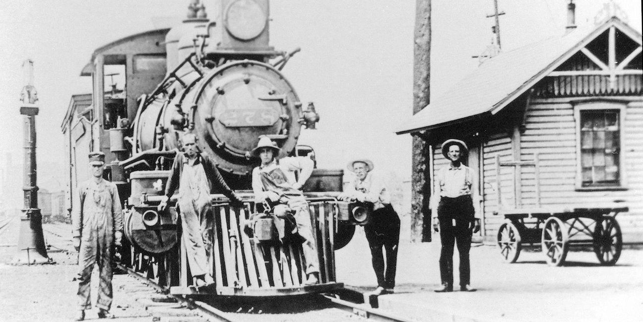
| Fostoria | |
This station was not standing in its original location as of 2023.Not sure if it was torn down or moved. Does anyone know for sure? It was on North Cadwallader north of East North Street at GPS: 41.158982,-83.4093. The Fostoria Railroad Preservation Society was in the process of raising funds to relocate it to the Fostoria Iron Triangle Railpark, but I am unsure whether or not that happened. | ||||||
| Fostoria | |
The freight station was on the south side of East Center Street on the west side of the tracks (GPS: 41.157635,-83.40853). | ||||||
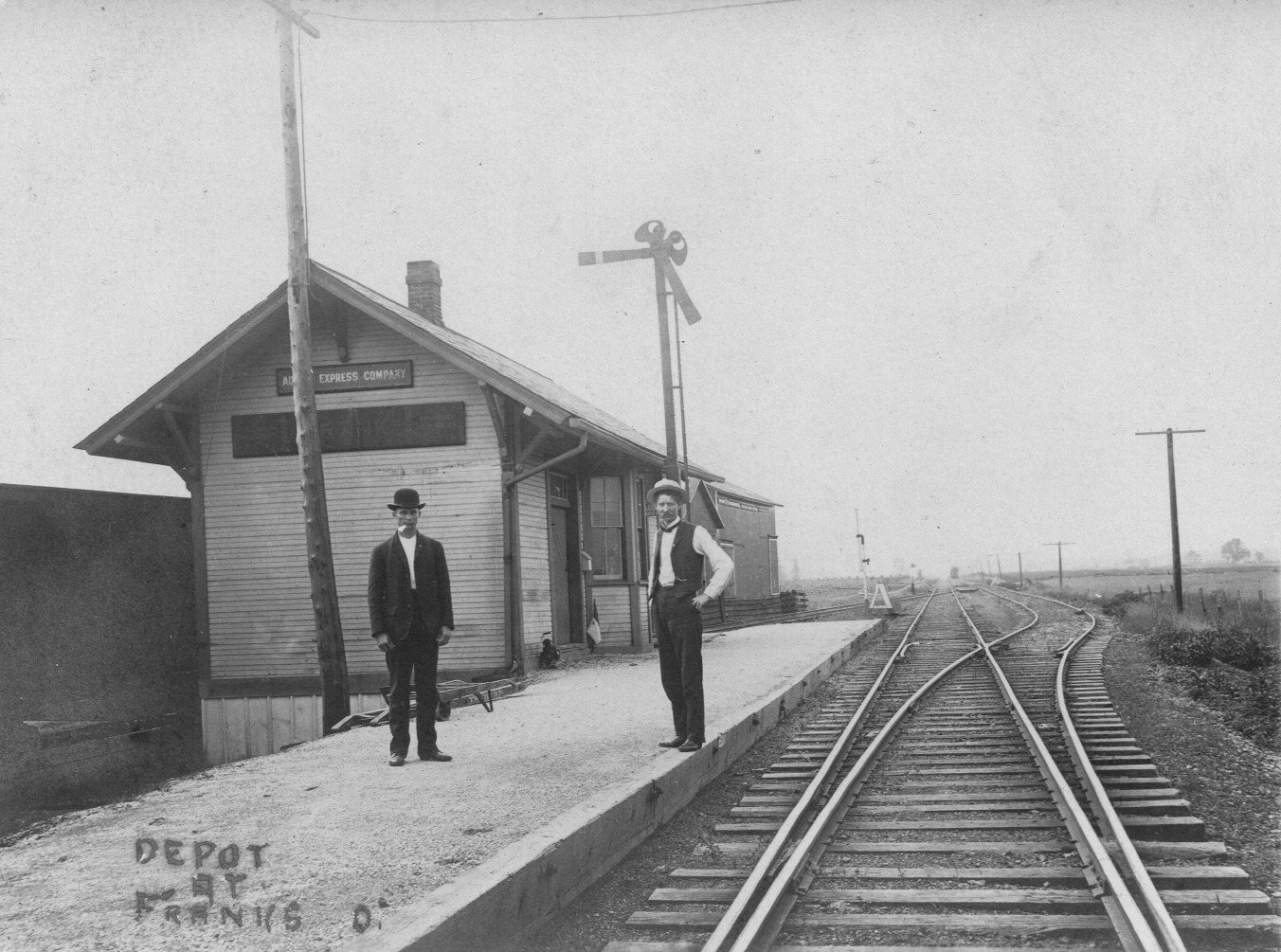
| Frank |
|
|||||||
| Green Springs | |
This station was on South Broadway near the intersection with South Kansas Street. It was on the north side of the tracks. (GPS: 41.249758,-83.054034). It is shown there on the 1928 Sanborn map. Later, the station was moved about 800 feet west to the NKP/Big 4 diamond. It was torn down in the early 1970s. Although the county line runs through the center of town, both the Big 4 and NKP stations were on the Seneca County side of the line. | ||||||
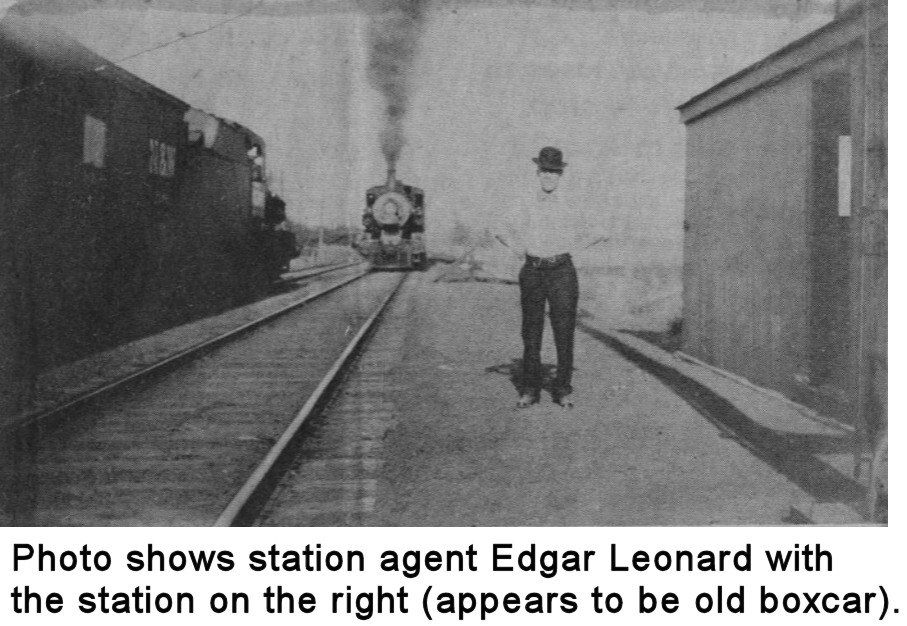
| Iler | |
This station was a remodeled boxcar. | ||||||
| Ink | |
This station was at MP 32 (from Toledo Jct.) between Bloomville and Tiffin. | ||||||
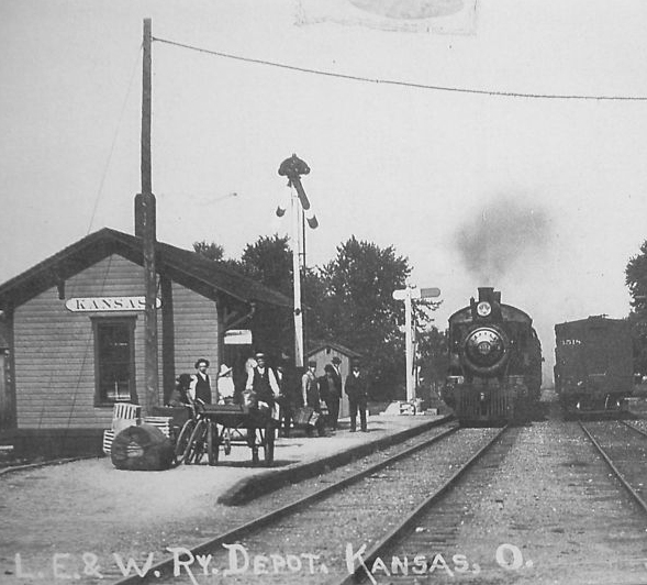
| Kansas | |
This station was on the east side of Jacob Street on the NW side of the tracks (GPS: 41.245383,-83.283349). The station was closed by the RR in 1959 and relocated to the Fostoria yard. It was later demolished there. | ||||||
| Maple Grove | AND |
From the design, this station looks as though it may have served both the PRR and NKP. | ||||||
| McCutchenville | |
The station was on the SE side of Clay Street (SR-53) on the SW side of the tracks (GPS: 40.996063,-83.254749). | ||||||
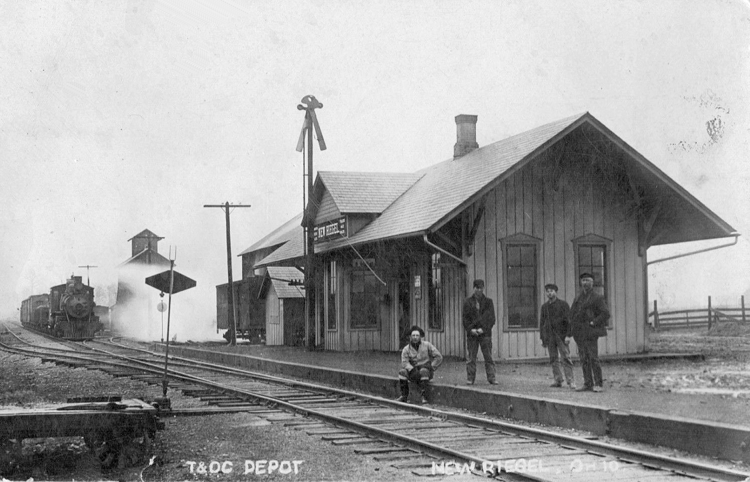
| New Riegel | |
This station was on the SE side of Tiffin Street on the SW side of the tracks (GPS: 41.053167,-83.314835). | ||||||
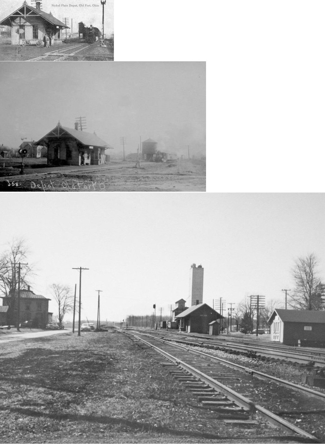
| Old Fort | |
The station was on the east side of Main Street on the north side of the tracks (GPS: 41.240081,-83.149332). | ||||||
| Republic | |
The station was just to the west of the south end of Washington Street. It was on the north side of the tracks (GPS: 41.117892,-83.017824). | ||||||
| Rockaway |
|
|||||||
| Scipio | |
It appears from the photo that this larger building, which may have been a store or hotel, doubled as the RR station. | ||||||
| Siam (Attica JCT.) |
AND |
This station was in the SW corner of the diamond (GPS: 41.085623,-82.875516). | ||||||
| St. Stephens | |
This station was at MP 23.3 (from Toledo Junction) between Carrothers and Bloomville. | ||||||
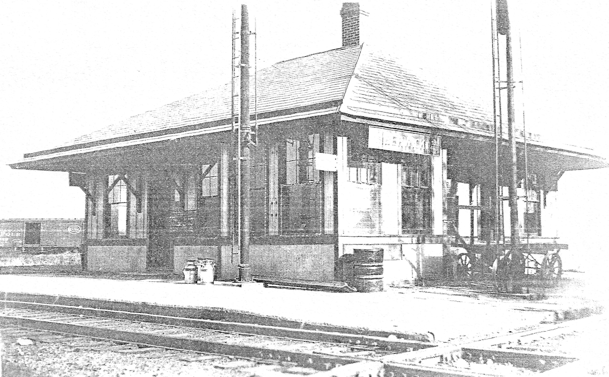
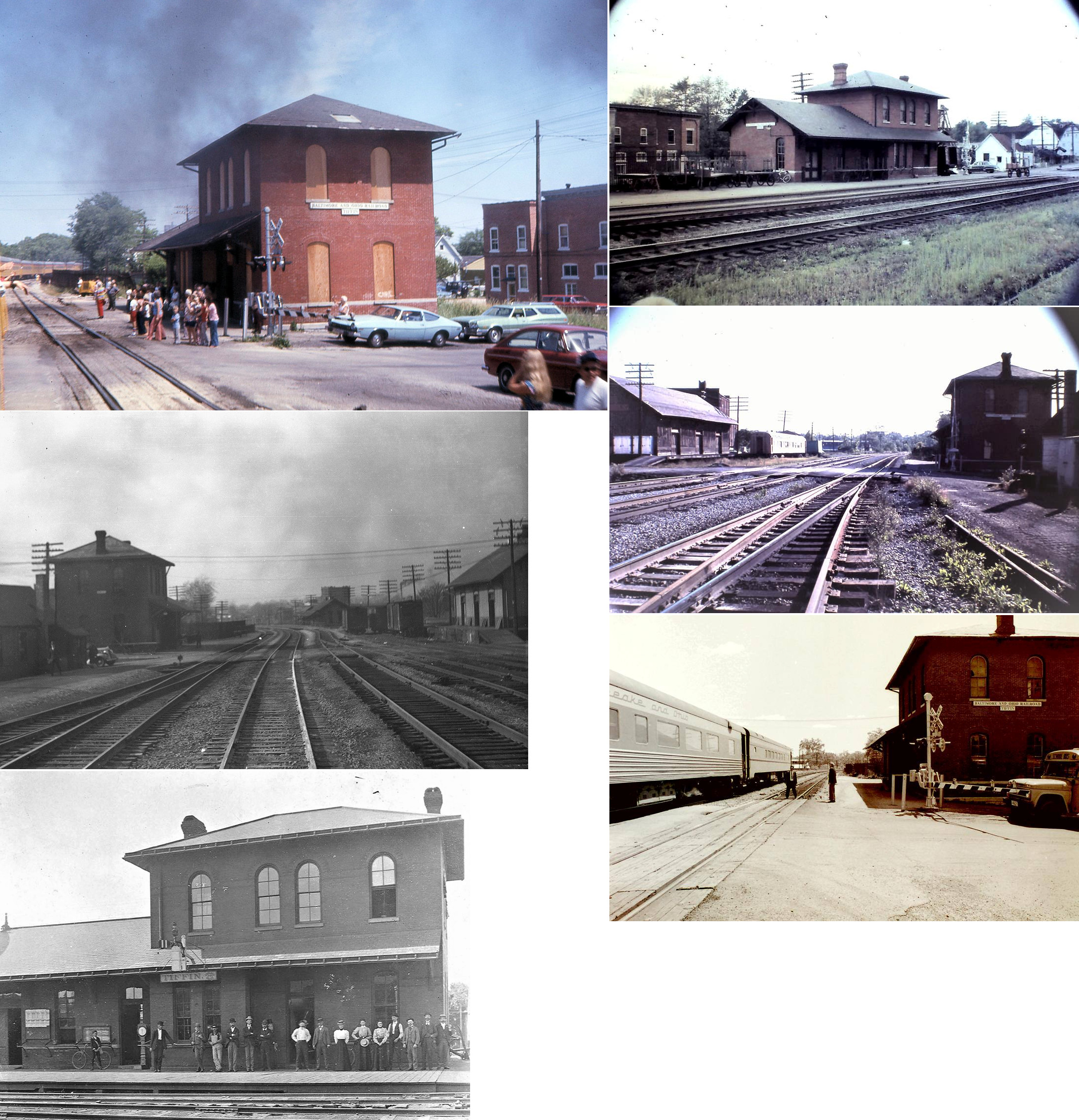
| Tiffin | |
This station was on the east side of North Monroe Street, on the south side of the B&O tracks (GPS: 41.119475, -83.178801). | ||||||
| Tiffin | |
The freight house was built in 1872. It was north of Adams Street between Monroe Street and Sandusky Street at approximately GPS: 41.119386, -83.180432. | ||||||
| Tiffin |
|
The Northwestern Ohio Railway (later TWV&O, then PRR) passenger station was on the east side of Washington Street between Harrison and Water Streets on the north side of the tracks at the top of the viaduct (GPS: 41.119528, -83.177157). The station was most likely built by the Northwestern Ohio Railway as it appears on maps from that era. | ||||||
| Tiffin |
|
The freight house was on the east side of North Monroe Street (formerly Lafayette) at approximately GPS: 41.119754, -83.178853 across the tracks from the B&O passenger station. The freighthouse was on the SE corner of Hudson and North Monroe Streets. This station also was most likely built by the Northwestern Ohio Railway as it appears on maps from that era. | ||||||
| Watson's Station |
|
|||||||
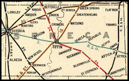
| 1898 SENECA COUNTY RAILROAD MAP | ||||||||
 |
||||||||
| Notes About Existing
Stations... Amsden (LE&W) - The station was originally on the north side of Main Street (West County Road 28) on the SE side of the tracks (GPS: 41.216185,-83.326948). An interurban ran behind the depot. The depot was moved to the old interurban right-of-way. It is now on the south side of CR 28 at GPS: 41.215546,-83.327768. Berwick (CCC&St.L) - The Berwick passenger and freight stations are on SR 587 near where the RR crossed the highway. The Berwick buildings were combined into one building and are now a garage/shop. Can anyone identify which building this is on Google maps for a precise location? Fostoria (B&O) - Amtrak stop. Fostoria (B&O/C&O) - Moved in 1930s. Was a station at the junction just to the north of this location. On the HV this station was referred to as B&O Junction. Fostoria (LE&W) - Station is now owned by the Fostoria Rail Preservation Society. Purchased from Campfire USA in 2007. Green Springs (CCC&St.L) - The Big 4 also owned a grain elevator across the tracks from the station. McCutchenville (T&OC) - Originally the station was located in Senaca County on the north side of town on the east side of Route 53 where the Heritage Cooperative office building is presently (2011) located. It was moved from the original site to its current location around 1952. It still has the original wood flooring, walls and interior doors. the lower level was once a garage, but has been expanded and converted into additional living space. Wharton (T&OC) - Moved from its original location on West Sandusky Street on the east side of the New York Central tracks. The depot was moved in the late 1950s, when passenger service and the signaling system were taken off the line, to make room for the new Post Office. A local auto mechanic now owns it and uses it for storage. The north end of the building is missing. It has been modified with large opening to accommodate vehicles. Tiffin (SD&C) - This Sandusky, Dayton and Cincinnati RR (later IB&W, then CCC&St.L, then NYC) station sits along an old boardwalk area next to an old candy store. Across the abandoned tracks to the SW is the old freight station which appears to be part a of a complex of modern buildings. Jim Cook tells of the former Tiffin stations: The Baltimore and Ohio station sat on the Southeast corner of the intersection of the railroad and N. Monroe; The TVW&O (later PRR) station sat on the Northeast corner of the intersection of the railroad and N. Washington street at the top of a steep stairway. |
||||||||