 COUNTY COUNTY
|
|
||||||||
| EXISTING STATIONS | ||||||||
|---|---|---|---|---|---|---|---|---|
| Station Name |
Original Railroad |
Current Location |
Type | Current Use |
Date Built |
Track Status |
Building Material |
More Info |
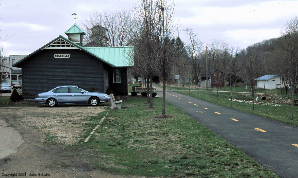
| Bellville |  |
Side St. W. of SR13 North edge of town. | R | Civic | ???? | Gone | Wood |
|
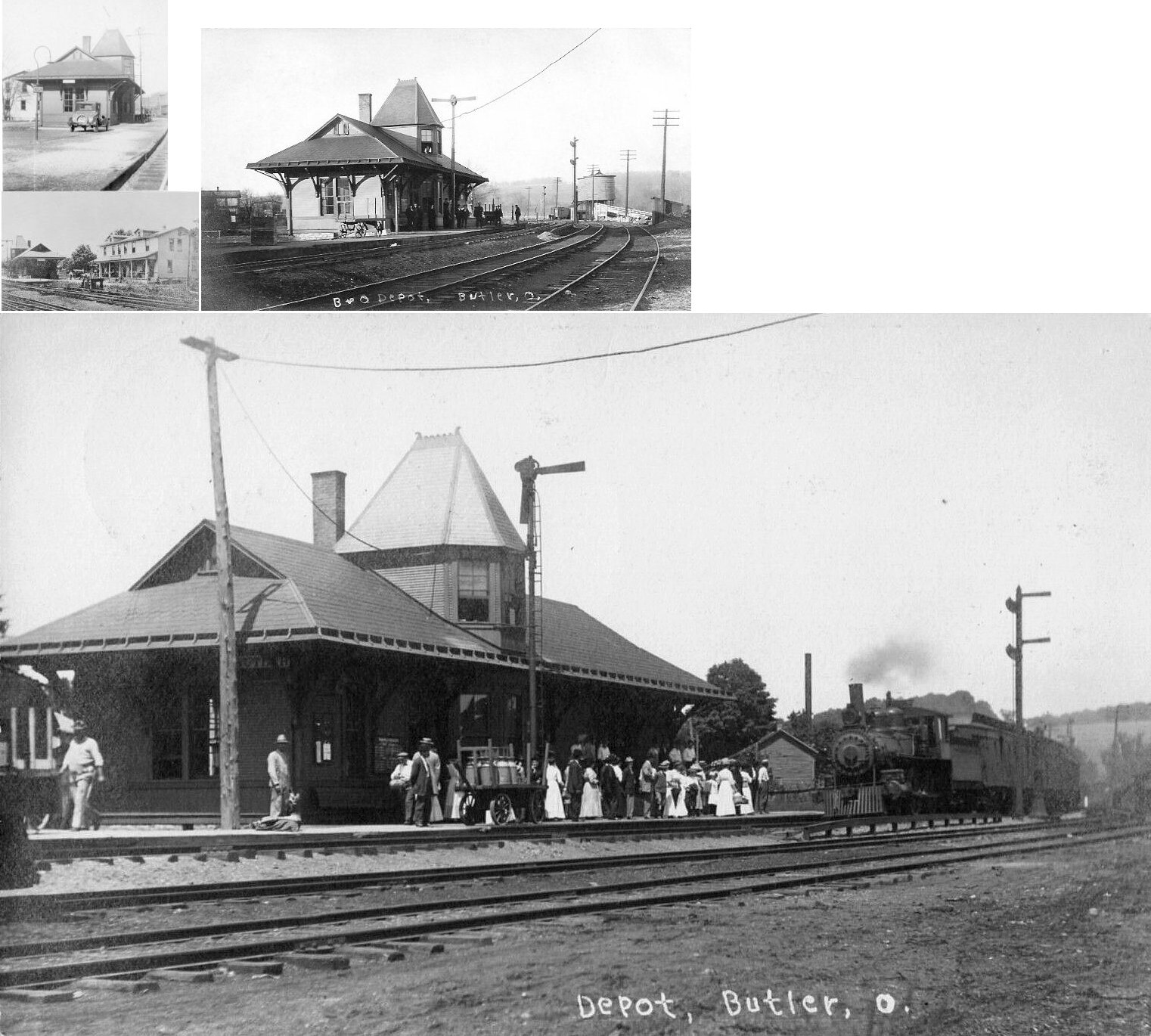
| Butler |  |
Unknown | F | ???? | ???? | ???? | ???? | |
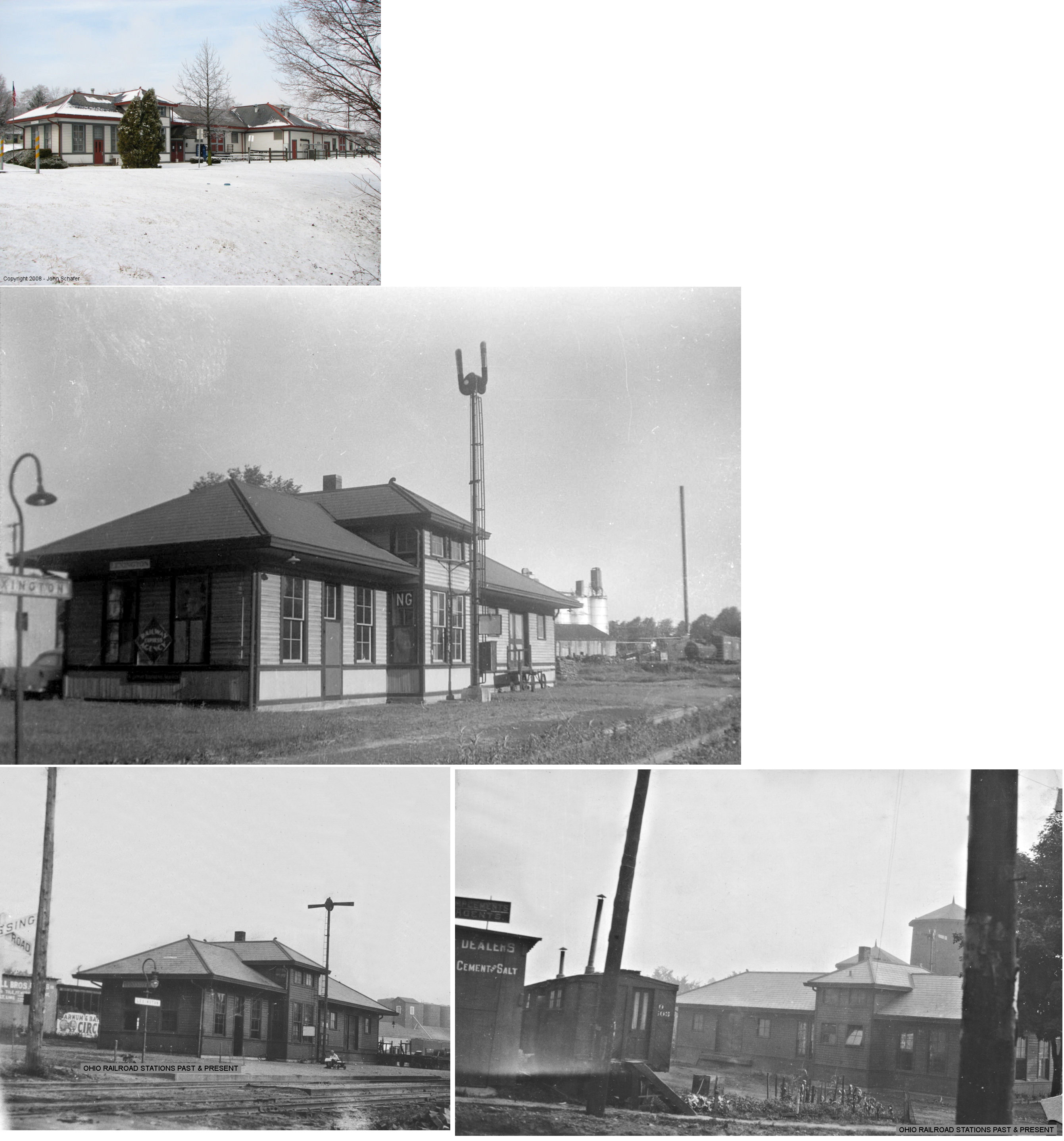
| Lexington | |
North side of US 42 east of Mill Street (GPS: 40.678871, -82.580559) |
C | Civic | 1913 | Gone | Wood |
|
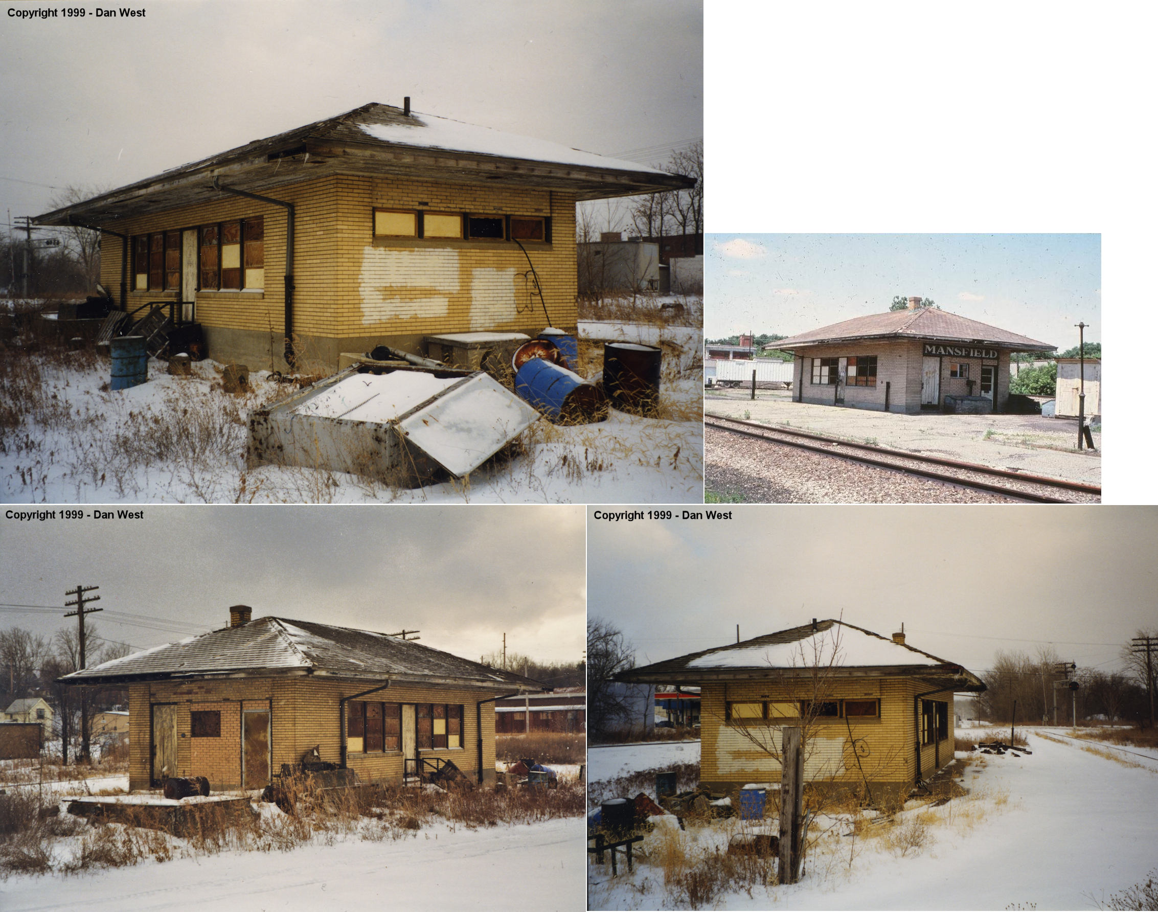
| Mansfield | |
283 North Mulberry Street (GPS: 40.766292, -82.518522) |
P | Vacant | 1889 | In Use | Brick |
|
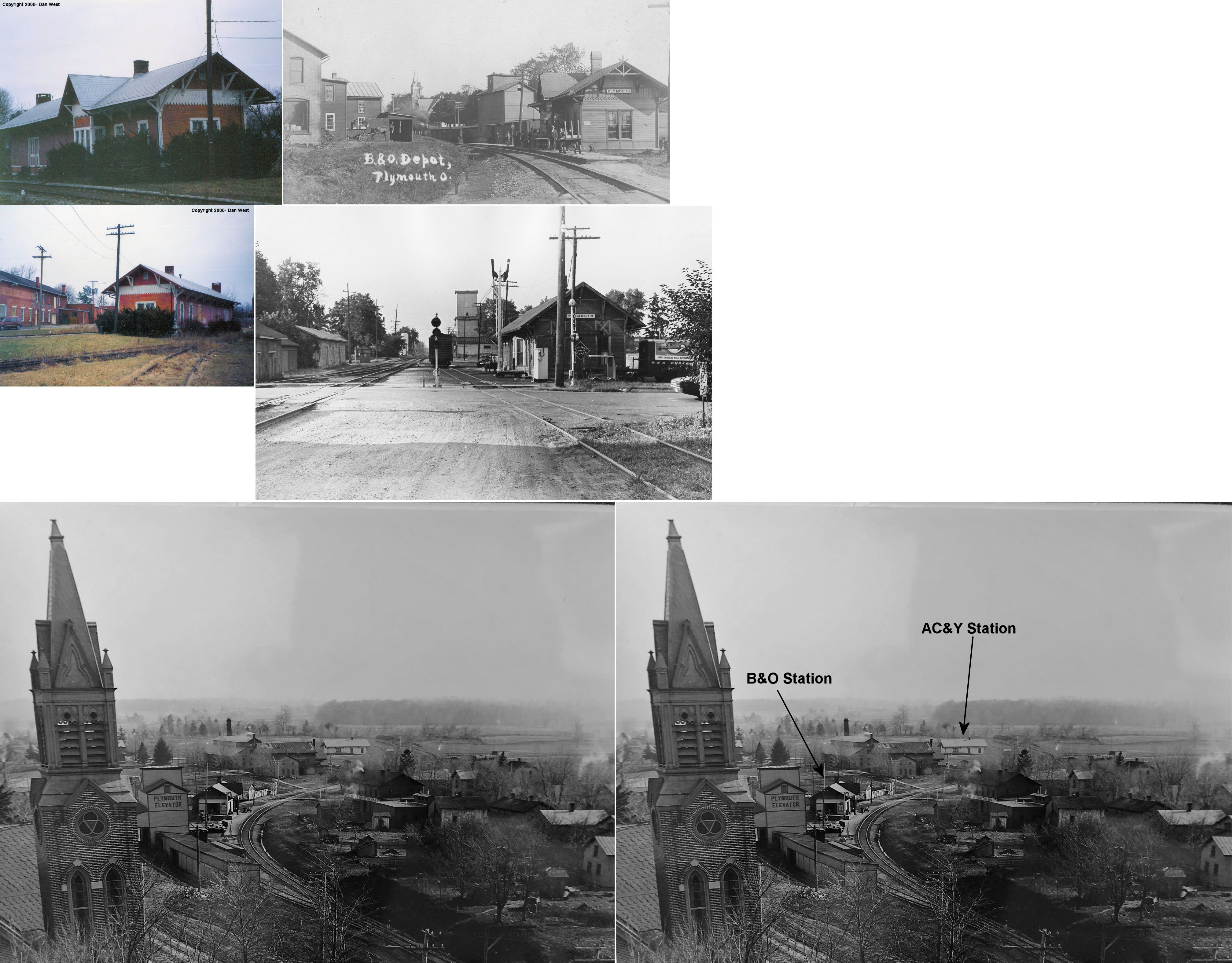
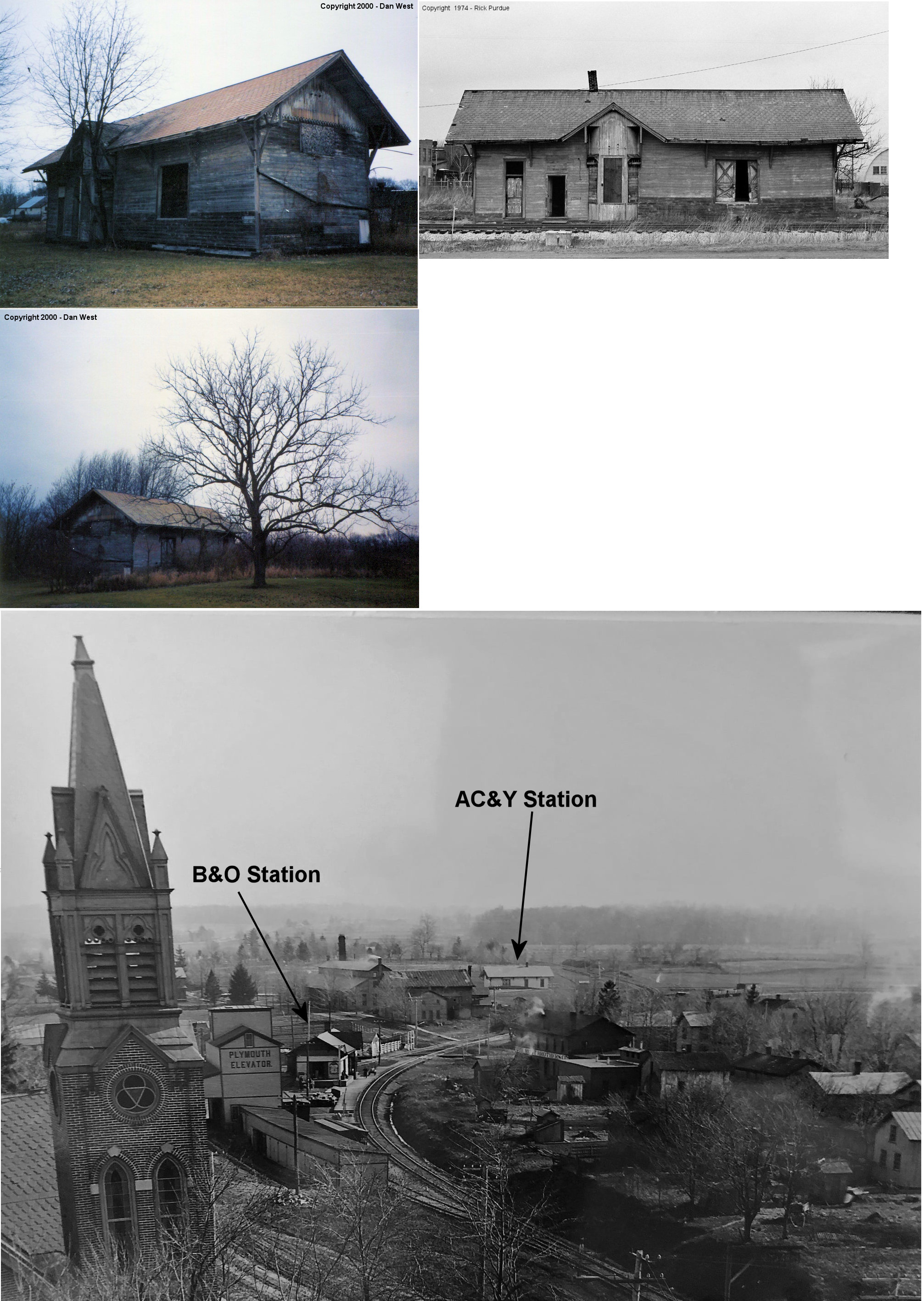
| Plymouth | |
Bell & West High (GPS: 40.993115,-82.668305) |
C | Vacant | 1887 | In Use | Wood |
|
| Plymouth |
 |
Near Bell & West High behind Locomotive Works (GPS: 40.99068,-82.669922) |
C | Vacant | ???? | In Use | Wood |
|
| Shelby | Ashland Railway |
South side of East Main Street (GPS: 40.881164, -82.657277) |
P | Railroad | 1960s | In Use | Metal |
|
| STATIONS OF THE PAST | ||||||||
| Station Name |
Original Railroad |
Notes | ||||||
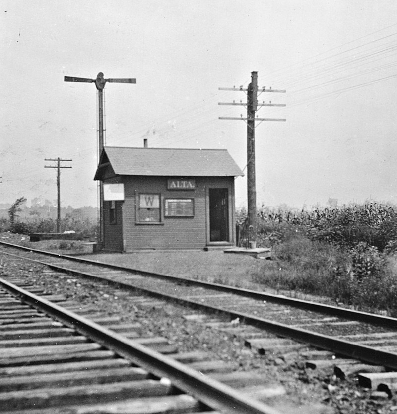
| Alta | |
Alta was originally known as Summit Station. The building in the photo was built in 1901. It was built to B&O passenger station plans for small stations, but by 1919 it was listed as a signal shack in the valuation records. It's not clear whether it ever served as a passenger station though. | ||||||
| Bellville | |
This depot was on the east side of North Bell Street. It was built in 1906 and destroyed in a wreck in 1955. | ||||||
| Bellville | |
When the frame B&O station was destoryed in 1955, a metal depot was constructed on the site. It was subsequenlty torn down in 1964. | ||||||
| Butler (INdependence) |
|
The first station here was on the NE side of Main Street on the SE side of the tracks (GPS: 40.58824,-82.425511). | ||||||
|
Butler (INdependence) |
|
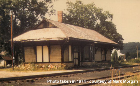
Depot was torn down sometime before 1980. Here are some photos of the station before a 1908 fire claimed the tower part of the building. In the 1974 photo, you can see the roof repair where the tower section was removed. The station sat just to the north at the end of East Henry Street. In the old days the Hotel Victor sat behind the station and a handle factory was across the tracks. Town was originally called Independence when the RR first came through. | ||||||
| Cookton |
 |
|||||||
| Coulter |
|
According to PRR valuation records, a shelter was built here in 1910. I beleive this station was just east of the county line in Ashland County on Twp-1075 in the vicinity of GPS: 40.693172, -82.337669. It was at same location as the Illinois Pipeline Company. Can anyone verify this location? Not sure which side of the county line this station was on. | ||||||
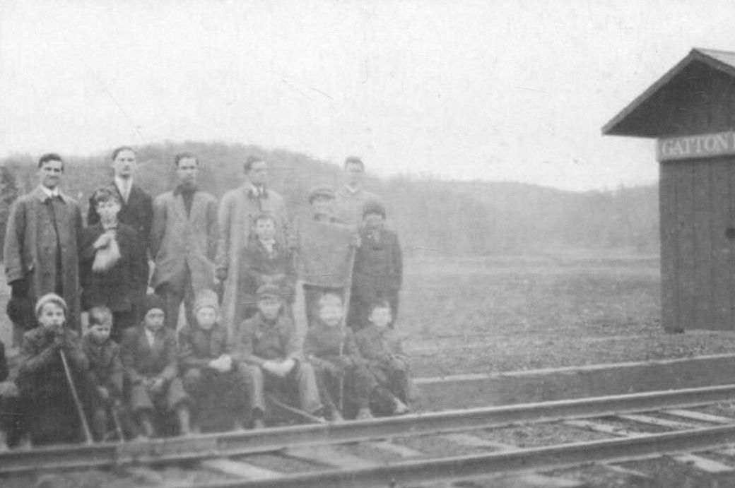
| Gatton Rocks |
|
This small depot was a flag stop that served the resort here. | ||||||
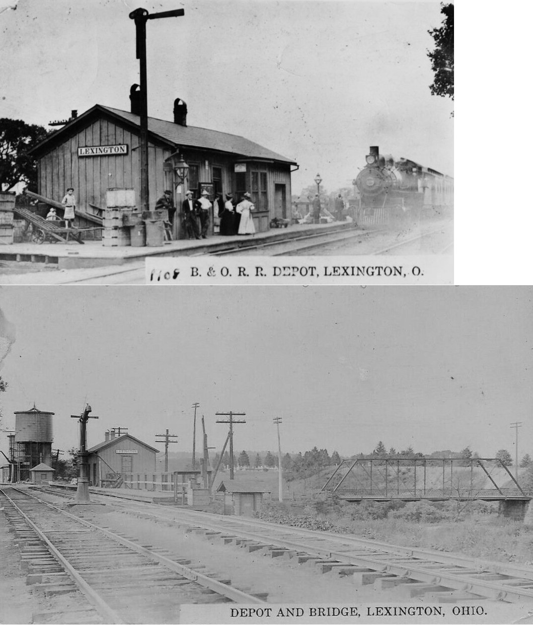
| Lexington |
|
This was the first station here. | ||||||
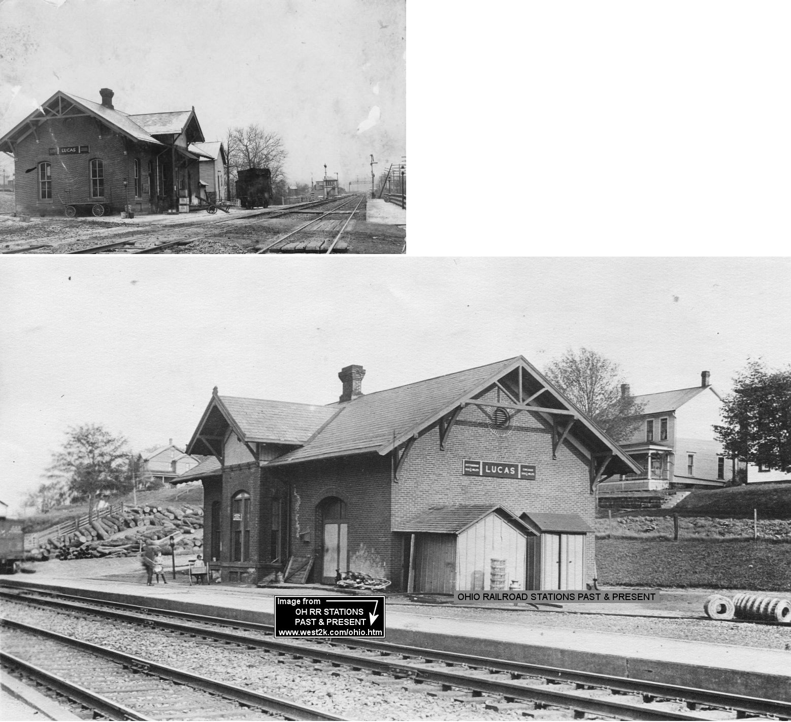
| Lucas |
|
The brick combination station was on the south side of the tracks at what used to be the south end of Union Street (now the intersection with Moffett Road) (GPS: 40.701929,-82.419399). According to PRR valuation records, the station was built in 1882. | ||||||
| Mansfield |
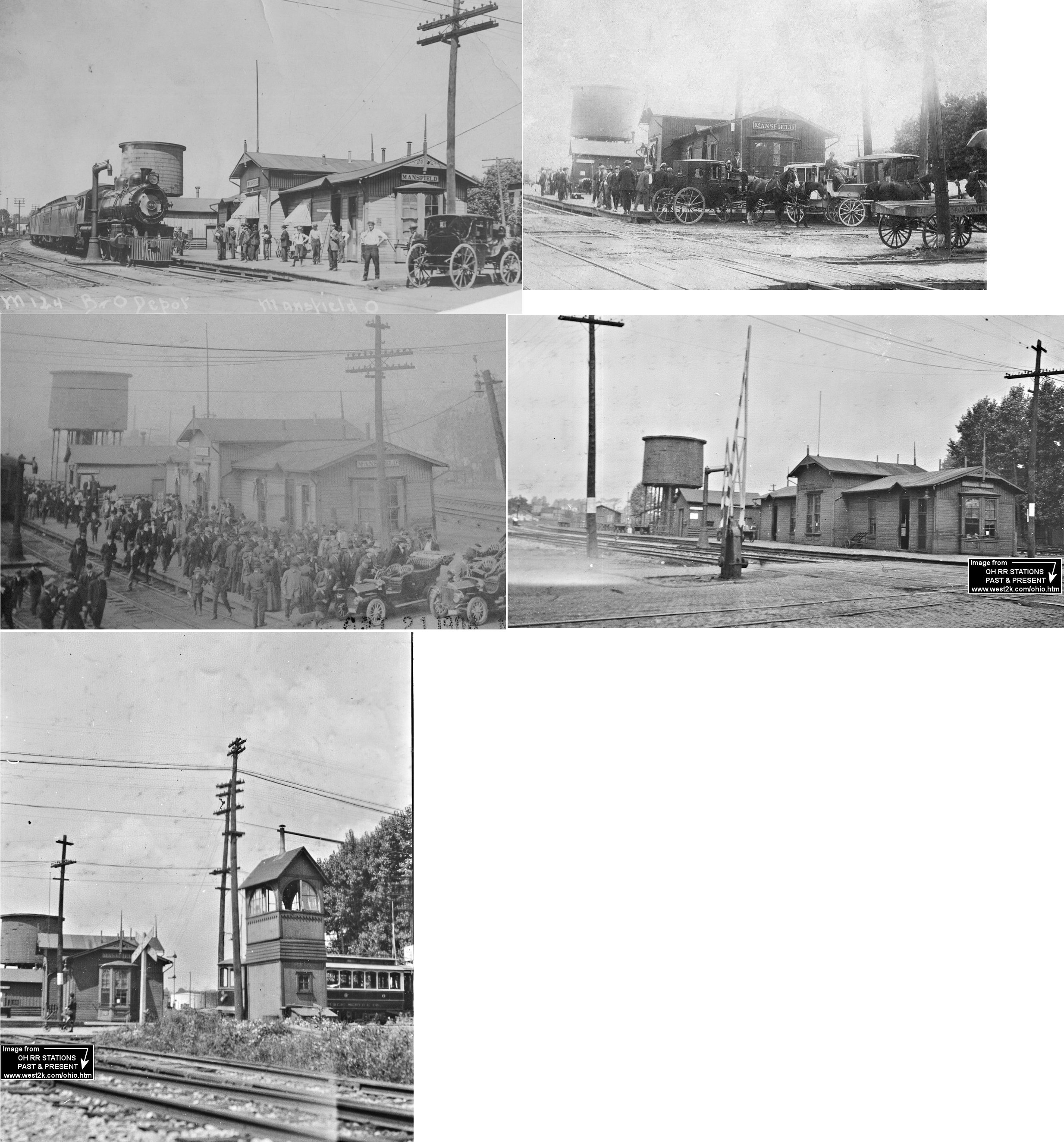
|
The first PFt.W&C station was between East 4th and East 3rd Streets. According to an article in the Mansfield News-Journal (12-4-1912), the station was a one-story frame structure part of which was occupied by the Strong grain elevator. After this station was retired, the PFt.W&C entered the union depot with B&O on North Main Street. | ||||||
| Mansfield |
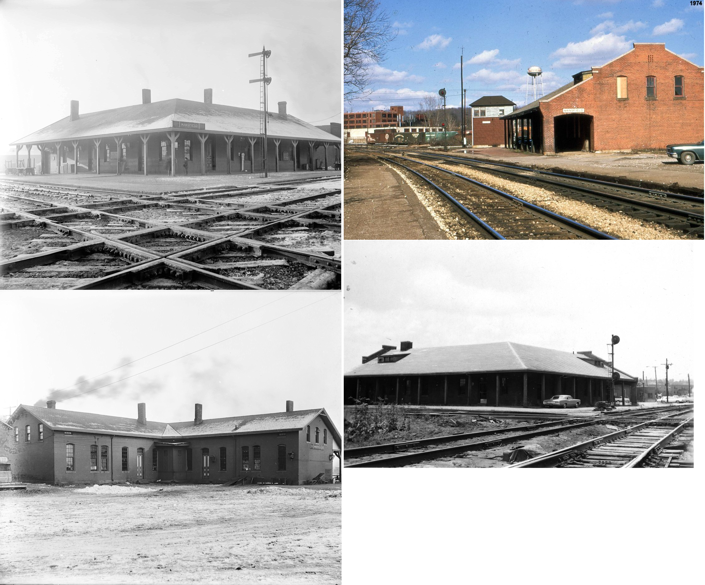
AND  |
This union station, built in 1872, was off North Diamond Street, just to the NE of the NYP&O (Erie RR) freight station listed below. It was in the south quadrant of the PRR/Erie diamond at GPS: 40.768259, -82.512462. It a major enlargement and modernization project in 1940. Here are some more photos, including one from 1974. PRR valuation records say the station was owned by the PRR with part being leased to the Erie. Those records give a build date of 1866. It was torn down in 1980. | ||||||
| Mansfield |
 |
This Railway Express depot was just to the SE of Union Station along the PRR tracks. | ||||||
| Mansfield |
|
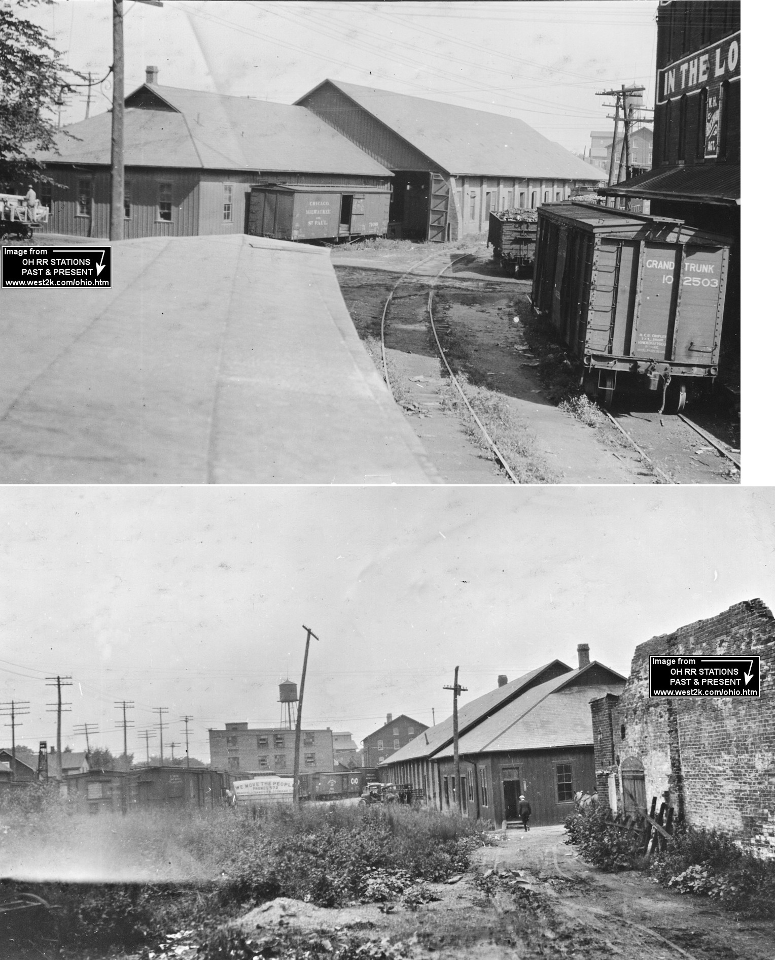
The freight depot was on a spur on the east side of North Diamond Street (before it was rerouted), just north of Olive Street at GPS: 40.767697, -82.513261. According to Erie RR valuation records, the station was built in 1869. | ||||||
| Mansfield |
|
The freight house was at the end of several spur tracks on the north side of East Bloom Street (now East 5th Street) between North Adams and North Franklin Streets. | ||||||
| Mansfield |
 |
The first station in Mansfield was "at the foot of North Walnut Street" (News-Journal, 6-22-1969). It was likely an Mansfield & New Haven station (later known as the SM&N (Sandusky, Mansfield & Newark) and later part of the B&O). | ||||||
| Mansfield |
AND |
This older union station was on the east side of Main Street just south of Orchard Street (GPS: 40.769622,-82.514738). This station is shown on the 1873 map. | ||||||
| Mansfield | |
This station was at 283 North Mulberry at GPS:40.766380, -82.518007 (on the west side of Mulberry Street, just south of Surrey Road near where the more modern brick station is now). | ||||||
| Mansfield | |
The freight station was on the west side of North Walnut Street, between West 5th and West 6th Streets (GPS: 40.764175, -82.516474). The building was expanded with an office on the south side sometime between 1887 and 1892 (Although, according to B&O valuation records, this station was built in 1889. That doesn't seem correct as it is shown on older maps.). Around 1900 another smaller freight depot was added on the north side of the larger freight house. By 1909 these two freight houses were joined as one building and the building's address as given in 1958 was 29 West Sixth Street. | ||||||
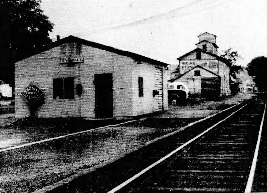
| Melco |
|
This location was abandoned as a freight station in 1956. Not sure when passenger service ended. | ||||||
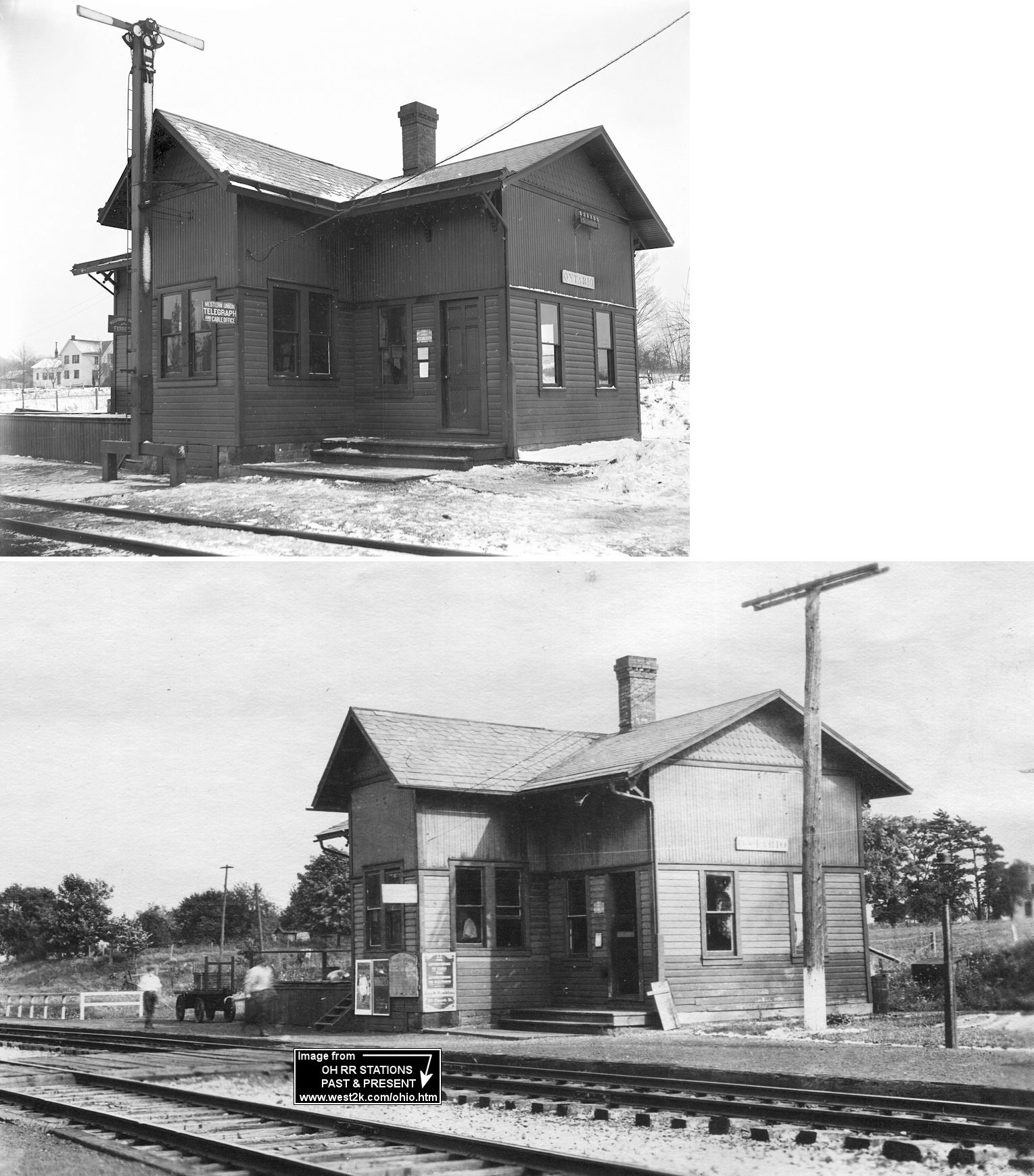
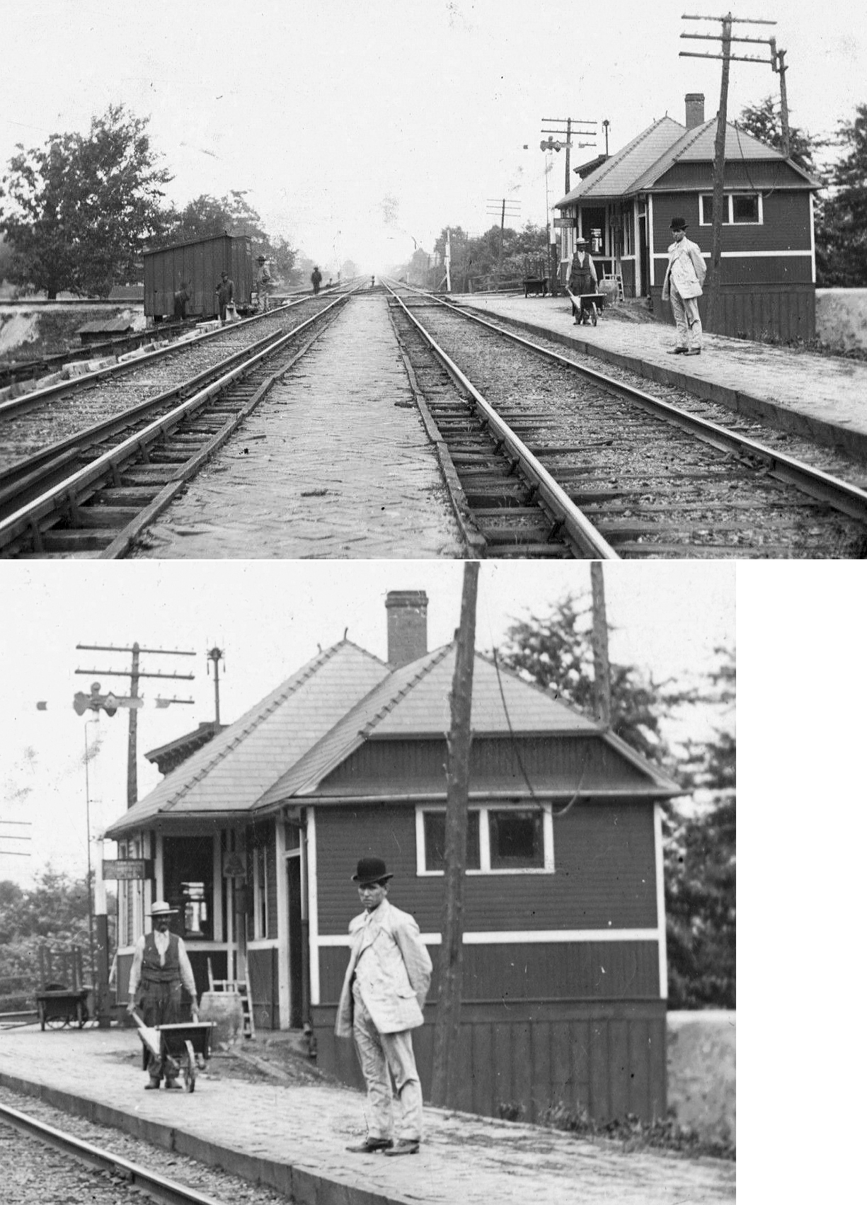
| Ontario |
|
On April 25, 1891 a wreck occurred at the station when two trains attempted to occupy the same siding. The depot platform was demolished in the wreck (Mansfield News-Journal, 4-25-1891). According to Erie RR valuation records, a station was built here 1896, so the one pictured may have been the second station here. It was on the south side of Railroad Street at approximately GPS: 40.759141, -82.645930. | ||||||
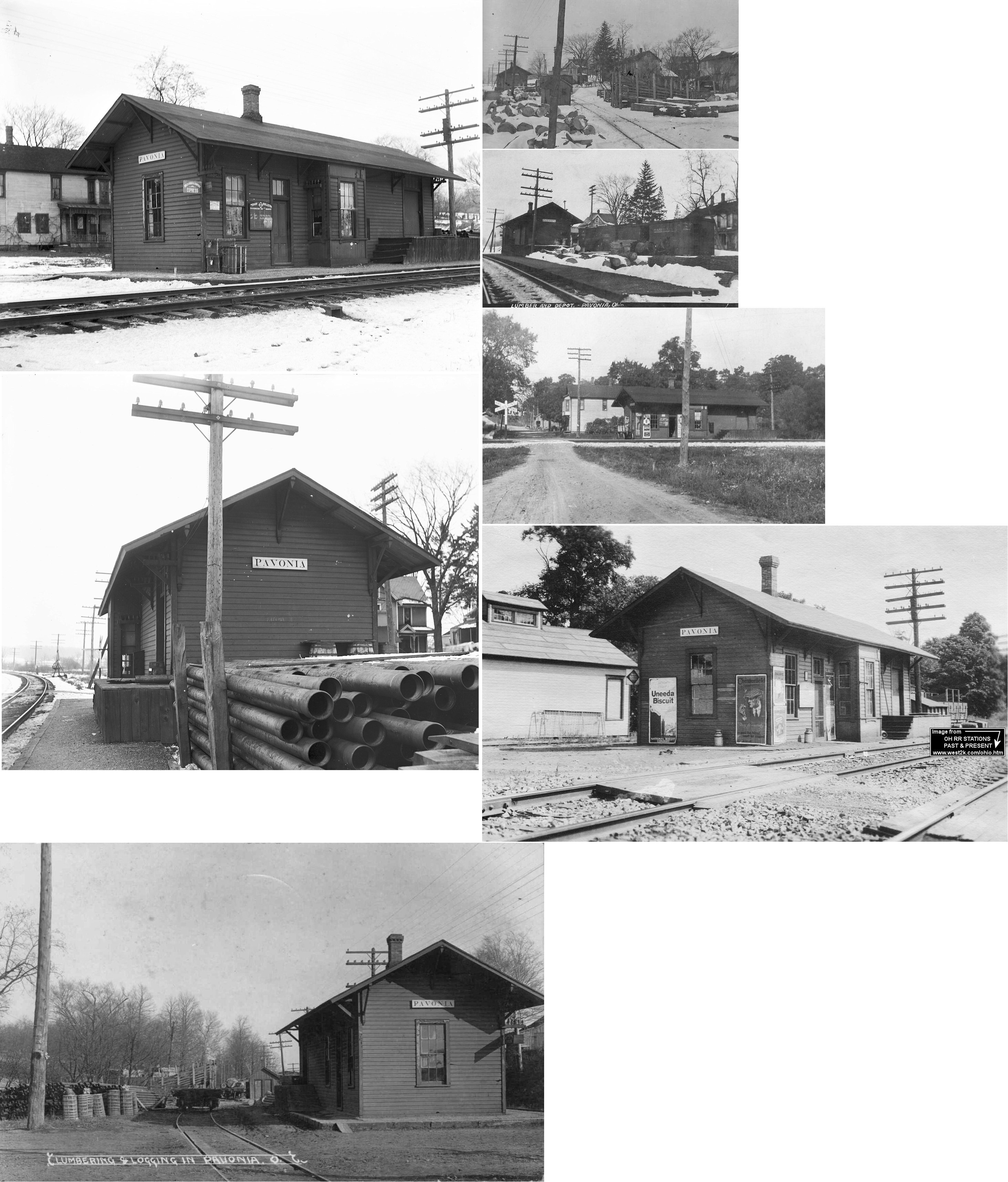
| Pavonia |
|
The station was on the north side of the tracks on the east side of North Street. According to Erie RR valuation records, the station was built in 1887. | ||||||
| Plymouth |
|
Before the B&O station was built here, there was an older SM&N (Sandusky, Mansfield & Newark) station. It was probably at the same location as the B&O station and likely demolished for the newer station's construction. | ||||||
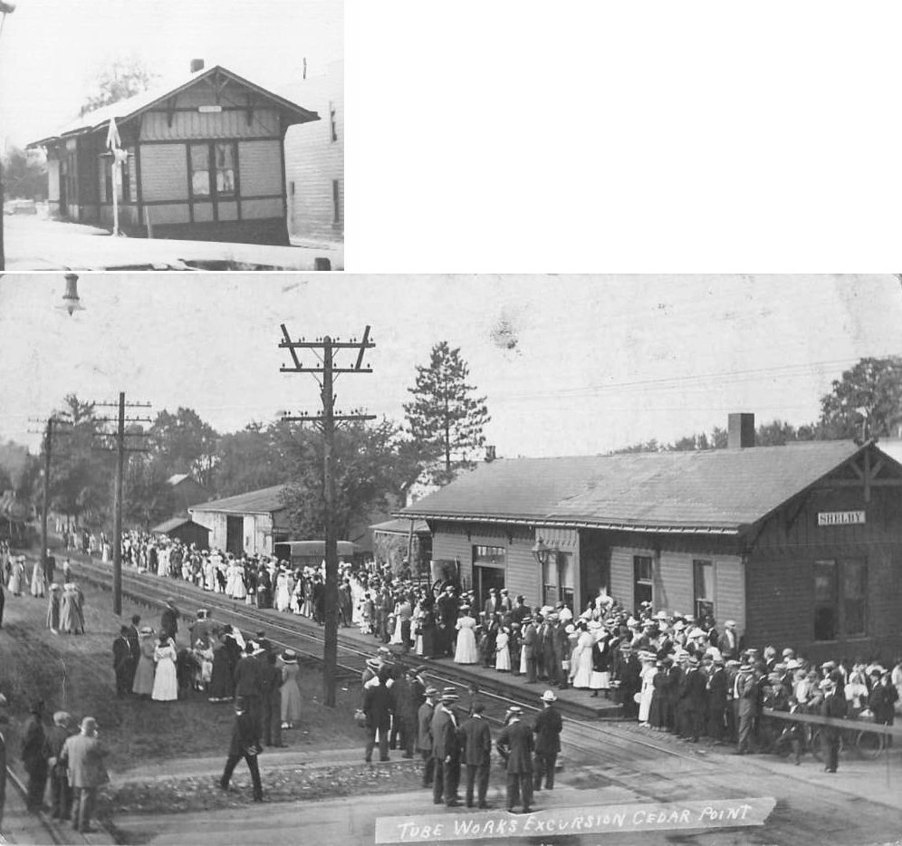
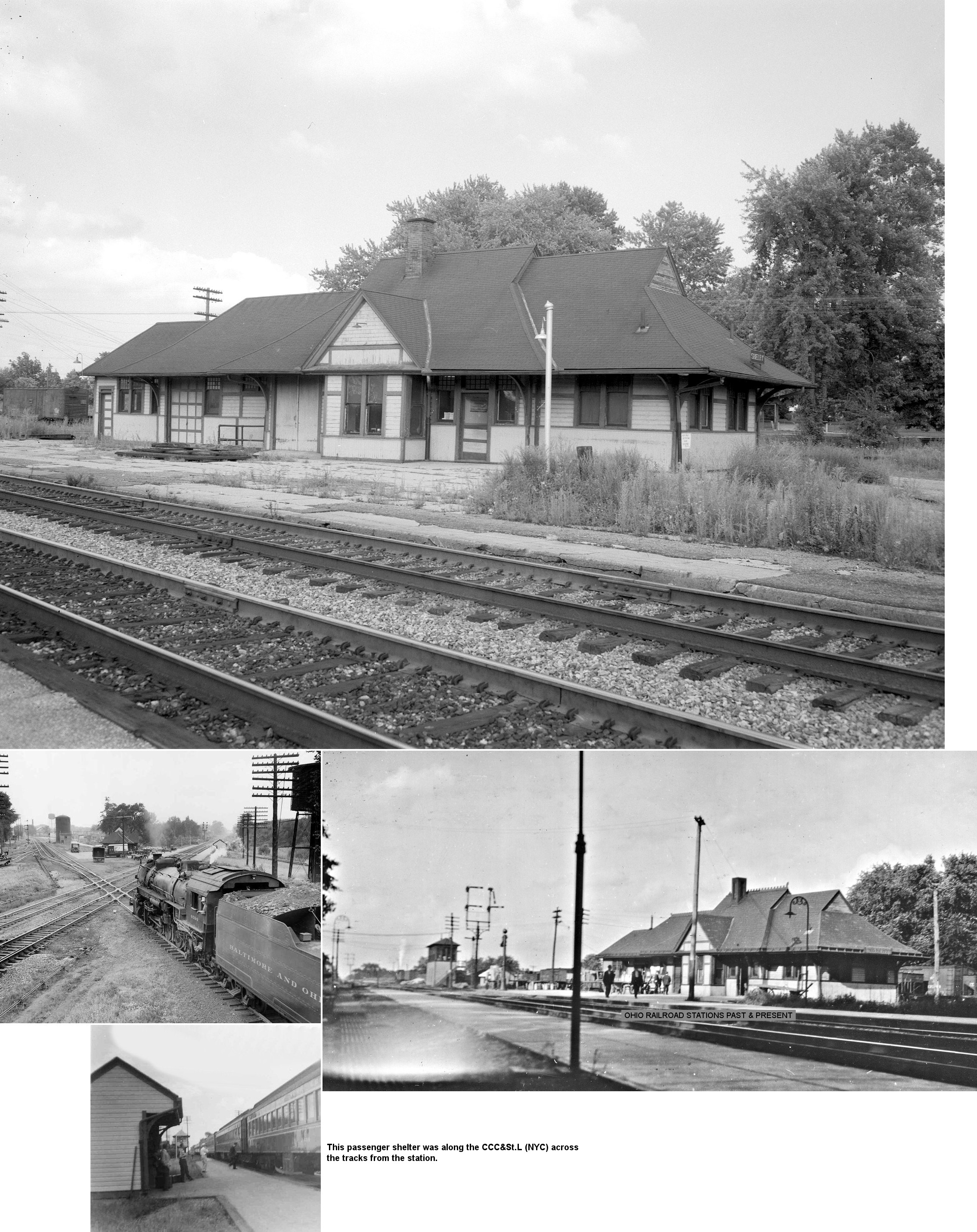
| Shelby | |
This combination station was located on the south side of East Main Street. In later years the shell of the station was used as a passenger waiting room. It was torn down in the 1960s and thereafter the Ashland Railway built a small metal depot on the site which is still standing. | ||||||
| Shelby |  |
The NYC had a small station on the north side of West Main Street. This station is shown on the 1919 Sanborn Map next to a signal tower at that location. The station was short-lived as it does not appear on the 1909 or 1930 maps. | ||||||
| Shelby |  AND |
|||||||
| Shelby Junction | AND |
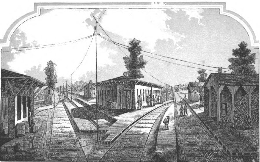
The first station at this location in the northern part of Shelby was built in the 1850s and destroyed by fire sometime in the 1880s. This location is near the intersection of North Broadway and Flint Street. The illustration is from 1854. The passenger station was in the southern quadrant of the diamond and a CCC&I (Big 4) freight depot was in the eastern quadrant. | ||||||
| Shelby Junction | AND |
The second station at this location was damaged by a 1969 derailment and demolished soon thereafter. The station was at the northern end of Mohican Street at GPS: 40.890160, -82.657933 in the southern quadrant of the diamond. The photo with the B&O engine is looking south. According to B&O valuation records, this station was built in 1889 and was owned 100% by the CCC&St.L (with the B&O renting its portion). There was also an 1889 freight station here that was owned by the CCC&St.L, but also used by the B&O. | ||||||
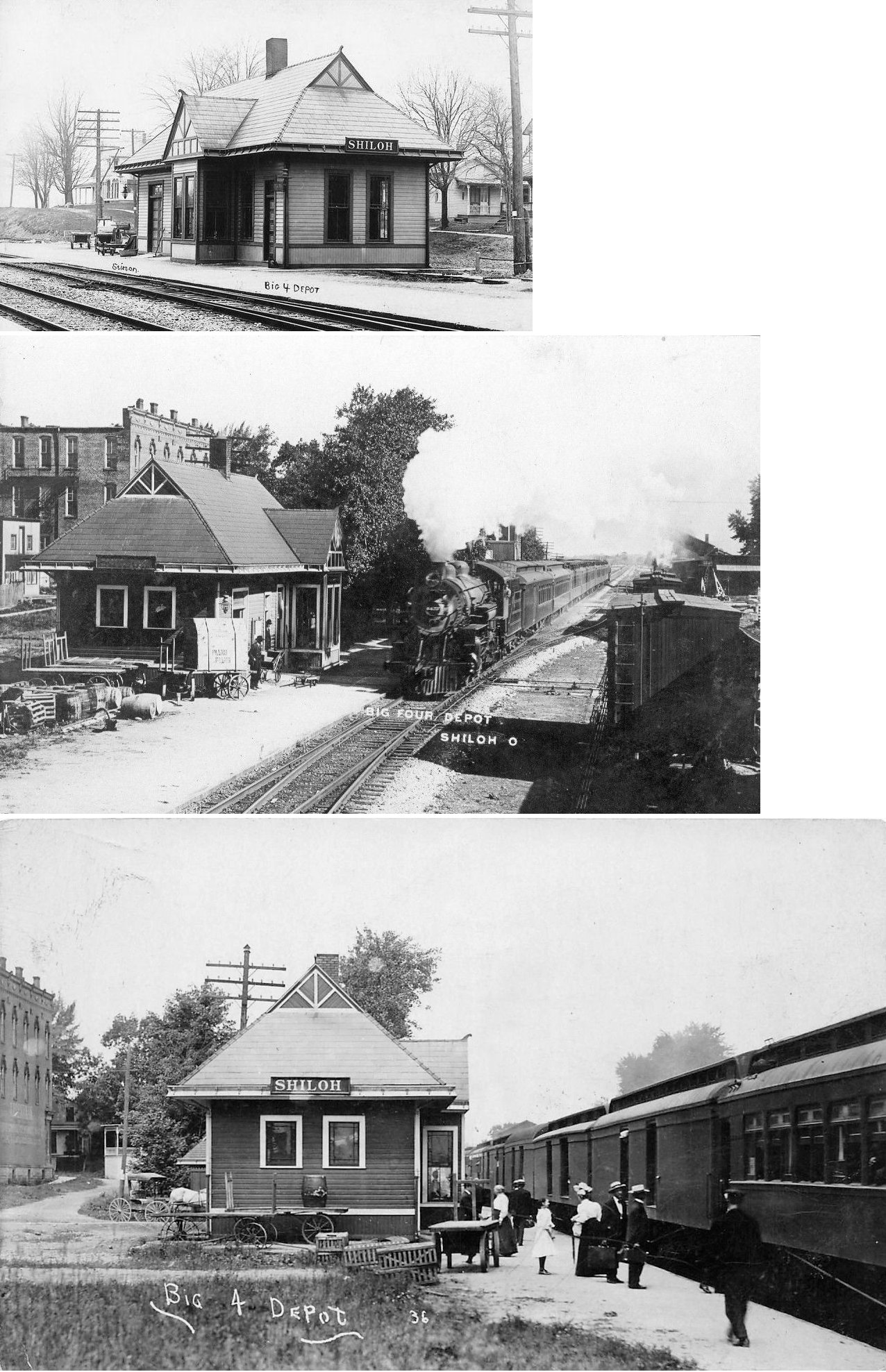
| Shiloh | |
The station was on Cleveland Street south of Main Street (GPS: 40.966569,-82.601695). | ||||||
| Spring Mill |
|
|||||||
| Toledo Junction |
AND  |
|||||||
| Vernon Junction | AND |
Previously known as Junction City. | ||||||
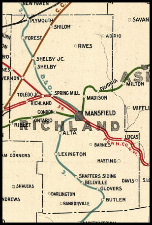
| 1898 RICHLAND COUNTY RAILROAD MAP | ||||||||
 |
||||||||
| Notes About Existing
Stations... Bellville (Replica) - This is a rest stop on the bikepath. Lexington (B&O) - Depot has been a senior center since around 1990. Previoulsy leased by the Kiwanis Club from Chessie System/CSX from 1970-1987. Mansfield (B&O) - Rich Tubbs, former operator at MD tower, reports that this station was for the B&O only. The Erie station was further east at the PRR diamonds where it was shared with the PRR. MD tower stood between the two stations. According to B&O valuation records, this station was built in 1889. Plymouth (B&O) - The 1887 map shows this station, but there is a small temporary station located next it indicating that it may have been under construction that year. The B&O planned to build another freight house/grain elevator to the north, but it was never completed. Eventually, a private grain elevator was at that location along Railroad Place (now just a dirt driveway). Plymouth (Pittsburgh, Akron & Western) - This station was originally located on the northeast corner of the diamond with the B&O (near the baseball fields on Riggs Street). It was built in 1890. Shelby (Ashland Railway) - This station, built in the 1960s, is on the site of the old B&O station. |
||||||||