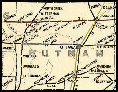
 COUNTY COUNTY
|
|
||||||||
| EXISTING STATIONS | ||||||||
|---|---|---|---|---|---|---|---|---|
| Station Name |
Original Railroad |
Current Location |
Type | Current Use |
Date Built |
Track Status |
Building Material |
More Info |
| Columbus Grove |  |
211 East Sycamore Street (GPS: 40.918615, -84.055084) |
F | Business | 1960s | Gone | ??? |
|
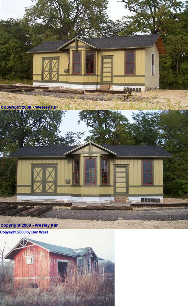
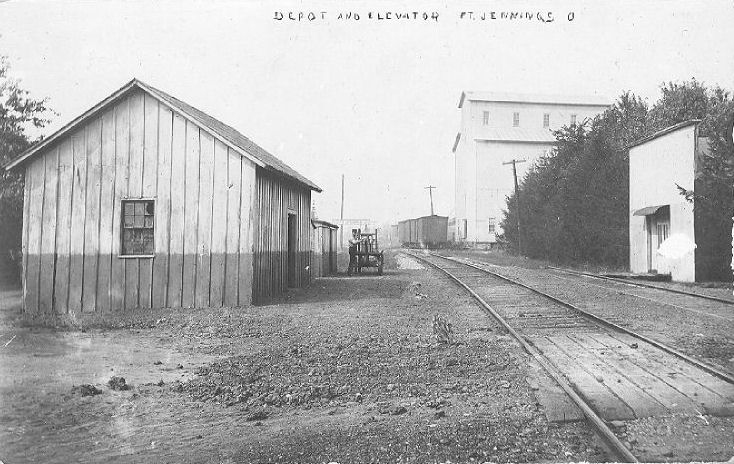
| Fort Jennings |  |
Road 21L, Cloverdale? (Can someone provide a more specific location or GPS coordinates?) |
C | Private | ???? | None | Wood |
|
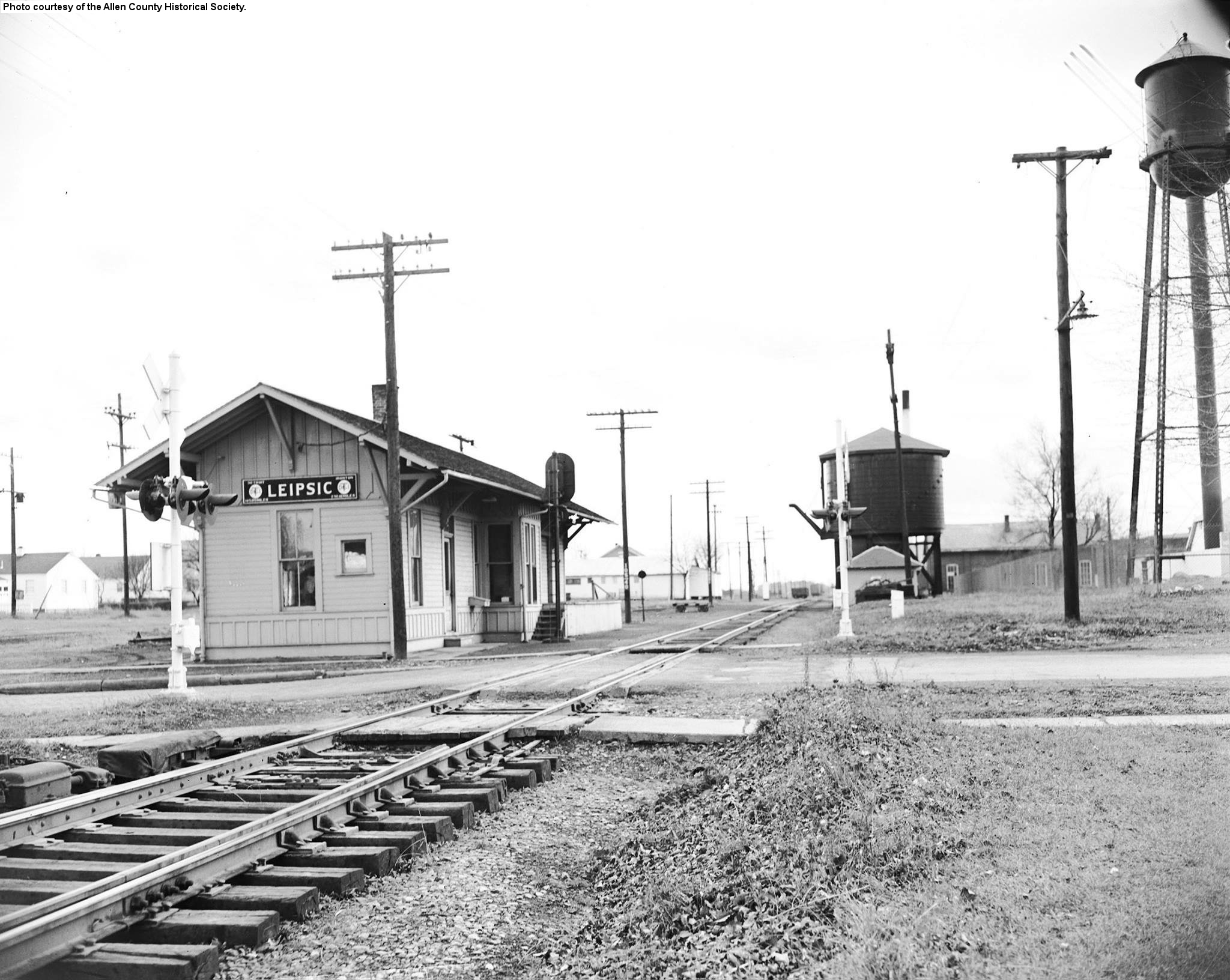
| Leipsic |  |
West side of Belmore Street between Center and Mathias Streets (GPS: 41.102110, -83.981918) |
C | Storage | ???? | Gone | Wood |
|
| Leipsic |  |
Auglaize Village at 12296 Krouse Road, Defiance (GPS: 41.264724, -84.440018) |
P | Railroad | 1966 | In Use | Metal |
|
| North Creek | |
Corner of Twonship Road 18-A and Road B (GPS: 41.150777, -84.217041) |
C | Vacant | ???? | None | Wood |
|
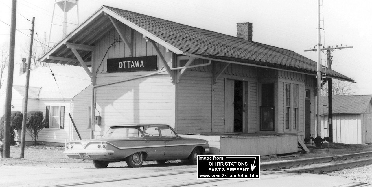
| Ottawa |  |
Taft & Fourth Streets (GPS: 41.021276, -84.047597) |
P | Railroad | ???? | In Use | Brick |
|
| STATIONS OF THE PAST | ||||||||
| Station Name |
Original Railroad |
Notes | ||||||
| Allemeier |  |
This was a flagstop between Delphos and Ottoville on the Delphos Branch. There was likely never a depot or shelter here. | ||||||
| Avis | |
|||||||
| Basingers (BAssingers) |
 |
There was at least a freight station here in the vicinity of GPS: 40.940142, -83.981084 or possibly to the NE near where the Blanchard valley Co-op is today. Basingers was on Township Road Q between SR 696 and Lehman Road. There are no tracks left from the railroad, but its path can be seen on satellite maps north of the GPS coordinates. | ||||||
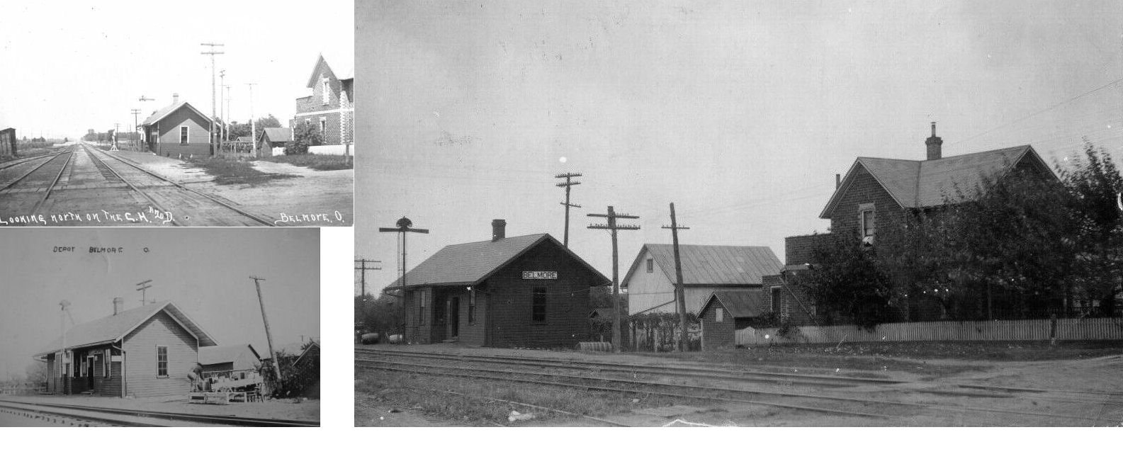
| Belmore | |
Belmore was initially called Montgomeryville, but the name changed in 1868 to coincide with the post office there that was named Belmore. The town began to expand with a train station on the Cincinnati, Hamilton, & Dayton Railroad in 1869. | ||||||
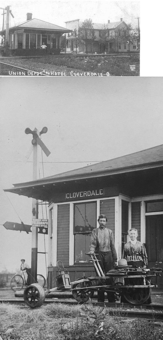
| Cloverdale | AND |
This union depot was in the southeast corner of Railroad Avenue and 4th Street. | ||||||
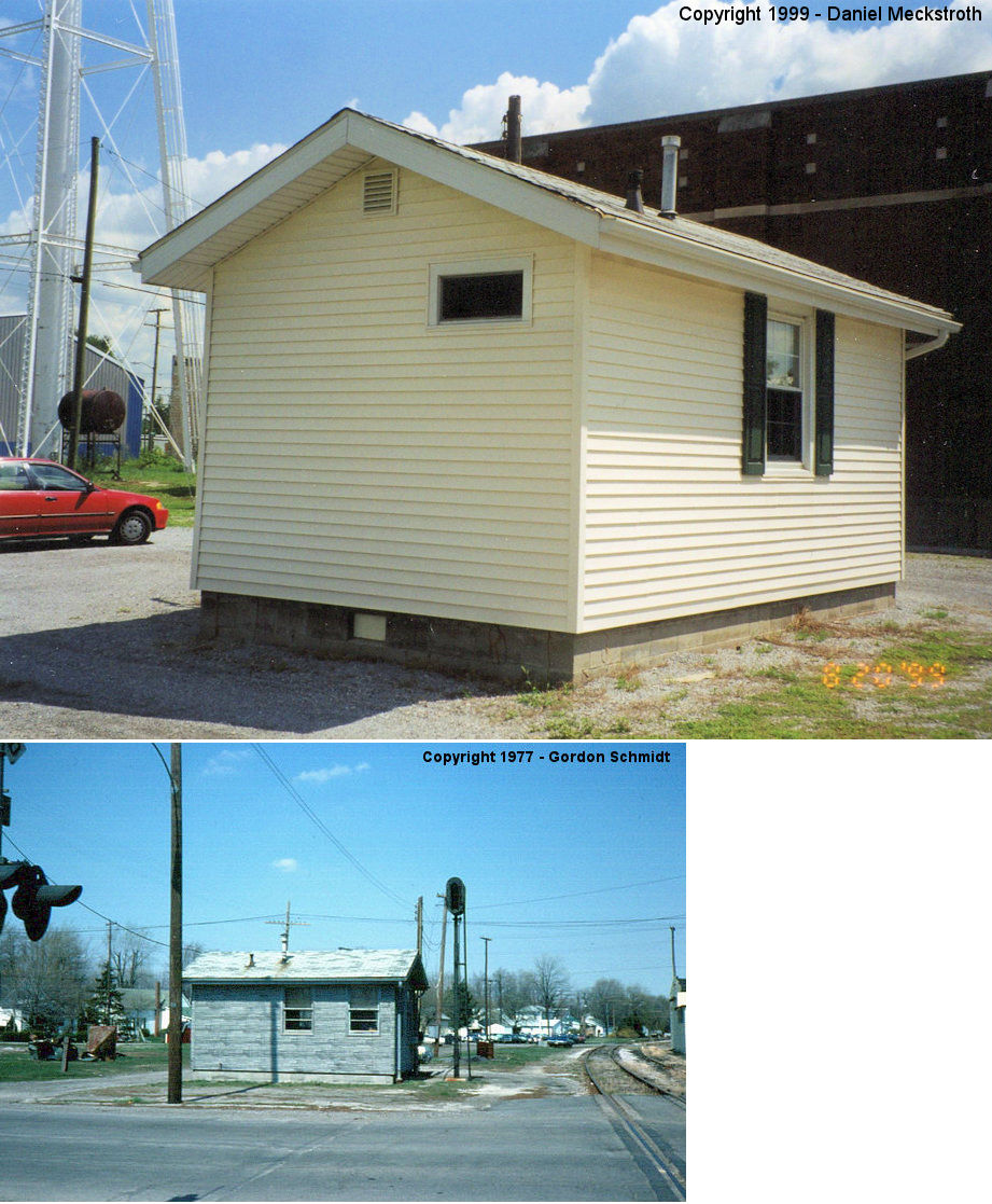
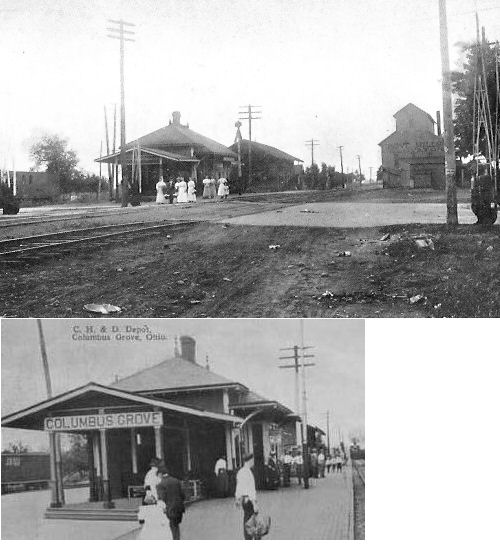
| Columbus Grove | |
According to Sanborn maps, the passenger station sat on the southwest side of Sycamore (between Broadway and Vidette) and the original freight station was on the other side of the street near the Northern Ohio passenger station. A later freight station was built (or the original was moved to) the SW side of Sycamore. The passenger station was torn down sometime prior to 1951 as it is missing from the 1951 Sanborn map. | ||||||
| Columbus Grove |
|
The passenger station was built in 1897 and sat on the northeast side of Sycamore Street (between Broadway and Vidette) on the west side of the tracks. | ||||||
| Columbus Grove | |
This station was at the corner of Water and Sycamore Streets. The freight depot was 50 feet to the north. The Ohio Electric interurban station was just to the west as the OE tracks ran parallel to the CH&D here. The CH&D depot was torn down in the 1970s. | ||||||
| Continental |  |
This station sat on Main Street near Oak Street. The photo shows both the passenger station and freight transfer station (across the tracks). The Express Agency building is behind the station in the photo. According the Sanborn maps, the freight station was gone by 1928 and the Express Agency building was expanded. The station was almost demolished on April 14, 1947 when a 28-car derailment happened at the station causing damage to the ticket office, freight office, and other surroundeing railroad buildings (New Philadelphia Daily Times, 4-14-1947). According to the The station was torn down in the early 1980s. | ||||||
| Continental |
|
The passenger station was at the corner of 5th and Oak Streets. It was across the street and slightly northeast of the Hotel Central. It was gone by 1928 and Sanborn maps from that year show only a small RR tool house at the location. | ||||||
|
Crawfis College (McCullough) |
|
McCulloughville Station (a.k.a. Crawfis College) was a flagstop located adjacent to the college (it was actually a residential high school), that had its own post office on campus (1889-1902). The college was on the NW corner of US-224 & County Road 5. A passenger shelter was on the north side of the tracks here. The station was also called "McCulloughville" and "College Hill" at various times. The name of the school was changed to Crawfis High School in 1906 and it closed in 1938 (The Lima News, 7-23-2008). | ||||||
| Croswell |
|
The track crossed State Road 115, 50 feet south of Road K. The exact location of the depot is unknown. | ||||||
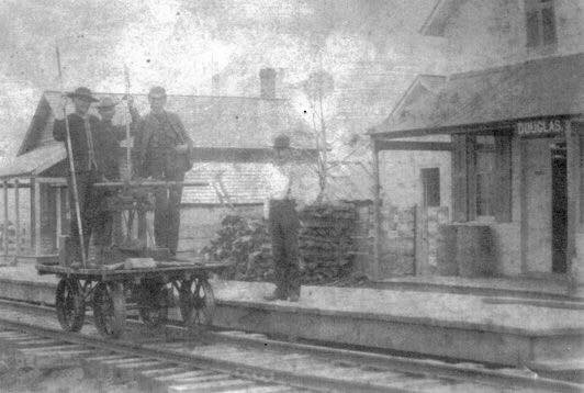
| Douglas |
|
This station was in Jackson Township between Munatana and Fort Jennings where US-224 crossed the old railroad grade at GPS: 40.943266, -84.301743. The town had a post office and station, but was never platted. | ||||||
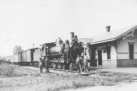
| Dupont |
|
Photo also shows Cloverleaf engine #102. The structure was moved to a different section of the village, converted to a house, and burned a few years ago after its condition had deteriorated beyond repair. | ||||||
| East Mandale |
|
East Mandale was 1.25 miles east of Mandale (Paulding Co.). It was at the junction of FFt.W&W’s Findlay-Ft. Wayne mainline and the Delphos Branch. The depot was north of the mainline. At some point is was moved behind the house at 24742 Road K22 at GPS: 41.012885, -84.337072. The owner tore it down in the early 2000s. | ||||||
| Elm Center |
|
|||||||
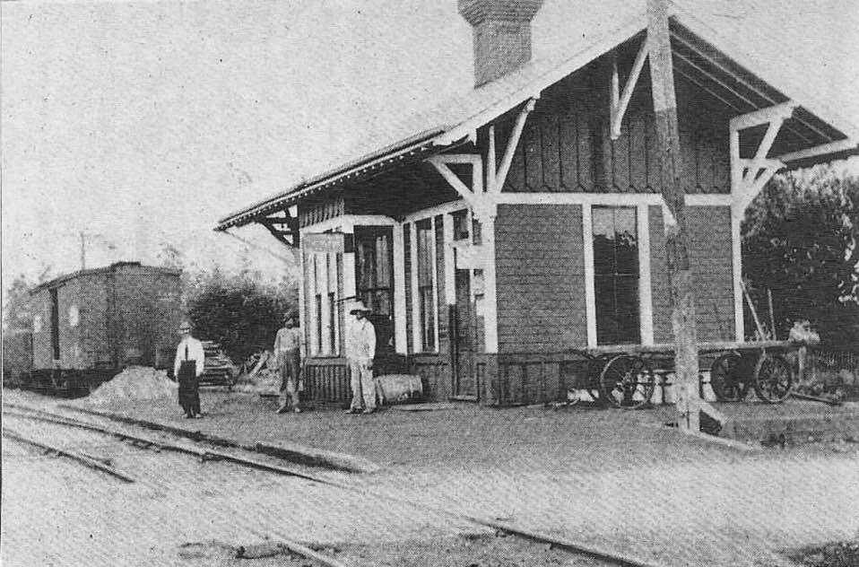
| Fort Jennings | |
This must have been an older station than the one that is still standing. | ||||||
| Gilboa |
|
An 1895 map showed the depot in the southwest corner of the railroad/Pearl Street crossing, just south of US-224, but early citizens of the village reported that it was in the southwest corner of the railroad/Sugar Ridge Street crossing. | ||||||
| Glandorf | |
The depot was in the southeast corner of Ottawa-Glandorf Road and Main Street across from feed mill. | ||||||
| Hartsburg |
|
|||||||
| hector |
|
This station was on the east side of County Road 19 on the south side of the tracks at GPS: 41.098786, -84.227357. | ||||||
| Huntstown | |
Huntstown was between Cloverdale and Muntanna. The town had an early Toledo, Delphos & Burlington RR station. An article in The Toledo Evening Bee from January 12, 1892 reported that the Findlay, Ft. Wayne & Western let a contract to build a depot at Huntstown on the Cloverleaf that was to be used by both railroads. It is unlikely that ever happened. Huntstown is now gone. | ||||||
| Jones City |
|
|||||||
| kieferville |
|
|||||||
| Leipsic |  |
This Detroit & Lima Northern (later DT&I) station was built in 1898 and sat on the southwest corner of 11th and Sugar Streets at GPS: 41.102970, -83.993907. It was on the east side of the tracks. It was replaced in the 1960s with a metal prefab building. | ||||||
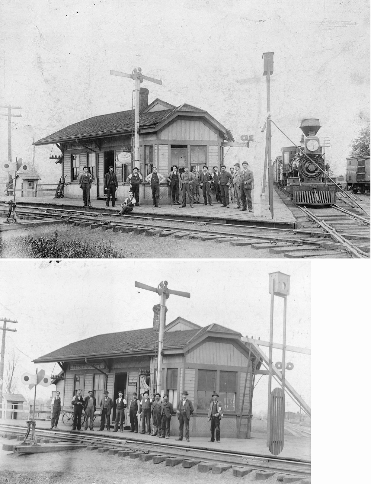
| Leipsic Junction | AND |
The first station at the junction predating the one listed below. | ||||||
| Leipsic
Junction (Craton) |
AND |
This station, built around 1882, was located at Second Street and Broadway on the southwest side of the diamond. There was a freight station on the northwest side on a transfer track. On the northeast corner of the diamond was the signal tower. This area was once called Craton. This station was demolished in 1970. | ||||||
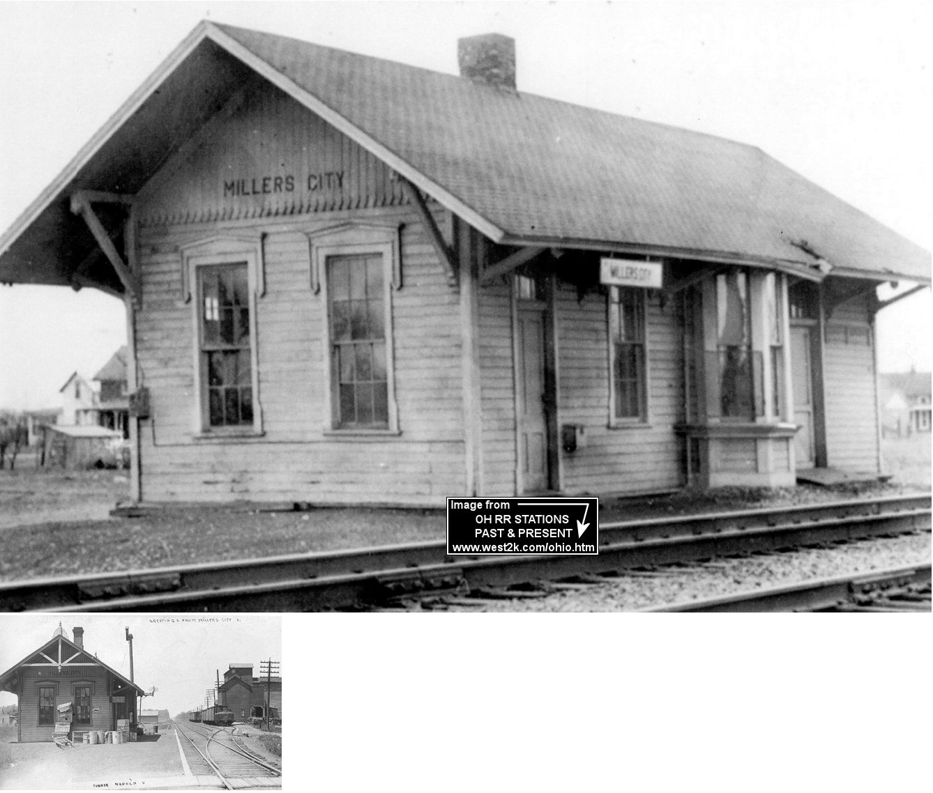
| Miller City | |
This station was built in 1882 and closed in 1950. Former Miller City Mayor William Okuly served as agent and operator at this station for 40 years (The Lima Citizen, 3-13-1960). | ||||||
| Muntana | |
|||||||
| Muntana | |
This was a flagstop between Ottoville and East Mandale on the Delphos Branch. There was likely never a depot or shelter here. It was about 2 miles west of the TSt.L&W Muntana station. | ||||||
| Oakdale |
|
This station was on County Road 5 at approximately GPS: 41.132841, -83.957609. | ||||||
| Ottawa |
|
The original Dayton & Michigan (CH&D predecessor) station was likely the first station built in town built around 1859-60 when the tracks were laid. The exact location of the station is unknown, but it was somewhere on the west side of the tracks between Main Street and 3rd Street. This station burned down in May 1878 with 13 other buildings when a fire started at Main (formerly Main Cross) and Taft Avenue (formerly Railroad Avenue) and worked its way northward (The Lima Times-Democrat, 5-30-1878). The station was actually burned down on purpose during the blaze in order to stop the fire from spreading further (The Cleveland Plain Dealer, 4-18-1887). | ||||||
| Ottawa | |
The freight station was across the tracks to the east from the passenger station at 4th and Taft Streets. It was likely used by the D&M and the FFt.W&W as it had platforms along both lines and a transfer track. | ||||||
| Ottawa | |
Built in 1898, this station was torn down in 1972. | ||||||
| Ottawa | |
This two-story station was on the south side of 4th Street on the east side of North Oak Street at GPS: 41.021433, -84.046892 and is shown on the 1893 Sanborn map. The FFt.W&W tracks ran down the middle of 4th Street. When the CH&D bought the FFt.W&W in 1901 this station was coverted to a CH&D freight office on the transfer track between the CH&D and the FFt.W&W. There was also a shared freight house in that SE corner of the diamond as it had platforms facing both RRs. | ||||||
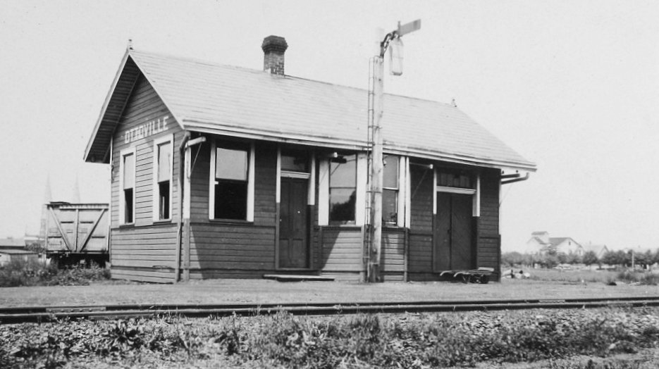
| Ottoville |
|
The Delphos & Northern Railroad (a CH&D subsidiary) built track through Ottoville in 1904, connecting the Cincinnati, Hamilton & Dayton Railway in Delphos to the Cincinnati, Findlay & Fort Wayne Railway at East Mandale. D&N’s track was 35' west of and parallel to Winkelman Street in Ottoville, and its depot was west of the track and 230 feet north of 3rd Street (GPS: 40.932933, -84.335855). The D&N was abandoned in 1918 and the track was removed by 1919. The line is hard to see on maps and on the ground as much of it has been reclaimed as farm land. | ||||||
| Pandora | |
|||||||
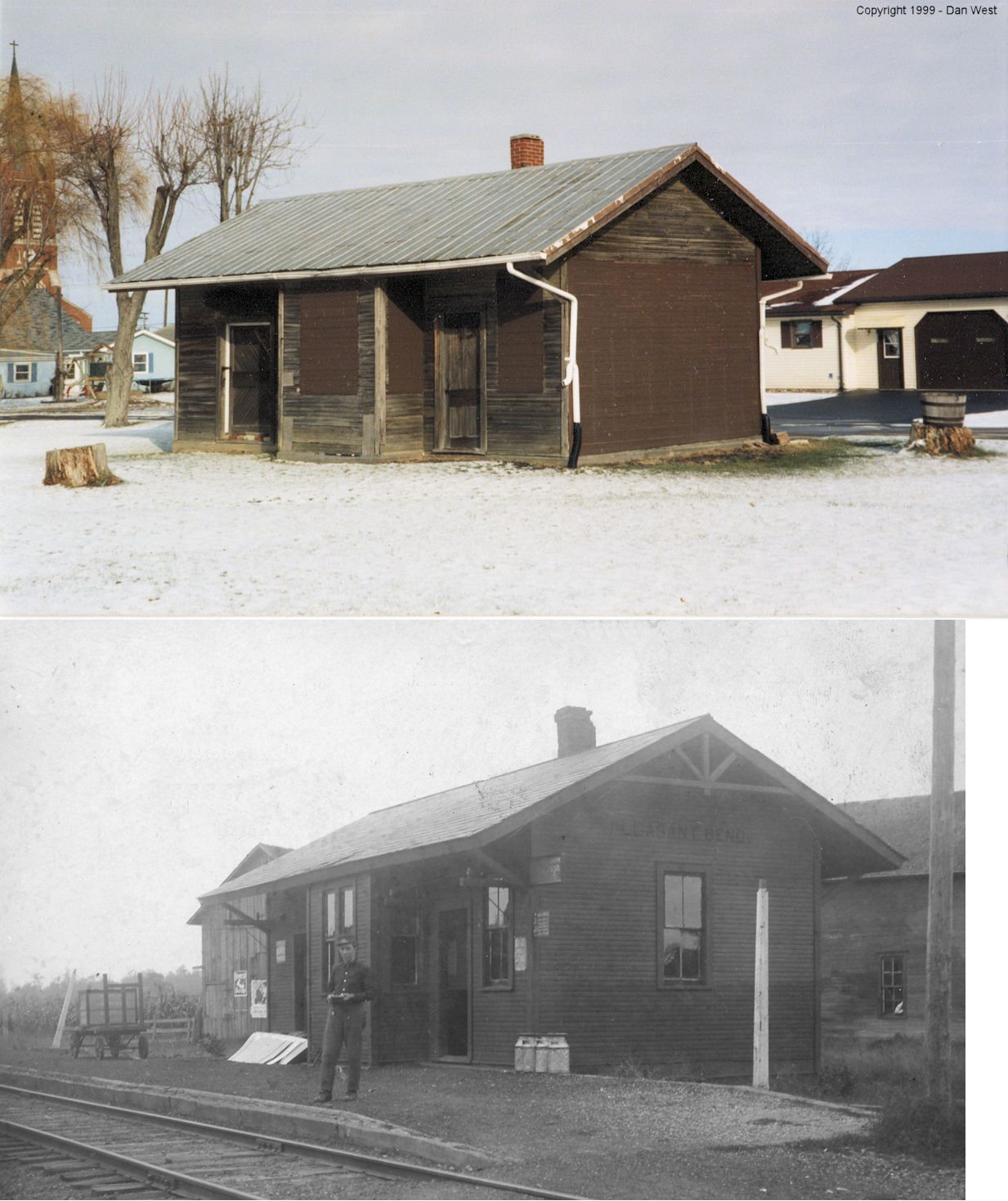
| Pleasant Bend | |
This station was last located 200 yards off SR 108 near the tracks in Miller City and was used as a garage. It was reported as being gone in 2012, disposition unknown. Mark Camp wrote, "This was the depot from Pleasant Bend. It was moved away from town and I photographed it in the late 1960s. It has since been moved to its present location. Some have said it came from Kiefersville, but this is not possible for Kiefersville is on the NYC&StL and this is not a NKP depot. It is classic TStL&W architecture, identical to the depot at North Creek (compare photos). I had heard from a reputable depot enthusiast from the 1960s that it was moved from Pleasant Bend and never had reason to doubt this. Most of the other nearby Cloverleaf depots can be accounted for." | ||||||
| Prentice (Prentiss) Station |
|
This station was where County Road B crosses the tracks around GPS: 41.152445, -84.019791, There was a grain elevator and a few stores at this location. The station was there as a convenience for local farmers. A post office was established and in operation from 1896-1902. | ||||||
| Rimer |
|
|||||||
| Rushmore |
|
|||||||
| Townwood (Spitzer) |
|
The village of Spitzer, located on the Nickel Plate railroad four miles east of Leipsic, was platted in 1886. Owing to the fact that there was another town of the same name in Ohio, the name was changed to Townwood. | ||||||
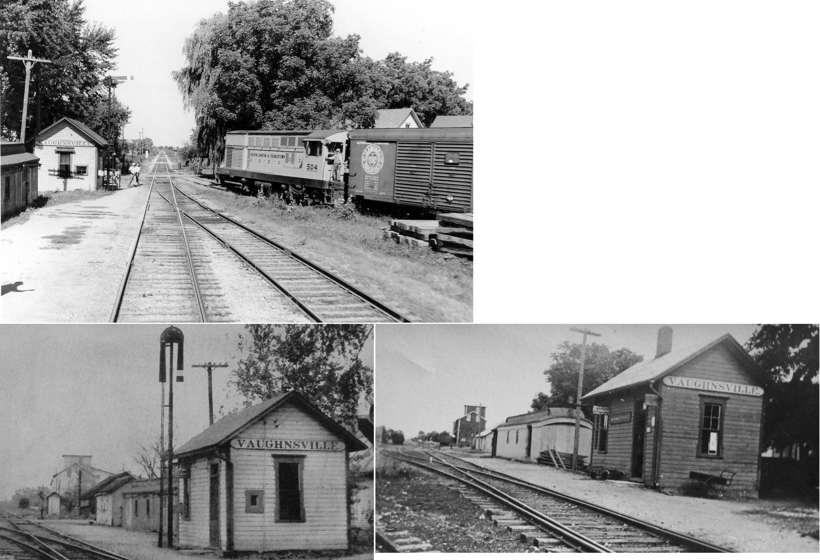
| Vaughnsville |
|
It appears from the photo that there was an old passenger car next to the station used as a freight station or as a maintenance-or-way shed. | ||||||
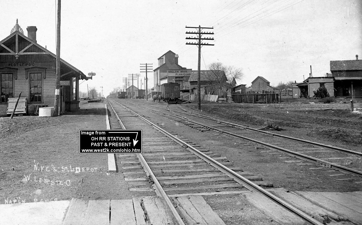
| West Leipsic | |
This combination station was near the corner of Werner Street (Raod 7) and Main Street (Road X) on the south side of the tracks at GPS: 41.104460, -83.996880. Maps show this as a passenger and freight station, however other sources claim that despite its design it was freight only, mostly serving a nearby poultry farm. It was likely a combination station, at least in the early years and probably a freight station only in later years as was the case withmany depots. | ||||||
| 1898 PUTNAM COUNTY RAILROAD MAP | ||||||||
 |
||||||||
| Notes About
Existing Stations... Columbus Grove (AC&Y) - Insurance Office. See old photo before building was re-sided. This small pre-fabricated building was a freight office built on the site of the original station. Fort Jennings (TSt.L&W) - This station was moved from Fort Jennings. Depot is located 1/2 mile east of Cloverdale, Ohio. Going East on State Route 114 turn right on Buckeye trail (Road 22K) and go approximately 1.25 miles then right on Road 21L about a quarter of a mile. Was used as a cattle barn now sits empty and in disrepair. Update: In 2005 the station was dismantled, inventoried, and stored in the hopes of being renovated and reconstructed at a site yet to be determined. Update: As of Fall, 2008 restoration of the station is in full swing! Leipsic (CH&D) - This was was the "downtown" CH&D depot which was moved to its current location. It originally sat on Railroad Street just southwest of Liberty Street. It is now hard to recognize as a station due to being re-sided. Leipsic (DT&I) - Replaced the original wooden station. It was at Sugar Street just east of 11th Street, but was moved to Auglaize Village in Defiance around 2012 as a maintenance building for the RR there. North Creek (TSt.L&W) - Moved to Hiltner Airport (owned by Charles Hiltner). Covered with aluminum siding. As of 2021 the airport was closed and the land was for sale. Ottawa (D&M) - This second-generation Dayton & Michigan station was built sometime after the original station burned down in 1878. It was on the southeast corner of 3rd Street North Taft Street at GPS: 41.020214, -84.047643. The brick station reportedly cost $50,000 to build (The Plain Dealer, 4-18-1887). It appears, according to Sanborn maps, that sometime between 1893-1900 the station was moved one block north to its current location at 4th and Taft. Either that or another brick station of the same dimensions was built at 4th and Taft. Then sometime between 1911-1924 it appears that the building was enlarged and the tower was added to the NE corner (a visitor to the site reports two distinctly different foundations under the building). More info is needed on the exact build dates of this/these stations. |
||||||||