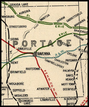
 COUNTY COUNTY
|
|
||||||||
| EXISTING STATIONS | ||||||||
|---|---|---|---|---|---|---|---|---|
| Station Name |
Original Railroad |
Current Location |
Type | Current Use |
Date Built |
Track Status |
Building Material |
More Info |
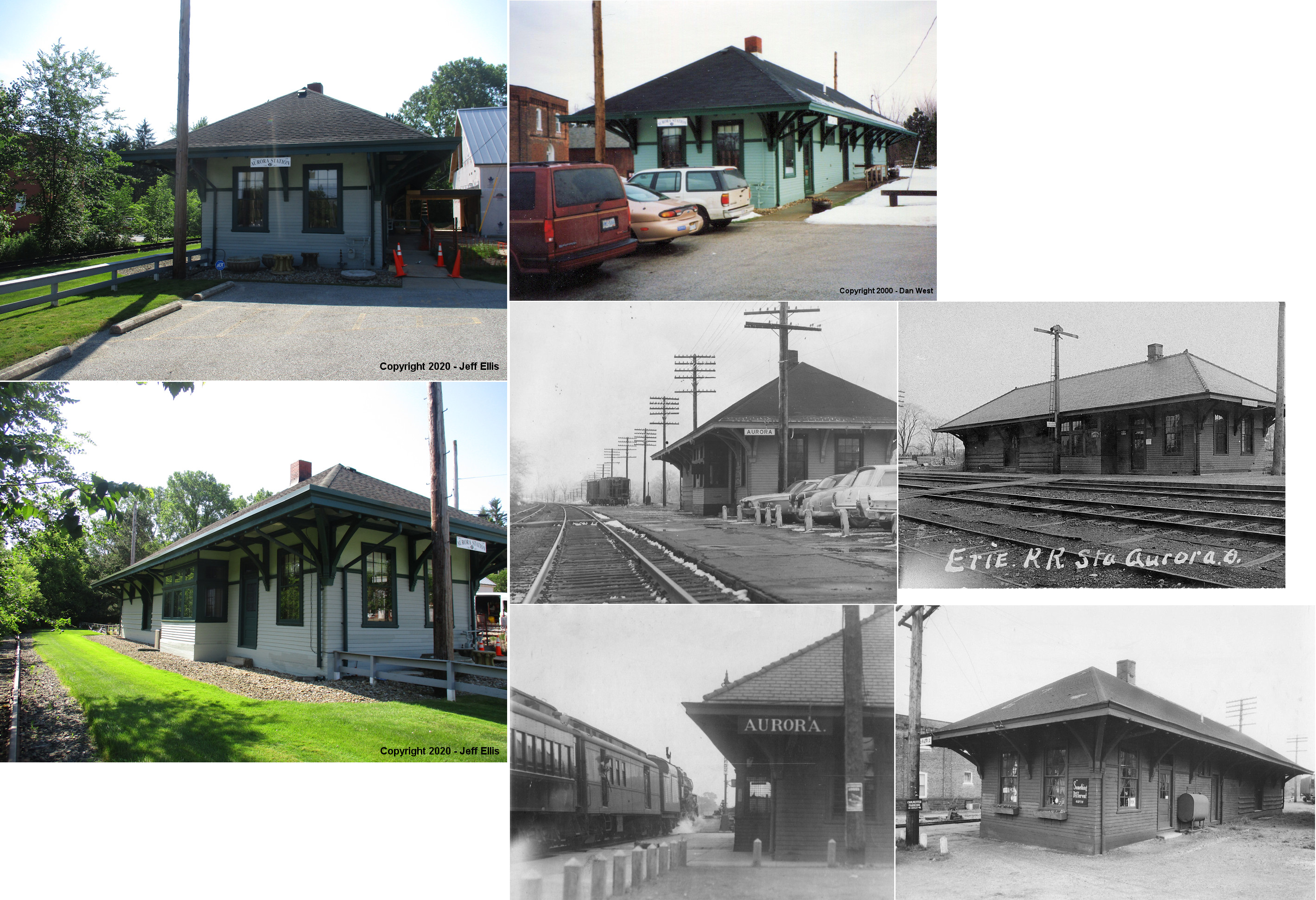
| Aurora |  |
13 New Hudson Road (GPS: 41.316787,-81.333286) |
P | Business | ???? | Aband | Wood | |
| Diamond (Palmyra) |
 |
South side of Tallmadge Road (CR 18) at Universal Drive (GPS: 41.098566,-81.02233) |
P | Vacant | 1906 | Gone | Wood | |
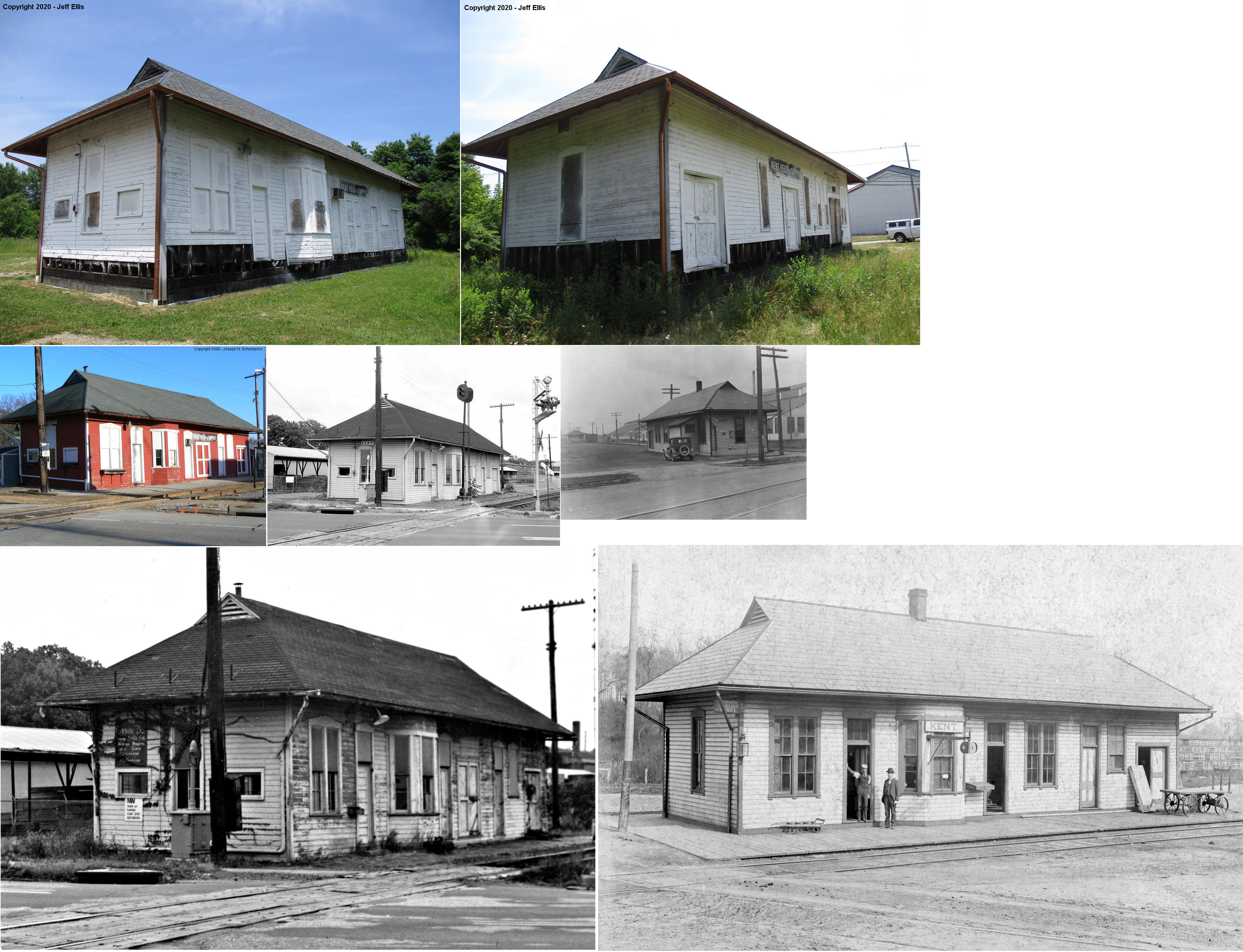
| Kent |  |
North side of Stow Street (GPS: 41.150455,-81.361383) |
P | Railroad | 1905 | In Use | Wood | |
| Kent |  |
849 West Main Street (GPS: 41.153415, -81.373412) |
P | Business | 1881 | In Use | Wood |
|
| Kent |  |
152 Franklin Avenue (GPS: 41.15296,-81.359229) |
P | Business | 1875 | In Use | Brick |
|
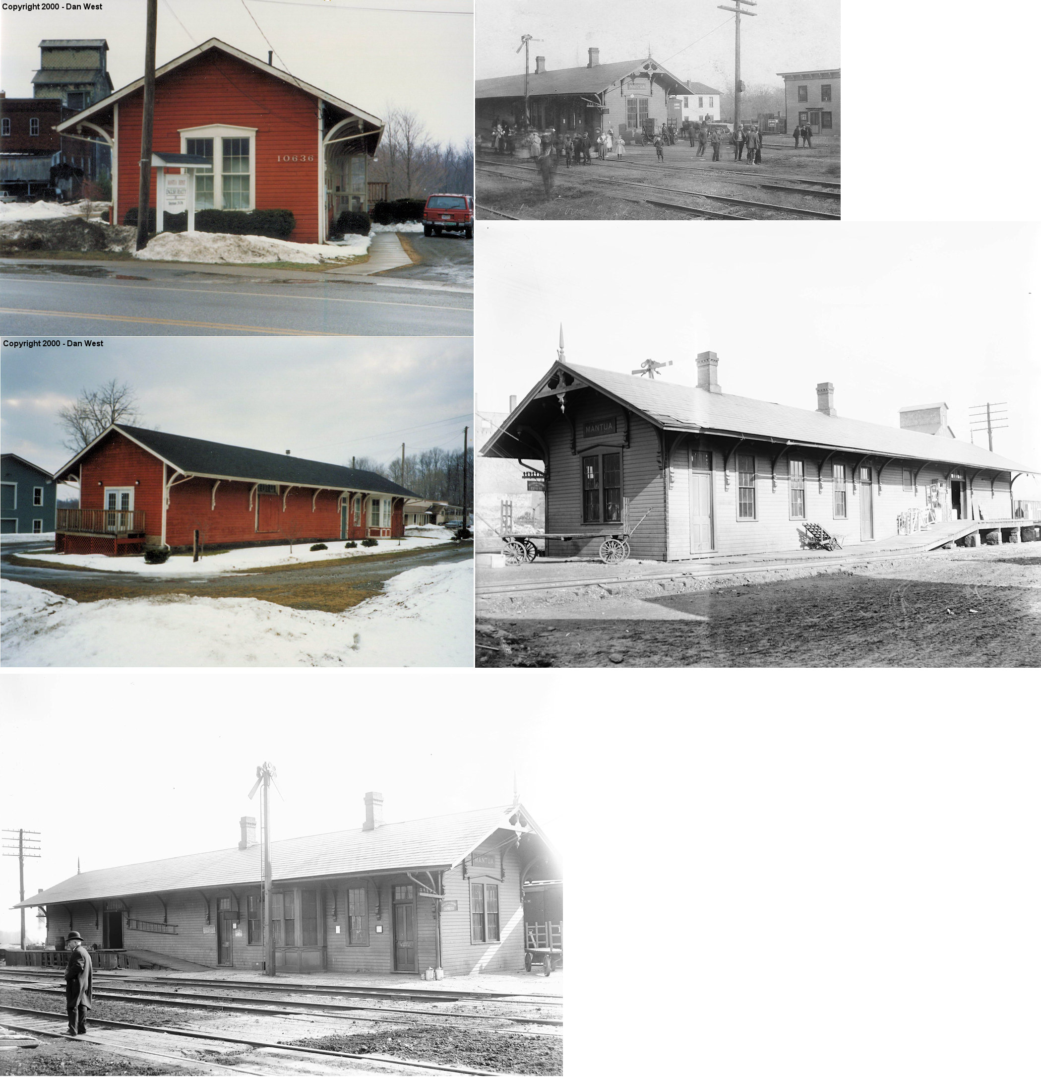
| Mantua | |
10636 Main Street (GPS: 41.281286,-81.223981) |
C | Business | 1872 | Gone | Wood |
|
| Mogadore |  |
87 South Cleveland Avenue, near Gencorp Plant | P | Society | 1905 | None | Wood |
|
| STATIONS OF THE PAST | ||||||||
| Station Name |
Original Railroad |
Notes | ||||||
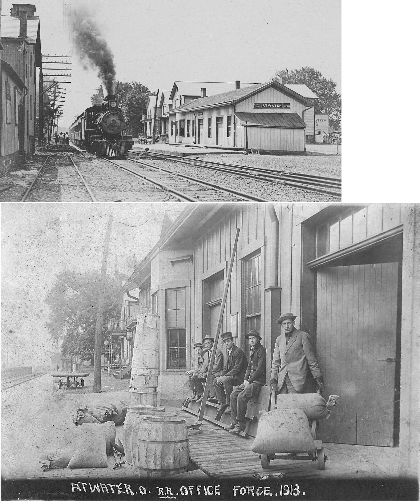
| Atwater |
 |
The station was at the north end of Depot Street on the west side of the tracks (GPS: 41.024743,-81.164203). According to PRR valutaion records from 1917, the station was built in 1873. A nearby passenger shelter was built in 1911 (perhps due to the depot not having an overhanging roof). | ||||||
| Brady Lake |
|
According to the 1923 PRR List of Stations & Sidings, there was only a platform here instad of a station building. | ||||||
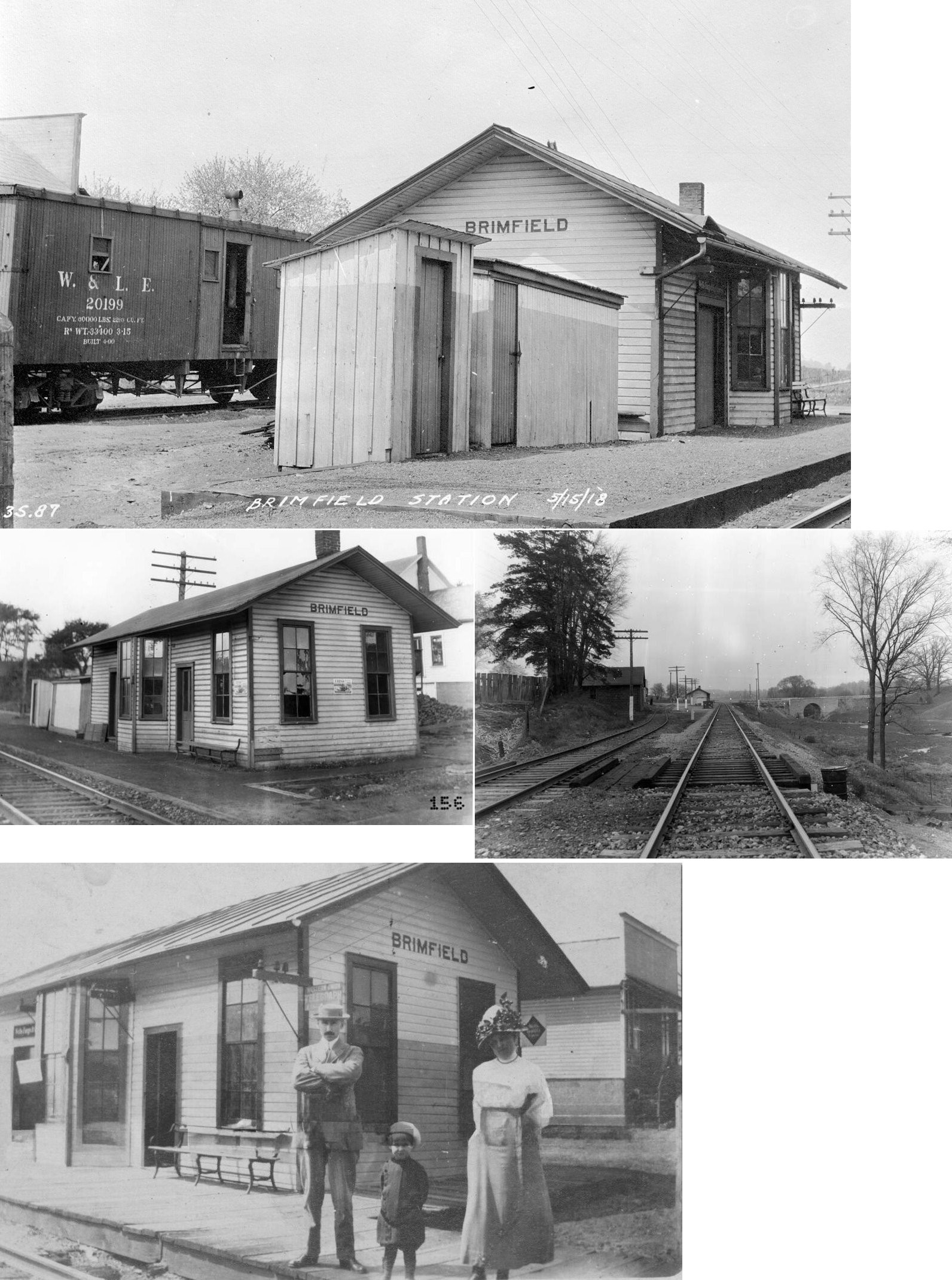
| Brimfield |
 |
This station was on the south side of Tallmadge Road (CR-18) on the west side of the tracks (GPS: 41.100052,-81.370465). A new station was built here in 1883 (Summit County Beacon, 1-10-1883). If this is that station then it was built when the line was the Connotton Valley Railway (later Cleveland, Canton & Southern; and later Wheeling & Lake Erie). | ||||||
| Charleston | |
The B&O built a new station here in 1905 when the new double-track line was completed. | ||||||
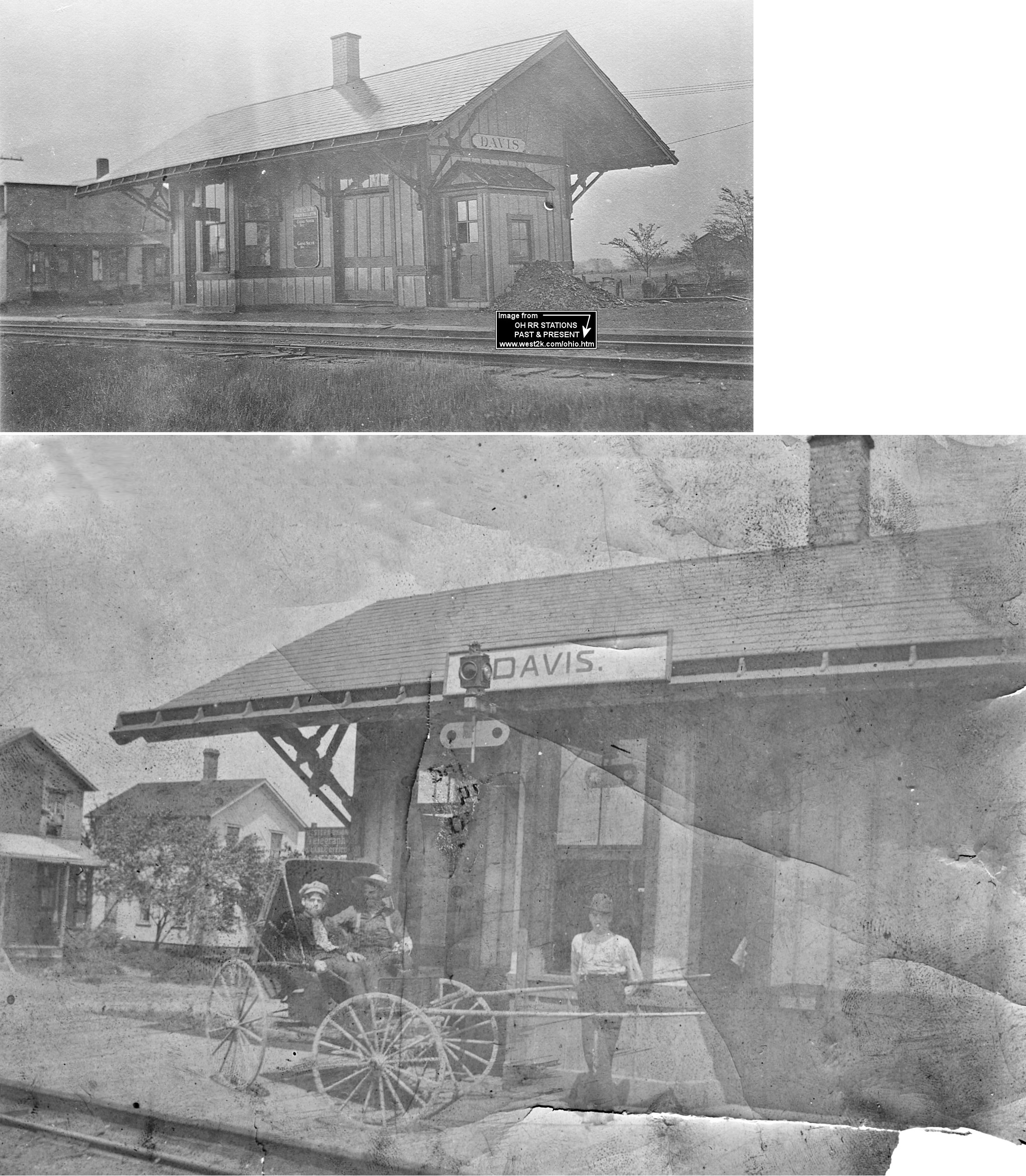
| Davis | |
A 16'x30' combination station was built here in 1902 according to NYC valuation records. | ||||||
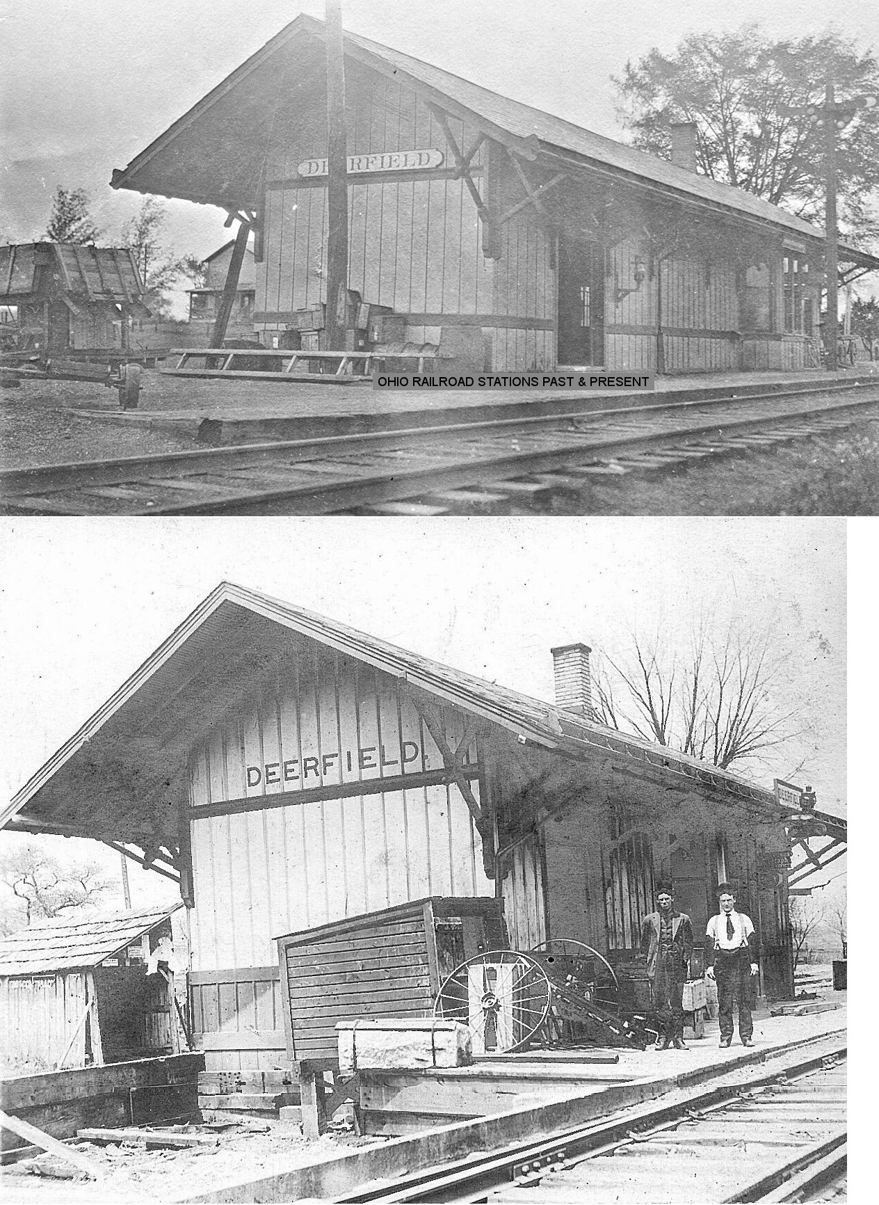
| DeerfielD Station | |
According to NYC valuation records, this station was built in 1907 and had a 20-foot extension added in 1912. | ||||||
|
Diamond (Palmyra) |
|
The first station here burned down and was replaced by the current station in 1906. | ||||||
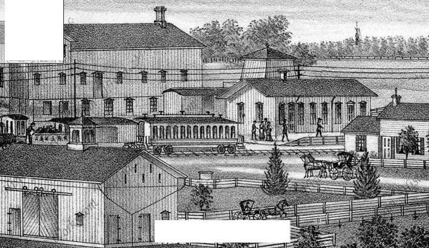
| Earlville |
|
The illustration is from a Portage County atlas from 1874 showing the first station at Earlville. The engine in the illustration reads "A&KJ RR" (The C&P began trains through the area in 1851). This station probably sat in the vicinity of the Rusty Nail Restaurant and SR-43. | ||||||
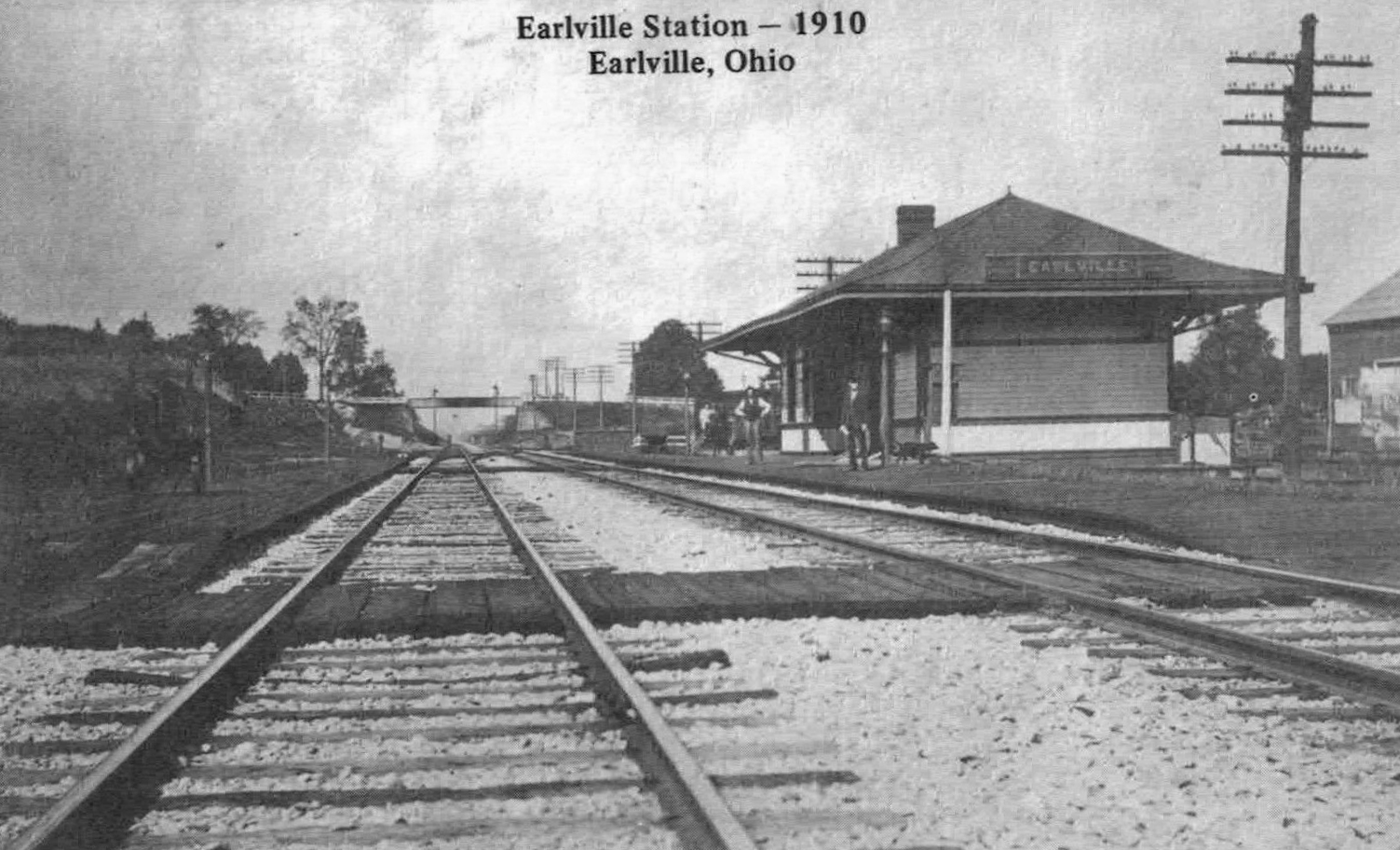
| Earlville |
|
The later C&P station, built in 1904 (according to PRR valuation records), sat on the east side of SR-43 (in the gully between SR-43 and Diagonal Road). | ||||||
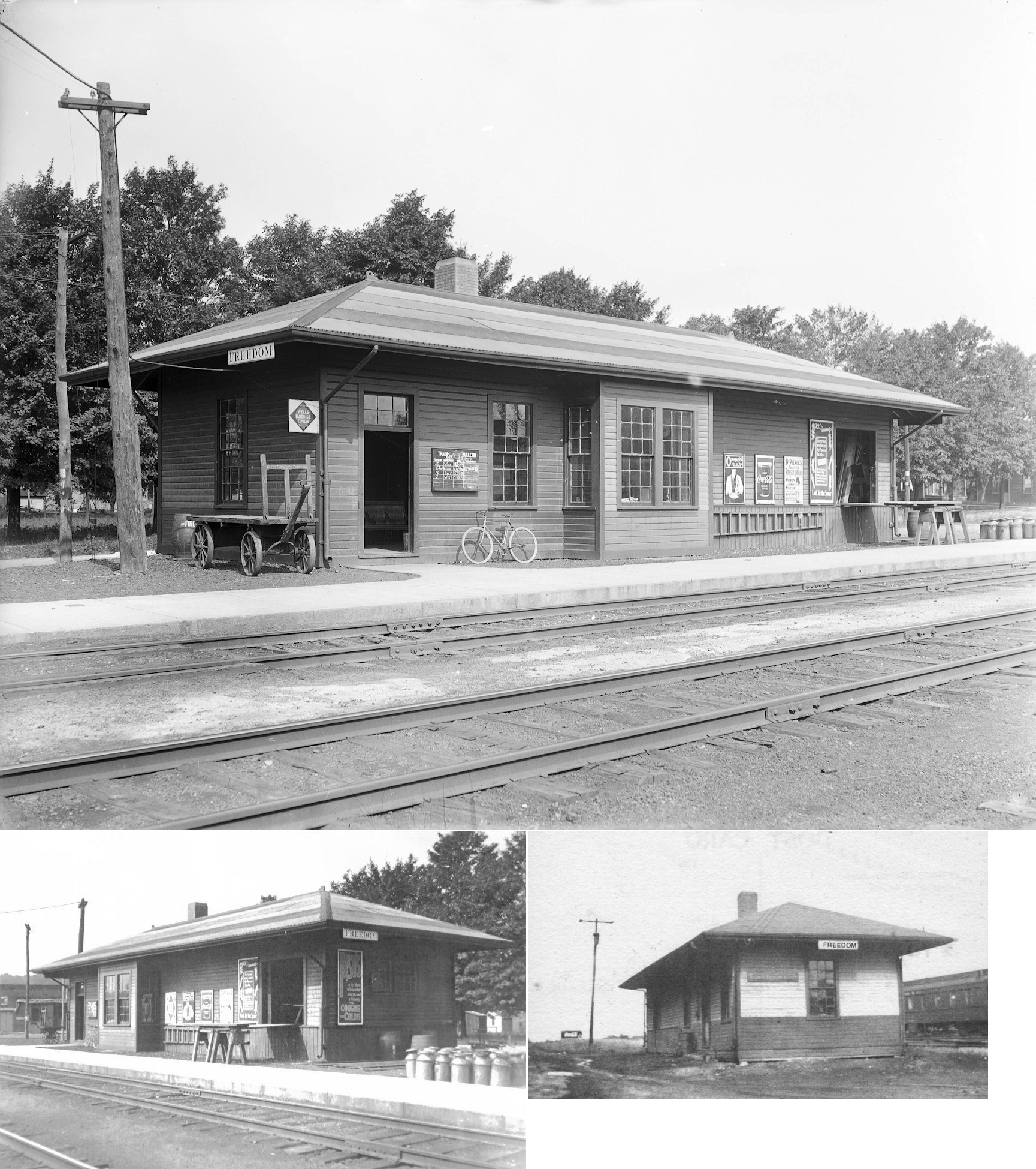
| Freedom Station | |
This depot was on the north side of the tracks on the east side of Freedom Road near Nichols Road (GPS: 41.20546,-81.147506). | ||||||
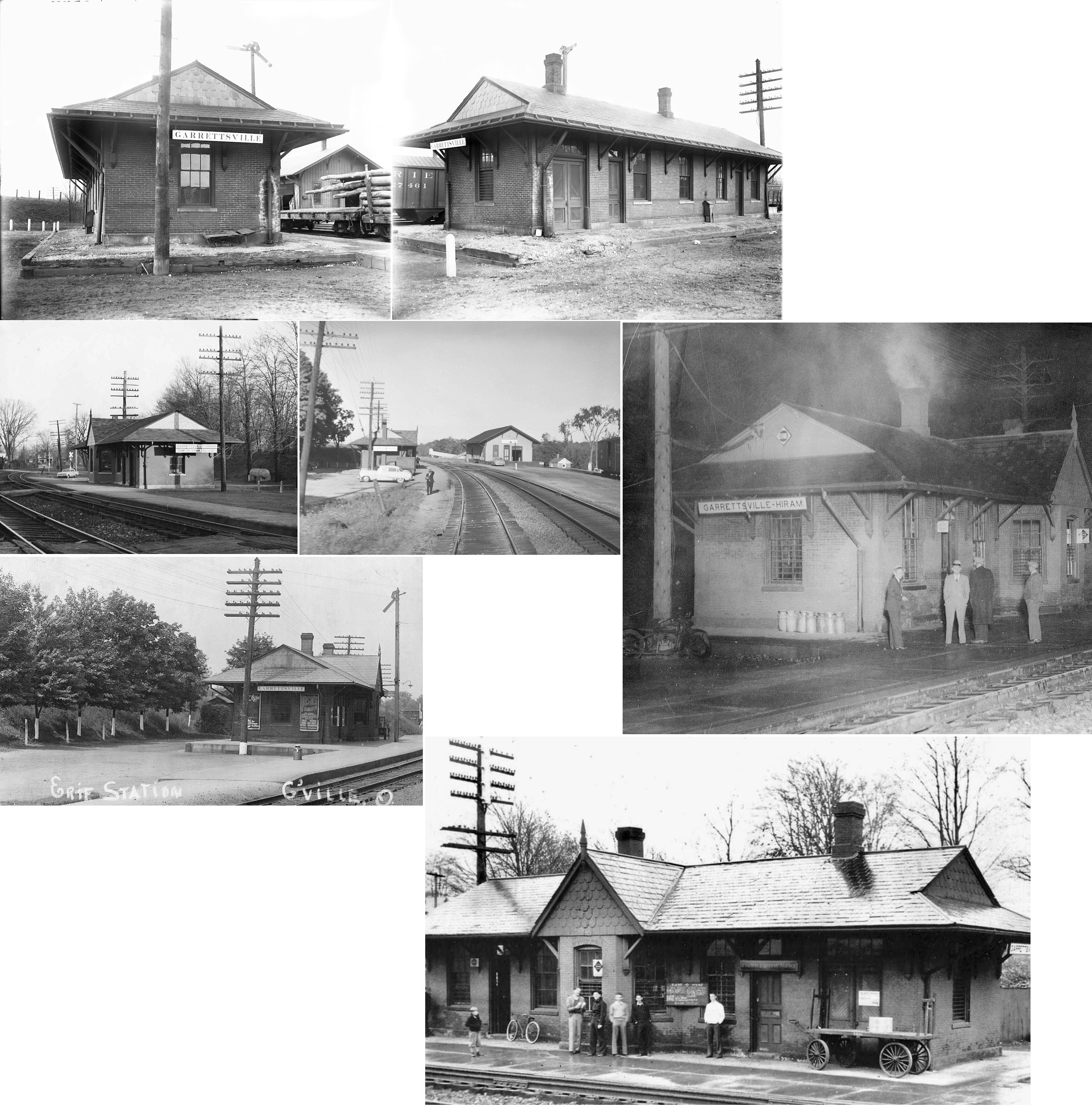
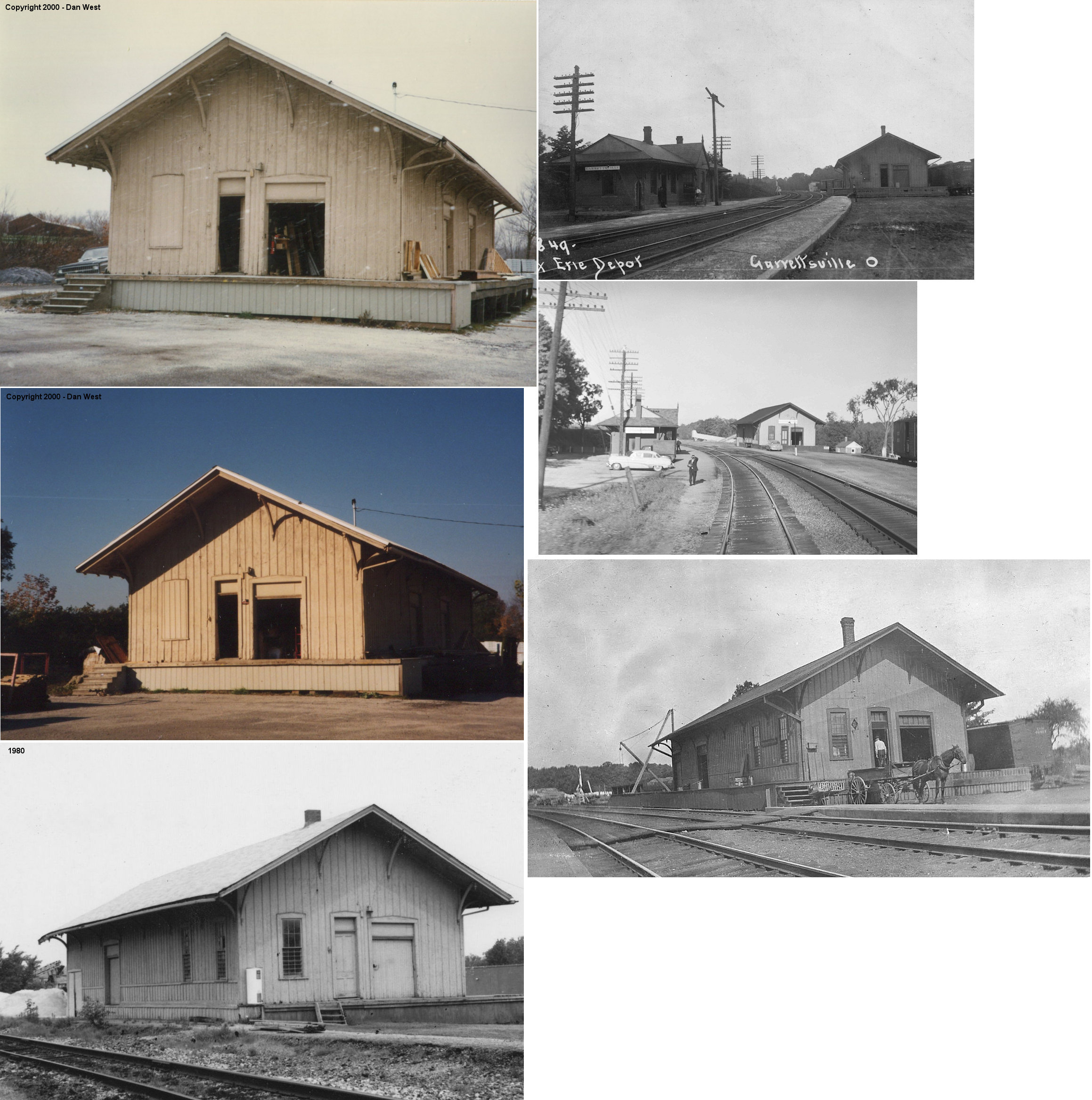
| GarretTsville | |
This station was on the south side of the tracks on the northwest side of Freedom Street (GPS: 41.282009,-81.101562). | ||||||
| GarretTsville | |
The freight station, which was located on the north side of the tracks off Freedom Street (GPS: 41.282191,-81.101603), was sold at auction in the summer of 2009 and was dismantled. The dismantled building is now for sale and it may be rebuilt at another location in the future. | ||||||
|
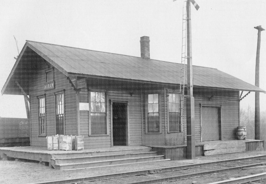
Hiram (Jeddo Station) |
|
The old county map shows this station on the east side of Burton-Limaville Road (SR-700) on the north side of the tracks (GPS: 41.277071,-81.144773). However, Gary Spencer writes, "Based on the picture of the station in 'Erie Stations' and my knowledge of the terrain, the station was on the west side of SR 700, not the east side. The picture shows a team track behind the station and parking. This area was flat and used for parking for the Erie commuter train in the 1950. On the east side of SR 700 there is an immediate drop-off." Hiram Station was also known as Caton P.O. This station burned around the turn of the 20th century and thereafter the Garrettsville station was the stop for "the home of Hiram College." | ||||||
| Hutson |
|
This station was between Deerfield and North Benton. It is shown on the 1913 LEA&W timetable. | ||||||
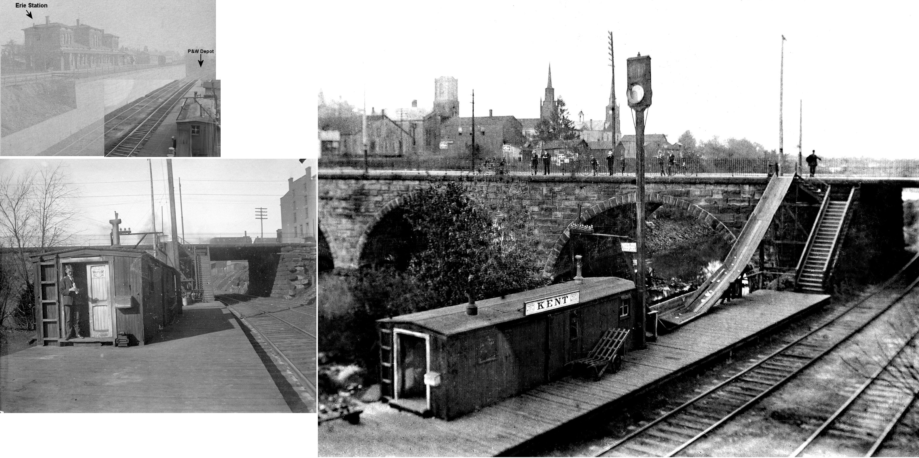
| Kent | |
The freight station sat just to the south of the passenger station along Franklin Ave.. | ||||||
| Kent |  |
Before the B&O built the existing passenger station in 1905, the P&W had a small passenger station on the east bank of the Cuyahoga river just south of the Main Street bridge. This station sat "below" and just to the north of the Erie station and overlooked the dam. Old maps show a staircase leading down to the station from the Main Street bridge. Judging from the photo, this station may have been a recycled boxcar or caboose. | ||||||
| Kent | |
There was a freight station about 100 yards south of the existing passenger station (toward Stow Street). | ||||||
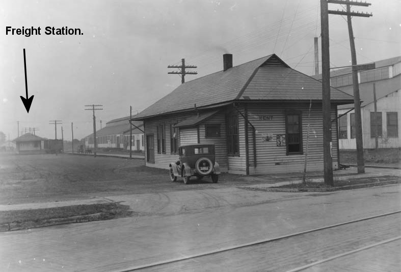
| Kent | |
This freight station was on the south side of Stow Street (GPS: 41.14972,-81.36226). It was torn down by CSX on December 10, 2010. | ||||||
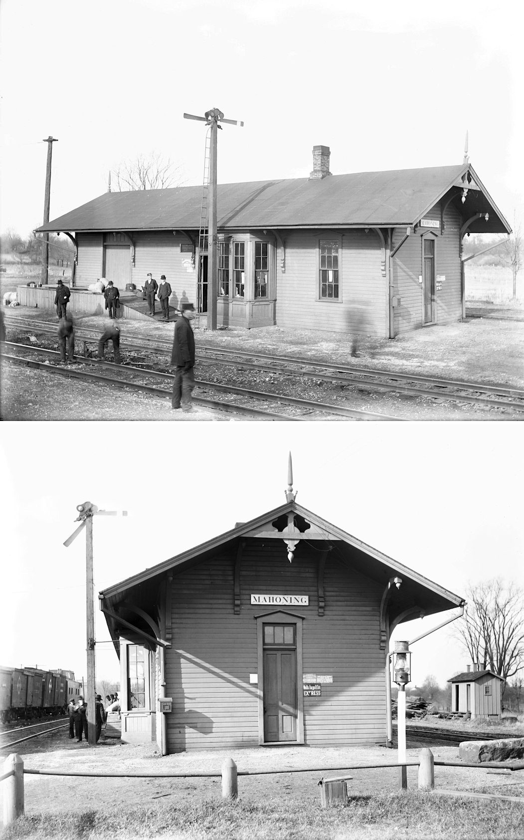
| Mahoning | |
This station was on the west side of Windham-Parkman Road on the east side of the tracks (GPS: 41.262134,-81.049334). There was a station here as early as 1874 when the line was the Cleveland & Mahoning Railway. | ||||||
| Mishler | |
This station was on Mishler Road (County Highway 4) north of Manning Road. It was where Mishler road curves from north to northwest. The station was on the east side of the tracks (GPS: 40.999929,-81.361384). There was a pickle factory, elevator and school near this location at one time, but all is gone now as the area is residential/rural. | ||||||
| Mogadore | |
The original W&LE station here was demolished by a derailed freight train on May 11, 1905 at 5:30 a.m. when a broken wheel flange caused 13 cars to pile up at the depot. The station agent narrowly escaped injury (Akron Beacon Journal, May 11, 1905) | ||||||
| Moran (Streetsboro) |
|
May have been built by the Connotton Valley Railway. This location was also known as Jesse. The station was ont he south side of Aurora-Hudson Road on the east side of the tracks (GPS: 41.263372,-81.389696). | ||||||
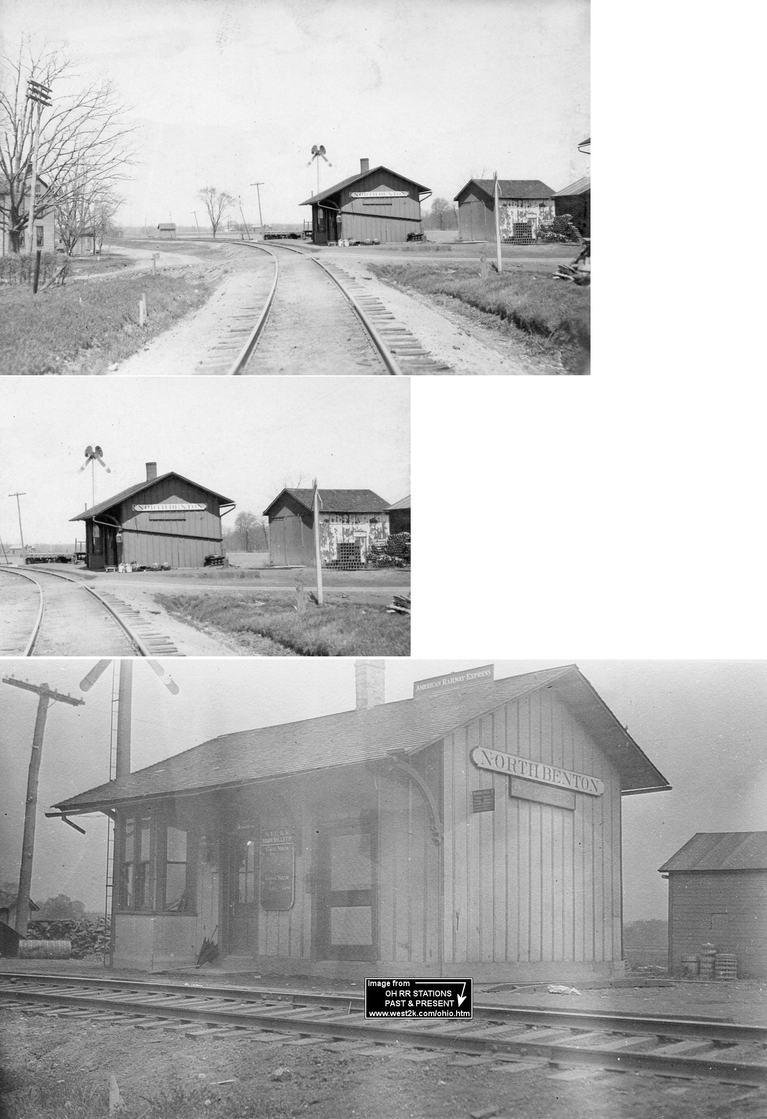
| North Benton Station | |
North Benton Station was just north of North Benton in Portage County. A 16'x26' combination station was built here in 1888 according to NYC valuation records. | ||||||
| Mottstown | |
This station was between Davis and Deerfield. It was mainly a flag stop, but one train per day had a regular stop there according to the 1913 LEA&W timetable. Not sure if there was a station building here or just a shelter or platform. | ||||||
| Pritchards | |
A 10'x14' passenger shelter was built here in 1916. | ||||||
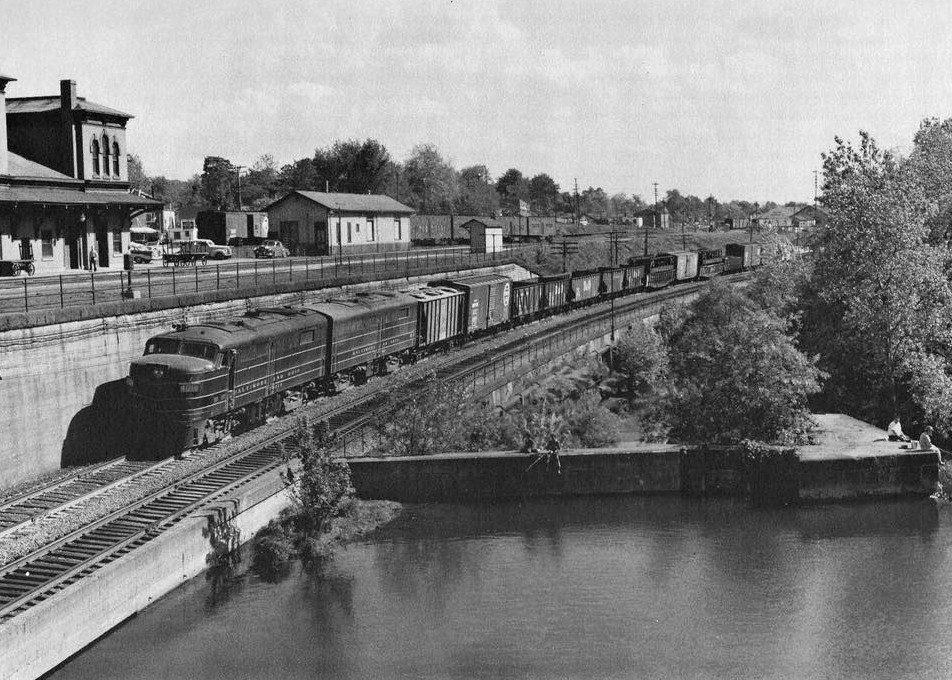
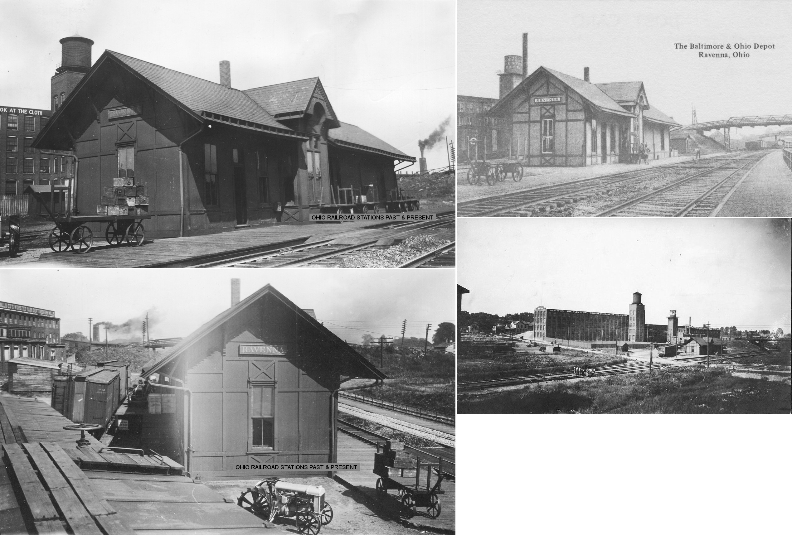
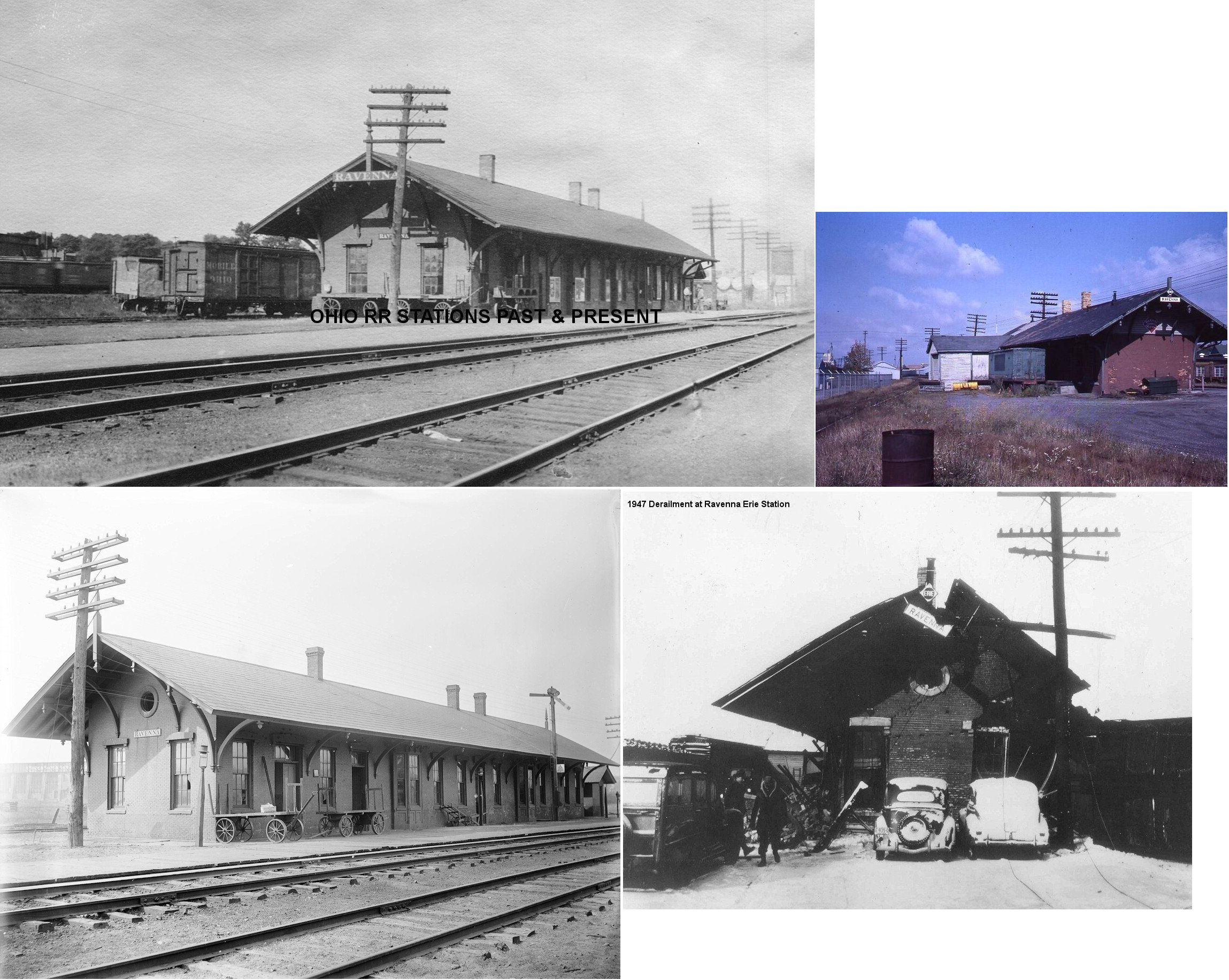
| Ravenna |
|
This combination station was on the east side of South Chestnut Street south of Hazen Street. It was on the north side of the main line. It burned down in 1952. | ||||||
| Ravenna |
|
This newer metal prefab building replaced the station above. | ||||||
| Ravenna | |
Built in 1863 (according to Erie RR valuation records), this station was on the SW side of Cleveland Road near the intersection with Lincoln Avenue and GPS: 41.163256, -81.251613. | ||||||
| Ravenna | |
This freight house was diagonally east across the tracks from the passenger station on a siding at GPS: 41.163489, -81.251185. It was built in 1863 at the same time the passenger station was erected. By the 1940s the freight station was used by the Farm Bureau Cooperative. | ||||||
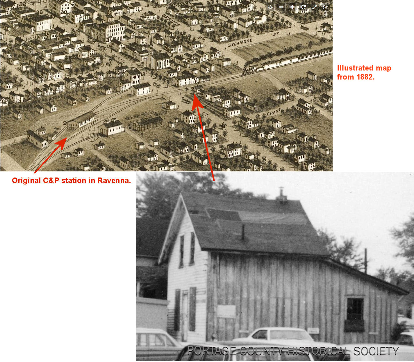
| Ravenna |
|
The original C&P station was in the same approximate location as the station listed below. It was a two-story frame station. This was the station at which President Lincoln stopped on his inagural whistle stop tour in 1861. It was built in the early 1850s. Shown on the photo is the building that the Portage County Historical Society identified as the original station. It was later moved to Spruce Street and used as a house and subsequently torn down around 1970. Also shown is an old map which indicates that the station was a different building, but that appears to be a freight station. | ||||||
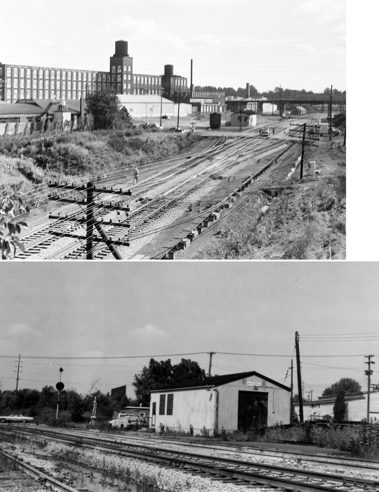
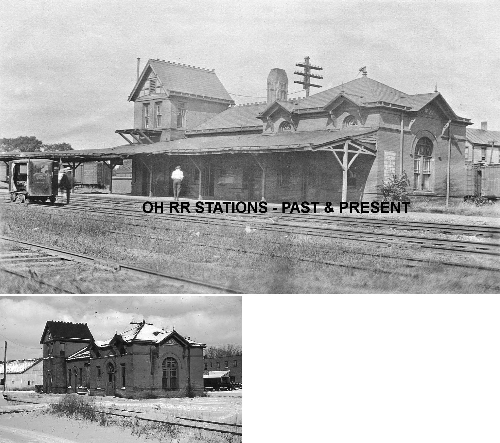
| Ravenna |
|
This second generation station at this location was built in 1886-87 and was subsequently replaced by the station below when the new airline opened. It was used as a yard office after it was out of service as a station. The design is similar to the PFt.&W stations at Enon, PA and Delphos, OH. The passenger station was about 250 feet north of Main Street, west of North Sycamore Street at GPS: 41.158831, -81.247427. The freight station was about 150 feet NW of the passenger station. The passenger station was still standing as of 1954 and, although there were some plans to restore it, it was torn down soon after that. | ||||||
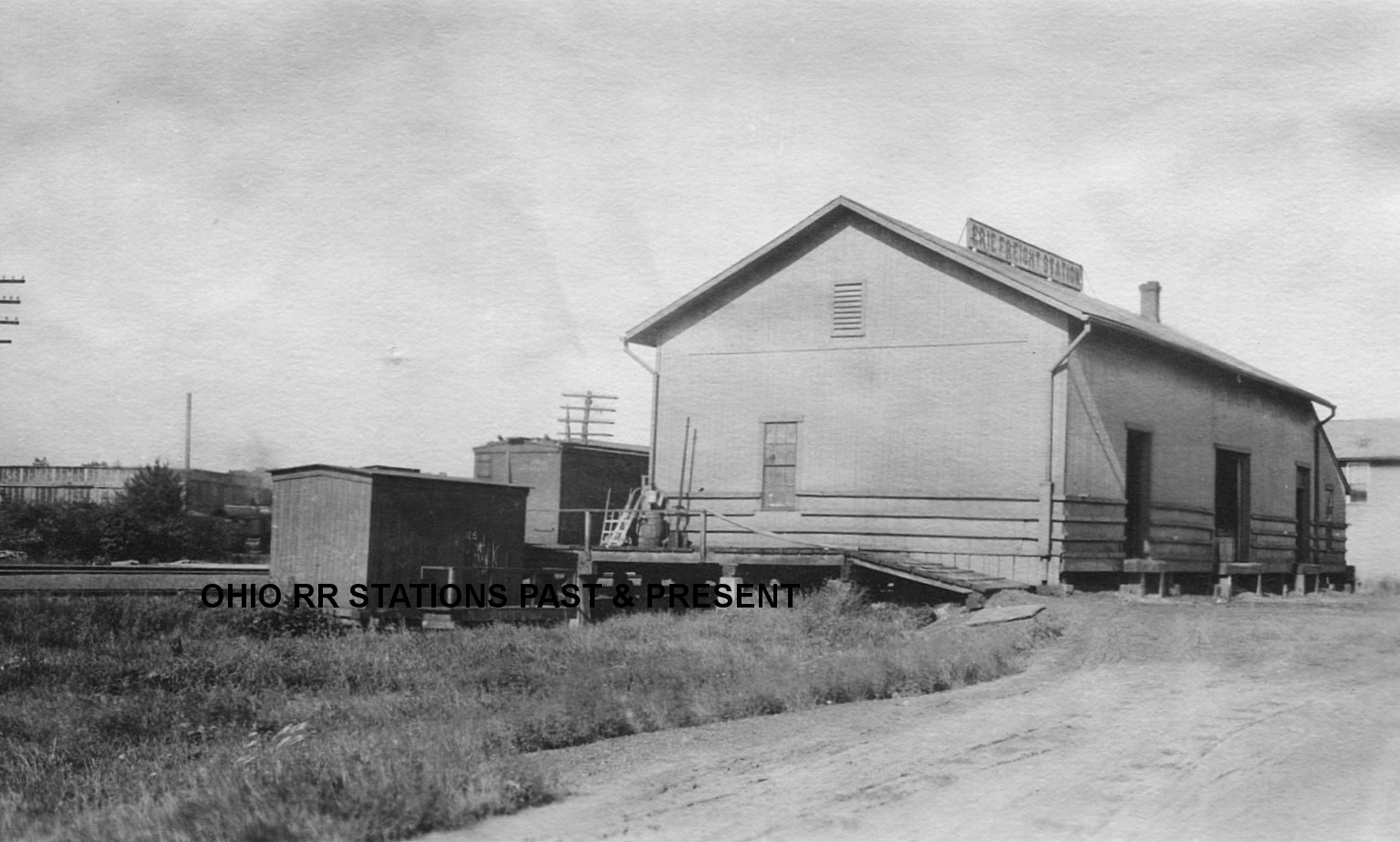
| Ravenna |
|
The freight station here was an old mill that was converted for railroad use. It was built in 1857 according to PRR valuation records. It was at GPS: 41.159364, -81.247548. | ||||||
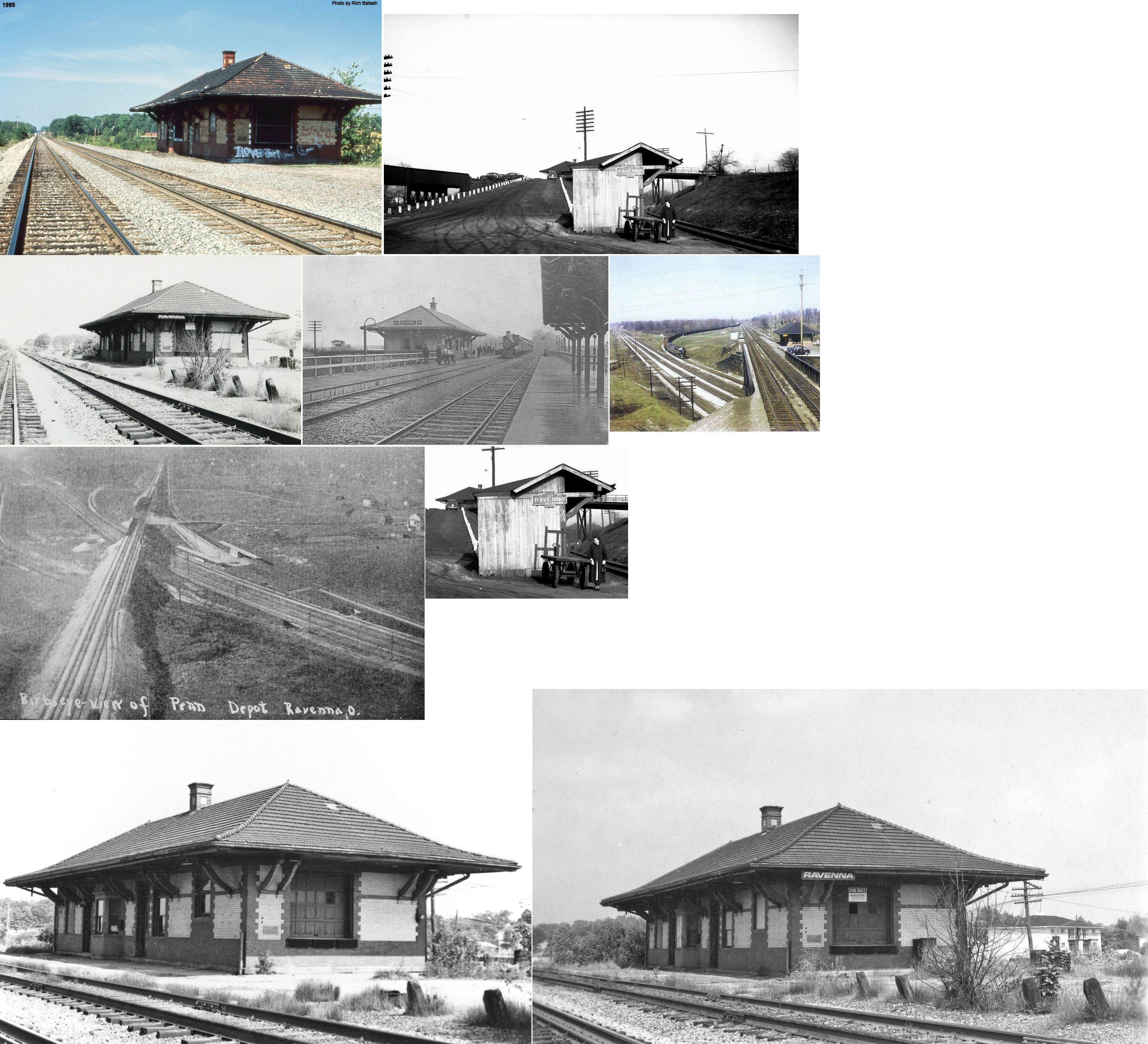
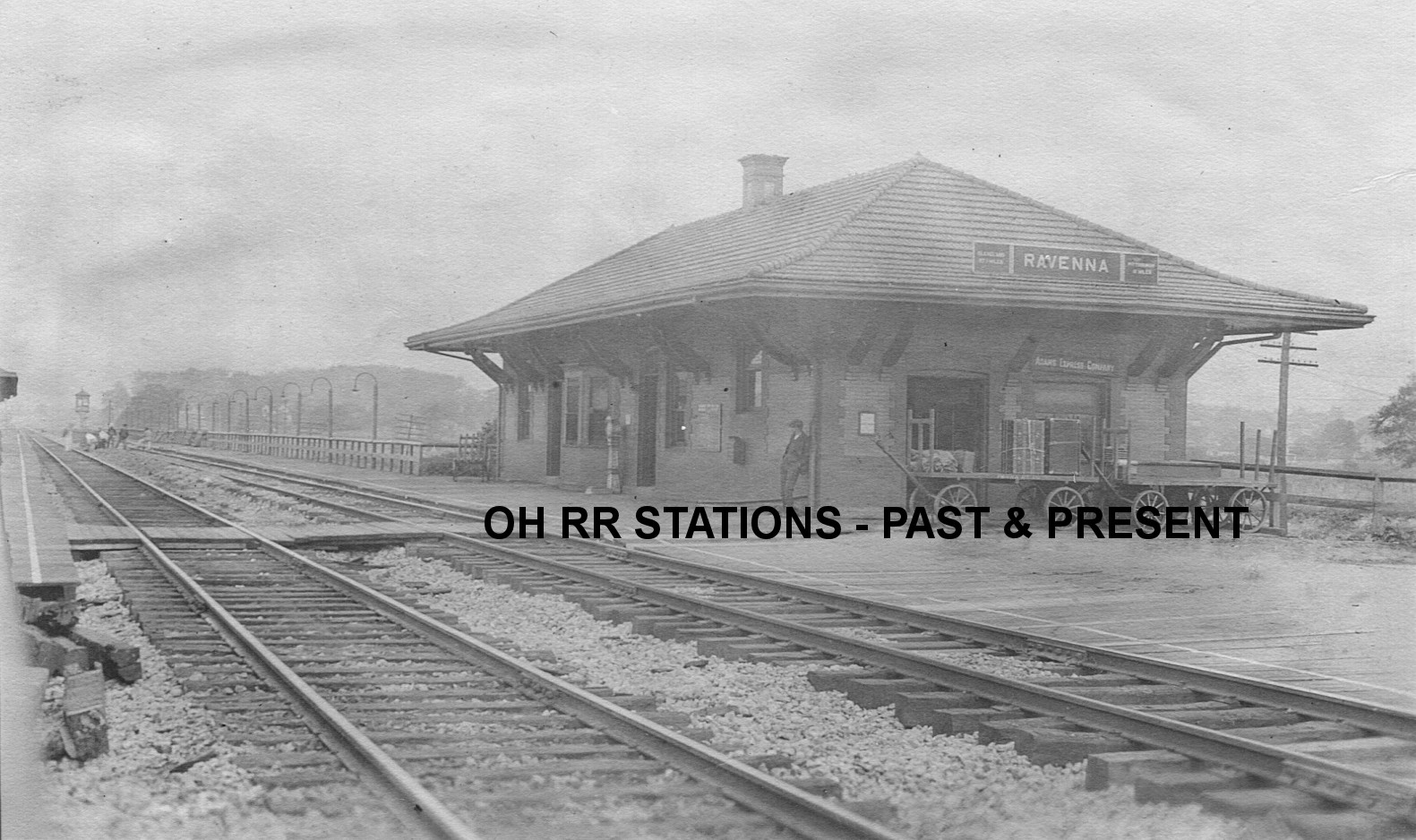
| Ravenna |
|
This station was built in 1902 when the new airline bypassed downtown. Here is a photo from 1916. | ||||||
| Ravenna |
AND |
An article in the Cleveland Daily Leader from July 29, 1864 makes reference to a A&GW/C&P transfer station here. | ||||||
|
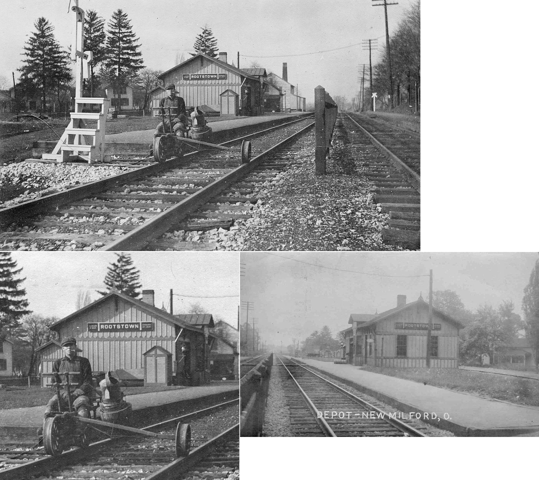
Rootstown (NEW MILFORD) |
|
The "Rootstown" PRR station was actually in New Milford. It was on the east side of Hattrick Road on the south side of the tracks (GPS: 41.104965,-81.213942). According to PRR valutaion records from 1917, the station was built in 1872. | ||||||
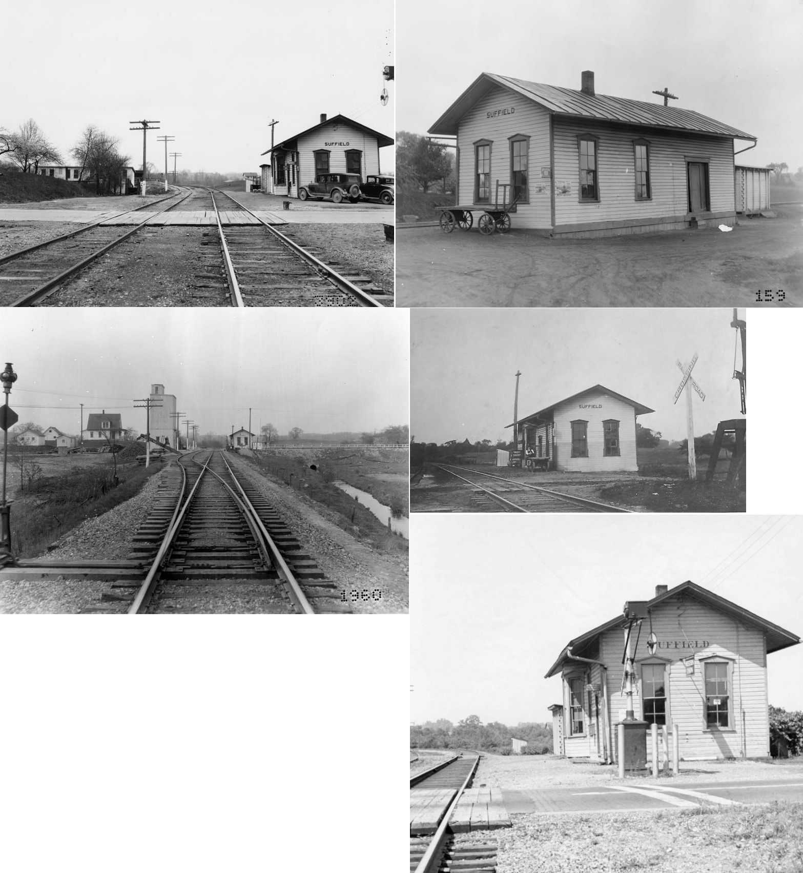
| Suffield | |
|||||||
|
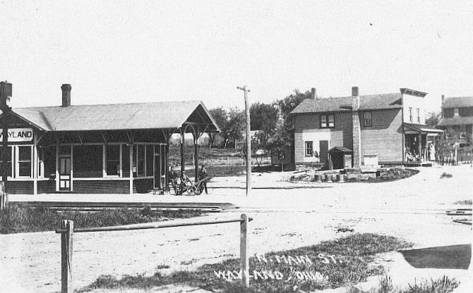
Wayland (Newport) |
|
This station was on the old main line. It was on the west side of Wayland Road on the north side of the tracks (GPS: 41.160648,-81.071449). Wayland has also been known as "Cyclone," "Newport," and "Parisville" at various points in history. | ||||||
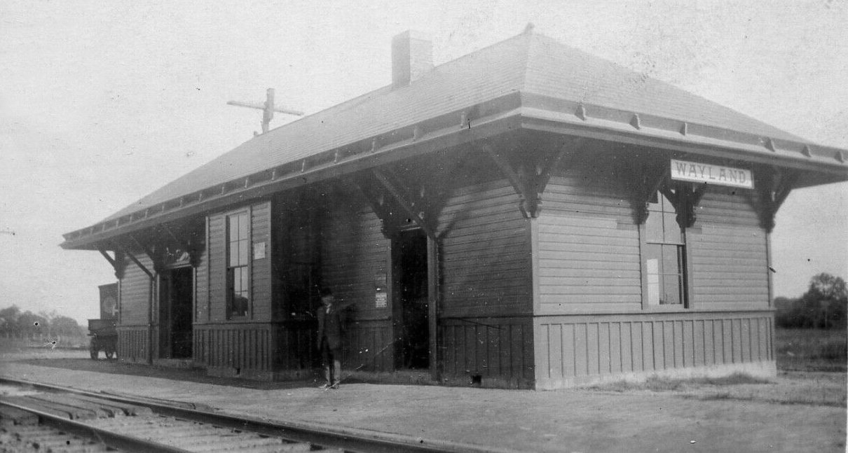
| Wayland |
|
The B&O built a new station here in 1905 when the new double-track line was completed. A number of these stations (including Kent, Newton Falls, Wayland, Charleston, Lafferty and Fairpoint) were all built by the firm of Holbert & McSpedden of Fairmont, West Virginia in 1905. | ||||||
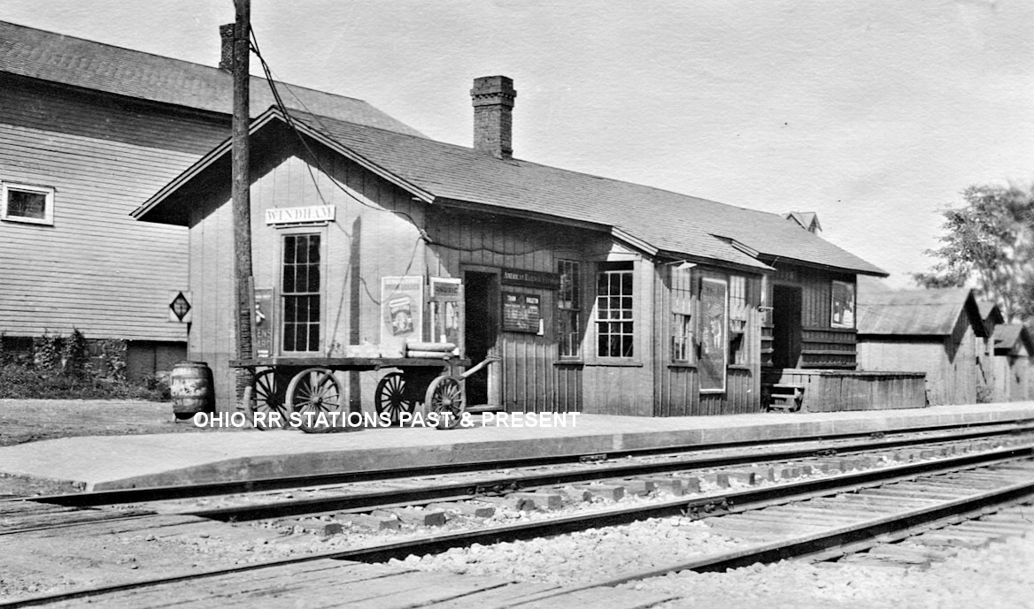
| Windham | |
The station was on the east side of Main Street on the north side of the tracks (just south of where the high school is today) (GPS: 41.231037,-81.048777). | ||||||
| 1898 PORTAGE COUNTY RAILROAD MAP | ||||||||
 |
||||||||
| Notes About Existing
Stations... Kent (CC&S) - Station was moved in July, 2014 from its original location on the south side of Main Street diagonally across the tracks to the property of Components & Equipment International, Inc. at 849 West Main Street. Kent (A&GW) - Restored in 1976. Mantua (A&GW) - "The Erie Railroad came through in 1855 and the depot was built in 1872." --Portage Heritage by James B. Holm (1957, Portage County Historical Society) Mogadore (W&LE) - This station is technically in Portage County as the county line is Cleveland Avenue. It was moved from its original location on the east side of North Cleveland Avenue at the W&LE crossing. A train derailed and hit the building in 1912. Here are a couple more photos. |
||||||||