 COUNTY COUNTY
|
|
||||||||
| EXISTING STATIONS | ||||||||
|---|---|---|---|---|---|---|---|---|
| Station Name |
Original Railroad |
Current Location |
Type | Current Use |
Date Built |
Track Status |
Building Material |
More Info |
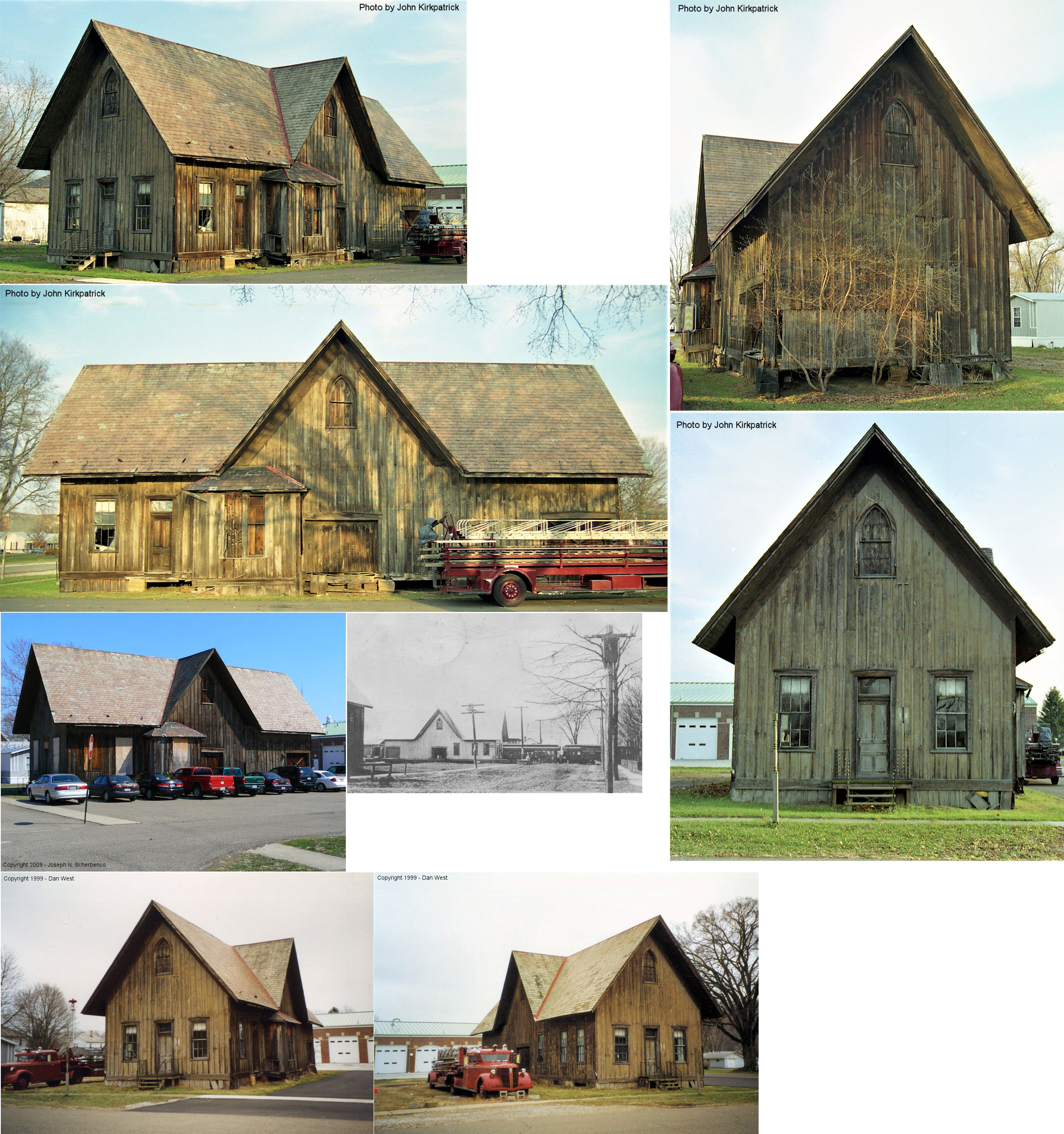
| Dresden |  |
SE corner of Eighth & Clay Streets (GPS: 40.120510, -82.013048) |
C | Society | ???? | Gone | Wood |
|
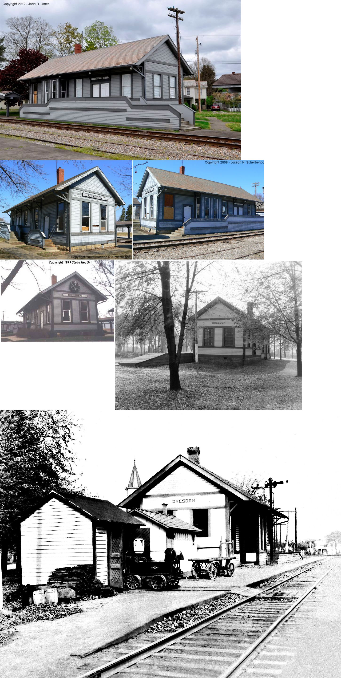
| Dresden |  |
Main Street between
Muskingum and 12th Streets (GPS: 40.118217, -82.009021) |
C | Storage | 1902 | In Use | Wood | |
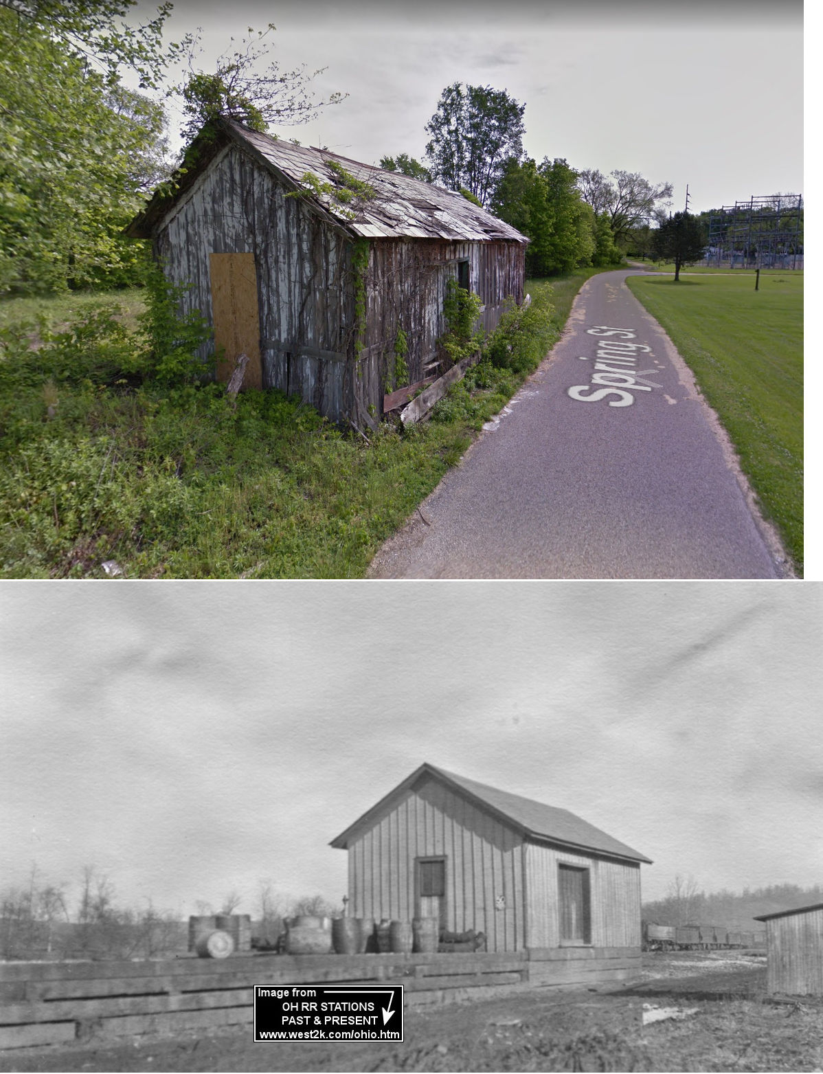
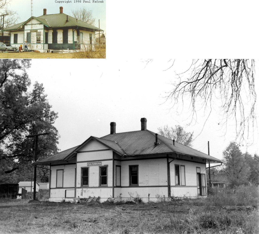
| East
Fultonham (Fultonham) |
 |
North side of Spring Street (GPS: 39.851950, -82.121859) |
F | ???? | 1885 | Gone | Wood | |
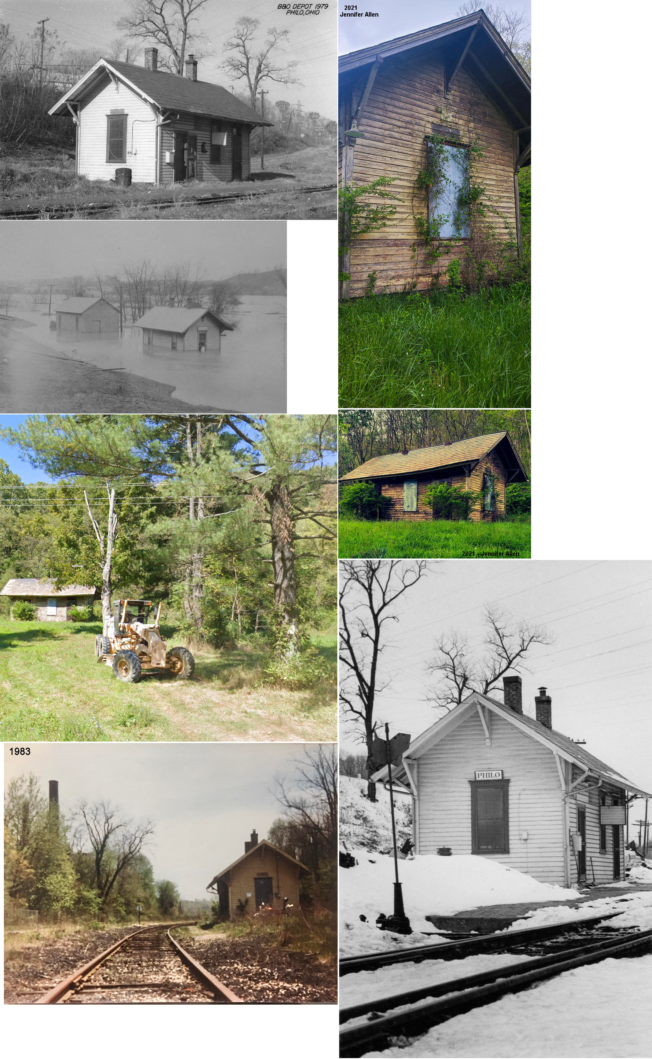
| Philo (Taylorsville) |
 |
North side of OH-376 halfway between Ruraldale and Gaysport (GPS: 39.790082, -81.868436) |
P | Private | ???? | None | Wood |
|
| St. Clair |
 |
15505 Chandlersville Road (GPS: 39.862788, -81.700258) |
C | Storage | 1902 | None | Wood |
|
| Zanesville |
 AND  |
3rd & Market Streets (GPS: 39.942474,-82.009072) |
F | Business | 1891 1917 |
Gone | B/W |
|
| Zanesville | |
Linden Avenue at McIntire (GPS: 39.947804,-82.009404) |
C | ???? | ???? | In Use | Brick | |
| Zanesville |  |
2nd & Market Streets (GPS: 39.942293,-82.010391) |
P | Society | 1882 | Gone | Brick |
|
| STATIONS OF THE PAST | ||||||||
| Station Name |
Original Railroad |
Notes | ||||||
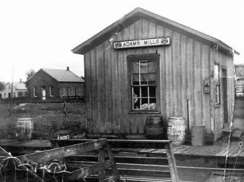
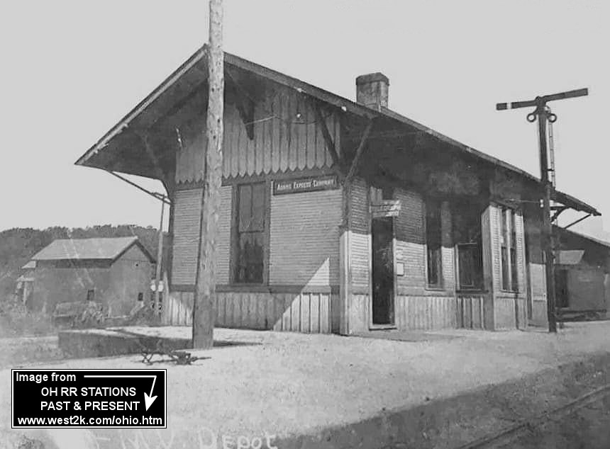
| Adams Mills |  |
Passenger station? According to PRR vaulation records, this station was built in 1898. | ||||||
| Adams Mills | |
Freight station? PRR records also list a sectionman's shelter here, so that could be what this is. | ||||||
| Ballou | |
This station is on the 1887 timetable for the Zanesville & Ohio River RR. It was 6.5 miles from the Zanesville station. | ||||||
| Barton | |
This station is shown on the 1887 Zanesville & Ohio River timetable as being 10.2 miles south of Zanesville and 1 mile south of the Taylorsville (Philo) station. | ||||||
| Black Run | |
According to PRR valuation records, this station was built in 1890. | ||||||
| Bluerock | |
This station is shown on the 1887 Zanesville & Ohio River timetable as being .5 mile south of Merriam (Gaysport). | ||||||
| Brookover |
 |
A shelter-type station was built here in 1916. | ||||||
| Buckeye | |
This station is shown on the 1887 Zanesville & Ohio River timetable as being 4.1 miles south of Zanesville. | ||||||
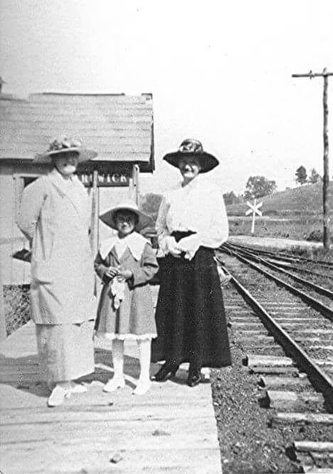
| Carlwick |
|
The agent was in a store here starting in 1883, but the railroad added a passenger shelter in 1910. | ||||||
| Cannelville | |
According to NYC valuation records, this station was built in 1890. | ||||||
| Cannon | |
According to NYC valuation records, a passenger shelter was built in 1898. | ||||||
| Cedar Run | |
This station is shown on the 1887 Zanesville & Ohio River timetable as being .8 mile south of Stone. | ||||||
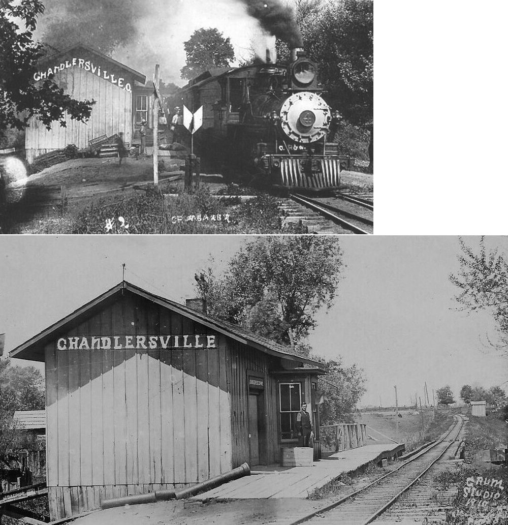
| Chandlersville |
|
This station was built in 1888. Prior to that the station was housed in a general store. | ||||||
| Claypool Mill Station |
|
|||||||
| Coal Dale |
|
|||||||
| Darlington (Newton Sta.) |
|
This station was near where Darlington Drive (Twp. 46) crosses the tracks. There was also a tower at the corssing of the C&MV and Z&W. NYC valuation records don't list a station for Darlington | ||||||
| Deffenbaugh |
|
A shelter-type station was built here in 1916. | ||||||
| Del Carbo |
|
This station was near the center of Section 27, Newton Township. | ||||||
| Dillons Falls | |
This station was likely on Dillon Falls Road. | ||||||
| Duncan Falls | |
This station is shown on the 1887 Zanesville & Ohio River timetable as being 8.8 miles south of Zanesville and .4 miles north of the Taylorsville (Philo) station. | ||||||
| Dresden |
 |
There was an older station here before the W&LE built the one that is still standing. | ||||||
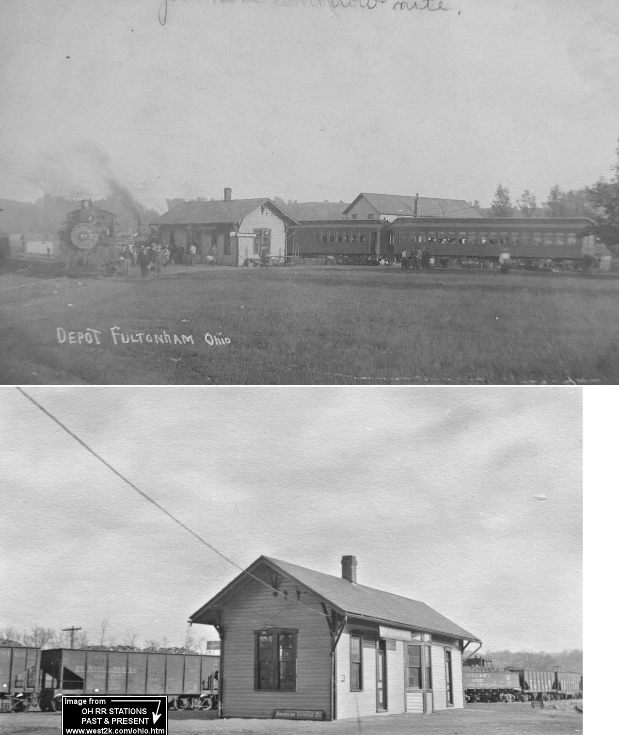
| East
Fultonham (Fultonham) |
|
According to NYC valuation records, both the passenger and freight stations were built in 1885. | ||||||
| East Fultonham | |
In 1919, the New York Central valuation records indicated that a partial carbody was converted and served as a passenger shelter here. The records said the shelter was built in 1915. This may have been used as a temporary depot before the new station (listed below) was built. | ||||||
| East
Fultonham (Fultonham) |
|
This station replaced the passenger station listed above. It was burned then demolished. | ||||||
| Elizabeth | |
According to NYC valuation records, this station was built in 1900. | ||||||
| Ellis Station | |
This station was near where Ellis Dam road is today. | ||||||
| Ellis |
|
There was a two-story station here with agnet's quarters on the second floor. An old boxcar was used as a freight house. The station was torn down in 1938. | ||||||
| Fair Oaks | |
This station is on the 1887 timetable for the Zanesville & Ohio River RR. It was 1.6 miles from the Zanesville station. | ||||||
| Frazeysburg |  |
This combination station was on the west side of State Street between 2nd and Canal Streets. It sat on the south side of the tracks. According to PRR valuation records, this station was built in 1902. | ||||||
| Fraziers | |
This station is on the 1887 timetable for the Zanesville & Ohio River RR. It was 4.9 miles from the Zanesville station. | ||||||
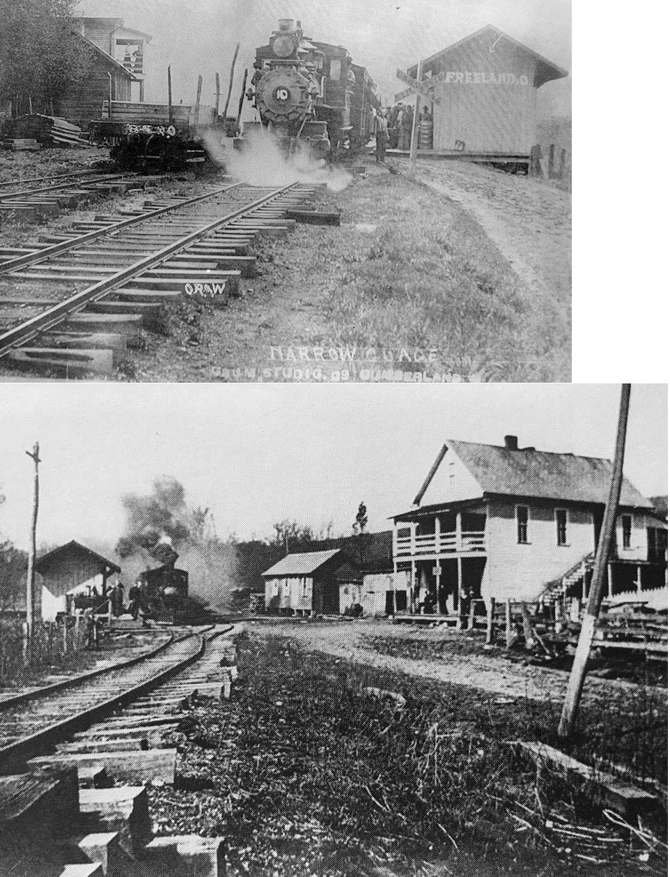
| Freeland |
|
A shelter-type station and freight depot was built in 1904. Prior to that the station was housed in a general store (which still stands as of 2019). | ||||||
| Garrett | |
This station is on the 1887 timetable for the Zanesville & Ohio River RR. It was 7 miles from the Zanesville station. | ||||||
| Gaysport | |
This station is on the 1887 timetable for the Zanesville & Ohio River RR. It was 13.5 miles from the Zanesville station. See the listing for Merriam below. | ||||||
| Gilbert | |
|||||||
| Grangers | |
This station is on the 1887 timetable for the Zanesville & Ohio River RR. It served the Granger Mine and was 3 miles from the Zanesville station. | ||||||
| Griffin |
|
A shelter-type station was built here in 1916. | ||||||
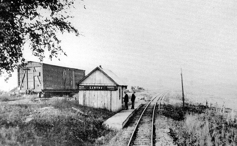
| Lawton (Burnt Mills) |
|
This station was between Carlwick and Chandlersville on Salt Creek Drive NE of Burnt Mills Road at GPS: 39.891441, -81.872798. This station was built here in 1916. | ||||||
| Lewis |
|
According to NYC valuation records, this station was built in 1900. | ||||||
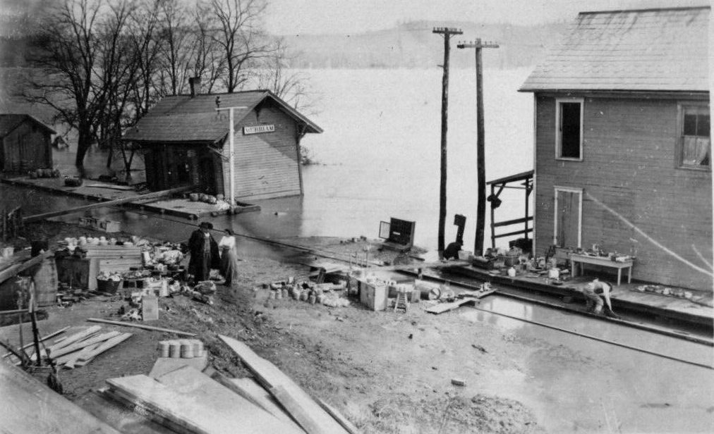
| Merriam (Gaysport) |
|
|||||||
| Moxahala | |
This station is on the 1887 timetable for the Zanesville & Ohio River RR. It was 2.5 miles from the Zanesville station. | ||||||
| Muskingum |
|
According to NYC valuation records, a shelter was built in 1891. | ||||||
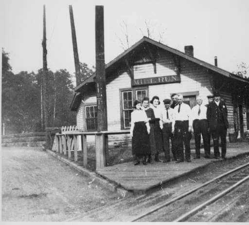
| Mill Run |
|
This station was built in 1886. | ||||||
| Nashport | |
|||||||
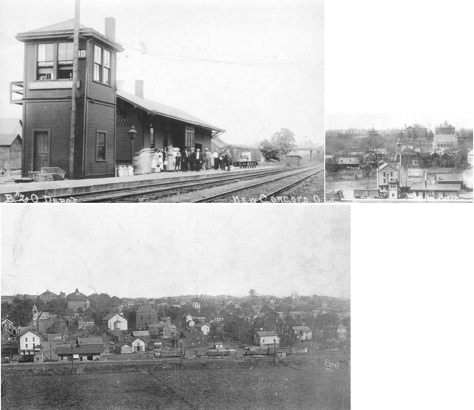
| New Concord | |
This combination station was at the south end of Depot Street at West Maple Avenue. There was an Central Ohio station at this location in 1875. | ||||||
| Newton Station | |
This station was on the north side of Darlington Drive on the east side of the tracks (GPS: 39.88043,-82.035736). | ||||||
| Pierce |
|
A shelter-type station was built here in 1912. | ||||||
| Putnam | |
|||||||
| Rock Cut | |
This station was near where Rock Cut Road crosses the old grade. | ||||||
| Romine |
|
A shelter-type station was built here in 1895. | ||||||
| Sealover | |
|||||||
| Seawright |
|
A shelter-type station was built here in 1915. | ||||||
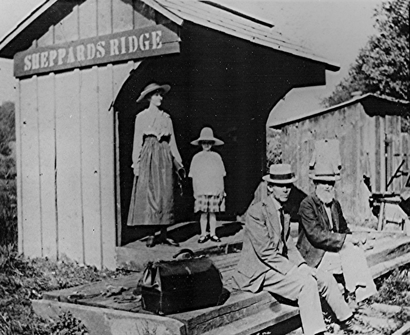
| Sheppard's Ridge |
|
This shelter-type station was built in 1912. | ||||||
| Smiths |
|
A shelter-type station was built here in 1915. | ||||||
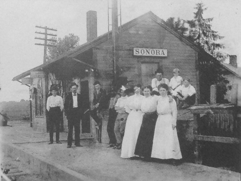
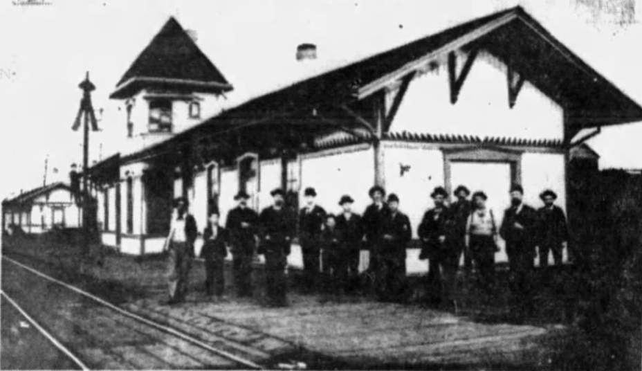
| Sonora | |
This station was built in 1888 (according to the B&O Annual Report of that year). There may have been an earlier Central Ohio station here before that. This station was at the east end of Main Street on the east side of the tracks. Here is a note from Fred Whissel: "My dad (Carl A. Whissel) was owner and operator of Whissel's Grocery/Sohio Service Station and fourth-class U.S. Post Office in Sonora for decades (1940s-70s). He had to take outgoing mail down to the station each weekday and Saturday morning and hand it up to a B&O mail car worker or hang canvas bag on a tall stand from which the slowly moving train could retrieve. The train would stop only if they had heavy, perishable, or live cargo (like carton of chicks). My dad would then take incoming mail back to the store (Sonora Rd. and Webster St.) to sort and insert in glass-faced wooden cabinet that had 100 boxes (ours was #84). At same time, the rural carrier, Charlie Oliver, would sort mail separately to be delivered to "rural free delivery" recipients in the surrounding area (Perry Township). | ||||||
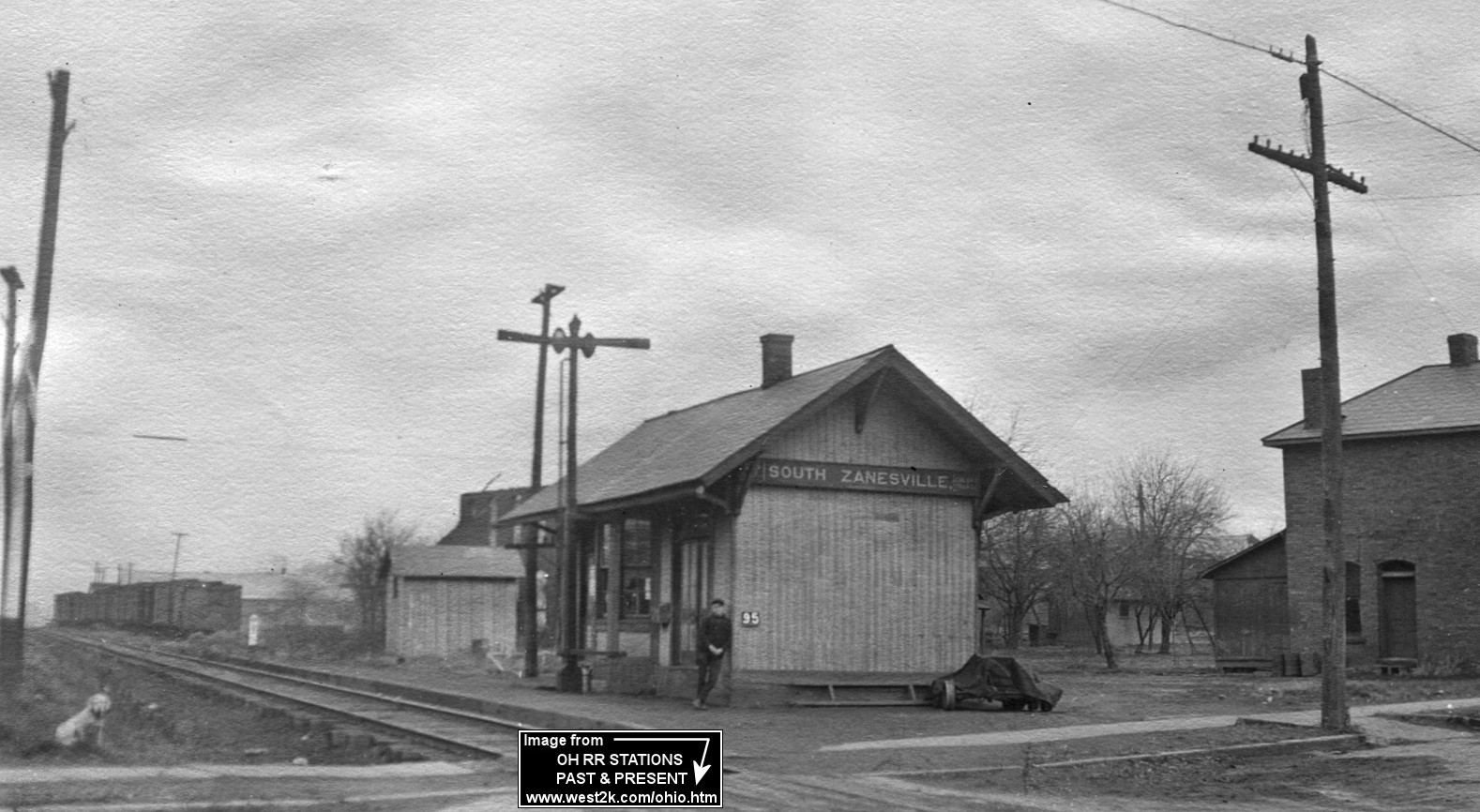
| South Zanesville |
|
This small station was on the north side of East Main Street between North Shawnee Avenue and US-22 (GPS: 39.903317,-82.019656). It was on the east side of the tracks. According to NYC valuation records, the station was built in 1886. | ||||||
| South Zanesville | |
This station was on the north side of East Main Street between North Shawnee Avenue and Pembroke Avenue (GPS: 39.903374,-82.018583). It was on the west side of the tracks. It is shown on maps from 1919 when the line was owned by the PRR, but the station may have been built prior to that by the C&MV. | ||||||
| Spratt |
|
The station here was in a general store. There was no railroad-owned station building. | ||||||
| Stone | |
|||||||
| Stovertown |
|
According to NYC valuation records, a shelter was built in 1908. | ||||||
| Stovertown | |
|||||||
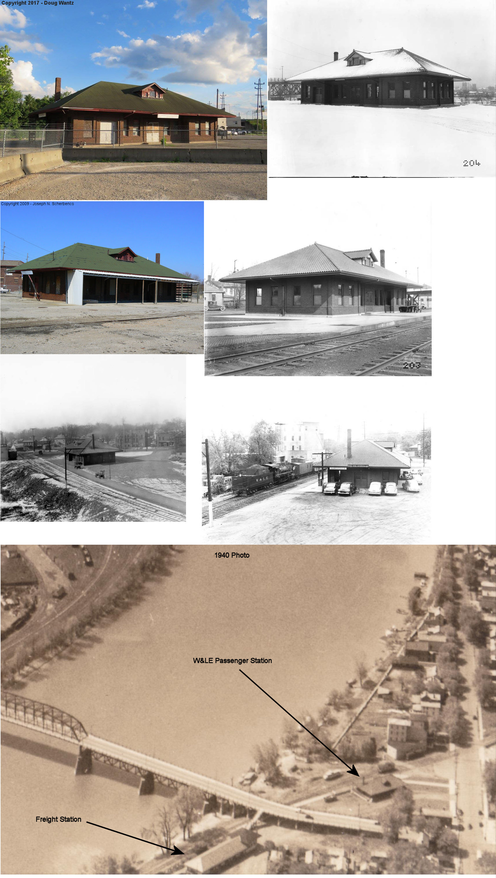
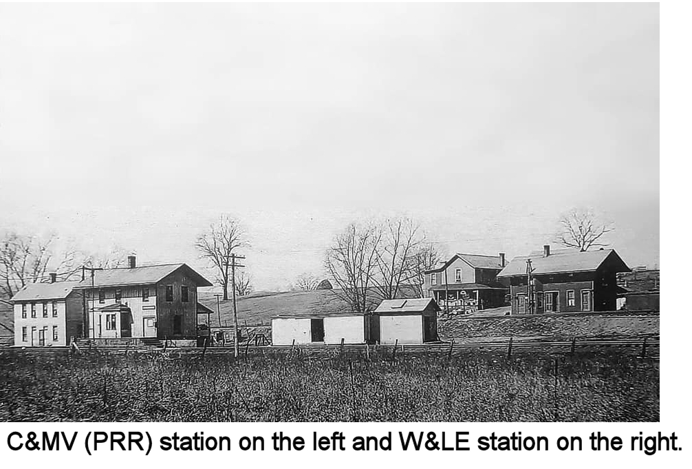
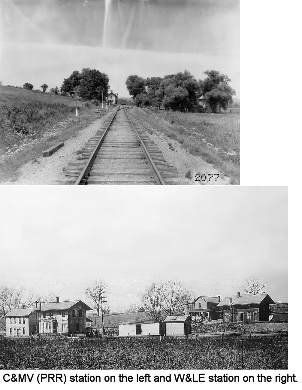
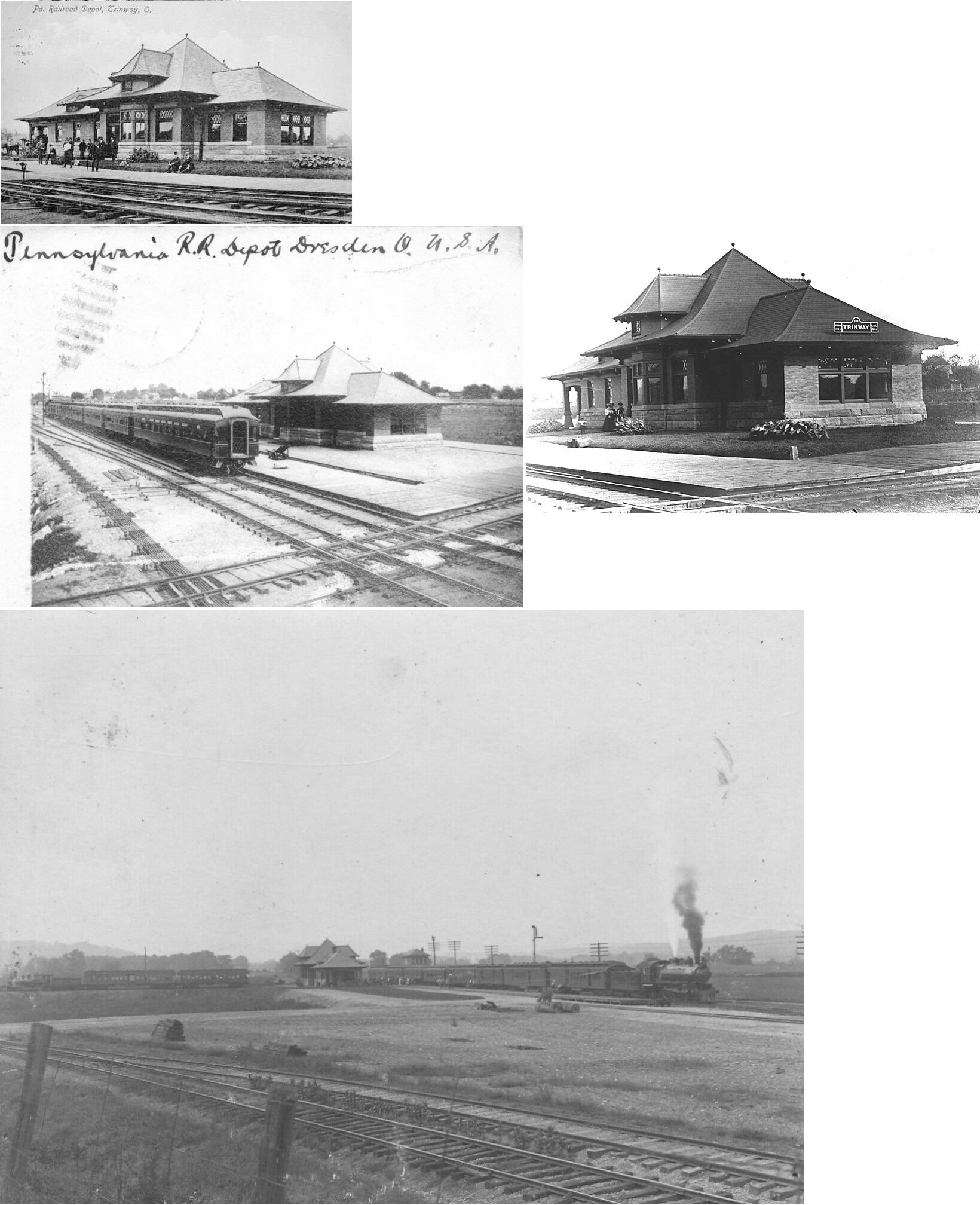
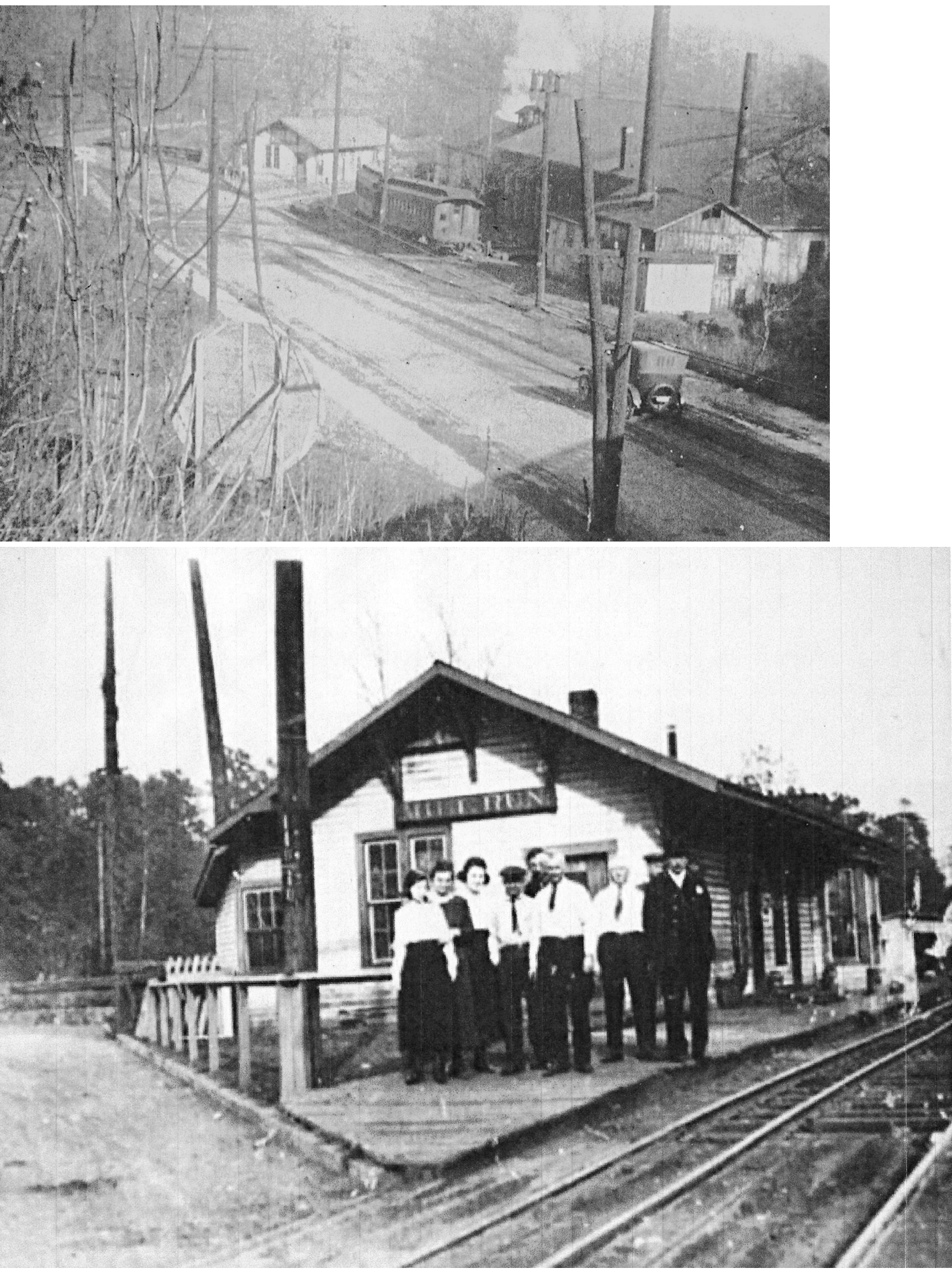
| Trinway (Dresden Jct.) |
|
This was the first station built here. This location was known as Dresden Junction in the early years (it is shown as such on the 1875 map and had a station at that time). This station became a freight depot when the new station was built, although PRR valuation records say a new frame freight station was built here in 1902 (which could just be the date this station went into service as a freight station). | ||||||
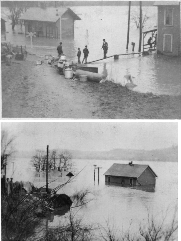
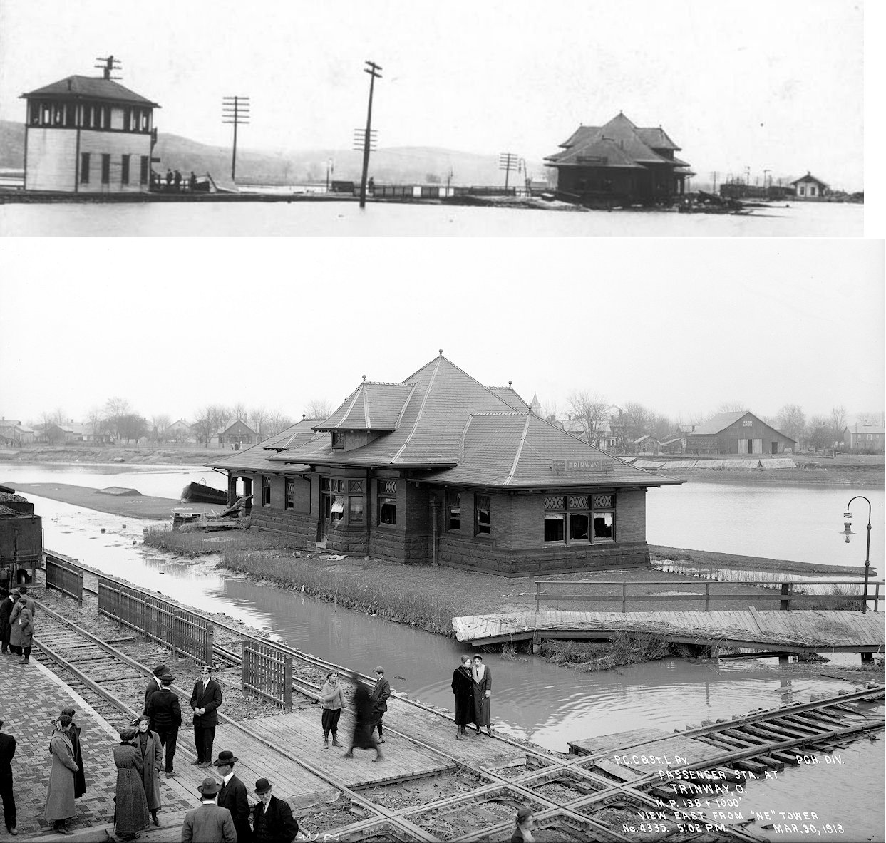
| Trinway (Dresden Jct.) |
 |
This station was built in 1905 (PRR valuation records say 1902) and served the PCC&St.L, CA&C and C&MV. Here is a panoramic photo of the station during a flood. | ||||||
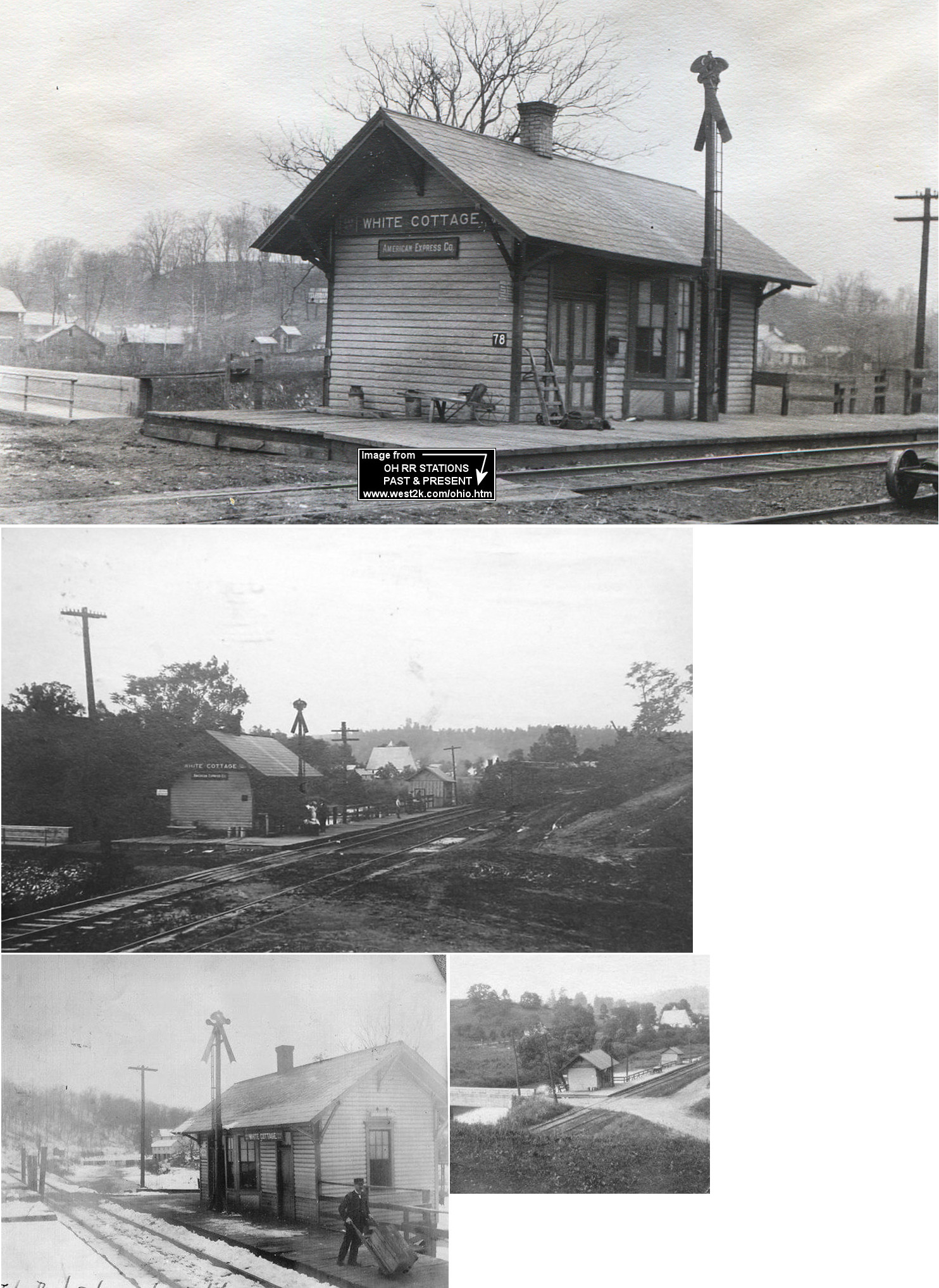
| White Cottage |
|
According to NYC valuation records, this station was built in 1885. | ||||||
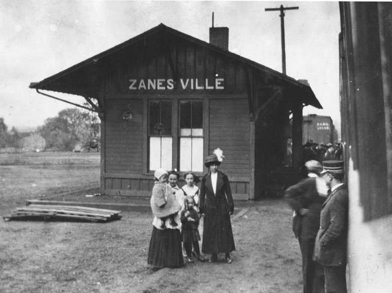
| Zanesville | |
This station, built in 1883, was at 2nd and Market Streets (GPS: 39.942219,-82.009673). It was torn down in spring 1999. The BZ&C (later OR&W) RR leased space in this station aa the last mile of that railroad was via B&O trackage rights. | ||||||
| Zanesville | |
The freight house was just north of the passenger station at GPS: 39.942791,-82.00963. | ||||||
| Zanesville (MIll Run) |
|
Built in 1923, this station was just a long, curved, covered platform with a baggage house. It was off Hall Avenue near Mill Run at GPS: 39.953189, -81.993615. The name of the station at first was Mill Run, but was changed to Zanesville after the OR&W stopped leasing sapce at the B&O station. | ||||||
|
Zanesville (Mill Run) |
|
The PRR installed a converted box car with a loading platform west of Hall Avenue as a freight house in 1923. It was essentially a freight transfer shed next to the OR&W tracks. It was here that the PRR and the OR&W moved freight to and from the narrow-gague OR&W and the standard-gauge PRR. Large freight like logs and lumber were just transferred between cars here with a crane as well. | ||||||
|
Zanesville (Mill Run) |
|
Not sure of the vintage of this station, but appears to be a passenger station for Mill Run that was on Hall Avenue. | ||||||
| Zanesville | |
The first C&MV freight house was just north of the passenger station at 2nd and Market Streets (GPS: 39.942671,-82.010359). This freight house was replaced with a larger one (listed below) in 1886 to the west of the passenger station | ||||||
| Zanesville | |
This was the second C&MV freight house. It was built in 1886 and located west of the passenger station at GPS: 39.942347,-82.010778. | ||||||
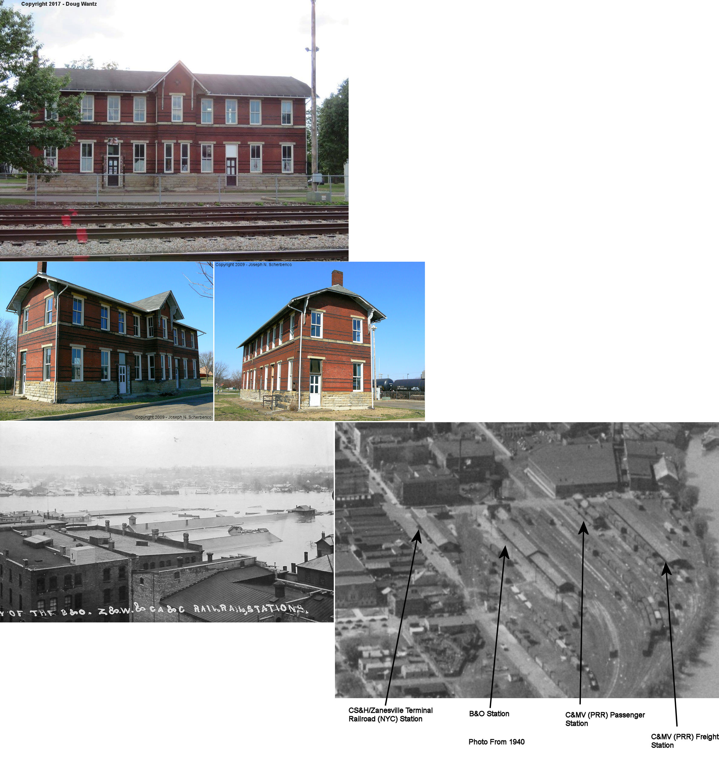
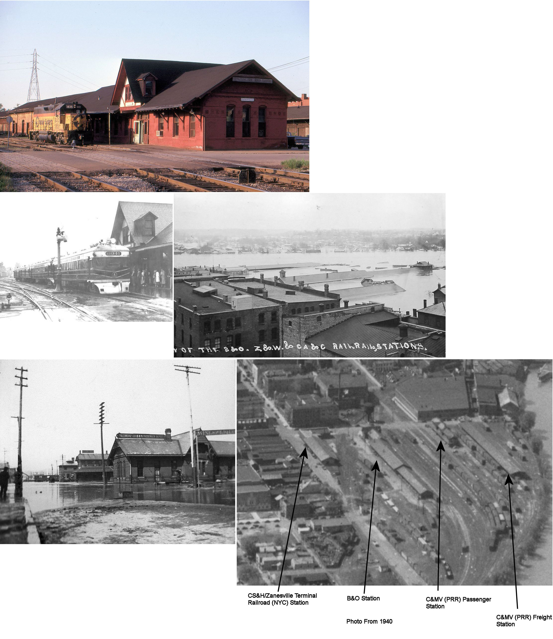
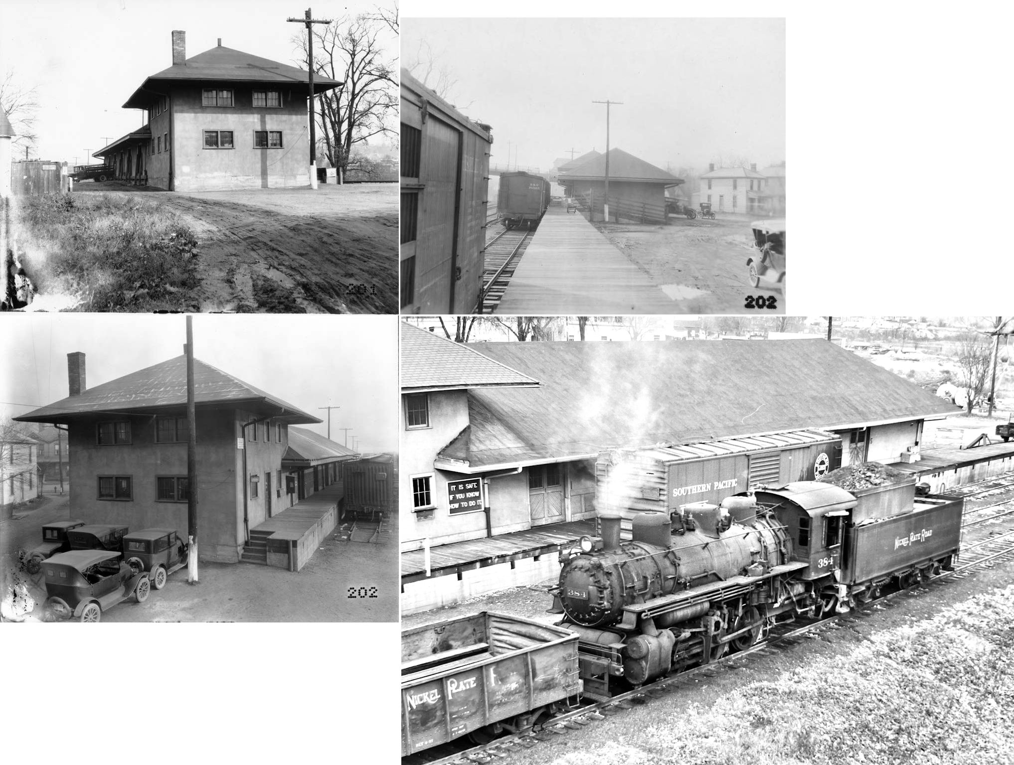
| Zanesville |
|
The passenger station was on the corner of Market and North 3rd Street (GPS: 39.942149,-82.009179). On the first floor of the building was a saloon, lunchroom, ladies waiting room, gents waiting room, baggage office and freight office. The second story of the building was apartments, possibly agents' quarters. This building was probably demolished to make way for the larger freight facility in 1917. | ||||||
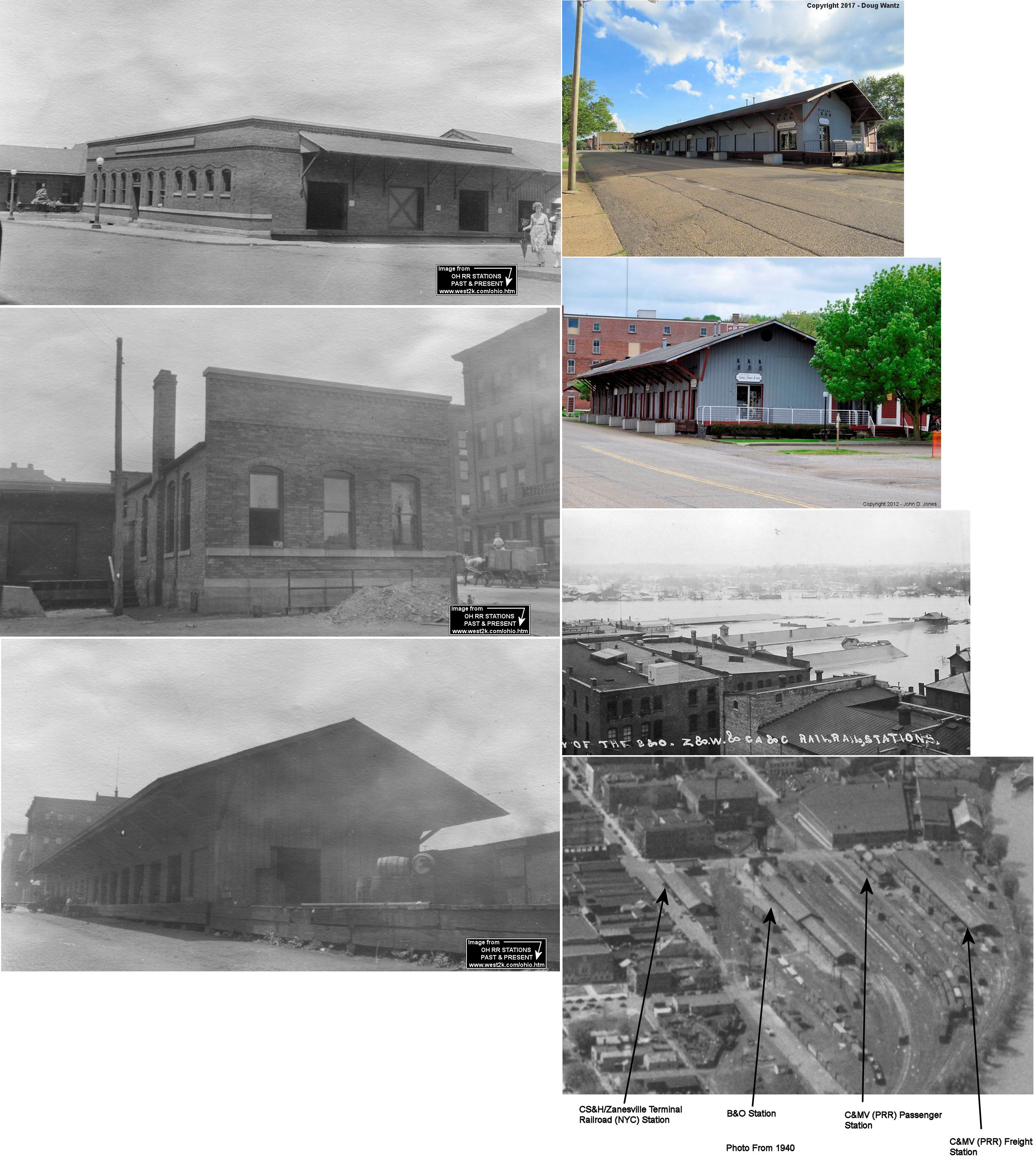
| Zanesville |
|
The original CS&H freight house was where the current Zanesville Terminal Railroad still stands. This building was probably demolished to make way for the larger ZTRR freight facility in 1917. | ||||||
| Zanesville |
|
The original passenger station here was to the NE of where the existing W&LE station is near Linden and McIntire Streets (GPS: 39.947973,-82.008648). | ||||||
| Zanesville | |
The W&LE freight station was built on the site of the original CC&S passenger station and the structure may have included that original station (GPS: 39.947973,-82.008648). | ||||||
| 1898 MUSKINGUM COUNTY RAILROAD MAP | ||||||||
 |
||||||||
| Notes About Existing
Stations... Dresden (CA&C) - According to a Keystone Magazine article in 1994, this station was constructed from the members of a covered bridge. Clay Street was formerly Railroad Street and the PRR tracks used to run down the center of the street. Philo (B&O) - The passenger and freight stations were originally on the east side of Front Street between 1st Street and James Street in Philo. The railroad planed to have the station burned by the fire department, but a local property owner was able to secure it from the railroad for free and had it moved out to his property on SR-376 in the 1980s or 1990s. St. Clair (BZ&C) - This is an old boxcar that was used as a passenger shelter and freight house at St. Clair beginning in 1902. After the railroad was removed in 1929 the boxcar/station was moved to the nearby farm. Zanesville (ZTRR) - The wood frame part of this freight station was built by the CS&H in 1891 as a freight station. In 1917 the brick portion was added by the Zanesville Terminal Railroad (affiliated with the CS&H and Zanesville & Western, later NYC). That front brick section replaced the original 2-story CS&H passenger station portion of the building (which also housed a saloon and lunchroom). The station was closed in 1968 and restored in 1989. On National Register of Historic Places. Zanesville (C&MV) - PRR depot is located across the tracks from the former site of the B&O depot. It's being restored by a local developer. Tracks for the NYC freight house and PRR station have all been removed and replaced with automobile parking areas. The only remaining tracks are the B&O tracks. Station is on National Register of Historic Places. |
||||||||