 COUNTY COUNTY
|
|
||||||||
| EXISTING STATIONS | ||||||||
|---|---|---|---|---|---|---|---|---|
| Station Name |
Original Railroad |
Current Location |
Type | Current Use |
Date Built |
Track Status |
Building Material |
More Info |
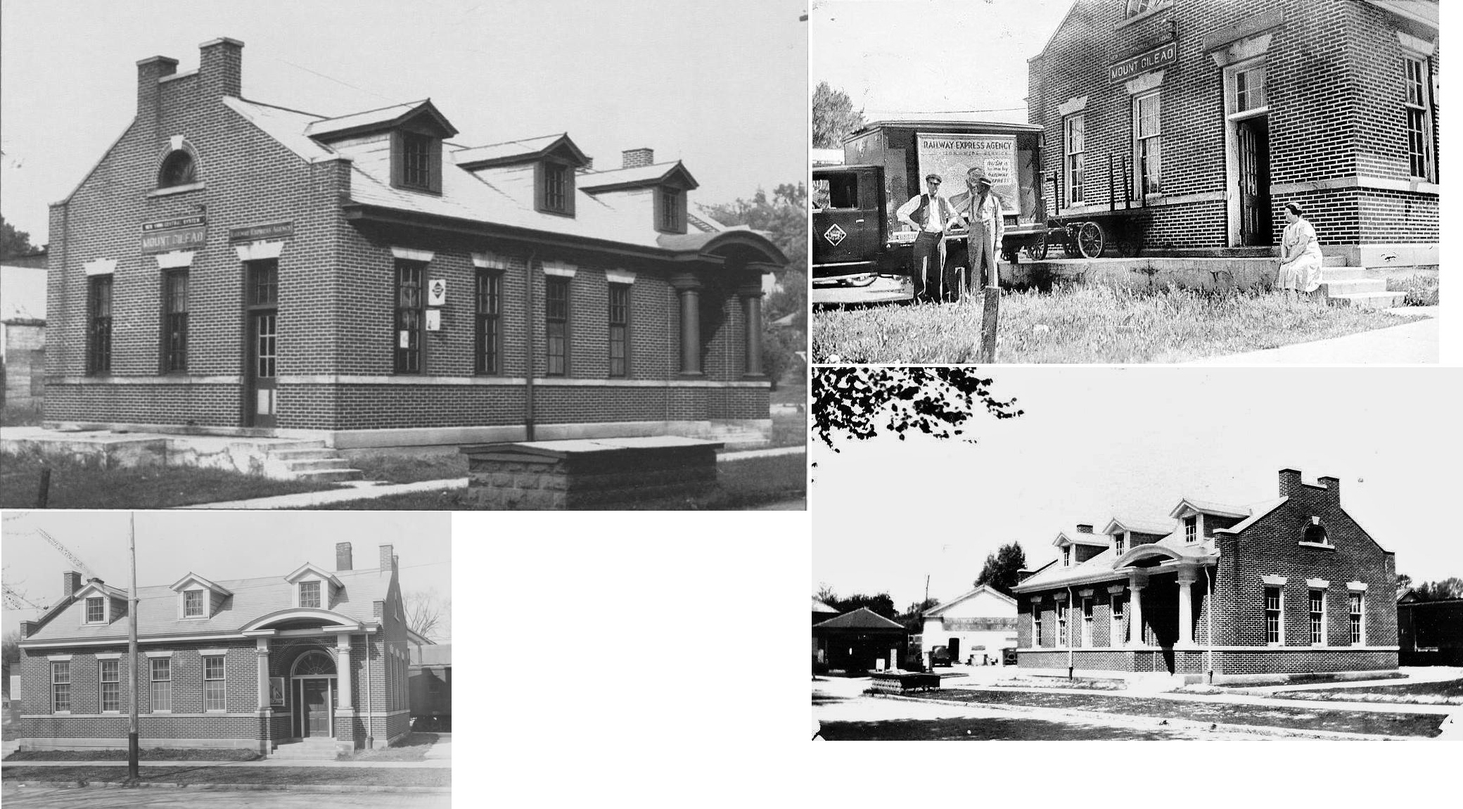
| Mt. Gilead |  |
Iberia Street & West High Street (GPS: 40.549724, -82.831191) |
P | Municipal | 1924 | Gone | Brick | |
| STATIONS OF THE PAST | ||||||||
| Station Name |
Original Railroad |
Notes | ||||||
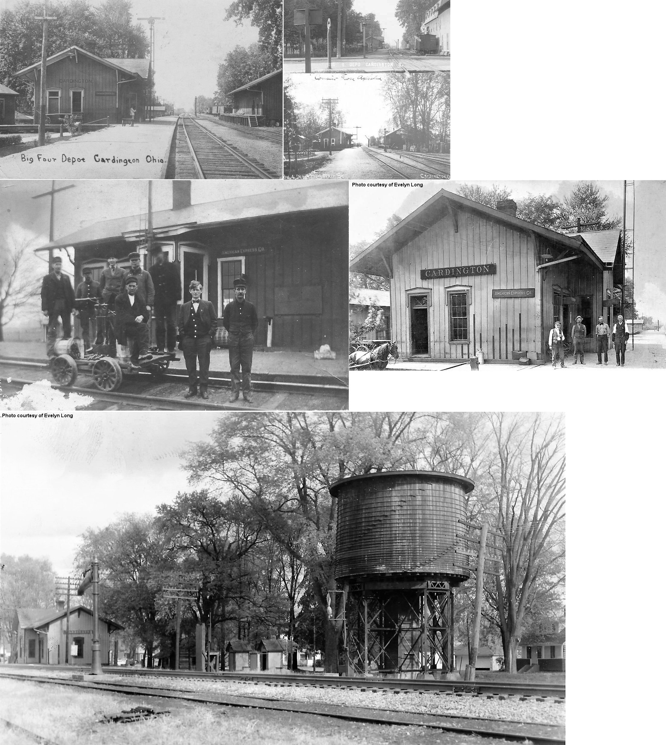
| Cardington |  |
The passenger station was on Railroad Street between 2nd and Walnut with the freight house on the opposite side of the tracks. The white building in the foreground of the first photo is the Mills Brothers and Conger Flour Mill (that was its name in 1903, in 1885 it was called the Dawson, Wherry & Co. Flour Mill). The station was demolished by the railroad in 1963. | ||||||
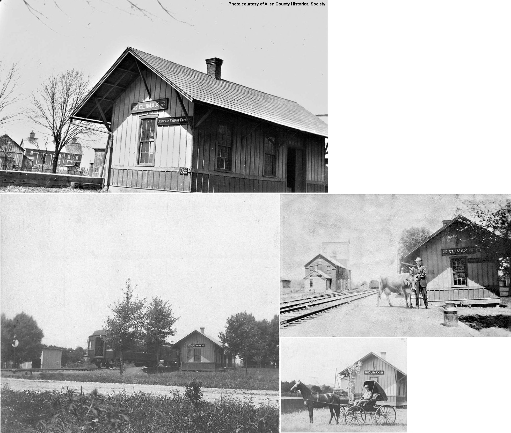
| Climax |  |
This station was on the north side of Marion-Johnsville Road on the east side of the tracks at approximately GPS: 40.630898, -82.888850. | ||||||
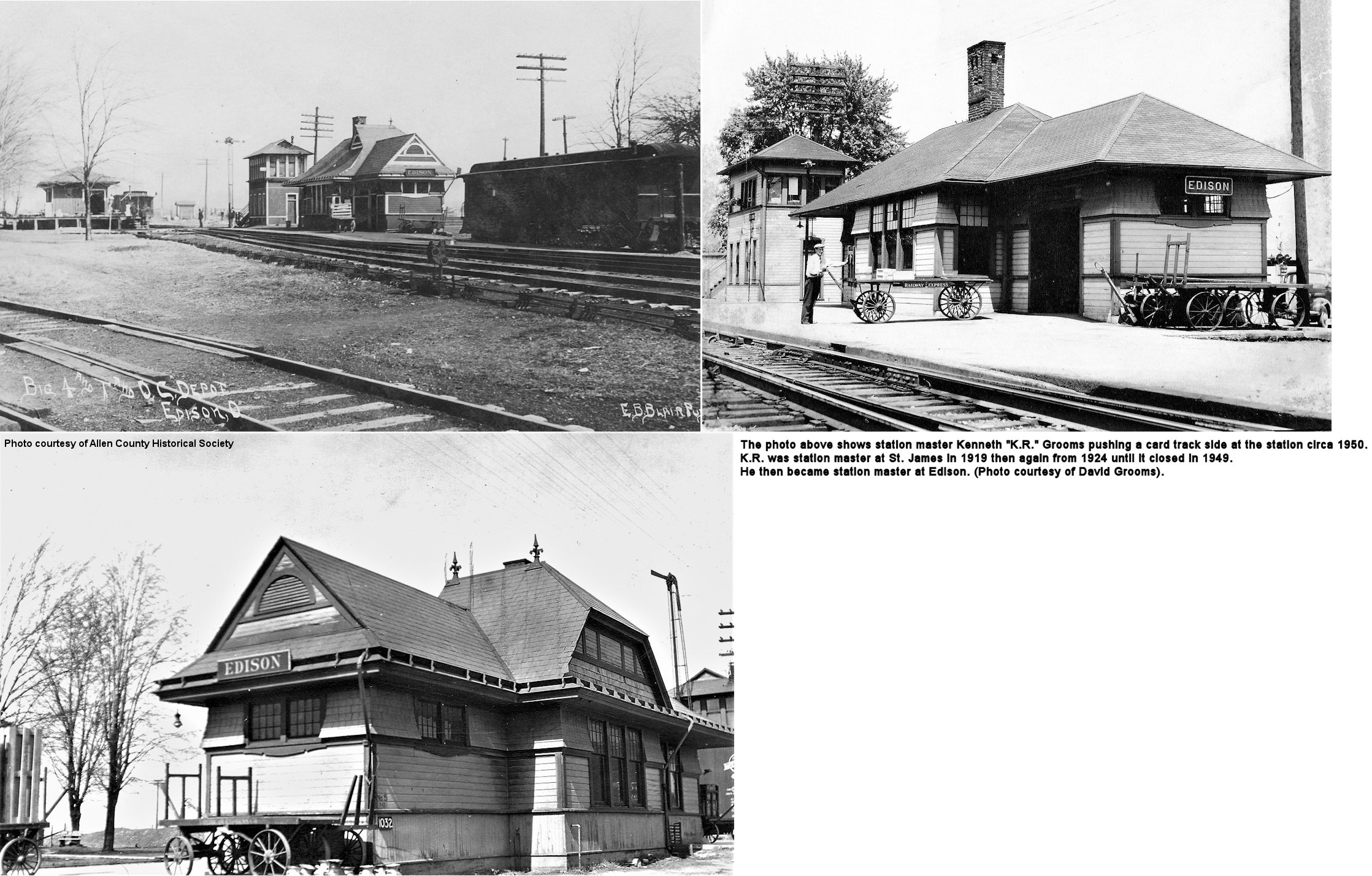
| Edison (Gilead Station) |
 |
Edison was first known as Mt. Gilead Station. The CCC&I
built a station in Edison circa 1850. The railroad began operation in
February of 1851. Edison was originally named West Gilead, but by the time
the railroad was built the name had been changed to Gilead Station. The
first station agent was Luther D. Mozier whose land the rail-line had
been laid. This position would be held by him or a member of the Mozier
family for the next 75 years. Later the name was changed to Levering
Station in honor of State Senator Allen Levering. Due to confusion with
there being another village of Levering in Knox county, the name of the
village and the railroad station was again changed in 1881 to Edison, in
honor of the inventor. The original C.C.C. station was built on the west
side of the track across from Vine Street. It remained on that site until
circa 1880 when railroad officials wanted the station located at the point
where the “Big Four” and the T. & O.C. railroads junctioned. Instead of
building a new station they decided to move the old station to the new
location. According to published reports, William F. Haycock relayed to
his grandson, the late Lee “Esty” Swartwood, that the workmen placed
timbers under the station and moved it onto the railroad tracks. A steam
locomotive was hitched to the station and it was slowly slid up the tracks
to the new location. --Donna Carver |
||||||
| Edison | |
Joint station used by both railroads. Records from the NYC, which later acquired both of the railroads, list the date of the "new" combined station as 1891. The station was razed in 1966. | ||||||
| Edison | |
Freight station. | ||||||
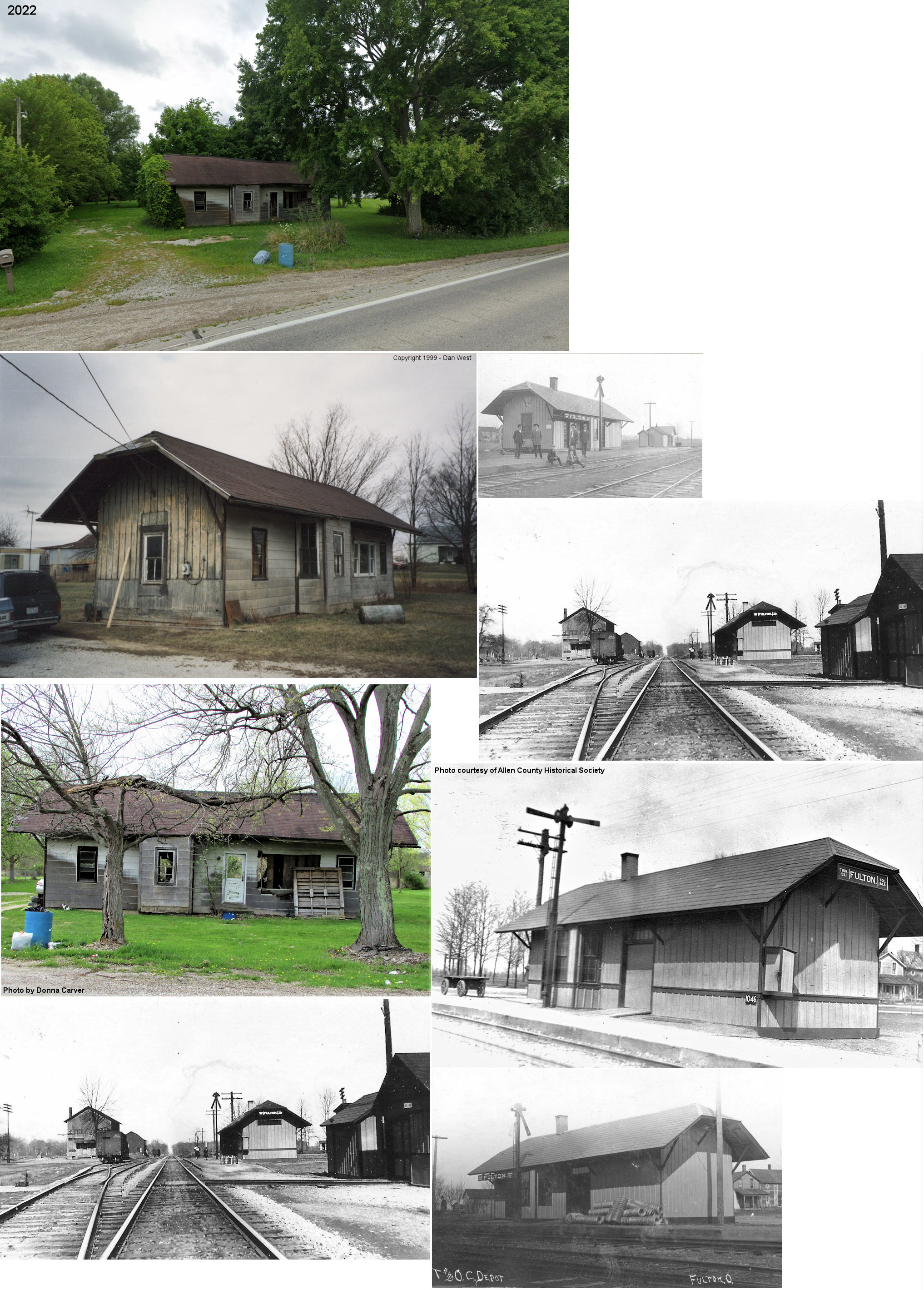
| Fulton | |
This station was moved from its original location to a lot
on SR-61 north of town at SR 61 north of town at GPS: 40.466226, -82.821869. Although the owner said the station would be "torn down soon" back in the late 1990s, it appears that the station survived until late 2022. |
||||||
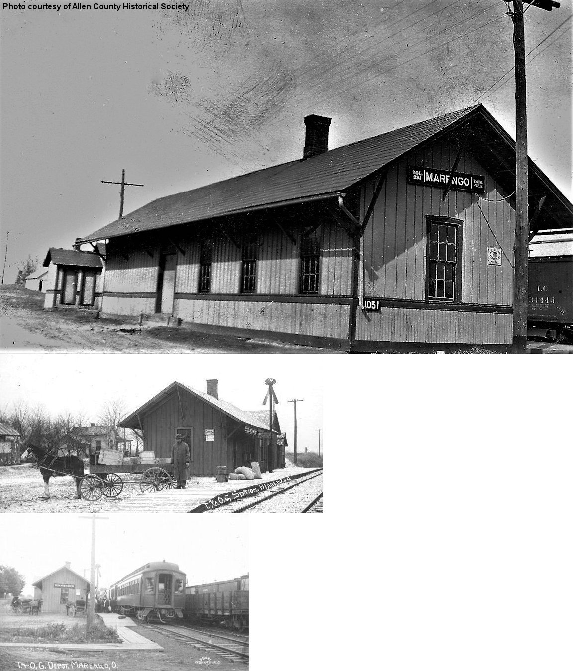
| Marengo | |
|||||||
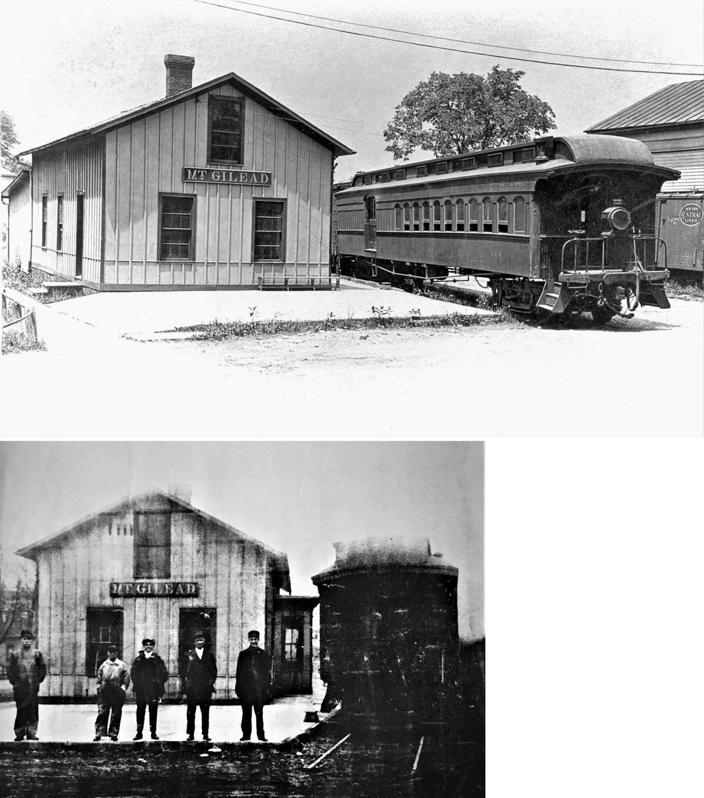
| Mt. Gilead |
|
This station was at the corner of High & Rich Streets. It was torn down in 1924 and replaced by the Mt. Gilead Shortline brick station listed above which was built just a few feet to the west (toward Iberia St.). The CCC&St.L leased the Mt. Gilead Shortline. The station is of CCC&I vintage, appearing on maps from 1885. After 1924, the CCC&St.L also had a freight house on the west side of Iberia Street. According to the Cincinnati Enquirer of Sept. 1, 1882, there was a robbery at the depot on August 31, 1882 whereby burglars pryed open the door and used explosives to blow the door off the safe. Although $1,000 had been at the depot the day before, the station agent took the money home for safe-keeping, so the burglars only took $8 from the safe for their efforts. | ||||||
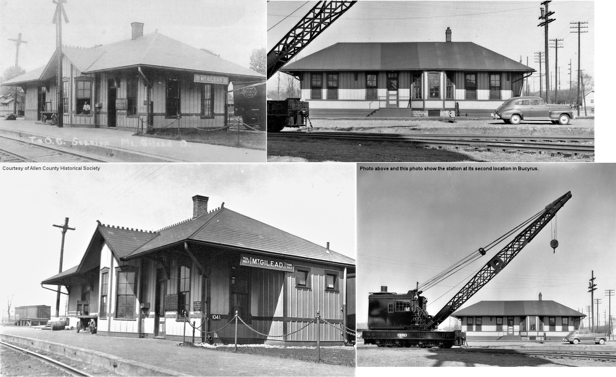
| Mt. Gilead | |
This station was located on the east side of the tracks on north side of West High Street just east of the intersection with Marion Street at GPS: 40.549089, -82.843022. It was built in 1882, and taken out of service in the 1920s when it became redundant when the NYC leased both the T&OC and CCC&St.L. In 1924 all passenger service for the town shifted to the brick Mt. Gilead Shortline depot at Iberia & High Streets. It was dismantled and moved to Bucyrus in 1929, modified somewhat, and served as an NYC yard office there. In Bucyrus, it was located on the east side of the tracks just west of the intersection of Hopley Avenue and East Southern Street at GPS: 40.797929, -82.964770. | ||||||
| Peerless | |
The station here burned down on October 15, 1891 (Bucyrus Evening Telegraph, 10-16-1891). A new station was likely built after that, but that's not confirmed. This station was either just north or south of the county line, as Peerless Road follows the county line here. | ||||||
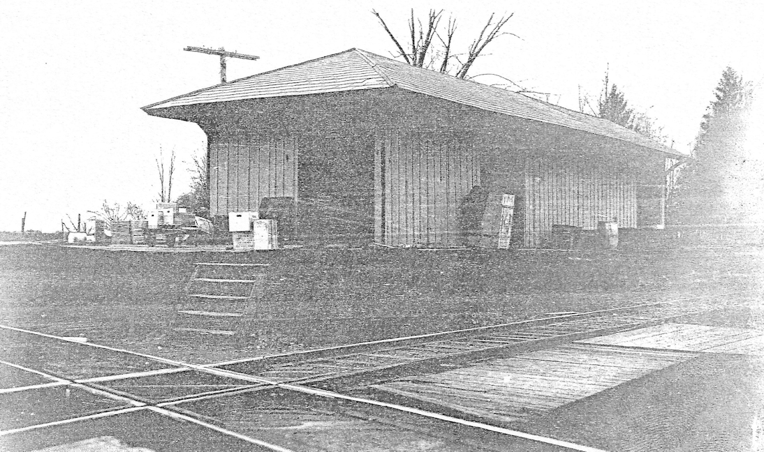
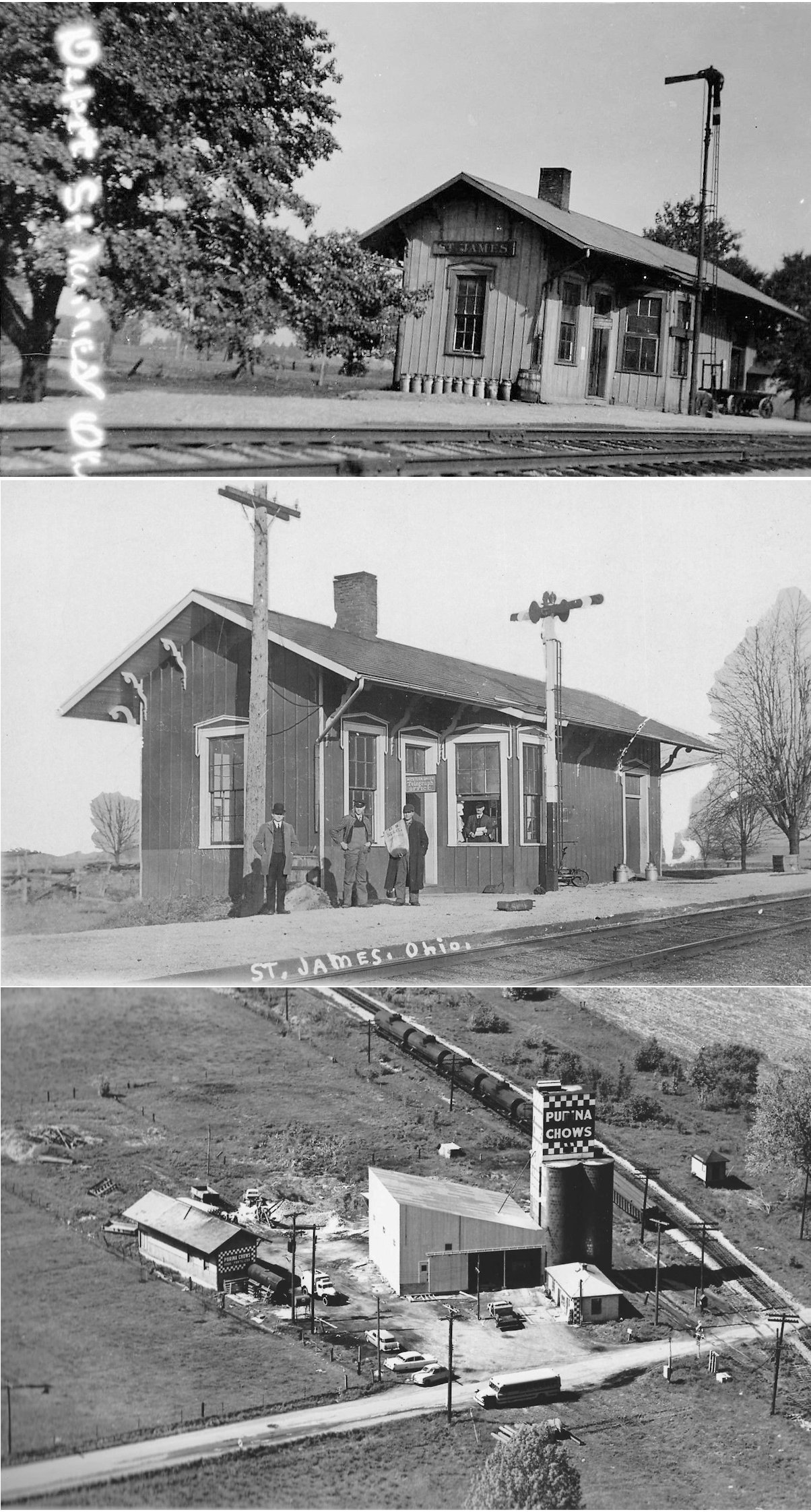
| St. James | |
This station was rumored to have been moved, but no other information exists. By 1850, work on the Cleveland, Columbus, Cincinnati and St. Louis Railroad was progressing across the state but the exact route for northwest Ohio had not been decided. Railroad officials came to Iberia with the plan to build a station there if landowners there would invest $200 each toward station facilities. Iberia residents declined believing that the railroad would be too dirty and noisy. As a result, the railroad made a loop through Galion and bypassed Iberia by a mile to the southeast. Within a few years a small depot was built on the west side of the track where County Road 51 crosses the railroad. St. James, also known as Iberia Station, was the first station stop for locals heading south from Galion on the Big Four Line. A post office was established at the station and at various times was called Iberia Station, Harwood, and and St. James. The St. James Post office was closed in 1935. The depot was closed and no longer an agency by 1949. The depot was moved across the tracks and used as storage at the feed mill up until the late 1960s. It is unknown when it was torn down. --Donna Carver. | ||||||
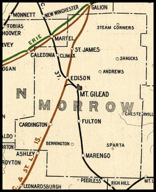
| 1898 MORROW COUNTY RAILROAD MAP | ||||||||
 |
||||||||
| Notes About Existing
Stations...
|
||||||||