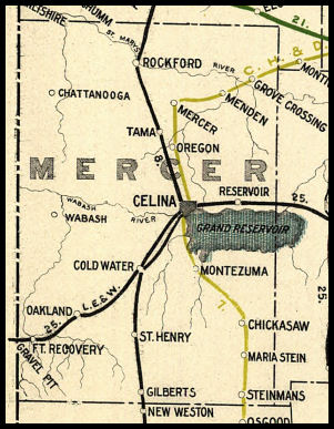
 COUNTY COUNTY
|
|
||||||||
| EXISTING STATIONS | ||||||||
|---|---|---|---|---|---|---|---|---|
| Station Name |
Original Railroad |
Current Location |
Type | Current Use |
Date Built |
Track Status |
Building Material |
More Info |
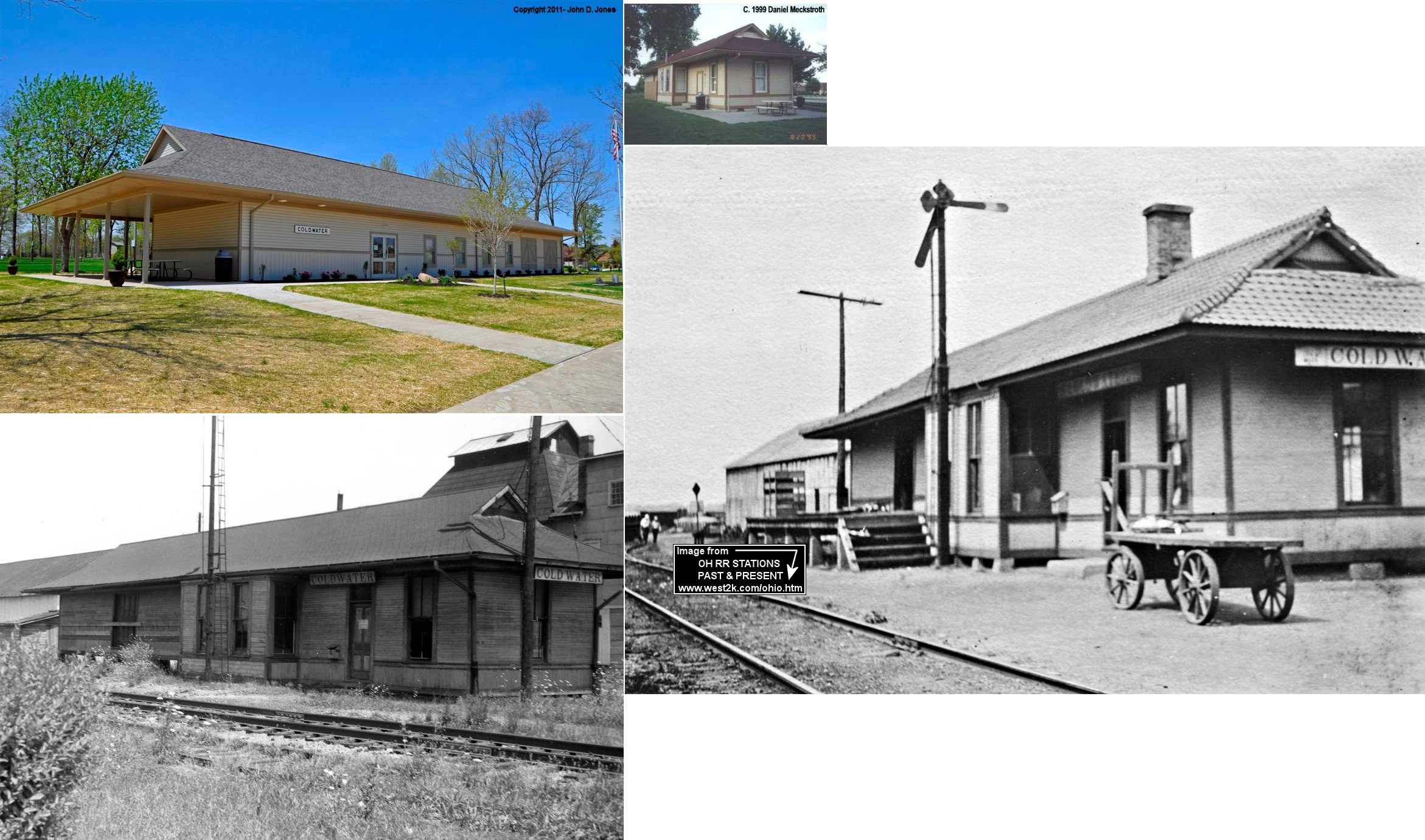
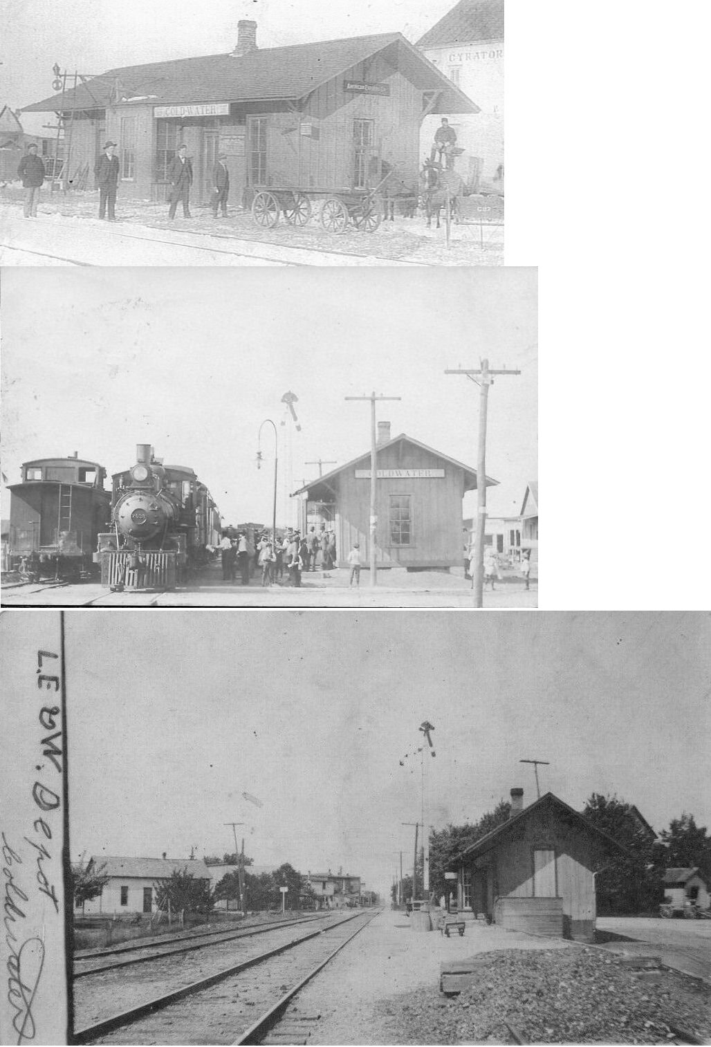
| Coldwater |
 |
West side of North Elm Street in Memorial Park (GPS: 40.486687, -84.634293) |
C | Civic | 1870s | None | Wood |
|
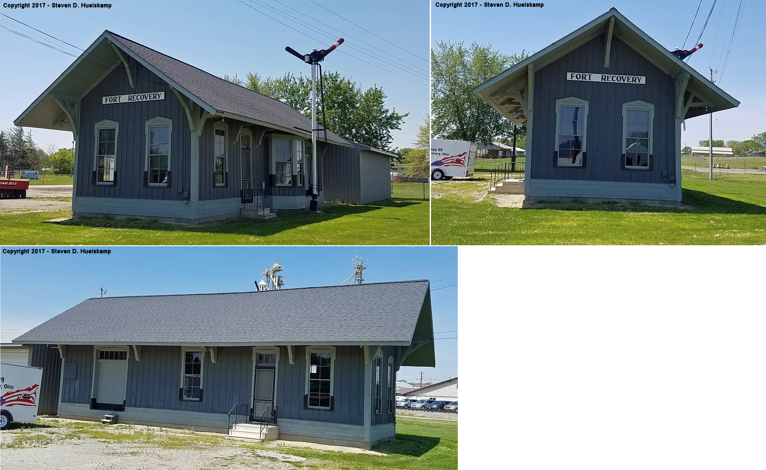
| Ft. Recovery |  |
SR 49 north of town at Ambassador Park (GPS: 40.416714, -84.782886) |
P | Civic | ???? | None | Wood |
|
| STATIONS OF THE PAST | ||||||||
| Station Name |
Original Railroad |
Notes | ||||||
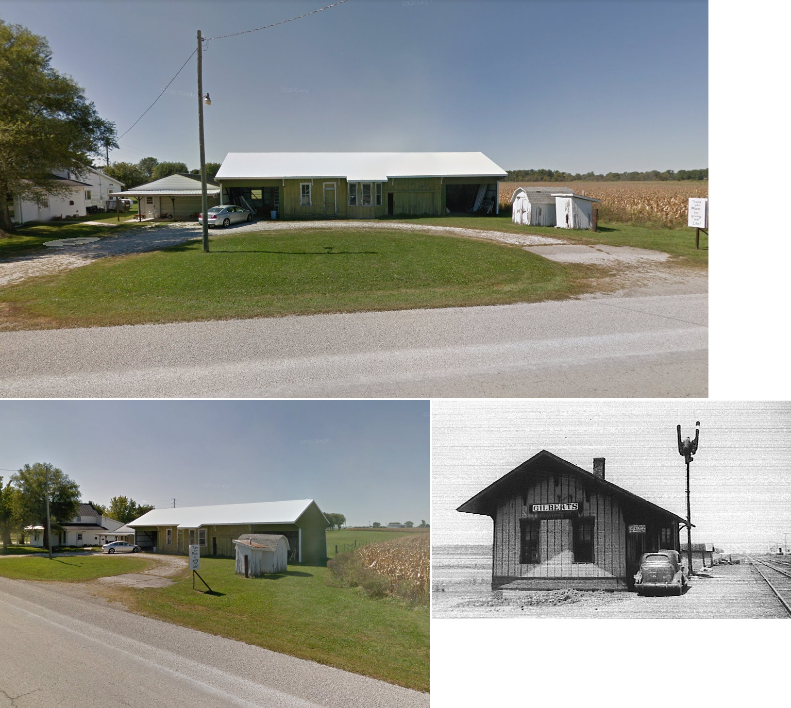
| Burkettsville (Gilberts) |
|
The original location of the depot was just north of the county line. It was a bit northwest of the intersection of Washington and Main Streets. It was on the west side of the tracks (GPS: 40.352112,-84.643613). At some point it was moved to the NW corner of the intersection of SR 118 and North Star Fort Loramie Road (GPS: 40.32331,-84.63724) in Darke Co. where it served as a garage and storage. The station was sold and burned for practice by the local fire department in late 2017. Burkettsville was formerly known as Gilberts Station. | ||||||
| Byrds Station |
 |
This station was 3.6 miles east of Mendon near the county line. | ||||||
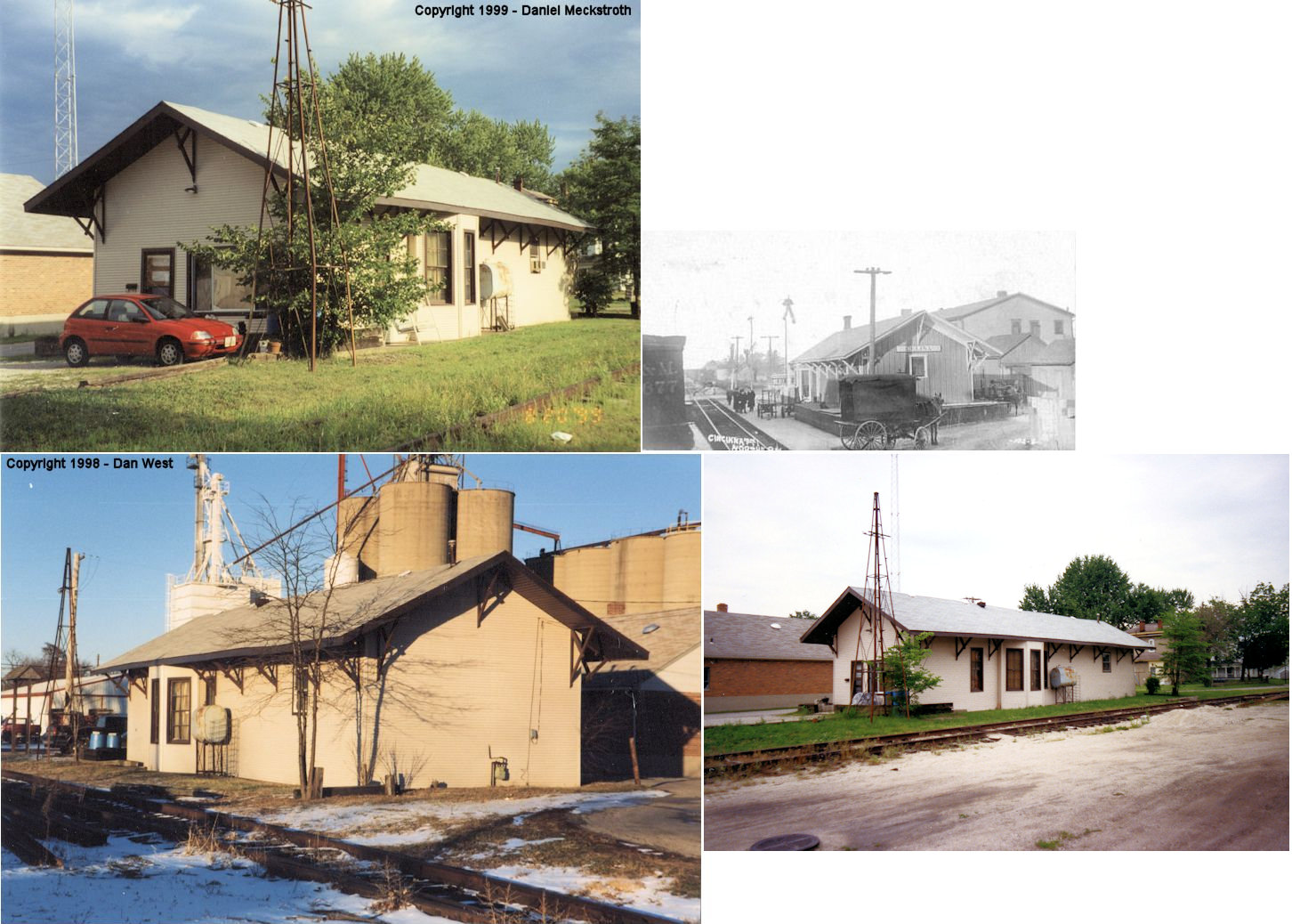
| Chickasaw |
|
|||||||
| Coldwater | |
This station was on the west side of South Market Street just south of West Walnut Street (GPS: 40.478443,-84.631087). The NKP also had a freight depot on West South Street just west of South Market Street. | ||||||
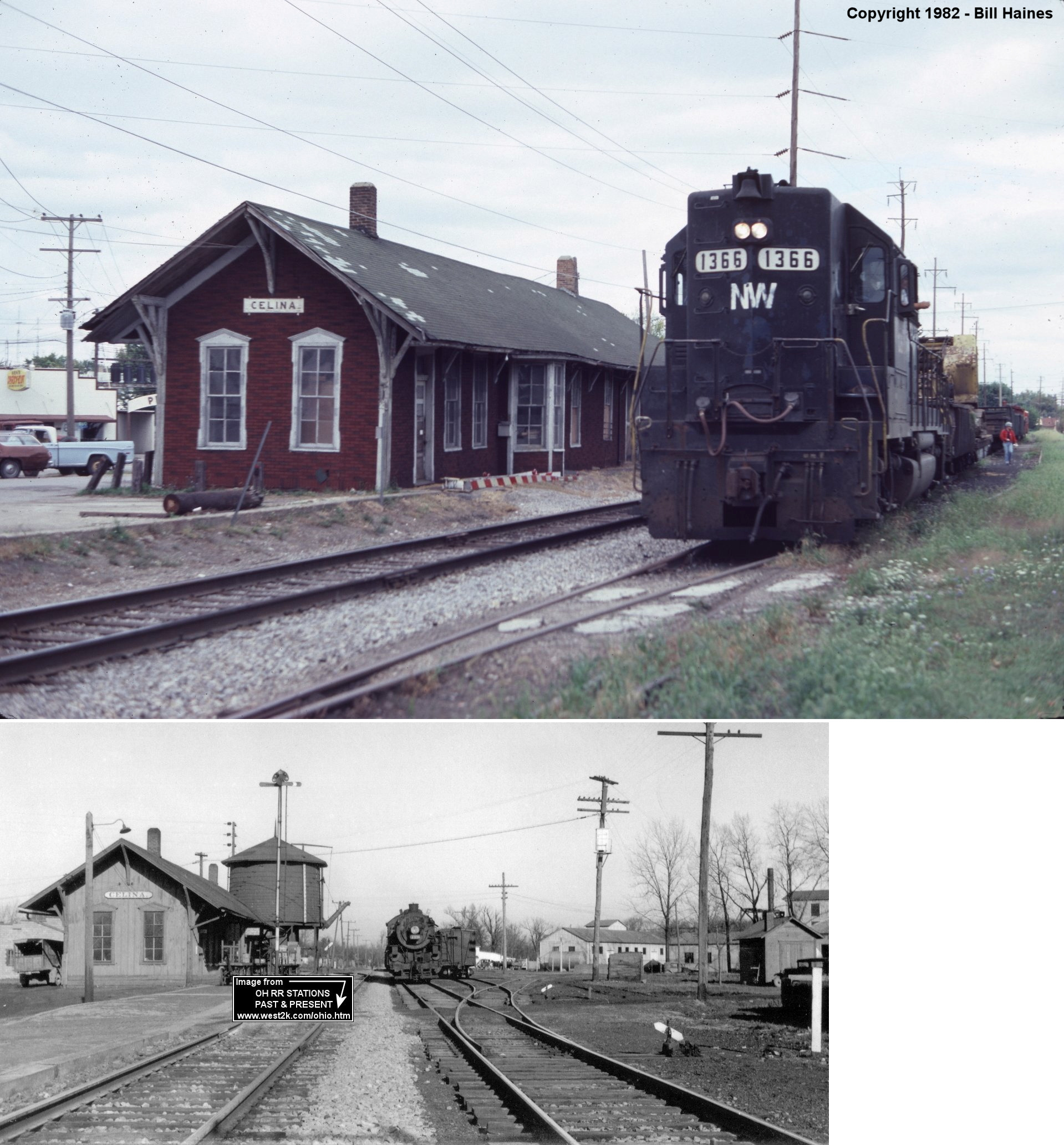
| Celina | |
This station was located on the west side of the tracks between West Logan Street and Ann Street According to a 1914 map, there was a hotel across the tracks which faced West Logan Street. This station may have been built by the Toledo, Cincinnati & St. Louis RR as old maps show a station here when the line was still narrow gague (before the line became part of the TSt.L&KC (Cloverleaf Route) (GPS: 40.545484,-84.576048). | ||||||
| Celina | |
The passenger and freight stations were located at the corner of East Logan and South Main Streets. There was a park with a fountain in front of the station on the corner (GPS: 40.545331,-84.570324). | ||||||
| Celina |
|
This station was on the south side of West Market Street Street west of Mill Street at GPS: 40.548799, -84.576707. In its later years it was used as a residence. | ||||||
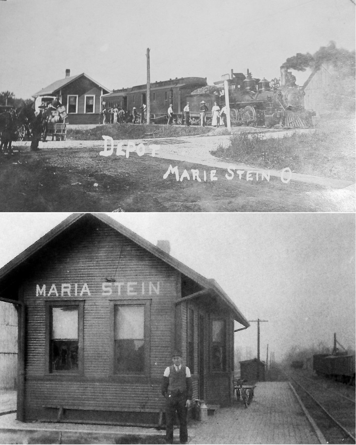
| Maria Stein (St. Johns) |
|
There was an earlier TC&St.L (narrow gague) station here in 1888. It was on the north side of SR-119 on the east side of the tracks. This town was formerly known as St. Johns Station. | ||||||
| Mendon | |
This station, built in 1878, was only about 50 feet southwest from the town hall on the public square (near the corner of Main and Market Streets. Also nearby was the "CH&D Hotel" on Main Street. The station and tracks were gone by 1928. The town has erected a sign marking the site of old depot. | ||||||
| Mendon |
 |
There was and earlier station here before the line was converted to standard gague. It was located on the north side of Jefferson Street between Wayne and Washington Streets (GPS: 40.672001,-84.520834). | ||||||
| Mercer | |
|||||||
| Montezuma | |
In 1888 when the line was still narrow gague (TC&St.L), the station was on the north side of West Main Street on the NE side of the tracks. | ||||||
| Oakland Spur (FERNER) |
|
This station was on Erastus-Durbin Road in Recovery Township. | ||||||
| Oregon Sta. (Earley) |
|
This station was on Oregon Road. | ||||||
| Philothea |
|
This station was on the north side of Philothea Road on the east side of the tracks. There was a station here during the CJ&M RR days (GPS: 40.450719,-84.643355). | ||||||
| Reservoir Station | |
On the north side of Lake St. Marys, this station was on the west side of Riley Road on the north side of the tracks (GPS: 40.553331,-84.494069). | ||||||
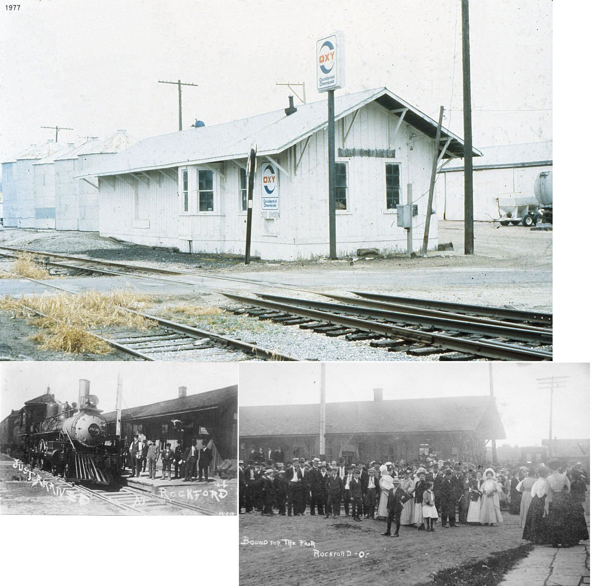
| Rockford |
|
This combination station was on Pearl Street east of Main Street. The station was on the east side of the tracks. Rockford was formerly known as Shane's Crossing. | ||||||
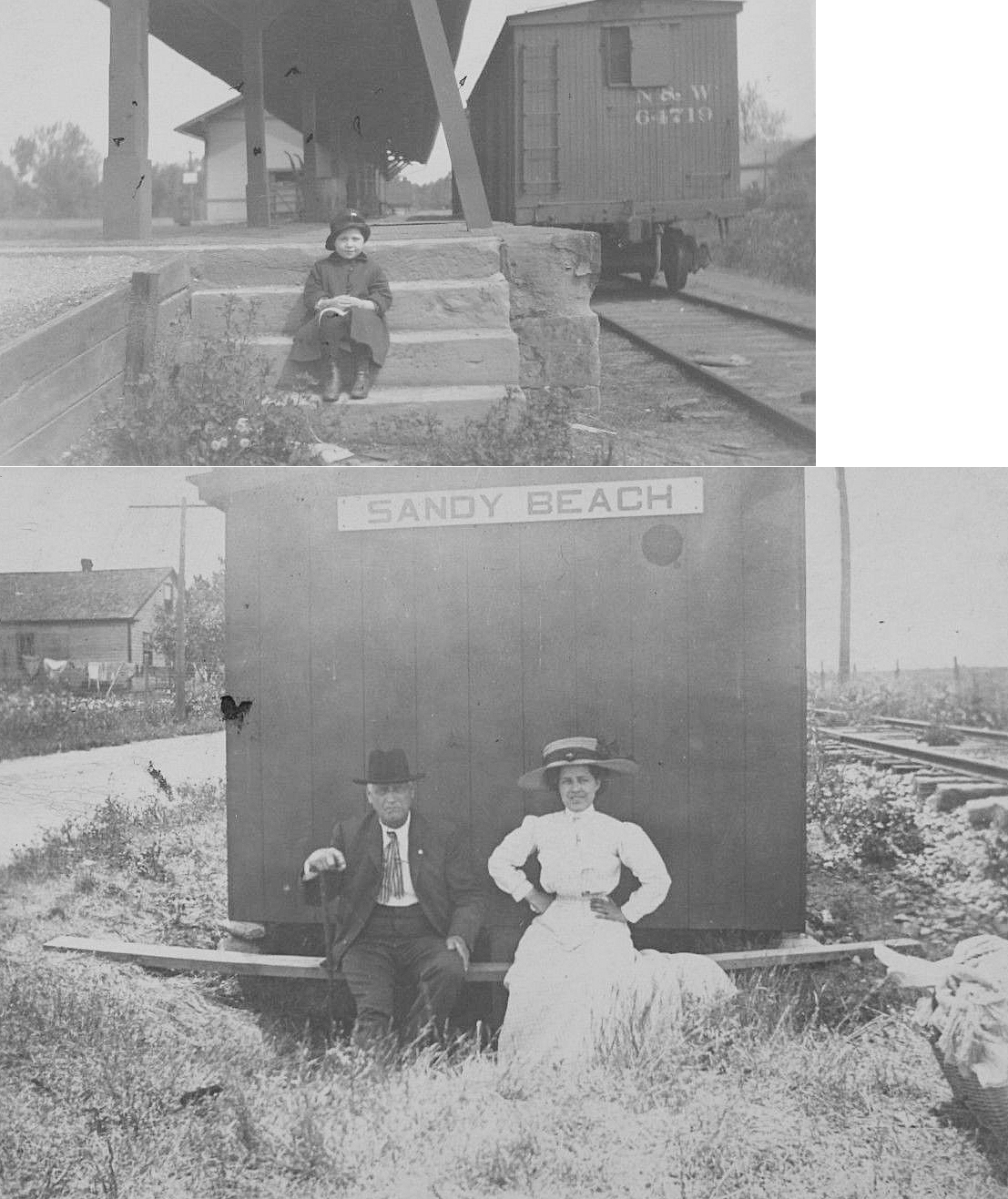
| Sandy Beach | |
|||||||
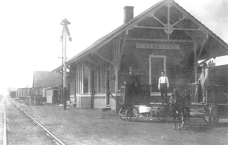
| St. Henry |
|
The original depot was on the south side of Main Street on the west side of the tracks. This station burned down in 1906. | ||||||
| St. Henry |
|
This was the second depot that opened in 1906. It was torn down in 1965. | ||||||
| St. Joseph (Victoria) |
|
|||||||
| Tamah Station (TAMA) |
|
This station was on the south side of Tama Road on the SW side of the tracks (GPS: 40.63315,-84.619349). | ||||||
| 1898 MERCER COUNTY RAILROAD MAP | ||||||||
 |
||||||||
| Notes About Existing
Stations... Coldwater (Cincinnati Northern) - The station was originally located on the north side of East Main Street on the east side of the tracks (GPS: 40.479949,-84.627433). Fort Recovery (LE&W) - Bought by village in 1973 and moved to community park about a quarter mile from its original location which was off Celina Road near the Wabash River. This station is restored and inside are some of the equipment used during the station's operating years. The signal levers are operable and the passenger train arrival/departure boards are still there. The station is on the entrance to the park, where thousands see it each year as they attend the tractor pulling contests held in Fort Recovery. The desk at the bay window is still the way it looked when the station closed from serving the N&W. --Daniel Meckstroth |
||||||||